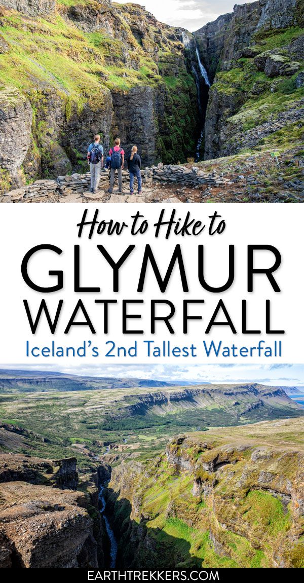
Glymur Waterfall is Iceland’s second tallest waterfall. You can only get to it by hiking, but what a beautiful hike it is. This hike features a short walk through a cave, two river crossings, and many amazing views of the waterfall. It’s relatively short, it’s fun, and it’s located near Reykjavík, so this hike can be added to even quick trips to Iceland. Here’s how to do it.
Table of Contents
How to Hike to Glymur Waterfall
Glymur Waterfall Hiking Stats
Distance: 7 km (4.3 miles) round trip
Total Ascent: 425 meters (1394 feet)
Difficulty: Moderate
Length of Time: 3 to 4 hours
When to go: The best time to go is from June through September, when there is no snow on the ground and the log is in place for the first river crossing. The remainder of the year, this hike can be dangerous when snow covers the trail.
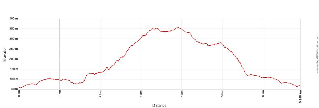
Elevation profile
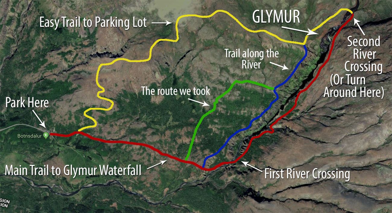
Two Routes
There are two different ways to do this hike: as a loop or as an out-and-back hike.
If you do it as an out-and-back hike, you will hike up the east side of river to the waterfall and return the same way. On this hike, you will cross the river on the log (only in the summer months when the log is in place).
If you do this as a loop, you will hike up the east side of the river, cross the river above the waterfall, and return by walking down the west bank of the river. This is the way that we did this hike and we recommend it. The second river crossing adds a nice little twist to the hike and you get a different view of the waterfall from the west riverbank.
The hiking stats in this post are for the loop route. However, there is not much difference in distance and elevation gain for the loop route or the out-and-back route.
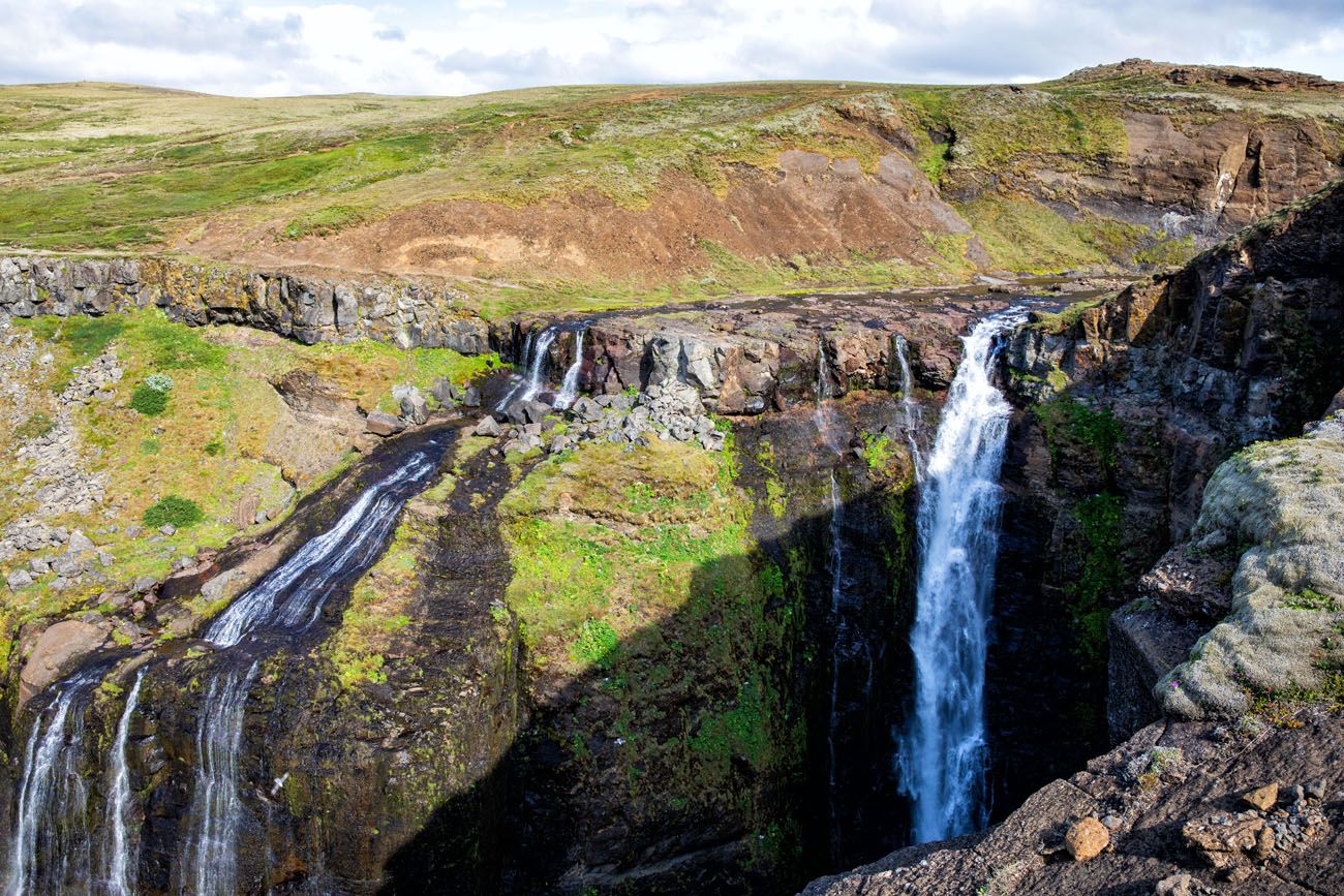
About Glymur Waterfall
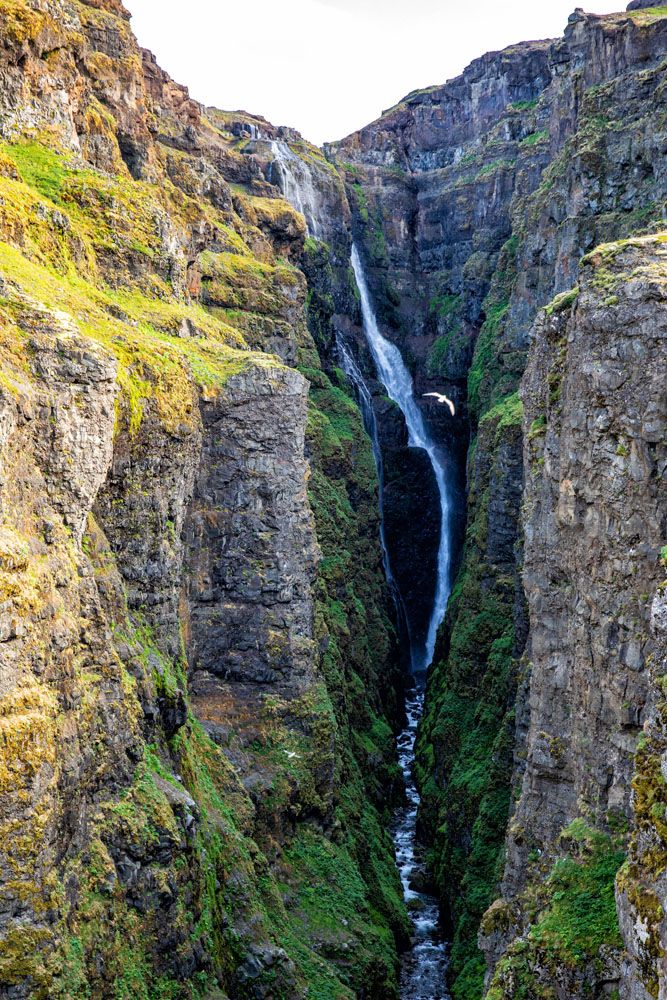
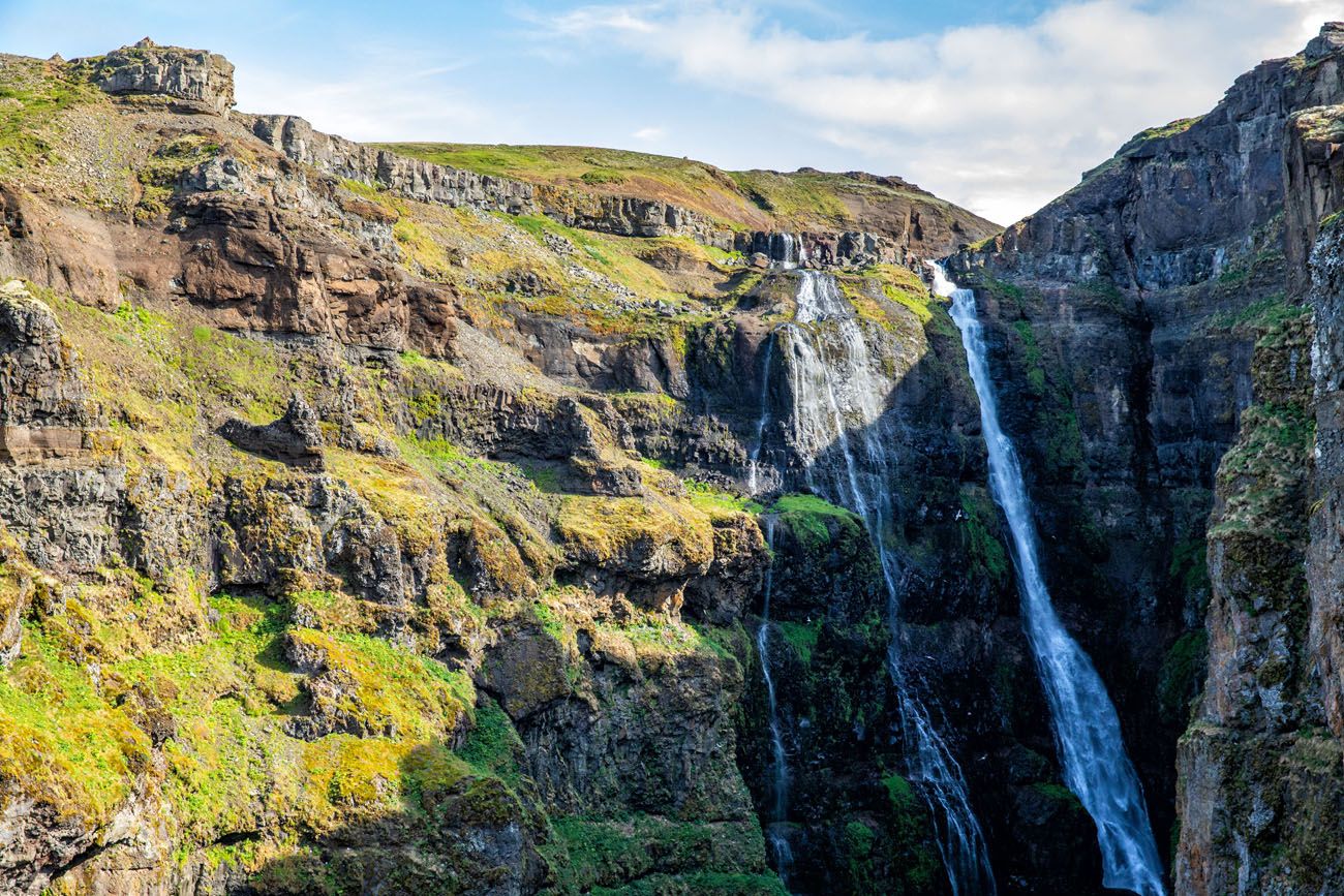
At 198 meters, Glymur Waterfall is Iceland’s second tallest waterfall. At one time, Glymur was ranked as the highest waterfall in Iceland, until the discovery of Mosárfoss at Vatnajökull glacier in 2011.
Glymur Waterfall: Step-By-Step Trail Guide
Getting to the Trailhead
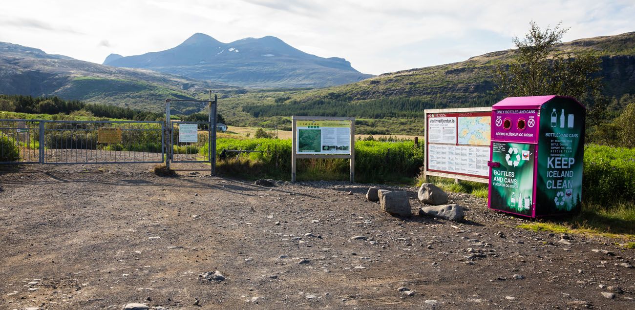
Glymur Waterfall is located in Hvalfjörður, which is northeast of Reykjavik, not far from the Golden Circle. To get here from Reykjavík, it is just over an hour drive, most of this along gorgeous coastline and the Hvalfjörður fjord.
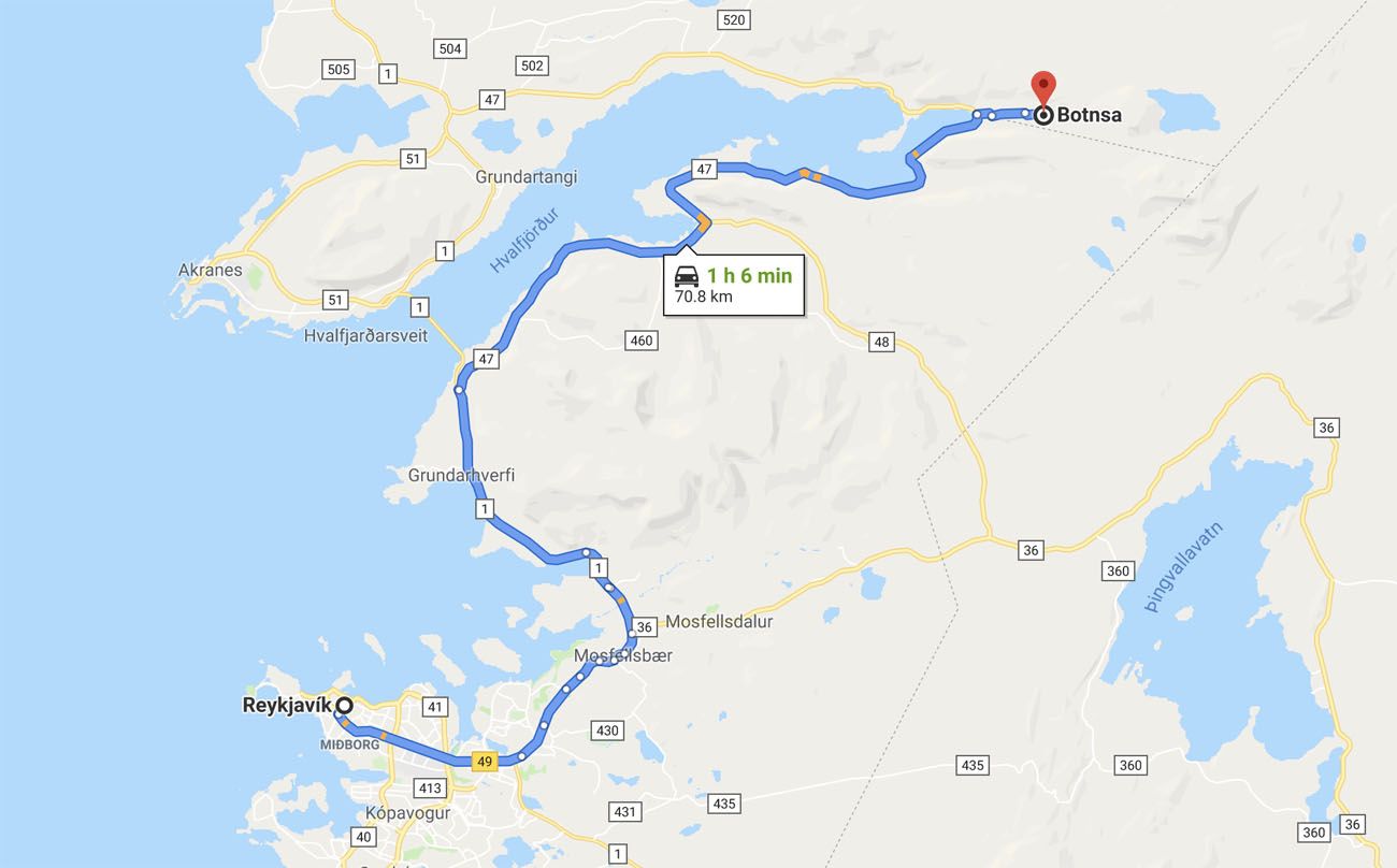
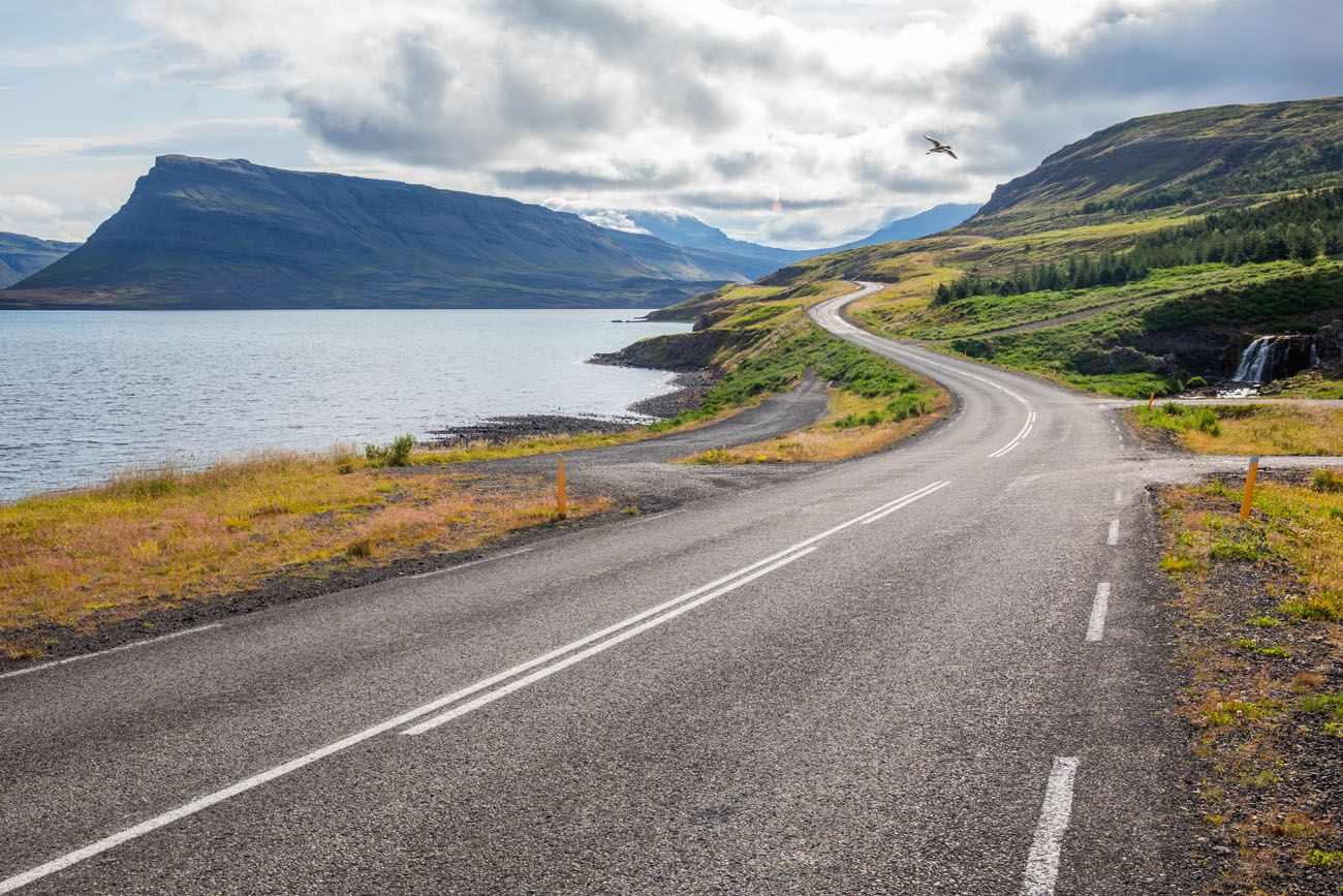
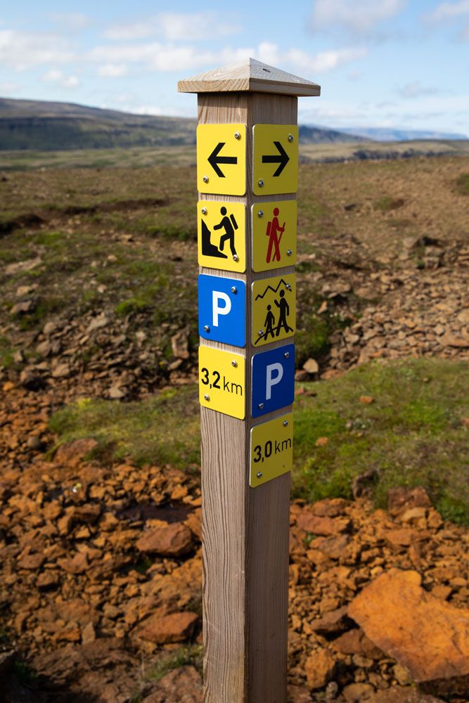
At the end of the fjord, turn right on the access road to Glymur Waterfall. It is a 3 km drive down this road to a large parking lot. It is free to park here and there are no toilets. The parking lot is labeled “Botnsa” on Google Maps.
We arrived at 8:30 am and we were the second car in the parking lot. The first group of hikers turned around at the first river crossing, so we were on our own up until the top of the waterfall. We stopped so frequently for photos and to fly the drone that other hikers caught up to us.
If you want a similar experience, to be able to hike to Glymur Waterfall with low crowds, try to get here early. This is a BUSY hike and the parking lot was completely full when we finished the hike.
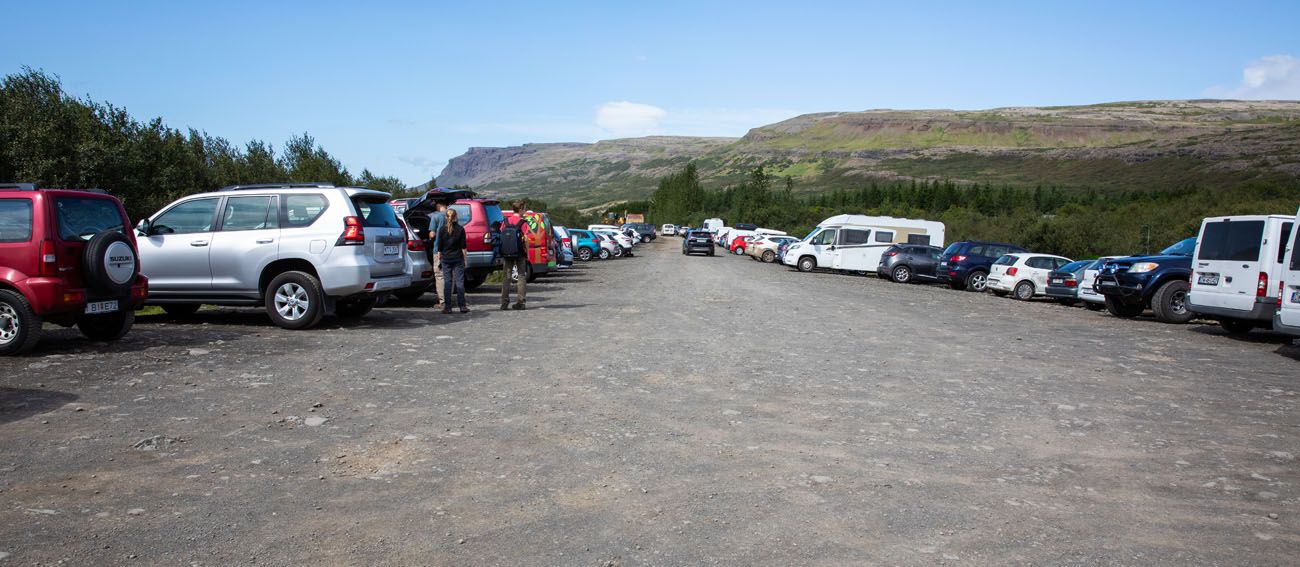
The parking lot (this photo was taken at the end of the hike).
Hiking to the Botnsá River
From the car park, it is a relatively flat walk to get to the Botnsá River. This part of the hike is kind of boring but it goes by fast (it takes about 30 minutes to walk to the river).
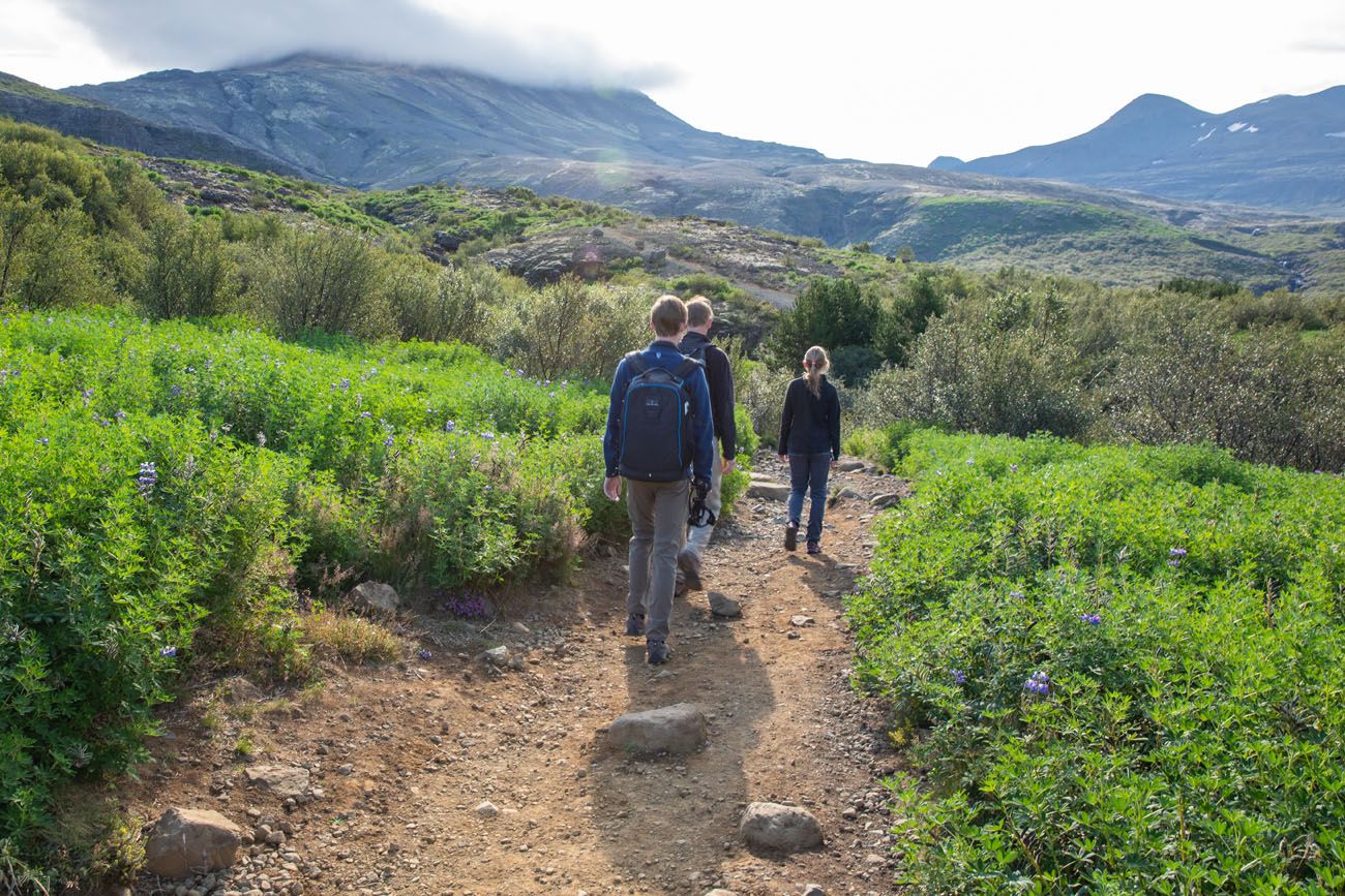
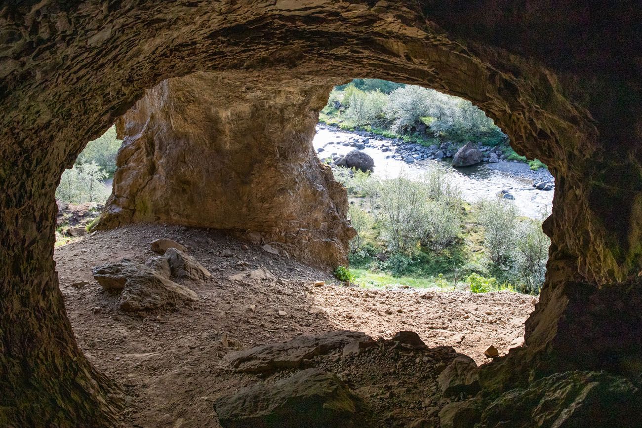
The trail enters a small cave near the riverbank. Hike down through this cave and follow the trail to the left along the river. You are now hiking upstream towards Glymur Waterfall.
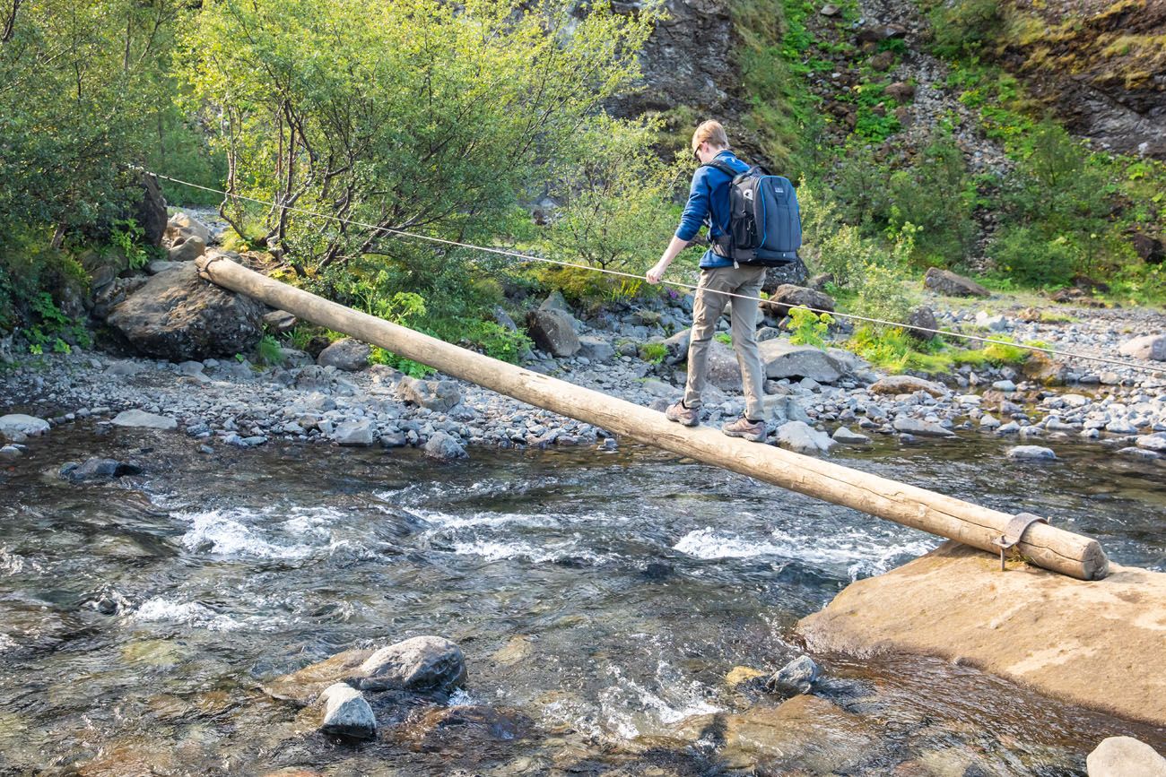
First River Crossing
It doesn’t take long until you reach the first river crossing. From spring until autumn, this log is in place to assist hikers across the Botnsá River. There is a cable you can hold on to.
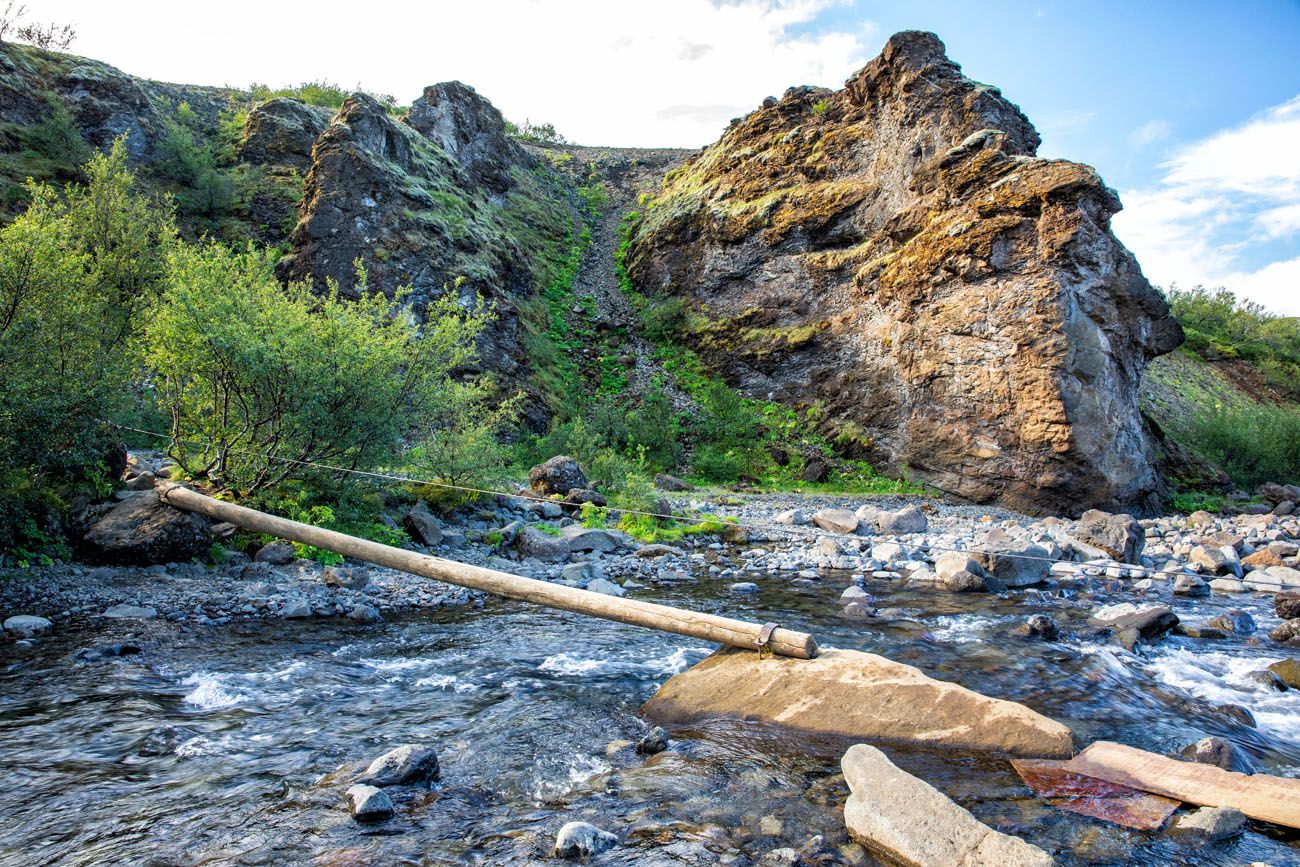
For those of you who might have questions about exactly when this log is up, there are no exact dates (everything that I read states from spring to autumn). From what I know, this is weather dependent and can vary from year to year. If the log is not in place, you will have to walk through the river.
Hiking Up to Glymur Waterfall
From here, it takes between an hour to an hour and a half to reach the highest viewpoint over Glymur Waterfall.
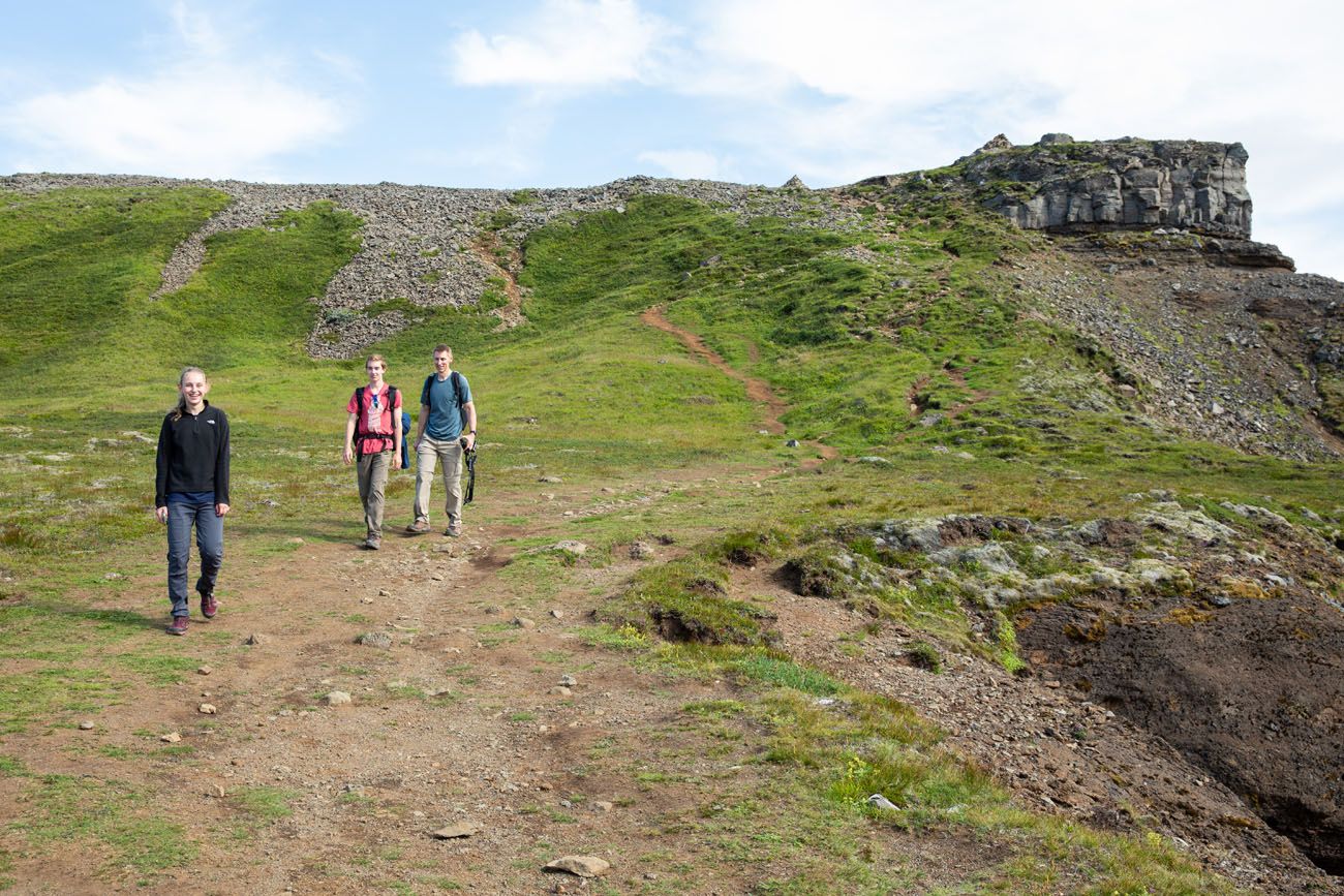
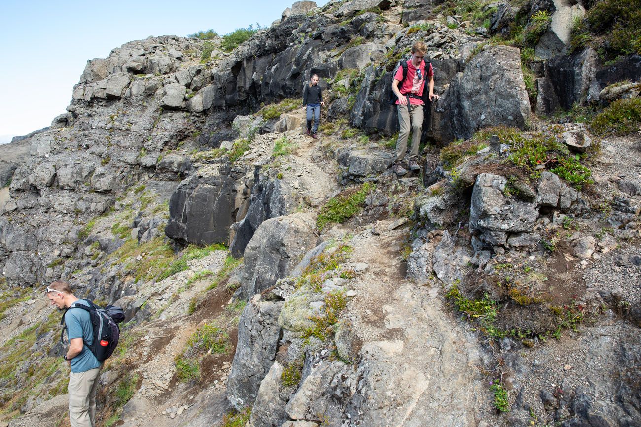
Once you cross the Botnsá River, it is a steady uphill walk. At times the trail is steep. There are several places where the trail is located along the edge of the cliff, so if you have a fear of heights, this hike could be very challenging for you.
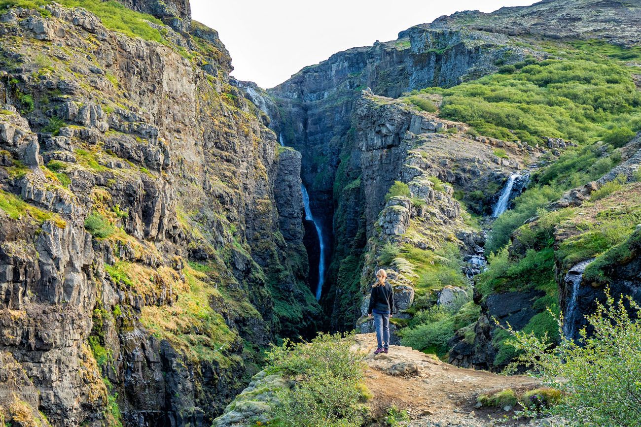
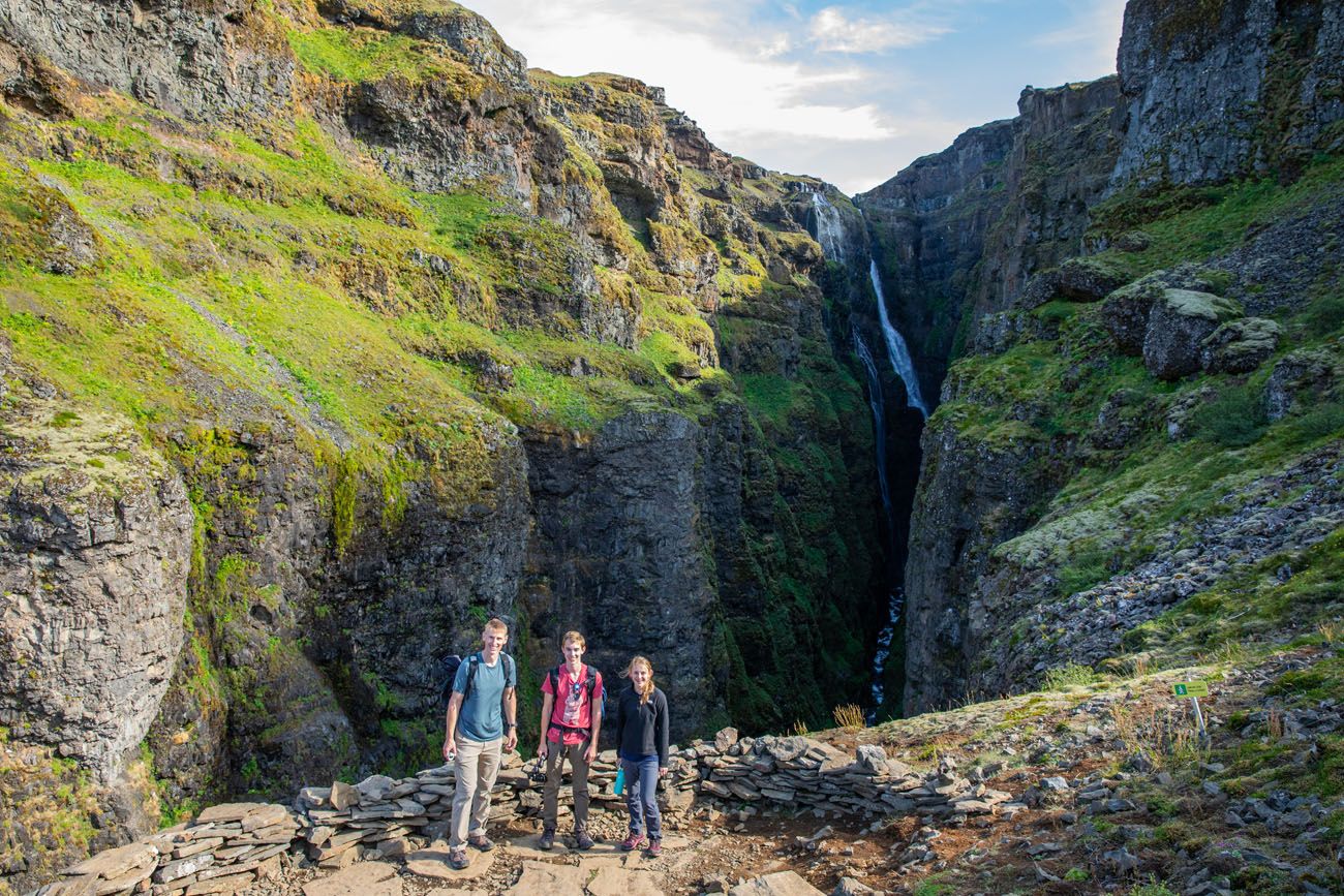
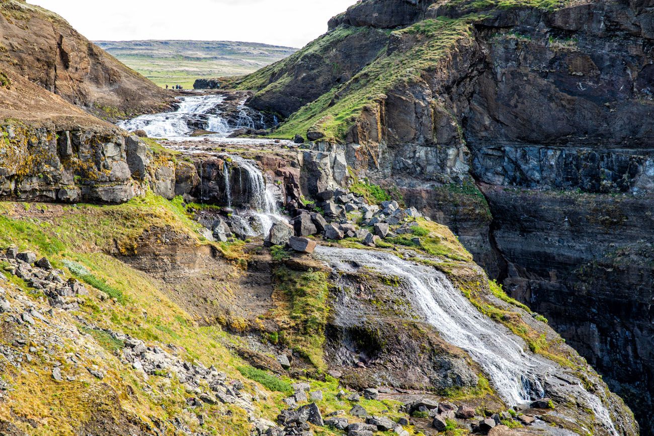
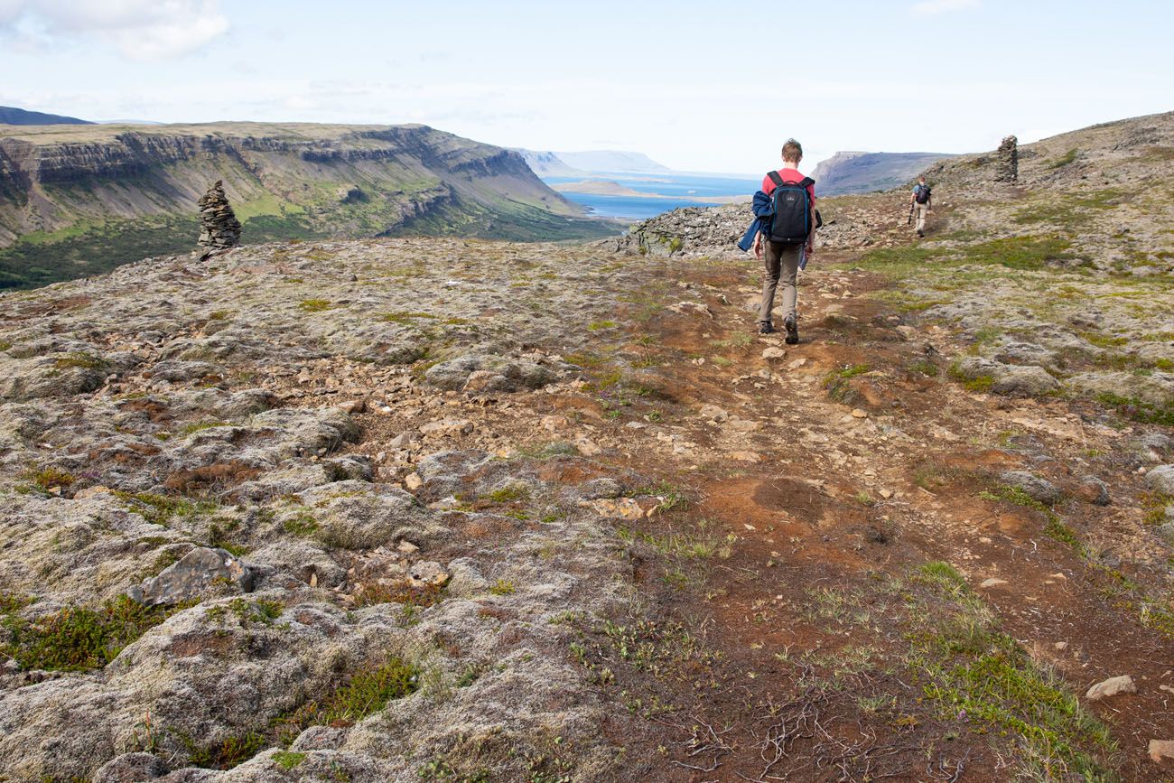
Along the way, there are several very nice viewpoints of Glymur Waterfall. The higher you go, the better the view, not only of the waterfall, but of entire valley.
Here is the trail to Glymur Waterfall in photos.
A short distance into the hike, this is the view back to the river and the first river crossing.
Not only do you get to see Glymur Waterfall on this hike, but also several smaller waterfalls.
There will be several places where you will cross a small stream.
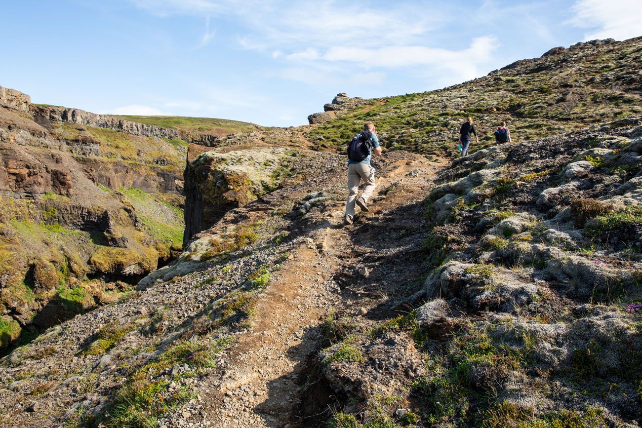
Approaching the highest point on the trail.
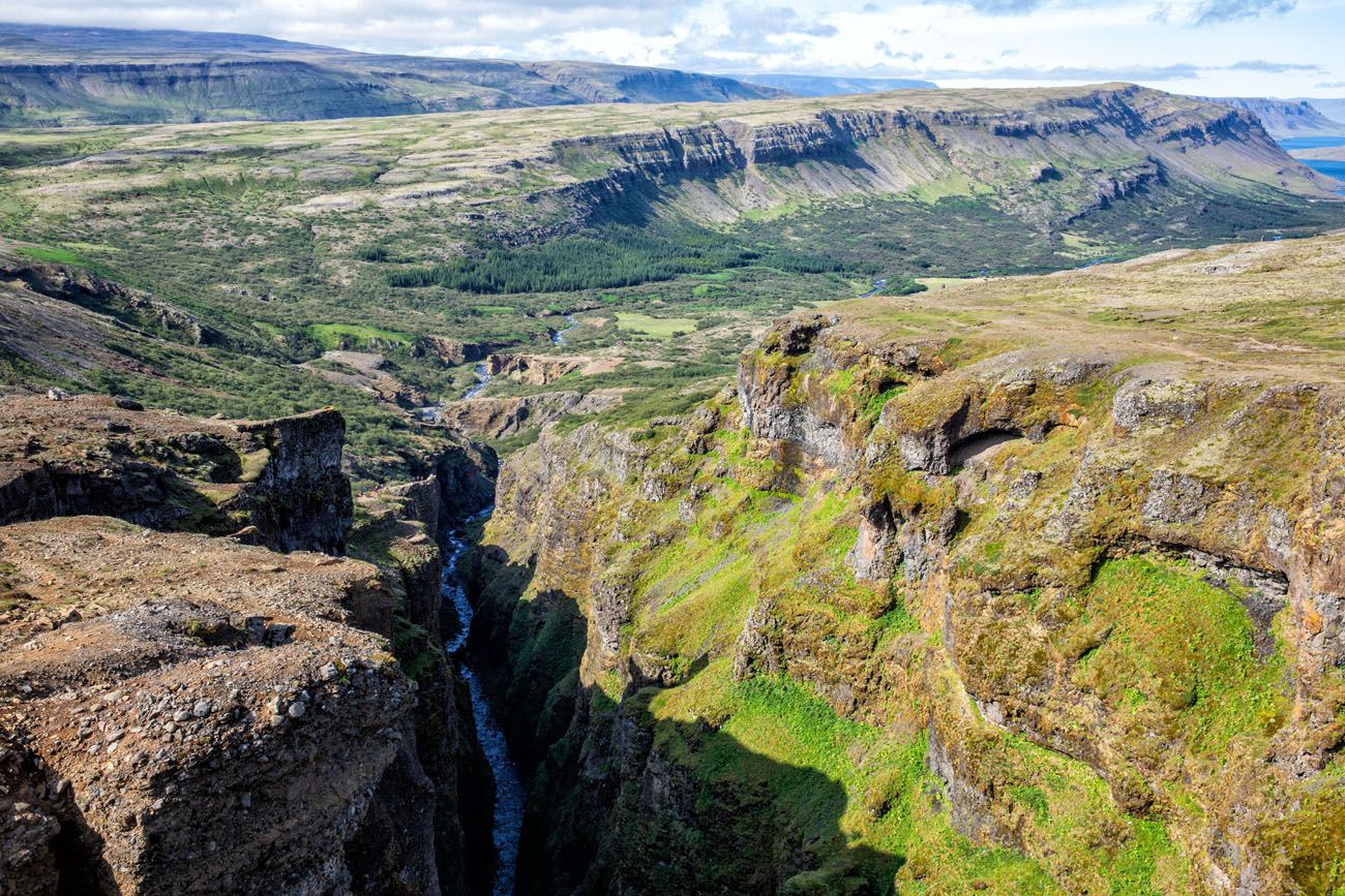
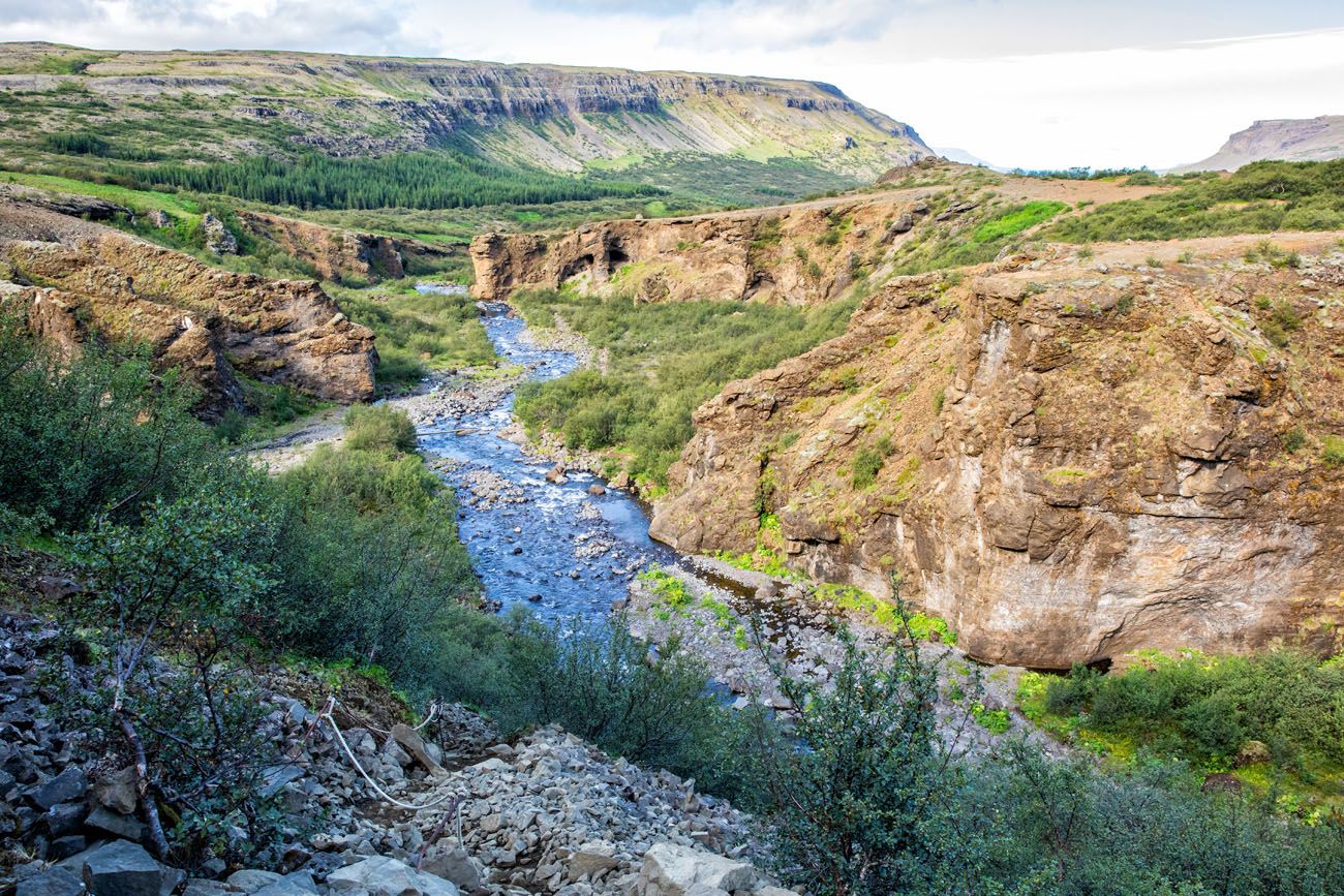
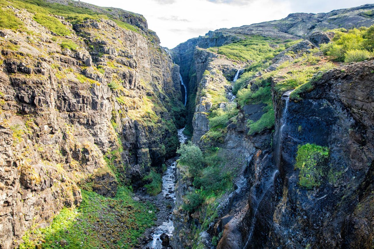
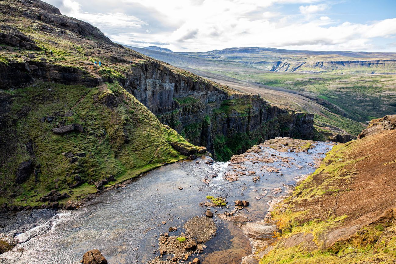
View over the Botnsá River and the canyon from the highest viewpoint on the trail.
And from the same point you get a nice view of the top of the waterfall (and get an idea of how close the trail comes to edge of the cliff).
Once at the highest viewpoint you have a choice to make: turn around and return to the car park on the trail you just walked up or cross the river and hike down the other side.
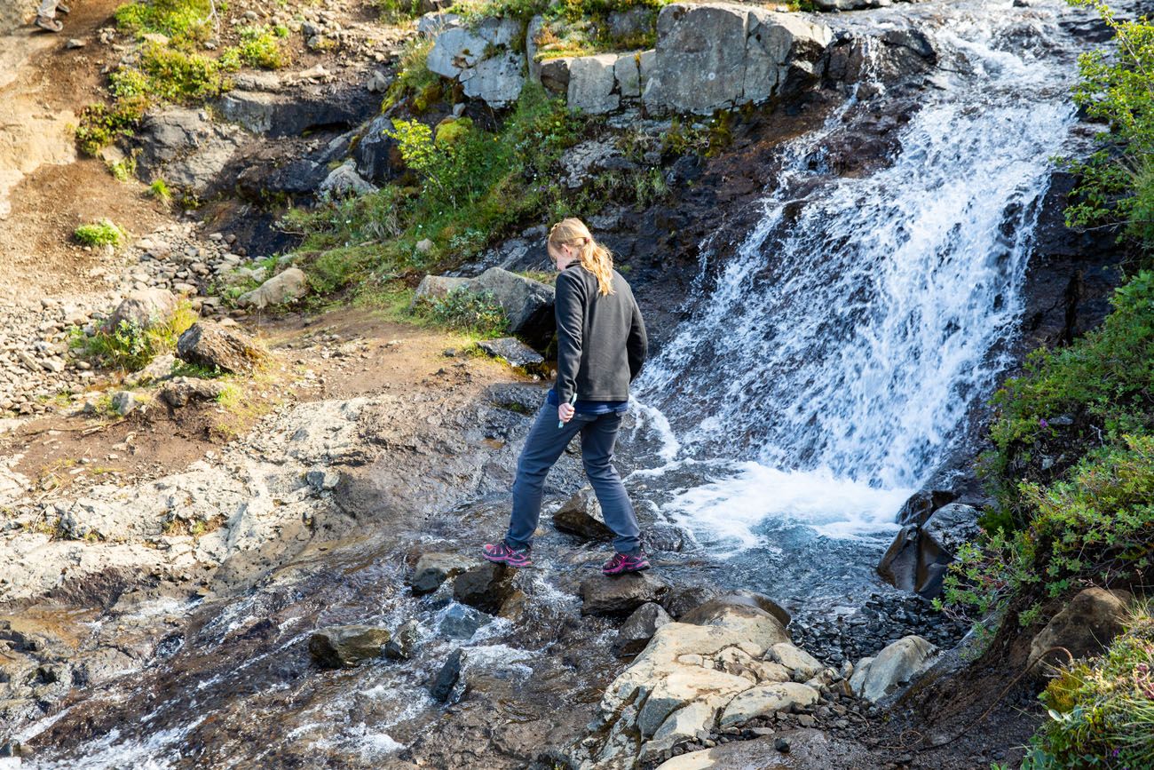
Second River Crossing
Just above the waterfall, the river is wide, shallow, and slow moving. It’s safe for a river crossing but you will get wet. There is no log, no bridge, and no stepping stones of rocks to get across the river and keep your feet dry. Tim and Kara can tell you, they searched and searched for a bridge of stones and never found one.
To cross the river, you can keep your shoes on, but of course, you will finish the hike with wet shoes. Or, you can go barefoot.
We chose the barefoot method. When we did this, in mid-July, the water was cold. My feet were numb by the time I reached the other side. Plus, you can’t go that fast, because the rocks and pebbles are slippery and can hurt your feet, if you are not accustomed to doing this sort of thing.
But it was tons of fun and one of our favorite parts of the hike.
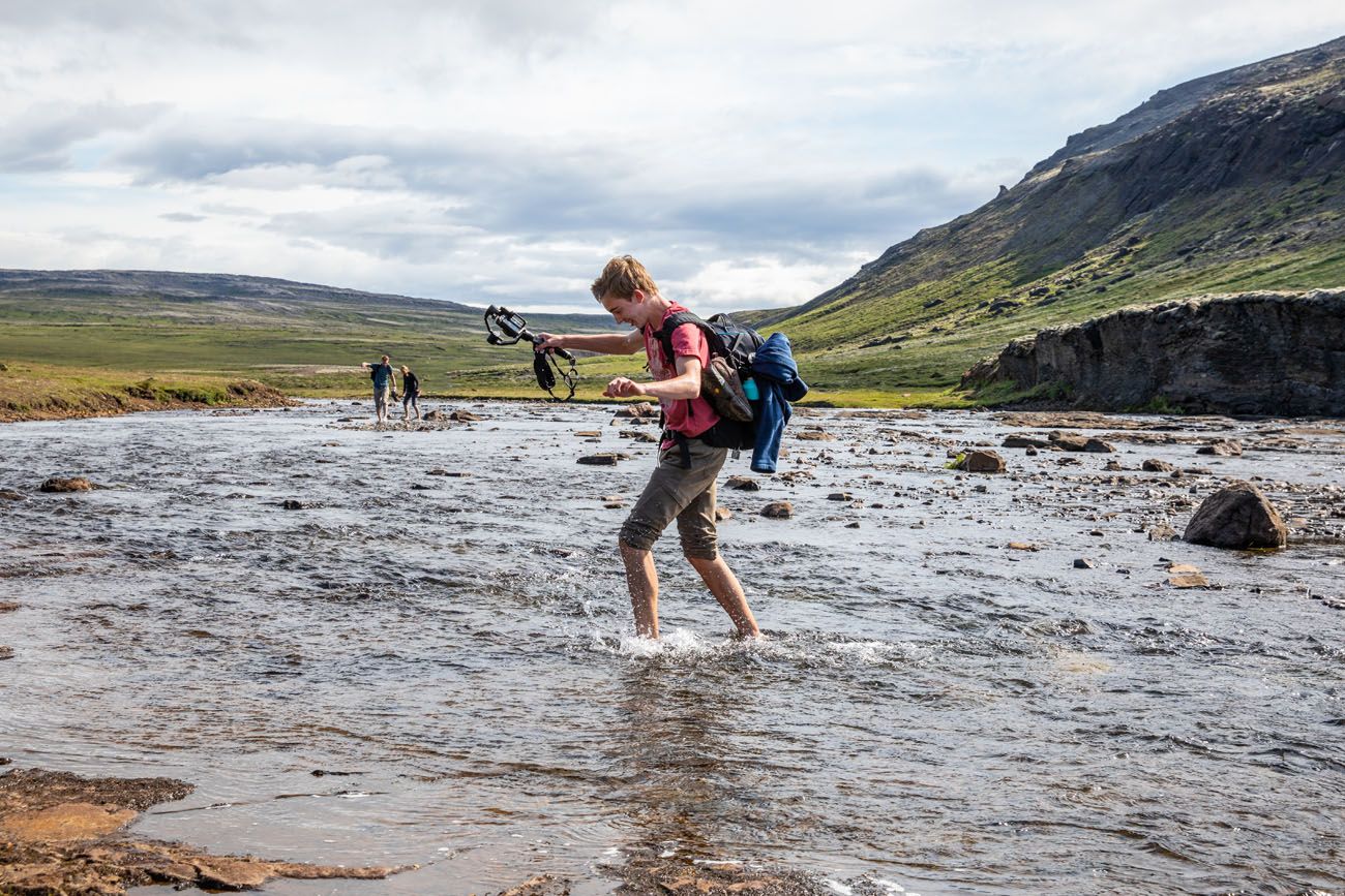
PRO TRAVEL TIP: If you don’t want to cross the river barefoot and you want to hike in dry shoes, bring along a second pair of shoes than can get wet, just for this river crossing. You will have to carry wet shoes back to your car, but this will make the river crossing easier.
View of the waterfall from the trail on the other side of the river.
Hiking Back to the Parking Lot
At first, the trail takes you along the riverbank. And then, once again, you have another decision to make. You can hike back on an easy trail to the car park or take a more challenging trail down along the riverbank. They are both the same distance, but the riverbank trail is rated as more difficult.
We chose option #2, the more difficult trail along the west bank of the river.
At first, we were glad we made this choice. The view of Glymur Waterfall is beautiful from here.
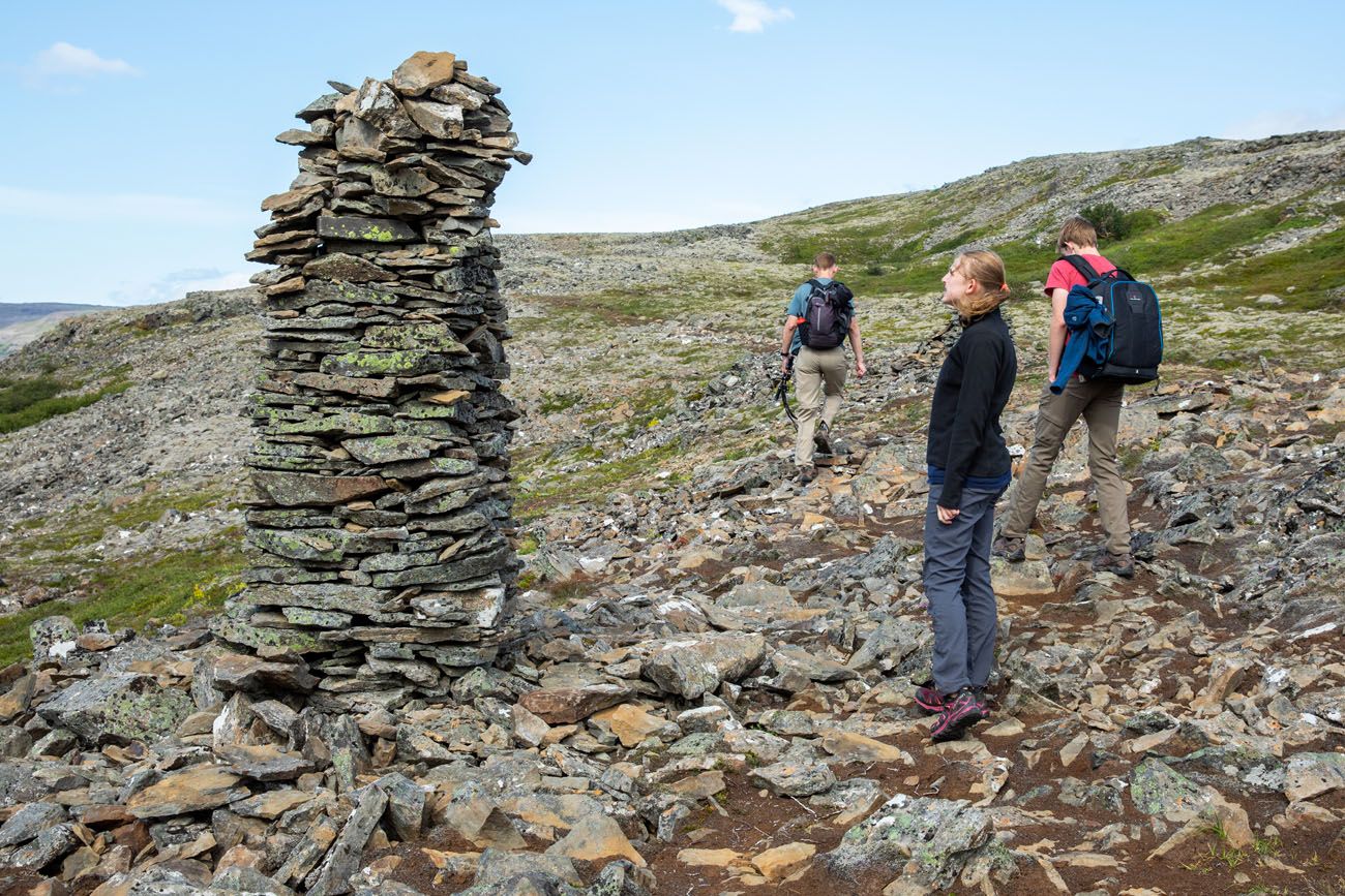
But then we lost the main trail. We ended up following the cairns, the giant piles of stacked stones, and then the trail disappeared. We retraced our steps and then found a very steep trail down the cliff and through the woods. This trail met up with the first part of the trail we hiked earlier in the day.
Doing it this way worked, but it was frustrating and added on extra time and distance to the hike. If you choose to go this way, just know that the trail is not well marked and it’s easy to miss the turn off to descend down the steep rock face.
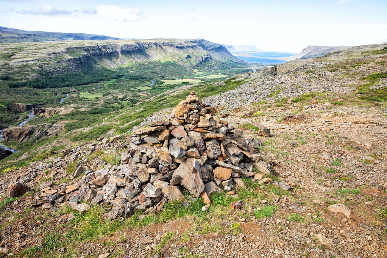
At this rock cairn, we turned right, following the trail and rock cairns along the ridge. There is a second trail that continues along the river and this might be easier to follow.
A view of the trail and the rock cairns.
Once you reach this rock cairn, look for a trail to the left. We kept going here which was our mistake.
The steep trail down the cliff.
Reading other hiking reports from this summer, it sounds like a lot of other hikers do this same thing, following the rock cairns rather than sticking to the trail alongside the river. You will still get to the parking lot, but this trail is not well-marked and can be difficult to follow. There is a second trail that follows the river and once you reach the cave, you walk back to the parking lot on the same trail you walked earlier in the day.
Here’s another view of the hiking map, with the route that we followed in green.
Glymur Waterfall Video
Want to see more? Check out our video of the Glymur Waterfall hike. It includes shots of the waterfall and canyon filmed by drone.
Tips to Have the Best Experience
Get here early (8:30 am or earlier) to avoid the crowds.
If you are afraid of heights, you might want to skip this hike. There are several places where the trail gets very close to the cliff edge, so this may be challenging for you.
Wear hiking shoes. The trail is rough and uneven in some spots and you need shoes with good support and good traction.
Bring sunscreen, sunglasses, snacks, and water.
Bring a second pair of shoes for the river crossing if you don’t want to hike across the river barefoot.
Check the weather before you go.
Please practice the seven principles of Leave No Trace: plan ahead, stay on the trail, pack out what you bring to the hiking trail, properly dispose of waste, leave areas as you found them, minimize campfire impacts, be considerate of other hikers, and do not approach or feed wildlife.
Do you have plans to hike to Glymur Waterfall. If you have any questions or if you want to share your experience, comment below!
More Information about Iceland
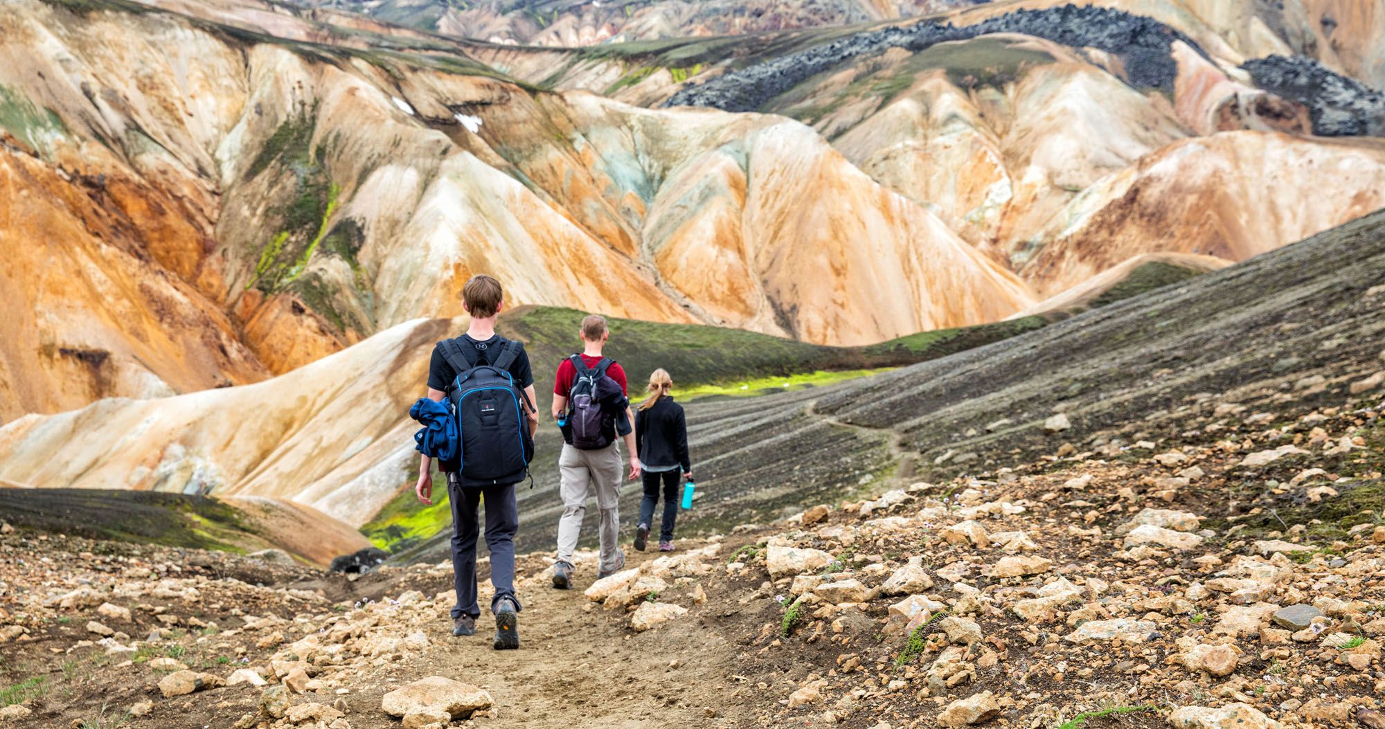
ADVENTURES IN ICELAND: One of the best ways to experience Iceland is on a hiking trail, and we have an article about 10 epic day hikes in Iceland. You can also venture to Kerlingarfjöll, go glacier hiking, visit Landmannalaugar, and hike the amazing Fimmvörðuháls trail.
ICELAND ITINERARIES: There are several ways to put together a trip to Iceland. If you have 10 days, here are four different ways to spend your time in Iceland. This two week Iceland itinerary includes the entire Ring Road and main highlights of Iceland.
SNAEFELLSNES PENINSULA: Plan the perfect visit to the Snaefellsnes Peninsula with our Guide to the Snaefellsnes Peninsula, which covers the best things to do, where to stay and sample itineraries.
WATERFALLS IN ICELAND: Here are 20 beautiful waterfalls to visit in Iceland. We have detailed guides on how to visit Haifoss, Sigöldugljúfur, Aldeyjarfoss, Dettifoss, and Brúarfoss.
ICELAND TRAVEL ADVICE: First time in Iceland? Here are essential travel tips for Iceland, including driving tips, sample costs, SIM cards, when to visit, and more.
Read all of our articles about Iceland in our Iceland Travel Guide.
All rights reserved © Earth Trekkers. Republishing this article and/or any of its contents (text, photography, etc.), in whole or in part, is strictly prohibited.
Comments 23
If you wanted to just walk up to a few lookouts and back, how long would the hike be?
Author
Roughly 5km/3milesif you walked part of the main trail to some viewpoints, but you would still have to do the first river crossing to even get to a section where you have a nice view of the waterfall.