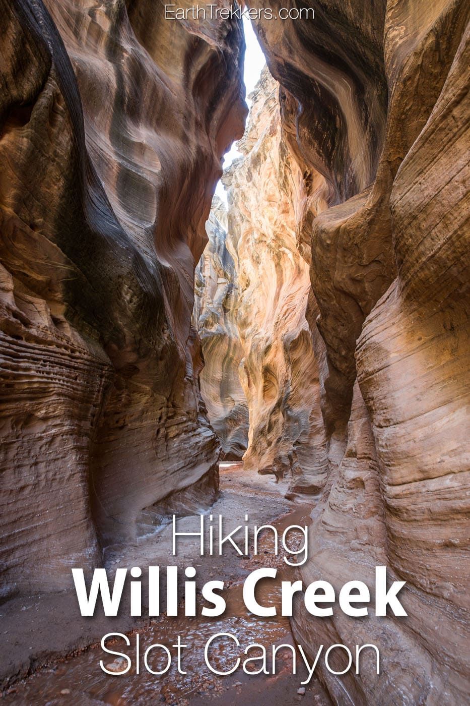
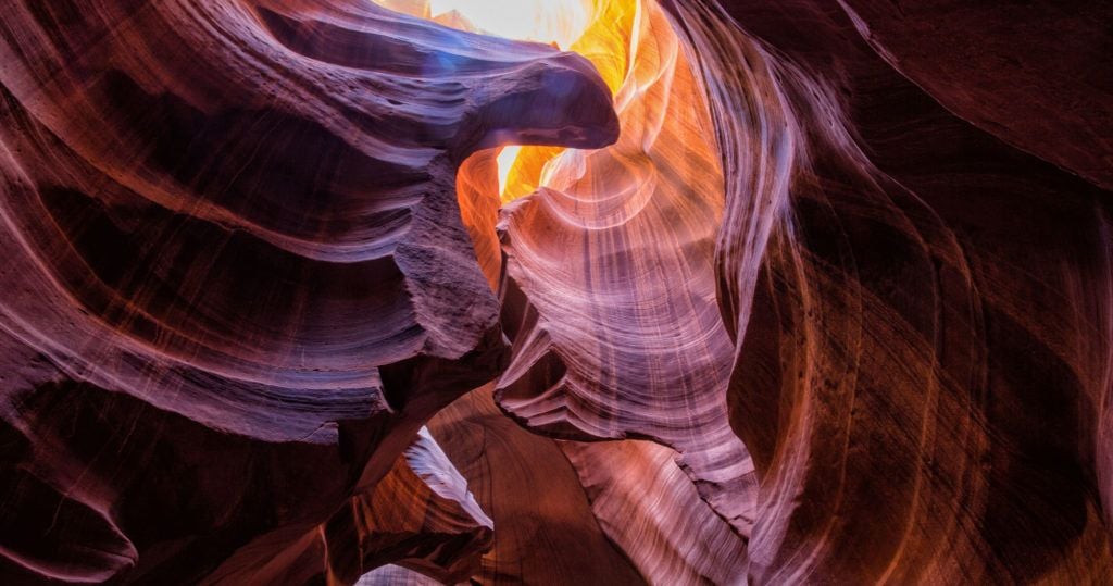
The hike along the Willis Creek Slot Canyon is so much fun! And to think that we almost skipped this hike.
After a long day of hiking and exploring both Bryce Canyon National Park and Kodachrome Basin State Park, we wondered if we should tack on Willis Creek to the end of our day. Would it be worth it?
The answer is yes. Willis Creek was a blast to hike. Hiking within the narrow canyon, hopping and skipping over the creek, and watching as the canyon walls steadily grew higher and higher over us as we headed downstream was such a great experience.
Willis Creek is fun to explore. It’s easy, it’s great for all ability levels and ages, and with the creek and high canyon walls, you can stay cool (almost) even during the hotter summer months.
Table of Contents
Willis Creek Hiking Stats
- Distance: 3+ miles (out and back)
- Elevation Gain: Minimal
- Difficulty: Easy
- Length of Time: 1.5 – 3 hours
- When to go: You can hike Willis Creek all year. The best time for this hike are during the spring and fall, when temperatures are mild. Expect very high temperatures midday during the summer. In the winter, it will be cold but crowds will be at their lowest.
Getting to the Willis Creek Trailhead
Willis Creek is located within Grand Staircase-Escalante National Monument. The closest town is Cannonville. From Cannonville, head south on Kodachrome Road, which becomes Cottonwood Canyon Road. Before arriving at Kodachrome Basin State Park (and before crossing over the Paria River), turn right on BLM 500, also named Skutumpah Road.
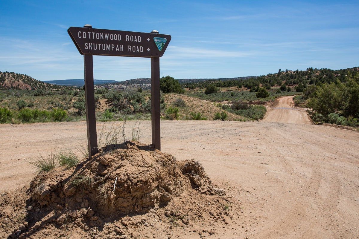
Skutumpah Road is a well groomed dirt road that takes you to the trailhead. Cars should be able to drive on this road, although a SUV or 4×4 is ideal. During wet, rainy weather, this road may be impassable, even if you have a 4×4.
Follow Skutumpah Road for 5.8 miles (about 20 minutes of driving) to a car park on the right hand side of the road.
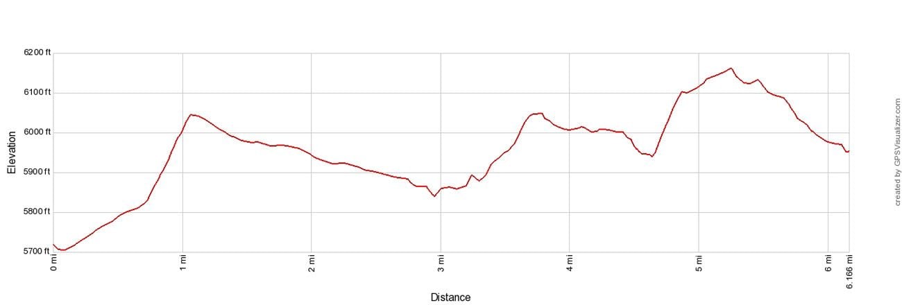
This is the elevation profile for the drive from the intersection of Cottonwood Canyon Road and Skutumpah Road to the parking lot at the trailhead (one-way). Some people report difficulties driving up the steeper sections of the road, and with this elevation profile, you can get an idea of what to expect. We do not have an elevation profile for the Willis Creek hike, since it is mostly flat.
Important Update: In recent months, we have heard numerous reports about the road conditions on Skutumpah Road. Make sure you read the comments below to get updated reports on the road conditions. And if you hike Willis Creek, feel free to write back in with your experience on the road and the trails, to help other hikers. Thanks!
The GPS coordinates for the trailhead are 37.483062, -112.096760.
From the car park, cross the road to get to the trailhead.
Hiking Willis Creek Slot Canyon
Step-By-Step Trail Guide
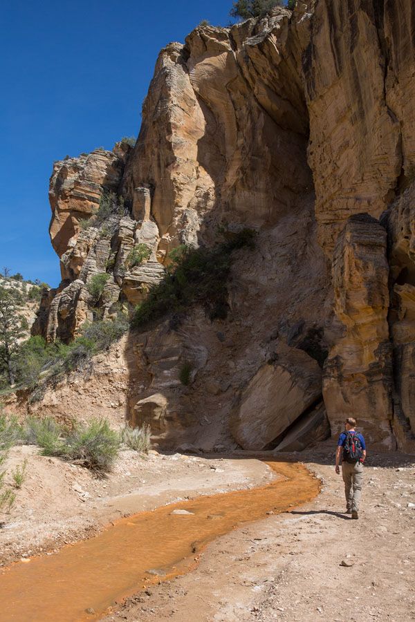
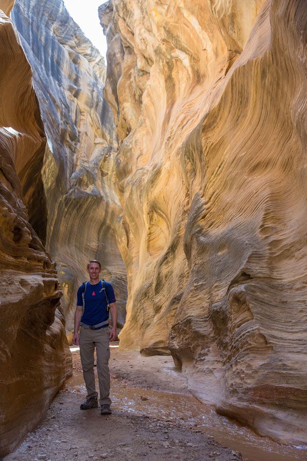
After following the trail for about 200 meters through brush and small trees, the trail dips down to Willis Creek. For the rest of the hike, you will be walking alongside or in Willis Creek.
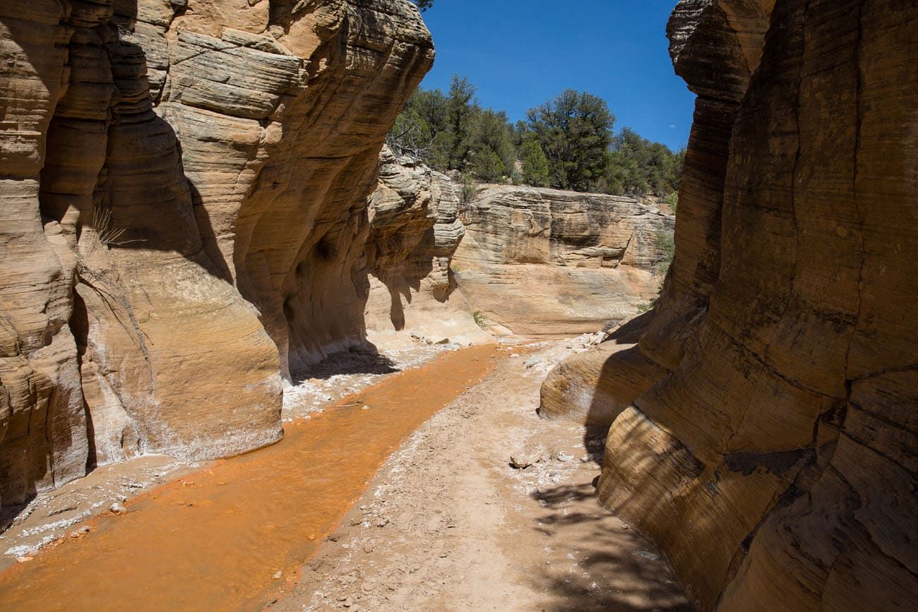
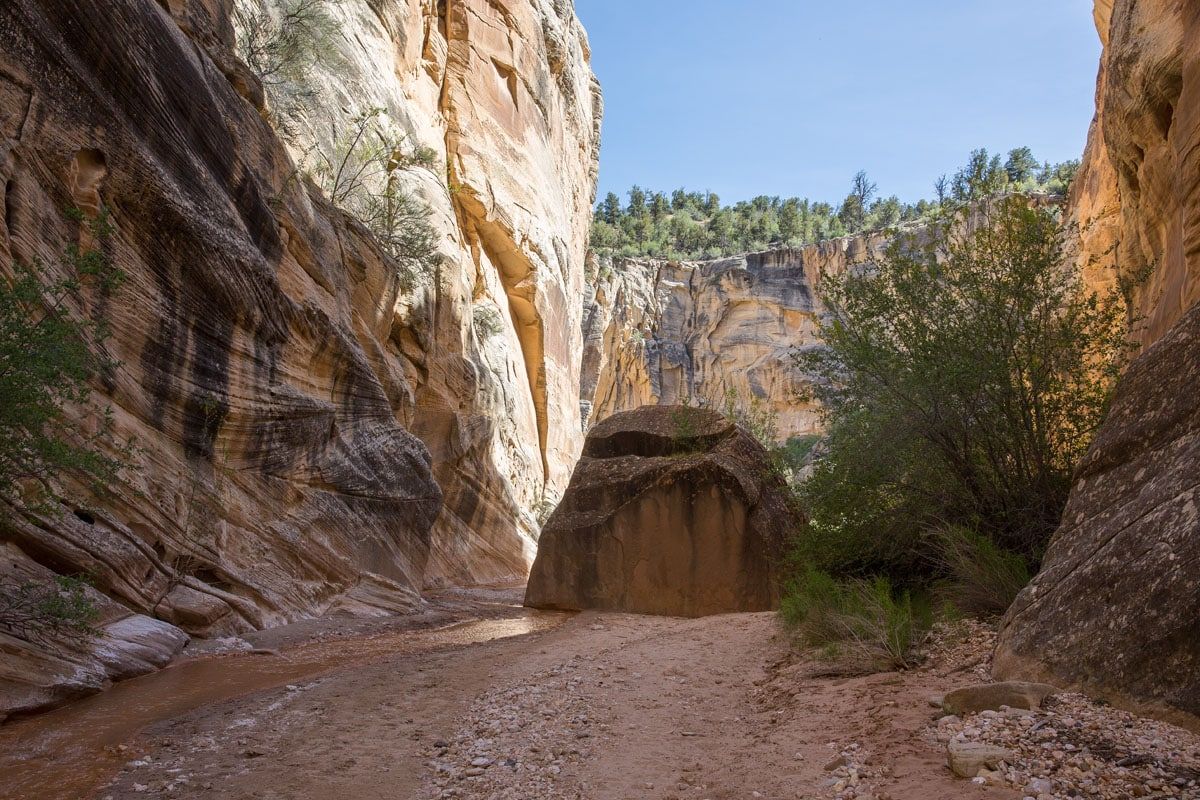
At first, the canyon walls are not very high, and the canyon is relatively wide. But this changes the further you hike.
It does not take long for the canyon to get narrow. This is when it gets really fun! Tim and I tried our best to keep our feet dry, since we only had one pair of hiking shoes and several days of hiking to go. It kept things fun, hopping and skipping across the creek.
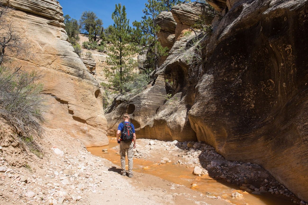
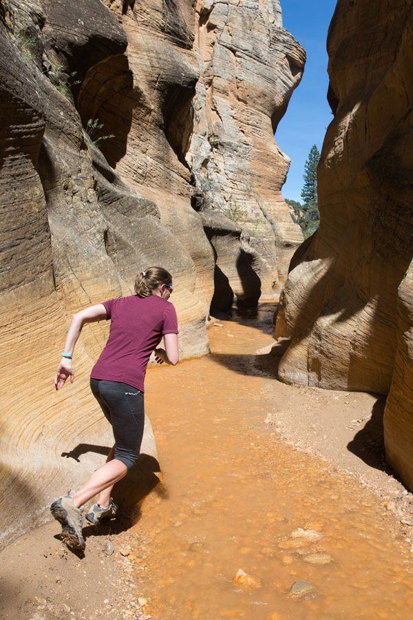
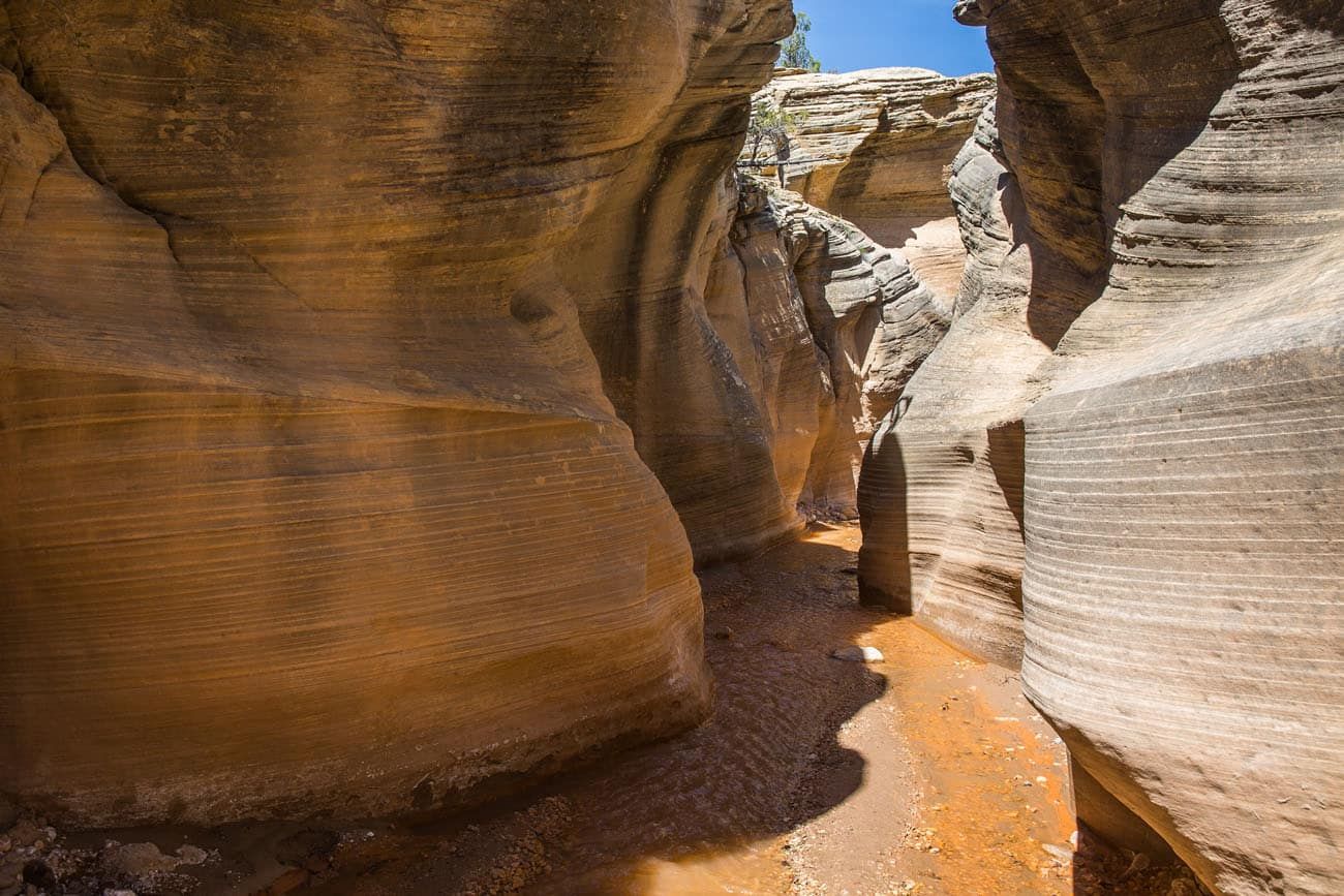
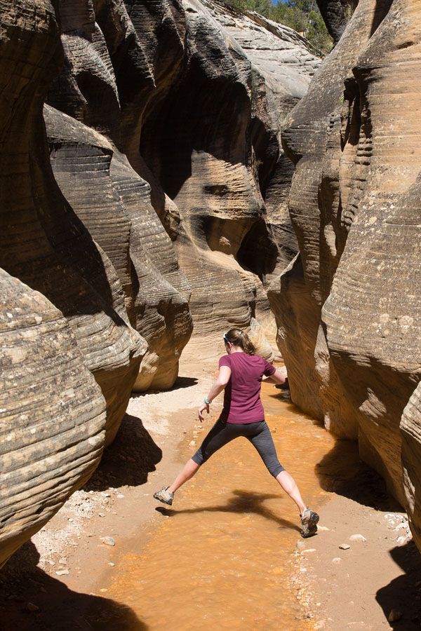
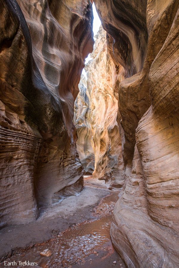
In some places, the canyon widens, which is nice, but the best parts of the hike are when the walls close in on you and make you feel so tiny. We felt like kids again, out exploring. During our hike, we only saw a handful of other people, making this an even better experience.
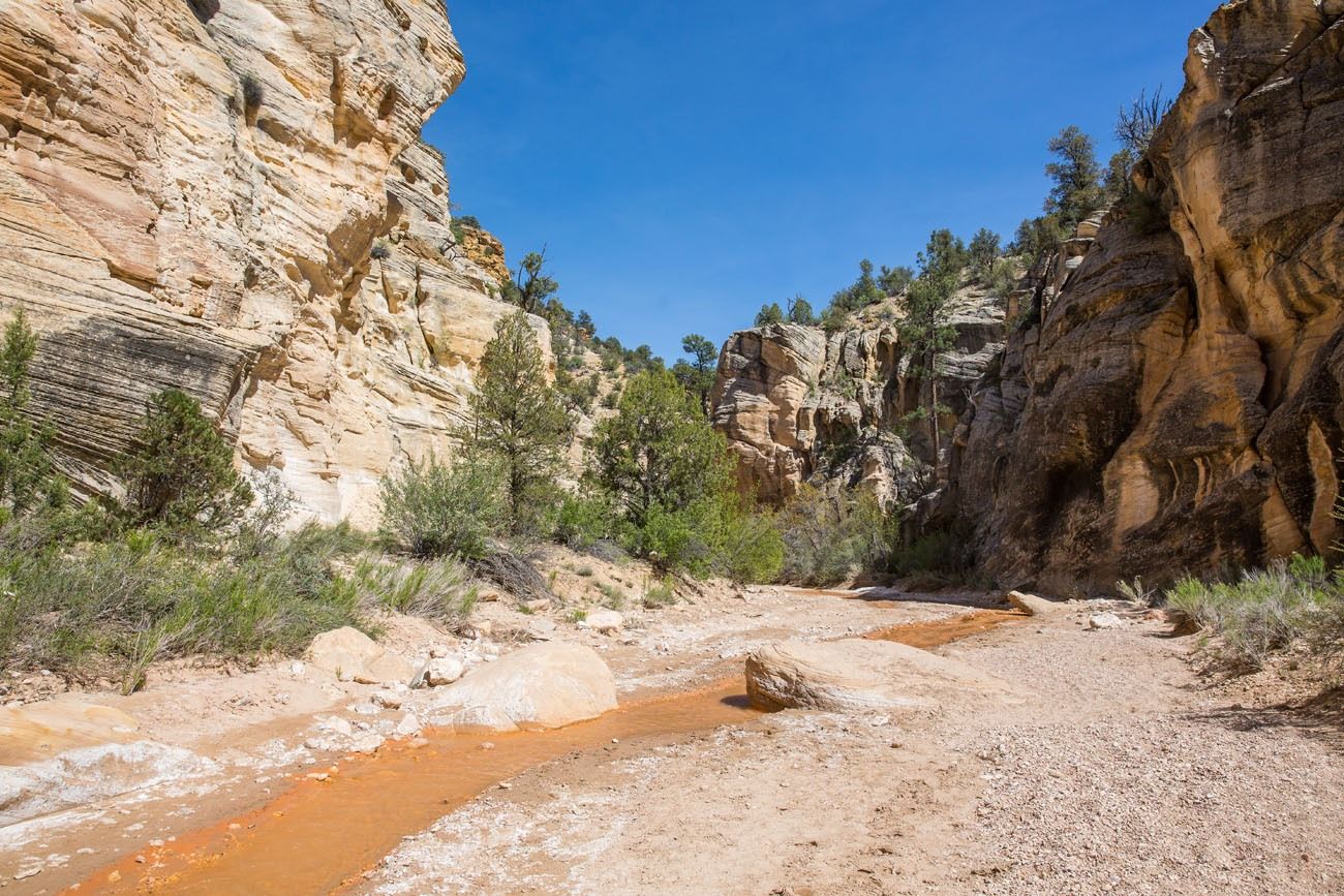
You have the option to hike all of the way to Sheep Creek. However, the slot canyon ends at 1.4 miles. Beyond this, the canyon widens and even though its scenic, it can get monotonous. If you do not have a GPS with you, once you get to this gigantic rock in the creek, the slot canyon portion of the hike is over. You can keep going or turn around here, the choice is yours.
About Our Experience
Willis Creek can be combined with other parks in the area.
We started our day at sunrise at Bryce Canyon. After spending six hours in Bryce, we drove out to Kodachrome Basin State Park where we did two hikes (Shakespeares Arch-Sentinel Trail and Angel’s Palace Trail). Later in the afternoon, around 4 pm, we started the Willis Creek hike. We almost did not do this hike, thinking it would be a bust after amazing Bryce Canyon and hiking in Kodachrome, but Willis Creek surprised us. This hike is pure fun and with very few people here, it was a great experience.
If you are wondering if Willis Creek is worth it, it really is! It’s fun, it’s easy, and it only takes a few hours. If you are traveling with kids, they are going to have a blast! Why not add it to your list if you are in the area?
We hiked this trail in May 2017.
Driving Times to Nearby Destinations:
- Bryce Canyon National Park: 24 miles, 50 minutes
- Kodachrome Basin State Park:10 miles, 30 minutes
- Zion National Park: 91 miles, 2 hours
- Escalante:43 miles, 1.25 hours

Important Things to Know Before You Go
Flash Floods. Since you are hiking through a slot canyon, flash floods are a danger. Make sure you check the weather forecast before you start the hike. Don’t hike if thunderstorms are in the area.
Shoes. There is a good chance you feet will get wet. You need to wear a sturdy pair of shoes, like hiking shoes, tennis shoes, or sandals designed for hiking (Keen sandals).
Bring lots of water. Bring several liters of water per person, especially during the summer months.
Sunscreen. Even though you are hiking through a canyon, you will still be exposed to the sun for most of the hike. Make sure you are wearing sunscreen.
Please practice the seven principles of Leave No Trace: plan ahead, stay on the trail, pack out what you bring to the hiking trail, properly dispose of waste, leave areas as you found them, minimize campfire impacts, be considerate of other hikers, and do not approach or feed wildlife.
If you have any questions about hiking Willis Creek, or if you want to share your experience, either on the hiking trail or the road to get here, let us know in the comment section below.
More Information about Utah
UTAH ITINERARY: In our Utah National Parks Road Trip Guide, we cover multiple ways to road trip through the national parks in Utah.
ZION NATIONAL PARK: Check out our Zion National Park Travel Guide for important travel planning tips, sample itineraries, advice on when to go, where to stay, and more.
GRAND STAIRCASE-ESCALANTE: In Grand Staircase-Escalante, hike Peek-A-Boo and Spooky Gulches, explore Devils Garden, and hike through Zebra Slot Canyon.
GOBLIN VALLEY: Goblin Valley is a small state park packed with unique rock formations that’s a fun place to explore, especially for kids. Nearby you can also hike through Little Wild Horse slot canyon.
MONUMENT VALLEY: Get the details on what to do and how to plan your visit in our Guide to Monument Valley. We also have information on Teardrop Arch and a sunrise photography tour of Monument Valley.
USA ROAD TRIPS: Planning your next big adventure in the USA? Check our our USA Road Trip Guide for travel ideas and sample itineraries.
Read all of our articles about Utah in our Utah Travel Guide and the USA in our United States Travel Guide.
Note: This post contains affiliate links. When you make a purchase using one of these affiliate links, we get paid a small commission at no extra cost to you.
All rights reserved © Earth Trekkers. Republishing this article and/or any of its contents (text, photography, etc.), in whole or in part, is strictly prohibited.
Comments 65
Hi Julie,
I wanted to get your thoughts on doing the 3 hikes in one day you seemed to have done but in reverse order with 2 kids (10 years old). Our plan for now would be leaving Page, AZ at 8am and driving through Cottonwood Canyon Road (stopping only at Grosvenor Arch) to get to Kodachrome basin (hiking there Angel’s Palace Trail), then heading to Willis Creek Slot Canyon (doing the shorter hike you mentioned stopping at big rock), to finish at Bryce Canyon with hiking only the Queens Garden – Navajo Loop trail (we would do the other viewpoints the next morning). Do you think it will be doable or will it be too much for one day ? My initial plan was doing that day only Kodachrome & Willis Creek hikes with finishing the day at Bryce viewpoints (Inspiration Point, Bryce Point etc). Then the next day I had us hiking Bryce Canyon in the morning (the Queens Garden/Navajo Loop Trail then heading to Las Vegas stopping on the way in the Valley of Fire to hike White Domes Trail and 7 wonders loop (to see Pink Canyon and Fire Wave). However I now want to add that second day a hike (Arches Trail) in Red Canyon/Dixie National Forrest since I thought the girls would like that one (and we are driving through that area). However, that day has a very long drive time to go all the way to Vegas so I am wondering if so many hikes will fit that day if I dont move Bryce hike to the day before… Any Advice on which option you would recommend ? Thanks!
Author
Hello Aurelia. Yes, I think it is very doable to do those 3 hikes in one day. We did all three, were finished by mid afternoon, and then drove to Zion, so we did maybe a little less driving than you will do. The Kodachrome hike is the least interesting of the three (but it is very good and worth doing), so the hikes keep getting better as the day goes on, which will help keep your kids entertained if they start to get tired. And with your big day the next day, it’s better to do those 3 hikes on your first day. Have a great trip! Cheers, Julie
Thank you so much Julie for your insight – super helpful! Sounds like my itinerary is finalized. We cant wait to explore this area.
We visited on Oct. 24. Great little side excursion on our road trip! I highly recommend this place for elementary school kids — they’d have a blast. Skutumpah road must be graded periodically, because we had no problem getting there in our zero-clearance minivan. We touched bottom only once while crossing Sheep Creek (more like Sheep trickle when we were there), but our minivan touches bottom coming out of the parking lot to our grocery store. The road is quite steep, though, so wet weather would make it a real problem. The flow through the canyon was low enough that two 55-year-olds with marginal knees could get through without even getting our feet wet. Very pleasant. The only negative was that the Bryce Valley Lodge people were running horses through the slot canyon. They were very nice and there was room for the horses to get by, but they left behind a lot of horsecrap. Kinda detracted from the otherwise pristine feel of the place. I guess everybody’s got to make a living, and presumably the spring run-off will wash all that out of there, but it was unfortunate.
9/26/23
Our trip to Willis Creek is the highlight of our vacation! We’ve spent 2 days at Zion & 2 days at Bryce. The lodge we stayed at, in Tropic, had a notebook with all the nearby things to do. Willis Creek was a last minute decision. BLM500 road was tougher than we expected & I was sure we may pop a tire on the Kia Soul rental but we made it the 6 miles. Most of that road needs to be driven at 10 mph. When we were getting out of car we met a couple leaving & they told us how awesome the hike was. I mentioned the treacherous road & they stated they had come from the “other direction” and it wasn’t bad. So, enough on that later.
My husband & I are 60 & not in the greatest shape, so had decided to skip the Narrows hike at Zion, so I thought this was next best option & it was better than we could have ever imagined. We both opted for sandals rather than hiking shoes & are glad we did. The hike or Stroll as I would call it was very easy. The canyons are breathtaking, the water was a perfect temperature & never deep. It was unlike anything we have ever seen & so worth seeing. We saw maybe 12 other people & were there about 3 hours. So, as we were leaving I suggested we go back the other way as the young man had said the road isn’t bad & you can even see a truck that ran into a slot canyon at a bridge a few miles down. Let me tell you, DO NOT go “the other way”, which is a right turn out of parking lot. My best guess is it was 35 miles of the bad road, worse in some places, than the way in, no cell service at all, so we had no idea how far we would go. We finally got to a paved road & were still 15 minutes from Kanab. So we were over an hour getting back to the first house or sign of civilization! Then when we got cell service, just before Kanab, we were 89 miles from our lodge! Mind you it was a 14 mile drive to Willis Creek!!!! BUT it was so worth going! Do it. Just take the road slowly. Take 12 East toward Escalante & right on Kodachrome Drive, then BLM500 for almost 6 miles. Parking area on right
Author
Hello Nancy from Florida! Thanks for writing in with your experience and the road conditions. I’m glad you had a great hike!! Cheers, Julie
This hike was awesome!! Such helpful tips from this post. Highly recommend! Just went today