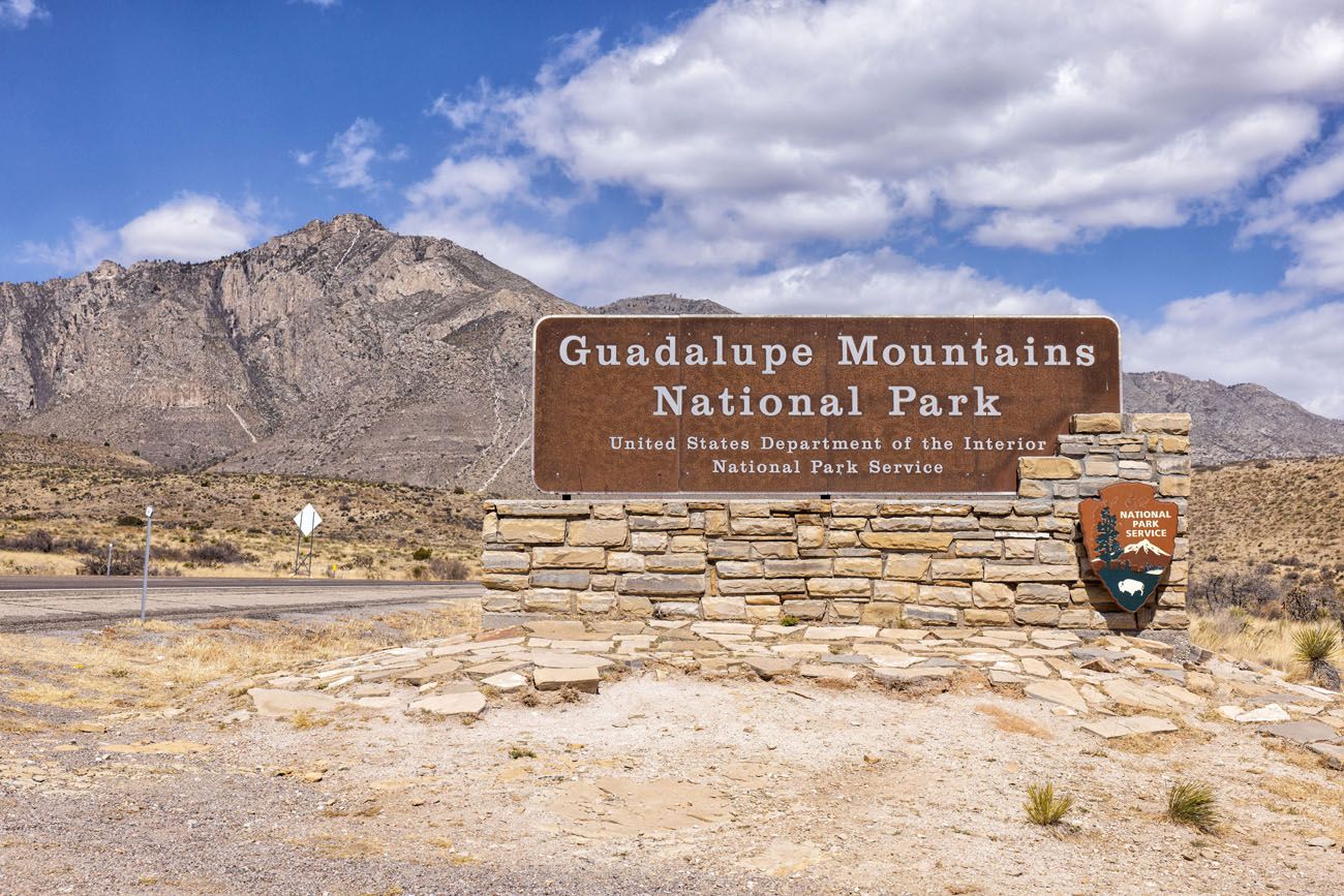
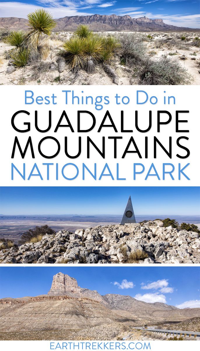
Canyons, gypsum sand dunes, fossilized coral reefs, the Chihuahuan Desert, and some of the highest peaks in Texas…these are all things that you can see in Guadalupe Mountains National Park.
If you like hiking, you’ll love this park. Almost everything in the park requires some sort of short walk or hike…there is very little that you can see from your car. And you have a wide variety of hikes to choose from. Hike to Guadalupe Peak, the highest point in Texas, hike to a slot canyon, and explore the quieter trails in the remote areas of the park.
In this guide, we cover the best things to do in Guadalupe Mountains National Park, with information on how to plan your time, where to stay and eat, and when to go.
Table of Contents
Interesting Facts about Guadalupe Mountains National Park
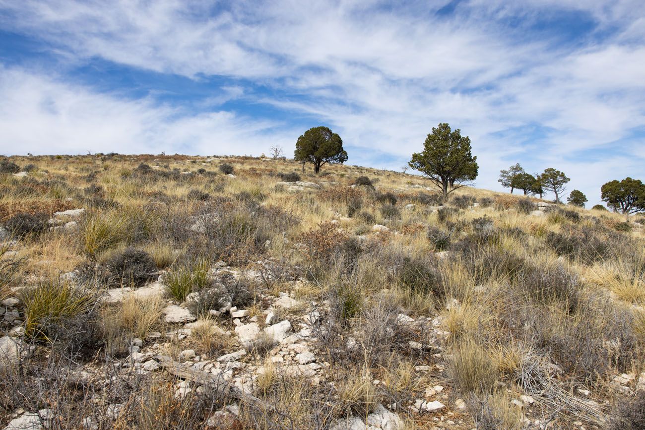
This national park preserves a portion of the Guadalupe Mountains. This mountain range runs north-south in Texas and New Mexico.
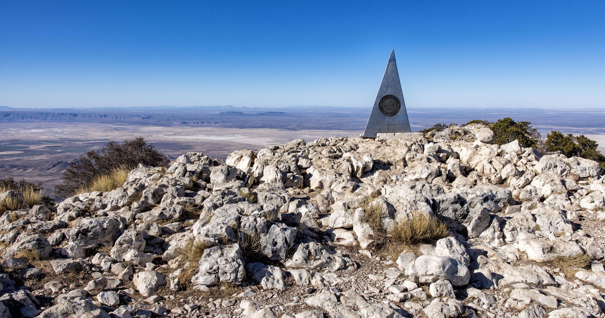
The highest peaks are located in the southern part of the mountain range, within the boundaries of the national park. Guadalupe Peak, at 8,751 feet, is the highest peak in the Guadalupe Mountains and the highest peak in Texas, earning it the nickname “Top of Texas.”
Another national park is located within these mountains. Carlsbad Caverns, which is located just over the border in New Mexico, is also located within the Guadalupe Mountains.
These mountains get their name from the Guadalupian series (once called the Middle Permian) in the Permian period. In geologic time, the Permian period was part of the Paleozoic Era and it began 298.9 million years ago and ended 252.2 million years ago. The national park preserves the world’s largest Permian fossil reef, which dates back to this time.
Guadalupe Mountains officially became a national park on October 15, 1966. In 2023, 230,000 people visited the park, making Guadalupe Mountains National Park the 12th least visited park that year.
Geography and Map of the Park
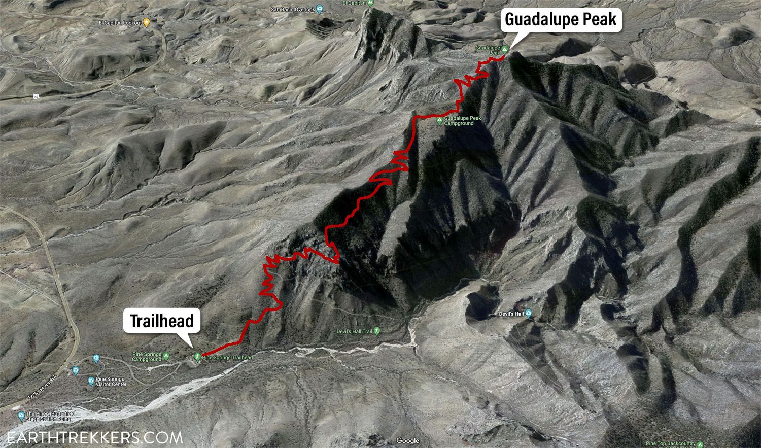
There are several areas of Guadalupe Mountains National Park, which are labeled on the map below.
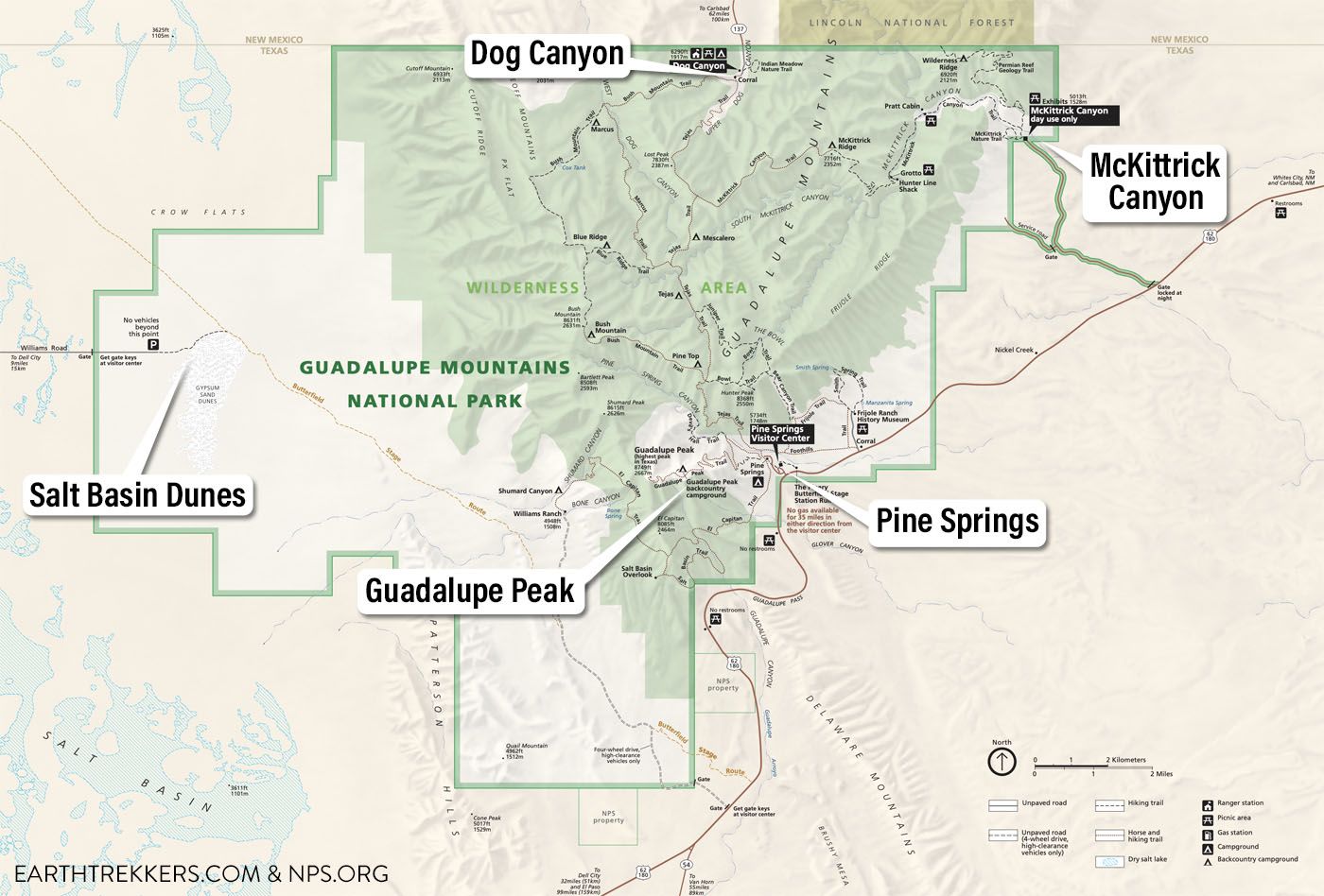
Map of Guadalupe Mountains National Park
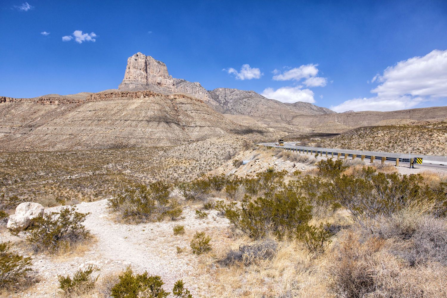
US Highway 62/180 runs along the eastern border of Guadalupe Mountains National Park. From this road, you have access to many of the top sights in the park.
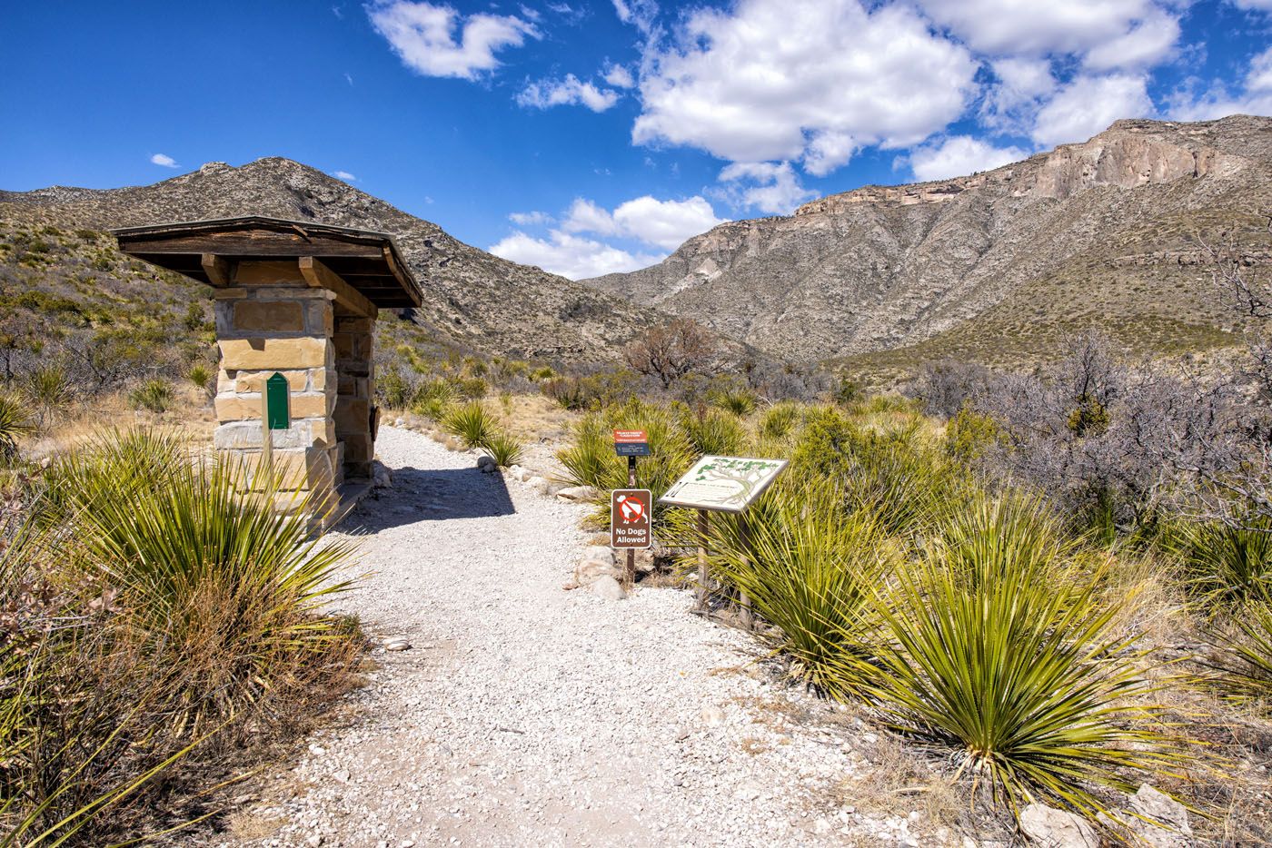
The most popular part of the park to visit is the Pine Springs area. From here, you can hike some of the best trails in the park, including Guadalupe Peak and Devil’s Hall, and it is just a short drive to Frijole Ranch.
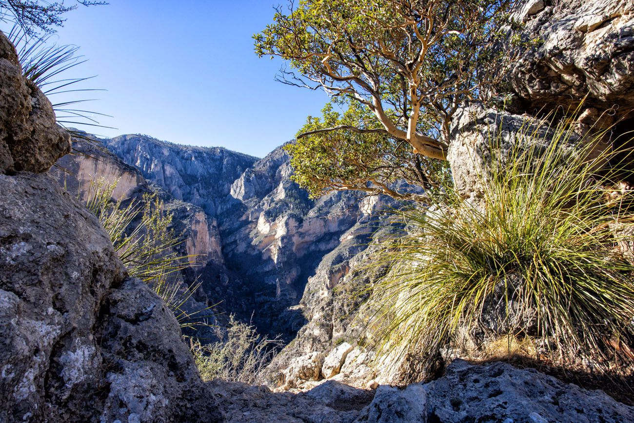
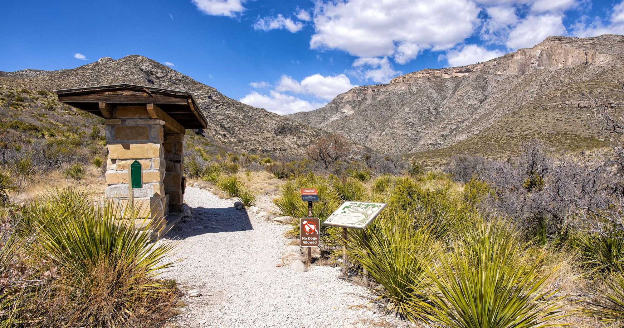
Farther north, in a separate section, is McKittrick Canyon. This is another popular hiking destination and trails to Pratt Cabin, the Grotto, the Notch, and the Permian Reef Trail all start here.
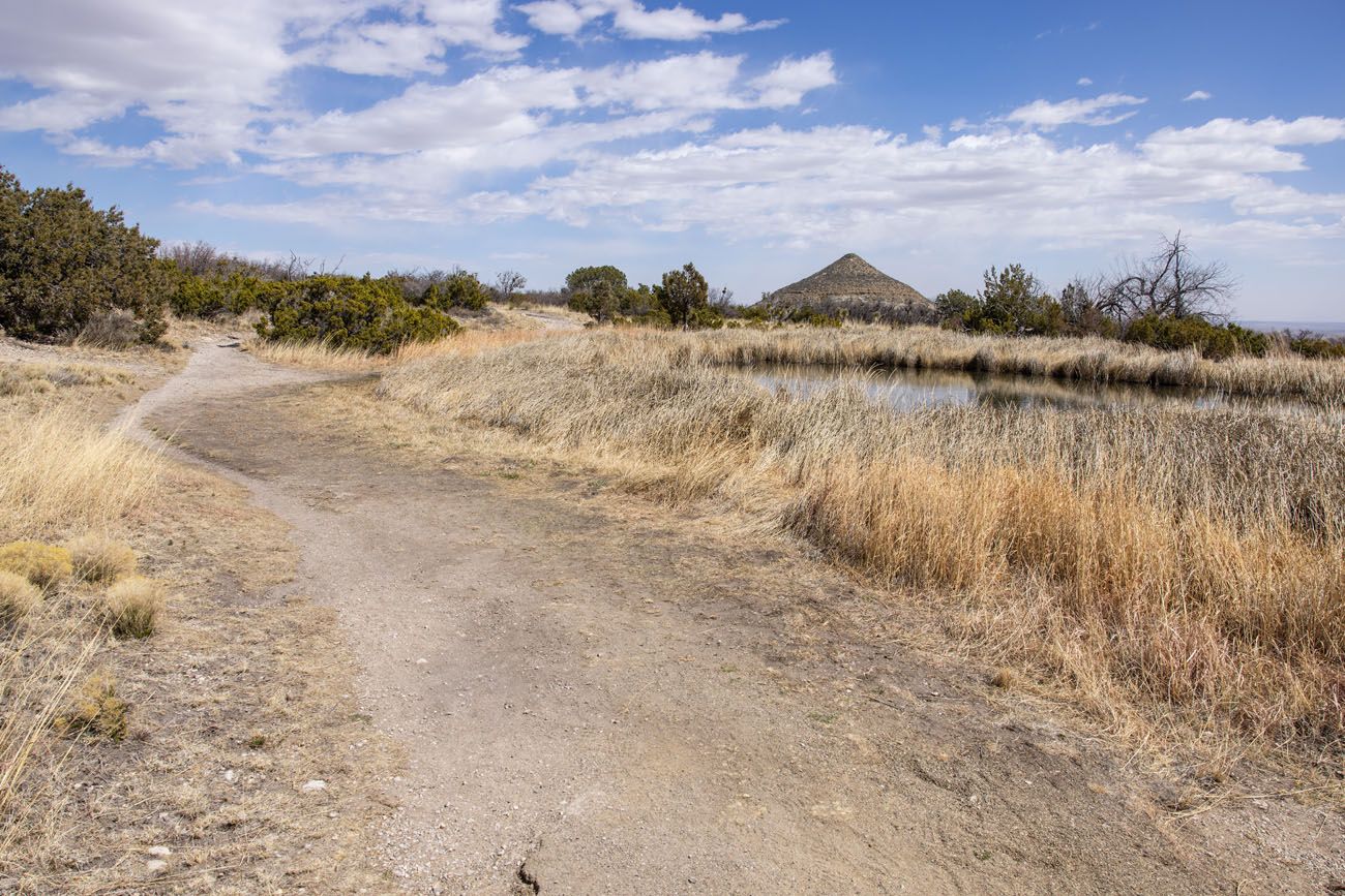
Dog Canyon is a quieter, more remote area of Guadalupe Mountains National Park. There is a campsite here as well as a few hiking trails. If you want to hike without the crowds, this is the place to go.
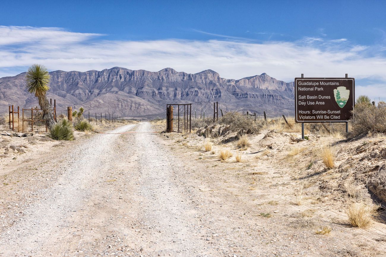
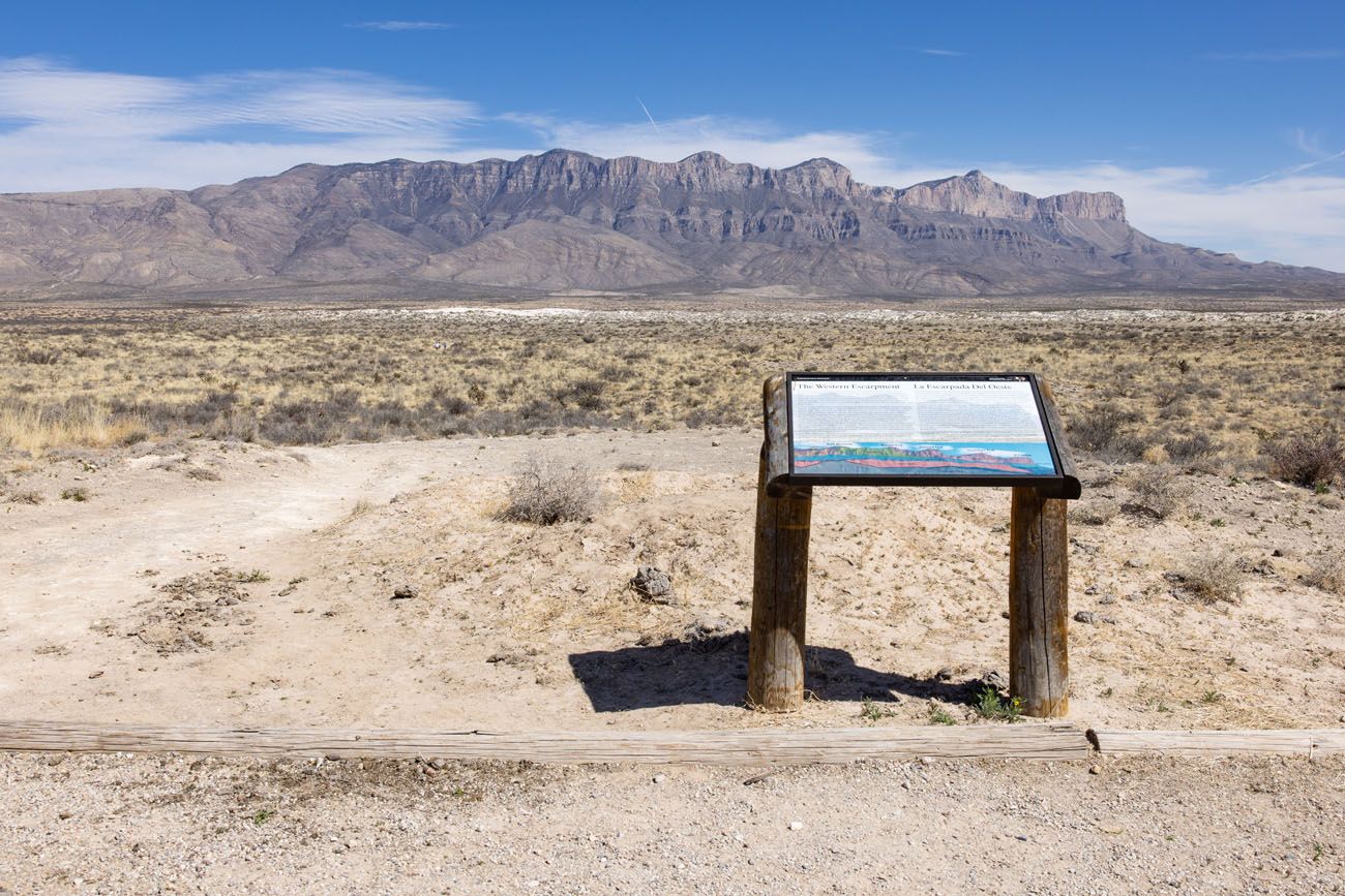
Finally, on the western side of the park are the Salt Basin dunes. This is a smaller, more vegetated version of White Sand Dunes National Park. It is very remote and it takes some time to get here, but your reward is stunning views of the Guadalupe Mountains from the snow white dunes.
Numerous hiking trails link these areas together, making this park a great spot for backpacking and those who enjoy long distance day hikes.
Best Things to Do in Guadalupe Mountains
Below I list the best things to do in Guadalupe Mountains National Park, ordered geographically.
How to Use This Map: Click the tab in the top left hand corner of the map to view the layers (points of interest and the walking route). You can click the check marks to hide or show layers. If you click the icons on the map, you can get more information about each point of interest.
If you click the star next to the title of the map, this map will be added to your Google Maps account. To view it on your phone or computer, open Google Maps, click the menu button, go to “Your Places,” click Maps, and you will see this map on your list.
Things to Do in and around Pine Springs Visitor Center
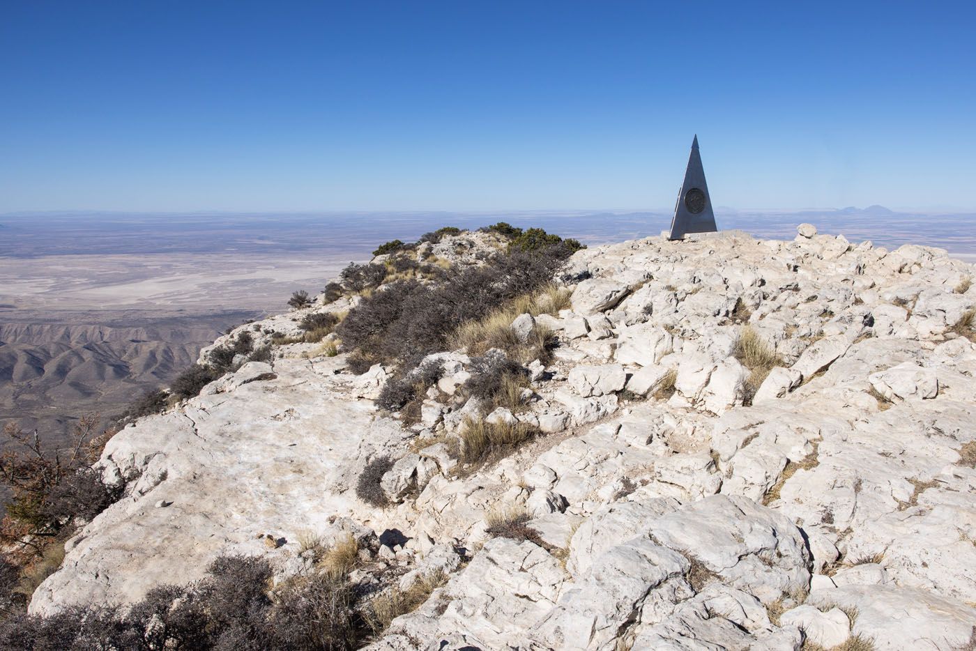
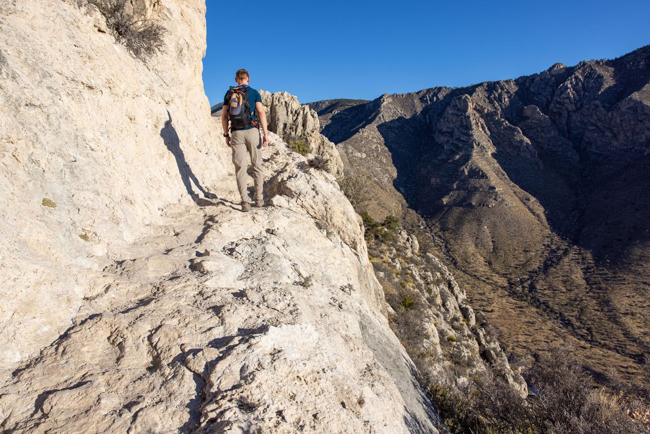
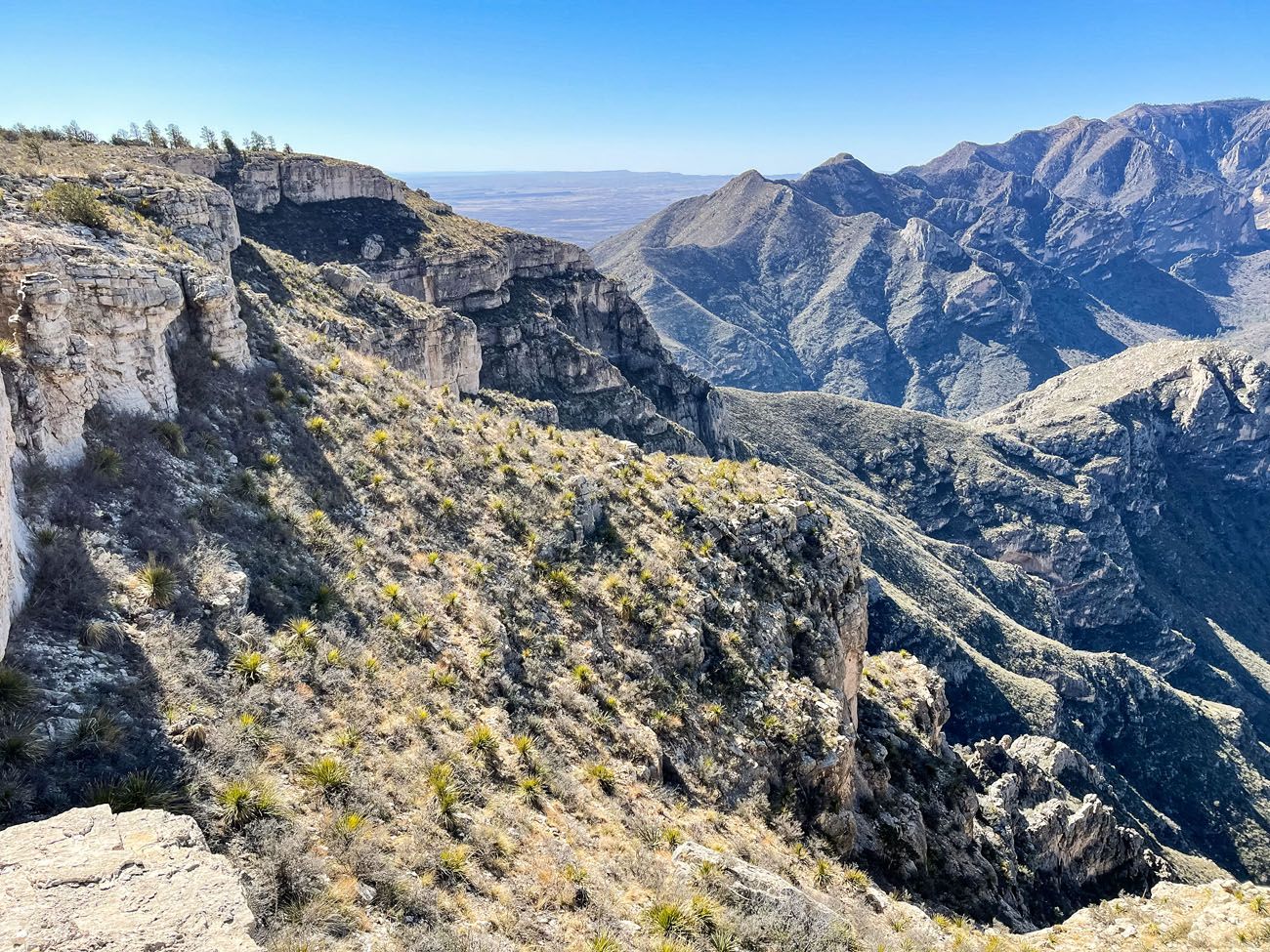
Hike to Guadalupe Peak, aka the “Top of Texas”
Distance: 8.4 miles out-and-back | Difficulty: Strenuous | Total Ascent: 3,000 feet | Time: 4 to 8 hours
At 8,751 feet, Guadalupe Peak is the highest point in Texas. This is one of the most popular hikes in the park, as many people want the bragging right that they stood on the highest peak in Texas.
Guadalupe Peak | Best Things to Do in Guadalupe Mountains National Park
Guadalupe Peak Trail Map | Best Things to Do in Guadalupe Mountains National Park
Trail to Guadalupe Peak | Best Things to Do in Guadalupe Mountains National Park
Getting here is not easy. It’s a tough, uphill hike to get to Guadalupe Peak, with rocky trails, long steep staircases, and some narrow sections of trail.
But once at the top, the views are unbeatable. From Guadalupe Peak, you have panoramic views over the national park as well as the Chihuahuan Desert.
For full details on how to do this, check out our guide on How to Hike to Guadalupe Peak.
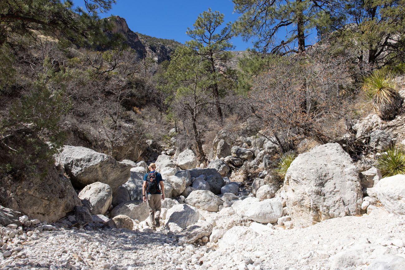
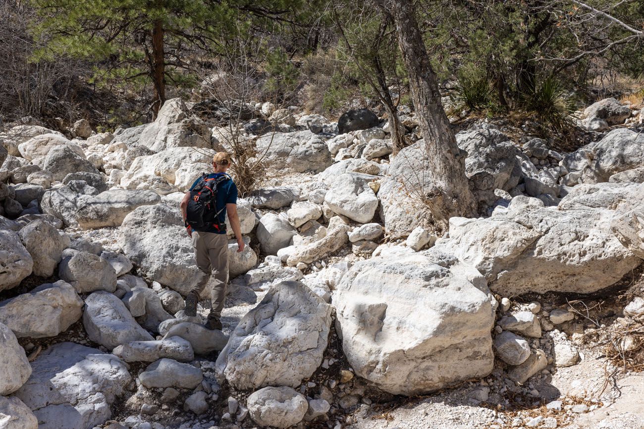
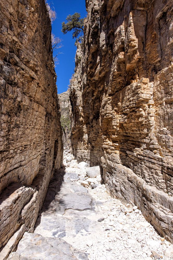
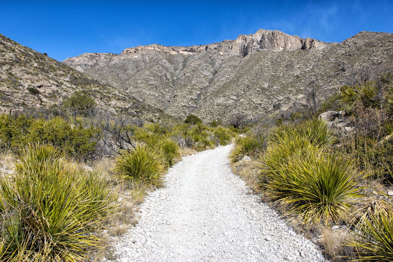
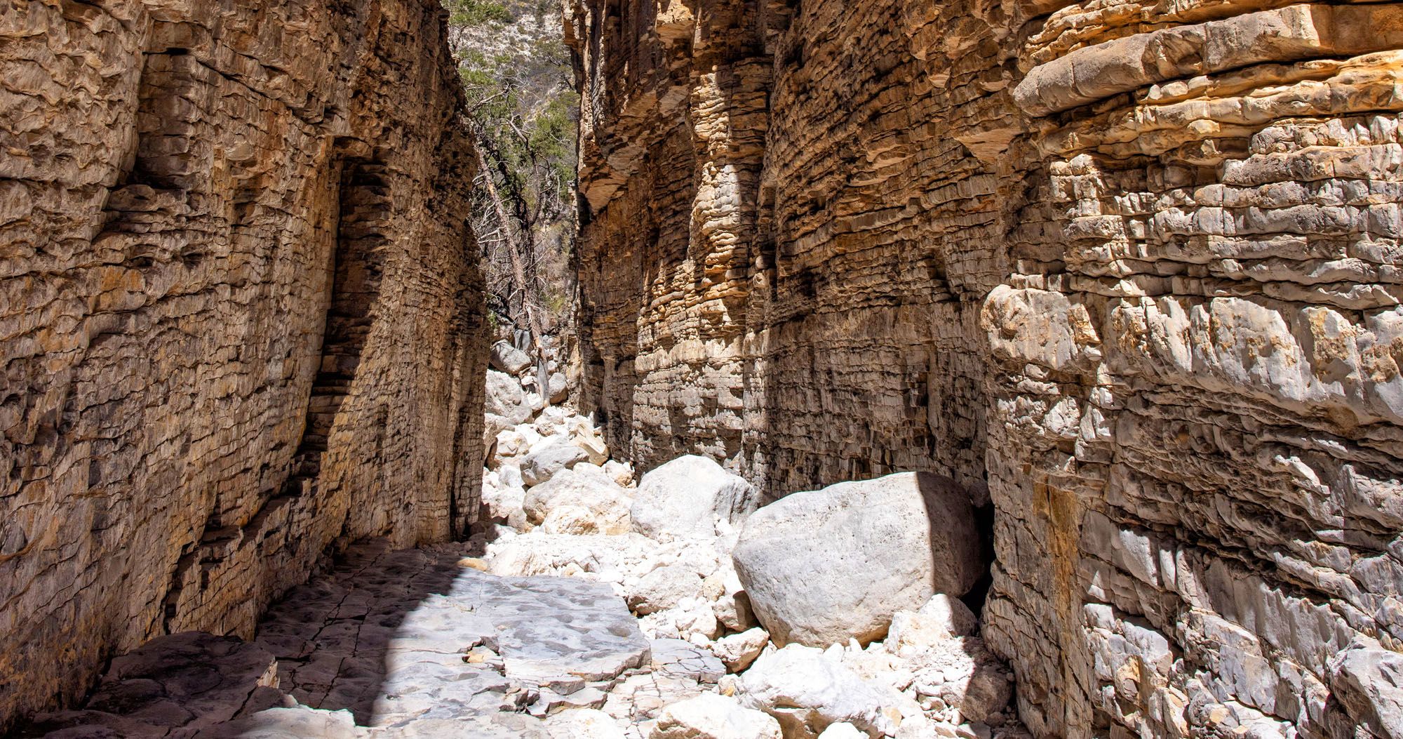
Hike the Devil’s Hall Trail
Distance: 3.75 miles out-and-back | Difficulty: Moderate to Strenuous | Total Ascent: 800 feet | Time: 2 to 4 hours
This is a fun hike…if you like rock scrambling.
Starting at the Pine Springs Trailhead, the first mile is an easy hike on a dirt trail that runs through the canyon. At about one mile into the hike, you reach the wash. For the next 0.75 miles, you hike/rock scramble up and over boulders of all sizes to get to the end of the canyon.
Devil’s Hall Trail | Best Things to Do in Guadalupe Mountains National Park
Near the end of the trail, you reach the “staircase” in the photo below. Scramble up and over this and continue the walk for another 5 minutes to get to Devil’s Hall.
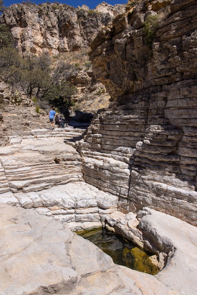
This is the “first section” of Devil’s Hall. Continue past this small pool of water for about five more minutes to get to Devil’s Hall.
Devil’s Hall | Best Things to Do in Guadalupe Mountains National Park
For full details on how to do this, read our Guide to the Devil’s Hall Trail.
ABOUT THE DIFFICULTY OF THIS HIKE: The difficulty varies based on conditions along the trail. If the wash is dry and you have experience rock scrambling, this trail is of moderate difficulty and takes most people about 2 hours. However, if the wash is wet, this hike becomes much more difficult and longer to hike. Rainy conditions are more likely to occur in the late-summer and the National Park Service urges people to not do this hike in wet or rainy conditions.
Hike to Hunter Peak
Distance: 9.9 mile loop | Difficulty: Strenuous | Total Ascent: 2,900 feet | Time: 5 to 8 hours
Hunter Peak, at 8,368 feet, is almost as high as Guadalupe Peak, so this is another tough day hike.
This loop hike starts and ends at the Pine Springs Trailhead. Most people hike up the Bear Canyon Trail to the Bowl Trail and then hike down the Tejas Trail.
We did not do this hike, but from talking to other hikers, this trail is less crowded than Guadalupe Peak and the views are stunning. Of those who hike both trails, Hunter Peak is usually the favorite of the two.
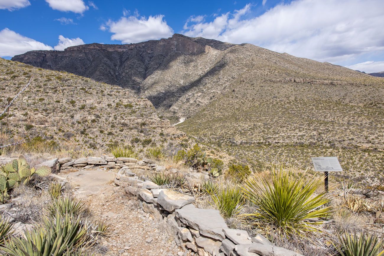
Walk the Pinery Trail
Distance: 0.9 miles round-trip | Difficulty: Easy | Time: 30 minutes
This short, paved trail leads to the ruins of the Old Butterfield Stagecoach Route Pinery Station that was built in 1858. There are also signs along the trail identifying local plants.
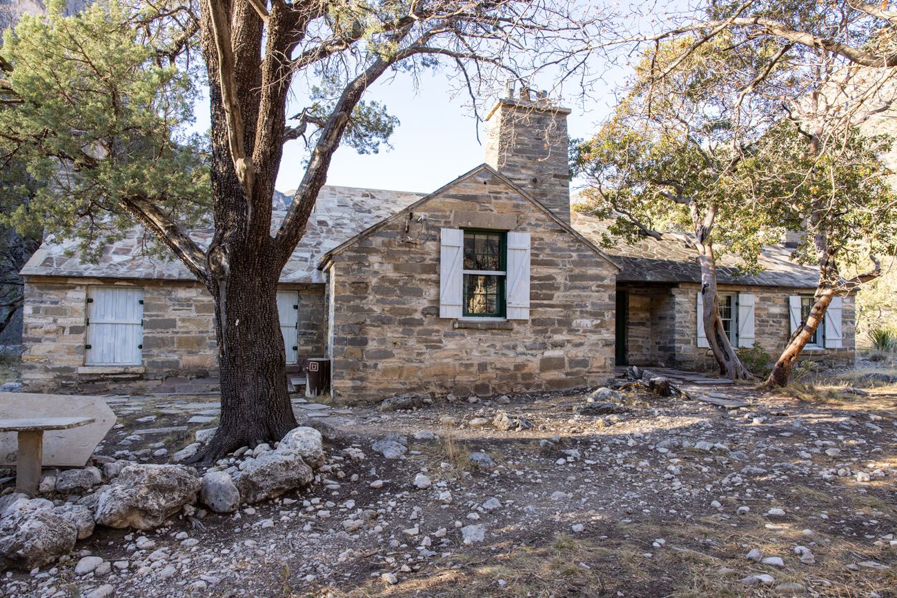
Frijole Ranch Museum & the Spring Trail
Located just a short drive east on US Highway 62/180 is Frijole Ranch.
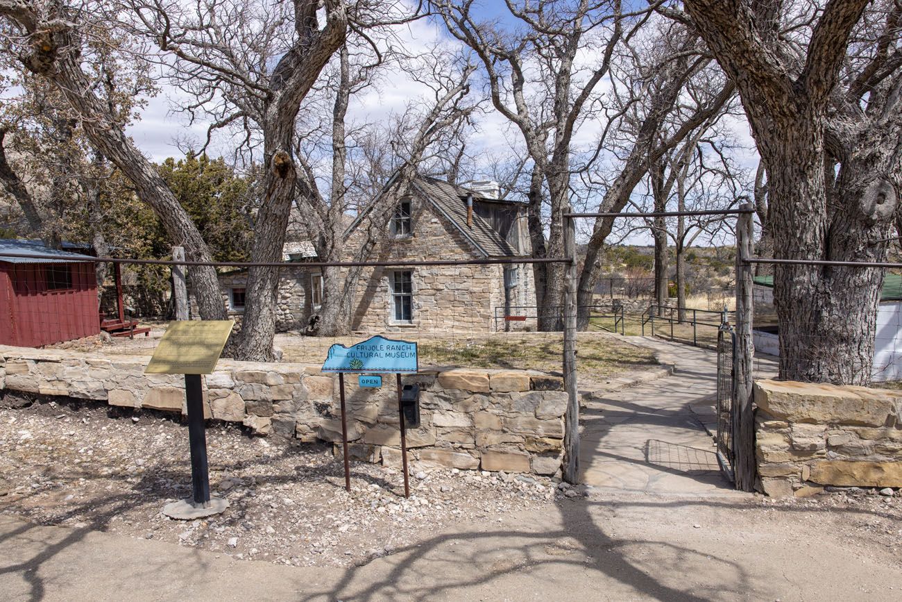
Frijole Ranch | Best Things to Do in Guadalupe Mountains National Park
The Frijole Ranch Cultural Museum is a one-room schoolhouse and spring house that was part of the Frijole Ranch. The museum, which is located in these buildings, contains historical artifacts about the Native Americans and the ranching community who lived in this area.
From the ranch, you can walk a half mile out and back to see the Manzanita Spring. Or, hike the entire Smith Spring Trail Loop. This hike is 2.3 miles round-trip, moderate, takes between 1 and 2 hours, and leads to the Smith Spring.
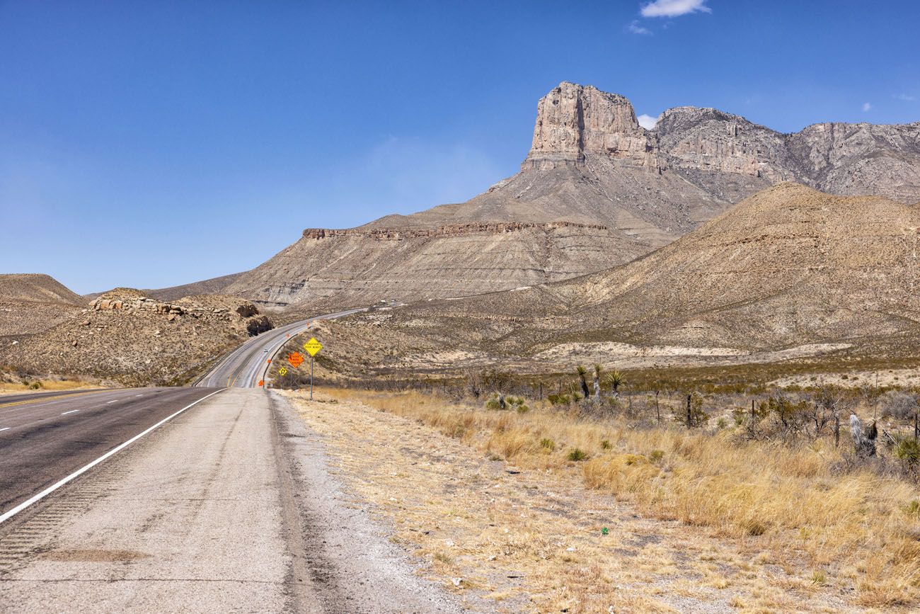
El Capitan Lookout
El Capitan is the 10th highest peak in Texas and the southernmost point of the Guadalupe Mountains.
For one of the best views of El Capitan, drive to the El Capital Lookout on Highway 62/180. There is a pull out on either side of the highway but the pull out on the US Highway 62/180 South has the better view, in my opinion, since you aren’t looking across the highway.
El Capitan Lookout | Best Things to Do in Guadalupe Mountains National Park
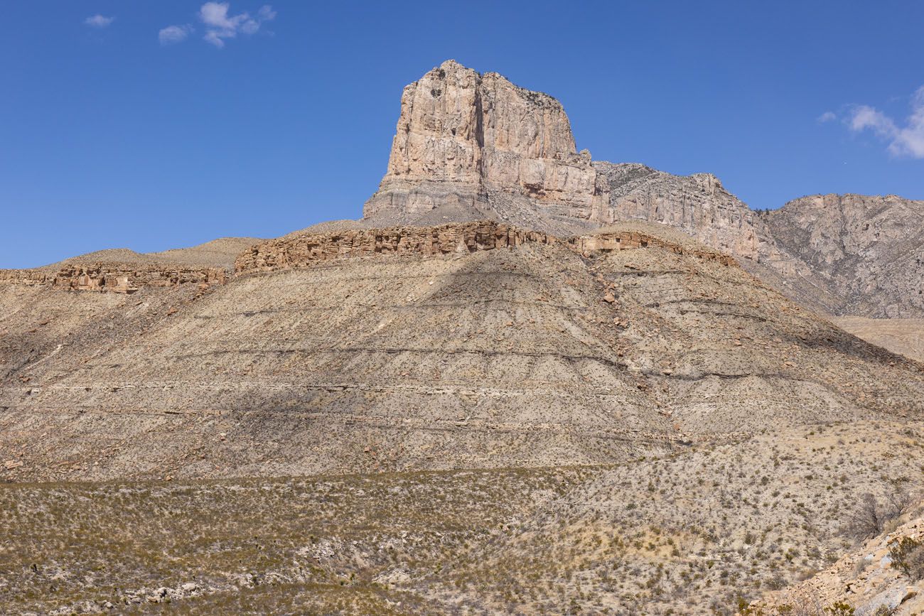
Closer view of El Capitan | Best Things to Do in Guadalupe Mountains National Park
If you are in the passenger seat, you can also get some nice photos of El Capitan as you drive US Highway 62/180 between Pine Springs and the El Capitan Lookout.
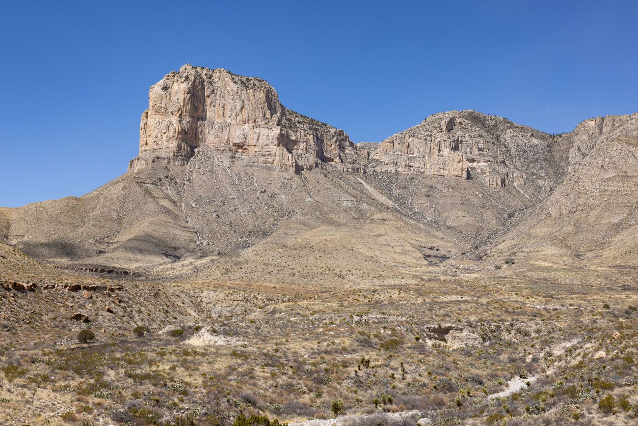
El Capitan taken from Highway 62/180 | Best Things to Do in Guadalupe Mountains National Park
Things to Do in McKittrick Canyon
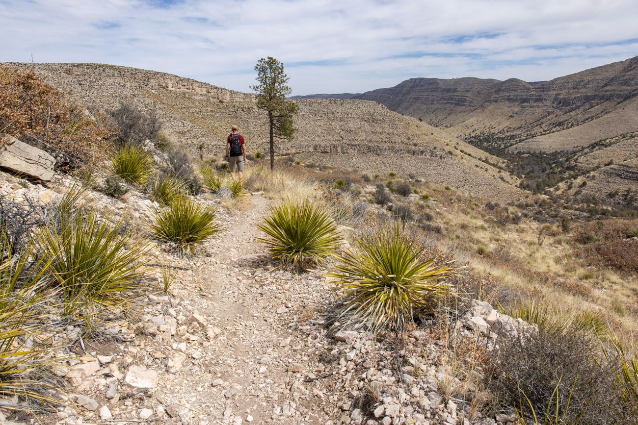
Hike to Pratt Cabin
Distance: 4.75 miles out-and-back | Difficulty: Easy | Total Ascent: 525 feet | Time: 1.5 to 4 hours
This is one of the shortest hikes to do in McKittrick Canyon. From the McKittrick Canyon Trailhead, it is a slightly uphill walk through McKittrick Canyon to get to Pratt Cabin. Along this hike, you will cross the wash several times and have great views of Wilderness Ridge.
Geologist Wallace Pratt bought this ranch property and built this stone cabin in the early 1930’s. He and his family spent the summers here from 1932 to 1945. In the 1960’s, Pratt donated his land to the National Park Service, which helped create the national park. The cabin was listed on the National Register of Historic Places in 1975.
Now, the cabin is used as a picnic and rest area for hikers. There are no restrooms here and the cabin is only open if there is a park ranger on site.
McKittrick Canyon Trailhead | Best Things to Do in Guadalupe Mountains National Park
McKittrick Canyon Trail | Best Things to Do in Guadalupe Mountains National Park
Pratt Cabin | Best Things to Do in Guadalupe Mountains National Park
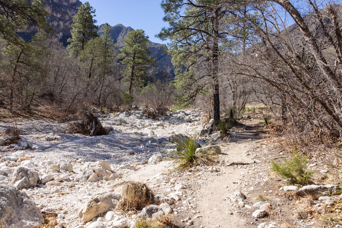
Hike to the Grotto and Hunter Line Shack
Distance: 7.25 miles out-and-back | Difficulty: Easy to Moderate | Total Ascent: 820 feet | Time: 2 to 5 hours
This hike continues on the McKittrick Canyon Trail beyond Pratt Cabin.
Beyond Pratt Cabin, the trail narrows, the gravel disappears, and now you are walking on a dirt singletrack trail. Again, the trail slowly and steadily heads uphill. There will be a few more places where you cross the wash.
From the McKittrick Canyon Trail, the detour to the Grotto is marked with a metal trail sign. The trail to the Grotto leads off to the left and heads downhill on a very rocky trail.
You have the option to continue on to the Hunter Line Shack and it takes about 4 to 5 minutes to walk here from the Grotto.
McKittrick Canyon Trail beyond Pratt Cabin
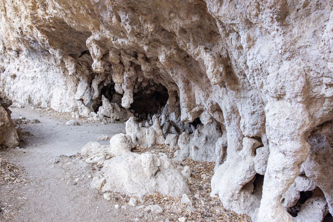
The Grotto | Best Things to Do in Guadalupe Mountains National Park
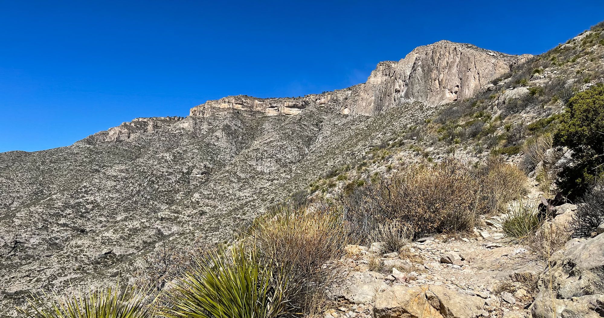
Hike to the Notch
Distance: 9.8 miles out-and-back | Difficulty: Moderate to Strenuous | Total Ascent: 1,675 feet | Time: 4 to 6 hours
On the McKittrick Canyon Trail, continue past the Grotto to get to the Notch.
Beyond the Grotto, the McKittrick Canyon Trail gets noticeably steeper and rockier. The trail switchbacks up McKittrick Ridge, rapidly gaining elevation as you head up into the mountains.
The final 0.25 miles up to the Notch is the most challenging. This is the steepest, narrowest, and rockiest part of the trail. But your reward, once you get to the Notch, are awesome views of McKittrick Canyon in both directions.
The Notch | Best Things to Do in Guadalupe Mountains National Park
McKittrick Canyon from the Notch | Best Things to Do in Guadalupe Mountains National Park
For full details on how to hike to Pratt Cabin, the Grotto, and the Notch, take a look at our Guide to the McKittrick Canyon Trail.
The Permian Reef Trail, the Most Underrated Trail in Guadalupe Mountains
Distance: 9.75 miles out-and-back | Difficulty: Strenuous | Total Ascent: 2,670 feet | Time: 4 to 6 hours
There is a long list of hikes to do in this park and several that start in McKittrick Canyon. To cover as much ground as possible, Tim and I split up. I hiked the more popular trail to the Notch and Tim hiked the more challenging and lesser-known Permian Reef Trail.
I think Tim got the better deal.
We knew very little about the Permian Reef Trail before coming to Guadalupe Mountains. Most people hike the McKittrick Canyon Trail, since that one is easier and has several places to turn-around.
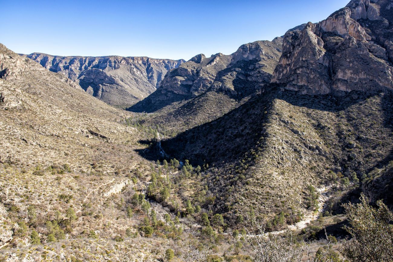
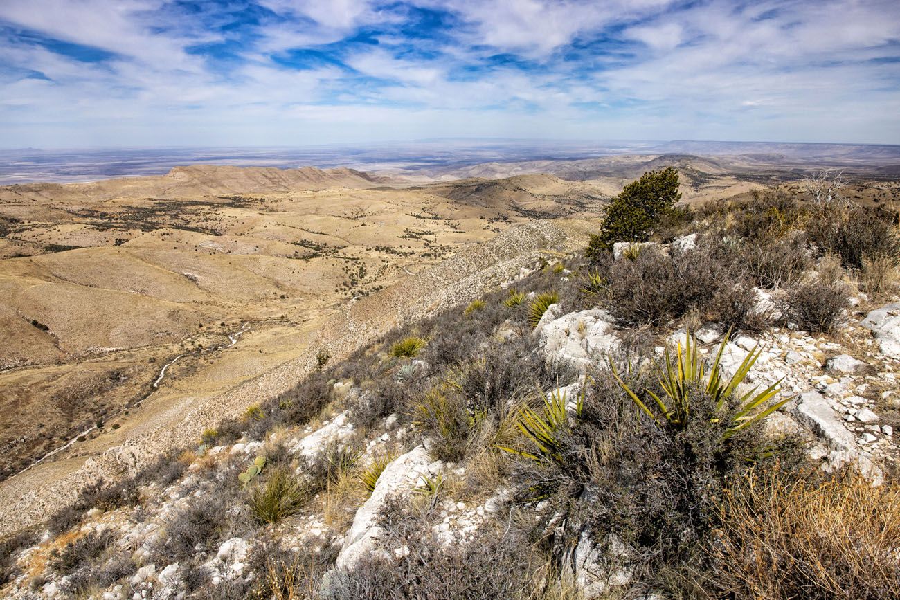
The Permian Reef Trail heads up onto Wilderness Ridge, the massive ridge that looms over McKittrick Canyon. It’s a tough hike to get up here, but on the way, you hike through a mini slot canyon and past unique rock formations. Once up on the ridge, the views are incredible.
The crowd levels on these two trails couldn’t be any more different. Over the course of almost 10 miles on the Permian Reef Trail, Tim saw 2 people. I, on the other hand, literally saw hundreds as I hiked back from the Notch to the parking lot.
Comparing notes and photos, Tim and I agree that the Permian Reef Trail is better than hiking the McKittrick Canyon Trail to the Notch. The views are better, the trail is more fun to hike, and there are far fewer people. The Permian Reef Trail is more challenging, since it climbs higher than the Notch, but the distance is about the same.
So, if you are trying to choose between the two, and you are looking for a trail with solitude and outstanding views, go for the Permian Reef Trail.
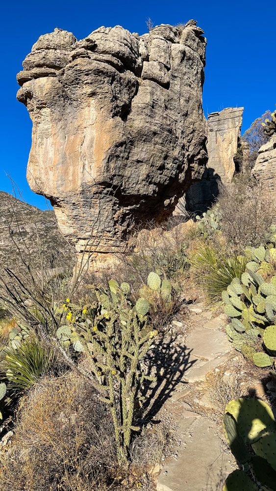
Rock formation on the Permian Reef Trail
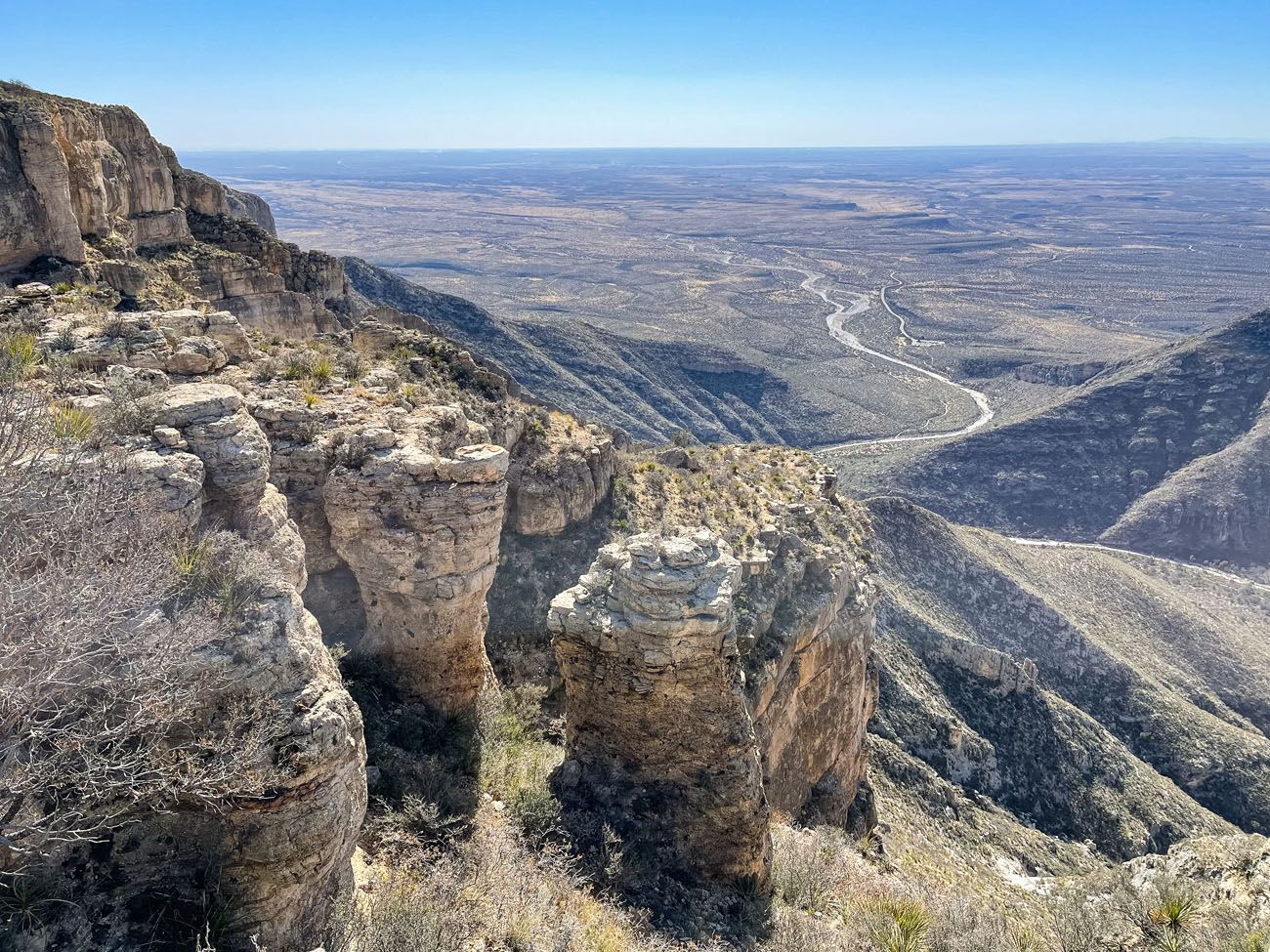
View from the Permian Reef Trail | Best Things to Do in Guadalupe Mountains National Park
Another view from the Permian Reef Trail | Best Things to Do in Guadalupe Mountains National Park
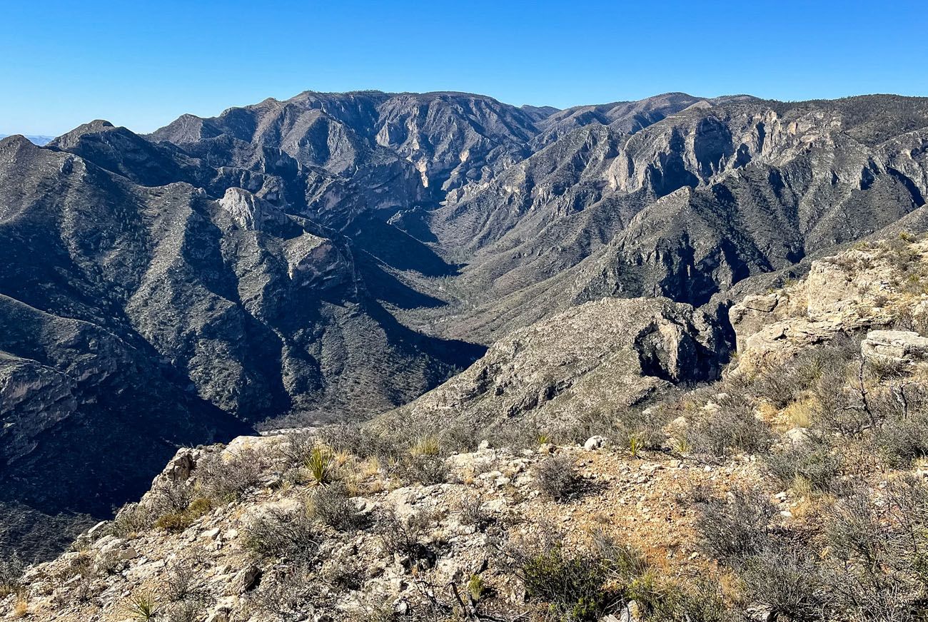
View of McKittrick Canyon from the Permian Reef Trail
McKittrick Nature Trail
Distance: 0.9-mile loop | Difficulty: Easy | Total Ascent: 250 feet | Time: 30 to 60 minutes
This loop trail briefly heads uphill for great views over McKittrick Canyon and to the Permian Reef. Signs along the trail identify the plants and animals that thrive in these desert conditions.
McKittrick Nature Trail | Best Things to Do in Guadalupe Mountains National Park
McKittrick Nature Trail | Best Things to Do in Guadalupe Mountains National Park
Things to Do in Dog Canyon
Dog Canyon is a remote area on the northern end of the park. To get here from Carlsbad, it is an hour and a half drive through ranches and tiny towns. It is a beautiful drive to get here and the road is paved the entire distance.
If you like the idea of leaving the crowds behind and going off-the-beaten-path, put Dog Canyon on your to-do list.
Hike the Tejas Trail to Lost Peak
Distance: 6.25 miles out-and-back | Difficulty: Moderate | Total Ascent: 1,650 feet | Time: 3 to 5 hours
There are several hiking trails that start in Dog Canyon and Lost Peak is the one that we did. We spoke to several park rangers, both at Pine Springs and Dog Canyon, and they all recommended Lost Peak as the top hike to do in this area.
Starting at the Dog Canyon Trailhead, hike the Tejas Trail to Lost Peak. At first, the trail is relatively flat and shady, as it heads through the canyon. About 1.5 miles into the hike, the trail starts its ascent up into the mountains and it is an uphill hike until you get to Lost Peak.
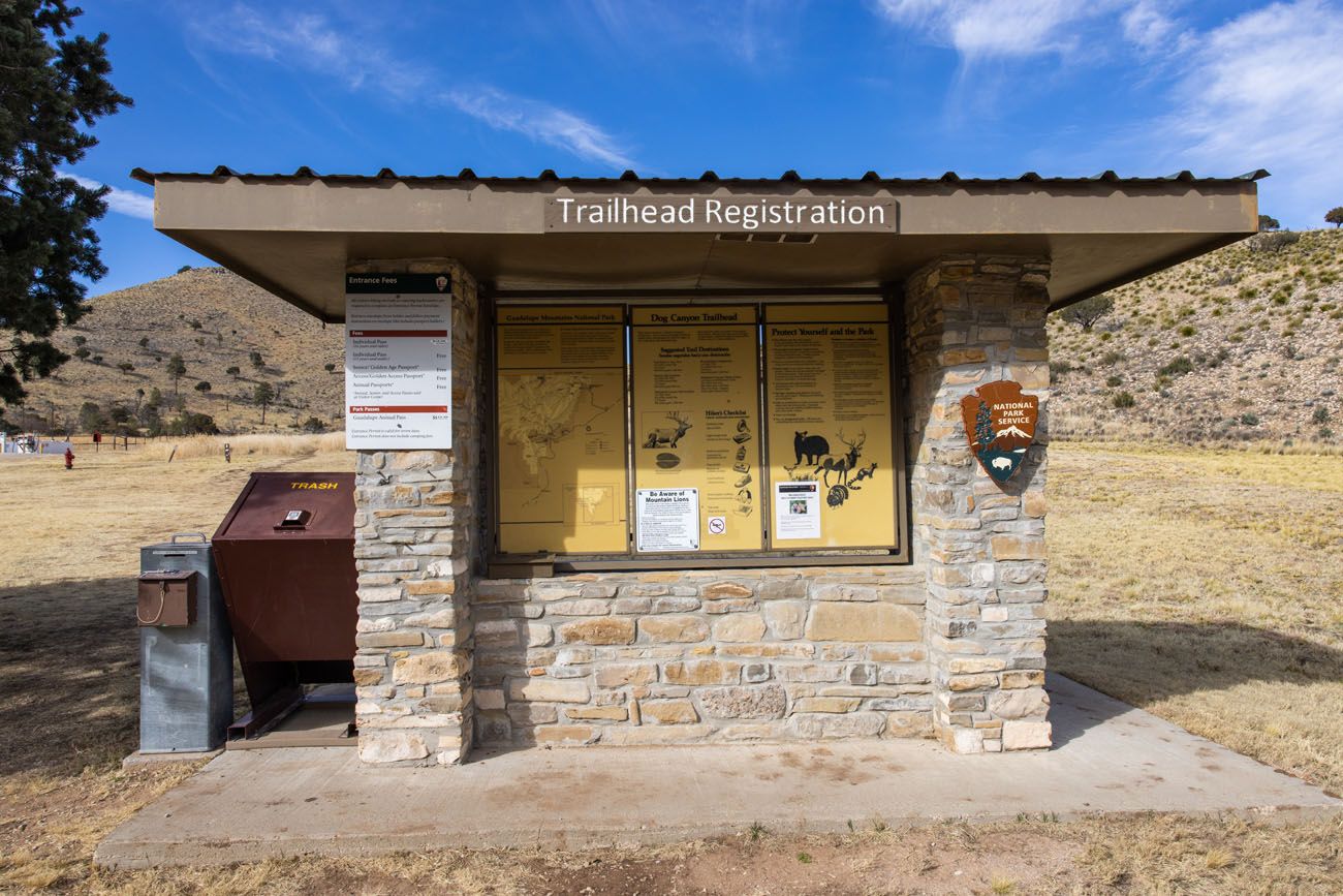
Dog Canyon Trailhead | Best Things to Do in Guadalupe Mountains National Park
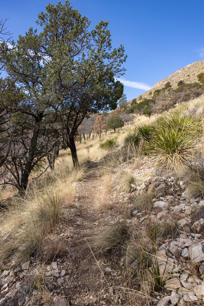
Tejas Trail | Best Things to Do in Guadalupe Mountains National Park
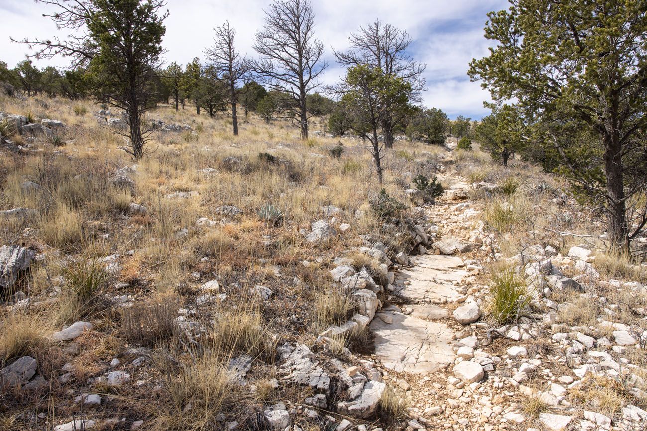
Tejas Trail closer to Lost Peak | Best Things to Do in Guadalupe Mountains National Park
There is no maintained trail to Lost Peak. The park ranger said that we would have to hike off trail to get to the peak.
Tim and I both wear Garmin Fenix watches and the trail maps show the location of Lost Peak, so we knew when and where to head off trail towards the peak. This is at about the 3-mile point. From the Tejas Trail, look to the right and you should be able to see the top of Lost Peak. It is marked with a large rock cairn.
View of Lost Peak from the Tejas Trail. If you look closely, there is a rock cairn marking Lost Peak.
We hiked through the brush to the peak, doing our best to keep our feet on the rocks so that we would not trample the plants. There are a lot of thorny shrubs so I recommend wearing lot pants to protect your skin.
From the top of the peak, enjoy the view. It’s not quite as good as Guadalupe Peak. However, it’s an easier hike and we saw a total of three people on this trail.
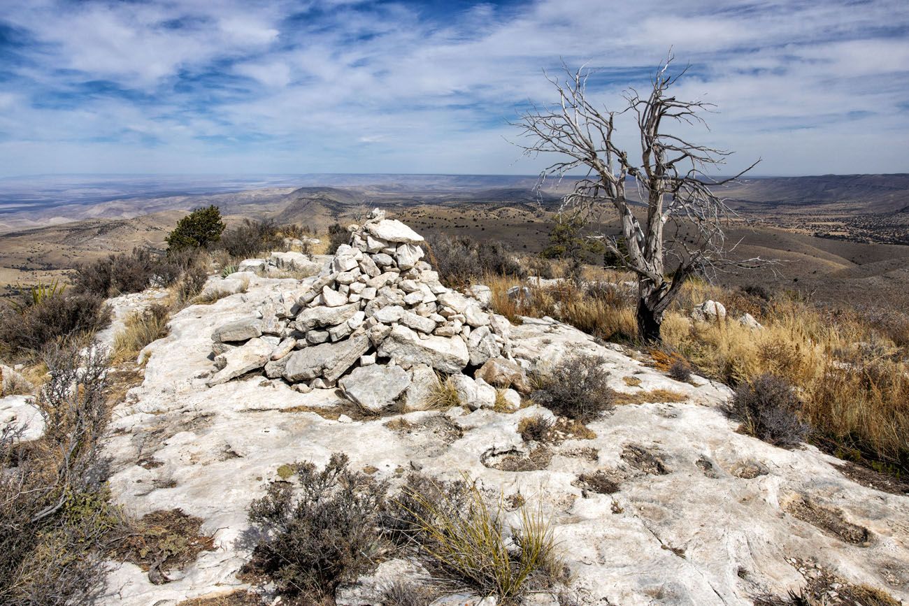
Lost Peak | Best Things to Do in Guadalupe Mountains National Park
View from Lost Peak | Best Things to Do in Guadalupe Mountains National Park
View of Dog Canyon on the return hike | Best Things to Do in Guadalupe Mountains National Park
McKittrick Canyon or Lost Peak? Of the two areas, Tim and I liked Dog Canyon more. We loved the remote feel of this part of the park. I liked Lost Peak more than hiking to the Notch…I liked the views more and loved that fact that we were almost totally on our own. However, Tim liked the Permian Trail more than Lost Peak.
Hike to Marcus Overlook
Distance: 5.2 miles | Difficulty: Moderate | Total Ascent: 825 feet | Time: 2 to 5 hours
This trail leads to a viewpoint of the western side of the Guadalupe Mountains.
We did not hike this trail. However, we met two backpackers on the Tejas Trail who hiked both to Marcus Overlook and Lost Peak. They told us that the view from Marcus Overlook was nice but Lost Peak was better. That also confirms what we were told by the park rangers.
However, the hike to Marcus Overlook is shorter, so if you don’t want to do a long hike, this is one to consider.
Visit the Salt Basin Dunes
This is another remote region of Guadalupe Mountains National Park.
The Salt Basin Dunes are gypsum dunes, similar to those at White Sands National Park. However, the dunes in Guadalupe Mountains are smaller and covered with vegetation.
HELP PROTECT THIS AREA: Since these dunes are covered with plants, sledding is not allowed on the Salt Basin Dunes. Areas of the dunes are covered in a cryptobiotic crust, a dark, crusty layer that is home to lichen and fungi that provide nutrients for the plants and help stabilize the soil. Do not step on this crust.
From the parking area, it is just over a 1-mile walk one-way to get to the dunes. This trail is flat and sandy. Since the Salt Basin Dunes sit at a lower elevation than the rest of the park, it will most likely be warmer here than at Pine Springs or McKittrick Canyon. There is no shade on the trail so bring water, sunblock, and sunglasses.
We didn’t walk far into the dunes, just far enough to take a few photos. This is one of my favorite parts of Guadalupe Mountains National Park. The views of the Guadalupe Mountains, the beautiful snow-white dunes, and low crowds make this one of the best things to do in Guadalupe Mountains National Park.
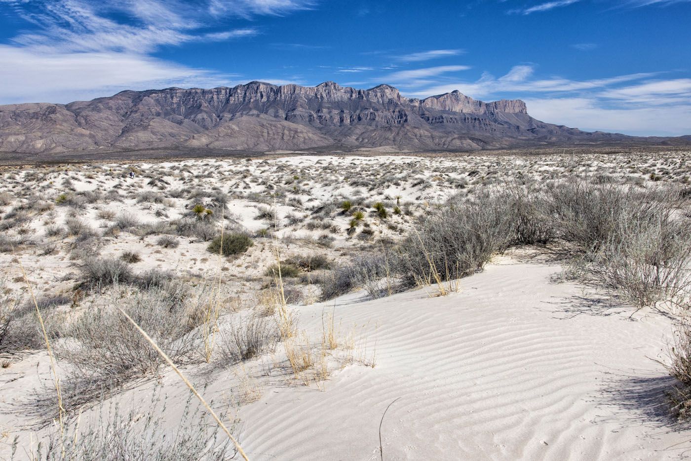
Salt Basin Dunes | Best Things to Do in Guadalupe Mountains National Park
GETTING HERE FROM PINE SPRINGS: From the Pine Springs Visitor Center, it takes an hour to drive here. Google Maps can route you to the dunes, just be aware that you will not have any cellular service once you leave the Pine Springs area. We did not have cellular service in and around the sand dunes. From Highway 62, turn right on FM road 1576 and take this for 17 miles. Turn right on Williams Road and take this for 7.5 miles. The road ends at the parking lot. Williams Road is a well-packed clay road but it can be impassable and slippery when wet.
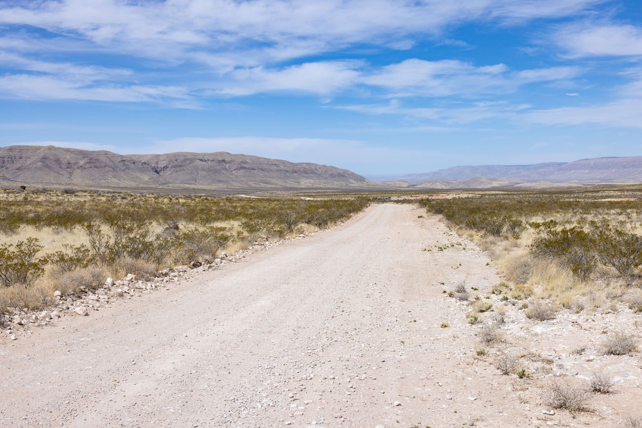
GETTING HERE FROM DOG CANYON: From Dog Canyon, you will drive on some very remote unpaved roads, but it is a lot quicker to go this way than heading to Carlsbad and driving US Highway 62/180 to get here. We used Google Maps, caching the maps while in Carlsbad (we did not have cellular service in Dog Canyon). The driving route is on our map above. The gravel roads are well graded and suitable for standard vehicles, just as long as it is not wet or raining. It took us 1 hour and 45 minutes to drive from Dog Canyon to the dunes (Google says it will take 2.5 hours). The first half of the drive is on a gravel road, then the road is a paved road until you get to Williams Road, which is a clay road. We had zero cellular service for the entire drive (know how to change a flat tire and have plenty of gas, food, and water if you plan to take this route). We did this drive in a Toyota Forerunner.
G008 in New Mexico
Visit Williams Ranch
Williams Ranch is a remote ranch located in the southwestern part of the park. To get here, you will drive on a very rough gravel road. A high-clearance 4×4 vehicle is a must, because of the large boulders and obstacles along this road.
We did not do this, since the road was closed for storm damage during our visit. Learn more about the road and get updates on its reopening here.
Go Backpacking
In Guadalupe Mountains National Park, there are 10 campsites in the designated wilderness. These campsites located along hiking trails that connect Dog Canyon, McKittrick Canyon, and Pine Springs. The trails that lead to these campsites are challenging hiking trails and you will need to pack enough food and water for your trip. Wilderness Use Permits must be obtained before you go. Learn more on the National Park Service website.
Our 6 Favorite Experiences
Out of that long list to do, what are really the best things to do in Guadalupe Mountains National Park?
To help you narrow it down, here are our six favorite experiences:
- Hiking to Guadalupe Peak
- Hiking to Devil’s Hall
- Hiking the Permian Reef Trail
- Visiting the Salt Basin Dunes
- Seeing El Capitan from the El Capital Lookout
- Visiting Dog Canyon and hiking to Lost Peak
Lost Peak | Best Things to Do in Guadalupe Mountains National Park
How Many Days Do You Need in Guadalupe Mountains National Park?
How many days to you need in Guadalupe Mountains National Park? The answer to that question really depends on what you want to get out of your visit.
If you simply want to hike to Guadalupe Peak, to brag that you stood on the Top of Texas, one day is all you need in Guadalupe Mountains National Park.
With two days, you can hike and explore two regions of the park.
But if you want to thoroughly explore the different regions of the park, then plan on spending at least three days here.
Here is our 3-day itinerary for Guadalupe Mountains National Park:
Day 1: I hiked the McKittrick Canyon Trail to the Notch while Tim hiked the Permian Reef Trail. I finished the Notch in 3.5 hours and Tim finished the Permian Reef Trail in 4 hours so we still had a lot of time left in the day. In the afternoon, we hiked the McKittrick Nature Trail together, then visited the El Capitan Lookout for photos, and walked to Manzanita Spring from the Frijole Ranch.
Day 2: Guadalupe Peak + Devil’s Hall hike (we combined these two hikes as a loop)
Day 3: Dog Canyon and the hike to Lost Peak in the morning. In the afternoon, we drove to and visited the Salt Basin Dunes, then drove to El Paso for a flight home the following day.
Highway 62/180 as it heads into Guadalupe Mountains National Park
Best Time to Visit Guadalupe Mountains National Park
In general, fall, winter and spring are great times to visit Guadalupe Mountains National Park. Temperatures are mild and you can avoid the high temperatures that occur during the summer months.
Here is what to expect by season:
SPRING: High temperatures range from the low 50’s to the high 60’s. This is one of the driest times to visit the park but you can have days with very high winds. On one of the three days we were here, wind gusts reached 45 mph, which can make hiking the Guadalupe Peak miserable and even a bit dangerous. March is one of the busiest times to visit the park since this coincides with spring break in Texas (in particular, the second week of March).
SUMMER: Since the park sits at 5,000 feet, daytime highs aren’t too bad. The average high at the peak of summer is in the high 80’s, but during a heat wave, the temperature can hit 100°F. This is also the wettest time to visit Guadalupe Mountains National Park.
FALL: High temperatures range from the 70’s to the 60’s, cooling off as it gets closer to winter. Rain chances are slightly higher in the fall than in the spring. But if you plan your visit for the end of October into early November, you can see the fall colors in the park.
WINTER: In the winter, temperatures are cool, usually sitting in the 50’s during the day. The weather is dry but there is a small chance the area could get a dusting of snow.
OUR VISIT IN MARCH: We visited Guadalupe Mountains on March 14, 15, and 16, 2022. This coincided with spring break. The park was crowded but we got an early enough start that the hiking trails were empty, at least until we began the return hike back to our car. We had beautiful weather, with it getting slightly warmer each day, with high’s ranging from the low 60’s to the low 80’s. On our first day in the park, winds were high so we hiked the McKittrick Canyon trails, which were more sheltered, and saved Guadalupe Peak for the next day when the weather was calmer.
Guadalupe Mountains National Park appears in our Best US National Parks Month-By-Month series as a great park to visit in March, April, and October.
How to Get to Guadalupe Mountains National Park
Guadalupe Mountains National Park is located in west Texas.
The closest major airport is the El Paso International Airport, and from here it takes an hour and 45 minutes to drive to the park. You can also fly in or out of the Midland International Air and Space Port in Midland-Odessa, Texas. From here, it is a 3 hour drive to the park.
Here are the driving distances and times from nearby destinations:
Carlsbad, New Mexico: 52 miles, 50 minutes
Carlsbad Caverns National Park: 40 miles, 40 minutes
Big Bend National Park: 275 miles, 5 hours
White Sands National Park: 190 miles, 3 hours
San Antonio, Texas: 460 miles, 7 hours
Dallas, Texas: 500 miles, 8 hours
USA Road Trip Idea
If you are looking for a cool road trip idea, you can combine Guadalupe Mountains National Park with Carlsbad Caverns, White Sands, and Big Bend National Parks. Check out our 10-day Texas New Mexico Road Trip Itinerary for more information.
How to Get Around Guadalupe Mountains National Park
To get around Guadalupe Mountains National Park, you will need a car. There is no public transportation or shuttle service in the park.
A standard vehicle is suitable if you plan to visit all areas of the park, including Dog Canyon and the Salt Basin Dunes. It is a clay road to get to the Salt Basin Dunes but a standard car will do just fine on this road, as long as it is not wet or raining.
The only reason why you would need a 4×4 is to drive to Williams Ranch.
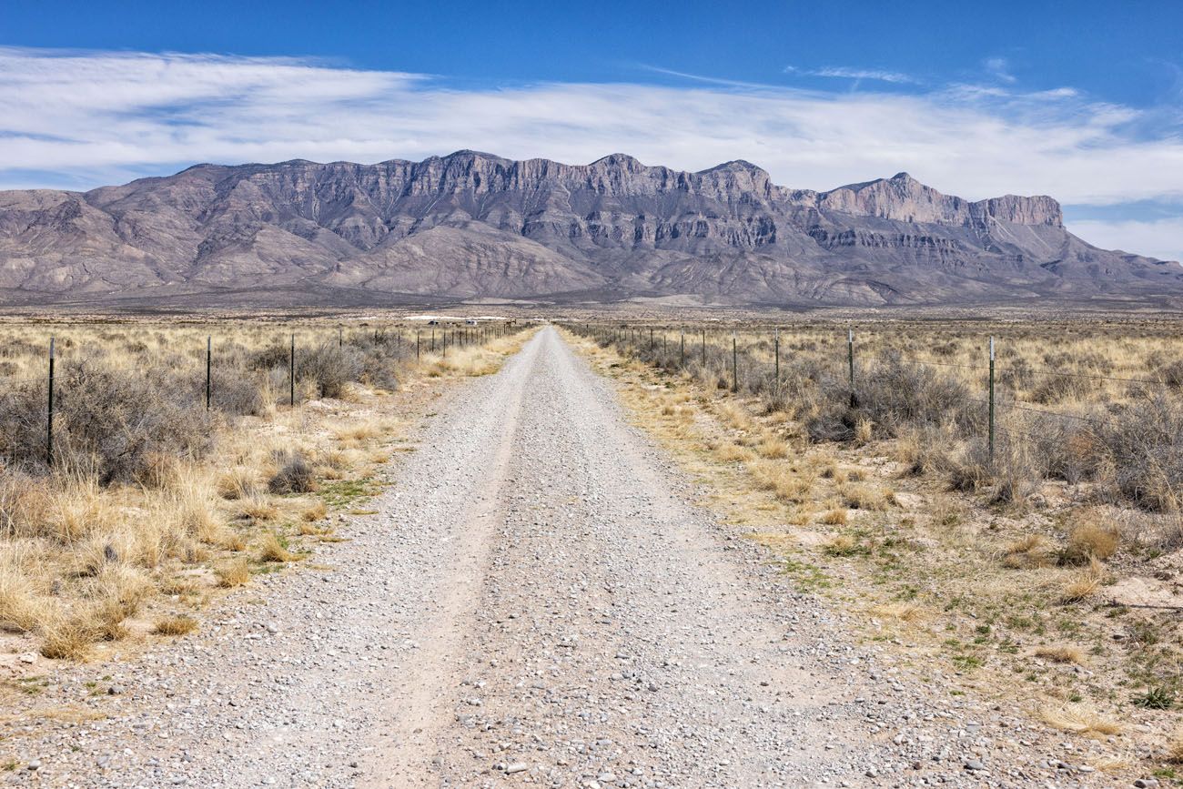
Road to the Salt Basin Dunes
Where to Stay
There is no lodging options or dining options in Guadalupe Mountains National Park. There are campsites (for tent camping and for RVs) at Pine Springs Campground and Dog Canyon Campground. Learn more here.
Outside of the park, the best place to stay is Carlsbad, New Mexico. From this town, it takes just under an hour to drive to Guadalupe Mountains National Park.
TownePlace by Marriott Carlsbad. This is where we stayed on both of our visits to Carlsbad. It is centrally located in town, so it’s just a quick drive to get dinner or go to the grocery store. Breakfast is included and this is one of the highest rated hotels in Carlsbad.
Home2 Suites by Hilton Carlsbad. This new property is located on the southern end of Carlsbad, making it faster to drive to Guadalupe Mountains and Carlsbad Caverns National Park. It sits outside of Carlsbad, so if you have plans to go to dinner in town, you will have a 10 to 15 minute drive, but staying here shortens your drive to the parks. Plus, it gets awesome reviews.
Post Time Inn. This is another new hotel that opened in 2020. Your stay includes breakfast, premium movie channels, and free laundry. This is a hotel that I would consider on a return visit to Carlsbad.
Where to Eat
Here are two restaurant recommendations, great spots to get dinner at the end of the day. We have eaten at both of these on both of our visits to Carlsbad. The Trinity Restaurant is our favorite of the two.
The Trinity Hotel Restaurant. This hotel serves excellent pasta dishes. We were lucky enough to get a table on the second level where we could overlook the restaurant and bar.
Yellow Brix Restaurant. This restaurant offers indoor and outdoor seating. They serve salads, steak, burgers, sandwiches and pasta. I had the Green Chili Fettuccini and it was delicious.
PRO TRAVEL TIP: Call and make a reservation in advance, especially if you will be visiting the area during peak season. During our second visit, the restaurants were turning people away or offering wait times of an hour or more.
Important Planning Information
Entrance Fee: $10 per person, valid for 7 days. This fee is paid using the green fee envelopes available at all trailheads (make sure you have the exact amount of cash for your group). Display the fee stub on your dashboard during your visit. If you have an America the Beautiful Pass, Senior Pass, or Military Pass, you do not have to pay the entrance fee; display the pass on your dashboard.
Hours of Operation: The park is open 24 hours a day, 365 days per year.
Cellular Service: The only place we had a decent cell signal was on top of Guadalupe Peak. In the remainder of the park, we had poor or no cellular service (we use Verizon).
Get updates on road conditions and trail closures, as you plan your trip and just before your visit, on the National Park Service website.
Where Are You Going Next?
If your visit is part of a bigger road trip through New Mexico and Texas, here is more information to help you plan your trip:
HIKES IN GUADALUPE MOUNTAINS: Learn how to hike to the “Top of Texas” our guide to Guadalupe Peak. The Devil’s Hall Trail is a fun hike to unique looking canyon. The Permian Reef Trail is an underrated hike to put on your list. We also have detailed guide on how to hike the McKittrick Canyon Trail to Pratt Cabin, the Grotto, and the Notch.
ROAD TRIP IDEA: Learn how to combine Guadalupe Mountains with White Sands, Carlsbad Caverns, and Big Bend National Park in our 10 day Texas Mexico Road Trip Itinerary.
CARLSBAD CAVERNS NATIONAL PARK: Carlsbad Caverns sits right beside Guadalupe Mountains National Park. Learn how to plan your visit in our article Best Things to Do in Carlsbad Caverns National Park.
BIG BEND NATIONAL PARK: Check out our Big Bend National Park Travel Guide for important travel information, sample itineraries, and how to plan your visit. Don’t miss our article Best Things to Do in Big Bend for great things to do in the park.
WHITE SANDS NATIONAL PARK: If your visit to Guadalupe Mountains National Park is part of a bigger road, White Sands National Park is a great place to add on to your itinerary.
NATIONAL PARKS BY SEASON: Guadalupe Mountains National Park appears in our Best US National Parks in March, Best National Parks in April, and Best National Parks in October articles. For more information about the best times to visit the national parks, check out our Best National Parks Month-by-Month Guide.
US NATIONAL PARKS: Looking for your next big adventure? Read our post Best National Parks, where we narrow down the long list into 15 must-see parks. You can also learn more about the national parks (and get the full list) in our Guide to the US National Parks.
Read all of our articles about the United States in our United States Travel Guide.
If you have any questions about the best things to do in Guadalupe Mountains National Park, let us know in the comment section below.
Note: This post contains affiliate links. When you make a purchase using one of these affiliate links, we get paid a small commission at no extra cost to you.
All rights reserved © Earth Trekkers. Republishing this article and/or any of its contents (text, photography, etc.), in whole or in part, is strictly prohibited.
Comments 8
I’ve looked at All Trails…How do you combine Guadalupe Peak and Devils Hall as a loop?
Thanks!
Traci
Author
In our guide to Guadalupe Peak, we lay out how to add on Devils Hall Trail, which includes a map. Have a great hike! Cheers, Julie
I can feel the thrill of embarking on the challenging hike to reach the summit of Guadalupe Peak, the highest point in Texas.
Hi! I am planning a 50 day road trip this summer, and this area is on my list. I have two full days to spend between Carlsbad Caverns and Gaudalupe Mountains. I would like to squeeze in two of the larger hikes in — I think I should be in good enough shape to bear all of those miles. That being said, how were the temperatures/weather? In other words, is it remotely safe to attempt gaudalupe mountain or Permian reef trail in the afternoon, or would it be far too hot/are there afternoon t-storms?
Author
In the summer, it will be very hot in the afternoon. The average temperature for that area in the summer is 96 degrees Fahrenheit but it could easily be hotter than that. And thunderstorms are a possibility as well. Here is a link to the Carlsbad weather in July so you know more what to expect. If you want to hike, it’s best to do it first thing in the morning, starting at sunrise or a little earlier. Visit Carlsbad Caverns in the afternoon, since that stays cool all day/all year. We were here in March and the weather was pleasant. I hope you have a great road trip! Cheers, Julie
So sorry for the late response — thanks for the information! And as an aside, EarthTrekkers has been such a huge help in planning my roadtrip. Thanks for all the great information about the parks! Best, John
We are planning a trip using your itinerary (backwards) in March 2023 (you do such a great job explaining places and have great ideas!). We will be hiking with our two boys (ages 23 and 14) in Big Bend and think it makes the most sense to stay at Chisos Basin Lodge for convenience. However, the Willow House in Terlingua looks so cool. Would staying there be inconvenient? Which lodging do you recommend between those two?
Author
You will have a little more driving to do if you stay in Terlingua than Chisos Basin, but you will have more restaurants to choose from for dinner and potentially better internet connectivity, if that matters. We stayed outside of Big Bend NP, near Terlingua for 2 nights and at the Lajitas Golf Resort for two nights, which is farther away than Terlingua. So, if you don’t mind some extra time driving, stay in the Willow House. Have fun in Texas!! Cheers, Julie