
The Damnation Creek Trail is our favorite hike in Del Norte Coast Redwoods State Park. It’s a short but challenging hike, with a trail running through old-growth redwood forests out to a picturesque beach.
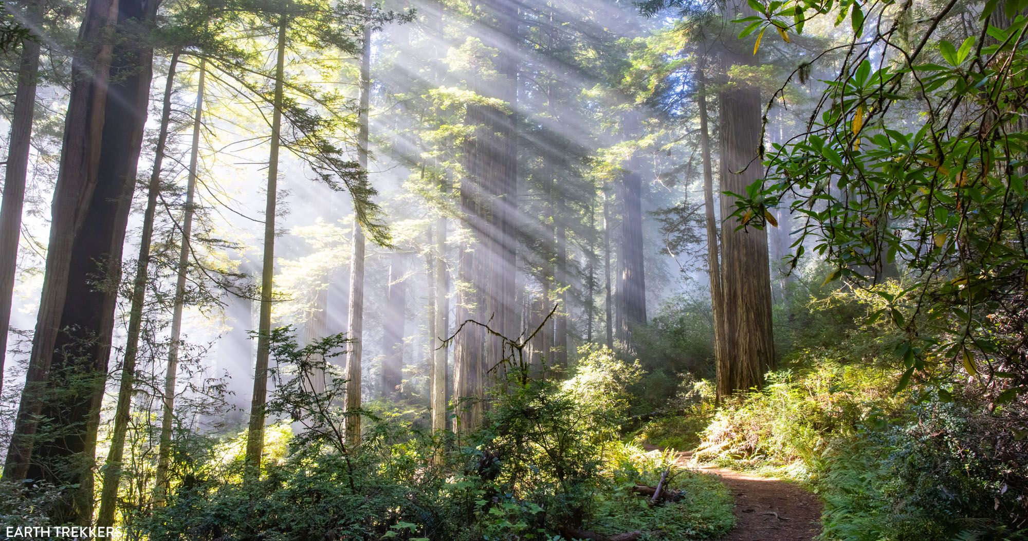
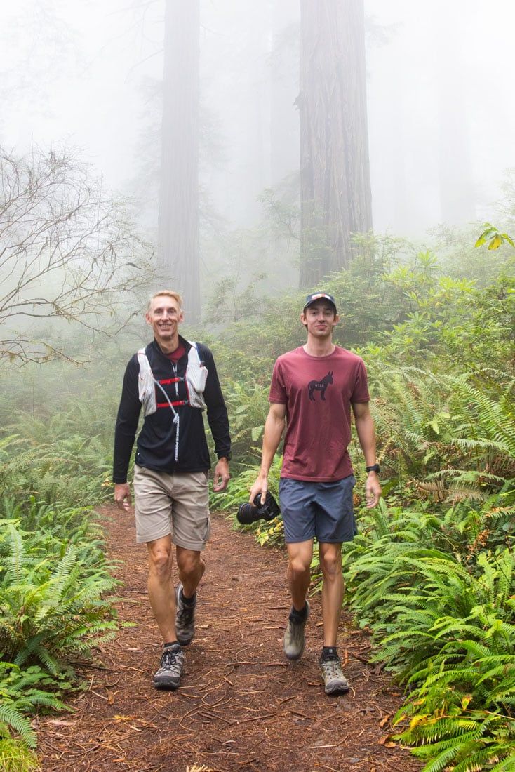
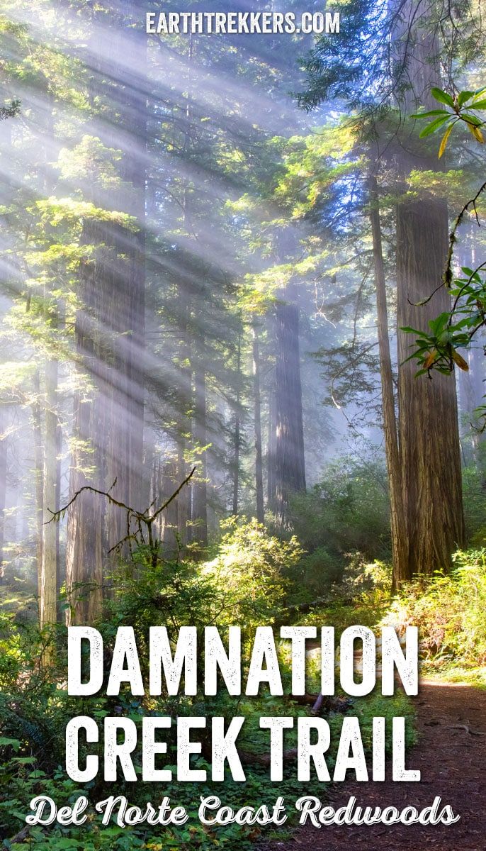
We hiked the Damnation Creek Trail on a September morning, and it quickly became one of our favorite experiences in Redwood National and State Parks. A mix of morning fog and heavenly sun rays created fantastic lighting as we snapped hundreds of photos. You’ll see how much lighting can change the environment in our pictures of the trail.
The Damnation Creek Trail is a hike that combines stunning redwood forests with a secluded beach and views of a rugged, rocky coastline. It is a tough hike, but the stunning views make it worthwhile. This trail is the best hike in Del Norte Coast to see old-growth redwood trees.
Below is our detailed guide to hiking the Damnation Creek Trail. You’ll find trail stats, a step-by-step trail guide, tips to have the best experience, and more.
If you’re just starting to plan your visit, take a look at our Guide to Redwood National and State Parks, which pulls together all of our Lassen articles in one place, and our guide to Del Norte Coast Redwoods, which lists additional things to do in this state park.
Damnation Creek Trail Hiking Stats, Elevation Profile & Map
Distance: 4.0 miles (6.4 km) round trip
Total Ascent: 1,300 feet (400 meters)
Lowest Elevation: 0 feet (0 meters)
Highest Elevation: 1,080 feet (330 meters)
Difficulty: Moderate to strenuous
Time: 2 to 3 hours
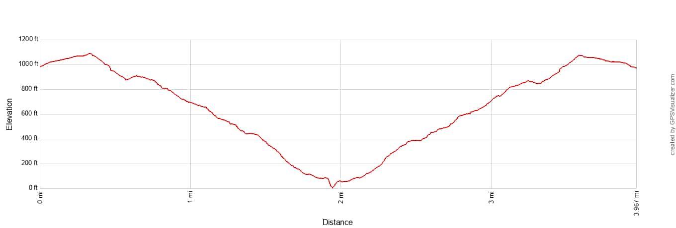
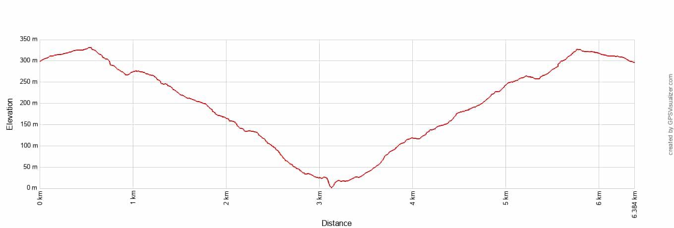
Damnation Creek Trail Elevation Profile
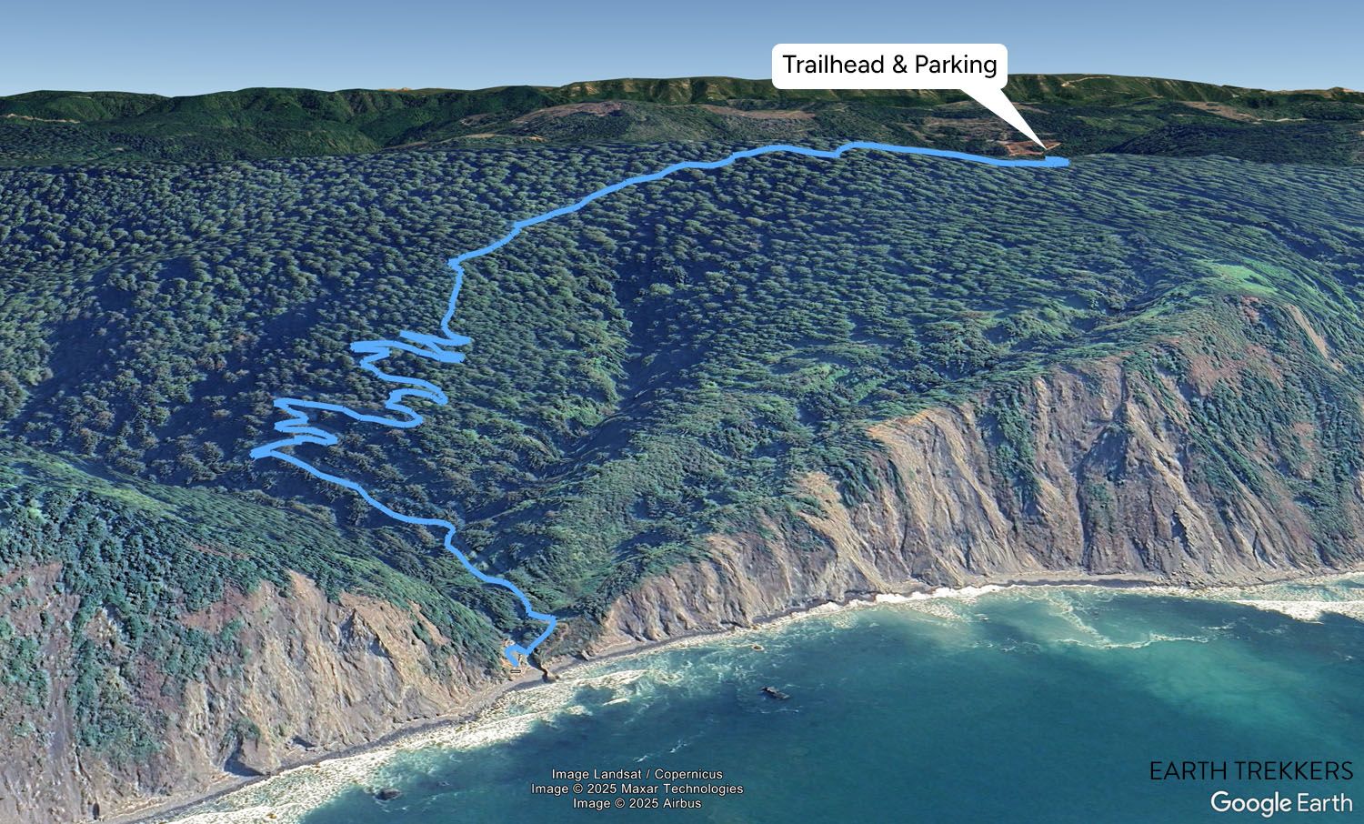
Damnation Creek Trail Map
Please practice the seven principles of Leave No Trace: plan ahead, stay on the trail, pack out what you bring to the hiking trail, leave areas as you found them, minimize campfire impacts, be considerate of other hikers, and do not approach or feed wildlife.
Damnation Creek Trail: Step-By-Step Guide
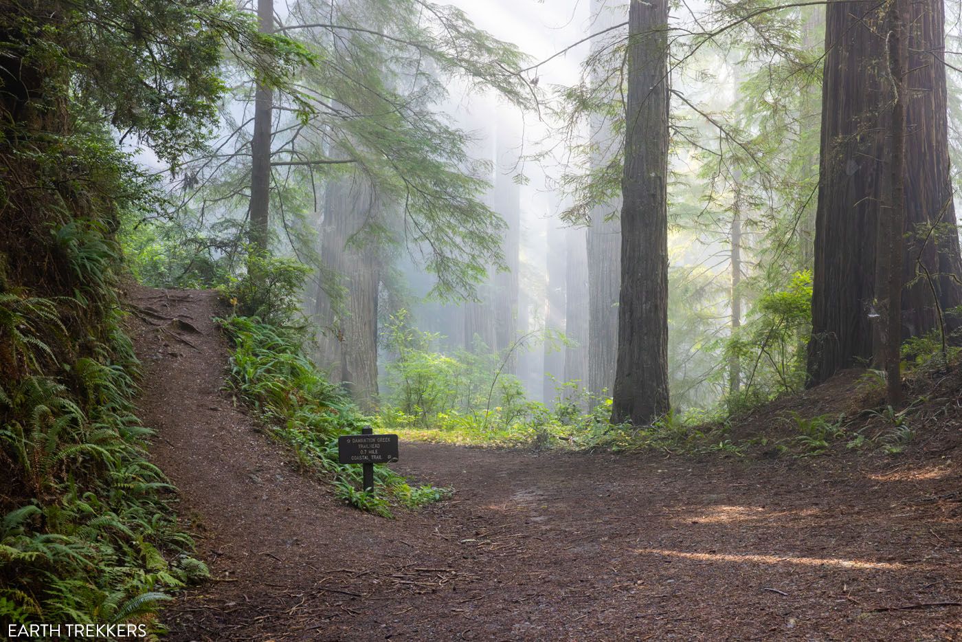
Where to Park & Trailhead
The Damnation Creek Trailhead is located on U.S. Route 101, the main highway that leads through the state park. There’s a small gravel parking lot here that’s directly off the road. This lot can be easy to miss when you’re driving up the highway, especially since there are no signs pointing to it.
Using Google Maps (or your preferred map service), route to “Damnation Creek Trailhead,” or you can use these GPS coordinates: 41°38’53.4″N 124°06’48.0″W.
If you’re traveling from the south, the trailhead is just after a bend in the road. We almost missed the turn into the parking lot on our visit, so drive slowly and stay alert.
There’s a handful of parking spaces here, and we drove past it several times over several days, and the lot was hardly ever full. We arrived at 8:15 am on a September morning and saw no one here. In fact, we had the entire trail to ourselves, and it was only when we returned to the parking lot two hours later that we saw hikers starting to file in.
There’s a large wooden trail sign at the north end of the parking lot. It’s here that you’ll find the official start to the trail. Please note that there are no bathrooms available at the trailhead.
The Start of the Hike
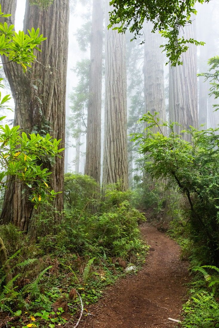
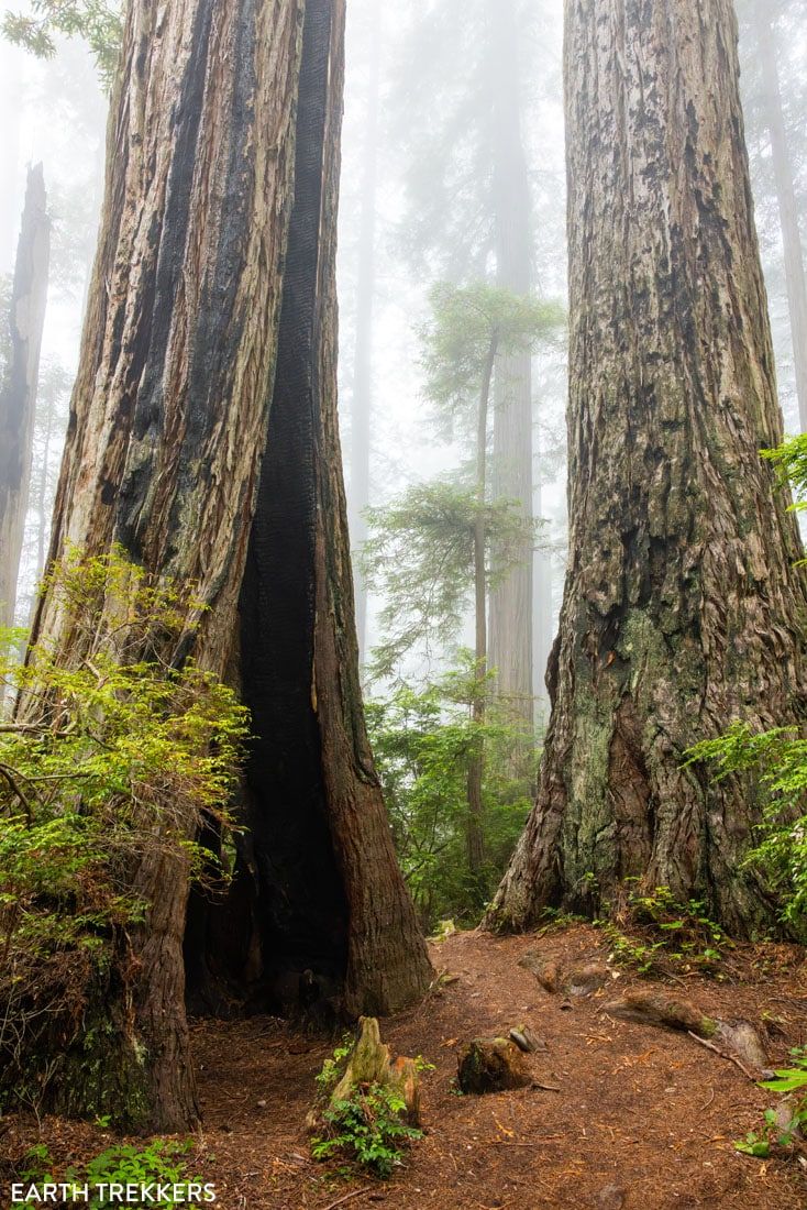
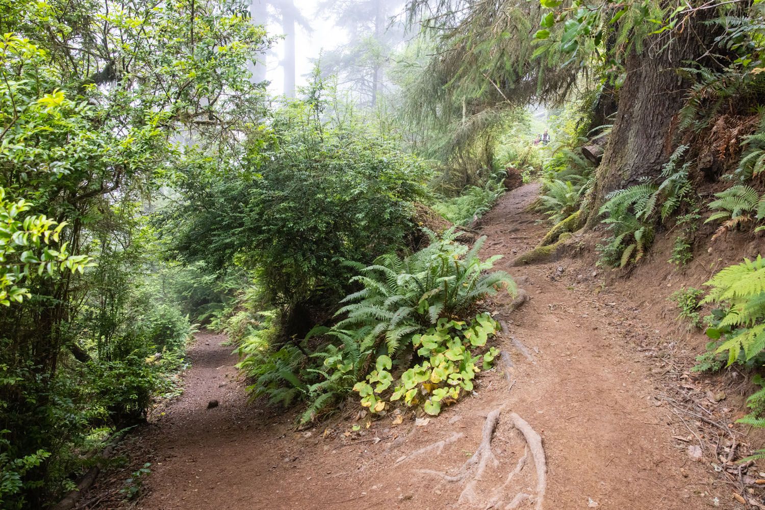
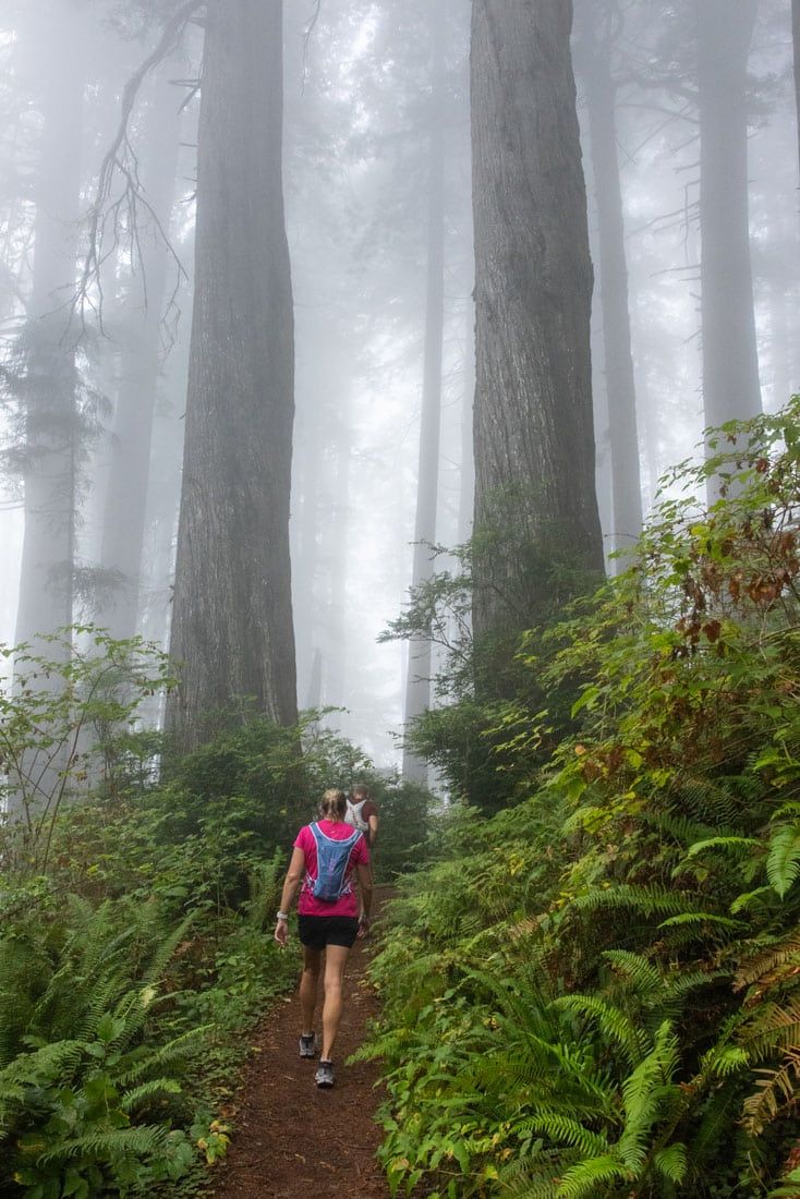
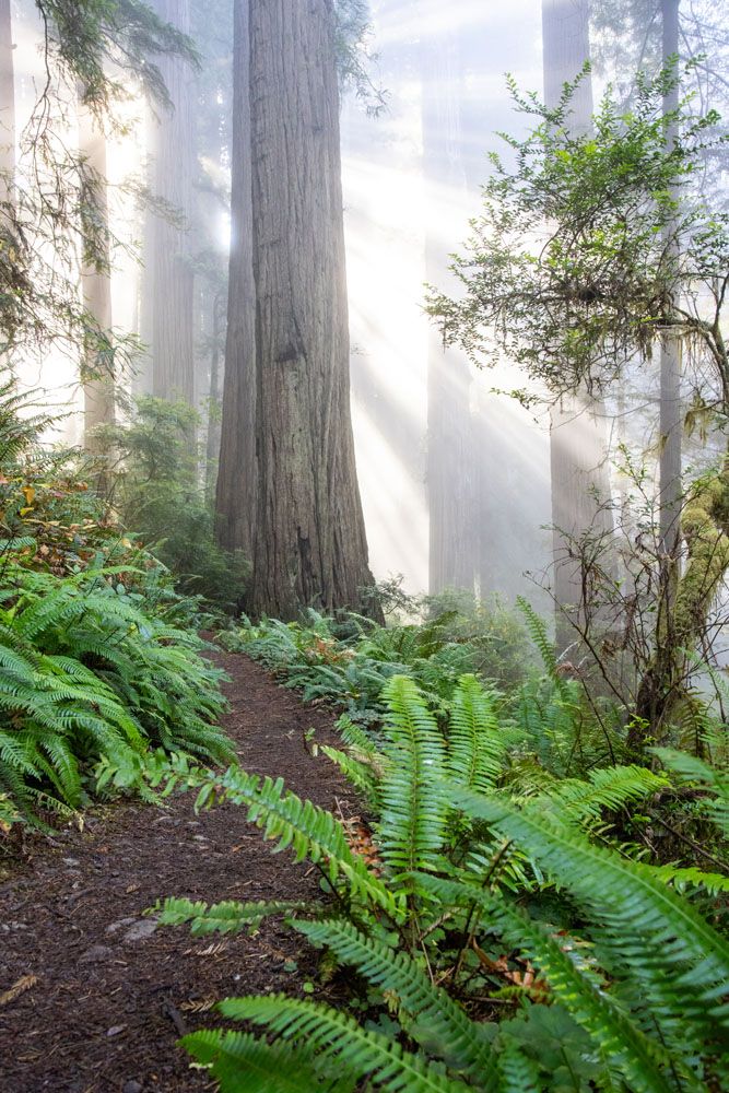
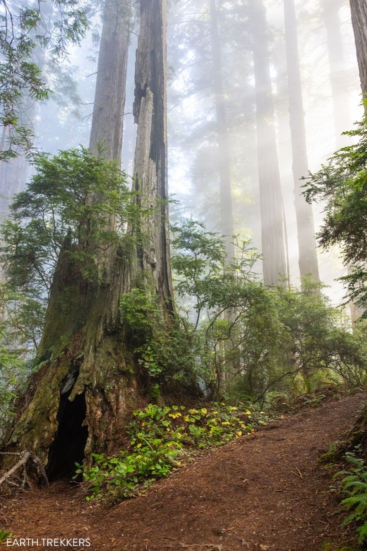
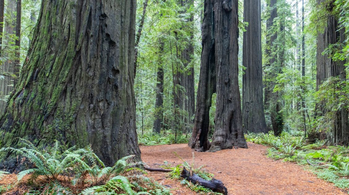
The trail starts off very scenic, winding through a giant redwood grove. Almost immediately, you’ll be treated to great views of this old-growth forest. Trees tower hundreds of feet high, with some trunks wide enough to fit a person inside. This initial part of the trail is mostly flat, with minor ups and downs to warm you up.
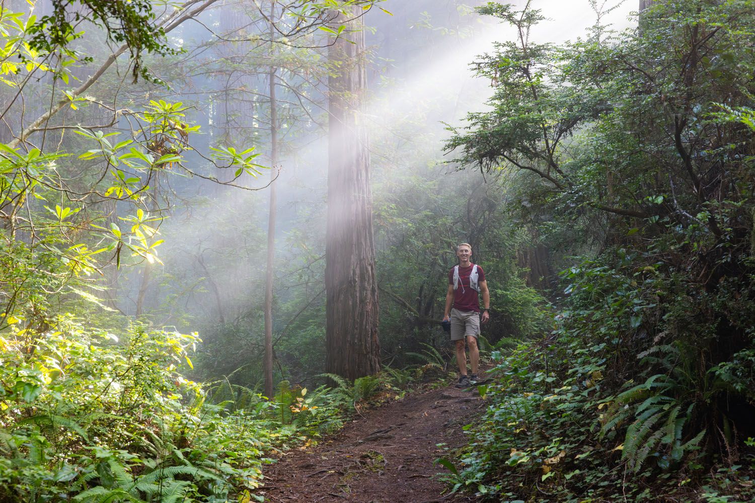
When we started this hike early in the morning, a thick layer of fog covered the forest. Sometimes, we could barely see the trees ahead. On any other trail, we might have been disappointed by the low visibility, but not here. The fog gave everything a mysterious atmosphere and made wandering this forest trail even more enjoyable.
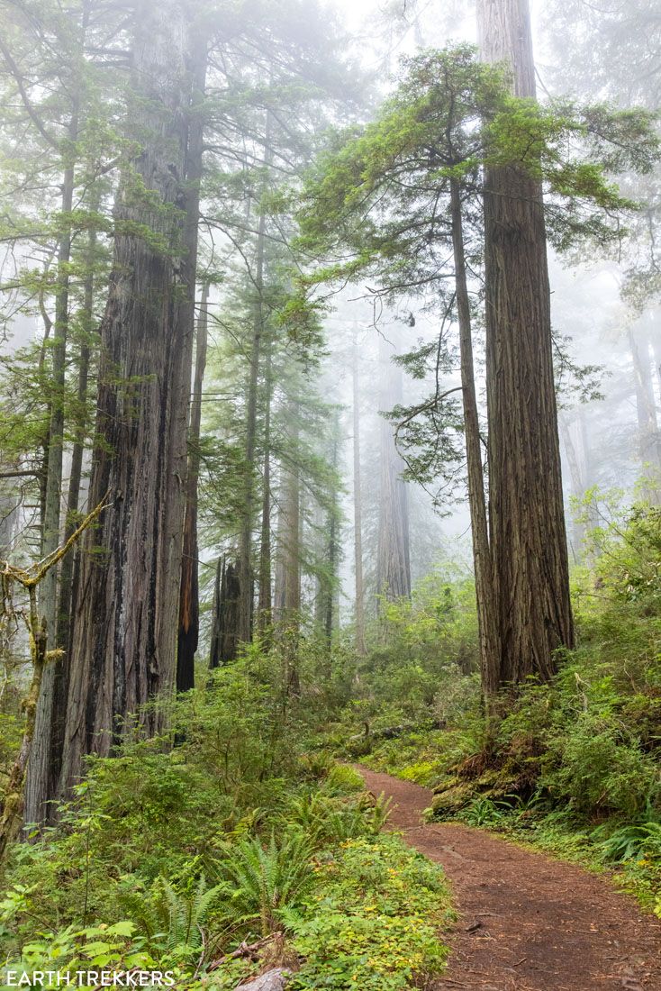
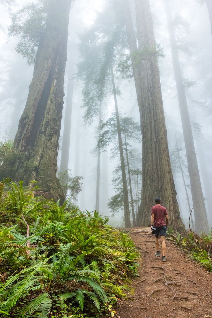
The trail itself is well-defined and easy to follow. You’ll hike along a rugged dirt path that leads through the forest before descending to the shore below. Expect to see lots of tiny tree roots covering the trail, so make sure to watch your step. We enjoyed the rugged feel of this trail, which provided a more natural experience of exploring the redwood forest.
The Big Descent
At 0.75 miles, you’ll cross over the Coastal Trail. This will be a much wider and flatter trail, but it’s not the trail you want. Continue across for a few steps and hang a left to stay on the Damnation Creek Trail.
Damnation Creek Trail and Coast Trail intersection
From this point, your descent starts to get steeper. You’ll already have walked through an impressive section of redwood forest, so if you’re short on time or want an easier hike, this trail crossing makes for a good turnaround point. Otherwise, continue on the Damnation Creek Trail as you descend down to the beach.
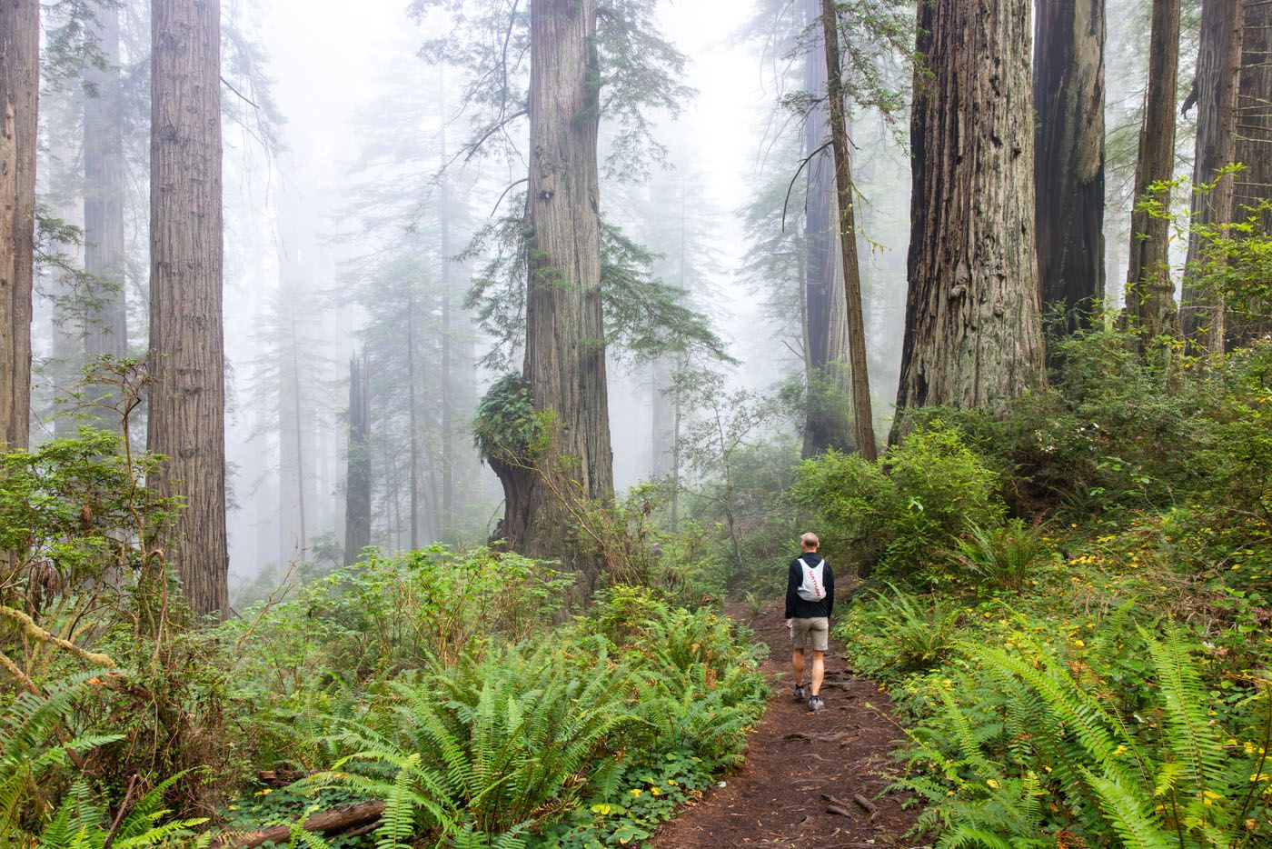
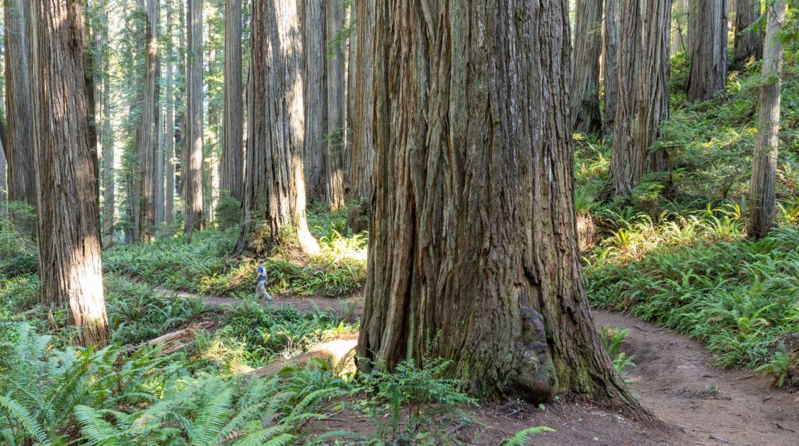
The descent begins gradually but quickly becomes steeper. You’ll follow a series of switchbacks that descend the hillside, especially as you get lower. The trail also narrows and becomes more rugged from this point. There were times when I had to watch my step to avoid tripping over tree roots.
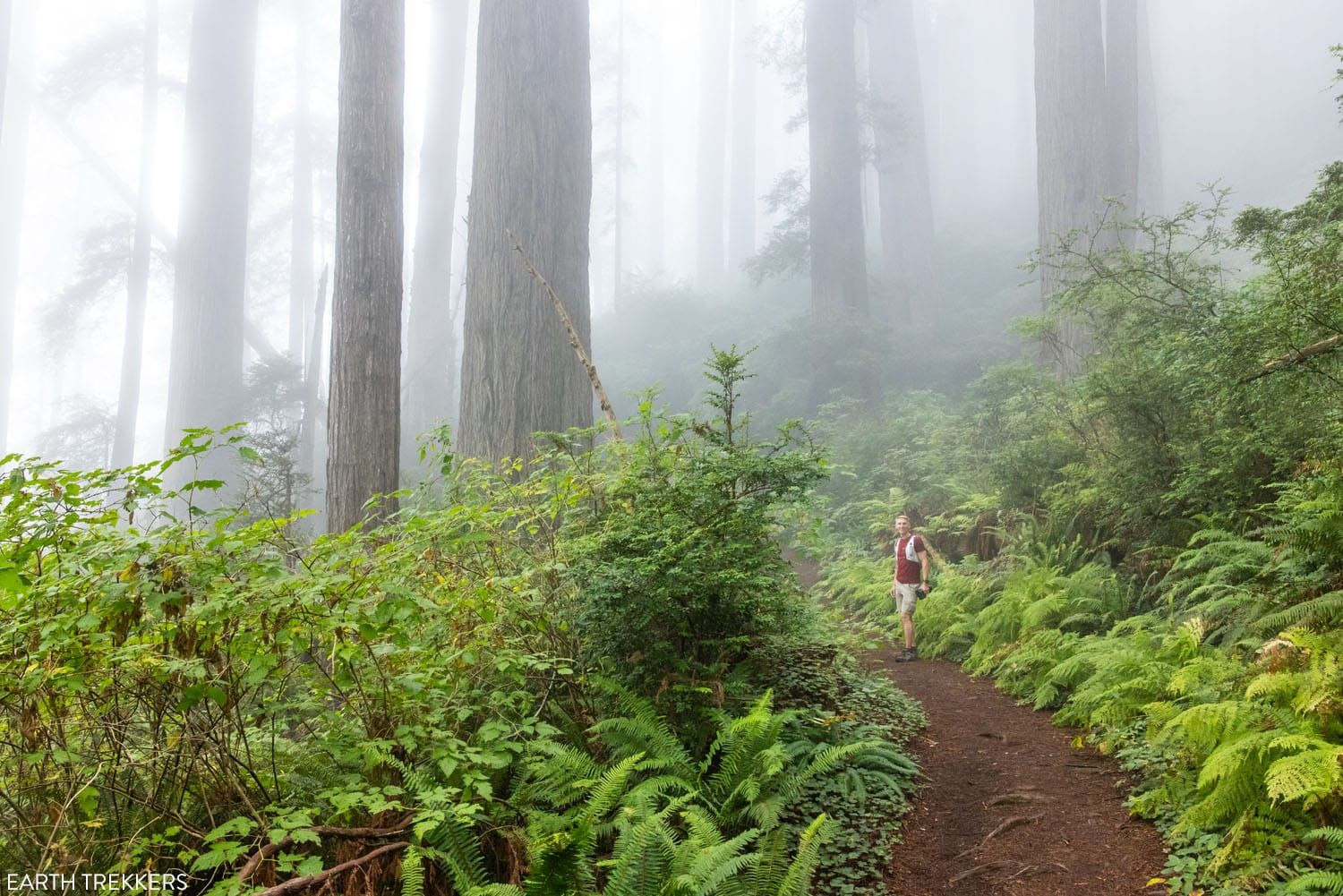
As we descended, the massive redwoods grew sparser, and giant ferns and thick overgrowth covered the forest floor. The landscape looked increasingly lush as we approached the ocean. It felt like we were wandering through Jurassic Park. Well, minus the dinosaurs, of course.
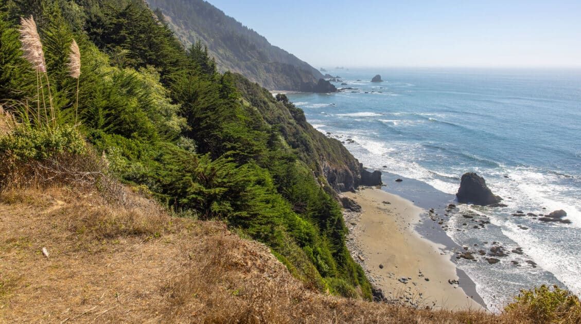
The descent continues to go on for a while, with switchback after switchback. You can tell you’re getting closer to shore when you can hear the waves. By the 2-mile mark, you’ll get your first look at the ocean as the trail flattens out and exits the forest.
On the Beach
A few minutes past this point, you’ll reach your end destination: a secluded, rocky beach with clear views out over the ocean. We had the entire beach to ourselves when we hiked here. With the morning fog and the emptiness of the beach, it felt like we were discovering something new.
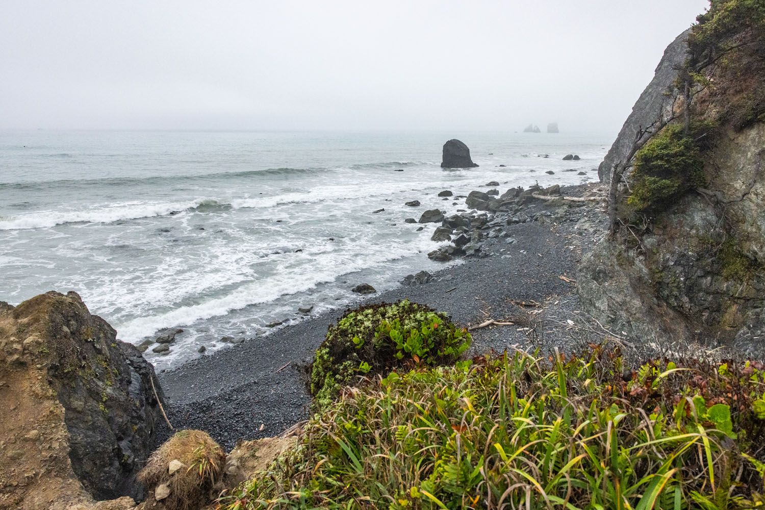
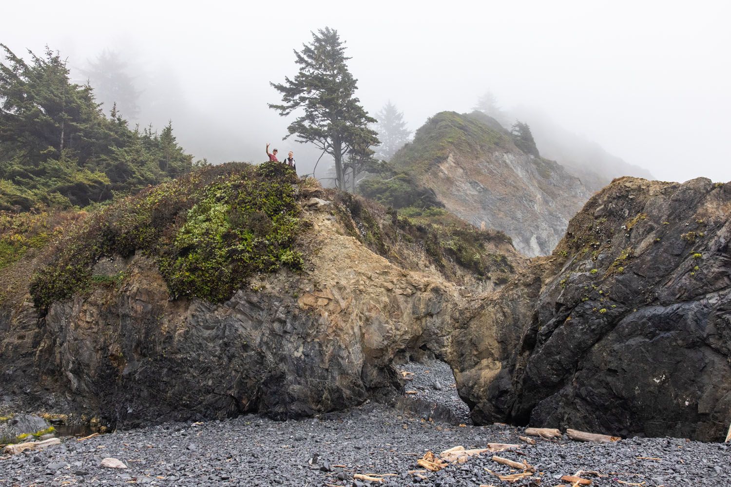
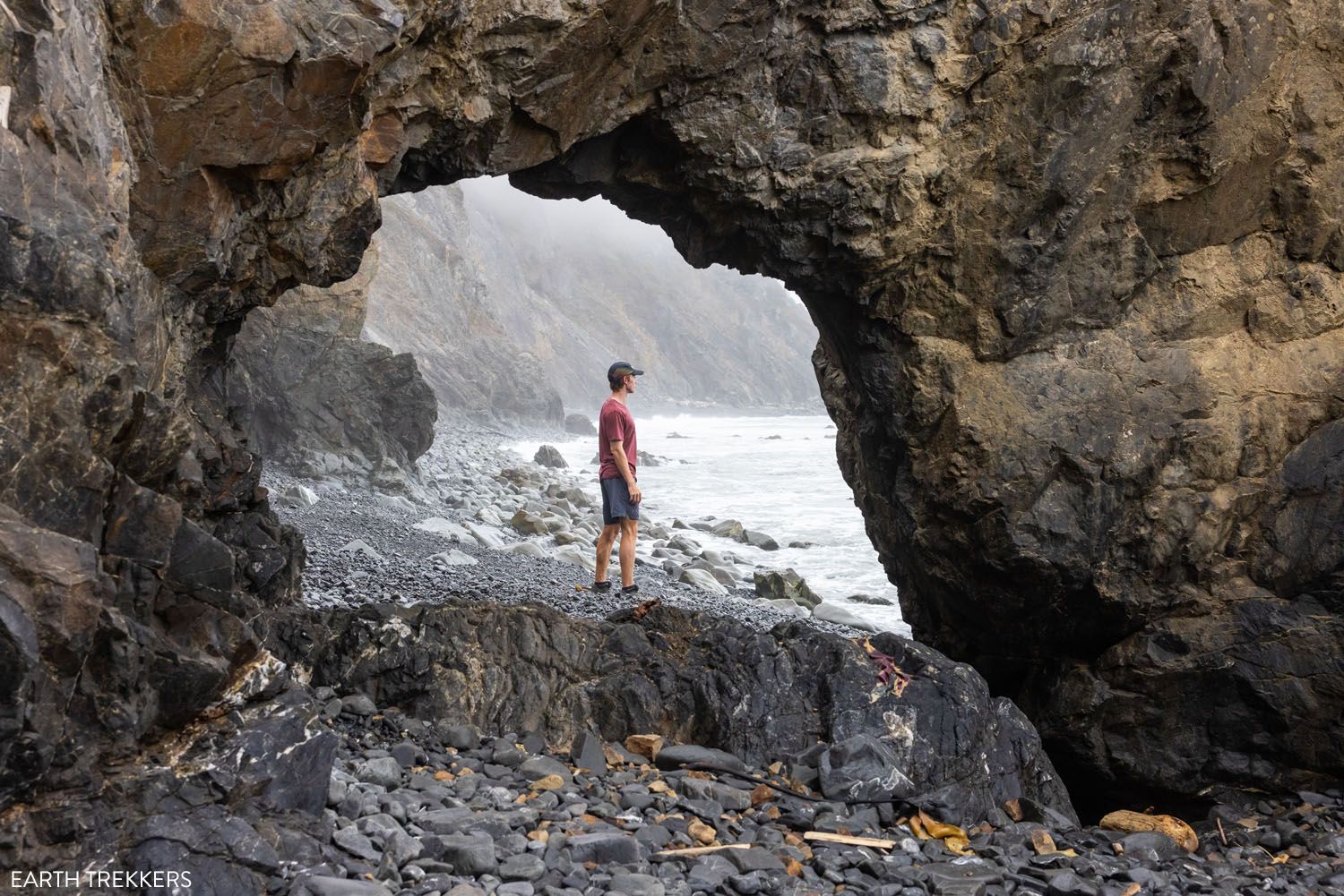
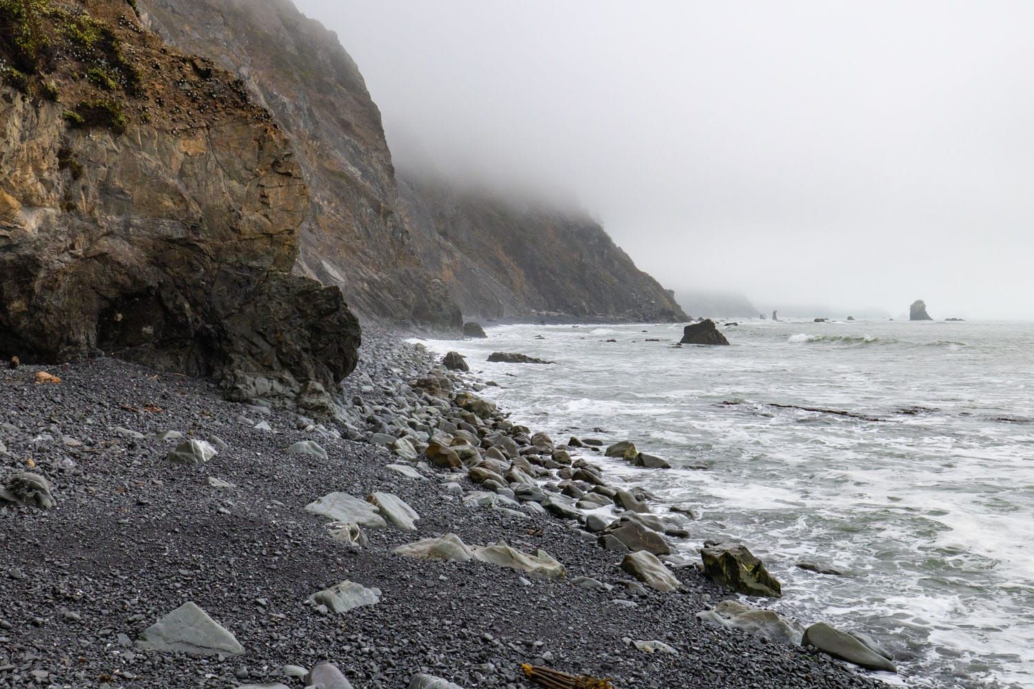
This is a cool beach to visit with or without other hikers. Giant sea rocks emerge from the ocean, breaking the waves as they approach the shore. The beach itself is rocky, with some bits of driftwood that have floated onto land. While you’re here, consider walking along the beach or enjoying a snack while watching the waves.
Hikers are advised not to swim in the ocean. Waters can become rough, and temperatures may be cold. Rip tides and strong currents can also be dangerous. Leave your bathing suit at the hotel today.
The Return Hike
Enjoy your time down on the beach, and when you’re ready, follow the trail back up the hillside. We hope you enjoyed your easy downhill walk while you could! Here comes the hard part: a steady, constant climb back to the trailhead.
This ascent is challenging, with a little over 1000 feet of elevation gain in just 2 miles. It’s a constant and steady climb most of the way back to the parking lot.
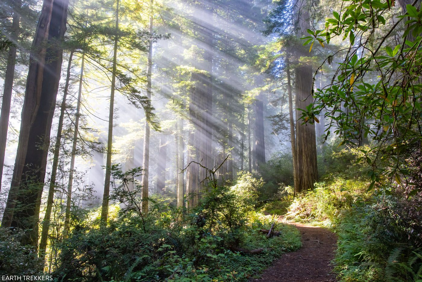
As we neared the top, we were met with a magical mix of lighting that transformed the trail. It was late enough in the morning for the sun to rise high above the forest, piercing through the fog. The area was bathed in streaks of bright, heavenly rays that danced among the trees. It was as if the gates of Heaven had opened right in front of us. It’s quite ironic too, given that the trail is called the Damnation Creek Trail! 😂
Seeing the forest this way turned the Damnation Creek Trail into one of our favorite redwood experiences. The last half mile took us so long to complete because we stopped every minute to take more pictures. Here are the highlights:
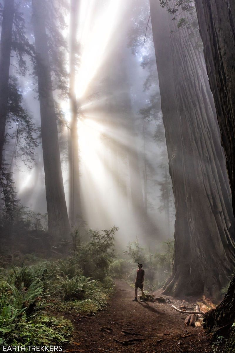
It’s difficult to predict whether the trail will be lit like this, but the time of day you visit can help. We started the hike at 8:15 am and finished at 10:30 am. This was in mid-September, when the sun starts to rise a bit later in the day.
Things to Do After the Hike
There are plenty of great trails and things to do in Del Norte Coast Redwoods National Park after your hike. Spend some more time wandering redwood groves, hike out to several beaches, or go for a scenic coastal drive.
If you want more coastal action, drive the Coastal Drive Loop out to High Bluff Overlook for one of the best viewpoints within the state park. Closer to Crescent City, hike the Coastal Trail down to Endert Beach, a large sandy beach with stunning coastal views.
If you want to spend more time amongst redwoods, visit Trees of Mystery. Although not officially within the state park, this redwood forest-turned-amusement park is worth a visit with its convenient location, especially if traveling with younger kids.
Our Top Tips for the Damnation Creek Trail
When is the Best Time of Day to Do this Hike?
This hike can be done at any time of day, but we recommend starting in the early morning. Morning fog can give a mystical appearance to the forest, not to mention the rising sun casting rays of light. We started our hike at 8:15 am in mid-September, and the morning weather helped make the Damnation Creek Trail one of our favorite redwood experiences.
When is the Best Time of Year to Hike the Damnation Creek Trail?
The best time to hike the Damnation Creek Trail is between April and October. At this time of year, moderate temperatures and low rainfall lead to the best hiking conditions. Even in the summer, high temperatures rarely break 70°F (21°C).
Will I Have Cellular Service?
We had minimal cellular service along the Damnation Creek Trail. For most of the hike, our phones were on SOS, but at brief moments, we’d have enough service to send a text. We don’t recommend relying on your phone to send texts, emails, or pictures until after you finish the hike.
What Should I Bring on the Damnation Creek Trail?
We recommend packing a camera, hiking shoes with good grip, and at least one liter of water per person. The trail is a moderate descent along a dirt path, but the terrain can get slippery when wet. For this reason, it’s best to wear shoes that can handle the trail.
What is the Best Hike in Del Norte Coast?
This question depends on what you’re interested in seeing. If you want to hike past towering redwood trees, the Damnation Creek Trail is the best hike in the park. If you want a short coastal walk out to a sandy beach, the Coastal Trail down to Endert Beach may suit you better. For us, the Damnation Creek Trail was our favorite hike, as it featured the most impressive redwood grove in the state park, but it also has some beach access.
If you have any questions about how to hike the Damnation Creek Trail, let us know in the comment section below.
Plan Your Trip to California
Below are more of our guides on Redwood National and State Parks, plus nearby places to visit in California and Oregon.
Complete Guide to Del Norte Coast Redwoods State Park
Discover the best things to do in Del Norte Coast Redwoods State Park, including a one-day itinerary covering the top spots and nearby attractions. Welcome to Del Norte Coast, a California state park that features ancient redwood trees and dramatic coastlines. As part of the Redwoods National and State Parks, you can get up close […]
How to Plan a Trip to Redwood National & State Parks
Redwood National and State Parks Home to some of the tallest trees on Earth, Redwood National and State Parks protect some of the last remaining groves of old-growth coastal redwoods. Wallking amongst these giants feels like stepping into another world. Trees reach heights over 300 feet tall and some are more than 2,000 years old. […]
Avenue of the Giants: Best Things to Do, Photos & Helpful Tips
Discover the best things to do along the Avenue of the Giants, complete with a map and photos. The Founders Grove is not to be missed, but you can also drive through a redwood tree and go off the beaten path, walking quieter, lesser-known trails through the old-growth forests. Avenue of the Giants is one […]
5 Amazing Things to Do in Jedediah Smith Redwoods State Park
Jedediah Smith Redwoods State Park is our favorite of the Redwood National and State Parks. In this guide, we’ll share our must-do hikes and scenic drives, plus how to see the best of the park with a one day itinerary. Jedediah Smith Redwoods is one of the four parks that make up Redwoods National and […]
Best US National Parks to Visit Month-By-Month
Best National Parks to Visit Month-By-Month When planning a trip to the national parks, one of the most important things to consider is the time of year that you are planning your visit. With a few exceptions, most national parks have an optimal time to visit, based on factors such as weather, crowd levels, and […]
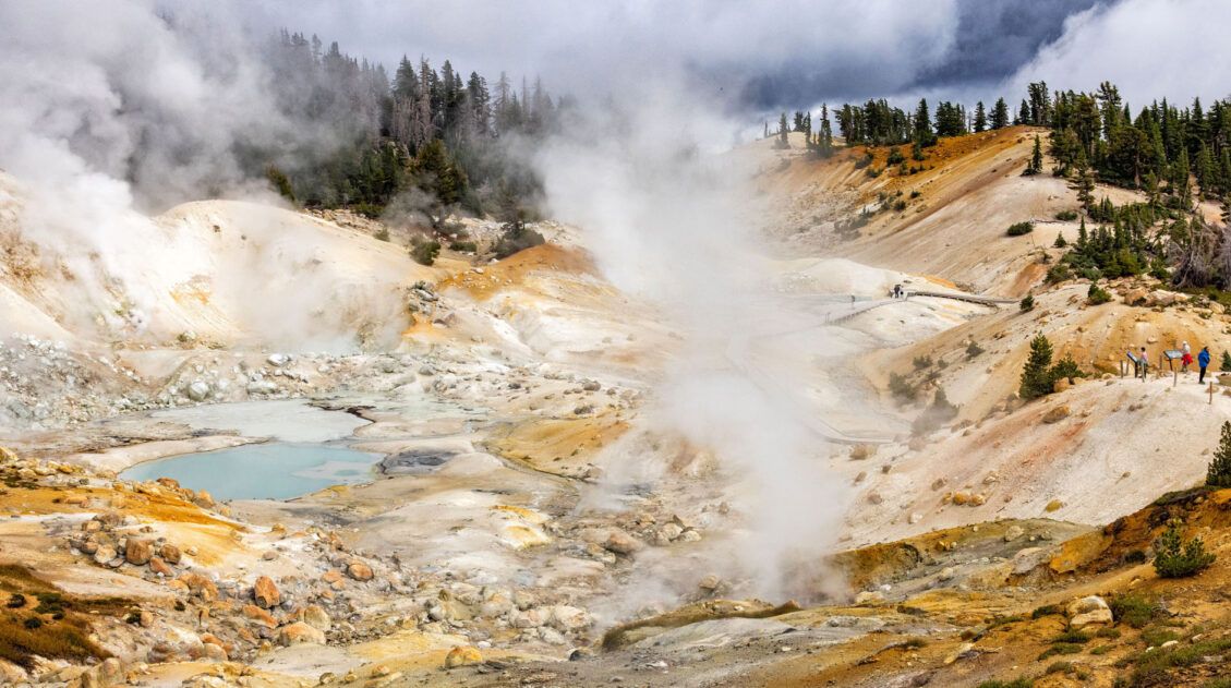
The Bumpass Hell Trail, An Essential Hike in Lassen Volcanic
Welcome to Bumpass Hell, a dynamic thermal region with an unforgettable name. The largest hydrothermal area within Lassen Volcanic National Park, Bumpass Hell amazes visitors with its giant steam vents, bubbling mud pots, and colorful, otherworldly landscapes. The Bumpass Hell Trail is one of the most popular trails in Lassen Volcanic National Park. It’s easy […]
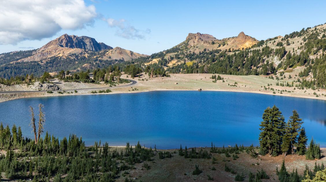
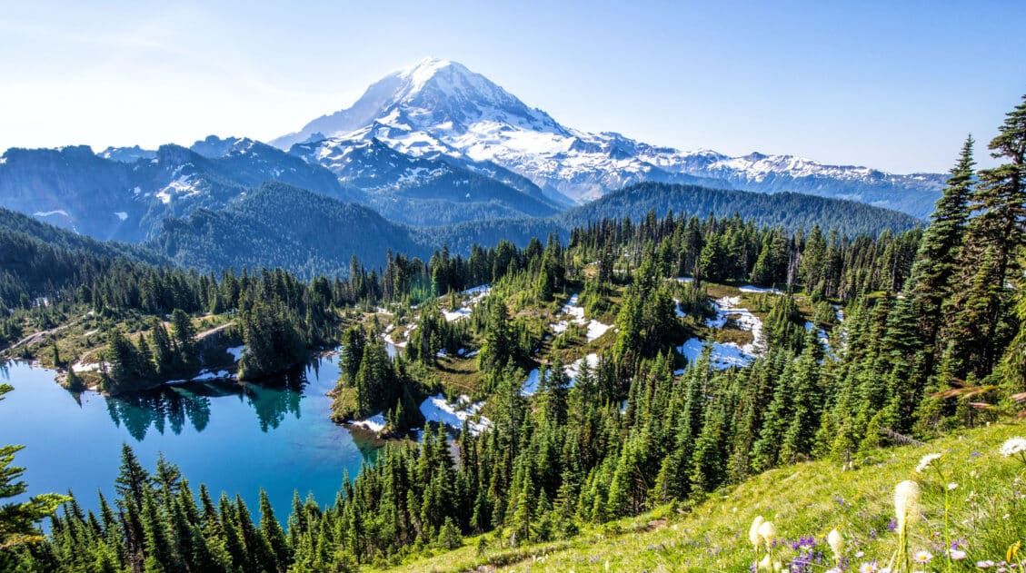
The Ultimate Guide to Lassen Volcanic National Park
Lassen Volcanic National Park With steaming fumaroles, boiling hot springs, and volcanoes galore, Lassen Volcanic is an underrated gem amongst Californian national parks. Here you can hike to the summit of active volcanoes, wander through bubbling hydrothermal basins, and explore landscapes carved by lava flows. Lassen Volcanic is a paradise for hikers, photographers, and road […]
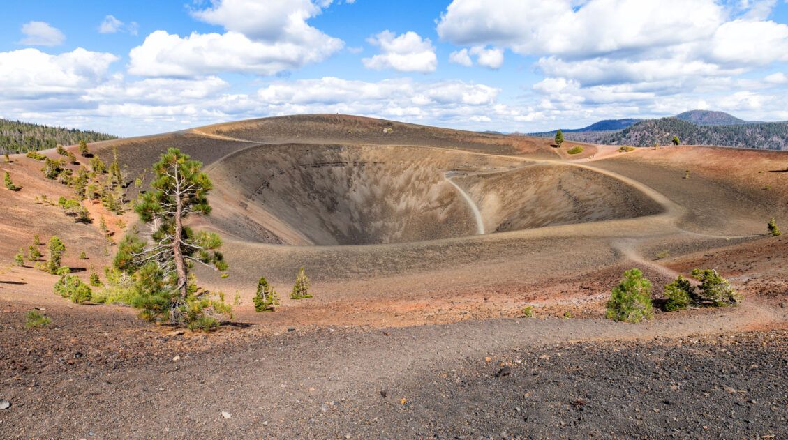
Cinder Cone Trail, The Coolest Hike in Lassen Volcanic
In Lassen Volcanic National Park, there’s no shortage of volcanoes to see. Highlights include the iconic Lassen Peak, massive lava rocks, and steaming hydrothermal features like Bumpass Hell. For a less crowded hike that highlights historic lava flows and offers sweeping views from an extinct volcano, put the Cinder Cone Trail on your list. This […]
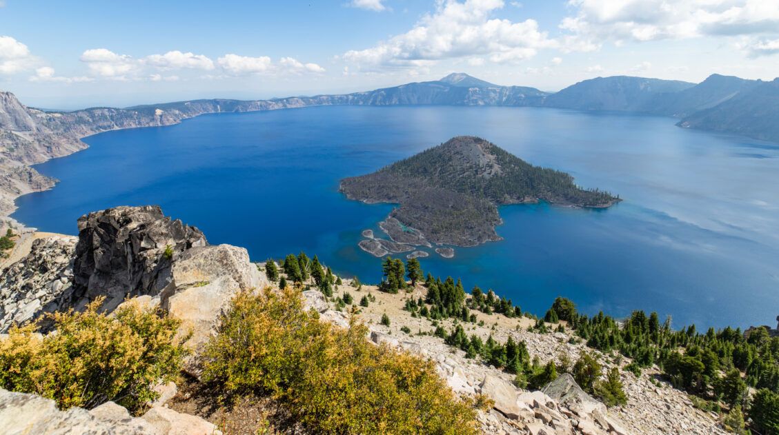
16 Best Things to Do in Crater Lake National Park
Discover the best things to do in Crater Lake National Park, including its top viewpoints, scenic drives, and hiking trails. One day is enough to see the highlights, but more time allows you to hike another trail or two. Home to the deepest lake in the United States, Crater Lake amazes visitors every year with […]

25 Best Things to Do in San Francisco
What’s the first thing that comes to your mind when you think of San Francisco? The Golden Gate Bridge? The legend and the stories of Alcatraz? Cable cars climbing up and down the steep hills of the city? San Francisco is a big city, filled with lots of things to do. It has a colorful […]
The Ultimate Guide to the 63 US National Parks
Stretching from the South Pacific, across the United States to the Caribbean, are 63 national parks. These national treasures preserve iconic landscapes, majestic mountains, primordial forests, arid deserts, misty coastlines, immense canyons, wildlife, and historic landmarks. The opportunities for adventure are endless. Hiking, rock climbing, rafting, mountain biking, sand boarding, horseback riding, mountaineering, canyoneering, and […]
United States Travel Guide: Places to Visit in the USA
Plan your visit to the United States. Learn about the best things to do, how to plan your time, road trip ideas, and sample itineraries.
US National Park Itineraries & Road Trip Ideas
National Park Itineraries Need help planning the perfect national park itinerary? Get ideas for your next road trip, including single and multi-day itineraries for the US national parks. Road Trip Itineraries One Day National Park Itineraries If you only have one day, what should you do? Here are detailed one day itineraries for the national […]

Leave a Comment