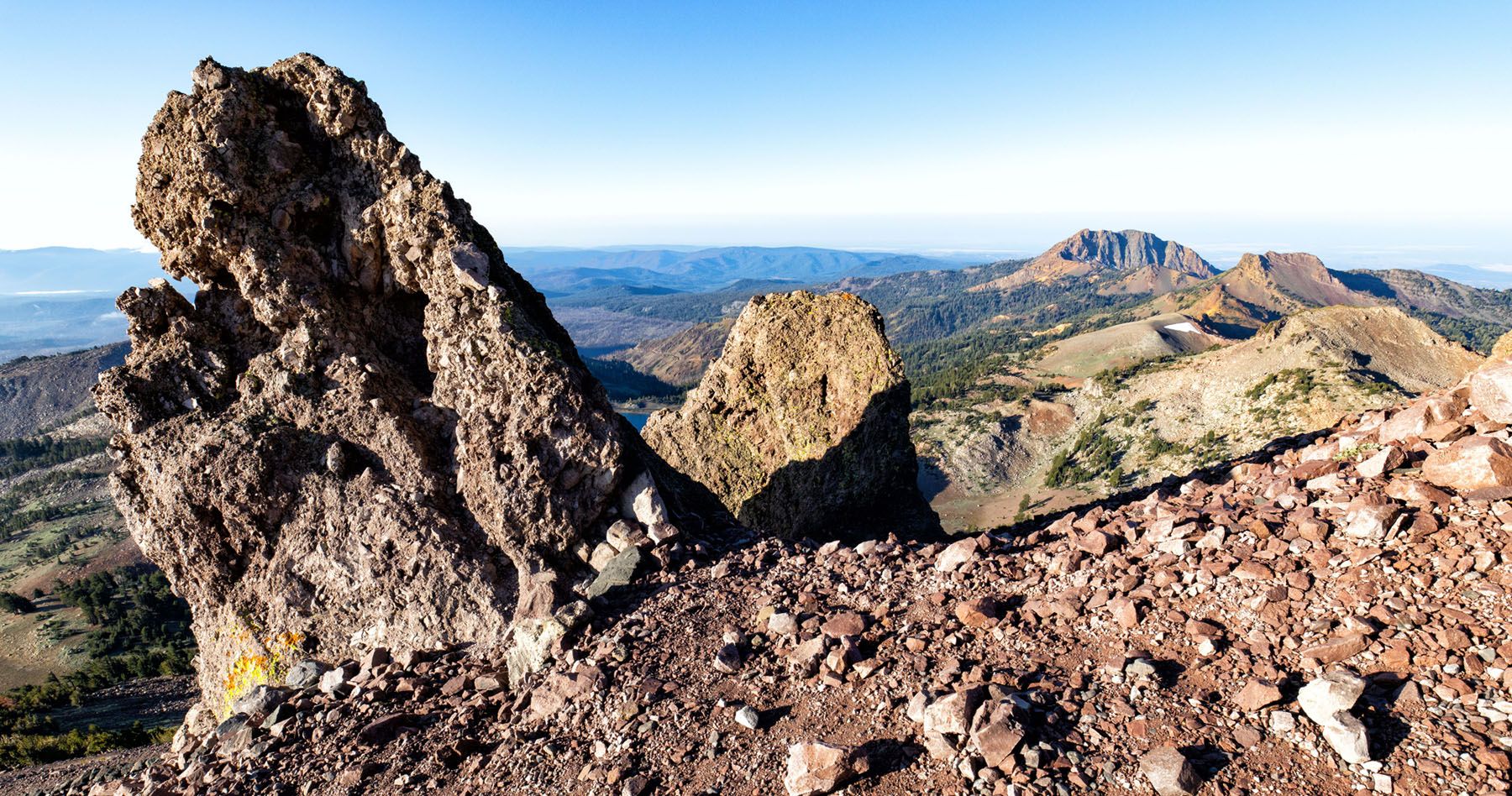
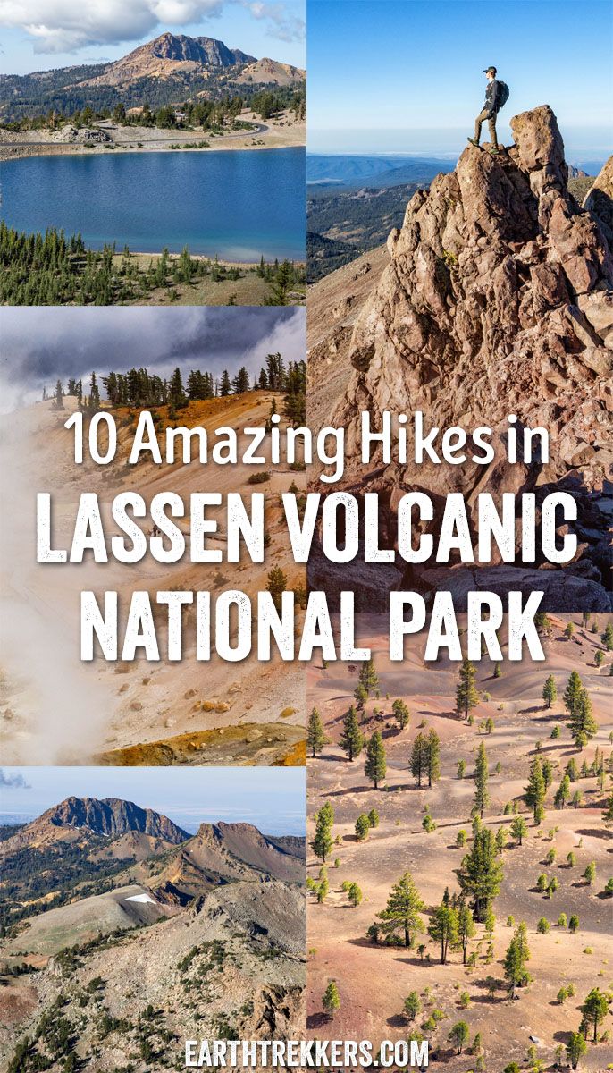
In this guide, we will uncover the 10 best hikes in Lassen Volcanic, from popular trails to a few hidden gems. These are located along Highway 89 (the heart of the park) and in more remote regions such as Warner Valley and Butte Lake.
Stroll through bubbling hydrothermal areas, summit volcanoes like Cinder Cone and Lassen Peak, wander alpine meadows, and stand on peaks with sweeping views over forests and valleys. Whether you’re looking for a short, family-friendly walk or a challenging climb, these hikes showcase the very best of Lassen.
Over three busy days, we hiked the park’s top trails, from the classic routes along Highway 89 to the quieter backroads of Warner Valley and Butte Lake. In this guide, we share the top hikes in Lassen Volcanic National Park, a mix of iconic favorites and hidden gems.
We’ve ordered these hikes geographically, starting with the must-do trails along Highway 89 (the heart of the park), and ending with the more remote (but equally spectacular) adventures.
Our 5 Favorite Hikes in Lassen Volcanic
Before we jump into the full list, here are the five best hikes in Lassen Volcanic. These include the must-have experiences in the park, plus a few underrated hikes that are well worth the time and effort.
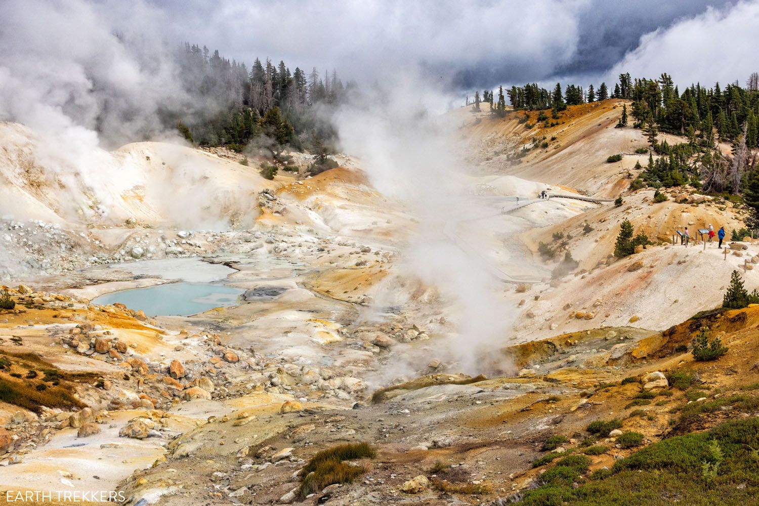
#1 Bumpass Hell Trail. On this 3 mile hike, enjoy views out over nearby peaks and valleys before descending into the park’s largest hydrothermal area. Walk the boardwalks and get up-close with steaming fumaroles. This trail is relatively easy and suitable for all ages, making it a must-do on a Lassen Volcanic itinerary.
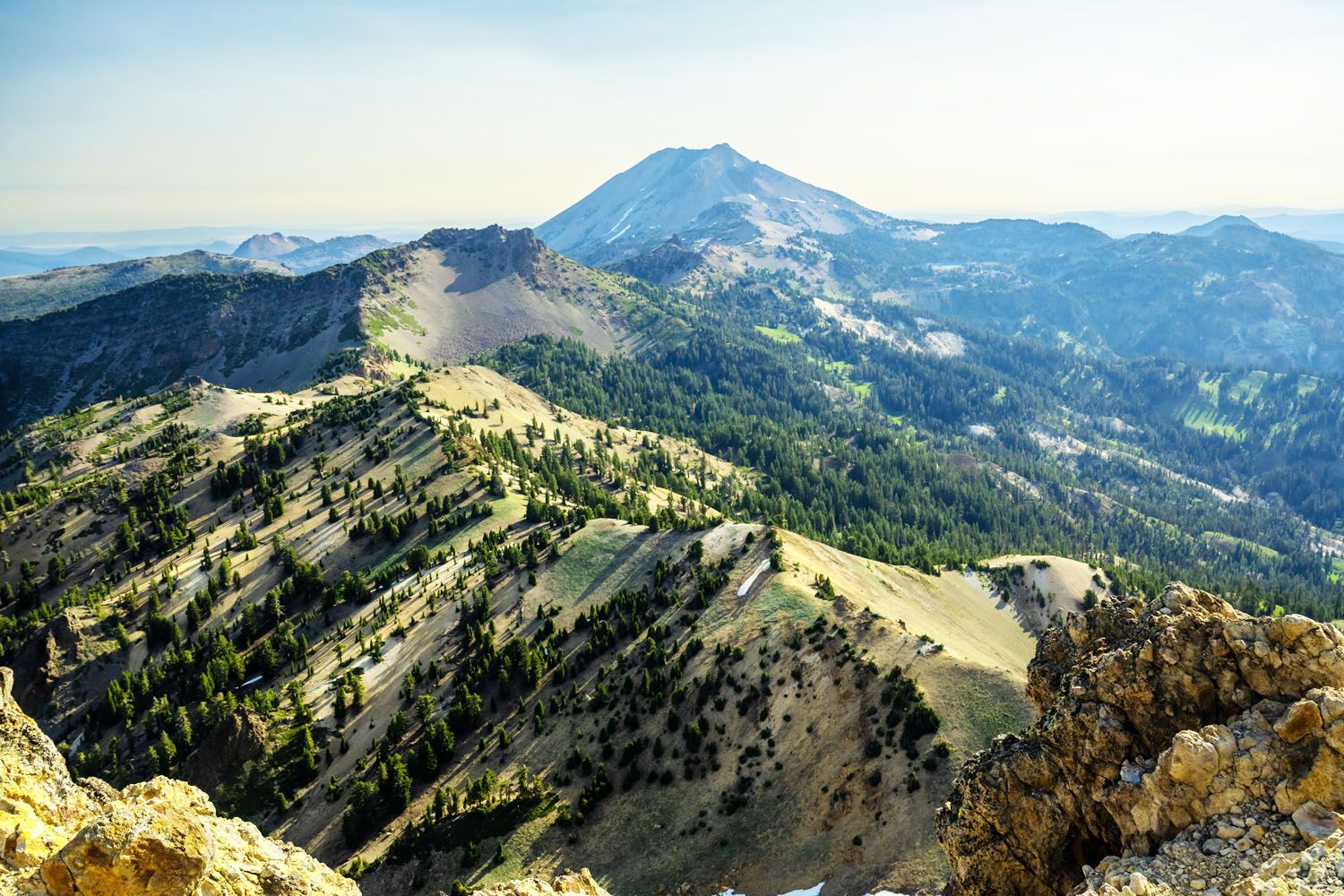
#2 Lassen Peak. At a height of 10,457 feet (3,187 meters), this active volcano is the highest point in the national park. It’s a tough, constant climb to the top, but the views are unmatched. If you only do one mountain summit, this one gets our vote. This is Tyler and Tim’s favorite hike.
#3 Cinder Cone. Hike past a towering lava field before climbing to the top of an extinct cinder cone volcano. From the volcano’s rim, enjoy 360-degree views out over lava fields, lakes, and surrounding mountains. It’s a long drive to get out this way, but you are rewarded with one of the most unique hikes in Lassen Volcanic.
#4 Manzanita Lake Loop. This relatively short, easy hike is another great option for families, photographers, and those who aren’t interested in mountain climbs or drives to remote sections of Lassen Volcanic. Enjoy a quiet stroll through forests, with views out over tranquil waters and Lassen Peak as a backdrop.
#5 Brokeoff Mountain. Hike through lush, mossy forests, climb into alpine meadows, and enjoy some of the most breathtaking views in the national park. This 7-mile trail is challenging but rewarding. This is Julie’s favorite hike in Lassen Volcanic.
Planning a trip to Lassen Volcanic National Park? Our How to Plan a Trip to Lassen Volcanic guide covers everything you need to know, with links to all of our in-depth guides and practical travel tips.
Best Hikes in Lassen Volcanic National Park
The hikes on this list are spread out across different regions of the national park. Many of the top hikes in Lassen Volcanic lie along Highway 89, the main road that runs through the more popular region of the park. This is where you’ll find trailheads for Lassen Peak, Bumpass Hell, Lake Manzanita, and more. For quieter and just as amazing experiences, hike the trails in Warner Valley and the remote Butte Lake.
Below is a map marking the top hikes in the park, plus other notable places to visit.
How to Use This Map: Click the icons on the map to get more information about each point of interest. To take this map with you, click the star next to the title of the map which adds it to your Google account. Next, within your Google Maps app, select ‘Saved’ and then select ‘Maps’. This map title will now appear in your list.
Each hike on our list below is a day hike, so it can all be completed in one day. In no particular order, here are the top 10 hikes in Lassen Volcanic National Park. Note: All distances are round-trip.
1. Explore Bumpass Hell
Our Rating: ⭐️⭐️⭐️⭐️⭐️ This is the #1 hike to do in Lassen Volcanic. It’s short, it’s relatively easy, and great for all ages and ability levels. Plus, it wins the award for the best name for a hiking trail.
Distance: 2.7 miles (4.4 km) | Difficulty: Easy to moderate| Total Ascent: 500 feet (150 meters) | Time: 1 to 3 hours
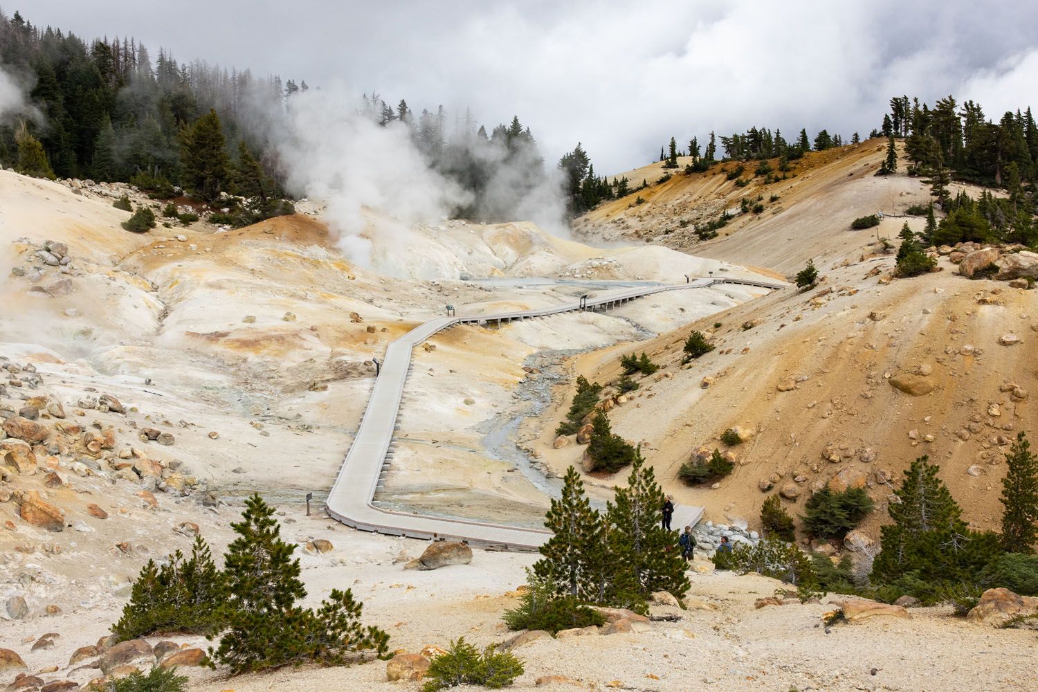
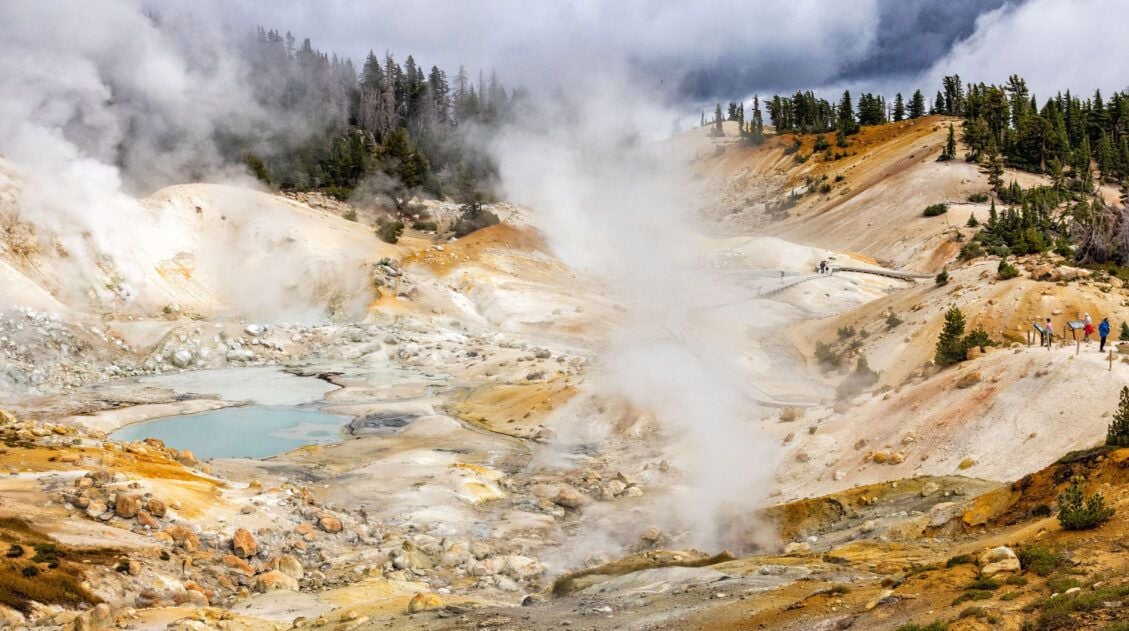
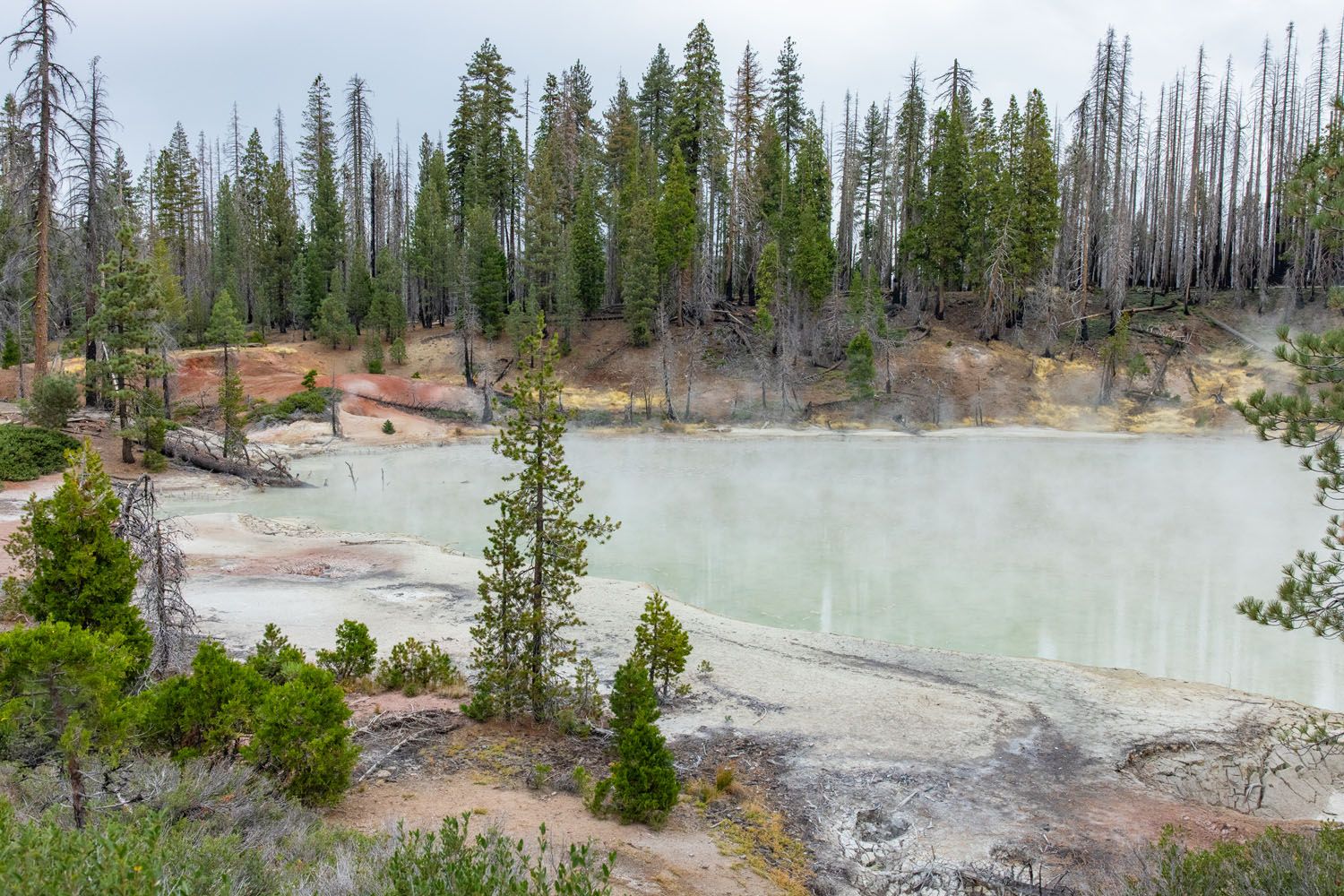
The Bumpass Hell Trail is the most popular hike in Lassen Volcanic National Park. It’s easy to hike, it’s great for all ages, and it explores the largest hydrothermal area within the park.
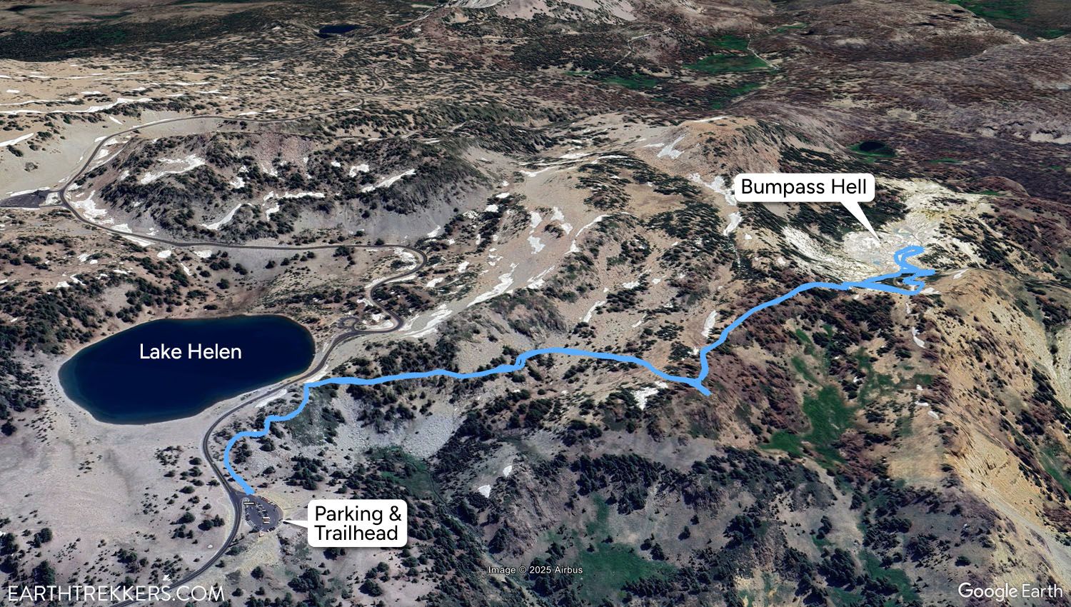
Map of the Bumpass Hell Trail
This short, 3-mile round-trip hike is an easy to moderate option for most visitors, taking about 1.5 hours to complete. It’s also right along Highway 89, near Lassen Peak and Lake Helen, making it super easy to reach.
The runs along a mountainside, offering views out over Lake Helen, the valley below, and the surrounding peaks. It stays mostly flat until the 1 mile mark, where hikers get their first view of Bumpass Hell. From here, it’s a short but steep descent down to the hydrothermal area.
In Bumpass Hell, you’ll find a small boardwalk loop that leads through the thermal area. Along the way, you’ll enjoy up-close views of steaming fumaroles, boiling mud pots, and smell that classic scent of sulfur reminiscent of rotten eggs.
This hike is so much fun that I did it twice. The first time was on a cloudy day. On our final day in the park, a brilliantly sunny day, I did this hike again, to capture the thermal area in the sunlight.
You get some great “bang for your buck” along this trail, with a somewhat easy difficulty and incredible views every step of the way. The Bumpass Hell trail became one of our favorite hikes within Lassen Volcanic National Park. Here’s how to do it ↓
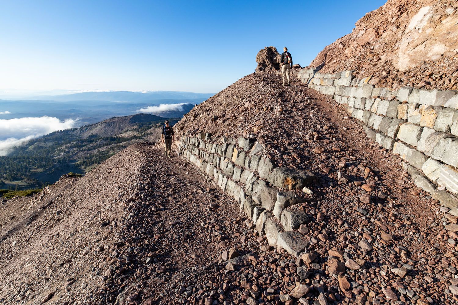
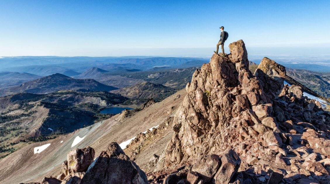
2. Summit Lassen Peak, the Highest Peak in the Park
Our Rating: ⭐️⭐️⭐️⭐️⭐️ Summit the highest peak in the park and stand atop the largest plug dome volcano in the world. The views are incredible, and even though it’s a tough hike, its short distance makes it easy to fit into a busy day.
Distance: 4.84 miles (7.8 km) out-and-back| Difficulty: Strenuous | Total Ascent: 2,060 feet (628 meters) | Time: 2.5 to 5 hours
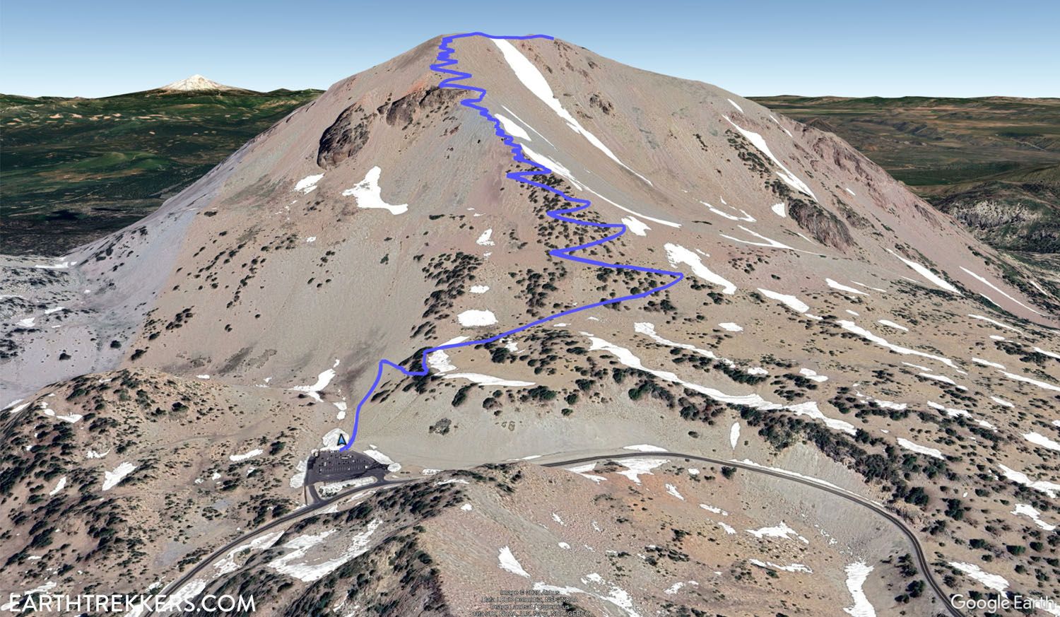
The Lassen Peak Trail leads to the tallest point in the park at 10,457 feet (3,187 meters). Along the way, you’ll enjoy some of the best views within the park and get the chance to stand atop the largest plug dome volcano in the world.
It is a 2.5-mile hike to the summit of Lassen Peak. Expect a steady and constant climb to the top. The trail itself is very simple to follow, but the constant uphill climb can be strenuous.
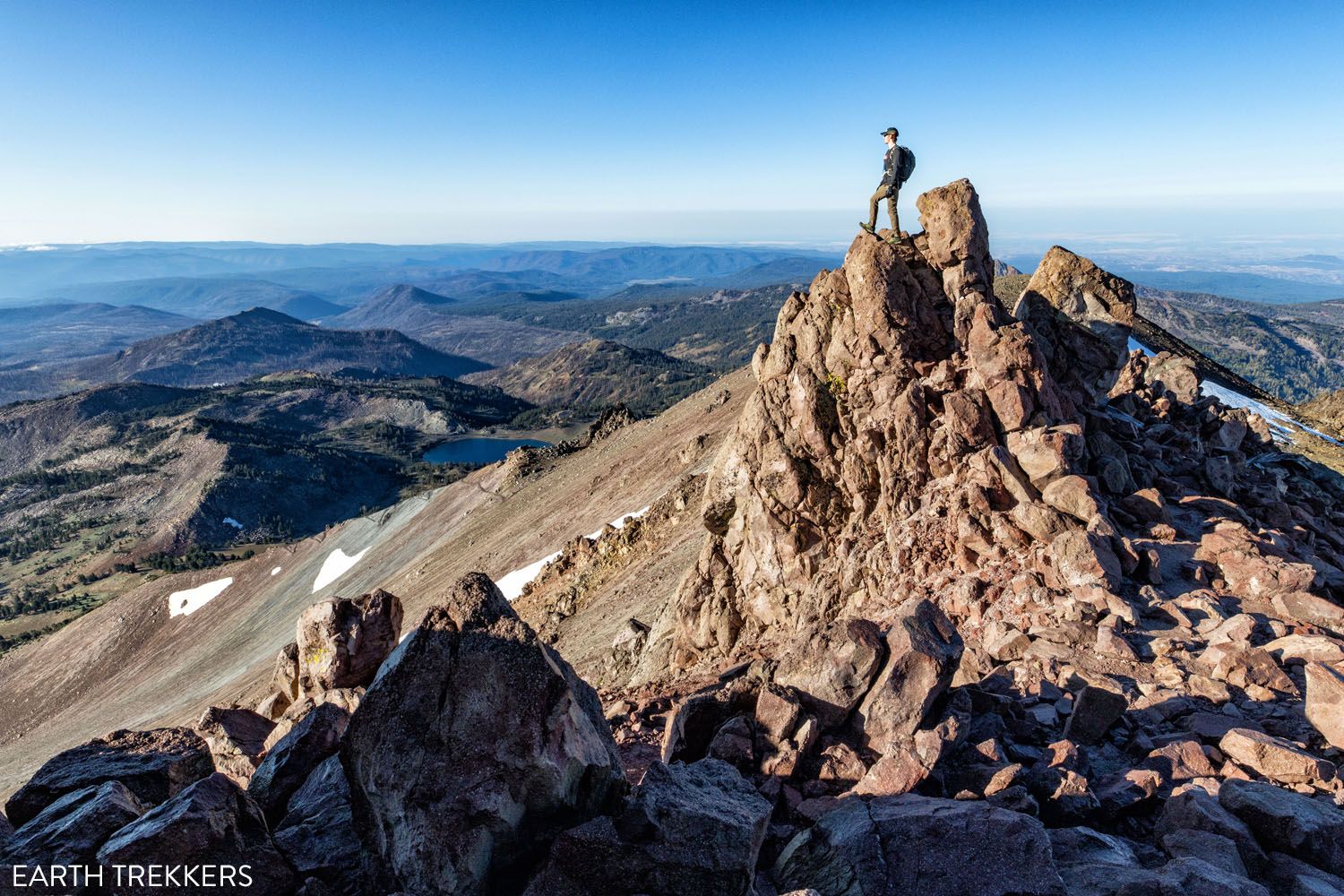
The Lassen Peak trail is the most challenging hike on our list, but don’t let that deter you. With an exposed trail and high elevation, you’ll constantly be able to look out over the national park below, spotting iconic sights such as Lake Helen and Brokeoff Mountain. The view from the summit is even better, with 360-degree views over dozens of surrounding mountains, valleys, and lakes. On a clear day, you can even spot the towering Mount Shasta to the north.
Lassen Peak Trail
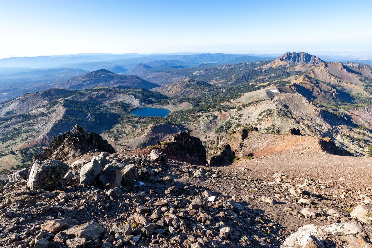
The view of Lassen Volcanic NP from the trail. In this photo are Lake Helen and Brokeoff Mountain.
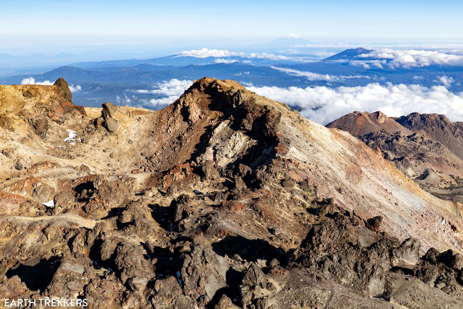
View from Lassen Peak with Mount Shasta in the distance
Similar to Brokeoff Mountain, we recommend starting this hike early in the morning, no later than 9:00 am. Afternoon clouds frequently roll in and cover the summit, also bringing a potential for storms. You don’t want to put in all that effort just to have no view!
A Step-By-Step Guide to Hiking Lassen Peak
Everything you need to know to hike to Lassen Peak.PRO HIKING TIP: You will be hiking at high altitudes, ranging from 8,500 feet to 10,457 feet. We don’t recommend this as the first hike you do in Lassen Volcanic if you aren’t acclimated to the elevation. Familiarize yourself with the symptoms of altitude sickness before starting this hike and take your time heading to the summit.
3. Enjoy the View from Brokeoff Mountain
Our Rating: ⭐️⭐️⭐️⭐️⭐️ This is one of less popular hikes in Lassen Volcanic, with its longer distance and difficulty (but that also means it is less crowded). On a clear day, you get a panoramic view of the park with arguably the best view of Lassen Peak. Plus, this trail is constantly changing and fun from start to finish.
Distance: 7.2 miles (11.6 km) | Difficulty: Strenuos | Total Ascent: 2,560 feet (780 meters) | Time: 3 to 5 hours
The view of Lassen Peak from Brokeoff Mountain | shutterstock.com
The main reason to do this hike is for the views from the summit. This spot offers the best sweeping views of Lassen Volcanic, including Lassen Peak.
However, this hike is just as much about the journey as the destination.
The trail and its views are constantly changing, which always keeps things interesting. The three of us loved hiking through the dense forests and enjoying the views from the park along the trail. This is one of the prettiest hikes in Lassen Volcanic, with its ever-changing scenery and panoramic views.
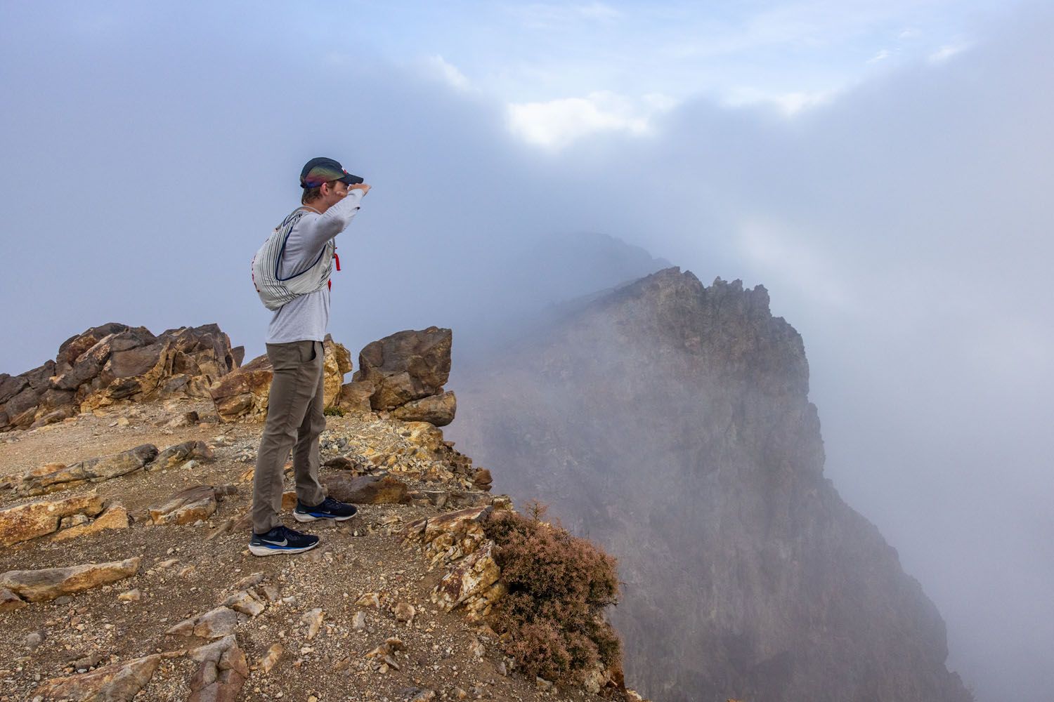
Unfortunately, this was our view from Brokeoff Mountain
Despite starting early in the day, clouds moved in right before we reached the peak of Brokeoff Mountain. We never got to see those amazing views from the summit, but the hike was still well worth it, since the trail is so entertaining. Hopefully, you will have better luck than we did!
The Brokeoff Mountain trail is one of the toughest hikes in Lassen Volcanic, which discourages many people from tackling this trail. But for those that do, this is a relatively quiet trail that offers an incredible hiking experience in the park. We only saw a handful of people during the three hours we spent hiking. This is a great option for those who want amazing summit views while avoiding the crowds.
WHERE IS IT? The trailhead for Brokeoff Mountain is a half mile from the national park’s southwest entrance, sitting just outside the park.
PRO HIKING TIP: It’s best to start this hike early in the morning, no later than 9:00 am. In the afternoon, clouds roll in and typically conceal the peaks within the national park. For the best views from the summit, we recommend starting early.
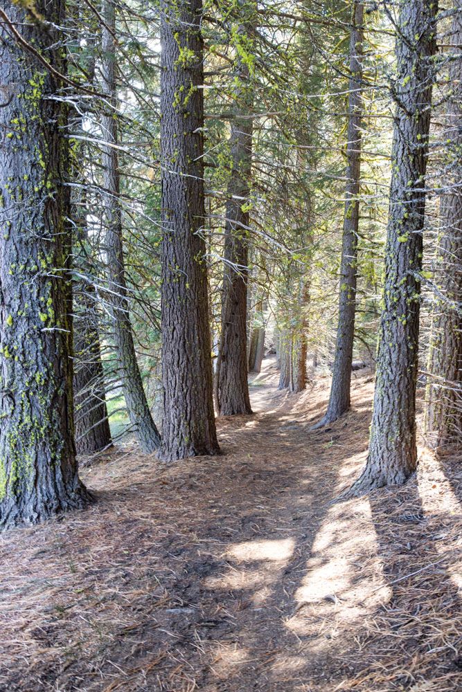
4. Hike to a Waterfall on Kings Creek Trail
Our Rating: ⭐️⭐️⭐️ If you only have one day in the park, there are better hikes to do (Bumpass Hell, Manzanita Lake, Cinder Cone, Lassen Peak). The Kings Creek Trail is worthwhile if you have 2+ days in the park.
Distance: 2.3 mile (3.7 km) loop | Difficulty: Moderate | Total Ascent: 500 feet (150 meters) | Time: 1 to 2 hours
The Kings Creek Trail is a 2.3-mile loop out to Kings Creek Falls. This is a nice, easy-to-moderate hike for those who want to see one of the only waterfalls in the park. We saw people of all ages hiking this trail.
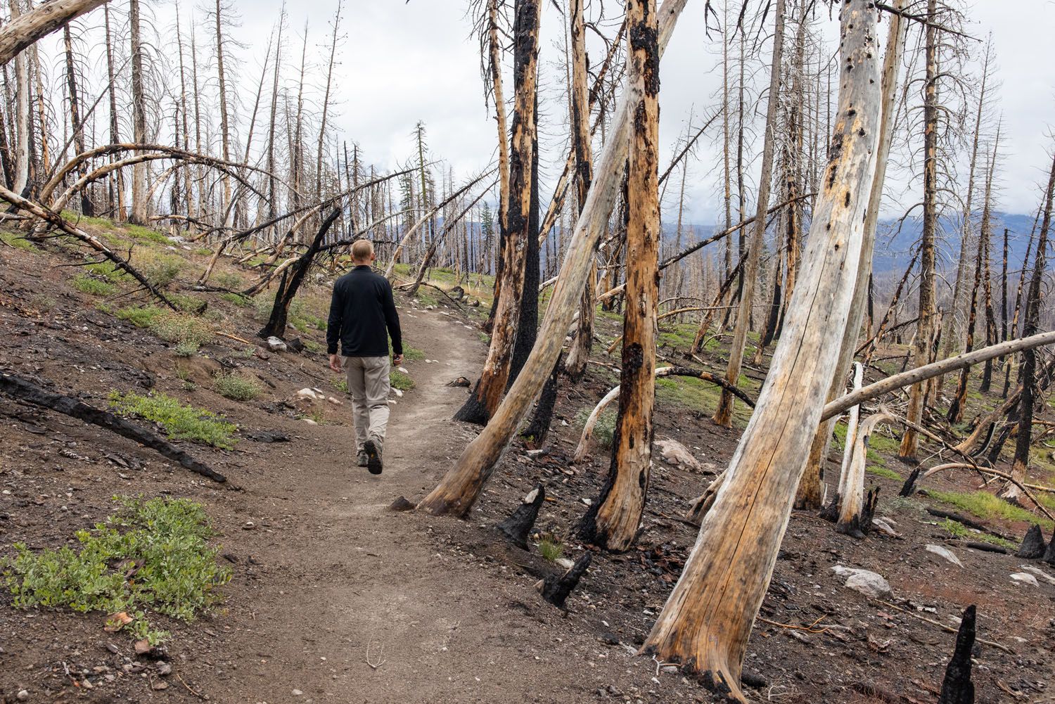
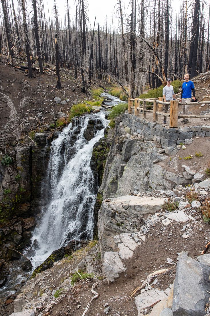
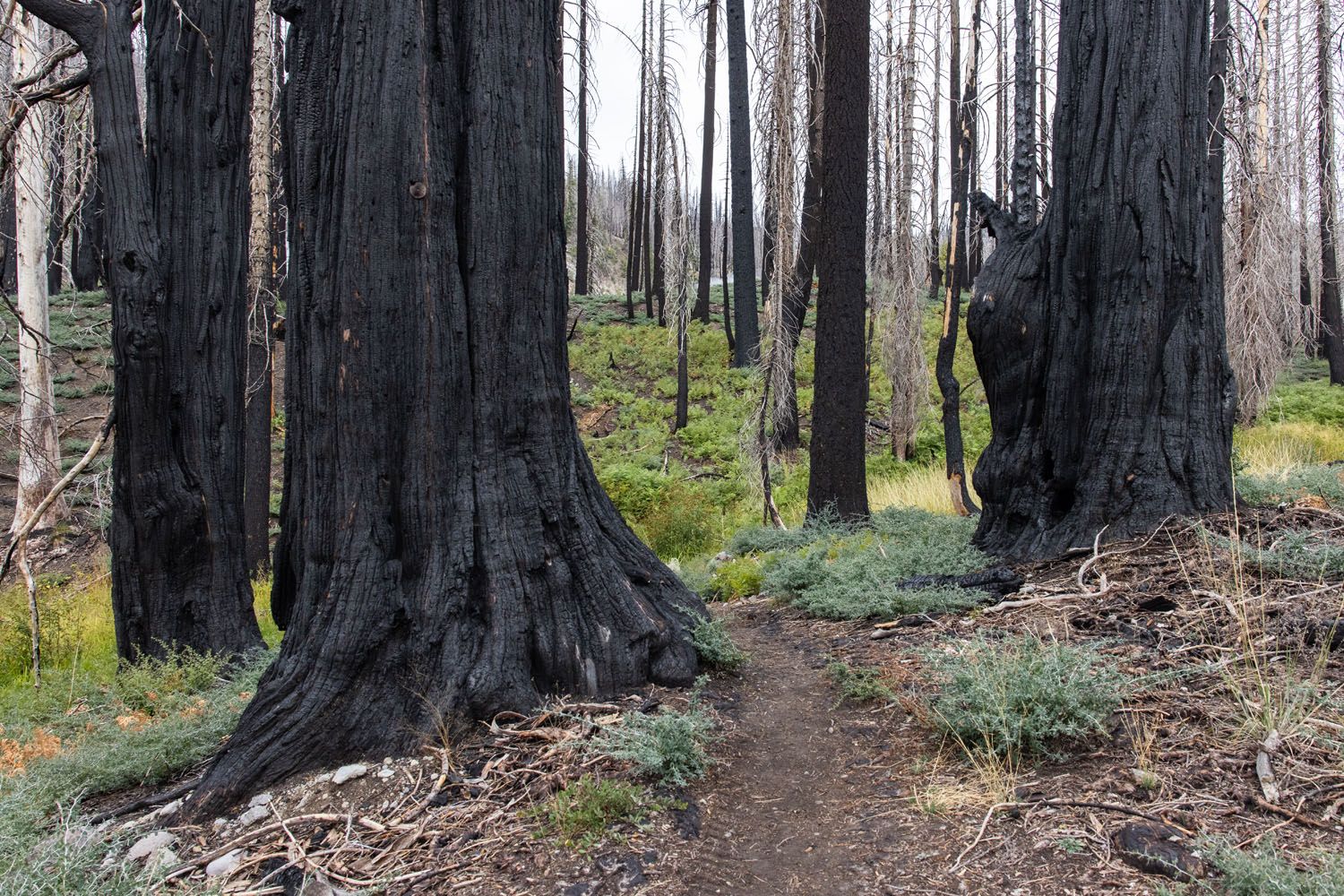
This trail runs through the Lower Kings Creek Meadow and forests ravaged by the 2021 Dixie Fire. Trees remain blackened and barren, with no leaves or foliage along many of the trees, but it makes for an interesting area to walk through. The trail loops through the Upper Cascades section, offering viewpoints over the hilly landscape, before descending down to Kings Creek Falls.
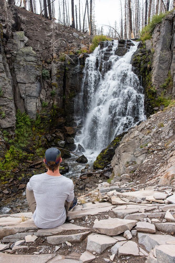
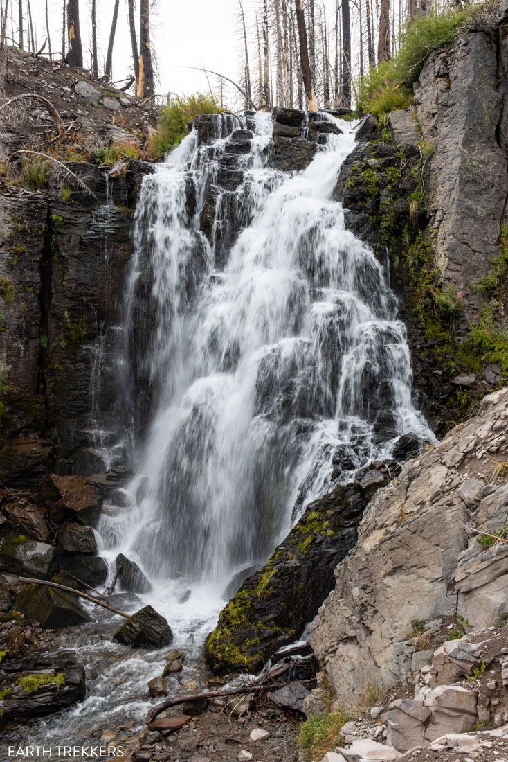
Kings Creek Falls is a scenic, 30-foot-high waterfall. We found it to be quite peaceful, especially since we were the only ones at the overlook. You’ll know you’ve made it to Kings Creek Falls when you find a fenced-in overlook.
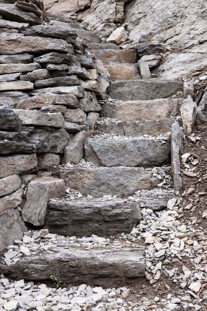
From the falls, return to your car either via the trail you followed, or along the Cascading Foot Trail. This one-way trail (it’s really more of a stair climb) runs up along a cascading waterfall. It’s a more strenuous route, but far more scenic and the one we recommend taking.

WHERE IS IT? The trailhead for Kings Creek Falls is directly along Highway 89. There is parallel park along the road’s shoulder, which is limited.
5. Learn About Lassen’s Eruption on the Devastated Area Interpretive Trail
Our Rating: ⭐️⭐️⭐️ Quick and easy to do, perfect for those who want to learn more about the volcanic eruption.
Distance: 0.2 mile loop| Difficulty: Easy | Total Ascent: Minimal | Time: 15 minutes
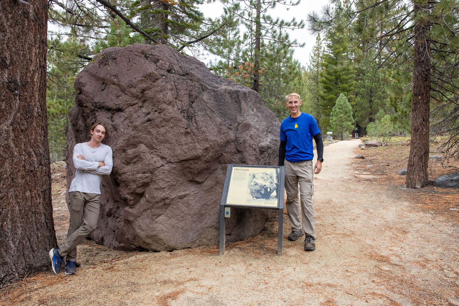
This 0.2-mile trail is flat, easy to follow, and the easiest hike on our list.
This short interpretive trail showcases the destruction and aftermath of Mount Lassen’s 1915 eruption. The trail loops past giant volcanic rocks and boulders, complete with informative signs that give context to what you see.
6. Manzanita Lake Loop, A Short Scenic Walk in Lassen
Our Rating: ⭐️⭐️⭐️ This easy lake loop is a popular photography location in Lassen Volcanic.
Distance: 1.7 mile loop | Difficulty: Easy | Total Ascent: Minimal | Time: 1 hour
This is one of the easiest hikes in Lassen Volcanic National Park. Along this 1.7 mile flat trail, you get to circle Manzanita Lake and enjoy views out at Lassen Peak. On calm days, you’ll even see the reflection of Lassen Peak in the water.
The Manzanita Lake Loop is a great pick for those who want an easy, flat hike while getting views of Lassen Peak. The trailhead is also at a lower elevation than other hikes in the national park, making this a great option for your first day in the park. At 5,870 feet (1,790 meters), you can comfortably begin to acclimate to the higher elevations of Lassen Volcanic.
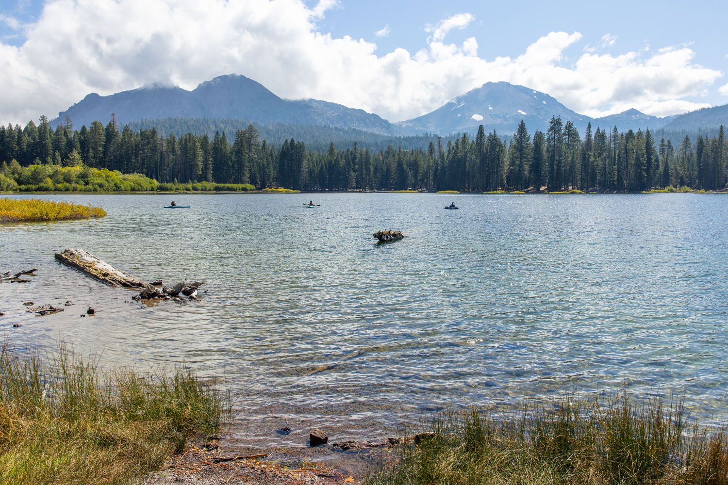
Trail around Manzanita Lake
Julie hiked the full loop, and the most impressive views of Lassen Peak came along the northern and western stretches of the trail.
There’s a large campground at Manzanita Lake where you’ll find cabins, bathrooms, parking, and a general store. Visitors can also rent kayaks at the boat launch area. Just across Highway 89 is the Reflection Lake Trail, another easy hike on our list.
7. Photograph Lassen Peak from Reflection Lake
Our Rating: ⭐️⭐️⭐️⭐️ We liked the views better from this lake (compared to Manzanita) plus it’s a shorter hike.
Distance: 0.5 mile loop | Difficulty: Easy | Total Ascent: Minimal | Time: 30 minutes
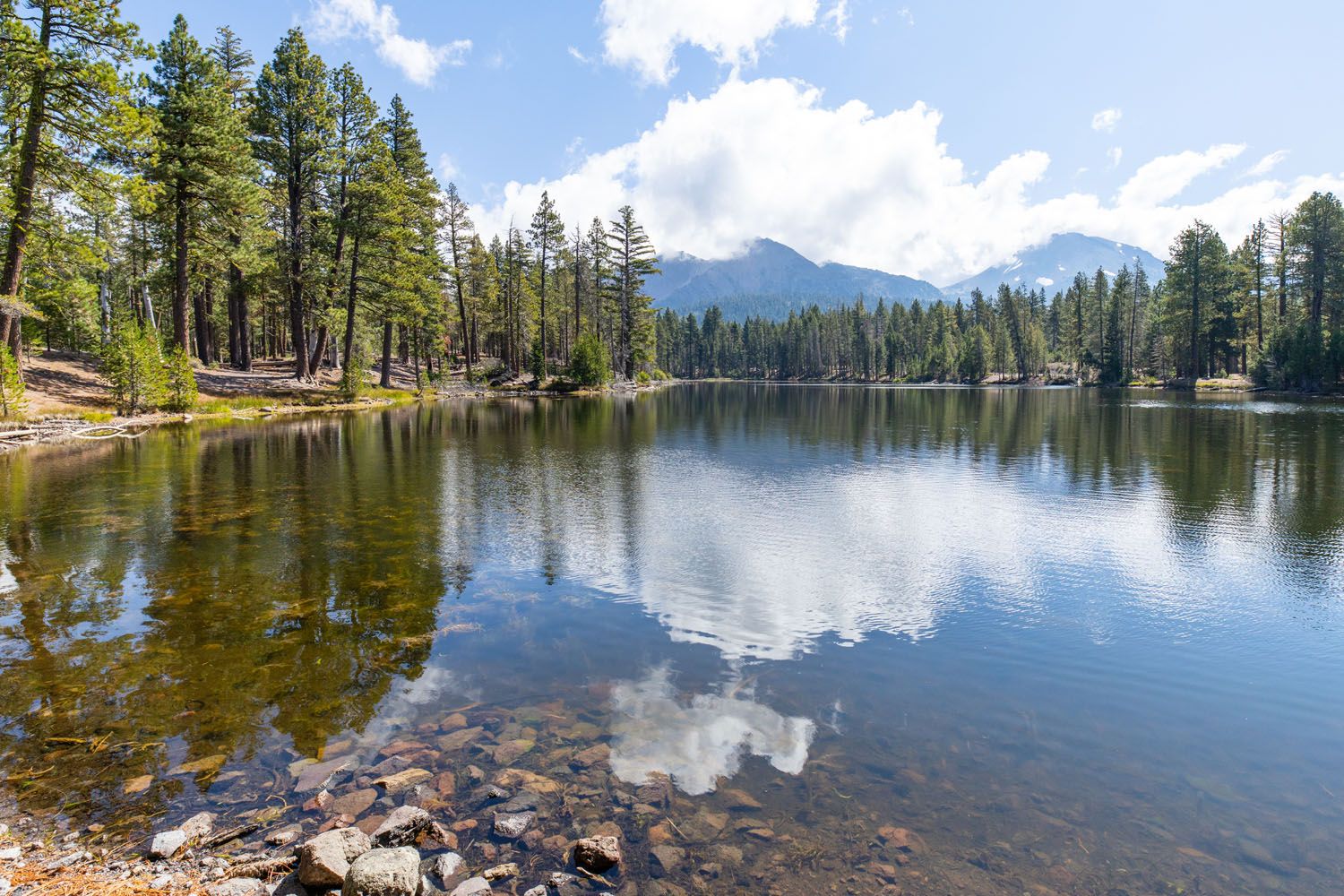
This shorter, less-traveled trail is a quieter alternative to the Manzanita Lake Loop. This is also one of the easiest and shortest hikes in the national park. Along your walk, you’ll catch reflections of Lassen Peak and the Chaos Crags on a calm, clear day.
Reflection Lake is located across the street from Manzanita Lake and the Loomis Museum. Park at the Loomis Museum, then cross the street to begin your walk around Reflection Lake.
8. Hike to the Fumaroles and Mud Pots in Devils Kitchen
Our Rating: ⭐️⭐️⭐️⭐️ This hydrothermal area gets far fewer visitors than Bumpass Hell and is just as interesting to visit, but it is located in a more remote area of the park (Warner Valley).
Distance: 5.1 miles (8.2 km) | Difficulty: Moderate | Total Ascent: 700 feet (215 meters) | Time: 2.5 to 4 hours
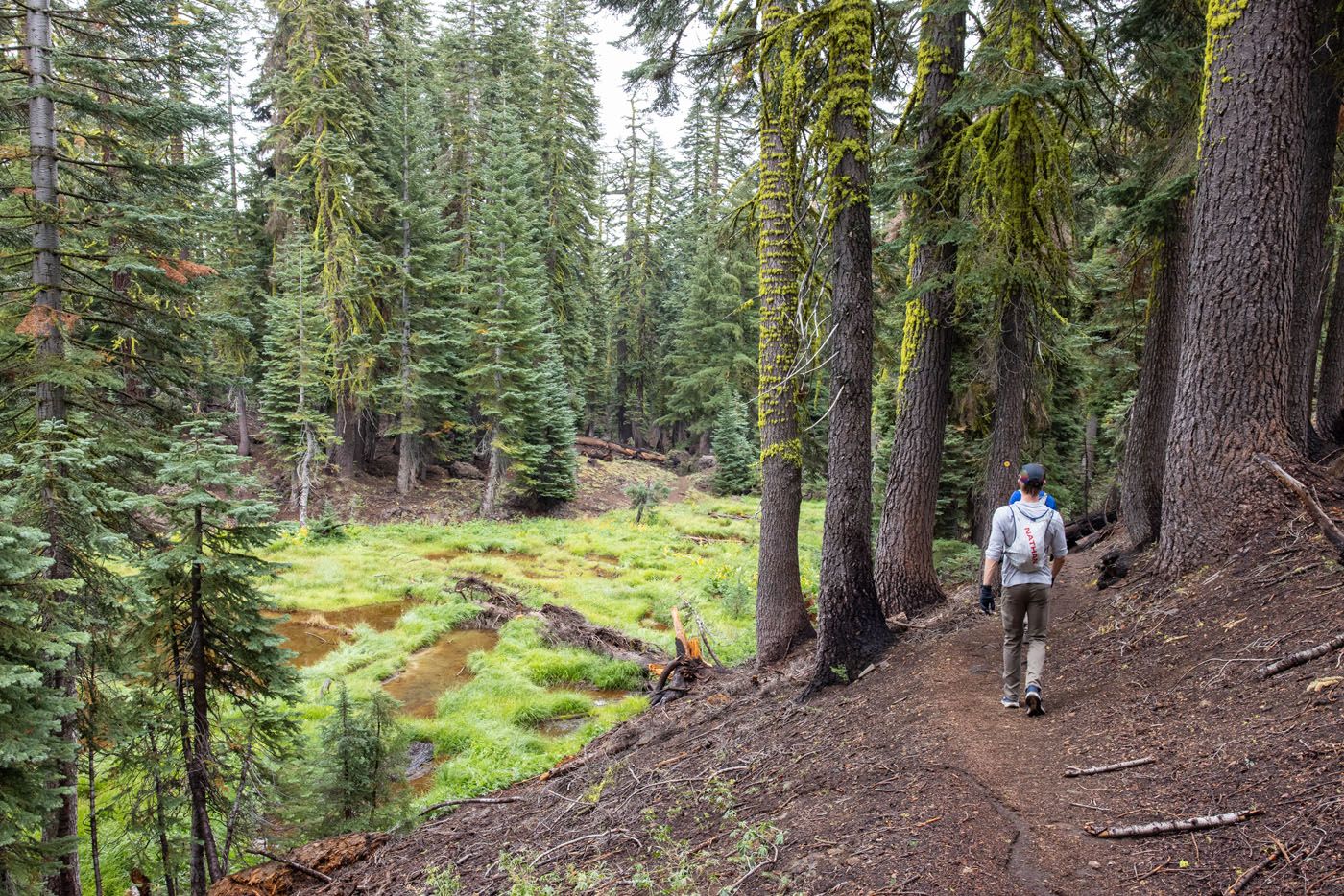
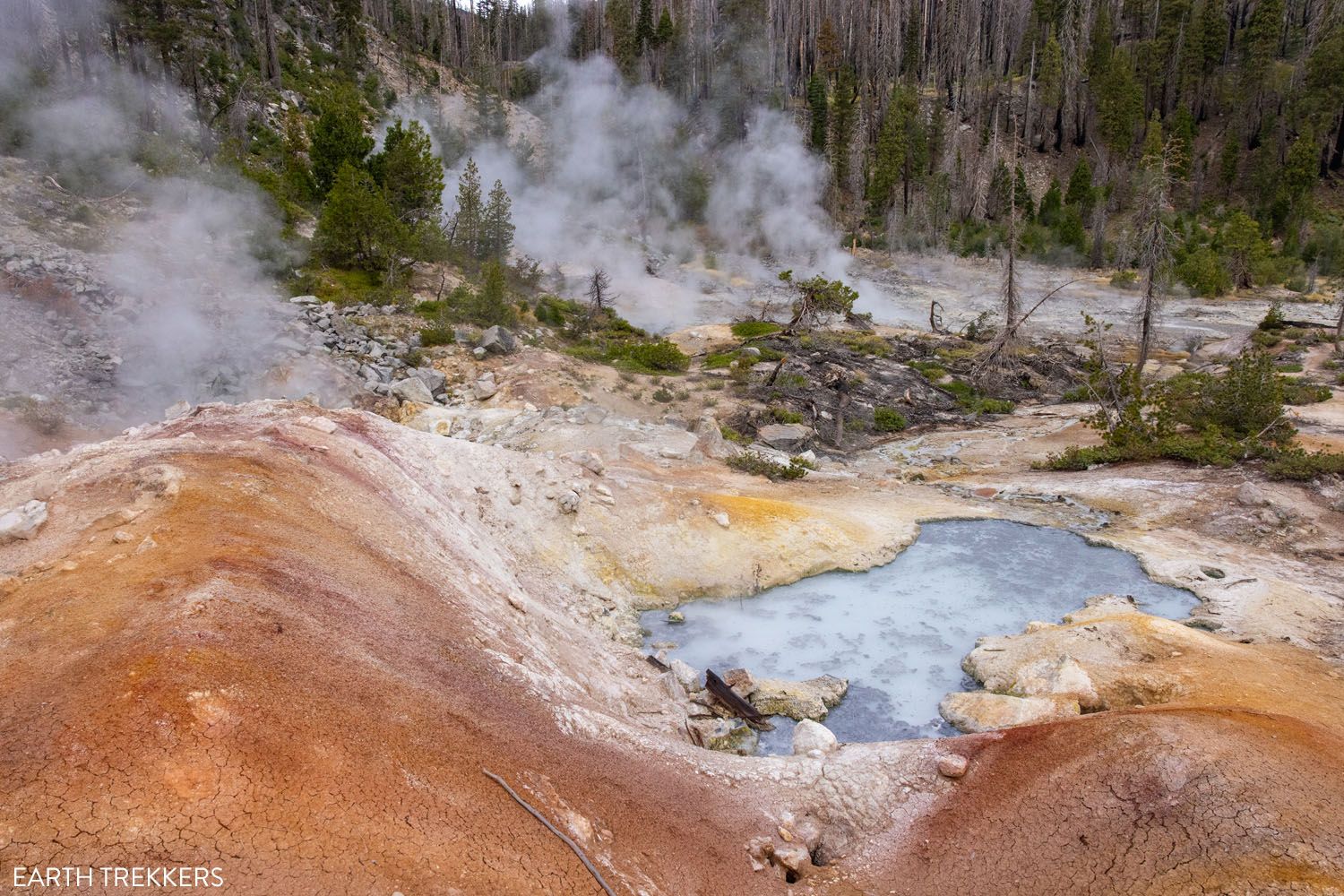
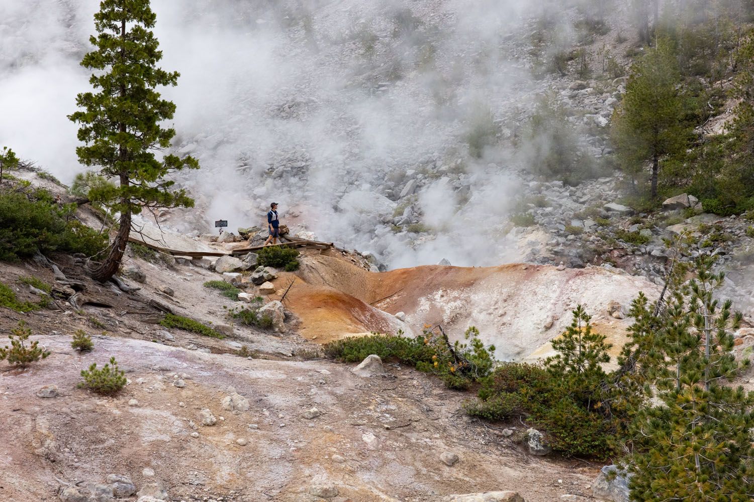
Devil’s Kitchen is the second-largest hydrothermal area in Lassen Volcanic National Park, located in the Warner Valley region. It’s a peaceful 2.5-mile one-way walk through meadows and forests before reaching Devil’s Kitchen. Here you’ll get up close with steaming fumaroles and watch mud pots violently boil.
The trail features a packed dirt trail and some low-grade hills. A portion of the trail runs through a forest that was badly burned in a recent fire. Overall, this is an easy to moderate difficulty hike suitable for those of all ages.
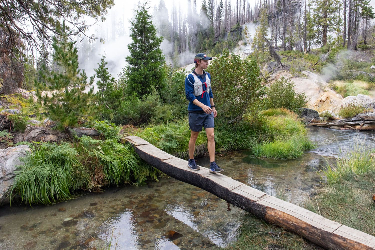
This was the first hike we did in Lassen Volcanic. Our visit began with cloudy, rainy weather, so while waiting for clearer skies to hike Lassen Peak and Brokeoff Mountain, we decided to explore Warner Valley instead. On the day we did this, we were the only ones on the trail. Wandering through the thermal area in complete solitude was a lot of fun and made this corner of the park feel wonderfully remote.
WHERE IS IT? The hike begins at the Warner Valley trailhead. Other hikes, such as the one to Boiling Springs Lake, also start here (in fact, these two trails overlap). Warner Valley is a separate region of the national park. To get here from Chester, drive the Chester Warner Valley Road to the trailhead.
Devil’s Kitchen is a great alternative to hiking the Bumpass Hell Trail. You’ll find far fewer hikers along the trail, making Devil’s Kitchen a perfect option for those wanting a quieter hike.
9. Hike to Boiling Springs Lake on the PCT
Our Rating: ⭐️⭐️ Not worthwhile on its own, as we don’t think it’s worth the driving and hiking time to reach this lake. However, it’s much more worthwhile if you combine it with Devils Kitchen. Then it becomes one of the best off-the-beaten-path hikes in the park.
Distance: 2.8 miles (4.5 km) | Difficulty: Moderate | Total Ascent: 435 feet (130 meters) | Time: 1.5 to 3 hours
Also located in Warner Valley, follow a forested trail that leads out to and circles Boiling Springs Lake, a steaming hydrothermal lake. There are a number of viewpoints that overlook the lake, and keep an eye out for small steam vents by the multi-colored shore.
The trailhead for Boiling Springs Lake shares the parking lot with the Devil’s Kitchen trailhead. To get to Boiling Springs Lake, follow the Devil’s Kitchen trail for 0.6 miles before reaching a trail split. Left will lead you to Boiling Springs, while right leads to Devil’s Kitchen.
FUN FACT: A portion of the Pacific Crest Trail (PCT) runs along the route to Boiling Springs Lake. You’ll see signs for the PCT and maybe a few thru hikers on your visit.
PRO HIKING TIP: We recommend wearing long pants on this trail. As you get closer to the lake, the trail narrows and is lined with prickly plants that scratched our legs.
DO THE DEVILS KITCHEN + BOILING SPRINGS LAKE COMBO HIKE: Since this trail is shared with Devil’s Kitchen, we recommend hiking both trails together. This makes for a great half-day exploring a less-visited section of the park. The combined trail is 6.7 miles long, has a total ascent of 1,000 feet, and will take most hikers 3 to 5 hours to complete.
10. Overlook the Painted Dunes from the Cinder Cone
Our Rating: ⭐️⭐️⭐️⭐️⭐️ It takes a while to drive here and the hike is deceptively challenging, but we loved it for its views and the unique opportunity to stand atop a cinder volcano. We think it is the best underrated hike in Lassen Volcanic.
Distance: 3.8 miles (6.1 km) | Difficulty: Moderate to strenuous | Total Ascent: 900 feet (275 meters) | Time: 1.5 to 3 hours
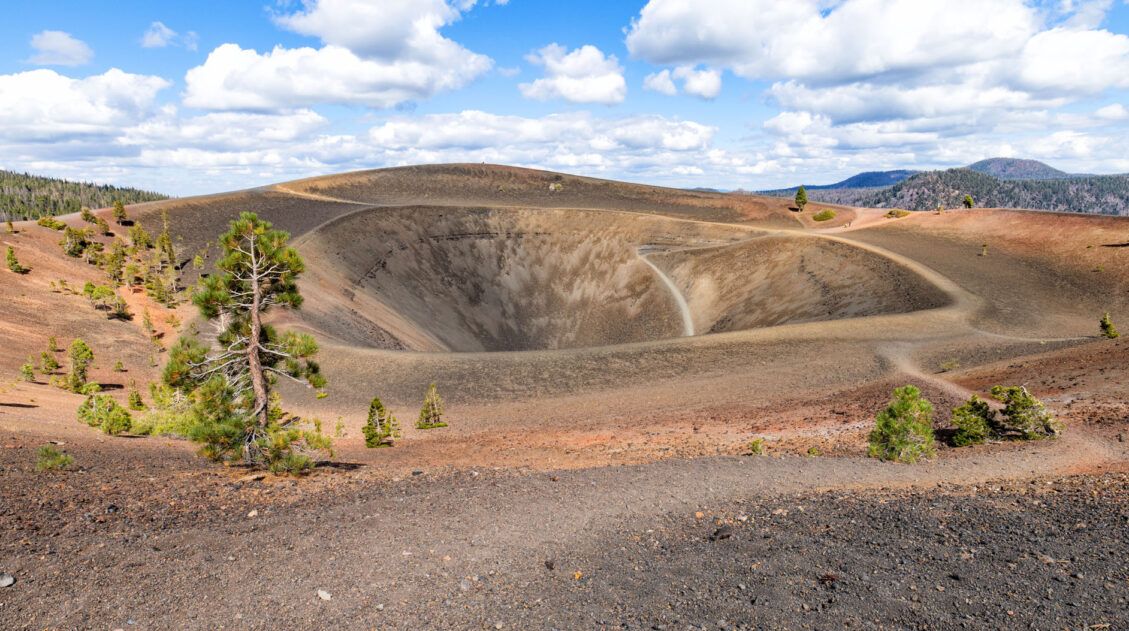
In the remote, northeast section of Lassen Volcanic National Park, follow a 4-mile-long trail to the top of Cinder Cone. This extinct volcano rises dramatically from the surrounding landscape and offers incredible 360-degree views from the rim.

The trail follows along towering lava fields and through a forest covered in black volcanic sand. It’s a flat, easy walk until you reach the base of Cinder Cone. From here, it’s a short, very steep trudge to the top across thick gravelly sand. The views from the top, however, are totally worth the effort.
From the volcano’s rim, overlook massive lava fields known as the Fantastic Lava Beds, the nearby Butte Lake and Snag Lake, and even catch a glimpse of Lassen Peak off in the distance.

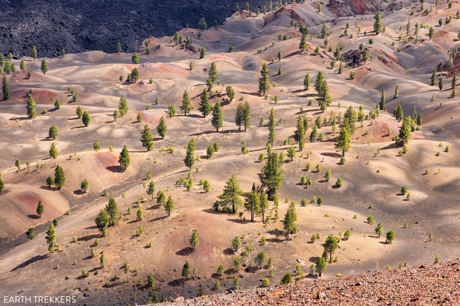
The Painted Dunes
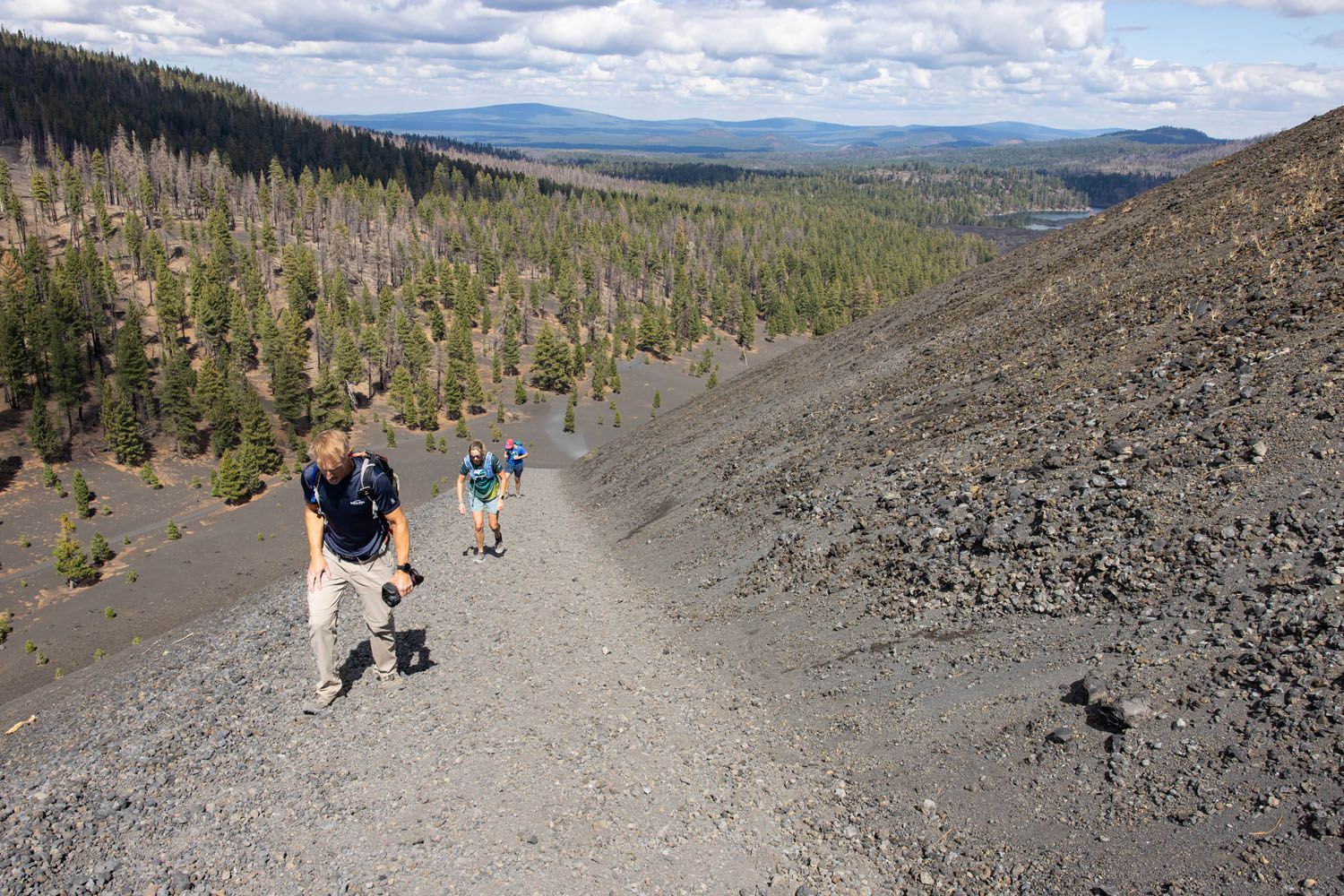
The trail to the summit of Cinder Cone. It’s tough!
This hidden gem of a hike is great for hikers who want to stand atop a volcano but avoid the crowds and difficulty that comes with the Lassen Peak hike. Not to mention, the trail only takes 2-3 hours to complete, so it’s a great addition onto a Lassen Volcanic itinerary. Here’s how to do it ↓
WHERE IS IT? The trailhead is found at Butte Lake Campground, which is located in a more remote area of the national park. To get here, drive the 6.6-mile gravel road that connects to Route 44.
When is the Best Time to Go Hiking in Lassen Volcanic National Park?
The best time to go hiking in Lassen Volcanic is from mid-July through September. Many of the national park’s hiking trails are snow-covered for most of the year, primarily due to the park’s high elevation. As a result, many trails are only open for a few months in summer and early fall.
Here are a few dates to be aware of:
Lassen Volcanic Road Opening: Highway 89, the main road through the park, typically opens between mid-May and early July, depending on the amount of snowfall the park receives. You can see the historical opening dates of the road here.
Lassen Volcanic Road Closure: Highway 89 usually closes between late October and late November.
Hiking in Lassen Volcanic: Snow can linger on the trails well into late summer. We hiked Lassen Peak in mid-September and there was still snow on the trail. One of the top trails in the park, the Bumpass Hell Trail, tends to open mid-to-late July.
We recommend checking the National Parks Service website before you go. This page provides information on trail conditions and closures within Lassen Volcanic National Park.
We visited Lassen Volcanic in early September and had a wonderful experience. Temperatures were cool, especially in the morning, so we had to start our hikes with an extra layer. However, there were fewer visitors to the national park at this time, and we had several trails to ourselves. We also didn’t need to worry about trail closures due to snow.
Frequently Asked Questions About Hiking in Lassen Volcanic
What is the most popular hike in Lassen Volcanic?
The Bumpass Hell Trail is the most popular hike in Lassen Volcanic. It is less than 3 miles round-trip, rated easy to moderate, located in the heart of the park, and takes hikers through a hydrothermal area with steam vents and bubbling mud pots.
What is the best summit to climb in Lassen Volcanic?
Lassen Peak is an active volcano and the highest peak in the park, at 10,457 feet (3,187 meters). The trail to the summit is just 2.4 miles one way, and even though it is challenging, still makes it doable for many people. The views from the trail and the peak are incredible, with panoramic views of northern California.
Are permits required to hike in Lassen Volcanic National Park?
No permits are required for day hiking in Lassen. However, backcountry camping does require a wilderness permit. Always check current trail conditions and closures before heading out.
Are there easy hikes in Lassen Volcanic?
Yes. Bumpass Hell (when open), Manzanita Lake Loop, and the Devastated Area are short, family-friendly hikes with minimal elevation gain. These trails showcase geothermal features and scenic views without requiring a strenuous climb.
Are there hikes away from the crowds in Lassen?
Yes. Warner Valley and the Butte Lake area offer quieter trails and unique volcanic landscapes. Brokeoff Mountain and Cinder Cone also tend to be less crowded than Lassen Peak, especially early or late in the day.
Is Lassen Volcanic good for experienced hikers?
Absolutely. While there are easy geothermal walks, Lassen also offers steep summit climbs, longer backcountry routes, and rugged terrain. Hikes like Brokeoff Mountain provide big elevation gain and sweeping views with far fewer visitors than other more popular national parks.
If you have any questions about the best hikes in Lassen Volcanic National Park, or if you want to share your favorites, let us know in the comment section below.
Plan Your Trip to Lassen Volcanic
Below are links to more of our guides on Lassen Volcanic National Park, plus more information about the national parks and destinations in California.
14 Best Things to Do in Lassen Volcanic National Park
In this guide, we will cover the best things to do in Lassen Volcanic National Park. Discover the best hiking trails, scenic drives, and a few hidden gems that are definitely worth your time. We’ll also provide information on where to stay, how to plan your time, and the ideal time of year to visit. […]

Essential Hiking Gear: What Should You Bring on a Day Hike?
In this post, find out what we carry with us on day hikes. Whether you are a new hiker, shopping for a friend or family member, or just curious about what hiking gear you should bring on a day hike, we have a lot of great information to share with you. We have hiked thousands […]
California Travel Guide: Places to Visit in California
California Travel Guide California is home to some of the world’s tallest trees, breathtaking mountains, stunning desert landscapes, gorgeous beaches, and bustling cities. There are countless adventures worth having here, whether it be wine-tasting in Napa, hiking to the top of Half Dome, or exploring its long list of national parks. California is a favorite […]

The Ultimate Guide to Lassen Volcanic National Park
Lassen Volcanic National Park With steaming fumaroles, boiling hot springs, and volcanoes galore, Lassen Volcanic is an underrated gem amongst Californian national parks. Here you can hike to the summit of active volcanoes, wander through bubbling hydrothermal basins, and explore landscapes carved by lava flows. Lassen Volcanic is a paradise for hikers, photographers, and road […]
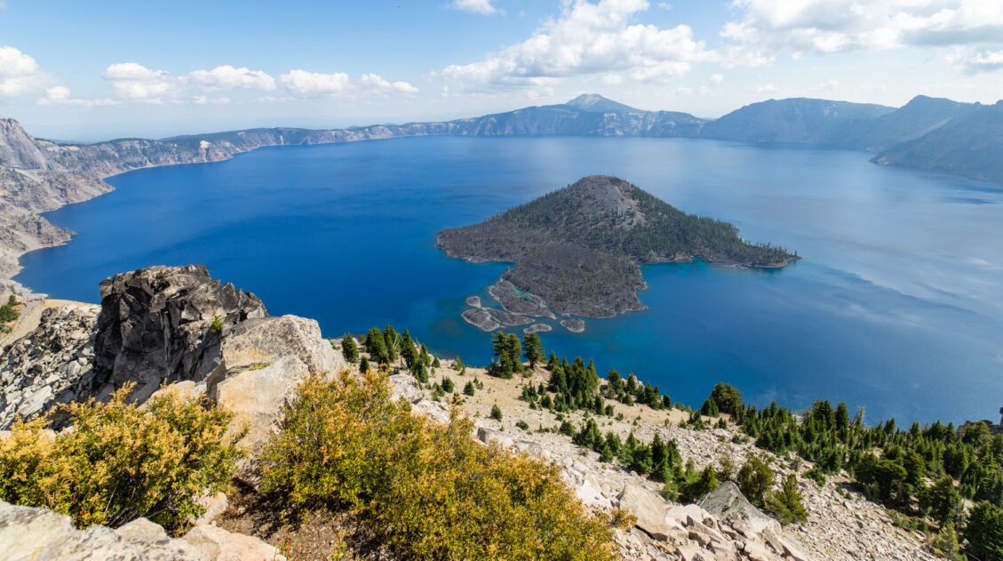
16 Best Things to Do in Crater Lake National Park
Discover the best things to do in Crater Lake National Park, including its top viewpoints, scenic drives, and hiking trails. One day is enough to see the highlights, but more time allows you to hike another trail or two. Home to the deepest lake in the United States, Crater Lake amazes visitors every year with […]
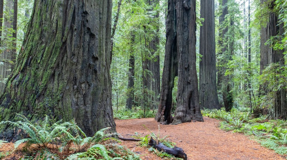
How to Plan a Trip to Redwood National & State Parks
Redwood National and State Parks Home to some of the tallest trees on Earth, Redwood National and State Parks protect some of the last remaining groves of old-growth coastal redwoods. Wallking amongst these giants feels like stepping into another world. Trees reach heights over 300 feet tall and some are more than 2,000 years old. […]
Our 15 Favorite US National Parks: A Few May Surprise You
Stretching from the South Pacific, across the United States and into the Caribbean, are 63 national parks. These national treasures are filled with scenic drives, hundreds of miles of hiking trails, wildlife, historic sites, and endless opportunities for adventure. In this guide, we cover 15 of the best national parks in the USA and what […]

The Ultimate Guide to the 63 US National Parks
Stretching from the South Pacific, across the United States to the Caribbean, are 63 national parks. These national treasures preserve iconic landscapes, majestic mountains, primordial forests, arid deserts, misty coastlines, immense canyons, wildlife, and historic landmarks. The opportunities for adventure are endless. Hiking, rock climbing, rafting, mountain biking, sand boarding, horseback riding, mountaineering, canyoneering, and […]
How to Plan the Perfect Pinnacles National Park Itinerary
When planning a trip to Pinnacles National Park, one of the biggest questions you may have is “how much time do I need?” We’re here to answer that question and help you plan the perfect Pinnacles National Park itinerary. For most people, a half to a full day is all the time you need to […]
20 Fun, Short Hikes in the US National Parks
One of the best ways to experience the national parks is from a hiking trail. Hike to amazing viewpoints, deep into the forests, through scenic canyons, and to hidden lakes and waterfalls. Along the way, you have a better chance of spotting wildlife and potentially leaving the crowds behind. Here are 20 fun, short hikes […]
Ultimate US National Parks List for 2026 (+ Printable Checklist)
The US national parks are one of this country’s best ideas…land set aside for the preservation of the natural world and the enjoyment of the people. Every few years, another park gets added and the US national parks list grows a little longer. Over the past 150 years, 63 national parks have been created in […]
US National Park Itineraries & Road Trip Ideas
National Park Itineraries Need help planning the perfect national park itinerary? Get ideas for your next road trip, including single and multi-day itineraries for the US national parks. Road Trip Itineraries One Day National Park Itineraries If you only have one day, what should you do? Here are detailed one day itineraries for the national […]
12 Amazing National Parks for Your Next Family Adventure
If you are planning a family vacation in the United States, the national parks make an excellent destination. There are currently 63 national parks in the USA…that’s a lot to choose from. We have narrowed down the list to 12 great national parks to take the kids. When you are traveling with kids, you want […]
United States Travel Guide: Places to Visit in the USA
Plan your visit to the United States. Learn about the best things to do, how to plan your time, road trip ideas, and sample itineraries.

Leave a Comment