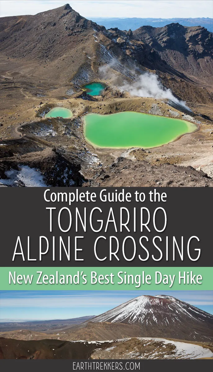
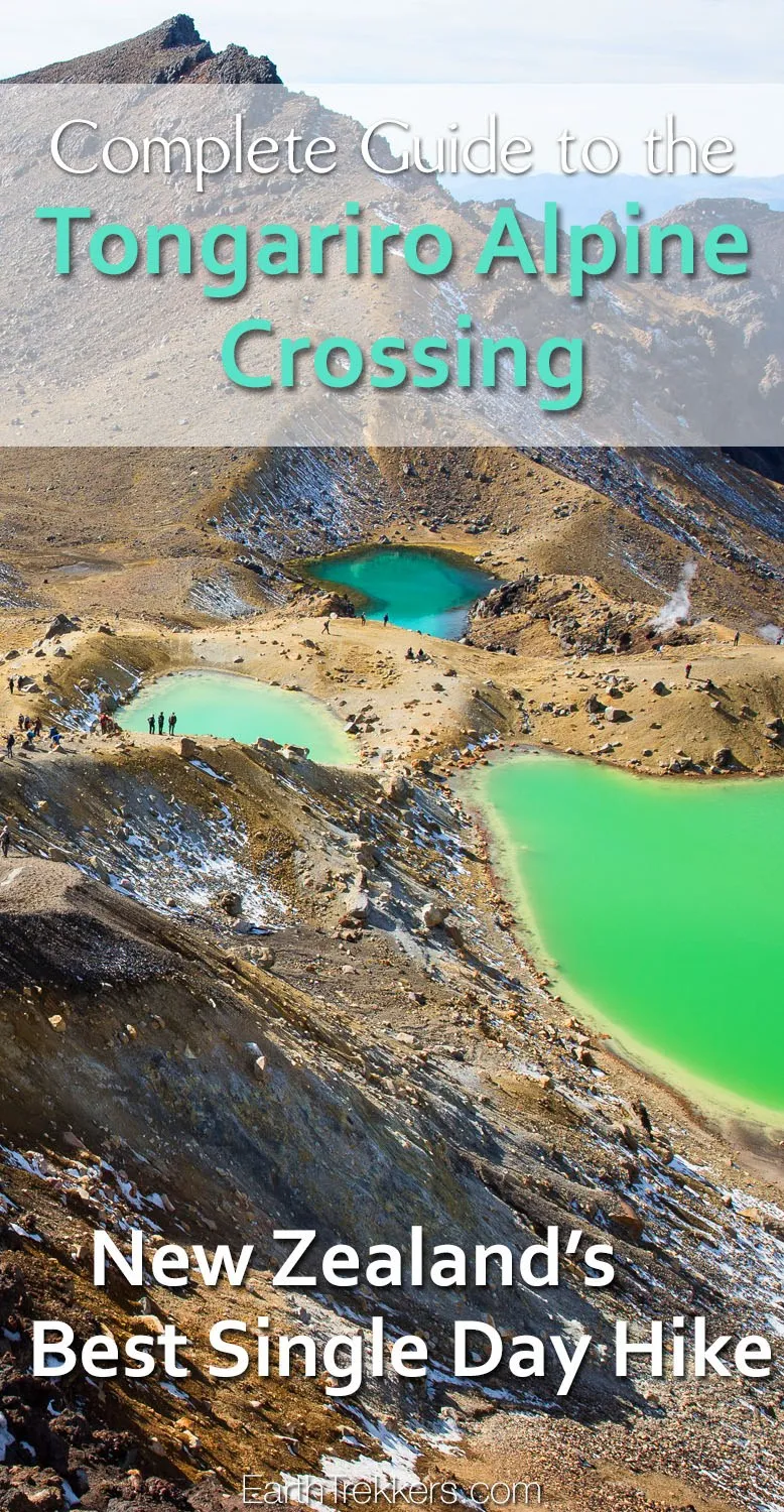
The Tongariro Alpine Crossing is a 19.4 km (12 mile) hike in New Zealand’s North Island with emerald lakes, views of semi-dormant volcanoes, and ever-changing terrain. Our complete guide covers everything you need to know to plan your day.
The Tongariro Alpine Crossing is often labeled as the world’s greatest single day hike.
Located on the North Island of New Zealand, the volcanic terrain of Tongariro National Park breaks up the lush, green scenery that is so prevalent in this country. Here is your chance to hike in the shadow of Mt. Doom (Mount Ngauruhoe), walk through an almost lunar landscape, and watch as semi-dormant volcanoes smoke not too far off in the distance.
The Tongariro Alpine Crossing, with its ever-changing views, emerald green pools, and crimson colored volcanic terrain, is one of our favorite day hikes in the world, and we’ve done a lot of hikes. Since hiking the Tongariro Alpine Crossing, we’ve returned to New Zealand several times to hike some of its longer trails, such as the Routeburn Track and Milford Track.
First we discuss the Tongariro Alpine Crossing trail route, complete with stats, a map, and lots of photos from the trail. Then we get into the necessary logistics, such as how to arrange your shuttle and how to get your permit.
Let’s get started.
The Essentials
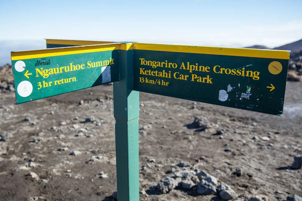
Shuttle: It’s best to do this hike point-to-point, which requires hiring a shuttle that connects the parking lots at both ends of the hike. The best direction is Mangatepopo to Ketetahi.
Permit: A permit is required. It is free and can be obtained on the Department of Conservation website.
Check Conditions: Before your hike, visit the DOC website for the latest trail and weather conditions.
Best Time of Year: November through May
November 2025 Update: All links and pricing verified. Added photos, sections on where to stay and what to bring, plus links to our new content from our most recent trip to New Zealand.
Tongariro Alpine Crossing Hiking Stats
Below are the hiking stats starting at the Mangatepopo car park and ending at the Ketetahi car park.
Distance: 19.4 km (12.1 miles) point-to-point
Elevation Gain: 765 meters elevation gain and 1125 meters elevation loss if you hike from Mangatepopo car park to Ketetahi car park
Difficulty: Strenuous
Length of Time: 6 to 9 hours
Location: Tongariro National Park, North Island of New Zealand
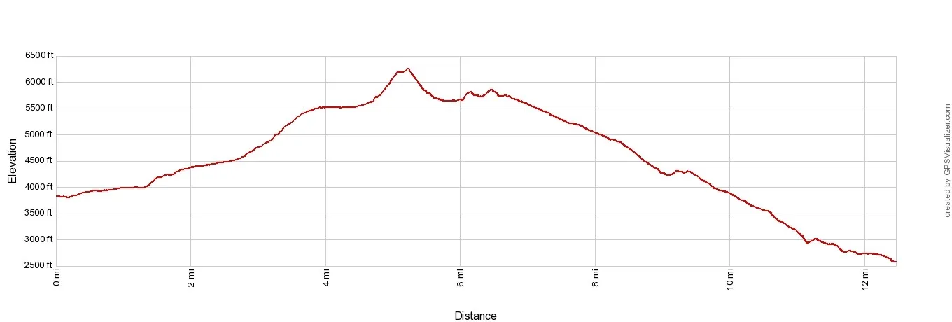
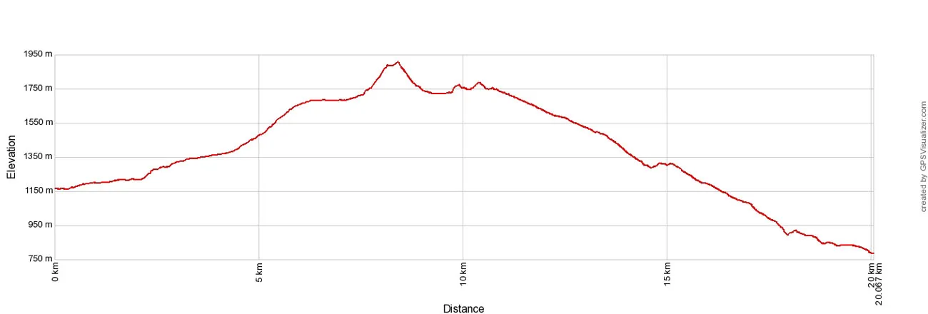
Tongariro Alpine Crossing Elevation profile
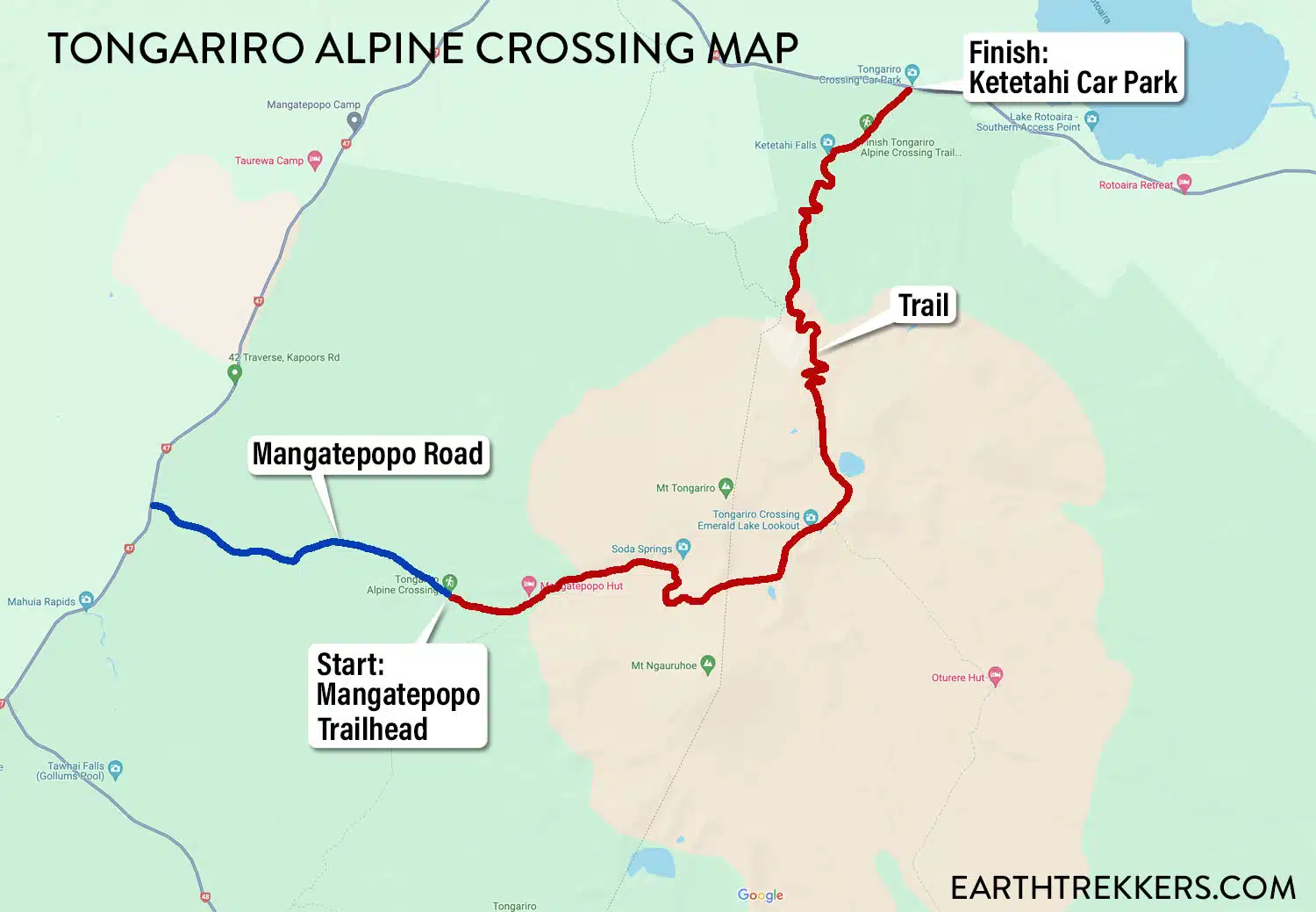
Tongariro Alpine Crossing Trail Map
The Tongariro Alpine Crossing is a 19.4 km hike, estimated to take between six and nine hours. It is a point to point hike so you will need to arrange transportation to either the start or finish of the hike. More on this later (or skip ahead now).
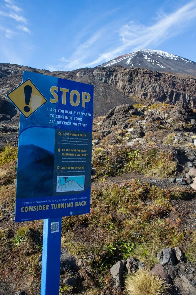
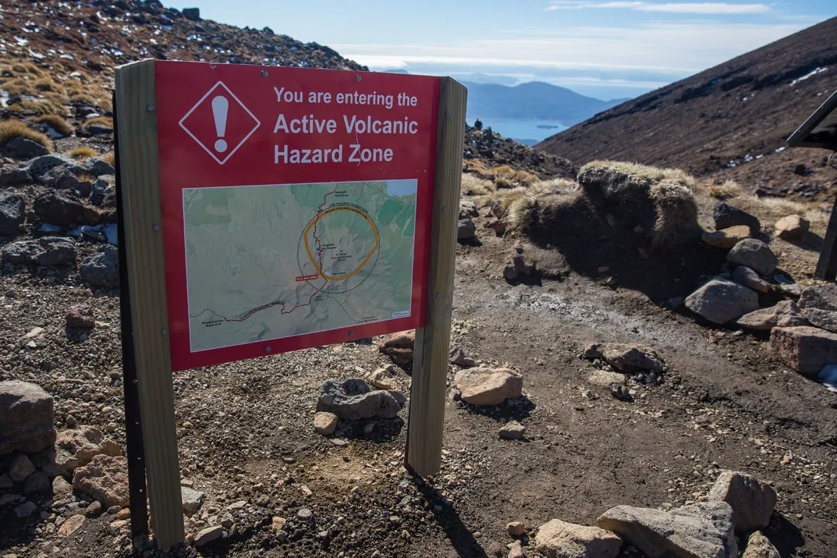
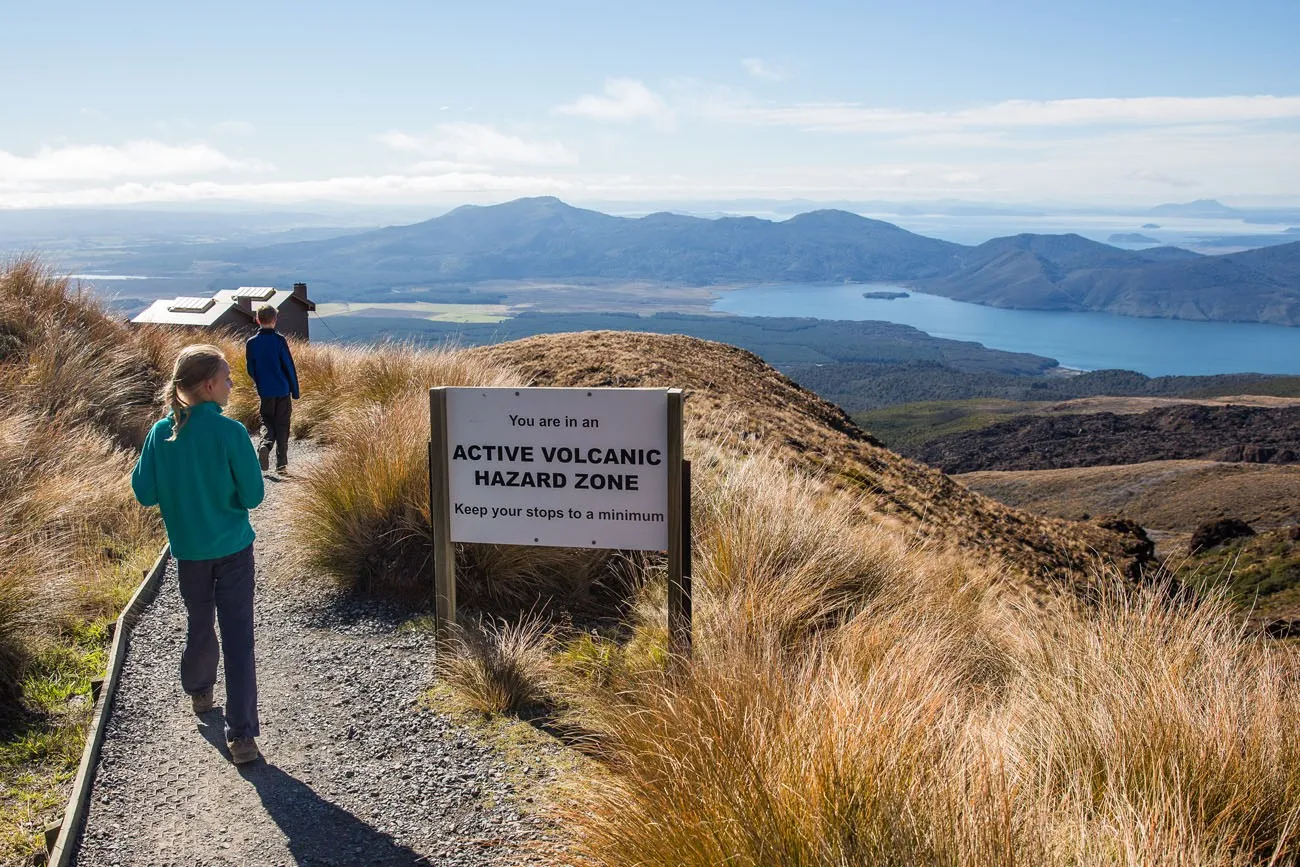
The hike climbs up through volcanic terrain, with old lava fields, walks through giant calderas, and even past a smoking, steaming volcano that erupted just six years ago. The volcanic activity of the park is constantly being monitored, with warning signs at various points along the trail alerting hikers what to do if an eruption should occur.
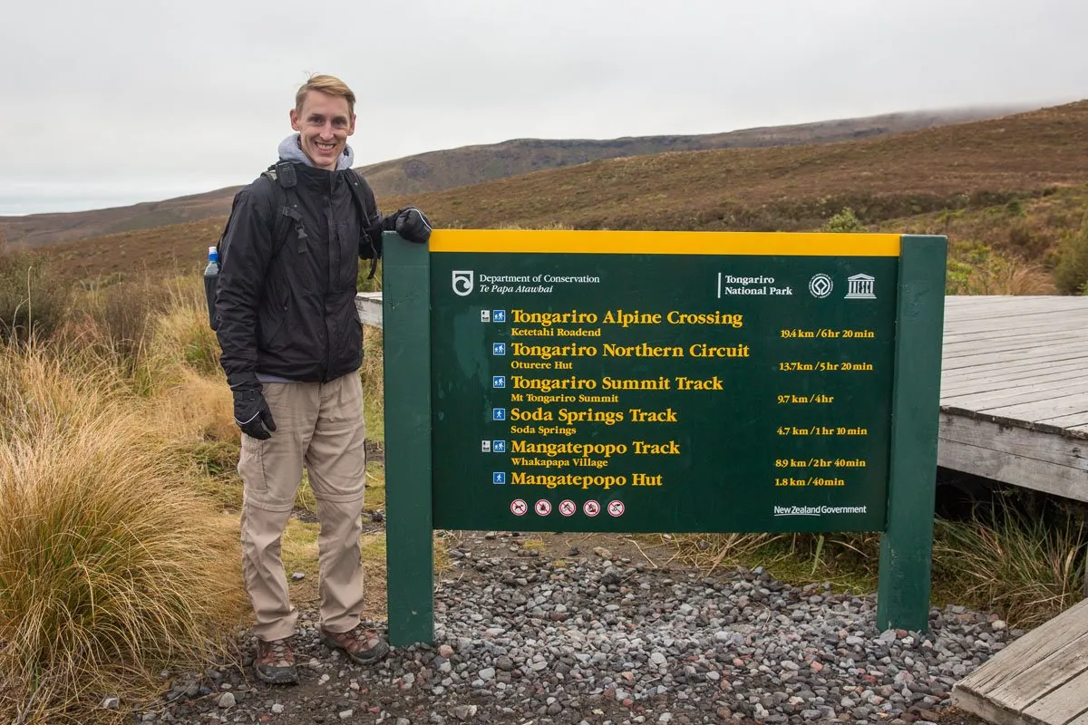
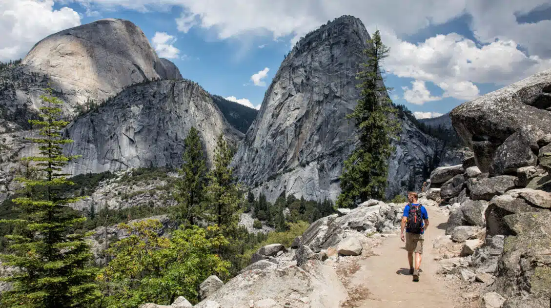
Tim at the trailhead at the Mangetopopo car park
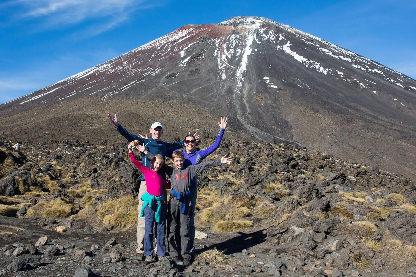
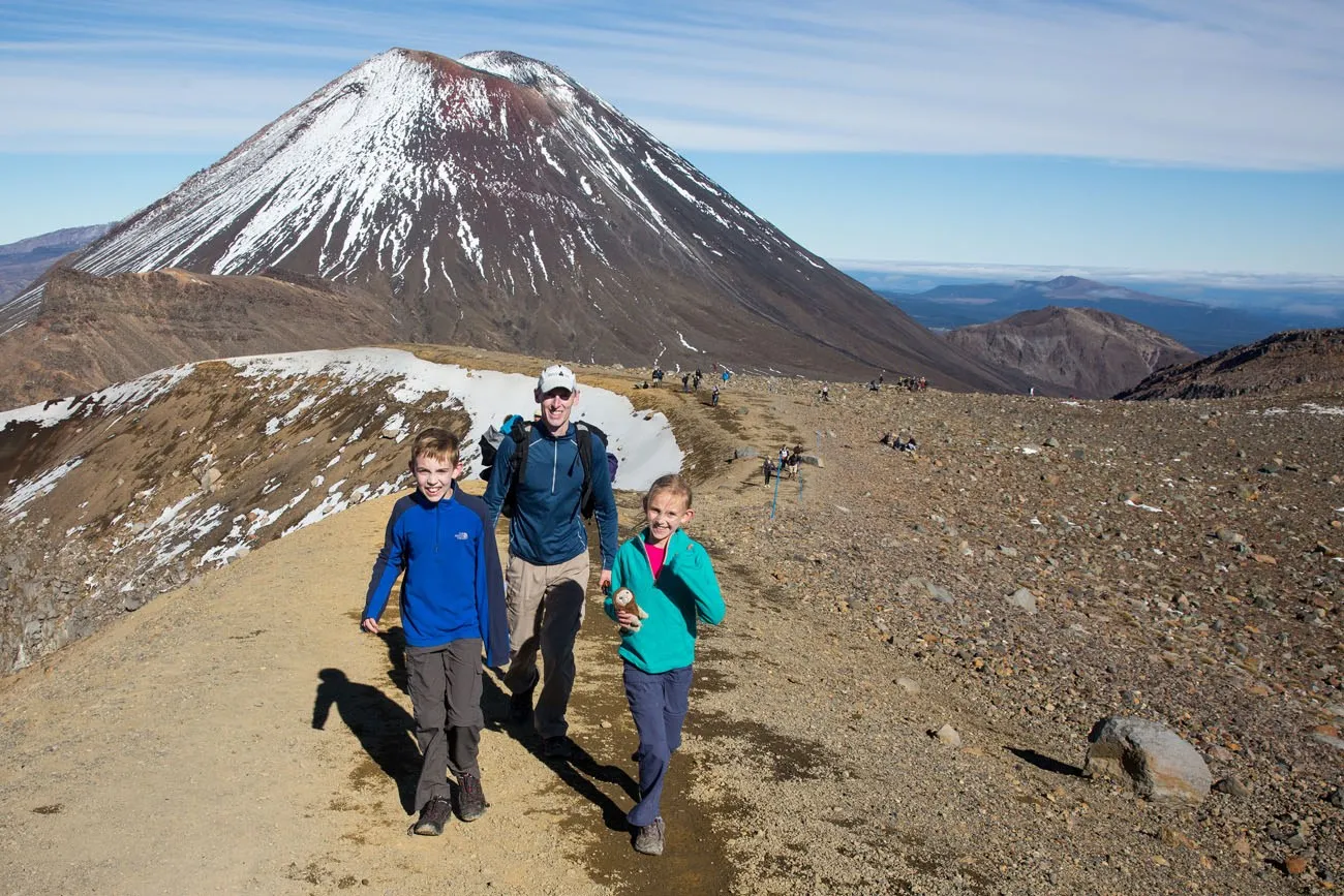
Tongariro National Park was made more famous by its star appearance in the Lord of the Rings trilogy, like so many places in New Zealand. The alpine, volcanic scenery is the setting of Mordor, in which stands Mt Doom, aka Mt Ngauruhoe. For the entire trilogy, Frodo and Sam are trying to get to Mt Doom in order to destroy the infamous ring.
Tyler and Kara were thrilled not only to be hiking around a volcano but to also be hiking around a volcano featured in one of their favorite movies. At the time that they did this hike, they were 12 and 10 years old.
Please practice the seven principles of Leave No Trace: plan ahead, stay on the trail, pack out what you bring to the hiking trail, leave areas as you found them, minimize campfire impacts, be considerate of other hikers, and do not approach or feed wildlife.
How to Hike the Tongariro Alpine Crossing
Step-By-Step Trail Guide
The Start of the Hike
Our hike started at the Mangatepopo car park at 8:30 am. It was a very chilly morning, only 45 degrees Fahrenheit (7 degrees Celsius), and we were standing under a thick blanket of clouds.
At first we were cold and wearing hats and gloves, but all of this would quickly change. A half hour into the hike the clouds melted away and we were all taking off layers. We were thrilled to have clear skies!
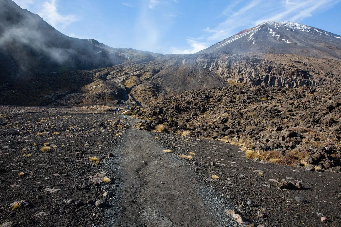
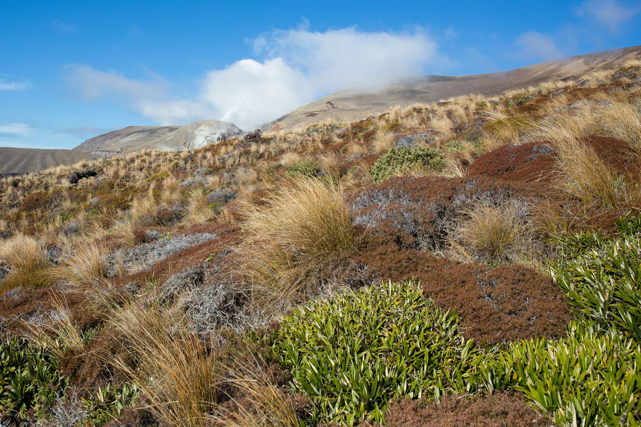
After forty-five minutes of hiking up a steady, gradual incline through alpine vegetation, the scenery began to change. The ground became darker, the soil was almost black, and there were volcanic boulders strewn across the landscape.
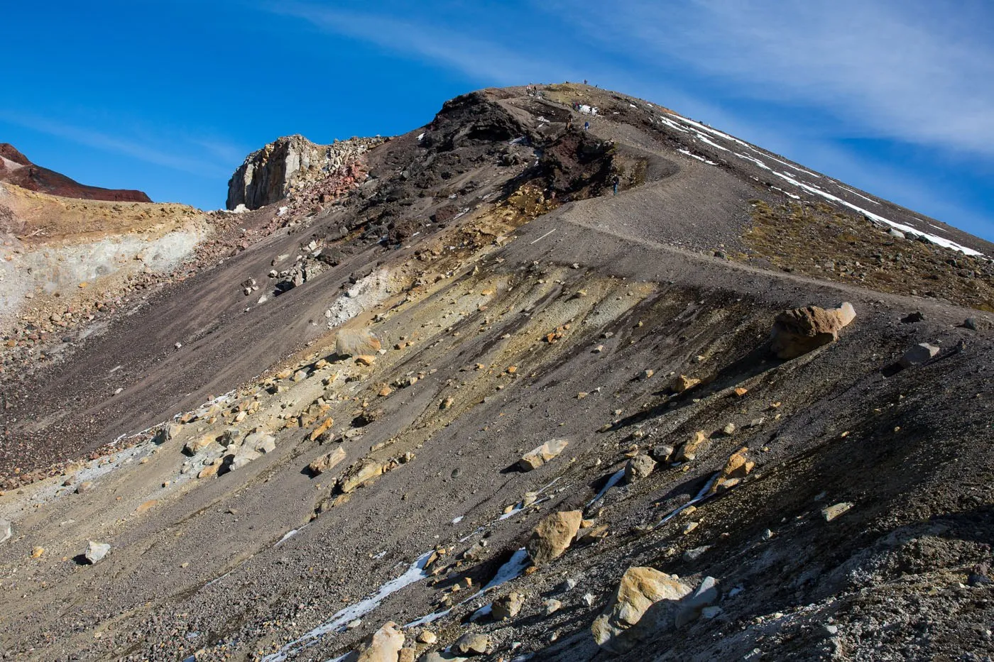
On the Devils Staircase
Almost 5 km into the hike, you reach the first tough section of the trail.
After a warning sign alerting hikers as to how strenuous the trail was about to become, we began the real climb up the mountain. It was steep and tiring and had us pausing to catch our breath occasionally, but the higher we got the better the views became.
This first real climb is the most strenuous of the hike. Once you make it to the top of this section you will still have a few more climbs, but the worst is out of the way. This ascent up a series of staircases is sometimes referred to as the ‘Devils Staircase.’
A view looking back at Devils Staircase
With Mt. Doom looming over us we took some family photos and ate a snack of apples and granola bars. The view from here was awesome and it was about to get even better.
In the Shadow of Mt. Doom
At the top of Devils Staircase, the trail levels out (for a little bit) and the views start to get very, very good. Mt. Ngauruhoe looms over this part of the trail, making a fantastic photo spot.
For the next few kilometers of this hike, all that hard work you did will pay off as you get to enjoy some of the most unique views of New Zealand.
Just 13 km (about 4 hours of walking) to go at this point.
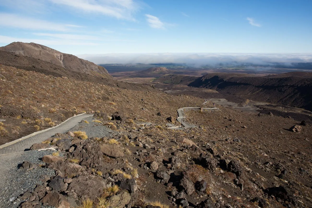
We hiked across a valley, over flat, squishy, wet volcanic soil and then it was time for one more push to the top.
The final climb was steep, strenuous, and almost a little dangerous. The ground was covered with loose gravel and it was icy, making us slip and slide at times. Not far off the trail was a drop off back down to the caldera. If you are doing this hike with snow or ice on the ground, be VERY careful here.
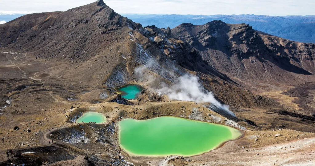
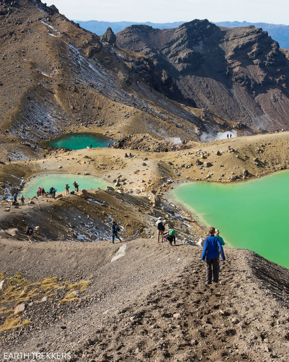
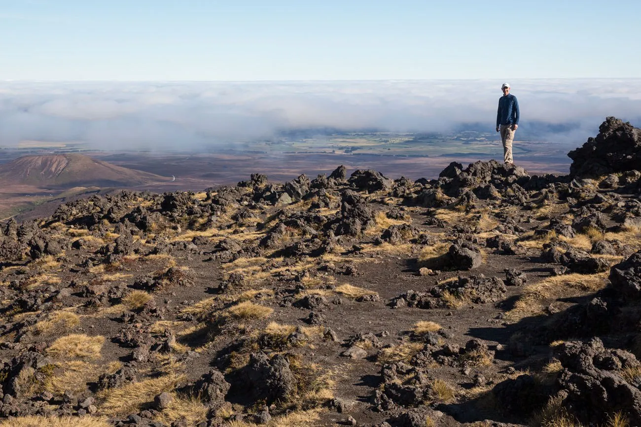
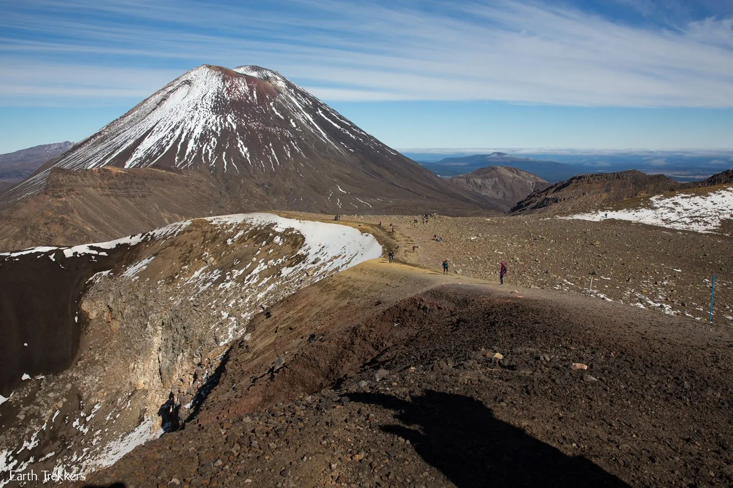
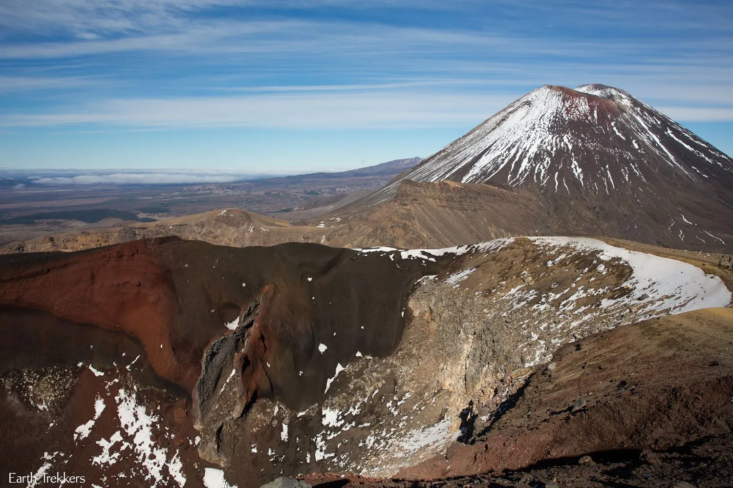
The Best Views of Tongariro National Park
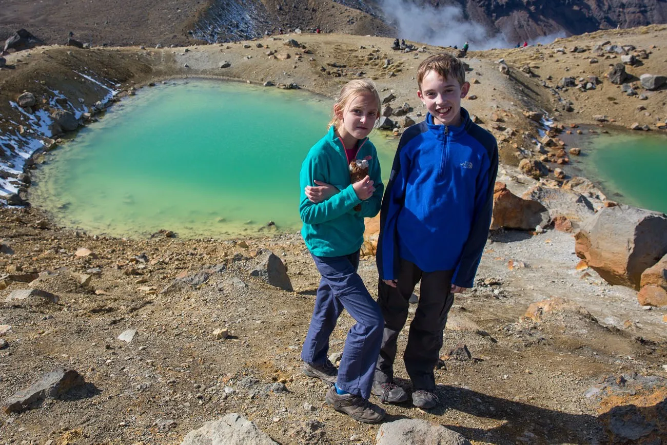
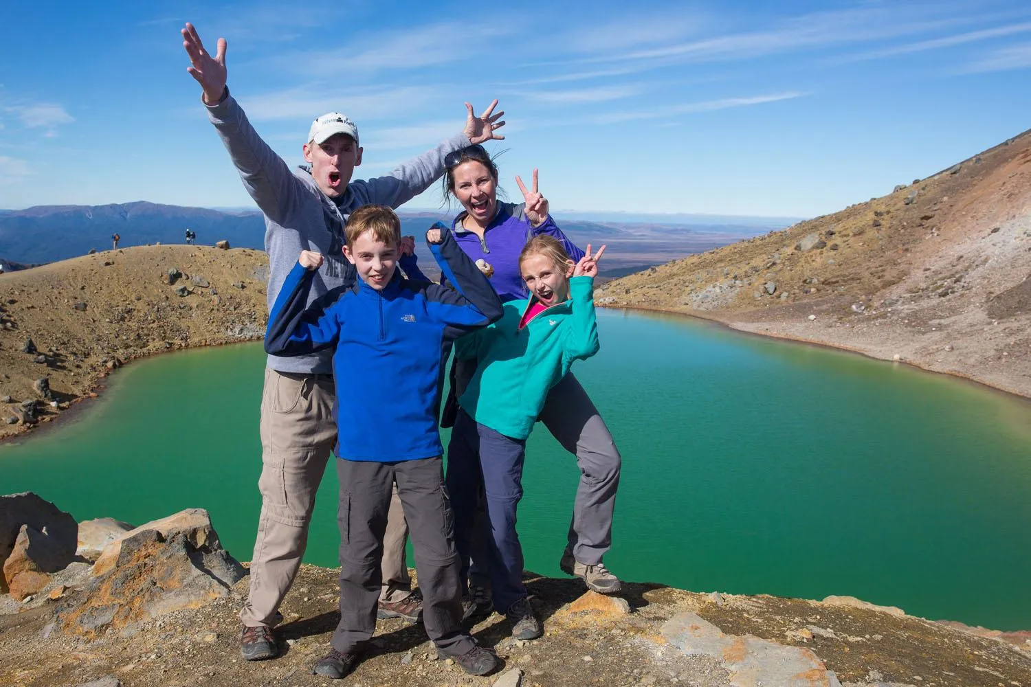
From the highest point of the hike we had 360° views of Tongariro National Park. We could see Mt. Ngauruhoe (Mt. Doom), Mt. Ruapehu, the Red Crater, small green lakes, and even Lake Taupō off to the north.
The skies were crystal clear and the temperatures were still on the chilly side but they were perfect for hiking. What a spectacular day.
The ever changing scenery and the difficulty of the trail really keeps things fun and interesting. Plus, if you’ve been road tripping through New Zealand, you’ve seen endless green landscapes and mountains.
This hike, which crosses volcanic terrain, is so much different from the rest of New Zealand, that it really makes this hike something special.
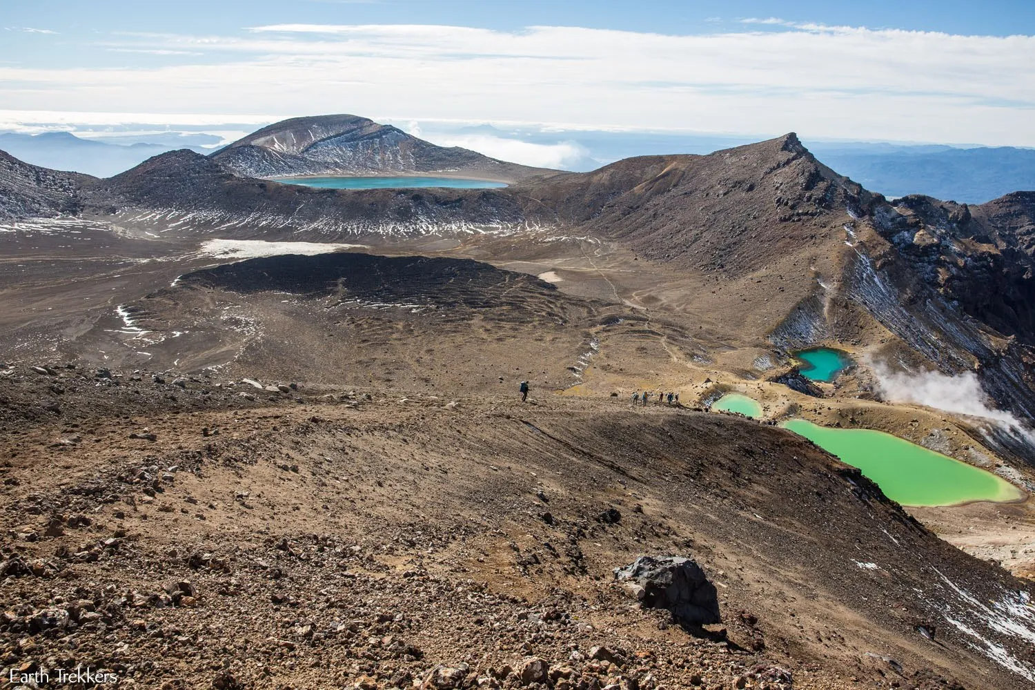
From this viewpoint we paused to enjoy the view we worked so hard to get to. It’s times like these that make me thankful that we are fit and healthy enough to do things like this, especially as a family. It is a gift to be able to travel like we do but it is moments like these that really make us appreciate what we are doing.
Sliding Down the Mountain
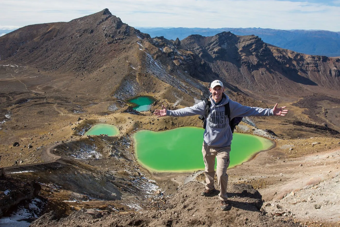
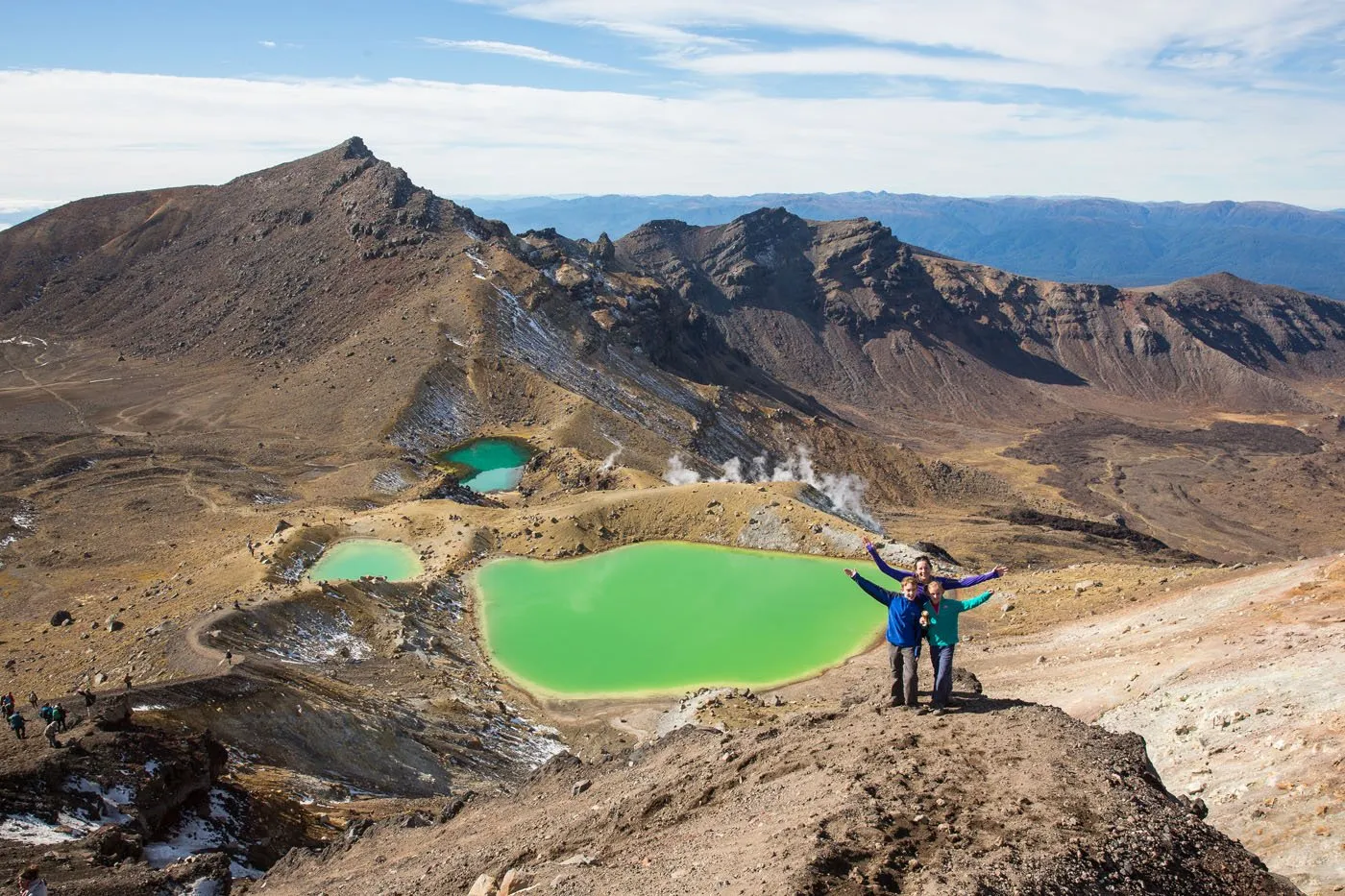
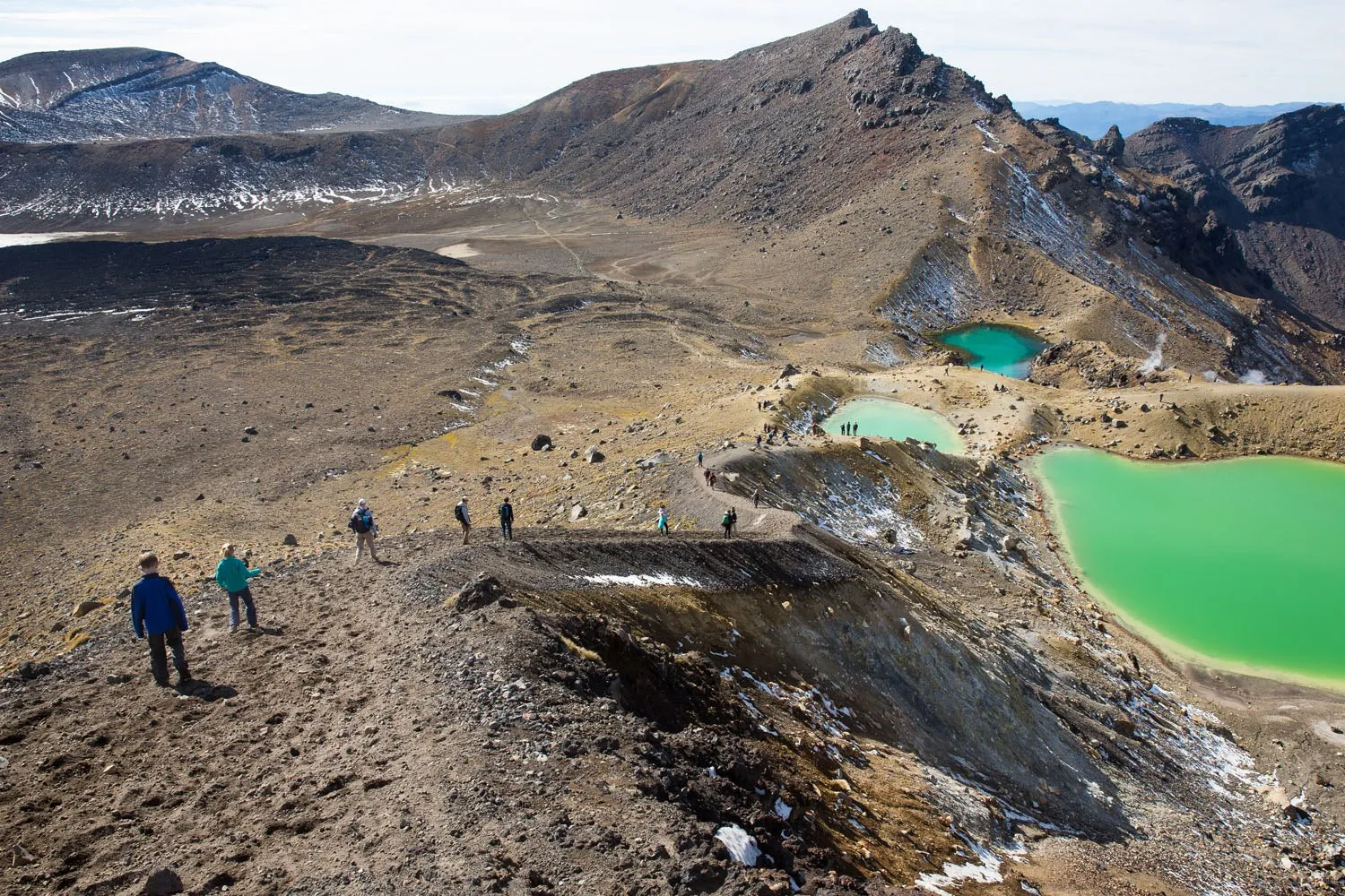
Now comes the fun part. It was a steep descent down to the thermal pools. The path was covered with thick dirt and gravel with a drop off on either side. We figured out how to slide down through the gravel, almost like skiing, getting to the bottom in almost no time at all.
The air smelled of sulfur so there would be no picnic stops here, even though the views were amazing.
The Final Kilometers of the Hike
Now it was time for the walk towards the car park. For the most part, the most dramatic scenery was behind us, except for a few small surprises here and there. We found a sulfur free viewpoint overlooking a large lake and it was here that we ate a picnic lunch of ham and cheese sandwiches.
From this point it was a downhill walk back to the Ketetahi car park. Tyler and Kara were now determined to get back to our car as quickly as possible, so they really increased our speed. For part of the way, Tim and I were almost jogging to keep up with them.
This part of the hike is not to be underestimated. Yes, it is mostly downhill, but it is almost 10km (about 6 miles), so you still have a few hours to go until you are finished.
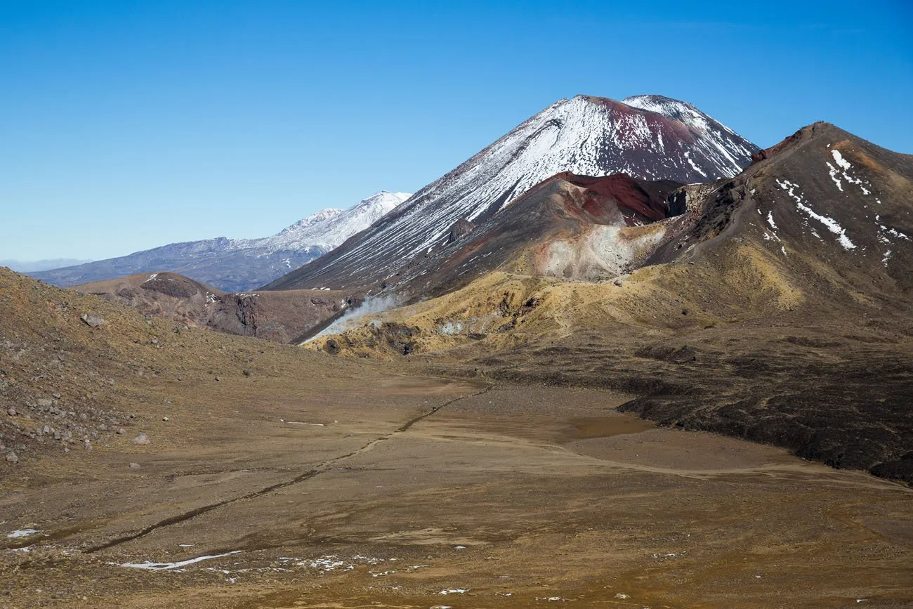
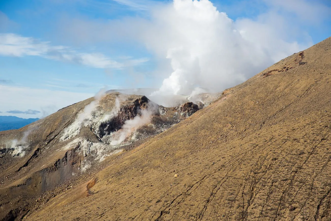
On the way down from the Tongariro Alpine Crossing we could see the Te Maari Crater, sending plumes of white steam into the sky.
There were multiple warnings that we were in active volcano territory and to not leave the trail. There was no threat of eruption today, but this is the same volcano that erupted several years before our visit.
It took us about two hours to get from our picnic spot to the car park. By the time we got to the car park, all of us were tired, our legs were sore, and our toes were bruised from bumping on the fronts of our shoes during the long descent.
We did the entire hike in six hours and ten minutes, including our breaks for food and photos. These two kiddos are amazing hikers.
Our family thoroughly enjoyed the Tongariro Alpine Crossing. By far it was our favorite hike in New Zealand and now one of our favorites in the world. The views are fantastic, the ever-changing views kept us from getting bored, the trails are rugged, and this hike is downright fun.
If you do one hike when going to New Zealand, it should be this one!
Tongariro Alpine Crossing Parking & Shuttle
Since this hike is done point-to-point, you will need to make a shuttle reservation in advance (this cannot be done the day of your hike).
The best way to hike the Tongariro Alpine Crossing is from the Mangatepopo trailhead, ending at the Ketetahi car park. Doing it in this direction eliminates a lot of the elevation gain, making it much easier in this direction.
There are several shuttle options, but the best option is to arrange a shuttle from the Ketetahi Car Park to the Mangatepopo car park the morning of your hike.
You will drive and park at the Ketetahi car park, board the shuttle you reserved, and take this to the Mangatepopo car park. Hike the Tongariro Alpine Crossing and you will finish at the Ketetahi car park and your car. You can get right in your car, rather than waiting for a scheduled shuttle to pick you up (or worrying about hiking fast enough to make it to the shuttle). This is what we did and it worked brilliantly.
There are several companies that provide this service, such as the Mountain Shuttle and Tongariro Crossing Shuttles. Or you can check out this shuttle service on GetYourGuide.
Tongariro Alpine Crossing Permit
In order to hike the Tongariro Alpine Crossing, you will need a permit. You can obtain that permit in advance on the New Zealand Department of Conservation website. It is free to do but if you do not have a permit you could be penalized. At the time of the last update of this article, there is no cap on the number of hikers but I recommend checking this on the official website before your trip, just in case things change.

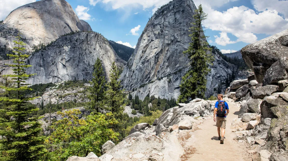
Tim on the trail
When Can You Hike the Tongariro Alpine Crossing?
You can hike the Tongariro Alpine Crossing all year. The best time to do it is from November to May, when the weather is warmer and drier. From June through October, snow and ice on the trail can make this hike dangerous. The New Zealand DOC website recommends hiking the Tongariro Alpine Crossing with a guide during this time.
We did this hike on May 5 and even then there was a little bit of snow and ice on the ground at the highest elevations. It did make the trail very slippery and somewhat dangerous.
The graphs below depict the average monthly temperatures and precipitation near Tongariro, which will help you plan your trip.
What Should You Bring on the Hike?
- Hiking shoes or boots, ideally waterproof
- Multiple layers. The weather can be unpredictable. Bring a waterproof jacket, hiking pants, a base layer, and a lightweight jacket.
- Hiking poles (optional)
- Food: 2 to 3 liters of water per person, snacks, picnic lunch
- First aid kit
- GPS device, we use the Garmin InReach
- Sunblock
- Camera
- Fully charged phone (although do not expect cell service along the trail)
Essential Hiking Gear: What Should You Bring on a Day Hike?
If you are new to hiking or are curious about what you should bring on a hike, check out our Hiking Gear Guide. Find out what we carry in our day packs and what we wear on the trails.Where is the Best Place to Stay?
We stayed in Turangi, which is a 15-minute drive from the Ketetahi car park.
Here are a few highly rated properties in Turangi and just outside of town:
- Moe Marie Sleep Peacefully
- Anglers Adventure Paradise Cabin
- River and Ridge Getaway
- The Redbarn
- The Grumpy Trout Lodge (south of Turangi, but closer to the hike)
Taupō, which is a one-hour drive to the Ketatahi car park, has more hotel and restaurant options. It’s worth considering if you also plan to visit Taupō on your trip and prefer to minimize the number of hotels you stay in. We have recommendations in our guide Best Things to Do in Taupō ↓ (we’ve been here three times in recent years, our most recent visit being December 2024).
20 Amazing Things to Do in Taupō (+ Map, Photos & Tips)
Best things to do in Taupō, including where to eat and where to stay.Tongariro Alpine Crossing Helpful Tips
It is a 19.4 km hike from start to finish. We started at the Mangatepopo car park and ended at the Ketetahi car park. Since it is a point to point hike, transportation to the start or the finish of the hike will need to be arranged. We parked at the Ketetahi car park and had a shuttle take us to the start of the hike at Mangatepopo. That way, once we arrived at Ketetahi, our car was waiting for us and we could leave when we were ready.
You can do the hike in either direction, but most people go from Mangatepopo to Ketetahi. Mangatepopo sits at a higher elevation than Ketetahi, so starting here eliminates almost 200 meters of climbing. It is also much more interesting to climb up through the volcanic scenery in the shadow of Mt Doom than to climb up through the monotonous scenery near Ketetahi.
Toilets: There are toilets at both car parks. There are also toilet facilities an hour into the hike right before the strenuous climb starts, as well as toilet facilities just before the long walk back down to the Ketetahi car park.
Weather conditions can change abruptly so make sure you have plenty of layers with you. It can get very cool at the summit. Also make sure you bring along plenty of water and sunblock. There is very little cover on the trails.
Try to avoid weekends.We did the hike on a Sunday and there were a lot of people on the trail. I am assuming that on weekdays the trail would be less crowded.
Don’t forget to get your permit in advance.
If you want a view but don’t want to do the hike, check out the Sky Waka Gondola. This gondola is located near the trail and offers similar views from the hiking trail.
And finally, have fun and enjoy it! It is a fabulous hike, one of our favorites!
Frequently Asked Questions
How hard is the Tongariro Alpine Crossing?
The Tongariro Alpine Crossing is a 20 km hike (12.4 miles) with 800 meters of total ascent, so it is a challenging day hike. In order to do this hike, you need to have a good level of fitness. There are no technical sections on the trail (no rock scrambling), but the distance combined with the elevation gain and changing terrain make this a strenuous hike.
Can you hike the Tongariro Alpine Crossing with kids?
Active, adventurous kids can hike the Tongariro Alpine Crossing. Our kids were 10 and 12 when we did this and they did the full hike without any difficulty. I think an active 8 year old with some prior hiking experience can do this hike, but you should know what your kids can handle before attempting a long hike like this one. Take them on a few shorter hikes as a “test,” before committing to a long, point-to-point hike like the Tongariro Alpine Crossing.
Is the Tongariro Alpine Crossing worth it?
Absolutely. This was our favorite hike in New Zealand and the Tongariro Alpine Crossing is one of our favorite hikes in the world. If you are an avid hiker and planning a visit to New Zealand, put this hike on the top of your list.
Can you hike the Tongariro Alpine Crossing without a shuttle?
Yes, it’s possible to hike the Tongariro Alpine Crossing without a shuttle. One option is to park at the Mangatepopo car park and hike out-and-back to the Red Crater (about 13 miles total). Be aware that there is a 4-hour parking limit at Mangatepopo from October through April. If you have two vehicles, you can do the hike point-to-point (May through September).
Are you planning to hike the Tongariro Alpine Crossing? Comment below if you have any questions or if you want to share your experience.
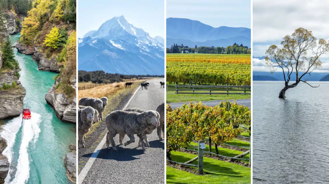
Plan Your Trip to New Zealand
We have TONS more information about New Zealand in our New Zealand Travel Guide, including Auckland, Queenstown, Wanaka, Aoraki/Mount Cook, Franz Josef, Christchurch, Wellington, Taupō, and the Milford Sound.
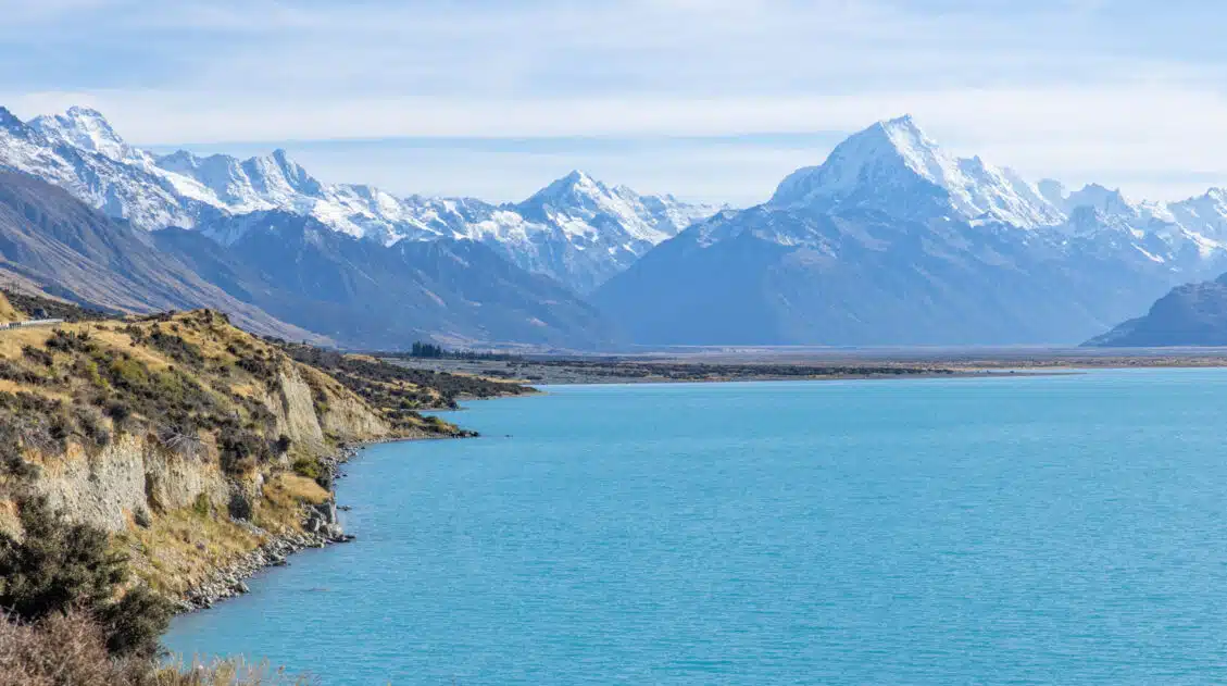
New Zealand Travel Guide | How to Plan a Trip to New Zealand
Pinterest Facebook Flipboard New Zealand Travel Guide New Zealand is one of our favorite countries in the world. Why? Because New Zealand has the perfect mix of breathtaking landscapes, adventure activities, beautiful cities, wine regions, stunning beaches, amazing drives, and gourmet food. This is the land of fiords, hiking trails, bungy jumping, sheep, glowworms, and […]
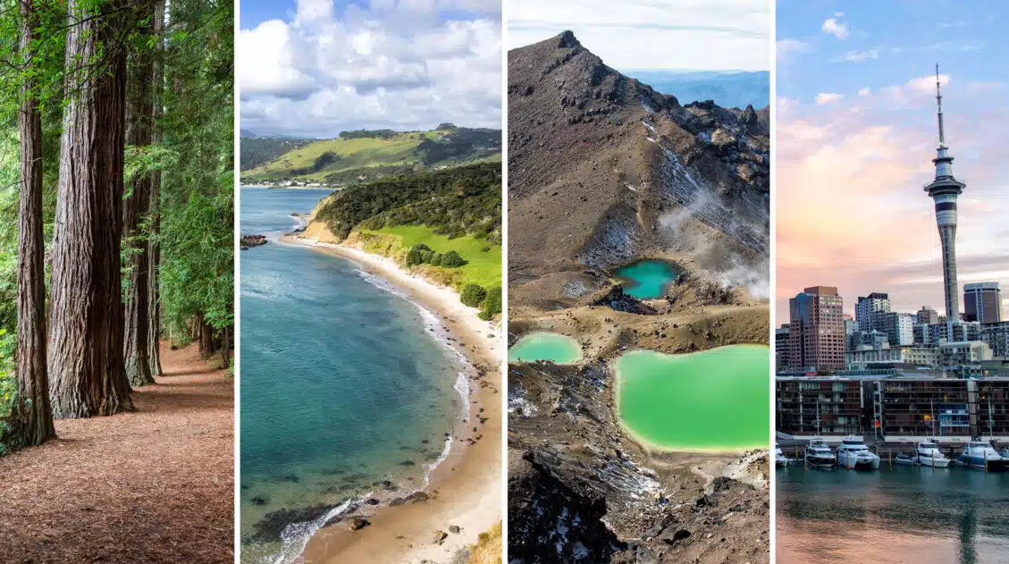
30 Amazing Things to Do on the North Island of New Zealand
Cruise the Bay of Islands, go black water rafting, spend a day on beautiful Waiheke Island, go sandboarding, hike the spectacular Tongariro Alpine Crossing, see glowworms and kiwi birds, visit Hobbiton, and explore the geothermal areas around Rotorua and Taupo…these are all things to do on the North Island of New Zealand. We have visited […]
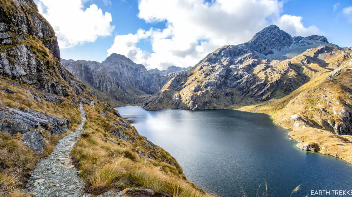
Exactly How to Hike the Routeburn Track in One Day
The iconic Routeburn Track is a 33 km (20 mile) alpine track on New Zealand’s South Island runs from The Divide in Fiordland National Park to Routeburn Shelter in Mount Aspiring National Park. It is typically done as a 2 to 3 day trek, but if you’re fit and fast, you can do it in […]
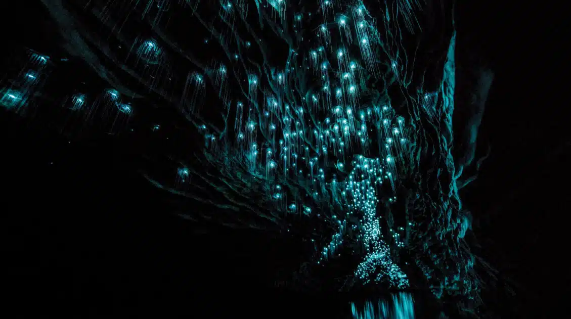
Waitomo Caves: Glowworms, Black Water Rafting & the Best Tours
This guide covers the best things to do in the Waitomo Caves, including how to see the glowworms and how to go black water rafting. It also covers the best tours, where to stay, and how to combine Waitomo Caves with another famous attraction on the North Island, Hobbiton. The Waitomo Caves are an underground […]
20 Amazing Things to Do in Taupō (+ Map, Photos & Tips)
Sitting on the shores of the largest freshwater lake in New Zealand is the small town of Taupō. Cruising the lake, mountain biking, hiking, skydiving, and jet boat riding top the list of things to do in Taupō. There are also geothermal areas to explore, thermal pools and spas to visit, and waterfalls to photograph. […]
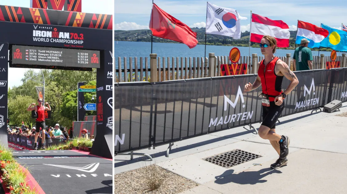
IRONMAN 70.3 New Zealand: Racing the 70.3 World Championship
Nothing screams destination race like Taupō, New Zealand. A beautiful lake swim through crystal clear water, cycling through the idyllic and lush New Zealand farmland, and a waterfront run with mountain views. And it’s not just Taupō that makes this such a great destination race. In addition to racing, New Zealand is an outdoor enthusiast’s […]
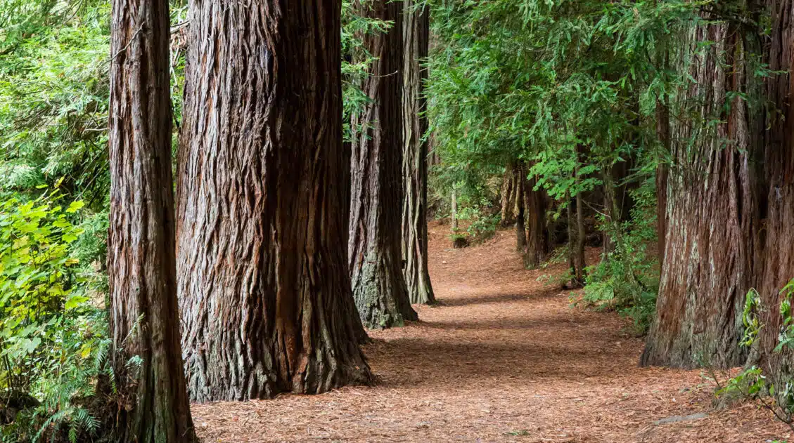
20 Wonderful Things to Do in Rotorua, New Zealand
Discover the best things to do in Rotorua, from its geothermal wonders such as Te Puia and Wai-O-Tapu Thermal Wonderland, to unique experiences like the Redwoods Treewalk and zorbing, as well as its cultural tours of Māori villages. One day is sufficient to see the main sights, but more time lets you visit several thermal […]
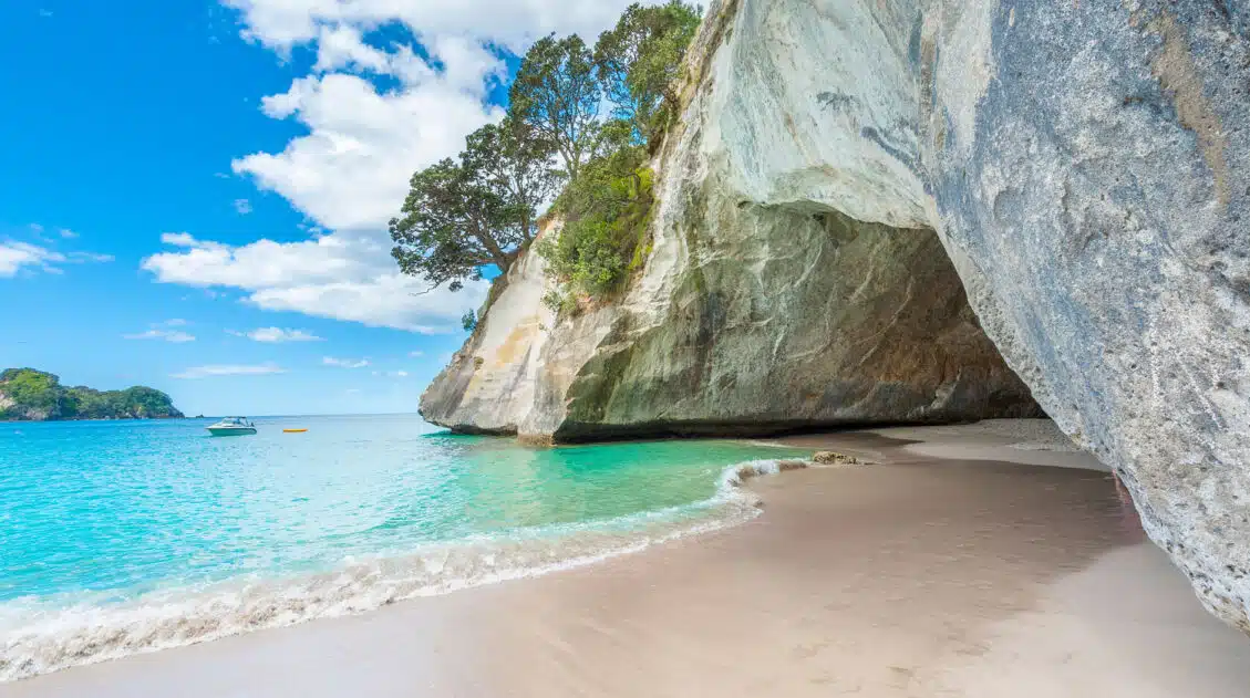
Cathedral Cove Boat Tour | Coromandel Peninsula, New Zealand
Cathedral Cove is one of the top attractions on the North Island of New Zealand. To get here, you have several options. You can get here by boat, by kayak, or on your own two feet. We took a cruise with Hahei Explorer to see Cathedral Cove. During our visit, which was in April 2023, […]
North Island Itinerary: Best Routes for 5 Days to 2 Weeks
If you’re planning a New Zealand North Island itinerary, this guide offers flexible routes for 5 days, 7 days, 10 days, and 2 weeks. Whether it’s your first visit or a return trip, these itineraries balance iconic highlights with lesser-known local gems. We have road tripped through the North Island three times, exploring from the […]
40 EPIC Things to Do on the South Island of New Zealand
Discover 40 amazing things to do on the South Island of New Zealand, from cruising Milford Sound to wine tasting and hiking the famous Roy’s Peak Track. Plan to spend at least one week on the South Island to see its highlights; three weeks is ideal for the full experience. The South Island of New […]
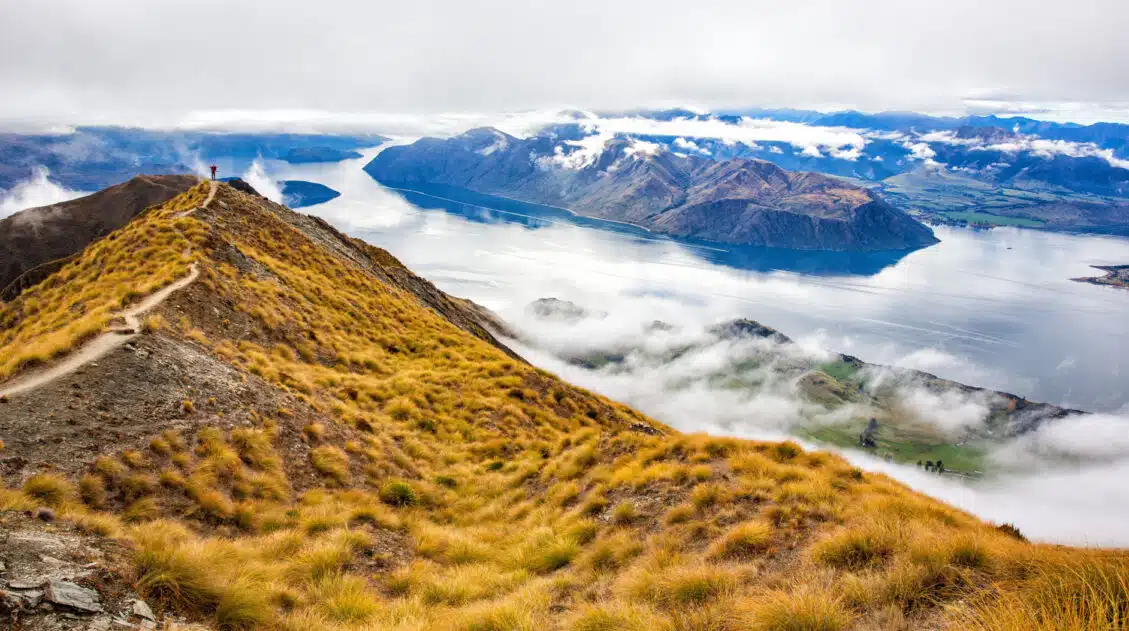
Roys Peak Track: Stats, Photos, Hiking with Kids
The Roys Peak Track is a 16 km (10 mile) strenuous, out-and-back hike to a stunning viewpoint over Wanaka and Lake Wanaka. Here’s how to do it. Roys Peak Track is one of the best hikes to do on the South Island of New Zealand. Located in Wanaka, this trail takes you high into the […]
New Zealand Itinerary: 3 Week North & South Island Road Trip
This 3-week New Zealand itinerary starts in Auckland, spends one week on the North Island, then two weeks on the South Island, ending in Queenstown. It’s the best way to see the highlights of New Zealand in one road trip. It’s no secret that New Zealand is one of our favorite destinations in the world. New Zealand is the perfect blend […]
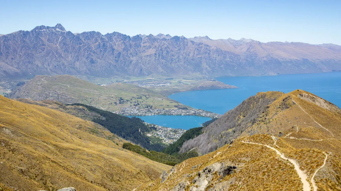
How to Hike the Ben Lomond Track, the Best Hike in Queenstown
Looking for the best day hike in Queenstown? The Ben Lomond Track provides the perfect mix of challenge and reward. Along this 11 km (6.8 mile) round trip hike, you’ll be treated to incredible views of the Remarkables, Lake Wakatipu, Queenstown, and mountain peaks as far as the eye can see. You can either hike […]
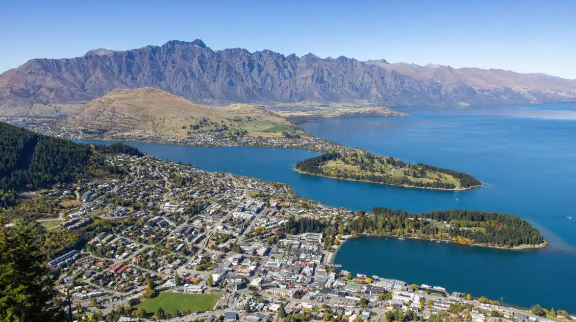
Queenstown Bucket List: 25 Epic Things to Do in Queenstown
Discover the best things to do in Queenstown, from adrenaline-pumping activities like bungy jumping, jet boat rides, and paragliding, to top hiking trails, viewpoints, scenic drives, and more relaxed experiences such as hot springs and wine tastings. Queenstown is one of the best places in New Zealand to engage in heart-racing, thrilling adventures. Paragliding, bungy […]
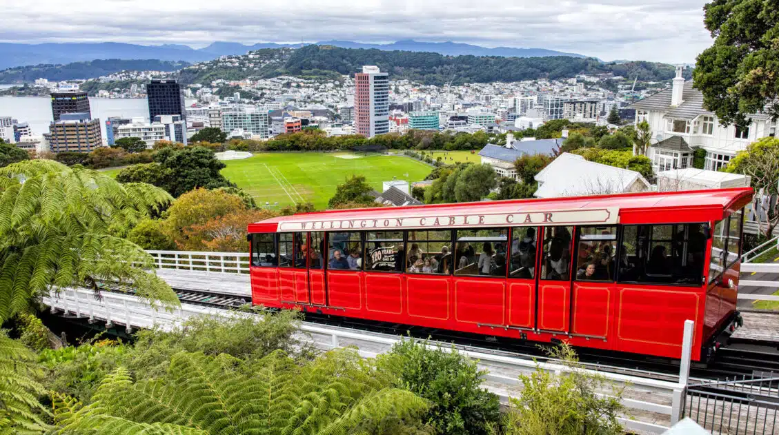
Top 10 Things to Do in Wellington, New Zealand
Wellington is a beautiful city on the North Island of New Zealand. It is packed with fabulous bars, restaurants, coffee shops, and breweries. Walking the waterfront is a must-do, as is visiting Te Papa and riding the historic cable car. In this guide, we list 10 of the best things to do in Wellington plus […]


Comments 38