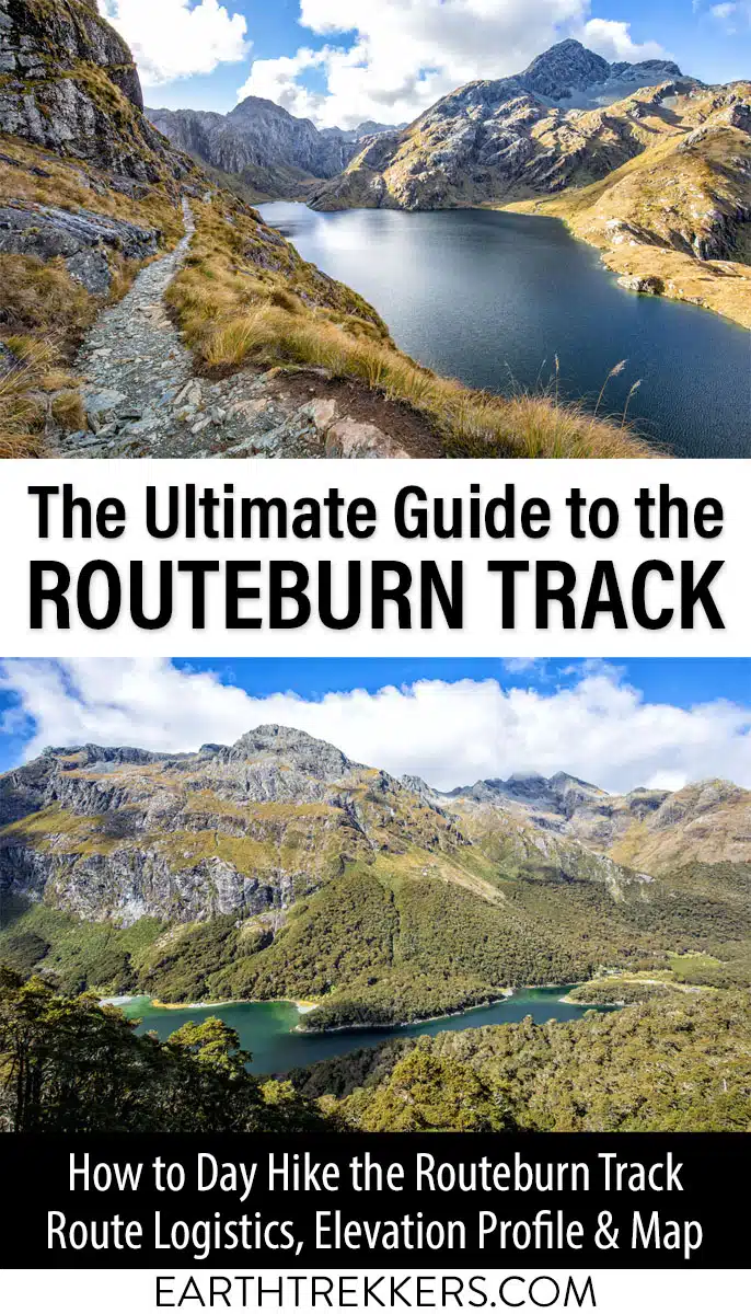
The iconic Routeburn Track is a 33 km (20 mile) alpine track on New Zealand’s South Island runs from The Divide in Fiordland National Park to Routeburn Shelter in Mount Aspiring National Park. It is typically done as a 2 to 3 day trek, but if you’re fit and fast, you can do it in one long day.
The Routeburn Track is considered one of the best hikes in New Zealand, and for a good reason, as there are many picturesque elements to this hike.
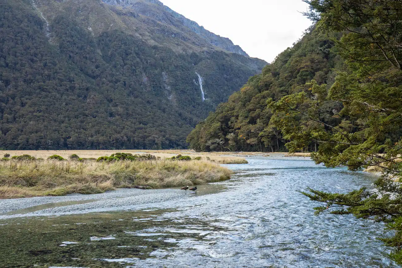
The Routeburn Track will take you through lush mossy forests, across rivers, streams, and swing bridges, past pristine alpine lakes, past more waterfalls than you can count, and to jaw dropping vistas of mountains, glaciers, and valleys. You may also find yourself being greeted by some of New Zealand’s birdlife, such as the endangered kea, a parrot that can only be found on New Zealand’s South Island.
This is one of New Zealand’s Great Walks. It is typically done in 2 to 3 days, but if you are extremely fit, you can hike the Routeburn Track in one day. In this guide, we’ll cover how to do it, plus how to arrange your transportation, which can be one of the trickiest parts of the entire experience.
November 2025 Update: All links and hiking stats verified. Added links to our new guides on New Zealand.
What is the Routeburn Track?
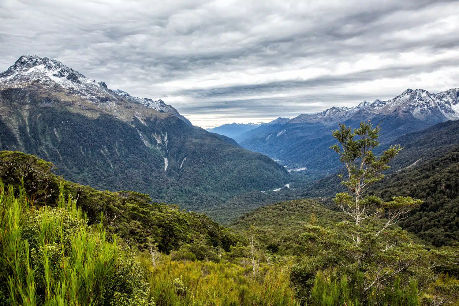
The Routeburn Track is a point-to-point track that connects Fiordland National Park and Mount Aspiring National Park, two gorgeous parts of New Zealand’s South Island. Both parks include portions of the Southern Alps.
You may already be familiar with some of Fiordland National Park’s other treasures, such as the Milford Sound and the Doubtful Sound. And while you will not see those fiords from the Routeburn Track, they are a testament to the natural beauty you will find in this part of New Zealand.
Hiking the full length of the Routeburn Track is typically done in two to three days by overnighting at the huts or campsites along the track. But if you are fit and fast, it is possible to go the entire 33.1 kilometers (20.6 miles) in one day.
Due to the point-to-point nature of the Routeburn Track, and the fact that the two end points are separated by a 325 km (202 mile) drive, there are some transportation logistics to work out. Or you might opt to only hike a portion of the Routeburn Track out-and-back in order to avoid dealing with those logistics.
So, you have options when it comes to enjoying one of New Zealand’s greatest walks. I will cover all of those options in this guide along with other practical information to help you plan the Routeburn Track experience that is best for you.
Please practice the seven principles of Leave No Trace: plan ahead, stay on the trail, pack out what you bring to the hiking trail, leave areas as you found them, minimize campfire impacts, be considerate of other hikers, and do not approach or feed wildlife.
Routeburn Track Maps
Routeburn Track Map
The Routeburn Track on a 3D map
Trailheads and Shelters
It is helpful to familiarize yourself with the following locations along the trail before planning your own experience.
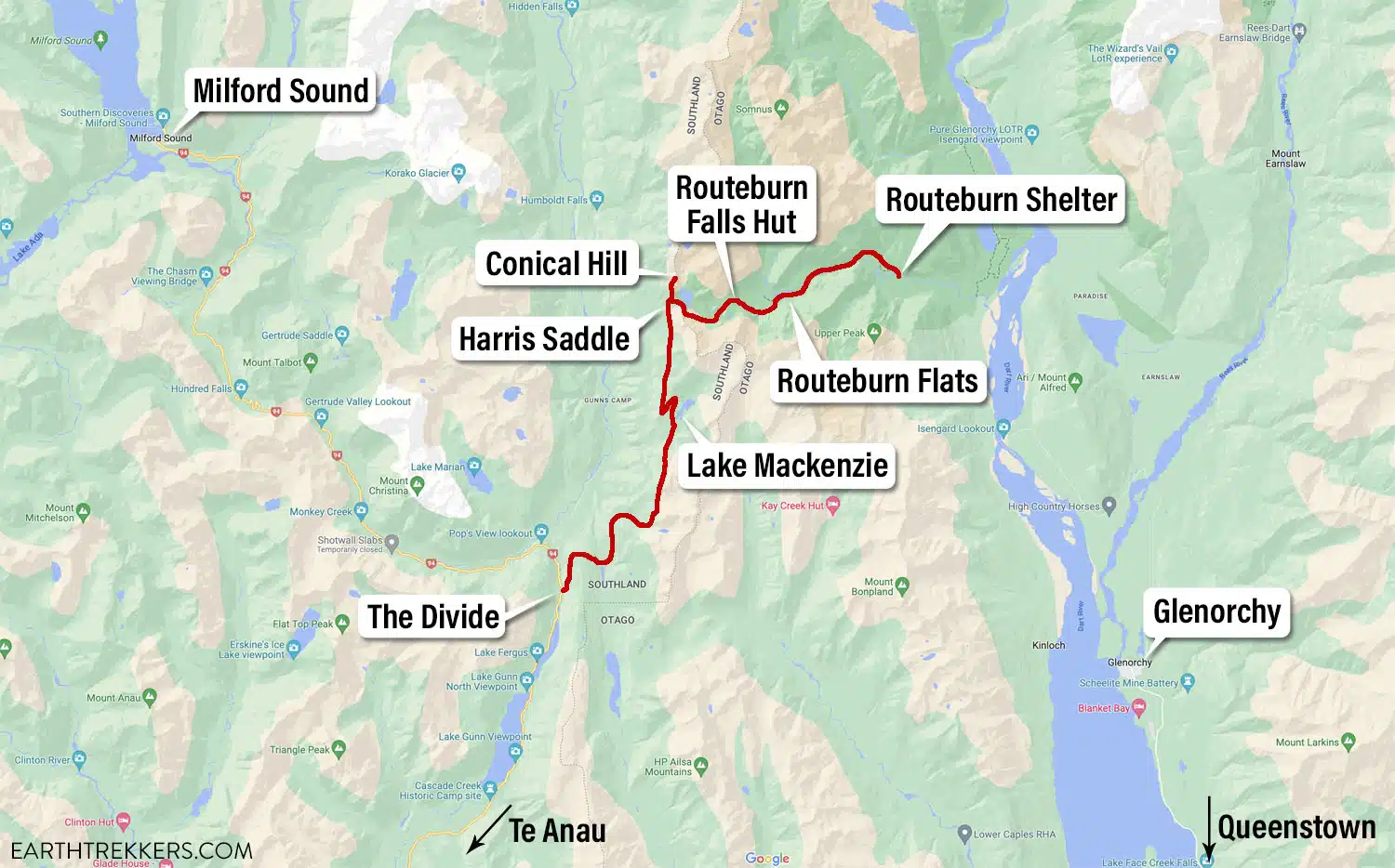
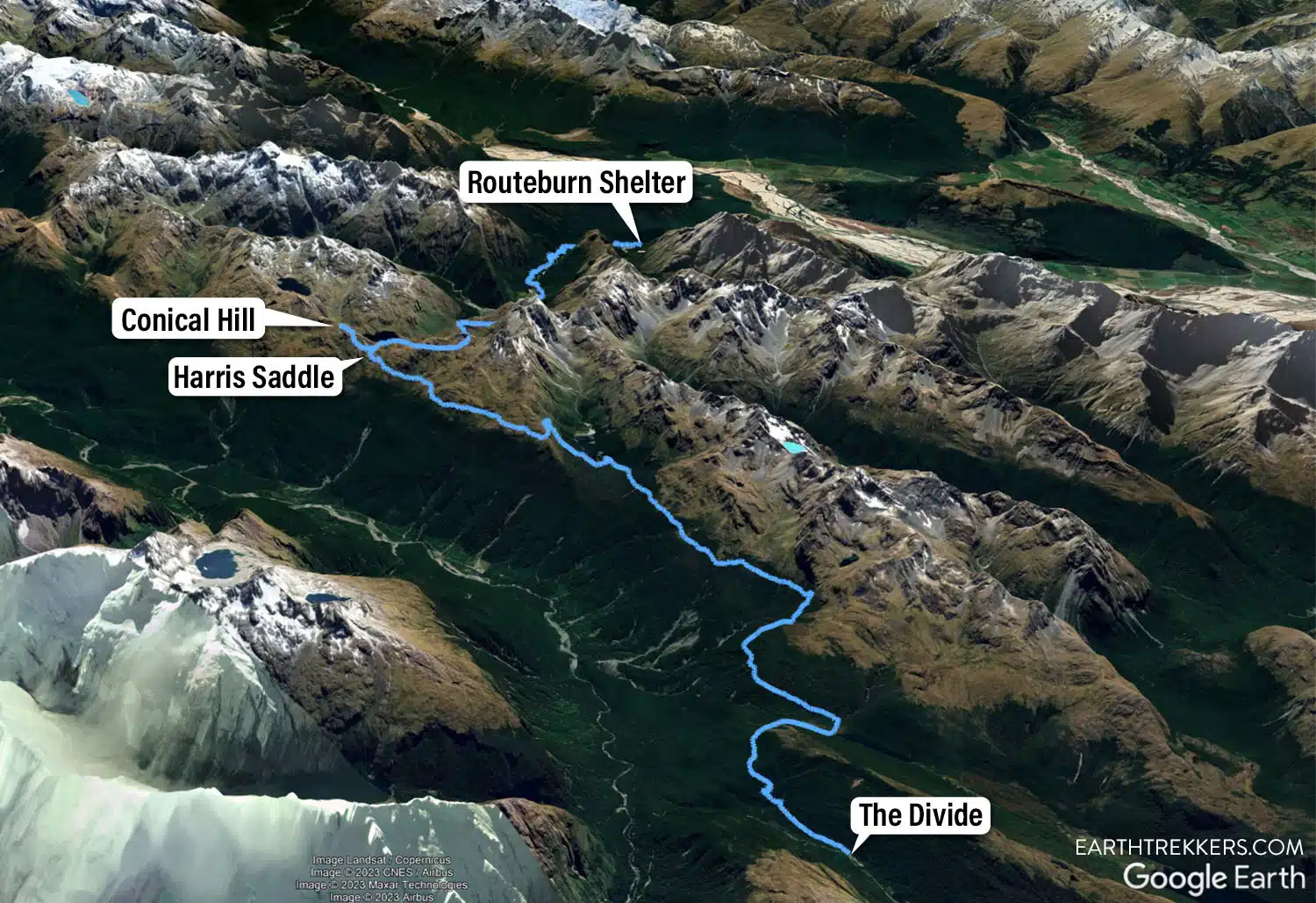
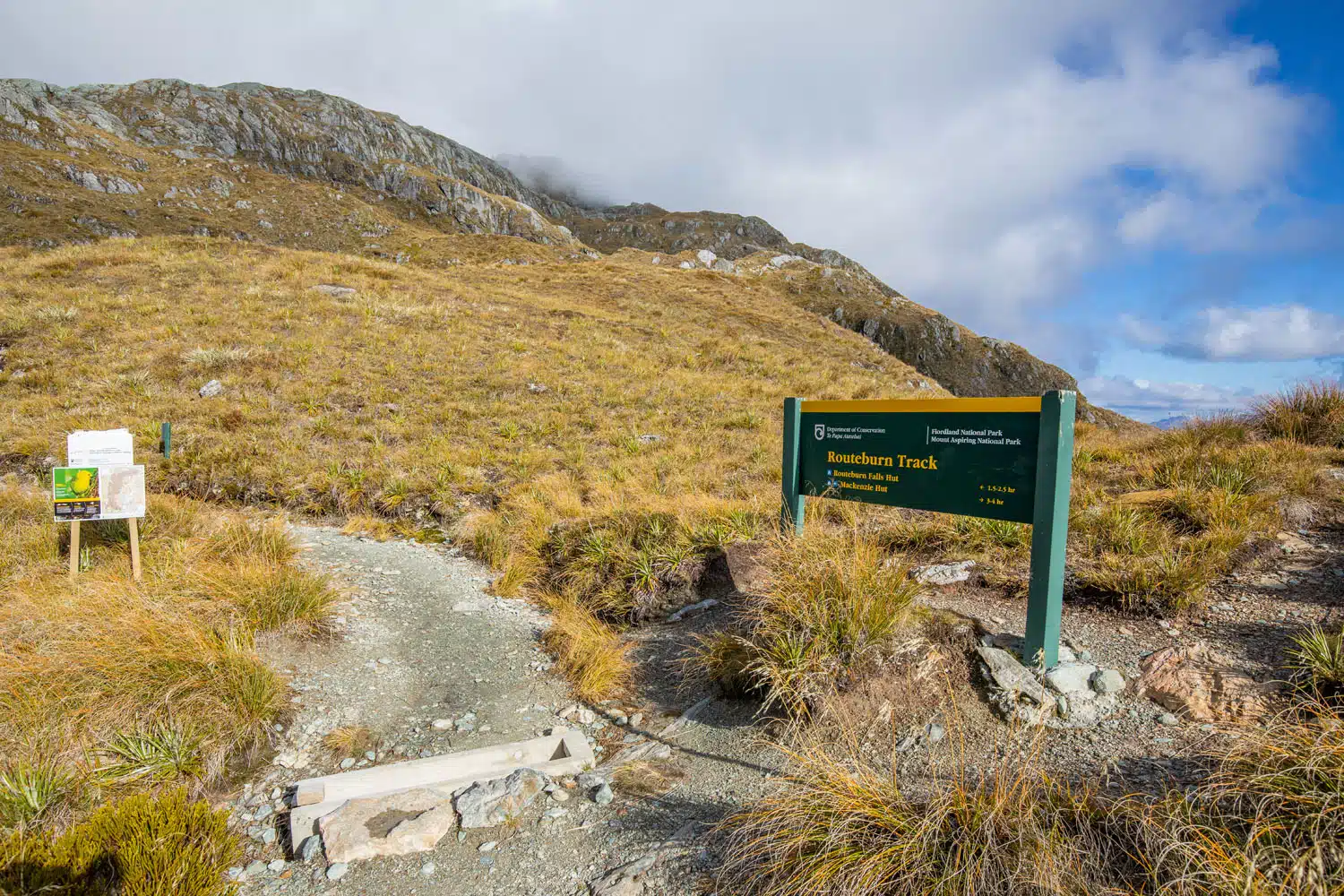
The Divide: One of the endpoints (a trailhead) of the track. It is located 84 km (52 miles) from Te Anau along the same road you would drive to the Milford Sound. Allow 1 hour and 15 minutes to drive between The Divide and Te Anau. At The Divide you will find parking, toilets, and an open shelter.
Lake Mackenzie: Close to the lake there is a hut with bunks, campsites, and toilets. This site is 12 km (7.5 miles) from The Divide and 21.1 km (13.1 miles) from the Routeburn Shelter.
Harris Saddle: This is near the highest point along the Routeburn Track. There are two fully enclosed emergency shelters here.
Routeburn Falls Hut: A minute or two from Routeburn Falls there is a hut with bunks. There are also toilets here. This site is 23.3 km (14.5 miles) from The Divide and 9.8 km (6.1 miles) from the Routeburn Shelter.
Routeburn Flats: There is a hut with bunks, campsites, and toilets. This site is 25.6 km (15.9 miles) from The Divide and 7.5 km (4.7 miles) from the Routeburn Shelter.
Routeburn Shelter: One of the endpoints (a trailhead) of the track. It is located 71 km (44 miles) from Queenstown. Allow 1 hour and 15 minutes to drive between the Routeburn Shelter and Queenstown, passing through the small quaint town of Glenorchy along the way. At the Routeburn Shelter you will find parking, toilets, and an open shelter.
There are also toilets in a few places along the track.
The drive between Te Anau and The Divide, and the drive between Queenstown and the Routeburn Shelter, are both scenic drives. Multi-day hikers should consider adding more time to the beginning and end of the trek to stop and enjoy the scenery of these drives. Day hikers should consider returning to these areas to enjoy the scenery of these drives.
Routeburn Track Hiking Stats
The following GPS data represents the full length of the Routeburn Track (point-to-point). It does not include the Key Summit or Conical Hill add-ons.
The Routeburn Track is officially listed as 33.1 km (20.6 miles) one way. My GPS device calculated it as 32.1 km (20 miles) one way.
Distance: 32.1 km (20 miles) point-to-point from The Divide to the Routeburn Shelter
Total Ascent: 1,380 m (4,510 feet)
Total Descent: 1,400 m (4,575 feet)
Lowest Elevation: 520 m (1,700 feet)
Highest Elevation: 1,310 m (4,300 feet)
Time: 9 to 14 hours (my time: 9 hrs 15 min)
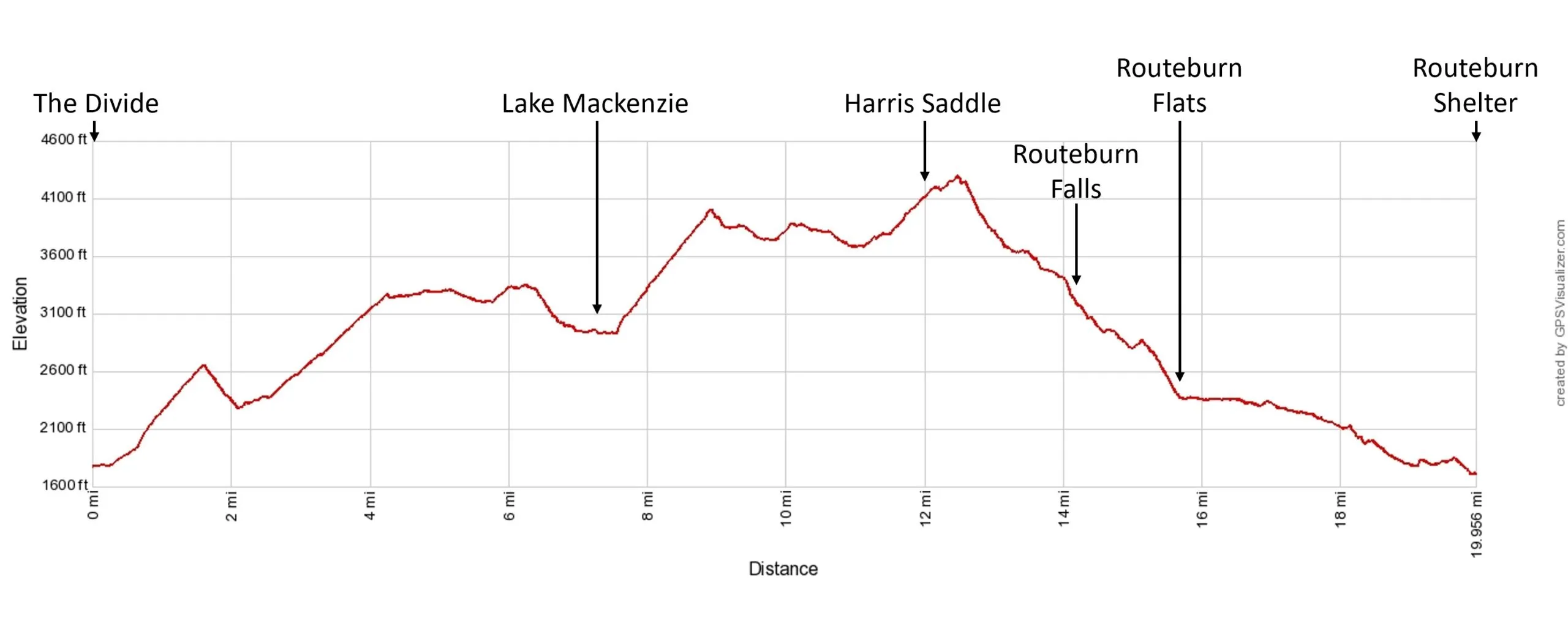
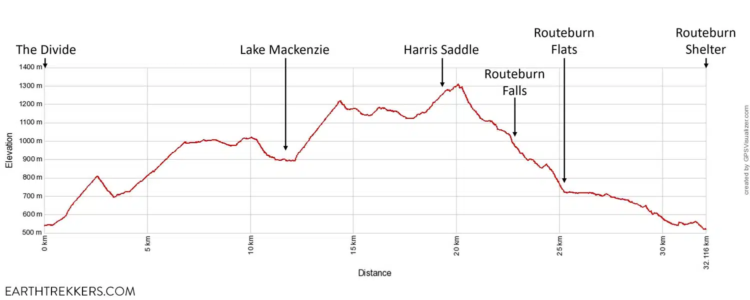
Routeburn Track Elevation Profile
The graph above represents the elevation profile when hiked from The Divide to the Routeburn Shelter. Swap the Total Ascent and Total Descent values if you hike it in the opposite direction, although there isn’t much of a difference in the values since the two trailheads sit at a similar elevation.
Key Summit Spur Trail GPS Stats
This spur trail is located between The Divide and Lake Mackenzie.
Distance: 1.6 km (1 mile) roundtrip
Total Ascent: 140 m (460 feet)
Lowest Elevation: 808 m (2,650 feet)
Highest Elevation: 945 (3,100 feet)
Time: 30 minutes [assumes 2 miles/hr, but add 30 minutes to linger, so people should allow 1 hour total]
Conical Hill Spur Trail GPS Stats
This spur trail is located next to the emergency shelters at the Harris Saddle.
Distance: 2.3 km (1.4 miles) roundtrip
Total Ascent: 300 m (1,000 feet)
Lowest Elevation: 1,235 m (4,050 feet)
Highest Elevation: 1,515 m (4,970 feet)
Time: 1.5 to 2 hours (my time: 1 hr 8 min)
Routeburn Track with Conical Hill GPS Stats
I’m providing the GPS stats and elevation profile of the Routeburn Track with Conical Hill added because I highly recommend this combination. The views from the top of Conical Hill are spectacular. Note that the GPS data I collected below is about 1 km (0.6 miles) shorter than the official measurement.
Distance: 34.4 km (21.4 miles) point-to-point from The Divide to the Routeburn Shelter
Total Ascent: 1,680 m (5,510 feet)
Total Descent: 1,700 m (5,575 feet)
Lowest Elevation: 520 m (1,700 feet)
Highest Elevation: 1,515 m (4,970 feet)
Time: 10 to 18 hours (my time was 10 hrs 23 min but I was jogging parts of the downhill during the last 5 miles)
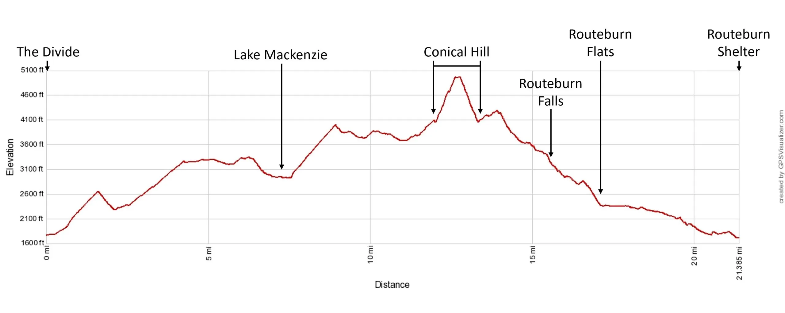
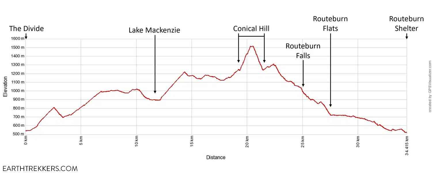
Routeburn Track Elevation Profile with Conical Hill
Routeburn Track Trail Description
This trail description is written as hiking in the direction from The Divide to the Routeburn Shelter.
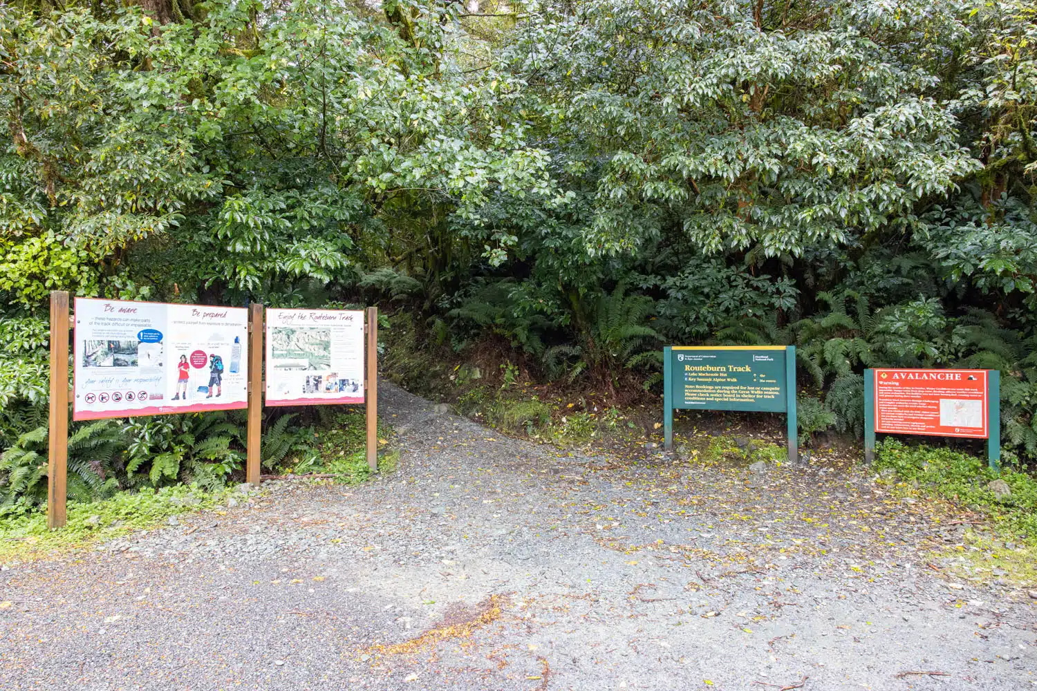
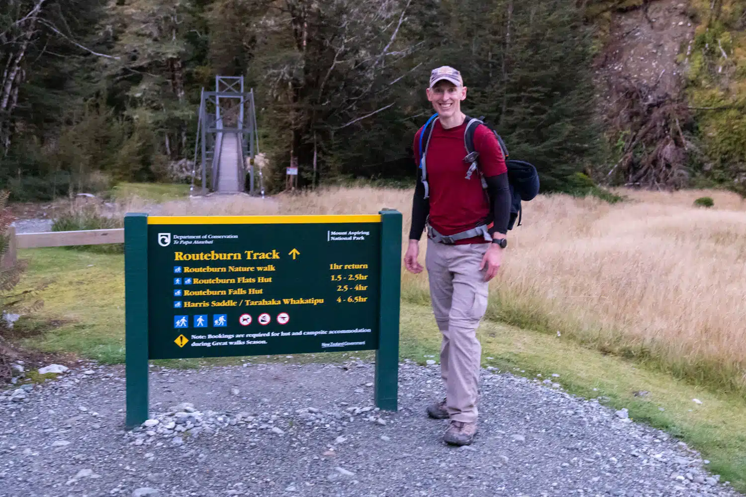
Trailhead at The Divide
As you drive from Te Anau to The Divide you will see road signs pointing to The Divide, Key Summit trailhead, and the Routeburn Track trailhead. All of these are in the same location. The Divide is a parking lot with an open shelter and toilets. And the two trailhead names are just two names for the same trailhead, which is located at this parking lot.
Trailhead at The Divide
The Divide to the Key Summit Spur Trail
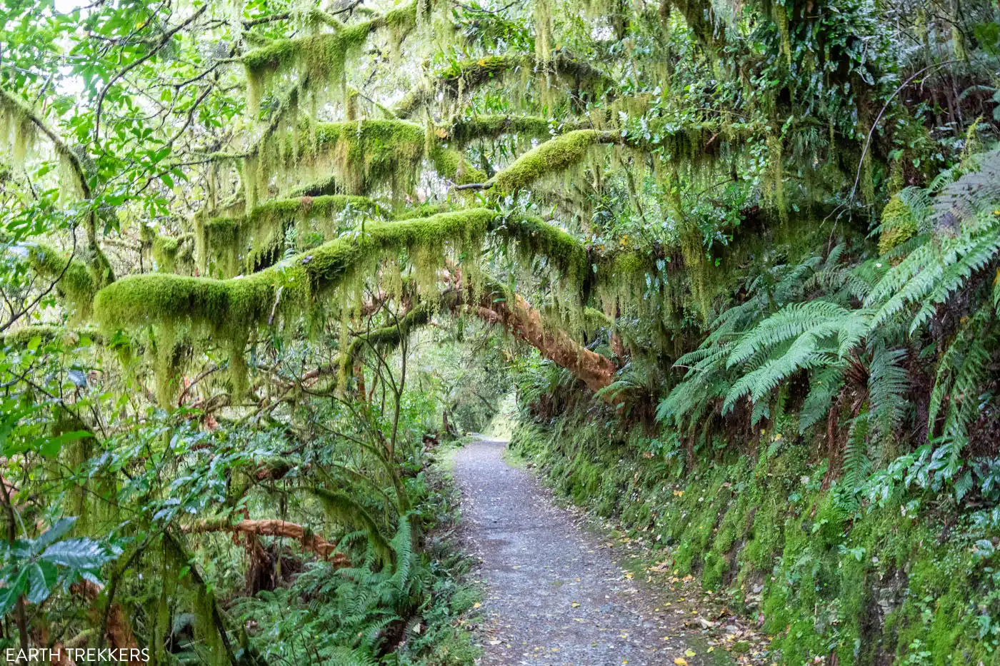
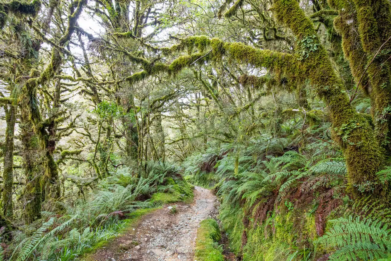
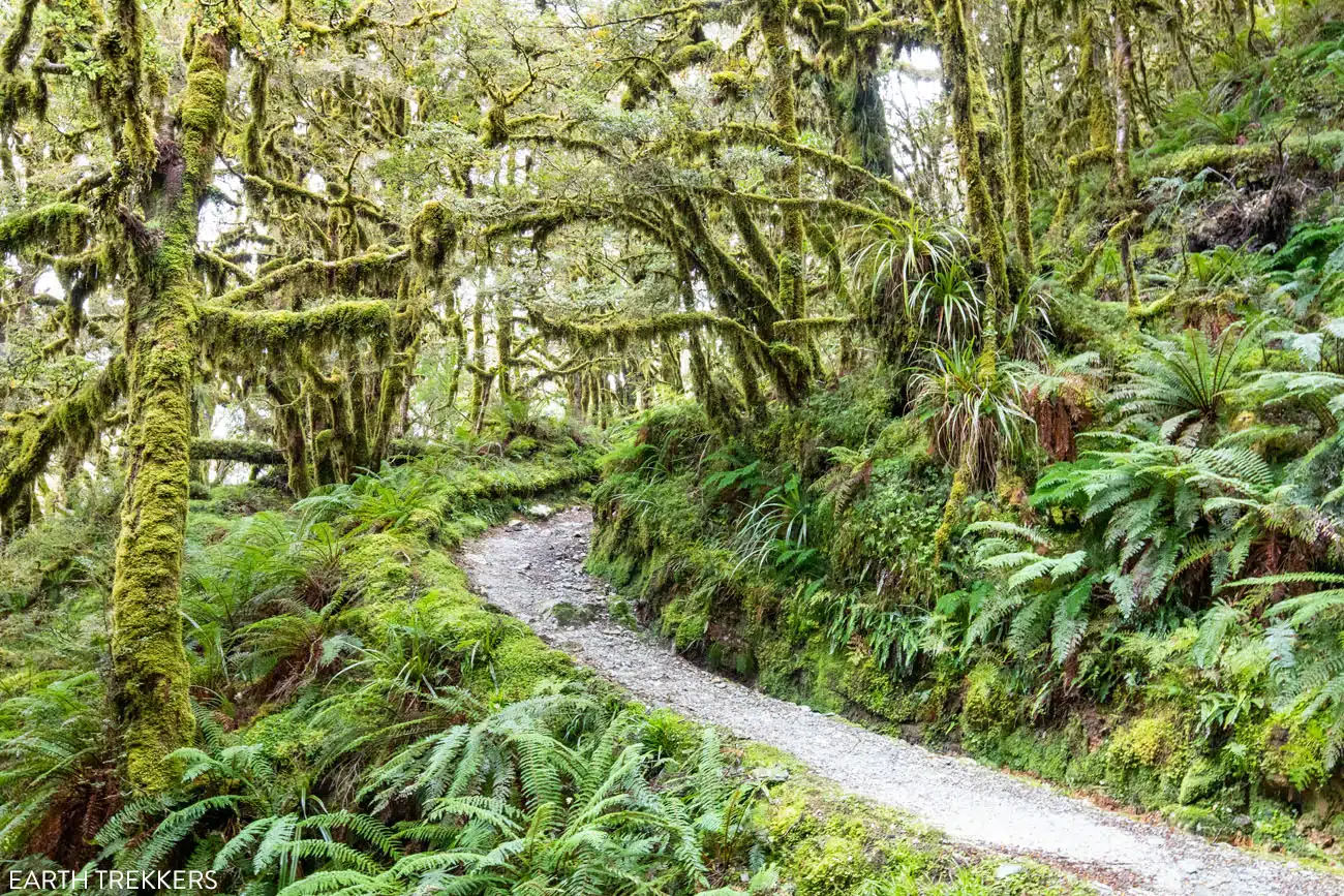
The gravel trail starts off with a gradual incline through a lush mossy beech forest. The mossy forest looked like something out of a fairytale at times. The moss covered the trees, grew on the mountainside of the trail, and hung from the limbs that extended over and above the hiking trail.
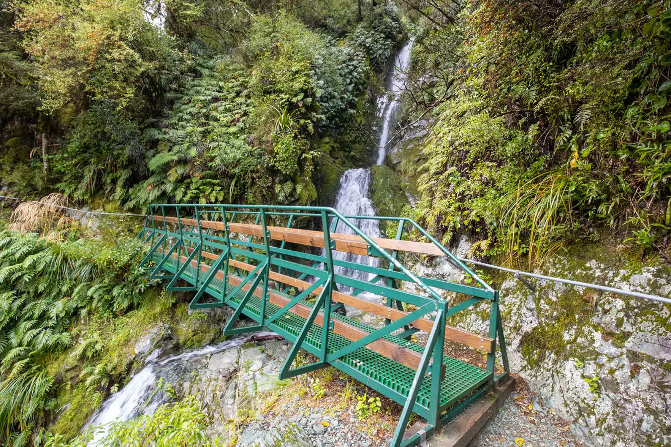
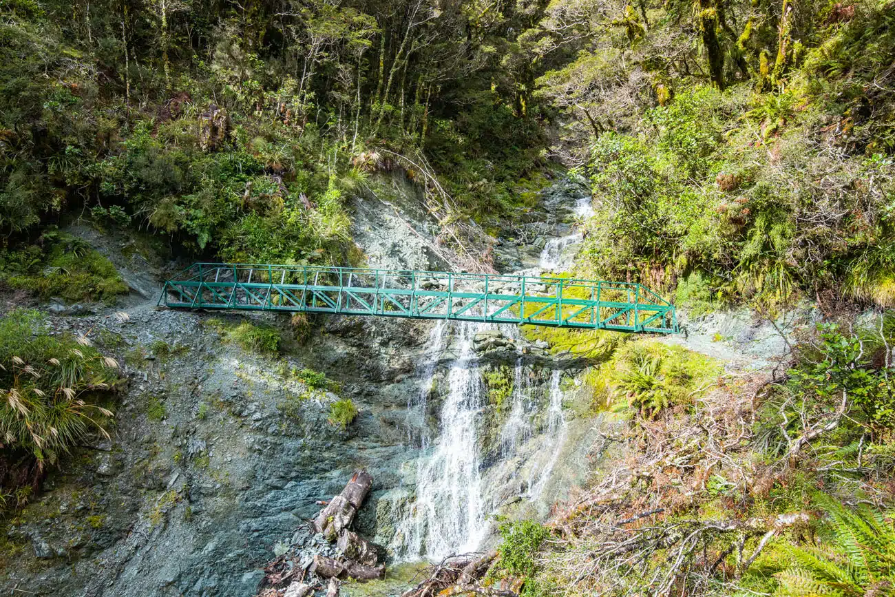
A little more than a kilometer into the hike you will cross a bridge with a waterfall. The trail now becomes a little steeper, and turns to a mixture of gravel and rocks, as you ascend a set of switchbacks through the rainforest.
You will occasionally see a water trough running along one side of the trail. And sometimes you may have to step over a thin layer of water crossing the trail, and even walk over a thin layer of water running down the trail. This area gets a lot of rain so the trail can be wet. Wearing waterproof hiking shoes is recommended.
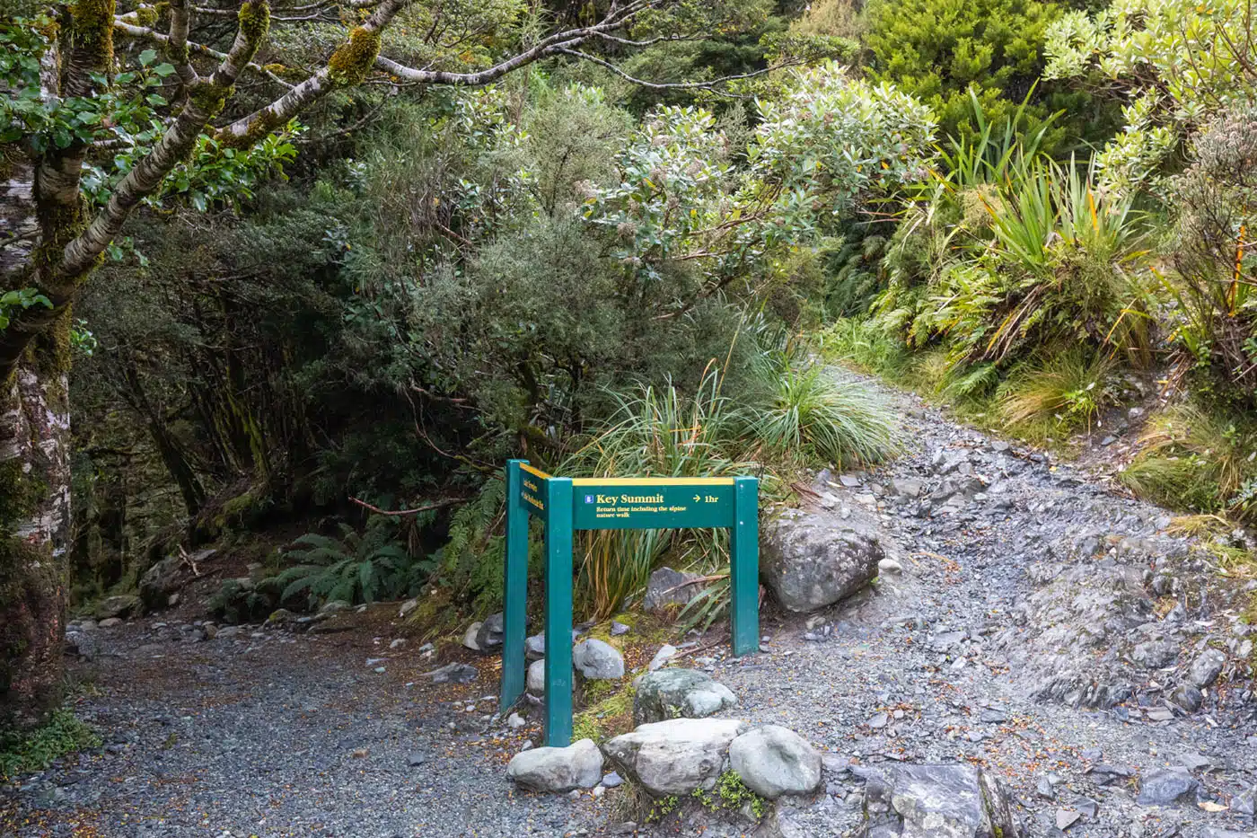
After about 45 minutes of hiking, you will reach the junction for the Key Summit Trail. At this junction you will have your first view out of the trees towards a set of mountain peaks and the valley below. Enjoy this view now as you will not have many views out of the forest until after you pass Earland Falls, or unless you take the Key Summit spur trail.
Key Summit Spur Trail
The Key Summit Spur Trail will wind you up out of the trees for alpine mountain views of Fiordland National Park. This spur trail is about 1.6 km (1 mile) roundtrip, out and back, with 140 meters (460 feet) of total ascent. Allow 1 hour.
If you are planning a multi-day experience then it is worth hiking the Key Summit Spur Trail. The views will be more impressive if you start your multi-day trek from The Divide as you wouldn’t have already seen the alpine scenery further along the Routeburn Track.
If you are planning to day-hike the Routeburn Track then you should consider skipping the Key Summit Spur Trail for the more impressive views from the Conical Hill Spur Trail, especially if you are starting at The Divide. This will allow you to conserve energy and precious daylight hours for what lies ahead. If you are starting at the Routeburn Shelter then you can gauge energy level and time once you reach this junction since you will be near the end of your hike.
PRO TRAVEL TIP: Use the view from the Key Summit Spur Trail junction to determine how cloudy it is. This spur may not be worth it if everything is clouded in.
Trail junction and the detour to Key Summit
Key Summit Trail
View from the Key Summit Trail
For information on combining a hike to Key Summit with a cruise on the Milford Sound, see our article How to Plan a Milford Sound Day Trip.
Key Summit Spur Trail to Lake Howden
The next 0.8 km (0.5 miles) of the Routeburn Track, beyond the Key Summit Spur Trail, descends a bit as you continue hiking through the lush mossy beech forest until you reach Lake Howden. This section of the mossy forest is awesome, I couldn’t stop taking photos of it.
At Lake Howden there is a trail junction so pay attention to the signage. To continue on the Routeburn Track you will cross a bridge at the near end of Lake Howden which offers excellent views of the lake and the trees growing out of the lake.
Note that you might see signage for Lake Howden Hut, this hut was destroyed by a landslide.
Lake Howden
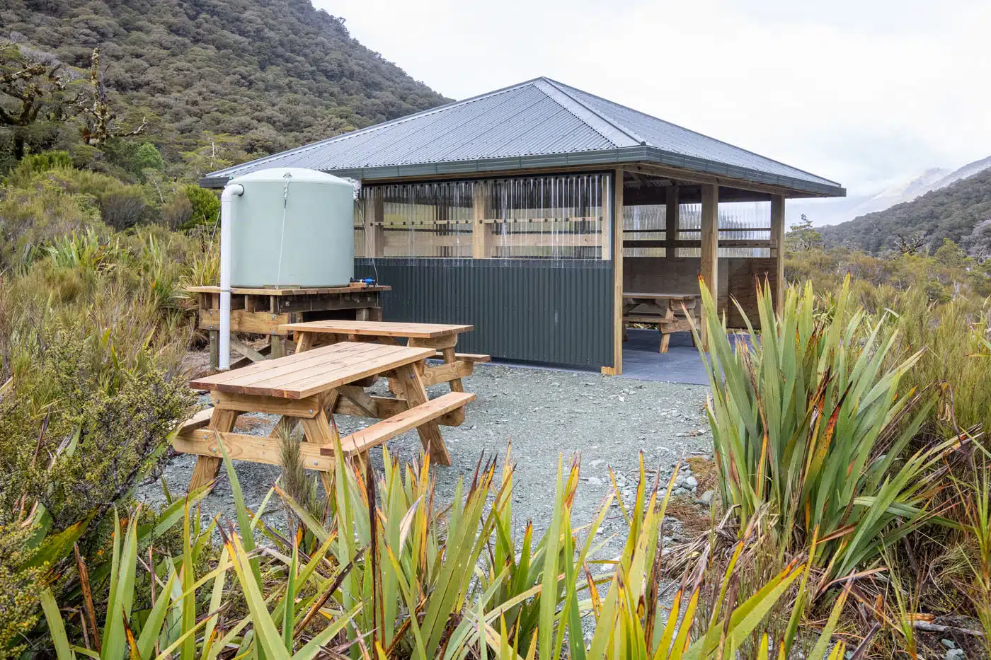
Lake Howden Shelter
On the other side of the bridge follow a short platform elevated slightly off the ground. At the end of the platform there is an open shelter with picnic tables, and just past that are toilets. The track then returns to the ground and keeps going.
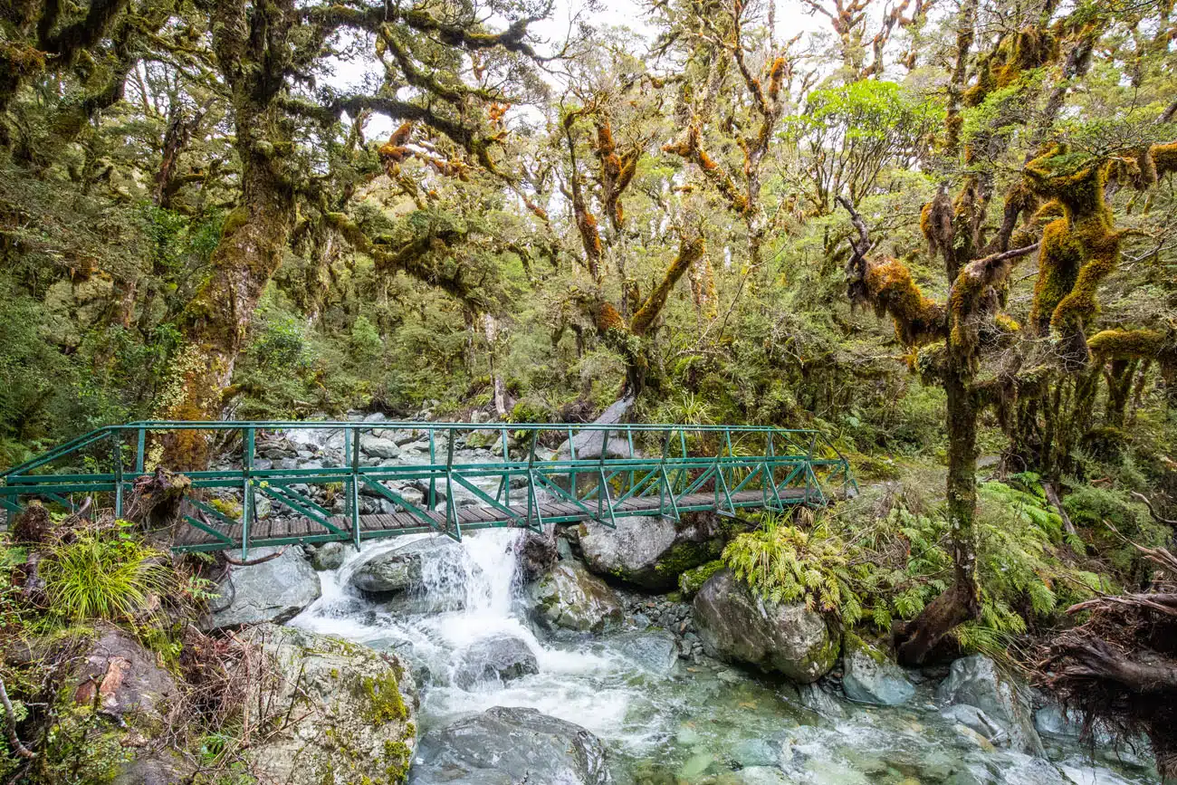
You will now ascend through a lush mossy forest again, this time passing a countless number of small waterfalls and bridges.
Lake Howden to Lake Mackenzie
About 4 km (2.5 miles) from Lake Howden you will arrive at Earland Falls. At 174 meters tall the Earland Falls is impressive to see and the Routeburn Track will lead you right to the base of the falls. So close in fact that you are very likely to get wet from the spray.
If trail conditions are not favorable for approaching the falls then there is a flood trail that you can take instead. The flood trail dips down and then back up to the main trail on the other side of Earland Falls. Look for the posted signs indicating the flood trail.
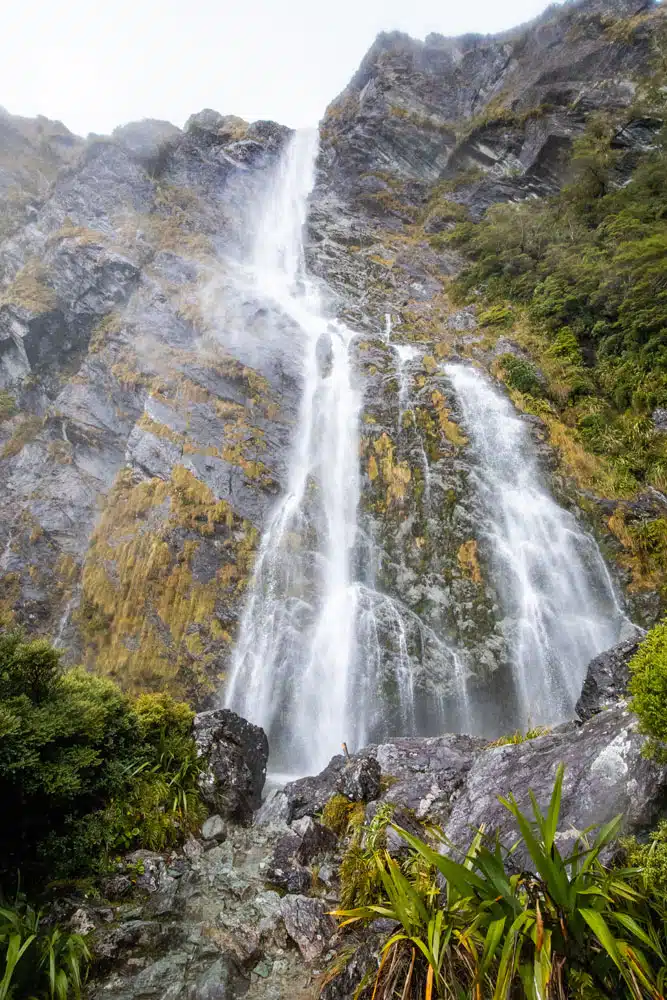
Earland Falls
Beyond Earland Falls you will get a variety of views from more bridges and waterfalls to mountain and valley views.
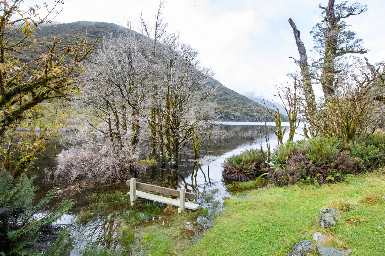
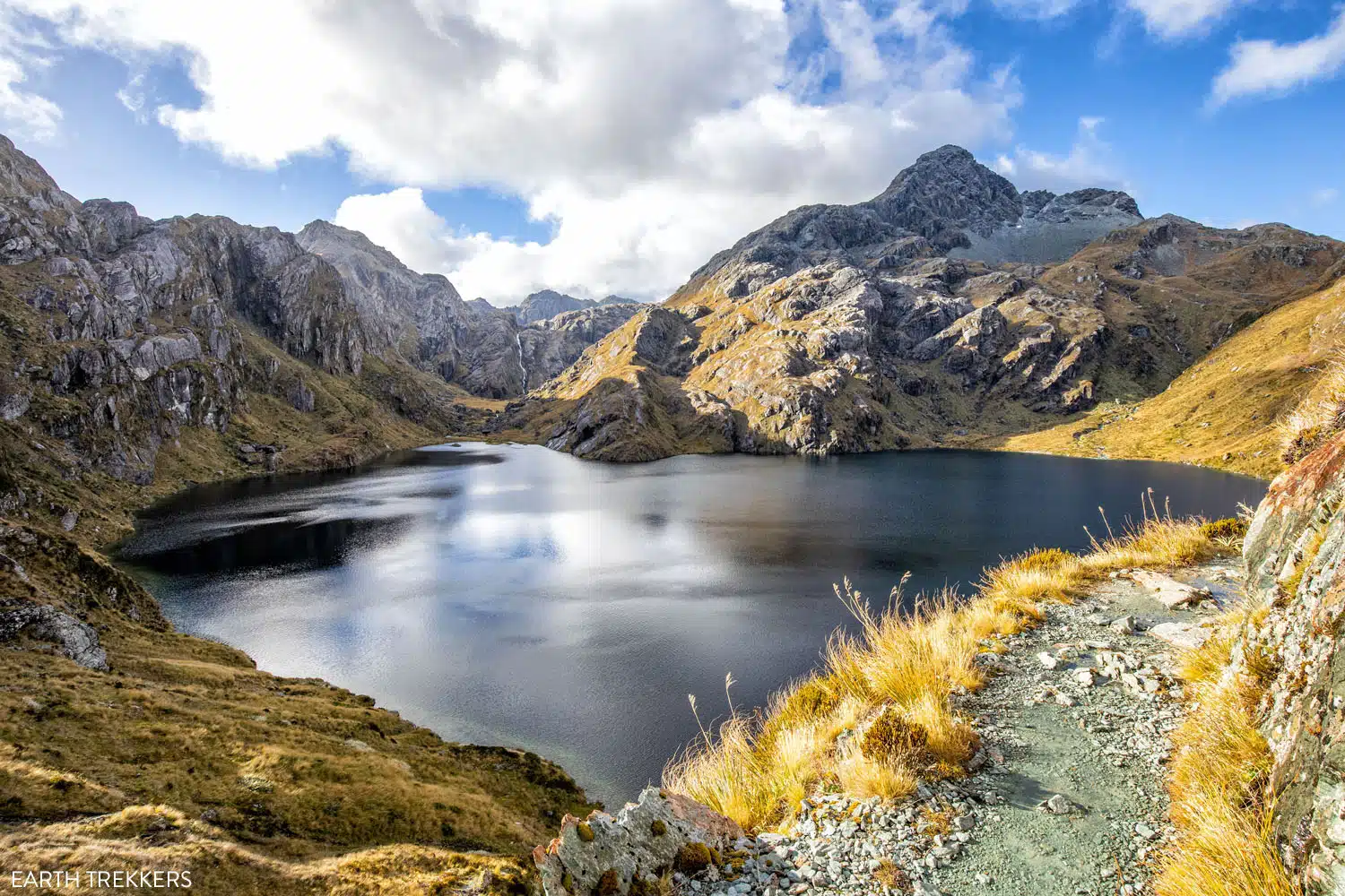
At roughly 4 km (2.5 miles) beyond Earland Falls you will arrive at the Routeburn Walkers Hut, which is only for guided hikers. And 1 minute further you will reach Lake Mackenzie, a beautiful lake with a mountain backdrop. This is also the location of a hut, campsites, and toilets.
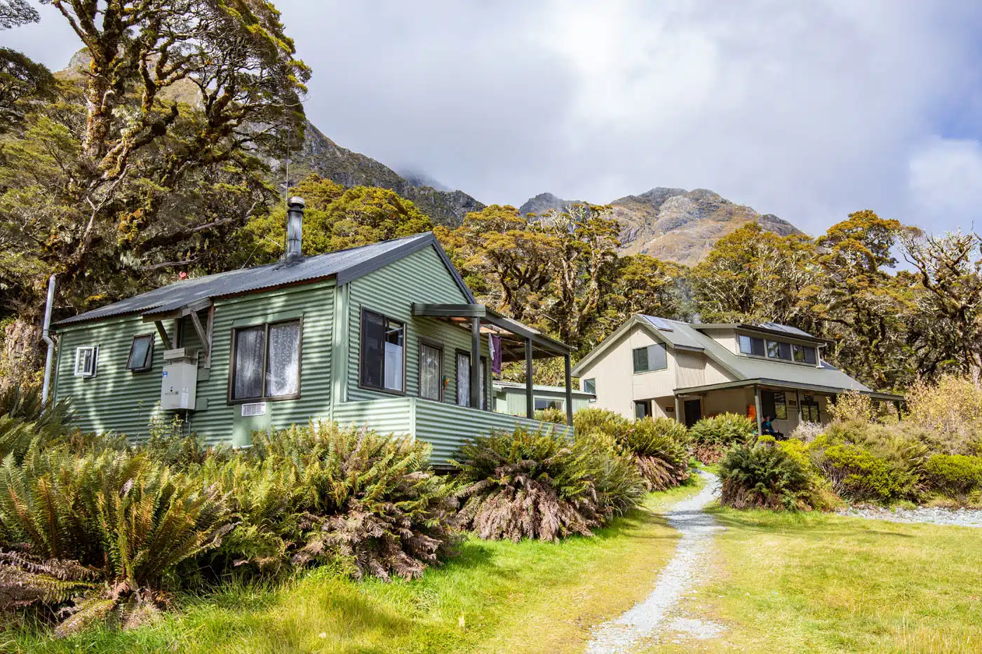
Lake Mackenzie Huts
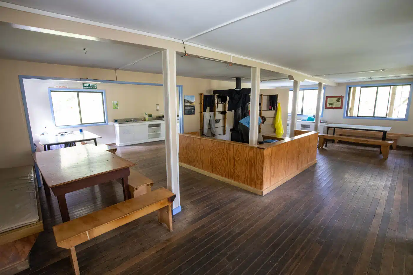
Inside the Lake Mackenzie Hut
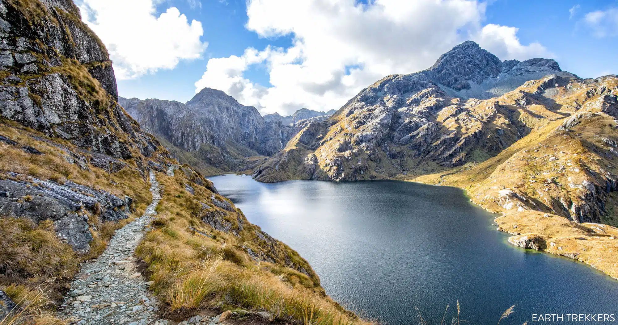
Lake Mackenzie
Lake Mackenzie to Harris Saddle
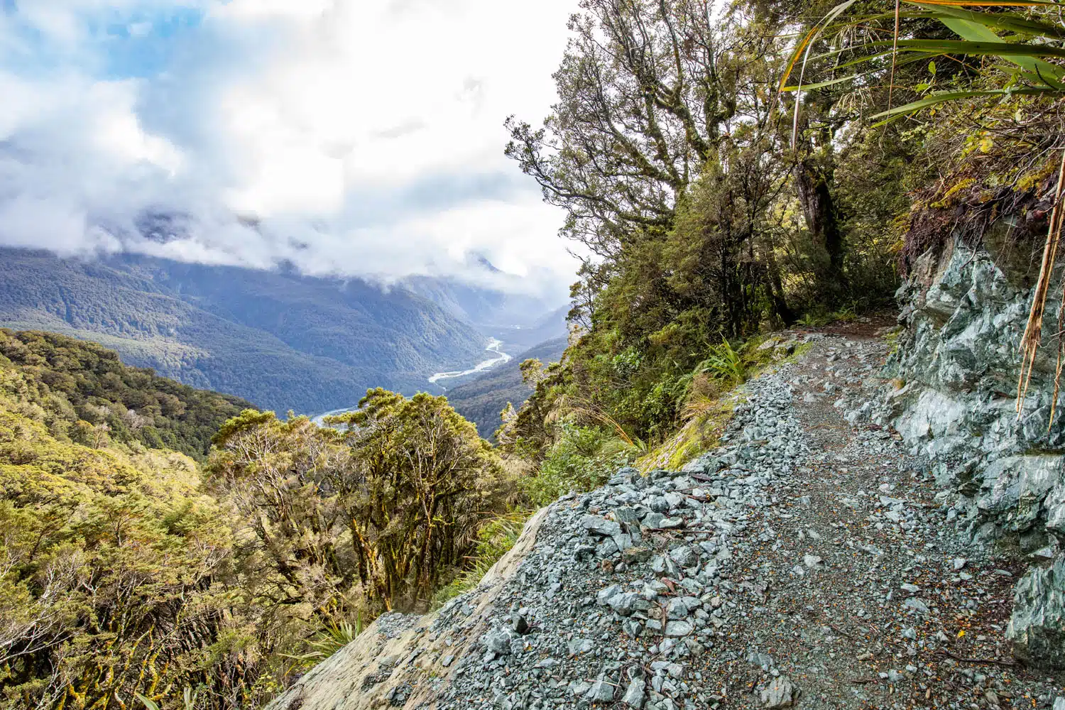
From Lake Mackenzie you hike up the mountain on one side of the lake. You start in a forest, but as you climb higher the trail opens up to beautiful views of the lake and mountains opposite.
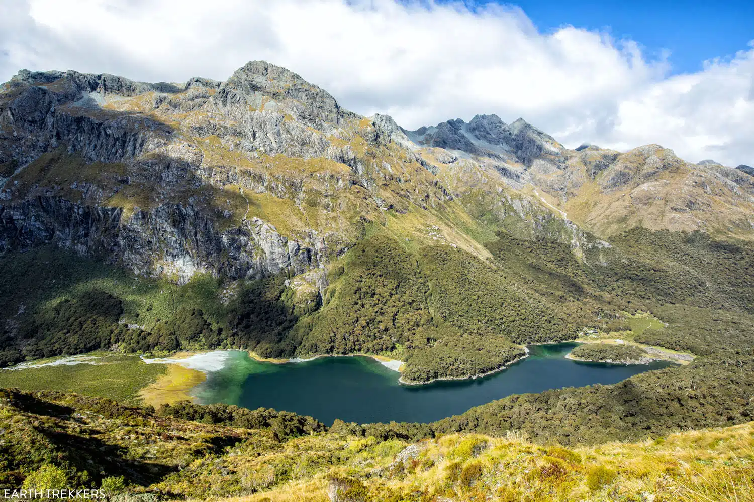
Lake Mackenzie
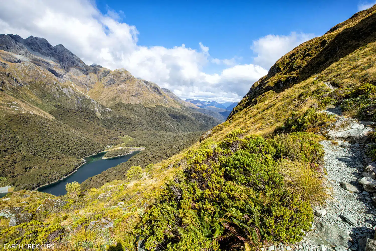
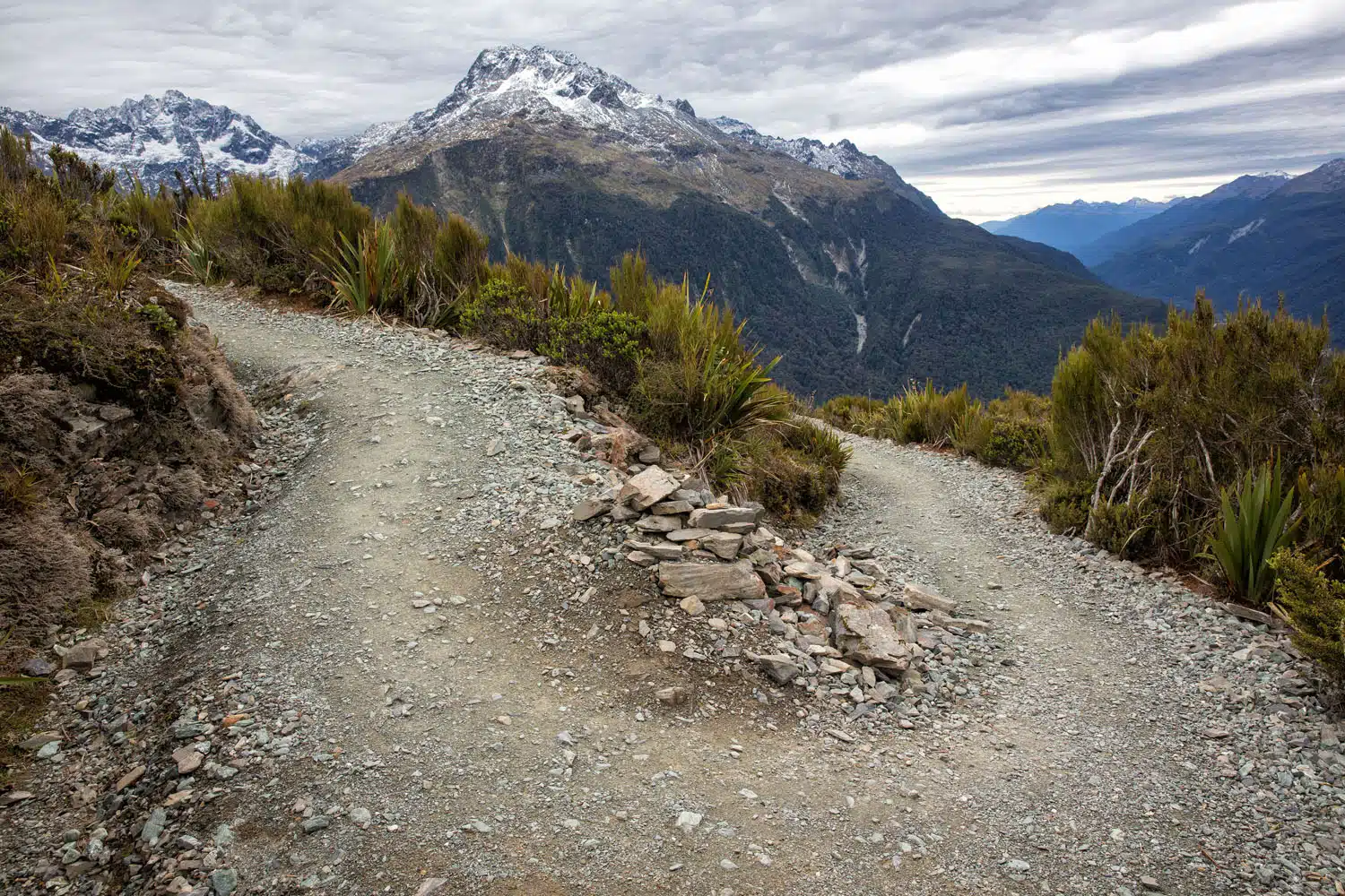
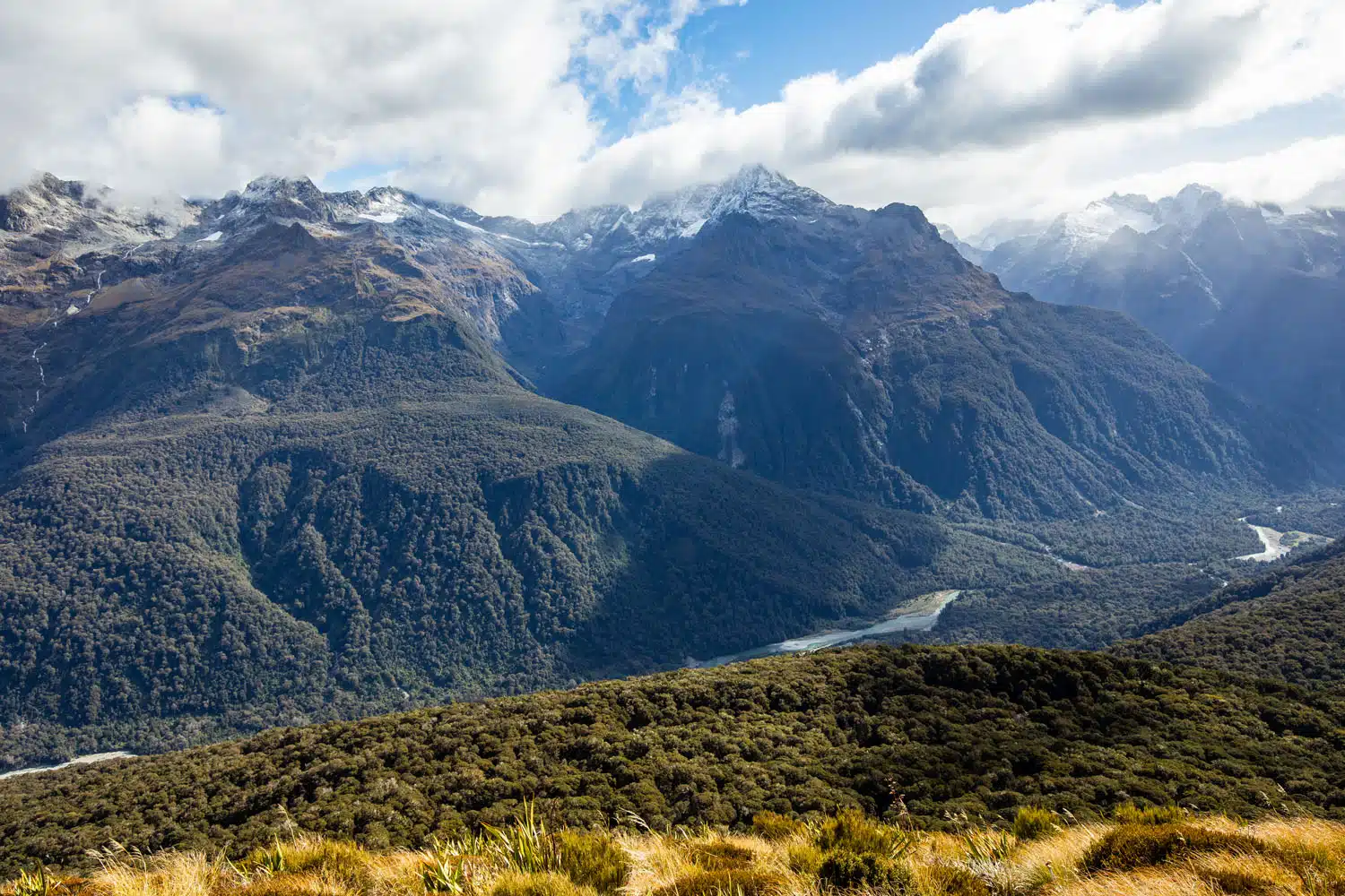
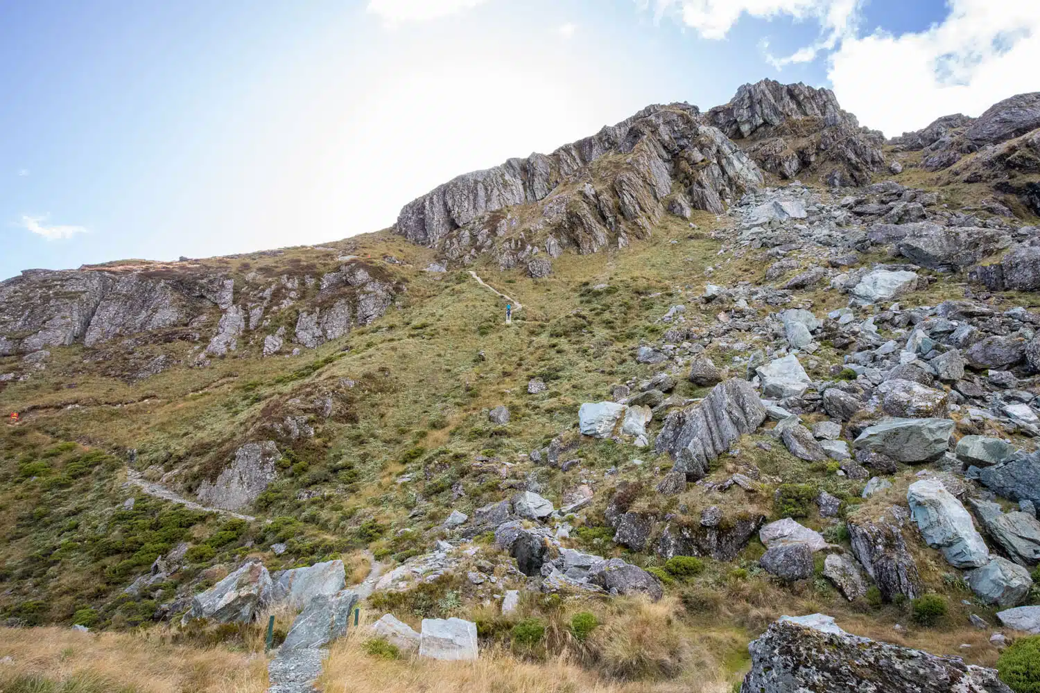
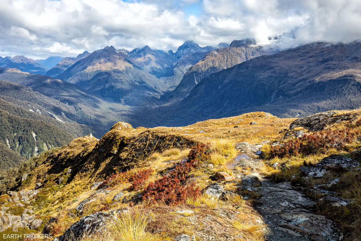
At about 2.7 km (1.7 miles) from Lake Mackenzie, you leave the Lake Mackenzie view behind, and you are now treated to a new view that is even more spectacular. You are above the tree line, so you have wide open views of the mountains around you.
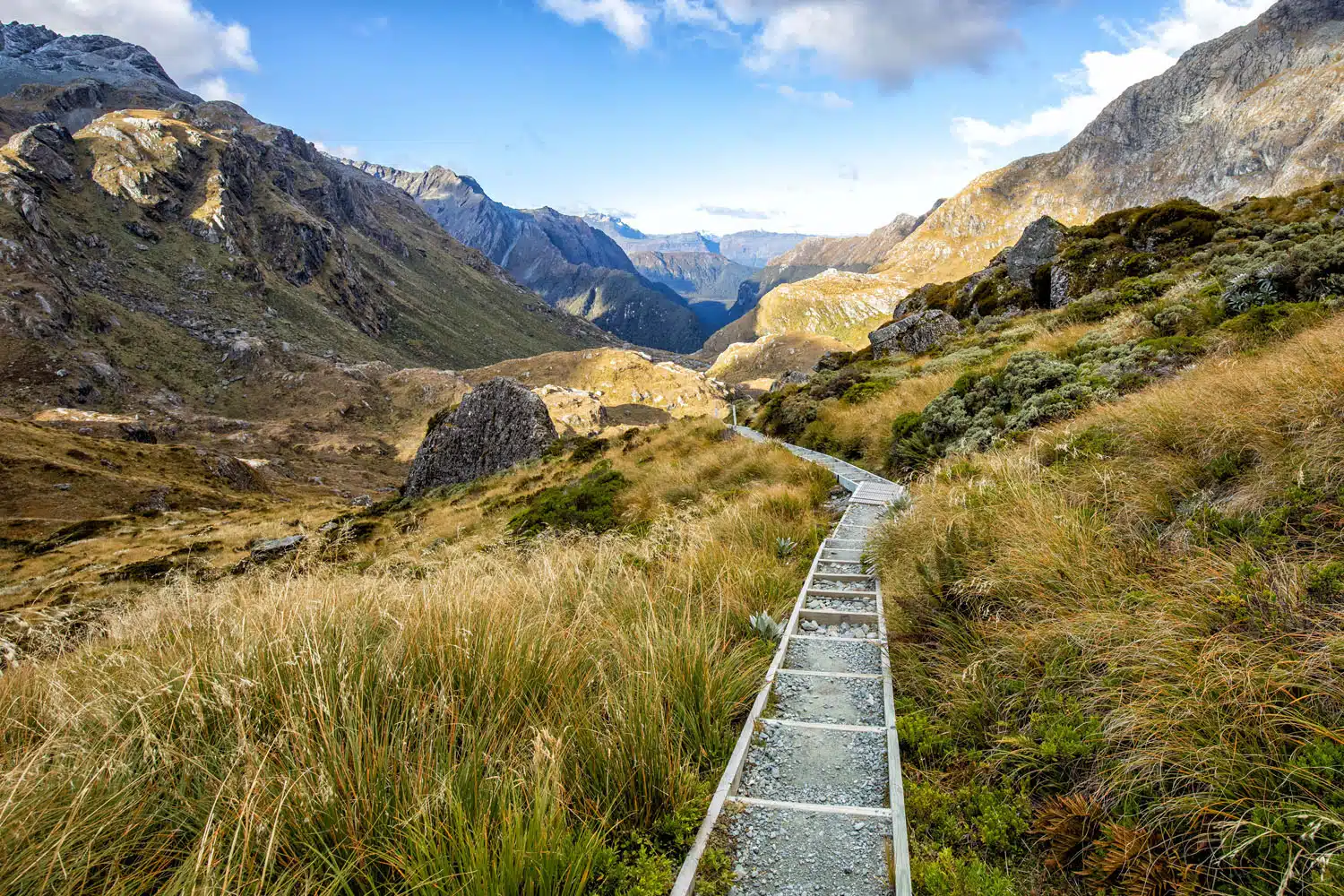
The trail will now alternate between gradual descents and gradual ascents as you continue hiking along the exposed mountainside that follows a valley towards the Tasman Sea. Enjoy the alpine mountain views and glaciers on the opposite side of the valley.
You are now in the exposed alpine section of the track so keep an eye out for sudden weather changes.
The trail leading to Harris Saddle
The view from the trail
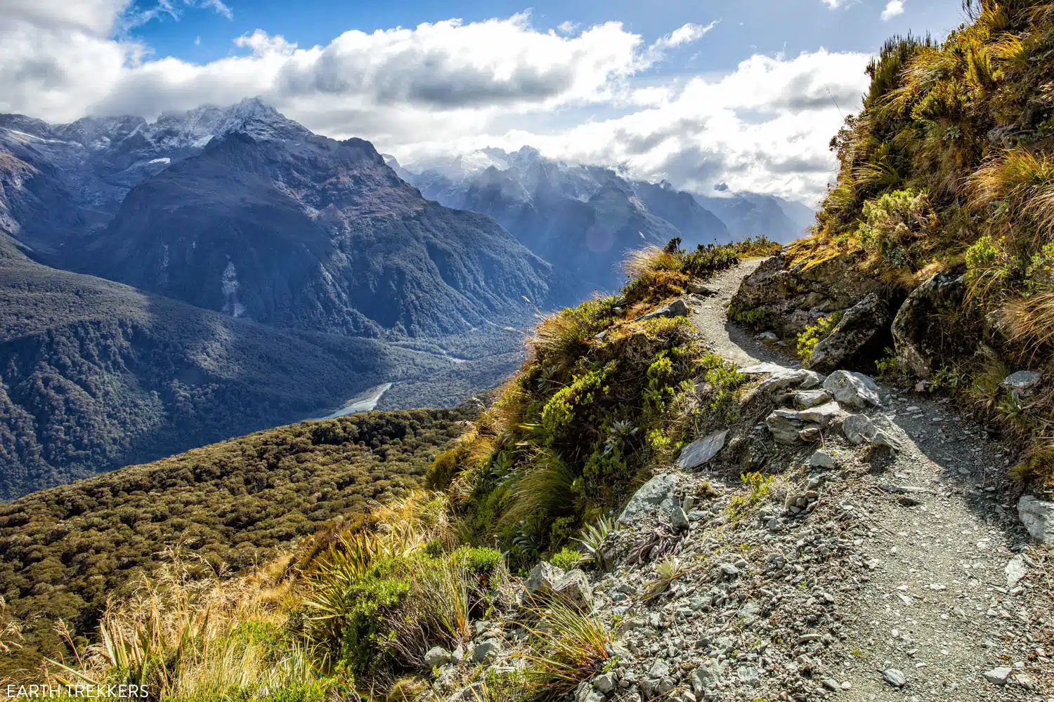
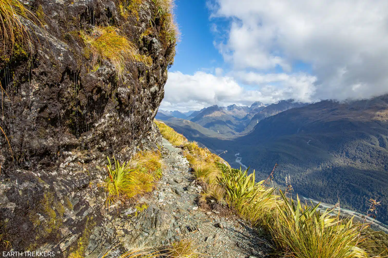
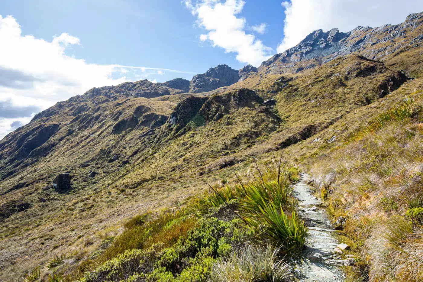
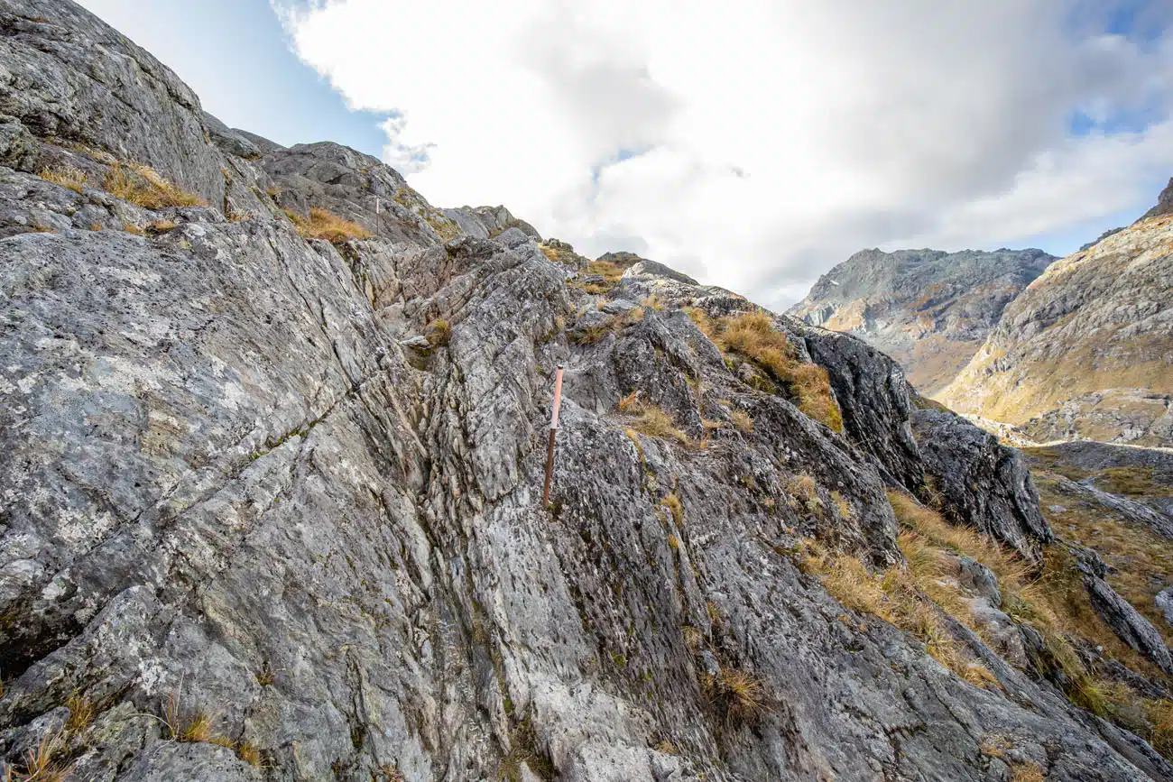
The trail will eventually turn such that you are no longer heading in the direction of the Tasman Sea, but rather heading towards Harris Saddle, which is near the highest point on the track.
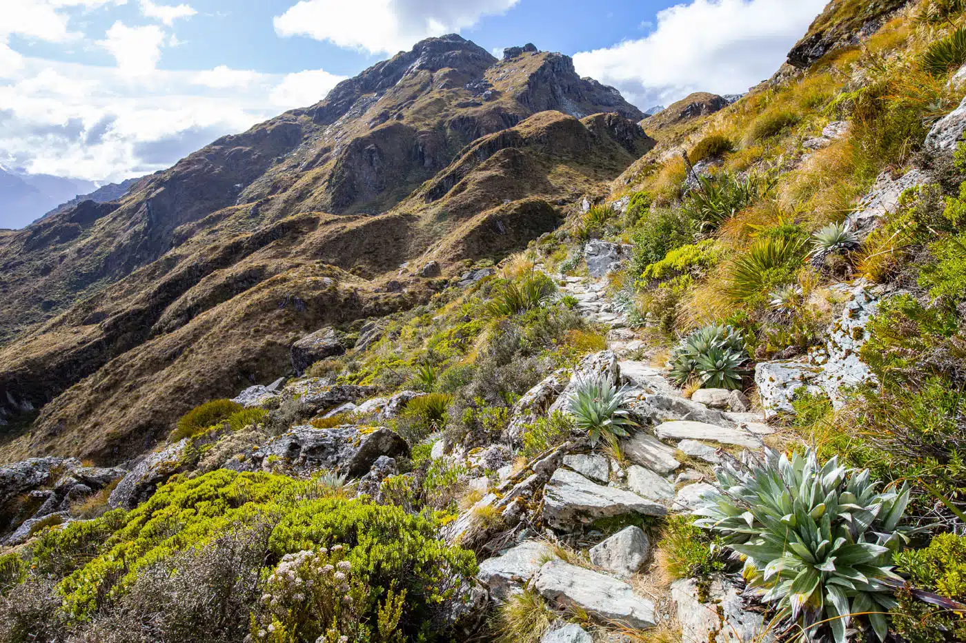
You reach the Harris Saddle at roughly 7.5 km (4.7 miles) from Lake Mackenzie. There are two emergency shelters here and right next to one of the shelters you will find the Conical Hill Spur Trail.
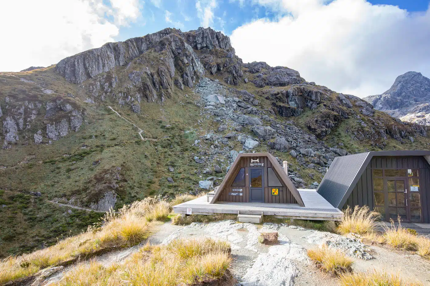
Harris Shelter with Conical Hill in the background
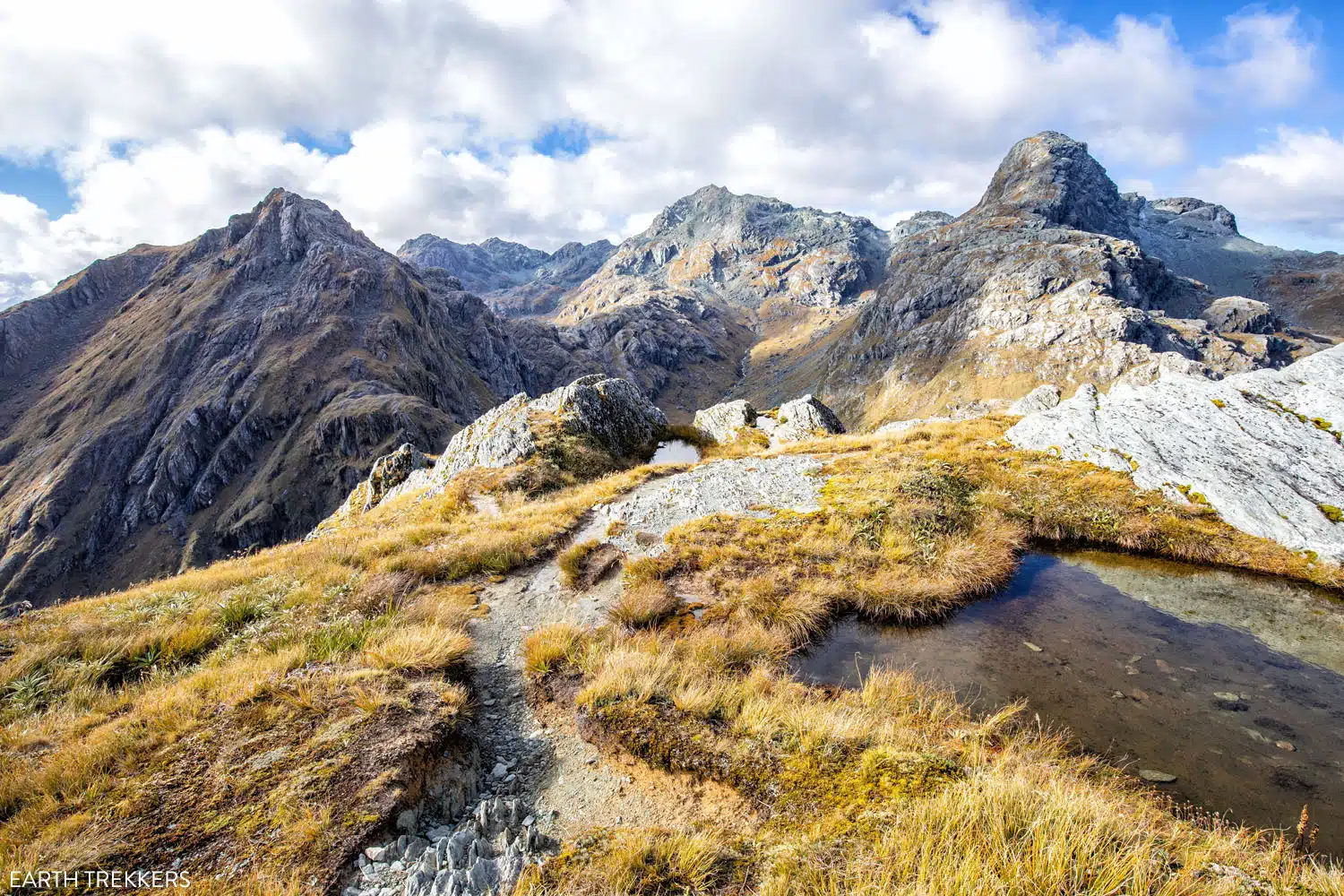
Conical Hill Spur Trail
The Conical Hill Spur Trail is a steep ascent up to a spectacular view overlooking Lake Harris and then an impressive 360-degree panoramic view on top of the hill. This is highly recommended if the weather conditions are favorable to enjoy the stunning views.
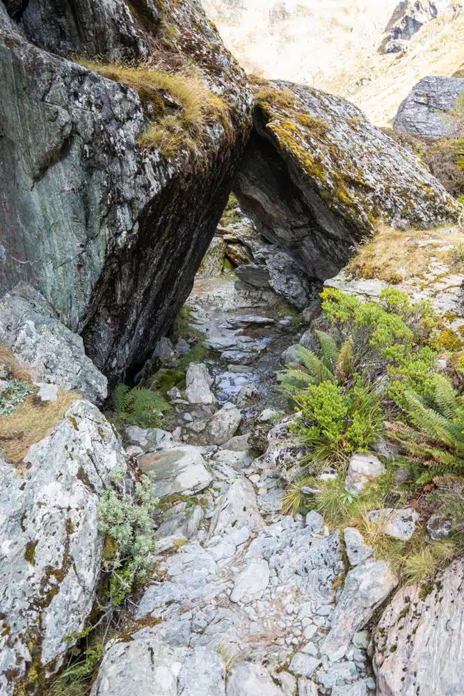
It is an adventurous climb up, often following a thin stream of water that makes the rocky track slippery on the climb up and on the descent back down.
Conical Hill Trail
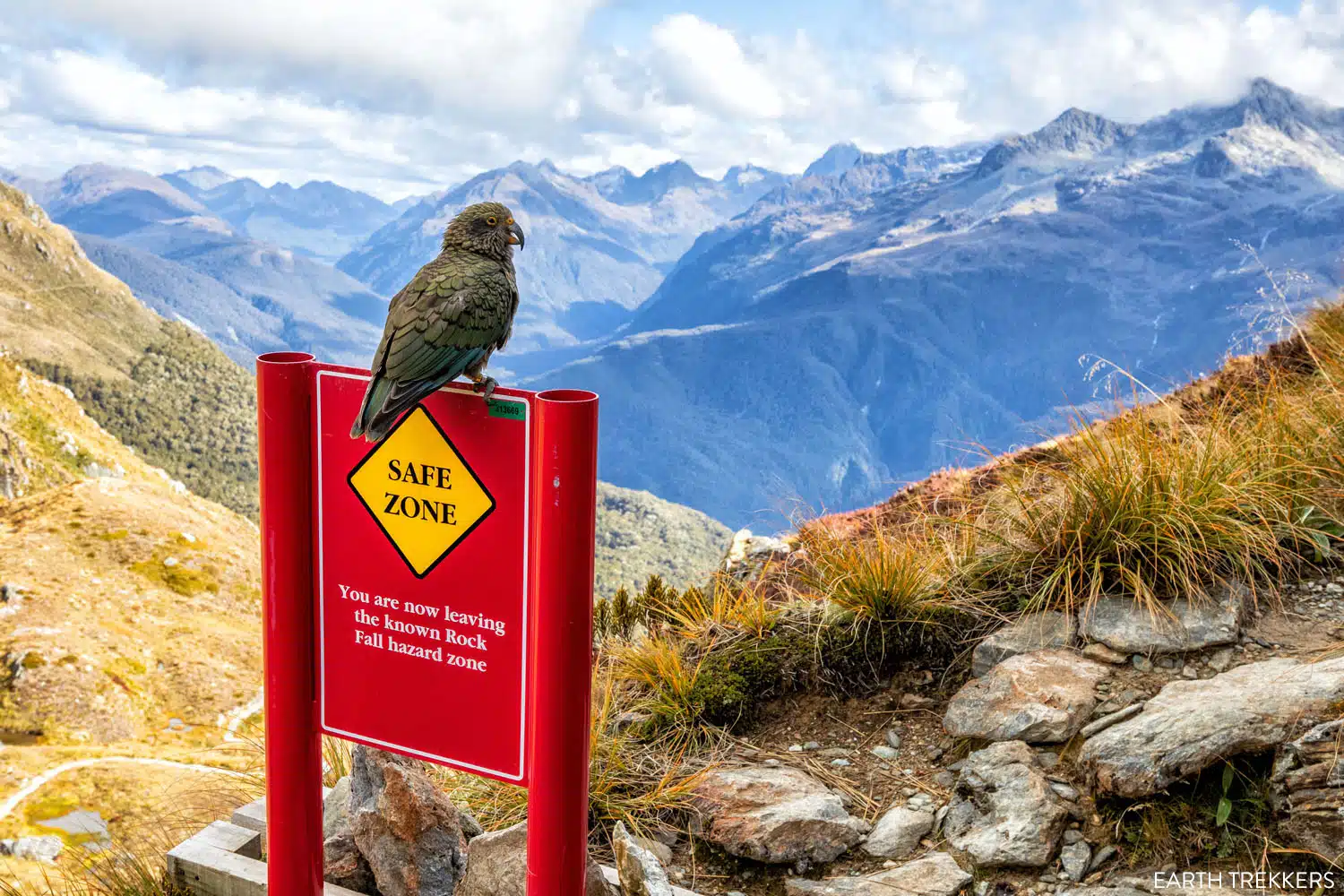
Kea on the trail
Trail to Conical Hill
The view from the Conical Hill Trail
It is 2.3 km (1.4 miles) roundtrip, out and back hike, with 300 meters (1,000 feet) of total ascent. So, if you are day hiking the Routeburn Track then you need to carefully consider the amount of time and effort this may take. And if you have sufficient energy, food, and water to still be able to finish the hike.
If you are trying to decide between the Conical Hill Spur Trail or the Key Summit Spur Trail, then the views at the top of Conical Hill are more impressive, but the Key Summit requires less effort and time.
On top of Conical Hill
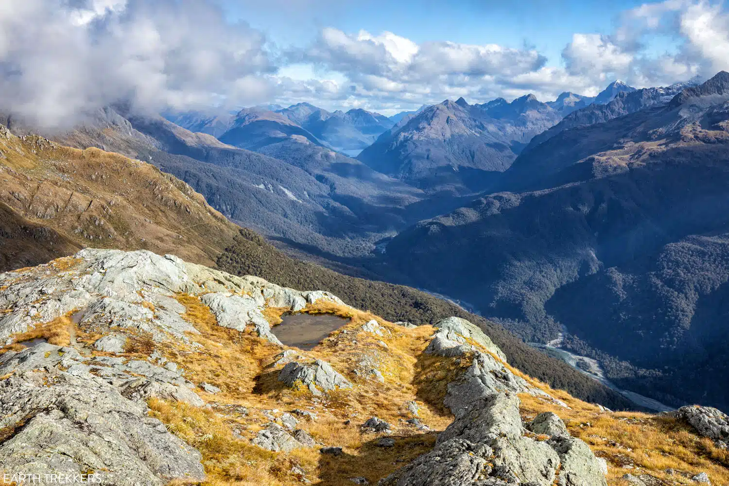
The view from Conical Hill
Harris Saddle to Routeburn Falls
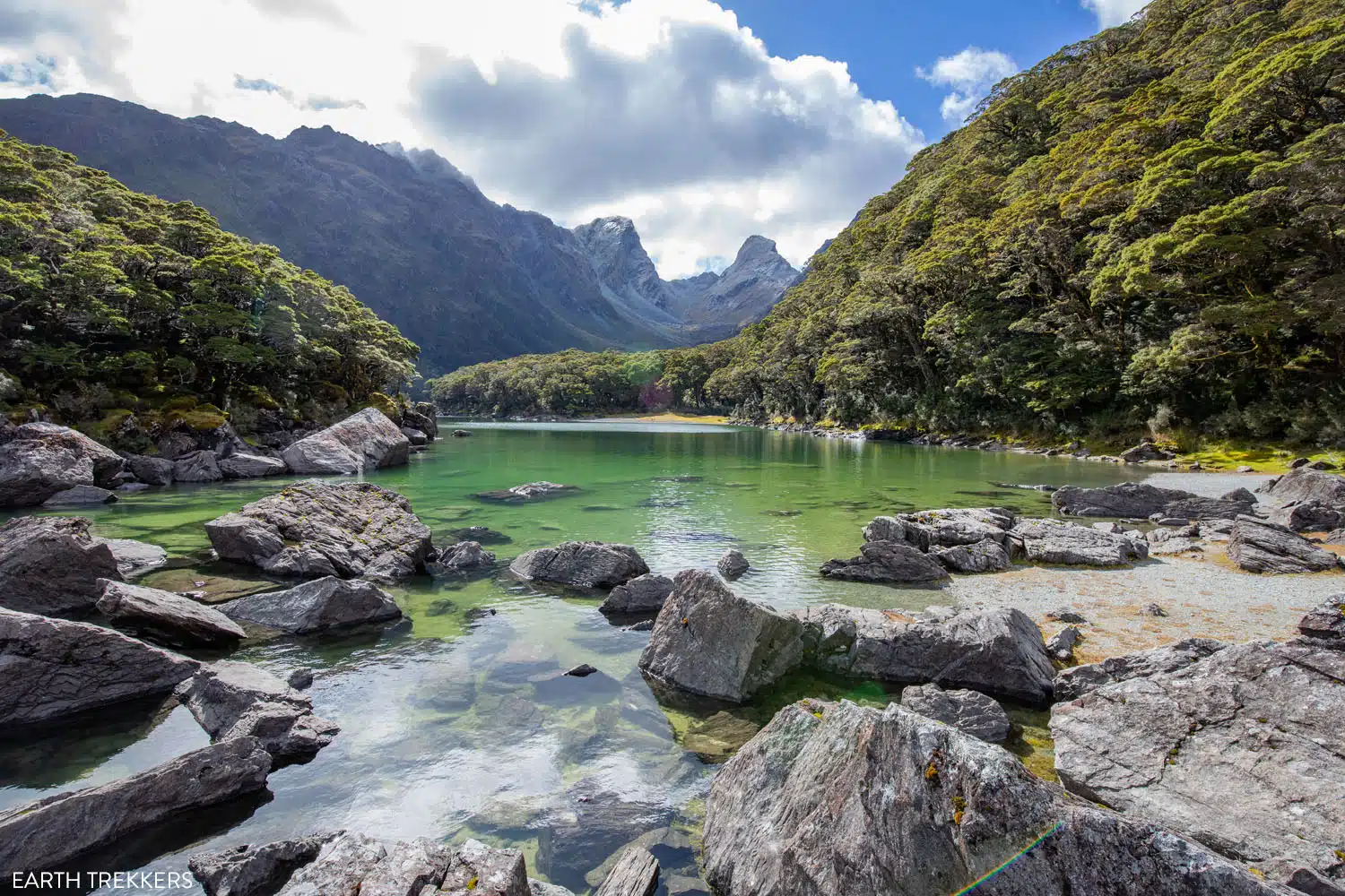
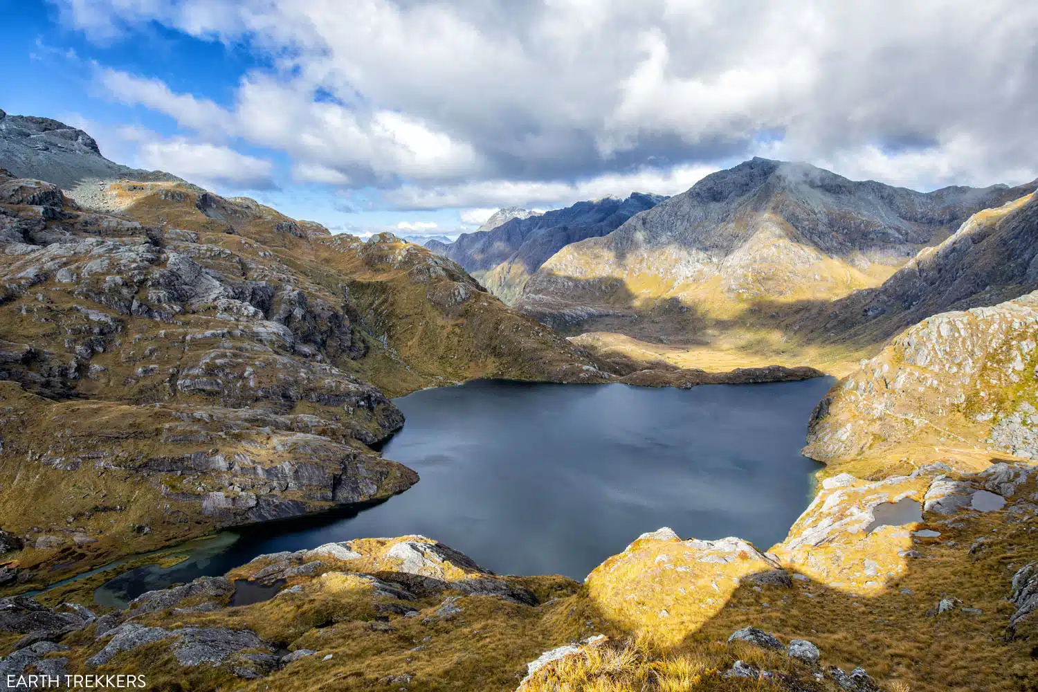
Continuing on the Routeburn Track from Harris Saddle, you leave the mountain and valley views you’ve been enjoying behind. The trail now takes you around a portion of Lake Harris. The trail stays above Lake Harris as you walk around it.
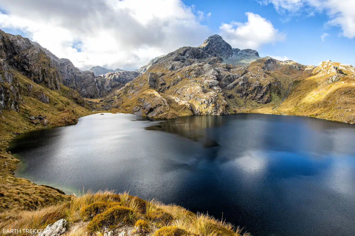
Lake Harris
The trail then leaves Lake Harris behind and you descend a rocky path into a new valley. Once you reach the descending valley floor, the track is mostly rocky with occasional gravel sections to it.
At about 3.6 km (2.25 miles) beyond the Harris Saddle you reach the mighty Routeburn Falls. And just beyond the Routeburn Falls you will find the Routeburn Falls Hut.
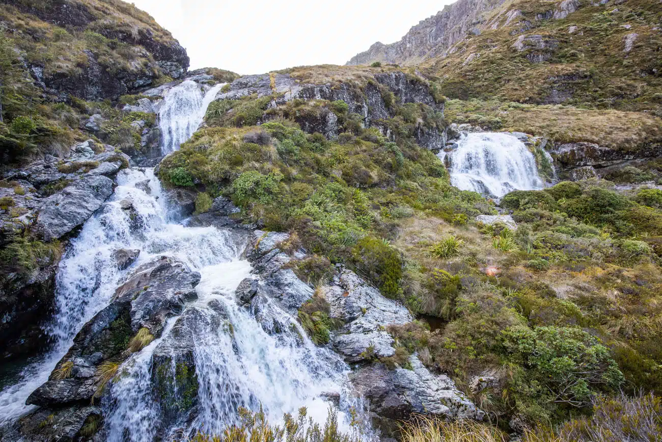
Routeburn Falls
Routeburn Falls to Routeburn Shelter
The trail now descends through a beech forest, reaching a signed trail junction for the Routeburn Flats hut and campsite after about 2.3 km (1.4 miles) of hiking from Routeburn Falls. Follow the short spur trail if you plan to stay at the Routeburn Flats, otherwise continue along the Routeburn Track.
Beyond the Routeburn Flats hut/campsite junction the trail approaches the Routeburn River and then flattens out for a bit. The track surface here was smooth and fast.
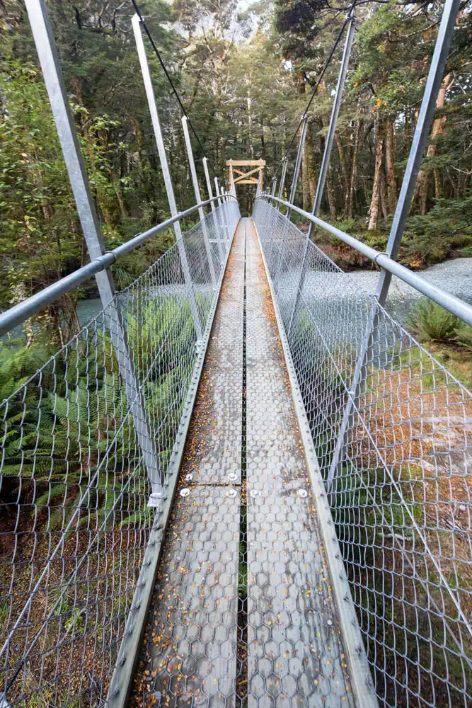
The trail continues through the forest and crosses the Routeburn River via a swing bridge. The trail then runs alongside, and high above, the river. As you continue you can hear the raging river running through the canyon next to you.
You eventually come to a sign for the Routeburn Nature Walk. This is a spur trail that reconnects to the main trail so you can take either path. Staying on the main trail is the shorter of the two options.
At about 7.5 km (4.7 miles) from Routeburn Flats you reach the Routeburn Shelter and the end of the hike. Here you will find parking, toilets, and an open shelter.
About My Experience
We planned our New Zealand South Island itinerary such that we were traveling north through the Southern Alps. So, we were in Te Anau before we were in Queenstown. Therefore, I day-hiked the Routeburn Track on the day we were planning to leave Te Anau and begin our stay in Queenstown.
Julie was recovering from a foot injury, so I solo day-hiked it, and she provided my transportation. She dropped me off at The Divide, explored the scenic sites along the road to the Milford Sound, and then drove to the Routeburn Shelter to pick me up.
The morning of the hike we were getting some heavy rain so I delayed the start of the hike an hour in hopes the rain would ease. And it did! I ended up having a beautiful day with sunny skies. But I did lose a valuable hour of daylight with that decision.
It was early April, so I already had to be extra mindful of the amount of daylight that I had to complete this as a day hike. I had already hiked to Key Summit on a prior trip to New Zealand, so I didn’t need to hike that spur trail again. But I really wanted to add-on the Conical Hill spur trail because I had heard so many great things about it. Numerous people said it was their favorite part of the hike. So, I knew at the start of my hike I would have to maintain a steady pace and not linger anywhere too long in order to squeeze this in.
When I reached Harris Saddle the sky was clear and sunny, so I went for it and added Conical Hill. I did it at a quick, but safe, pace knowing that I still needed to rush to a bit so I wouldn’t run out of daylight later. And I’m glad I did! The panoramic views were absolutely stunning and it was my favorite part of the hike. Plus, I got to see a group of kea on the way up to Conical Hill.
Once I got back to the Harris Saddle, I could definitely feel the extra fatigue the strenuousness of the steep climb and slippery descent this spur trail had on me. Especially after all the work I had put in to get to Harris Saddle. Fortunately, it was mostly downhill from here.
Once I reached Routeburn Falls I still had 9.8 km (6.1 miles) to go, and I knew I wasn’t going to reach the Routeburn Shelter before dark at my normal hiking pace. So, I intermittently walked and jogged the rest of the trail. That strategy worked and I reached the Routeburn Shelter just as it got too dark.
Overall, the Routeburn Track is an incredible experience. It is a well thought out trail offering a mix of scenery, including a lush mossy forest, a raging river, waterfalls, bridges, mountain views, alpine lakes, and views of glaciers. There are some logistics to work out due to the point-to-point nature of this hike and the total distance involved. But don’t be put off by that. It is well worth the effort necessary to plan this trek as it is truly a New Zealand Great Walk.
Routeburn Track in One Day
It is possible to day-hike the Routeburn Track, but only the fittest and fastest hiker should attempt this due to the distance and total ascent involved.
Before committing to a day hike, know how much daylight you will have. The following website shows the daylight hours for Te Anau for any time of year and can serve as an approximation. You might have a little less daylight than what is shown here since, no matter which direction you hike, the surrounding mountains and forest could be blocking some of the light. Pack a headlamp just in case you do not finish before it gets too dark.
A day hiker should give careful consideration before adding on the Key Summit and/or Conical Hill spur trails. Make sure you have ample time to finish the hike before it gets too dark, as well as the stamina. The views from Conical Hill are more impressive than those from Key Summit, but Conical Hill is more strenuous and can make you more fatigued, thus slowing your hiking pace for the remainder of the day.
A downside to day-hiking the Routeburn Track is that you only have one day. If bad weather moves in on you then you could miss some of the gorgeous panoramic views. This area does receive a lot of rainfall, so by planning a multi-day experience you will have more time to account for bad weather.
Routeburn Track Multi-Day Hike
Spending two or three days on the Routeburn Track will allow you to take a more leisurely pace, spend more time enjoying the incredible scenery, and give you some flexibility if bad weather moves through. It also gives you the ability to hike the Key Summit and Conical Hill add-ons without overly exhausting yourself.
In order to multi-day hike the Routeburn Track you have to stay at designated places along the track, which have to be reserved in advance. Either by reserving a bunk at one of the huts or by reserving a campsite. These reservations can be made here.
Routeburn Track Out-and-Back
If you want to avoid the transportation logistics related to the point-to-point nature of the Routeburn Track then hiking a portion of the Routeburn Track out and back is a great alternative. Here are my thoughts on an out-and-back hike starting from The Divide vs. starting from the Routeburn Shelter.
The best forest scenery is from The Divide to Lake Howden. The forest during this portion of the track is lush and mossy, like something out of a fairytale. You will hike through a somewhat mossy forest on the Routeburn Shelter side of the track, but it didn’t have the same wow factor as The Divide side. The track on the Routeburn Shelter side was wider, more open, and the forest wasn’t as mossy or lush.
There is an equally impressive waterfall on The Divide side of the track (Earland Falls) and on the Routeburn Shelter side of the track (Routeburn Falls). Earland Falls is a tall waterfall and Routeburn Falls is a very wide waterfall. Both were great and demonstrated their power. I liked Earland Falls slightly more, simply because I thought it was fun that the trail runs right along the base of the waterfall and you get wet from the spray as you hike past it. You also see a bunch of small waterfalls as you hike The Divide side of the track.
The best mountain scenery along the Routeburn Track is the alpine section (once you climb above the tree line) that starts above Lake Mackenzie and runs to Harris Lake, especially from the top of Conical Hill.
So overall, the portion of the track that runs from The Divide to the top of Conical Hill offers the best experience with the lush mossy forest, waterfalls, and panoramic alpine scenery. However, it is about a 41 kilometer (25.5 mile) roundtrip out-and-back hike.
Only the fittest and fastest hikers should attempt this as a day hike. Otherwise, plan this as a multi-day hike with a stay at Lake Mackenzie hut or campsite. A multi-day experience gives you more opportunity to wait for clear skies to hike the alpine portion, from above Lake Mackenzie to the top of Conical Hill, if bad weather moves in. In addition, a multi-day experience starting from The Divide gives you the opportunity to add-on the Key Summit Spur Trail.
So, there are a lot of reasons to start at The Divide vs. starting at the Routeburn Shelter. Of course, if your main goal is to see the views from the top of Conical Hill as an out-and-back day hike, then starting at the Routeburn Shelter will be a shorter hike. It will be about 28 kilometers (17.4 miles) roundtrip, which is much shorter than starting at The Divide. The total ascent will be the same in either direction since The Divide and the Routeburn Shelter are at similar elevations.
Another advantage of an out-and-back experience is that if you are spending multiple days in either Te Anau or Queenstown then you can do the hike on the most favorable weather day.
Navigation
The Routeburn Track is well maintained and well-marked, but you should still have some sort of navigational aid with you to occasionally confirm you are heading in the right direction. You will be hiking in an area without cellular service so make sure you prepare your navigational aid for offline use. This may involve caching or downloading a basemap.
The trail, trailheads, and shelters are all on Google Maps so I ‘starred’ (saved) their locations and cached the map on my phone before starting the hike. Then, while I was hiking, I periodically checked the Google Maps app to make sure I was heading in the right direction, especially when reaching a trail junction. I also checked the app to get a gauge of how far I was from the next shelter.
Trail Conditions
The day before you start your hike stop into the Department of Conservation (DOC) Visitor Centre and ask about current trail and weather conditions. There is a DOC Visitor Centre in Te Anau and in Queenstown.
You should also check the Department of Conversation website to see if any alerts are posted for the Routeburn Track.
And you should also check the weather forecast posted here.
The Routeburn Track is well marked with trail signs at each junction.
What is the Best Direction?
The Routeburn Track is a point-to-point trail that can be hiked in either direction. The two endpoints (trailheads) have a similar elevation, thus making the total ascent and total descent almost identical regardless of which direction you hike. So, the overall effort is the same in either direction.
If you start at The Divide then you will have a longer and more gradual ascent, followed by a shorter and steeper descent. If you start at the Routeburn Shelter then you will have the opposite: a shorter and steeper ascent followed by a longer and more gradual descent.
Another factor to consider when determining which way to hike is the direction that works best for your travel itinerary. If you are exploring New Zealand’s South Island then it makes sense to do this hike when you travel between Te Anau and Queenstown. It is a 325 km (202 mile) drive between the two trailheads, so you can save time if you don’t return to the starting point. We have more information on how to plan these logistics later in this guide.
Our travel itinerary had us traveling in the direction from Te Anua to Queenstown, so I did the hike on the day we planned to drive from Te Anua to Queenstown. I checked out of our Te Anua accommodations, started at The Divide, ended at the Routeburn Shelter, and checked into our accommodations in Queenstown.
If you are planning a multi-day experience, then your hiking direction might be determined by the availability for reserving the huts and campsites.
There is also an added benefit for those planning a multi-day experience and finishing at The Divide. If you finish the hike early enough in the day then you could visit the Milford Sound that same day and/or visit some of the scenic stops on the road between Te Anau and the Milford Sound. This can be a valuable time saver since The Divide is located on the same road as the Milford Sound.
One of many spectacular views along the Routeburn Track
Transportation Logistics
The Routeburn Track is a point-to-point hike so there are transportation logistics that need to be worked out before attempting this hike.
If you have a vehicle then you can drive to either starting point of the hike, but then you need to get back to your vehicle once you finish the hike.
Or do you?
What if I told you that your vehicle could be waiting for you at the end of your hike?
It sounds too good to be true, but there is a company that offers this service. You park your car and start hiking and they will drive your car the 325 km (202 miles), roughly 4.5 hours, from one trailhead to the other so your vehicle is there when you finish. See the Track Hopper website for more details.
If you do not have a vehicle then there are many transportation services to choose from, here are links to a few of them:
When is the Best Time to Hike the Routeburn Track?
You should only hike the Routeburn Track from November 1st to April 30th. This is considered the Great Walk season.
Hiking the Routeburn Track from May 1st to October 31st is not recommended and is considered extremely dangerous due to winter conditions, limited daylight hours, and the risk of avalanches. It is also considered impassable since the bridges are removed to avoid damage from the floods and avalanches that can occur during this time of year.
I hiked the Routeburn Track on April 6.
Be mindful that avalanches can occur at any time of year, but they are more likely to occur outside of the Great Walk season.
Where to Stay on the Routeburn Track
There are 3 places along the Routeburn Track to stay: Lake Mackenzie, Routeburn Falls Hut, and Routeburn Flats.
There is a hut with bunks, as well as campsites at both Lake Mackenzie and Routeburn Flats. There is also a hut with bunks at Routeburn Falls Hut (no campsite).
During the Great Walk season, the huts have heating, mattresses, basic cooking facilities, and cold water. Bring your own bedding, food, and cooking utensils. The campsites have a cooking shelter. Both have access to toilets but no showers.
The huts and campsites must be reserved in advance. And the sooner the better to ensure you can get your desired travel dates.
Learn more about the huts, campsites, prices, and availability here.
What to Bring on the Routeburn Track
Here is a list of gear we recommend taking with you, whether you are planning a day-hike or multi-day experience. As you plan what gear to bring, keep in mind that you will be hiking in a remote alpine area that receives a lot of precipitation. This can result in the trail being wet, muddy, and slippery at times. And even if the forecast is calling for sunny skies you should be prepared for sudden changes in the weather. Rain, snow, and high winds can happen during any season.
- Hiking shoes with a good grip – preferably waterproof hiking shoes
- Rain Jacket
- Dress in layers
- Sunscreen
- Headlamp
- First aid kit
- Google Maps app or other navigational aid
- GPS – preferably one with SOS and satellite communications
- Food and water
- Hiking poles – optional
If you are planning a multi-day adventure, then check the “What to take” section on the DOC website.
Essential Hiking Gear: What Should You Bring on a Day Hike?
If you are new to hiking or are curious about what you should bring on a hike, check out our Hiking Gear Guide. Find out what we carry in our day packs and what we wear on the trails.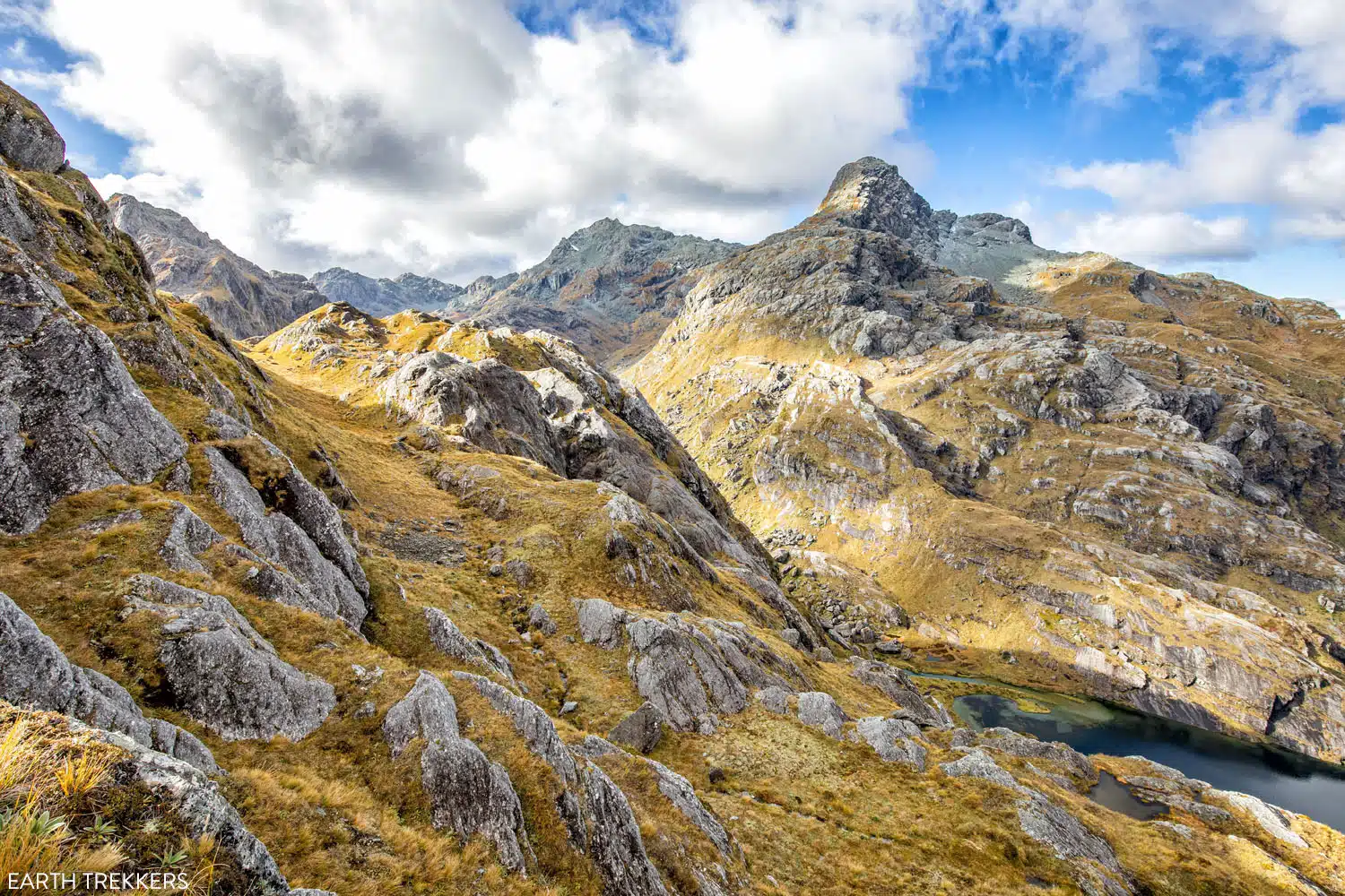
The view from the Conical Hill Trail
Frequently Asked Questions
Can the Routeburn Track be hiked in a day?
Yes! If you are fit and fast you can day-hike the Routeburn Track.
What is the best time of year to hike the Routeburn Track?
You should only hike the Routeburn Track during the Great Walk season, which starts on November 1st and ends April 30th.
Can I hike the Routeburn Track in the winter?
It is highly discouraged to attempt the Routeburn Track in the winter as it is considered extremely dangerous and impassable. You will have to have expertise in winter alpine trekking, winter navigation, and river crossings. Resources at the huts are also very limited.
Can kids hike the Routeburn Track?
The New Zealand Department of Conservation recommends kids being at least 10 years of age before hiking the alpine section of the Routeburn Track. That is the section between Lake Mackenzie and Routeburn Falls Hut.
If you have any questions about hiking the Routeburn Track, or if you want to share your experience, let us know in the comment section below.
Plan Your Trip to New Zealand
Queenstown Bucket List: 25 Epic Things to Do in Queenstown
Pinterest Facebook Flipboard Discover the best things to do in Queenstown, from adrenaline-pumping activities like bungy jumping, jet boat rides, and paragliding, to top hiking trails, viewpoints, scenic drives, and more relaxed experiences such as hot springs and wine tastings. Queenstown is one of the best places in New Zealand to engage in heart-racing, thrilling […]
Tongariro Alpine Crossing Hike, Step-By-Step Guide to New Zealand’s Best Day Hike
The Tongariro Alpine Crossing is a 19.4 km (12 mile) hike in New Zealand’s North Island with emerald lakes, views of semi-dormant volcanoes, and ever-changing terrain. Our complete guide covers everything you need to know to plan your day. The Tongariro Alpine Crossing is often labeled as the world’s greatest single day hike. Located on […]
Milford Sound Day Trip: A DIY Guide to the Drive + Cruise
This guide explains how to plan your Milford Sound day trip, including sights and activities along the drive, how to book your cruise, and tips we’ve learned from our visits. It’s best to visit Milford Sound from Te Anau, but you can also go from Queenstown—just expect a much longer day. The Milford Sound (also […]
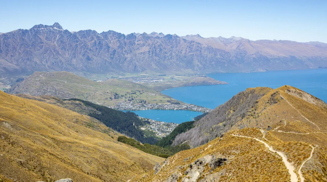
How to Hike the Ben Lomond Track, the Best Hike in Queenstown
Looking for the best day hike in Queenstown? The Ben Lomond Track provides the perfect mix of challenge and reward. Along this 11 km (6.8 mile) round trip hike, you’ll be treated to incredible views of the Remarkables, Lake Wakatipu, Queenstown, and mountain peaks as far as the eye can see. You can either hike […]
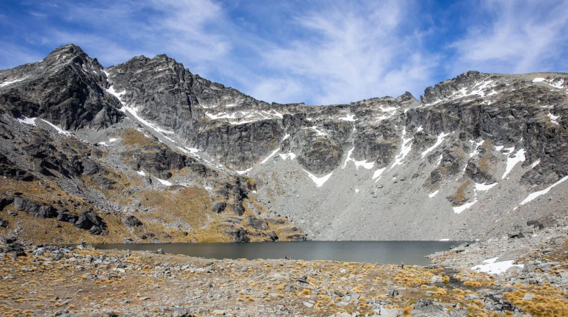
Lake Alta Track: How to Hike This Stunning LOTR Filming Site
The Lake Alta Track in Queenstown, New Zealand offers a journey to a beautiful alpine lake nestled high up in the Remarkables mountain range. We did this hike on our most recent trip to New Zealand. Dad and I returned to Queenstown to do some hikes we never got to experience on our first two […]
New Zealand Itinerary: 3 Week North & South Island Road Trip
This 3-week New Zealand itinerary starts in Auckland, spends one week on the North Island, then two weeks on the South Island, ending in Queenstown. It’s the best way to see the highlights of New Zealand in one road trip. It’s no secret that New Zealand is one of our favorite destinations in the world. New Zealand is the perfect blend […]
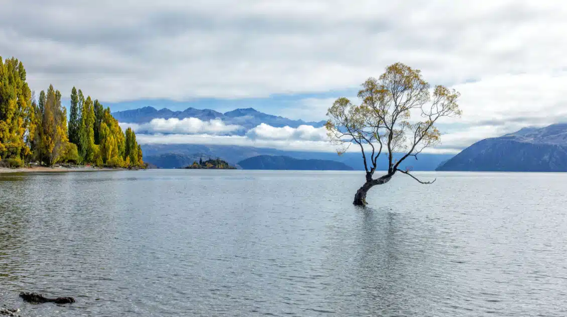
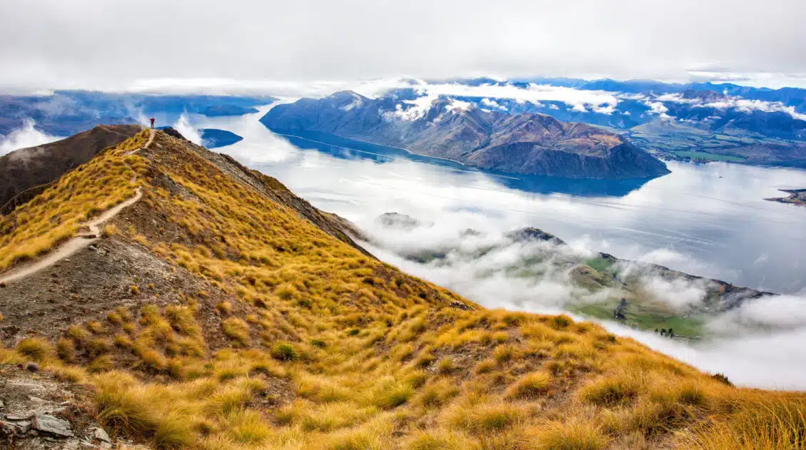
20 Epic Things to Do in Wanaka, New Zealand
Discover the best things to do in Wanaka, from top hikes like Roy’s Peak and Diamond Lake to unique activities such as lavender farms, via ferratas, and enjoying freshly baked cookies at Cinema Paradiso. See the highlights in one busy day, but stay longer to experience all that Wanaka has to offer. Wanaka is one […]
Two Week South Island Itinerary: 3 Road Trip Routes
We have visited New Zealand three times, and in this guide, we provide three different ways to plan a two-week South Island itinerary. There’s a lot to see and do on the South Island, and this guide gives you the opportunity to pick the road trip that best fits your interests. Two of these itineraries […]
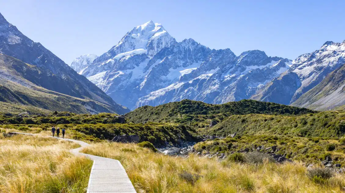
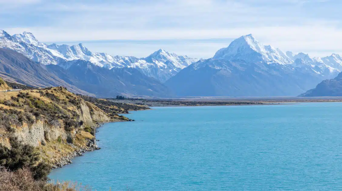
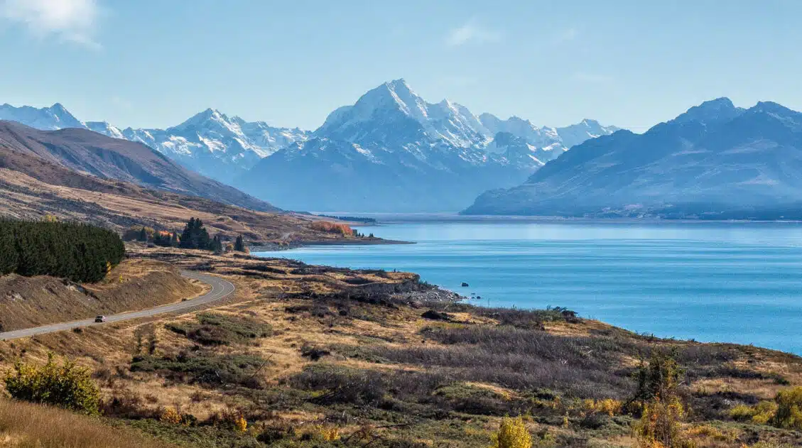
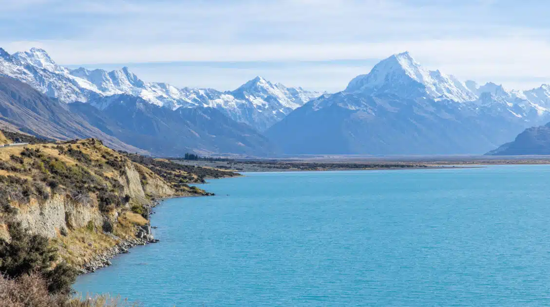
15 Amazing Things to Do in Aoraki / Mount Cook National Park
Discover the very best things to do in Aoraki/Mount Cook National Park, from its top hiking trails to its best viewpoints. We’ll also cover where to stay, the best time to visit, and how to plan your time. Aoraki / Mount Cook is the tallest mountain in New Zealand. Getting a glimpse of this mighty […]
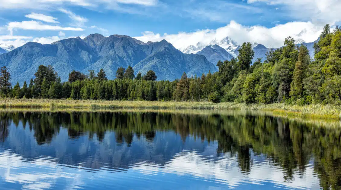
Best Things to Do in Franz Josef | Glacier Country, New Zealand
In this guide, we cover the best things to do in Franz Josef, plus how to get here, where to stay, and how to plan your time. Hike to viewpoints of glaciers, see the rarest Kiwi, soar over Fox Glacier and Franz Josef Glacier in a helicopter, capture Mount Tasman’s reflection in Lake Matheson, go […]
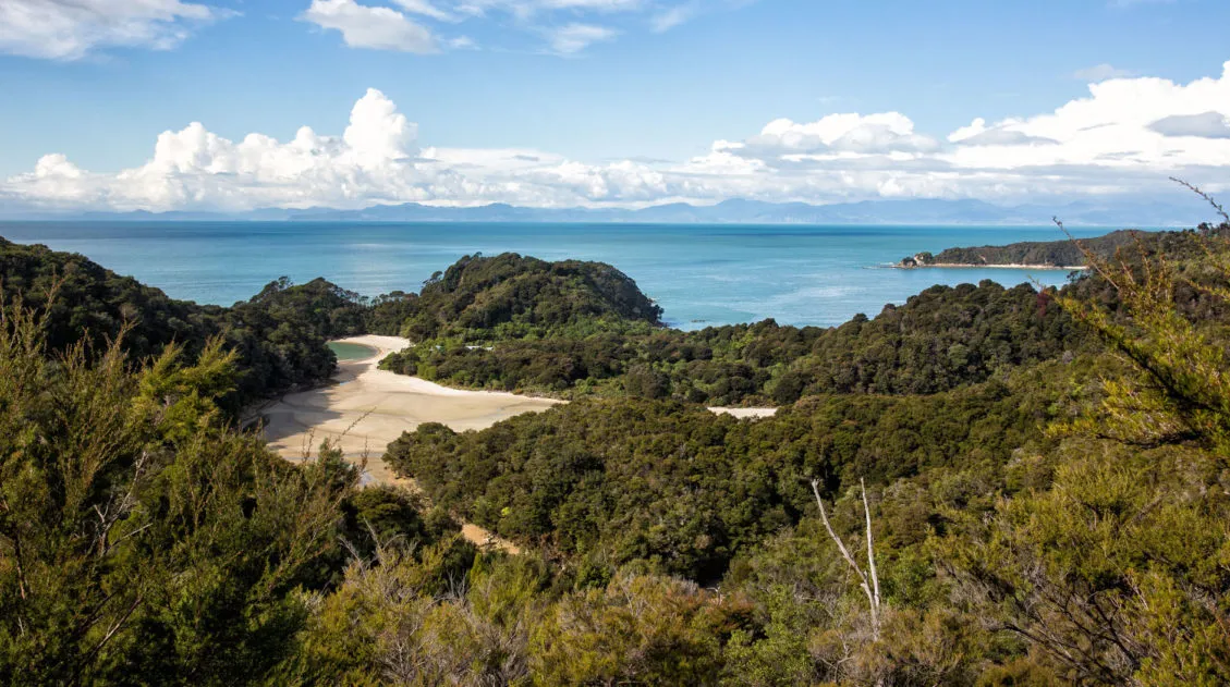
One Day in Abel Tasman National Park
Abel Tasman National Park is New Zealand’s smallest park. Located on the northern coastline of the South Island, Abel Tasman is home to one of New Zealand’s multi-day walking tracks, aptly named the Abel Tasman Coast Track. This is also a great place for kayaking, exploring the wide, empty beaches, and walking on trails amidst […]
50 EPIC Things to Do in New Zealand (Ultimate Bucket List)
Discover the best things to do in New Zealand, from its main attractions to its hidden gems. We are frequent visitors to New Zealand, and this list contains our favorite experiences. We’ll also cover when to visit and how to plan your perfect New Zealand itinerary. New Zealand is the perfect mix of awe-inspiring landscapes, […]
New Zealand Travel Guide | How to Plan a Trip to New Zealand
New Zealand Travel Guide New Zealand is one of our favorite countries in the world. Why? Because New Zealand has the perfect mix of breathtaking landscapes, adventure activities, beautiful cities, wine regions, stunning beaches, amazing drives, and gourmet food. This is the land of fiords, hiking trails, bungy jumping, sheep, glowworms, and glaciers. Lord of […]
Ultimate Hiking Guide: Europe, Asia, Africa, Americas & Oceania
Are you looking for the perfect hike? With hikes on six continents ranging from a few miles to multi-day adventures, explore some of the best hikes from around the world.
Roys Peak Track: Stats, Photos, Hiking with Kids
The Roys Peak Track is a 16 km (10 mile) strenuous, out-and-back hike to a stunning viewpoint over Wanaka and Lake Wanaka. Here’s how to do it. Roys Peak Track is one of the best hikes to do on the South Island of New Zealand. Located in Wanaka, this trail takes you high into the […]

Comments 7