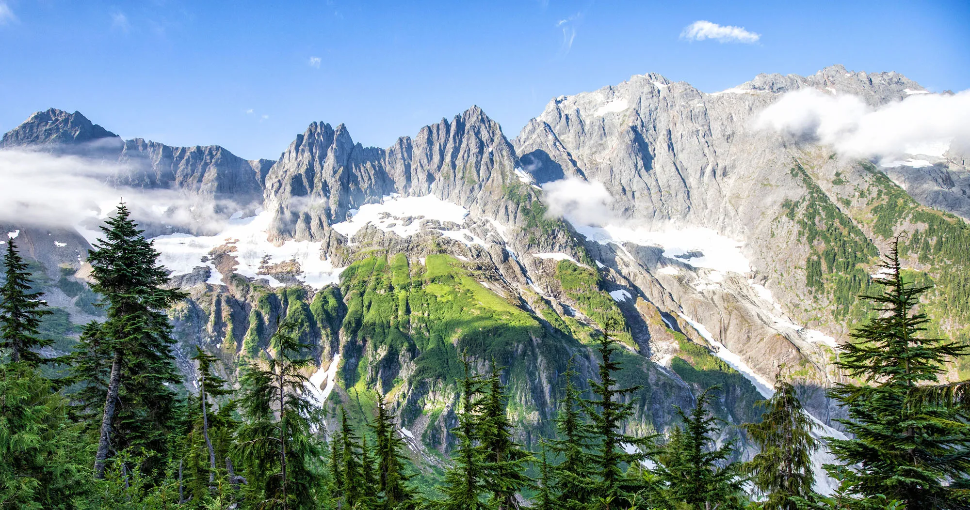

North Cascades National Park is not a place that easily reveals itself. Sure, the drive along Highway 20 is lovely. And the viewpoints over the lakes and mountain passes are gorgeous. But to really see this park, you are going to have to invest some time on the hiking trails.
We spent three weeks hiking in Washington state and the trails here left a lasting impression. The only way to truly understand the scale and beauty of the North Cascades is on foot — hiking high into the mountains, where layer after layer of glacier-capped peaks stretch off in every direction.
This guide is designed specifically for first-time visitors who want to:
- Choose the right hikes for their fitness level
- Understand which trails deliver the best views
- Avoid wasting time driving between areas of the park
- Know which hikes are worth the effort (and which can be skipped)
If you are in the early planning stages, start with our North Cascades National Park Travel Guide for broader tips on how to plan your visit.
GOOD TO KNOW IN 2026: The final 3 miles of Cascade River Road are open July through October only. Check current trail conditions and road closures on the National Park Service website before you go.
Best Hikes in North Cascades
BEST OVERALL HIKE | Cascade Pass & Sahale Arm
BEST MODERATE HIKE | Maple Pass Loop
BEST EASY HIKE | Rainy Lake
BEST LAKE HIKE | Blue Lake
BEST FOR VARIETY | Hidden Lake
BIGGEST CHALLENGE | Desolation Peak
Please practice the seven principles of Leave No Trace: plan ahead, stay on the trail, pack out what you bring to the hiking trail, leave areas as you found them, minimize campfire impacts, be considerate of other hikers, and do not approach or feed wildlife.
How to Choose the Best Hike in North Cascades
If you’re short on time, use this section to quickly identify which hikes belong on your list.
If You Want the Classic North Cascades Experience
- Cascade Pass & Sahale Arm
- Maple Pass Loop
These two hikes offer the most dramatic, high-alpine views of the park.
If You Prefer Short & Easy Hikes
- Rainy Lake
- Blue Lake
- Thunder Knob
Big rewards for minimal effort.
If You’re Here for Mountain Views
- Cascade Pass & Sahale Arm
- Hidden Lake
- Desolation Peak
- Maple Pass Loop
The hikes in the Mount Baker area also deliver exceptional high-alpine panoramas.
If You Want to Leave the Crowds Behind
- Hidden Lake
- Cutthroat Lake
- Thornton Lake
These require more effort or a rougher drive to the trailhead, which keeps crowds low.
If You Want a Big Challenge
- Desolation Peak (requires a boat crossing or long additional hike)
- Cascade Pass & Sahale Arm (strenuous, but the most rewarding day hike in the park)
Quick Overview of North Cascades National Park Complex
There are three sections to North Cascades National Park Complex: the Chelan Lake National Recreational Area (which includes Stehekin), Ross Lake National Recreational Area, and North Cascades National Park.
400 miles of hiking trails criss-cross their way through this mountainous landscape. Not only is this a great place to go hiking, but with miles and miles of long-distance trails, this is an awesome place to go backpacking.
North Cascades National Park is nicknamed the American Alps, getting its name from the jagged, rocky mountain peaks and emerald green slopes. At times, it really does look like you are standing in Switzerland.
The North Cascades Range, which runs through the park, is the largest glacial system in the lower 48 states. In fact, there are an estimated 300+ glaciers here.
How to Use This Map: Click the icons on the map to get more information about each point of interest. To take this map with you, click the star next to the title of the map which adds it to your Google account. Next, within your Google Maps app, select ‘Saved’ and then select ‘Maps’. This map title will now appear in your list.
Best Hikes in North Cascades National Park
The hikes in this post are organized by geographical area. Several of these trails technically lie outside of the park border, but they are located so close to the park, and are so popular, that I could not leave them off of the list.
Note: all distances are round-trip.
Ross Lake National Recreational Area
These hikes are located along Highway 20 and in the Ross Lake area, within the national park.
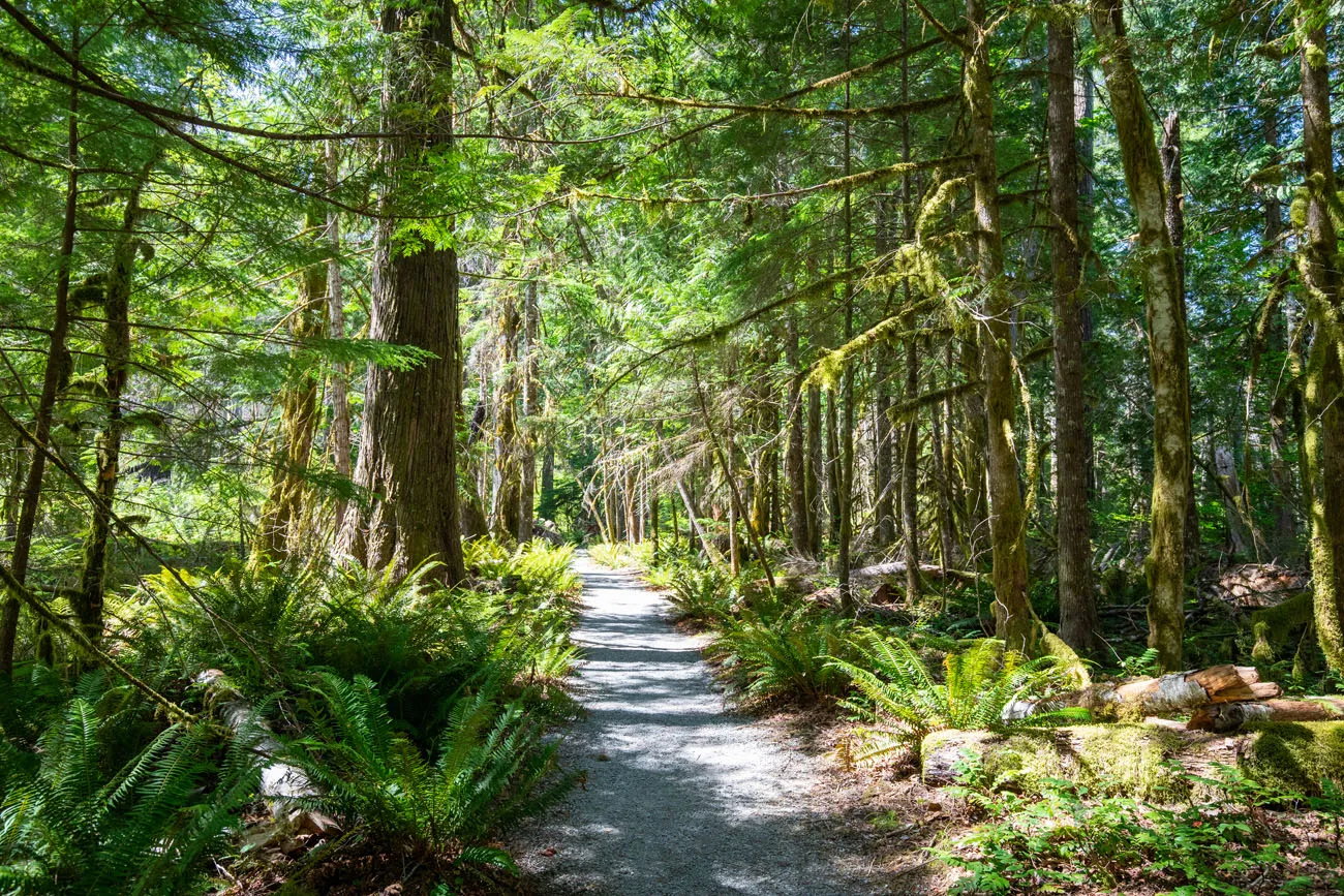
Trail of the Cedars Nature Walk
Distance: 0.3 miles
Difficulty: Easy
Length of Time: 30 minutes
Location: Newhalem
Best for: Visitors who want a quick, peaceful forest walk near Newhalem
Why it’s worth it: An easy stroll through old-growth forest that faintly resembles the temperate rainforests of Olympic National Park
Skip it if: You have already visited Olympic National Park, this will feel familiar
This short, easy trail makes a loop alongside the Skagit River. You walk through an old growth forest that faintly resembles the temperate rainforests of Olympic National Park. This short walk is nice, but skippable, especially if you have already been to Olympic National Park.
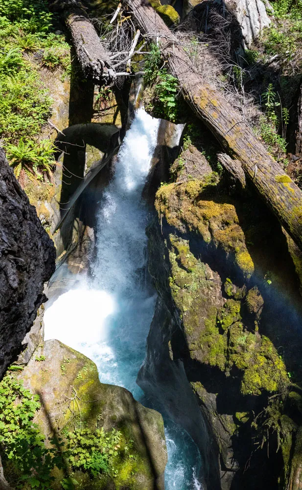
Ladder Creek Falls
Distance: 0.4 miles
Difficulty: Easy
Length of Time: 30 minutes
Location: Newhalem
Best for: Visitors in Newhalem who want a quick waterfall stop
Why it’s worth it: A short, dramatic hike to viewpoints of a beautiful waterfall, with a narrow suspension bridge crossing
Skip it if: You’re short on time and prioritizing longer trails, though this pairs easily with the Trail of the Cedars
Just a short walk from the Trail of the Cedars, also located in Newhalem, is Ladder Creek Falls. You will cross a narrow suspension bridge next to the Gorge Powerhouse and then follow the loop trail up to viewpoints of the waterfall. Parts of the trail are steep, but the trail is paved with steps and handrails.
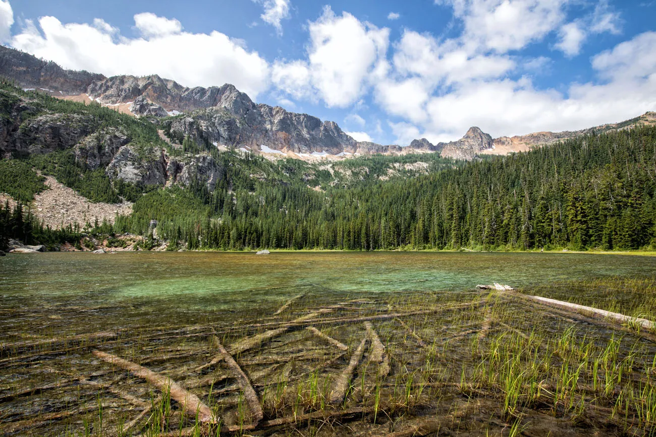
Thornton Lake
Distance: 10.4 miles
Elevation Gain: 3,000 feet
Difficulty: Moderate to strenuous
Length of Time: 5 to 8 hours
Location: Highway 20, 11 miles east of Marblemount. Take Thornton Lakes Road 5 miles until you reach the trailhead. This road is unpaved and not recommended for vehicles with low clearance.
Best for: Hikers looking for a remote backcountry lake with big mountain surroundings
Why it’s worth it: A beautiful, secluded lake ringed by rocky peaks; less crowded than other North Cascades trails
Skip it if: You have a low-clearance vehicle (road access is rough), or prefer trails with views along the way rather than just at the destination
This beautiful, remote lake is surrounded by rocky mountains. The trail starts off easy, a relatively flat walk through thick forests. Then the trail climbs steeply up to a ridgeline. After a short descent, you are standing at the shore of Thornton Lake. You can do this hike as a day hike, or, with a permit, camp here overnight.
Kelly vanDellen/shutterstock.com
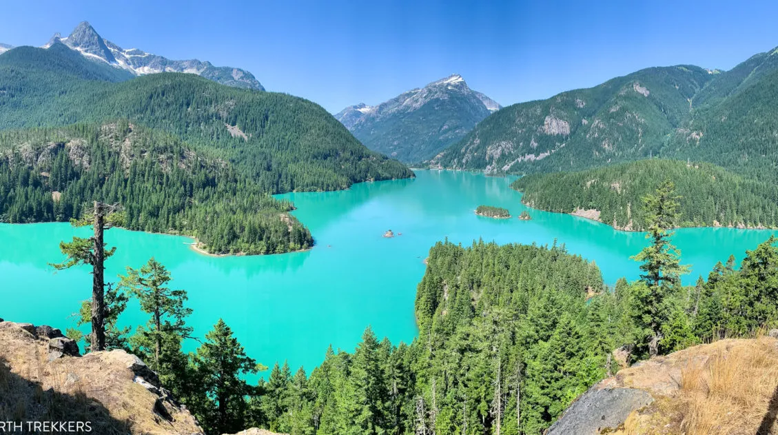
Thunder Knob Trail
Distance: 3.6 miles
Elevation Gain: 425 feet
Difficulty: Easy to moderate
Length of Time: 2 to 3 hours
Location: Diablo Lake
Best for: Families and beginners who want a rewarding viewpoint without a strenuous climb
Why it’s worth it: Beautiful views over the turquoise waters of Diablo Lake, with time before or after to enjoy the beach and water
Skip it if: You’re prioritizing high alpine views over lake scenery; hike Sahale Arm or Maple Pass for that
For beautiful views over Diablo Lake, hike to the top of Thunder Knob. This is a family-friendly trail that starts at Diablo Lake. Before or after the hike, you can spend some time at the lake, relaxing on the beach, paddle boarding, or kayaking.
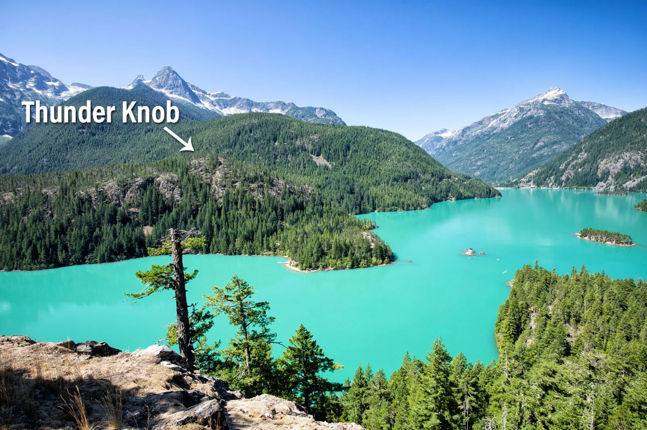
View of Diablo Lake and Thunder Knob from the Diablo Lake Overlook.
Desolation Peak
Distance: 9.4 miles
Difficulty: Hard
Length of Time: 5 to 8 hours, not including transportation on Ross Lake
Elevation Gain: 4,400 feet
Best for: Experienced hikers drawn to history and sweeping backcountry views. This is one of the most remote trails in the park
Why it’s worth it: Sweeping views of Skagit Peak, Little Jackass Mountain, and Ross Lake, and a direct connection to Jack Kerouac’s summer as a fire lookout here in 1956
Skip it if: You can’t arrange boat transportation and aren’t prepared for the much longer overland approach
In 1956, Jack Kerouac (author of On the Road) spent part of the summer on top of this peak, serving as a watchman in the fire tower. He wrote the book Desolation Angels from this experience.
Located on Ross Lake, Desolation Peak offers sweeping views over the park.
The trailhead can be reached by crossing Ross Lake by boat or by hiking an additional 16 miles on the East Bank Trail. To get from the lake to Desolation Peak, it is a challenging, steep hike. Once at the summit, you are treated to views of Skagit Peak, Little Jackass Mountain, and Ross Lake.
Trails in Okanogan-Wenatchee National Forest
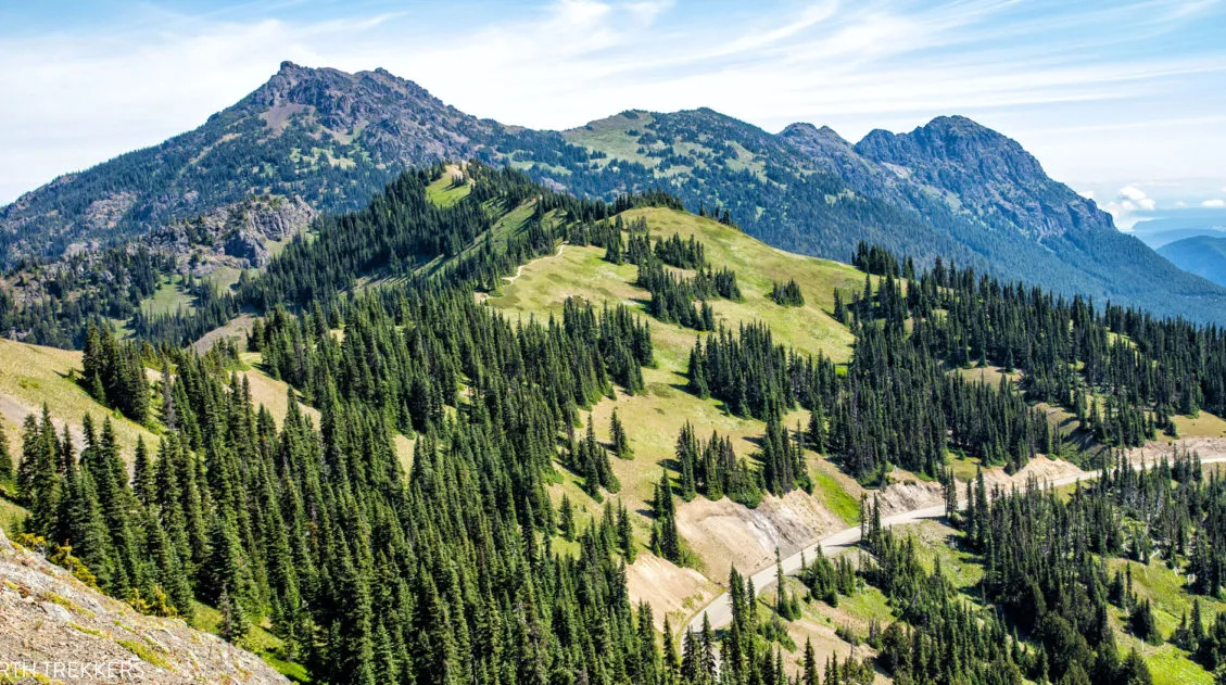
These hikes are located on Highway 20 just outside of North Cascades National Park. One of these hikes, the lovely Maple Pass hike, almost enters the national park. We highly recommend the Maple Pass Loop because the views you get from the top of the trail are amazing.
Maple Pass Loop
Distance: 7.2 miles
Difficulty: Moderate to difficult
Total Elevation Gain: 2,200 feet
Length of Time: 3 to 5 hours
Location: Rainy Pass Picnic Site on Highway 20
Best for: Hikers who want to experience a wide variety of scenery — wildflowers, old growth forest, an alpine lake, and panoramic mountain views — in a single loop
Why it’s worth it: The high-point views of the North Cascades are absolutely stunning; this is one of the best day hikes in the entire region
Skip it if: You’re set on staying strictly within the national park boundary, though you will be bumping right up against it
The Maple Pass Loop offers a little bit of everything…wildflowers, old growth forests, a visit to a lovely alpine lake, and (the best part) panoramic views of the North Cascades.
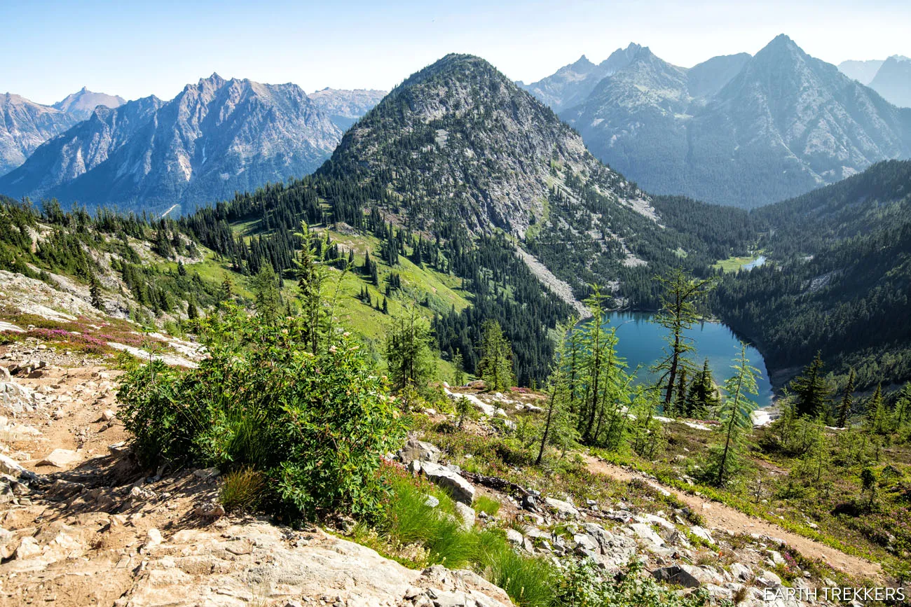
Although it is not located in North Cascades National Park, you bump right up against the park border. From the highest points along the trail, you will have spectacular views of the national park. The view over Ann Lake is lovely, but the whole reason for doing this hike, in my opinion, are for the high mountain views. It’s truly breathtaking.
From this trail, you really get to appreciate just how vast and rugged North Cascades National Park is.
Rainy Lake
Distance: 2 miles
Difficulty: Easy
Length of Time: About 1 hour
Location: Rainy Pass Picnic Site on Highway 20
Best for: First-time visitors, families with young children, or anyone who wants a gorgeous lake view with minimal effort
Why it’s worth it: A flat, paved walk to a stunning alpine lake with North Cascades National Park sitting just beyond
Skip it if: You have the time and energy to do the full Maple Pass Loop instead, Rainy Lake is best as a quick add-on
This hike shares the same trailhead as the Maple Pass Loop. To get to Rainy Lake, it is a flat walk on a paved trail to a viewpoint of the lake. This is a gorgeous hike and beyond the lake sits North Cascades National Park.
Blue Lake
Distance: 5 miles
Difficulty: Easy to moderate
Elevation Gain: 1,100 feet
Length of Time: 2 to 3 hours
Location: Highway 20, about 1 mile west of the Washington Pass Overlook. There is a small parking lot right off of the highway.
Best for: Hikers who want a short, rewarding trail to a beautiful alpine lake; great for almost all ages and fitness levels
Why it’s worth it: A brilliantly blue lake surrounded by towering mountains, with a peaceful old-growth forest walk to get there
Skip it if: You’ve already done Rainy Lake and are looking for something more challenging. There is some overlap in the “easy alpine lake” category.
This is a great to add on to your North Cascades to-do list. It’s short and relatively easy, so it’s perfect for almost all ages and ability levels. Most of the hike takes you through an old growth forest, a beautiful, peaceful walk.
The trail ends at the Blue Lake, a brilliantly blue lake that is surrounded by towering mountains. You can continue to follow the trail around the lake for even better views.
Cutthroat Lake
Distance: 4 miles
Difficulty: Easy
Elevation Gain: 550 feet
Length of Time: 1.5 to 3 hours
Location: Park in the small lot at the end of NF-400 (about 1 mile east of the Washington Pass Overlook). The trailhead is located at the end of this parking lot.
Best for: Visitors who want a quick, flat forest walk to a quiet lake
Why it’s worth it: A mostly flat walk with a lovely log footbridge just before the lake; low effort, peaceful setting
Skip it if: You only have time for one lake hike in this area, we’d choose Blue Lake over Cutthroat Lake for the scenery
Cutthroat Lake is another lovely lake. I don’t think it’s as pretty as the Blue Lake, and this trail is a bit on the boring side, so if you only have time for one lake hike, I recommend the Blue Lake over Cutthroat Lake.
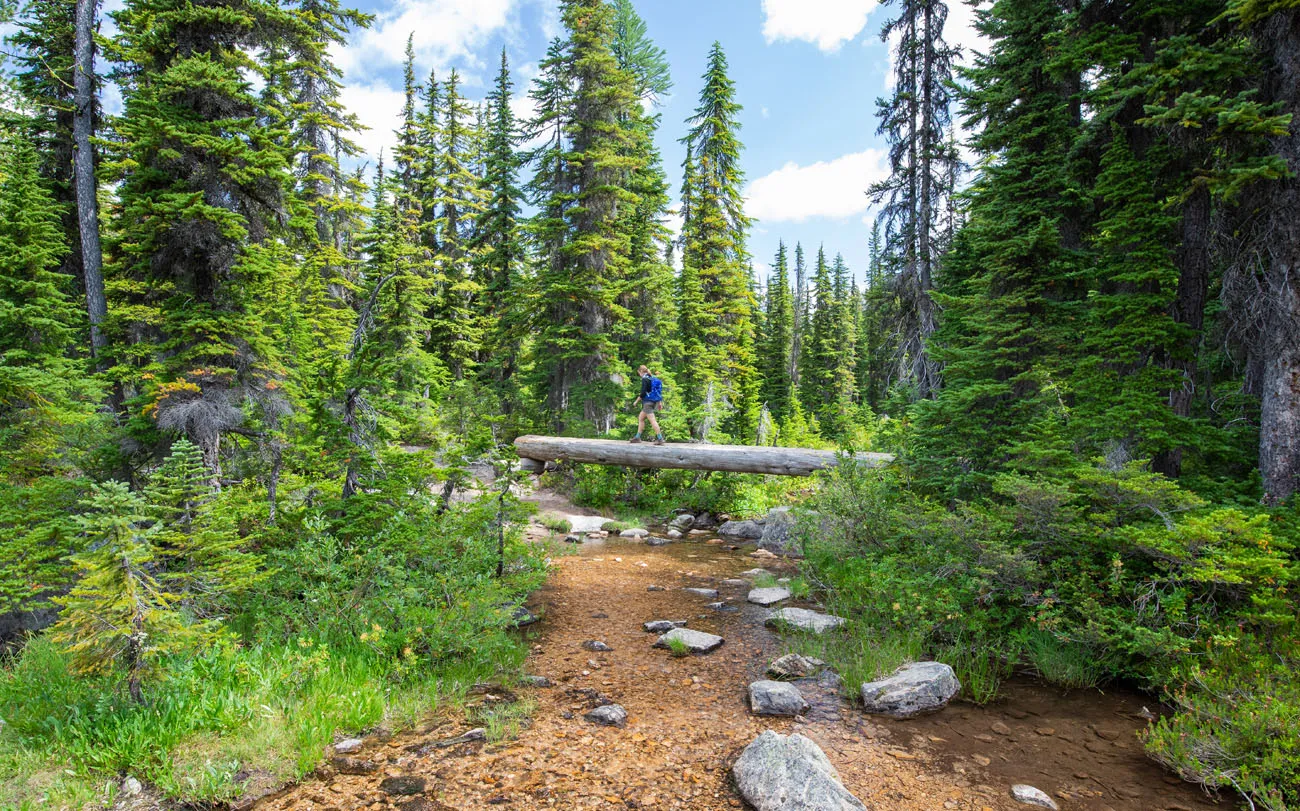
To get to the Cutthroat Lake, it is a mostly flat walk through a forest. The best part of the hike is crossing the log footbridge just before you reach the lake.
Hikes on Cascade River Road
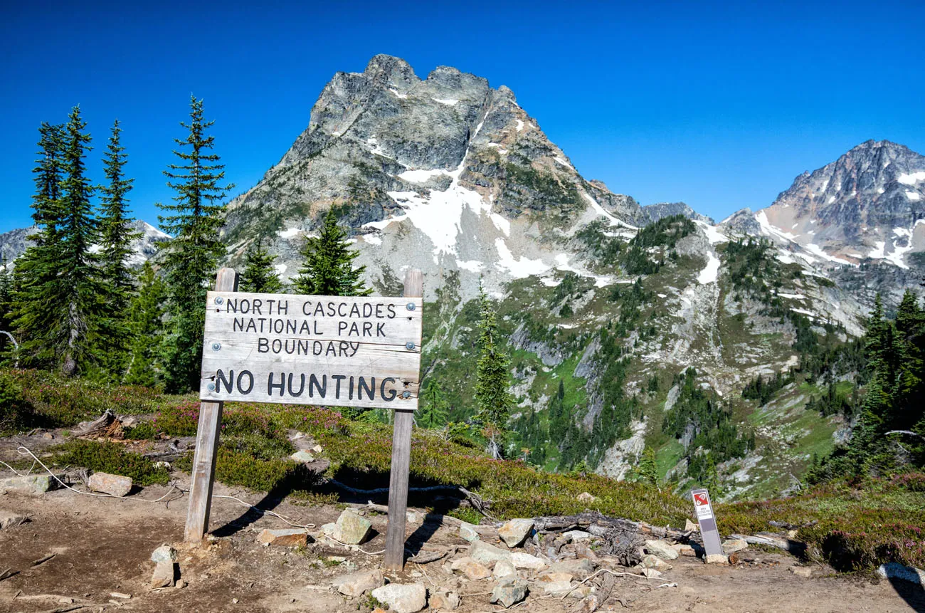
These next two hikes are located on Cascade River Road, a road that is 23 miles long. The final 13 miles are unpaved. This road starts in Marblemount and ends within the national park boundary.
The final 3 miles of Cascade River Road is open just a few months of the year (July through October).
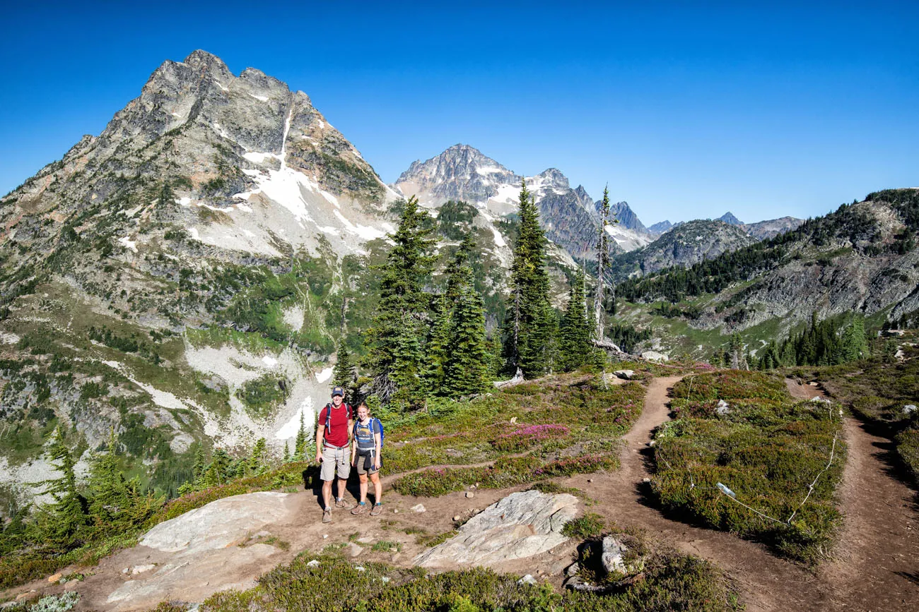
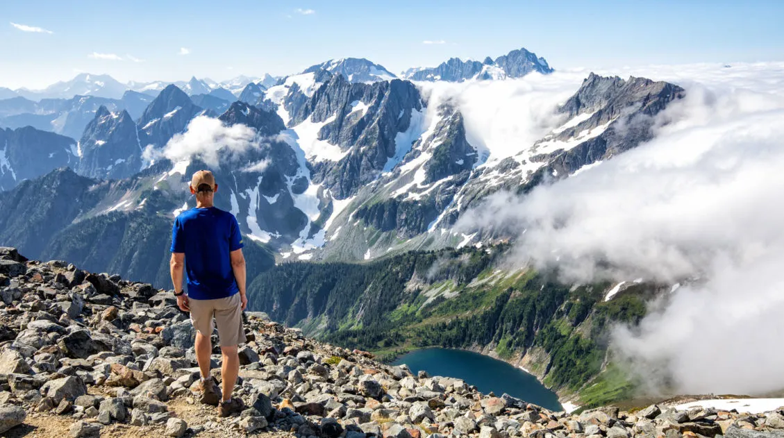
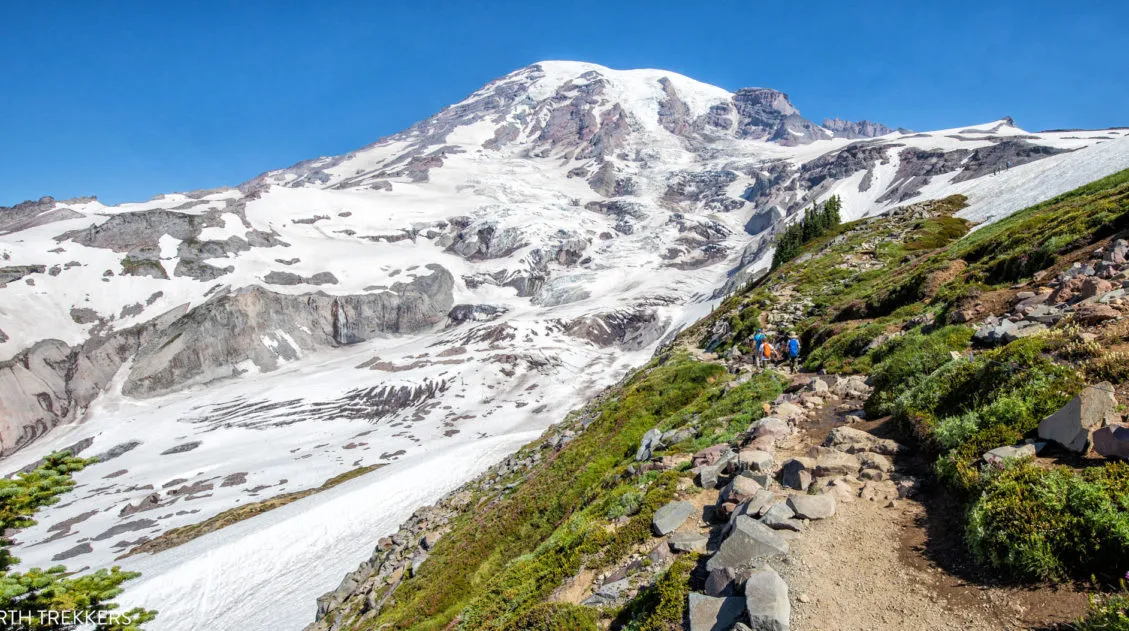
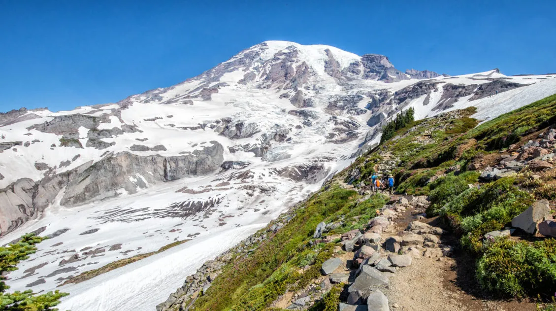
Cascade Pass and Sahale Arm
Distance: 12 miles
Difficulty: Hard
Total Elevation Gain: 4,150 feet
Length of Time: 5.5 to 7.5 hours
Location: The trailhead starts at the end of Cascade River Road.
Best for: Experienced hikers who want the best single-day view in North Cascades National Park
Why it’s worth it: Gorgeous every step of the way with evergreen forests, wildflower fields, marmots, mountain goats, and jaw-dropping views of Doubtful Lake and dozens of snow-capped peaks from the Sahale Glacier Camp
Skip it if: You’re not comfortable with long, sustained elevation gain. This is a tough climb, but it’s absolutely worth it.
If you only have time for one hike in the North Cascades, this is the one that we recommend.
Often labeled as the best day hike in North Cascades National Park, the Cascade Pass and Sahale Arm hike is gorgeous every step of the way.
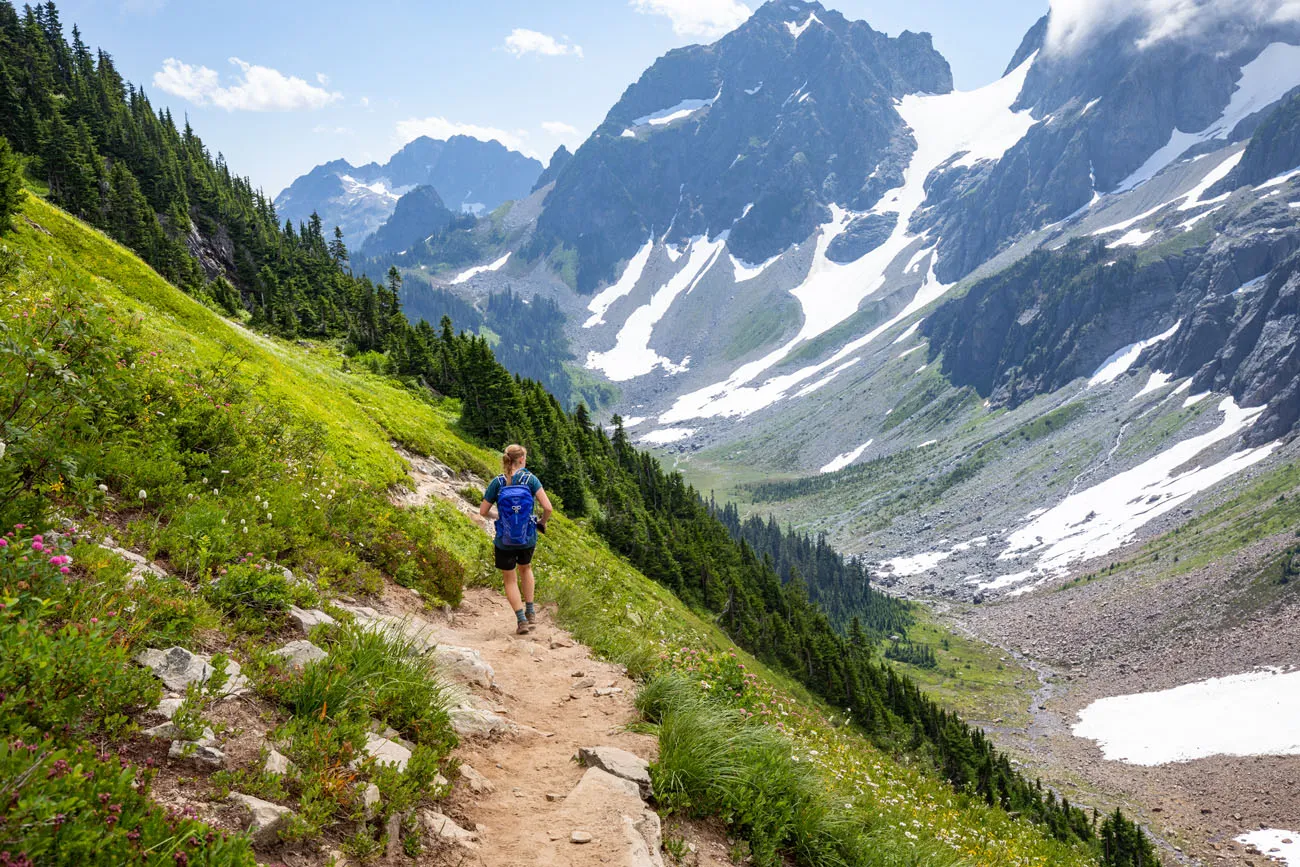
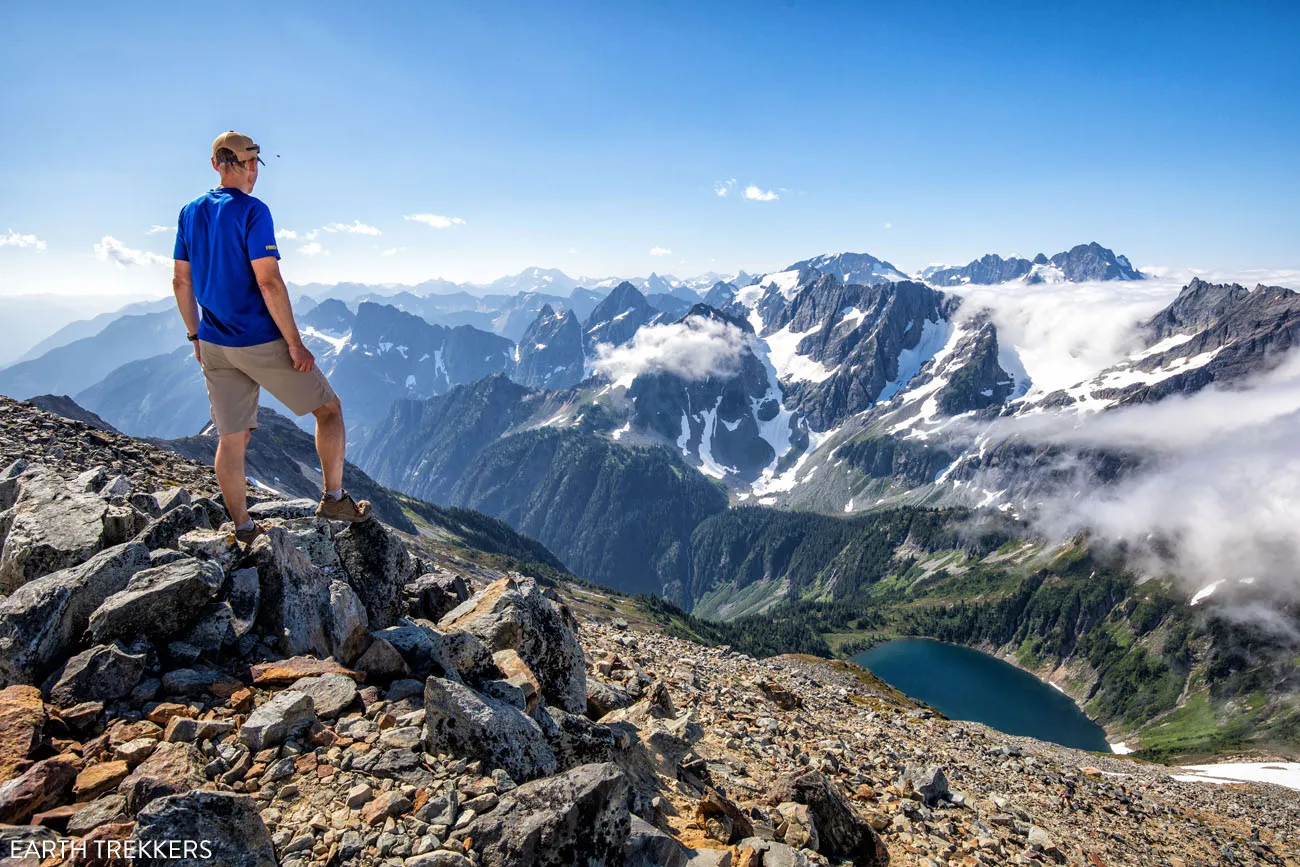
You will hike through evergreen forests, through fields of heather and wildflowers, past marmots, mountain goats, and maybe even bear. Once at the Sahale Glacier Camp, you get to enjoy spectacular views over Doubtful Lake and layers of jagged, snow-capped peaks.
The Cascade Pass and Sahale Arm hike is a tough one but it is absolutely worth it. We spent 3 weeks hiking in Washington state and this was one of our favorite hikes.
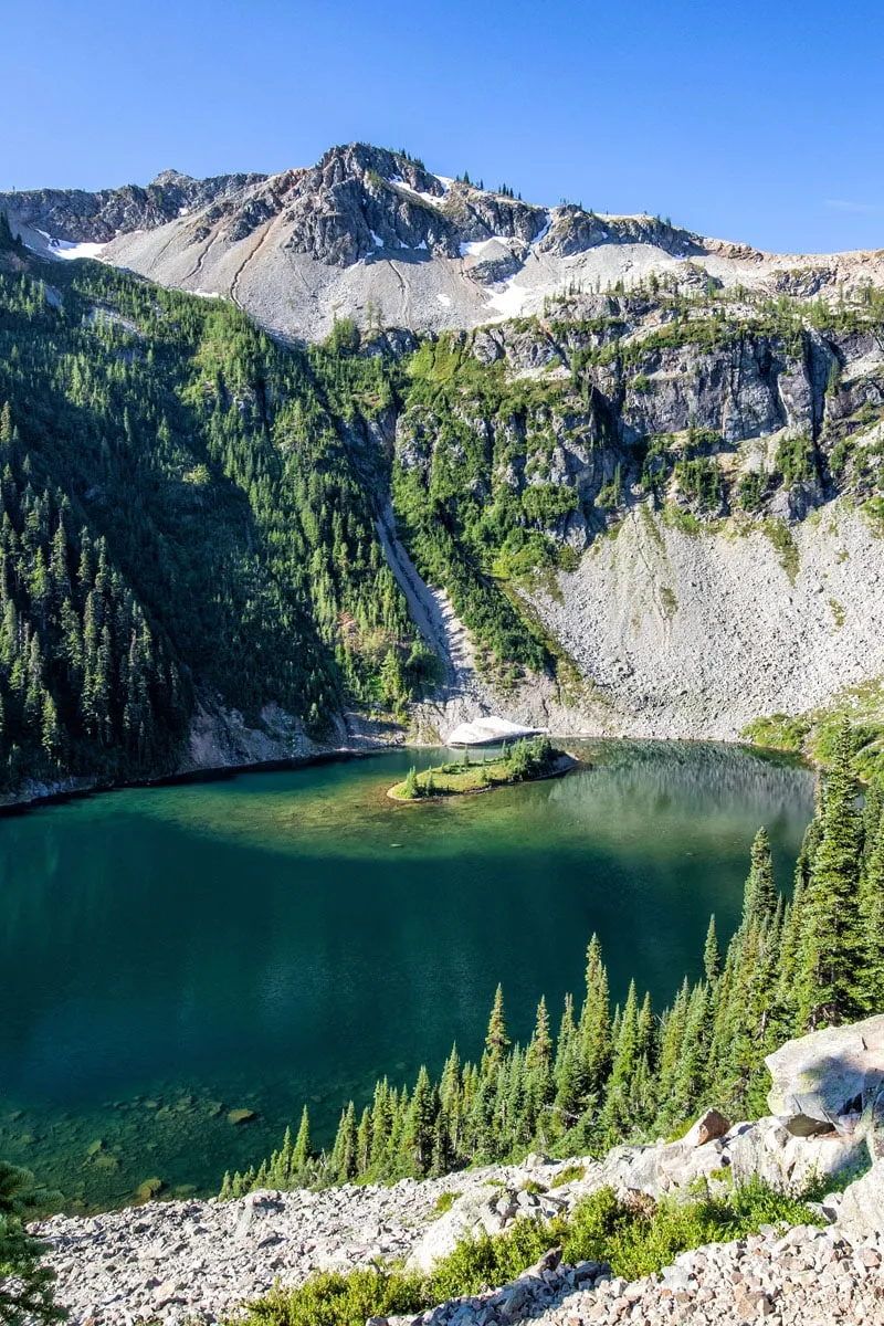
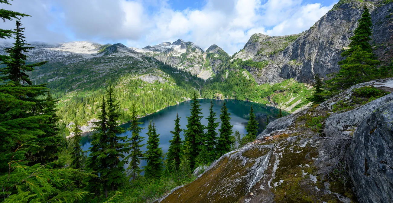
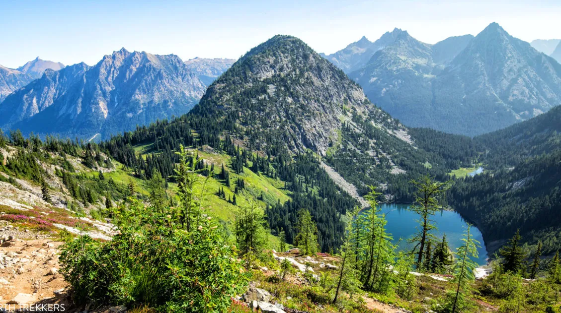
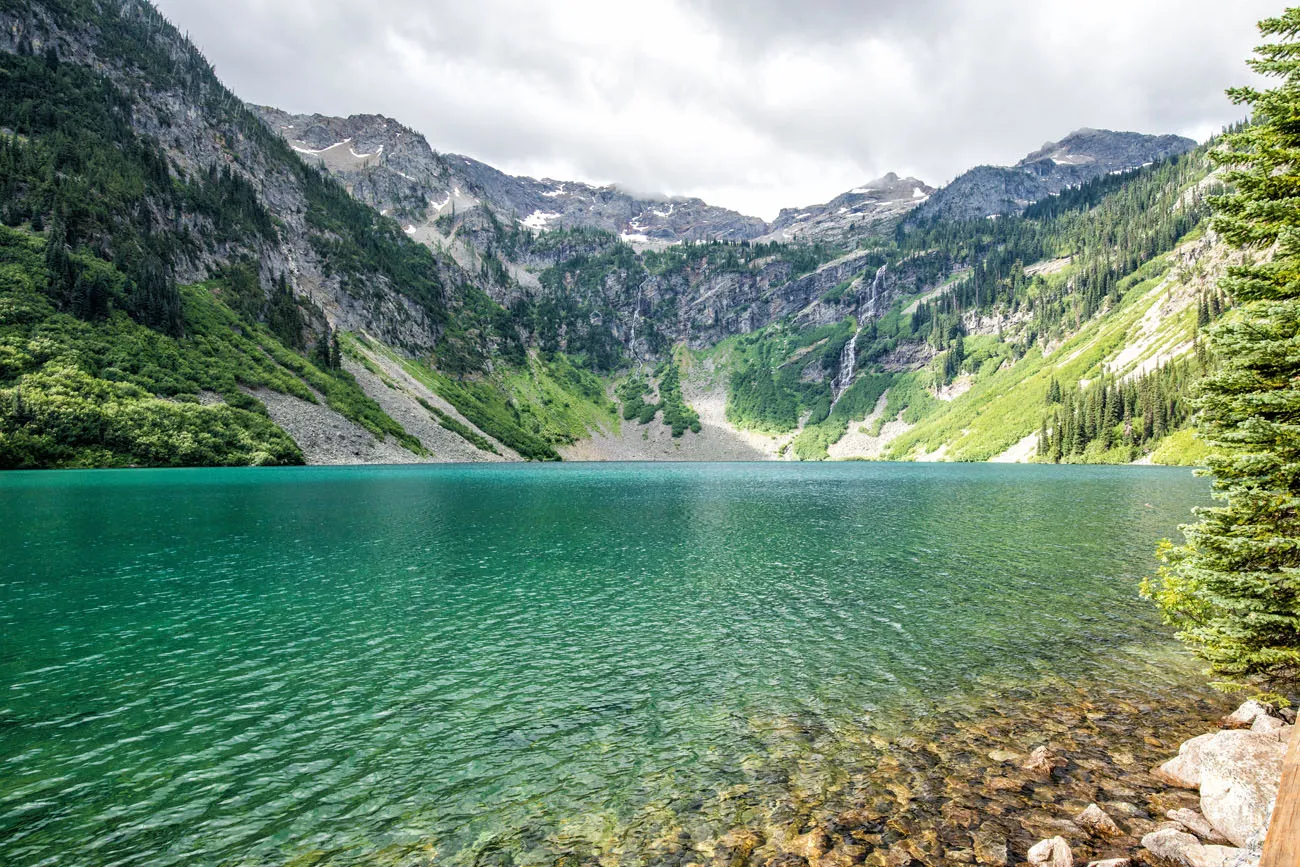
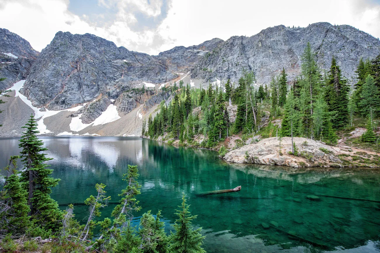
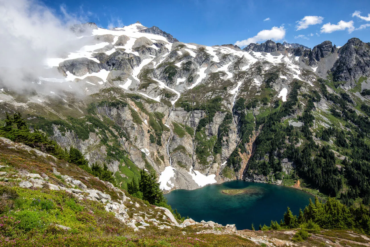
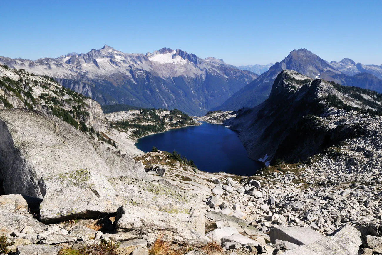
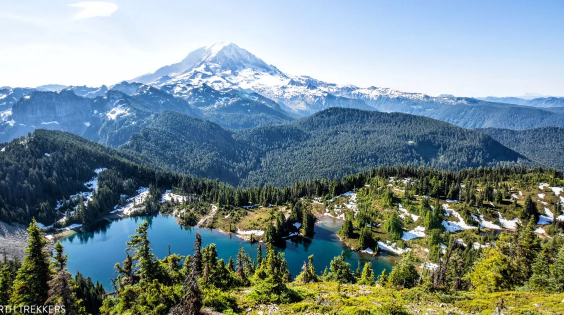
Hidden Lake
Distance: 9 miles
Difficulty: Moderate to Strenuous
Elevation Gain: 2900 feet
Length of Time: 5 to 7 hours
Location: Take Cascade River Road for 10 miles and then turn left onto Sibley Creek (Hidden Lake) Road. Follow this for 4.5 miles to the end of the road and the trailhead for the hike.
Best for: Hikers who want a high-alpine lake with panoramic mountain views and fewer crowds than Sahale Arm
Why it’s worth it: Stunning views of Sahale, Forbidden, and Boston peaks, with a secluded, deep blue lake as the destination
Skip it if: You’re prioritizing the top-tier hike in the area; Cascade Pass & Sahale Arm is the better choice if you can only do one
This hike takes you through alpine meadows and across barren, rocky terrain to a secluded, deep blue lake. Along this hike, you will have stunning views of the North Cascades range, with views of Sahale, Forbidden, and Boston peaks.
Lijuan Guo/shutterstock.com
This hike was high on our list but unfortunately, we ran out of time. If you want to visit a beautiful lake and have high alpine views, put this one on your list. I also imagine it would be less crowded than the nearby hike to Sahale Glacier.
In Stehekin Valley
No roads lead to Stehekin Valley. The only way to get here is by boat, by foot, or by horseback from Chelan. Once in Stehekin, you can camp or stay in one of the lodges. From Stehekin, you can go on short day hikes or backpack the trails into the interior of North Cascades National Park.
Rainbow Loop
Distance: 4.4 to 6.8 miles
Difficulty: Moderate
Elevation Gain: 1000 feet
Length of Time: 4 to 6 hours
Location: Stehekin Valley. There are two trailheads for this loop and both can be accessed via the Stehekin shuttle. For more information, visit the National Park Service website.
Best for: Visitors already making the trip to Stehekin who want the most rewarding day hike in the valley
Why it’s worth it: Wonderful views of Stehekin Valley, Lake Chelan, Rainbow Creek, wildflowers, and surrounding mountains, plus the remoteness makes it feel special
Skip it if: You’re not planning to visit Stehekin. The logistics of getting here are significant, and this hike alone may not justify the trip
This is the most popular hike to do in Stehekin Valley. It is not overly difficult and from the trail, you get to see wonderful views of Stehekin Valley, Lake Chelan, Rainbow Creek, wildflowers, and the surrounding mountains.
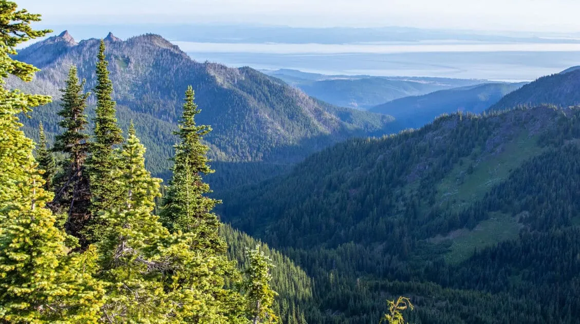
Mount Baker Area
This area lies outside of North Cascades National Park, but the hikes here were recommended to us by many of our readers. The Mount Baker area looks and feels even more rugged and remote than the national park.
We spent one day here, but stormy weather and low-lying clouds made it impossible to do the hikes on this list. Guess we’ll have to come back someday, not that we mind. The North Cascades are gorgeous and the type of place we would love to visit again in the (hopefully) near future.
Skyline Divide. This hike is 9 miles long with an elevation gain of 2,500 feet. This hike offers incredible, high alpine views with great views of Mt. Shuksan, Mt. Kulshan, and the North Cascades off in the distance.
Ptarmigan Ridge Trail. This hike is also 9 miles in length with 1,350 feet of elevation gain. Get close-up views of Mt. Baker with stunning views of the surrounding mountains. This hike looks and sounds amazing and was #1 on our list for this region. I’m so sad we couldn’t do it.
Artist Ridge. This easy hike (only 1.2 miles and fairly flat) offers panoramic views of Mt. Baker and Mt. Shuksan.
Table Mountain. A bit longer and more challenging than Artist Point (2.6 miles with 725 feet of elevation gain), this trail steeply climbs up to the top of Table Mountain for panoramic views of the area.
4 Common Mistakes First-Timers Make in North Cascades
1. Underestimating Road Access
Several of the best trails in this park require driving unpaved roads, and some have seasonal closures that extend well into summer. Cascade River Road doesn’t fully open until July, and Thornton Lakes Road isn’t suitable for low-clearance vehicles. Check conditions before you go.
2. Not Planning for the Sahale Arm Weather
The Cascade Pass and Sahale Arm hike is exposed at the top. Even in summer, conditions can change quickly and temperatures drop significantly at elevation. Bring layers, check the forecast, and don’t attempt this trail in poor visibility.
3. Skipping the Highway 20 Hikes Because They’re “Not in the Park”
The Maple Pass Loop and Rainy Lake are technically in Okanogan-Wenatchee National Forest, not the national park. Don’t let that stop you. These trails deliver some of the best views of the North Cascades and are absolutely worth including.
4. Trying to Get to Stehekin Without a Plan
Stehekin Valley is only accessible by boat, foot, or horseback. If you want to hike the Rainbow Loop, you’ll need to book your ferry or floatplane transportation in advance and build it into your itinerary as a dedicated day (or overnight).
Our Top Picks
If You Only Have One Day
Do Cascade Pass & Sahale Arm. It’s the best single hike in North Cascades National Park. It is strenuous, but extremely rewarding.
If You Have Two Days
Day 1: Cascade Pass & Sahale Arm (Cascade River Road)
Day 2: Maple Pass Loop (Highway 20)
Together, these two hikes give you the full breadth of the North Cascades: a deep-park alpine experience on day one, and high ridge panoramas on day two.
If You Want Something Easier
Rainy Lake + Blue Lake make a great pairing. Both are short, the trailheads are close together on Highway 20, and the payoff is beautiful for the effort required. Add Thunder Knob if you have extra time.
If You Want a Serious Challenge
Desolation Peak — plan the boat logistics in advance and set aside a full day.
Or combine Thornton Lake with an early start for a remote, strenuous adventure with a high wilderness feel.
Before you go, get updated trail conditions and information about possible park closures on the National Park Service website.
Plan Your North Cascades Trip
If hiking is just one part of your visit to North Cascades National Park, these guides will help you plan the rest of your trip.
- North Cascades National Park Travel Guide – When to visit, where to stay, road openings, and seasonal tips
- Best Things to Do in North Cascades – Scenic drives, viewpoints, and non-hiking highlights
- Washington National Parks Road Trip – Visit Olympic, North Cascades, and Mount Rainier National Parks on one epic road trip.
North Cascades is an amazing park when it comes to hiking, but it’s not the only one. See how these trails compare in our guide to the Best Hikes in the US National Parks, featuring standout hikes from 55+ parks across the country.
What do you think are the best hikes in North Cascades National Park? Let us know in the comment section below!
More Information for Your Trip to Washington
If this is part of a bigger road trip through the USA, visit our United States Travel Guide and our Washington Travel Guide for more inspiration and travel planning tips.
9 Amazing Things to Do in North Cascades National Park
Pinterest Facebook Flipboard Discover the best things to do in North Cascades National Park, from the stunning drive along Highway 20 to Diablo Lake, Washington Pass Overlook, and world-class hiking trails. North Cascades National Park gets a fraction of the visitors that flock to Olympic and Mount Rainier, and that’s exactly what makes it so […]
Maple Pass Loop Hiking Guide 2026 | North Cascades, WA
The Maple Pass Loop, also known as the Heather-Maple Pass Loop, is one of the best day hikes in the North Cascades, and one that’s surprisingly accessible for the views it delivers. In early August, Tim, Kara, and I completed this hike and came away genuinely impressed. It’s not our favorite hike in the area […]
Cascade Pass and Sahale Arm: The Best Day Hike in North Cascades
We’ve hiked in more than 50 national parks across the United States, and the Cascade Pass and Sahale Arm hike is one that still stands out. We did this hike as part of a six-week road trip through the national parks of Colorado and Washington, and it was the perfect way to end the trip. […]
Tolmie Peak Lookout Hike & Its Jaw-Dropping View of Mount Rainier
One of the best views of Mount Rainier isn’t from Paradise or Sunrise, it’s from a small historic fire lookout high above Eunice Lake. The Tolmie Peak Lookout hike delivers one of the most spectacular perspectives of the mountain, from one of the quietest corners of the park. Tolmie Peak Lookout is one of our […]
Best Things to Do in Mount Rainier National Park (2026 Guide)
Discover the best things to do in Mount Rainier National Park, from iconic hikes like the Skyline Trail and Mount Fremont Fire Lookout to scenic viewpoints, waterfalls, and easy walks that are perfect for first-time visitors. We’ve visited Mount Rainier National Park twice: once on a 6-day deep dive where we hiked trail after trail […]
20 Epic Hikes in the US National Parks
With 63 national parks and thousands of miles of hiking trails, your options are endless for exploring the American national parks. We narrowed down the list for you to 20 of the best hikes in the US national parks, 20 amazing ways to explore this beautiful country. Hike to the tallest peaks, through massive canyons, […]
Best Hikes in Olympic National Park: Ranked by Area and Difficulty
Olympic National Park offers some of the most diverse hiking in the United States. Where else can you hike through a moss-covered temperate rainforest in the morning, walk along a wild Pacific coastline in the afternoon, and look out over glacier-capped mountain peaks from an alpine ridge? We spent four days in Olympic National Park, […]
Olympic National Park Itinerary: How to Spend 2 to 3 Days in the Park
Olympic National Park is one of the most diverse and logistically complex national parks in the United States and figuring out how to structure your time here can feel overwhelming. This Olympic National Park itinerary combines the best of the park into one easy-to-plan trip, and we’re sharing it from experience. We spent four days […]
Washington Travel Guide: National Parks, Road Trips & Places to Visit
Washington Travel Guide Washington State packs an incredible range of landscapes into one destination, from glacier-covered volcanoes and alpine lakes to wild Pacific coastline and dense rainforests. If you love hiking, scenic drives, and national park adventures, Washington is one of the best outdoor destinations in the United States. We explored Washington on a three-week […]
US National Parks that Require Reservations – 2026 Guide
Due to growing popularity and visitation, there are now eight National Parks and one National Monument that require a reservation in advance. This includes timed-entry reservations, vehicle reservations to drive a particular road, or hiking permit for select trails. This article was updated with new information from the National Park Service on February 23, 2026. […]
The Ultimate Guide to the 63 US National Parks
Stretching from the South Pacific, across the United States to the Caribbean, are 63 national parks. These national treasures preserve iconic landscapes, majestic mountains, primordial forests, arid deserts, misty coastlines, immense canyons, wildlife, and historic landmarks. We have visited 55 of the 63 US national parks, from the towering granite walls of Yosemite and the […]

Comments 20