
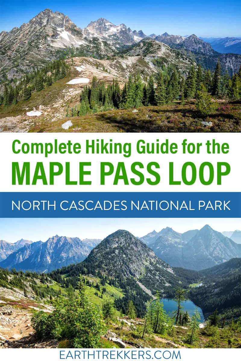
The Maple Pass Loop, also known as the Heather-Maple Pass Loop, is one of the best day hikes in the North Cascades, and one that’s surprisingly accessible for the views it delivers.
In early August, Tim, Kara, and I completed this hike and came away genuinely impressed. It’s not our favorite hike in the area — that title belongs to the Cascade Pass and Sahale Arm hike — but for its length and difficulty level, it’s hard to beat.
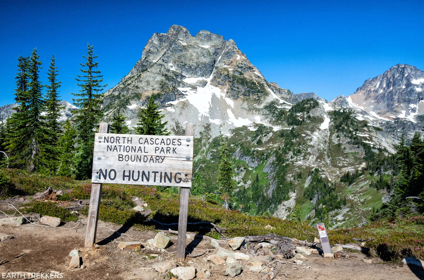
The trail offers a little bit of everything: wildflowers, old-growth forest, a visit to a lovely alpine lake, and (the best part) sweeping panoramic views of the North Cascades. Although the loop sits just outside North Cascades National Park, you hike right up to the park boundary, and from the highest points on the trail, the views into the park are truly breathtaking.
If you’ve come to the North Cascades to hike, this one belongs on your list.
March 2026 Update: Added new photos, plus more tips, FAQs, and important things to know as you plan your hike.
Maple Pass Loop Hiking Stats & Map
Distance: 7.2 miles (11.5 km) loop
Difficulty: Strenuous
Total Elevation Gain: 2,200 feet (670 m)
Trailhead Elevation: 4,900 feet (1,495 m)
Highest Elevation (Maple Pass): 6,950 feet (2,120 m)
Length of Time: 3 to 5 hours
When to Go: Late June through October, depending on when Highway 20 opens. Snow can linger on the trail through July. If you plan to do this hike before mid to late July, be prepared for lots of snow on the trail.
Note: These hiking statistics do not include the spur trail to Lake Ann. Adding Lake Ann onto the hike adds about 1 mile (1.6 km) and 100 feet (30 m) of elevation gain.
The Maple Pass Loop is good for: Active families, intermediate hikers, anyone wanting big alpine views without a technically demanding trail. Our teenage daughter completed it comfortably.
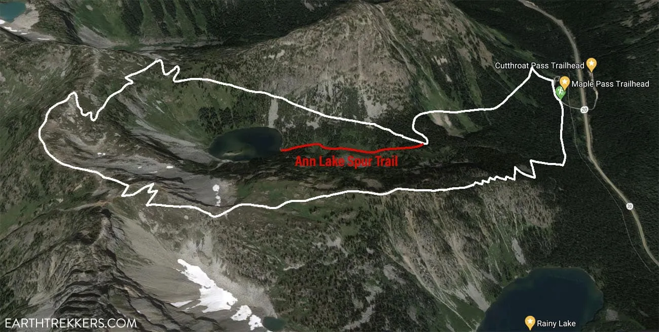
Map of the Heather – Maple Pass Loop with the detour to Lake Ann
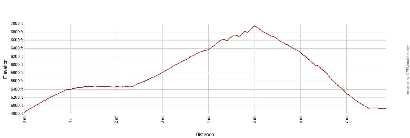
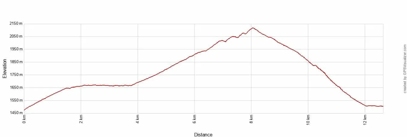
Elevation of the Maple Pass Loop in the counter-clockwise direction with the spur trail to Ann Lake.
Please practice the seven principles of Leave No Trace: plan ahead, stay on the trail, pack out what you bring to the hiking trail, leave areas as you found them, minimize campfire impacts, be considerate of other hikers, and do not approach or feed wildlife.
How Hard is the Maple Pass Loop?
The Maple Pass Loop is rated strenuous, but it’s on the more approachable end of that rating. The total elevation gain is 2,200 feet over 7.2 miles, which is steady but never brutal — there are no technical sections, scrambling, or exposure.
The steepest part is the descent through the forest back to the parking lot, which can be tough on the knees.
Most fit, active hikers will complete it in 4 to 5 hours. Our 16-year-old daughter handled it comfortably. If you’ve done moderate hikes before and are reasonably active, this trail is within reach.
What is the Best Direction to Hike the Loop?
The Heather – Maple Pass Trail is a loop and it can be hiked in either direction.
If you hike the Maple Pass Loop counter-clockwise, it is a gradual climb up to Maple Pass. For the entire climb, you have amazing views over Lake Ann and then out to the North Cascades. To get back to the parking lot, it’s a short but very steep descent through the woods that can be tough on the knees.
If you hike the Maple Pass Loop clockwise, you get the big climb over with early in the hike. The first 3 miles will be a steep trail mostly through the woods. The views will open up for the last half mile of the ascent. Then, as you hike the loop around the lake, you get to enjoy the views, although a lot of the best views will be behind you, so you’ll have to turn around frequently. It’s a gradual descent for most of the hike as you head back to the parking lot.
We hiked the Maple Pass Loop in the counter-clockwise direction. The amazing views over Lake Ann and the North Cascades took our minds off the uphill climb. We stopped for a lot of breaks to take photos and then cruised down the downhill section in the woods. It worked great for us and we really enjoyed hiking it in this direction.
If you prefer to get the hardest part out of the way first, then hike the loop clockwise.
Maple Pass
Parking & Getting to the Trailhead
The Maple Pass Loop starts at the Rainy Pass Picnic Area on Highway 20, approximately 38 miles east of Marblemount and 33 miles west of Winthrop.
The parking lot fills up fast. When we arrived at 7:30 am on an August weekday morning, and there were just a few cars in the parking lot. By the time we finished the hike, the parking lot was completely full. On summer weekends, expect the lot to be full by 8 am. During fall larch season in late September and early October, cars can line up along the highway shoulder for over a mile. Arrive early, especially on weekends.
You will need a National Forest Pass. The cost is $5 per day. Fill out one of the day use passes (bring a pen!), insert your $5 cash, and deposit the envelope in the payment box. Display your pass on your dashboard. If you have an America the Beautiful Pass, you do not need to purchase the National Forest Pass. Display your America the Beautiful pass on your dashboard.
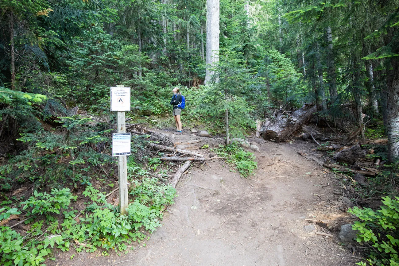
Trailhead: The trail starts on the west side of the parking lot. Look for signs directing you to Rainy Lake.
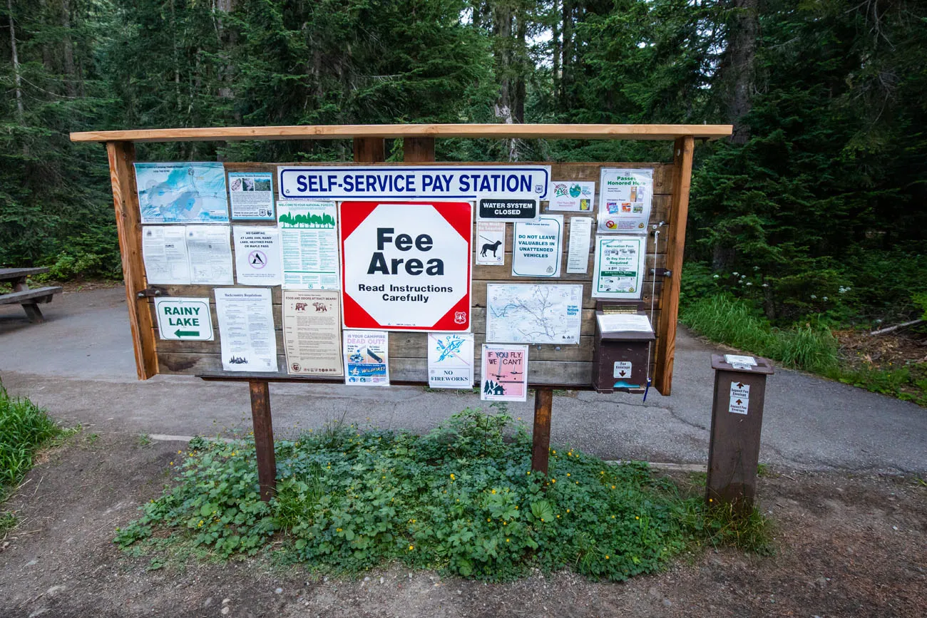
The pay area. This is where you will pay the fee for the National Forest Pass.
Maple Pass Loop: Step-By-Step Trail Guide
This trail description is for hiking the Maple Pass Loop in the counter-clockwise direction.
Rainy Pass Trailhead to Lake Ann Junction
Distance: 1.3 miles
Time: 30 to 60 minutes
Elevation Change: 600 feet ↑
If you do this hike counter-clockwise, the trail starts right behind this trail sign, next to the start of the paved trail to Rainy Lake. Look for the dirt trail that wastes no time climbing up through the forest.
If you choose to hike the Maple Pass Loop clockwise, you will take the paved trail to Rainy Lake. At about 0.4 miles, look for the dirt trail that switchbacks up into the forest. There will be a small sign directing you to Maple Pass, but it can be hard to miss.
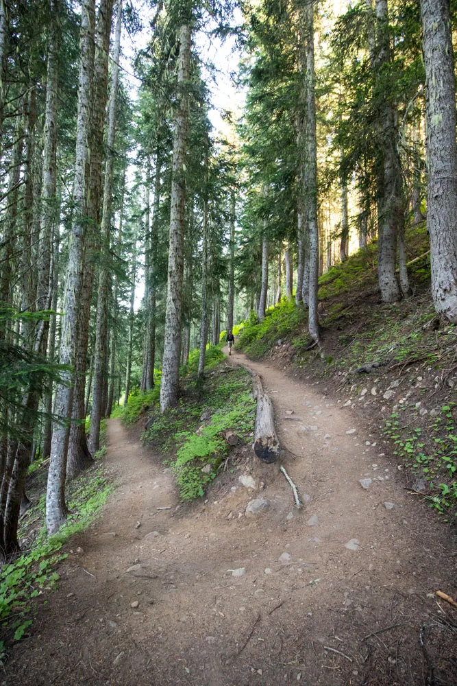
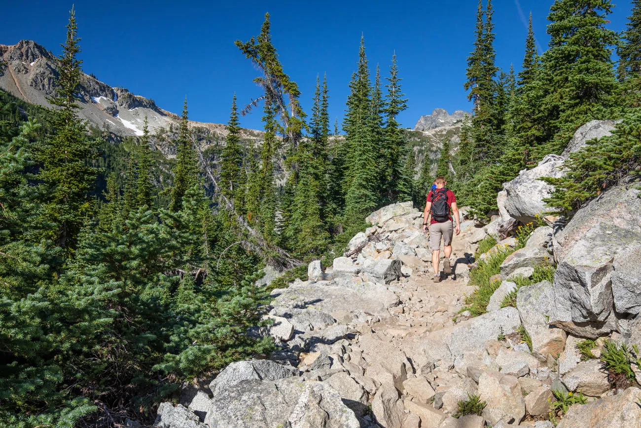
For the first 1.3 miles of the hike, it’s a gradual climb through a forest. It’s quiet, it’s shady, and it feels very peaceful. It’s a steady climb, and you’ll gain about 600 feet of the total elevation gain (which is about 2,200 feet) in this first section.
Optional Detour to Lake Ann
Distance: 1 mile
Time: 30 minutes
Elevation change: Mostly flat
At the 1.25-mile point, you reach the spur trail to Lake Ann. You have the option to add on the short walk to Ann Lake.
Round trip, it is a 1-mile hike out-and-back to Lake Ann, adding roughly 100 feet of elevation to the entire hike. From the lake, you get a nice view of the ring of mountains that surround the lake, and it gives you some perspective as to how high you will hike today.
We enjoyed this detour, but it’s not a must-do. If you just want to get right to the good stuff, or if you are short on time, skip Lake Ann and continue on the main trail instead.
PRO TRAVEL TIP: If you choose to hike to Ann Lake, make sure you bring mosquito repellent. We got swarmed by mosquitoes here!!
Lake Ann to Heather Pass
Distance: 1.3 miles
Time: 30 to 60 minutes
Elevation change: 600 feet ↑
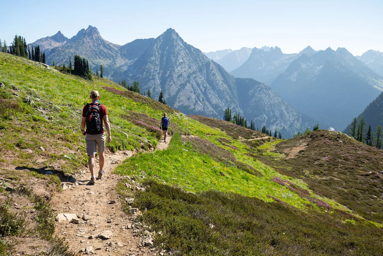
This is the point where this hike really starts to get good.
Past the Lake Ann detour, the trail continues to gain elevation. The steepness of this section of trail is very similar to the hike between the parking lot and Lake Ann. It’s a steady climb but nothing too difficult or strenuous.
Once you clear the trees, you get to see the amazing views that makes this hike so popular.
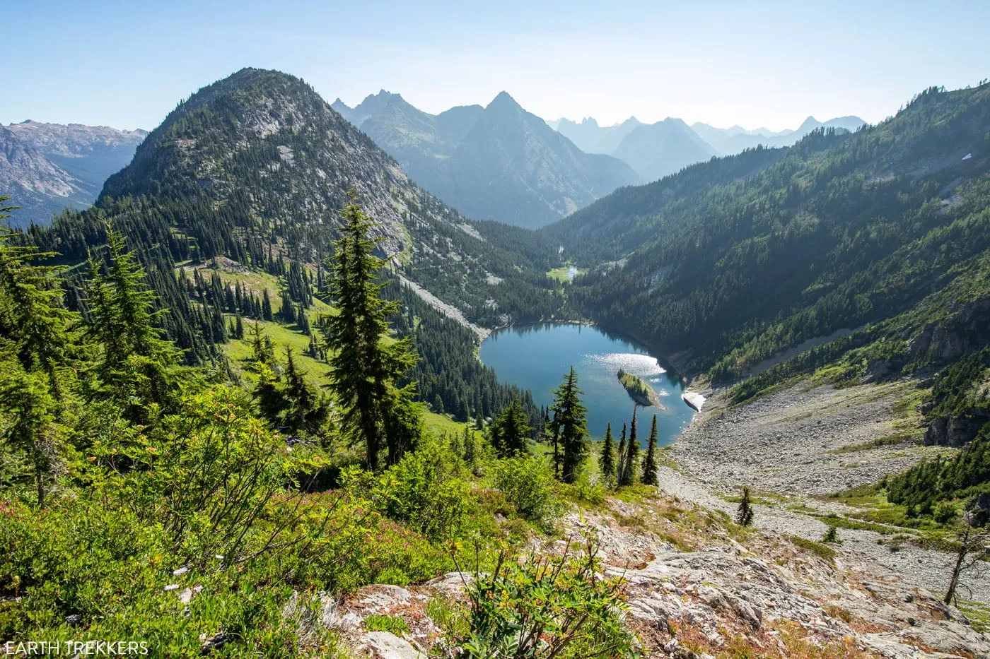
At first, you get a wonderful view over Lake Ann and the trail that snakes along the ridgeline.
Then you come to Heather Pass, where fields of wildflowers color the hillsides.
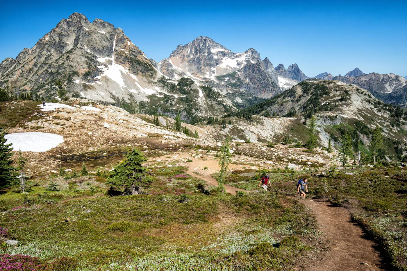
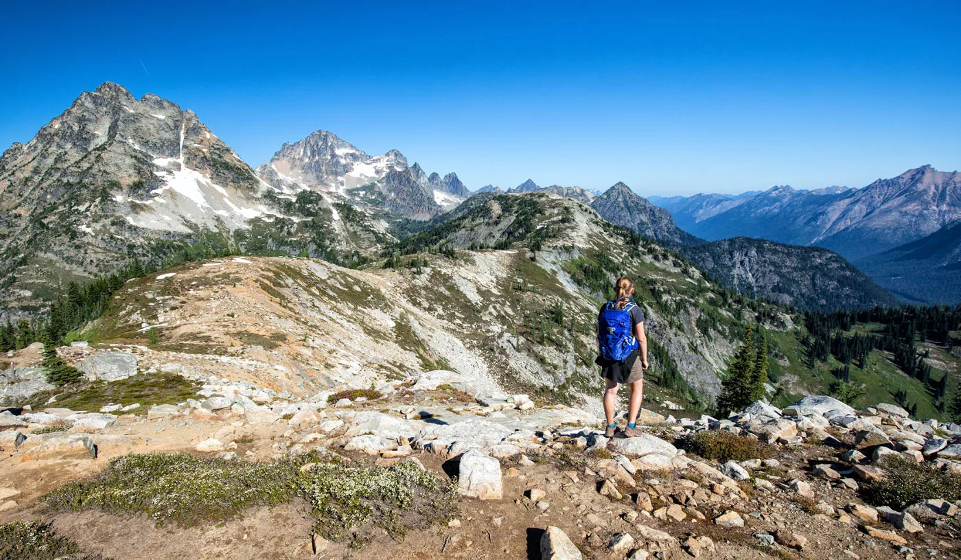
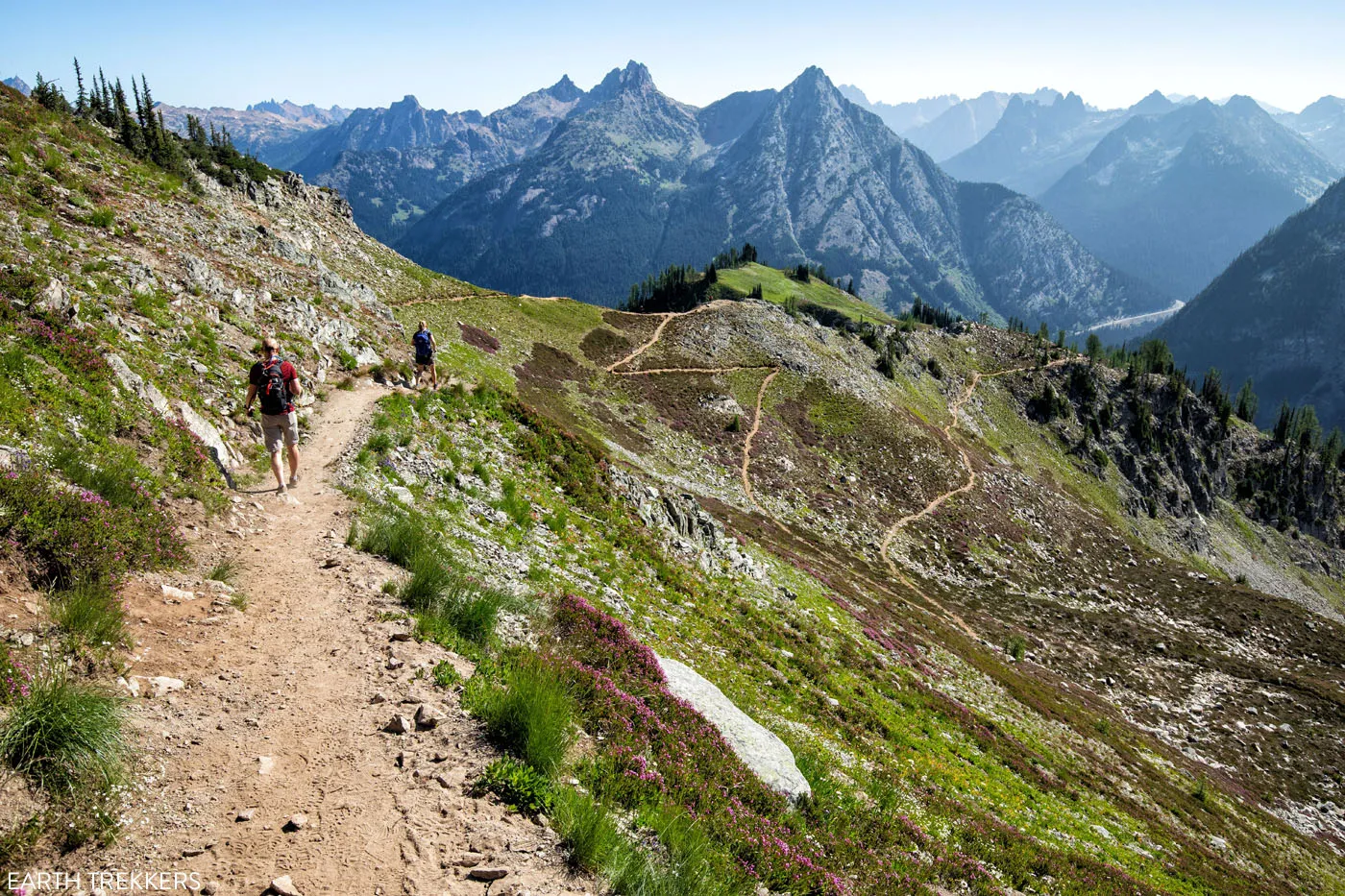
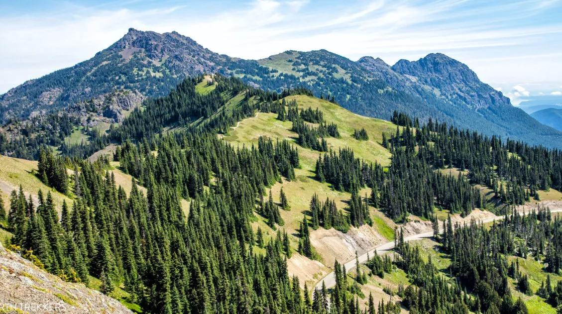
Heather Pass to Maple Pass
Distance: 1.6 miles
Time: 45 to 90 minutes
Elevation Change: 900 feet ↑
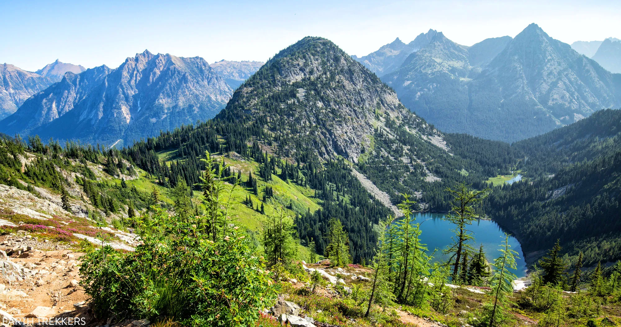
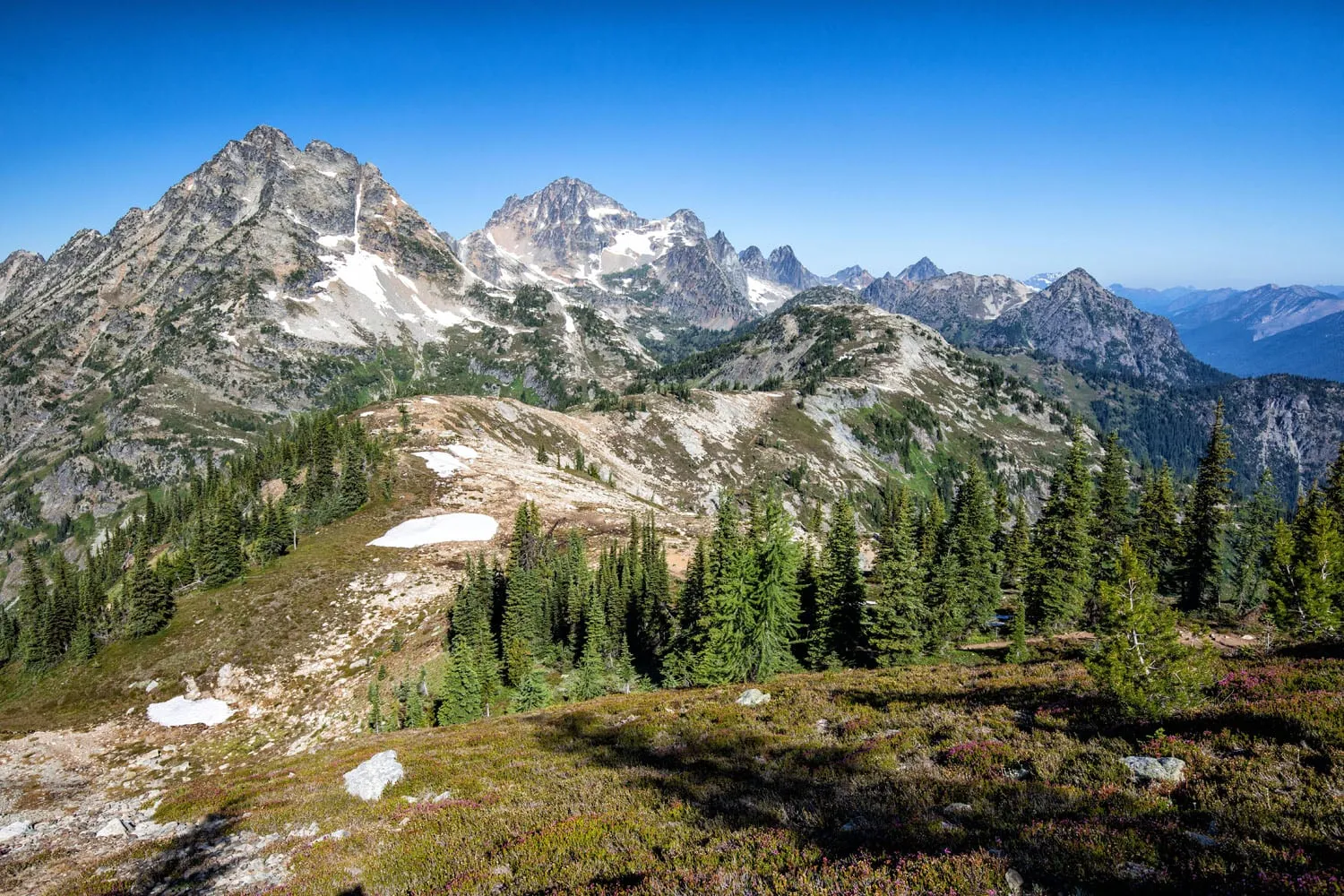
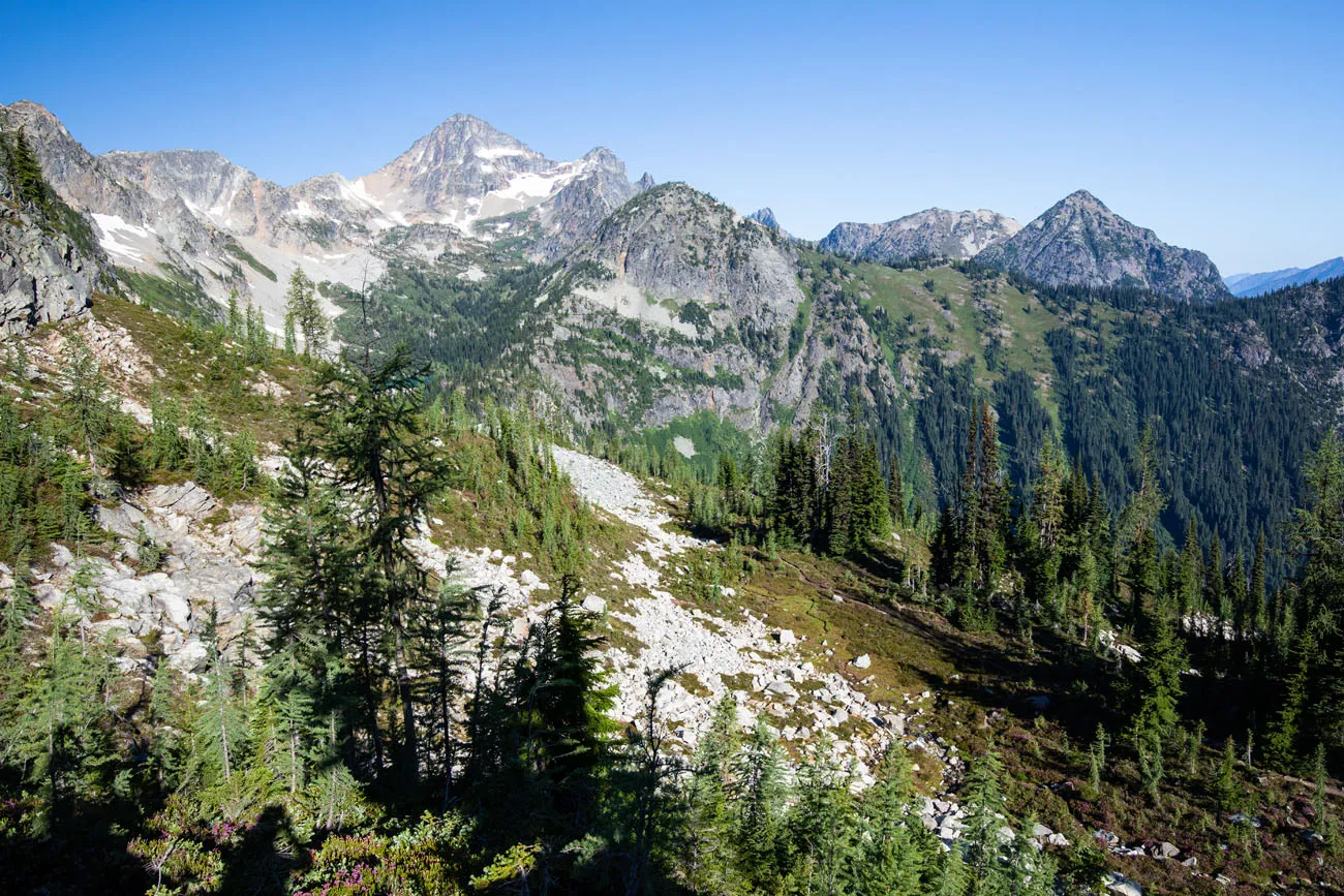
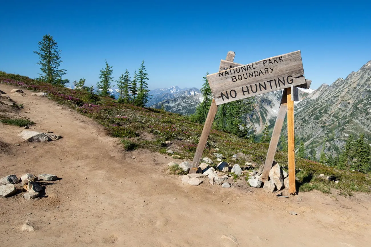
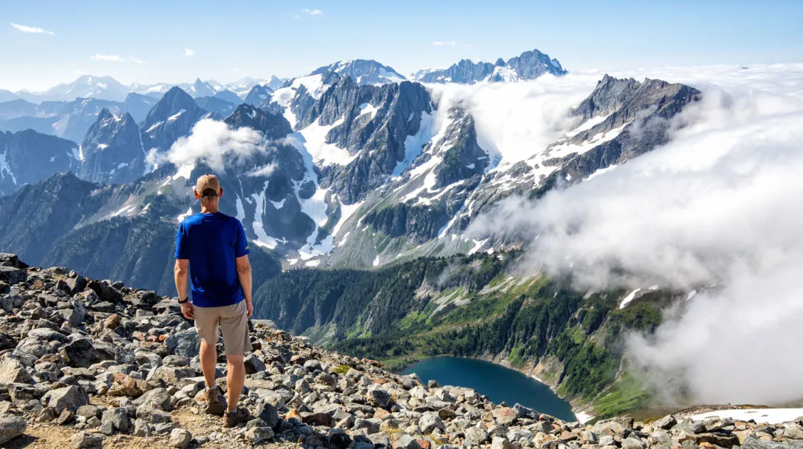
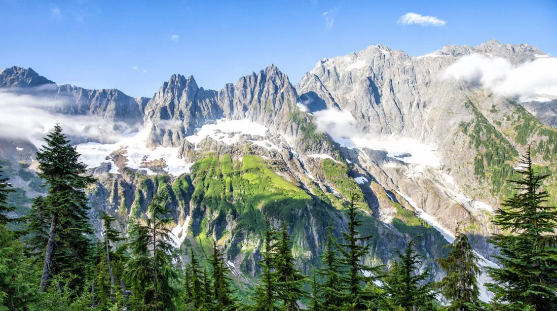
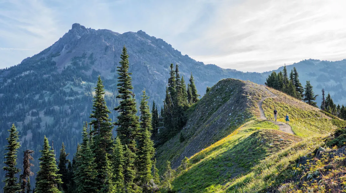
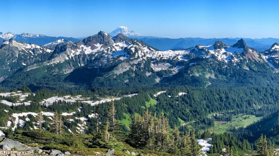
As you continue on the trail, you hike up to a ridgeline for one of the best views of the day. Now you are standing next to the North Cascades National Park boundary. Out to the west are layers and layers of jagged mountain peaks.
This is the most beautiful section of the hike, and my photos will give you a better sense of what to expect than my words ever could.
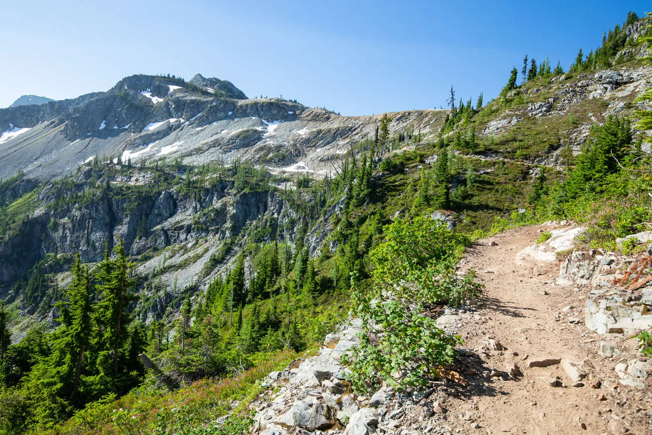
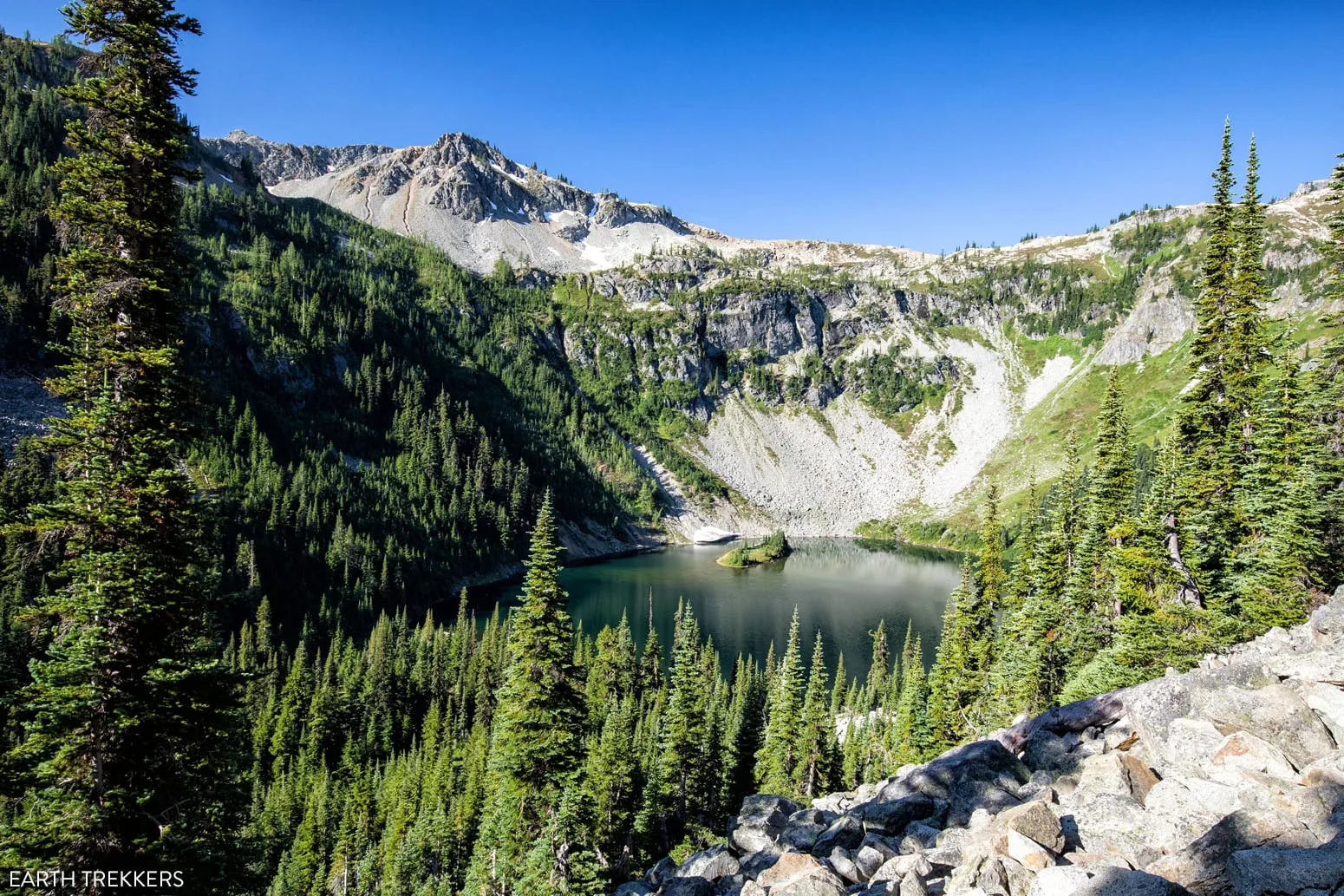
The view of the trail between Heather Pass and Maple Pass
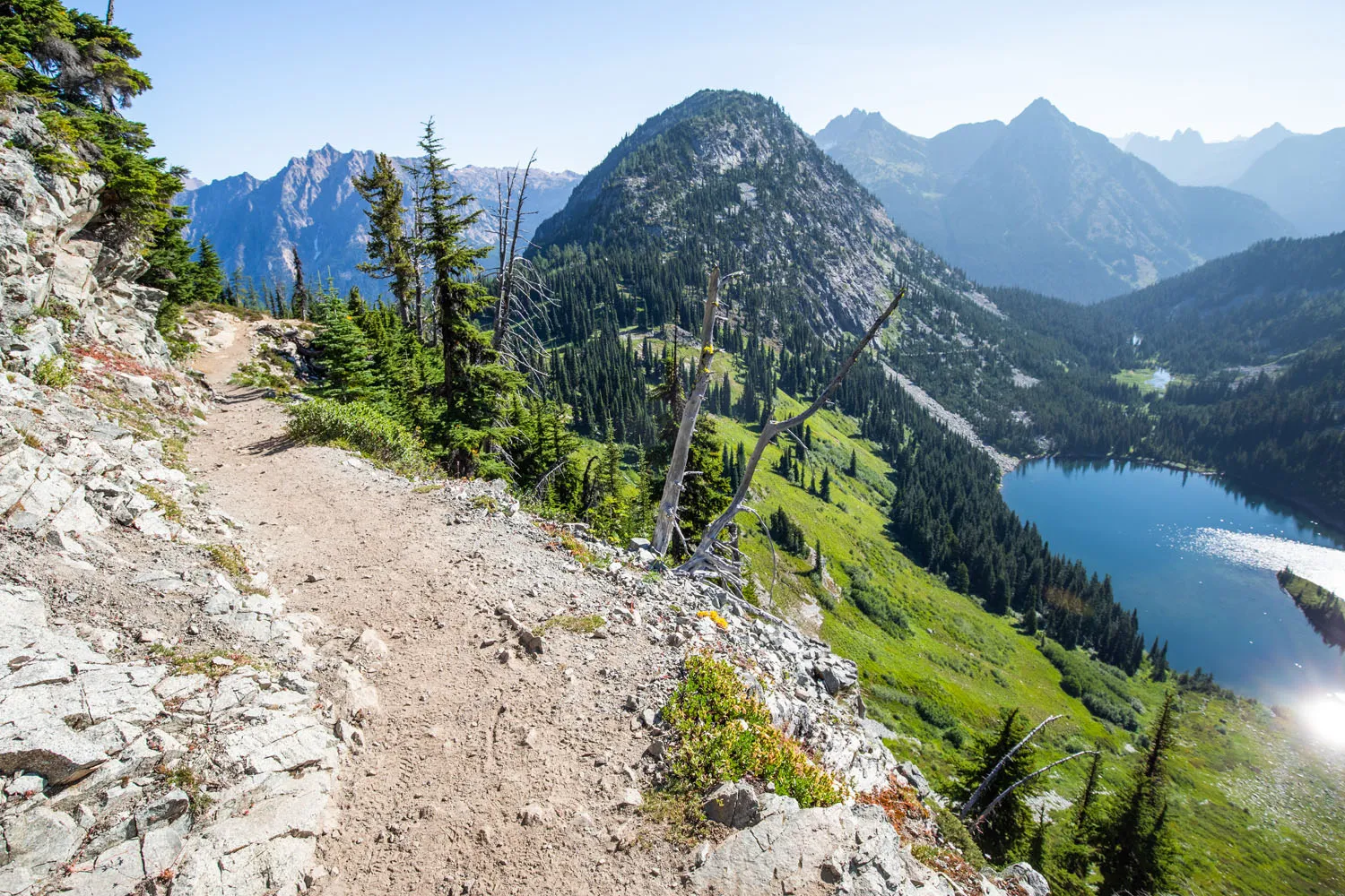
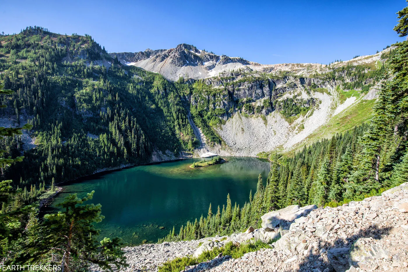
Overlooking Lake Ann
It was here that we realized North Cascades is a park where you really need to hike—and hike high—to appreciate its true grandeur. The drive along Highway 20 is beautiful, and the short hikes to the lakes are nice, but the truly spectacular views only come after climbing higher into the mountains.
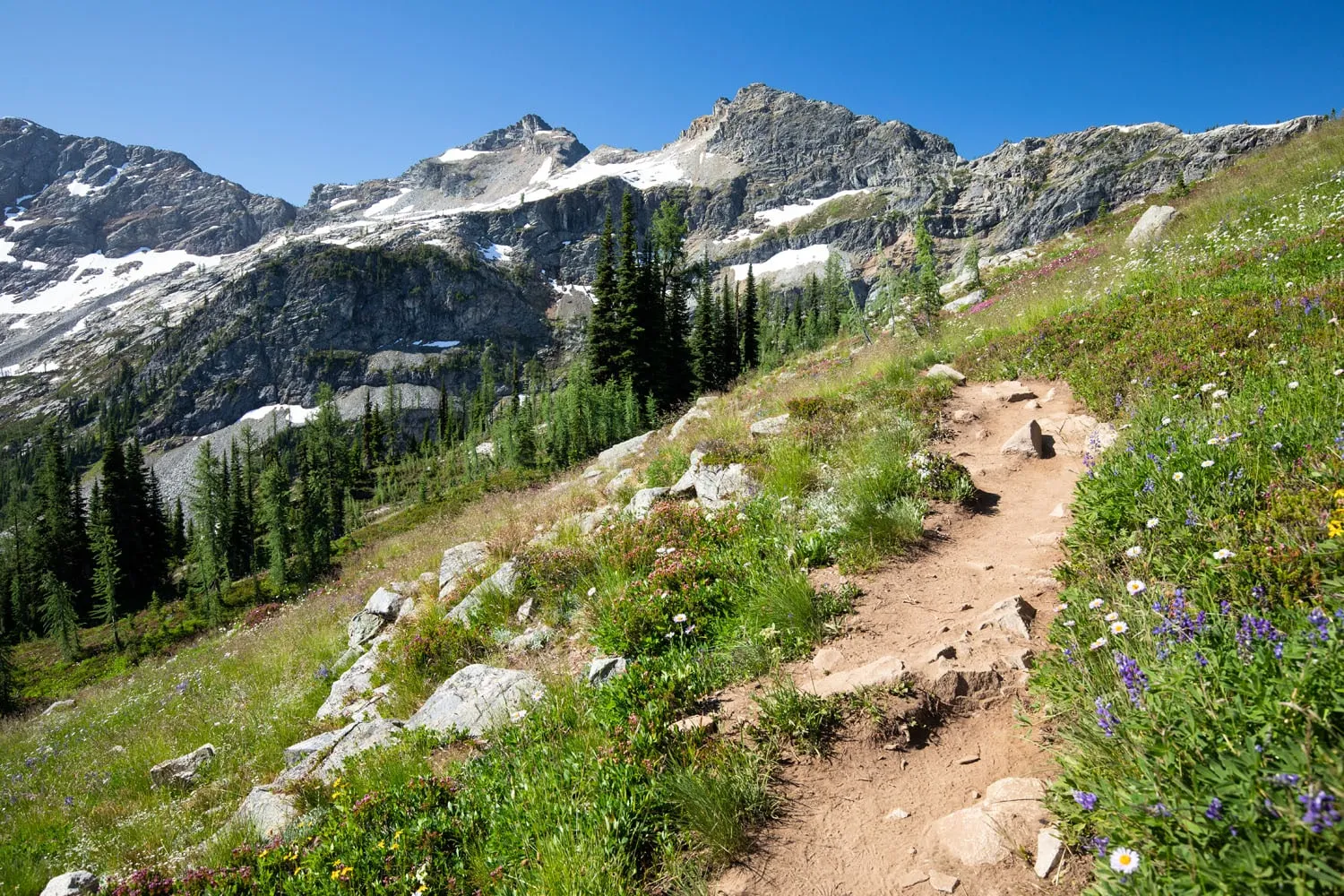
The trail tops out at Maple Pass. This upper part of the trail can still be snow-covered well into the summer, so be prepared to hike on the snow if you will be here in July. We did this in early August and there were still a few patches of snow lingering on the ground.
At the pass, take in one last view of the North Cascades. From here, it’s a massive descent back to the Rainy Lake picnic area.
Descent to Rainy Lake
Distance: 3 miles
Time: 1 to 1.5 hours
Elevation Change: 2,200 feet ↓
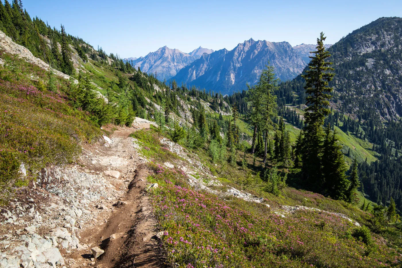
From Maple Pass, it is a ~3-mile descent to get back to the Rainy Lake picnic area. At first, the trail switchbacks through fields of wildflowers.
Looking back towards Maple Pass. This a a great hike to see wildflowers in summer.
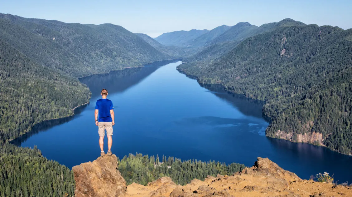
Once you enter the forest, you will hike down steep, rocky trails that can be hard on the knees. Through clearings of the trees, keep a lookout for a view over Rainy Lake to get a sense of how high you are right now (and how far down you still have to descend).
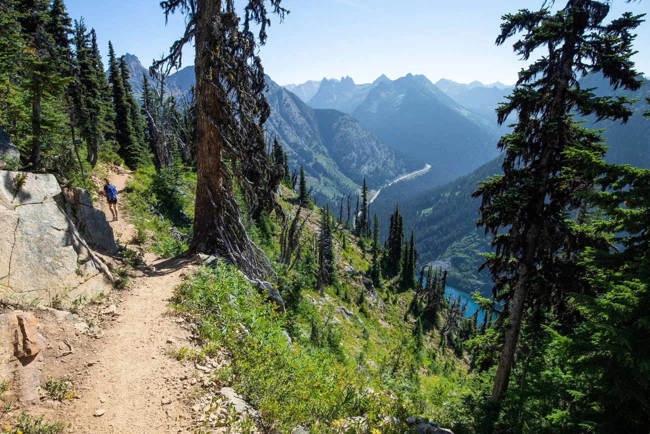
For the most part, this trail runs through the forest, with little views other than the trees. However, you can hike quickly through this section, since it is now a predominantly downhill hike. Hiking poles are good to have here, if steep descents bother your knees.
The dirt trail ends at the paved trail to Rainy Lake. Turn left to return to the parking lot. If you want to make the detour, turn right and it’s about a 0.6 mile walk one-way to the lake.
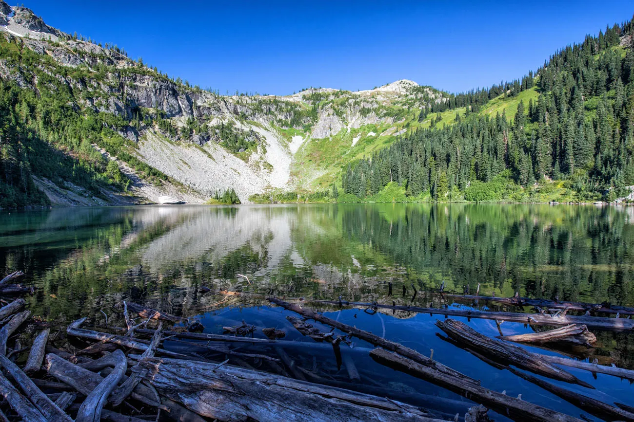
Rainy Lake
When is the Best Time to Hike the Maple Pass Loop?
The trail is typically accessible from late June through October, depending on snowpack and the opening of Highway 20.
Here’s what to expect each season:
July: The trail opens as snow melts, but above Heather Pass you may encounter significant snow well into the month. Microspikes are recommended if you’re hiking before mid-July. On the plus side, crowds are lighter and the wildflowers begin to bloom. Check trail conditions before you go.
August: This is our pick for the sweet spot. When we hiked in early August with our teenage daughter, the wildflowers were at or near peak, the trail was in good shape (with just a few lingering snow patches near the top and some muddy sections lower down), and the crowds were manageable with an early start. Days are long, weather is generally stable, and the views are at their best.
Late September to Early October: This is larch season and I’ve heard it is spectacular. The larches turn a brilliant gold and the entire ridge takes on an otherworldly glow. That said, this is by far the most crowded time of year on the trail. On peak weekends, cars line the highway shoulder for over a mile. If you want to experience the larches, go on a weekday and arrive before 7 am.
October: Early October can still be excellent, especially midweek. By mid-October, snow can return to the upper trail and Highway 20 typically closes for the season sometime in November. Check current road status before you plan your trip.
Bottom line: Visit in August for wildflowers and manageable crowds, or in late September for the larches if you’re willing to plan around the crowds.
Is the Maple Pass Loop Worth It?
Absolutely. The Maple Pass Loop delivers some of the best views in the North Cascades on a relatively short hike. The combination of alpine lakes, rugged peaks, and colorful larches makes this one of the most rewarding day hikes in Washington.
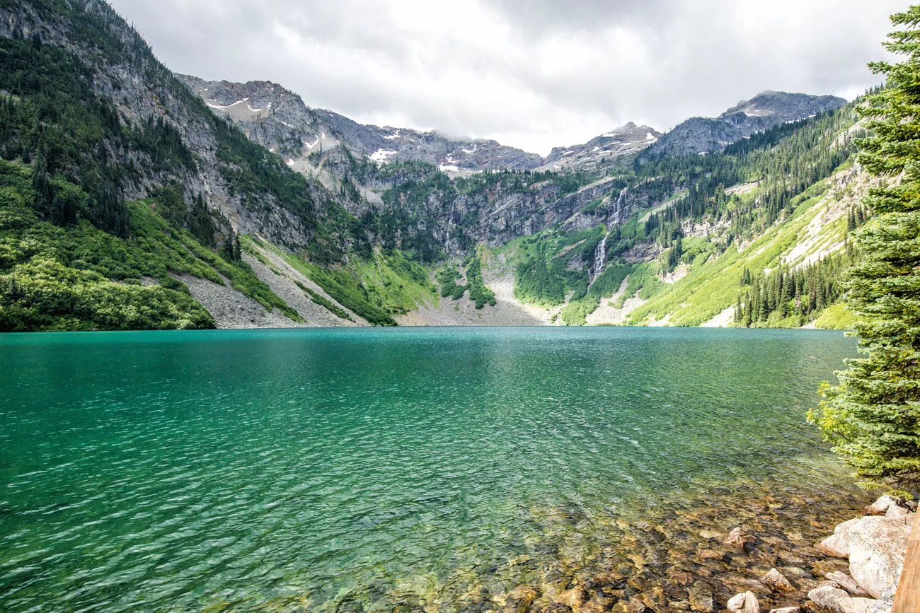
Lake Ann
Our Top Tips for the Maple Pass Loop
Get updates on the road status and trail closures on the National Park Service website before you go.
Start early. This is the single most important tip for this hike. The parking lot fills by 8 am on summer weekends, and once you’re on the trail, the difference between a 7 am start and a 10 am start is enormous in terms of crowds. An early start also gives you the best light for photography on the ridge.
Hike counter-clockwise. You can hike this loop in either direction, but we recommend counter-clockwise. The gradual climb gives you stunning views over Ann Lake the entire way up, which makes the elevation gain feel much more rewarding. The steep descent through the forest at the end is hard on the knees, but it’s over quickly.
Bring hiking shoes or boots. When we hiked in early August, we encountered muddy sections on the lower trail and lingering snow patches near the top. Sturdy hiking shoes or boots will serve you much better than trail runners or sneakers here.
Bring hiking poles. Not essential, but worth it. The steep descent through the forest on the counter-clockwise route is rocky and can be slippery. Poles take the strain off your knees significantly.
Don’t skip Ann Lake. The detour adds roughly a mile and very little elevation. The lake itself is beautiful, but the real payoff is the perspective it gives you. Standing at the lake looking up at the ridgeline you’re about to hike is a great motivator. Bring bug spray; the mosquitoes near the lake can be fierce in summer.
No cell service. There is zero cellular reception on this trail and for most of the drive along Highway 20. Download offline maps before you leave. We recommend Gaia GPS or AllTrails, and let someone know your plans.
Layers are essential. Even on a warm August day, the exposed ridgeline between Heather Pass and Maple Pass can be significantly cooler and windier than the trailhead. Pack a light jacket or windshell regardless of the forecast.
Check Highway 20 before you go. The North Cascades Highway closes seasonally, typically in November, and the opening date in spring varies by year depending on snowpack. Check current road status on the Washington State Department of Transportation website before your trip.
Leave No Trace. The trail sees heavy traffic, especially in fall. Stay on the trail, pack out everything you bring in, and resist the urge to cut switchbacks — shortcutting causes erosion on these fragile alpine slopes.
What to Bring on the Hike
Hiking shoes. We recommend hiking shoes. When we did this hike in August, we hiked through patches of snow and large sections of muddy trail. You can get by with a sturdy pair of walking shoes, but I would leave the Converse sneakers and flip flops at home.
Water and snacks. At least 2 liters of water in the summer.
Sunscreen, hat, and sunglasses. For approximately half of the hike there is very little shade.
Camera. Even a smartphone will do.
Essential Hiking Gear: What Should You Bring on a Day Hike?
If you are new to hiking or are curious about what you should bring on a hike, check out our Hiking Gear Guide. Find out what we carry in our day packs and what we wear on the trails.FAQs About the Maple Pass Loop
How long does it take to hike the Maple Pass Loop?
Most hikers complete the Maple Pass Loop in 3 to 5 hours, depending on pace, photo stops, and whether you take the short detour to Ann Lake.
How hard is the Maple Pass Loop?
The Maple Pass Loop is a moderately strenuous hike. The loop is 7.2 miles long with about 2,200 feet of elevation gain, which means there is a steady climb to Maple Pass followed by a long descent back to the trailhead.
Do you need a permit to hike the Maple Pass Loop?
You do not need a hiking permit, but a Northwest Forest Pass or America the Beautiful pass is required to park at the Rainy Pass / Rainy Lake trailhead.
Which direction should you hike the Maple Pass Loop?
Most hikers recommend hiking the loop counterclockwise. This route offers a more gradual climb with constant views of Ann Lake and the North Cascades before finishing with a steep descent through the forest. However, hiking clockwise gets the steepest climbing done early in the hike.
Is the Maple Pass Loop good for fall colors?
Yes. The Maple Pass Loop is one of the best larch hikes in Washington. In late September and early October, alpine larch trees turn bright golden yellow, making this hike extremely popular during fall.
Can beginners hike the Maple Pass Loop?
Beginner hikers who are comfortable hiking 7+ miles with sustained uphill sections can complete the Maple Pass Loop. However, the elevation gain and steep descent can make it challenging for those new to hiking.
Plan Your Trip to North Cascades National Park
The Maple Pass Loop is one of the best hikes in the North Cascades, but there is much more to explore in this rugged and underrated national park. If you are planning a visit, these guides will help you choose the best hikes, scenic drives, and places to visit.
- Cascade Pass and Sahale Arm Hike: Our favorite hike in the North Cascades and one of the best day hikes in any US national park. Longer and more demanding than Maple Pass, but the views are in a different league entirely.
- North Cascades National Park Travel Guide: Our complete guide to visiting the park, including scenic drives, viewpoints, and travel tips.
- Best Hikes in North Cascades National Park: A guide to the top hikes in the park, including Cascade Pass, Sahale Arm, and several lesser-known trails.
If you enjoy hikes like the Maple Pass Loop, check out our guide to the Best Hikes in the U.S. National Parks, which features some of our favorite trails from parks across the United States.
If you have any questions about hiking the Heather-Maple Pass Loop, let us know in the comment section below. Happy hiking!!
Explore More of North Cascades National Park
If this is part of a bigger road trip through the USA, visit our United States Travel Guide and our Washington Travel Guide for more inspiration and travel planning tips.
9 Best Things to Do in North Cascades National Park
Wild, rugged, remote…North Cascades National Park is highly underrated park, especially for hikers and backpackers. The scenic drives and overlooks give you a glimpse of the beauty of this place, but to truly discover the majesty of the North Cascades, you’ll have to hit the hiking trails. Here are the 9 best things to do […]
Hiking the Enchantments in One Day: A Step-By-Step Trail Guide
Over 19.25 miles, climb Aasgard Pass, wander through a surreal landscape of turquoise alpine lakes and jagged peaks, then descend nearly 7,000 feet to the Snow Lakes trailhead. Hiking the Enchantments in one day is a long, hard challenge, but one you’ll never forget. If you are a hiker, the Enchantments are a destination that […]
Cascade Pass and Sahale Arm Hike: North Cascades National Park
For outstanding views of the North Cascades, put the Cascade Pass and Sahale Arm hike on your list. Often labeled as the best day hike in North Cascades National Park, the Sahale Arm hike is gorgeous every step of the way. You’ll hike through evergreen forests, through fields of heather and wildflowers, past marmots, mountain […]
12 Great Hikes in North Cascades National Park
North Cascades National Park is not a place that easily reveals itself. Sure, the drive along Highway 20 is lovely. And the viewpoints over the lakes and mountain passes are gorgeous. But, to really see this park, you are going to have to invest some time on the hiking trails. If you only saw the […]
17 Great Hikes in Olympic National Park (+ Map & Photos)
One thing that makes Olympic National Park so unique is its wide variety of landscapes and ecosystems. In this one park, you can hike to mountain peaks, stroll through lush, temperate rainforests, and explore the rugged, rocky coastline. In this post, we list 17 of the best hikes in Olympic National Park…17 great ways to […]
Hiking the Klahhane Ridge Trail to Mount Angeles, Olympic NP
The hike from Hurricane Ridge to Mount Angeles is a spectacular day hike in Olympic National Park. Along the Klahhane Ridge Trail you have panoramic views over this side of Olympic National Park. To get up onto Mount Angeles, it’s a tough hike that ends with some tricky rock scrambling, but you are rewarded for […]
Mount Storm King Hike: Is It Worth the Brutal Climb?
Mount Storm King earns its dramatic name. This short but relentlessly steep trail in Olympic National Park climbs over 2,000 feet in just over two miles, ending with a rope-assisted scramble to a rocky outcropping with sweeping views over the impossibly blue waters of Lake Crescent. We hiked this in July on a clear summer […]

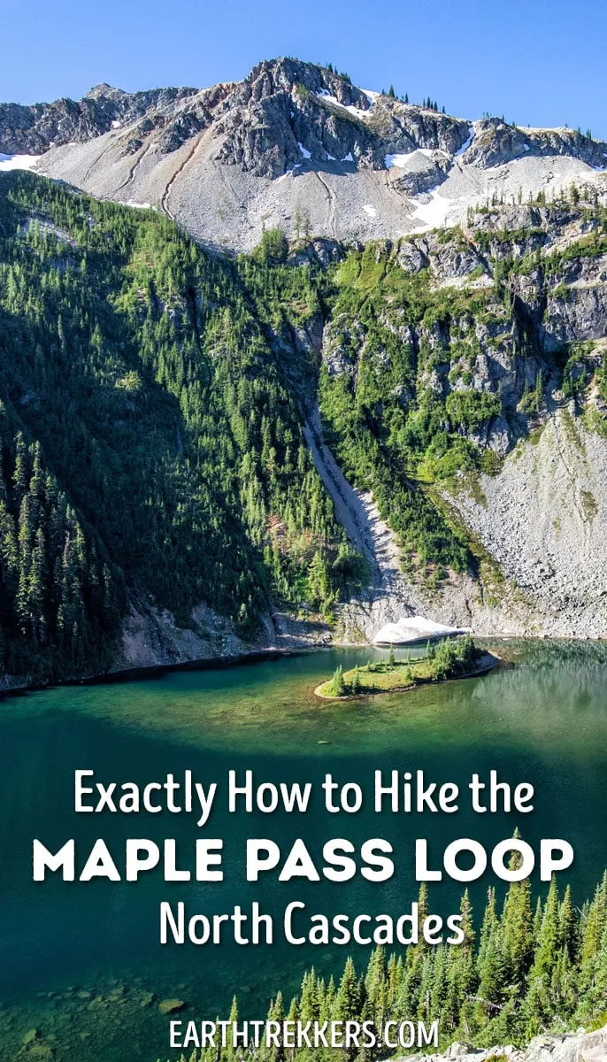
Skyline Trail Loop: A Step-by-Step Guide to Rainier’s Most Iconic Views
The Skyline Trail Loop is the most iconic hike in Mount Rainier National Park, and we’ve hiked it twice in both directions to figure out exactly which way is better. Here’s everything you need to know, from snow crossings and trail conditions to the best direction for views of Mount Rainier. For jaw-dropping alpine scenery, […]
Washington Road Trip Itinerary: Olympic, Rainier & North Cascades (7–14 Days)
Washington state is one of the great road trip destinations in the United States, and this itinerary is the one we wish we’d had before our own trip. We spent several weeks exploring Washington’s three national parks—Olympic, Mount Rainier, and North Cascades—as well as Leavenworth, Lake Chelan, and the Enchantments. We then combined our top […]
15 Best Hikes in Mount Rainier (Ranked by Difficulty & Area)
Mount Rainier is one of the most spectacular hiking destinations in the United States. From wildflower-covered alpine meadows to glacier viewpoints and fire lookout summits, the variety here is incredible. We’ve hiked in more than 50 U.S. national parks and on trails around the world, from Everest Base Camp in Nepal to the Dolomites, and […]
Ultimate US National Parks List for 2026 (+ Printable Checklist)
The US national parks are one of this country’s best ideas…land set aside for the preservation of the natural world and the enjoyment of the people. Every few years, another park gets added and the US national parks list grows a little longer. Over the past 150 years, 63 national parks have been created in […]
The Ultimate Guide to the 63 US National Parks
Stretching from the South Pacific, across the United States to the Caribbean, are 63 national parks. These national treasures preserve iconic landscapes, majestic mountains, primordial forests, arid deserts, misty coastlines, immense canyons, wildlife, and historic landmarks. The opportunities for adventure are endless. Hiking, rock climbing, rafting, mountain biking, sand boarding, horseback riding, mountaineering, canyoneering, and […]

Comments 20