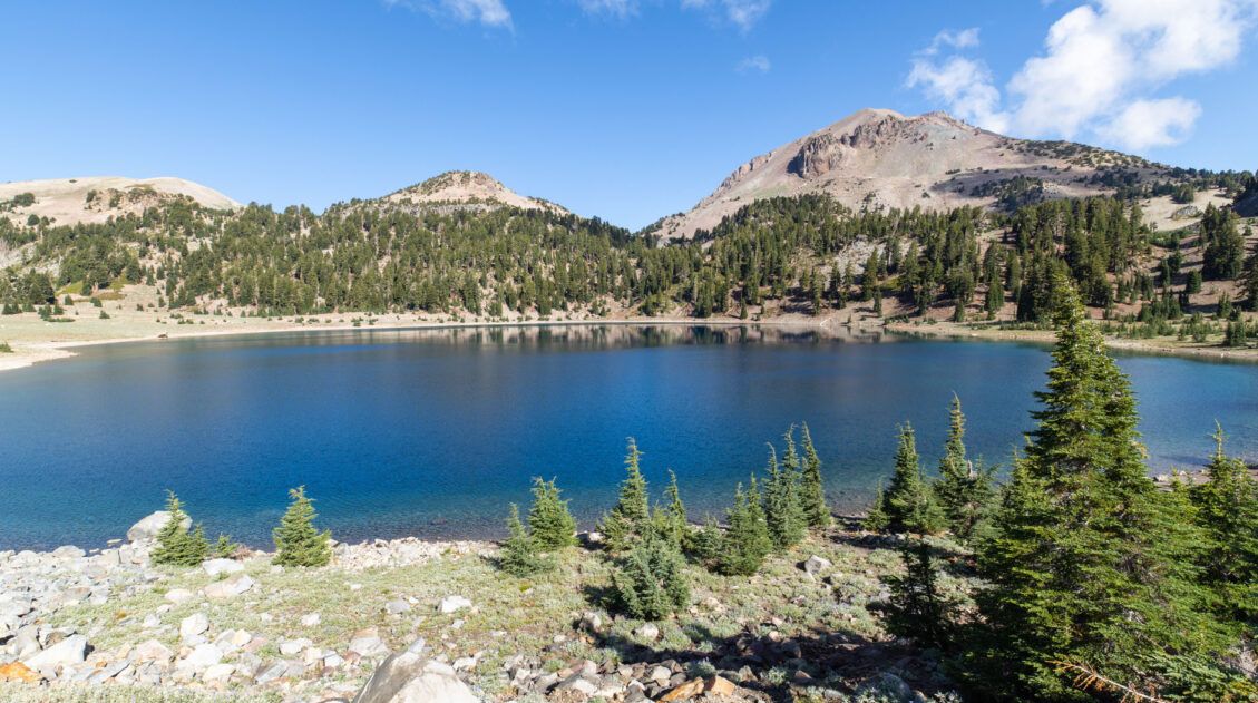
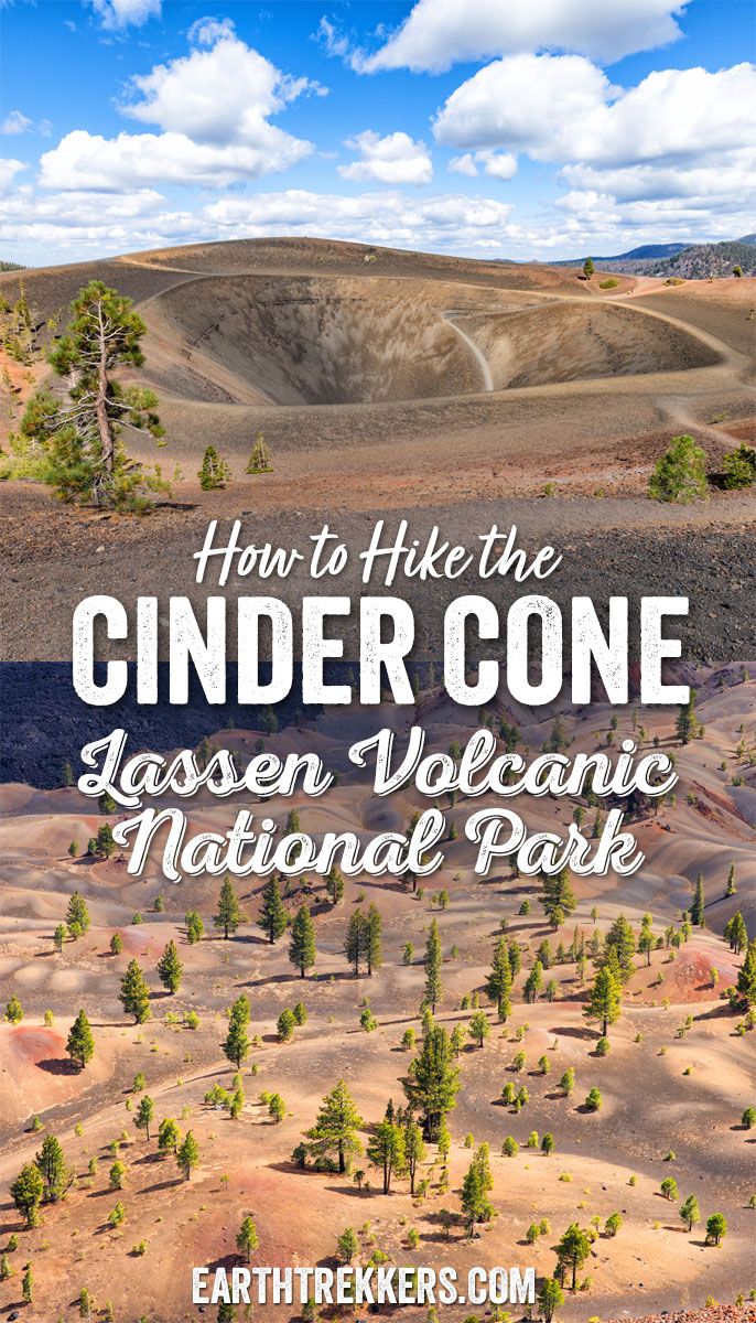
In Lassen Volcanic National Park, there’s no shortage of volcanoes to see. Highlights include the iconic Lassen Peak, massive lava rocks, and steaming hydrothermal features like Bumpass Hell. For a less crowded hike that highlights historic lava flows and offers sweeping views from an extinct volcano, put the Cinder Cone Trail on your list.
This hike exceeded our expectations. After three days of hiking in Lassen Volcanic, the Cinder Cone Trail was the final thing we did in the park. It was the perfect finale.
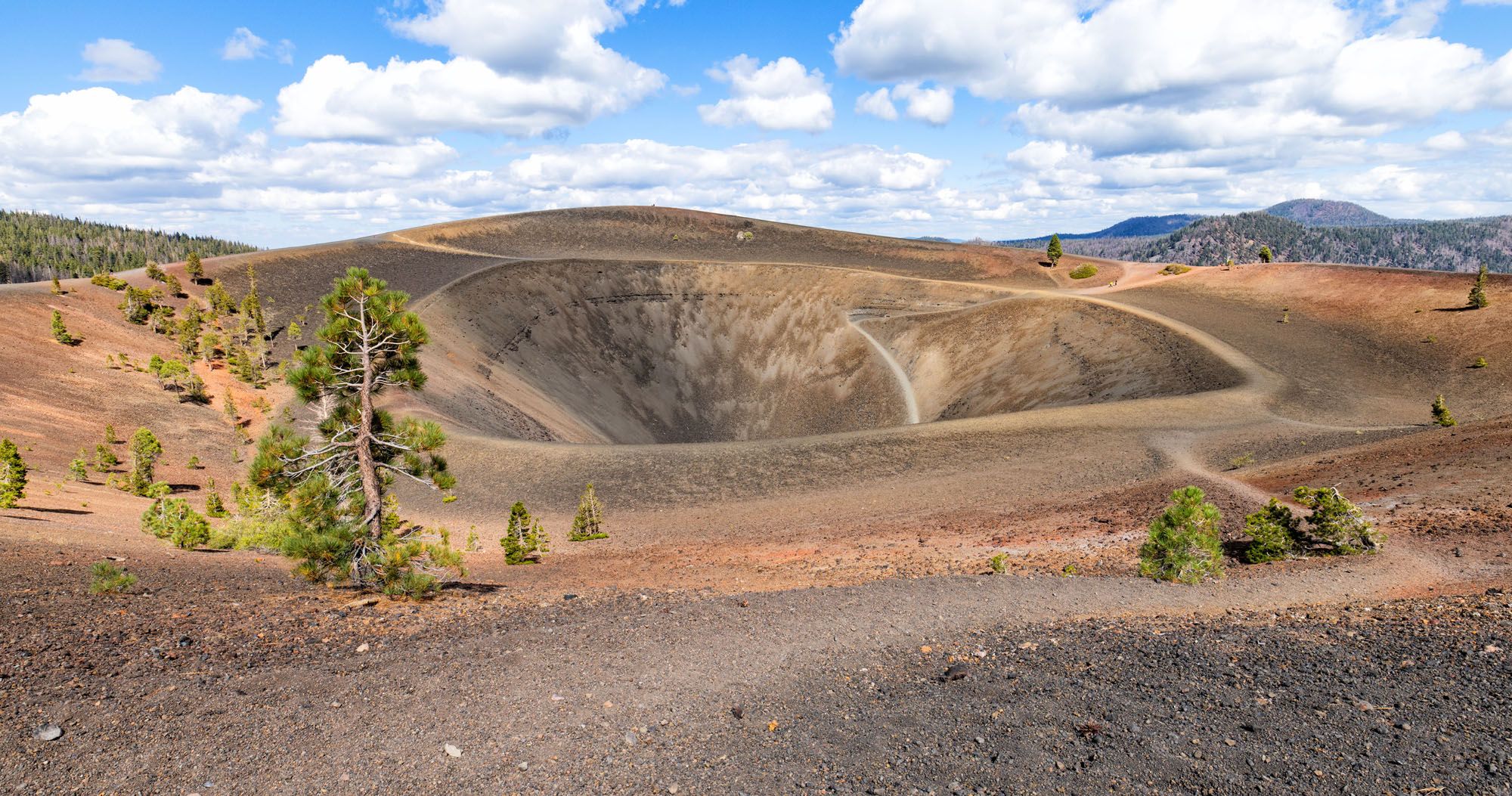
The Cinder Cone hike is deceptively hard but wonderfully unique. Located in a remote area of the park, you’ll first walk a flat trail alongside a lava field. And then the Cinder Cone appears. It’s a short, strenuous, thigh-burning hike to the top, but the views are incredible. We loved gazing into the caldera and out across the park.
In this guide, we’ll cover everything you need to know to hike the Cinder Cone Trail: how to get here, trail stats, and a step-by-step trail guide. And if you want to see how this trail compares to others in the park, head over to our post best hikes in Lassen Volcanic, which includes other popular trails, plus a few more hidden gems.
Where is the Cinder Cone Trail?
The Cinder Cone Trail is located in the northeast region of Lassen Volcanic National Park. The trailhead is located next to the Butte Lake Campground.
From the Northeast Entrance, take SR-89 north, turn right onto SR-44 and continue 11 miles. Turn south onto Butte Lake Road (FR-32N21), following signs for Butte Lake. FR-32N21 is a 6.6-mile gravel road that is suitable for standard vehicles. It leads to Butte Lake Campground, where you’ll find the Cinder Cone trailhead.
Here are driving times from other areas of Lassen Volcanic National Park:
- Kohm Yah-mah-nee Visitor Center: 1 hour 30 minutes
- Manzanita Lake: 45 minutes
- Chester, California: 1 hour 5 minutes
It is a long drive to get here, but that helps keeps crowds low. I think this hike is well worth the driving time to get here, if you have 2 or more days in the park, as it was one of our favorite experiences in Lassen Volcanic.
If you’re just starting to plan your visit, take a look at our guide How to Plan Your Trip to Lassen Volcanic. It pulls together all of our Lassen articles in one place, along with essential planning tips.
Cinder Cone Trail Hiking Stats
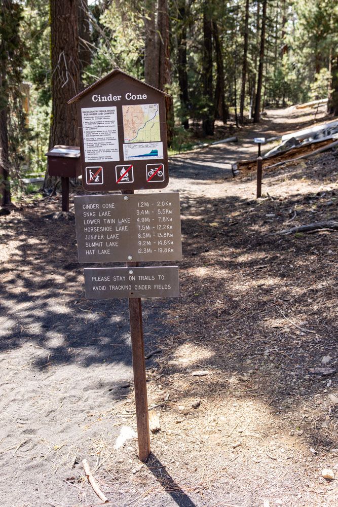
Distance: 3.8 miles (6.1 km) round trip
Difficulty: Moderate to strenuous
Total Ascent: 900 feet (275 meters)
Lowest Elevation: 6,080 feet (1,850 meters)
Highest Elevation: 6,910 feet (2,105 meters)
Time: 1.5 to 3 hours
When: The Butte Lake area of the park is open from May through November. For the rest of the year, this area is closed due to snow.
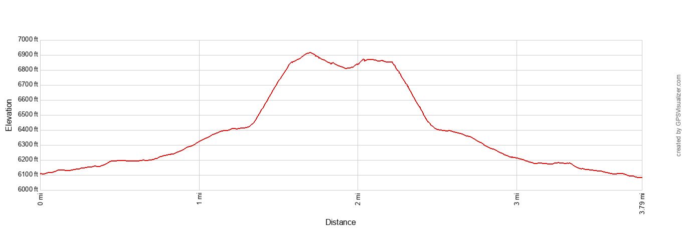
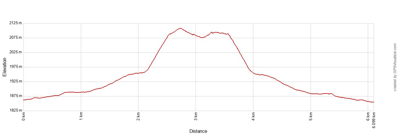
Cinder Cone elevation profile
Please practice the seven principles of Leave No Trace: plan ahead, stay on the trail, pack out what you bring to the hiking trail, leave areas as you found them, minimize campfire impacts, be considerate of other hikers, and do not approach or feed wildlife.
Cinder Cone Trail
Step-By-Step Trail Guide
Getting to the Trailhead
The hike starts at the Butte Lake Campground, which is located at the end of Forest Route 32N21 (Butte Lake Road).
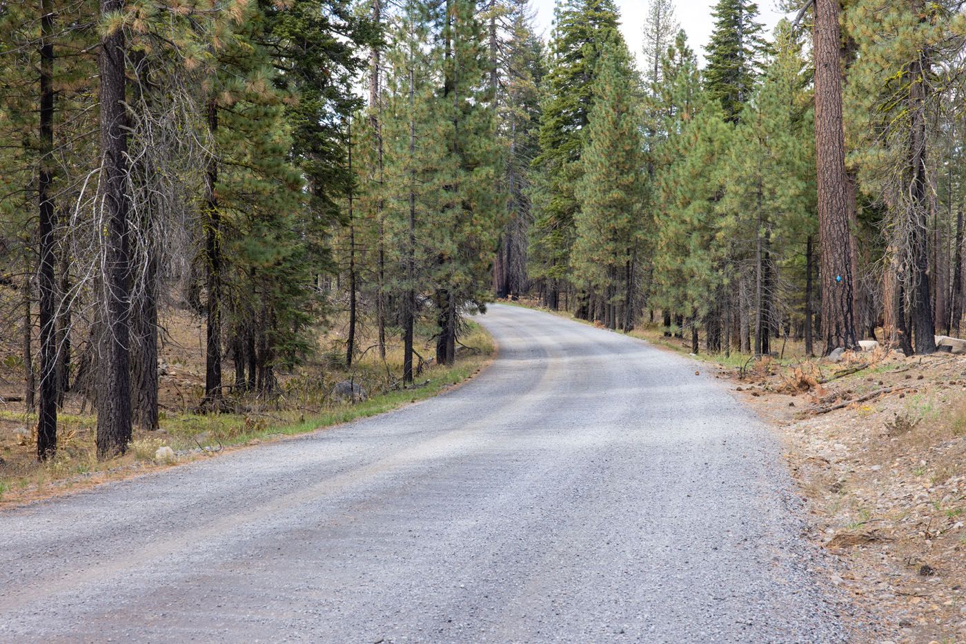
Butte Lake Road
On the drive, you will pass Butte Creek Campground. Do not stop here, as you still have a few miles to go. Continue past this until you reach Butte Lake Campground.
There’s a large parking area at Butte Lake Campground. Here you’ll find bathrooms, campgrounds, access to Butte Lake, and the Cinder Cone trailhead.
The Cinder Cone Trailhead is located next to the boat launch.
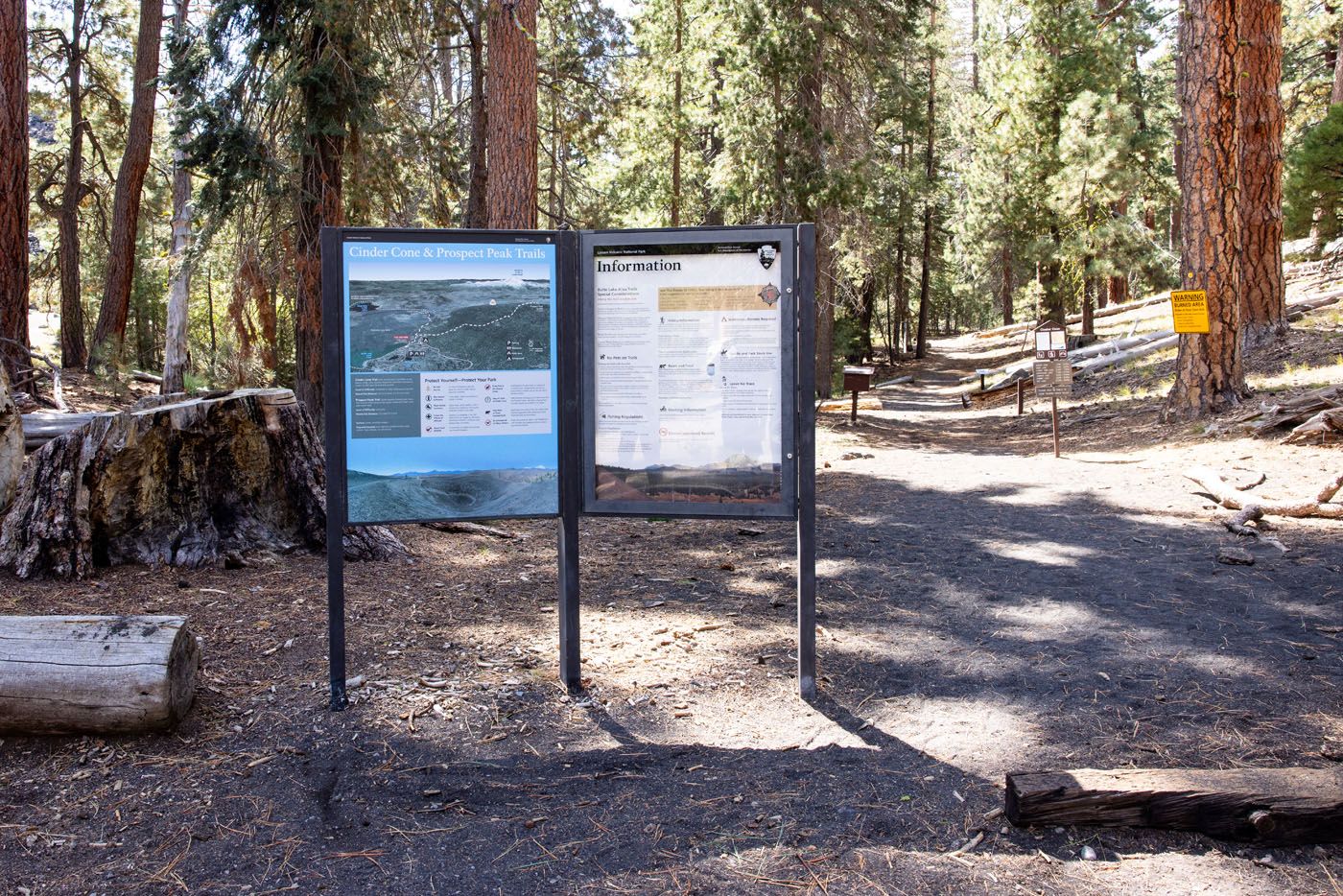
Cinder Cone Trailhead
From the Trailhead to Cinder Cone
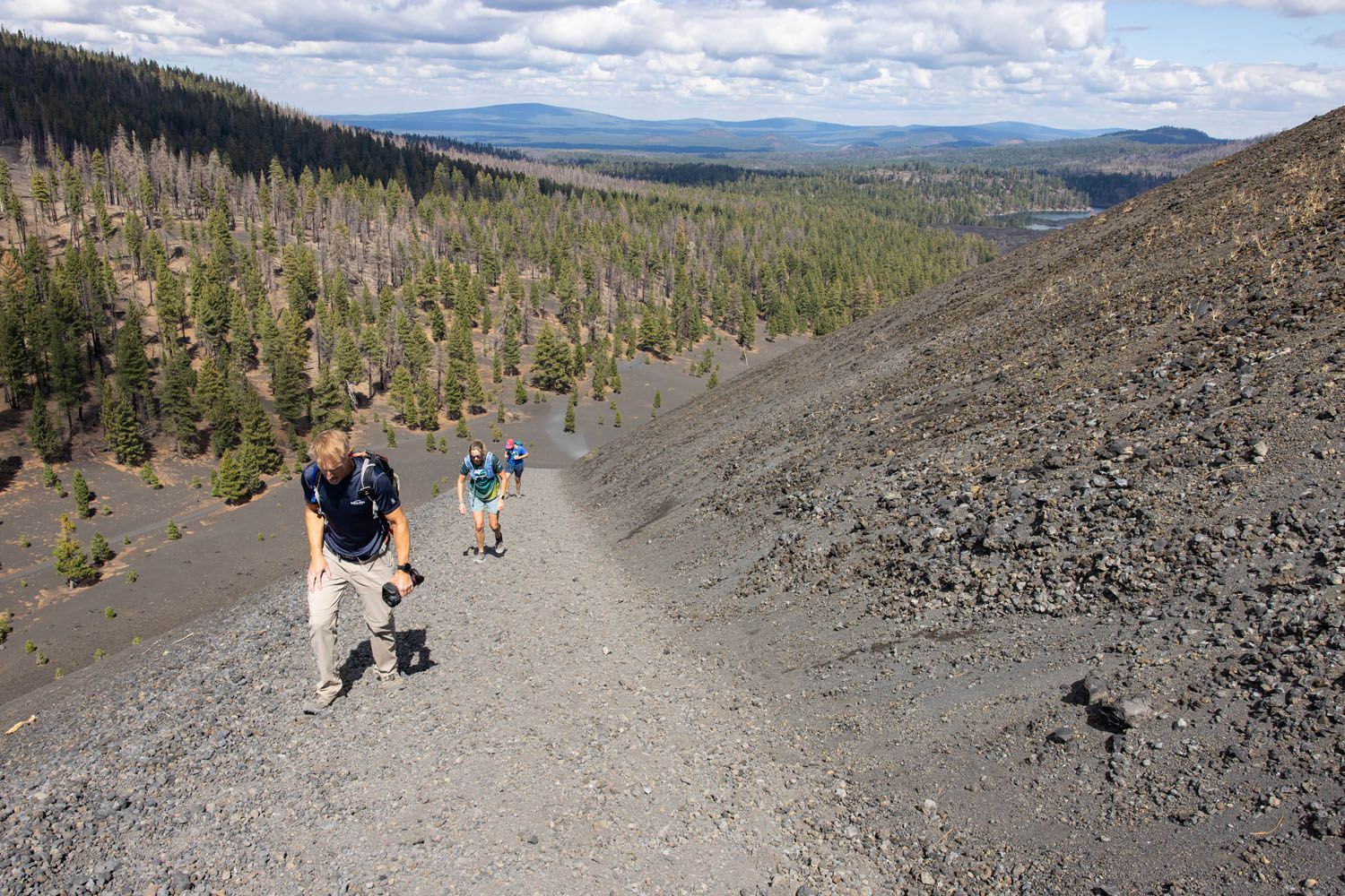
The trail leading to Cinder Cone is very easy to follow. You’ll hike along a wide, mostly flat trail through a forest. There are a few gentle climbs that get a bit steeper as you near Cinder Cone. However, the trail consists of thick black sand, which does make it harder to hike due to the increased resistance.
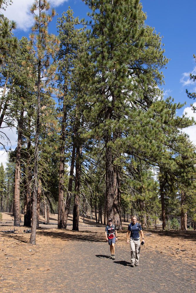
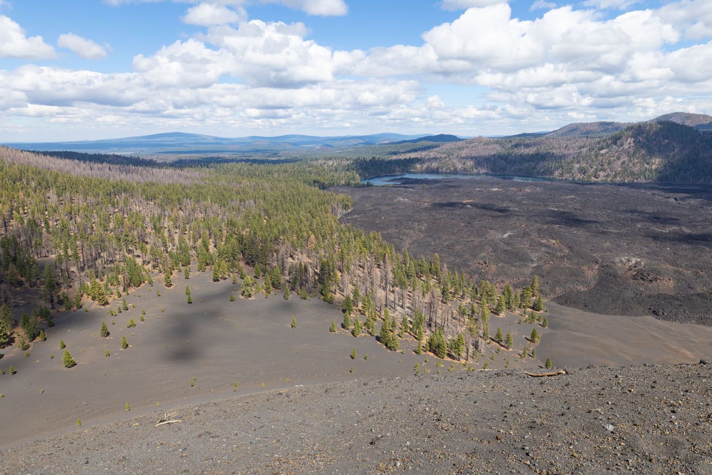
The path through the forest runs along a towering lava field. Known as the Fantastic Lava Beds, this massive lava field was formed by eruptions from the Cinder Cone and stretches from Butte Lake in the north to Snag Lake in the south. Walls of lava rock many feet high line the left side of the trail, forming a natural wall. It’s crazy to imagine that this much material oozed out from Cinder Cone over the years.
As you near Cinder Cone, you’ll begin to see more of the volcano through breaks in the trees. It can be quite an imposing sight, with its massive peak looming overhead. Cinder Cone stands alone in a barren field of black sand, so you can clearly see it rise over the rest of the surrounding landscape.

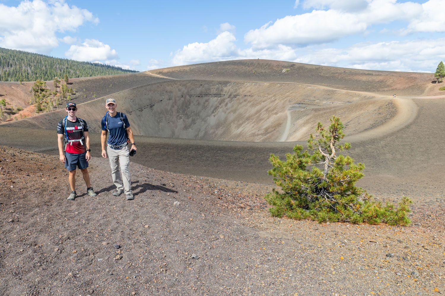
At 1.2 miles, you’ll enter an open field of volcanic sand and find yourself standing before Cinder Cone. Lucky for you, this is a fantastic spot for a photo and a clear view of your destination. But you still have to get to the top!
Hiking Up Cinder Cone
Standing at the base of the volcano, you’ll clearly see the trail winding up the side of Cinder Cone. You may even see a hiker standing at the top. That’s where you’re headed, but trust us, the views are worth the effort!
The hike up Cinder Cone is a challenge. It’s a steep climb along a path of thick, loose, gravelly sand, and the trail is exposed to the elements. It can get quite hot while hiking up on a sunny day, as there’s no shade to find relief.
We slowly trudged up the side of the volcano. With every two steps we took, it felt like we slid one step back, due to the gravel. Slowly, we put one foot in front of the other, and soon enough, the top was within arm’s reach. Although it’s a steep, heart-pounding climb, it’s not a long climb. From the base of Cinder Cone, it’s less than a half mile to the volcano’s rim.
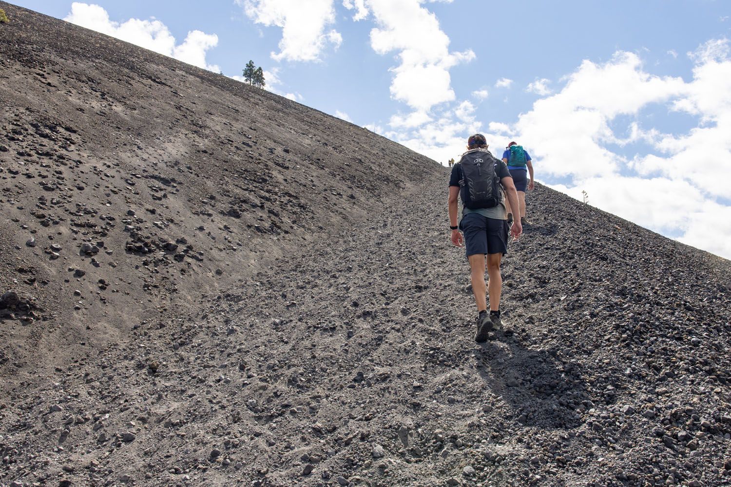
PRO TRAVEL TIP: It’s a lot easier to take short steps than long strides. With short steps, you’ll grip the trail better and slide less often, and reduce the stress on your legs.
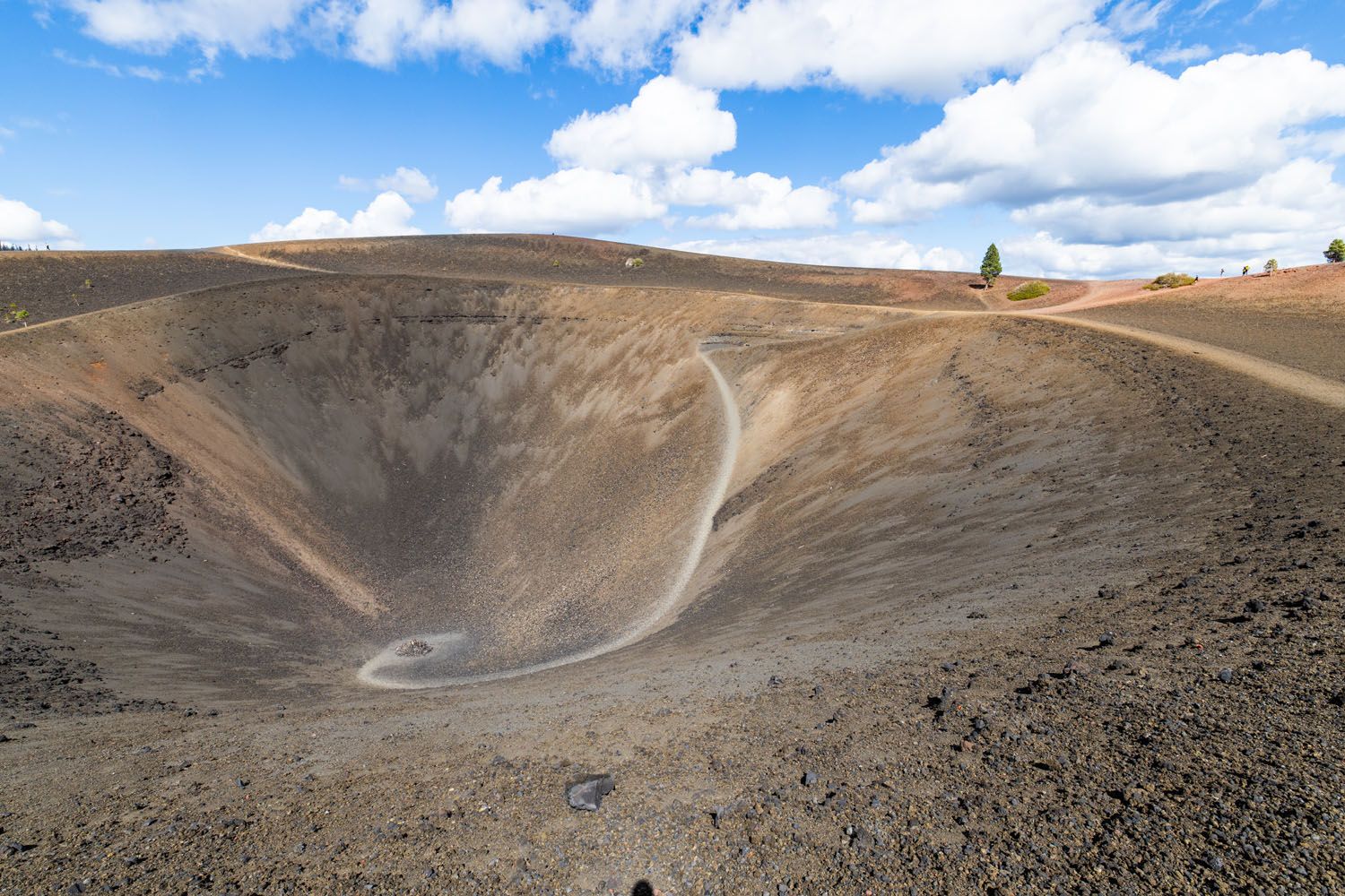
Hiking the Rim of the Cinder Cone
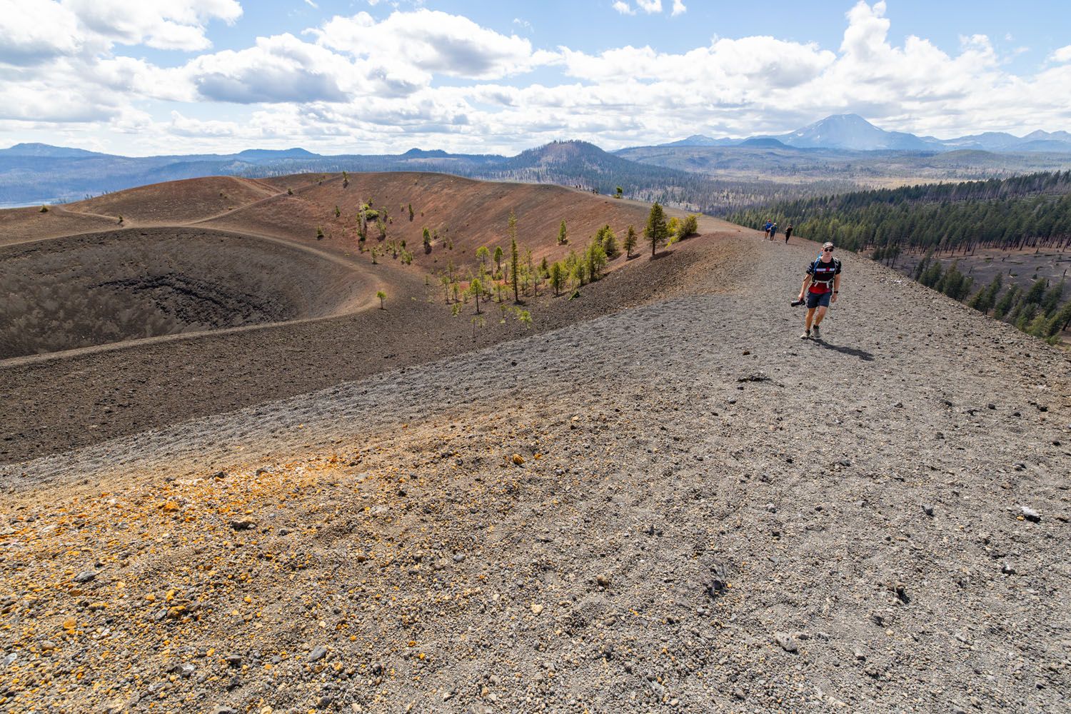
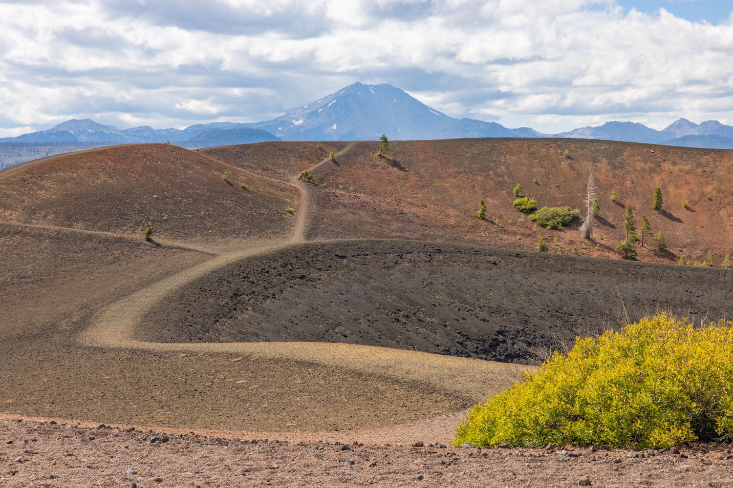
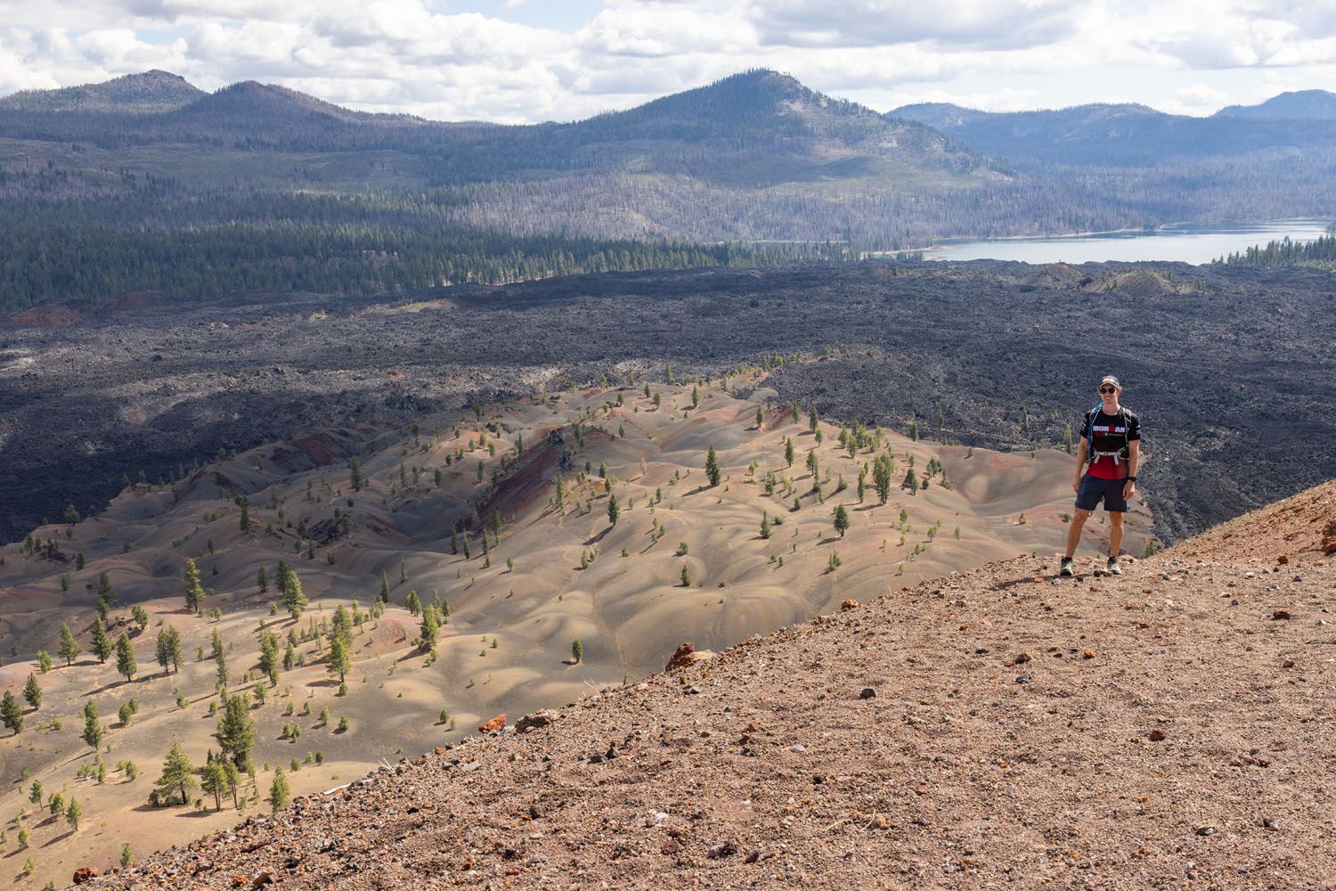
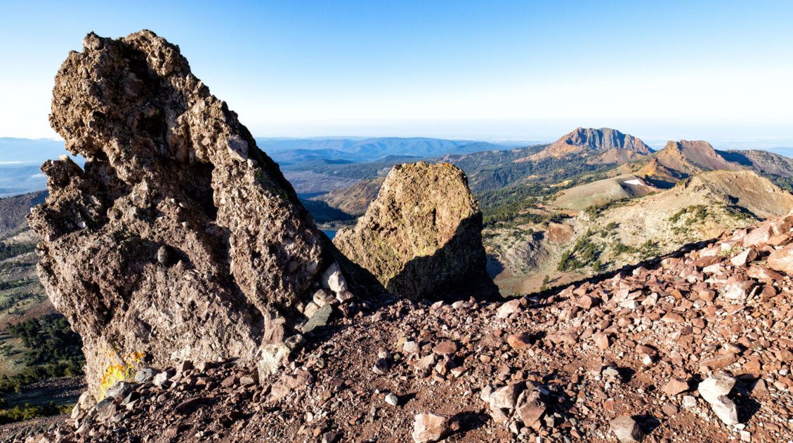
Once on top of the rim, you’ll be greeted with incredible views into the caldera of the volcano and the surrounding mountain peaks. On a clear day, you can also see Lassen Peak off in the distance.
There is a short trail that loops around the rim of Cinder Cone. Along this trail, you get the chance to look out over Butte Lake, the Fantastic Lava Beds, the Painted Dunes, Snag Lake, and all the surrounding peaks. We strongly encourage you to walk the full length of the rim (especially since you put all that work in to get up here!).
Here are the highlights of the rim walk in photos:
Cinder Cone with Lassen Peak in the distance

Another view of Lassen Peak
A view of the Fantastic Lava Beds
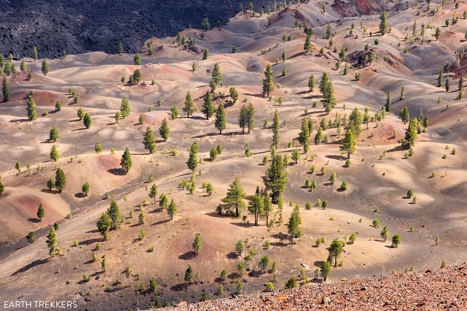
The Painted Dunes
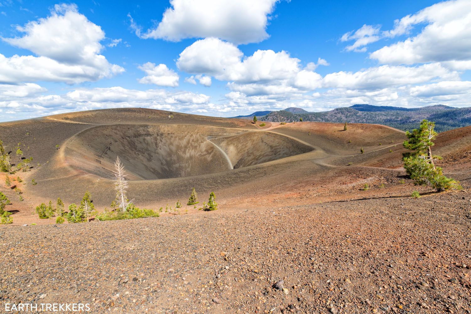
There’s also a short trail that leads into the caldera of Cinder Cone. Since the volcano has been extinct for hundreds of years, there’s no lava down here. However, if you’re looking for an extra challenge, you have the option to hike down and up within the caldera.
Ending Your Hike
You have a few options for finishing the hike. The first and easiest option is to return the way you came. Doing this will cap your hike at 4 miles round-trip (and reflects what is shown in the “stats” section).
Alternatively, you can descend Cinder Cone along the southeast side and loop clockwise along the base of the volcano. This will add an extra 15 to 30 minutes of hiking, but the trail passes next to the Painted Dunes, another popular landmark worth seeing. The Painted Dunes are visible from the rim of Cinder Cone but are equally amazing up close.
The descent of Cinder Cone from the south side is much rockier than the path you ascended along. The trail, however, is just as steep, if not steeper. Take caution when descending and watch your step, as loose rock may slide out from under your feet.
Follow clockwise along the base of Cinder Cone, until the trail reconnects with the “Butte Lake to Snag Lake Trail.” This will lead north for a few minutes before reconnecting with the trail that you started your hike on. From here, follow the trail through the woods back to Butte Lake Campground.
About Cinder Cone
The formation of Cinder Cone began in the 1650’s with a series of volcanic eruptions. A volcanic vent began to violently expel chunks of lava into the air, which cooled and slowly formed a cone-shaped volcano. Cinder Cone grew to a height of 750 feet above the surrounding landscape, and is essentially a giant mound of tiny, cooled lava rocks. Conveniently enough, Cinder Cone is a type of volcano known as a “cinder cone,” one of the four types of volcanoes that exist in Lassen Volcanic National Park.
During Cinder Cone’s formation, lava flows erupted from the volcano’s base and stretched out to the nearby Butte Lake and Snag Lake. These flows eventually blocked Cinder Cone’s vent, turning it extinct. The lava flows solidified and today are known as the Fantastic Lava Beds. From the top of Cinder Cone, hikers get a phenomenal view out over these lava flows, as well as the nearby lakes, mountains, and even Lassen Peak in the distance.
Things to Do Near Cinder Cone
Cinder Cone is located in the northeast section of Lassen Volcanic National Park. It’s over an hour drive from more popular sites such as Lassen Peak or Bumpass Hell, but that’s not to say there aren’t great things to check out near Cinder Cone. The list below details some of the best things to see and do while you’re in this region of the national park.
- Continue hiking: There are several great trails around Butte Lake Campground, many of which extend off of the Cinder Cone Trail. Hike to the summit of the nearby Prospect Peak or follow trails out to Snag Lake and around Butte Lake.
- Butte Lake: This is a great spot for swimming, fishing, and boating. The water here is not as cold as other alpine lakes, with water temperatures in the mid-60’s during the summer. This also makes a great spot for a picnic.
- Subway Cave: This isn’t technically inside of the national park, but it is located near the intersection of SR-89 and SR-44, so there’s a good chance you will drive right past it heading to or from this hike. It’s free to visit, takes about 15 minutes, and you get to explore an underground cave.
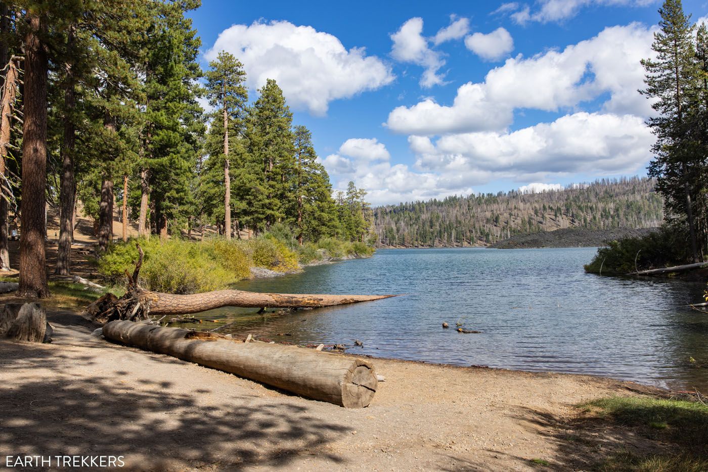
Butte Lake
What Should I Bring on the Hike?
There is little shade on the trail, so bring a hat and consider wearing sunscreen.
A good pair of walking shoes are sufficient. We wore hiking shoes and trail running shoes.
Bring water (about 1 to 2 liters per person).

Essential Hiking Gear: What Should You Bring on a Day Hike?
If you are new to hiking or are curious about what you should bring on a hike, check out our Hiking Gear Guide. Find out what we carry in our day packs and what we wear on the trails.If you have any questions about how to hike the Cinder Cone Trail, let us know in the comment section below.
Plan Your Trip to Lassen Volcanic
Below are links to more of our guides in Lassen Volcanic National Park, plus more information about the national parks and destinations in California.
Top 10 Hikes in Lassen Volcanic (+ Our Favorites)
Pinterest Facebook Flipboard In this guide, we will uncover the 10 best hikes in Lassen Volcanic, from popular trails to a few hidden gems. These are located along Highway 89 (the heart of the park) and in more remote regions such as Warner Valley and Butte Lake. Stroll through bubbling hydrothermal areas, summit volcanoes like […]
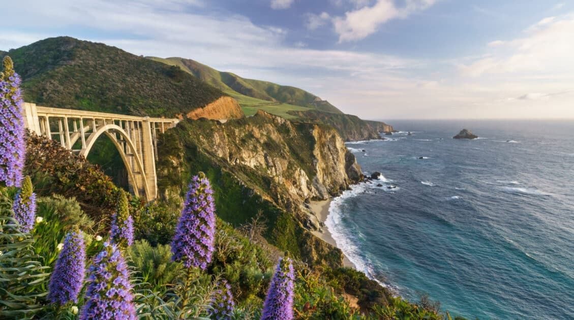
California Travel Guide: Places to Visit in California
California Travel Guide California is home to some of the world’s tallest trees, breathtaking mountains, stunning desert landscapes, gorgeous beaches, and bustling cities. There are countless adventures worth having here, whether it be wine-tasting in Napa, hiking to the top of Half Dome, or exploring its long list of national parks. California is a favorite […]

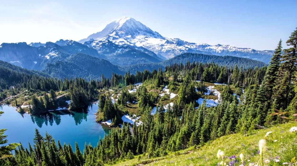
The Ultimate Guide to Lassen Volcanic National Park
Lassen Volcanic National Park With steaming fumaroles, boiling hot springs, and volcanoes galore, Lassen Volcanic is an underrated gem amongst Californian national parks. Here you can hike to the summit of active volcanoes, wander through bubbling hydrothermal basins, and explore landscapes carved by lava flows. Lassen Volcanic is a paradise for hikers, photographers, and road […]
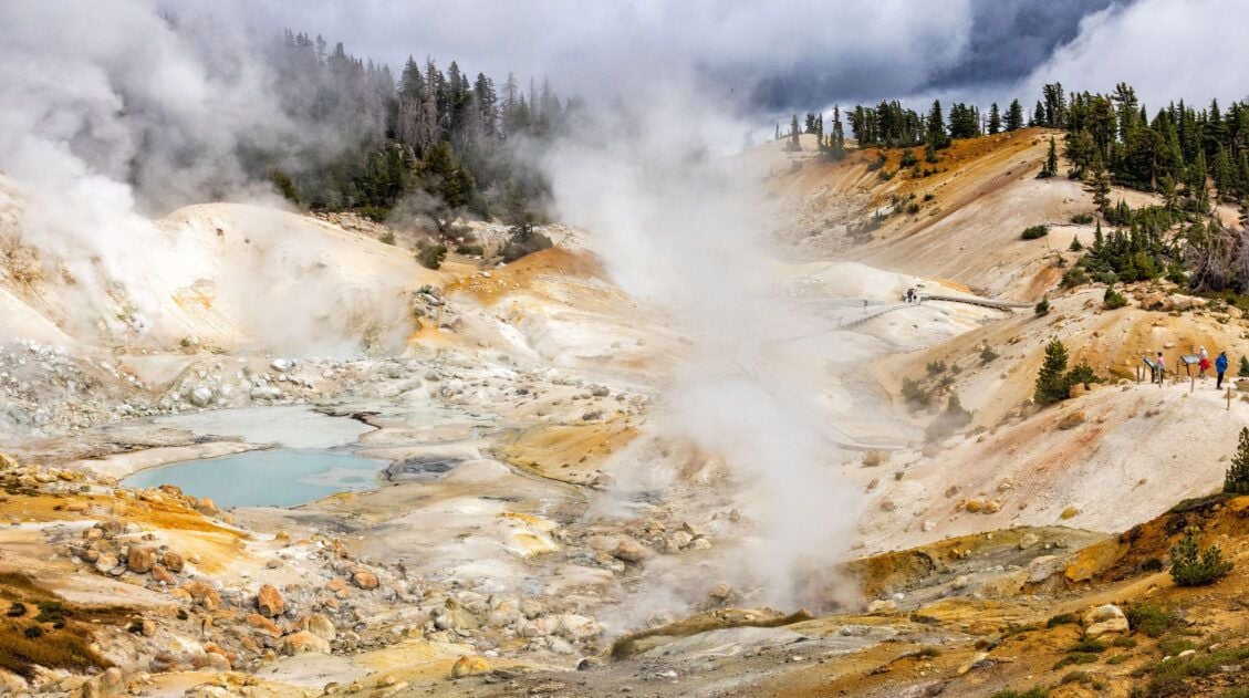
The Bumpass Hell Trail, An Essential Hike in Lassen Volcanic
Welcome to Bumpass Hell, a dynamic thermal region with an unforgettable name. The largest hydrothermal area within Lassen Volcanic National Park, Bumpass Hell amazes visitors with its giant steam vents, bubbling mud pots, and colorful, otherworldly landscapes. The Bumpass Hell Trail is one of the most popular trails in Lassen Volcanic National Park. It’s easy […]
14 Best Things to Do in Lassen Volcanic National Park
In this guide, we will cover the best things to do in Lassen Volcanic National Park. Discover the best hiking trails, scenic drives, and a few hidden gems that are definitely worth your time. We’ll also provide information on where to stay, how to plan your time, and the ideal time of year to visit. […]
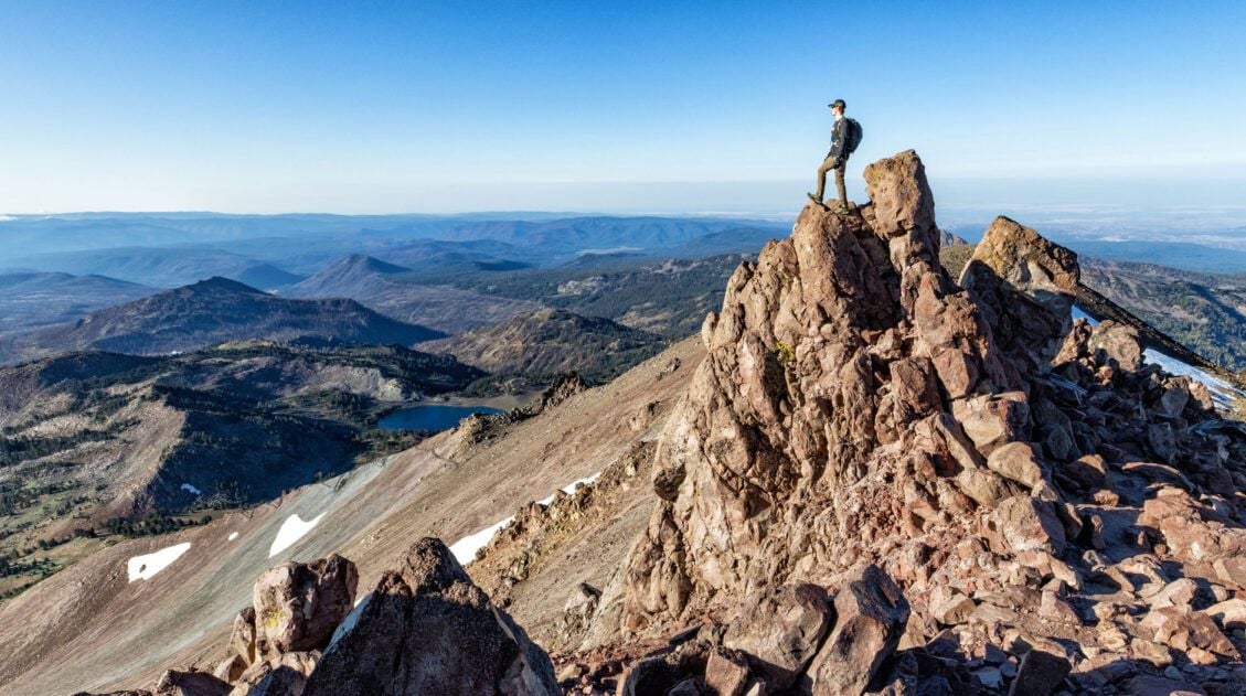
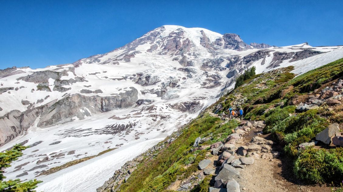
Lassen Peak Trail: Step-By-Step Trail Guide, Photos & Stats
The Lassen Peak Trail is not only one of the most popular hikes in Lassen Volcanic National Park, but it also leads to the tallest point in the park at 10,457 feet (3,187 meters). The trail to the top is just 2.4 miles one way, but with a steady ascent and high elevation, this hike […]
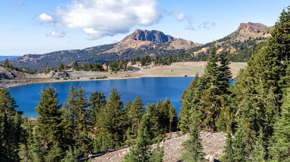
10 Days in Lassen Volcanic, Crater Lake & the Redwoods: California-Oregon Road Trip
This Northern California and Oregon road trip is one of the best in the USA. With 10 days, you can visit Lassen Volcanic, Crater Lake, and Redwood National and State Parks, but that’s not all. Add on a scenic drive along the Oregon coast, explore underground caves, and drive the amazing Avenue of the Giants. […]
20 Epic Hikes in the US National Parks
With 63 national parks and thousands of miles of hiking trails, your options are endless for exploring the American national parks. We narrowed down the list for you to 20 of the best hikes in the US national parks, 20 amazing ways to explore this beautiful country. Hike to the tallest peaks, through massive canyons, […]
Best US National Parks to Visit Month-By-Month
Best National Parks to Visit Month-By-Month Most national park planning advice tells you the “best” month to visit a park without showing you the full picture. This guide does both. We’ve visited 56 of the 63 US national parks, many of them multiple times and in different seasons, and timing is consistently one of the […]
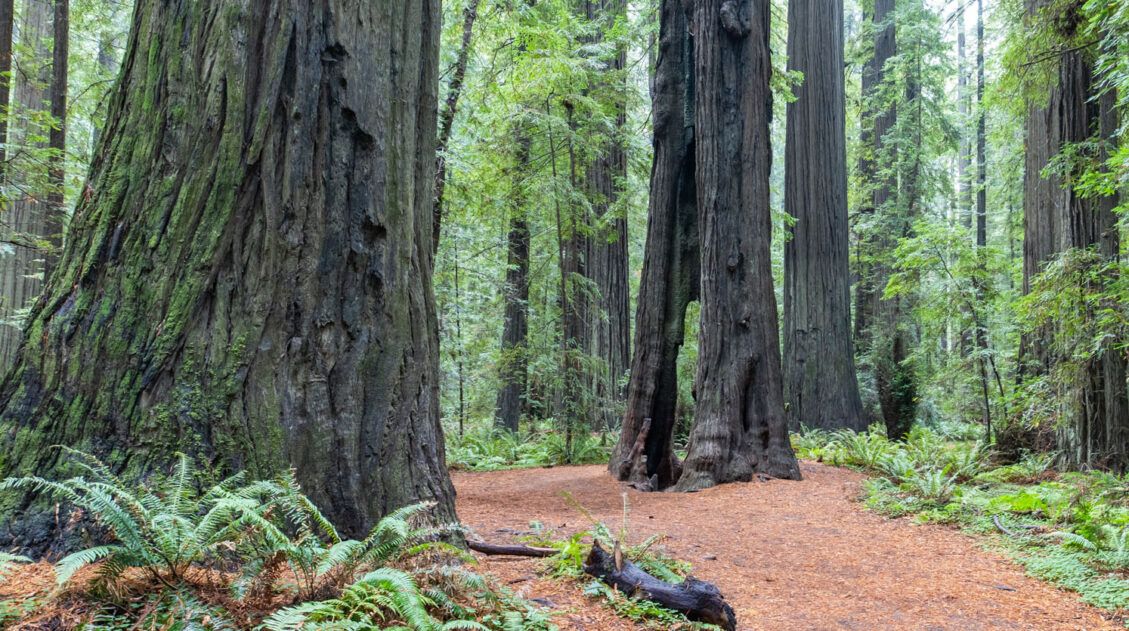
How to Plan a Trip to Redwood National & State Parks
Redwood National and State Parks Home to some of the tallest trees on Earth, Redwood National and State Parks protect some of the last remaining groves of old-growth coastal redwoods. Wallking amongst these giants feels like stepping into another world. Trees reach heights over 300 feet tall and some are more than 2,000 years old. […]
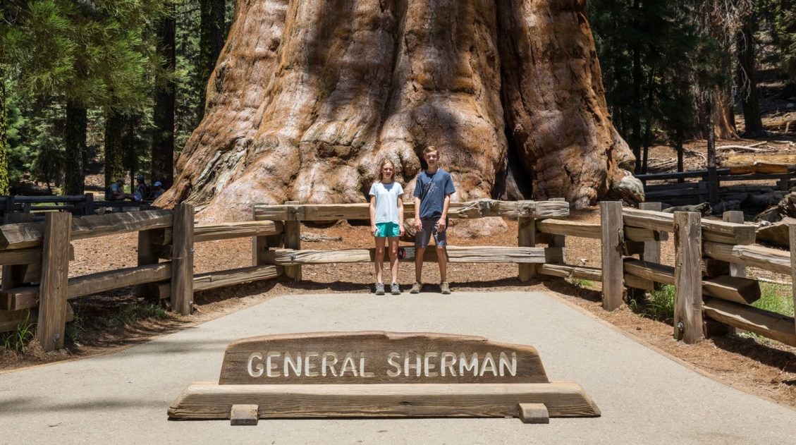
One Day Itinerary for Kings Canyon and Sequoia National Parks
Kings Canyon and Sequoia National Parks sit side by side in central California. Filled with alpine peaks, deep canyons, and the largest trees in the world, you could spend several days here. However, if you only have one day, you have just enough time to visit the highlights of both parks. We visited Kings Canyon […]
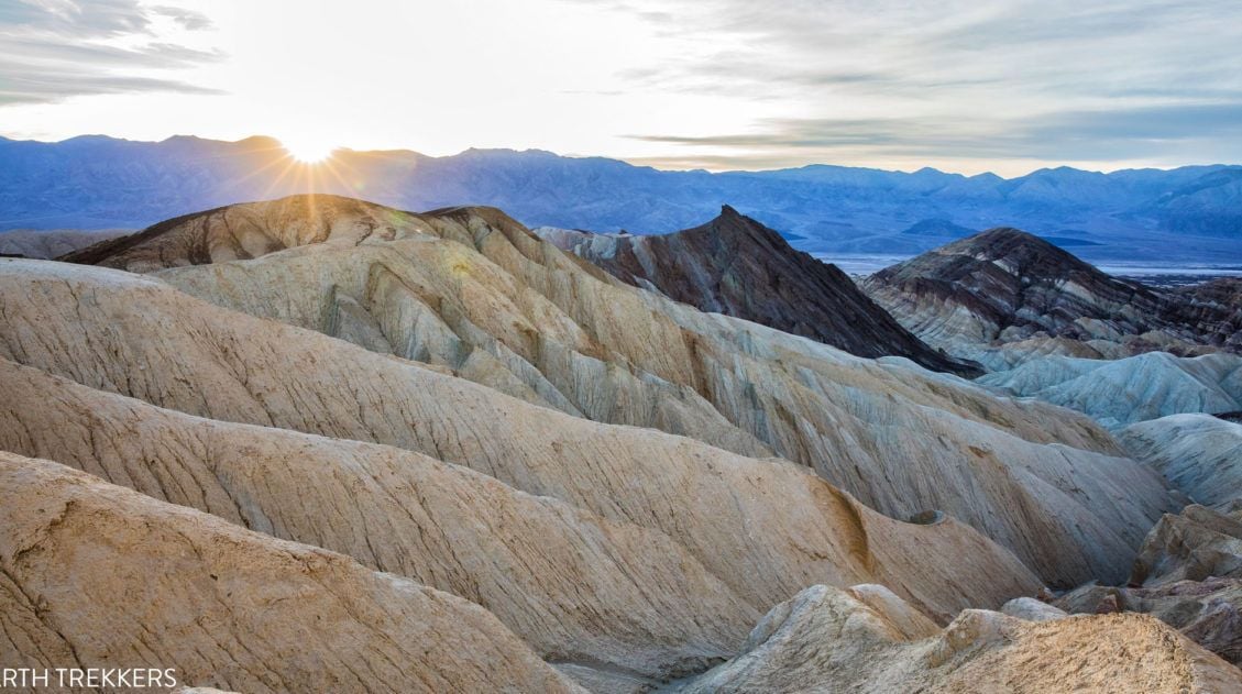
20 Epic Things to Do in Death Valley National Park
Death Valley…just the name inspires a sense of wonder and mystery. With barren salt flats, towering mountains, mysterious sailing stones, shifting sand dunes, rainbow-colored mountains, and canyons to explore, there is a lot to do here. In this post, learn about the best things to do in Death Valley National Park, with suggestions on how […]

The Ultimate Guide to the 63 US National Parks
Stretching from the South Pacific, across the United States to the Caribbean, are 63 national parks. These national treasures preserve iconic landscapes, majestic mountains, primordial forests, arid deserts, misty coastlines, immense canyons, wildlife, and historic landmarks. We have visited 56 of the 63 US national parks, from the towering granite walls of Yosemite and the […]
United States Travel Guide: Places to Visit in the USA
Plan your visit to the United States. Learn about the best things to do, how to plan your time, road trip ideas, and sample itineraries.

Leave a Comment