
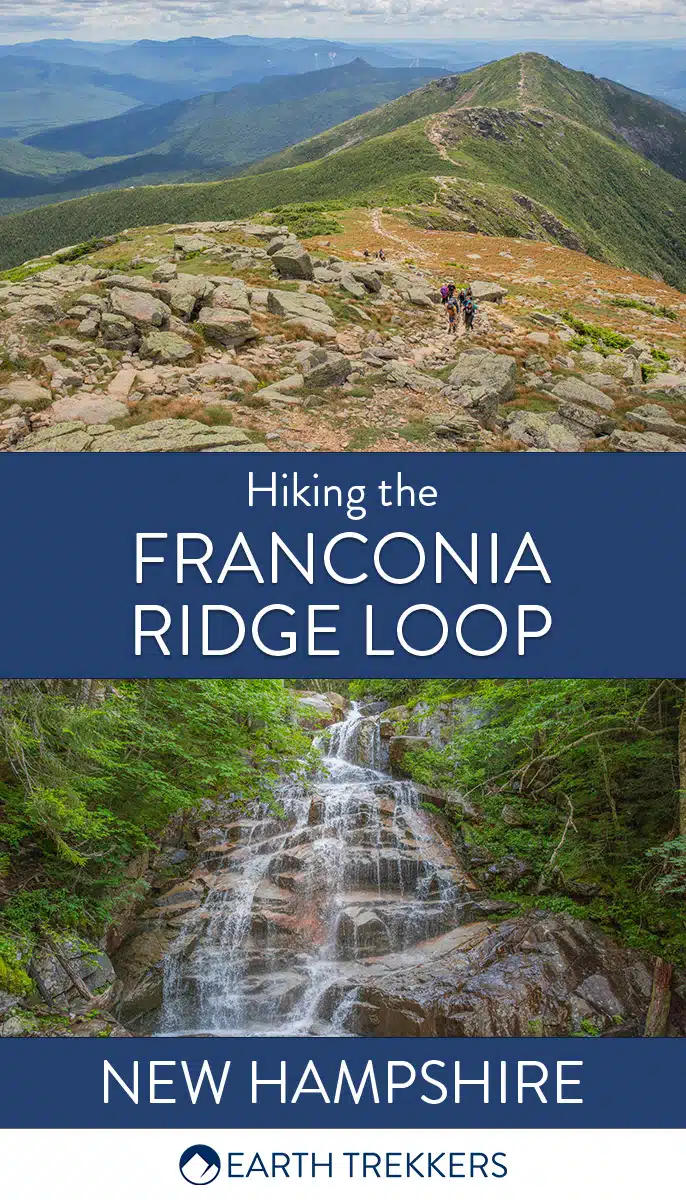
The Franconia Ridge Loop is one of the most beautiful, yet challenging, hikes in New Hampshire’s White Mountains.
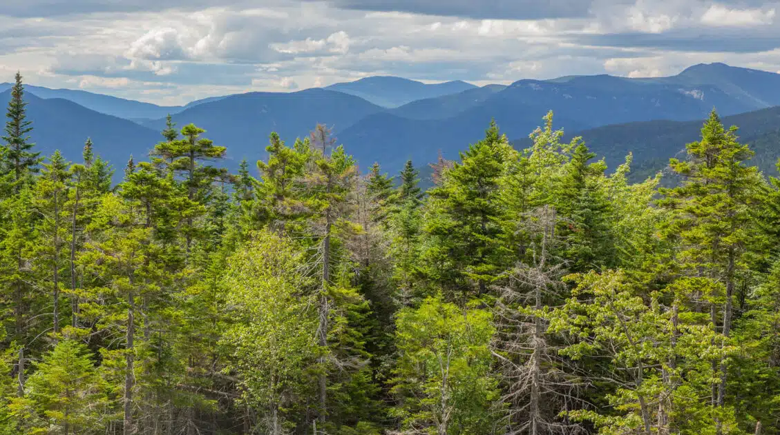
Hikers will traverse the National Forest’s second highest range of peaks and reach the summit of three mountains. A long stretch of the hike is above the treeline, offering beautiful views over the park’s expanse of forested ridges. On a clear day, hikers can look out across Maine, Vermont, and even Quebec. While the Franconia Ridge Loop is a task for prepared and strong-willed hikers, you do not need an extensive amount of experience to complete this loop.
FRANCONIA NOTCH STATE PARK: Don’t miss our Guide to Franconia Notch State Park, which includes more great things to do plus lots of helpful tips for your visit.
Franconia Ridge Loop Hiking Stats
Distance: 8.27 miles (13.3 km) loop
Total Ascent: 4,154 feet (1,266 meters)
Lowest Elevation: 1,790 feet (545 meters)
Highest Elevation: 5,248 feet (1,600 meters)
Average Time: 6-9 Hours. We completed the hike in 6 hours, but we hiked fast and did not take many breaks.
When to Go: Though you can do this hike at any time of the year, the best time is from May to September when the weather is warmest and the skies are the sunniest. The top of the ridge gets cold and breezy, even in the heat of summer. If hiking this in the fall, make sure to bring a warm layer.
Best Time of Day: We recommend that you begin the hike early in the morning, so that you have plenty of time to complete it and beat the crowds. We began at 9 am, and already the trail was crowded and parking was scarce.


Please practice the seven principles of Leave No Trace: plan ahead, stay on the trail, pack out what you bring to the hiking trail, leave areas as you found them, minimize campfire impacts, be considerate of other hikers, and do not approach or feed wildlife.
Franconia Ridge Loop Hiking Guide
Which Direction Should You Go?
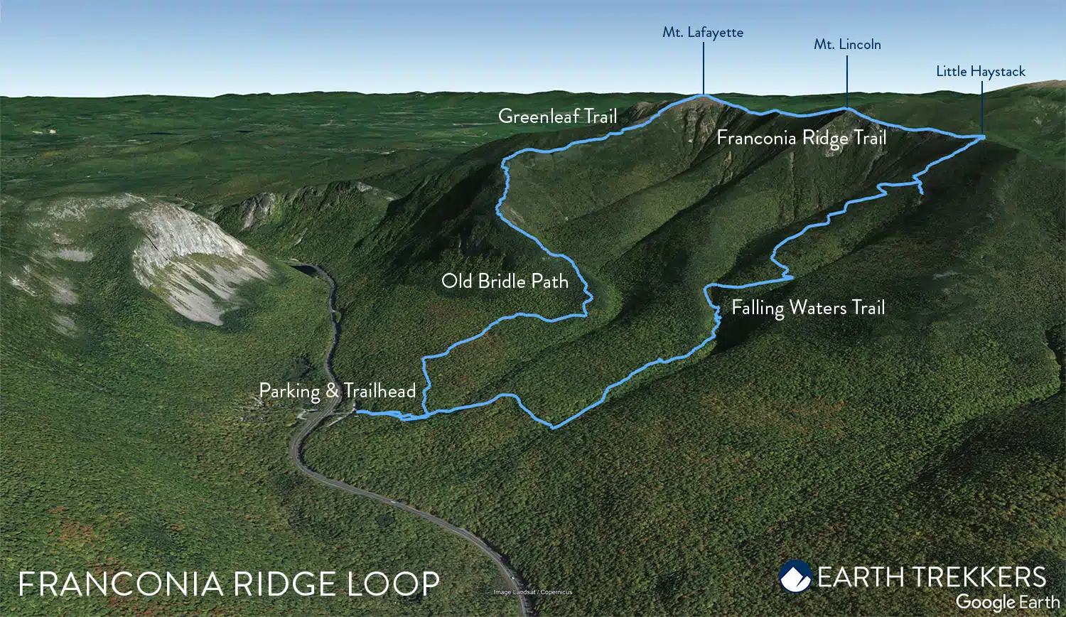
Since this hike is done as a loop, you can do it in a clockwise or counterclockwise direction. We did this hike in a counter clockwise direction, since that is the most typical way to do this hike and slightly easier than the clockwise direction.
The Franconia Ridge Loop starts up the Falling Waters Trail, and then along the Franconia Ridge Trail, the Greenleaf Trail, and Old Bridle Path. The Falling Waters Trail and Old Bridle Path meet at the same parking lot, creating a perfect loop.
Some hikers prefer to hike this loop in the clockwise direction by starting on the Old Bridle Path. Completing the loop this way calls for a steep ascent to the top of Mt. Lafayette, but hikers will enjoy a slightly more gradual descent. If you prefer this method, then begin with the Old Bridle Path and follow this guide in the opposite direction.
Franconia Ridge Loop Trailhead & Parking
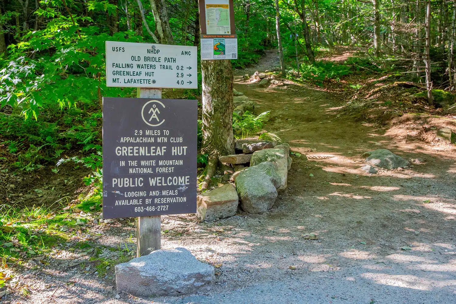
The parking area where the Falling Waters and Old Bridle Path trailheads converge doesn’t have an official name. If you’re using Google Maps, searching for “Old Bridle Path trailhead” will guide you to the correct spot (here are the GPS coordinates: 44°08’31.8″N 71°40’53.6″W).
You’ll also find road signs on Route 93 that direct you to the trailhead parking area. This parking lot is accessible at any time of day and in 2023, there was no parking fee. It’s advisable to arrive early in the morning; by 9 am in August the lot was mostly occupied.
Across Route 93 is Lafayette Place Parking, an alternative parking area if the Trailhead parking is full.
There is also a hiker shuttle that runs to the trailhead, a good option if you can’t get to the trailhead early. Park at the Peabody Big Lot to ride the shuttle to the trailhead. There is a small fee to ride the shuttle, cash only. The shuttle runs on weekends and holidays from late May through mid-October. Get more information on the Franconia Notch State Park website.
Parking lot trailhead
Franconia Ridge Loop Trail
Step-By-Step Hiking Guide
Falling Waters Trail
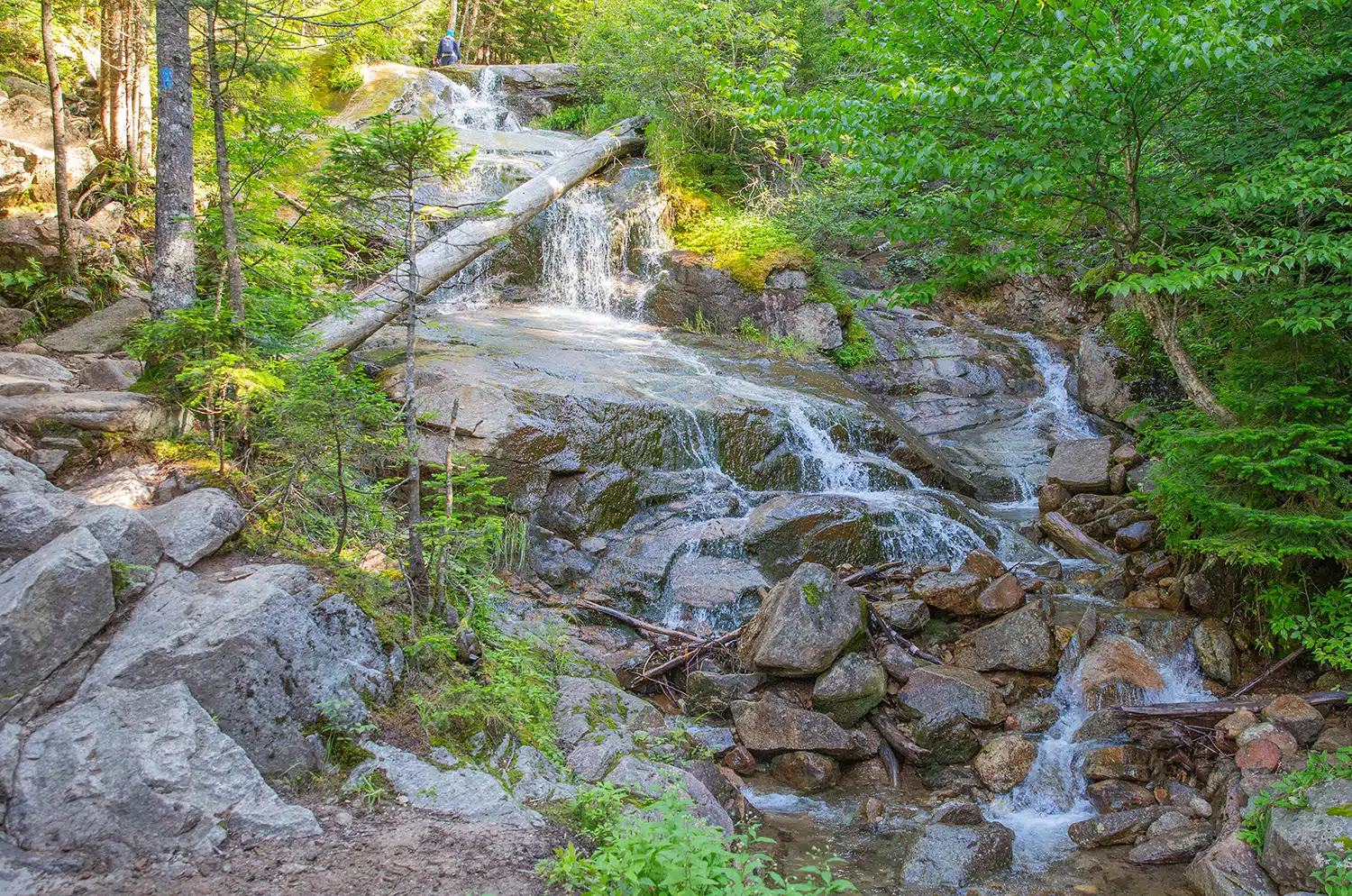
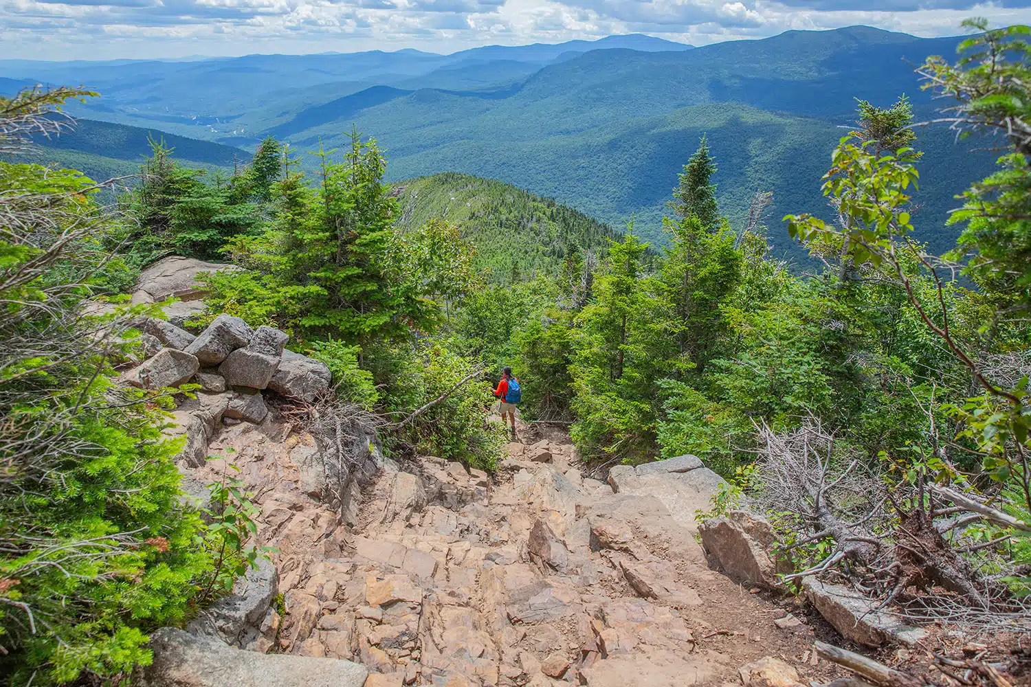
We began our hike on the Falling Waters Trail, a path aptly named for its location along a rushing stream. This trail is 3.4 miles long and takes hikers to the peak of Little Haystack Mountain, the smallest of three summits in the Franconia Ridge Loop.
The first half of the Falling Waters Trail winds through the woods and leads past rushing waterfalls. Hikers will walk up and over large slick rocks and will hop across stones to cross shallow streams. The beauty of the rushing falls, and the exciting terrain, made this section of the hike fun, yet slow-going.
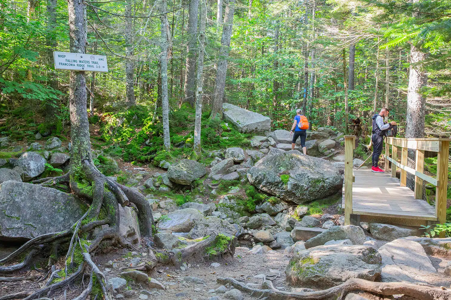
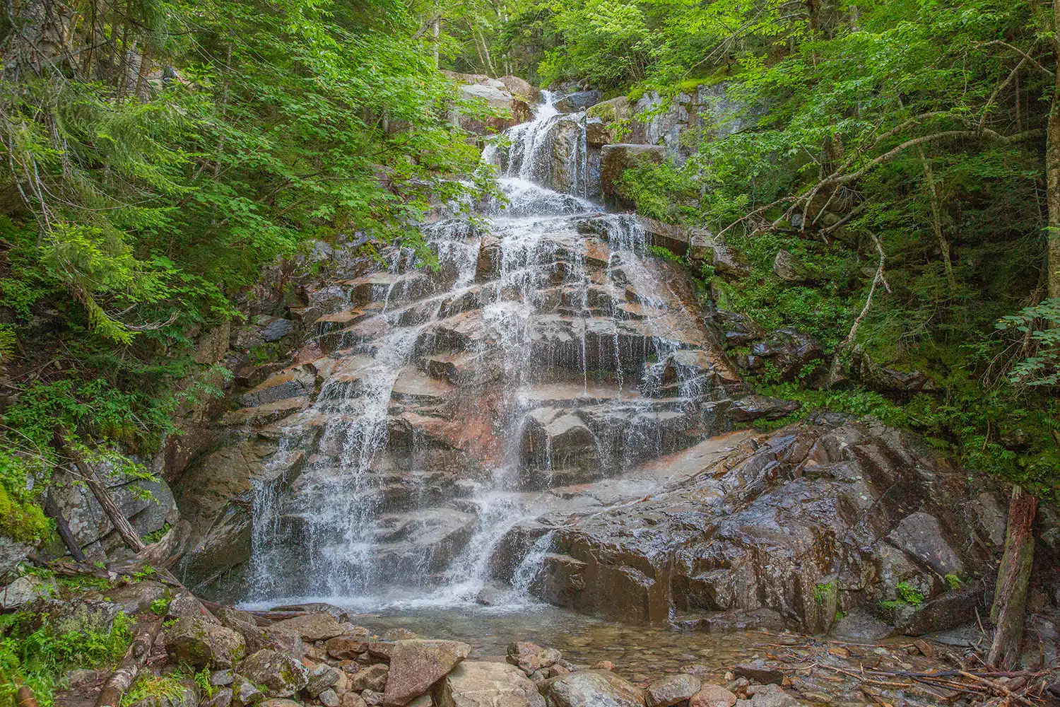
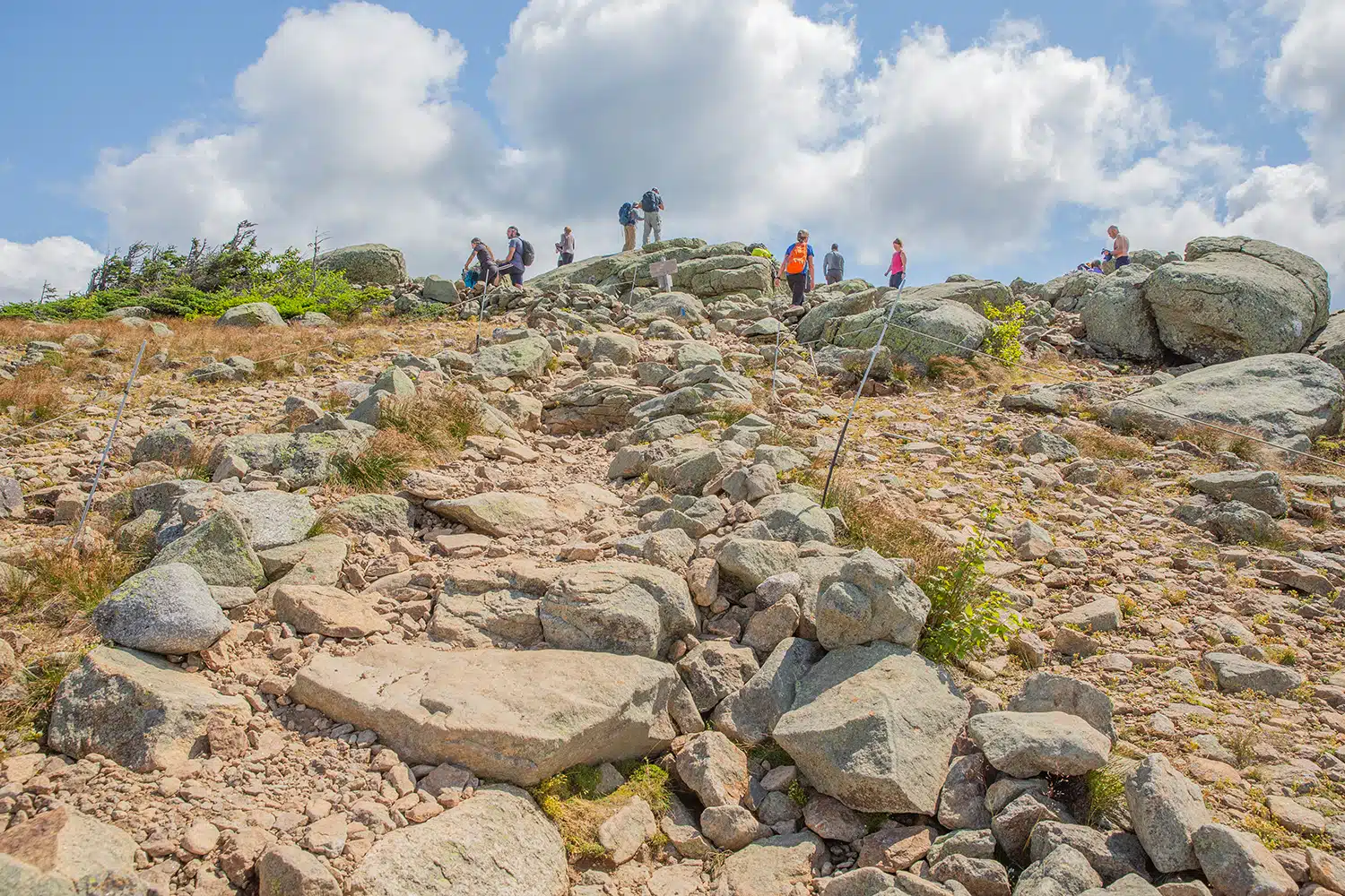
As the trail continues, the incline becomes steeper. The last mile of the Falling Waters Trail is a hard climb, what I would consider the most challenging uphill section of the hike.
After the steep climb, hikers reach the summit of Little Haystack and are greeted with an awe-inspiring view over the White Mountains.
Final ascent of the Falling Waters Trail
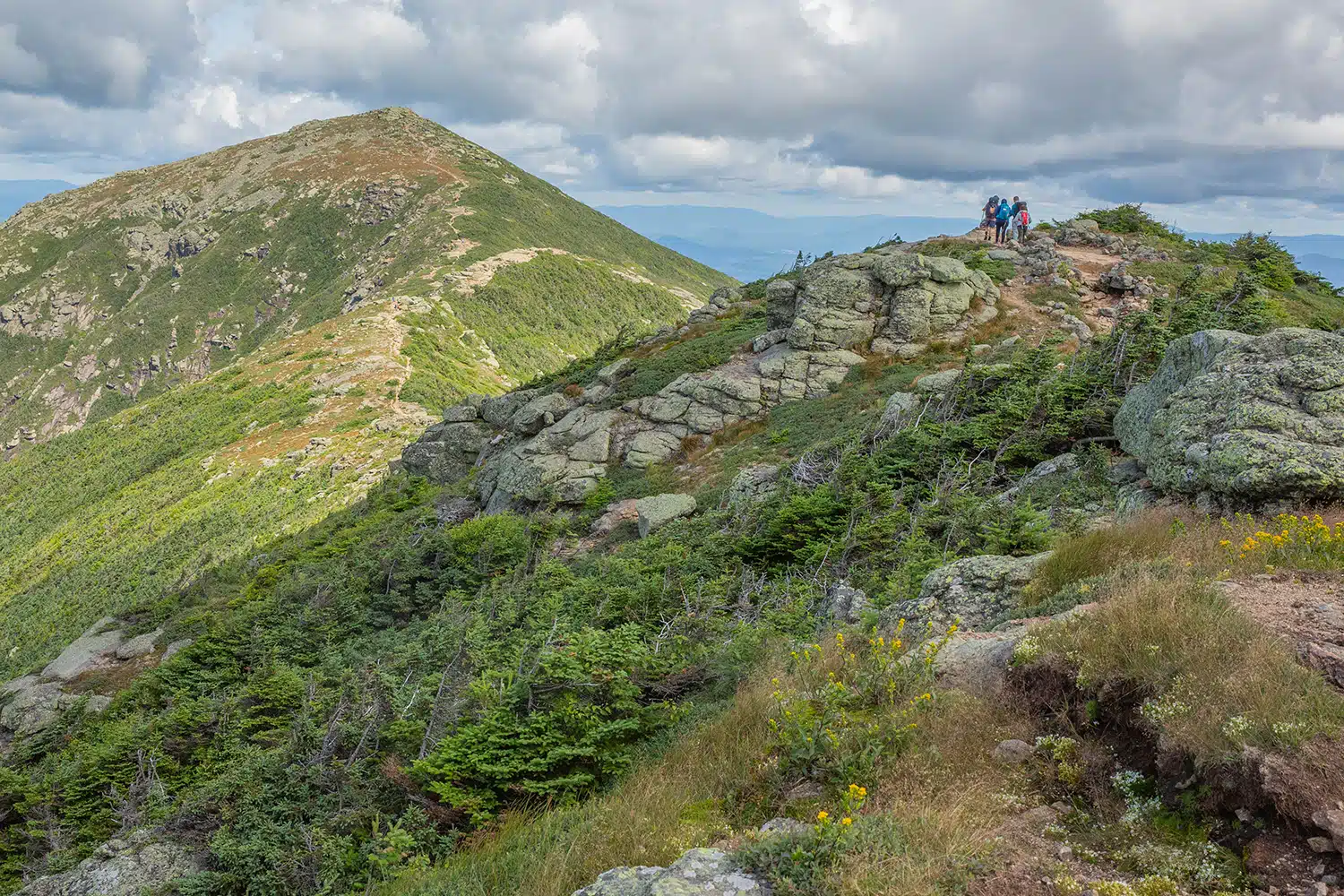
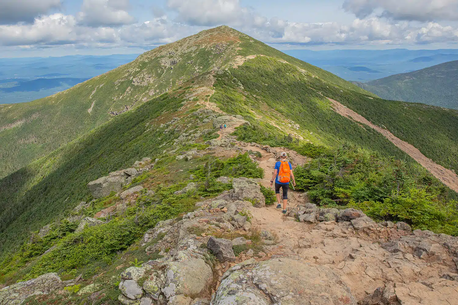
Franconia Ridge Trail
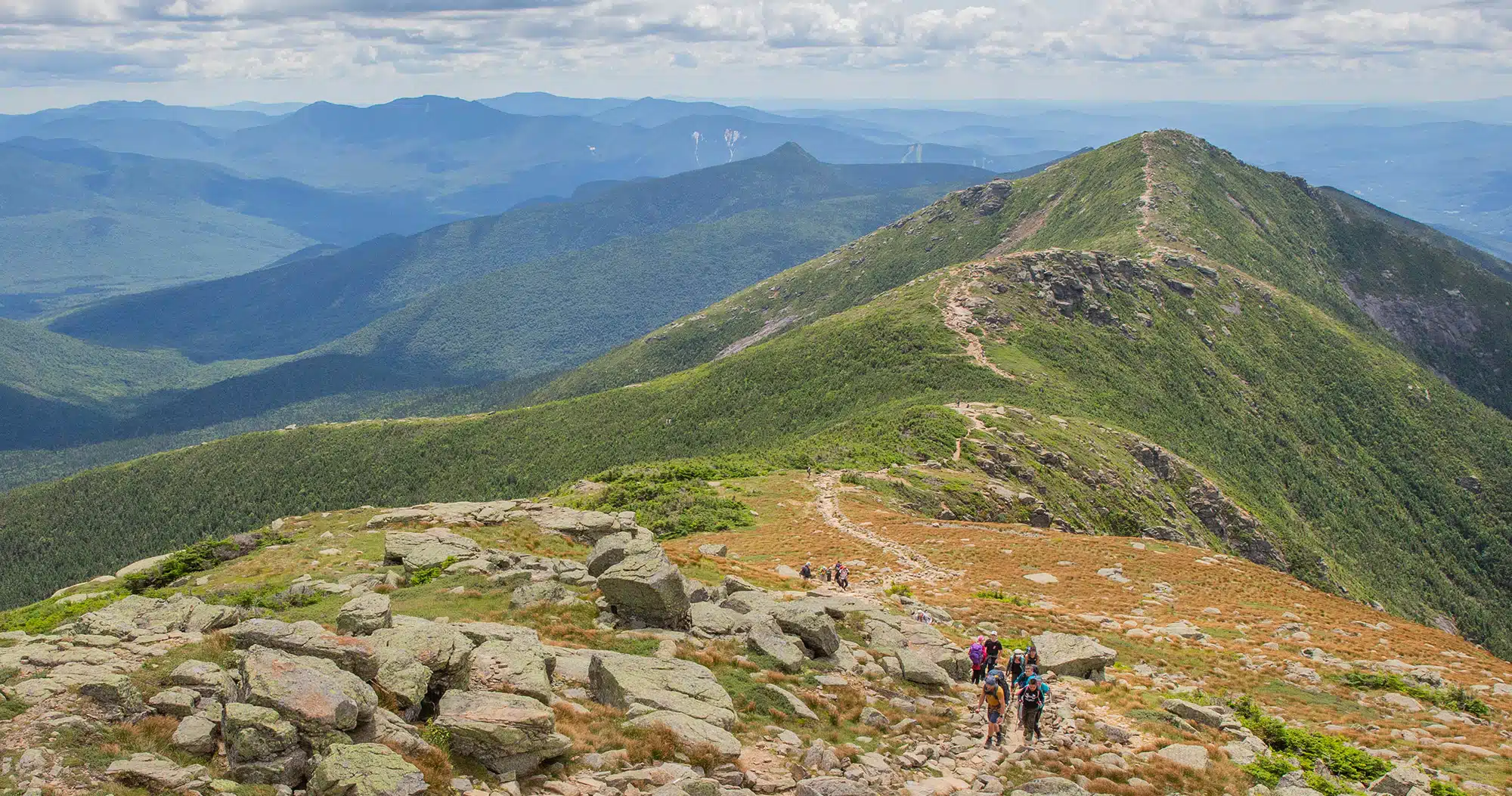
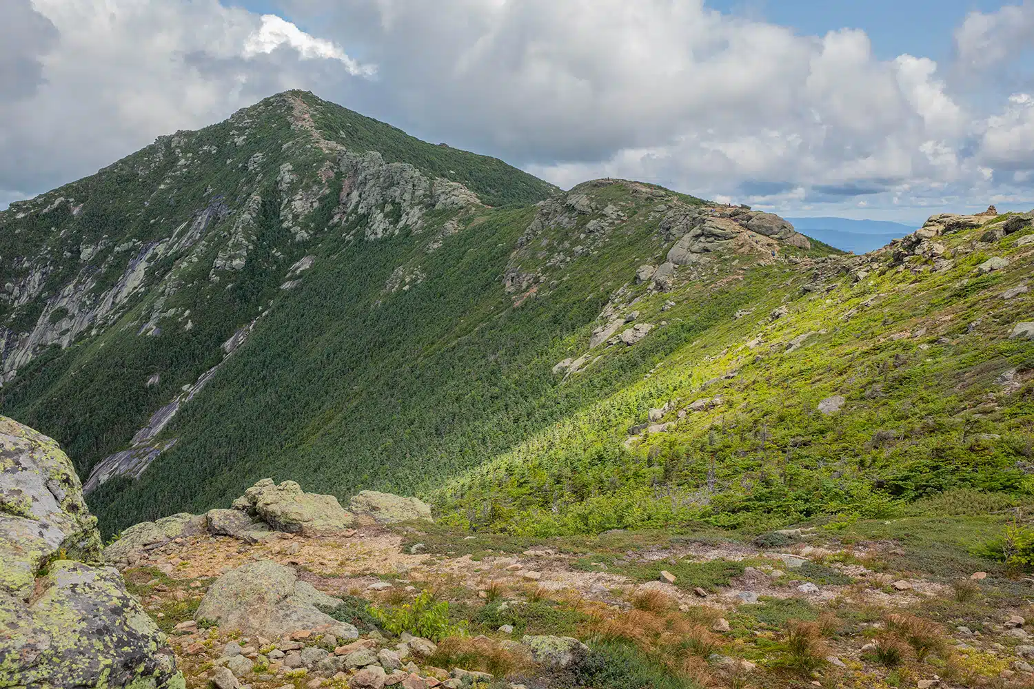
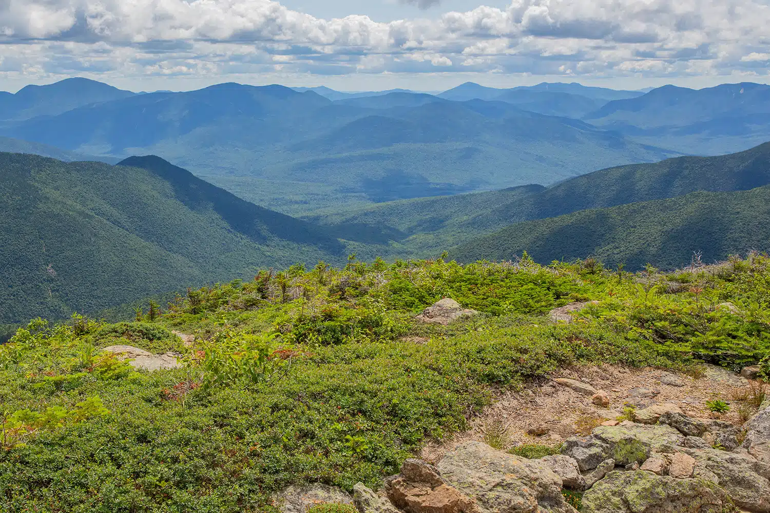
Beyond the summit of Little Haystack, hikers progress along the Franconia Ridge Trail. This trail consistently stays above the tree line, guiding hikers to the summits of both Mt. Lincoln and Mt. Lafayette. Personally, the ridge hike stood out as my favorite section. It presents an opportunity to relish stunning vistas of the wooded peaks that stretch across the landscape.
The Franconia Ridge Trail is also the easiest section of the hike, as the trail winds up and down at a relatively gradual slope. The ridge is cold and windy, even in the summer months, so I recommend you bring a warm jacket for this section of the hike.
Trail to the peak of Mt. Lincoln
Hiking to the peak of Mt. Lincoln
Hiking to the peak of Mt. Lafayette
Green Leaf Trail & Old Bridle Path
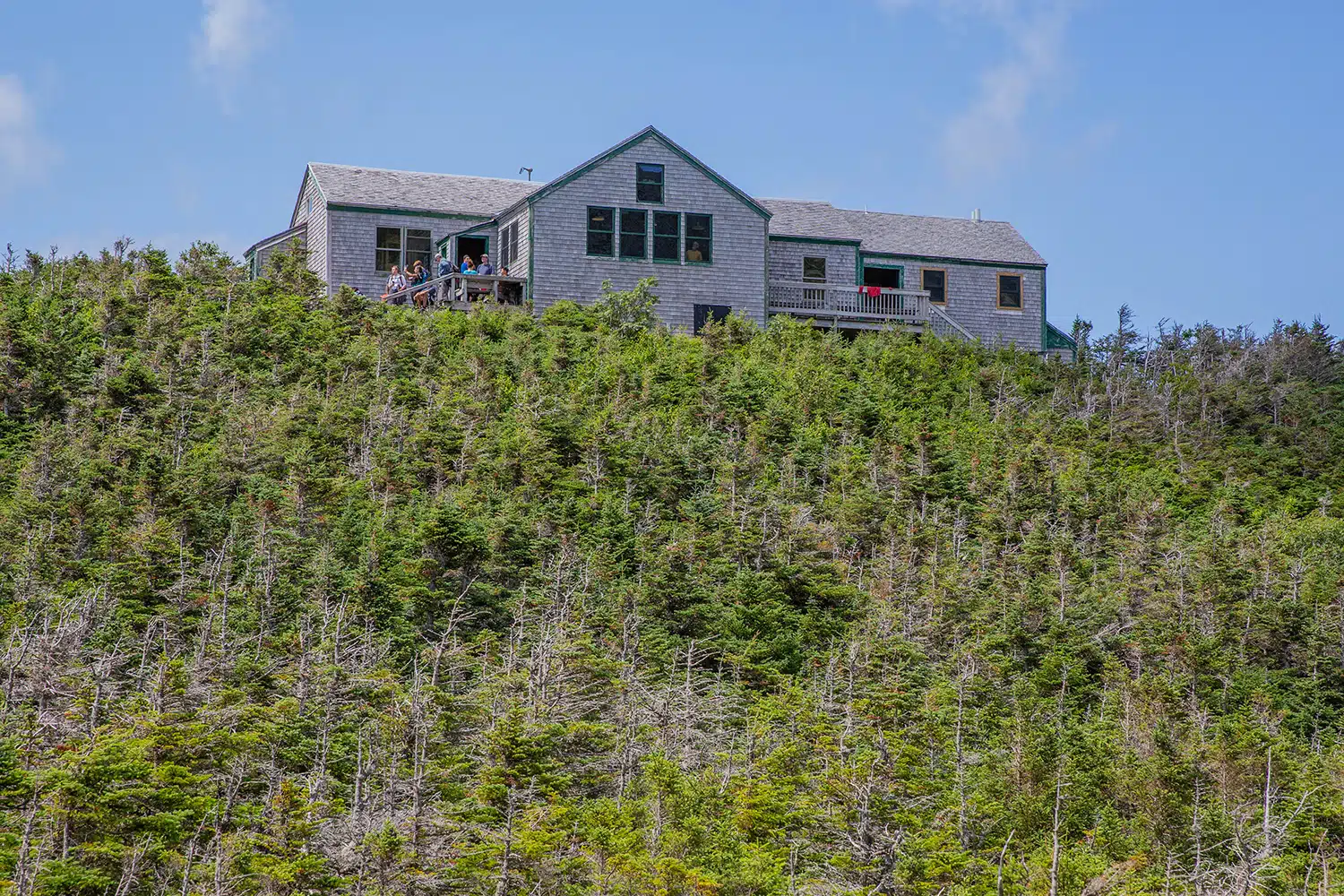
After reaching Mt. Lafayette hikers begin the descent via the Green Leaf Trail. This downward path is steep and slow-going, necessitating hikers to exercise caution as they maneuver through the rocky terrain.
The Green Leaf Trail ends at the Green Leaf Hut, a mountain cabin that offers snacks, merchandise, and water refills for day hikers.
Green Leaf Hut
At Green Leaf Hut hikers will reach the Old Bridle Path, a 3-mile-long trail that descends to the parking lot. The first mile of descent remains steep, but as the trail continues the path becomes more gradual, allowing hikers to move more quickly. While traversing the Old Bridle Path, you’ll encounter some remarkable vantage points that offer captivating views of Mt. Lincoln and Mt. Lafayette.
Descending down the Old Bridle Path
What to Bring on the Franconia Ridge Loop
Hiking shoes. We recommend wearing hiking shoes for this hike. The trail is rough and uneven in a lot of places and you will occasionally hike on smooth rocks, which can be very slippery. Hiking shoes will give you added traction which will be very helpful on this hike.
Water. Bring at least 2 liters of water per person.
Food. This hike may take anywhere from 6-8 hours. Bring snacks and a packed lunch.
Jacket. The hike along the top of the ridge is chilly and windy, even in the summer months.
Sunscreen, hat, and sunglasses. Along the top of the ridge, the hiking trail is completely exposed to the sun.
Essential Hiking Gear: What Should You Bring on a Day Hike?
If you are new to hiking or are curious about what you should bring on a hike, check out our Hiking Gear Guide. Find out what we carry in our day packs and what we wear on the trails.How Hard is the Franconia Ridge Loop?
We saw people of all ages completing this hike. While it is a difficult and steep trail, it is doable for strong-willed and fit hikers. It is best to have some prior mountaineering experience to know if this trail is possible for you, but you do not need to have an extensive background. The trail is easy to follow and we saw a lot of people on this hike. The trail is also open to pets!
View from the Franconia Ridge Trail
If you have any questions about how to hike the Franconia Ridge Loop, or if you want to share your experience, let us know in the comment section below.
More Information for Your Trip to New England
Best Things To Do in Franconia Notch State Park
Pinterest Facebook Flipboard Within New Hampshire’s White Mountains National Forest lies Franconia Notch State Park. This park sits on one end of the popular Kancamagus Highway and it is near some of New Hampshire’s tallest peaks, making it a prime destination to explore. With forested ridges to climb, gorges to wander, lakes to play in, […]
Top 10 Stops Along the Kancamagus Highway
The Kancamagus Highway is one of New Hampshire’s most scenic drives, as it travels past rolling mountains, lush pine forests, and cascading waterfalls. Along the way are opportunities to complete several short hikes, in addition to quick overlooks to gaze over gorgeous mountain views. This drive is the perfect way to experience the beauty of […]
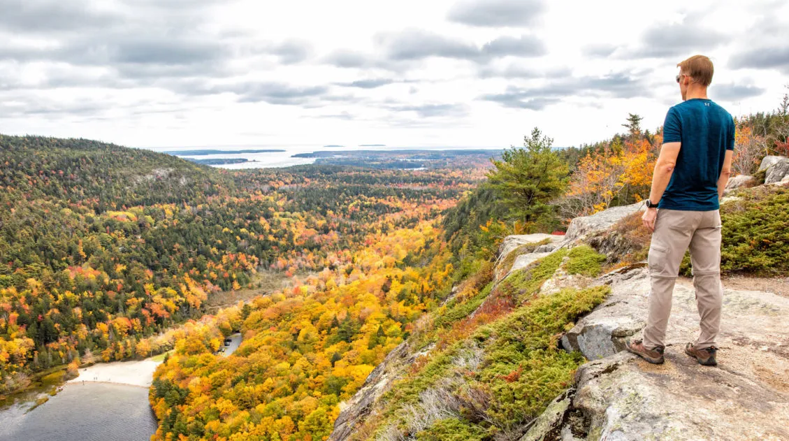
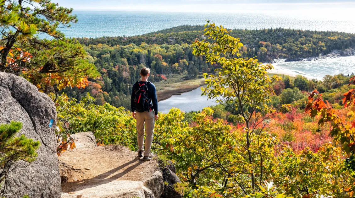
10 Best Hikes in Acadia from Easy Walks to Thrilling Climbs
From easy strolls along coastal paths to summit climbs to thrilling cliff walks, there are a lot of amazing hikes in Acadia National Park. One of the things that makes Acadia so unique, and so exciting, is the large number of trails with ladders and metal rungs. Similar to a via ferrata, you can hike […]

Portland, Maine: Things to Do, Day Trip Ideas, Where to Stay & Eat
Portland, a lively city by Maine’s Casco Bay, features historic red-brick buildings, cobbled streets, and century-old monuments. Along the shore, travelers embark on whale watching cruises, ferry tours, and fishing trips on Maine’s blue seas. The city is brimming with shops, boutiques, cafes, restaurants, and rooftop bars. With a bustling atmosphere and vibrant nightlife, there’s […]
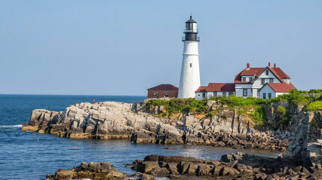
Cape Elizabeth, Maine: Lighthouses, Lobster Rolls & Beaches
Cape Elizabeth’s enchanting coastline offers a captivating blend of natural beauty and historic charm. It is home to the Portland Head Light, the oldest lighthouse in Maine, as well as numerous smaller lighthouses and state parks. Here you can bike along scenic trails, savor fresh lobster rolls, and gaze over serene ocean views. Best Things […]
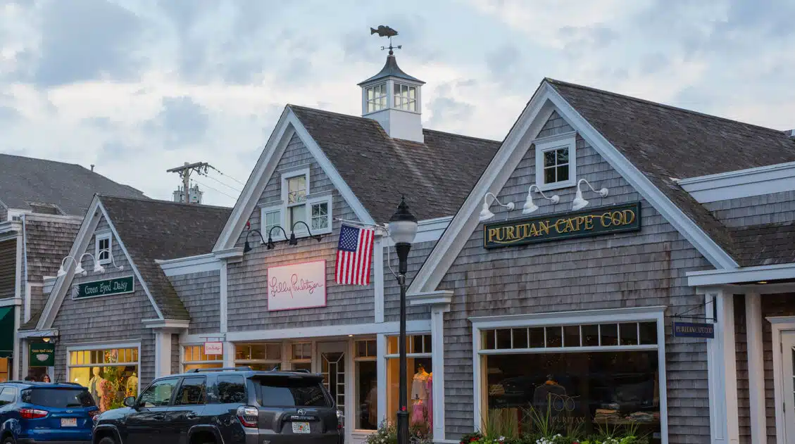
2 Days on Cape Cod: Martha’s Vineyard, Provincetown & Falmouth
There are an overwhelming number of activities, towns, and beaches to visit on Cape Cod. Planning a trip here is difficult, especially when you only have a short amount of time but want to see everything. Here is how we spent two days on Cape Cod with tips to help you have the best experience. […]

Best Things to Do in Camden, Maine
Camden is the perfect place for those seeking the charm of a quintessential New England coastal town. It’s an ideal place to unwind and enjoy the natural beauty of Maine’s Penobscot Bay. Surrounding the small town, you will find plenty of opportunities for hiking, sailing, kayaking, fishing, and harbor cruises. After a day of adventure, […]
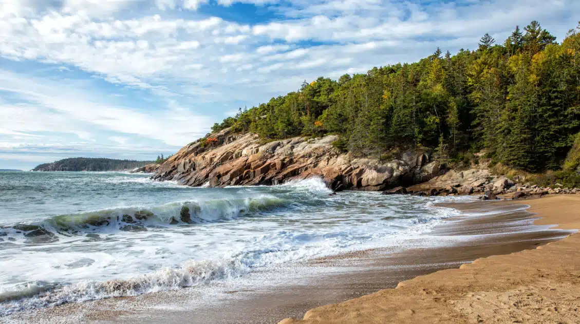
Acadia National Park Travel Guide
Acadia National Park Acadia National Park, also called the “Crown Jewel of the North Atlantic Coast,” protects the rocky coastline in Maine. Granite coastal cliffs, estuary and intertidal habitats, and the tallest mountain on the Atlantic Coast of the United States are found here. This national park is packed with scenic drives, short but thrilling […]
The Beehive Trail Guide: What to Know Before You Hike
The Beehive Trail is one of the most thrilling hikes in Acadia National Park. This trail is a tamer, easier version of the Precipice Trail. It features sections of cliff walks and metal rungs, but with less elevation gain and less exposure, this is a good option if you are not quite sure if you […]
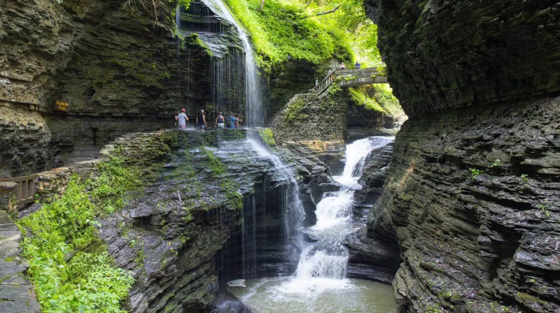
Watkins Glen Gorge Trail in Photos & Tips for Your Visit
Watkins Glen State Park is a breathtaking natural wonder located just outside the town of Watkins Glen in the Finger Lakes region of New York. The highlight of the park is the Watkins Glen Gorge Trail, a stunning path leading through the heart of the gorge, passing 19 waterfalls and climbing over 800 stone steps. […]
US National Park Itineraries & Road Trip Ideas
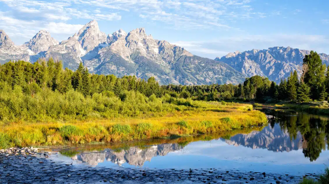
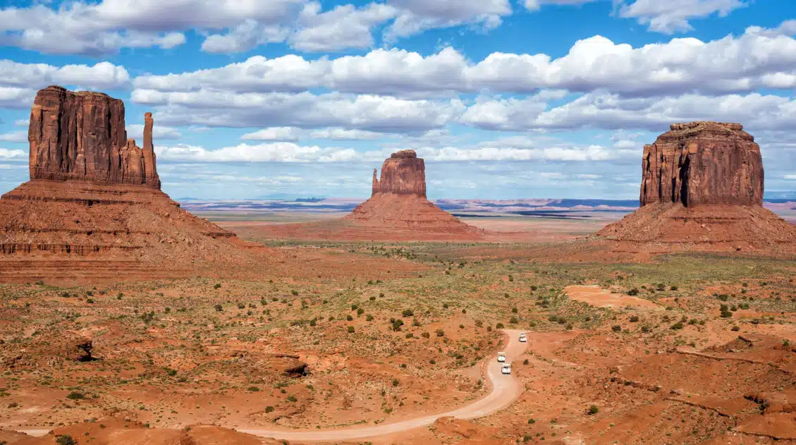
National Park Itineraries The national parks are best experienced as a road trip and with 56 parks visited between us, we’ve done a lot of them. Whether you’re dreaming of a two-week American Southwest loop, a classic Yellowstone and Grand Teton combo, or a deep dive into Utah’s Mighty 5, we’ve put together detailed itineraries […]
United States Travel Guide: Places to Visit in the USA
Plan your visit to the United States. Learn about the best things to do, how to plan your time, road trip ideas, and sample itineraries.
New Hampshire Travel Guide
Plan your visit to New Hampshire. Learn about the best things to do, how to plan your time, where to stay, and more.

Comments 2