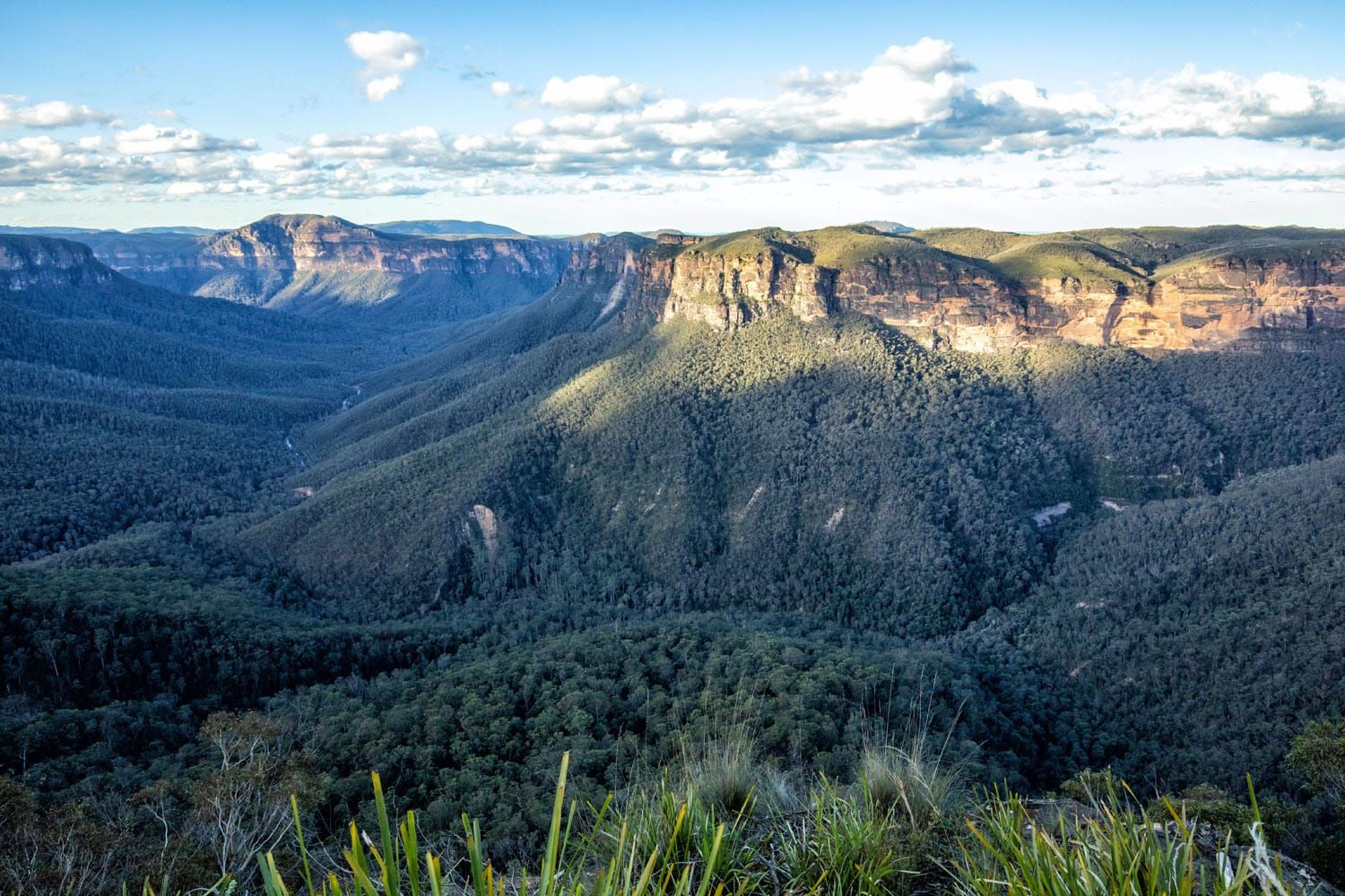
The Grand Canyon Track is a scenic journey that takes you through a diverse landscape, with lush rainforests, a waterfall you can walk behind, rugged rock ledges and dramatic overhangs, and fern-lined creeks with moss covered stepping stones. The trail also takes you to a viewpoint at the top of the canyon walls with a stunning panoramic vista. So, you get a little bit of everything with this hike. No wonder it is one of the Blue Mountains’ most highly rated hikes.
If you are visiting the Blue Mountains, then the Grand Canyon Track is a hike not to be missed. It is more interesting than walking around the canyon floor at Scenic World, a more touristy section of the Blue Mountains.
The Grand Canyon Track is a relatively short hike, clocking in at around 6 km (less than 4 miles). The ascent out of the canyon, assisted by stair steps, can be strenuous. But overall, we rate this as a moderate hike that most people can handle, even kids. If you have knee issues and/or balance issues then carefully consider if this hike is right for you as the trail in and out of the canyon can be steep, and the wet rock surfaces can be slippery.
Trailheads for the Grand Canyon Track
The Grand Canyon Track is located in the Blackheath section of the Blue Mountains, which is about a 15-minute drive from Katoomba or about a 20-minute drive from Scenic World. So, it is located outside the main visitor area of the Blue Mountains.
From Katoomba, take A32 (Great Western Hwy) towards Blackheath and turn right onto Evans Lookout Road. As you travel along Evans Lookout Road you will come to three different parking areas for this hike, in the following order: Neates Glen Parking Area, Grand Canyon Carpark, and Evans Lookout Parking Area. The Evans Lookout Parking Area is located at the very end of Evans Lookout Road.
All three parking areas are considered trailheads for the Grand Canyon Track.
The Grand Canyon Track makes a loop. A portion of the loop consists of the 1.4 km (0.9 mile) section of Evans Lookout Road that connects all three of these parking areas. You must walk along the road between Evans Lookout Parking Area and Neates Glen Parking Area in order to complete the full loop.
Each of the trailheads (parking areas) for the Grand Canyon Track have their own advantage as to why you might start the hike there. The advantages I outline here are based on hiking the loop track in a counterclockwise direction, which I explain the benefits of later in this article.
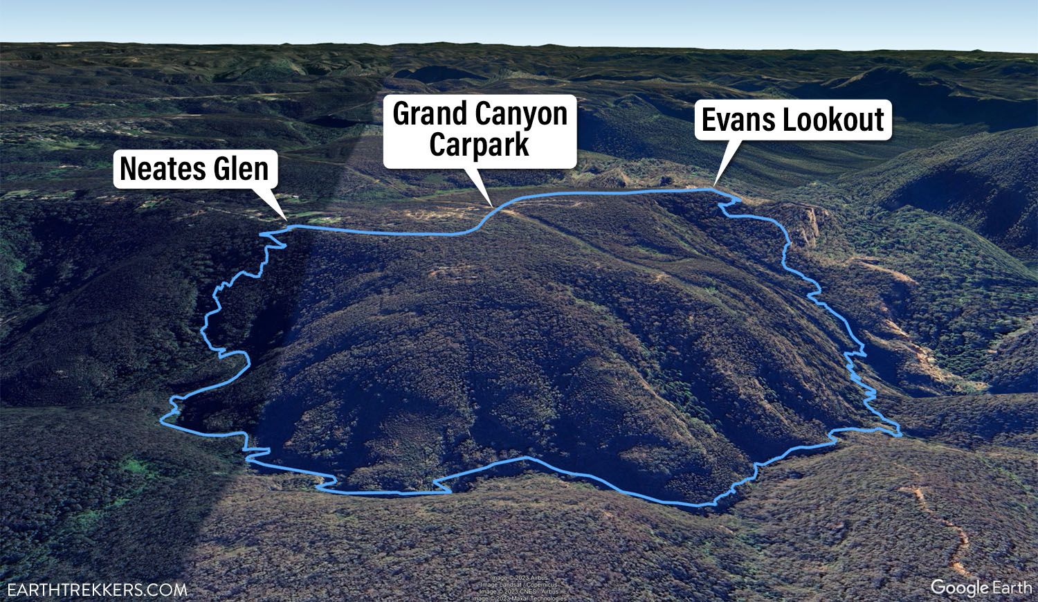
Grand Canyon Track map labeled with the three parking areas.
Neates Glen Parking Area: This is the first parking area you reach as you drive along Evans Lookout Road. If you start the hike here, then you will save the 1.4 km (0.9 mile) relatively flat portion of the trail along the road until the end of the hike. This is the best trailhead to park at if you want to descend down into the canyon and back out as early into the hike as possible, when your legs are fresher. This is also the best trailhead to park at if you start the hike late in the day, so you get in and out of the canyon before you lose sunlight.
Grand Canyon Carpark: This is the second parking area you reach as you drive along Evans Lookout Road. If you start the hike here then you will break up the road portion of the trail into two sections: some at the beginning of the hike and some at the end of the hike. This is the best trailhead to park at in order to split up the boring walk along the road.
Evans Lookout Parking Area: This is the third parking area you reach as you drive along Evans Lookout Road. This parking area is located at the end of the road. This is the best trailhead to park at if you want to enjoy the gorgeous panoramic vista at Evans Lookout twice, once before you start the hike and again at the end of the hike. Plus, you get the boring road portion of the hike over with right away.
Grand Canyon Track Hiking Stats
The following GPS data and the elevation profile are based on starting and ending at Neates Glen Parking Area and hiking the loop in the counterclockwise direction.
Distance: 5.8 km (3.6 miles) Roundtrip (Loop)
Total Ascent: 340 meters (1,115 feet)
Lowest Elevation: 778 meters (2,553 feet)
Highest Elevation: 1,013 meters (3,322 feet)
Difficulty: Moderate
Time: 2 to 3 hours
The National Parks & Wildlife Service recommends 3 to 4 hours to complete the loop. But from what I’ve seen in the reviews for this track, fast hikers complete it in about 2 hours and families stopping to take short breaks take about 3 hours.
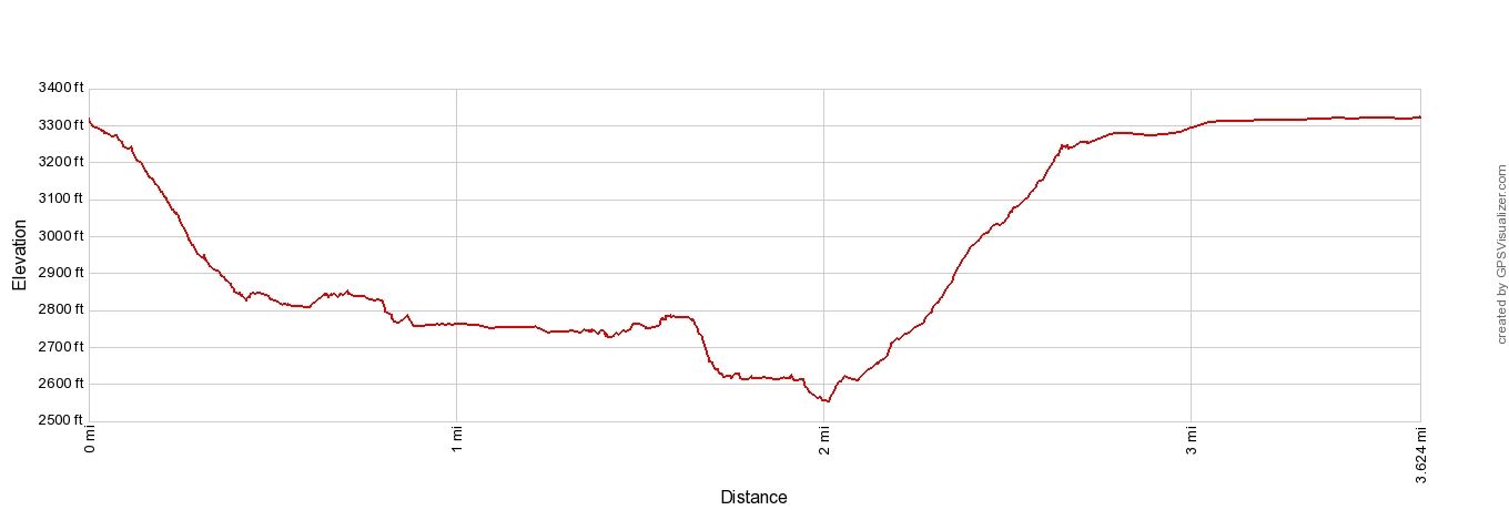
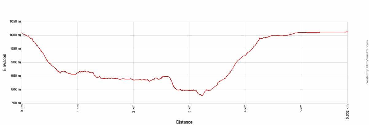
Grand Canyon Track Elevation Profile
Please practice the seven principles of Leave No Trace: plan ahead, stay on the trail, pack out what you bring to the hiking trail, leave areas as you found them, minimize campfire impacts, be considerate of other hikers, and do not approach or feed wildlife.
Clockwise vs. Counterclockwise
Since the Grand Canyon Track is a loop, it can be hiked in the clockwise or counterclockwise direction. I hiked it in the counterclockwise direction and definitely recommend that you hike it in that same direction for several reasons.
There are a lot of stairs on both ends of the canyon portion of the trail. The stair steps on the Neates Glen Parking Area side of the trail are narrower and more closed in, especially through the lush rainforest section. The landscape around the steps on the Evans Lookout side of the trail are more open and conducive for stopping to take breaks. So, I recommend hiking down into the canyon from Neates Glen Parking Area and hiking back up to Evans Lookout.
After putting in the effort to hike up to Evans Lookout, you will be rewarded with a gorgeous vista. You can also find a place to sit here if you want to rest and enjoy the view longer.
In addition, by going in the counterclockwise direction, the views through the canyon will continually get better. You will see beautiful scenery, turn the corner, and see something even more fun and beautiful. This happens again and again as you hike in the counterclockwise direction. The canyon just keeps getting better.
If you descend into the canyon at the Neates Glen Parking Area then you are hiking in the counterclockwise direction, regardless of where you parked.
Grand Canyon Track
Step-By-Step Trail Guide
This trail description has been written by starting and ending at the Neates Glen Parking Area and hiking the Grand Canyon Track loop in the counterclockwise direction.
Trailhead
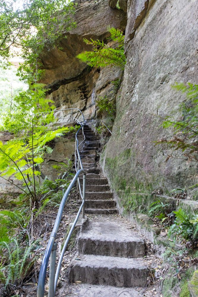
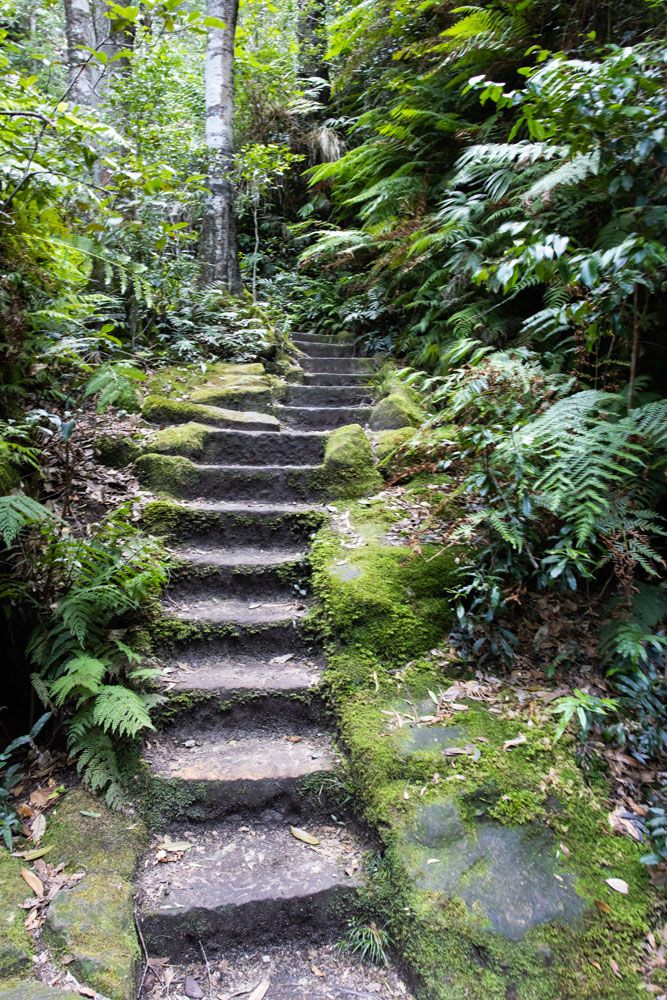
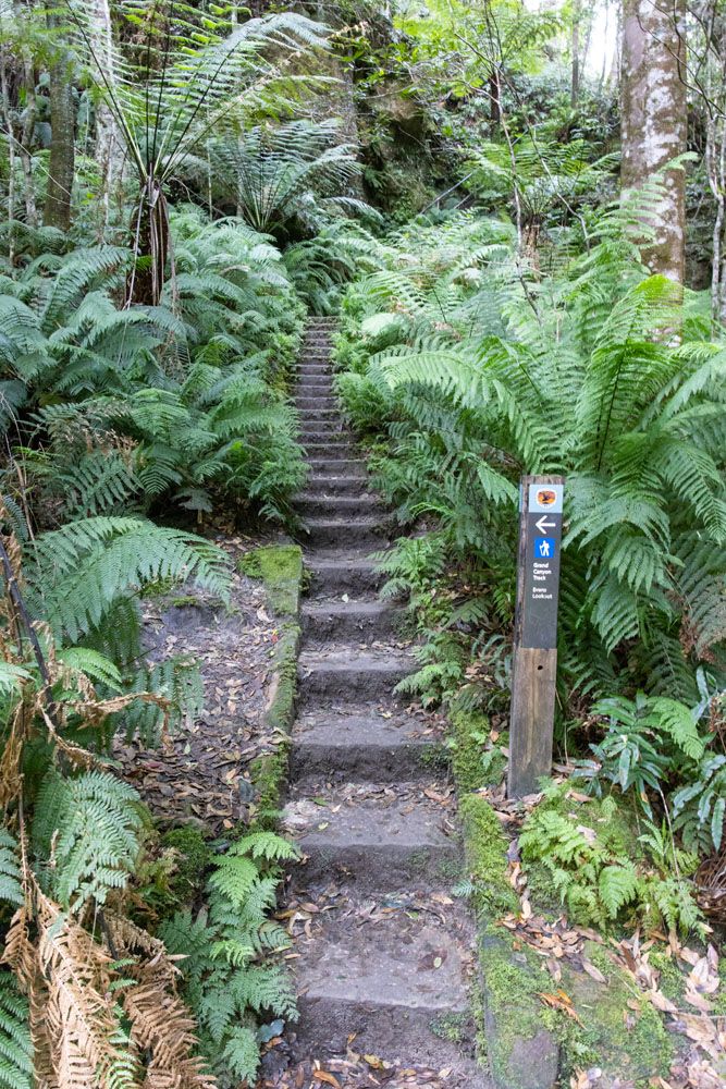
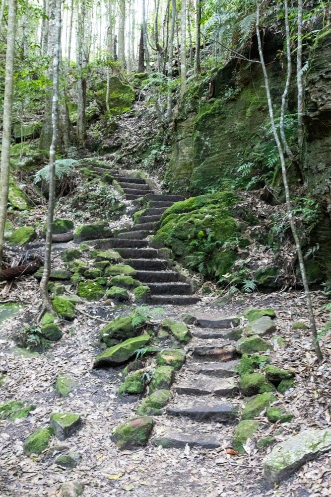
At the Neates Glen Parking Area look for the trailhead sign. You immediately descend steps through a forest which will turn into a lush rainforest as you keep descending. The old stone and mossy steps lined with ferns make you feel like you are hiking down into another world.
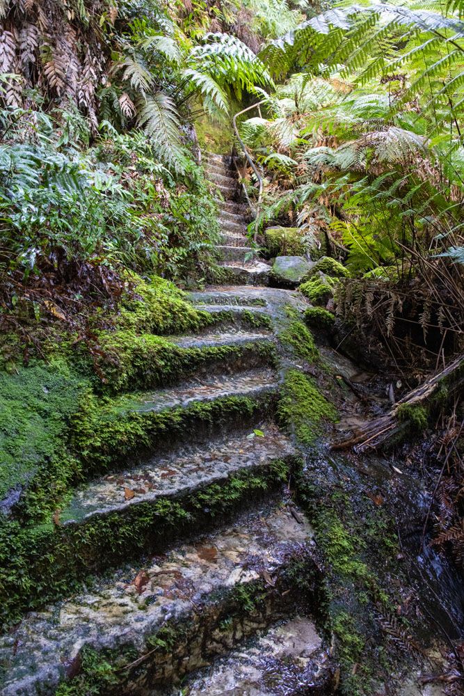
Looking back up a set of stone mossy steps through the lush vegetation
Looking back at the trail that descends into the canyon
Along the Valley Floor
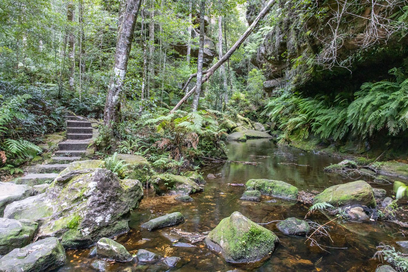
Once you reach the valley floor the trail follows along Greaves Creek and the tall sandstone walls of the canyon remind you of how far you have descended.
Greaves Creek
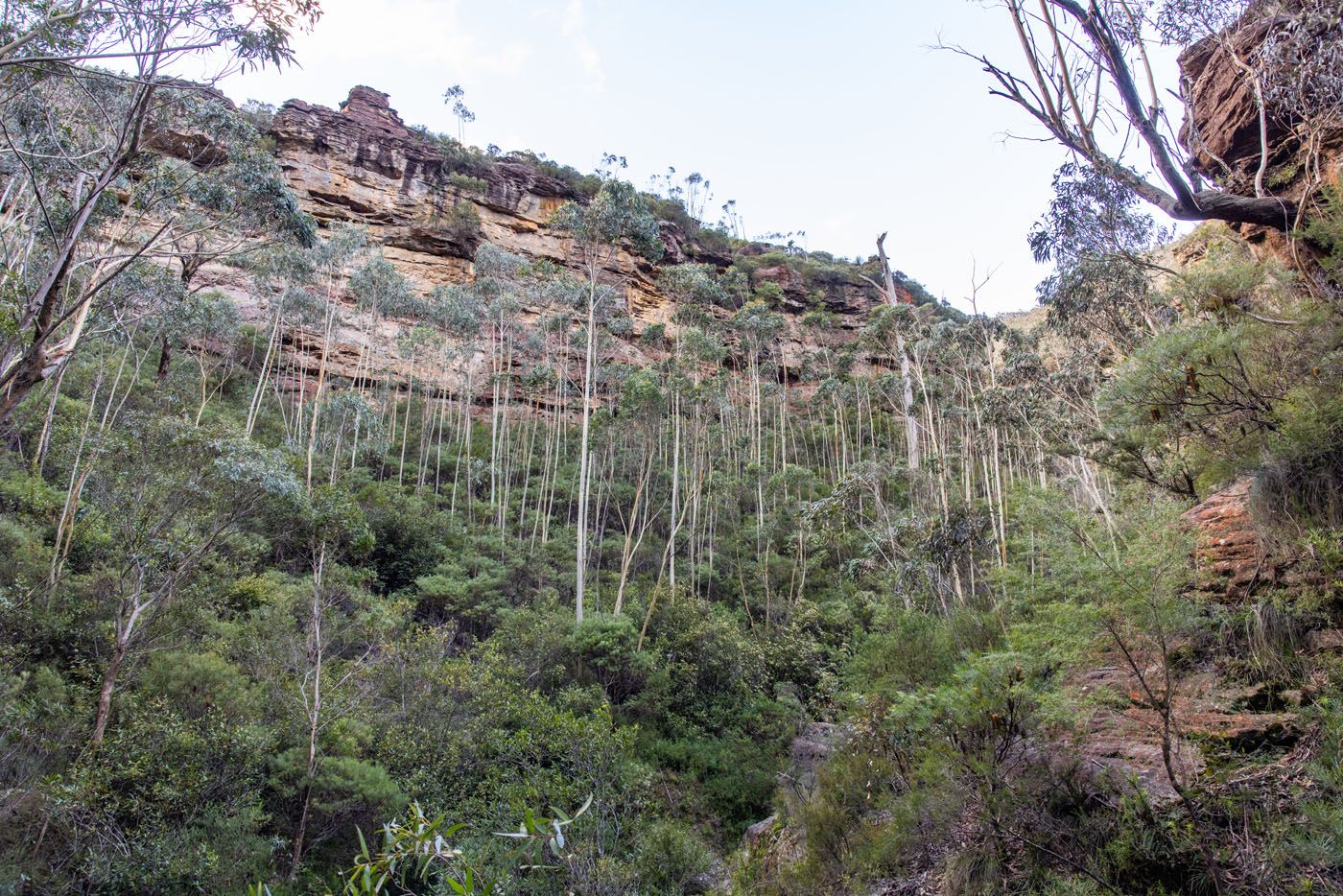
Canyon walls from the canyon floor
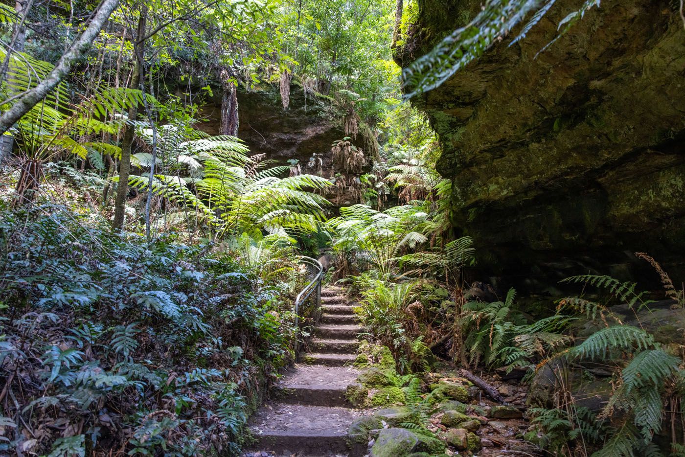
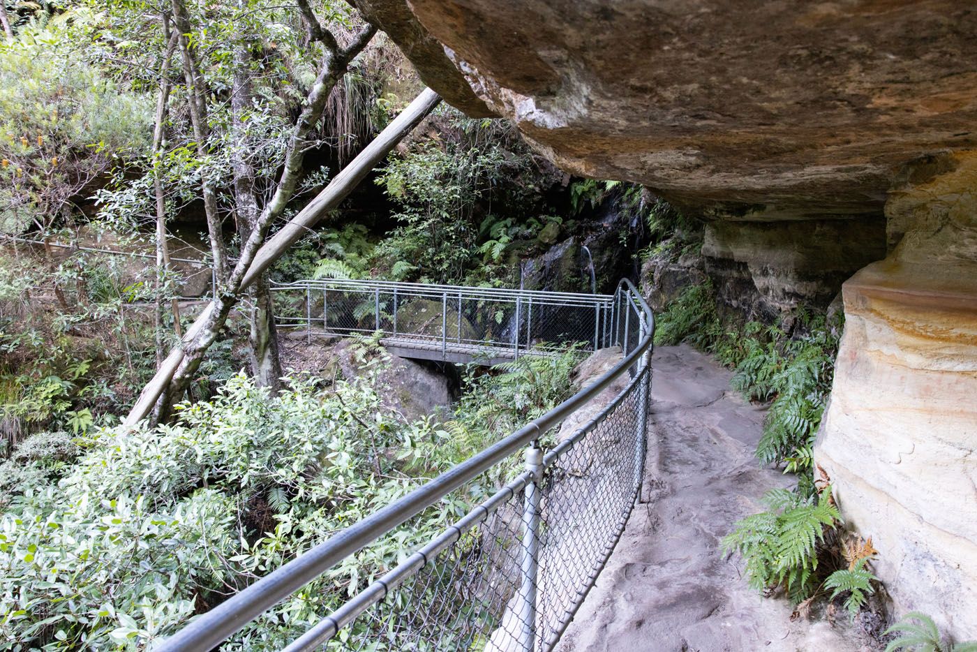
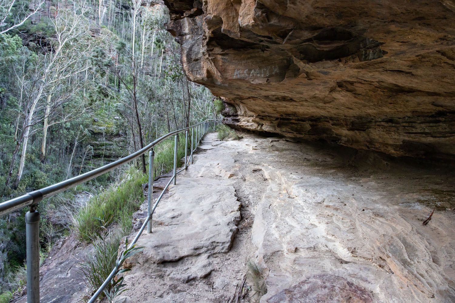
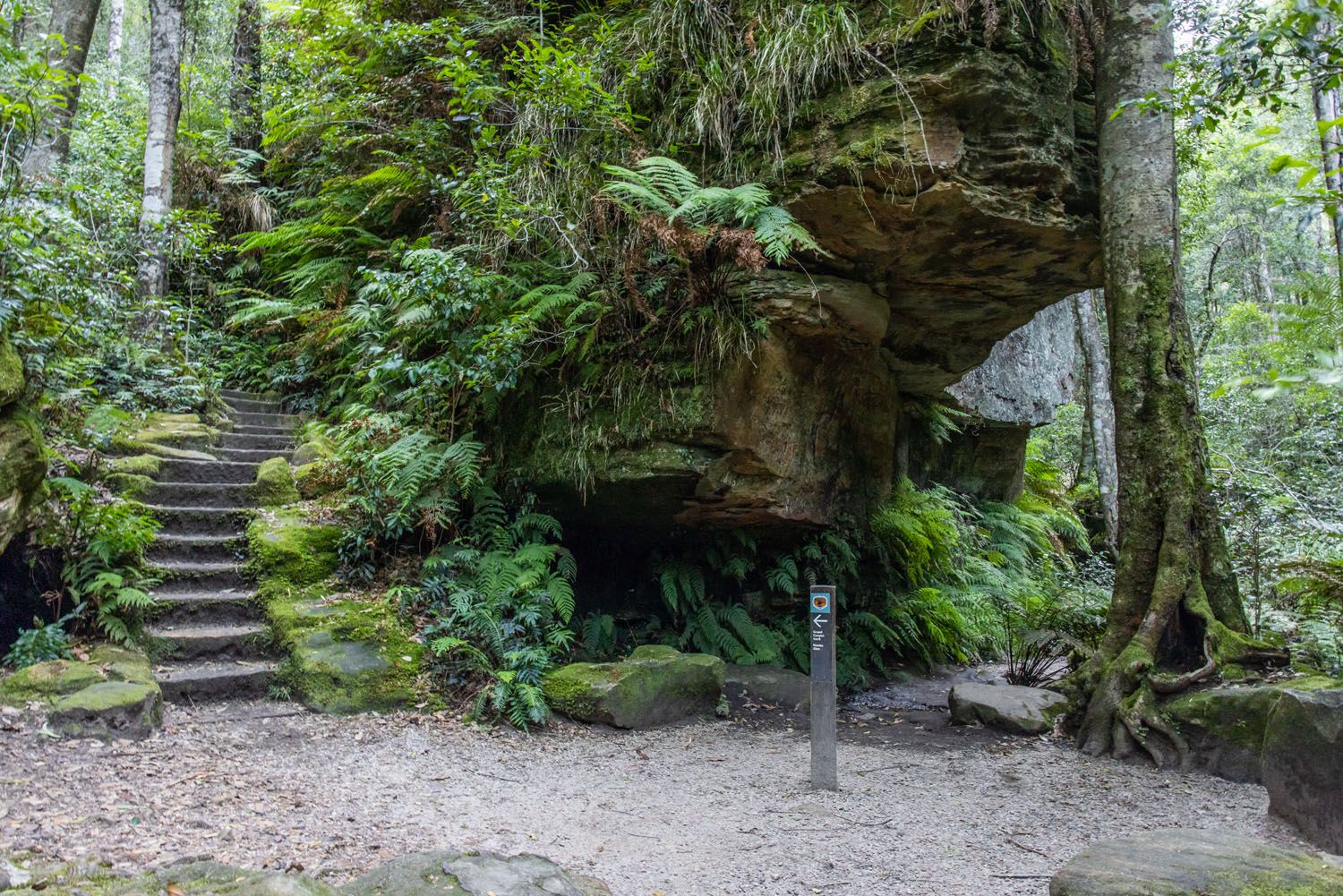
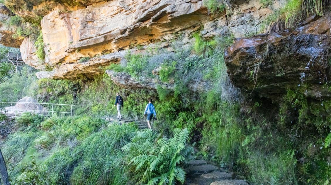
The trail then becomes more interesting as you walk alongside a sandstone wall with overhangs and staircases.
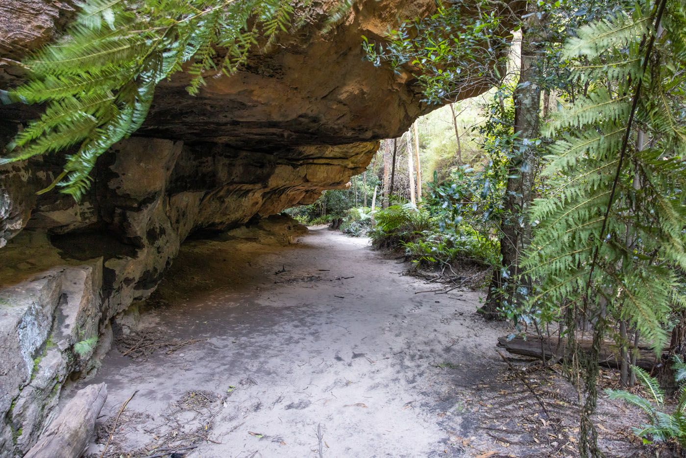
The trail passes under sandstone overhangs
Next, the trail takes you along a rock ledge that passes behind a waterfall.
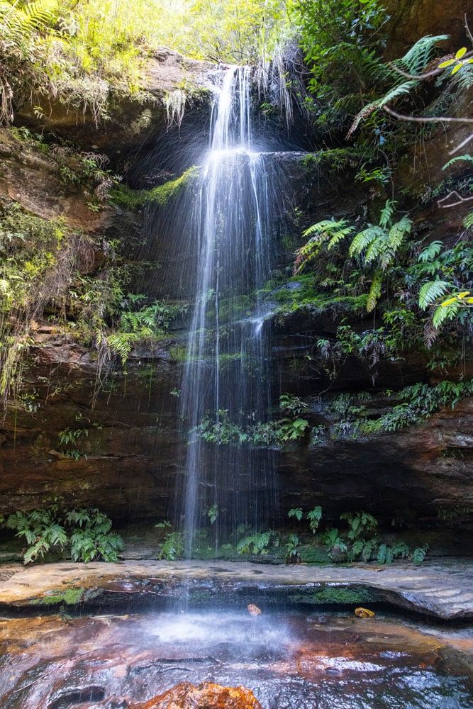
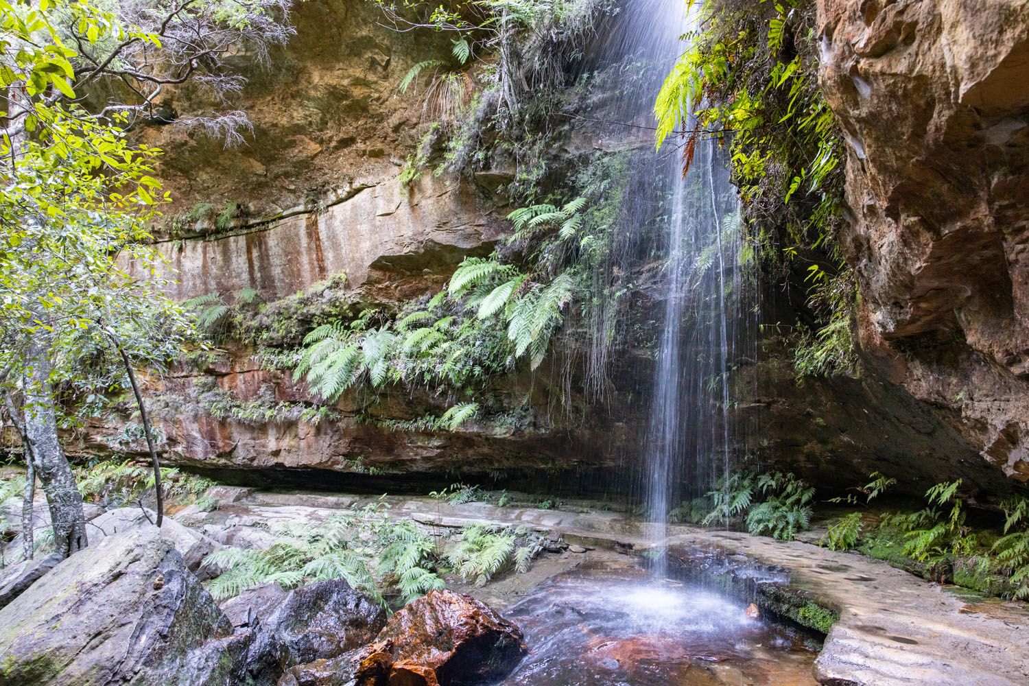
The trail goes behind the waterfall
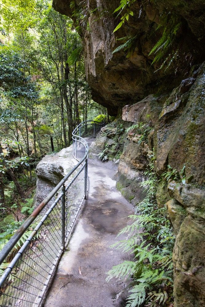
The stone ledges, overhangs, and staircases continue, too many times to highlight each one here. As the stone ledges get narrower and higher off the valley floor, fences are added to keep you on the trail.
The trail then takes you through a lush rainforest section again with ferns and moss lining the trail.
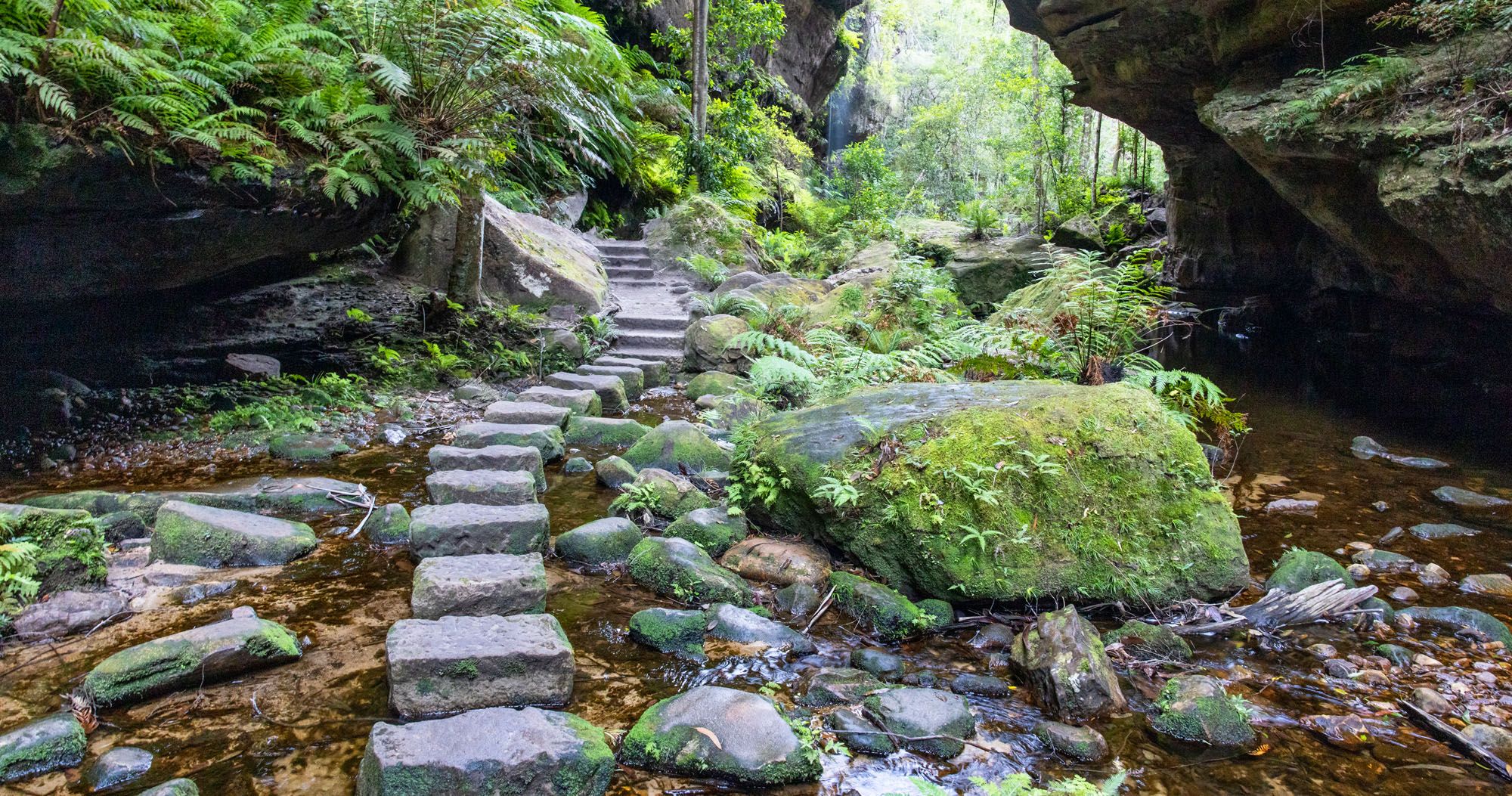
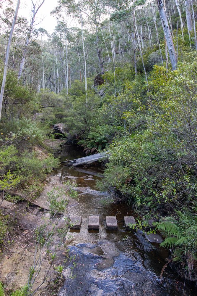
Just when you think the trail can’t get any better you enter the most dramatic section of the hike. Complete with steppingstones across the creek, a mossy landscape with ferns, boulders, and vertical canyon walls towering next to you.
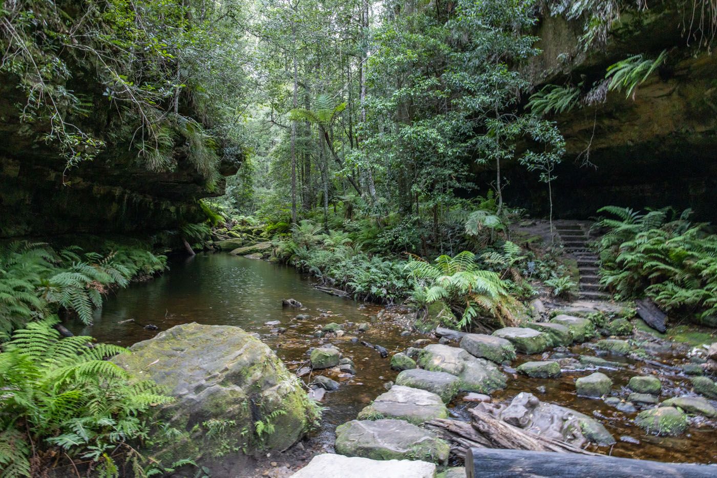
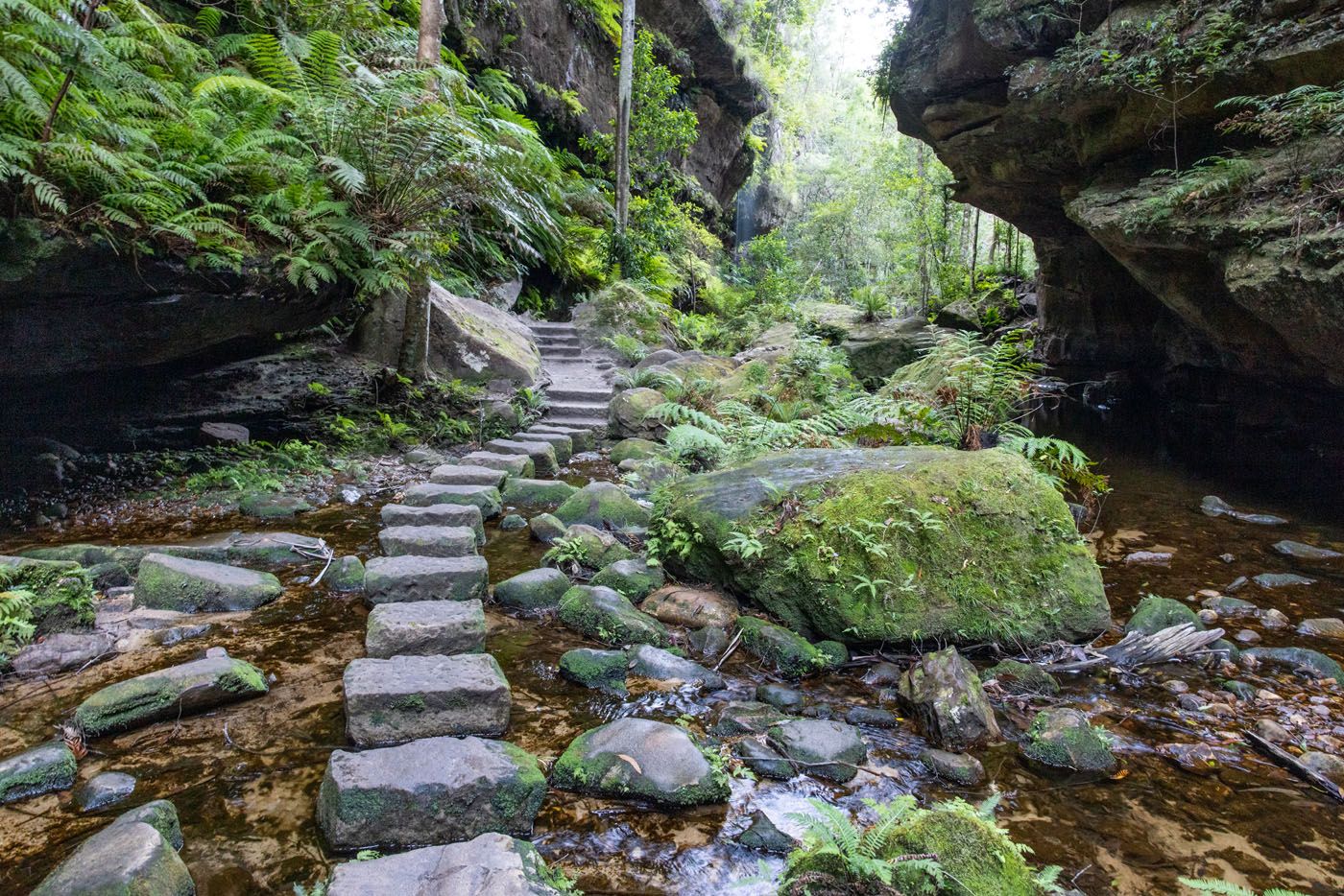
Steppingstones across the creek
The Ascent Out of the Canyon
As you start the ascent out of the canyon you hike through a forest of ferns.
Once you are above the ferns, the rest of the climb up to Evans Lookout isn’t as interesting. The climb up can be challenging but the hike through the canyon makes it worth it.
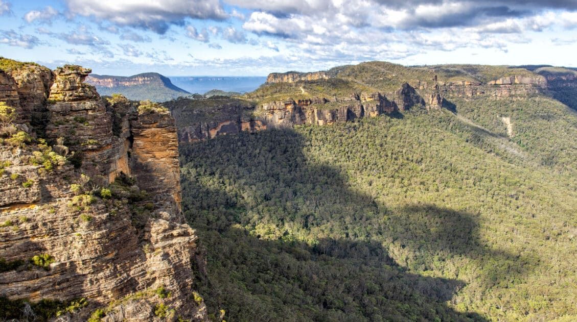
Once you reach the top of the canyon you are rewarded with an incredible panoramic view at Evans Lookout.
Evans Lookout
It is then a 1.4 km (0.9 mile) mostly flat hike along Evans Lookout Road back to the Neates Glen Parking Area.
About My Experience
Under normal circumstances I would have parked at the Evans Lookout Parking Area. I would have parked there so I could enjoy the views and photograph Evans Lookout before and after the hike. But we didn’t get to this hike until late in the day and I was running short on daylight, so I needed to complete the canyon portion of the hike first. That forced me to start at the Neates Glen Parking Area in order to hike in the recommended counterclockwise direction.
Hiking the Grand Canyon Track in the counterclockwise direction is definitely the way to go, as the trail keeps getting better and better as you travel through the canyon. I had heard about how great this trail was, but I didn’t fully know what to expect. And the trail kept surprising me with even more fun and beautiful scenery the further I went through the canyon.
And the wow factor of the Evans Lookout view made any discomfort from the ascent out of the canyon disappear.
Overall, it is a beautifully designed trail that is easy to follow and keeps things interesting by taking you through a variety of landscape features such as: lush vegetation, waterfalls, rock ledges and overhangs, steppingstone creek crossings, and even a wide-open panoramic vista of Grose Valley.
How to Get to the Grand Canyon Track
If you are driving, then parking is available at each of the three trailheads as described above.
If you are relying on public transportation, then take a train to either the Katoomba Station or the Blackheath Station. Check the NSW Transport website for train schedules. You then take Bus 698 to ‘Evans Lookout Rd at James Rd’. Use the Trip Planner found here for schedules and exact bus stop locations as there might be a short walk between the rail station and the bus stop. It is also important to know that the bus may drop you off before reaching James Road and thus increasing your walk down Evans Lookout Road to get to the first trailhead.
Alternatively, consider taking a taxi or Uber from the Katoomba Station or Blackheath Station. Be sure to schedule a pickup location and time with the taxi or Uber driver since you may not have cellular service near the trailheads.
The Blue Mountains Explorer Bus (hop on hop off) does not service this area.
What to Bring
You can end up walking on wet rocky surfaces that can be slippery, so hiking shoes with a good grip are recommended. Waterproof hiking shoes would be even better in case it rains or has recently rained as the trail can develop puddles and get muddy in spots.
I also recommend dressing in layers as the hike up and out of the canyon will likely make you sweat.
Be sure to bring food and water. You can level up your experience by enjoying a picnic lunch or snack in a scenic spot along the canyon floor.
And don’t forget sunscreen and your sunglasses.

Essential Hiking Gear: What Should You Bring on a Day Hike?
If you are new to hiking or are curious about what you should bring on a hike, check out our Hiking Gear Guide. Find out what we carry in our day packs and what we wear on the trails.Frequently Asked Questions
Where is the Grand Canyon Track located?
The Grand Canyon Track is located in the Blackheath section of the Blue Mountains in New South Wales, Australia.
How to get to the Grand Canyon Track?
If you are driving then there are three parking areas (trailheads) located along Evans Lookout Road. If you are relying on public transportation then take a train to Katoomba Station or Blackheath Station and then bus 698 as far as it will go down Evans Lookout Road. Check train and bus schedules on the NSW Transit website.
Is hiking the Grand Canyon Track worth it?
Yes! The Grand Canyon Track is one of the most highly rated hikes in the Blue Mountains. It takes you through varying scenery including lush vegetation, waterfalls, rock ledges and overhangs, steppingstone creek crossings, and even a wide-open panoramic vista of Grose Valley.
When is the best time to hike the Grand Canyon Track?
The Grand Canyon Track is open all year but it is best enjoyed during the summer months.
Can I hike the Grand Canyon Track with a dog?
Pets, including dogs, are not permitted on the Grand Canyon Track unless they are a certified assistance animal.
If you have any questions about hiking the Grand Canyon Track, or if you want to share your experience, you can do so in the comment section below.
More Information for Your Trip to Australia
22 Amazing Things to Do in the Blue Mountains, Australia
Pinterest Facebook Flipboard With sandstone cliffs, hiking trails that lead to towering waterfalls and viewpoints, cable car and gondola rides, and views of unique rock formations, the Blue Mountains are a joy to explore. In this guide, learn about the best things to do in the Blue Mountains with tips to help you plan your […]
One Day in the Blue Mountains: Day Trip from Sydney
One day in the Blue Mountains is just enough time to soak up the views, hike a short trail or two, and ride the railway and cable cars and Scenic World. The Blue Mountains sit to the west of Sydney, Australia. To get here, you can take the train or drive here, if you have […]
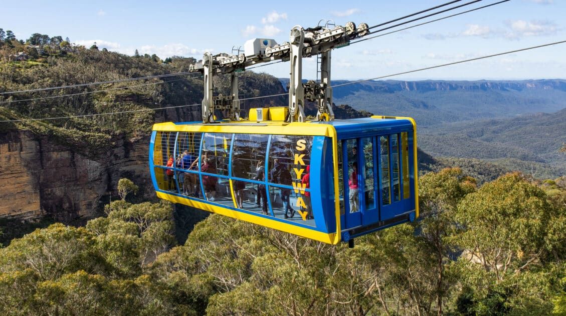
Scenic World, Blue Mountains: Plan Your Visit, Photos, & Tips
Scenic World is one of the best places to visit in the Blue Mountains. At this one spot, you can ride the world’s steepest railway, stand on the roof of the Skyway, ride on the Southern Hemisphere’s steepest cable car, and walk on boardwalk trails through the rainforest. For those who plan to explore the […]
Wentworth Falls Track Loop Hike | Blue Mountains, Australia
Walking the Wentworth Falls Track for views of Wentworth Falls is one of the best things to do in the Blue Mountains. This short walk takes you to several viewpoints of the waterfall. For those who want to go farther, you can turn this walk into a very rewarding loop. In this guide, we lay […]

Australia Travel Guide: How to Plan a Trip to Australia
Australia Travel Guide Australia, the land down under, beckons with its breathtaking beauty and unparalleled adventures. This is a country that has it all, with awe-inspiring wonders like the Great Barrier Reef and the uncharted lands of the Outback. Encounter wildlife that cannot be found anywhere else in the world on Australia’s islands and sanctuaries. […]

4 Day Sydney Itinerary: Highlights & Hidden Gems
With 4 days in Sydney, not only will you be able to visit the main highlights, but you will also have time to explore a few hidden gems at a relaxed pace. Sydney Harbour, the Taronga Zoo, the Sydney Opera House, the shops at the Strand and the Queen Victoria Building, Watsons Bay, and the […]
10 Stunning Beaches in Sydney (+ Map & Photos)
Sydney is home to some of the most beautiful beaches in the world. Boasting over 100 beaches in and around the city, Sydney is unmatched globally as one of the best cities in the world when it comes to seaside escapes. With long, white stretches of sand, crystal clear aquamarine water, and a steady sea […]
5 Day Cairns Itinerary: Great Barrier Reef & Beyond
Cairns, Australia is the gateway to the Great Barrier Reef and Daintree National Park. You can also add on visits to Fitzroy Island, the Aboriginal town of Kuranda, the Green Island, and even go skydiving. In this guide, we lay out a sample 5 day Cairns itinerary, with suggestions to shorten or lengthen it, depending […]
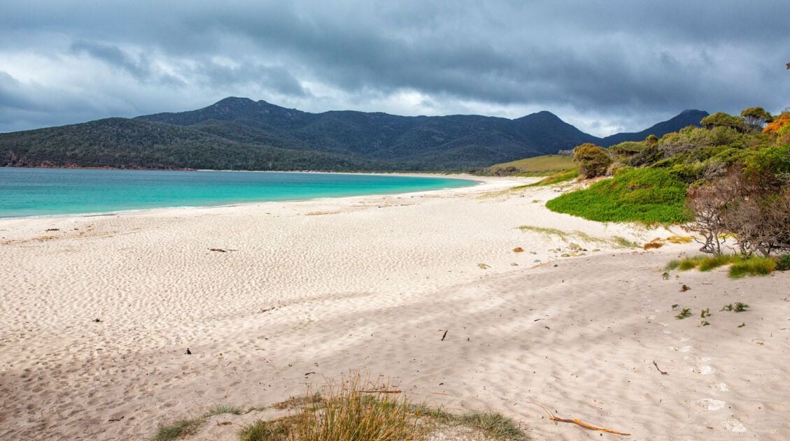
How to Hike the Wineglass Bay and Hazards Beach Circuit | Tasmania, Australia
In Norway and Italy we were hikers. In Nepal we were trekkers. In New Zealand we were trampers. Once we visited Australia and successfully hiked the Wineglass Bay Circuit, we can call ourselves bushwalkers. We had a week to spend in Tasmania, and like always, we were on the lookout for some of the best […]
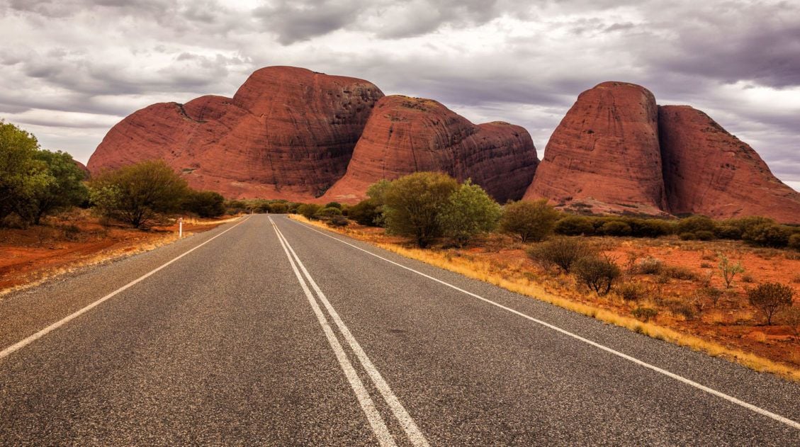
Plan the Perfect Visit to Uluru-Kata Tjuta
For most people, a trip to Australia just would not be complete without a visit to Uluru (aka Ayers Rock). There are a lot of must-have experiences in Australia…Sydney Harbour, the Great Barrier Reef, and seeing those crazy kangaroos, but Uluru also makes it high on the list. There is a lot more to do […]

Comments 4