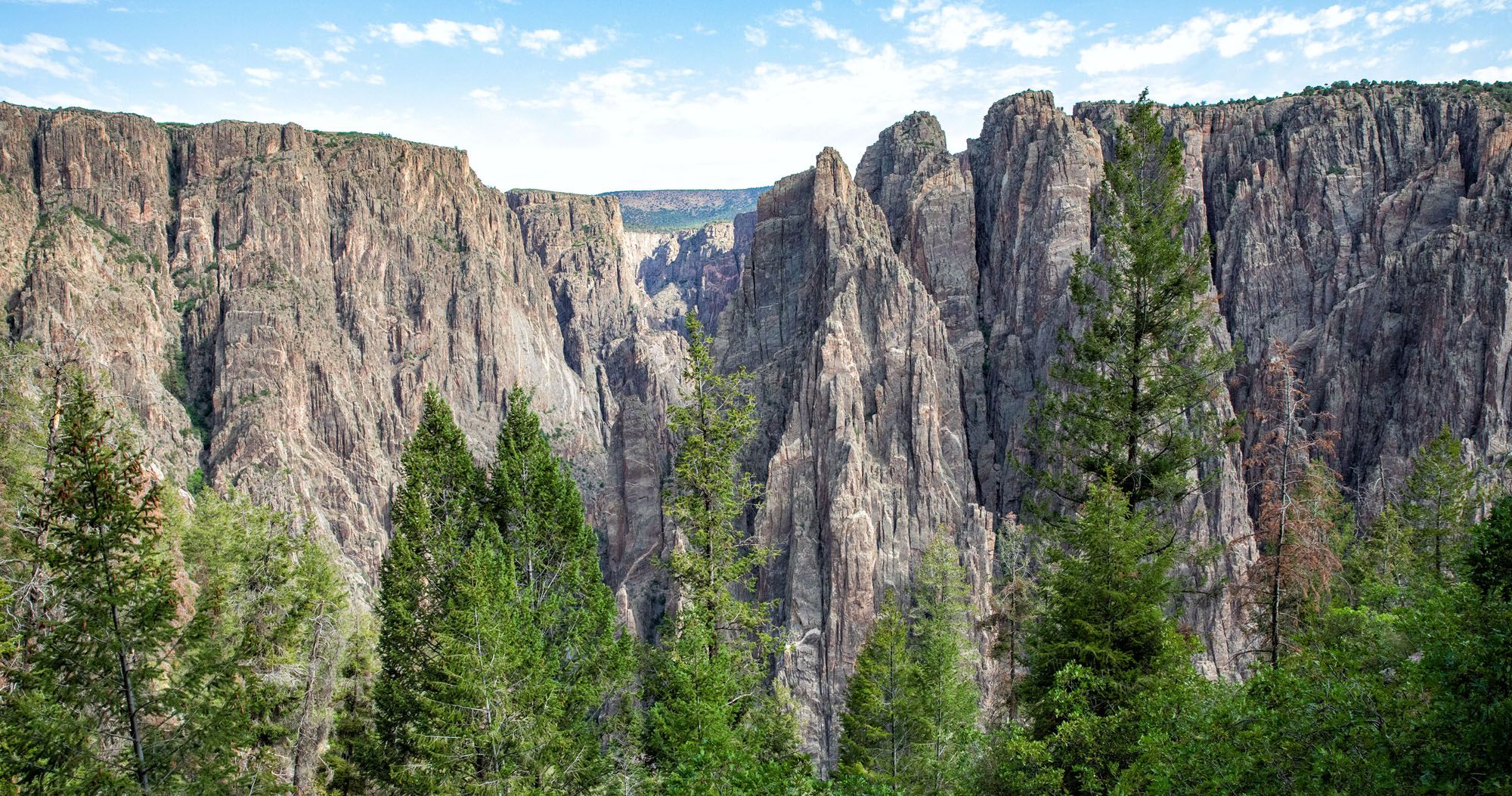
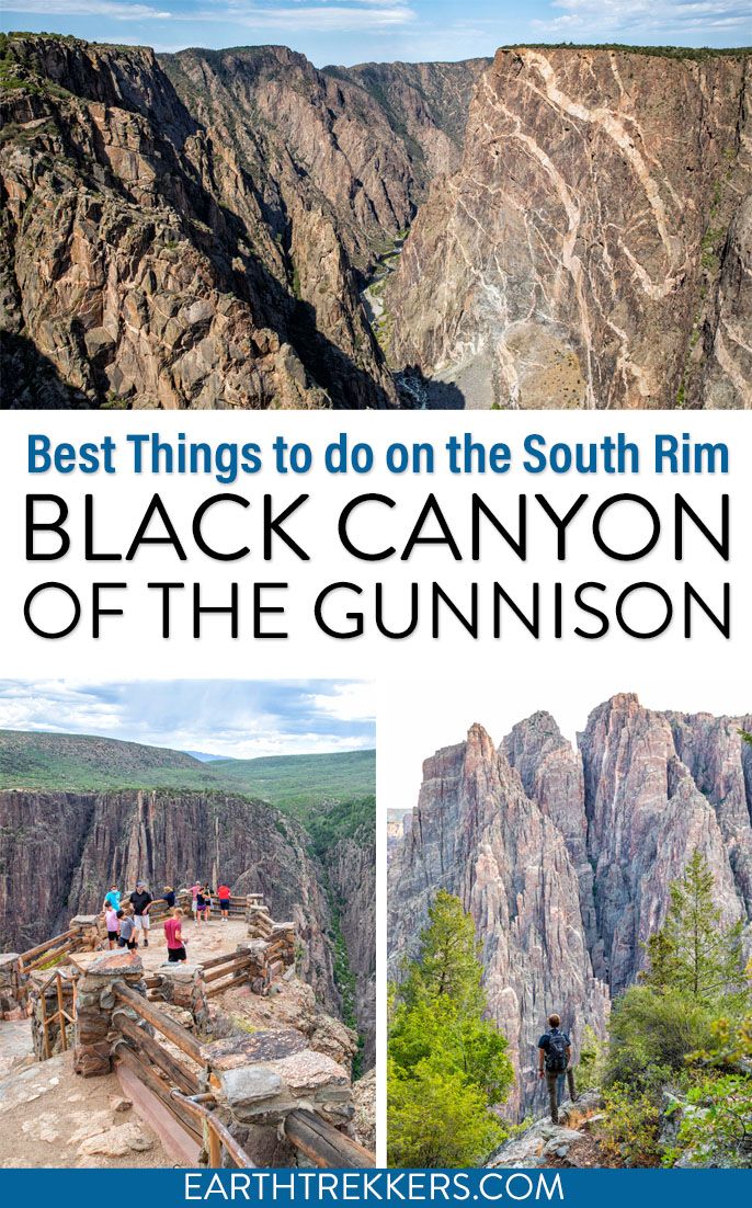
The Black Canyon of the Gunnison is a highly underrated national park. In some ways, it’s a smaller, less crowded version of the Grand Canyon. You can enjoy the views along both rims, hike the rim trails, or go on a real adventure by hiking below the rim.
You can explore both the North and the South rims of the Black Canyon of the Gunnison. To do this, you need about two full days. Sure, the distance between the two rims is small (only about 1,100 feet in the narrowest section), but it takes two and a half hours to drive from the South Rim to the North Rim. And both are worth it.
In this post, we cover the best things to do on the South Rim of Black Canyon of the Gunnison.
Update September 2025: The park is recovering from a wildfire on the South Rim which occurred in July 2025. As of September 2025, the South Rim has reopened, although some buildings, roads, and hiking trails remain closed. Get updates on the National Park Service website.
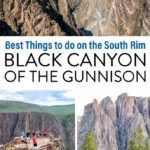
Things to Do on the South Rim of Black Canyon of the Gunnison
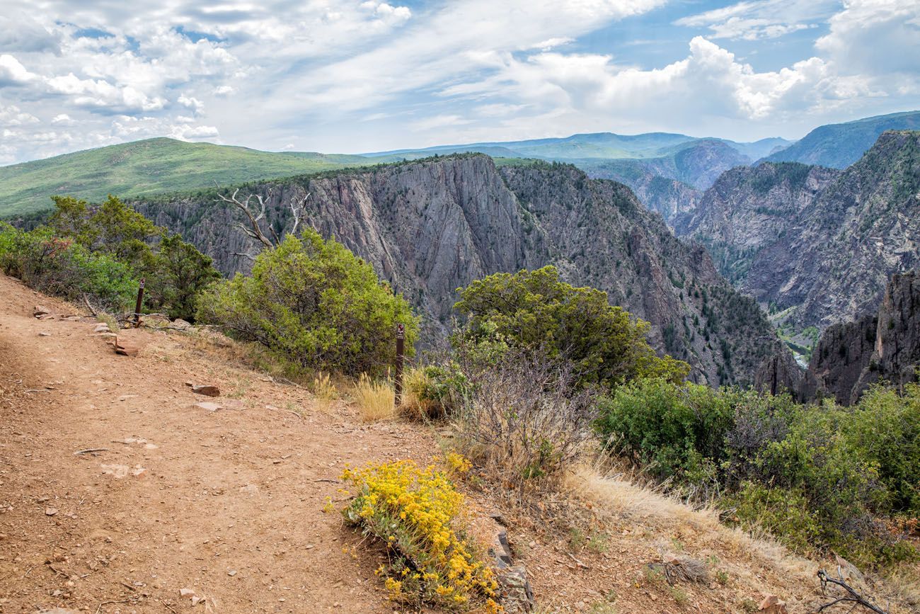
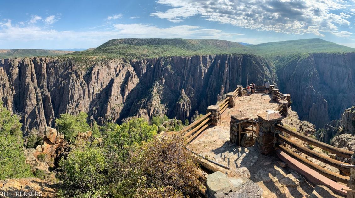
1. Drive South Rim Road
Without a doubt, this is the best thing to do on the South Rim of Black Canyon of the Gunnison. Along this relatively short drive, you are treated to spectacular views of the canyon.
This road is 7 miles long and has 12 viewpoints. The scenic drive starts at Tomichi Point, just before you reach the visitor center, and ends at High Point. Some viewpoints are quick. You’ll walk just a few steps to the overlook. Other overlooks can sit a 1/3 of a mile from the road, so you will do a little walking.
Twelve overlooks are a lot to visit and they can get repetitive. Below, we list our six favorite viewpoints. If you want to see the view from each of the overlooks, and get more details about the drive, read our Guide to the South Rim Road.
Complete Guide to South Rim Drive Road, Black Canyon of the Gunnison
Best viewpoints along South Rim Drive and exactly how much walking you will do to each overlook.Gunnison Point
This is one of the best overlooks in Black Canyon of the Gunnison. It is located right next to the Visitor Center. It’s a short, downhill walk to the viewpoint and the view is incredible. From here, you get panoramic views of the canyon and can peer into the far depths of the canyon.
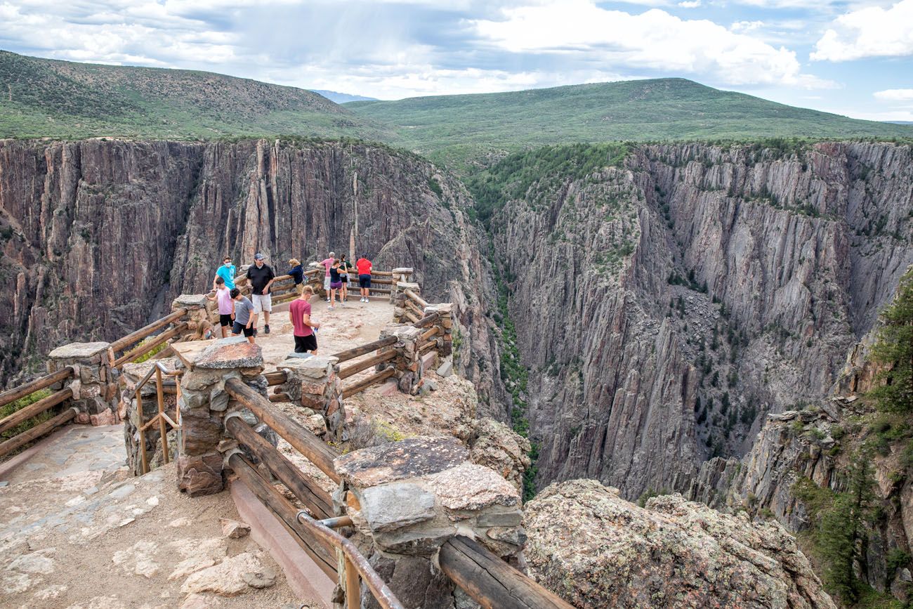
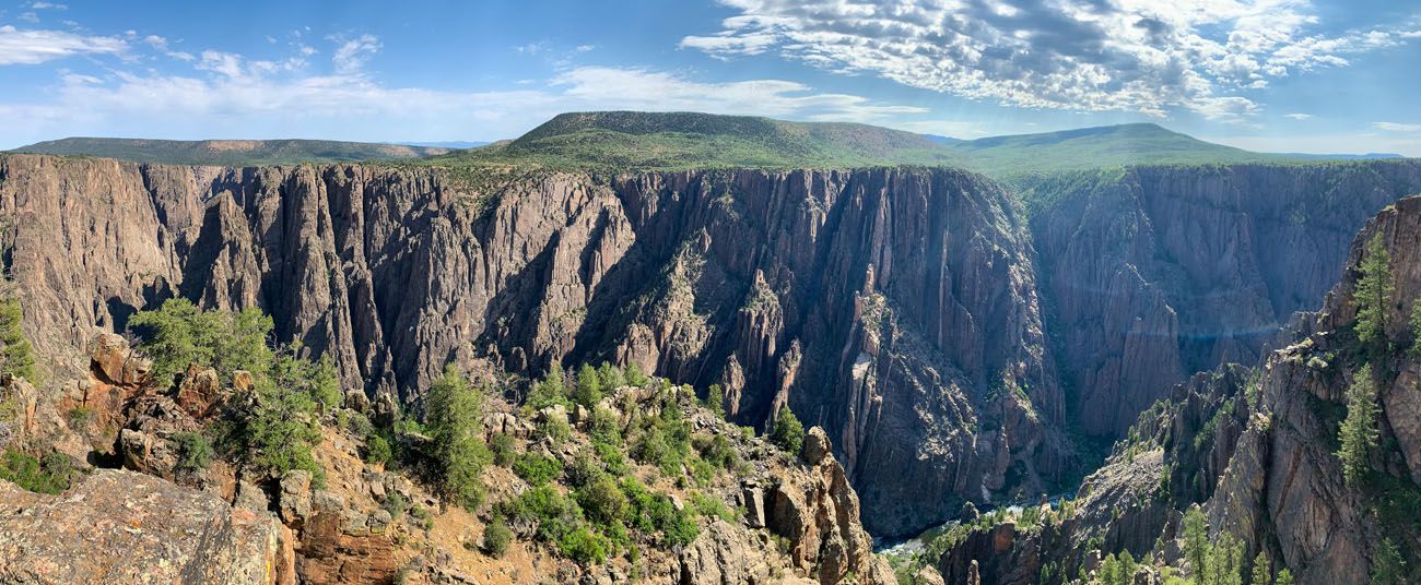
Panoramic view from Gunnison Point
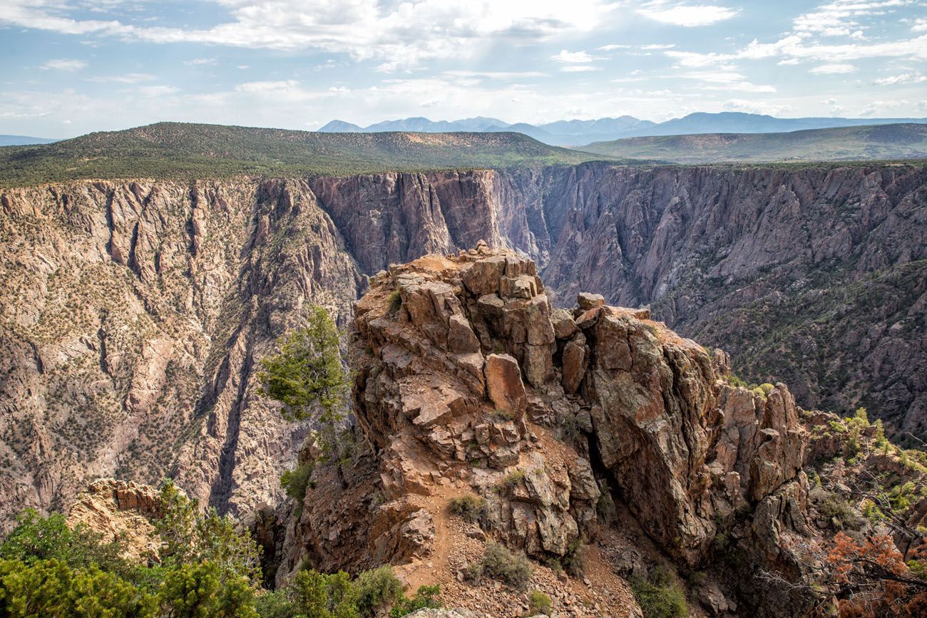
Pulpit Rock Overlook
This is a popular overlook because it gives you a sweeping view of Black Canyon of the Gunnison. From here, you get to appreciate just how narrow and deep this canyon is.
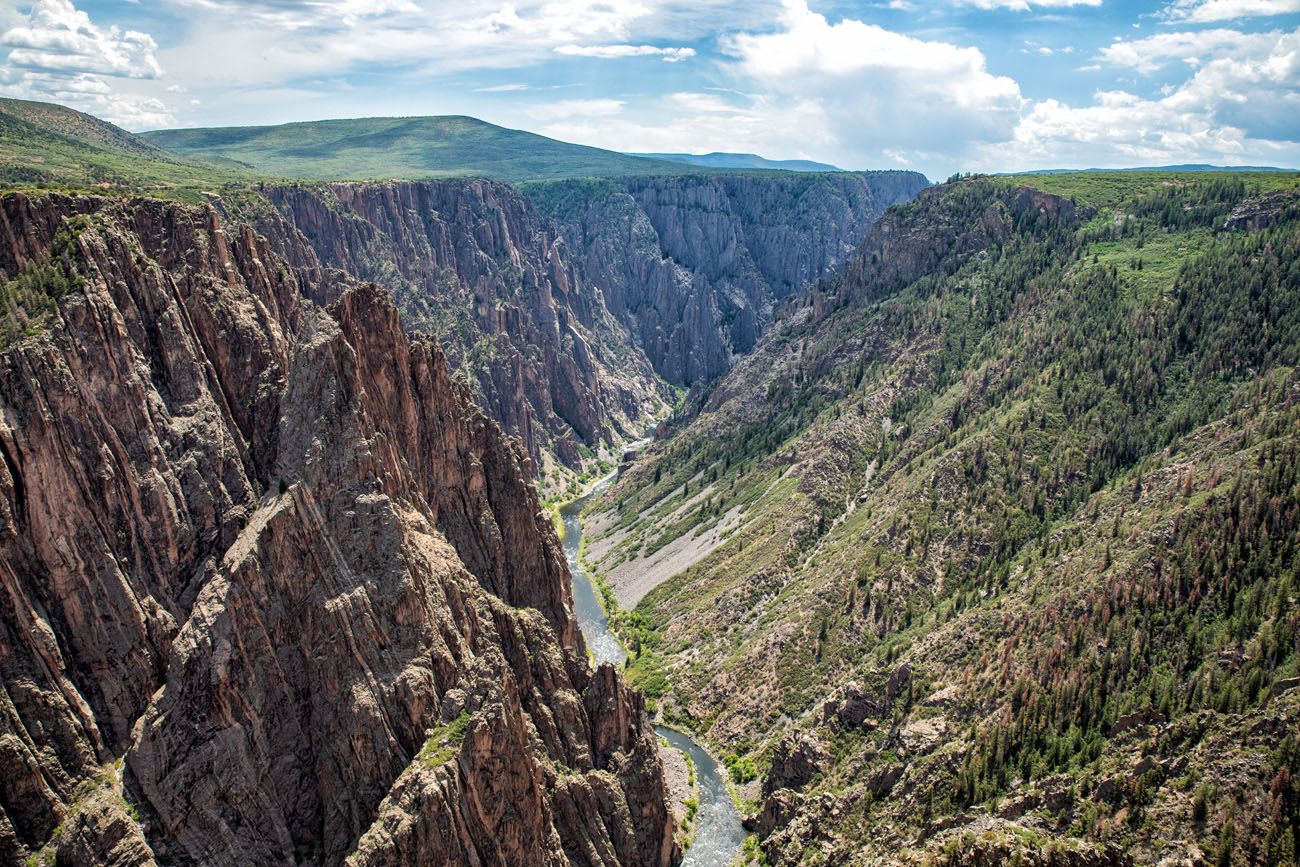
View from Pulpit Rock
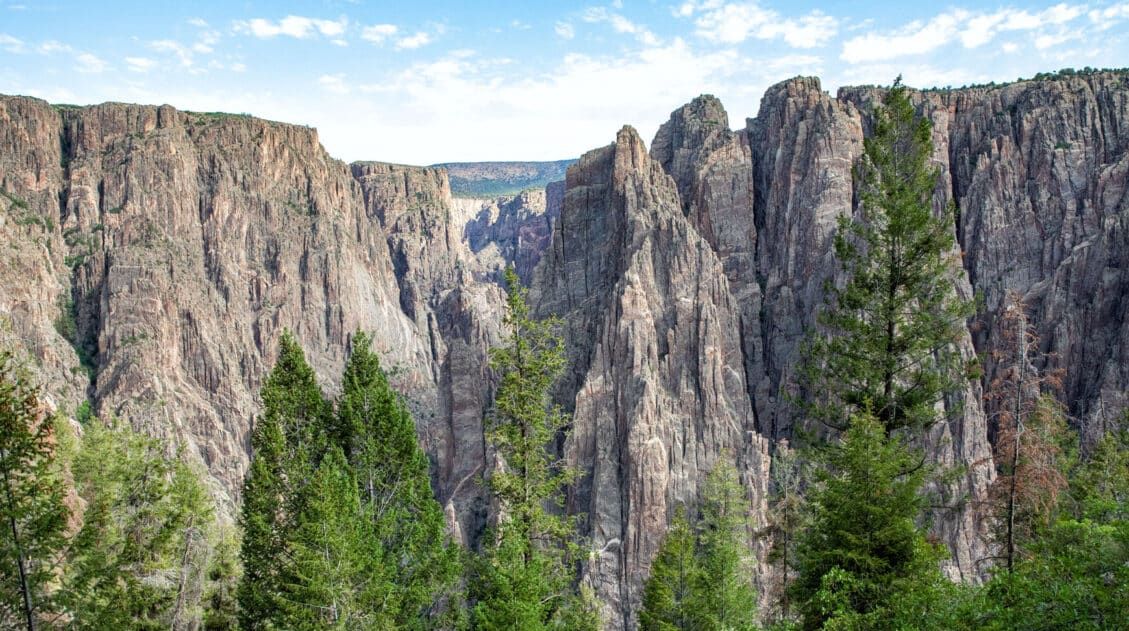
Cross Fissures View
This viewpoint gives you up a close-up view of fissures of rock within the canyon. It lacks the big, sweeping views you get from other overlooks but we really liked this one. This is a unique viewpoint, with views of the jagged rocks, and it’s also less crowded than some of the other overlooks on this list.
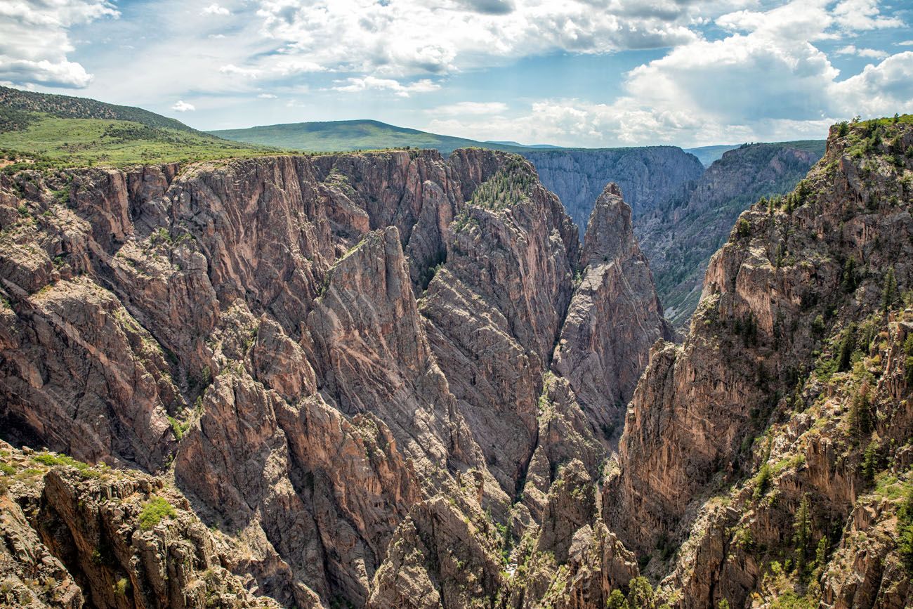
Cross Fissures View
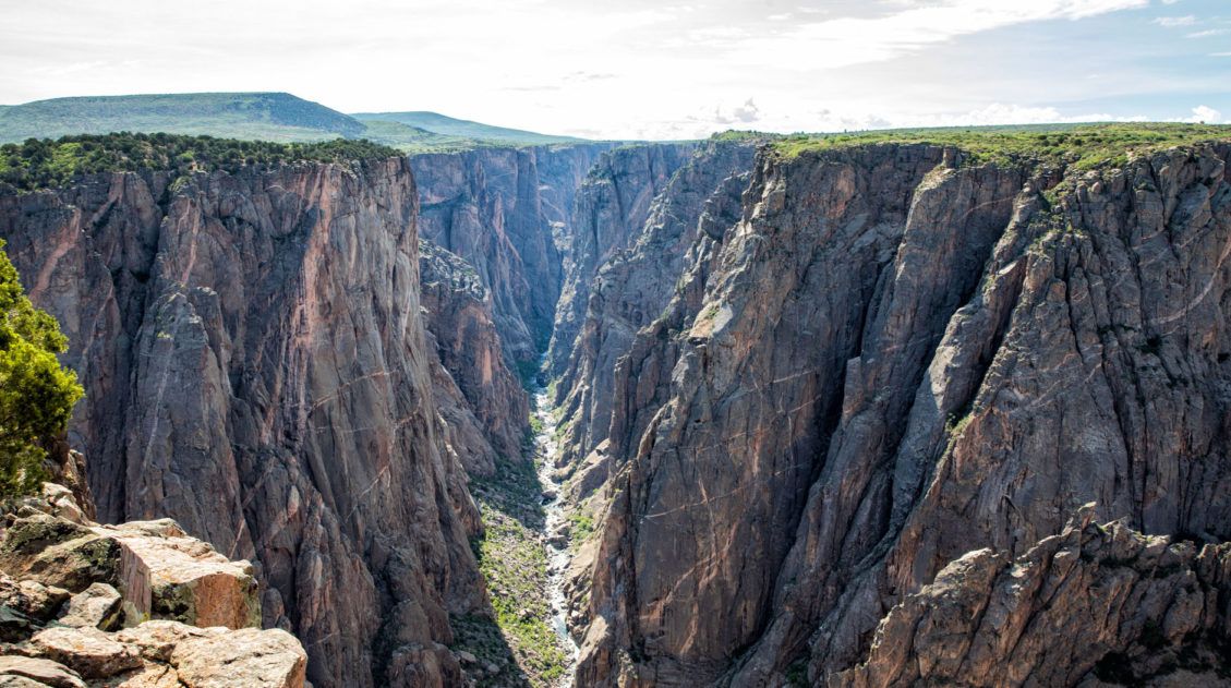
Chasm View
From Chasm View, you get a view of the canyon at its narrowest point. Along this stretch of Black Canyon of the Gunnison, the rock walls plunge straight down to the Gunnison River.
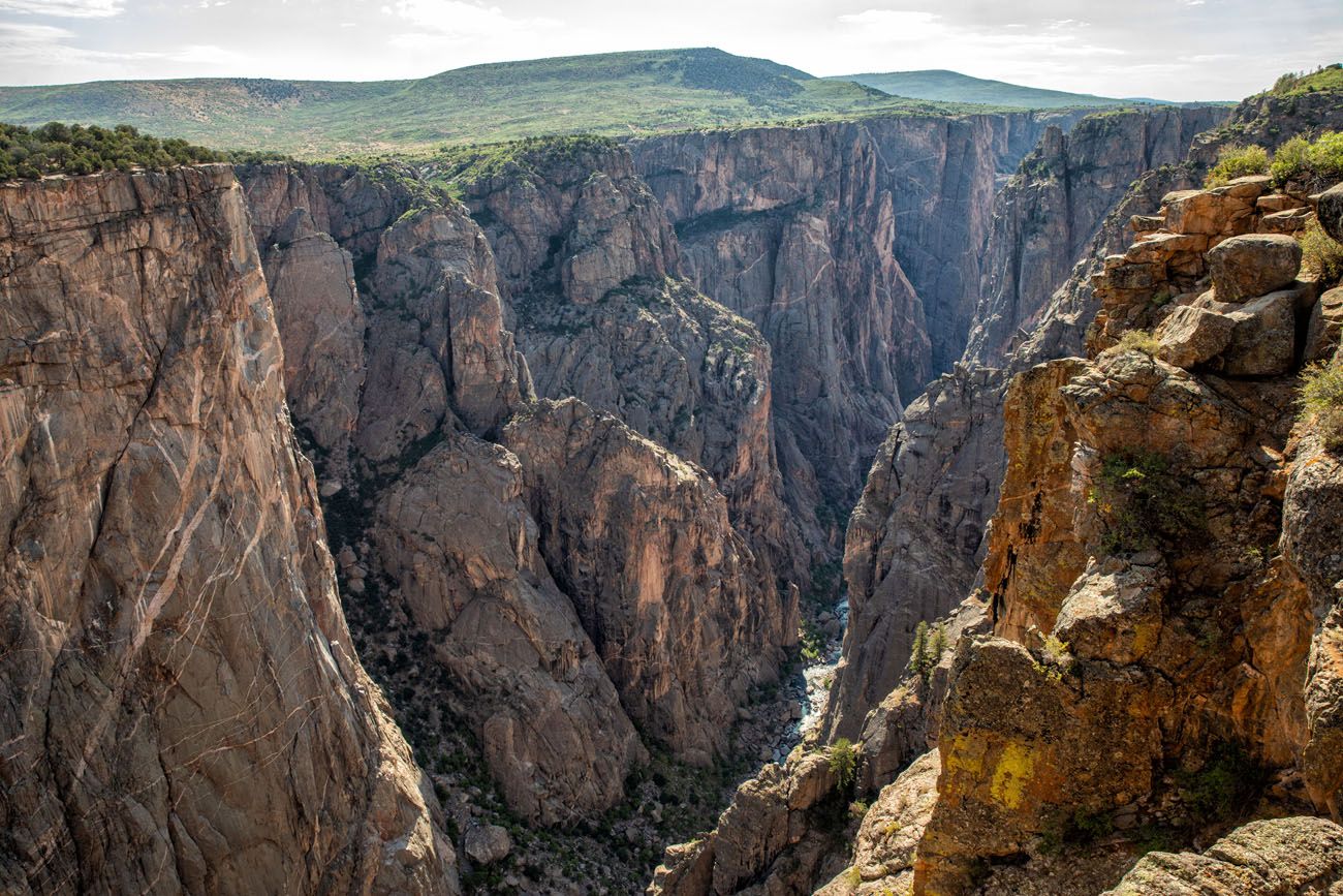
Chasm View
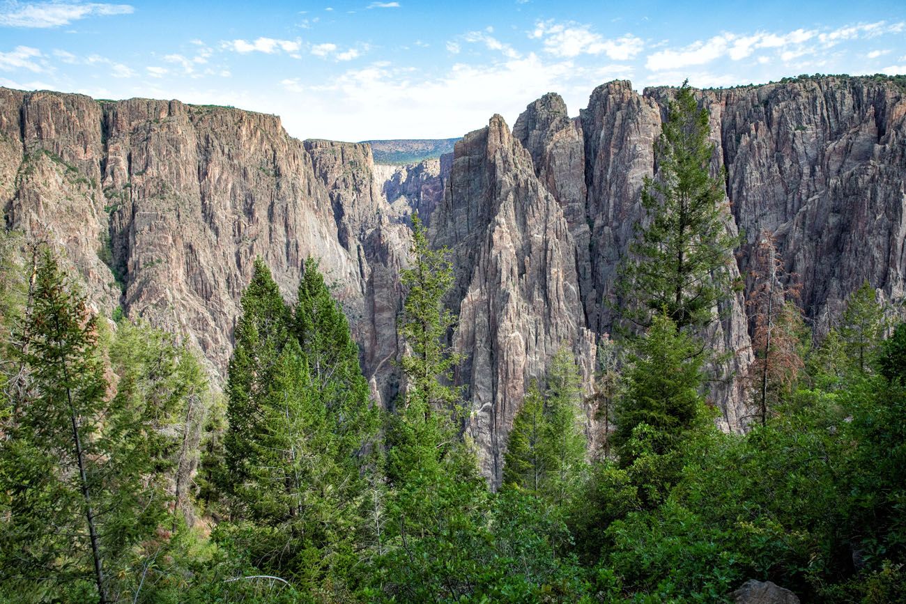
Painted Wall
This overlook gives you the best view of the striated walls of the canyon. The Painted Wall is the tallest cliff in Colorado at 2,250 feet.
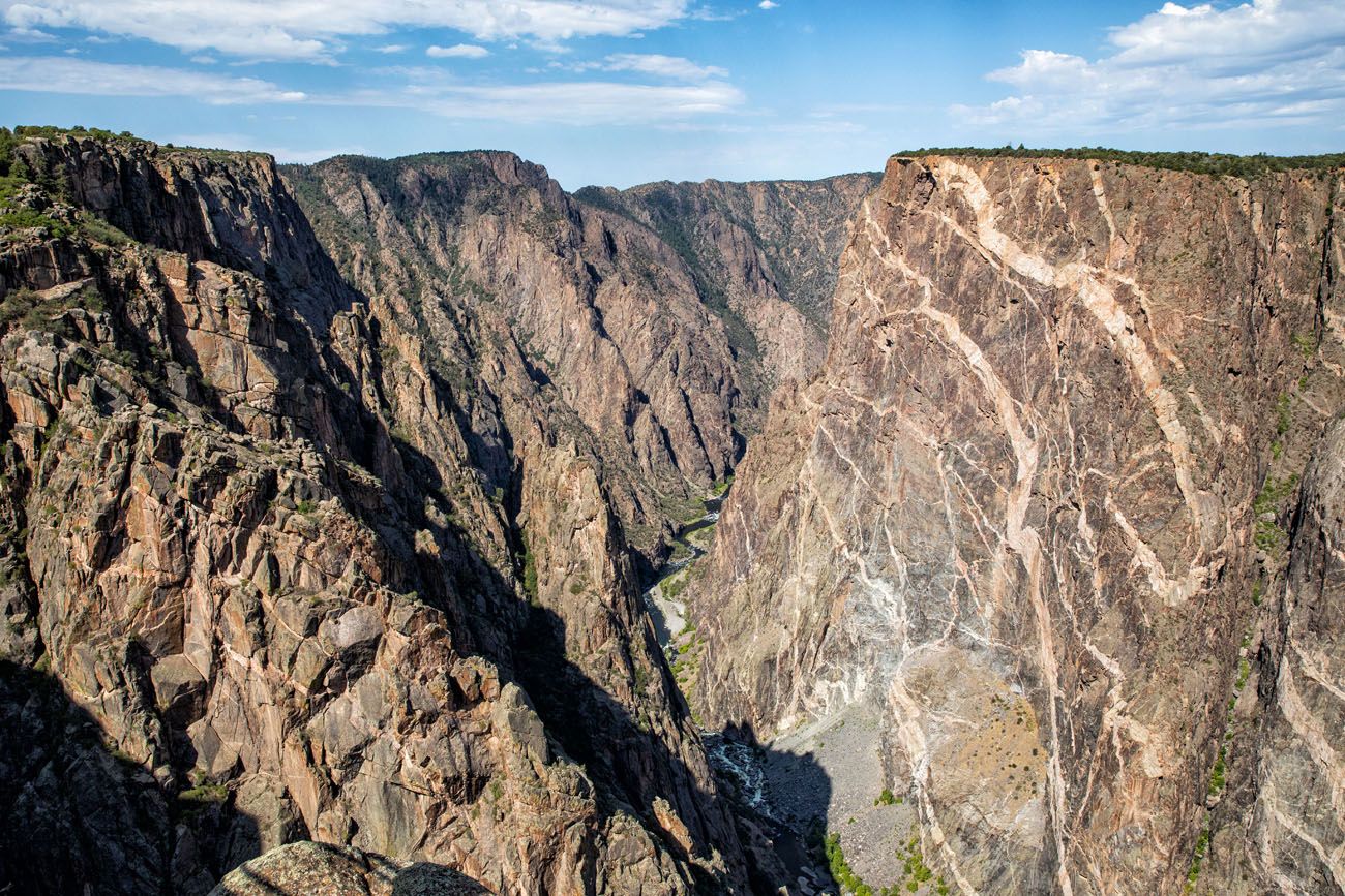
The light-colored bands are called pegmatite. Over a billion years ago, molten rock squeezed between fissures in the rock, forming these bands.
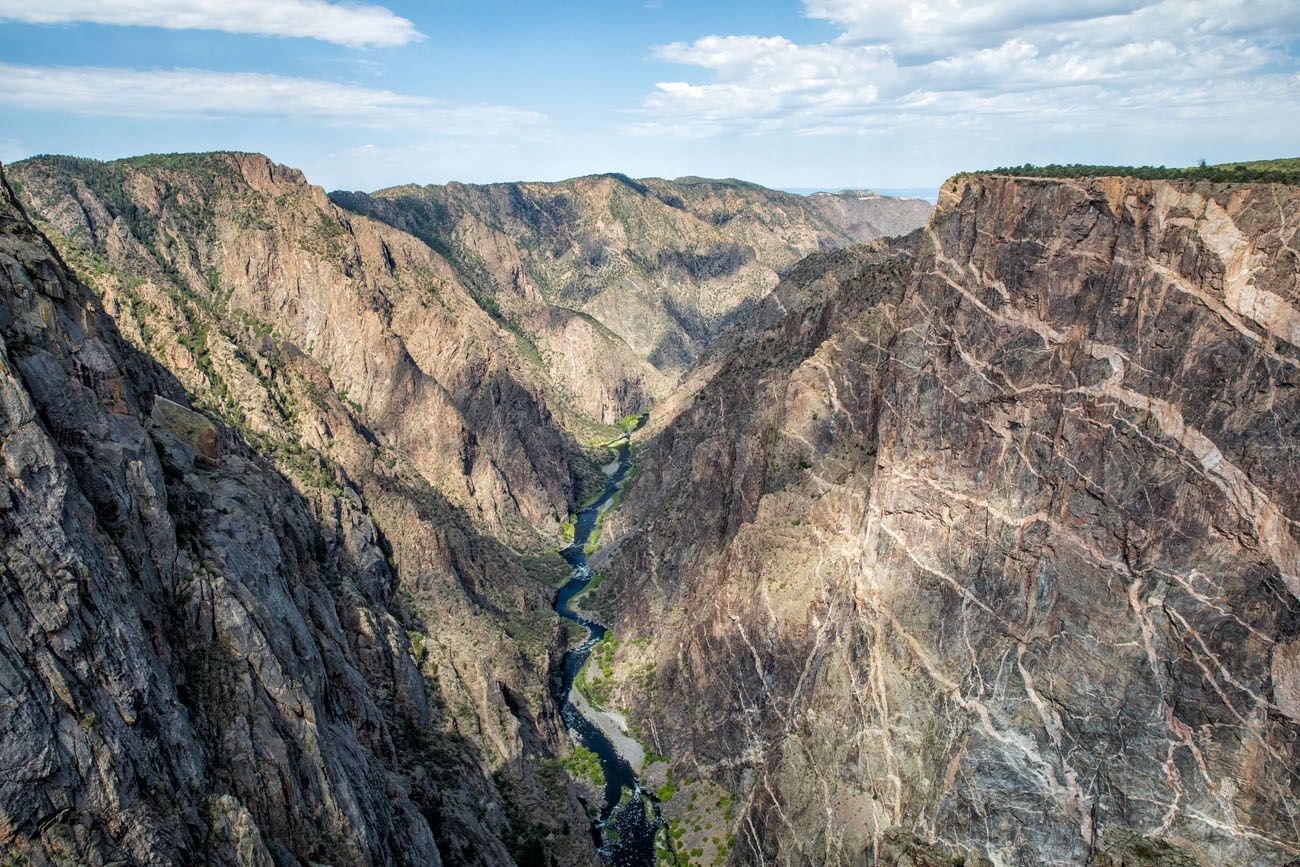
Cedar Point Nature Trail
This is one of the best overlooks in Black Canyon of the Gunnison. You can look along the Gunnison River with the steep, canyon walls on either side. Plus, you get to see the amazing, striated walls of the North Rim of the canyon.
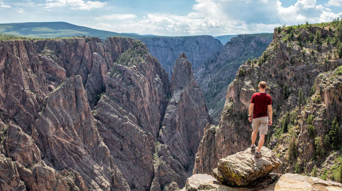
2. Hike Along the Rim
One of the best ways to experience the Black Canyon of the Gunnison is to hike one of the short hiking trails on the rim. These take a small amount of your time and offer better or more unique views than what you get from the overlooks.
Warner Point Trail
Distance: 1.5 miles round trip | Time: 1 hour
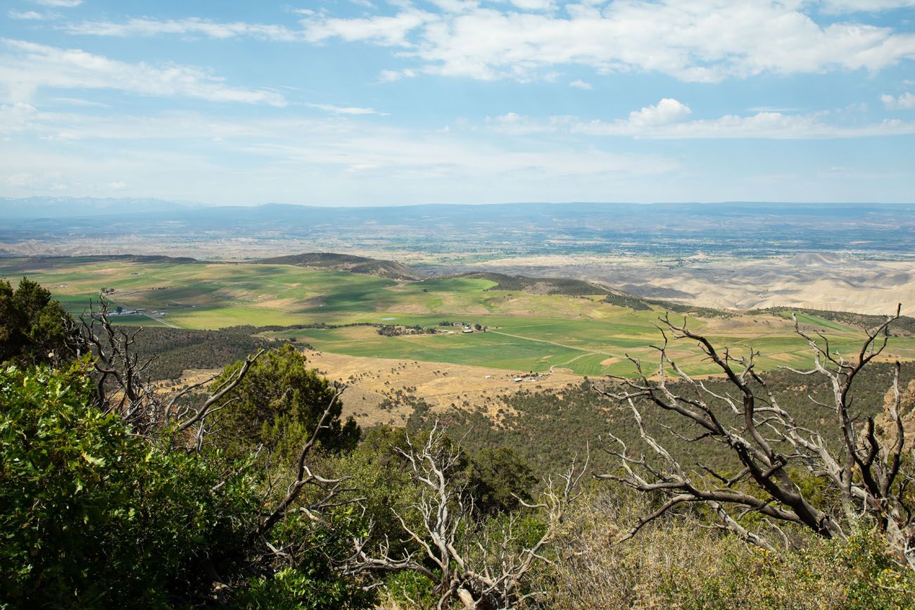
Uncompahgre Valley
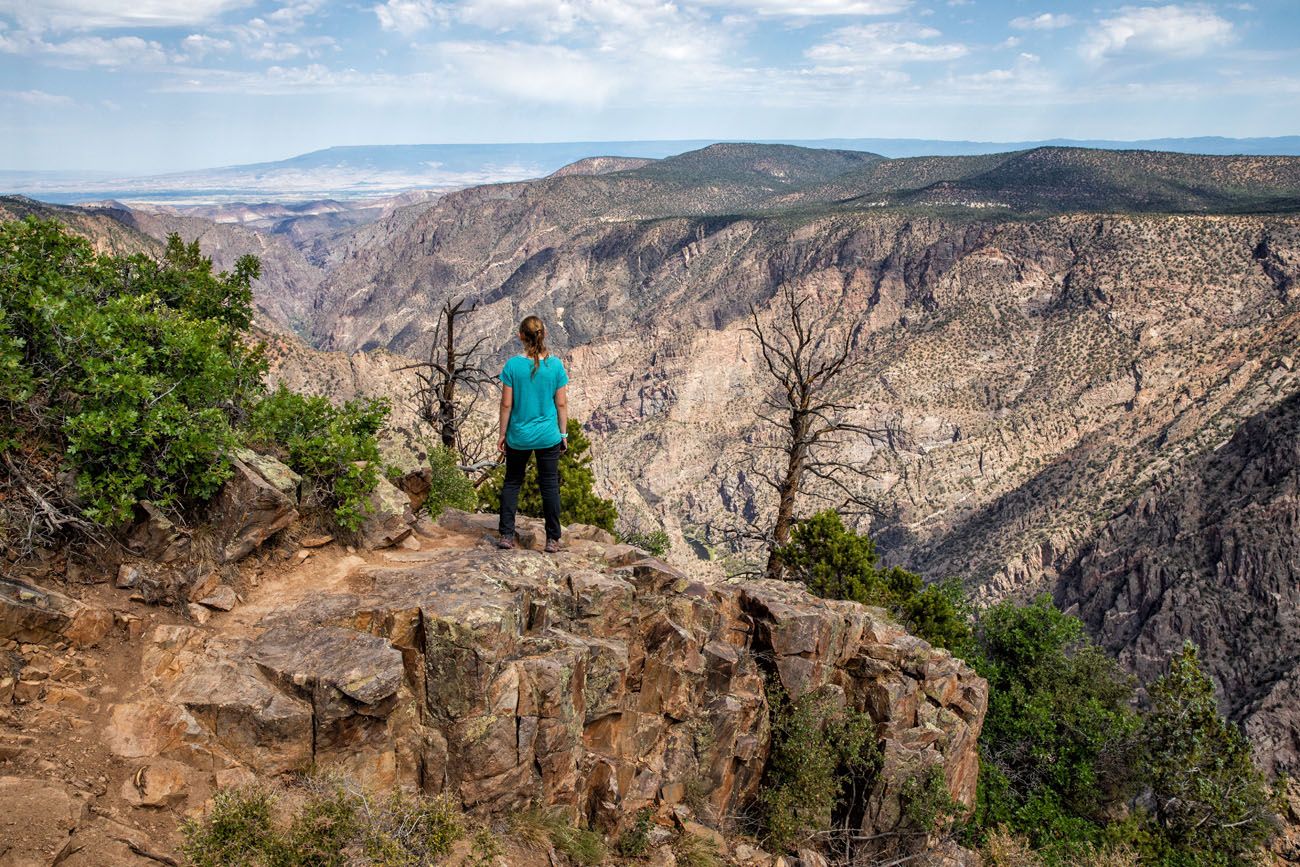
Warner Point Trail is located at the very end of South Rim Road. Along most of the trail, you do not have views of the canyon. Instead, you are looking out over the San Juan Mountain Range and Uncompahgre Valley.
The trail ends with a great view of the Black Canyon and Gunnison River.
Please practice the seven principles of Leave No Trace: plan ahead, stay on the trail, pack out what you bring to the hiking trail, leave areas as you found them, minimize campfire impacts, be considerate of other hikers, and do not approach or feed wildlife.
Oak Flat Loop Trail
Distance: 2 miles round trip | Time: 1.5 – 2 hours
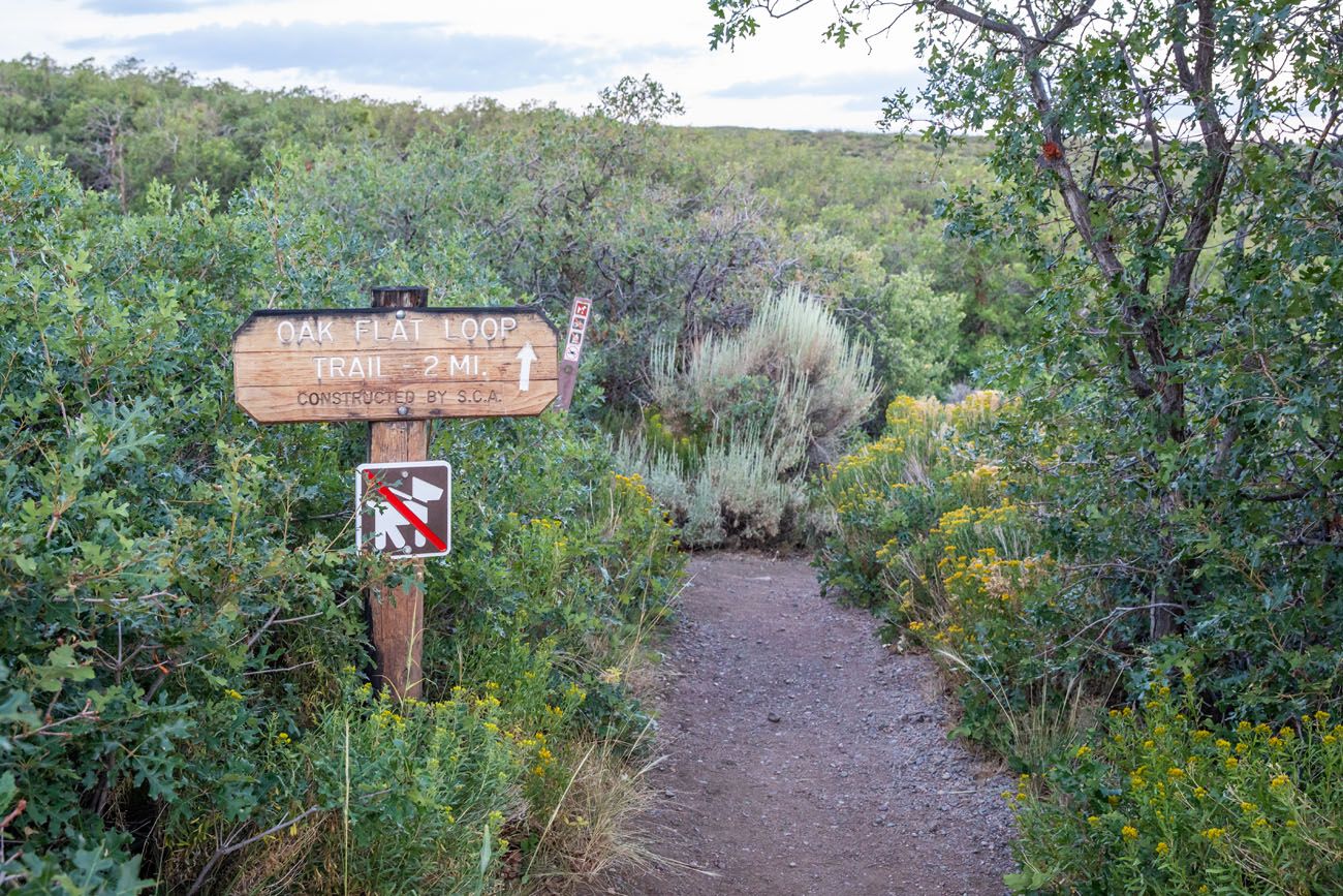
This trail starts and ends at the Visitor Center and takes hikers a short distance below the rim. If you want to go below the rim without doing a long, strenuous, inner canyon hike, put this trail on your to-do list. Along the way, you hike through forests of oak, aspen, and Douglas fir trees and through the clearings you will have great views of the far canyon wall. This is a strenuous trail because it does go a short distance below the rim.
Rim Rock Nature Trail
Distance: 1 mile point-to-point | Time: 45 minutes – 1 hour
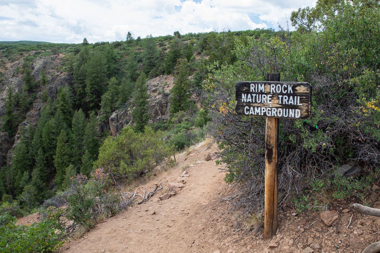
This point-to-point trail starts at Campground Loop C and ends at the visitor center. It is a mostly flat trail along the rim with views looking east along the Black Canyon. Since it is a point-to-point hike, you need to have a driver in your group drop you off and pick you up, or you can do this out-and-back.
It’s a nice hike but skippable. You can get the same view from Tomichi Overlook (located along the trail) so hiking the entire trail is not necessary.
If you only have the time and/or energy for one of these rim trails, I recommend the Warner Point Trail.
For more information about Black Canyon of the Gunnison National Park, read our Black Canyon of the Gunnison Travel Guide. Get important travel planning tips, sample itineraries, advice on when to go, where to stay, and more.
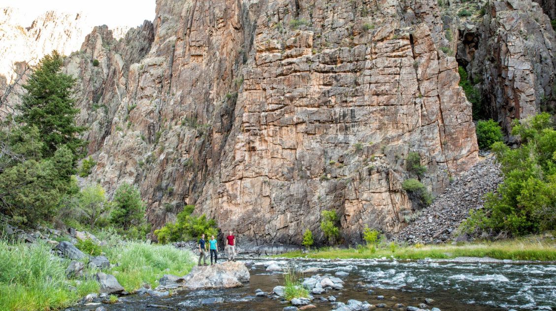
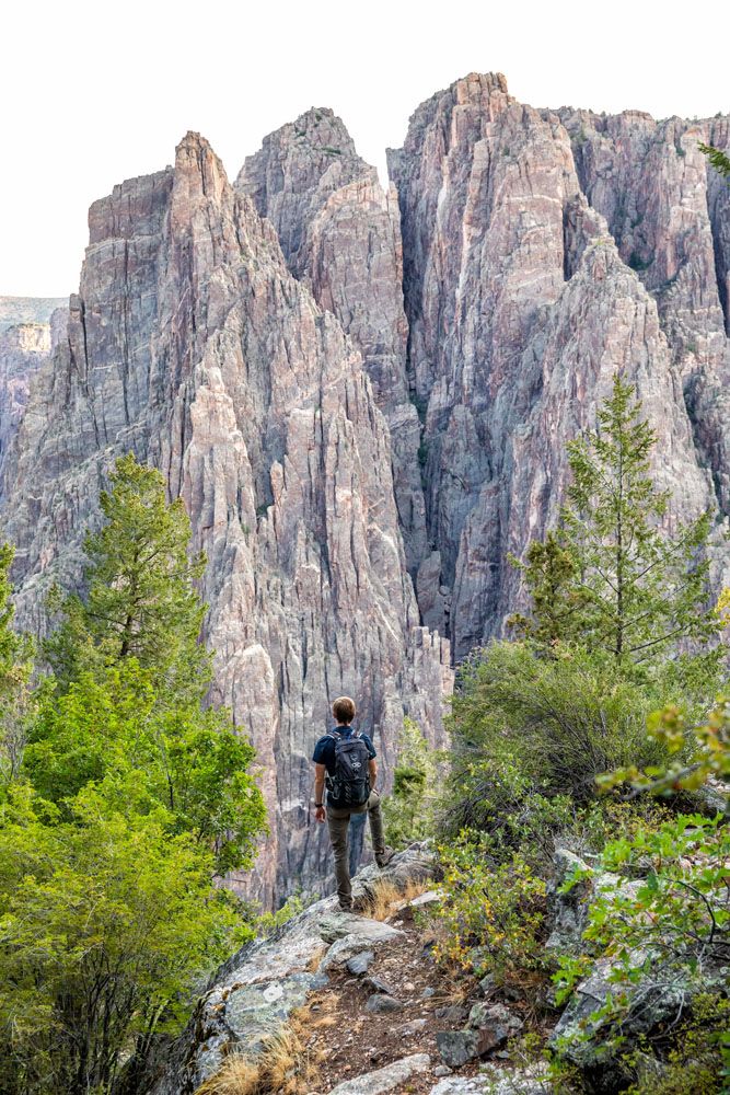
3. Explore the Inner Canyon
For an epic experience, go below the rim and hike to the Gunnison River.
When you stand on the rim and look at the sheer cliffs that drop down the river, it seems like an impossible feat to hike this canyon. For those with a sense of adventure, you can tackle one of these short, extremely steep, and challenging trails to the Gunnison River.
On the South Rim, four trails lead from the rim to the Gunnison River. A Wilderness Use Permit is required for each of these hikes (you need to pick up your permit the day before your hike). There are no maintained trails into the inner canyon, so only those with prior hiking experience and a high level of fitness should attempt an inner canyon hike.
These South Rim routes can be hiked all year. However, they are typically snow covered from November through April.
You are permitted to camp by the river overnight, turning this into a 2-day experience.
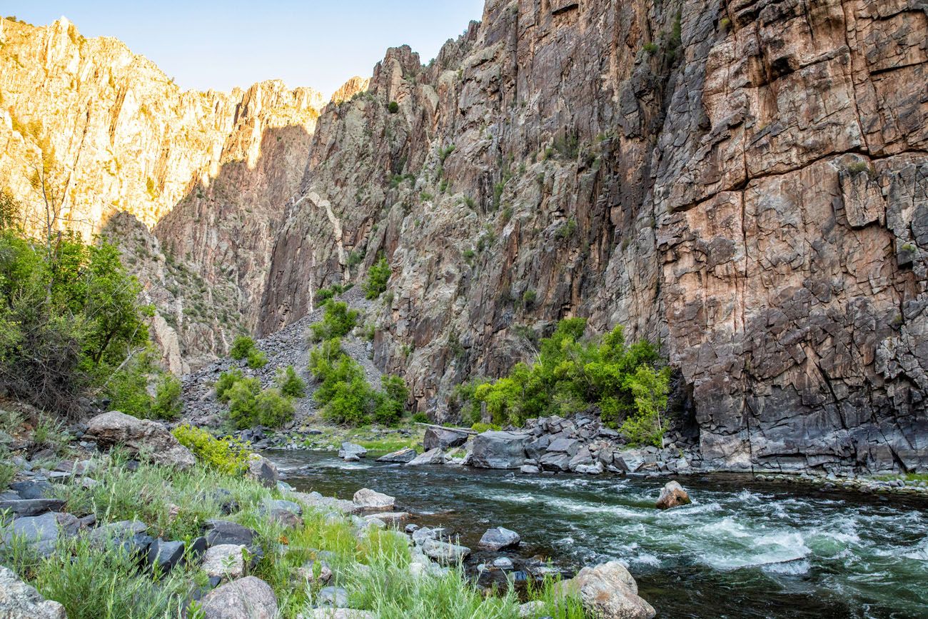
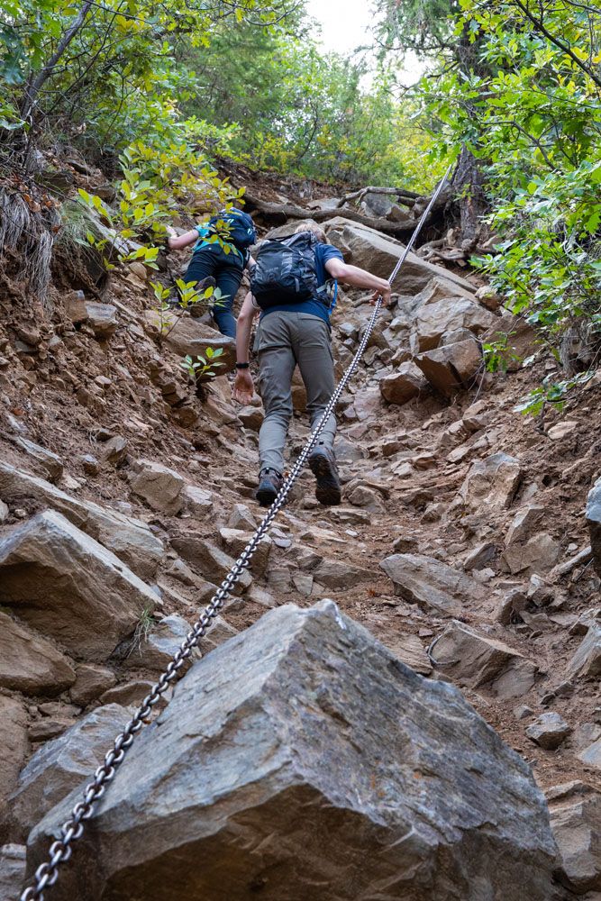
Gunnison Route
Distance: 2.7 miles round-trip | Length of Time: 4 to 6 hours
This is the most popular inner canyon route on the South Rim. The hike starts at the Visitor Center and follows the Oak Flat Trail for a short distance, before the Gunnison Route breaks off and starts its steep descent to the Gunnison River.
With a vertical drip of 1,800 feet in just over a mile, this is an extremely steep trail. However, the routes below are even more challenging.
We hiked the Gunnison Route and absolutely loved it. In fact, it was our favorite experience at Black Canyon of the Gunnison National Park.
How to Hike the Gunnison Route | Black Canyon of the Gunnison
Learn more about the Gunnison Route and how to get a Wilderness Permit for any inner canyon route on the South Rim.We laughed and joked on the way down, as we slipped and slid on the loose trail. Standing next to the Gunnison River, gazing up at the immense granite walls, was an unforgettable experience. It’s not much fun on the way back up, but what a sense of accomplishment you get once you are standing back on the rim.
Tomichi Route
Distance: 2 miles round-trip | Time: 6 – 8 hours
This is the steepest South Rim Route. Starting at Tomichi Point overlook, the trail drops almost 2,000 feet in about one mile. The trail is made up of loose rock and you will be in the sun for most of the hike.
Warner Route
Distance: 5.5 miles round-trip | Time: 6 – 8 hours
This is the longest route on the South Rim. With 2,700 feet of vertical drop, it also has the biggest overall descent. Camping overnight is highly recommended due to the length of time this route requires. The route starts on the Warner Point Trail and ends at a wide point in the canyon at the Gunnison River.
Devil’s Backbone Route
Located near the East Portal, this route takes hikers along a ridge along the Gunnison River. There will be some rock scrambling along the way with bare rock and slippery gravel. This route does not require a permit if done as a day hike.
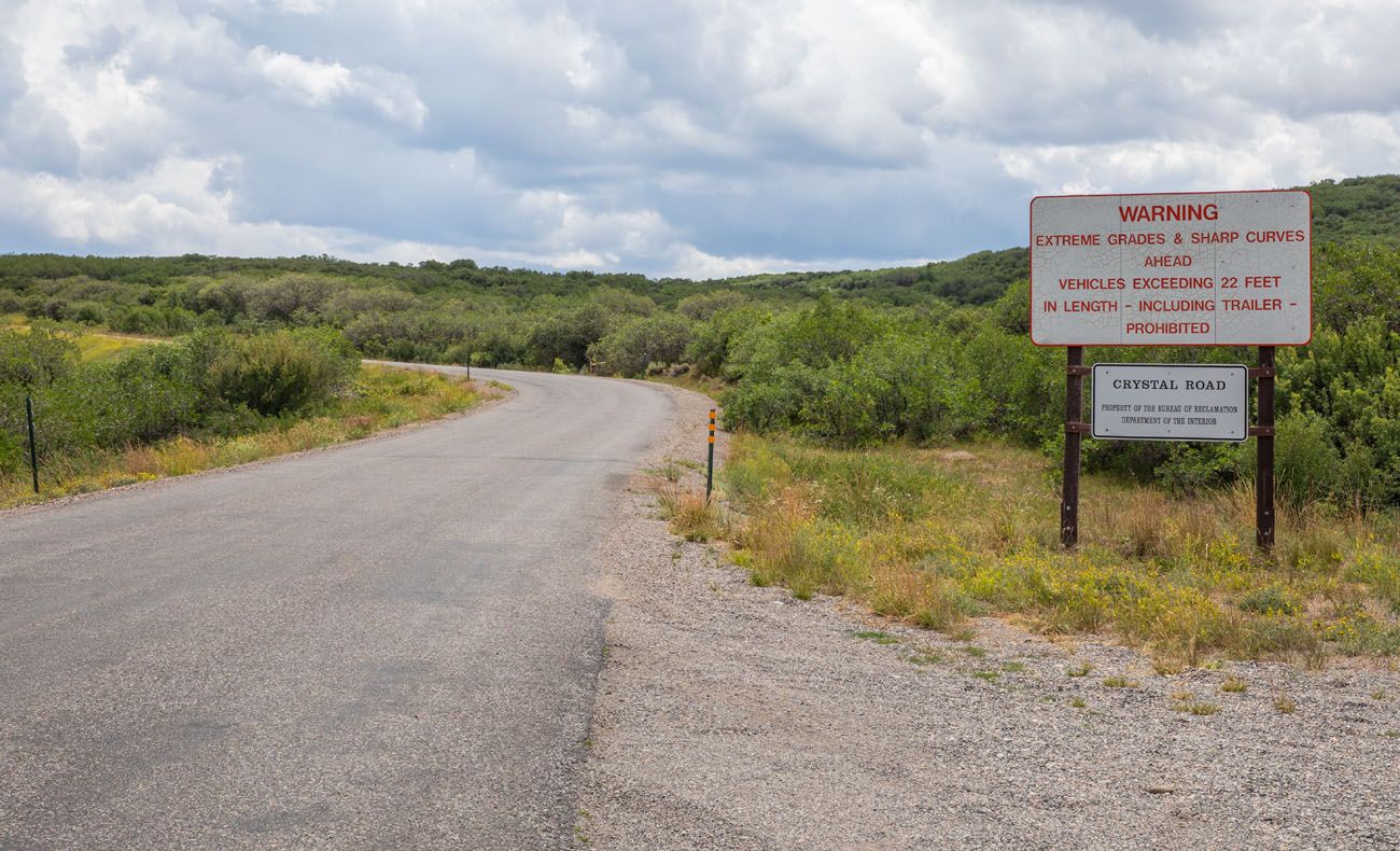
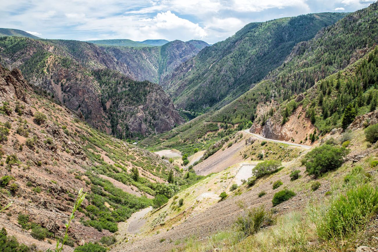
4. Drive East Portal Road
This steep, windy road is the easiest way to get down to the Gunnison River.
The road is 7 miles long, starting at the entrance station and ending at the Crystal Dam. With hairpin turns and 16% grades in some spots, the East Portal Road is extremely steep. The road ends at the Gunnison River, where you can go camping, fishing, or have a picnic next to the river.
Note: Vehicles longer than 22 feet are not permitted on East Portal Road. It is closed from November through April.
5. Go Fishing in the Gunnison River
The Gunnison River is an outstanding place to go trout fishing and it is designated as a Gold Medal Water and Wild Trout Water.
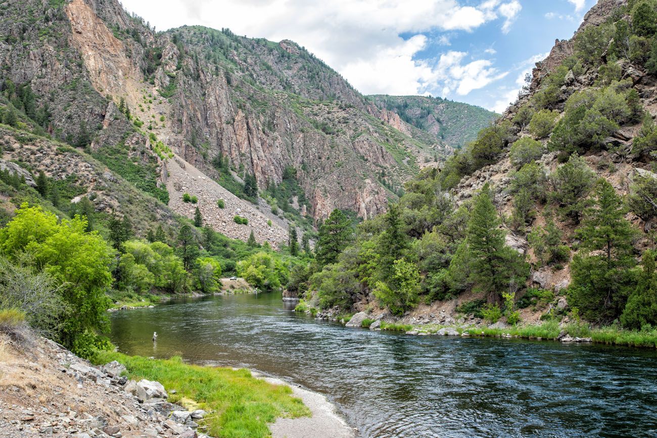
Fisherman in the Gunnison River. Photo taken at the end of East Portal Road.
A Colorado fishing license is required and there are many regulations. See the National Park Service website for full details.
To get to the Gunnison River, you can either drive East Portal Road or hike one of the inner canyon routes.
6. See the Night Sky
In September 2015, Black Canyon of the Gunnison was designated as a Dark Sky Park by the International Dark-Sky Association.
The park is open 24 hours a day, so it is possible to pull up to an overlook and enjoy the view of the night sky. The best time to view the night sky is during the new moon phase or when the moon rises late in the night.
Every year, the Black Canyon hosts an Astronomy Festival so visitors can experience the night sky. At the festival, telescopes are set up each night, there are ranger talks, and guest speaker programs.
South Rim of Black Canyon of the Gunnison: On a Map
How to Use This Map: Click the icons on the map to get more information about each point of interest. To take this map with you, click the star next to the title of the map which adds it to your Google account. Next, within your Google Maps app, select ‘Saved’ and then select ‘Maps’. This map title will now appear in your list.
Practical Information
The South Rim of Black Canyon of the Gunnison is open 365 days a year. South Rim Road is typically open from early April through mid-November. The remainder of the year it is closed to vehicles but you can go snowshoeing or cross-country skiing.
East Portal Road is typically open from mid-April through mid-November.
You need a half to a full day to visit the South Rim of Black Canyon of the Gunnison. Drive South Rim Road, visit some or all of the overlooks, and hike the Warner Point Trail and/or the Oak Flat Loop Trail. If you have a full day, drive the East Portal Road to the Gunnison River.
If you want to hike an inner canyon route, you need to apply for a permit in advance.
The graphs below show the average monthly temperatures and precipitation in Black Canyon of the Gunnison National Park, which will help you plan your trip.
As you plan your trip and just before your visit, get updates on park conditions on the National Park Service website.
If you have any questions about the things to do on the South Rim of Black Canyon of the Gunnison, or if you want to share your experience, let us know in the comment section below.
More Information about Black Canyon of the Gunnison
How to Visit the Black Canyon of the Gunnison: North & South Rims
Pinterest Facebook Flipboard In some ways, the Black Canyon of the Gunnison is a smaller version of the Grand Canyon. You can visit both the North and South Rims, enjoy the views from the overlooks, and, for the ultimate adventure, hike below the rim to the Gunnison River. In this guide, learn how to visit […]
How to Hike the Gunnison Route | Black Canyon of the Gunnison
The Gunnison Route takes hikers from the south rim of the Black Canyon to the Gunnison River. It’s the most popular inner canyon experience on the south rim, but don’t let that fool you. This is a hard, strenuous hike where you will descend (and later hike back up) a massive amount of elevation in […]
Black Canyon of the Gunnison National Park Travel Guide
Black Canyon of the Gunnison National Park Black Canyon of the Gunnison National Park is a smaller, less crowded version of the Grand Canyon. You can enjoy the views along both rims, hike the rim trails, or go on a real adventure by hiking below the rim. The park preserves the narrowest and deepest section […]
6 Things to Do on the North Rim of Black Canyon of the Gunnison
Only a fraction of the visitors to Black Canyon of the Gunnison make the trip to the North Rim. Those that do are rewarded with a wonderfully quiet, uncrowded experience and views that beat those from the South Rim. Similar to the South Rim, you can drive the rim road, stopping at overlooks along the […]
Ultimate Guide to the Colorado National Parks (+ 10 Day Itinerary)
There are four Colorado national parks: Rocky Mountain, Mesa Verde, Black Canyon of the Gunnison, and Great Sand Dunes. The landscapes that these national parks protect are dramatically different from one another. In Rocky Mountain National Park, journey high into the Rocky Mountains, cross the Continental Divide, and hike to gorgeous alpine lakes and waterfalls. […]
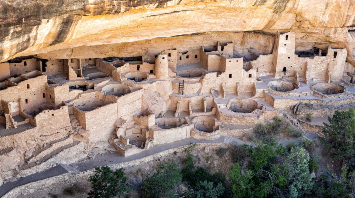
Top 10 Things to Do in Mesa Verde National Park
Located in southwestern Colorado, Mesa Verde National Park is one of the most unique national parks in the United States. This park preserves the ancient Puebloan cliff dwellings and archeological sites that are hundreds of years old. Short hikes, scenic drives, and viewpoints make the to-do list, but the best way to experience this park […]
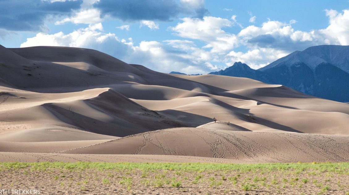
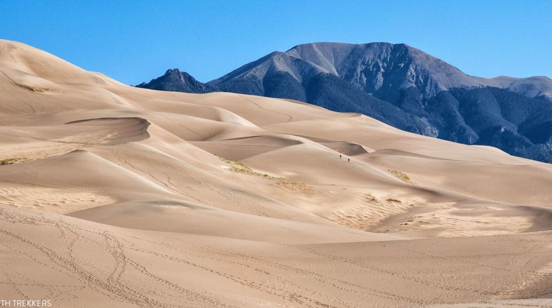
8 Amazing Things to Do in Great Sand Dunes National Park
Great Sand Dunes is a much different experience than many other national parks in the United States. Sure, there is hiking and amazing sunsets and ranger programs, but this park has a much different feel to it. It’s a small park and the list of things to do is very short. A few hours are […]
7 to 14 Day Colorado Itinerary: National Parks & Scenic Drives
With four national parks, numerous national forests and state parks, plus historic towns scattered throughout the Rocky Mountains, Colorado makes an awesome road trip destination. On this Colorado itinerary, you will visit all four national parks (Great Sand Dunes, Mesa Verde, Black Canyon of the Gunnison, and Rocky Mountain National Parks), linking them together with […]
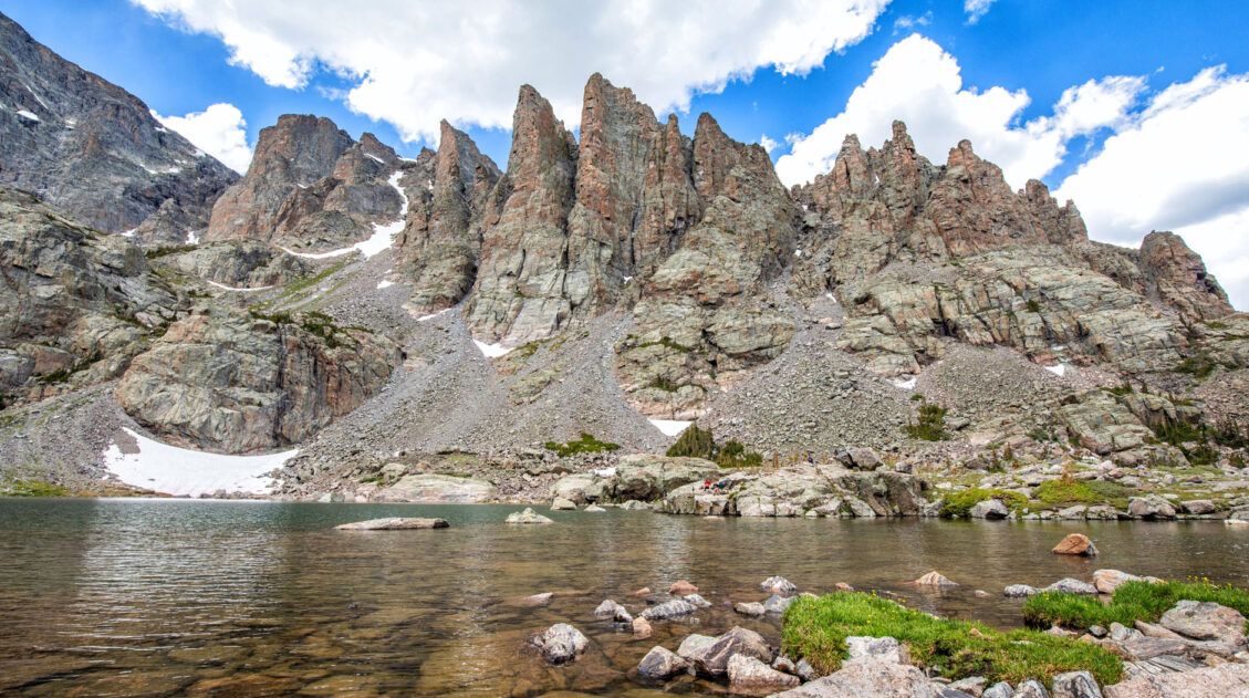
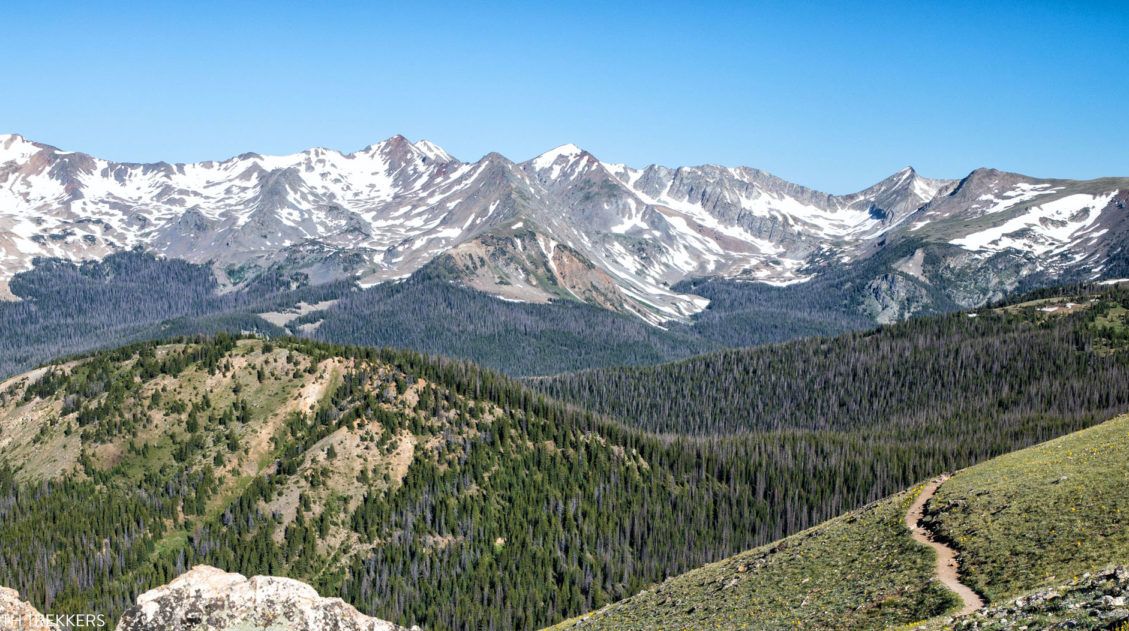
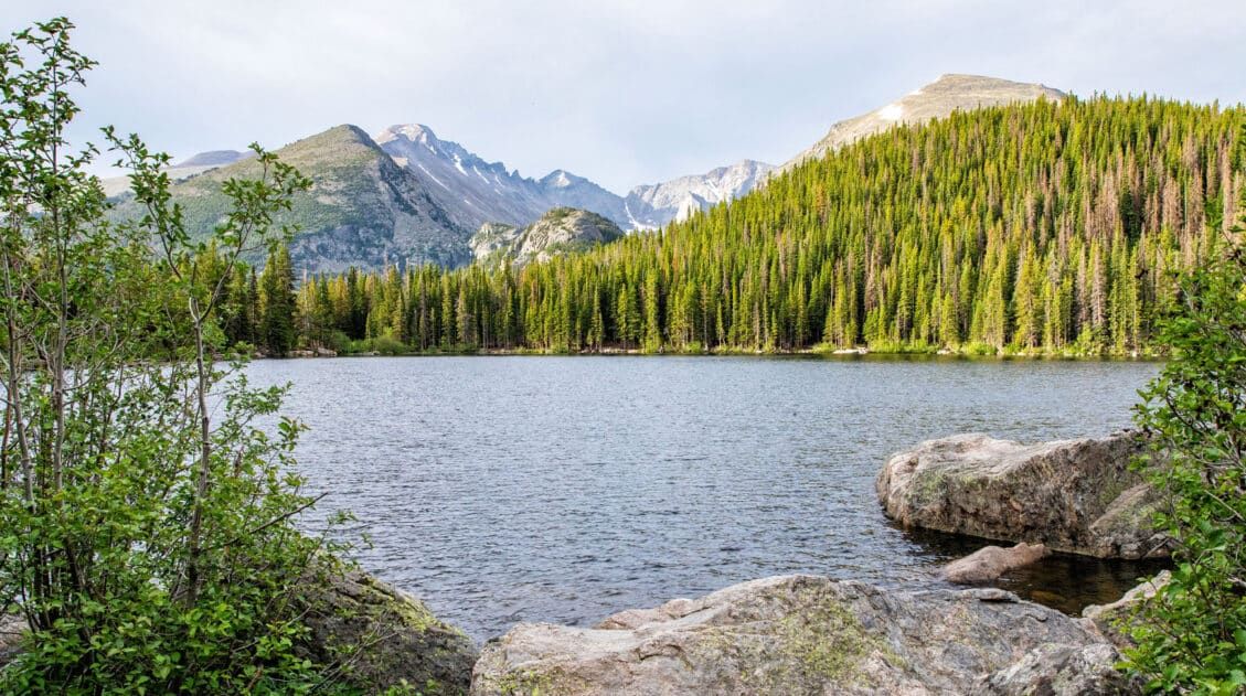
10 Best Things to Do in Rocky Mountain National Park
With lofty mountain peaks, hiking trails that lead to alpine lakes and waterfalls, wildlife, and a scenic drive along one of the highest roads in the USA, Rocky Mountain National Park is a joy to explore. In this post, learn about the best things to do in Rocky Mountain National Park with tips on how […]
The Ultimate Colorado Travel Guide
Colorado Travel Guide For travelers, Colorado is a year-round adventure destination. In the summer and fall, hike in the Rocky Mountains, explore the national parks, soak in the hot springs, and go on some of the best scenic drives in the USA. In the winter and early spring, when snow blankets the mountains, Colorado is […]
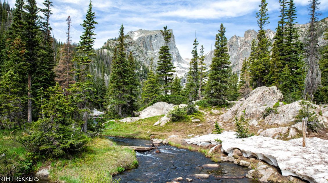
The Perfect Rocky Mountain National Park Itinerary (2026)
If you are planning your Rocky Mountain National Park itinerary, this is a great place to start. Rocky Mountain National Park is one of the best US national parks to go hiking. With towering mountain peaks, alpine lakes and waterfalls, and the opportunity to hike aƒlong the Continental Divide, this park offers world-class hiking experiences. […]
United States Travel Guide: Places to Visit in the USA
Plan your visit to the United States. Learn about the best things to do, how to plan your time, road trip ideas, and sample itineraries.
US National Parks List: All 63 Parks, Map & Free Printable Checklist
There are 63 national parks in the United States, and we’ve visited 56 of them, from the remote wilderness of Denali to the coral reefs of the Virgin Islands. We’re a family of avid hikers who have spent over a decade exploring these parks, from multi-day backcountry trips to scenic drives with kids in tow. […]

Comments 2