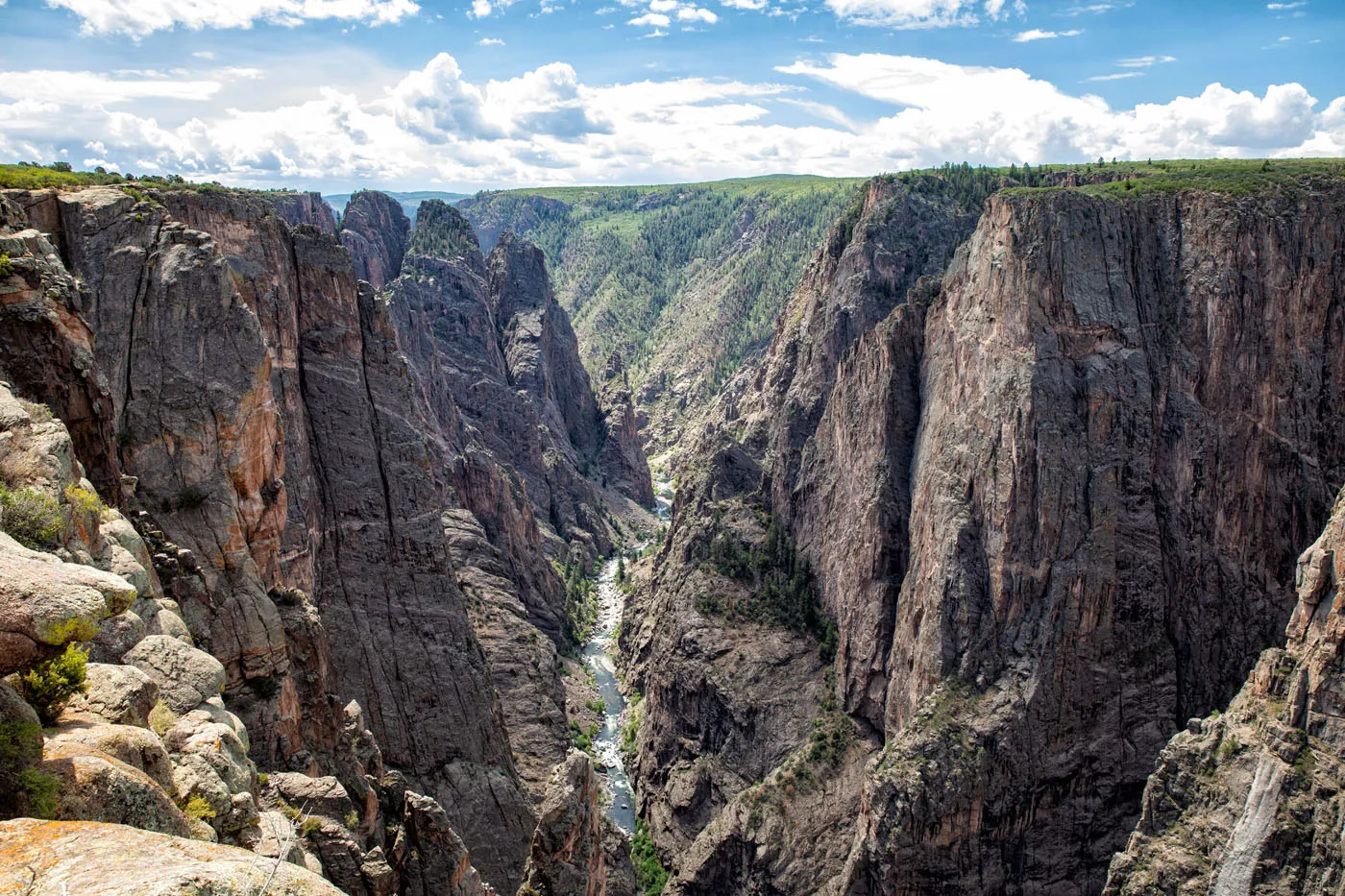
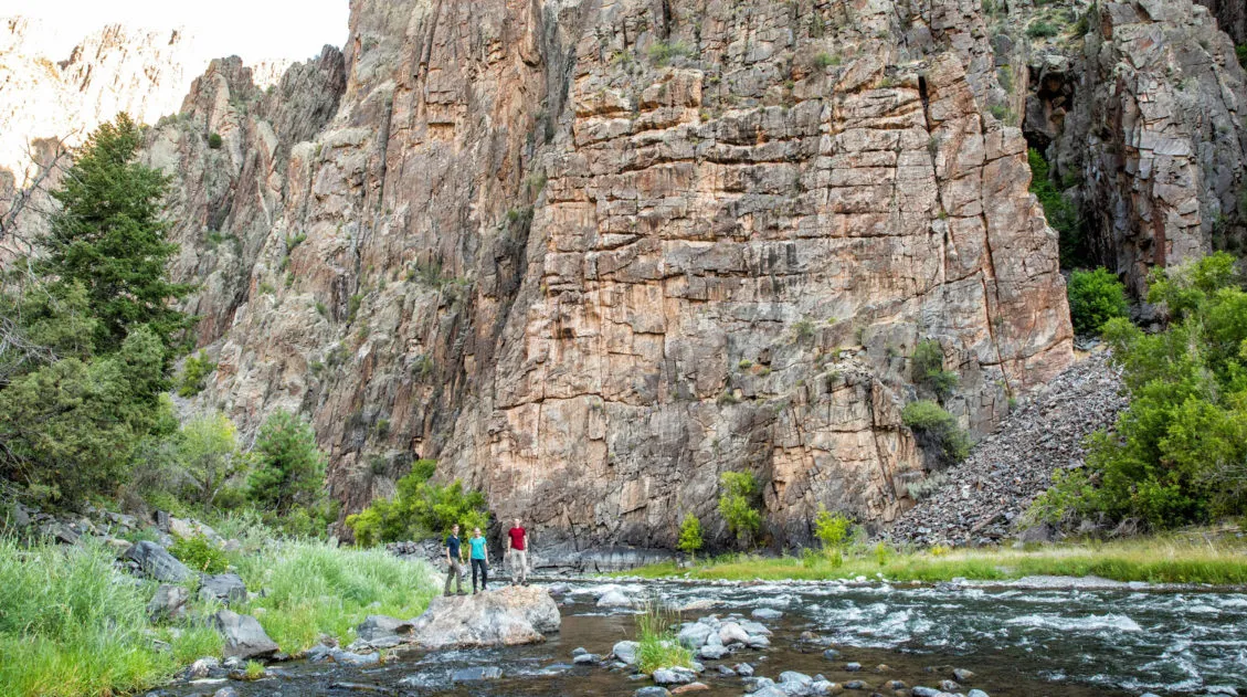
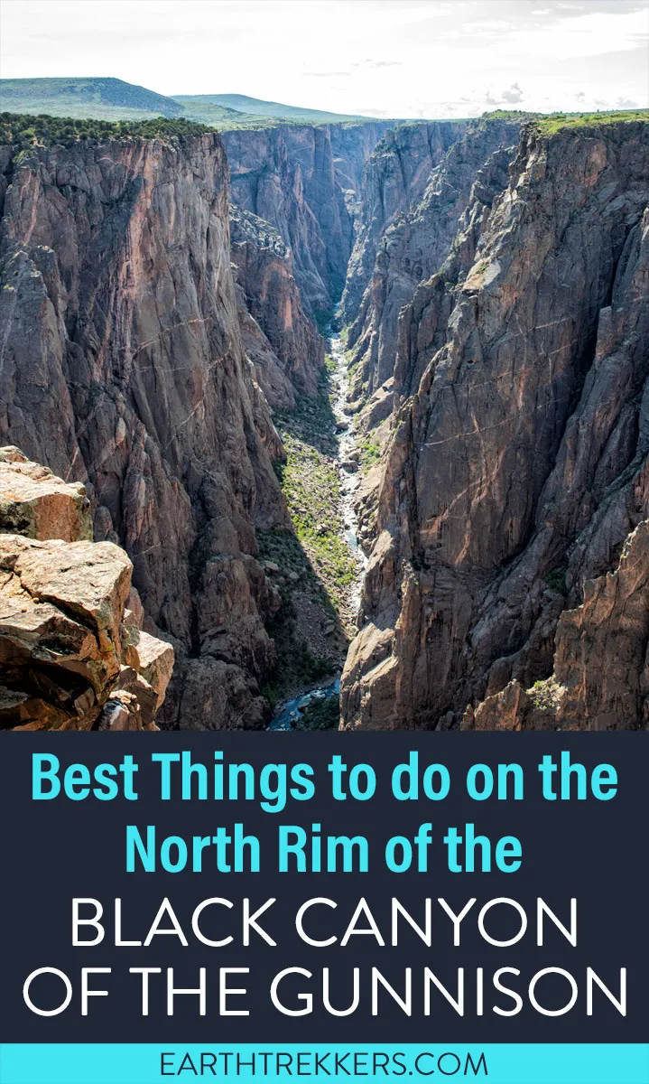
Only a fraction of the visitors to Black Canyon of the Gunnison make the trip to the North Rim. Those that do are rewarded with a wonderfully quiet, uncrowded experience and views that beat those from the South Rim.
Similar to the South Rim, you can drive the rim road, stopping at overlooks along the way. There are also several hiking trails to go deeper into the park, several inner canyon experiences, and a jaw-dropping viewpoint that beats anything on the South Rim.
In this post, I cover the best things to do on the North Rim of Black Canyon of the Gunnison with advice on how to plan your time.
Things to Do on the North Rim of Black Canyon of the Gunnison
1. Drive North Rim Drive Road
North Rim Drive Road is four and a half miles long and weaves its way along the North Rim. This road is an unpaved, gravel road but it is suitable for all vehicles.
Along North Rim Drive Road are five overlooks and access to a few hiking trails.
Here are the overlooks in order, starting at The Narrows and ending with Kneeling Camel View. Unlike the overlooks on the South Rim, it is a very short walk from the parking area to the overlook, so each overlook only takes a few minutes of your time.
The Narrows
This overlook offers nice views along the canyon at one of its narrowest points. This is the view looking southeast through the Black Canyon.
The Narrows
Balanced Rock
From this viewpoint, you can see a large, balanced boulder perched high above the Gunnison River. It’s not the most thrilling view so if you skipped one viewpoint on the North Rim, this one gets my vote.
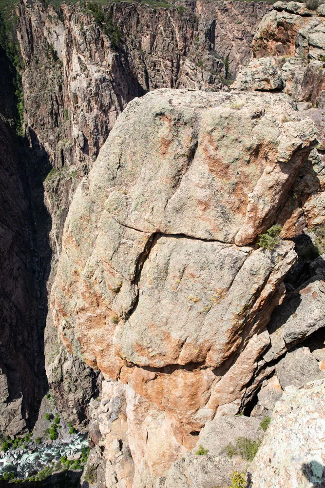
Balanced Rock
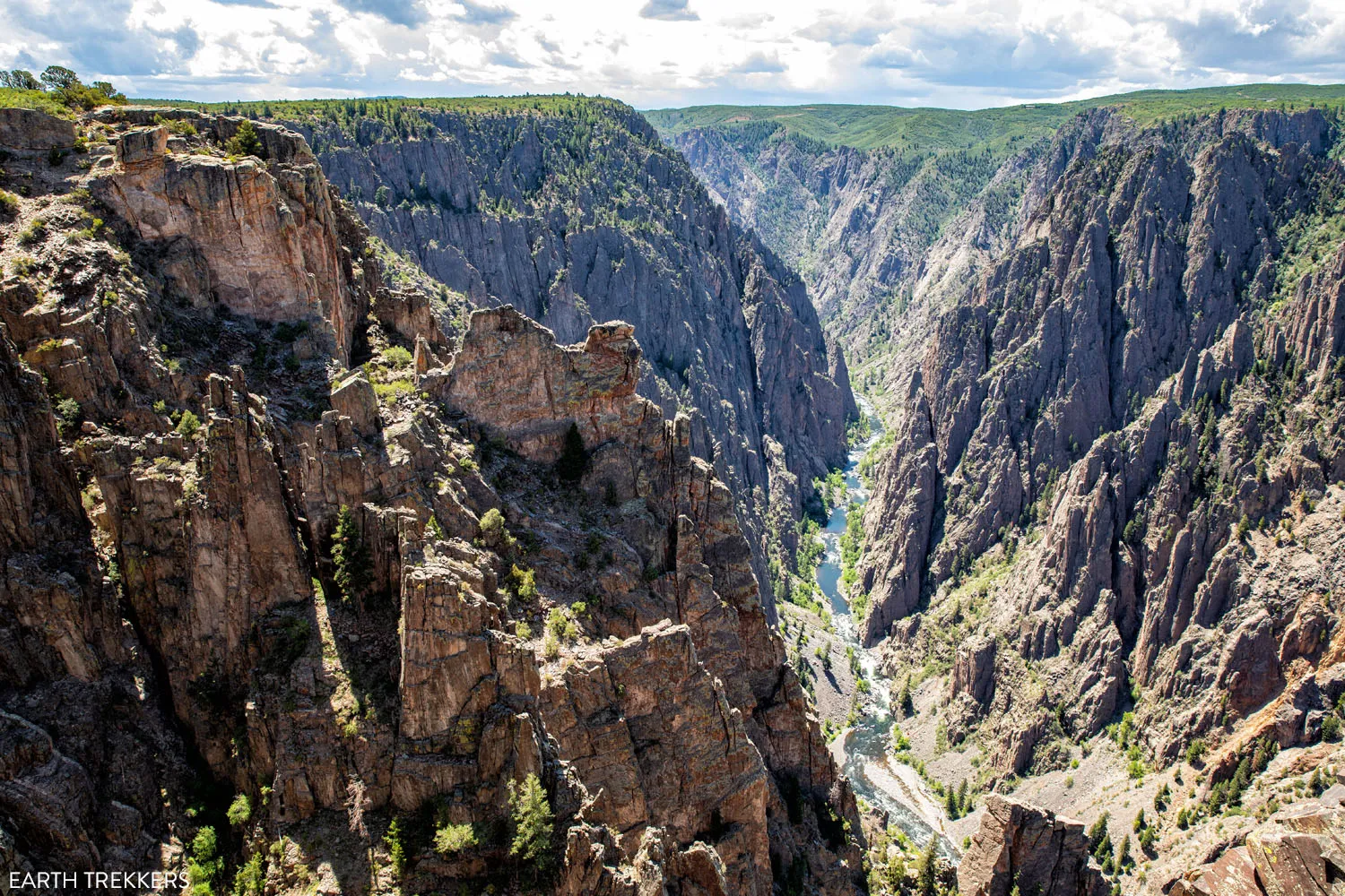
Big Island
From here, you get similar views as from The Narrows, with views down the Black Canyon.
Big Island Viewpoint
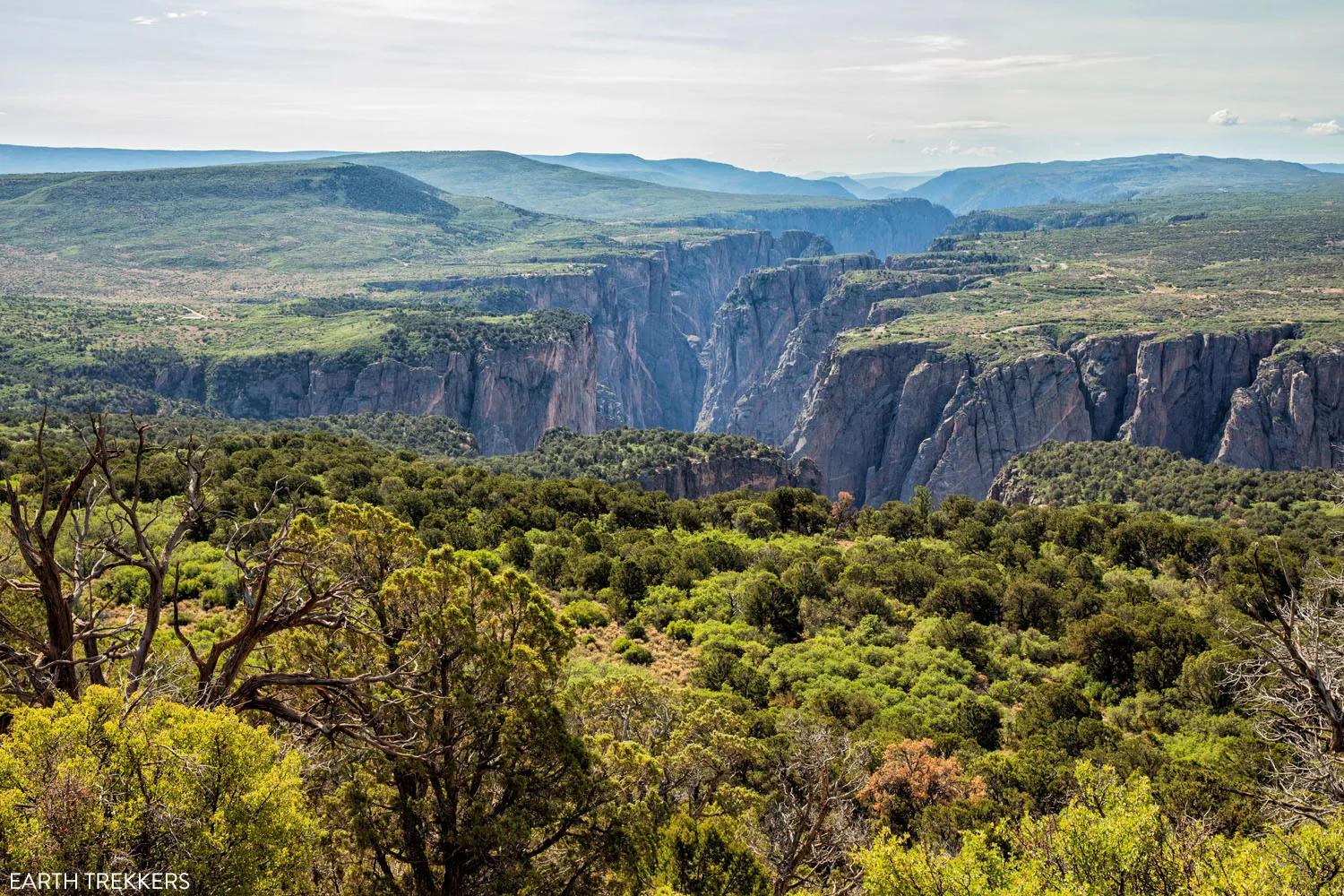
Island Peaks View
From this overlook, you can see a lot of the South Rim. Looking southeast, you get to see rugged pinnacles of rock. Looking northwest, you can see the South Rim visitor center and a wider expanse of the canyon. If you hiked, or plan to hike the Gunnison Route (one of the easier hikes down into the inner canyon), you can see the location of the hiking trail and just how steep of a hike this is.
Island Peaks Viewpoint
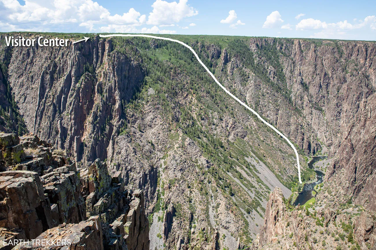
View of the Gunnison Route on the South Rim
Kneeling Camel View
Can you see the shape of a kneeling camel in the rocks?
Beyond this viewpoint, the road ends with a round-about and from here you will drive back towards the visitor center.
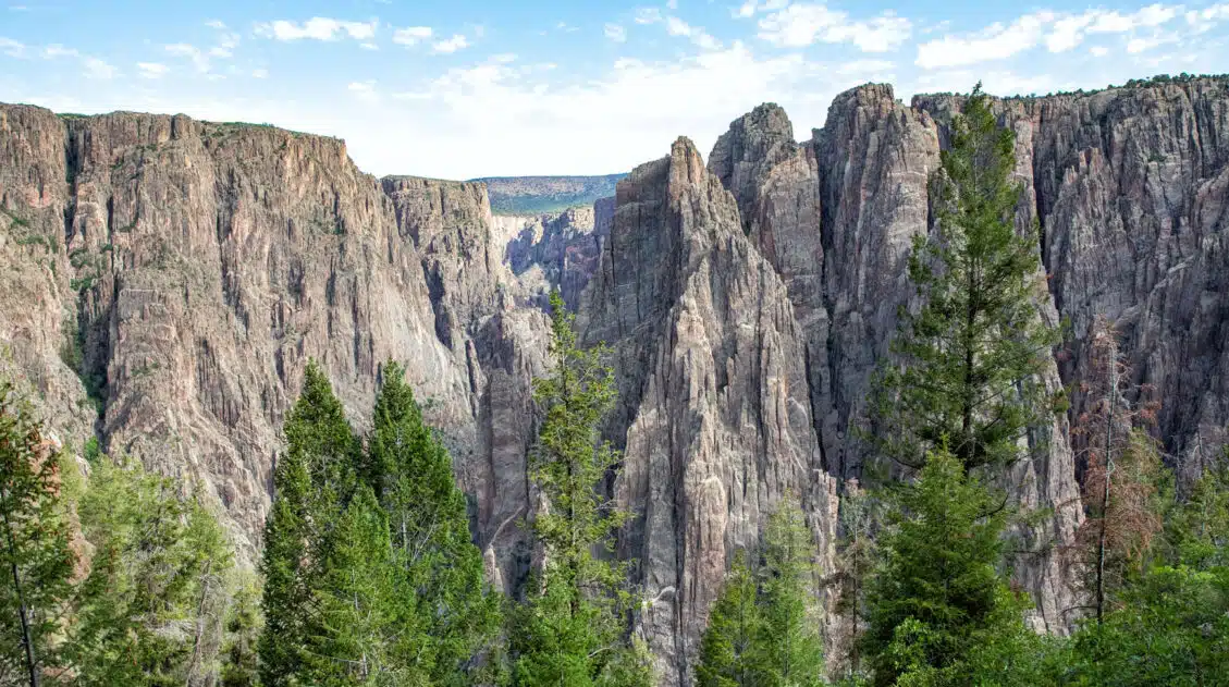
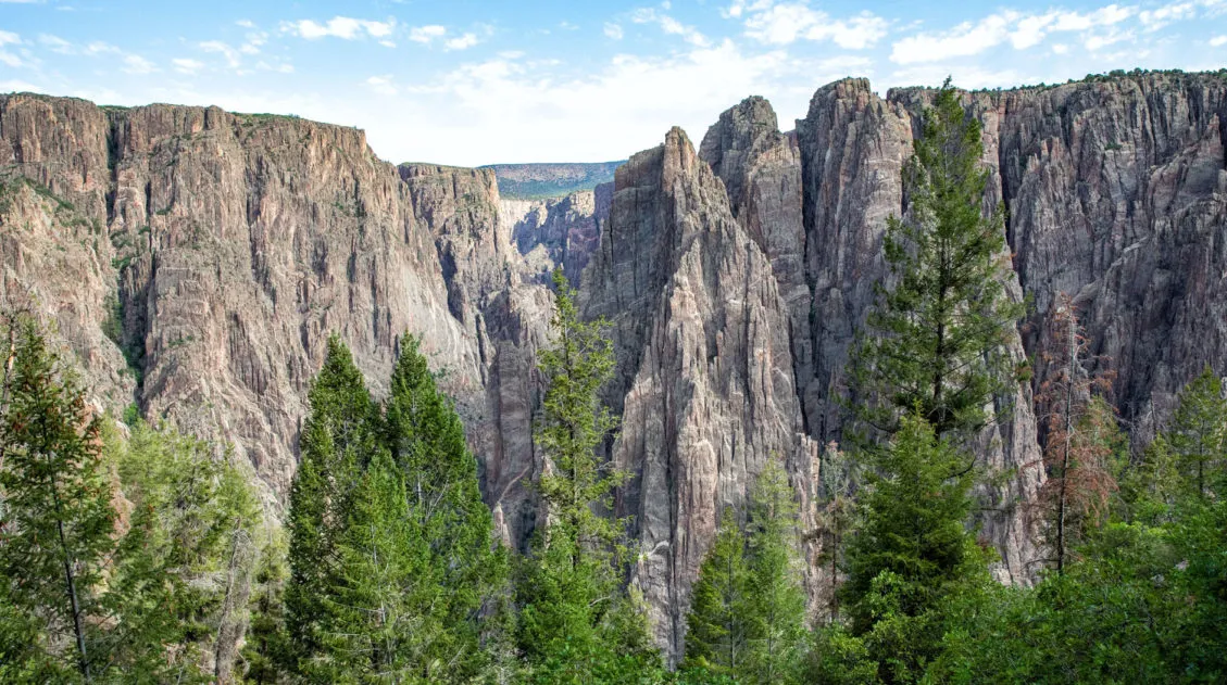
2. Chasm View Nature Trail
Distance: 0.33 miles | Difficulty: Easy | Time: 15 minutes
This short hiking trail loops around the North Rim Campground and offers stunning views of the Painted Wall. The Painted Wall is the tallest cliff in Colorado at 2,250 feet. If you look closely, you might be able to see people at the overlooks on the South Rim from here.
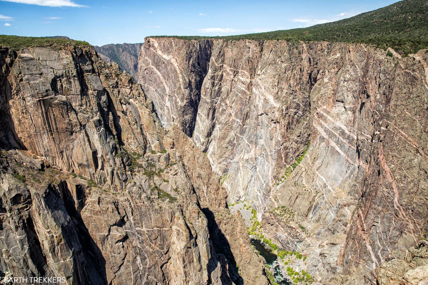
View of the Painted Wall
View from the Chasm View Nature Trail
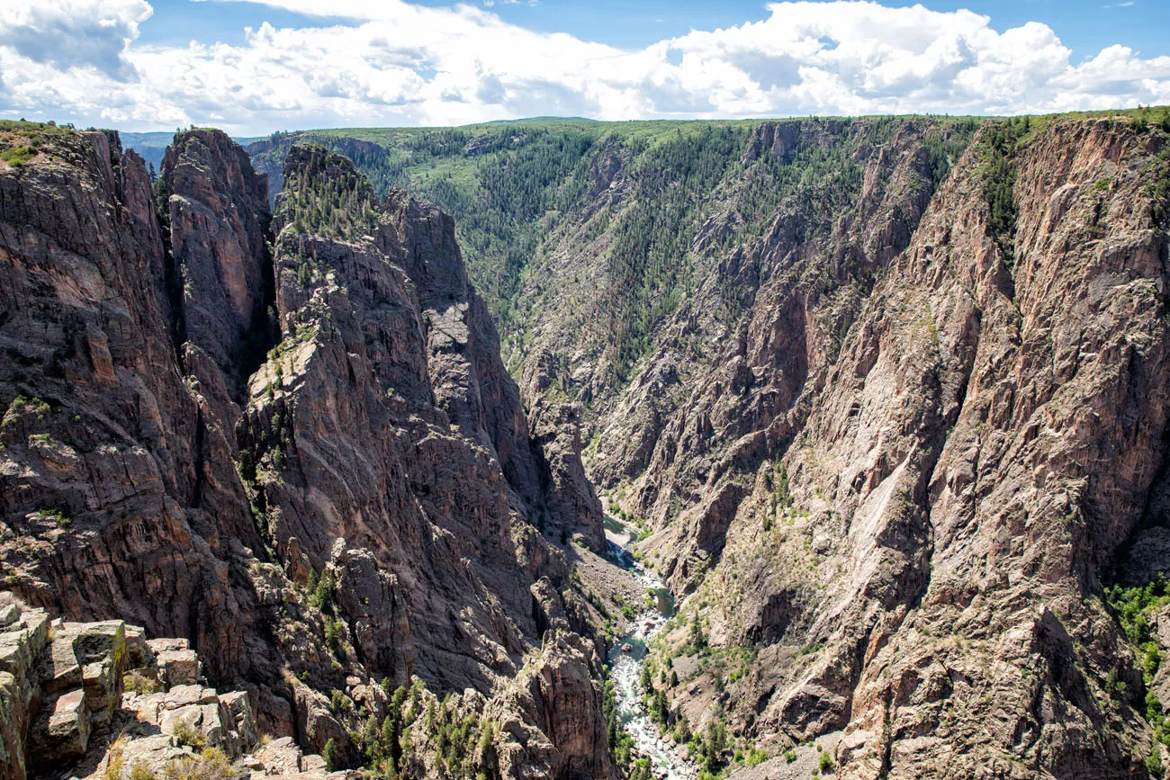
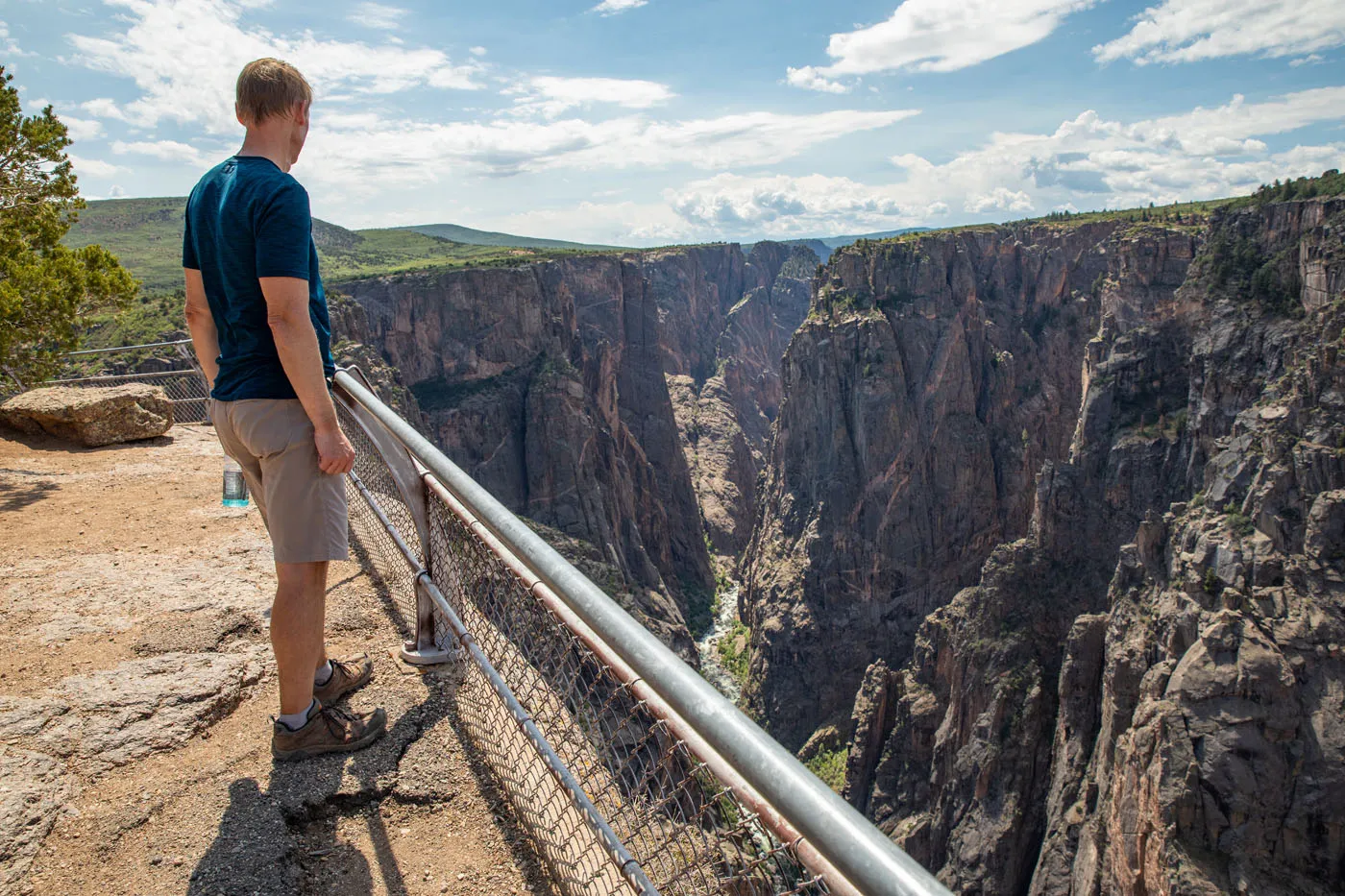
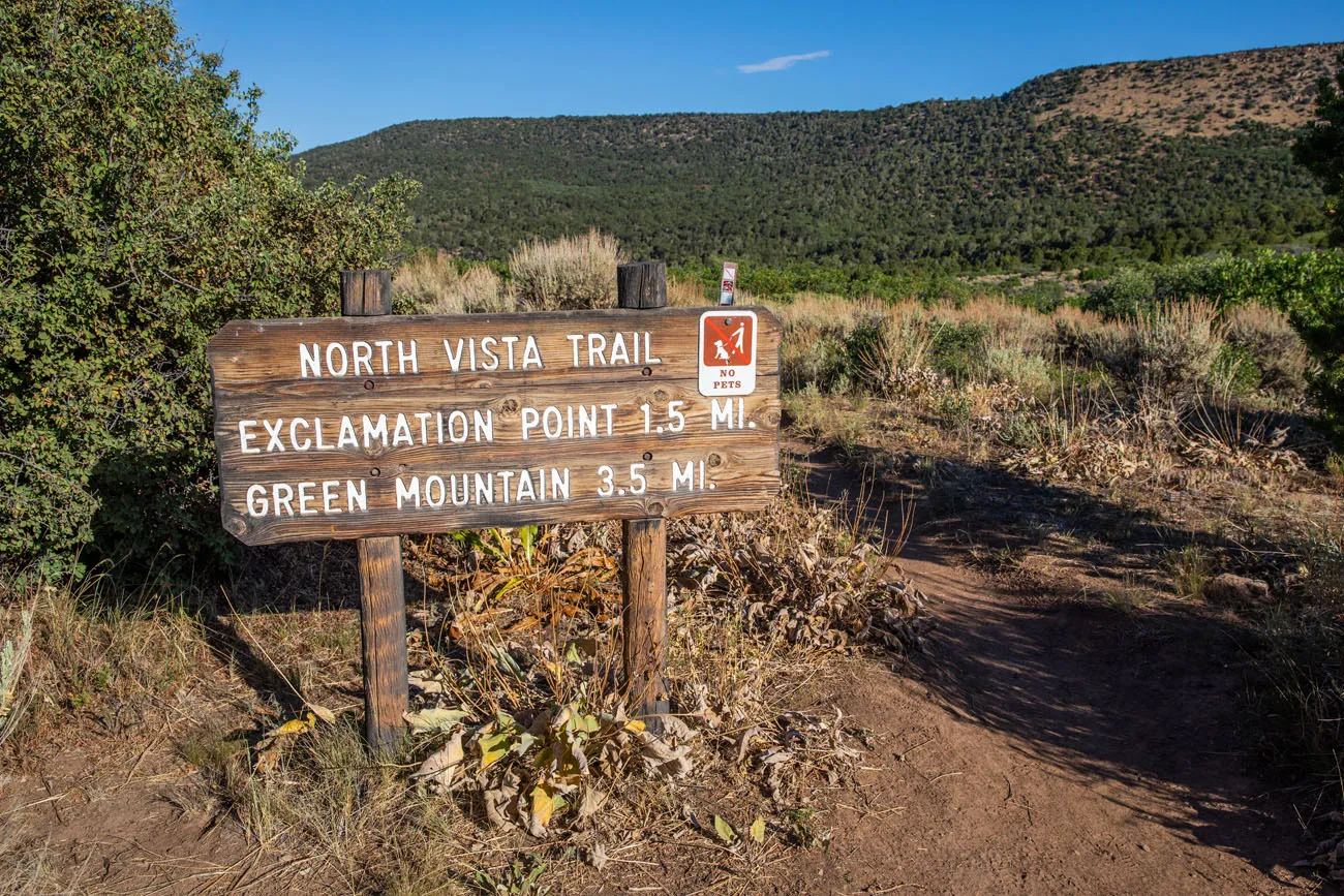
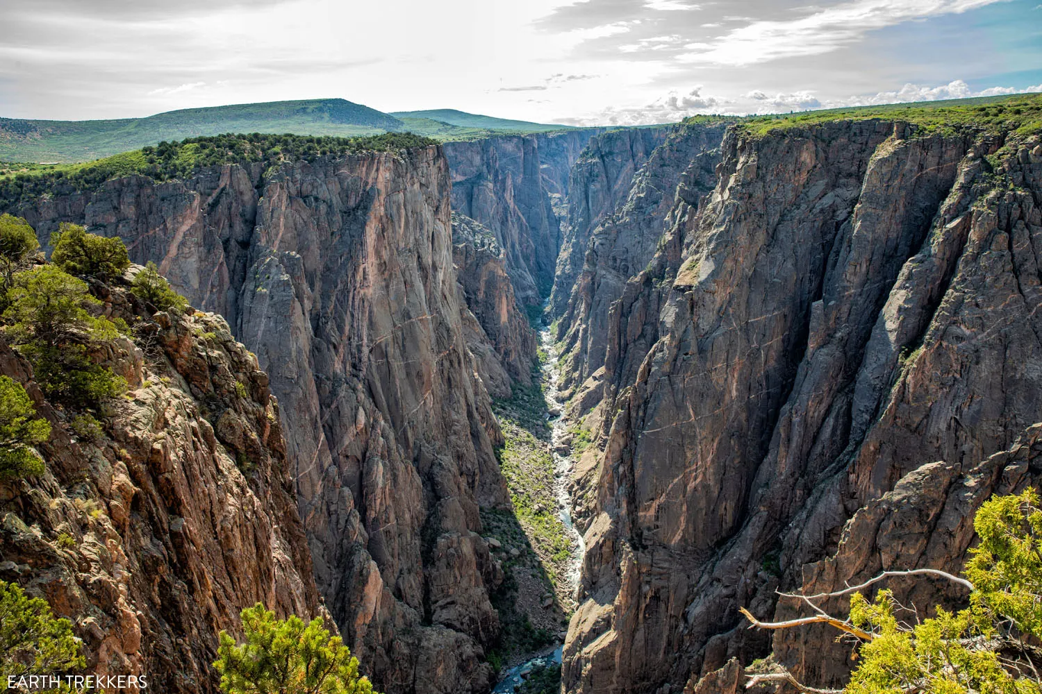
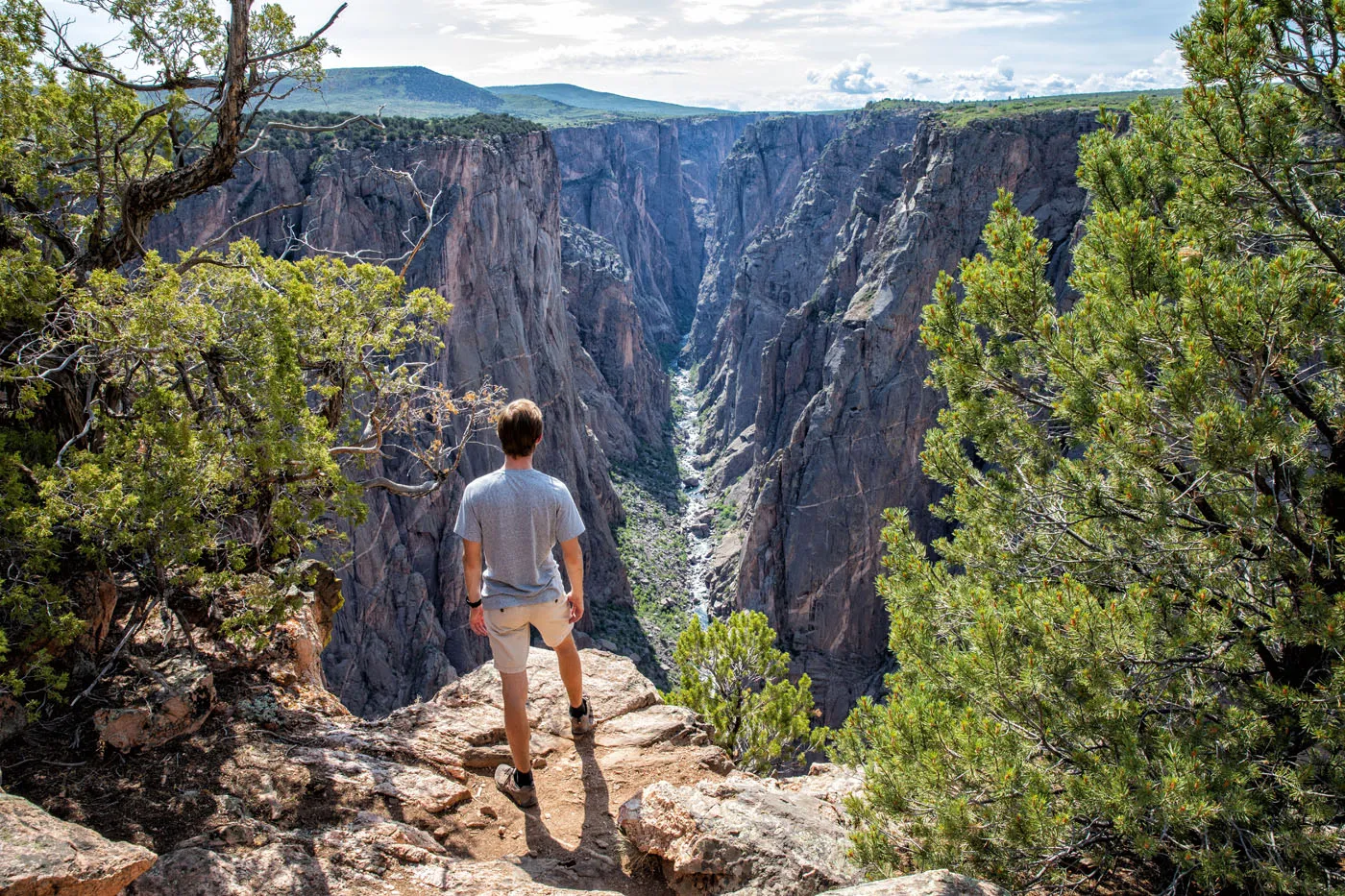
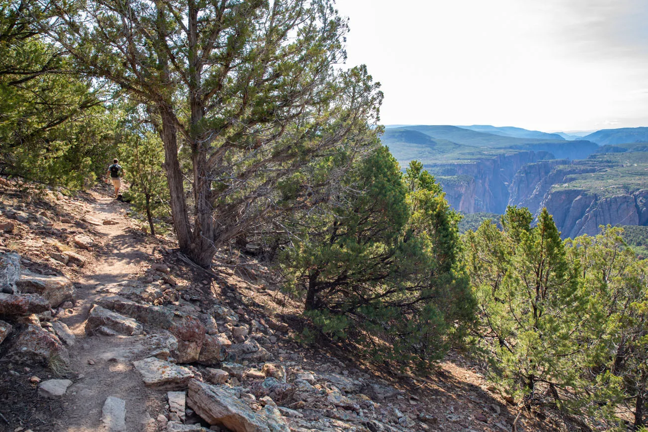
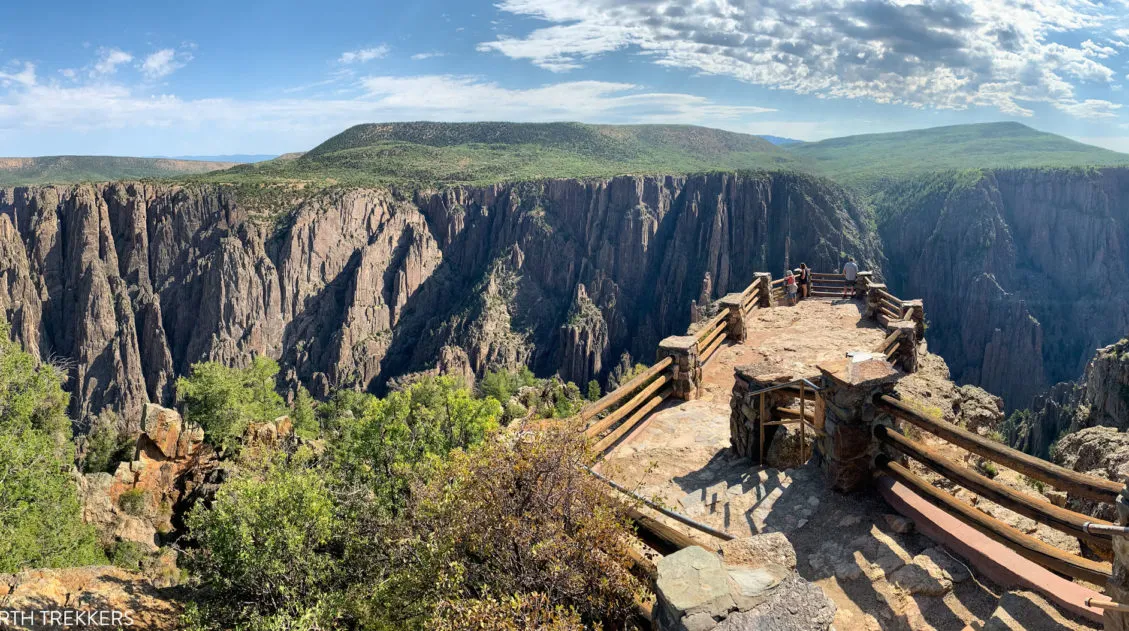
3. Exclamation Point
Distance: 3 miles round-trip | Difficulty: Easy | Time: 1.5 hours
This is one of the most spectacular views in Black Canyon of the Gunnison National Park, but to get here you will have to do a little bit of hiking.
To get to Exclamation Point, park in the small lot near the Ranger Station. You will hike the North Vista Trail to get to this viewpoint.
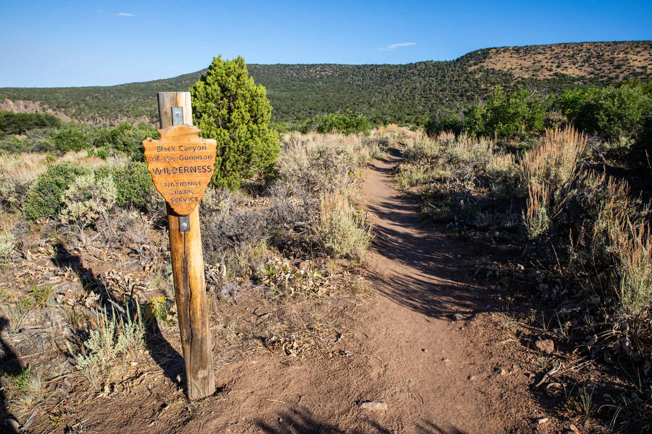
Even though you hike into the Black Canyon of the Gunnison wilderness, you do not need a permit to hike to Exclamation Point.
Note: You do not need a permit for this hike. Permits are required for inner canyon use but this hike does not enter the inner canyon.
The North Vista Trail heads along the North Rim, through juniper trees and brush. Occasionally you will get a view of the South Rim. There are a few ups and downs along the trail but nothing too strenuous. Just before reaching the 1.5 mile point, look for the spur trail to the left, which takes you out to Exclamation Point.
From here, you have a straight shot looking down the Black Canyon of the Gunnison. It’s an extraordinary view and well worth the short hike to get here.
4. Hike Green Mountain
Distance: 7 miles round-trip | Difficulty: Moderate | Total Ascent: 1,230 feet | Time: 3 to 4 hours
If you want panoramic views over Black Canyon of the Gunnison National Park, put this hike on your list.
To get to the peak of Green Mountain, you will hike the North Vista Trail. Park at the Ranger Station. For this hike, you do not need a permit.
From the trailhead, you will hike 3.5 miles to the top of Green Mountain. Along the way, you will pass the short spur trail to Exclamation Point.
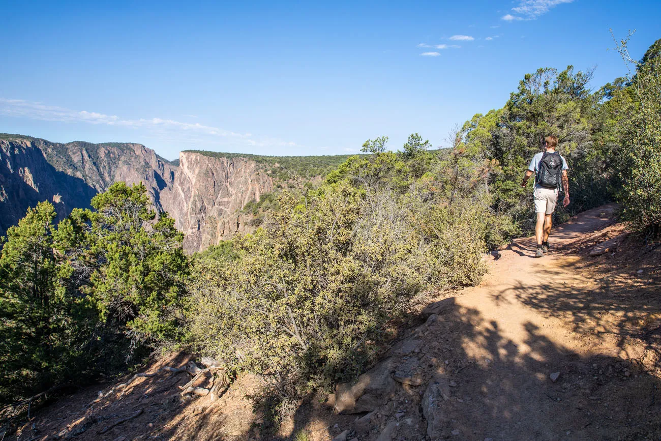
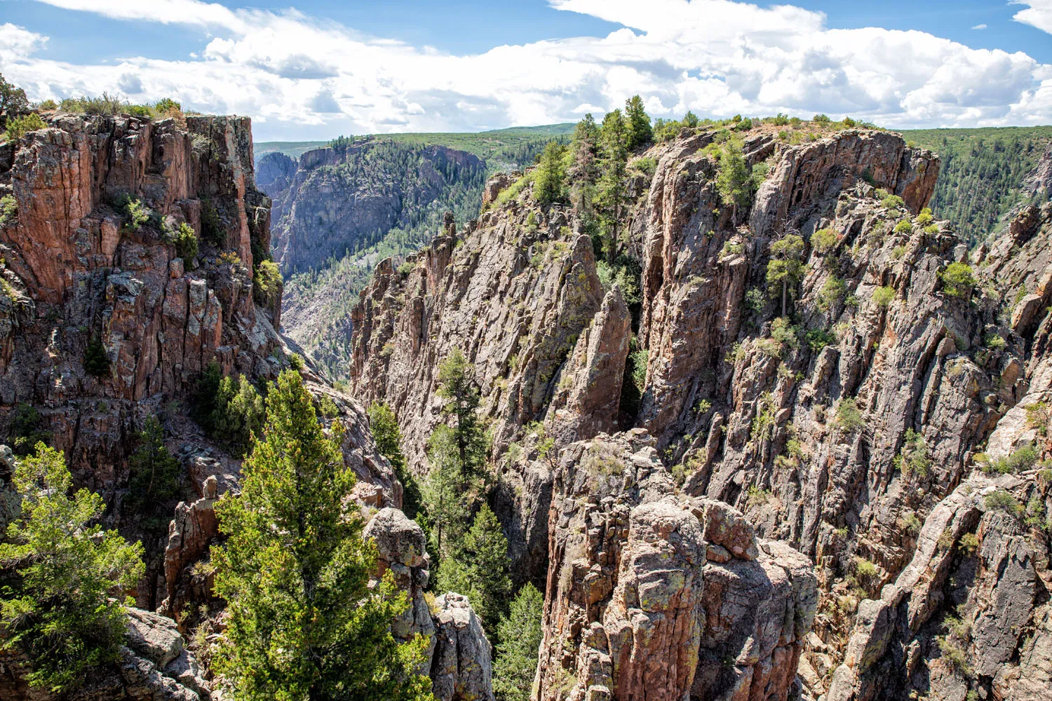
On the first half of the hike you occasionally get a view of the canyon through the trees.
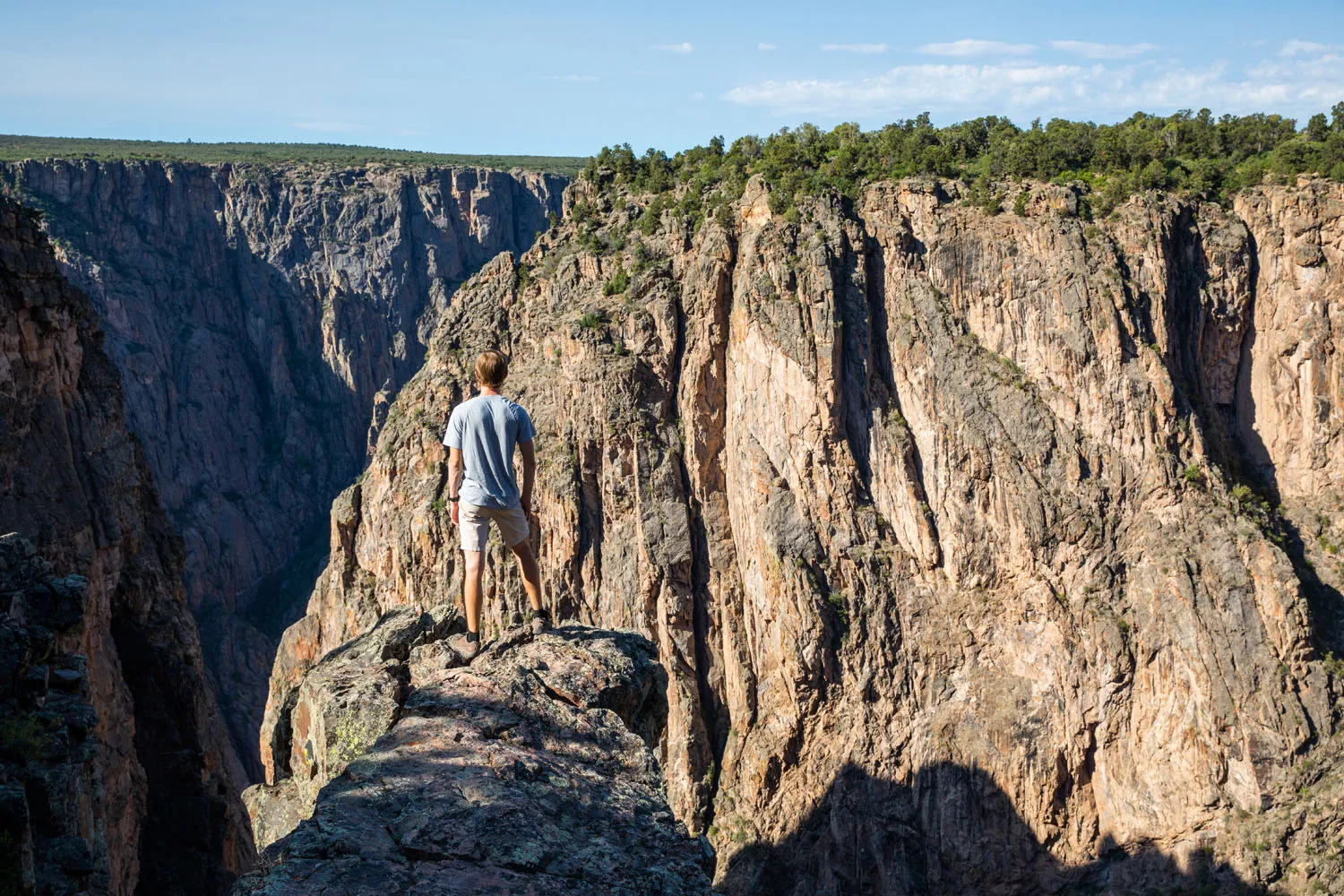
Near Exclamation Point there are also unique views of the canyon like this one.
The first half of the hike is relatively easy, a flat walk along the North Rim. Once you get past Exclamation Point, the trail climbs up Green Mountain. It’s nothing too strenuous but the high elevation here can make you feel winded. This hike starts at an elevation of almost 8,000 feet. Once you reach the peak of Green Mountain, you’ll be standing at 8,546 feet with sweeping views over Colorado.
View of the Black Canyon from Green Mountain
From the peak of Green Mountain, you can see the San Juan Mountains, the Uncompahgre Plateau, and a unique view of Black Canyon of the Gunnison.
View from the trail on the return hike.
5. Deadhorse Trail
Distance: 5 miles round-trip | Difficulty: Easy to moderate | Time: 2 to 4 hours
This hike starts at Kneeling Camel View. Most of this walk is along an old service road. Once you hit a fence, turn right and walk out to the edge of the rim for a view of the canyon.
6. Explore the Inner Canyon
There are three routes on the North Rim that enter the inner canyon. All of these require wilderness use permits which can be obtained at the Ranger Station on the North Rim. Excellent physical fitness and prior hiking experience are necessary to do these hikes. These hiking trails are infamous for the abundant poison ivy growing along the trail which can be 5 feet high in some spots.
S.O.B. Draw
Distance: 1.7 miles round-trip | Time: 5 hours
This is the easiest inner canyon route on the North Rim. The trail drops 1,800 feet before arriving at the Gunnison River. Be prepared to climb several ledges and wear long pants and long-sleeved shirts to protect yourself against the poison ivy.
Long Draw
Distance: 1.8 miles round-trip | Time: 4.5 miles
This route takes hikers to the narrowest portion of the canyon. You will descend 1,800 feet and climb several ledges. Park at Balanced Rock Overlook.
Slide Draw
Distance: 1.2 miles round-trip | Time: 5.5 hours
This is the toughest, most dangerous inner canyon route on this list. The trail is steep with loose rock. To start this hike, you will have to scramble down a 30-feet ledge. This hike starts near Kneeling Camel Overlook.
Please practice the seven principles of Leave No Trace: plan ahead, stay on the trail, pack out what you bring to the hiking trail, leave areas as you found them, minimize campfire impacts, be considerate of other hikers, and do not approach or feed wildlife.
Things to do on the North Rim: On a Map
How to Use This Map: Click the icons on the map to get more information about each point of interest. To take this map with you, click the star next to the title of the map which adds it to your Google account. Next, within your Google Maps app, select ‘Saved’ and then select ‘Maps’. This map title will now appear in your list.
How to Get to the North Rim of Black Canyon of the Gunnison
Even though the canyon is only 1,100 feet in the narrowest section, it takes about two hours to drive from the South Rim to the North Rim. To visit both the South and the North Rims, you need to have two days (one day for each rim).
If you are staying in Montrose, it takes an hour and a half to drive to the North Rim (64 miles).
Crawford is the closest town to the Black Canyon. To get to the North Rim of Black Canyon of the Gunnison, take highway 92 to Black Canyon Road and follow signs for Black Canyon of the Gunnison. The final 7 miles of the road is a gravel road that is suitable for standard cars.
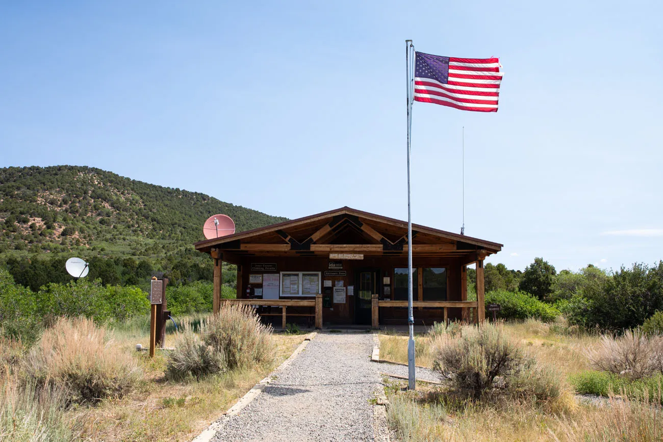
North Rim Visitor Center
Practical Information
The North Rim is closed to vehicles in the winter. You can get updates about road conditions on the National Park Service website.
There is a $30 to visit the Black Canyon of the Gunnison National Park. This fee also includes the South Rim, so if you went here first, within the past 7 days, you are also covered to visit the North Rim. However, if you only plan to visit the North Rim, you will have to pay this $30 fee. There are limited fee collection stations on the North Rim. The National Park Service recommends that you pay your fee online before you go. Learn more here.
You need a half to a full day to visit the North Rim of Black Canyon of the Gunnison. This gives you plenty of time to drive North Rim Drive Road and visit all of the viewpoints, hike to Exclamation Point, and add on the hike to Green Mountain or an inner canyon route.
Get updates on road and trail closures on the National Park Service website as you plan your trip and just before your visit.
If you are looking for a cool spot to add onto your visit, check out Needle Rock Natural Area, which is located northeast of Crawford.
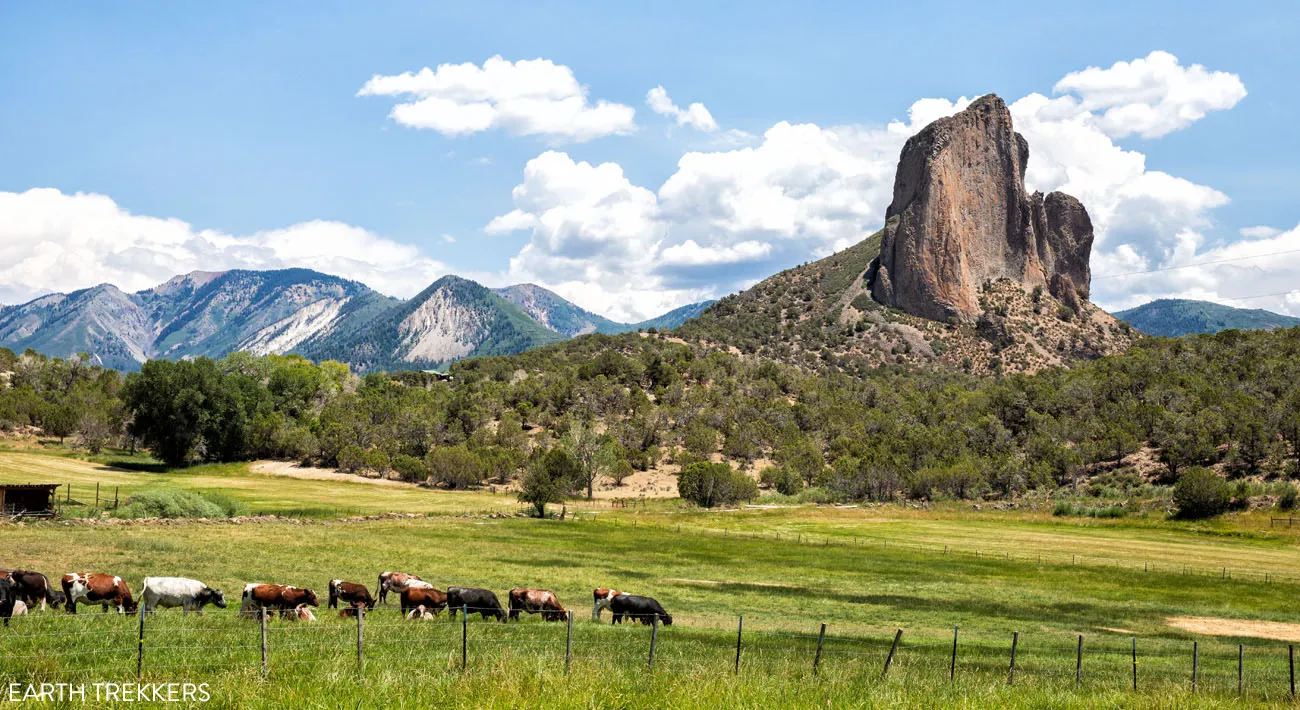
Needle Rock Natural Area
If you have any questions about visiting the North Rim of Black Canyon of the Gunnison National Park, let us know in the comment section below.
More Information about Colorado
How to Visit the Black Canyon of the Gunnison: North & South Rims
In some ways, the Black Canyon of the Gunnison is a smaller version of the Grand Canyon. You can visit both the North and South Rims, enjoy the views from the overlooks, and, for the ultimate adventure, hike below the rim to the Gunnison River. In this guide, learn how to visit Black Canyon of […]
Best Things to Do on the South Rim of Black Canyon of the Gunnison
The Black Canyon of the Gunnison is a highly underrated national park. In some ways, it’s a smaller, less crowded version of the Grand Canyon. You can enjoy the views along both rims, hike the rim trails, or go on a real adventure by hiking below the rim. You can explore both the North and […]
How to Hike the Gunnison Route | Black Canyon of the Gunnison
The Gunnison Route takes hikers from the south rim of the Black Canyon to the Gunnison River. It’s the most popular inner canyon experience on the south rim, but don’t let that fool you. This is a hard, strenuous hike where you will descend (and later hike back up) a massive amount of elevation in […]
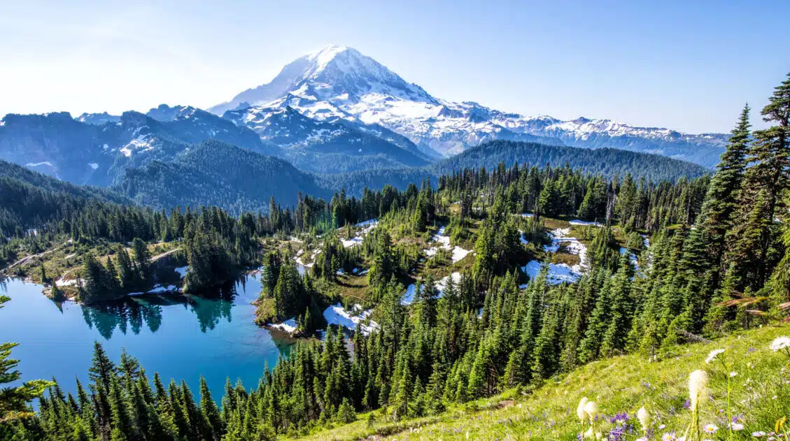
Ultimate Guide to the Colorado National Parks (+ 10 Day Itinerary)
There are four Colorado national parks: Rocky Mountain, Mesa Verde, Black Canyon of the Gunnison, and Great Sand Dunes. The landscapes that these national parks protect are dramatically different from one another. In Rocky Mountain National Park, journey high into the Rocky Mountains, cross the Continental Divide, and hike to gorgeous alpine lakes and waterfalls. […]
7 to 14 Day Colorado Itinerary: National Parks & Scenic Drives
With four national parks, numerous national forests and state parks, plus historic towns scattered throughout the Rocky Mountains, Colorado makes an awesome road trip destination. On this Colorado itinerary, you will visit all four national parks (Great Sand Dunes, Mesa Verde, Black Canyon of the Gunnison, and Rocky Mountain National Parks), linking them together with […]
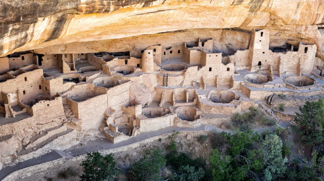
Top 10 Things to Do in Mesa Verde National Park
Located in southwestern Colorado, Mesa Verde National Park is one of the most unique national parks in the United States. This park preserves the ancient Puebloan cliff dwellings and archeological sites that are hundreds of years old. Short hikes, scenic drives, and viewpoints make the to-do list, but the best way to experience this park […]
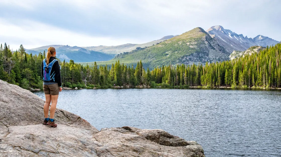
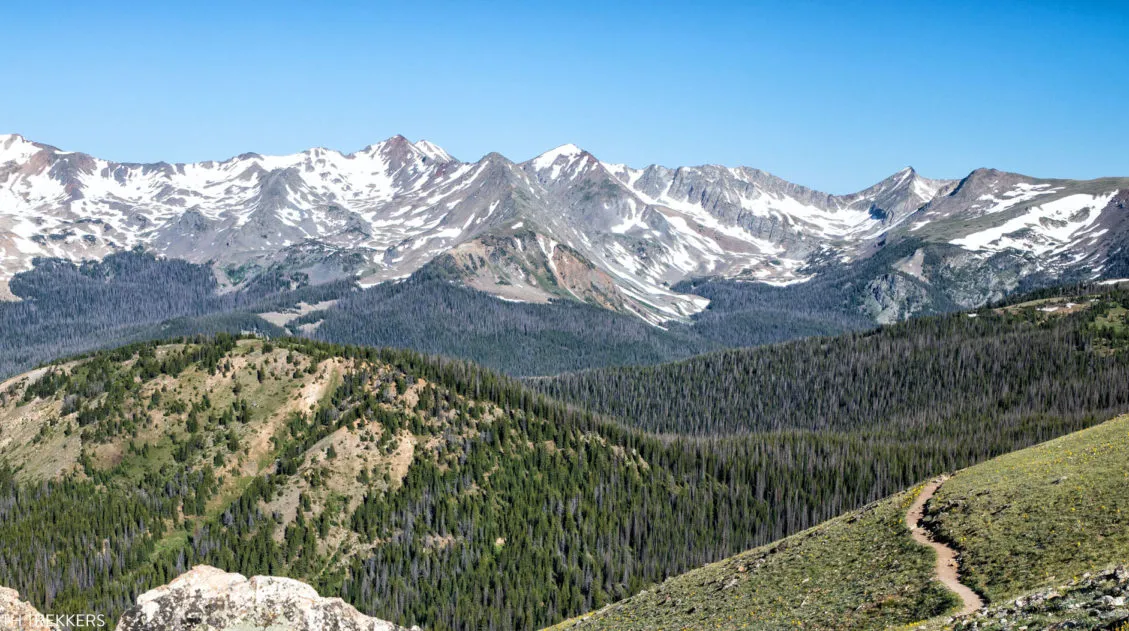
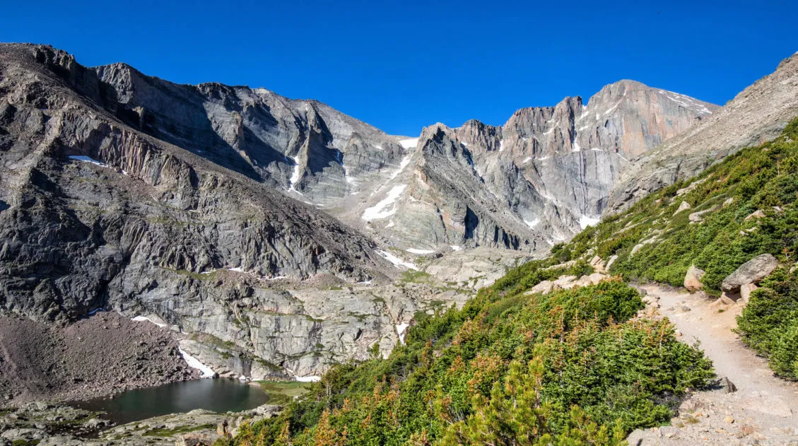
One Perfect Day in Rocky Mountain National Park
If you only have one day in Rocky Mountain National Park, what should you do? The answer to this question depends on several factors…the time of year you plan to visit Rocky Mountain National Park, if you are traveling with children, how much you like to hike, and if you are acclimated to the higher […]
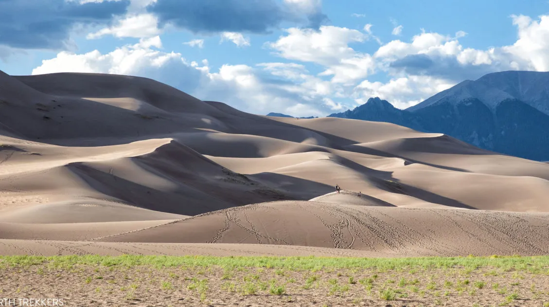
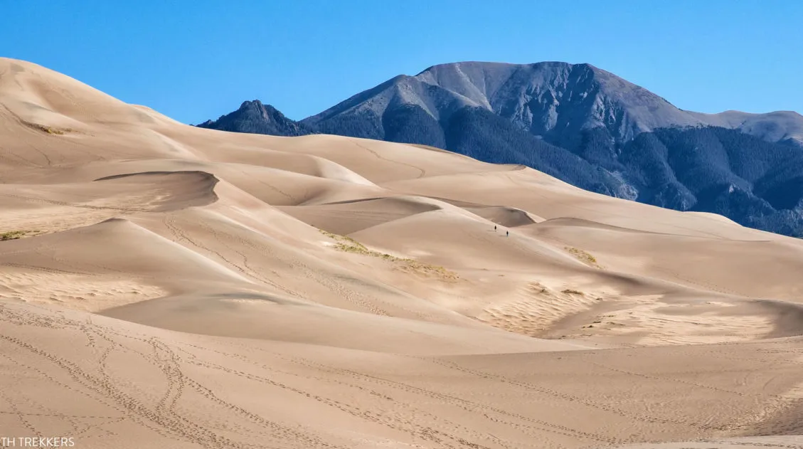
8 Amazing Things to Do at Great Sand Dunes National Park
Great Sand Dunes is a much different experience than many other national parks in the United States. Sure, there is hiking and amazing sunsets and ranger programs, but this park has a much different feel to it. It’s a small park and the list of things to do is very short. A few hours are […]
Best US National Parks to Visit Month-By-Month
Best National Parks to Visit Month-By-Month When planning a trip to the national parks, one of the most important things to consider is the time of year that you are planning your visit. With a few exceptions, most national parks have an optimal time to visit, based on factors such as weather, crowd levels, and […]
The Perfect Rocky Mountain National Park Itinerary (2025)
If you are planning your Rocky Mountain National Park itinerary, this is a great place to start. Rocky Mountain National Park is one of the best US national parks to go hiking. With towering mountain peaks, alpine lakes and waterfalls, and the opportunity to hike along the Continental Divide, this park offers world-class hiking experiences. […]
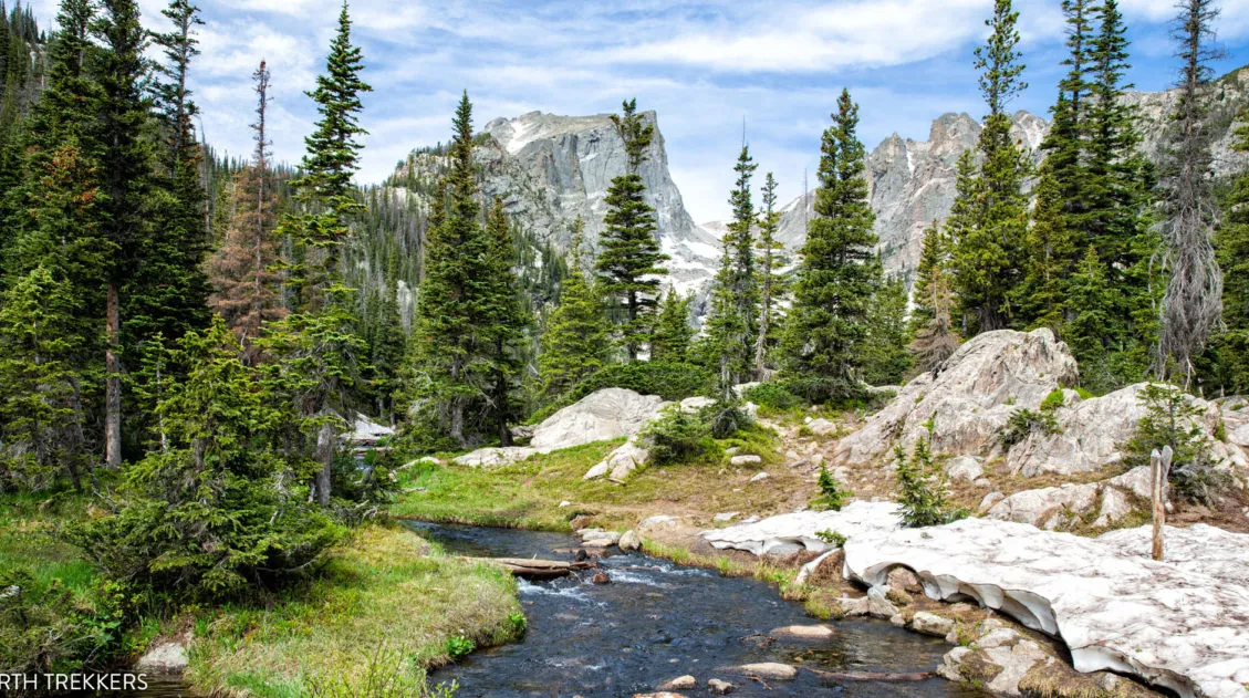
15 Epic Hikes in Rocky Mountain National Park
Rocky Mountain National Park is best seen from a hiking trail. Fortunately, there are hikes for all ages and ability levels. From short, easy strolls around lakes, to ridgeline trails with panoramic views, to challenging but epic climbs to the tallest mountain peaks, there truly is something here for everyone. Here are 15 of the […]
Best National Parks in the USA: 15 Amazing Parks for Your Bucket List
Stretching from the South Pacific, across the United States and into the Caribbean, are 63 national parks. These national treasures are filled with scenic drives, hundreds of miles of hiking trails, wildlife, historic sites, and endless opportunities for adventure. In this guide, we cover 15 of the best national parks in the USA and what […]
The Ultimate Guide to the 63 US National Parks
Stretching from the South Pacific, across the United States to the Caribbean, are 63 national parks. These national treasures preserve iconic landscapes, majestic mountains, primordial forests, arid deserts, misty coastlines, immense canyons, wildlife, and historic landmarks. The opportunities for adventure are endless. Hiking, rock climbing, rafting, mountain biking, sand boarding, horseback riding, mountaineering, canyoneering, and […]
United States Travel Guide: Places to Visit in the USA
Plan your visit to the United States. Learn about the best things to do, how to plan your time, road trip ideas, and sample itineraries.
Comments 10