Colorado is the perfect road trip destination. The Rocky Mountains, the national parks and state parks, the historic towns, and the diverse landscapes are all linked together by some of the most beautiful drives in the United States. Drive some of the highest roads in the United States and twist and turn through verdant valleys and canyons. Here are 9 of the best scenic drives in Colorado.
About this List
This is not an all-inclusive list. The list of scenic drives in Colorado is very long. On this list are some of the most notable and popular scenic drives in Colorado, made famous by their spectacular views and sheer “wow” factor.
Many of these driving routes are through-roads, highways and byways that connect several destinations. Several of these drives simply take you to the top of a mountain for outstanding views. Here is a little road trip terminology:
Scenic Byway: A scenic route or tourist route; a specially designed road or waterway that travels through an area of natural or cultural beauty
Mountain Pass: A navigable route through or over a mountain range.
Note: All of these roads are paved so there is no need for a 4WD vehicle. You can see these scenic drives on a map at the end of this post.
Scenic Drives in Colorado
1. Peak to Peak Scenic Byway
Distance: 55 miles | Time: 2 Hours | Open: All Year
The Peak to Peak Scenic Byway connects Estes Park with Central City. It runs along the eastern edge of Rocky Mountain National Park and Colorado’s Front Range. This road traverses mountain peaks and goes through several historic towns before ending in Central City.
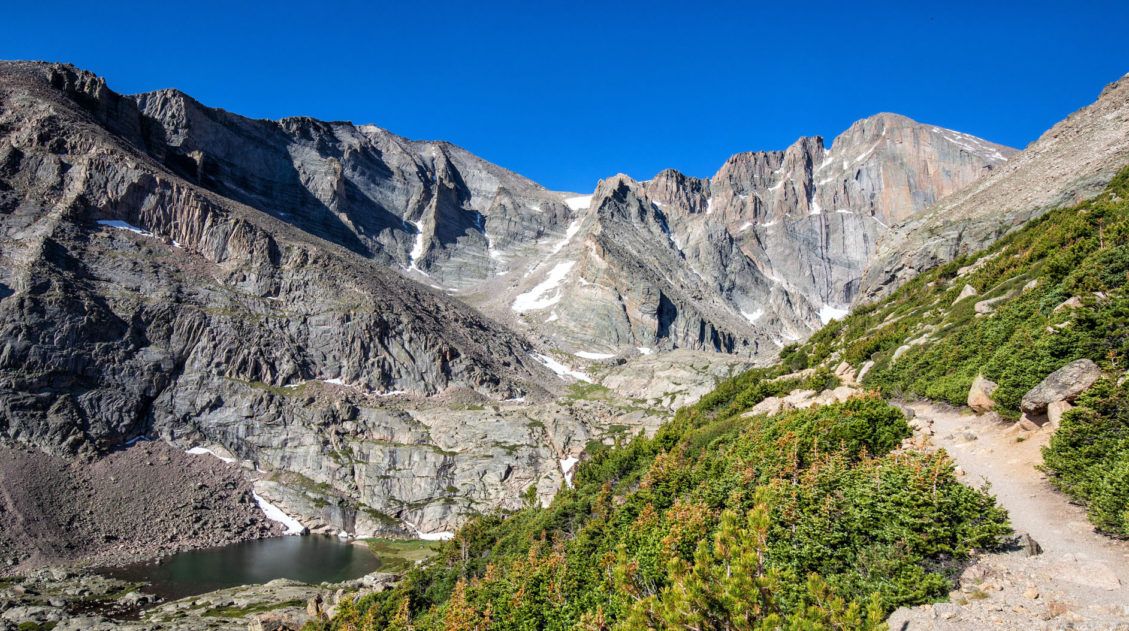
On this drive you get to see Longs Peak, the tallest mountain in Rocky Mountain National Park. Mount Meeker, at 13,911 feet, can also be seen on this drive. Nederland is small, historic town and a nice place to stop for a bite to eat. Once in Central City, you can visit the casinos.
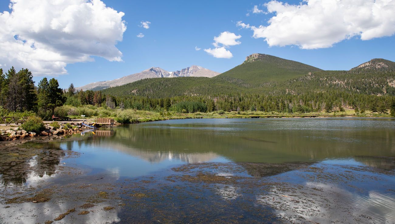
Lily Lake and Longs Peak, located along the Peak to Peak Scenic Byway
2. Mount Evans Scenic Byway
Distance: 50 miles round-trip | Time: 2 hours | Open: Summer
This is the highest paved road in North America.
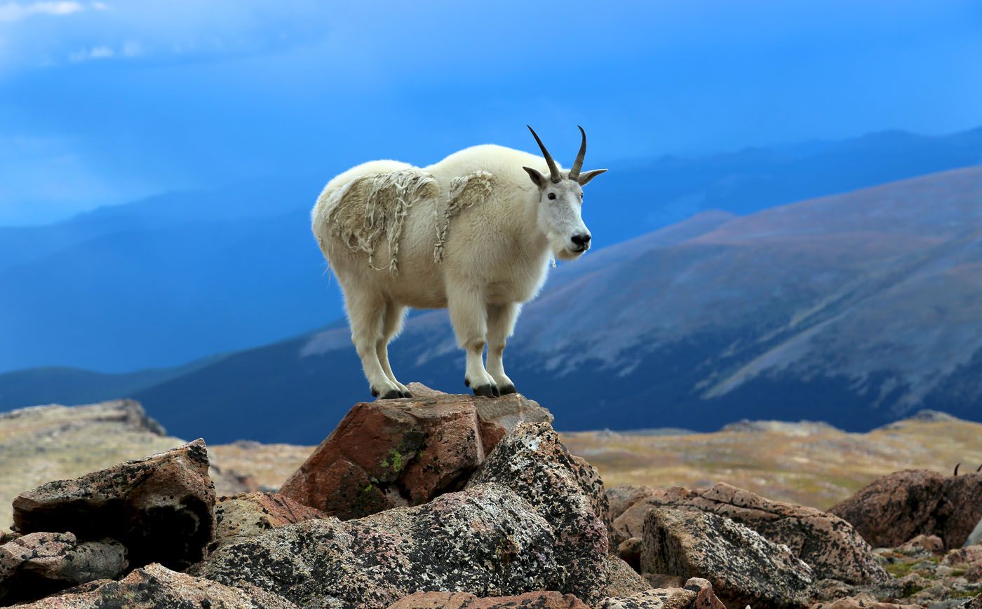
At 14,271 feet, Mount Evans is located in the Front Range of the Rocky Mountains. You can drive to the summit of this lofty mountain on the Mount Evans Scenic Byway.
In just 28 miles, the road climbs over 7,000 feet, ending near the summit of Mount Evans. At its highest point it reaches 14,130 feet, making this is the highest paved road in North America.
Once at the summit, you get to enjoy panoramic views over the Rocky Mountains, views of the Continental Divide, and it is here that you have a very good chance to see mountain goats and bighorn sheep.
Steve Boice/shutterstock.com
How to Do This: The Mount Evans Scenic Byway is typically open from Memorial Day to Labor Day, depending on weather conditions. Get updates here. To get here from I-70, take exit 240 in Idaho Springs, follow Highway 103 south until it reaches Echo Lake, then take Highway 5 to the top of Mount Evans. From Bergen Park, take Squaw Pass Road/Highway 103 to Echo Lake and then take Highway 5 to the top of Mount Evans.
3. Trail Ridge Road
Distance: 48 miles | Time: Half to Full Day | Open: Summer and early fall
Located in Rocky Mountain National Park, Trail Ridge Road is the highest paved through road, not only in Colorado, but also in the entire US national park system.
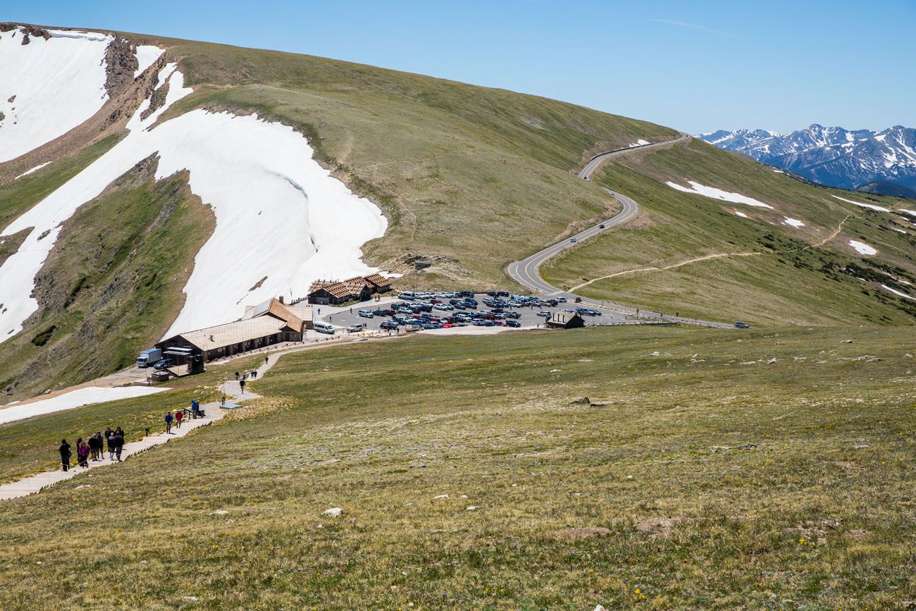
Alpine Visitor Center and Trail Ridge Road
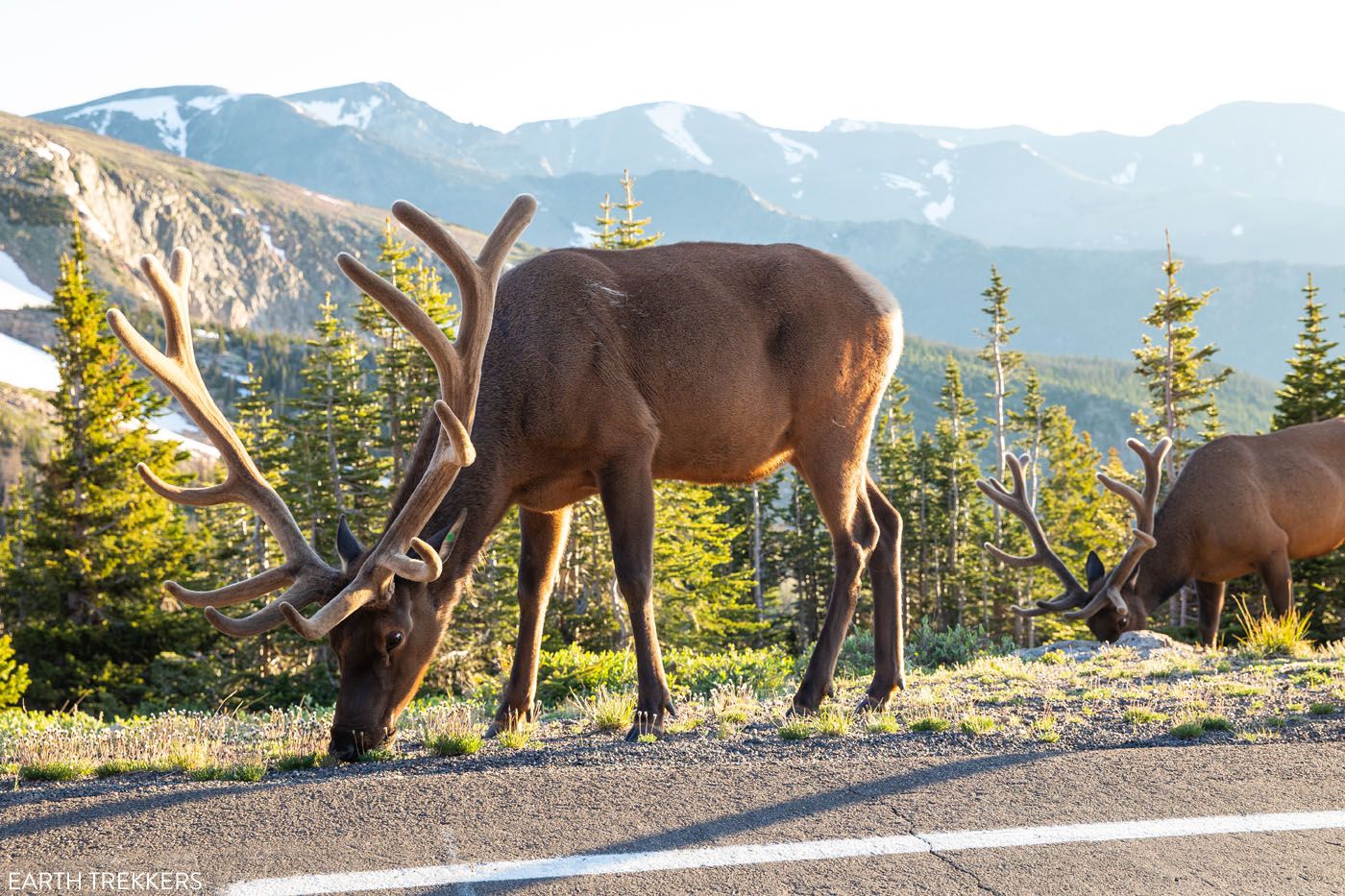
Elk on Trail Ridge Road
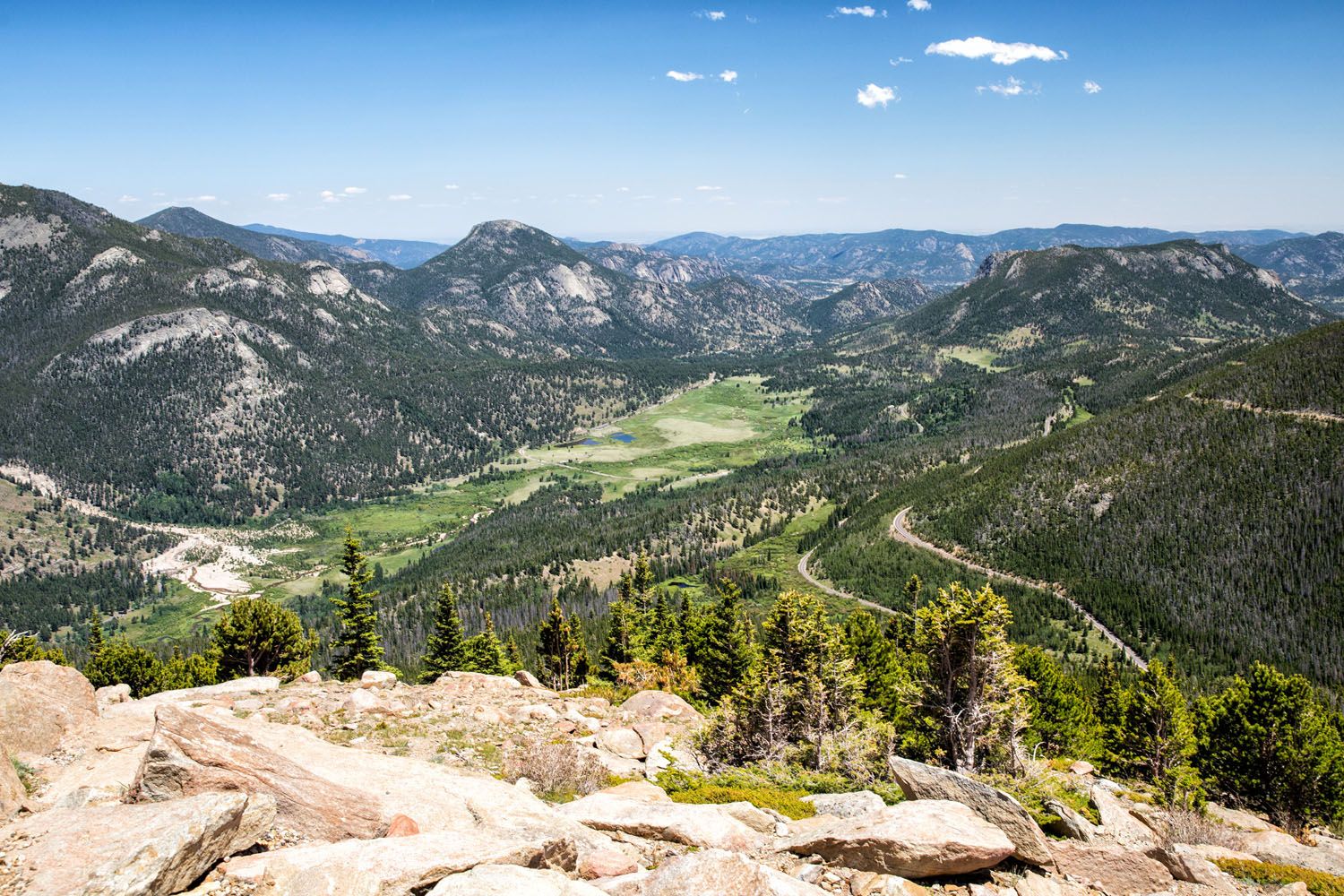
View of Rocky Mountain National Park from Trail Ridge Road
For 48 miles, this road runs from Estes Park in the east to Grand Lake in the west. 11 miles of this road is located in the alpine tundra, which is above the tree line. It reaches its highest point at 12,183 feet. Trail Ridge Road crosses the Continental Divide at Milner Pass.
This is a gorgeous drive. Along the way, there is a good chance that you will spot bighorn sheep and elk. The views from the overlooks are stunning. A few great hikes in Rocky Mountain National Park start and end along this road. And you can also visit the Alpine Visitor Center, the highest visitor center in the USA.
Important: Trail Ridge Road is typically open from Memorial Day through mid-October. During the remainder of the year it is closed due to snow. Get updated road conditions and information about the Timed Entry System on the National Park Service website.
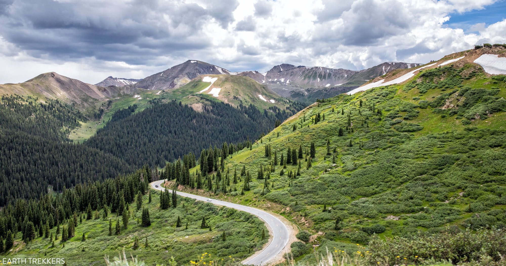
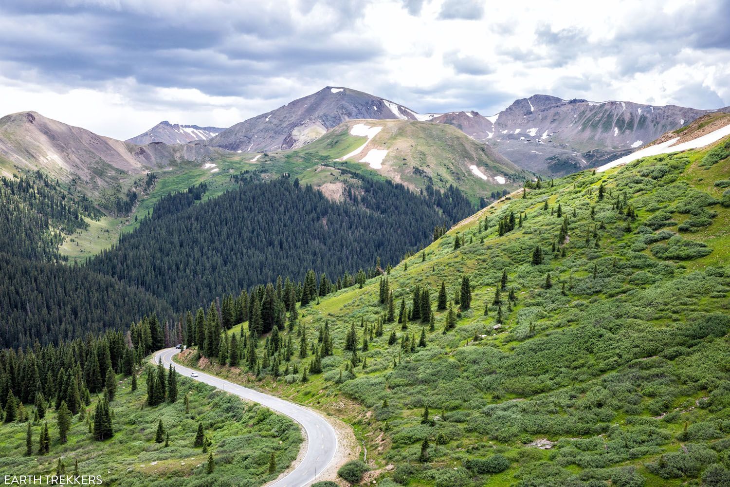
4. Top of the Rockies National Scenic Byway
Distance: 130 miles | Time: 4 to 5 hours | Open: All Year with the exception of Independence Pass
This scenic byway has several parts to it. It includes three mountain passes and several very historic towns.
Starting in Aspen, drive Highway 82 east towards Granite. Along this drive, you will cross Independence Pass, the highest paved state highway, crossing the Continental Divide. The summit of this pass sits at 12,095 feet. Parts of this road are narrow and winding and there are very short distances where the road is only wide enough for one car to pass.
Independence Pass is generally open from Memorial Day to late October depending on snowfall. It is closed the remainder of the year. Get updates on road conditions here.
Once you arrive at Highway 24, turn left and take Highway 24 north to continue on the Top of the Rockies Scenic Byway.
Leadville, at 10,152 feet, is the highest incorporated town in the United States. This historic town was a boomtown in the 1880s, with its silver mines drawing famous figures like Doc Holliday, Susan B. Anthony, Buffalo Bill Cody, and Horace “Silver Dollar” Tabor.
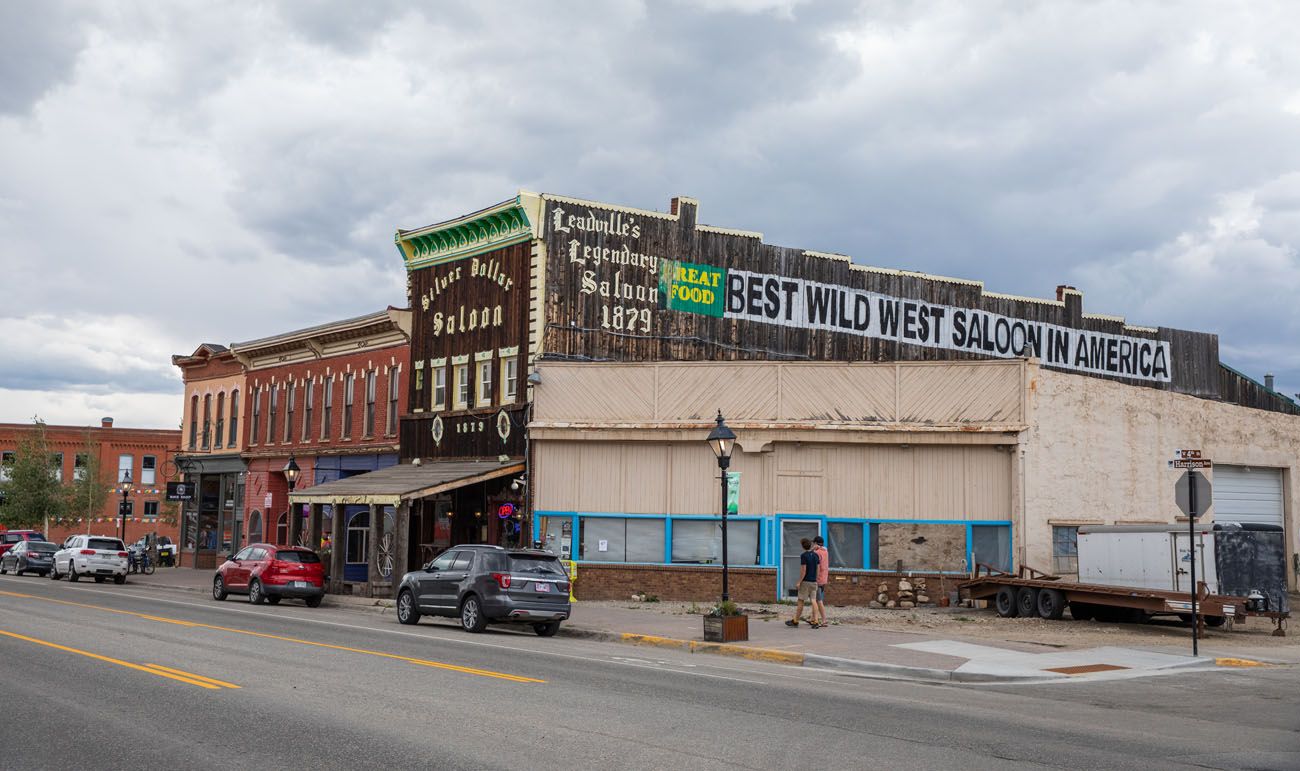
Leadville
At Leadville, this scenic byway forks. If you go right on Highway 91, you will cross the Continental Divide at the 11,318-foot Fremont Pass before arriving at Copper Mountain and I-70. If you go left on Highway 24, you will cross the Continental Divide at the 10,424-foot Tennessee Pass before reaching Minturn and I-70.
Highway 24 and Highway 91 are generally open all year, although they can briefly close after a big snowfall.
PRO TRAVEL TIP: It can be 20 to 30 degrees cooler on these mountain passes (Mount Evans, Pikes Peak, Alpine Ridge Road, and Loveland Pass) than at lower elevations. Make sure you bring extra layers, even during the summer months.
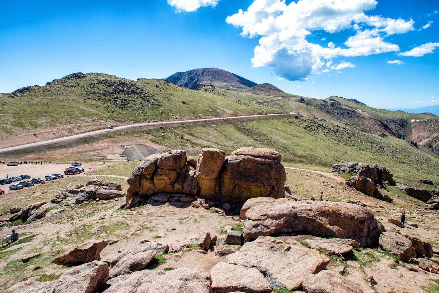
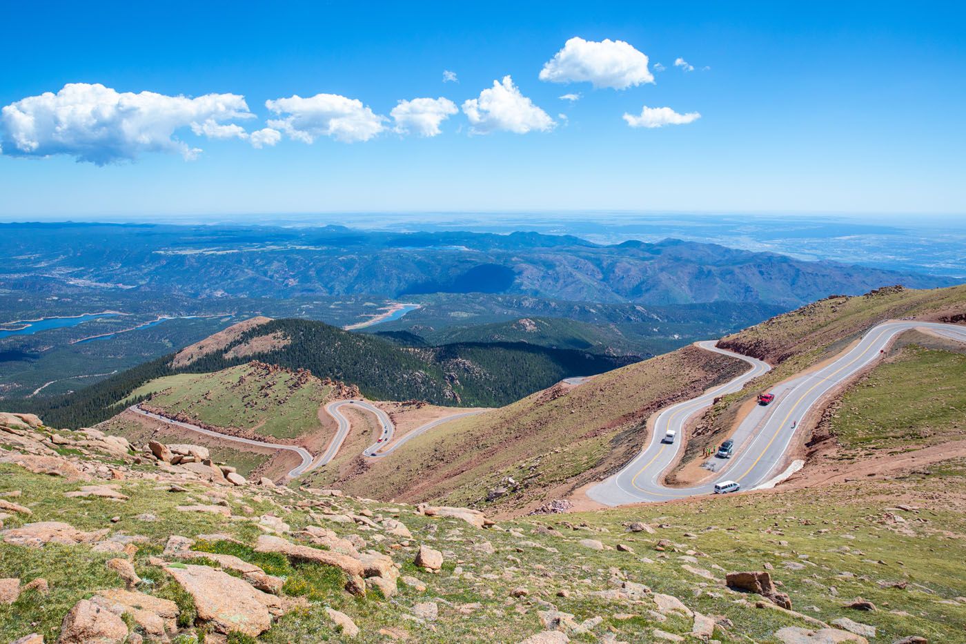
5. Pikes Peak
Distance: 40 miles round trip | Time: 2 to 3 hours | Open: All Year
Driving to the summit of Pikes Peak is one of the most popular scenic drives in Colorado.
At 14,115 feet, this is one of the most prominent fourteeners in Colorado. It is located right outside of Colorado Springs and from its summit, Pikes Peak offers sweeping views over Colorado. On a clear day, you can also see Kansas, New Mexico, Utah, and Arizona.
Road to Pikes Peak
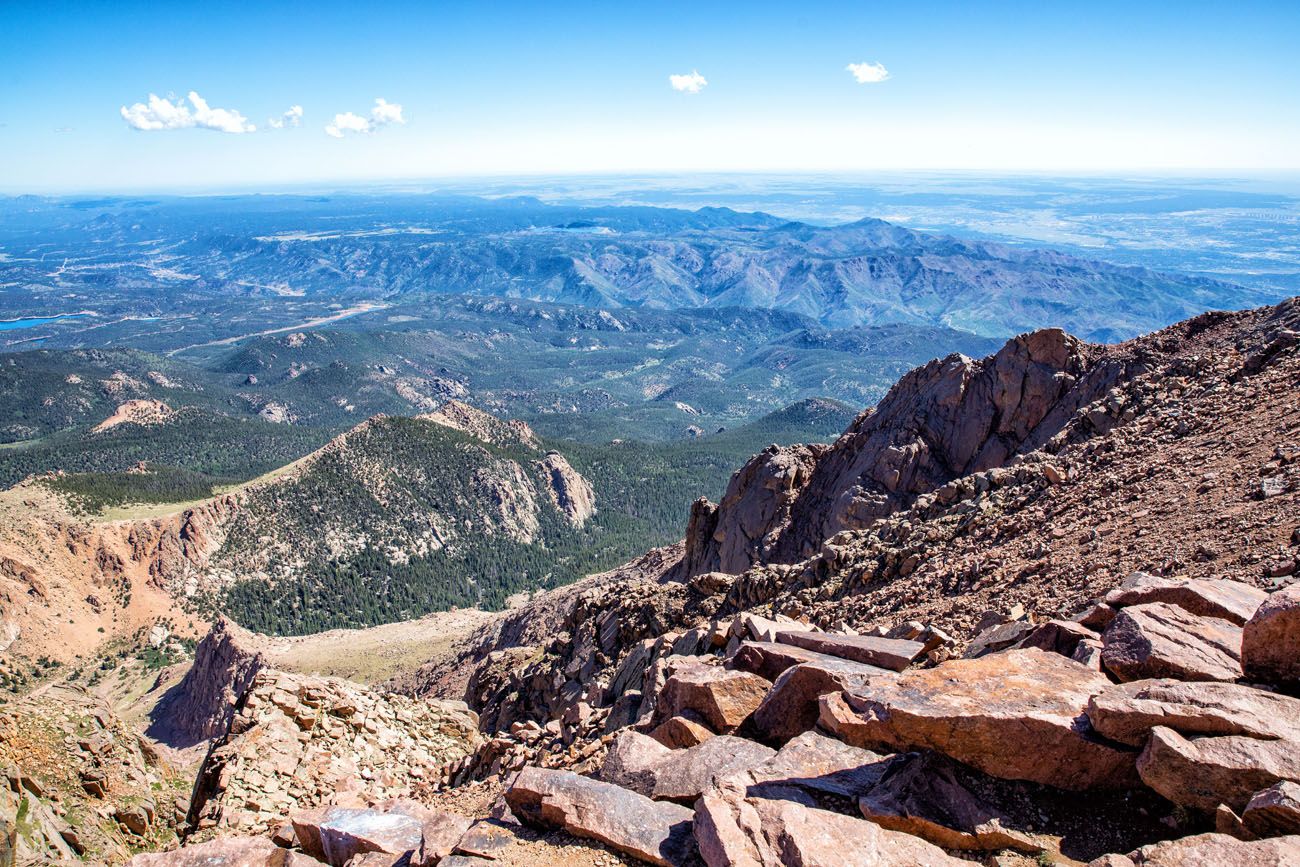
View from Pikes Peak
There is an entrance fee to visit Pikes Peak, which you will pay at the base of the mountain, before starting the drive. If you are visiting between the end of May and late September, you will need to make a reservation in advance.
At the summit of Pikes Peak, there are restaurants, restrooms, and a gift shop. There are ranger-guided programs where you can learn more about the history, geology, and wildlife of Pikes Peak. And don’t miss the hot, fresh donuts at the Summit House…they are delicious!
Pikes Peak is generally open year round, although it can close after a heavy snowfall. For updated conditions and updated entrance fees, click here.
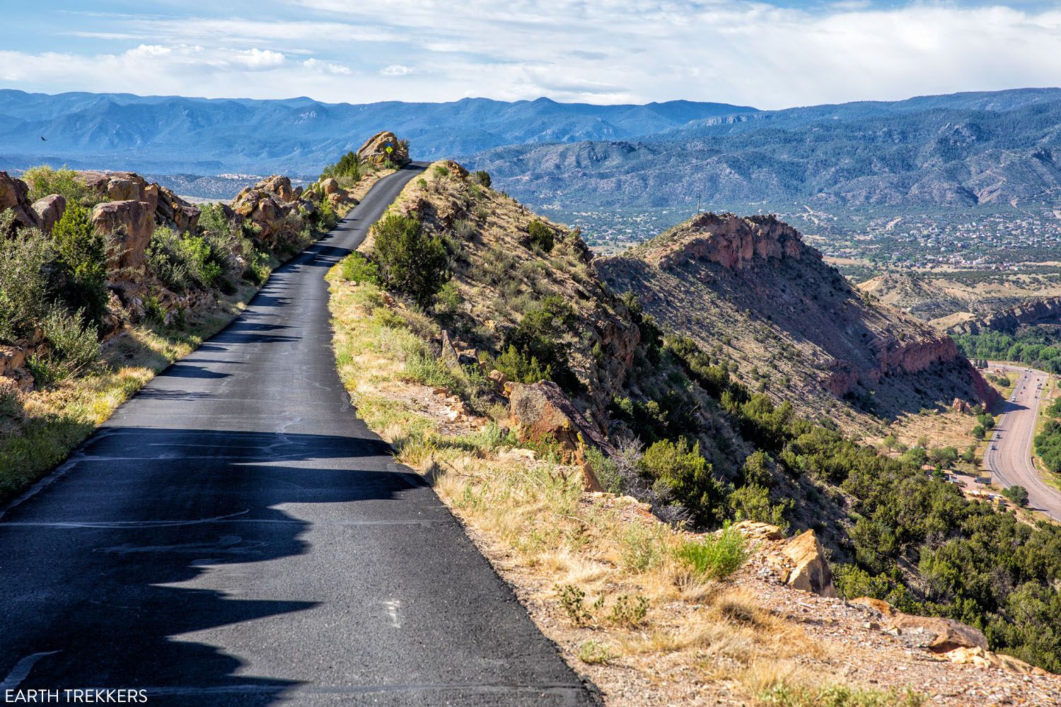
6. Skyline Drive in Cañon City
Distance: 2.6 miles | Time: 15 minutes | Open: All Year
This short but sweet drive is also one of the most unique scenic drives in Colorado. This narrow, one-way road bounces up and down along a razorback ridgeline.
Skyline Drive
This road was built in 1905 by prison inmates, who in turn got a reduction in their prison sentences. Skyline Drive was built as a scenic drive to give visitors unparalleled views of the area. At first, it was only open to horse-drawn carriages, pedestrians, and bicycles but it was soon open to cars.
How to Do This: From Highway 50 in Canon City, turn right onto Skyline Drive (the entrance is marked on our map below). This one-way road heads south for 2.6 miles before ending back in town. There are no guardrails and the drop-offs on either side are 450 feet high. There are wider areas to allow other vehicles to pass.
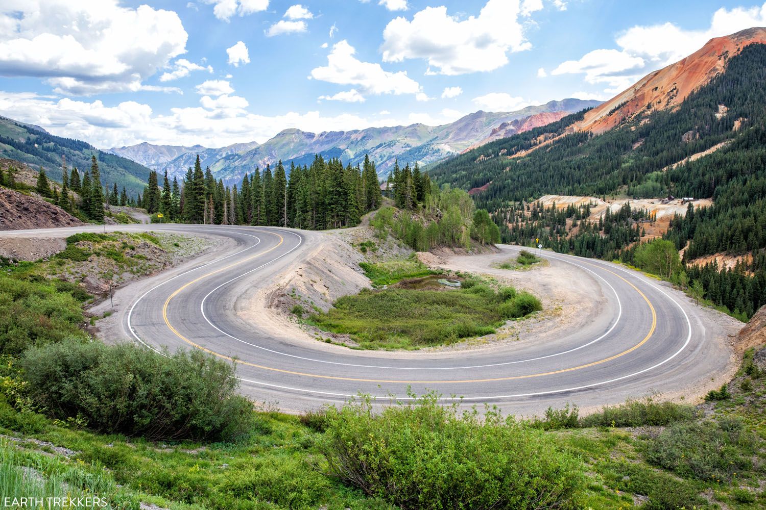
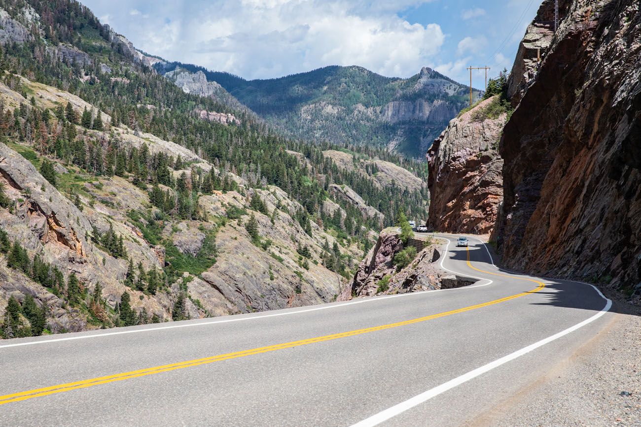
7. San Juan Skyway and the Million Dollar Highway
Distance: 230 miles | Time: 1 day | Open: All Year
This is one of the most spectacular scenic drives in Colorado. The San Juan Skyway makes a big loop through the San Juan Mountains, connecting historic towns and two national parks.
Cortez is located on the southwest corner of this loop. This is the gateway into Mesa Verde National Park.
To drive the loop, head east along Highway 160 to Durango. This town was at its hey-day in the 1880’s during the mining of the San Juan mines.
From Durango, head north on Highway 550, through the San Juan National Forest and the Hermosa Cliffs.
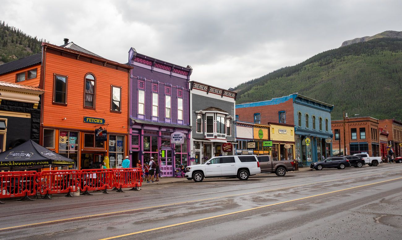
Silverton
The stretch of road between Silverton and Ouray is known as the “Million Dollar Highway,” since it reportedly took a million dollars per mile to build this road. Another legend has it that when the road was paved, it covered over a million dollars worth of gold and precious minerals.
This stretch of road is magnificent, with its twisting turns and high mountain views.
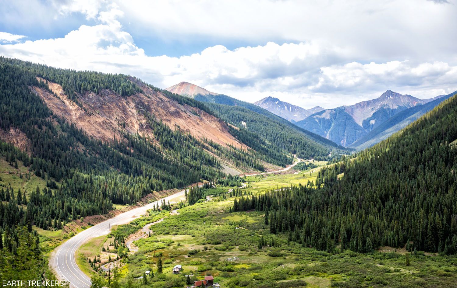
Million Dollar Highway
Ouray is a lovely, historic town. Soak in the hot springs, go shopping, or explore the Box Canyon waterfalls. Learn more about what to do in Ouray here.
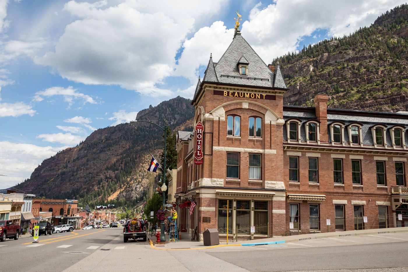
Ouray
Just past Ouray, the loop continues on Highway 145, heading through Telluride, another historic mining town. The loop ends back in Cortez.
ROAD TRIP IDEA: If you are road tripping through Colorado to visit the national parks, this drive is a great way to get from Mesa Verde National Park to the Black Canyon of the Gunnison. From Cortez, drive the San Juan Skyway through Durango, Silverton, and Ouray, then continue north to Montrose.
8. Loveland Pass
Distance: 8 miles round-trip | Time: 1 hour | Open: All Year
Loveland Pass is a high mountain pass that is located south of I-70, between Vail and Idaho Springs. This pass sits at 11,990 feet.
To get here, it is a relatively short but steep drive from I-70. It is a steady 6.7% grade to the summit with numerous hairpin turns.
This is the highest mountain pass in Colorado that stays open during the winter season, although it can briefly close after large snowfalls. 2WD vehicles must carry chains during the winter months.
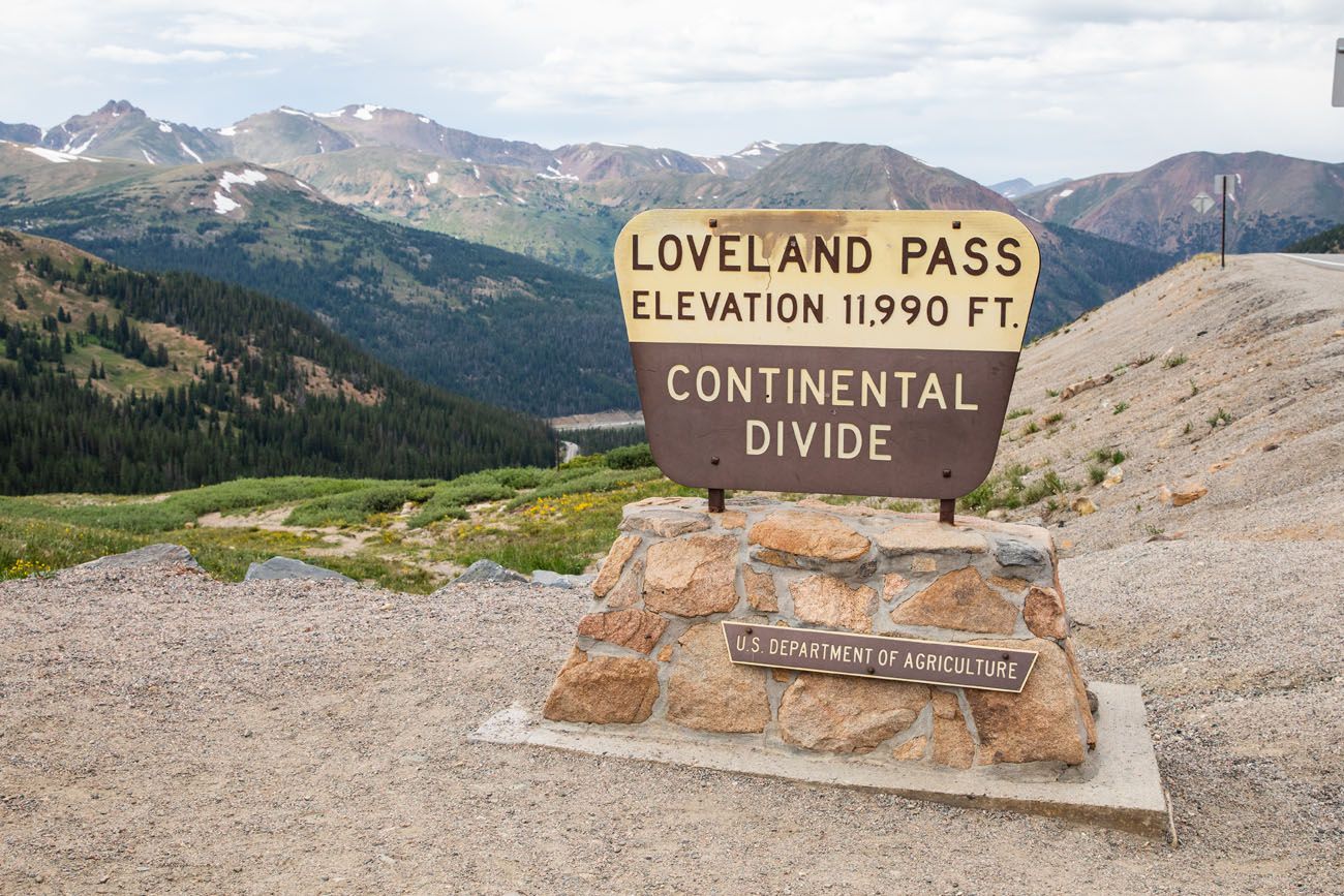
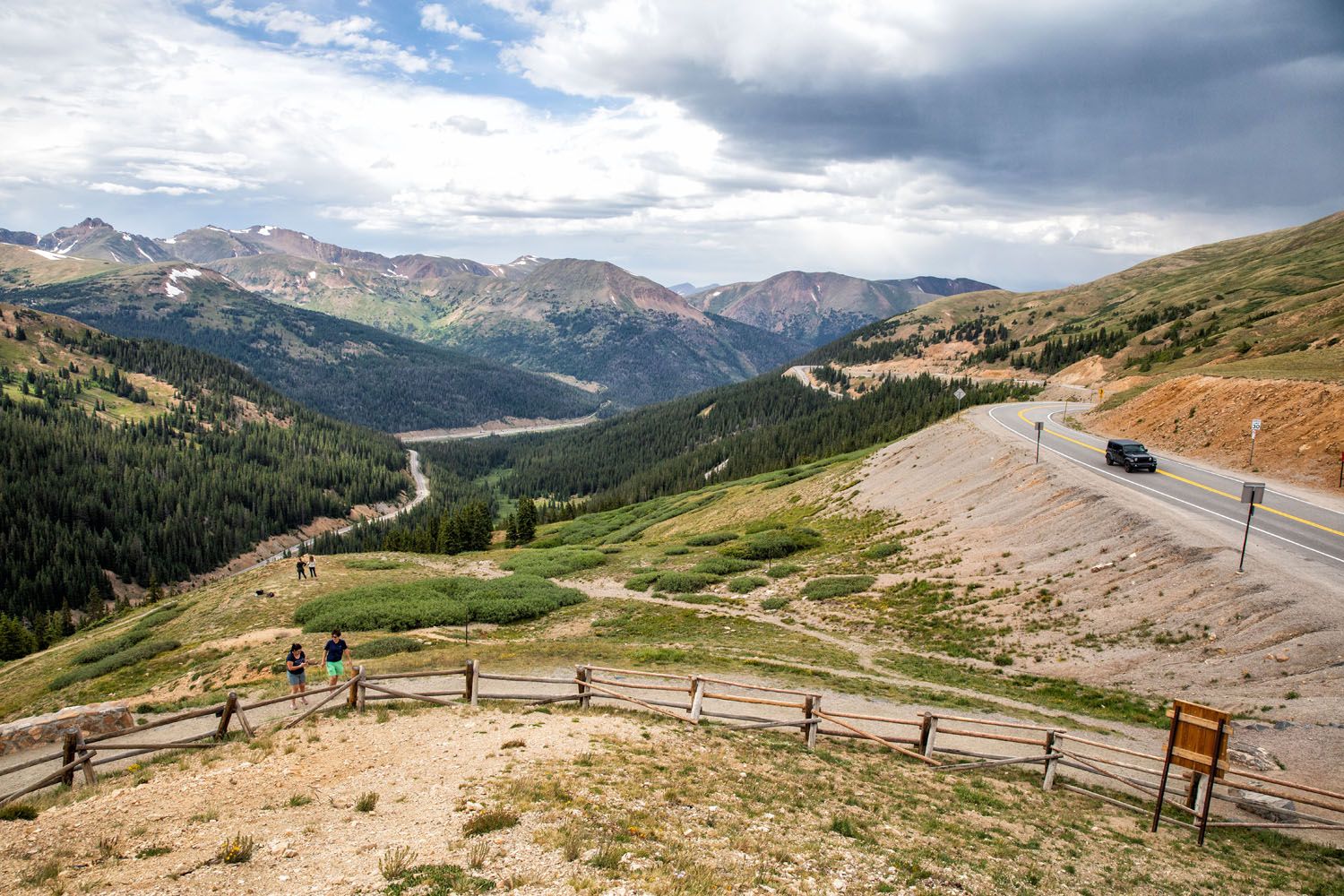
Loveland Pass
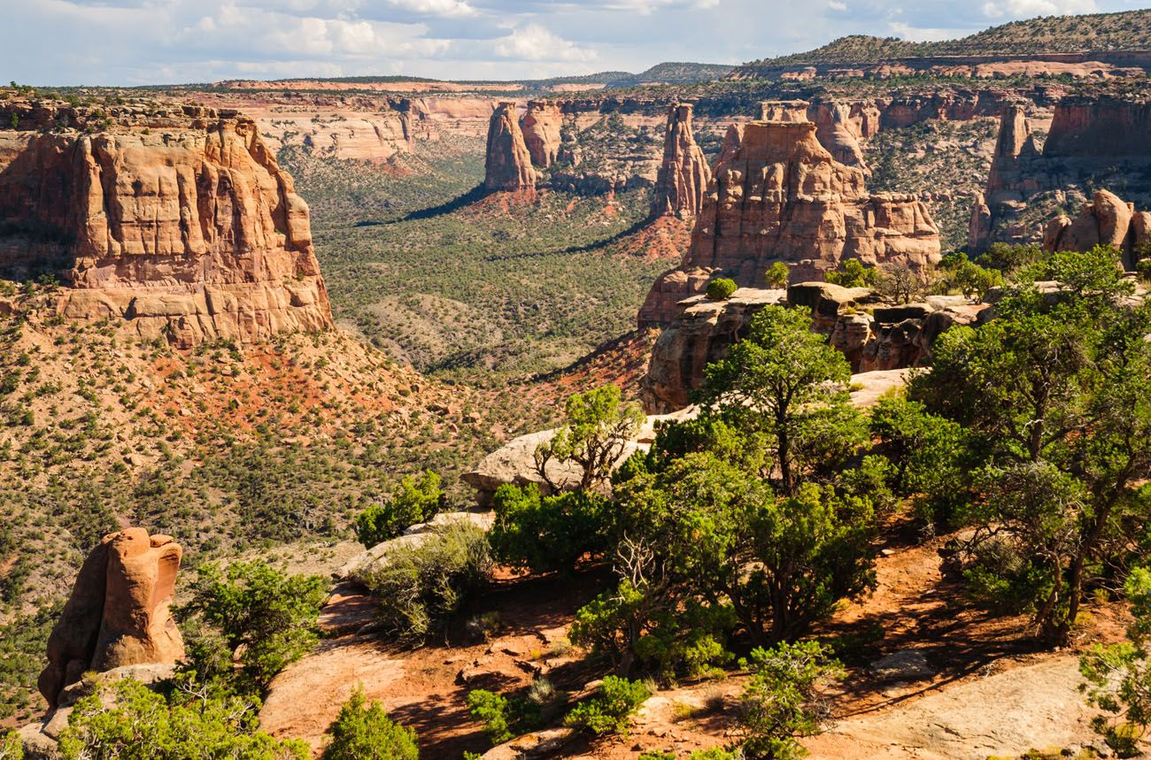
9. Rim Rock Drive, Colorado National Monument
Distance: 23 miles | Time: 1 hour | Open: All Year
This scenic drive is still on our to-do list but it looks absolutely amazing.
Colorado National Monument, with its red sandstone rock formations and mesas, looks more like it should belong in Utah or Arizona than in Colorado.
Zack Frank/shutterstock.com
Rim Rock Drive winds along the edge of the Uncompahgre Plateau, offering stunning views of the red rock canyons and valleys.
There is a $25 fee per vehicle to enter Colorado National Monument.
Scenic Drives in Colorado: On a Map
How to Use This Map: Click the tab in the top left corner of the map to see a list of the points of interest and to turn layers on/off. Click the icons on the map to get more information about each point of interest.
To take this map with you, click the star next to the title of the map which adds it to your Google account. Next, within your Google Maps app, select ‘Saved’ and then select ‘Maps’. This map title will now appear in your list.
If you have any questions about these scenic drives in Colorado, or if you want to share a scenic drive that we missed, let us know in the comment section below.
More Information about Colorado
If this is part of a bigger road trip through the USA, visit our United States Travel Guide and our Colorado Travel Guide for more inspiration and travel planning tips.
Best USA Road Trips: 18 Ideas for Your Next Big Adventure
Pinterest Facebook Flipboard One of the best ways to explore the USA is on a good old-fashioned road trip. Cruise along Route 66, road trip through the Florida Keys, explore the American Southwest, or even drive from coast to coast. In this guide, we share 18 of the best USA road trips…18 great ideas for […]
7 to 14 Day Colorado Itinerary: National Parks & Scenic Drives
With four national parks, numerous national forests and state parks, plus historic towns scattered throughout the Rocky Mountains, Colorado makes an awesome road trip destination. On this Colorado itinerary, you will visit all four national parks (Great Sand Dunes, Mesa Verde, Black Canyon of the Gunnison, and Rocky Mountain National Parks), linking them together with […]
Ultimate Guide to the Colorado National Parks (+ 10 Day Itinerary)
There are four Colorado national parks: Rocky Mountain, Mesa Verde, Black Canyon of the Gunnison, and Great Sand Dunes. The landscapes that these national parks protect are dramatically different from one another. In Rocky Mountain National Park, journey high into the Rocky Mountains, cross the Continental Divide, and hike to gorgeous alpine lakes and waterfalls. […]
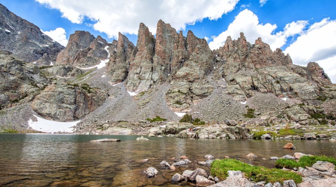
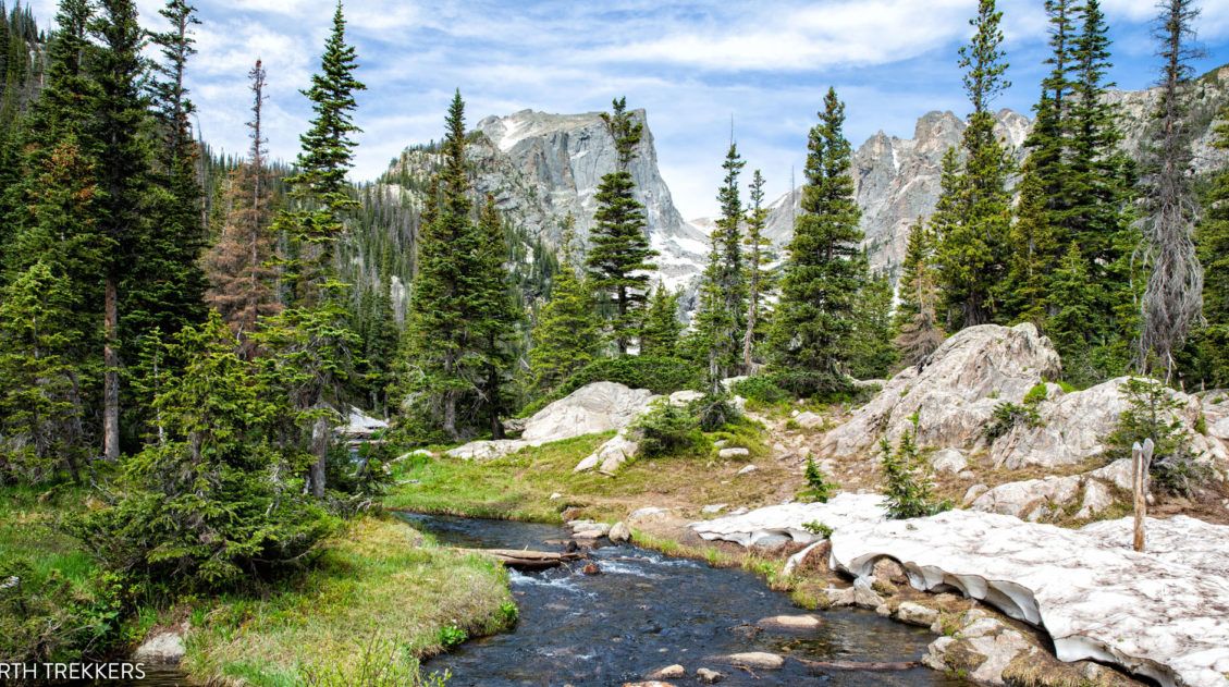
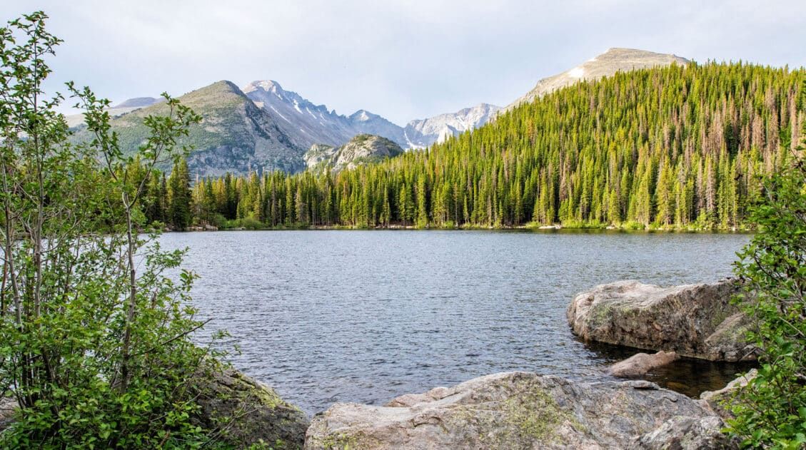
10 Best Things to Do in Rocky Mountain National Park
With lofty mountain peaks, hiking trails that lead to alpine lakes and waterfalls, wildlife, and a scenic drive along one of the highest roads in the USA, Rocky Mountain National Park is a joy to explore. In this post, learn about the best things to do in Rocky Mountain National Park with tips on how […]
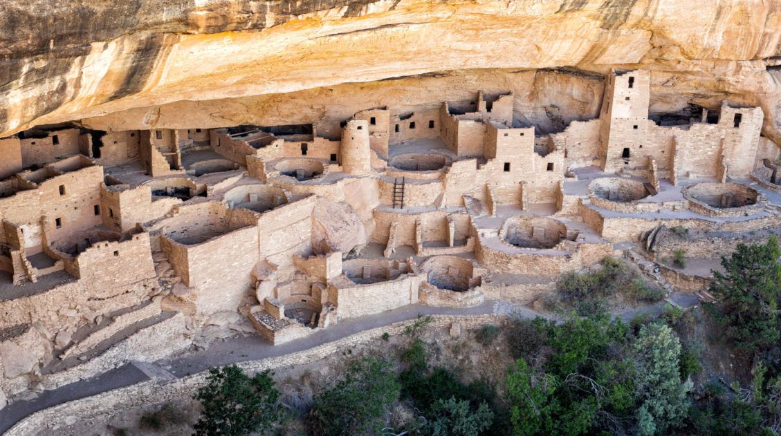
Top 10 Things to Do in Mesa Verde National Park
Located in southwestern Colorado, Mesa Verde National Park is one of the most unique national parks in the United States. This park preserves the ancient Puebloan cliff dwellings and archeological sites that are hundreds of years old. Short hikes, scenic drives, and viewpoints make the to-do list, but the best way to experience this park […]
The Perfect Rocky Mountain National Park Itinerary (2026)
If you are planning your Rocky Mountain National Park itinerary, this is a great place to start. Rocky Mountain National Park is one of the best US national parks to go hiking. With towering mountain peaks, alpine lakes and waterfalls, and the opportunity to hike aƒlong the Continental Divide, this park offers world-class hiking experiences. […]
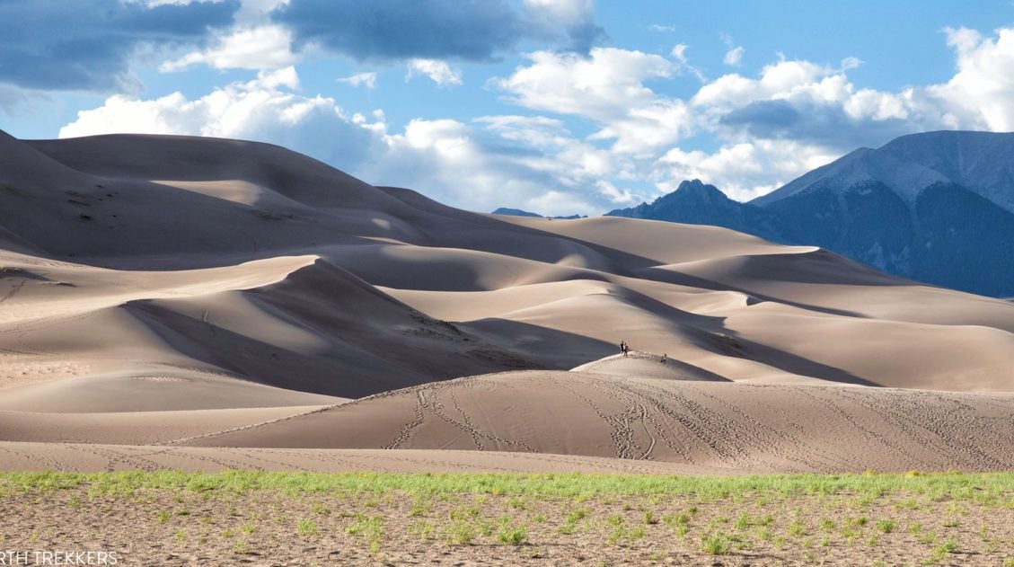
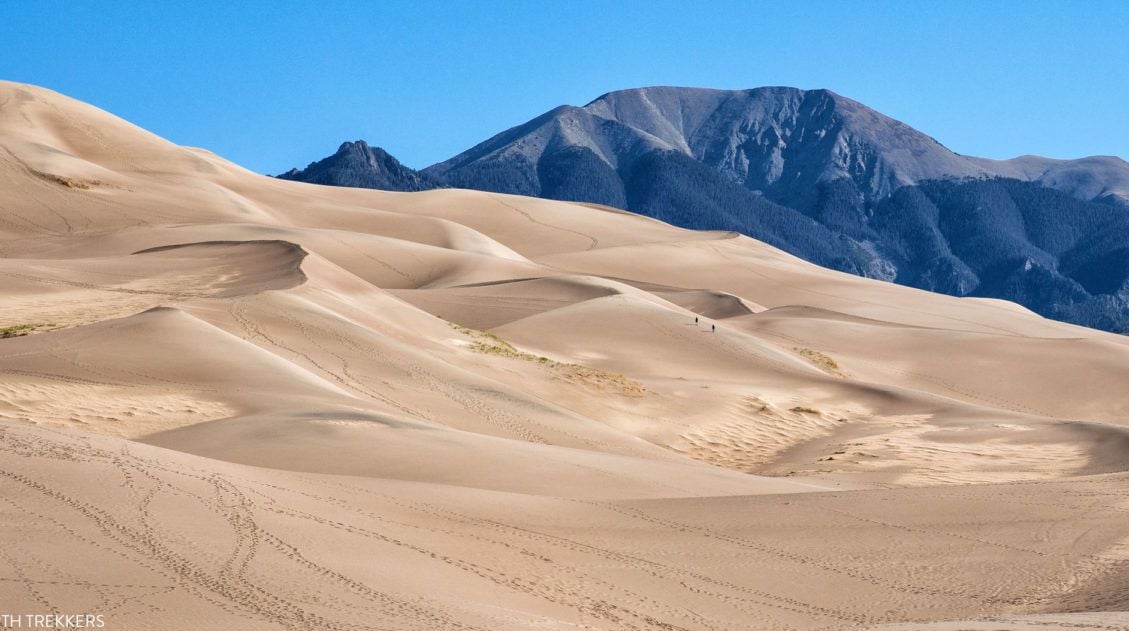
8 Amazing Things to Do in Great Sand Dunes National Park
Great Sand Dunes is a much different experience than many other national parks in the United States. Sure, there is hiking and amazing sunsets and ranger programs, but this park has a much different feel to it. It’s a small park and the list of things to do is very short. A few hours are […]
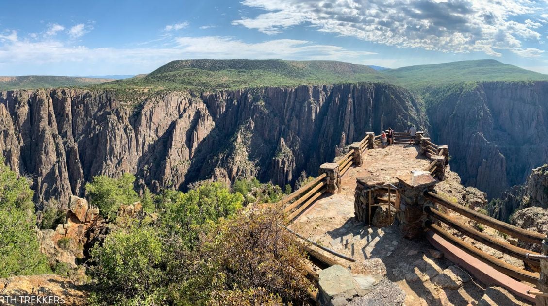
How to Visit the Black Canyon of the Gunnison: North & South Rims
In some ways, the Black Canyon of the Gunnison is a smaller version of the Grand Canyon. You can visit both the North and South Rims, enjoy the views from the overlooks, and, for the ultimate adventure, hike below the rim to the Gunnison River. In this guide, learn how to visit Black Canyon of […]
15 Epic Hikes in Rocky Mountain National Park (+ Our Top Picks)
Rocky Mountain National Park is best seen from a hiking trail. Fortunately, there are hikes for all ages and ability levels. From short, easy strolls around lakes, to ridgeline trails with panoramic views, to challenging but epic climbs to the tallest mountain peaks, there truly is something here for everyone. Here are 15 of the […]
The Ultimate Colorado Travel Guide
Colorado Travel Guide For travelers, Colorado is a year-round adventure destination. In the summer and fall, hike in the Rocky Mountains, explore the national parks, soak in the hot springs, and go on some of the best scenic drives in the USA. In the winter and early spring, when snow blankets the mountains, Colorado is […]
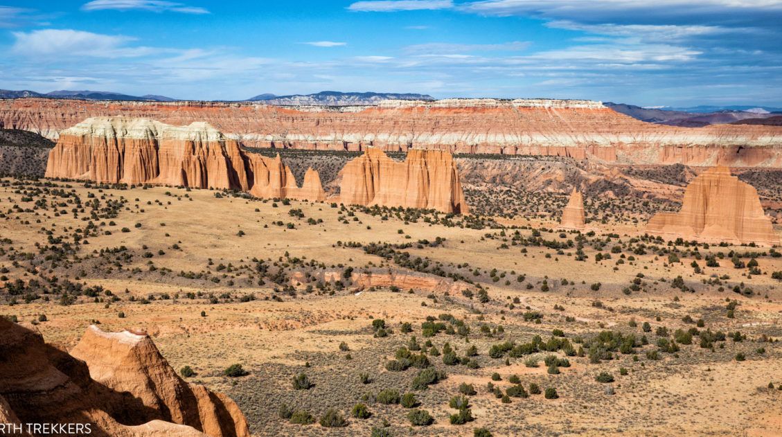
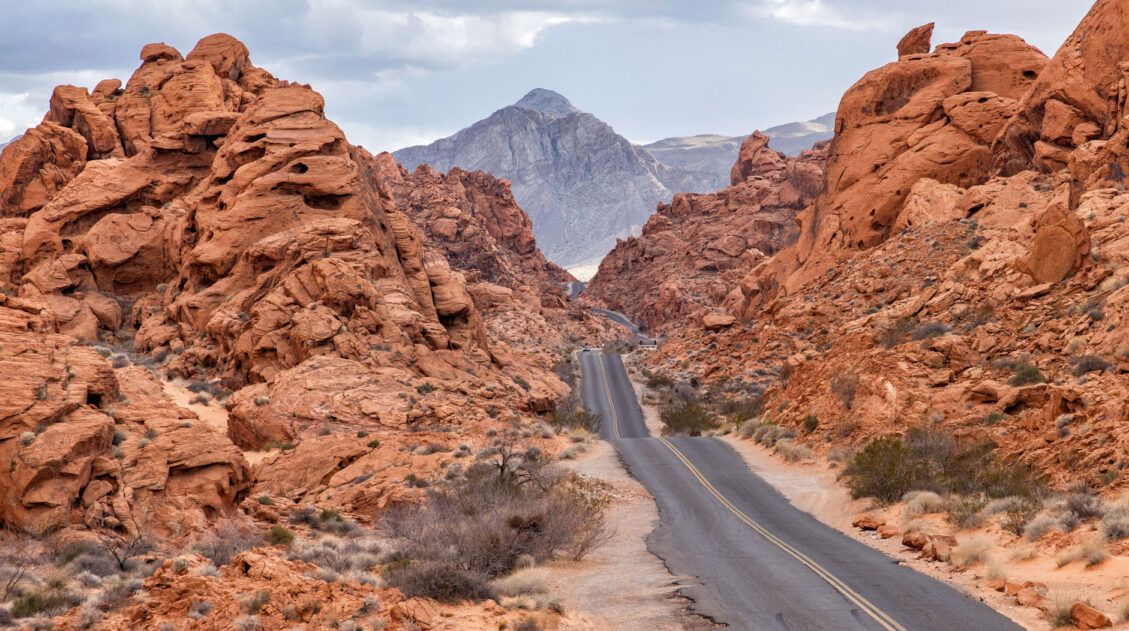
Complete Guide to the Cathedral Valley Loop (+ Map & Best Route)
Cathedral Valley is a rugged, remote district of Capitol Reef National Park. Few people travel out this way, to see this valley and its sandstone monoliths, colorful Bentonite hills, and vast desert scenery. But that’s part of its appeal. If you like the idea of leaving the crowds behind and exploring the backcountry, the Cathedral […]
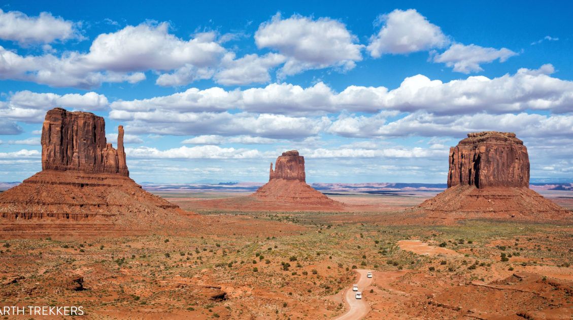
How to Visit Monument Valley: Ultimate Guide for First Time Visitors
With sandstone buttes, colossal mesas, and panoramic vistas, Monument Valley is one of the USA’s iconic landscapes. Sure, it’s possible to drive right through Monument Valley, visiting the main sites in just two or three hours, but if you really want to explore it, consider spending at least one day here. We were surprised at […]
Utah’s Mighty 5: How to Plan the Perfect Road Trip Itinerary
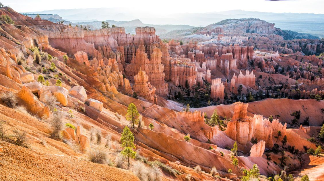
Stretching across southern and central Utah are five stunning national parks. Called the Mighty 5, these parks contain some of the most thrilling hiking trails and iconic landscapes in the United States. Stand atop Angels Landing in Zion. Gaze across a wonderland of hoodoos at Bryce Canyon. Explore the Water Pocket Fold at Capitol Reef. […]

Comments 12