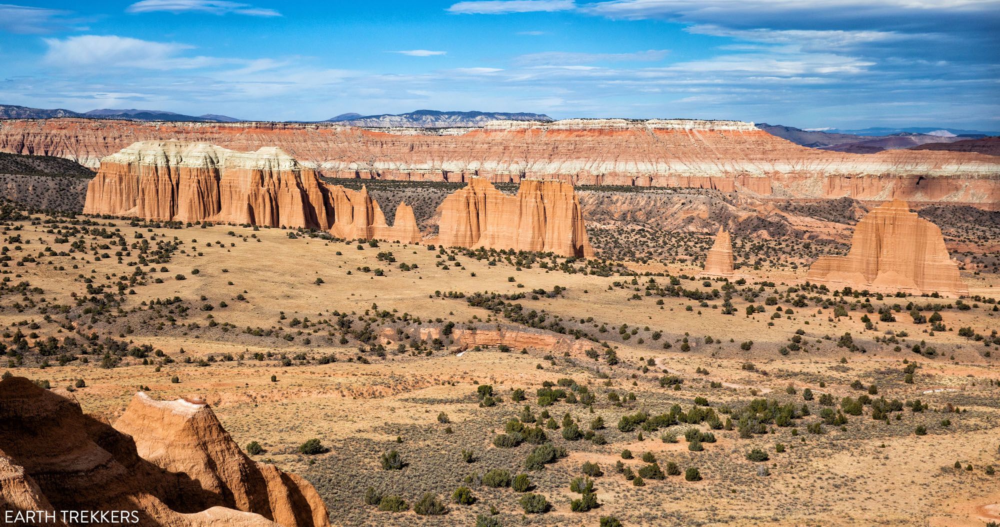
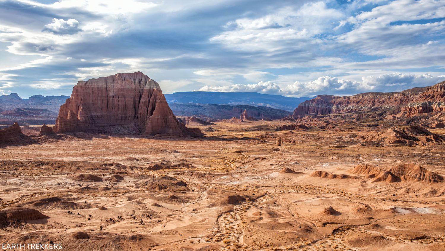
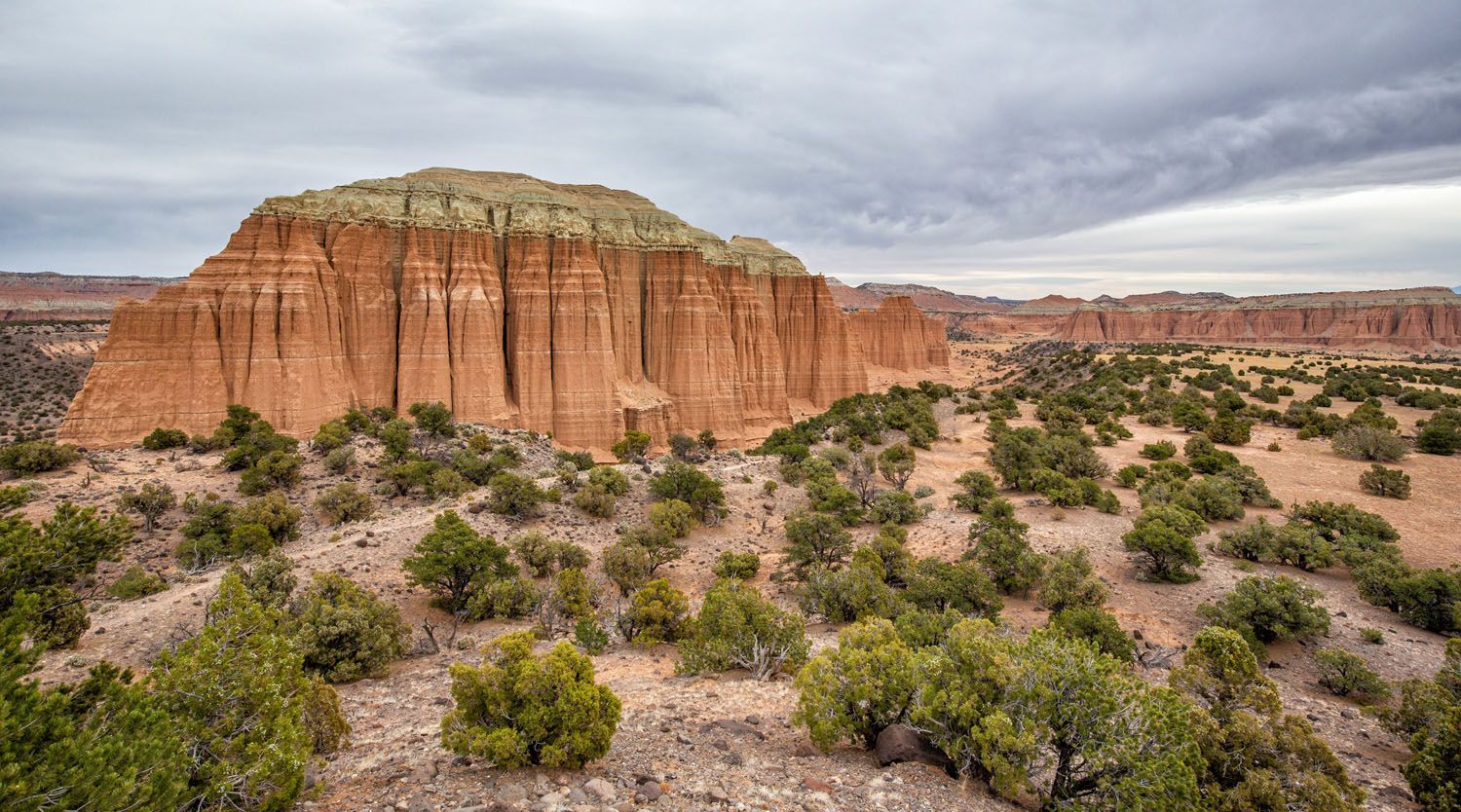
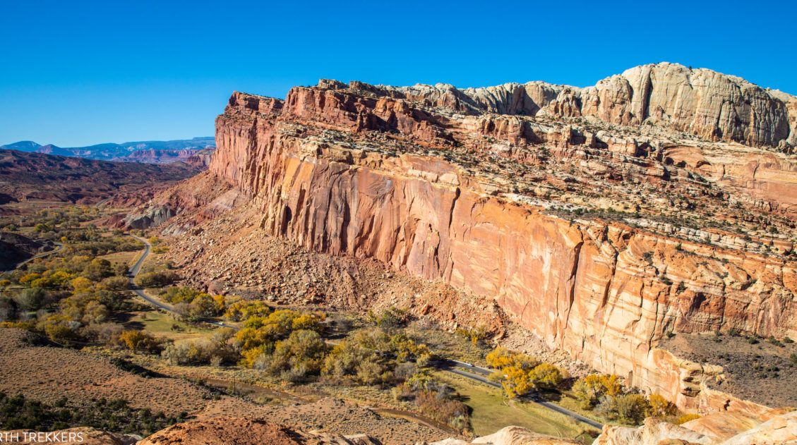
Cathedral Valley is a rugged, remote district of Capitol Reef National Park. Few people travel out this way, to see this valley and its sandstone monoliths, colorful Bentonite hills, and vast desert scenery. But that’s part of its appeal. If you like the idea of leaving the crowds behind and exploring the backcountry, the Cathedral Valley Loop is an awesome drive to put on your to-do list.
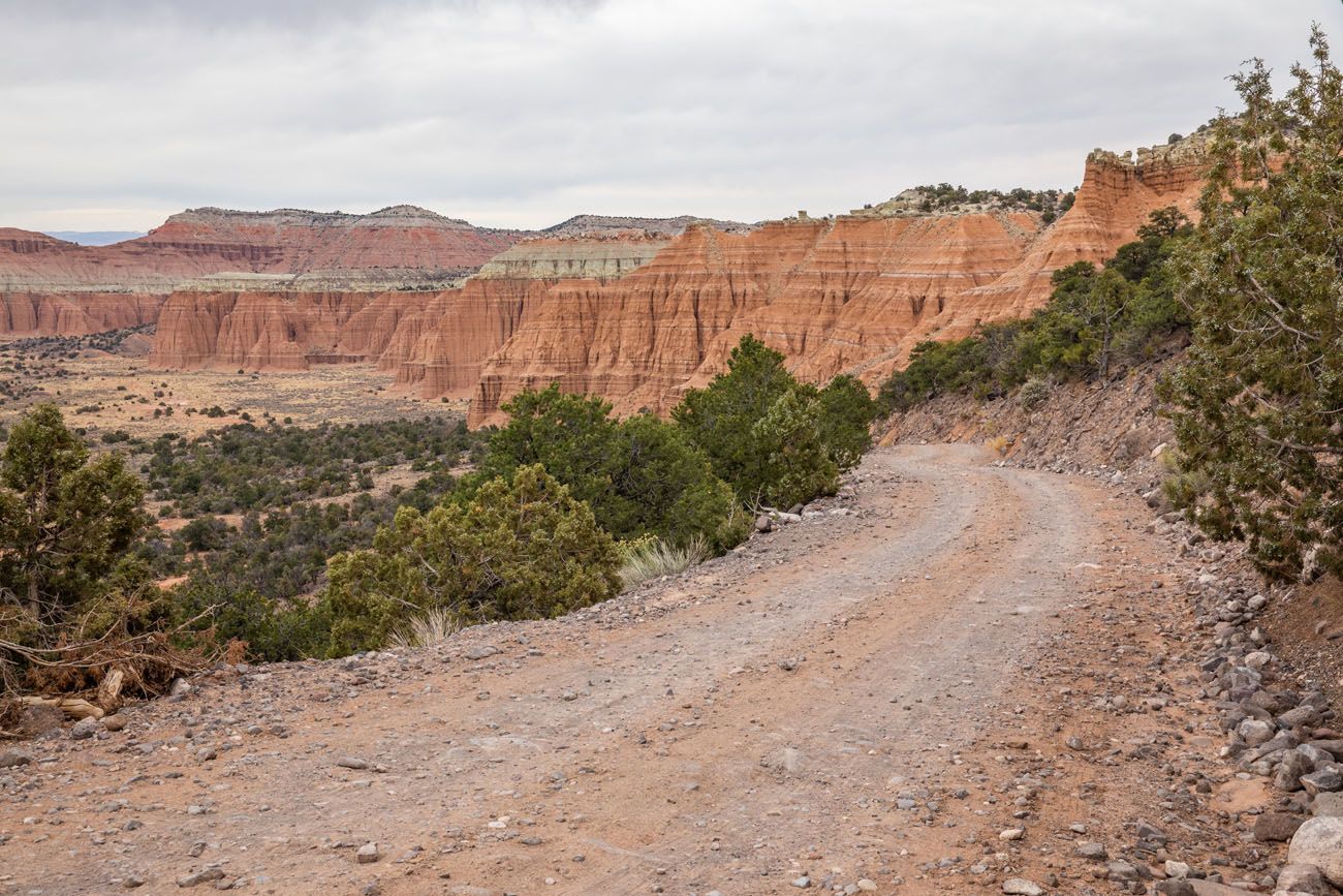
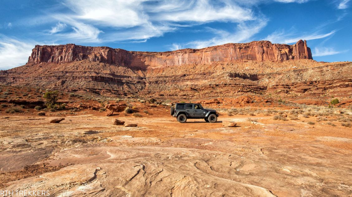
The Cathedral Valley Loop is a 58-mile scenic drive that is located north of the historic Fruita district. There are no paved roads on this loop, so you must have a high clearance vehicle, and having a 4×4 is strongly recommended.
This is one of our favorite experiences in Capitol Reef National Park. Cathedral Valley is a beautiful place to explore and since it is so remote, it feels like an adventure.
Overview of the Drive
Distance: 58 miles without detours. The total distance is 72.6 miles if you include all of the short detours we list during the drive.
Length of Time: It takes 4 hours to drive the entire loop, but with short detours, overlooks, and adding on one or two short hikes, the Cathedral Valley Loop takes a full day.
Route: Two roads form the Cathedral Valley Loop: Hartnet Road and Cathedral Road. From Highway 24, drive Hartnet Road northwest to Cathedral Valley and return to Highway 24 on Cathedral Road. You will drive a short stretch of Highway 24 to complete the loop.
Direction: The best way to drive the Cathedral Valley Loop is in the clockwise direction. This gets the river crossing over with at the very beginning of the drive. There is a chance that the water level in the Fremont River will be too high to safely cross in a vehicle, so you might have to modify this loop. It’s best to know this at the start of the drive, rather than driving the entire loop and getting stuck at the river at the very end. More on this later.
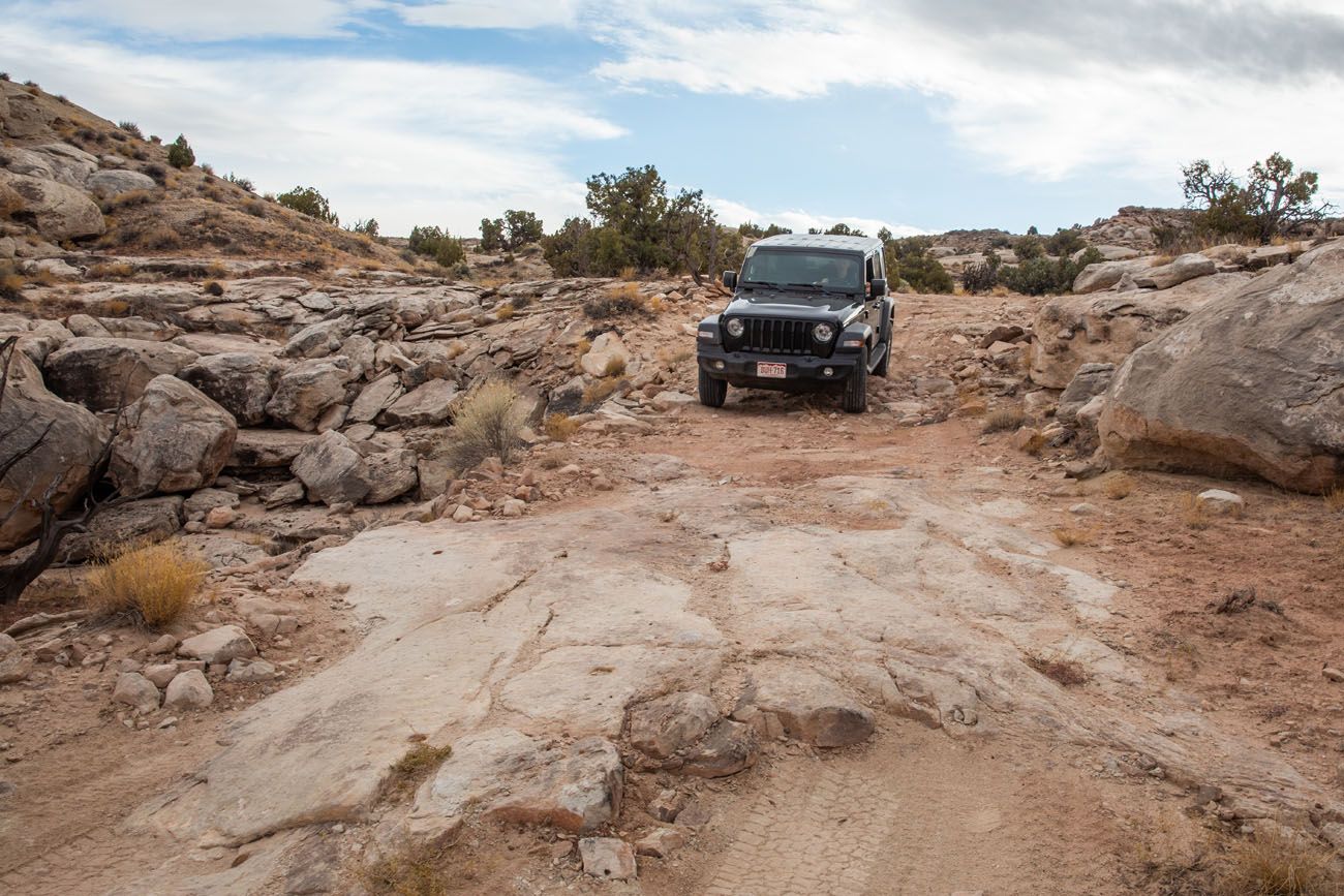
Type of Vehicle: Hartnet Road and Cathedral Road are gravel roads. Some sections of the roads have thick sand and small obstacles, so you must have a high clearance vehicle. A 4×4 is not mandatory but strongly recommended by the National Park Service. Having done this drive, I wouldn’t do it in anything other than a high clearance 4×4. 95% percent of the road was well-maintained and easy to drive, but there are a few spots where you may need to use 4WD.
When to Go: You can drive the Cathedral Valley Loop all year. Spring and summer storms can temporarily make the roads impassable, even for a 4×4. The roads are not plowed in the winter. We did this drive in early November.
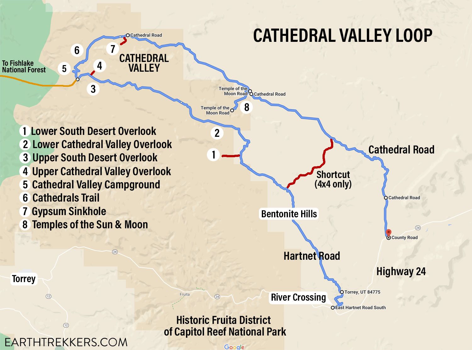
Map of the Cathedral Valley Loop
Best Things to Do in Cathedral Valley
These sights are discussed in more detail below, but here is a list of the best things to do in Cathedral Valley.
The five must-see sights:
- Temples of the Sun & Moon
- Upper Cathedral Valley Overlook
- Upper South Desert Overlook
- Lower South Desert Overlook & Jailhouse Rock
- Cathedrals Trail
Also well worth your time are a quick visit to the Gypsum Sinkhole, the 2-mile round-trip hike to the Lower Cathedral Valley Overlook for a bird’s eye view of the Temples of the Sun and Moon, and a drive through the Bentonite Hills.
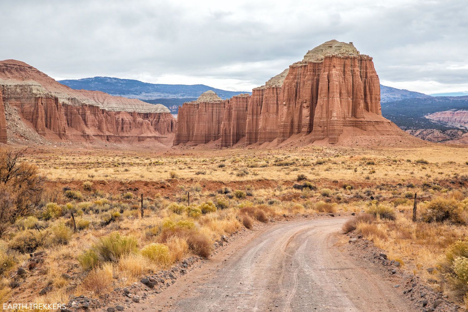
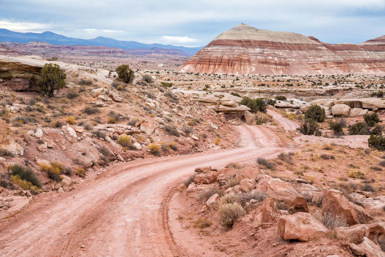
For most of the loop, the road is a well-maintained gravel and dirt road like this one. Sections of washboarding are not uncommon. There are areas of deep sand in some sections of the Cathedral Valley Loop.
Cathedral Valley Loop: Route Description
This loop is described in the clockwise direction, since that is the recommended way to do this drive. Later in this post, I will give a brief overview of what it is like to do this in the counter-clockwise direction, with a bail-out if you can’t cross the Fremont River (we were unable to do the river crossing so we drove the Cathedral Valley Loop in a counter-clockwise direction).
The number for each overlook/detour/hike is the mile marker, starting from the junction of Hartnet Road and Highway 24. The distances of the detours (the short spur roads) are included in the overall distances listed.
0.0 Start: Hartnet Road
From Highway 24, at mile marker 91, turn onto Hartnet Road. Reset your odometer.
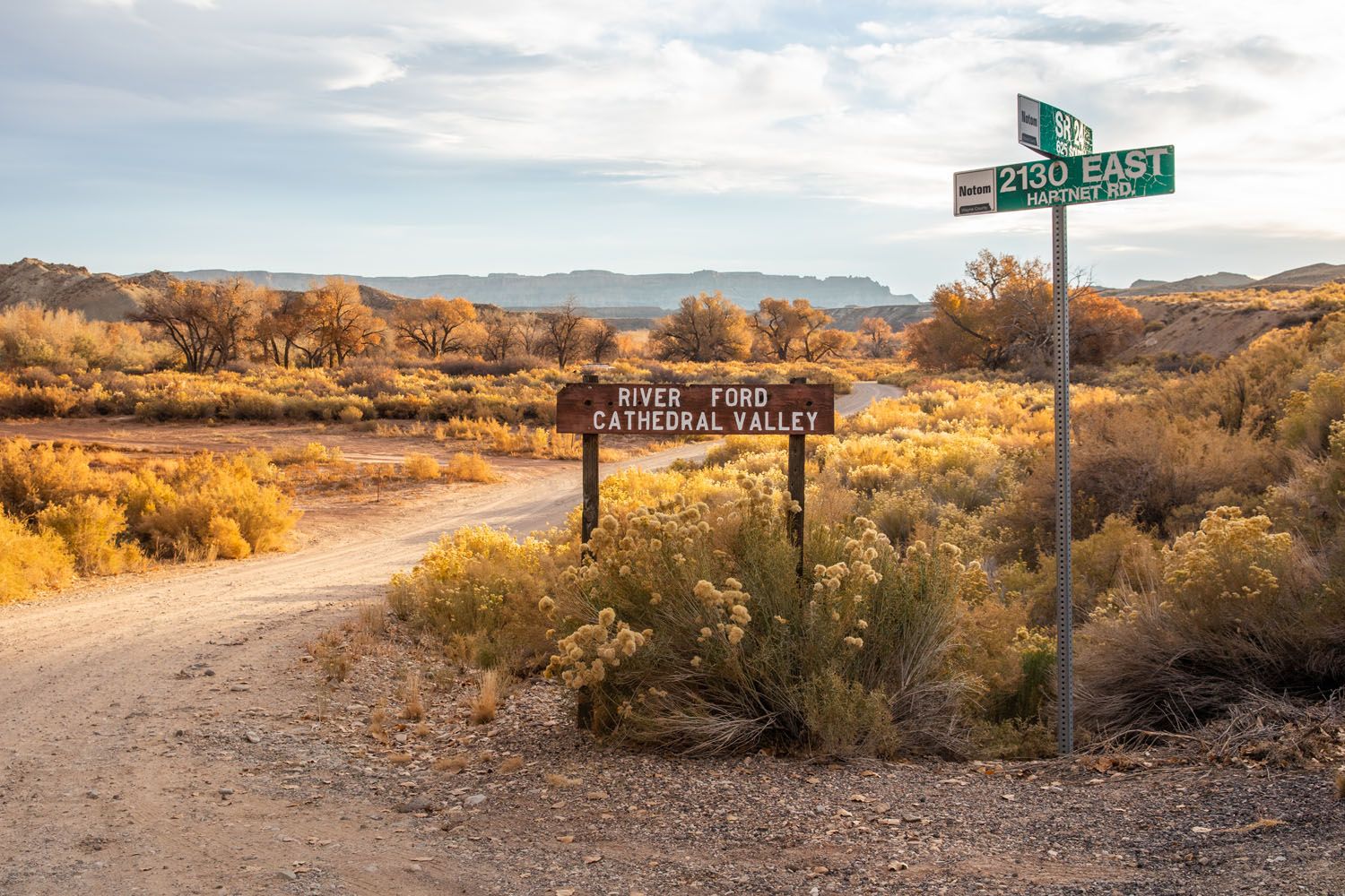
Drive for 0.5 miles and take the second left. This dirt road leads to the Fremont River crossing. Below is a map of this part of the drive and the river ford.
0.5 Crossing the Fremont River (River Ford)
To cross the Fremont River, you will enter the river, immediately turn right, and drive downstream for approximately 100 feet. Then, it is a sharp left up onto the opposite river bank.
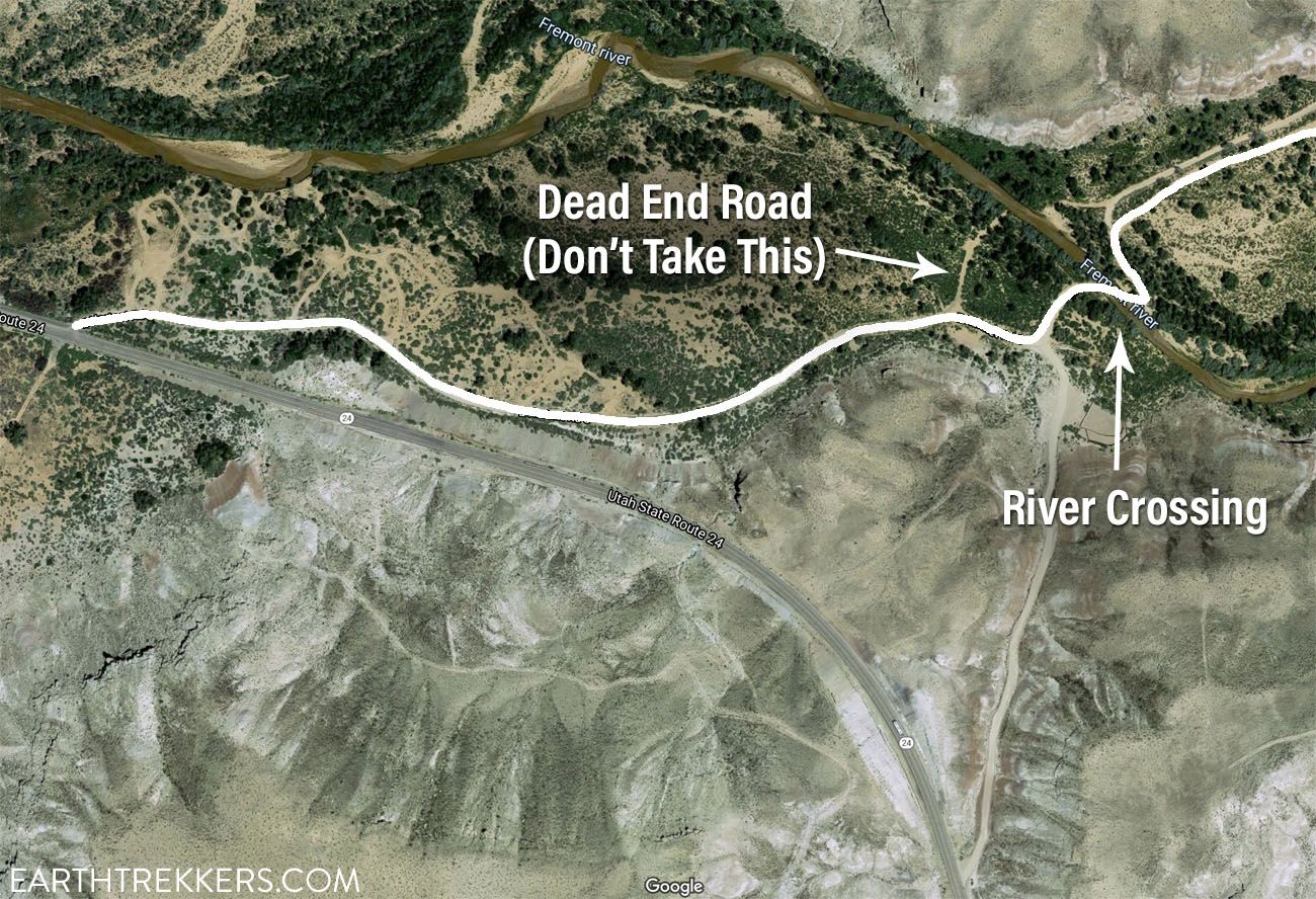
Map of the Fremont River crossing. The white line is Hartnet Road. Skip the first left hand turn (this dead ends at a steep drop-off into the Fremont River) and continue to the second road. You will have to drive 100 feet down the river before exiting on the opposite riverbank.
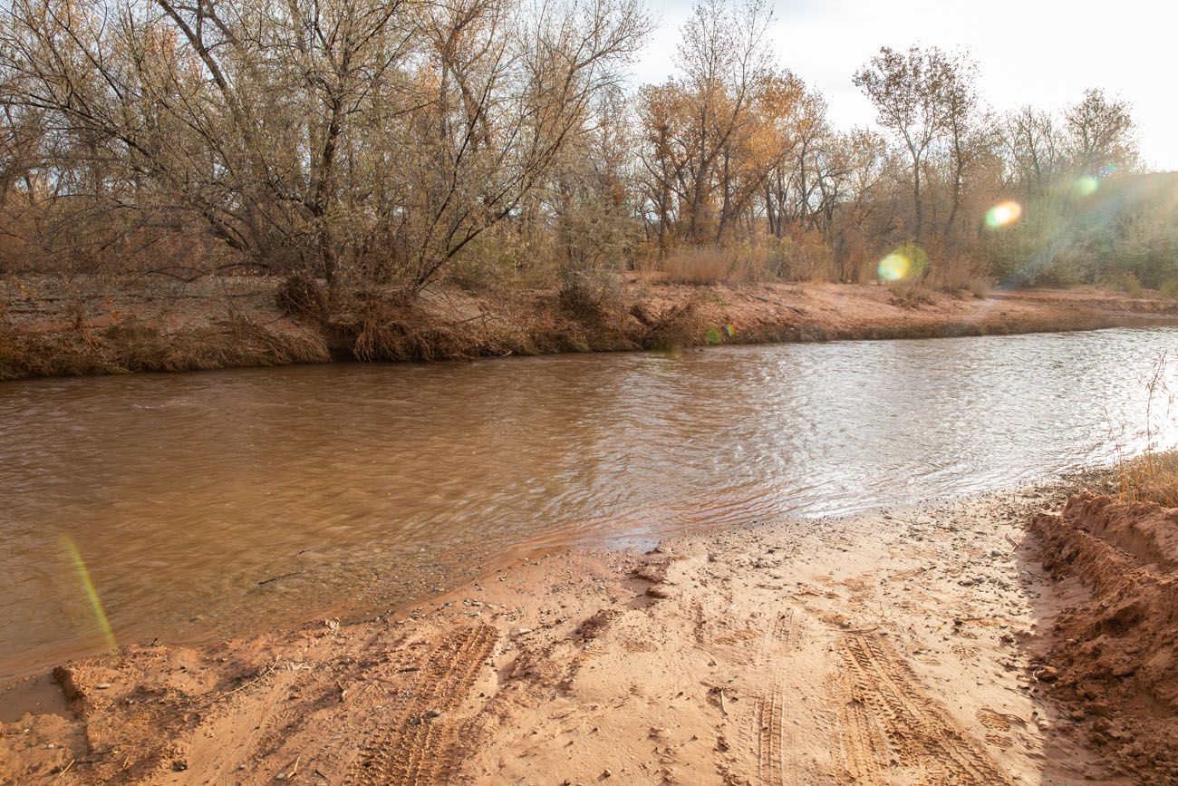
View of the Fremont River.
The Fremont River is shallowest on the right hand side, so drive down this side of the river until you have to make the left turn.
After storms and recent snowfalls, the water level may be too high in the Fremont River to safely cross it. Typically, the water level fluctuates between 8 and 16 inches.
On the day we did this, the water level was too high and moving too rapidly for us to safely ford the river. I took my shoes off and waded into the Fremont River (it’s COLD in November!). It was up to my knees and I didn’t even make it to the deepest section, so we estimate that the water level was at least 20 inches high.
Rather than floating our Jeep down the river, we drove the Cathedral Valley Loop in the counter-clockwise direction.
It is best to start the Cathedral Valley Loop at the Fremont River, rather than driving the entire loop and ending here, only to learn that the water level is too high to safely ford it.
6.0 Historical Stop
On old, rusted drilling truck and well sit here. This well provided water for cattle when this area was a ranch.
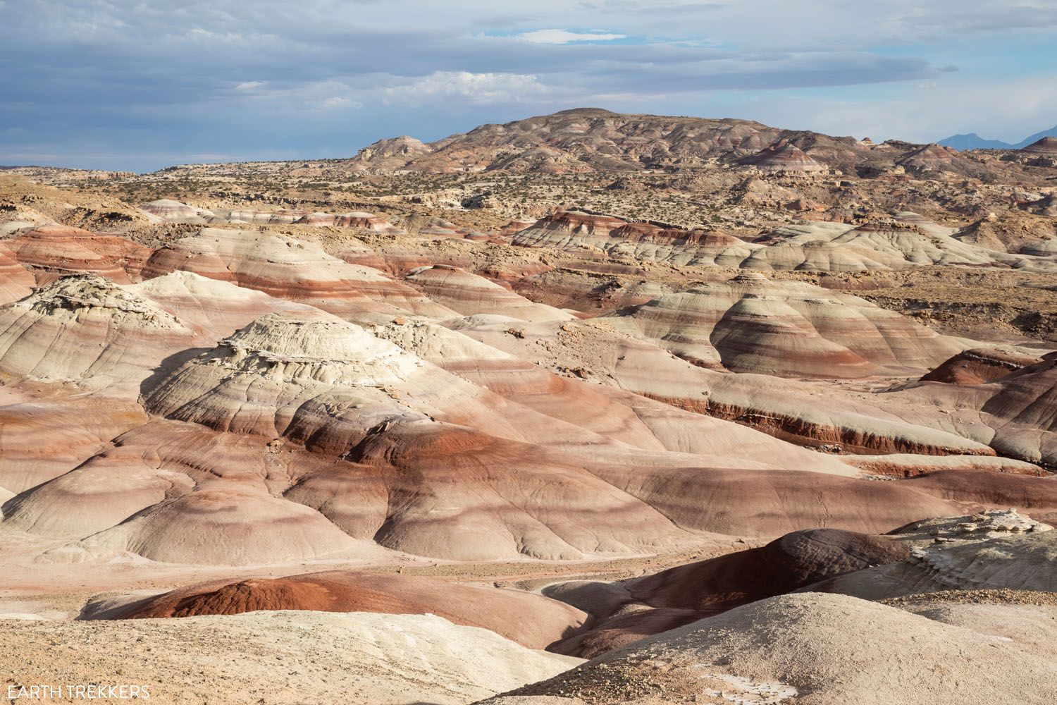
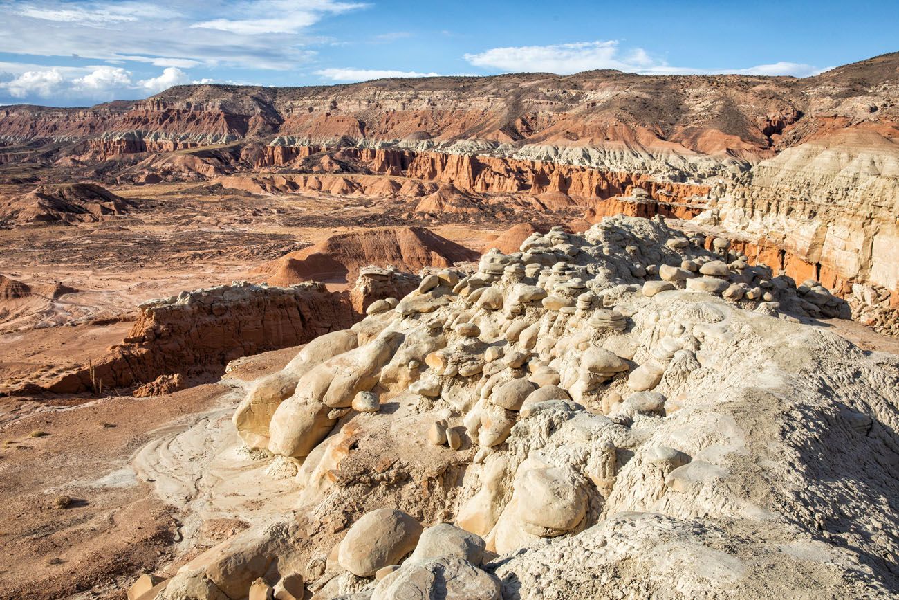
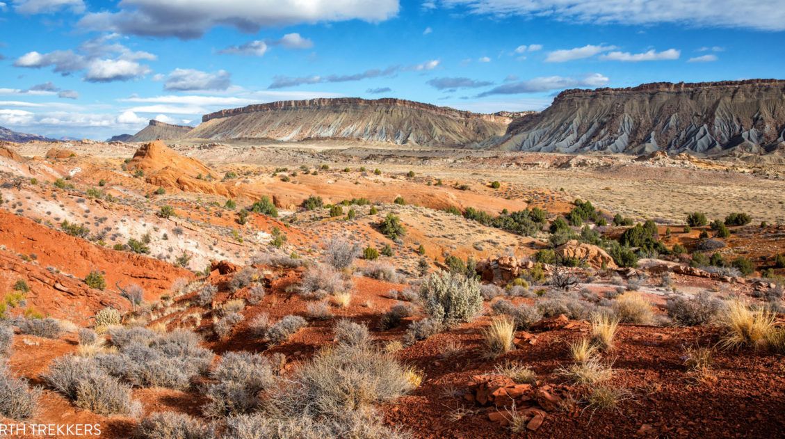
8.6 Bentonite Hills
These colorful hills are made of clay and volcanic ash. If it has recently been wet, this area can be impassable.
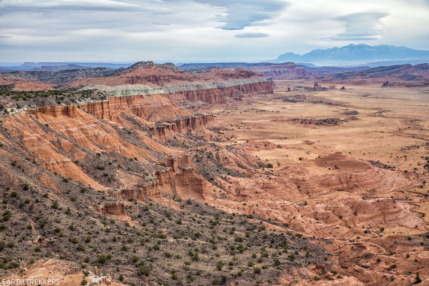
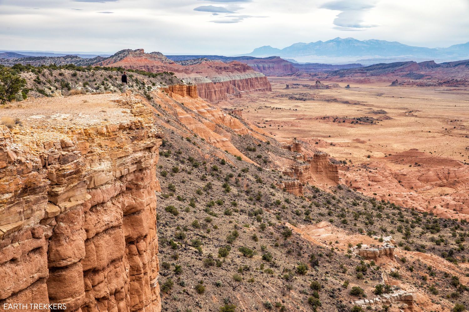
14.8 Lower South Desert Overlook & Jailhouse Rock
Turn left on this spur road and drive 1.2 miles to the end. Park in the small parking lot.
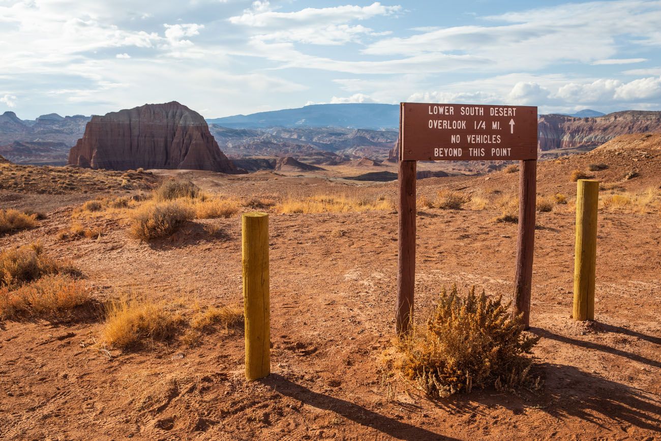
Walk 0.25 miles to the overlook (0.5 miles round trip). It’s well worth it and one of our favorite views along the drive.
You can continue the hike from here, hiking past Jailhouse Rock to Temple Rock, a 4.5 mile out-and-back hike that takes about 2 hours.
18.2 Park Boundary
At this point you leave BLM lands and enter Capitol Reef National Park.
19.3 Lower Cathedral Valley Overlook
For a bird’s eye view of the Temple of Sun and the Temple of the Moon, hike 1.8 miles round-trip to an overlook. Most of the walk is flat and fast. To get up to the overlook, it’s a short but strenuous hike up the saddle to reach the viewpoint. There is a sketchy trail that heads higher up the hillside for even higher views.
This viewpoint is best in the afternoon, when the sun is at your back.
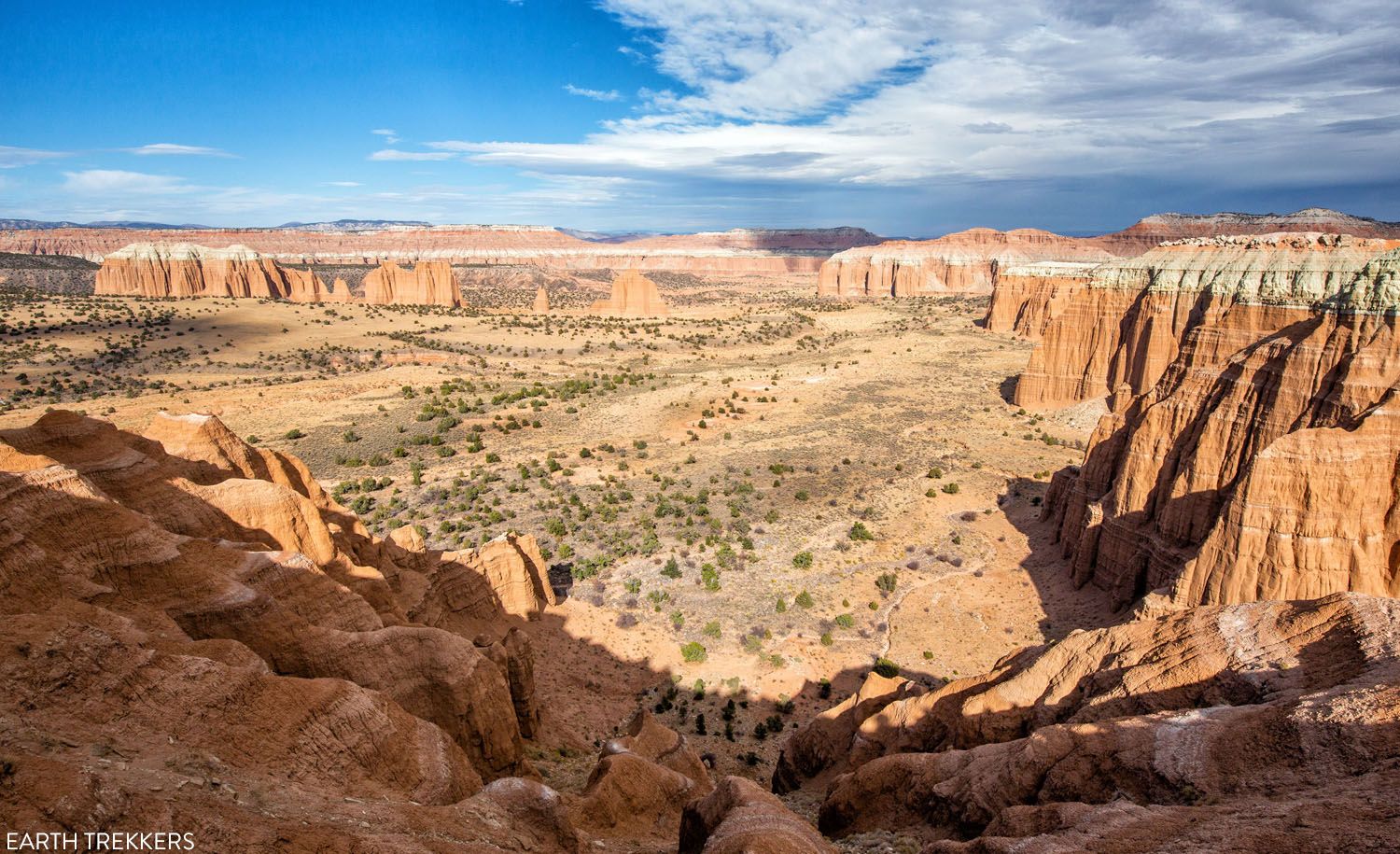
28.6 Upper South Desert Overlook
For a spectacular view of the South Desert and the Water Pocket Fold, it is a 0.5-mile round trip hike to this viewpoint. From the parking lot, it is a strenuous, mostly uphill walk to the viewpoint. But once here, you will be standing on an outcropping of rock with panoramic views of the South Desert.
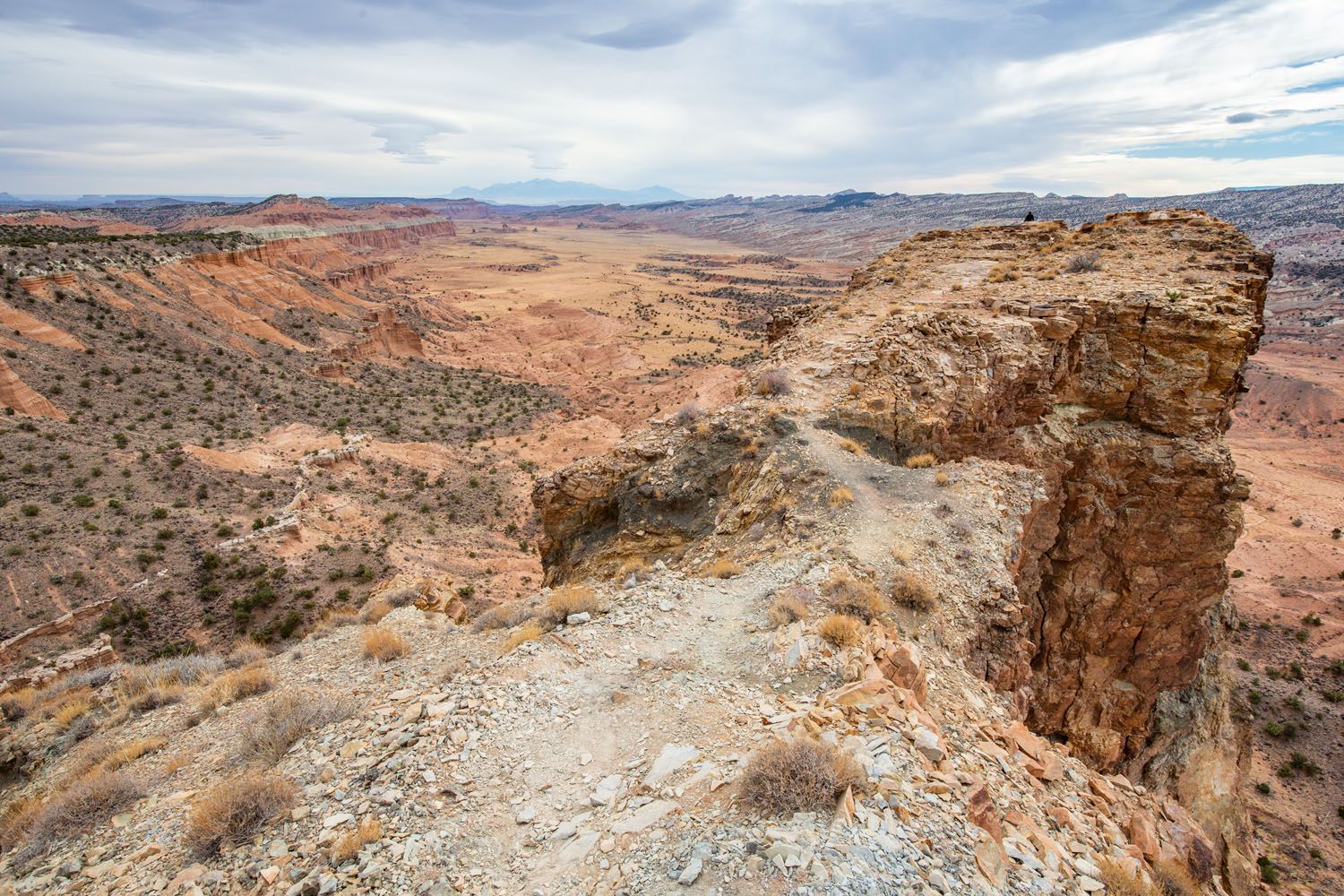
The rocky outcropping is the overlook.
The view from the overlook.
If you don’t want to walk all of the way up to the overlook, you can also get a very nice view just a short walk from the parking lot. Can you spot Tim in this photo?
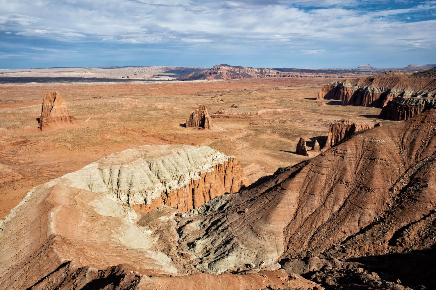
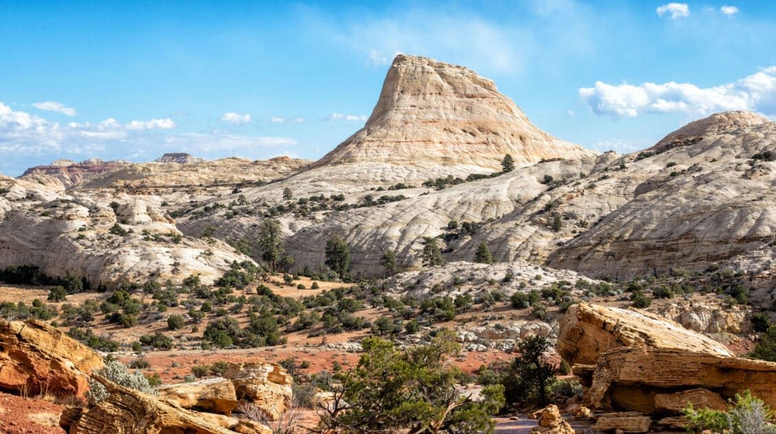
29.1 Upper Cathedral Valley Overlook
Turn right on the spur road and drive 0.4 miles to the end of the road. From here, it is a very short walk (about a quarter of a mile round-trip) to another viewpoint. This time, you are looking northeast, out over Cathedral Valley and its collection of Entrada Sandstone monoliths and rock formations. The cover photo for this post was taken from this overlook.
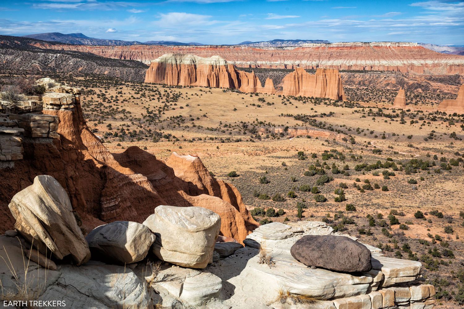
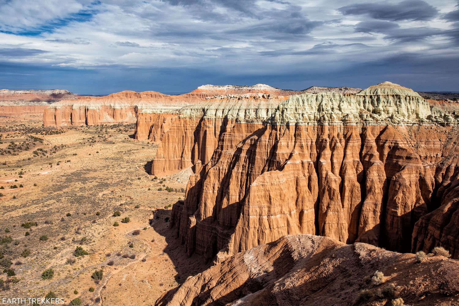
Cathedral Road weaves its way through this valley, which is your next destination.
30.1 Hartnet Junction
At this junction, turn right onto Cathedral Road to continue on the loop. If you continue straight, you exit Capitol Reef National Park and enter Fishlake National Forest.
30.4 Cathedral Valley Campground
A spur road leads to a campground with 6 campsites. This is your only place to use a toilet on the entire loop. Also, this is where we had the strongest cellular service. It wasn’t much, but we could send and receive emails and send a text message.
Beyond the campground, Cathedral Road drops down into the valley. The road makes several switchbacks and is narrow at times so keep a lookout for oncoming vehicles.
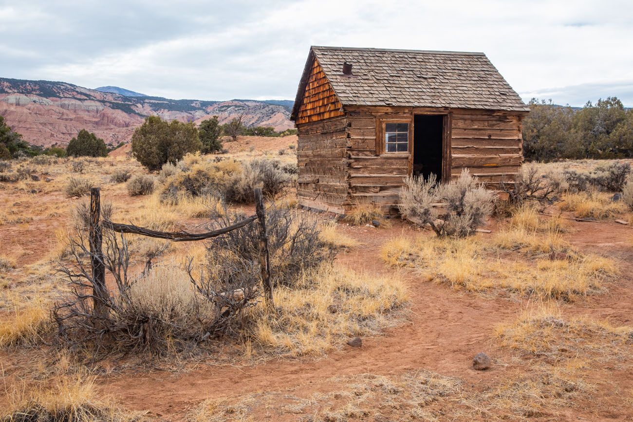
32.1 Morrell Cabin
This cabin was used by cowboys when moving their stock between the rangeland and mountain pastures. It was used from the 1930’s to the 1970’s and then was abandoned once grazing allotments in the area were restructured.
To get to the cabin, it is a 0.5-mile easy, round trip walk.
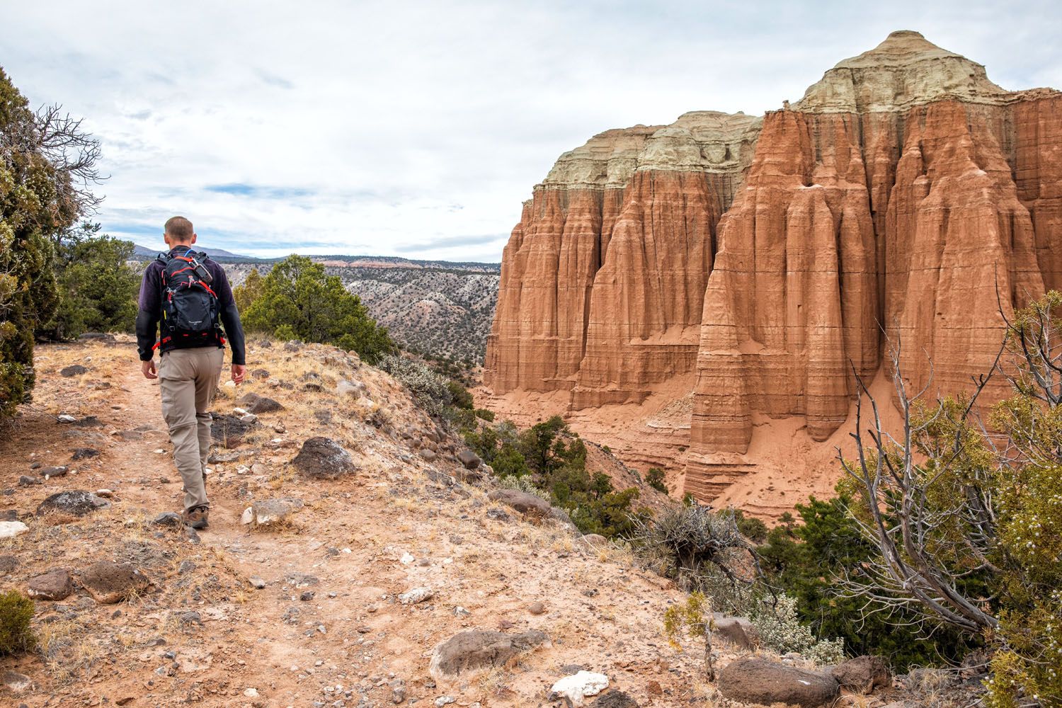
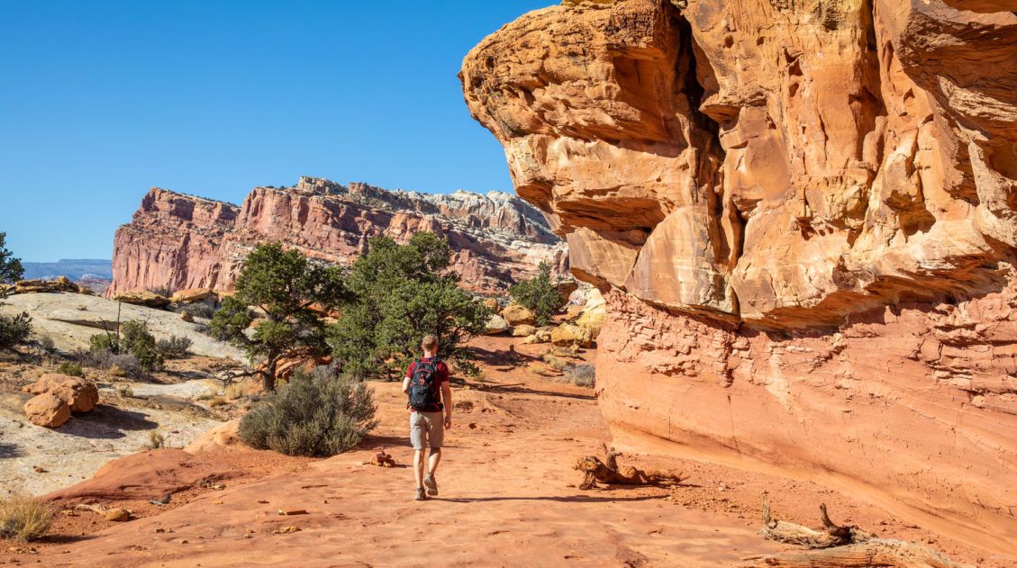
32.8 Cathedrals Trail
Distance: 2.5 miles | Difficulty: Easy | Total Ascent: 400 feet | Time: 1 hour
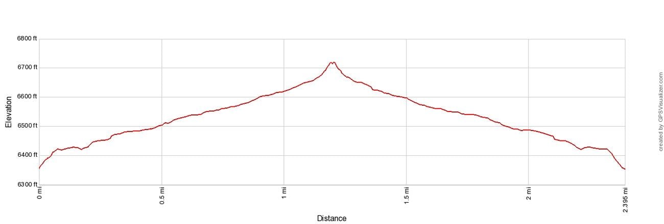
This easy hike offers very nice views of the monoliths of Cathedral Valley. The best part of this hike, in my opinion, is the first half, as you walk alongside this chain of sandstone formations. The trail ends on top of hill where you have panoramic views of Cathedral Valley.
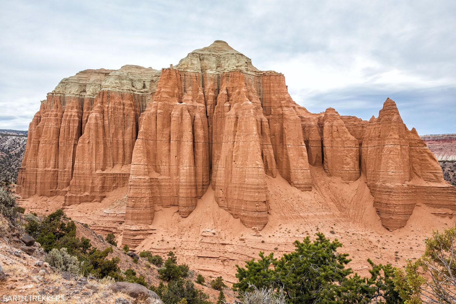
View from the end of the trail.
If you are short on time or energy, it’s worth it to just walk the first part of the trail. Once you have seen enough, turn around and retrace your steps back to your vehicle.
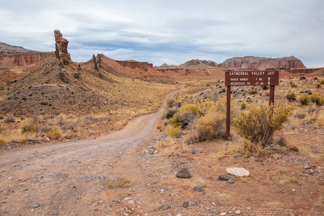
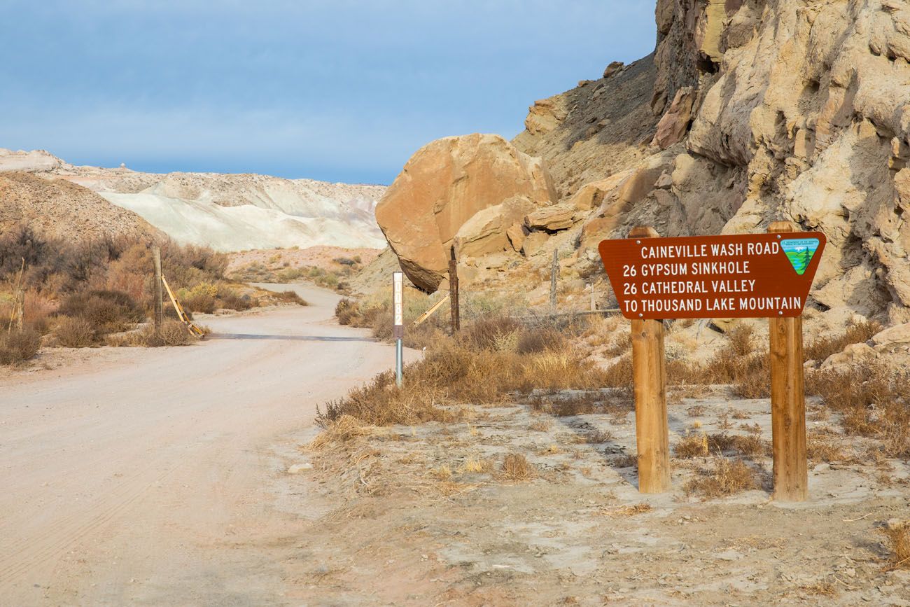
35.5 Cathedral Valley Junction
At this junction, Baker Ranch Road heads north through more remote wilderness, called Last Chance Desert, before reaching Interstate 70. Stay straight to continue the Cathedral Valley Loop.
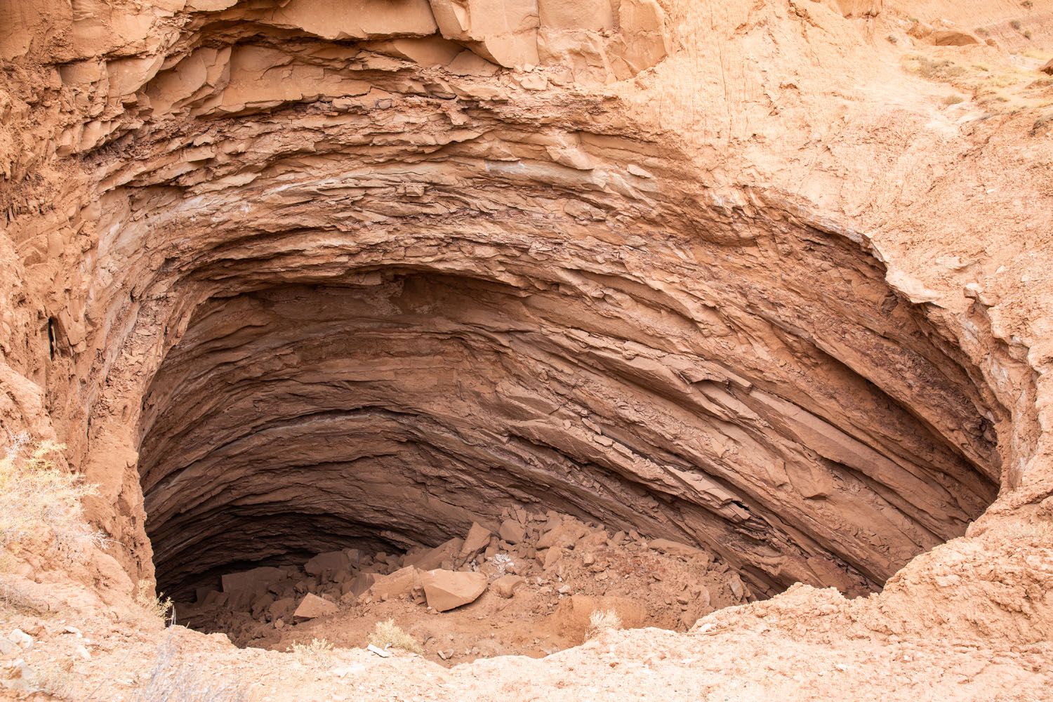
35.6 Gypsum Sinkhole
Turn right, drive the 1-mile spur road and park at the end of the road. From the parking it, it is a very short walk to see the Gypsum Sinkhole. This large hole was formed when ground water dissolved and drained away the gypsum dome.
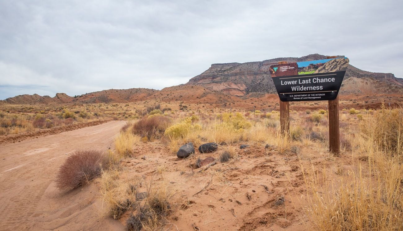
41.5 Exit Capitol Reef National Park
At this point, you exit Capitol Reef National Park and reenter BLM lands. There is a road junction here, another road that leads into the more remote Last Chance Wilderness.
46.6 Junction for the Temples of the Sun and Moon
Turn right onto the spur road that takes you to the Temples of the Sun and Moon. This road is 1 mile long and you will re-enter Capitol Reef National Park.
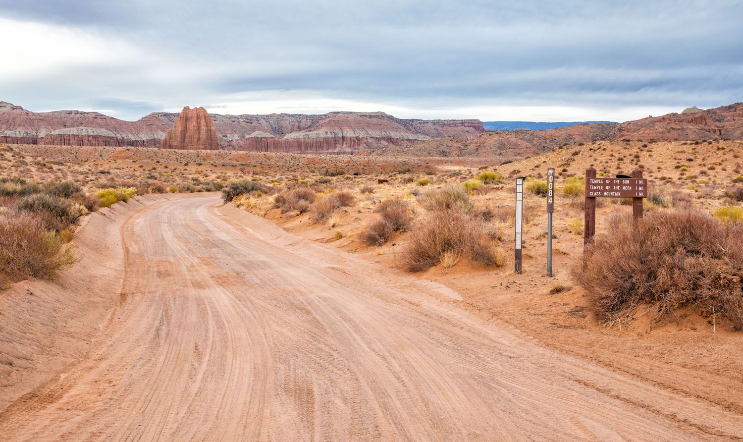
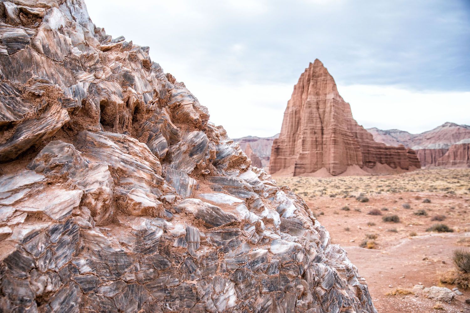
48.1 Glass Mountain
Take the spur road to Glass Mountain. This unique looking mound of rock is made of selenite crystals, also known as moonstone. From this spot, you also have a good view of the Temples of the Sun and Moon.
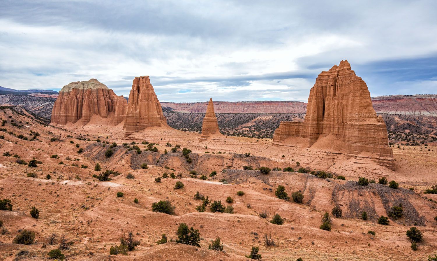
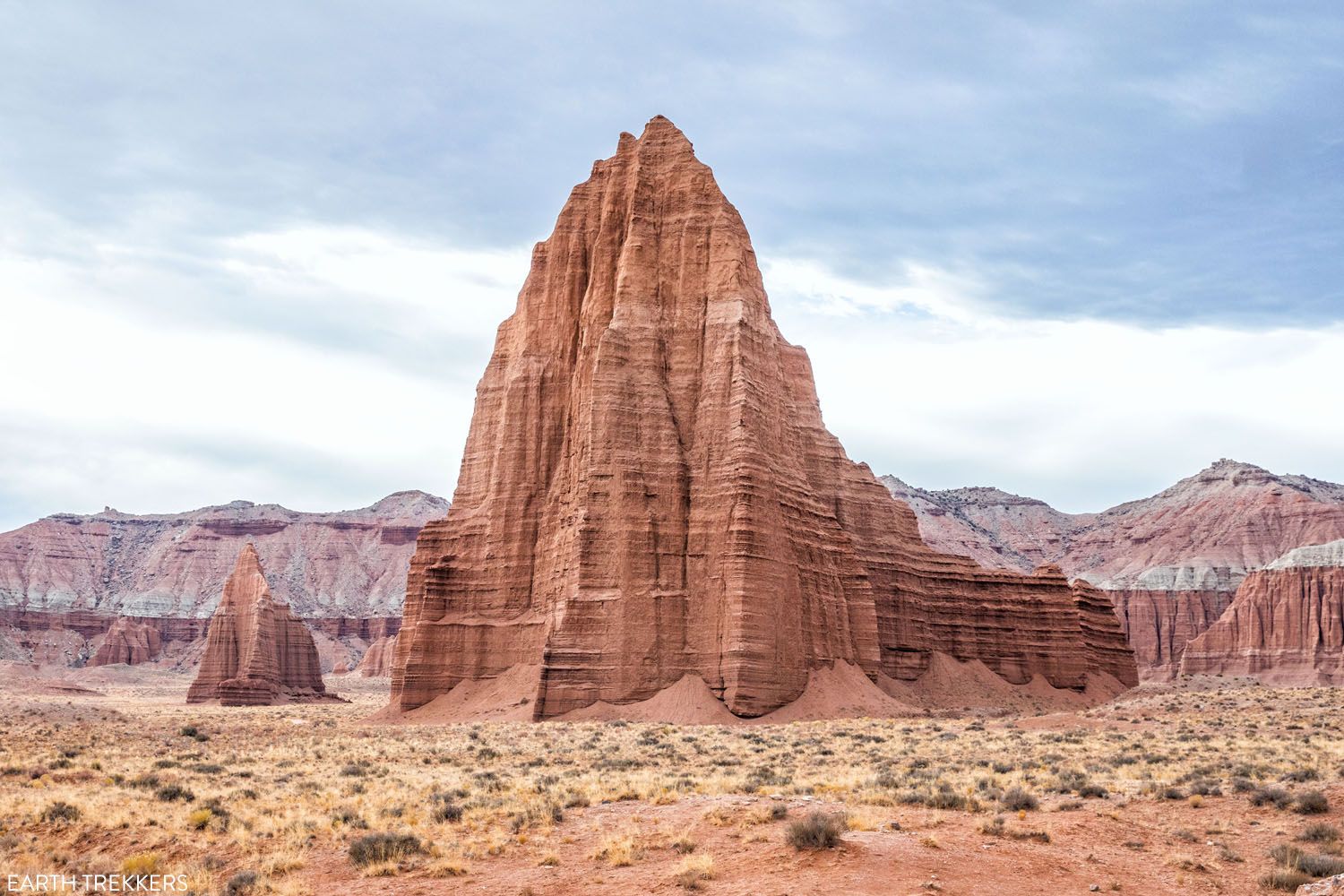
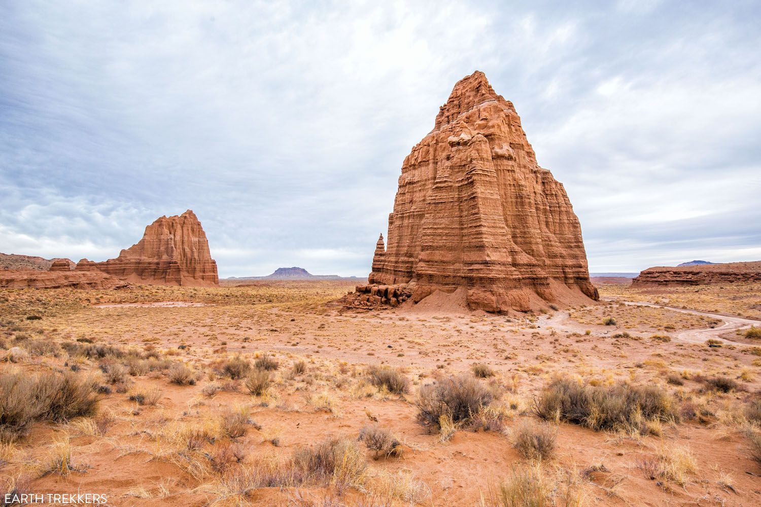
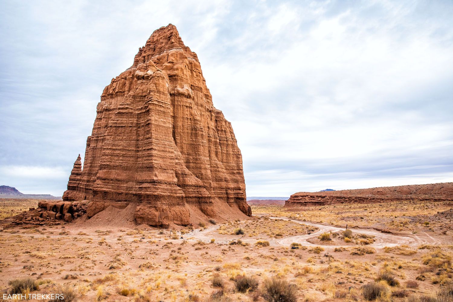
48.8 Temples of the Sun and Moon
The Temple of the Sun and the Temple of the Moon are iconic formations in Cathedral Valley. They are made of Entrada Sandstone and are rapidly eroding.
The Temple of the Sun is the first of two “temples” that you will see. It is also the larger formation.
The road ends next to the Temple of the Moon. You can get out and explore, but avoid walking on the biological soil crust. Behind the Temple of the Moon is a sandy area that also makes a great photography location.
58.6 Morrison Formation
Once you drive back to Cathedral Road, you will exit Capitol Reef National Park again. For the rest of the drive you will be on BLM lands.
Between the Temples of the Sun and Moon and Highway 24, there is not much to see. It’s a pretty drive although there are no more notable viewpoints or hiking trails.
58.6 miles into Cathedral Valley Loop, you will drive through the Morrison Formation, which are more colorful hills like the Bentonite Hills seen earlier on the drive. This area can be impassable if it is wet or raining.
2.5 miles from Highway 24, the name of the road changes to Caineville Wash Road (at the junction with W Factory Road, which leads to Factory Butte).
65.6 Highway 24
This is where the dirt road hits asphalt. Turn right to complete the full loop and return to Capitol Reef National Park. Turn left to go to Caineville, Hanksville, or Moab.
Note: If you complete the loop (drive Highway 24 back to the junction with Hartnet Road, a distance of 7 miles), the total distance of the loop is 72.6 miles, which includes all of the driving detours on the Cathedral Valley Loop listed above.
Cathedral Valley Loop in a Counter-Clockwise Direction
There are several reasons to drive the Cathedral Valley Loop in a counter-clockwise direction.
If Fremont River is impassable, then you will have to do this drive in a counter-clockwise direction. Just be aware that you will have to do some backtracking along the drive.
If you are a photographer, consider doing this drive counter-clockwise. The best time to photograph the Temples of the Sun and Moon is at sunrise and early morning. The best time to photograph the Temples of the Sun and Moon from Lower Cathedral Valley Overlook is in the afternoon. If you drive the loop in a counter-clockwise direction, you can be at these two spots at the best time of day.
If you do this drive in a counter-clockwise direction, you are leaving the Fremont River ford for the very end of the drive. If it is impassable (it was in our case), you will have to either drive the entire loop again, drive back towards Cathedral campground and exit through Fishlake National Forest, or take a short cut across the loop.
Cathedral Valley Shortcut
There is a rough, unmaintained 4×4 road that connects Hartnet Road and Cathedral Road. This is a handy shortcut if the Fremont River is impassable.
The road is not on Google and not on any guides that I have seen. We only knew about it because it is labeled on the National Geographic Capitol Reef National Park Map. If we didn’t have this map, we wouldn’t have known about this road, forcing us to retrace the entire loop back to Highway 24.
This shortcut road is 5.2 miles long and it takes 30 to 45 minutes to drive it. It is very rough, much rougher than Hartnet Road and Cathedral Road. The road is uneven, with boulders, tight turns, and rough, rocky surfaces. You must have a high clearance 4×4 to drive this road. It’s a challenging, somewhat technical, bumpy ride. This shortcut is only recommended for those with experience driving on unmaintained, technical roads.
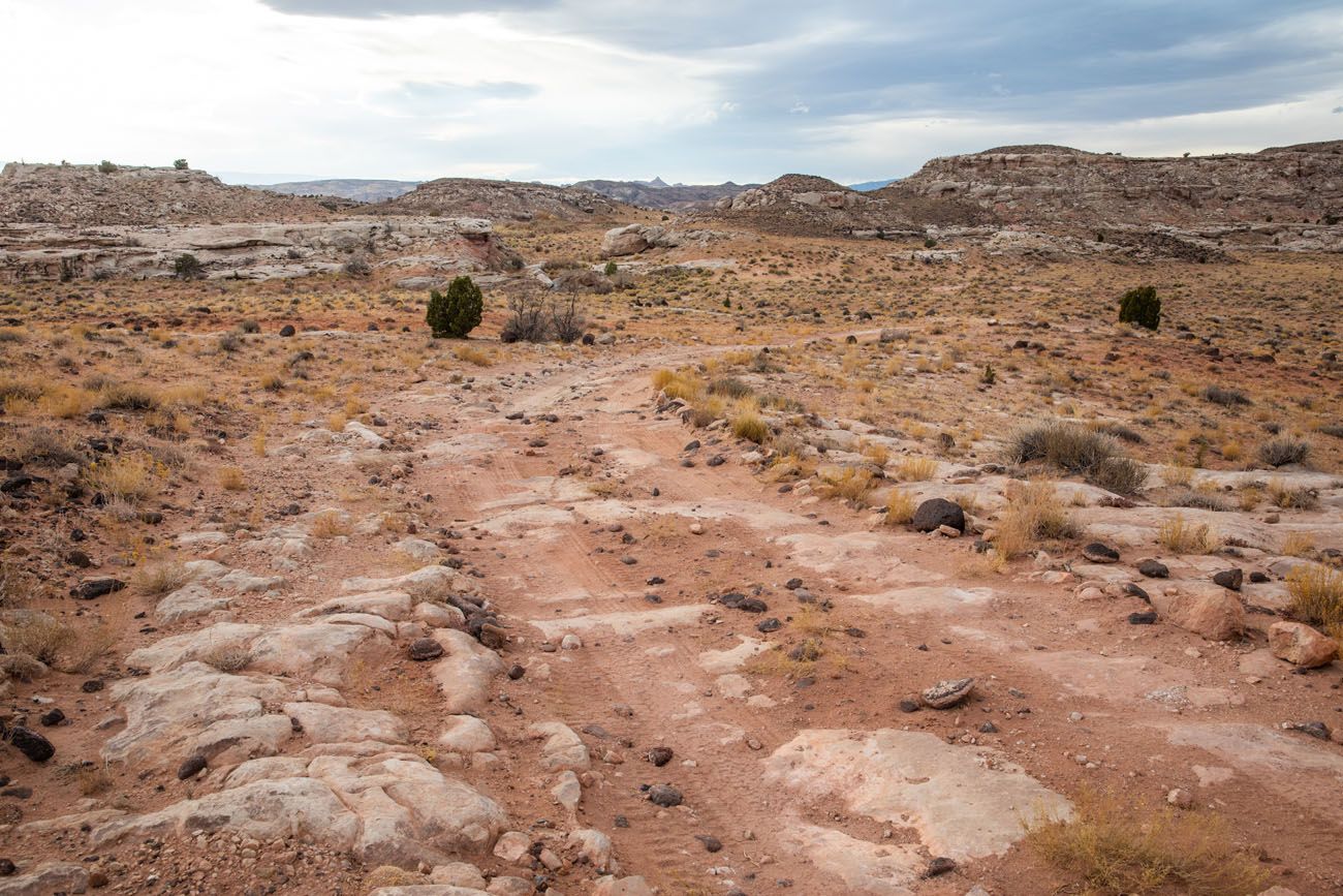
Note: I don’t know the name of this road so I am referring to it as the shortcut road. It’s marked as a four wheel drive road on the National Geographic map but it is unnamed.
Our route in the counter-clockwise direction with this shortcut: From Highway 24, we drove Cathedral Road to Hartnet Road and continued on Hartnet Road until we reached the Bentonite Hills. At the Bentonite Hills, we turned around, drove north on Hartnet Road for 0.75 miles, and then turned right on the shortcut road. The shortcut road ends at Cathedral Road. We turned right and took this to Highway 24.
So, if you cannot ford the Fremont River, you can still drive Cathedral Valley Loop (as long as you have a 4WD high-clearance vehicle).
You can also use the shortcut road as a bail out, if you get to the Fremont River at the end of your drive and realize you cannot cross it. Retrace the drive on Hartnet Road and the shortcut road will be on your right once you exit the Bentonite Hills.
Temple of the Moon
Variations of this Drive
If you don’t want to drive the entire loop, here are two alternate ways to drive part of the Cathedral Valley Loop.
Temples of the Sun and Moon
The Temples of the Sun and Moon are the most iconic sites in Cathedral Valley and for some people, just seeing this is enough. To get here, take Cathedral Road for 15 miles and turn left on the junction to the Temples of the Sun and Moon. Once you are finished here, you can retrace the drive back to Highway 24, or drive a little further into Cathedral Valley. The Cathedrals Trail is a nice, short hike if you want to get up close to more of the monoliths.
Cathedral Valley + Fishlake National Forest
From Highway 24, drive Cathedral Road, stopping at the Temples of the Sun and Moon and hiking Cathedrals Trail. Near the campground, visit the Cathedral Valley Overlook and the Lower South Desert Overlook. Then, exit Capitol Reef National Park and enter Fishlake National Forest. The road reaches its highest point on Thousand Lake Mountain and then will connect with Highway 72.
Upper Cathedral Valley Overlook
Tips to Have the Best Experience
Check the weather forecast before you do this drive. The roads can be impassable during and after storms and snow.
You can get updates on road conditions at the visitor center in Capitol Reef National Park. However, the day before we did this drive, they stated that the river crossing was passable, which was incorrect, so even the park rangers may not have up-to-date information.
ATV’s are not permitted on national park land so they cannot be driven on the Cathedral Valley Loop.
Bring extra food, water, and clothing, just in case you get stranded. There are very few people out here and there is minimal cellular service, so if you get stuck, have a breakdown, etc., it could be hours or even days until help arrives. When we did this drive, we saw a total of four cars over the course of the day.
Start this drive with a full tank of gas. You do not need extra gas; one tank is more than sufficient to complete this loop.
Purchase a copy of the National Geographic Capitol Reef National Park Map before your trip. This map has all of the spur roads on the loop as well as other BLM roads in the area. It will also be useful if you plan to Loop the Fold and drive Notom – Bullfrog Road to Burr Trail Road.
Please practice the seven principles of Leave No Trace: plan ahead, stay on the trail, pack out what you bring to the hiking trail, leave areas as you found them, minimize campfire impacts, be considerate of other hikers, and do not approach or feed wildlife.
If you like scenic drives and exploring the remote backcountry, Looping the Fold is another awesome experience in Capitol Reef National Park. Learn more in our guide to Looping the Fold.
If you have any questions about driving the Cathedral Valley Loop, or if you want to share your experience, let us know in the comment section below.
More Information about Utah
How to Loop the Fold in Capitol Reef National Park
Pinterest Facebook Flipboard Desert vistas, slot canyons, colorful hills made of bentonite and sandstone, marine fossils…these are just a few of the things that you will see when you Loop the Fold in Capitol Reef National Park. This incredibly scenic drive takes you through the remote, southern section of Capitol Reef. On this drive, you […]
14 Amazing Things to Do in Capitol Reef National Park
Capitol Reef, often an overlooked national park, is full of many wonderful surprises. With two amazing scenic drives, hiking trails that rival those in Zion, rugged, remote areas to explore by 4×4, short, easy slot canyons, historical landmarks, and even delicious pie, this national park is absolutely amazing. In this post, learn about the best […]
How to Drive the White Rim Road: Map, Photos & Driving Tips
Driving the White Rim Road is the experience of a lifetime. If you are looking for adventure, solitude, incredible views, and a totally different way to experience Canyonlands National Park, put this drive on your list. Along the drive, you will gaze up at the Island in the Sky mesa and peer down into the […]
15 Best Hikes in Capitol Reef National Park
The hikes in Capitol Reef National Park are some of the most underrated in Utah. From short, easy trails along Highway 24 to scenic routes like Cassidy Arch and Grand Wash, this park is packed with adventure, without the crowds you’ll find in Zion or Arches. Drive deeper into the park and you’ll discover the […]
Cassidy Arch, An Essential Hike in Capitol Reef National Park
The hike to Cassidy Arch is one of the most thrilling trails in Capitol Reef National Park. Easily accessible from Scenic Drive, this short 3.4-mile hike features stunning scenery, views over the Grand Wash, and the chance to stand on Cassidy Arch. On this hike, you can view the arch from afar or walk across […]
Rim Overlook & Navajo Knobs Trail | Capitol Reef National Park
The hike to Navajo Knobs is our favorite hike in Capitol Reef National Park. It’s a long, tough hike but what an incredible journey! From the valley floor, you will steadily hike up to the Rim Overlook, for jaw-dropping views over Fruita, Highway 24, and Scenic Drive. The trail continues its climb for another 2.5 […]
Utah’s Mighty 5: How to Plan the Perfect Road Trip Itinerary
Stretching across southern and central Utah are five stunning national parks. Called the Mighty 5, these parks contain some of the most thrilling hiking trails and iconic landscapes in the United States. Stand atop Angels Landing in Zion. Gaze across a wonderland of hoodoos at Bryce Canyon. Explore the Water Pocket Fold at Capitol Reef. […]

The Ultimate Guide to the 63 US National Parks
Stretching from the South Pacific, across the United States to the Caribbean, are 63 national parks. These national treasures preserve iconic landscapes, majestic mountains, primordial forests, arid deserts, misty coastlines, immense canyons, wildlife, and historic landmarks. We have visited 56 of the 63 US national parks, from the towering granite walls of Yosemite and the […]
Our 15 Favorite US National Parks: A Few May Surprise You
Stretching from the South Pacific, across the United States and into the Caribbean, are 63 national parks. These national treasures are filled with scenic drives, hundreds of miles of hiking trails, wildlife, historic sites, and endless opportunities for adventure. In this guide, we cover 15 of the best national parks in the USA and what […]
Utah Travel Guide: Places to Visit in Utah
Utah Travel Guide If you like rugged, desert landscapes, it is hard to beat the beauty of Utah. Visit the state’s five stunning National Parks, stand among iconic US monuments, kayak on the Great Salt Lake, and climb through photogenic slot canyons. This state is a great one for road trippers as there are many […]
16 Amazing Things to Do in Arches National Park (+ HELPFUL Tips)
Arches National Park is a wonderland of desert vistas, short hiking trails, strange rock formations, and you guessed it, arches. Not only will you find over 2,000 arches here, but you will also see hoodoos, fins of sandstone rocks, massive mesas, and balanced rocks. Here are the best things to do in Arches National Park. […]
Best Things to Do in Island in the Sky: Canyonlands National Park
Canyonlands National Park is an underrated park located near Moab, Utah. Compared to its smaller and more popular neighbor Arches National Park, Canyonlands feels more rugged, more remote, and a whole lot larger. Island in the Sky, the most popular section of Canyonlands, is filled with jaw-dropping vistas and short but sweet hiking trails. Here […]
Hiking Bryce Canyon: Queen’s Garden and Navajo Loop Trails
Bryce Canyon National Park may be small in size but it has an enormous wow factor. With its orange and pink hoodoos and sandstone rock formations, Bryce Canyon is one of the most unique national parks in the United States. By hiking Bryce Canyon and visiting its numerous viewpoints, you can have the best experience […]
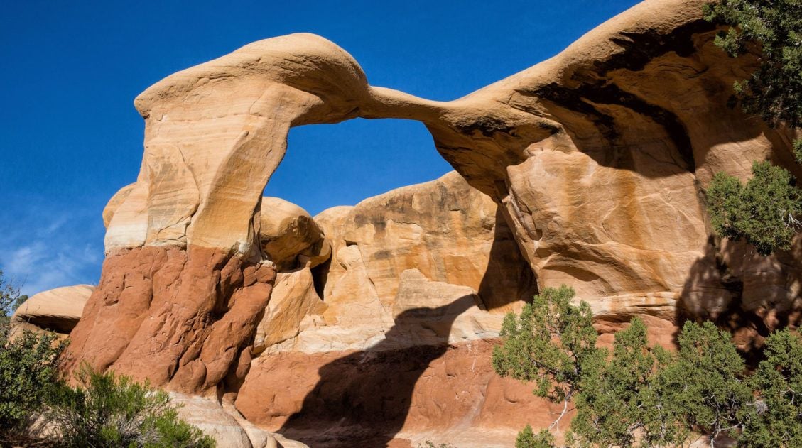
5 Reasons Why You Should Visit Devils Garden in Grand Staircase-Escalante
Devils Garden is a fun to explore, scenic spot to visit in Grand Staircase-Escalante National Monument. If you have plans to drive down Hole-in-the-Rock Road, here are five reasons why you should visit Devils Garden. #1 This Place is a Beauty! With hoodoos, crazy rock formations, and arches, Devils Garden is a beautiful spot to […]
Best USA Road Trips: 18 Ideas for Your Next Big Adventure
One of the best ways to explore the USA is on a good old-fashioned road trip. Cruise along Route 66, road trip through the Florida Keys, explore the American Southwest, or even drive from coast to coast. In this guide, we share 18 of the best USA road trips…18 great ideas for your next big […]

Comments 59