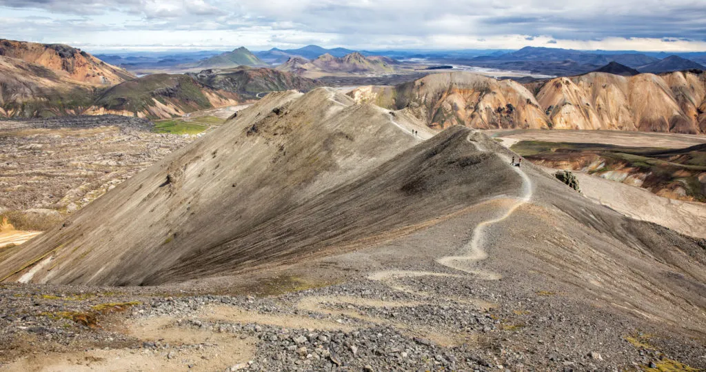
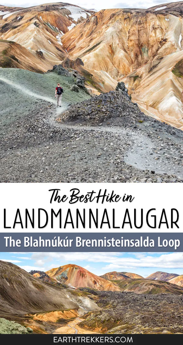
Mt. Blahnúkúr and Mt. Brennisteinsalda are two very popular hikes to do in Landmannalaugar, Iceland. If you can’t decide between the two, it’s possible to do both, combining the hikes into one big loop.
If you are looking for an epic experience in Landmannalaugar, it’s hard to beat this hike. You will walk through lava fields, past steaming fumaroles, up and down zig-zagging trails, and you will summit two mountains. The Blahnúkúr Brennisteinsalda loop is one of our favorite hikes in Iceland.
Blahnúkúr Brennisteinsalda Loop Hiking Stats
Distance: 9.7 km (6 miles) loop
Total Ascent: 610 meters (2000 feet)
Difficulty: Strenuous
Length of Time: 4 to 6 hours
When to Go: Mid-June through mid-September. This is when the trails and the roads to Landmannalaugar are free of snow.
On this hike, you will first summit Mt. Blahnúkúr and then Mt. Brennisteinsalda. By doing it this way, you get the toughest climb over with first. It is possible to do this in the opposite direction, but the biggest climb of the day will come near the end of the hike.
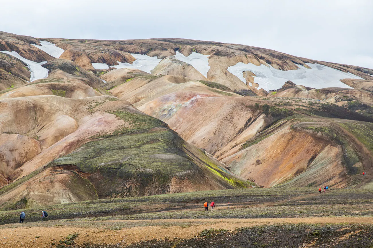
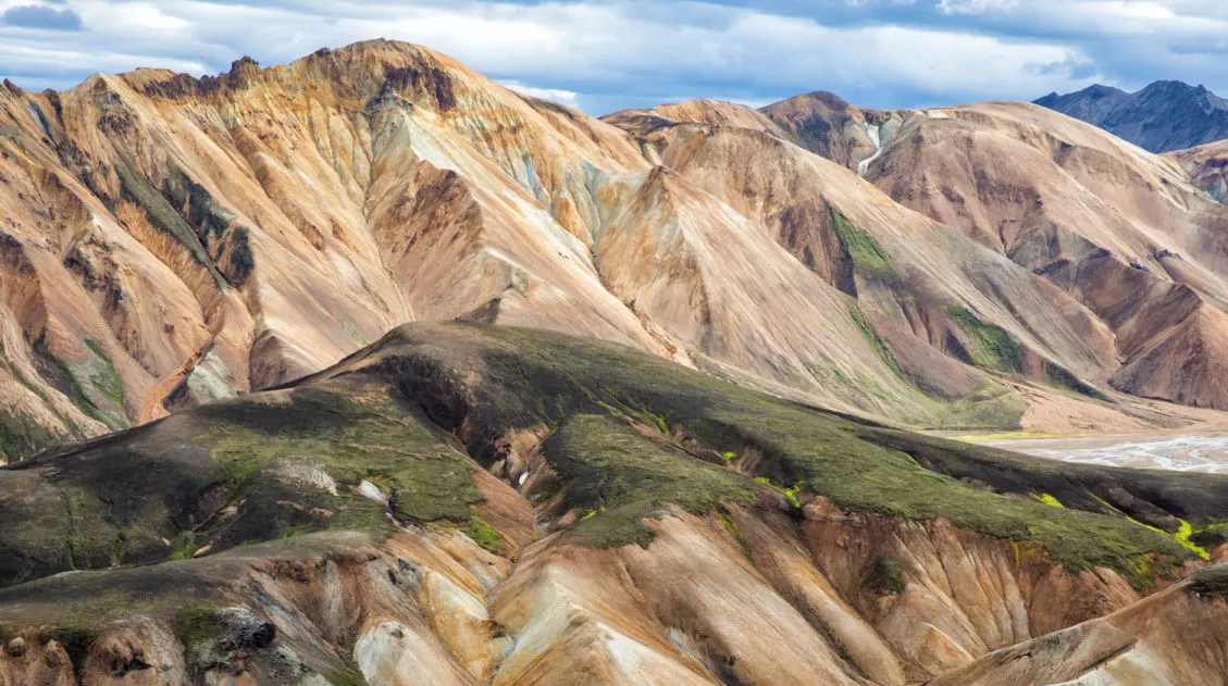
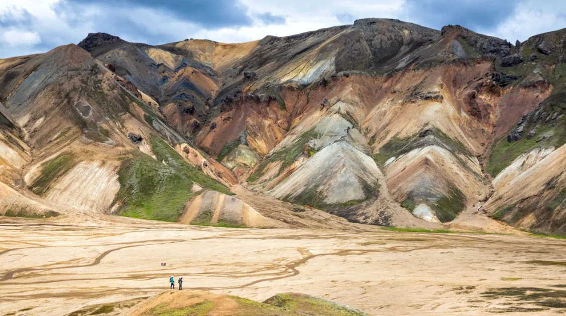
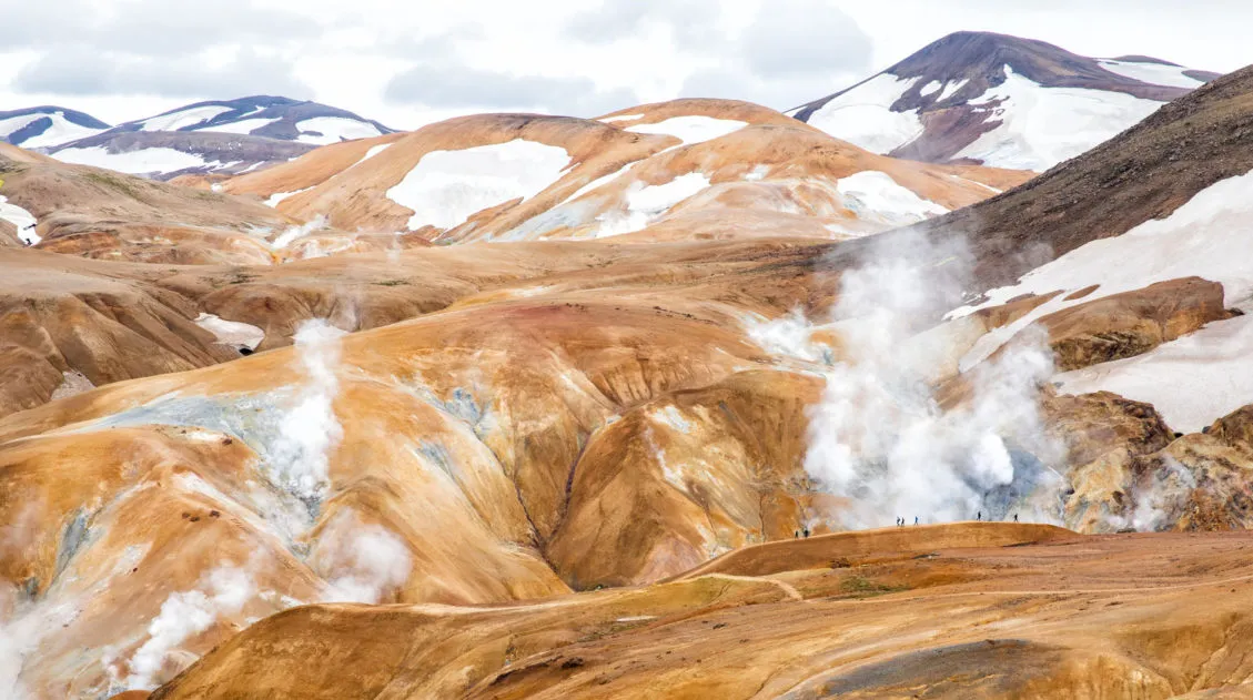
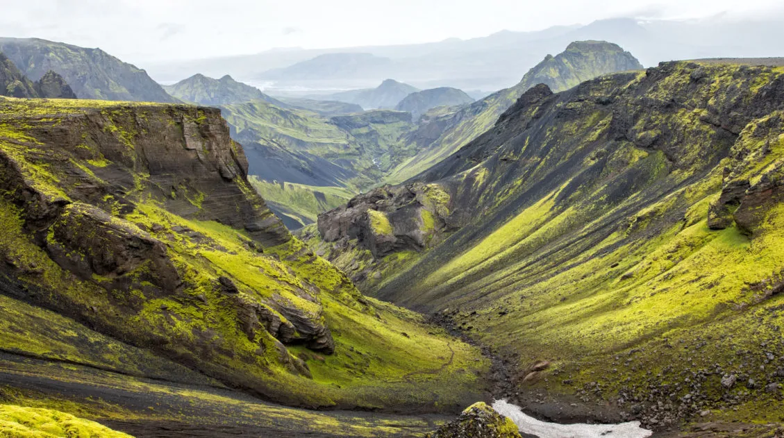
Mt. Blahnúkúr is also called the Blue Peak. It’s blueish-gray color gives it a much different appearance than the yellow, orange, and brown mountains of Landmannalaugar. The trail to the summit of Blahnúkúr features multiple sections of steep climbs and switchbacks. It is a tough climb and it earns the distinction as the most challenging hike in Landmannalaugar, but the views along the way are incredible.
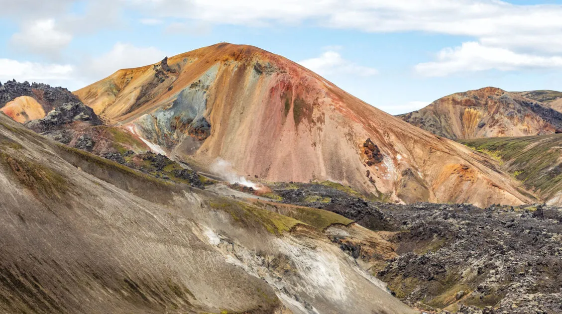
Mt. Brennisteinsalda is also called the Sulphur Wave. This colorful mountain also features a steep climb, although it is not as challenging as Mt. Blahnúkúr. From the summit, you have great views of the Laugahraun lava field and trekkers on the Laugavegur Trail.
For information on planning your trip to Landmannalaugar, don’t miss our post How to Visit Landmannalaugar (and learn about the new parking reservations).
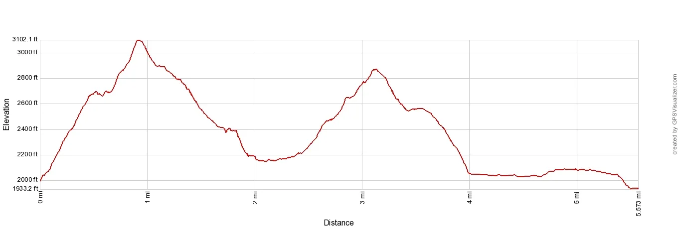
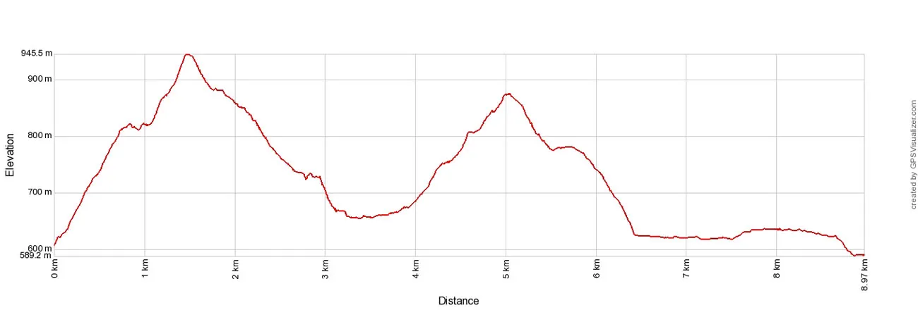
Elevation profile of this hike. The first peak is Mt. Blahnúkúr and the second peak is Mt. Brennisteinsalda. This elevation profile starts at the trailhead (at the base of Mt. Blahnúkúr) which accounts for the slight difference in total distance. The 9.7 km (6 mile) round trip distance accounts for the walk from the campground to the trailhead.
Blahnúkúr Brennisteinsalda Loop
Step-By-Step Trail Guide
Getting to the Trailhead
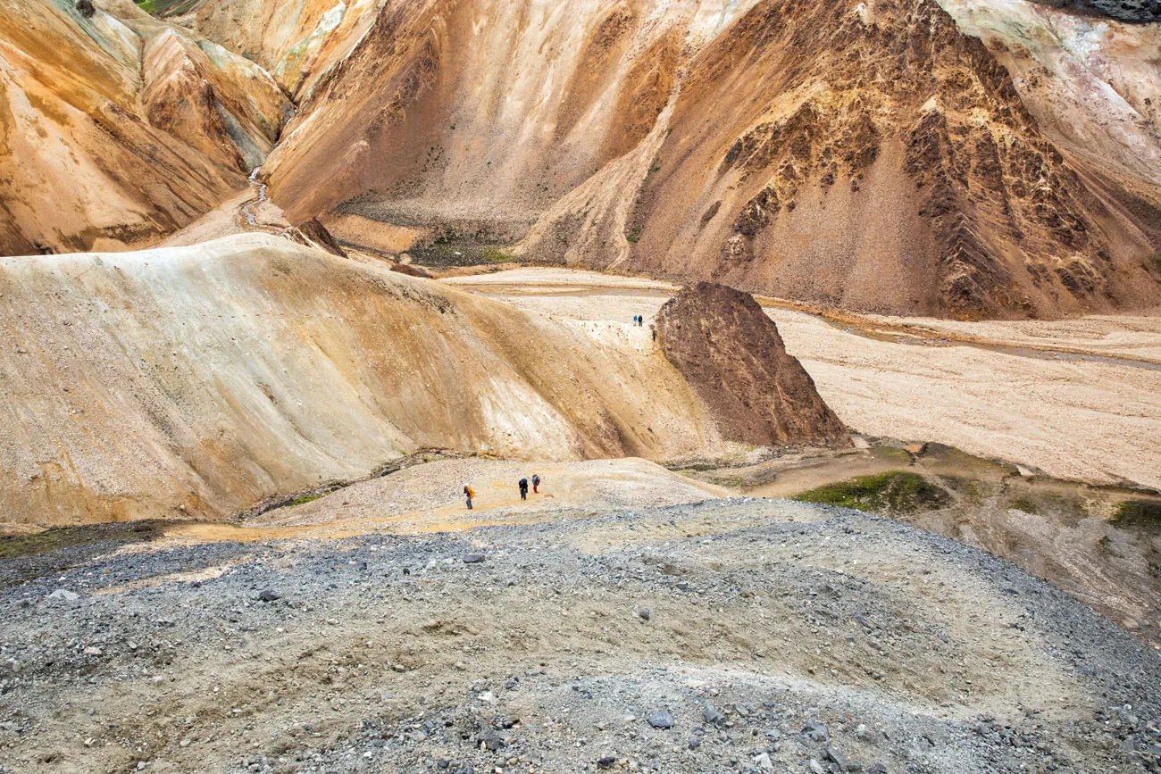
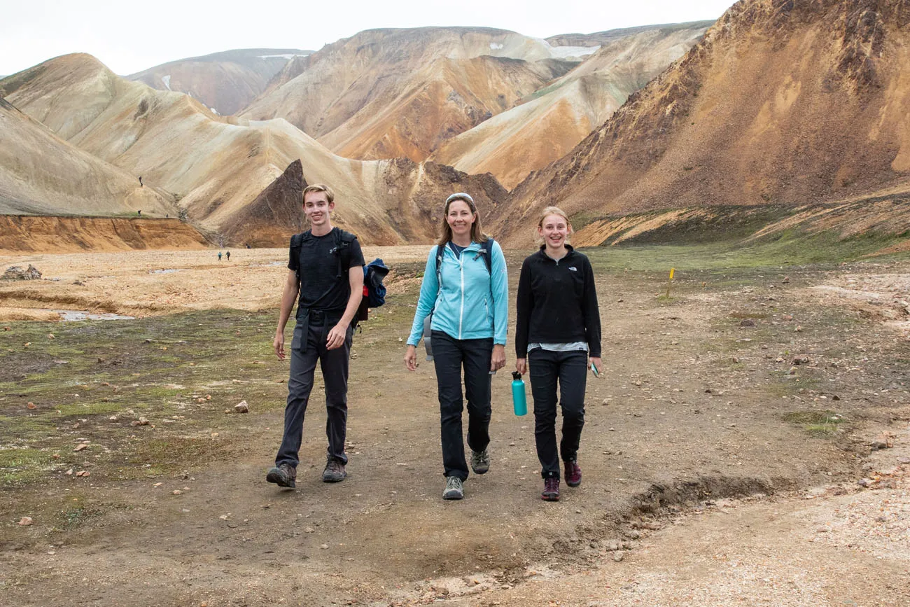
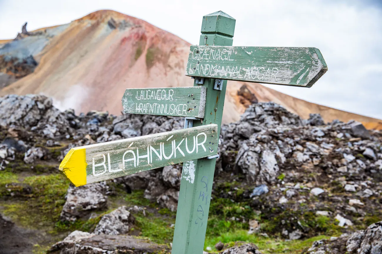
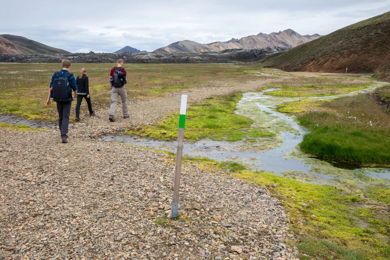
From the campground, walk along the riverbed in the direction of the Blahnúkúr (if you are not sure where to go, ask at the Information Desk). It is a flat, 0.8 km (0.5 mile) walk from the campground to the trailhead. At the base of the mountain, there is a sign marking the trailhead.
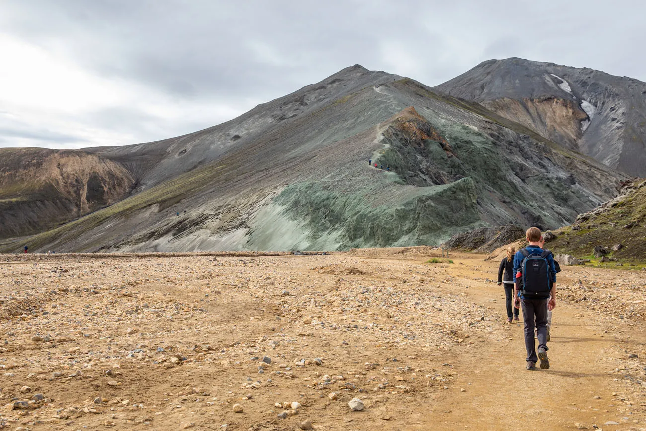
Hiking from the campground to Mt. Blahnúkúr. You will cross a bridge over a small river before arriving at the trailhead.
Hiking Up Blahnúkúr
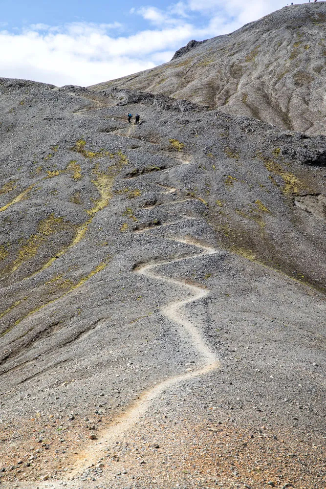
From the trailhead, it’s a steady uphill climb. At times, the trail will be steep, with switchbacks and short, steep ascents.
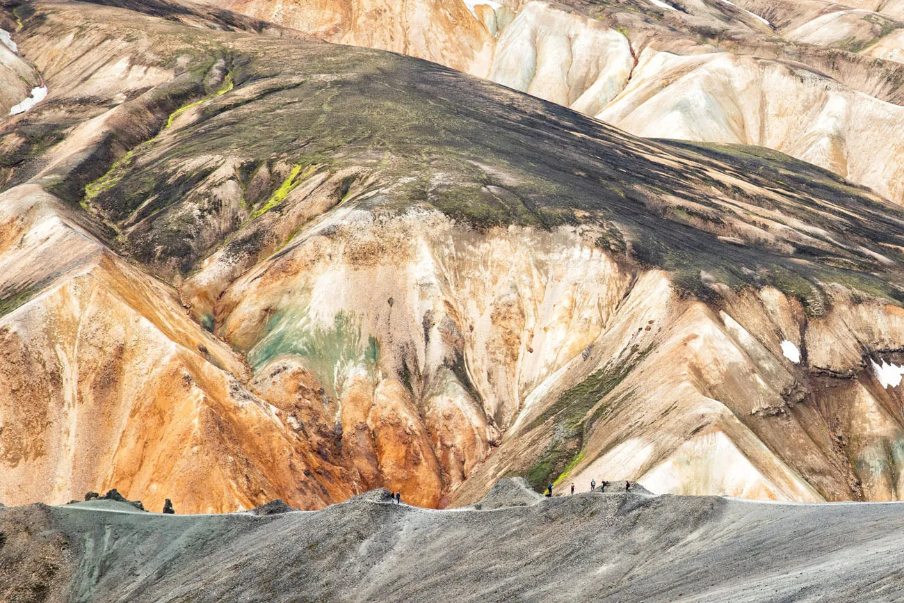
Along the way, there are many places to stop to take a break and to take photos. In fact, we hardly had time to get out of breath, simply because we stopped so frequently to take photos. This is one hike where you probably won’t mind the climb, simply because the views just keep getting better and better.
View over Landmannalaugar.
Mt. Brennisteinsalda is the colorful mountain off in the distance.
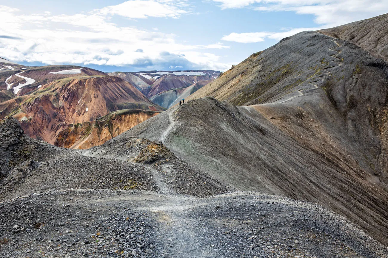
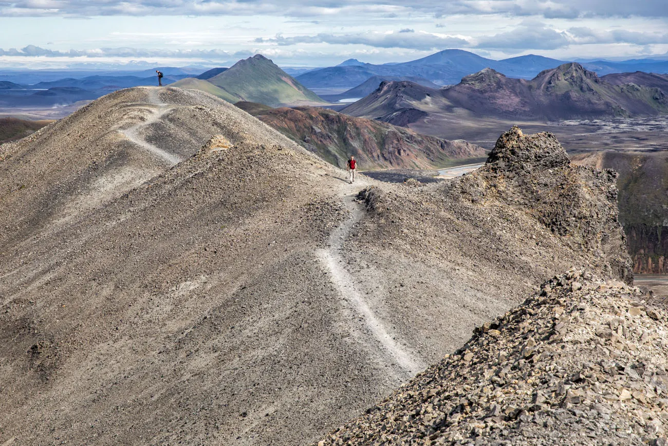
Looking back at the hiking trail.
Another view of the hiking trail.
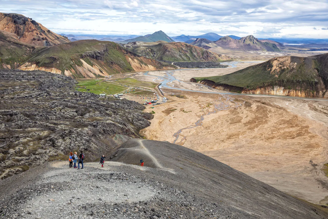
The Summit of Blahnúkúr
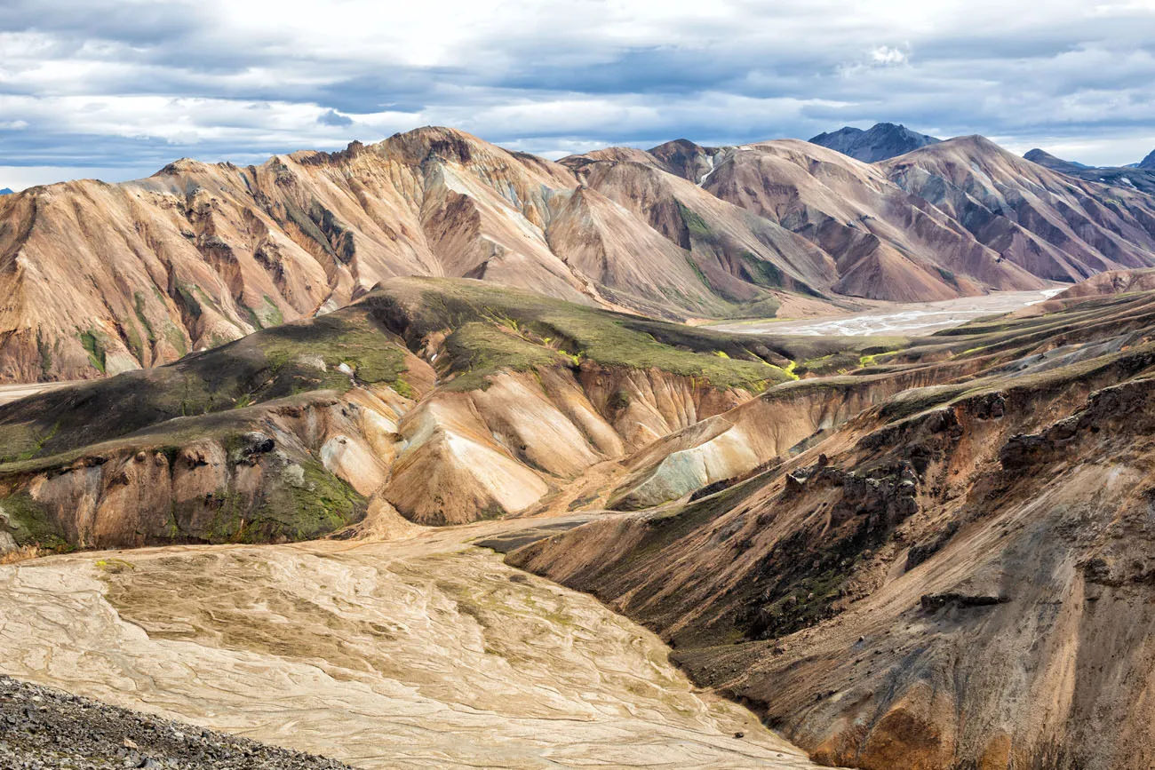
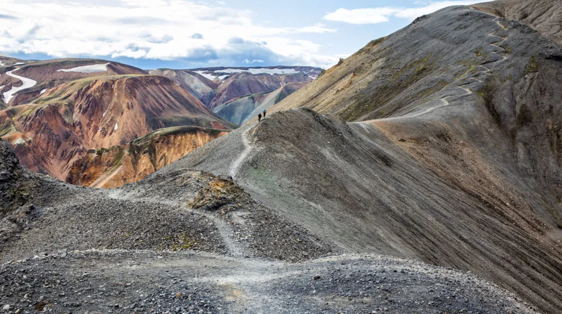
From the summit, enjoy the panoramic views over the rhyolite mountains of Landmannalaugar.

Hiking Down Blahnúkúr
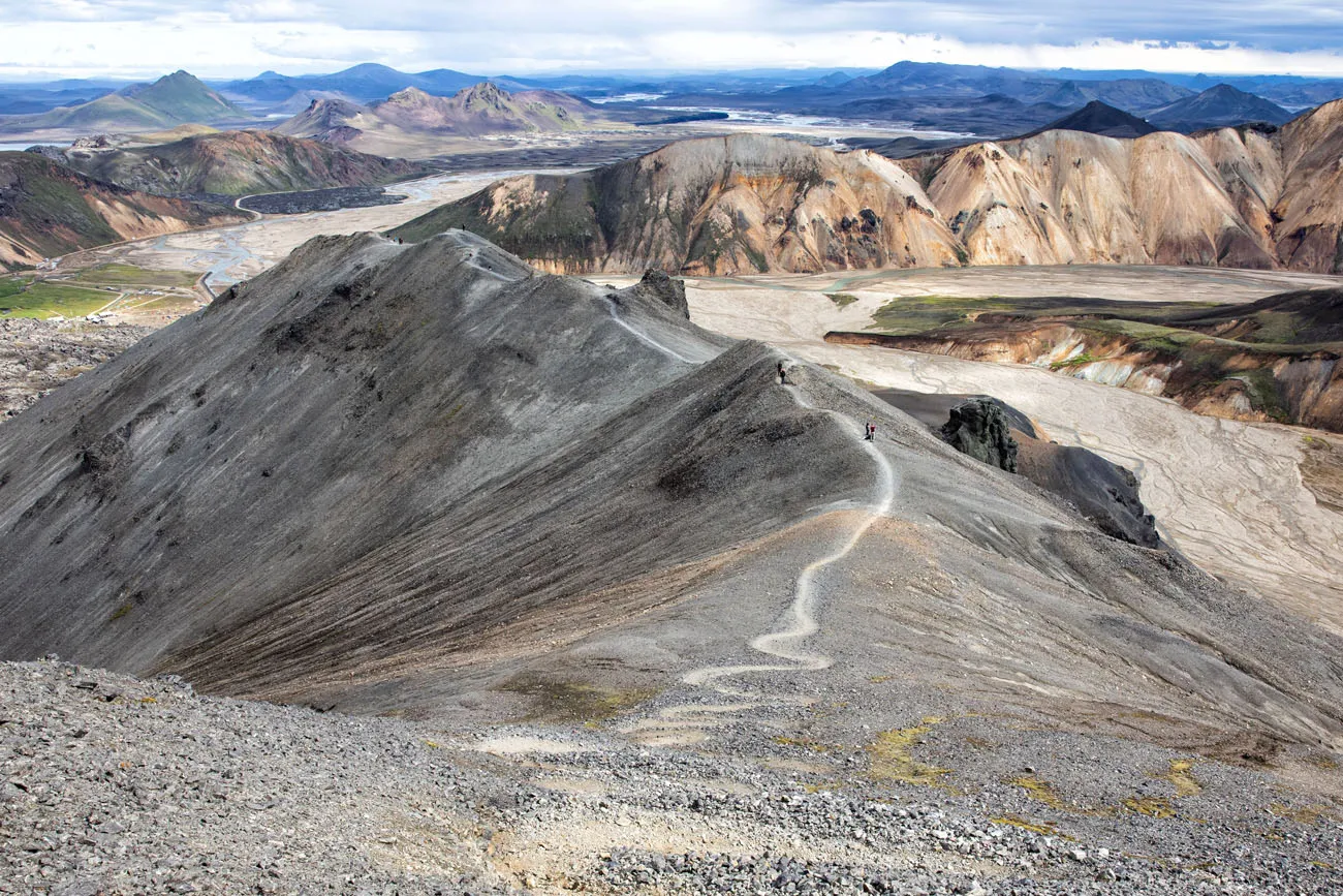
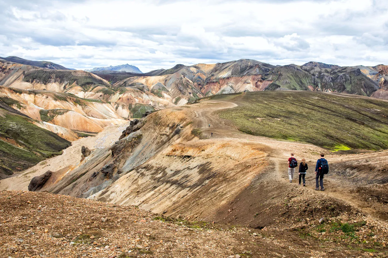
From the peak of Mt. Blahnúkúr, the trail heads to the east and eventually drops down to a riverbed. From the peak to the riverbed, it is an easy, downhill hike.
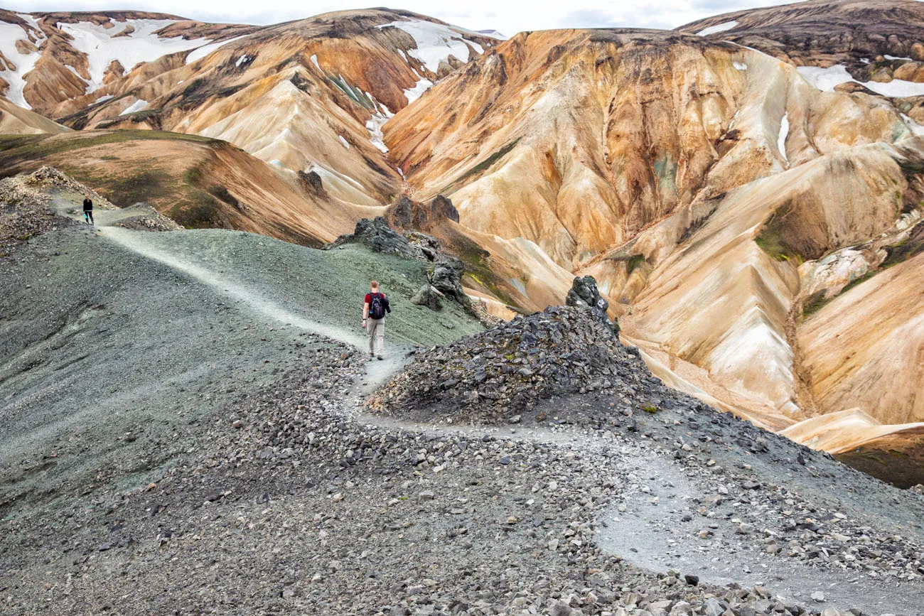
On the way down you will come to a fork in the trail. If you take the trail to the right, it will be a very steep descent back down to the canyon. The trail to the left is the longer way to go, but it is much less steep, so it’s a lot easier on the knees. We chose the trail to the left.
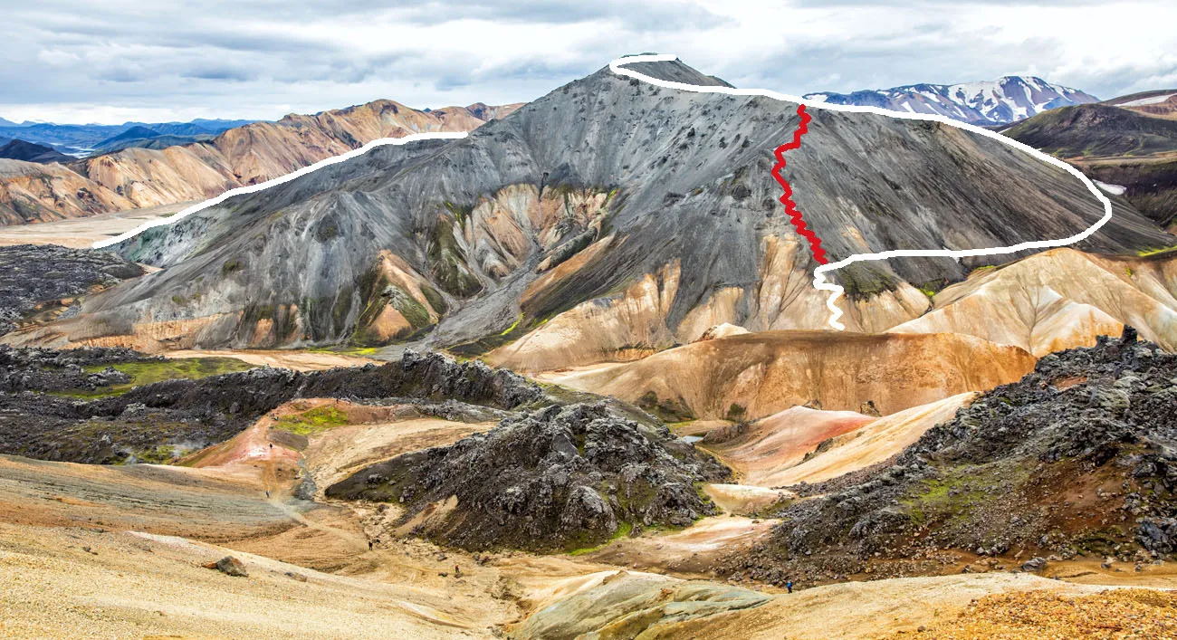
Below is the view of Blahnúkúr from Brennisteinsalda. The white line is the longer, easier hiking route that we took. The red line is the more direct but very steep hike down the mountain.
Here is the view along the trail.
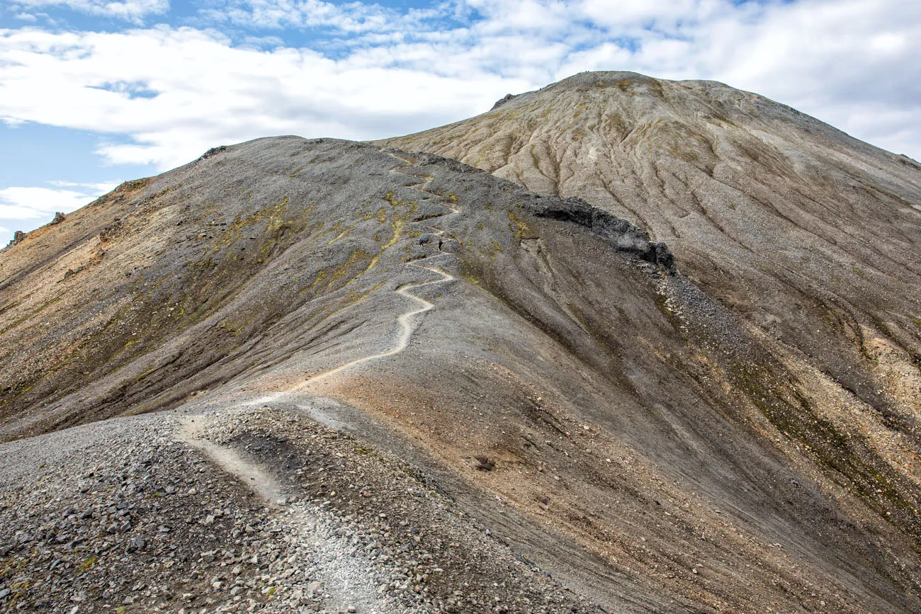
Hiking down Blahnúkúr, with Mt. Brennisteinsalda in the distance.
The last section of the trail, just before reaching the riverbed, is very short and steep. We walked down this without any problems, but the trail at this section is slippery. Good hiking shoes are a must and hiking poles will help, and we did see a few people slip and fall.
Hiking Up Brennisteinsalda
Once you make it down to the riverbed, turn right to head back in the direction of the campground. You will cross the small river (look for a bridge of stepping stones to help you cross the river) and then follow the orange trail markers into the lava field.
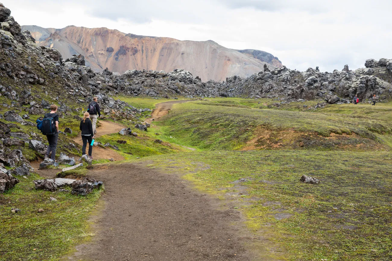
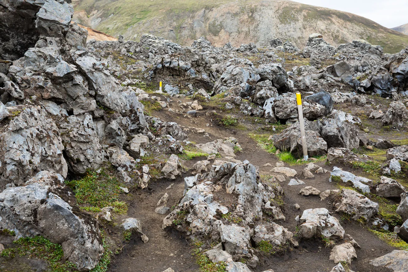
Once in the lava field, the markers change to orange (a recent hiker wrote in that this part of the trail has changed to orange) until you get to this sign. Turn left to hike the Laugavegur Trail towards Hrafntinnsuker.
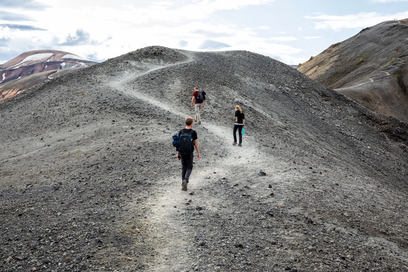
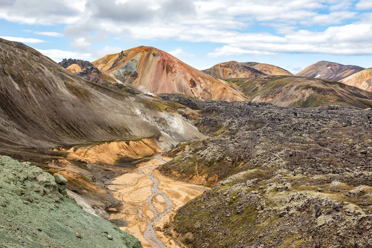
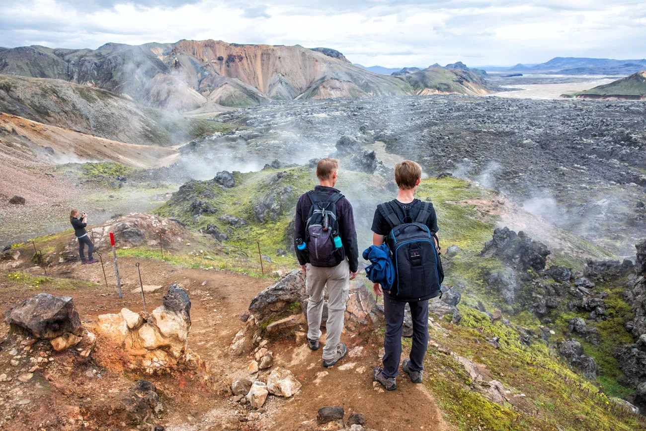
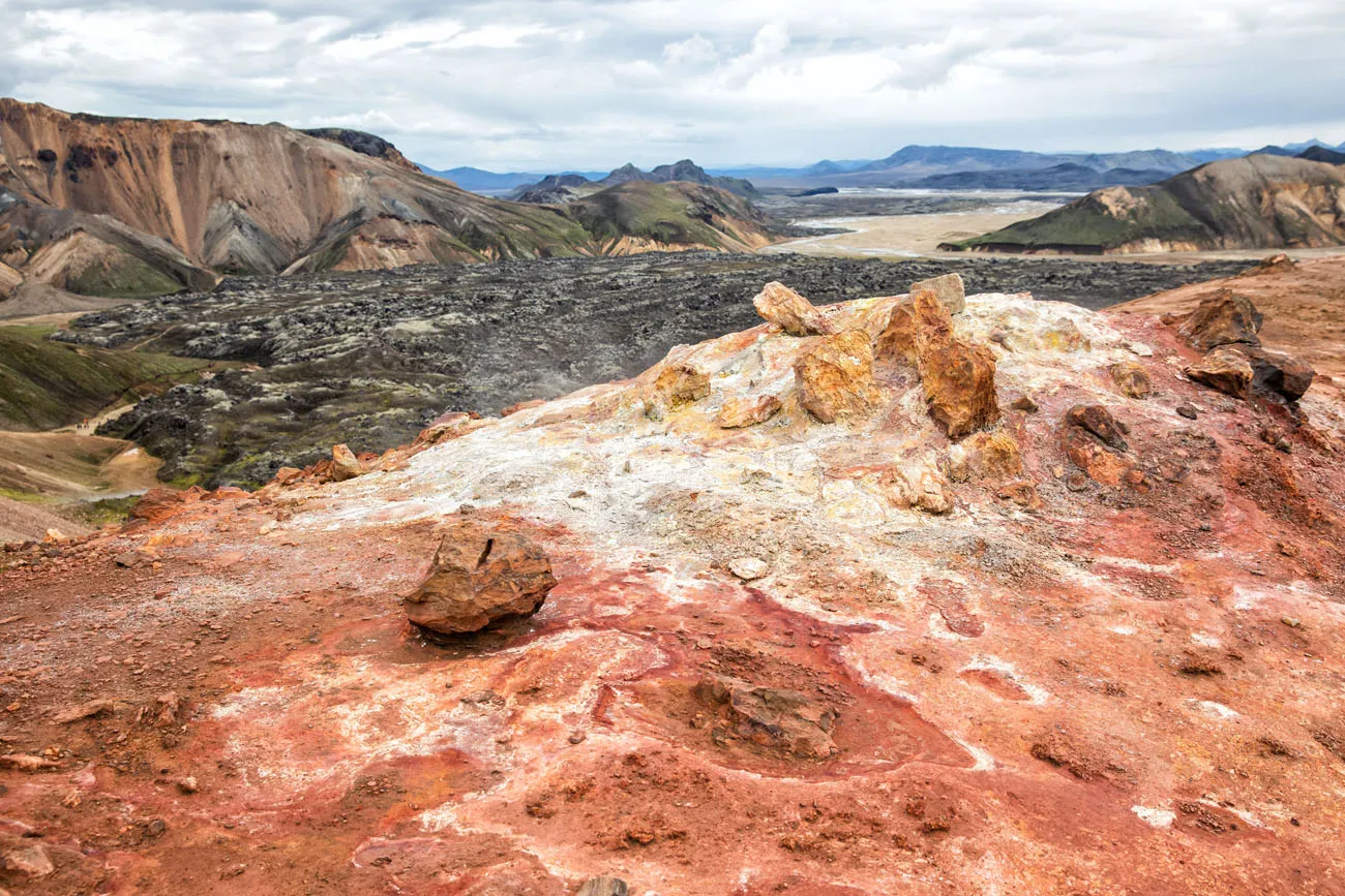
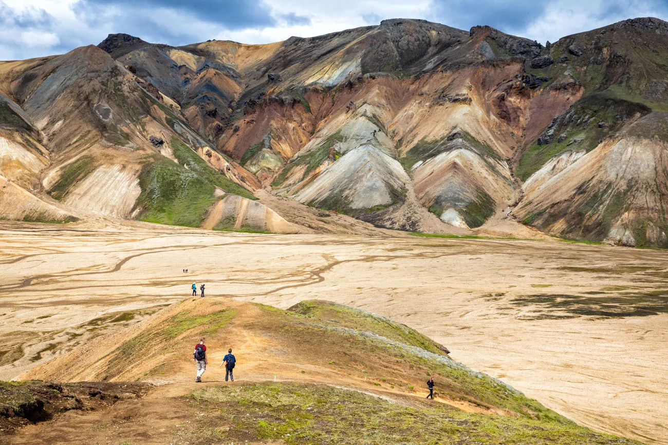
Once you hike up out of the lava field, the trail markers will change to red. At this point, you will hike past steaming, sulfuric vents and colorful geothermal features. From the top of the climb, you have a great view over the lava field.
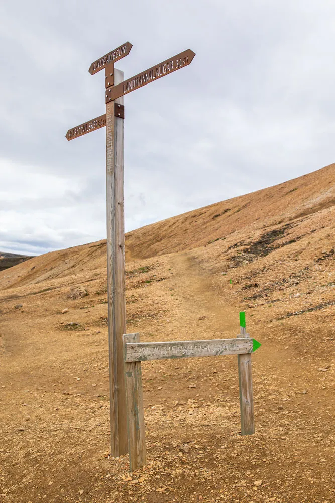
Another hefty climb brings you to this trail sign (below). Turn right to continue up Brennisteinsalda. Now you are on a trail labeled with green trail markers.
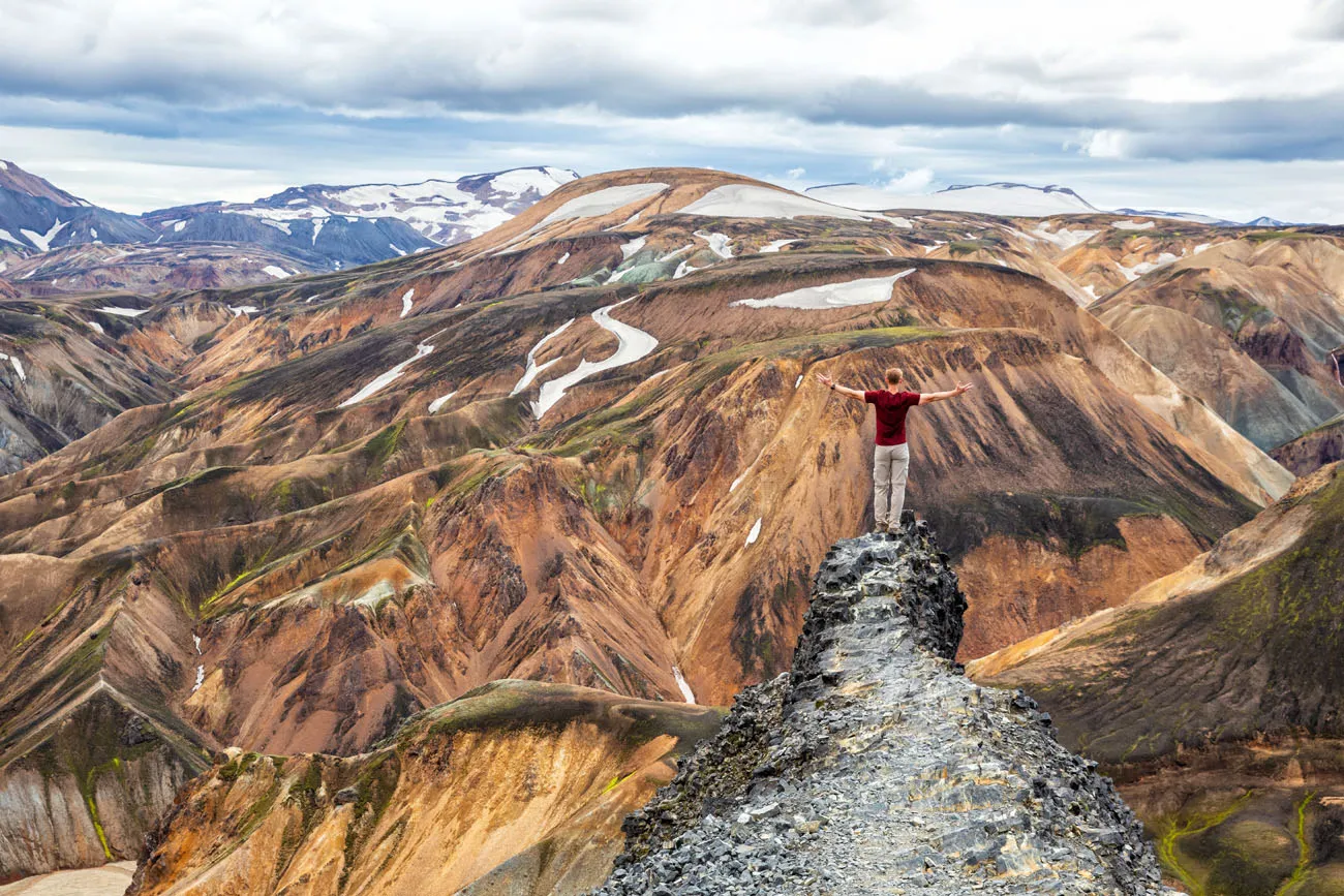
Now, it’s just one more big climb to the peak of Mt. Brennisteinsalda. Here is the view from the summit.


The view of Blahnúkúr from Brennisteinsalda.
The Hike Back to Landmannalaugar
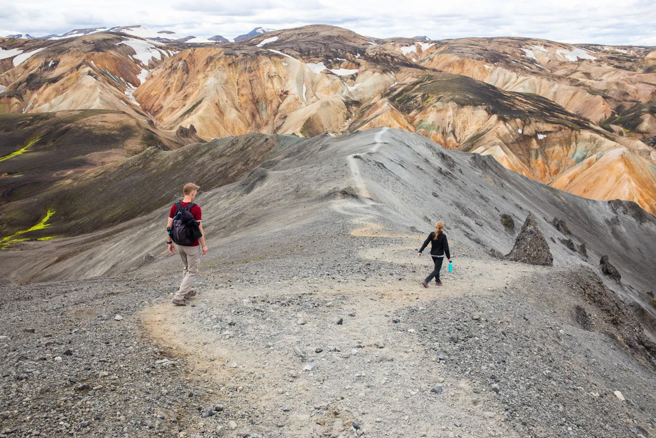
From here, it’s a mostly downhill walk to get back to the campground. Continue to follow the green trail downhill, in the direction of Vondugil.
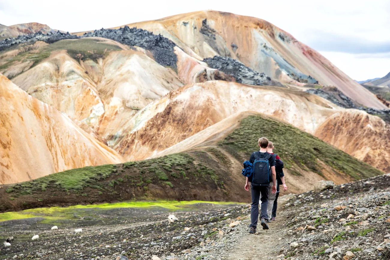
It’s a very pretty walk and now that you are walking downhill, it’s easier to enjoy the views of the multi-colored rhyolite mountains that make this region so unique.
At the bottom of Mt. Brennisteinsalda, turn right and walk through the flat valley towards the lava field. Now you are a trail with white and green trail markers.
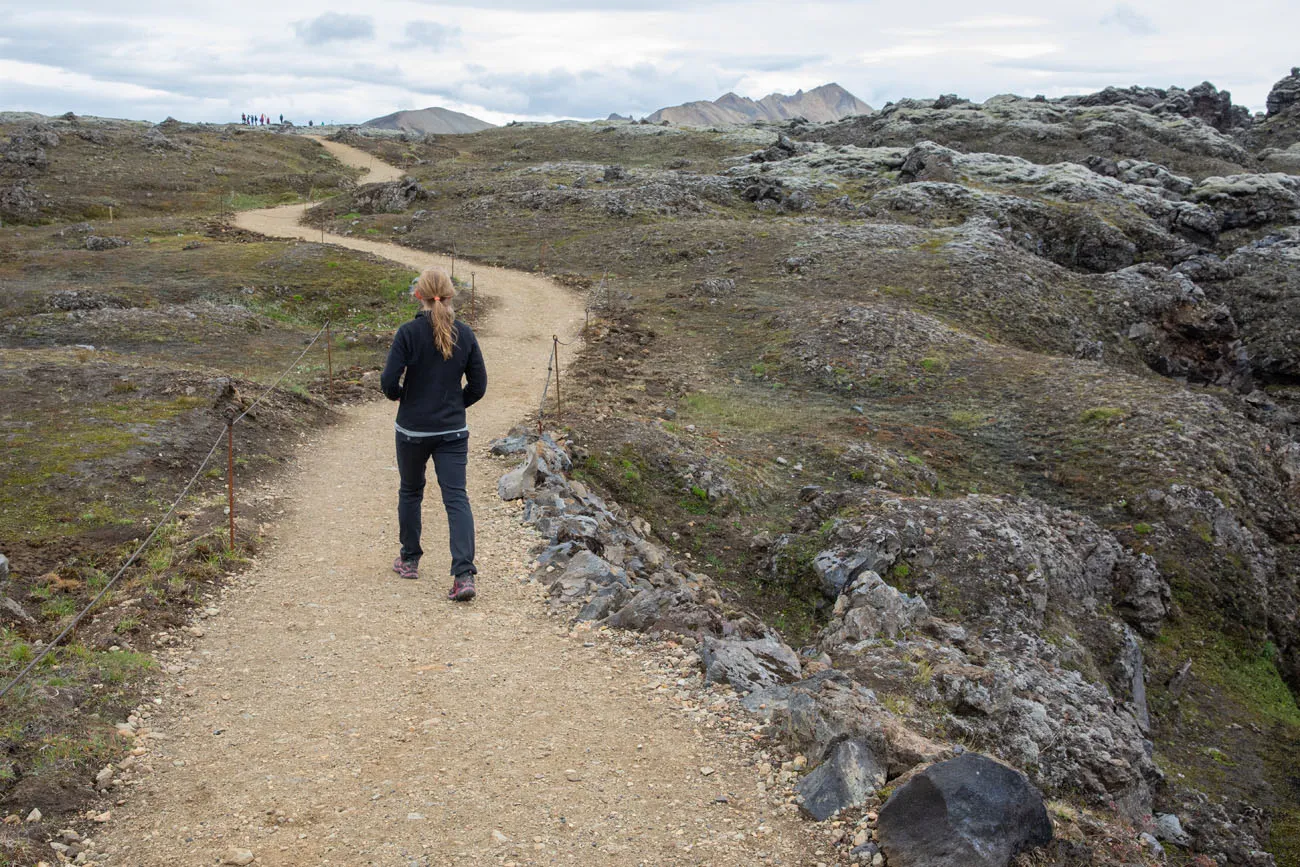
Once in the Laugahraun lava field, the trail markers change one final time to red and white and now you should follow the signs to Landmannalaugar. This part of the trail is easy to walk, since it’s a wide, gravel trail. Most likely you will see a lot of people here, since the hike through Laugahraun is the most popular hike to do in Landmannalaugar.
Summary of the Hiking Trails
- Walk 0.5 miles from the Landmannalaugar campground to the trailhead for Blahnúkúr
- Hike Mt. Blahnúkúr
- Once in the riverbed, follow the yellow trail markers into the lava field; these change to orange in the lava field
- Turn left onto the red trail, the Laugavegur Trail
- Turn right on the green trail to the Brennisteinsalda summit, towards Vondugil
- Follow the white and green trail through the valley towards Landmannalaugar
- Follow the white and red trail through the Laugahraun lava field to Landmannalaugar
If combining these two hikes into one larger hike sounds like too much to do, you can choose between Blahnúkúr and Brennisteinsalda (or from one of several other day hikes in Landmannalaugar). Read our individual posts about each hike:
Tips to Have the Best Experience
Wear hiking shoes. This trail is a mix of dirt, gravel and clay and it can be slippery in spots. If you have hiking poles, they can be helpful as well.
It can be cold in Landmannalaugar, even in the summer. Bring several layers and make sure you bring a rain jacket.
Check the weather before you go. This hike is best done on a clear day.
More Information about Landmannalaugar
If you have any questions about hiking Blahnúkúr and Brennisteinsalda as a loop, comment below.
More Information for Your Trip to Iceland
Iceland Travel Guide: How to Plan a Trip to Iceland
Iceland Travel Guide Iceland… the land of fire and ice. Though the country may look small on a map, Iceland is filled with some of Europe’s best outdoor adventures. In Iceland you can drive the Ring Road, walk on a glacier, explore geothermal hot springs, admire grand waterfalls, and hike some of the most scenic […]
Two Weeks in Iceland: The Ultimate Iceland Road Trip Itinerary
If you have two weeks in Iceland, we have an epic road trip to share with you. Drive the Ring Road, relax in the Blue Lagoon, visit Reykjavík, tour the Golden Circle, walk on the largest glacier in Europe, get up close with puffins, explore several gorgeous off-the-beaten-path destinations, and see more waterfalls than you […]
How to Visit Kerlingarfjöll and the Hveradalir Geothermal Area, Iceland
Kerlingarfjöll is a mountain range located in Iceland’s central highlands. Tucked away within this mountain range is Hveradalir, a geothermal wonderland of steaming vents, boiling mud pools, and rainbow-colored hot springs. The combination of hiking trails, rust-colored mountains, and clouds of steam creates one of Iceland’s most unique hiking and photography destinations. Kerlingarfjöll is located […]
40 Best Things to Do in Iceland: Waterfalls, Volcanoes & Glaciers
Iceland…the land of fire and ice. This small country is one of Europe’s best outdoor destinations. Go on an epic road trip, see the northern lights, walk on a glacier, visit more waterfalls than you can count, journey into the unique landscape of the Highlands, stand on volcano, relax in a hot spring, or hike […]
Best Hikes in Europe: 25 Incredible Hikes for Every Level
From the dramatic cliffs of Norway to the jagged peaks of the Dolomites and the volcanic landscapes of Iceland, Europe is packed with some of the most unforgettable hikes in the world. In this guide, we share our favorite hikes in Europe, trails that stand out for their scenery, uniqueness, and overall experience from start […]
The Perfect 7 to 10 Day Iceland Ring Road Itinerary
A road trip on the Ring Road is one of Iceland’s best experiences. With 7 to 10 days, you can drive around entire circumference of Iceland, visiting the highlights and several off-the-beaten-path destinations. Stand in front of mighty Skógafoss, tour the Golden Circle, relax in the Blue Lagoon, go whale watching and glacier hiking, explore […]
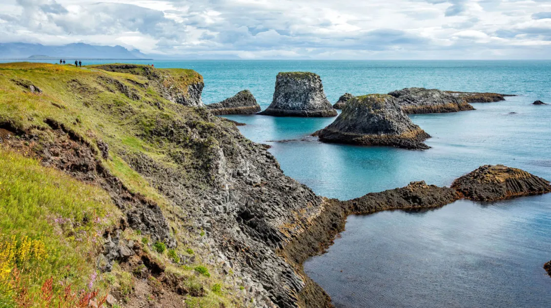
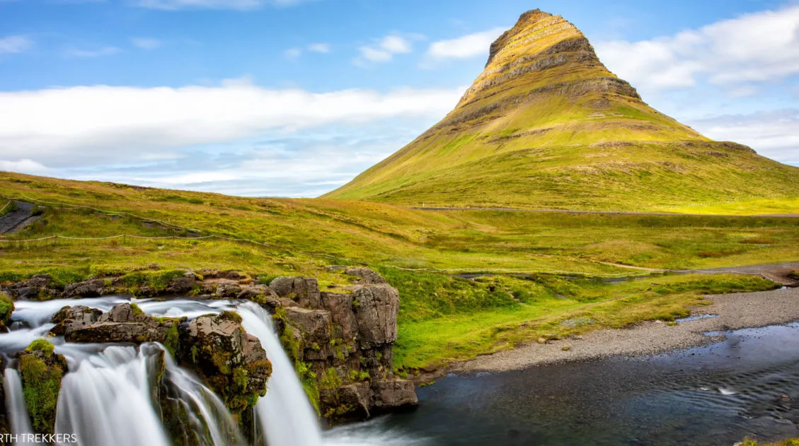
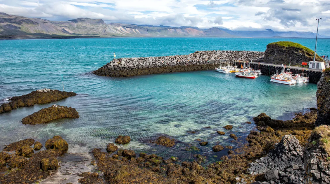
Best of the Snaefellsnes Peninsula (+ One Day Itinerary)
Black sand beaches, waterfalls, volcanoes, remote lighthouses, iconic mountains, lava fields, street art, and some of the most dramatic coastal cliffs in Iceland…these all make the list of the best things to do on the Snaefellsnes Peninsula. Snaefellsnes Peninsula is called Iceland in miniature, since it contains a sampling of many of Iceland’s natural wonders: […]
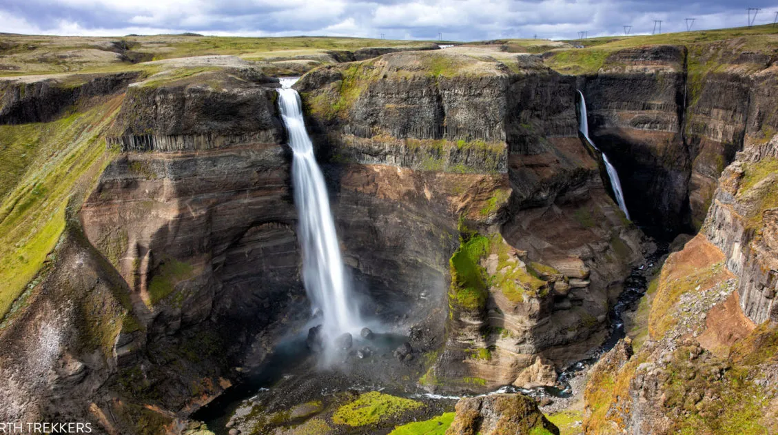
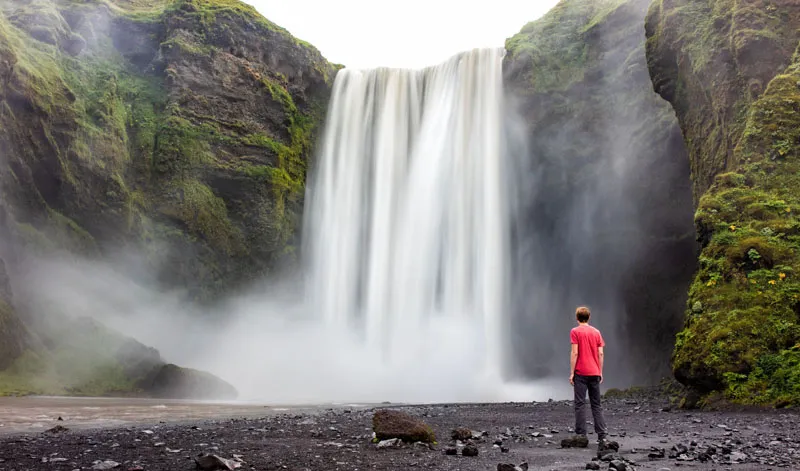
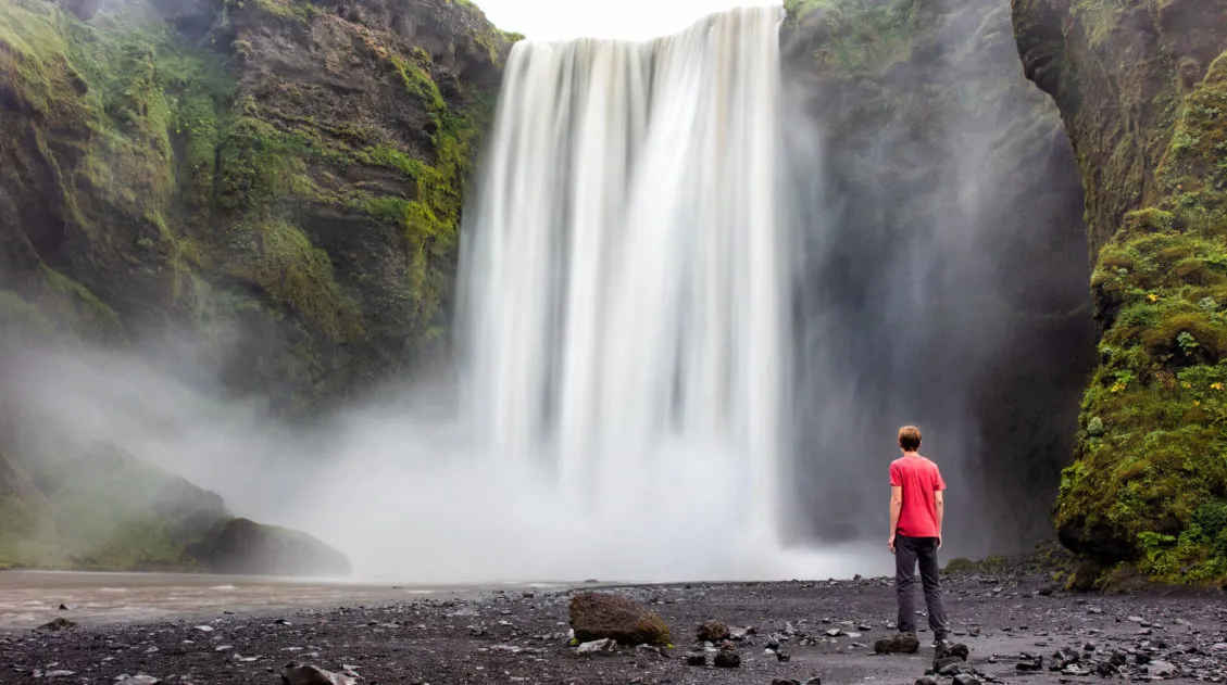
Exactly How to Get to Háifoss Waterfall (& Is It Worth It?)
Háifoss Waterfall is one of Iceland’s most spectacular waterfalls. Located in the beautiful Þjórsárdalur valley, Háifoss makes a great detour on a road trip around the Golden Circle or during the drive out to Landmannalaugar. Fans of Stranger Things might recognize this waterfall, as it was a filming location for the finale of Season 5. […]
10 Day Iceland Itinerary: 4 Epic Ways to Plan a Trip to Iceland
If you are planning a trip to Iceland, this is a great place to start. There are many different ways to plan your “perfect Iceland itinerary,” depending on your interests. Visit the highlights, road trip around the island, go off-the-beaten-path, or hike some of the best trails in Iceland. If you have 10 days in […]
Fimmvörðuháls Hike: A Step-By-Step Guide to Iceland’s Best Day Hike
26 waterfalls, 1 volcano, 2 glaciers, and 3 very unique landscapes…this is the Fimmvörðuháls hike in Iceland. This is one of the best day hikes we have done yet. Never have we seen so much diversity as there is on the Fimmvörðuháls hike. Start at the mighty Skógafoss waterfall. The land is lush and green […]
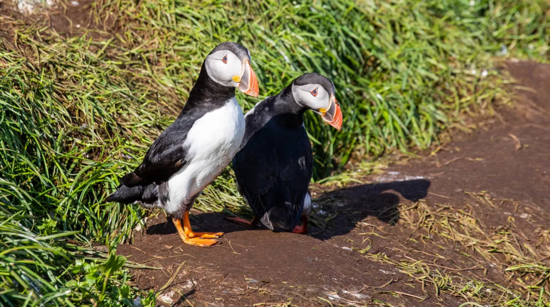
How to See the Puffins at Borgarfjörður Eystri, Iceland
Puffins nest in Iceland from late-April through mid-August. They can be found along the coast throughout Iceland, but there are a few places where you can easily see enormous colonies of these birds. Some of the most popular places to see puffins in Iceland are Heimaey Island, Hornstrandir Nature Reserve and the Latraberg Cliffs on […]
11 Best Day Trips & Tours from Reykjavík, Iceland
If you are planning a quick stopover in Iceland, Reykjavík is the perfect place to use as your home base. From here, you can explore some of the country’s top sites, such as the Blue Lagoon, the Golden Circle, and the amazing sights along the south coast. In this post, we list 11 of the […]
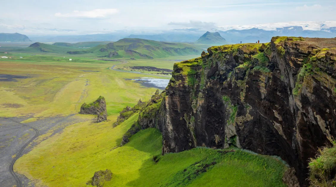
The Amazing South Coast of Iceland: What to Do & What to Skip
The south coast is home to some of Iceland’s most beautiful places to visit. Gorgeous waterfalls, black sand beaches, and glacier lagoons all make the list, as well as one of the most epic hiking trails in the world. Here are the best things to on the south coast of Iceland. Everything on this list […]

Comments 26