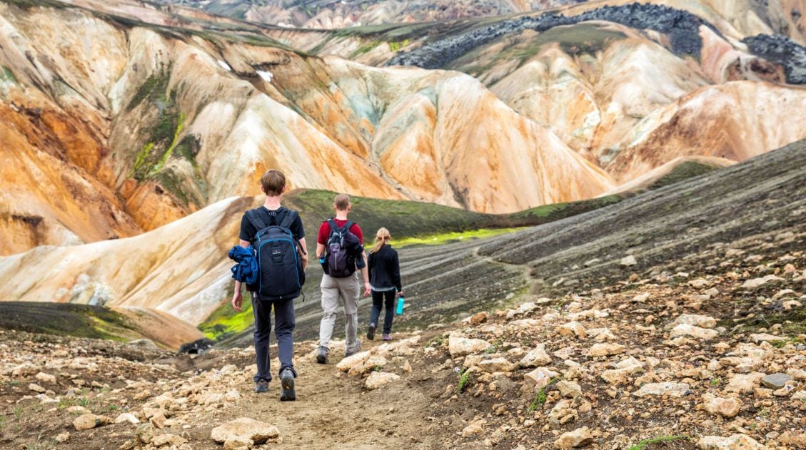
The hike up Mt. Blahnúkúr, also called the Blue Peak, is one of the most popular day hikes in Landmannalaugar. It’s a tough, short hike but the views are incredible and well worth the effort.
This is not only our favorite hike in Landmannalaugar, it is one of our favorite hikes in Iceland. The spectacular views over the rhyolite mountains of Landmannalaugar are the main reason for doing this hike.
Mt. Blahnúkúr Hiking Stats
Distance: 6.1 km (3.8 miles) round trip
Total Ascent: 350 meters (1144 feet)
Difficulty: Strenuous
Length of Time: 2.5 to 3.5 hours
When to Go: mid-June through mid-September. This is when the hiking trails and the roads to Landmannalaugar are free of snow.
This hiking distance is the round trip distance from the campground. It includes the walk to the official trailhead.
For information on planning your trip to Landmannalaugar, don’t miss our post How to Visit Landmannalaugar ↓ (and learn about the new parking reservations).
The Essential Landmannalaugar Guide for First-Time Visitors (+ 2026 Updates)
Lots of important things to know as you plan your trip to Landmannalaugar.How to Hike Mt. Blahnúkúr
Step-By-Step Trail Guide
Getting to the Trailhead
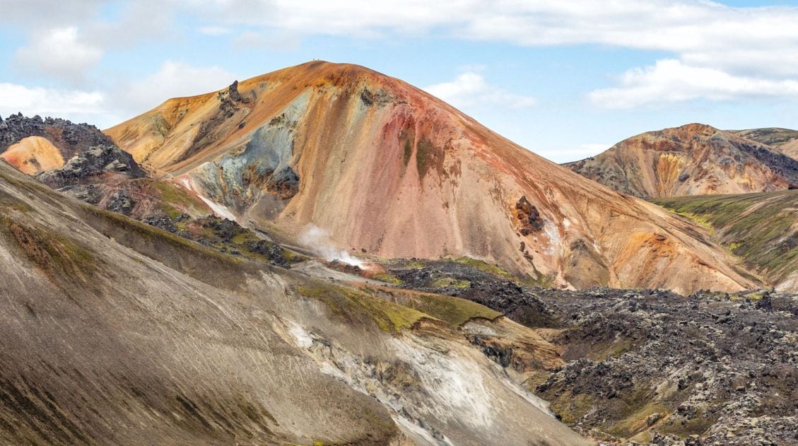
The Blue Peak looms over the Landmannalaugar campground. Mt. Blahnúkúr is the blueish-gray mountain that looks slightly out of place among the rhyolite mountains of Landmannalaugar.
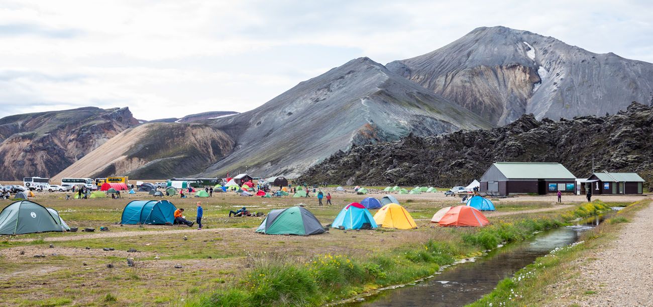
Landmannalaugar with Blahnúkúr in the background.
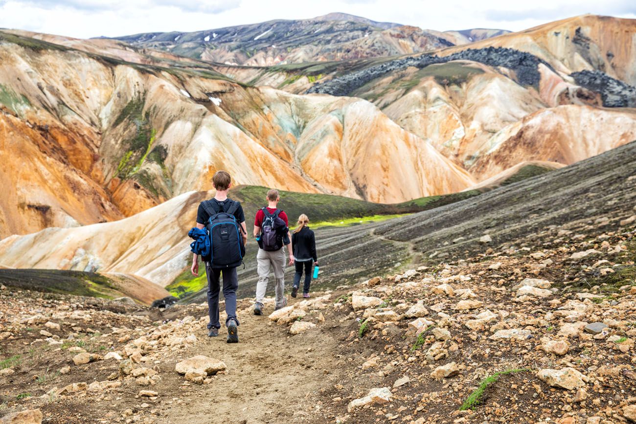
From the campground, walk along the riverbed in the direction of the Blahnúkúr (if you are not sure where to go, ask at the Information Desk). It is a flat, 0.8 km (0.5 mile) walk from the campground to the trailhead. At the base of the mountain, there is a sign marking the trailhead.
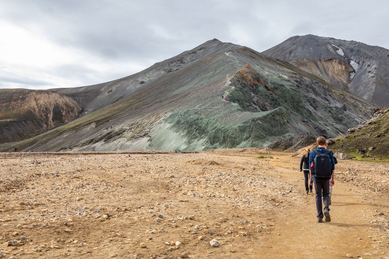
Walking towards Blahnúkúr. There will be a bridge over a very small river before you get to the trailhead.
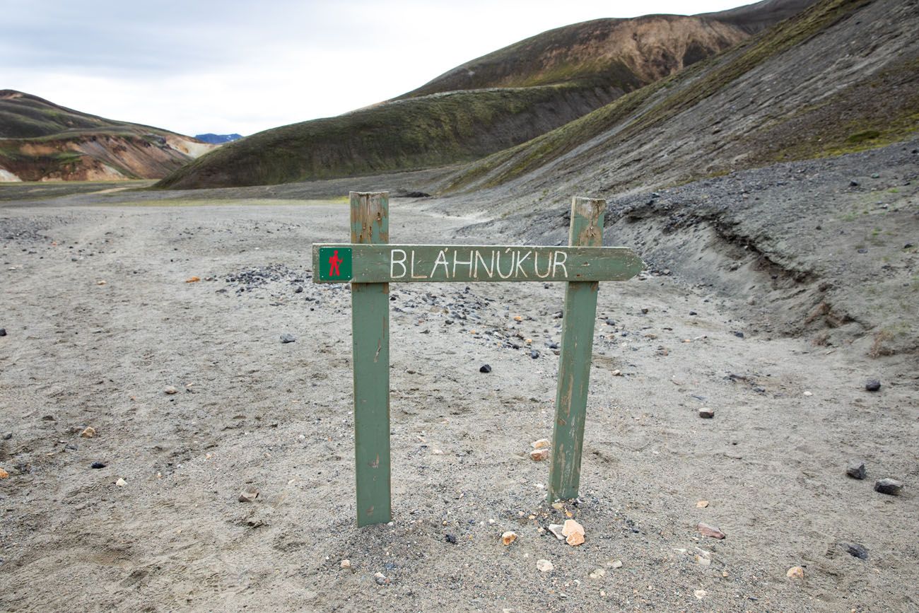
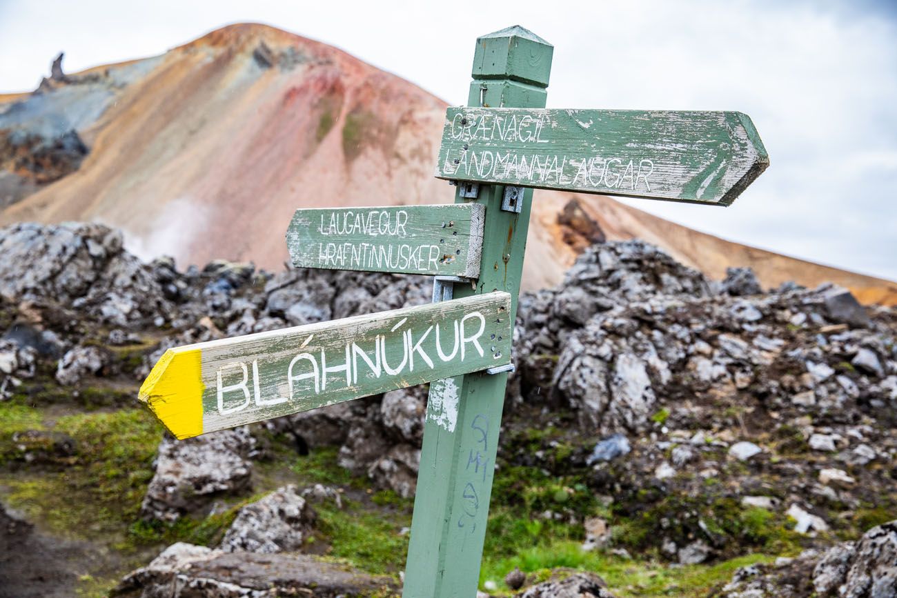
Trail sign
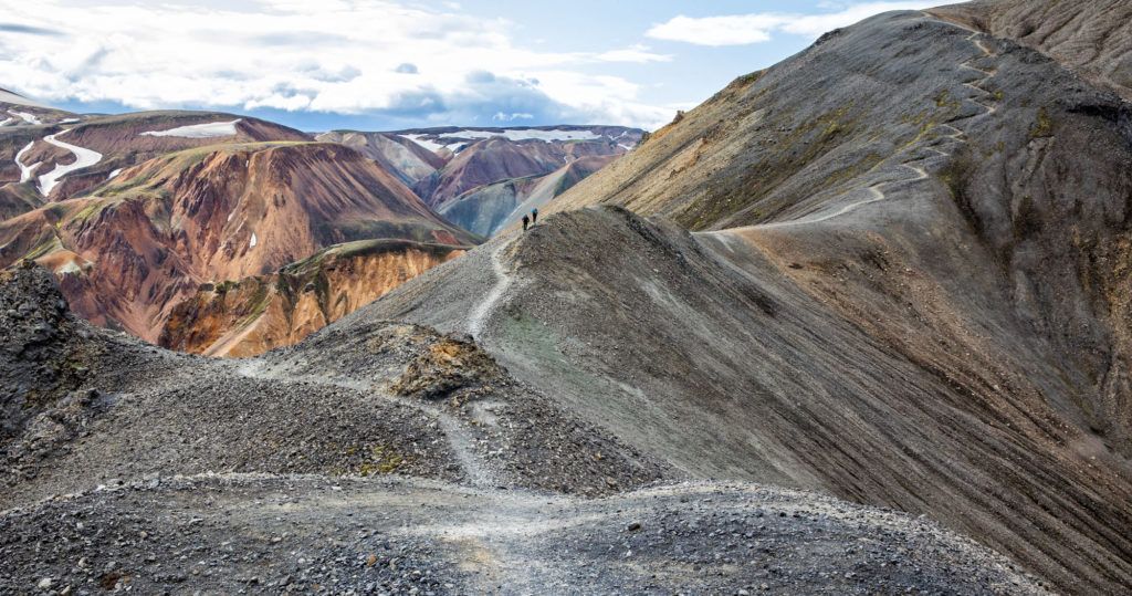
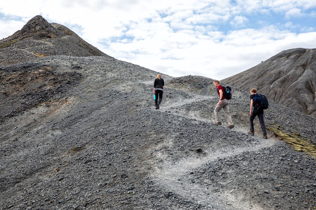
Hiking up Blahnúkúr
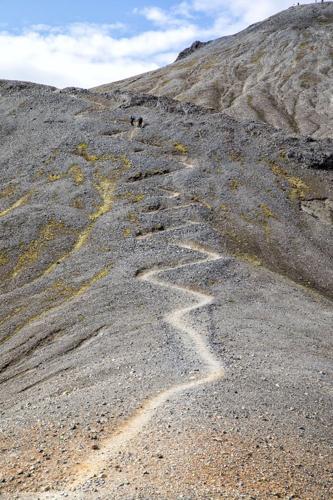
From the trailhead, it’s a steady uphill climb. At times, the trail will be steep, with switchbacks and short, steep ascents. The trail is easy to follow from start to finish.
Along the way, there are many places to stop to take a break and to take photos. In fact, we hardly had time to get out of breath, simply because we stopped so frequently to take photos. This is one hike where you probably won’t mind the climb, simply because the views just keep getting better and better.
Here is the climb up Mt. Blahnúkúr in photos.
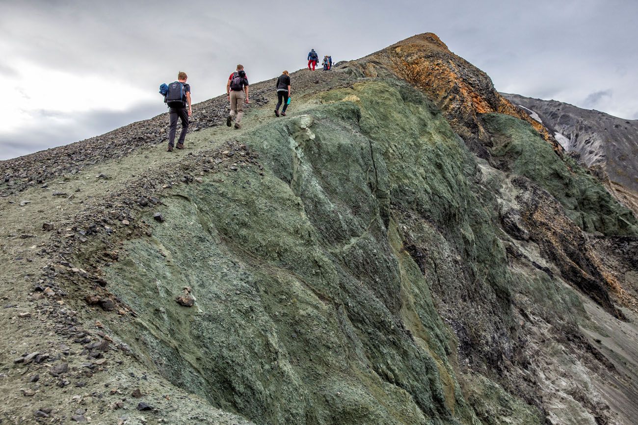
The first part of the trail is very steep.
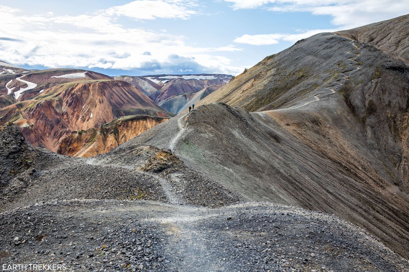
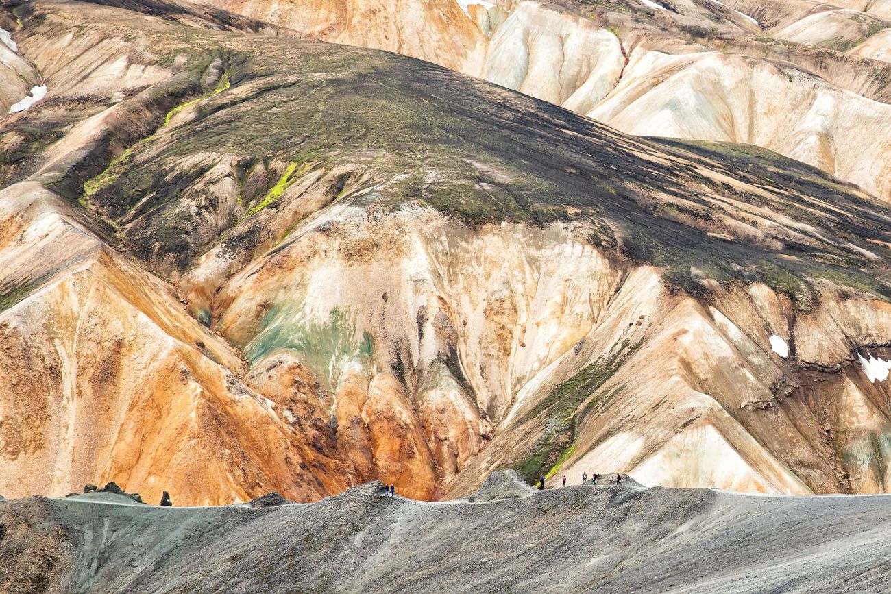
The view over Landmannalaugar.
The summit of Blahnúkúr is on the right side of this photo.
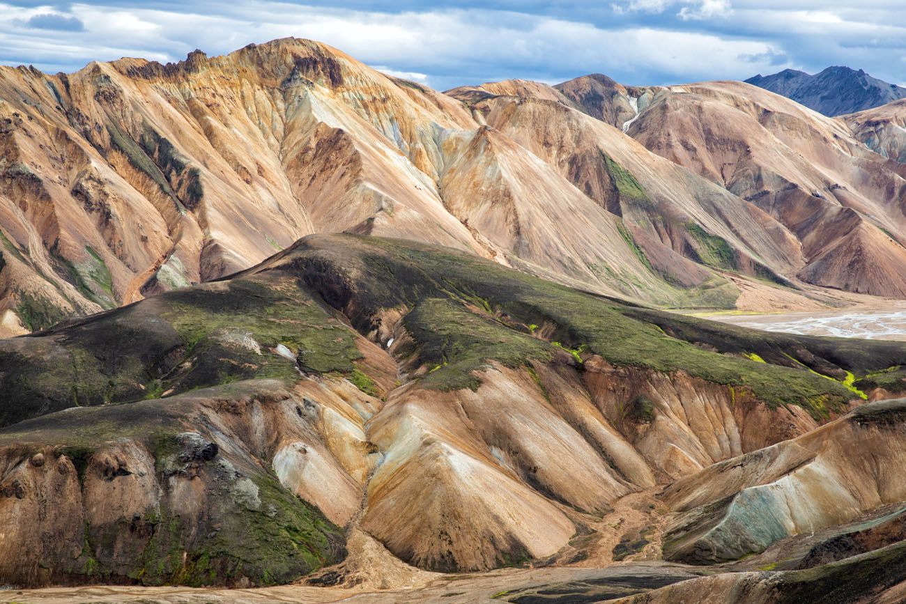
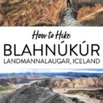
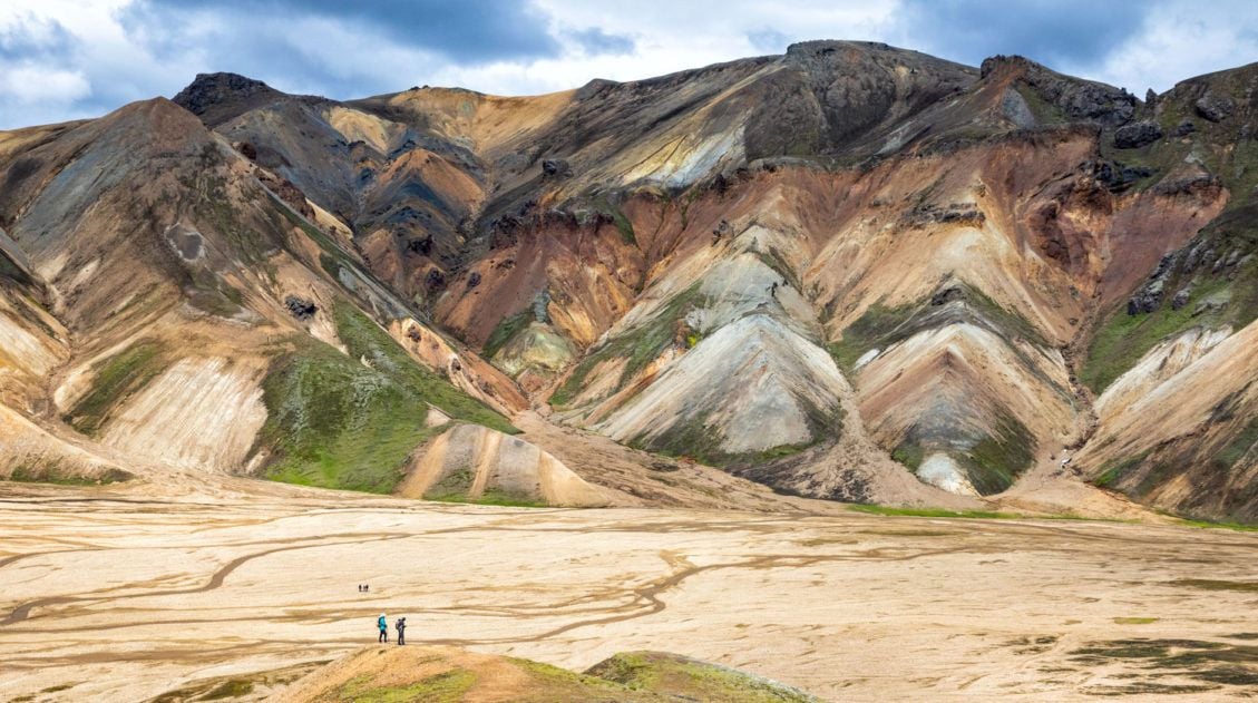
Rhyolite mountains
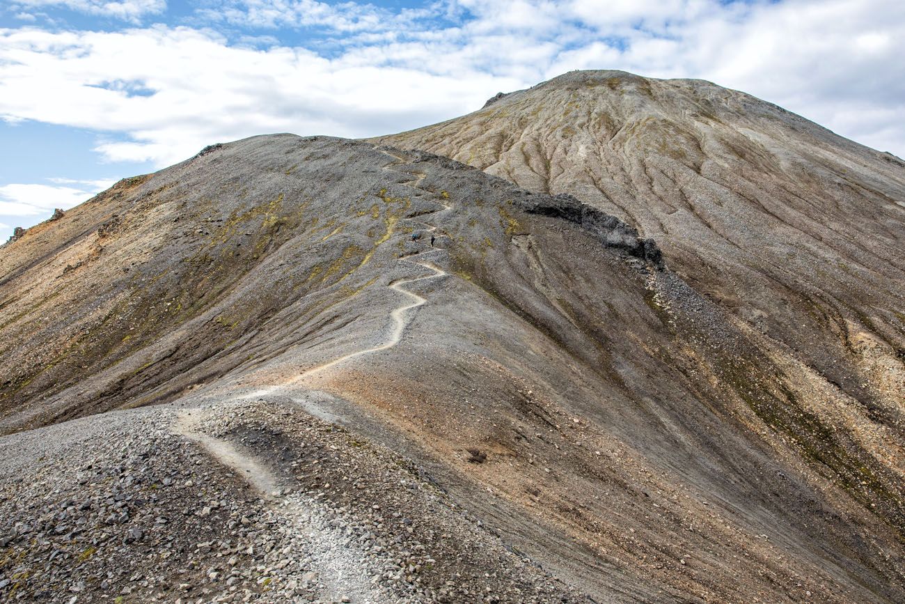
Looking up at Mt. Blahnúkúr.
Looking back along the trail.
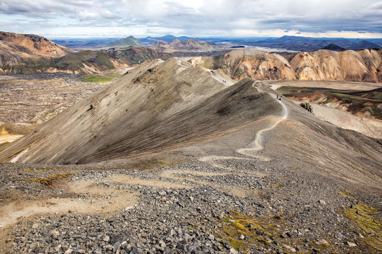
Another view of the trail and Landmannalaugar.
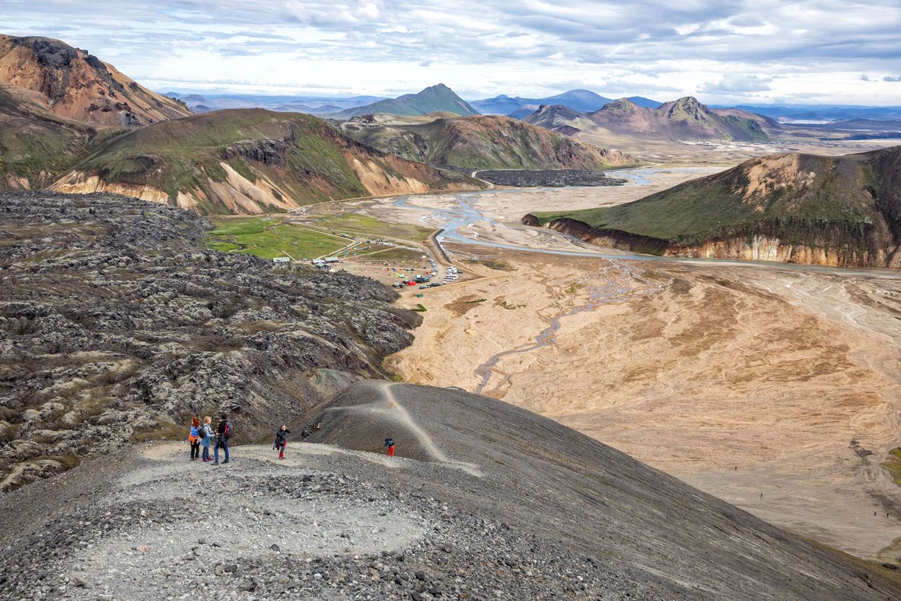
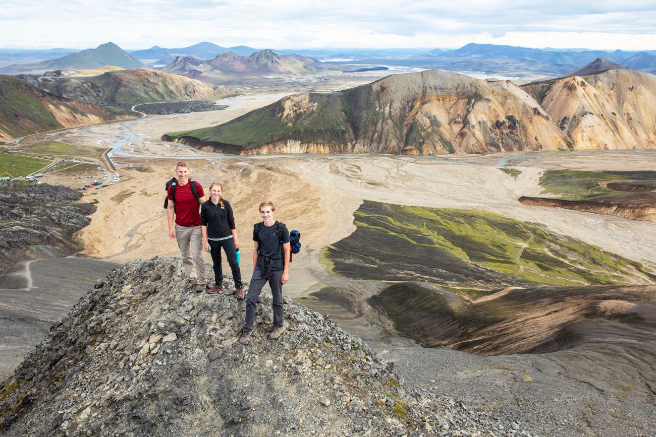
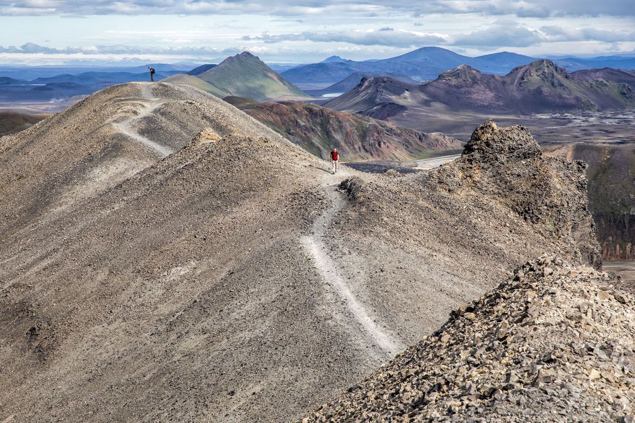
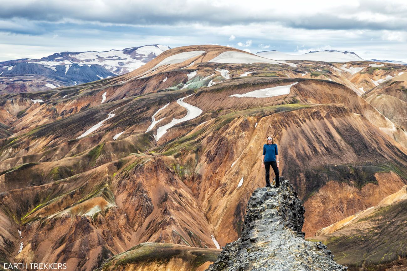
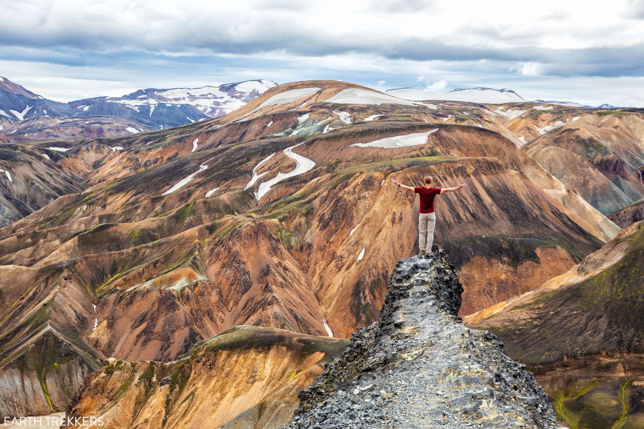
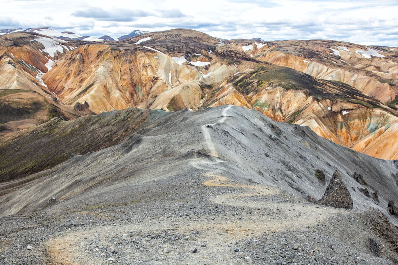
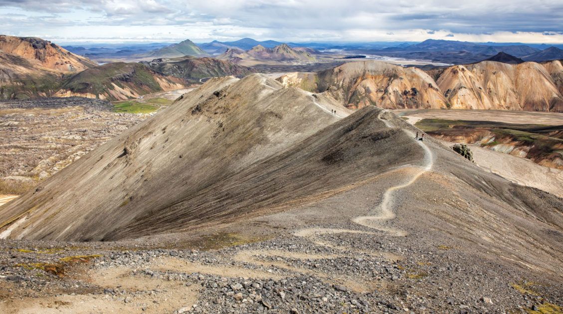
At the Summit
Once at the summit, you can stand out on this outcropping of rock for a cool photo with the snow-covered, colorful mountains in the background.
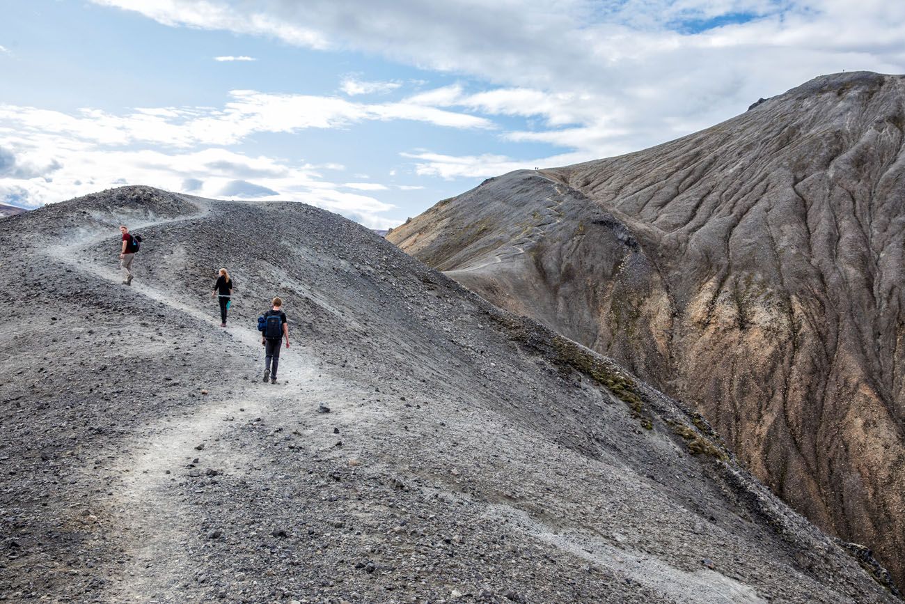
From the summit, you can return to Landmannalaugar the same way you came up, but for a different view, we recommend continuing the trail as a loop.
The Hike Down Blahnúkúr
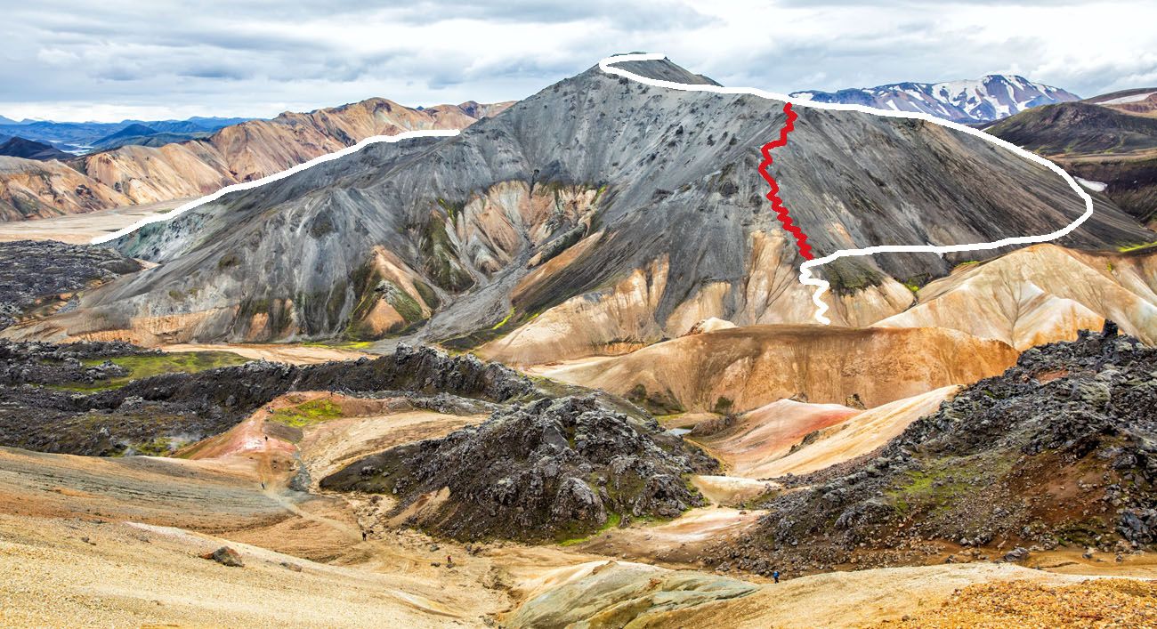
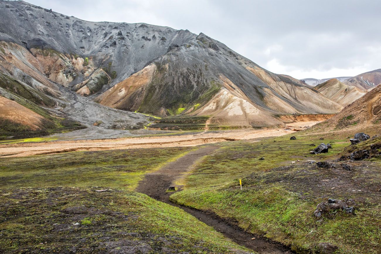
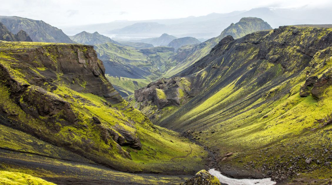
From the peak of Mt. Blahnúkúr, the trail heads to the east and eventually drops down to Graenagil, a canyon that cuts through the mountains. From the peak to the canyon, it’s an easy, downhill hike.
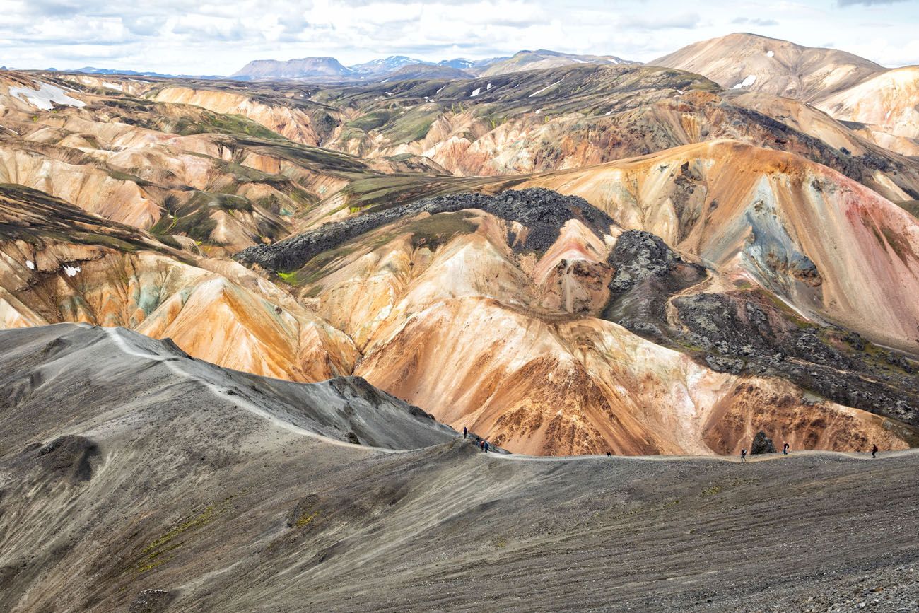
On your way down you will come to a fork in the trail. If you take the trail to the right, it will be a very steep descent back down to the canyon. The trail to the left is the longer way to go, but it is much less steep, so it’s a lot easier on the knees. We chose the trail to the left.
Below is the view of Blahnúkúr from Brennisteinsalda (a neighboring mountain that is not part of this hike). The white line is the longer, easier hiking route that we took. The red line is the more direct but very steep hike down the mountain.
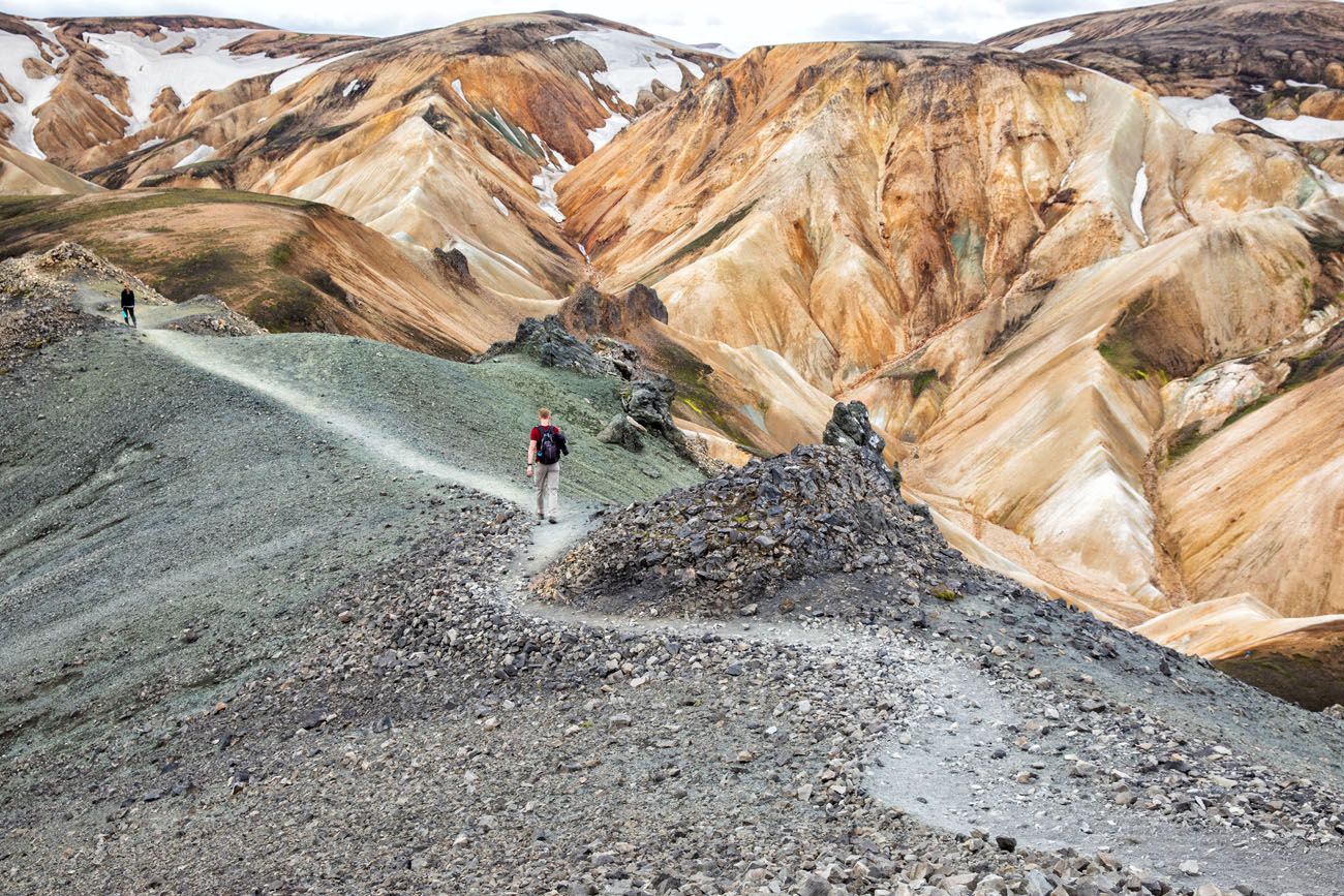
Here is the view along the trail.
The last section of the trail, just before reaching the canyon, is very short and steep. We walked down this without any problems, but the trail at this section is slippery, and looked like it was a mixture of dirt and clay. Good hiking shoes are a must and hiking poles will help, and we did see a few people slip and fall.
Hiking Back to the Campground
To get back to Landmannalaugar follow the Blahnúkúr trail to the riverbed. You should now start seeing yellow trail markers. Cross the riverbed and continue following the yellow trail markers towards the Laugahraun lava field.
Looking back at Blahnúkúr and the riverbed.
Once you reach this sign, follow the sign towards Graenagil and Landmannalaugar.
The walk through Graenagil Canyon is an easy, mostly downhill walk through a gorge. Mt. Blahnúkúr will be to your right and the Laugahraun lava field is to your left. It’s roughly a 1 km walk from Mt. Blahnúkúr back to Landmannalaugar.
If you still have time and energy, you can add on Laugahraun (the walk through the lava field) and Brennisteinsalda (the Sulphur Peak) to this hike. This makes a big loop up two different peaks and it’s an awesome hike for those who want to see more of Landmannalaugar.
Tips to Have the Best Experience
Wear hiking shoes. This trail is a mix of dirt, gravel and clay and it can be slippery in spots. If you have hiking poles, they can be helpful as well.
It can be cold in Landmannalaugar, even in the summer. Bring several layers and make sure you bring a rain jacket.
Check the weather before you go. This hike is best done on a clear day.
If you have any questions about the hike up Mt. Blahnúkúr or a visit to Landmannalaugar, let us know in the comment section below.
More Information about Iceland
Iceland Travel Guide: How to Plan a Trip to Iceland
Iceland Travel Guide Iceland… the land of fire and ice. Though the country may look small on a map, Iceland is filled with some of Europe’s best outdoor adventures. In Iceland you can drive the Ring Road, walk on a glacier, explore geothermal hot springs, admire grand waterfalls, and hike some of the most scenic […]
One Day in Landmannalaugar (with Háifoss and Sigöldugljúfur)
Landmannalaugar is a wonderland of rainbow-colored mountains, lava fields, and hot springs. Hiking trails crisscross these colorful hills, making this part of Iceland one of the most unique places to go hiking. With one day in Landmannalaugar, you can hike one or two trails, soak in the hot springs, photograph the stunning landscapes, and add […]
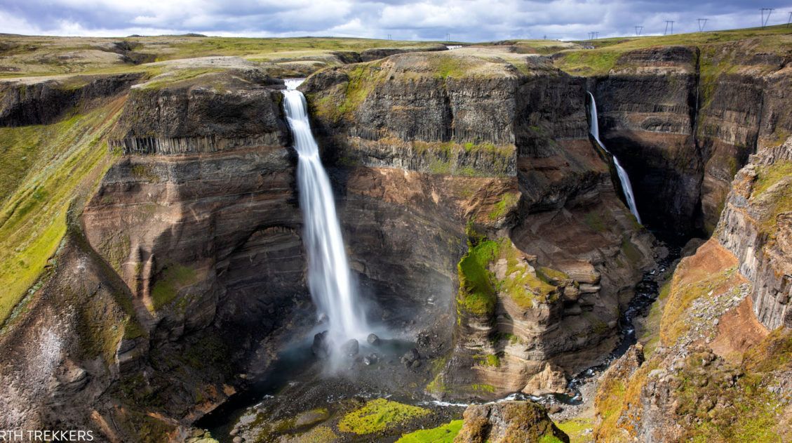
Exactly How to Get to Háifoss Waterfall (& Is It Worth It?)
Háifoss Waterfall is one of Iceland’s most spectacular waterfalls. Located in the beautiful Þjórsárdalur valley, Háifoss makes a great detour on a road trip around the Golden Circle or during the drive out to Landmannalaugar. Fans of Stranger Things might recognize this waterfall, as it was a filming location for the finale of Season 5. […]
The Essential Landmannalaugar Guide for First-Time Visitors (+ 2026 Updates)
Landmannalaugar is an area in Iceland that is famous for its colorful rhyolite mountains and epic day hikes. Geothermal hot springs, lava fields, and unique hiking trails attract adventurous travelers all summer long. Landmannalaugar is one of Iceland’s best areas for day hikes. Take your pick from short, easy trails or tougher climbs up ancient […]
10 Epic Hikes in Iceland: Which One Will Be Your Favorite?
One of the best ways to experience Iceland is from a hiking trail. Visit stunning waterfalls, hike through the steaming, colorful landscapes of Landmannalaugar and Kerlingarfjöll, and visit beautiful, remote destinations that you can get to only your own two feet. Here are 10 of the best hikes in Iceland. Every hike on this list […]

Essential Hiking Gear: What Should You Bring on a Day Hike?
In this post, find out what we carry with us on day hikes. Whether you are a new hiker, shopping for a friend or family member, or just curious about what hiking gear you should bring on a day hike, we have a lot of great information to share with you. We have hiked thousands […]
The Perfect 7 to 10 Day Iceland Ring Road Itinerary
A road trip on the Ring Road is one of Iceland’s best experiences. With 7 to 10 days, you can drive around entire circumference of Iceland, visiting the highlights and several off-the-beaten-path destinations. Stand in front of mighty Skógafoss, tour the Golden Circle, relax in the Blue Lagoon, go whale watching and glacier hiking, explore […]
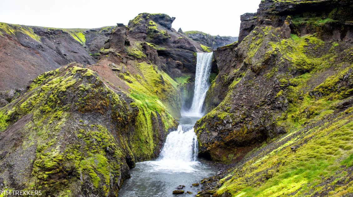
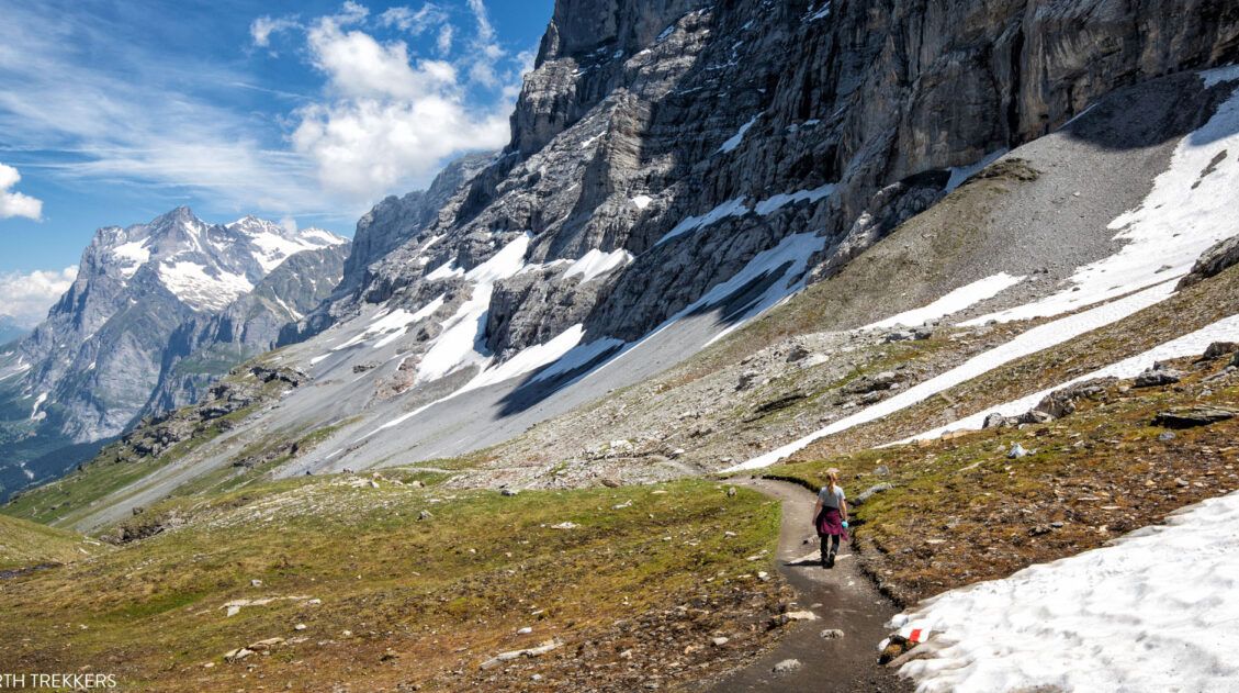
Fimmvörðuháls Hike: A Step-By-Step Guide to Iceland’s Best Day Hike
26 waterfalls, 1 volcano, 2 glaciers, and 3 very unique landscapes…this is the Fimmvörðuháls hike in Iceland. This is one of the best day hikes we have done yet. Never have we seen so much diversity as there is on the Fimmvörðuháls hike. Start at the mighty Skógafoss waterfall. The land is lush and green […]
40 Best Things to Do in Iceland: Waterfalls, Volcanoes & Glaciers
Iceland…the land of fire and ice. This small country is one of Europe’s best outdoor destinations. Go on an epic road trip, see the northern lights, walk on a glacier, visit more waterfalls than you can count, journey into the unique landscape of the Highlands, stand on volcano, relax in a hot spring, or hike […]
10 Day Iceland Itinerary: 4 Epic Ways to Plan a Trip to Iceland
If you are planning a trip to Iceland, this is a great place to start. There are many different ways to plan your “perfect Iceland itinerary,” depending on your interests. Visit the highlights, road trip around the island, go off-the-beaten-path, or hike some of the best trails in Iceland. If you have 10 days in […]
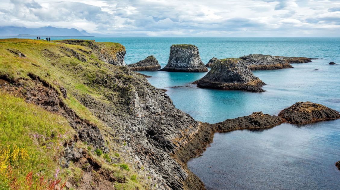
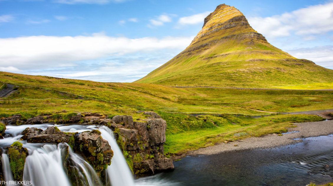
Best of the Snaefellsnes Peninsula (+ One Day Itinerary)
Black sand beaches, waterfalls, volcanoes, remote lighthouses, iconic mountains, lava fields, street art, and some of the most dramatic coastal cliffs in Iceland…these all make the list of the best things to do on the Snaefellsnes Peninsula. Snaefellsnes Peninsula is called Iceland in miniature, since it contains a sampling of many of Iceland’s natural wonders: […]
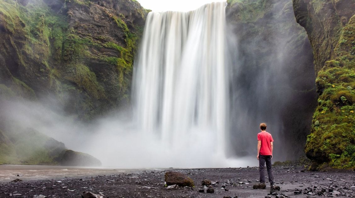
Exactly How to Hike Skógafoss Waterfall Way: Iceland’s Most Scenic Trail
The Skógafoss Waterfall hike (also called the Skógá Trail or Waterfall Way) is one of Iceland’s most underrated experiences. This trail starts at the mighty Skógafoss waterfall and follows the Skógá River upstream for 8 km (5 miles). As you hike through this lush, green landscape, you get to see 25 more waterfalls, dramatic canyons, […]
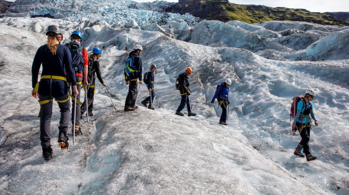
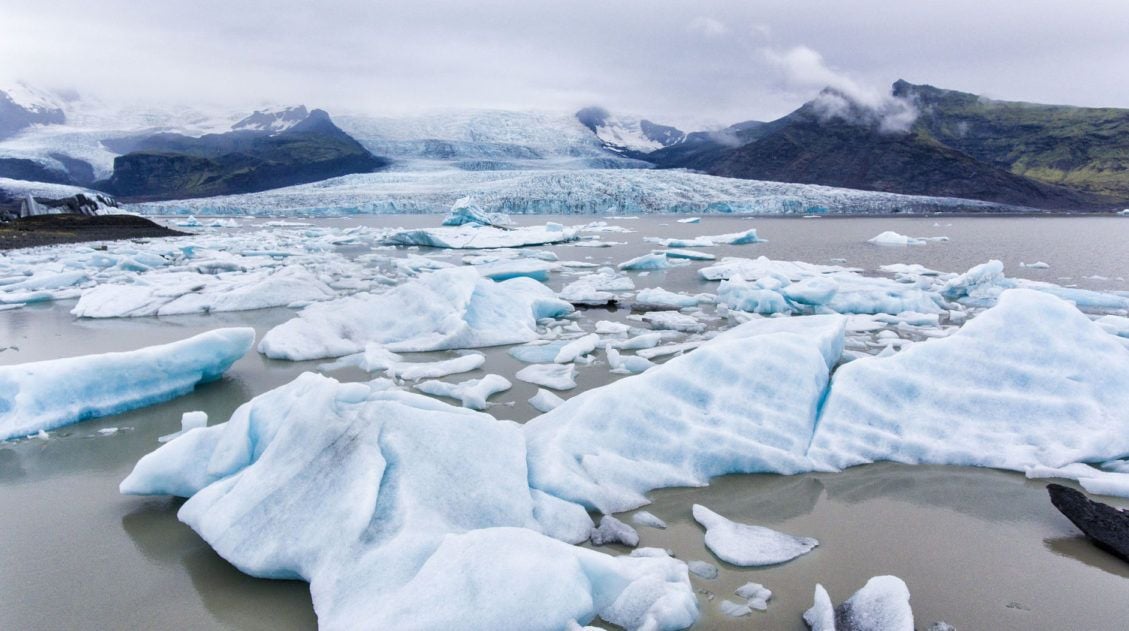
Best Iceland Glacier Hikes, Ice Caves & Ice Climbing
Strap on some crampons, grab an ice pick, and set off on a very cool Icelandic adventure. If you are thinking about doing an Iceland glacier hike, we have lots of great information to share with you. Hiking on a glacier was one of our most anticipated experiences in Iceland. Exploring crevasses, walking on the […]
Best Hikes in Europe: 25 Incredible Hikes for Every Level
From the dramatic cliffs of Norway to the jagged peaks of the Dolomites and the volcanic landscapes of Iceland, Europe is packed with some of the most unforgettable hikes in the world. In this guide, we share our favorite hikes in Europe, trails that stand out for their scenery, uniqueness, and overall experience from start […]

Comments 20