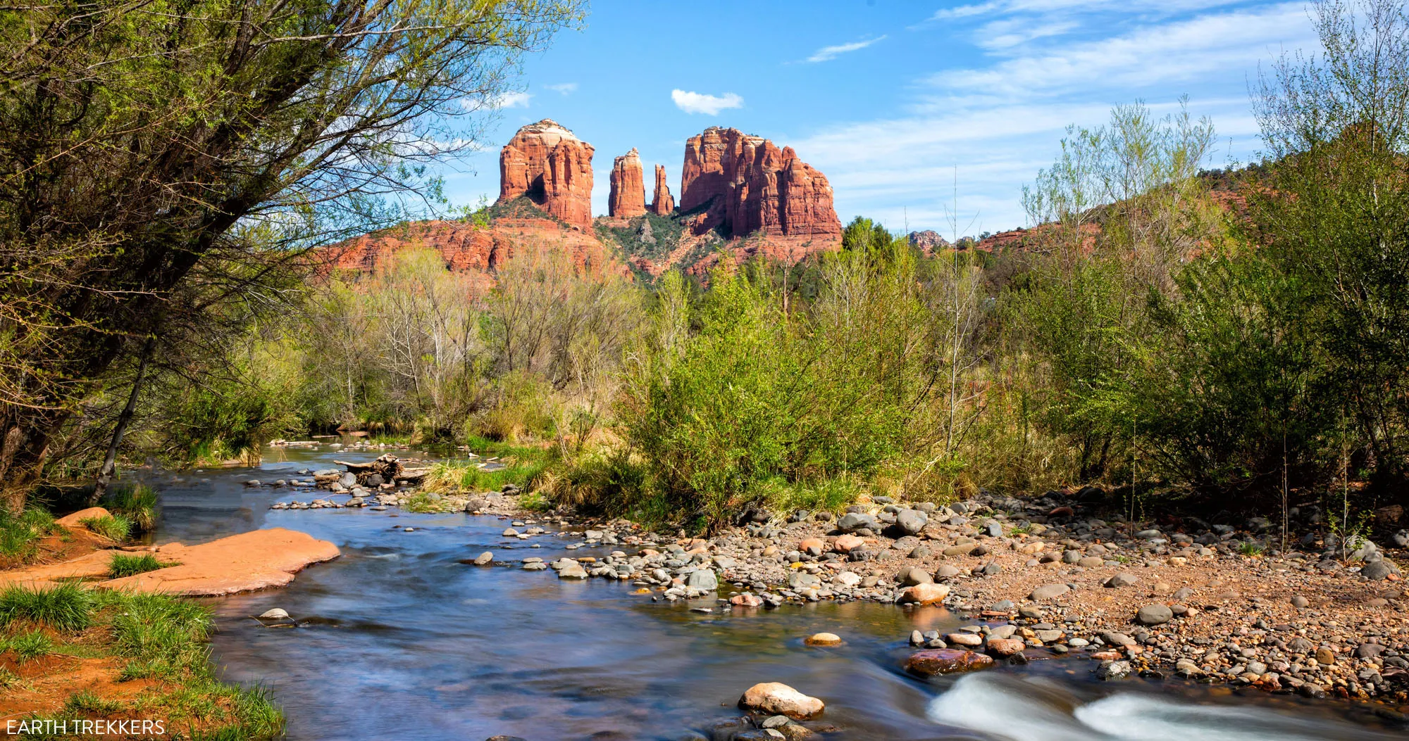

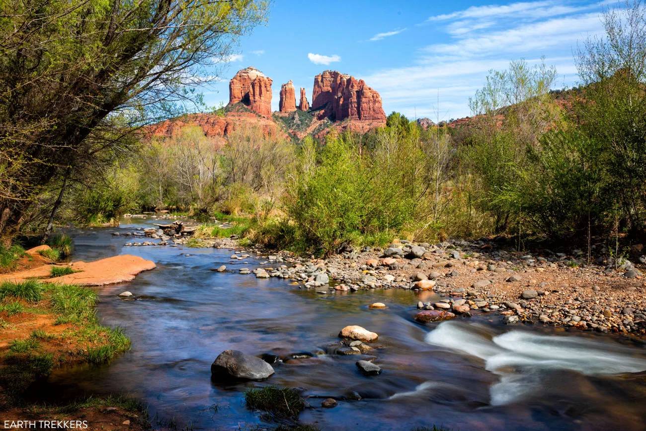
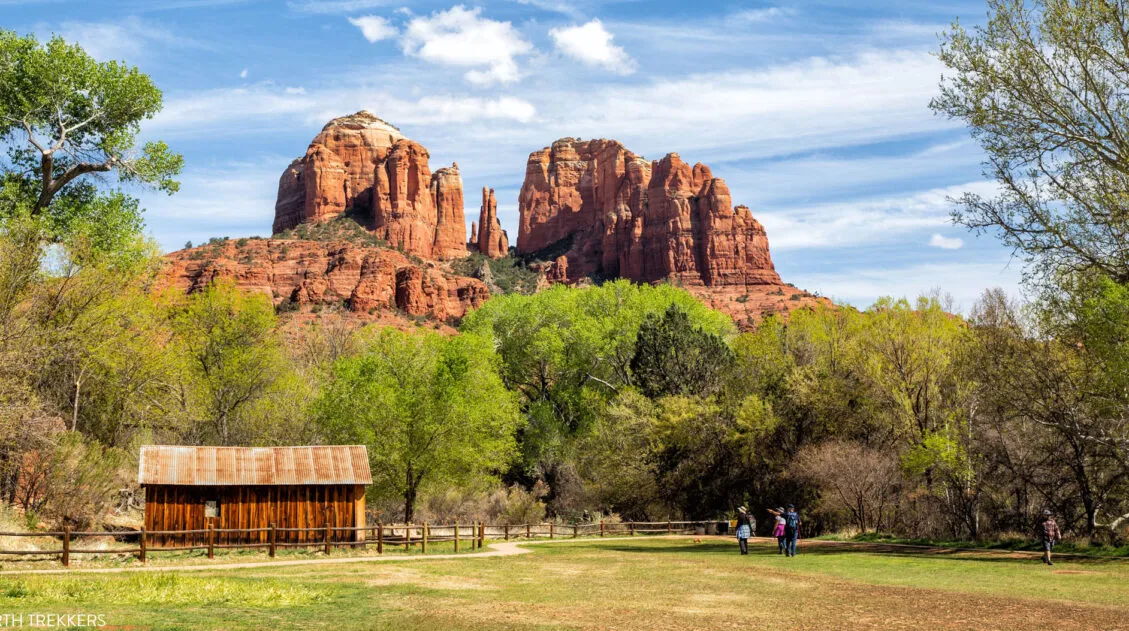
The Crescent Moon Picnic Site is one of the best photography locations in Sedona. If you want to photograph Cathedral Rock with Oak Creek, which is one of the iconic shots in Sedona, this is the place to go.
There is more to do at the Crescent Moon Picnic Site than just take a picture of Cathedral Rock. Go fishing, have a picnic, and swim in Oak Creek. You can even get married here.
We visited Crescent Moon Picnic Site for the sole purpose of photographing Cathedral Rock. Our visit lasted between one and two hours, as we hunted down the best views and photo locations. But if you are traveling with kids, or just searching out a place to relax, you can easily spend half of a day here.
Crescent Moon Picnic Site: Practical Information
The Crescent Moon Picnic Site is also referred to as Crescent Moon Ranch and Crescent Moon Day Use Site.
Entrance Fee: $12 per vehicle, up to 5 people, cash or check only. Walk-ins and extra passengers are $2 each. The Red Rock Grand Annual Pass is accepted.
Hours of Operation: 8 am to dusk in the summer months
Website: Click here for updated hours and entrance fees.
How to Get to Crescent Moon Picnic Site
The Crescent Moon Picnic Site is located south of Sedona. To get here from Sedona, drive Highway 89A through West Sedona. Turn left on Upper Red Rock Loop Road and take this for 1.8 miles. Turn left on Chavez Ranch Road, turn right onto Red Rock Crossing Road, and then turn left into the Crescent Moon Picnic Site. From the “Y” in Sedona, it takes 15 minutes to drive here.
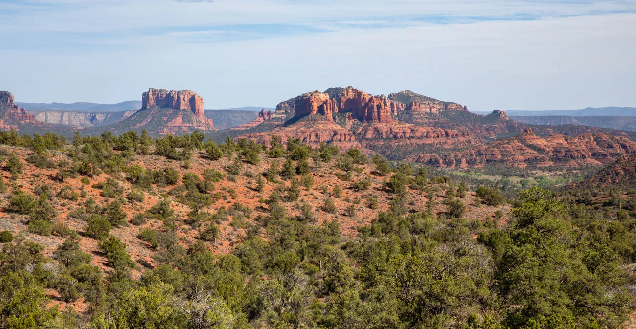
PRO TRAVEL TIP: You get your first good views of Cathedral Rock even before you get to Crescent Moon Picnic Site. There are two viewpoints on Red Rock Loop Road to visit. From Lover’s Knoll, you can capture Cathedral Rock and a twisted juniper tree in the same photo. There is also an unmarked pull-off (GPS Coordinates: 34°50’43.2″N 111°49’35.5″W) but this parking lot is very rough and rocky so if you are in a car, you might want to skip this overlook.
View from the unmarked turn-off (GPS Coordinates: 34°50’43.2″N 111°49’35.5″W)
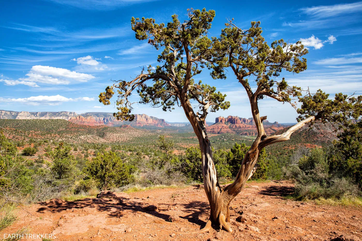
Lover’s Knoll Viewpoint
Overview of Crescent Moon Picnic Site
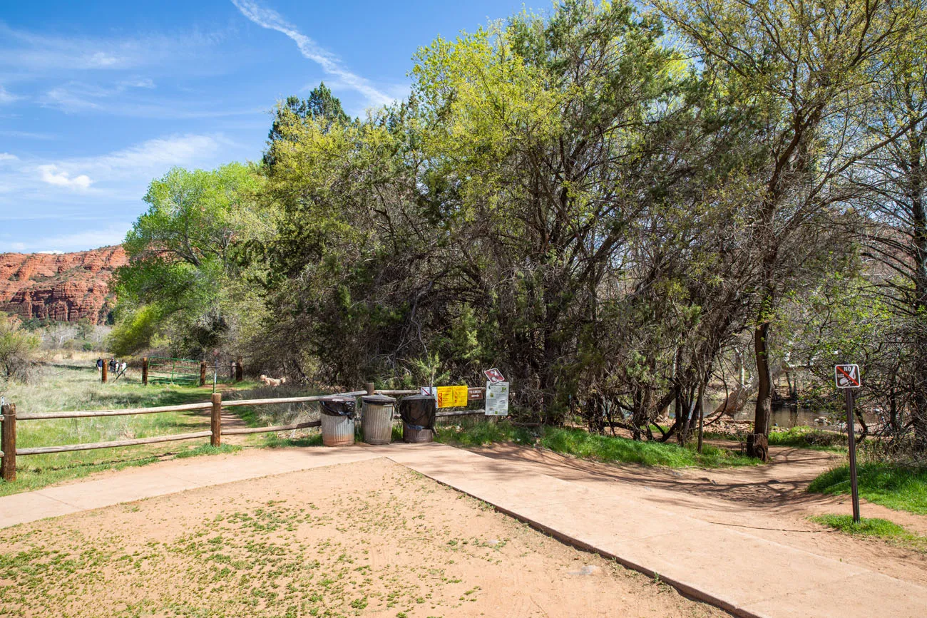
When you arrive at Crescent Moon Picnic Site, you will pay your entrance fee at the pay booth. There are several parking lots located throughout the site, as well as bathrooms. Once here, you can follow the trails out to the creek, either to photograph Cathedral Rock or relax next to Oak Creek.
Where to Photograph Cathedral Rock
There are five notable photography locations in the Crescent Moon Picnic Site. All but one of these offers a great view of Cathedral Rock.
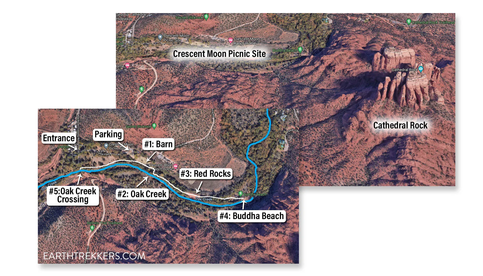
The upper map shows Crescent Moon Picnic Site in relation to Cathedral Map. The lower map shows the photography locations at Crescent Moon Picnic Site. The numbers correspond to the five locations described below. The blue line is Oak Creek and the white line is the walking path.
#1: The Barn & Cathedral Rock
GPS coordinates: 34°49’33.2″N 111°48’15.3″W
This photography spot is the easiest to get to and the easiest to find. From the parking lot, walk east into the wide, grassy field (walk towards Cathedral Rock). From the field, you have a wonderful view of the barn and Cathedral Rock.
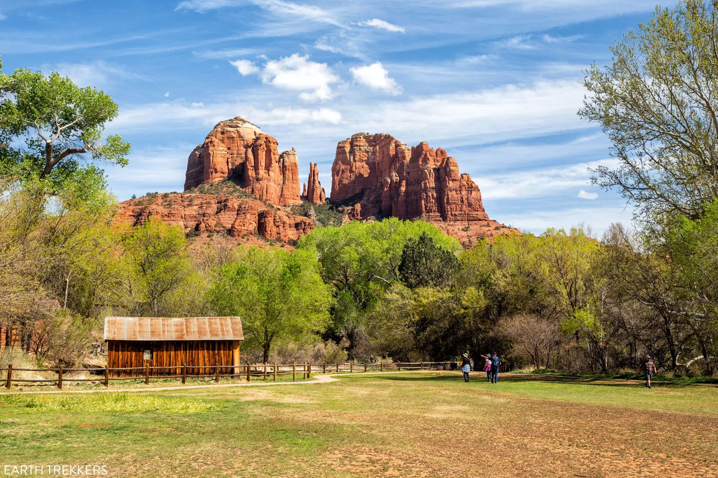
Cathedral Rock and the barn
#2: Oak Creek
GPS coordinates: 34°49’29.8″N 111°48’13.1″W
This photography location allows you to capture Oak Creek and Cathedral Rock in the same photo.
To get here from photo location #1, walk past the barn to the end of the field. At the corner of the field, there will be a trail that leads into the woods.
At the end of the field, follow the trail into the woods.
As soon as you are in the woods, leave the trail and walk to the riverbank of Oak Creek.
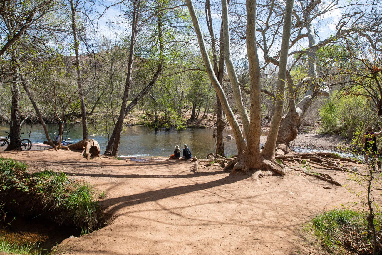
Once in the woods, head right to the riverbank and look for these two unique trees.
To get to the photo location, you will have to cross Oak Creek to the small, sandy peninsula for the best angle. I actually stood in the creek to take the photo of Cathedral Rock.
View of the sandy point in Oak Creek. I stood in the creek near the point to take the photo below.
This is a very popular hangout spot, especially on a hot day. There is a good chance that you will be sharing this place with other visitors.
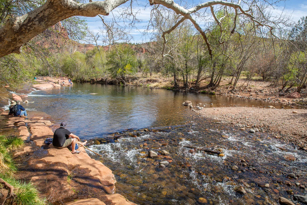
#3: Red Rocks
GPS Coordinates: 34°49’25.9″N 111°48’03.4″W
From photo location #2, walk back to the trail in the woods. Take the trail to the right, walking towards Cathedral Rock. It is a 0.15 mile flat, easy, shady walk to an opening in the trees. At this point, you will be standing on orange-red sandstone rocks with a great view of Cathedral Rock. I have seen some people refer to this area as Buddha Beach, but that is located farther down the trail.
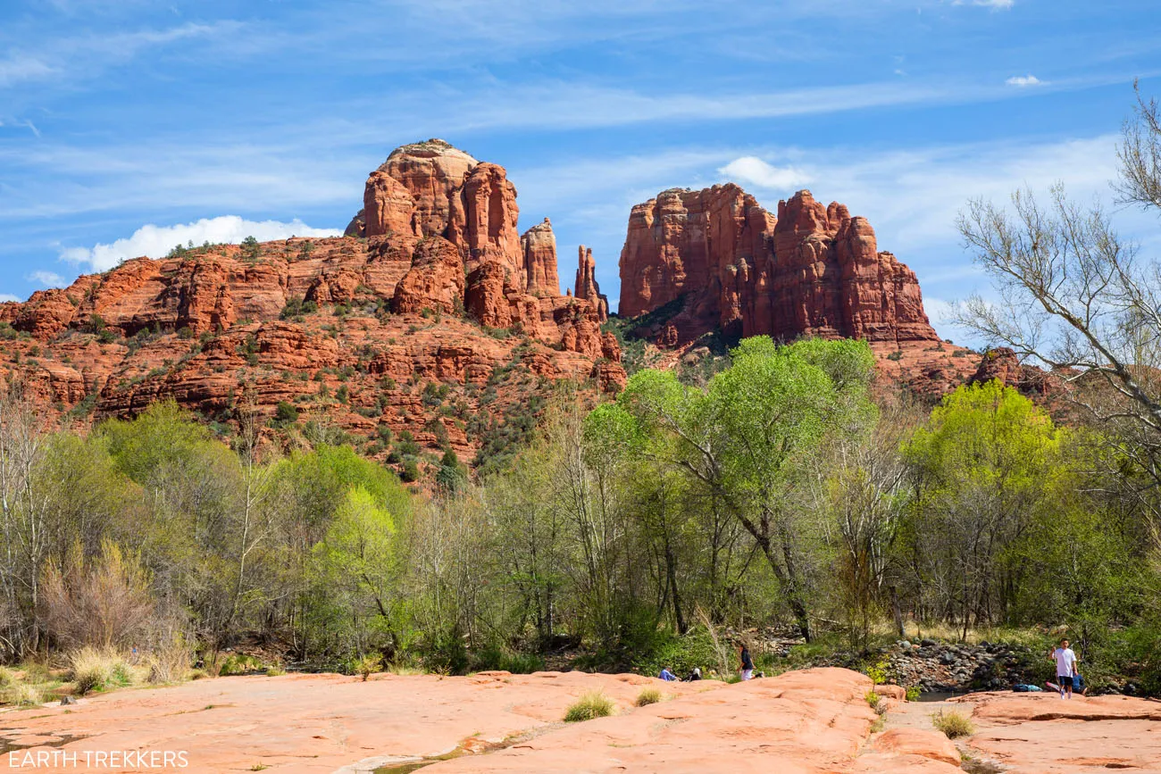
If you are lucky and it has recently rained, you can capture the reflection of Cathedral Rock here, as the water pools the grooves in the red rocks.
#4: Buddha Beach
GPS Coordinates: 34°49’25.1″N 111°47’49.6″W
From the red rocks, continue to walk in the direction of Cathedral Rock. The trail resumes once you enter another small forest. The trail ends at a rocky beach with some rock cairns. This is Buddha Beach. From here, you do not have a view of Cathedral Rock. Just across Oak Creek is the massive base of Cathedral Rock, which obscures the top of the rock.
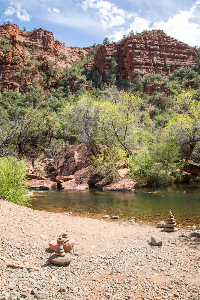
Buddha Beach is located 0.5 miles from the parking lot. If you are only visiting Crescent Moon Picnic Site to photograph Cathedral Rock, you don’t miss out on much by skipping this location.
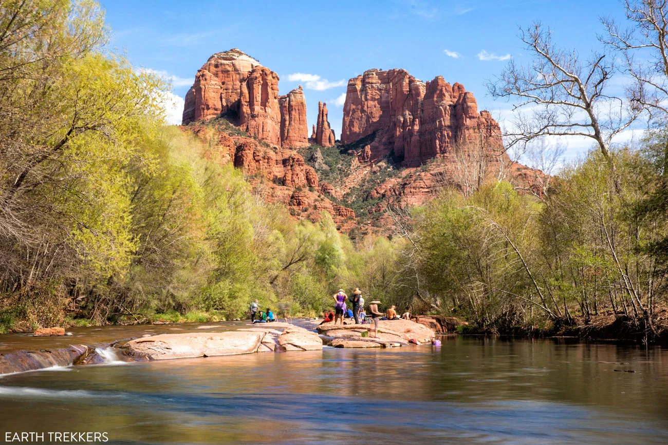
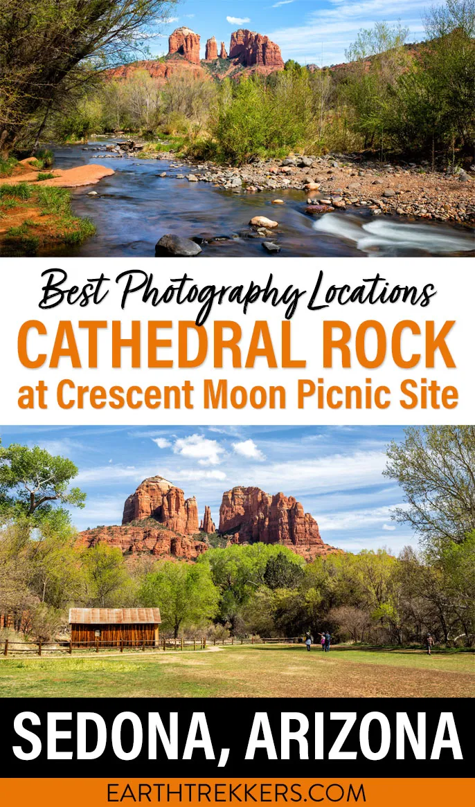
#5: Oak Creek Crossing
GPS Coordinates: 34°49’31.4″N 111°48’32.5″W
This is the classic view of Cathedral Rock and Oak Creek. To get here, it is a long walk from Buddha Beach since this photography location is near the entrance into the picnic site.
From Buddha Beach, retrace your steps back to barn and the wide grassy field. Follow the trail along the trees, heading away from Cathedral Rock. The trail ends at a small cabin. From here, this is your view.
A view of the cabin from the photo spot
This is also the place to cross Oak Creek if you plan to hike up Cathedral Rock. There is no bridge here, so you will have to wade through the creek to get to the other side.
Things to Know Before You Go
How Long Does a Visit to Crescent Moon Picnic Site last?
If you only have plans to photograph Cathedral Rock, visiting the locations listed above, plan on spending two hours at the Crescent Moon Picnic Site. If you plan to soak in Oak Creek, go fishing, have a picnic lunch or dinner, or stick around for sunset, your visit can last half of a day or longer.
When is the best time to visit Crescent Moon Picnic Site?
The best time of day to photograph Cathedral Rock from Crescent Moon Picnic Site is in the afternoon and early evening. In the afternoon, the west side of Cathedral Rock (the side that you see when you are at the picnic site) is illuminated by the sun. This is a very popular sunset photography location in Sedona, so if you have plans to photograph Cathedral Rock at sunset, get here an hour early to stake out your tripod location.
What camera gear do you use?
To learn more about our camera gear, check out our Travel Photography Gear Guide.
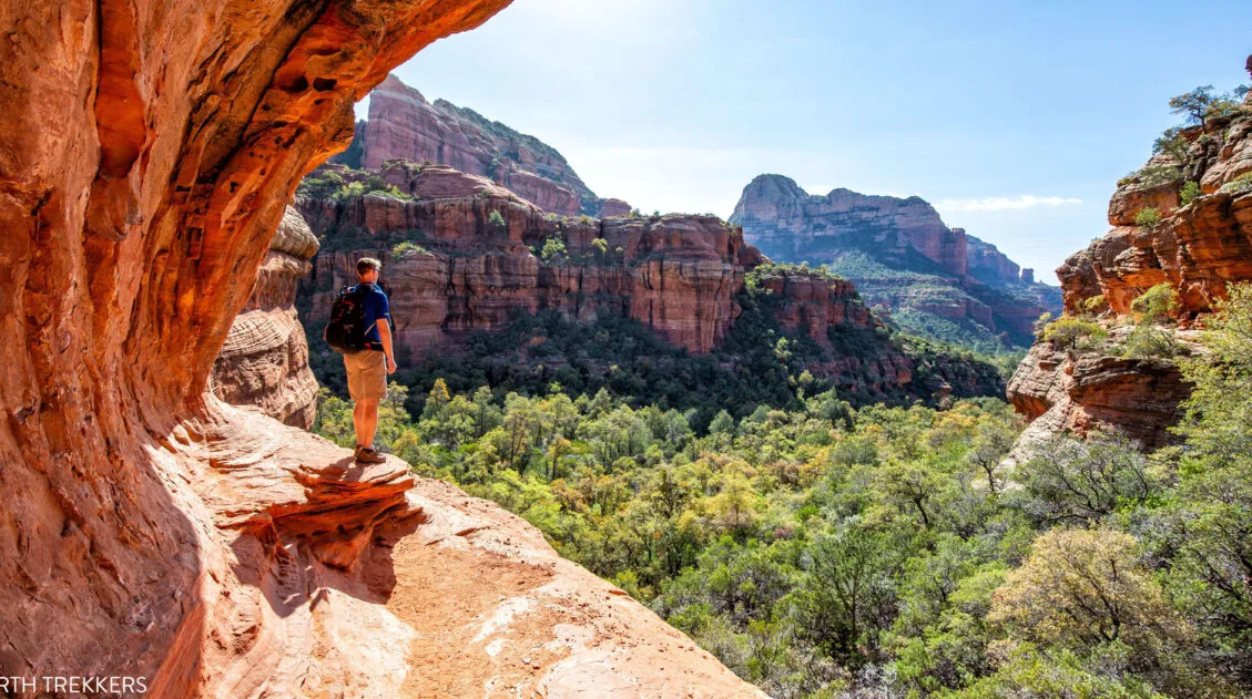
Can I hike to Cathedral Rock from the Crescent Moon Picnic Site?
Yes. To do this, you will have to cross Oak Creek (at photo location #5). Take the Red Rock Crossing Trail to the Templeton Trail. This will join Cathedral Rock Trail, which heads up onto Cathedral Rock. This hike is 4 miles round-trip, has 1,000 feet of elevation gain, and takes 2 to 4 hours.
If you have any questions about how to photograph Cathedral Rock, or if you would like to share your experience, let us know in the comment section below.
More Information about Sedona & Arizona
We have more information about things to do in Arizona in our Arizona Travel Guide. If this is part of a bigger road trip through the USA, you can read all of our articles about the United States in our United States Travel Guide.
15 Amazing Things to Do in Sedona (Beyond Just Hiking the Trails)
Pinterest Facebook Flipboard What do you look for when picking the perfect vacation spot? Outdoor adventures? Shopping? Wineries? Great restaurants? Beautiful sunsets? A fun place to take the kids? What if I told you that you could get all of these in one place…Sedona, Arizona. In this article, learn about the best things to do […]
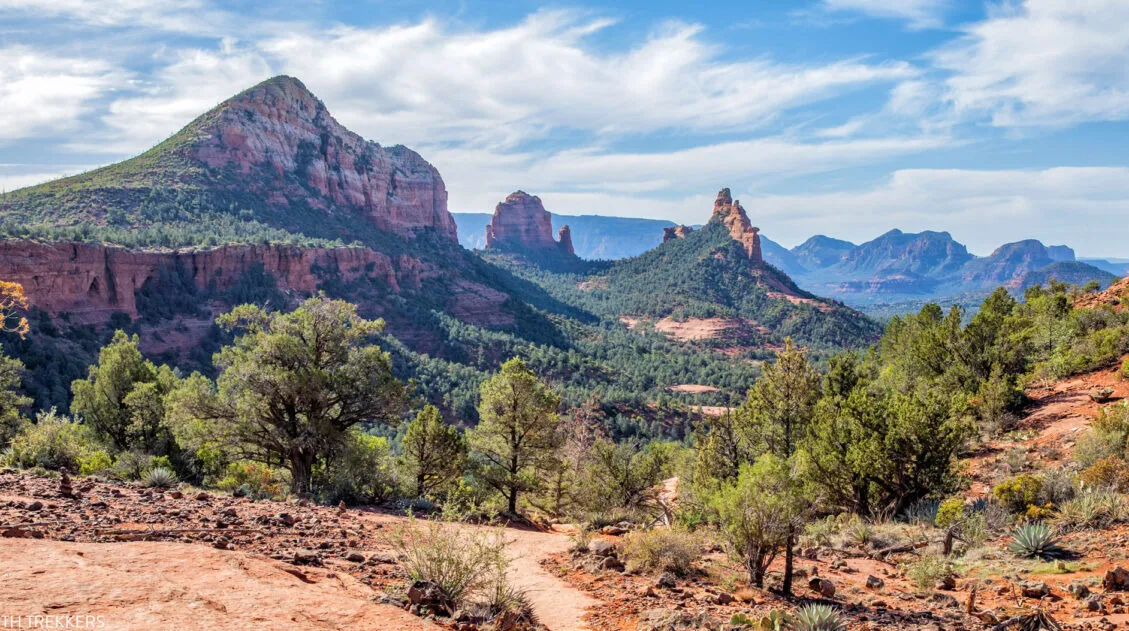
How to Hike to Cathedral Rock in Sedona, Arizona
Hiking to Cathedral Rock is an essential experience in Sedona. This hike is short and sweet, and with some rock scrambling and jaw-dropping views, it’s tons of fun from start to finish. Cathedral Rock is one of the most popular hikes in Sedona. Do not expect solitude on this trail. This experience is much more […]
Boynton Canyon Trail & the Subway Cave | One of Sedona’s Top Hikes
Boynton Canyon is one of Sedona’s top hikes. This is a relatively easy hike, as you walk on a mostly flat trail that is sheltered from the sun. The trail ends at the back of the canyon, where a short climb takes you up to a viewpoint, offering sweeping views of Boynton Canyon. Along the […]
Sedona Itinerary | Best Way to Spend 1 to 6 Days in Sedona
There are many different ways to piece together a Sedona itinerary. Your perfect itinerary depends on your traveling style. Whether you are an avid hiker, a family traveling with kids, or someone who wants to experience Sedona without spending time on the hiking trails, we have some great suggestions for you. In this guide, learn […]
How to Hike the Brins Mesa – Soldier Pass Loop in Sedona
The Brins Mesa and Soldier Pass Loop combines two scenic hiking trails into one awesome experience. Since this is done as a loop, you are always hiking through new landscapes, so the view is always changing. From Brins Mesa, you get panoramic views of the surrounding red rock mountains. On the Soldier Pass Trail, you […]
12 Best Sedona Hikes, Ranked Shortest to Longest
If you are looking for an epic hiking destination, it’s tough to beat Sedona, Arizona. With its red rock scenery, arches, hidden caves, and network of hiking trails, this is a great place to explore on foot. Add in the abundance of top-notch hotels and restaurants in Sedona and you have an awesome getaway destination, […]

Sedona Travel Guide: How to Plan a Trip to Sedona
Sedona Travel Guide In central Arizona, miles and miles of trails criss cross through red rocks and spectacular desert landscapes, creating an outdoor playground for hikers and mountain bikers. Venture into the desert on a 4×4, visit cultural heritage sites, go wine tasting, slide down a waterfall, and watch as the sky turns brilliant shades […]
10 Days in the American Southwest: The Ultimate Road Trip
The American southwest is one of the USA’s best road trip destinations. It’s unbelievable how much there is to see and do here. There are the breathtaking vistas of the Grand Canyon, thrilling hiking trails in Zion National Park, and millions of hoodoos to photograph in Bryce Canyon. Are you getting excited yet? The list […]
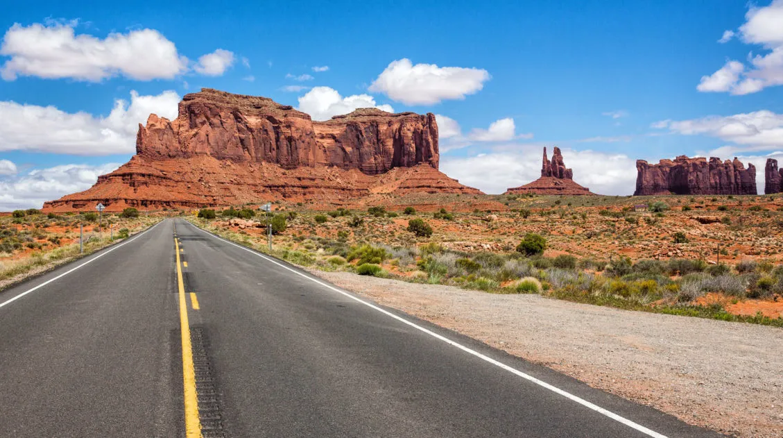
The Ultimate Arizona Road Trip Itinerary
On this Arizona road trip itinerary, you will visit three national parks, drive past the buttes and mesas of Monument Valley, walk through magical Antelope Canyon, and hike the desert hills of Sedona. Arizona is home to some of the most iconic landscapes in the United States and this road trip is the perfect way […]
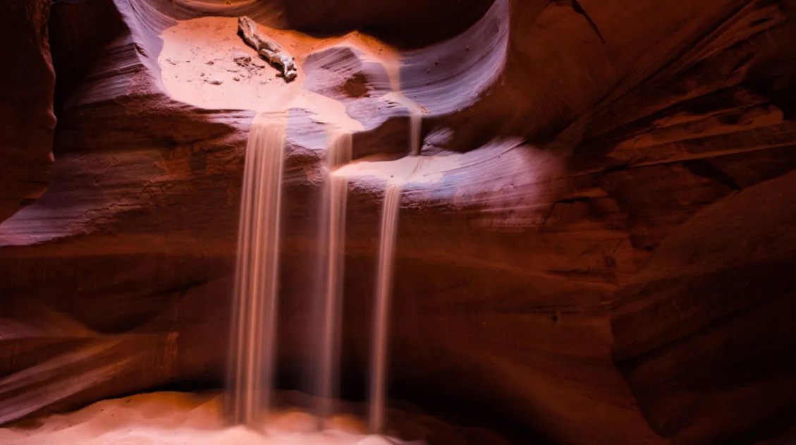
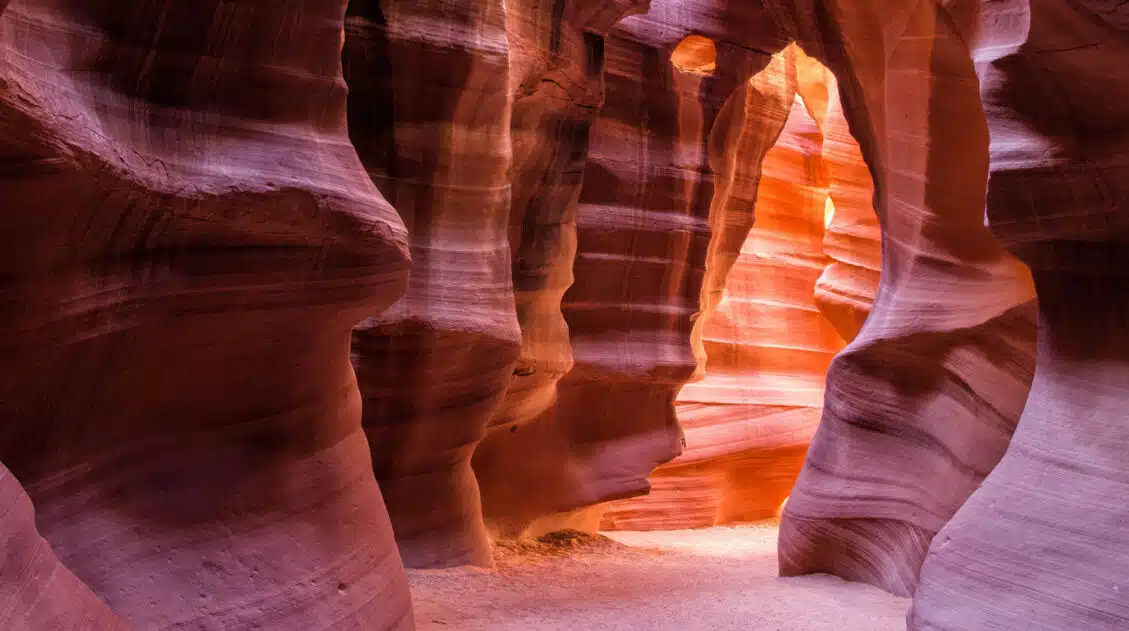
Upper or Lower Antelope Canyon: Which One Should You Visit?
Tim and I visited Upper and Lower Antelope Canyon on the same day. We took the same tours, walked through the same red sandstone walls, and came away with completely different favorites. Tim’s was Lower. Mine was Upper. That split tells you something important: these aren’t two versions of the same experience. They’re genuinely different […]
Arizona Travel Guide: Top Places to Visit in Arizona
Arizona Travel Guide From the awe-inspiring Grand Canyon to the sprawling Sonoran Desert, Arizona offers a diverse mix of natural wonders, bustling cities, and deep-rooted traditions. Visit Arizona to hike amidst its slot canyons and desert landscapes, view the starry night skies, and see the famously tall saguaro cactus. Take a trip to Arizona on […]

15 Great Places to Work Remotely in the USA
The COVID-19 pandemic brought huge changes to how we live and work. With lockdowns and social distancing, employees of many businesses began to work remotely. Home offices, kitchens, and spare bedrooms became the new office space for many people. What we thought would be a temporary adjustment has now become a more permanent aspect of […]
Best USA Road Trips: 18 Ideas for Your Next Big Adventure
One of the best ways to explore the USA is on a good old-fashioned road trip. Cruise along Route 66, road trip through the Florida Keys, explore the American Southwest, or even drive from coast to coast. In this guide, we share 18 of the best USA road trips…18 great ideas for your next big […]

Comments 6