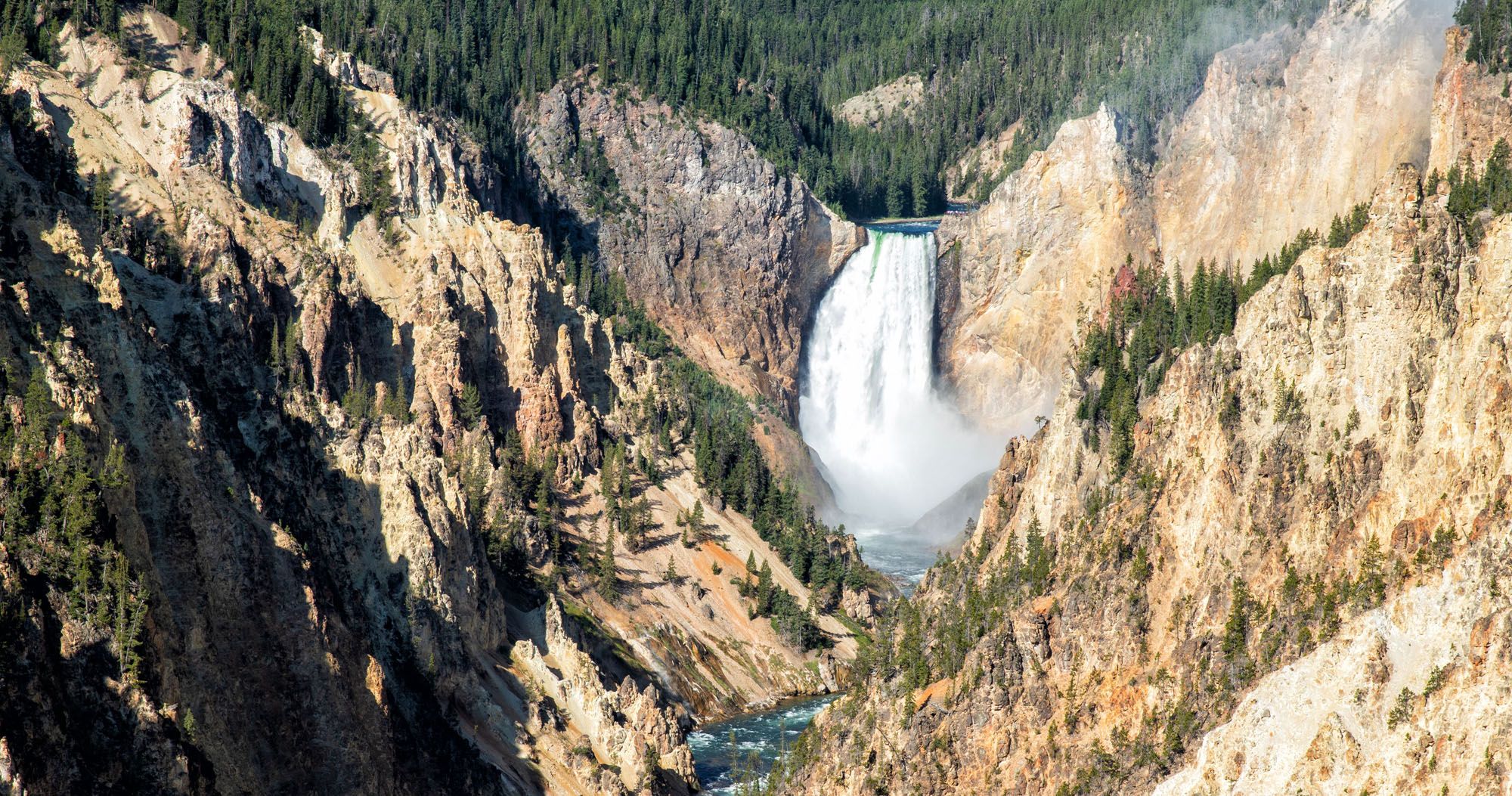
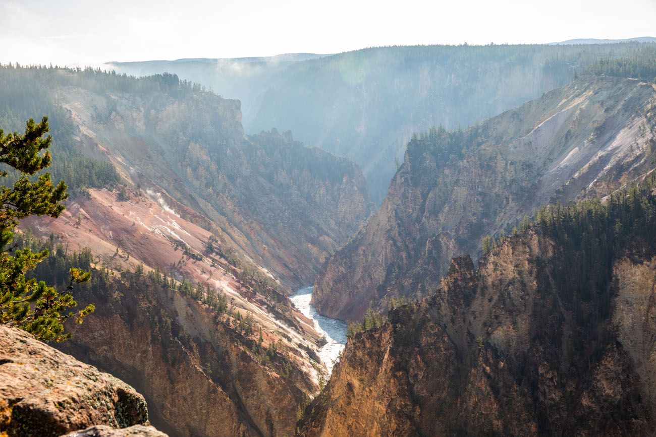
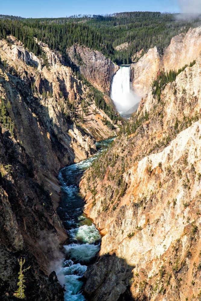
The Grand Canyon of the Yellowstone is one of Yellowstone National Park’s top attractions. With two rims to visit, multiple viewpoints, and several hiking trails, there is a lot to do here. In this guide, we share the best things to do at the Grand Canyon of the Yellowstone with tips to help you plan your time.
Here’s everything you need to know to visit the Grand Canyon of the Yellowstone.
A Brief Geography Lesson
There are three main sections to Grand Canyon of the Yellowstone: the North Rim, the South Rim, and Brink of the Upper Falls. Technically, the Brink of the Upper Falls is located on the North Rim, but since it is accessed from a different road, I am listing it as a third section to visit.
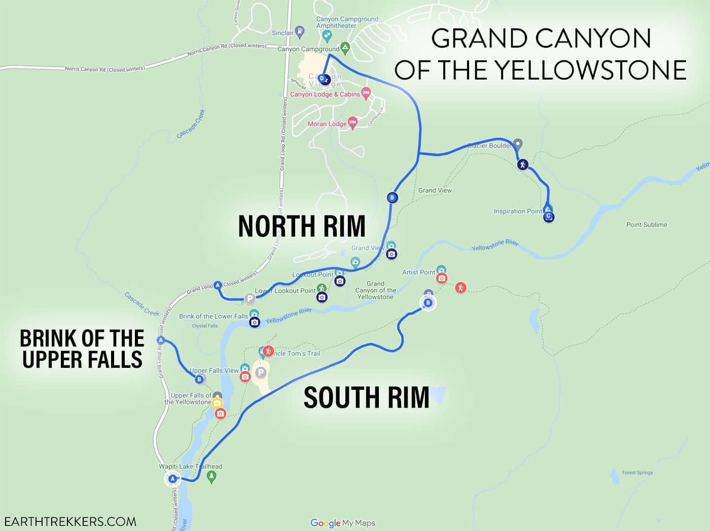
The North Rim has several great overlooks and hiking trails to visit. Several offer spectacular views of the Lower Falls. You can drive to each of the viewpoints and add on the short but strenuous hikes.
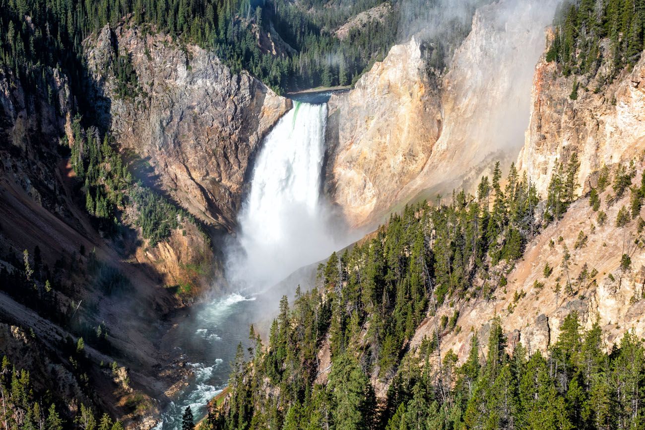
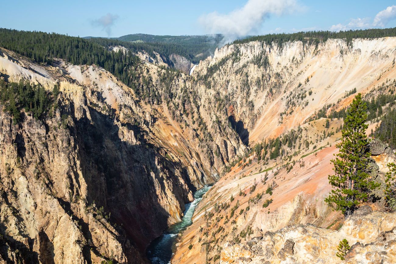
The South Rim is similar to the North Rim, with several overlooks and short hiking trails. This is where you will find Artist Point, the best view of Grand Canyon of the Yellowstone and one of the most photographed spots in Yellowstone National Park.
Brink of the Upper Falls takes you to an overlook that is perched on the crest of Upper Falls.
If you want the full experience, plan on visiting each of these sections. This will take about half of a day. If you don’t have that kind of time, I’ll let you know what is worth it later in this guide.
Things to Do on the North Rim of Grand Canyon of the Yellowstone
There are five main things to do on the North Rim:
- Brink of the Lower Falls
- Lookout Point
- Red Rock Point
- Grand View
- Inspiration Point
In addition to these, you can also add on Seven Mile Hole Trail and Brink of the Upper Falls.
How to Get Around the North Rim
The easiest way to get to each viewpoint is in your car. North Rim Drive is a one-way loop includes each of these viewpoints and Canyon Village. There is lots of parking at each overlook, but even so, midday it could be tough to get a parking space.
You also have the option to park in one spot and hike the North Rim Trail.
The North Rim Trail is a 3 mile trail (one-way) that runs from Chittenden Bridge to Inspiration Point. You don’t have to hike the entire trail…you can park at any one of the overlooks on the North Rim and hike the North Rim Trail from here. In fact, you might have to do this if you are struggling to find a parking space.
PRO TRAVEL TIP: The best way to visit the North Rim is to drive to each overlook. This saves you lots of time and energy…several of these short hikes are very steep and I think your time is better spent doing these than hiking the North Rim Trail.
This list of overlooks and hiking trails is in order of their location on North Rim Drive.
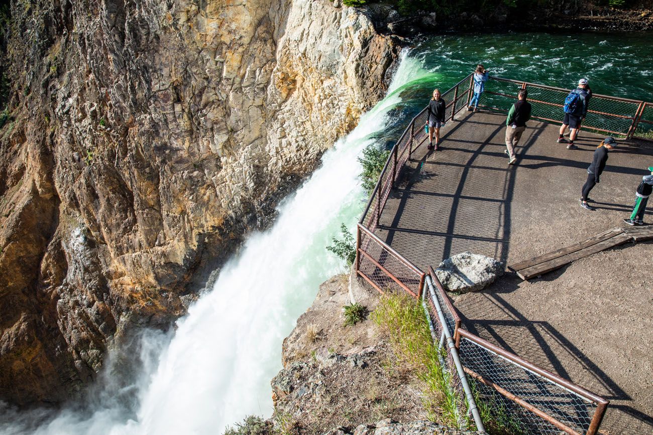
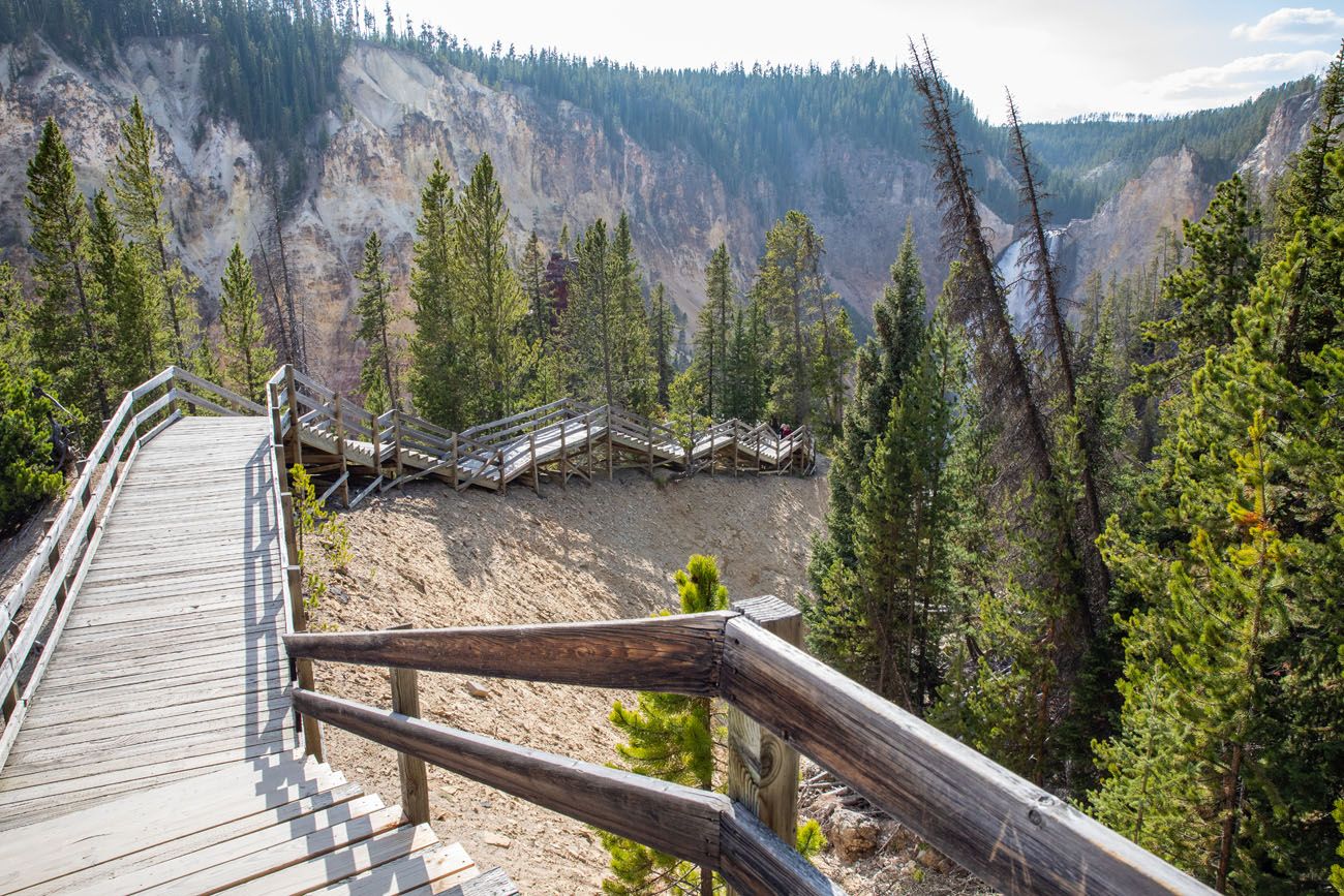
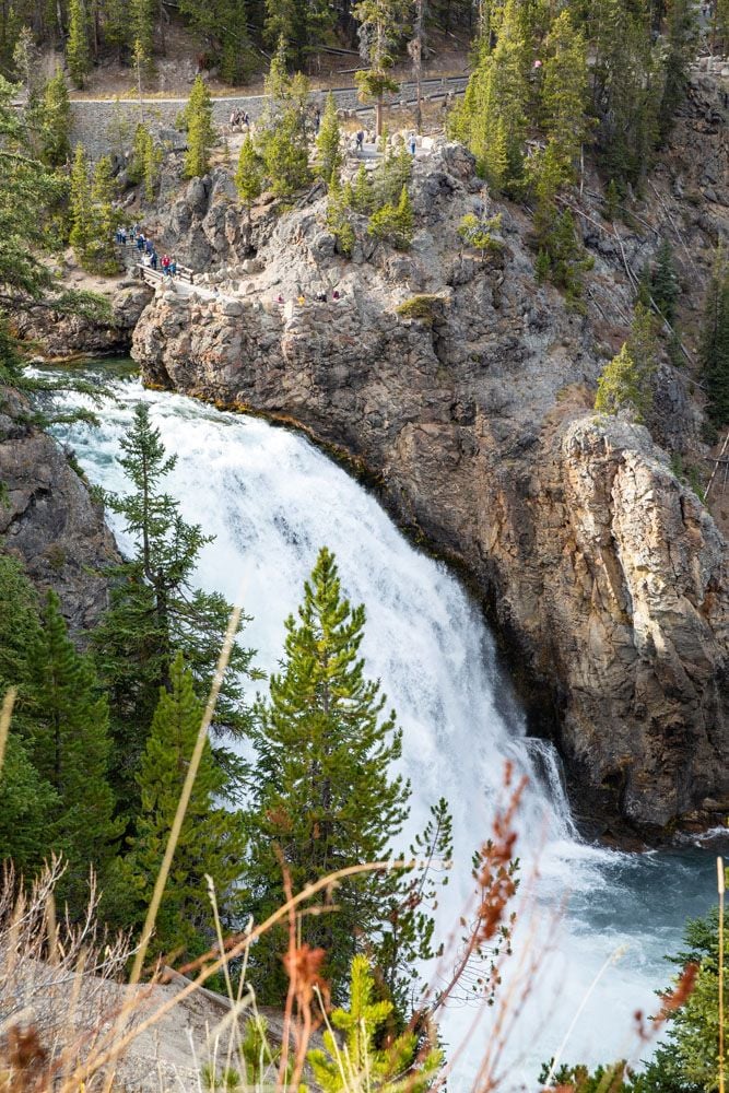
Brink of the Lower Falls
Distance: 0.7 miles out-and-back | Total Ascent: 600 feet | Difficulty: Moderate to strenuous | Length of Time: 30 to 60 minutes
This is one of the toughest trails at Grand Canyon of the Yellowstone but if you want to get up close to Lower Falls, this hike is definitely worth the effort.
Starting on the rim, this trail rapidly descends into the canyon. It is a paved trail but rough and bumpy in spots.
Once you get to the bottom, there are two viewpoints. One is up against the fence, the closest you can get to Lower Falls. The second is overlooking the lower viewpoint (the best place to photograph friends and family next to the waterfall).
On the way back up, take your time. This area of Yellowstone National Park sits at 7,700 feet of elevation and that extra altitude will make you even more breathless.
Lookout Point
This viewpoint is awesome. This is the easiest place to get a breathtaking view of Lower Falls from the North Rim.
Lookout Point
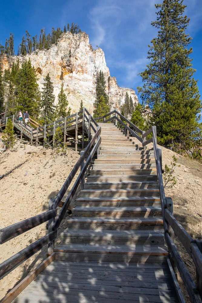
Red Rock Point
Distance: 0.6 miles out-and-back | Difficulty: Moderate | Total Ascent: 260 feet | Length of Time: 30 to 45 minutes
This hike is a cross between Brink of the Lower Falls and Uncle Tom’s Trail. A short, steep hike takes you down into the canyon. Just when you think you are there, a long series of steps awaits.
Worth it? Absolutely.
From this point, you are standing at eye level with Lower Falls. Here’s the view.
Red Rock Point
The Red Rock Point Trail starts next to Lookout Point. First, you will hike down a paved and gravel path. The final section of the hike is on the steps pictured below.
Steps leading down to Red Rock Point
This is the view looking back up the stairs. Lookout Point is on top of the rocky prominence.
Grand View
In my opinion, this viewpoint really is not all that grand. This viewpoint is more about looking down the Grand Canyon.
Grand View
Inspiration Point
From here, you are very far away from Lower Falls. In fact, it looks tiny from this viewpoint (but the colorful canyon is pretty).
To get to Inspiration Point, turn right onto Inspiration Point Road and drive to the end of the road. This road ends at the parking lot for the viewpoint.
Once finished at Inspiration Point, you have the option to hike Seven Mile Hole Trail (keep reading for more info) or complete the loop on North Rim Drive. You will drive through Canyon Village, a nice place to stop for a bite to eat if you are hungry, before getting back to Grand Loop Road.
Seven Mile Hole Trail and Cascade Overlook
Distance: 10 miles out-and-back | Difficulty: Strenuous | Total Ascent: 2,000 feet | Length of Time: 5 to 8 hours
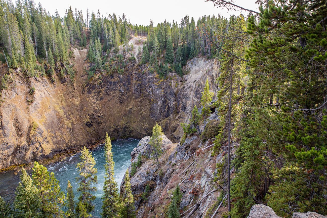
This trail starts at Glacier Boulder on North Rim Road (just past Inspiration Point). You can walk ¾ of a mile to Cascade Overlook for a view of the canyon. Beyond this point, the trail then drops down into the canyon, going all of the way to the Yellowstone River.
PRO TRAVEL TIP: If you only want to see the highlights, hike Brink of the Lower Falls Trail, visit Lookout Point, and hike to Red Rock Point. Skip Grand View Point, Inspiration Point, and Seven Mile Hole Trail, and then move on to the South Rim.
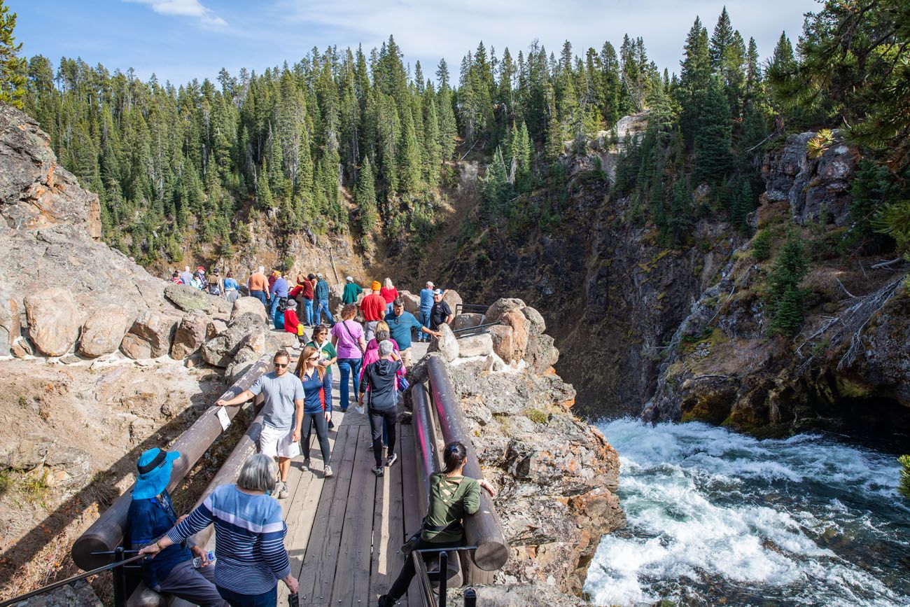
Brink of the Upper Falls
Brink of the Upper Falls is located on the North Rim. This overlook has its own parking lot. From North Rim Drive, turn left onto Grand Loop Road, and then turn left onto Brink of the Upper Falls Drive.
It’s a short drive to an enormous parking lot. There are also restrooms here.
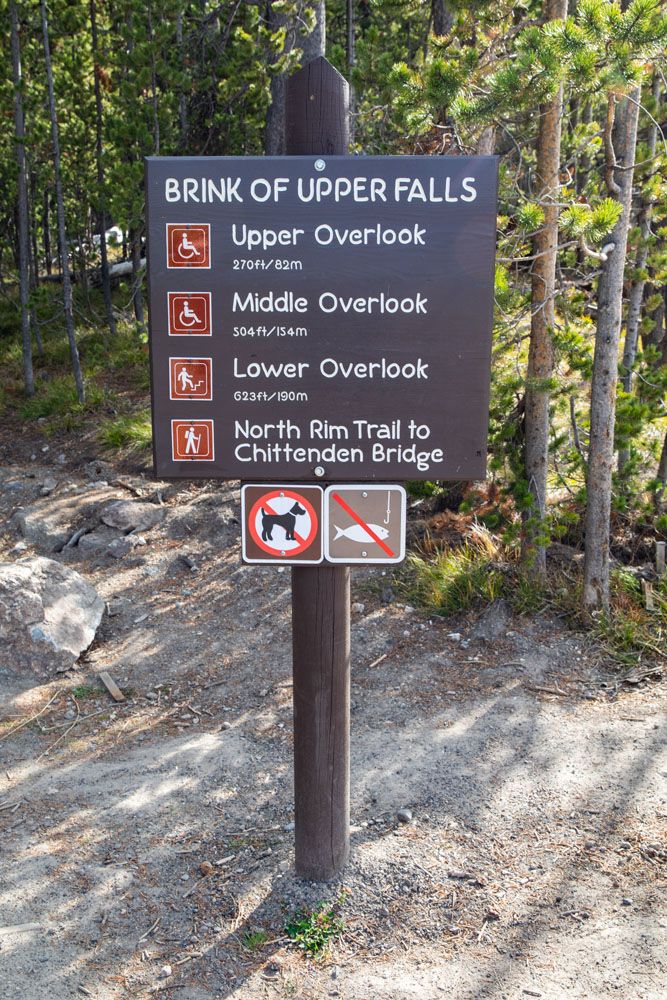
There are three overlooks (Upper, Middle and Lower) to visit. All are located on a paved trail.
The first overlook (Upper Overlook) is not very exciting. You are looking out over the Yellowstone River but can’t see the falls from here.
Upper Overlook view
The Middle Overlook gives you a view down onto the Lower Overlook.
Middle Overlook
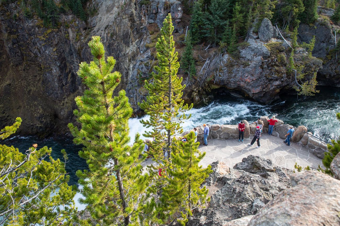
The Lower Overlook is the best overlook. To get here, it is an easy, flat walk that is a quarter of a mile out-and-back (there are some stairs so it is not wheelchair accessible). From here, you are standing on a platform that is located next to the top of Upper Falls.
Lower Overlook
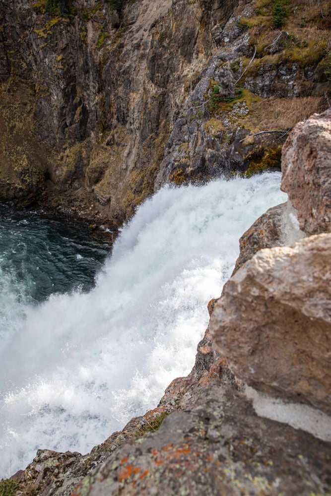
View of Upper Falls from the Lower Overlook
It’s similar to Brink of the Lower Falls, but not as impressive. For one thing, the “fence” here is made of boulders, so it’s a lot harder to see the waterfall (you have to bend over the rock wall to look down at the waterfall). And this waterfall is a lot smaller than Lower Falls (it’s only 1/3 of the size).
Even though Brink of the Upper Falls lacks the wow factor that the Lower Falls has, it still has its advantages. For those who cannot hike a long, steep trail to an overlook (as you have to do to visit Brink of the Lower Falls), this is an easy way to experience what it is like to stand on the brink of a waterfall and hear its thunder.
Things to Do on the South Rim of Grand Canyon of the Yellowstone
There are four main things to do on the South Rim:
- Sunset Point
- Upper Falls View
- Uncle Tom’s Trail
- Artist Point
In addition to these, you can also add on the hike to Point Sublime.
Getting Around the South Rim
Like the North Rim, the easiest way to get around the South Rim is in your car. On South Rim Drive, there are two parking lots, and from these lots you can visit each overlook listed above. You can also hike the South Rim Trail, a 1.75 mile trail (one-way) that connects Chittenden Bridge with Artist Point.
This list of overlooks and hiking trails is in order of their location on South Rim Drive, starting at the first parking lot at Uncle Tom’s Point.
Canyon Overlook (Upper Falls View)
From the parking lot for Uncle Tom’s Point, it is a short walk to Canyon Overlook (also called Upper Falls View). Here is the view of Upper Falls.
Sunset Point
Distance: 0.6 miles out-and-back | Difficulty: Easy | Total Ascent: 70 feet | Length of Time: 15 to 30 minutes
This viewpoint sits across the Yellowstone River from Brink of the Upper Falls. The view of Upper Falls from here is better than at Canyon Overlook, since you are closer, but it is a longer walk to get here (a 0.6 mile hike, out-and-back, from Canyon Overlook).
Sunset Point. If you look closely, you can see the Lower Overlook of Brink of the Upper Falls.
Uncle Tom’s Trail
Uncle Tom’s Trail is now permanently closed, due to safety issues.
This historic ‘hiking trail’ started off as a series of ropes and ladders and years later, a massive staircase was erected. Until the summer of 2019, visitors could descend the 328 steps to get to a stunning viewpoint of Lower Falls. And then it was a thigh-burning workout to climb those same stairs back up to the rim.
Tim and I hiked this trail on our first visit to Yellowstone over 20 years ago, and it remains one of our favorite memories from that trip. It’s a shame that the trail is now closed—today, it lives on only in the photos and recollections of those lucky enough to experience it.
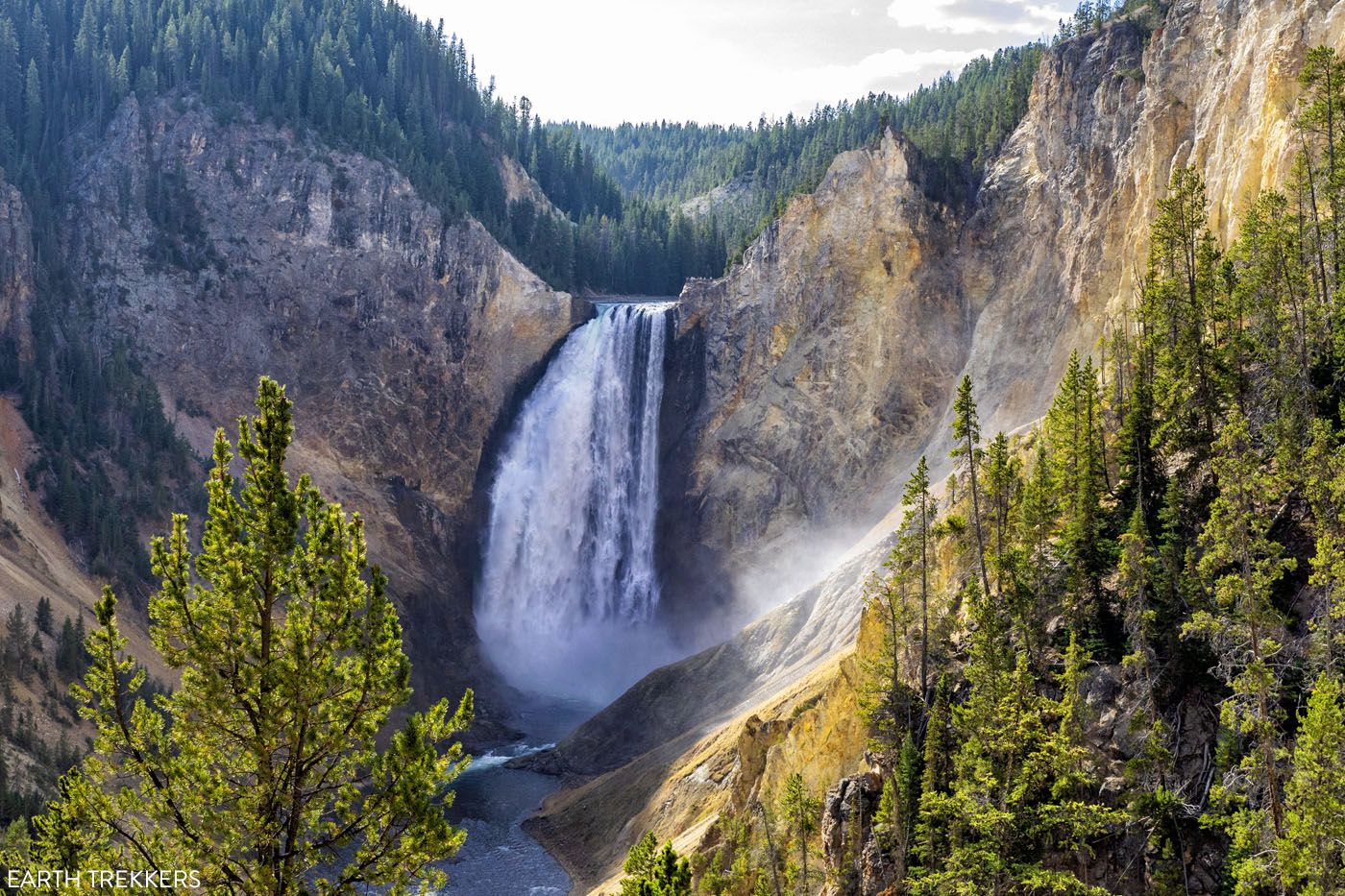
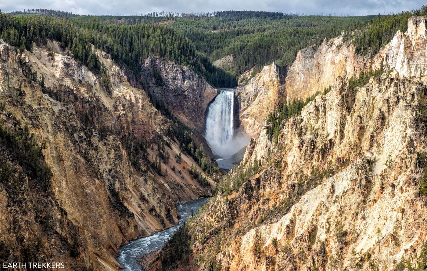
Artist Point
If you do one thing on the South Rim, it should be a visit to Artist Point.
From the parking lot at the end of South Rim Drive, it is a 5 minute walk to one of the most iconic viewpoints in Yellowstone National Park.
Point Sublime
Distance: 3 miles out-and-back | Difficulty: Moderate | Total Ascent: 350 feet | Length of Time: 1 to 2 hours
Starting at Artist Point, this hiking trail heads east, away from Upper and Lower Falls. Along the hike, you have beautiful views of the canyon.
Best Experiences at Grand Canyon of the Yellowstone
That’s a long list. If you just want to visit the highlights of Grand Canyon of the Yellowstone, here are our top 5 experiences:
- Artist Point (South Rim)
- Brink of the Upper Falls (North Rim)
- Lookout Point (North Rim)
- Red Rock Point (North Rim)
- Sunset Point (South Rim)
If it is open, Uncle Tom’s Trail also belongs on this list.
How Much Time Do You Need?
To visit both the North and South Rims of Grand Canyon of the Yellowstone, you will need 3 to 4 hours. This gives you enough time to drive to the overlooks on the North Rim, hike to Brink of the Lower Falls, visit Brink of the Upper Falls, and visit the viewpoints on the South Rim.
If you like the idea of adding on the hike to Point Sublime, add another hour to this estimate.
Best Time of Day to Visit the Grand Canyon of the Yellowstone
The best time of day to visit Grand Canyon of the Yellowstone is in the morning, for two reasons.
In the morning, crowds will be lower, especially if you can get started by 8 am.
The lighting is better for photography in the morning. We have been here at different times throughout the day and the morning is my favorite time to photograph the canyon. In the morning, the sun illuminates the waterfalls and canyon. In the afternoon, once the sun moves to the west, the waterfalls are in the shadows.
Most of the photos in this guide were taken in the morning.
How to Plan Your Time: A Sample Itinerary
Wondering how to put all of this together? Here is a sample itinerary for Grand Canyon of the Yellowstone.
Ideally first thing in the morning, start on the North Rim. Crowds should be low and it will be a lot easier to get a parking space at each overlook.
Hike Brink of the Lower Falls Trail. Drive to Lookout Point and take in the view. From here, you can also hike to Red Rock Point. Hop back into your car and you have the option to visit Grand View and Inspiration Point. Depending on how fast you hike the two trails, it will take 2 to 3 hours to visit the North Rim.
Next, visit the South Rim. Drive to the end of the road, visit Artist Point, and you have the option to add on the hike to Point Sublime. Get back into your car and drive to the Uncle Tom’s Road parking lot. Hike Uncle Tom’s Trail (if it is open), take in the view from Canyon Overlook, and you have the option to add on Sunset Point. It can take just 30 minutes to visit the North Rim (if you only visit Artist Point) or 2 to 3 hours, if you hike to Point Sublime and Uncle Tom’s Trail.
Finally, you have the option to visit Brink of the Upper Falls. This parking lot is enormous and it is not as popular as the other sights, so this is a good place to visit midday, as places in Yellowstone get more crowded. This adds 20 to 30 minutes to your day.
How to Use This Map: Click the tab in the top left corner of the map to see a list of the points of interest and to turn layers on/off. Click the icons on the map to get more information about each point of interest.
To take this map with you, click the star next to the title of the map which adds it to your Google account. Next, within your Google Maps app, select ‘Saved’ and then select ‘Maps’. This map title will now appear in your list.
Interesting Facts about Grand Canyon of the Yellowstone
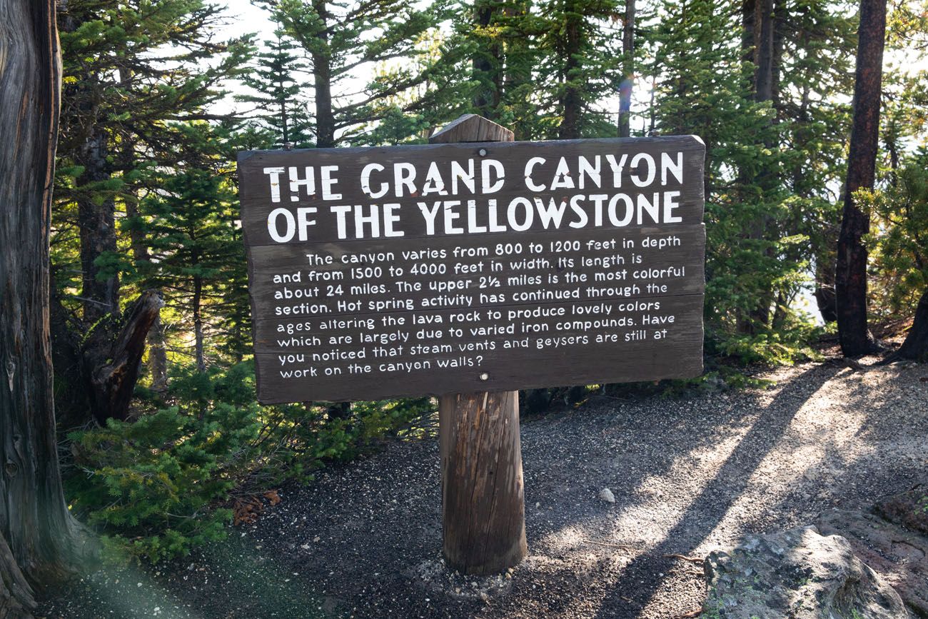
The Grand Canyon of the Yellowstone is a canyon that has been carved out by the Yellowstone River. It is roughly 24 miles long and it is 1,200 feet deep at its deepest point.
The Yellowstone River is 692 miles long. It originates at Yount Peak in the Absaroka Range of Wyoming and then flows northwest towards Yellowstone National Park. Once in the park, it flows through Yellowstone Lake, through Grand Canyon of the Yellowstone, to Tower Falls, through Gardiner, Montana, and then takes a turn to the northeast and heads to North Dakota. Interstate 94, which runs through Montana, runs parallel with the Yellowstone River. In North Dakota, it joins the Missouri River.
This canyon contains two of the three major waterfalls along the Yellowstone River (the third is Tower Falls just a few miles away).
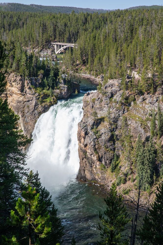
Upper Falls is the smaller of the two waterfalls. It’s 109 feet tall (33 meters) and can be viewed from several viewpoints, most notably Brink of the Upper Falls (on the North Rim) and Canyon Overlook (on the South Rim).
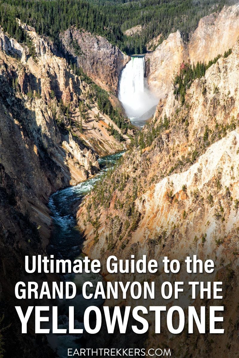
When you see photos of Grand Canyon of the Yellowstone, it is most likely Lower Falls that is pictured. This 300 foot waterfall is the main attraction of the Grand Canyon. Most overlooks on both the North and South Rims offer big views of this waterfall, with Artist Point being the most famous.
Frequently Asked Questions
Which is better…the North Rim or the South Rim?
That’s a tough one to answer. If Uncle Tom’s Trail is open, I would say that the South Rim is better. From Uncle Tom’s Trail, you get a close up look of Lower Falls and then you can capture the iconic photo of Grand Canyon of the Yellowstone at Artist Point.
If Uncle Tom’s Trail is not open, then I say the North Rim is better. Brink of the Lower Falls is awesome, as are Red Rock Point and Lookout Point.
Which is better…Red Rock Point or Brink of the Lower Falls?
Both of these are short, strenuous hikes to a viewpoint of Lower Falls. From Brink of the Lower Falls, you are standing next to the waterfall and can really hear its power, which is exhilarating. From Red Rock Point, you have one of the best views of Lower Falls.
Both are worth the effort, in my opinion. If you want a great view of Upper Falls, hike to Red Rock Point. And if you want to stand next to the waterfall and look over its edge, put Brink of the Lower Falls on your list.
If I only did one thing at Grand Canyon of the Yellowstone, what should it be?
If you only have time to do one thing at Grand Canyon of the Yellowstone, I have two suggestions. The quickest and easiest thing to do is to visit Artist Point for the iconic shot of the canyon. If you like the idea of hiking down into the canyon, consider hiking to Red Rock Point for another great view of Lower Falls.
Artist Point
Practical Information
Yellowstone Entrance Fee: $35 per vehicle for a 7-day pass
Visiting in Winter: In early November, most park roads close to automobile traffic, including the roads to the Grand Canyon. From mid-December through mid-March, the only way to get to the Grand Canyon is by guided snowmobile or snowcoach. Winter travel ends in mid-March. The roads are plowed and start reopening to cars in mid-April. Click here for more information.
For updates on conditions in the park, visit the National Park Service website.
If you have any questions about how to visit Grand Canyon of the Yellowstone, let us know in the comment section below.
More Information about Yellowstone
Read all of our articles about the USA in our United States Travel Guide.
Yellowstone Itinerary: How to Plan an Epic Trip to Yellowstone
Pinterest Facebook Flipboard This guide provides a detailed Yellowstone itinerary for 1 to 5 days, focusing on the main attractions in a logical, well-planned route. We’ll also cover the best time to visit, including weather charts, must-have experiences, park maps, and many helpful tips we’ve gathered from our multiple visits to Yellowstone. If you’re planning […]
18 Epic Things to Do in Yellowstone on Your First Visit
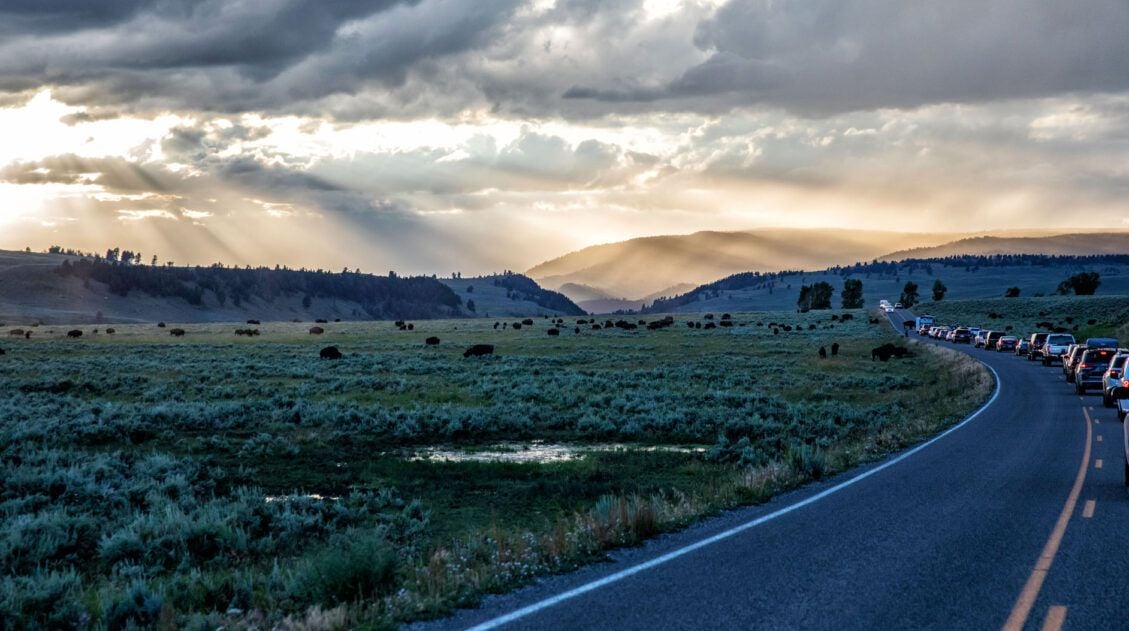
Yellowstone National Park is a wonderland of geothermal activity, stunning landscapes, and abundant wildlife. Steam hisses out of the ground along walking trails, bison stop cars in their tracks on the main park road, and technicolor hot springs never fail to amaze even the most seasoned traveler. In this post, learn about the best things […]
How to Visit Grand Prismatic Spring Overlook and Hike to Fairy Falls
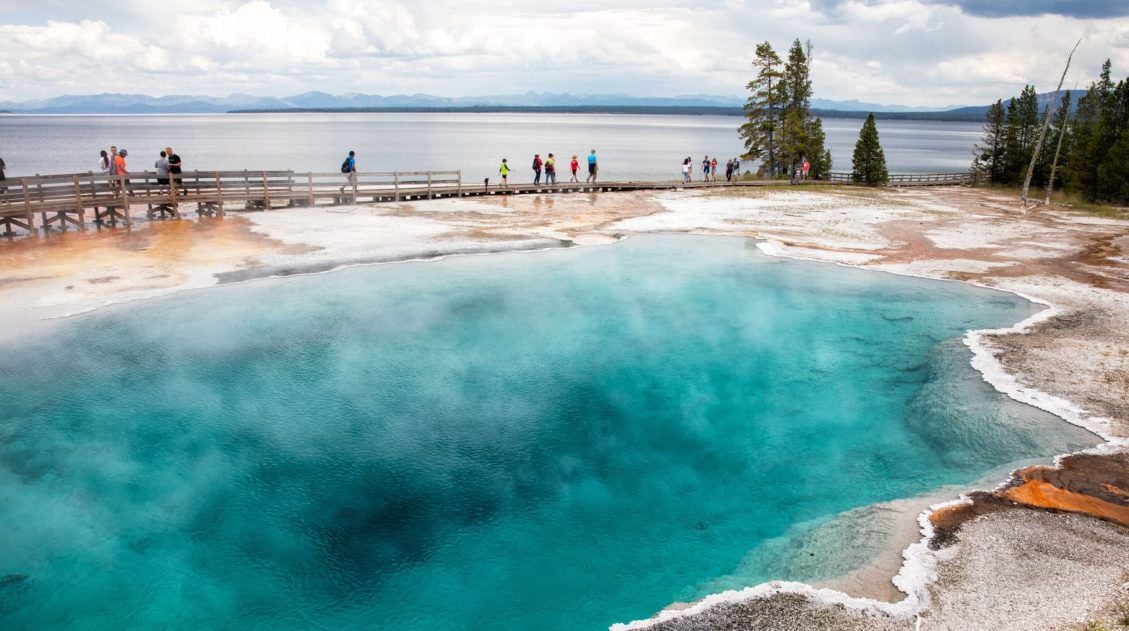
The Grand Prismatic Spring is Yellowstone’s most colorful hot spring. Fairy Falls is one of Yellowstone’s tallest waterfalls. If you want to see both, it’s easy to combine the hike to Fairy Falls with the Grand Prismatic Spring overlook. In this article, learn how to visit the Grand Prismatic Spring and how to combine the […]
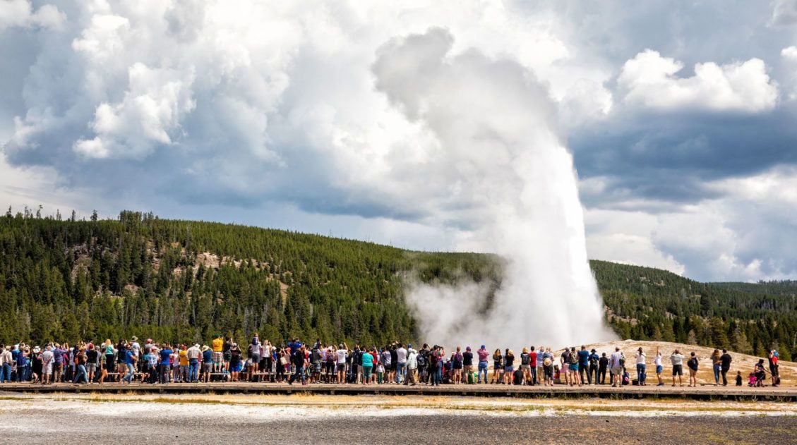
Yellowstone’s Old Faithful: 10 Tips to Have the Best Experience
What is the first thing you think of when you hear the name “Yellowstone?” For many people, that answer would be Old Faithful. Old Faithful is one of the most popular sights in Yellowstone National Park. If this is your first time in Yellowstone, then most likely, Old Faithful is at the top of your […]
One Day in Yellowstone: 6 Epic Road Trip Itineraries
If you only have one day in Yellowstone National Park, what should you do? Yellowstone National Park is massive. It’s the second largest national park in the United States outside of Alaska. With thousands of acres of land, five entrances, numerous canyons and geyser basins to visit, plus a drive through valleys filled with bison […]
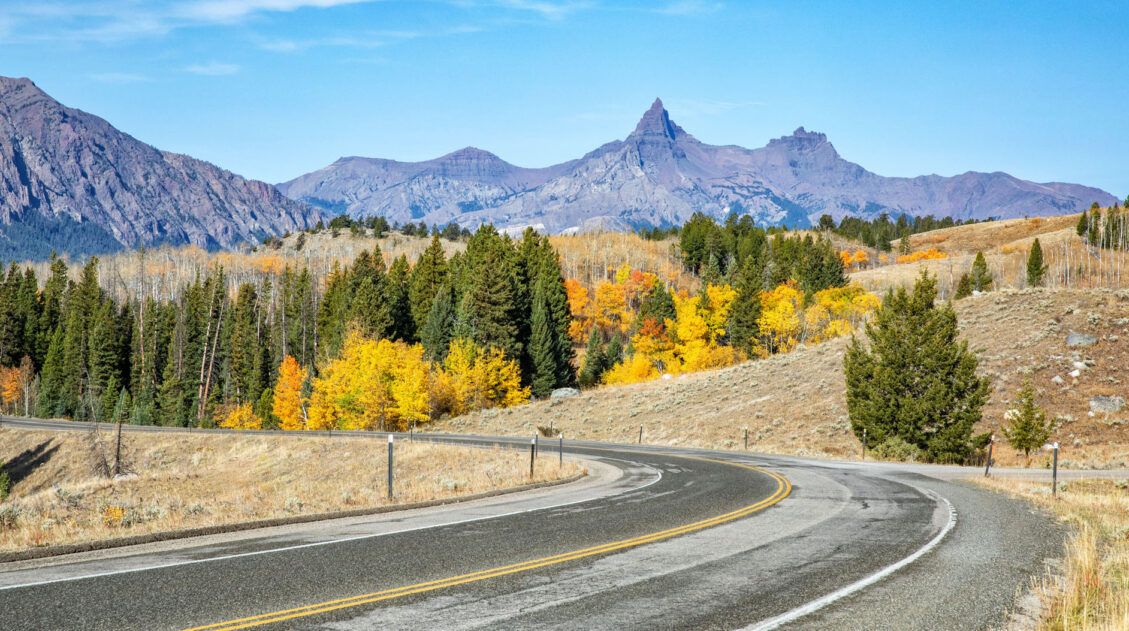
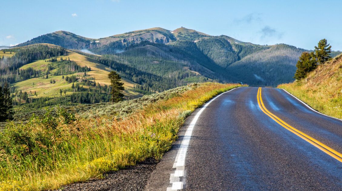
Beartooth Highway: Driving One of America’s Most Scenic Roads
Beartooth Highway is one of the most scenic drives in the United States, climbing to nearly 11,000 feet while passing alpine lakes, mountain passes, and sweeping views on the way to Yellowstone National Park. Connecting Red Lodge, Montana, with Cooke City near Yellowstone’s northeast entrance, this unforgettable road trip is often called the most beautiful […]
Geyser Basins in Yellowstone: Which Ones Are Worth the Visit?
Yellowstone National Park has the highest concentration of geothermal features of anywhere else on earth. The land literally smokes, bubbles and hisses. Numerous geysers erupt on a regular basis, including the most famous geyser in the world, Old Faithful. In this post, learn how to visit the geyser basins in Yellowstone National Park and which […]
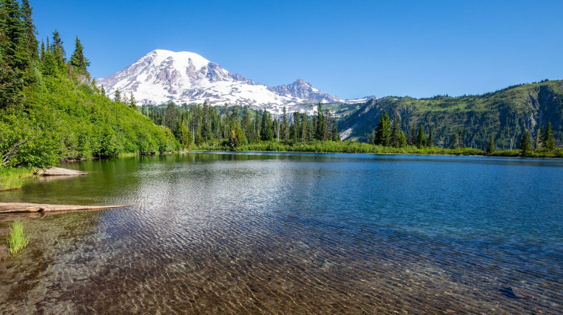
Grand Teton, Yellowstone and Glacier National Parks: 10 Day Road Trip Itinerary
Grand Teton, Yellowstone, and Glacier National Parks are three of the most spectacular parks in the United States, and with 10 days, you can visit all three on one unforgettable road trip. Start in Grand Teton, where the lakes and the jagged mountain range create a hiker’s and photographer’s paradise. Journey north to Yellowstone, a […]
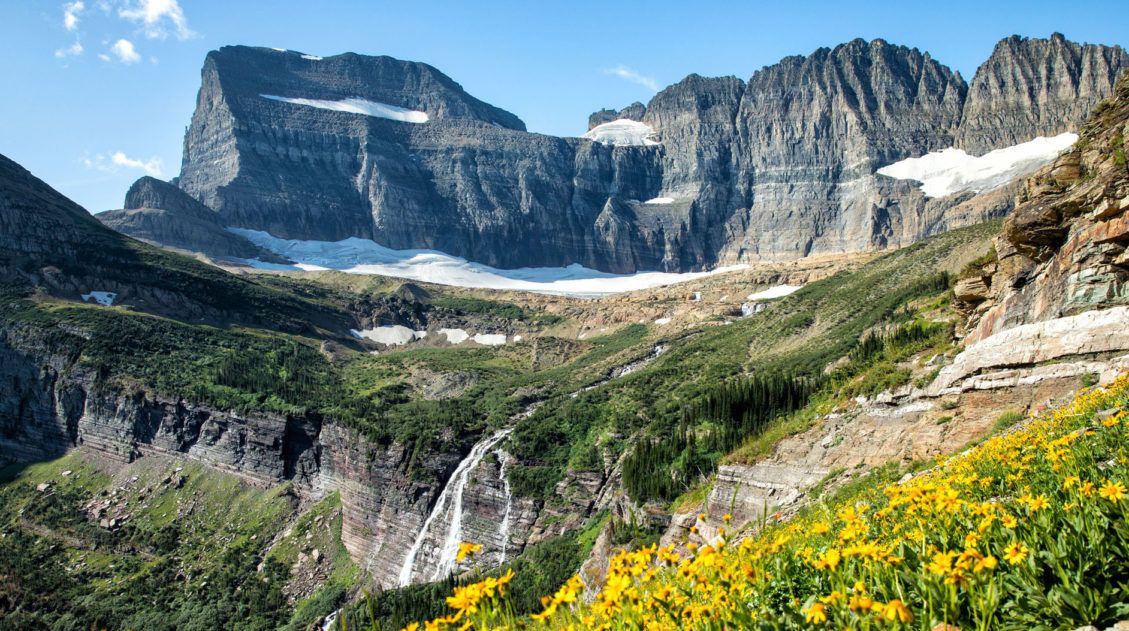
10 Best Hikes in Glacier National Park (Easy Walks to Epic Day Hikes)
Looking for the best hikes in Glacier National Park? From the breathtaking Highline Trail and the scenic walk to Hidden Lake Overlook to the unforgettable hike to Grinnell Glacier, Glacier National Park is home to some of the most spectacular trails in the United States. We’ve visited Glacier National Park multiple times, hiking trails across […]
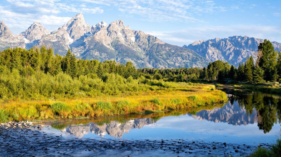
15 Best Things to Do in Grand Teton National Park
Jagged mountain peaks, lush meadows, scenic lakes, the winding Snake River, historical sites, and miles of hiking trails…this is Grand Teton National Park. If you are looking for the best things to do in Grand Teton National Park, we have lots of great information to share with you. There is something here for everyone. Families […]
US National Parks List: All 63 Parks, Map & Free Printable Checklist
There are 63 national parks in the United States, and we’ve visited 56 of them, from the remote wilderness of Denali to the coral reefs of the Virgin Islands. We’re a family of avid hikers who have spent over a decade exploring these parks, from multi-day backcountry trips to scenic drives with kids in tow. […]

The Ultimate Guide to the 63 US National Parks
Stretching from the South Pacific, across the United States to the Caribbean, are 63 national parks. These national treasures preserve iconic landscapes, majestic mountains, primordial forests, arid deserts, misty coastlines, immense canyons, wildlife, and historic landmarks. We have visited 56 of the 63 US national parks, from the towering granite walls of Yosemite and the […]

Comments 14