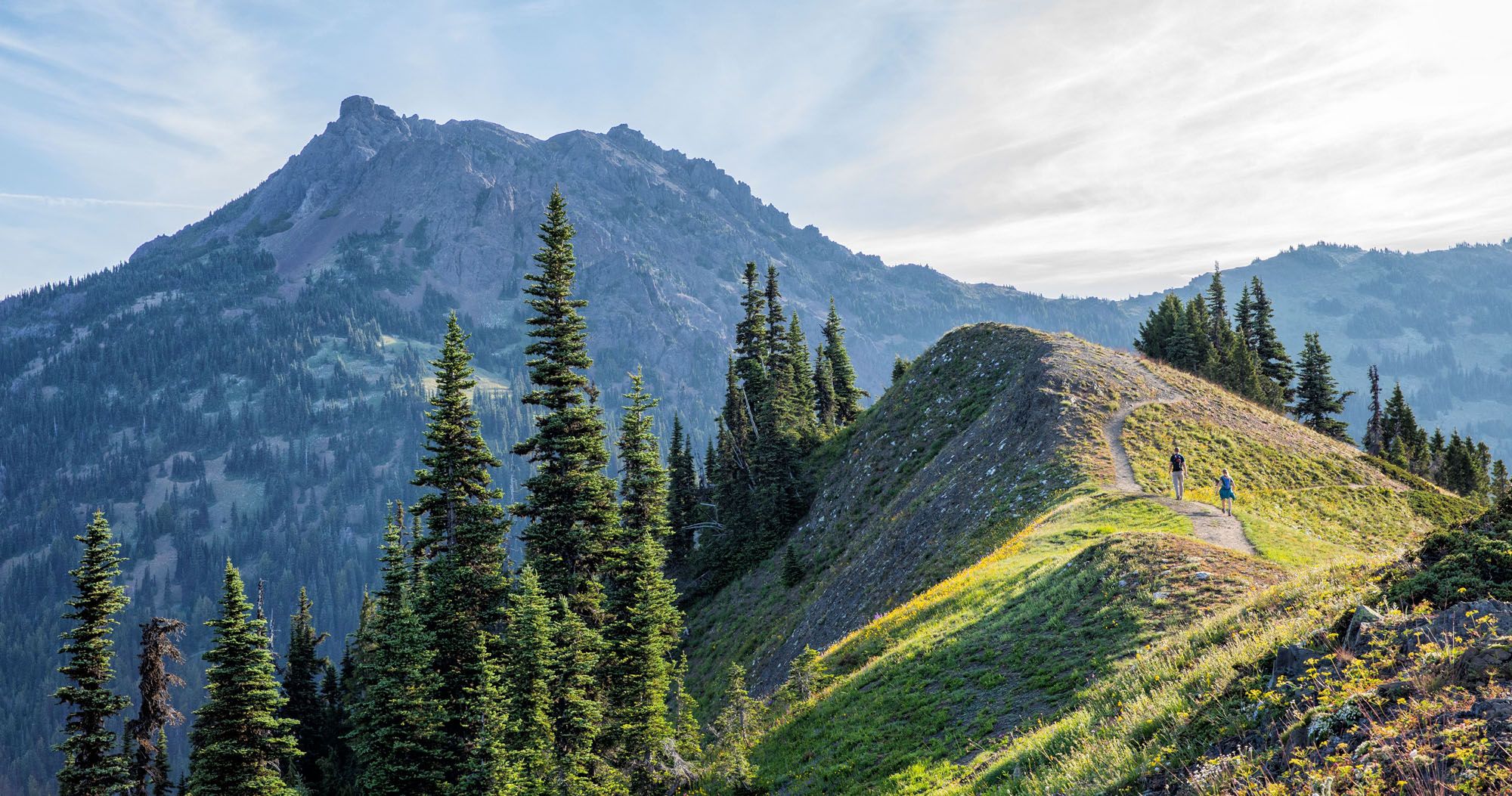
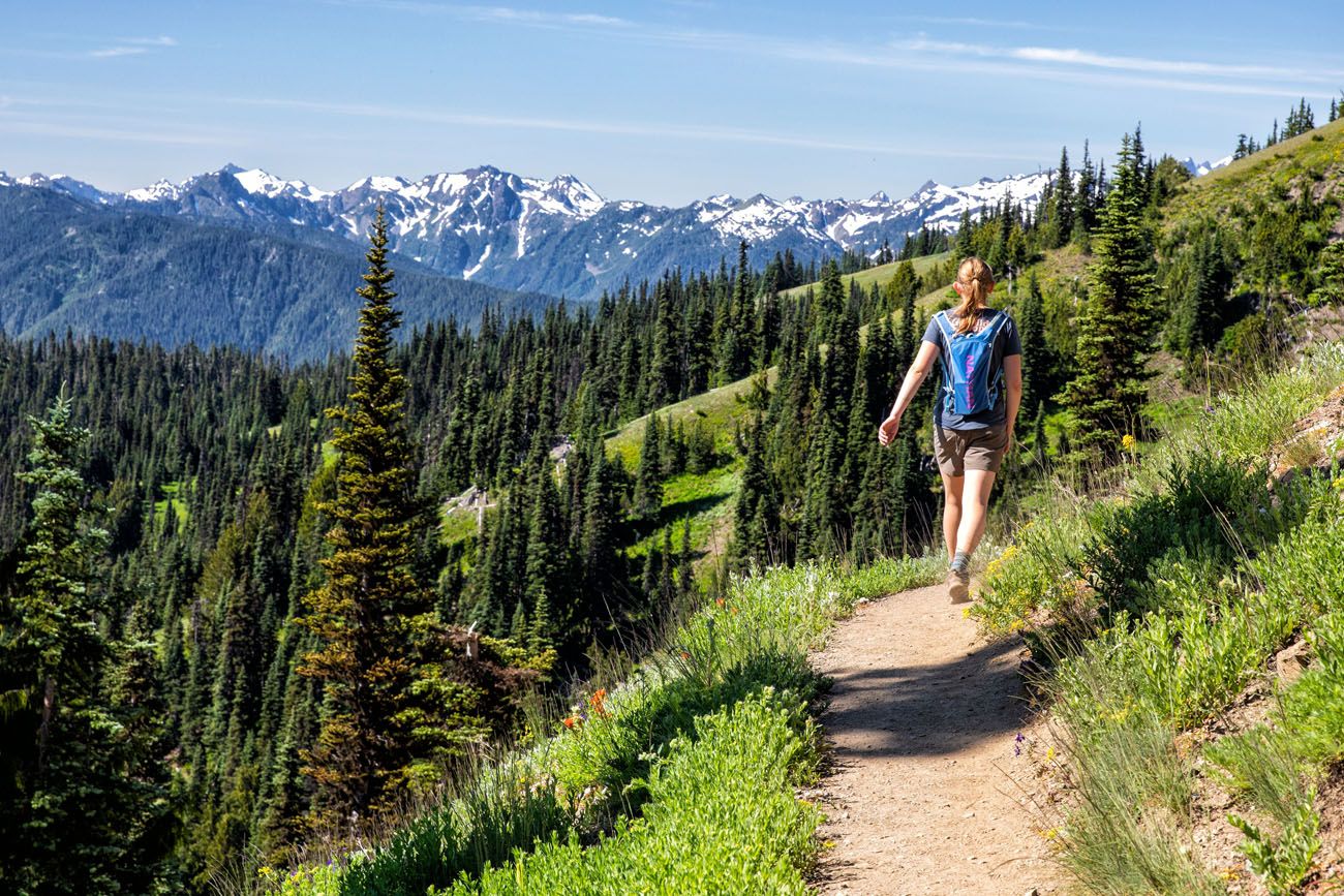
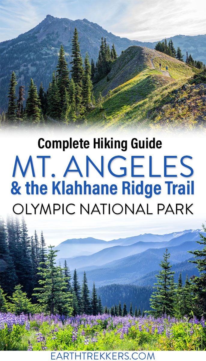
Not every hike makes you work for the view, but the ones that do are always the most memorable. The Klahhane Ridge Trail to Mount Angeles is that kind of hike.
The Klahhane Ridge Trail to Mount Angeles was the very first hike we did in Olympic National Park, and it ended up being our favorite hike in the entire park.
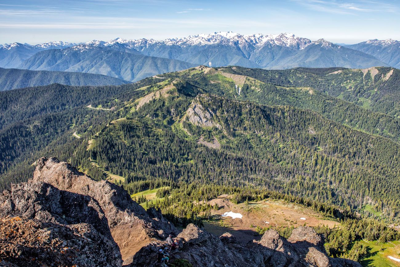
It set the bar high, with panoramic ridge views, a challenging rock scramble to the summit, and a 360° payoff at the top that stretches from the Olympic Mountains all the way to Puget Sound, Vancouver Island, and Mount Rainier on a clear day.
We love hikes that make you earn the view, and this one does exactly that. The scramble to the peak is genuinely challenging, but it also makes the hike more interesting and the summit more satisfying.
This guide walks you through every stage of the trail so you know exactly what to expect.
Mount Angeles Hiking Stats & Map
Distance: 6.25 miles (10 km) round-trip (this includes the short spur trail to Sunrise Point)
Total Ascent: 2,550 feet (775 m); 75% of this is on the way to the Mount Angeles peak
Starting Elevation (Hurricane Ridge): 5,250 feet (1,600 m)
Highest Elevation (Mount Angeles): 6,450 feet (1,965 m)
Difficulty: Most of the hike is easy to moderate; the final hike and rock scramble up to the peak is difficult
Length of time: 4 to 6 hours
When to go: The best time to hike to Mount Angeles is during the summer season when the trail is free of snow. During the winter season, the road to Hurricane Ridge is only open on weekends and can close at any time due to snowfall. Learn more on the NPS website.
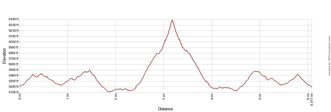
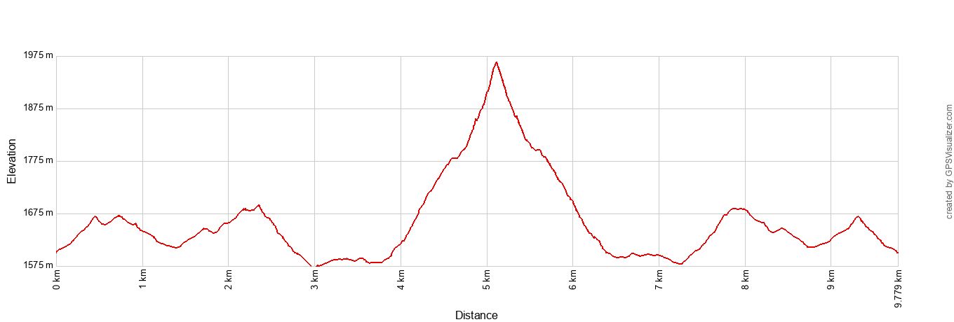
Mount Angeles elevation profile
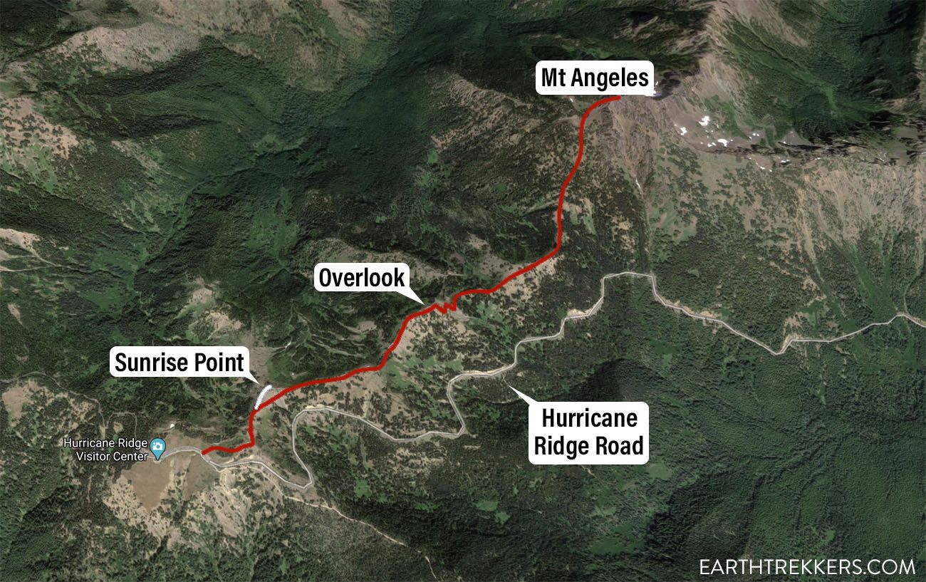
Map of the Klahhane Ridge Trail to Mount Angeles
Please practice the seven principles of Leave No Trace: plan ahead, stay on the trail, pack out what you bring to the hiking trail, leave areas as you found them, minimize campfire impacts, be considerate of other hikers, and do not approach or feed wildlife.
Getting to the Trailhead & Parking
The trailhead is located at the Hurricane Ridge Visitor Center, roughly 17 miles south of Port Angeles. From Port Angeles, follow Race Street south, which becomes Hurricane Ridge Road. Drive all the way to the end and the large parking lot at the visitor center is your destination.
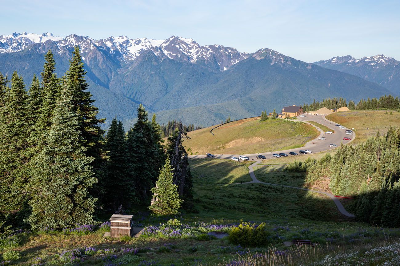
Hurricane Ridge Visitor Center and parking lot seen from Sunrise Point Trail.
No reservation is required to visit Hurricane Ridge. That said, the parking lot fills up fast on summer weekends and holidays. Aim to arrive before 9 a.m. if you can. You’ll get a better parking spot and have the trail mostly to yourself for the first hour or two.
Entrance fee: A 7-day vehicle pass costs $30. If you’re visiting more than one national park on your trip, the America the Beautiful annual pass ($80) is well worth it.
In winter, Hurricane Ridge Road is only open on weekends and can close at any time due to snow. Always check current road conditions on the NPS website before you go.
Trail Guide: Klahhane Ridge Trail to Mount Angeles
Section 1: High Ridge Nature Trail to Sunrise Point Junction
Distance: 0.3 miles
Time: 15 minutes
The hike begins at the eastern end of the Hurricane Ridge Visitor Center parking lot. Look for the sign marked High Ridge Trail. This is your starting point.
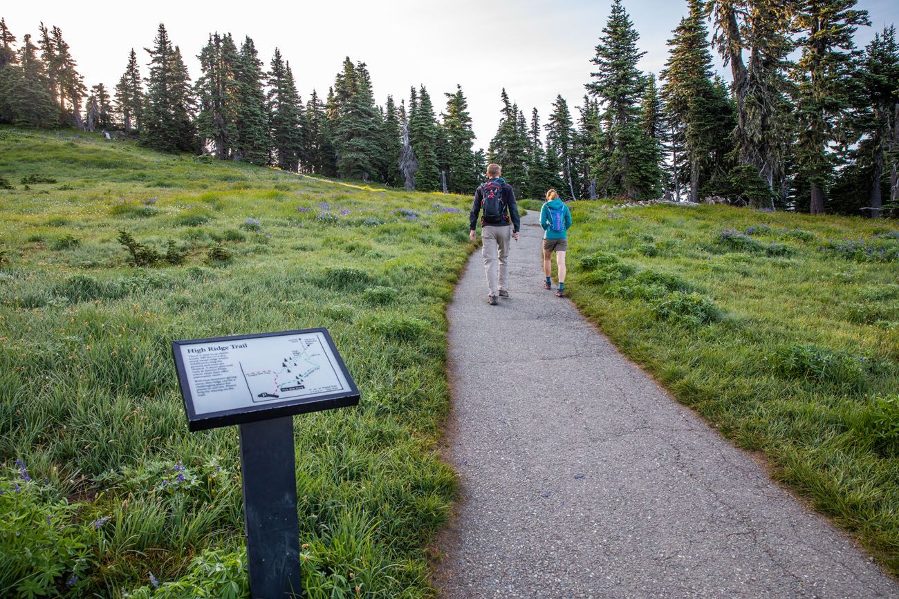
High Ridge Trail
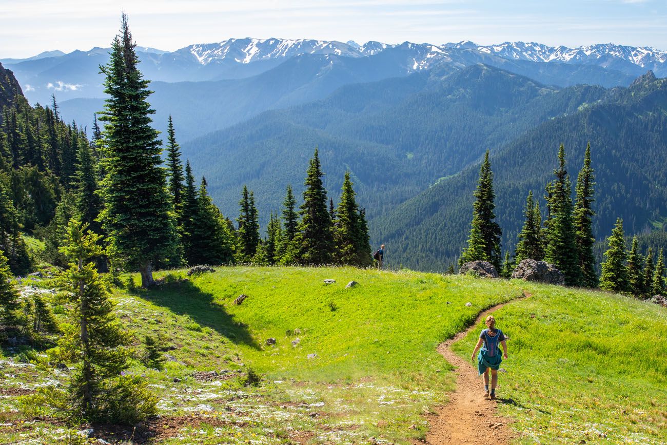
The trail opens as a paved path that climbs up onto a ridge with an early taste of the views to come. It transitions to a dirt trail after the initial climb, which can be dusty in dry conditions.
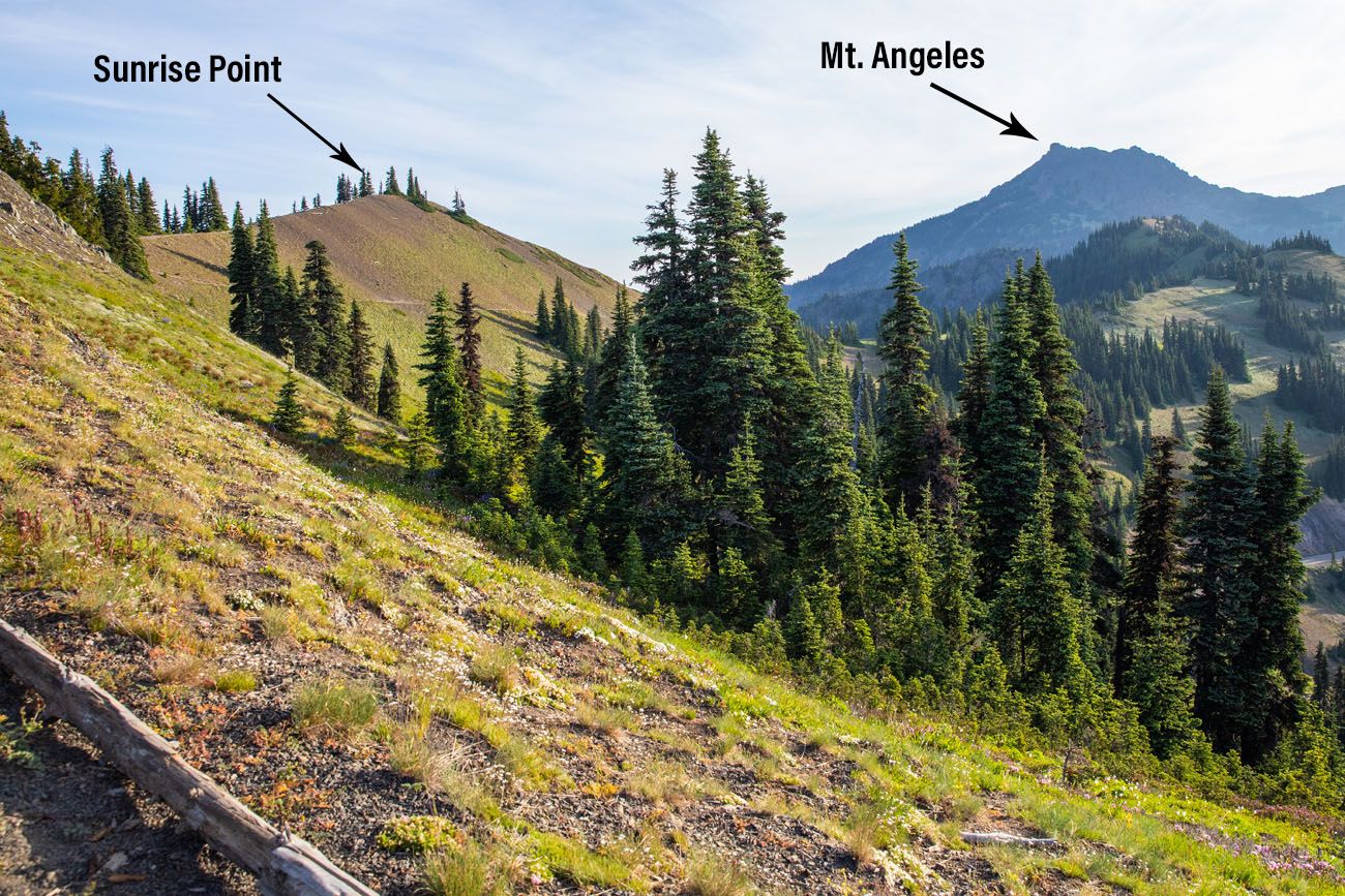
The view along the trail of Sunrise Point and Mount Angeles.
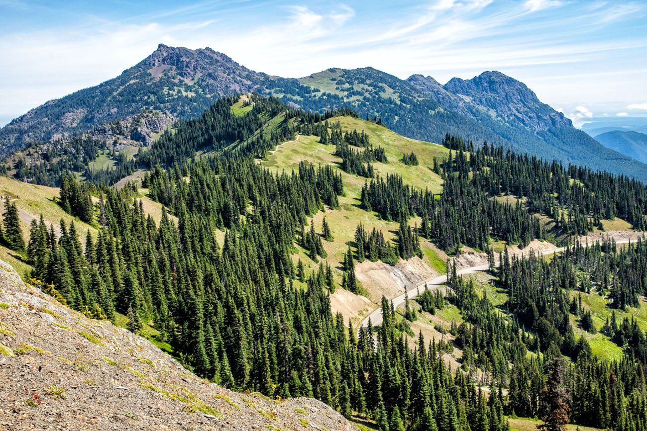
Another view of Mount Angeles and Hurricane Ridge Road
At the top of the ridge, you’ll reach a junction with the short spur trail to Sunrise Point. The detour adds an additional 0.2 miles round-trip (making this section of the hike a total of 0.5 miles). The view from Sunrise Point is nice, but I don’t think you lose much by skipping it. Here is the view to help you decide.
View from Sunrise Point
Section 2: Sunrise Point Junction to the Overlook
Distance: 1 mile
Time: 20 to 30 minutes
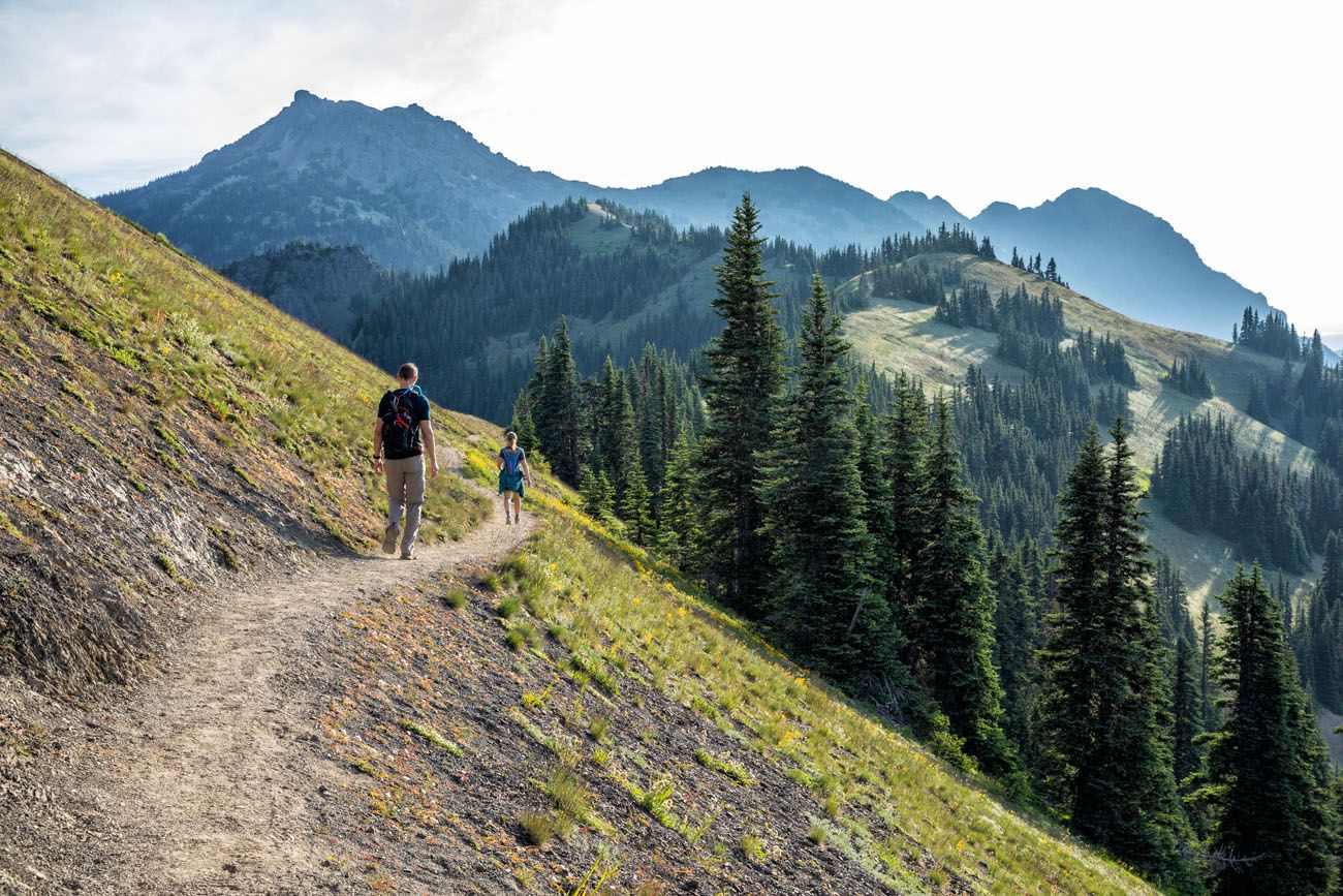
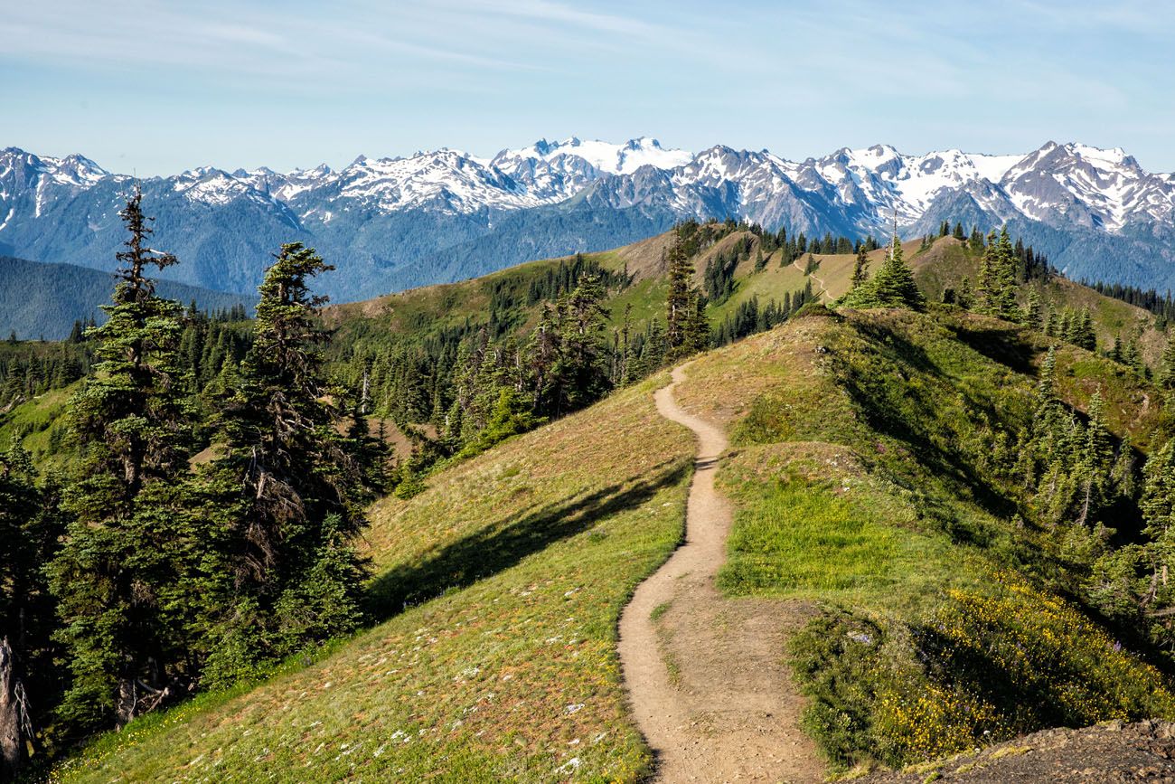
Continue past the spur trail to Sunrise Point. The trail goes by several different names, based on trail maps I have seen and online reports: the Sunrise Point Trail, the Hurricane Ridge Trail, and the Klahhane Ridge Trail.
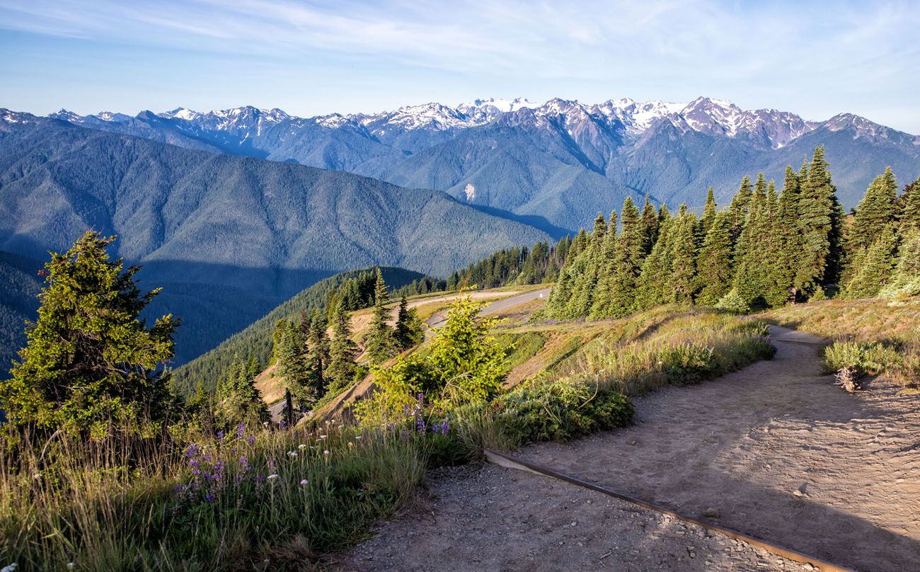
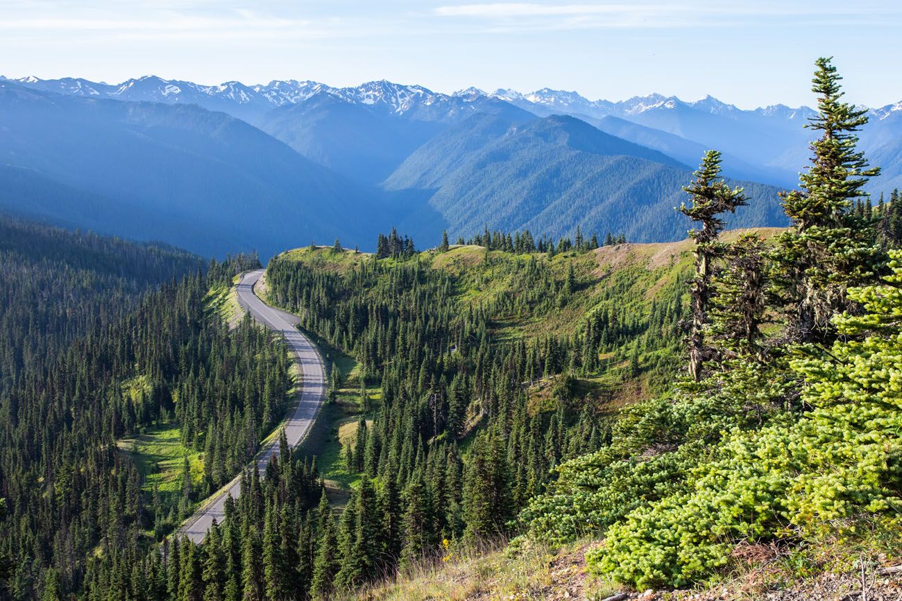
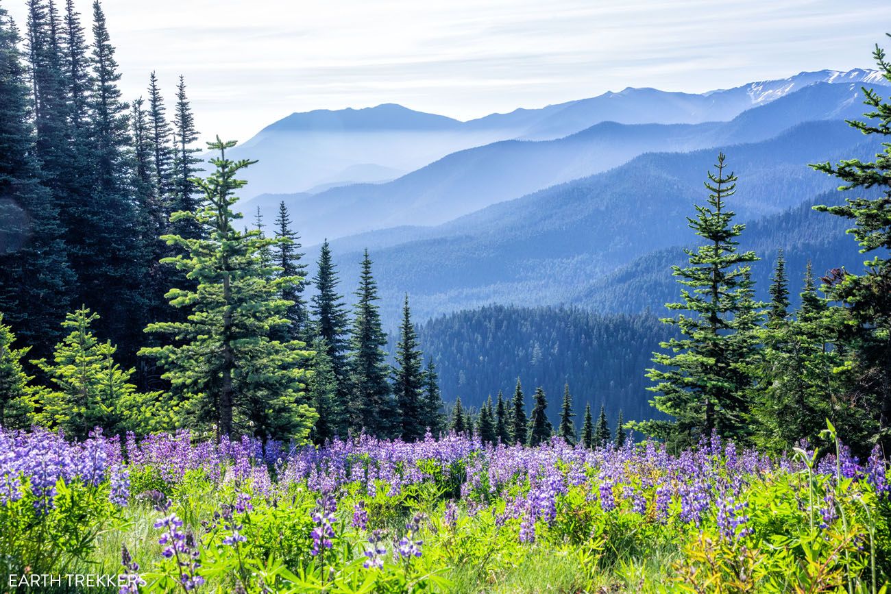
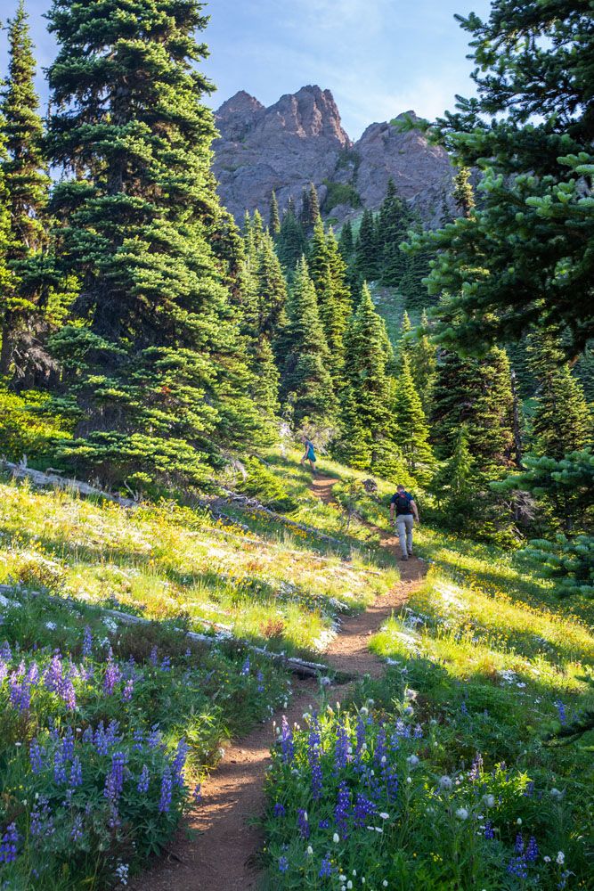
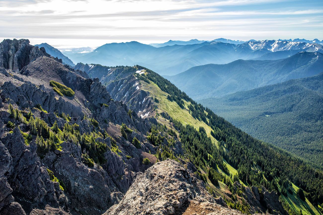
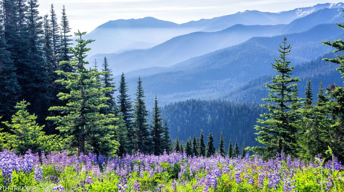
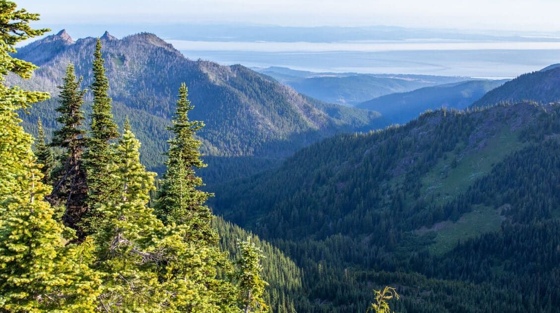
This section alternates between open, exposed ridgeline and pockets of dense forest with wildflowers. Along this trail, you have great views of Puget Sound and the snowcapped mountains of Olympic Park. You get some great views from this part of the trail, although it doesn’t even come close to what you will get from the peak of Mount Angeles.
Looking back along the trail towards the Hurricane Ridge Visitor Center.
Along this section of trail, you will reach another optional detour to an overlook.
From the main trail, you can walk up a slope for more panoramic views. The photo below shows the detour (white line) and main trail (red line). We visited the overlook, but we don’t think it is worth the time, even though it doesn’t take long, because the views really don’t change all that much.
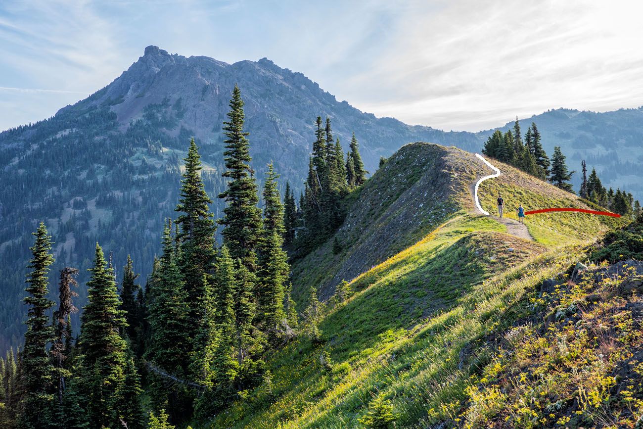
View of Mount Angeles from the trail. The white line marks the short, easy trail to the overlook. The trail to Mount Angeles is the red line.
Optional Turn-Around Point: If you don’t want to hike all of the way to Mount Angeles, I recommend hiking to the viewpoint along Sunrise Point Trail. Right before you get to the big descent, there is a very short spur trail that takes you to a nice overlook. From here, you can see Mount Angeles and you have a great view along Sunrise Ridge. For those who don’t want to do a big, strenuous day hike, this makes a great turn-around point. On our map of the trail, I labeled this spot as “overlook.” If you just hike to this overlook, you will hike 3 miles round trip with 800 feet of total ascent.
Section 3: Overlook to the Trail Fork
Distance: 0.8 miles
Time: 15 – 20 minutes
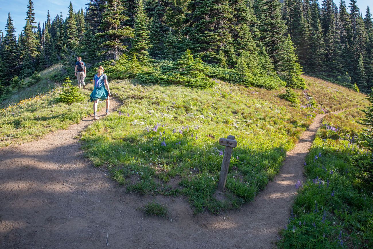
After a big descent followed by a smaller climb, you will come to a fork in the trail. Take the trail to the left to continue to Mount Angeles. When we did this, the trail to the left was not marked by any sign. The only trail marker here is a sign labeled “TRAIL,” which marks the Klahhane Ridge Trail.
Section 4: Hiking/Scrambling up Mount Angeles
Distance: 0.8 miles
Time: 30 to 60 minutes
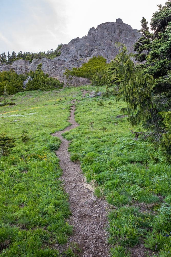
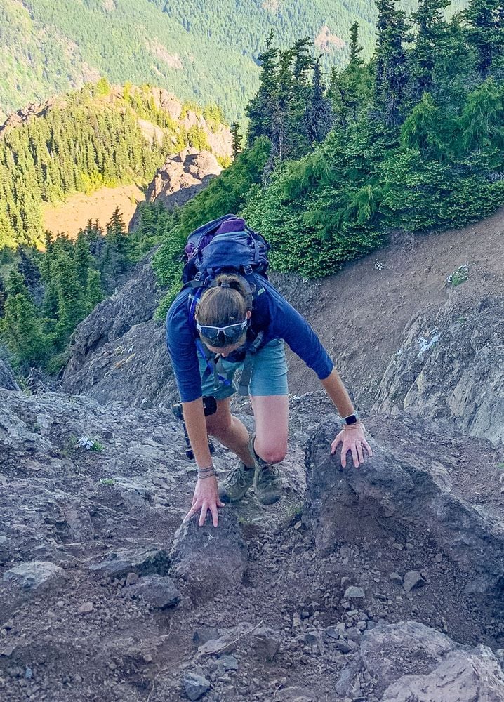
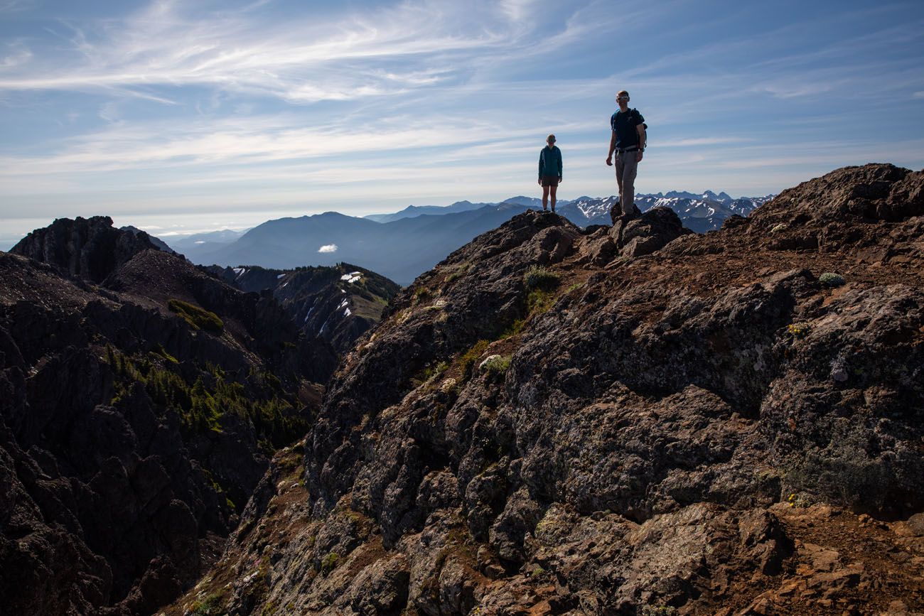
Once you get to the fork in the trail, the hike gets radically harder. It is a constant uphill hike, mostly through a forest, although you will get some occasional views out over Olympic National Park. This part of the trail isn’t too bad in terms of difficulty, but that will change.
Once you emerge from the trees, Mount Angeles will be in front of you. At this point, the trail gets steeper and can be hard to follow in spots. There are no trail signs at this point and very little in terms of rock cairns to keep you moving in the correct direction. Basically, you have to follow the worn trail of those who have hiked here before you, but the trail can be easy to lose in some spots.
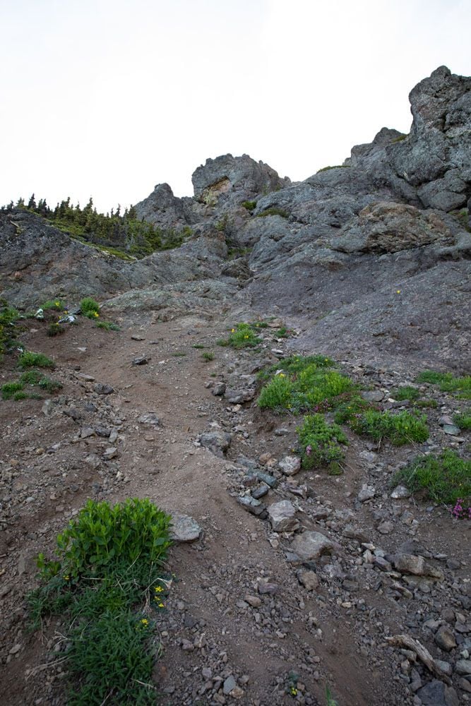
After hiking up steep dirt trails and over scree slopes, you have one final climb before you. There is a fork in the trail. If you take the trail to the left, it’s a little bit longer, but it is also less steep with just a little bit of rock scrambling at the very end. If you are not confident in your rock scrambling skills, we recommend going left at the fork.
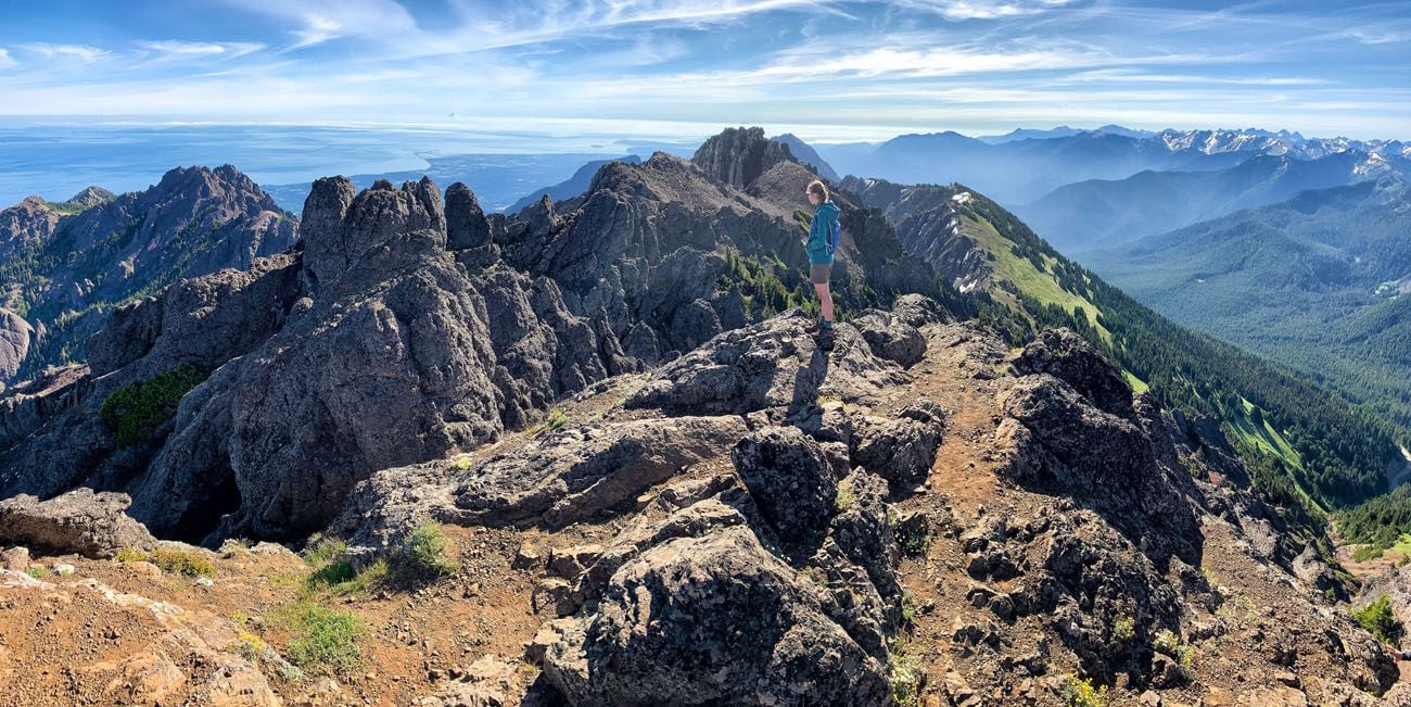
The trail to the right is a shorter but steeper climb to the summit with some technical rock scrambling. This is the route we took and here are our photos.
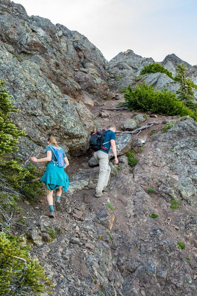
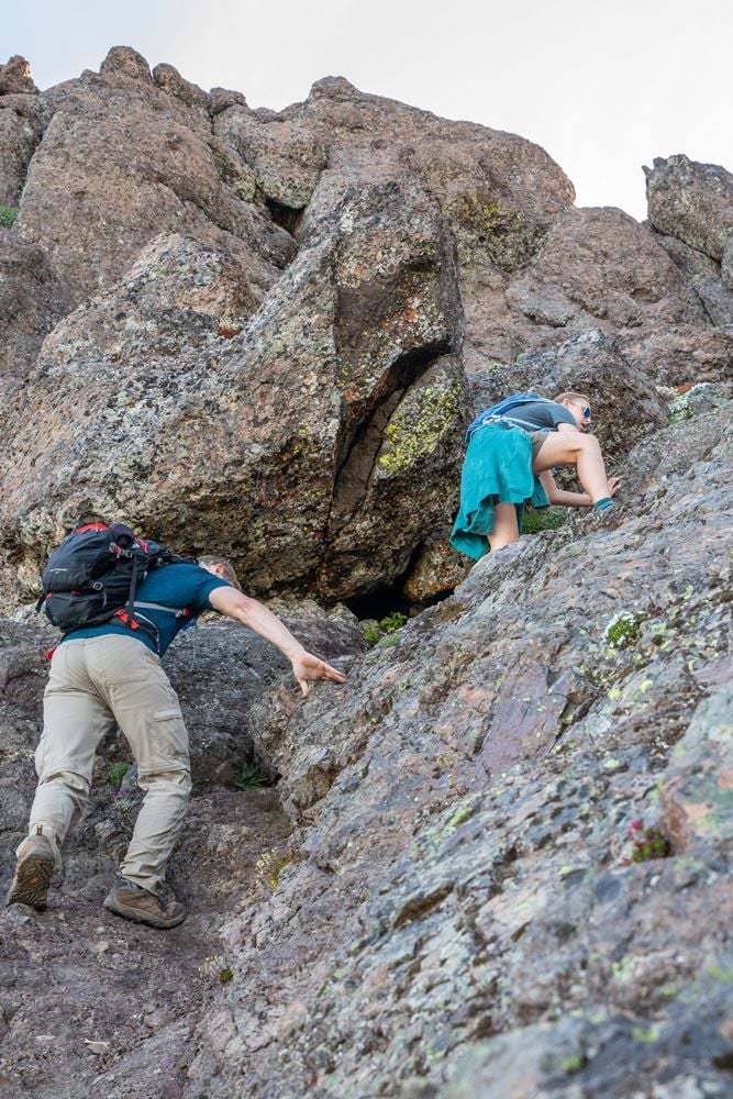
The last scramble onto the peak is the most challenging. When we were here, several other hikers turned around without attempting this part.
If you can do it, it is worth it to get to the top, since you get to see those panoramic views you worked so hard for. However, if you get to this point and don’t think you can manage the rock scramble, I recommend retracing your steps to the fork and going up the left side.
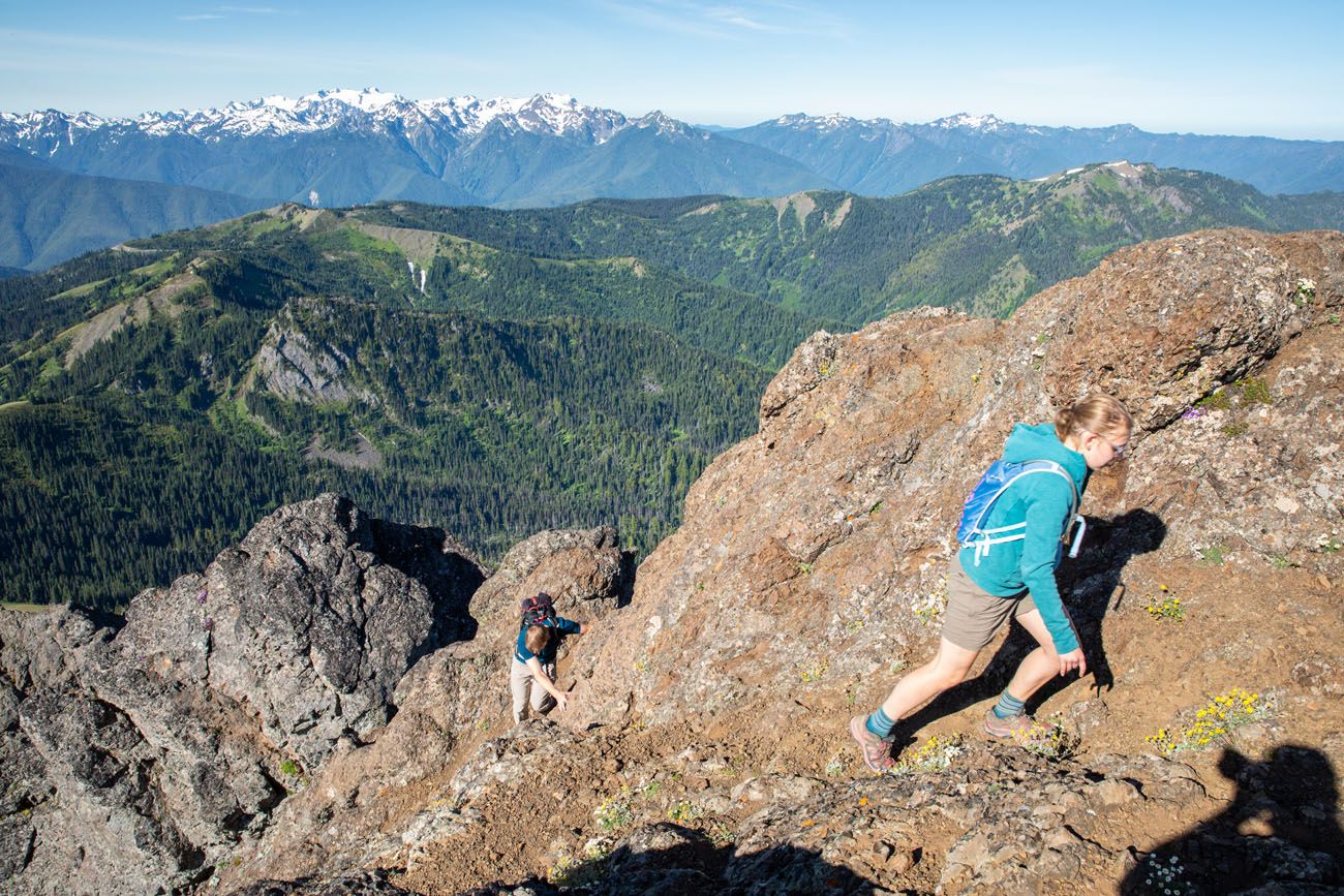
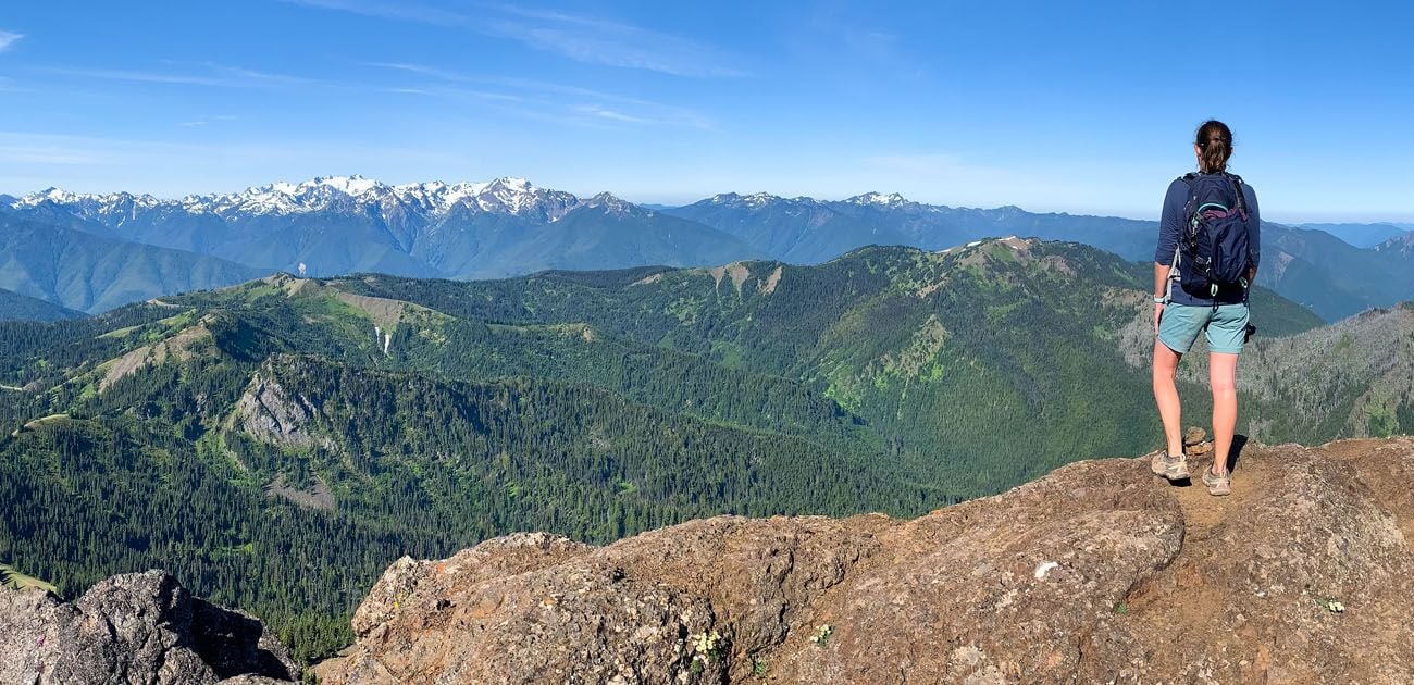
Once standing safely on top of Mount Angeles, enjoy the spectacular view. On a clear day, you can see Puget Sound, Vancouver Island, the mountains of Olympic National Park, and Mt. Rainier.
The Return Hike
Distance: 3.1 miles
Time: 1.5 to 2 hours
To get down off of Mount Angeles, we hiked down the left side of the peak, and it is much easier than the tricky rock scramble.
To return, simply retrace your steps to the parking lot. After everything you worked for to reach the summit, the hike back feels like a reward in itself — those incredible panoramic views spread out ahead of you the whole way down, and with most of the elevation already behind you, it’s a relaxed, satisfying end to one of the best hikes in Olympic National Park.
Tips for Hiking the Klahhane Ridge Trail to Mount Angeles
Pick a clear day. This is the most important thing you can do to have a great experience on this hike. The panoramic views from the summit are the whole reason you’re here. Puget Sound, Vancouver Island, the Olympic Mountains, and Mount Rainier are all visible on a clear day. If you’re spending multiple days in Olympic National Park, save this hike for the best weather day of your trip. Check the forecast the night before and be flexible if you can.
The rock scramble to the summit is the real deal. The final push to the peak involves steep drop-offs and sections of loose rock that require confident footing and solid judgment. If you’ve never done any scrambling before, this probably isn’t the hike to start with. That said, if you’re comfortable on technical terrain, don’t skip it. Working for that summit is exactly what makes this hike so satisfying.
Wear the right footwear. Hiking shoes or boots with grippy soles are essential for this hike, especially on the upper section where the trail gets loose and rocky. Trail runners may work for experienced hikers, but we wouldn’t recommend anything less. Definitely leave the sneakers in the car.
Check trail conditions on the National Park Service website before you go.
What to Bring on the Hike
Hiking shoes. Don’t do this hike in anything other than hiking shoes or hiking boots. The final trail up to Mount Angeles, with the loose rock and scree, is slippery. You will also need shoes with good traction for the final section of rock scrambling.
Hiking poles. Hiking poles take the stress off of your legs and help to ease leg pain and fatigue.
Water and snacks. At least 2 liters of water in the summer.
Sunscreen, hat, and sunglasses. For much of this hike you will be exposed to the sun, with very little shade.
Rain jacket or fleece. It can be chilly on top of Mount Angeles, even in the summer. Be prepared for all weather conditions.
Check trail conditions on the National Park Service website before you go.

Essential Hiking Gear: What Should You Bring on a Day Hike?
If you are new to hiking or are curious about what you should bring on a hike, check out our Hiking Gear Guide. Find out what we carry in our day packs and what we wear on the trails.Frequently Asked Questions
Do I need a permit or reservation to hike to Mount Angeles?
No permit or timed entry reservation is required. You will need to pay the Olympic National Park entrance fee, which is $30 per vehicle for a 7-day pass, or free with an America the Beautiful annual pass.
What is the best time of year to hike to Mount Angeles?
Summer (July through September), is the best window, when the trail is typically snow-free and the road to Hurricane Ridge is fully open. For the clearest views, aim for a calm, sunny morning and check the forecast before you go. If you have flexibility, save this hike for the clearest weather day of your trip.
Are there restrooms and water at the trailhead?
Yes. Although the original Hurricane Ridge Visitor Center burned down in 2023, a temporary contact station at the trailhead has restrooms and potable water available during summer. There are no facilities on the trail itself, so fill up before you set out.
How difficult is the rock scramble to the summit?
It’s genuinely challenging, with steep drop-offs and sections where the trail is hard to follow. If you’ve never done any rock scrambling before, we’d recommend doing some research before attempting the summit.
Are dogs allowed on the Klahhane Ridge Trail?
No. Dogs are not permitted on the Klahhane Ridge Trail or anywhere in the Olympic National Park backcountry. Leave your pup at home for this one.
Is the hike kid-friendly?
The full route to the summit, with its steep scramble and significant elevation gain, is not well suited for young children. That said, the first portion of the trail up to the overlook makes a great family-friendly option. It’s a 3-mile round trip with 800 feet of elevation gain and still delivers impressive views of Mount Angeles and Sunrise Ridge.
If you have any questions about hiking to Mount Angeles in Olympic National Park, let us know in the comment section below.
Explore More of Washington
If you are interested in hiking more trails in Olympic National Park, check out our guide to the Best Hikes in Olympic National Park. To see all of our guides on the park, including detailed trail guides, itineraries, and more things to do, see our Olympic National Park Travel Guide.
If this is part of a bigger road trip through the USA, visit our United States Travel Guide and our Washington Travel Guide for more inspiration and travel planning tips.
Best Things to Do in Olympic National Park (2026 Guide)
Pinterest Facebook Flipboard Discover the best things to do in Olympic National Park, from Hurricane Ridge to the amazing Hoh Rainforest to the wild and rugged Pacific coast. Olympic National Park might be the most diverse national park in the United States. In a single visit, you can stand on a windswept alpine ridge looking […]
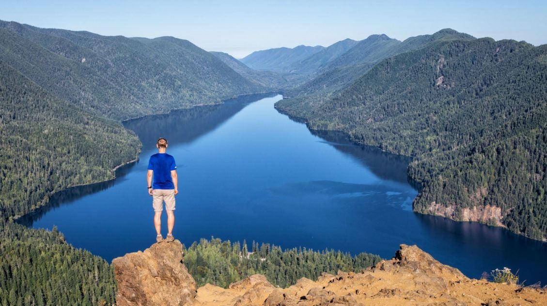
Mount Storm King Hike: Is It Worth the Brutal Climb?
Mount Storm King earns its dramatic name. This short but relentlessly steep trail in Olympic National Park climbs over 2,000 feet in just over two miles, ending with a rope-assisted scramble to a rocky outcropping with sweeping views over the impossibly blue waters of Lake Crescent. We hiked this in July on a clear summer […]
Olympic National Park Itinerary: How to Spend 2 to 3 Days in the Park
Olympic National Park is one of the most diverse and logistically complex national parks in the United States and figuring out how to structure your time here can feel overwhelming. This Olympic National Park itinerary combines the best of the park into one easy-to-plan trip, and we’re sharing it from experience. We spent four days […]
20 Epic Hikes in the US National Parks
With 63 national parks and thousands of miles of hiking trails, your options are endless for exploring the American national parks. We narrowed down the list for you to 20 of the best hikes in the US national parks, 20 amazing ways to explore this beautiful country. Hike to the tallest peaks, through massive canyons, […]
Staircase Rapids Loop: A Hidden Gem Hike in Olympic National Park
The Staircase Rapids Loop is an underrated trail in Olympic National Park. On this short, easy hike, you will walk along the North Fork of the Skokomish River, through a temperate rainforest, with views of waterfalls and rapids. Just under 3 miles long, this trail loops up and around Staircase Rapids. With waterfalls, dense forests, […]
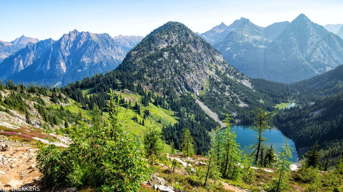
Maple Pass Loop Hiking Guide 2026 | North Cascades, WA
The Maple Pass Loop, also known as the Heather-Maple Pass Loop, is one of the best day hikes in the North Cascades, and one that’s surprisingly accessible for the views it delivers. In early August, Tim, Kara, and I completed this hike and came away genuinely impressed. It’s not our favorite hike in the area […]
Washington Road Trip Itinerary: Olympic, Rainier & North Cascades (7–14 Days)
Washington state is one of the great road trip destinations in the United States, and this itinerary is the one we wish we’d had before our own trip. We spent several weeks exploring Washington’s three national parks—Olympic, Mount Rainier, and North Cascades—as well as Leavenworth, Lake Chelan, and the Enchantments. We then combined our top […]
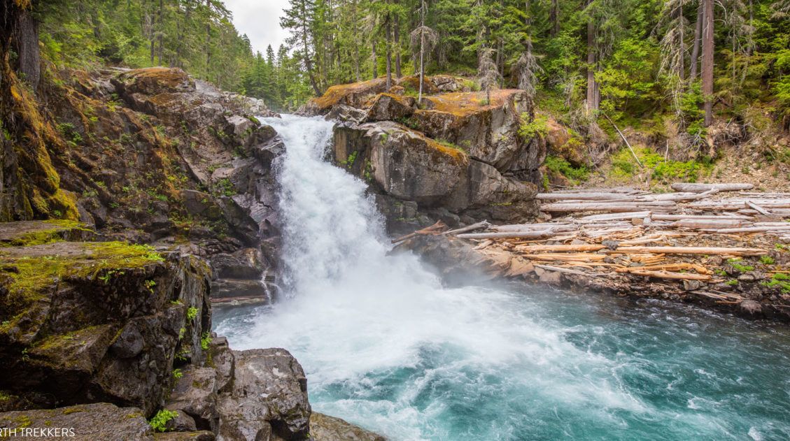
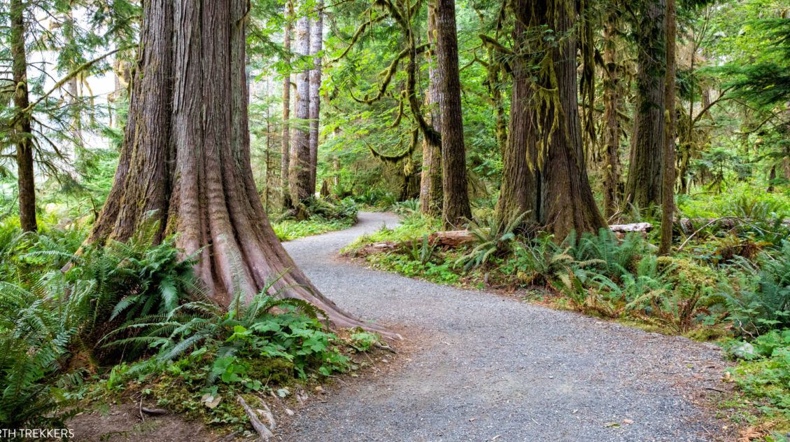
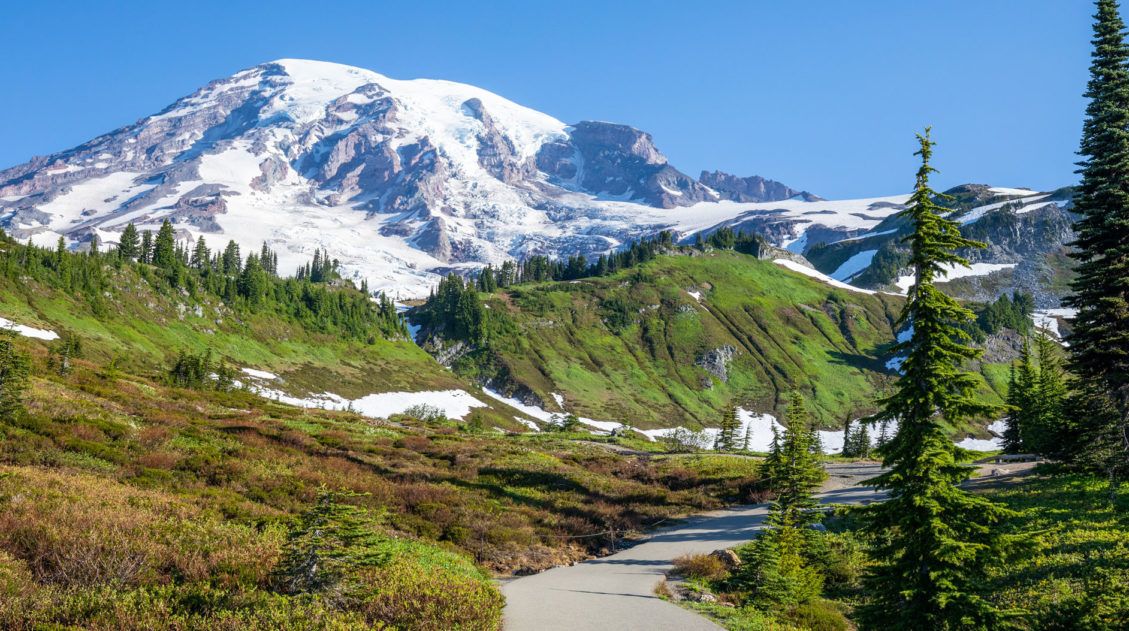
Silver Falls Loop Trail: An Underrated Hike in Mount Rainier
If you’re looking for a hike that quietly exceeds expectations, the Silver Falls Loop Trail is it. We hiked the Silver Falls Loop on our first trip to Mount Rainier at the end of July. The trail was wonderfully quiet even during peak summer; the old-growth forest along the Ohanapecosh River was stunning, and Silver […]
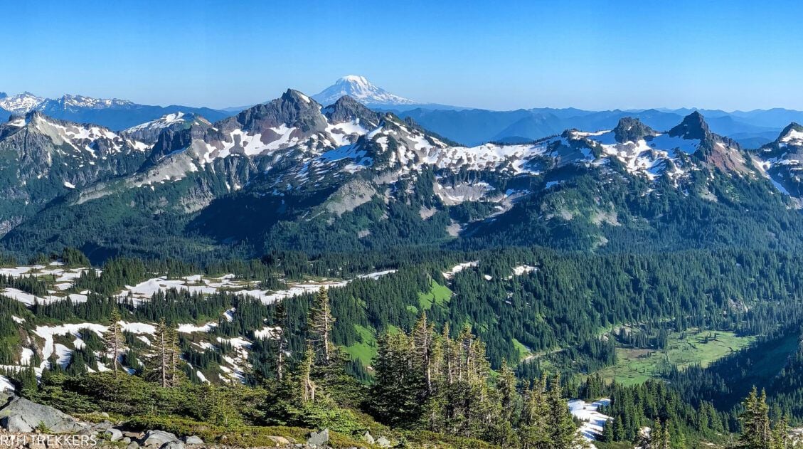
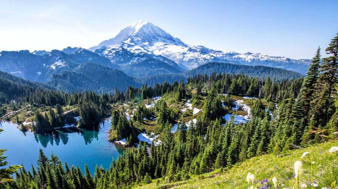
The Perfect Mount Rainier National Park Itinerary (2 to 6 Days)
Planning a trip to Mount Rainier National Park and not sure how to structure your time? We’ve got you covered, and we’re speaking from experience. We’ve visited Mount Rainier twice: once on a six-day trip where we hiked extensively through every corner of the park, from Paradise and Sunrise to the quieter trails of the […]
Skyline Trail Loop: A Step-by-Step Guide to Rainier’s Most Iconic Views
The Skyline Trail Loop is the most iconic hike in Mount Rainier National Park, and we’ve hiked it twice in both directions to figure out exactly which way is better. Here’s everything you need to know, from snow crossings and trail conditions to the best direction for views of Mount Rainier. For jaw-dropping alpine scenery, […]
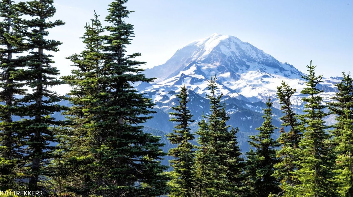
Mount Rainier National Park Travel Guide: How to Plan Your Visit
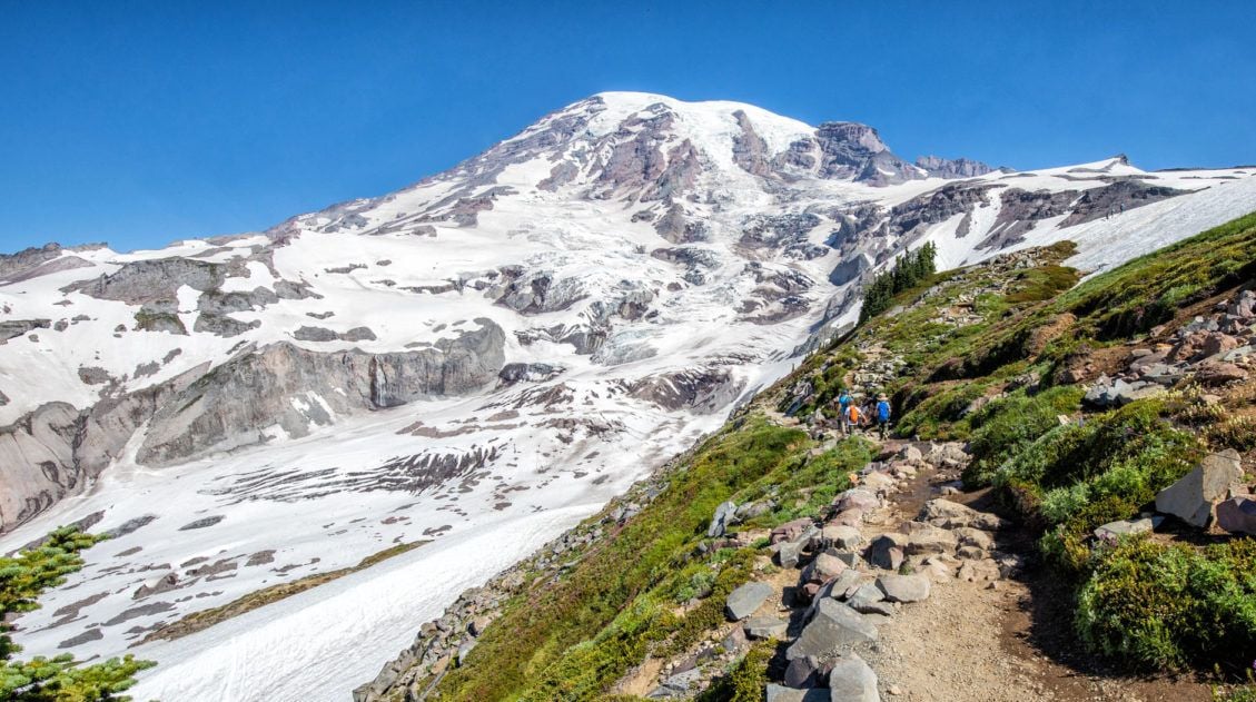
Mount Rainier National Park Mount Rainier National Park is an outstanding park to visit, whether you are an avid hiker, a family on a road trip through the USA, or someone who simply enjoys exploring the natural wonders of this beautiful country. Mount Rainier is a glacier-capped, active volcano that can be seen for hundreds […]
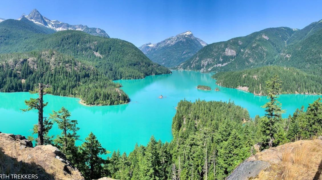
9 Amazing Things to Do in North Cascades National Park
Discover the best things to do in North Cascades National Park, from the stunning drive along Highway 20 to Diablo Lake, Washington Pass Overlook, and world-class hiking trails. North Cascades National Park gets a fraction of the visitors that flock to Olympic and Mount Rainier, and that’s exactly what makes it so good. We visited […]

The Ultimate Guide to the 63 US National Parks
Stretching from the South Pacific, across the United States to the Caribbean, are 63 national parks. These national treasures preserve iconic landscapes, majestic mountains, primordial forests, arid deserts, misty coastlines, immense canyons, wildlife, and historic landmarks. We have visited 56 of the 63 US national parks, from the towering granite walls of Yosemite and the […]
20 Fun, Short Hikes in the US National Parks
One of the best ways to experience the national parks is from a hiking trail. Hike to amazing viewpoints, deep into the forests, through scenic canyons, and to hidden lakes and waterfalls. Along the way, you have a better chance of spotting wildlife and potentially leaving the crowds behind. Here are 20 fun, short hikes […]

Comments 15