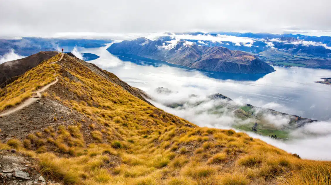
The Lake Alta Track in Queenstown, New Zealand offers a journey to a beautiful alpine lake nestled high up in the Remarkables mountain range.
We did this hike on our most recent trip to New Zealand. Dad and I returned to Queenstown to do some hikes we never got to experience on our first two trips, plus we were getting our legs warmed up for the Milford Track.
With an incredibly scenic drive to the trailhead, the fun starts before you even begin hiking. The lake itself, with its stunning mountain backdrop and crystal-clear water, also makes for the perfect picnic spot.
A trail suitable for all ages, which offers incredible alpine views, makes this one of the best hikes in Queenstown.
About Lake Alta
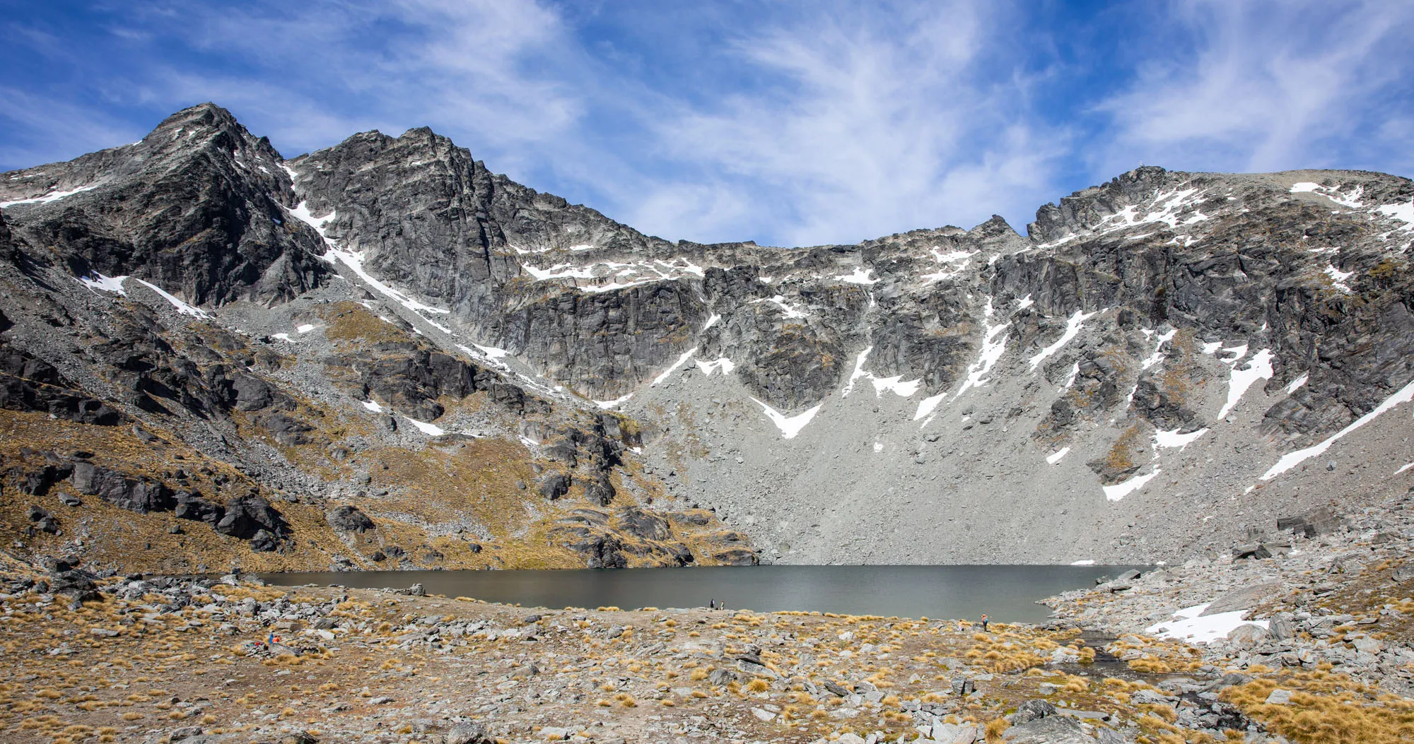
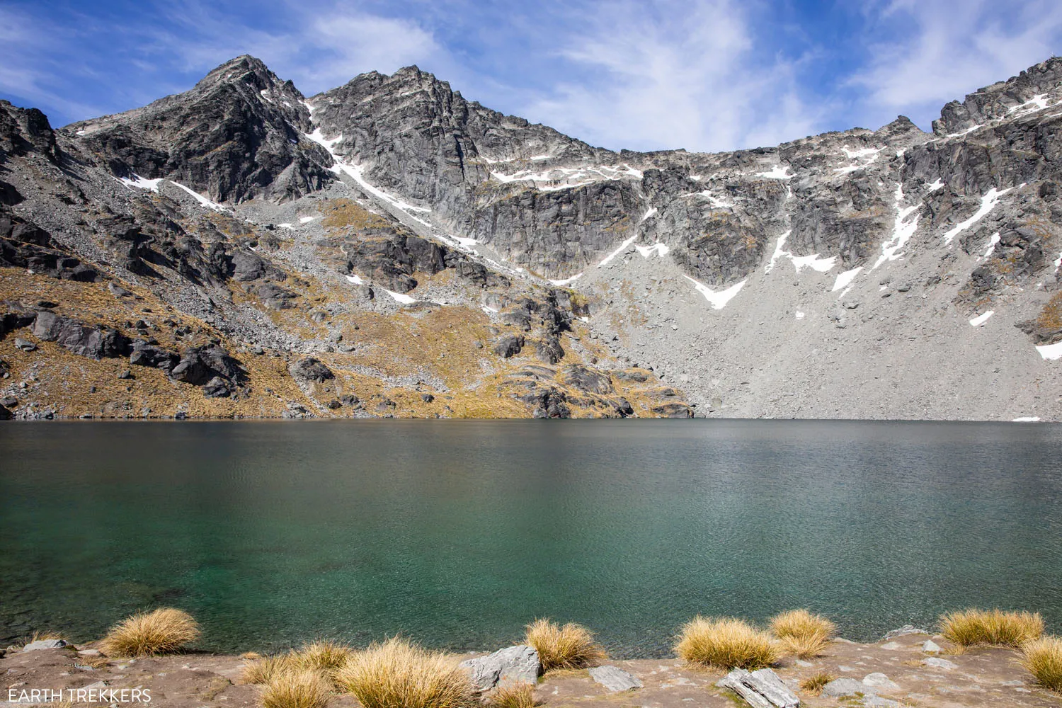
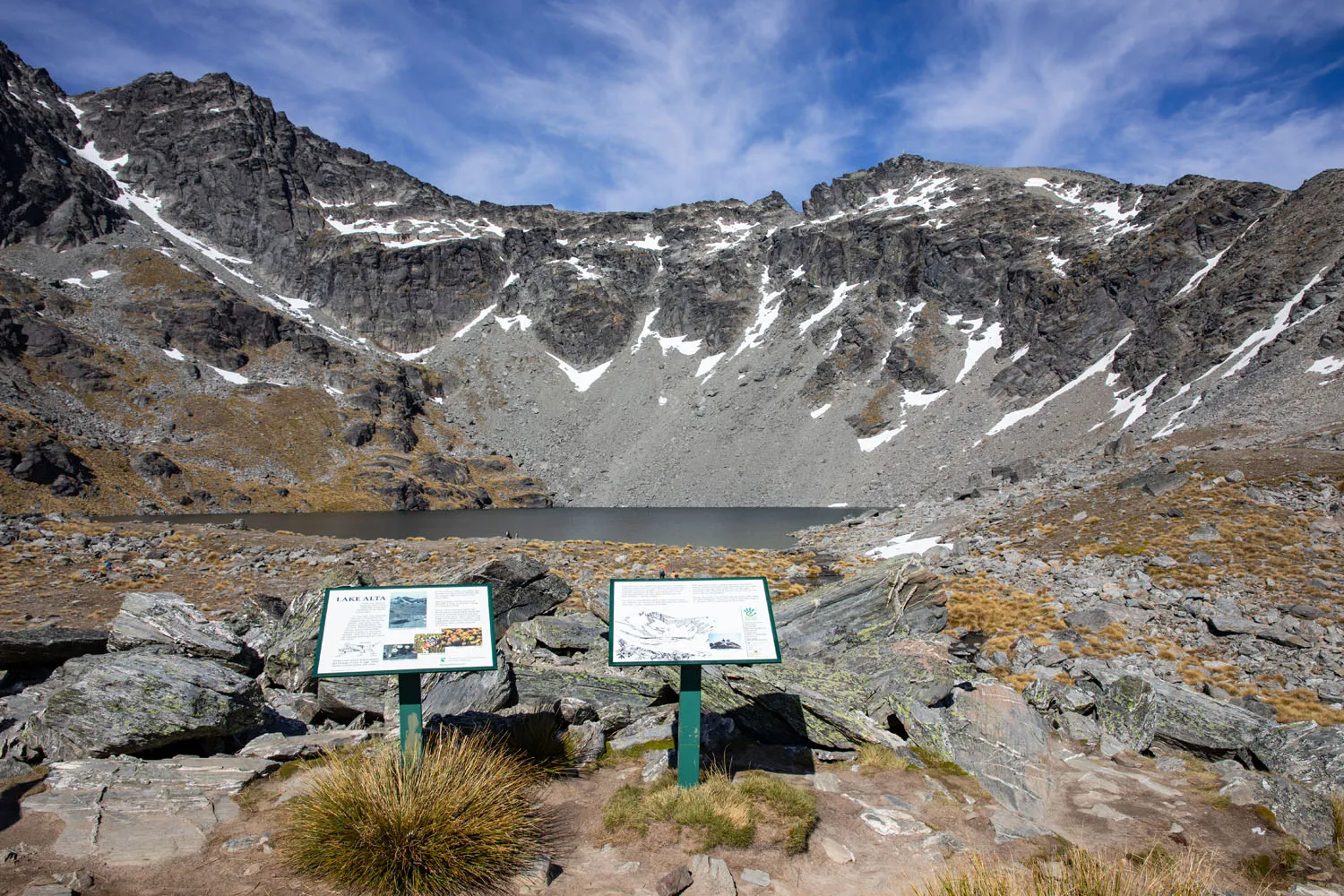
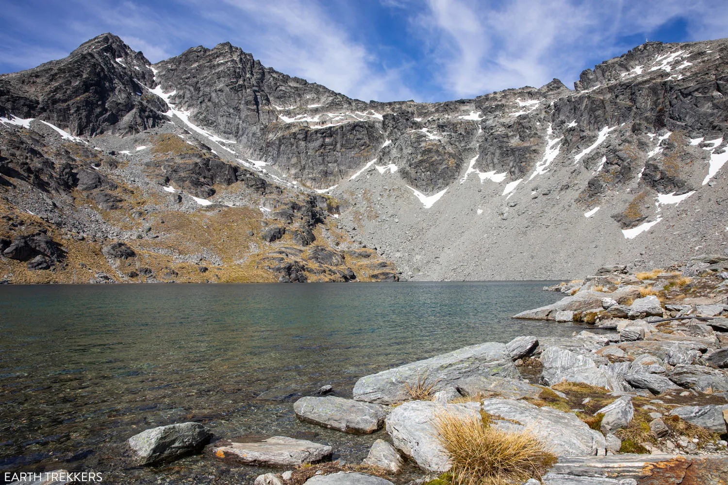
Lake Alta is an alpine lake that sits at the eastern base of The Remarkables. With looming, snowy peaks providing the backdrop to this pristine blue lake, this makes for a great Queenstown hike in the summer months.
Lake Alta is found within the Remarkables Ski Area. In the winter you’ll find the slopes covered in snow, and the lake frozen over. Ditch your hiking shoes for skis and enjoy some runs down the slopes.
Lake Alta is also a filming location for Lord of the Rings. Fans may recognize the area as Dimrill Dale, where Aragorn leads the fellowship after fleeing the Mines of Moria in The Fellowship of the Ring.
Lake Alta Hiking Stats
This is an out-and-back hike. The following hiking stats are round trip from the parking lot located at the end of the Remarkables Ski Field Access Road:
Distance: 3.7 km (2.3 miles)
Total Ascent: 241 meters (792 feet)
Lowest Elevation: 1,595 meters (5,232 feet)
Highest Elevation: 1,809 meters (5,935 feet)
Difficulty: Easy
Time: 1 hour 15 minutes to 2 hours
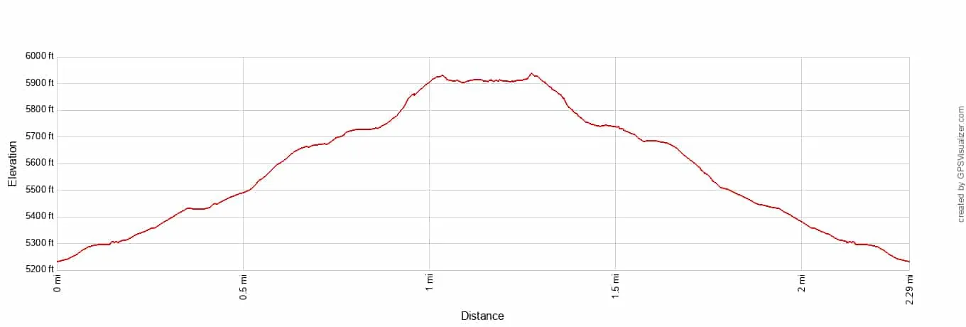
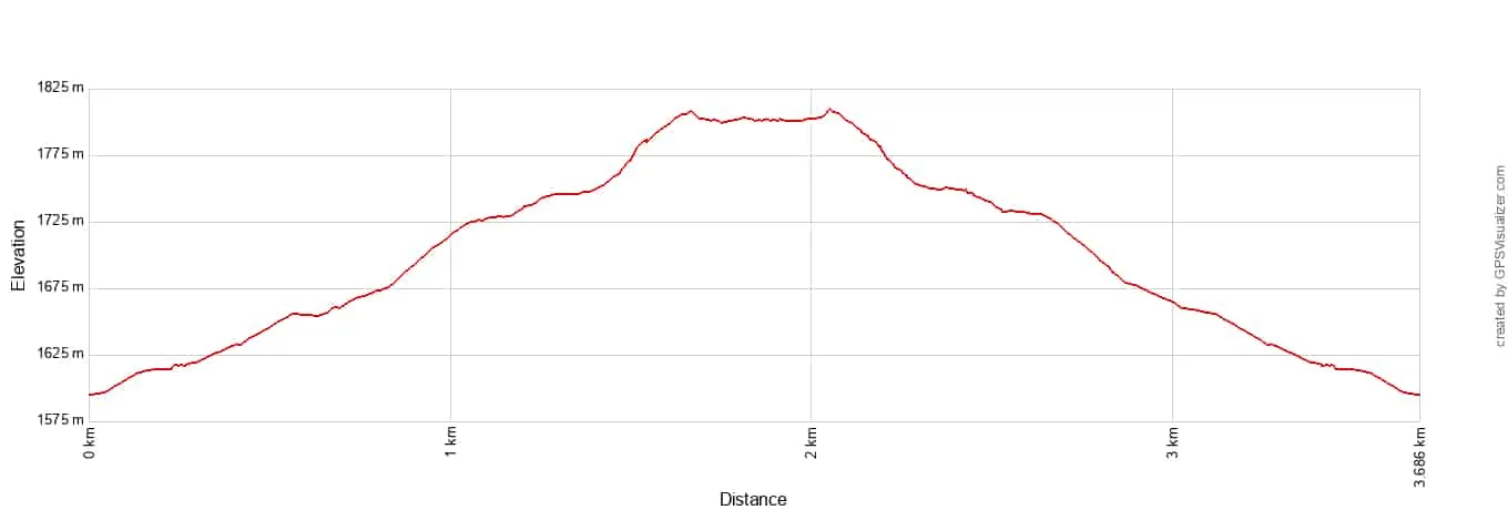
Lake Alta Track elevation profile
Map of the Driving Route and Hiking Trail
Below is a map of the driving route on Remarkables Ski Field Access Road to get to the parking lot and trailhead, plus the Lake Alta Track trail.
How to Use This Map: Click the icons on the map to get more information about each point of interest. To take this map with you, click the star next to the title of the map which adds it to your Google account. Next, within your Google Maps app, select ‘Saved’ and then select ‘Maps’. This map title will now appear in your list.
Things to Know Before You Hike
There is no shade along the trail or at the lake. So, we strongly recommend bringing sun protection with you.
While you will be hiking through a ski area, all of the ski facilities (including the restaurant) will be closed. So, be sure to bring water and snacks with you for this hike.
We did this hike in mid-December, at the start of New Zealand’s summer season. The lake was not frozen at that time, but we were told that the lake was still frozen at the beginning of December.
The Alta Lake Track is an easy trail that can be completed by those of all ages. You’ll find a steady, gradual climb the full way to the lake, but nothing strenuous. We also completed this hike in the morning, which we found was a great time of day for lighting.
Please practice the seven principles of Leave No Trace: plan ahead, stay on the trail, pack out what you bring to the hiking trail, leave areas as you found them, minimize campfire impacts, be considerate of other hikers, and do not approach or feed wildlife.
Driving to the Trailhead & Parking Fee
To get here, route yourself on Google Maps to the “Remarkables Skifield Car Park.” This route is also shown on our map above.
From New Zealand State Highway 6, turn onto Remarkables Ski Field Access Road. You will arrive at an entrance gate to pay the fee before continuing. You must pay with a credit card as there is no attendant and no cash payment option.
The cost is $15 NZD per vehicle.
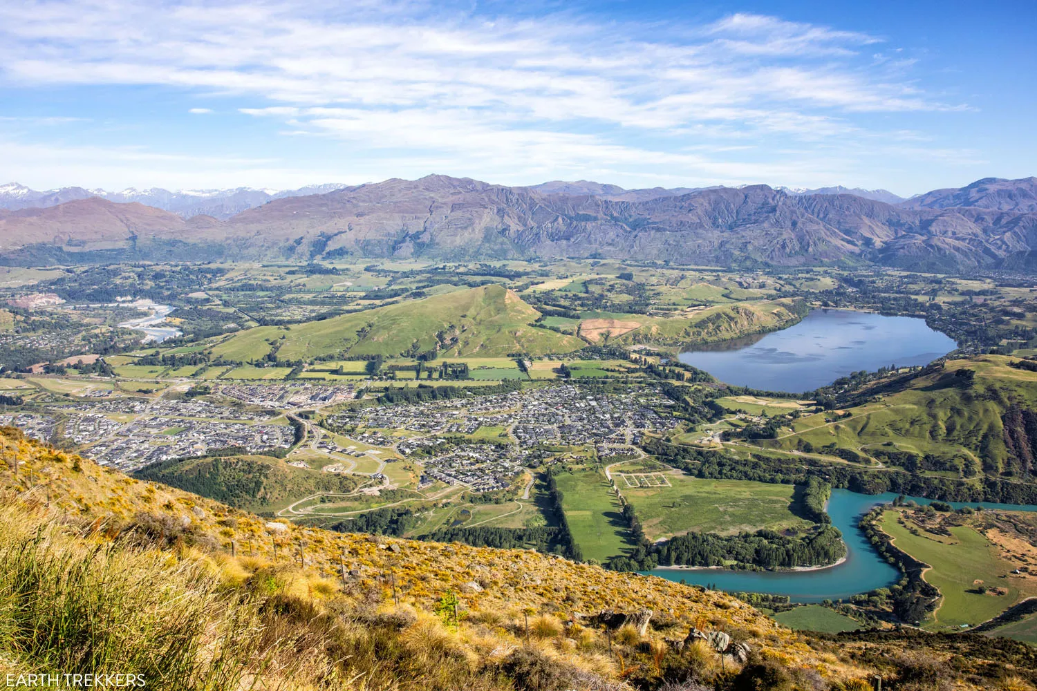
Follow Remarkables Ski Field Access Road as it winds up and around The Remarkables mountains. The drive itself is very scenic, with a few chances to pull off the road and snap a photo looking out over Queenstown. Even for those not interested in hiking to Lake Alta, we would still recommend this scenic drive.
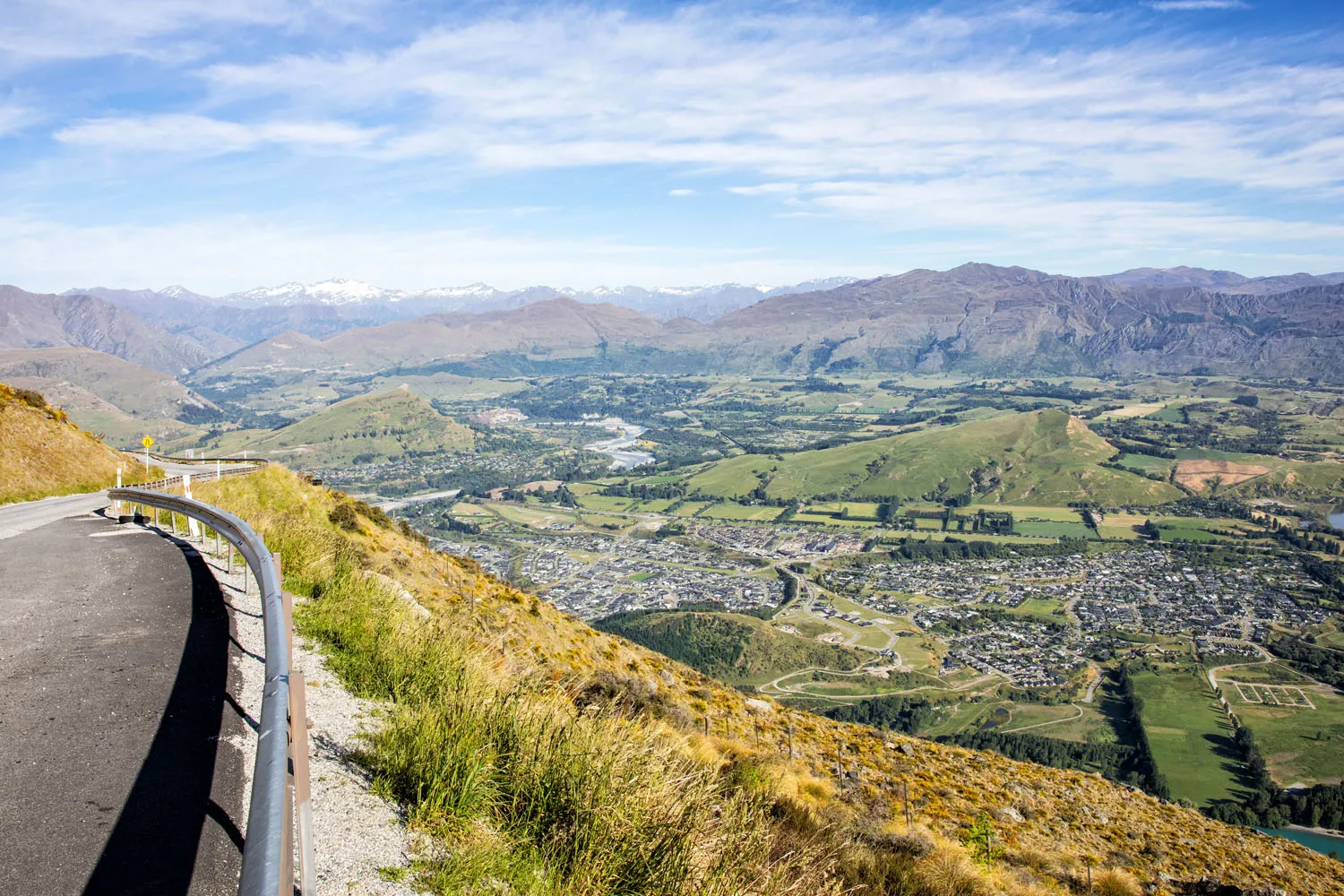
Good to Know: This drive isn’t for everyone. There are plenty of sharp hairpin turns, some even have names like “The W” and “Redeye Corner.” Guardrails only seem to be installed in the more precarious spots. This is a windy road along the mountainside, so do take caution while driving. The road itself starts off paved but will turn to gravel as you get closer to the top.
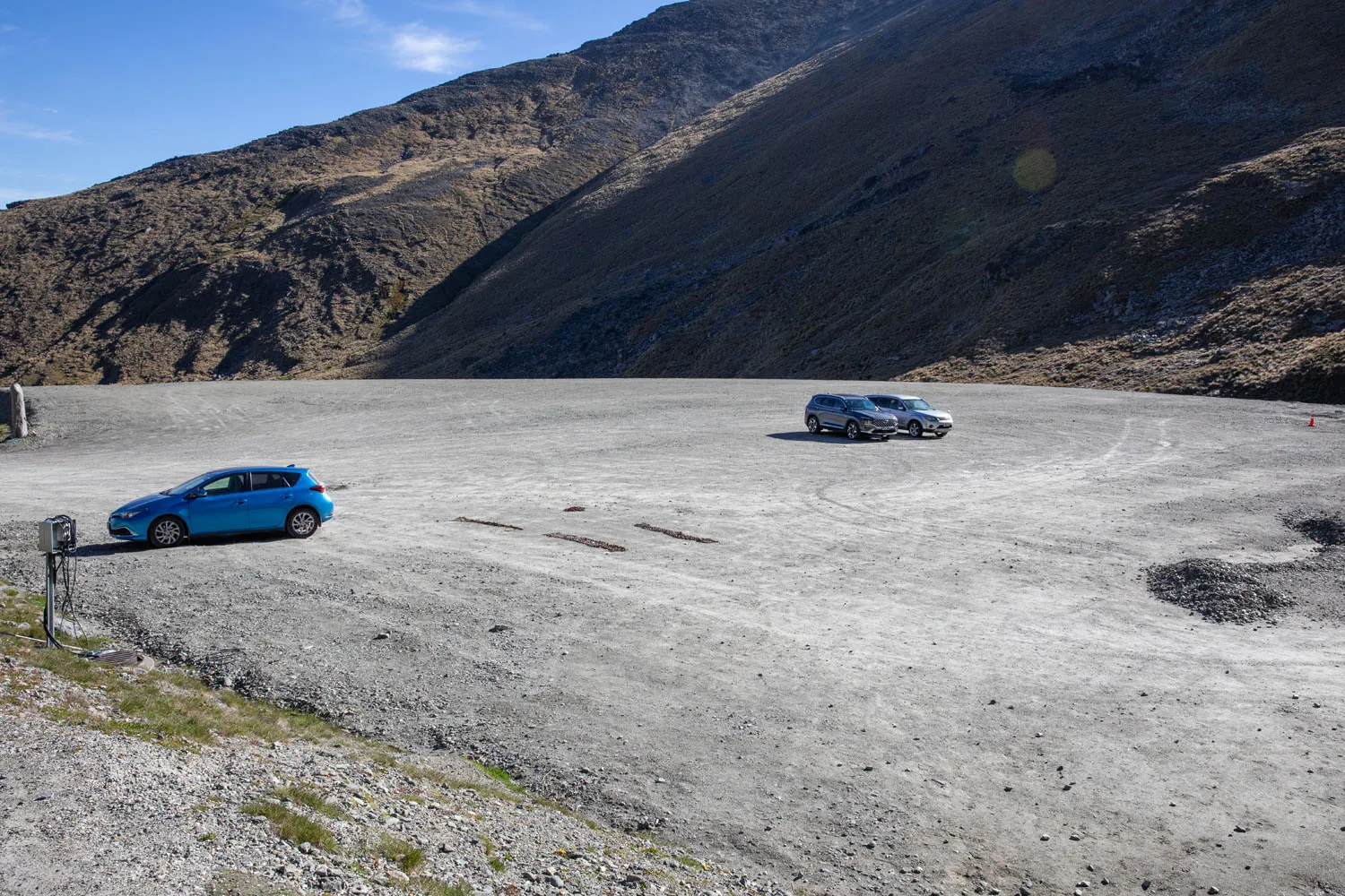
The large car park is located at the end of the road.
Lake Alta Track: Step-By-Step Trail Guide
Start of the Hike
From the parking lot, walk up to the ski facilities. The main building houses a restaurant and a ski equipment rental center, but this building is only open during the ski season. Therefore, it is important to get water and any snacks you want in Queenstown before starting the drive to the ski facilities.
If you need to use the bathroom, there is a small public toilet structure to the left of the main building as you approach it from the parking lot. This is the only toilet facility available along this hike.
Now make your way to the side of the main building that is opposite the parking lot. Here you will find a patio area with picnic tables.
With your back to the picnic tables, you will be standing in a valley with mountains to both sides of you and in front of you. All of these mountains will have paths on them, so it might seem a little confusing at first as to which way to go.
You will basically be walking straight up through the valley in front of you. If you start hiking up the mountains to the left or right, then you are going the wrong way.
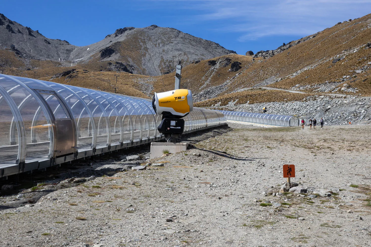
From the patio area, walk straight towards the tubes used to take skiers up the bunny slope. There will be two tubes, one after the other. The trail will follow directly to the right of both tubes. The trail itself isn’t well defined here; just hug the right side of these tubes as you hike.
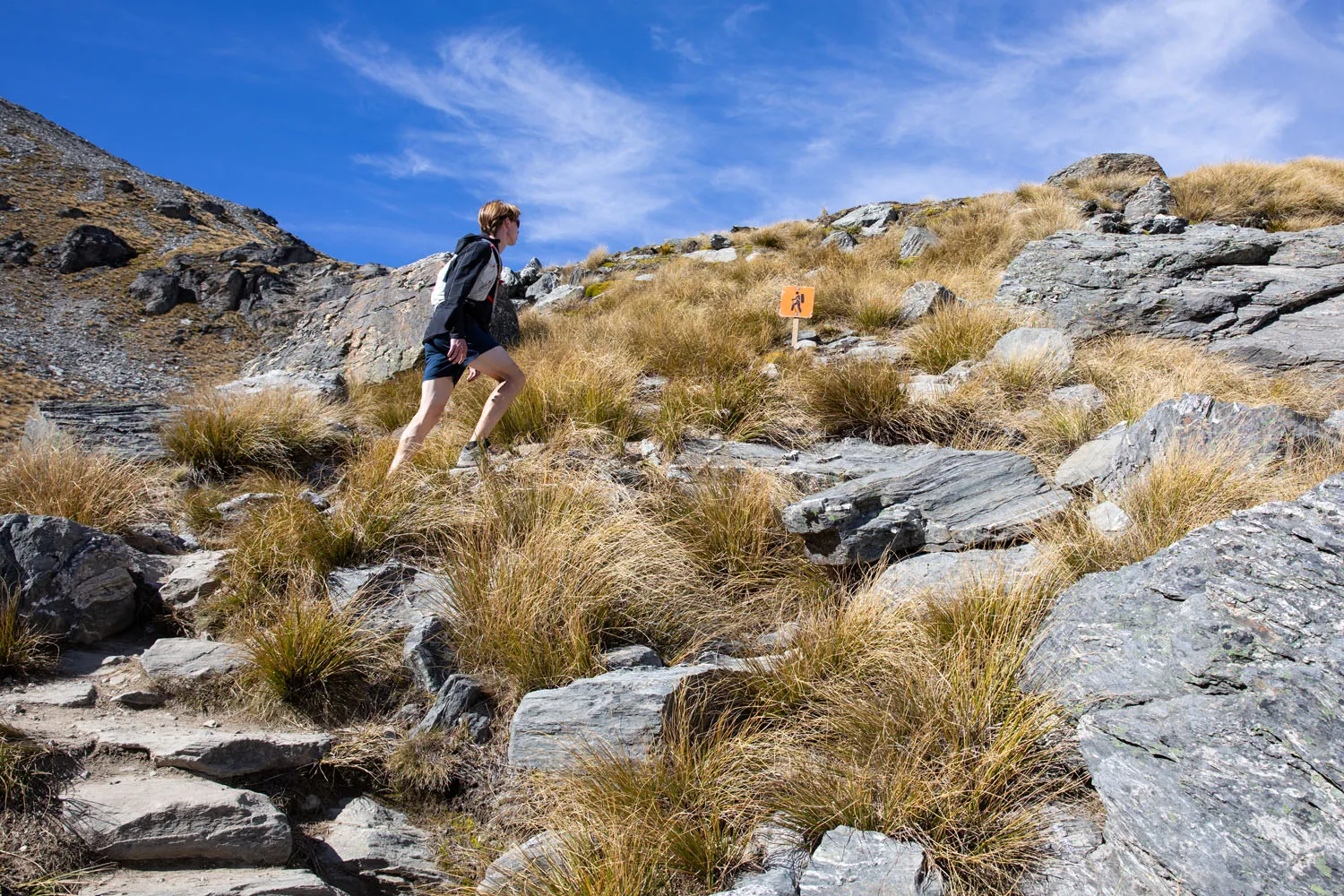
You might occasionally see small wooden signs close to the ground with a hiker symbol on them. I say “might” because these probably have to be reinstalled each year once ski season ends.
On the Trail
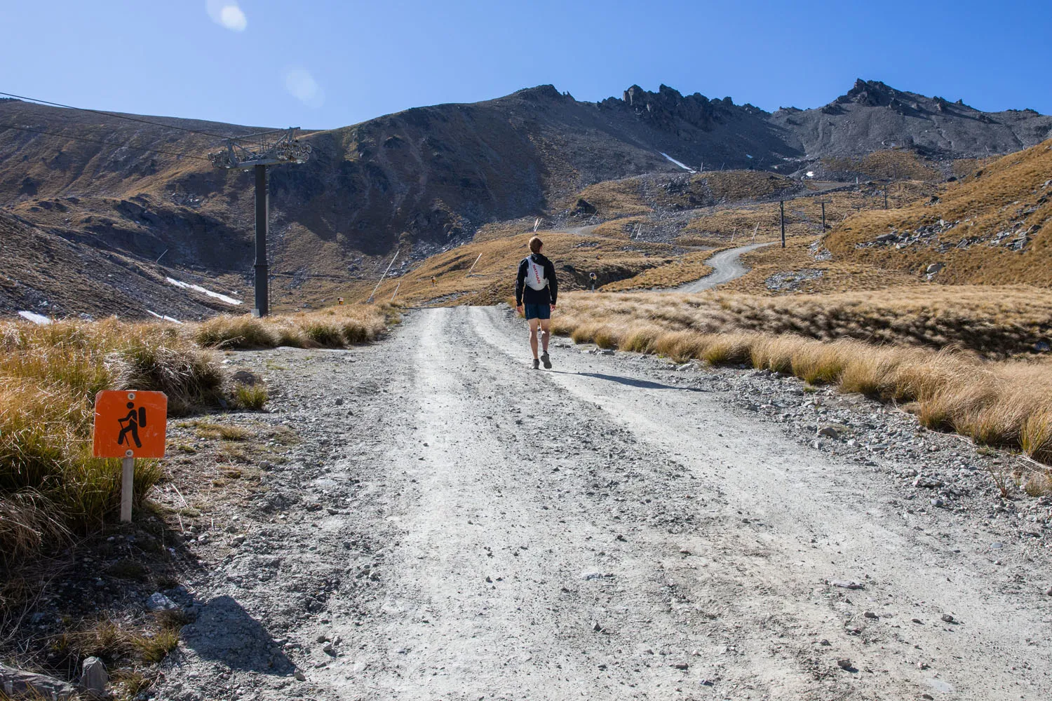
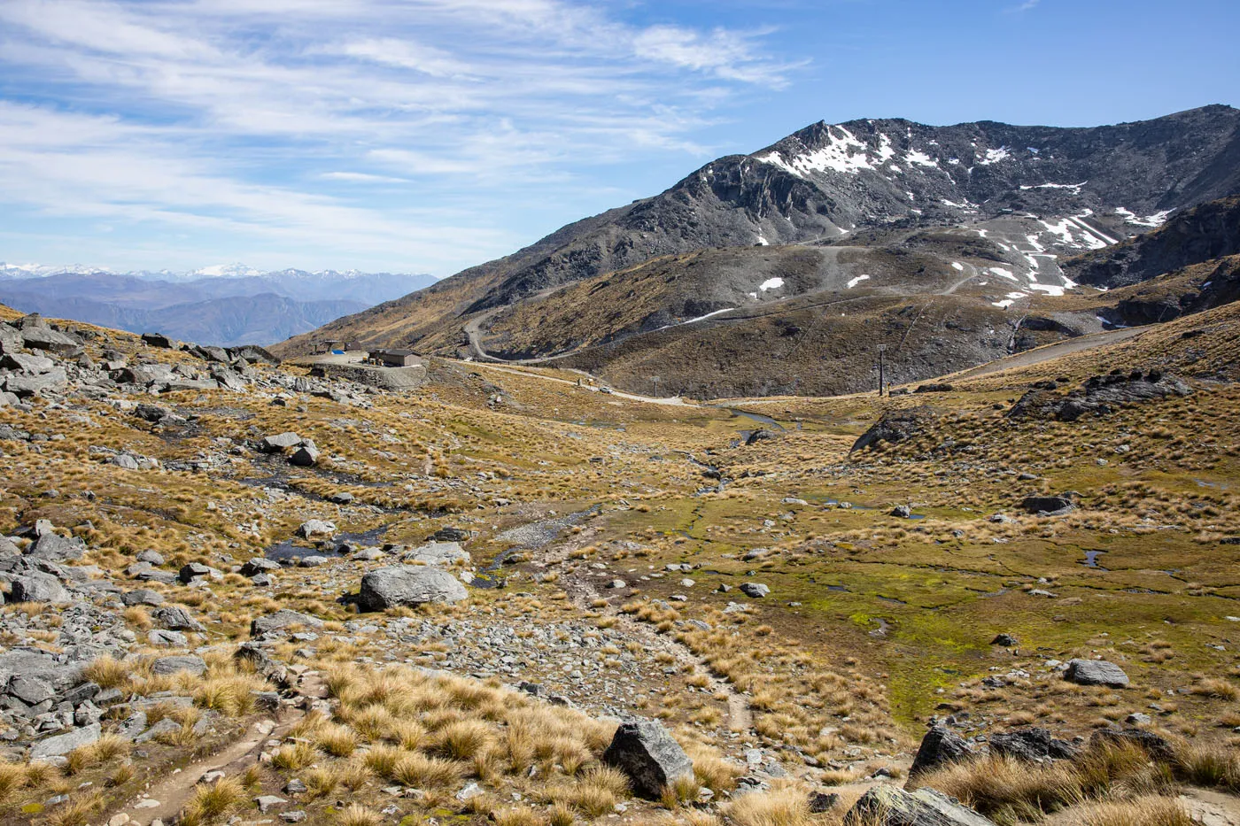
At the end of the second tube the path will turn into a gravel road.
You don’t have to follow this road for very long until it splits into two gravel roads. At this split, take the road to the right (it is the steeper of the two). You’ll have a steep but short climb here, but this is the most strenuous part of today’s hike.
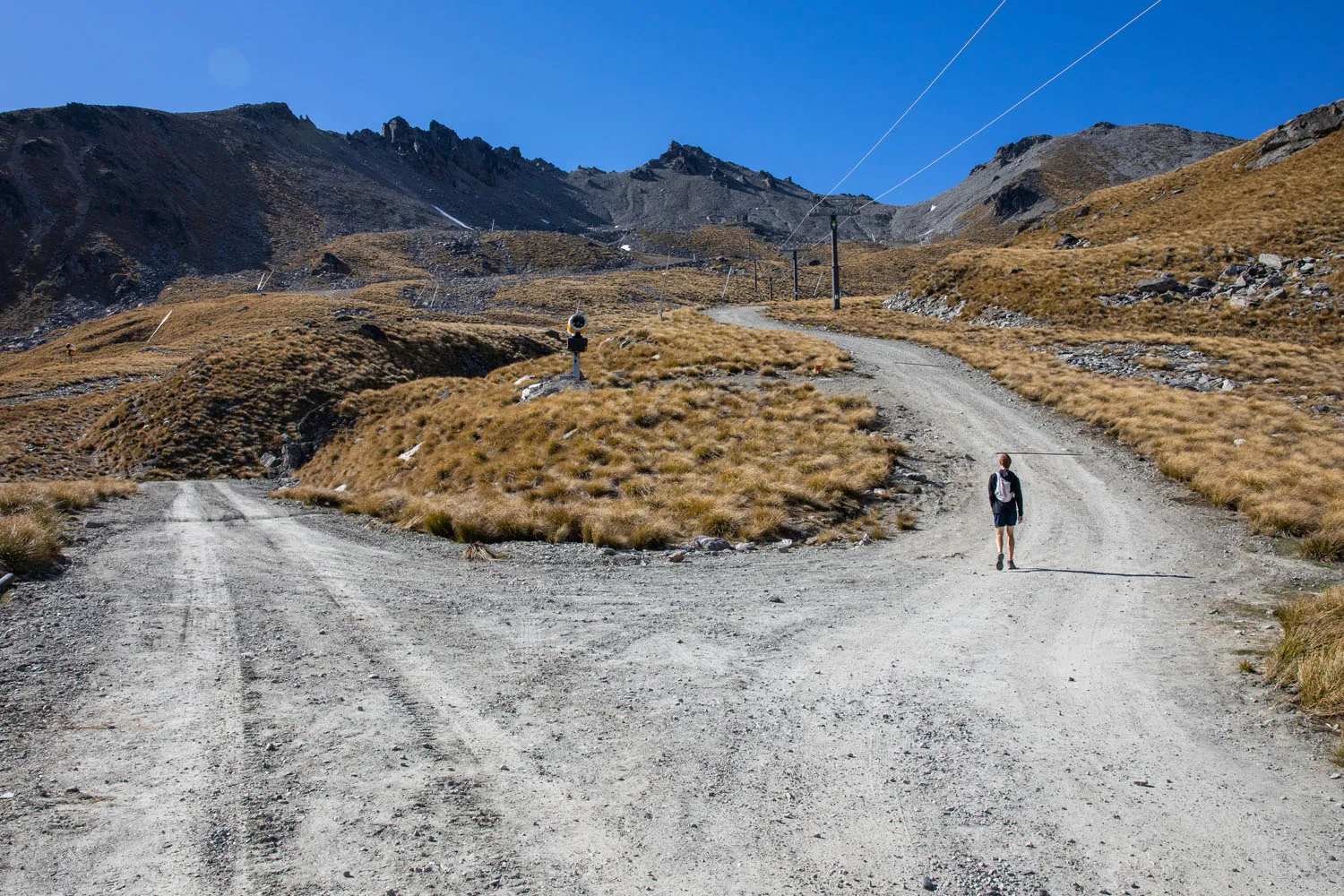
At the top of that climb, the road will reach a junction. The road itself will go left and right like a T intersection. But there will also be a narrow hiking path straight ahead. Take the narrow hiking path.
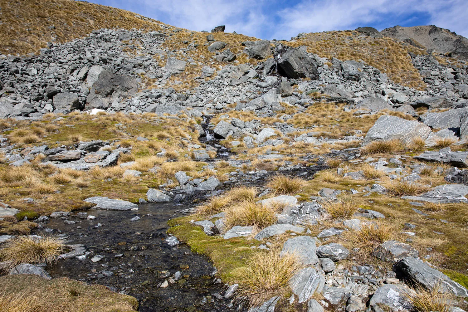
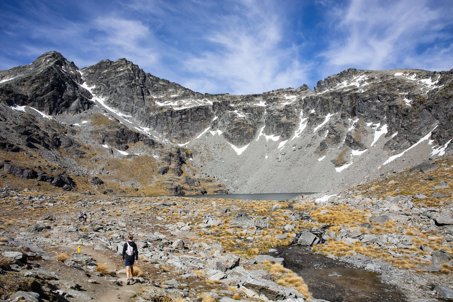
Up to this point, the trail wasn’t all that exciting. You hiked uphill along a gravel road that cuts through a barren rock field. Still, it is impressive looking up at the peaks surrounding you.
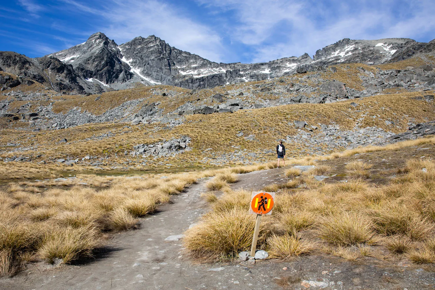
Once on the narrow hiking path the trail will flatten out for a moment, and you’ll get a change of scenery. You are now following a trail surface mixed with rock and dirt, and you will cross through a small bog. This part of the trail can be muddy, and you will be crossing over small streams, so watch your step.
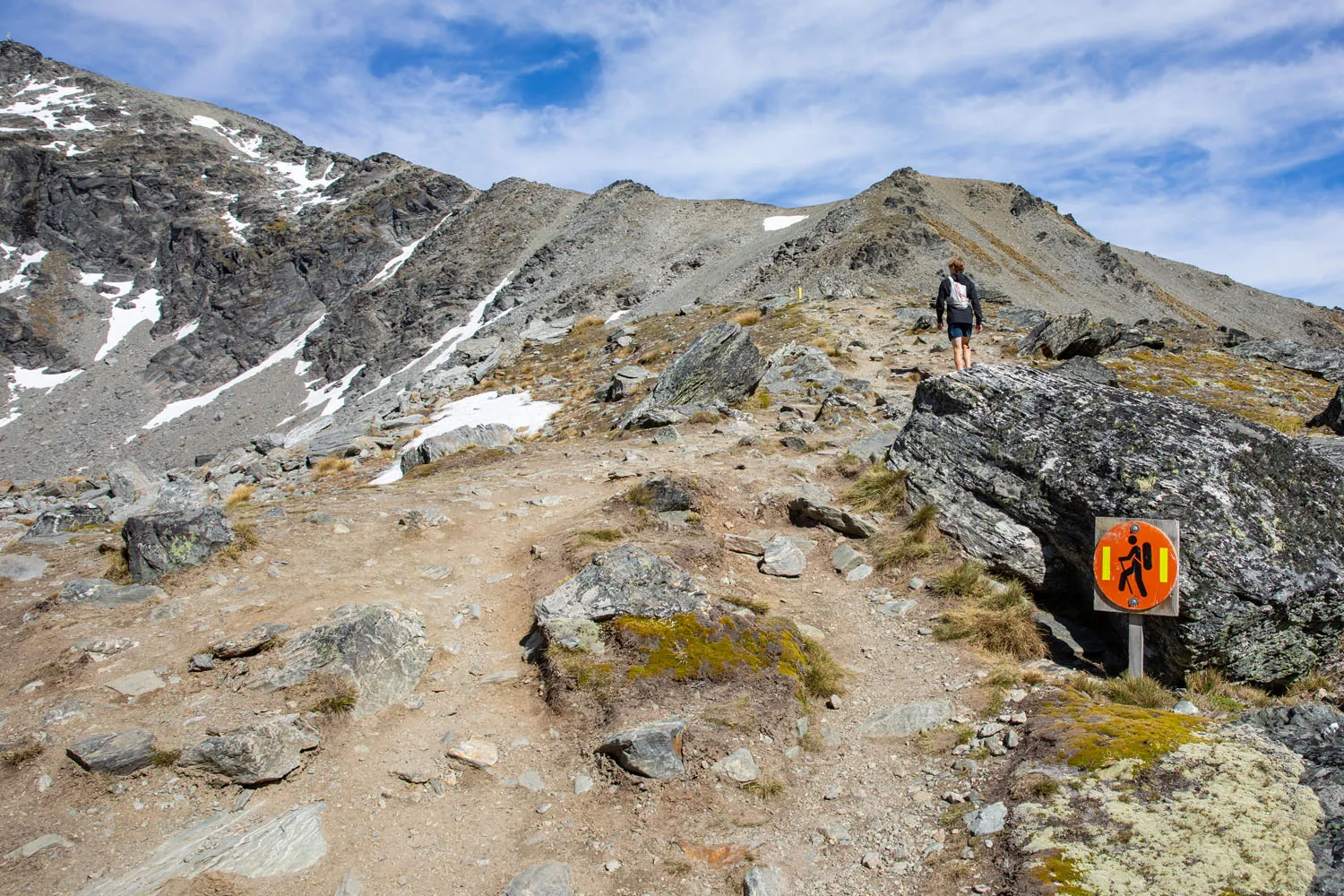
With one short final climb to go, you will reach a vantage point overlooking Lake Alta. Take in the views from here and then continue following the trail to the lake. When we hiked here in the morning, we were one of the only people here. We found it to be quite serene, with the lake sitting at the base of some pretty impressive peaks. This could be a great spot for a picnic.
This is an out-and-back hike, so once you have finished enjoying your time here, return to the car park the same way you came.
What to Bring
We recommend packing water, nutrition, sunscreen, and sunglasses. Bringing a windbreaker is also a good idea. Make sure you check the weather beforehand, so you know what clothing layers to wear. When we hiked here on a warm sunny morning, we were comfortable in hiking pants and a t-shirt.
Essential Hiking Gear: What Should You Bring on a Day Hike?
If you are new to hiking or are curious about what you should bring on a hike, check out our Hiking Gear Guide. Find out what we carry in our day packs and what we wear on the trails.What to Do Next
Looking for other fun activities to complete your day in Queenstown? How about another hike, or relax in the Onsen Hot Pools? For a more thrilling adventure, consider bungy jumping, paragliding, or a jet boat ride. See our full list of recommendations in our guide Things to Do in Queenstown and learn how to plan your time with our Queenstown Itinerary.
More Hikes in Queenstown
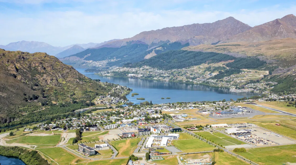
Queenstown Hill is a short, moderate hike located just outside of the city center and provides panoramic views over Queenstown, Lake Wakatipu, and The Remarkables.
Ben Lomond is a longer, more challenging hike that starts at the top of the Queenstown gondola and summits Ben Lomond Mountain. From this peak, the views are even more spectacular than from Queenstown Hill.
Moke Lake is a relatively short, easy hike trail that loops around the lake. It’s great for all ages and ability levels.
If you are looking for something more remote and challenging, the Routeburn Track is typically done in 2 to 3 days, but can be done in one day for those who are very fit and fast.
These are just a few of our guides on New Zealand. You can see all of them in our guide How to Plan a Trip to New Zealand.
If you have any questions about hiking the Lake Alta Track, let us know in the comment section below.
Plan Your Trip to New Zealand
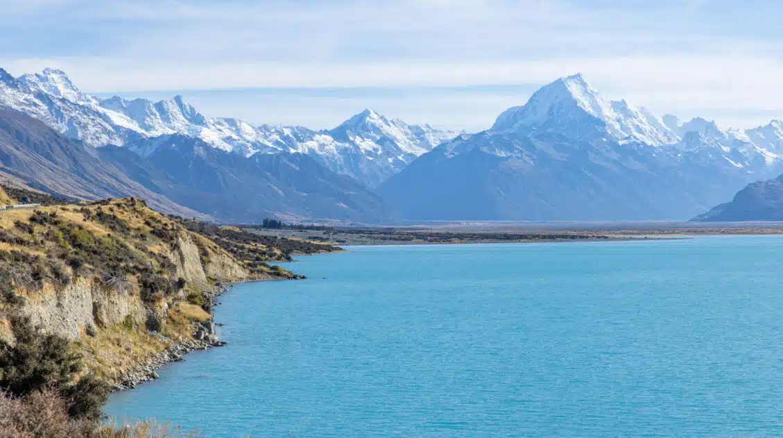
New Zealand Travel Guide | How to Plan a Trip to New Zealand
New Zealand Travel Guide New Zealand is one of our favorite countries in the world. Why? Because New Zealand has the perfect mix of breathtaking landscapes, adventure activities, beautiful cities, wine regions, stunning beaches, amazing drives, and gourmet food. This is the land of fiords, hiking trails, bungy jumping, sheep, glowworms, and glaciers. Lord of […]
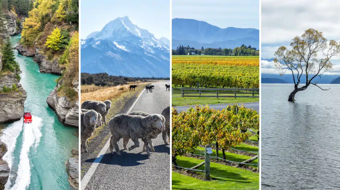
40 EPIC Things to Do on the South Island of New Zealand
Discover 40 amazing things to do on the South Island of New Zealand, from cruising Milford Sound to wine tasting and hiking the famous Roy’s Peak Track. Plan to spend at least one week on the South Island to see its highlights; three weeks is ideal for the full experience. The South Island of New […]
Queenstown Hill Walkway: A Step-By-Step Hiking Guide
The Queenstown Hill Walkway is the ideal hike for those looking to get great views over Queenstown without having to summit one of the looming nearby mountain peaks. Located in the heart of town, it’s an easy hike that is perfect for a morning or afternoon outing. Plus, with its popularity, you will see plenty […]
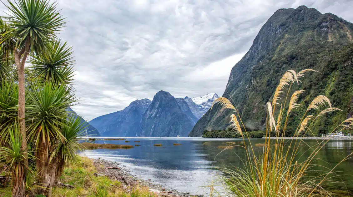
Milford Sound Day Trip: A DIY Guide to the Drive + Cruise
This guide explains how to plan your Milford Sound day trip, including sights and activities along the drive, how to book your cruise, and tips we’ve learned from our visits. It’s best to visit Milford Sound from Te Anau, but you can also go from Queenstown—just expect a much longer day. The Milford Sound (also […]
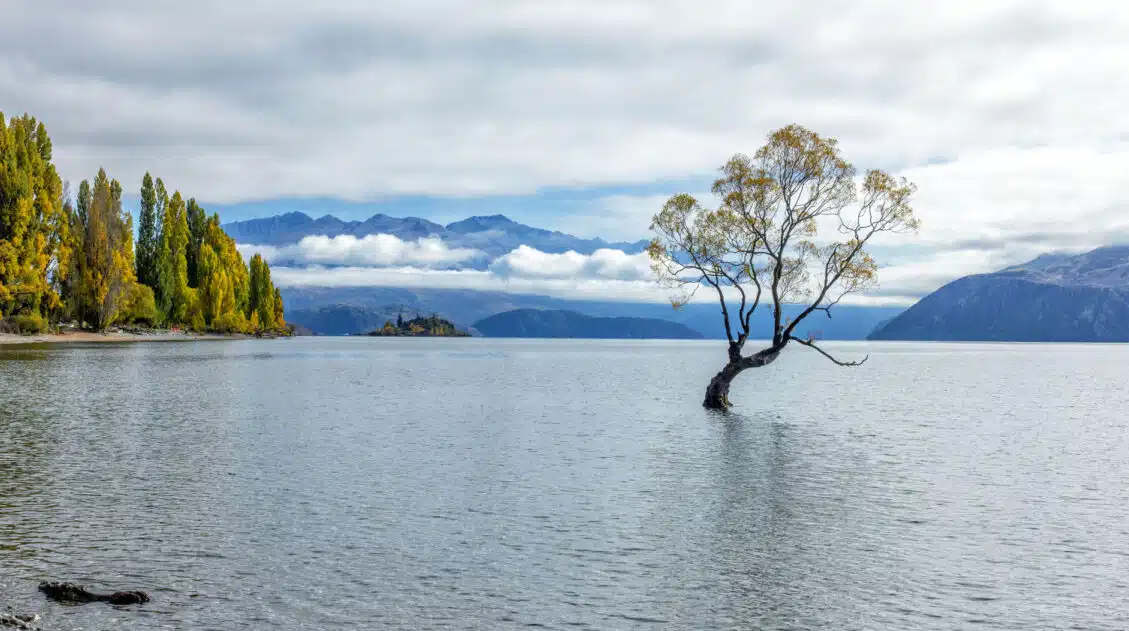
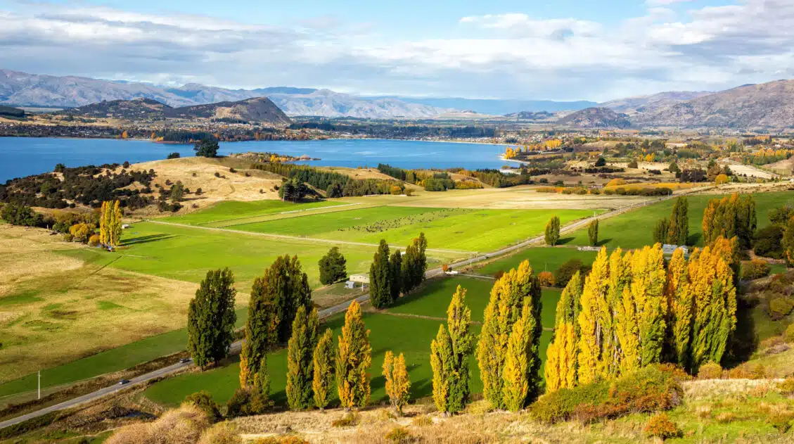
20 Epic Things to Do in Wanaka, New Zealand
Discover the best things to do in Wanaka, from top hikes like Roy’s Peak and Diamond Lake to unique activities such as lavender farms, via ferratas, and enjoying freshly baked cookies at Cinema Paradiso. See the highlights in one busy day, but stay longer to experience all that Wanaka has to offer. Wanaka is one […]
10 Day South Island New Zealand Itinerary: 4 Different Ways
With 10 days on the South Island of New Zealand, you have just enough time to visit several top spots. Queenstown, Wanaka, the Milford Sound, and seeing Aoraki / Mount Cook (New Zealand’s tallest mountain) all top the list, but you also have the option to add on the Southern Scenic Route, Akaroa, Abel Tasman, […]
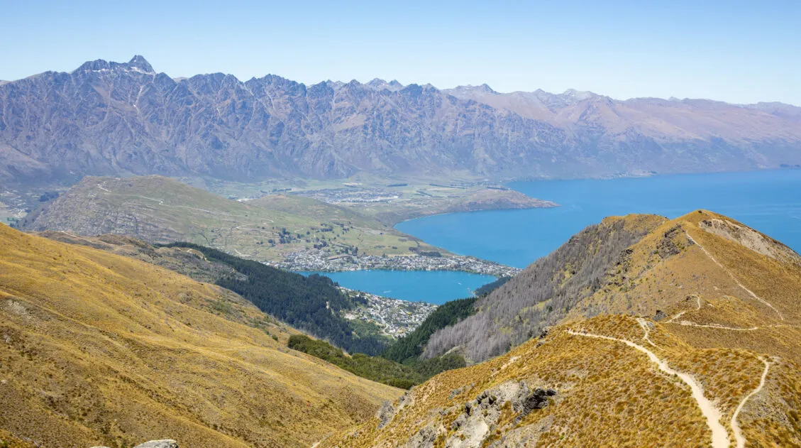
How to Hike the Ben Lomond Track, the Best Hike in Queenstown
Looking for the best day hike in Queenstown? The Ben Lomond Track provides the perfect mix of challenge and reward. Along this 11 km (6.8 mile) round trip hike, you’ll be treated to incredible views of the Remarkables, Lake Wakatipu, Queenstown, and mountain peaks as far as the eye can see. You can either hike […]
Queenstown Itinerary: 3 Unique Ideas for Your Perfect Vacation
If you are planning your Queenstown itinerary, there are a lot of things to consider. How long should you spend in Queenstown? Where should you stay? Should you rent a car? What are the best things to do in Queenstown? In this guide, we share the top experiences in Queenstown and then how to put […]
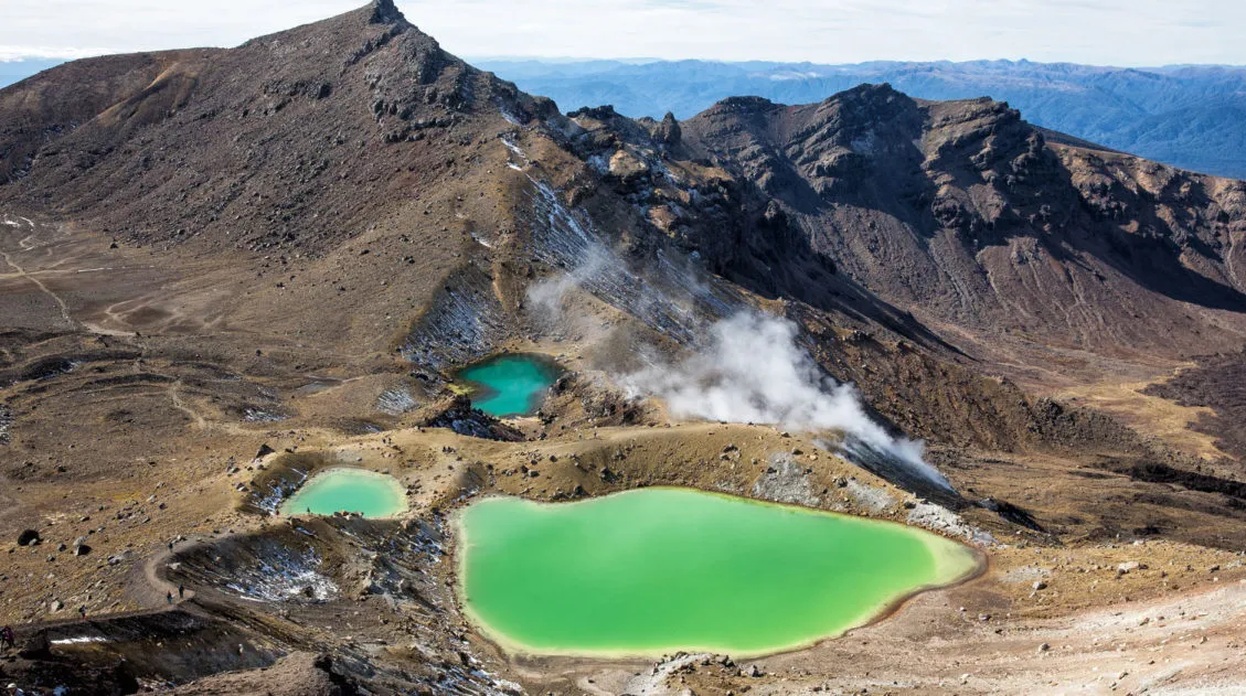
Tongariro Alpine Crossing Hike, Step-By-Step Guide to New Zealand’s Best Day Hike
The Tongariro Alpine Crossing is a 19.4 km (12 mile) hike in New Zealand’s North Island with emerald lakes, views of semi-dormant volcanoes, and ever-changing terrain. Our complete guide covers everything you need to know to plan your day. The Tongariro Alpine Crossing is often labeled as the world’s greatest single day hike. Located on […]
Two Week South Island Itinerary: 3 Road Trip Routes
We have visited New Zealand three times, and in this guide, we provide three different ways to plan a two-week South Island itinerary. There’s a lot to see and do on the South Island, and this guide gives you the opportunity to pick the road trip that best fits your interests. Two of these itineraries […]
Diamond Lake & Rocky Mountain Track: Best Routes, Map & Trail Stats
The Diamond Lake and Rocky Mountain Track is a 7.3 km (4.5-mile) moderate trail with 520 meters of ascent, offering views of Diamond Lake and Lake Wanaka. There are several routes and in this guide, we cover which one is best, based on your time, interests, and hiking ability. A visit to New Zealand would be […]

Best Things to Do in Franz Josef | Glacier Country, New Zealand
In this guide, we cover the best things to do in Franz Josef, plus how to get here, where to stay, and how to plan your time. Hike to viewpoints of glaciers, see the rarest Kiwi, soar over Fox Glacier and Franz Josef Glacier in a helicopter, capture Mount Tasman’s reflection in Lake Matheson, go […]
Southern Scenic Route: Things to Do, Map & Itinerary
The Southern Scenic Route is a 600+ kilometer driving route that connects Dunedin, Invercargill, Te Anau, and Queenstown, New Zealand. It is a gorgeous drive, and along the way you are treated to some of the most spectacular scenery in the country. On this drive, you will visit quaint coastal towns, deserted beaches, waterfalls, fiords, […]
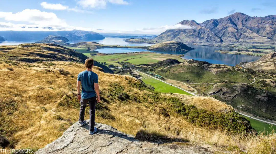
Roys Peak Track: Stats, Photos, Hiking with Kids
The Roys Peak Track is a 16 km (10 mile) strenuous, out-and-back hike to a stunning viewpoint over Wanaka and Lake Wanaka. Here’s how to do it. Roys Peak Track is one of the best hikes to do on the South Island of New Zealand. Located in Wanaka, this trail takes you high into the […]
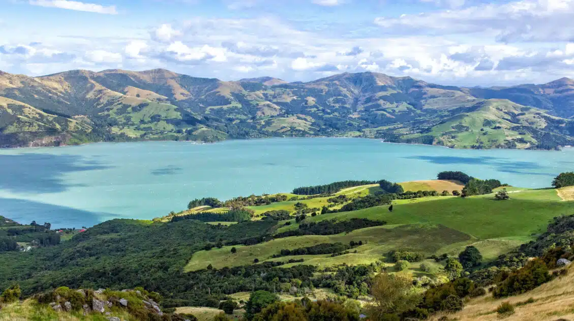
Best Things to Do in Akaroa & Banks Peninsula, New Zealand
Go for a scenic drive, take a hike, feed an alpaca, take a wildlife cruise to see the smallest dolphins in the world, and dine on fresh seafood…these are all things to do in Akaroa and Banks Peninsula. Banks Peninsula is a small, volcanic peninsula located on the east coast of the South Island of […]

Leave a Comment