
On just one hike, you can see several waterfalls, an enormous Banyan tree, and hike through a bamboo forest. The Pīpīwai Trail is a relatively short hike that is located in Haleakala National Park on the Road to Hana. In this guide, we cover everything you need to know to hike the Pīpīwai Trail.
Pīpīwai Trail Stats
Distance: 3.8 miles out-and-back
Difficulty: Moderate
Total Ascent: 1,200 feet
Elevation at the Trailhead: 100 feet
Elevation at Waimoku Falls (end of trail): 875 feet
Length of Time: 1.5 to 4 hours
When to Go: The Pīpīwai Trail can be hiked year round.

Pīpīwai Trail Elevation Profile
Please practice the seven principles of Leave No Trace: plan ahead, stay on the trail, pack out what you bring to the hiking trail, leave areas as you found them, minimize campfire impacts, be considerate of other hikers, and do not approach or feed wildlife.
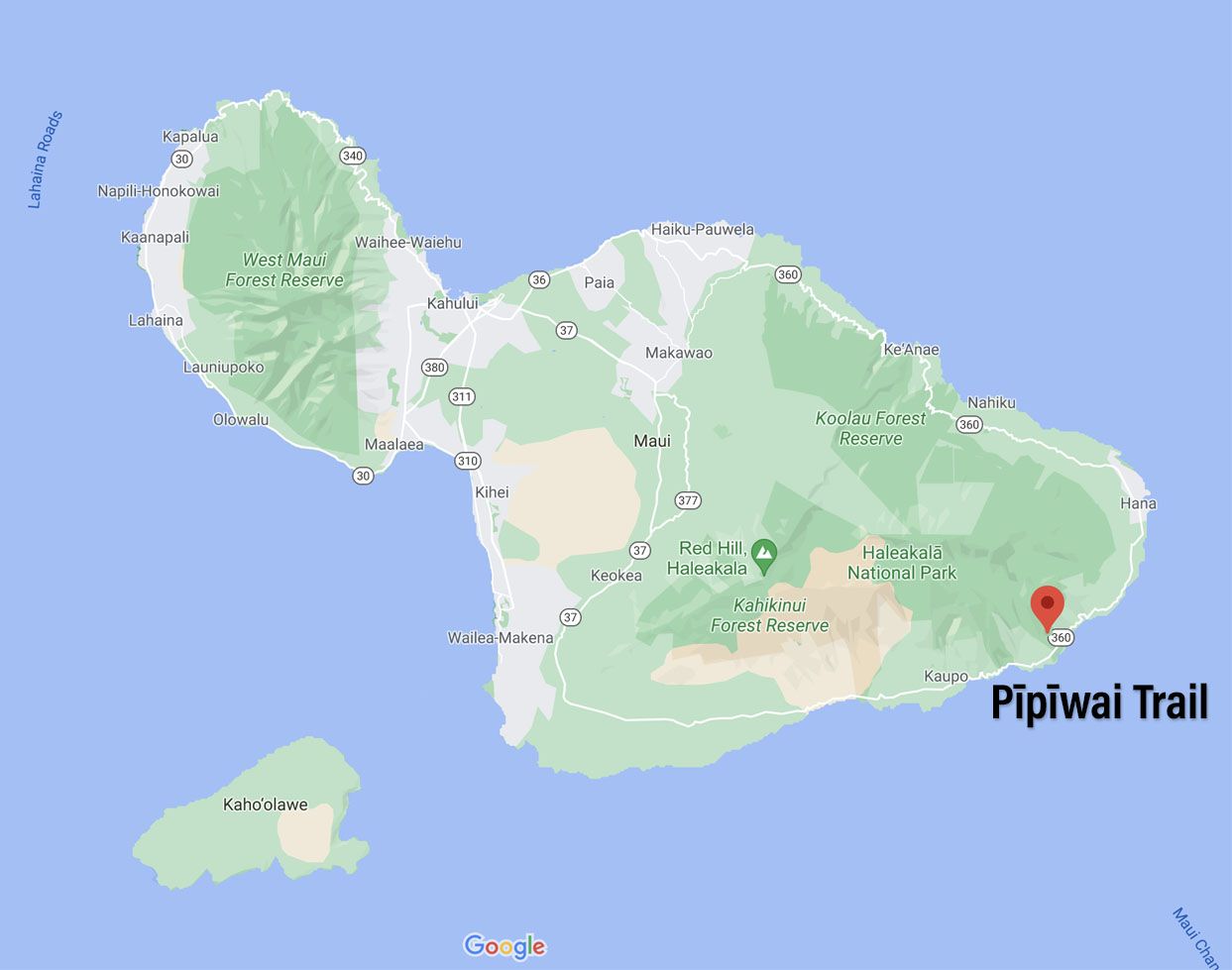
Where is the Pīpīwai Trail?
The Pīpīwai Trail is located in the Kīpahulu District of Haleakala National Park in Maui.
Many people are familiar with the Haleakalā crater, which is famous for its sunrises and hiking trails that lead into the crater.
What you might not know that there is a smaller section of Haleakala National Park on the southern coast of Maui. Called the Kīpahulu district, this section of the park is lush, green, and filled with waterfalls, plant life, and beautiful coastal scenery. It looks vastly different than the barren, almost Mars-like appearance of the Haleakala crater.
The Kīpahulu District is one of the main stops on the Road to Hana. Due to its location, this is the typically the final stop of the day, as most people drive the Road to Hana out and back, starting in the north. Beyond the Kīpahulu District (to the west), the road becomes rougher and narrower and more remote, which is why many people turn around, rather than driving this section of the road.
The location of the Pīpīwai Trail and Kīpahulu District is important, because this part of the national park has operating hours. If you get here too late in the day, not only will large crowds which make parking challenge, but the park may not even be open.
Also located in the Kīpahulu District is a walking trail that leads to the Seven Sacred Pools at ‘O’heo.
How to Get to the Kīpahulu District
The Kīpahulu District is located on the south coast of Maui.
You can get here by driving the Road to Hana. The Road to Hana runs along the east coast of Maui. It’s not a very long drive, at least in terms of distance, but because of the hundreds of turns and one-way bridges, it takes several hours to drive this stretch of road.
From the Road to Hana
Here are driving distances and times from other locations in Maui, via the Road to Hana (these times do not take in account any additional time for stops along the way):
- Hana: 11 miles, 40 minutes
- Lahaina: 84 miles, 3.5 hours
- Ka’anapali: 89 miles, 3.75 hours
- Kihei: 70 miles, 3 hours
- Wailea: 76 miles, 3.25 hours
- Kahului: 63 miles, 3 hours
As you can see, staying in Hana is ideal. In 45 minutes, you can reach the Kīpahulu district, getting here first thing in the morning, when crowds are low.
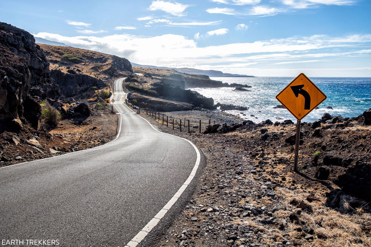
On Highway 37
Alternatively, you can drive Highway 37 along the south coast to get to the Kīpahulu District. This gets you here quicker, but it is a more rugged, remote road than Highway 360 (the Hana Highway). This road is also referred to as the Back Road to Hana or the Backside of Haleakala.
We did this and it’s a beautiful drive. The road is not nearly as bad as other sources make it out to be. There are a few short sections of unpaved road and several sections of extremely rough paved road, but regular cars will do just fine. The road is narrow with one lane bridges, but in that respect it’s similar to the Road to Hana. Just note that you could be violating the terms of your rental car agreement if you drive Highway 360.
Here are the driving distances and times from other locations in Maui, via Highway 360 (these times do not take in account any additional time for stops along the way):
- Lahaina: 74 miles, 2.5 hours
- Ka’anapali: 79 miles, 2.75 hours
- Kihei: 60 miles, 2 hours
- Wailea: 66 miles, 2.25 hours
- Kahului: 53 miles, 2 hours
WHAT WE DID: We drove Highway 360 directly to the Kīpahulu District, arriving at 9:30 am. The parking lot was about 1/3 full and I was actually surprised at how many cars were already here. We hiked the Pīpīwai Trail and then the trail to the Seven Sacred Pools at ‘O’heo. By the time we reached the parking lot (at 11:15) the parking lot was completely full and a long line of cars were lined up in front of the entrance gate.
Best Way to Drive the Road to Hana & is It Worth It?
Learn more about driving the Back Road to Hana, including photos of the road, in our Guide to the Road to Hana.The Kīpahulu District & Parking
At the entrance booth you will pay the park entrance fee.
There are two parking lots: an upper lot and a lower lot. Either lot is fine but the lower lot is closer to the visitor center and restrooms.
If the parking lots are full, you will not be permitted to enter the park. You will wait in line in front of the entrance gate until a space becomes available. There is no parking along Hana Highway.
To avoid waiting in line, try to plan your arrival by 10 am.
Park Entrance Fee
The entrance fee is $30 per vehicle. This is valid for 3 days and it includes both the Kīpahulu District and the Haleakala crater.
Hiking the Pīpīwai Trail
Step-By-Step Trail Guide
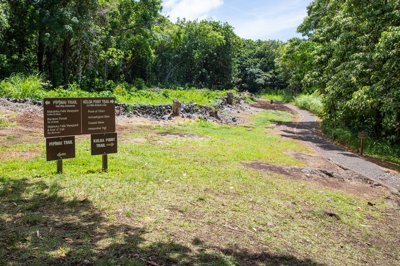
The Trailhead
The trailhead for the Pīpīwai Trail is located to the left of the Visitor Center. Follow the trail for about 300 feet. At the trail junction, go left to start the Pīpīwai Trail.
To Makahiku Falls Viewpoint
From the trailhead, it is a 0.5 mile walk to the first viewpoint of the hike, the Makahiku Falls Viewpoint.
Shortly after starting the Pīpīwai Trail, you will cross Hana Highway. The trail continues on the opposite side of the road.

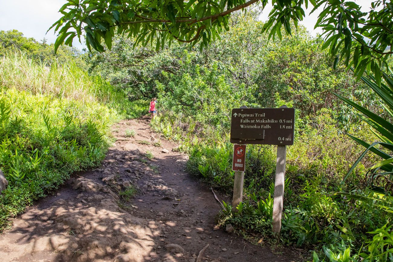
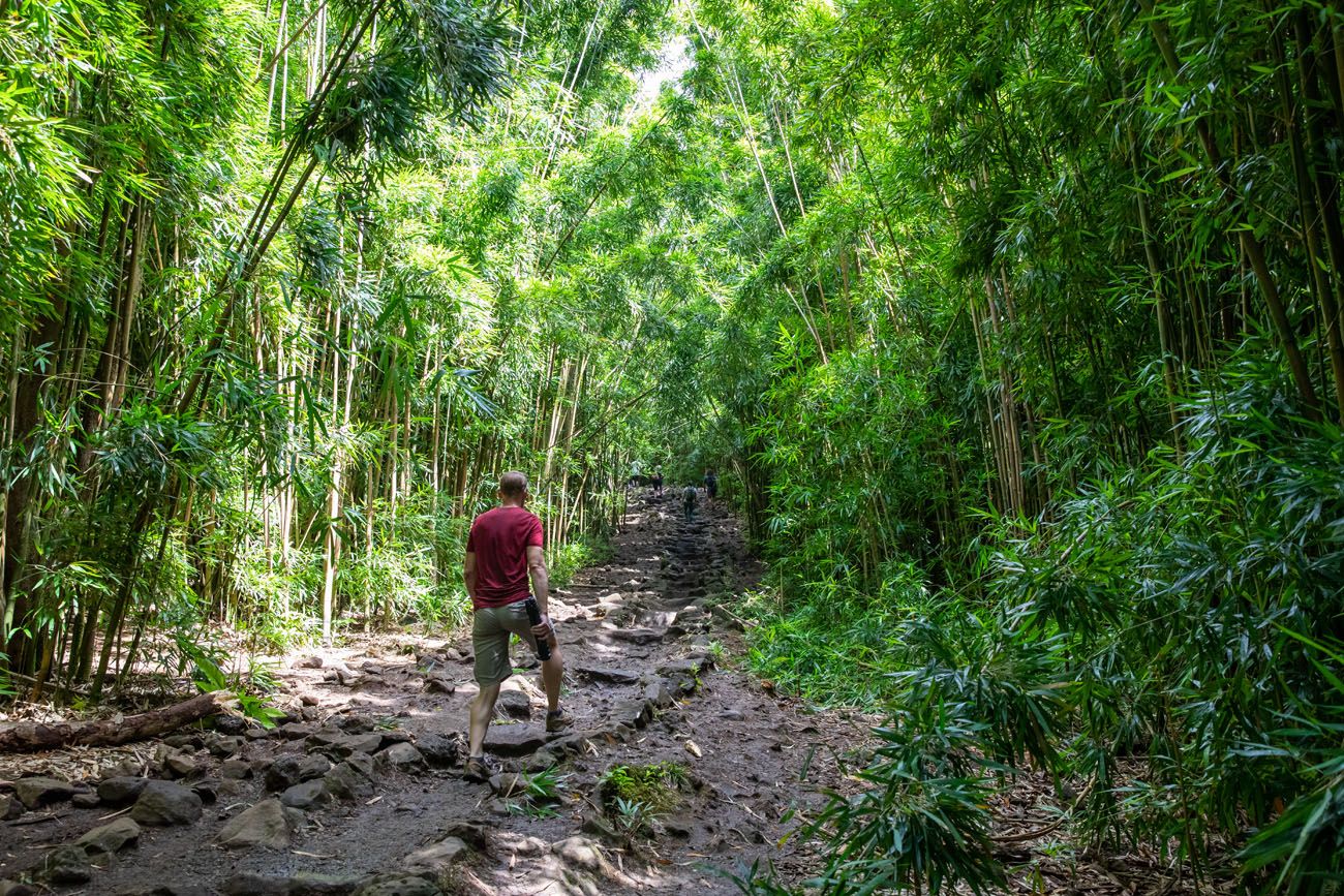
This first part of the trail is mostly uphill. You will hike in and out of the trees and walk over lots of tree roots. This first part of the trail is one of the steepest sections of the hike. It’s also the hottest, since it is the sunniest part of the trail.
At 0.5 miles you reach the overlook of the Makahiku Falls. This 200 foot (61 m) waterfall has carved out the valley below.
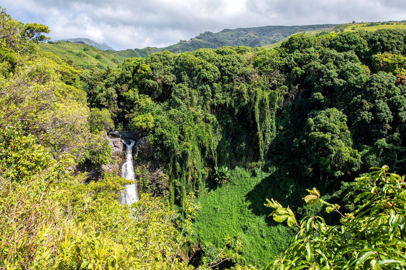
Makahiku Falls
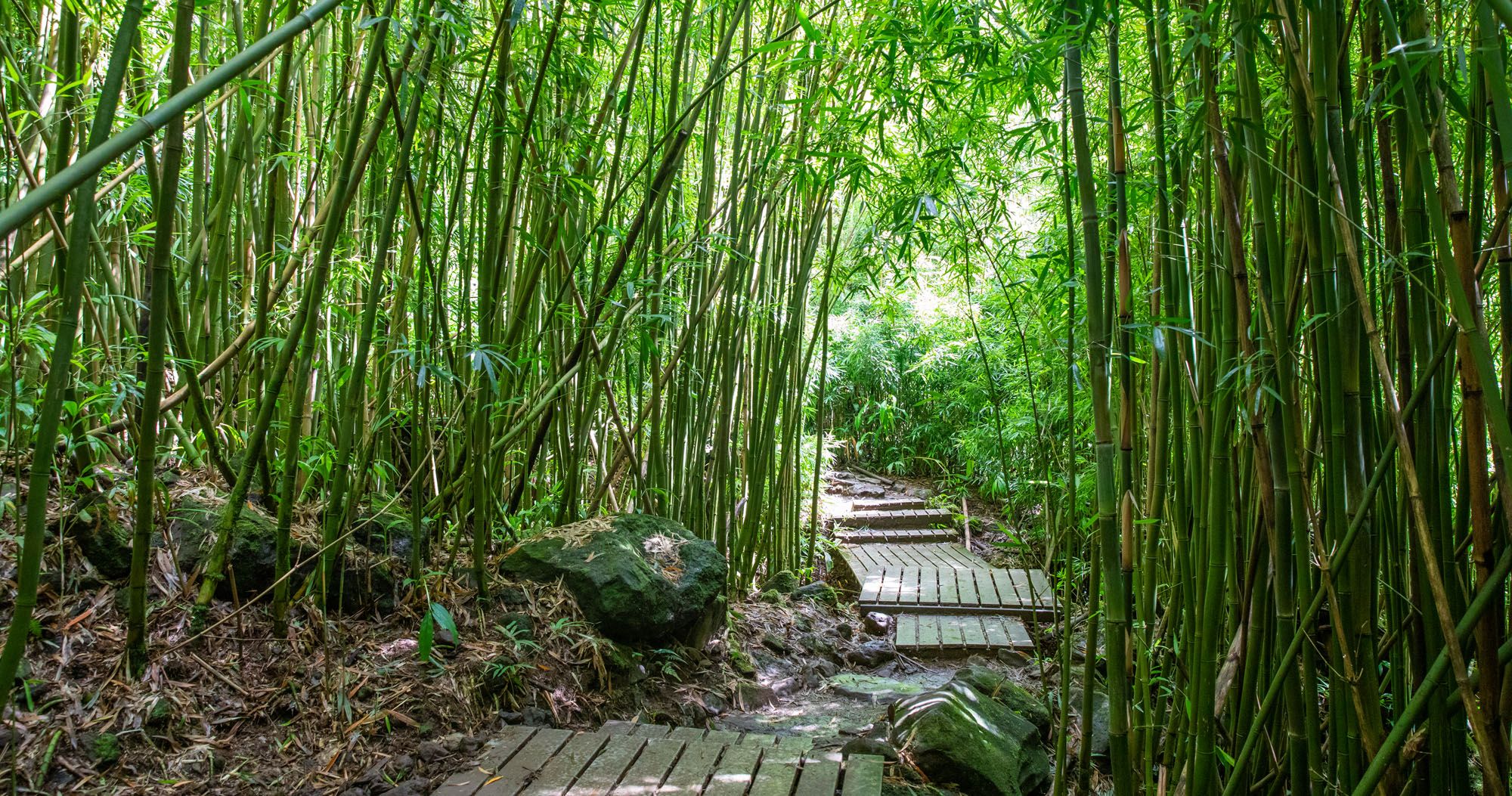
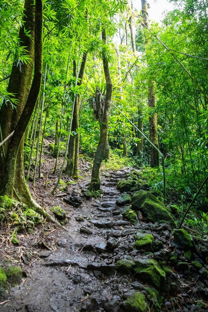
Bamboo Forest
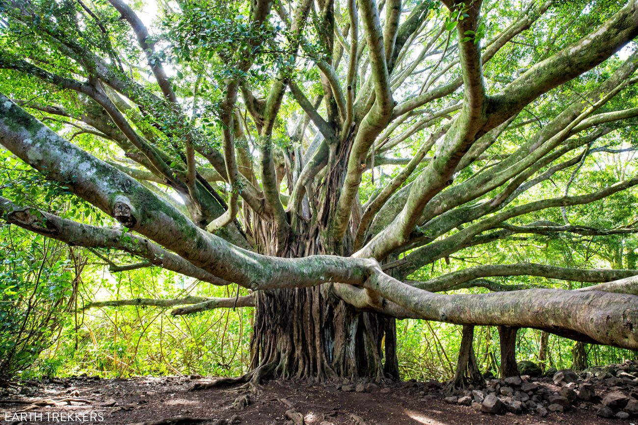
Just beyond the Makahiku Falls Viewpoint, you reach a giant Banyan tree.
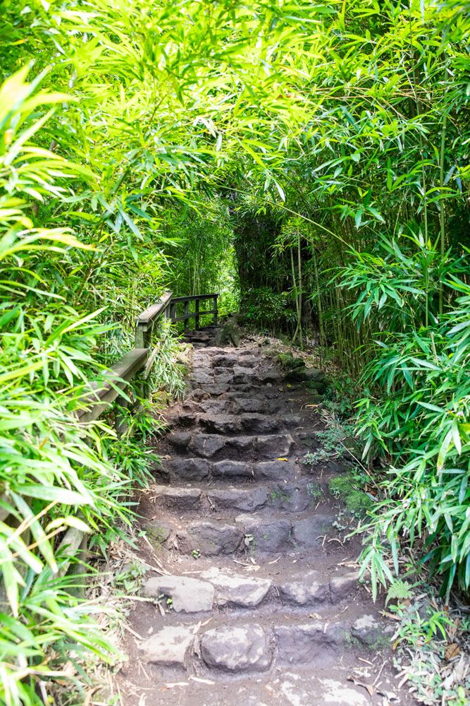
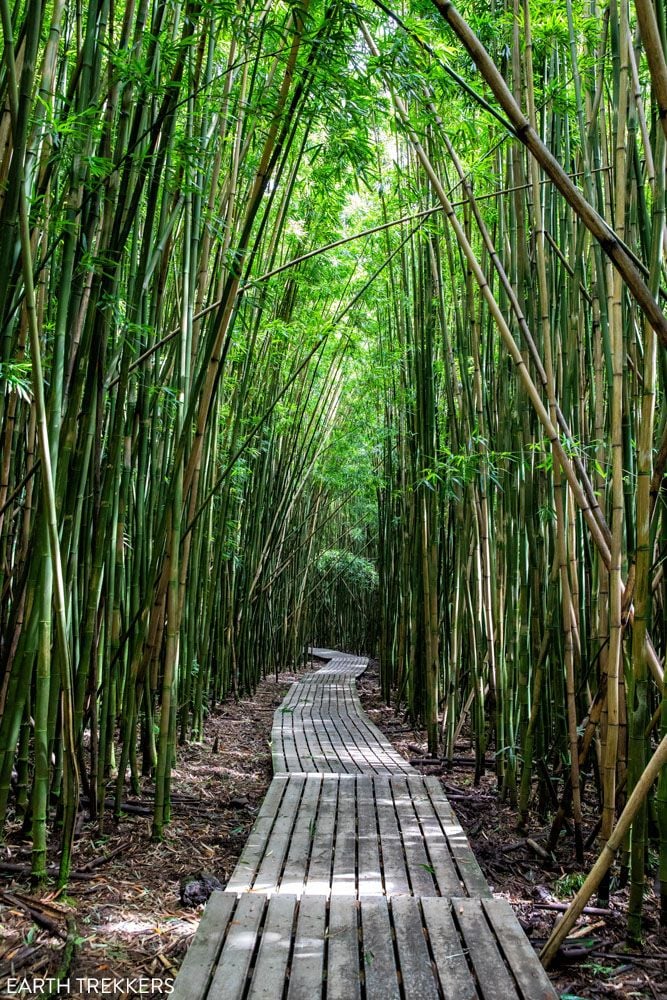
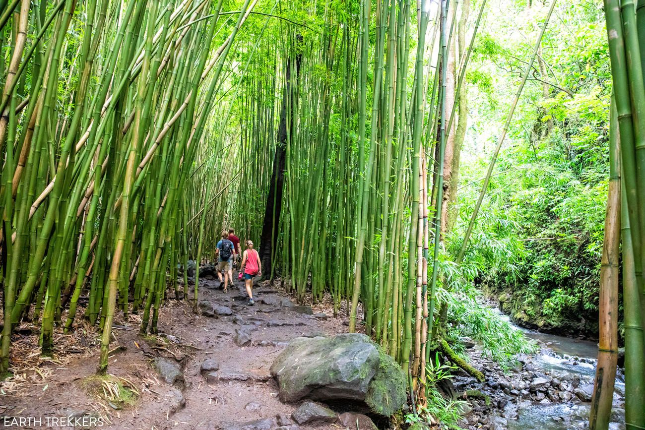
About one mile into the hike, the landscape is about to make a dramatic change. You cross two bridges over the Pīpīwai Stream, climb some rock steps, and entire the cool, moist air of the bamboo forest.
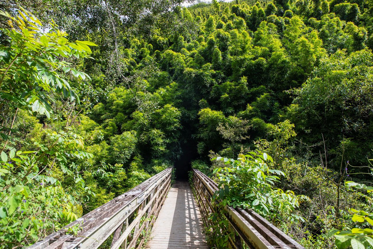
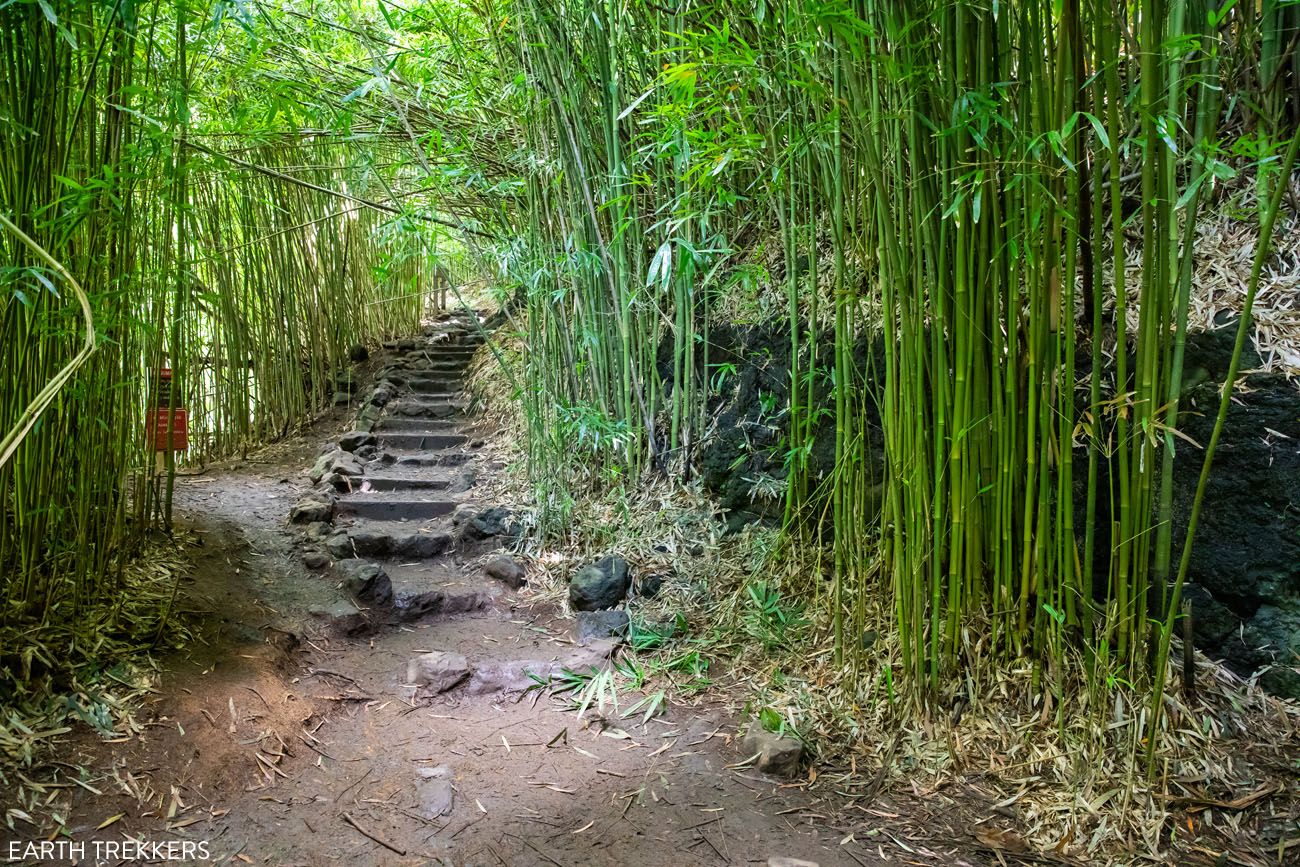
For the next half mile, you walk through this mystical bamboo forest. The trail alternates between compacted dirt and boardwalk trails. On a windy day, the bamboo stalks sound like wind chimes as the breeze knocks them together.
It’s a beautiful walk and best part of this hike, in my opinion.
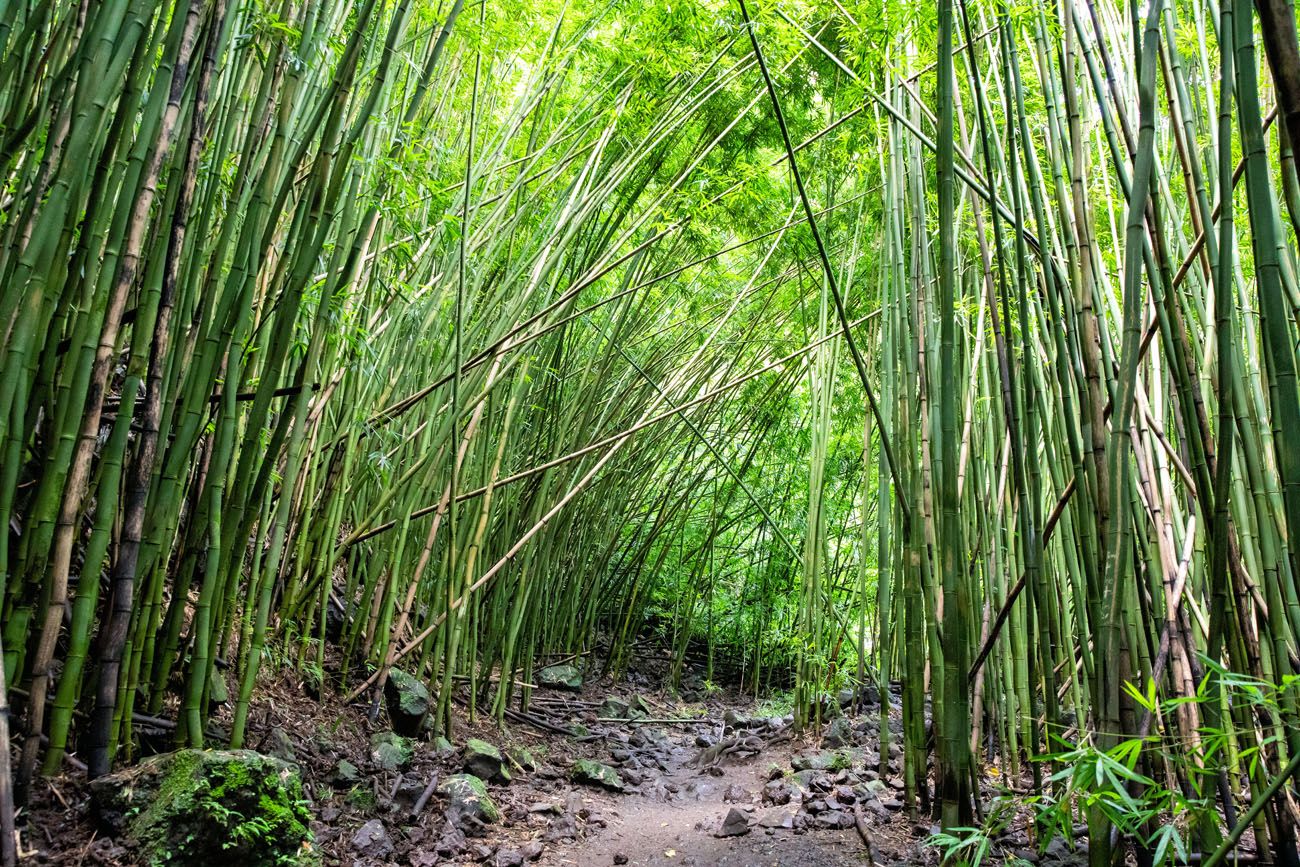
Once you emerge from the bamboo, you are getting close to the end of the trail.
PRO HIKING TIP: This trail can be extremely muddy if it has recently rained. And in this part of Maui, it rains quite frequently. I highly recommend wearing hiking shoes or a pair of shoes that you don’t mind getting muddy. Your shoes WILL get dirty!!
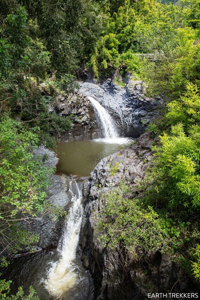
Waimoku Falls
Once you emerge from the bamboo forest, you cross a few more bridges, climb a few more sets of stone steps, and come to the end of the trail. It is here that you have a view of the elegant Waimoku Falls. This 400 foot waterfall is one of the tallest in Maui.
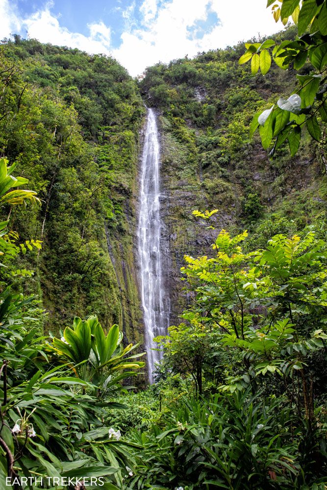
Waimoku Falls
Return Hike
To finish the hike, retrace your steps to the Visitor Center.
What to Pack
Hiking shoes. If it has recently rained, the trail will be muddy. Very muddy. We saw people getting by with flip flops and running shoes, but their feet and legs were covered with mud by the time they finished the hike. Assume that you will be walking through mud, so wear a pair of shoes that you don’t mind getting dirty. Hiking shoes are ideal since they provide a lot of traction but you can also get by with running or walking shoes.
Water. Bring at least one liter of water per person but more is even better. It can get hot on the hike, especially on a sunny day.
Sunblock, sunglasses, and a hat. This trail does have some shade but there are sections where you will be exposed to the sun.

Essential Hiking Gear: What Should You Bring on a Day Hike?
If you are new to hiking or are curious about what you should bring on a hike, check out our Hiking Gear Guide. Find out what we carry in our day packs and what we wear on the trails.Tips to Have the Best Experience
Get here as early as possible, ideally by 10 am, to avoid waiting for a parking space.
Get here no later than 3 pm, so you have enough time to finish the hike before the gates close.
Leave No Trace. Practice the seven principles of Leave No Trace. This includes packing out what you bring to the hiking trail, be considerate of other hikers, and leaving archaeological artifacts as you found them.
For more things to do in Haleakala National Park, with recommendations on how to plan your time, read our Guide to Haleakala National Park.
If you have any questions about how to hike the Pīpīwai Trail, or if you want to share your experience, let us know in the comment section below.
More Information about Hawaii
Read all of our articles about Hawaii in our Hawaii Travel Guide and the United States in our United States Travel Guide.

Hawaii Travel Guide: How to Plan a Trip to Hawaii
Travel advice and inspiration for travel to Hawaii, USA. How to visit Maui, Kauai, Oahu, the Big Island, with itineraries and photos.
Sliding Sands Trail and Halemau’u Trail Loop | Stats, Photos & Tips
Pinterest Facebook Flipboard In Haleakala National Park, you can combine two very unique trails into one big day hike. The Sliding Sands Trail, which is one of the most popular trails in the park, starts on the rim of Haleakala and ends on the crater floor. To finish the hike, you can retrace your steps […]

Maui Itinerary: Best Way to Spend 1 Day to 1 Week in Maui
If you are planning your Maui itinerary, there is an overwhelming amount of information to process…both on the internet and in guidebooks. We want to simplify that for you. In this guide, we share with you Maui’s top experiences, how to organize them day-by-day, and then how to put this all together to create your […]
13 Amazing Things to Do in Haleakala National Park
Haleakala National Park is named for Haleakala, the massive volcano that forms the eastern part of Maui. Watching the sunrise above the clouds and hiking into the crater are two of the best things to do in Haleakala National Park, but there is more to this park than visiting the summit of a volcano. You […]

Maui Bucket List: 20 Best Things to Do in Maui, Hawaii
Maui, with its scenic drives, beautiful beaches, and water sports, is a top destination for tourists in Hawaii. In just one place, you can snorkel with sea turtles, learn to surf, visit a national park, watch the sunrise above the clouds, go wine tasting, attend a luau, rappel down a waterfall, and relax on the […]
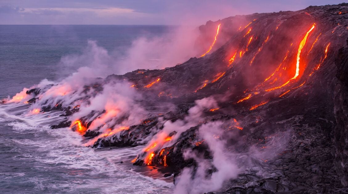
Top 10 Things to Do in Hawai’i Volcanoes National Park
Hawai’i Volcanoes National Park is home to two of the world’s most active volcanoes, Mauna Loa and Kīlauea. If you get lucky with your timing, you can catch Kīlauea in action, as molten lava oozes up from below the Earth’s crust, creating brand new land. But there is more to Hawai’i Volcanoes National Park than […]
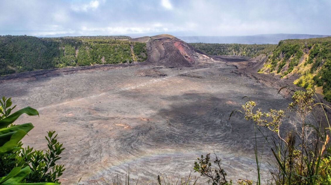
How to Hike the Kīlauea Iki Trail in Hawai’i Volcanoes National Park
The Kīlauea Iki Trail is a great experience to add to your Hawai’i Volcanoes National Park to-do list. On this relatively short hike, walk through a rainforest, cross a solidified lava lake, and gaze out at the crater from the rim. You also have the option to add on the Thurston Lava Tube. This hike […]
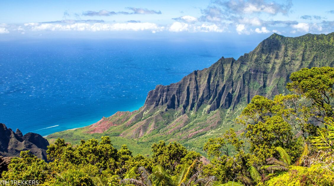
20 Best Things to Do in Kauai, Hawaii
Kauai, also called the “Garden Isle,” is our favorite of the Hawaiian Islands. With its waterfalls, beautiful beaches, tropical resorts, and stunning coastlines, Kauai is pure paradise. In this guide, we cover the best things to do in Kauai with tips to have the best experience. Best Things to Do in Kauai Here are the […]

Diamond Head Summit Trail, Oahu | Things to Know Before You Go
The Diamond Head Summit Trail in Oahu is one of Hawaii’s most popular hikes. This short, steep trail takes hikers up to a spectacular viewpoint of Waikiki Beach. We have hiked a lot of trails around the world and this was the most crowded, congested trail we have seen yet. If you are looking for […]

The Ultimate Guide to the 63 US National Parks
Stretching from the South Pacific, across the United States to the Caribbean, are 63 national parks. These national treasures preserve iconic landscapes, majestic mountains, primordial forests, arid deserts, misty coastlines, immense canyons, wildlife, and historic landmarks. We have visited 56 of the 63 US national parks, from the towering granite walls of Yosemite and the […]


Comments 9