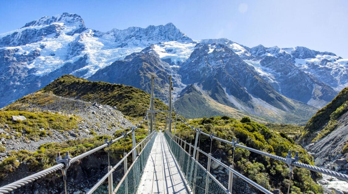
This Tasman Valley Hiking Guide covers the various walking tracks in the Tasman Valley section of Aoraki / Mount Cook National Park. These trails lead to Tasman Glacier View, Blue Lakes, Tasman Lake, and the Tasman River. You could easily spend several hours walking all of these tracks, but are all of the tracks worth hiking?
In this Tasman Valley Hiking Guide, I talk about each of these walking tracks and give you the information you need in order to decide which to hike and which to skip. I also provide a strategy for prioritizing your time in the Tasman Valley.
Another favorite, and not to be missed, hike in Aoraki / Mount Cook National Park is the Hooker Valley Track. Plan your visit with our Guide to Aoraki/Mount Cook National Park.
Tasman Valley Trailhead
From the Aoraki / Mount Cook village, take Highway 80 (Mount Cook Road) almost 1 km (0.6 miles) to Tasman Valley Road. Follow Tasman Valley Road until it ends at the Blue Lakes Car Park (labeled as Tasman Glacier Car Park in Google Maps). It is a 7.1 km (4.4 mile) scenic drive along Tasman Valley Road.
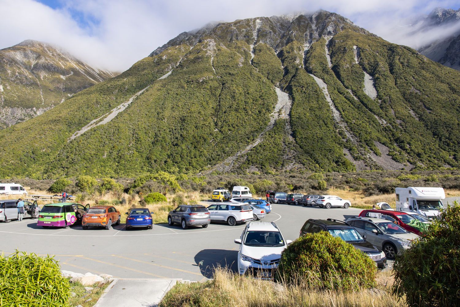
At the carpark you will find bathrooms, a shelter, and one trailhead.
All trails in this area start at this one trailhead and then split off from there. So, you will start here whether you plan to hike to Tasman Glacier View, Blue Lakes, Tasman Lake, and/or to the Tasman River.
Tasman Valley parking
Tasman Valley Trails
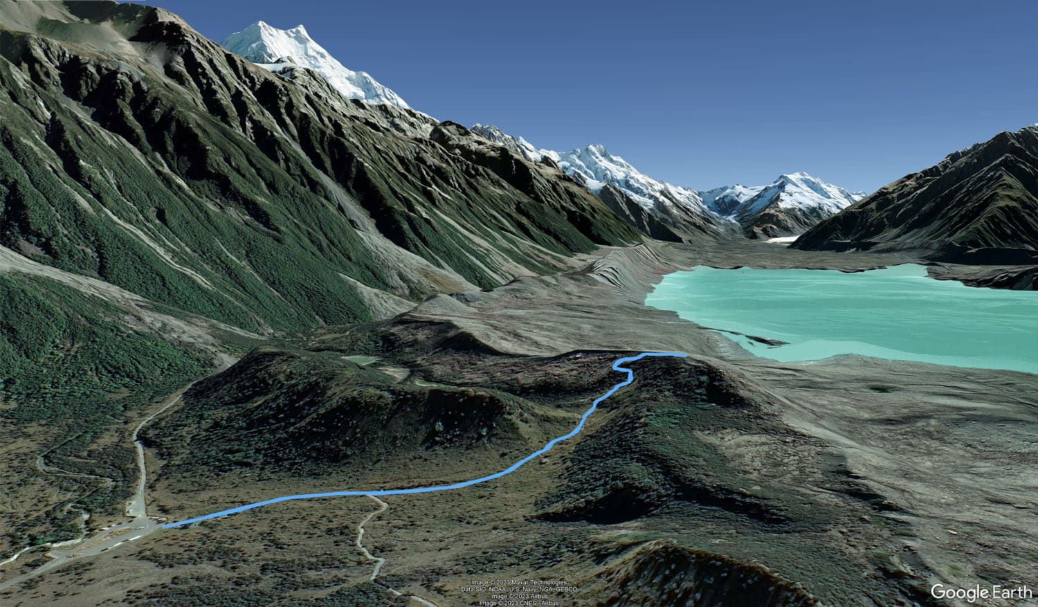
There are four trails in the Tasman Valley area to be aware of:
- Tasman Glacier View Track
- Blue Lakes spur trail
- Tasman Lake Track
- Tasman River spur trail
The single trailhead starts as the Tasman Glacier View Track. The Blue Lakes spur trail and Tasman Lake Track split off from the Tasman Glacier View Track. And the Tasman River spur trail splits off from the Tasman Lake Track.
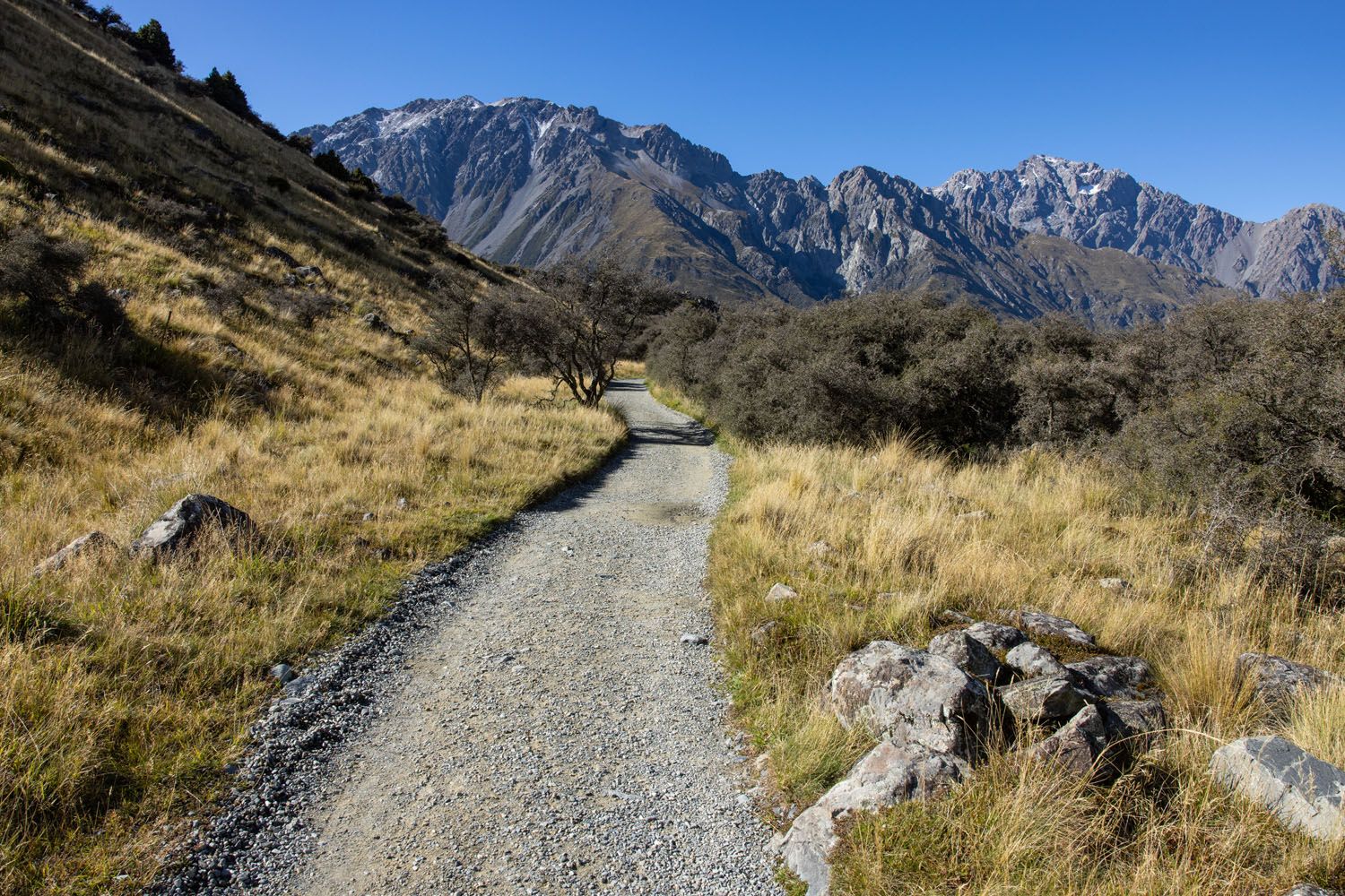
All of these trails are well-maintained gravel trails that are easy to follow.
If you use Google Maps to assist with trail navigation then know that Google Maps only shows two of the trails, the Tasman Glacier View Track and the Tasman Lake Track. And Google Maps labels both trails as “Blue Lakes and Tasman Glacier Walks”.
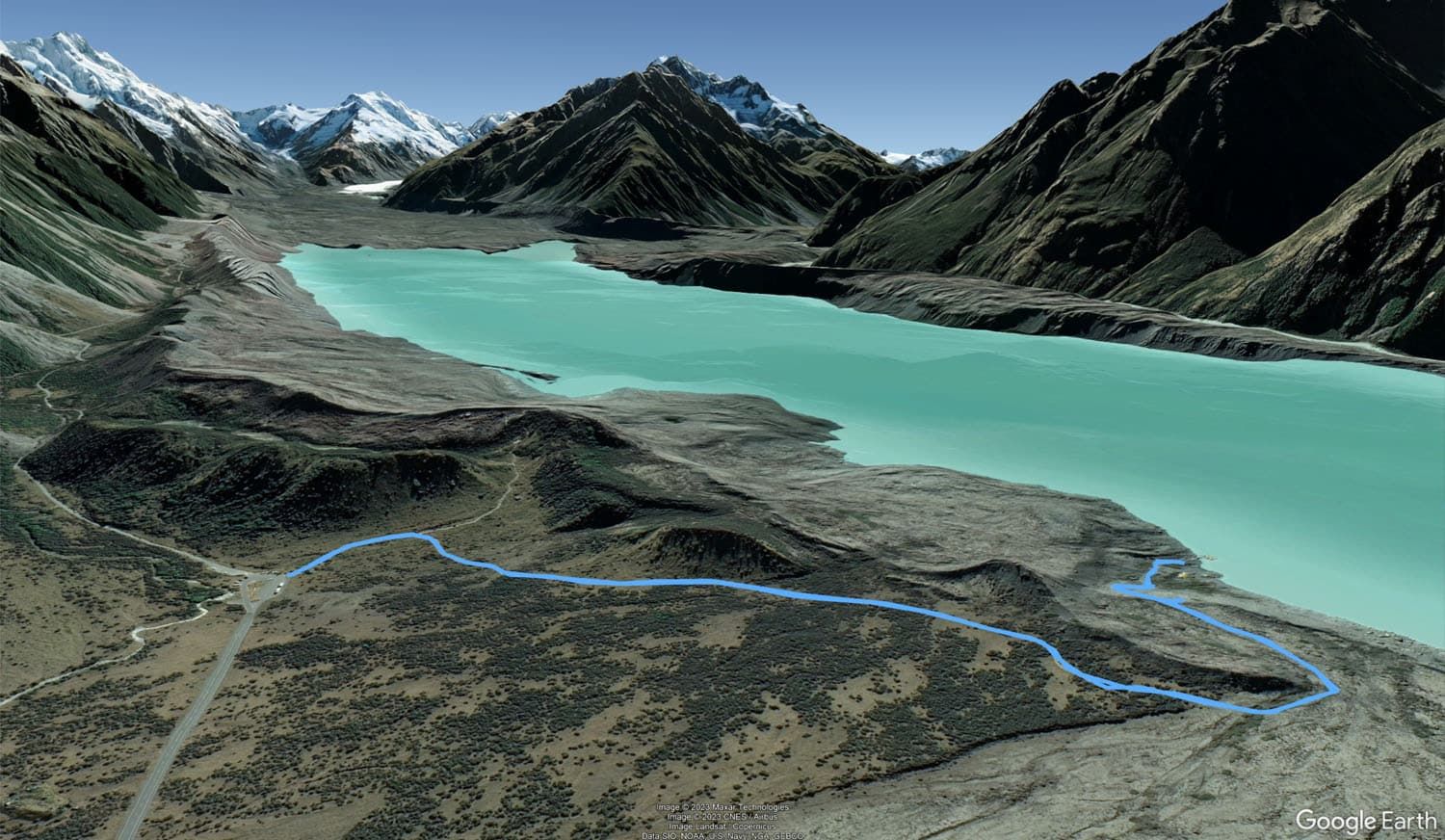
We created the following map to help clarify the different trails in the Tasman Valley area.
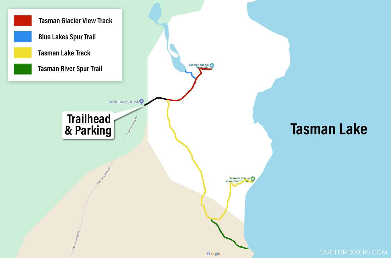
Map of the Tasman Valley Hikes
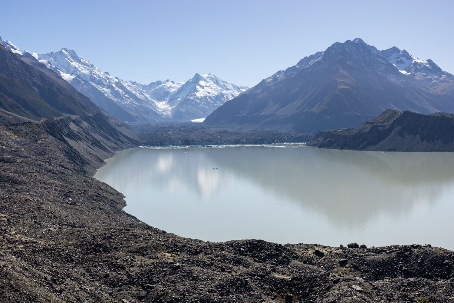
Tasman Glacier View Track
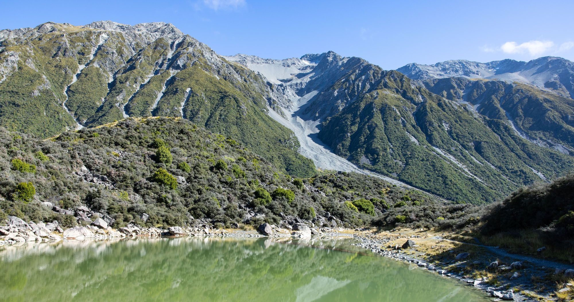
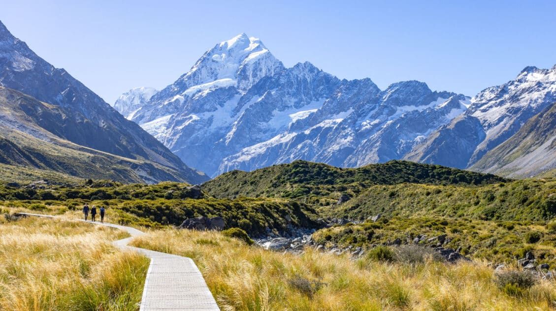
This trail takes you up to a gorgeous viewpoint overlooking Tasman Lake with a beautiful mountain backdrop. From the viewpoint you can also see the top of Mount Cook off to the left side and the retreating Tasman Glacier in the distance. In the summer you may also see icebergs floating in the lake, whereas in the winter the lake tends to freeze over.
This is a must-see viewpoint for any visit to Aoraki / Mount Cook National Park.
The overlook at the end of the Tasman Glacier View Track has a variety of names. On the trail signs it is labeled as “Tasman Lake View” and on Google Maps it is labeled as “Tasman Glacier Viewpoint”.
Distance: 1.15 km (0.72 miles) roundtrip
Total Ascent: 100 meters (330 feet)
Lowest Elevation: 717 meters (2,355 feet)
Highest Elevation: 817 meters (2,685 feet)
Difficulty: Easy
Time: 30 minutes, longer if you want to linger at the overlook
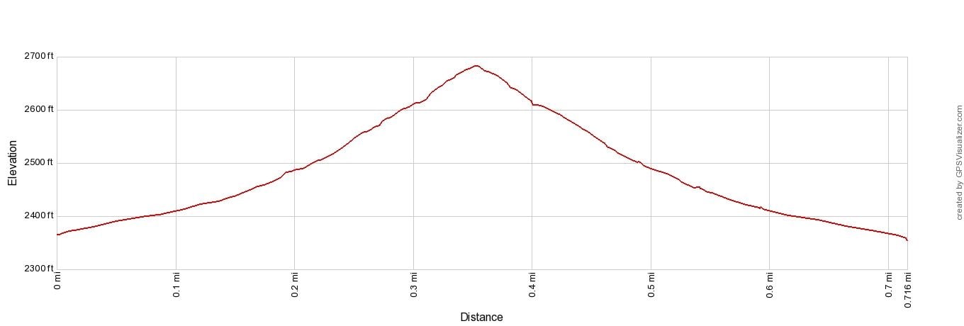
Tasman Glacier Viewpoint Elevation Profile
Tasman Glacier View Track
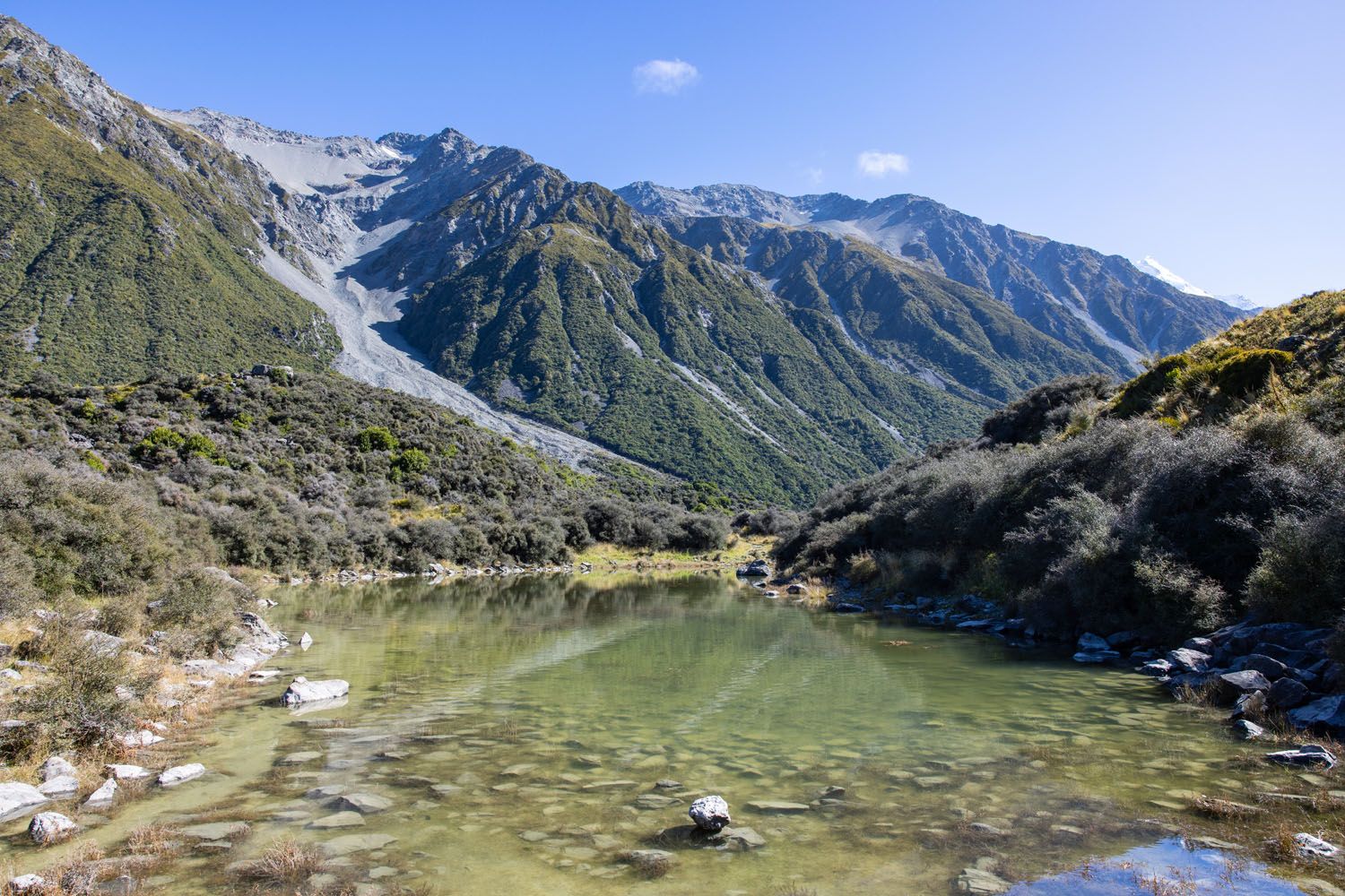
Blue Lakes
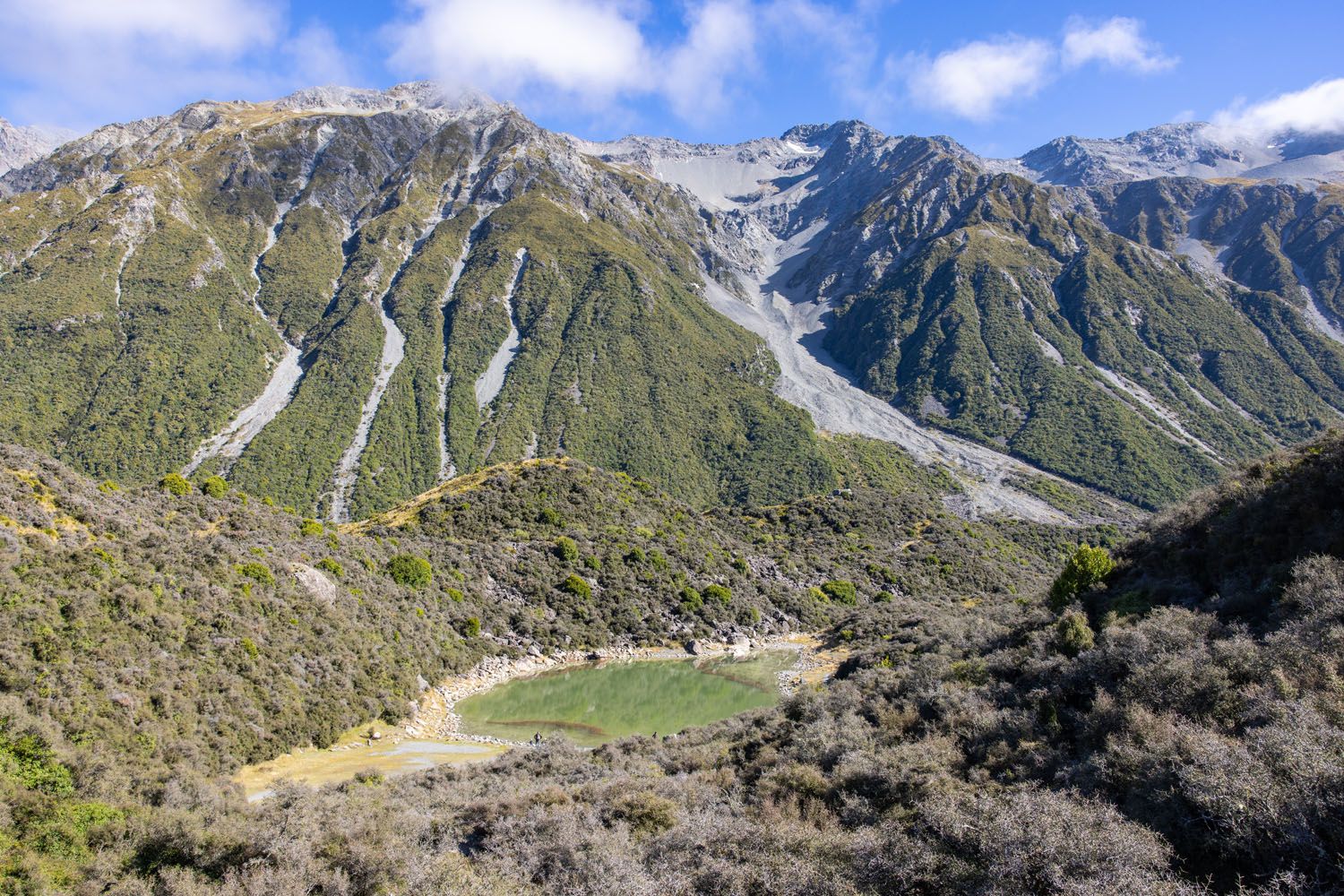
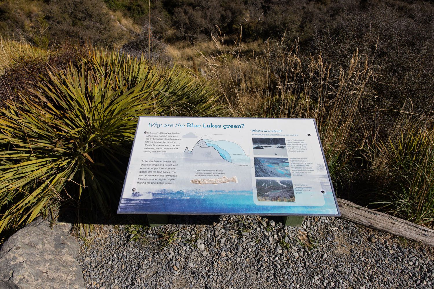
This spur trail branches off of the Tasman Glacier View Track and takes you right up to the water of the Blue Lakes. Under certain lighting conditions you might be able to capture the reflection of the surrounding mountains in the lake.
The New Zealand Department of Conservation website states “A side trip to the Blue Lakes offers good swimming in summer.” If you want to swim, then know that there are not any changing rooms or bathrooms at the lake. You might also enjoy sitting by the lake and having a picnic.
Tasman Lake Track
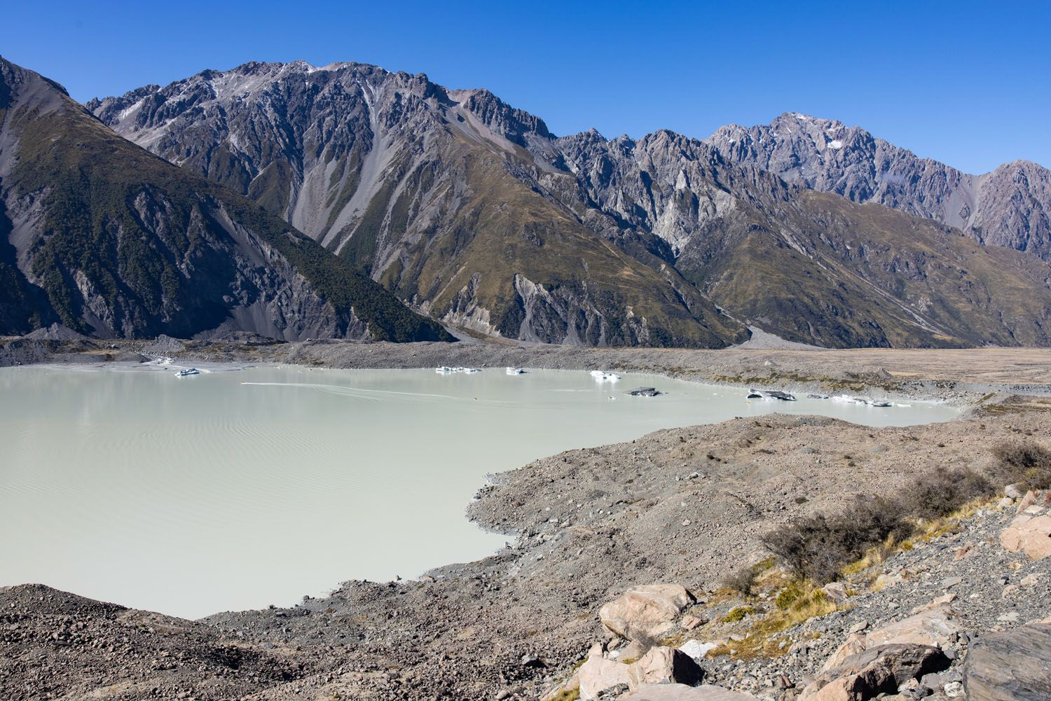
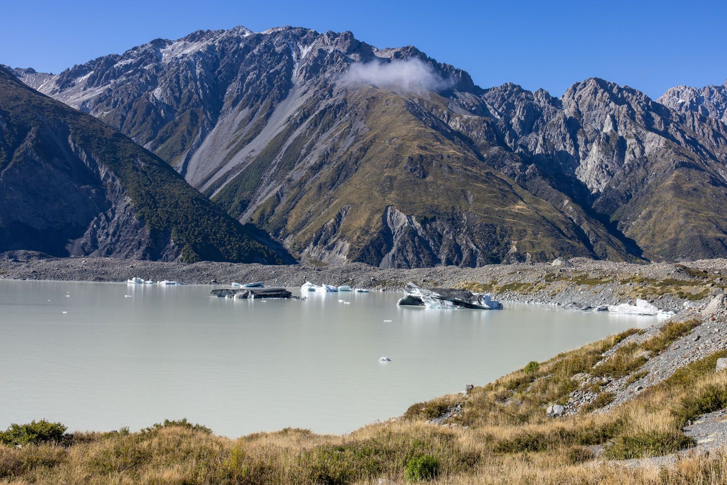
This trail takes you to a jetty where boat and kayak tours on Tasman Lake enter the water. These tours are a popular way of seeing any icebergs that are in the lake. Anyone is welcome to hike this trail, but if you sign up for one of the boat or kayak tours then you will have to hike this trail in order to reach the jetty. Just before reaching the jetty there is a viewpoint overlooking the lake.
The trail signs will refer to this track as “Tasman Lake Jetty”.
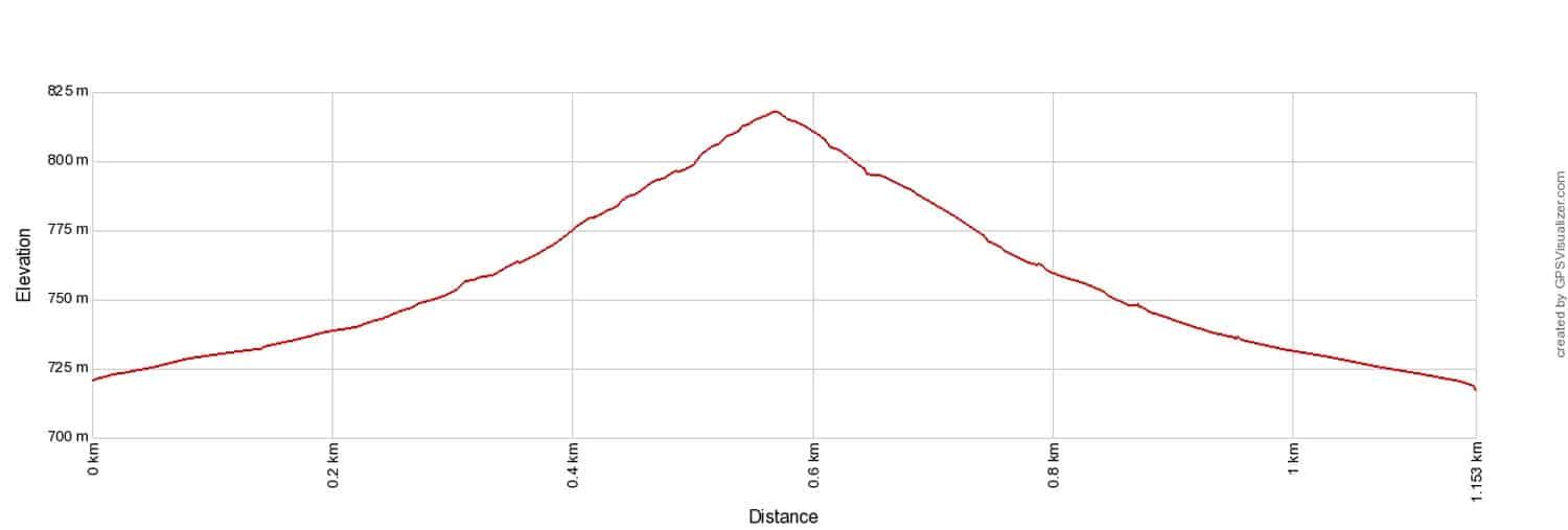
Distance: 2.8 km (1.75 miles) roundtrip
Total Ascent: 60 meers (200 feet)
Lowest Elevation: 717 meters (2,355 feet)
Highest Elevation: 738 meters (2,420 feet)
Difficulty: Easy
Time: 1 hour
Tasman Lake Track
Tasman River
This spur trail branches off of the Tasman Lake Track and takes you to the source of the Tasman River, where the river breaks off from the lake.
Please practice the seven principles of Leave No Trace: plan ahead, stay on the trail, pack out what you bring to the hiking trail, leave areas as you found them, minimize campfire impacts, be considerate of other hikers, and do not approach or feed wildlife.
Description of the Tasman Valley Trails
All of the trails in the Tasman Valley area are well-maintained and easy to follow gravel tracks.
At the Blue Lakes Car Park (labeled as Tasman Glacier Car Park in Google Maps) you will find a shelter, bathrooms, and one trailhead. The trail starts as the Tasman Glacier View Track.
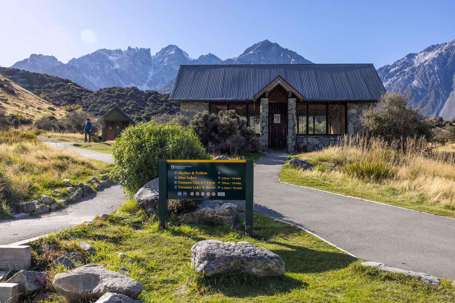
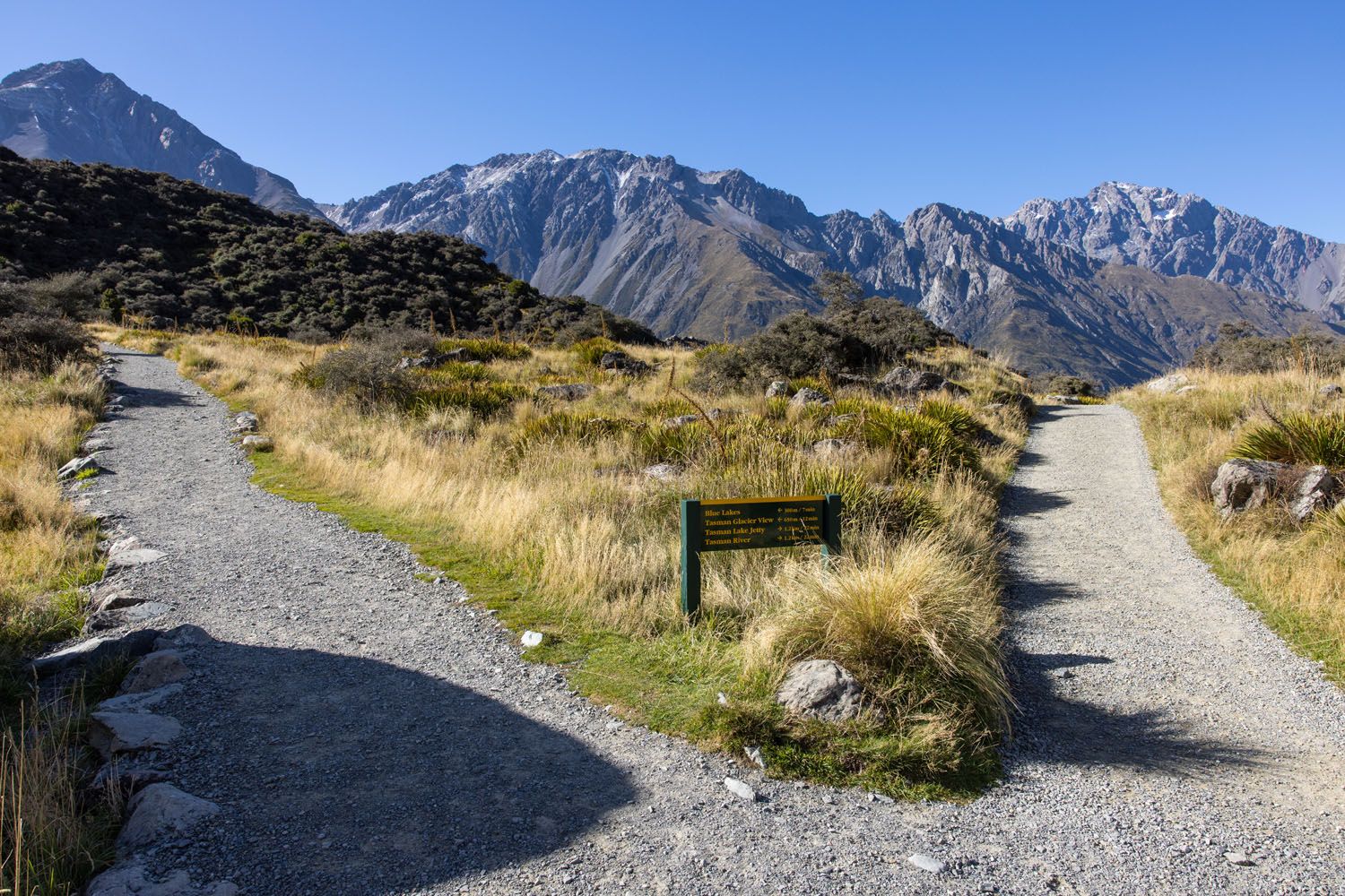
You do not have to follow the trail from the parking lot very far before you reach the first trail junction. At this junction you will see a sign pointing straight for Tasman Lake View (this is the continuation of the Tasman Glacier View Track) and right for Tasman Lake Jetty (this is the Tasman Lake Track).
I recommend going straight first, staying on the Tasman Glacier View Track, and thus following the sign to Tasman Glacier View.
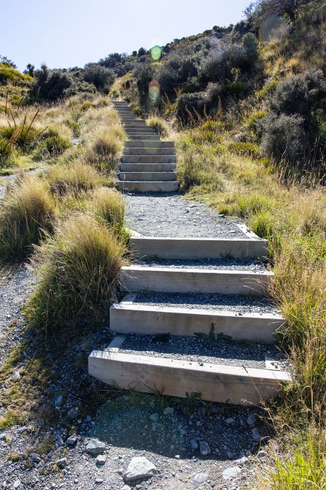
The track will gain elevation a little with the assistance of some steps built into the trail. You will not hike very far before reaching the second trail junction. At this junction you go straight, and up the steps, to reach Tasman Lake View or you turn left and head to Blue Lakes.
I recommend continuing straight, staying on the Tasman Glacier View Track, and thus following the sign to Tasman Glacier View. You will ascend some steps as you start climbing up towards the viewpoint.
Part of the way up there is an overlook where you can see Blue Lakes below you.
The Blue Lakes
At the top of the Tasman Glacier View Track, you reach Tasman Lake View (labeled as Tasman Glacier Viewpoint on Google Maps). From here you have a gorgeous view of Tasman Lake and the Tasman Glacier in the distance. The lake is surrounded by mountains, and you can look for the top of Mount Cook towering over those mountains on the left. If you are hiking in the summer, look for icebergs in Tasman Lake. You can also see the boats touring the icebergs from here. In the winter the lake freezes over.
At this overlook there are boulders you can sit on to take in the full beauty of this viewpoint and to enjoy a picnic or snack.
Once you descend down from the overlook follow the short Blue Lakes spur trail to the edge of Blue Lakes. From the shoreline of the lake, you can see the top of Mount Cook. And under certain lighting conditions you might be able to snap a picture of the mountains reflecting in the Blue Lakes. This is also a good spot to enjoy a picnic and the New Zealand Department of Conversation allows swimming in Blue Lakes during the summer.
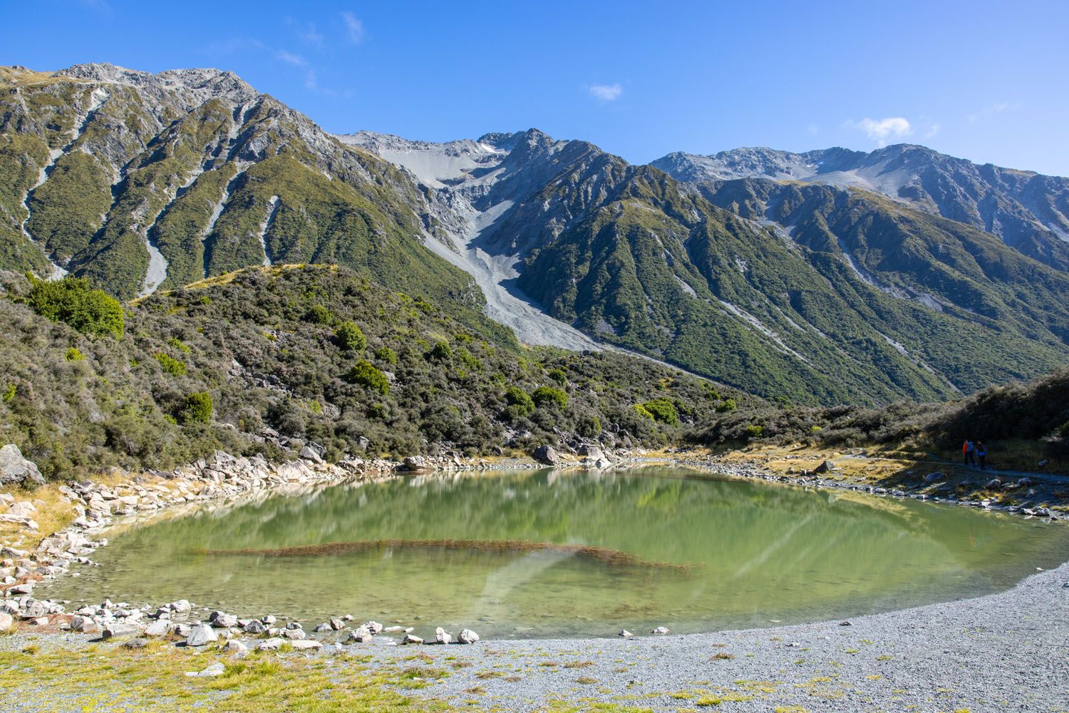
If you are feeling a little adventurous then from the shoreline, follow the trail around to the right and through a thorny brush tunnel to another part of the same lake.
After visiting Blue Lakes retrace your steps back towards the parking lot. Once you are almost back at the parking lot you will reach the first trail junction again. This is the junction for the Tasman Lake Track (the trail sign says Tasman Lake Jetty).
Tasman Lake Track
Follow that trail towards the Tasman Lake Jetty. About 0.8 km (0.5 miles) along this track you reach another trail junction. At this junction you go left to continue along the Tasman Lake Track (to reach the Tasman Lake Jetty) or right to follow the Tasman River spur trail to the source of the Tasman River.
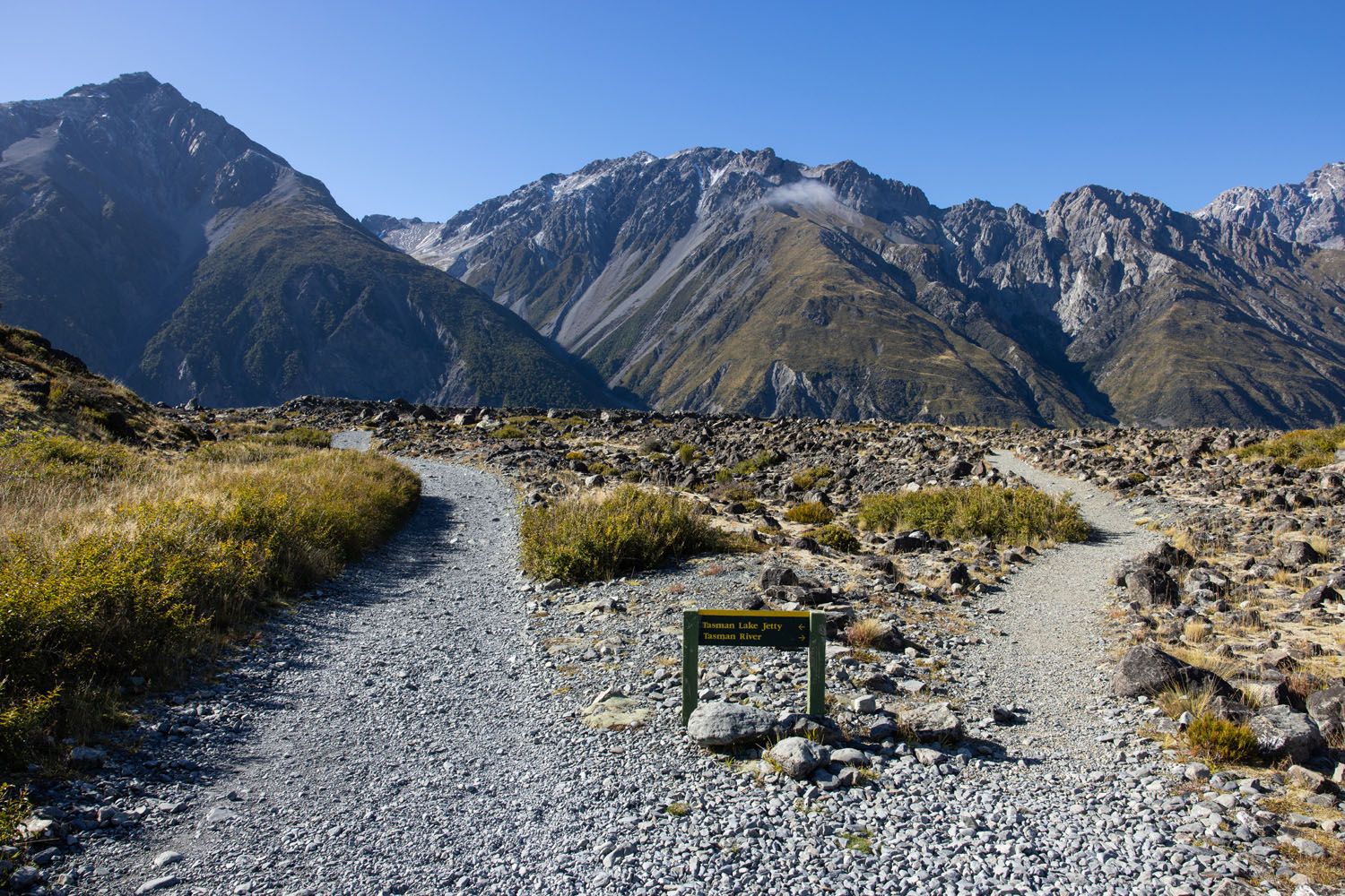
I recommend turning left first and continuing to follow the Tasman Lake Track. There is an overlook of the lake just before reaching the Tasman Lake Jetty. At this overlook and at the end of the Tasman River spur trail you might be able to spot icebergs in the lake during the summer.
It is important not to try to swim in Tasman Lake, walk on any frozen portions of Tasman Lake, or climb on any icebergs. These acts are dangerous and prohibited by the New Zealand Department of Conservation.
PRO TRAVEL TIP: If you want to hike the Tasman Lake Track and/or the Tasman River spur trail in hopes of getting a closer view of the icebergs, then scope out the iceberg situation first from the top of Tasman Glacier View Track to see if it’s worth it.
For the best close-up views of the icebergs consider taking a boat or kayak tour on Tasman Lake. If you book a Tasman Lake boat or kayak tour then you will hike the Tasman Lake Track to the Tasman Lake Jetty as part of that tour.
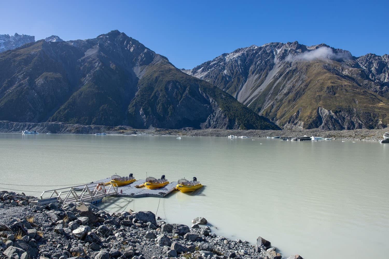
Tasman Lake Jetty
Tasman Valley Hiking Strategy
After spending a couple of hours hiking around this area here are my suggestions on how to prioritize your time here.
I recommend hiking the Tasman Glacier View Track first. It’s a relatively short hike with the roundtrip distance only slightly more than a kilometer (less than a mile). You do have to ascend about 300 steps in order to get up to the overlook, but it is well worth it. You are rewarded with a gorgeous view overlooking Tasman Lake, Tasman Glacier in the distance, the surrounding mountains, and even the top of Mount Cook. You can also look for icebergs floating in the lake during the summer. And this is a great spot to sit and enjoy a picnic or snack while you soak in the view.
Everyone visiting Aoraki / Mount Cook National Park should include the Tasman Glacier View Track in their itinerary.
The advantage of hiking the Tasman Glacier View Track first is that you can use the views from this track to help you decide if you want to follow any of the other trails in the Tasman Valley area. As you are ascending the steps on the Tasman Glacier View Track you will reach an overlook of Blue Lakes. So, as you admire Blue Lakes from this viewpoint you can decide if you want to follow the spur trail to its shoreline.
You might hike to the Blue Lakes shoreline to try to capture a photo of the mountain reflections in the lake, to go for a swim in the summer, or to have a picnic by the lake.
Once you are at the top of the Tasman Glacier View Track you can see the full length of Tasman Lake. As you take in the view look towards the end of the lake where the Tasman Lake Jetty and the start of the Tasman River are located. Based on the view, and if there are any icebergs near the jetty or river, you can decide if you want to hike out to either of those points. Following the Tasman Lake Track out to the Tasman Lake Jetty is about 2.8 km (1.75 miles) roundtrip from the first trail junction (the junction closest to the parking lot).
The scenery along the Tasman Lake Track is just okay; the scenery along the Hooker Valley Track is much better. So, I recommend prioritizing the Hooker Valley Track over the Tasman Lake Track. The only caveat is if you spot icebergs in the vicinity of the jetty or the river then it might be worth hiking out to those points for a closer look. You will also have a chance to see icebergs in the two glacial lakes along the Hooker Valley Track.
It is important not to try to swim in a glacial lake (such as Tasman Lake), walk on any frozen portions of a glacial lake (such as Tasman Lake), or climb on any icebergs. These acts are dangerous and prohibited by the New Zealand Department of Conservation.
The best way to see icebergs is by taking a boat or kayak tour on Tasman Lake.
If you book a Tasman Lake boat or kayak tour then you will hike the Tasman Lake Track to the Tasman Lake Jetty as part of that tour.
What to Bring
I recommend wearing hiking shoes. Waterproof hiking shoes would be even better in the event of bad weather. The trails can get wet and muddy when it rains, and the trails can be slippery when it snows, so bring proper footwear for those conditions. Under perfectly dry conditions you could get away with wearing sneakers that have a good grip. But you never know what the weather will be ahead of your visit, so it is best to be prepared for the worst. Furthermore, the shoreline of Blue Lakes can be muddy as well.
All of the trails in the Tasman Valley area are exposed to the sun, so don’t forget to bring sunscreen, sunglasses, a hat, and some water.
If you are only hiking the Tasman Glacier View Track then you don’t need much more than that as the track is short. Although you might consider bringing items to have a picnic at the top of the Tasman Glacier View Track.
If you plan to hike more than the Tasman Glacier View Track then bring sufficient food and water, and dress in layers so you are prepared for any weather changes. This is an alpine region so weather changes can occur rapidly.
If you plan to swim at Blue Lakes then bring a swimsuit, towel, and change of clothes. There are not any changing rooms or bathrooms at the Blue Lakes. And know that swimming in Tasman Lake is not allowed and is considered very dangerous.

Essential Hiking Gear: What Should You Bring on a Day Hike?
If you are new to hiking or are curious about what you should bring on a hike, check out our Hiking Gear Guide. Find out what we carry in our day packs and what we wear on the trails.Safety
Do not swim in Tasman Lake. The lake is very cold, and hypothermia can set in quickly.
Do not try to walk on Tasman Lake if it is frozen. The ice can easily give way causing you to fall in.
Do not climb on Icebergs as they are not stable and can tip over.
Check the weather forecast.
The view from the Tasman Glacier View Track
Frequently Asked Questions
Where is the Tasman Valley located?
The Tasman Valley is located in Aoraki / Mount Cook National Park on the South Island of New Zealand.
How do you get to the Tasman Valley area?
From the Aoraki / Mount Cook village, take Highway 80 (Mount Cook Road) almost 1 km (0.6 miles) to Tasman Valley Road. Follow Tasman Valley Road until it ends at the Blue Lakes Car Park (labeled as Tasman Glacier Car Park in Google Maps). It is a 7.1 km (4.4 mile) scenic drive along Tasman Valley Road.
What hiking trails are in the Tasman Valley area?
There are four trails in the Tasman Valley area: Tasman Glacier View Track, Blue Lakes (spur trail), Tasman Lake Track, and Tasman River (spur trail). All four trails share the same trailhead and then break off from there.
Is hiking in the Tasman Valley area worth it?
Hiking the Tasman Glacier View Track is worth it, and we highly recommend it for anyone visiting Aoraki / Mount Cook. The other trails in the Tasman Valley area are optional. We recommend prioritizing other trails in Aoraki / Mount Cook National Park, such as the Hooker Valley Track, over the other trails in the Tasman Valley area.
When is the best time to hike in the Tasman Valley area?
The Tasman Valley area is open year-round with the summer and winter seasons offering different experiences. In the summer look for icebergs in Tasman Lake. In the winter Tasman Lake freezes over. The road to the Tasman Valley area can close in the winter due to snow.
Can you swim in Tasman Lake?
Swimming in a glacial lake, such as Tasman Lake, is not allowed and is considered very dangerous. Walking on frozen parts of Tasman Lake is also considered very dangerous and is prohibited.
Can you swim in Blue Lakes?
Yes, during the summer season you are allowed to swim in Blue Lakes since it is not a glacial lake. But know that there are not any changing rooms or bathrooms at the lake.
Can I hike in the Tasman Valley area with a dog?
No, dogs are not permitted on the trails in the Tasman Valley area.
Can I fly a drone in Aoraki / Mount Cook National Park?
You have to obtain a permit from the New Zealand Department of Conservation before flying a drone within Aoraki / Mount Cook National Park.
If you have any questions about hiking the Tasman Valley trails, let us know in the comment section below.
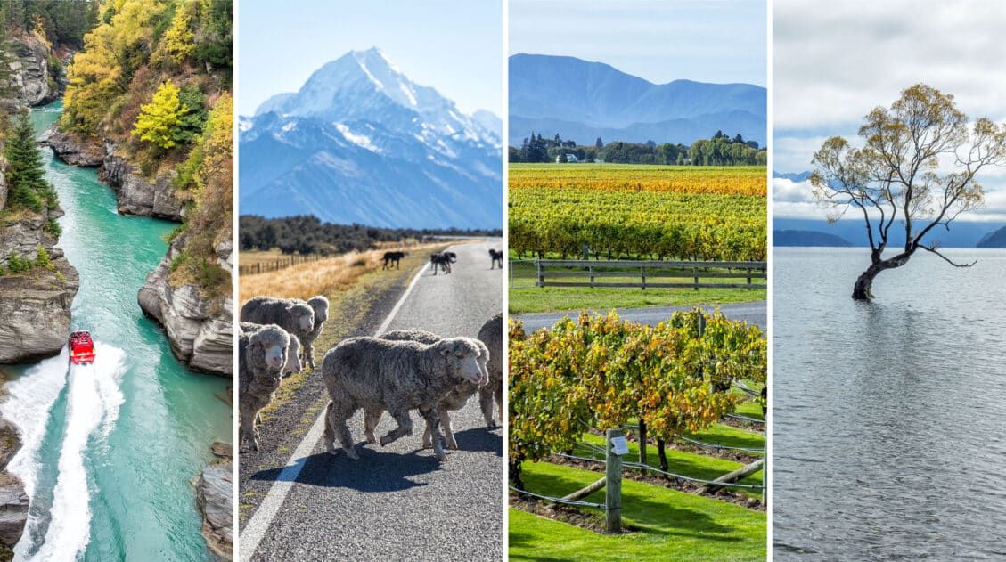
Plan Your Trip to New Zealand
We have TONS more information about New Zealand in our New Zealand Travel Guide, including Auckland, Queenstown, Wanaka, Aoraki/Mount Cook, Franz Josef, Christchurch, Wellington, Taupō, and the Milford Sound.
15 Amazing Things to Do in Aoraki / Mount Cook National Park
Pinterest Facebook Flipboard Discover the very best things to do in Aoraki/Mount Cook National Park, from its top hiking trails to its best viewpoints. We’ll also cover where to stay, the best time to visit, and how to plan your time. Aoraki / Mount Cook is the tallest mountain in New Zealand. Getting a glimpse […]
Exactly How to Hike the Hooker Valley Track & Is It Open?
The Hooker Valley Track is a 10.6 km (6.6 mile) easy to moderate hike. It’s the most popular in Aoraki / Mount Cook National Park and great for all ages. We hiked it twice, and in this guide we will provide tips, hiking stats, photos, and an elevation profile, so you know what to expect. […]
40 EPIC Things to Do on the South Island of New Zealand
Discover 40 amazing things to do on the South Island of New Zealand, from cruising Milford Sound to wine tasting and hiking the famous Roy’s Peak Track. Plan to spend at least one week on the South Island to see its highlights; three weeks is ideal for the full experience. The South Island of New […]
Best Things to Do in Franz Josef | Glacier Country, New Zealand
In this guide, we cover the best things to do in Franz Josef, plus how to get here, where to stay, and how to plan your time. Hike to viewpoints of glaciers, see the rarest Kiwi, soar over Fox Glacier and Franz Josef Glacier in a helicopter, capture Mount Tasman’s reflection in Lake Matheson, go […]
Fox Glacier & Franz Josef Helicopter Tours: Photos, Tips & What to Expect
A helicopter flight over the Franz Josef and Fox Glaciers is a thrilling experience. To see this land of glacier-capped mountains, rainforests, and rugged coastlines is one of the best experiences to have in Glacier Country, if not all of New Zealand. On a helicopter tour from Franz Josef or Fox Glacier, you will fly […]
One Week on the South Island of New Zealand: 4 Ways to Plan Your Trip
In this guide, we provide four different ways to spend one week on the South Island of New Zealand, including maps, daily itineraries, and many tips we learned over multiple trips. If you have one week on the South Island of New Zealand, there are several different ways to plan your time. Whether you want […]
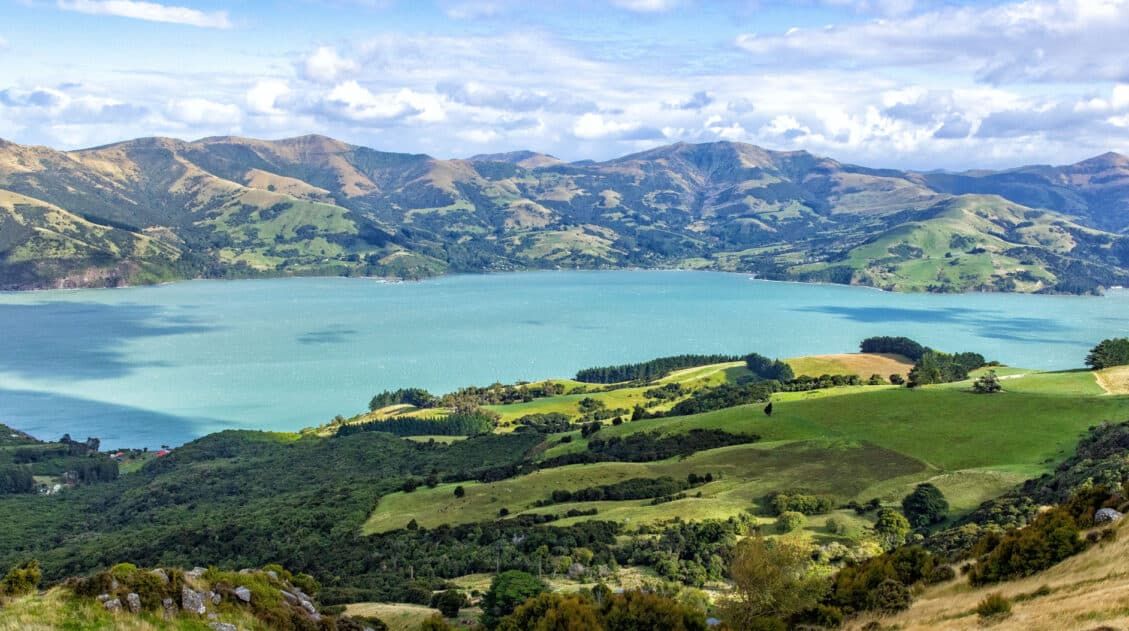
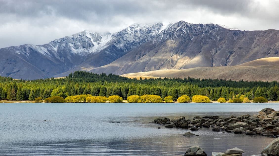
Best Things to Do in Akaroa & Banks Peninsula, New Zealand
Go for a scenic drive, take a hike, feed an alpaca, take a wildlife cruise to see the smallest dolphins in the world, and dine on fresh seafood…these are all things to do in Akaroa and Banks Peninsula. Banks Peninsula is a small, volcanic peninsula located on the east coast of the South Island of […]
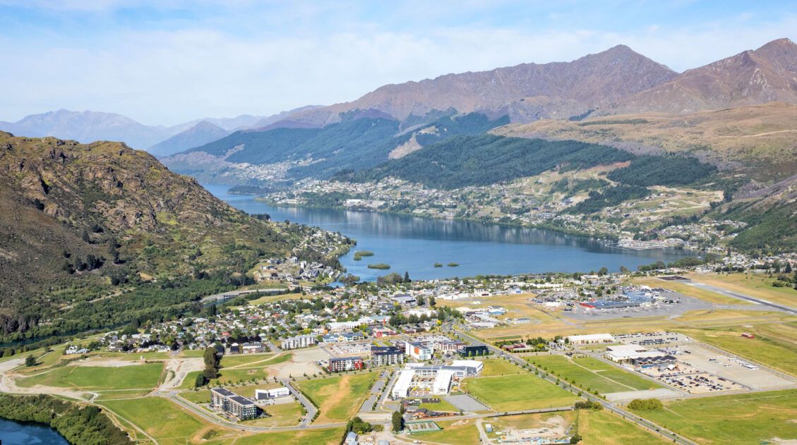
Queenstown Itinerary: 3 Unique Ideas for Your Perfect Vacation
If you are planning your Queenstown itinerary, there are a lot of things to consider. How long should you spend in Queenstown? Where should you stay? Should you rent a car? What are the best things to do in Queenstown? In this guide, we share the top experiences in Queenstown and then how to put […]
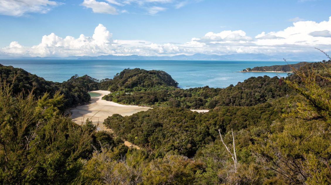
One Day in Abel Tasman National Park
Abel Tasman National Park is New Zealand’s smallest park. Located on the northern coastline of the South Island, Abel Tasman is home to one of New Zealand’s multi-day walking tracks, aptly named the Abel Tasman Coast Track. This is also a great place for kayaking, exploring the wide, empty beaches, and walking on trails amidst […]
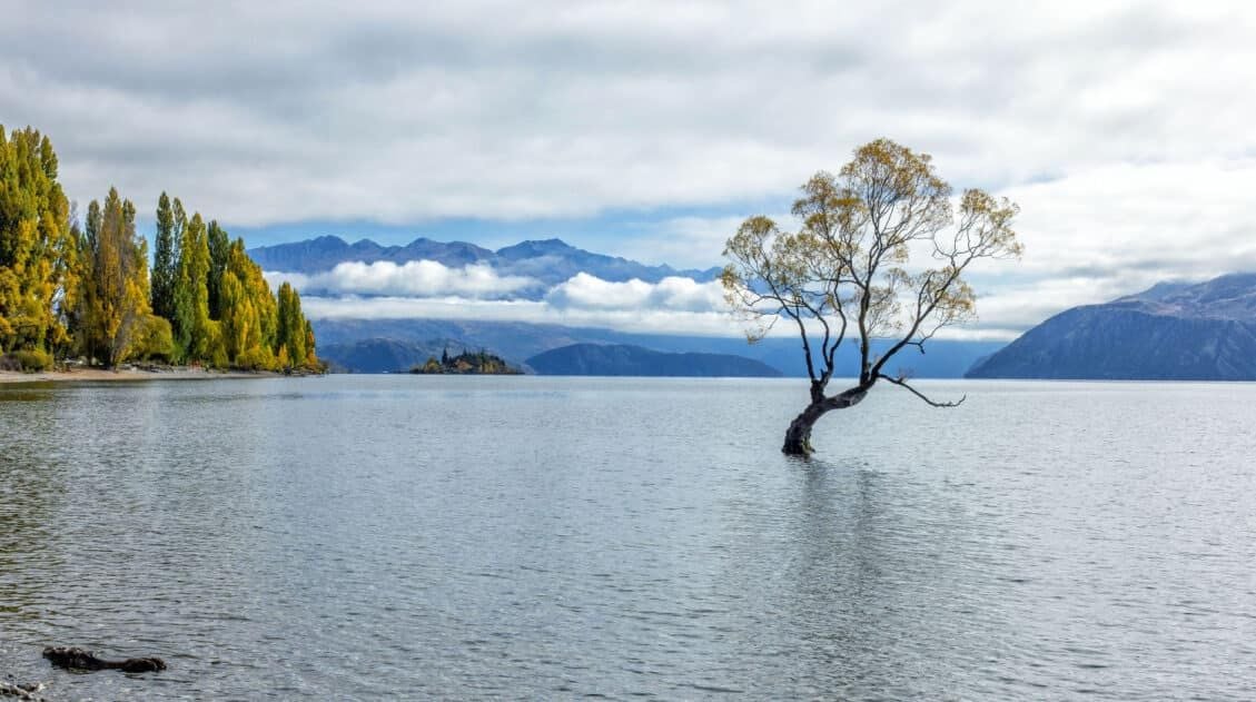
20 Epic Things to Do in Wanaka, New Zealand
Discover the best things to do in Wanaka, from top hikes like Roy’s Peak and Diamond Lake to unique activities such as lavender farms, via ferratas, and enjoying freshly baked cookies at Cinema Paradiso. See the highlights in one busy day, but stay longer to experience all that Wanaka has to offer. Wanaka is one […]

New Zealand Itinerary: 3 Week North & South Island Road Trip
This 3-week New Zealand itinerary starts in Auckland, spends one week on the North Island, then two weeks on the South Island, ending in Queenstown. It’s the best way to see the highlights of New Zealand in one road trip. It’s no secret that New Zealand is one of our favorite destinations in the world. New Zealand is the perfect blend […]
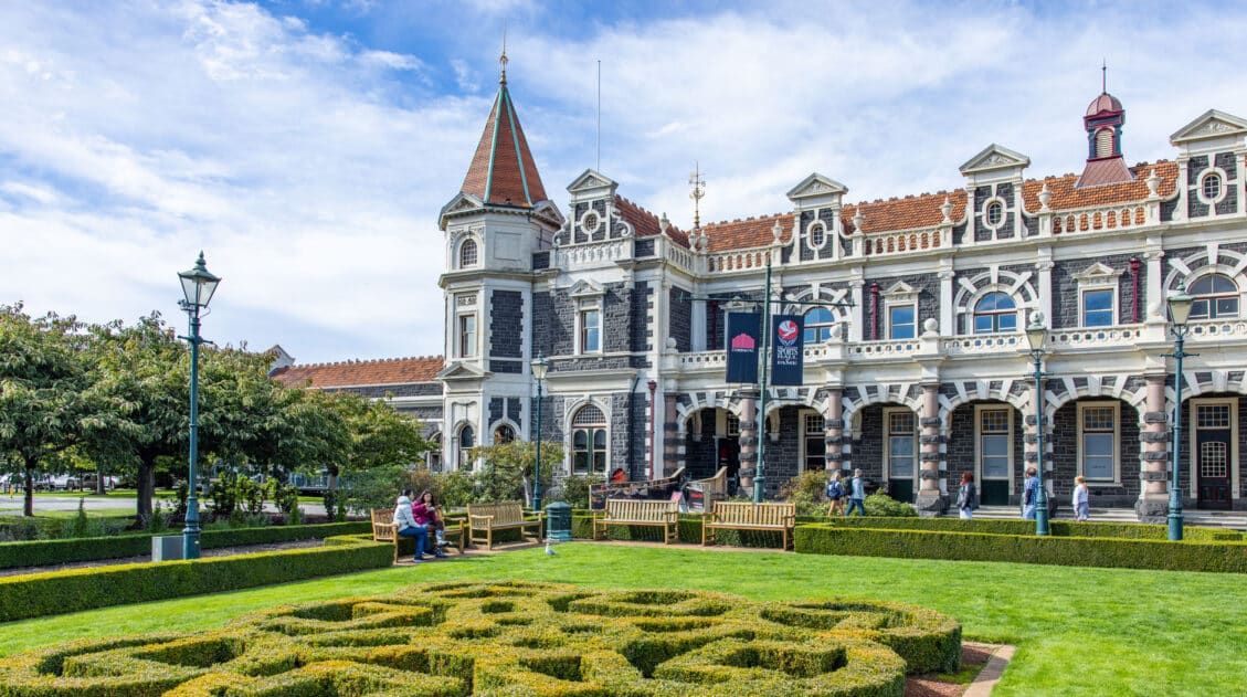
20 Best Things to Do in Dunedin & the Otago Peninsula
Discover the best things to do in Dunedin and on the Otago Peninsula, plus where to stay, where to eat, and how to get here. Dunedin is the second largest city on the South Island of New Zealand. It sits on the east coast, next to the Otago Peninsula. This city has a rich Scottish, […]
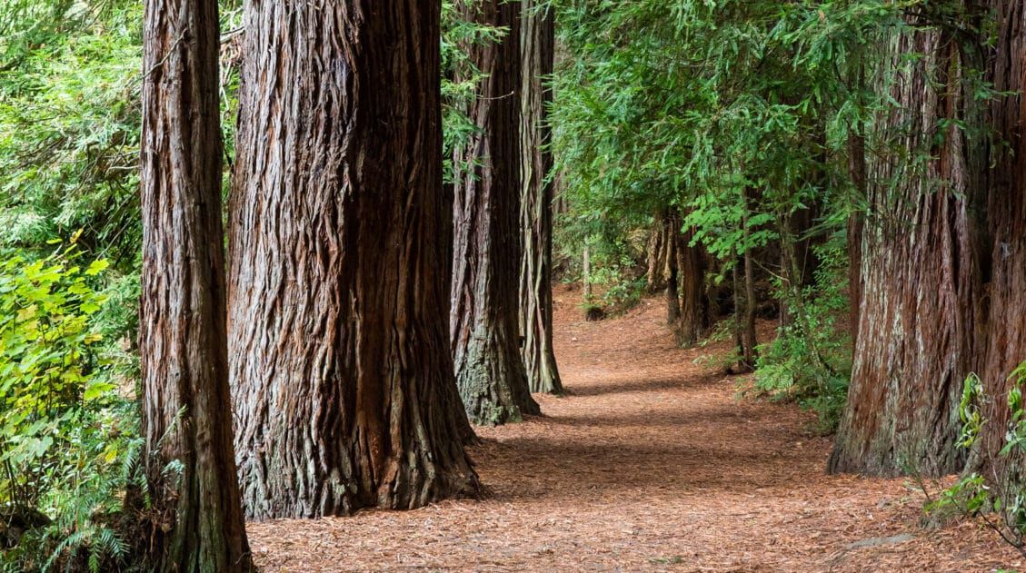
20 Wonderful Things to Do in Rotorua, New Zealand
Discover the best things to do in Rotorua, from its geothermal wonders such as Te Puia and Wai-O-Tapu Thermal Wonderland, to unique experiences like the Redwoods Treewalk and zorbing, as well as its cultural tours of Māori villages. One day is sufficient to see the main sights, but more time lets you visit several thermal […]
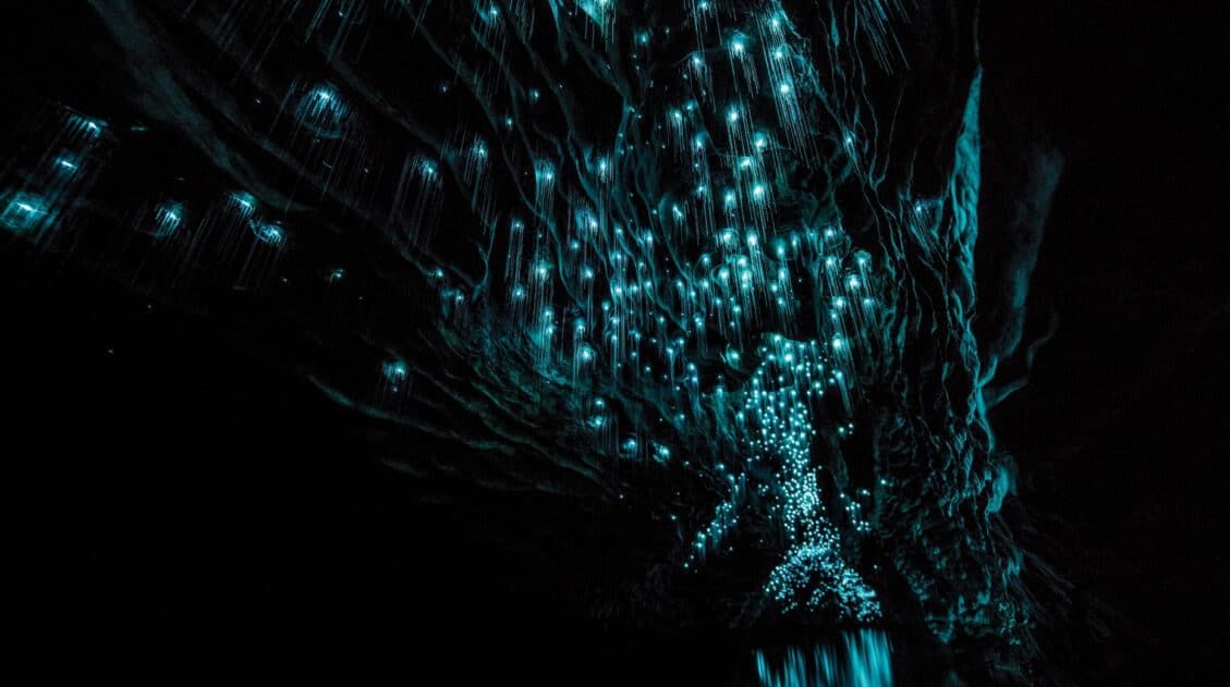
Waitomo Caves: Glowworms, Black Water Rafting & the Best Tours
This guide covers the best things to do in the Waitomo Caves, including how to see the glowworms and how to go black water rafting. It also covers the best tours, where to stay, and how to combine Waitomo Caves with another famous attraction on the North Island, Hobbiton. The Waitomo Caves are an underground […]

Leave a Comment