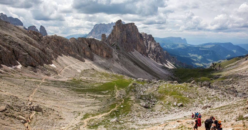

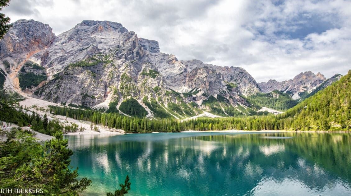
The Puez-Odle Altopiano trail is a 17 km (10.6 mile) hike along some of the highest mountain peaks in the Dolomites. We hiked this lesser-known trail on our first trip to the Dolomites and it is a spectacular hike from start to finish. With jaw-dropping views of the Dolomites, fields of wildflowers, and endless alpine views, this is our favorite hike in the Dolomites.
On our first trip to the Dolomites, we only had three days in the region. I picked this hike out of a guidebook, choosing it for its longer distance, high alpine trail, and claims of spectacular views. The guidebook was spot on. This hike may not be as iconic as Tre Cime di Lavaredo or as short and sweet as the Cinque Torri, but it is still an amazing day hike.
One of the great things about this hike is that a cable car eliminates most of the uphill hiking. Overall, there are about 850 meters of climbing and 1,500 meters of descent on the Puez-Odle Trail, making it an overall downhill hike.
This hike is perfect for those looking for a full day hike, endless panoramic views, and a less crowded trail than some other hikes in the Dolomites. Adventurous kids can do this hike (our kids were 9 and 11 at the time). And if you’re deciding how this hike compares to other classics in the region, you’ll also find it featured in our roundup of the best hikes in the Dolomites, alongside other unforgettable trails.
February 2026 Update: Added new photos and confirmed hiking stats. In January, we also added a link to the AllTrails map.
Puez-Odle Altopiano Hiking Stats
Distance: 17 km (10.6 miles) point-to-point
Total Ascent: 850 meters (2,800 feet)
Total Descent: 1,500 meters (4,900 feet)
Time: 6 to 9 hours
Difficulty: Moderate to strenuous
When to go: This hike is best during the summer months, when the wildflowers are in bloom.
Bring: Hiking shoes, water, snacks or lunch, a jacket (it is chilly at the higher elevations), and of course, your camera.
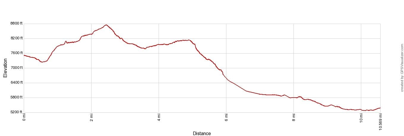
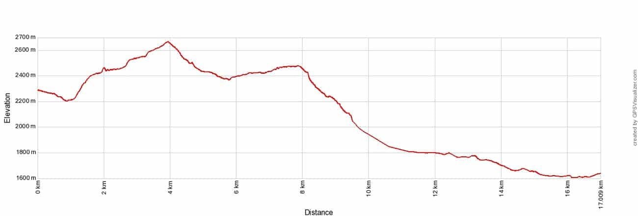
Elevation profile
Please practice the seven principles of Leave No Trace: plan ahead, stay on the trail, pack out what you bring to the hiking trail, leave areas as you found them, minimize campfire impacts, be considerate of other hikers, and do not approach or feed wildlife.
Hiking the Puez-Odle Altopiano
Step-By-Step Trail Guide
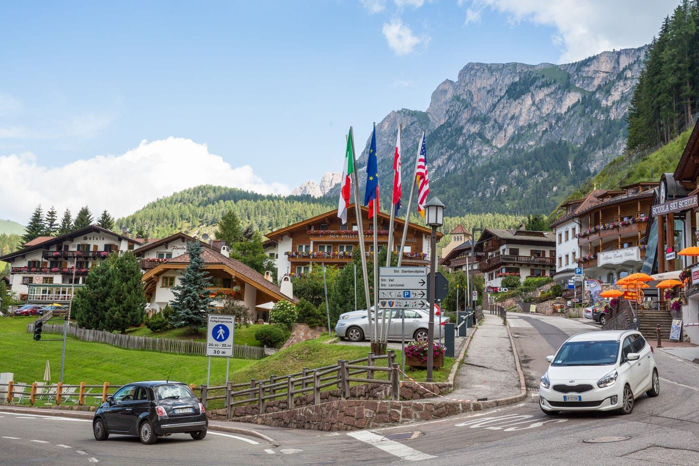
Selva di Val Gardena
The hike starts in the town of Selva di Val Gardena, in the Upper Val Gardena area of the Dolomites. For us, this was an hour and a half drive from our hotel. Winding roads and numerous passes through the mountains made the drive incredibly scenic.
Here is a map of the Dolomites, with the location of Selva di Val Gardena, the gondola that takes you to the start of the hike, and the location of Rifugio Puez, a restaurant/hotel located along the hike. It also includes the walking route from the end of the trail back to the Dantercepies gondola.
Selva di Val Gardena
Dantercepies Cable Car
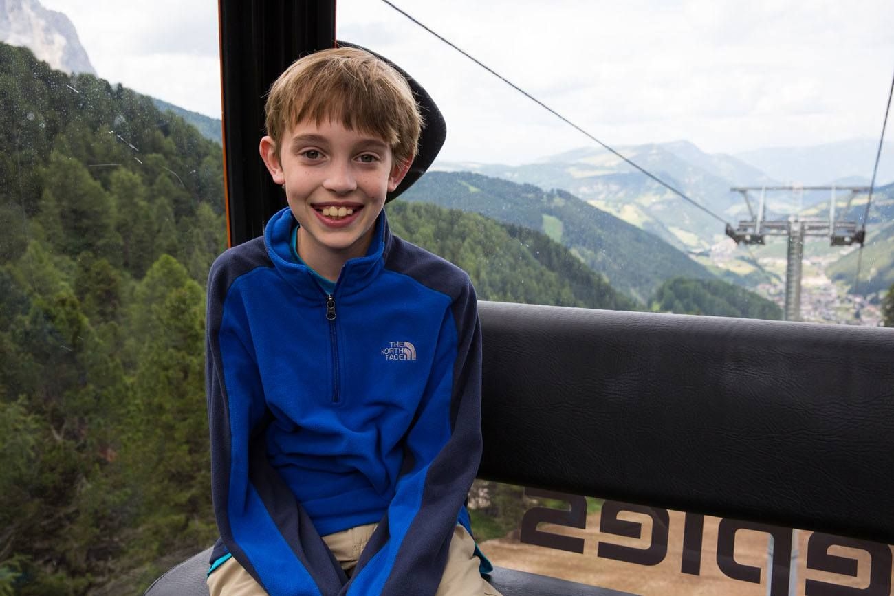
This hike starts with a ride on the Dantercepies cable car. There is a parking garage and a large parking lot next to the bottom cable car station.
This gondola takes you up into the mountains, shaving off a portion of your climb. This saves a lot of time and energy and provides awesome views on your way to the top.
Note: The Dantercepies gondola does not operate all year. In the summer, it runs from mid-June through early October. Get exact dates and hours of operation here.
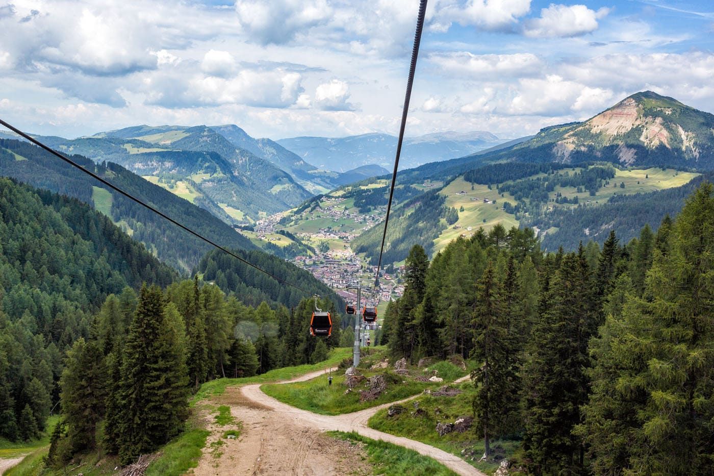
From the gondola, follow the wide trail east towards Rifugio Jimmi. Enjoy those views along the way!
Rifugio Jimmi to Rifugio Puez
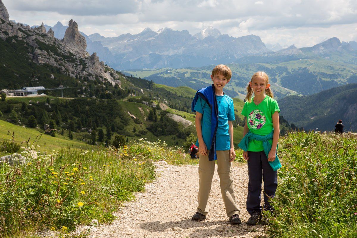
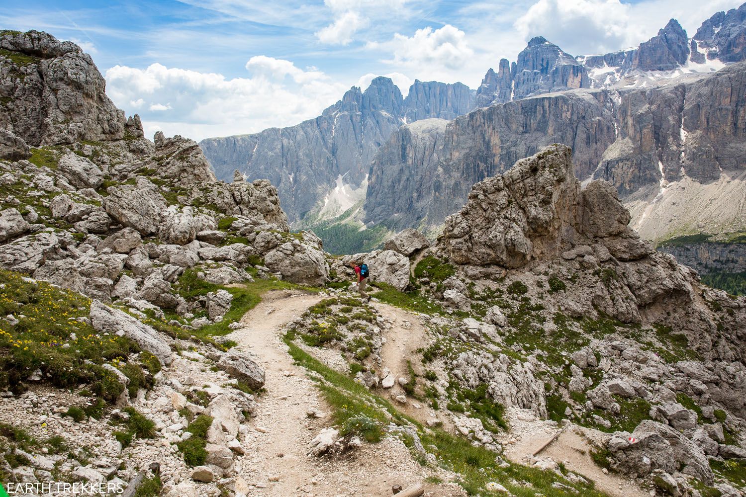
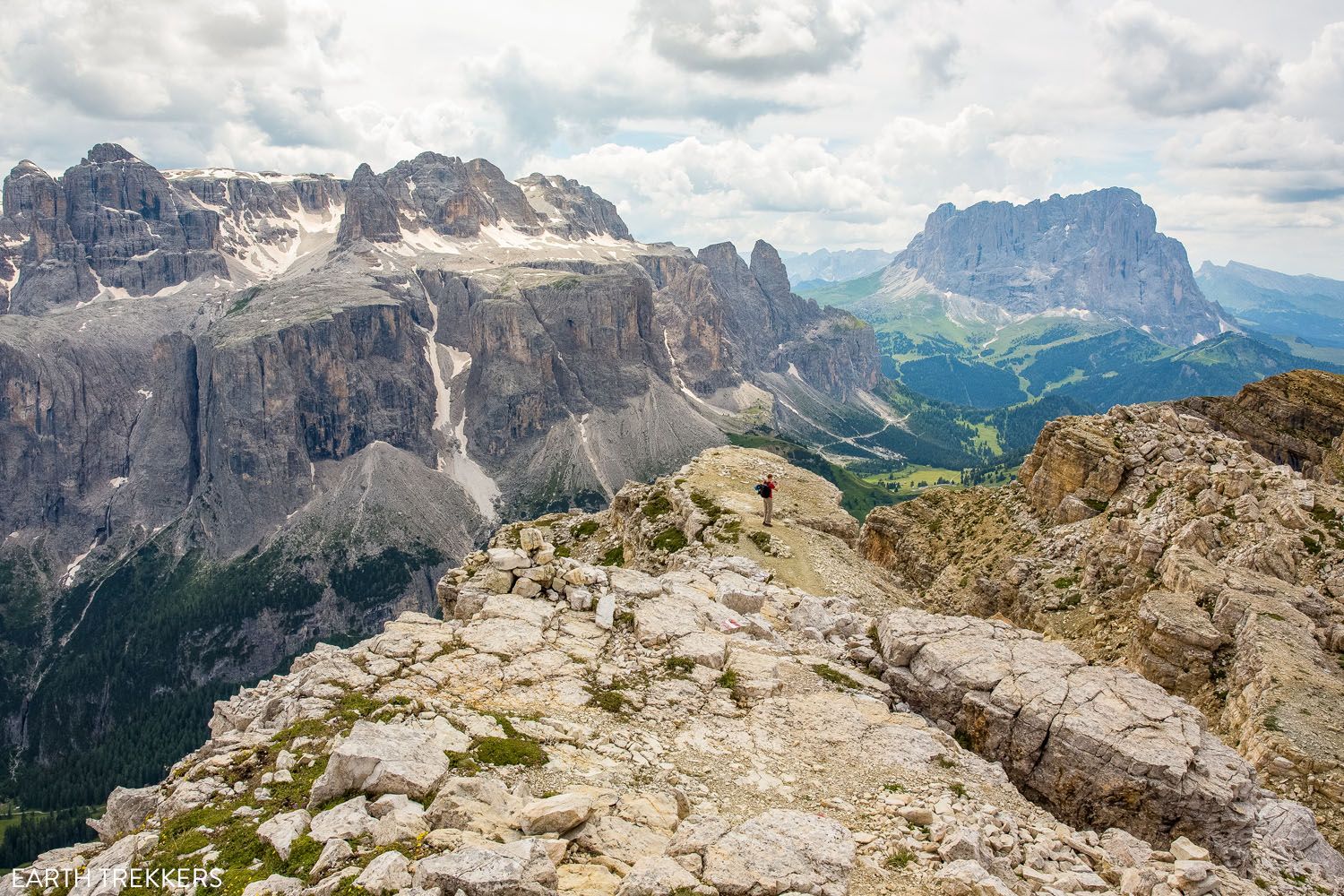
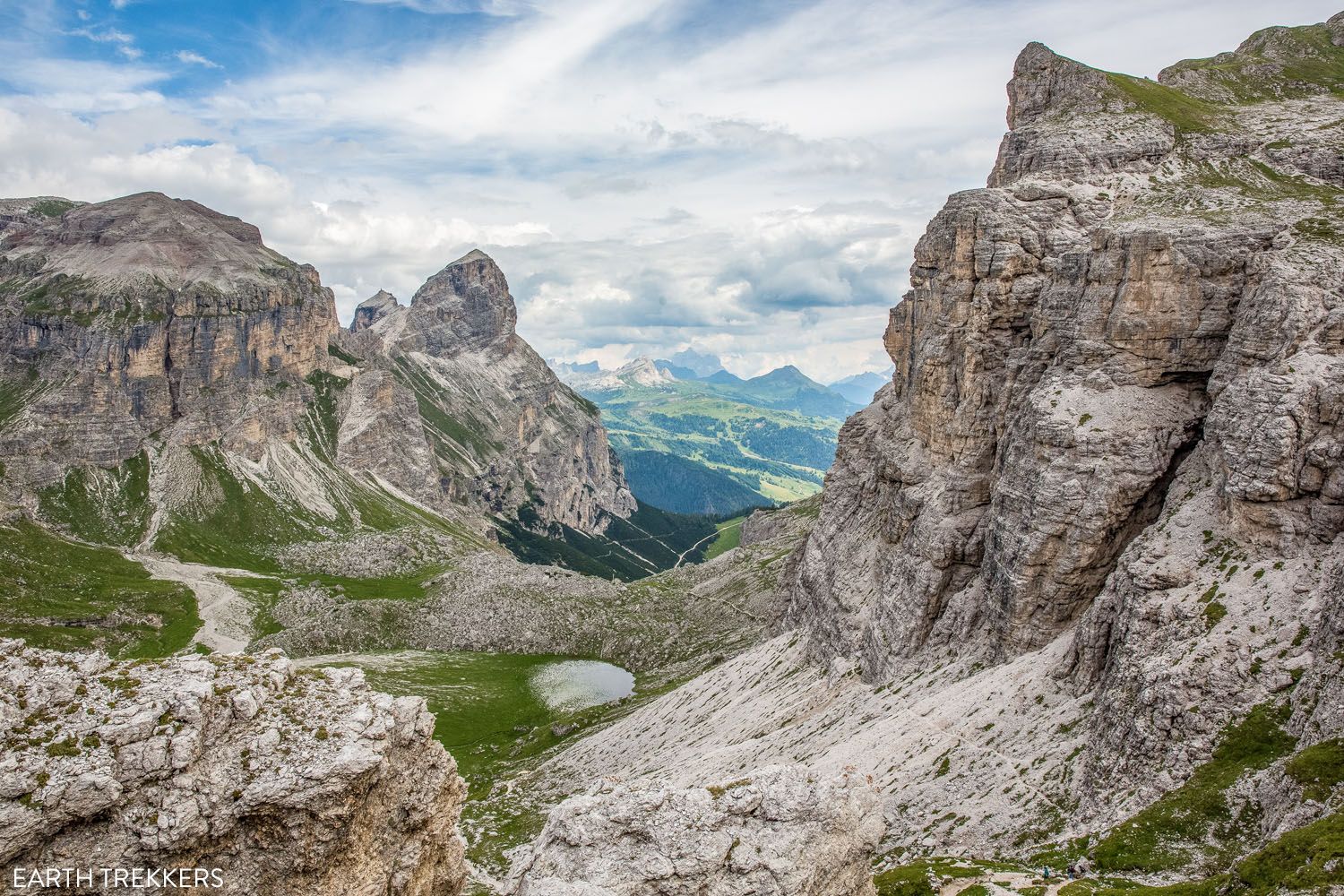
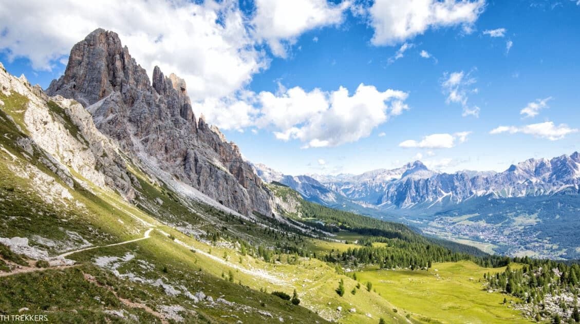
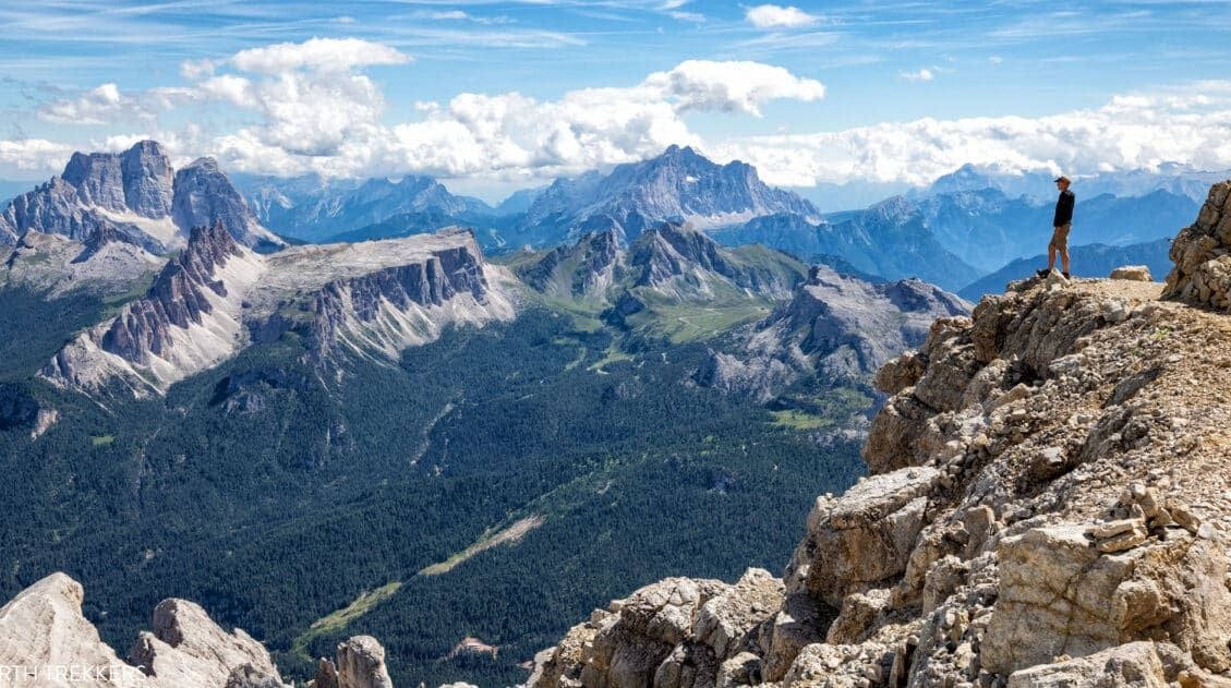
Once at Rifugio Jimmi, the real hiking begins. From here, take the no. 2 trail up and into the rocky mountains. As we climbed higher and higher, we had the best view of the Dolomites so far.
View from the Puez-Odle Altopiano trail
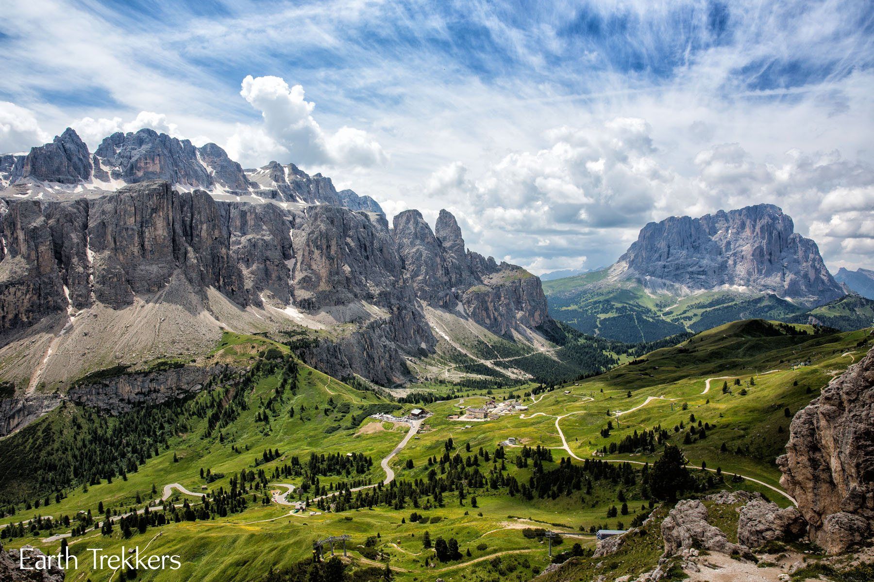
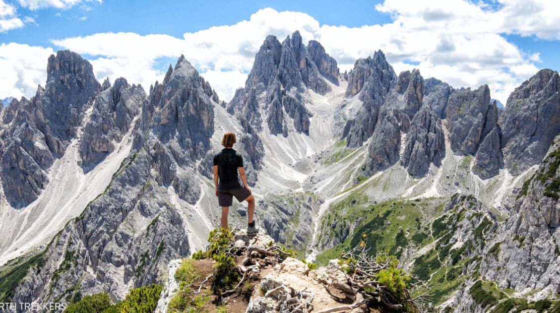
It did not take long until we summited the mountain. The views on the other side were totally different! Good-bye lush green landscape…hello rocky formations.
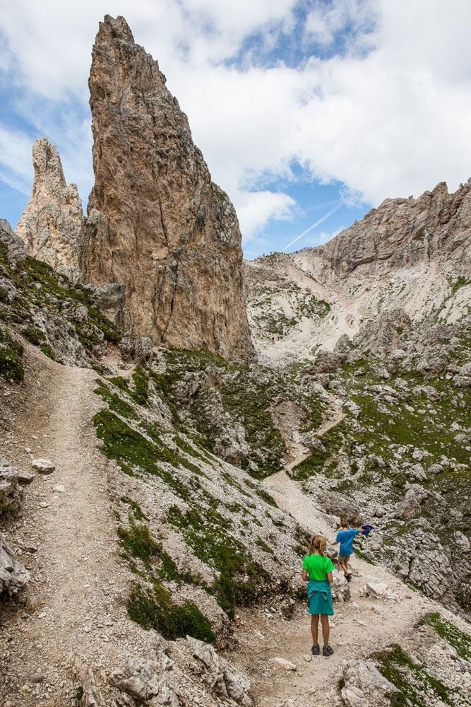
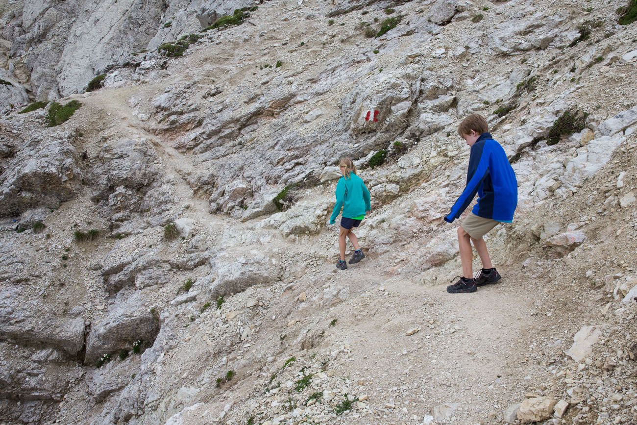
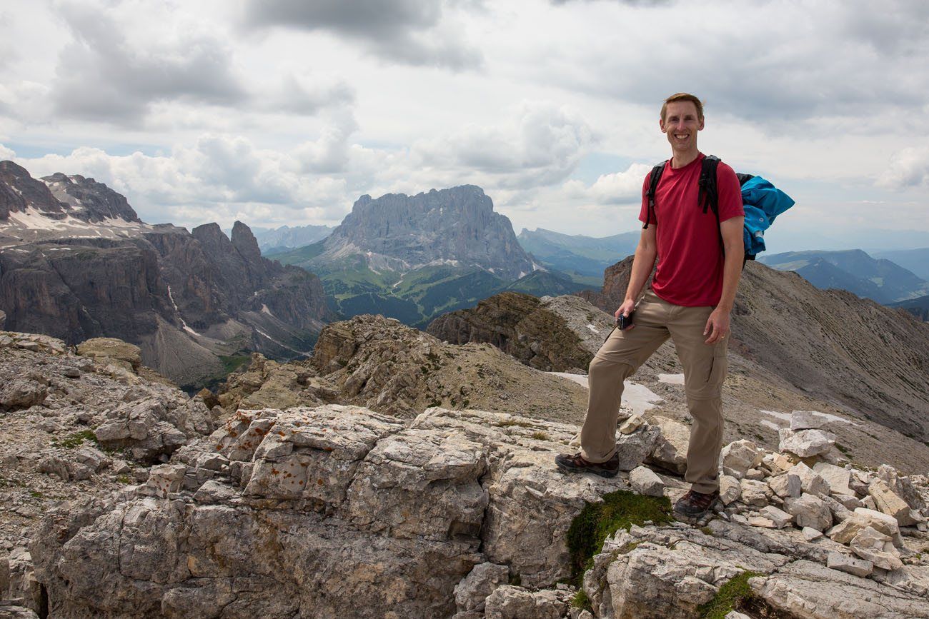
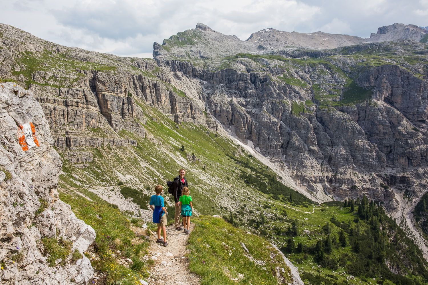
We ate a picnic lunch, enjoying our new view over Lago di Crespeina, before setting off again. Tyler and Kara did great hiking on these trails. The trails are very difficult in some sections, with lots of scree that made the descents very slippery.
View from the Puez-Odle Altopiano trail
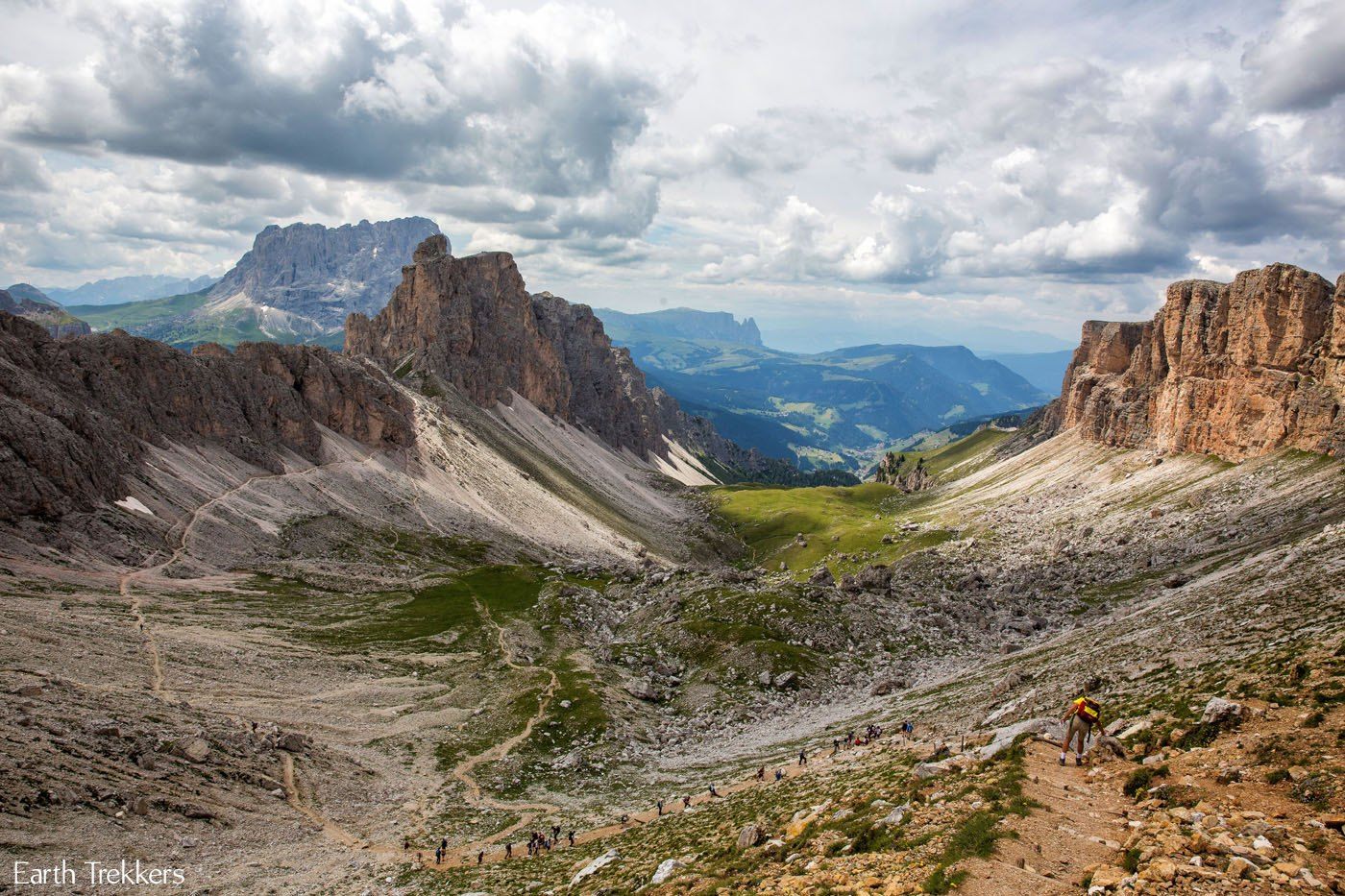
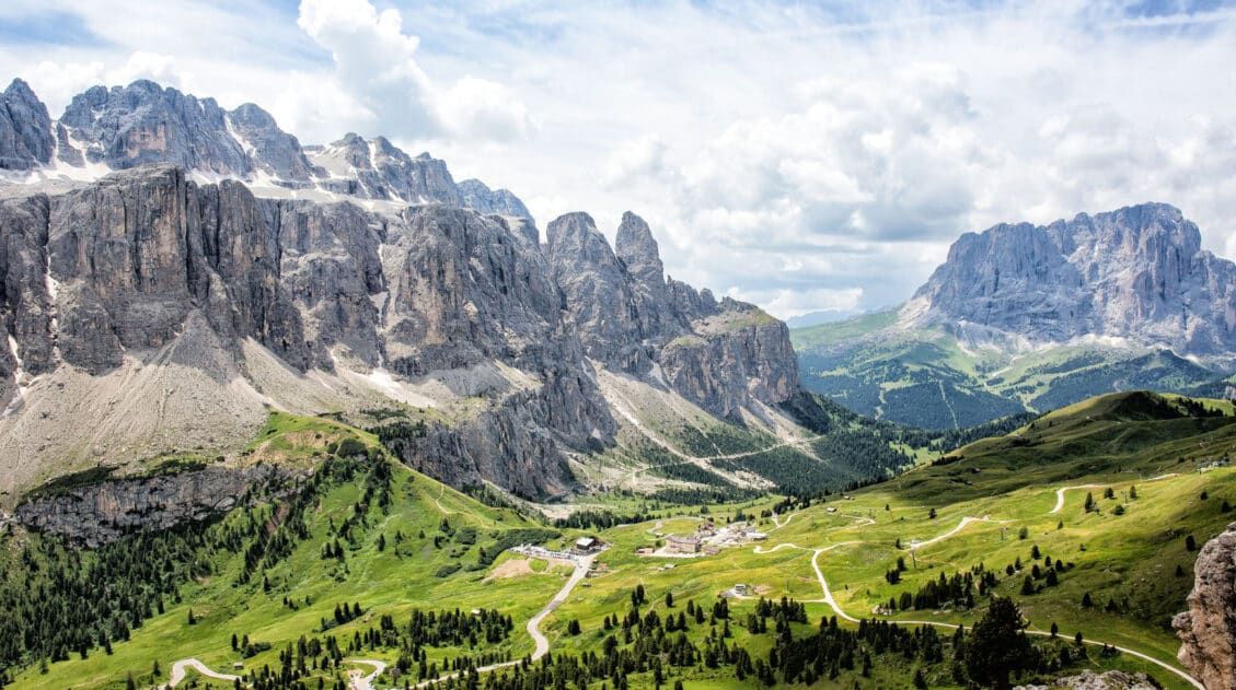
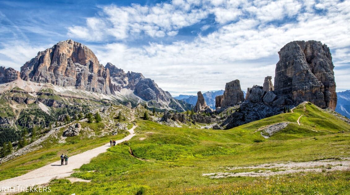
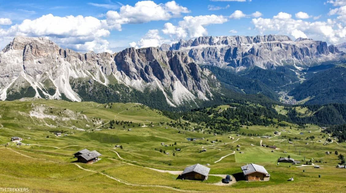
Finally, we made it to the second peak. It is so beautiful here!! Once on the second peak, you can look out across the Vallunga, the gorgeous U-shaped valley shown in the photo above. Just look at this place…it’s amazing!
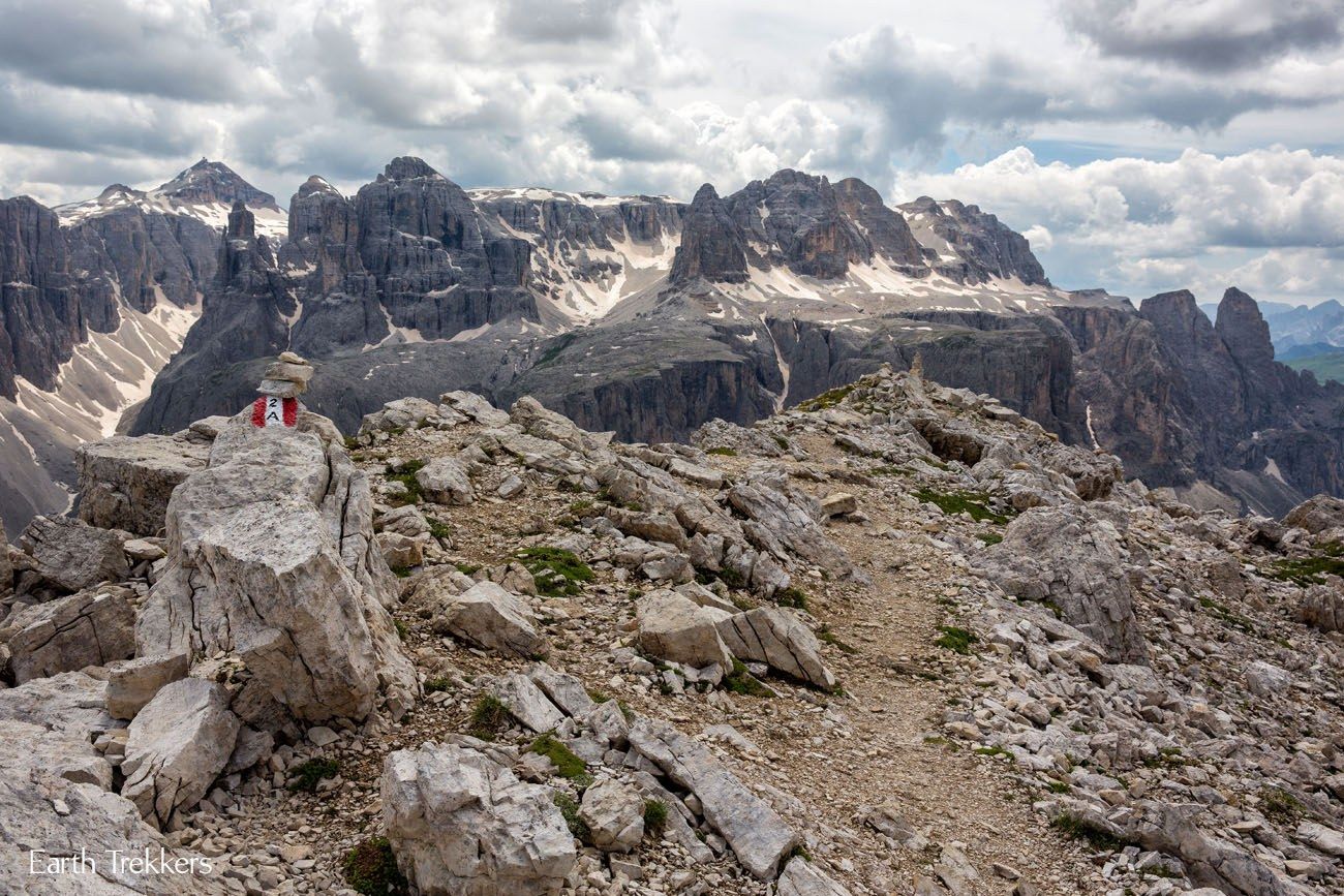
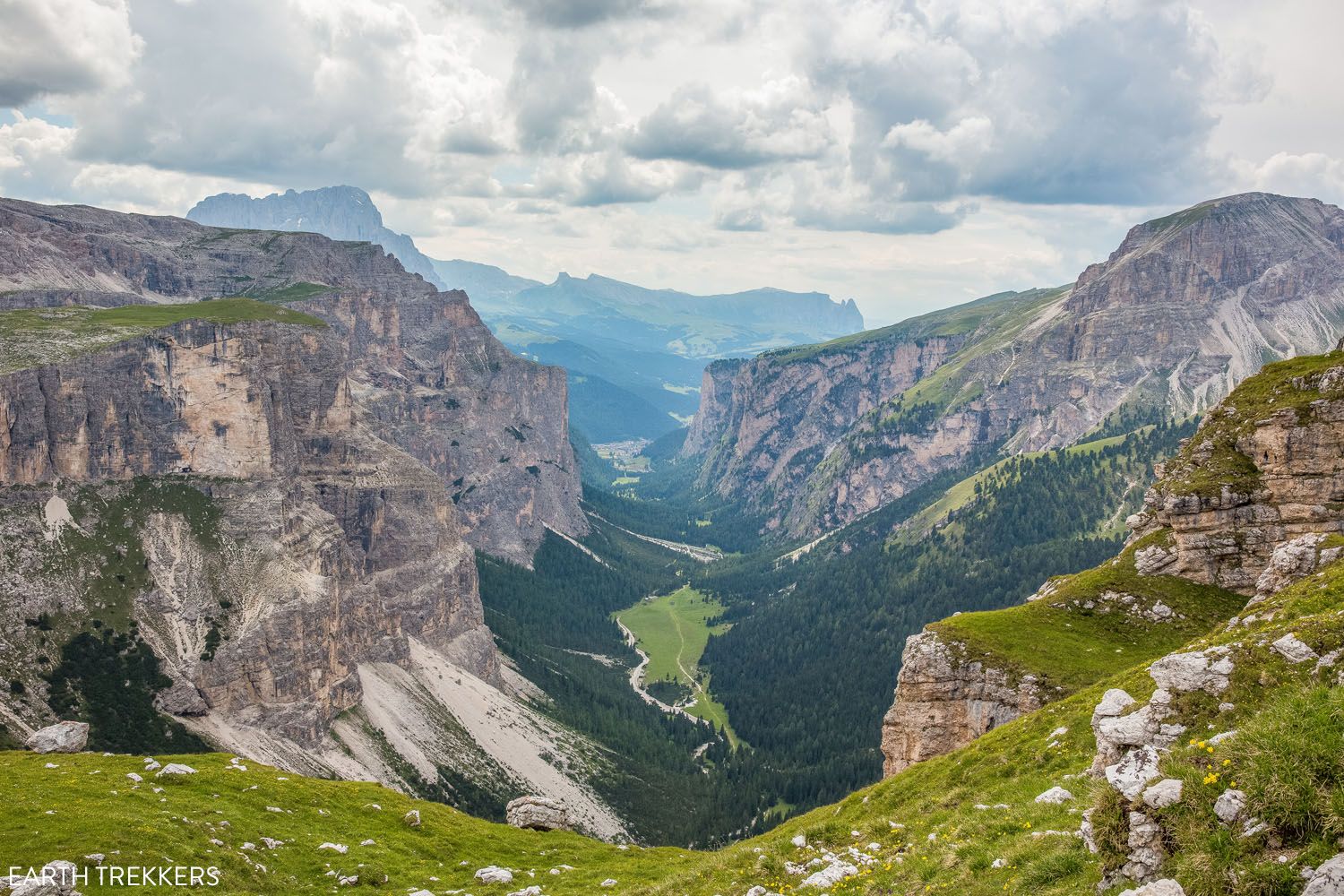
Another view from the Puez-Odle Altopiano trail. After Rifugio Puez, the trail makes a massive descent and you will walk through the valley below.
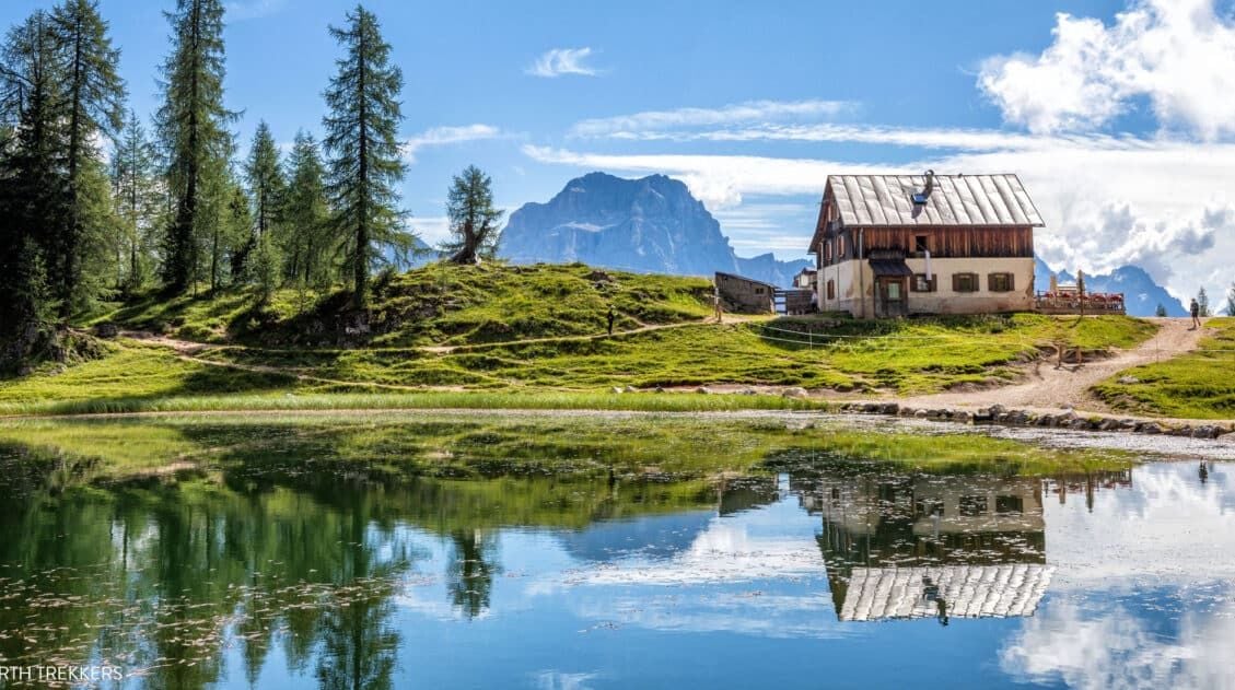
Rifugio Puez
The hike took us to Rifugio Puez, a restaurant/hotel offering tired hikers a place to eat or even stay the night. There are Rifugios located all through the Dolomites and a lot of them can only be accessed by hiking.
We stopped for about a half hour at Rifugio Puez. They served apfelstrudel (apple pie) here, which really wasn’t very good, even as hungry as we were. But it filled us up and gave us the energy we needed to finish the hike. We still had a long ways to go.
Making the Descent Back to Selva di Val Gardena
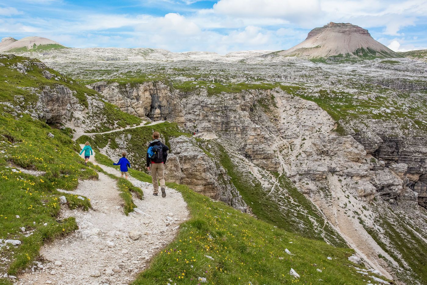
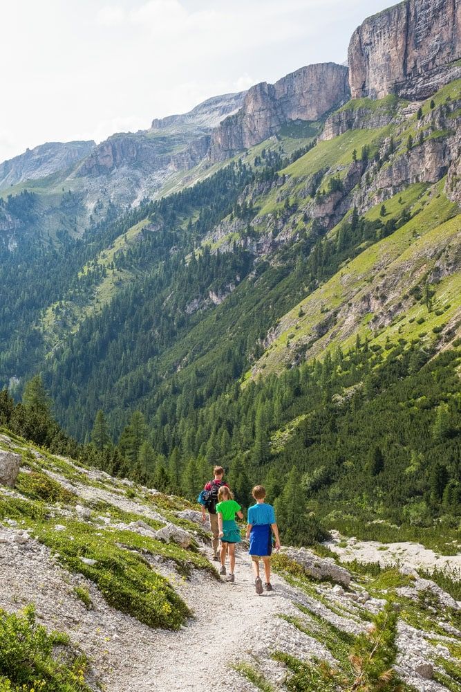
It is a 650 meter descent into the valley. Going down is a lot easier on the lungs but it is hard on the legs. From Rifugio Puez we took trail #14 down into the valley. This trail rapidly drops down into the valley, so even though this section is downhill, it can be tough on the knees and feel strenuous.
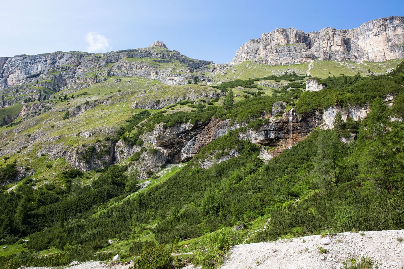
Cascate della Vallunga
Finally, when we entered the valley, it was nice to be walking on level ground again. You are still gradually walking downhill, but it’s a lot easier now that the terrain is more level.
This part of the hike is the most monotonous, and it will take an hour and a half to two hours to walk through the valley, but the scenery and herds of cattle help keep things interesting.
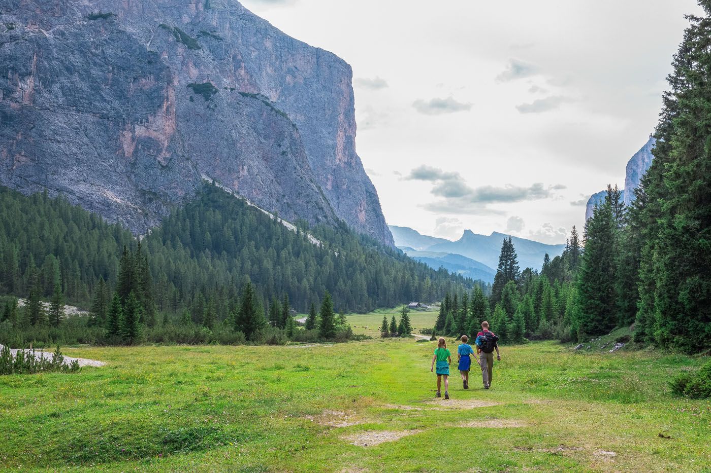
Final walk through the valley
Finishing the Hike
The walk through the valley ends at a road named Streda Val, at a parking lot that is called Parcheggio Vallunga Parkplatz Langental – Wolkenstein.
Rather than walking down Streda Val, stay on the footpath and walk past Baita Ciampac Hutte. We had dinner here on a separate trip to the Dolomites and it is wonderful…if they are open, you could sit outside and have a snack.
From Baita Ciampac Hutte, continue along Streda Dantercepies for 800 meters until you get to the parking garage for the Dantercepies cable car, completing the loop. This walking route is marked on our map provided earlier in this guide.
The Puez-Odle Altopiano hike took us just over 6 hours, including our stops for lunch and apfelstrudel. Tyler and Kara (ages 11 and 9 at the time) were amazing, never complaining and never even seeming to get tired. It’s a great hike for active, adventurous kids, but those younger than 9 may have a hard time.
If you’re planning your first trip to the Dolomites, we recommend starting with our Dolomites Travel Guide, where we cover how to plan your visit, more great places to visit in the Dolomites, where to stay, and how to design your custom itinerary.
The Puez Odle Hike on AllTrails
We’ve gotten a lot of questions recently about using AllTrails for this hike. This hike is on AllTrails and it is called Dantercepies – Forcella Cir – Puez Refuge – Vallunga. However, it is not the same route that we took, but it is very similar. Here are a few important things to know:
At about 1.8 miles on the AllTrails map we turned right and hiked to Sass da Ciampac. That trail then rejoins the AllTrails route at the 3.1 mile point.
At Rifugio Puez Hutte (marker #3 on the AllTrails map) we took Trail 14, which immediately drops down into the valley and then rejoins the AllTrails route. The AllTrails route stays higher longer after Rifugio Puez Hutte and then drops into the valley. We don’t know if one way offers a better view than the other but you can ask at the Rifugio.
If you have any questions about hiking the Puez-Odle Altopiano, let us know in the comment section below.
Plan Your Trip to Italy
We have TONS more information about Italy in our Italy Travel Guide, including Rome, Florence, Venice, Tuscany, the Dolomites, the Amalfi Coast, the Cinque Terre, and Puglia.
15 Best Hikes in the Dolomites (Easy to Challenging)
Pinterest Facebook Flipboard The Dolomites are one of the best hiking destinations in Europe. In this guide, we rank the 15 best hikes in the Dolomites, from easy scenic trails to challenging alpine adventures, based on views, difficulty, and our firsthand experience hiking the region. Jagged limestone peaks, knife-edge ridgelines, and turquoise alpine lakes make […]
What We Wish We Knew Before Visiting the Dolomites
The Dolomites. This is where jagged pinnacles of rock soar into the sky, mountain huts and cabins dot the green, rolling hills, cable cars whisk hikers and skiers to the highest mountain peaks, and hiking trails connect small hamlets and towns. It’s easy to fall in love with the photos. Planning a smooth trip here, […]
Exactly How to Hike to the Cadini di Misurina Viewpoint
The hike to the Cadini di Misurina viewpoint is one of our favorite short hikes in the Dolomites. This is a gorgeous hike every step of the way, with panoramic views of the surrounding mountains, a unique view of the “backside” of Tre Cime di Lavaredo, and of course, an awesome view of the Cadini […]
Croda da Lago Circuit Hike (+ Lago Federa & Forcella Ambrizzola)
The Croda da Lago Circuit is one of the most underrated hikes that we did in the Dolomites. We’ve explored this region on multiple trips and hiked many of its classic trails, and this loop still stands out for its variety: soaring limestone peaks, quiet alpine meadows, and the impossibly photogenic Lago Federa tucked beneath […]
Cinque Torri, Dolomites: Best Hike, How to Visit + Rifugios Averau & Nuvolau
We’ve explored the Dolomites across multiple trips, hiking Tre Cime, the Puez-Odle Altopiano, Lago di Sorapis, and more, and we have strong opinions about what’s worth your time. The Cinque Torri belongs near the top of any list. It’s one of the most recognizable rock formations in the Dolomites: five jagged towers rising above alpine […]
Dolomites Itinerary: Mix-and-Match Daily Plans for 3 to 10 Days
Planning a Dolomites itinerary can feel overwhelming. With its towering peaks, storybook alpine villages, epic hikes, and scenic drives around every corner, how do you decide what’s worth your time? In this guide, we make it simple. We break the Dolomites into easy, day-by-day itineraries that you can mix and match to build your perfect […]
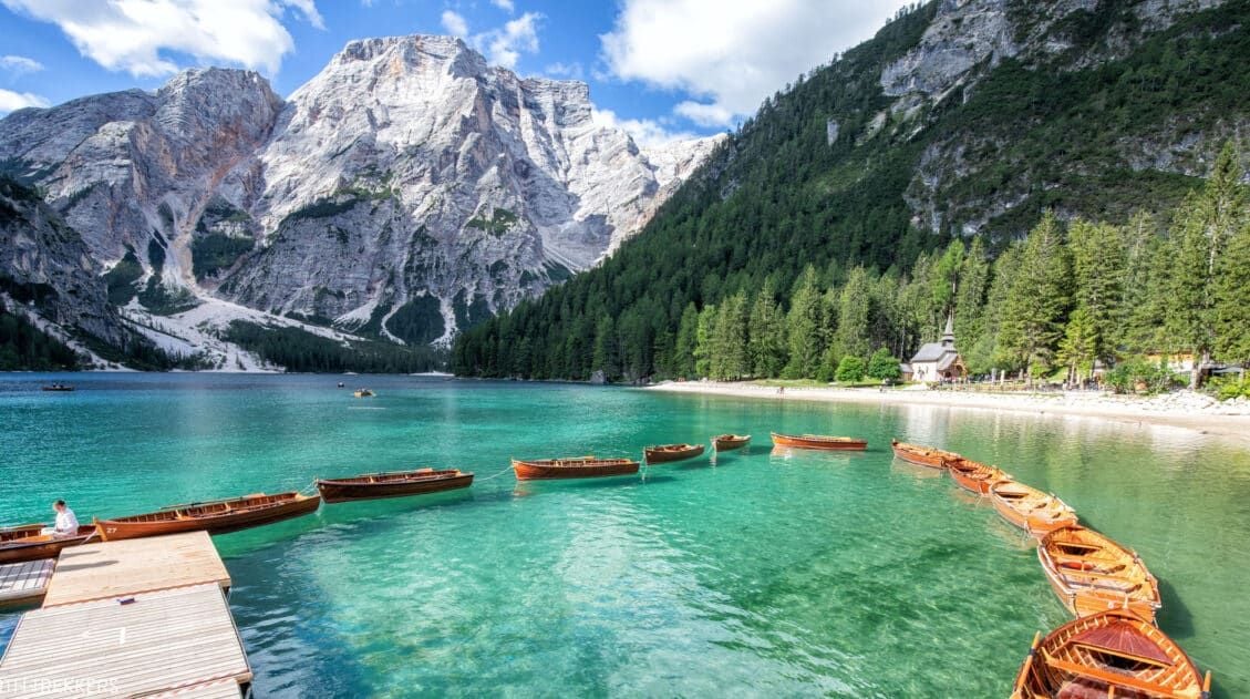
Exactly How to Visit Lago di Braies in 2026 (Photos & Helpful Tips)
Lago di Braies (Pragser Wildsee) is one of the most beautiful lakes in the Dolomites, but visiting it requires planning. In this guide, you’ll learn the best time to go, how parking and access restrictions work in 2026, how to avoid the worst crowds, and whether Lago di Braies is actually worth visiting. This crystal-clear […]
Tofana di Mezzo & Cima Tofana: The Freccia nel Cielo Cable Car
There are many fantastic cable car rides in the Dolomites. Most visitors head straight to Seceda or Marmolada and miss this. Cima Tofana delivers jaw-dropping views with a fraction of the crowds, plus you have the option to add on a very short but thrilling hike. We rode the Freccia nel Cielo cable car to […]
15 Surprising Things to Do in the Dolomites That Aren’t Hiking
We have traveled to the Dolomites twice, spending 12 days exploring alpine lakes, mountain passes, and hiking trails. This guide features the very best things to do in the Dolomites that require minimal or no hiking, based on our personal experiences. It’s no secret that the Dolomites are a great place to go hiking. But […]

Italy Travel Guide: How to Plan a Trip to Italy
Italy Travel Guide From the ruins of ancient Rome to the hiking trails of the Dolomites, the trulli of Puglia to the hilltop villages of Tuscany, Italy is a country that rewards every kind of traveler, and keeps pulling you back. We’ve traveled to Italy six times, exploring the country from the lakes and mountains […]
10 Day Northern Italy Itinerary (Dolomites, Venice & Lake Como)
This 10-day itinerary through Northern Italy features Venice, the Dolomites, Verona, Milan, and Lake Como, with hiking suggestions, hotel recommendations, and practical planning advice based on our numerous trips to Italy. We’ve visited Italy numerous times, exploring these destinations on separate trips over the years, hiking in the Dolomites, wandering the canals of Venice, strolling […]

20 Best Things to Do in Venice, Italy (2026 Guide)
Discover 20 things to do in Venice, Italy, from strolling its canals and island-hopping to Murano and Burano, to visiting St. Mark’s Basilica and the Rialto Bridge. Venice is one of our favorite spots in Italy. With its winding canals and centuries-old architecture, it’s an easy place to fall in love with, and small enough […]

Comments 128