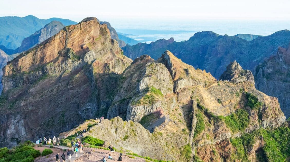
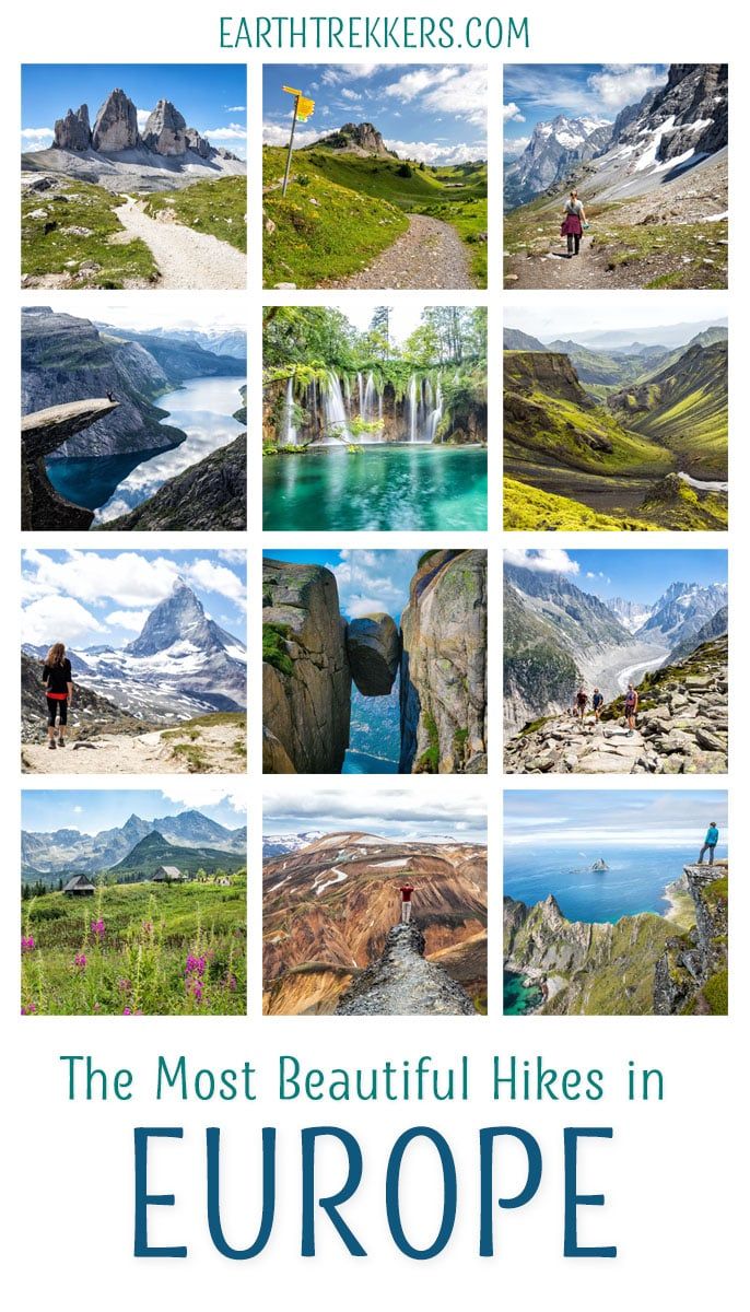
From the dramatic cliffs of Norway to the jagged peaks of the Dolomites and the volcanic landscapes of Iceland, Europe is packed with some of the most unforgettable hikes in the world. In this guide, we share our favorite hikes in Europe, trails that stand out for their scenery, uniqueness, and overall experience from start to finish.
We’ve been hiking across Europe for more than 13 years, exploring these trails as a family, first with young kids, then as teenagers, and now as adults. Over the years, we’ve hiked far more trails than what’s listed here, but these are our absolute favorites: iconic hikes with big views, memorable landscapes, and that “wow” factor that makes them worth planning a trip around.
Every hike on this list is one we’ve personally done, and for each one, we’ve written a detailed trail guide to help you plan your adventure.
From Italy and Switzerland to Iceland, Greece, and Slovakia, these hikes span a wide range of destinations and difficulty levels, helping you find the perfect trail for your next trip.
Looking for even more inspiration? Don’t miss our guide to the best day hikes in the world, or browse all of our hiking guides in our Hiking Guide.
How to Choose the Right Hike in Europe
With so many incredible trails to choose from, the “best” hike in Europe really depends on your travel style, fitness level, and what kind of scenery excites you most.
We’ve hiked all of the trails on this list, and they range from short, scenic walks to long, challenging days in the mountains. Use the quick guide below to find the hikes that best match what you’re looking for.
| If you want… | Consider these hikes |
| An iconic, bucket list experience | Trolltunga and Kjeragbolten (Norway), Path of the Gods (Italy), Seven Hanging Valleys Trail (Portugal), Gornergrat (Switzerland) |
| Big alpine scenery (mountains + dramatic views) | Dolomites hikes (Tre Cime di Lavaredo), Swiss Alps (Eiger Trail, Schynige Platte to First, Gornergrat, Mürren Via Ferrata), Seceda (Italy), Grand Balcon Nord (France) |
| A relatively easy, scenic walk | Cinque Terre (Italy), Eiger Trail and Gornergrat (Switzerland), Cliffs of Moher (Ireland), Hveradalir Geothermal Area (Iceland), Måtind (Norway), Plitvice Lakes (Croatia), Fira to Oia (Greece), Caminito del Rey (Spain) |
| A challenging, all-day adventure | Trolltunga (Norway), Koscielec (Poland), Schynige Platte to Faulhorn to First (Swiss Alps) |
| Unique, otherworldly landscapes | Iceland hikes (Landmannalaugar, Fimmvörðuháls) |
| Fewer crowds and hidden gems | Koscielec (Poland), Ladder of Kotor (Montenegro), Green Lake (Slovakia), Hiorthfjellet (Norway), Vereda do Larano (Madeira) |
A Few Quick Tips
- Check the season. Many alpine hikes are only accessible from late June through September due to snow.
- Know your limits. Some of these hikes involve long distances, steep climbs, or exposed sections.
- Start early. Popular trails like Trolltunga and the Cinque Terre can get very crowded.
- Plan logistics ahead of time. Cable cars, parking, and transportation can all impact your day.
Map of the Best Hikes in Europe
Here is a map of the best hikes in Europe featured in this guide. From the fjords of Norway to the mountains of the Alps and the volcanic landscapes of Iceland, these trails are spread across the continent. Use this map to get a sense of where each hike is located and to help plan your itinerary.
You can zoom in to explore each region and see how these hikes cluster geographically.
How to Use This Map: Click the icons on the map to get more information about each point of interest. To take this map with you, click the star next to the title of the map which adds it to your Google account. Next, within your Google Maps app, select ‘Saved’ and then select ‘Maps’. This map title will now appear in your list.
Bucket List Hikes in Europe
These are the hikes that define Europe, iconic trails with unforgettable views that are worth planning a trip around.
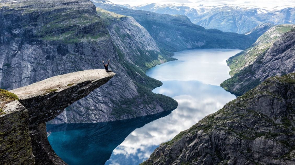
Trolltunga (Norway)
Why it’s awesome: One of the most iconic hikes in Europe, Trolltunga features a narrow rock ledge suspended high above a fjord, one of the most unforgettable viewpoints in Norway.
Best for: Experienced hikers looking for a long, challenging day with a huge payoff and a true bucket list experience.
Distance: 28 km (17.4 miles) out-and-back
Difficulty: Strenuous
Time: 10 to 12 hours
Location: Norway
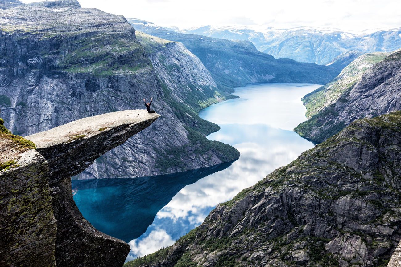
Trolltunga
What to expect: This is a long and demanding hike, but the scenery is spectacular from start to finish. The trail climbs onto a high plateau with sweeping views, and the final stretch to Trolltunga delivers one of the most dramatic viewpoints in Europe. Expect a full day on the trail, changing weather, and potentially large crowds during peak season, but for us, this hike absolutely lived up to the hype.
The hiking stats above are for the full hike but it is possible to shorten it. A small car pack was added which eliminates the first big climb of the hike. If you can get one of the few spots here, the hike comes in at 20 km (12.4 miles) with 300 meters (1,000 feet) of elevation gain. Not only is the hike shorter, it’s also a lot easier.
👉 See our complete Trolltunga hiking guide for trail details, parking info, and tips for planning your hike.
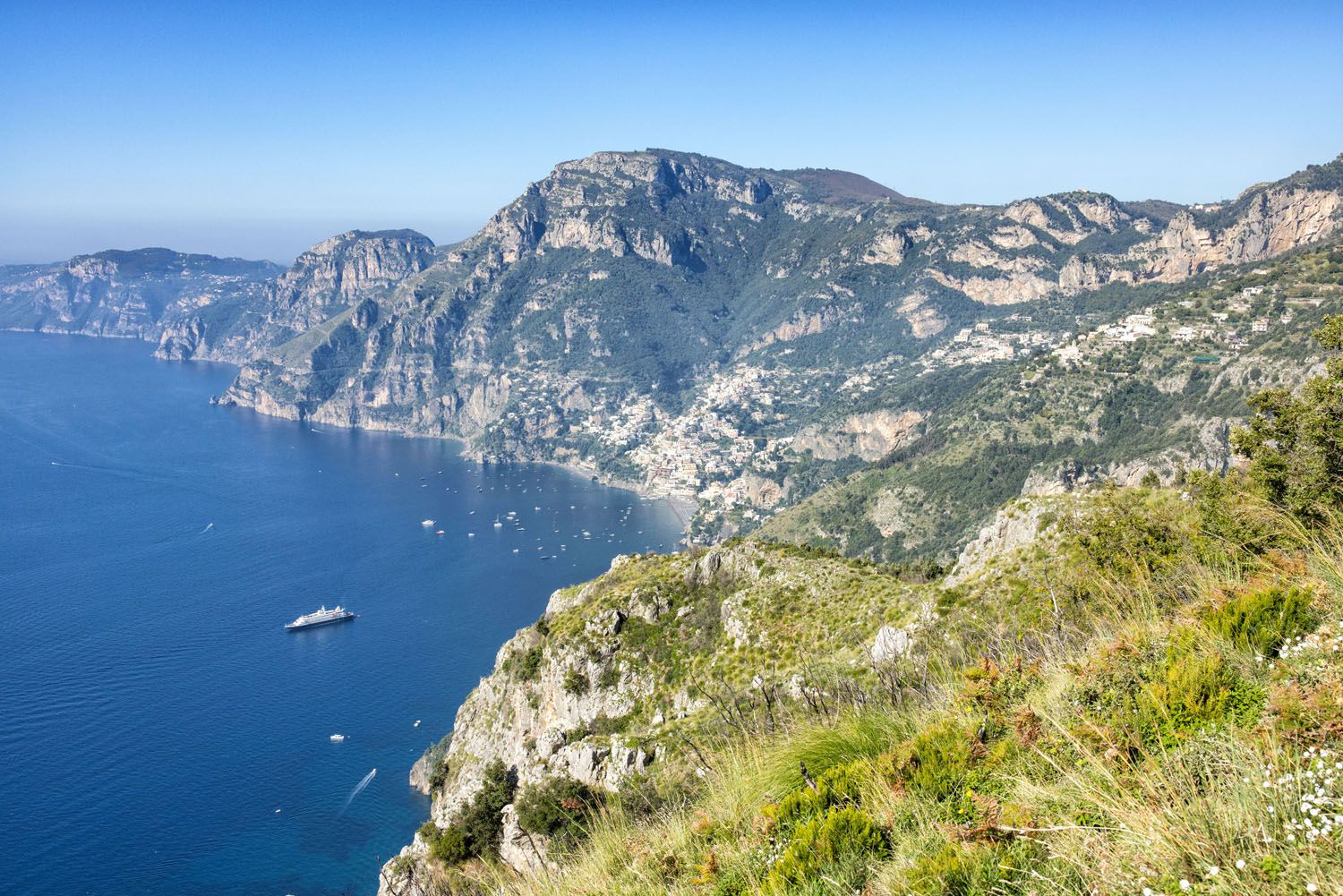
Path of the Gods (Italy)
Why it’s awesome: A stunning coastal trail high above the Amalfi Coast, with sweeping views of the Mediterranean Sea and Positano.
Best for: Travelers looking for one of the most scenic and rewarding hikes in Italy without a full-day, strenuous effort.
Distance: 5.6 km (3.5 miles) point-to-point
Difficulty: Easy to moderate
Time: 1.5 to 3 hours
Location: Amalfi Coast, Italy
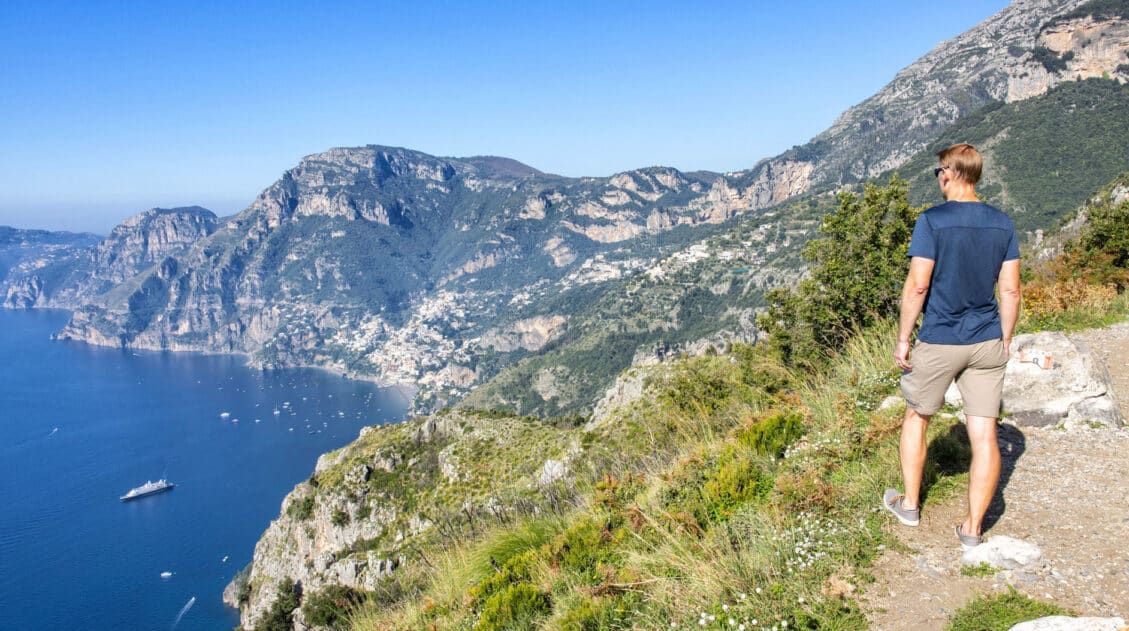
Located high above the coastal towns of Positano and Praiano is one of the most beautiful walks in Italy, the Path of the Gods (also called Sentiero degli Dei). This is the most popular hike to do along the Amalfi Coast and it is famous for its jaw-dropping views over Positano and the Sorrento peninsula.
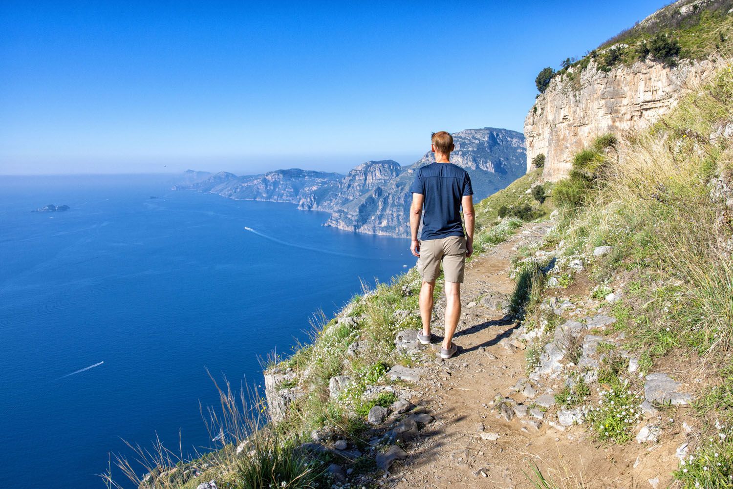
Path of the Gods
The view along the Path of the Gods
What to expect: This point-to-point hike runs between Bomerano and Nocelle, following a cliffside path with nonstop views of the Amalfi Coast. It’s not overly difficult, as it is a mostly downhill hike, but there are some uneven sections and gradual elevation changes. The scenery is the highlight. Expect panoramic views almost the entire way, making this one of the most enjoyable and accessible hikes in Europe.
👉 See our complete Path of the Gods hiking guide for trail directions, transportation tips, and how to plan your hike.
Path of the Gods: Amalfi Coast’s Most Scenic Hike
Everything you need to know to hike the Path of the Gods, including arranging your transportation and the best route to take.Tre Cime di Lavaredo (Italy)
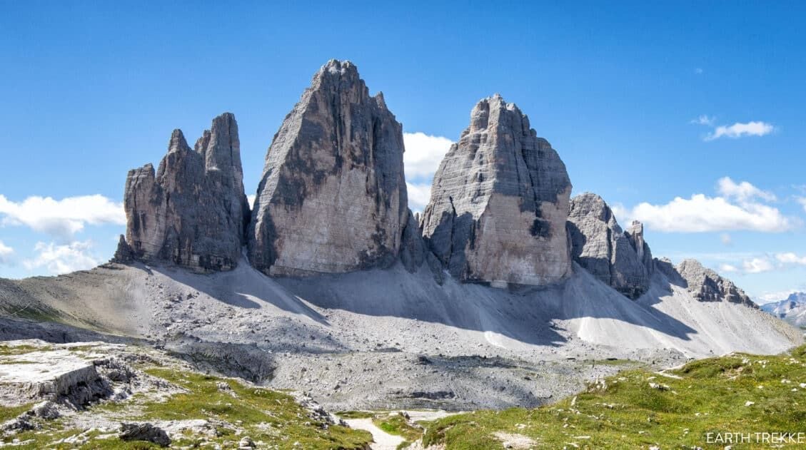
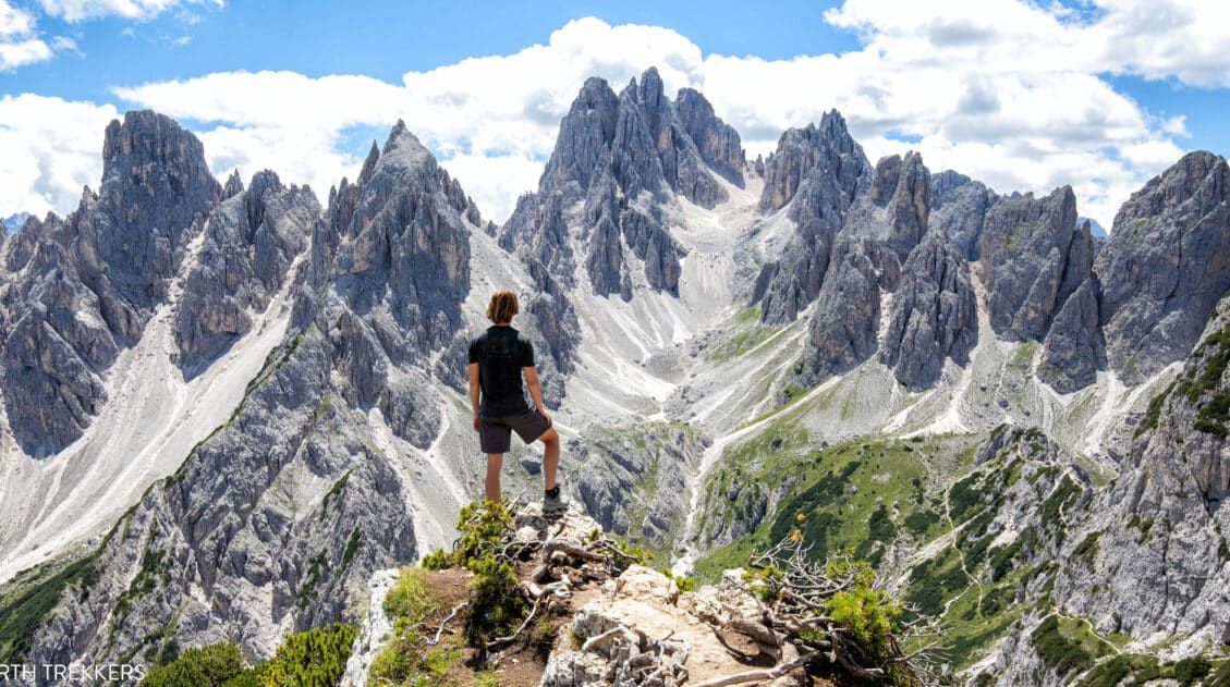
Why it’s awesome: One of the most iconic hikes in the Dolomites, this scenic loop circles the three towering peaks of Tre Cime with nonstop alpine views.
Best for: Hikers who want jaw-dropping mountain scenery without a long, strenuous day on the trail.
Distance: 8.8 km (5.5 miles) loop
Difficulty: Moderate
Time: 2 to 2.5 hours
Location: Dolomites, Italy
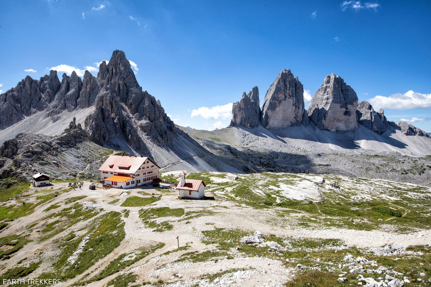
View of Tre Cime di Lavaredo and Rifugio Locatelli
What to Expect: The Tre Cime loop is a high-elevation trail that circles these famous limestone peaks, offering incredible views almost the entire way. The hike is not overly difficult, and the first time we hiked it, Tyler and Kara were kids. The altitude and steady ups and downs can make it feel more challenging than expected.
Along the route, you’ll pass mountain huts, sweeping alpine meadows, and some of the most photographed viewpoints in the Dolomites. It’s a busy trail in peak season, but for us, this is one of the most rewarding hikes in Italy and a must-do in the Dolomites.
This is one of our favorite hikes in the Dolomites and one we’ve done multiple times. It’s just that good. Add on the short hike to the Cadini di Misurina viewpoint and it just may be the most memorable day of your trip to the Dolomites.
👉 See our complete Tre Cime di Lavaredo hiking guide for trail options, parking reservations, and tips for avoiding the crowds.
Tre Cime di Lavaredo: Step-By-Step Trail Guide
Everything you need to know to hike the amazing Tre Cime di Lavaredo in the Dolomites of Italy.See our Dolomites hiking guide for more ideas of things to do in the Dolomites and detailed trail guides.
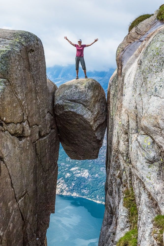
Kjeragbolten (Norway)
Why it’s awesome: A thrilling hike to a massive boulder wedged between two cliffs, suspended high above Lysefjord, one of the most unique viewpoints in Europe.
Best for: Adventurous hikers who want a shorter but physically demanding hike with an unforgettable, adrenaline-filled finish.
Distance: 12 km (7.5 miles) out-and-back
Difficulty: Strenuous
Time: 6 to 8 hours
Location: Norway
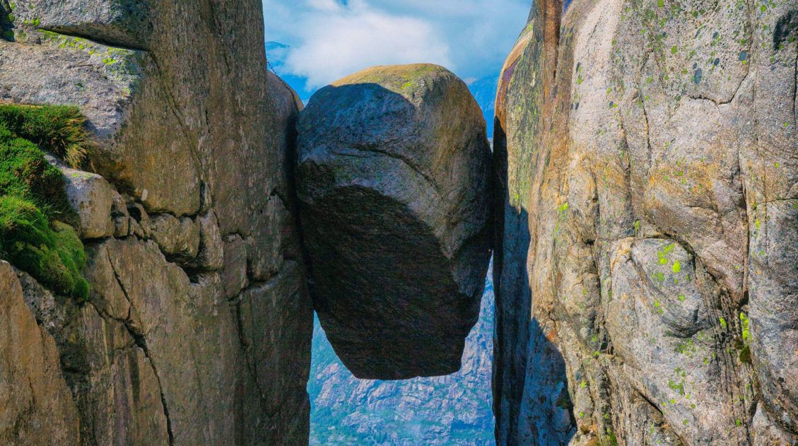
Kjeragbolten
Hiking to Kjeragbolten, this giant boulder wedged between two cliffs, is one of our favorite hikes of all time.
Why?
It’s not just because you get the chance to do something absolutely crazy, stepping out onto the boulder, but it’s also because this hike is tons of fun. From climbing sheer granite faces with the aids of chains, to descending down into valleys inhabited by sheep and their clanging bells, to views out over some of the most spectacular scenery in Norway, this hike is a pure joy.
Once at the Kjeragbolten, do you dare step out onto it?
This boulder sits 1000 meters off of the ground. It’s a bit unnerving, stepping onto it and then posing for the camera, but what an awesome collection of photographs you will have at the end of the day.
👉 See our guide to hiking Kjeragbolten for trail details, parking info, and tips for tackling the steep sections.
Kjeragbolten Hike: Trail Guide & What to Expect
Trail details, elevation info, and tips for safely hiking to Norway’s famous boulder.Cinque Terre Coastal Trail (Italy)
Why it’s awesome: A scenic coastal trail connecting colorful cliffside villages, with sweeping views of the Mediterranean Sea along the way.
Best for: Travelers looking for a beautiful, relatively easy hike that combines coastal views, charming towns, and flexible distances.
Distance: 11 km (7 miles)
Difficulty: Easy to moderate
Time: 5 hours+
Location: Cinque Terre, Italy
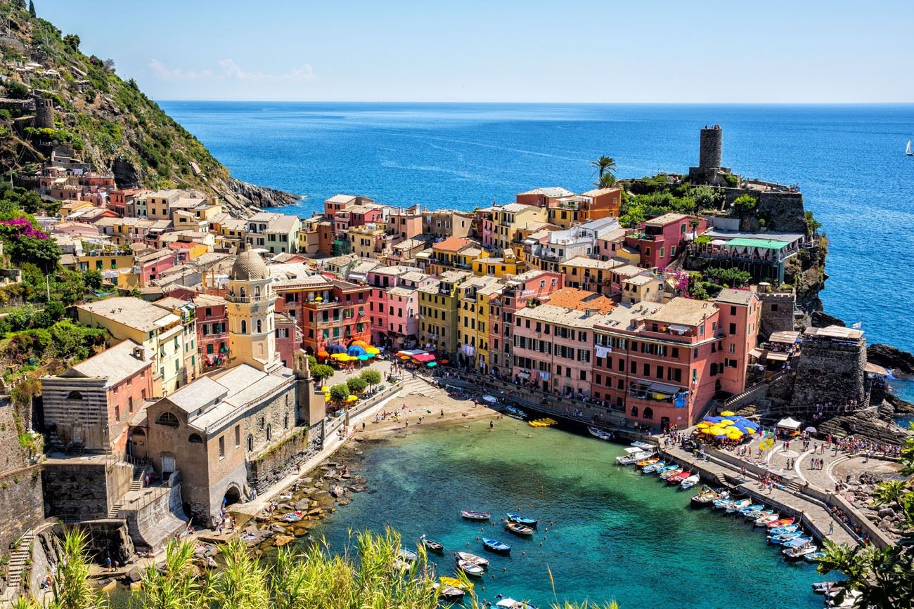
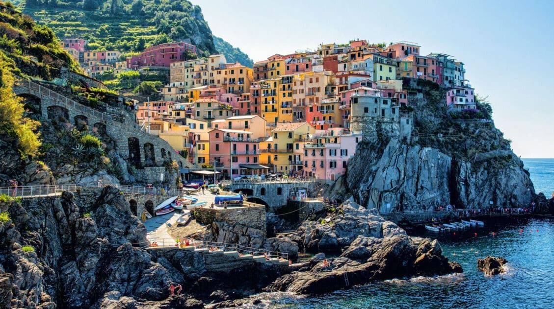
Vernazza
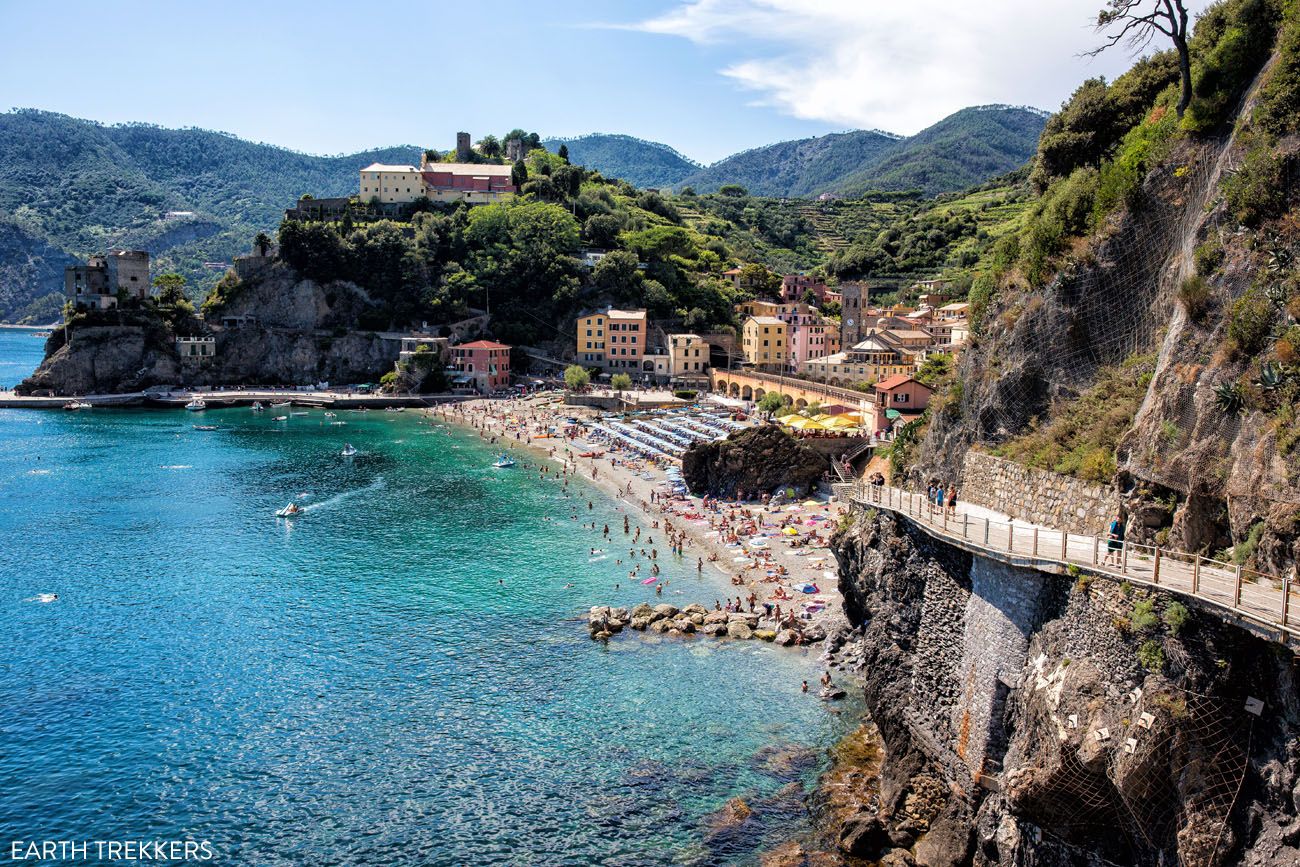
Monterosso al Mar from the hiking trail
The Cinque Terre is a group of five towns perched on the coastline of Italy, just north of Pisa. These colorful towns are easily recognizable, with their pastel buildings stacked on top of one another, overlooking the harbors below. Each town offers something a little bit different than the others, and part of the fun of visiting the Cinque Terre is picking your favorite one.
Hiking the Cinque Terre is one of the best ways to explore these five towns.
There is a 11 km trail (called the Blue Trail) connecting Riomaggiore to Monterosso al Mare. Some portions of the trail are very easy to walk, such as the paved section connecting Riomaggiore to Manarola, and other sections climb up and over hillsides with spectacular views along the coast.
It takes about 5 hours to hike the entire distance, not counting the time to explore and linger in each town. To hike between all five towns, set aside a full day.
One of the best things about this hike is that you don’t have to do the full thing. When you get tired, take the train to the next town, rather than hiking the trail.
This is also the only hike on this list where you can refuel with gelato, pizza, and wine, as you hike from town to town.
Could this be the best hike in Europe? 😊
👉 See our complete Cinque Terre hiking guide for trail options, closures, and how to plan your route.
Planning to Hike the Cinque Terre? Here’s What You Need to Know
How to hike the Cinque Terre from start to finish.Europe’s Best Mountain Hikes
For dramatic alpine scenery, these hikes deliver big views of jagged peaks, glaciers, and mountain landscapes. This is where you’ll find some of the most scenic trails in the Alps and Iceland.
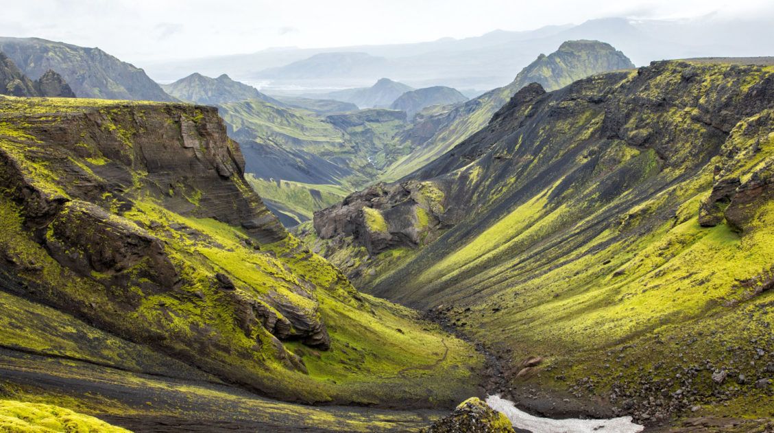
Fimmvörðuháls (Iceland)
Why it’s awesome: An unforgettable hike between two glaciers, featuring waterfalls, volcanic landscapes, and some of the most unique scenery in Europe.
Best for: Experienced hikers looking for a long, adventurous day with constantly changing landscapes and a true sense of wilderness.
Distance: 25 km (15.5 miles) point-to-point
Difficulty: Challenging
Time: 8 to 10 hours
Location: Iceland
This is the toughest hike on the list and it’s one of the best.
26 waterfalls, 1 volcano, 2 glaciers, and 3 unique landscapes all combine for one of the most extraordinary hiking experiences on the planet.
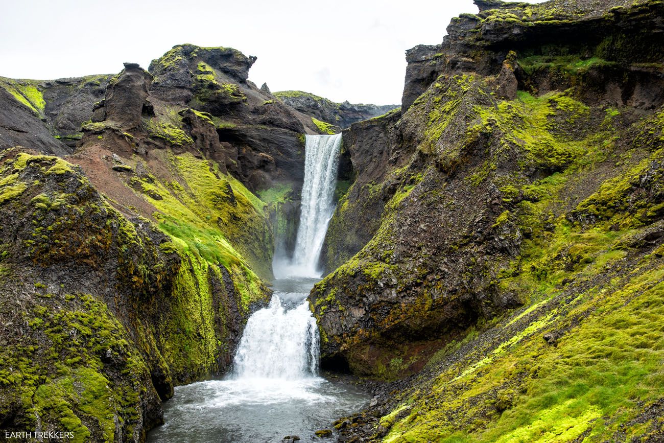
Sunset Falls
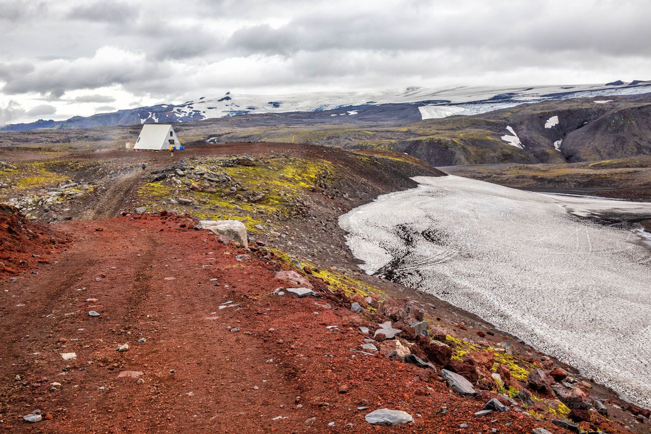
Baldvinsskáli Hut
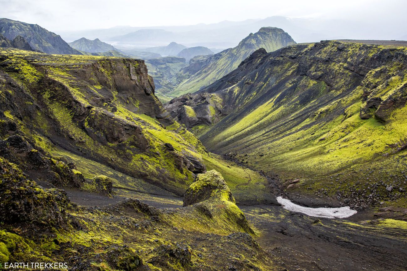
Thórsmörk
Starting at the mighty Skógafoss waterfall, the land is lush and green as you hike past 25 more waterfalls along the Skógá River.
As you approach the ice caps, the green grass fades away, leaving behind a rocky, barren landscape.
From here, you hike between the glaciers Eyjafjallajökull and Mýrdalsjökull, on fresh, black, volcanic soil, which is one of the youngest landscapes on the planet.
Once you begin the descent into Thórsmörk, the contrast is startling. Lime green moss covers the black soil and rocks, and eventually you will hike through a forest before arriving in Básar.
👉 We cover exactly how to do it in our Fimmvörðuháls hiking guide, which includes trail logistics, transportation, and tips for planning this point-to-point hike.
Fimmvörðuháls Hike: A Step-By-Step Guide to Iceland’s Best Day Hike
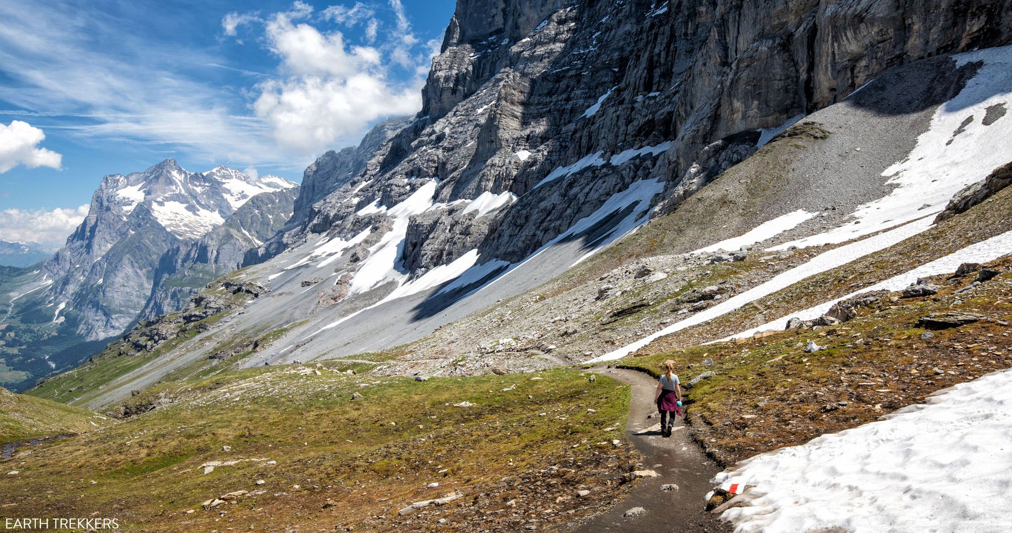
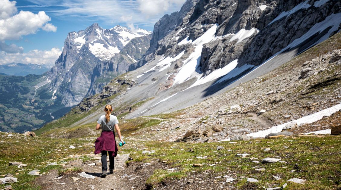
Trail details, transportation logistics, and what to expect on one of Iceland’s most epic hikes.The Eiger Trail (Swiss Alps)
Why it’s awesome: A spectacular trail that runs beneath the north face of the Eiger, with incredible views of glaciers, cliffs, and the Lauterbrunnen Valley.
Best for: Hikers who want classic Swiss Alps scenery without a long or overly strenuous day.
Distance: 7.25 km (4.5 miles) point-to-point
Difficulty: Easy to moderate
Time: 2 to 3 hours
Location: Jungfrau Region, Switzerland
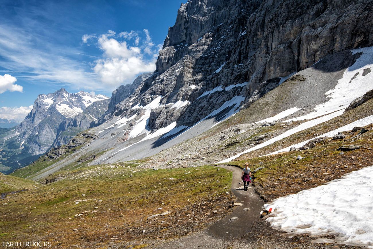
Eiger Trail
The Eiger Trail is one of our favorite short hikes in Europe. This point-to-point hike follows the north face of the Eiger mountain. Along the way, you get jaw-dropping views across the Lauterbrunnen Valley to Mürren and Grindelwald.
The views are unbeatable, it is mostly a downhill walk so you don’t have to be super fit to hike this trail, and it can be easily added onto a visit to Jungfraujoch.
If you are planning a visit to Europe with kids, this is a great hike to put on your list. Plus, the entire Jungfrau region is a delight to explore.
👉 See our complete Eiger Trail Guide for trail directions, how to use the train, and tips for planning your hike.
Schynige Platte to Faulhorn to First (Swiss Alps)
Why it’s awesome: A breathtaking ridge hike with nonstop views of the Eiger, Mönch, and Jungfrau, plus alpine lakes and wildflower-filled meadows along the way.
Best for: Hikers who want a full-day alpine experience with incredible scenery from start to finish.
Distance: 16 km (10 miles) point-to-point
Difficulty: Strenuous
Time: 6 hours
Location: Jungfrau Region, Switzerland
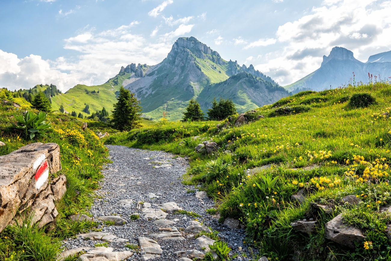
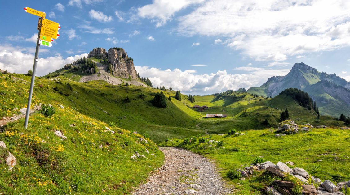
The start of the hike at Schynige Platte
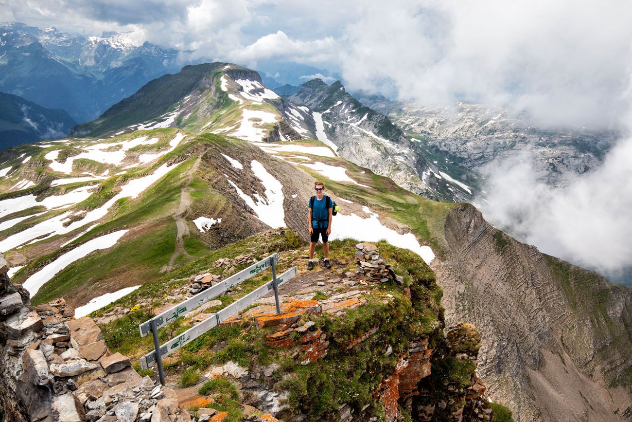
Faulhorn
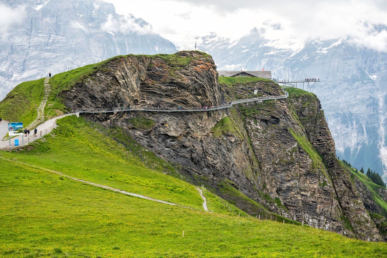
At the end of the hike, you have the option to add on the First Cliff Walk.
This is the second time the Jungfrau region is showing up on this hiking list (and it’s not the last), because it is a beautiful area to explore on foot, with a long list of hiking trails. The point-to-point hike from Schynige Platte to First is another one of our favorites.
The hike from Schynige Platte to Faulhorn to First is a big day hike. A scenic ride on a cogwheel train takes you high up into the mountains. For the next 6 hours, you hike past alpine lakes, rustic mountain huts, snow-covered trails, cows and their musical bells, and get to see some of the best views of Swiss Alps.
If you plan to visit the Jungfrau region in the summer months and are looking for a longer hike to do, this is one of the best.
👉 See our complete Schynige Platte to First hiking guide for trail logistics, train and gondola details, and tips for planning your hike.
SchynigeSchynige Platte to Faulhorn to First Hike: The Complete Guide
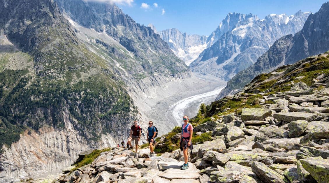
Everything you need to know to hike from Schynige Platte to First, a gorgeous hike in the Jungfrau Region.Grand Balcon Nord (France)
Why it’s awesome: A scenic alpine trail with incredible views of Mont Blanc, the Mer de Glace glacier, and the Chamonix Valley.
Best for: Hikers who want spectacular Mont Blanc views without a long or overly strenuous hike.
Distance: 6.8 km (4.2 miles) point-to-point
Difficulty: Moderate
Time: 2 to 4 hours
Location: Chamonix, France
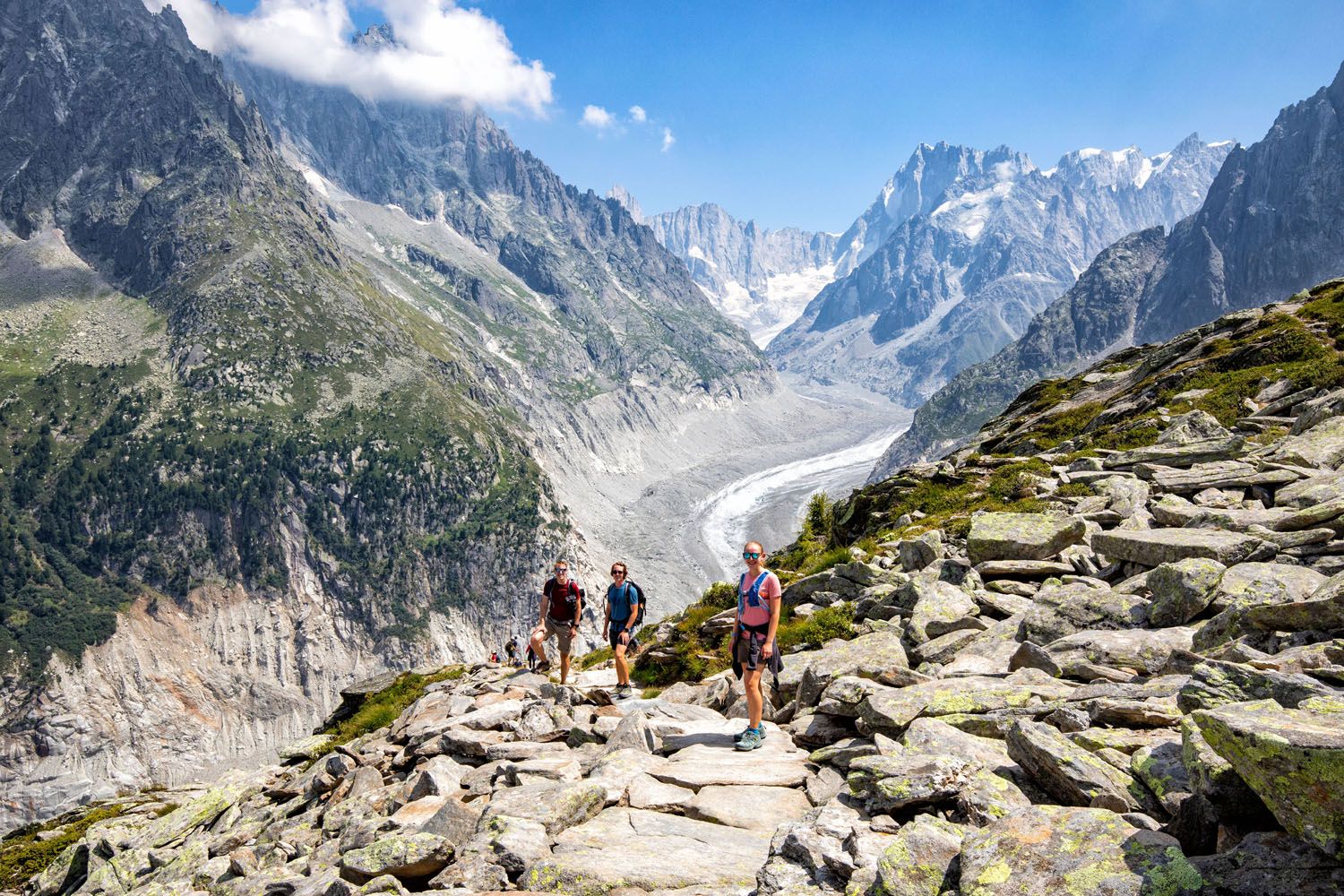
What to expect: This point-to-point trail runs high above the Chamonix Valley, connecting Plan de l’Aiguille and Montenvers. The hike is relatively short and mostly downhill in this direction, making it accessible for many hikers while still delivering incredible scenery. Along the way, you’ll get sweeping views of Mont Blanc and surrounding peaks, with the option to add on a visit to Aiguille du Midi or the Mer de Glace glacier. It’s one of the best ways to experience the Alps without committing to a full-day hike.
👉 See our guide How to Hike Grand Balcon Nord for trail directions, cable car and train logistics, and tips for planning your hike.
Grand Balcon Nord Hike: Complete Guide & Tips
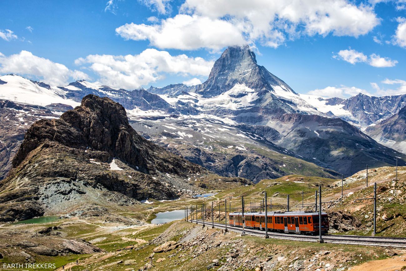
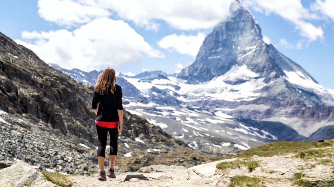
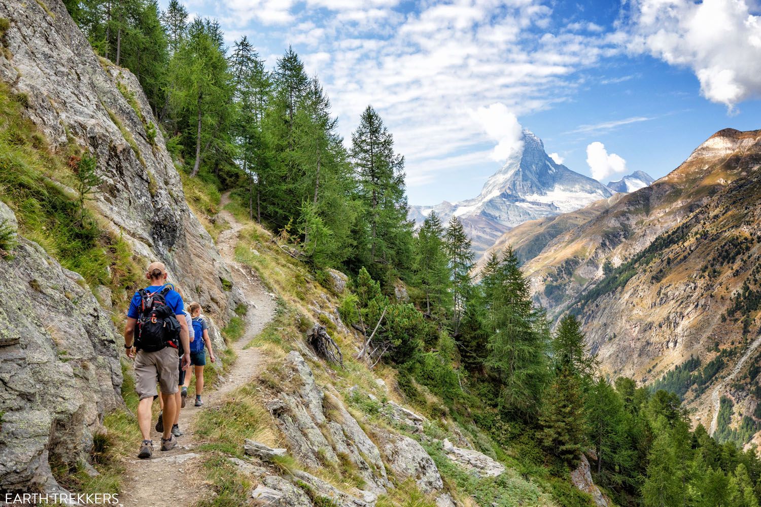
Trail details, transport logistics, and how to plan this scenic Chamonix hike.Gornergrat to Riffelberg (Swiss Alps)
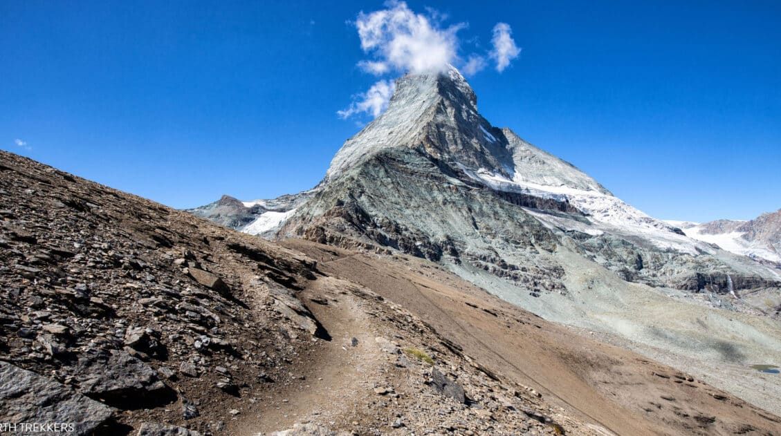
Why it’s awesome: One of the best viewpoints of the Matterhorn, with panoramic views of glaciers and some of the highest peaks in the Alps.
Best for: Travelers who want incredible alpine scenery with minimal hiking, plus the option to add short scenic walks.
Distance: 5 km (3.1 miles) point-to-point
Difficulty: Easy
Time: 1.5 hours
Location: Zermatt, Switzerland
View from Gornergrat
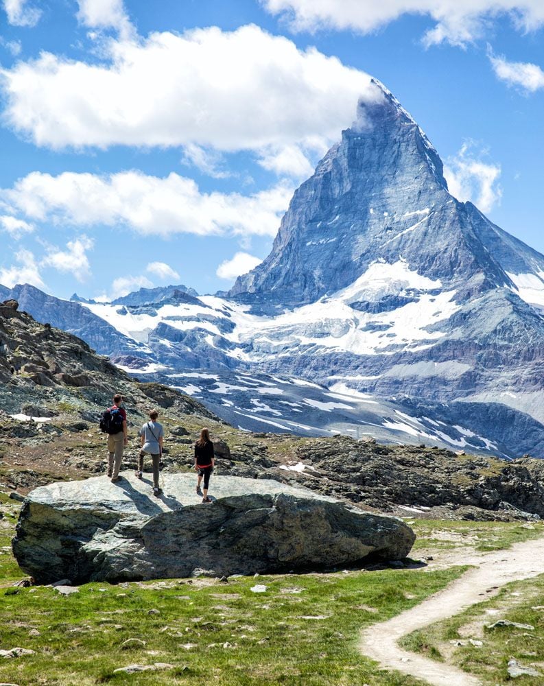
The Matterhorn
This is another spectacular hike that does not require a whole lot of effort. And every step of the way you are treated to epic views of the Matterhorn…just as long as the weather cooperates.
Gornergrat is the location of the highest open-air railway in Europe. From Gornergrat, you get to see the second largest glacier in the Alps (Gorner Glacier), Switzerland’s highest peak (Dufourspitze), and the Matterhorn.
The hike from Gornergrat to Riffelberg is an overall downhill walk, so it’s a great hike for all ages and ability levels. Along the entire trail, the Matterhorn is right in front of you, which creates dramatic photo spots and great places to take a family photo.
You can end the hike early, going just to Riffelsee, or go a bit farther to Riffelberg. From Riffelberg, ride the train back to Zermatt or go even higher, adding on a visit to the Matterhorn Glacier Paradise.
👉 See our guide on How to Visit Gornergrat and hike to Riffelberg for train details, hiking options, and tips for planning your visit.
Gornergrat: Best Views of the Matterhorn + Hiking Tips
Learn how to visit Gornergrat, with train info, hiking options, and what to expect.Coastal Trails, Cliff Walks & Unique Landscapes
These hikes trade towering peaks for ocean views, dramatic cliffs, and one-of-a-kind landscapes. Many are shorter or less strenuous, but the scenery is just as memorable.
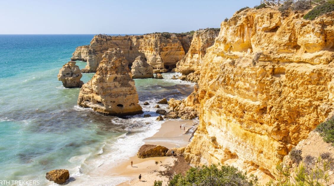
Seven Hanging Valleys Trail (Portugal)
Why it’s awesome: A spectacular coastal hike with dramatic cliffs, sea arches, hidden beaches, and nonstop views of the Atlantic Ocean.
Best for: Hikers who want big coastal scenery, warm weather, and a moderately challenging but manageable trail.
Distance: 5.7 km (3.5 miles) point-to-point
Difficulty: Easy to Moderate
Time: 2 to 3 hours
Location: Algarve, Portugal
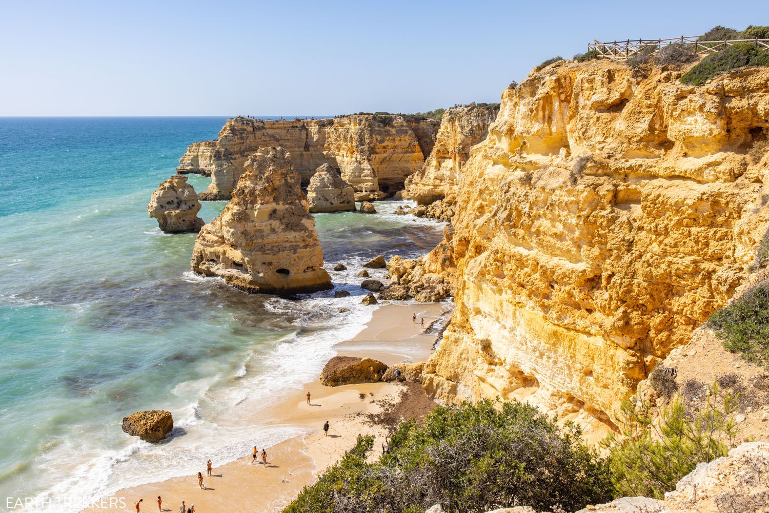
Marinha Beach
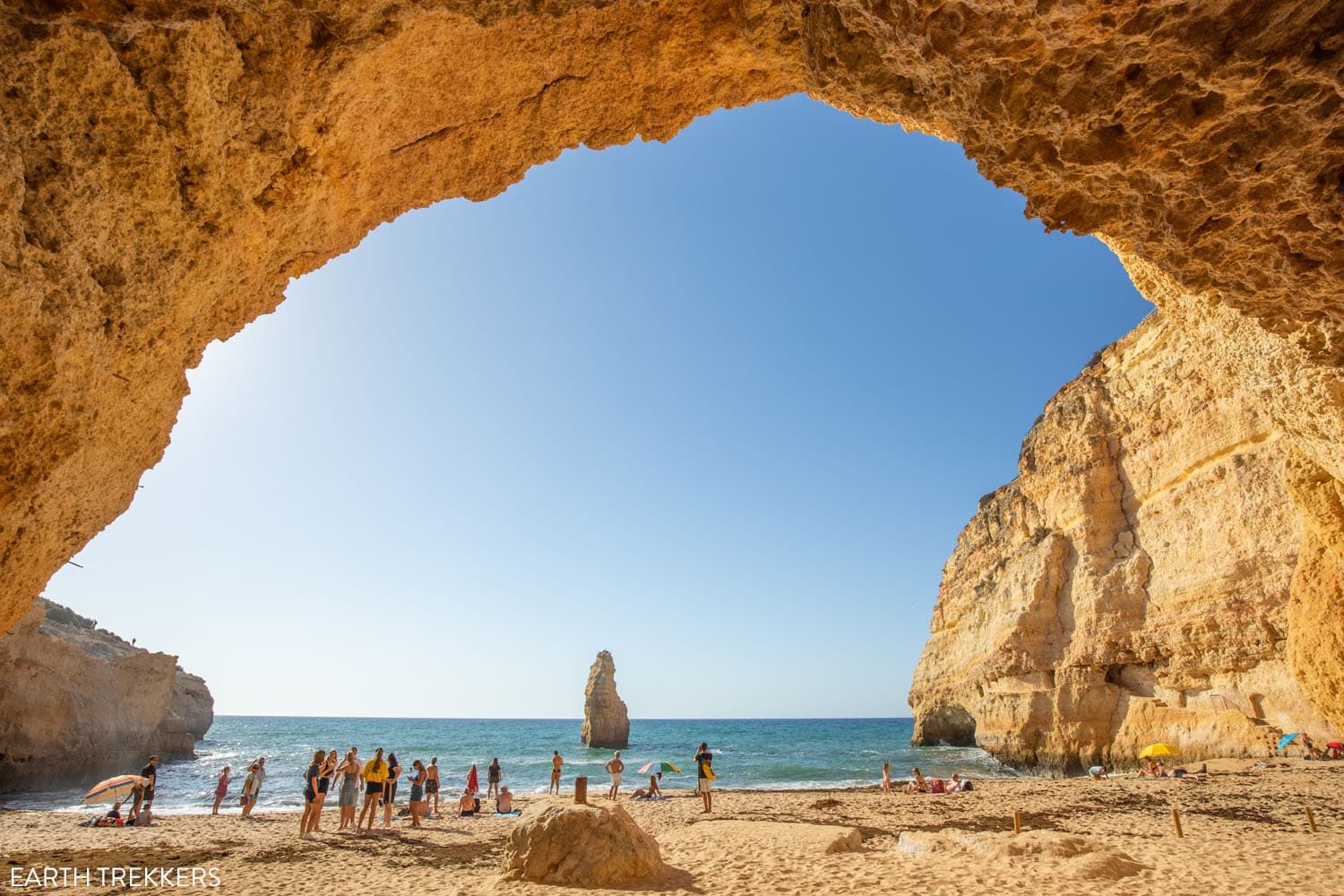
Praia do Carvalho
Stretching along the coastline of the Algarve is one of the most beautiful walks in Portugal, the Seven Hanging Valleys Trail. On this hike, you will gaze across some of the most picturesque beaches in Europe, peer into Benagil Cave, and be treated to an endless number of jaw-dropping views of the Algarve.
This hiking trail takes you past some of the most famous beaches in the Algarve, including the very photogenic Marinha Beach.
The Seven Hanging Valleys Trail is one of the few hikes on this list that ends at a beach, and what better way to end a hike than with a relaxing afternoon on the beach and lunch in a nearby beach cafe?
👉 See our Seven Hanging Valleys hiking guide for trail logistics, parking info, and tips for planning your hike.
Seven Hanging Valleys Trail: Complete Hiking Guide
Everything you need to know to hike the Seven Hanging Valleys Trail, from arranging your transportation to what to expect along the trail.Caminito del Rey (Spain)
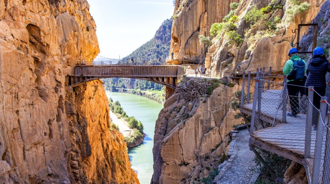
Why it’s awesome: A narrow walkway pinned to steep canyon walls, offering dramatic views high above a river gorge.
Best for: Travelers looking for a unique, slightly adventurous experience that doesn’t require a long or strenuous hike.
Distance: 7 km (4.3 miles)
Difficulty: Easy
Time: 1 to 3 hours
Location: Andalusia, Spain
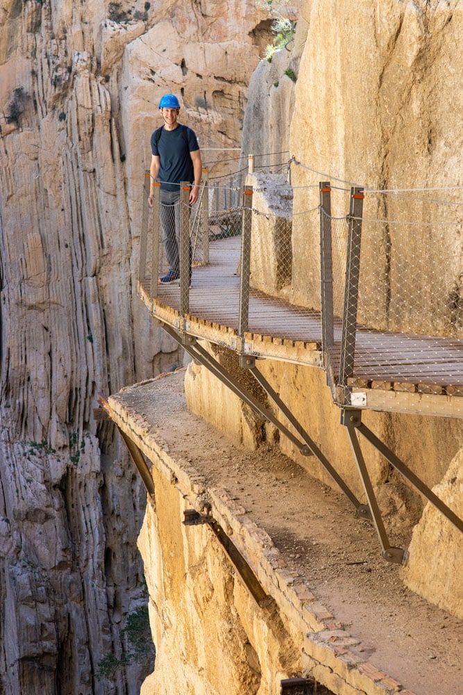
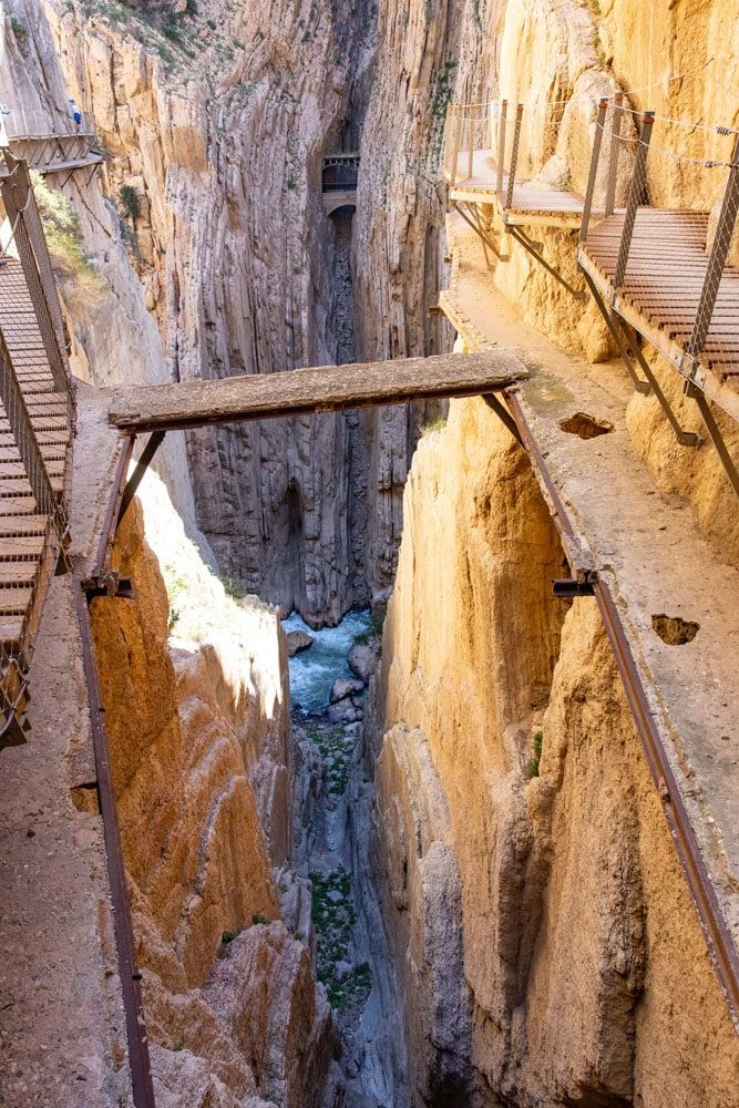
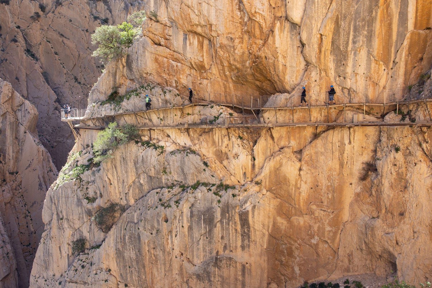
What to expect: The Caminito del Rey follows a series of suspended walkways through a narrow gorge, with sections perched high above the river below. The path is well-maintained and secured, but the exposure makes it feel adventurous. The route is mostly downhill and not physically demanding, making it accessible to most travelers. It’s a one-way hike with a shuttle return, and advance reservations are required.
👉 See our guide to the Caminito del Rey for ticket info, shuttle logistics, and tips for planning your visit.
Caminito del Rey: What to Know Before You Go
Ticket info, shuttle logistics, and tips for walking this famous cliffside trail.Fira to Oia (Greece)
Why it’s awesome: A stunning walk along the caldera cliffs of Santorini, with sweeping views of the Aegean Sea and whitewashed villages perched on the edge.
Best for: Travelers looking for one of the most scenic and memorable walks in Europe without a technical or strenuous hike.
Distance: 10 km (6 miles) point-to-point
Difficulty: Easy to moderate
Time: 3 to 5 hours
Location: Santorini, Greece
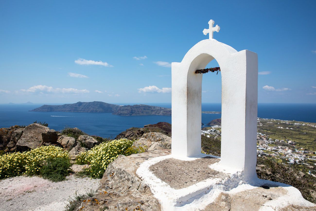
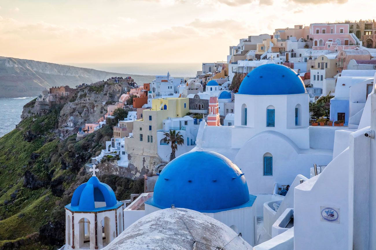
Santorini sunset
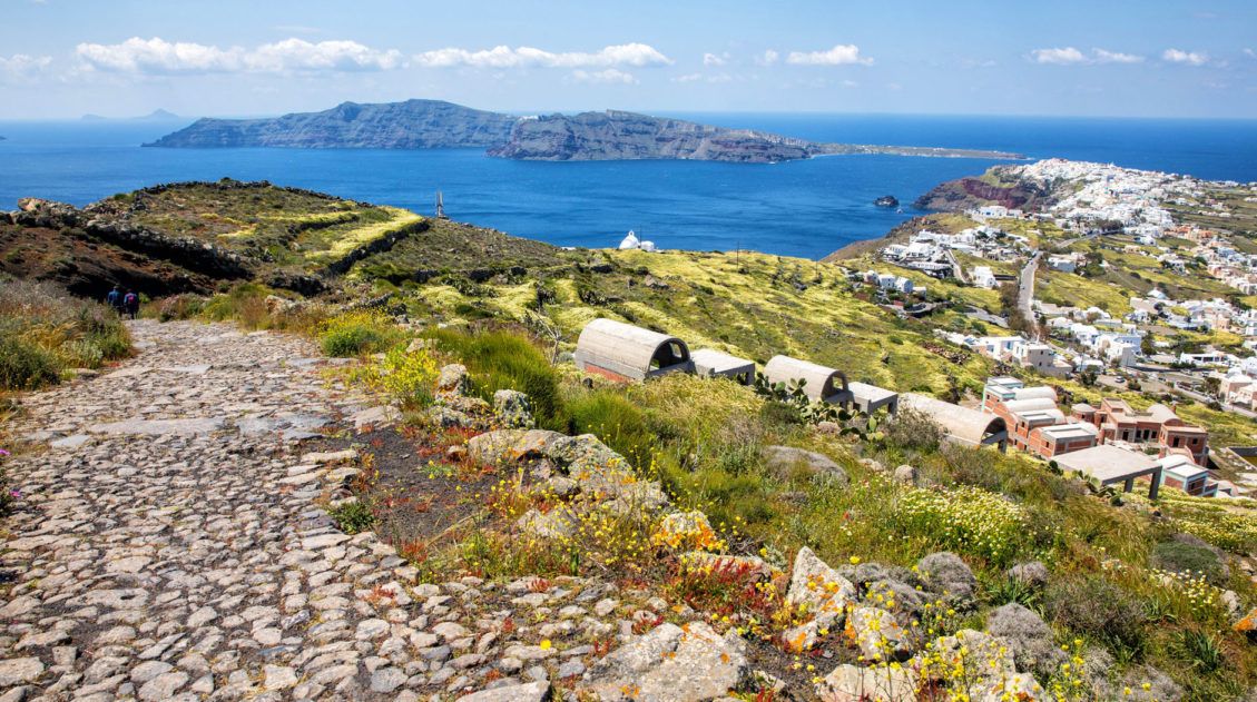
Walking from Fira to Oia is one of Santorini’s top experiences. Hike along the rim of a caldera, explore the towns of Oia, Imerovigli, Firostefani, and Fira, and enjoy some of the most beautiful views of the islands.
If you go the entire distance, you will walk just over 10 km (about 6 miles). The walking path is a mix of paved, pedestrian streets and dirt hiking trails.
You can do this hike in either direction. For the best experience, walk from Fira to Oia. This makes it an overall downhill walk (although you will still have to walk up some hills), you get to see the amazing views of Oia in front of you, and you can end in Oia. Spend the rest of the day exploring the village, watch Oia’s legendary sunset, and then return to your hotel.
👉 See our complete Fira to Oia walking guide for route details, timing tips, and how to plan your walk.
Fira to Oia Walk: Complete Guide & Tips
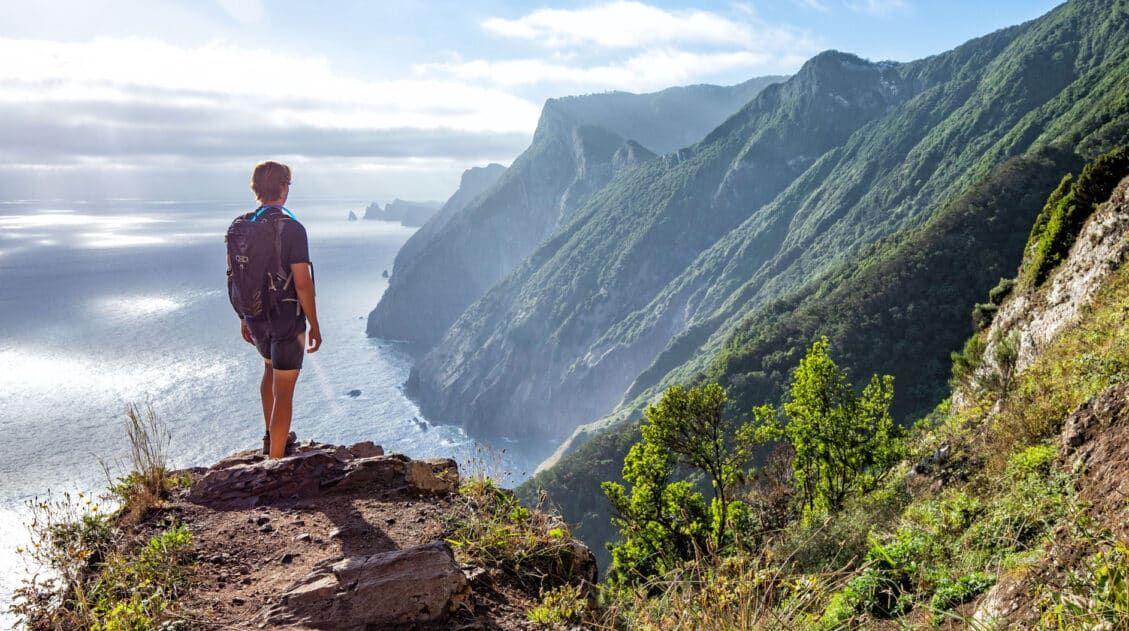
Route details, timing tips, and how to plan this iconic Santorini walk.Vereda do Larano (Madeira, Portugal)
Why it’s awesome: A stunning coastal trail carved into steep cliffs, with sweeping views of the Atlantic Ocean almost the entire way.
Best for: Hikers who want dramatic coastal scenery with a bit of exposure and a more adventurous feel.
Distance: 10.6 km (6.6 miles)
Difficulty: Easy
Time: 2.5 to 4 hours
Location: Madeira, Portugal
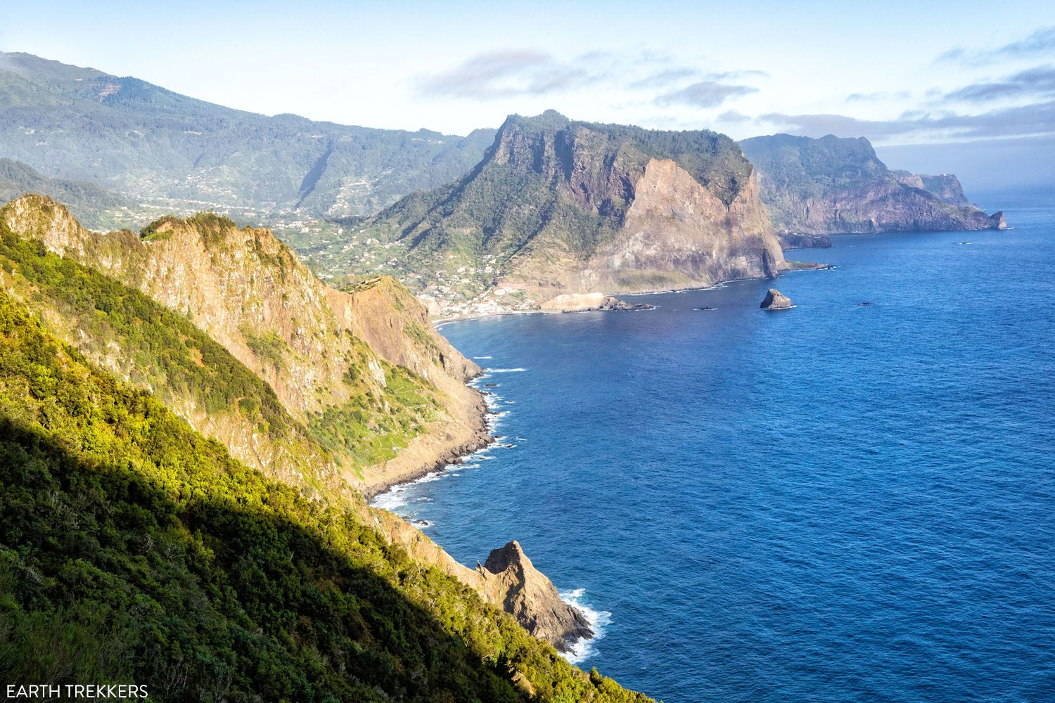
The view along Vereda do Larano
We hiked Madeira’s most famous hiking trails, plus a few off-the-beaten-path hikes, and this one was our favorite. Featuring stunning coastal views on an easy but scenic trail, with just a fraction of hikers compared to Pico do Ariero or Vereda da Ponta de São Lourenço, this hike was a joy from start to finish.
Some sections are narrow with exposure and no guardrails, so this hike is best for those comfortable with heights. It’s one of the most unique coastal hikes in Europe and a highlight of visiting Madeira.
👉 See our complete Vereda do Larano hiking guide for trail directions, transportation logistics, and tips for planning your hike.
How to Hike Vereda do Larano to Boca do Risco
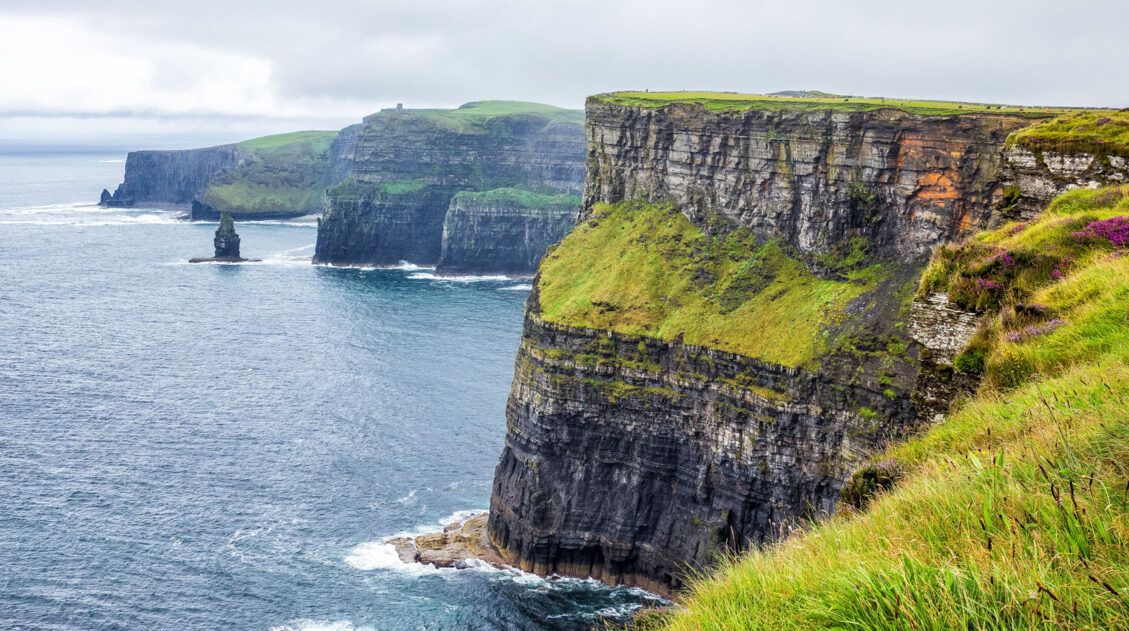
Trail details, logistics, and what to expect on Madeira’s most scenic coastal hike.Cliffs of Moher (Ireland)
Why it’s awesome: Towering sea cliffs, crashing waves, and sweeping views of the Atlantic Ocean make this one of Ireland’s most iconic landscapes.
Best for: Travelers looking for an easy, scenic walk with big views and minimal elevation gain.
Distance: Varies (short walks to longer point-to-point routes)
Difficulty: Easy
Time: 1 to 4 hours
Location: County Clare, Ireland
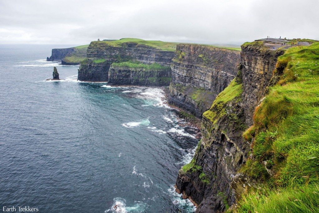
What to expect: The Cliffs of Moher stretch along Ireland’s west coast, with walking paths that range from short viewpoints near the visitor center to longer coastal routes along the cliffs. While this is more of a scenic walk than a traditional hike, the views are spectacular the entire way. Expect wide, open landscapes, changing weather, and plenty of photo opportunities. It can be busy near the main viewpoints, but quieter sections are easy to find if you walk farther along the trail.
👉 See our guide to the Cliffs of Moher for walking routes, parking info, and tips for planning your visit.
Cliffs of Moher: What to Know Before You Go
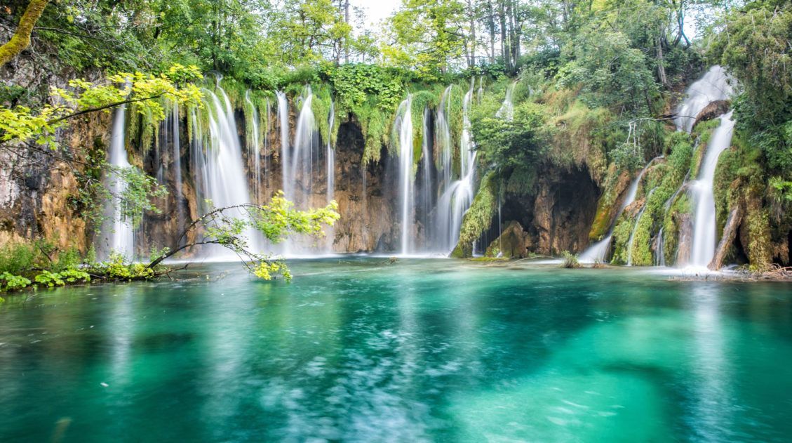
Walking routes, parking info, and tips for visiting Ireland’s most famous cliffs.Plitvice Lakes (Croatia)
Why it’s awesome: A series of cascading turquoise lakes connected by waterfalls and wooden boardwalks. One of the most beautiful landscapes in Europe.
Best for: Travelers looking for an easy, scenic walking route with incredible views and minimal physical effort.
Distance: 8 to 11 km
Difficulty: Easy to moderate
Time: 4 to 8 hours
Location: Croatia
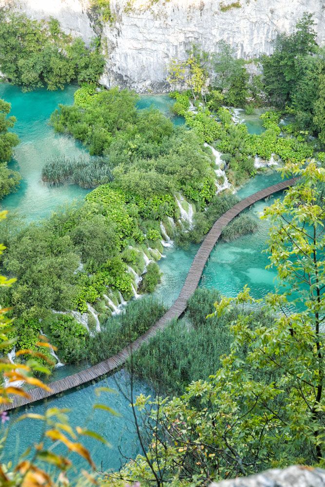
View over Plitvice Lakes
Plitvice Lakes is one of the most unique places to visit in Croatia. With easy walking trails, boardwalks suspended over the turquoise water, stunning viewpoints, and photogenic waterfalls, this is the type of place that is perfect for visitors of all ages.
This park is a network of hiking trails and boardwalks that are linked together with shuttle buses and boats. There are numerous “programs” you can follow, which are suggested routes depending upon your starting point, your energy level, and how much time you have.
👉 In our guide to Plitvice Lakes, learn about a great loop you can hike, which is not listed as one of the main programs. See the highlights of Plitvice Lakes plus off-the-beaten-path viewpoints over the lakes.
Plitvice Lakes, Croatia: Best Walking Route, Helpful Tips & Photos
Everything you need to know to plan your visit to Plitvice Lakes.Hidden Gems and Less-Expected Favorites
These hikes may not be as famous, but they were some of our most memorable experiences in Europe. If you want fewer crowds or something a little different, start here.
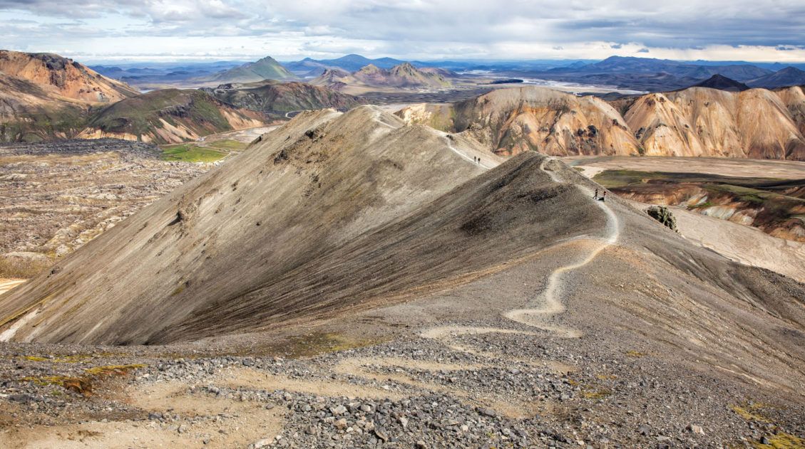
Blahnúkúr & Brennisteinsalda Loop (Iceland)
Why it’s awesome: A colorful geothermal landscape with rhyolite mountains, steaming vents, and panoramic views unlike anywhere else in Europe.
Best for: Hikers who want a shorter but incredibly scenic hike through one of Iceland’s most unique landscapes.
Distance: 9.7 km (6 miles) loop
Difficulty: Strenuous
Time: 4 to 6 hours
Location: Landmannalaugar, Iceland
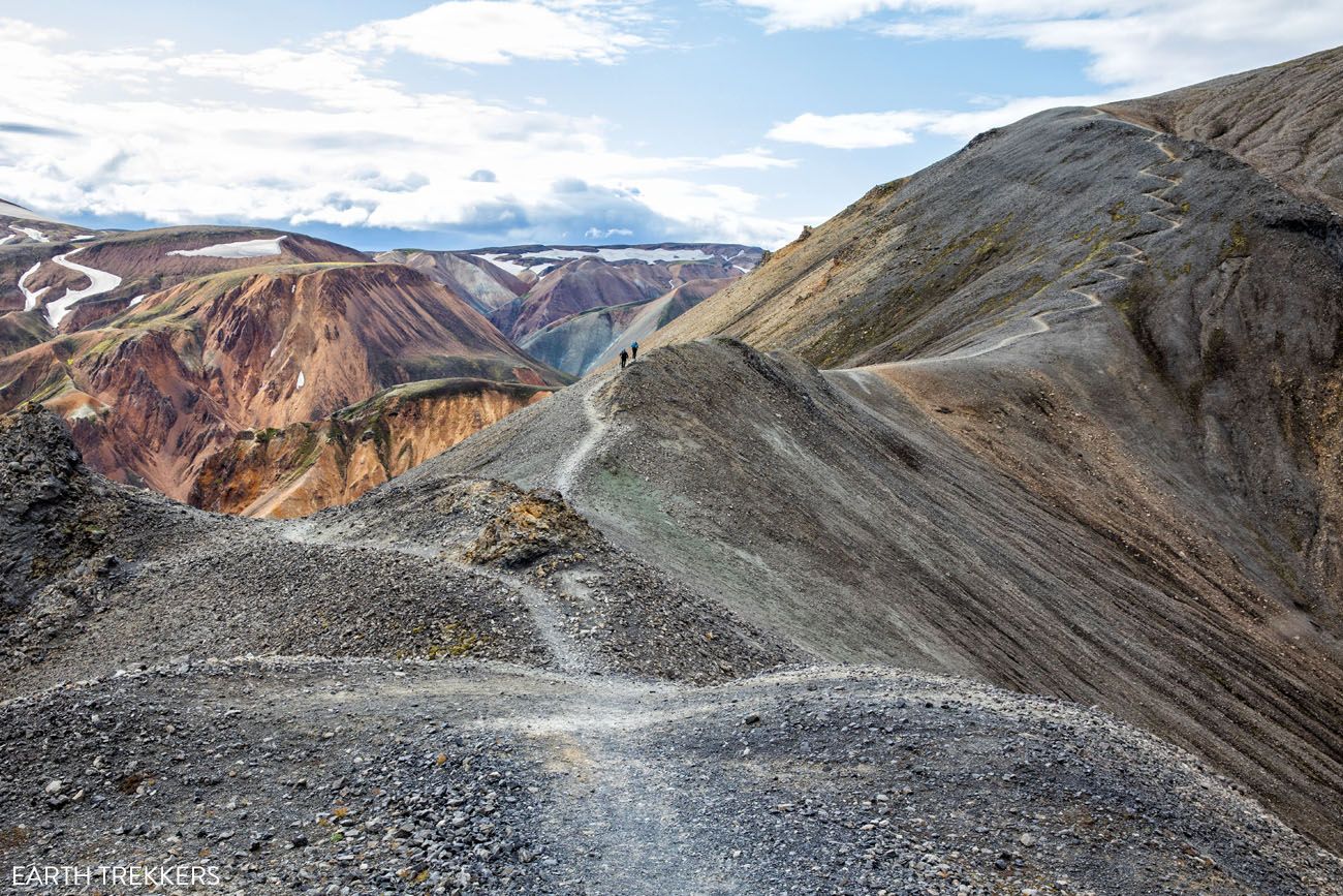
Hiking up Mt. Blahnúkúr
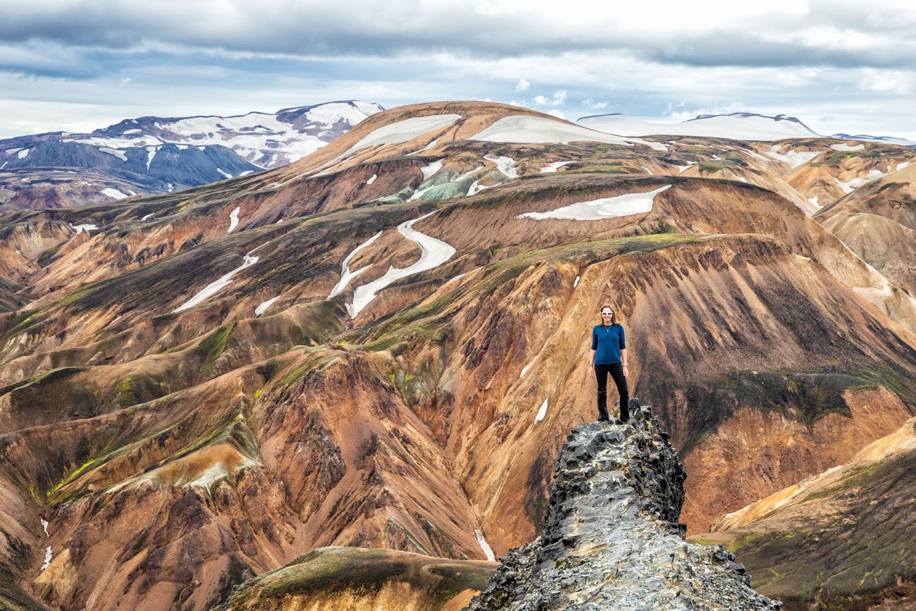
On top of Mt. Blahnúkúr
Landmannalaugar is one of the top spots to go hiking in Iceland. Its colorful rhyolite mountains, geothermal hot springs, lava fields, and unique hiking trails attract adventurous travelers all summer long.
What to expect: This loop hike combines two of the best short hikes in Landmannalaugar, taking you over Bláhnúkur for sweeping views and across Brennisteinsalda for a closer look at steaming geothermal terrain. The scenery is constantly changing, with colorful mountains, black lava fields, and active geothermal features. It’s a relatively short hike, but one of the most unique landscapes we’ve experienced in Europe.
👉 See our complete Landmannalaugar hiking guide for trail options, how to get here, and tips for planning your visit.
Hike the Blahnúkúr Brennisteinsalda Loop Trail, Landmannalaugar, Iceland
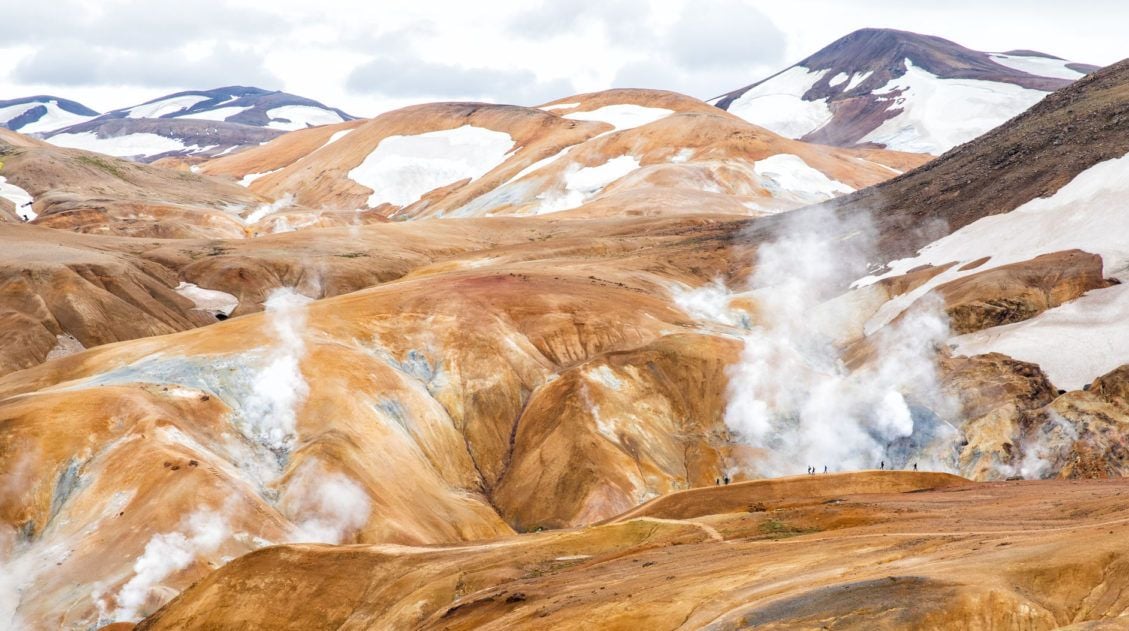
This loop is one of the best experiences in Landmannalaugar. Here’s how to do it.Hveradalir Geothermal Area (Iceland)
Why it’s awesome: A remote geothermal valley filled with steaming vents, bubbling mud pots, and colorful hills in Iceland’s highlands.
Best for: Hikers who want a unique geothermal landscape with fewer crowds and a more off-the-beaten-path feel.
Distance: 11.5 km (7 miles) out-and-back
Difficulty: Moderate
Time: 4 to 5 hours
Location: Kerlingarfjöll, Iceland
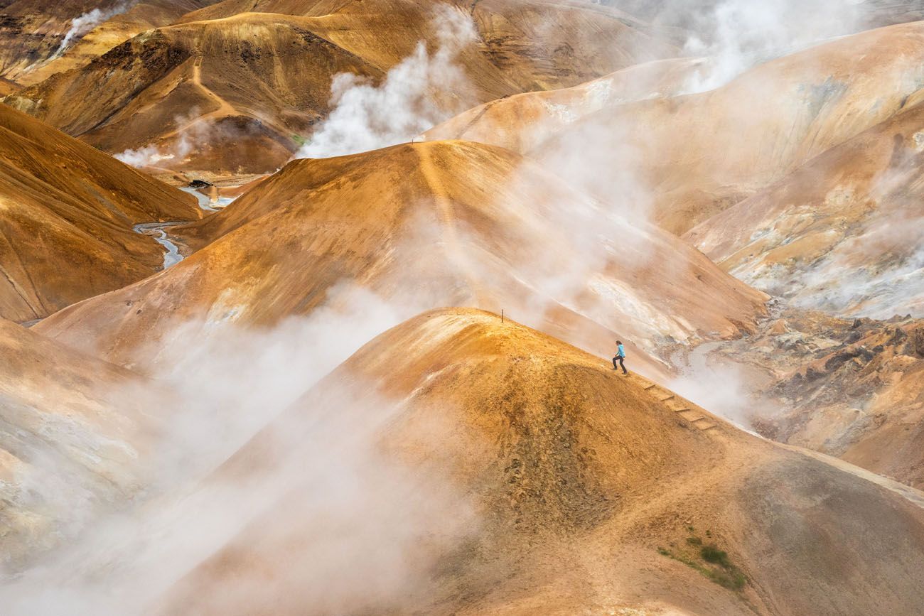
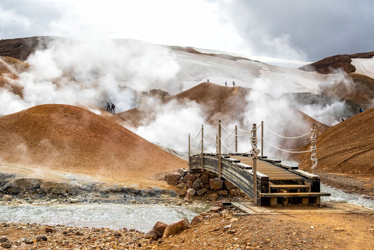
Kerlingarfjöll is a mountain range located in Iceland’s central highlands. Tucked away within this mountain range is Hveradalir, a geothermal wonderland of steaming vents, boiling mud pools, and rainbow-colored hot springs.
The combination of hiking trails, rust-colored mountains, and clouds of steam creates one of Iceland’s most unique hiking and photography destinations.
From the Kerlingarfjöll Mountain Resort, you can drive or hike to the Hveradalir Geothermal Area. If you hike out-and-back, it’s awesome to see how the terrain changes from the lush, green landscape around the resort to the steamy, orange and yellow mountains of Hveradalir. The hiking stats above include the hike to and from the resort plus exploring the Hveradalir area.
👉 See our complete Hveradalir hiking guide for trail options, how to get here, and tips for visiting Iceland’s highlands.
How to Visit Kerlingarfjöll and the Hveradalir Geothermal Area, Iceland
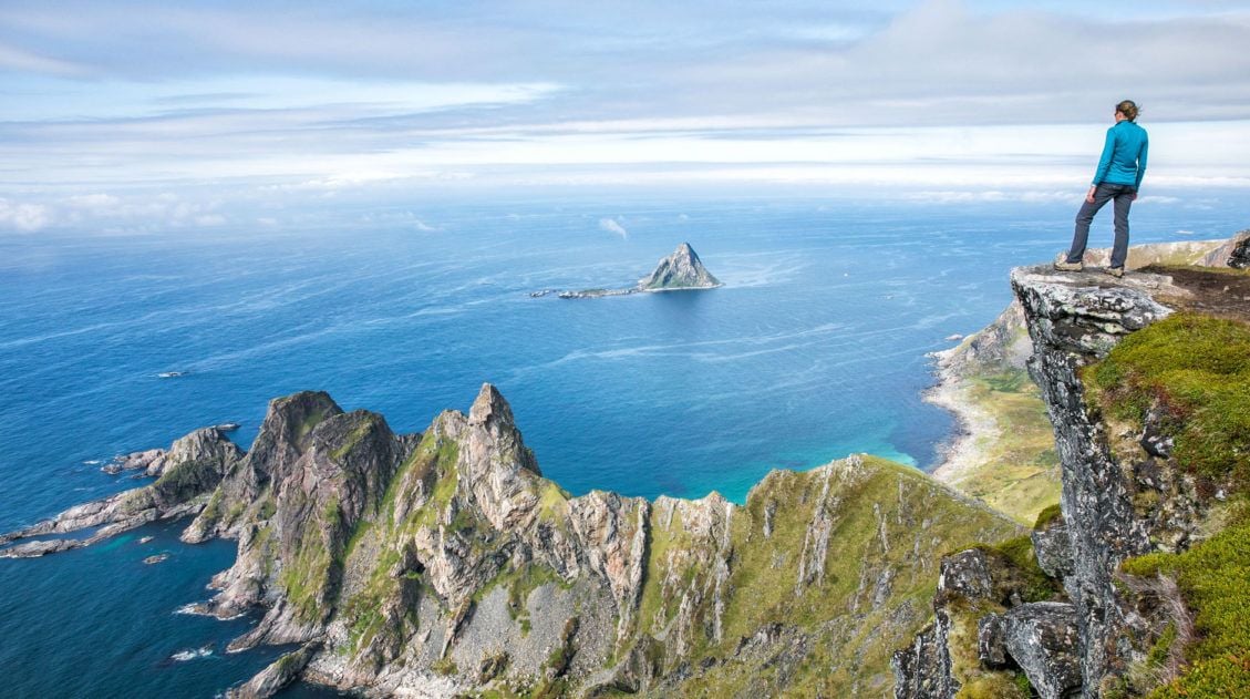
Trail details, access info, and tips for visiting this remote geothermal valley.Måtind & the Stave-Bleik Coastal Trail (Norway)
Why it’s awesome: A short but spectacular hike to a summit overlooking turquoise beaches, rugged coastline, and the open Arctic Ocean.
Best for: Hikers looking for a shorter climb with big views in a remote and uncrowded setting.
Distance: 7.6 km (4.7 miles) out-and-back
Difficulty: Easy to moderate
Time: 3 to 4 hours
Location: Vesteralen Islands, Norway
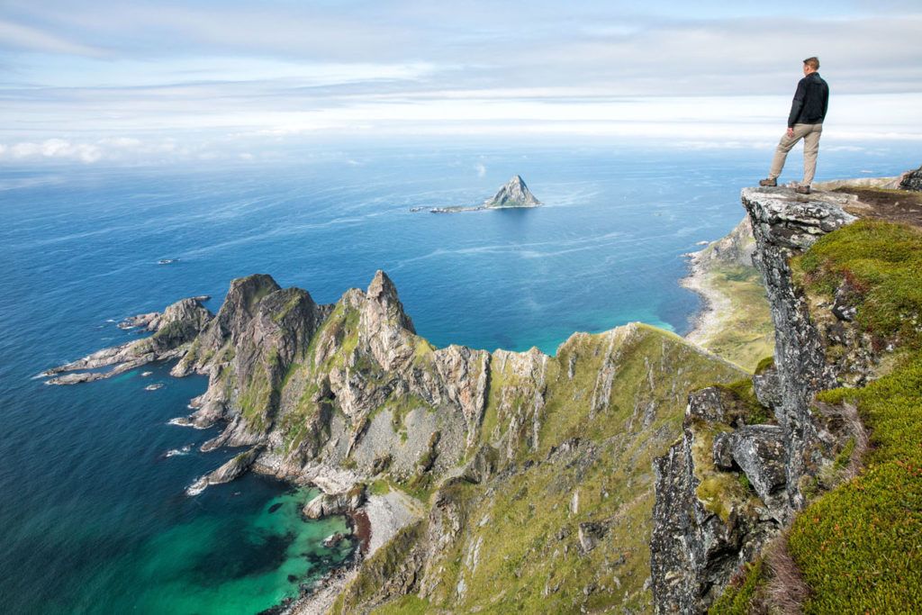
Måtind
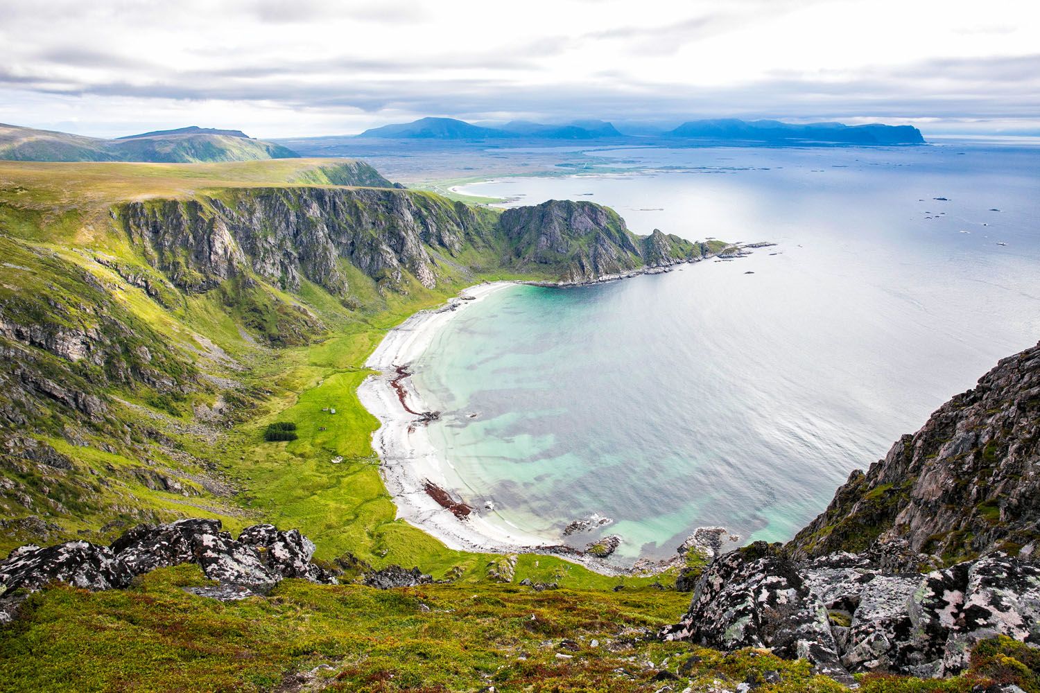
Stave Beach
What to Expect: The hike to Måtind is short but steep, climbing quickly to a summit with sweeping views of the rugged coastline. From the top, you’ll look down onto one of the most beautiful beaches in Norway, with vibrant blue water and jagged peaks surrounding it. The trail is not technical, but the climb is steady and exposed in places. It’s a quick hike with a huge payoff and one of our favorite hidden gems in Europe.
👉 See our guide on how to hike Måtind and the Stave-Bleik Coastal Trail for trail details, how to get here, and tips for planning your hike.
Hiking to Måtind: Norway’s Hidden Gem
The Stave-Bleik Coastal Trail is a 9 km trail that runs point-to-point along the coastline. Here’s how to do it.The Ladder of Kotor (Montenegro)
Why it’s awesome: A historic zigzag trail climbing high above the Bay of Kotor, with sweeping views over one of the most beautiful coastlines in Europe.
Best for: Hikers who want a moderately challenging climb with incredible views and a unique, off-the-beaten-path feel.
Distance: 6.4 km (4 miles) one way; 12.8 km (8 miles) round trip
Difficulty: Strenuous
Time: 3 to 6 hours
Location: Kotor, Montenegro
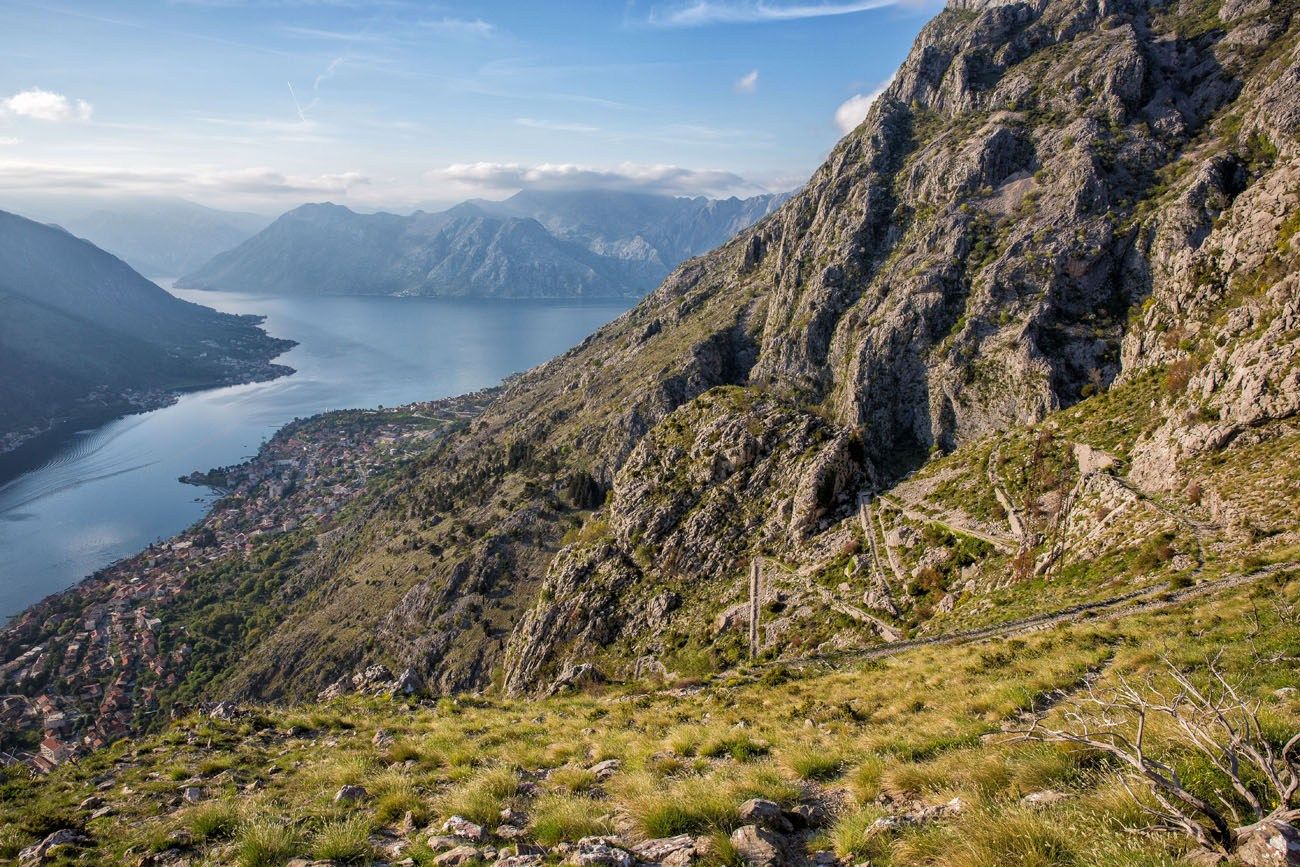
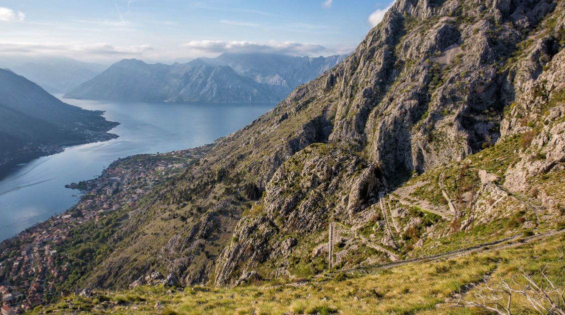
Ladder of Kotor
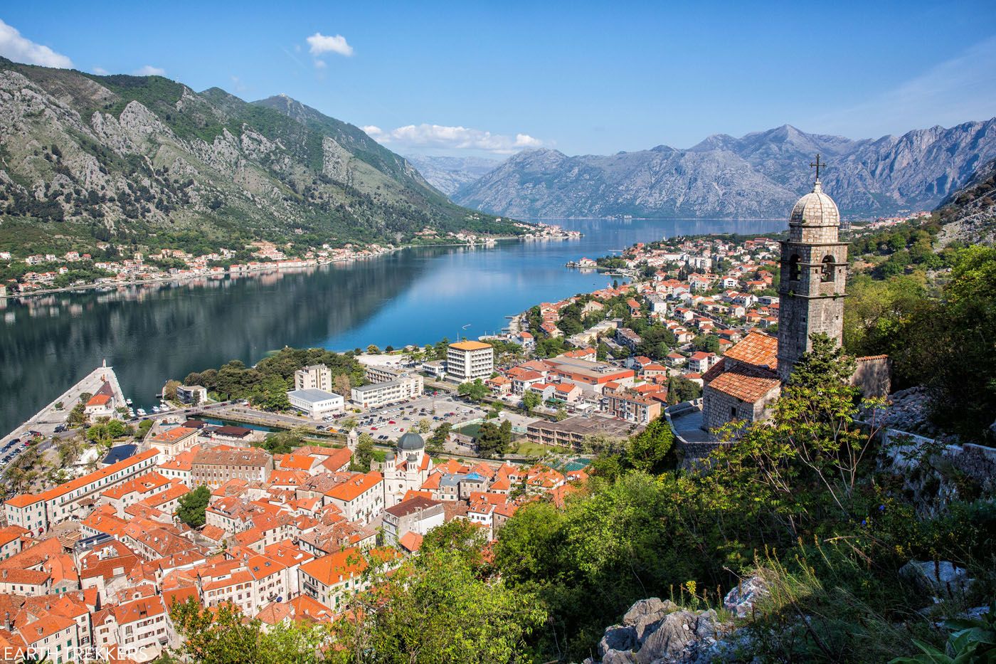
View of Kotor from the castle walls
What to expect: The Ladder of Kotor climbs steeply above the old town of Kotor via a series of switchbacks that were once part of a historic trade route. As you ascend, the views over the bay get better and better, with each turn revealing a new perspective. The trail is rocky and exposed in places, and the climb can be hot, but the scenery makes it well worth the effort. It’s one of the best ways to experience Kotor beyond the old town.
👉 See our guide on How to Hike the Ladder of Kotor for trail details, route options, and tips for planning your hike.
Ladder of Kotor Hike: What to Know Before You Go
Trail details, route options, and tips for hiking above the Bay of Kotor.Hiorthfjellet (Svalbard, Norway)
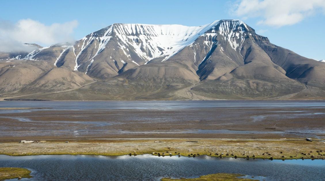
Why it’s awesome: A remote Arctic hike with sweeping views over Adventfjorden, rugged mountains, and the wild, untouched landscapes of Svalbard.
Best for: Adventurous travelers looking for a truly unique hiking experience far off the typical European travel path.
Distance: 5.4 km (3.4 miles) kayaking + 8.7 km (5.4 miles) hiking
Difficulty: Strenuous
Time: 11 hours
Location: Svalbard, Norway
This experience is one of the most adventurous on this list. Due to its location, it is also the most remote.
Svalbard is a Norwegian archipelago that is located in the Arctic Ocean. If you look at Svalbard on globe, it looks like it’s just a hop, skip and a jump away from the North Pole.
Longyearbyen is the largest settlement in Svalbard. At 78° north, it is also the world’s northernmost city. This is a town where the streets have no names, reindeer wander through town, and there are more snowmobiles than people.
And this is where this adventure begins.
From Longyearbyen, you will kayak across Adventfjord. Once on shore, it is a 9 km hike out-and-back to the summit of Hiorthfjellet. Along the way, you get great views of Longyearbyen and the chance to see Svalbard reindeer.
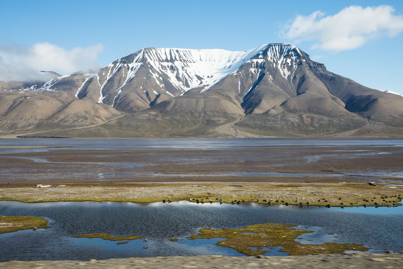
View of Hiorthfjellet from Longyearbyen
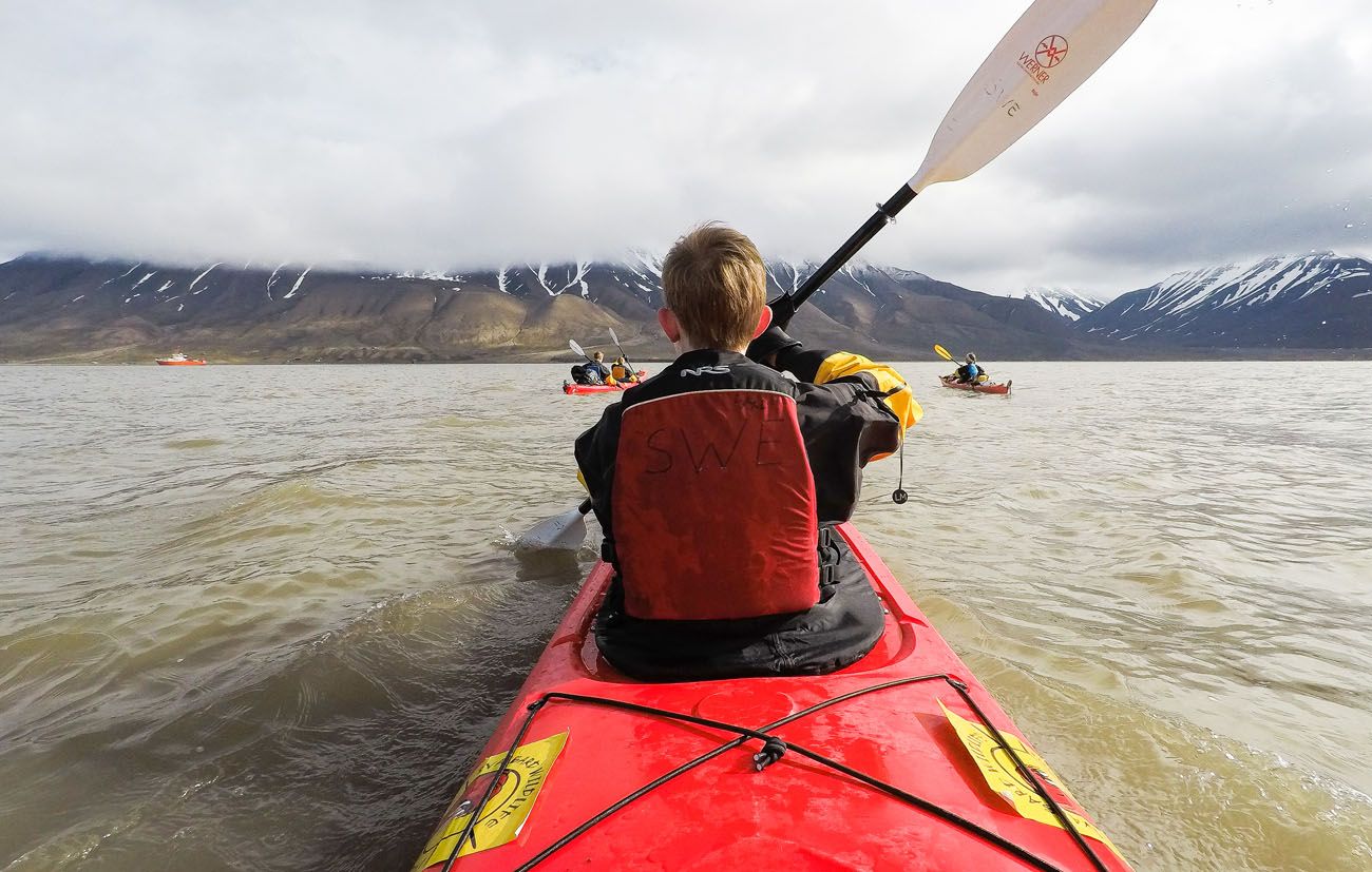
Kayaking across Adventfjord
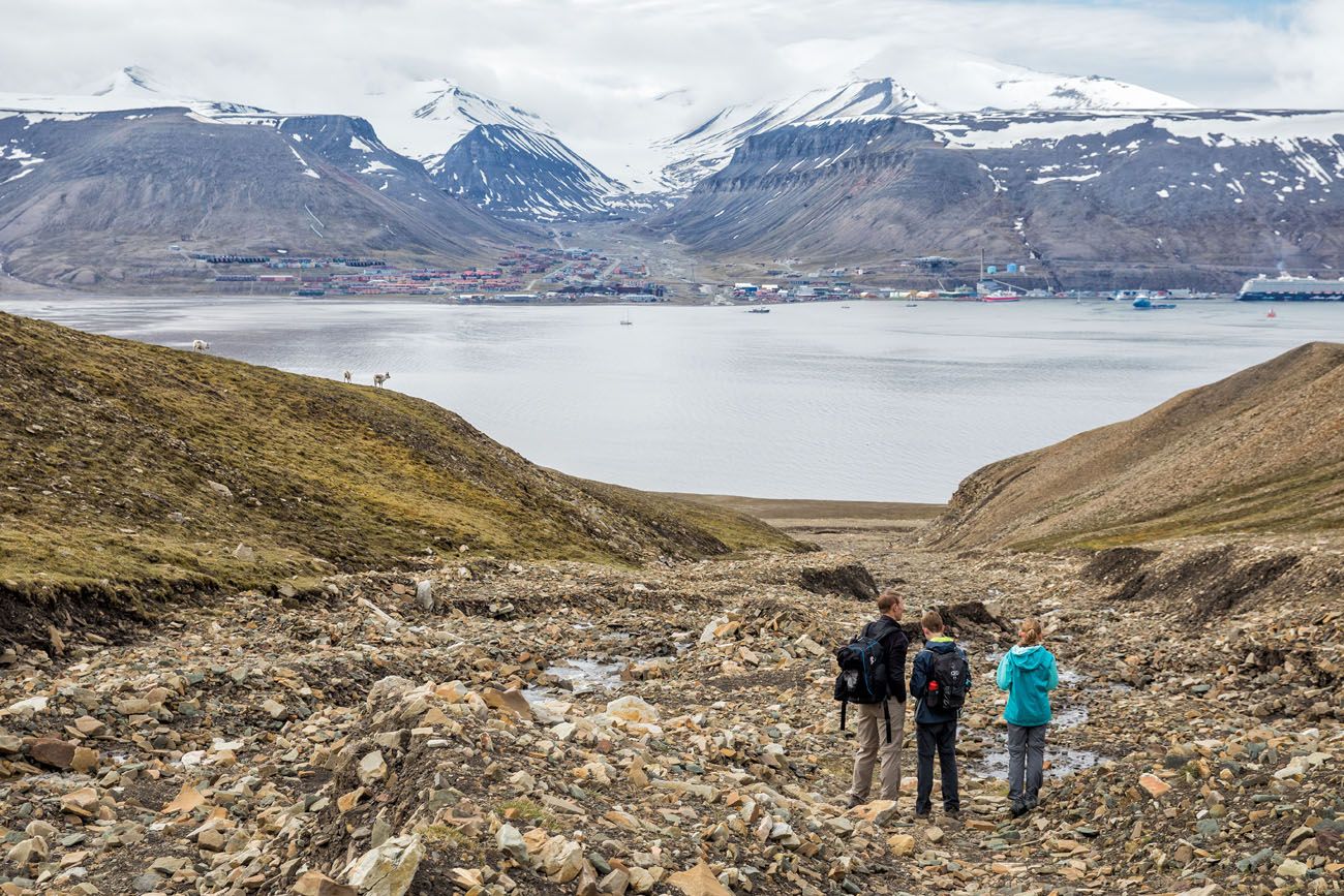
View of Longyearbyen (and a few reindeer) from the Hiorthfjellet hiking trail
When we did this at the end of June, it snowed during the final part of our hike up Hiorthfjellet, making this hike even more memorable. We didn’t get to enjoy the view from Hiorthfjellet because of the snow, but I hear it’s an incredible view of the area.
To finish the experience, hike and then kayak back to Longyearbyen.
👉 See our complete Hiorthfjellet hiking guide for logistics, safety considerations, and what to expect on this Arctic adventure.
Kayaking Adventfjord and Hiking Hiorthfjellet: A One Day Adventure in Svalbard
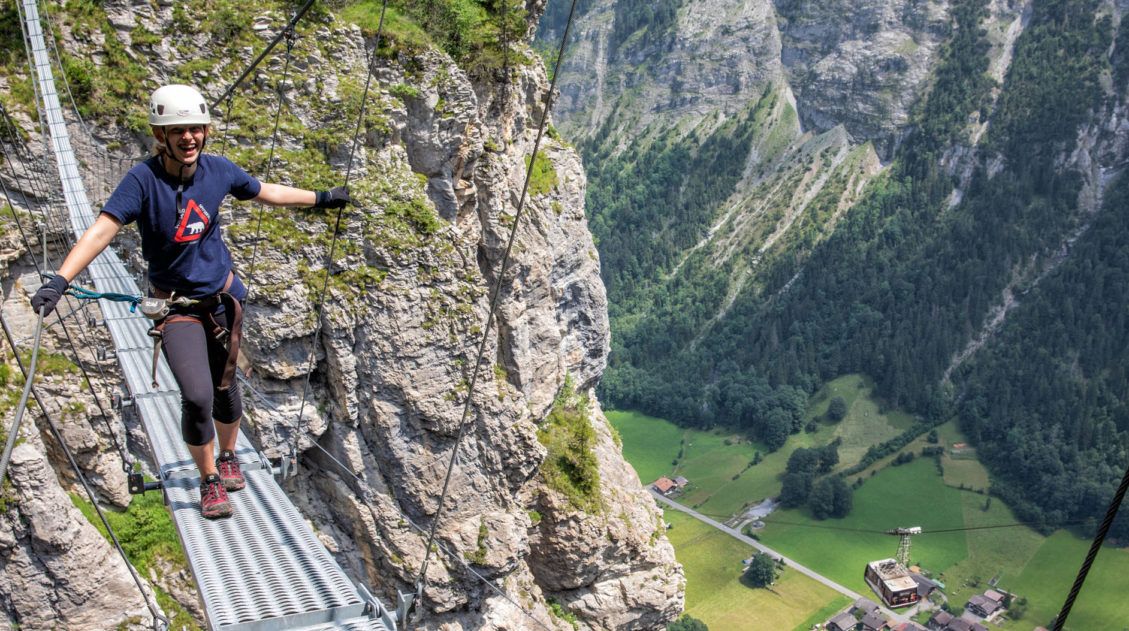
This is one of the most adventurous experiences on this list. Go kayaking and then hike Hiorthfjellet, an unforgettable experience.Mürren Via Ferrata (Switzerland)
Why it’s awesome: A thrilling cliffside route with ladders, cables, and suspension bridges, all set against the dramatic backdrop of the Lauterbrunnen Valley.
Best for: Adventurous travelers who want a unique, adrenaline-filled experience in the Alps without needing advanced climbing skills.
Distance: 2.2 km (1.4 miles) one-way
Difficulty: Moderate
Time: 3 hours
Location: Jungfrau Region, Switzerland
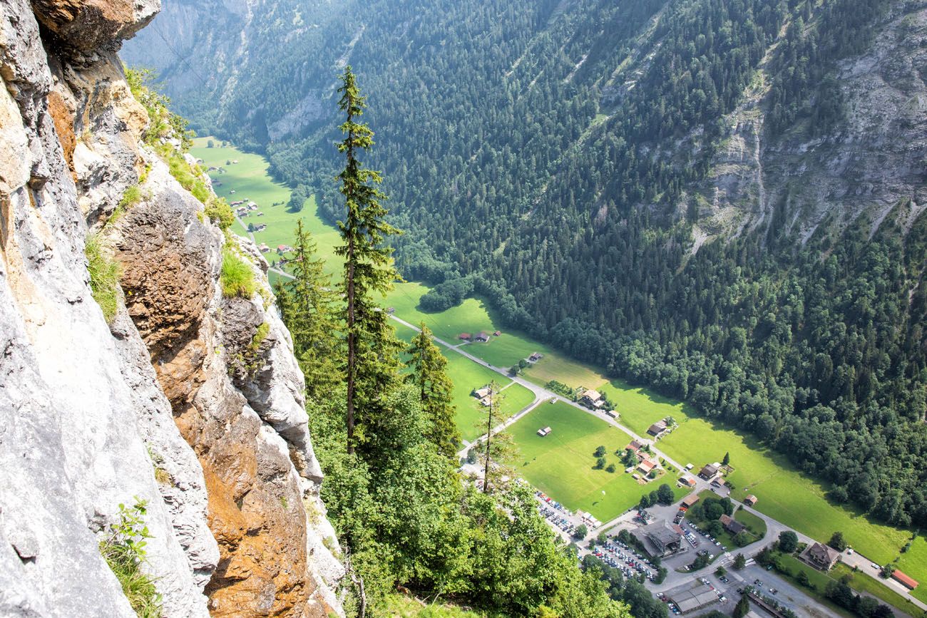
View from the Mürren via ferrata
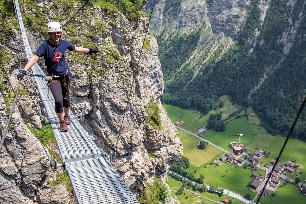
This is the shortest but the most thrilling hike on our list of favorite hikes in Europe.
The Mürren via ferrata is a 2.2 km journey, part via ferrata and part hiking trail. You’ll cling to a cliff, climb down steep ladders, walk on a tightrope and a suspension bridge, and (with a guide) zip line across a ravine.
The best part is dangling over the Lauterbrunnen Valley, because the views are unbeatable.
👉 See our guide to the Mürren Via Ferrata for equipment info, route details, and tips for planning your visit.
The Mürren Via Ferrata: One of Switzerland’s Most Thrilling Experiences
Exactly how to do the Mürren via ferrata.The Green Lake (Zelene Pleso) & Vel’ká Svišt’ovka (Slovakia)
Why it’s awesome: A scenic hike to a vibrant emerald lake surrounded by rugged peaks in the High Tatras.
Best for: Hikers looking for a moderately challenging trail with classic alpine scenery and a rewarding endpoint.
Distance: 13.2 km (8.2 miles) point-to-point
Difficulty: Moderate
Time: 6 to 8 hours
Location: High Tatras, Slovakia
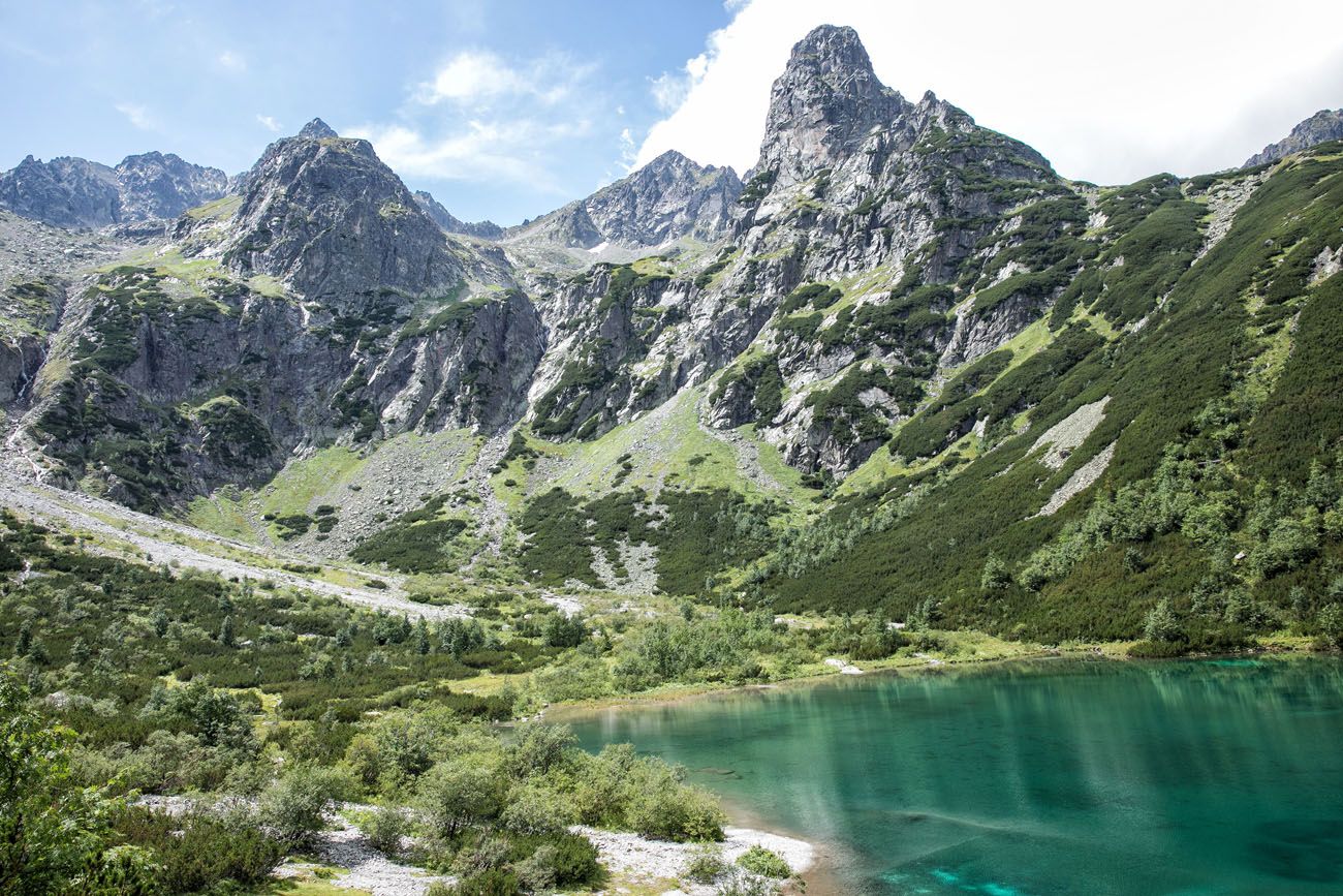
Green Lake (Zelene pleso)
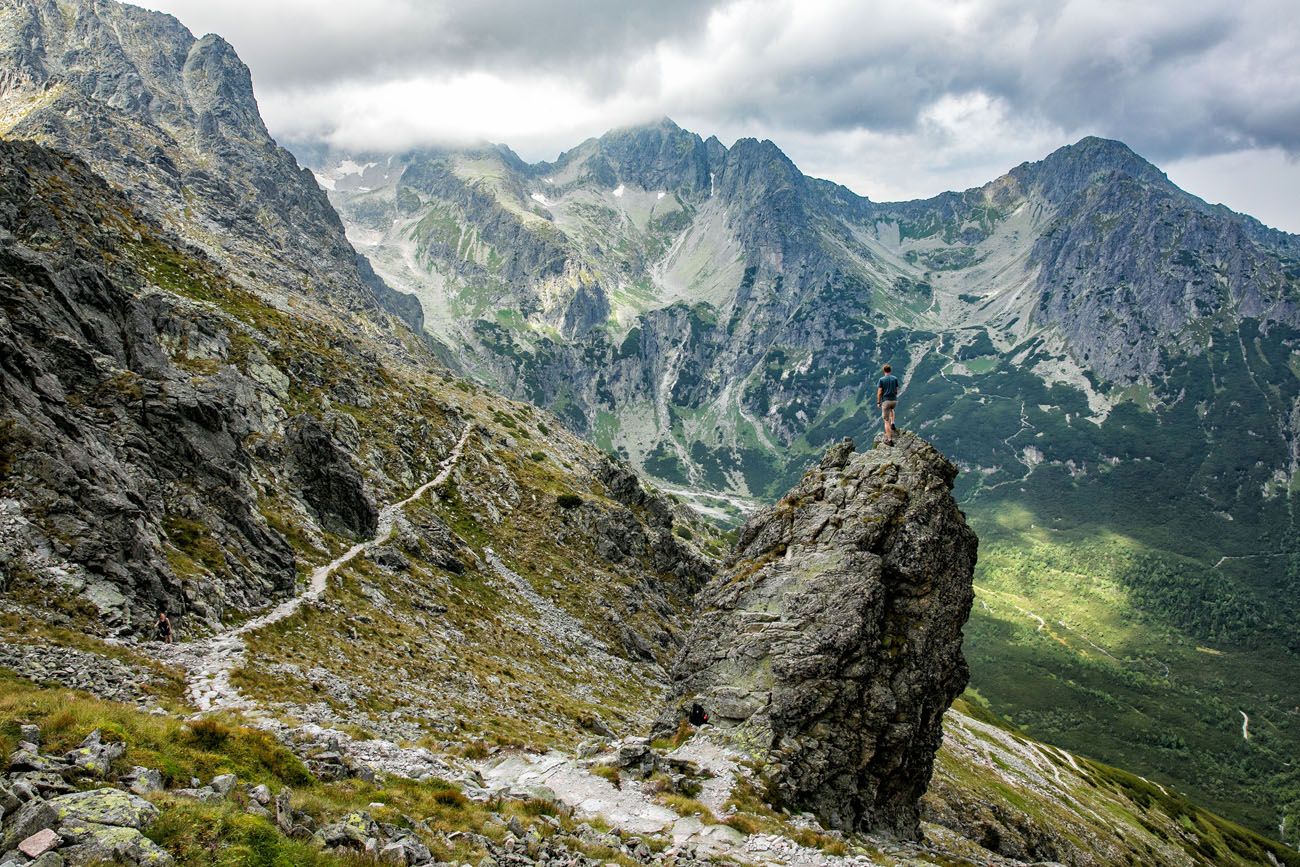
On the trail from Vel’ká Svišt’ovka to Zelene Pleso
The High Tatras is another fantastic hiking destination in Europe. Jagged mountains, emerald green lakes, rugged hiking trails, and cable cars all come together to form the perfect adventure destination.
Hiking to the summit of Vel’ká Svišt’ovka was our favorite hike in the Tatras. The stunning mountain views and a visit to several vividly green lakes makes this a gorgeous hike.
A cable car shaves off the first major ascent, so this hike is easier than many of the hikes in the Tatras. Even so, this hike is not to be underestimated. It is a long hike, with a surprisingly difficult downhill section, parts of it requiring the use of chains. To get back into town, you also need to be prepared for the long, monotonous walk through a pine forest on a rocky, uneven trail. But it’s worth it for the views.
👉 See our Vel’ka Svist’ovka and Zelene Pleso trail guide for trail details, route options, and tips for planning your hike.

Hiking to Vel’ká Svišt’ovka and Zelene Pleso in the High Tatras of Slovakia
Everything you need to know to hike to the Green Lake in Slovakia.ANOTHER NOTABLE MENTION: Rysy is another popular hike to do in the Tatras. Rysy is the highest point in Poland and the highest point in the Tatras that you can hike to without a guide. Most people get here by hiking from the Slovakian Tatras. We hiked to Rysy from Štrbské Pleso in Slovakia. This tough hike is 20 km (12.5 miles) long with 1,345 meters (4,415 feet) of elevation gain.
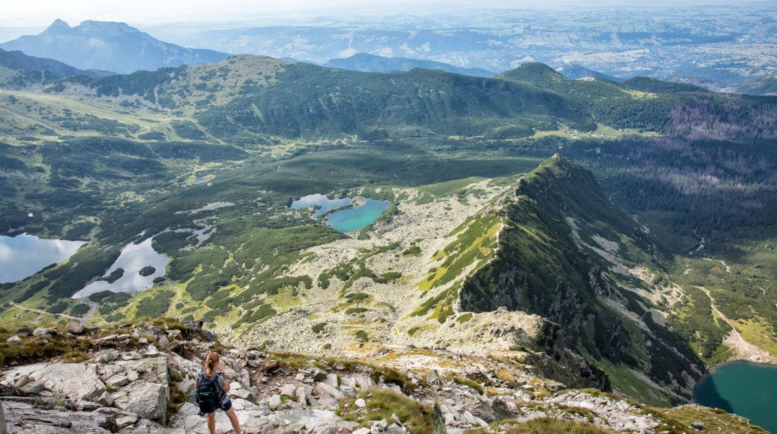
Koscielec (Poland)
Why it’s awesome: A dramatic summit hike with rugged terrain, a touch of scrambling, and sweeping views over the Tatra Mountains.
Best for: Experienced hikers looking for a shorter but more technical climb with a true summit experience.
Distance: 18 km (11.2 miles) loop
Difficulty: Strenuous
Time: 8 to 10 hours
Location: Tatra Mountains, Poland
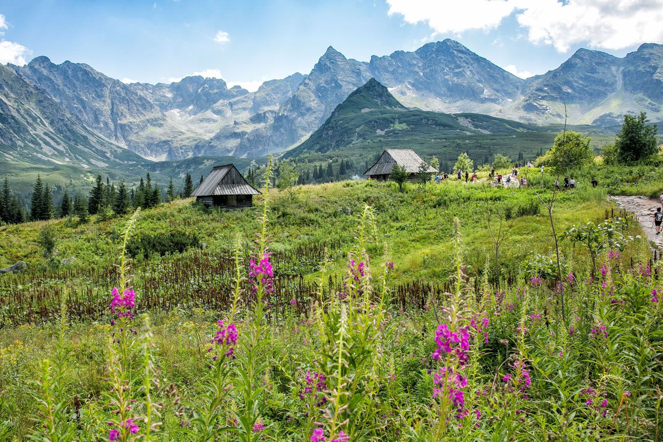
Wildflowers along the trail
The hike to Koscielec is one of the toughest hikes on this list.
This hike starts and ends in Zakopane, Poland’s gateway into the Tatras. Along the trail, you will hike through fields of wildflowers, past alpine huts, and next to crystal-clear lakes. It is a very tough hike up Koscielec but your reward is panoramic views over both Poland and Slovakia.
👉 See our complete Koscielec hiking guide for trail details, route options, and tips for planning your hike.
How to Hike Koscielec in the Polish Tatras from Zakopane
Step-by-step trail guide for the amazing hike to the summit of Koscielec.For a Bigger Adventure
If you’re ready to take things to the next level, this is one of the most iconic long-distance hikes in Europe, and one of the best ways to fully experience the Alps.
Walker’s Haute Route (France & Switzerland)
Why it’s awesome: One of Europe’s most legendary long-distance hikes, crossing the Alps from Chamonix to Zermatt with nonstop views of glaciers, high mountain passes, and iconic peaks.
Best for: Experienced hikers looking for a multi-day, bucket list adventure through some of the most spectacular scenery in the Alps.
Distance: 204 km (127 miles)
Difficulty: Challenging
Time: 13 to 14 days
Location: French and Swiss Alps
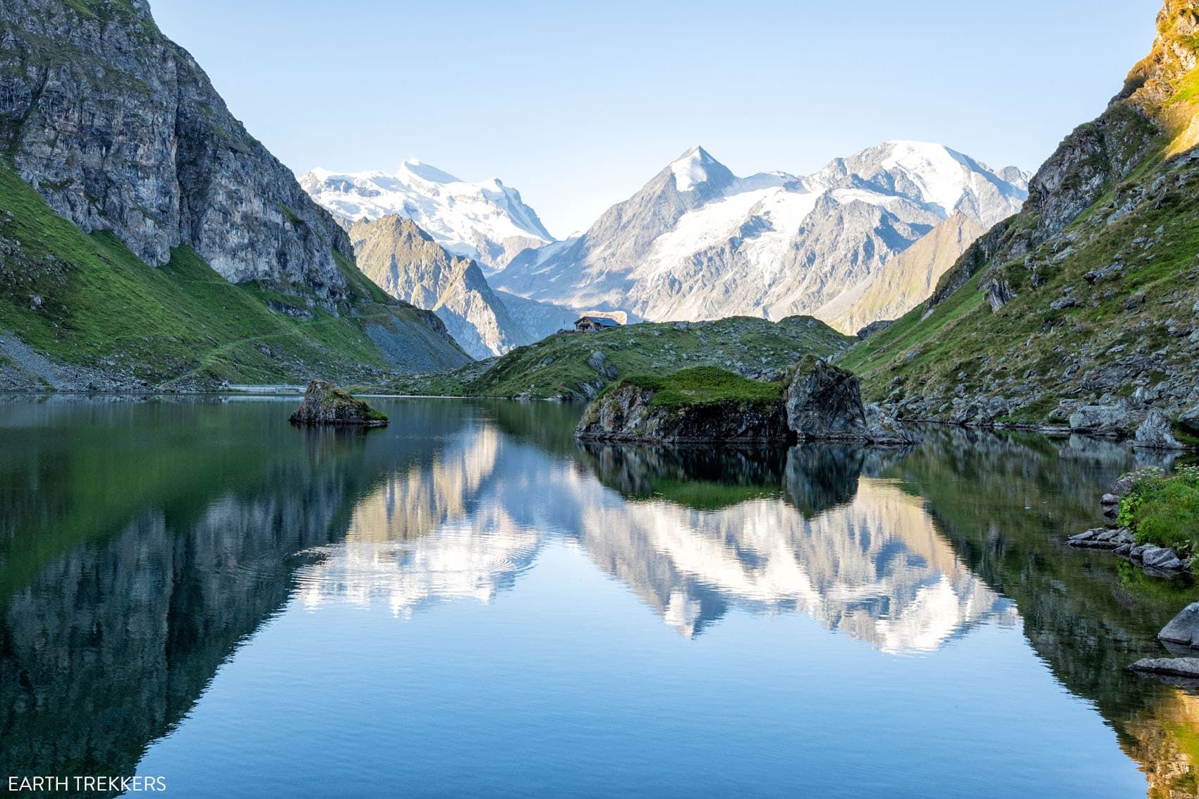
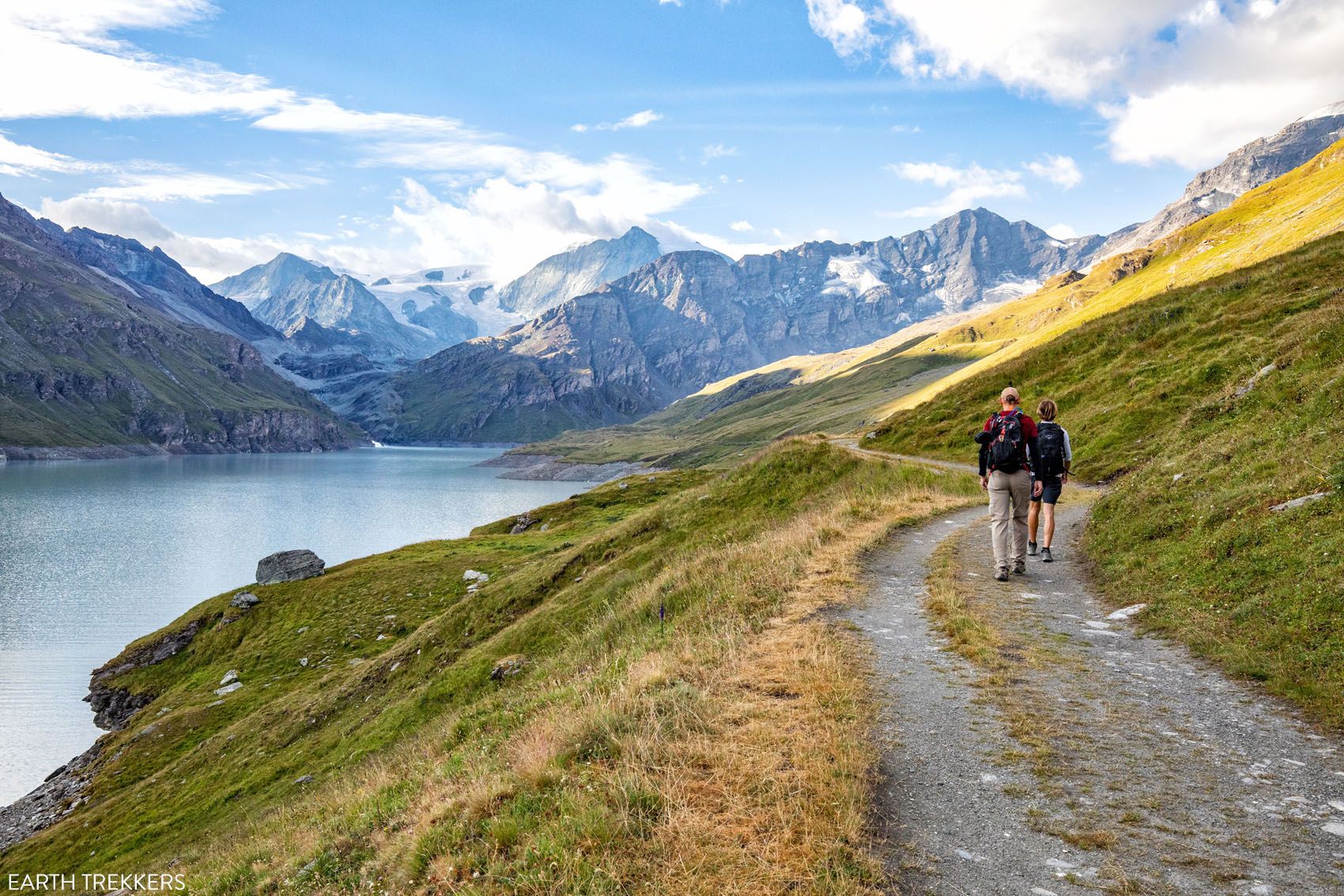
What to Expect: The Walker’s Haute Route is a point-to-point trek that connects Chamonix in France to Zermatt in Switzerland, crossing 10 high mountain passes and winding through alpine valleys along the way.
Each day brings new scenery, including glaciers, rugged peaks, and quiet mountain villages, making this one of the most rewarding long-distance hikes in Europe. It requires planning, good fitness, and multiple days on the trail, but for us, this was one of the most unforgettable hiking experiences we’ve ever had.
👉 See our complete Walker’s Haute Route guide for itinerary options, logistics, and tips for planning this trek.
Walker’s Haute Route: Complete Guide & Itinerary
Route details, itinerary options, and tips for planning this iconic Alps trek.Famous Hikes That Didn’t Make Our Top Picks
Even though these hikes didn’t make our top 25, they’re still iconic and worth considering. We enjoyed both, but compared to others on this list, they didn’t stand out quite as much in terms of overall experience.
Pico do Arieiro to Pico Ruivo (PR1)
WHY IT’S FAMOUS: One of Madeira’s most iconic hikes, with dramatic ridgelines and sweeping mountain views.
OUR TAKE: While this hike is incredibly popular and undeniably scenic, it wasn’t one of our personal favorites. Crowds, logistics, and our overall experience didn’t quite live up to expectations compared to other hikes on this list. We did this hike in 2024 and it was the most crowded trail we have hiked, anywhere around the world. Since our visit, a new fee and reservation system have been implemented, so hopefully that will keep crowds more manageable.
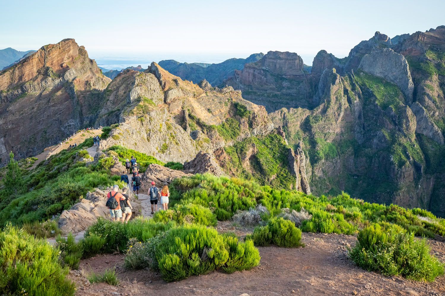
If you’re visiting Madeira, we recommend Vereda da Larano for a more enjoyable overall experience.
TRAIL GUIDE: See our Pico do Ariero to Pico Ruivo Trail Guide for full details on the trail, the new fees and reservation system, plus tips we learned from our hike.
Pulpit Rock
WHY IT’S FAMOUS: One of Norway’s most iconic hikes, leading to a dramatic cliffside viewpoint high above Lysefjord.
OUR TAKE: This is a great hike and one we’ll always remember. It was our first hike in Europe with our kids, which makes it especially meaningful to us. The trail is relatively short and accessible, with a big payoff at the end. That said, compared to other hikes in Norway like Kjeragbolten, Trolltunga, and Måtind, it didn’t stand out as much in terms of overall experience and uniqueness.
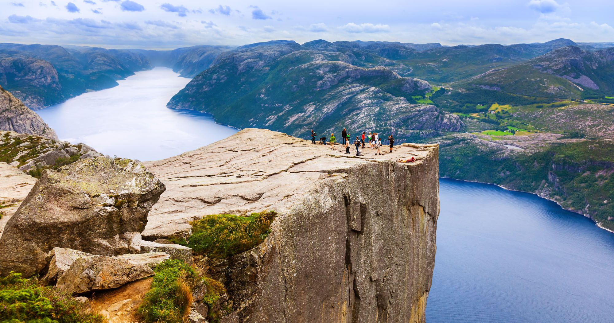
If you’re visiting Norway, we recommend prioritizing Kjeragbolten or Trolltunga for a more memorable and adventurous hike.
TRAIL GUIDE: See our Pulpit Rock hiking guide for full details on the trail, what to expect, and tips for planning your visit.
Frequently Asked Questions
What is the best country in Europe for hiking?
After 13 years of hiking across Europe, Norway and Switzerland consistently top our list — Norway for its dramatic fjord scenery and iconic trails like Trolltunga and Kjeragbolten, Switzerland for the sheer density of world-class trails in a small area. Italy’s Dolomites and Iceland’s volcanic highlands are close behind. The honest answer is that it depends on what kind of hiking you enjoy: coastal, alpine, volcanic, or remote.
When is the best time of year to hike in Europe?
June through September is the sweet spot for most alpine and highland hikes in Europe, when snow has cleared from higher elevations and trail conditions are reliable. For coastal hikes like Cinque Terre or the Path of the Gods, May and October are ideal — cooler temperatures and fewer crowds. Iceland’s highland trails (including Landmannalaugar) are only accessible July through early September.
Do you need permits to hike in Europe?
Most day hikes in Europe don’t require advance permits, but there are exceptions. Trolltunga and some popular Norwegian trails now have timed entry systems during peak season. Cinque Terre requires a day pass to access the coastal trail. Plitvice Lakes National Park in Croatia requires a paid entry ticket. We cover current permit requirements in each individual trail guides.
What should I pack for a day hike in Europe?
The essentials: sturdy hiking boots, a daypack with at least 2 liters of water, snacks, a rain layer (weather changes fast in the Alps and Iceland), sunscreen, a trail map or downloaded offline GPS route, and a fully charged phone. For strenuous hikes like Trolltunga or Kjeragbolten, trekking poles and extra layers are strongly recommended. Always check the weather forecast the morning of your hike.
Are the hikes in this guide suitable for kids?
Several of them, yes. We’ve hiked throughout Europe with our own kids starting at age 8, and some of our favorites for families include the Eiger Trail (Switzerland), Path of the Gods (Italy), Plitvice Lakes (Croatia), and the Seven Hanging Valleys Trail (Portugal). Each trail guide notes difficulty level and suitability so you can find the right fit for your group.
Plan Your Hiking Trip to Europe
Planning a hiking trip to Europe? Many of the best trails are concentrated in a few standout regions. If you want to dive deeper into one area and find more great hikes, start with these guides:
If the Dolomites are on your list, don’t miss our guide to the Best Hikes in the Dolomites, where we share our favorite trails in one of the most beautiful mountain ranges in Europe.
For dramatic fjords and unforgettable viewpoints, explore our guide to the Best Hikes in Norway, featuring iconic trails like Trolltunga and Kjeragbolten, plus a few hidden gems.
If you’re heading to Switzerland, our guide to the Best Hikes in the Bernese Oberland covers some of the most scenic trails in the Alps, including hikes near Mürren, Wengen, and Grindelwald.
Looking for something more rugged and unique? Our guide to the Best Hikes in Iceland features volcanic landscapes, waterfalls, and some of the most otherworldly scenery in Europe.
And for even more inspiration around the world, take a look at our Hiking Guide, where we share our favorite trails across multiple continents.
What are your favorite hikes in Europe? We are always looking for new hiking trails and new hiking destinations and we would love to hear your list of best hikes in Europe (let us know in the comment section below). Thanks!
More Hikes & Places to Visit in Europe
Here are links to even more great hikes across Europe.
5 Best Hikes in Madeira, Portugal (New 2026 Rules)
Pinterest Facebook Flipboard Hiking in Madeira is one of the best ways to enjoy the island’s natural beauty, from its high peaks to its coastal cliffs. The island offers plenty of options for any type of hiker, from steep mountain climbs to flat waterfall trails. Here are 5 of the best hikes in Madeira, our […]
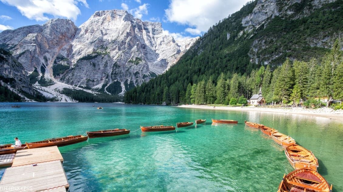
Exactly How to Visit Lago di Braies in 2026 (Photos & Helpful Tips)
Lago di Braies (Pragser Wildsee) is one of the most beautiful lakes in the Dolomites, but visiting it requires planning. In this guide, you’ll learn the best time to go, how parking and access restrictions work in 2026, how to avoid the worst crowds, and whether Lago di Braies is actually worth visiting. This crystal-clear […]
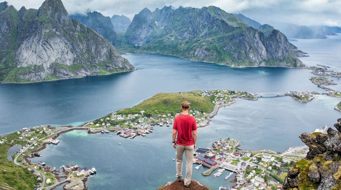
How to Hike Reinebringen (+ Where to Park)
Reinebringen, with its dazzling view over the fishing villages of Reine, Sakrisøy, and Hamnøy, is the most popular hike in the Lofoten Islands, and one look at the panorama from the top tells you exactly why. We hiked Reinebringen in 2018 with our kids, who were 13 and 15 at the time, before most of […]
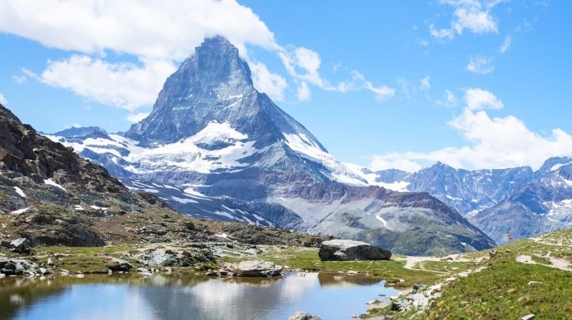
12 Epic Day Hikes in Zermatt (+ Trail Stats, Photos & Map)
One of the best ways to explore Zermatt is on foot. Hiking trails climb high into the mountains above Zermatt, past Swiss hamlets, through scenic valleys and rocky gorges, and to some of the best viewpoints of the Matterhorn. The network of cable cars and trains takes you up into the mountains, so for the […]
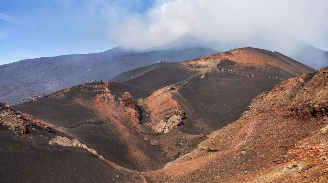
Exactly How to Visit Mount Etna & Do You Need A Guide?
In this guide, we cover how to visit Mount Etna, how to hike to the summit of Mount Etna, the best time to visit, whether or not you will need a guide, plus tour options, depending on what kind of experience you prefer to have. Mount Etna dominates the skyline of eastern Sicily. This is […]
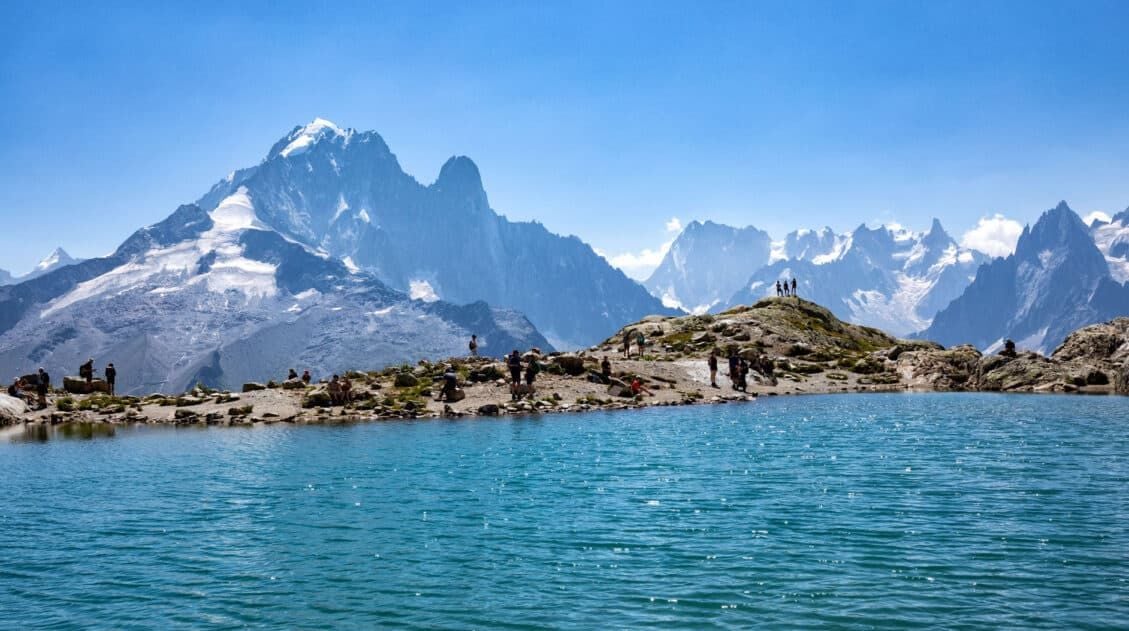
How to Hike to Lac Blanc, Chamonix (Photos, Stats & Map)
There are several reasons why the hike to Lac Blanc is one of the best in Chamonix. For one thing, this alpine lake is beautiful. A series of gondolas and chair lifts lop off the first big climb, making this hike doable for most ages and ability levels. But one of the best reasons to […]
Exactly How to Hike to the Cadini di Misurina Viewpoint
The hike to the Cadini di Misurina viewpoint is one of our favorite short hikes in the Dolomites. This is a gorgeous hike every step of the way, with panoramic views of the surrounding mountains, a unique view of the “backside” of Tre Cime di Lavaredo, and of course, an awesome view of the Cadini […]
Complete Guide to the Hörnlihütte Hike (Map, Trail Stats & Photos)
The Hörnlihütte (Hörnli Hut) is a lodge built at the base of the Matterhorn. For thrill seeking rock-climbers, the Hörnlihütte marks the start of the ascent up to the peak of the Matterhorn. Even if you do not wish to stand on top of the Matterhorn, simply hiking to and from the Hörnlihütte makes for […]
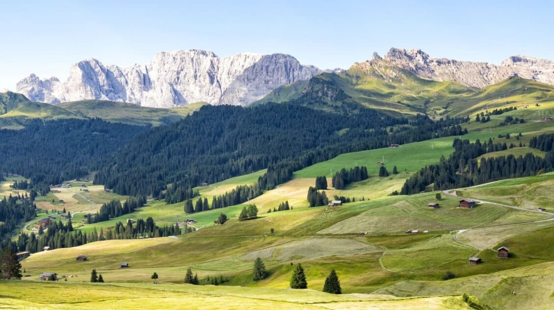
Alpe di Siusi (Seiser Alm) in Summer: Things to Do, Photos & Tips
Alpe di Siusi (Seiser Alm in German) is the highest alpine meadow in Europe. This lush, green meadow is located in the Dolomites of Italy. Cabins, rifugios, and hotels dot the landscape. Hiking trails and biking trails run along the hillsides, connecting the small villages. And Sassolungo, with its jagged, rocky peaks, looms over the […]
Exactly How to Hike Pico do Arieiro to Pico Ruivo (PR1) | Madeira’s #1 Hike
The PR1 trail from Pico do Arieiro to Pico Ruivo is Madeira’s most popular and thrilling hike. Enjoy the beautiful golden sunrise rising over the island, and then traverse from Madeira’s third highest peak, Pico do Arieiro, to its highest peak, Pico Ruivo. The trail features narrow pathways rising above a steep valley, offering glimpses […]

Essential Hiking Gear: What Should You Bring on a Day Hike?
In this post, find out what we carry with us on day hikes. Whether you are a new hiker, shopping for a friend or family member, or just curious about what hiking gear you should bring on a day hike, we have a lot of great information to share with you. We have hiked thousands […]
30 Beautiful Places to Visit in Europe (+ Our Favorites)
It is no secret that Europe is home to some of the world’s most beautiful destinations. From grand historic cities and charming fairytale towns to soaring mountain ranges and sun-soaked beaches, there is a seemingly endless list of gorgeous places to explore. Whether you are planning your next trip to Europe, or just trying to […]
Ultimate Hiking Guide: Europe, Asia, Africa, Americas & Oceania
Are you looking for the perfect hike? With hikes on six continents ranging from a few miles to multi-day adventures, explore some of the best hikes from around the world.

Comments 46