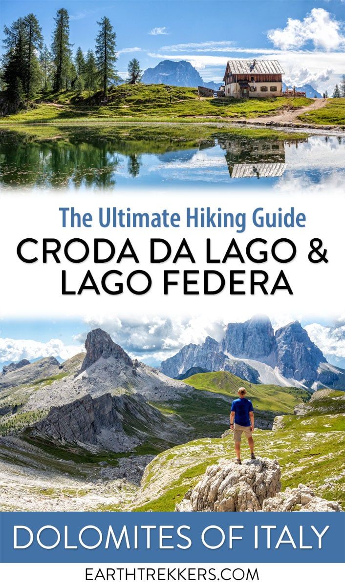
The Croda da Lago Circuit is one of the most underrated hikes that we did in the Dolomites. We’ve explored this region on multiple trips and hiked many of its classic trails, and this loop still stands out for its variety: soaring limestone peaks, quiet alpine meadows, and the impossibly photogenic Lago Federa tucked beneath rugged mountain walls. It’s a full-day hike that feels adventurous without being overly technical, making it one of the most rewarding experiences in the Dolomites.
During the summer months, the Dolomites is a busy place to visit. But not this trail. The Croda da Lago Circuit was one of the emptiest trails that we hiked in our 12 days in the Dolomites. So, if you are looking for a less crowded hike that is still BIG on views, this hike is for you.
This trail is a perfect fit for travelers looking to go beyond the short, crowded walks and experience a more immersive side of the Dolomites. If you’re planning your first trip, we recommend starting with our Dolomites Travel Guide, where we cover how to plan your visit, where to stay, and how to build a realistic itinerary. And if you’re deciding how this hike compares to other classics in the region, you’ll also find it featured in our roundup of the best hikes in the Dolomites, alongside other unforgettable trails.
In this guide, we’ll walk you through exactly how to hike the Croda da Lago Circuit, what to expect along the trail, and why Lago Federa is one of the most beautiful alpine lakes in the Dolomites.
The Essentials
HIGHLIGHTS | Lago Federa, Rifugio Croda da Lago, Forcella Ambrizzola, Forcella Rossa, Val de Formin, and great views of Cortina d’Ampezzo
WHERE | Near Cortina d’Ampezzo
TRAILHEAD | Ponte de Ru Curto
DISTANCE | 12.8 km (8 miles) loop
DIFFICULTY | Moderate to strenuous
TIME | 4 TO 6 hours
NEARBY | Passo Giau, Passo Falzarego, Cinque Torri
Croda da Lago Circuit + Lago Federa Hiking Stats
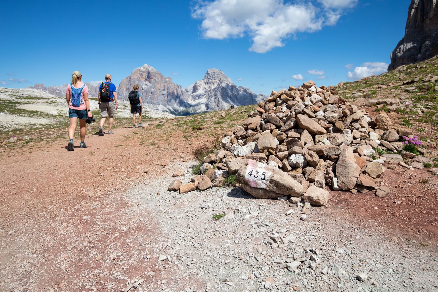
This hike is done as a loop. It can be done in either direction, but we recommend doing it clockwise, so that you are hiking down through the steep, tricky boulder field, rather than going up it.
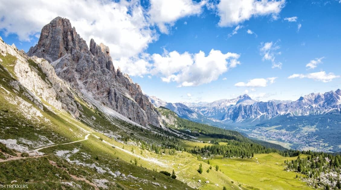
The circuit makes a loop around the Croda da Lago mountain range, which is a small, jagged, rocky mountain range that can be seen from the Cinque Torri, Rifugio Nuvolau, Tofana di Mezzo, and other viewpoints in the Dolomites. Along the way, you will hike past lovely Lago Federa and reach the high point of the trail at Forcella Ambrizzola.
Distance: 12.8 km (8.0 miles) lollipop-type loop
Total Ascent: 900 m (2,950 feet)
Difficulty: Moderate to strenuous
Lowest Elevation (Trailhead): 1,680 m (5,510 feet)
Highest Elevation (Forcella Ambrizzola): 2,475 m (8,120 feet)
Starting Point: Ponte de Ru Curto, SP638
Ending Point: Ponte de Ru Curto, SP638
Time: 4.5 to 6 hours
When to Go: Summer through early fall
Toilets: At Rifugio Palmieri (Lago Federa); there are no toilets at the trailhead
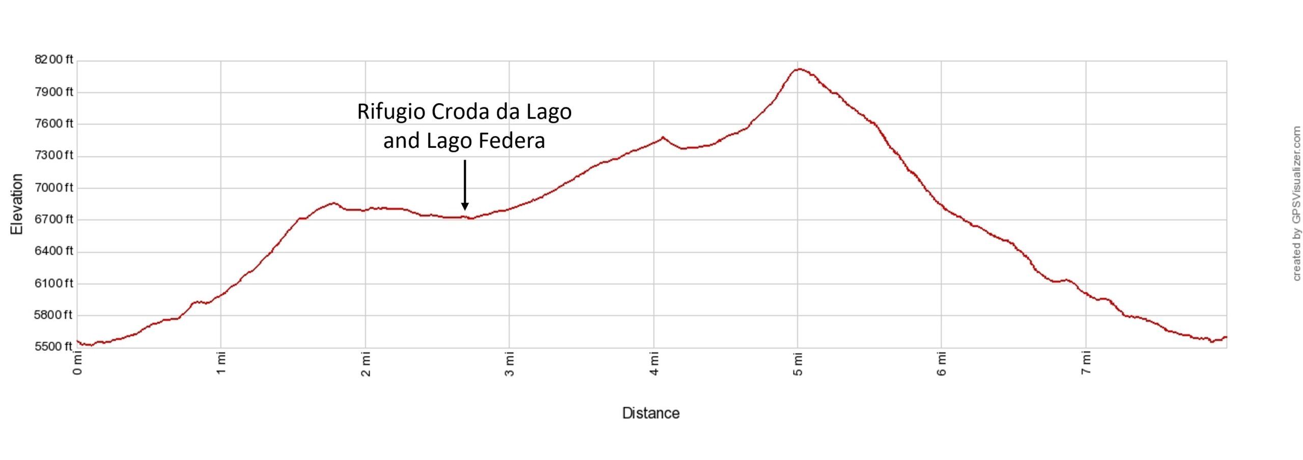
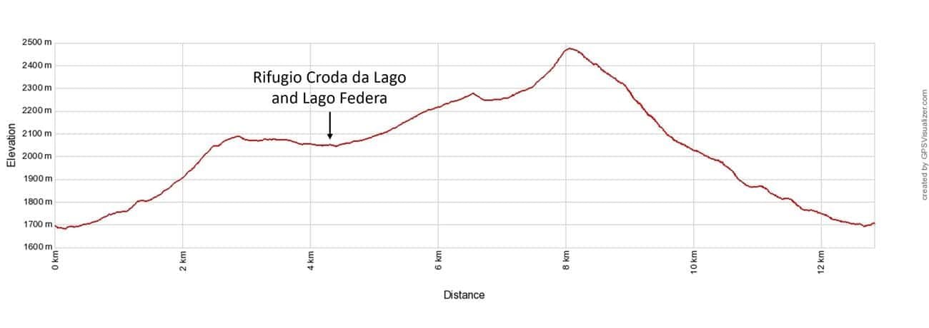
Croda da Lago Circuit + Lago Federa Elevation Profile
Please practice the seven principles of Leave No Trace: plan ahead, stay on the trail, pack out what you bring to the hiking trail, leave areas as you found them, minimize campfire impacts, be considerate of other hikers, and do not approach or feed wildlife.
Croda da Lago Circuit + Lago Federa Map
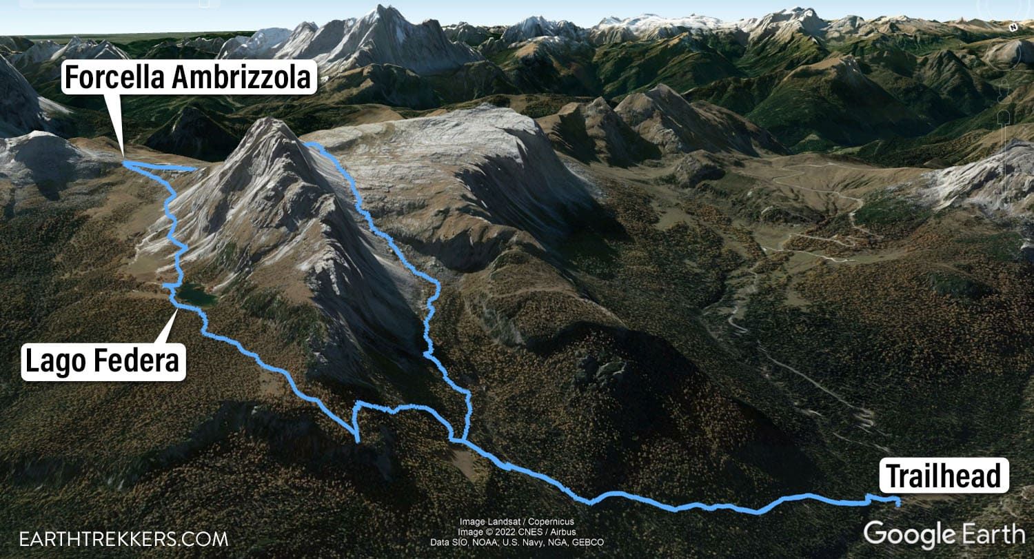
Croda da Lago Circuit + Lago Federa Map
How to Hike the Croda da Lago Circuit
Step-By-Step Trail Guide
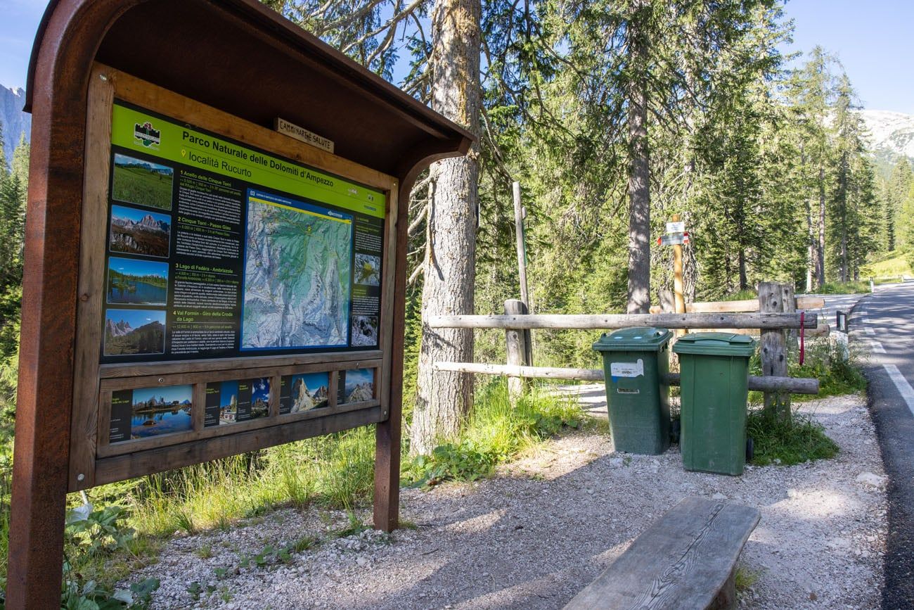
Parking and Trailhead
The trailhead is located on SP638 at Ponte de Ru Curto. It is a 15-minute drive to get here from Cortina d’Ampezzo, the closest town.
Parking is right along the road, near the trailhead sign. Here is a view of the cars parked along the road. It’s a good idea to get here early (before 9:30 am) to get a spot, because parking is very limited. We got here at 8:30 am and there were roughly 10 cars parked.
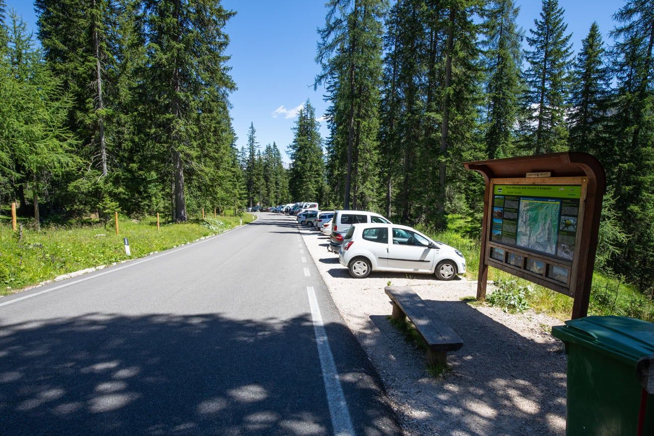
This photo was taken midday, once we finished the hike. However, when we started the hike there were only a few cars here.
Croda da Lago Circuit Trailhead
If you are taking public transportation, there is a bus stop about 40 meters from the trailhead. When we were here, we saw very few public buses running in this area. We also heard from other hikers that the buses were failing to show up. If you are reliant on public transportation, you will need to have a lot of patience, since the buses are not always reliable.
Hiking to Lago Federa
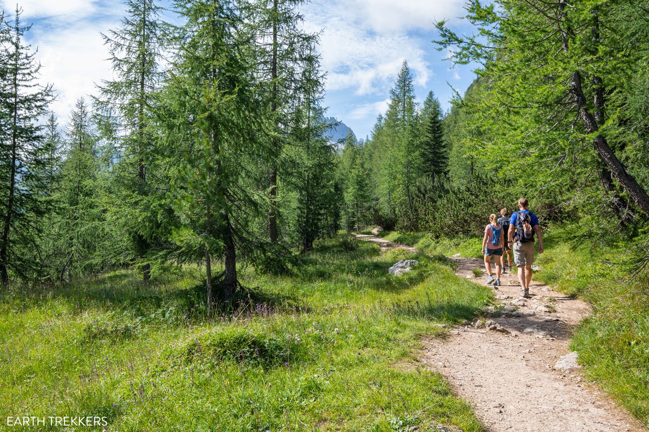
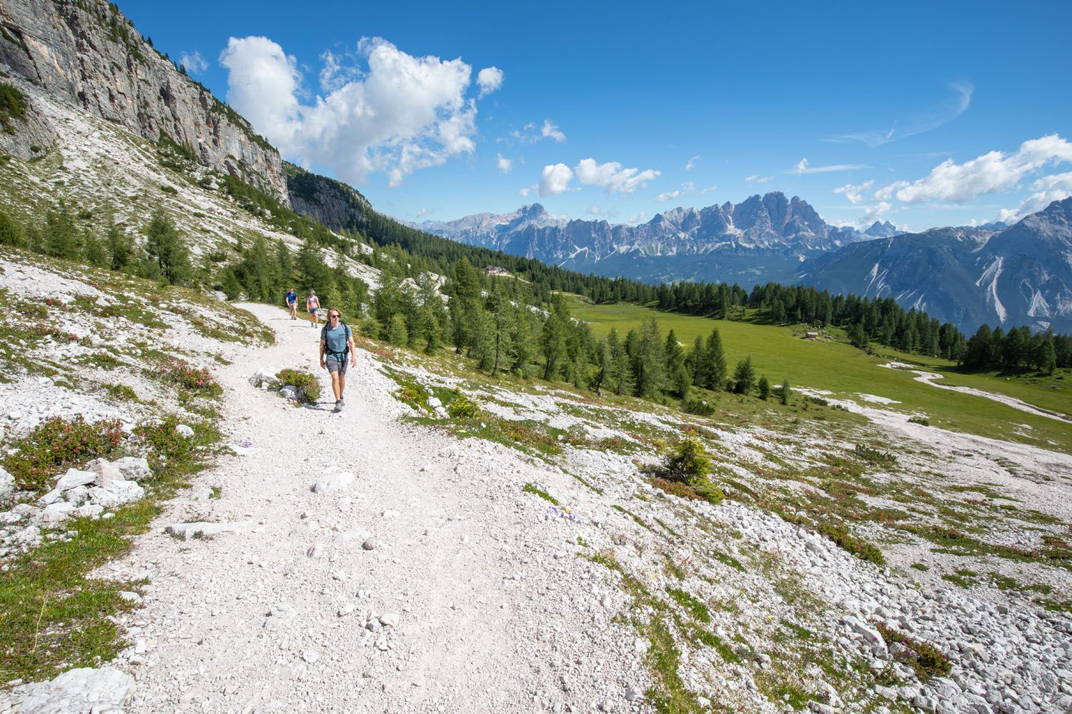
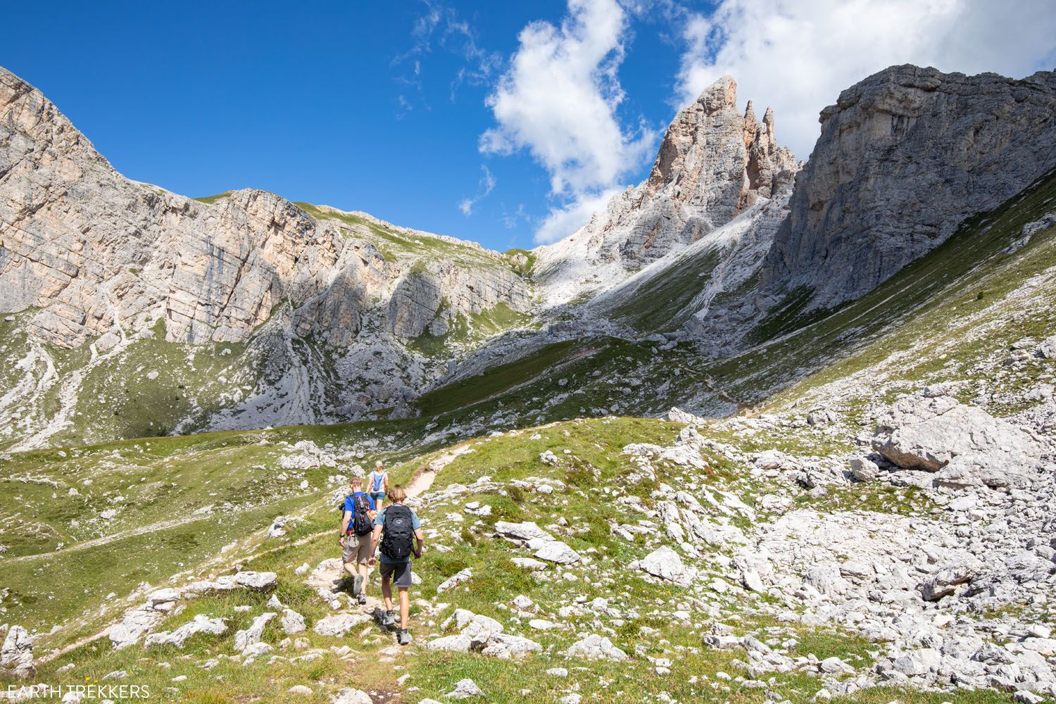
For roughly the first 3 km (2 miles) of the hike takes you through a pine forest. You will cross several bridges, have a few short, steep climbs up switchbacks and gravelly slopes, and occasionally get a view through the trees of Tofana di Rozes and Cortina d’Ampezzo.
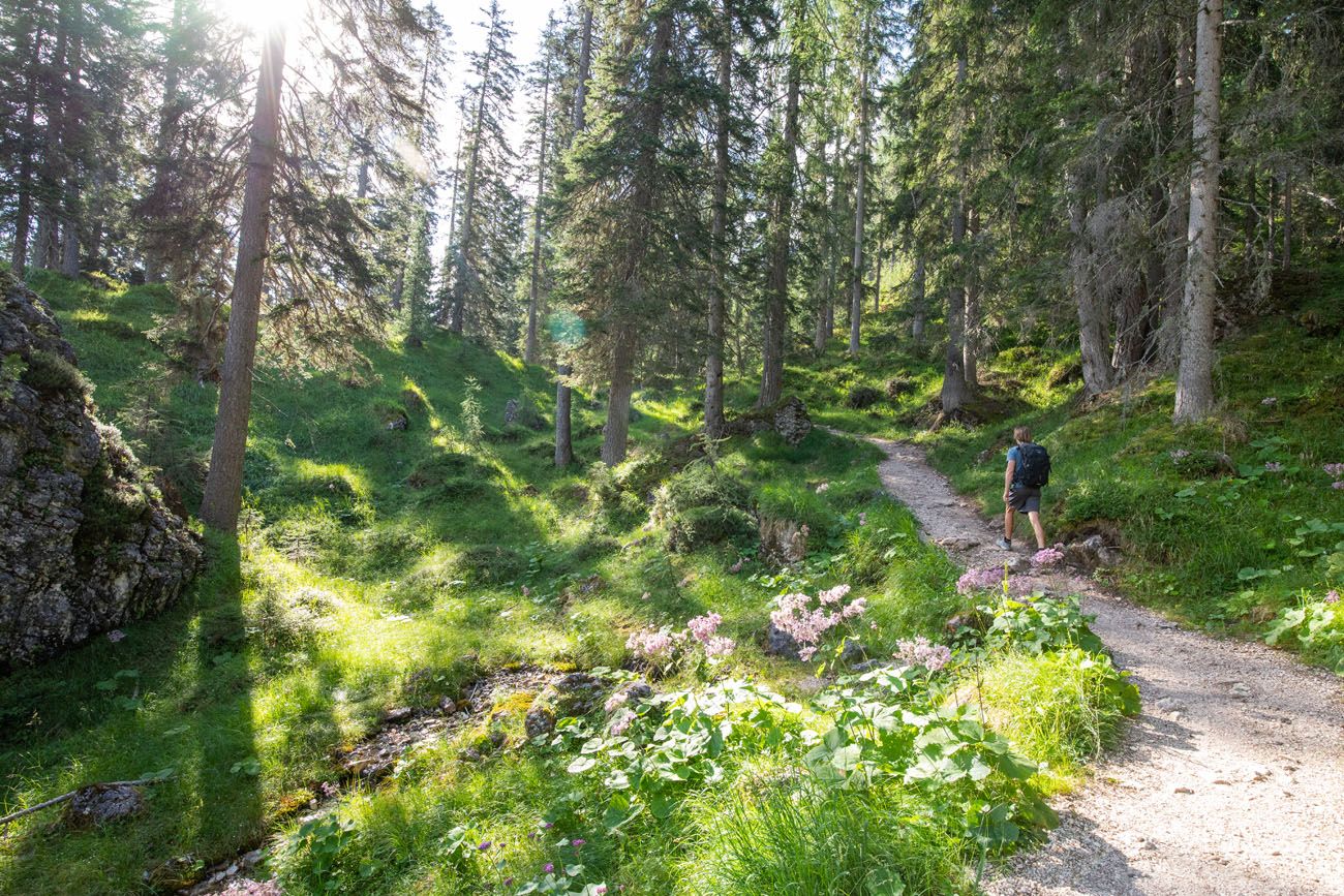
The first trail junction (Cason de Formin) appears 1.8 km (1.1 miles) into the hike. This is where the loop around Croda da Lago begins. Stay to the left here to go to Lago Federa first (take trail #434).
2.8 km into the hike (1.7 miles), keep an eye out for a short detour to the left. This quick and easy walk takes you to Val Negra, a viewpoint over Cortina d’Ampezzo. At this point, you are at 2,048 meters (6,700 feet).
Val Negra Viewpoint
Val Negra View
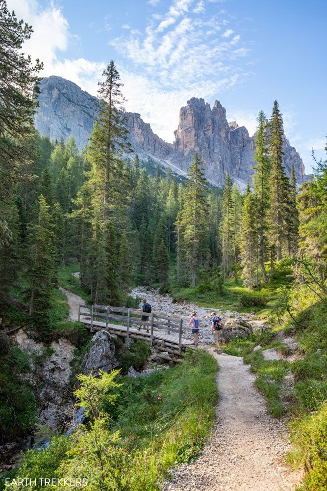
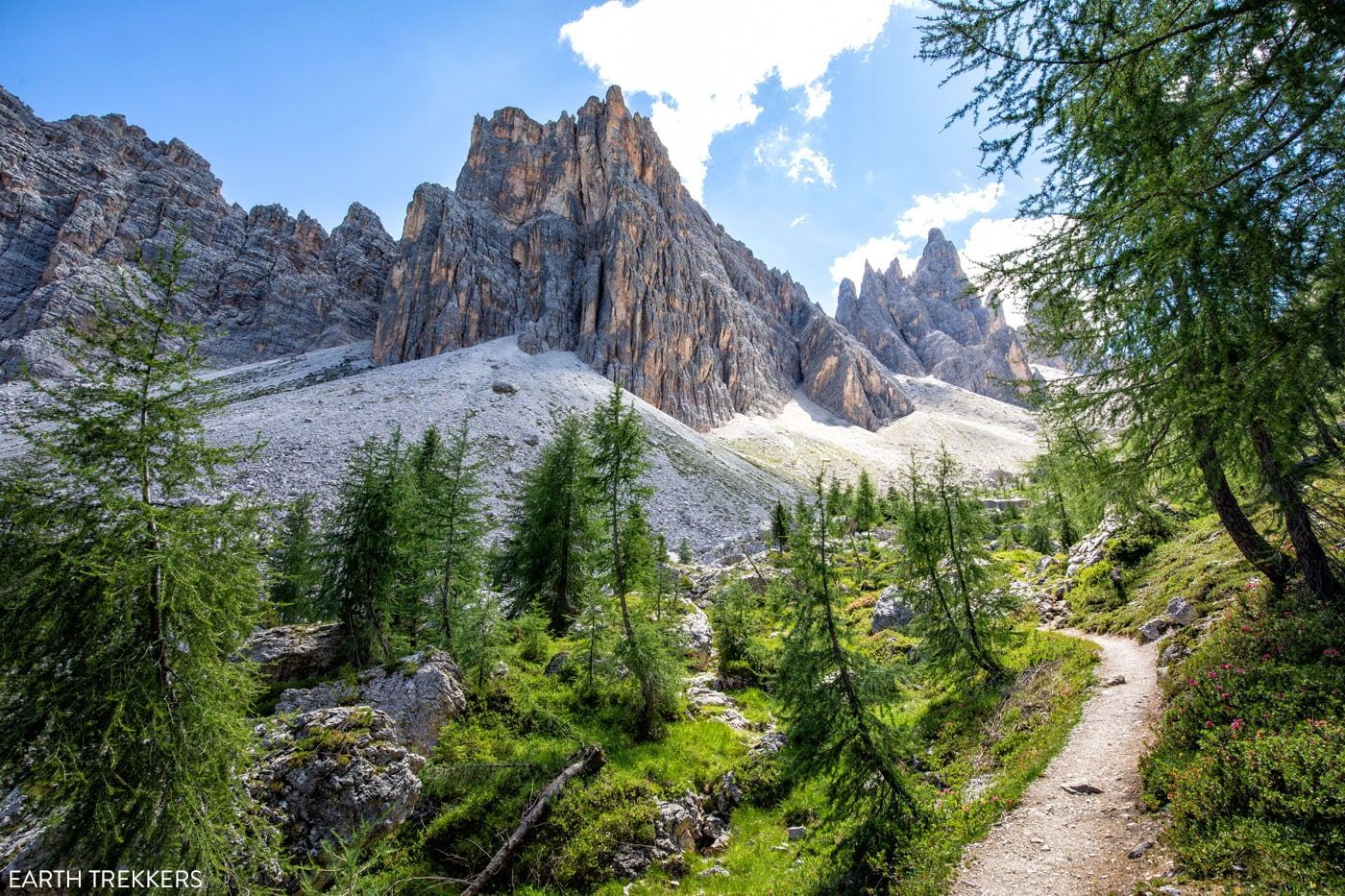
It’s a pretty walk through the woods, but if you find this part a bit boring, not to worry. The scenery along the trail is about to dramatically change. Not too far past the Val Negra viewpoint, the trail flattens out and then slightly heads downhill.
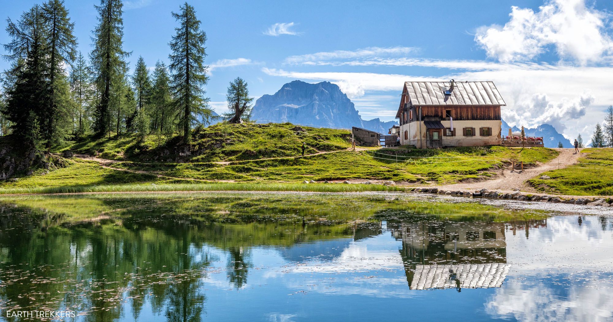
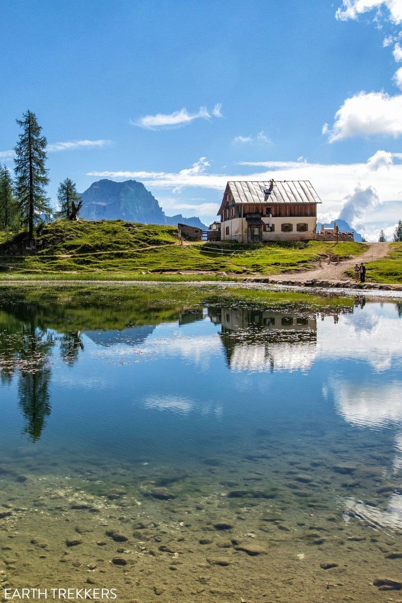
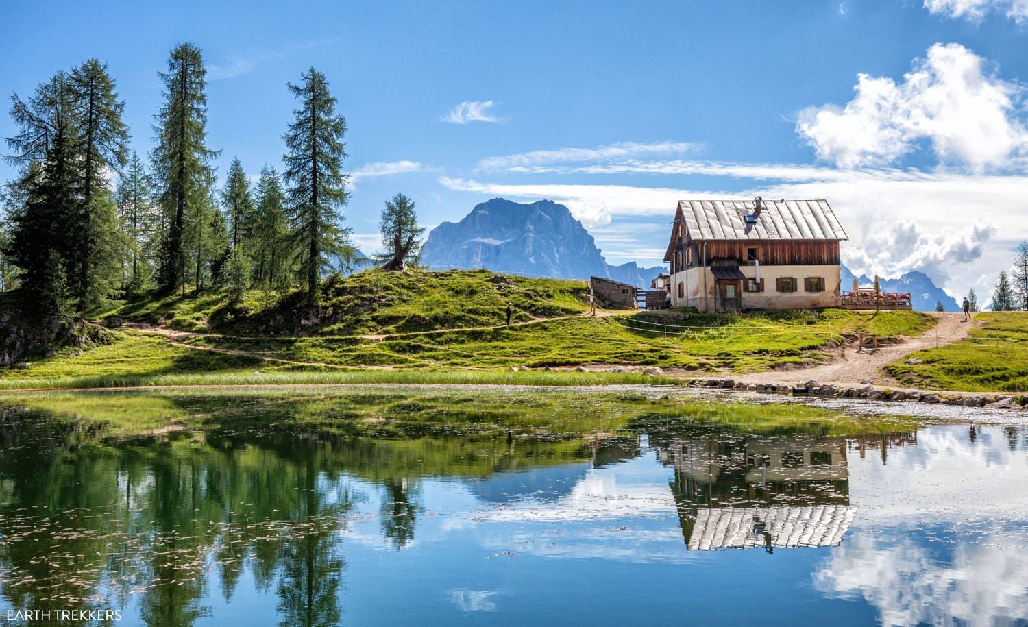
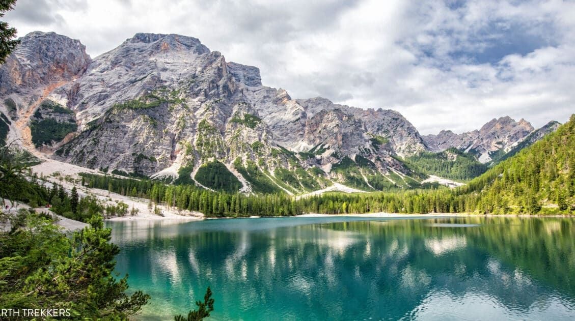
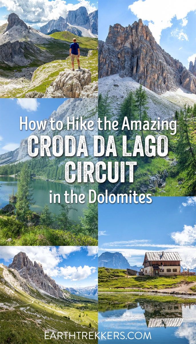
At 4 km, you reach Lago Federa.
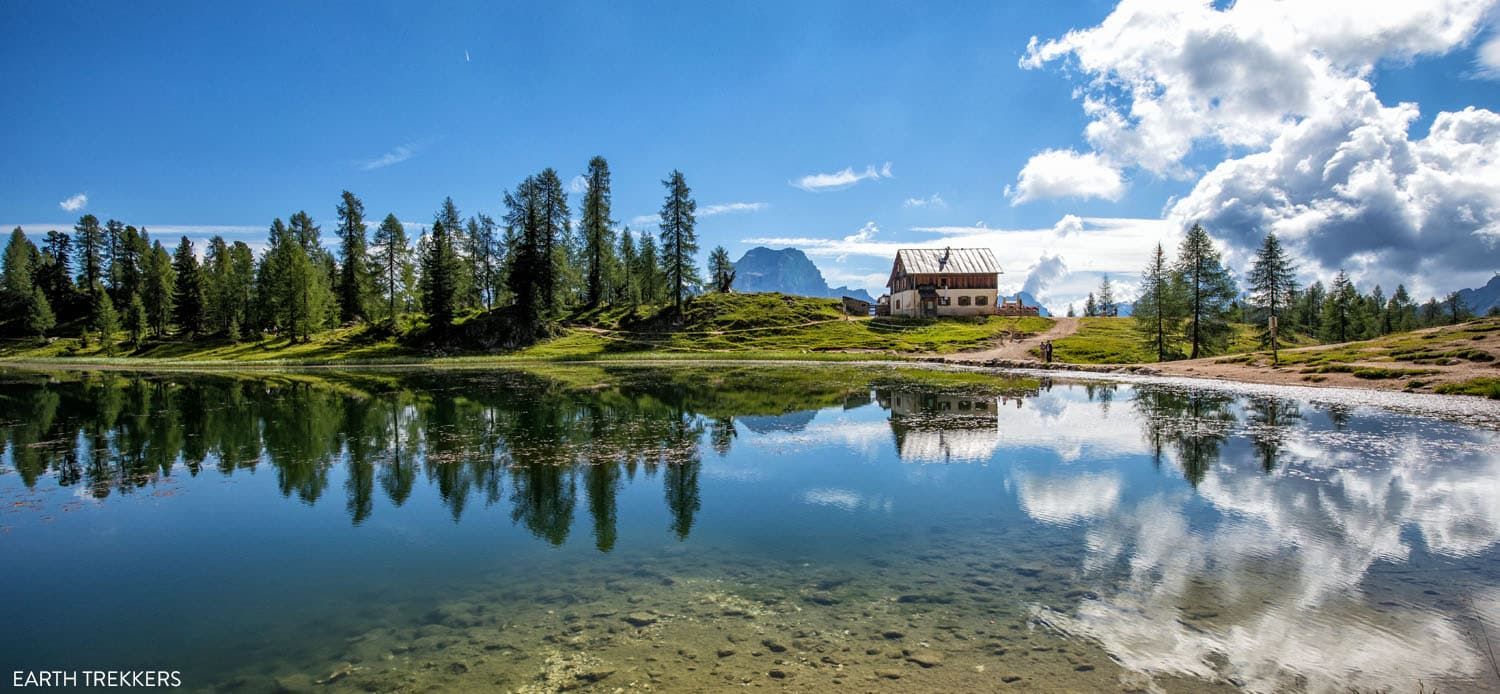
Lago Federa
Lago Federa, with its emerald green water and mountain backdrop, is one of the prettiest lakes in the Dolomites. It’s also one of the least crowded since you have to hike to get here.
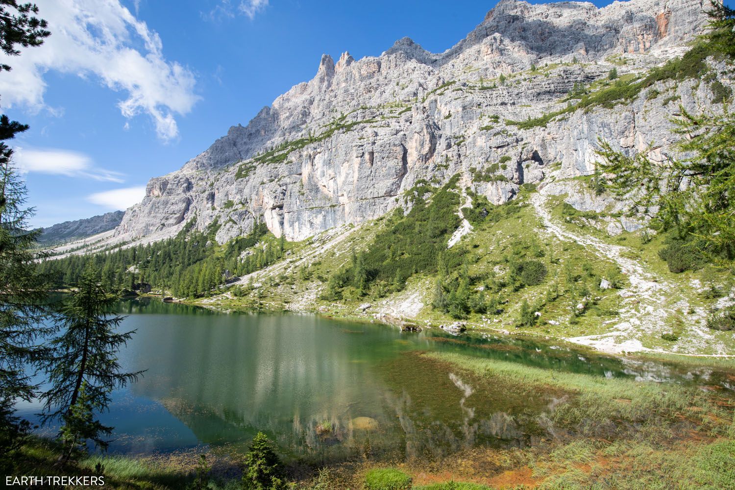
First view of Lago Federa
Another view of Lago Federa
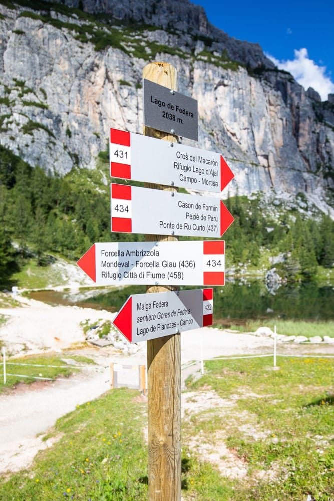
Trail sign at Lago Federa
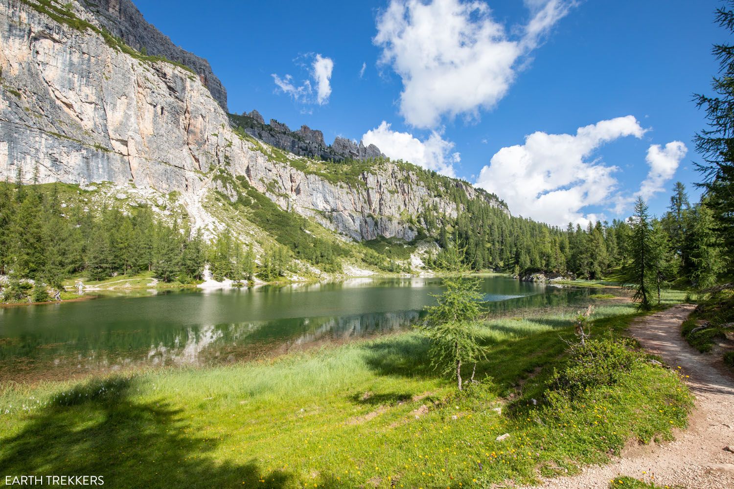
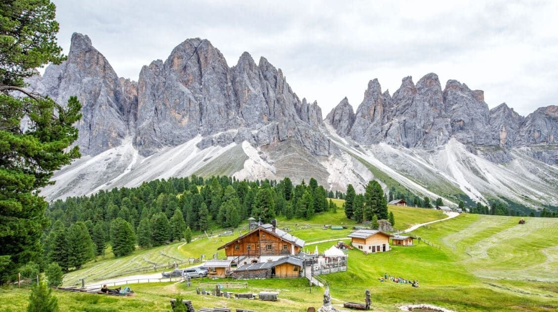
Sitting next to the lake is Rifugio Palmieri, sometimes also referred to as Rifugio Croda da Lago. This is a wonderful place to have a mid-morning snack or lunch, depending on the time of day.
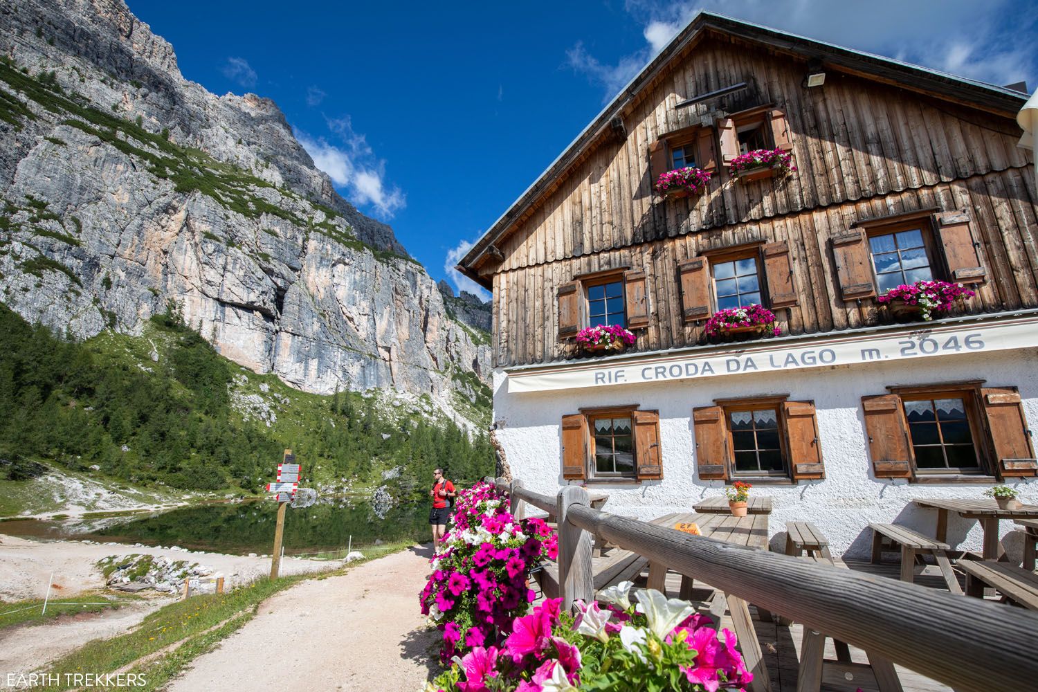
For the iconic view of Rifugio Palmieri, walk around the far side of Lago Federa for a view to the hut. The trail makes a loop around the lake, so you can go as far as you like. Our hiking stats do not include the loop around Lago Federa.
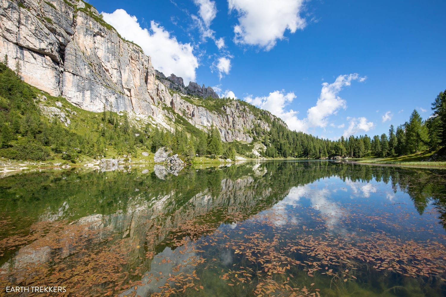
One more view of the lake.
Stats for the Lago Federa Hike
If you only want to hike out-and-back to Lago Federa (not doing the full Croda da Lago Circuit) here are the hiking stats.
Distance: 8.4 km (5.2 miles) out-and-back to Rifugio Croda da Lago located at Lago Federa
Total Ascent: 500 m (1,650 feet)
Estimated Time: 2.5 to 3.5 hours
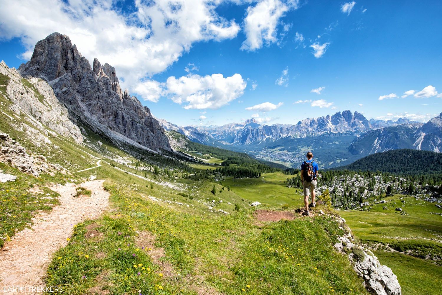
Lago Federa to Forcella Ambrizzola
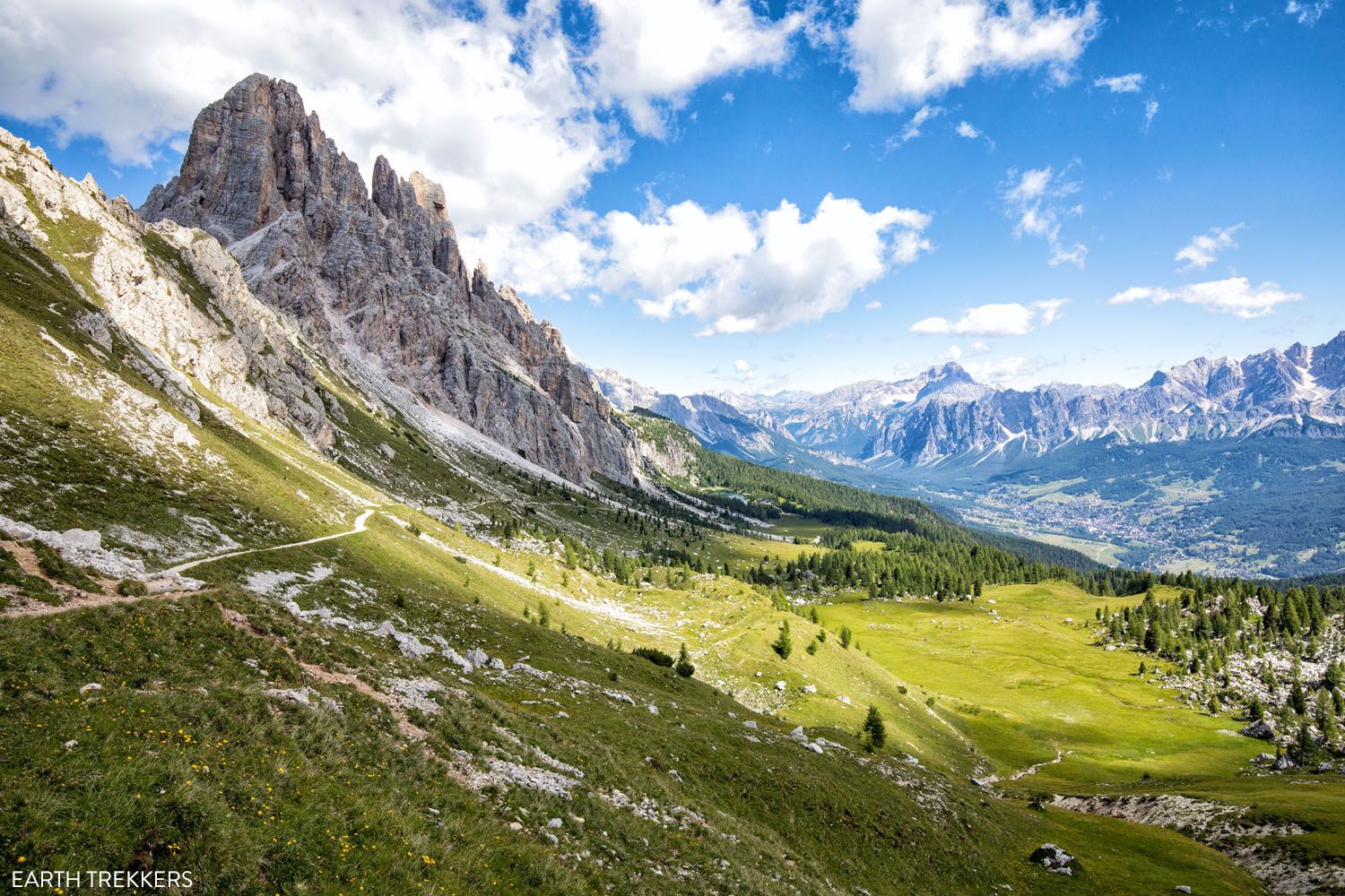
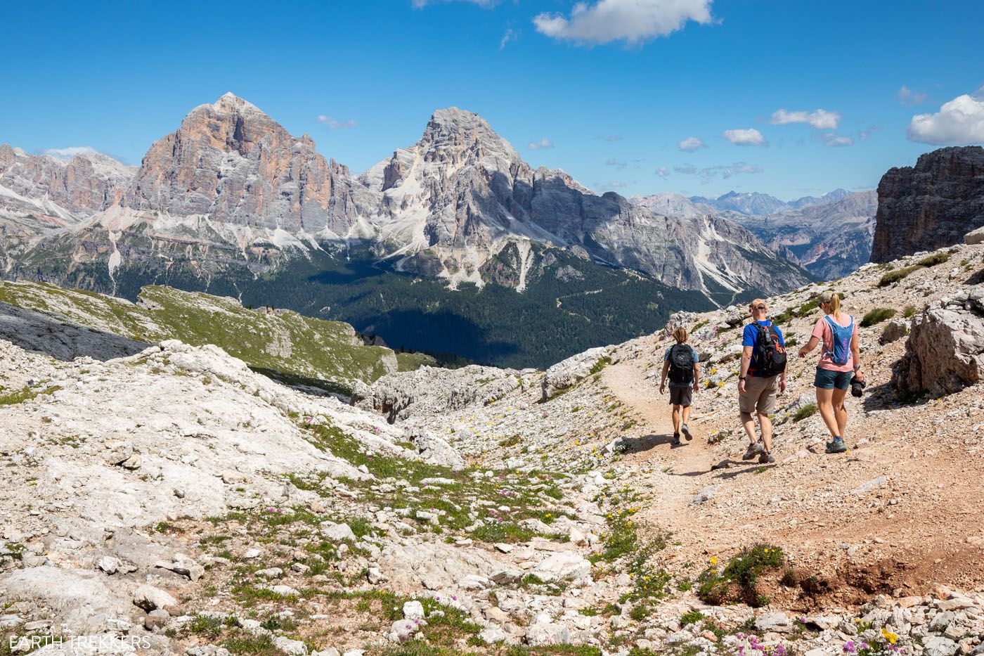
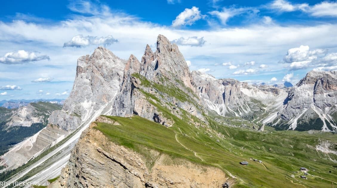
Now comes one of the most beautiful parts of the hike. From Lago Federa, it is a steady, uphill hike to Forcella Ambrizzola. In front of you is the craggy peak of Becco de Mezzodi and to your right is Croda da Lago. Behind you are views over Lago Federa and Cortina d’Ampezzo.
As you hike up the hill, and maybe pause to catch your breath, turn around and enjoy the magnificent view.
Here are photos from this part of the Croda da Lago Circuit.
Trail to Forcella Ambrizzola
Looking back towards Lago Federa.
Getting closer to Forcella Ambrizzola. The big peak to the left is Becco di Mezzodi.
Once you get close to Forcella Ambrizzola, turn around and look back. It’s one of the best views of day.
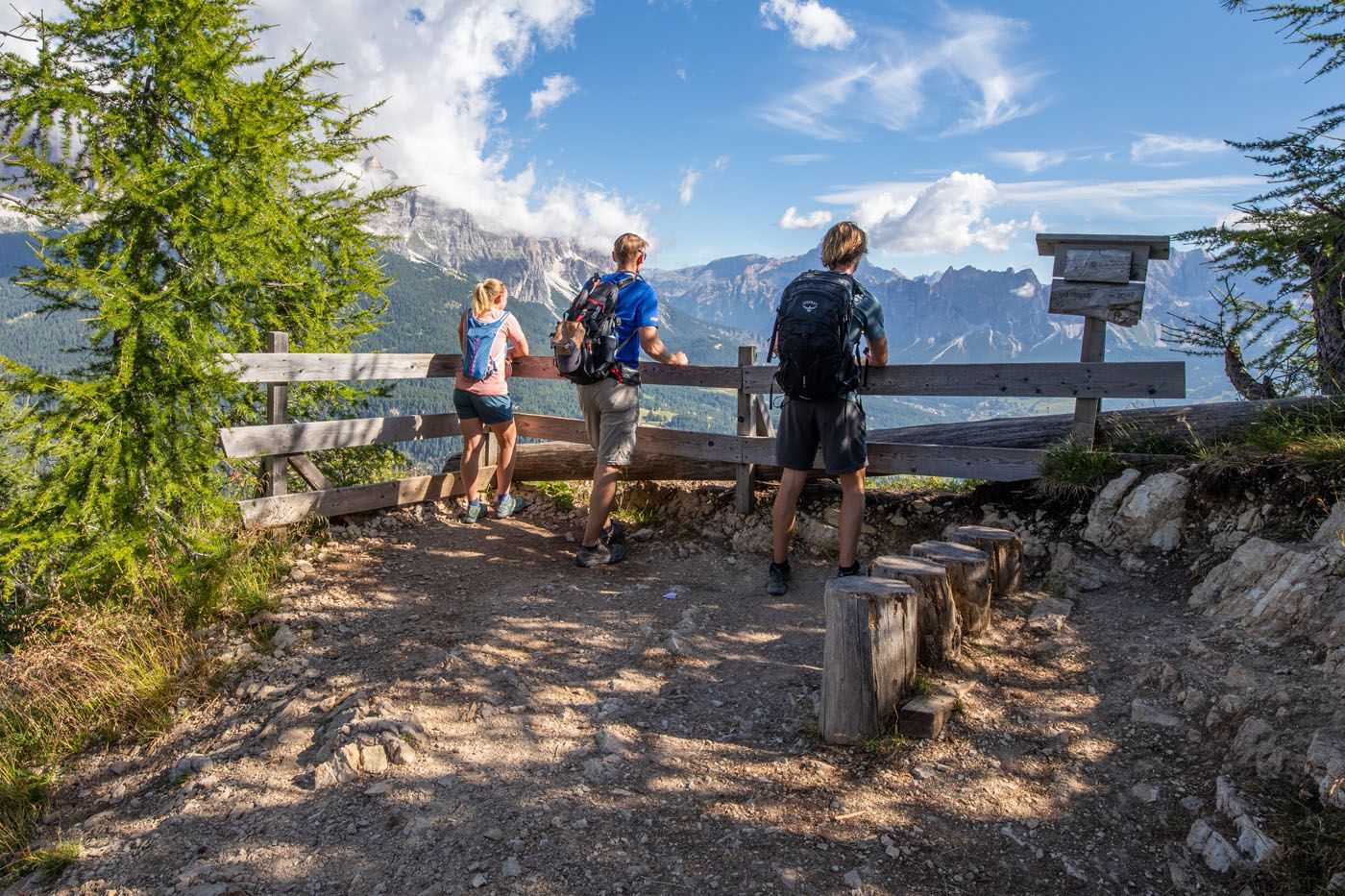
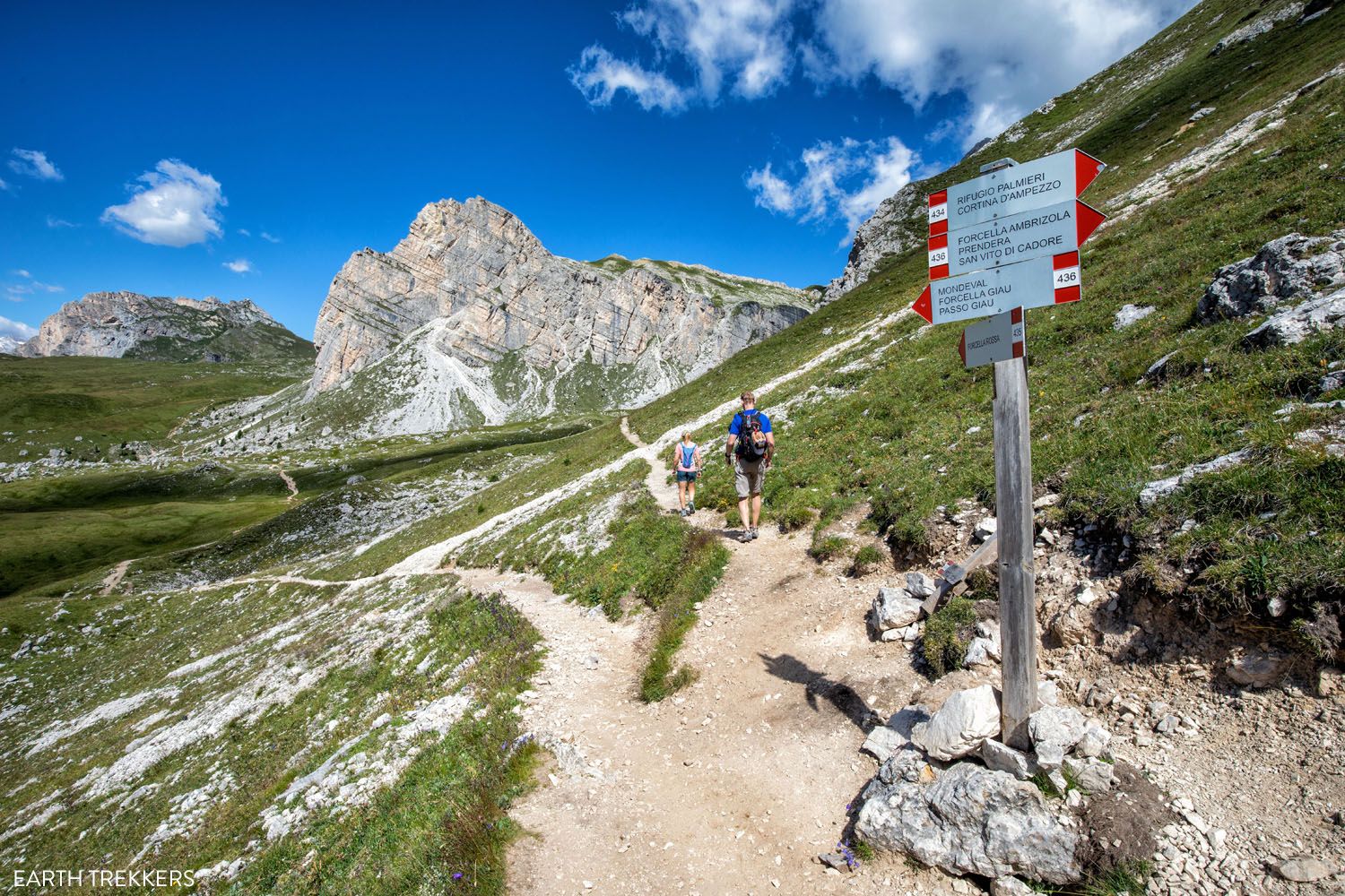
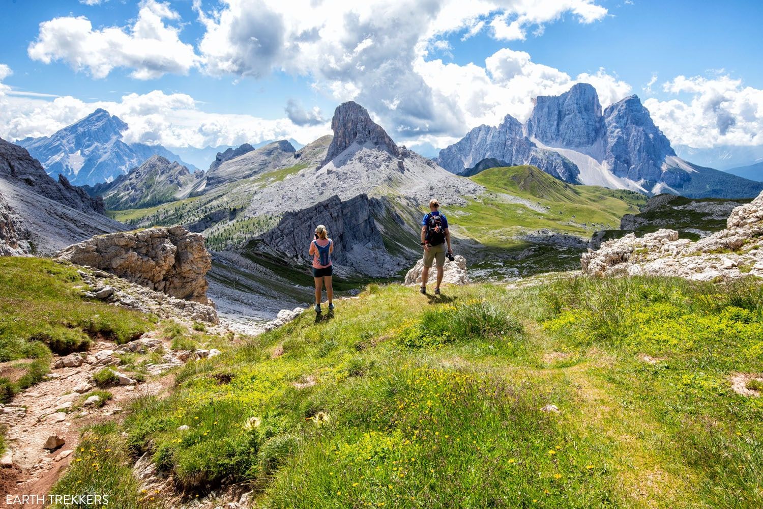
Once at Forcella Ambrizzola, you are standing at 2,277 meters (7,500 feet), but you still have some climbing to do. From this saddle, you can look out over both Cortina d’Ampezzo and the Mondeval alpine meadows.
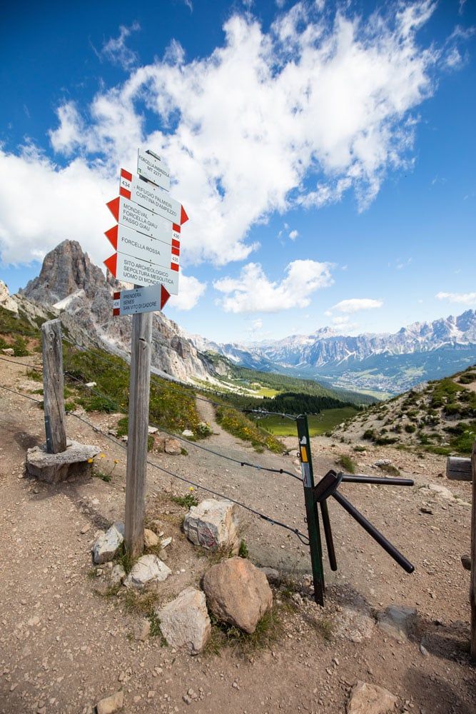
Trail sign at Forcella Ambrizzola
View from Forcella Ambrizzola
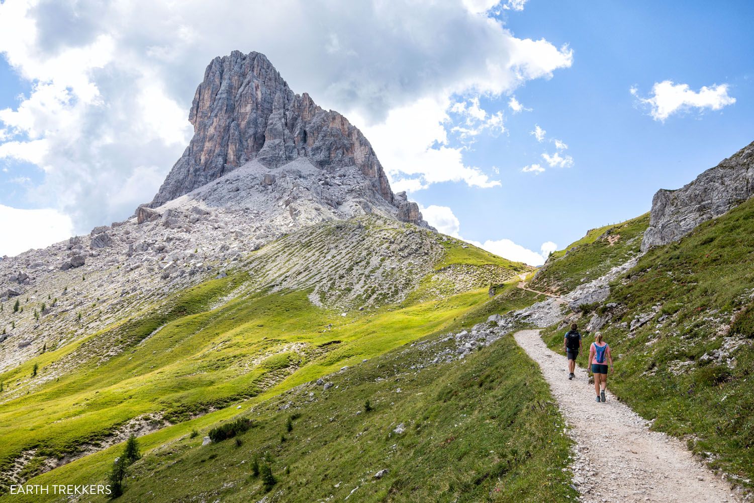
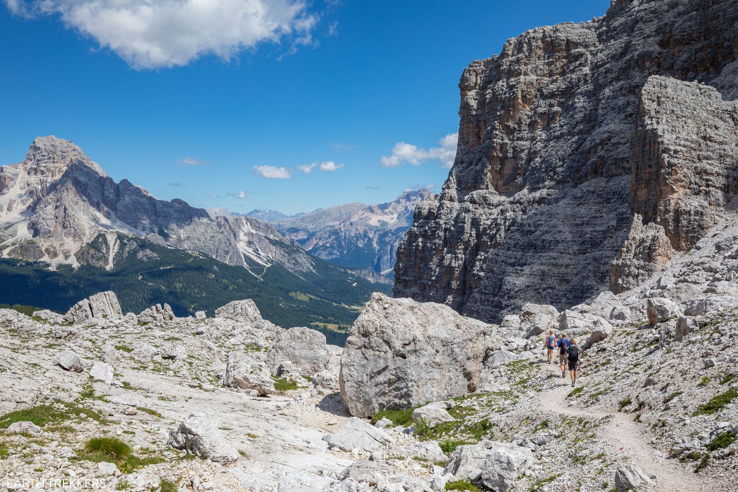
Forcella Ambrizzola to Forcella Rossa
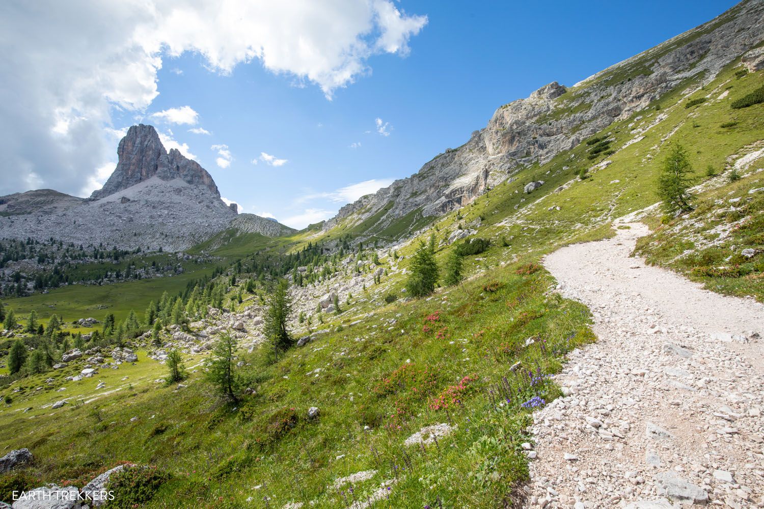
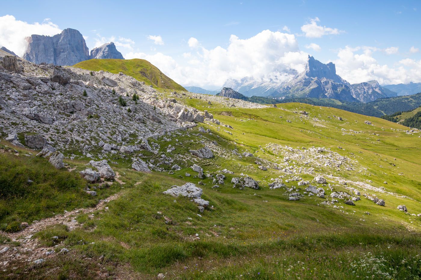
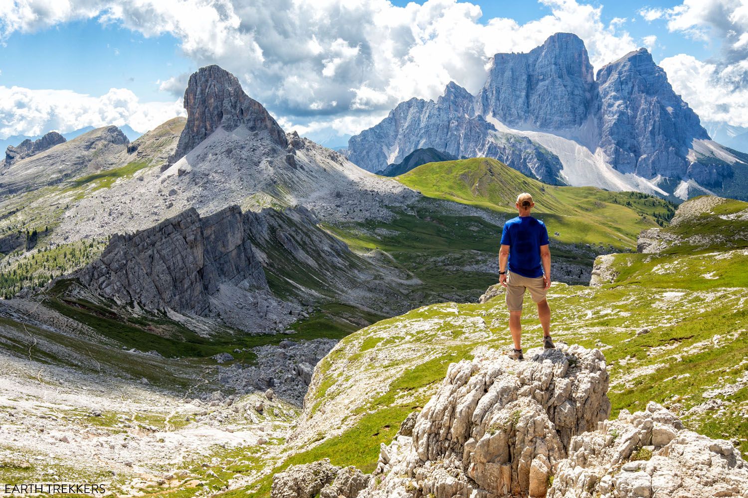
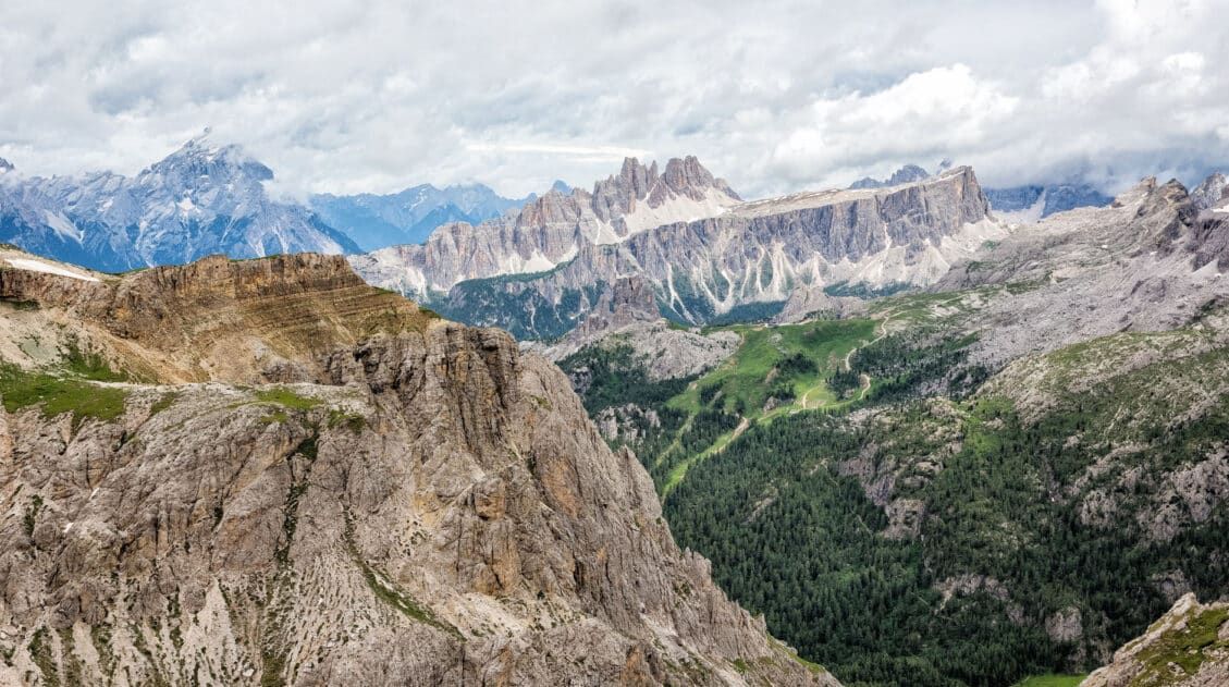
The trail briefly descends down into green meadows. Passo Giau is off to your left and the spine of the Croda da Lago range is to your right.
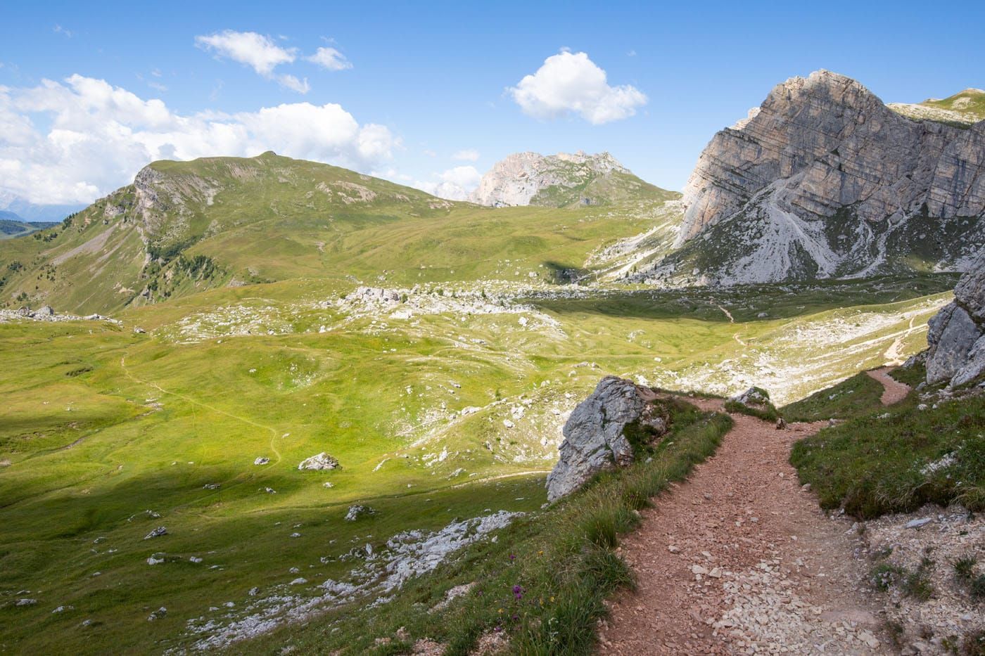
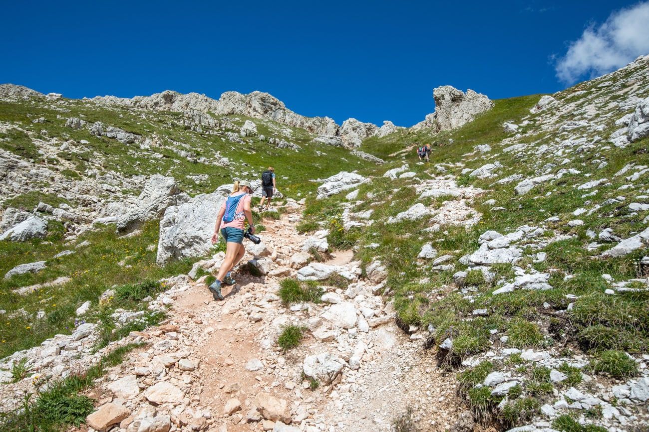
It doesn’t take long until the Forcella Rossa del Formin saddle comes into view. The trail gets a lot steeper and lot rockier. This is the toughest part of the hike, if you are doing this in a clockwise direction. Once you get to the top of this short beast of a climb, it’s almost all downhill for the rest of the hike.
Trail to the Forcella Rossa del Formin saddle.
Another view of the trail.
From Forcella Rossa del Formin, turn around and look back. This was one of our favorite views on this hike.
Forcella Rossa to the Trailhead
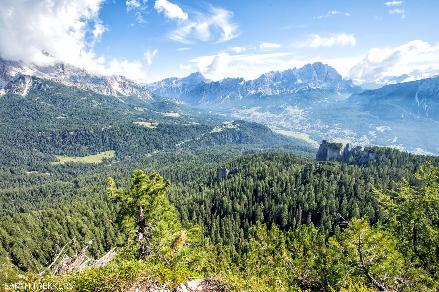
From the saddle, continue along trail #435. It flattens out for bit and from here, you can see Tofana di Rozes, Lagazuoi, and even the Cinque Torri, if you look closely. Off in the distance to your left, sitting high on Mount Nuvolau, is Rifugio Nuvolau.
We LOVED the views along this part of the trail.
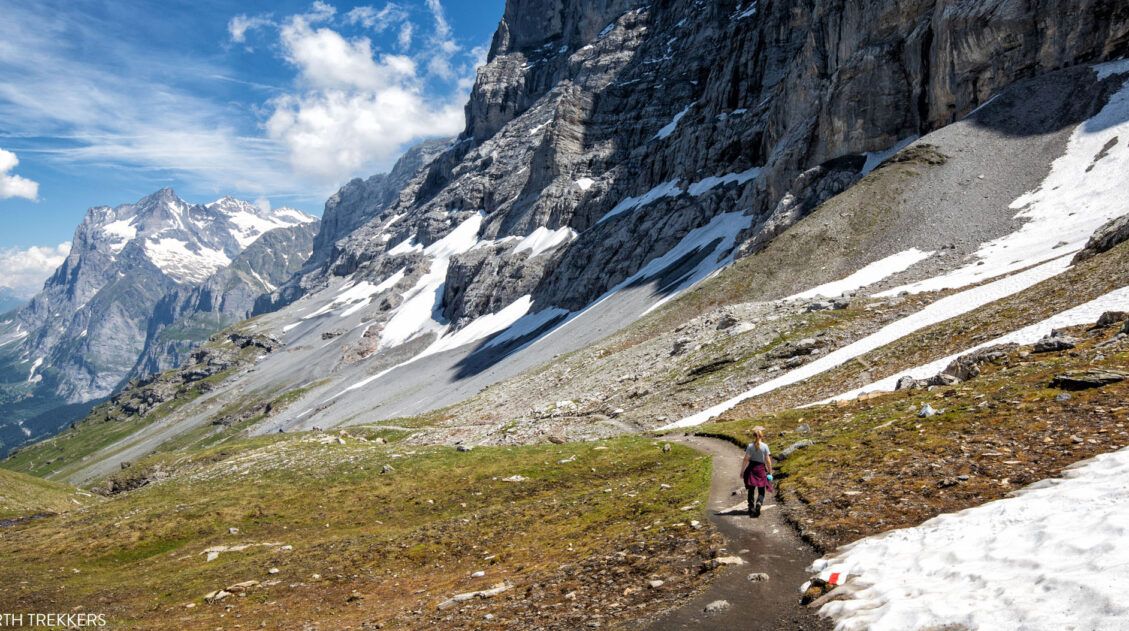
As you start the big descent, you enter the boulder field in Val de Formin. This next part of the hike, which is roughly 2 km (1.25 miles) long, is steep, slippery, and challenging, even going downhill. You will do a lot of rock scrambling over boulders so take your time here. This part of the hike takes a while, even though you are going downhill.
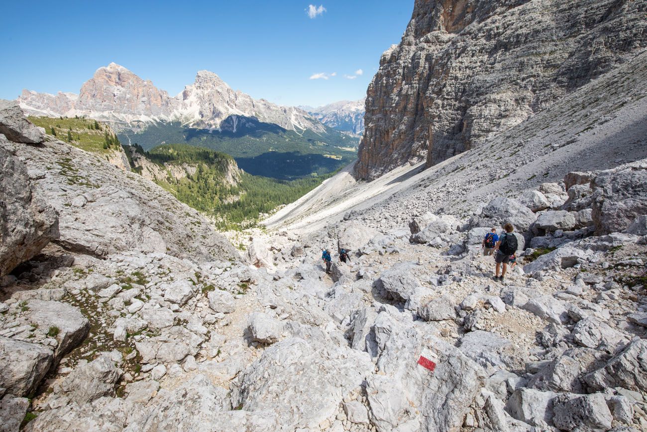
Once at the bottom, look up. It’s impossible to even see a trail from this vantage point. And if you are hiking this trail in the opposite direction, getting up this rocky, rough terrain will keep you busy for the next hour or so.
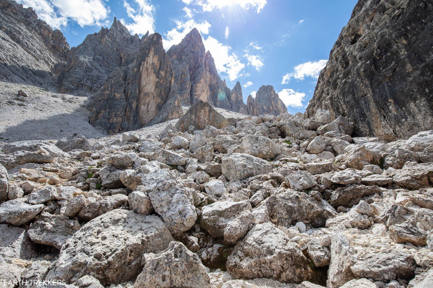
Looking back up at the trail.
Once the trail enters the forest again, you can move a lot quicker. Now you are hiking downhill through the trees, occasionally getting a view of the mountains. Once you reach the trail junction at Cason de Formin, you have just under 2 kilometers to go (about 1.1 miles) or about 30 minutes.
Looking back up the trail to the peaks of Croda da Lago.
The Croda da Lago circuit ends back at the trailhead on SP638.
What to Bring on the Croda da Lago Circuit
Hiking shoes. I recommend wearing hiking shoes for this hike. The trail is rough and uneven in a lot of places and you will rock scramble up and down smooth, granite rocks, which can be very slippery. The hiking shoes will give you added traction which will be very helpful on this hike.
Water. Bring at least 1.5 liters of water per person. You can refill you water bottle or hydration pack at Rifugio Palmieri.
Sunscreen, hat, and sunglasses. Parts of the trail is shaded, but you will be exposed to the sun for much of the hike.

Essential Hiking Gear: What Should You Bring on a Day Hike?
If you are new to hiking or are curious about what you should bring on a hike, check out our Hiking Gear Guide. Find out what we carry in our day packs and what we wear on the trails.If You Like the Croda da Lago Circuit, Try These Dolomites Hikes
If you like hiking the Croda da Lago Circuit and Lago Federa, you might also like these hikes in the Dolomites:
- WWI History + Rifugios with a View: Just down the road are two short hikes that make for one amazing. Start with the short, easy Cinque Torri and add on the hike up to Rifugios Averau and Nuvolau, where you can have lunch with arguably one of the best views of the Dolomites.
- Full Day Hike: The The Puez Odle Altopiano is a tough hike but our favorite in the Dolomites. It is located in Val Gardena.
- Alpine Lake: Lago di Sorapis is a popular hike but you can escape the crowds and get even better views by doing it as a loop. Our trail guide shares exactly how to do that.
Frequently Asked Questions
Is it worth it to hike out-and-back to Lago Federa?
Lago Federa is one of the most beautiful lakes that we visited in the Dolomites. To get here, it is a 4.2 km walk one-way, mostly through the forest, to get to this lake. This is a nice lake to visit, but I don’t think it is worth hiking out-and-back to it, at least from the Ponte Curto trailhead, since you are in a forest for most of the hike. I think it’s best to either hike to Lago Federa as part of Croda da Lago Circuit or to include it on a point-to-point hike through the Dolomites.
When is the best time to do the Croda da Lago Circuit?
The best time of year to hike the Croda da Lago Circuit is during the summer and early fall (from June through mid-October). In autumn, the larches turn a vibrant yellow, making this trail a great place to see fall colors.
If you have any questions about how to hike the Croda da Lago Circuit or how to hike to Lago Federa, let us know in the comment section below.
More Information for Your Trip to Italy
We have TONS more information about Italy in our Italy Travel Guide, including Rome, Florence, Venice, Tuscany, the Dolomites, the Amalfi Coast, the Cinque Terre, Sicily, Basilicata, and Puglia.
Dolomites Itinerary: Mix-and-Match Daily Plans for 3 to 10 Days
Pinterest Facebook Flipboard Planning a Dolomites itinerary can feel overwhelming. With its towering peaks, storybook alpine villages, epic hikes, and scenic drives around every corner, how do you decide what’s worth your time? In this guide, we make it simple. We break the Dolomites into easy, day-by-day itineraries that you can mix and match to […]
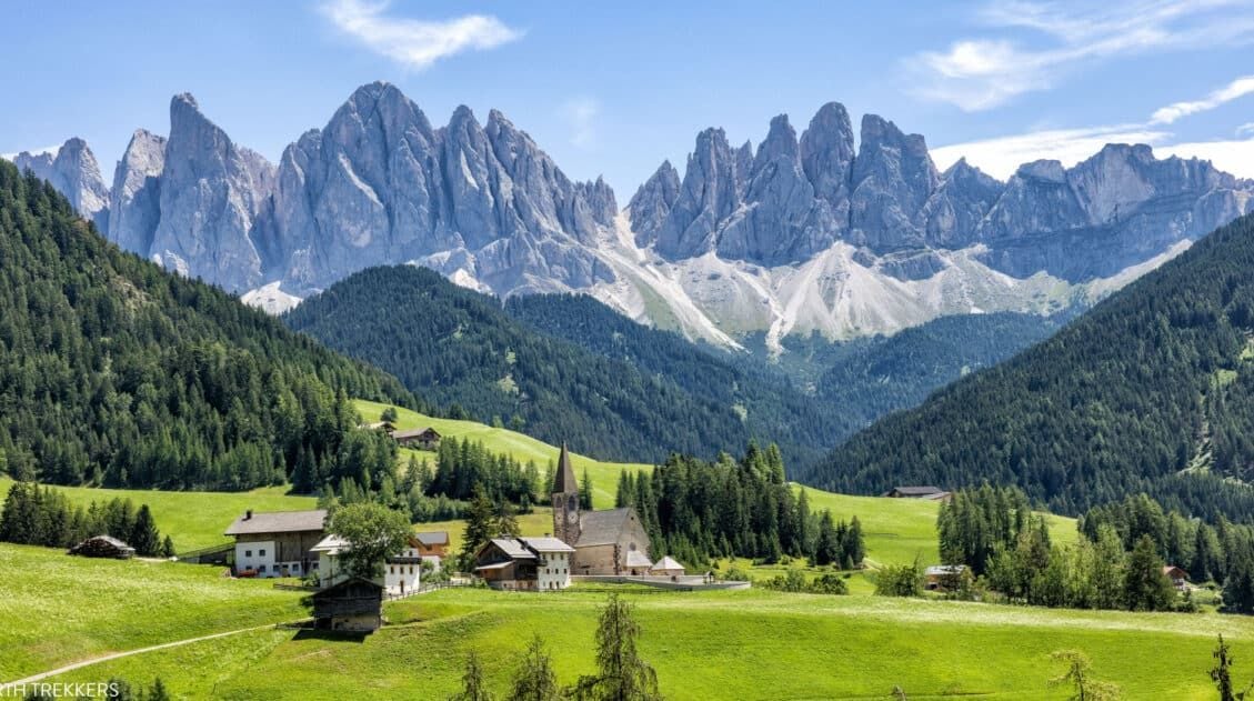
15 Best Hikes in the Dolomites (Easy to Challenging)
The Dolomites are one of the best hiking destinations in Europe. In this guide, we rank the 15 best hikes in the Dolomites, from easy scenic trails to challenging alpine adventures, based on views, difficulty, and our firsthand experience hiking the region. Jagged limestone peaks, knife-edge ridgelines, and turquoise alpine lakes make the Dolomites one […]
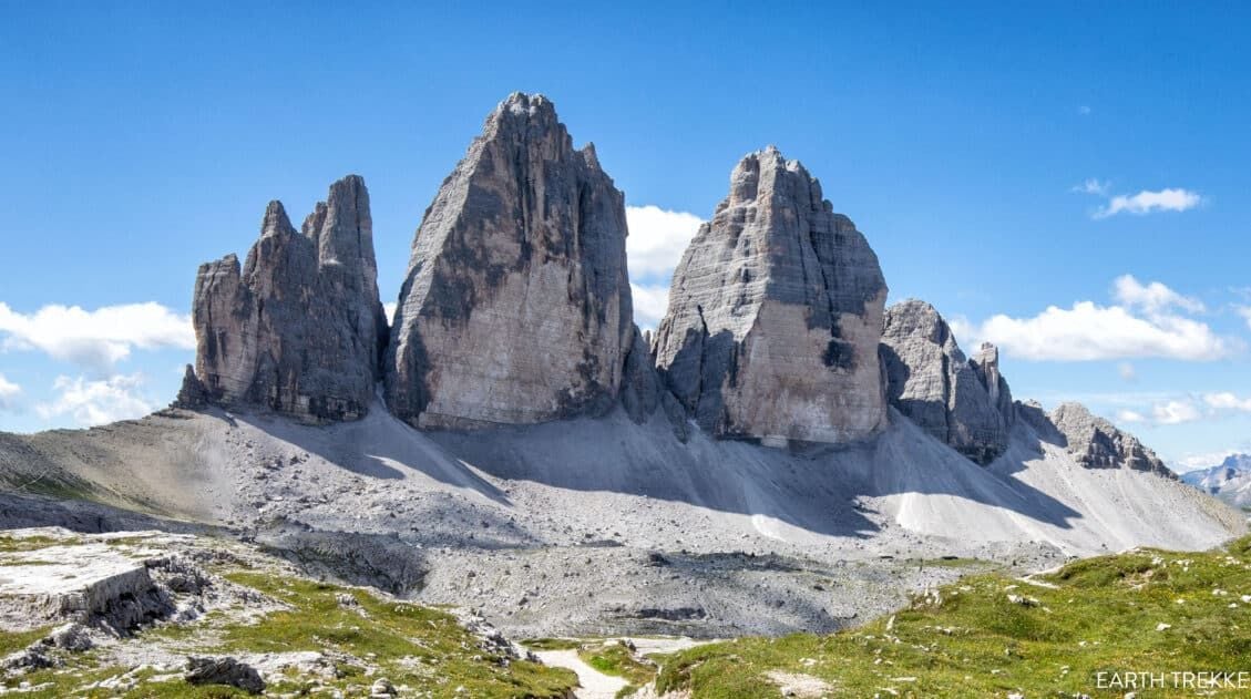
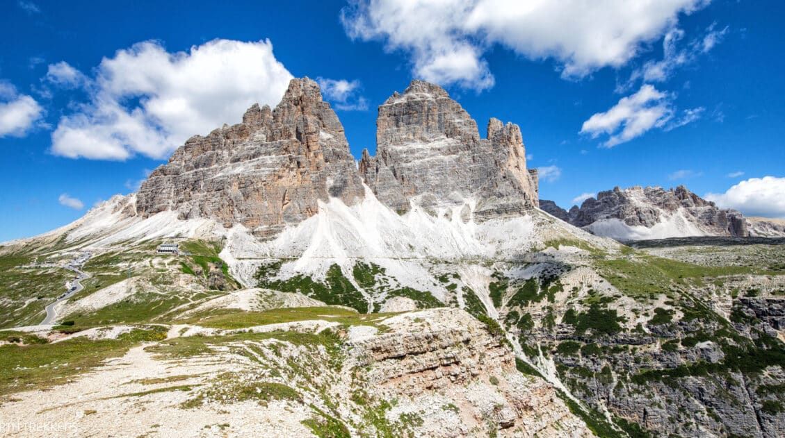
Tre Cime di Lavaredo Hike: Step-By-Step Trail Guide, Parking & Map
The Tre Cime di Lavaredo trail is one of the most iconic hikes in the Italian Dolomites, featuring a scenic loop trail that circles three dramatic limestone peaks. We’ve hiked Tre Cime on multiple trips to the Dolomites, including peak summer season when parking restrictions were in place. The first time we did this hike, […]
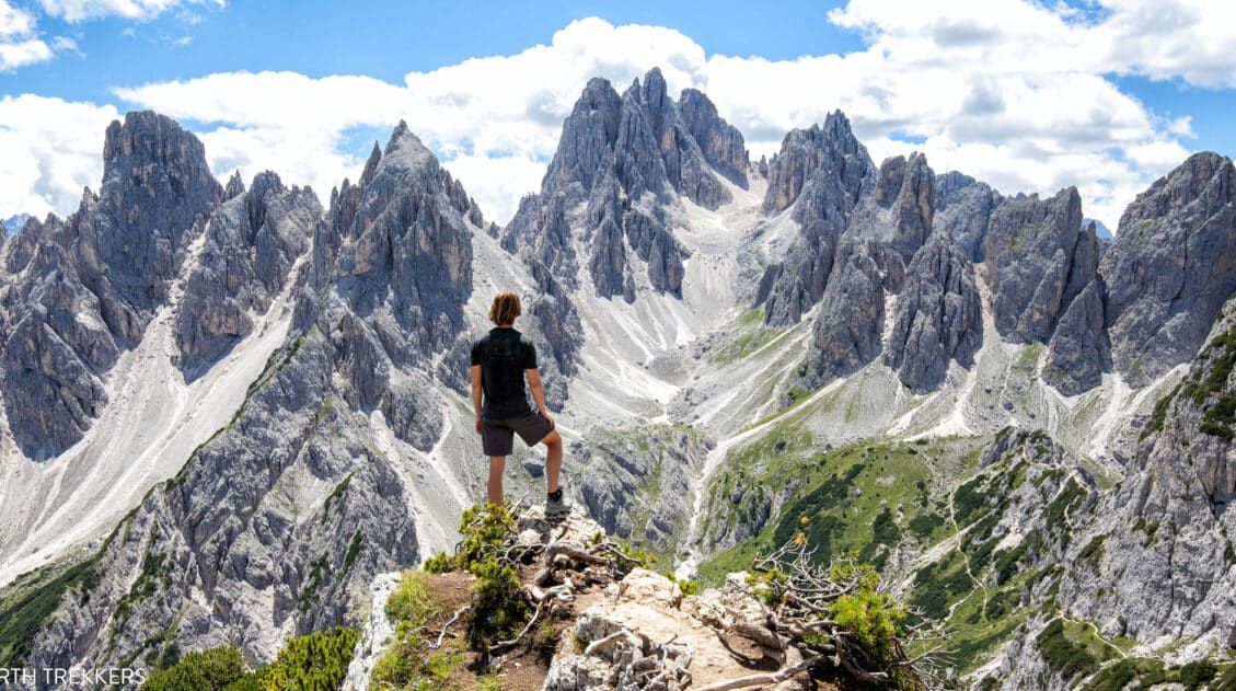
Exactly How to Hike to the Cadini di Misurina Viewpoint
The hike to the Cadini di Misurina viewpoint is one of our favorite short hikes in the Dolomites. This is a gorgeous hike every step of the way, with panoramic views of the surrounding mountains, a unique view of the “backside” of Tre Cime di Lavaredo, and of course, an awesome view of the Cadini […]
What We Wish We Knew Before Visiting the Dolomites
The Dolomites. This is where jagged pinnacles of rock soar into the sky, mountain huts and cabins dot the green, rolling hills, cable cars whisk hikers and skiers to the highest mountain peaks, and hiking trails connect small hamlets and towns. It’s easy to fall in love with the photos. Planning a smooth trip here, […]
Best Way to Visit Seceda (with Little to No Hiking)
The ridgeline of Seceda looks almost unreal — a dramatic wall of jagged peaks rising above the green pastures of Val Gardena. It’s one of those views that stops you in your tracks, the kind you’ve seen in photos of the Dolomites and wondered, Is it really that beautiful in person? (Yes. It is.) And […]
How to Hike the Adolf Munkel Weg to Geisler Alm
The Adolf Munkel Weg is a point-to-point hiking trail that runs along the Odle/Geisler mountain group in Val di Funes. This hike is on the longer side (13 km) and since it is point-to-point, you will have to use public transportation or do some extra hiking to get back to the starting point. We didn’t […]
Hiking the WWI Frontline Trail From Lagazuoi to Passo Falzarego
The Lagazuoi to Passo Falzarego Trail is an easy, downhill hike in the Dolomites that combines stunning alpine views with World War I history. It’s a great hike for families and those looking for a short, sweet hike combined with a thrilling cable car ride. This was the very first hike that we did in […]
10 Day Northern Italy Itinerary (Dolomites, Venice & Lake Como)
This 10-day itinerary through Northern Italy features Venice, the Dolomites, Verona, Milan, and Lake Como, with hiking suggestions, hotel recommendations, and practical planning advice based on our numerous trips to Italy. We’ve visited Italy numerous times, exploring these destinations on separate trips over the years, hiking in the Dolomites, wandering the canals of Venice, strolling […]
Best Hikes in Europe: 25 Incredible Hikes for Every Level
From the dramatic cliffs of Norway to the jagged peaks of the Dolomites and the volcanic landscapes of Iceland, Europe is packed with some of the most unforgettable hikes in the world. In this guide, we share our favorite hikes in Europe, trails that stand out for their scenery, uniqueness, and overall experience from start […]
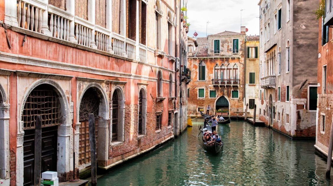
2 Days in Venice Itinerary: Best Itinerary for First-Time Visitors
If you are planning your first trip to Venice, this Venice itinerary is perfect for you. With 2 days in Venice, you have just enough time to visit the highlights of this beautiful city and stroll the canals. Tour Doges Palace, visit St. Mark’s Basilica, drift through the canals on a gondola, and explore the […]
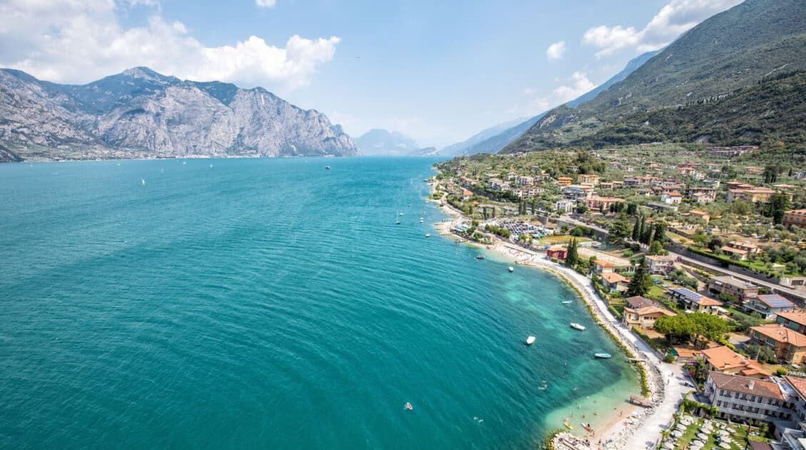
Lake Garda Itinerary: The Best Way to Spend 1 to 4 Days in Lake Garda
Lake Garda is Italy’s largest lake, spanning three provinces of Italy (Trentino, Verona, and Brescia). On a visit to Lake Garda, not only can you visit the long list of lovely towns that line the lake, but you can also cruise to Lake Garda’s islands, take your pick from hikes in the area, visit vineyards […]

Comments 21