
Discover the 10 best hikes in Shenandoah, with tips for families, photographers, and new hikers.
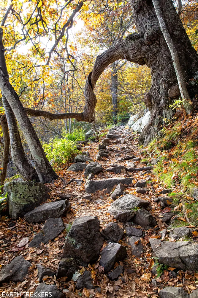
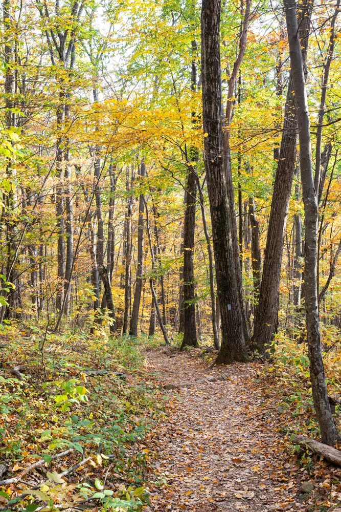
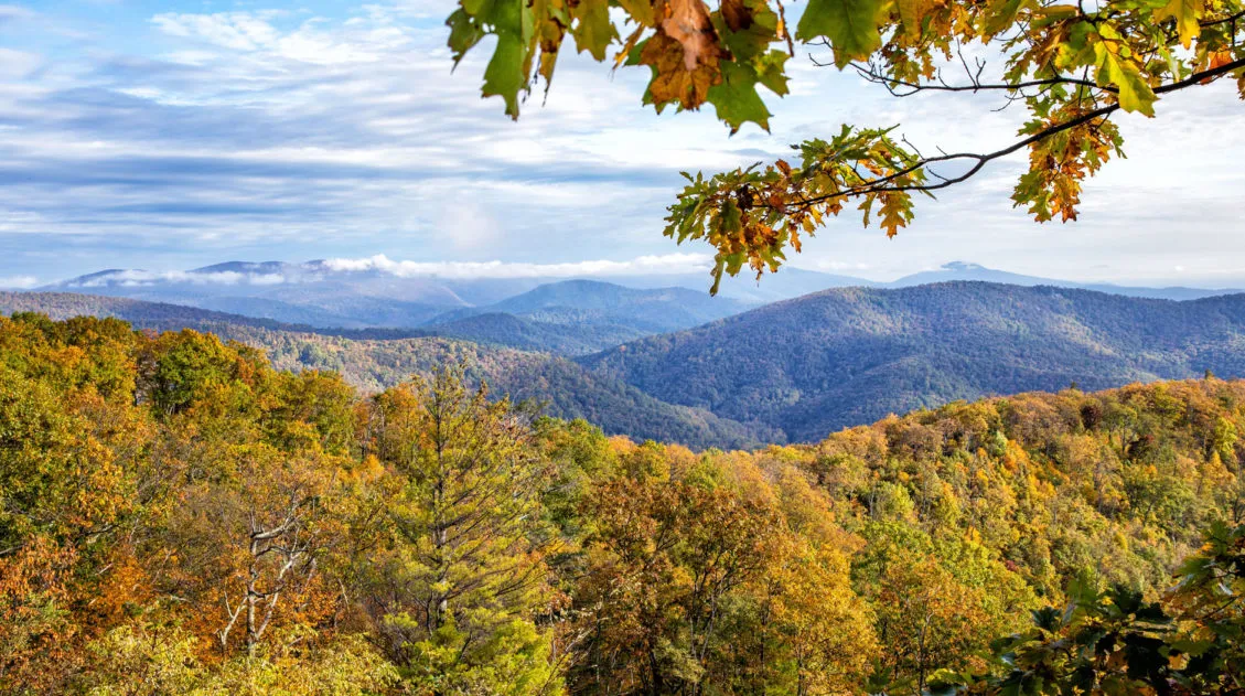
500 miles of hiking trails travel through Shenandoah National Park. These trails range from short, easy summit hikes, gorgeous walks to waterfalls, to challenging climbs up the tallest mountains. You also have the option to walk a few miles of the legendary Appalachian Trail.
Shenandoah National Park holds a special place in our hearts. Just two hours from where we live, we have spent more time here than any other national park in the United States.
Old Rag, the toughest hike on this list, was Tyler and Kara’s first long-distance hike. We did this in 2013, when they were only 8 and 10 years old, as a test hike before taking them on longer trails in Norway. Shenandoah was our kids’ introduction to hiking, and what a beautiful place to start.
Even though we have spent a lot of time here, we haven’t even come close to hiking all 500 miles. But on this list are 10 popular hikes to consider. Each offers a slightly different experience. So, if you prefer summit climbs, hikes to waterfalls, or something fun and easy to hike with younger kids, we have a lot of great suggestions for you.
The Essentials
Park Entrance Fee: $30
Old Rag Day-Use Ticket: $2, mandatory to hike Old Rag from March 1 to November 30, purchase in advance on recreation.gov
Best Time to Visit: April and May for waterfalls and wildflowers; October for fall colors
How Much Time Do You Need? One day to hike a few short trails and drive Skyline Drive. Two days to add on more hikes and viewpoints.
November 2025 Update: Added new information about Blackrock Summit, confirmed dates and pricing for the Old Rag Day-Use permit, updated the map, and added new links to our other guides on Shenandoah National Park.
10 Hikes in Shenandoah National Park
I am putting these hikes into two different categories: summit climbs and hikes to waterfalls. In each list, I start with the easiest hike and end with the hardest. All hiking distances are round-trip. You can see the location of these hikes on the map at the end of this post.
Summit Climbs
1. Blackrock Summit
Distance: 1 mile | Difficulty: Easy | Total Ascent: 175 feet | Time: 45 minutes
For a summit climb, this is the easiest in the park. Just one mile round trip, hikers are treated to sweeping views of the park. This hike is ideal for photographers and families.
This hike follows a portion of the Appalachian Trail. You can pick up a self-guided brochure at the trailhead, which has information along the trail.
The only downside of this hike is its location. It’s at the southern end of the park. Most of the other hikes listed in this guide are centrally located, which makes it easier and more convenient to combine several hikes during your visit.
Parking: Park at the Blackrock Summit Parking and follow the Appalachian Trail south to the summit.
2. Little Stony Man
Distance: 0.9 miles | Difficulty: Easy | Total Ascent: 285 feet | Time: 30 – 60 minutes
This hike is short, sweet, and I loved it. It doesn’t quite have the sweeping views that Stony Man has (mentioned next) but this trail is also less crowded.
This hike is less than one mile round trip. It’s an uphill walk to summit but it’s doable for most people. In fact, there was a group of young kids here that were rock climbing (with a guide) on the nearby cliffs.
From the peak of Little Stony Man, it’s a nice view over the park. You can also look up at Stony Man, another summit hike that is well worth your time.
Parking: On Google, the parking lot is labeled “Little Stony Man Parking.” The trail starts on the west side of Skyline Drive.
3. Stony Man
Distance: 1.5 miles | Difficulty: Easy | Total Ascent: 360 feet | Time: 1 hour
Little Stony Man is the small rocky outcropping below.
At 4,040 feet, Stony Man is the second highest peak in Shenandoah National Park (Hawksbill is #1). From the top of Stony Man you are treated to spectacular views.
For a summit climb, this is a relatively short and easy trail, so it’s great for almost all ages and ability levels. That being said, it is also an extremely popular hike, so expect big crowds on this trail.
To get to the peak, it’s an easy to moderate uphill walk through the forest. The trail ends with a small loop. Go either way to get to the summit. From the top of Stony Man, enjoy the view. You can look down on the peak of Little Stony Man from here.
Parking: Park in the Passamaquoddy Loop Hike – Stony Man parking lot. This is located in Skyland. From Skyline Drive, turn onto Skyland Upper Loop at the north entrance and the parking lot will immediately be to your right.
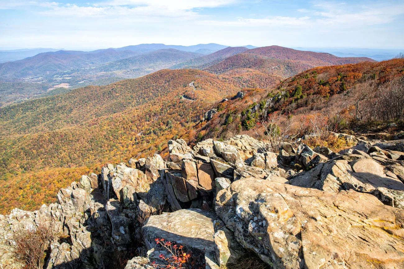
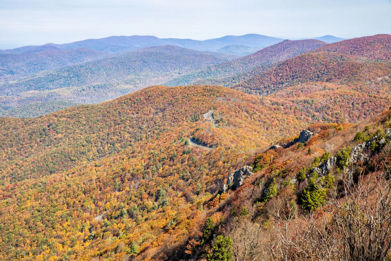
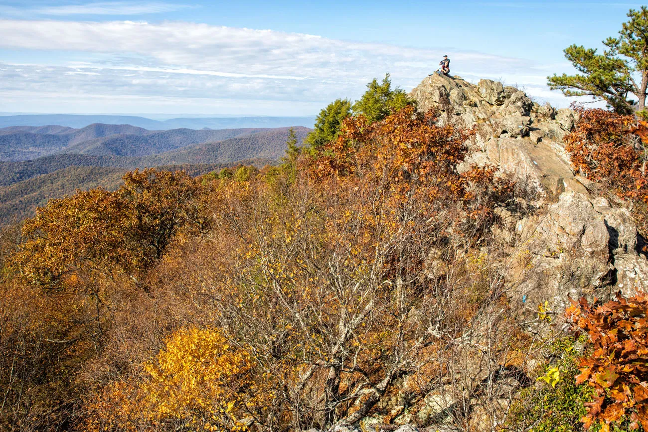
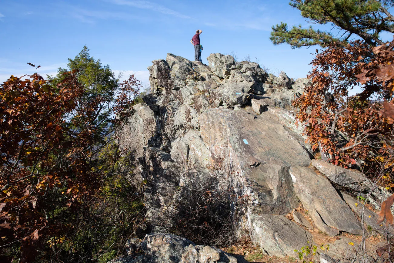
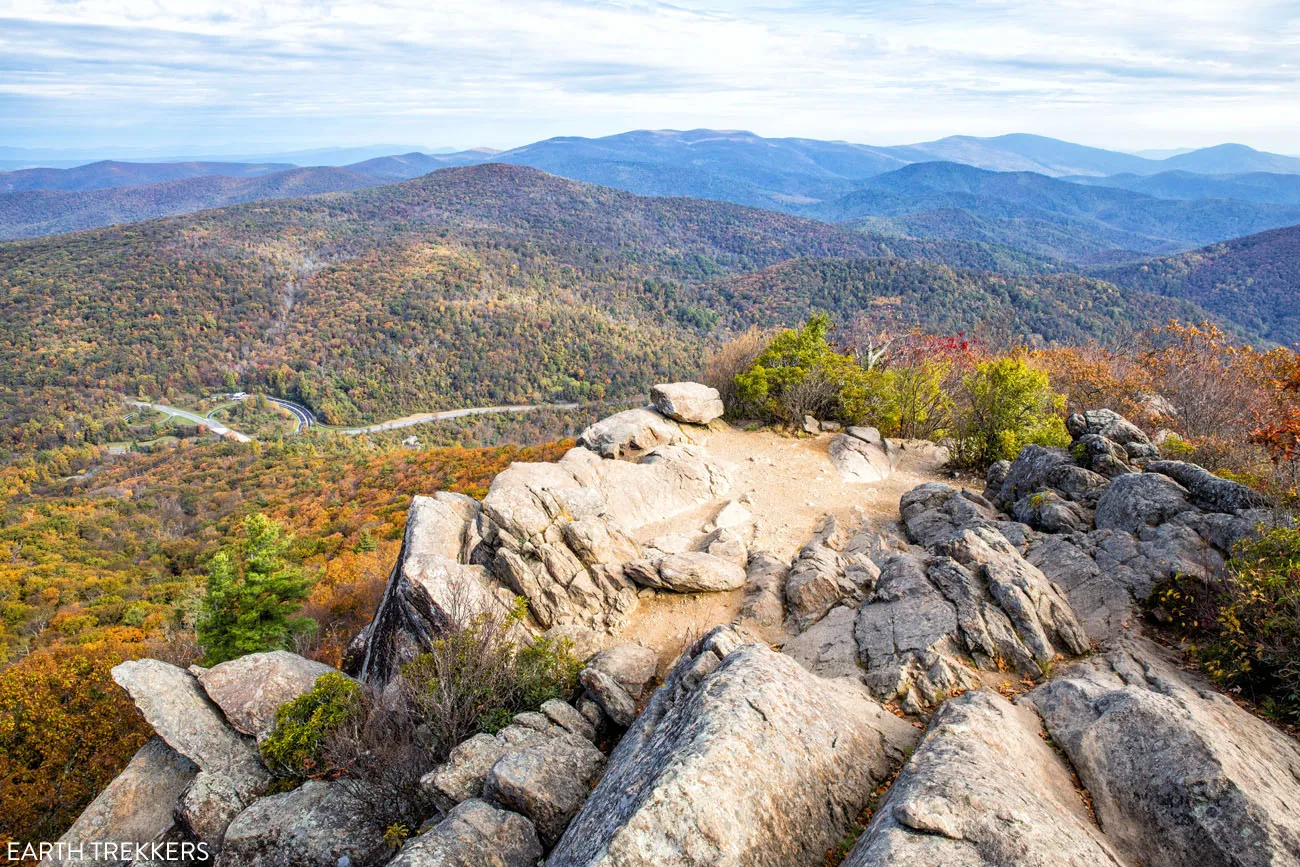
4. Bearfence Mountain Trail
Distance: 1.1 miles | Difficulty: Moderate | Total Ascent: 400 feet | Time: 1 hour
In my opinion, this hike is the most thrilling on this list. It’s a short, easy hike, with some fun rock scrambling thrown in.
It’s a short, uphill walk to get to the base of the rocky Bearfence summit. This is where the fun begins.
At first, the rock scrambling is easy. You’ll climb up and over a few large boulders on the trail. This is a nice test to see if you can handle what is coming. If this first part is challenging, consider turning around here.
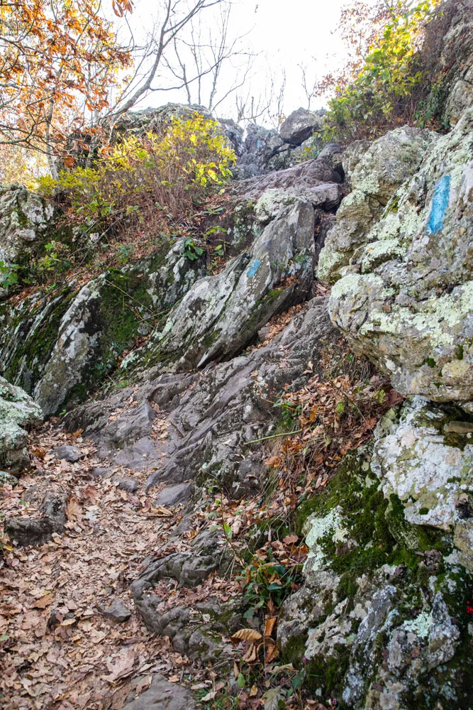
To get up to the summit, you will climb up a short, sheer rock wall and then up and over a series of enormous, jagged boulders. To do this, you will need to use both hands.
Once on top of Bearfence, you get 360° views of Shenandoah National Park.
The view from Bearfence
To finish the hike, rock scramble down the other side of Bearfence. The trail hits the Appalachian Trail (AT), which you will hike back to the parking lot.
I saw lots of kids on this trail, some as young as 6 years old.
Parking: Park at the Bearfence Mountain Trailhead, which is at mile marker 56.4 on Skyline Drive. The trail starts on the east side of Skyline Drive.
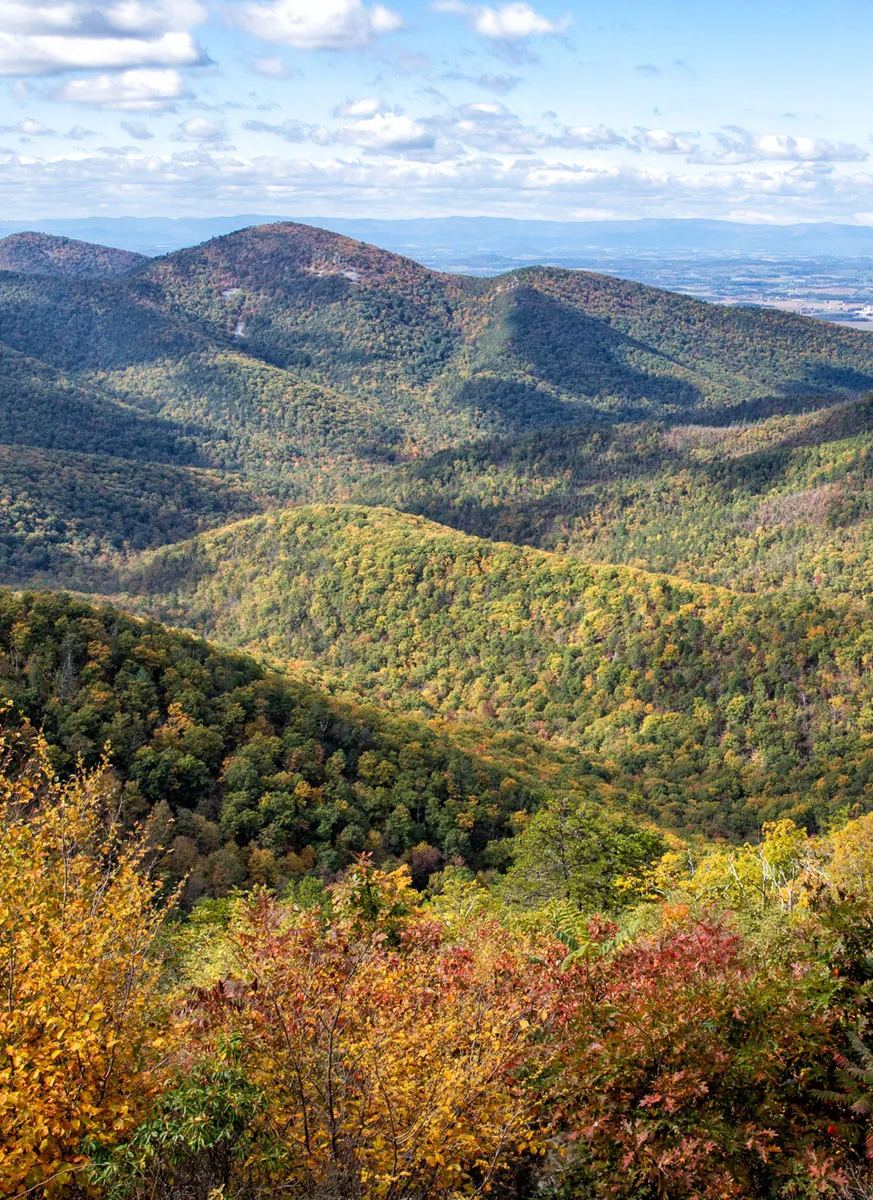
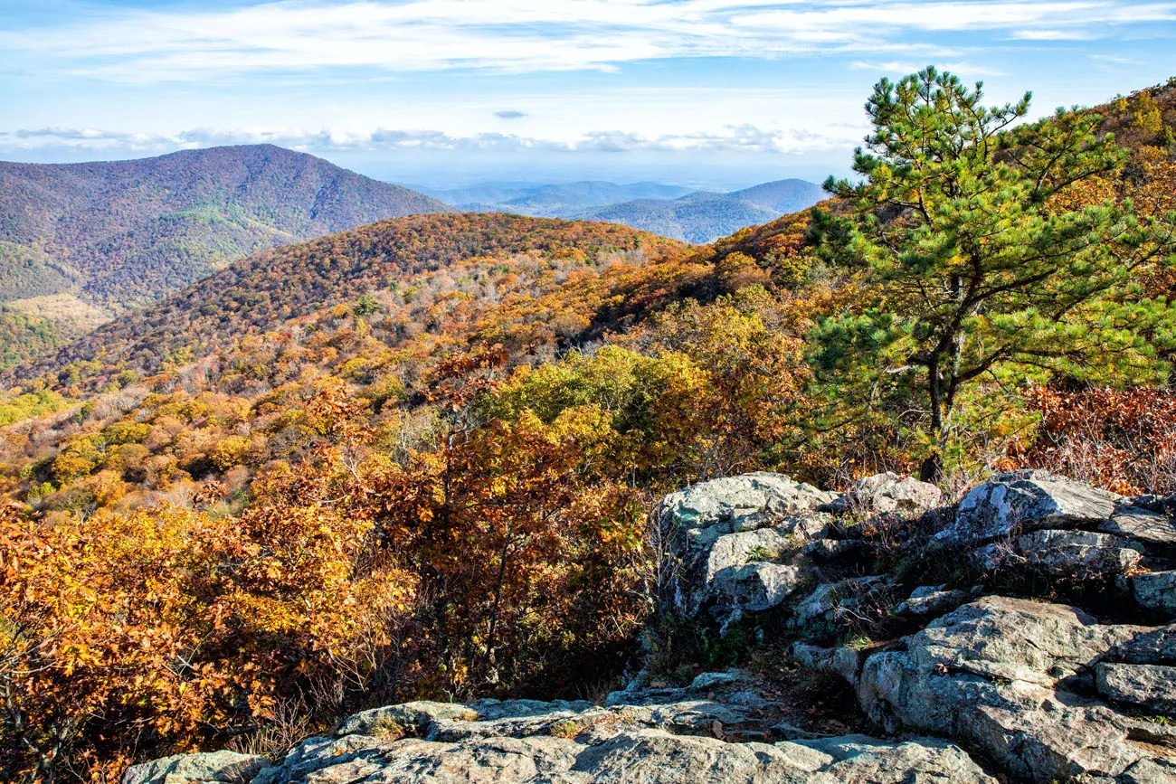
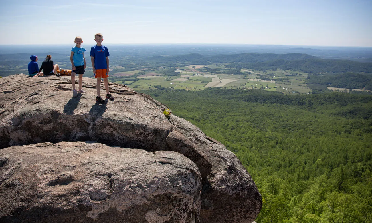
5. Hawksbill Mountain
Distance: 1.5 to 2.8 miles | Difficulty: Easy to moderate | Total Ascent: 500 to 700 feet | Time: 1 to 2 hours
Hawksbill Mountain is the highest peak in the park, at 4,049 feet. There are several ways to get here.
The easiest way to hike to Hawksbill Mountain is on the Upper Hawksbill Trail. Park in the lot “Upper Hawksbill Parking.” From here, it is a 1.1 mile mostly uphill walk to the summit, with almost 500 feet of elevation gain (round-trip distance = 2.2 miles).
The shorter but harder trail to the summit is the Lower Hawksbill Trail. Park at Hawksbill Gap. It is a very steep, strenuous 0.75 mile hike to the summit (1.5 miles round trip), with 700 feet of ascent. It is an uphill walk the entire way. This is the way that I went and I can tell you, it can be a real thigh-burner.
A third option is to turn this hike into a loop. Park at Hawksbill Gap. Take the spur trail to the Appalachian Trail and hike this for 1 mile, until you get to the trail junction for the Salamander Trail. Turn left onto the Salamander Trail and follow this for 0.7 miles. Once you reach the Upper Hawksbill Trail, it is a very short walk to the summit. Return to your car on the steep, downhill walk down the Lower Hawksbill Trail. This hike is 2.8 miles long and takes up to 3 hours.
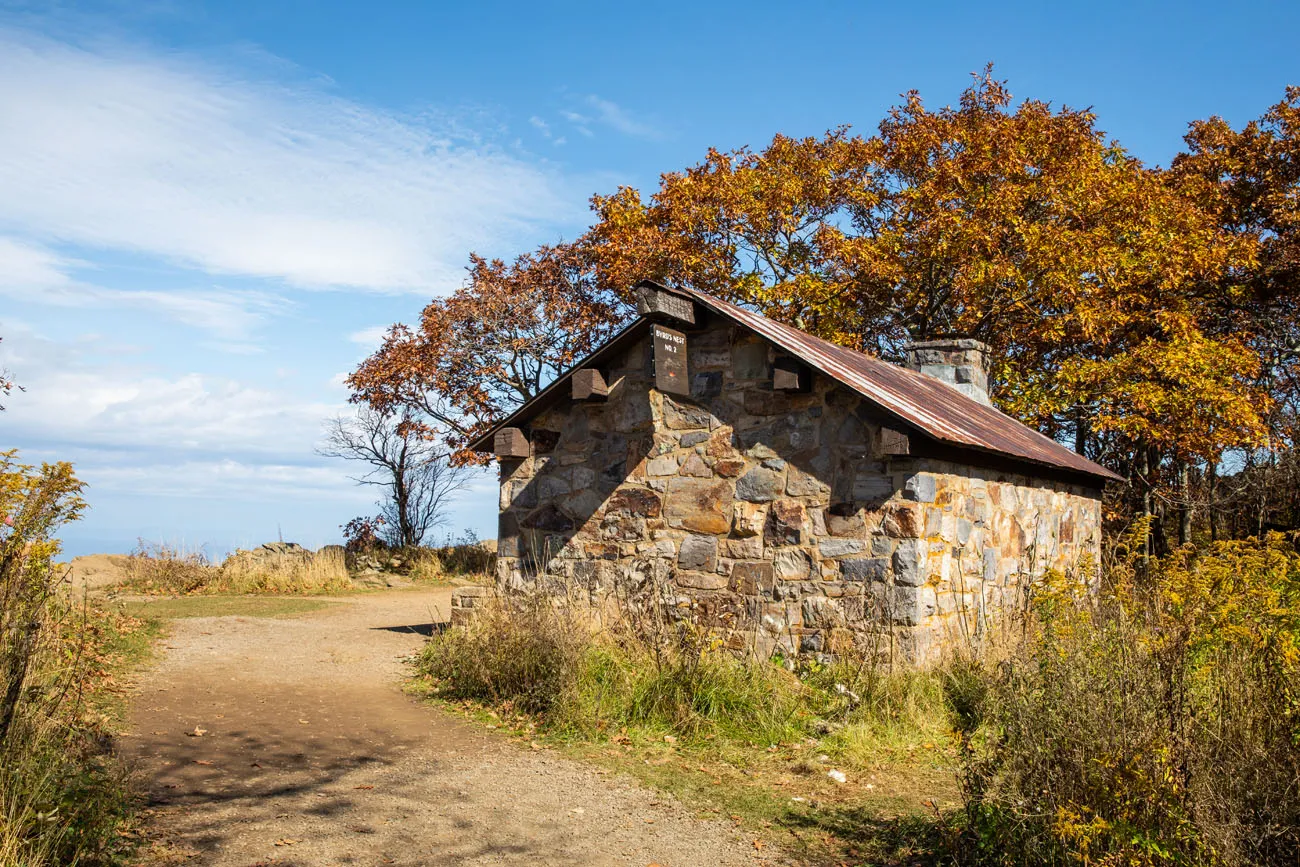
Byrds Nest No. 2 Shelter (at the summit of Hawksbill)

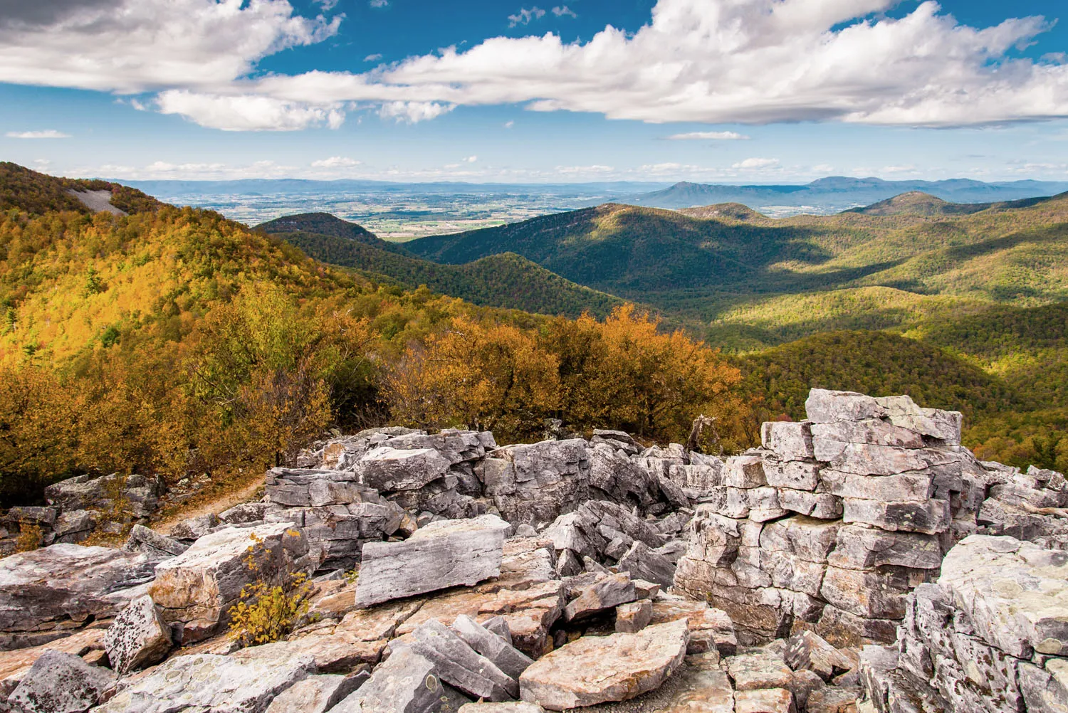
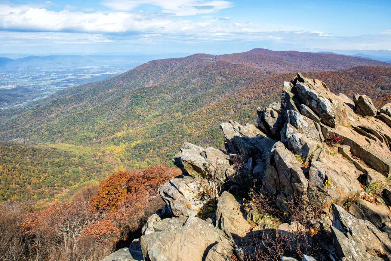
6. Marys Rock
Distance: 2.6 to 3.6 miles | Difficulty: Easy to moderate | Total Ascent: 800 to 1200 feet | Time: 2 to 3 hours
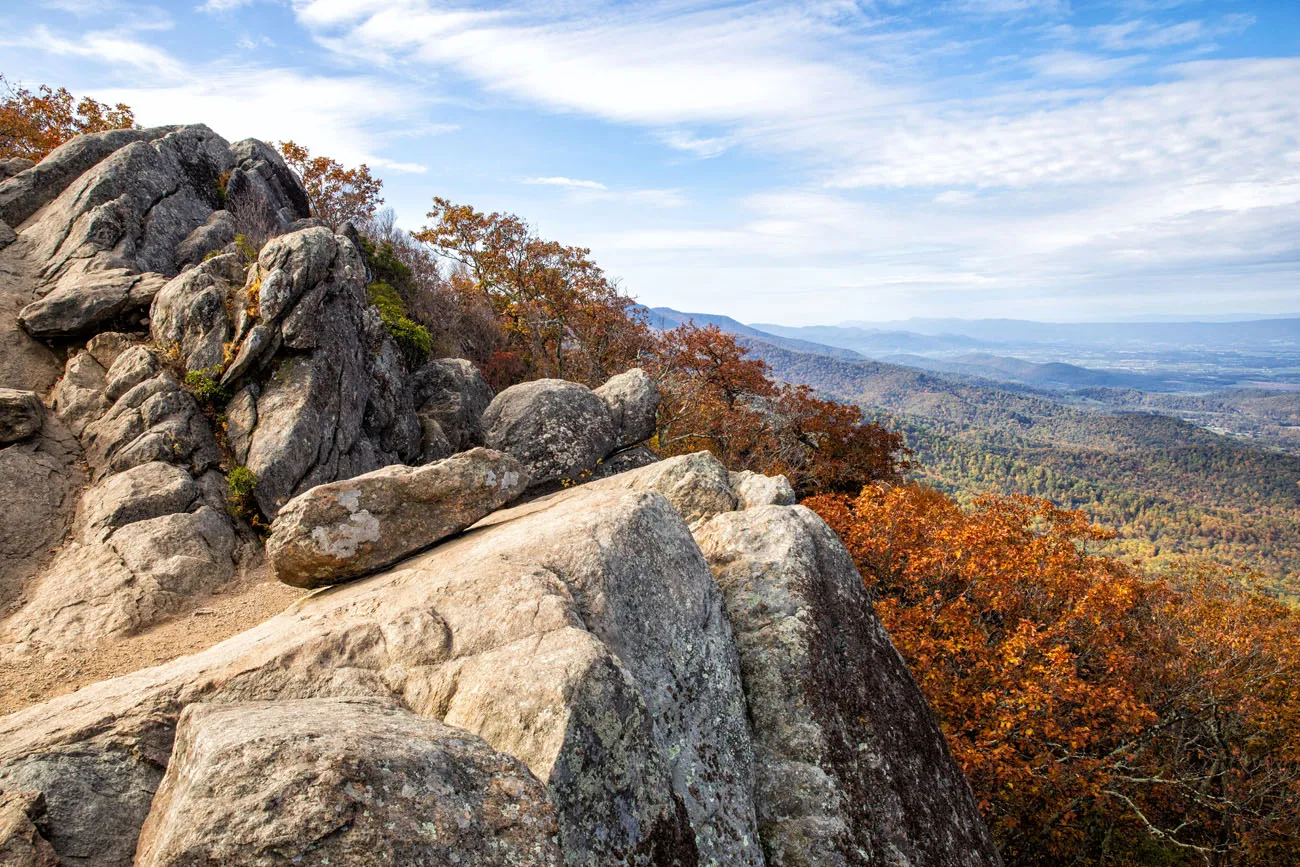
Marys Rock offers breathtaking views over Shenandoah National Park. There are two ways to get here.
Marys Rock North. This is the longer, tougher trail to the peak. Park in the Panorama Parking Lot. For the majority of the hike you walk the Appalachian Trail. To get to the summit, it is a moderate, uphill climb. Just before reaching the summit, take the short spur trail off of the AT to reach the viewpoint.
This is the way that I went. The overall distance is 3.6 miles with 1,200 feet of total ascent.
Marys Rock North trail.
Marys Rock South. This is the shorter, easier route to the summit. Start at the Meadow Spring Trailhead. This trail dead ends at the AT. Turn right to continue onto Marys Rock. Just before reaching the top, take the spur trail to the summit. Retrace your steps to get back to your car. This hike is 2.6 miles long with 800 of total ascent.
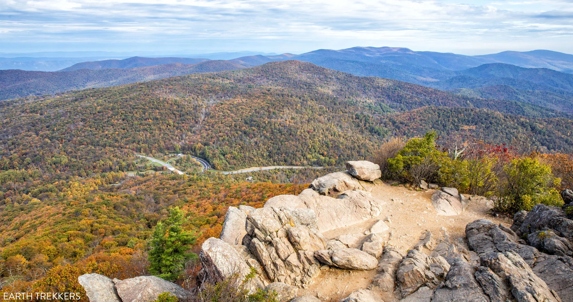
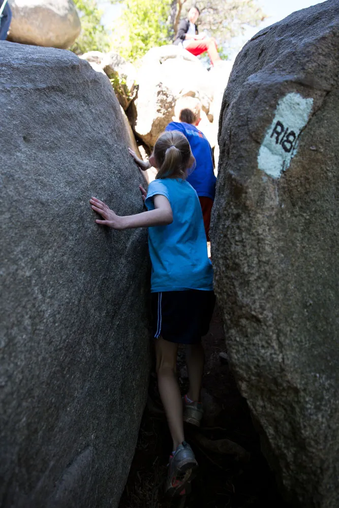
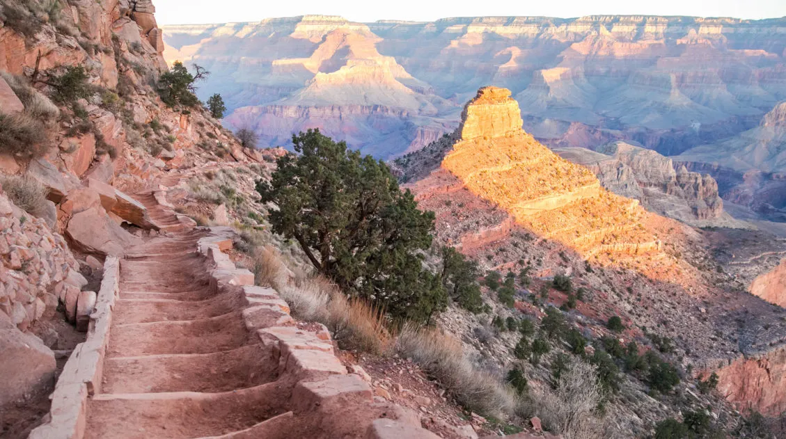
7. Old Rag
Distance: 9.4 miles | Difficulty: Strenuous | Total Ascent: 2,400 feet | Time: 5 to 7 hours
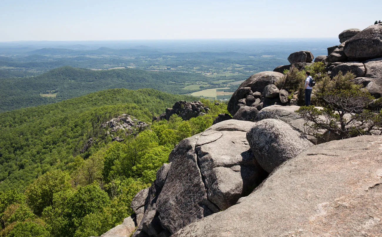
Old Rag is the toughest hike on this list but it is also our favorite. And we’re not the only ones. Many people who hike this trail say that it’s their favorite in the park, too. In fact, Old Rag is hailed as the best day hike in the mid-Atlantic region.
On this hike, you’ll ascend to the base of Old Rag on a moderate hike up through the forest. To reach the summit of Old Rag, you climb through, up, and over enormous boulders. The rock scrambling is challenging, fun, and the best part of the hike. The view from the top is pretty sweet, too.
This is an extremely popular hike, so expect big crowds midday and on weekends. Get here early to ensure you get a parking space and to hike the trail before the bottlenecks occur on the rock scrambling sections.
If you will be hiking Old Rag from March through November, you will need to purchase a Day-Use Ticket.
How to Hike Old Rag in Shenandoah National Park
Everything you need to know to hike Old Rag, the best hike in Shenandoah National Park.Waterfall Hikes
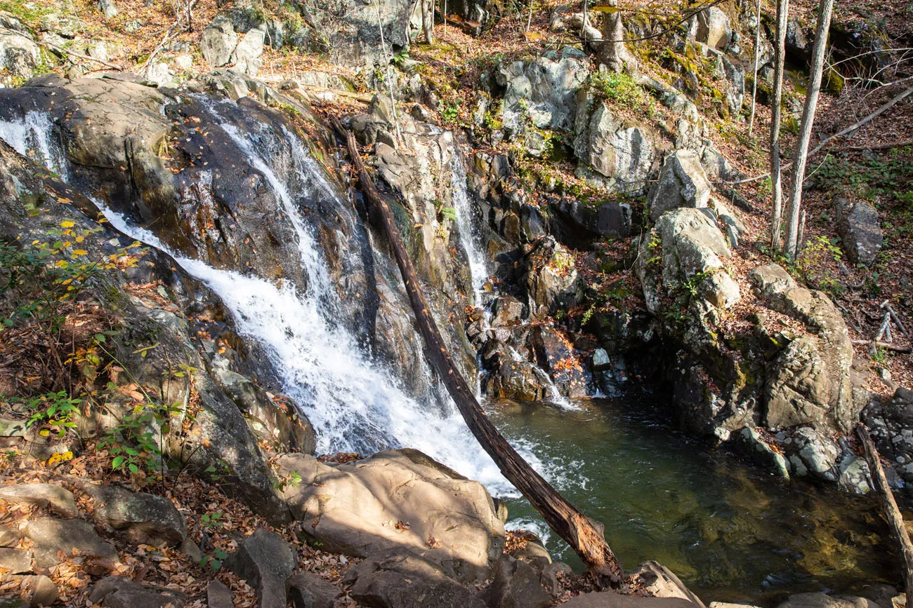
8. Dark Hollow Falls
Distance: 1.4 miles | Difficulty: Easy to moderate | Total Ascent: 440 feet | Time: 1 to 2 hours
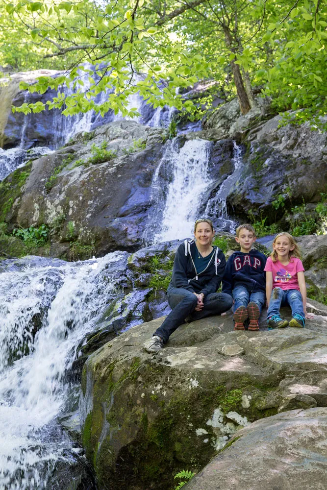
The hike to Dark Hollow Falls is one of the most popular hikes on this list. Why? It’s a relatively short, easy hike to one of the tallest waterfalls in the park.
From the parking lot, you will walk down the trail to the base of the waterfall. Just over a half-mile from the trailhead will be an overlook of Dark Hollow Falls. Descend a little farther to get to the base of the waterfall.
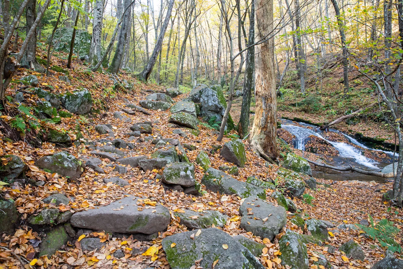
Go Farther: When you reach the trail junction for the Rose River Loop Trail (see photos below), you can hike a portion of this trail to see more waterfalls. A long series of much smaller waterfalls and pools is what you will see. A half to three-quarters of a mile one-way is as far as you need to go to get the best views. It’s a beautiful trail. Just note that it will be a long, uphill walk to get back to your car.
Parking: Park at the Dark Hollow Falls Parking Area on Skyline Drive. This is located just north of Big Meadows and the Harry F. Byrd Sr. Visitor Center. If the Dark Hollow Falls lot is full, park at Byrd Visitor Center and link via Story of the Forest Trail (adds ~0.5 mi).
9. Lewis Spring Falls Trail
Distance: 3 miles | Difficulty: Strenuous | Total Ascent: 1,000 feet | Time: 2 to 3 hours
This is a tough hike to a nice waterfall, but in my opinion, this hike is not worth the effort, unless you are a big fan of waterfall hikes. I recommend Dark Hollow Falls and the Rose River Loop (next) before putting this hike on your to-do list.
Starting at the Big Meadows Complex, take the Lewis Springs Fall Trail. This trail rapidly descends to the waterfall and it takes about 1.25 miles to reach Lewis Falls.
At this point, there is an overlook with your first unobstructed view over Shenandoah Valley. The small waterfalls here are also very nice to photograph.
To see Lewis Falls, cross the creek and take the spur trail to the overlook.
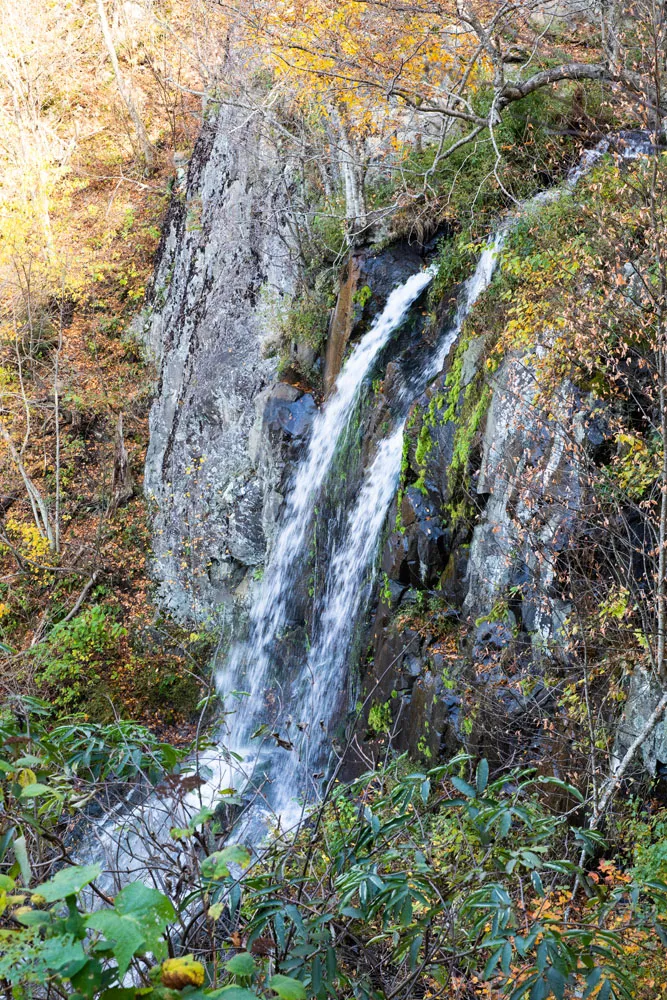
Lewis Falls
Backtrack to the main trail. There is a fork in the trail near the overlook. Now, it is a strenuous, uphill walk back to Big Meadows. The Lewis Spring Falls Trail ends at the Lewis Spring Fire Trail. Take this for 50 feet and then turn left onto the Appalachian Trail. Walk the AT until you get back to the parking lot.
Parking: Park near the amphitheater near the back of the Big Meadows Complex (the parking lot is marked on our map).
10. Rose River Loop Trail
Distance: 4 miles | Difficulty: Moderate | Total Ascent: 1,000 feet | Time: 2 to 3 hours
This is a beautiful hike and I think it’s the best hike in Shenandoah National Park if you want to see several waterfalls.
Park at Fishers Gap Overlook and cross Skyline Drive to the trailhead. Immediately, there is a fork in the trail. Go left to take the Rose River Loop Trail. You will return on the Rose River Fire Trail, which is to the right.
The first mile is downhill walk through the forest. This is the least thrilling part of the hike but that is about to change.
At about one mile into the hike, the trail turns to the right and you can hear the waterfall. Just a short walk later you arrive at the viewpoint for Rose River Falls.
The trail continues along the Rose River and it is a very pretty downhill walk through this section.
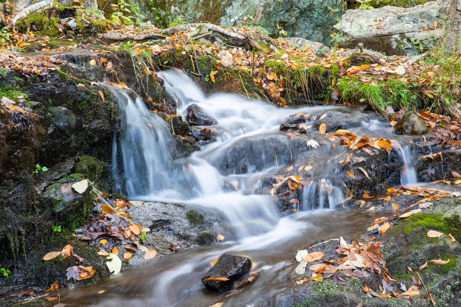
The trail turns the to the right again, crosses the Hogcamp Branch on a small bridge, and then you start your ascent back to Skyline Drive. Even though you are walking uphill, this is the best part of the hike. As you walk along the Hogcamp Branch, you get to see numerous cascading falls and pools of water. It’s beautiful.
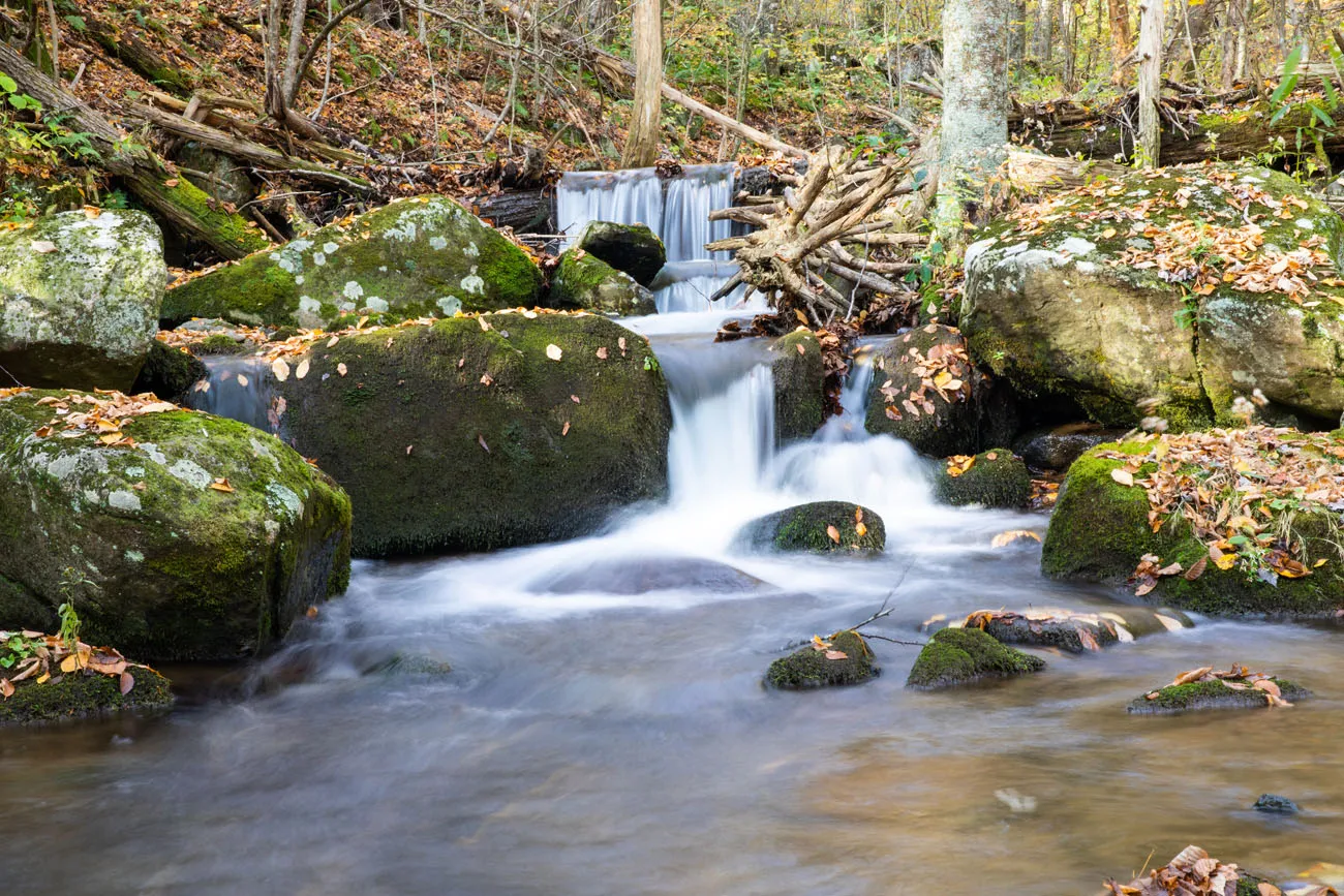
Photographers: Bring your tripod, polarizing filter and neutral density filters for this hike. This is an extremely photogenic hike with the small waterfalls and pools of water.
The Rose River Loop Trail ends at the junction with the Rose River Fire Road and Dark Hollow Falls Trail. Cross the wide bridge to the right and take the wide fire road back to the parking lot to complete the loop.
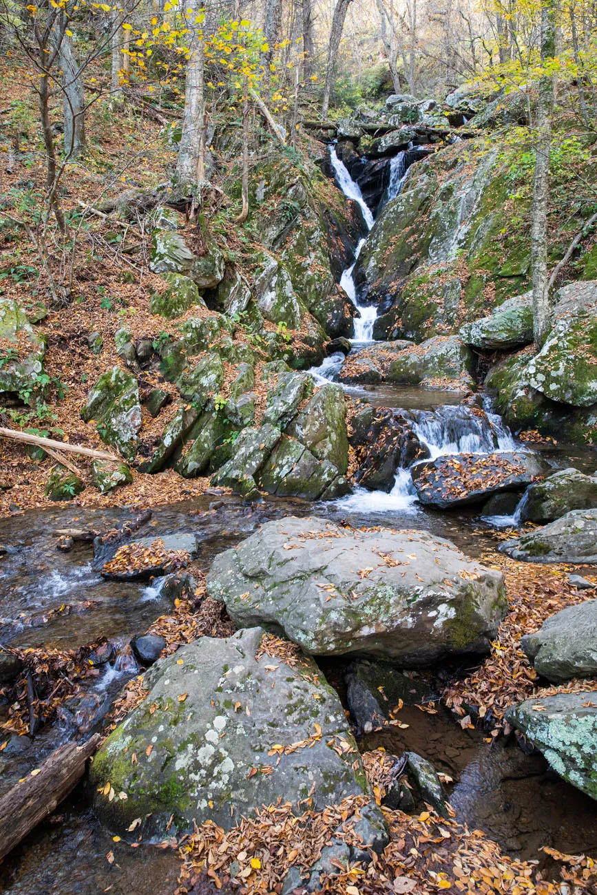
Waterfall at the trail junction. This is where the Rose River Falls Loop meets the Dark Hollow Falls trail.
PRO TRAVEL TIP: Start this hike first thing in the morning to hike the trail before it gets crowded. Not only will there be hikers doing this a loop but there will also be people hiking down from Dark Hollow Falls.
PRO TRAVEL TIP #2: Do this loop in a clockwise direction. You get the unexciting walk through the forest done first. Then, as you hike up Hogcamp Branch, you are walking towards the cascading waterfalls, which is a beautiful sight.
Bonus: Cedar Run to White Oak Circuit
This challenging hike is still on our to-do list, but because of the accolades it gets, I couldn’t leave it off of this list. On this 9 mile hike, you have the chance to see nine waterfalls! From the Hawksbill Gap parking lot on Skyline Drive, it’s a massive descent down to White Oak Falls and then a steep, strenuous hike up the Whiteoak Canyon Trail. Expect this hike to take 6 to 8 hours.

One Hike to Skip
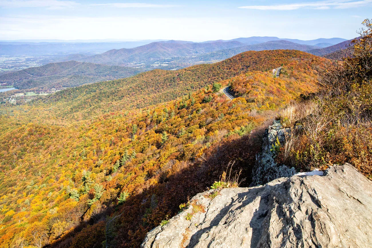
Sugarloaf – Keyser Run Fire Road – Hogback Mountain
Distance: 5.1 miles | Difficulty: Moderate | Total Ascent: 1,000 feet | Time: 2 to 4 hours
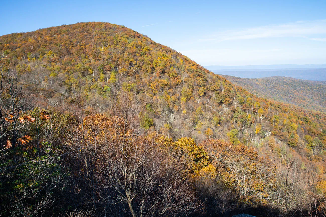
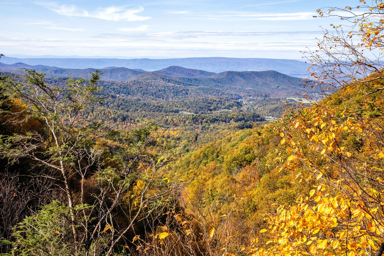
Hogsback Mountain (view from Little Hogback Overlook which is also on the AT)
This is my least favorite hike on this list and I recommend skipping it. So, why even mention it? If you purchase the Falcon Guide to Shenandoah National Park, read about this hike, and want to give it a try, I recommend otherwise. The book says you’ll get spectacular views from this scenic trail. I beg to differ.
This is a long, boring, monotonous hike. It’s over 5 miles long and for 90% of the time you will be in the forest with no views, other than trees and groves of mountain laurel. The one good viewpoint, Little Hogback Mountain Overlook, can easily be reached on a short walk from Skyline Drive. Plus, on this trail, you will hike up a steep, strenuous trail to the top of Hogback Mountain. There is no view here for your reward, just more views of the forest.
Hogback Mountain Overlook: If you want the same view with minimal effort, park in the parking lot for Little Hogback Overlook. You will hike less than a tenth of a mile on the AT to the viewpoint.
View from Little Hogback Overlook
Parking: If you still want to do this hike, park in the small lot at mile 21 on Skyline Drive, just south of the Hogback Overlook. The trail starts on the opposite side of Skyline Drive.
Best Hikes in Shenandoah: On a Map
Here are the best hikes in Shenandoah on a map. Each hike is a different color, to make it easy to identify the hikes you plan to do.
How to Use This Map: Click the tab in the top left corner of the map to see a list of the points of interest and to turn layers on/off. Click the icons on the map to get more information about each point of interest.
To take this map with you, click the star next to the title of the map which adds it to your Google account. Next, within your Google Maps app, select ‘Saved’ and then select ‘Maps’. This map title will now appear in your list.
About the Hiking Trails in Shenandoah National Park
All hiking trails in the park are marked with blue blazes on the trees. Every trail on this list is very easy to follow, just keep spotting those blue paint marks.
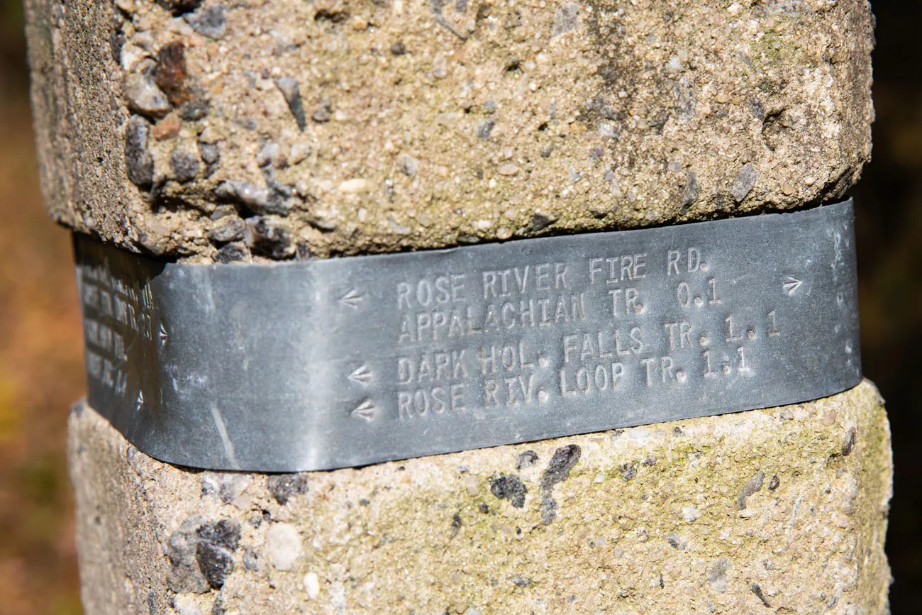
At trail junctions, you will see a concrete post. Wrapped around the top of the post is a piece of metal, marked with the trails and distances to the next junction or trailhead.
101 miles of the Appalachian Trail (AT) run through Shenandoah National Park. For the most part, the AT follows along right beside Skyline Drive. Several hikes on this list share the trail with the AT. The Appalachian Trail is marked with white blazes and concrete posts with “AT” on them. In cases where a day hike and the AT share the same trail, you will see blue and white blazes painted on the trees.
Hikes on this list that include the Appalachian Trail:
- Little Stony Man
- Stony Man Trail
- Blackrock Summit
- Bearfence Trail
- Hawksbill Trail (if you do it as a loop with the AT)
- Marys Rock
- Sugarloaf – Keyser Run Fire Road – Hogback Mountain
- Lewis Spring Falls Trail
Shenandoah is one of the few national parks where dogs are allowed on some trails. If you plan to hike with your dog, be aware that there are several trails where dogs are not allowed (Old Rag, Bearfence, Stony Man, and the Dark Hollow Falls Trail) and you can see the full list on the National Park Service website.
PRO TRAVEL TIP: Before your trip to Shenandoah National Park, visit the official National Park Service website to get updates on park and trail conditions. National parks can close at any time due to weather events, wildfires, or government shutdowns.
Our Recommendations
My personal favorites are Old Rag, the Bearfence Trail, the view from Hawksbill and Marys Rock, and the Rose River Loop.
If you are hiking with kids, our top picks include Dark Hollow Falls, Little Stony Man and Stony Man, Blackrock Summit, and the Upper Hawksbill Trail. Older, more adventurous kids will love scrambling at Bearfence or Old Rag.
For an epic hiking experience, put Old Rag on your list.
If you want to avoid the crowds, Little Stony Man is a nice summit hike with fewer people than other hikes on this list. Hike the Rose River Loop Trail in the morning. Both the Lewis Springs Fall Trail and the Sugarloaf – Hogsback Mountain Trails had just a few people on them, but I personally wasn’t a fan of these hikes.
If you only have one day in the park, I recommend one waterfall hike (Dark Hollow Falls) and one to two summit hikes. Hike the Upper Hawksbill Trail to stand on the highest point in Shenandoah National Park and then have some fun on the Bearfence Trail.
Please practice the seven principles of Leave No Trace: plan ahead, stay on the trail, pack out what you bring to the hiking trail, leave areas as you found them, minimize campfire impacts, be considerate of other hikers, and do not approach or feed wildlife.
When is the Best Time to Visit Shenandoah?
Fall is our favorite time to visit Shenandoah National Park, but late spring is nice as well.
With the exception of Old Rag, Dark Hollow Falls, and Blackrock Summit, all of the photos in this post were taken between October 19 and October 21, 2020. The best time to catch the fall colors in Shenandoah is the last two weeks of October.
| Month | Best For | Other Highlights |
| April & May | Waterfalls | Wildflowers |
| October | Peak fall colors | Great views of the park |
| December through February | Solitude | Snow and empty trails |
Shenandoah Trail Guide
If you want more information on hikes in Shenandoah National Park, I recommend purchasing the Hiking Shenandoah National Park Falcon Guide. This book contains 59 hikes to do in the park, complete with photos, maps, and detailed trail information. I used this book as a reference and its trail stats are very accurate.
Plan Your Trip to Shenandoah
In our guide Best Things to Do in Shenandoah, we cover more great things to do in the park, other than just hiking the trails, plus where to stay and places to visit near Shenandoah.
If you have plans to hike Old Rag, don’t miss our Old Rag Trail Guide.
McAfee Knob is a popular hike in Virginia that makes a great add-on to a visit to Shenandoah National Park.
We have more links to places to visit near Shenandoah National Park below.
If you have any questions about the best hikes in Shenandoah National Park, or if you want to share your experience, let us know in the comment section below.
Places to Visit Near Shenandoah
9 Amazing Things to Do in Shenandoah National Park
Pinterest Facebook Flipboard This guide covers the best things to do in Shenandoah National Park, nearby attractions, and essential tips to help you plan your trip, including where to stay, how many days you’ll need, and the best time of year to visit. Shenandoah National Park preserves a section of the Blue Ridge Mountains in […]
20 Fun, Short Hikes in the US National Parks
One of the best ways to experience the national parks is from a hiking trail. Hike to amazing viewpoints, deep into the forests, through scenic canyons, and to hidden lakes and waterfalls. Along the way, you have a better chance of spotting wildlife and potentially leaving the crowds behind. Here are 20 fun, short hikes […]
12 Amazing National Parks for Your Next Family Adventure
We’ve visited 56 of the 63 U.S. national parks and almost every single one would make a fantastic family destination. With 63 parks to choose from, the options can feel overwhelming. After years of exploring the national parks, we’ve narrowed it down to 12 that hit the sweet spot for families. These parks are easy […]

One Day Walking Tour of Washington DC (From a Local!)
Having lived in Maryland most of our lives, we are lucky to be in such close proximity to our nation’s capital. Washington DC is a place that we visit frequently. With so many museums and historical sights, this city makes an excellent travel destination in the USA. For one day, we acted like tourists, scouting out […]
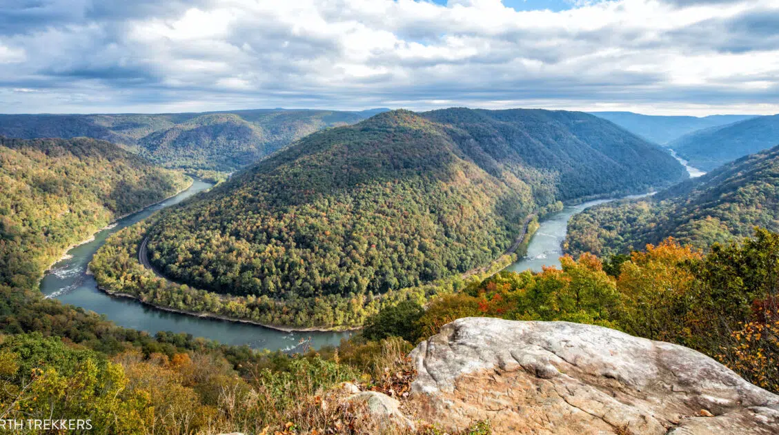
6 Beautiful Hikes in New River Gorge National Park
One of the best ways to see New River Gorge National Park is from a hiking trail. And one of the great things about this park is that all of the hikes are short and sweet (the longest hike on this list is just 3 miles long). In this guide, we cover the 6 of […]
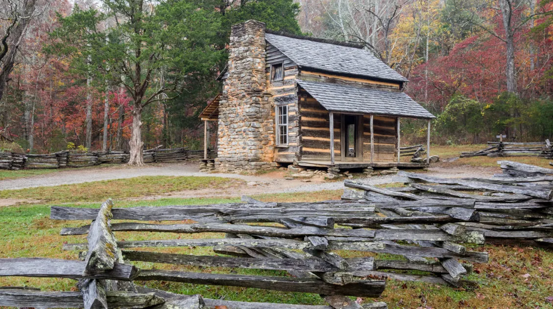
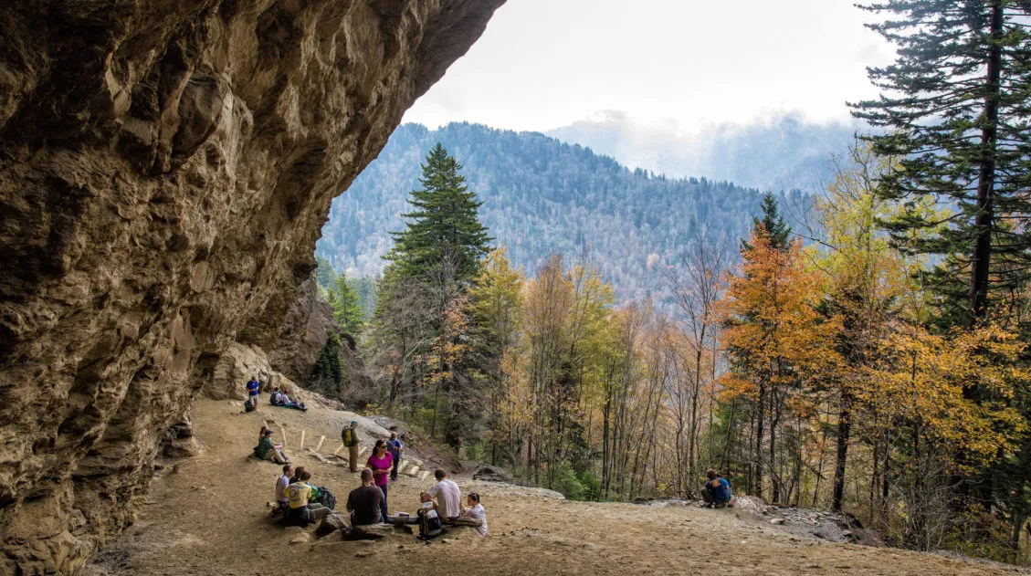
A Weekend in Gatlinburg and Great Smoky Mountains National Park
In an attempt to catch the last of the autumn colors, Tim and I went a road trip to the Great Smoky Mountains in early November. We spent a weekend exploring Great Smoky Mountains National Park, using Gatlinburg, Tennessee as our home base. Great Smoky Mountains National Park is the United States’ most visited national […]

A Weekend Getaway to Asheville, North Carolina
Nestled in the Blue Ridge Mountains, Asheville makes the perfect weekend getaway. There is something here for everyone, whether you are a foodie, a family, a beer aficionado, or an outdoor adventurer. In this guide, we cover the best things to do in Asheville, organized by travel style. Best Things to Do in Asheville The […]
New River Gorge National Park Itinerary for 1 to 3 Days
If you are planning your New River Gorge National Park itinerary, this is a great place to start. There are many different ways to plan the “perfect New River Gorge itinerary,” depending on your interests and how much time you have. The things to do in New River Gorge National Park are scattered along the […]
US National Parks List: All 63 Parks, Map & Free Printable Checklist
There are 63 national parks in the United States, and we’ve visited 56 of them, from the remote wilderness of Denali to the coral reefs of the Virgin Islands. We’re a family of avid hikers who have spent over a decade exploring these parks, from multi-day backcountry trips to scenic drives with kids in tow. […]
15 Best US National Parks to Visit in May
Planning a trip to the US national parks in May and don’t know which ones to visit? May is a beautiful time to visit the national parks, now that the snow has melted across much of the country and roads are beginning to reopen. The list of national parks to visit in May is a […]
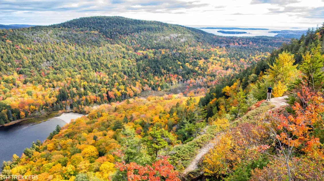
13 Best US National Parks to Visit in October
In October, fall colors sweep across much of the United States. The majority of the parks that you will see on this list are parks that are ablaze in fall colors. Some of these are obvious picks, such as Acadia and Shenandoah, but a few may surprise you. In this guide, we list 13 beautiful […]
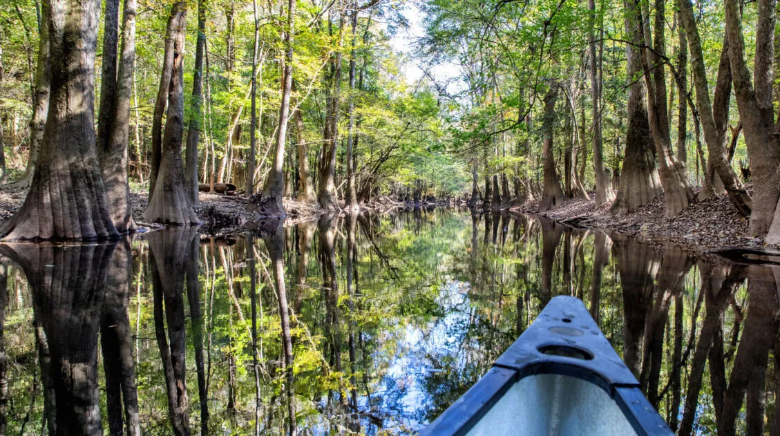
One Perfect Day in Congaree National Park
With its compact size and short list of things to do, one day is all you really need to visit Congaree National Park. With one day in Congaree National Park, walk the boardwalk trail, go canoeing or kayaking on Cedar Creek, and venture farther into the wilderness on one of several other hiking trails in […]

20 Amazing Things to Do in Charleston, SC
Charleston is a small coastal city in South Carolina. Touring its historic homes, shopping along King Street and in the Charleston City Market, and getting a history lesson at its museums top the list of things to do in Charleston. But you can also dine at a wonderfully long list of restaurants and venture beyond […]
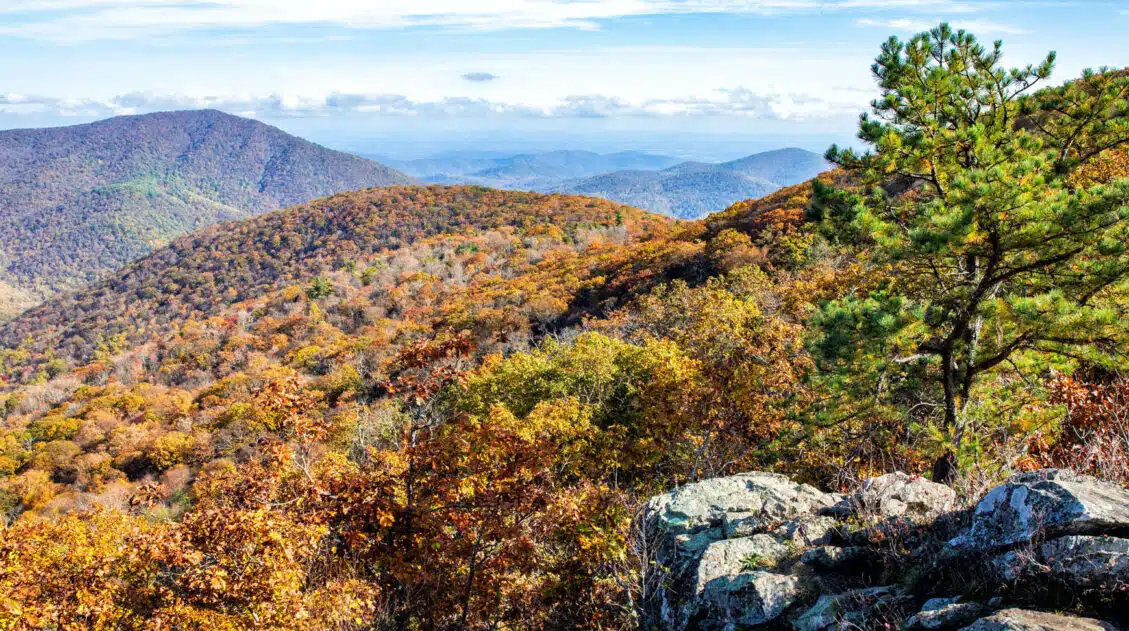
Virginia Travel Guide: Things to Do in Virginia
Virginia Travel Guide With Shenandoah National Park in the north and the Blue Ridge Mountains in the south, there is no shortage of wonderful hikes and outdoor adventures in Virginia. Visit colonial cities where George Washington walked the streets and Patrick Henry gave his famous speech. Additionally, natural marvels are found in Virginia from Luray […]
Hiking Mount LeConte via Alum Cave Trail: A Complete Guide
Summiting Mt. LeConte is one of the Smoky Mountains great hikes. It is a long way to the top but it’s an interesting experience, hiking through caves and along trails that, at times, cling to the side of the mountain. On a clear day, the view from the top of Mt. LeConte can be magnificent. There […]

Comments 15