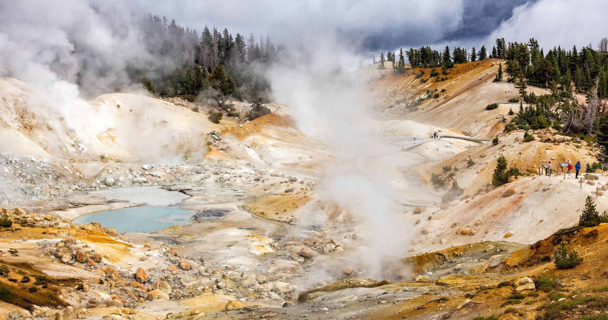
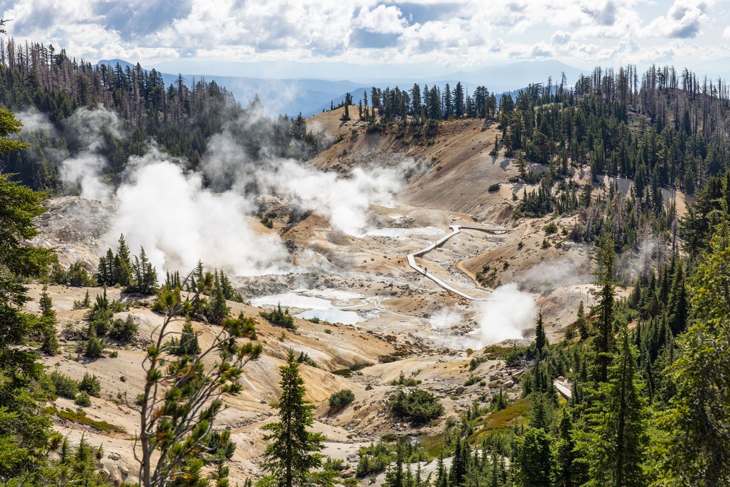
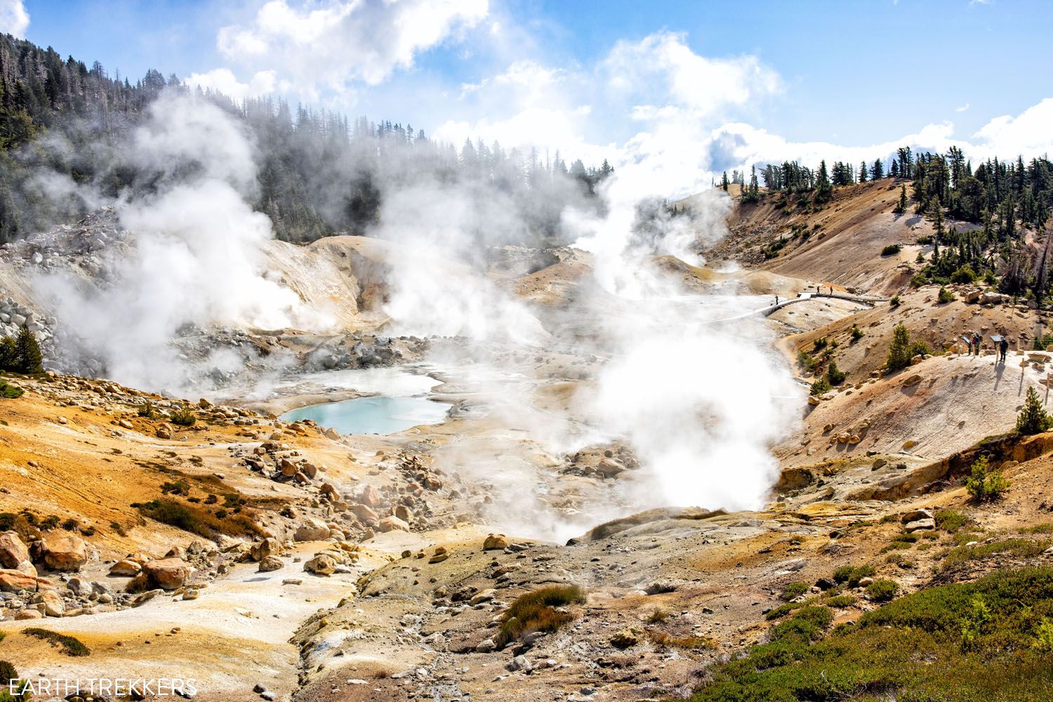
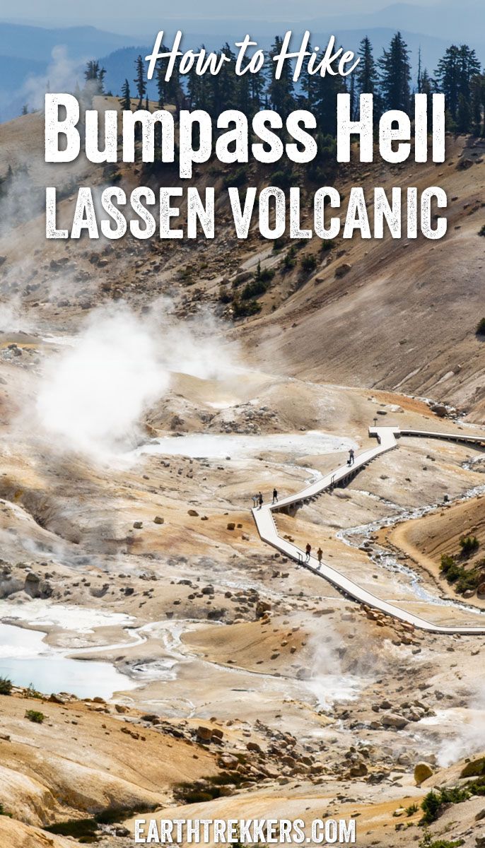
Welcome to Bumpass Hell, a dynamic thermal region with an unforgettable name. The largest hydrothermal area within Lassen Volcanic National Park, Bumpass Hell amazes visitors with its giant steam vents, bubbling mud pots, and colorful, otherworldly landscapes.
The Bumpass Hell Trail is one of the most popular trails in Lassen Volcanic National Park. It’s easy to hike, great for all ages, and is conveniently located near some of the park’s top sites. In fact, we rank it as one of the best hikes in Lassen Volcanic National Park, especially for first-time visitors.
This short, 3-mile round-trip hike is an easy to moderate option for most visitors, taking about 1.5 hours to complete. It’s also right along Highway 89, near Lassen Peak and Lake Helen, making it one of the park’s most accessible hikes.
I hiked this trail twice. The first time was on a very cloudy day in Lassen Volcanic. There’s nothing wrong with doing this hike in overcast conditions, but the next day, under a bright blue sky, I couldn’t resist hiking it again. The colors of the thermal pools really shine in the sunlight, as you’ll see in my photos.
Bumpass Hell Trail Stats
Distance: 2.7 miles (4.4 km) round trip
Difficulty: Easy to moderate
Total Ascent: 500 feet (150 meters)
Lowest Elevation: 8,160 feet (2,485 meters)
Highest Elevation: 8,380 feet (2,555 meters)
Time: 1 to 3 hours
When: Mid-July through late October
Toilets: Vault toilets are available at the trailhead.

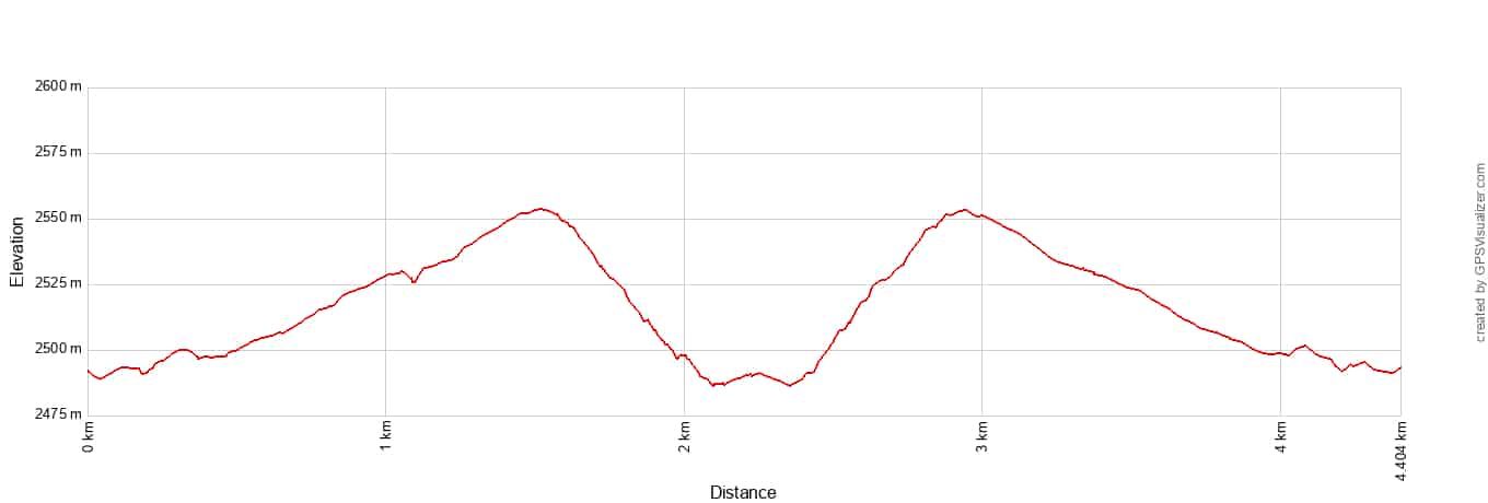
Bumpass Hell Trail Elevation Profile
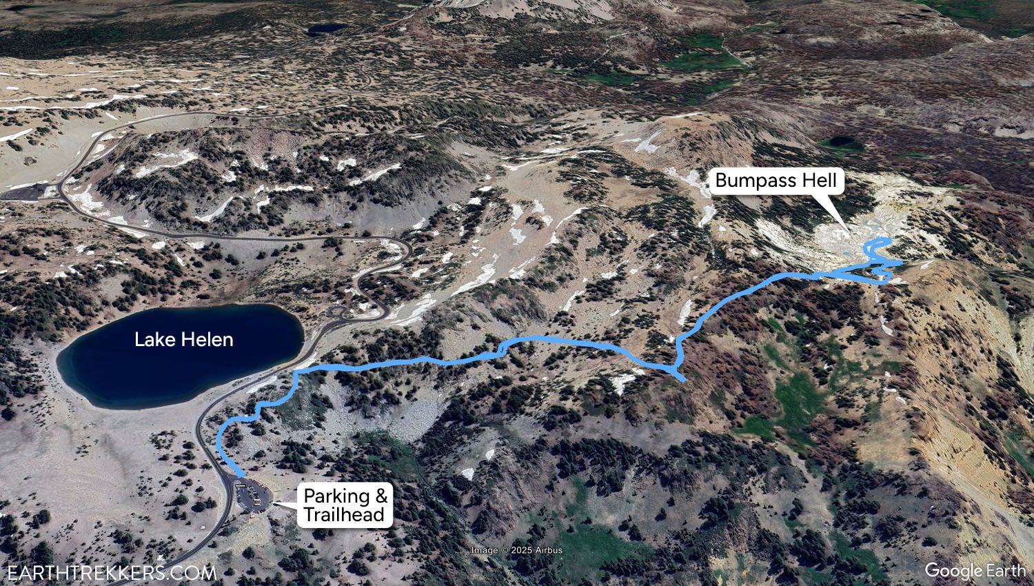
Bumpass Hell Trail Map
If you’re just starting to plan your visit, take a look at our guide How to Plan Your Trip to Lassen Volcanic. It pulls together all of our Lassen articles in one place, along with essential planning tips.
Please practice the seven principles of Leave No Trace: plan ahead, stay on the trail, pack out what you bring to the hiking trail, leave areas as you found them, minimize campfire impacts, be considerate of other hikers, and do not approach or feed wildlife.
Bumpass Hell Trail – Step-By-Step Trail Guide
Getting to the Trailhead
The Bumpass Hell trailhead is located along Highway 89, the main road that cuts through the national park (Bumpass Trailhead Parking on Google Maps).
Although the lot is large, expect it to be quite full, especially during midday. The first time we hiked this trail, we arrived on an afternoon in September and found only a handful of open spaces.
There’s a fantastic viewpoint right at the parking lot, near the bathrooms. This is a great spot for a quick photo out over the valley and surrounding peaks. If you’re short on time and can’t hike the Bumpass Hell Trail, we still recommend a quick stop for the view here.
Bumpass Hell Trail
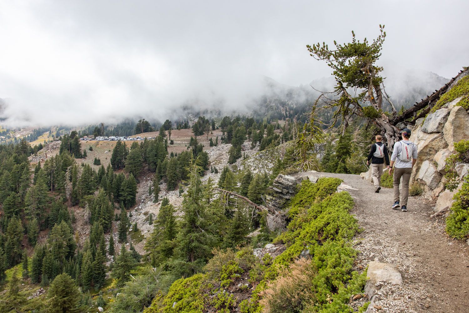
From the trailhead, follow the Bumpass Hell Trail along the mountainside. You will first walk along a flat, well-defined trail made of compacted dirt. It’s simple to follow and an easy effort, staying mostly flat as it passes in and out of tree cover.
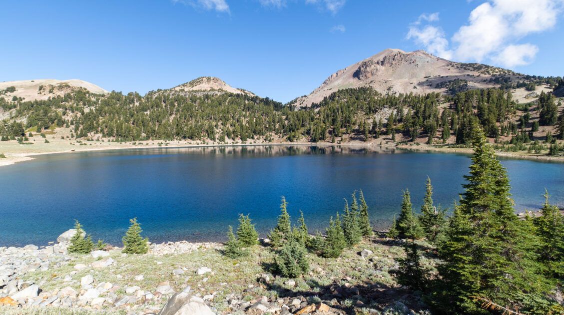
The trail passes Lake Helen almost immediately, at 0.25 miles. If you can’t find parking at the Bumpass Hell Trailhead, park here instead. You’ll also save a few extra minutes of hiking.
The trail continues to wind along the mountainside for another 0.75 miles. Most of the trail is exposed, so consider bringing a hat or sunscreen if it is sunny.

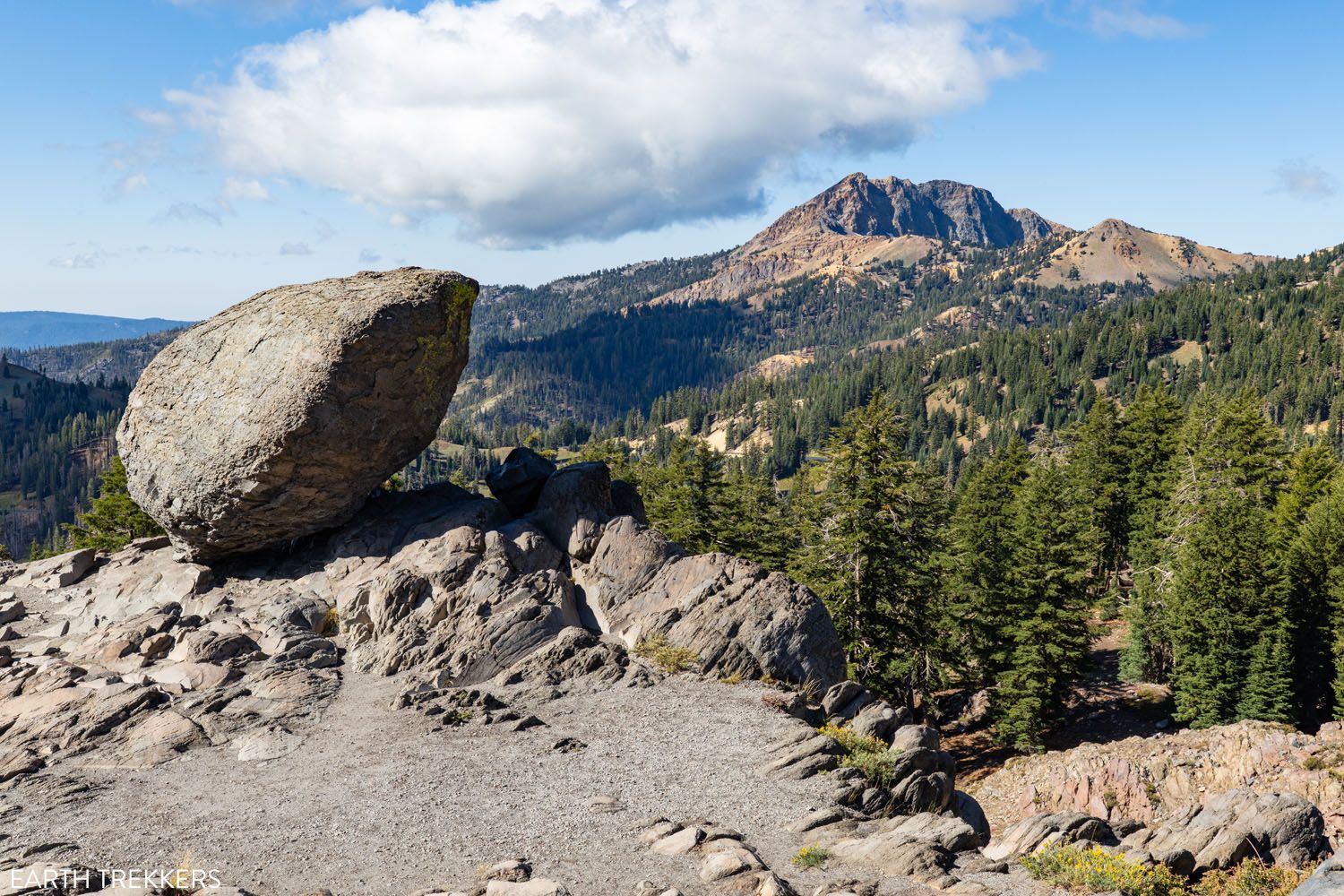
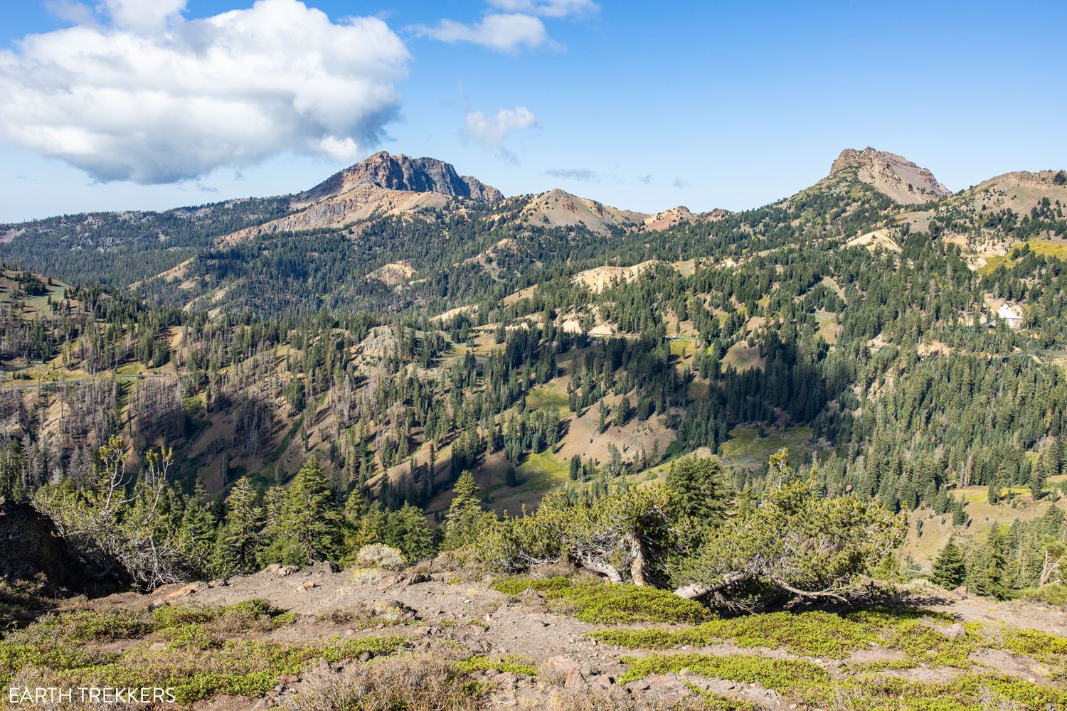
On your walk, the view opens up numerous times, with chances to look out over the nearby peaks and valleys. The most notable landmark is Brokeoff Mountain. You may also meet a handful of chipmunks and Douglas’s Squirrels foraging for food alongside the trail.
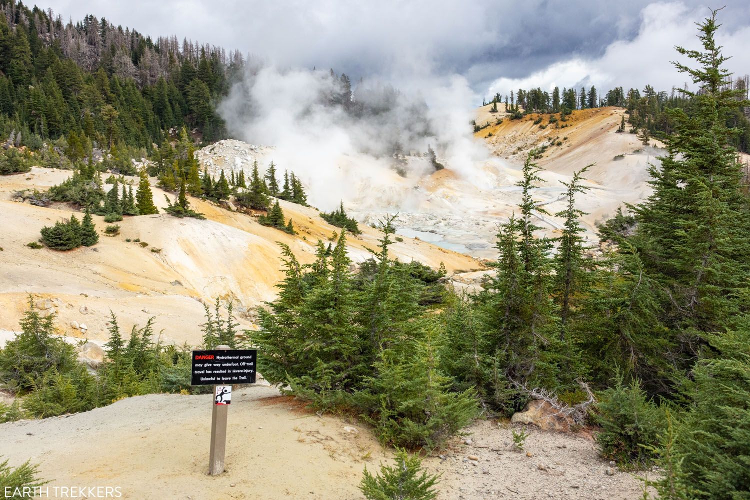
You will get your first view of Bumpass Hell at the 1-mile mark. Through a clearing in the trees, hikers can look down on this magnificent hydrothermal area. This was one of our favorite spots to photograph Bumpass Hell.
There’s a small bench here if you’d like to sit, rest, and enjoy the view. Once you’re ready, the trail descends down to Bumpass Hell, where you can get up close with the fumaroles.
It’s roughly a 10-minute descent down to Bumpass Hell. Almost immediately, the trail will split. The Frying Pan Trail leads to the left, and the Bumpass Hell Trail continues to the right. Both trails are roughly the same distance, and both lead to the thermal area, making a loop.
We hiked the Frying Pan Trail down and returned along the Bumpass Hell Trail. We recommend starting with the Frying Pan Trail. This path is much more scenic, with views of Bumpass Hell that only get better as you descend. There are also several offshoots where you can stop, take pictures, and learn about the region via posted signs. The Bumpass Hell Trail leads through the woods and doesn’t have any views, but it is quieter.

Exploring Bumpass Hell
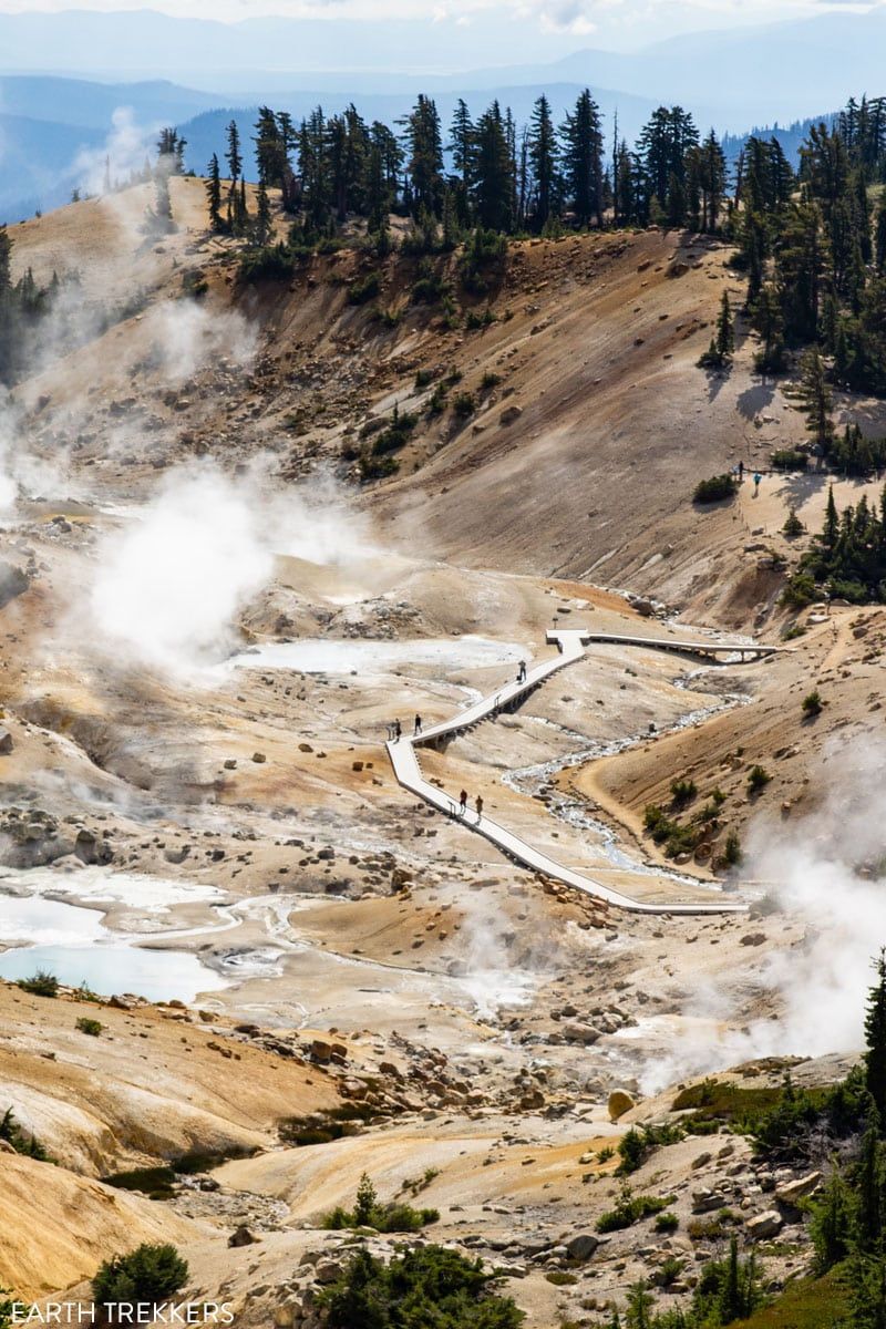
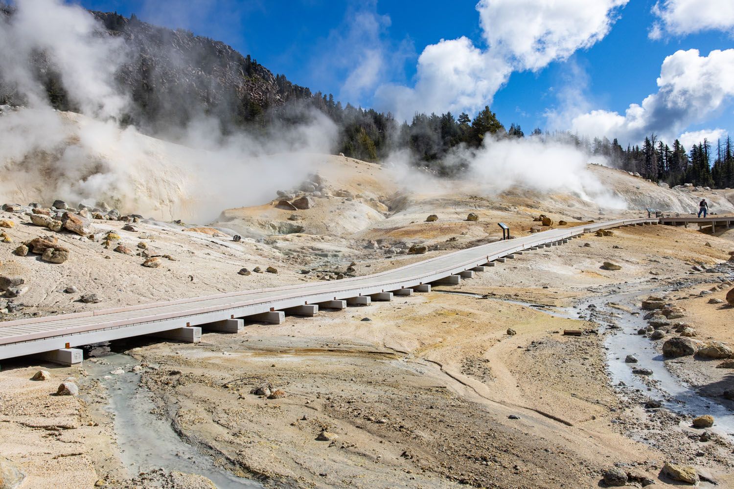
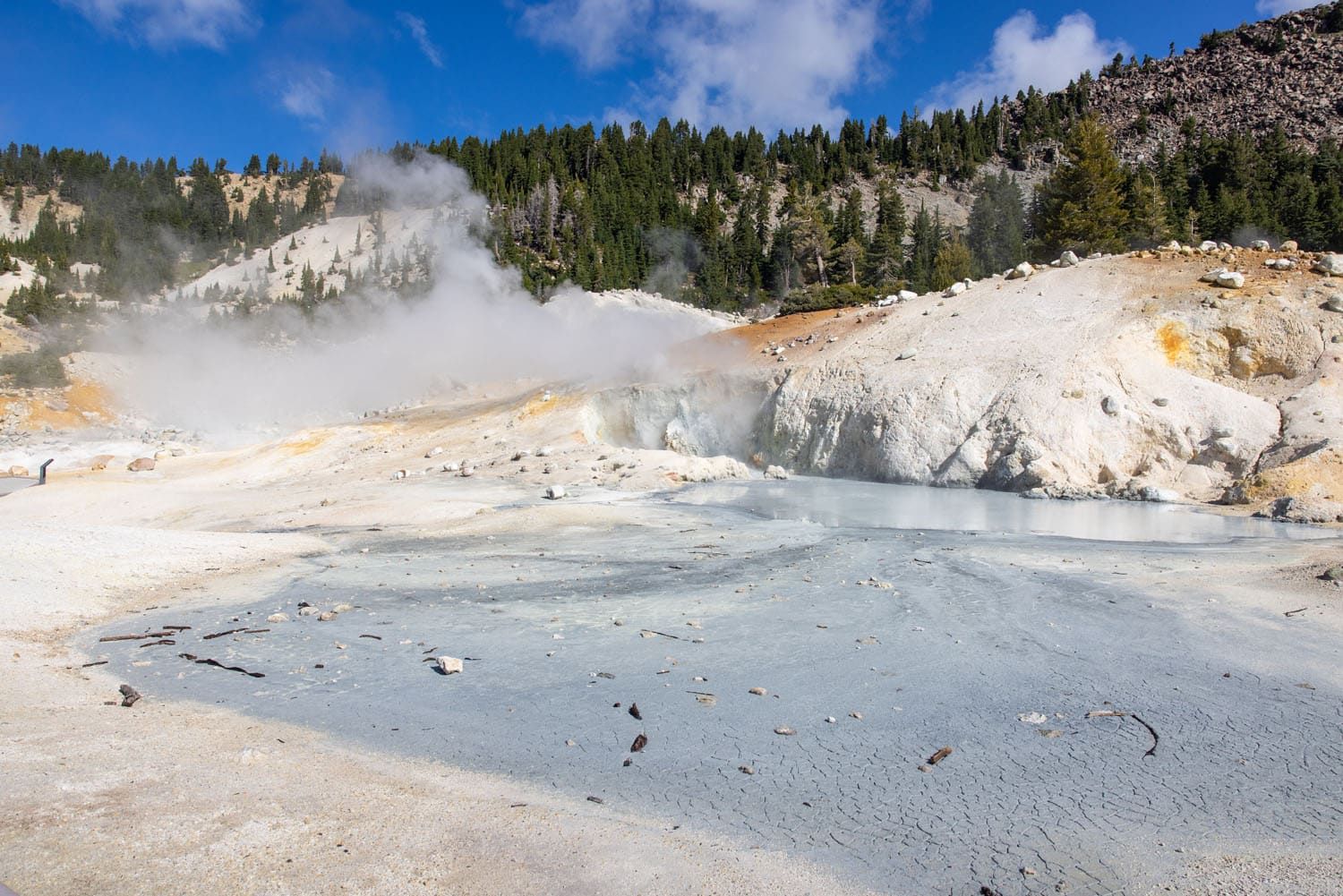
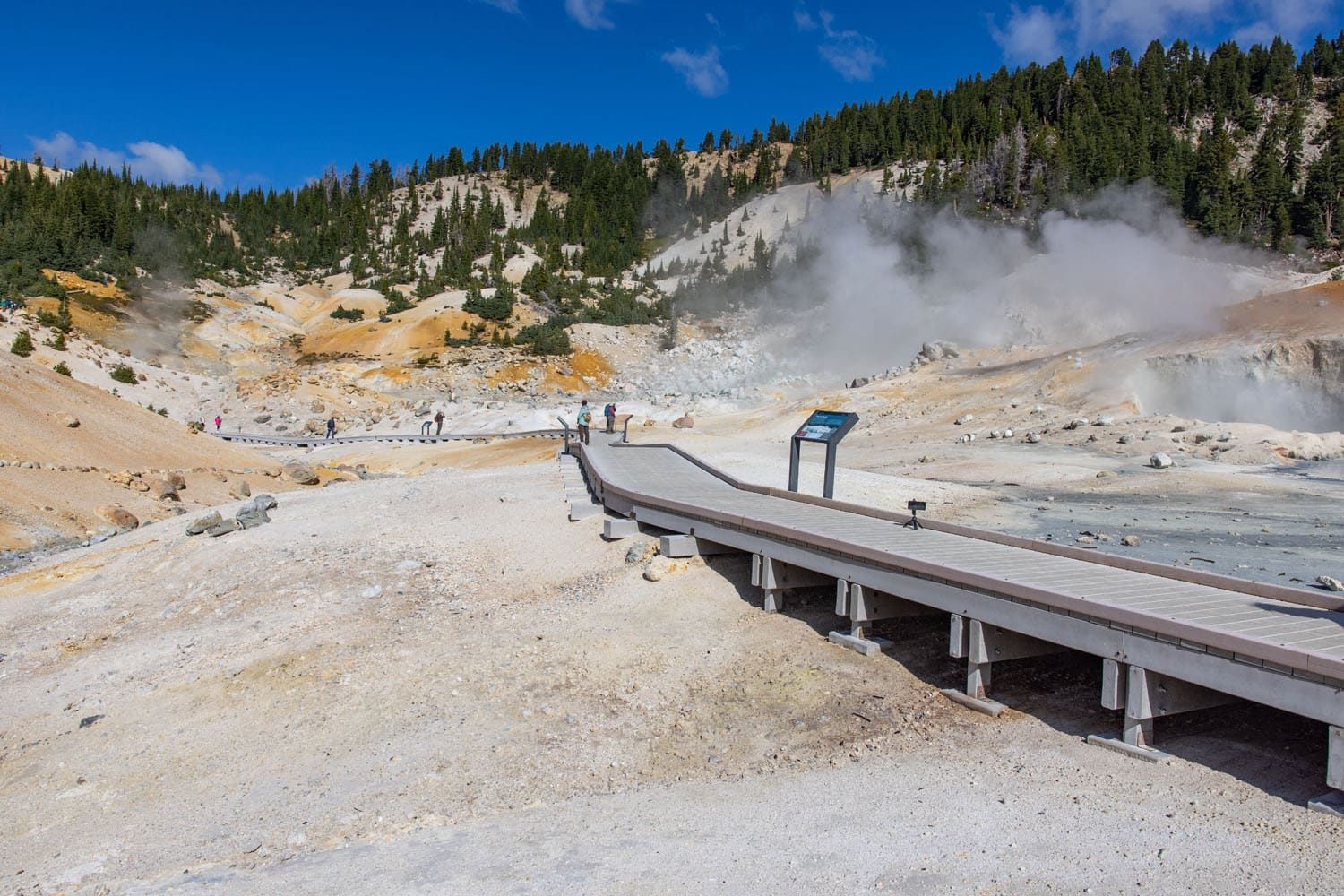
Once down at Bumpass Hell, you’ll find a small boardwalk loop that leads through the thermal area. Along the way, you’ll enjoy great up-close views of boiling mud pots and steaming fumaroles. Giant steam clouds rise into the sky, and you can hear the popping of mud from nearby pits. Undoubtedly, you’ll also enjoy that classic scent of sulfur, a strong odor that reminds us of rotten eggs.
Bumpass Hell is incredibly colorful and is even more impressive in the sun, as the colors just pop.
The boardwalk loop through Bumpass Hell is quite short, taking less than 10 minutes if you go slowly.

The Return Hike
Once you’re done, complete the loop on the Bumpass Hell Trail. Be prepared for a steep, uphill hike to Bumpass Hell overlook, and from the overlook, it is a mostly flat hike back to the parking lot.
The return hike, with a view of the parking lot in the distance.
When is the Bumpass Hell Trail Open?
Many of Lassen Volcanic’s hiking trails are snow-covered for most of the year, primarily due to the park’s high elevation. As a result, many trails are only open for a few months in summer and early fall.
According to the National Park Service website, the Bumpass Hell Trail has historically opened in mid-July and closes in November.
✅ The best time of year to hike the Bumpass Hell Trail is from late July through October. This narrow window is when the snow has melted, and you’ll have warm weather ideal for hiking. We also recommend checking the National Park Service website for trail updates before you go.
What to Bring on the Hike
🧴 There is little shade on the trail, so bring a hat and consider wearing sunscreen.
🥾 Snow can remain on the trail through late summer, so waterproof hiking shoes or boots are ideal. In September, when we did this, the trail was completely free of snow, and we wore a mix of hiking shoes and trail running shoes.
💧 Bring water (about 1 liter per person).
Essential Hiking Gear: What Should You Bring on a Day Hike?
If you are new to hiking or are curious about what you should bring on a hike, check out our Hiking Gear Guide. Find out what we carry in our day packs and what we wear on the trails.More Hydrothermal Areas in Lassen Volcanic
If you like Bumpass Hell and exploring geothermal areas (or just like the smell 🤣), here are a few more geothermal areas to visit in Lassen Volcanic National Park:
- Sulphur Works: This easily accessible hydrothermal area is located on Highway 89, one mile from the visitor center. You’ll drive through it on your way to see other sites, but we recommend spending a few minutes on foot admiring the steam vents.
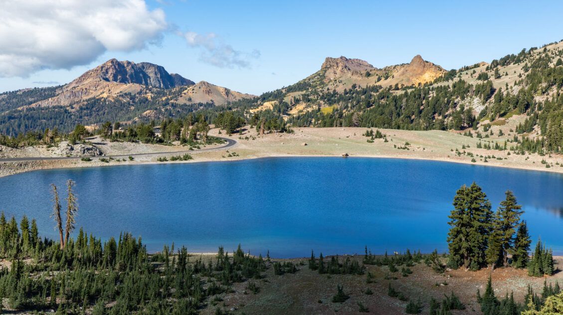
- Devils Kitchen: The second largest hydrothermal area in the park, Devils Kitchen is a much quieter alternative to Bumpass Hell. It’s a 4.2-mile round-trip hike through the Warner Valley Area, and we had the trail to ourselves when we hiked in September.
- Boiling Springs Lake: Also located within Warner Valley, this 3-mile trail leads out to a colorful lake complete with mudpots and steam vents. You can combine this hike with the trail to Devils Kitchen.

Devil’s Kitchen
If you have any questions about how to hike the Bumpass Hell Trail, let us know in the comment section below.
Plan Your Trip to Lassen Volcanic
Top 10 Hikes in Lassen Volcanic (+ Our Favorites)
In this guide, we will uncover the 10 best hikes in Lassen Volcanic, from popular trails to a few hidden gems. These are located along Highway 89 (the heart of the park) and in more remote regions such as Warner Valley and Butte Lake. Stroll through bubbling hydrothermal areas, summit volcanoes like Cinder Cone and […]
14 Best Things to Do in Lassen Volcanic National Park
In this guide, we will cover the best things to do in Lassen Volcanic National Park. Discover the best hiking trails, scenic drives, and a few hidden gems that are definitely worth your time. We’ll also provide information on where to stay, how to plan your time, and the ideal time of year to visit. […]
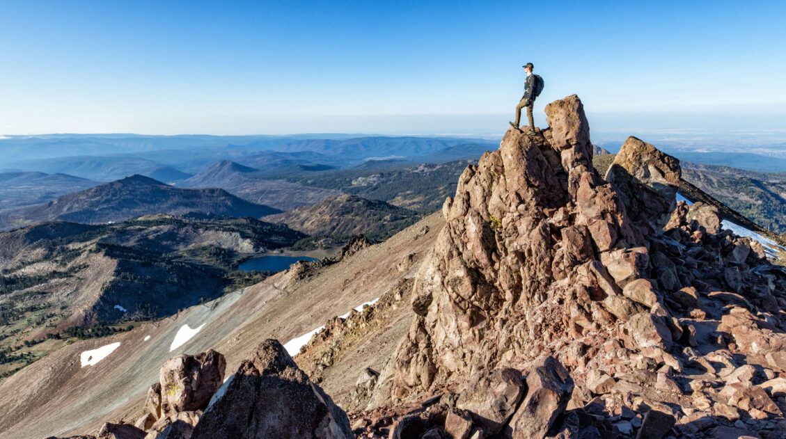
Lassen Peak Trail: Step-By-Step Trail Guide, Photos & Stats
The Lassen Peak Trail is not only one of the most popular hikes in Lassen Volcanic National Park, but it also leads to the tallest point in the park at 10,457 feet (3,187 meters). The trail to the top is just 2.4 miles one way, but with a steady ascent and high elevation, this hike […]
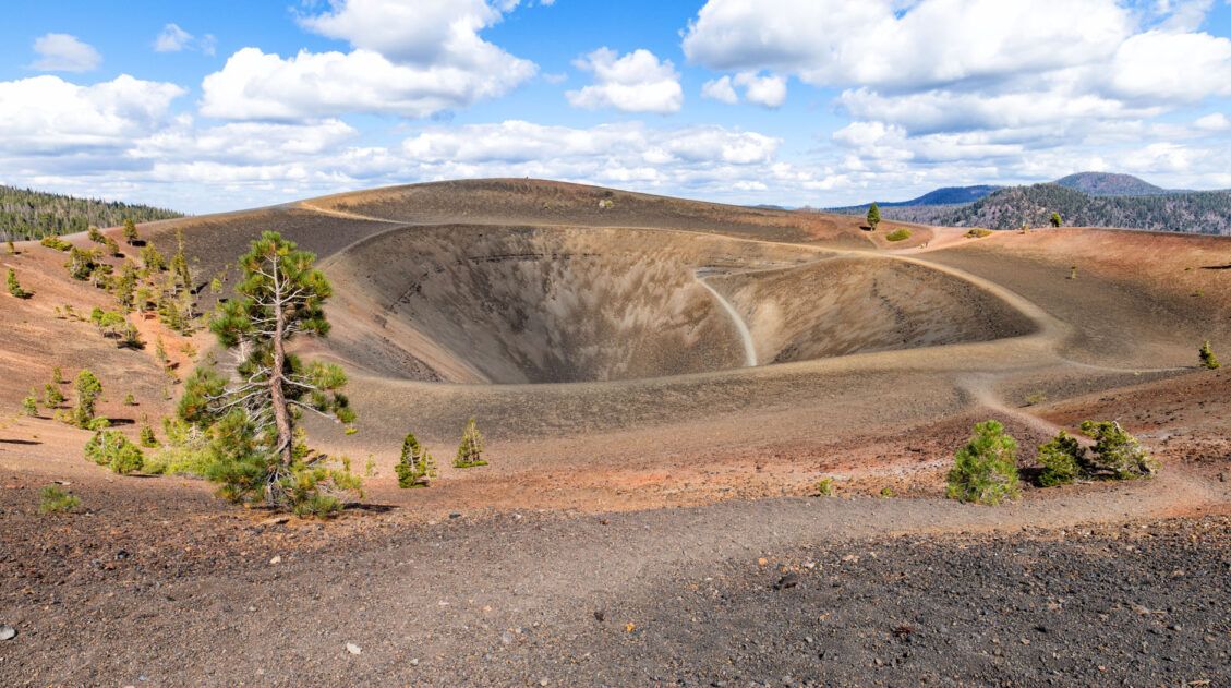
Cinder Cone Trail, The Coolest Hike in Lassen Volcanic
In Lassen Volcanic National Park, there’s no shortage of volcanoes to see. Highlights include the iconic Lassen Peak, massive lava rocks, and steaming hydrothermal features like Bumpass Hell. For a less crowded hike that highlights historic lava flows and offers sweeping views from an extinct volcano, put the Cinder Cone Trail on your list. This […]
The Ultimate Guide to Lassen Volcanic National Park
Lassen Volcanic National Park With steaming fumaroles, boiling hot springs, and volcanoes galore, Lassen Volcanic is an underrated gem amongst Californian national parks. Here you can hike to the summit of active volcanoes, wander through bubbling hydrothermal basins, and explore landscapes carved by lava flows. Lassen Volcanic is a paradise for hikers, photographers, and road […]
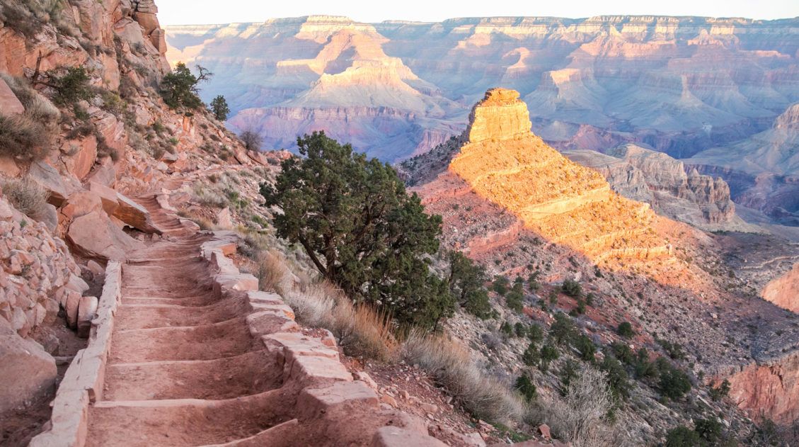
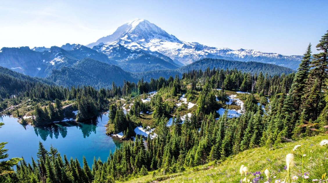
20 Fun, Short Hikes in the US National Parks
One of the best ways to experience the national parks is from a hiking trail. Hike to amazing viewpoints, deep into the forests, through scenic canyons, and to hidden lakes and waterfalls. Along the way, you have a better chance of spotting wildlife and potentially leaving the crowds behind. Here are 20 fun, short hikes […]
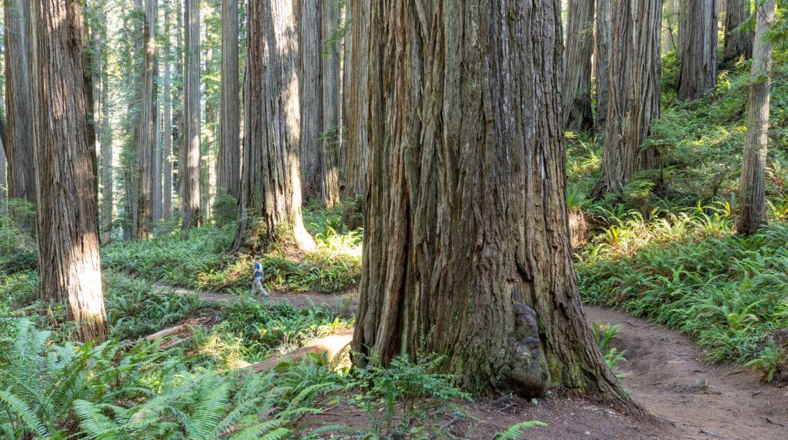
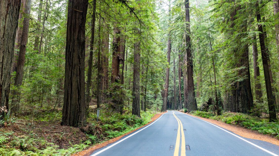
5 Amazing Things to Do in Jedediah Smith Redwoods State Park
Jedediah Smith Redwoods State Park is our favorite of the Redwood National and State Parks. In this guide, we’ll share our must-do hikes and scenic drives, plus how to see the best of the park with a one day itinerary. Jedediah Smith Redwoods is one of the four parks that make up Redwoods National and […]
California Travel Guide: Places to Visit in California
California Travel Guide California is home to some of the world’s tallest trees, breathtaking mountains, stunning desert landscapes, gorgeous beaches, and bustling cities. There are countless adventures worth having here, whether it be wine-tasting in Napa, hiking to the top of Half Dome, or exploring its long list of national parks. California is a favorite […]
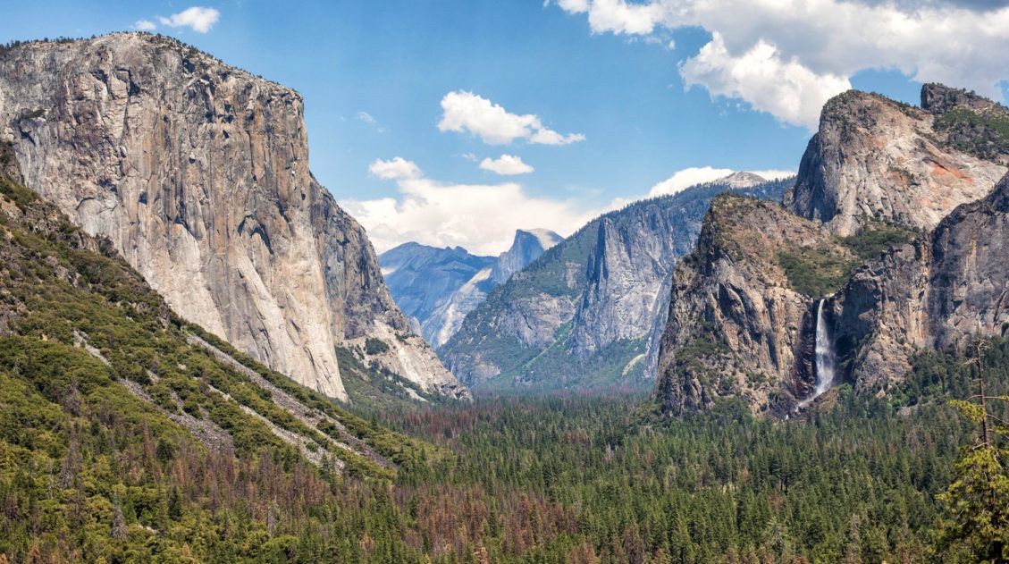
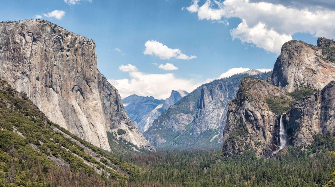
30 Epic Things to Do in Yosemite for First-Timers
Yosemite National Park is packed with famous landmarks, awesome hikes, and breathtaking views. If you are planning your first trip to Yosemite, how do you know what to do? I am a big fan of lists (and photos!). In this post, I list the best things to do in Yosemite: the best landmarks to visit, […]
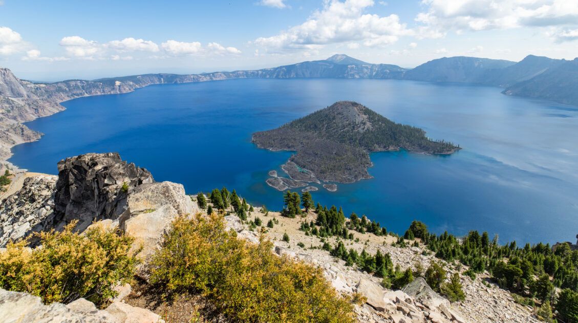
16 Best Things to Do in Crater Lake National Park
Discover the best things to do in Crater Lake National Park, including its top viewpoints, scenic drives, and hiking trails. One day is enough to see the highlights, but more time allows you to hike another trail or two. Home to the deepest lake in the United States, Crater Lake amazes visitors every year with […]
Best US National Parks to Visit Month-By-Month
Best National Parks to Visit Month-By-Month When planning a trip to the national parks, one of the most important things to consider is the time of year that you are planning your visit. With a few exceptions, most national parks have an optimal time to visit, based on factors such as weather, crowd levels, and […]
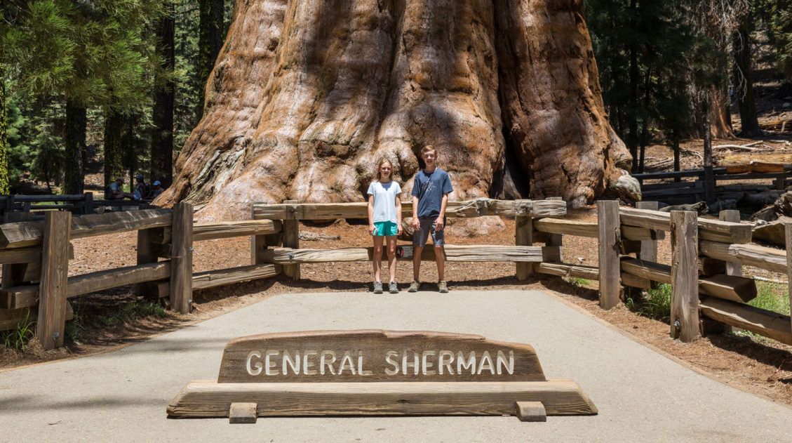
One Day Itinerary for Kings Canyon and Sequoia National Parks
Kings Canyon and Sequoia National Parks sit side by side in central California. Filled with alpine peaks, deep canyons, and the largest trees in the world, you could spend several days here. However, if you only have one day, you have just enough time to visit the highlights of both parks. We visited Kings Canyon […]
Our 15 Favorite US National Parks: A Few May Surprise You
Stretching from the South Pacific, across the United States and into the Caribbean, are 63 national parks. These national treasures are filled with scenic drives, hundreds of miles of hiking trails, wildlife, historic sites, and endless opportunities for adventure. In this guide, we cover 15 of the best national parks in the USA and what […]
Avenue of the Giants: Best Things to Do, Photos & Helpful Tips
Discover the best things to do along the Avenue of the Giants, complete with a map and photos. The Founders Grove is not to be missed, but you can also drive through a redwood tree and go off the beaten path, walking quieter, lesser-known trails through the old-growth forests. Avenue of the Giants is one […]
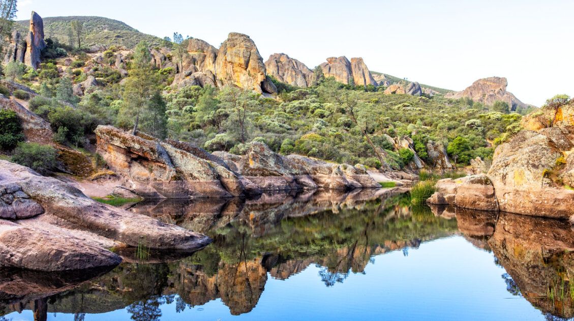
Best of Pinnacles: 5 Thrilling Things to Do in Pinnacles National Park
Pinnacles National Park is one of the smallest and least visited national parks in the United States. The list of things to do in Pinnacles National Park is relatively short and unexpectedly awesome. We loved this park, with its thrilling, unique hiking trails, its gorgeous reservoir and caves, and a chance to spot California Condors. […]
The Ultimate Guide to the 63 US National Parks
Stretching from the South Pacific, across the United States to the Caribbean, are 63 national parks. These national treasures preserve iconic landscapes, majestic mountains, primordial forests, arid deserts, misty coastlines, immense canyons, wildlife, and historic landmarks. The opportunities for adventure are endless. Hiking, rock climbing, rafting, mountain biking, sand boarding, horseback riding, mountaineering, canyoneering, and […]

Leave a Comment