
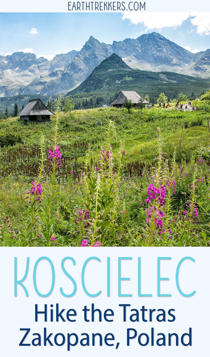
Zakopane is Poland’s gateway city for exploring the mountain range known as the Tatras. From Zakopane, you can take your pick from quick, easy hikes to longer all day affairs that have you climbing among the tallest mountain peaks. We hiked to the summit of Koscielec, one of many options if you are looking for a full day hiking trip into the mountains.
This was not the hike we originally planned to do. We planned to hike up Swinica via the Zawrat Saddle, but we learned halfway into the hike that the saddle was closed. This left us scrambling for another option and that’s when we stumbled upon Koscielec.
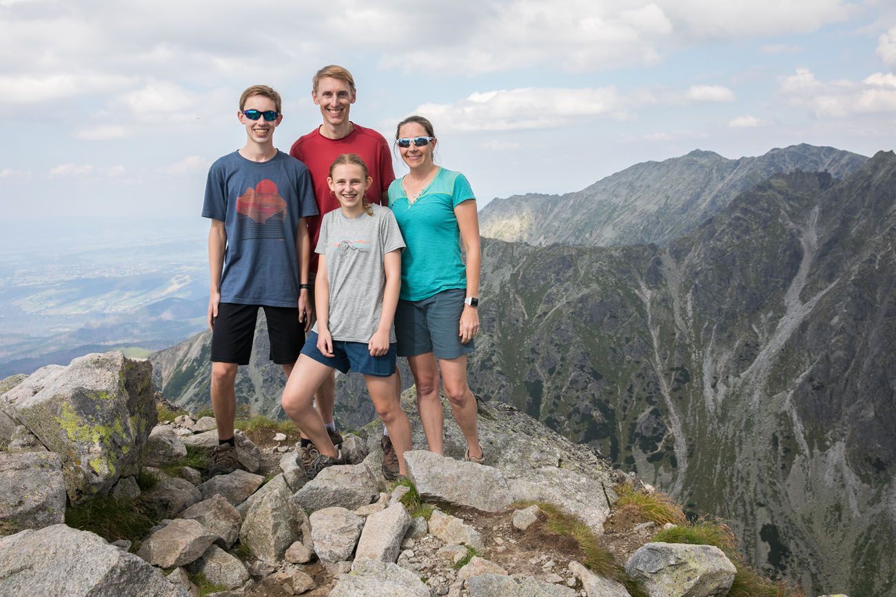
Even though Koscielec was not in the plans for the day it still turned out to be a brilliant day. From the summit of Koscielec we were treated to amazing views across the Polish Tatras and even into Slovakia.
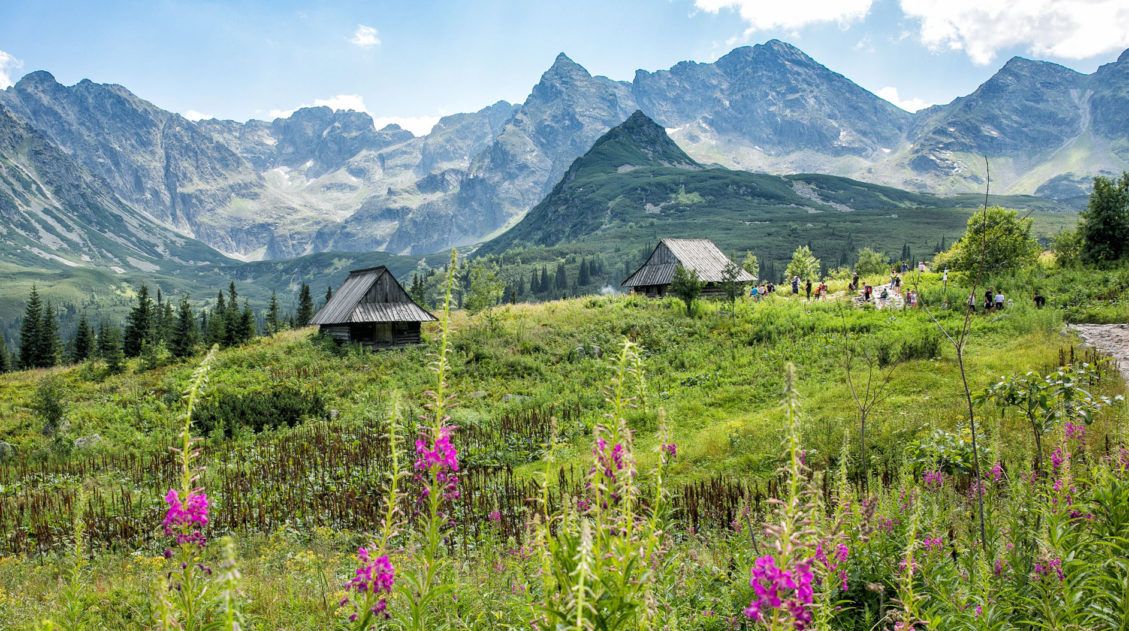
Wooden mountain huts, emerald green lakes, wildflowers and rocky mountain peaks…get ready to explore the Tatras!
How to Hike to Koscielec in the Polish Tatras
Koscielec Hiking Stats
Distance: 18 km (11.2 miles) out-and-back
Total Ascent: 1310 meters (4300 feet)
Difficulty: Strenuous
Length of Time: 8 to 10 hours
When to go: mid-June to September

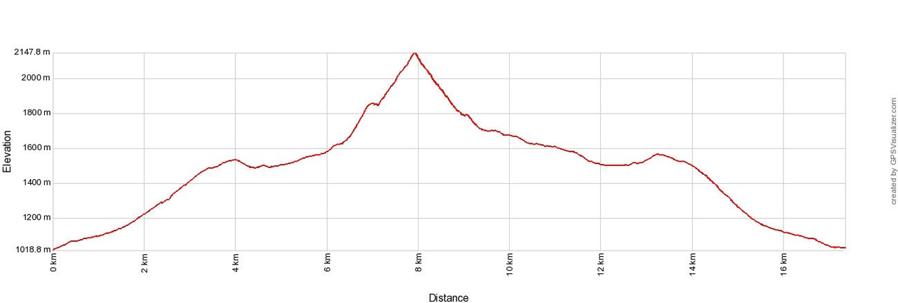
The elevation profile of the hike if you hike up Koscielec and then return to Zakopane by hiking through the Valley of Three Lakes (as described in this post).
An Overview of the Area
If you are unfamiliar with the Polish language, as we are, a lot of Polish names seem complicated and impossible to pronounce. We also had no general idea of the basic layout of the Polish side of the Tatras. To help you out, here is a map of where you’ll be going, so when I mention these names, you’ll know what I’m talking about.
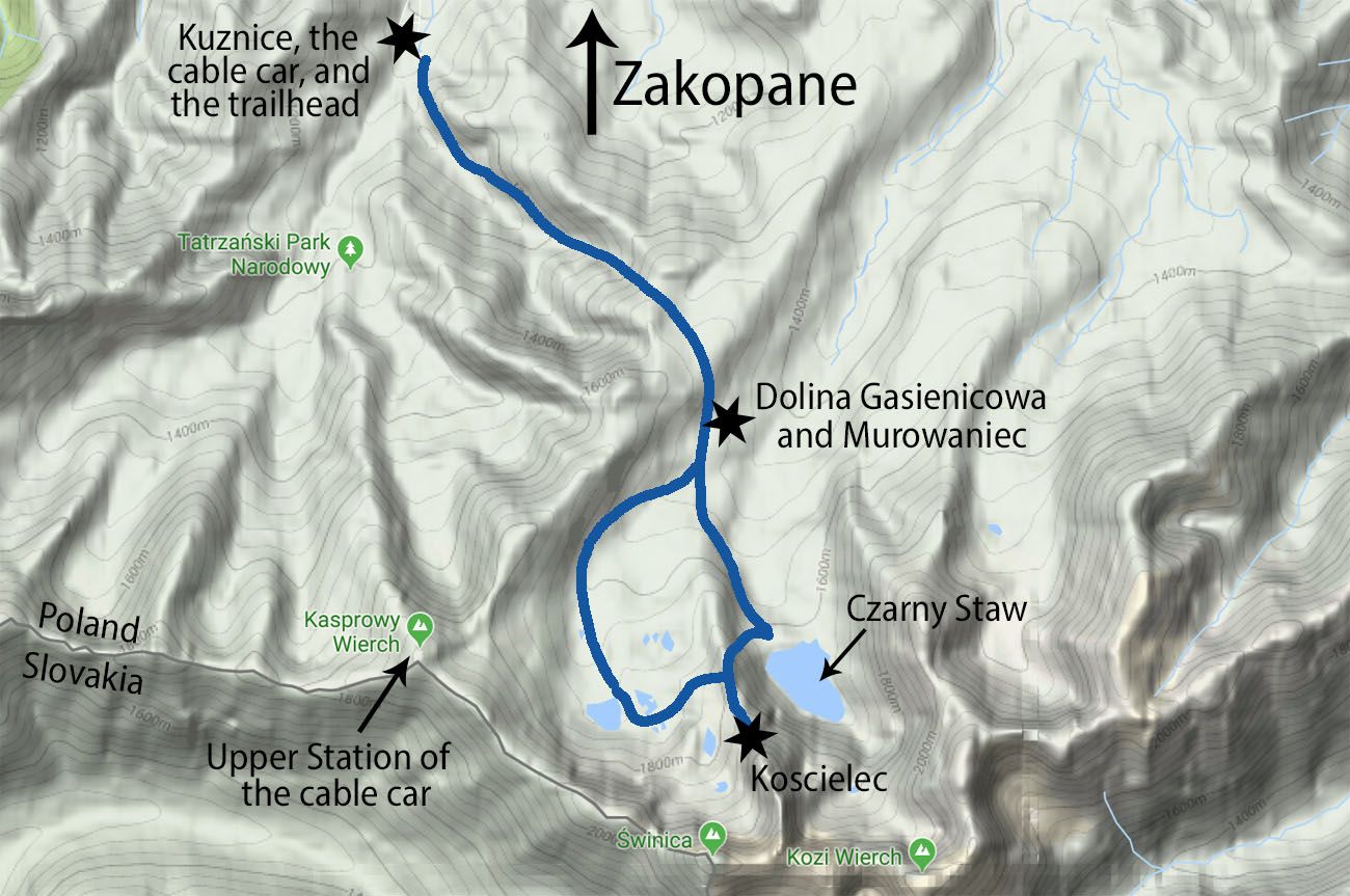
Kuznice is the area where you will find the lower station of the Kasprowy Wierch cable car. There is also a restaurant and a few small shops here.
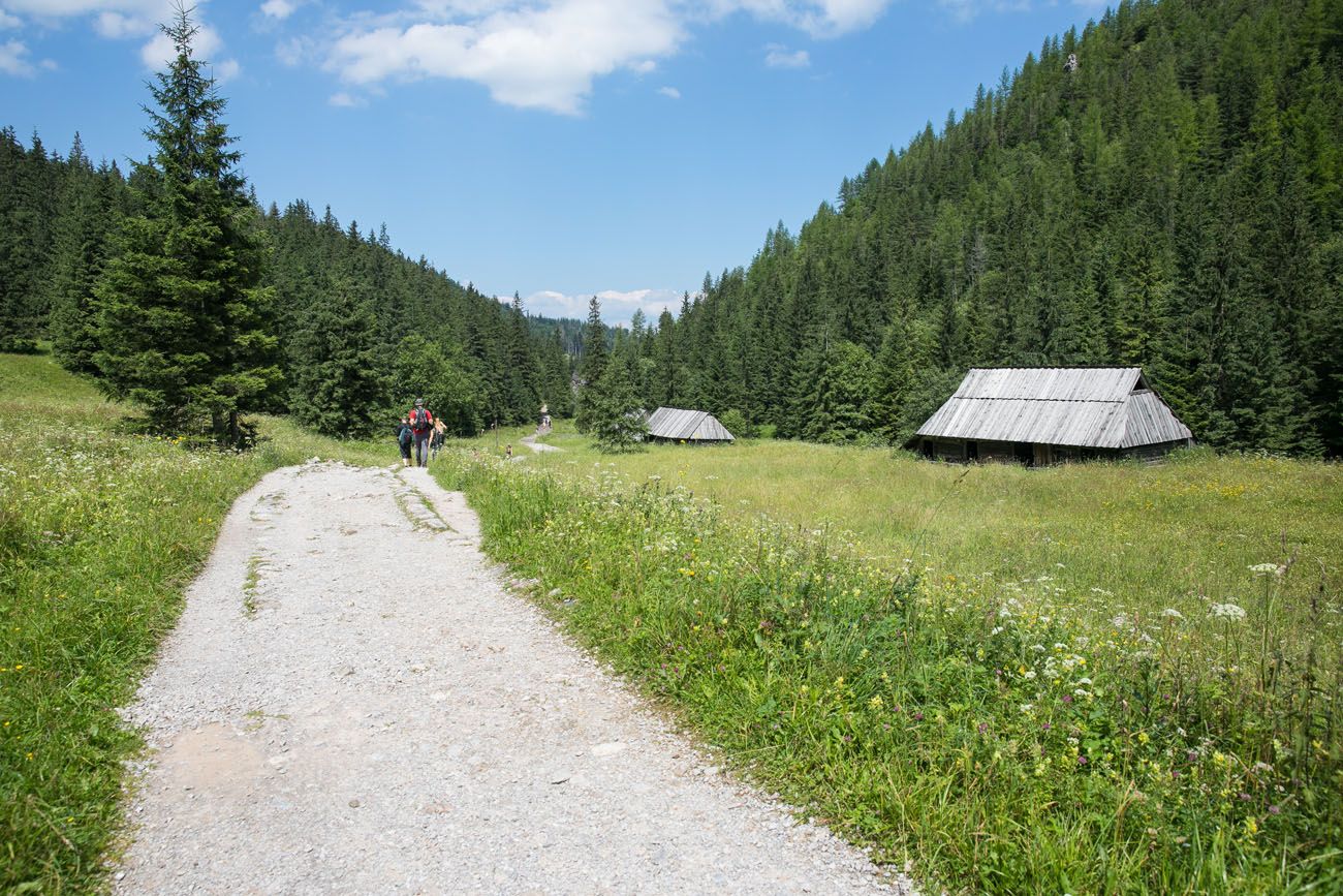
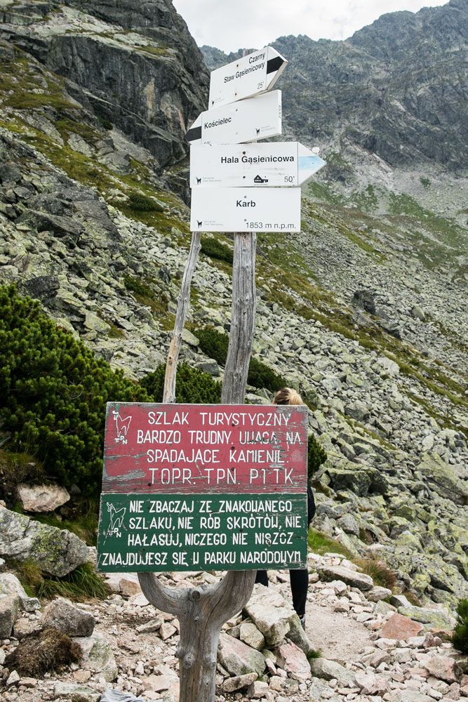
Dolina Gasienicowa is a valley that you will hike through. It is here that you will find Murowaniec, a large building that serves as a restaurant and a lodge to spend the night. The trail markers also refer to this area as Hala Gasienicowa.
Staw is Polish for pond or lake. On this hike, you will see several staws: Czarny Staw, Dlugi Staw, and Zielony Staw.
Parking in Zakopane
The trail to Koscielec is located near the cable car station for Kasprowy Wierch (Kolej linowa Kasprowy Wierch on Google Maps). Finding parking near this cable car station is almost impossible. Instead, you will have to park in town or on the road leading to the cable car station.
There is a road that leads from the city center of Zakopane to the cable car station. Along this road are several parking lots. If you get here early, you can park in one of these lots and then walk up the road to the trailhead.
If you get here later in the day, like us, the closer lots most likely will be filled. You will have to park in one of the parking lots in the center of Zakopane. From the lot, you can pay a few zloty to take a taxi or shuttle up to the cable car station. It’s just a five-minute drive one way, and taxis seem to come and go all day.
The Trailhead
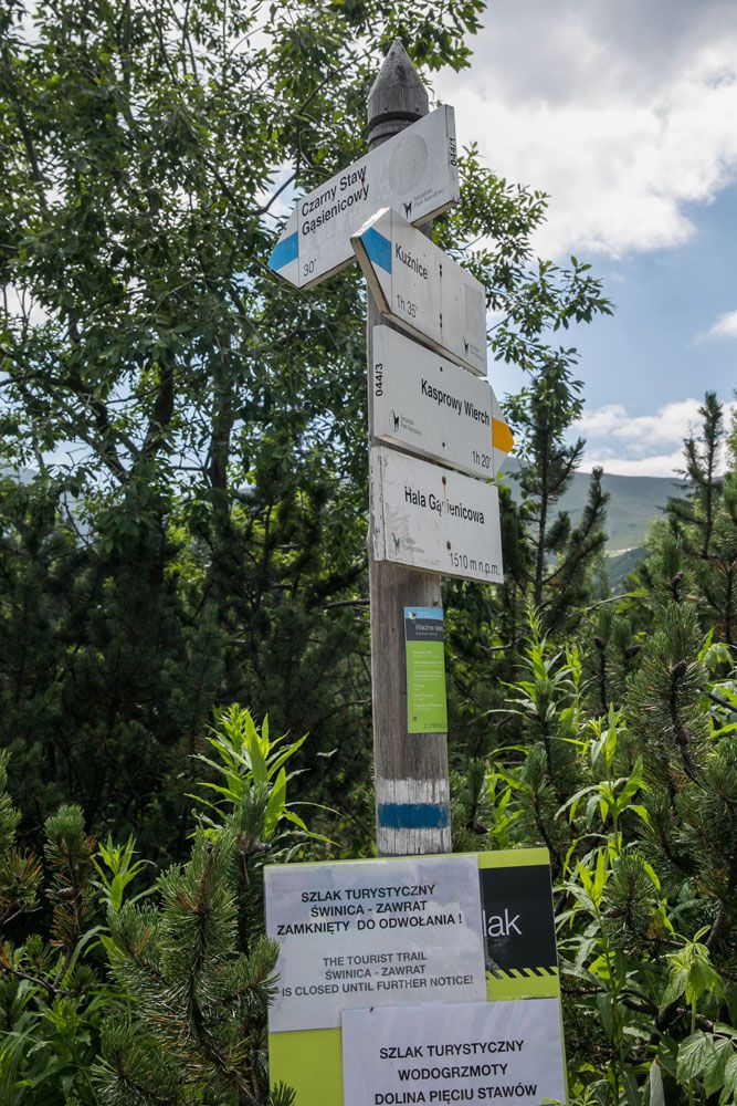
Finding the right trailhead can be one of the trickiest parts of the day. There are numerous trails that head into the mountains near the cable car station.
The first part of the hike is from Kuznice to the Murowaniec shelter in Dolina Gasienicowa. To get to the shelter, you can take the blue trail or the yellow trail.
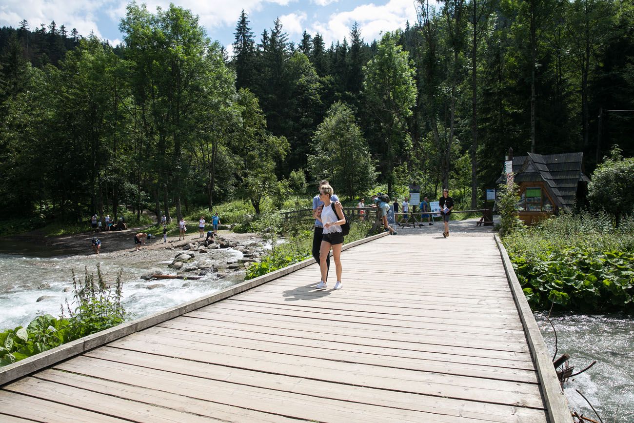
We took the yellow trail. When you are in Kuznice, stand with the cable car station at your back and walk away from the station, along the road Szlak pieszy niebieski. You will cross a wide, wooden bridge and at the small hut you will have to pay 5 zloty per person to hike the trail.
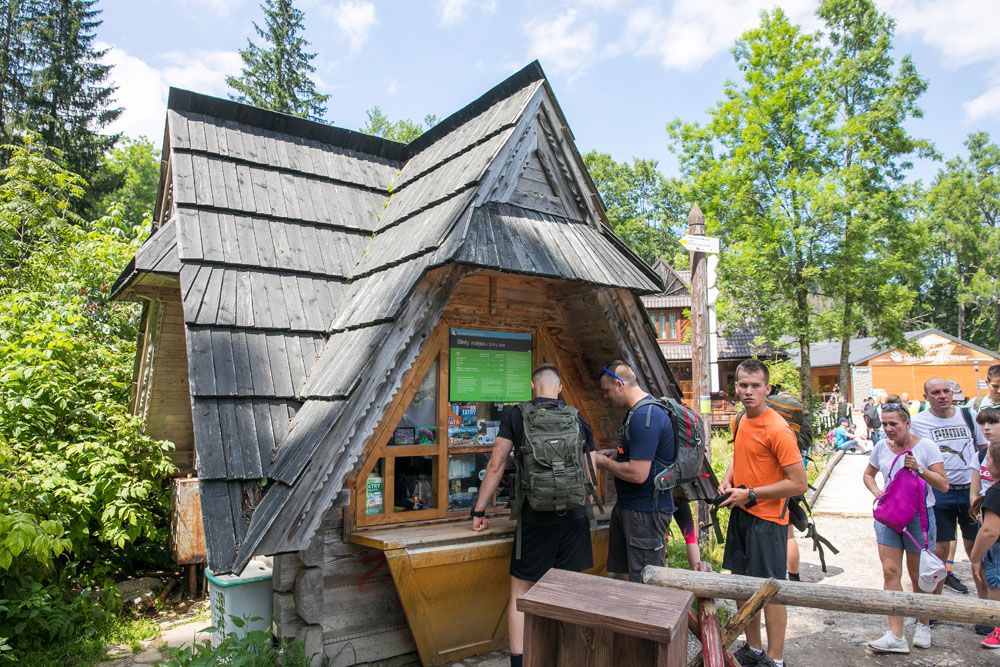
At the hut, turn right to get started on the trail, following the signs and the yellow trail marker to Hala Gasienicowa.
Hiking to Murowaniec
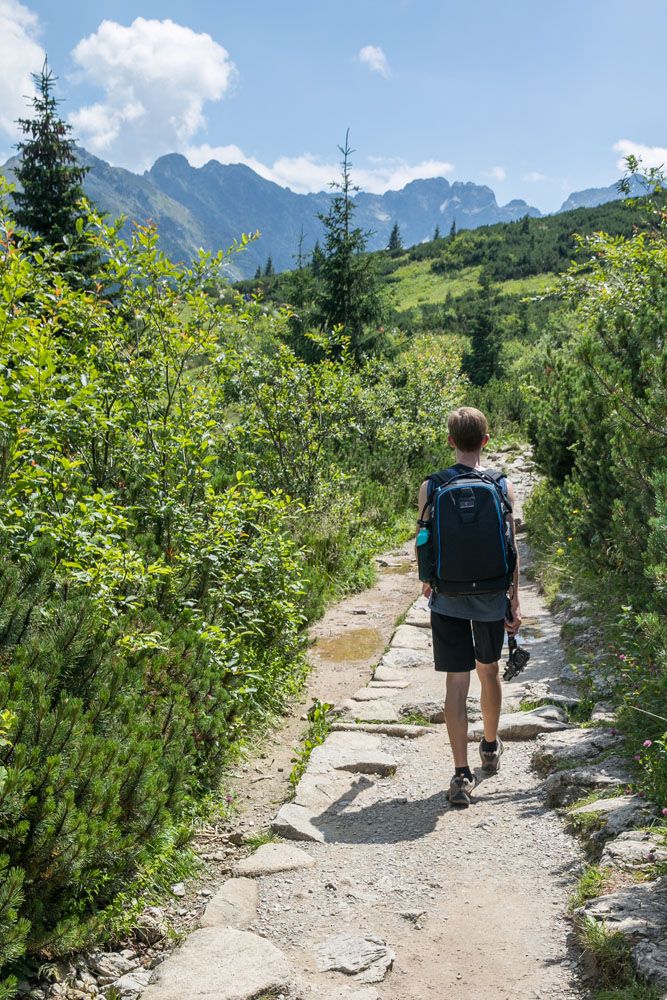
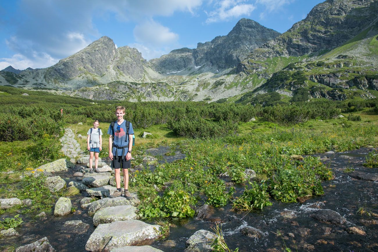
At first, it’s a steady, uphill climb through an alpine forest. At times the forest opens up and you are treated to views of meadows, wildflowers, and a few mountain huts.
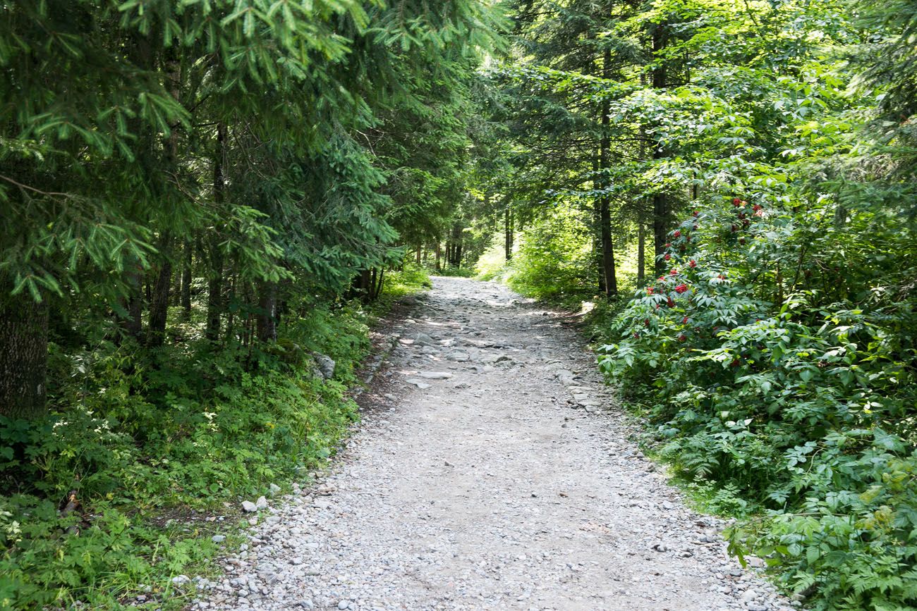
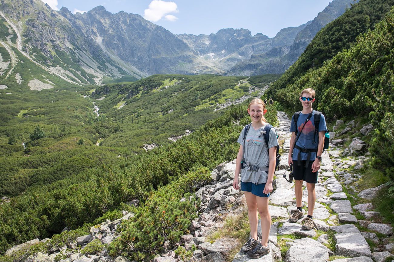
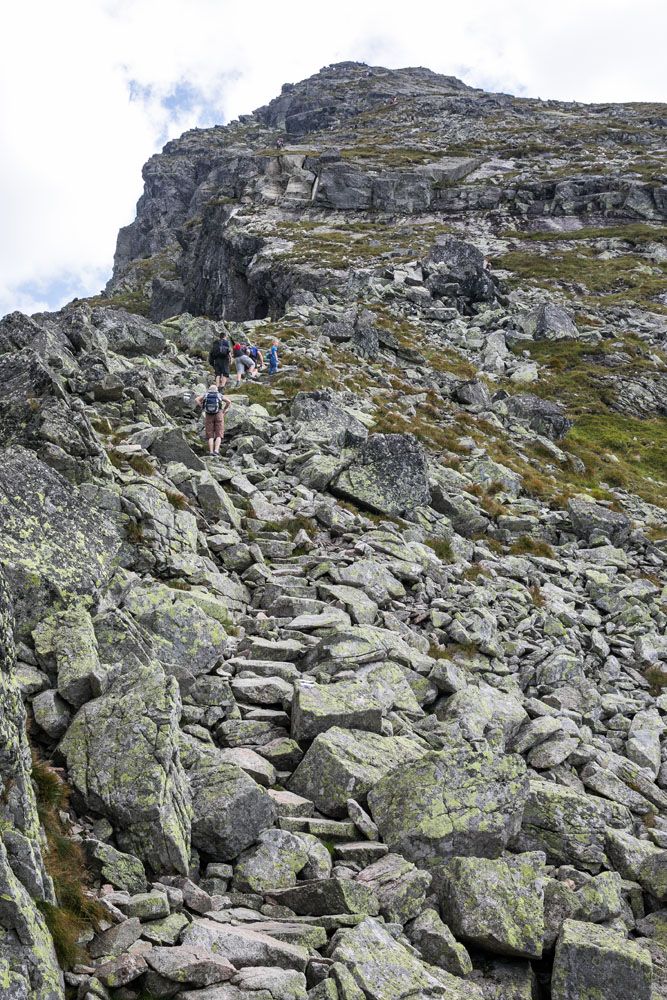
The trail becomes a series of stone staircases and rocky hiking trails.
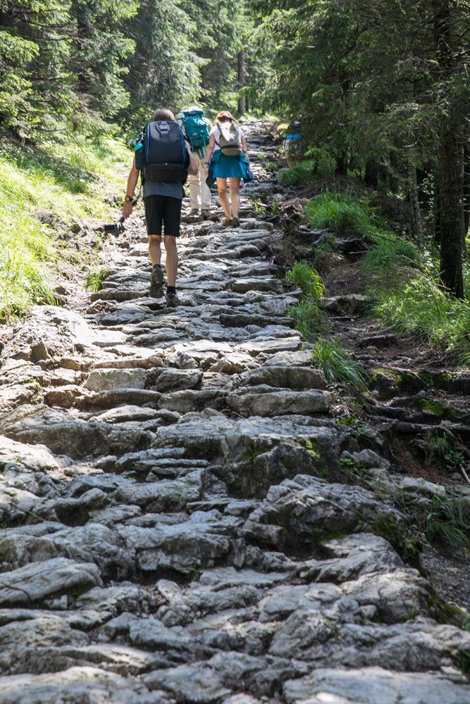
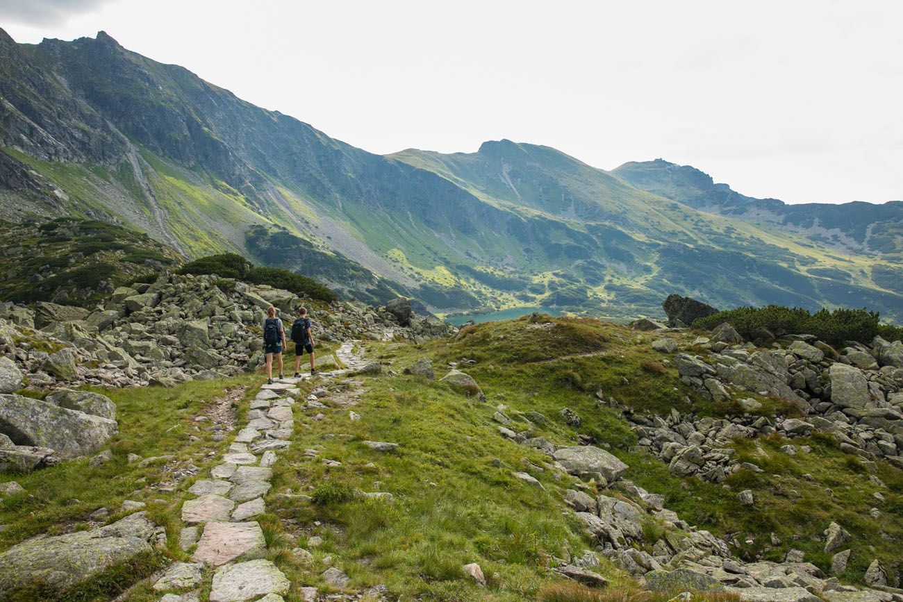
Along the way, the yellow and blue trails merge and now you will be hiking on the blue trail. Continue to follow the signs for Hala Gasienicowa. It’s also at this point that the views really open up.
Looking back to Zakopane
One of my favorite views of the entire hike was the view of the trail leading to the cabins in Dolina Gasienicowa with the rocky mountains as a backdrop. Gorgeous!
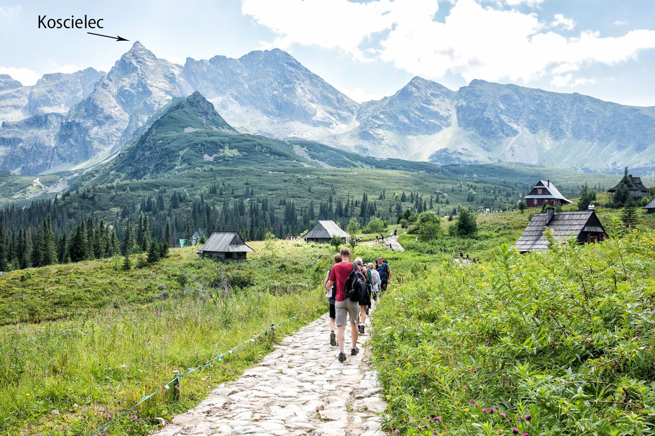
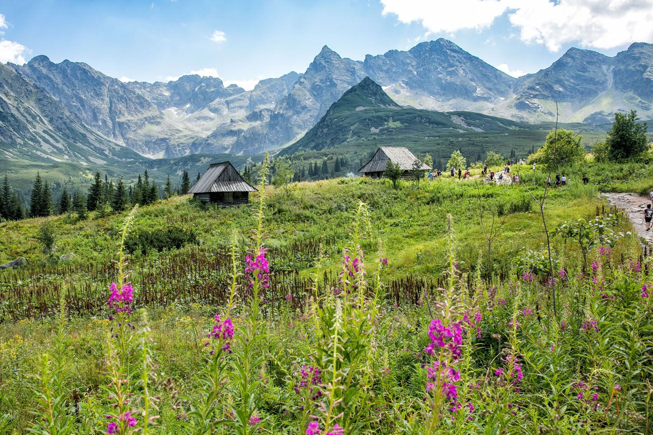
Murowaniec is a shelter located in the valley of Dolina Gasienicowa. You can stop here for food or water if you need it. If you brought food, save it for Czarny Staw, a picture perfect lake and a great spot for a picnic.
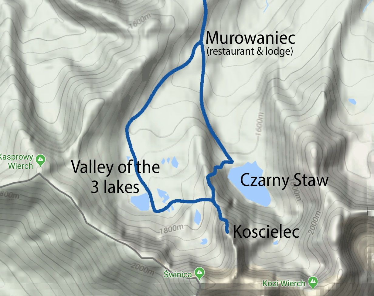
Hiking trail from Murowaniec to Czarny Staw, Koscielec, and the valley of the three lakes.
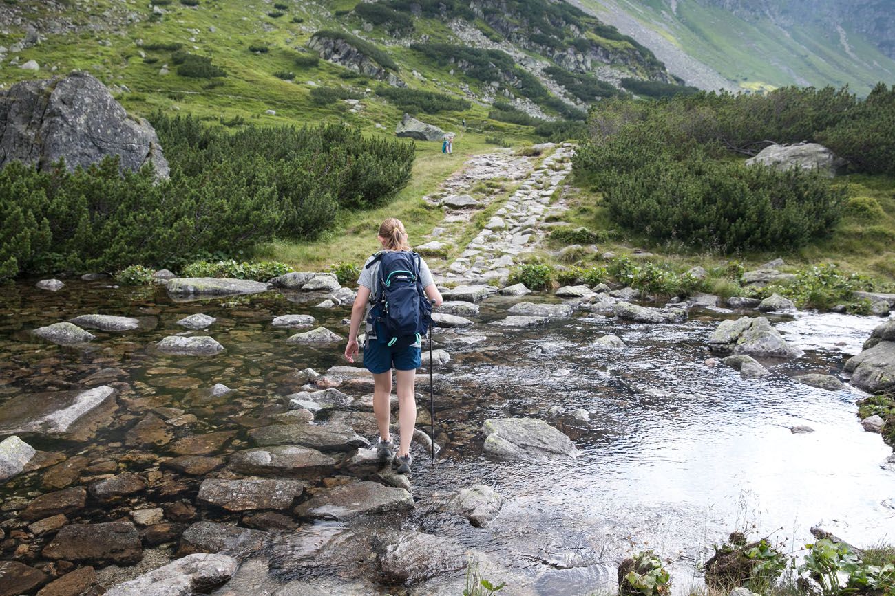
Hiking to Czarny Staw
Czarny Staw is an emerald green, alpine lake located higher up in the mountains. To get here from the valley of Dolina Gasienicowa, it’s a short, easy walk (about 35 minutes of walking).
Not too far past Murowaniec the trail forks again. It was here that we learned that the Zawrat Saddle was closed, forcing us to change our plans. It was a huge disappointment at the time. At this fork in the trail, stay to the left to continue on the blue trail to Czarny Staw.
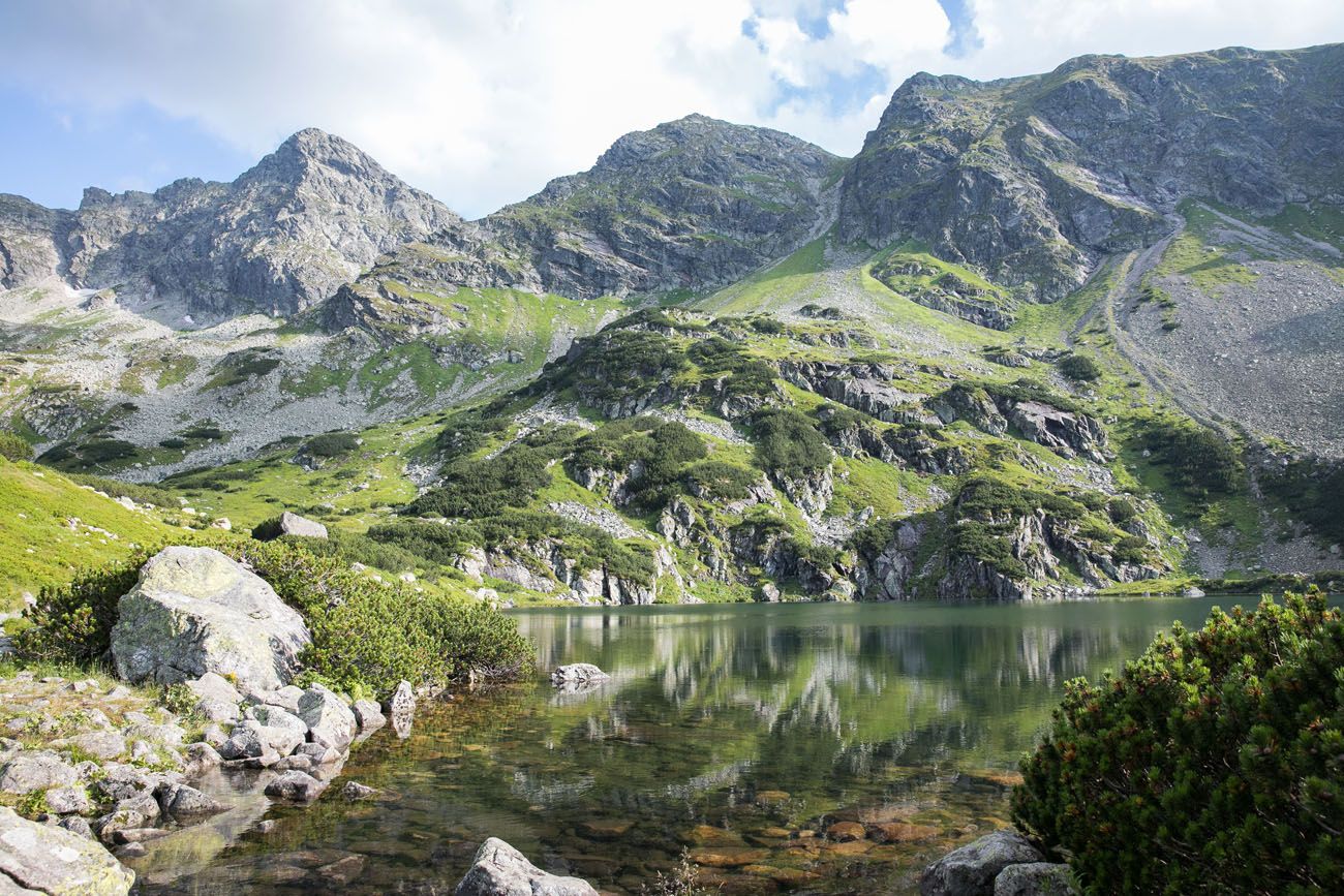
The shore of the lake is the perfect spot for a snack or a picnic lunch. One of the tallest peaks in front of you is Swinica. You can also see the pointy peak of Koscielec. Koscielec does not have quite the same height as Swinica, but it’s still a hefty climb to the top.
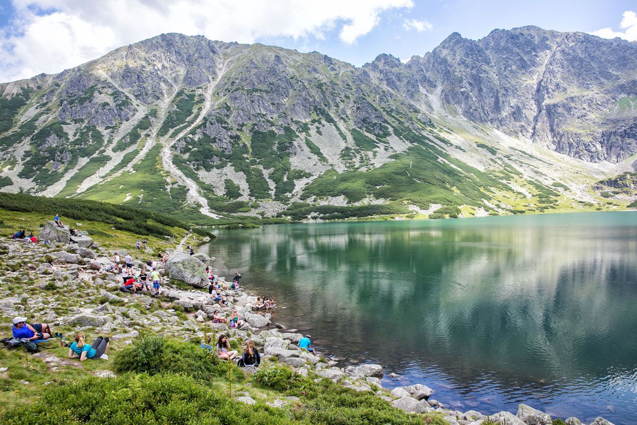
Czarny Staw
If the Zawrat Saddle is open and you want to continue on to Swinica, you will walk left around Czarny Staw and then head up the rocky trails into the mountains on the far side of the lake.
The Hike up Maly Koscielec
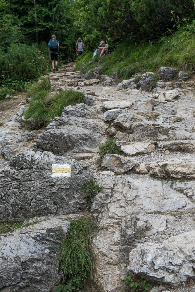
If you want to continue on to Koscielec, you will take the trail up to the right. What awaits you is a short but very steep climb up Karb (the pass to the top of Maly Koscielec) to the top of Maly Koscielec. It takes about 40 minutes to hike to the top and you are now on the black trail.
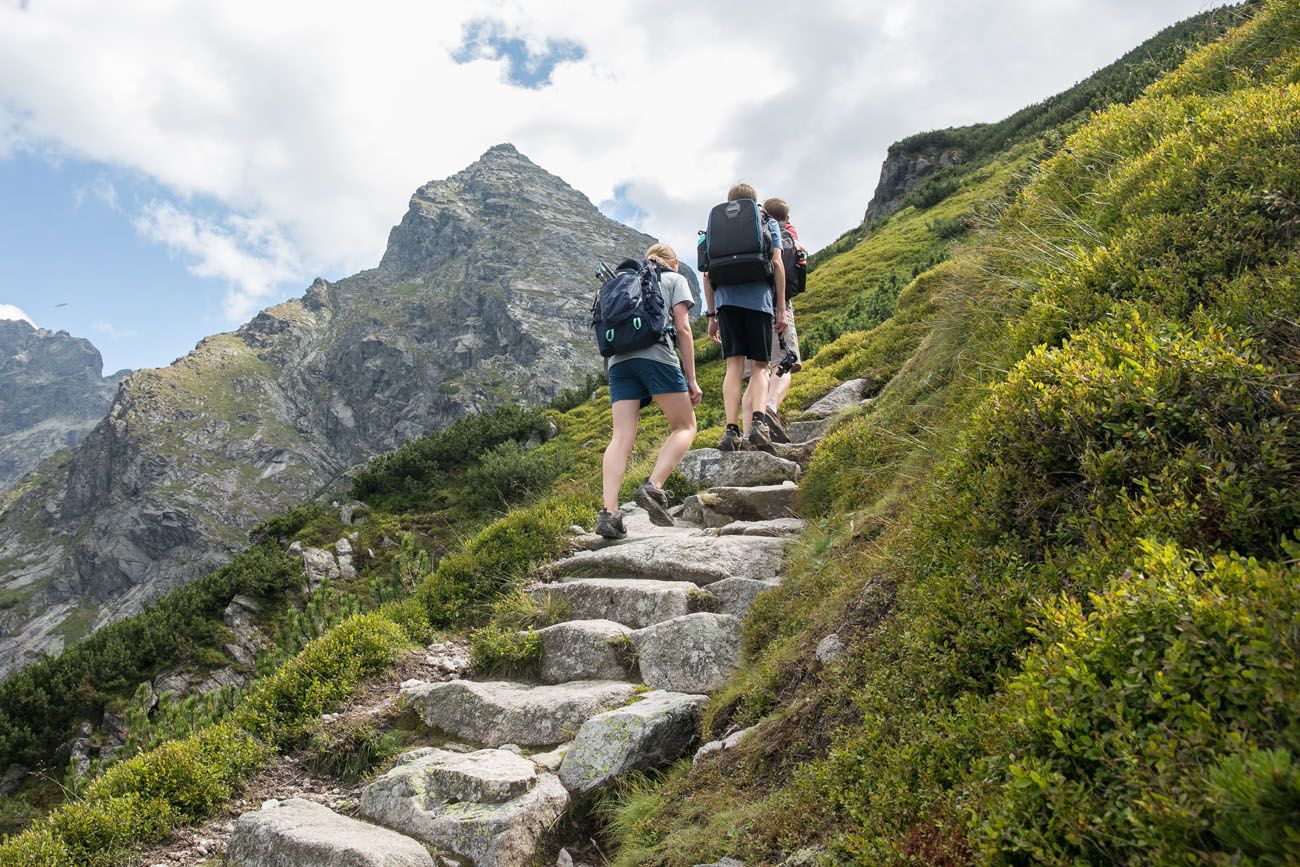
This is a strenuous climb and a nice warm up for Koscielec. If you think this is too difficult, then forget about Koscielec. The climb up Koscielec is harder and longer than the climb up Maly Koscielec.
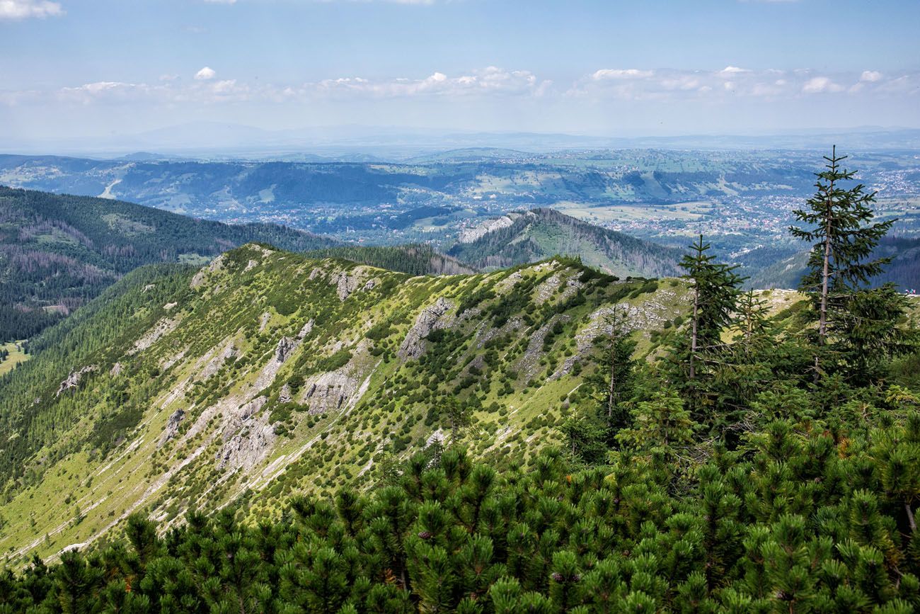
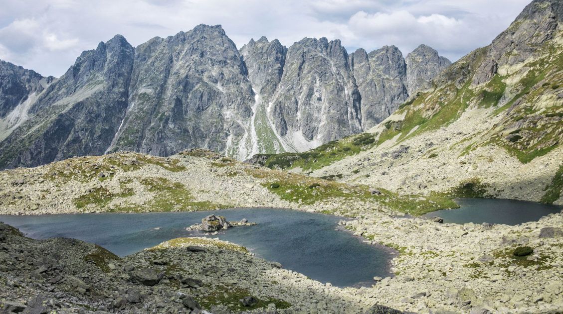
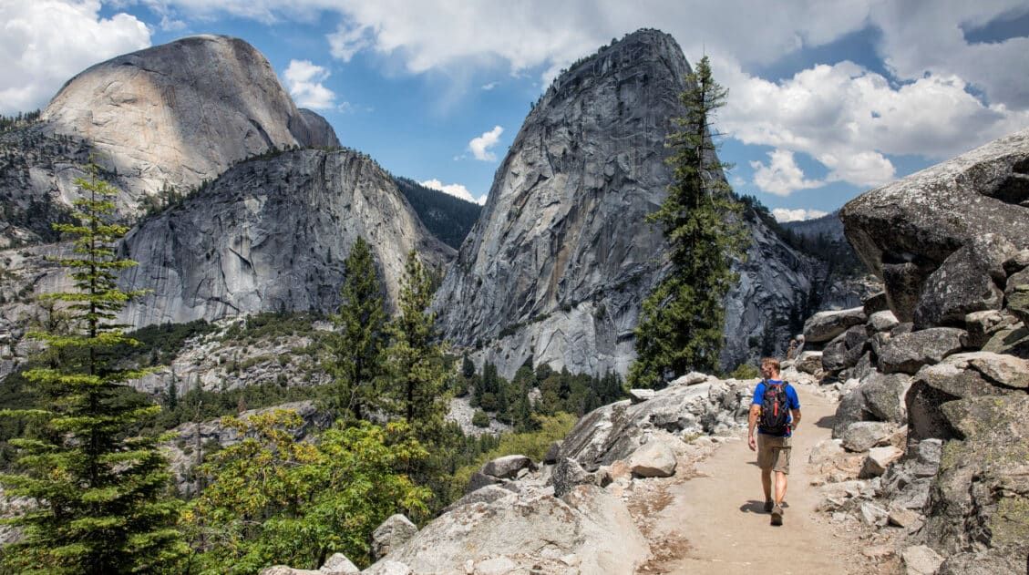
From the top of Maly Koscielec you get one of the best views of the day, so far. To your left is Czarny Staw. To your right are more alpine lakes, Dlugi Staw, Kurtkowiec, and Zielony Staw. In front of you is the pointy peak of Koscielec and behind that is Swinica. If you look way off into the distance to the west you will be able to see Kasprowy Wierch and the upper cable car station.
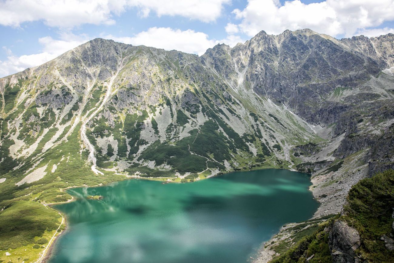
View of Czarny Staw from Maly Koscielec
Koscielec is the rocky peak in this photo.
Hiking Koscielec
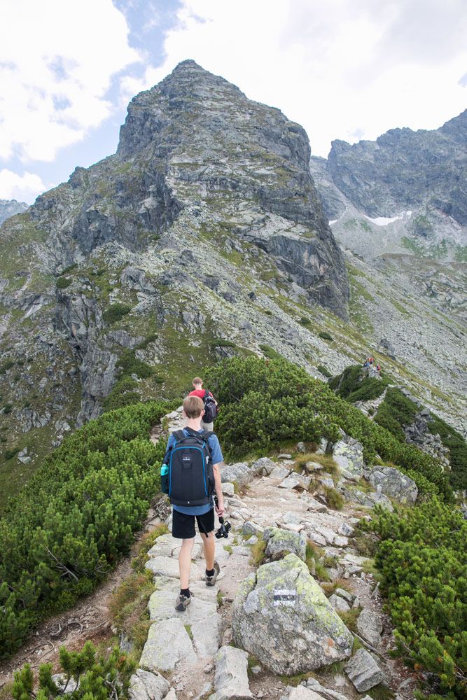
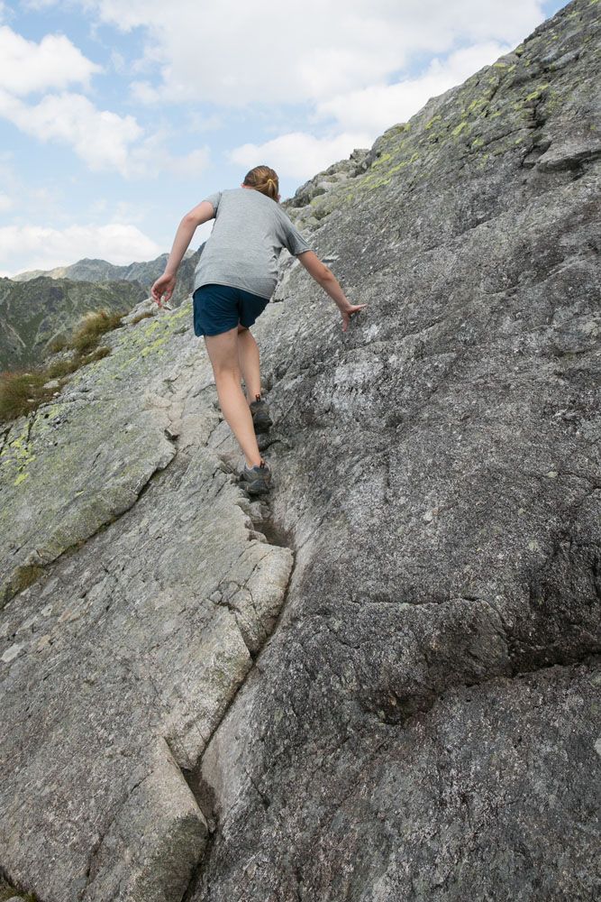
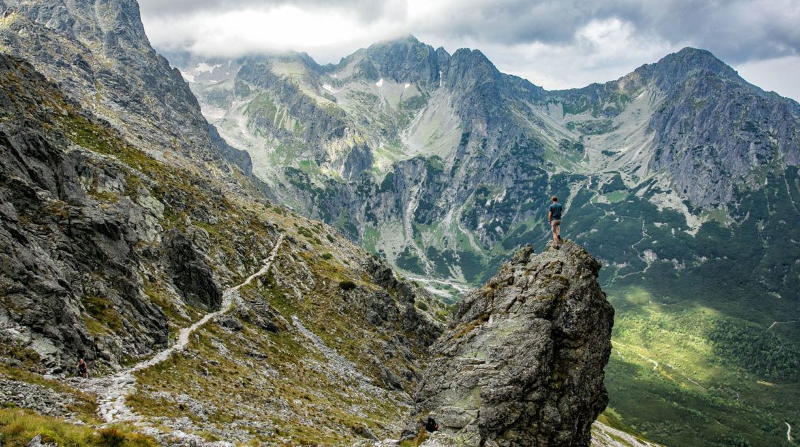
From Maly Koscielec, it’s a 50-minute challenging climb to the summit of Koscielec.
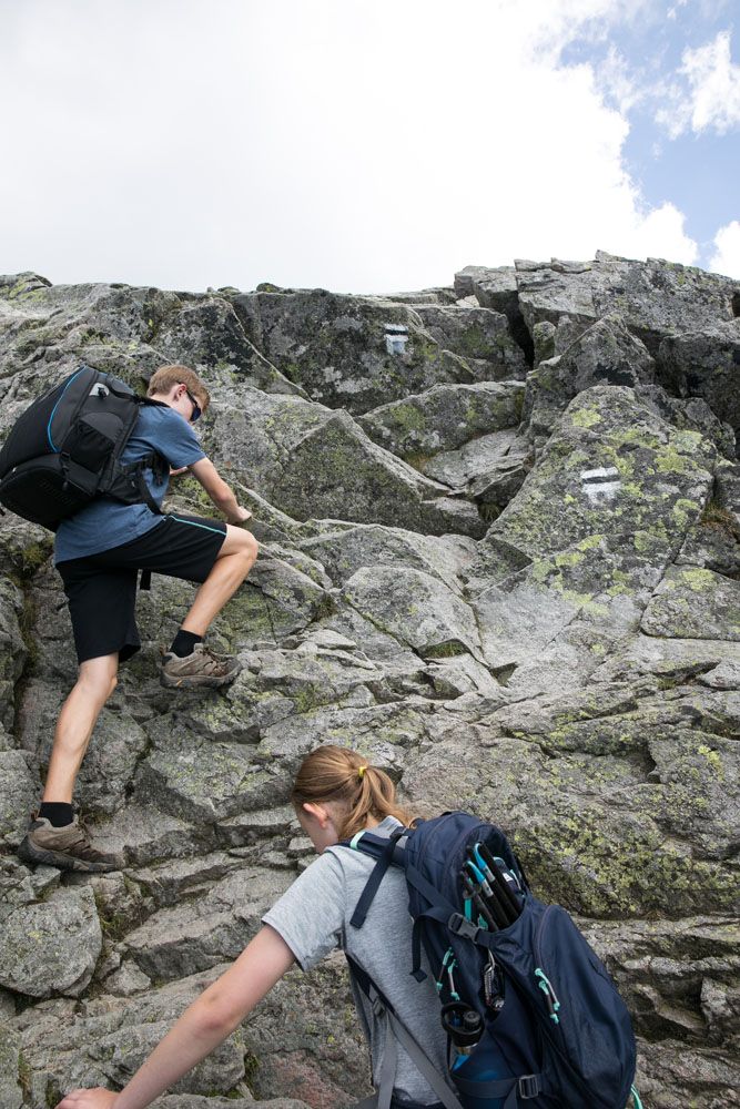
From the bottom, it looks like a steep, exhausting climb to get to the top. This is basically the climb to the summit of Maly Koscielec via Karb on steroids.
Be prepared to take breaks. Along the way, there will be short sections of rock scrambling. There is a lot of exposure on this part of the trail so if you have issues with heights, you may want to end your day on top of Karb.
The climb feels exactly how it looks…grueling. There is nothing fun about this part of the hike other than the short sections of rock scrambling. But it’s worth it for the view from the top.
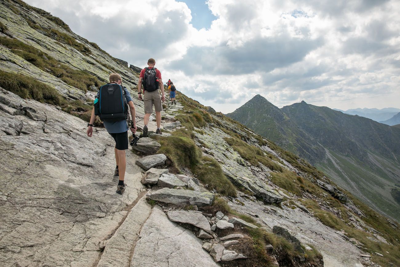
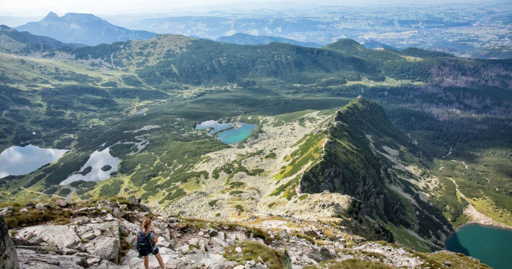
The climb to the top of Koscielec is absolutely worth it. It’s similar to the view from Karb, only now you are much higher. From here, you get a better view of Swinica and the mountains on the Slovakian side of the Tatras.
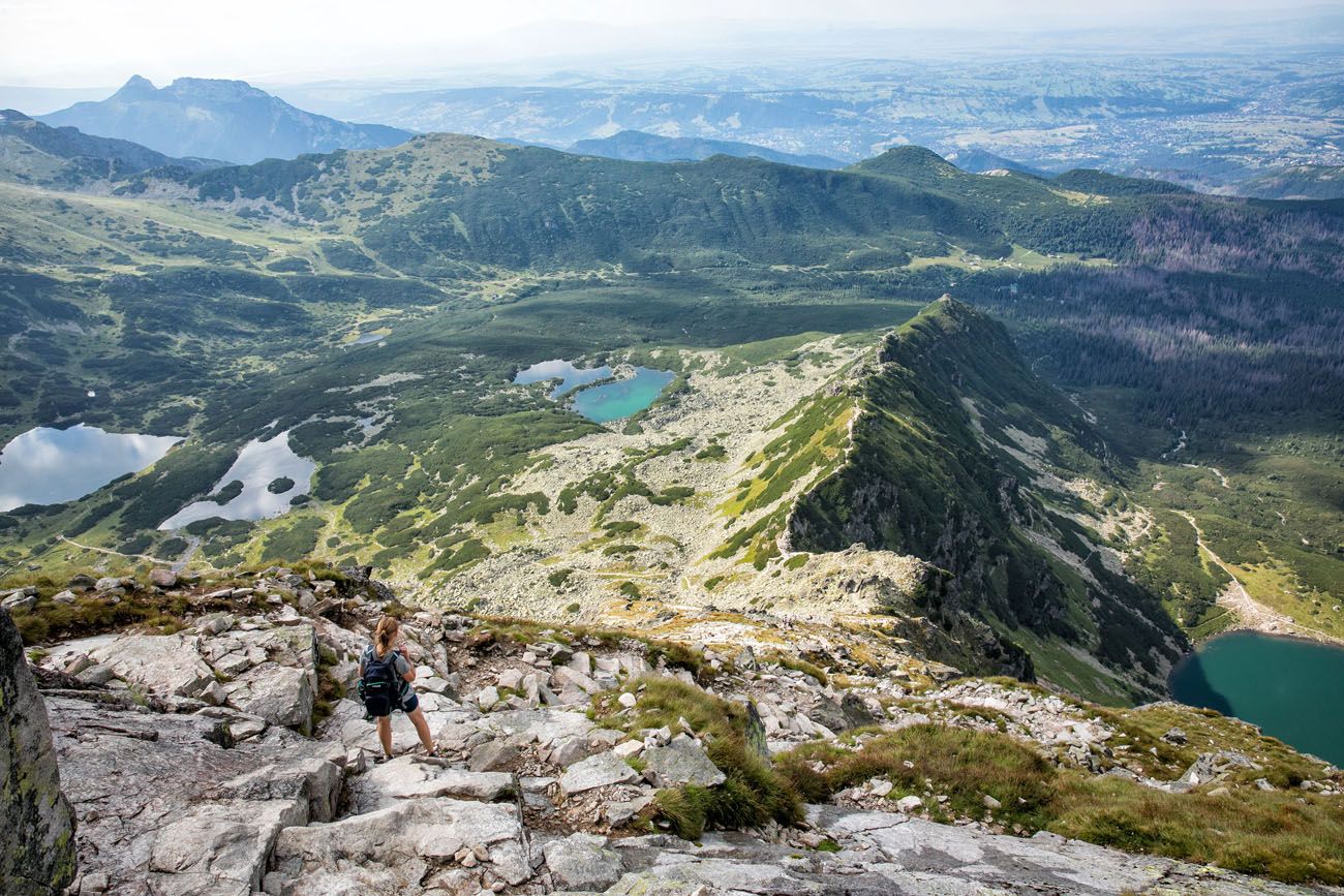
The view from Koscielec. You can see the three lakes on the left, Czarny Staw on the right, and Zakopane off in the distance.
The trail ends here. There is no safe way to continue towards Swinica and the Slovakia Tatras, at least not that I saw.
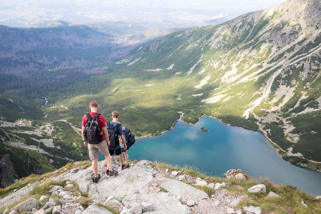
After you descend back down to Karb, you have a choice. You can hike back to Kuznice the same way you came or you can hike down past the three lakes in the valley next to Karb. Just for a change in scenery, we chose to hike to Dlugi Staw and the other emerald green lakes.
Zielony Staw
The hike back to Dolina Gasienicowa is quick, easy and beautiful. We refilled our water bottles at the Murowaniec shelter before hiking the rest of the way back to Kuznice.
Alternate Ending to the Hike
It is possible to return to Kuznice on the cable car. From Dolina Gasienicowa, you can hike the yellow trail for one hour to Kasprowy Wierch and the upper cable car station. This saves you about an hour of hiking back down the mountain to Kuznice. But there is a chance you’ll have to wait in line at the upper station.
On the day we did this, the line at the lower station was insanely long and we were worried we’d be waiting hours to take the cable car down the mountain.
If you like the idea of taking the cable car down to Kuznice, make sure you know the closing time for the cable car before you hike up there.
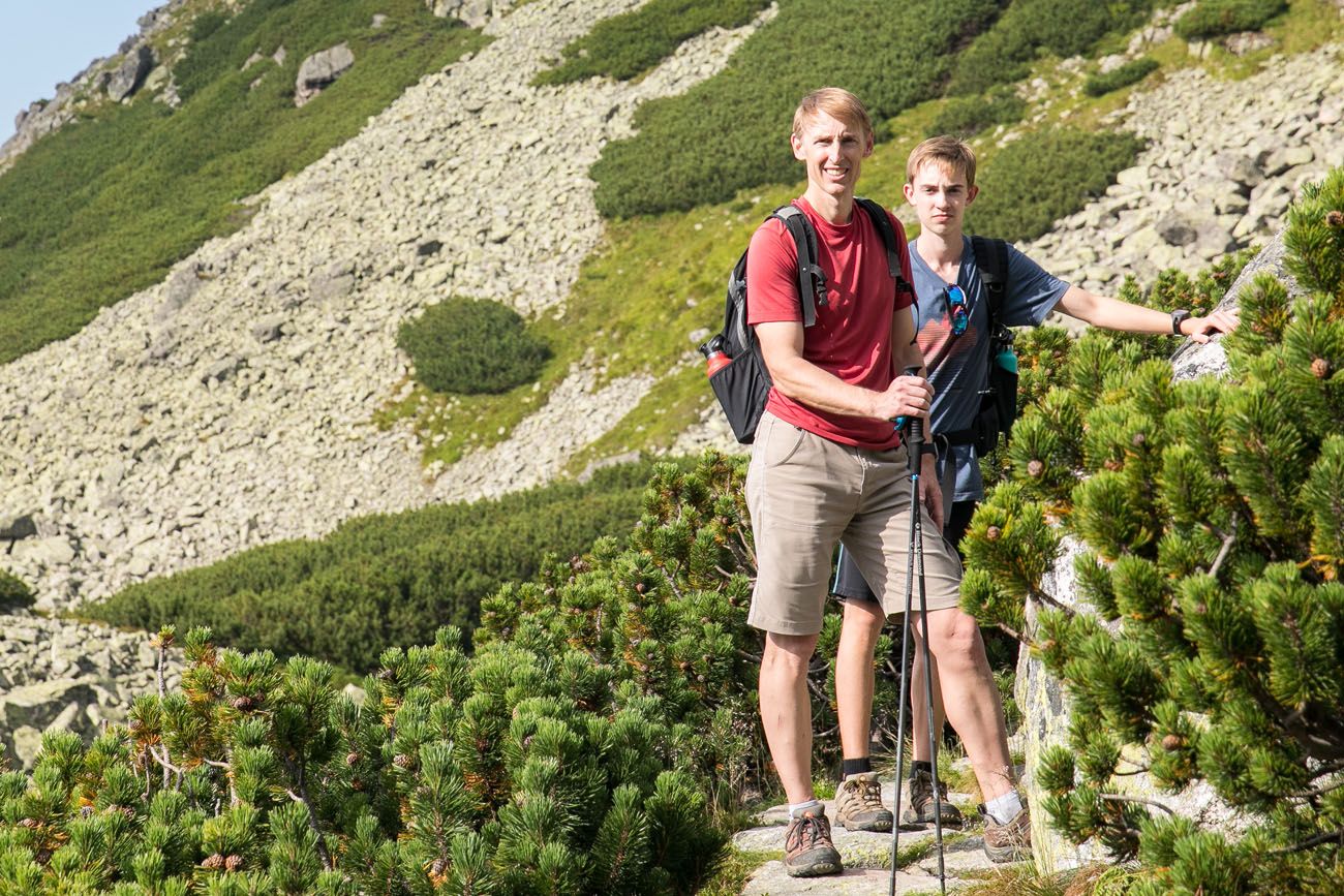
About Our Experience
We visited Zakopane on a Saturday in July. Every day for 10 days before our visit, it rained (at least where we were in Gdansk, Warsaw, and Krakow). So, on this gorgeous, sunny Saturday, literally thousands of tourists and locals descended upon the slopes of the Tatras.
I read that the Tatras were an off-the-beaten-path hiking destination in Europe. Well, it sure didn’t feel that way. Maybe it was the nice weather, but this was one of the busiest trails we have hiked in Europe.
My plan was to spend the day hiking to Swinica via the Zawrat Saddle. This is a challenging trail with rock scrambling, the use of chains, and a reward of amazing views across the entire mountain range.
During our visit, the Zawrat Saddle was closed. We learned this about an hour into the hike, when a small sign alerted us to the trail closure. We had no hiking map (I was following another blogger’s route and trail description) so we had no way to figure out an alternate way up Swinica. Instead, we just kept hiking and picked trails that looked interesting along the way. And that’s how we ended up on top of Koscielec.
Even though it ended differently than I expected it to, it was still an awesome day. And what a great introduction to the Tatras. From Zakopane, we drove an hour south to Tatransky Lomnica, Slovakia for a 3-day hiking holiday on the Slovakian side of the High Tatras ↓
Hiking the High Tatras of Slovakia: How to Plan Your Visit
Things to do, best hikes, and how to plan a visit to the Slovakian Tatras.Video of the Hike to Koscielec
Tips to Have the Best Experience
Buy a map. In Kuznice, near the lower cable car station, there are several stands selling food, souvenirs, and hiking maps. I suggest spending a few zloty to buy a map, just in case you have the same issue with trail closures along the way.
Get here as early as possible! We drove to Zakopane from Krakow. Our rental car pick up time was 8 am so we didn’t get on the road until 8:30 am. It’s a two-hour drive without traffic. But on this gorgeous Saturday we hit a lot of traffic so we did not reach Zakopane until almost noon. If we did it again, we would pick up our rental car the night before and leave Krakow by 7 am at the latest. Ideally, plan to spend at least one night in Zakopane.
Please practice the seven principles of Leave No Trace: plan ahead, stay on the trail, pack out what you bring to the hiking trail, leave areas as you found them, minimize campfire impacts, be considerate of other hikers, and do not approach or feed wildlife.
Are you interested in hiking the Tatras? Comment below if you have any questions. And if you have hiked the Polish Tatras, feel free to share your experience too.
Happy Hiking!
More Information about Poland and Slovakia

Hiking to Vel’ká Svišt’ovka and Zelene Pleso in the High Tatras of Slovakia
Pinterest Facebook Flipboard For stunning mountain views and a visit to several vividly green alpine lakes, the hike to the summit of Vel’ká Svišt’ovka is a good one to add to your Tatras hiking list. A cable car lops off the first major ascent, so this hike is easier than many of the hikes in […]
Should You Visit the Tatras from Poland or Slovakia?
The High Tatras are a mountain range that span the border between Poland and Slovakia. This region attracts hikers in the summer and skiers in the winter and is rapidly increasing in popularity. You can visit the High Tatras from Poland or Slovakia. Which one you choose depends on your traveling style and how much […]
How to Hike Rysy from the High Tatras of Slovakia
Rysy is a mountain in the High Tatras that straddles the border between Poland and Slovakia. It is the tallest mountain in Poland and the highest mountain in the High Tatras that you can hike to without a guide. There are two approaches to the summit of Rysy. From Zakopane, Poland, you hike past Morskie […]
Hiking the High Tatras of Slovakia: How to Plan Your Visit
The High Tatras of Slovakia are an outdoor paradise. Jagged mountains, emerald green lakes, rugged hiking trails, and cable cars all come together to form the perfect adventure destination. Go on short, easy walks around alpine lakes, ride a cable car to one of the highest peaks in Slovakia, and hike to Rysy, the tallest […]
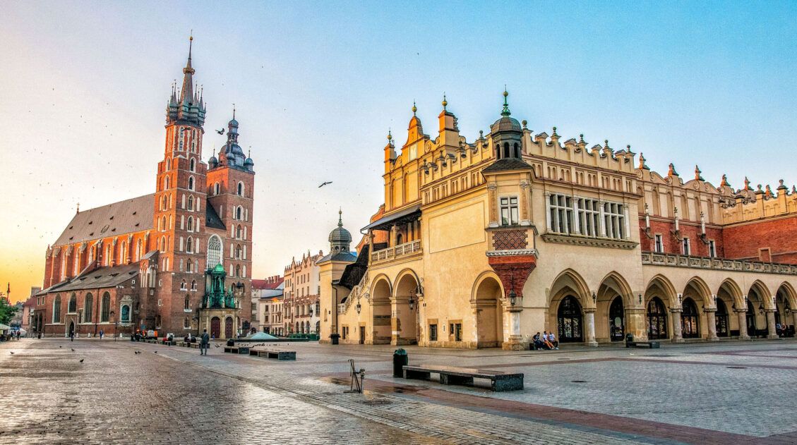
Poland Travel Guide | How to Plan a Trip to Poland
Travel advice for Poland. How to visit Gdansk, Krakow, Warsaw, Auschwitz, and Zakopane. Get travel itineraries and learn where to stay and where to eat.
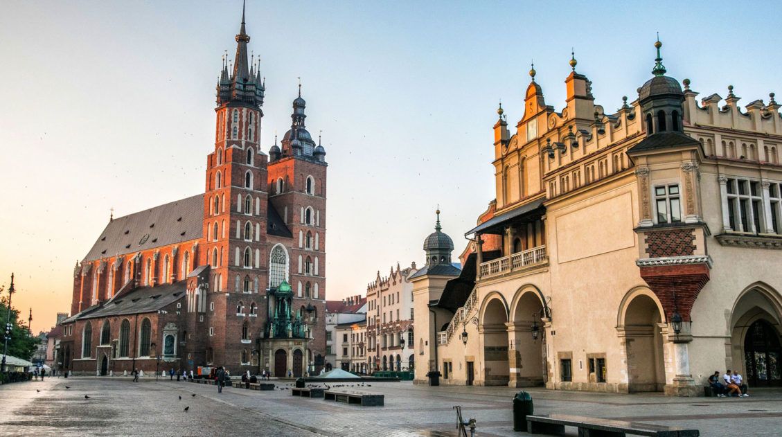
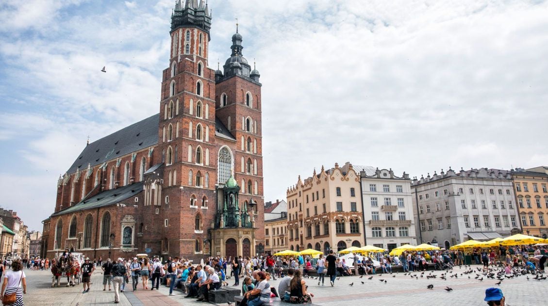
Krakow Bucket List: 25 Memorable Things to Do in Krakow
Krakow, Poland…this is a city that deserves to be on every traveler’s must-see list. It’s a lot like Prague, only with fewer tourists and cheaper prices. With its large market square, colorful streets, historic sites, and abundance of amazing, budget friendly restaurants, Krakow is a favorite stop for many people on their tour through Poland. […]
10 Day Poland Itinerary: Gdansk, Warsaw & Krakow
On this 10 day Poland itinerary, visit three of Poland’s most famous cities. Start in Gdansk, a beautiful city on the Baltic Coast, where you can stroll through the colorful old town and day trip out to the Baltic beaches or Malbork Castle. Next, journey to Warsaw, a city with a tumultuous past and a […]
Ultimate Hiking Guide: Europe, Asia, Africa, Americas & Oceania
Are you looking for the perfect hike? With hikes on six continents ranging from a few miles to multi-day adventures, explore some of the best hikes from around the world.
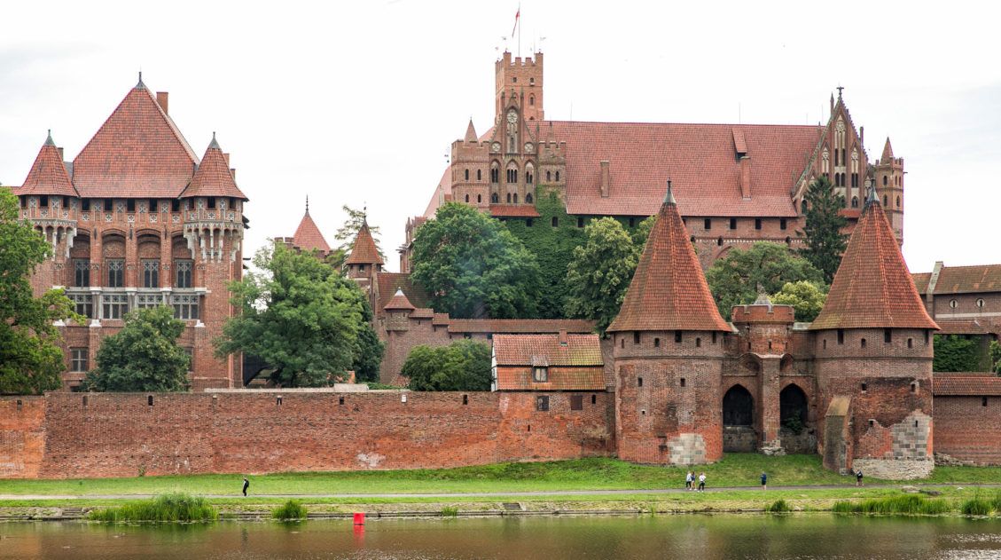
Malbork Castle: Plan the Perfect Day Trip from Gdansk
Malbork Castle is Poland’s most famous castle. It’s also the largest castle in the world, classified by surface area. Located just a short distance from Gdansk and easily accessible by train, Malbork Castle is one of the best day trips to take from Gdansk. In this article, get a brief history of the castle, learn […]
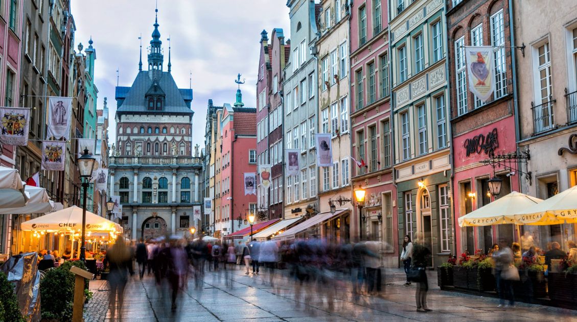
10 Best Things to Do in Gdansk, Poland
Gdansk is a beautiful city located on the Baltic Sea. It is often overlooked by many travelers to Poland, in favor of the more popular spots like Warsaw, Krakow, and Wroclaw. However, this city is well worth the journey north. In fact, it’s our favorite Polish city. On the fastest of itineraries, Gdansk can be […]
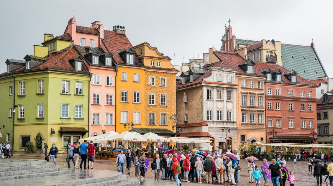
2 Days in Warsaw: The Perfect Itinerary for Your First Visit
2 days in Warsaw is the perfect amount of time to explore the historic city center, get an eye-opening history lesson at several museums, and sample some local food. On this Warsaw itinerary, you will stroll through the historic city center, visit several world-class museums, and dine on Polish food. Two days is the perfect […]
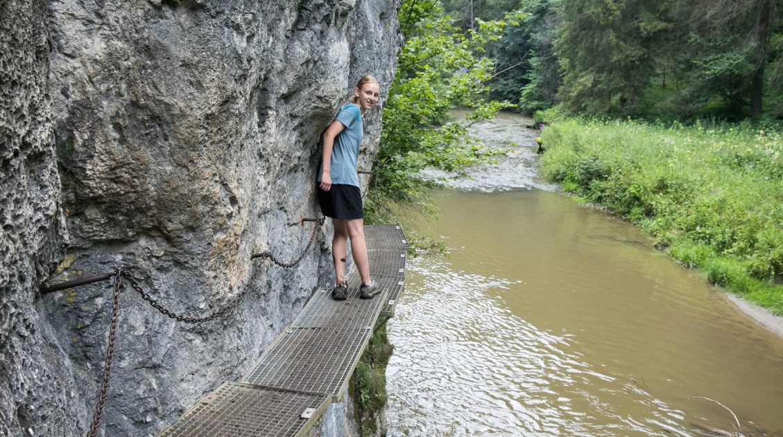
Our Experience in Slovak Paradise National Park
While researching what to do in the Slovakian Tatras, I stumbled across this cool spot called Slovak Paradise. Located in Slovensky Raj National Park, this is a very unique outdoor obstacle course. With long, wooden ladders and metal catwalks attached to vertical cliffs, you can spend days hiking and climbing through gorges and up waterfalls. […]
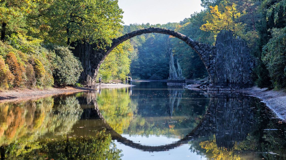
Rakotzbrücke: A Fairytale Bridge in Saxony, Germany
Rakotzbrücke, also called the Devil’s Bridge, looks like something that belongs in a fairytale. This unique looking bridge is tucked away in a small park in Saxony, Germany. Getting here can be a challenge, since Rakotzbrücke is not located near any major city. However, if you combine a trip here with other nearby destinations, you […]
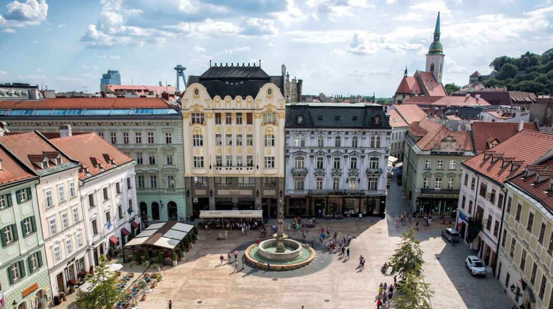
Top 10 Things to Do in Bratislava, Slovakia
Bratislava, with its compact old town, charming city streets, and outdoor café culture, is a wonderful place to visit. This city may not be as popular as other central European cities such as Vienna or Prague, but don’t let that fool you. Bratislava is underrated as a European destination, as we just learned. If you […]

Comments 27