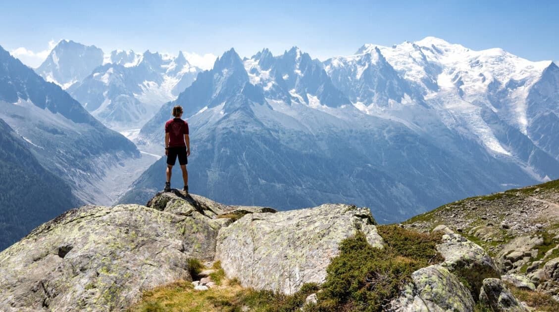
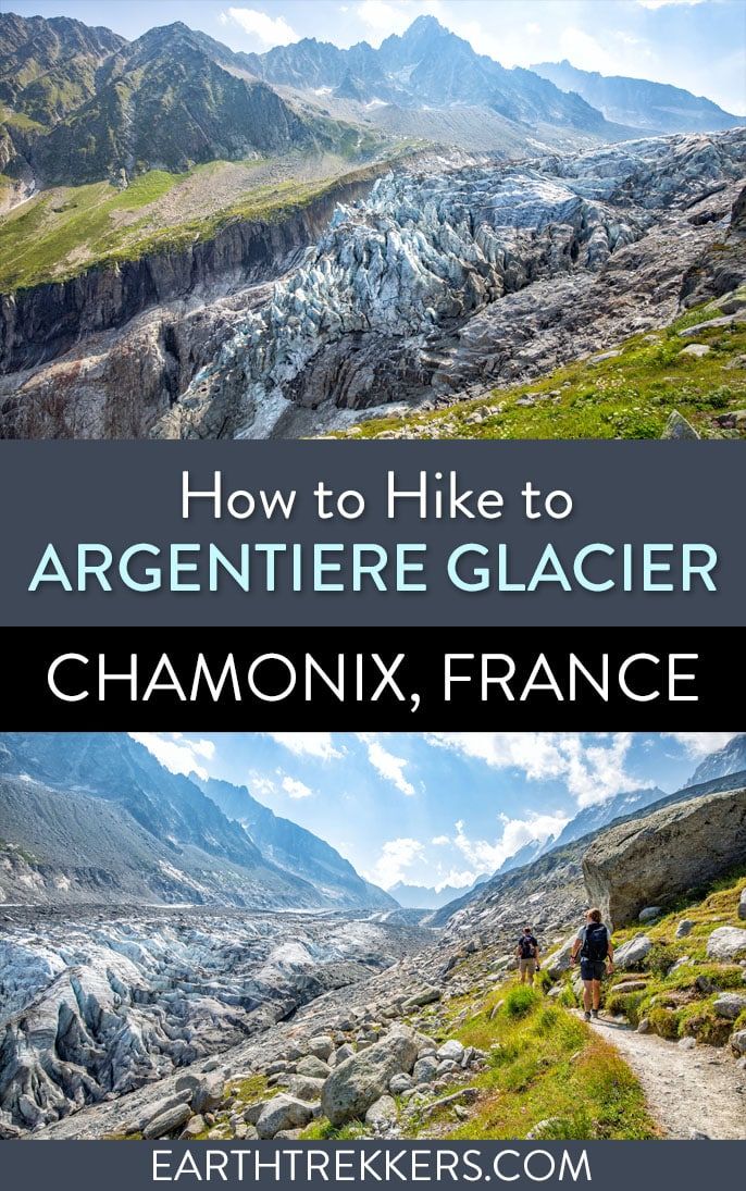
The hike to Argentière Glacier is one of the best day hikes near Chamonix, with trails leading to multiple viewpoints of the glacier at different elevations. Depending on how you access the mountain, this can be either a moderate out-and-back of about 4.7 km or a challenging full-day loop of 14 km with over 1,100 meters of elevation gain.
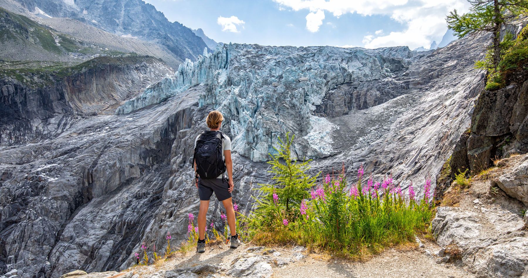
This was the first hike we did from Chamonix, a warm-up before tackling Lac Blanc and the Grand Balcon Nord. What sets it apart from those bigger, more famous trails is the experience itself. This hike isn’t about sweeping views of Mont Blanc. It’s about getting up close with Argentière Glacier, close enough to watch chunks of ice break from the serac wall and hear the deep crack and rumble as they fall. Seeing a glacier is one thing. Hearing it is another entirely.
Note for 2026 visitors: The Grands Montets gondola is closed for construction through at least summer 2026, and trail access on this route may also be affected. Before planning this hike, check the official Grands Montets page for the latest access information. If conditions are uncertain, we’d suggest swapping this day for a second hike. Lac Blanc and the Grand Balcon Nord are both stronger options for most visitors anyway.
How to Get to Argentière from Chamonix
To reach the town of Argentière, we took the train from Chamonix. Trains run every 30 minutes to 1 hour, depending on the time of day. By train it takes approximately 20 minutes to travel to Argentière from Chamonix. We purchased our train ticket in the Chamonix train station and boarded the next train.
For train timetables and pricing, visit the sncf website.
You also have the option to take a bus, taxi, or drive yourself to Argentière. Personally, we recommend the train, as it was a relaxing and enjoyable ride.
Argentière Cable Car
There are two cable car stations in Argentière sitting side by side, and their status has changed significantly since we visited in 2022.
Le Grand Montets has been closed since a fire destroyed the mid-station at Lognan in September 2018. A massive reconstruction project, designed by architect Renzo Piano and costing €155 million, is currently underway. The first section of the new gondola, running from Argentière up to Lognan, opened for winter 2025–26. The last time I checked, the cable car system will be closed in the summer of 2026. The full new cable car system to the summit is not expected to be complete until December 2027. Check the official Grands Montets page for the latest summer operating status.
The Telecabine de Plan Joran, which we used on our hike and which served as the main alternative access point while Le Grand Montets was closed, is shut down through summer 2026 for its own construction works related to the broader Grands Montets rebuild.
What this means for summer 2026 visitors: Plan for the full hike from Argentière town. It’s a bigger day, but the glacier views are identical and we’ve covered that route in full below.
When you’re ready to visit the cable car station, it is about a 5-minute walk from the Argentière train station. Exit and turn left on Rue Charlet Straton and follow signs for Grands Montets.
Hiking to Argentière Glacier from Town
For summer 2026 visitors, the hike from Argentière town is your best option, if the Grand Montets gondola will not be running. It’s a bigger day than the gondola route, but the glacier payoff is the same, and there’s something to be said for earning it on foot. Here’s everything you need to know.
Note: We hiked to Argentière Glacier using the gondola, but have researched the from-town route thoroughly for those visiting while it’s closed.
Hiking Stats (From Town)
Distance: 14 km (8.7 miles) loop | Total Ascent: 1,160 meters (3,800 feet) | Time: 4.5 to 5.5 hours | Difficulty: Strenuous
The Route
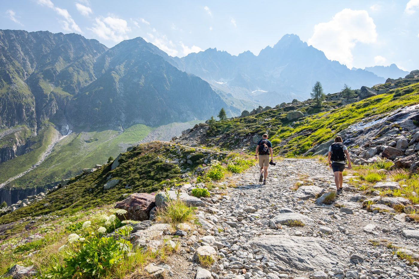
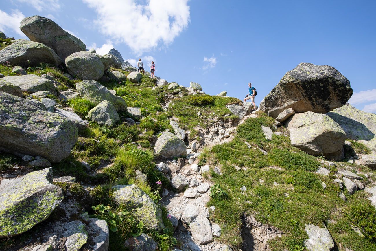
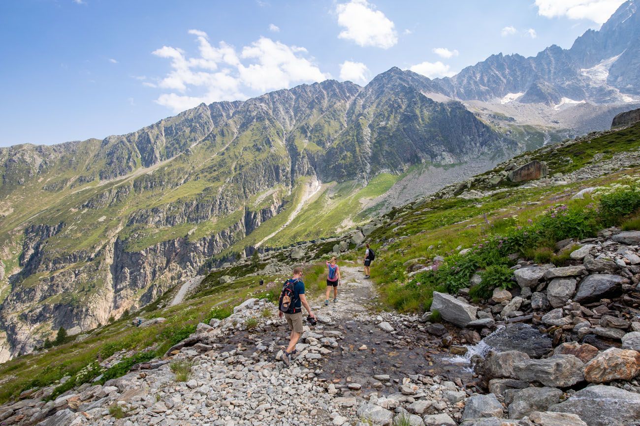
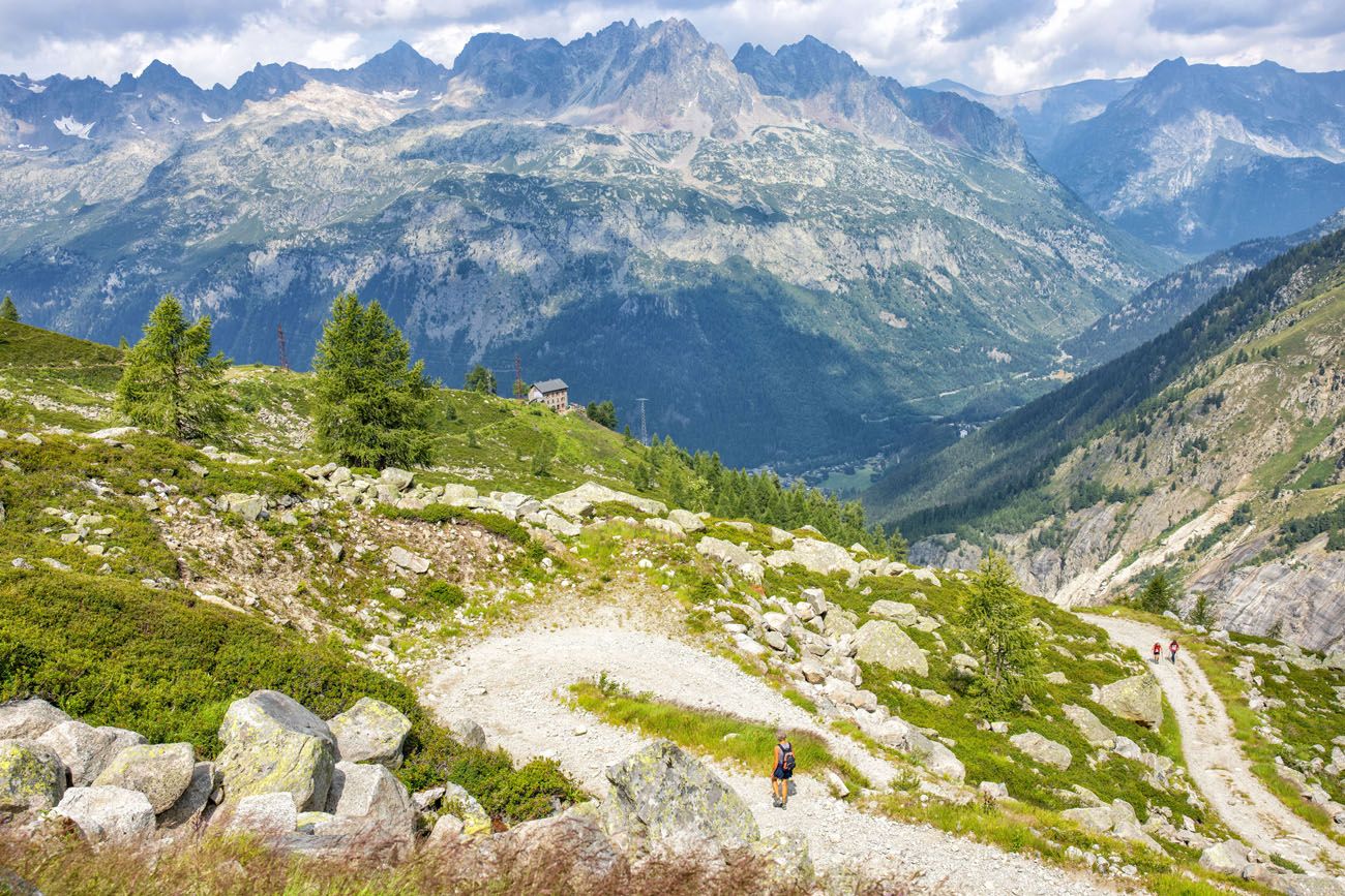
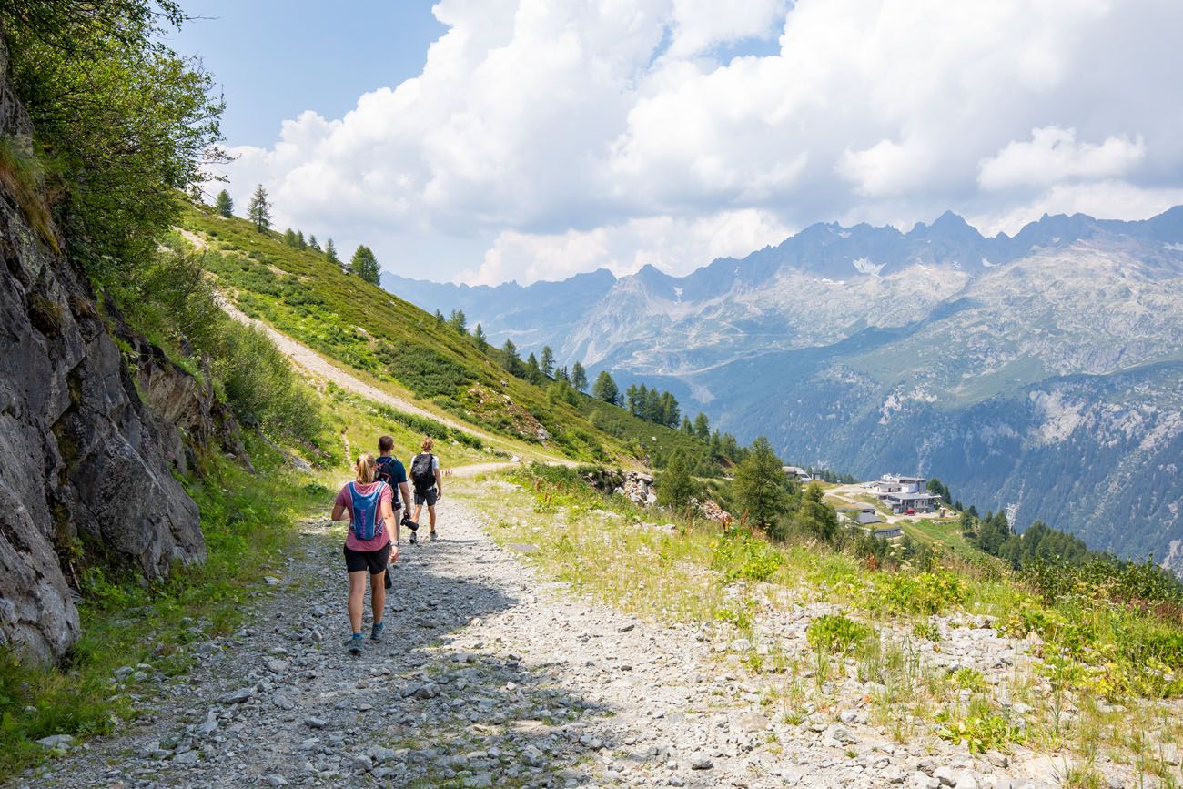
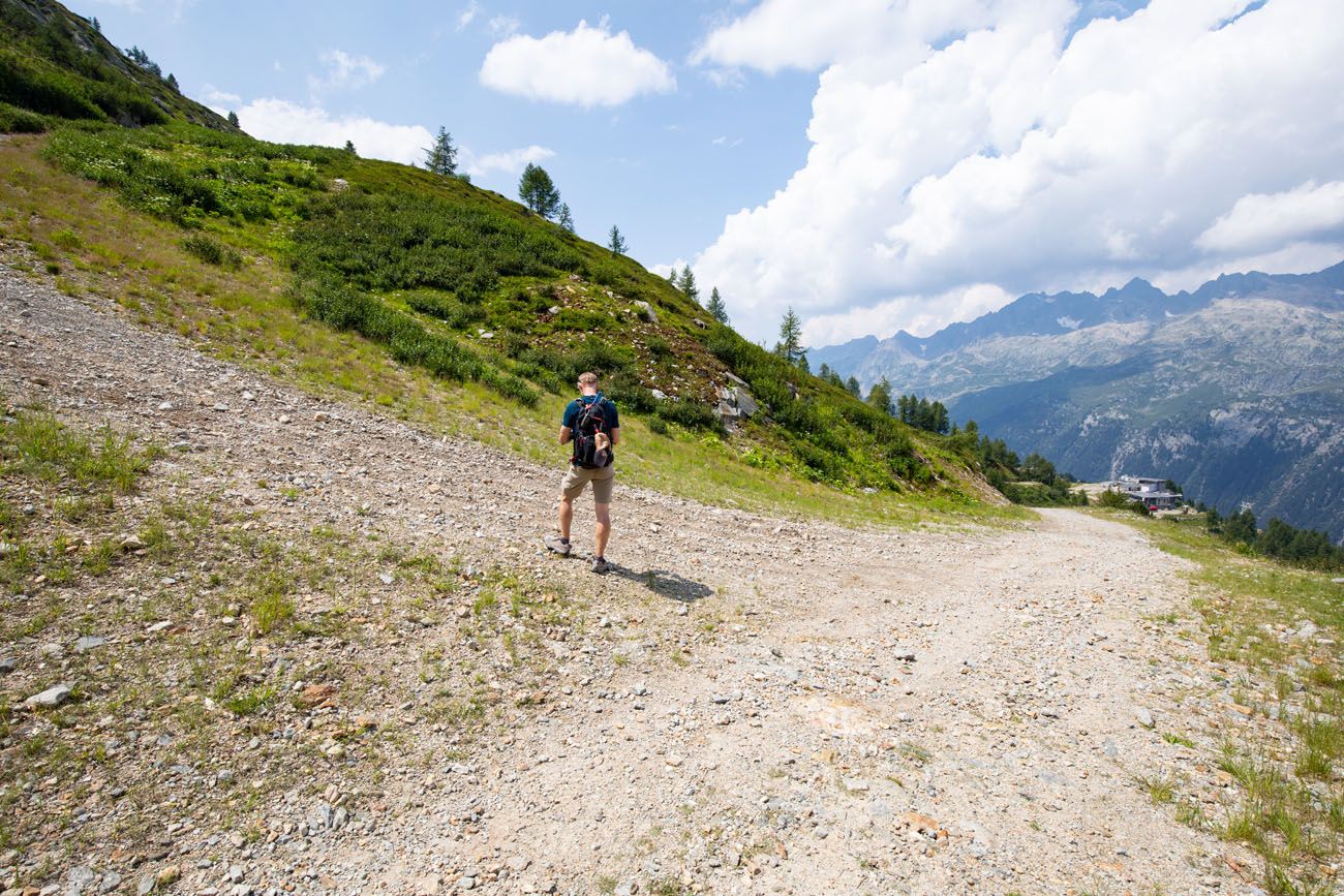
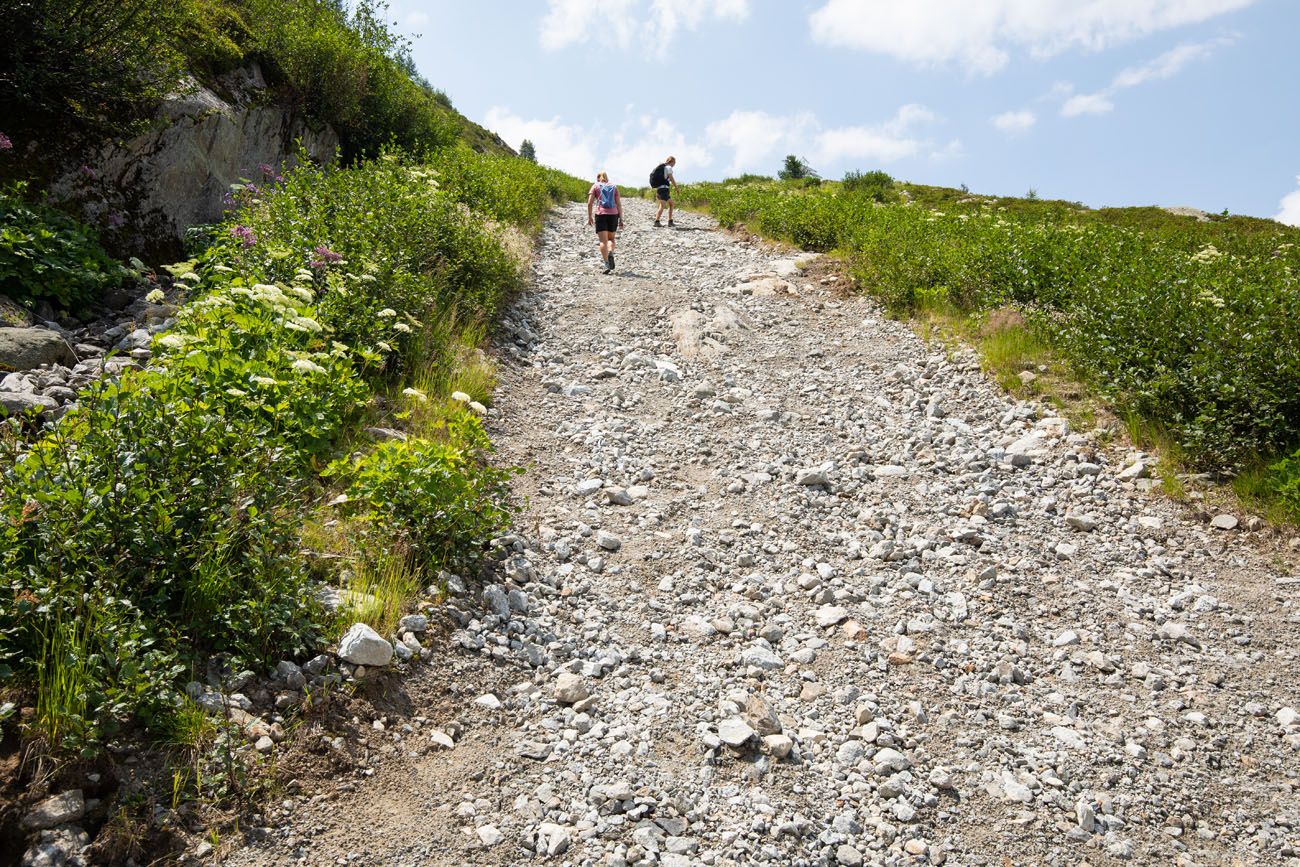
The first stretch is the hardest. From town, the trail climbs a steep gravel road for roughly 2.5 km with relentless elevation gain. There’s not much relief here, so settle into a steady pace and don’t burn yourself out early. The road eventually gives way to a gentler forest trail, where the gradient eases and you get your first real chance to catch your breath.
After another 1.5 km through the trees, you’ll arrive at Chalet Refuge de Lognan. Step around to the far side of the hut and you’ll get your first glimpse of the glacier. It’s still distant at this point, but impressive enough to stop you in your tracks.
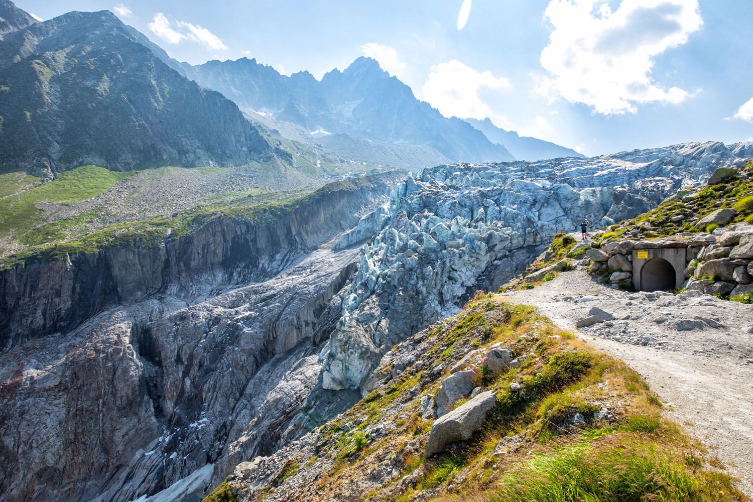
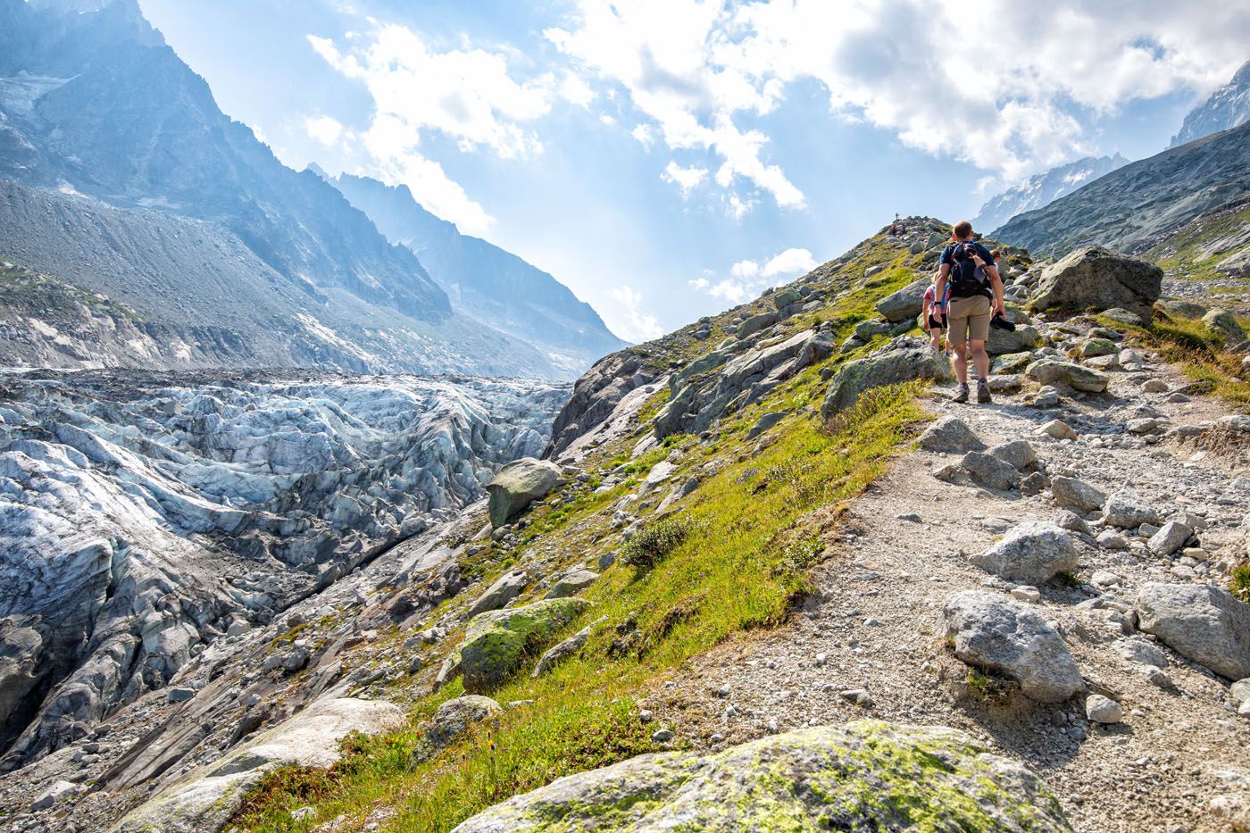
From the refuge, a narrow trail follows the glacier valley uphill, connecting to a gravel road that leads to the main viewpoint area. This is where you’ll get the best views of the glacier’s serac wall, the dramatic ice face that makes this hike unlike anything else in the Chamonix valley. Take your time here.
The trail continues to Le Point de Vue, the official endpoint of the hike, where you get a wider perspective of the full glacier stretching back into the mountains. From here, the return follows a separate gravel road back downhill through the forest to Argentière.
Tips for Hiking from Town
Bring hiking poles. The descent follows a steep gravel road where the surface is loose and slippery. Poles make a real difference here.
Start early. With 1,160 meters of elevation gain, this is a full day out. An early start also means better light on the glacier and fewer people at the viewpoints.
Plan to stop at Chalet Refuge de Lognan. You’ll pass it on both the way up and the way down. It’s a great spot for a break, and we can personally vouch for the cold beers and meat and cheese platter after a long day on the trail.
Once the new gondola is up and running, the route from Joran becomes the easier and more accessible way to experience this hike and the one we personally recommend based on our own experience. Here’s a step-by-step guide to that route for when it reopens ↓
How to Hike to the Argentière Glacier from Joran
Argentière Glacier Hiking Stats
Below are the hiking stats from the Joran gondola station out-and-back to the viewpoint of the Argentière glacier.
Distance: 4.7 km (2.9 miles) out-and-back
Total Ascent: 250 meters (820 feet)
Lowest Elevation: 2,130 meters (6,990 feet)
Highest Elevation: 2,185 meters (7,170 feet)
Time: 1.5 to 3 hours
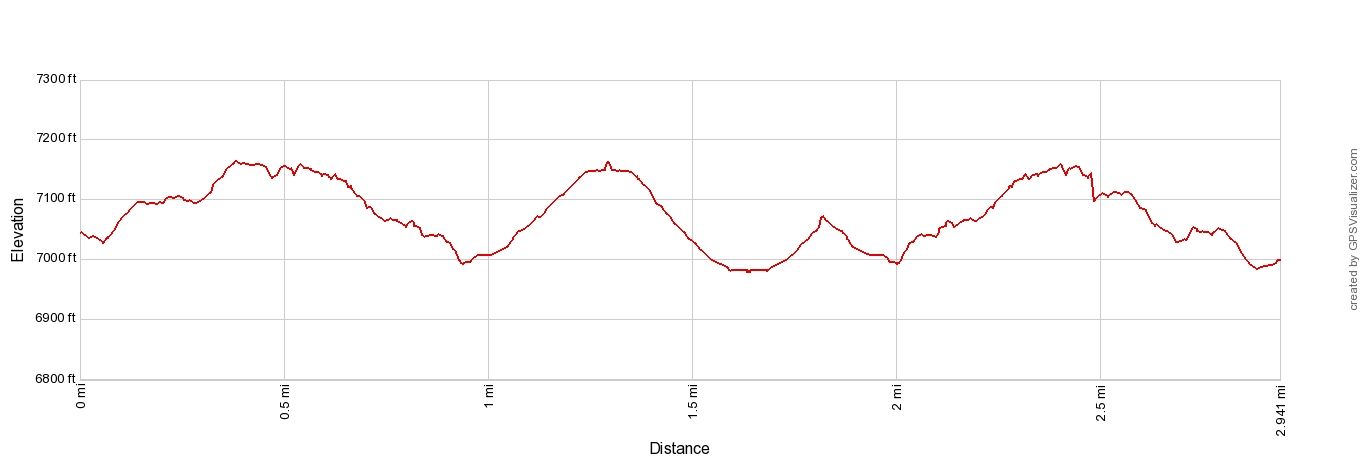
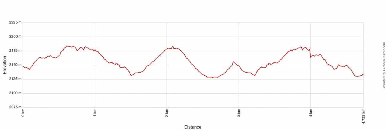
Elevation profile for the out-and-back hike from the Joran gondola station
On this hike, there are a few optional add-ons: hike higher along the glacier for better views and hike to Chalet Refuge de Lognan. These additional distances, and how to do this, are mentioned later in this guide.
Step-By-Step Trail Guide
Joran Gondola to Viewpoints of Glacier d’Argentière
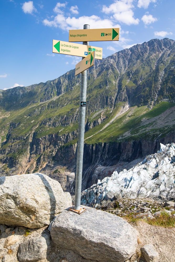
Once you step off the gondola, the trail is right before you. Follow trail signs for Point de Vue Glacier d’Argentière.
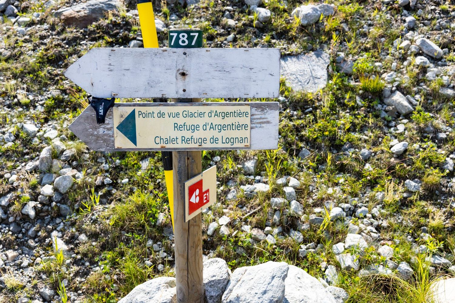
Hiking sign next to the Joran gondola station.
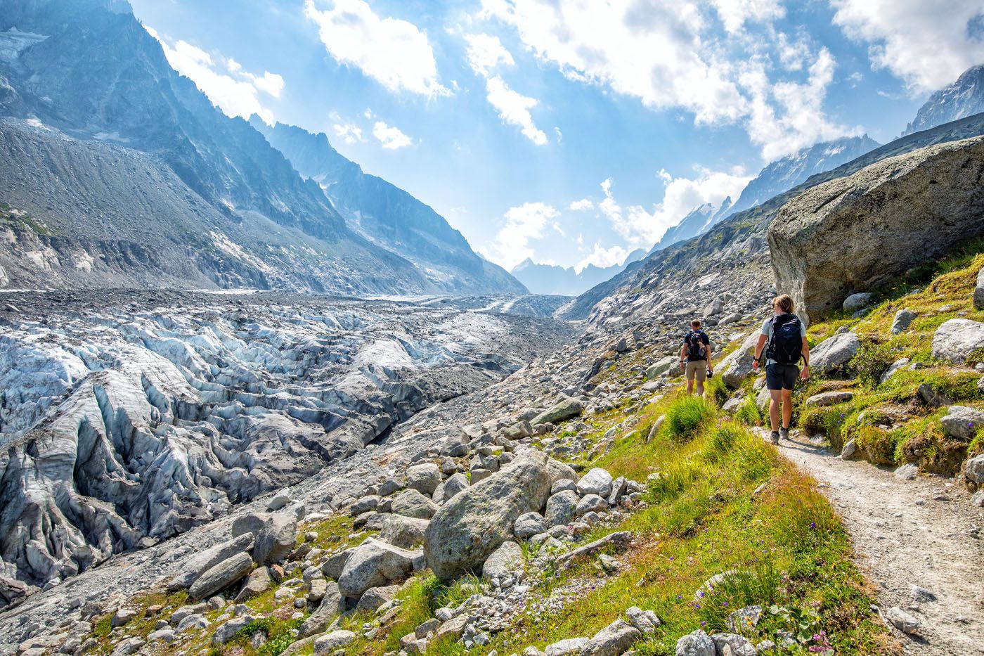
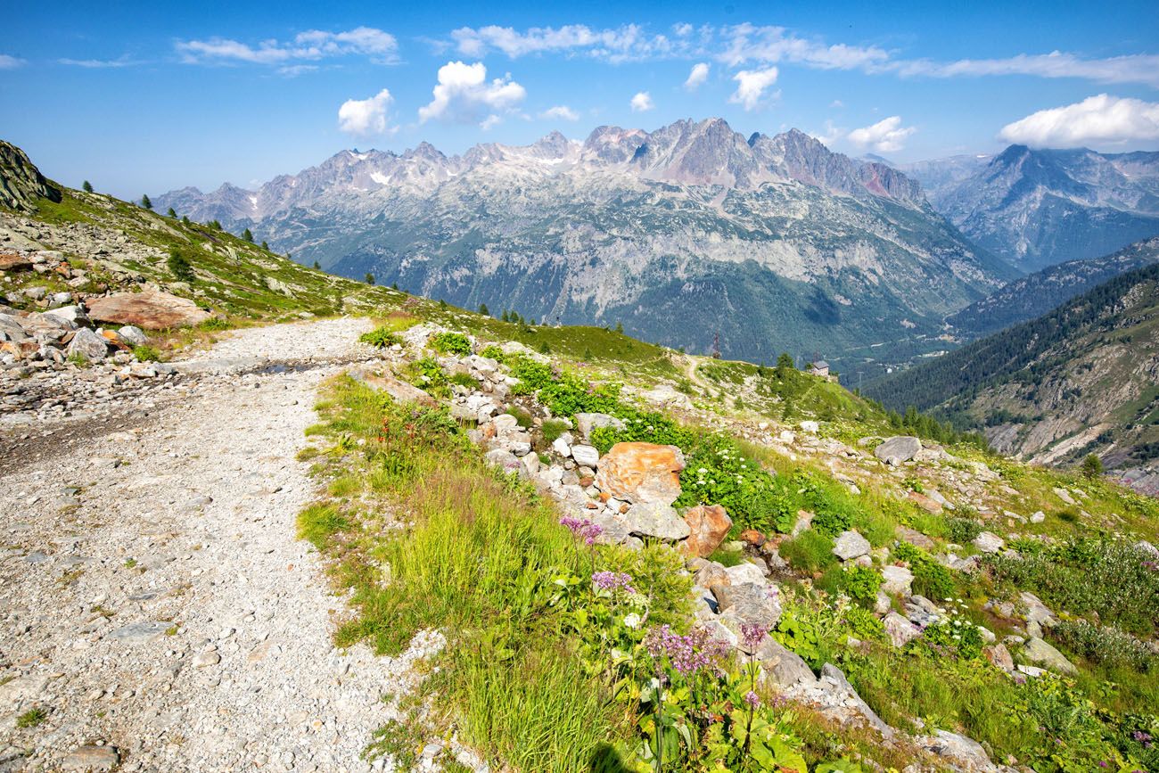
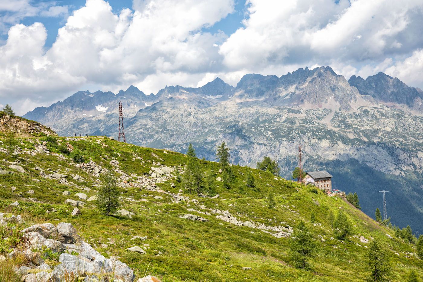
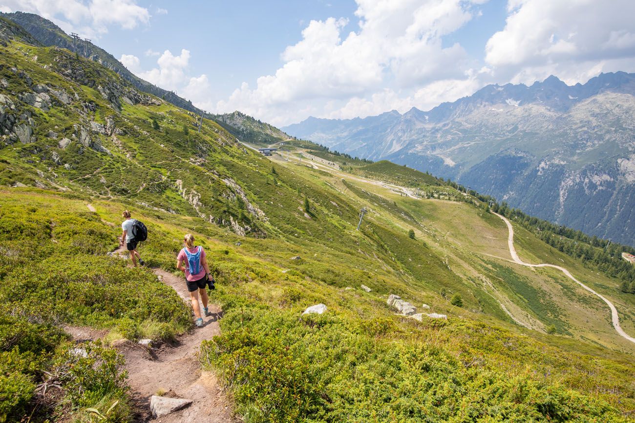
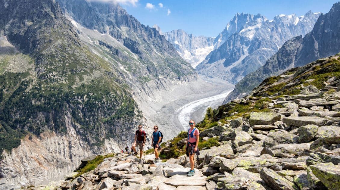
The hike to the glacier is only a little more than a mile long (about 1.6 km) and it remains relatively flat, with a few ups and downs along the way. Looking out, you get a very nice view over Argentière and the mountains on the opposite side of the valley. You also get a view of the Lognan cable car station (La Croix de Lognan).
Here are views of the trail to Glacier d’Argentière in photos.
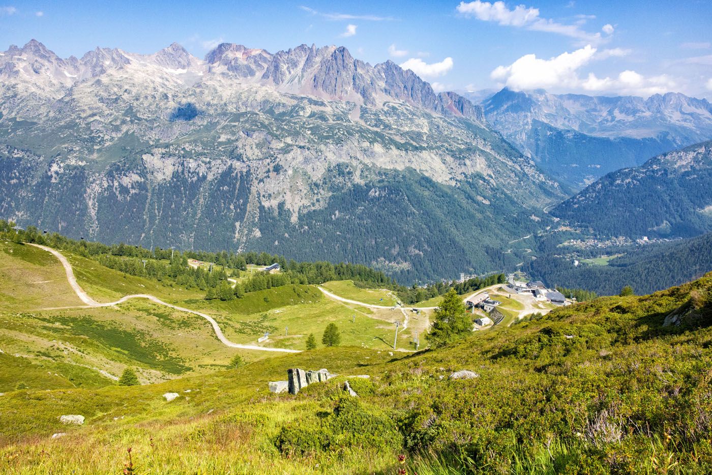
Looking out over the Lognan cable car station from the trail.
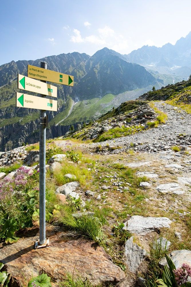
When you get to this sign, the trail changes over to a gravel road. Stay to the right to continue to the upper viewpoint of the Argentière Glacier. If you go left, you will go to the lower viewpoint.
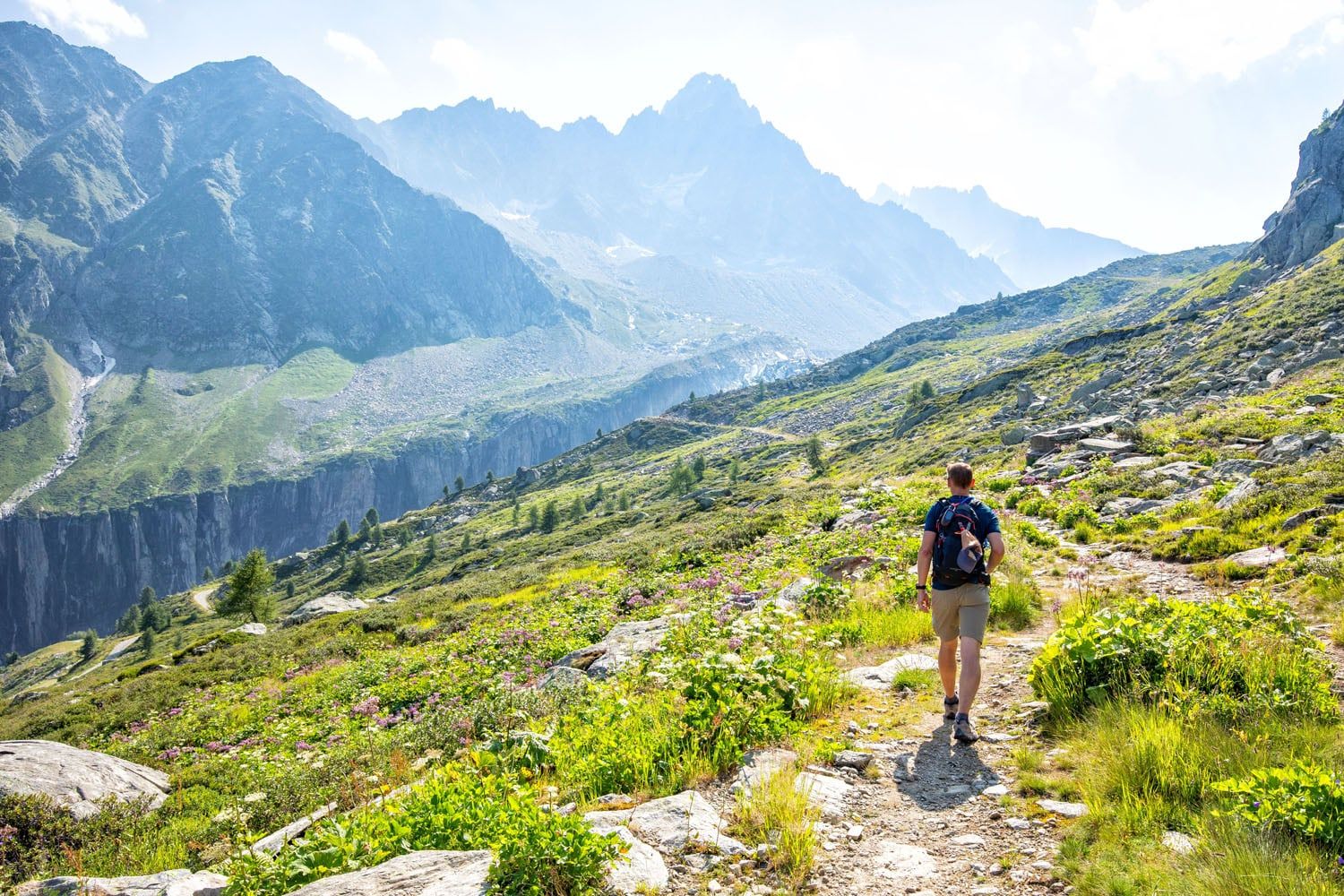
As you get closer to the glacier, the trail changes from a narrow, dirt trail to a wide, rocky, gravelly road. Continue to follow signs for “Le Point de Vue.” From this point, it only takes a few more minutes to get to the first viewpoint of Glacier d’Argentière.
Views of Glacier d’Argentière
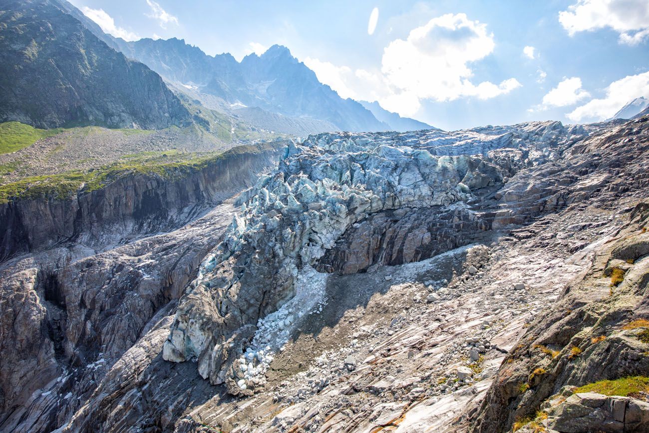
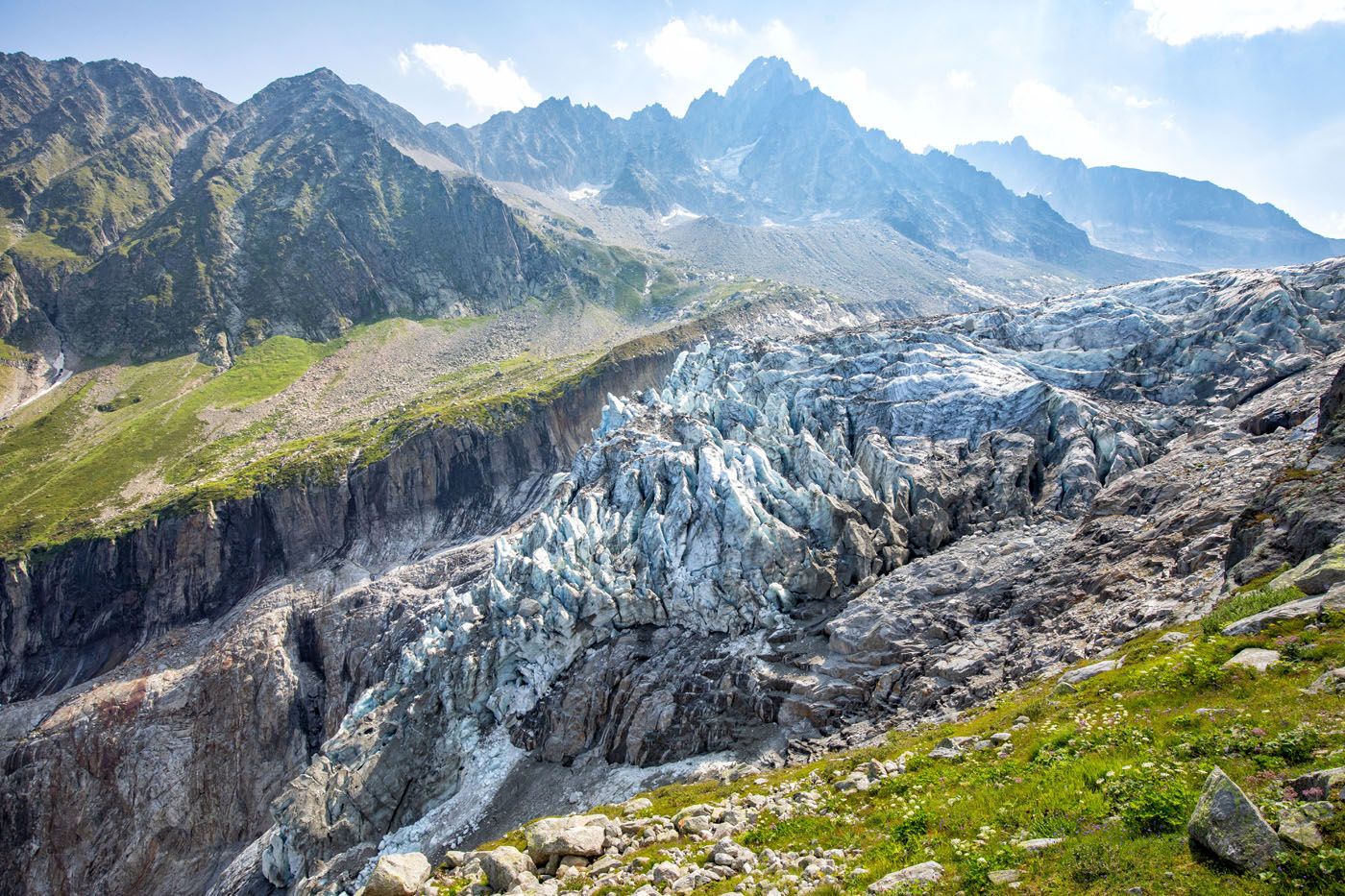
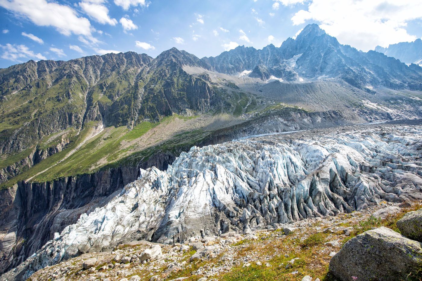
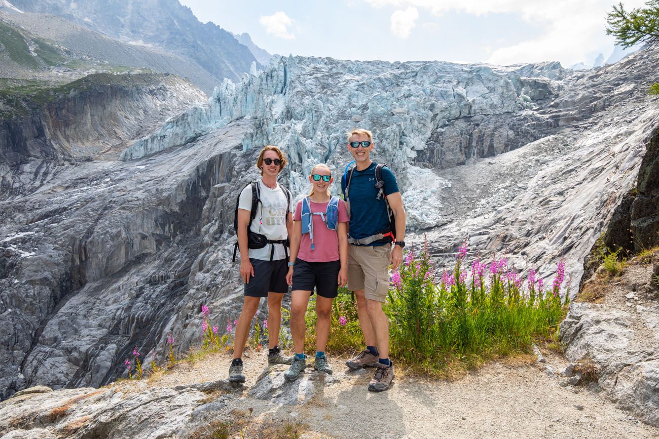
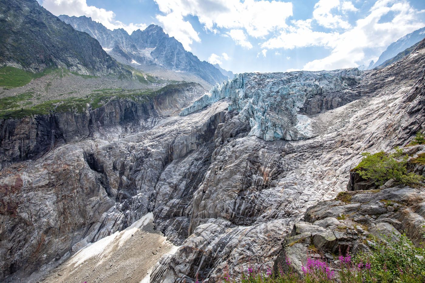
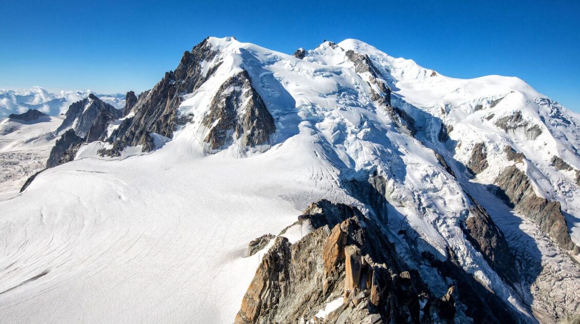
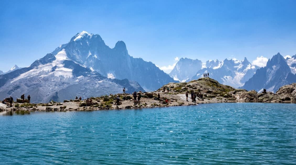
Once you reach the glacier, you have a full view of its icy serac wall and deep crevices, as well as the valley it carved out during its long recession. This is where we stood for a long time, just watching and listening. In mid-July, the glacier was actively calving, and the sound of it cracking and rumbling in the summer heat was something we weren’t expecting.
Argentière glacier
Once you reach the glacier you have a few options for how to continue the hike.
- You can climb up the ridge to see the top of the glacier.
- You can hike down to Chalet Refuge de Lognan to get a snack or refreshment.
- You can hike down to the lower viewpoint of the Argentière glacier (you will pass this viewpoint on the way to Chalet Refuge de Lognan).
- You can hike back the way you came to return to the Joran gondola.
We hiked higher along the trail for more views of the glacier and then headed to the Chalet Refuge de Lognan before returning back to the cable car.
More Views of Argentière Glacier
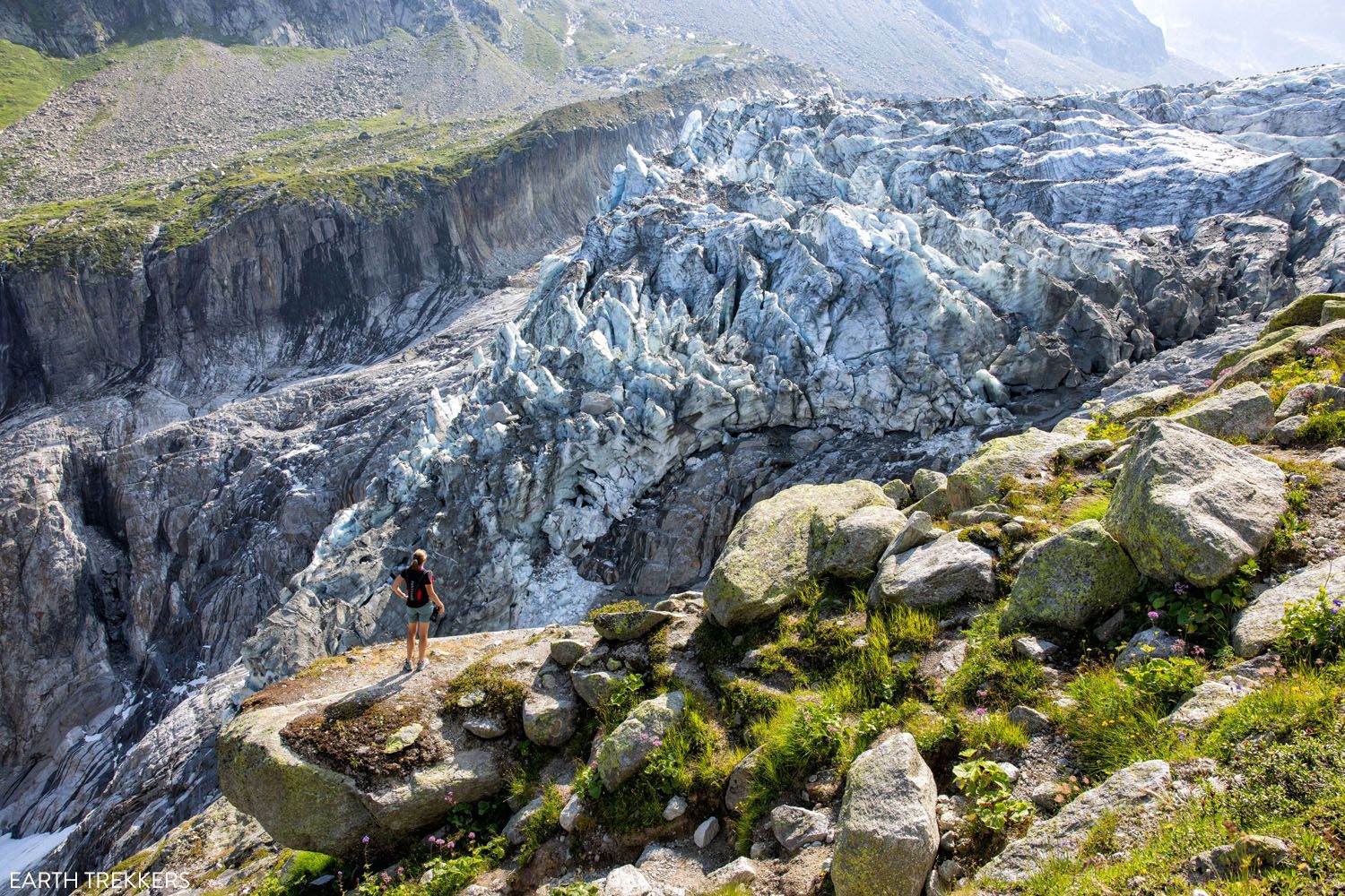
From the viewpoint at the end of the gravel road, there is a steep, rocky trail that heads uphill to a ridgeline. From this part of the trail, you get great views over the glacier.
From the viewpoint, hike up this trail to continue up the ridgeline.
Trail along the ridgeline.
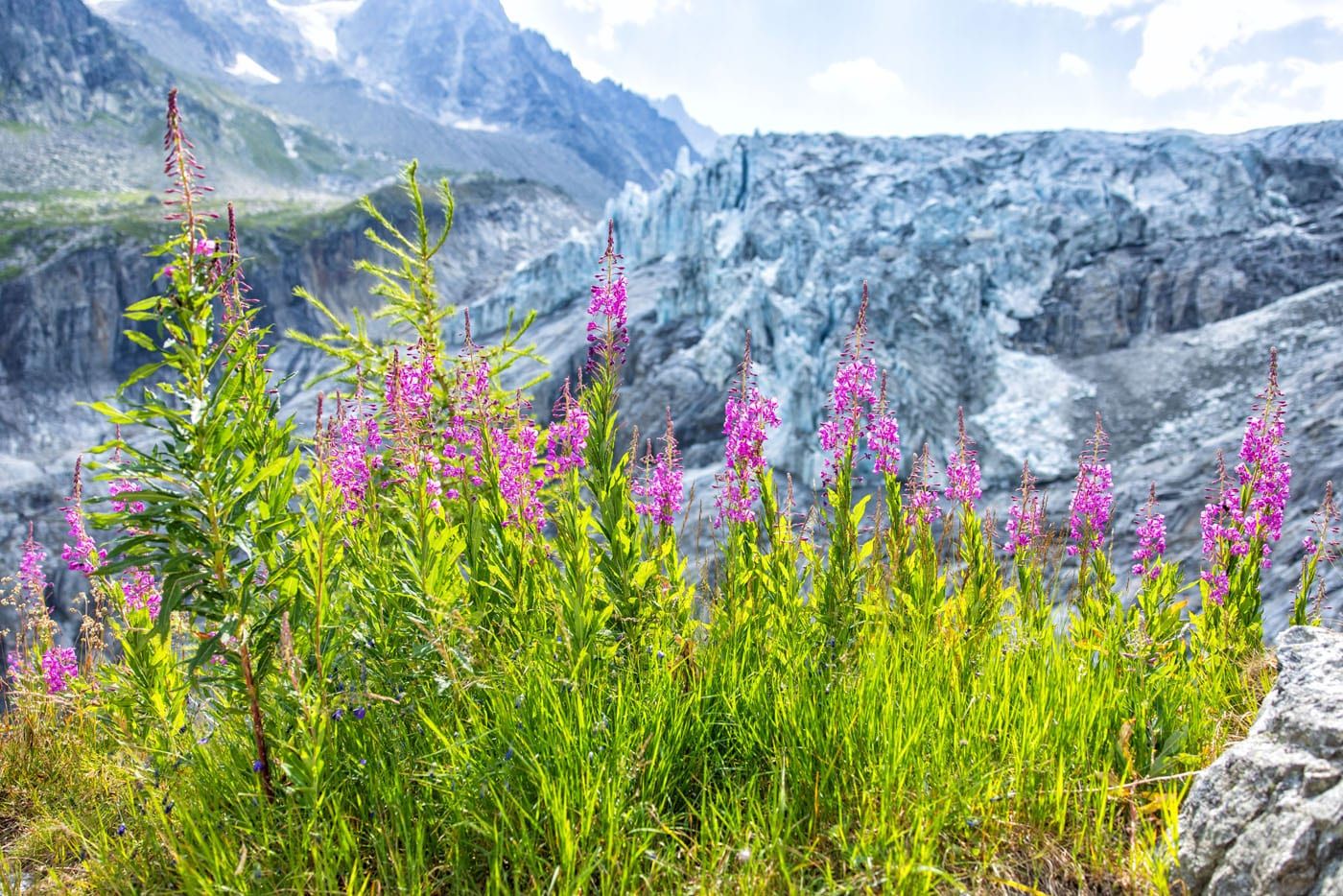
The view of the Argentière Glacier.
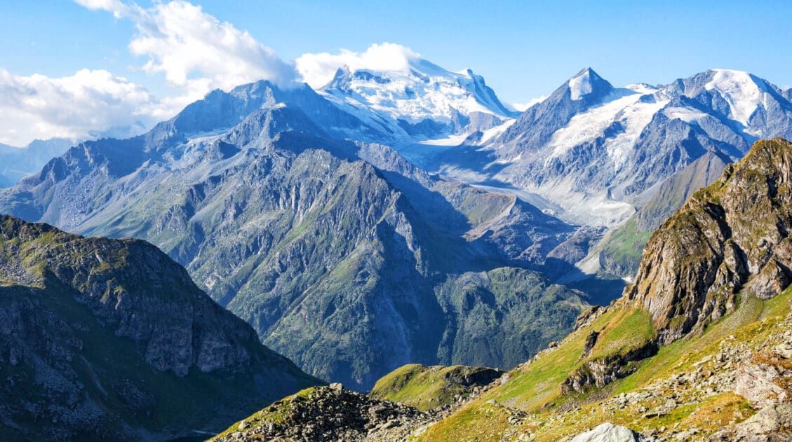
From the top you can see how large the glacier is as it stretches endlessly back towards distant mountains. The surface of the glacier is surprisingly flat but dotted with crevices.
Once you reach the trail sign in the photo below, you have a choice to make. It is a 10-minute walk to a higher viewpoint over Glacier d’Argentière or you can continue on the trail that runs closer to the glacier (the trail to Refuge d’Argentière).
We chose the lower trail to Refuge d’Argentière. We only hiked along this section of trail for about 10 minutes, but you can continue walking next to the glacier for as long as you prefer.
If you do this, you are adding roughly 1 km (1.6 miles) out-and-back with 140 meters (460 feet) of total elevation gain.
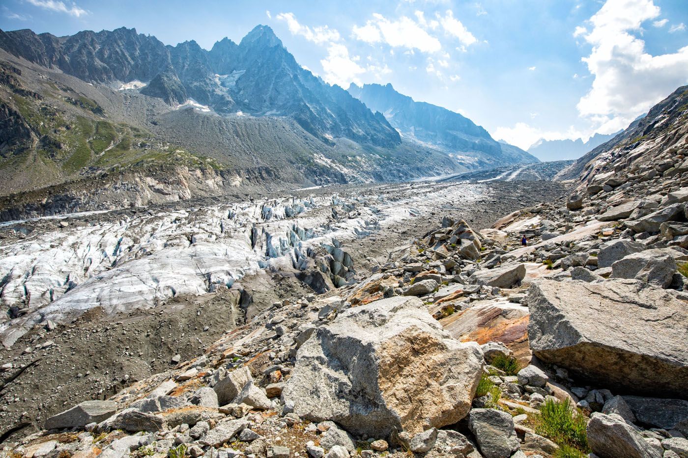
Glacier d’Argentière
Once you are ready to turn around, backtrack the way you came. Then, you can either head to the Chalet Refuge de Lognan or return to the cable car.
Hike to Chalet Refuge de Lognan
As we headed back downhill, we followed signs for La Croix de Lognan, walking back on a gravel road rather than the narrower ridgeline hiking trail.
Farther down the road was a sign pointing to Chalet Refuge de Lognan and we followed this gravel road all the way to the refuge.
This part of the hike is well worth it. You get a lower view of the Argentière Glacier (la langue du glacier d’Argentiere on Google maps), and we thought it was one of the best of the day.
From this viewpoint, it is a 15-minute downhill walk (about 1 km/0.6 miles) on the gravel road to Chalet Refuge de Lognan.
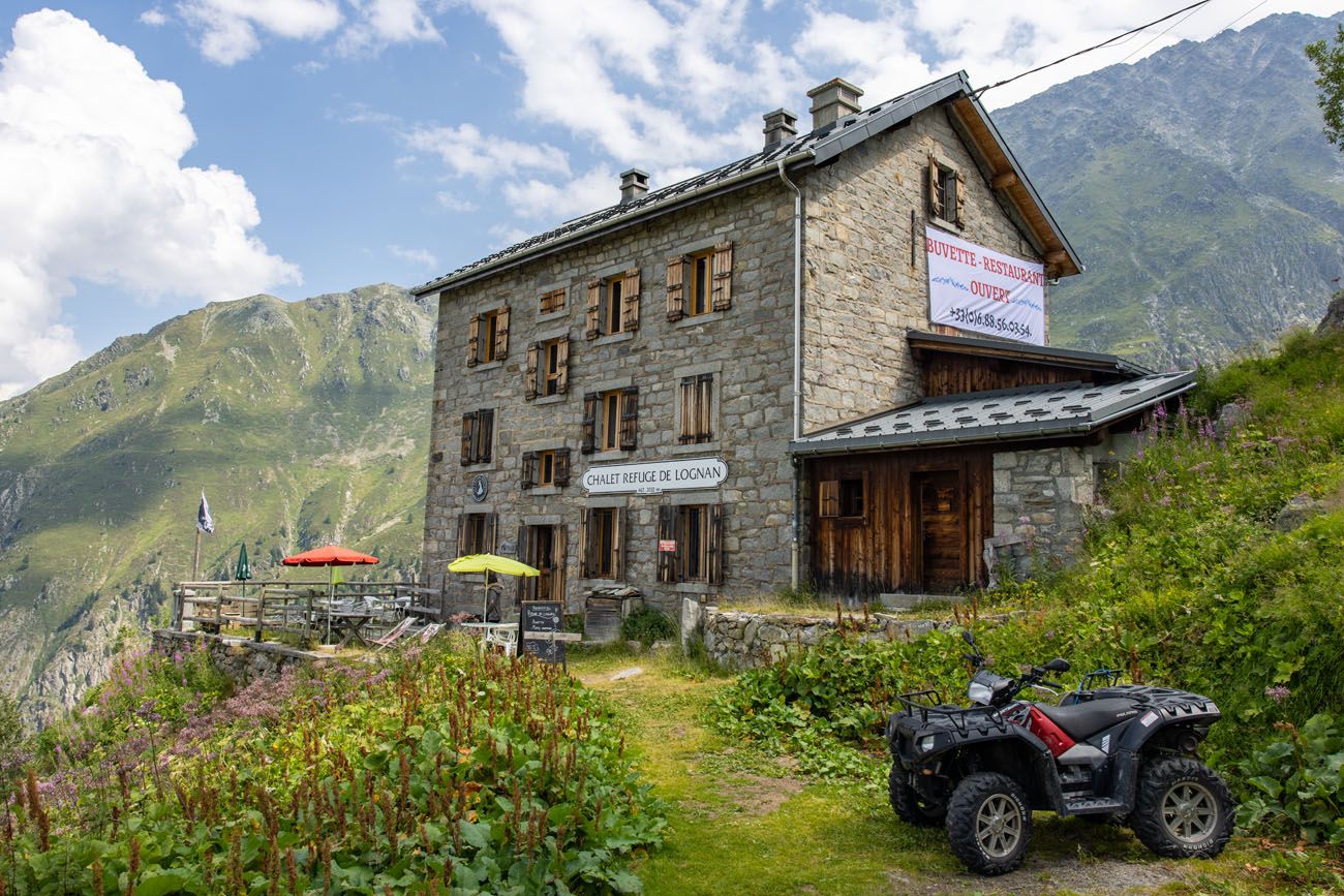
We enjoyed having a rest at this refuge. We ordered two beers and a meat and cheese platter. Delicious!
Return to the Joran Gondola
From the refuge, hike back up the gravel road and follow the trail signs towards La Croix de Lognan.
You will come to a trail split and when we did this, there was no trail sign here. If you go left, it is a beast of an uphill hike to get back onto the dirt trail you started on earlier in the day (this is what we did). It connects to the Joran gondola, but it is a tough climb, so we recommend going right.
If you go right, it’s an easy walk down to the Lognan cable car station. From the Lognan cable car station, it is an easier uphill walk to the Joran gondola, compared to what we did.
Tim is standing at the trail split. Stay right to continue to the Lognan cable car station. If you go left, it’s a steep uphill walk.
Here is the hill. It doesn’t look too bad in this photo but it is challenging!
The Joran gondola station is off in the distance. On the right hand side of the photo is the wider, easier trail between the Lognan station and the Joran station.
Once at the Joran cable car, ride it to Argentière and then return to Chamonix (if that is where you are staying).
Hiking Route Modification
Once the Grand Montets cable car reopens, the ideal route is to take this, rather than the Joran gondola. From La Croix de Lognan (the upper cable car station), it will be a shorter hike and the extra amount of trail that you hike from Joran does not add any extra views that are worth the additional distance.
What to Bring on the Hike
Walking shoes or hiking shoes. I recommend wearing hiking shoes, since you will be hiking uphill and downhill on uneven surfaces.
Water. At least 1 liter of water per person. It’s not a long hike, but it can be warm in the summer, and it might be nice to have some cool water to drink during the hike.
Sunscreen, hat, and sunglasses. Most of the trail is fully exposed to the sun.

Essential Hiking Gear: What Should You Bring on a Day Hike?
If you are new to hiking or are curious about what you should bring on a hike, check out our Hiking Gear Guide. Find out what we carry in our day packs and what we wear on the trails.Frequently Asked Questions
Is it worth hiking to Argentière Glacier if the cable cars aren’t operating?
Yes, but with a caveat. We’d only recommend it if you have at least three days in Chamonix. The full hike from town is a serious day out (14 km, 1,160 meters of elevation gain), and if you’re short on time, Lac Blanc and the Grand Balcon Nord are better hikes that should take priority. There are also plenty of other incredible experiences in Chamonix, including Aiguille du Midi, Mer de Glace, the town itself, that are worth your time before committing to a strenuous full-day hike to the glacier. That said, if you have the days and the legs for it, the glacier experience is unique enough to be worth the effort.
How difficult is the full hike from Argentière town?
Moderate to strenuous. The first 2.5 km is a relentless climb up a steep gravel road with no real relief. That’s the hardest part. After that, the gradient eases through the forest before opening up to the glacier viewpoints. Bring hiking poles, especially for the descent, where the loose gravel surface can be slippery.
How long does the hike take?
Using the gondola from Joran, plan for about 4 hours, including the detour to Chalet Refuge de Lognan. Hiking from town will add roughly 30 to 60 minutes each way on top of that, making it a 5 to 6-hour day.
Is Chalet Refuge de Lognan worth the detour?
Absolutely. It adds minimal time to your hike and the lower viewpoint of the glacier tongue just before the refuge is one of the best of the entire day. We had cold beers and a meat and cheese platter there and it was the perfect way to end the hike. We’d recommend checking current opening hours before you go, as the refuge may have limited seasonal hours.
Can kids do this hike?
With the gondola, yes. We’d say this is a good hike for kids aged 8 and up. The trail from Joran is relatively flat and short enough to be manageable for older children. Without the gondola, the full hike from town is a much bigger day and better suited to fit teenagers and adults.
What is the best time of year to hike to Argentière Glacier?
Mid-July through early October is the sweet spot, when the trail is clear of snow and the glacier is actively calving in the summer heat. We hiked in mid-July and the conditions were perfect. Earlier in the season, you may encounter snow on the upper sections of the trail, so check conditions before you go.
Plan Your Trip to Chamonix and France
The Grand Balcon Nord is one of several excellent hikes in Chamonix — the Grand Balcon Nord Trail and the Lac Blanc trail are both worth adding to your itinerary if you have the time.
For a full overview of what to do in the area, including the cable cars, town, and day trips, visit our guide to the best things to do in Chamonix. If you’re still in the early stages of planning your trip, our Chamonix itinerary covers how to structure your days.
For everything else you need to plan a trip to France, start with our France Travel Guide.
If you have any questions about how to hike to Glacier d’Argentière or if you want to share your experience, let us know in the comment section below.
More Information for Your Trip to Chamonix
24 Best Things to Do in Chamonix, France in the Summer
Pinterest Facebook Flipboard Discover the best things to do in Chamonix, France in the summer. This guide covers the top cable cars, hiking trails, glaciers, and adventures in Chamonix, based on our firsthand experience hiking and exploring the area. Chamonix is one of the most spectacular mountain destinations in Europe, and in the summer, it’s […]
Chamonix Itinerary: How to Spend 1 to 5 Days in Chamonix
Chamonix is one of the best places in the French Alps for a summer itinerary packed with cable car rides, glacier views, high alpine hikes, and jaw-dropping views of Mont Blanc. With 1 day, you can ride to Aiguille du Midi and see one of the most famous views in Europe; with 3 days, you […]
20 Best Day Hikes in the World (+ Map & Photos)
Where can you go to find that perfect day hike? The hike that leaves you breathless as you climb the summit of the mountain. The hike with the awe-inspiring views. The hike that is so enjoyable because the terrain and its views are always changing. The hike that has you saying “Wow!” over and over […]
Grand Balcon Nord Hike: Best Direction, Hiking Stats & Tips
The Grand Balcon Nord is one of the best hikes in Chamonix. This trail runs above the valley, offering sweeping views of Mont Blanc at one end and Mer de Glace, France’s largest glacier, at the other. Tim, Tyler, Kara, and I hiked it in July as part of a five-day visit to Chamonix before […]
How to Hike to Lac Blanc, Chamonix (Photos, Stats & Map)
There are several reasons why the hike to Lac Blanc is one of the best in Chamonix. For one thing, this alpine lake is beautiful. A series of gondolas and chair lifts lop off the first big climb, making this hike doable for most ages and ability levels. But one of the best reasons to […]
Ultimate Guide to the Walker’s Haute Route
Walker’s Haute Route The Walker’s Haute Route is one of the most rewarding and memorable multi-day walks in Europe. On this trek, hikers cross 10 of the highest mountain passes in the French and Swiss Alps, as they walk from Chamonix, France to Zermatt, Switzerland. Walking from Chamonix to Zermatt takes you to remote mountain huts, to tiny […]
15 Great Hikes to Do in the Bernese Oberland, Switzerland
The Bernese Oberland is a hiker’s paradise. Alpine trails crisscross their way through the towns, valleys, and the mountain peaks of this gorgeous place. Take your pick from short, easy, family-friendly trails to cliff walks to thrilling trails. Here are 15 of the best hikes to do in the Bernese Oberland. All of the hikes […]
Dolomites Itinerary: Mix-and-Match Daily Plans for 3 to 10 Days
Planning a Dolomites itinerary can feel overwhelming. With its towering peaks, storybook alpine villages, epic hikes, and scenic drives around every corner, how do you decide what’s worth your time? In this guide, we make it simple. We break the Dolomites into easy, day-by-day itineraries that you can mix and match to build your perfect […]
France Travel Guide: How to Plan a Trip to France
Travel information and advice for France. Best things to do in France with itineraries for Paris, the French Riviera, and the Alsace wine region.
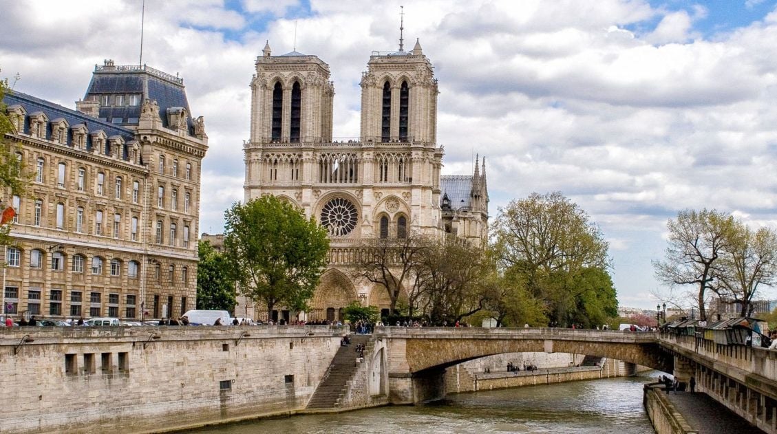
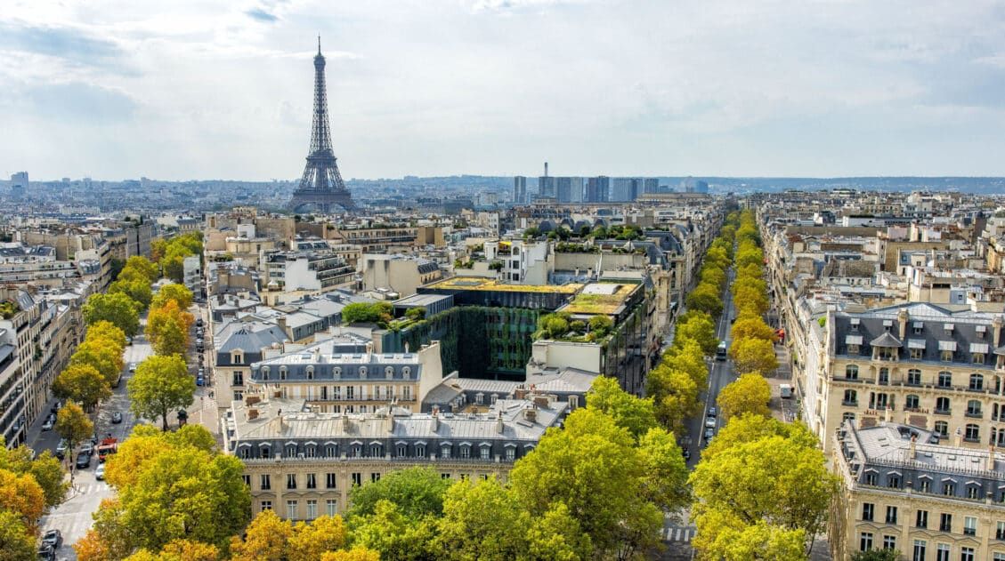
3 Days in Paris: The Perfect Itinerary for Your First Visit
In this guide, we’ll show you how to spend 3 memorable days in Paris. Visit the highlights, including the Eiffel Tower, the Louvre, Montmartre, and Notre Dame Cathedral, plus day trip to Versailles. Learn how to skip the lines, save some money, and make the most of your time in Paris. Welcome to one of […]
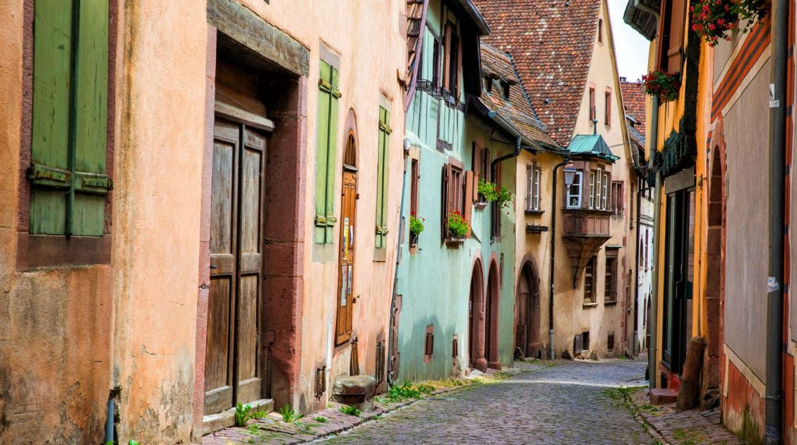
10 Fairytale Towns to Visit on the Alsace Wine Route
When I first saw photos of the town of Colmar, it immediately got added to our travel wish list. With its colorful buildings, bouquets of flowers, and scenic streets, it looked like it was plucked right out of a fairy tale. With a little more research, I was thrilled to learn that Colmar is just […]
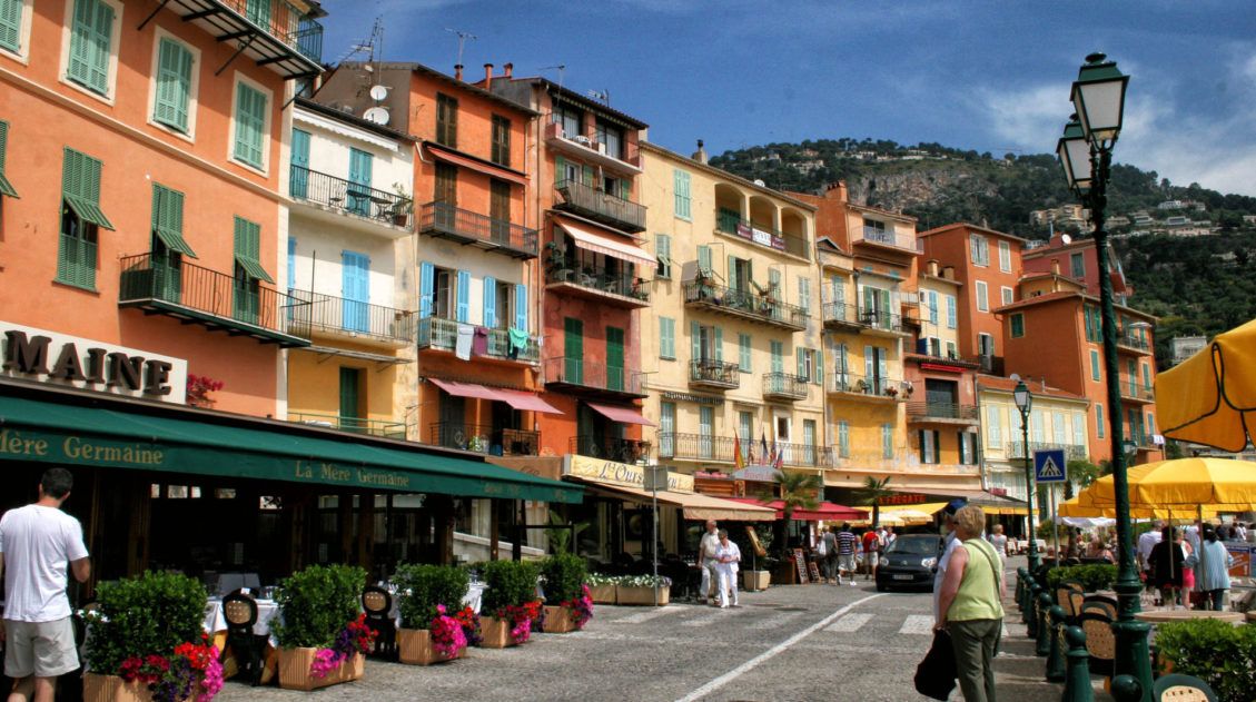
10 Day French Riviera and Provence Itinerary
The south of France…the land of beautiful coastal cities, glitzy beaches, vineyards, lavender, and one of the world’s best cuisines. This is where the rich and famous come to relax and party. It is a land of luxury, with yachts dotting the shorelines, fancy hotels in every city, and epic parties you read about in […]
How to Visit Gornergrat and Hike to Riffelsee & Riffelberg
For one of the best views of Matterhorn, it’s hard to beat Gornergrat. A scenic, cogwheel train takes you from Zermatt to this alpine paradise. Once at the top station, you can simply enjoy the sweeping views of the Matterhorn and the Swiss Alps from the restaurant and terraces. Or, you can add on the […]

Comments 4