Walker’s Haute Route
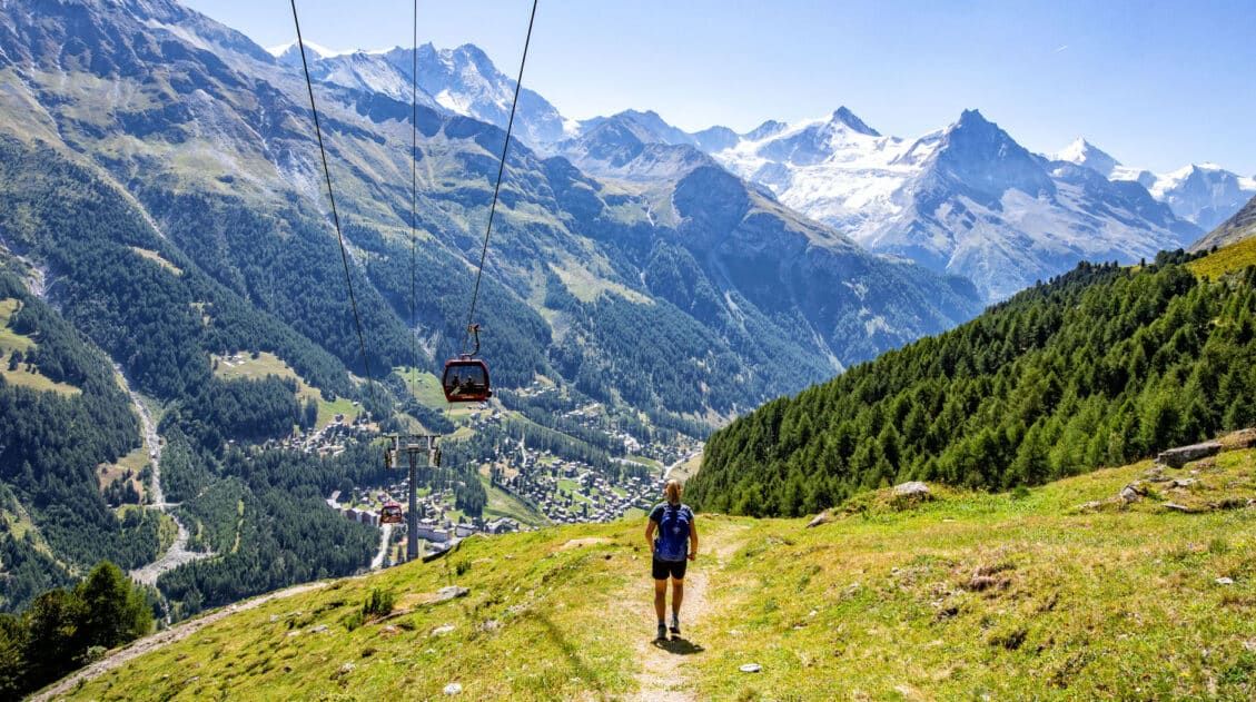
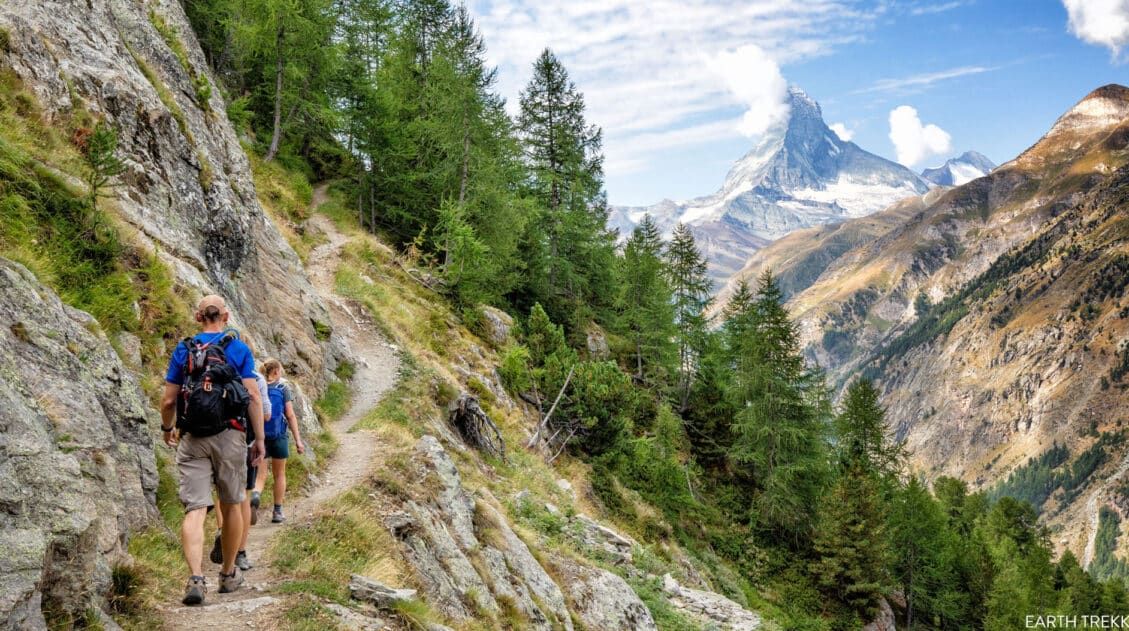
The Walker’s Haute Route is one of the most rewarding and memorable multi-day walks in Europe.
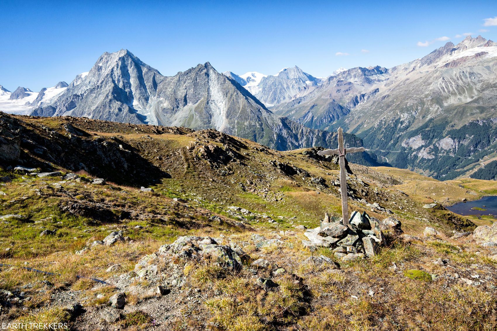
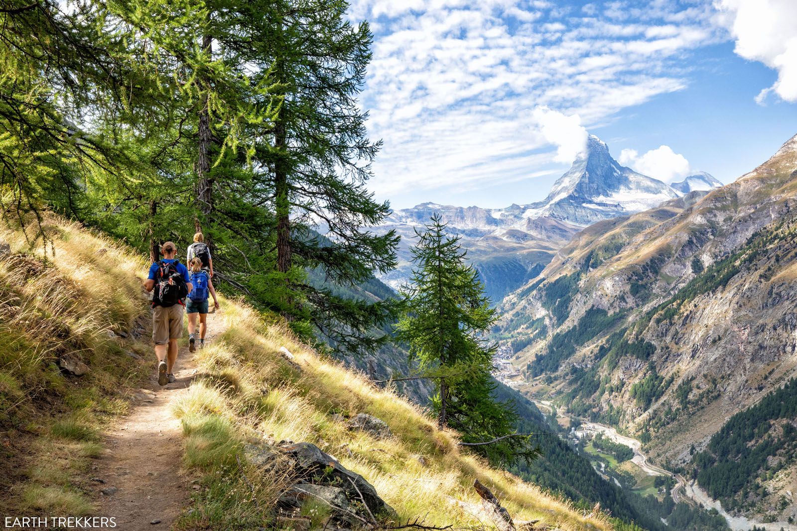
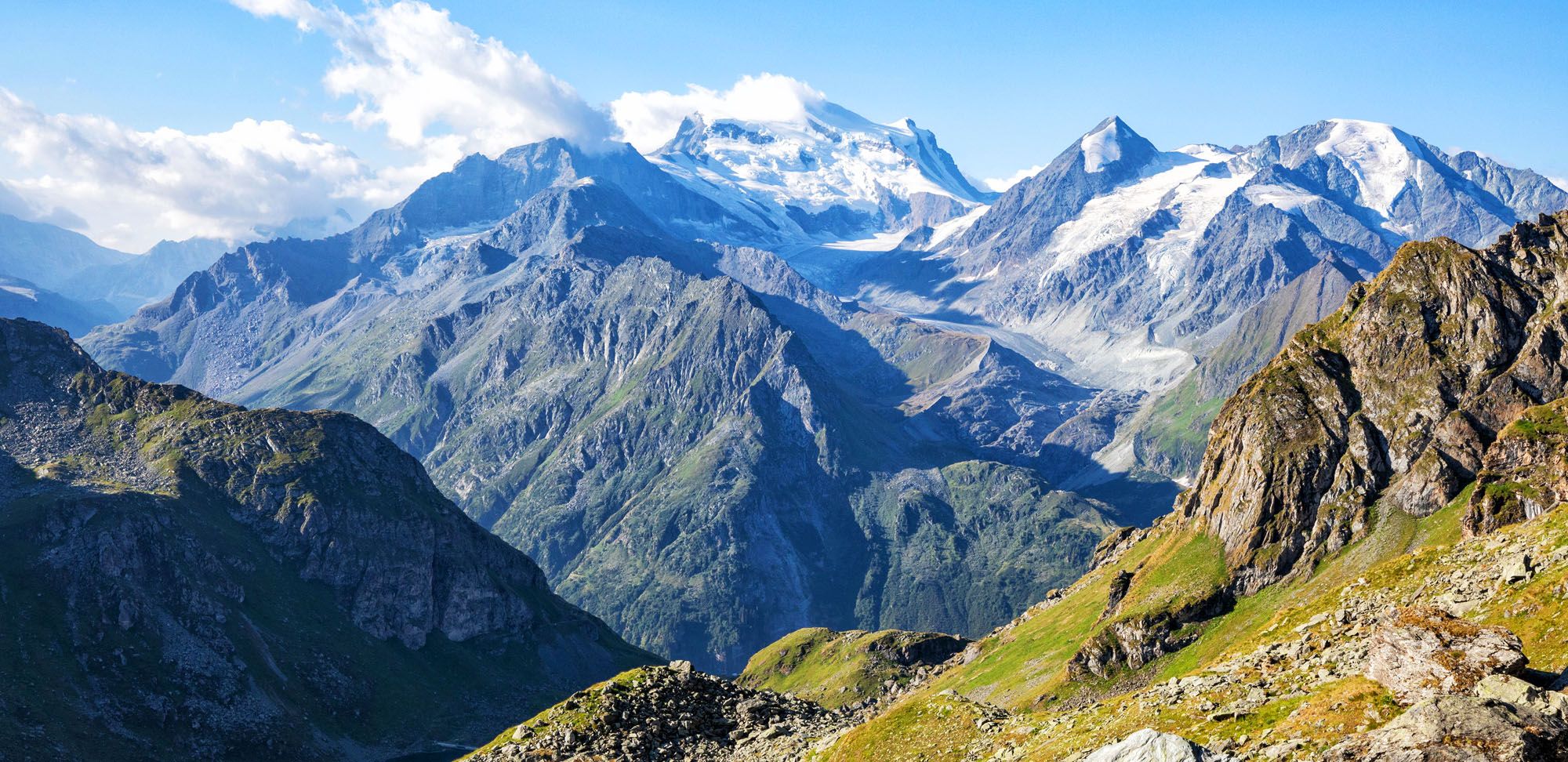
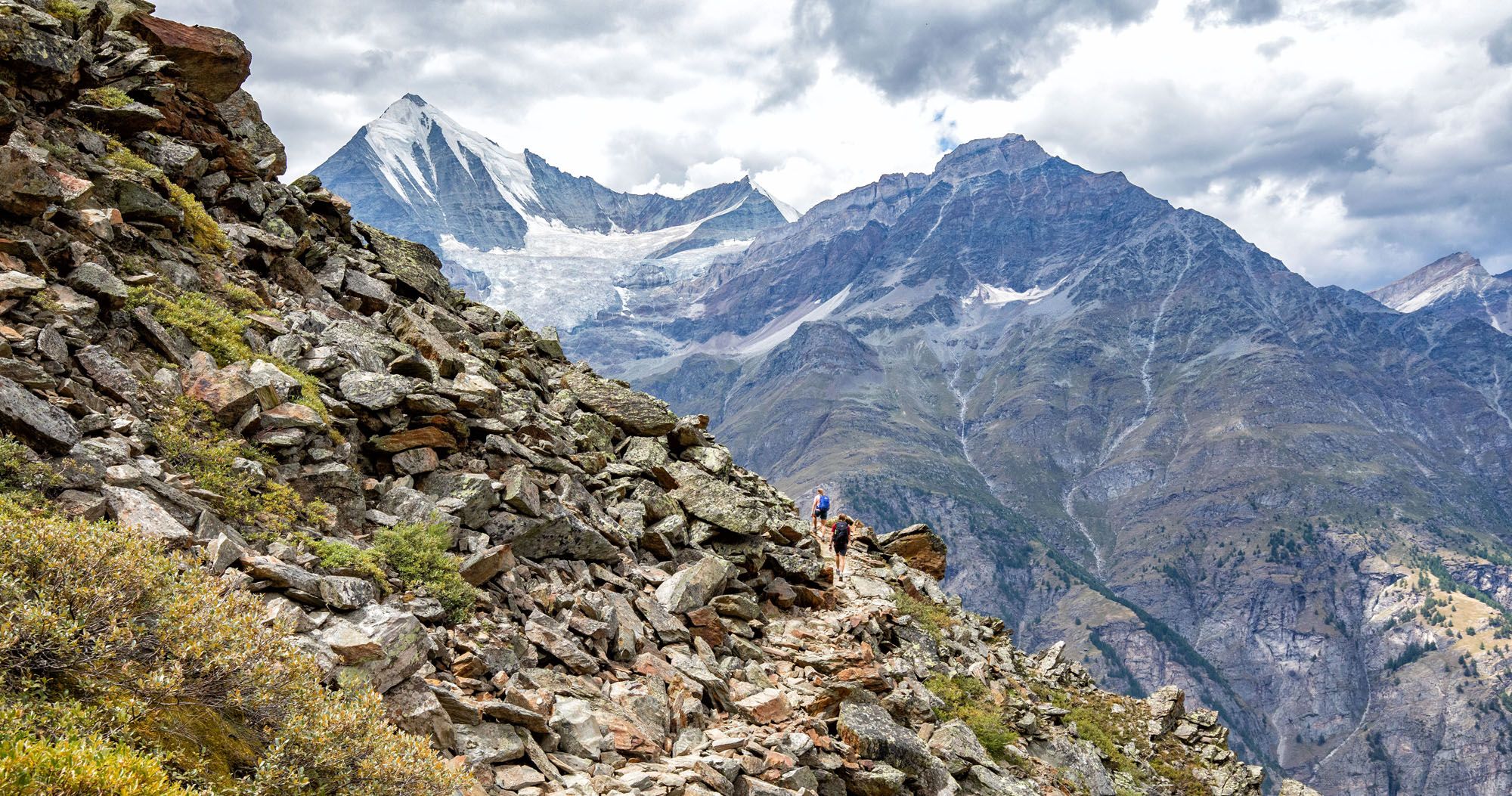
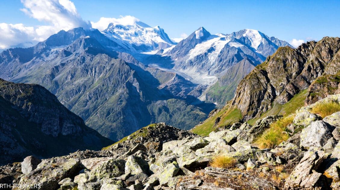
On this trek, hikers cross 10 of the highest mountain passes in the French and Swiss Alps, as they walk from Chamonix, France to Zermatt, Switzerland.
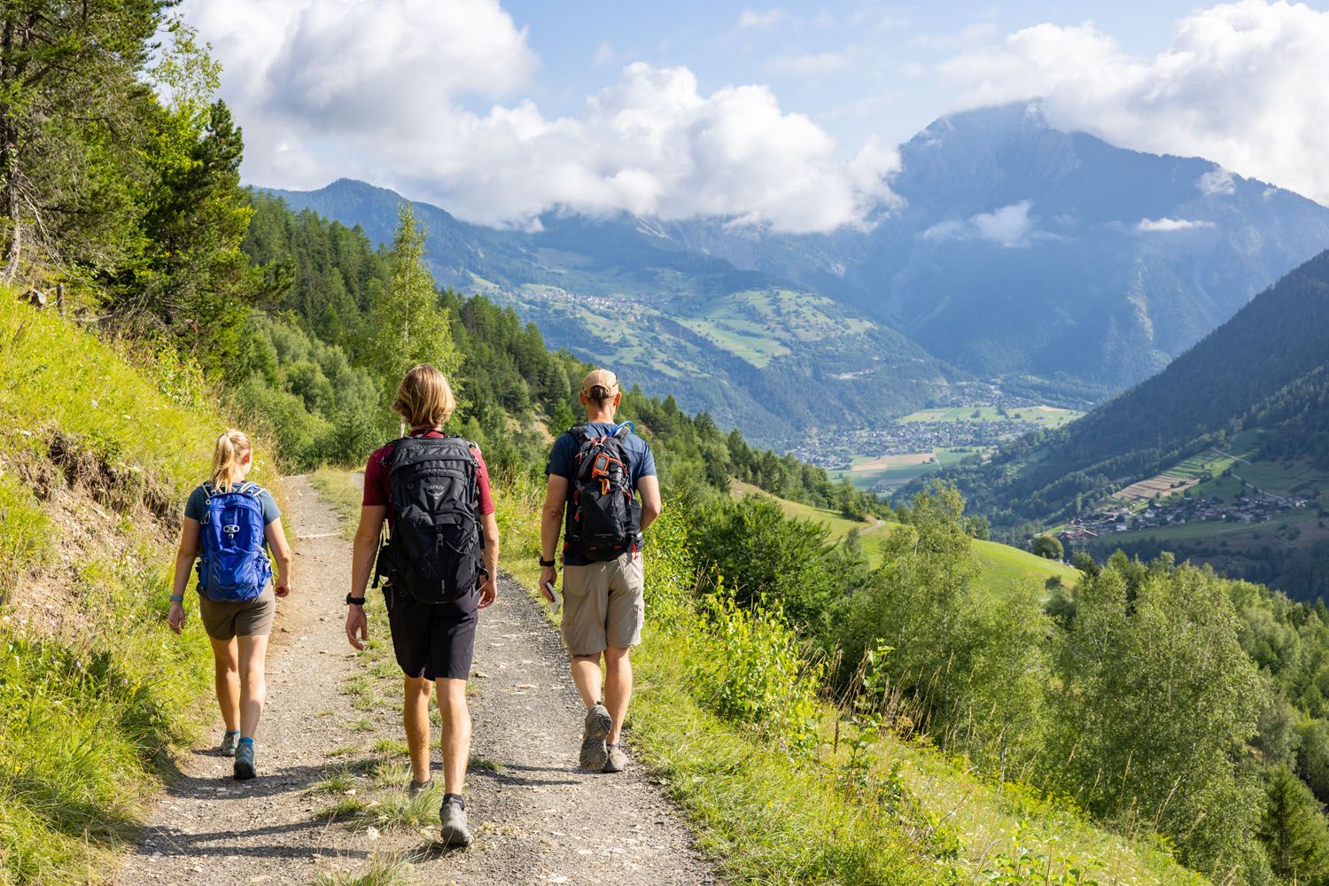
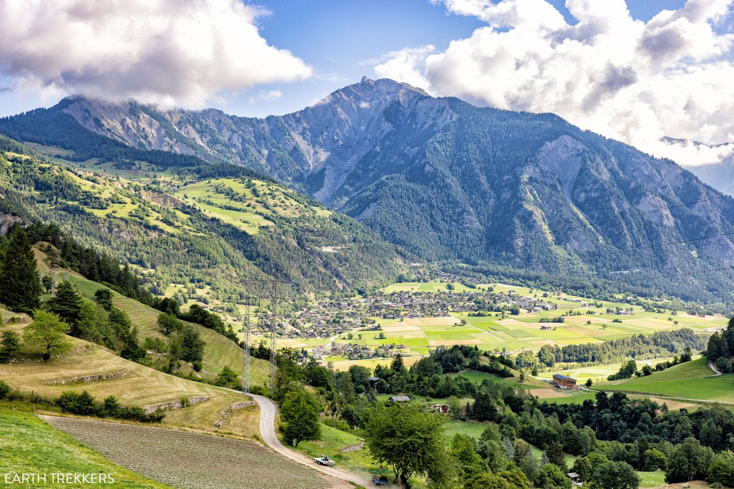
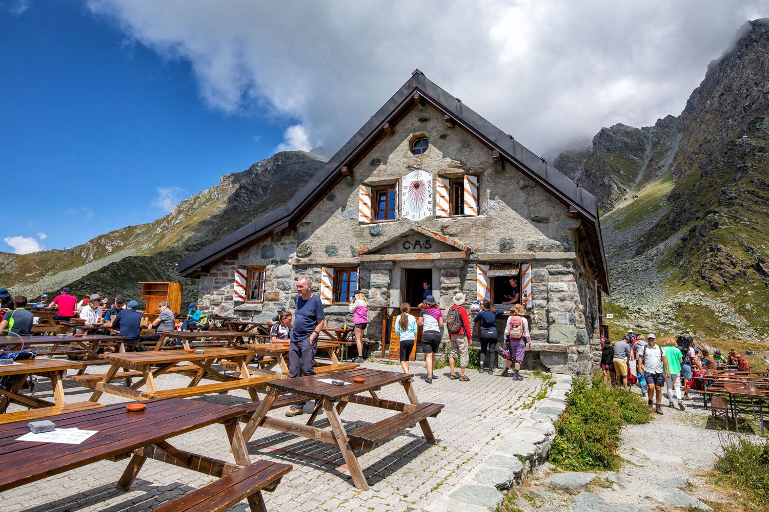
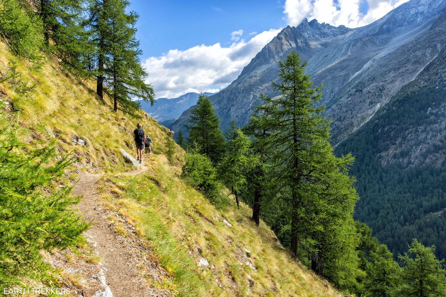
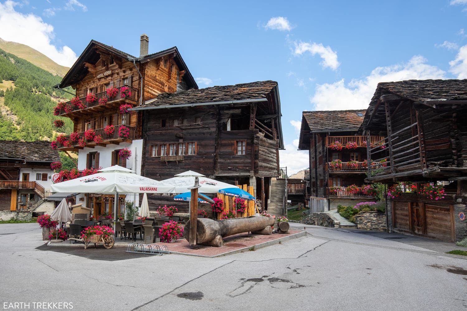
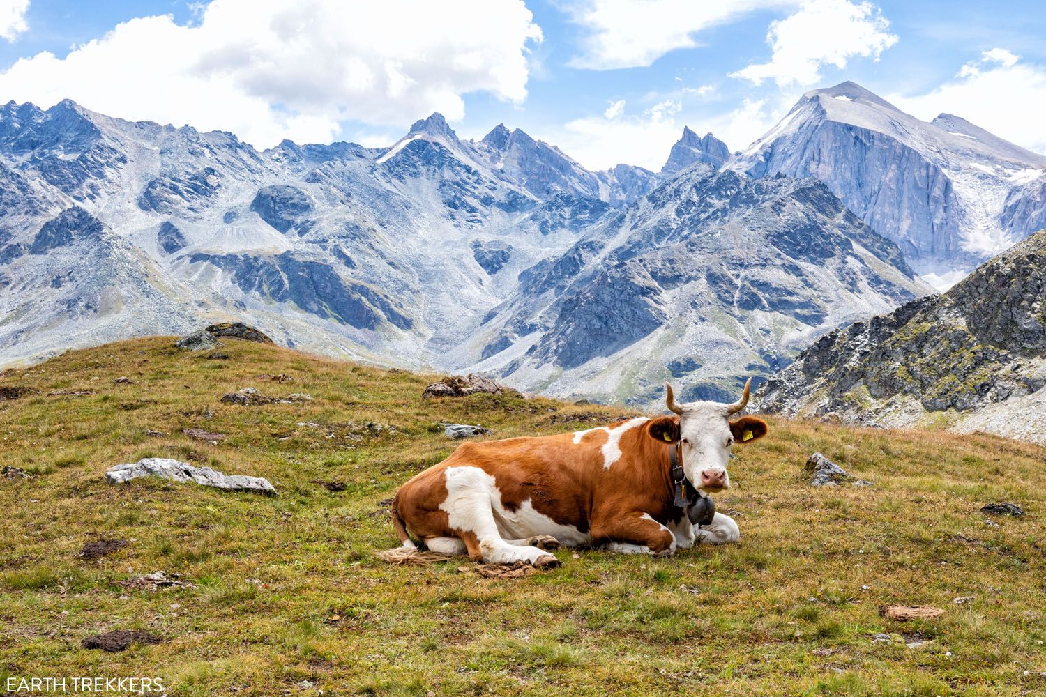
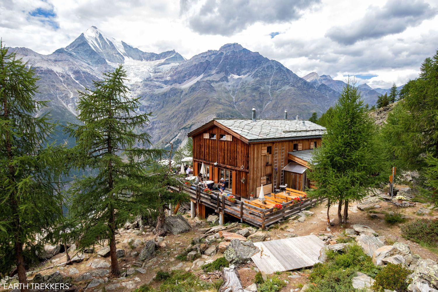
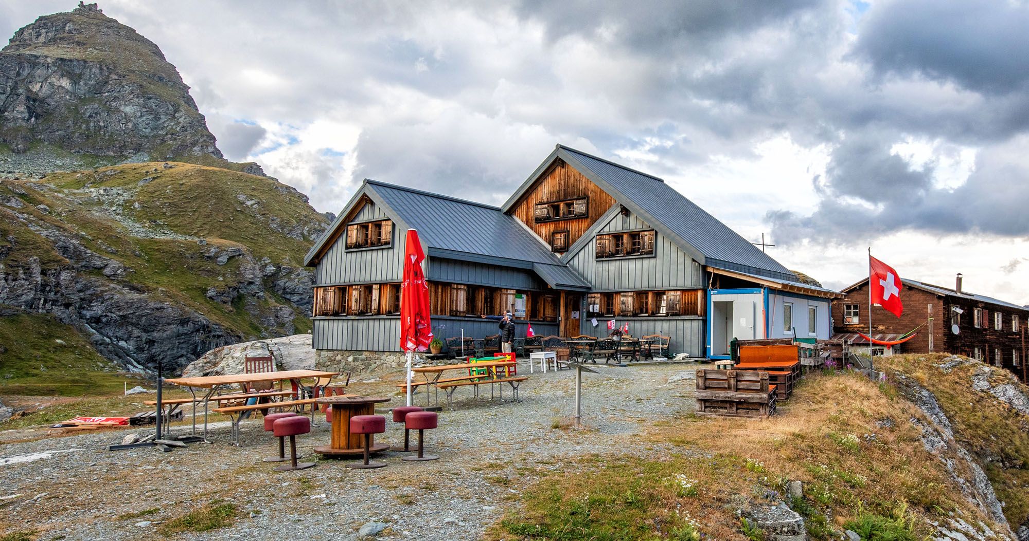
Walking from Chamonix to Zermatt takes you to remote mountain huts, to tiny hamlets on the mountainsides, and small villages in the valleys. Along the way, you get to see some of the most breathtaking views of the Alps. It’s a tough trek but you will make some incredible memories that you will cherish for the rest of your life.
In 2022, we hiked the entire Walker’s Haute Route, without taking any shortcuts. In this guide, we cover everything you need to know to plan your adventure and hike the Walker’s Haute Route.
Map & Elevation Profile of the Walker’s Haute Route
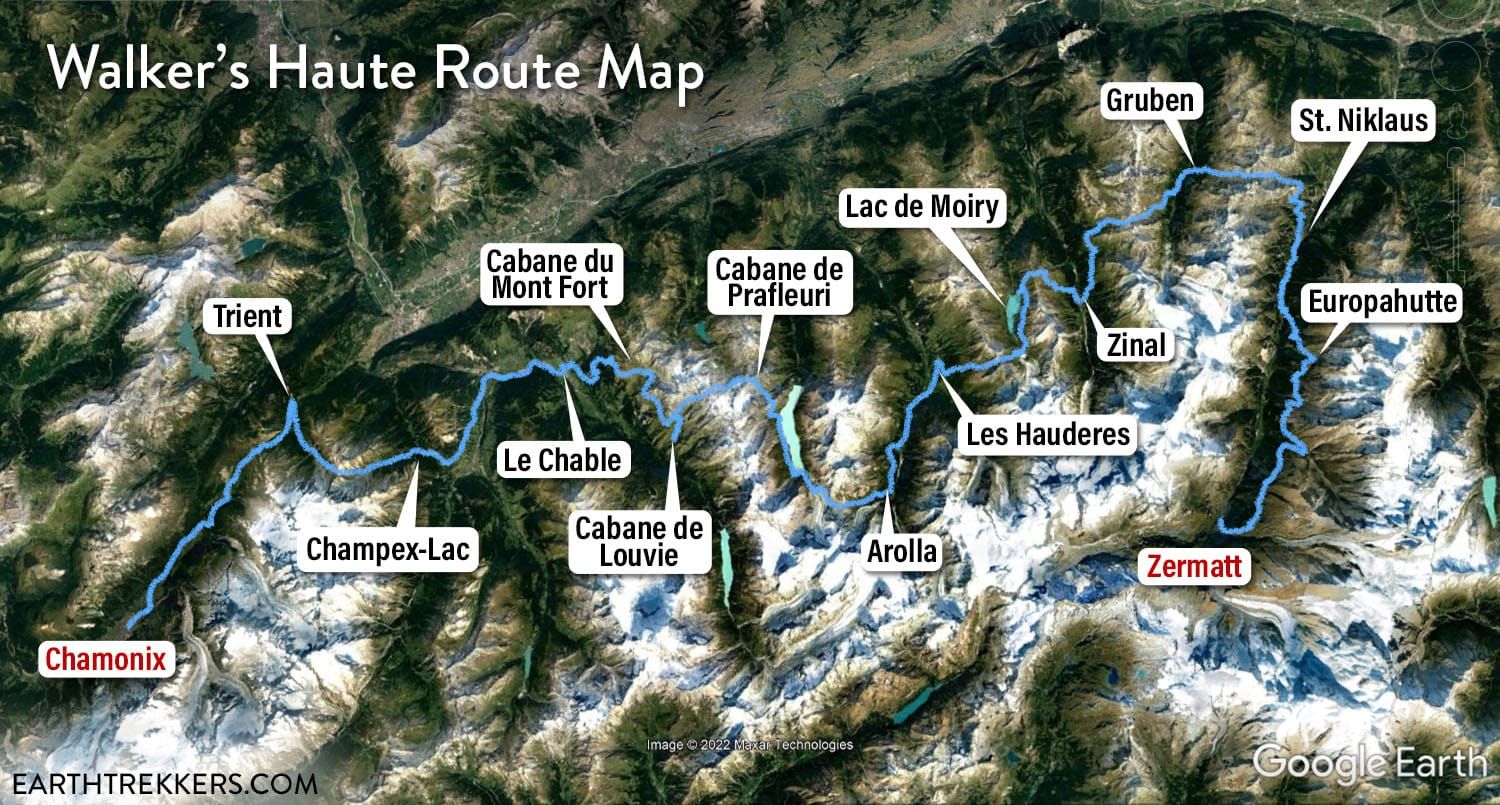
Map of the Walker’s Haute Route
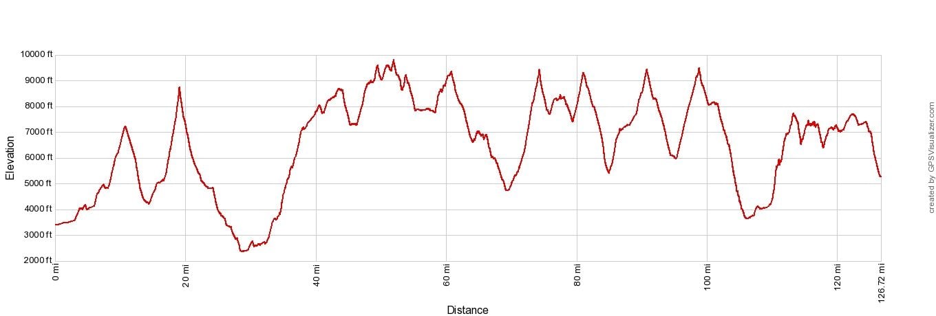
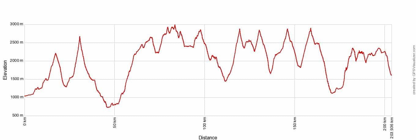
Elevation profile of the Walker’s Haute Route
Overview of the Walker’s Haute Route
The Walker’s Haute Route starts in Chamonix, France and ends in Zermatt, Switzerland. It takes most people 13 to 14 days to walk the Haute Route.
We hiked the entire distance, didn’t take any shortcuts, and made a few detours along the way, so our hiking distance and total ascent is slightly higher than what you might see listed on other sources.
Here are our hiking stats.
Distance: 204 km (127 miles)
Total Ascent: 14,300 m (47,000 feet)
Total Descent: 13,700 m (45,000 feet)
Time: 72 hours of hiking (including stops)
Days: 13
Start: Chamonix, France
End: Zermatt, Switzerland
When: July 24 to August 5
We hiked the Walker’s Haute Route in 13 days. That averages out to be 16 km (10 miles) a day with 1,140 meters (3,740 feet) of total ascent. However, some days were much longer than this and there were a few short, easy days thrown into the mix.
Walker’s Haute Route Stages: An Overview of All 14 Stages
There are 14 stages of the classic Walker’s Haute Route. The journey starts in Chamonix, France and ends in Zermatt, Switzerland. In this guide, we list an overview of each of the 14 stages, with information on possible detours and ways to shorten the trek, if necessary.
How Hard is the Walker’s Haute Route?
The Walker’s Haute Route is tough. We had multiple days where we hiked more than a mile in ascent (more than 1,600 meters), which is a lot of climbing to do.
And the next day…it’s not a rest day. You have to wake up and do it again.
We also did the Everest Base Camp trek in 2014. Tyler and Kara were just 10 and 11 at the time.
In terms of hiking, the Haute Route is MUCH more challenging. The longer daily distances, the huge ascents, and very few rest days makes the Haute Route physically tougher than EBC in our opinion.
If you plan to hike the Haute Route, a 16 km/10-mile day with 1,100 meters/3,500 feet of total ascent should be easy for you, before starting this trek.
When to Hike the Haute Route
The Walker’s Haute Route is typically done from mid-July through mid-September, when the trails are clear of snow.
Mountain huts open mid-June, but going this early, you risk hiking on trails that are still snow-covered, which could be dangerous.
We hiked the Haute Route from July 24 to August 5, which is also the busiest time to be on the trails.
Important Things to Know About the Walker’s Haute Route
Walker’s Haute Route: 21 Important Things to Know & FAQ
In this guide, we hope to answer all of the questions you have about the Walker’s Haute Route, and maybe some you haven’t thought of yet. We cover what to expect on a typical day, what to do about your luggage, how fit do you need to be, if you will have cellular service, and much more.
How To Plan Your Walker’s Haute Route Experience
This guide starts off outlining a few factors to consider as you plan the experience that is right for you. Then it outlines decisions you need to make regarding some of the stages, where shortcuts can be taken, and it provides suggestions for those who want to shorten or lengthen their experience.
Stages of the Walker’s Haute Route
Below are guides to each stage of the Walker’s Haute Route. These include maps, elevation profiles, a route overview, and lots of photos of the trail.
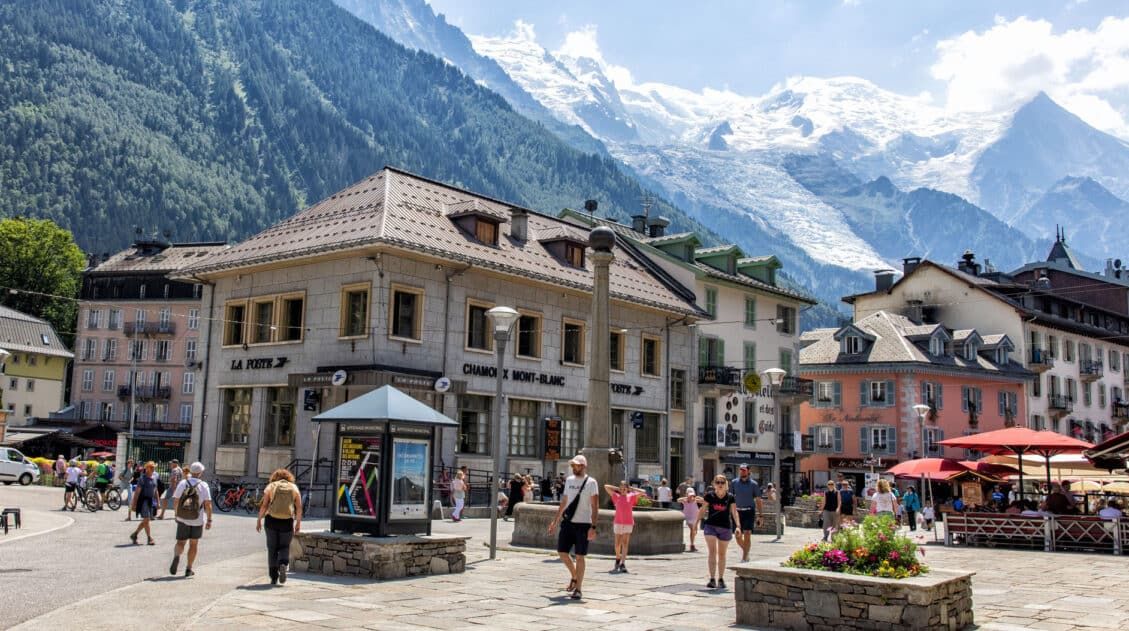
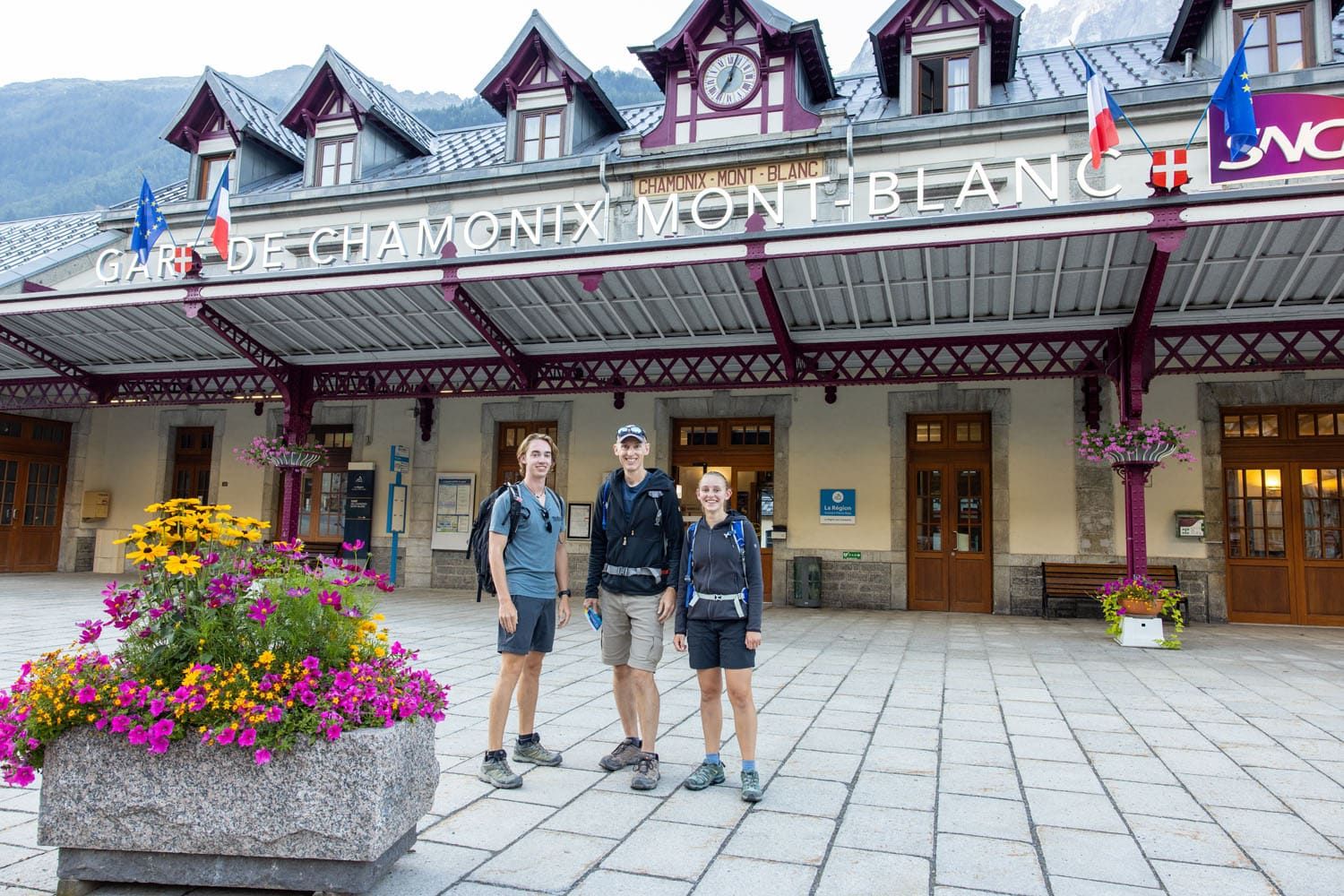
Walker’s Haute Route Stage 1: Chamonix-Mont-Blanc to Argentière
Stage 1 of the Walker’s Haute Route is the shortest, easiest day of the entire trek. It’s a mostly flat walk between Chamonix and Argentière and for most of this stage, you are either walking through town or through an evergreen forest. If you spent any time in Chamonix or Argentière prior to starting this […]
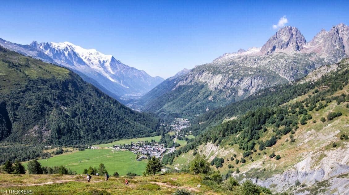
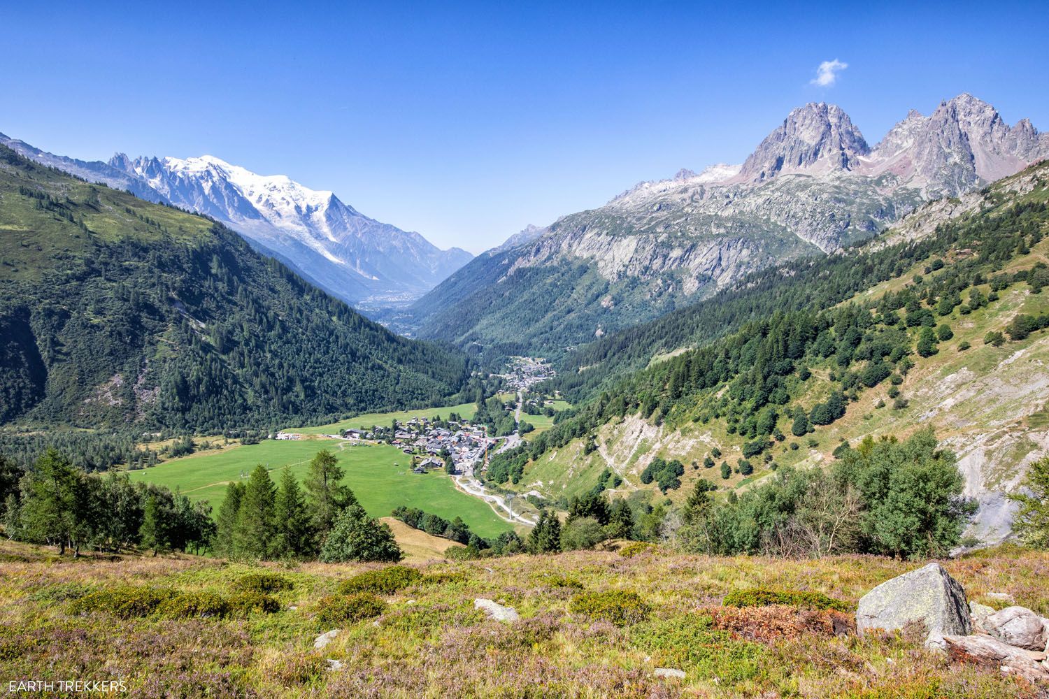
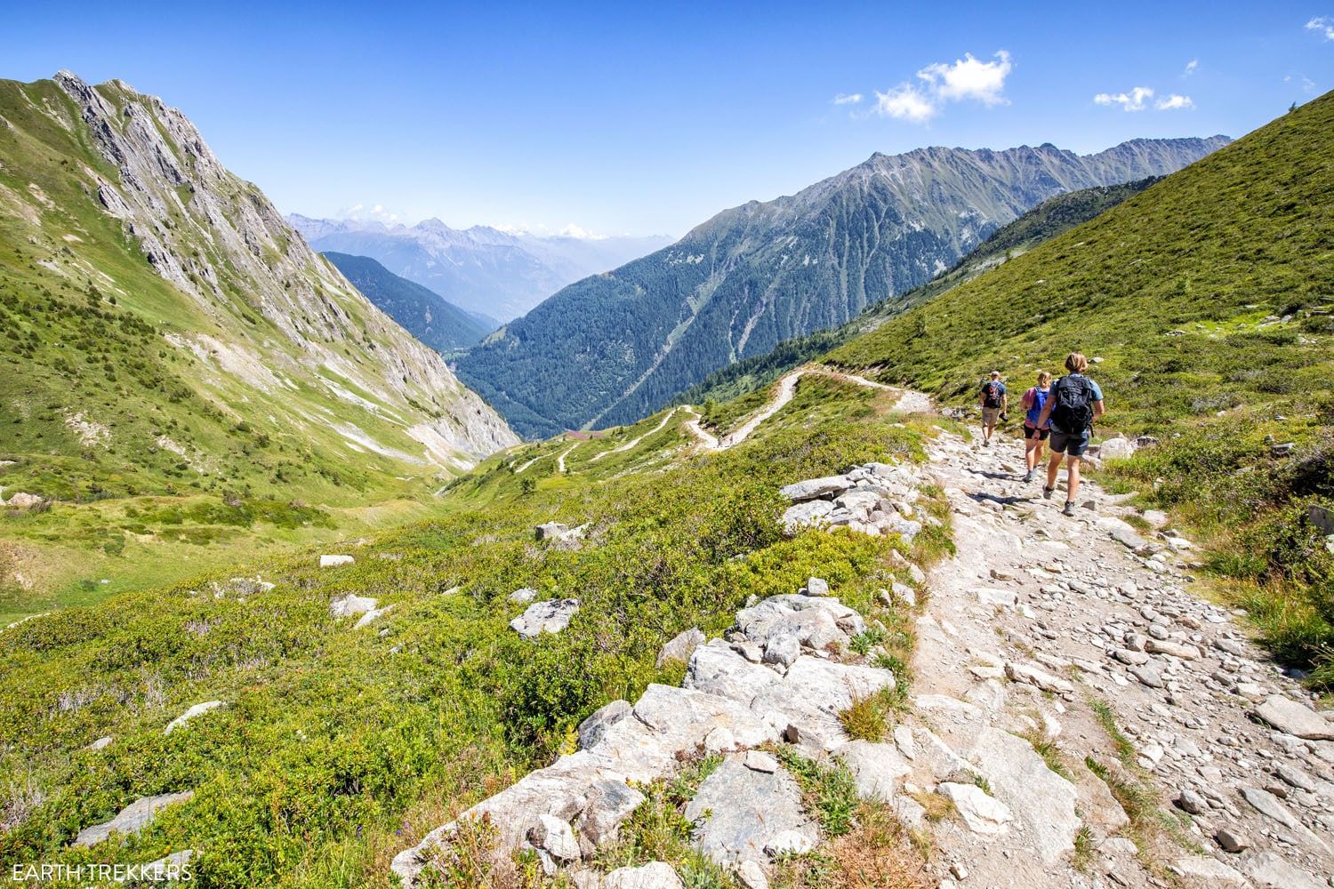
Walker’s Haute Route Stage 2: Argentière to Col de Balme to Trient
After an easy, somewhat unexciting walk from Chamonix to Argentière, the hike gets to be a lot more interesting on this stage. It also gets a lot more challenging. Stage 2 of the Walker’s Haute Route is the first time you really get to test out your legs and enjoy the alpine views for which […]
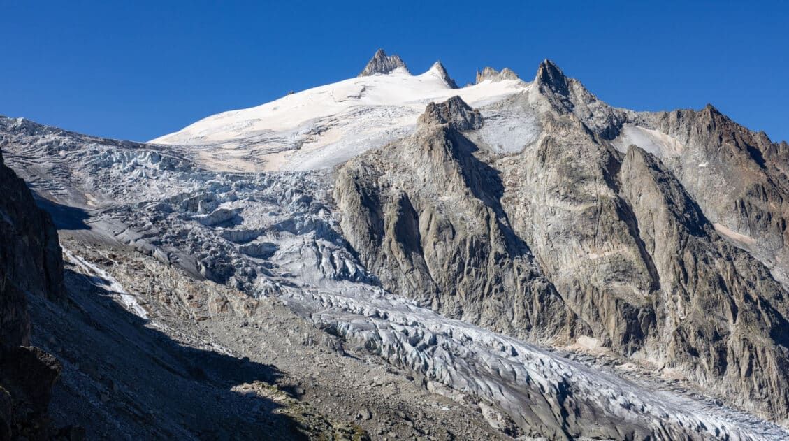
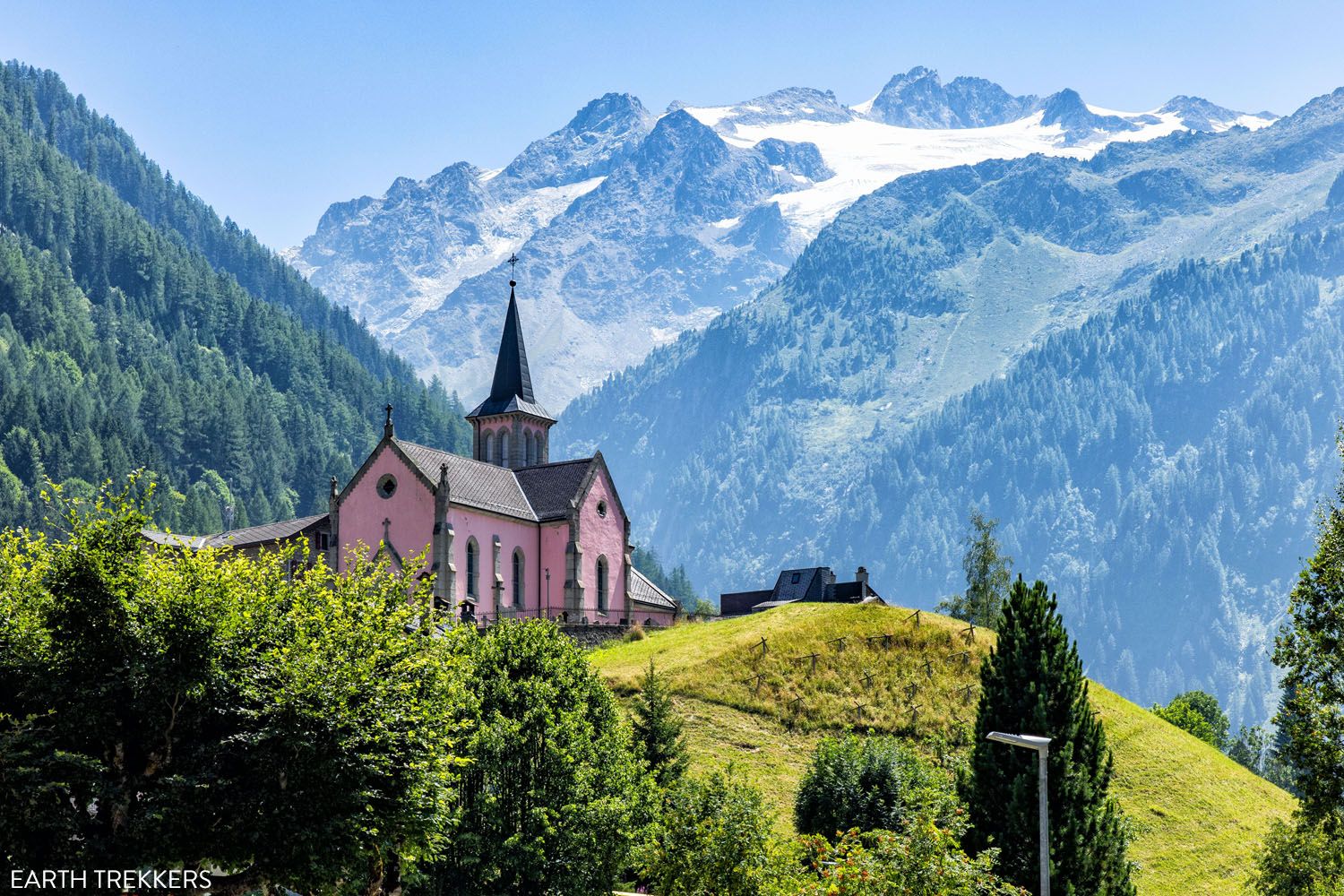
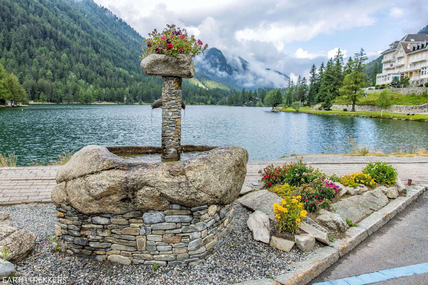
Walker’s Haute Route Stage 3: Trient to Fenêtre d’Arpette to Champex-Lac
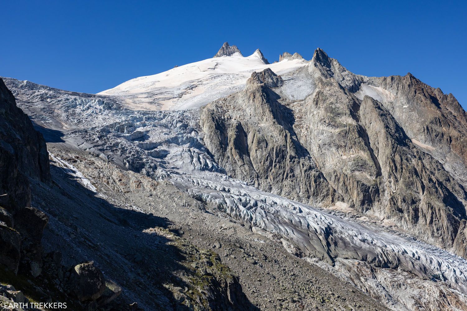
Stage 3 of the Walker’s Haute Route is the most challenging stage yet, but also one of the most rewarding. A massive, steep climb takes you up to the top of a mountain pass, Fenêtre d’Arpette, and along the way, you will have fantastic views of the Trient Glacier. It is a hard hike, and […]
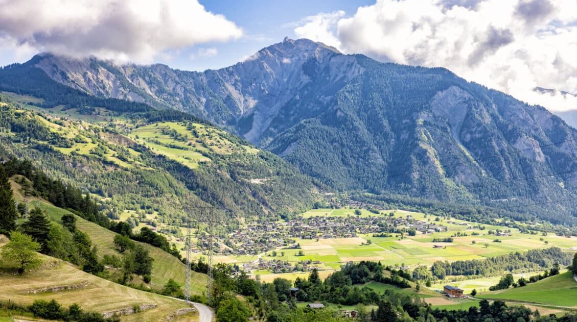
Walker’s Haute Route Stage 4: Champex-Lac to Le Châble
After two long, strenuous climbs and steep descents offered by the last two stages of the Walker’s Haute Route, Stage 4 provides a much needed day of recovery. Although you will still end up hiking roughly 14 km (8 miles), Stage 4 is much less challenging and one of the easiest days of the entire […]
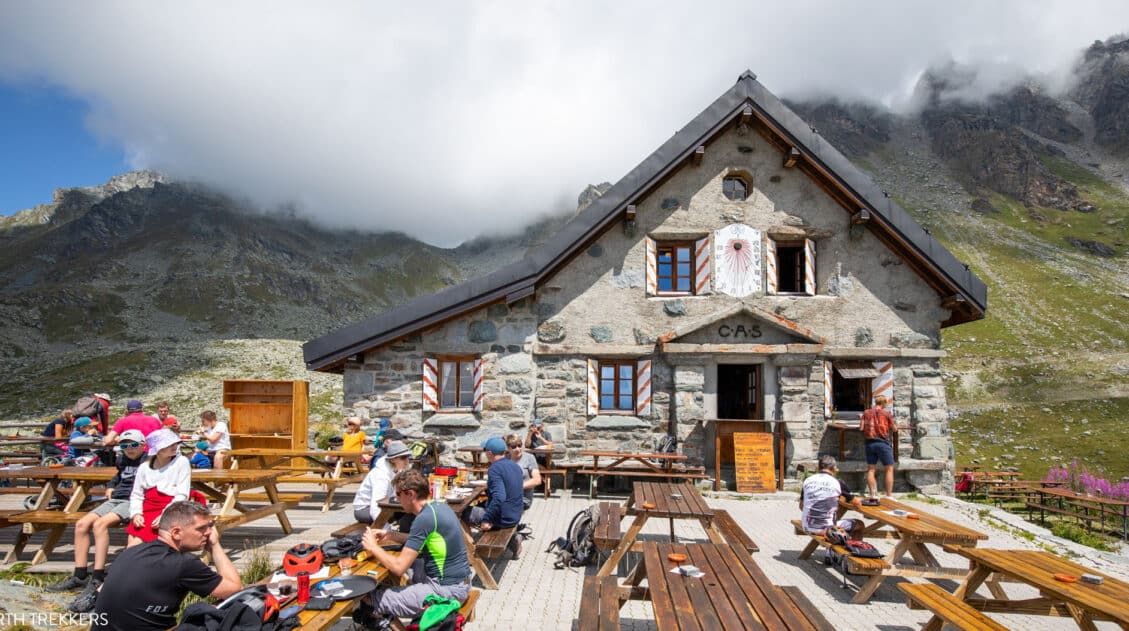
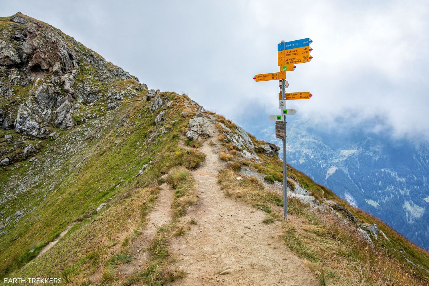
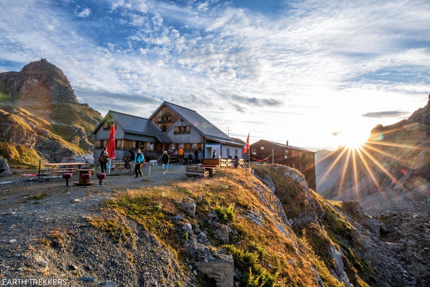
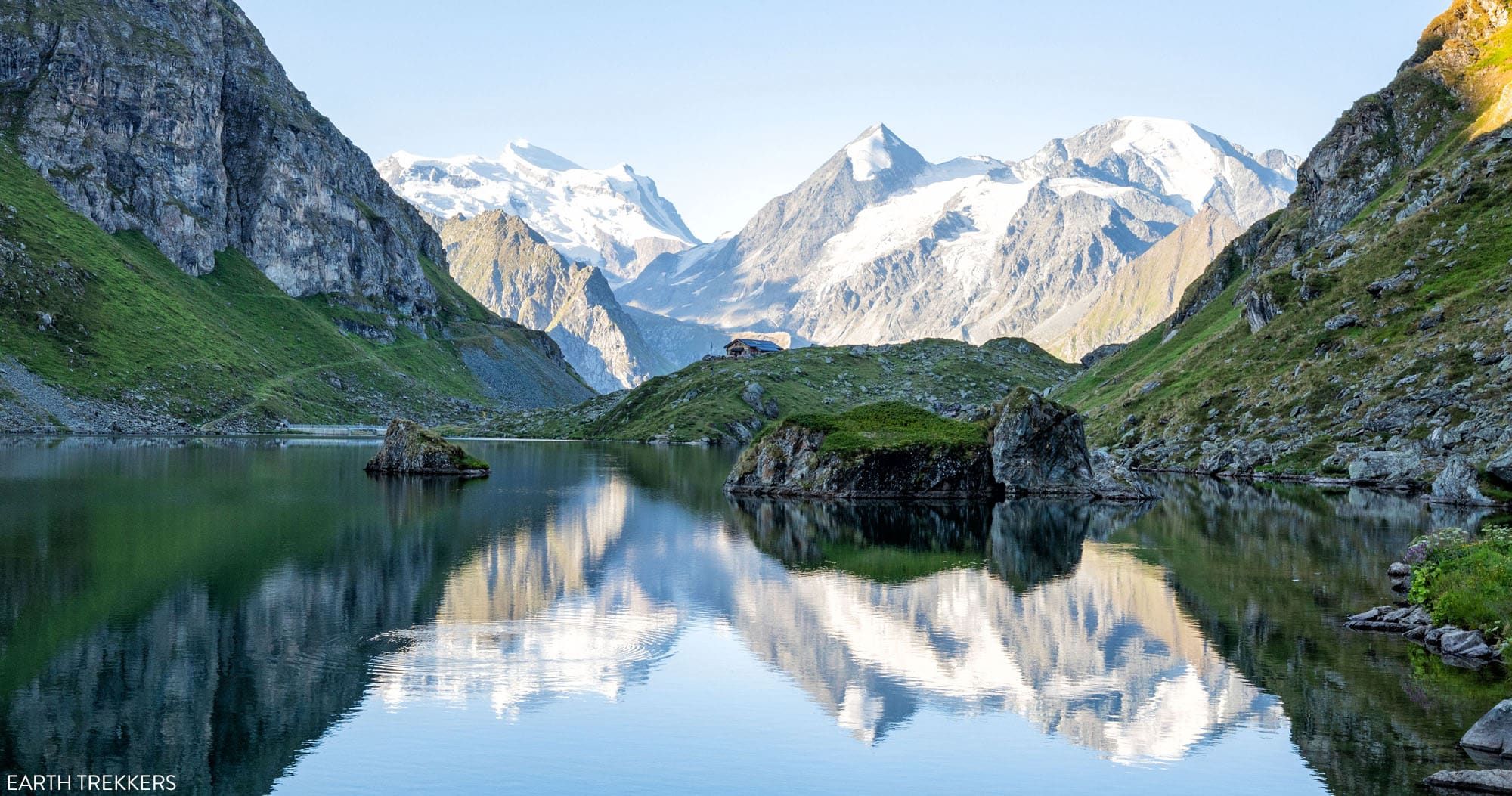
Walker’s Haute Route Stage 5: Le Châble to Cabane du Mont Fort
Hopefully you are feeling well rested, as Stage 5 of the Walker’s Haute Route includes one of the largest climbs of the entire route. Beginning in the valley in Le Châble, you will work your way up into the high alpine mountain ranges where you will spend the night. Be prepared for wild changes in […]
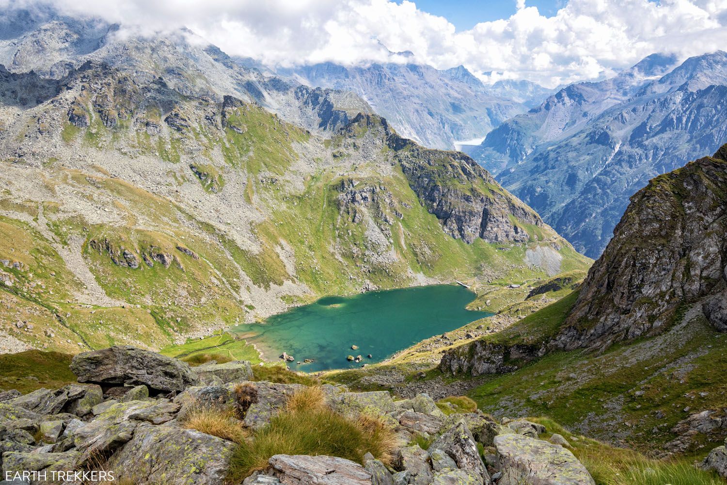
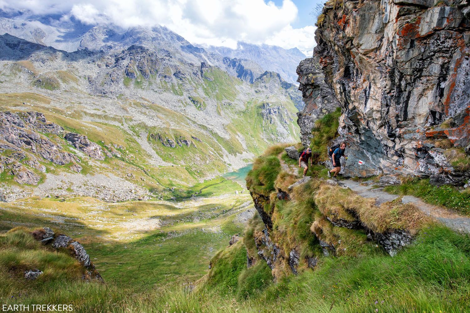
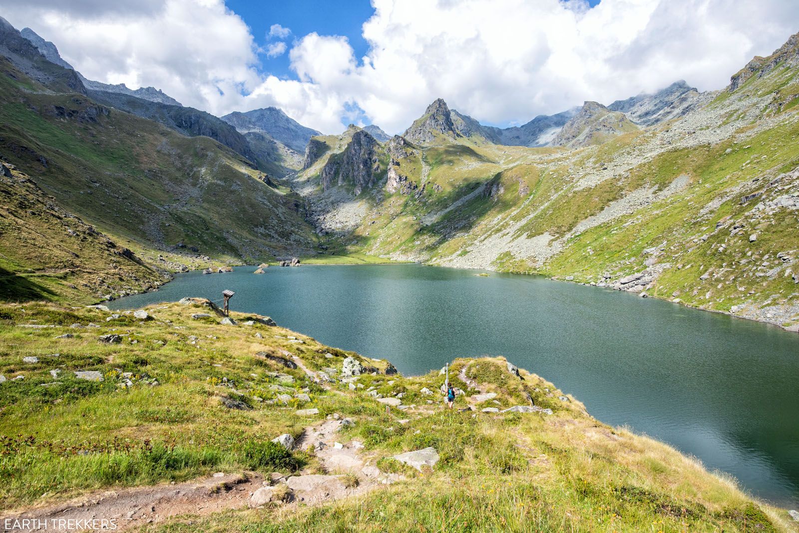
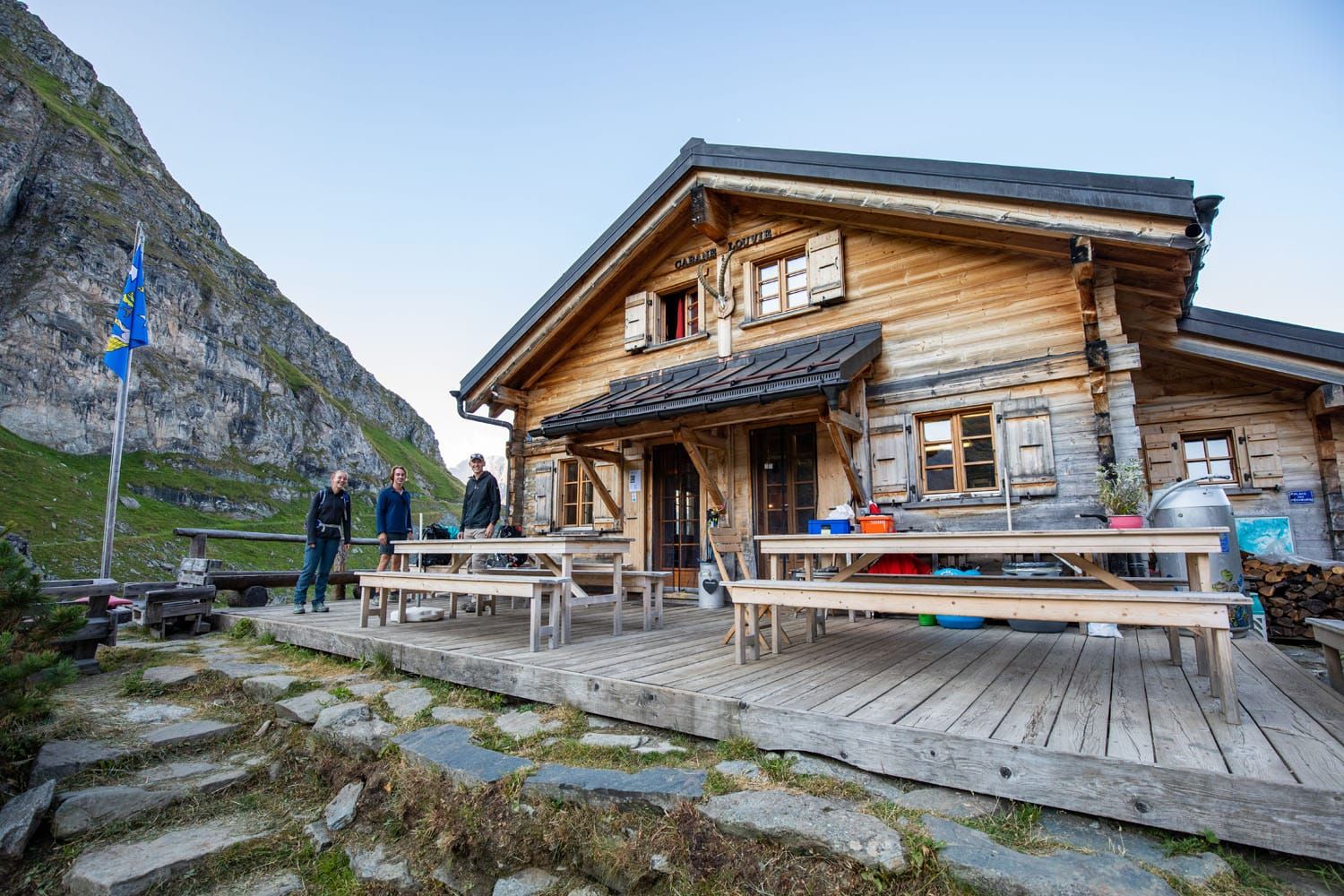
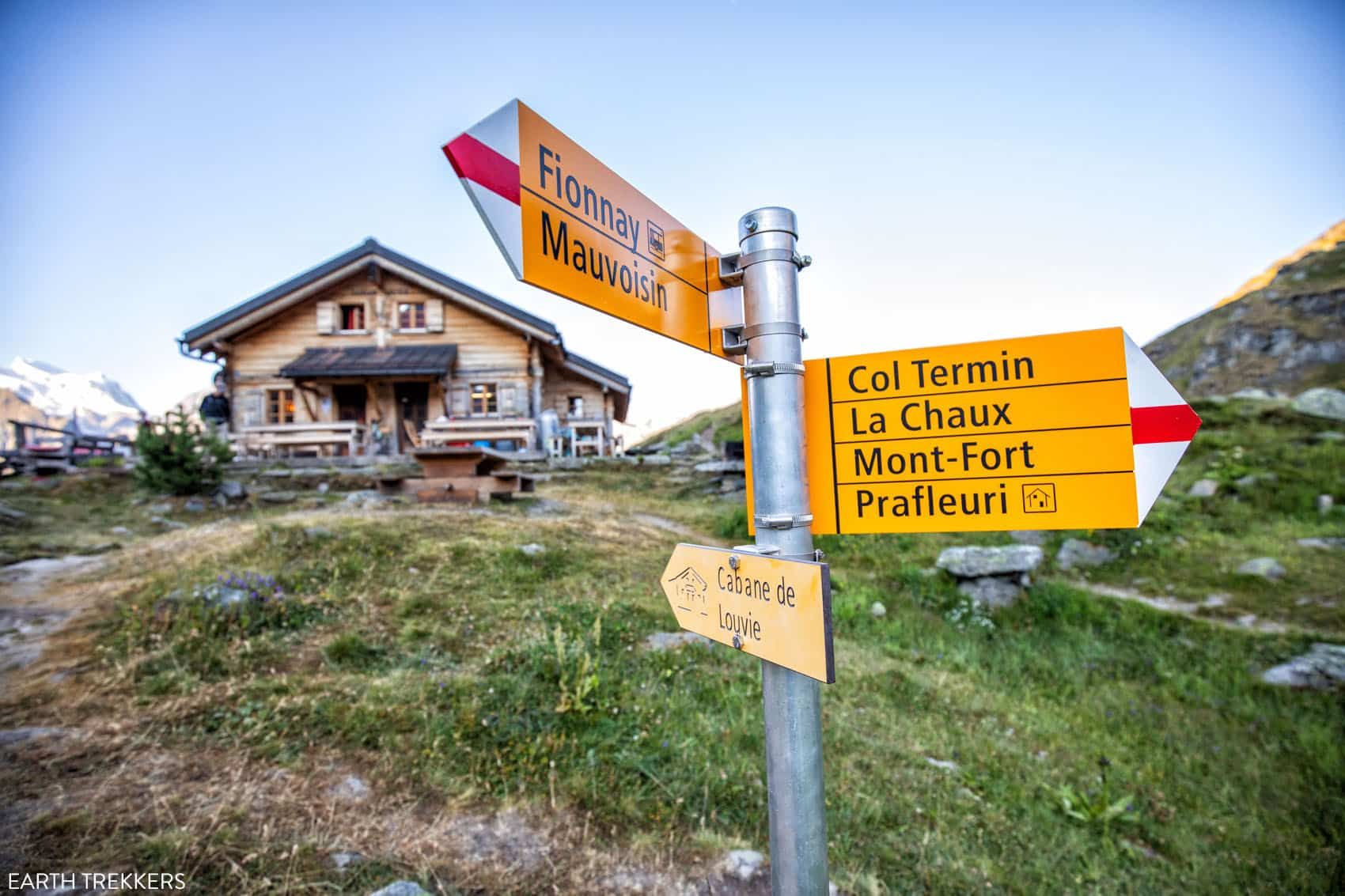
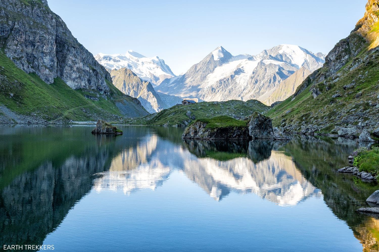
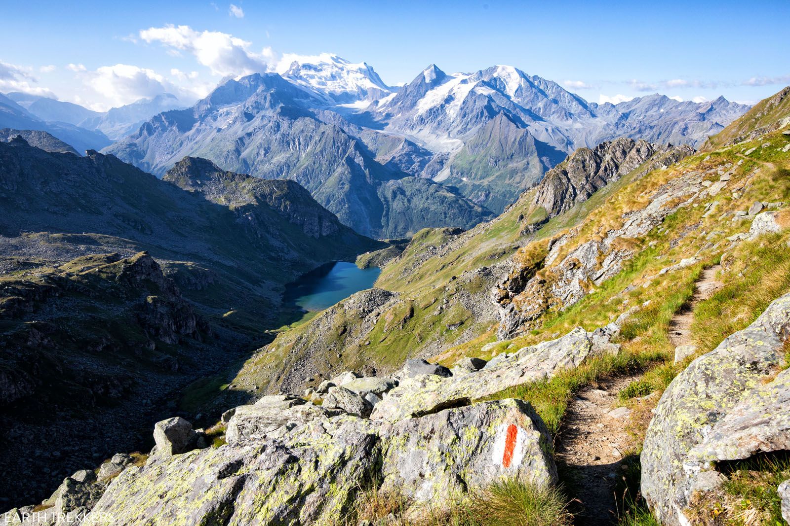
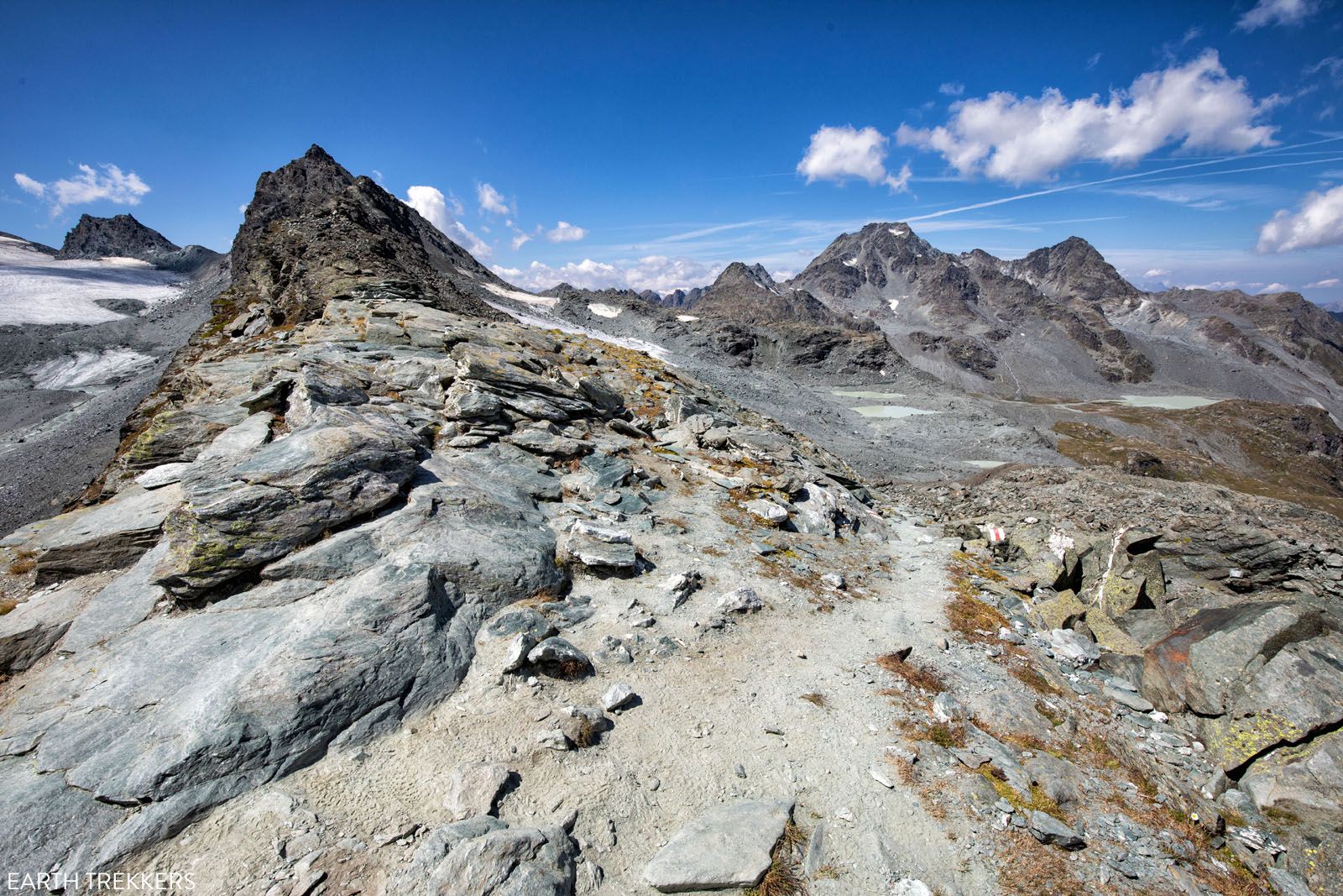
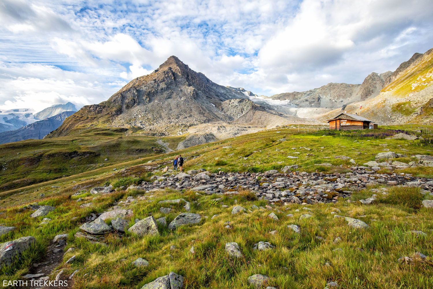
Walker’s Haute Route Stage 6: Cabane du Mont Fort to Cabane de Prafleuri
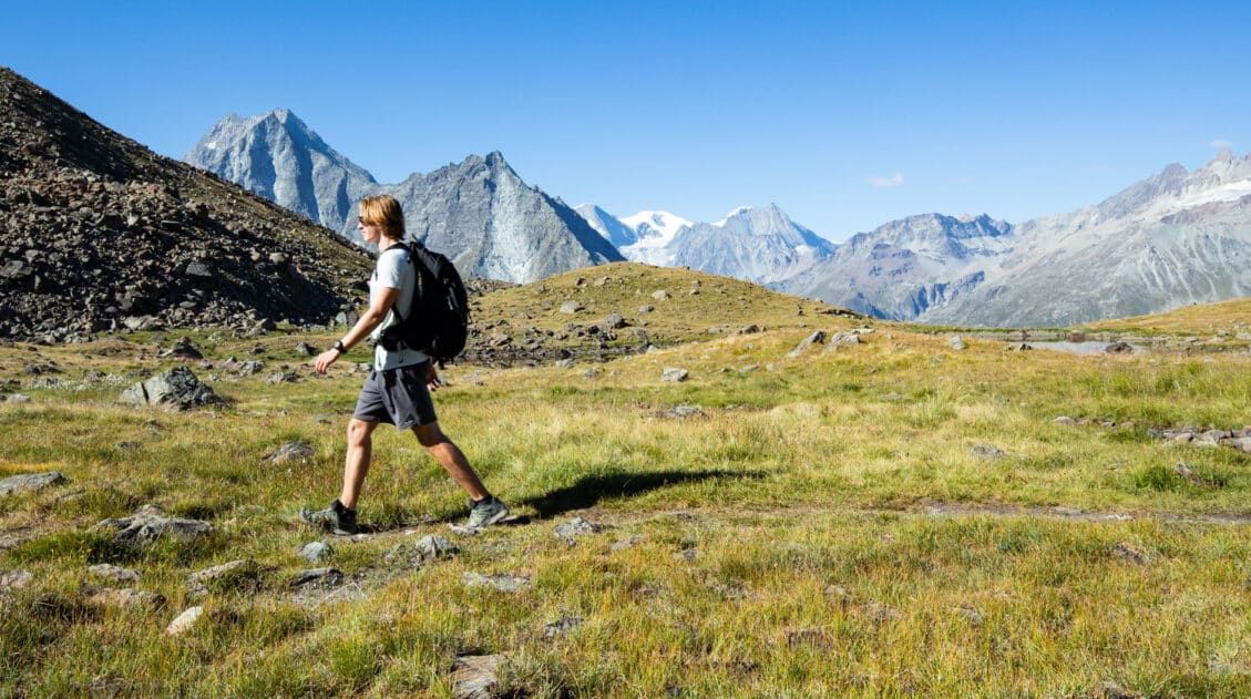
On very tired legs we started Stage 6 of the Walker’s Haute Route. Today’s hike is a quintessential day on the Haute Route. In about 7 hours, you will cross several cols, hike past glacial lakes, and enjoy views of spectacular alpine scenery. In fact, Stage 6 is the most scenic day yet. This is […]
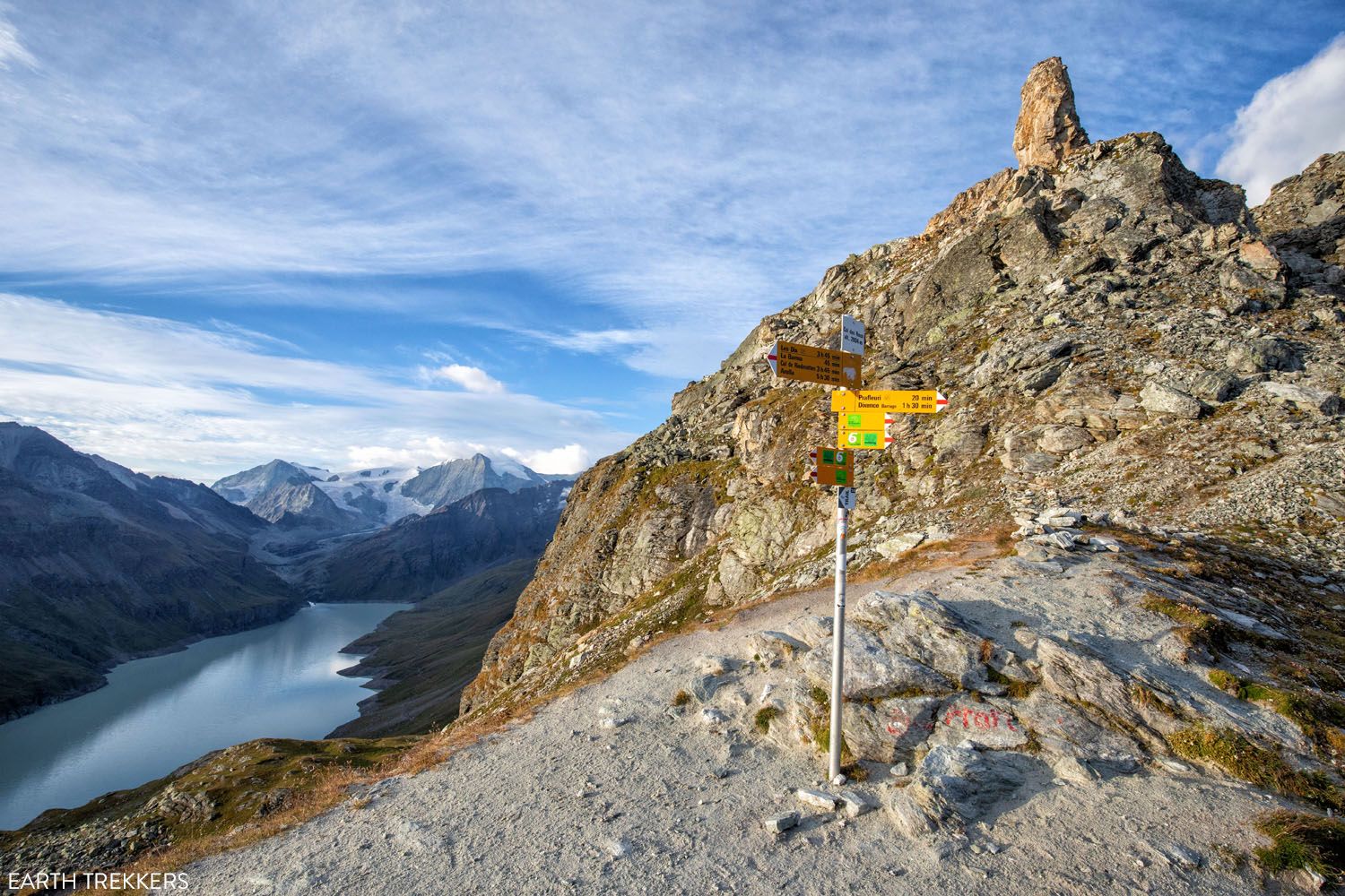
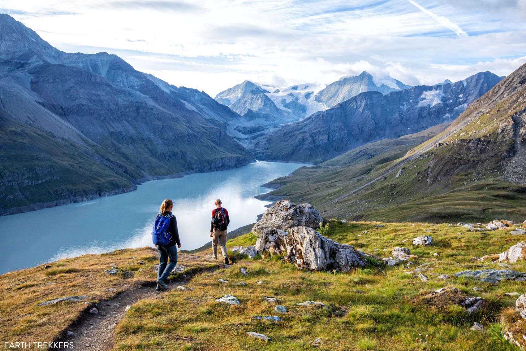
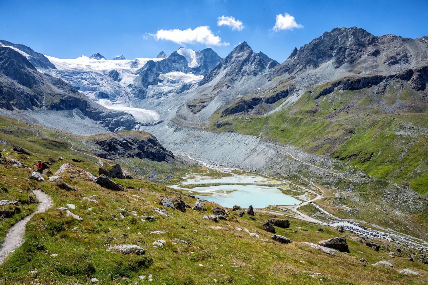
Walker’s Haute Route Stage 7: Cabane de Prafleuri to Arolla
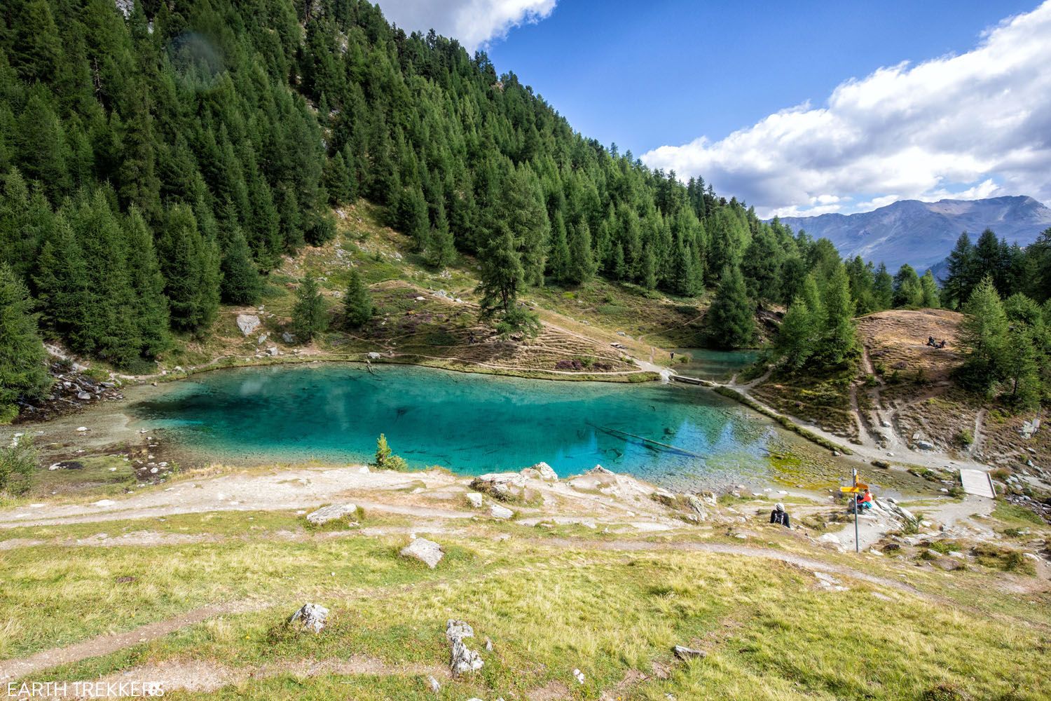
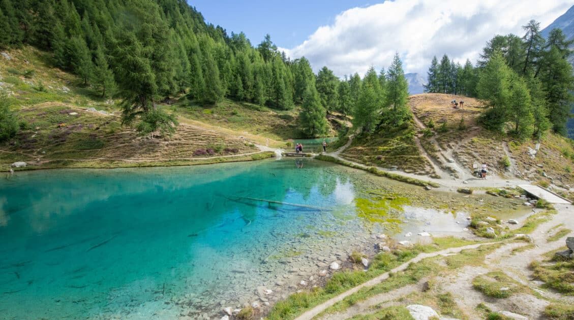
Stage 7 is one of our favorite stages of the Walker’s Haute Route. This is a beautiful walk from start to finish. Today’s trail covers a wide variety of landscapes, from glacier-covered mountains, a lovely milky-blue lake, forested hills, and wide open grasslands. In terms of difficulty, today’s stage is relatively easy. You will have […]
Walker’s Haute Route Stage 8: Arolla to Les Haudères
Stage 8 is both the easiest and shortest of the 14 stages that make up the Walker’s Haute Route and it is a great chance to catch your breath and rest your legs before heading into the final stretches of the Haute Route. Beginning in Arolla, you will hike up and over hillsides, passing through […]
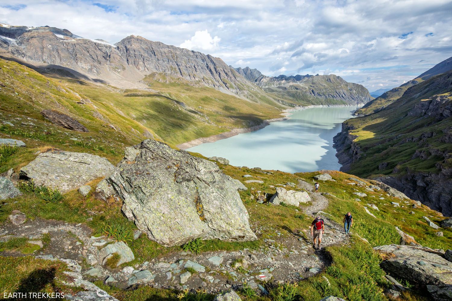
Walker’s Haute Route Stage 9: Les Haudères to Lac de Moiry
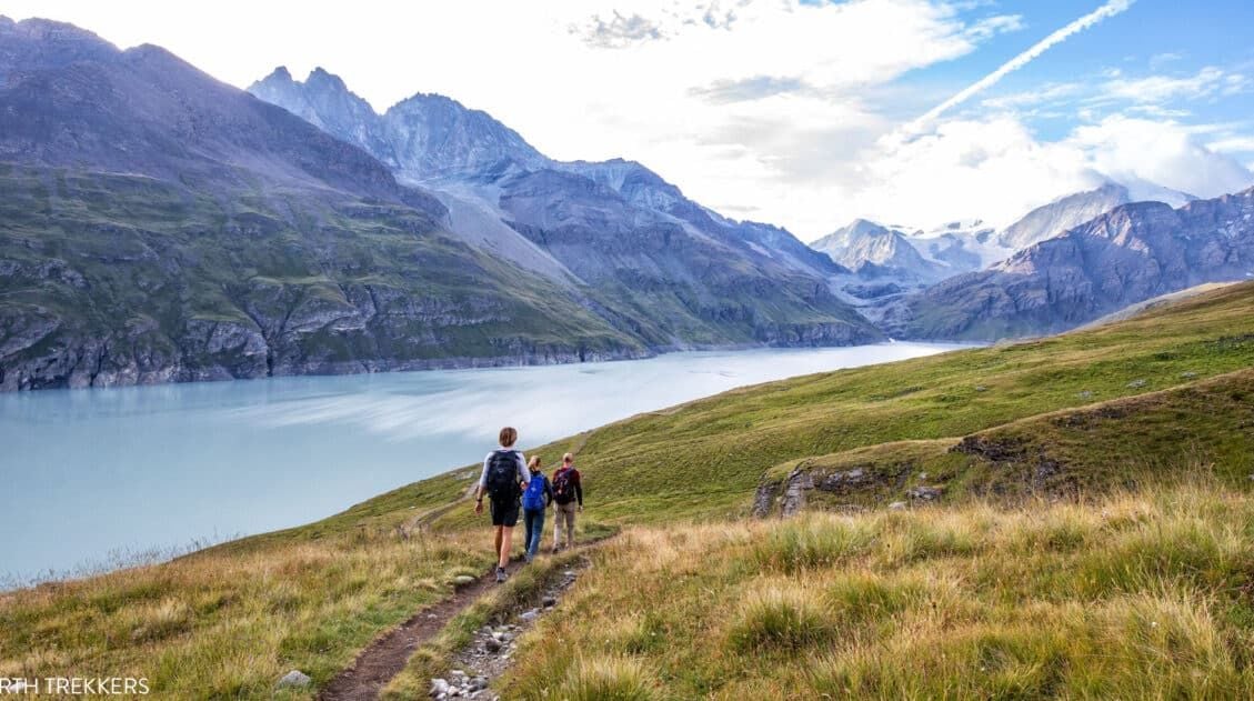
Stage 9 of the Walker’s Haute Route starts in Les Haudères or La Sage and from these two villages, it is a challenging hike up to Col du Tsaté. From Col du Tsaté, it is an easier and scenic downhill walk to Lac de Moiry. There are beautiful views as you look out over high […]
Walker’s Haute Route Stage 10: Lac de Moiry to Col de Sorebois to Zinal
Having completed a segment of Stage 10 on yesterday’s hike, we found ourselves with another short day today. However, that did not make it easy. Today’s hike finds you crossing over another mountain pass as you hike from Lac de Moiry to Zinal. As is the same for other days of the Walker’s Haute Route, […]
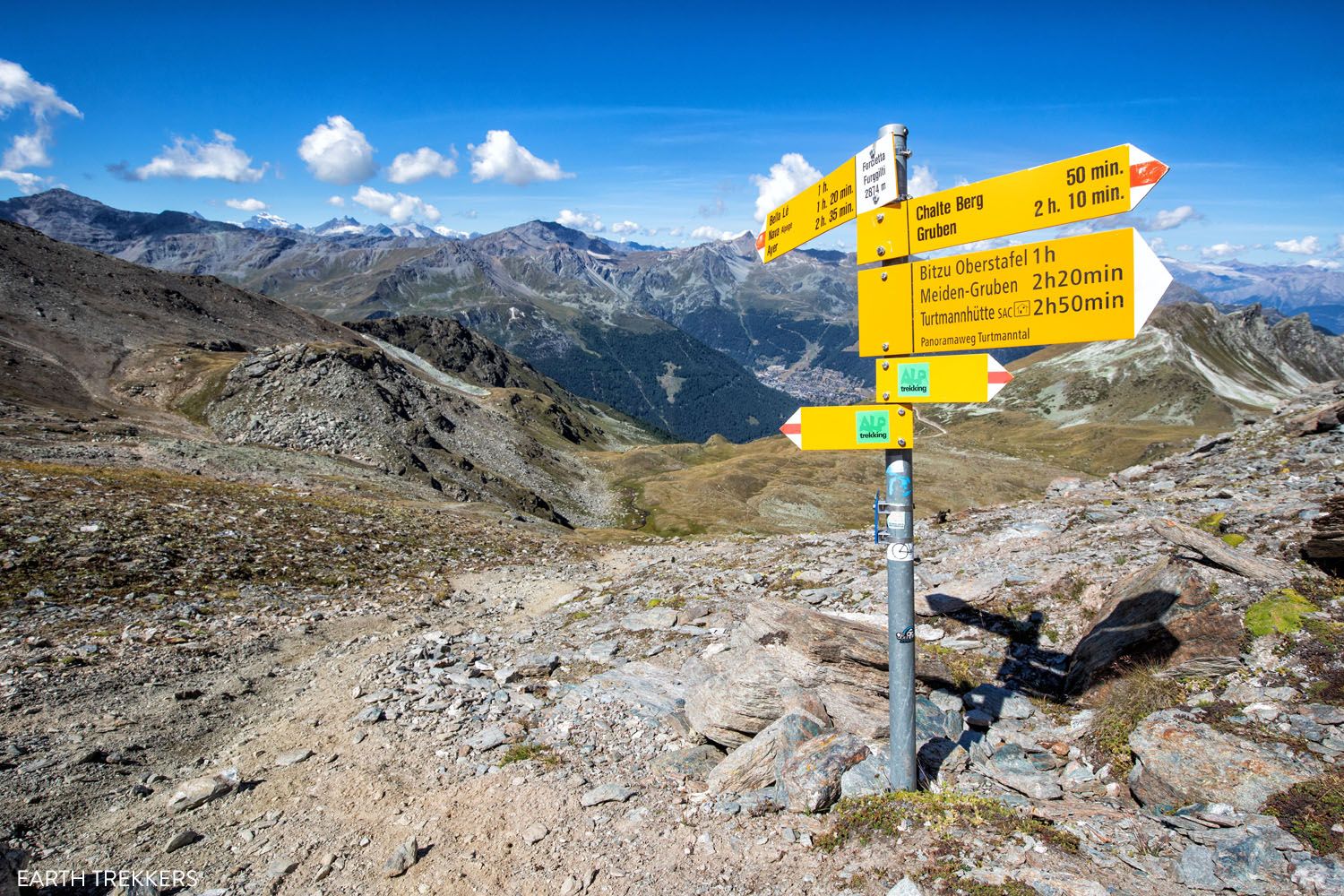
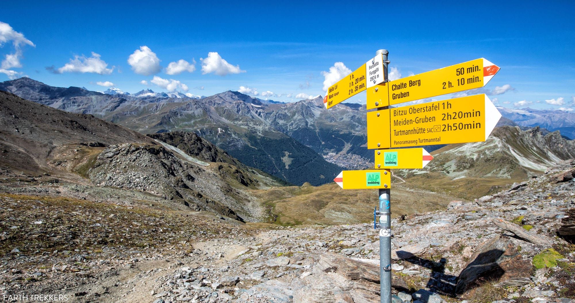
Walker’s Haute Route Stage 11: Zinal to Forcletta to Gruben
Stage 11 of the Walker’s Haute Route is another challenging mountain climb and descent. Yet, it is a great and rewarding hike with beautiful views over the Turtmanntal valley, the glacier-capped mountains of Weisshorn and Bishorn to the south, and the Rhone Valley and Bernese Alps to the north. This is one of the most […]
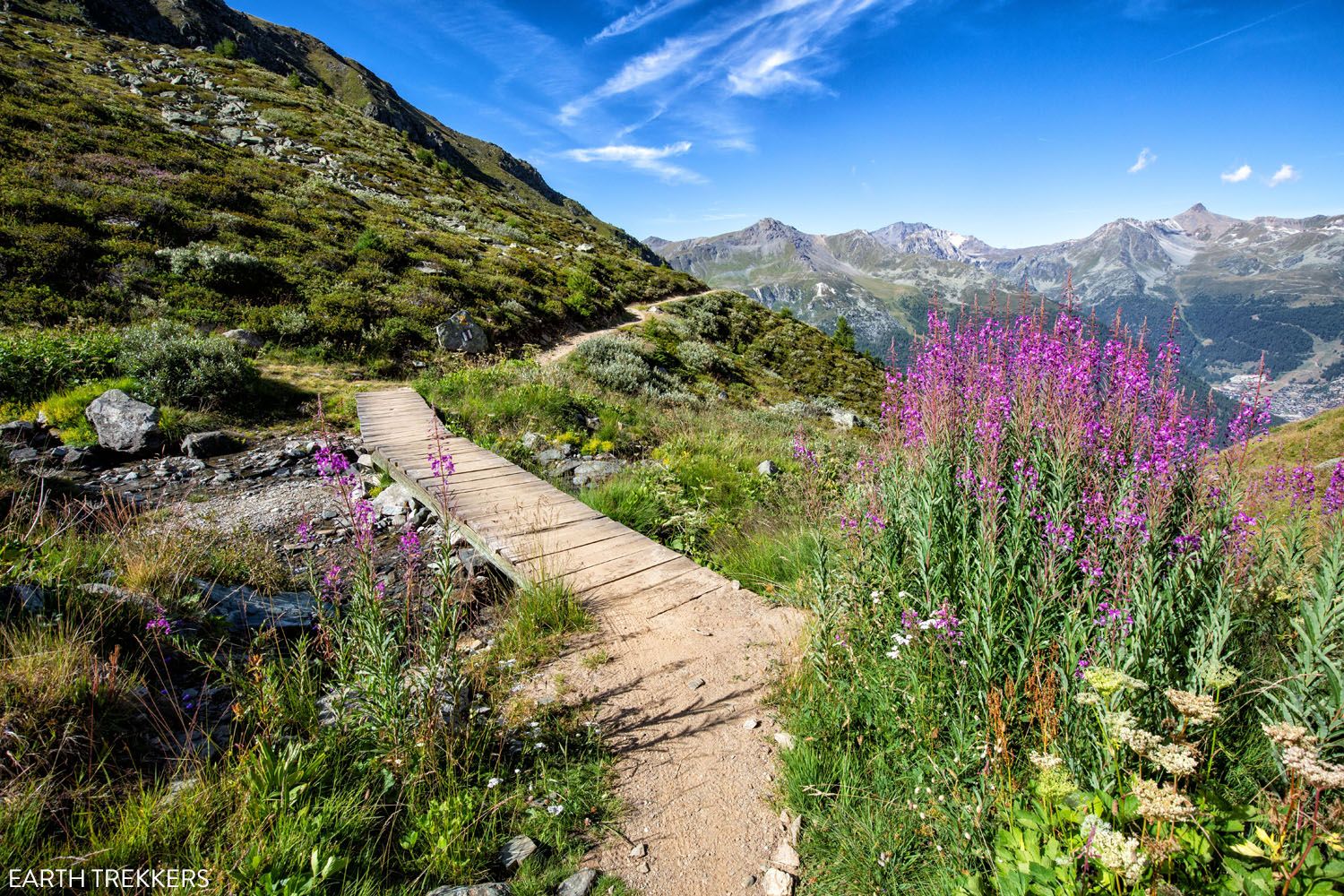
Walker’s Haute Route Stage 12: Gruben to Augstbordpass to St. Niklaus
Today’s stage marks the beginning of the end of the Walker’s Haute Route. With only three stages to go, things once again ramp up in both alpine views and physical challenge in terms of the trail. Opening up to Mattertal valley and passing through a large hamlet, Stage 12 has little shortage in excellent views. […]
Walker’s Haute Route Stage 13: St. Niklaus to the Europahütte
As you enter one of the final stages of the Walker’s Haute Route, you will most likely be sore, a bit fatigued, and growing tired of massive mountain ascents and descents. Plus, the anticipation of seeing Zermatt and the Matterhorn grows. The good news is that Stage 13 of the Haute Route features the final […]
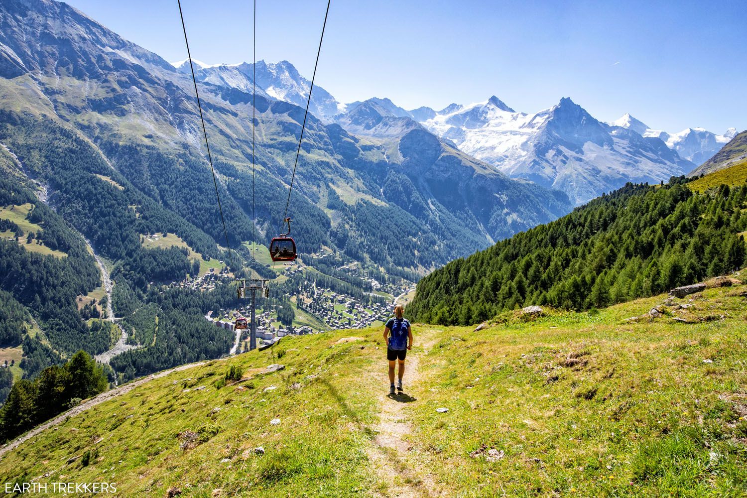
Walker’s Haute Route Stage 14: Europahütte to Zermatt
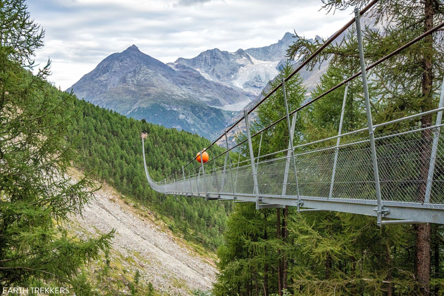
From bridges, caves, hamlets, and impressive views of the finish line, the final stage of the Walker’s Haute Route has it all. Every step brings you closer to the end goal of Zermatt, a beautiful town that’s renowned for its skiing and hiking. Enjoy the views along the way, as they only get better the […]
Do You Need a Guide for the Haute Route?
No, you do not need a guide for the Walker’s Haute Route. The trails are very well signed and easy to follow in Switzerland.
We did the Walker’s Haute Route without a guide and had no issues. A good guidebook (we recommend Trekking Chamonix to Zermatt, The Classic Walker’s Haute Route by Kev Reynolds) will explain the daily route and give you options to shorten it, should you have bad weather.
Booking Your Accomodations
How To Book Your Walker’s Haute Route Accommodations
Making your hotel and lodge reservations for the Walker’s Haute Route may seem like a daunting task but it doesn’t have to be. Get step-by-step instructions for booking your accommodations.
Walker’s Haute Route Photos