
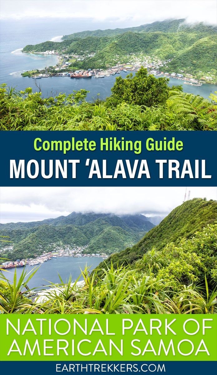
The Mount ‘Alava hike is one of the most adventure-filled trails featured in the National Park of American Samoa. You’ll find a path less wandered by your average visitor as you hike along one of American Samoa’s many ridgelines. Be prepared for a trek through the jungle and incredible views out over Pago Pago Harbor and the island.
There are two variations of this hike. You can either hike out-and-back on the Mount ‘Alava Trail or combine the Mount ‘Alava Trail with the Mount ‘Alava Adventure trail for a more challenging hike. We cover both of these in this guide and give you our opinion on which one is better.
About Mount ‘Alava
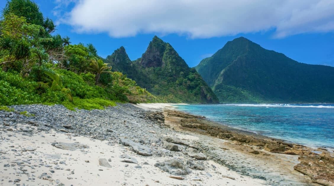
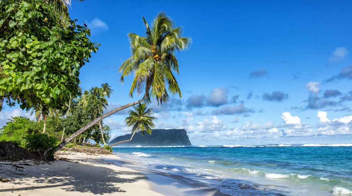
American Samoa is an island filled with beauty and adventure waiting to be explored. From pristine beaches to lush, looming mountains and ridges, the island is a tropical paradise.
Mount ‘Alava is one of many peaks found in American Samoa, and the highest peak you can summit within the National Park of American Samoa. That being said, you’re bound to have some of the best views on the entire island.
Mount ‘Alava Hiking Routes
There are two trails that lead to the summit of Mount ‘Alava: the Mount ‘Alava Trail and the Mount ‘Alava Adventure Trail.
Both trails feature very similar elevation gain, but differ in terms of distance, difficulty, and the trail itself.
The Mount ‘Alava Trail is a longer, more gradual climb along a wide muddy/grassy path through the jungle. This trail starts at Fagasa Pass and ends at the Mount ‘Alava summit.
The Mount ‘Alava Adventure Trail is half the distance but much harder to navigate. This trail starts in Vatia and steeply climbs up to the Mount ‘Alava summit. In our experience, the adventure trail was extremely overgrown and didn’t appear to have been hiked in months. You’ll find a very steep, muddy path with wooden ladder segments. Calling this an “adventure trail” isn’t doing the route justice.
You can pick one of these trails and hike it out-and-back or join them together to create a point-to-point hike.
We opted for the point-to-point option. Tim and I took the Mount ‘Alava Trail to the summit, then continued on to the town of Vatia via the Mount ‘Alava Adventure Trail. Julie was our shuttle, dropping us off and picking us up.
Below we describe our experience on the trail, what to expect, and alternative routes.
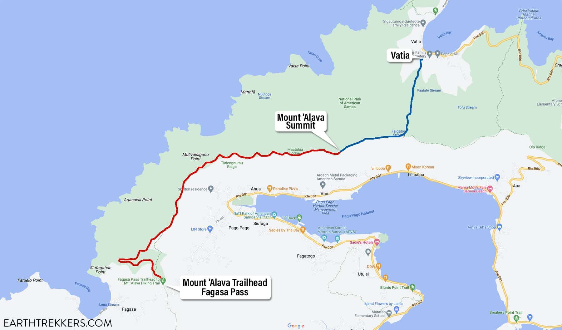
Mount ‘Alava Trail Map. The red line is the Mount ‘Alava Trail. The blue line is the Mount ‘Alava Adventure Trail.
Mount ‘Alava Hiking Stats
Mount ‘Alava Trail + Mount ‘Alava Adventure Trail
This is the point-to-point option and how we did this hike.
Distance: 5.3 miles (8.5 km) point-to-point
Difficulty: Strenuous
Total Ascent: 1,540 feet (470 meters)
Total Descent: 2,065 feet (630 meters)
Lowest Elevation (Vatia): 130 feet (40 meters)
Highest Elevation (Mount ‘Alava): 1,700 feet (520 meters)
Time: 3.5 to 5.5 hours
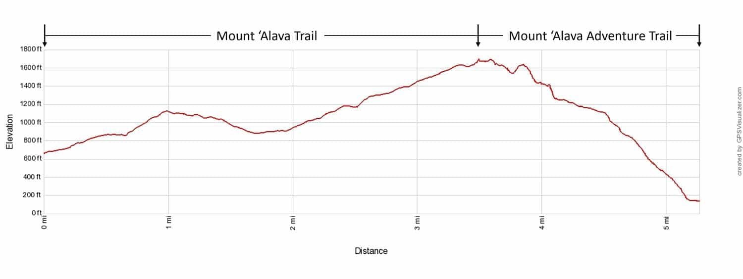
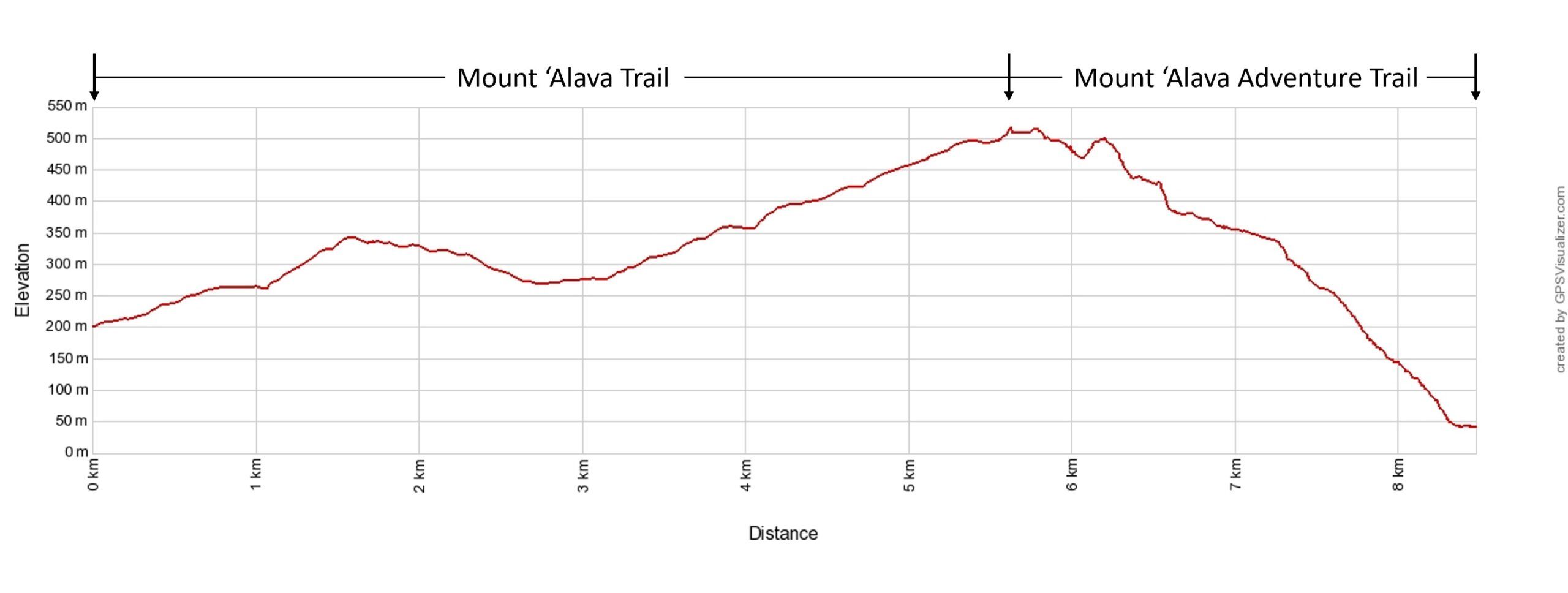
Mount ‘Alava Trail to the Mount ‘Alava Adventure Trail Elevation Profile
Mount ‘Alava Trail Out-and-Back
Distance: 7.0 miles (11.3 km) round trip
Difficulty: Moderate
Total Ascent: 1,735 feet (530 meters)
Lowest Elevation: 660 feet (200 meters)
Highest Elevation (Mount ‘Alava): 1,700 feet (520 meters)
Time: 3.5 to 5.5 hours
Mount ‘Alava Adventure Trail Out-and-Back
Distance: 3.6 miles (5.8 km) round trip
Difficulty: Challenging
Total Ascent: 1,870 feet (570 meters)
Lowest Elevation (Vatia): 130 feet (40 meters)
Highest Elevation (Mount ‘Alava): 1,700 feet (520 meters)
Time: 3 to 4 hours
Mount ‘Alava Hike
Step-By-Step Trail Guide
We did the point-to-point hike, starting at Fagasa Pass and ending in Vatia.
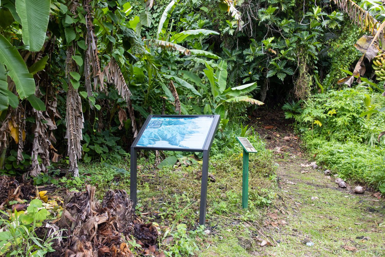
The trailhead for the Mount ‘Alava Trail is a small concrete parking area at Fagasa Pass (“Fagasa Pass Trailhead” on GoogleMaps). There was a small National Park sign that gave stats regarding the trail, a small clearing in the jungle ahead, and no other signs of life in sight.
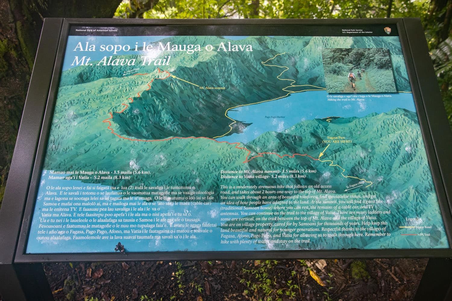
National park sign at the Fagasa Pass trailhead
Across the road there is another trail that climbs up into the jungle. Do NOT take this path as this is a different trail that leads in the opposite direction.
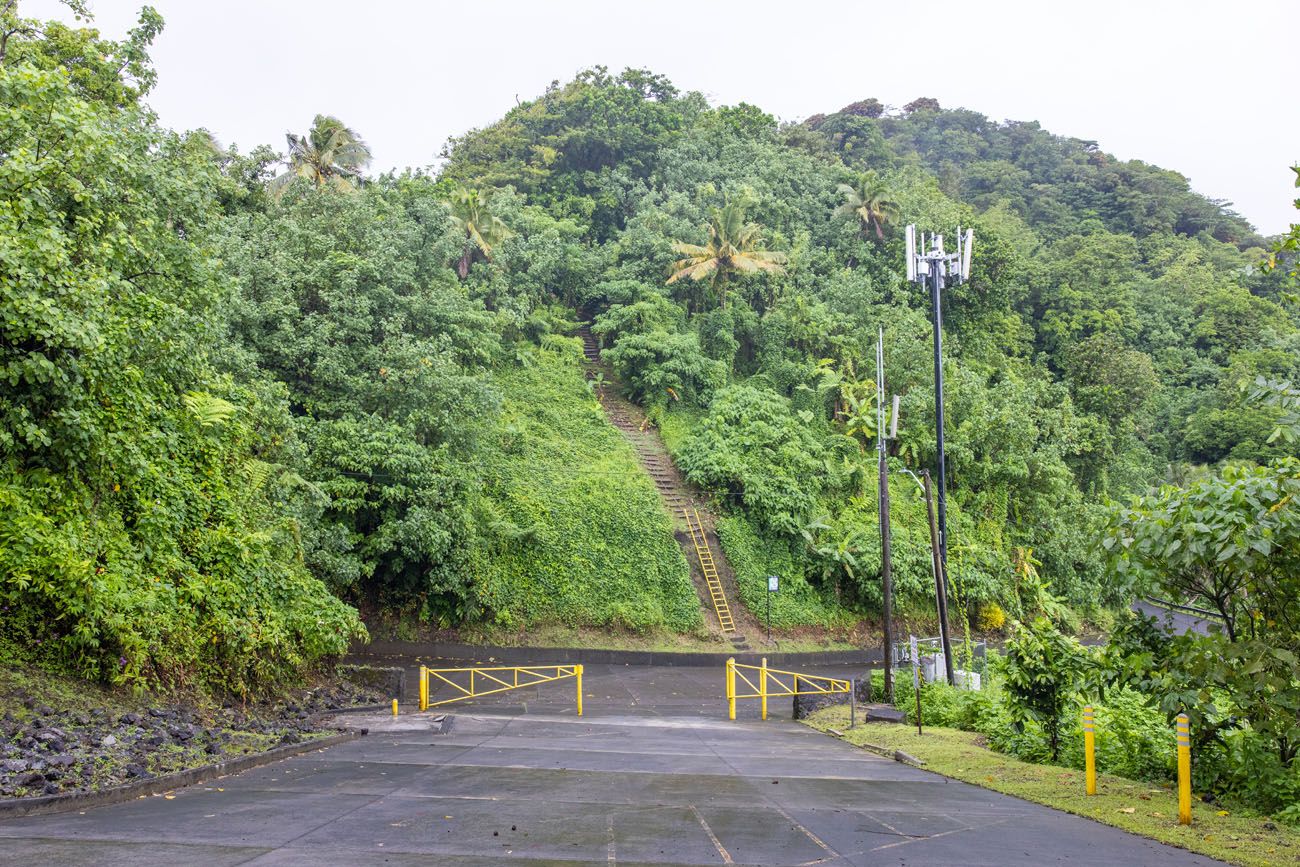
This photo was taken from the parking lot at the Fagasa Pass trailhead. On the opposite side of the road is a different trail (the ladder and steps in this photo). That is NOT the Mount ‘Alava Trail. The Mount ‘Alava Trail is behind me and heads into the forest.
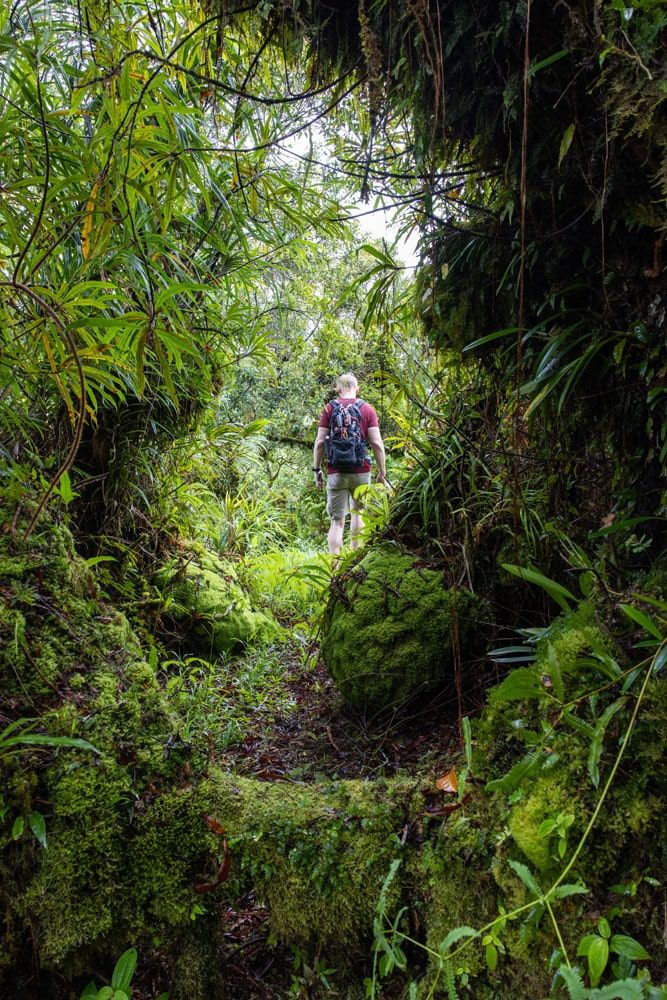
Tim and I completed the hike together as a point-to-point trail, and Julie picked us up in our rental car at the end. We said goodbye and hiked into the jungle clearing ahead of the Fagasa Pass Trailhead. We wouldn’t see another person until finishing the hike over 3 hours later.
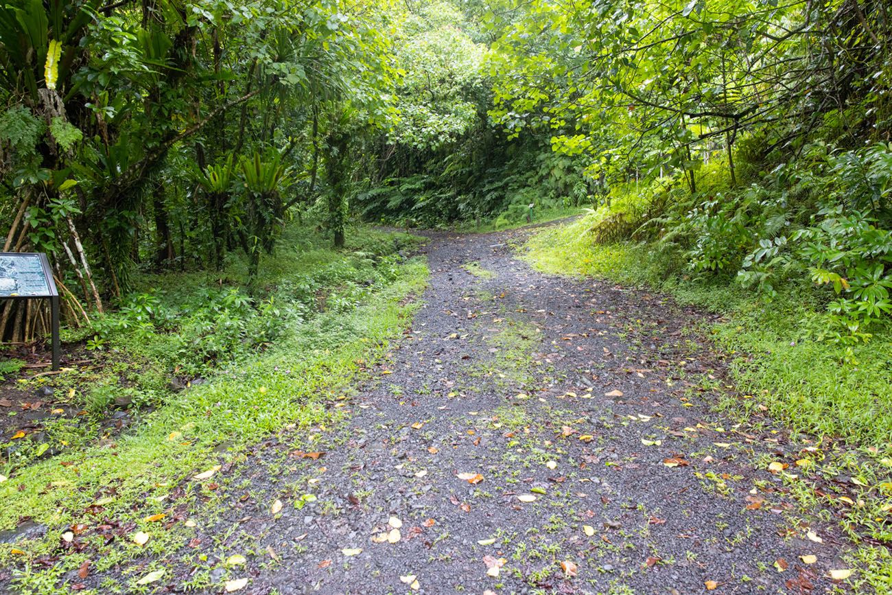
The Mount ‘Alava Trailhead
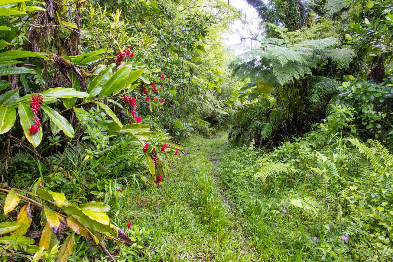
The Mount ‘Alava Trail
You’ll follow along a wide gravel and rocky path through the jungle that’s pretty well-maintained. The rocky path is covered in moss and very slippery.
Near the beginning of the Mount ‘Alava Trail, Google Maps shows a fork in the path. This fork does not exist. There is only one trail to follow when starting at the Fagasa Pass, and luckily it is clearly defined throughout.
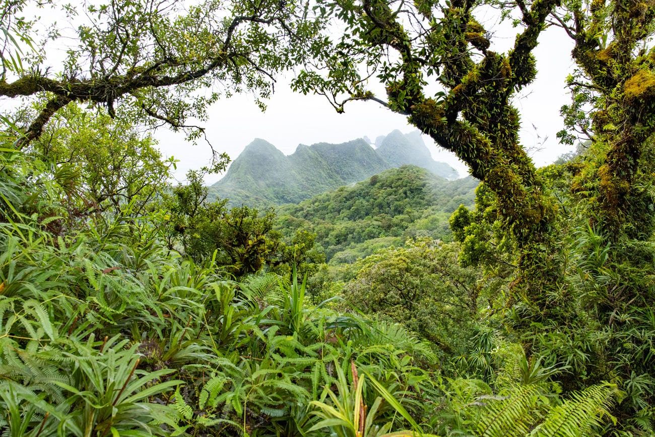
You’ll trek along this path as it climbs up and along the ridge above Pago Pago harbor. Since you’re in the rainforest for pretty much the entire hike, there are only two viewpoints before reaching the top. You’ll reach the first at 0.75 miles, where a break in the foliage will reveal a nice view of the coastline on your left. On a clear day this view would be amazing, but unfortunately we weren’t so lucky.
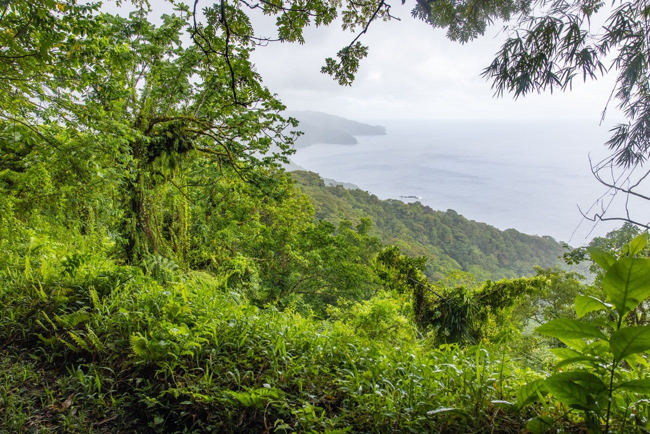
First viewpoint from the Mount ‘Alava Trail
The trail from here will alternate between gradual downhill and flat, grassy sections. If it’s rained recently (chances are it has), expect the trail to be muddy and full of large pools of water that block your path. We had fun long jumping over a few of these to reach the trail on the other side.
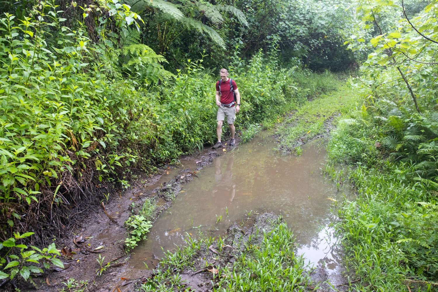
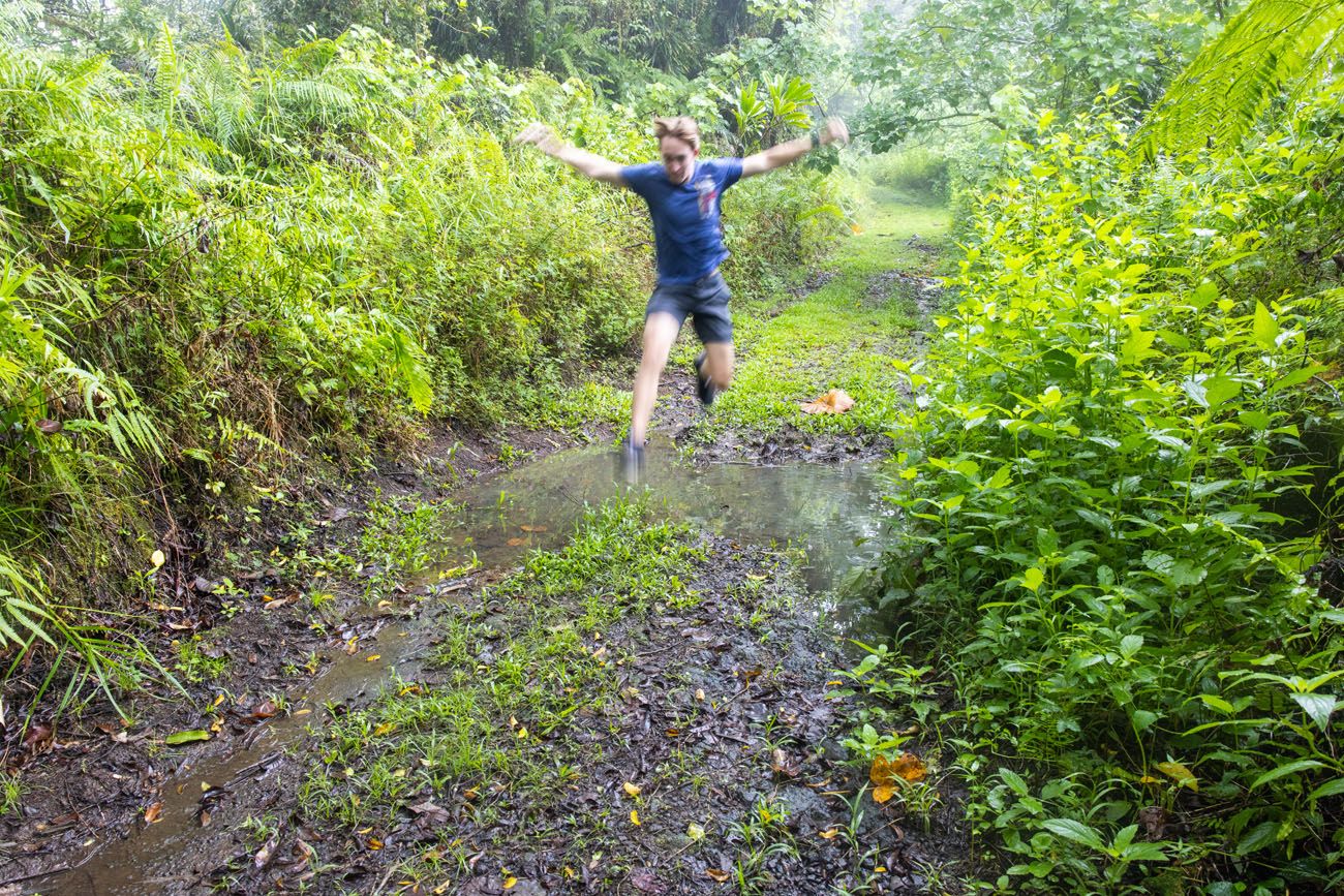
Mount ‘Alava Trail
Roughly two miles into the hike, you’ll reach the base of a steady ascent which will carry on for a while. It was here that we were treated to some less-than-pleasant smells of seafood. We couldn’t see the harbor due to the dense jungle foliage, but we could smell the seafood emanating from the tuna factory below.
A little bit before 3 miles you’ll reach your second “viewpoint”. There is a partial view of the coast on your left, but most of it is obscured by foliage. It’s not a photo-worthy view, but definitely a nice change of scenery.
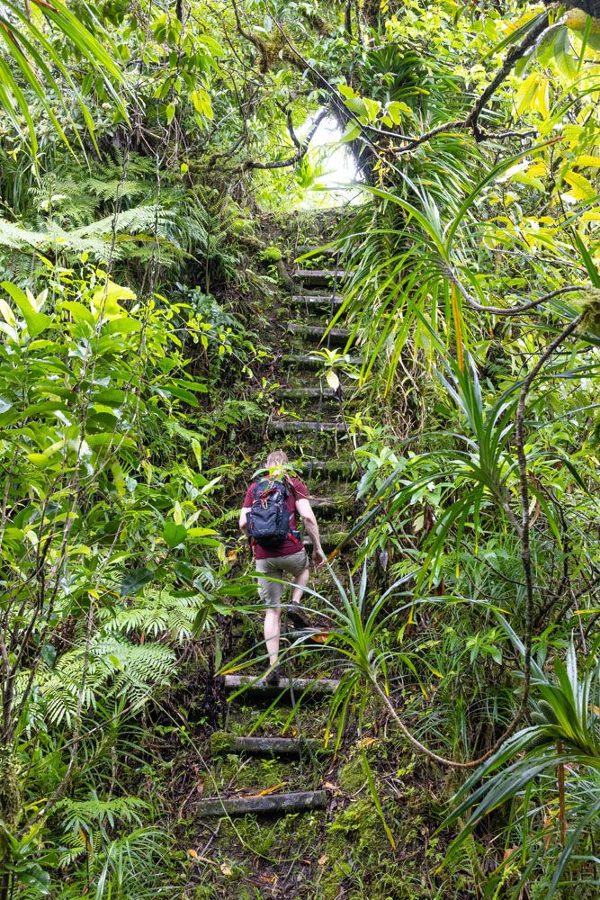
The trail keeps ascending until you reach a set of metal steps that takes you to the top of Mount ‘Alava. Exercise caution on the metal staircase as it is definitely showing wear and tear from being exposed to the elements.
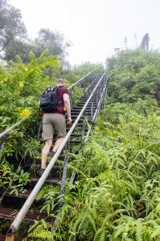
Staircase to the Mount ‘Alava summit
Mount ‘Alava Summit
Upon climbing to the top of the staircase, you’ll reach the peak of Mount ‘Alava and the abandoned cableway.
Once you reach the top it is difficult to see the harbor due to the high foliage. Luckily, there is a wooden platform you can climb up onto that gives you visibility above the foliage. Reaching this platform will require a bit of steady footing as you have to use the metal railing next to the platform as a ladder. It will be obvious once you are there.
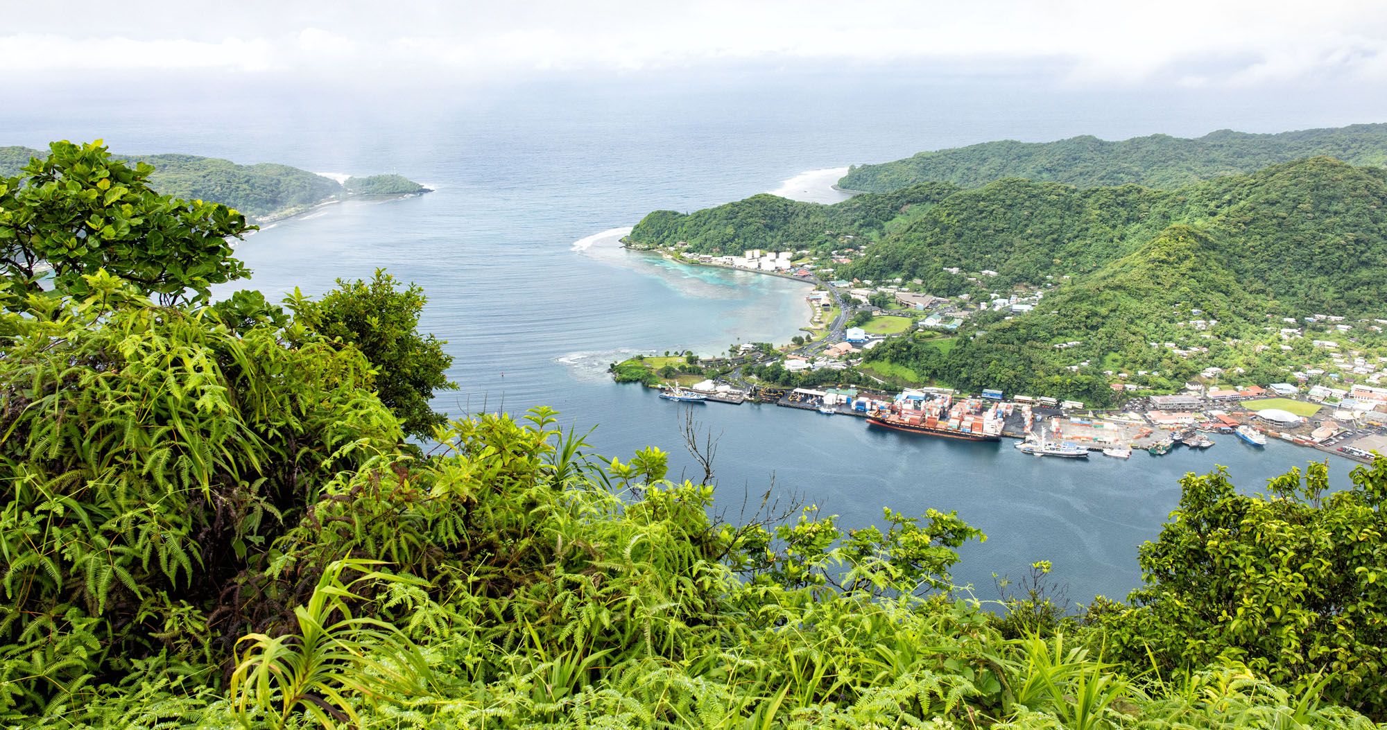
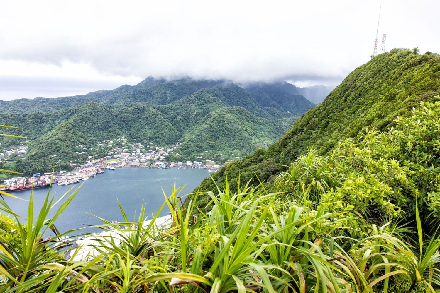
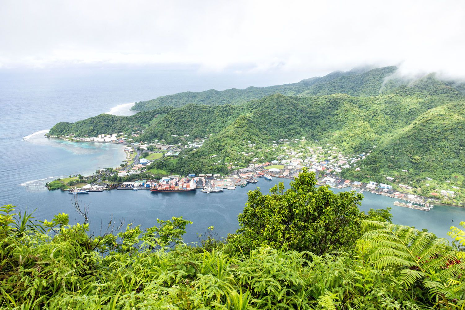
This hike is all about getting the view from this platform. If the platform wasn’t there, then it wouldn’t be worth completing the hike. This platform is made of wood and is exposed to the elements, so just like the metal staircase, exercise caution when climbing onto it. From the platform you get a beautiful view of the harbor and coastline.
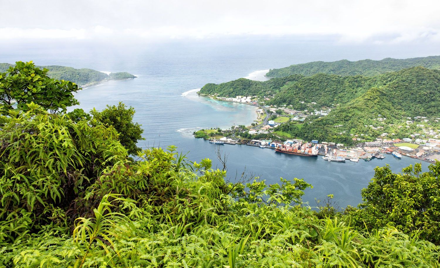
The view of Pago Pago Harbor from the Mount ‘Alava summit
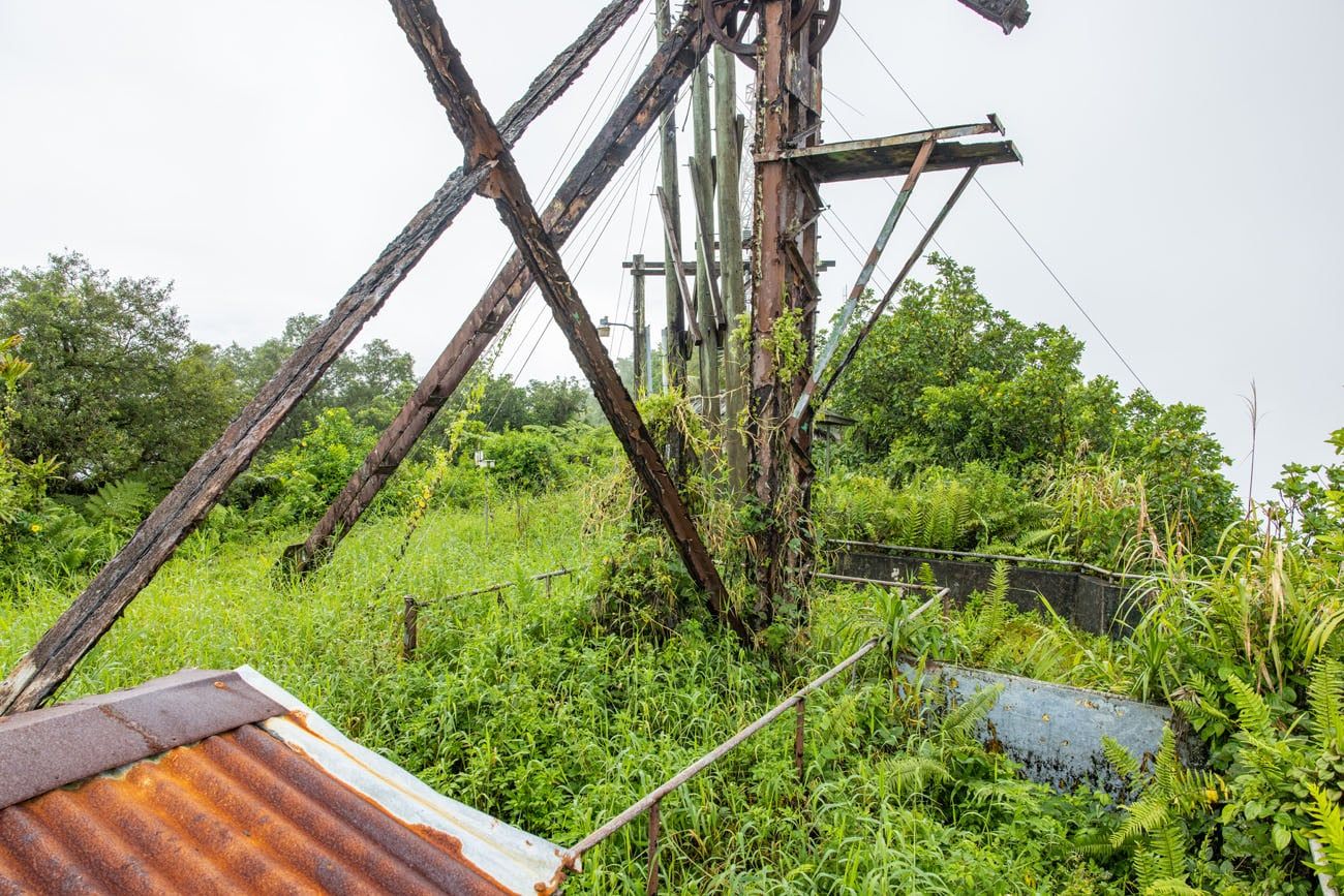
Remains of the cableway
Mount ‘Alava Adventure Trail
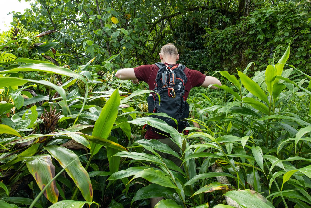
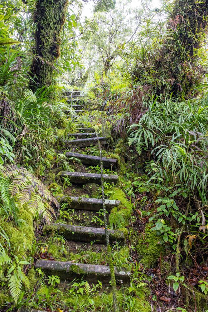
If you are up for an adventure, then continue following the Mount ‘Alava Adventure Trail beyond the peak of Mount ‘Alava. This was great and our favorite part of the hike. From mossy trees, to thick plant life overgrowing the trail, to lots of ropes and ladders, this was a welcome surprise. According to the sign in the Visitor Center, there are 56 ladders and 783 steps on the Mount ‘Alava Adventure Trail.
From the platform on top of Mount ‘Alava, hike to the other side of the abandoned cableway. From here you’ll find a chute with railings on both sides. When we did this, the path was completely covered in thick ginger leaves. Surprisingly enough, this is the trail.
Take this path a bit higher where you’ll reach an overgrown pavilion. The trail to continue onwards is straight ahead, but since it’s completely overgrown it’s very difficult to make-out amongst the brush. Look for a path straight ahead that travels down into the jungle below. The path should appear as a slight clearing amidst the foliage that’s only shoulder-width.
You’ll take a few staircases down before passing through a narrow ridge with drop-offs on either side. The staircases are very slippery, and although there is a rope to help with balance, we found it to be extremely mossy and disgusting to use.
The view through a break in the trees
Another view, this time looking back at the Mount ‘Alava summit and Pago Pago Harbor
Mount ‘Alava Adventure Trail
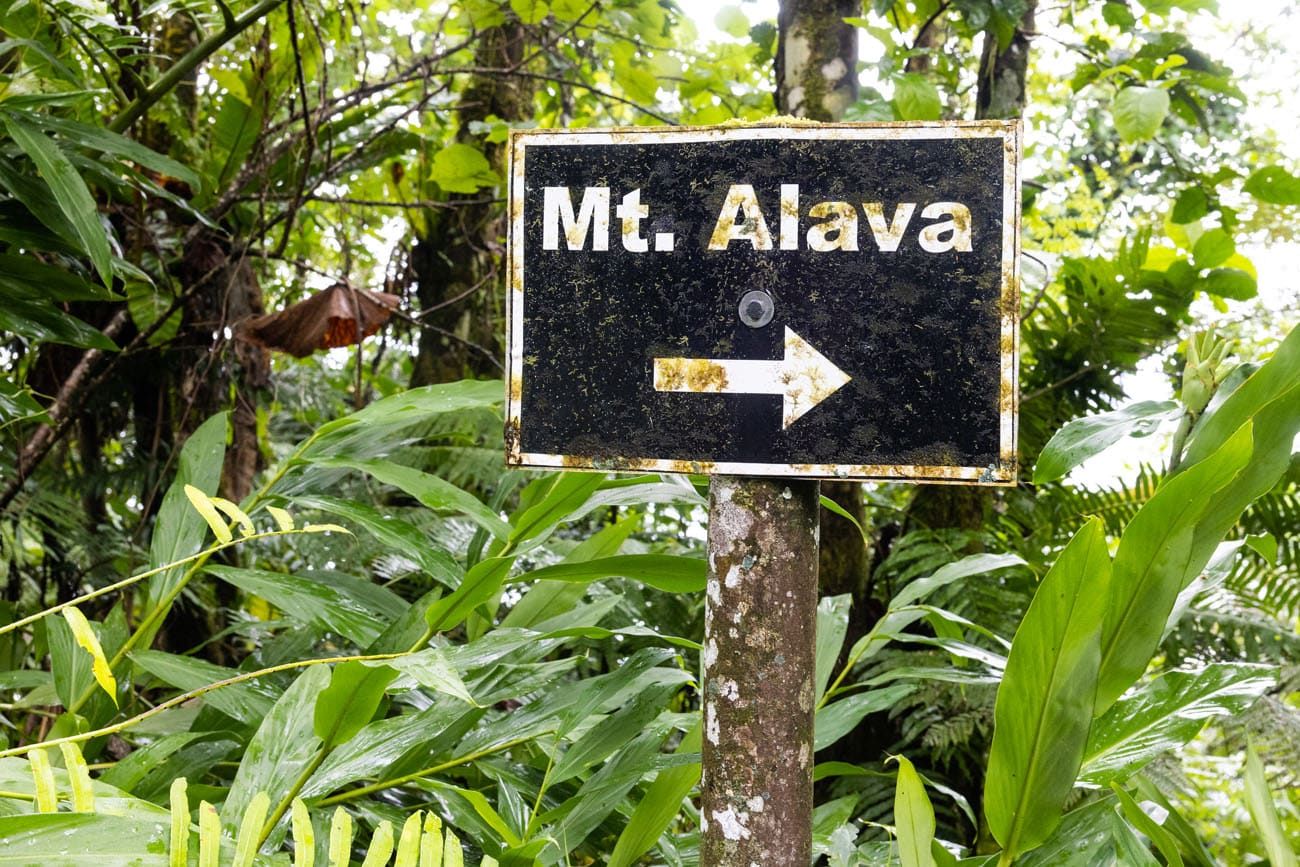
About 4 miles into the hike, the trail splits. There is a sign here pointing to Mount ‘Alava behind you. This is where you start the descent to Vatia on the Mount ‘Alava Adventure Trail. The only sign here is pointing to Mount ‘Alava so having a trail map or digital map will come in handy here. We used Google Maps to confirm that we were following the Mount ‘Alava Adventure Trail.
Hiking Down the Mount ‘Alava Adventure Trail
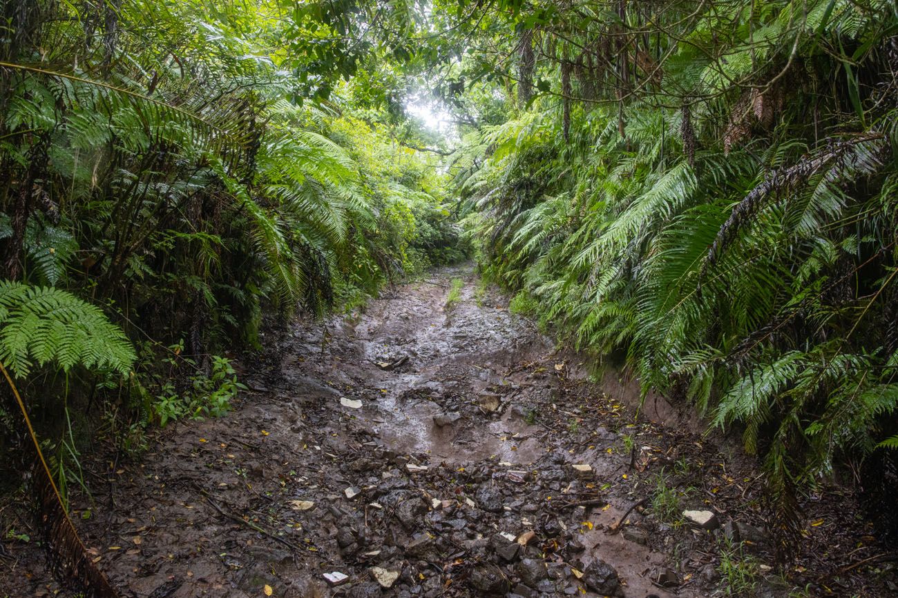
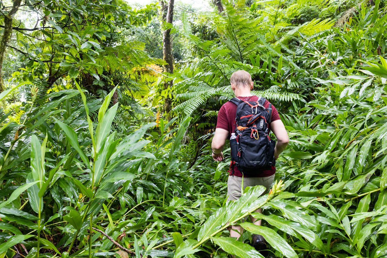
We didn’t find this trail to be fun at all. It’s a steady descent and everything was slippery. The tree roots were slippery, the rocks were slippery, and when we finally reached some grass, it was on a steep decline so that was also slippery.
We hardly ever fall while hiking and we’ve hiked some crazy trails around the world. Tim and I both ended up with bruised palms, bruised hips, and a sore back from the multiple times we fell coming down this trail. We were expecting there to be ropes and ladders on this trail but there were hardly any.
When we did this in 2023, the trail was very overgrown.
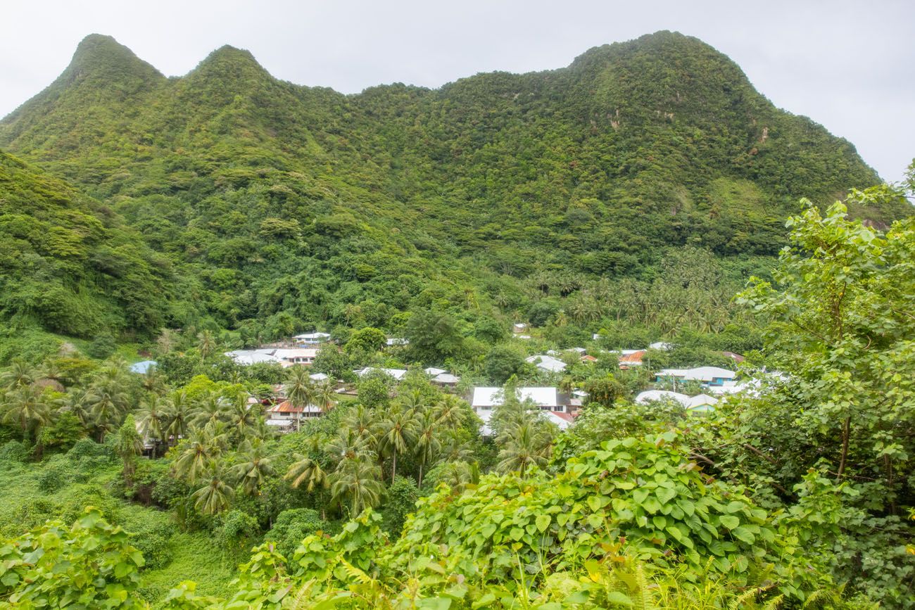
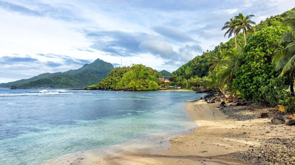
A view of Vatia from the trail.
The trail itself is also very overgrown at spots. Although the foliage becomes manageable after reaching the trail split, there are sections where it’s difficult to tell where the trail goes, which required us to bushwhack our way down the mountain. We even got on our hands and knees to climb under a fallen tree that blocked our path, which actually was really fun in the moment.
After a grueling trip down the mountain, we reached our endpoint in Vatia thirsty, bruised, covered in mud, and exhausted. Calling this hike an adventure would be an understatement. In our opinion, this hike came with a wide set of challenges that didn’t make the one and only real viewpoint worth it.
The Mount ‘Alava Adventure Trail traihead in Vatia.
Alternate Trails and Our Recommendation
When completing the Mount ‘Alava hike, we took point-to-point route, combining the two trails described above. Having done the full hike, we recommend simply hiking out-and-back on the Mount ‘Alava Trail for most people.
For one thing, this is an out-and-back hike, so you don’t have to have someone in your group be the shuttle. Secondly, the hike to Vatia on the Adventure Trail was not enjoyable in our opinion.
The main reason for doing this hike is the view from the summit of Mount ‘Alava, and the easiest way to get there is out-and-back on the Mount ‘Alava Trail.
If you hike about a half mile beyond the summit, you get to hike using some ropes and ladders and this was the most thrilling part of the trail. Once you get to the descent to Vatia, turn around and hike back to the Fagasa Pass.
The full point-to-point hike is only recommended for experienced hikers and those who don’t mind the risk of falling, getting covered in mud, and potentially getting injured. I did this hike in running shoes and they were destroyed by the end of this hike. On the drive back to our hotel, we went to a shoe store so I could have a clean pair of shoes for the remainder of our trip.
The view from the Mount ‘Alava summit
Be Prepared
The Mount ‘Alava hike comes with its own set of challenges regardless of which route you take. For that reason, it’s best to be prepared against the elements.
Footwear: We recommend wearing waterproof hiking shoes for this trail. Ideally pick a pair that has good traction and that you don’t mind getting dirty. After completing this hike, our shoes were absolutely trashed.
Insect Repellent: We did experience some mosquitos on the trail, so it is a good idea to have some insect repellent with you just in case.
Water: It can be hot and humid so bring lots of water.
Gloves: If you plan to hike any of the sections involving ropes and ladders then you might want to bring gloves as there is a lot of moss on some of the ropes.

Essential Hiking Gear: What Should You Bring on a Day Hike?
If you are new to hiking or are curious about what you should bring on a hike, check out our Hiking Gear Guide. Find out what we carry in our day packs and what we wear on the trails.If you have any questions about hiking the Mount ‘Alava Trail or if you would like to share your experience, let us know in the comment section below.
Plan Your Trip to American Samoa
Ultimate Guide to American Samoa: 18 Amazing Things to Do
Pinterest Facebook Flipboard American Samoa is a group of several small islands in the South Pacific. For visitors, the National Park of American Samoa is the main attraction, but there is a long list of things to do outside of the national park. In this guide, we cover the best things to do in American […]
American Samoa Travel Tips: 20 Things to Know Before You Go
If you are planning a trip to American Samoa, there is no doubt that you have a lot of questions. When is the best time to go? How do you get around? Where should you go? American Samoa is not like Fiji, Bali, or the Virgin Islands. The tourism infrastructure is not well developed, so […]
National Park of American Samoa: Things To Do, Photos & Map
We cover the best things to do in the National Park of American Samoa, from its top hiking trails to its secluded beaches. This guide also includes what you need to know as you plan your visit, such as how to get there, how much time you’ll need, and where to stay. Located in the […]
Best Things to Do in Samoa (+ Itinerary & Helpful Tips)
Relax on the beach, slide down a waterfall, go snorkeling, learn about Samoan culture, photograph Samoa’s breathtaking waterfalls, and hike through a lava field. These are some of the best things to do in Samoa. Samoa, often overlooked in the South Pacific, is a hidden gem in this region of the world. This beautiful country […]
Samoa and American Samoa Itineraries with Hawaii & Fiji
Samoa and American Samoa are two countries that sit side-by-side in the South Pacific. They are separated by the International Date Line but share a lot of similarities. If you are planning your Samoa and American Samoa itinerary, there are multiple ways to do it. The biggest factors are where you are coming from and […]

The Ultimate Guide to the 63 US National Parks
Stretching from the South Pacific, across the United States to the Caribbean, are 63 national parks. These national treasures preserve iconic landscapes, majestic mountains, primordial forests, arid deserts, misty coastlines, immense canyons, wildlife, and historic landmarks. We have visited 56 of the 63 US national parks, from the towering granite walls of Yosemite and the […]
Fiji…One Week In Paradise
Ahhh…Fiji. Paradise. Fiji was everything we expected and more. Crystal clear aquamarine water, white sandy beaches, amazing sunsets, beautiful islands. We joke around that Fiji is our vacation from our vacation…a very long vacation, I know. Here we got some much needed R & R from our fast paced travels around the world. I can’t […]
10 Day Bali Itinerary: How to Plan a Trip to Bali, Indonesia
From its rich culture, beautiful scenery, looming peaks and cascading waterfalls, Bali is full of adventure waiting to be sought. Whether you consider yourself a beach bum or would rather discover hidden gems deep within the jungle, Bali has the perfect adventure for you. On this 10 day Bali itinerary, explore Bali’s hidden gems, famous […]
Doors Off Helicopter Tour of Kauai: Everything You Need to Know
A doors off helicopter tour of Kauai is a thrilling experience. To see this gorgeous island from the sky is one of the best experiences to have in Kauai, if not all of Hawaii. On a helicopter tour of Kauai, you will fly over countless waterfalls, peer down at beaches and small towns on the […]

Maui Bucket List: 20 Best Things to Do in Maui, Hawaii
Maui, with its scenic drives, beautiful beaches, and water sports, is a top destination for tourists in Hawaii. In just one place, you can snorkel with sea turtles, learn to surf, visit a national park, watch the sunrise above the clouds, go wine tasting, attend a luau, rappel down a waterfall, and relax on the […]
20 Epic Hikes in the US National Parks
With 63 national parks and thousands of miles of hiking trails, your options are endless for exploring the American national parks. We narrowed down the list for you to 20 of the best hikes in the US national parks, 20 amazing ways to explore this beautiful country. Hike to the tallest peaks, through massive canyons, […]
20 Fun, Short Hikes in the US National Parks
One of the best ways to experience the national parks is from a hiking trail. Hike to amazing viewpoints, deep into the forests, through scenic canyons, and to hidden lakes and waterfalls. Along the way, you have a better chance of spotting wildlife and potentially leaving the crowds behind. Here are 20 fun, short hikes […]
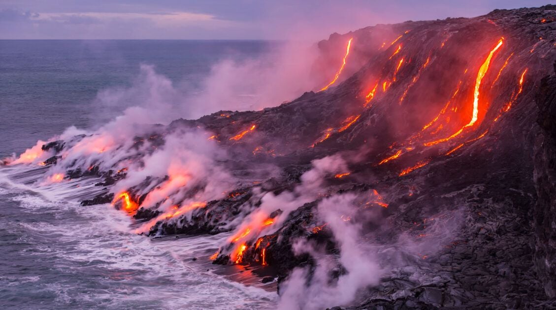
Top 10 Things to Do in Hawai’i Volcanoes National Park
Hawai’i Volcanoes National Park is home to two of the world’s most active volcanoes, Mauna Loa and Kīlauea. If you get lucky with your timing, you can catch Kīlauea in action, as molten lava oozes up from below the Earth’s crust, creating brand new land. But there is more to Hawai’i Volcanoes National Park than […]
Comments 2