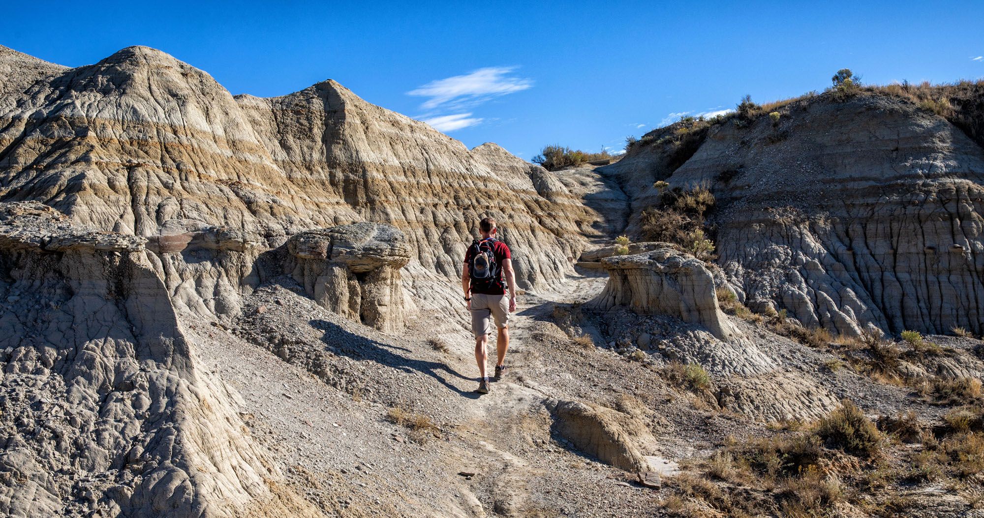
The Caprock Coulee Trail is often described as one of the best hikes in Theodore Roosevelt National Park. From this trail, you get some of the best views over the Little Missouri River and wildlife sightings are common from the trail.
We hiked a lot of trails in the North and South Unit, and even Elkhorn Ranch, and this is our favorite hike in Theodore Roosevelt National Park. It’s short, it’s not overly difficult, and the views are spectacular.
If you have plans to visit the North Unit and are looking for a great hike to do, put this hike on the top of your list.
Caprock Coulee Trail Hiking Stats
Distance: 4.1 mile (6.6 km) loop
Difficulty: Moderate
Total Ascent: 730 feet (220 m)
Lowest Elevation: 2,040 feet (620 m)
Highest Elevation: 2,480 feet (755 m)
Length of Time: 2 to 3 hours

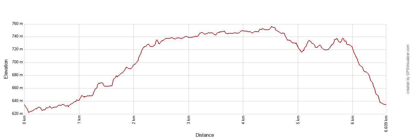
Caprock Coulee Trail Elevation Profile
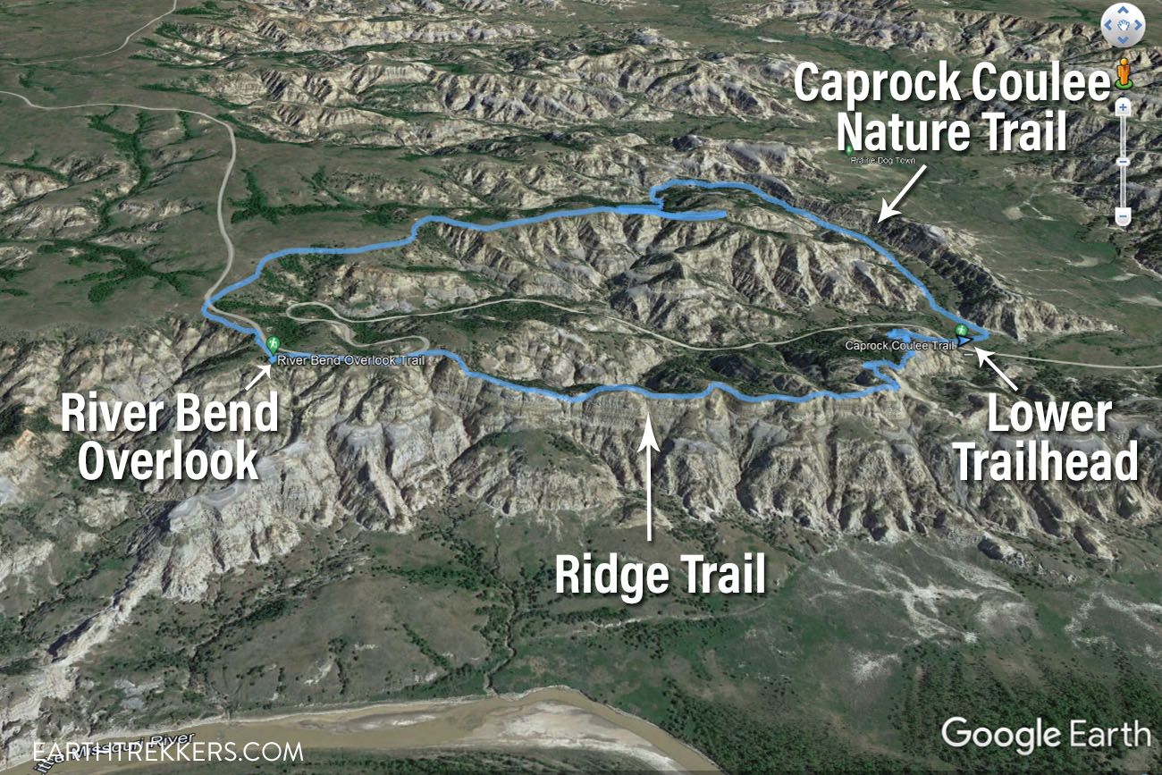
Caprock Coulee Trail Map
Please practice the seven principles of Leave No Trace: plan ahead, stay on the trail, pack out what you bring to the hiking trail, leave areas as you found them, minimize campfire impacts, be considerate of other hikers, and do not approach or feed wildlife.
Caprock Coulee Trail
Step-By-Step Trail Guide
Overview of the Trail
This hike is a loop and there are two trailheads to choose from.
The best trailhead is located at the starting point for the Caprock Coulee Nature Trail. Located on Scenic Drive, this trailhead is located at the lowest point on the loop. By starting here, you get the uphill hiking over with early and end with a nice, easy downhill walk.
The second trailhead is located at the River Bend Overlook Trail. From here, you are at the highest point along the hike. You start off with the best views of the hike, followed by a big descent and later, towards the end of the hike, a long climb.
When we did this, we started at the River Bend Overlook Trail because the Caprock Coulee Nature Trail trailhead and parking lot were closed for renovation. A brand new parking lot and restrooms were just installed but not yet open.
I recommend starting at the Caprock Coulee Nature Trail trailhead (the lower trailhead) and hiking this in a counter-clockwise direction. You get the less exciting part of the hike, and most of the uphill hiking, over and done with early in the hike, and get to end with the spectacular views from the ridge.
Caprock Coulee Nature Trail
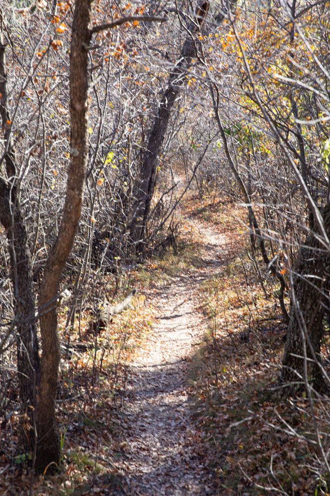
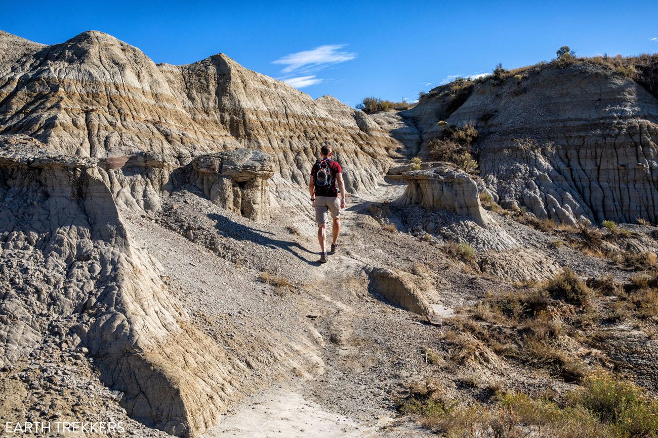
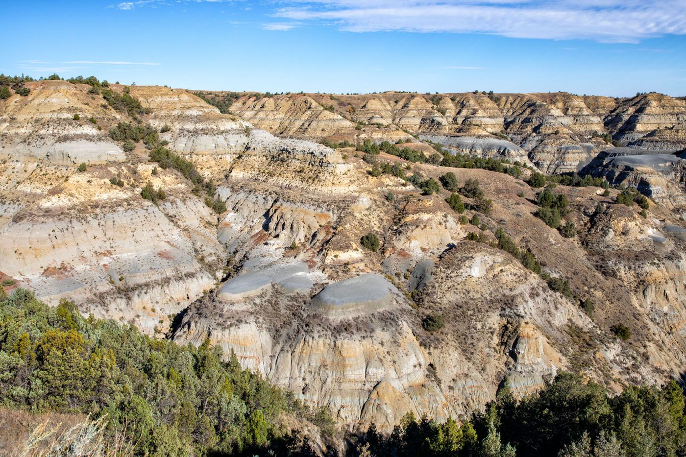
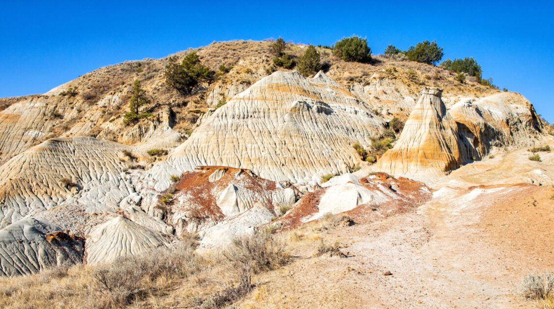
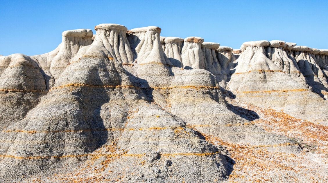
Starting at the Caprock Coulee Nature Trail trailhead (the lower parking lot), you will first walk the Caprock Coulee Nature Trail. This 0.9 mile trail winds through a canyon where you get to see the geologic and biological variety of the badlands.
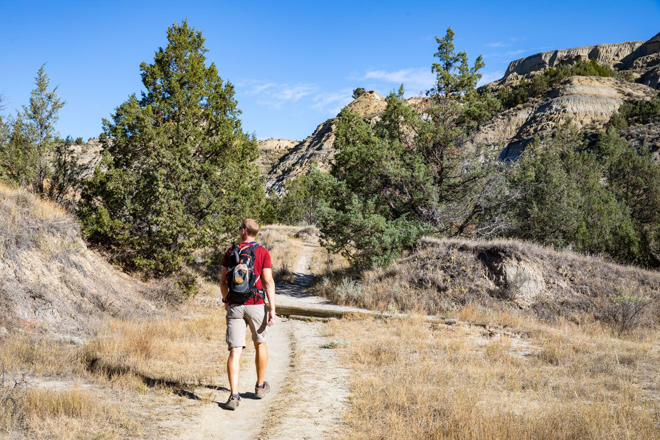
This first mile is easy and mostly flat. We didn’t find this part of the hike all that exciting but it gets a lot better.
What is a Coulee? A coulee is a steep, narrow canyon that was formed by water erosion. The Caprock Coulee Nature Trail takes you through one of these canyons.
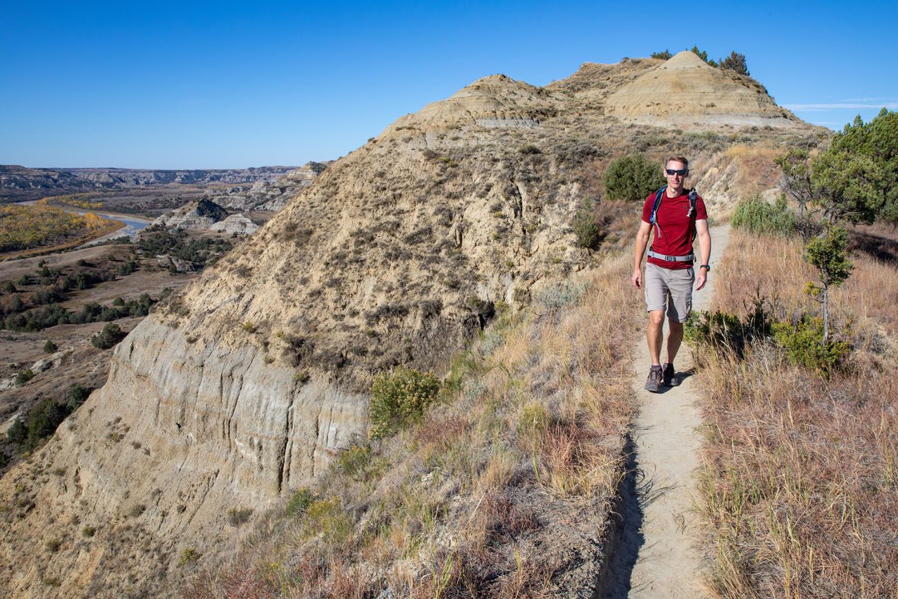
On the Caprock Coulee Trail
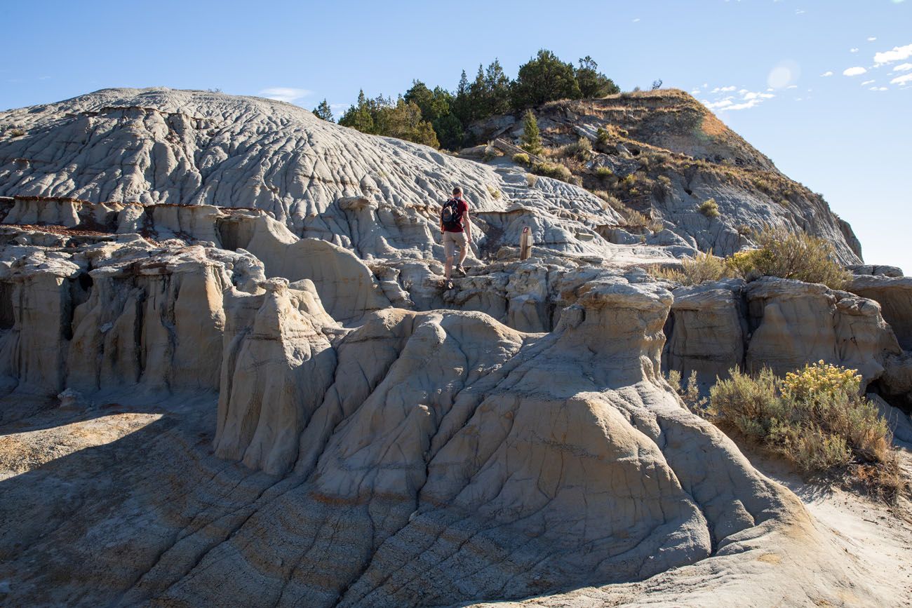
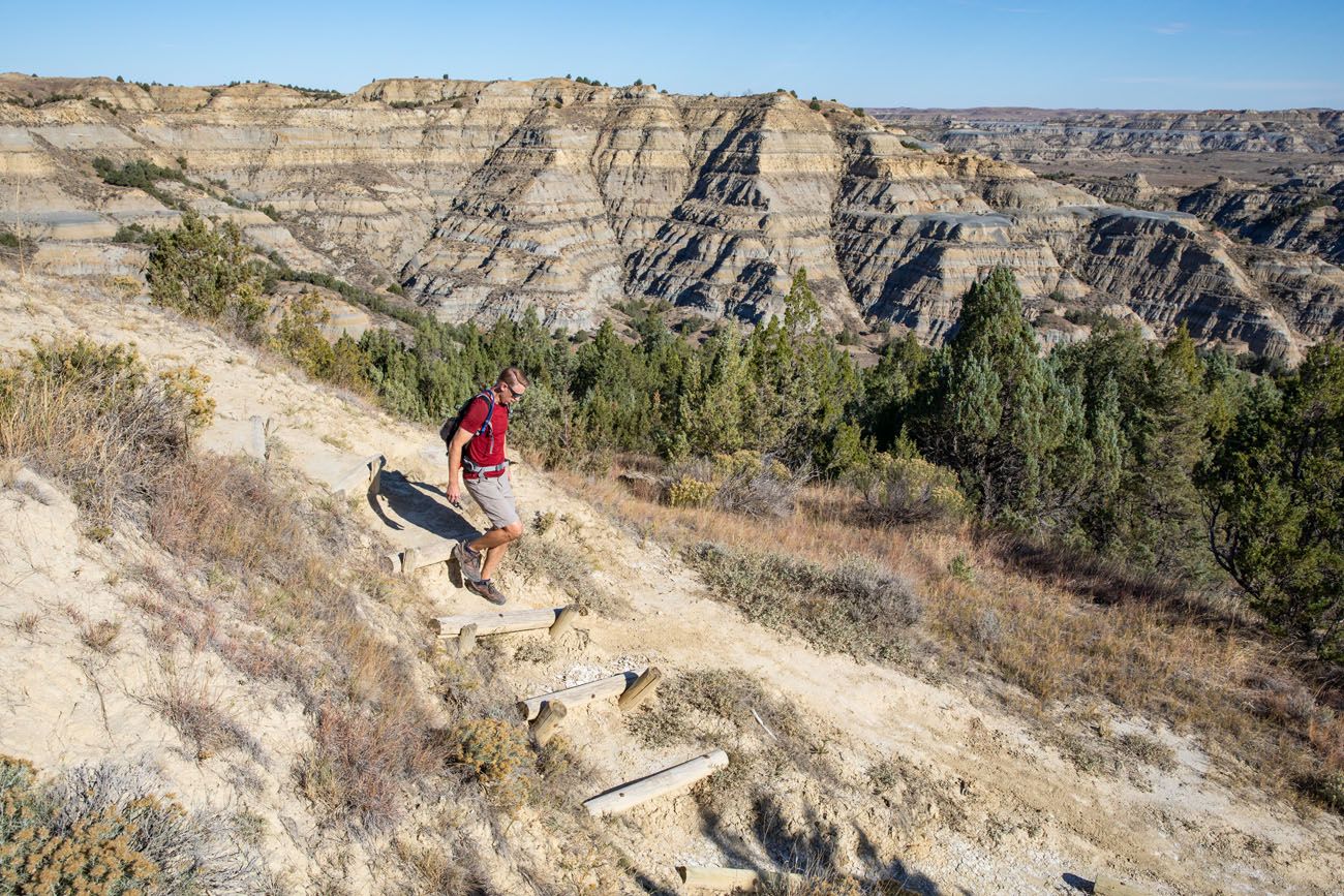
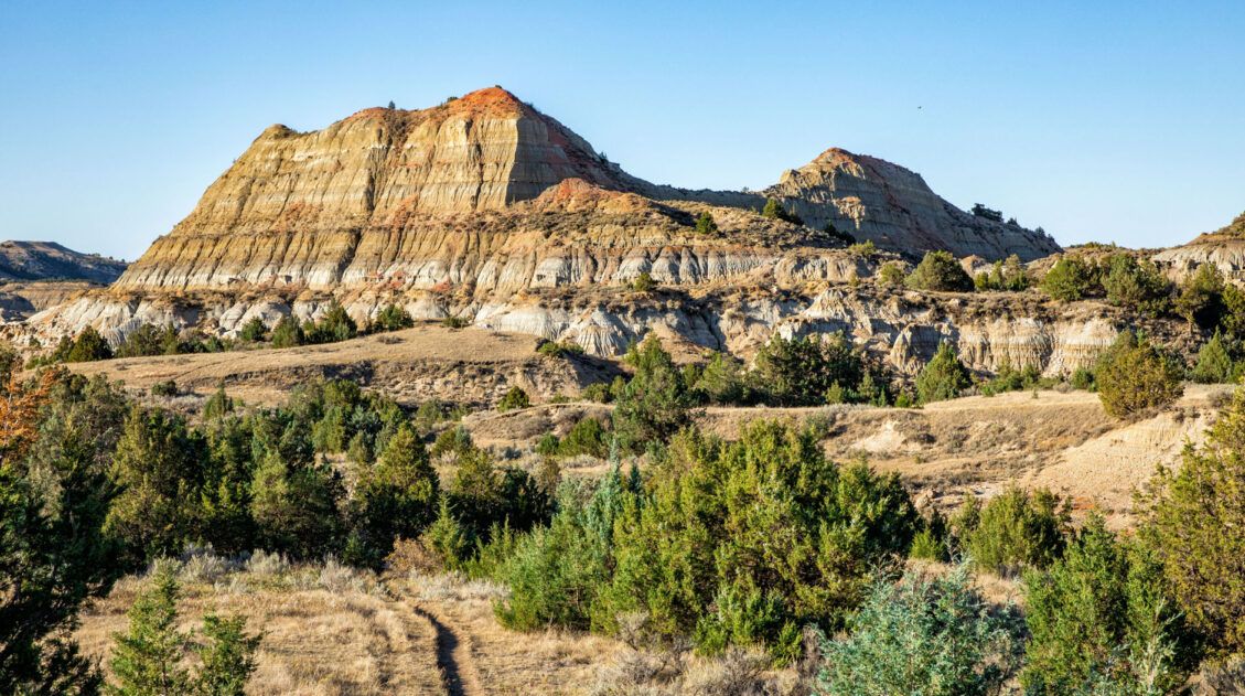
1 mile into the hike, the trail begins to climb up to the plateau. For the next ¾ of a mile, you will steadily hike uphill, sometimes through forests and sometimes through a wide, scenic canyon. There will be a few sets of staircases along the way. This is the toughest part of the hike but it’s worth it…the views that await are spectacular!
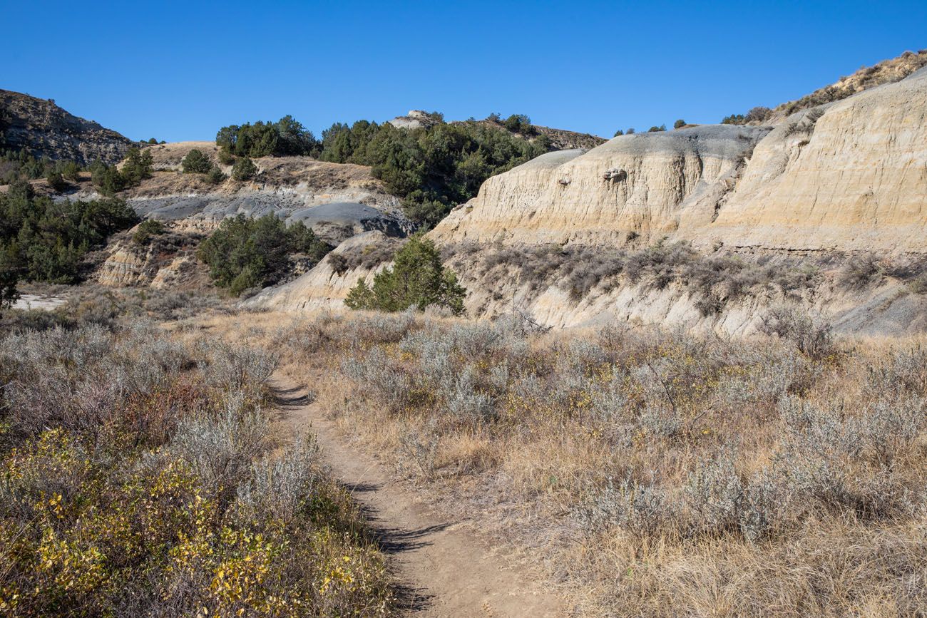
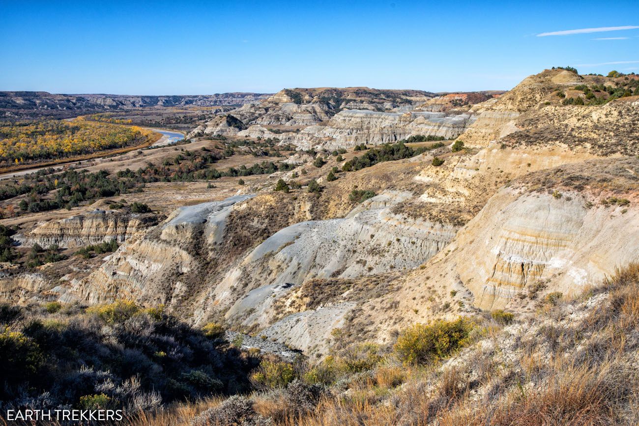
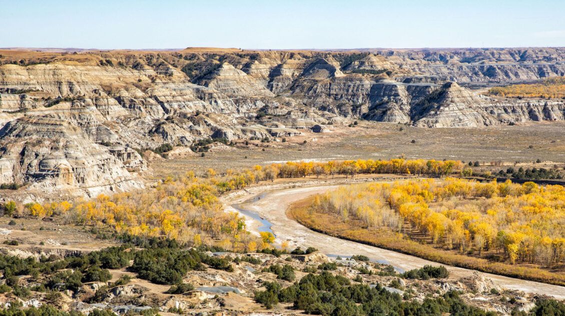
Once you hit the 2-mile point, you are on top of the plateau and the majority of the uphill hiking is behind you. From the plateau, you will have sweeping views across the North Unit and down to Scenic Drive, as it winds its way up to the top of the plateau.
Hiking onto the plateau.
View from the plateau.
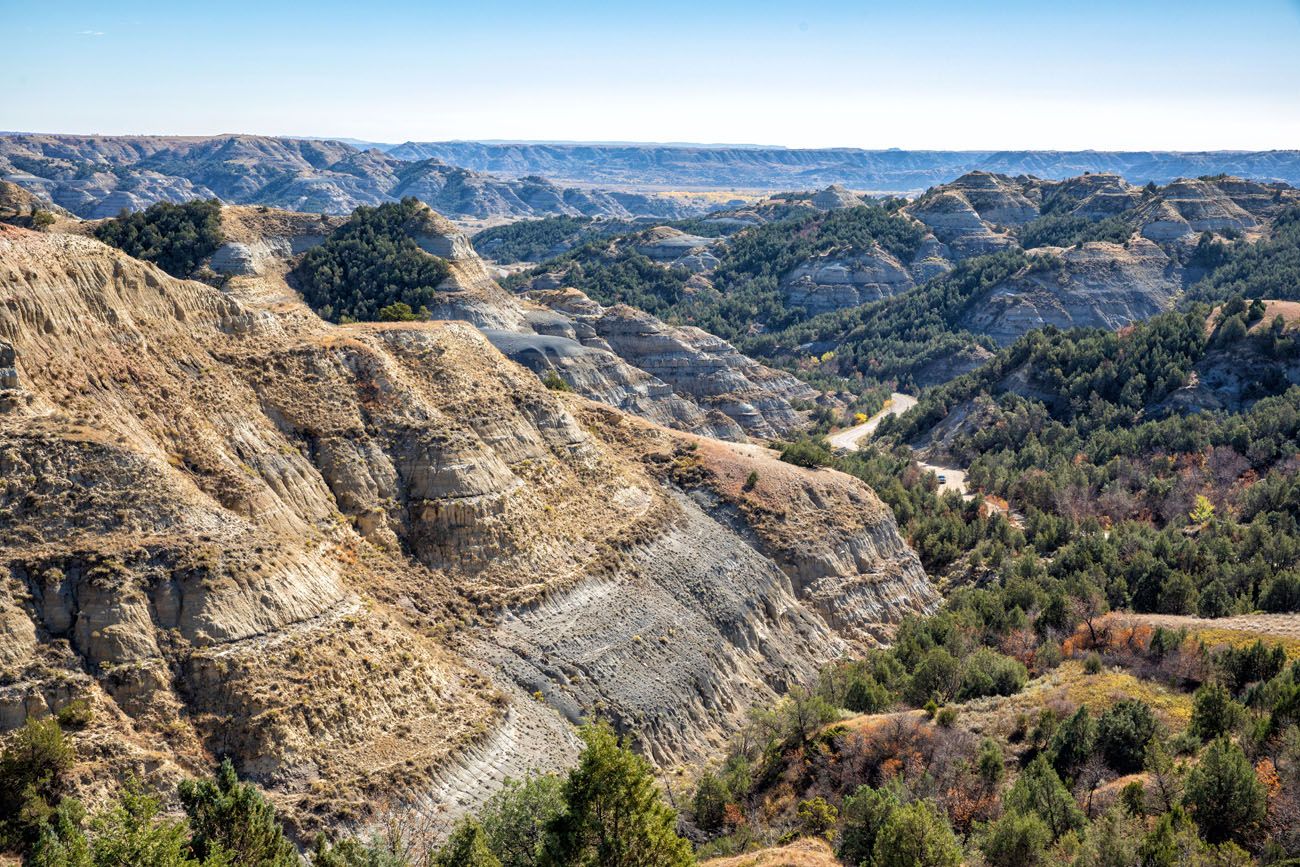
View of the badlands and Scenic Drive.
Big River Overlook
The Caprock Coulee Trail crosses Scenic Drive and not too long after that you come to the parking lot for the Big River Overlook Trail. You can do this now or after the hike, as you drive through the North Unit.
It is a very short walk to this overlook where you have big views over the Little Missouri River.
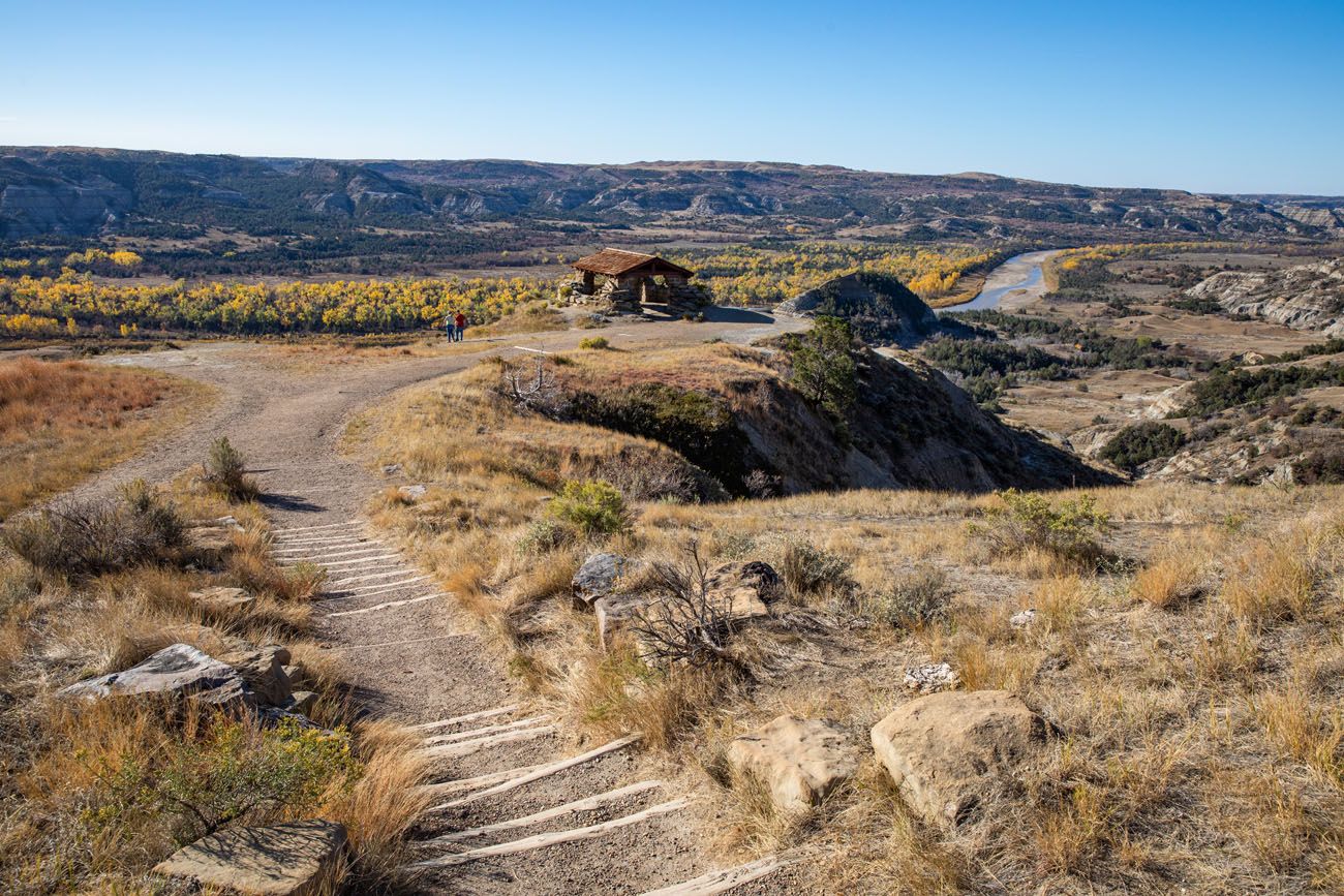
River Bend Overlook
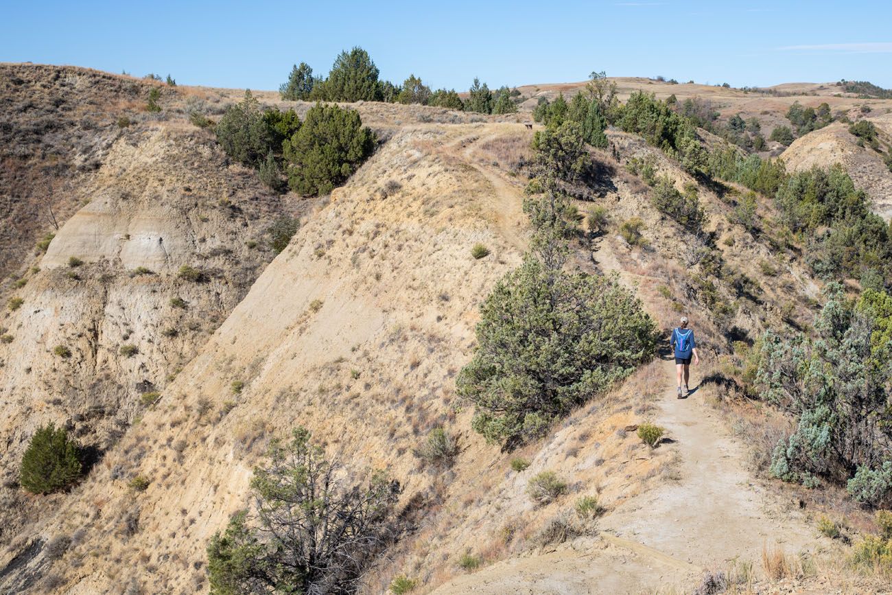
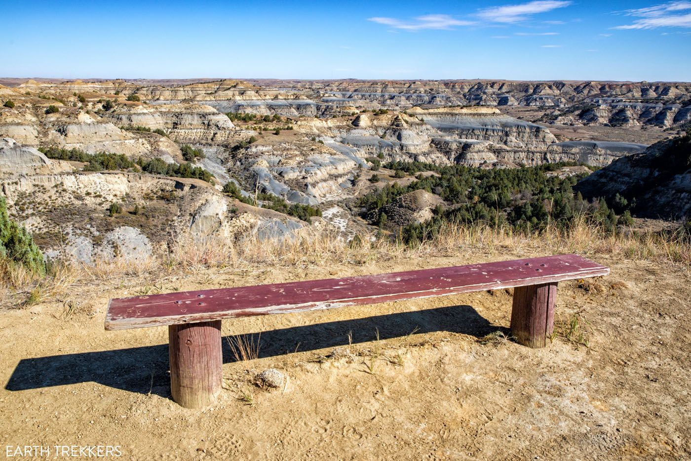
Along the Ridge
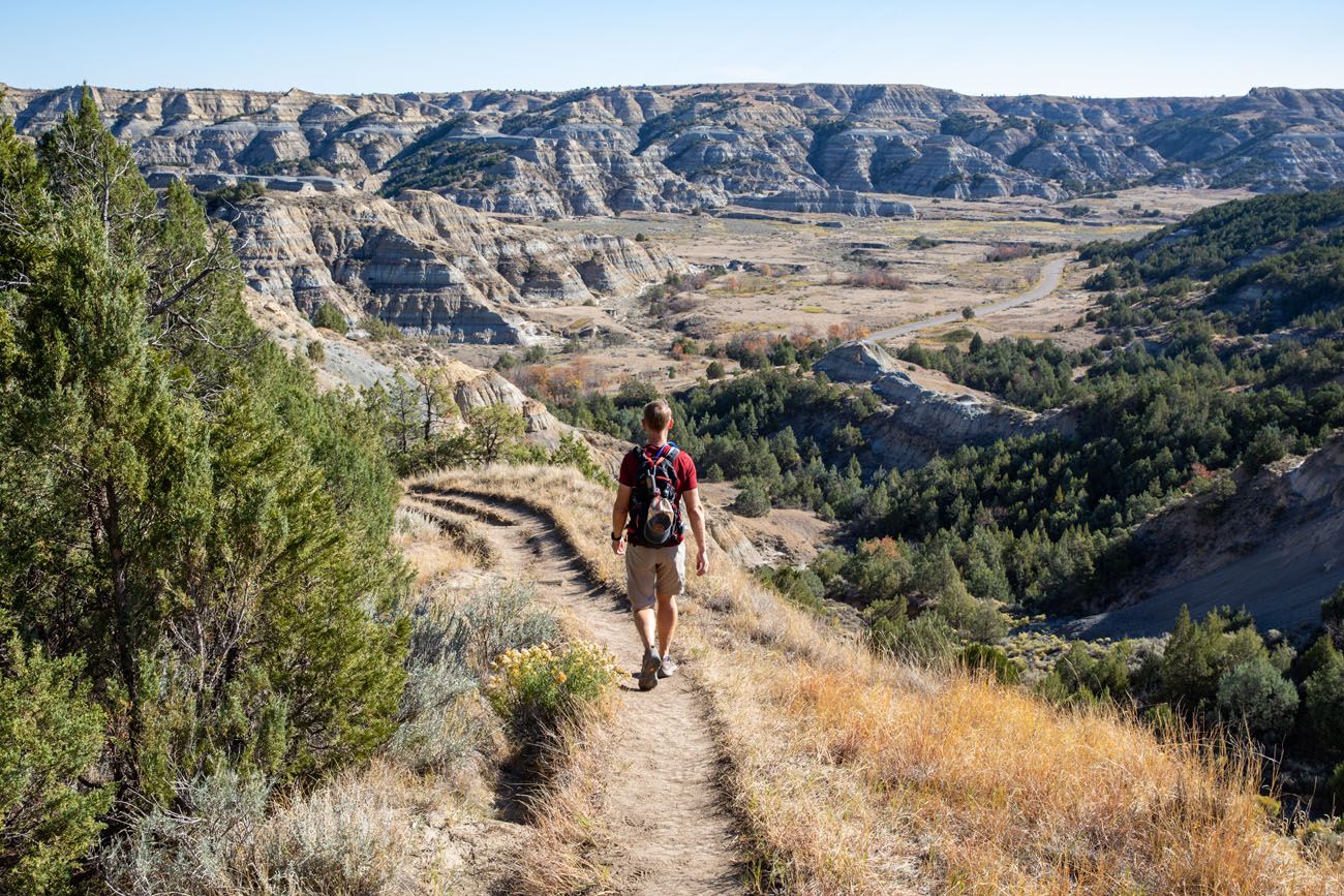
This is the best part of the hike. Along this part of the trail, you have panoramic views not only over the Little Missouri River Valley but also over the badlands. Take your time during this part of the hike and enjoy these views.
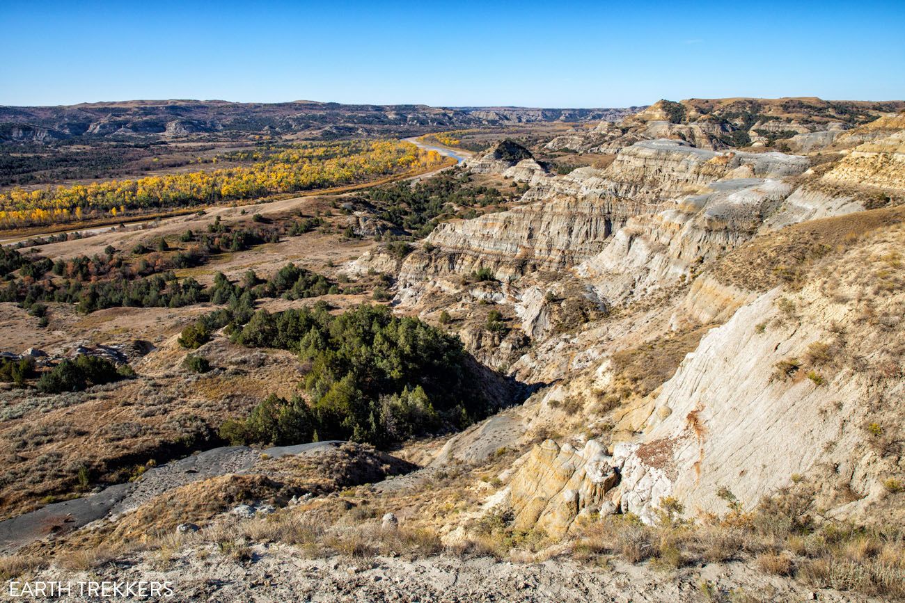
View over the Little Missouri River.
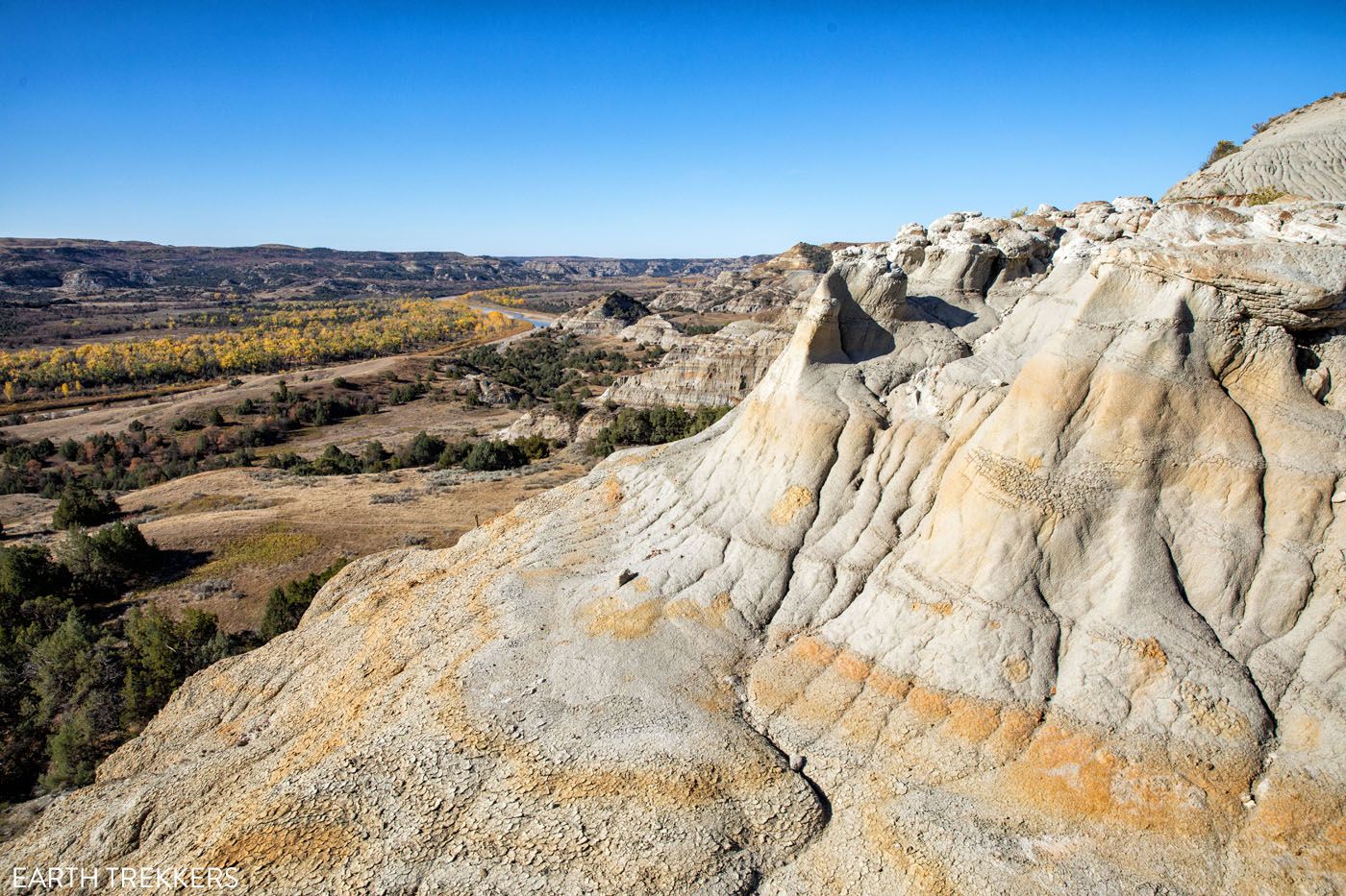
View of the badlands.
Another view of the Little Missouri River.
At the end of the ridge, the trail very rapidly descends. You will walk down steep hills and long sections of steps. Once at the bottom, you will arrive at the trailhead parking lot, the end of the hike.
Shorter Version of this Hike
If you don’t want to hike the full 4 miles, it is easy to shorten this hike and just do the best part…the walk along the ridge. Park at the Big River Overlook and hike along the ridge as far as you want to go, turning around when you are ready.
Tips to Have the Best Experience
☀️ Visiting in Summer. If you plan to visit Theodore Roosevelt National Park from June through September, be aware that it can get very hot. During the summer months, thunderstorms can pop out of nowhere. Plan to hike first thing in the morning or at the very end of the day, when temperatures are at their coolest.
💧 Bring sunblock and water on this hike. Plan on bringing at least 1 to 2 liters of water per person.
🥾 Hiking Shoes. Hiking shoes are ideal but you can get by with a good pair of walking or running shoes.
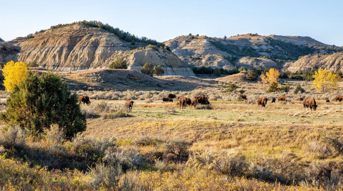
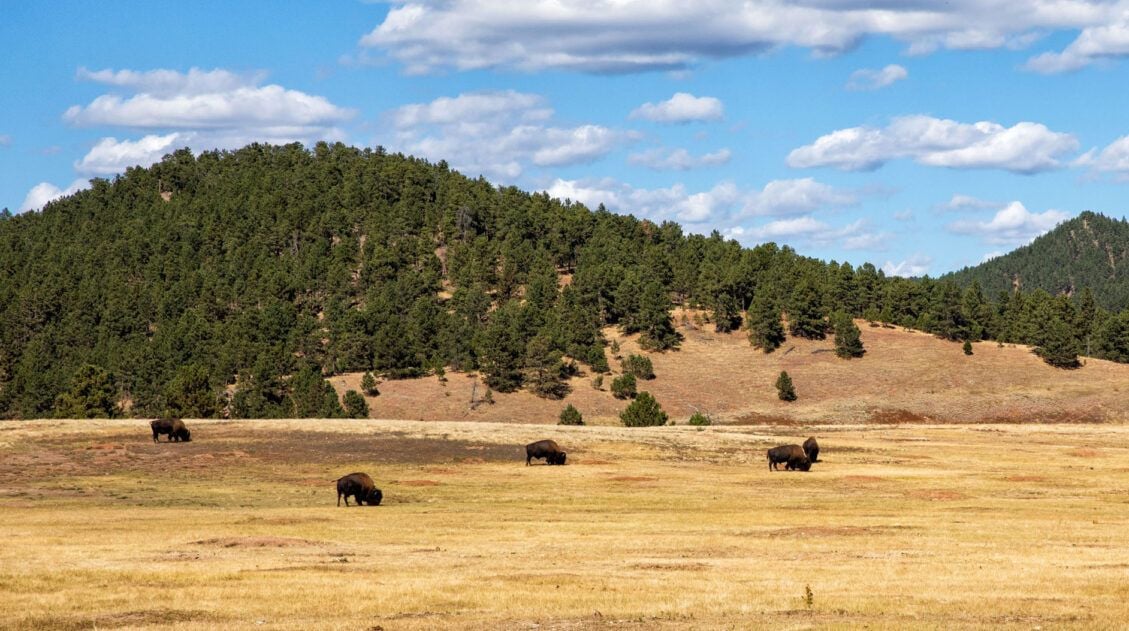
🦬 Wildlife Safety. There is a chance that you will see bison on this hike. If you do, keep your distance. They may not look it, but bison can run fast (up to 35 mph, which is much faster than the fastest human beings). The National Park Service recommends staying at least 25 yards away from a bison. You also need to keep a lookout for rattlesnakes, especially during the summer and early fall.
North Unit of Theodore Roosevelt National Park
This hike is just one of many wonderful things to do in the North Unit of Theodore Roosevelt National Park. You can also go for a scenic drive, hike to Sperati Point or walk the Little Mo Nature Trail, and see wildlife such as bison, prairie dogs, pronghorn, and mule deer.
If you have any questions about how to hike the Caprock Coulee Trail, let us know in the comment section below.
Plan Your Trip to North Dakota & Beyond
If this is part of a bigger road trip through the USA, visit our United States Travel Guide for more inspiration and travel planning tips. Below you can see more of our guides on Theodore Roosevelt National Park, North Dakota, and nearby destinations.
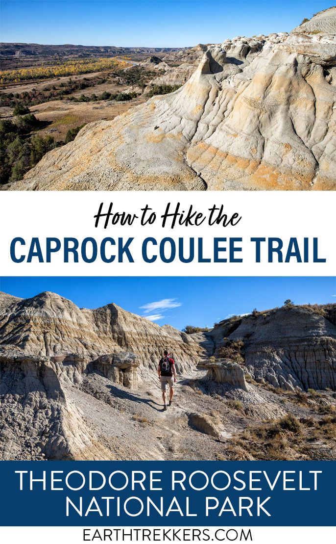
Ekblom Trail and Big Plateau Loop: The Complete Hiking Guide
Pinterest Facebook Flipboard The Ekblom Trail and Big Plateau Loop is one of the best hikes to do in Theodore Roosevelt National Park. Along this hike, you have numerous chances to spot wildlife, gaze out across the grasslands and colorful badlands, and get up close to the Little Missouri River. When we did this, we […]
12 Best Things to Do in Theodore Roosevelt NP (+ 3 Day Itinerary)
Discover the absolute best things to do in Theodore Roosevelt National Park. This comprehensive guide covers top hikes, stunning overlooks, and wildlife spotting across the North, South, and Elkhorn Ranch Units, plus a perfect 3-day itinerary to see it all. Theodore Roosevelt National Park is a striking wilderness where rugged badlands meet vast, rolling grasslands. […]
Complete Guide to the South Unit of Theodore Roosevelt National Park
In this guide, discover the best things to do in the South Unit of Theodore Roosevelt National Park, from the best hikes and viewpoints to what to expect along Scenic Loop Drive. Theodore Roosevelt National Park is made up of three separate units: the South Unit, the North Unit, and the Elkhorn Ranch Unit. The […]
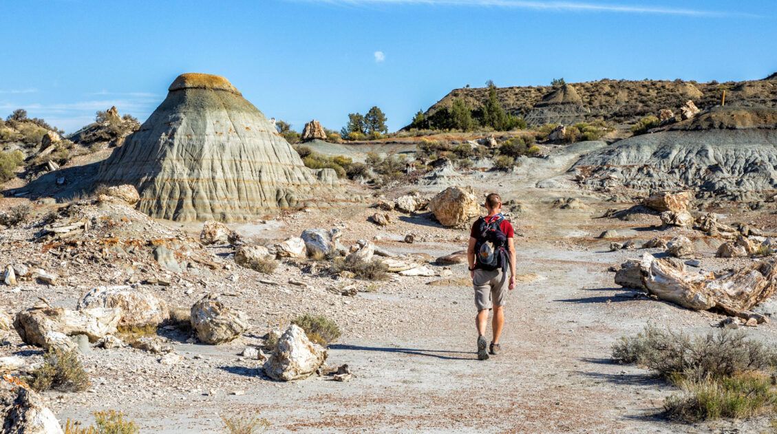
How to Hike the Petrified Forest Trail in Theodore Roosevelt National Park
Badlands, grasslands, bison, and the Little Missouri River are not the only attractions in Theodore Roosevelt National Park. You can also visit the Petrified Forest to see ancient, mineralized trees, similar to what you will see at Petrified Forest National Park in Arizona. Millions of years ago, this part of North Dakota was once a […]
Theodore Roosevelt National Park Travel Guide
Plan your visit to Theodore Roosevelt National Park. Learn about the best things to do, how to plan your time, where to stay, and more.
North Dakota Travel Guide: Things to Do in North Dakota
Plan your visit to North Dakota. Learn about the best things to do, how to plan your time, where to stay, and more.
20 Fun, Short Hikes in the US National Parks
One of the best ways to experience the national parks is from a hiking trail. Hike to amazing viewpoints, deep into the forests, through scenic canyons, and to hidden lakes and waterfalls. Along the way, you have a better chance of spotting wildlife and potentially leaving the crowds behind. Here are 20 fun, short hikes […]
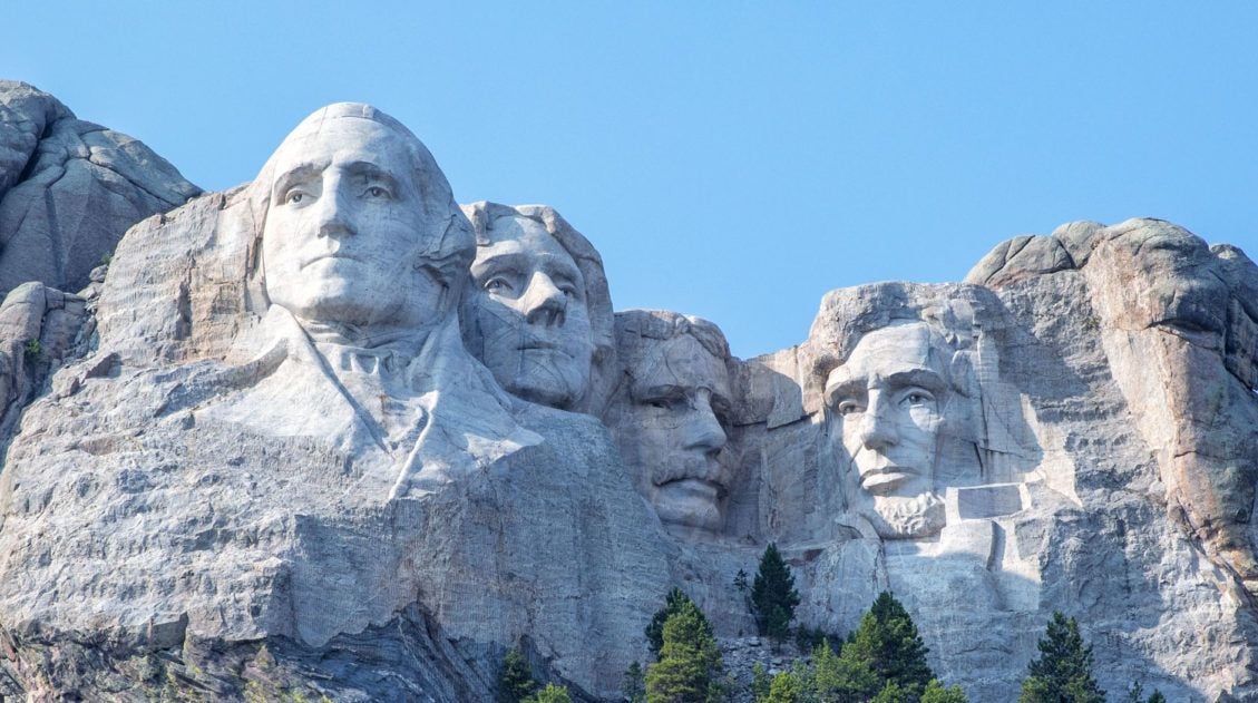
How to Visit Mount Rushmore: Tips & Top Things to Do
Planning a visit to Mount Rushmore? This iconic monument in South Dakota’s Black Hills is easy to visit, but knowing when to go, how long to stay, and what to do nearby can make a big difference. In this guide, we share everything you need to know before you go, including the best time to […]
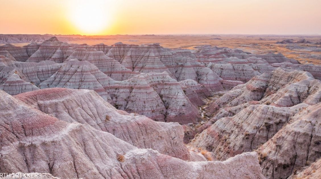
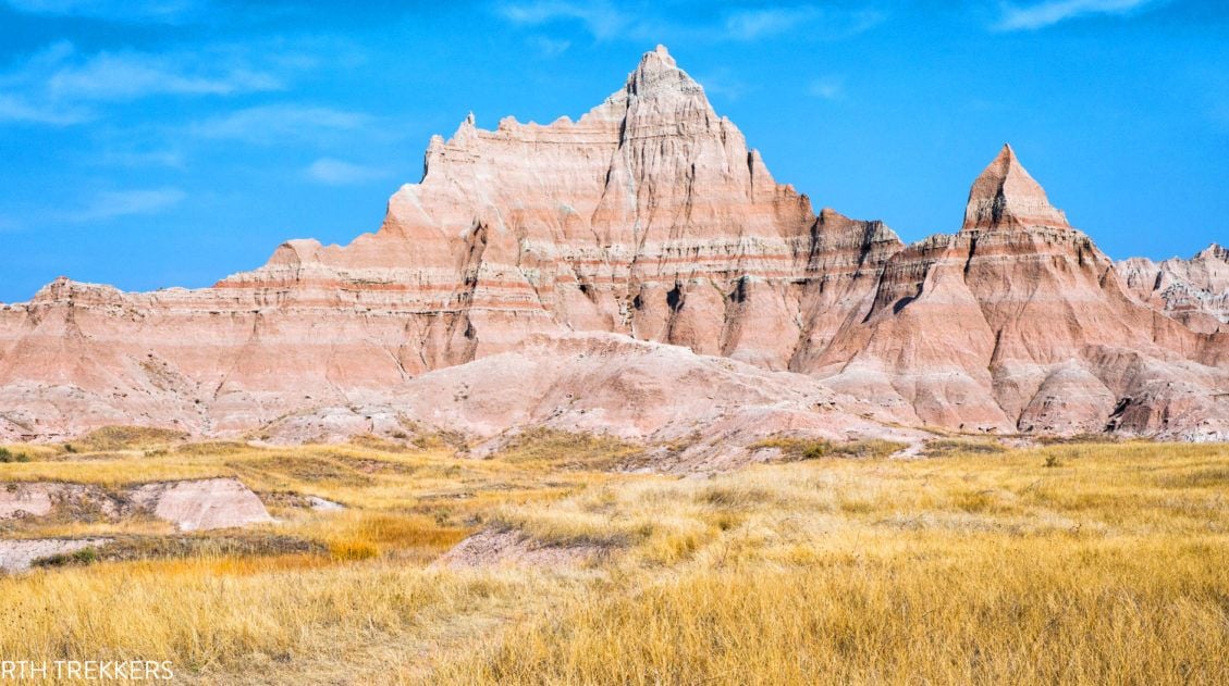
15 Amazing Things to Do in Badlands National Park (+ Map & Photos)
Discover the best things to do in Badlands National Park, in both the North and South units. We’ll also provide a map to help you plan your route, along with itinerary suggestions, where to stay, and helpful tips. Badlands National Park is one of the most highly underrated parks in the U.S. National Park system. […]
One Week South Dakota Itinerary: Black Hills & the Badlands
There are many different ways to spend one week in South Dakota. This itinerary focuses on the southwestern corner of the state, visiting sights located in and around the Black Hills. There is a long list of things to do in this part of South Dakota. Here are the things you will see on this […]
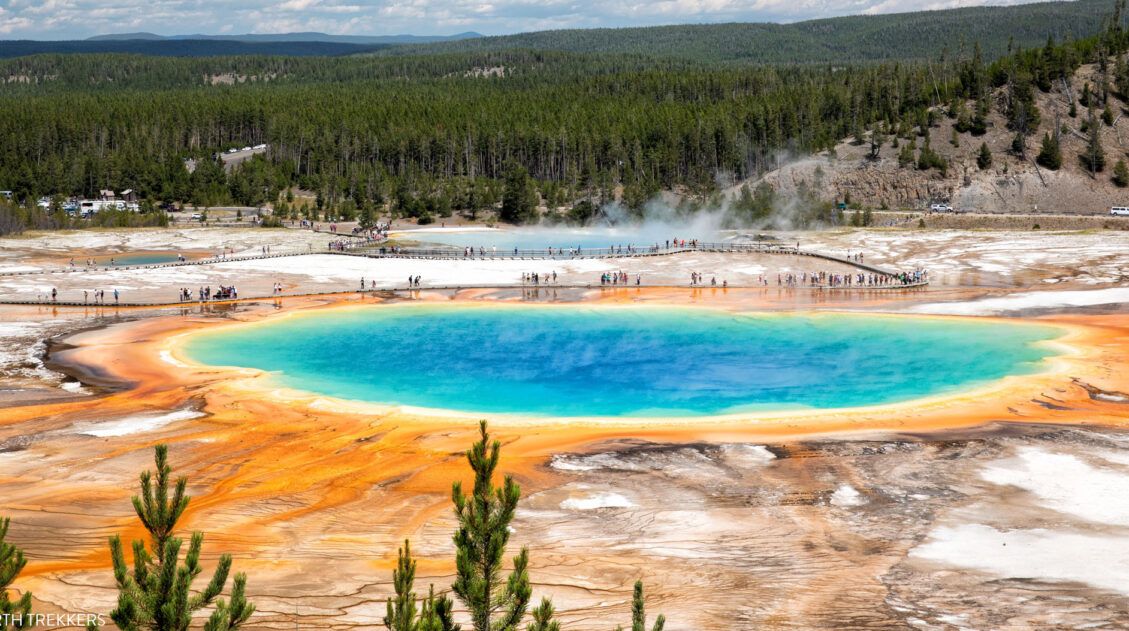
Yellowstone, Devils Tower, and Mount Rushmore: 10 Day Road Trip Itinerary
This is one of the best road trips in the USA. With 10 days, you can visit Yellowstone, Devils Tower, and Mount Rushmore, but that’s not all. You also have enough time to visit the highlights of Grand Teton, day trip out to Badlands National Park, spend some time at Wind Cave National Park, and […]
6 Great Things to Do in Wind Cave National Park
Discover the very best things to do in Wind Cave National Park, how to choose the best cave tour, and ideas for planning your time. This underrated park also has a few short, spectacular trails, with the chance to spot bison, elk, prairie dogs, and pronghorn. Wind Cave National Park gets its name for its […]

The Ultimate Guide to the 63 US National Parks
Stretching from the South Pacific, across the United States to the Caribbean, are 63 national parks. These national treasures preserve iconic landscapes, majestic mountains, primordial forests, arid deserts, misty coastlines, immense canyons, wildlife, and historic landmarks. We have visited 56 of the 63 US national parks, from the towering granite walls of Yosemite and the […]

Comments 2