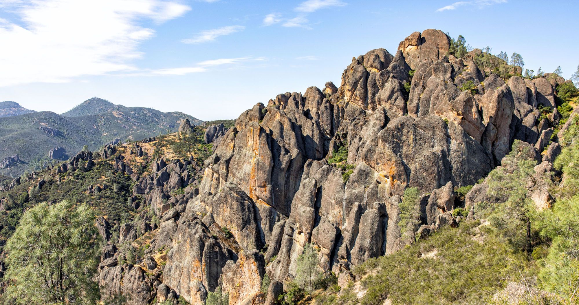

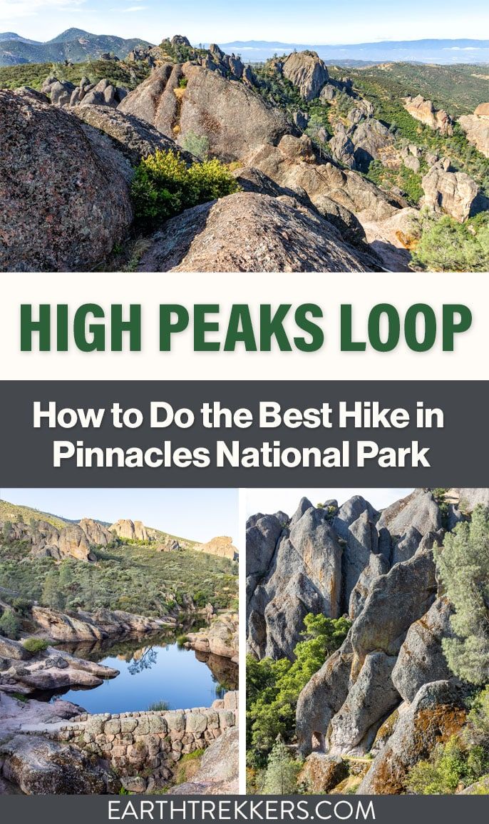
The High Peaks Trail Loop in Pinnacles National Park is an underrated adventure in the US national parks.
From start to finish, this hike offers nonstop excitement, with panoramic viewpoints, thrilling climbs up rock ladders and along ledges, and the chance to spot California Condors flying overhead. On this trail, hikers can also rock scramble through caves, have a snack or picnic lunch next to the reservoir, and enjoy extraordinary views over the park.
We are avid hikers and this loop trail ticks all of the boxes of a “perfect hike:” constantly changing views, unique landscapes, wildlife sightings, and fun obstacles along the trail. And since this is done as a loop, the views are always new.
In this guide, we will cover:
- Trail stats
- A map of the trail
- Which direction is best
- A step-by-step guide with lots of photos so you know what to expect
High Peaks Trail Loop Stats
There are several different ways to do this hike, which we will get to next, but these hiking stats are from the Bear Gulch Day Use Area, through the Bear Gulch caves, to the reservoir, then up the High Peaks Trail and down the Condor Gulch Trail. Basically, it is a loop hike that is done in a clockwise direction, starting and ending at the Bear Gulch Day Use Area.
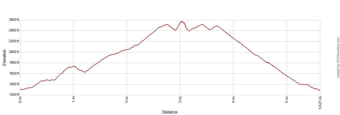
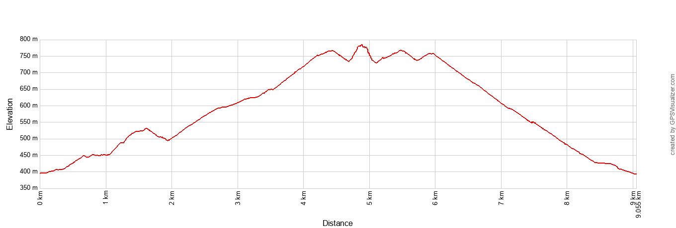
Distance: 5.6 miles (9.1 km)
Difficulty: Moderate to strenuous
Total Ascent: 1,725 feet (525 meters)
Lowest Elevation: 1,286 feet (392 meters)
Highest Elevation: 2,574 feet (785 meters)
Length of Time: 3 to 4.5 hours (our time was 3 hours 15 minutes)
Below is a map of the hiking trails. The trails change names numerous times and with the option to take alternate trails (Bear Gulch Cave Trail versus the Moses Spring Trail) it can get confusing. Hopefully, this map clears up any questions you may have. And since the trail is on Google Maps, you can follow along on your phone as you hike the trail.
How to Use This Map: Click the tab in the top left corner of the map to see a list of the points of interest and to turn layers on/off. Click the icons on the map to get more information about each point of interest.
To take this map with you, click the star next to the title of the map which adds it to your Google account. Next, within your Google Maps app, select ‘Saved’ and then select ‘Maps’. This map title will now appear in your list.
Which Direction is Best?
Since this hike is done as a loop, it can be done in either direction.
Counterclockwise Direction
Many people do this hike in a counterclockwise direction. Starting from the Bear Use Day Area, the hike starts on the Condor Gulch Trail, then joins the High Peaks Trail, and ends with the Bear Gulch Reservoir and the optional walk through the Bear Gulch caves, before ending back at the parking lot.
Advantages: The big climb comes early in the hike, so you can get this over with first. And the hike ends with the Bear Gulch Reservoir, a picturesque spot that is the perfect place for a picnic lunch before making the 1 mile hike to the parking lot.
Disadvantages: The Bear Gulch caves can be crowded midday and into the afternoon, right when you will be hiking through them.
If you plan to do the High Peaks Trail Loop in this direction, the trailhead is the Condor Gulch Trail. Look for the small footbridge next to the smaller parking lot in the Bear Gulch Day Use Area. There is a trail sign here marking the start of the trail.
Clockwise Direction
We did this hike in a clockwise direction. We chose to start with the caves first, since we got an early start (7:30 am) and liked the idea of hiking through them before they got crowded. In a clockwise direction, the Bear Gulch caves and reservoir come early in the hike. Then it is a slow, gradual climb up the High Peaks Trail to the highest point in the park. Return to the parking lot on the Condor Gulch Trail.
Advantages: If you are in the park early, the caves will be empty or there will just be a few hikers, and rock scrambling through these caves at your own pace (and taking photos) is more enjoyable than when they are more crowded. We had great lighting for photography along the entire hike.
Disadvantages: Most of the uphill hiking comes later in the hike (the climb up to High Peaks is stretched out over 2.8 miles versus 1.9 miles by going in the other direction). You don’t get the option to end with a picnic lunch next to the reservoir.
Verdict: Which Way is Best?
If you want to get the hard, uphill walk over with quickly, hike the loop in a counterclockwise direction.
If you like the idea of hiking through the caves without crowds of people, start early and do this hike in a clockwise direction.
The views along the trail are great, regardless of the direction you go.
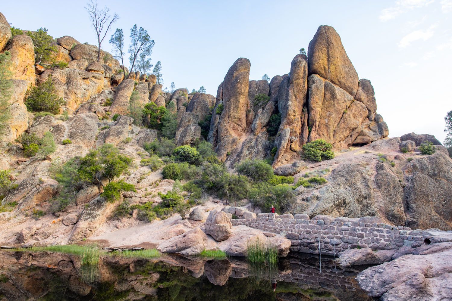
Bear Gulch Reservoir
How to Hike the High Peaks Trail Loop
This trail description is for the clockwise direction, starting and ending at the Bear Gulch Day Use Area.
Parking
There are two parking areas for this hike: the Bear Gulch Day Use Area and the Moses Spring Parking Area.
Bear Gulch Day Use Parking Area: This is a very large parking lot with 64 parking spaces and bathrooms. The Bear Gulch Nature Center is also located here. From this parking lot, it is a 0.25 mile walk to the official trailhead on the Sycamore Trail.
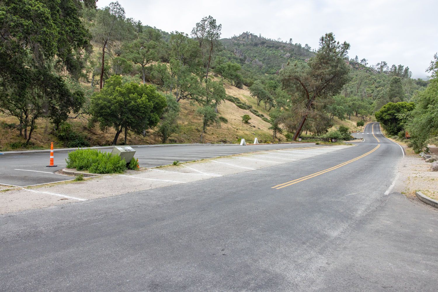
Bear Gulch Day Use Parking Area
Moses Spring Parking Area: This small parking lot is located at the end of the park road. There are only 10 parking spaces but there are bathrooms.
It doesn’t matter much, which one you choose. Since this hike is a loop, you will return to same lot where you parked. We parked at the Bear Gulch Day Use Area (even though there were a lot of spaces still available at the smaller lot). This meant we hiked the connector trail (the Sycamore Trail) first, and ended at the Bear Gulch Day Use Parking Area, on the Condor Gulch Trail. See our map above for more clarification.
Step-By-Step Trail Guide
Bear Gulch Day Use Area to the Bear Gulch Caves
We are starting with the Bear Gulch Day Use Area parking lot, since that is the larger lot and where most people will have an easier time getting a parking space.
The Sycamore Trail is a shady, 0.25-mile trail that runs parallel to the park road, through a picnic area. It ends at the Moses Spring Parking Area. On the other side of the street is the official trailhead for the loop hike.
This loop hike includes several different trails in the park, so you will see the names change throughout this hiking guide. The trailhead is the start of the High Peaks Trail. This trail runs uphill, through a shady, forested area a short distance before you get to the first trail split.
To include the caves and the reservoir, at the first trail split, take the Moses Spring Trail, which branches off to the left. Adding on the caves and the reservoir does add on extra distance, but they are top experiences in the park and not to be missed.
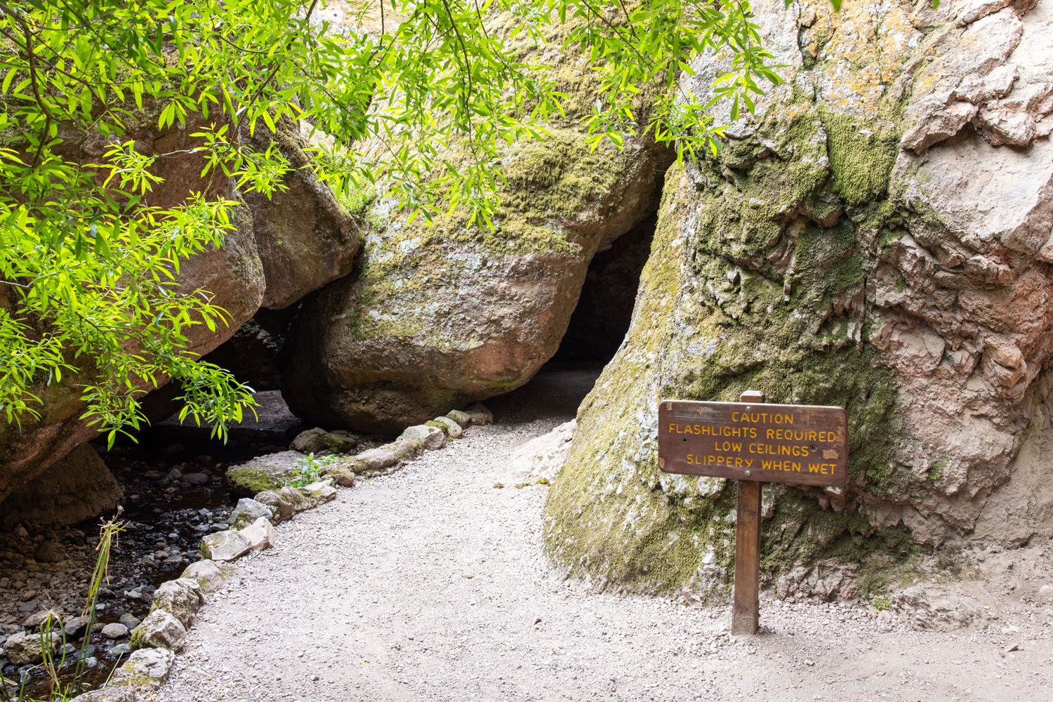
It won’t take long to get to another trail split. At this point, you have a choice to make. To hike through the Bear Gulch Caves, take the Bear Gulch Cave Trail. If the caves are closed, or if you have no desire to rock scramble through dark, claustrophobic caves, stay on the Moses Spring Trail.
Here are a few photos from each trail, to help you decide which one is best.
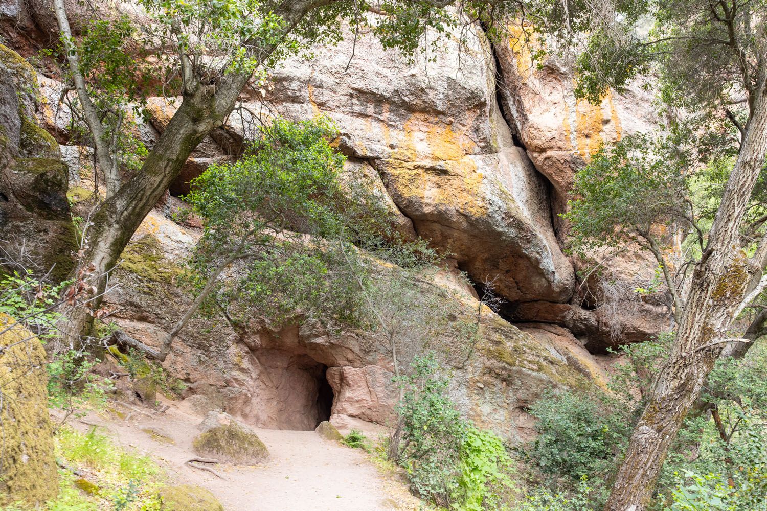
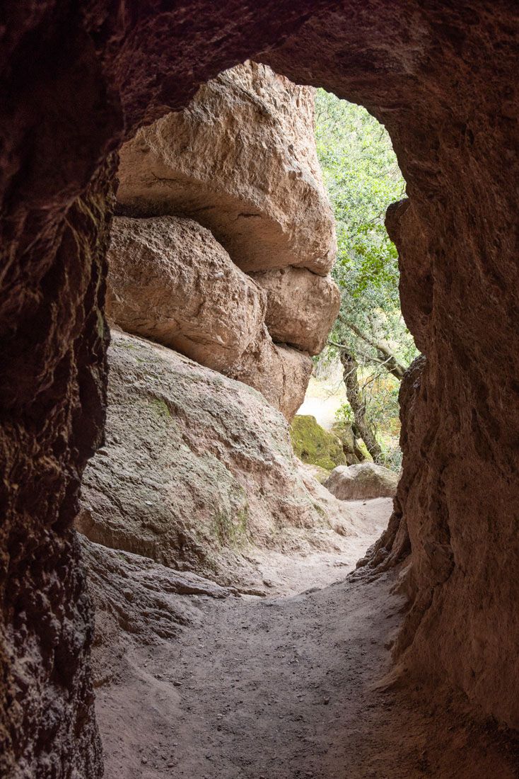
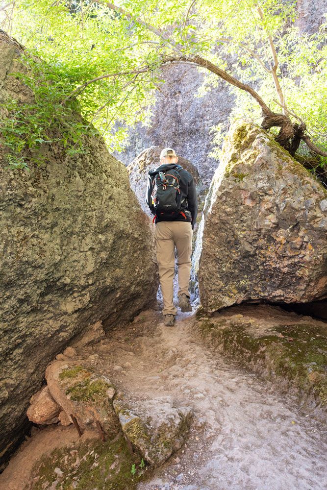
Bear Gulch Caves
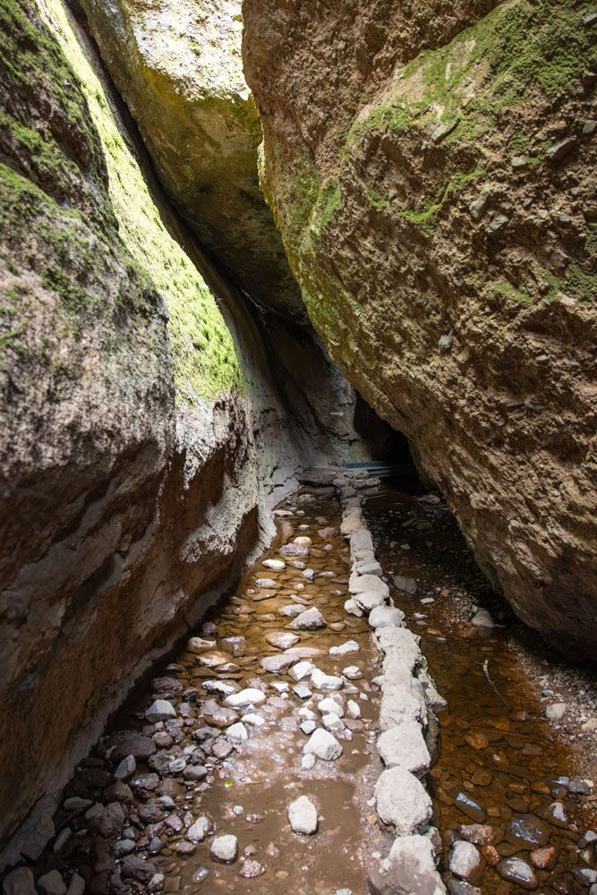
This trail enters the bottom of caves that have been formed by a huge rockfall. To get through the caves, you will need a headlamp (a smartphone is a bad idea because you need both hands free for rock scrambling). You will be in a dark cave, with uneven footing, and you will do some easy rock scrambling and crouching to get through the cave. There are a fair number of steps as you climb up through the cave and there can also be standing water in the cave.
In the lower cave, you may pass by the entrance to the upper cave. This is the large, prison-like door you see at the top of the lower cave. A park ranger told us that this cave is only open 2 to 4 weeks out of the year and is more claustrophobic than the lower caves. You don’t miss much if it is not open when you are here.
If you are claustrophobic, skip the caves and take the Moses Spring Trail.
Here are a few photos. We don’t have photos from the darkest part of the cave (there is a very short section where it is pitch black, so photography is almost impossible).
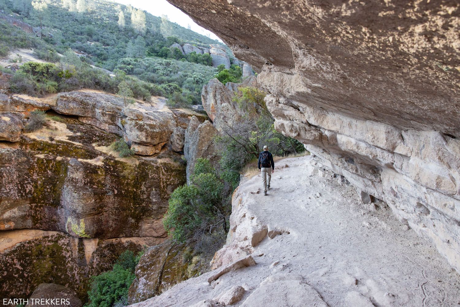
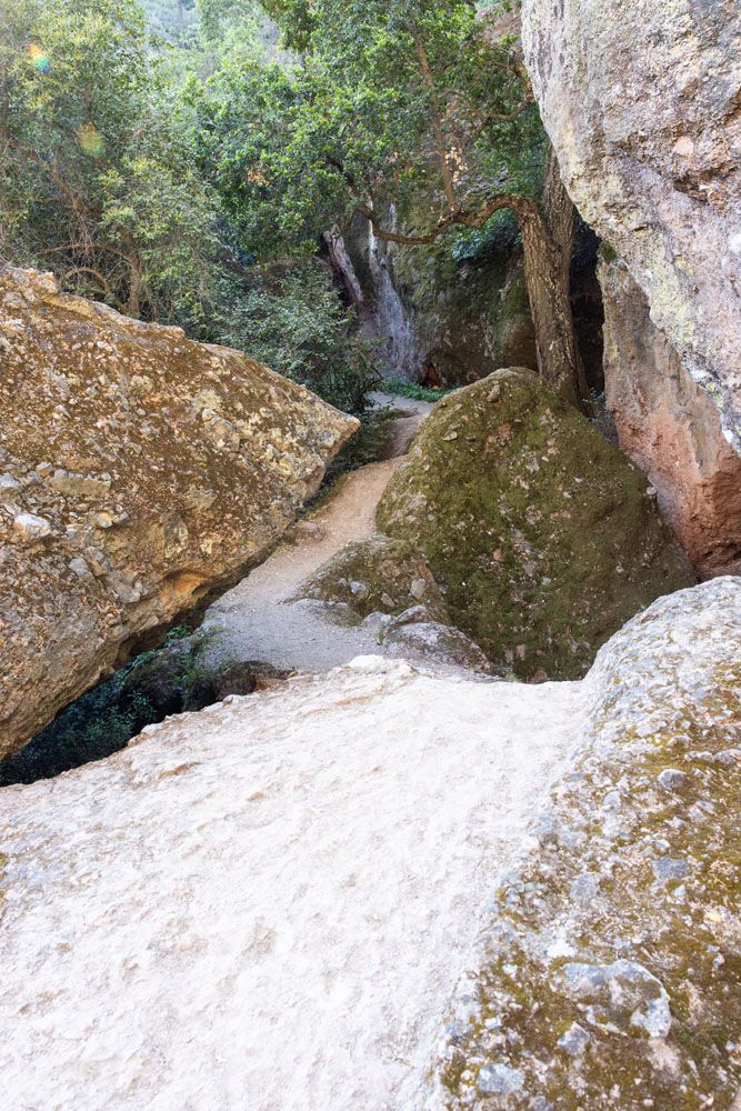
Moses Spring Trail
If the caves are closed, this is the detour trail. It is a very pretty trail, with a walk along cliff edges (the trail is wide so shouldn’t be a problem for those with a fear of heights) and trails that wind around enormous boulders.
Here are a few photos.
Continuing to Bear Gulch Reservoir
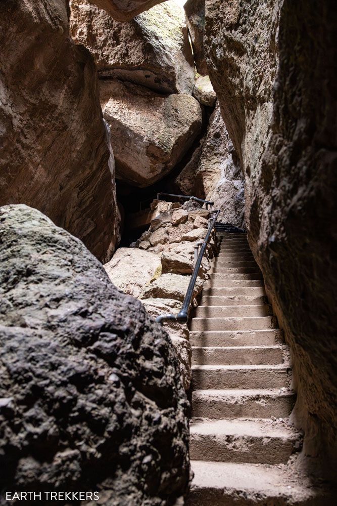
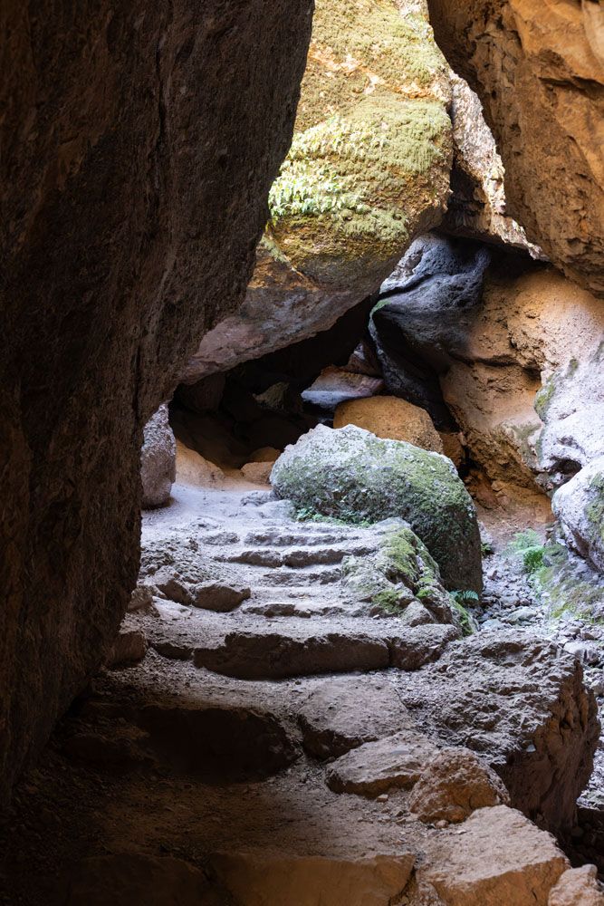
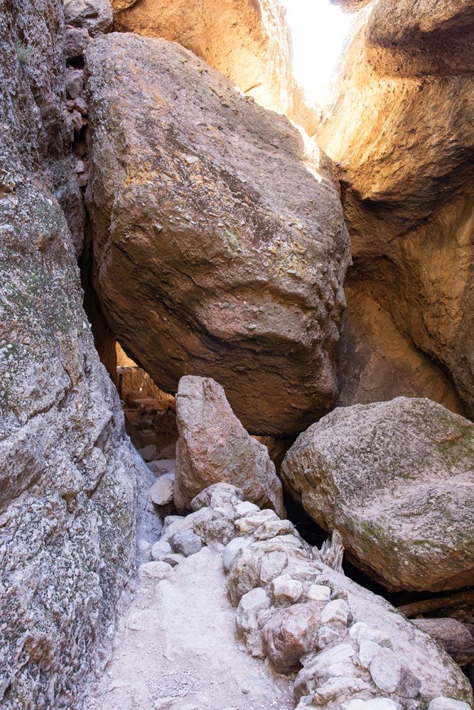
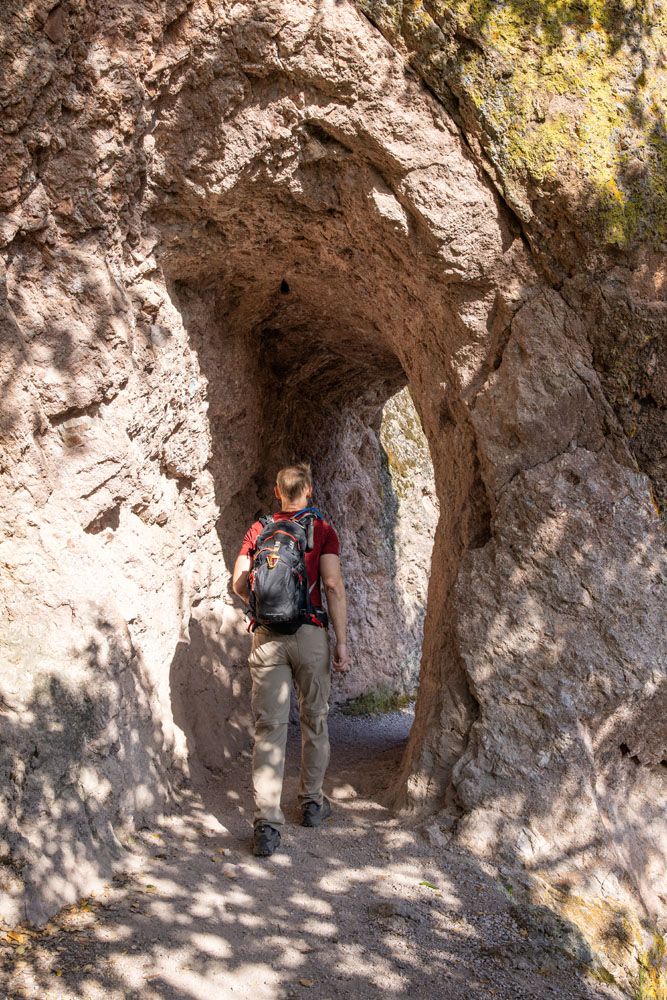
Once the trails rejoin, it is a short walk to Bear Gulch Reservoir. This part of the trail descends down through a cave, but this one is more open than the previous caves, so no headlamp is necessary. There is still some crouching involved to get past one massive boulder wedged in the cave. Then it is a climb up a narrow staircase (Tim counted 75 steps) and you emerge at the reservoir.
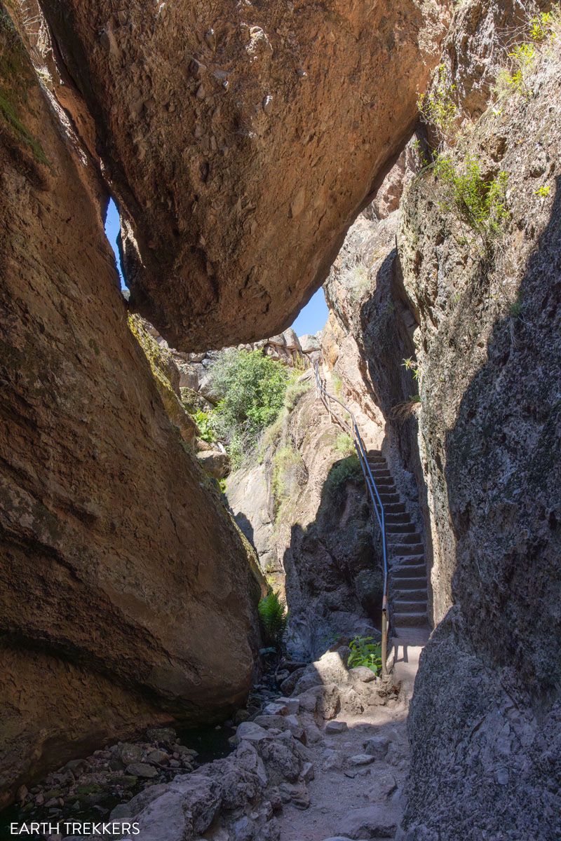
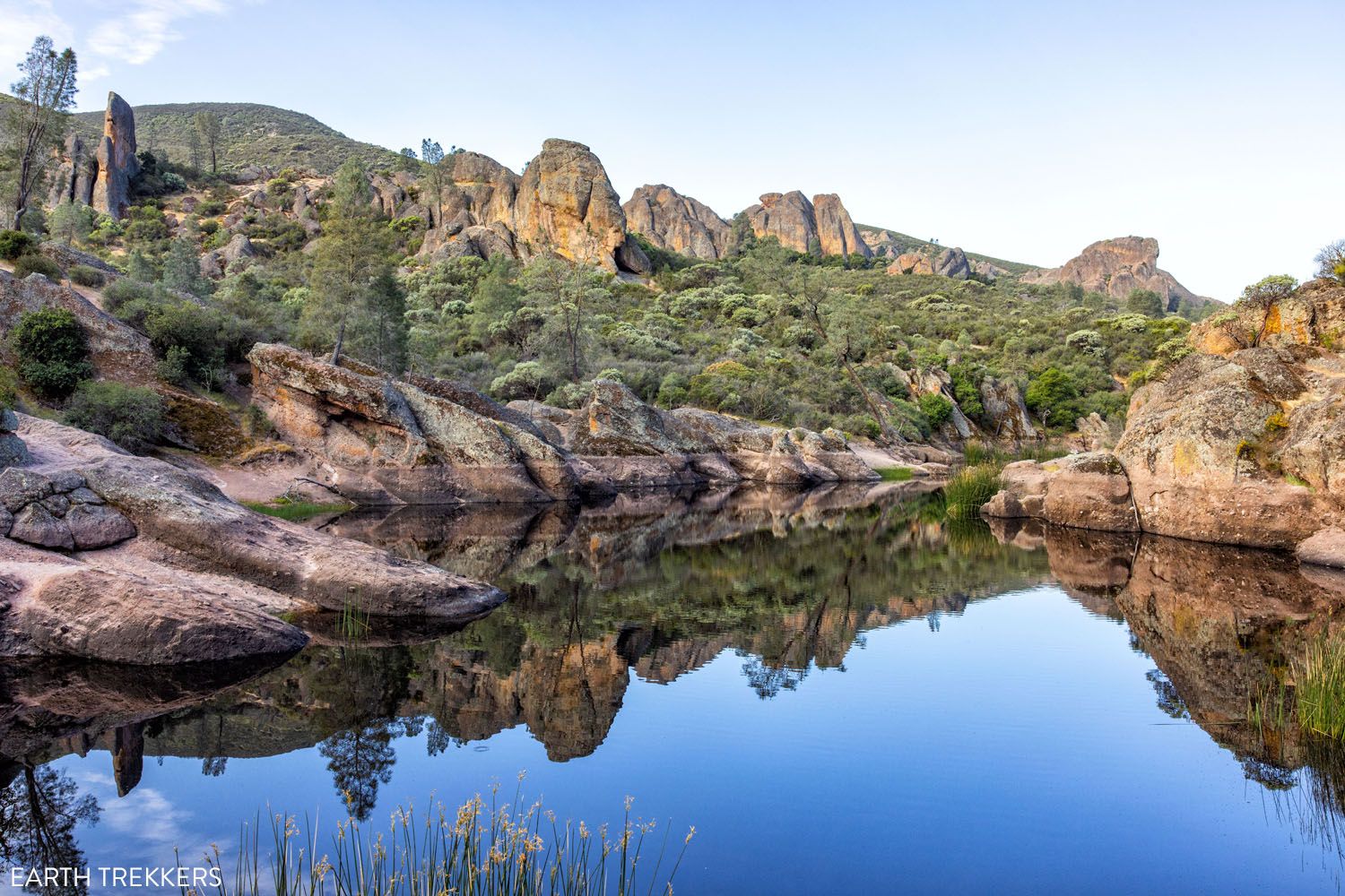
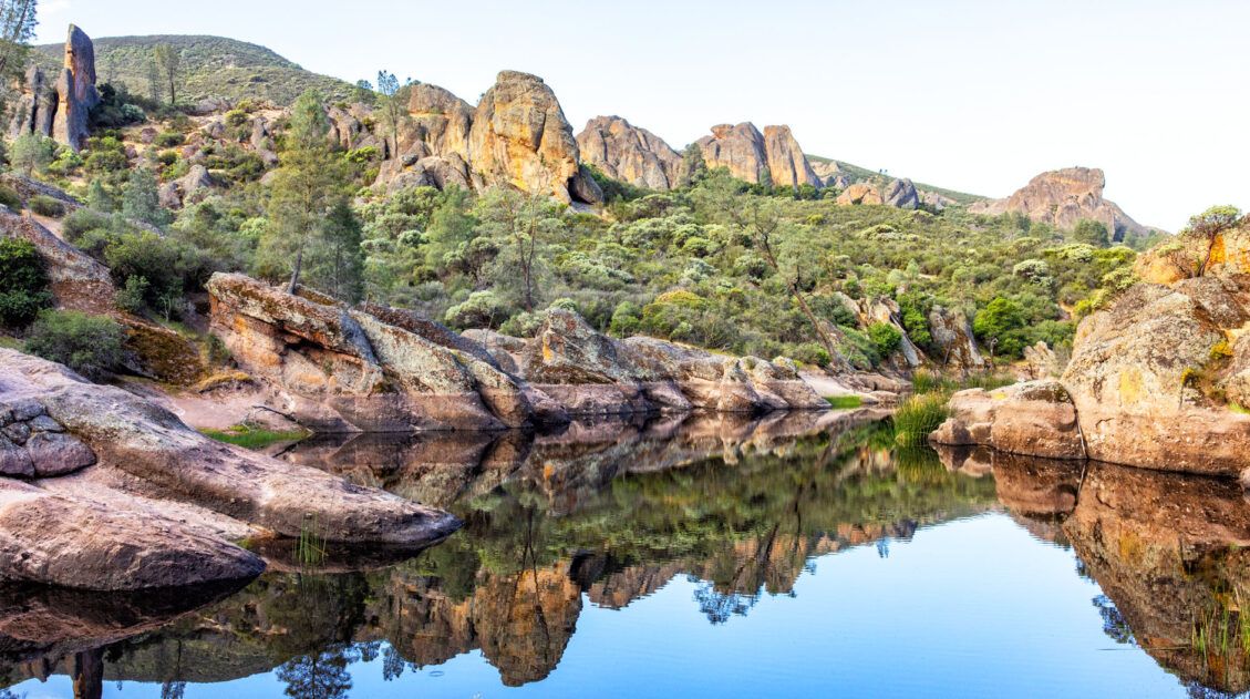
Bear Gulch Reservoir
By this point, you have hiked about 1 mile and have seen two of the main highlights of Pinnacles National Park. And it is going to get even better…
Rim Trail
From the Bear Gulch Reservoir, take the Rim Trail. This is a connector trail that gets you back on the High Peaks Trail. The best view is in the first 30 seconds, as it climbs the hill next to the reservoir, offering a beautiful view of the reservoir. The views from the remainder of this trail are nice, but nothing like what is coming later on this hike.
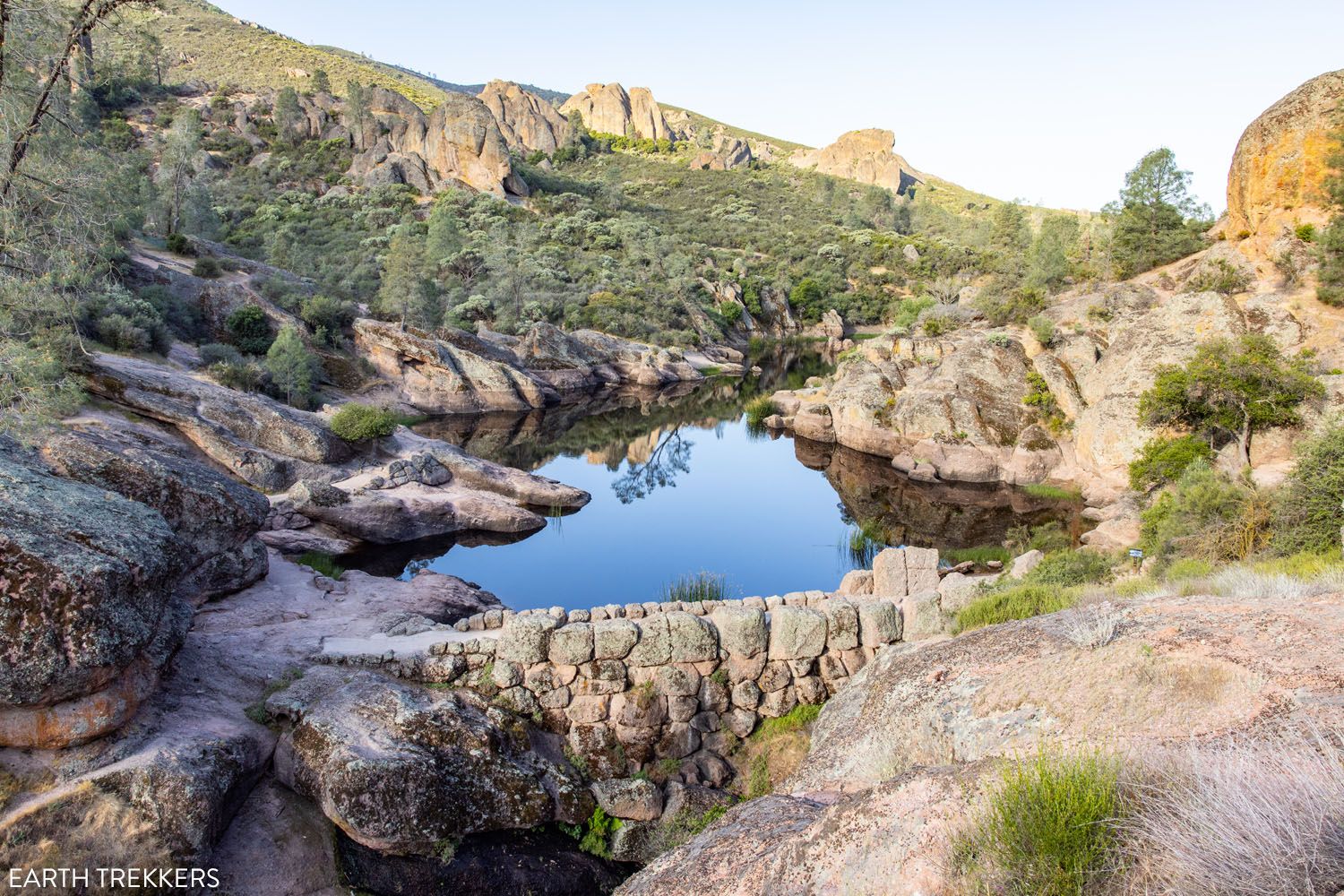
The view of Bear Gulch Reservoir from the Rim Trail
Rim Trail
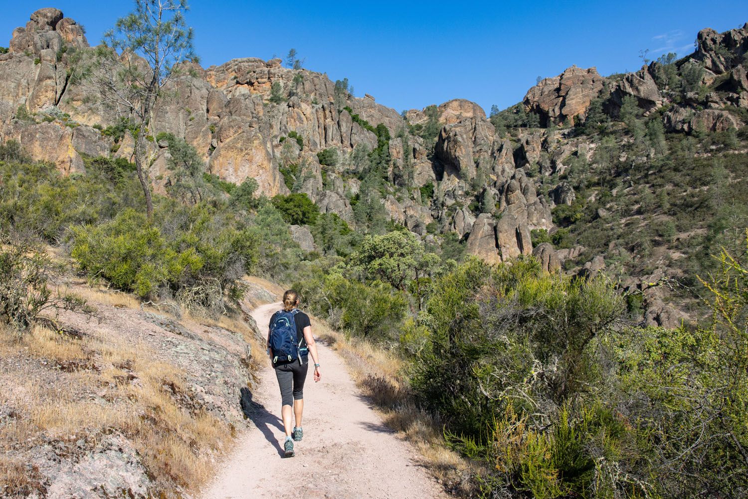
High Peaks Trail
The Rim Trail will dead end at the High Peaks Trail. Go left on the High Peaks Trail, to start the uphill hike to the highest point of the day.
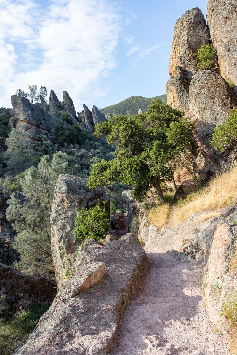
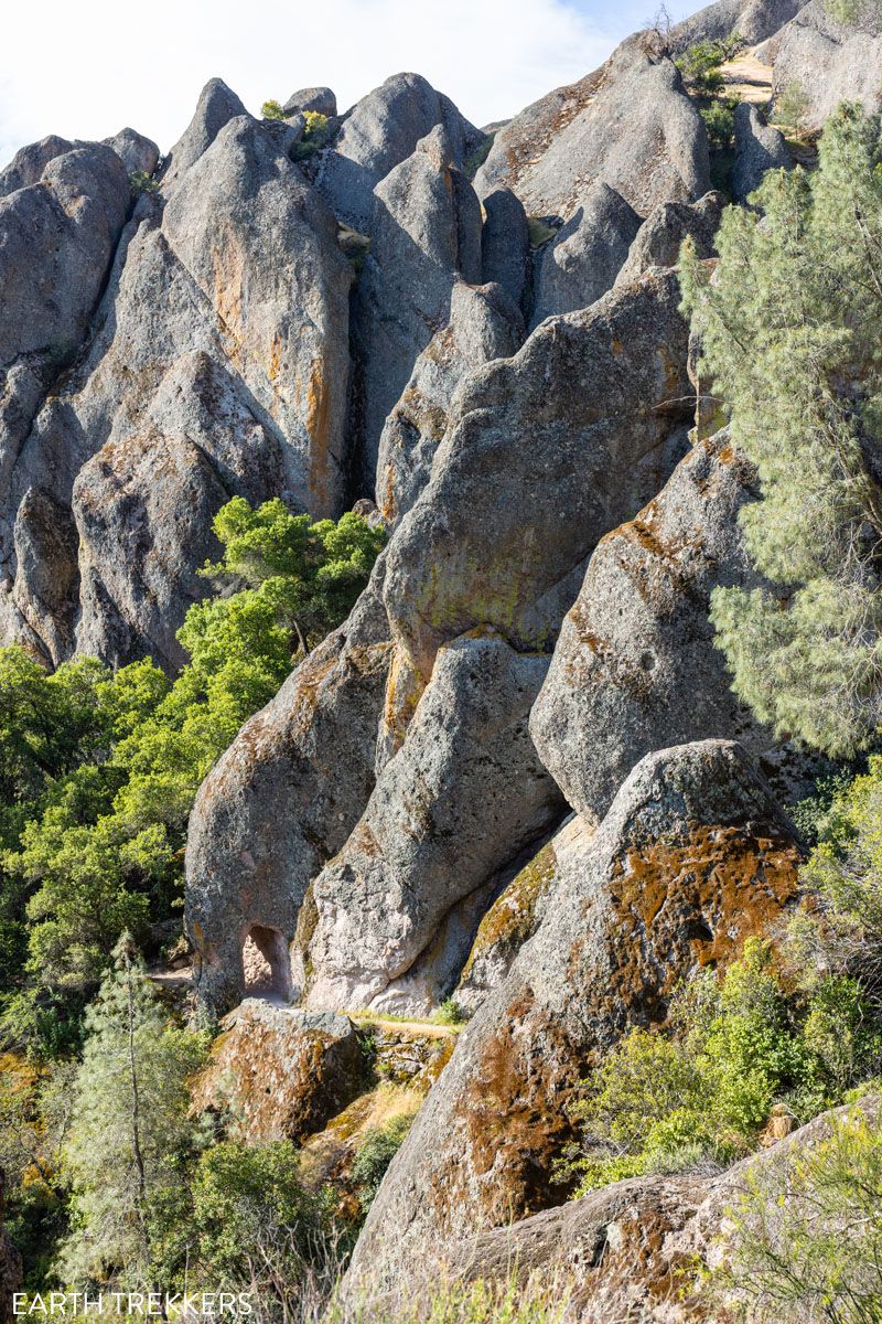
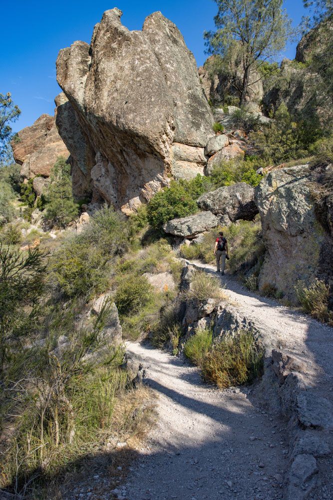
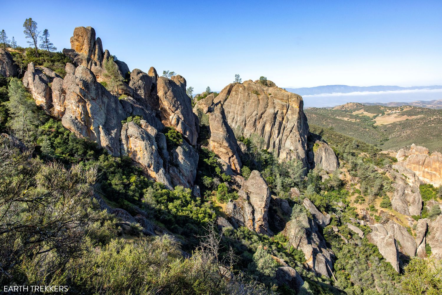
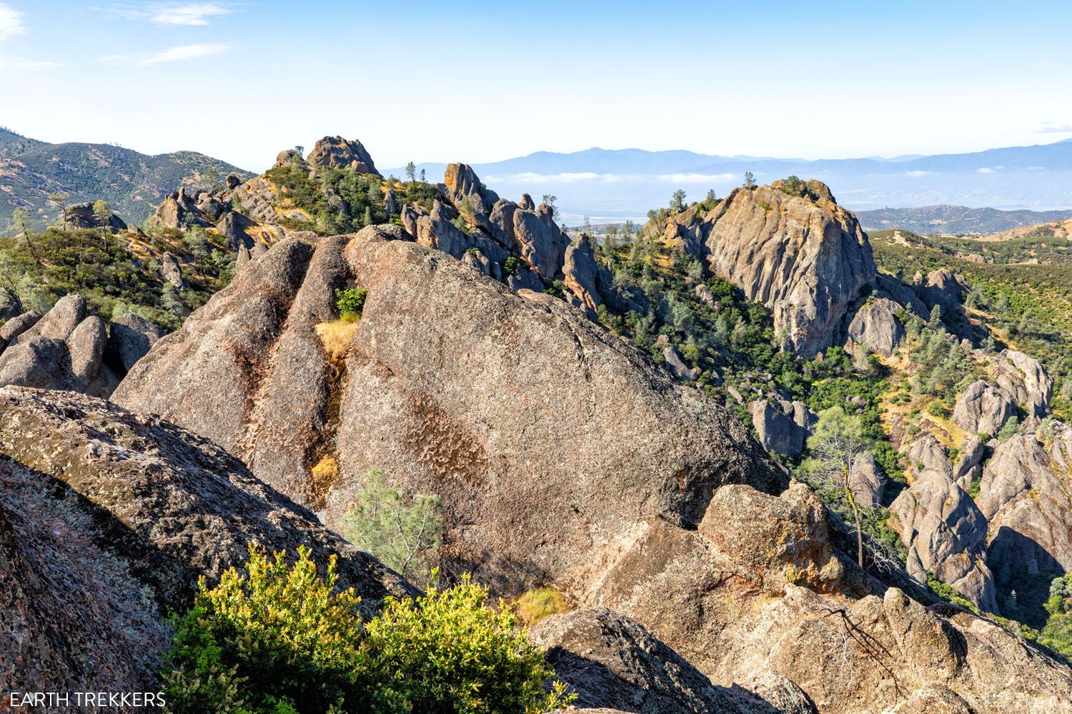
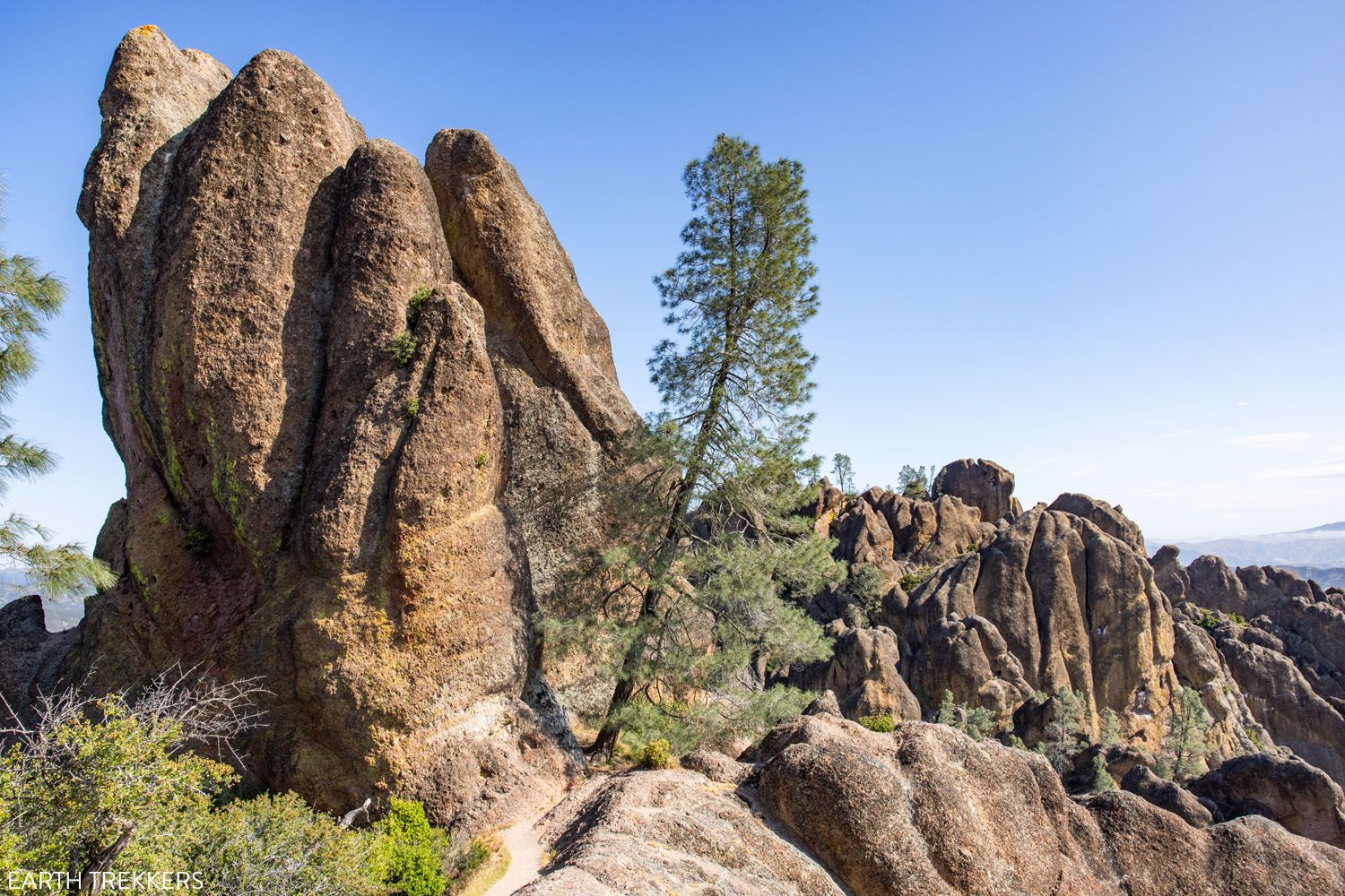
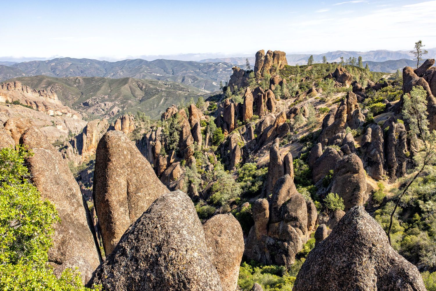
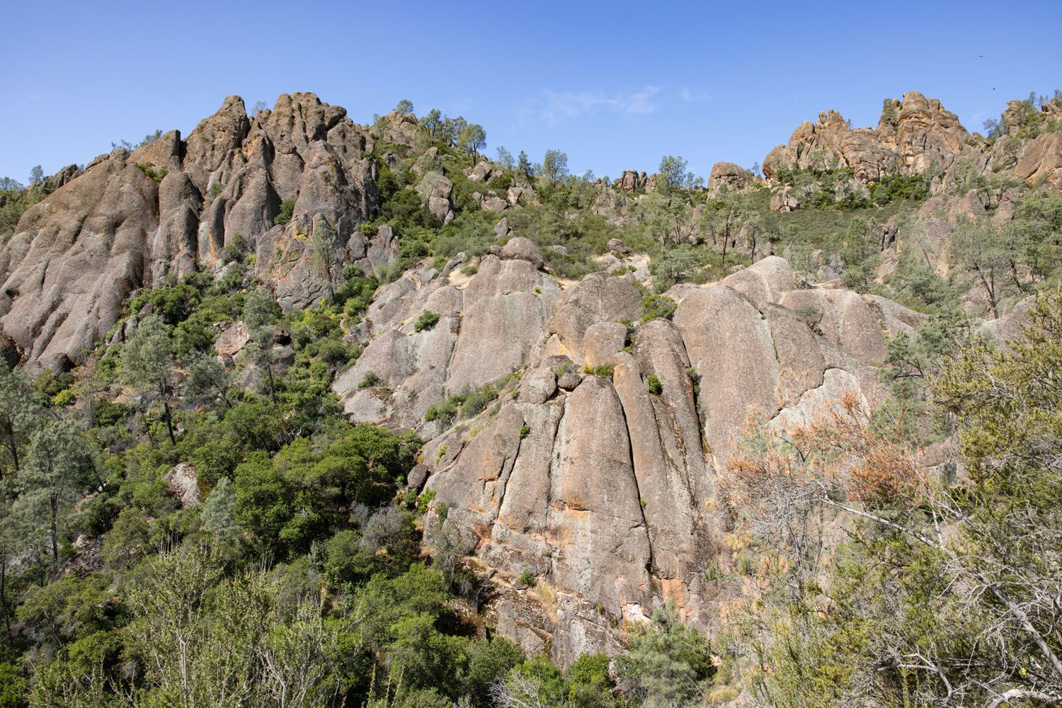
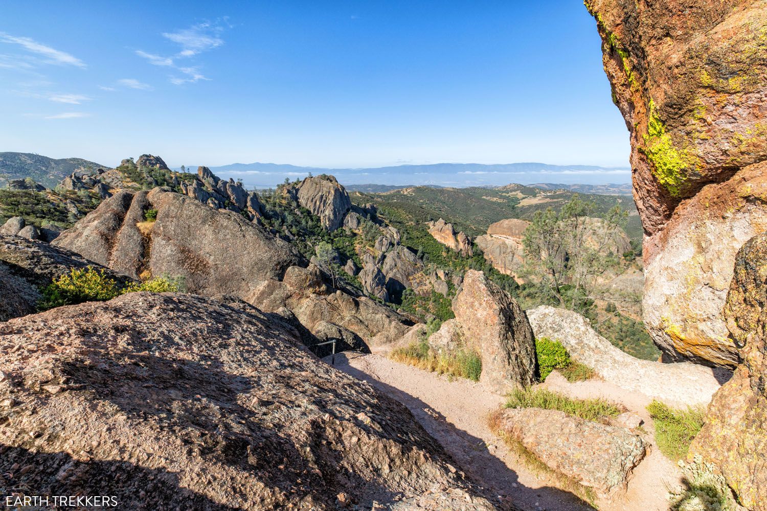
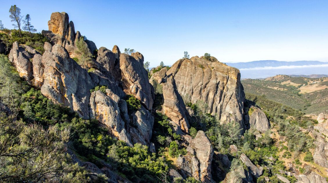
As you hike this trail, the views steadily get better. Once you reach the switchbacks, the landscape dramatically changes. Now, you are hiking among the rocky pinnacles, which gives this park its name. Keep an eye out for the California Condors soaring above you.
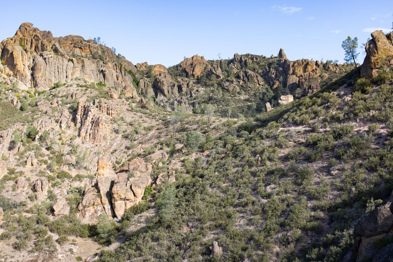
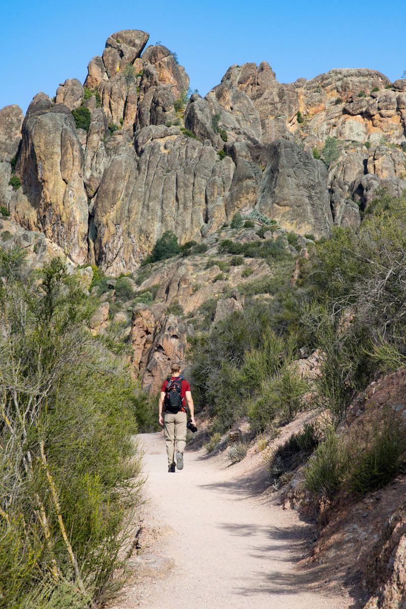
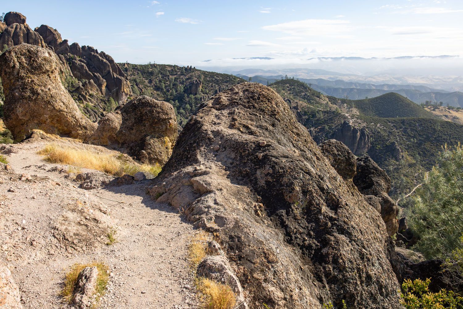
At the top of the switchbacks, again the view changes. Now the views open up to the west side of the park. There is a bench here plus a bathroom. To continue on the loop, take the trail to the right, to stay on the High Peaks Trail. Here’s the view ↓
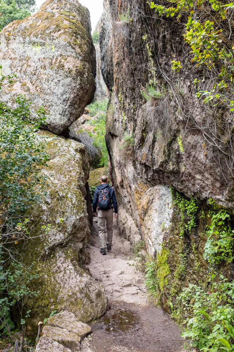
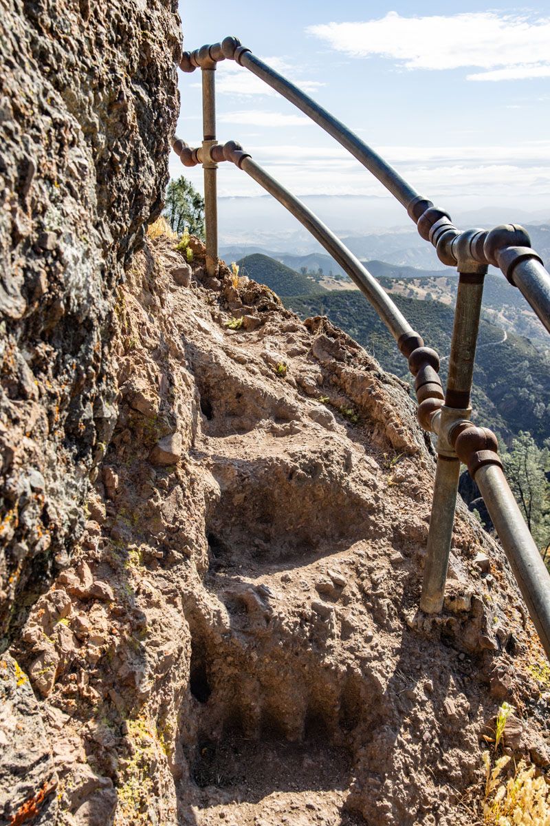
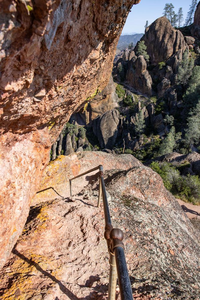
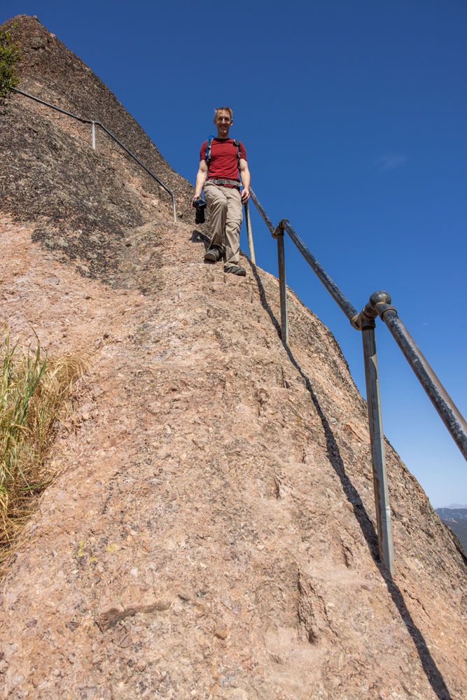
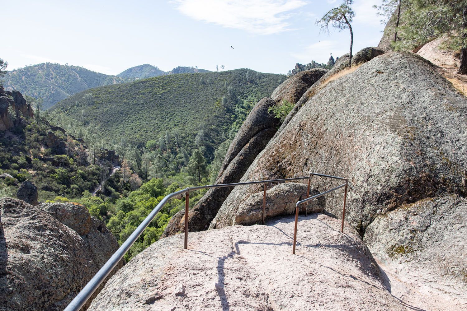
This next section of trail was our favorite on this hike. The climb continues, but now you are hiking up and down through the pinnacles. There are several ladders carved into the boulders, equipped with handrails to help you keep your balance. There is some exposure here, so if you have a fear of heights, sections of this trail could be challenging for you. But there are plenty of handrails to keep hikers safe, with little risk of falling (as long as you stay on the trail).
Here are the photos from this section of the trail.
Condor Gulch Trail
Once you make it through the rock ladders and cliff ledges, the High Peaks Trail starts to head downhill. Keep a lookout for the Condor Gulch Trail. This is the trail that will take you back to the Bear Gulch Day Use Area. If you miss it (staying on the High Peaks Trail), you will end up near the Old Pinnacles Parking lot, far away from where you want to be.
The Condor Gulch steadily descends down through areas of more pinnacles. The condors can still be seen overhead and the upper part of this trail is filled with spectacular viewpoints in all directions.
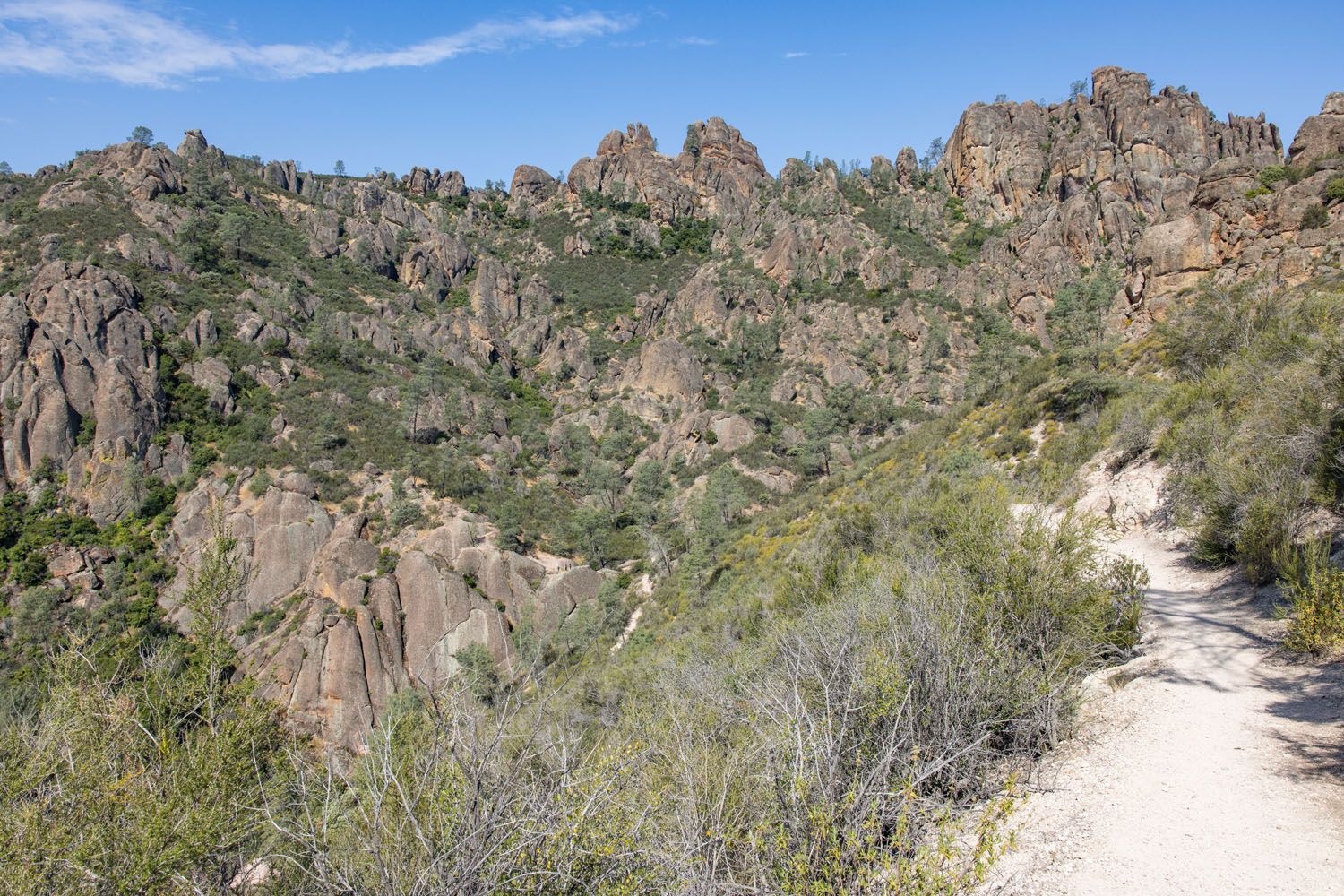
There is an “overlook” along the trail. It’s a small viewpoint on top of a massive boulder, with railings to stay safe, which is a popular photography spot in the park. However, we think the views that you just had from the trail are much better than what you get here, but it is a very quick detour if you want to check out the view.
Then the gradual descent continues until you reach the Bear Gulch Day Use Area. If you parked here, it is a very short walk to your car. If you parked at the Moses Spring Parking Area, it is a 0.25 mile walk on the Sycamore Trail to get to that parking lot.
Tips to Have the Best Experience
Check the National Park Service website before your visit to confirm which caves are open. These caves close during certain times of the year for bat nesting. If the caves are closed, you will detour around them on the Moses Spring Trail, which is also very pretty.
To get a parking space, plan on arriving by 9 am, especially if you plan to visit Pinnacles in the summer months. If it is a Saturday, Sunday, or a holiday, arrive by 8 am to ensure you get a parking space.
Check the weather forecast before you do this hike. In the summer, temperatures are very hot, and with that comes the risk of heat exhaustion and heat stroke. Start this hike early in the day and bring along plenty of water.
Get updates on trail conditions and closures on the National Park Service website.
Please practice the seven principles of Leave No Trace: plan ahead, stay on the trail, pack out what you bring to the hiking trail, leave areas as you found them, minimize campfire impacts, be considerate of other hikers, and do not approach or feed wildlife.
What to Bring on the Hike
Hiking shoes. Hiking shoes or boots are the ideal footwear for this trail. There are sections of rock scrambling, rough trails, and places where you will be hiking on boulders, so a pair of shoes with good traction is necessary.
Water and snacks. At least 3 liters of water per person in the summer.
Sunscreen, hat, and sunglasses. For most of this hike you will be exposed to the sun, with very little shade.
Camera. Even a smartphone will do.
Essential Hiking Gear: What Should You Bring on a Day Hike?
If you are new to hiking or are curious about what you should bring on a hike, check out our Hiking Gear Guide. Find out what we carry in our day packs and what we wear on the trails.If you have any questions about how to hike the High Peaks Trail Loop, or if you want to share your experience, let us know in the comment section below.
More Information for Your Trip to California
Best of Pinnacles: 5 Thrilling Things to Do in Pinnacles National Park
Pinnacles National Park is one of the smallest and least visited national parks in the United States. The list of things to do in Pinnacles National Park is relatively short and unexpectedly awesome. We loved this park, with its thrilling, unique hiking trails, its gorgeous reservoir and caves, and a chance to spot California Condors. […]
How to Plan the Perfect Pinnacles National Park Itinerary
When planning a trip to Pinnacles National Park, one of the biggest questions you may have is “how much time do I need?” We’re here to answer that question and help you plan the perfect Pinnacles National Park itinerary. For most people, a half to a full day is all the time you need to […]
30 Epic Things to Do in Yosemite for First-Timers
Yosemite National Park is packed with famous landmarks, awesome hikes, and breathtaking views. If you are planning your first trip to Yosemite, how do you know what to do? I am a big fan of lists (and photos!). In this post, I list the best things to do in Yosemite: the best landmarks to visit, […]

25 Best Things to Do in San Francisco
What’s the first thing that comes to your mind when you think of San Francisco? The Golden Gate Bridge? The legend and the stories of Alcatraz? Cable cars climbing up and down the steep hills of the city? San Francisco is a big city, filled with lots of things to do. It has a colorful […]
One Day Itinerary for Kings Canyon and Sequoia National Parks
Kings Canyon and Sequoia National Parks sit side by side in central California. Filled with alpine peaks, deep canyons, and the largest trees in the world, you could spend several days here. However, if you only have one day, you have just enough time to visit the highlights of both parks. We visited Kings Canyon […]
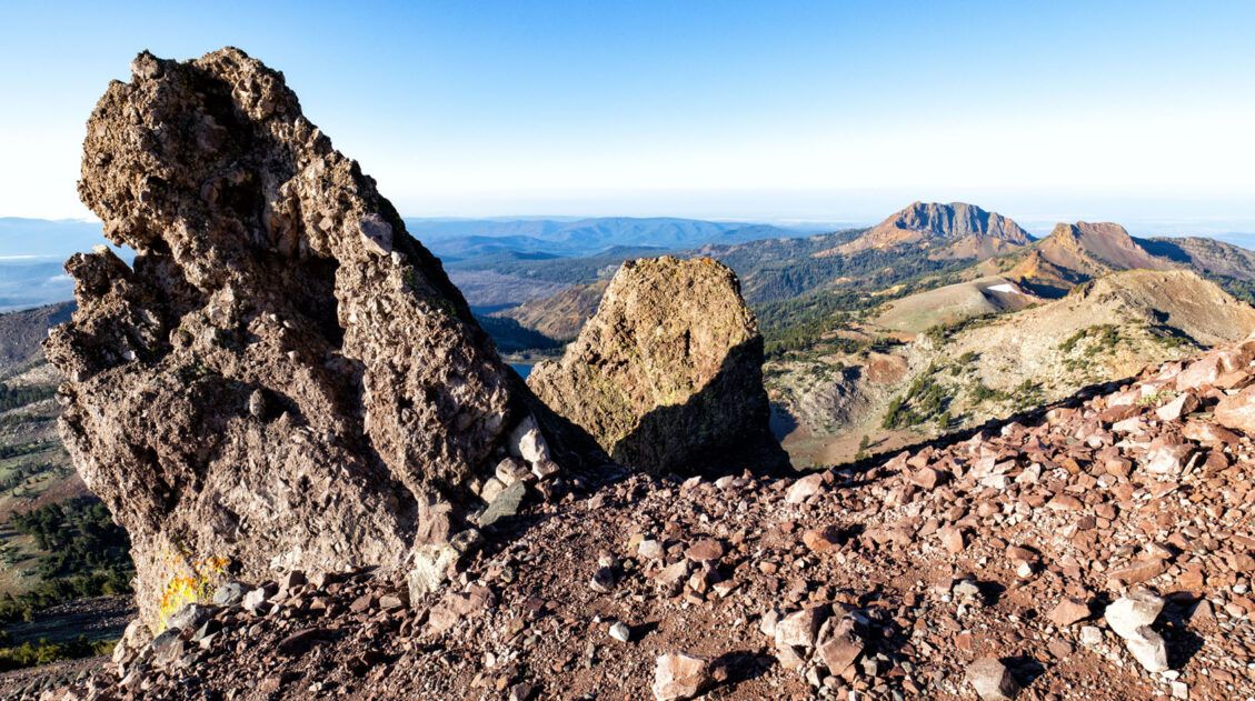
Top 10 Hikes in Lassen Volcanic (+ Our Favorites)
In this guide, we will uncover the 10 best hikes in Lassen Volcanic, from popular trails to a few hidden gems. These are located along Highway 89 (the heart of the park) and in more remote regions such as Warner Valley and Butte Lake. Stroll through bubbling hydrothermal areas, summit volcanoes like Cinder Cone and […]
20 Epic Hikes in the US National Parks
With 63 national parks and thousands of miles of hiking trails, your options are endless for exploring the American national parks. We narrowed down the list for you to 20 of the best hikes in the US national parks, 20 amazing ways to explore this beautiful country. Hike to the tallest peaks, through massive canyons, […]
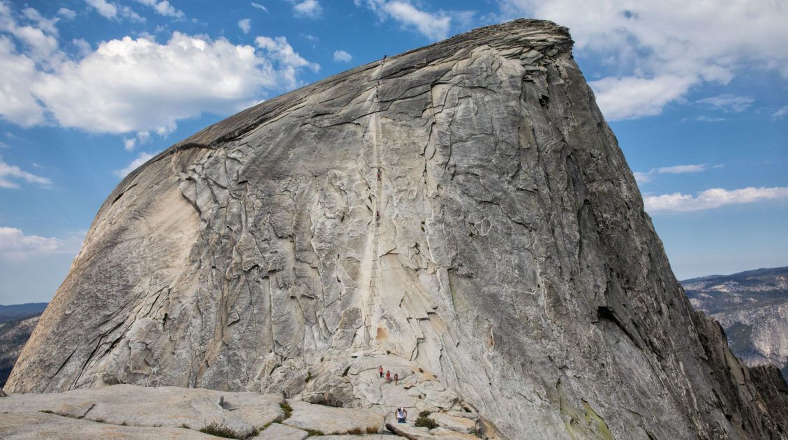
Half Dome 2026, A Step-by-Step Hiking Guide
The hike to Half Dome is one of Yosemite’s most challenging and most memorable hikes. On this hike you get to walk on some of Yosemite’s most popular hiking trails, view the Vernal and Nevada waterfalls, and walk through shady forests of Sequoia trees. But the best part of the trail is the final climb […]
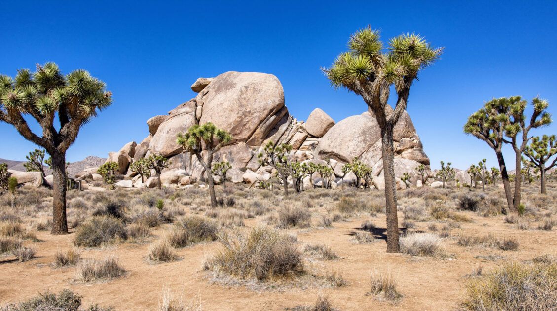
10 Things to Do in Joshua Tree National Park on Your First Visit
With its desert scenery, hiking trails, rock climbing routes, hidden oases, scenic drives, and trees that look like they have been plucked from the pages of a Dr. Seuss book, Joshua Tree National Park is a joy to explore. In this guide, learn about the best things to do in Joshua Tree National Park on […]
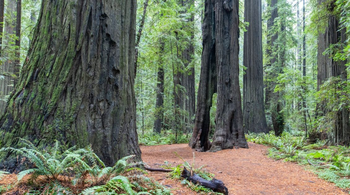
How to Plan a Trip to Redwood National & State Parks
Redwood National and State Parks Home to some of the tallest trees on Earth, Redwood National and State Parks protect some of the last remaining groves of old-growth coastal redwoods. Wallking amongst these giants feels like stepping into another world. Trees reach heights over 300 feet tall and some are more than 2,000 years old. […]
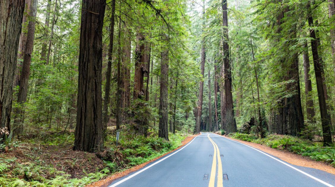
Avenue of the Giants: Best Things to Do, Photos & Helpful Tips
Discover the best things to do along the Avenue of the Giants, complete with a map and photos. The Founders Grove is not to be missed, but you can also drive through a redwood tree and go off the beaten path, walking quieter, lesser-known trails through the old-growth forests. Avenue of the Giants is one […]
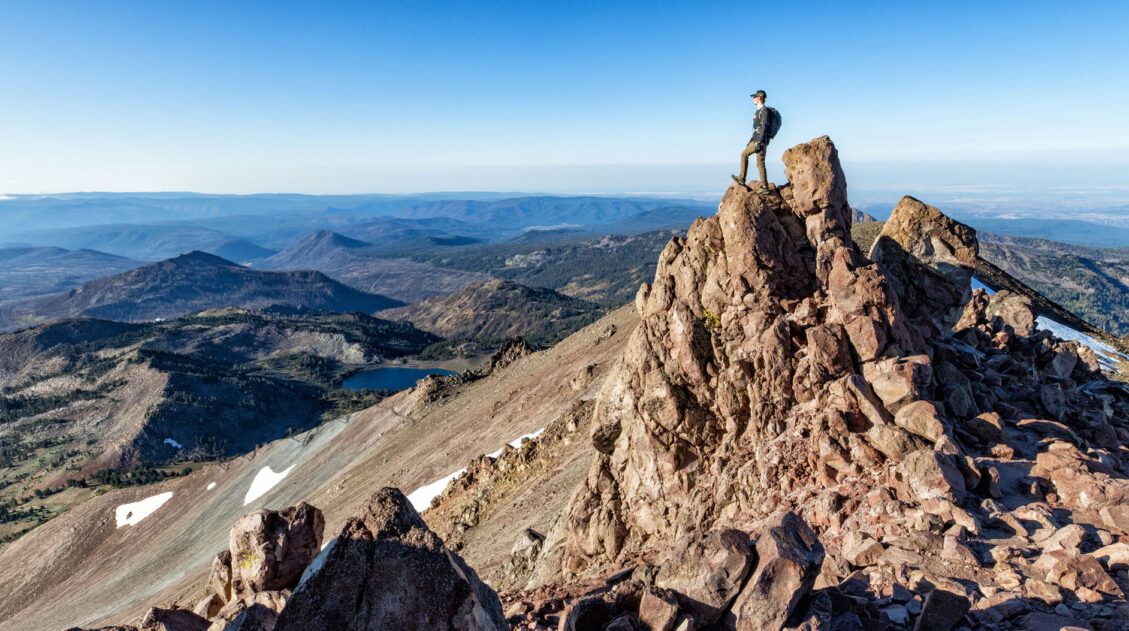
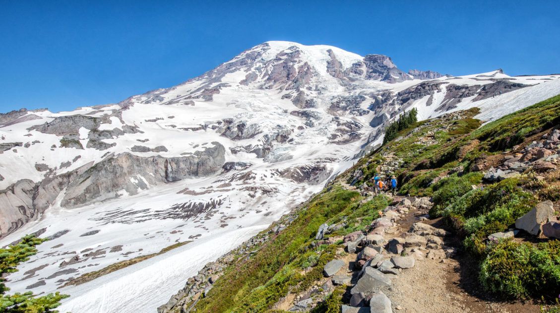
Lassen Peak Trail: Step-By-Step Trail Guide, Photos & Stats
The Lassen Peak Trail is not only one of the most popular hikes in Lassen Volcanic National Park, but it also leads to the tallest point in the park at 10,457 feet (3,187 meters). The trail to the top is just 2.4 miles one way, but with a steady ascent and high elevation, this hike […]
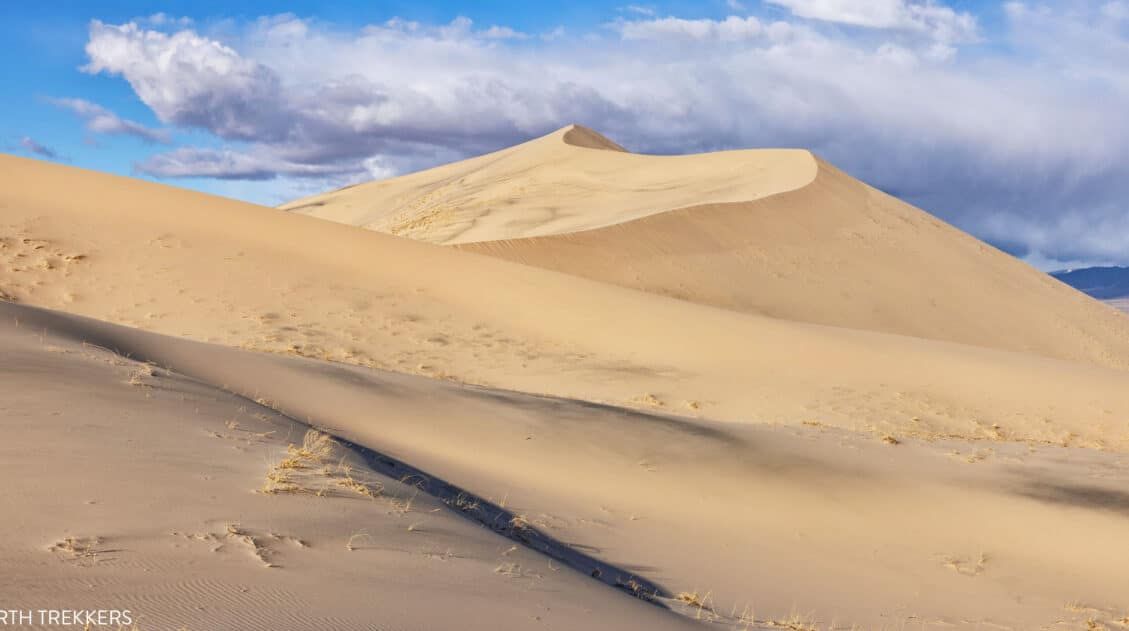
10 EPIC Things to Do in Mojave National Preserve
With enormous sand dunes, cinder cones, lava beds, and the densest population of Joshua Trees in the world, Mojave National Preserve is home to a wide variety of landscapes. This is a fun place to explore and makes a great addition to a southern California road trip. In this guide, we cover the best things […]
Ultimate US National Parks List for 2026 (+ Printable Checklist)
The US national parks are one of this country’s best ideas…land set aside for the preservation of the natural world and the enjoyment of the people. Every few years, another park gets added and the US national parks list grows a little longer. Over the past 150 years, 63 national parks have been created in […]
United States Travel Guide: Places to Visit in the USA
Plan your visit to the United States. Learn about the best things to do, how to plan your time, road trip ideas, and sample itineraries.

Comments 4