
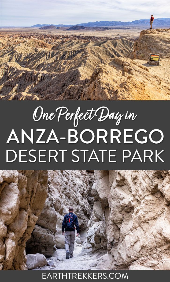
Anza-Borrego Desert State Park is a gem of a state park. With desert landscapes, slot canyons and dirt roads to explore, and hidden oases, this is a great place to add to your itinerary, if you will be visiting southern California. In this guide, we cover how to spend one day in Anza-Borrego Desert State Park.
What is Anza-Borrego Desert State Park?
Anza-Borrego Desert State Park is located in southern California. It gets its name from Juan Bautista de Anza, an 18th century Spanish explorer, and borrego, the Spanish word for sheep.
Anza-Borrego Desert State Park is the largest state park in California. With over 640,000 acres of land (according to the state park brochure), this is a massive state park. To put it into perspective, Anza-Borrego Desert State Park is twice the size of Grand Teton National Park and about four times the size of Zion National Park.
More than 100 miles of hiking trails run through the park and more than 500 miles of unpaved roads lead into the more remote areas of the park.
The park has a hot desert climate, as it is located within the Colorado Desert. It’s relatively warm all year with the hottest temperatures in the summer months. On the hottest of days, it can get up over 120°F (50°C).
Things to Do in Anza-Borrego Desert State Park
With its large size and network of hiking trails and unpaved roads, there is a lot to do in Anza-Borrego Desert State Park.
Go Hiking. The Slot is the most popular hike in the park, but other notable hikes include Wind Caves, the Borrego Palm Canyon Trail, the Cactus Loop Nature Trail, Hellhole Canyon, and the Narrows Earth Nature Trail.
Explore the Dirt Roads. Drive or bike the more than 500 miles of unpaved roads in the park. If you plan to drive these roads, a high-clearance 4WD is required for most of them.
Font’s Point. This overlook offers sweeping views across the badlands area of the park and is not to be missed (to get here you will need a 4WD vehicle).
Erosion Road Driving Tour. This 21-mile driving tour runs through the badlands area of the park. Along the drive are several great viewpoints, including Font’s Point. You can download a copy of the driving route here.
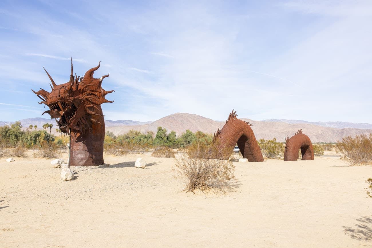
Galleta Meadows Sculptures. In Galleta Meadows, steel sculptures dot the landscape. Elephants, dinosaurs, and saber-tooth tigers and more were created by artist and welder Ricardo Breceda. These sculptures are located in Galleta Meadows and near Borrego Springs.
Go Stargazing. Since 2018, Anza-Borrego Desert State Park has been an International Dark Sky Park. From November through April, the park offers Night Sky programs (inquire at the visitor center).
One Day in Anza-Borrego Desert State Park
On this one day itinerary for Anza-Borrego Desert you will get to visit the highlights of the state park.
This is our exact itinerary from start to finish. It includes several of the most popular places in the park to visit (such as The Slot and the Borrego Palm Canyon Trail) as well as a few off the beaten path places. It is a busy, active day and perfect for adventurous travelers.
I list the times that we started each activity, to give you an idea for timing throughout the day. We are fast hikers and this will be reflected in our times.
To include the Wind Caves hike and Font’s Point, you will need a high-clearance 4WD vehicle. If you do not have a 4×4, you will have to skip these portions of the itinerary.
At the end of the itinerary, I will let you know what to skip, if you don’t want to do a lot of hiking or don’t have a full day in the park.
Please practice the seven principles of Leave No Trace: plan ahead, stay on the trail, pack out what you bring to the hiking trail, leave areas as you found them, minimize campfire impacts, be considerate of other hikers, and do not approach or feed wildlife.
Map of the Driving Route
How to Use This Map: Click the tab in the top left corner of the map to see a list of the points of interest and to turn layers on/off. Click the icons on the map to get more information about each point of interest.
To take this map with you, click the star next to the title of the map which adds it to your Google account. Next, within your Google Maps app, select ‘Saved’ and then select ‘Maps’. This map title will now appear in your list.
8:30 am: Hike The Slot
The Slot is one of the most popular hikes in Anza-Borrego Desert State Park. It was also our favorite experience of the day.
By doing this first, you can get here early and hike the trail before it gets crowded. There is also crowd control at the slot and once the main parking lot is filled, park rangers turn visitors away (this started at 9:45 am on our visit in February).
The Slot Hiking Stats
Distance: 1 to 2.2 miles (1.6 to 3.5 km)
Difficulty: Easy
Time: 1 to 2 hours
You can hike the slot out-and-back or as a loop. If you do the hike as a loop, it is 2 miles total. But you can shorten the hike by simply hiking out-and-back through the slot canyon portion of the hike, which makes this hike just 1 mile in length.
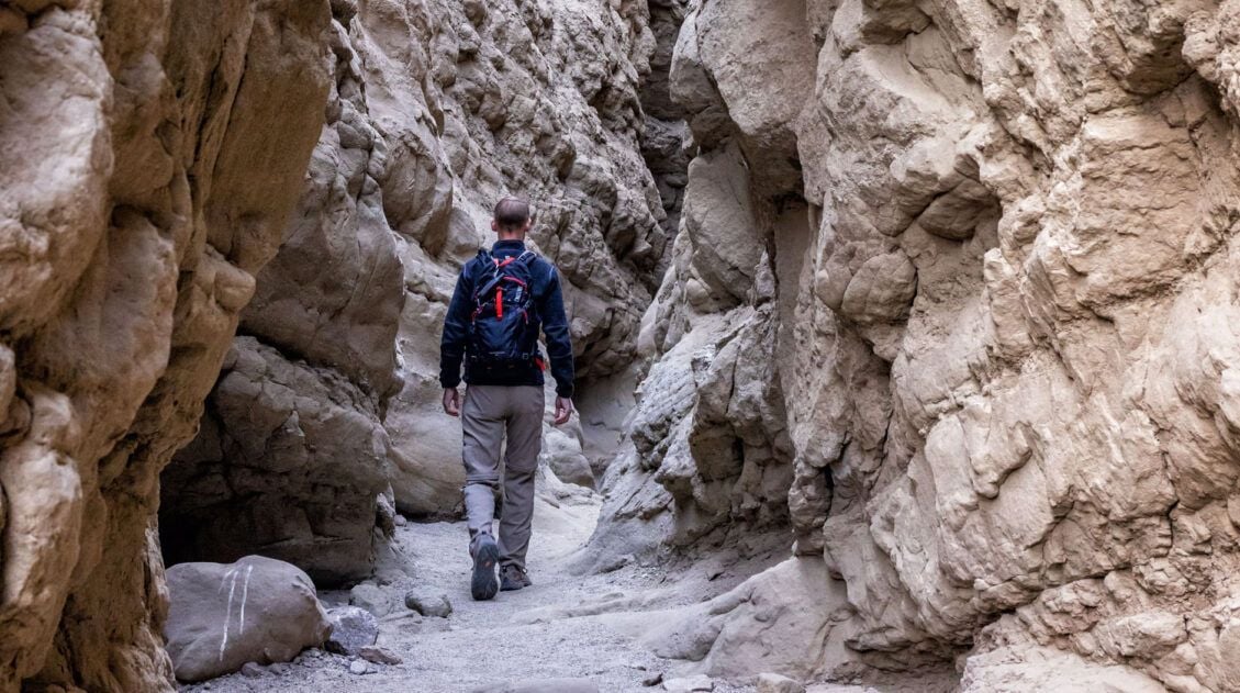
How to Hike The Slot: Stats, Map & Photos
For full details on both ways to do this hike, plus maps and many more photos, check out our guide on The Slot.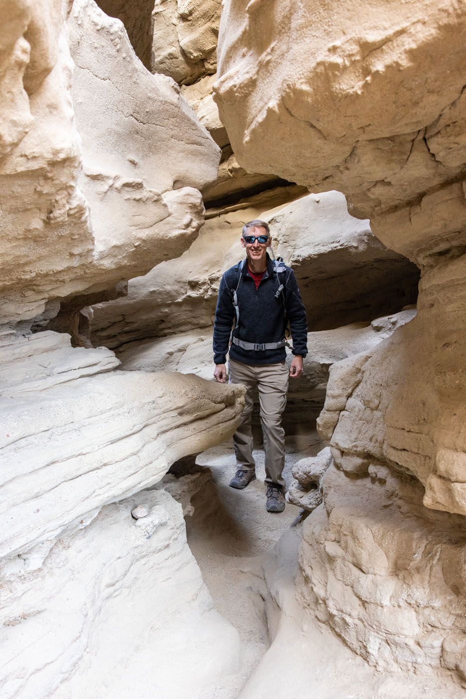
Tim in The Slot
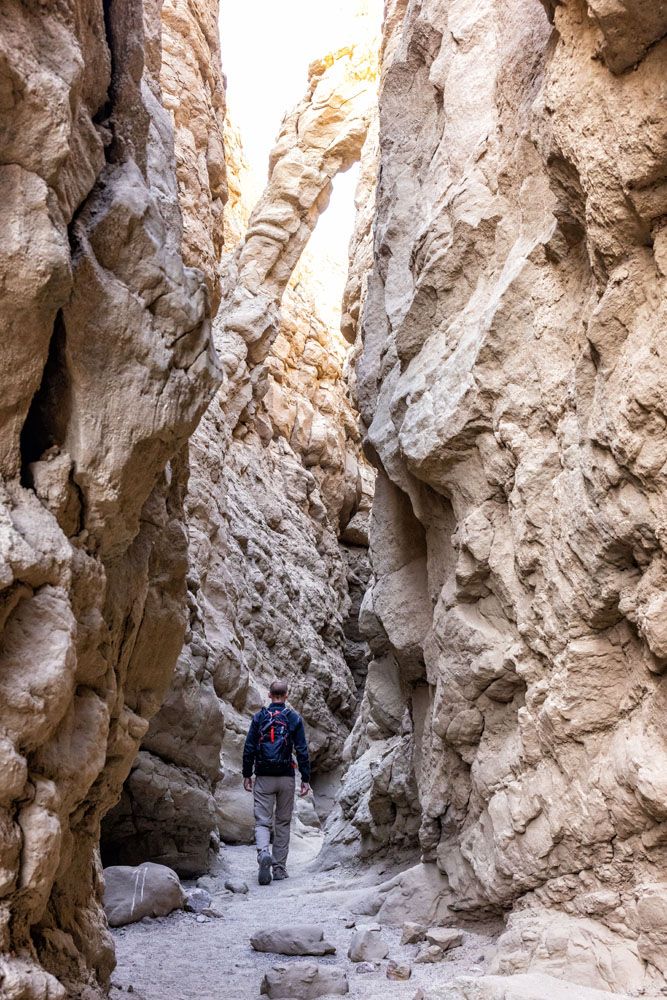
The Slot
9:30 am: Drive to Wind Caves
Driving Distance & Time: 19 miles, 40 minutes; high clearance 4WD is necessary
If you like the idea of an off the beaten path scenic drive + hiking combo, this just may be one of the highlights of the day. We loved this part of the park.
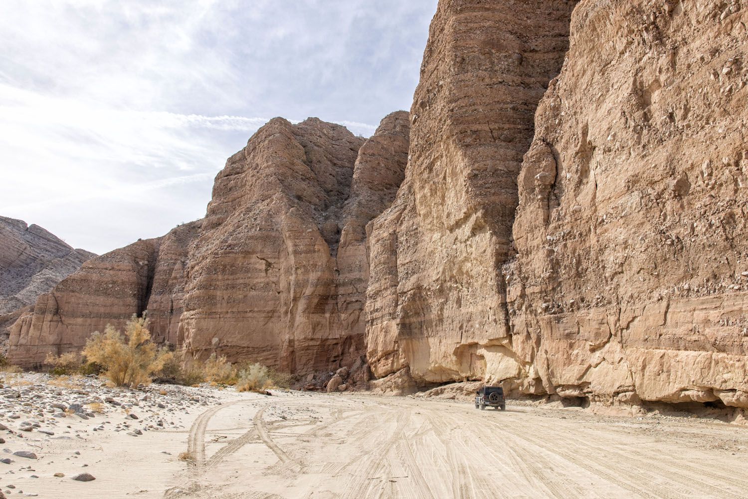
From The Slot trailhead, it takes 40 minutes to drive to the trailhead for Wind Caves. Take CA-78 East for 5 miles and turn right onto Split Mountain Road. Split Mountain Road is a paved road. From Split Mountain Road, turn right onto Fish Creek Wash. The road is now an unpaved road and a high clearance 4WD vehicle is required for this road.
Once on Fish Creek Wash, it is a 4-mile drive to get to the trailhead.
Fish Creek Wash
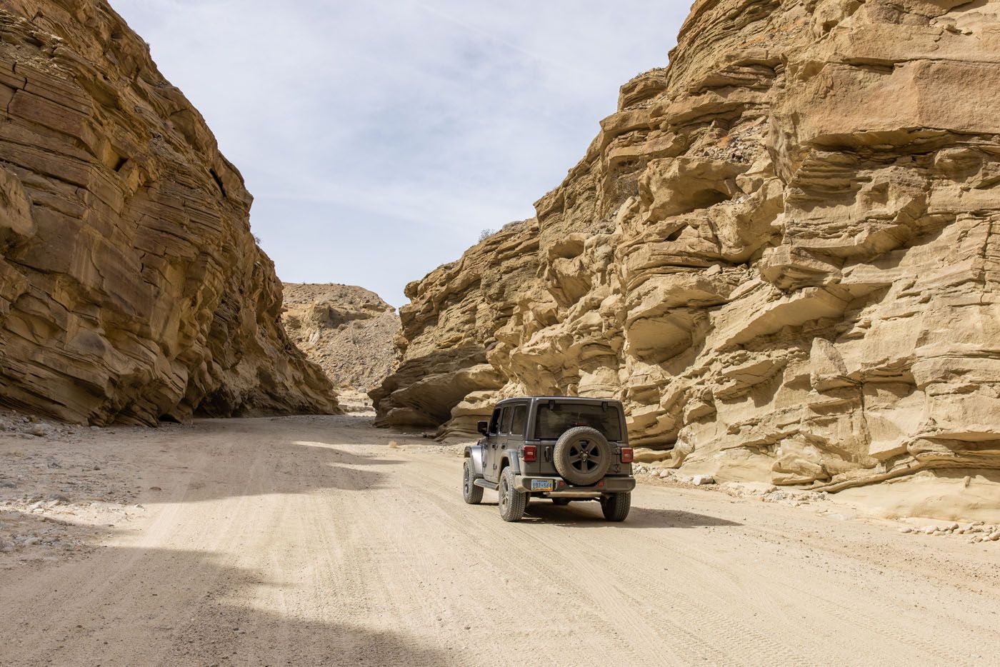
Fish Creek Wash
The Wind Caves trailhead is located on Fish Creek Wash. Here are the GPS coordinates of the exact location: 32°59’35.4″N 116°07’06.6″W. It is also called Wind Caves Trailhead on Google Maps.
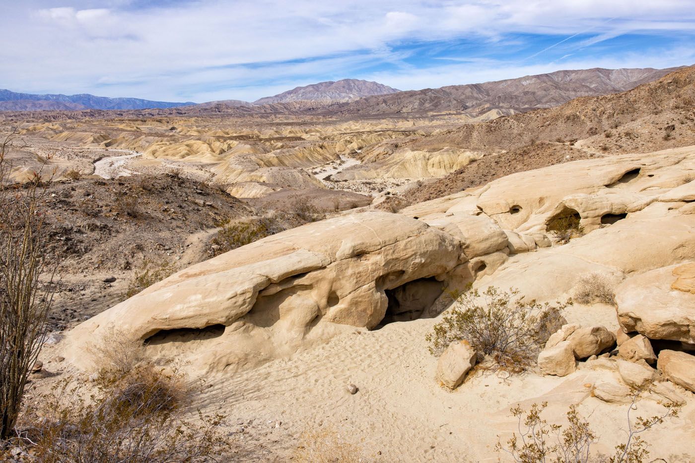
We loved this entire experience. It’s a beautiful drive on Fish Creek Wash, as the road cuts through a canyon on the way to the trailhead. Once on the trail, just a handful of people were here and the views of the desert landscapes were some of the best of the day.
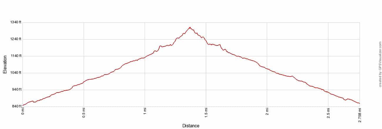
10:10 am: Wind Caves Hike
Wind Caves Hiking Stats
Distance: 1 mile (1.5 km) round trip (out-and-back)
Difficulty: Easy to moderate
Total Ascent: 350 feet (107 m)
Time: 30 minutes
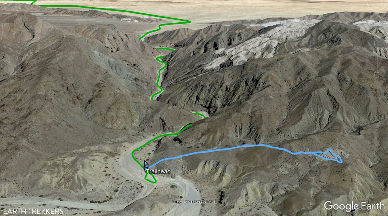
Map of the driving and hiking route. The green line is the driving route on Fish Creek Wash. The blue line is the hiking trail.
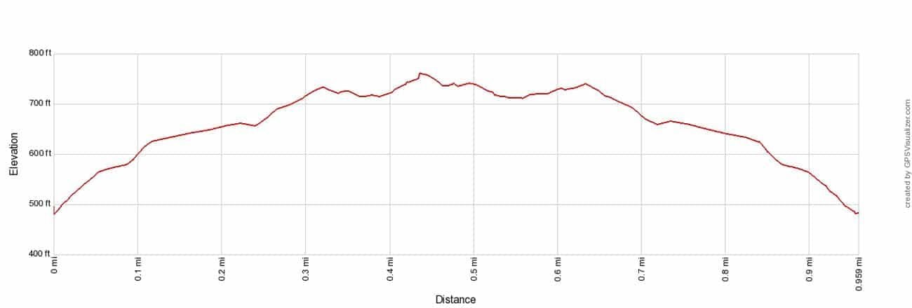
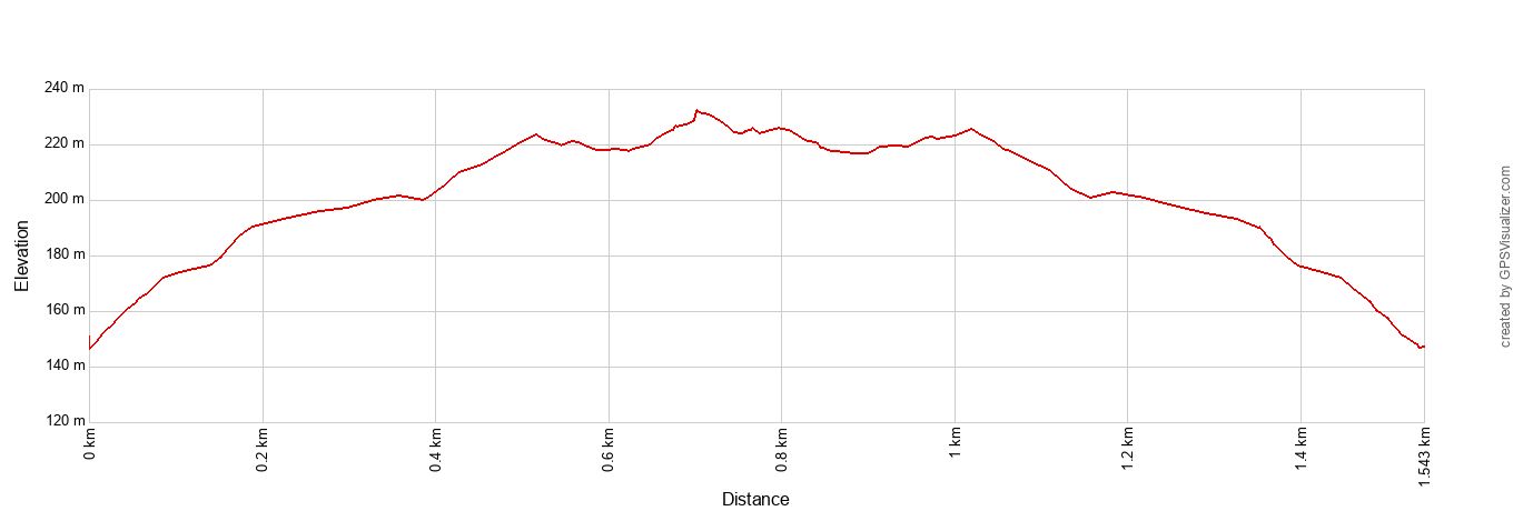
Wind Caves Trail Elevation Profile
The trailhead is well marked with several signs.
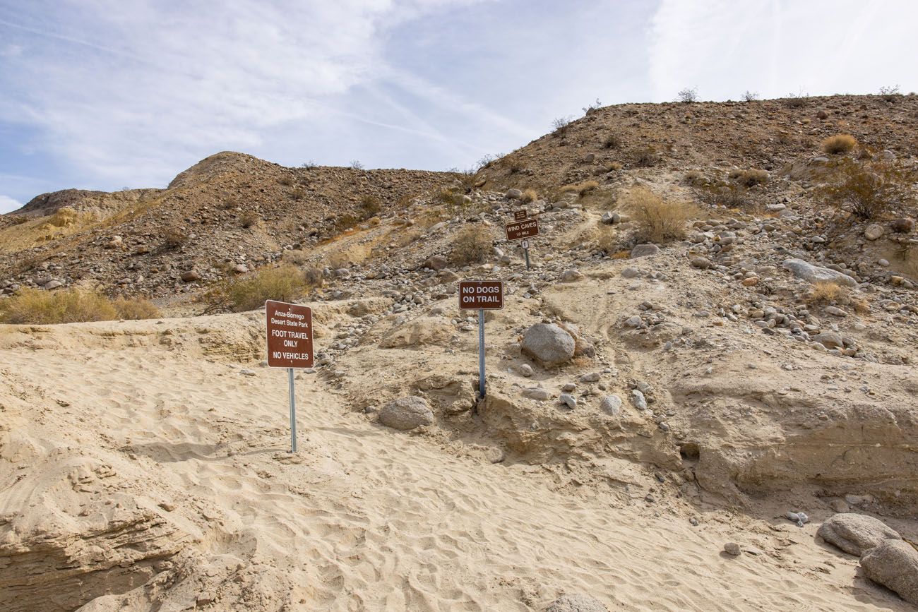
Wind Caves Trailhead
The first part of the hike is the hardest. From the wash, you hike uphill to get to the Wind Caves, but the higher you go, the better the view. Even without a visit to the Wind Caves this would be a worthwhile hike since the views are so spectacular.
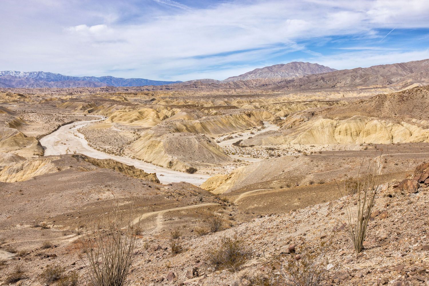
View from the trail
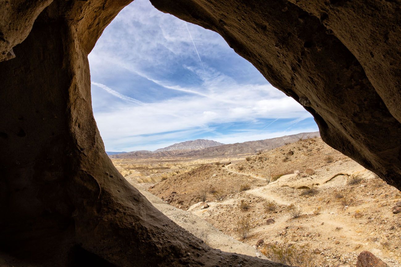
At 0.5 miles into the hike you reach the Wind Caves. These sandstone domes are pockmarked with small windows. Rock scrambling on top of the domes and exploring the caves are the top things to do here.
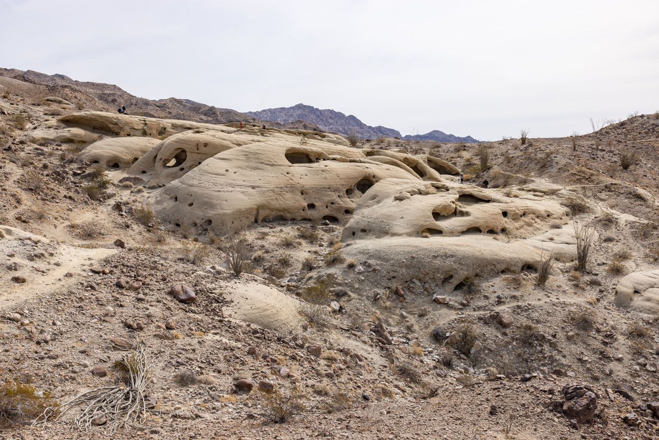
Wind Caves
To finish the hike, retrace your steps back to your car.
We only spent 30 minutes here. That includes our hiking time and some time exploring the caves (about 20 minutes hiking and 10 minutes exploring). If you are traveling with kids, you may want to spend more time than we did, since this may be one of the highlights of the day for them.
10:40 am: Drive to the Cactus Loop Trail
Driving Distance & Time: 28 miles, 40 minutes
The Cactus Loop Trail is optional. This short hiking trail makes a loop through tons of cacti. On this nature trail you will see ocotillo, beavertail cacti, and cholla cacti.
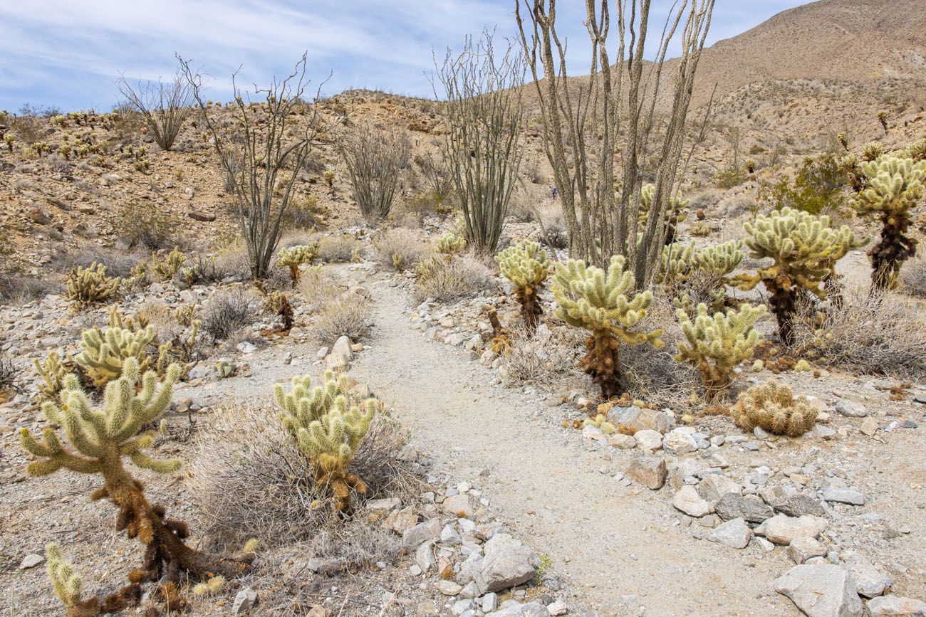
Cactus Loop Trail
If you have been to or plan to visit Joshua Tree National Park, this trail is not nearly as spectacular as the Cholla Cactus Garden. If you need to save some time or have no desire to hike through a cactus garden, this is an experience to skip. But for some people, especially those who have not seen a lot of cacti, this short trail may be worth it.
The Cactus Loop Trail is a one-mile loop and it takes 20 to 30 minutes to hike the full loop.
HOW TO GET TO THE CACTUS LOOP TRAIL: To get to the Cactus Loop Trail, drive Fish Lake Wash and Split Mountain Road to CA-78 and turn left (go west). Drive past Borrego Mountain Wash (the road that leads to The Slot) and turn right onto Yaqui Pass Road. Just past this turn is the Tamarisk Grove Campground. Park here and cross the street to hike the Cactus Loop Trail.
If you choose the skip the hike, you will still drive past the trailhead. So, skipping the hike saves 20 to 30 minutes.
11:50 am: Galleta Meadows Sculptures
Driving distance and time: 8 miles, 10 minutes
The Galleta Meadows Sculptures are spread out around the town of Borrego Springs. You get to see your first batch of them on the drive to the Borrego Springs.
From the Cactus Loop Trail, continue north on Yaqui Pass Road and turn left onto Borrego Springs Road. Go through the town and just before the large bend in the road you can see sculptures on either side of the road.
To the north of Borrego Springs Road are the Galleta Meadows horses, and elephant statue, and an eagle. To the south of the road are a saber-tooth tiger, another eagle, a T-Rex, and other dinosaurs.
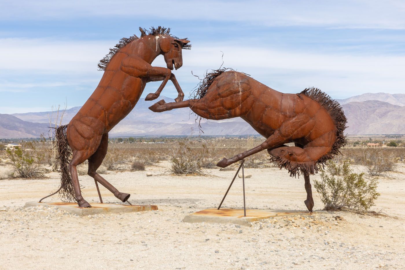
Galleta Meadows Horses
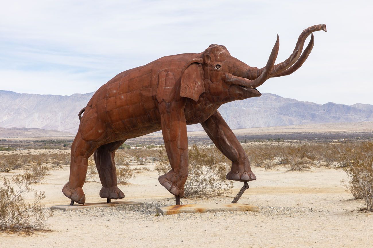
Galleta Meadows Elephant
12:10 pm: Lunch in Borrego Springs
Driving distance and time: 4 miles, 6 minutes
You can either have a picnic lunch or grab a bite to eat in Borrego Springs. We ate lunch at Carmelita’s Mexican Grill, which was good, but other restaurants include the Red Ocotillo, Carlee’s Place, and Los Jilbertos.
1:00 pm: Drive to the Montezuma Valley Road Lookout
Driving distance and time: 7 miles, 15 minutes
For a view over Anza-Borrego Desert State Park and Borrego Springs, drive to the lookout on Montezuma Valley Road. It’s a twisting road to get up to the viewpoint and here is the view:
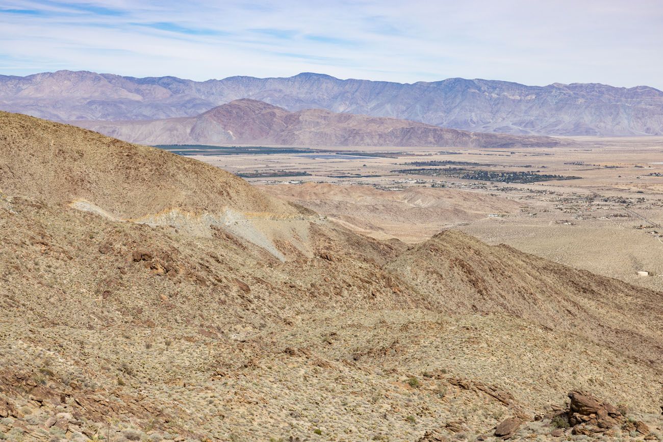
Montezuma Valley Road Lookout
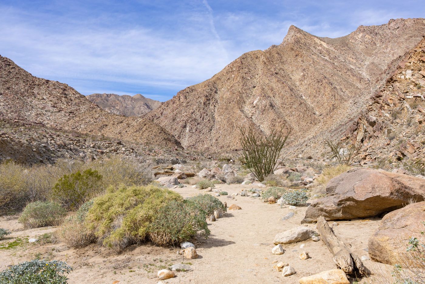
1:20 pm: Drive to and Hike the Palm Canyon Trail
Driving distance and time: 7 miles, 15 minutes
Drive Montezuma Valley Road back towards Borrego Springs. Turn left onto Palm Canyon Drive and take this to the Palm Canyon parking lot and trailhead.
Palm Canyon Hiking Stats
Distance: 2.8 miles (4.4 km) round trip (out-and-back)
Difficulty: Easy to moderate
Total Ascent: 500 feet (152 m)
Time: 1.5 to 2 hours
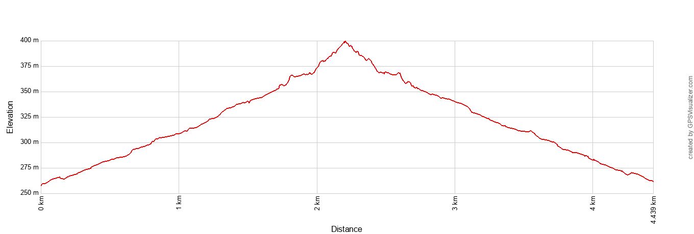
Palm Canyon Trail Elevation Profile
This trail leads from the dry desert to a hidden oasis. It’s a beautiful hike from start to finish and there is a good chance that you could see bighorn sheep from the trail.
Palm Canyon Trail
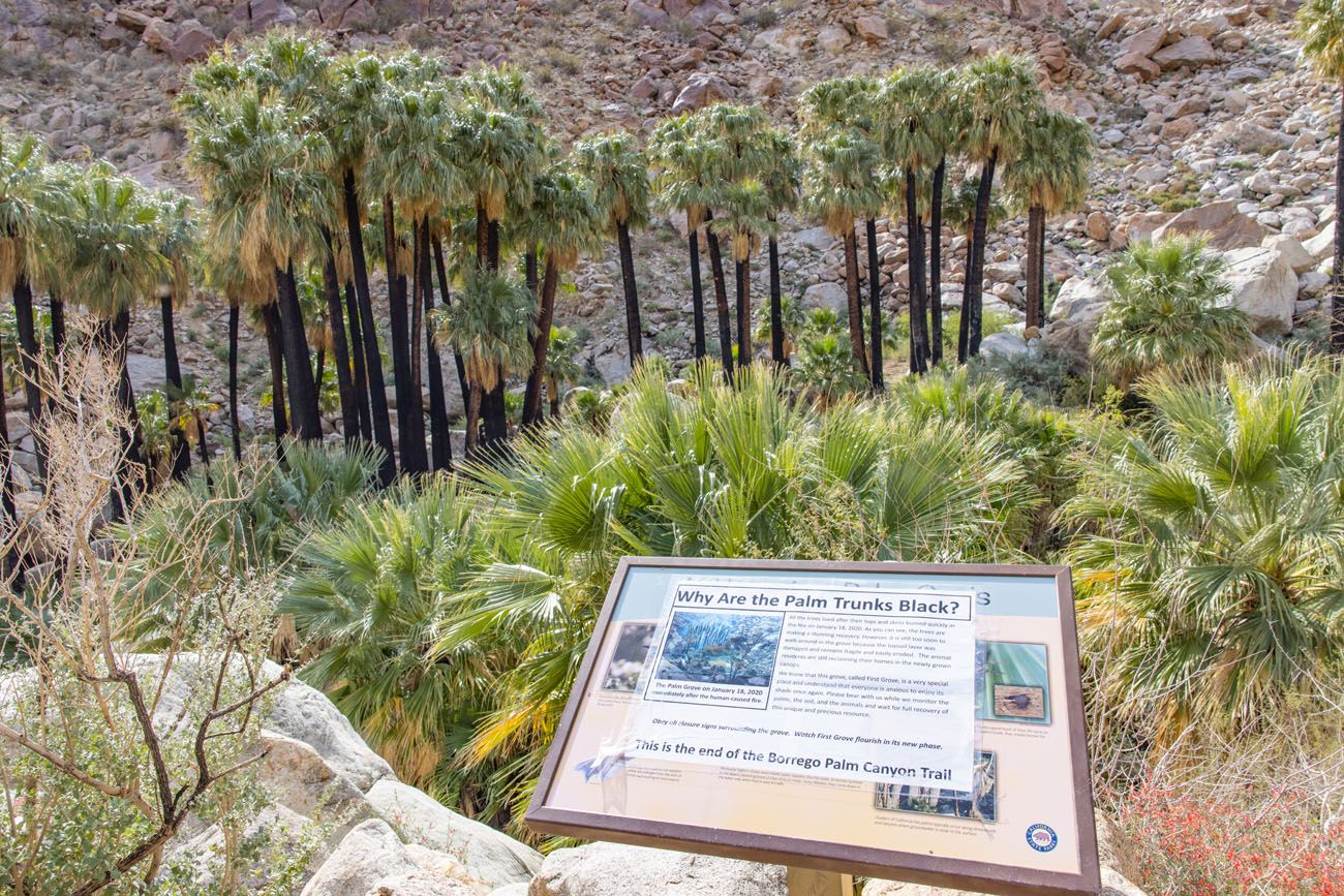
The trail ends at a palm grove. In January 2020, the grove was badly burned in a fire. Our photos are from our visit in February 2022 and the trees have made an amazing recovery. Usually, visitors are allowed to hike into the grove but on our visit we could only see it from the trail, as the grove is still recovering.
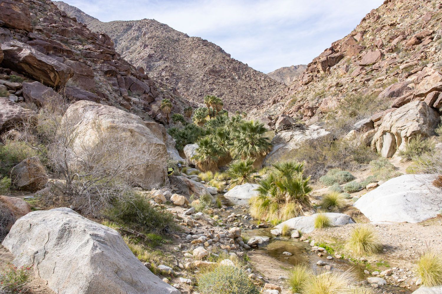
Palm Canyon Oasis
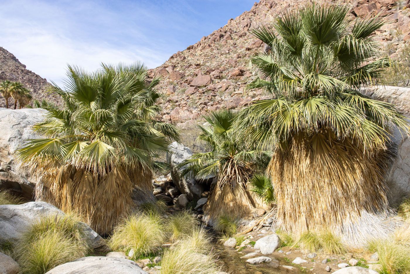
Palm Canyon Oasis
3:30 pm: Galleta Meadows
Driving distance and time: 5 miles, 12 minutes
It’s a short drive to Galleta Meadows where you can see more steel sculptures. In this area, you can see a camel, tapir, scorpion, giant tortoise, and a giant serpent.
The Serpent
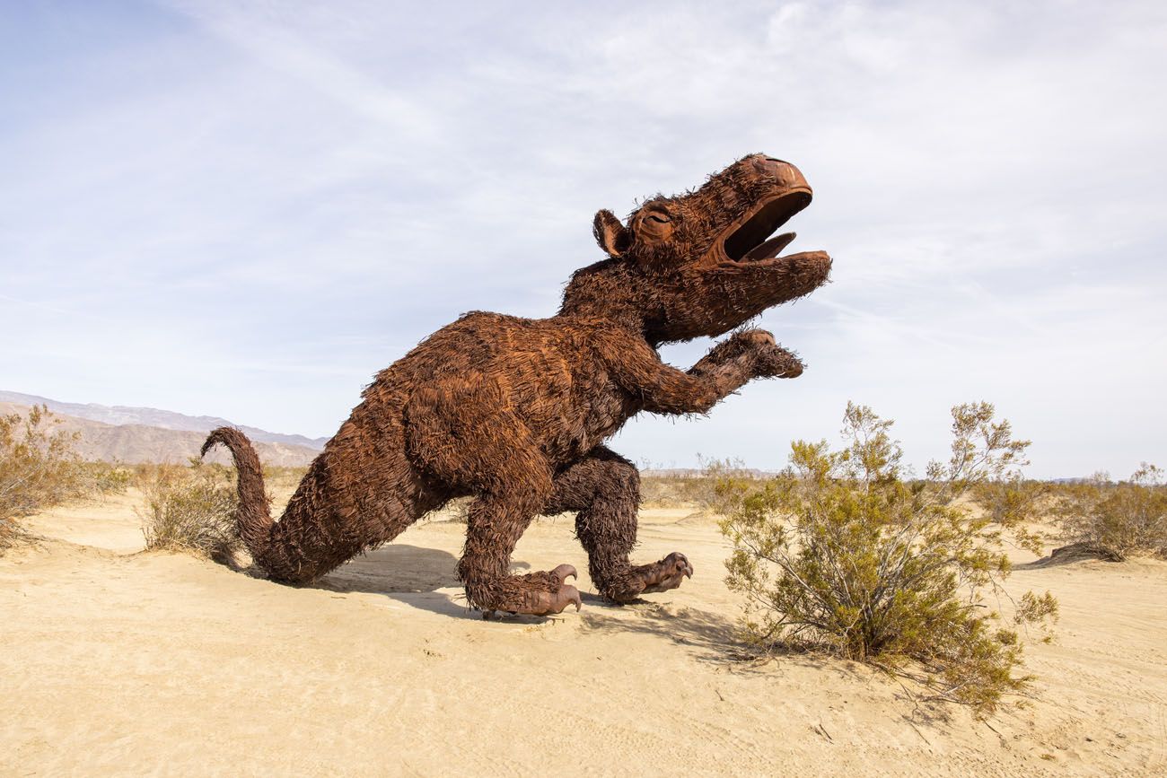
Galleta Meadows Dinosaur
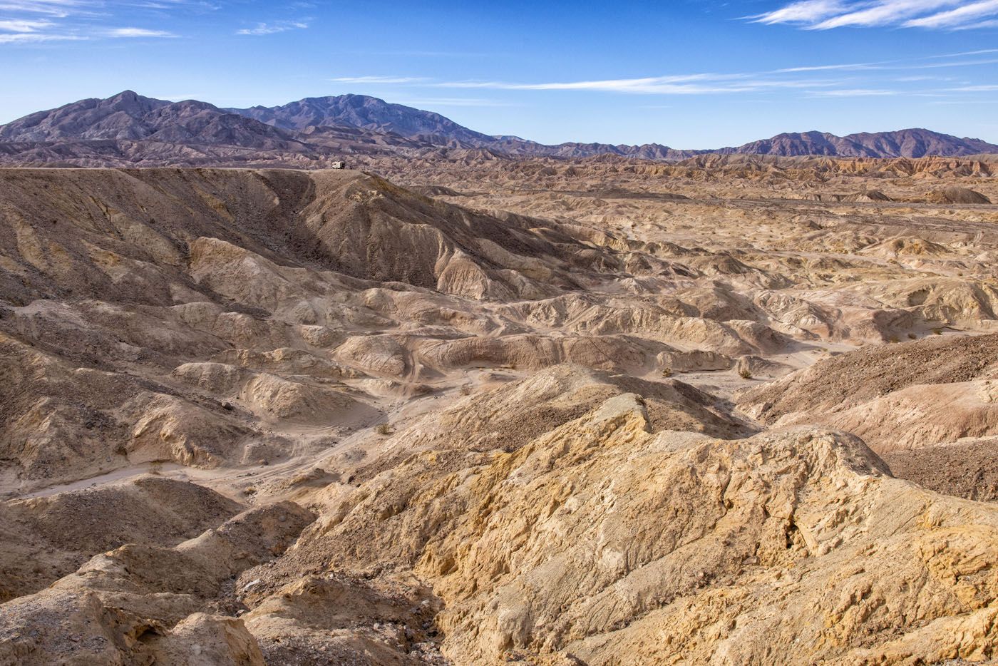
4:00 pm: Erosion Road Driving Tour
Driving distance and time: 34 miles, 1 hour
The Erosion Road Driving Tour starts at mile marker 23 on Palm Canyon Drive, near the airport. To get here from Galleta Meadows, it is a 5-mile drive that takes 8 minutes.
The Erosion Road Driving Tour includes 12 stops that correspond with mile markers along the drive. In total, it is a 21-mile drive plus an 8-mile detour to Font’s Point. Download or print a copy of the guide before your visit.
How to Get to Font’s Point
Font’s Point is the highlight of the driving tour but to get here, you must have a 4WD vehicle. To get to the viewpoint, it is a 4-mile drive through a rocky, sandy wash and standard vehicles will not make it down this road.
From S-22 (Borrego Salton Sea Way), turn right onto the wash. The road to Font’s Point is an unnamed road. There is a small sign here marking the turn and it is labeled as Font Point Trail Junction on Google Maps. Here are the GPS coordinates: 33°18’12.3″N 116°14’20.5″W.
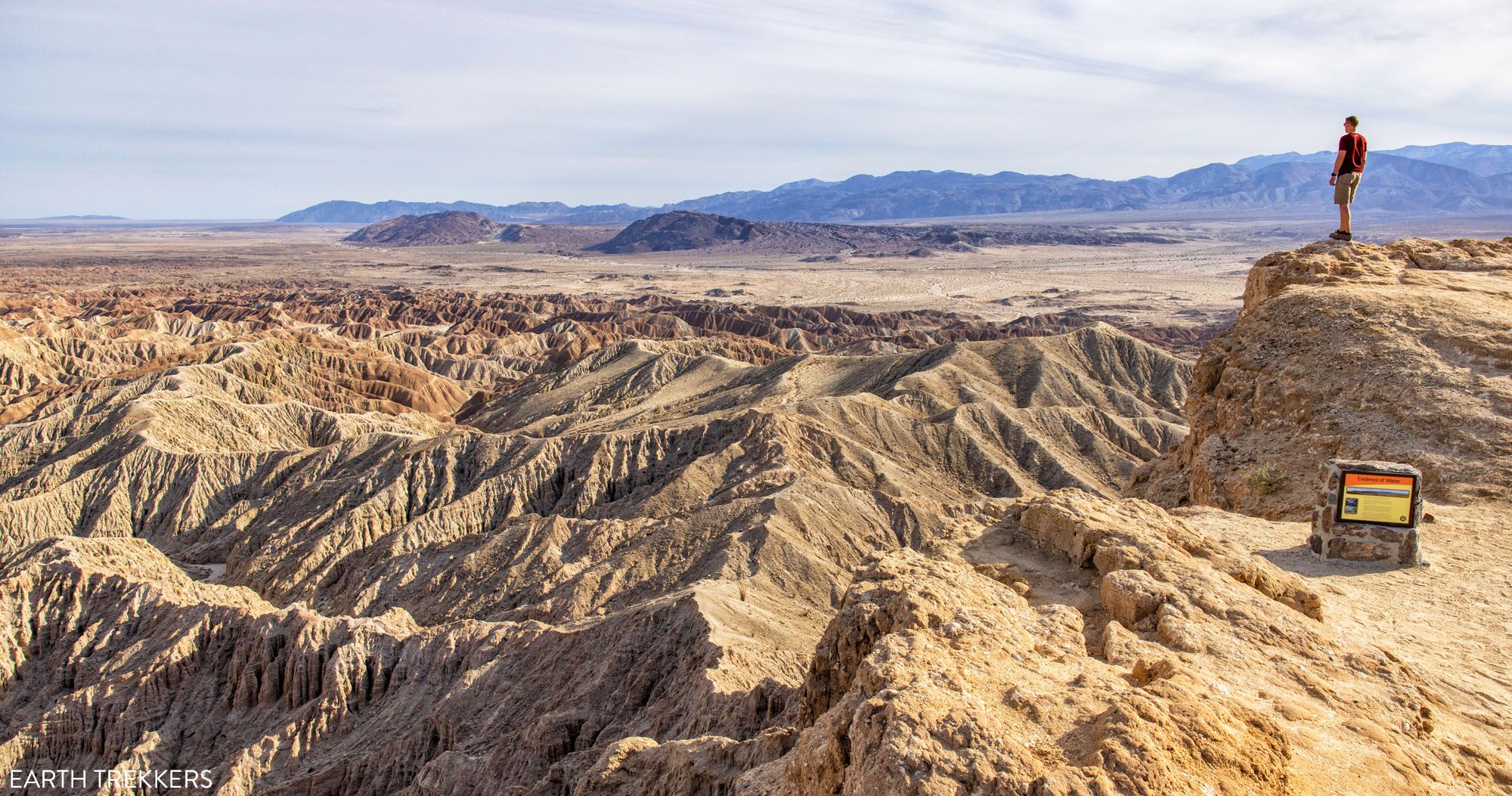
It is a 4-mile drive on this sandy road/wash to get to the overlook. Tim and I LOVED this view…it is our favorite viewpoint in Anza-Borrego Desert State Park and well worth the drive to get here. From Font’s Point, you overlook another section of badlands and it looks very much like Badlands National Park in South Dakota. This is also a filming location for the movie Everything Everywhere All at Once.
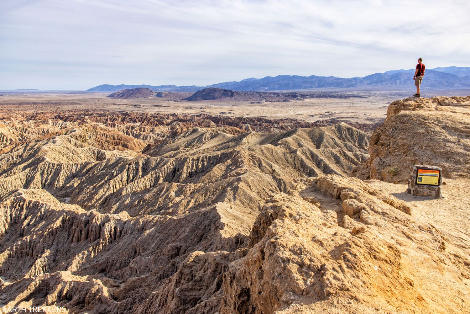
Font’s Point
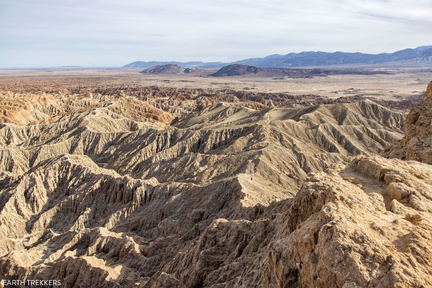
Font’s Point
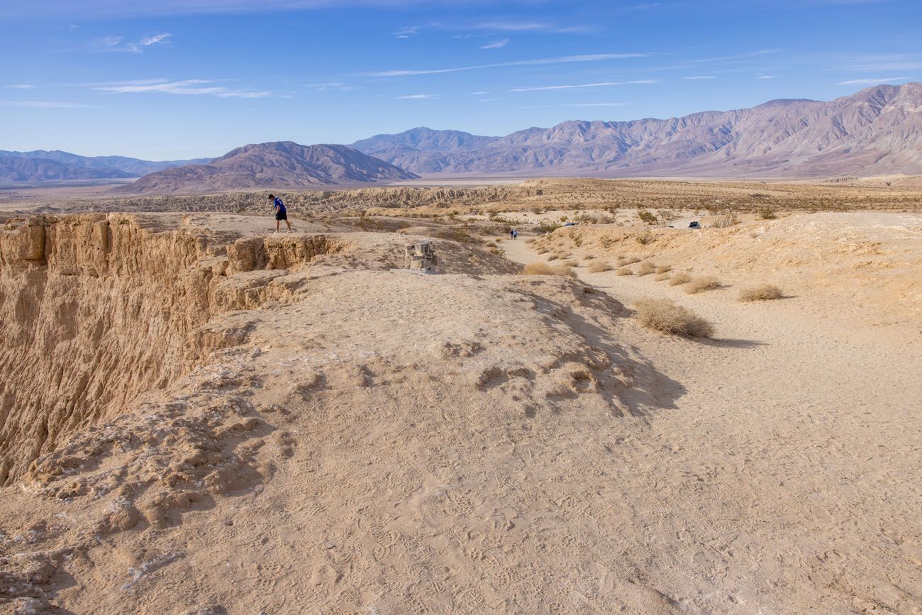
A view of Font’s Point, a man looking over the edge, and the trail from the parking lot to the viewpoint.
Remainder of the Erosion Road Tour
Drive back to S-22, turn right, and follow the rest of the Erosion Road Tour.
One more viewpoint on S-22, near the Ocotillo Wells State Vehicle Recreation Area
5:00 pm: Continue to Your Next Destination
From the Calcite Mine Scenic Overlook, which is the final stop of the Erosion Road Tour, return to your hotel or continue your road trip through southern California to your next destination.
To visit Anza-Borrego Desert State Park, we stayed in Palm Desert at the Westin Desert Willow Villas, using this as a home base to explore both the state park and Joshua Tree National Park.
If this is part of a bigger road trip in the area, or if you are looking for a great itinerary that takes you from Las Vegas to San Diego, check out our Las Vegas to San Diego Road Trip itinerary. It includes Anza-Borrego Desert State Park and Joshua Tree National Park, with the option to add on the Mojave National Preserve and Death Valley National Park.
Modifying this Anza-Borrego Desert Itinerary
If you do not have a 4WD vehicle, you will have to skip the drive on Fish Creek Wash to the Wind Caves hike and the drive to Font’s Point on the Erosion Road Tour.
Our favorite experiences in the park are The Slot, driving to and hiking Wind Caves, visiting Font’s Point, and hiking the Palm Canyon Trail.
If you are short on time, skip the Cactus Loop Nature Trail. If you do not have a 4WD, consider skipping the Erosion Road Tour since the visit to Font’s Point is the best part of the drive and you must have a 4WD vehicle to get here.
Best Time to Visit Anza-Borrego Desert State Park
The best time to visit Anza-Borrego Desert State Park is from late fall through early spring, when temperatures are mild.
WINTER: During the day, the temperatures get to 70°F (21°C) although they start off chilly, in the low to mid-40’s. Rainfall is the highest during the winter months, but even so, it’s still relatively dry. Only about an inch of rain falls each month during the winter season.
SPRING: Temperatures climb throughout the spring. In March, the average high is 78°F (26°C) and by early June, the average high is approaching 100°F. On unusually warm days, even in March, temperatures can hit or get over the 100 degree mark. Rainfall is low. From late February through March, it is possible to see wildflowers although the number of flowers varies greatly from year to year.
SUMMER: Summers are very hot and dry. The average high temperature is 105°F (40°C) and can get up to 120°F on the hottest of days.
FALL: Fall is the reverse of spring. Temperatures cool off and rainfall is low. In October, the average high is 90°F (32°C) and in November the average high is 78°F (26°C).
About our Visit: We visited Anza-Borrego Desert State Park in February as part of a road trip with Las Vegas, Mojave National Preserve, and Joshua Tree National Park.
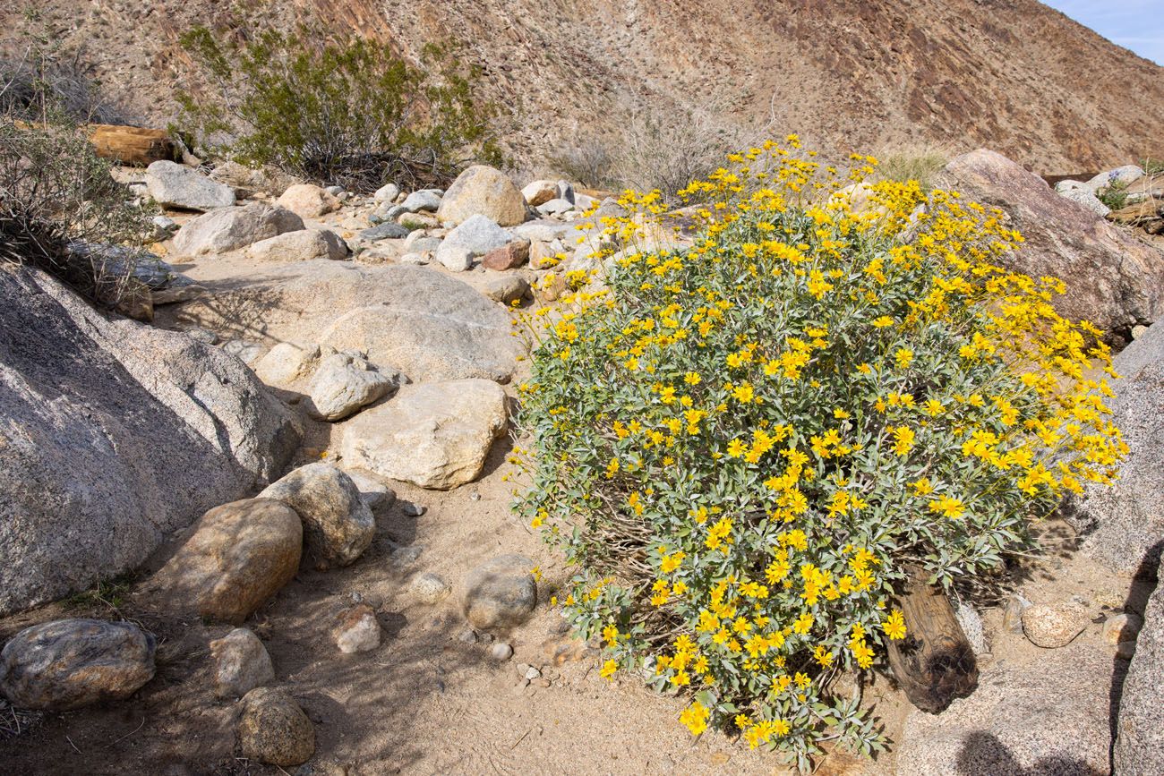
Wildflowers in February
Plan Your Visit
Cost: $10 per vehicle per day, charged at the Visitor Center, The Slot trailhead, the Hellhole Canyon trailhead, Tamarisk Campground, and Borrego Palm Canyon. Learn more here.
Hours: The park is open 24 hours a day, 365 days per year although some trailheads and parking lots have designated hours. The Borrego Palm Canyon Trail and Hellhole Canyon Trail parking lots are open sunrise to sunset. For visitor center hours (which vary seasonally) and other hours of operation, visit the park website.
If you have any questions about how to spend one day in Anza-Borrego Desert State Park, or if you want to share your experience, let us know in the comment section below.
More Information for Your Trip to California
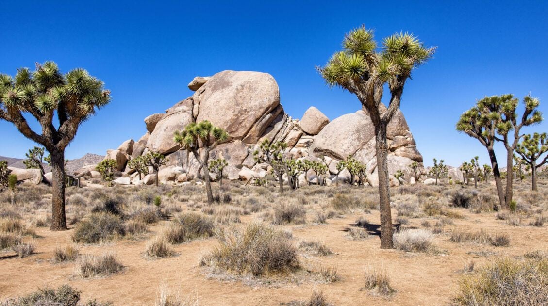
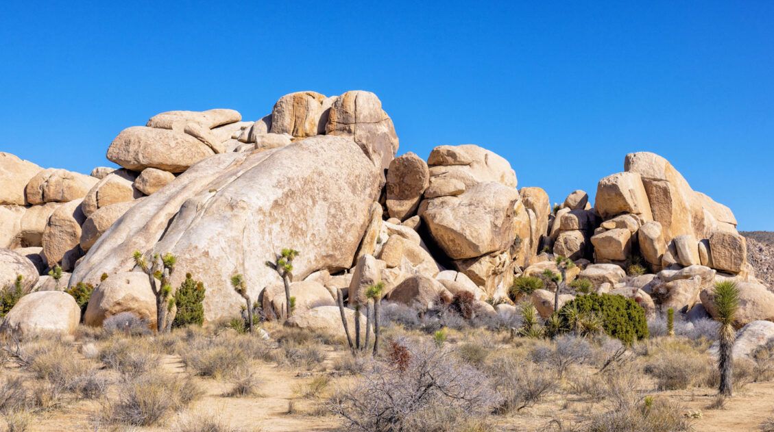
10 Things to Do in Joshua Tree National Park on Your First Visit
Pinterest Facebook Flipboard With its desert scenery, hiking trails, rock climbing routes, hidden oases, scenic drives, and trees that look like they have been plucked from the pages of a Dr. Seuss book, Joshua Tree National Park is a joy to explore. In this guide, learn about the best things to do in Joshua Tree […]
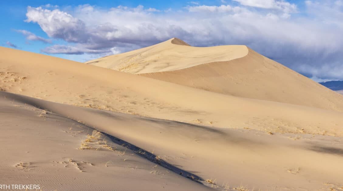
10 EPIC Things to Do in Mojave National Preserve
With enormous sand dunes, cinder cones, lava beds, and the densest population of Joshua Trees in the world, Mojave National Preserve is home to a wide variety of landscapes. This is a fun place to explore and makes a great addition to a southern California road trip. In this guide, we cover the best things […]
10 Best Things to Do in San Diego, California
San Diego is famous for its beautiful beaches, family friendly activities, and its near perfect year-round weather. Tour an aircraft carrier, say hello to the elephants at the world famous San Diego Zoo, go on a day trip to La Jolla, and take your pick of numerous bars and restaurants in the Gaslamp Quarter. San […]
How to Hike the Hall of Horrors | Joshua Tree National Park
The Hall of Horrors is one of the best hikes in Joshua Tree National Park. It’s short, it’s scenic, and adding on the slot canyon is one of the most thrilling experiences in the park. The Hall of Horrors is a short slot canyon that is located in the giant stacks of boulders in the […]
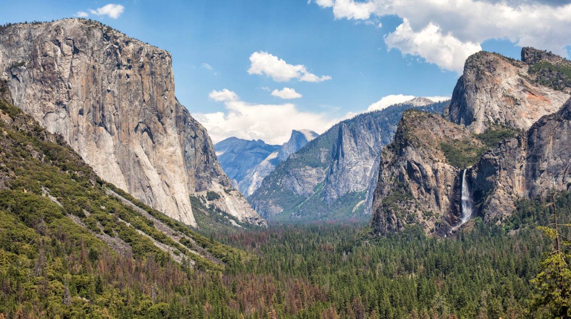
30 Epic Things to Do in Yosemite for First-Timers
Yosemite National Park is packed with famous landmarks, awesome hikes, and breathtaking views. If you are planning your first trip to Yosemite, how do you know what to do? I am a big fan of lists (and photos!). In this post, I list the best things to do in Yosemite: the best landmarks to visit, […]

10 Amazing Things to Do in Las Vegas: The Ultimate City Guide
Discover the very best things to do in Las Vegas, including a long list of day trips that could be the highlight of your trip. Las Vegas…also known as Sin City, Lost Wages, the Gambling Capital of the World, the City that Never Sleeps, and the Entertainment Capital of the World, is one of the […]
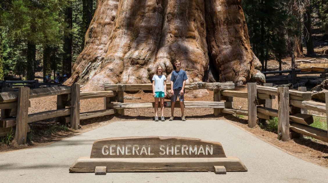
One Day Itinerary for Kings Canyon and Sequoia National Parks
Kings Canyon and Sequoia National Parks sit side by side in central California. Filled with alpine peaks, deep canyons, and the largest trees in the world, you could spend several days here. However, if you only have one day, you have just enough time to visit the highlights of both parks. We visited Kings Canyon […]
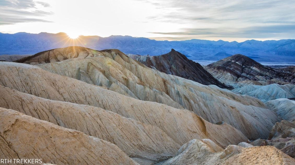
20 Epic Things to Do in Death Valley National Park
Death Valley…just the name inspires a sense of wonder and mystery. With barren salt flats, towering mountains, mysterious sailing stones, shifting sand dunes, rainbow-colored mountains, and canyons to explore, there is a lot to do here. In this post, learn about the best things to do in Death Valley National Park, with suggestions on how […]
Best USA Road Trips: 18 Ideas for Your Next Big Adventure
One of the best ways to explore the USA is on a good old-fashioned road trip. Cruise along Route 66, road trip through the Florida Keys, explore the American Southwest, or even drive from coast to coast. In this guide, we share 18 of the best USA road trips…18 great ideas for your next big […]

25 Best Things to Do in San Francisco
What’s the first thing that comes to your mind when you think of San Francisco? The Golden Gate Bridge? The legend and the stories of Alcatraz? Cable cars climbing up and down the steep hills of the city? San Francisco is a big city, filled with lots of things to do. It has a colorful […]
United States Travel Guide: Places to Visit in the USA
Plan your visit to the United States. Learn about the best things to do, how to plan your time, road trip ideas, and sample itineraries.

Comments 13