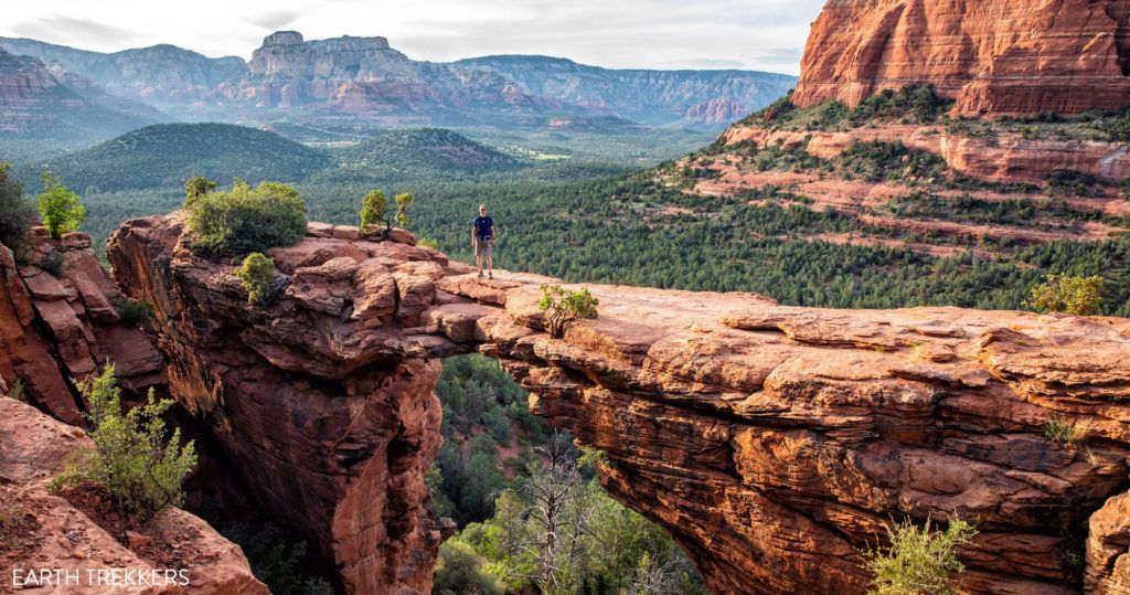

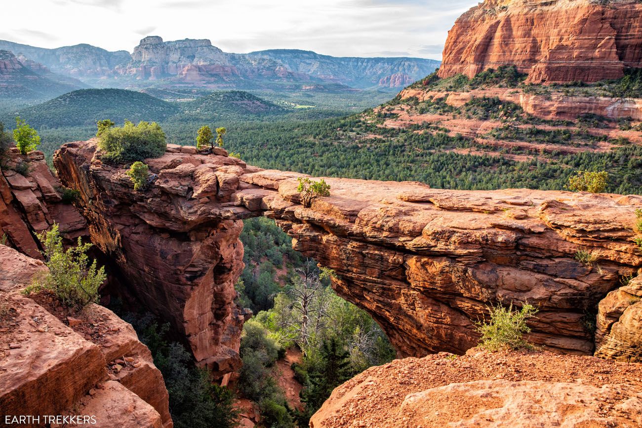
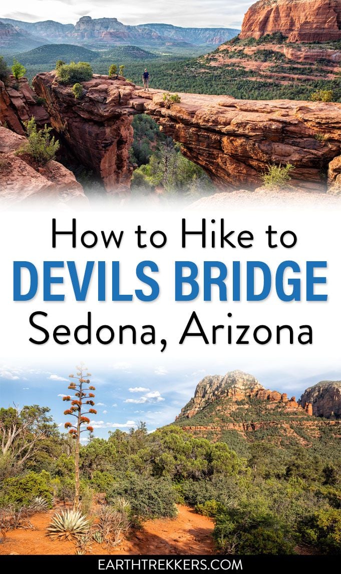
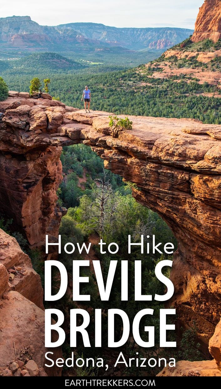
Devils Bridge is a wonderful hike in Sedona. With an easy hiking trail, beautiful red rock scenery, and of course, the chance to have your photo taken on top of Devils Bridge, this hike makes the top of the list for many visitors to Sedona.
This is one of the most popular trails in Sedona so be prepared to share it with a lot of people. But it’s worth it if you want your photo on top of this iconic red rock arch.
Devils Bridge Hiking Stats
Distance: 2 miles (3.2 km) round trip with a 4×4; 4.2 miles (6.7 km) round trip without a 4×4
Length of Time: 1 to 3 hours
Elevation Gain: 400 to 500 feet (120 to 150 m)
Difficulty: Easy with one short section of steps/rock scrambling
Location: West Sedona
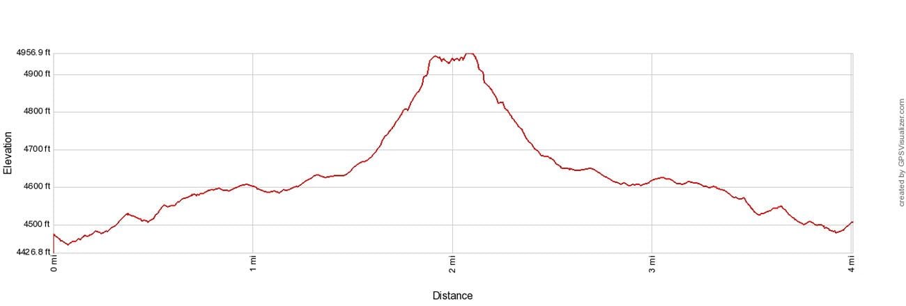

Elevation profile of the round trip hike from the Mescal Trailhead.
Please practice the seven principles of Leave No Trace: plan ahead, stay on the trail, pack out what you bring to the hiking trail, leave areas as you found them, minimize campfire impacts, be considerate of other hikers, and do not approach or feed wildlife.
How to Hike to Devils Bridge
Step-By-Step Trail Guide
There are several different ways to start this hike.
You have four different options for starting this hike:
- Dry Creek Road to the Devils Bridge Trailhead (you must have a high-clearance 4×4)
- Park at Dry Creek Road Parking Lot
- Take the Sedona Shuttle to the Dry Creek Parking Lot
- Park at the Mescal Trailhead
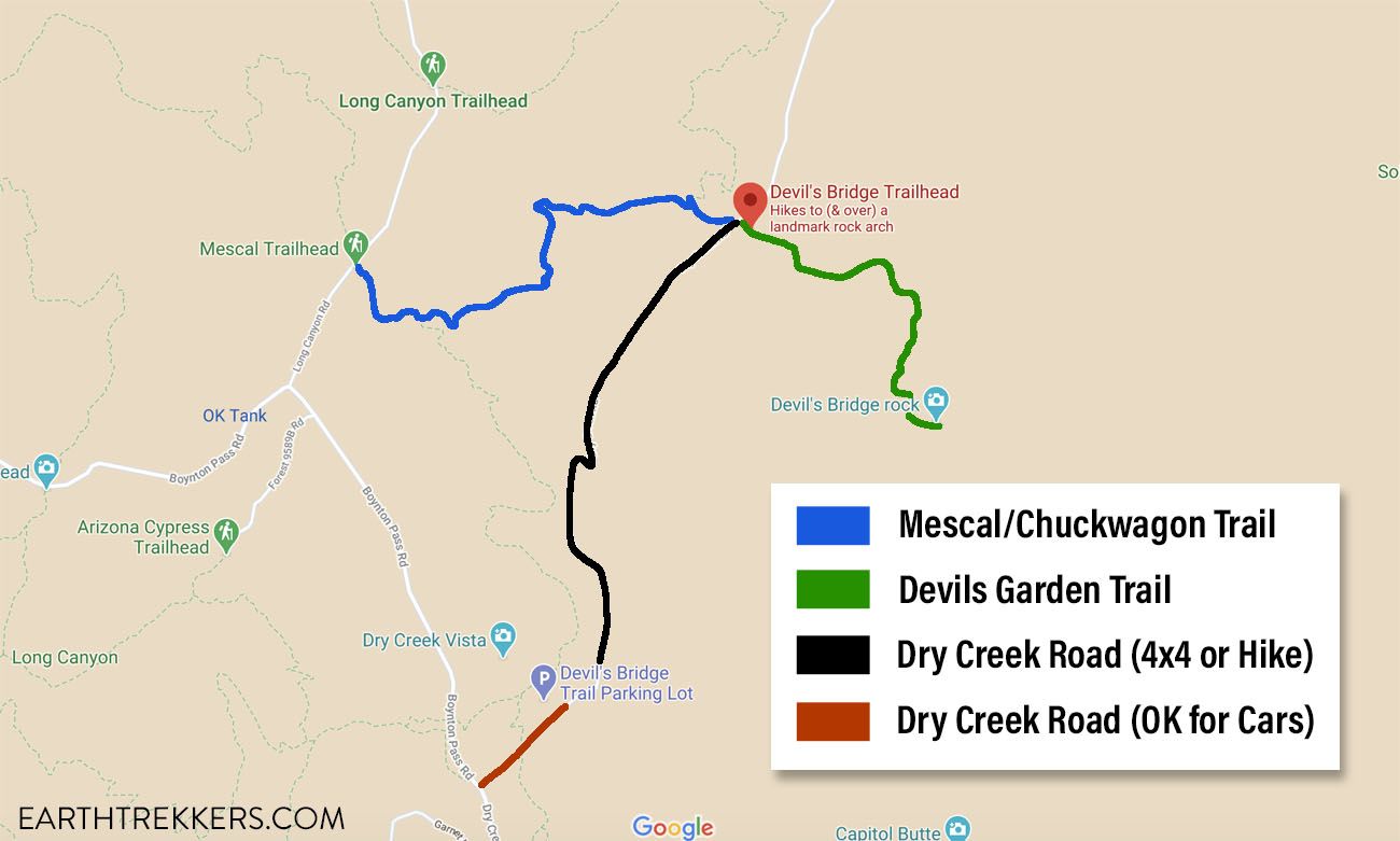
Map of the hiking trails and 4×4 roads to Devils Bridge.
Getting to the Trailhead with a 4X4
With a 4×4, you can drive and park directly at the Devils Bridge trailhead. This makes the hike 2 miles (3.2 km) round trip.
To get to the car park, you will have to drive on Dry Creek Road. Drive past the paved parking lot and continue down the very rocky dirt road for 1.3 miles until you get to the parking lot for Devils Bridge.
You must have a high-clearance 4WD to drive this road. There are several large rocks that you have to clear to even drive onto the road (see the photo below). And once on the road, it is extremely rocky and rough. We drove this road in a Jeep Rubicon (which we rented from Barlow Adventures in Sedona) and it had no issues at all on this road.
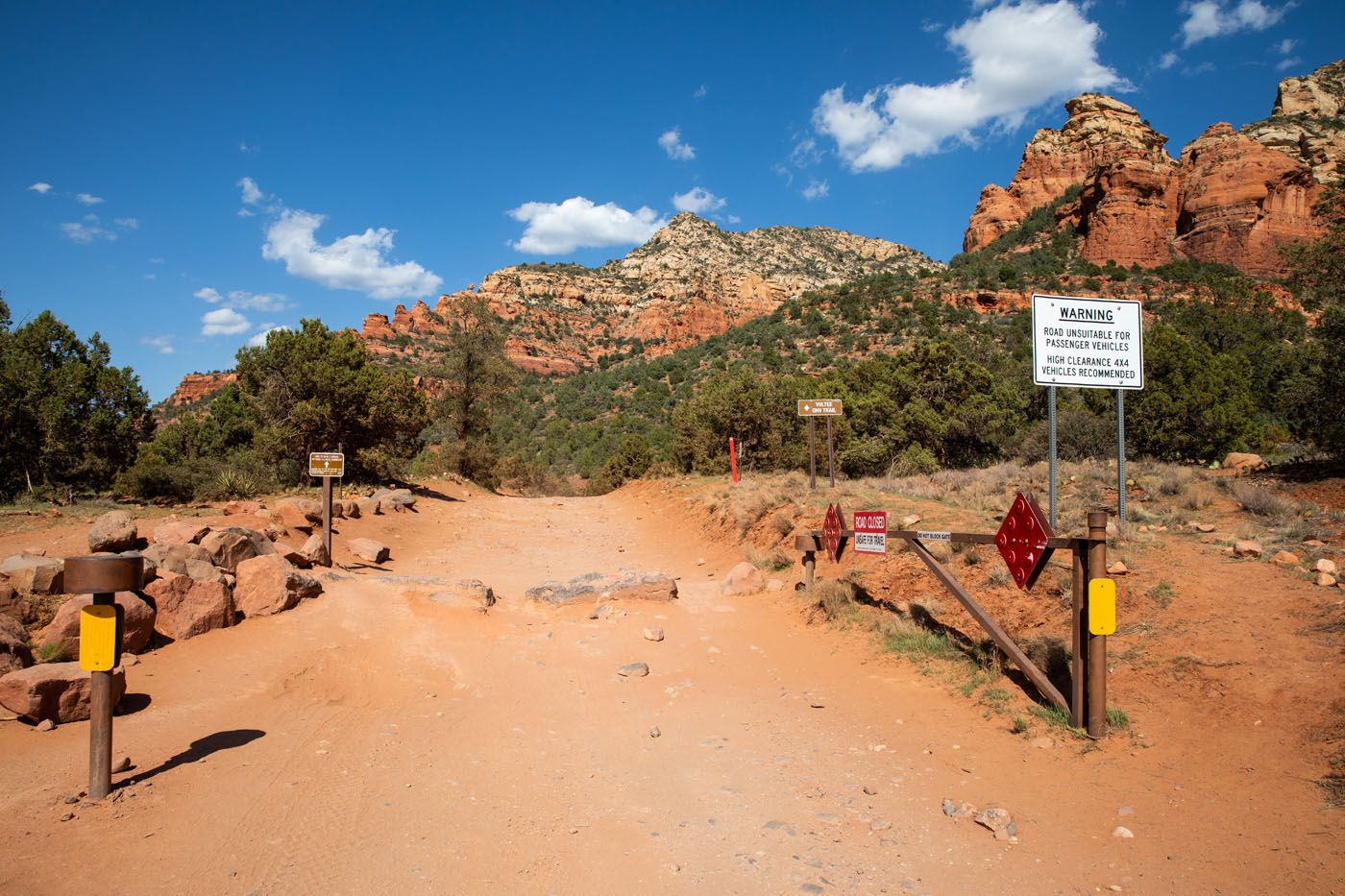
This photo makes those rocks look deceptively small. You must have a high-clearance 4WD vehicle to drive this road.
Getting to the Trailhead without a 4×4
Without a 4×4, there are three ways to get to the Devils Bridge Trail.
Dry Creek Road Parking Lot
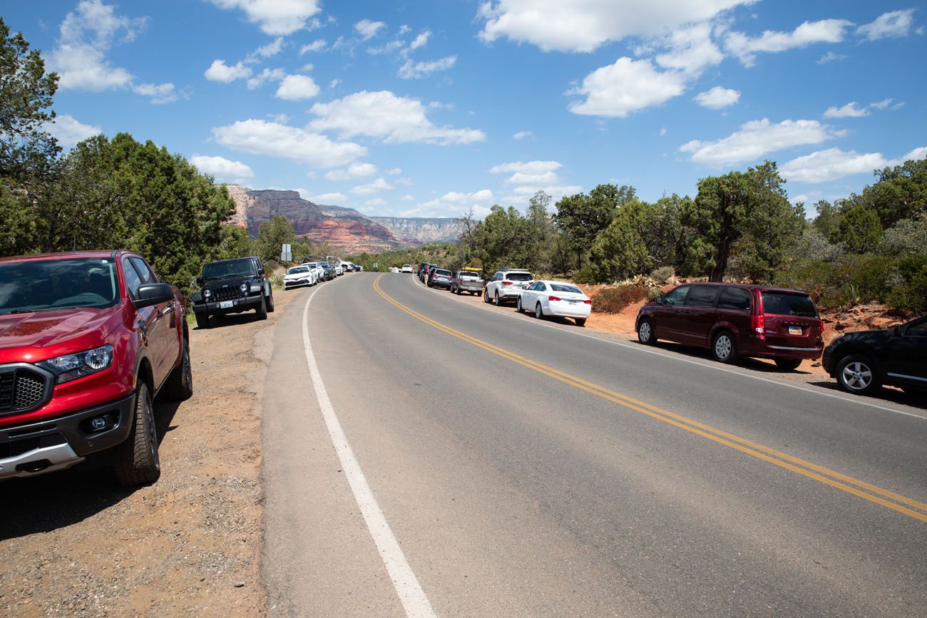
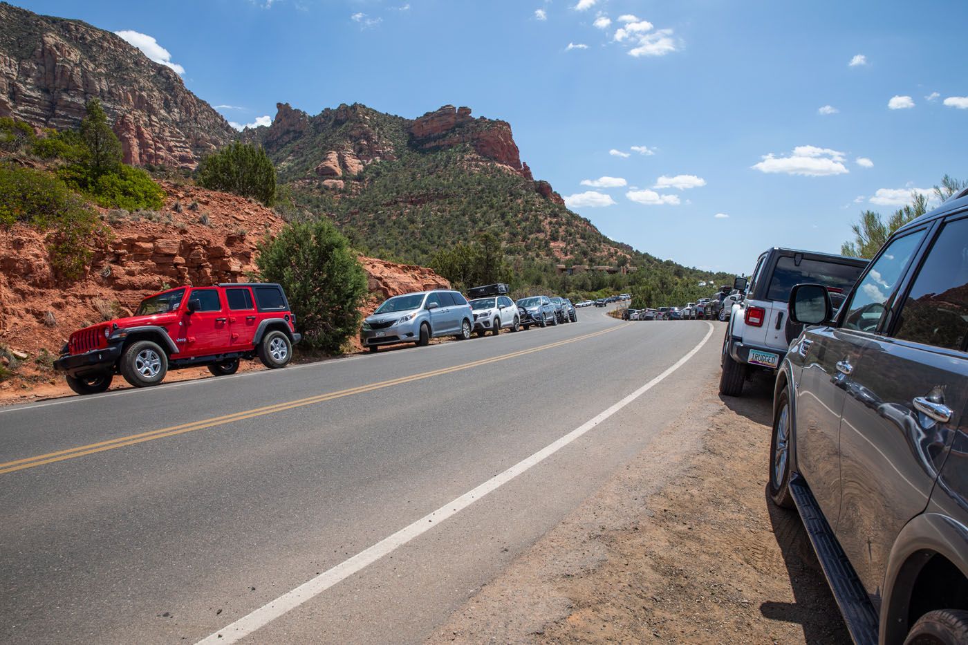
You can drive down Dry Creek Road for a very short distance, park in the paved parking lot for the Dry Creek Vista Trail, and walk along the dirt road until you get to the Devils Bridge trailhead. This makes your hike 4.6 miles (7.4 km) round trip, with most of that on a boring, dusty dirt road.
As you walk down Dry Creek Road, you will get passed by 4WD vehicles and Pink Jeep tours. It will be a dusty, hot walk with very little shade. There is nothing scenic about this road. For a more scenic option, and a slightly shorter walk, start at the Mescal Trailhead.
Dry Creek Road
IMPORTANT: Unless you get here before 7 am, you most likely will not get a parking space at the Dry Creek parking lot. By 7:15 am, we have seen cars already spilling out onto Boynton Pass Road. The later you get here, the farther away you will have to park, and your 4.6 mile hike can easily turn into a 5+ mile hike, and most of this will be on roads. I recommend getting here by 7 am or waiting for the late afternoon. Or, take the Sedona Shuttle.
Here are photos taken of the overflow parking for the Dry Creek Road parking lot on April 13, 2021 at noon.
Sedona Shuttle
There is a shuttle that now drops hikers off at trailhead at the Dry Creek Road parking lot and the Mescal Trailhead. The shuttle is free and runs from 7 am to 5:30 pm. For the full schedule and route, visit the official website.
Mescal Trailhead
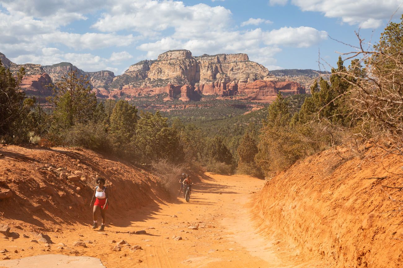
Another option is to park in the parking lot for the Mescal Trailhead. This is how we did this hike. This small lot is located on Long Canyon Road. From here, you walk one mile on a singletrack trail until you get to the Devils Bridge Trail. This is a mostly flat trail through beautiful desert scenery. It is also a mountain bike trail so stay alert for bikers. But if you don’t have a 4×4, this is a very nice walk to the “official” Devils Bridge trail. Doing it this way makes your hike 4.2 miles (6.7 km) round trip.
PRO TRAVEL TIP: I highly recommend hiking to Devils Bridge from the Mescal Trailhead than the Dry Creek parking lot. Not only is it a slightly shorter walk, but it is much nicer than walking down a hot, dusty road. It doesn’t take long to check this parking lot for an empty space.
We did not have a 4×4 so we started at the Mescal Trailhead. The next part of this article describes the trail from the Mescal Trailhead to the Devils Bridge Trail.
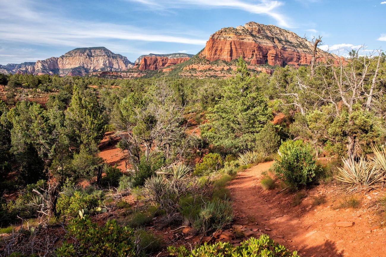
On the Mescal/Chuck Wagon Trail
From the parking lot on Long Canyon Road, follow the Mescal Trail into the woods. In just a short distance, the Mescal Trail ends. You now hike the Chuckwagon Trail until you get to Dry Creek Road.
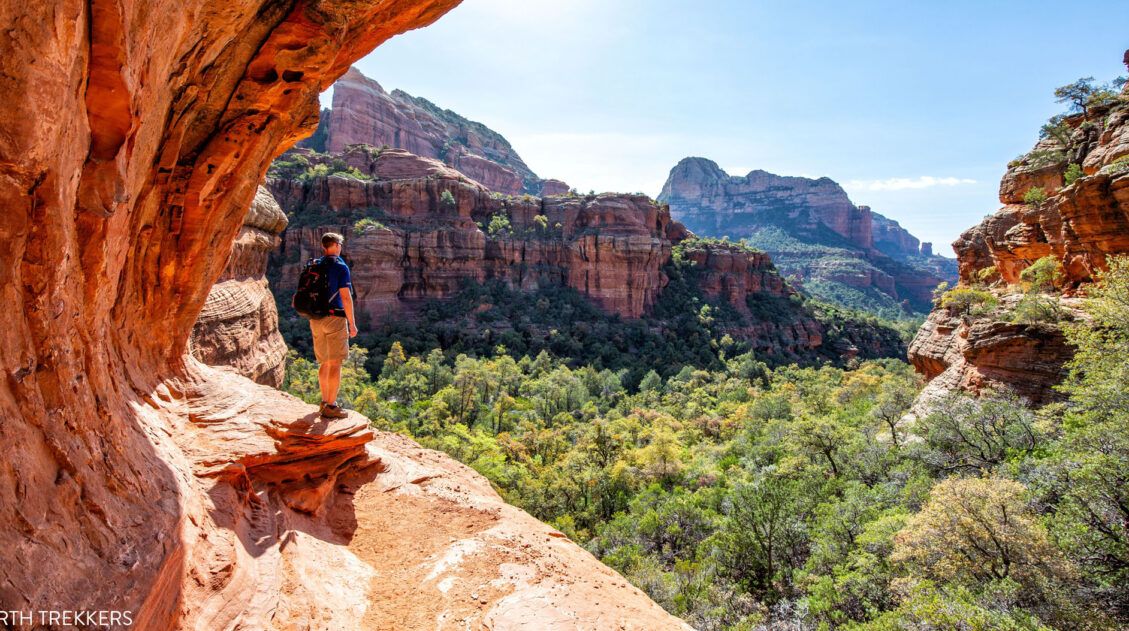
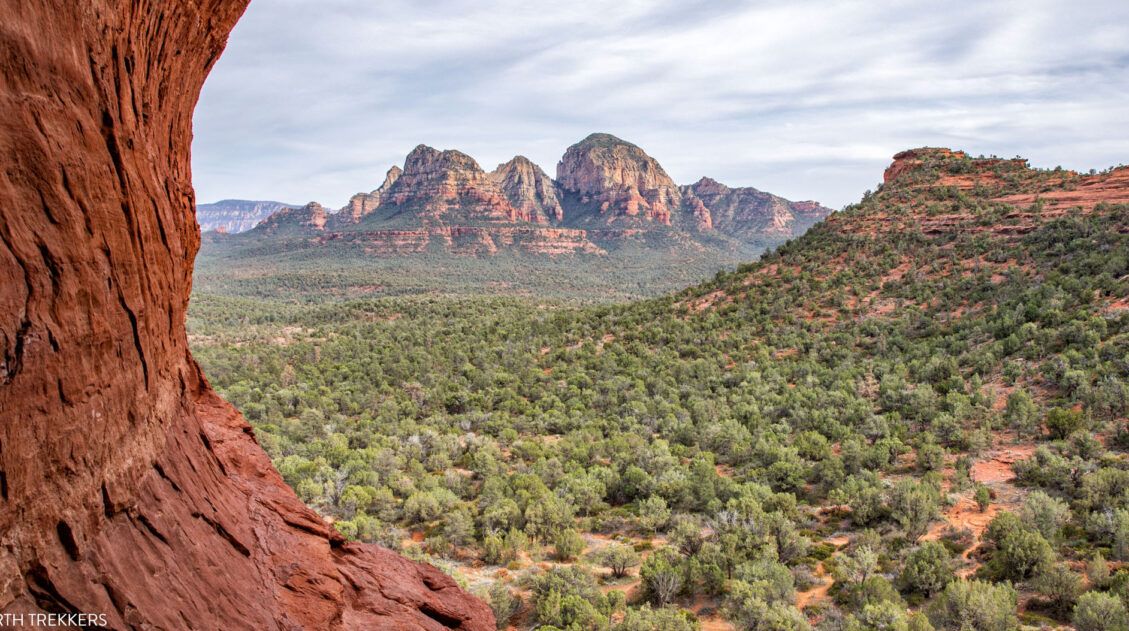
This trail winds its way through short sections of forest and up and down small hills. The scenery here is beautiful. Cacti and yucca plants line the trail and off in the distance are the red rock mountains of Sedona. Tim and I loved this section of the hike.
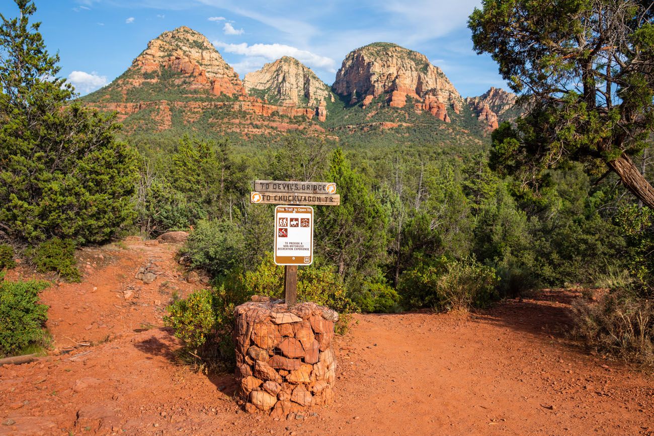
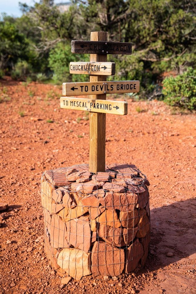
The trail is very easy to follow. Along the way, there are signs marking the trail.
PRO TRAVEL TIP: The Chuckwagon Trail is also used by mountain bikers. Stay on the lookout for bikers and give them room to pass should you meet one along the hike.
Just before reaching Dry Creek Road, the Devils Bridge trail branches off of the Chuckwagon Trail. There is a sign marking this spot so you shouldn’t miss it. Then you cross Dry Creek Road and pass through the parking lot for Devils Bridge.
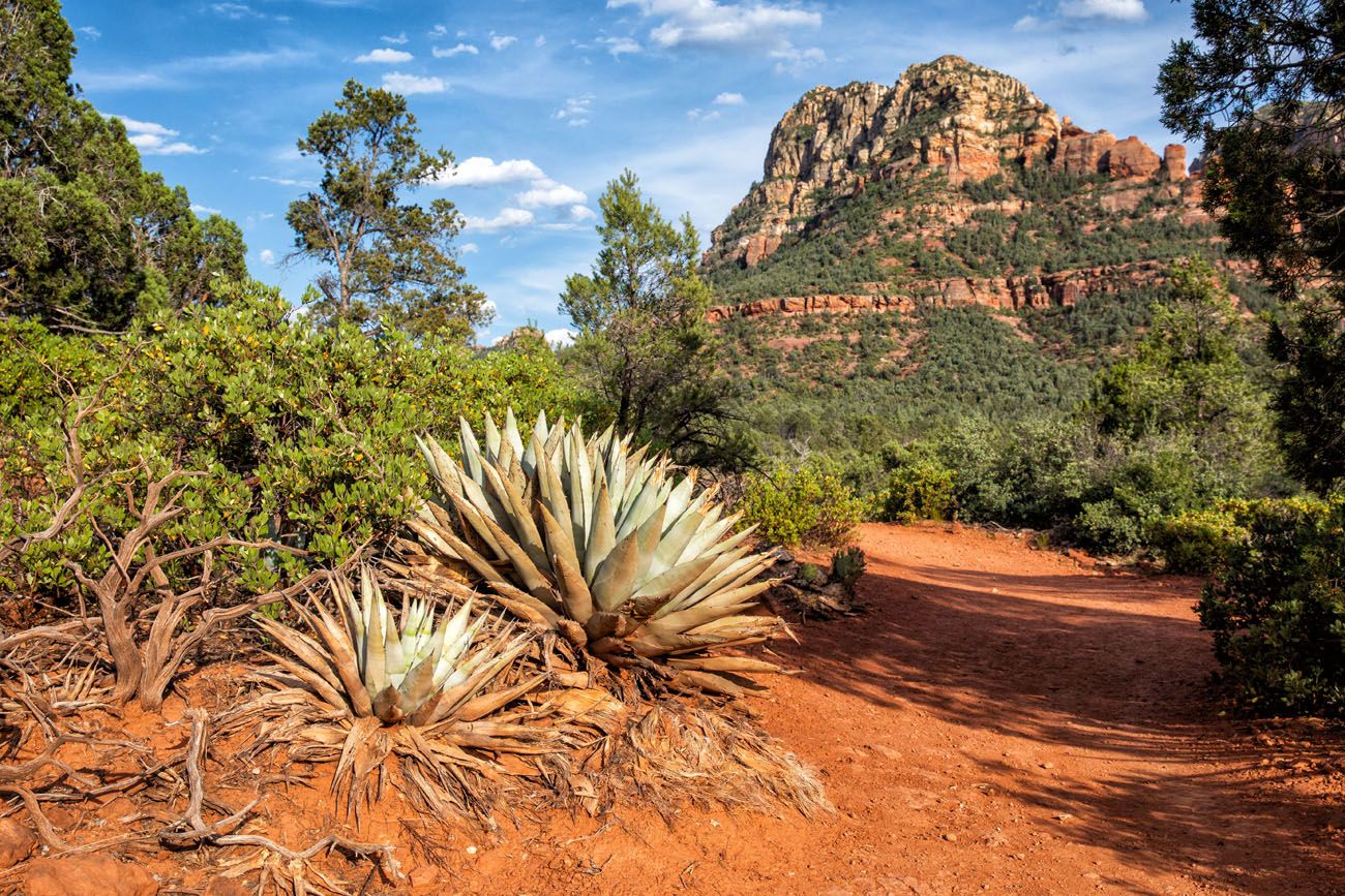
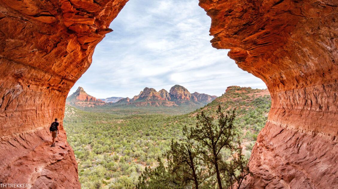
On the Devils Bridge Trail
From the parking lot for Devils Bridge it is just one mile to the bridge (2 miles round trip).
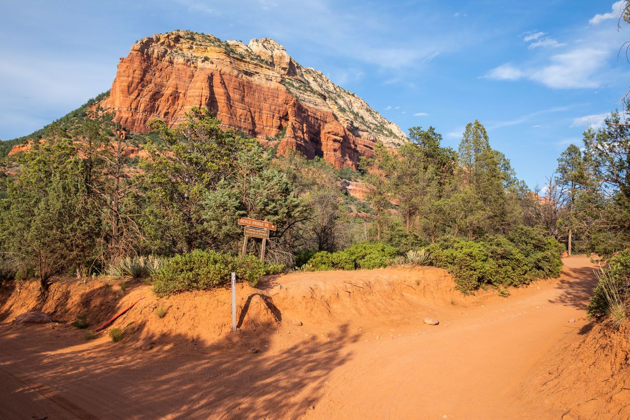
Dry Creek Road and the turn off for the Devils Bridge parking area.
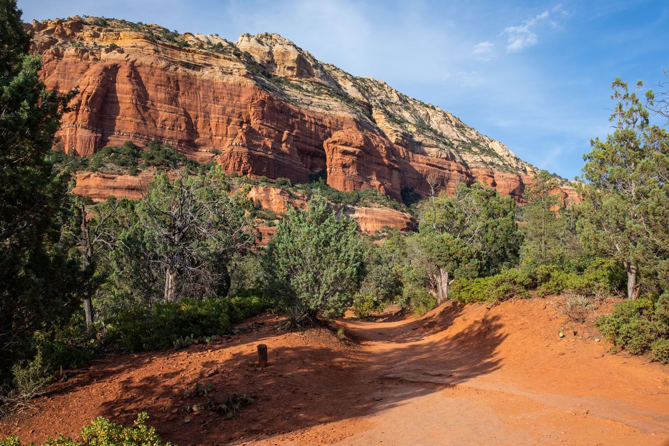
At first the trail is very wide, the remains of an old access road.
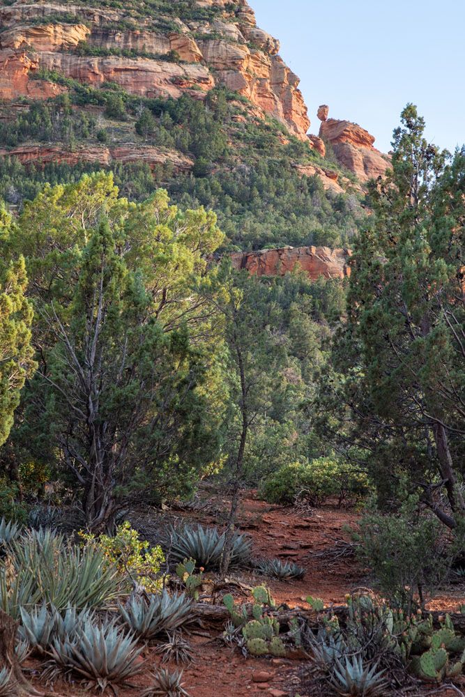
Along the way, if you look up at the rocky mountain in front of you, you might be able to see the balanced rock. It looks tiny from here and I zoomed in quite a bit with my camera to get this photo.
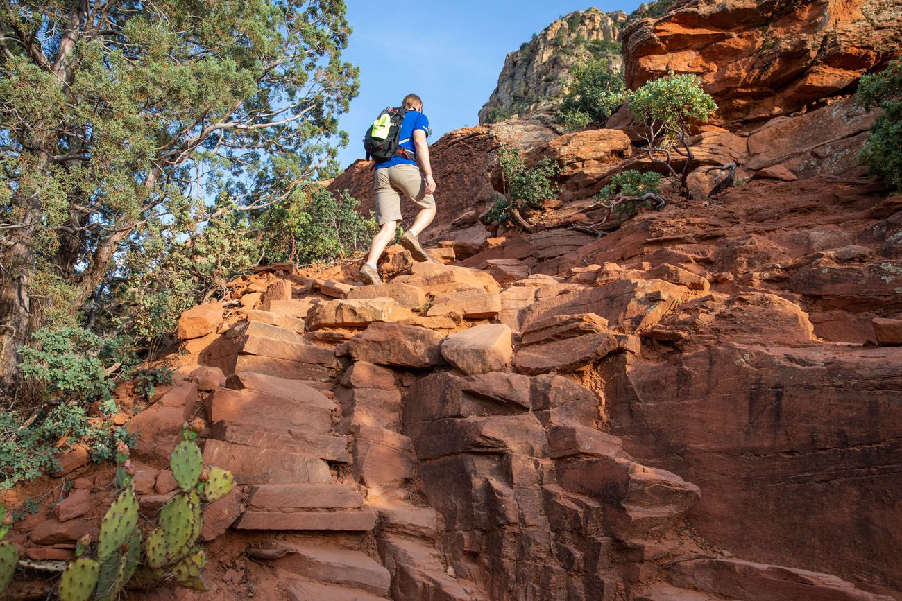
The trail narrows and then at the very end, climbs up to the base of the mountain. You will hike up several sets of steep, rocky steps and in some spots may even need to do some rock scrambling. This section does not last long and the good thing is that it ends right before Devils Bridge.
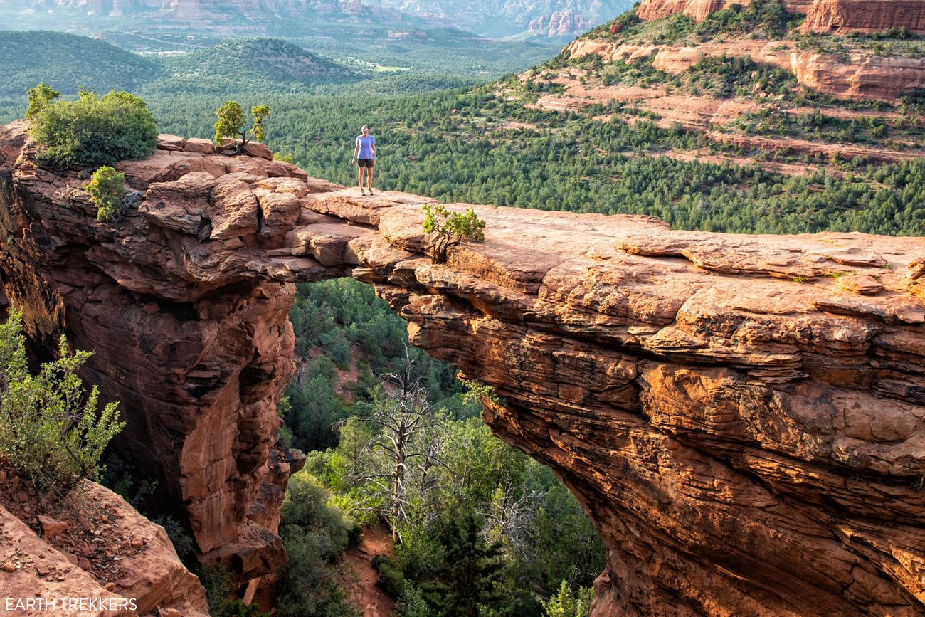
There is a wide, flat viewing area next to the bridge. This is the perfect spot to rest, enjoy the view, and wait to have your photo taken.
Note: In the past few years, we heard reports that people were waiting at least one hour to have their photo taken on Devils Bridge.
During the busier times of day, expect to wait to have your photo taken on the arch. This is one of the most popular hikes in Sedona so the chance that you will have the bridge all to yourself is slim.
We did this hike in the early evening in June. Tim and I started late not only to avoid the crowds but to also avoid the midday heat. We saw one mountain biker on the Chuckwagon Trail and a handful of people at Devils Bridge. Actually, I was delightfully surprised at how few people there were here. We did this hike June 2019.
Thoughts on the Hike
Tim and I loved this hike. It’s quick, it’s easy, and seeing Devils Bridge is awesome.
Kids can do this hike. We saw several kids about 8 years old on the trail. Of course, keep an eye on young kids when at the viewpoint for Devils Bridge because there is a big drop-off here. However, the viewpoint is very wide and there is plenty of room to safely sit back and enjoy the view without getting too close to the edge.
Before traveling to Sedona, I purchased the book Sedona’s Top 10 Hikes. Along with this guide and some online research, Tim and I picked out our hikes. This handy little guide is filled with colorful photographs, maps, and interesting facts about Sedona.
We have now visited Sedona multiples times. Check out our Sedona Travel Guide to learn how to plan your visit to Sedona and for more great hikes to do, read our post Sedona Hiking Guide.
Tips for the Devils Bridge Hike
If you are visiting Sedona during peak season (spring and fall), I recommend getting here very early or waiting for the late afternoon to do this hike. Get here by 7 am to get a space at the Mescal Trailhead or the Dry Creek Parking lot. Or, wait until 4 pm to do this hike (there are usually spaces at the Mescal Trailhead at 3:30 to 4 pm). In late afternoon, the lighting is great for photos and there is a good chance that the trail will be relatively empty. Our photos were taken in the late afternoon in June.
Check the Mescal Trail parking area for a space before joining the overflow parking on Boynton Pass Road. It’s a much nicer experience if you can avoid the walk on Dry Creek Road.
Rent a high-clearance 4WD and drive right to the trailhead. There are lots of other fun 4×4 roads to drive in Sedona…if you are looking for more adventure.
Help Keep this Post Updated. If you recently hiked Devils Bridge, how was your experience? How did you do it and did you have to wait in line for a photo? Your comments can help out future hikers. Let us know in the comment section below. Thanks!
Where We Stayed
We stayed at a wonderful bed & breakfast called A Sunset Chateau. This is a beautiful property located just outside of the town of Sedona. This property has a pool, hot tub, and a lush garden filled with tropical plants and trees.
Get more hotel recommendations in our article Where to Stay in Sedona: Best Hotels for Your Budget.

If you plan to hike Devils Bridge and have any questions, or if you want to share your experience, comment below!
More Information for Your Trip to Sedona
We lots more information about places to go in Arizona on our website. And if this is part of bigger trip in the USA, check out our United States Travel Guide.
12 Best Sedona Hikes, Ranked Shortest to Longest
Pinterest Facebook Flipboard If you are looking for an epic hiking destination, it’s tough to beat Sedona, Arizona. With its red rock scenery, arches, hidden caves, and network of hiking trails, this is a great place to explore on foot. Add in the abundance of top-notch hotels and restaurants in Sedona and you have an […]
Sedona Travel Guide: How to Plan a Trip to Sedona
Sedona Travel Guide In central Arizona, miles and miles of trails criss cross through red rocks and spectacular desert landscapes, creating an outdoor playground for hikers and mountain bikers. Venture into the desert on a 4×4, visit cultural heritage sites, go wine tasting, slide down a waterfall, and watch as the sky turns brilliant shades […]
15 Amazing Things to Do in Sedona (Beyond Just Hiking the Trails)
What do you look for when picking the perfect vacation spot? Outdoor adventures? Shopping? Wineries? Great restaurants? Beautiful sunsets? A fun place to take the kids? What if I told you that you could get all of these in one place…Sedona, Arizona. In this article, learn about the best things to do in Sedona with […]
How to Hike to Cathedral Rock in Sedona, Arizona
Hiking to Cathedral Rock is an essential experience in Sedona. This hike is short and sweet, and with some rock scrambling and jaw-dropping views, it’s tons of fun from start to finish. Cathedral Rock is one of the most popular hikes in Sedona. Do not expect solitude on this trail. This experience is much more […]
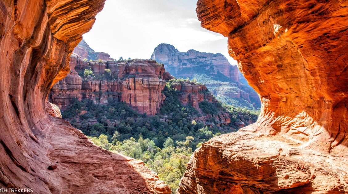
The Complete Guide to the Birthing Cave Hike | Sedona, Arizona
In Sedona, there are many hidden caves to hike to. The Birthing Cave is one of the fastest and easiest to visit. Round trip, this hike comes in at 2 miles and most people can do this in about an hour, if you move fast. However, the trick is finding parking (this is a very […]
Sedona Itinerary | Best Way to Spend 1 to 6 Days in Sedona
There are many different ways to piece together a Sedona itinerary. Your perfect itinerary depends on your traveling style. Whether you are an avid hiker, a family traveling with kids, or someone who wants to experience Sedona without spending time on the hiking trails, we have some great suggestions for you. In this guide, learn […]
Boynton Canyon Trail & the Subway Cave | One of Sedona’s Top Hikes
Boynton Canyon is one of Sedona’s top hikes. This is a relatively easy hike, as you walk on a mostly flat trail that is sheltered from the sun. The trail ends at the back of the canyon, where a short climb takes you up to a viewpoint, offering sweeping views of Boynton Canyon. Along the […]
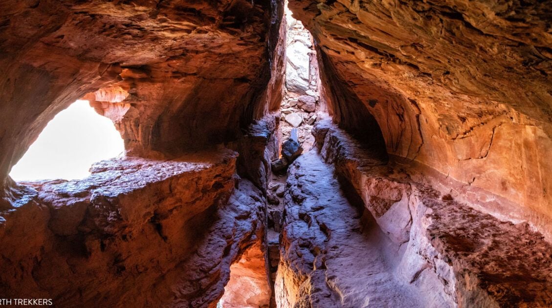
Soldier Pass Trail & Soldier Pass Cave: Step-By-Step Trail Guide
There are several reasons why so many hikers rave about the Soldier Pass Trail. For one thing, it is relatively short and easy to hike. But the main reason why people love this trail is to visit the Seven Sacred Pools, hike past a sinkhole named Devil’s Kitchen, and hike to the Soldier Pass cave. […]
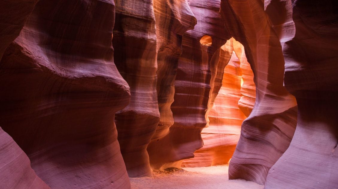
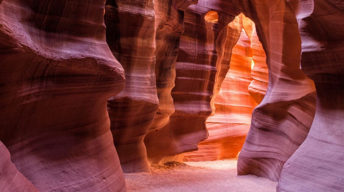
Exactly How to Visit Upper Antelope Canyon (+ Lots of Photos!)
Isn’t it awesome when a new place completely astounds you? For me, that was Upper Antelope Canyon. A few years ago, I saw my first photos of Antelope Canyon, with its glowing, red canyon walls, twisted, scalloped rock faces, and beams of light shining through the dusty air. Does this place really exist? Yes, it […]
10 Days in the American Southwest: The Ultimate Road Trip
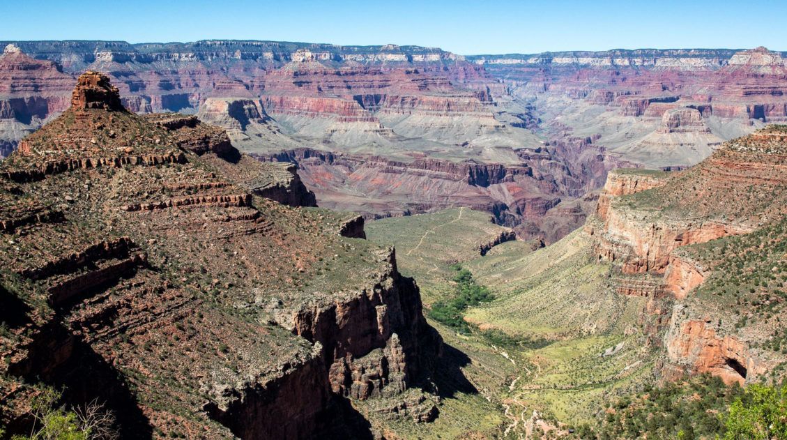
The American southwest is one of the USA’s best road trip destinations. It’s unbelievable how much there is to see and do here. There are the breathtaking vistas of the Grand Canyon, thrilling hiking trails in Zion National Park, and millions of hoodoos to photograph in Bryce Canyon. Are you getting excited yet? The list […]
One Day in the Grand Canyon Itinerary: Things to Do, Map, Photos
If you only have one day in the Grand Canyon, what should you do? Grand Canyon National Park is enormous. With thousands of acres of land, four rims to visit, plus the option to hike below the rim, there is no way that you will get to everything in just one day. However, with one […]
Arizona Travel Guide: Top Places to Visit in Arizona
Arizona Travel Guide From the awe-inspiring Grand Canyon to the sprawling Sonoran Desert, Arizona offers a diverse mix of natural wonders, bustling cities, and deep-rooted traditions. Visit Arizona to hike amidst its slot canyons and desert landscapes, view the starry night skies, and see the famously tall saguaro cactus. Take a trip to Arizona on […]
20 Fun, Short Hikes in the US National Parks
One of the best ways to experience the national parks is from a hiking trail. Hike to amazing viewpoints, deep into the forests, through scenic canyons, and to hidden lakes and waterfalls. Along the way, you have a better chance of spotting wildlife and potentially leaving the crowds behind. Here are 20 fun, short hikes […]

Comments 112