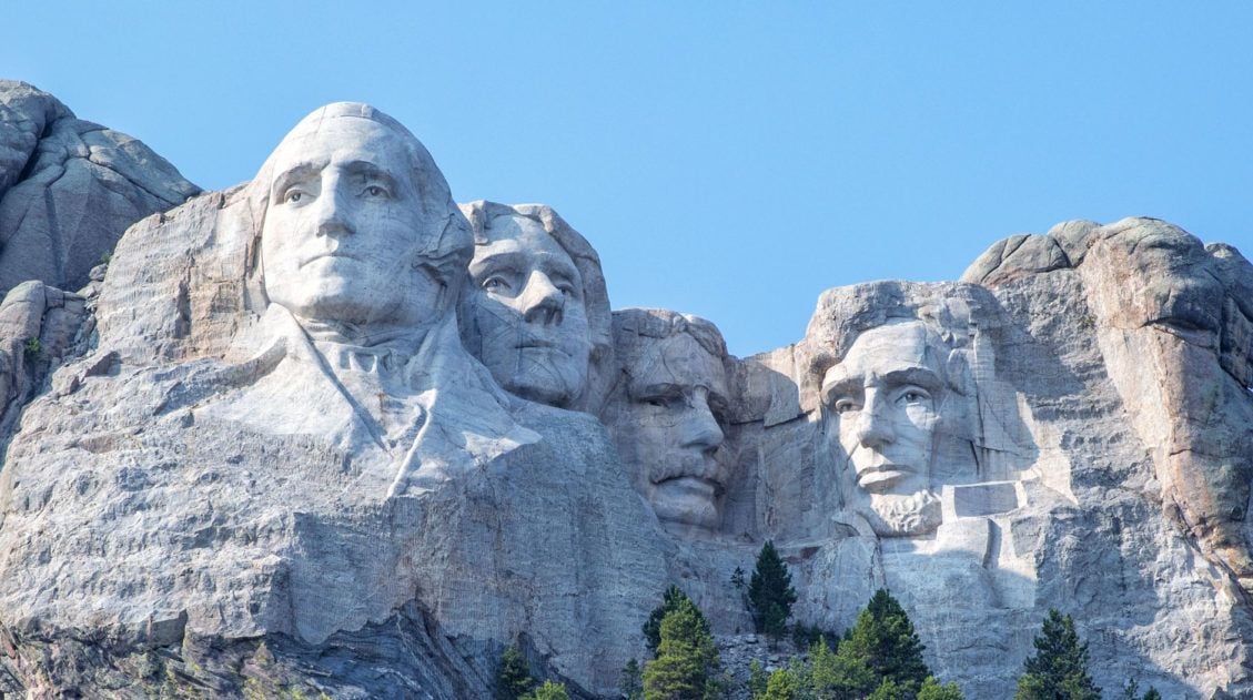
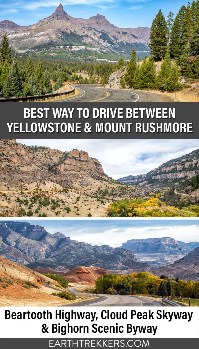
At first you might be wondering, why write a post about how to drive from Mount Rushmore to Yellowstone? Sounds easy, right? Just connect the two points on a map and pick the quickest route.
But what if I told you that you had several options and each of these included a different but very scenic drive.
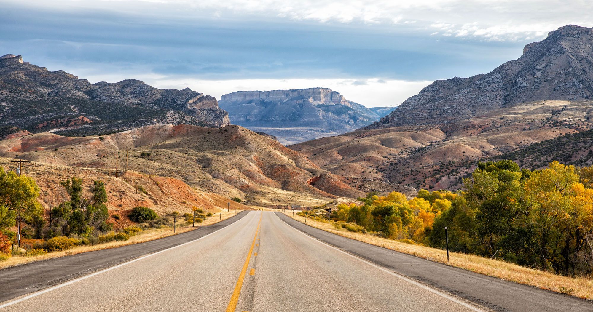
Two scenic drives cut through the Bighorn Mountains in northern Wyoming: Bighorn Scenic Byway and Cloud Peak Skyway. If your road trip from Mount Rushmore to Yellowstone is point to point, you will have to choose which one to drive. In this guide, we have lots of photos and information to help you make the best choice.
In addition to driving through the Bighorns, you can also add on the spectacular Beartooth Highway.
In this guide, we cover three different ways to drive from Yellowstone to Mount Rushmore with tips to have the best experience.
Overview of the Drive
In general, it takes 8 hours to drive from Mount Rushmore to Yellowstone National Park. That’s without stops. With stops, it can take 10 hours or longer.
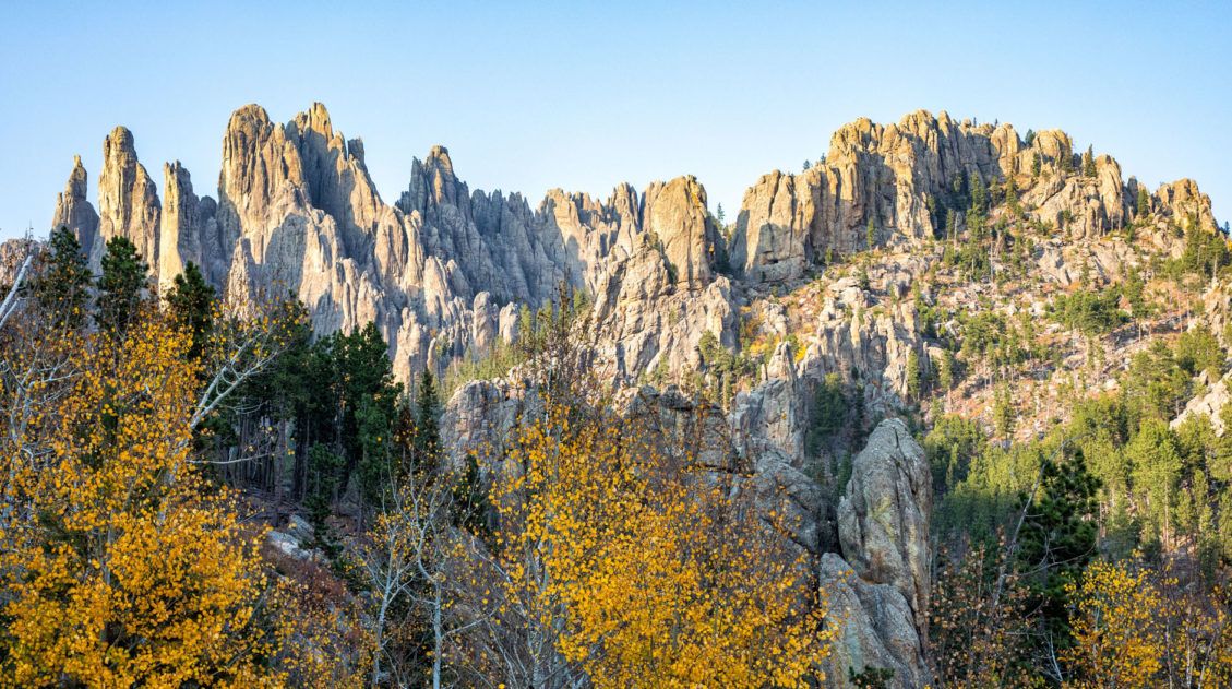
Two of these driving routes go through Bighorn National Forest and the Bighorn Mountains.
The Bighorn National Forest is one of the oldest protected forests in the USA. The Bighorn Mountains is a chain of mountains that lie to the east of the Continental Divide. At 13,175 feet (4,020 meters), Cloud Peak is the tallest of these mountains.
There are two main driving routes through the Bighorn Mountains. Cloud Peak Skyway (US Route 16) crosses the highest pass in the mountains. Bighorn Scenic Byway (US Route 14) cuts through the northern section of Bighorn National Forest. Along both of these routes, there are short hiking trails and many scenic overlooks to visit along the way.
You also have the option to drive Beartooth Highway, which is one of the most scenic drives in the USA. This drive starts in Red Lodge, Montana and ends at the northeast entrance of Yellowstone. This route takes longer and is best spread out over two days, but you also get to drive Bighorn Scenic Byway.
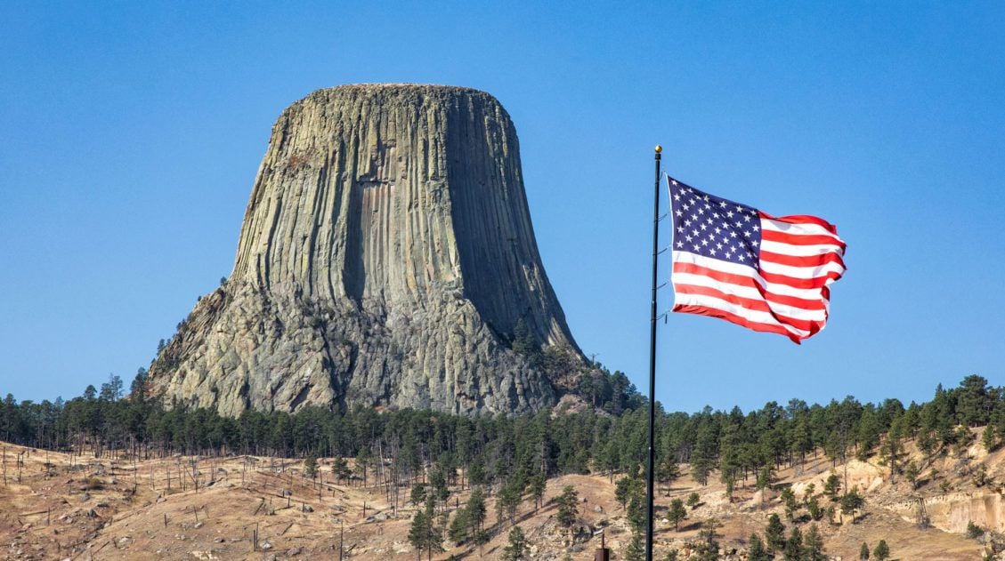
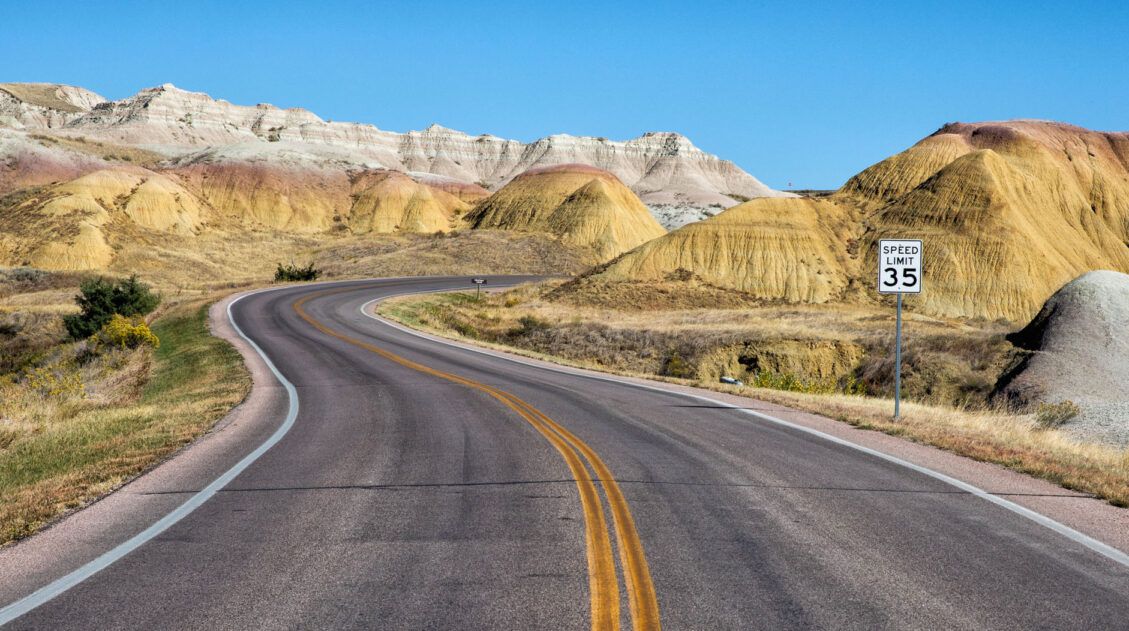
On the drive, you also have the option to add on Devils Tower. This is a detour adds on about an hour of driving and 60 additional miles. But it’s worth it since it is such an iconic sight in the USA.
At the end of the drive, it is best to stay in Cody, Wyoming (a 1 hour drive east of the east entrance into Yellowstone). Alternatively, you can also stay at Lake Yellowstone (1 hour beyond Cody) or Old Faithful Village or Canyon Village (2 hours beyond Cody), inside of Yellowstone National Park. Just note that staying in the park adds an additional one to two hours of driving time to the the day.
Mount Rushmore to Yellowstone: Driving Routes
Here are three different ways to drive from Mount Rushmore to Yellowstone and each of these include a quick visit to Devils Tower.
For each of these routes, I recommend getting an early start, no later than 8 am. This gives you plenty of time to visit Devils Tower and other scenic stops along the drive.
Route #1: Mount Rushmore to Yellowstone on Bighorn Scenic Byway
Distance: 441 miles
Driving Time (without stops): 7.5 hours
This driving route starts at Mount Rushmore and ends in Cody, Wyoming.
How to Use This Map: Click the tab in the top left corner of the map to see a list of the points of interest and to turn layers on/off. Click the icons on the map to get more information about each point of interest.
To take this map with you, click the star next to the title of the map which adds it to your Google account. Next, within your Google Maps app, select ‘Saved’ and then select ‘Maps’. This map title will now appear in your list.
Mount Rushmore to Devils Tower
To get to Devils Tower from Mount Rushmore, there are several different driving routes. The best route depends on where you will be staying in the Black Hills or Rapid City. You can use Google Maps to map out the quickest route. But in general, it takes 2 to 2.5 hours to get to Devils Tower.
Visiting Devils Tower
Since you still have a lot of driving to do today, you won’t have much time to spend at Devils Tower.
I recommend spending just an hour or two here. This gives you enough time to hike the Tower Trail (a 1.3 mile trail that loops around the base of Devils Tower) or the Red Beds Trail if you are a fast hiker (a 2.8 mile trail that makes a bigger loop around Devils Tower).
There are a few restaurants and general stores located at the entrance to Devils Tower National Memorial where you can get lunch and refill your gas tank.
Complete Guide to Devils Tower: How to Plan Your Visit
Everything you need to know to plan your visit to Devils Tower.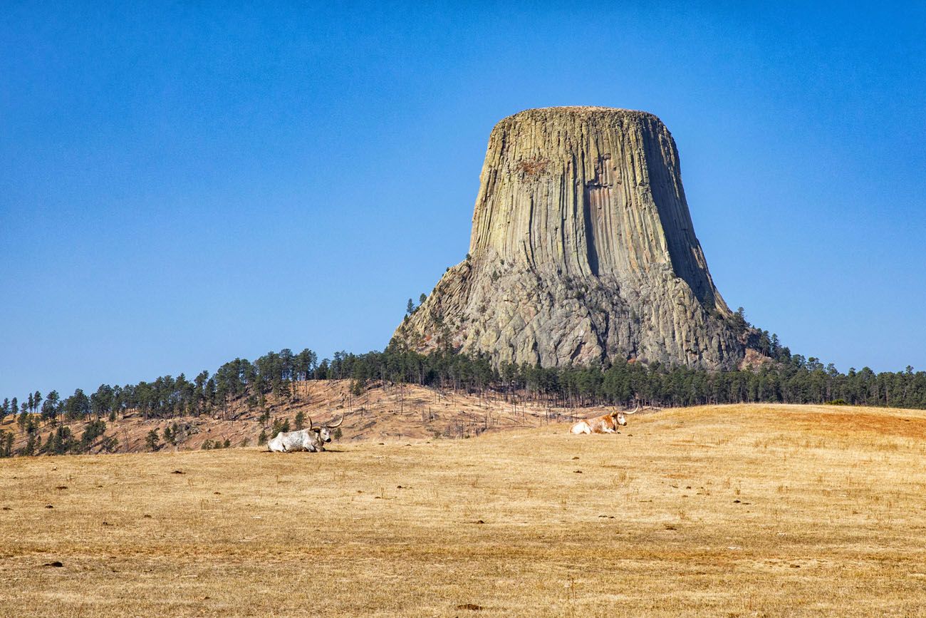
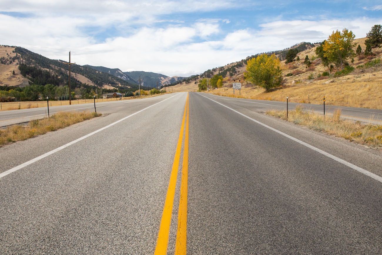
Devils Tower to Dayton, Wyoming
From Devils Tower, it takes 3 hours to drive to Dayton (185 miles). Most of this drive is on Interstate 90 which is a large divided highway. Dayton is the gateway to the Bighorn Scenic Byway.
Bighorn Scenic Byway
Bighorn Scenic Byway is 57 miles long, running from Dayton to Shell, Wyoming, on US Highway 14. It is the northern route through the Bighorn Mountains.
From Dayton, take US-14 west into the Bighorn Mountains. There are a lot of twists and turns on this part of the drive, as the road snakes up into the Bighorn Mountains.
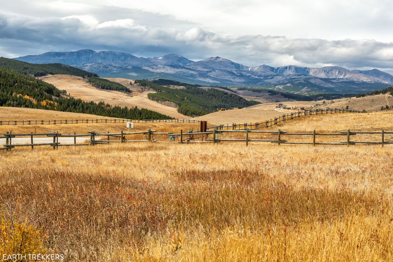
Stop at Sand Turn Interpretive Site (about 10 miles from Dayton) for a great view over the Tongue Valley.
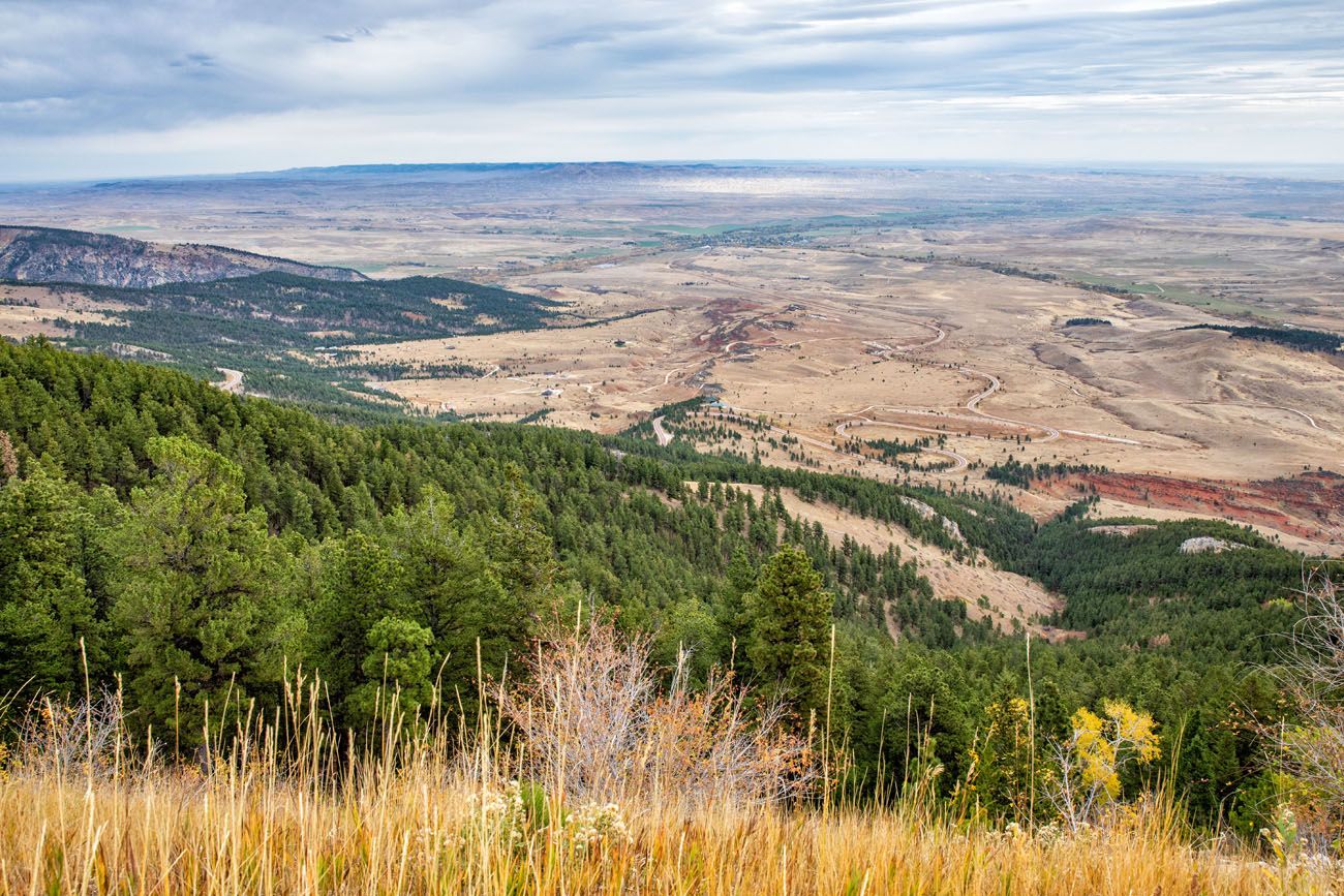
View from Sand Turn Interpretive Site
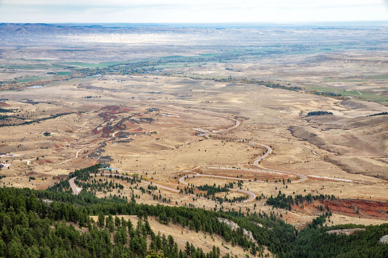
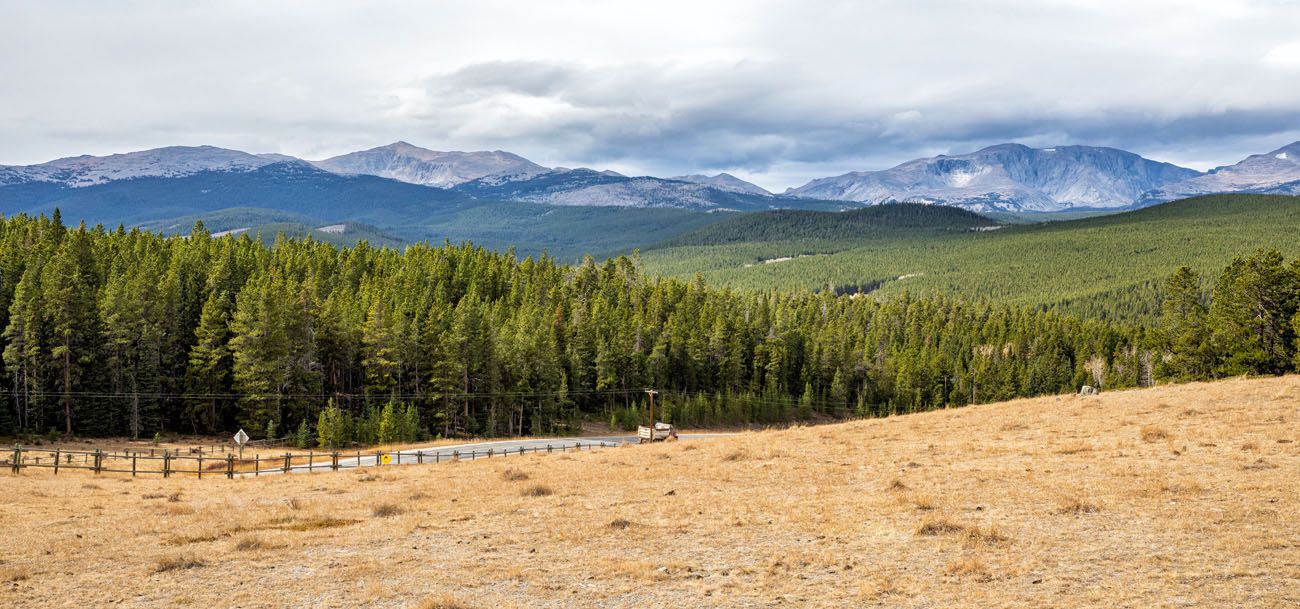
Closer view of Highway 14
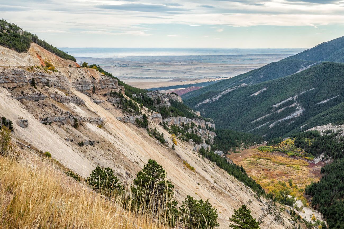
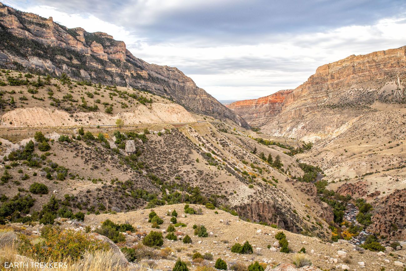
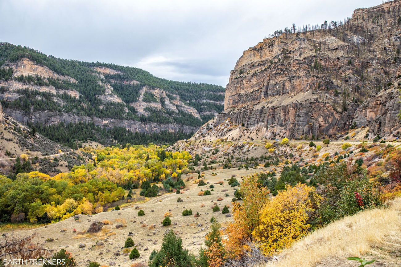
Beyond Sand Turn, Bighorn Scenic Byway enters a canyon and the views are beautiful. There are several pull outs along the road if you want to stop for photos. You can also see the sedimentary rock layers of the Bighorn Mountains.
For a view of Steamboat Point, pull off at the small parking lot on the right hand side of the road (GPS coordinates: 44°48’8.808″ N 107°21’52.355″ W). You can also hike to the top of Steamboat Point (1.7 miles, moderate difficulty) but only if you are doing great on time.
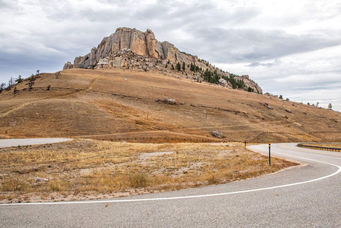
Steamboat Point
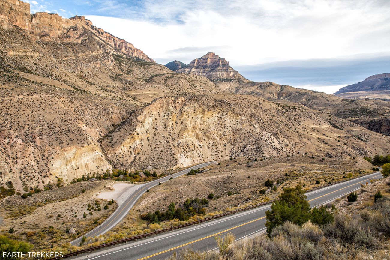
At Burgess Junction, turn left to continue on Bighorn Scenic Byway. If you are doing well on time, you can continue straight to drive US-14A to Medicine Wheel, an ancient stone circle that is sacred to Native Americans. This detour takes about one hour.
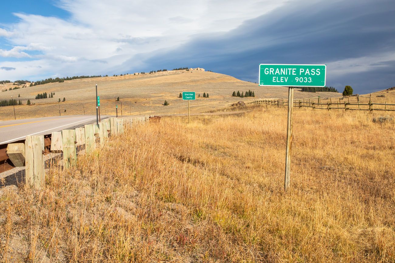
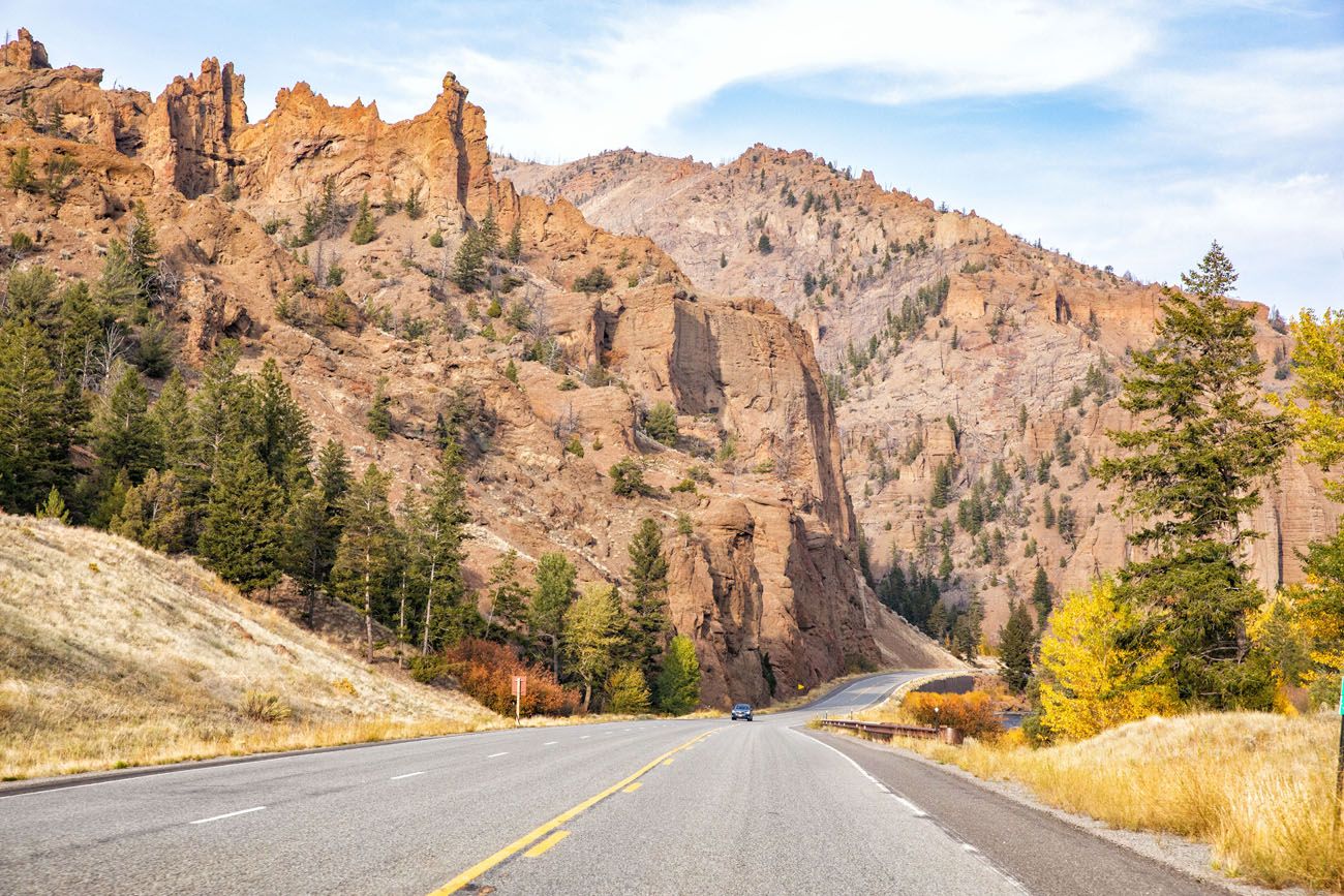
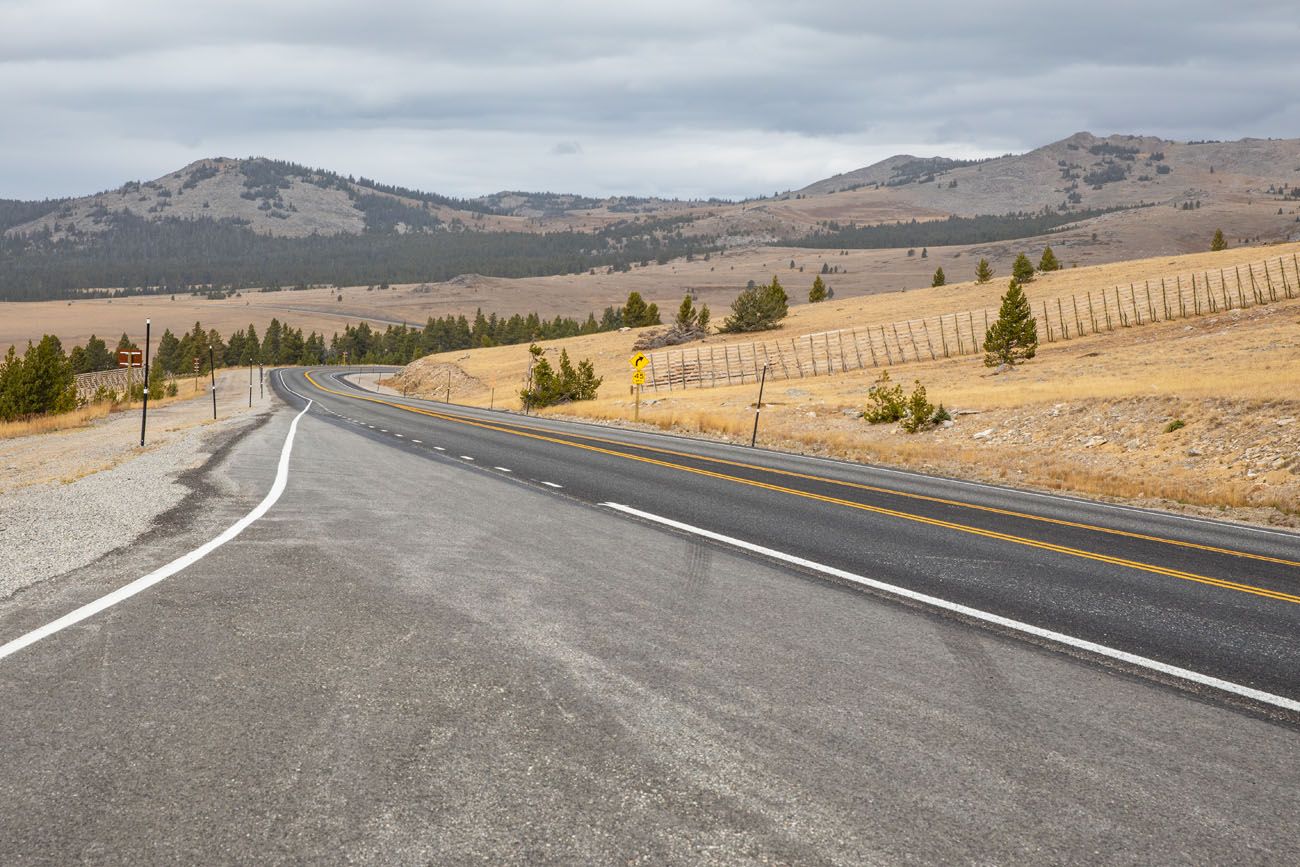
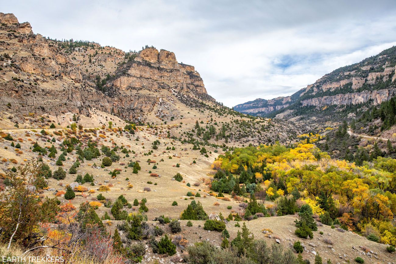
The Bighorn Scenic Byway reaches its highest point at Granite Pass (9,033 feet). And then comes the most thrilling part of this scenic byway.
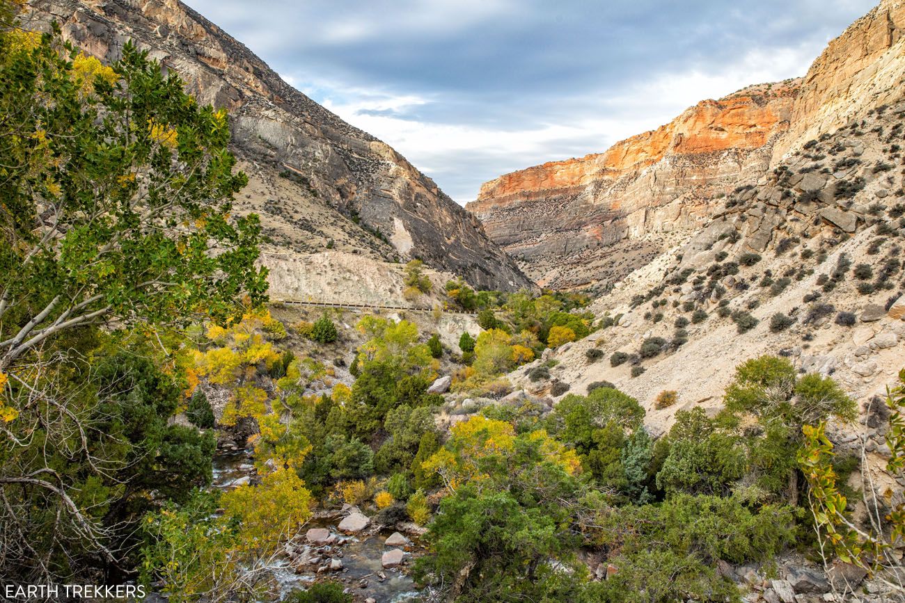
The road winds down into Shell Canyon. Here is the view along this part of the drive.
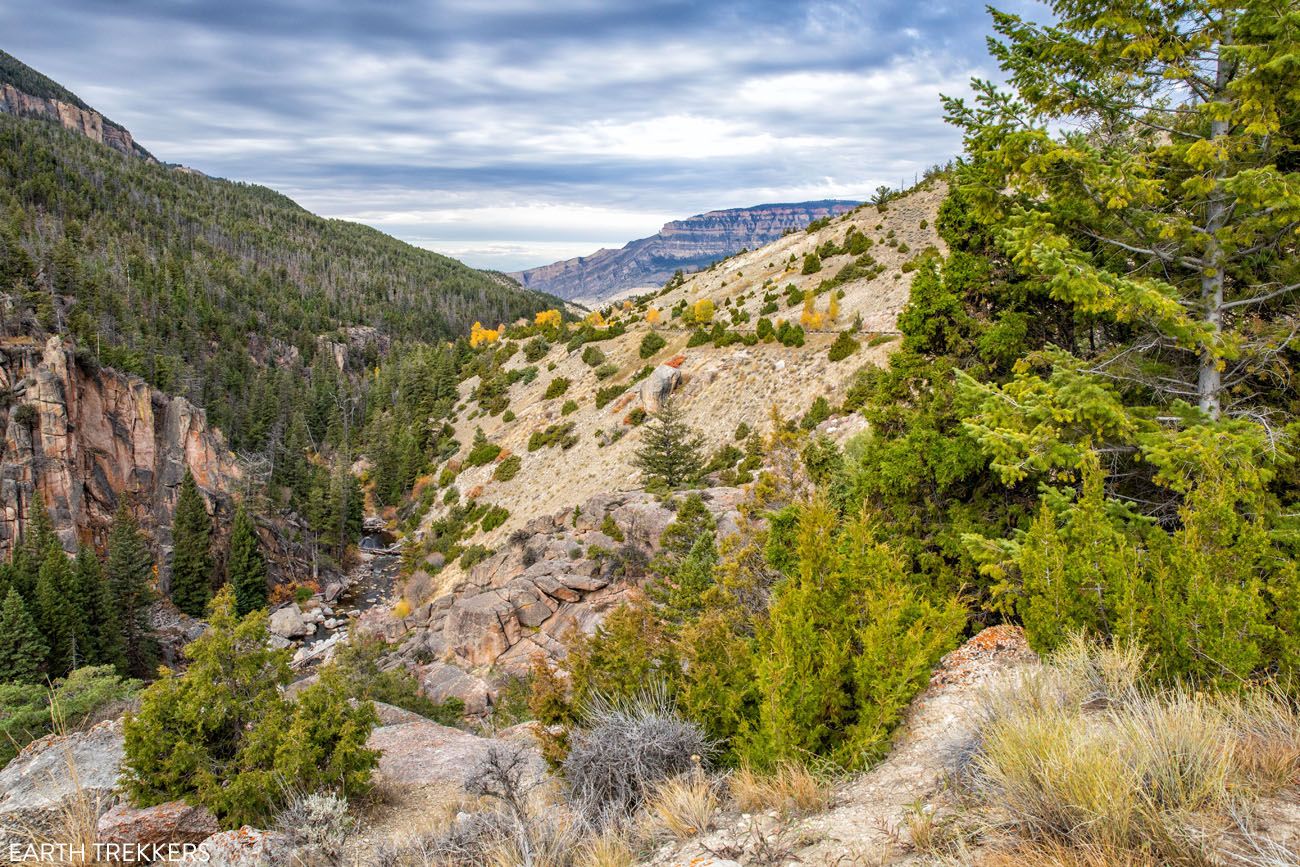
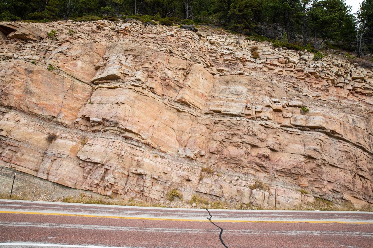
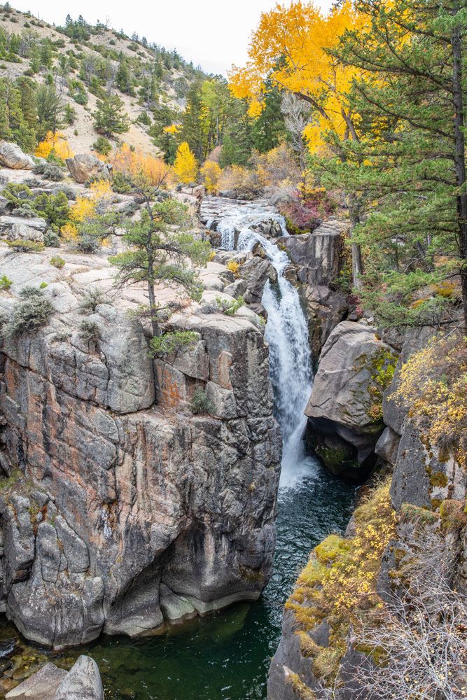
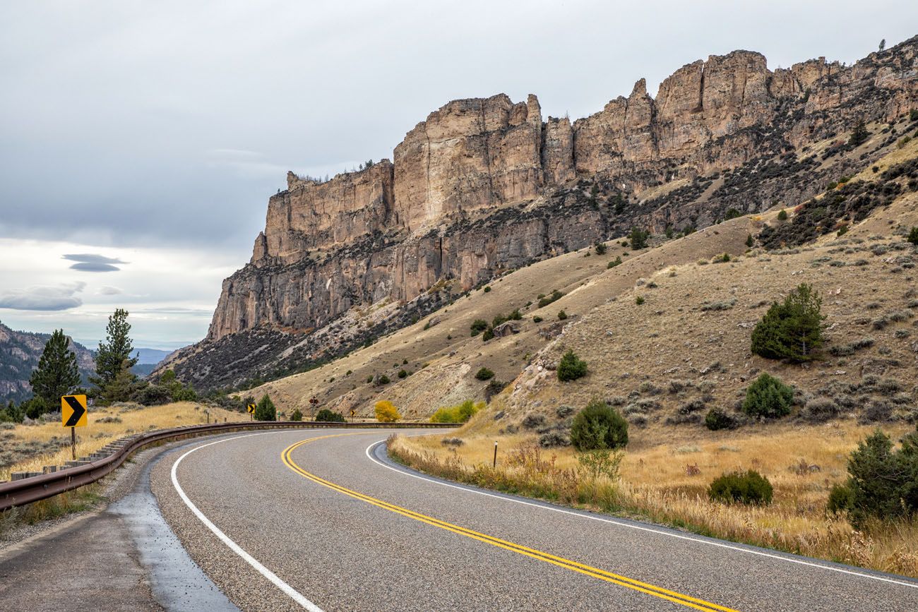
At Shell Falls Interpretive Site, several walking trails lead to overlooks of Shell Falls and Shell Canyon. This canyon gets its name from the shell fossils that are embedded in the granite walls.
Beyond Shell Falls, the road continues to descend into the canyon and the views keep getting better.
On the western edge of the Bighorn Mountains, the Bighorn Scenic Byway ends once you arrive in the town of Shell. Here is a view looking back at the mountains.
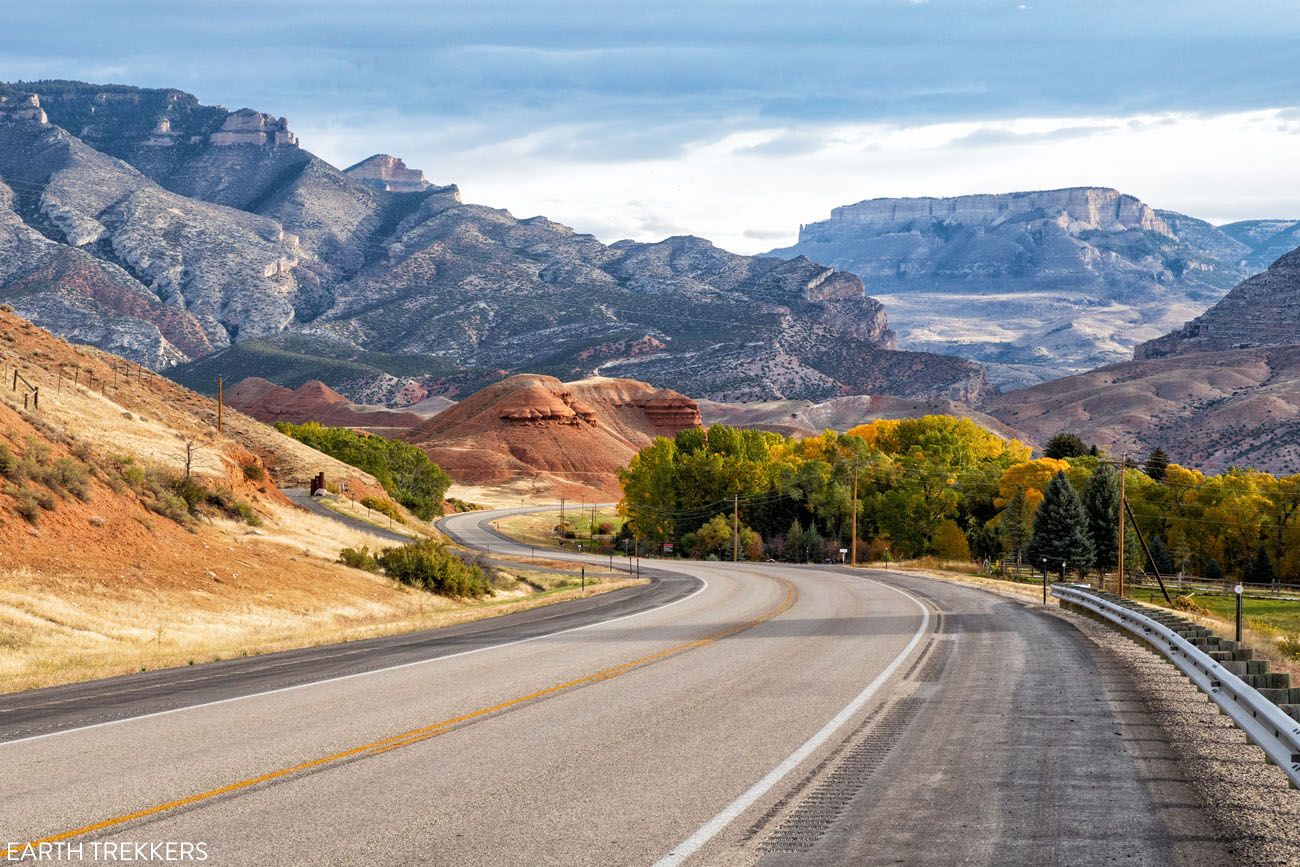
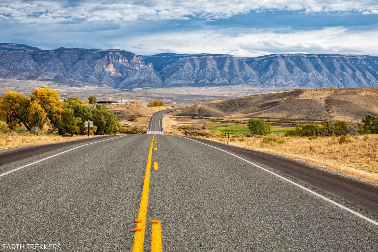
Shell to Cody
It takes just over an hour to drive from Shell to Cody on US-14.
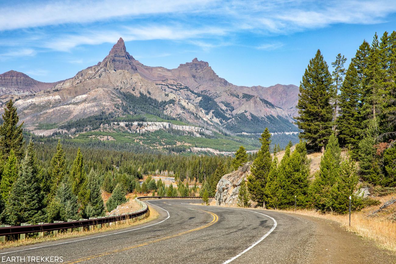
If you have plans to stay in Yellowstone National Park, you will have at least one more hour of driving once you reach Cody. The drive from Cody to the east entrance of Yellowstone is also a very scenic drive on the Buffalo Bill Cody Scenic Byway.
Buffalo Bill Cody Scenic Byway
Route #2: Mount Rushmore to Yellowstone on Cloud Peak Skyway
Distance: 428 miles
Driving Time (without stops): 7.5 hours
This driving route starts at Mount Rushmore and ends in Cody, Wyoming.
Mount Rushmore to Devils Tower
To get to Devils Tower from Mount Rushmore, there are several different driving routes. The best route depends on where you will be staying in the Black Hills or Rapid City. You can use Google Maps to map out the quickest route. But in general, it takes 2 to 2.5 hours to get to Devils Tower.
Visiting Devils Tower
Since you still have a lot of driving to do today, you won’t have a lot of time to spend at Devils Tower.
I recommend spending just an hour or two here. This gives you enough time to hike the Tower Trail (a 1.3 mile trail that loops around the base of Devils Tower) or the Red Beds Trail if you are a fast hiker (a 2.8 mile trail that makes a bigger loop around Devils Tower).
There are a few restaurants and general stores located at the entrance to Devils Tower National Memorial where you can get lunch and refill your gas tank.
For more information about how to visit Devils Tower, check out our Guide to Devils Tower ↓
Complete Guide to Devils Tower: How to Plan Your Visit
Everything you need to know to visit Devils Tower.Devils Tower to Buffalo, Wyoming
From Devils Tower, it takes 2 hours to drive to Buffalo (130 miles). Most of this drive is on Interstate 90 which is a large divided highway.
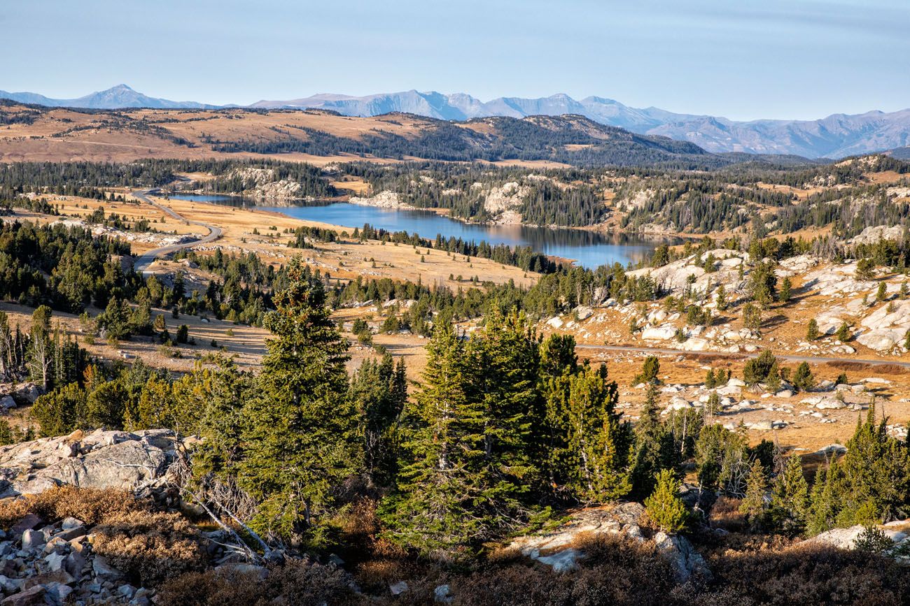
Cloud Peak Skyway
Cloud Peak Skyway is 47 miles long, running from Buffalo to Ten Sleep, Wyoming, on US Highway 16. It is the southern route through the Bighorn Mountains.
From Buffalo, US-16 gradually ascends into the Bighorn Mountains. It doesn’t enter the Bighorns as dramatically as the Bighorn Scenic Byway, since it lacks the switchbacks, tight turns, and canyon views. But it is still a very scenic drive, with views of ranches and the mountain peaks off in the distance.
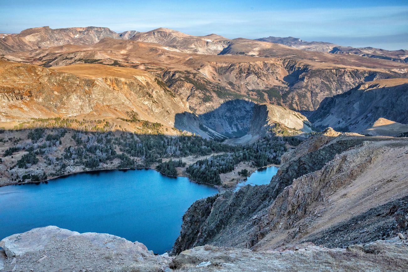
At Loaf Mountain Overlook you get a great view of the Cloud Peak Wilderness. This 189,000 acre wilderness is home to some of the tallest peaks in the Bighorn Mountains, including Cloud Peak and Black Tooth Mountain. In the photo below, you can see Loaf Mountain, Bighorn Peak, and Dayton Peak.
Loaf Mountain Overlook
Cloud Peak Skyway reaches its highest point at Powder River Pass (9,666 feet).
Powder River Pass Summit
As you continue west, the road drops down into a canyon. This was our favorite part of the Cloud Peak Skyway. Massive limestone mountains tower over the road. US-16 winds through this canyon for several miles and the views are beautiful.
Cloud Peak Skyway comes to an end in Ten Sleep.
Ten Sleep to Cody
From Ten Sleep, it takes just under two hours to drive to Cody (100 miles).
Route #3: Mount Rushmore to Yellowstone via Beartooth Highway
Distance: 520 miles
Driving Time (without stops): 9 hours
This driving route starts at Mount Rushmore and ends in Cooke City – Silver Gate, Wyoming.
If you want to enter Yellowstone National Park on one of the most scenic drives in the USA, Beartooth Highway, this is a route to consider. This is a longer route and there is a lot to see and do on Beartooth Highway, so this driving route takes two days.
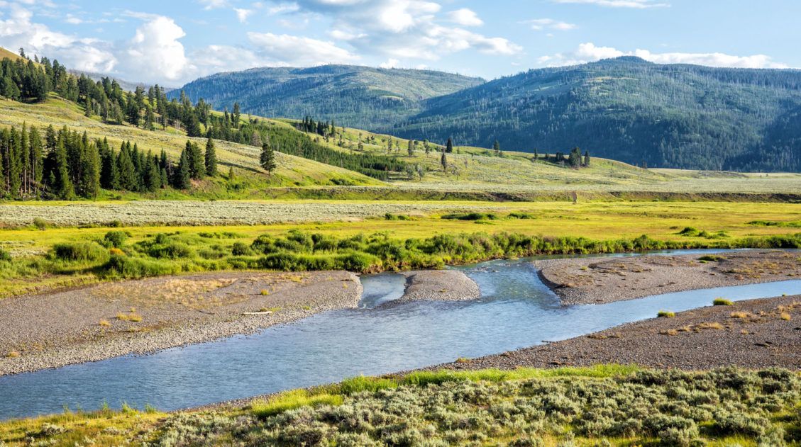
Starting at Mount Rushmore, visit Devils Tower and continue on to Red Lodge, Montana. Spend the night in Red Lodge. On the following day, drive Beartooth Highway in the morning and spend the afternoon in Lamar Valley, Yellowstone National Park.
Mount Rushmore to Devils Tower
To get to Devils Tower from Mount Rushmore, there are several different driving routes. The best route depends on where you will be staying in the Black Hills or Rapid City. You can use Google Maps to map out the quickest route. But in general, it takes 2 to 2.5 hours to get to Devils Tower.
Visiting Devils Tower
Since you still have a lot of driving to do today, you won’t have a lot of time to spend at Devils Tower.
I recommend spending just an hour or two here. This gives you enough time to hike the Tower Trail (a 1.3 mile trail that loops around the base of Devils Tower) or the Red Beds Trail if you are a fast hiker (a 2.8 mile trail that makes a bigger loop around Devils Tower).
There are a few restaurants and general stores located at the entrance to Devils Tower National Memorial where you can get lunch and refill your gas tank.
Devils Tower to Red Lodge, Montana
There are several ways to drive from Devils Tower to Red Lodge. The most scenic is driving the Bighorn Scenic Byway.
From Devils Tower, drive the Bighorn Scenic Byway as it is written out earlier in this guide. Drive through Shell, Wyoming and then take US-310 north to Montana. Then take US-72 south to State Highway 308 to Red Lodge. The drive on this route from Devils Tower to Red Lodge is 360 miles long and takes 6 hours without stops.
Spend the night in Red Lodge. This is a quaint, historic town that is located at the foot of the Beartooth Mountains. We stayed in the Alpine Lodge and had dinner at Prerogative Kitchen. Other recommended restaurants are Carbon County Steakhouse, Piccola Cucina at Ox Pasture (Italian), Palmita Mexican Restaurant, and Red Lodge Pizza Company.
On the following day, drive Beartooth Highway in the morning and spend the afternoon in Yellowstone National Park.
For more information about what to see and do along Beartooth Highway, and for lots more photos, check out our Guide to Beartooth Highway.
Our Favorite Route through the Bighorn Mountains: Bighorn Scenic Byway
Out of the two routes through the Bighorn Mountains, the first route, Bighorn Scenic Byway, is our favorite. The scenery along the drive is more spectacular along the entire length of the drive.
However, if you don’t like driving tight hairpin turns, the Cloud Peak Skyway has a gentler grade and fewer switchbacks, making it easier to drive.
If you plan to drive out and back between Mount Rushmore and Yellowstone, you can drive Cloud Peak Skyway to Yellowstone and return on Bighorn Scenic Byway.
Adding on Beartooth Highway is highly recommended if you have the time. You can either add it by following Route #3 or you can day trip out to the Beartooth Highway during your visit to Yellowstone.
If Roads are Closed Due Snow
It is best to drive these routes from June through September. Both the Bighorn Mountains and Beartooth Highway can get their first significant snowfalls in early October.
Beartooth Highway is typically closed from the second week of October through Memorial Day.
After heavy snowfalls, routes through the Bighorn Mountains can also close.
If you plan to do this drive from October through May, you will not be able to do the route that includes Beartooth Highway. It might be possible to drive through the Bighorn Mountains but you will have to keep an eye on the weather forecast and road conditions. You can get updated road conditions here.
If the driving routes through the Bighorn Mountains are closed, you will have to make a big detour. You can either drive through southern Montana or drive through southern Wyoming. This makes the drive longer and less scenic.
If you have any questions about how to drive from Mount Rushmore to Yellowstone, or if you want to share your experience, let us know in the comment section below.
More Information about Yellowstone, Wyoming, and South Dakota
Here are more articles to help you plan your trip to Yellowstone National Park, Wyoming, and South Dakota.
18 Epic Things to Do in Yellowstone on Your First Visit
Pinterest Facebook Flipboard Yellowstone National Park is a wonderland of geothermal activity, stunning landscapes, and abundant wildlife. Steam hisses out of the ground along walking trails, bison stop cars in their tracks on the main park road, and technicolor hot springs never fail to amaze even the most seasoned traveler. In this post, learn about […]
How to Visit Mount Rushmore: Tips & Top Things to Do
Planning a visit to Mount Rushmore? This iconic monument in South Dakota’s Black Hills is easy to visit, but knowing when to go, how long to stay, and what to do nearby can make a big difference. In this guide, we share everything you need to know before you go, including the best time to […]
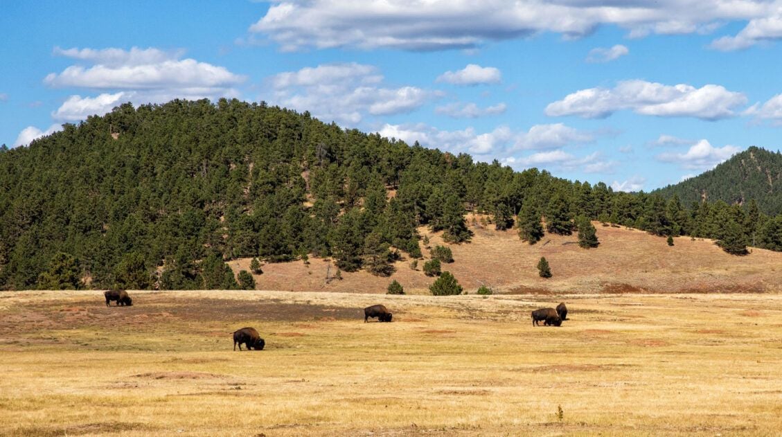
Custer State Park: Best Hikes, Scenic Drives & Things To Do
Discover the best things to do in Custer State Park, from its wildlife sightings along Wildlife Loop Road to epic hikes to the highest points in the park. We will also provide a map, a detailed one-day itinerary, plus important tips to help you have the best experience. Tucked away in the Black Hills of […]
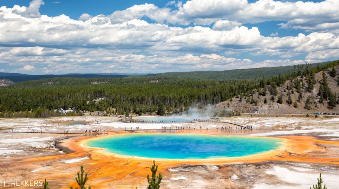
How to Visit Grand Prismatic Spring Overlook and Hike to Fairy Falls
The Grand Prismatic Spring is Yellowstone’s most colorful hot spring. Fairy Falls is one of Yellowstone’s tallest waterfalls. If you want to see both, it’s easy to combine the hike to Fairy Falls with the Grand Prismatic Spring overlook. In this article, learn how to visit the Grand Prismatic Spring and how to combine the […]
Yellowstone Itinerary: How to Plan an Epic Trip to Yellowstone
This guide provides a detailed Yellowstone itinerary for 1 to 5 days, focusing on the main attractions in a logical, well-planned route. We’ll also cover the best time to visit, including weather charts, must-have experiences, park maps, and many helpful tips we’ve gathered from our multiple visits to Yellowstone. If you’re planning a trip to […]
15 Things to Do in South Dakota near Mount Rushmore and Rapid City
The southwestern corner of South Dakota has a surprisingly long and wonderful list of things to do. Mount Rushmore, Badlands National Park, and Custer State Park are the big draws for many visitors to this part of the United States, but there is plenty more to keep you busy. In this post, we cover the […]
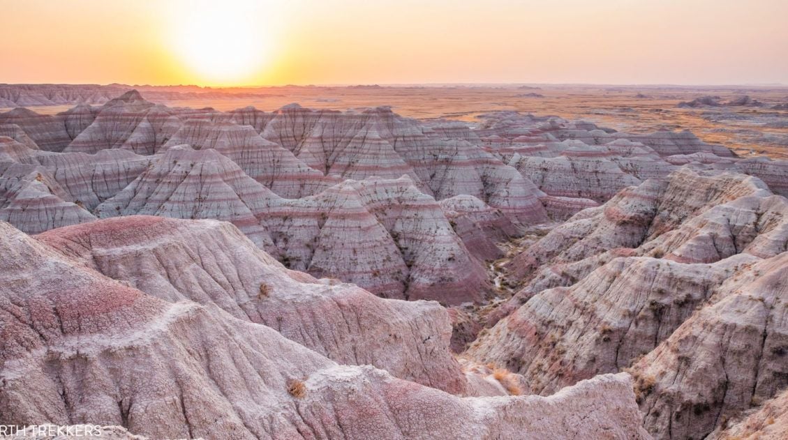
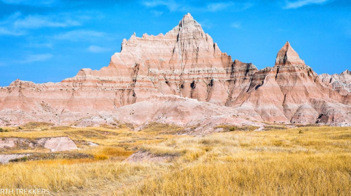
15 Amazing Things to Do in Badlands National Park (+ Map & Photos)
Discover the best things to do in Badlands National Park, in both the North and South units. We’ll also provide a map to help you plan your route, along with itinerary suggestions, where to stay, and helpful tips. Badlands National Park is one of the most highly underrated parks in the U.S. National Park system. […]
6 Great Things to Do in Wind Cave National Park
Discover the very best things to do in Wind Cave National Park, how to choose the best cave tour, and ideas for planning your time. This underrated park also has a few short, spectacular trails, with the chance to spot bison, elk, prairie dogs, and pronghorn. Wind Cave National Park gets its name for its […]
One Week South Dakota Itinerary: Black Hills & the Badlands
There are many different ways to spend one week in South Dakota. This itinerary focuses on the southwestern corner of the state, visiting sights located in and around the Black Hills. There is a long list of things to do in this part of South Dakota. Here are the things you will see on this […]
Best USA Road Trips: 18 Ideas for Your Next Big Adventure
One of the best ways to explore the USA is on a good old-fashioned road trip. Cruise along Route 66, road trip through the Florida Keys, explore the American Southwest, or even drive from coast to coast. In this guide, we share 18 of the best USA road trips…18 great ideas for your next big […]
United States Travel Guide: Places to Visit in the USA
Plan your visit to the United States. Learn about the best things to do, how to plan your time, road trip ideas, and sample itineraries.
12 Best Things to Do in Theodore Roosevelt NP (+ 3 Day Itinerary)
Discover the absolute best things to do in Theodore Roosevelt National Park. This comprehensive guide covers top hikes, stunning overlooks, and wildlife spotting across the North, South, and Elkhorn Ranch Units, plus a perfect 3-day itinerary to see it all. Theodore Roosevelt National Park is a striking wilderness where rugged badlands meet vast, rolling grasslands. […]

Comments 24