
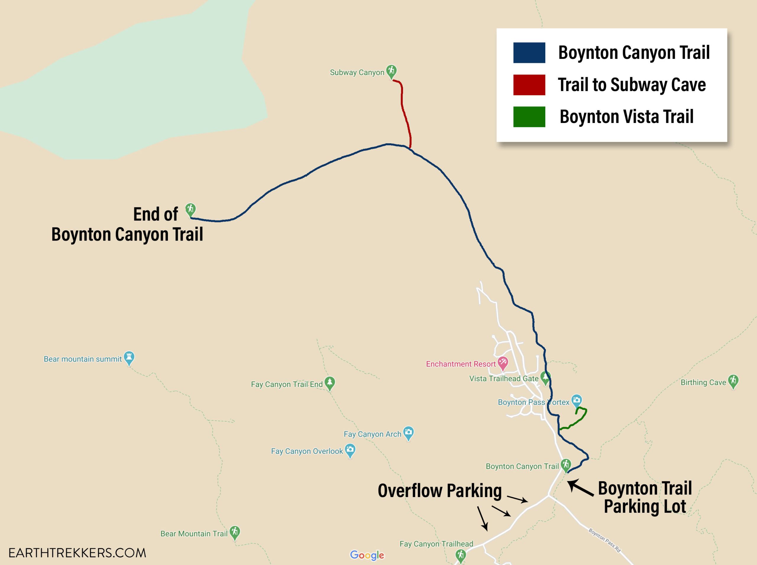
Boynton Canyon is one of Sedona’s top hikes. This is a relatively easy hike, as you walk on a mostly flat trail that is sheltered from the sun. The trail ends at the back of the canyon, where a short climb takes you up to a viewpoint, offering sweeping views of Boynton Canyon.
Along the trail, there are two detours you can take, to make this hike even more memorable. Near the start of the hike, take the short detour on the Boynton Vista Trail for stunning views over the Enchantment Resort and the red rocks of Sedona.
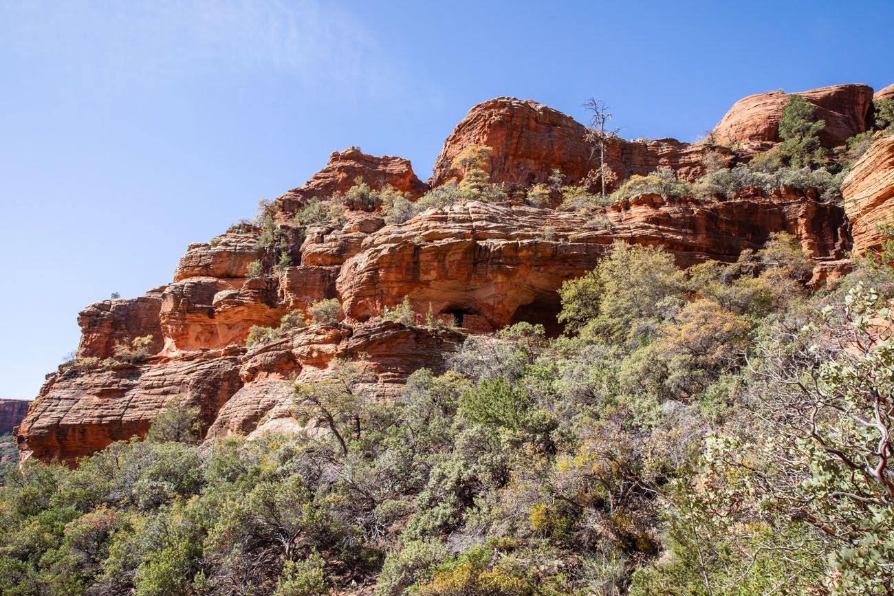
There is also a cave and Sinagua ruins you can visit. This cave, often referred to as the Subway Cave or the Boynton cave, frequently shows up on hiking websites (on All Trails this is the 3rd most popular hike in Sedona at the time that I am updating this) and it is also listed on Trip Advisor. Most of the people we met on the Boynton Canyon trail were hiking this trail with the sole purpose of visiting the Subway Cave.
Hopefully, with our trail description and photos, we can point you in the right direction, to prevent damage to the area by keeping you on the correct trail. Please respect this area, by staying on the trail, leaving artifacts and ruins as you found them, and practicing the seven principles of Leave No Trace.
Boynton Canyon is also the location of one of the four major Sedona vortexes. I read conflicting information about the exact location of this vortex. Vortex Hunters state the vortex is located on the Boynton Vista Trail. Jamie Elder, author of Sedona’s Best Vortex Guidebook, states that many vortexes are located throughout Boynton Canyon. She states that you could spend an entire day exploring offshoots from the main trail to experience these vortexes.
In this post, learn how to hike Boynton Canyon and add on the Boynton Vista Trail and Subway Cave.
Boynton Canyon & Subway Cave Hiking Stats
Boynton Canyon
Distance: 6.3 miles out-and-back
Total Ascent: 800 feet
Difficulty: Easy
Length of Time: 2.5 to 4 hours
Boynton Canyon + the Subway Cave
Distance: 7.1 miles out-and-back
Total Ascent: 1,100 feet
Difficulty: Moderate
Length of Time: 4 to 6 hours
Boynton Canyon + the Subway Cave + Boynton Canyon Vista Trail
Distance: 7.5 miles out-and-back
Total Ascent: 1,300 feet
Difficulty: Moderate
Length of Time: 4.5 to 6.5 hours
More Information:
When to Go: All year. The best time is the spring and fall, when temperatures are mild, but expect big crowds. During the summer, expect very hot temperatures but lower crowds. In the winter, temperatures can get below freezing but crowds are also lower.
Location: West Sedona
Red Rock Pass: You will need to purchase a Red Rock Pass to do this hike. The pass costs $5 per day or $15 for one week. The pass can be purchased at the fee machine at the trailhead (credit cards only). If you have an America the Beautiful Pass, you can use this rather than purchasing a Red Rock Pass.
Please practice the seven principles of Leave No Trace: plan ahead, stay on the trail, pack out what you bring to the hiking trail, properly dispose of waste, leave areas as you found them, minimize campfire impacts, be considerate of other hikers, and do not approach or feed wildlife.
How to Hike Boynton Canyon
Getting to the Trailhead
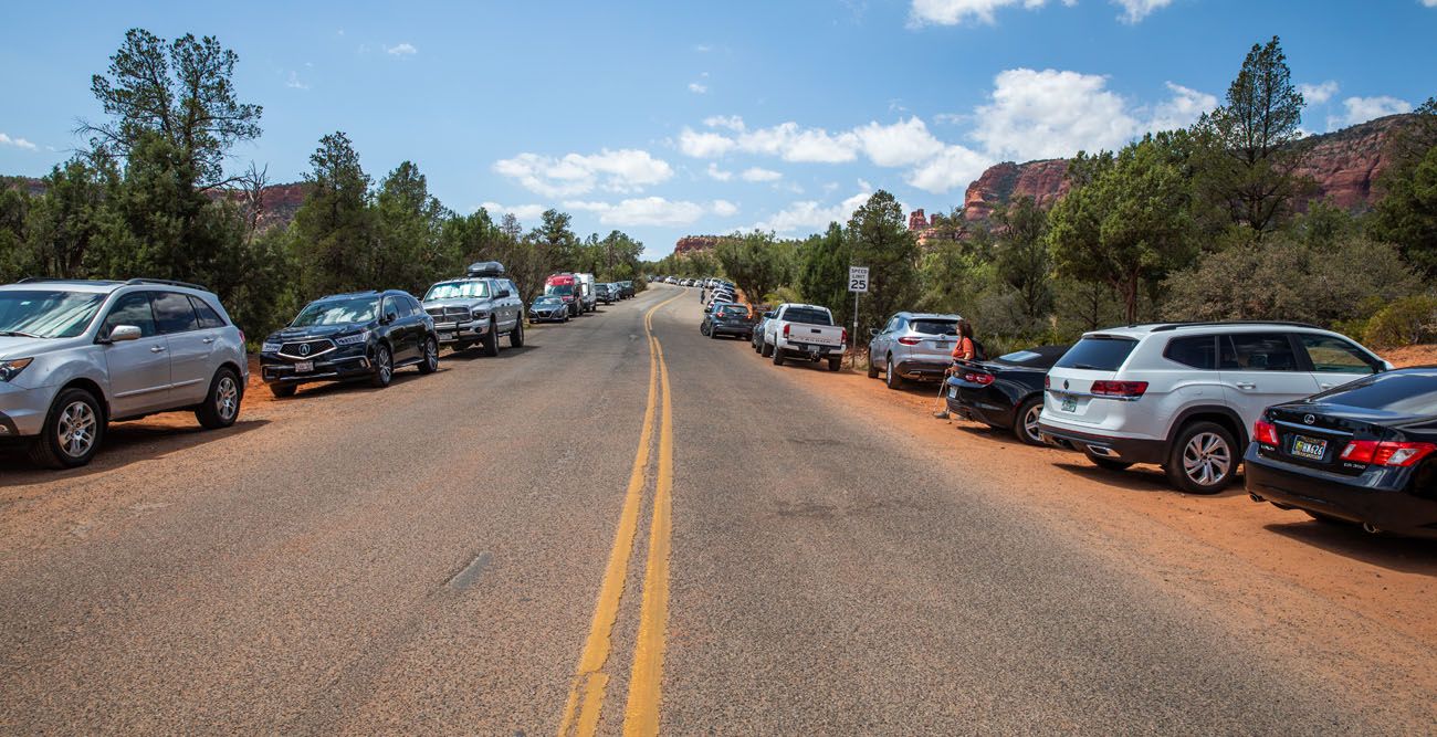
The main parking lot for this hike is located on Boynton Canyon Road, near the intersection with Boynton Pass Road. This lot can hold about 25 vehicles and in the busier months, it is typically filled by 7:30 am. There is a pit toilet in this parking lot.
Overflow parking is located on Boynton Pass Road, west of the intersection with Boynton Canyon Road. There is no parking lot here. You will simply park on the side of the road. If you park here, you still need to display a Red Rock Pass in your vehicle. Depending on how far up the road you park, it is about a 0.25 mile walk, or longer, to the trailhead.
Here is a photo of the parking area on Boynton Pass Road midday in April.
The trailhead is located in the main parking lot and it easy to find. Just look for the large trail sign. Before starting down the trail, you can take a photo of the map with your phone and refer back to it if necessary.
On the Trail
The hike starts off flat and fast. It doesn’t take long until you reach the first trail junction. Stay to the left to stay on the Boynton Canyon Trail (this is marked with a trail junction sign).
Boynton Vista Trail
0.3 miles into the hike you will arrive at the junction for the Boynton Vista Trail.
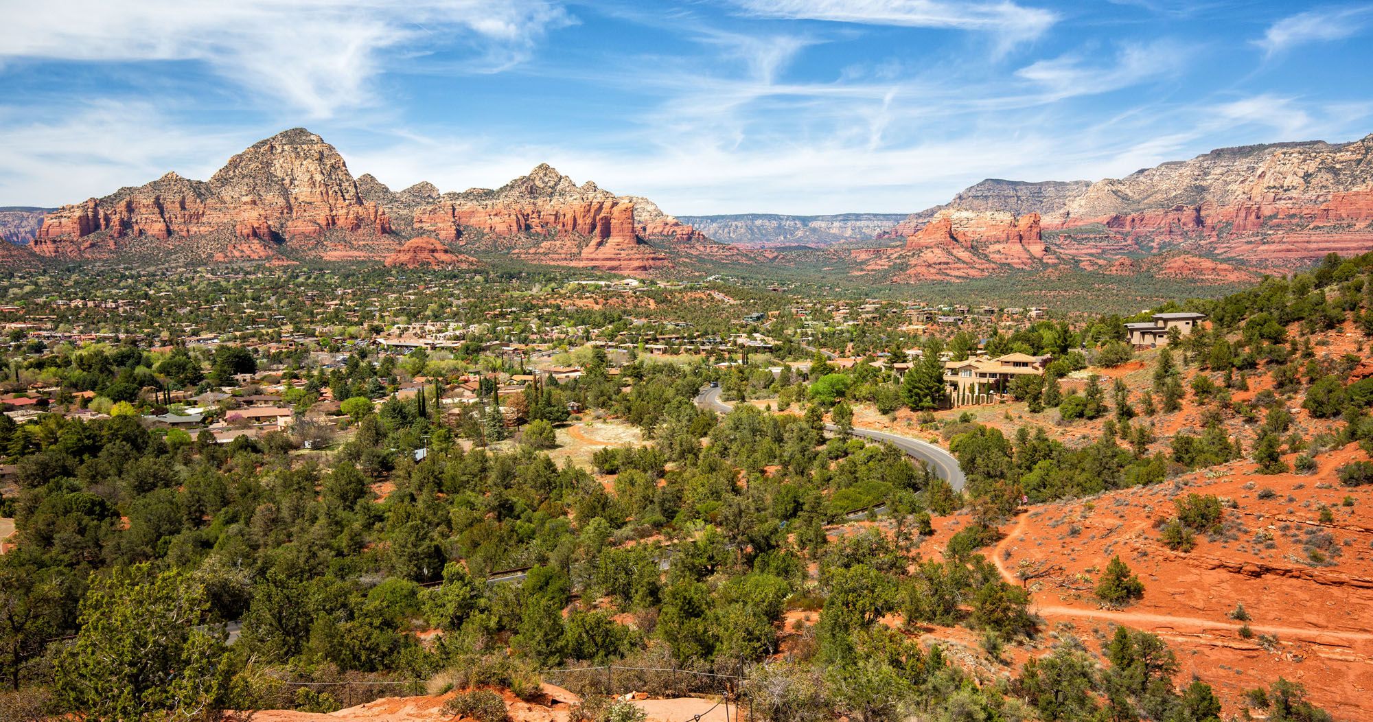
The Boynton Vista Trail is 0.4 miles round trip. It’s a moderate to strenuous hike up onto the red rocks but it is worth it. The views over the Enchantment Resort and the crimson mountains of Sedona are gorgeous. You also get a great view through Boynton Canyon, where you will be heading next.
This detour takes 30 to 45 minutes.
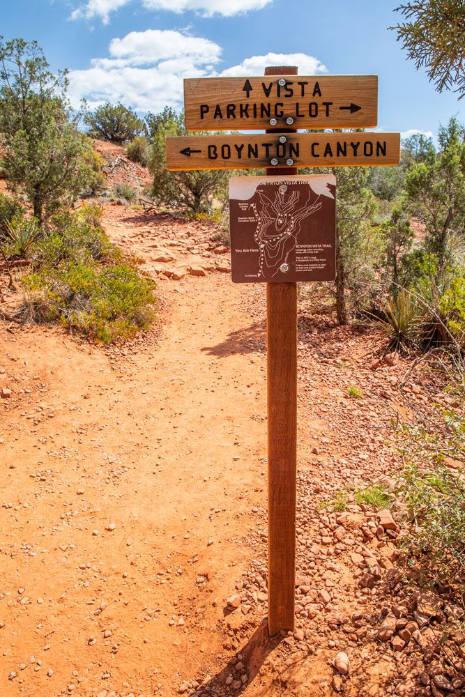
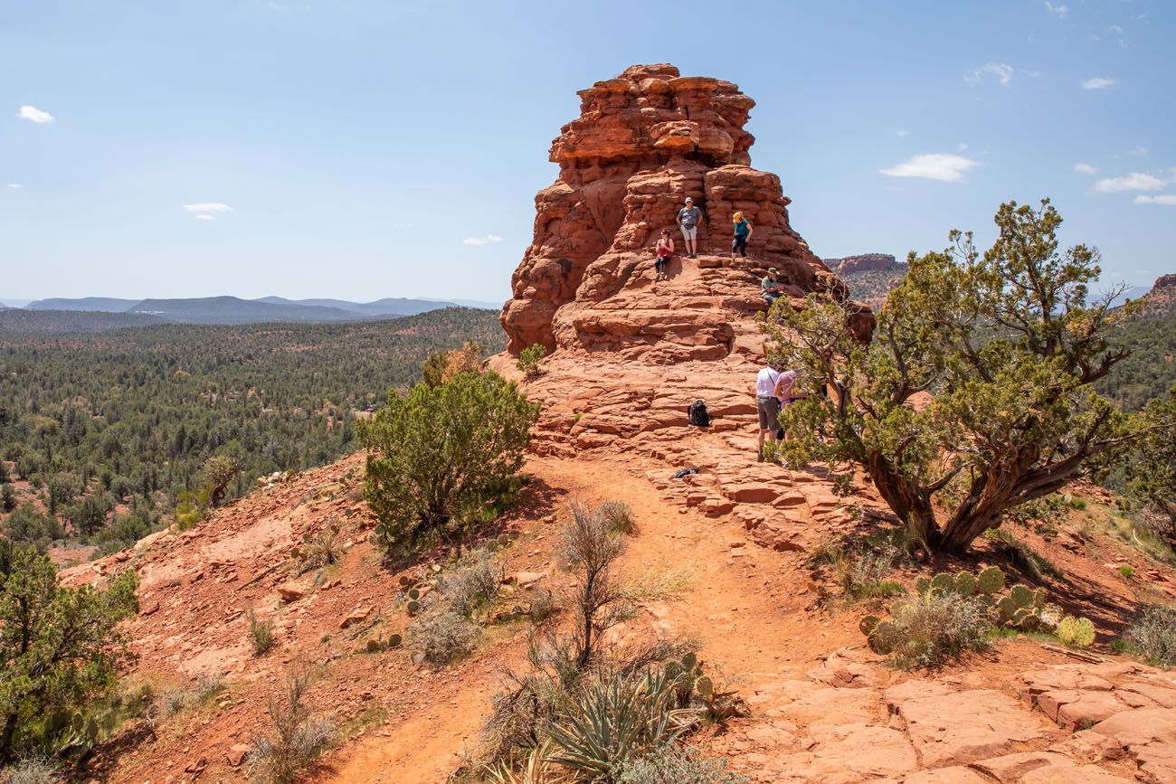
PRO TRAVEL TIP: You can do this spur trail at the beginning or the end of the hike. We saved it for the end of the hike. Since we started very early in the morning, Boynton Canyon was still shaded. Midday, when the sun is higher in the sky, is a better time for photography.

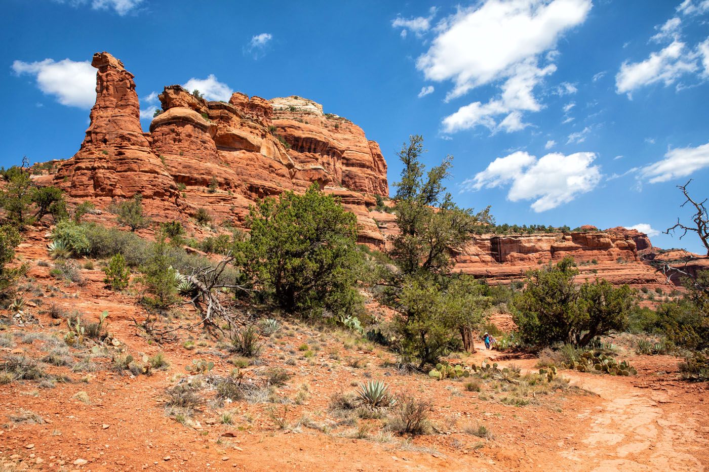
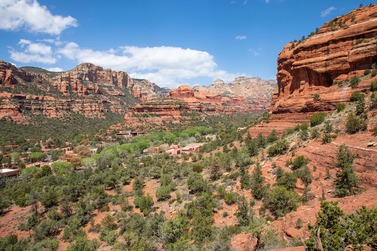
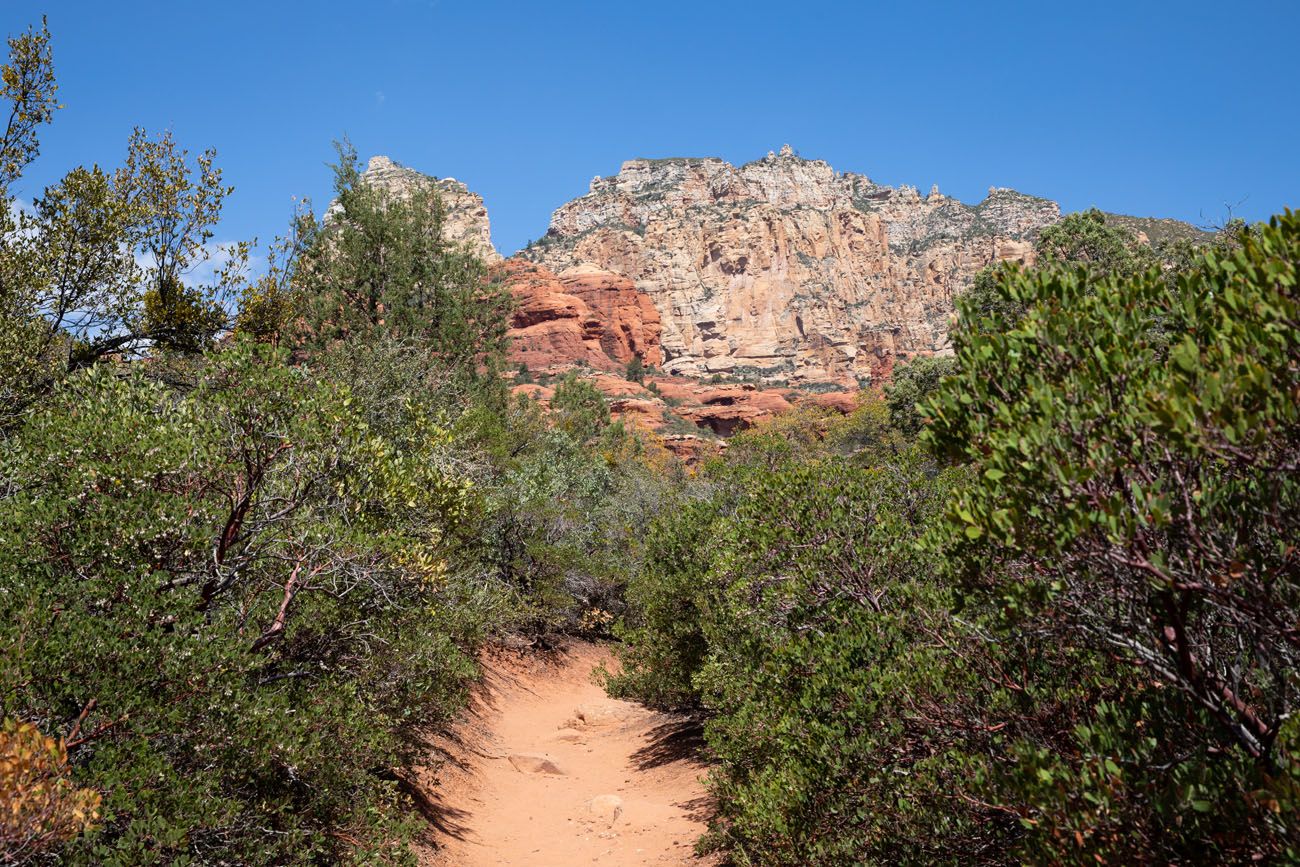
Through Boynton Canyon
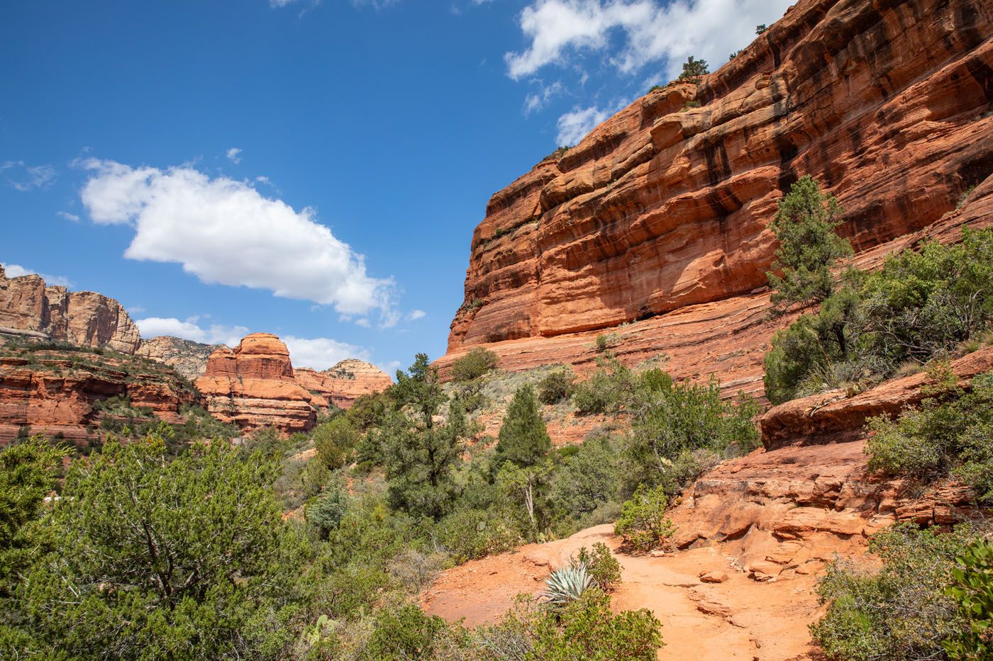
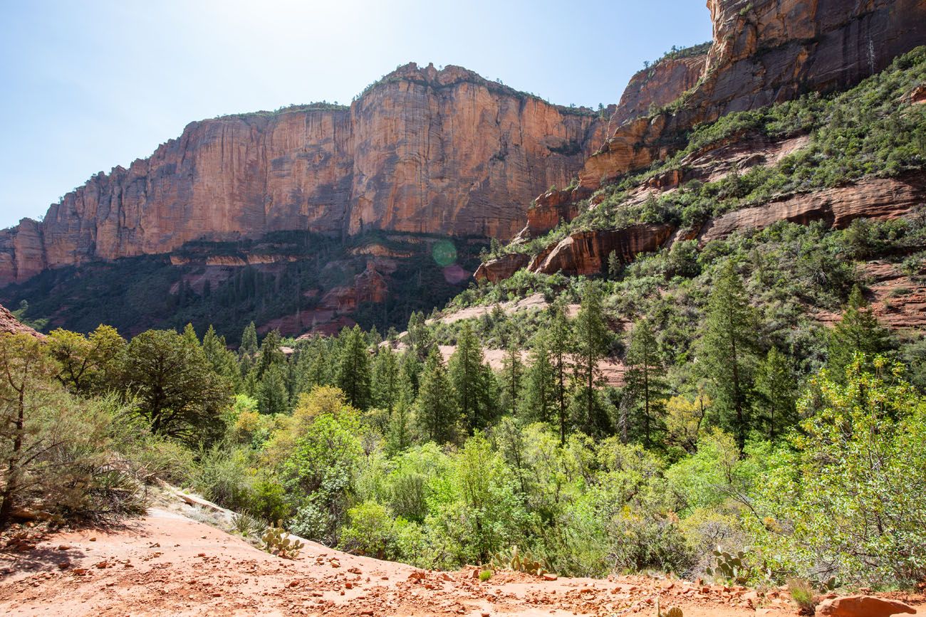
The first mile through Boynton Canyon is beautiful. To your right, massive sandstone cliffs tower overhead. To your left is the Enchantment Resort. At times, the trail opens up even more and you will have a wonderful view down Boynton Canyon.
There will be a few short ups and downs on this part of the trail but it is nothing too strenuous.
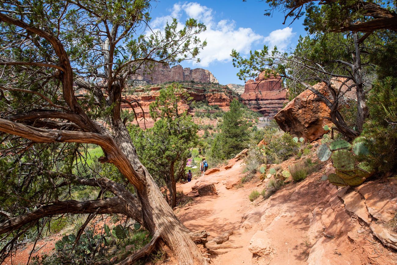
About a mile into the hike, you pass the far end of the Enchantment Resort. Now you are hiking on a sandy trail through short, shrubby trees.
The Subway Cave
The trail to the Subway Cave is located at the 2 mile point (if you already hiked the Boynton Vista Trail, the trail to the cave will be located 2.4 miles into the hike).
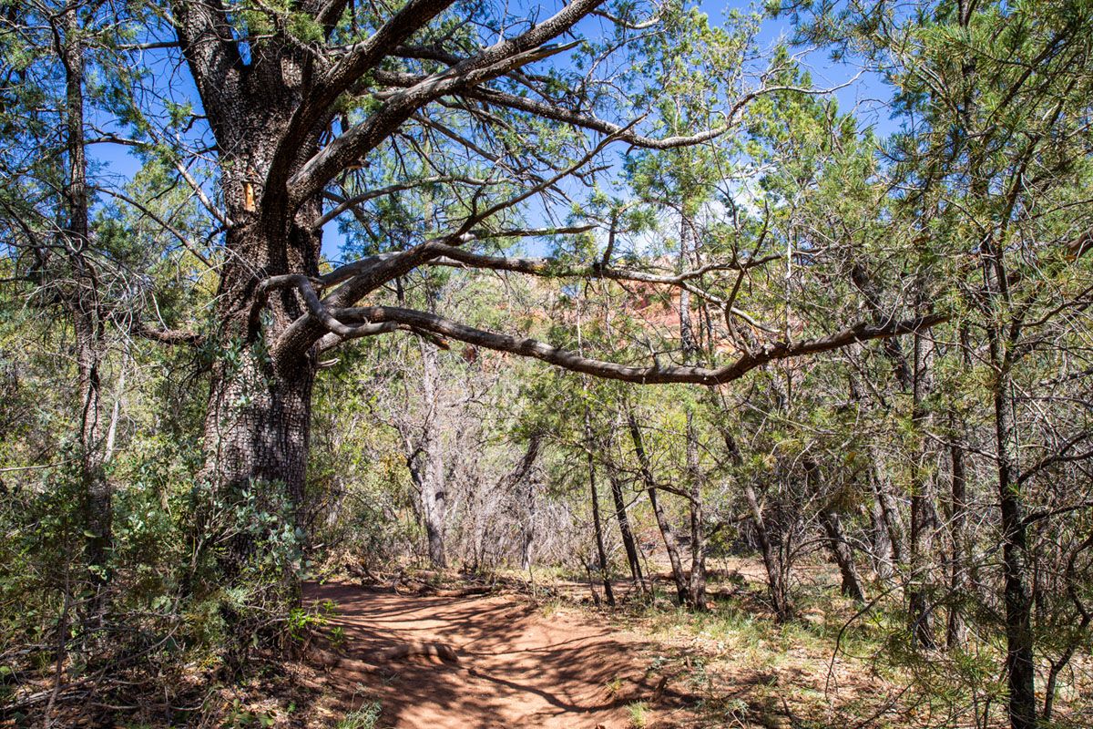
There is no sign marking the trail to the cave. However, there is a very distinctive tree. As you approach the 2 mile mark, keep an eye out for a large Alligator Juniper tree. This tree will be on the left side of the trail. The spur trail to the Subway Cave starts just across the trail from the tree, on the right hand side of the trail.
Here is a photo of the tree and the trail. Study it. Memorize it. Screenshot this image on your phone so you know what to look for.
Once you get to the tree, take the trail to the right. This trail is narrower than the main Boynton Canyon Trail, but it is easy to follow. It heads through the forest and gradually climbs up to the red cliffs. This trail is 0.4 miles, one-way, to get to the Subway Cave.
Note: If you miss the turn off for the spur trail, you know you have gone too far if you find yourself surrounded by tall pine trees. Just beyond the Alligator Juniper, the forest makes a noticeable change from short, shrubby trees to a forest filled with pine trees. It looks and smells much different from the first two miles of the hike.
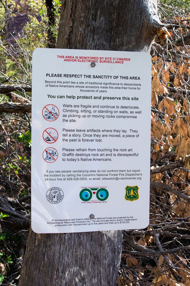
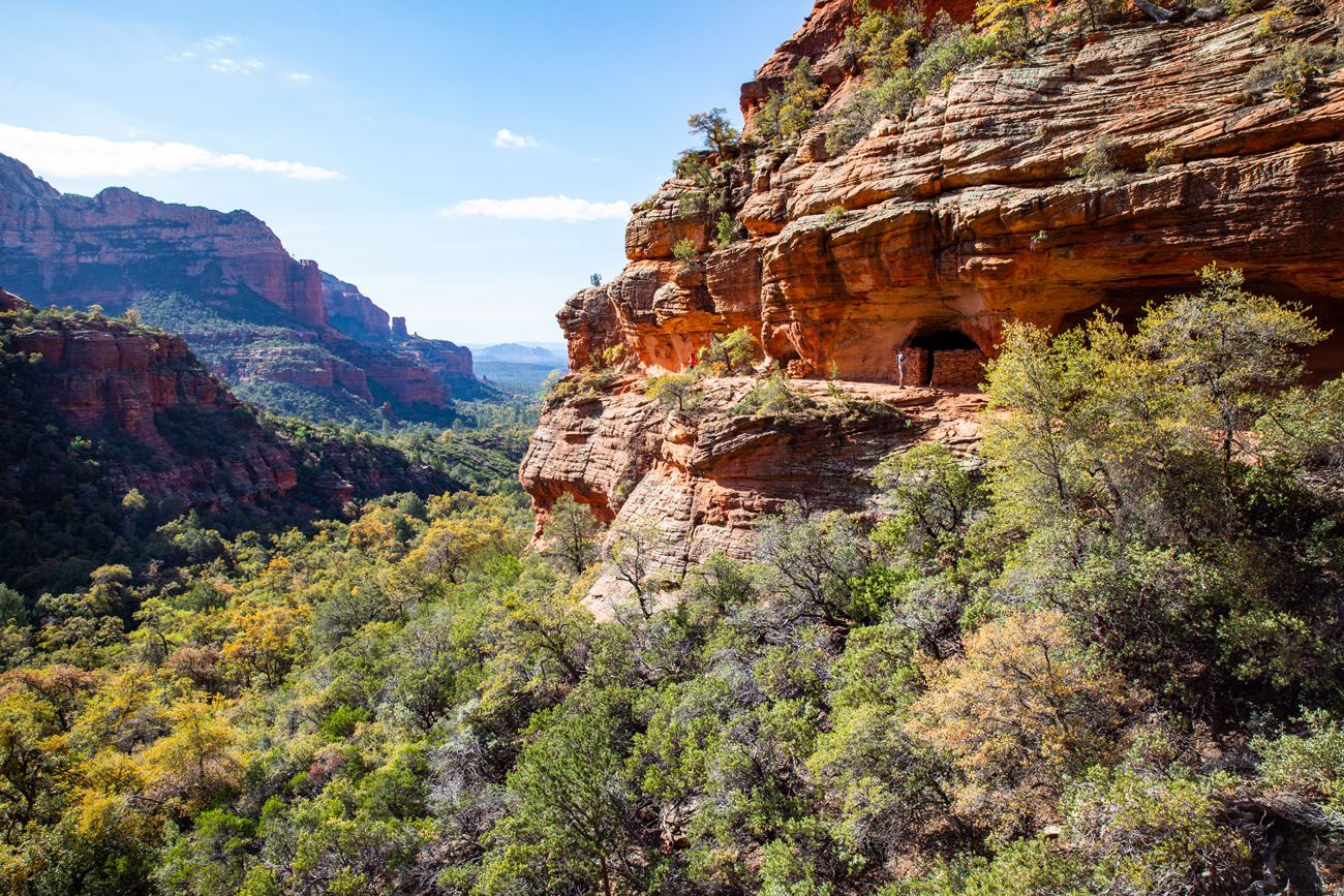
As you hike to the cave, you will pass this sign posted by the National Forest Service. Take a moment to read it. You will be visiting a sacred site with ancient ruins. Respect the area, leave everything as you found it, and do not disturb the ruins or sit or stand on the rock walls.
In the Subway Cave
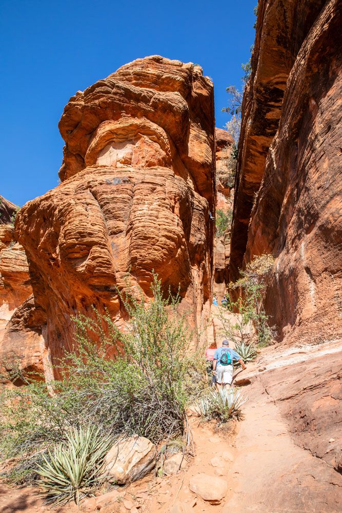
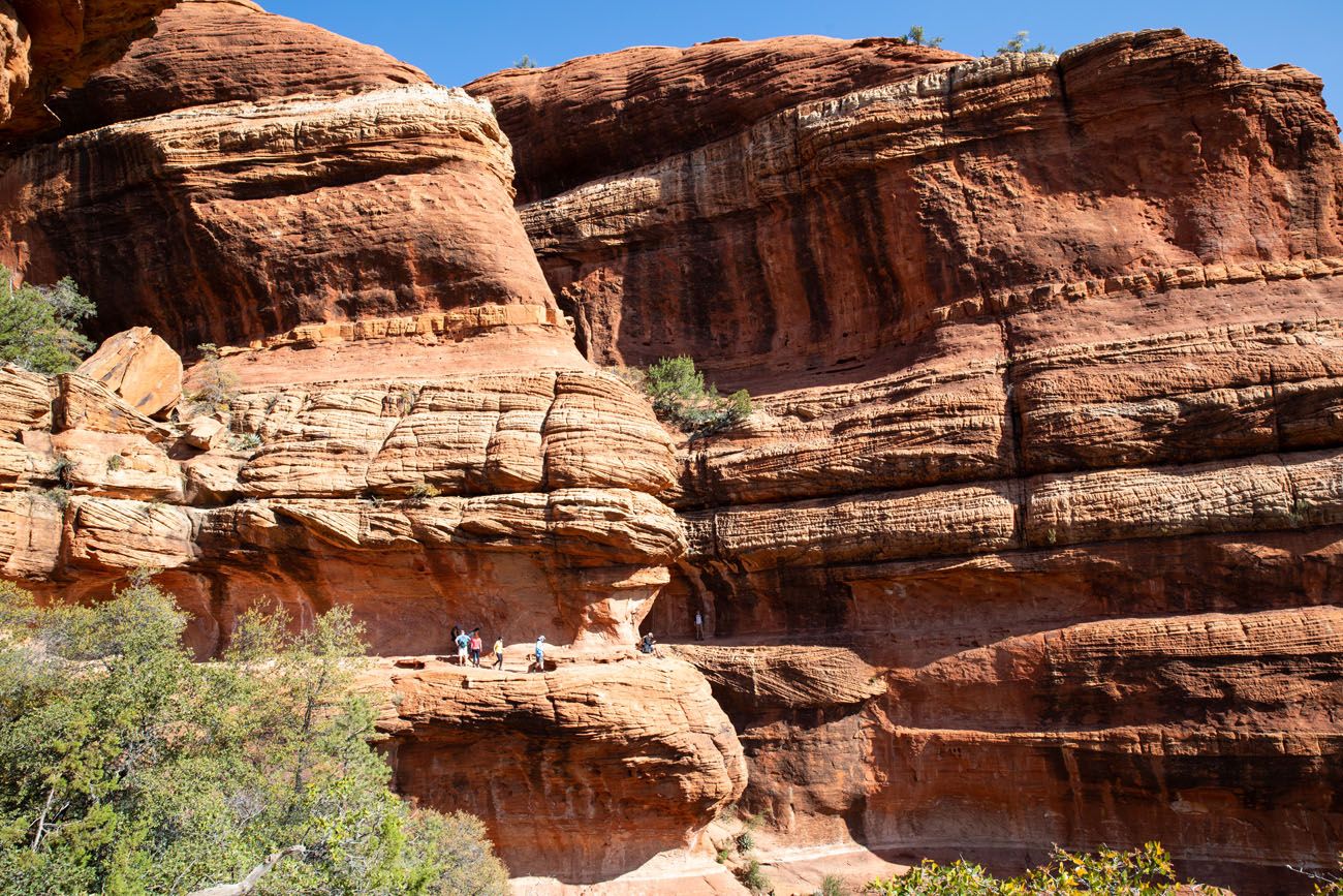
From the ground, the Subway Cave looks like a narrow slit in the sandstone walls.
Entrance into the cave.
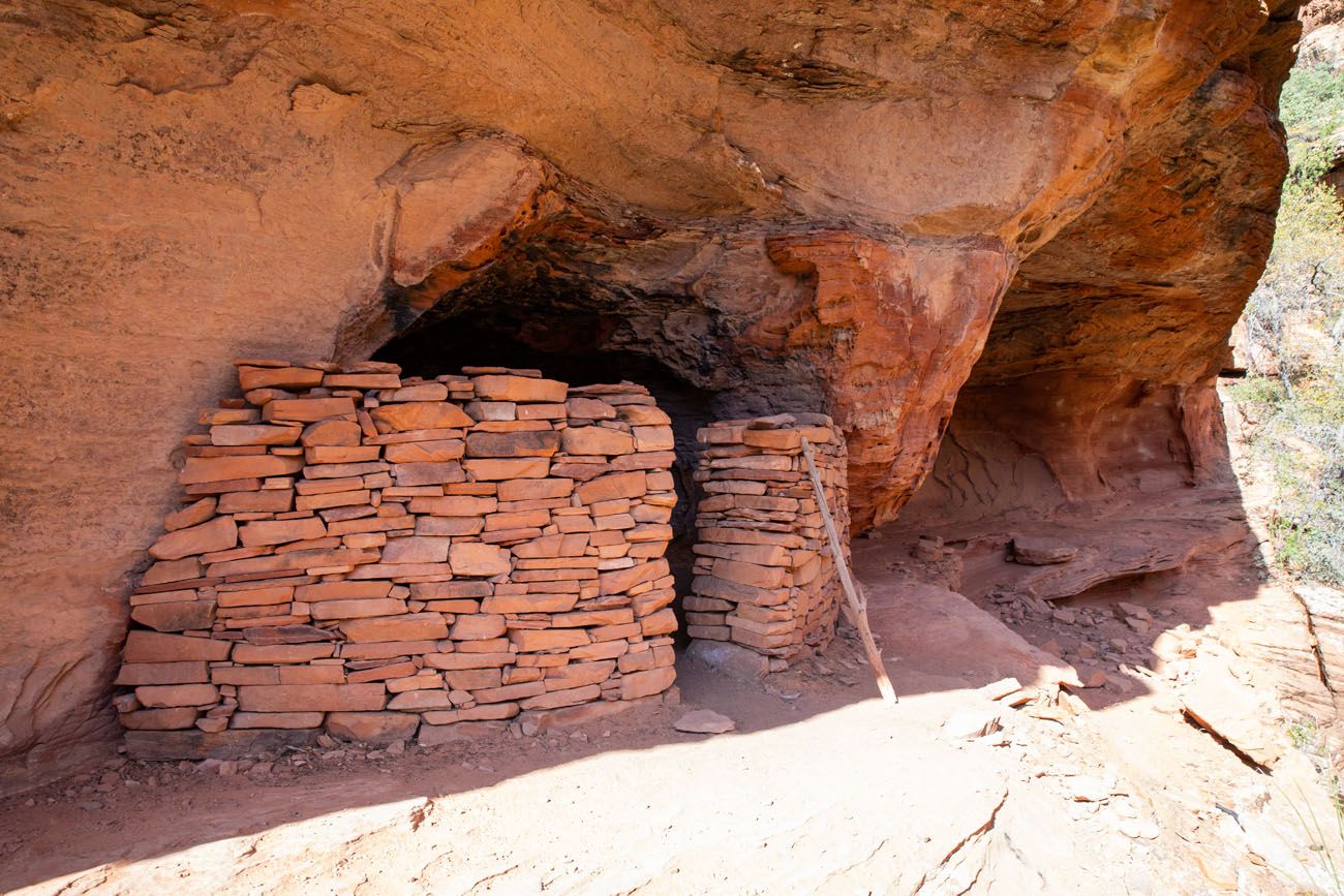
Looking up at the ruins on the cliffs. You can walk to the ruins from the Subway Cave.
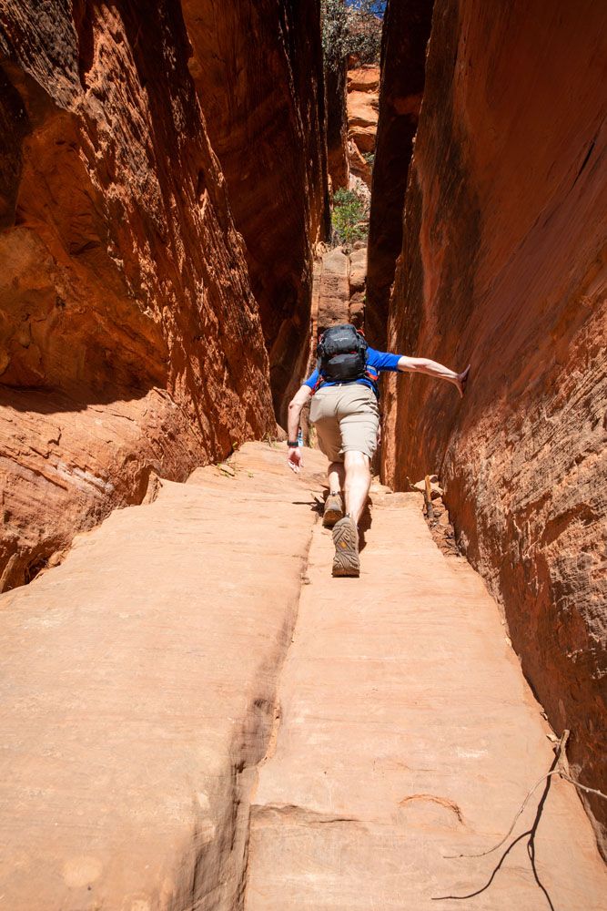
To get up into the cave, you will walk/rock scramble up the sandstone incline, which almost resembles a sliding board (and it might feel that way on the way back down). This is the trickiest part of the hike.
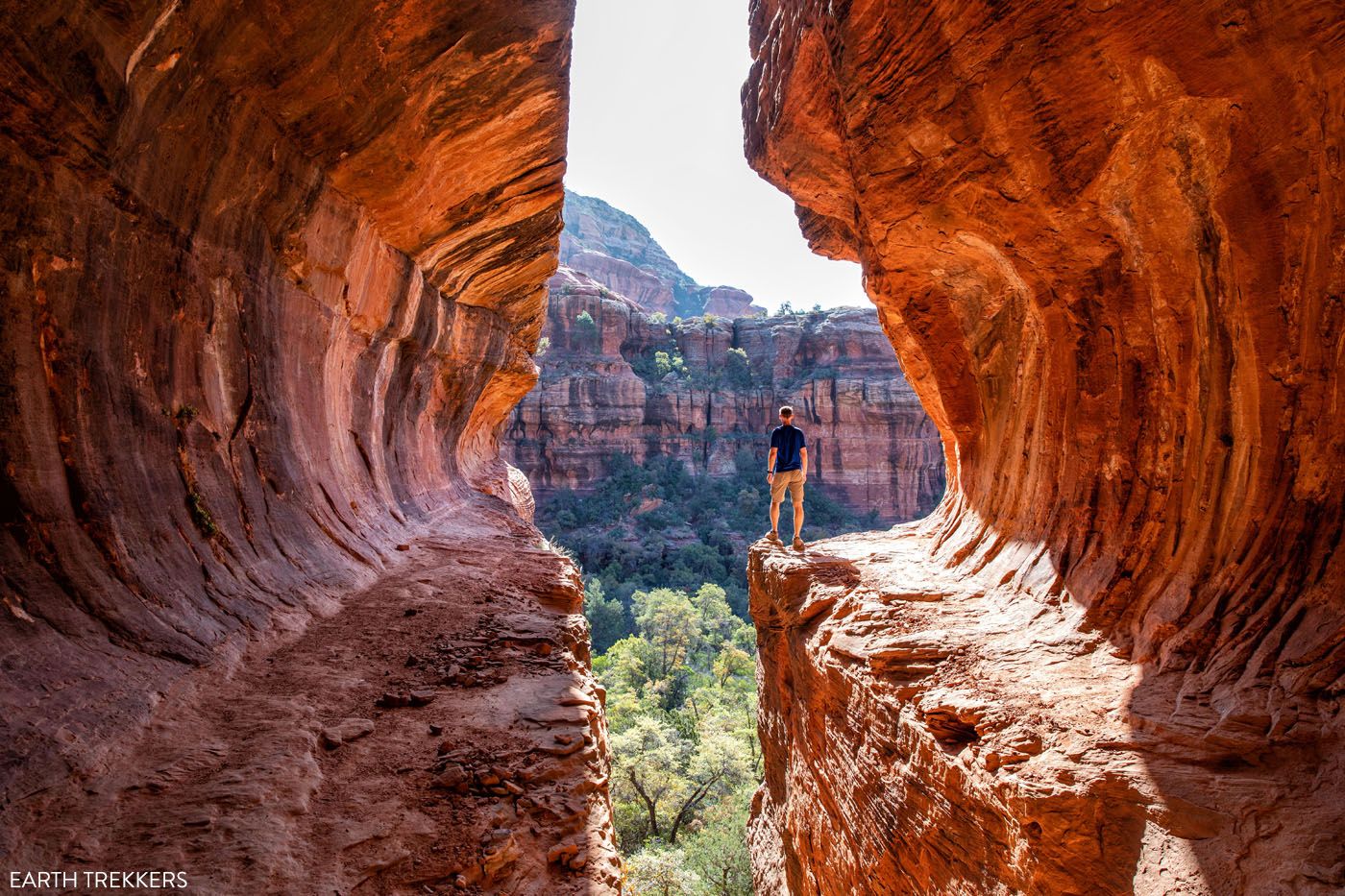
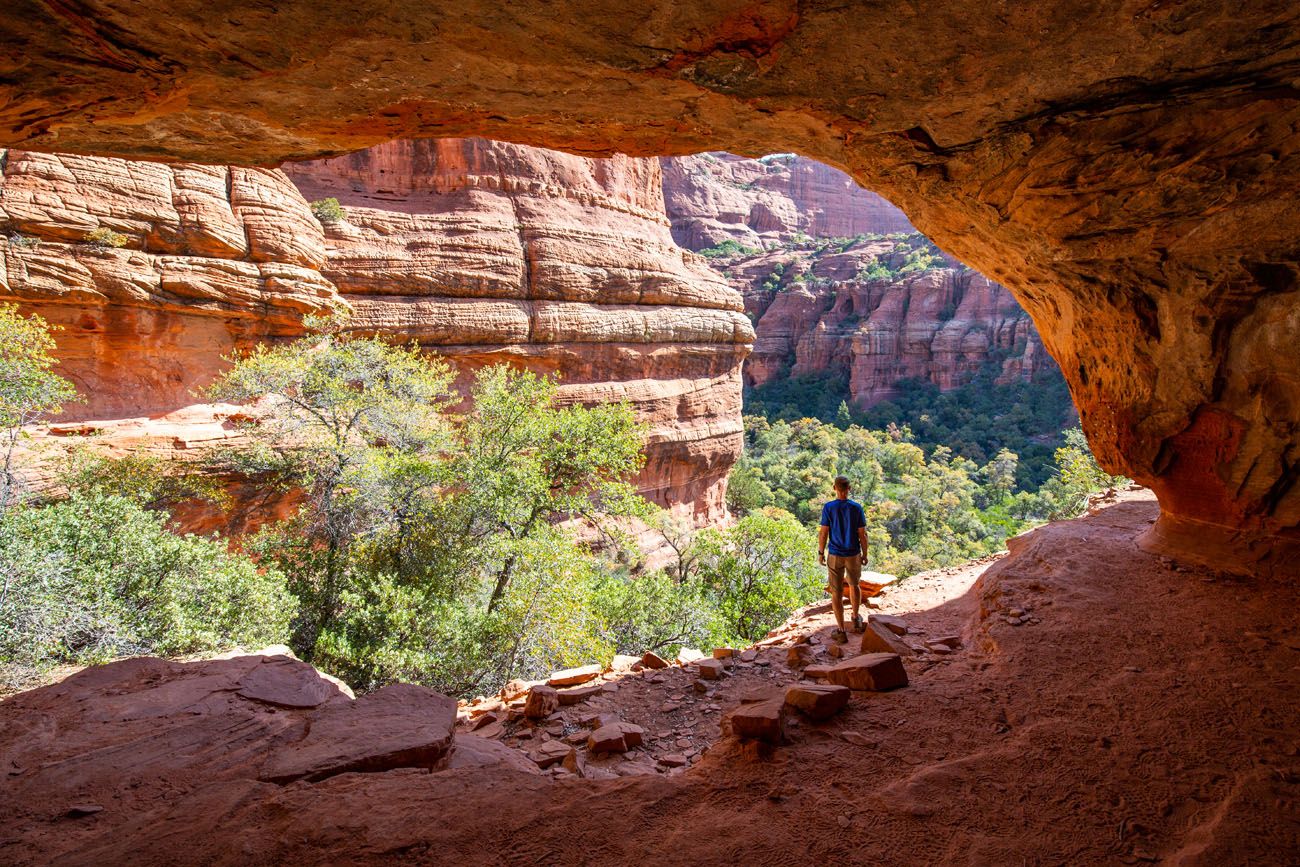
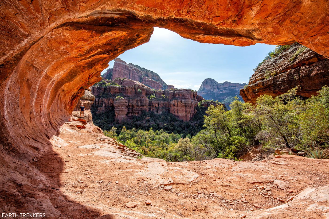
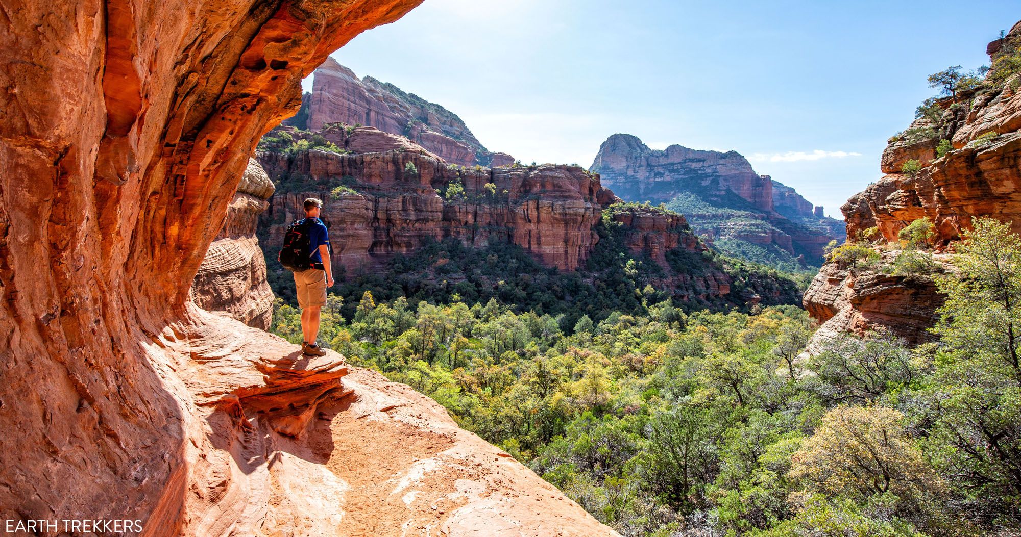
The incline ends at the back of the cave. Once you turn around, this is your view.
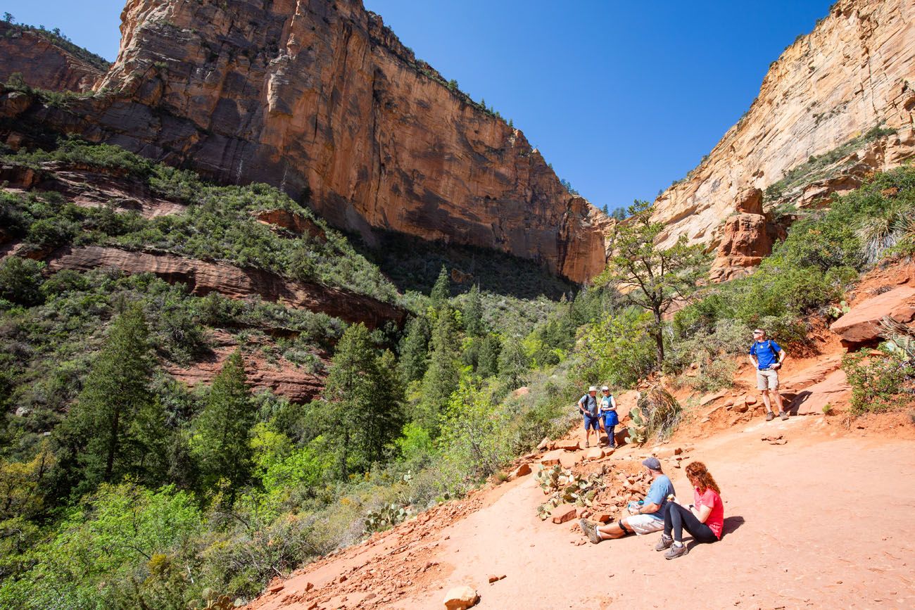
Most likely, you will be sharing this visit with many more people, unless you are doing this very early in the day or during the off season. We spent about an hour here, waiting for our turn for photos and exploring the Sinagua ruins.
If you have a fear of heights, you might not want to venture farther than the back of the cave. To walk out to the end of the cave, and to continue to the ruins, you will be walking on a narrow ledge with a drop-off on one side.
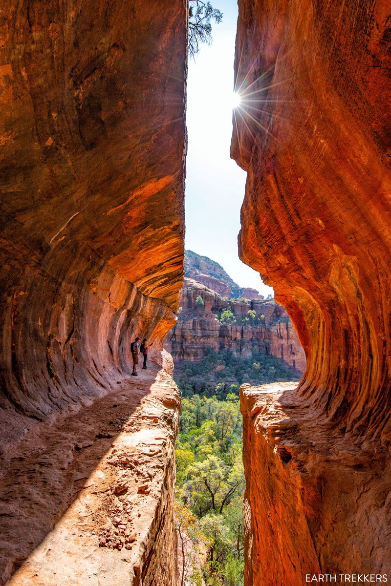
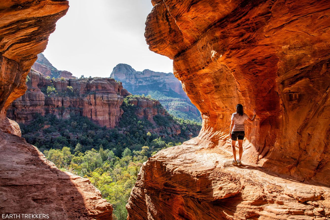
To see the ruins, walk out onto the ledge on the right side, continue around the bend, and the trail continues along the canyon wall. There are a lot of great photo spots here. Just remember, do not disturb the rock walls.
As you walk around the ledge on the outside of the cave, this is the view of the canyon and the ruins on the opposite cliff.
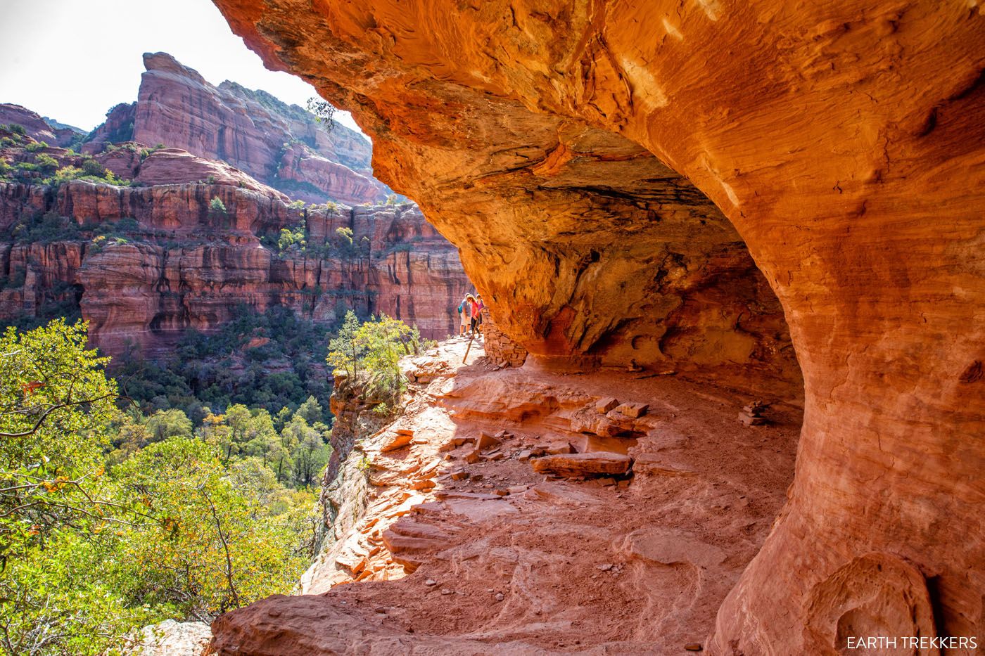
Looking back at the mouth of the Subway Cave.
There are several caves on the cliffs which make great photo spots.
To exit the Subway Cave, you will hike down the incline at the mouth of the cave.
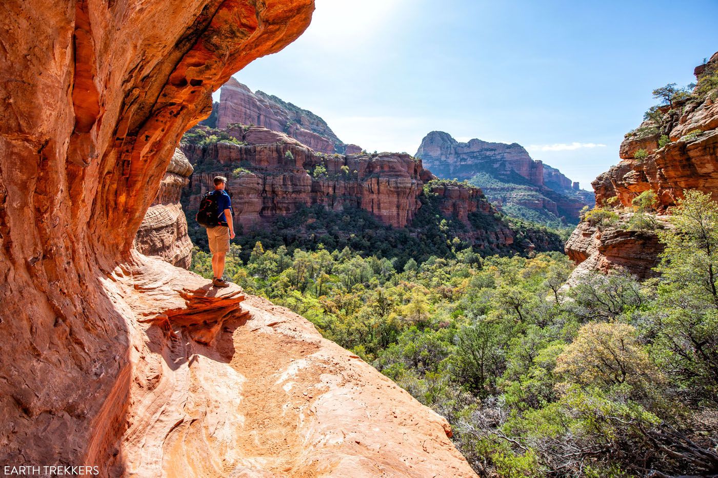
To Boynton Canyon Overlook
Once back on the Boynton Canyon Trail, turn right to continue the hike to the end of Boynton Canyon. From here, it is just over one mile to get to the end of the trail.
The trail slowly and steadily continues its climb to the back of the canyon. This final mile is all uphill, with the last half-mile being the steepest.
For this part of the hike you will walk through the forest. At first you hike through a forest filled with ponderosa pine trees. It feels cooler here and smells wonderful. As you get higher, the ponderosa pine trees fade away and are replaced with maple and oak trees.
The final half-mile is the most strenuous of the hike, as you hike up to the final viewpoint. There will be short sections where you will hike up a steep, rocky trail and do a few stair climbs.
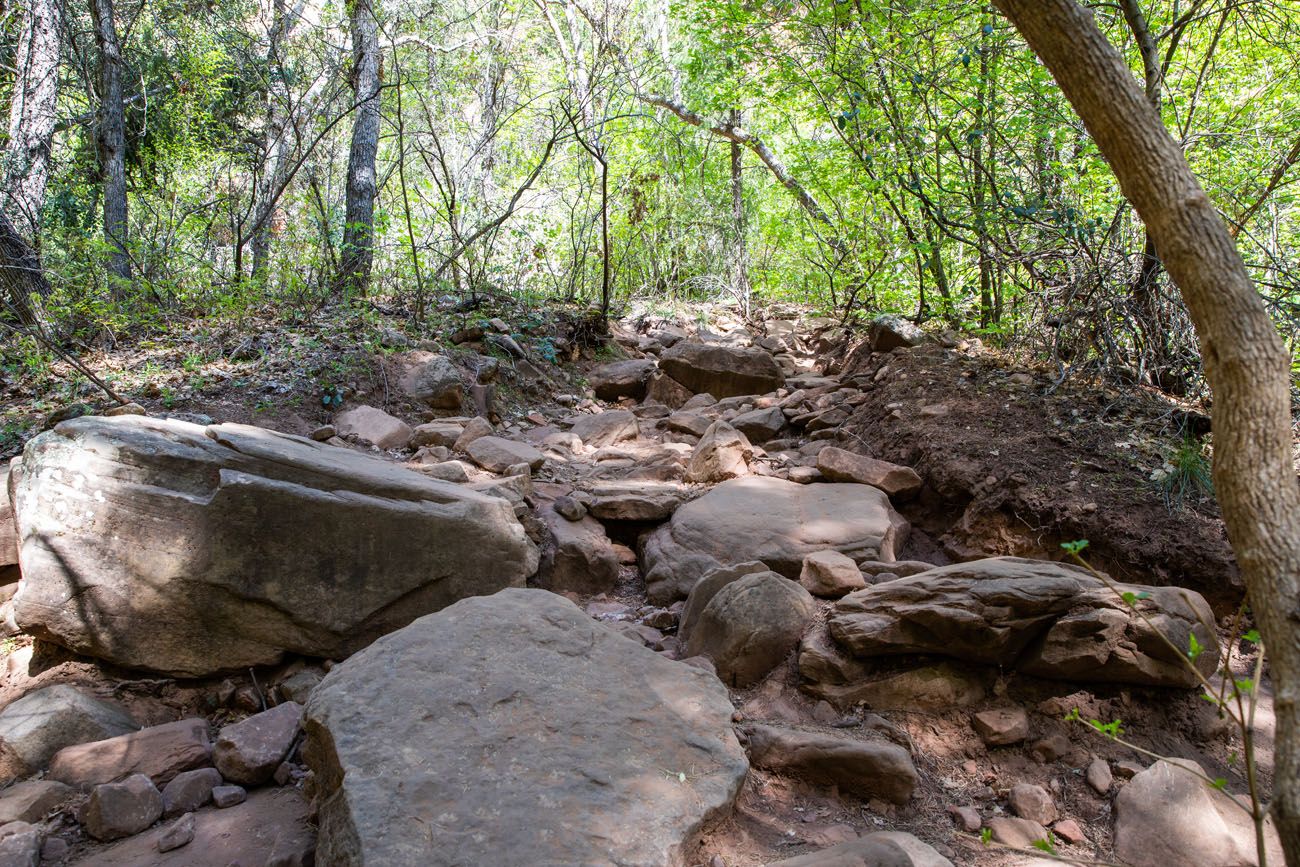
The rocky trail near the end of the canyon.
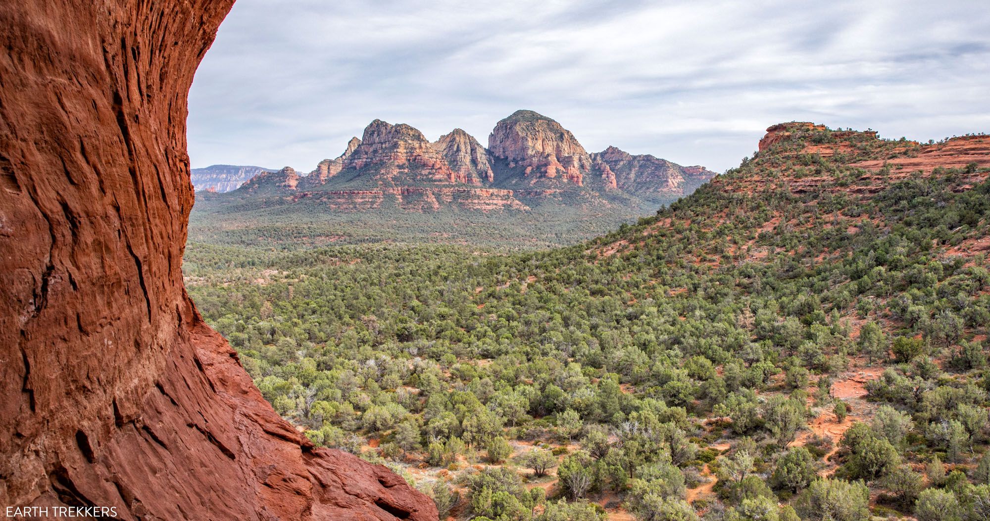
The trail ends at a wide plateau where you have a very nice view back down through Boynton Canyon.
To finish the hike, retrace your steps back through Boynton Canyon. Add on the Boynton Vista Trail if you did not do this yet…and if you still have the energy.

Tips to Have the Best Experience
Start the hike early, ideally by 7 am. By starting early, you can get one of the parking spaces in the trailhead parking lot. You will also get ahead of the crowds and hike in the cooler part of the day.
Leave No Trace. Practice the seven principles of Leave No Trace. This includes packing out what you bring to the hiking trail, be considerate of other hikers, and leaving archaeological artifacts as you found them.
Be prepared to spend at least one hour at the Subway Cave. This has become a popular hiking destination in Sedona, so expect to wait to have your photo taken.
What to Bring on the Hike
Hiking shoes. You can get by with a good pair of walking shoes or running shoes for this hike. However, if you plan to hike to the Subway Cave, I recommend wearing hiking shoes. The extra traction on hiking shoes will make your climb up into the cave and on the cave ledges much easier and safer.
Water and snacks. Bring at least 2 liters of water in the summer.
Sunscreen, hat, and sunglasses. A lot of the trail is shaded, but you will be exposed to the sun at the Boynton Canyon viewpoint (at the end of the trail), on the first mile of the hike, and if you do the optional hike on the Boynton Vista Trail.
Camera. Even a smartphone will do.
If you are new to hiking or are curious about what you should bring on a hike, check out our Hiking Gear Guide. Find out what we carry in our day packs and what we wear on the trails.
If you have any questions about hiking Boynton Canyon or the Subway Cave, let us know in the comment section below.
More Information about Sedona
SEDONA: Get links to all of our articles in our Sedona Travel Guide. To help you plan your visit, we also have guides to the best things to do in Sedona, the best hikes in Sedona, and how to plan the perfect Sedona itinerary. Learn where to stay in our Sedona Hotel Guide.
HIKES IN SEDONA: Some of the top trails in Sedona include Devils Bridge, Bell Rock and Courthouse Butte, Cathedral Rock, and the Brins Mesa – Soldier Pass Loop. For more ideas, read our guide to the Best Hikes in Sedona.
SEDONA ITINERARY: To help you plan your time, check out our One Day in Sedona Itinerary and Sedona Itinerary Ideas for 1 to 6 days.
SEDONA 4WD ROADS: One of the best things to do in Sedona is to drive the 4WD roads. Here are six 4WD roads in Sedona to choose from and a detailed guide on how to drive Broken Arrow, the most popular 4WD experience in Sedona.
ARIZONA ITINERARIES: If you are looking for road trip ideas through Arizona, we have a couple of good ones. See the highlights of Arizona in our 10 Day Arizona Itinerary, visit the Grand Canyon and Utah’s Mighty 5 in our Two Week American Southwest Itinerary, and visit parts of Arizona, Las Vegas, and southern Utah in our 10 Day American Southwest Itinerary.
We have TONS more information about Arizona in our Arizona Travel Guide. You can also read all of our articles about the United States in our United States Travel Guide.

Note: This post contains affiliate links. When you make a purchase using one of these affiliate links, we get paid a small commission at no extra cost to you.
All rights reserved © Earth Trekkers. Republishing this article and/or any of its contents (text, photography, etc.), in whole or in part, is strictly prohibited.
Comments 32
Hi! Most comments about the recommended hikes advise to go ‘early’ to help avoid the crowds. Is there a time that the parking lot opens or is it open 24/7 for Boynton Canyon? Thanks!
Author
Yes, this is a hike that you should start early (7 am or earlier). The parking lot is open 24 hours a day. Have a great hike! Cheers, Julie
Heading to Sedona last week of May. I appreciate your detailed but succinct description.
The 6 miles that you talked about – is that return or one way?
Author
That is for the return hike (out-and-back). Thanks for pointing that out, I’ll clarify it in the article. Cheers, Julie
The six miles would be back and forth not one way.
Thanks for the detailed description. very helpful !
Hi! Thank you for all your Sedona tips. We’re using your blog religiously to plan our Spring trip. If you had to choose between Boynton Canyon with the Subway Cave or Soldiers Pass, which hike would you choose?
Author
Hello Amy. Both are great hikes but we liked Boynton Canyon more. The Subway Cave is really nice to see and continuing onto Boynton Canyon is great too. Have a great time in Sedona! Cheers, Julie
Thank you for the detailed information about the hike! Looking forward to getting there sometime this week. Wondering if you could give an estimate of how wide the ledges are in Subway Cave?
Author
If I remember correctly, they are about 4 feet wide.