
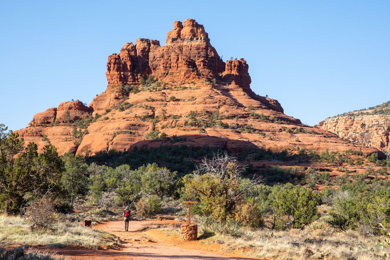
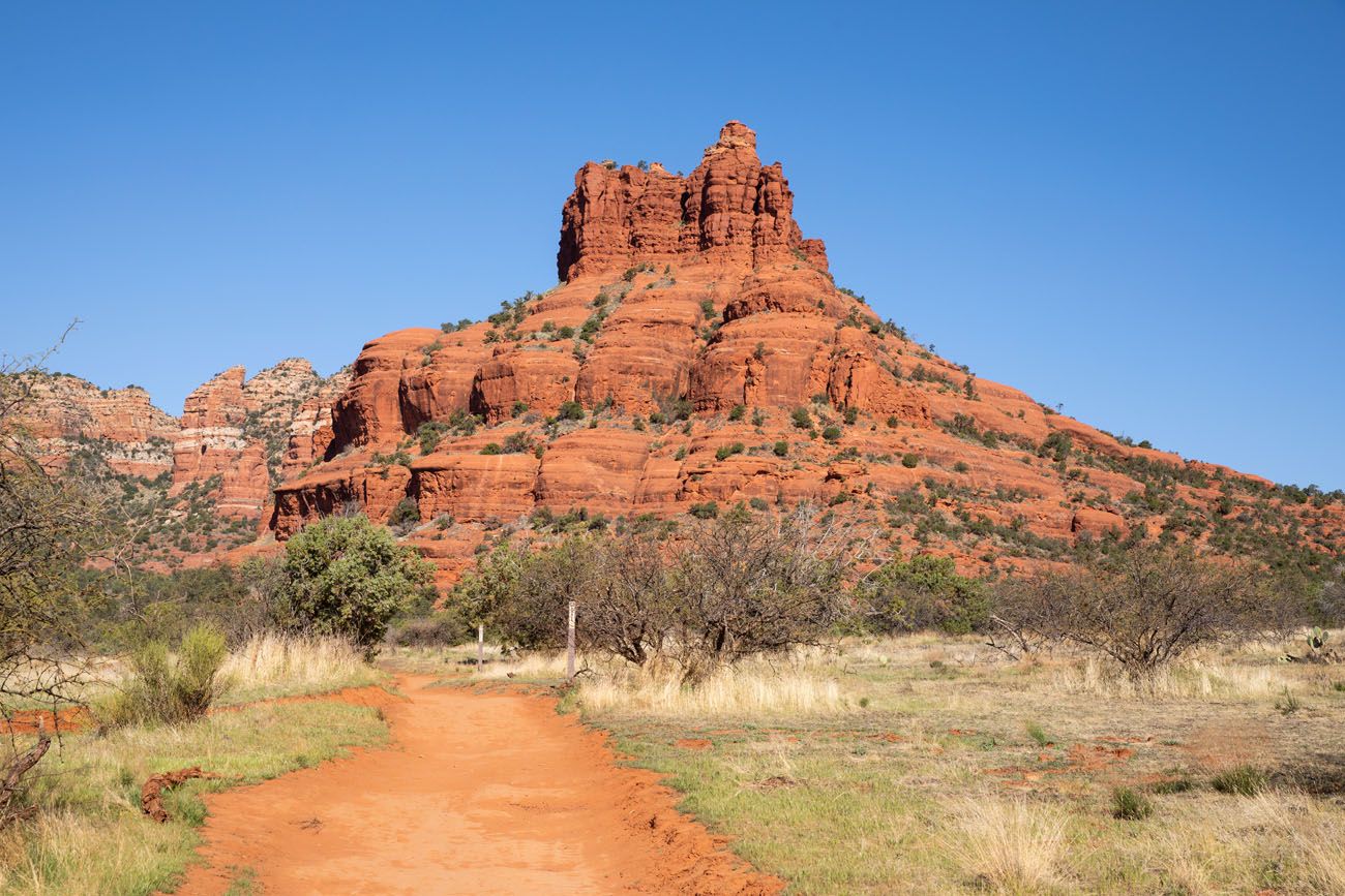
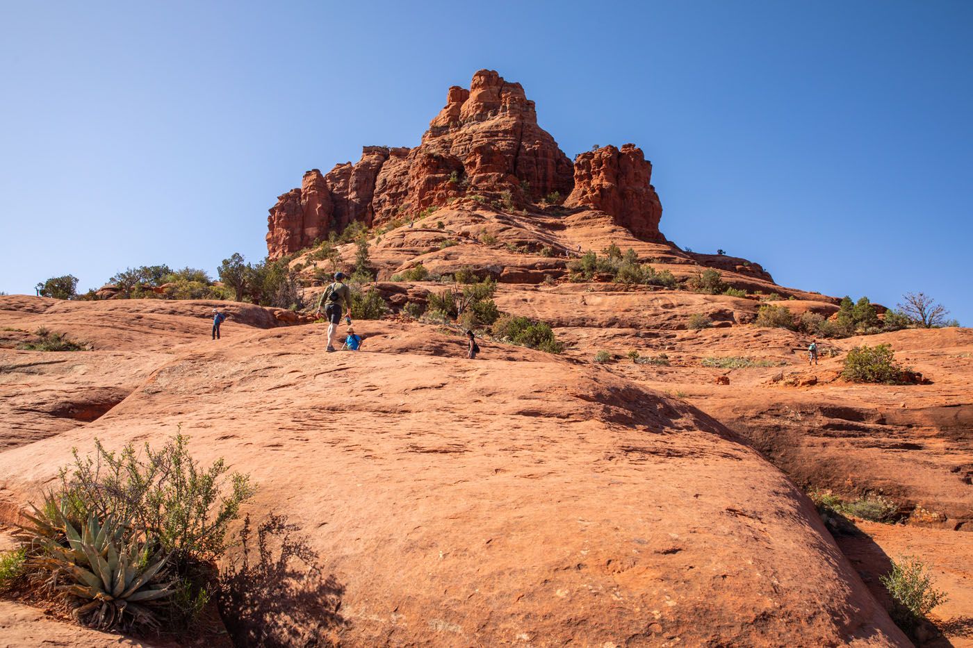
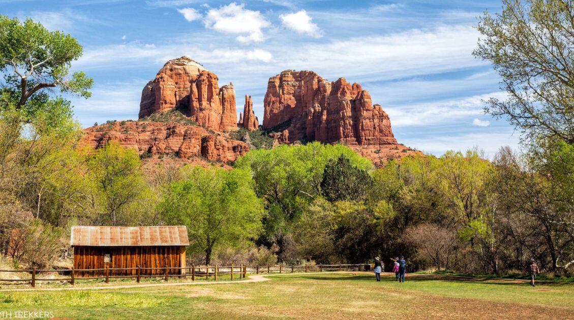
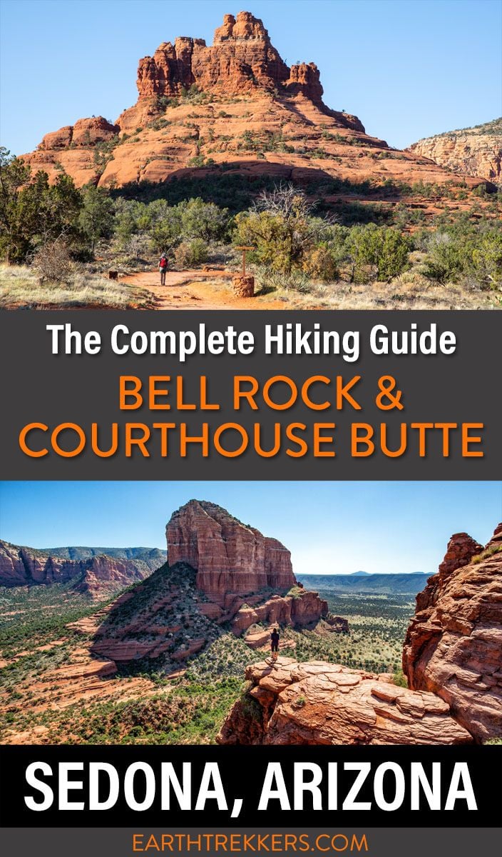
If you are looking for an easy hike with great views of two of Sedona’s most iconic formations, Bell Rock and Courthouse Butte, then put the Bell Rock and Courthouse Loop Butte Trail on your to do list.
This hike is done as a loop, so your views are always changing. It’s a relatively flat hike so it’s great for all ages and ability levels. At the end of the hike, you have the option to add on the climb up Bell Rock, which we highly recommend. The views are phenomenal!
Bell Rock Hiking Stats
Bell Rock and Courthouse Butte Loop Trail
Distance: 4 miles
Total Elevation Gain: 400 feet
Difficulty: Easy
Length of Time: 1.5 to 2.5 hours
Bell Rock and Courthouse Butte Loop Trail + Bell Rock Climb
Distance: 4.6 miles
Total Elevation Gain: 800 feet
Difficulty: Moderate
Length of Time: 2 to 4 hours
Bell Rock Climb Only
Distance: 1 mile
Total Elevation Gain: 400 feet
Difficulty: Moderate
Length of Time: 1 to 2 hours
More Information
When to Go: All year. The best time is the spring and fall, when temperatures are mild, but expect big crowds. During the summer, expect very hot temperatures but lower crowds. In the winter, temperatures can get below freezing but crowds are also lower.
Location: Village of Oak Creek
Red Rock Pass: You will need to purchase a Red Rock Pass to do this hike. The pass costs $5 per day or $15 for one week. The pass can be purchased at the fee machine at the trailhead (credit cards only). If you have an America the Beautiful Pass, you can use this rather than purchasing a Red Rock Pass.
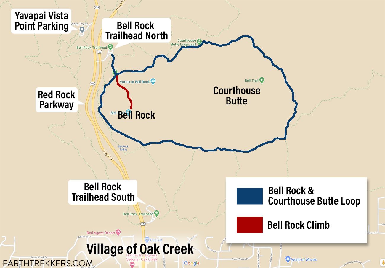
Bell Rock and Courthouse Butte Loop map
Please practice the seven principles of Leave No Trace: plan ahead, stay on the trail, pack out what you bring to the hiking trail, leave areas as you found them, minimize campfire impacts, be considerate of other hikers, and do not approach or feed wildlife.
Where to Park
There are two Bell Rock trailhead parking lots and on Google, they both have the same name (Bell Rock Trailhead). For this post, I am referring to the northernmost lot as Bell Rock Trailhead North and the southernmost lot as Bell Rock Trailhead South (see the map above).
Bell Rock Trailhead North
The best place to park is at the Bell Rock Trailhead North. This parking lot is located on the northbound section Red Rock Scenic Byway. This fairly large lot has a vault toilet and a machine where you can purchase your Red Rock Pass. This lot is the closest you can get to the hiking trail.
When we did this hike, the lot was completely full by 7:20 am. If you don’t mind some extra walking, there are two more places to park if the lot is full when you do this hike.
Yavapai Vista Point
The next closest parking lot is Yavapai Vista Point. This parking lot is located on the southbound section of the Red Rock Parkway.
From the Bell Rock Trailhead, it takes 8 minutes to drive here, since you have to drive north, turn around at the round-about for Back O Beyond Road, and then drive south to the Yavapai Vista Point parking lot.
The Yavapai Parking Lot is much larger so you should have a better chance to find parking here. Just note that this is also a secondary parking area for the extremely popular Cathedral Rock hike, so this lot will fill by mid-morning during the busier travel season.
This lot has a vault toilet and a machine to purchase your Red Rock Pass.
From the Yavapai Vista Lot, it takes about 10 minutes to walk to the Bell Rock Trailhead. You will walk south along Red Rock Parkway. There is a dirt path you can follow and you will have to cross both sections of the road (northbound and southbound) to get to the Bell Rock parking lot.
Bell Rock Trailhead South
If you couldn’t get parking at the Yavapai Lot, there is one more place to try. Bell Rock Trailhead South is located on Red Rock Parkway, just north of the Village of Oak Creek. This lot has a vault toilet and a machine to purchase your Red Rock Pass.
To get to the Bell Rock Courthouse Butte Loop, you will hike the Bell Rock Pathway north to the Courthouse Loop Butte Trail.
Clockwise or Counter-Clockwise?
Since this is a loop, you can hike it in either direction.
We did this hike in a clockwise direction. When we did this, it was a brilliantly sunny morning (we started at 7:40 am). For the first part of the hike, we were walking directly towards the sun (don’t forget your sunglasses!) but once we looped around Courthouse Butte, the sun was at our back and the views were beautiful.
In my opinion, the best views are on the north and south side of the loop and it is worth saving these views for the second half of the hike.
We saved the Bell Rock climb for the end of the hike. This climb is tons of fun and the views are amazing, so it’s a nice way to end the hike.
If you park at the Bell Rock Trailhead South, you will be starting the hike on the opposite side of the loop. If you choose to hike this loop in a clockwise direction, then you will do the Bell Rock climb towards the beginning of the hike, as you pass by the northern side of Bell Rock.
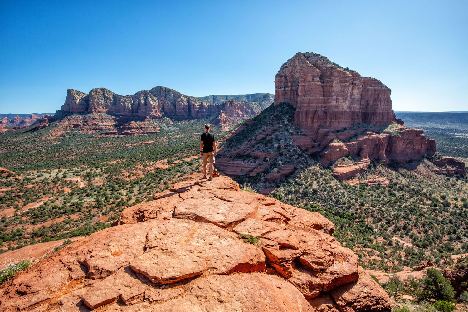
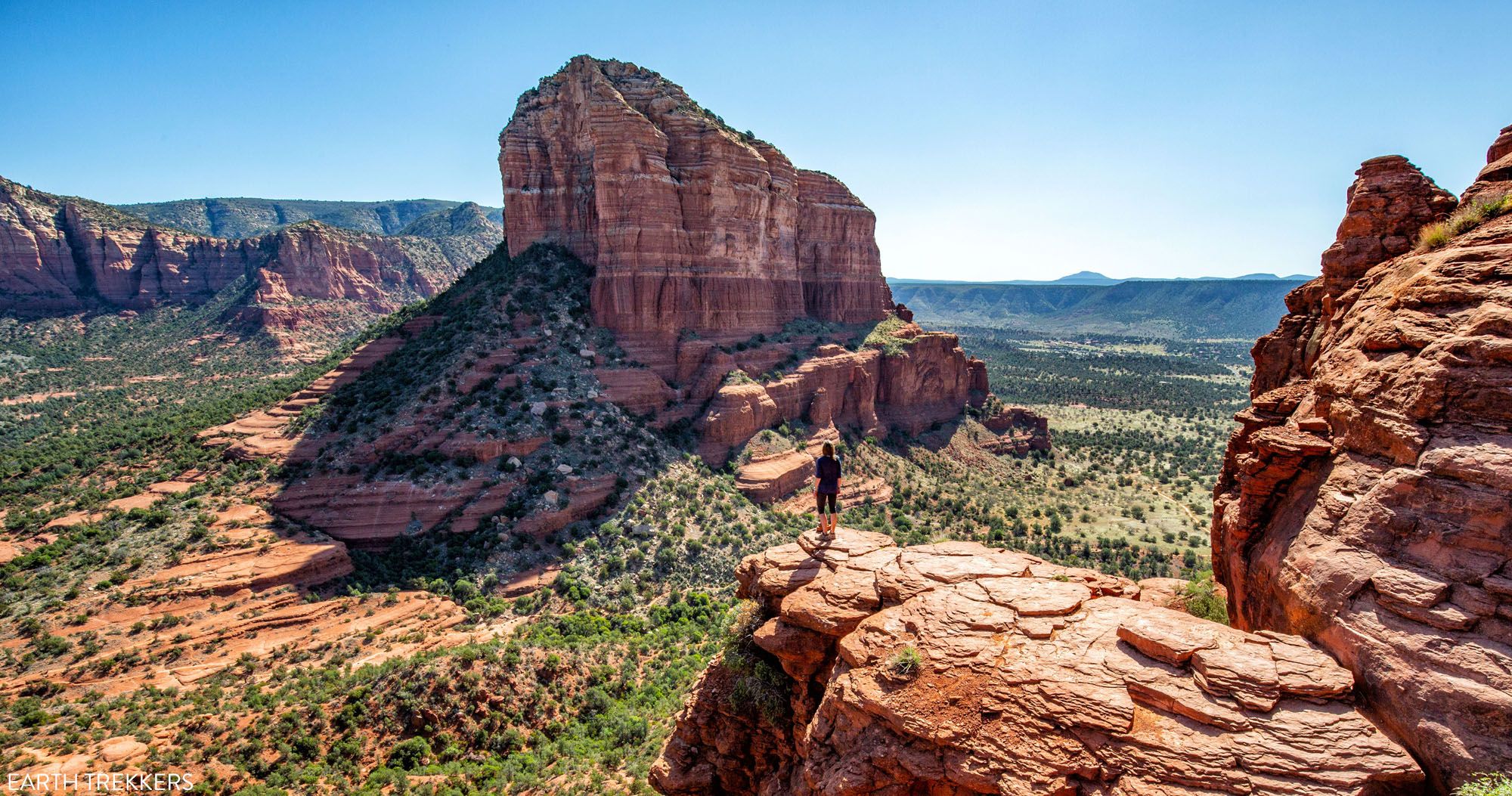
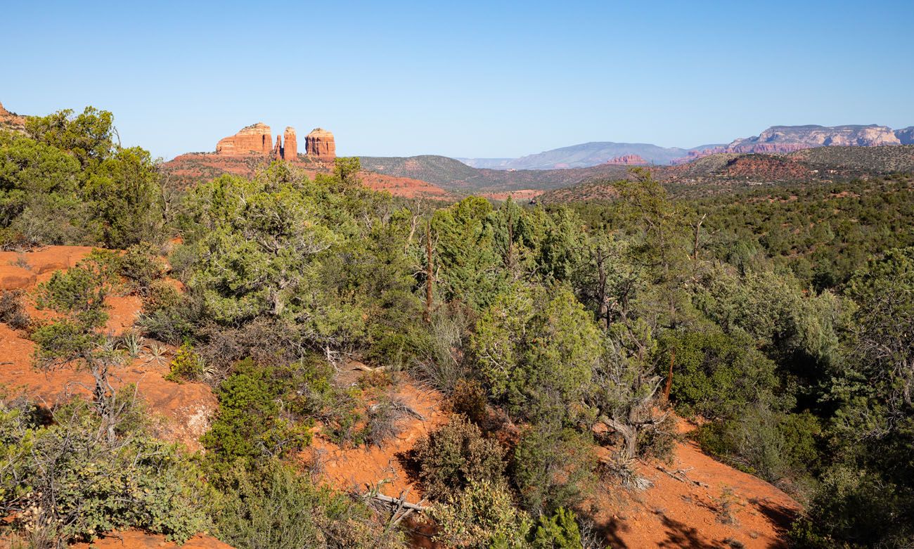
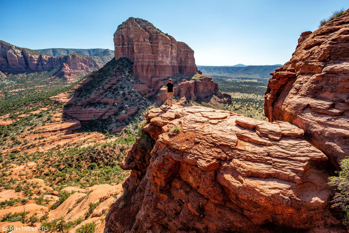
The view of Courthouse Butte from Bell Rock
Bell Rock Courthouse Butte Loop
Step-By-Step Trail Guide
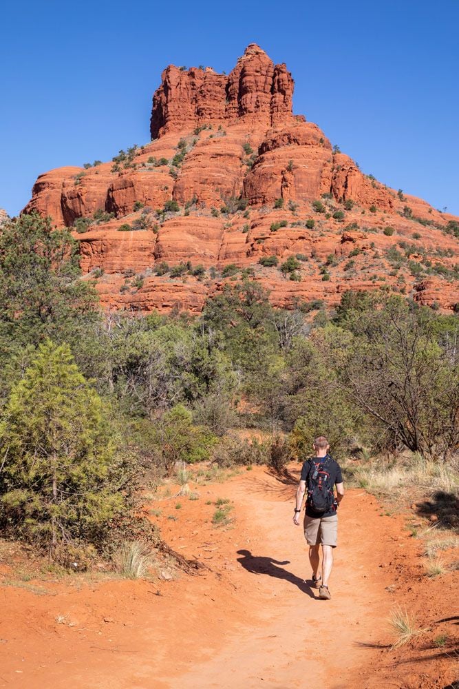
This trail forms one big loop. You will circle around Bell Rock and Courthouse Butte. Along the way, the trail changes names several times, so it can seem confusing, but there are lots of trail signs and maps along the way. As long as you keep Bell Rock and Courthouse Butte to your right you should be moving in the correct direction.
This is also a popular mountain biking spot, so keep your eyes and ears on alert for mountain bikers.
On the Courthouse Butte Loop Trail
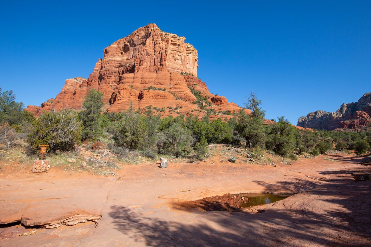
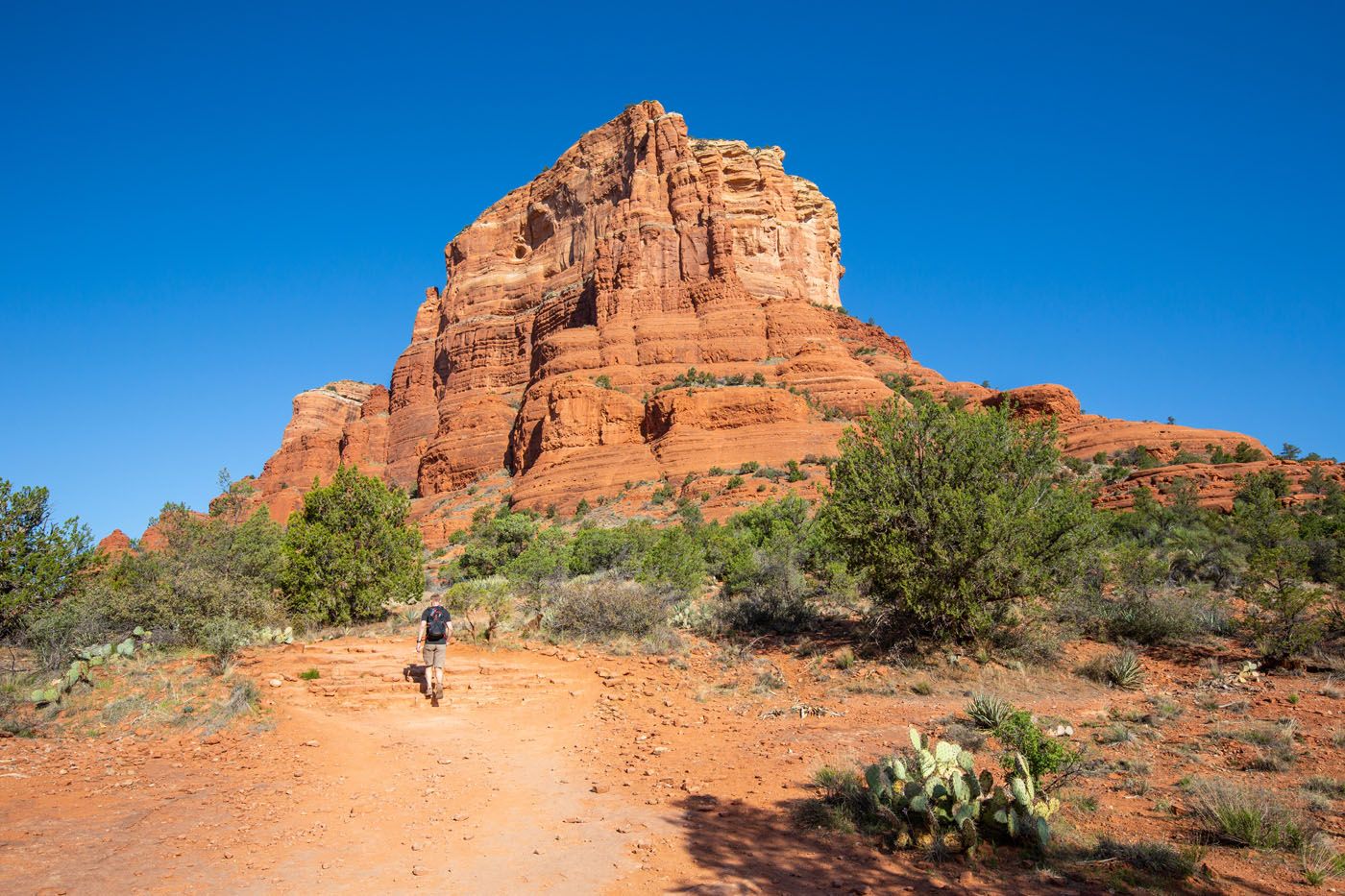
From the Bell Rock Trailhead North, it is a short walk on a wide, gravel trail, which is called the Bell Rock Access Trail, to get to the loop. This trail dead ends at the Bell Rock Pathway. Turn left to walk the loop in a clockwise direction.
PRO TRAVEL TIP: Before you turn left and start the loop, take a good look around at your surroundings (and even snap a few photos) so you recognize this spot when you complete the loop and know how to return to the parking area.
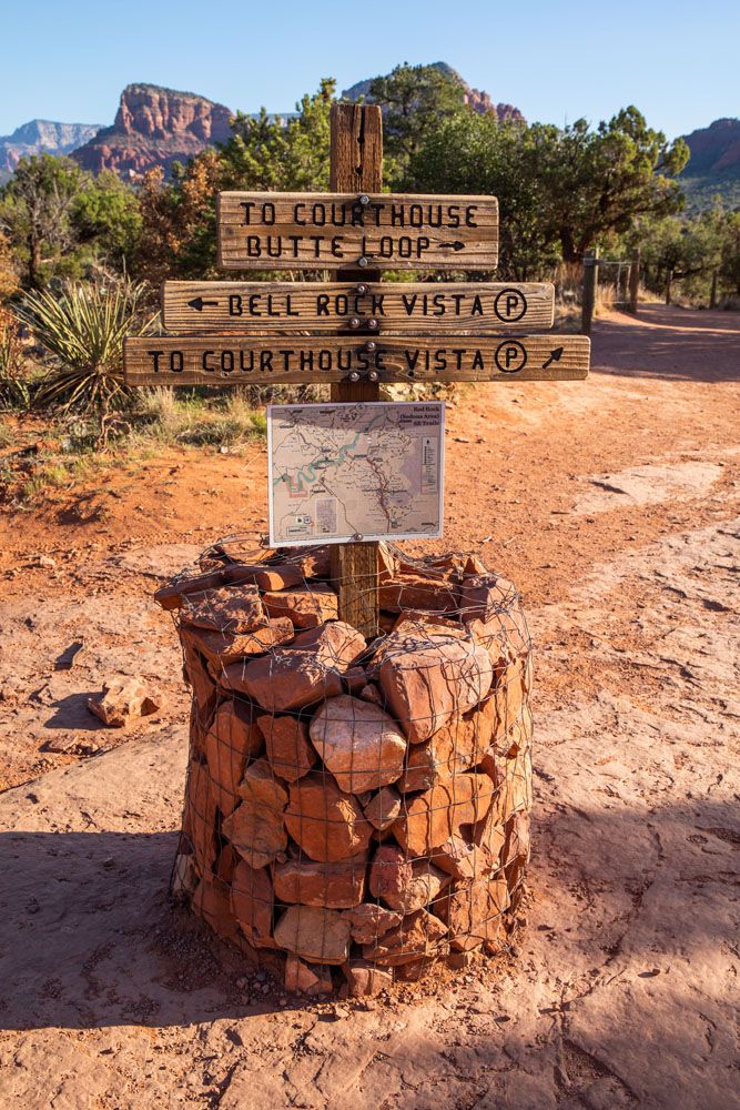
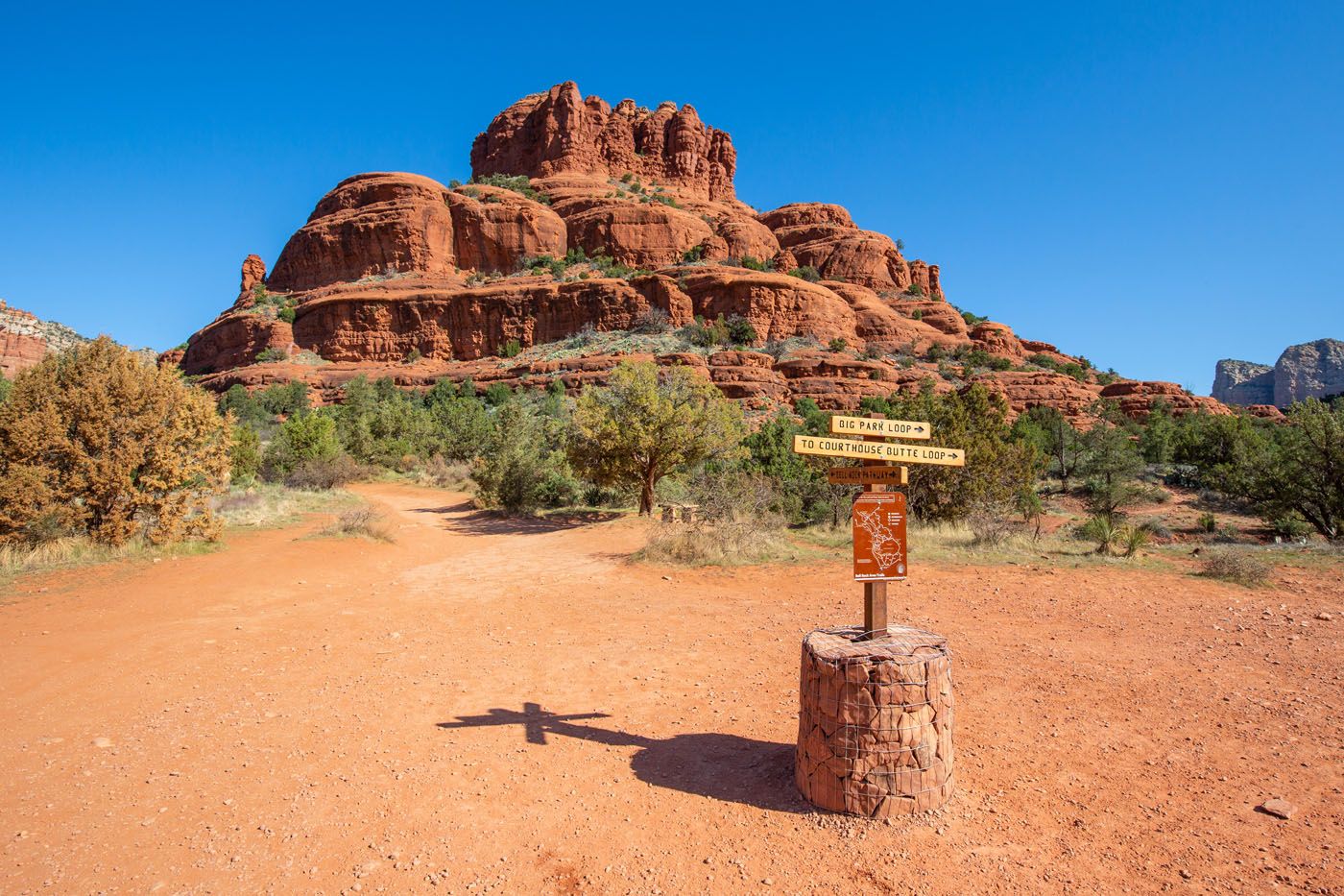
This is the trail junction sign when you get to the Beth Rock Pathway. Follow the sign “to Courthouse Butte Loop.”
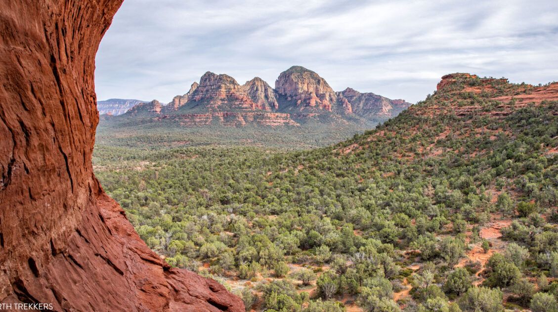
As you walk around the north side of the loop, you will have very nice views north towards Sedona. Courthouse Butte will be towering over you to the south.
The trail changes names a few times in this short section. From Bell Rock Pathway, take the Llama Trail for a few hundred feet and then the trail will fork again. Take the Courthouse Butte Loop Trail. There are trail signs at each of these junctions.
View north from the trail. If you look closely, you can see the Chapel of the Holy Cross.
Another view from the trail, this time looking northwest towards Cathedral Rock.
On this part of the hike you will be walking away from Bell Rock, so periodically turn around to take a look at it.
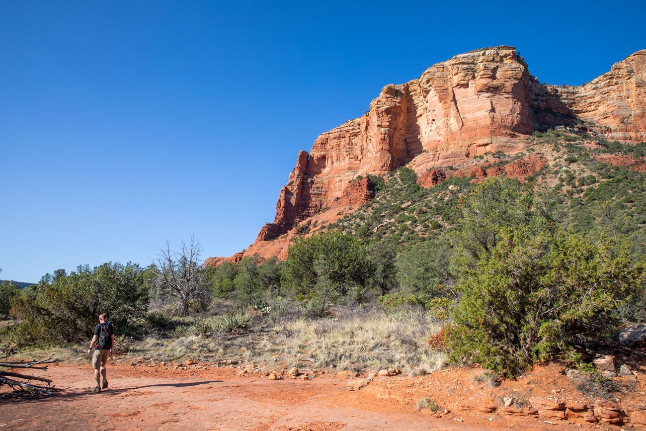
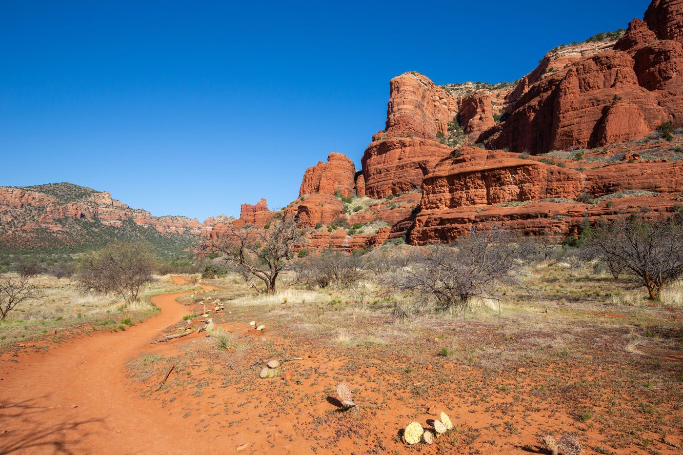
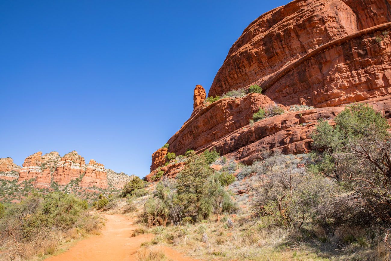
Follow the Courthouse Butte Loop Trail around Courthouse Butte. Once on the eastern side of the loop you will have great views of Courthouse Butte.
2 miles into the hike you will approach a wide wash. There are two trail signs here, pointing in two different directions, each with the same trail name, Big Park Loop. Cross the wash (walking towards Courthouse butte) and follow that sign for Big Park Loop. You have now reached the end of the Courthouse Butte Loop Trail and you will be following the Big Park Loop trail.
Note: On Google and All Trails, this trail is still labeled as Courthouse Butte Loop Trail but the park signs have a different name, Big Park Loop.
A photo of the wash. Cross this wash to the trail sign on the opposite side to continue the hike.
Further down the trail you have a great view of Courthouse Butte.
At mile 2.6, there is a sign telling you to go straight for Big Park Loop or to go left for Big Park Loop. Go straight at this sign. You’ll be walking towards Bell Rock.
At mile 2.75, follow the sign that says “To Bell Rock Pathway”. You will again be walking towards Bell Rock.
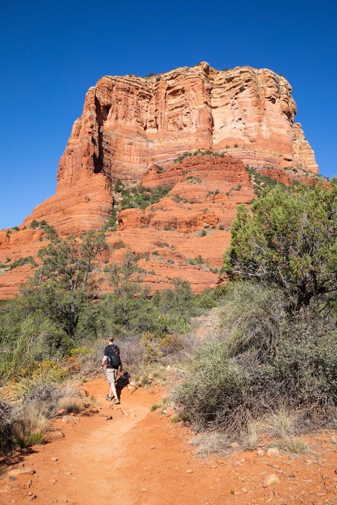
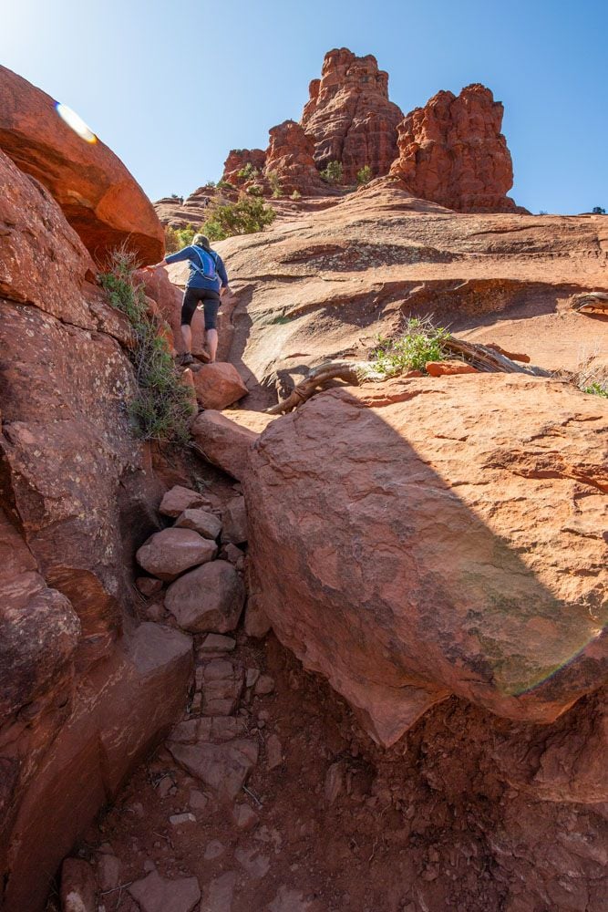
At mile 3.0, the trail name changes back to the Bell Rock Pathway and you will follow this back to your starting point. As you approach the end of the loop, you will see a trail sign labeled “Bell Rock Climb.” This is the trail to take to climb up Bell Rock.
Hiking along the side of Bell Rock
Bell Rock Climb
The Bell Rock climb starts at the sign that is labeled “Bell Rock Climb.”
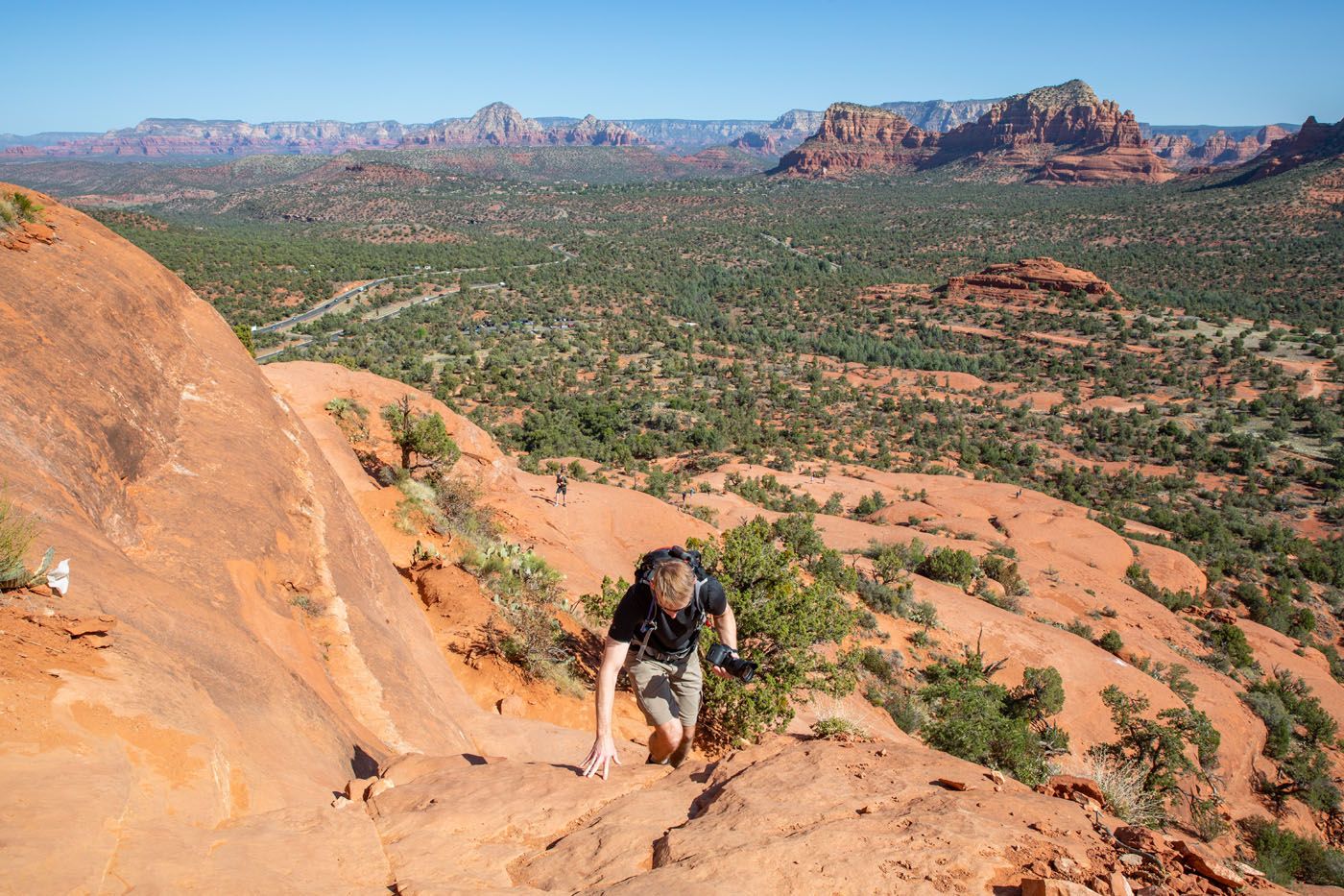
For the first 0.25 miles of the climb you will be following trail signs. The trail signs are then replaced with wire baskets filled with rocks. Follow these baskets to the upper levels of Bell Rock.
Eventually, the wire baskets will end but you can continue to hike higher by doing your own route finding.
How far you want to go is up to you. You can’t make it to the very top of Bell Rock but you can go pretty far. To get to the higher levels, you will do some rock scrambling. For parts of this climb, you will be hiking on sections of slickrock with a steep incline so it is best to wear hiking shoes so that you have good traction.
To finish the hike, retrace your steps down Bell Rock and back to your car.
Our Thoughts on the Hike
Despite a packed parking lot, we saw very few people on the loop trail. Many people come here just to hike up Bell Rock. So, if you are looking for a relatively easy hike with nice views and somewhat low crowds, the Bell Rock and Courthouse Butte Loop Trail is a great option in Sedona.
Hiking up Bell Rock is tons of fun. If you are visiting with kids, they will love this. The climb up Bell Rock is a nice warm up for Cathedral Rock, which is a very similar experience, just on a grander scale (both in terms of views and difficulty).
However, if you only have time for one hike, we recommend the Cathedral Rock hike over Bell Rock.
If you do this hike in the morning and need lunch or brunch suggestions, it is a short drive to the Village of Oak Creek. Miley’s Café and Red Rock Café both get great reviews. We had brunch at Red Rock Café. Their specialty is blue corn huevos rancheros and if you want a treat, order the giant cinnamon roll…it’s 3 pounds of happiness!
Tips to Have the Best Experience
Start the hike early, ideally by 7 am. By starting early, you can get one of the parking spaces in the trailhead parking lot. You will also get ahead of the crowds and hike in the cooler part of the day.
Leave No Trace. Practice the seven principles of Leave No Trace. This includes packing out what you bring to the hiking trail, be considerate of other hikers, and staying on the trail.
Learn more about Sedona. Learn more about Sedona in our Sedona Travel Guide, where we list more great hikes to do, where to stay and eat, and provide sample itineraries in Sedona, whether you have just one day, two days, or much longer.
What to Bring on the Hike
Hiking shoes. You can get by with a good pair of walking shoes or running shoes for this hike. However, if you plan to hike up Bell Rock, I recommend wearing hiking shoes. The extra traction on hiking shoes will make your climb up the rock much easier and safer.
Water and snacks. Bring at least 1 liter of water in the summer.
Sunscreen, hat, and sunglasses. There is very little shade on this trail.
Camera. Even a smartphone will do.

Essential Hiking Gear: What Should You Bring on a Day Hike?
If you are new to hiking or are curious about what you should bring on a hike, check out our Hiking Gear Guide. Find out what we carry in our day packs and what we wear on the trails.If you have any questions about hiking the Bell Rock and Courthouse Butte Loop Trail, let us know in the comment section below.
More Information for Your Trip to Sedona
We have TONS more information about Arizona in our Arizona Travel Guide and the USA in our United States Travel Guide.

Sedona Travel Guide: How to Plan a Trip to Sedona
Pinterest Facebook Flipboard Sedona Travel Guide In central Arizona, miles and miles of trails criss cross through red rocks and spectacular desert landscapes, creating an outdoor playground for hikers and mountain bikers. Venture into the desert on a 4×4, visit cultural heritage sites, go wine tasting, slide down a waterfall, and watch as the sky […]
Boynton Canyon Trail & the Subway Cave | One of Sedona’s Top Hikes
Boynton Canyon is one of Sedona’s top hikes. This is a relatively easy hike, as you walk on a mostly flat trail that is sheltered from the sun. The trail ends at the back of the canyon, where a short climb takes you up to a viewpoint, offering sweeping views of Boynton Canyon. Along the […]
12 Best Sedona Hikes, Ranked Shortest to Longest
If you are looking for an epic hiking destination, it’s tough to beat Sedona, Arizona. With its red rock scenery, arches, hidden caves, and network of hiking trails, this is a great place to explore on foot. Add in the abundance of top-notch hotels and restaurants in Sedona and you have an awesome getaway destination, […]
Sedona Itinerary | Best Way to Spend 1 to 6 Days in Sedona
There are many different ways to piece together a Sedona itinerary. Your perfect itinerary depends on your traveling style. Whether you are an avid hiker, a family traveling with kids, or someone who wants to experience Sedona without spending time on the hiking trails, we have some great suggestions for you. In this guide, learn […]

Where to Stay in Sedona: Best Hotels for Your Budget
Trying to decide where to stay in Sedona? You have lots of great options to choose from, from resorts with pools and on-site restaurants, cozy boutique-style hotels, family friendly resorts, adults only bed and breakfasts, and highly-rated budget properties. An important factor to consider is the location of your hotel. There are several neighborhoods in […]
15 Amazing Things to Do in Sedona (Beyond Just Hiking the Trails)
What do you look for when picking the perfect vacation spot? Outdoor adventures? Shopping? Wineries? Great restaurants? Beautiful sunsets? A fun place to take the kids? What if I told you that you could get all of these in one place…Sedona, Arizona. In this article, learn about the best things to do in Sedona with […]
Exactly How to Hike Devils Bridge in Sedona
Devils Bridge is a wonderful hike in Sedona. With an easy hiking trail, beautiful red rock scenery, and of course, the chance to have your photo taken on top of Devils Bridge, this hike makes the top of the list for many visitors to Sedona. This is one of the most popular trails in Sedona […]
Soldier Pass Trail & Soldier Pass Cave: Step-By-Step Trail Guide
There are several reasons why so many hikers rave about the Soldier Pass Trail. For one thing, it is relatively short and easy to hike. But the main reason why people love this trail is to visit the Seven Sacred Pools, hike past a sinkhole named Devil’s Kitchen, and hike to the Soldier Pass cave. […]

Six 4WD Roads in Sedona…Which Ones are Worth It?
One of the best ways to explore the desert landscapes and red rock scenery is to drive the 4WD roads in Sedona. These roads range from easy to difficult and take you to stunning overlooks and through remote terrain. They are lots of fun to drive and offer a unique experience if you are looking […]
The Ultimate Arizona Road Trip Itinerary
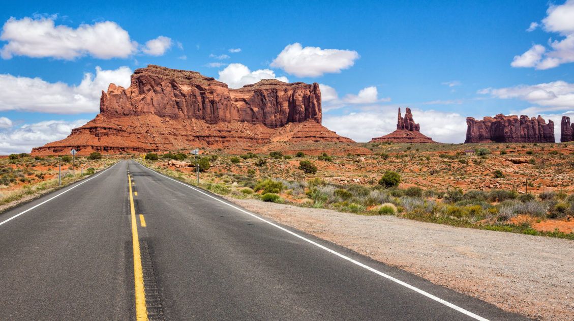
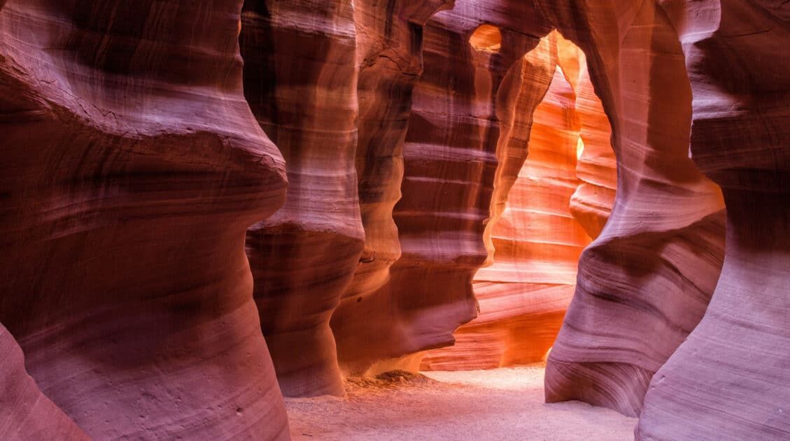
On this Arizona road trip itinerary, you will visit three national parks, drive past the buttes and mesas of Monument Valley, walk through magical Antelope Canyon, and hike the desert hills of Sedona. Arizona is home to some of the most iconic landscapes in the United States and this road trip is the perfect way […]
Arizona Travel Guide: Top Places to Visit in Arizona
Arizona Travel Guide From the awe-inspiring Grand Canyon to the sprawling Sonoran Desert, Arizona offers a diverse mix of natural wonders, bustling cities, and deep-rooted traditions. Visit Arizona to hike amidst its slot canyons and desert landscapes, view the starry night skies, and see the famously tall saguaro cactus. Take a trip to Arizona on […]
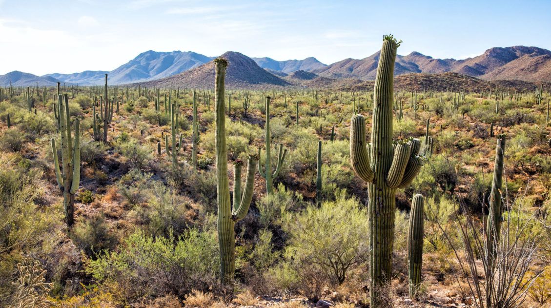
8 Amazing Things to Do in Saguaro National Park
Saguaro National Park is named for the Saguaro cactus, which grows only in the Sonoran Desert. This is an easy park to visit, with scenic drives and short walks among the towering cacti. A half day is all you need to see the highlights, but with more time you can tour the entire park, go […]
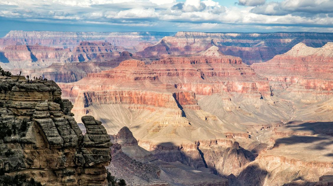
11 EPIC Things to Do on the South Rim of the Grand Canyon
For millions of years, the Colorado River has carved its way through the Colorado Plateau, forming this expansive, awe-inspiring landscape that we call the Grand Canyon. And it certainly is grand. Words cannot describe what it is like to gaze across the Grand Canyon for the first time. On a visit to the Grand Canyon, […]

Comments 6