
We’ve hiked most of the developed trails in Denali National Park, from the easy stroll around Horseshoe Lake near the entrance to the backcountry trails in Eielson and Kantishna. If we had to pick one trail that delivers the best payoff for the effort in the front country, the Savage Alpine Trail is at the top of the list.
Located at mile 15 of Denali Park Road, the farthest point you can drive into the park without a permit, the Savage Alpine Trail climbs steeply out of the Savage River valley and onto an exposed alpine ridge with sweeping views in every direction. From the road at mile 15, Denali is actually hidden behind the surrounding peaks, so you have to hike higher so the mountain comes into view. On a clear day, that view from the ridge is one of the best you can get without riding a bus deeper into the park.
In this guide, we cover everything you need to plan your hike: trail stats for every way to do it, how the free shuttle works, which direction to go, what to expect mile by mile, and how to combine the Savage Alpine Trail with the Savage River Loop for a full-day hike.
Savage Alpine Trail: At a Glance
TRAIL TYPE | Point-to-point or out-and-back
DISTANCE | 4 miles / 6.4 km one-way (point-to-point option)
DIFFICULTY | Strenuous
TOTAL ASCENT | 1,500 feet / 457 m
TIME | 2–4 hours
TRAILHEADS | Savage River Loop Trailhead & Mountain Vista Picnic Area
FREE SHUTTLE | Yes, the Savage River Shuttle connects both trailheads
DOGS ALLOWED | No
RESTROOMS | Yes, at both trailheads
BEST FOR | Views of Denali, alpine tundra, combining with Savage River Loop
Is the Savage Alpine Trail Worth It?
Yes, and it’s especially worth it if you weren’t able to get a bus reservation to go deeper into the park.
Most visitors to Denali never make it past mile 15. Bus tickets sell out months in advance, and if you’re visiting without one, it’s easy to feel like you’re missing the best of the park. The Savage Alpine Trail is the best answer to that problem. You’re about 15 miles closer to Denali than you are at the park entrance, and once you climb above the ridgeline, the mountain opens up in a way it simply doesn’t from the road. It won’t replace a bus trip to Eielson or Wonder Lake, but it’s a genuinely great view, and one you earn on foot.
Even if you did get a bus ticket, this hike is still worth doing. The alpine tundra, the exposed ridge, the steep push up from the Savage River, it’s one of the more rewarding front-country hikes in the park.
Our one caveat: if Denali is socked in, the hike is still beautiful, but you’ll miss the payoff that makes it special. Check the forecast and be flexible with your timing if you can.
Want to make a full day of it? Combine the Savage Alpine Trail with the Savage River Loop, a 2-mile easy stroll through a glacial river canyon right at the base of the trail. The two share a trailhead, the scenery is completely different, and together they make for one of the best half-day to full-day combinations in the front country. We cover exactly how to do it below.
Savage Alpine Trail Point-to-Point
Here are the hiking stats if you do the Savage Alpine Trail point-to-point. These stats come from the National Park Service website.
Distance: 4 miles (6.4 km) one-way
Difficulty: Strenuous
Elevation Gain: 1,500 feet (457 m)
Length of Time: 2 to 4 hours
If you hike the Savage Alpine Trail point-to-point, you will need some sort of way to get back to your car. You have several options:
#1 If you are traveling as a group with more than one vehicle, you can park a vehicle at each trailhead and use these as a shuttle.
#2 Walk back to your car on Denali Park Road once you finish the hike. This adds roughly 2 miles to the hiking stats above.
#3 Use the park shuttle (more on that below).
#4 Hitchhike to your car at the end of your hike.
Trailheads for the Savage Alpine Trail
Since this is a point-to-point hike, there are two trailheads.
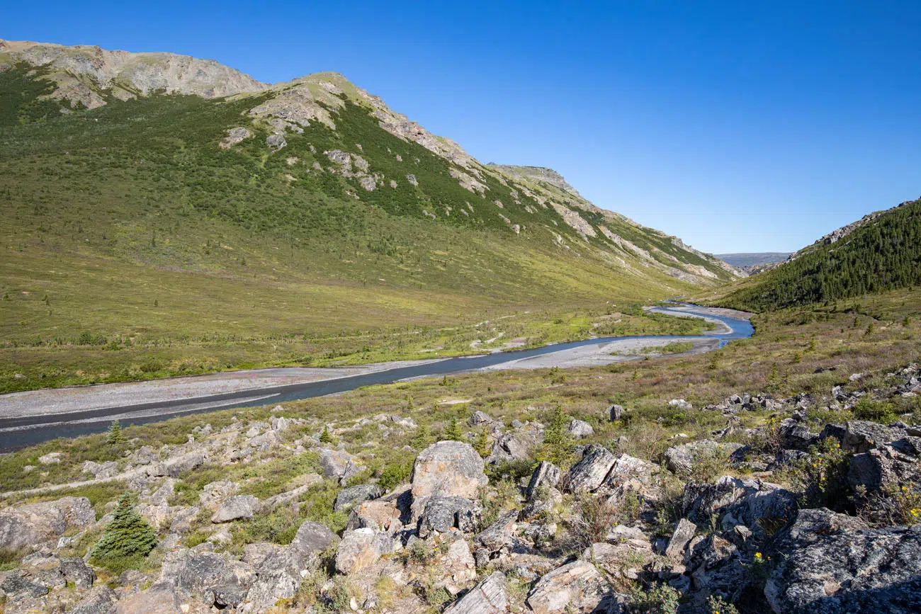
The Savage River trailhead is located next to the Savage River. This is the point where the Denali Park Road changes from a paved road to a dirt road. Beyond the bridge, you can only drive Denali Park Road with a permit, or ride one of the buses.
The Savage River Loop starts at the same trailhead.
There is small parking lot at Savage River that can hold roughly 20 cars. This parking lot tends to fill by mid-morning. Overflow parking spills onto the road next to the parking lot. There is also a gravel parking lot on the opposite side of Savage River that can be used for overflow parking.
There are restrooms at the parking lots on either side of the Savage River.
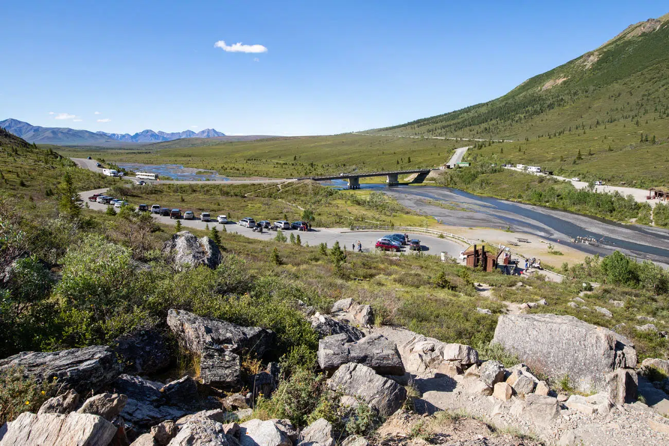
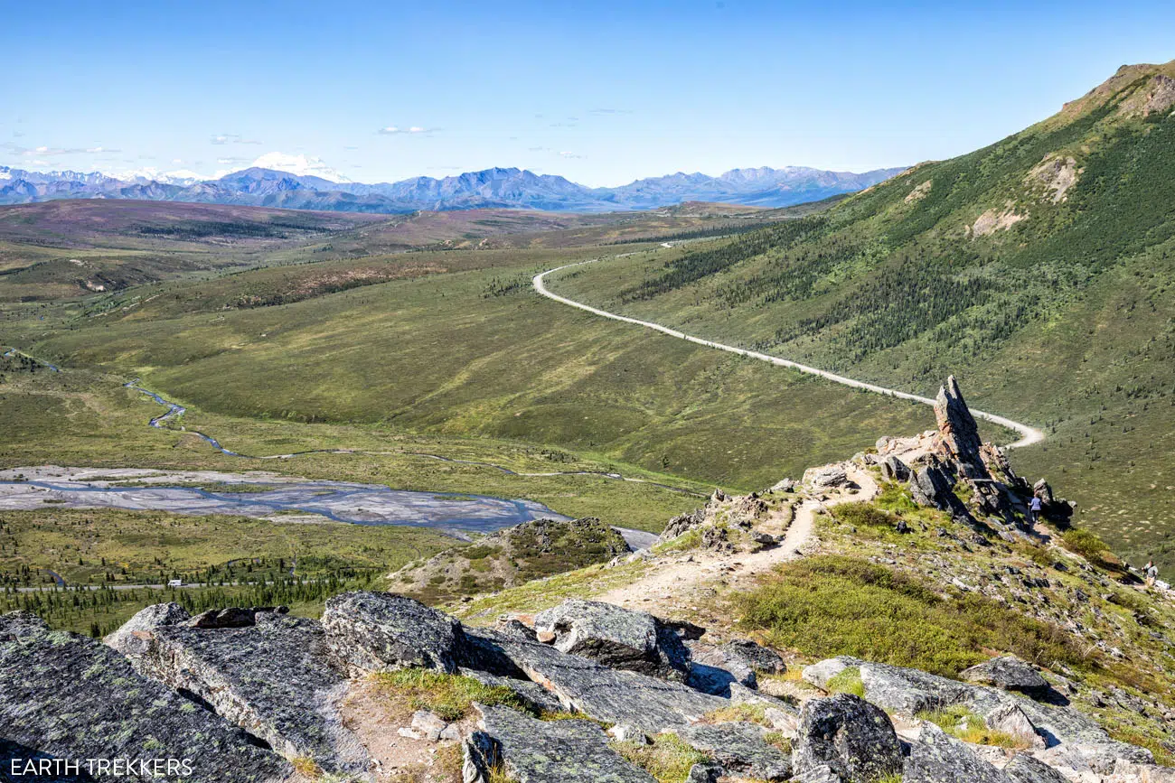
This photo was taken from the Savage Alpine Trail. You can see the Savage River parking lot, the overflow parking area on Denali Park Road, the bridge over the Savage River, and parking lot on the opposite side of the river.
Just to be clear, the trailhead is located at the paved parking lot on the east side of Savage River. On Google Maps it is labeled Savage River Loop Trailhead.
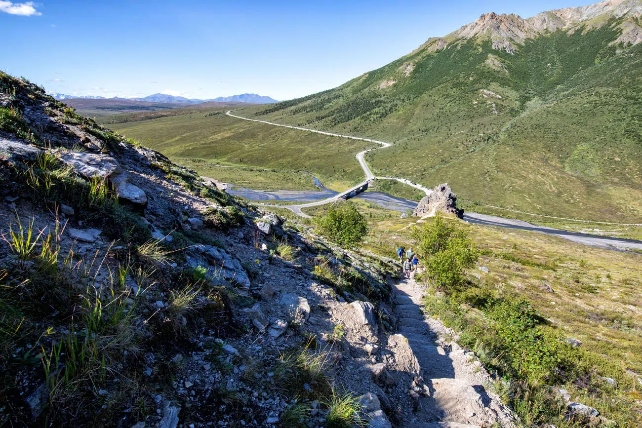
The second trailhead is located on Denali Park Road (Savage Alpine Trailhead on Google Maps). Park at the Mountain Vista Picnic Area and cross Denali Park Road to get to the trailhead. This parking lot still had lots of spaces when we drove through it midday. There are restrooms and picnic tables.
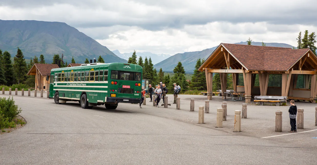
Mountain Vista Picnic Area and the Savage River shuttle
Savage River Shuttle
The Savage River Shuttle connects the Denali Visitor Center to the Mountain Vista Picnic Area and Savage River. It is free to park visitors.
When we did this hike, the shuttle only ran once every two hours. That makes planning your time a bit difficult, with such a huge time span between buses. However, with some planning, you can use the shuttle to your advantage.
Drive to the Savage River parking lot in the morning, a little bit before the shuttle is due to arrive. From Savage River, ride the shuttle to the Mountain Vista parking lot. Hike the Savage Alpine Trail point-to-point, ending back at the Savage River. By using the shuttle in this direction, you get the shuttle ride over with early and don’t have to wait for it once finished your hike.
PRO TRAVEL TIP: You can get the shuttle schedule at the Denali Visitor Center (or check them online here).
Which Direction Should You Go?
The park ranger we spoke to recommended starting at Mountain Vista and ending at the Savage River. Mountain Vista is located higher than Savage River, so you will have less ascent on the hiking trail. And you get to hike down the incredibly steep section near the Savage River parking lot, rather than hiking up it. Just note, if you plan to walk back to your car at Mountain Vista, it will be a mostly uphill walk on Denali Park Road.

Savage Alpine Trail Out-and-Back from Savage River
Here are the hiking stats if you do the Savage Alpine Trail out-and-back-from Savage River.
This is how we did this hike. We had just missed the shuttle and did not want to wait around for the next one, or take our chances that we would just miss the following shuttle once we made it to Mountain Vista. So, we hiked to the highest point of the trail, saw Denali, and had an overall great experience.
Distance: 3.5 miles (5.6 km)
Difficulty: Strenuous
Total Ascent: 1,710 feet (521 m)
Starting Elevation: 2,600 feet (792 m)
Highest Elevation: 4,150 feet (1,265 m)
Elevation at the Second Overlook: 4,030 feet (1,228 m)
Length of Time: 2 to 3 hours
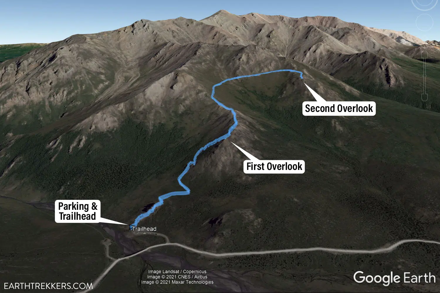
Map of the Savage Alpine Trail out-and-back from the Savage River parking lot.
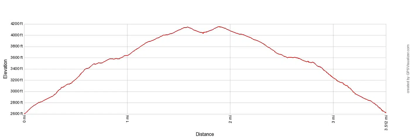
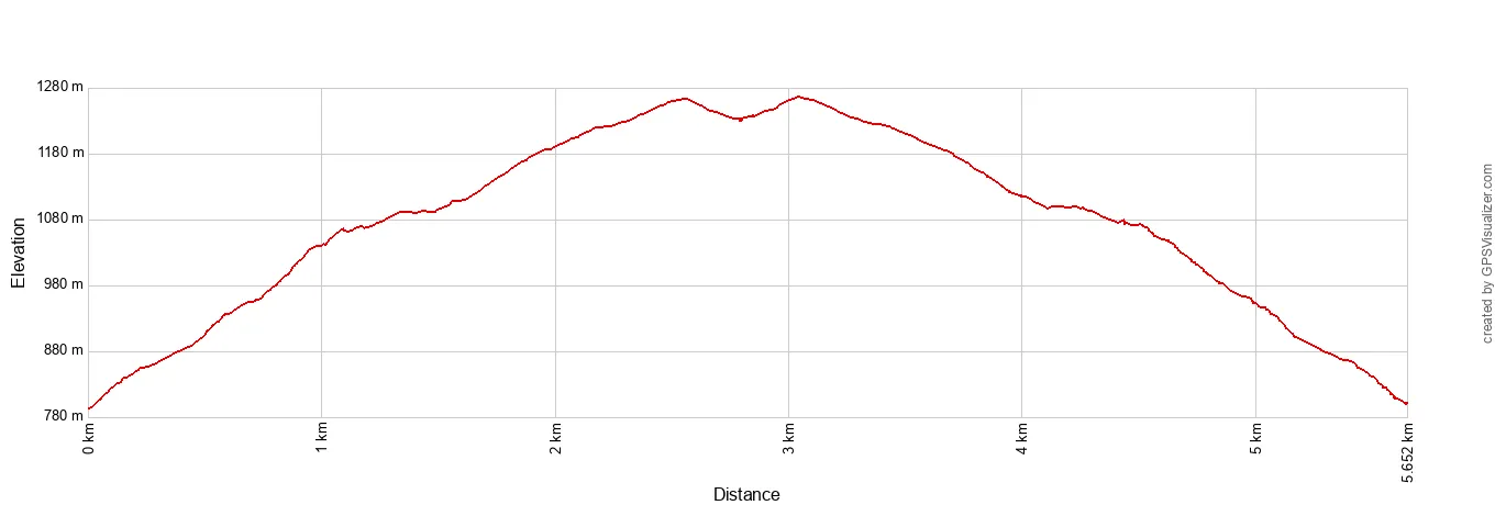
Savage River Trail elevation profile (out-and-back from the Savage River parking lot)
Note: You can also hike out-and-back from Mountain Vista. This will be a 4-mile (6.4 km) round trip hike with slightly less ascent than doing this hike from Savage River. What you miss out on are the views over the Savage River, but you won’t have to hike up the strenuous switchbacks on the western side of the trail.
Photos & Trail Description: Doing the Savage Alpine Trail Out-and-Back
We’ve broken this section down mile by mile based on our own hike from the Savage River trailhead, so you know exactly what’s coming and when. The trail has a few distinct personalities, a brutal opening climb, a ridge walk we liked so much Tim gave it a name, and a long steady push to the high point where Denali fills the frame on a clear day. Here’s what to expect.
The Savage Alpine Trail and the Savage River Loop share the same trailhead. Go right to hike the Savage Alpine Trail. You know you are on the right trail if you immediately start climbing up the mountain, some of this on steep steps.
Start of the Savage Alpine Trail
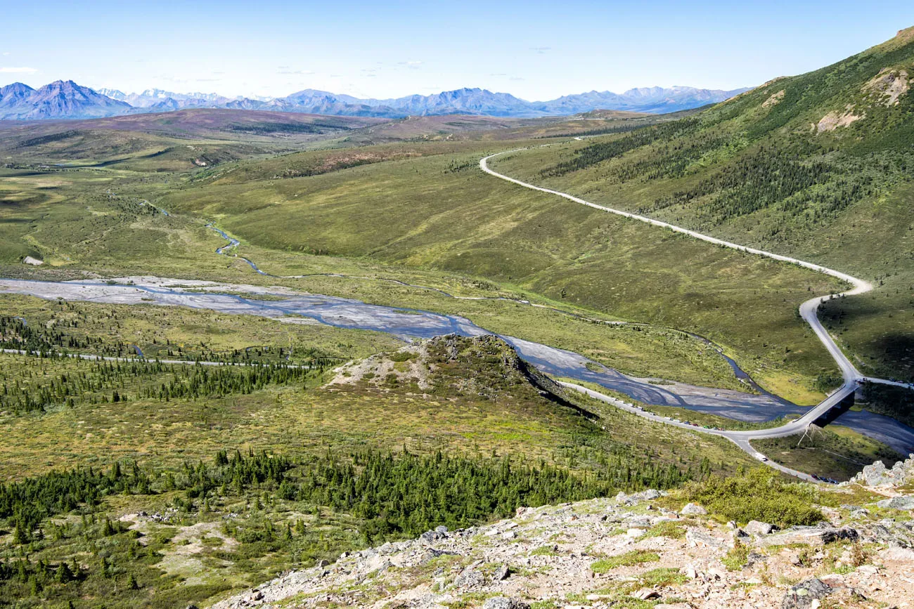
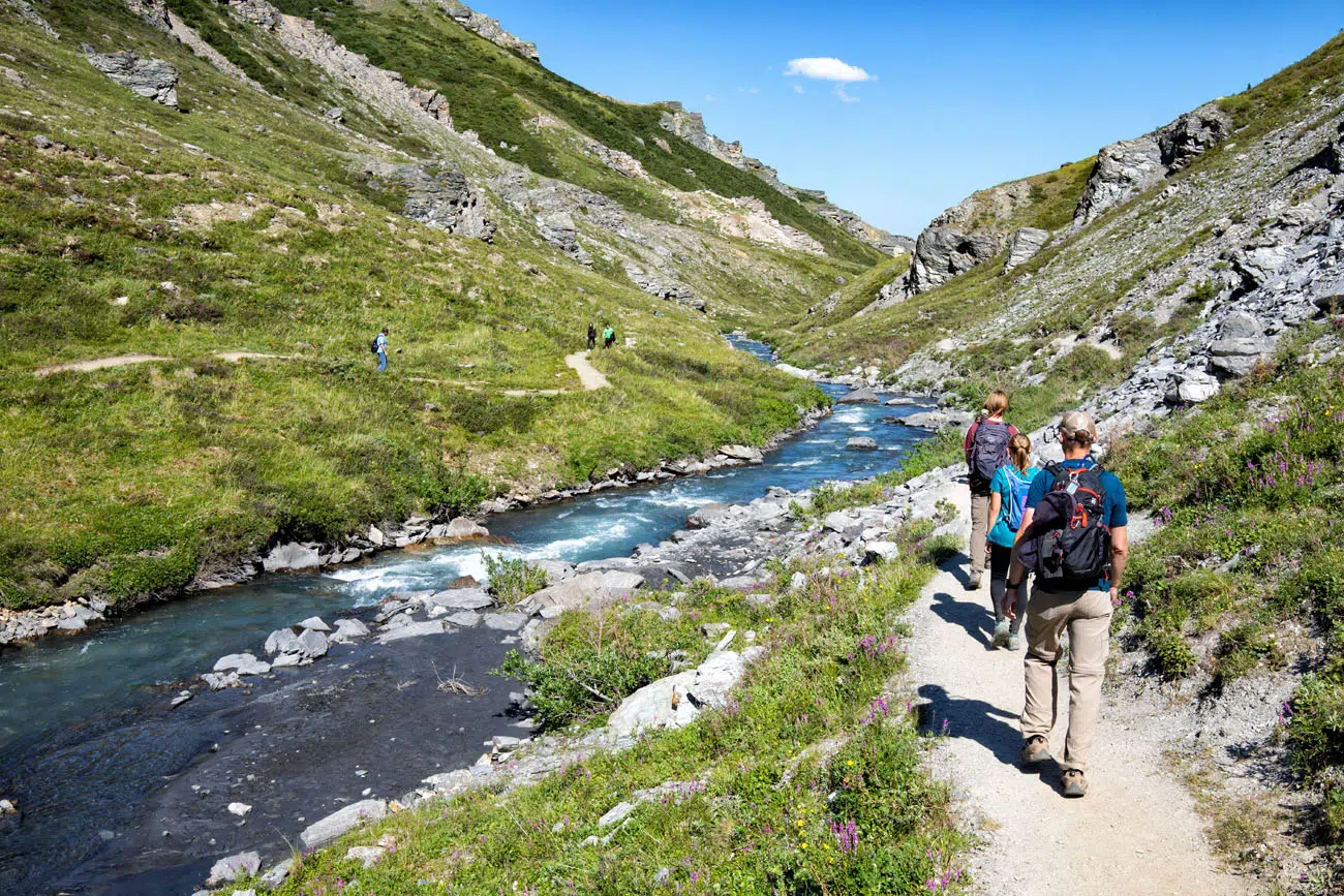
Savage River
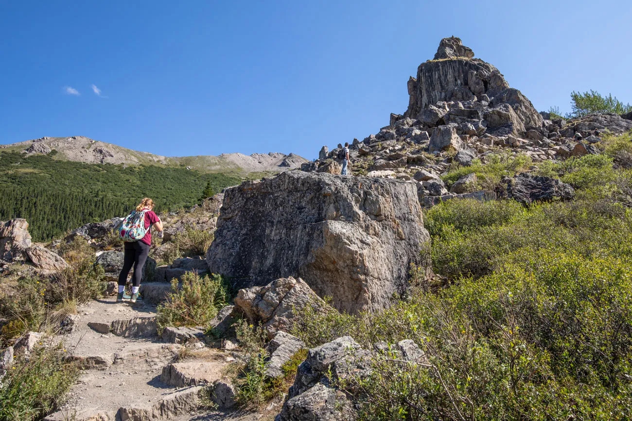
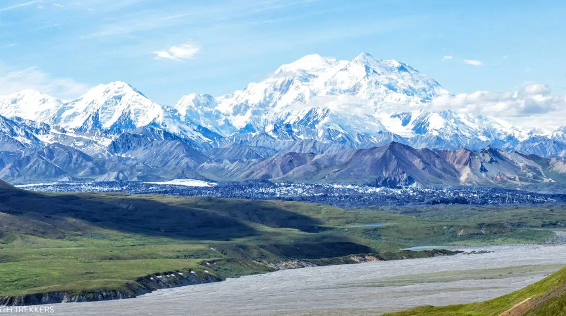
You cannot see the top of Denali from the parking lot, but you don’t have to hike up very far before the peak comes into view on a clear day. At 0.15 miles (180 feet of elevation gain) you will work your way up to a tower of dark rock. This is your first opportunity to see Denali.
View of the trail and Denali off in the distance.
The steepness of the rocky trail will continue (as do the stone steps) and eventually you will enter a section of switchbacks. Since you are on the backside of mountain, Denali will go out of view during this portion of the trail.
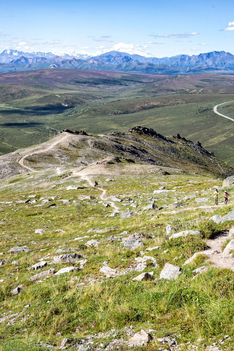
The switchbacks end 0.7 miles into the hike. At this point you climbed 760 feet in elevation and have a beautiful view of the top of Denali and some of the alpine peaks near it.

First overlook from the trail.
The view from the overlook.
PRO HIKING TIP: Feeling wiped out? You can turn around here. The view of Denali at this point is pretty good. It gets better as you go higher up the trail, but it doesn’t get dramatically better (keep scrolling for more photos). So, if you’re exhausted, you can make this your turn-around point.
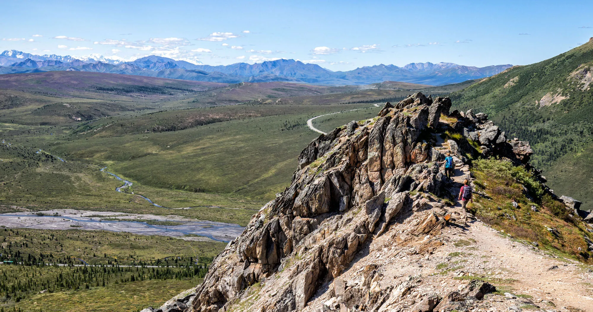
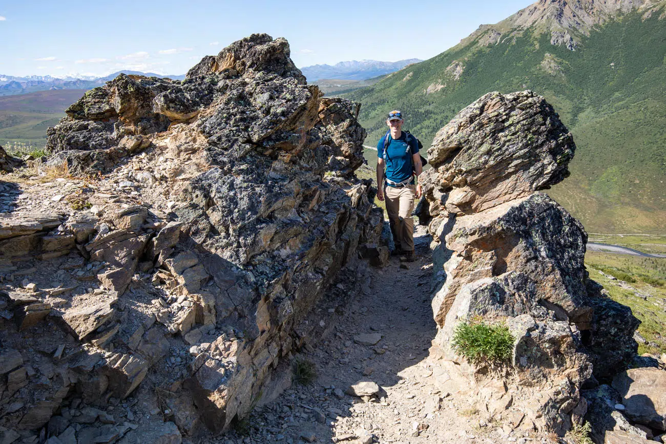
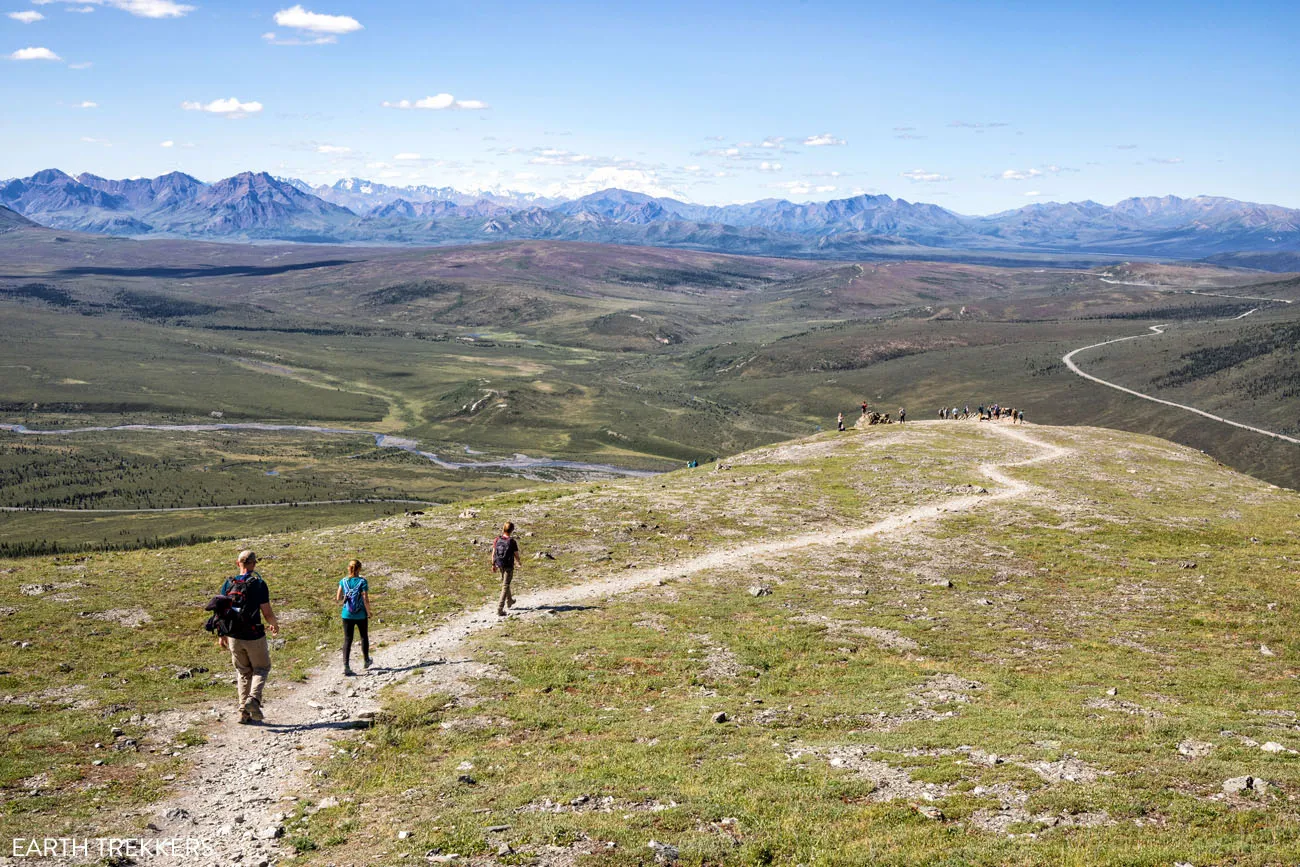
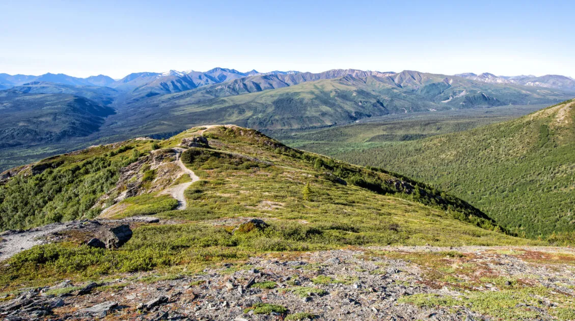
If you do continue onward then the next part of the trail was our favorite part. For the next 0.3 miles, the trail is flatter and you walk across a ridge of dark jagged stones. Kids will love this part of the trail. This section of trail might have an official name but Tim liked to refer to it as Devil’s Ridge.
At 1.0 miles into the hike and 950 feet of elevation gain, the trail becomes moderate the rest of way.

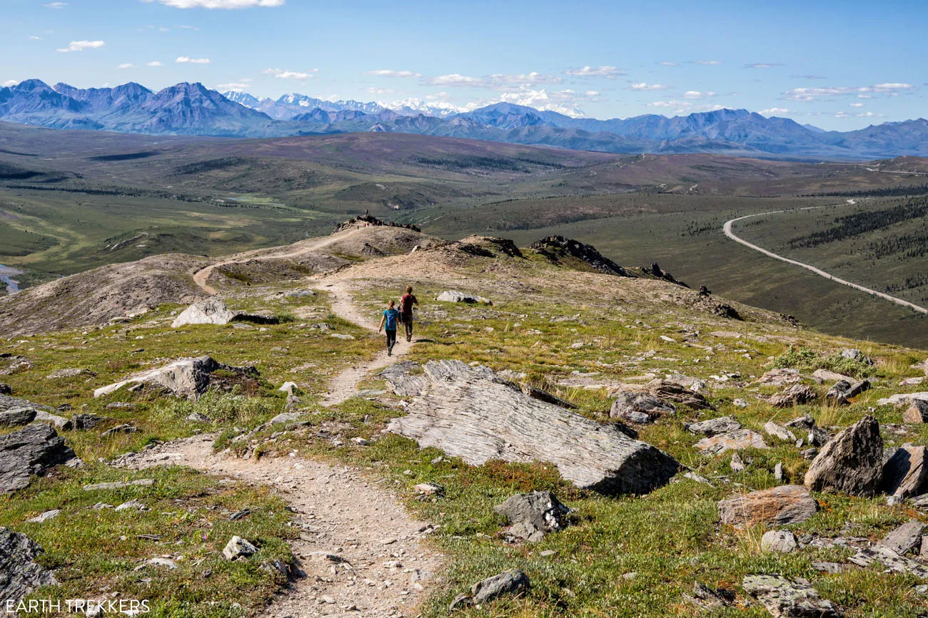
At 1.7 miles into the hike and 1560 feet of elevation gain you reach the high point of the trail. You might see a trail split here that goes higher but that isn’t the official Savage Alpine Trail. The official Savage Alpine trail descends to an overlook that is visible from here.
The trail leading to the second overlook.
Walk down to overlook. From the overlook the trail continues down and goes to the Mountain Vista parking lot.
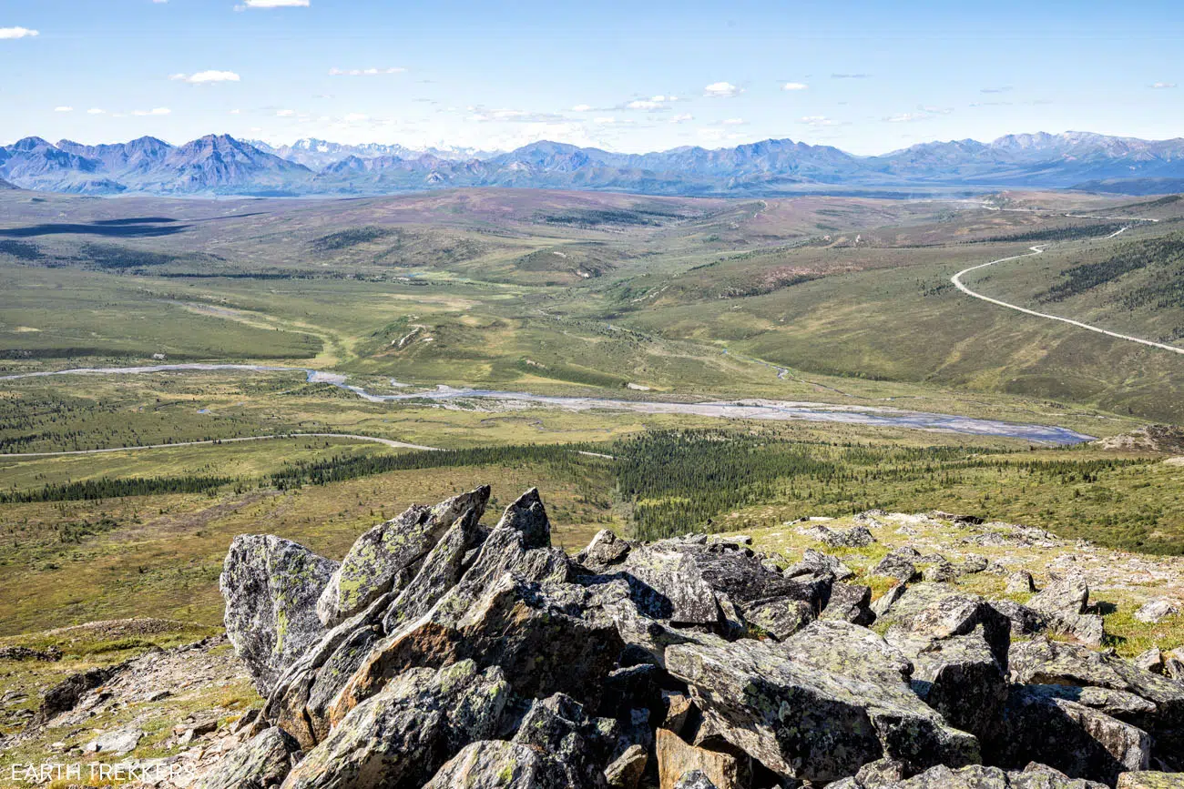
View from the overlook.
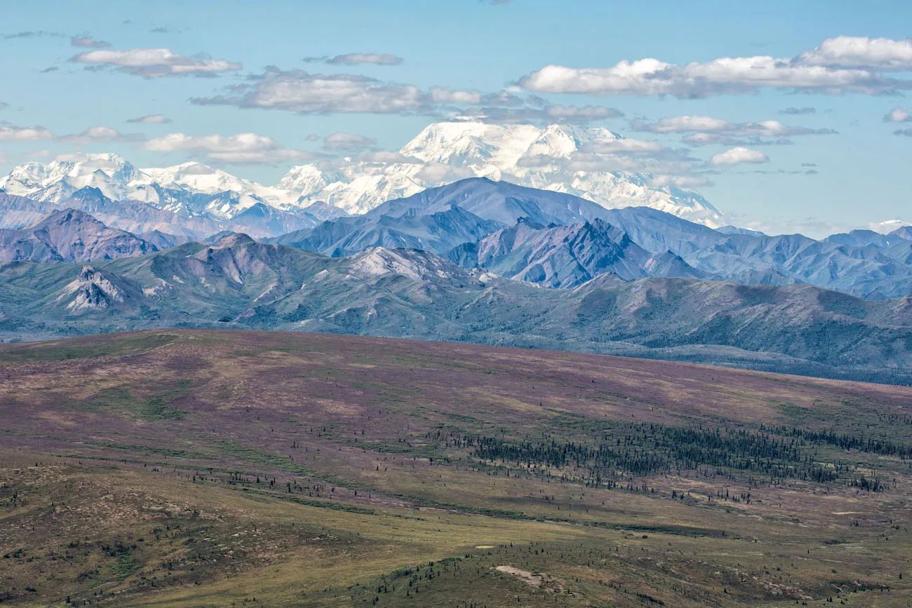
This photo of Denali was taken with a zoom lens (300 mm) from the overlook.
From the overlook, retrace your steps back to the parking lot, if you are doing this hike out-and-back. The views are better on the return hike, as you are walking towards Denali. It’s also a lot easier, since the climbing is over and done with.
The hardest section on the return hike are the switchbacks. The trail is the steepest here, with lots of stone steps, so your thighs, and maybe your knees, will be screaming at you at this point.
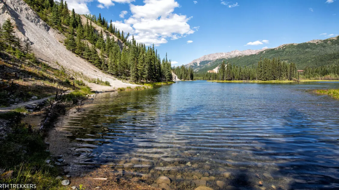
Savage River Loop
Once back at the parking lot, you have the option to hike the Savage River Loop, if you still have the energy. It’s a nice, easy stroll along the river. This trail is a 2-mile loop that takes about an hour.
Savage River Loop
Best Time to Hike the Savage Alpine Trail
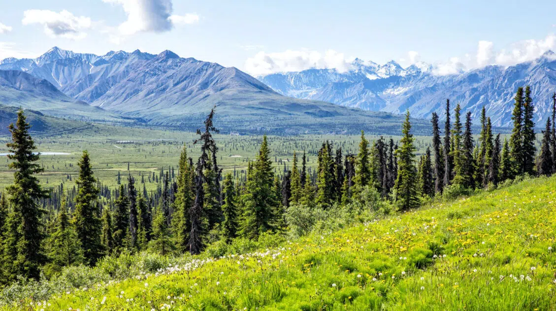
We hiked the Savage Alpine Trail in July and had a classic Denali mix: some clear mornings, some cloud cover, no snow on the trail. The crowds were noticeable but nothing like what you’d experience at Yellowstone or Yosemite in peak summer. The parking lot filled by mid-morning, but on the trail itself, it never felt busy.
The Savage Alpine Trail is accessible from mid-May through mid-September, when the road to mile 15 is open. Outside of that window, snow makes the trail difficult to follow and the shuttle doesn’t run.
- Spring (mid-May–June): Fewer crowds, long daylight hours, and a good chance of clear skies before the rainy season kicks in. Some lingering snow on the upper trail early in the season.
- Summer (July–August): Peak season and the rainiest months. Trails are snow-free, the shuttle runs reliably, but go early to secure parking and aim for clear mornings.
- Fall (September): The tundra turns brilliant red and gold, crowds drop off, and the park feels quieter. Come prepared for cold temperatures and the real possibility of early snow, especially later in the month.
- Winter: The park is technically open but mile 15 is not accessible by road. The Savage Alpine Trail is not a practical winter destination for most visitors
Tips to Have the Best Experience
This hike is best done when the skies are clear, so you can see Denali. The Savage Alpine Trail is still a great hike to do if Denali is hiding behind the clouds, but seeing Denali is icing on the cake.
Get to the Savage River parking lot before 10 am so you can get a parking space.
The day before your hike go to the Denali Visitor Center to get updated Savage River Shuttle times.
Before you go, get updates on trail conditions, either on the National Park Service website or at the Visitor Center.
The trail is very easy to follow. However, if you are here early in the season, there could be snow on the trail, making it harder to follow the trail. Bringing along a GPS preloaded with trail maps or using All Trails would be useful in this situation.
Please practice the seven principles of Leave No Trace: plan ahead, stay on the trail, pack out what you bring to the hiking trail, leave areas as you found them, minimize campfire impacts, be considerate of other hikers, and do not approach or feed wildlife.
What to Bring
Hiking shoes. There is a lot of loose rock and gravel on this trail so I recommend wearing hiking shoes with good traction.
There is no water along the trail. Bring at least one liter of water per person.
Bring sunscreen. There is very little shade on the trail.
Have insect repellent available. We only saw a few mosquitoes on this trail, mostly at the start when we were close to the Savage River.
Hiking poles. This trail is incredibly steep and hiking poles will take the stress off of your knees.
This hike is in bear country, however, we didn’t see any wildlife while we were here. There were many people already on the trail when we started so the chance that we would see a bear was slim. Even so, it’s a good idea to bring bear spray, especially if you plan to do this hike early or late in the day, when there are fewer people.
Essential Hiking Gear: What Should You Bring on a Day Hike?
If you are new to hiking or are curious about what you should bring on a hike, check out our Hiking Gear Guide. Find out what we carry in our day packs and what we wear on the trails.More Ways to Explore Denali National Park
The Savage Alpine Trail is one of the best hikes in the front country, but it’s just the starting point. For a full picture, see our guide to the best hikes in Denali National Park, where we cover ten trails across the park ranked by experience and difficulty, including several you can only reach by bus.
If you’re still planning your time in the park, our Denali National Park Travel Guide covers everything from where to stay and when to go to the best wildlife viewing spots and how to make the most of a visit even without a bus ticket.
Getting a bus ticket opens up the rest of the park entirely. Our Denali Park Road guide covers every major stop from mile 0 to mile 92: the viewpoints, the hikes, the wildlife corridors, and what to prioritize if your bus only goes partway.
One of the best things you can do in Denali has nothing to do with hiking: a flightseeing tour puts Denali’s scale in perspective in a way that no trail can. See our guide to flightseeing tours in Denali for what to expect, which operators we recommend, and how to choose the right flight for your budget.
If you’re visiting all 63 parks, Denali is one of the most rewarding. See our complete guide to the US national parks for help planning the rest of your list.
If you have any questions about how to hike the Savage Alpine Trail, or if you want to share your experience, let us know in the comment section below.
More Information about Alaska
Read all of our articles about Alaska in our Alaska Travel Guide and the United States in our United States Travel Guide.
16 Amazing Things to Do in Denali National Park
Pinterest Facebook Flipboard Discover the best things to do in Denali National Park, from bus tours along Denali Park Road and a flightseeing tour above the Alaska Range to spotting Alaska’s Big Five, hiking the Savage Alpine Trail, and visiting the famous sled dog kennels. Denali National Park is one of those places that redefines […]
Mount Healy Overlook Trail | Step-By-Step Guide, Stats, Photos
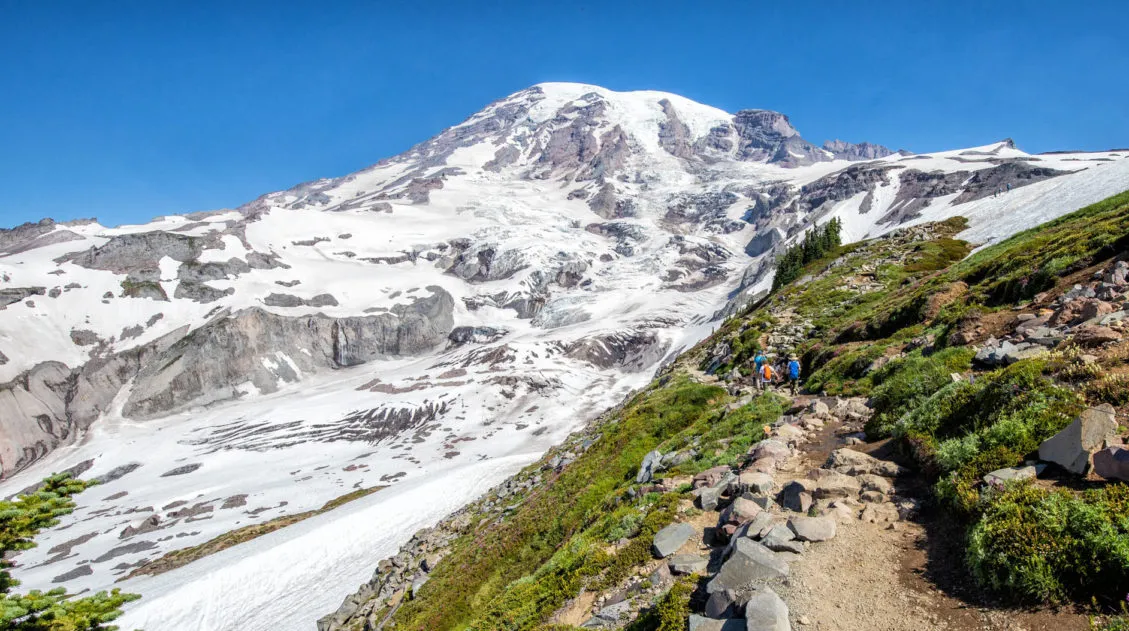
Hiking to the Mount Healy Overlook is one of the most popular hikes in Denali National Park & Preserve. The main reason to do this hike is for the view. From the overlook, you have 360° views of the front country of the park and, on a clear day, you will be able to see […]
10 Days in Alaska: 3 Itineraries for Every Type of Traveler
We have taken two trips to Alaska. The first was a three-week road trip with our whole family, our kids were older teenagers at the time, covering Anchorage, Valdez, Wrangell-St. Elias, Denali, Kenai Fjords, Homer, Seward, and Katmai National Park. It remains one of the best trips we have ever taken as a family. Several […]
How to Hike the Horseshoe Lake Trail | Denali National Park
Horseshoe Lake is a beautiful lake near the front entrance of Denali National Park. Named after its shape, Horseshoe Lake can be reached from the Horseshoe Lake Trail. This trail is a short and easy hike that first takes you to an aerial overlook of the lake and then down to its shoreline, where you […]
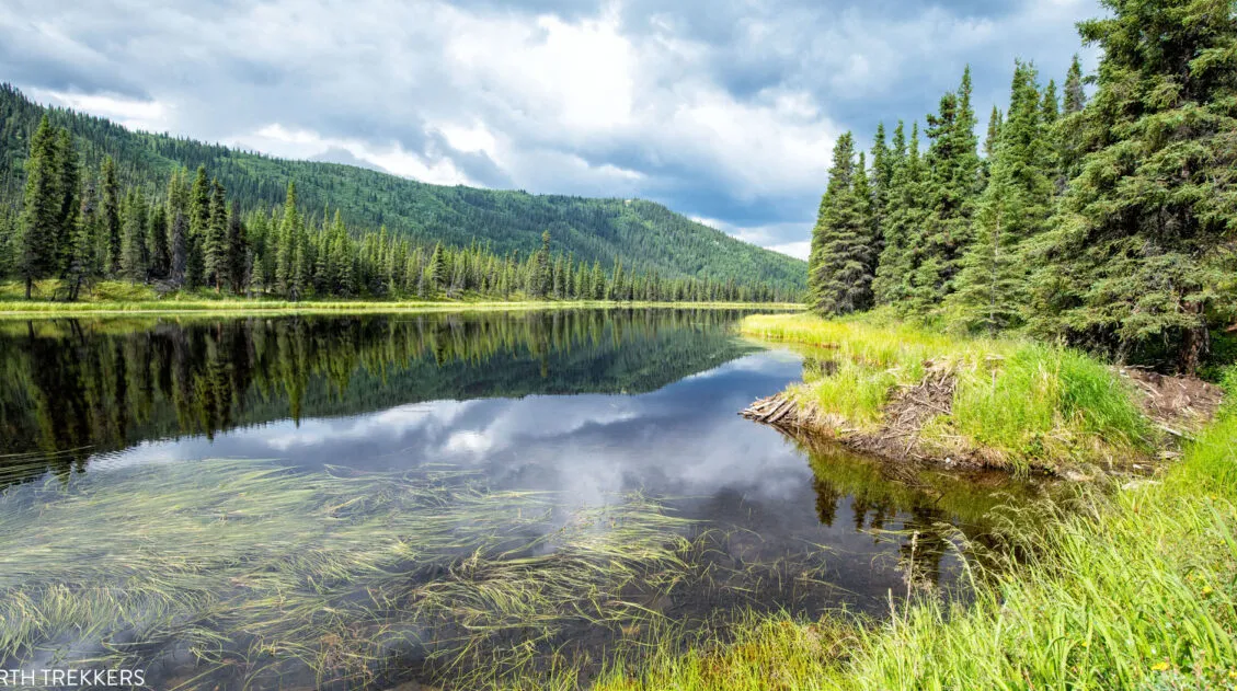
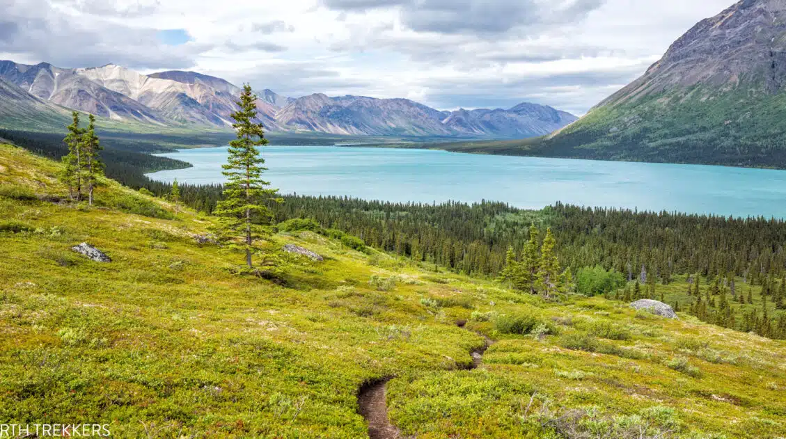
Triple Lakes Trail, Denali National Park: Is It Worth It?
The Triple Lakes Trail is a well-maintained, well-traveled trail along the eastern border of Denali National Park, just south of the park’s entrance. As you hike, you can walk right down to the shoreline of three separate lakes, watch for beavers at Lake 1 and moose at Lake 2, and enjoy occasional clearings with views […]
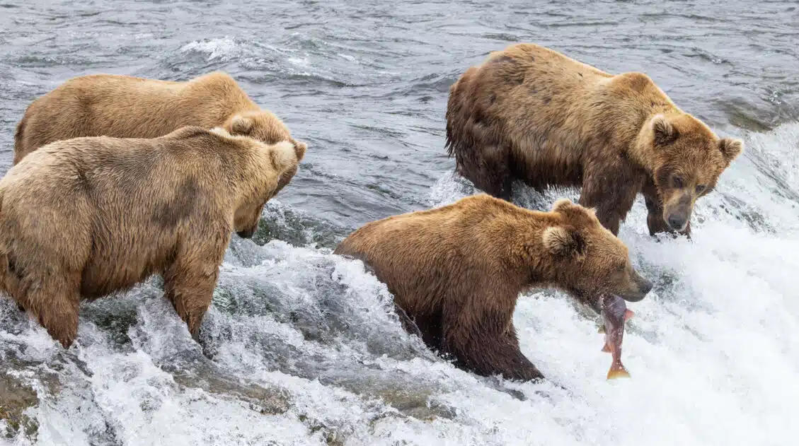
Complete Guide to Brooks Falls Trail & Viewing Platforms | Katmai National Park
Brooks Falls is one of the best places in Katmai National Park to view brown bears. Every July, when the salmon make their annual run, this part of the Brooks River is packed with bears, making it one of the best wildlife viewing experiences in the US national parks. In this guide, learn how to […]
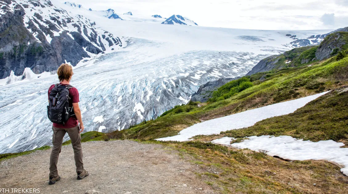
Harding Icefield Trail: The Ultimate Hiking Guide
Hiking the Harding Icefield Trail in Kenai Fjords National Park is a challenging, rewarding, and unique experience all rolled into one. This memorable hike takes you past the Exit Glacier and ends with sweeping views across the Harding Icefield, the largest icefield that is located entirely in the United States. In this guide, we provide […]
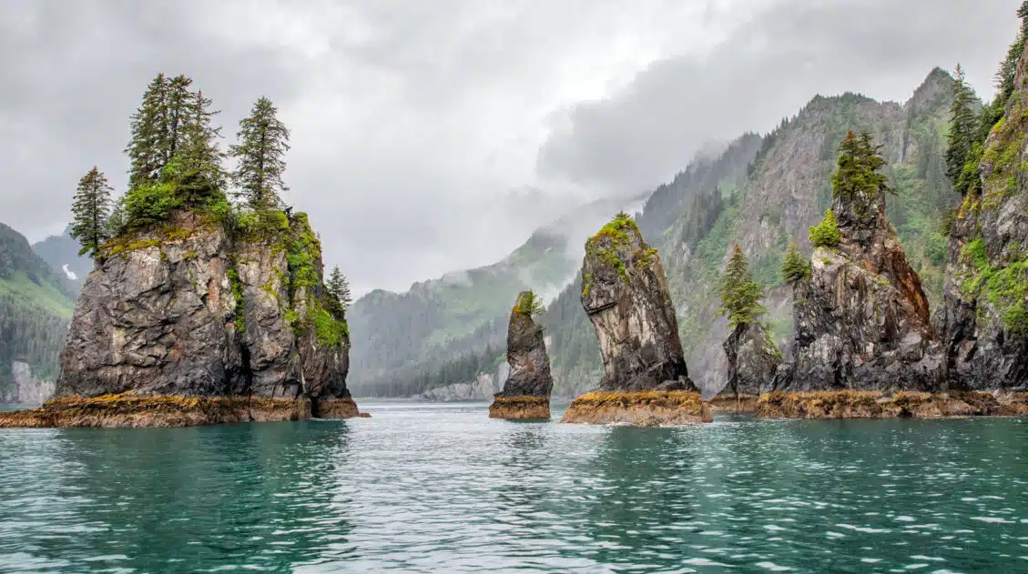
Kenai Fjords National Park Travel Guide
Plan your visit to Kenai Fjords National Park. Learn about the best things to do, how to plan your time, where to stay, and more.
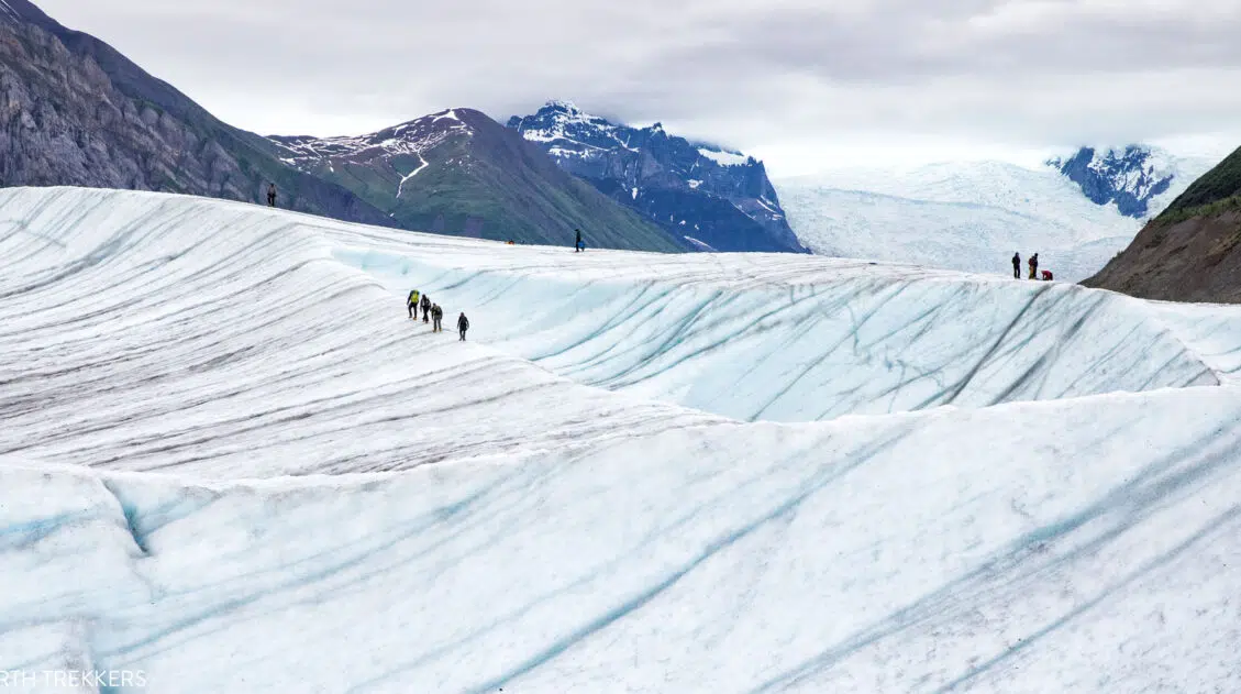
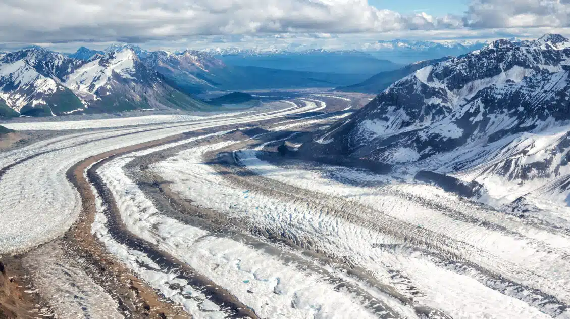
Root Glacier Trail: Step-By-Step Guide (Map, Stats & Photos)
Hiking the Root Glacier Trail is one of the best things to do in Wrangell – St. Elias National Park and Preserve. This national park is covered with a huge amount of glacial ice and the Root Glacier is the most accessible glacier in the park. Whether or not you have been glacier hiking before, […]
20 Epic Hikes in the US National Parks
With 63 national parks and thousands of miles of hiking trails, your options are endless for exploring the American national parks. We narrowed down the list for you to 20 of the best hikes in the US national parks, 20 amazing ways to explore this beautiful country. Hike to the tallest peaks, through massive canyons, […]
10 Epic Things to Do in Lake Clark National Park
Lake Clark National Park is a wild, rugged expanse of land that is home to two active volcanoes, icy glaciers, rocky, jagged mountains, several of the largest lakes in Alaska, and an abundance of wildlife. Located in Alaska, this national park is one of the least visited in the USA. There are no roads in […]
20 Fun, Short Hikes in the US National Parks
One of the best ways to experience the national parks is from a hiking trail. Hike to amazing viewpoints, deep into the forests, through scenic canyons, and to hidden lakes and waterfalls. Along the way, you have a better chance of spotting wildlife and potentially leaving the crowds behind. Here are 20 fun, short hikes […]
Wrangell-St. Elias National Park Travel Guide
Wrangell – St. Elias National Park Wrangell – St. Elias is one of the most awe-inspiring national parks in the USA. And it’s one many people don’t know about. This is the largest national park in the United States. Take Yellowstone National Park, multiply it by 6, and that’s roughly the size of Wrangell – […]

Comments 6