
Discover the best hikes in Denali National Park, from the easily accessible Savage Alpine Trail to trails deeper into the park, at Eielson and Kantishna.
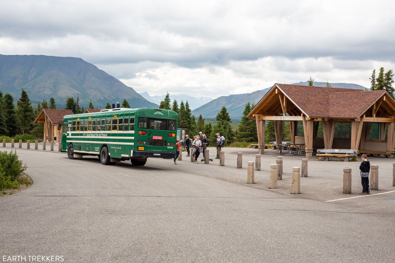
Most visitors to Denali never make it past the Savage River area, accessible at mile 15 of Denali Park Road. We’re not most visitors.
We hiked trails throughout the park, from the easy loops near the entrance all the way out to Eielson Visitor Center at mile 66 and into the remote backcountry near Kantishna at the end of the road. Few national parks have left us as awestruck. Denali is enormous, wild, and unlike anywhere else we’ve hiked in the US. The trails near the park entrance are pleasant, but the deeper you go into the park, the more extraordinary the experience becomes.
In this guide, we cover the best hikes in Denali National Park organized by region: the park entrance, Savage River, Eielson, and Wonder Lake, along with our recommendations for which ones are worth your time based on what you actually want out of a hike.
The National Park Service lists 20 maintained hiking trails in Denali. We’ve hiked nearly all of them. Off-trail hiking is permitted throughout the park and is one of the best ways to experience Denali, but this guide focuses on the maintained trails. For each one, we’ll tell you what the hike is actually like, who it’s best suited for, and whether it’s worth the effort.

Best Hikes in Denali
OUR FAVORITE HIKE | Thorofare Ridge Trail
BEST OVERALL HIKE | Savage Alpine Trail
BEST MODERATE HIKE | Mount Healy Overlook
BEST EASY HIKE | Horseshoe Lake
BEST VIEW OF DENALI | Thorofare Ridge Trail
BEST HIDDEN GEM | McKinley Station Trail
BEST FOR FAMILIES | Savage River Loop
ESCAPE THE CROWDS | Triple Lakes or McKinley Bar
⚠️ 2026 Road Closure Update
Denali Park Road is closed beyond mile 43 due to an ongoing landslide repair project at Pretty Rocks. In 2026, no buses will travel to Eielson Visitor Center or Wonder Lake, meaning the Thorofare Ridge Trail, Gorge Creek Trail, Tundra Loop, and McKinley Bar Trail described in this guide are not currently accessible.
The road is expected to reopen in 2027. If you’re planning your first trip to Denali and want the full experience, including the trails near Eielson, which are our favorites in the entire park, it’s worth timing your visit accordingly. We’ve kept all trail descriptions in this guide so you can plan ahead.
Currently visiting? The park entrance, Savage River, and a few trails along the East Fork Transit Bus route (to mile 42) are still open and very much worth your time→
What to Do in Denali while Denali Park Road is Closed (& Is It Worth It?)
Best Hikes in Denali National Park
The hikes on this list are organized geographically rather than by difficulty or rank, since your options largely depend on where you are in the park. Hikes near the entrance and Savage River are accessible by car. Everything beyond mile 15 requires the park bus.
Below is a map from the National Park Service. I labeled the four areas listed above on this map as well as the location of Denali.
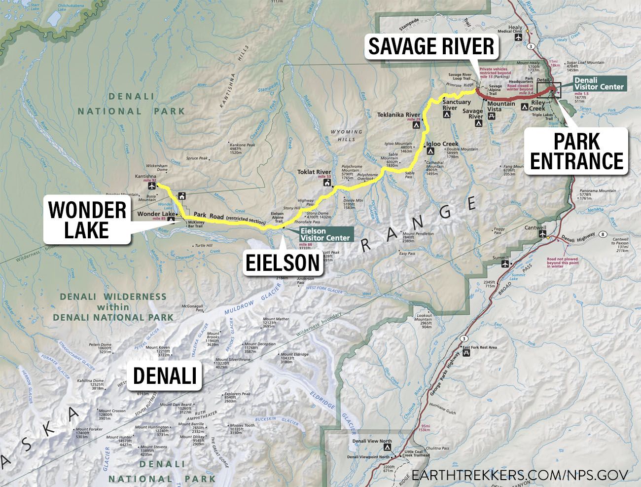
Map of Denali/nps.gov
Please practice the seven principles of Leave No Trace: plan ahead, stay on the trail, pack out what you bring to the hiking trail, leave areas as you found them, minimize campfire impacts, be considerate of other hikers, and do not approach or feed wildlife.
Trails Near the Entrance of Denali National Park
The area around the entrance to Denali National Park contains the highest number of trails in the park. That’s great, because this area is easy to get to and there is plenty of parking.
The downside of these hikes is that, with one exception, you won’t get to see Denali. The park entrance is located very far away from Denali, so don’t expect to get a view of it from here, unless you hike the Mount Healy Overlook Trail. And even then, keep your fingers crossed for clear skies.
If you are looking for a trail with a view of Denali, it’s best to go deeper into the park.
But with that being said, there are still some lovely hikes to do near the park entrance.
Mount Healy Overlook Trail
Distance: 4.9 miles out-and-back | Difficulty: Moderate | Total Ascent: 1,800 feet | Time: 2.5 to 4 hours
The main reason to do this hike is for the view. From the overlook, you have 360° views of the front country of the park and, on a clear day, you will be able to see the top of Denali.
Best for: Visitors who want a view of Denali without riding the park bus deeper into the park
Why it’s worth it: 360° views over the front country and, on a clear day, a distant glimpse of Denali
Skip it if: You’re expecting a close-up look at Denali because it appears very small from here, and you’ll need crystal clear skies to see it at all
Even though you can see Denali from this trail, it is still appears very small, since it is so far away. To see Denali, you will need crystal clear skies.
In our opinion, it’s not the most thrilling hike. Basically, it is an uphill climb, mostly in the trees, and this trail is just about getting you up to the overlook.
But once up there, the views are great. Plus, you can continue beyond the overlook, taking the trail higher into the mountains, for an even better experience. Here’s how to do it ↓
Mount Healy Overlook Trail: Step-By-Step Guide
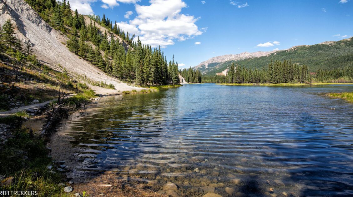
Everything you need to know to hike the Mount Healy Overlook Trail.Horseshoe Lake Trail
Distance: 2 miles round-trip | Difficulty: Easy | Total Ascent: 300 feet | Time: 1 to 2 hours
Best for: Families, beginners, or anyone wanting an easy, scenic walk near the park entrance
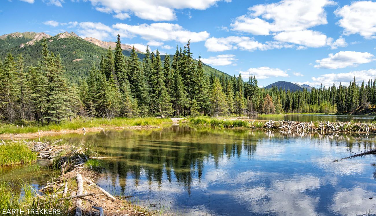
Why it’s worth it: Constantly changing scenery. The Nenana River, a massive beaver dam, and beautiful views along the lake shoreline, all in under two miles.
Skip it if: You’re an experienced hiker looking for elevation gain or a challenge
This was our favorite hike near the Denali Visitor Center and the park entrance.
It’s short, it’s easy, and the views along the trail are constantly changing. On this hike, you will walk along the beautiful Nenana River, get to see an enormous beaver dam, and the best part, you have beautiful views as you walk along the shoreline of the lake.
How to Hike the Horseshoe Lake Trail | Denali National Park
A step-by-step trail guide for the Horseshoe Lake hike.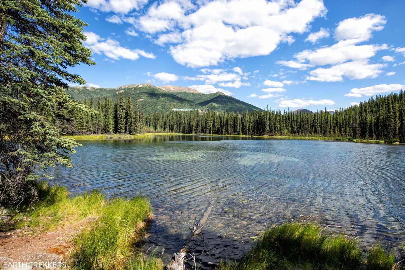
Nenana River
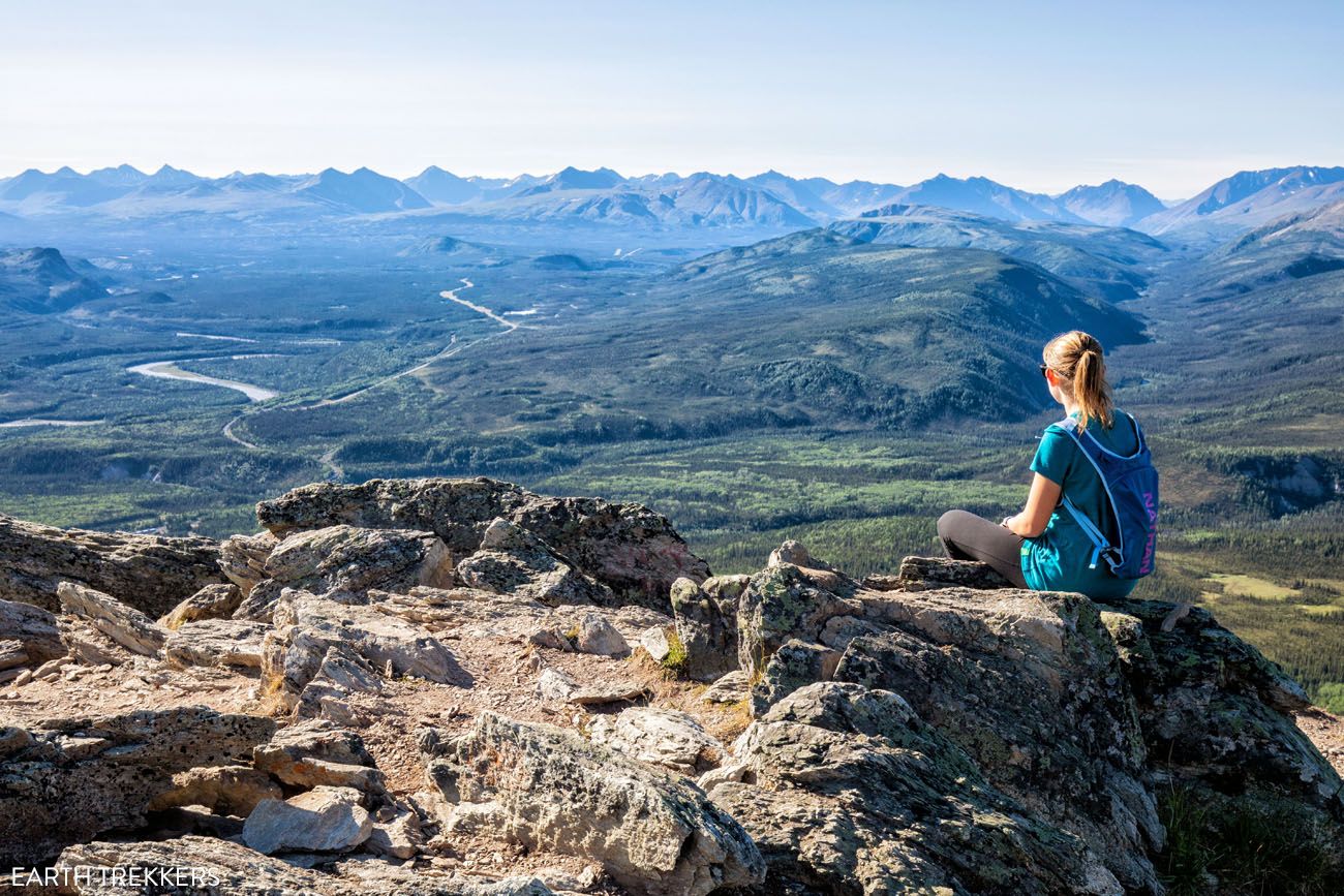
Triple Lakes Trail
Distance: 9.25 miles one-way | Difficulty: Moderate | Total Ascent: 1,800 feet | Time: 3.5 to 6 hours
Best for: Hikers who want to escape the crowds and don’t mind committing to a long day
Why it’s worth it: One of the least-trafficked trails in the front country, with three distinct lakes and good wildlife sightings along the way
Skip it if: You don’t have a shuttle arranged. Without one, the only option is 18.5 miles out-and-back, which is a serious undertaking.
This is the longest hike in Denali National Park. It’s 9.25 miles one-way, which means that you have to have some kind of shuttle to do this hike, or you have to hike it out-and-back (for a total distance of 18.5 miles).
The trail is named for the three lakes located along the trail and each one is slightly different. Wildlife sightings are common, with the chance to see beaver, moose, and bear.
If you have no desire to do a 9 mile point-to-point hike, or if you don’t have a shuttle, you can simply hike out-and-back to the three lakes. This makes it a 6 mile round-trip hike that takes 3 to 5 hours.
This is a nice hike, and a lot of people who do it, rave about it. We liked it, but it was not our favorite hike. It’s a long way to go to see a few lakes and have some views of the mountains in the front country of Denali. But if you like the idea of hiking a less crowded trail, this is a hike to consider.
Triple Lakes Trail, Denali National Park: Is It Worth It?
In this guide, we cover the different route options (doing the full hike point-to-point or turning around after seeing the lakes), information on the best direction to hike the trail, where to park, and more.McKinley Station Trail
Distance: 3.2 miles out-and-back | Difficulty: Easy | Total Ascent: 100 feet | Time: 2 hours
Best for: Solo hikers or anyone who wants a peaceful, uncrowded walk steps from the Visitor Center
Why it’s worth it: Surprisingly beautiful Riley Creek scenery with almost no other hikers, despite the trailhead’s proximity to the busiest part of the park
Skip it if: You’re working through a packed itinerary because this is an easy one to skip if time is tight
This is one of my favorite easy hikes in Denali National Park. I hiked the McKinley Station Trail solo while Tim, Tyler, and Kara hiked the Triple Lakes Trail.
This hike is easy, it’s conveniently located near the Denali Visitor Center, and I saw very people on this trail, despite its close proximity to the Visitor Center.
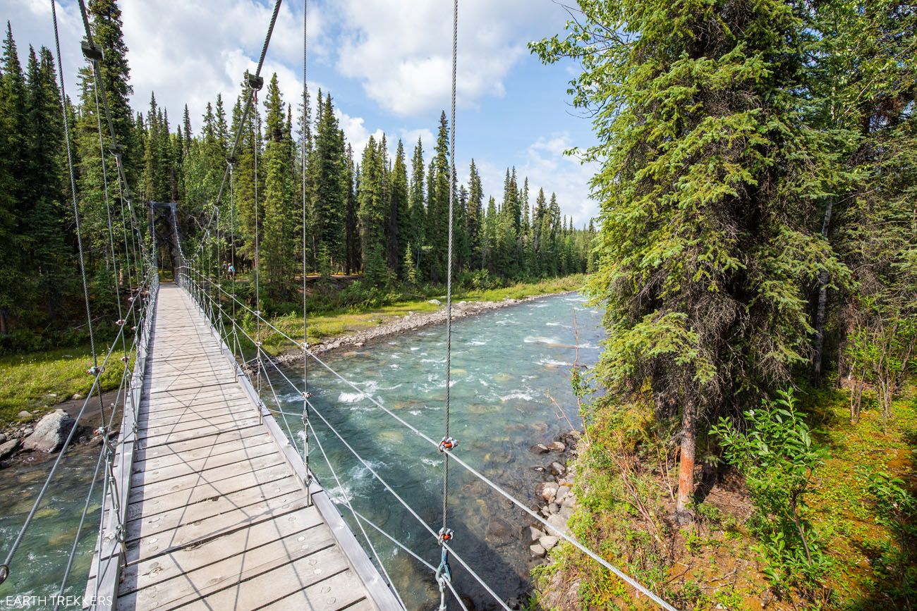
Starting behind the Visitor Center, follow signs for the McKinley Station Trail. There is a web of trails here so it can be easy to make a wrong turn, so pay close attention to the trail signs. After a big, steep descent, you will be at Riley Creek. The trail turns to the left here and goes under the railroad trestle. But as an optional detour, you can walk onto the wooden bridge for a nice view of Riley Creek and the railroad trestle.
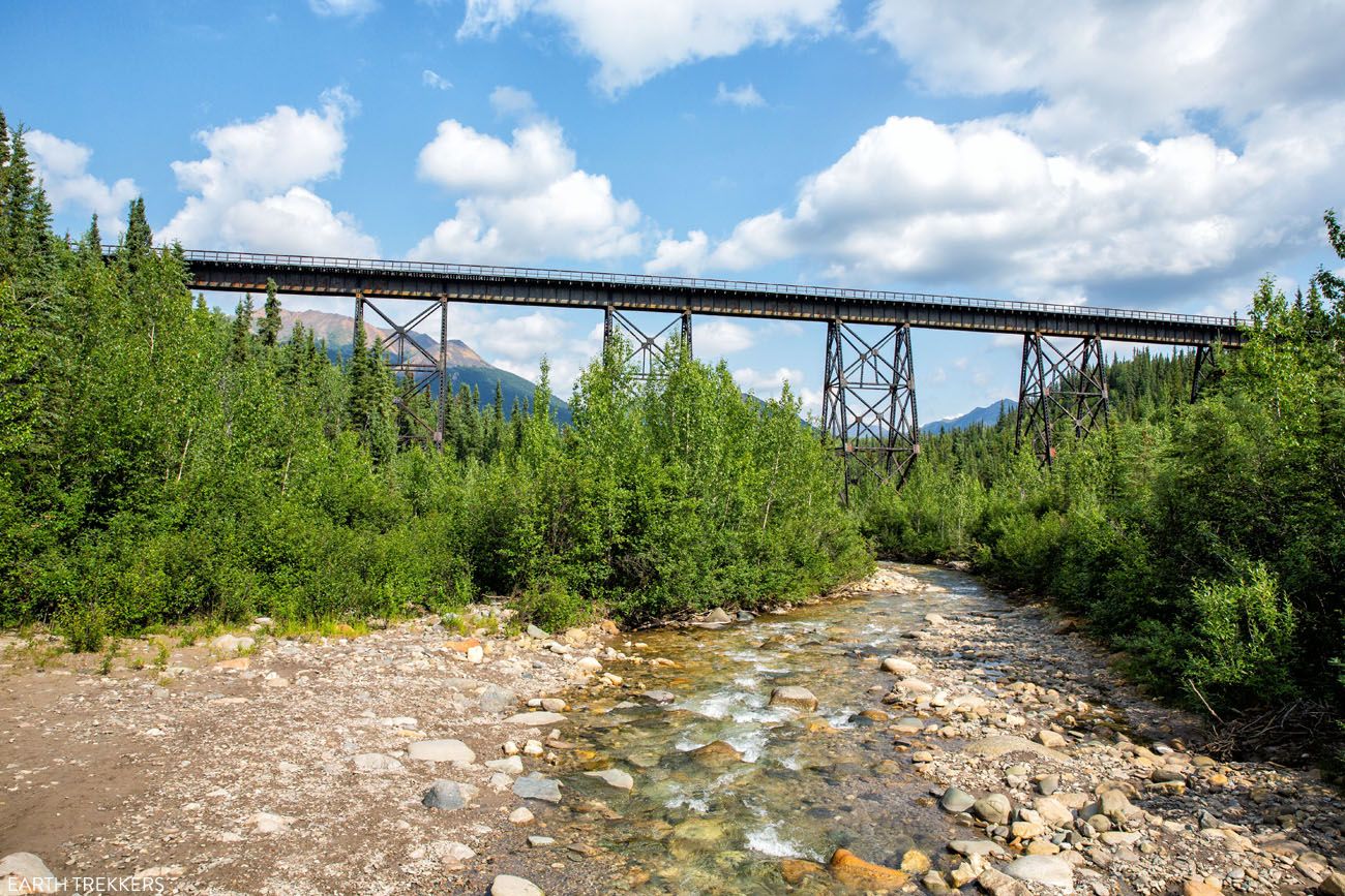
Riley Creek and the Railroad Trestle
Note: If you continue past the wooden bridge, you will now be hiking the Triple Lakes Trail. You can walk this first part of the Triple Lakes Trail to get to the suspension bridge that crosses Riley Creek.
Back on the McKinley Station Trail, Riley Creek is to your right. Just past the railroad trestle, the trail splits. But here’s the weird thing… both trails are called the McKinley Station Trail. I hiked both of them. If you go left, you will be in the trees the entire time and it’s rather boring. So, take the trail to the right. This narrow trail follows along Riley Creek and at times you have beautiful views of the river. I hiked this out-and-back midday and did not see one other person. It was a wonderful, unexpectedly amazing experience.
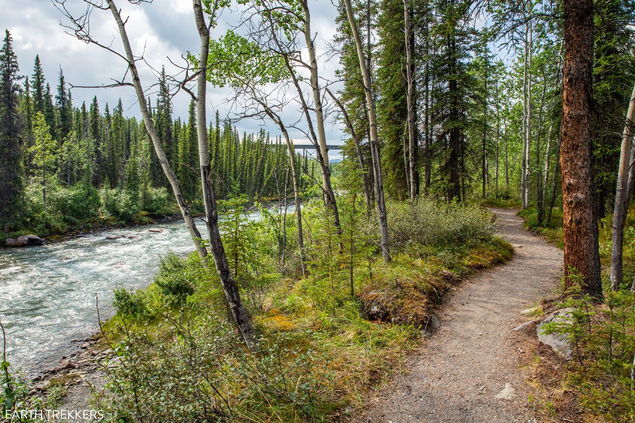
Riley Creek
Morino Trail
Distance: 0.4 miles | Difficulty: Easy | Total Ascent: Minimal | Time: 30 minutes
This short, easy trail starts behind the Visitor Center and takes you to the original location of the Morino Roadhouse. Built in 1921, this roadhouse was constructed to accommodate travelers to Denali National Park. Nothing remains of the building…just a clearing in the trees where it once stood.
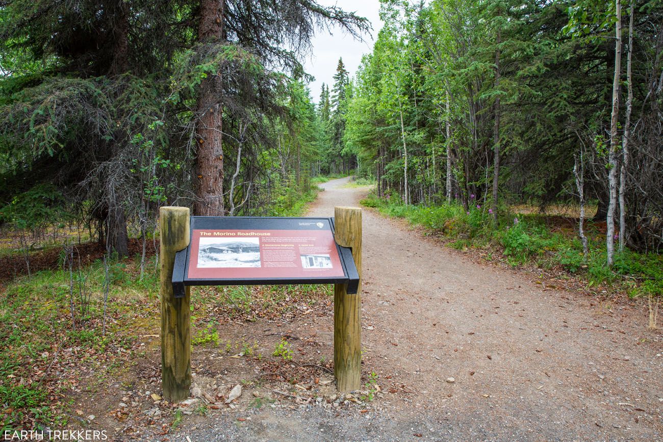
Morino Trail
Spruce Forest Trail
Distance: 0.4 miles round-trip | Difficulty: Easy | Total Ascent: Minimal | Time: 30 minutes
The Spruce Forest Trail meanders through the forest behind the Visitor Center. It forms a loop the McKinley Station Trail. Because of the network of trails here, it’s possible to combine the Spruce Forest Trail, Morino Trail, and McKinley Station Trail into one larger hike.
Oxbow Loop Trail
Distance: 1.5 miles round-trip | Difficulty: Easy | Total Ascent: Minimal | Time: 1 hour
This easy hike loops around an oxbow bend of the Nenana River. It starts and ends on Highway 3, about 7 miles south of the Denali National Park entrance. This trailhead is on the opposite side of the road from the Triple Lakes trailhead.
More Hikes Near the Visitor Center
For completion, here is a list of the remainder of hiking trails located near the Visitor Center. With the exception of the Roadside Hiking Trail and the Rock Creek Trail, these are connector trails.
Rock Creek Trail
This trail is 2.4 miles one-way. It starts at the Visitor Center parking lot and heads along a ridgeline. On this hike, you have views of Mount Healy. It ends near the Sled Dog Kennels. To complete the hike, you can either return on the Rock Creek Trail or the Roadside Hiking Trail.
Roadside Hiking Trail
This trail is 1.8 miles one-way and follows along the side of Denali Park Road, running parallel with the Rock Creek Trail. It connects the Sled Dog Kennels with the Visitor Center. The Roadside Hiking Trail can be combined with the Rock Creek Trail to form a loop.
Taiga Trail
The Taiga Trail is a connector trail that links the Visitor Center parking lot to several other hikes, including the Mount Healy Overlook Trail, Horseshoe Lake Trail, and the Rock Creek Trail.
Meadow View Trail
This 0.25 mile one-way trail connects the Roadside Hiking Trail with the Rock Creek Trail.
Roadside Bike Trail
This 1.7-mile compacted gravel trail connects the park entrance with the Visitor Center.
Jonesville Trail
This steep, 0.3 mile trail connects Riley Creek Campground with the Canyon, which is a business district outside of the park.
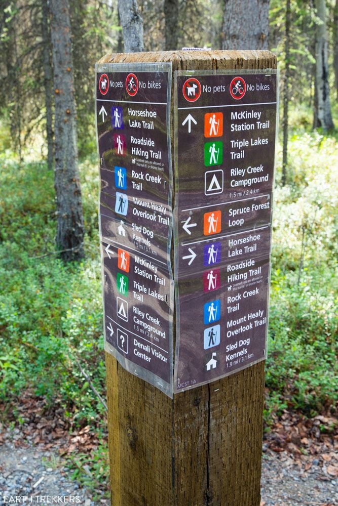
Trail sign near the Visitor Center. There are a lot of trails here that interconnect but these signs are posted at each trail junction.

Trails at the Savage River Area
The Savage River Area of Denali is located between miles 13 and 15 on Denali Park Road.
If you want sweeping views of Denali National Park, and the chance to see Denali without venturing too far into the park, put the Savage River Area on your to-do list.
From the Savage Alpine Trail, you have a great view of Denali, as long as the sky is clear. Plus, you can drive to this section of the park. For these reasons, this is one of the best locations to go hiking in Denali National Park.
GETTING HERE: You are permitted to drive to Savage River in your own vehicle, no permit necessary. However, parking is very limited. If you like the idea of doing one or more of these hikes, it is crucial to get here early in the day, ideally at or before 9 am. There is also a free park shuttle that connects the Visitor Center and the Savage River areas.
Mountain Vista Trail
Distance: 0.6 mile loop | Difficulty: Easy | Total Ascent: Minimal | Time: 30 minutes
Best for: Anyone driving to Savage River who wants a quick, easy walk with mountain views
Why it’s worth it: Great views of the Savage River area mountains with minimal effort, and it works as overflow parking if the Savage River lot is full
Skip it if: You’re short on time because the Savage Alpine Trail from the same area is a far more rewarding experience
This loop hike is located at mile 13 of Denali Park Road. Park at the Mountain Vista Rest Area and follow signs for the Mountain Vista Trail. Along this hike, you have great views of the mountains in the Savage River Area.
This area has restrooms, a very nice picnic area, and serves as alternate parking if you plan to hike the Savage Alpine Trail. The free Savage Area shuttle also stops here.
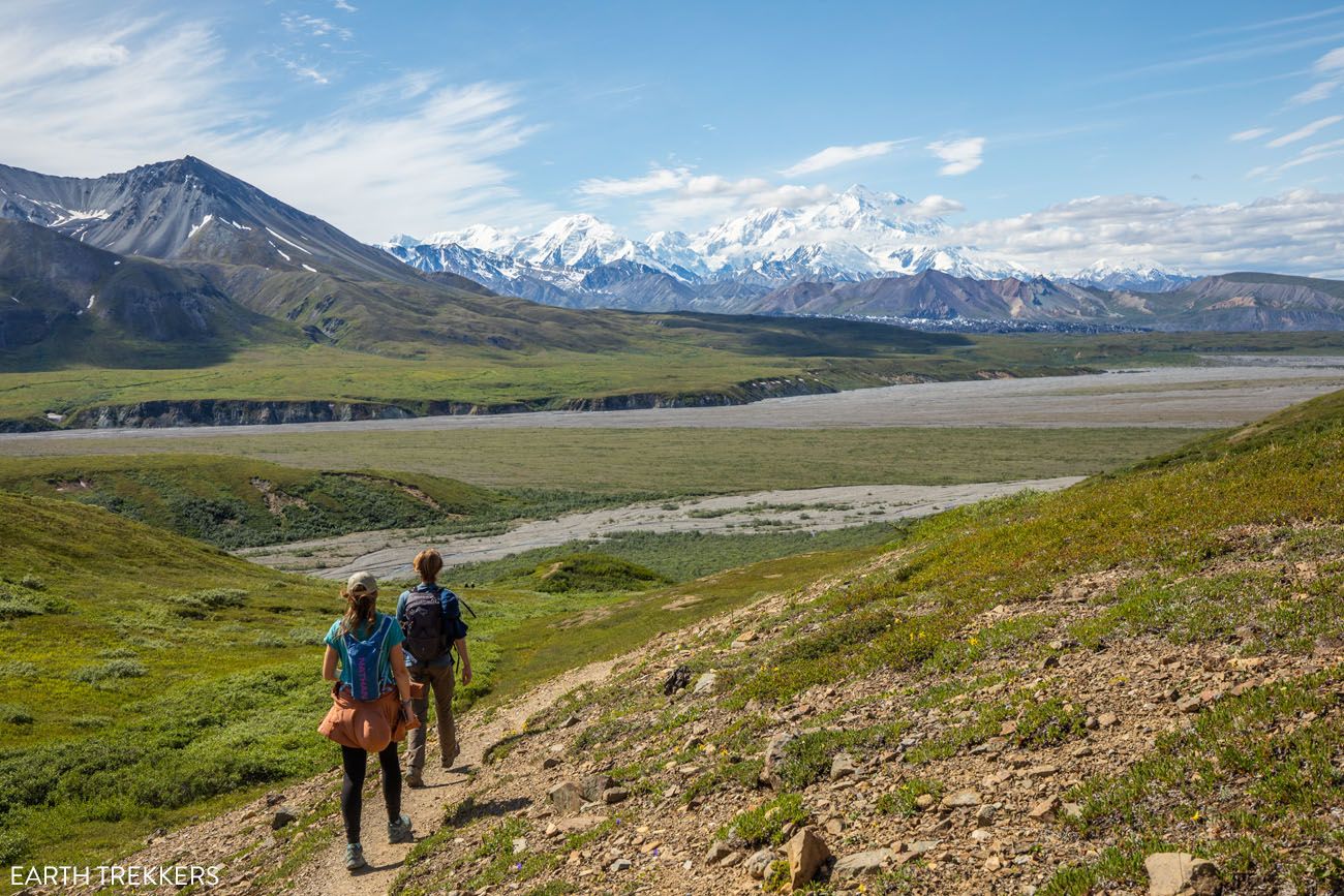
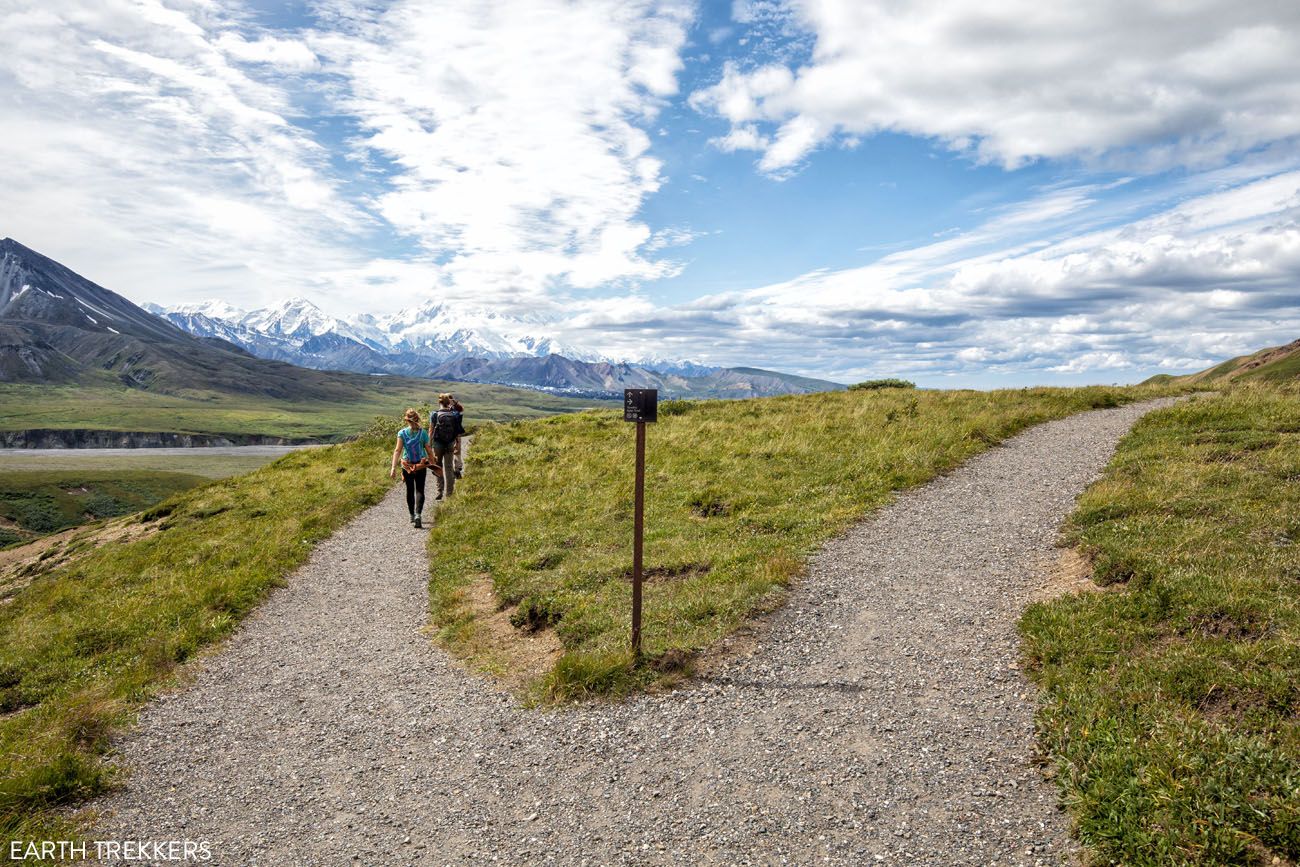
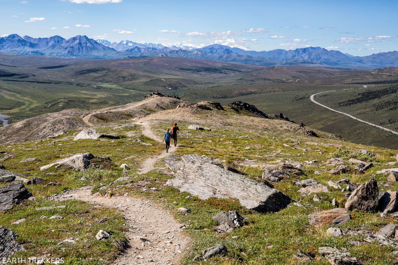
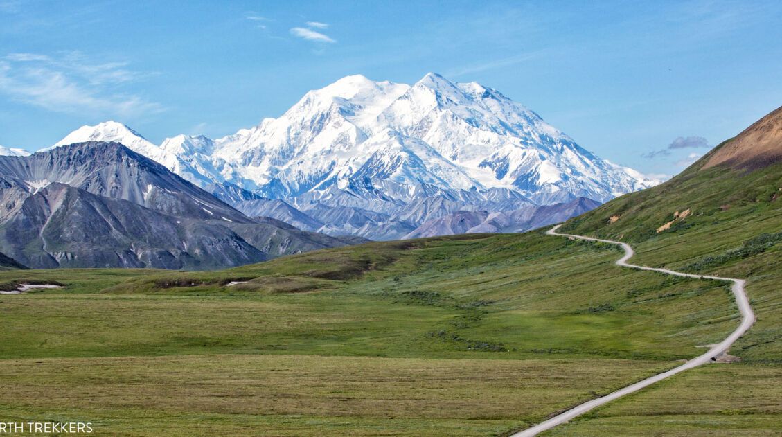
Savage Alpine Trail
Distance: 4 miles | Difficulty: Strenuous | Total Ascent: 1,500 feet | Time: 2 to 4 hours
Best for: Fit hikers who want the best views accessible by car, no park bus required
Why it’s worth it: The most rewarding hike in the front country. On a clear day, you get sweeping views of the Savage River area and a distant view of Denali
Skip it if: You’re not prepared for a very steep first 0.7 miles or are visiting with young children
Without a doubt, this is one of the best hikes in Denali National Park.
It’s a tough hike (it’s one of the hardest hikes in Denali), but on a clear day, it’s well worth it for the view.
This hike can be done as a point-to-point hike or an out-and-back hike, and either way, the distance comes in at around 4 miles. To do it as a point-to-point hike, you will need to utilize the free park shuttle. Or, you can do what we did, and hike it out and back from the Savage River parking lot.
Best Way to Hike the Savage Alpine Trail in Denali
Here’s what you need to know to hike the Savage Alpine Trail.From Savage River, it is an incredibly steep climb for the first 0.7 miles of the trail. But once at this point…enjoy the view! It’s awesome and you certainly earned it. You can turn around here, or keep working your way up higher for even better views of the Savage River area.
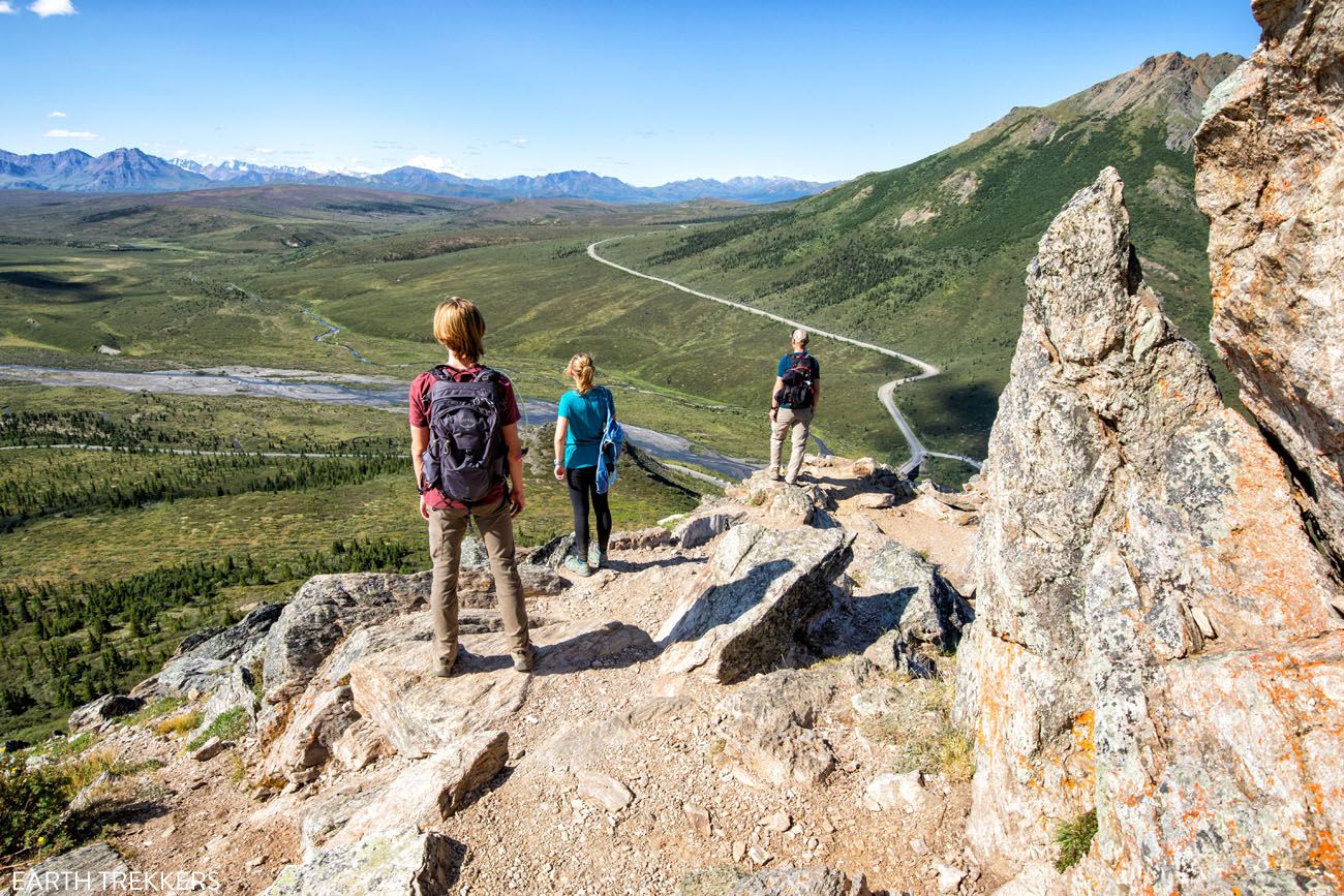
This is the view 0.7 miles into the hike, if you start at the Savage River parking lot. Can you see Denali…even from here, it still appears very small and very far away.
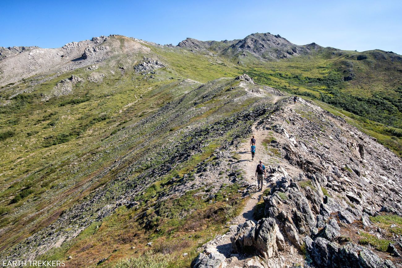
The trail continues higher into the mountains.
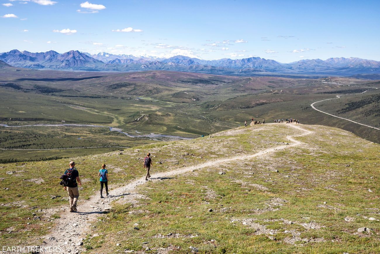
At the 2 mile mark, you reach another viewpoint. You can either retrace your steps back to the Savage River parking lot, or continue 2 miles to the Mountain Vista Rest Area. Both ways, it is 4 miles round trip.
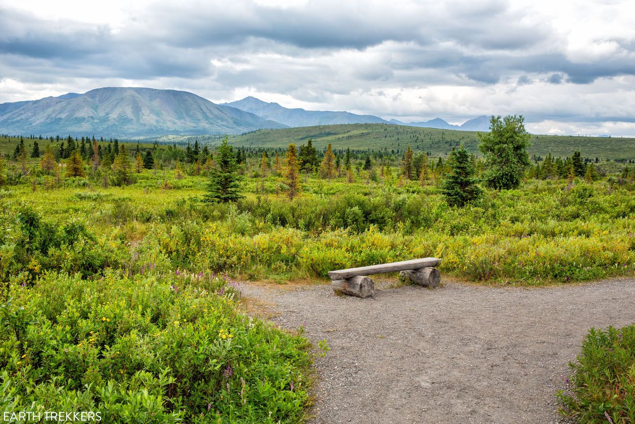
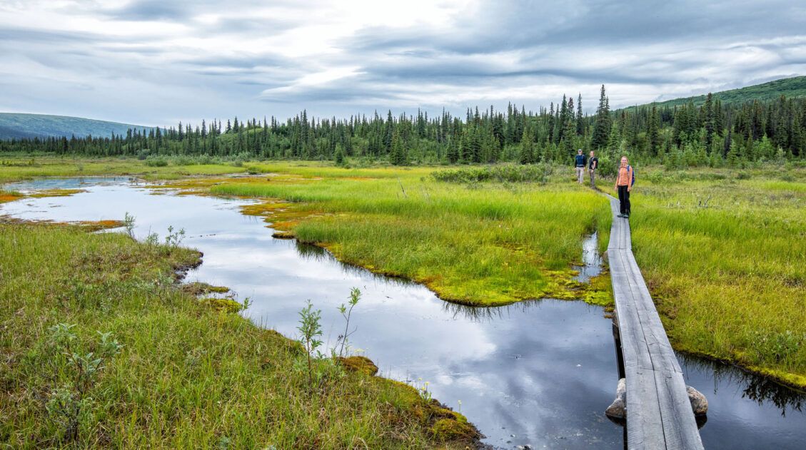
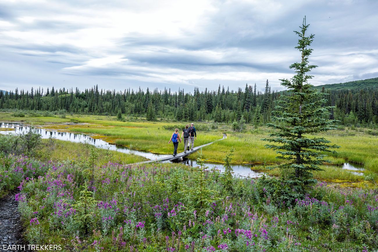
Savage River Loop
Distance: 2 mile loop | Difficulty: Easy | Total Ascent: Minimal | Time: 1 to 2 hours
Best for: Easy hikers, families, or anyone looking for a pleasant riverside walk at Savage River
Why it’s worth it: Beautiful scenery along one of the most accessible stretches of the park, with a good chance of wildlife sightings
Skip it if: You’re hoping to see Denali because you won’t get a view from this trail; hike the Savage Alpine Trail for that
This is another great hike to consider if you are looking for something easy. The Savage River Trail makes a loop around a portion of the Savage River.
It tends to be a busy trail, particularly midday. From the trail, you will not get to see Denali. You need to climb higher for that, which you can do on the Savage Alpine Trail, which starts at the same trailhead.
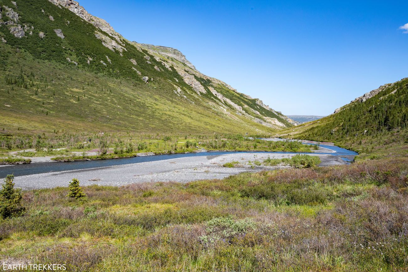
Savage River
Savage River Loop
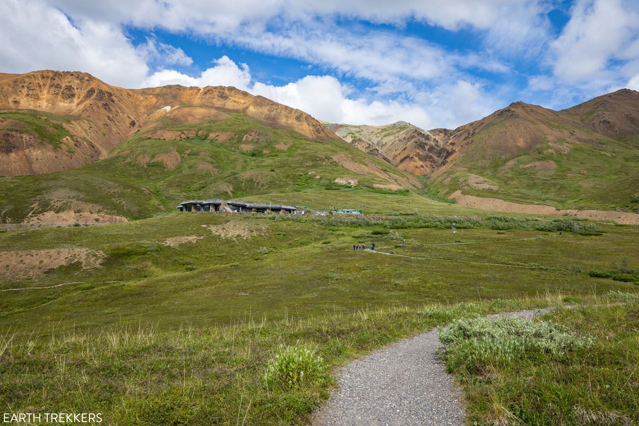
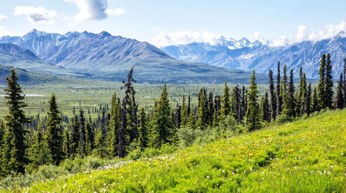
Trails at Eielson Visitor Center
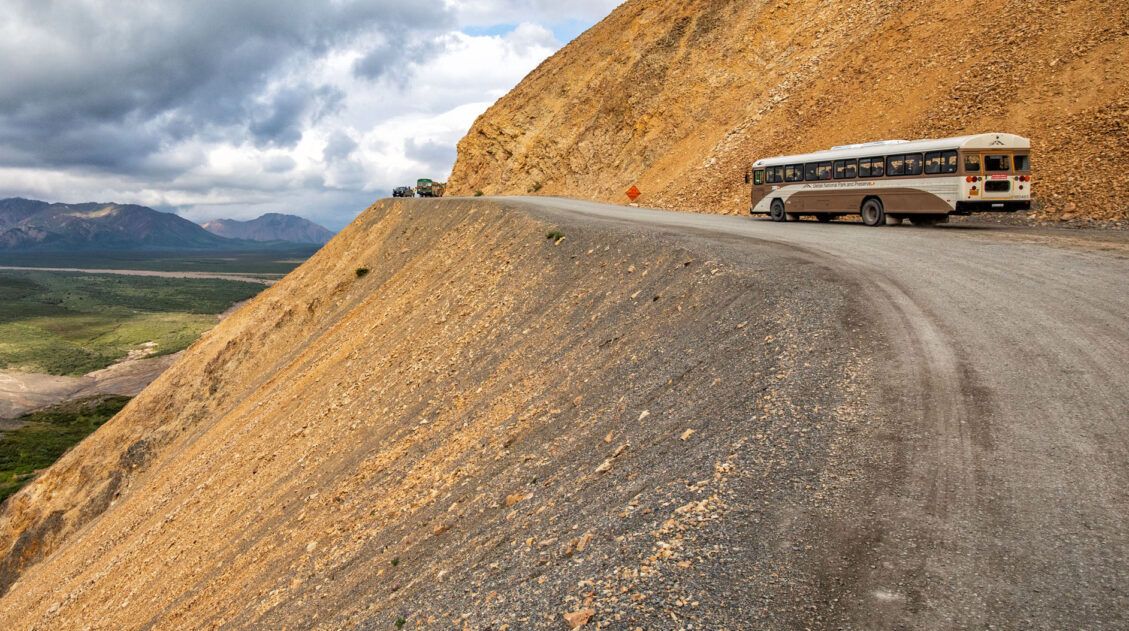
Eielson, which is located at mile 66 on Denali Park Road, is one of the most spectacular areas to visit in Denali National Park & Preserve. On a clear day, the views of Denali are unbeatable. The drive to get here is gorgeous, there are several short hikes to choose from, and you get to venture away from the crowds at the front of the park.
You can only get here by bus. If you want to spend some time hiking, the best option is to take the transit bus. This bus will drop you off at the Eielson Visitor Center, you can spend a few hours hiking, and then hop on the next available bus to the park entrance.
The bus typically runs from early June through mid-September. Note: Buses will not be traveling to Eielson Visitor Center in 2026 due to the landslide at mile 42.
5 Reasons Why You Should Visit Eielson Visitor Center on Denali Park Road
In this guide, we cover how to get to Eielson and what to do once you are here, including a more detailed overview of the hiking trails in this part of the park.Thorofare Ridge Trail
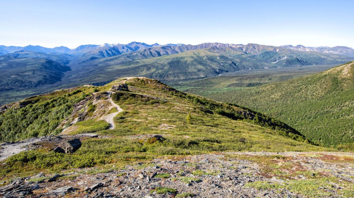
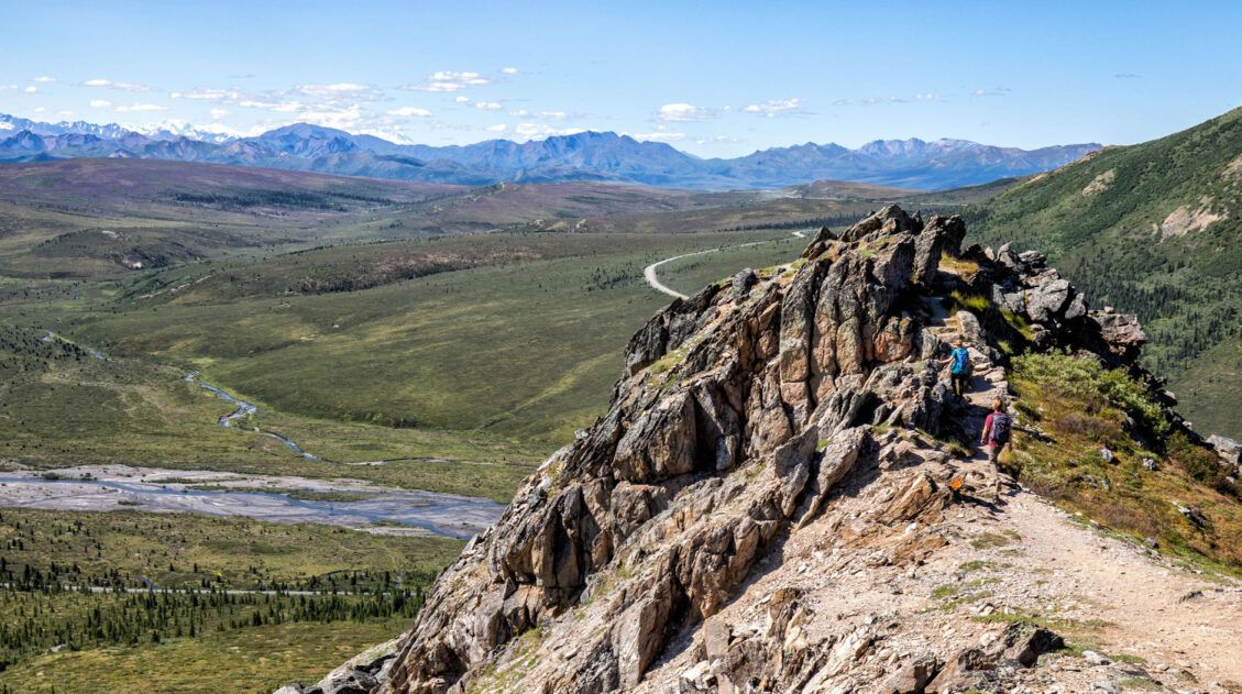
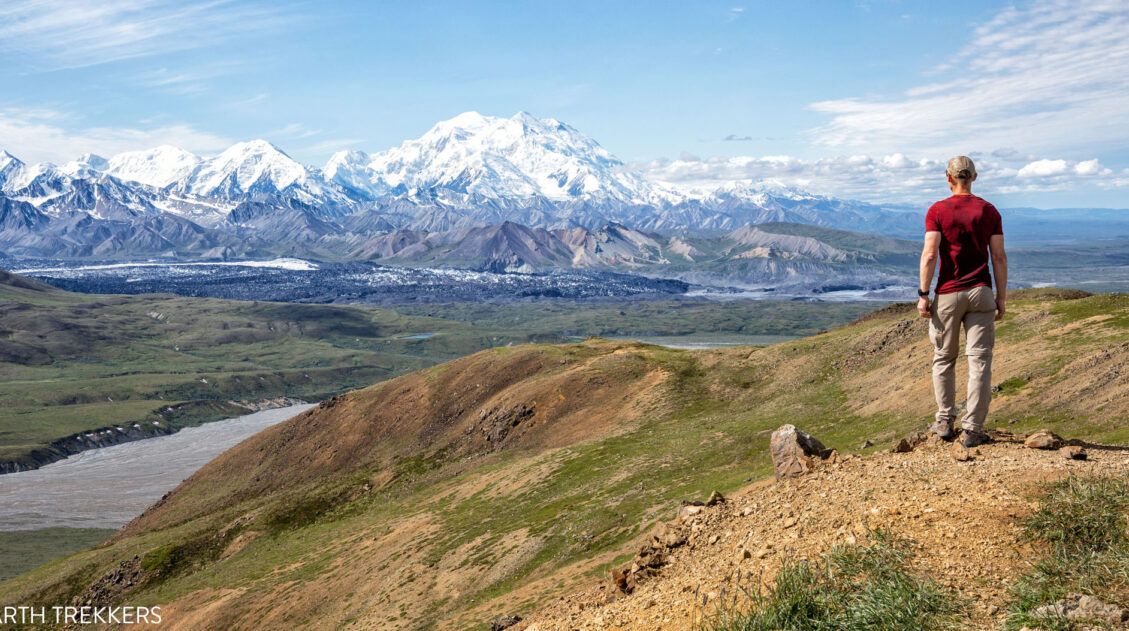
Distance: 2 miles out-and-back | Difficulty: Strenuous | Total Ascent: 1,000 feet | Time: 1 to 2 hours
Best for: Anyone willing to make the bus journey out to Eielson for the best views in the park
Why it’s worth it: In our opinion, this is the finest viewpoint of Denali in the entire park
Skip it if: You’re visiting in 2026, as Eielson is currently inaccessible due to the road closure; plan this one for 2027 or later
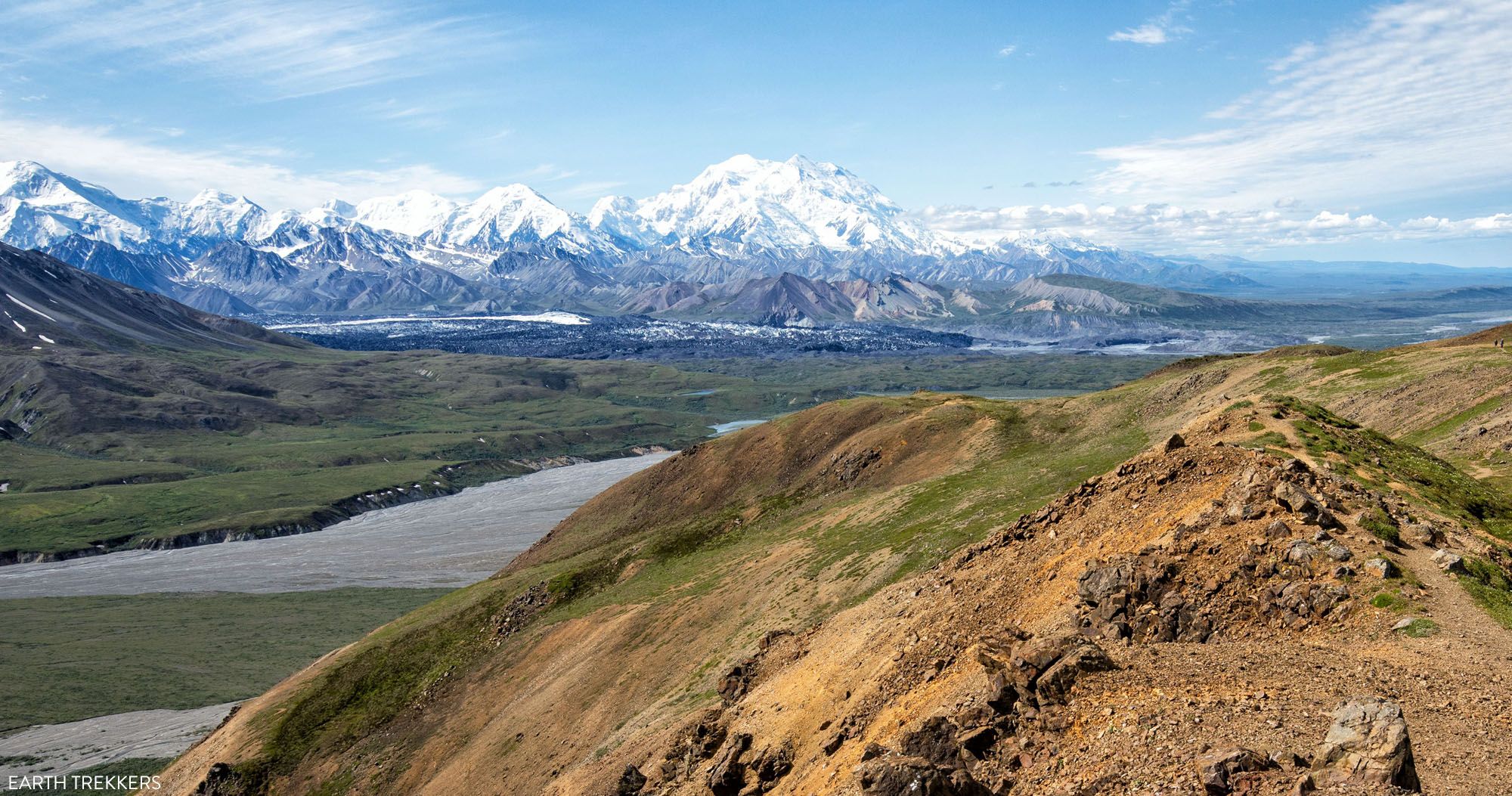
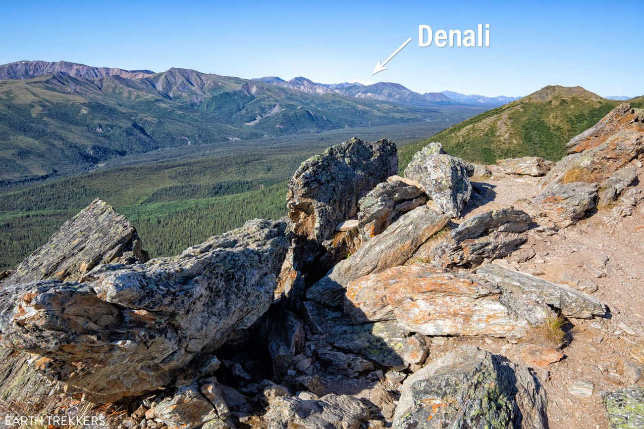
This is one of our favorite hikes in the park and it is definitely one of the best hikes in Denali.
For unbeatable views of Denali, this short, steep, very strenuous hike takes you up into the hills behind the Eielson Visitor Center. Once at the top, you can wander around as you like.
The trail starts across Denali Park Road from the bus parking lot. It steadily switchbacks up into the mountains and the higher you go, the better the view.
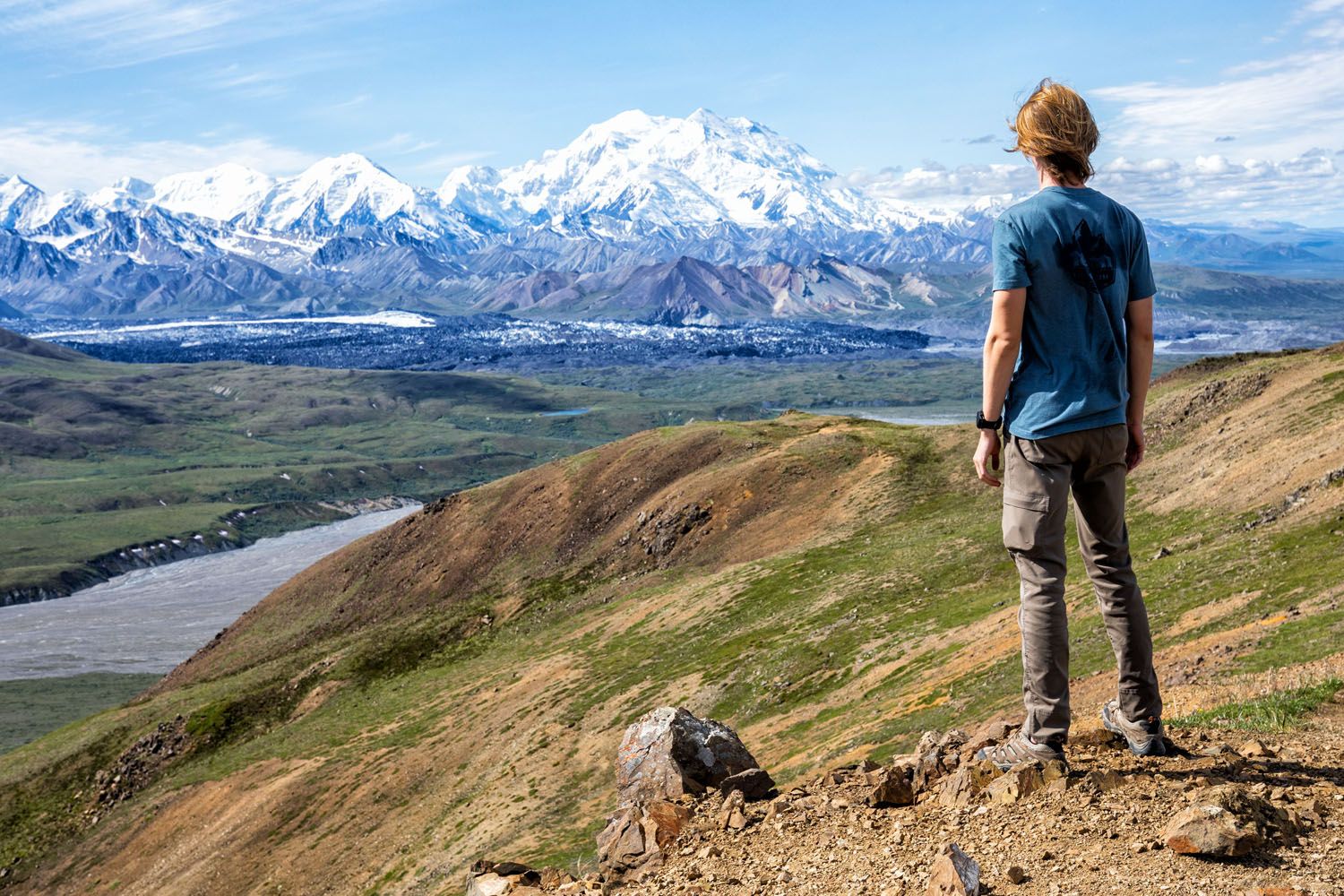
View from the Thorofare Ridge Trail
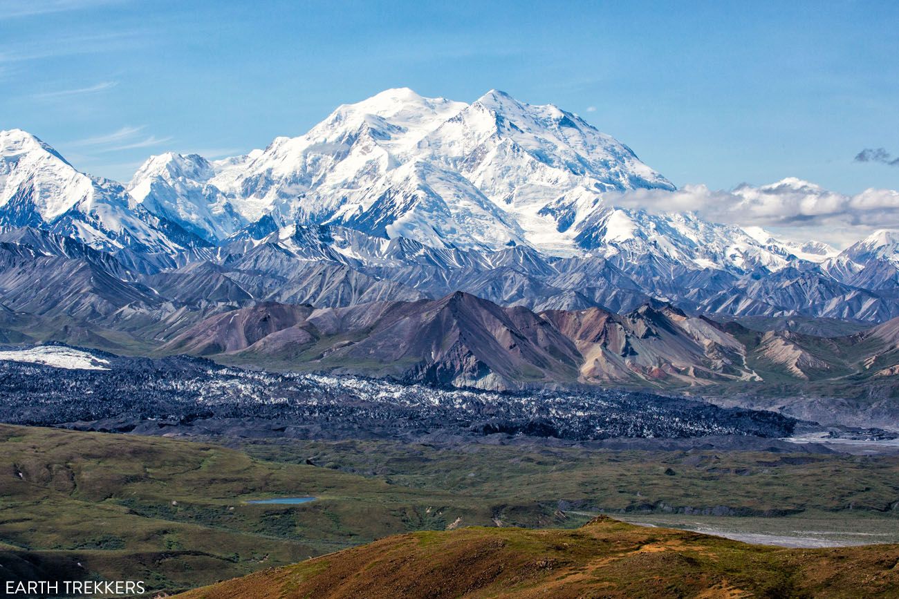
The view of Denali from the Thorofare Ridge Trail.
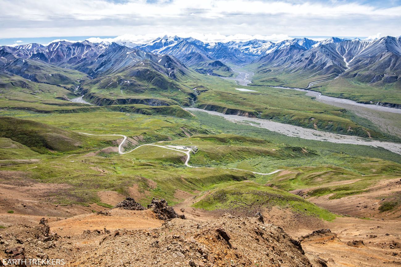
Overlooking Eielson Visitor Center and Denali Park Road from the Thorofare Ridge Trail
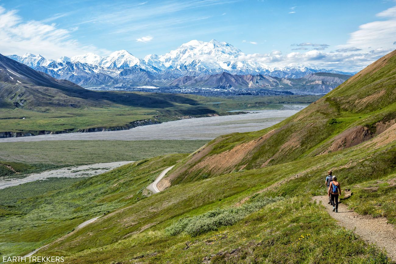
For the entire hike, the view of Denali is awesome!
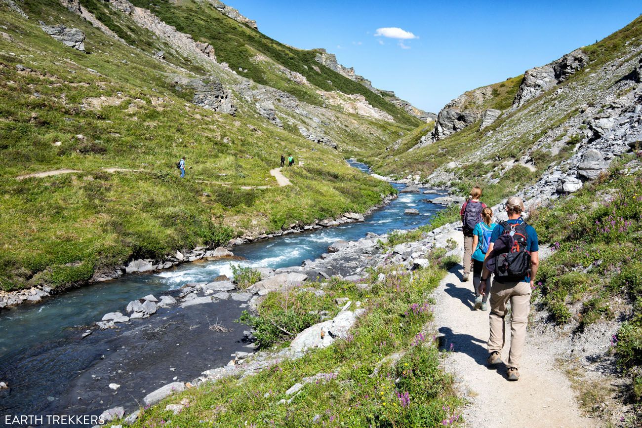
Gorge Creek Trail
Distance: 2 miles out-an-back | Difficulty: Moderate | Total Ascent: 600 feet | Time: 1 to 1.5 hours
Best for: Visitors at Eielson who want a slightly less strenuous alternative to the Thorofare Ridge Trail
Why it’s worth it: A quieter trail with decent views down to the Thorofare River bar, and a good complement to the Thorofare Ridge Trail if you have time for both
Skip it if: You only have energy for one hike at Eielson; the Thorofare Ridge Trail is the better use of it
From Eielson Visitor Center, this trail descends down to Gorge Creek and the Thorofare River bar. The views aren’t as good as they are from the Thorofare Ridge Trail, but it is a little bit easier.

If you only have the time or energy for one hike, we recommend the Thorofare Ridge Trail…it’s worth the effort.
Tundra Loop Trail
Distance: 0.3 miles round trip | Difficulty: Easy | Total Ascent: Minimal | Time: 30 minutes
Best for: Bus riders at Eielson who want to stretch their legs without committing to a full hike
Why it’s worth it: A quick, easy introduction to Denali’s tundra landscape right at the Eielson Visitor Center
This short, easy trail is a nice pick if you want to stretch your legs without doing a full hike. The views don’t change a whole lot from what you get at the Visitor Center, since the trail is just down the hill from the building and bus stop.
Tundra Loop Trail
Looking up at Eielson Visitor Center and Thorofare Ridge from the Tundra Loop Trail.
Trails at Wonder Lake
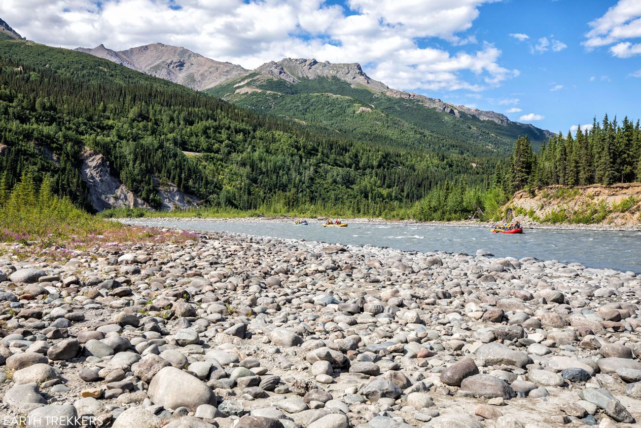
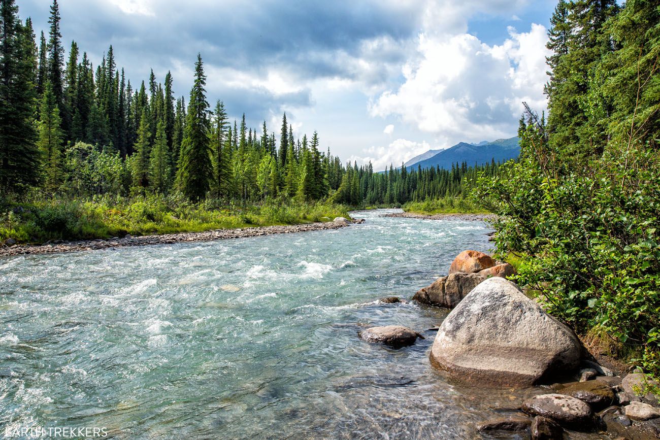
Wonder Lake is located in the backcountry of Denali, not far from the very end of Denali Park Road. If you have plans to journey out this way, the McKinley River Bar Trail, the only maintained trail in this part of the park, is well worth the time.
McKinley Bar Trail
Distance: 4.7 miles out-and-back | Difficulty: Easy | Total Ascent: 400 feet | Time: 2 to 4 hours
Best for: Wonder Lake visitors looking for a scenic, mostly flat hike through some of the most remote terrain in the park
Why it’s worth it: Beautiful, constantly changing landscape of streams, marshes, and spruce forest, with spectacular Denali views on clear days and almost no other hikers
Skip it if: You’re not already heading out to Wonder Lake; there’s no practical way to reach this trailhead otherwise
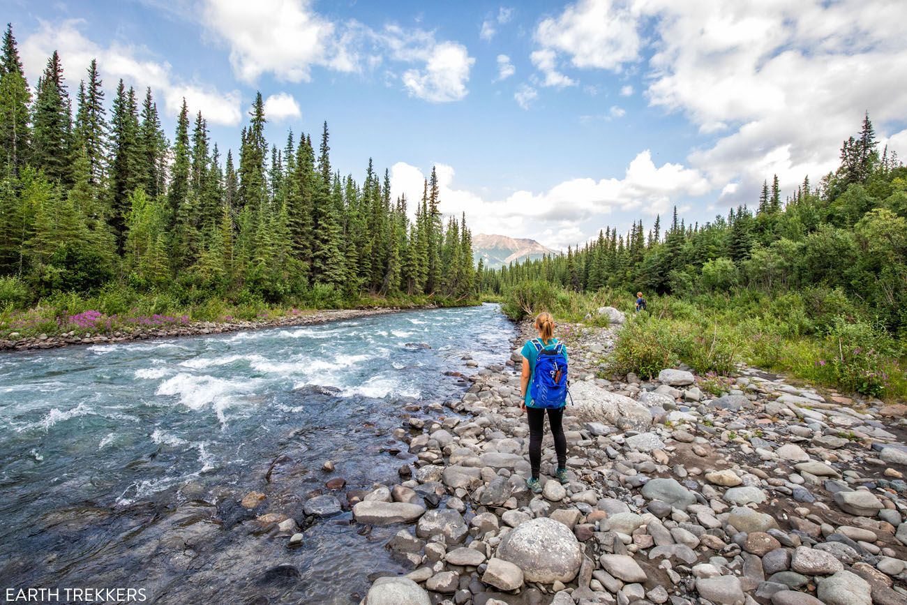
On this trail, you will hike across a beautiful landscape of streams, marshes, and spruce trees, which makes this hike enjoyable even on a cloudy day. If you are lucky to have a clear day, you will also be treated to spectacular views of Denali and the Alaskan Range.
This hike is mostly flat. From the trailhead, it passes in and out of forests and ever so slightly descends down towards the McKinley River. The trail ends at the McKinley River, a nice place to have a picnic lunch, before retracing your steps to the trailhead.
How to Hike the McKinley Bar Trail in Denali National Park
Step-by-step guide for the McKinley Bar Trail.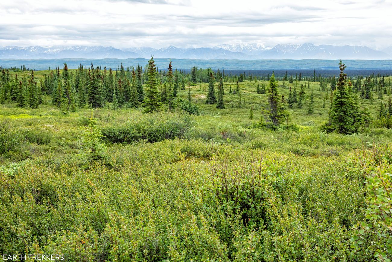
On a clear day, you can see Denali from this trail. In our photos, Denali is hidden behind the clouds.
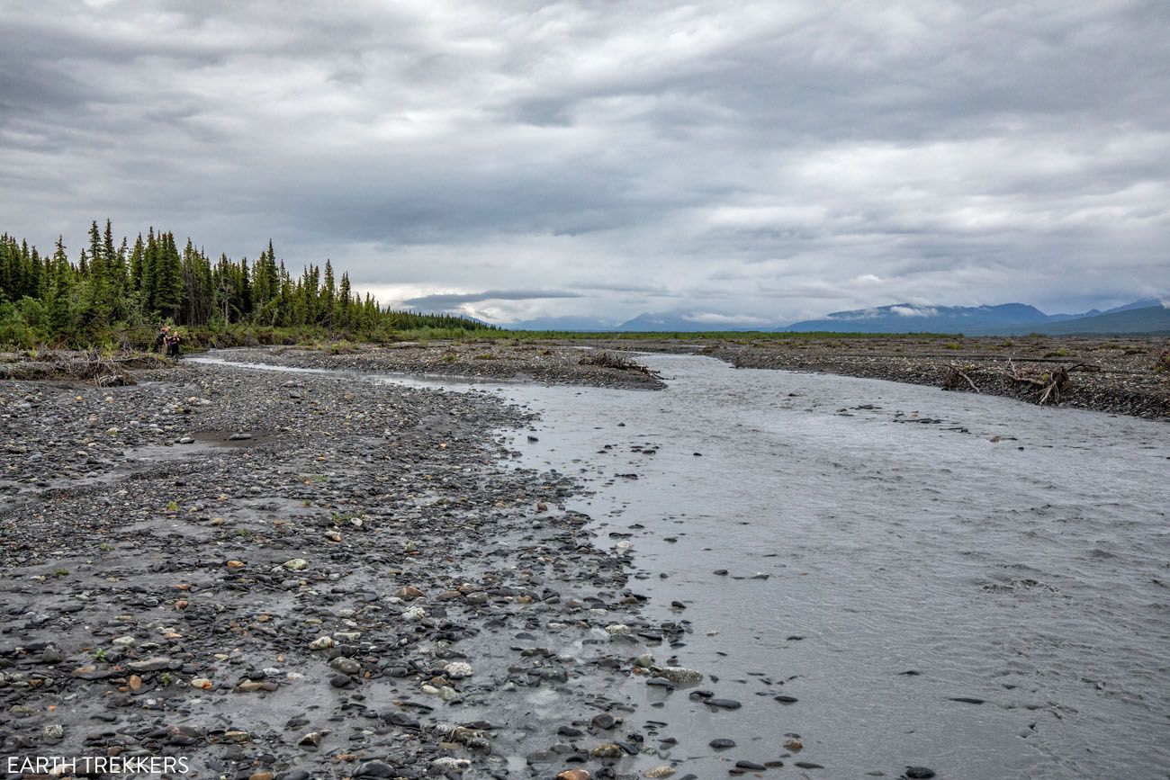
McKinley River Bar
McKinley River Bar Trail
How to Choose the Best Hike in Denali
Top 10 Hikes in Denali National Park
From the list of 20 trails, here are our top 10 favorite hikes in Denali National Park
- Thorofare Ridge Trail (Eielson)
- Savage Alpine Trail (Savage Area)
- Horseshoe Lake Trail (Park Entrance)
- Mount Healy Overlook Trail (Park Entrance)
- McKinley Station Trail (Park Entrance)
- Gorge Creek Trail (Eielson)
- McKinley Bar Trail (Wonder Lake)
- Savage River Loop (Savage Area)
- Triple Lakes Trail (Park Entrance)
- Tundra Loop Trail (Eielson)
We really liked the Thorofare Ridge Trail at Eielson, the Savage Alpine Trail in the Savage River Area, and the Horseshoe Lake and McKinley Station Trails near the park entrance.
Best Hikes with a view of Denali
If you want a view of Denali, we recommend the Thorofare Ridge Trail and/or the River Gorge Trail at Eielson, the Savage Alpine Trail, the McKinley River Bar Trail at Wonder Lake, and the Mount Healy Overlook Trail near the front of the park. In my opinion, the Thorofare Ridge Trail offers the best view of Denali.
Best Short, Easy Hikes in Denali
If you are looking for a short, easy hike, we recommend the Horseshoe Lake Trail, the Savage River Loop, the Tundra Loop at Eielson, or the McKinley Station Trail near the Visitor Center.
Best Hikes to Escape the Crowds
If you want to leave the crowds behind, the Triple Lakes Hike is a nice hike at the front of the park. Or, venture out to Wonder Lake and hike the McKinley River Bar Trail. Or, simply hike off-trail.
If You Can Only Do One Hike…
Finally, if you are short on time and only have time for one hike in Denali, I have two recommendations. The Savage Alpine Trail offers spectacular views of the park and it’s easy to get to on your own. Or, ride the transit bus out to Eielson and hike the Thorofare Trail or the River Gorge Trail…it is a gorgeous drive and you will get arguably one of the best views of Denali.
Savage Alpine Trail
When to Visit Denali for Hiking
We spent six days in Denali in July and would make the same call again. Three of those days were sunny, three were overcast, which is pretty representative of summer in Alaska, where the weather can shift quickly and Denali itself is famously elusive on cloudy days. On the clear days, the views from the Savage Alpine Trail and out at Eielson were absolutely stunning. On the cloudy days, the lower trails near the park entrance were still beautiful and perfectly enjoyable, you just won’t be seeing the mountain.
Crowds were a non-issue compared to most national parks we’ve visited. The Savage River area was the busiest spot we encountered, but even that wasn’t anything like the summer crowds you’d find at, say, a popular Zion or Yosemite trail. We hiked the Savage Alpine Trail early in the morning and had the trail largely to ourselves. If you’re here in summer and want to avoid other hikers, an early start solves the problem almost entirely.
The long summer days are a genuine advantage. With light well into the evening, there’s no pressure to rush, and you can comfortably fit in multiple hikes in a single day. That said, September is worth considering if you prefer cooler temperatures and want to catch the tundra turning brilliant shades of red and orange. Denali in fall is spectacular.
Best time to visit Denali for hiking, by season:
- Spring (May–early June): Snow still possible on higher trails; fewer crowds; some facilities and buses not yet operating
- Summer (June–August): Best overall conditions for hiking; long days, warmest temperatures, full bus service; most popular season but not overcrowded
- Fall (September): Stunning tundra colors; cooler and quieter; buses and some facilities begin closing mid-month
- Winter: Extreme cold; hiking trails largely inaccessible; the park takes on a completely different character
Frequently Asked Questions about Hiking in Denali National Park
What is the best hike in Denali National Park?
The Thorofare Ridge Trail at Eielson Visitor Center offers the finest views of Denali of any maintained trail in the park. Note that Eielson is currently inaccessible due to the road closure at mile 43, with reopening expected in 2027. For visitors in 2026, the Savage Alpine Trail in the Savage River area is the best hike accessible by car, with sweeping views of the park and a distant view of Denali on clear days.
Can you hike in Denali without taking the park bus?
Yes. Several trails near the park entrance and in the Savage River area are accessible by car, including the Savage Alpine Trail, Savage River Loop, Horseshoe Lake Trail, McKinley Station Trail, and Mount Healy Overlook Trail. To reach trails deeper in the park, at Eielson Visitor Center and Wonder Lake, you’ll need to take the park bus, which runs from early June through mid-September.
Are there easy hikes in Denali National Park?
Yes. The Horseshoe Lake Trail (2 miles, minimal elevation gain) is one of the best easy hikes in the park, with beautiful views of the Nenana River and the lake shoreline. The Savage River Loop (2 miles) and Mountain Vista Trail (0.6 miles) are also easy options at Savage River. Near Eielson, the Tundra Loop Trail is a short, flat walk.
Can you see Denali from the hiking trails?
Yes, on clear days. The best view of Denali from a hiking trail is from the Thorofare Ridge Trail at Eielson. The Savage Alpine Trail offers the best Denali view accessible by car. The Mount Healy Overlook Trail also provides a distant view on clear days, though the mountain appears very small from the front of the park. In our experience, you need to go deeper into the park, at minimum to Savage River, to feel like you’re actually seeing Denali.
Is off-trail hiking allowed in Denali National Park?
Yes and it’s one of the best ways to experience the park. Unlike most national parks, off-trail hiking is permitted throughout Denali. No permit is required for day hiking, though backcountry camping does require one. Come prepared with solid navigation skills and bear awareness; there are no marked routes once you leave the maintained trails.
How many days do you need in Denali for hiking?
Two to three days is enough to cover the front country and Savage River trails. If you want to reach Eielson and Wonder Lake, plan for at least four to five days to allow time for bus travel and some flexibility around weather. Denali can be cloudy, and you’ll want a backup day if the mountain is socked in when you reach Eielson. We spent six days in the park and felt it was the right amount of time.
Plan your Denali Trip
If hiking is just one part of your visit to Denali National Park, these guides will help you plan the rest of your trip.
- Denali National Park Travel Guide – When to visit, where to stay, and essential planning tips
- Best Things to Do in Denali National Park – Flightseeing, wildlife viewing, bus tours, and non-hiking highlights
- Denali Park Road: Mile by Mile Guide – What to see and do along all 92 miles of the park’s only road
Denali is one of our favorite parks for hiking, but it’s not the only one. See how these trails compare in our guide to the Best Hikes in the US National Parks, featuring standout hikes from parks across the country.
If you are planning a bigger trip through Alaska, we have lots of helpful information in our Alaska Travel Guide and 10-Day Alaska Itinerary.
If you have any questions about the best hikes in Denali, or if you want to share your experience, let us know in the comment section below.
Continue Exploring Alaska
10 Days in Alaska: 3 Itineraries for Every Type of Traveler
Pinterest Facebook Flipboard We have taken two trips to Alaska. The first was a three-week road trip with our whole family, our kids were older teenagers at the time, covering Anchorage, Valdez, Wrangell-St. Elias, Denali, Kenai Fjords, Homer, Seward, and Katmai National Park. It remains one of the best trips we have ever taken as […]
Denali Park Road: Things to Do from Mile 0 to 92 & Is It Worth It?
Denali Park Road is the only road into Denali National Park, 92 miles of gravel stretching from the park entrance west through Polychrome Pass, past Eielson Visitor Center, and all the way to Kantishna. Along the way, you’ll find some of the best wildlife viewing, hiking, and mountain views in any national park in the […]
Denali Flightseeing Tour: Is It Worth It? (+ Which Tour to Choose)
One of the best ways to experience Denali National Park is on a flightseeing tour. Denali is the tallest mountain in North America. It’s vertical relief, which is the visible difference from base to peak, is 18,000 feet (5,500 meters), which is the highest of any mountain in the world. On a Denali flightseeing tour, […]
Driving from Anchorage to Valdez: Best Things to Do, Map, & Photos
The drive from Anchorage to Valdez is gorgeous and it is packed with lots of great things to do. Along the drive, you can visit historical sites, hike on a glacier, feed a reindeer, learn about Musk Ox, see Dall sheep, photograph waterfalls, and stop at numerous viewpoints. This was our introduction to Alaska. And […]
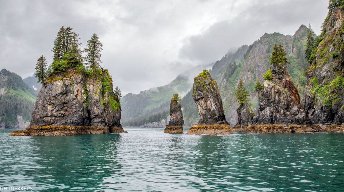
9 Amazing Things to Do in Kenai Fjords National Park
Hike to one of the largest icefields in North America, spot humpback whales and orcas on a wildlife cruise, kayak in front of glaciers, go ice climbing or glacier hiking, and soar over the fjords in a helicopter…these are all things to do in Kenai Fjords National Park. This is one of the few national […]
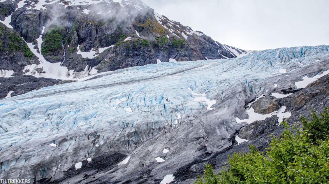
Ice Climbing on the Exit Glacier | Kenai Fjords National Park
Are you looking for an adventure to add to your Alaskan itinerary? How about ice climbing on the Exit Glacier in Kenai Fjords National Park? This experience, from start to finish, is a blast. The day starts off with a short but tough hike up a portion of the Harding Icefield Trail. Once at the […]
Anchorage to Seward: Best Things to Do on the Seward Highway
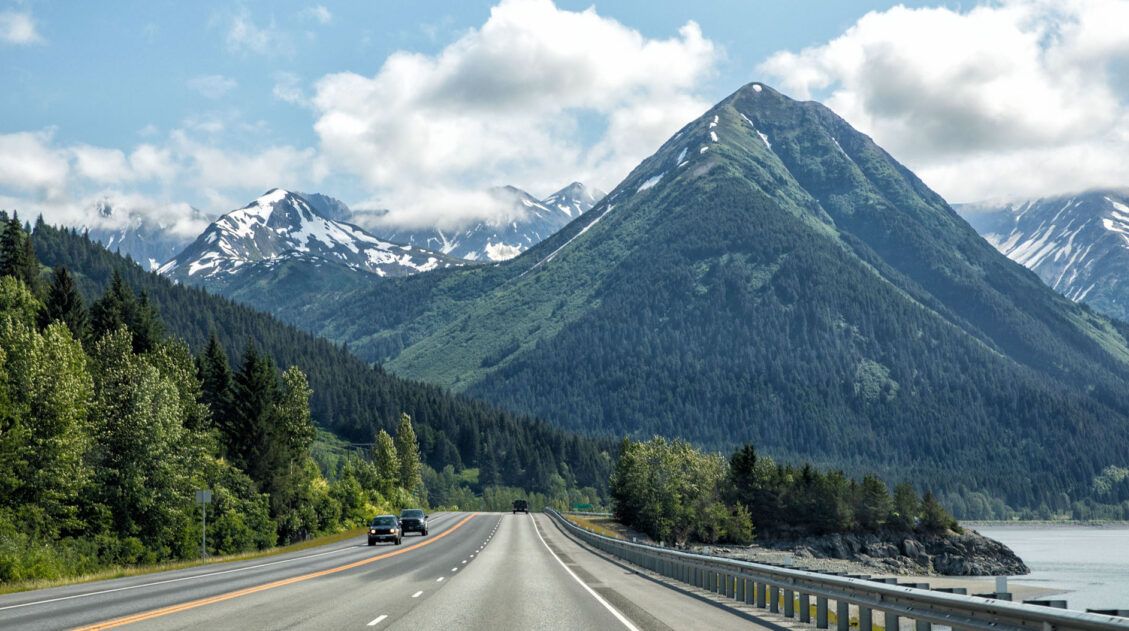
The drive from Anchorage to Seward on Seward Highway is beautiful, an attraction in itself. Along the way you can gaze across the Turnagain Arm, ride a cable car up into the Chugach Mountains, admire beautiful turquoise lakes with mountain reflections in them, hike to a waterfall in a picturesque setting, and so much more. […]
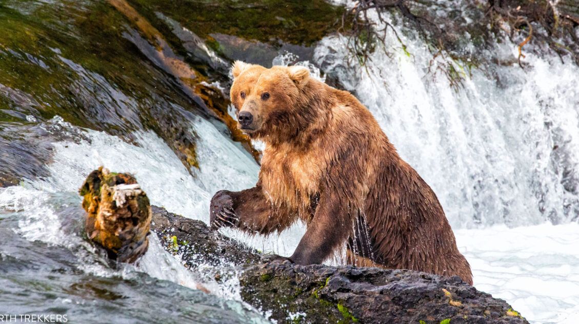
9 Amazing Things to Do in Katmai National Park & Preserve
Katmai National Park & Preserve is a land of brown bears and volcanoes. It is wild, rugged, and remote and one of our favorite national parks. This national park is one of the best in the US for wildlife viewing. Every summer, brown bears head to the rivers, to feed on salmon. Brooks Falls is […]
5 Reasons Why You Should Visit Eielson Visitor Center on Denali Park Road
Eielson, which is located at mile 66 on Denali Park Road, is one of the most spectacular places to visit in Denali National Park & Preserve and our single favorite experience in the park. On a clear day, the views of Denali are unbeatable. The drive to get here is gorgeous, there are several short […]
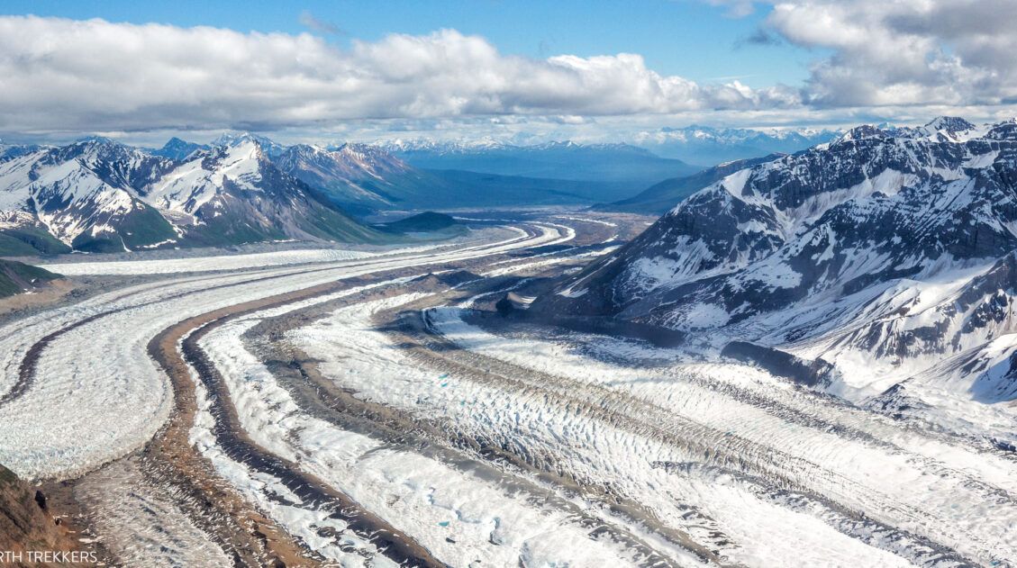
10 Best Things to Do in Wrangell – St. Elias National Park & Preserve
Wrangell – St. Elias National Park & Preserve is one of our favorite US National Parks. Its remote location, countless mountains and glaciers, and sheer beauty is simply astounding. It feels like an adventure to drive in on McCarthy Road, pull your belongings across the footbridge, and get shuttled to your lodge or campground. From […]
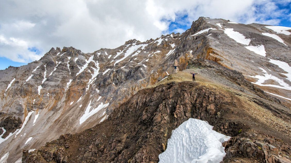
The Ultimate Bonanza Mine Trail Guide | Wrangell – St. Elias
The Bonanza Mine Trail is a tough hike that features panoramic views over the Kennicott and Root Glaciers. It’s not the most thrilling hike at first but once above the tree line the views really open up. The pay-off comes at the end…the chance to see the abandoned Bonanza Mine and sweeping views across Wrangell […]
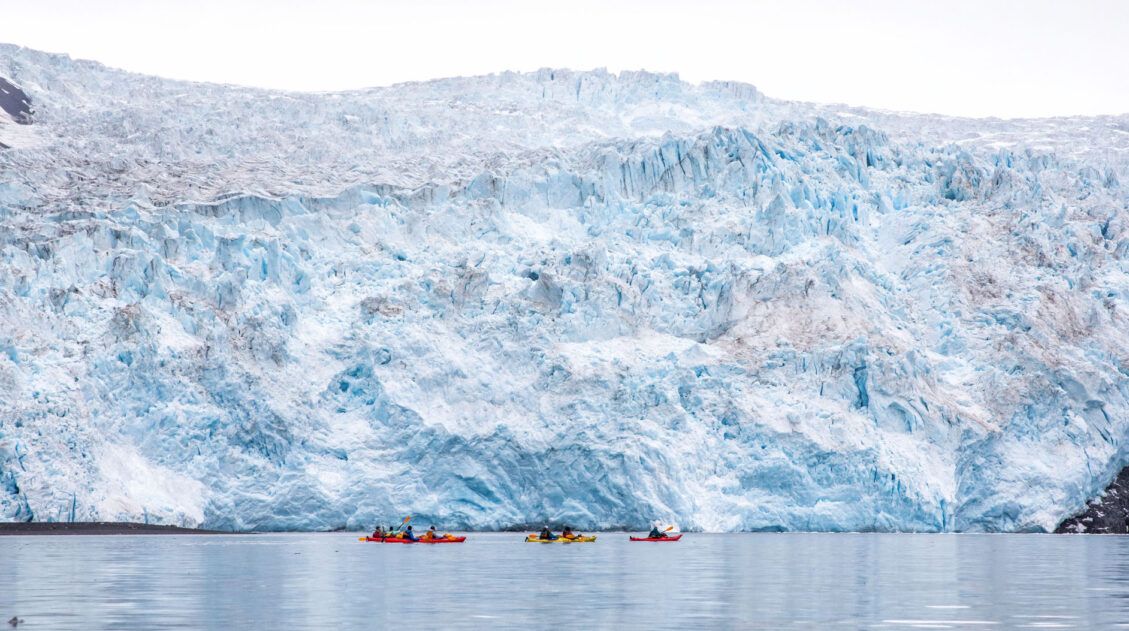
Aialik Glacier Kayaking: Beauty & Adventure in Kenai Fjords
One of the best things to do in Kenai Fjords National Park is to cruise through the fjords, to see the glaciers that carved out this beautiful landscape. And if you are looking for adventure, kayak to Aialik Glacier, one of the more remote glaciers in Kenai Fjords National Park, Alaska. This experience combines a […]

The Ultimate Guide to the 63 US National Parks
Stretching from the South Pacific, across the United States to the Caribbean, are 63 national parks. These national treasures preserve iconic landscapes, majestic mountains, primordial forests, arid deserts, misty coastlines, immense canyons, wildlife, and historic landmarks. We have visited 56 of the 63 US national parks, from the towering granite walls of Yosemite and the […]
United States Travel Guide: Places to Visit in the USA
Plan your visit to the United States. Learn about the best things to do, how to plan your time, road trip ideas, and sample itineraries.


Comments 8