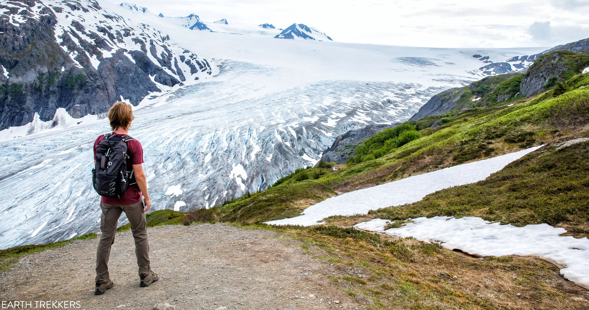
Hiking the Harding Icefield Trail in Kenai Fjords National Park is a challenging, rewarding, and unique experience all rolled into one. This memorable hike takes you past the Exit Glacier and ends with sweeping views across the Harding Icefield, the largest icefield that is located entirely in the United States.
In this guide, we provide everything you need to know about hiking the Harding Icefield Trail. We even cover two turnaround points along the trail that offer a rewarding experience for those with limited time or those that are questioning the difficulty of this hike.
An Overview of Harding Icefield and the Exit Glacier
Icefields form over time as a result of large accumulations of snow that compress and freeze, which then turns into ice. The flow of ice from the edges of an icefield are called glaciers. While glaciers act as drains, the icefield itself can be replenished with new snow accumulation.
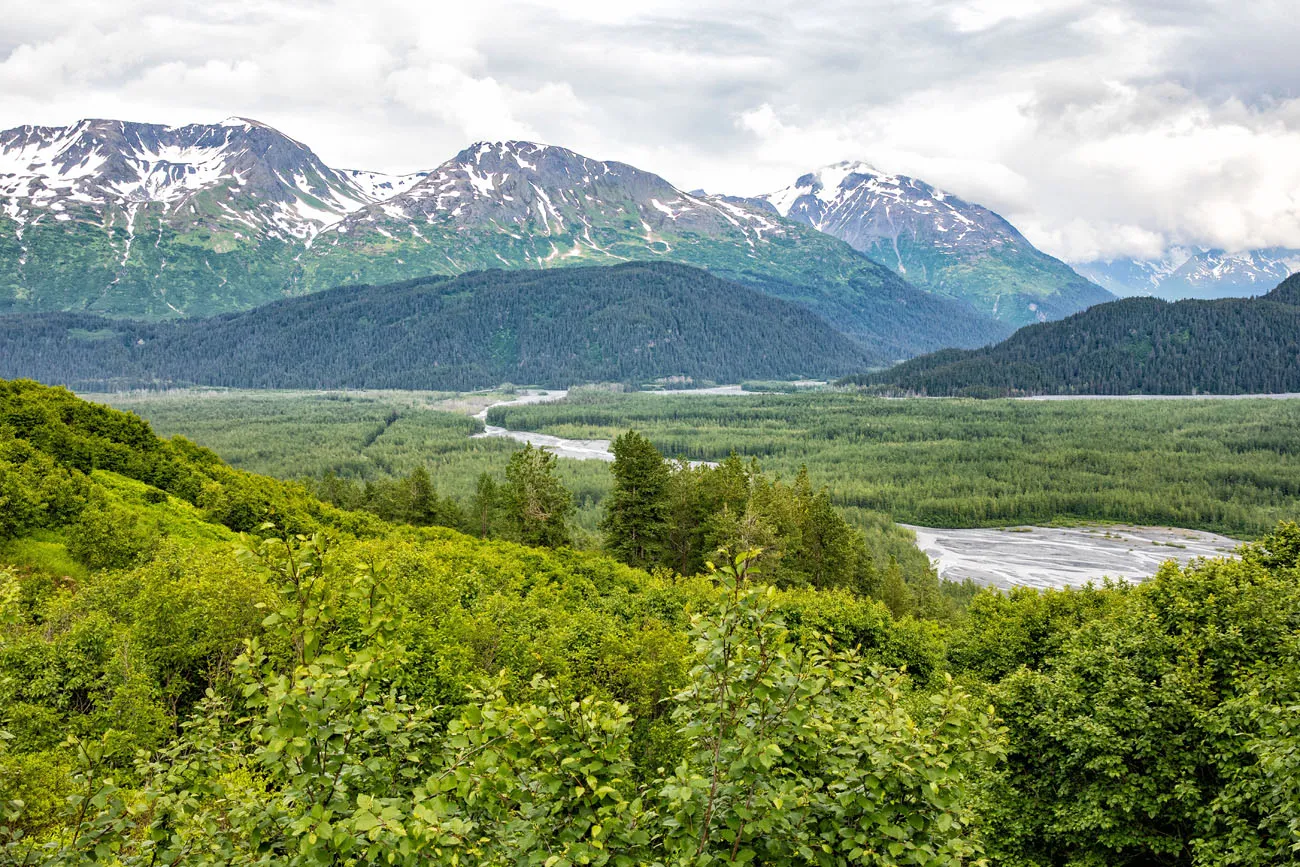
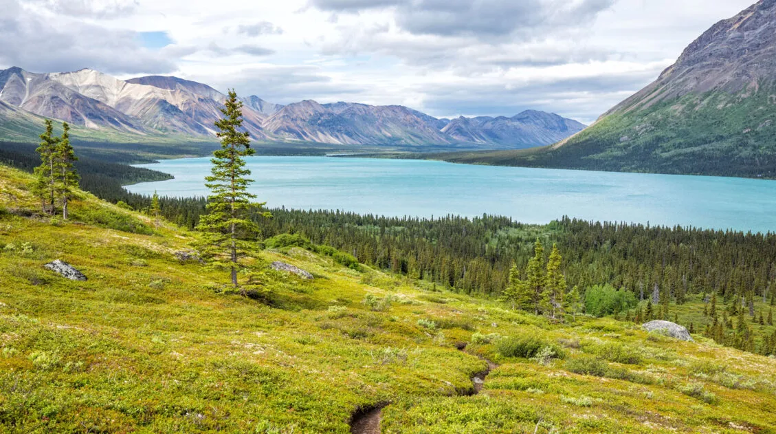
The Harding Icefield is a large expanse of ice in the mountains of the Kenai Peninsula, which includes Kenai Fjords National Park. Covering 700 square miles, with a maximum depth of about 4,000 feet, the Harding Icefield is the largest icefield located entirely in the United States.
The Harding Icefield connects 40 glaciers together, the most accessible of which is the Exit Glacier. The Exit Glacier gets its name from a 1968 expedition that crossed the Harding Icefield. This glacier was the exit point at the end of that expedition, hence the name.
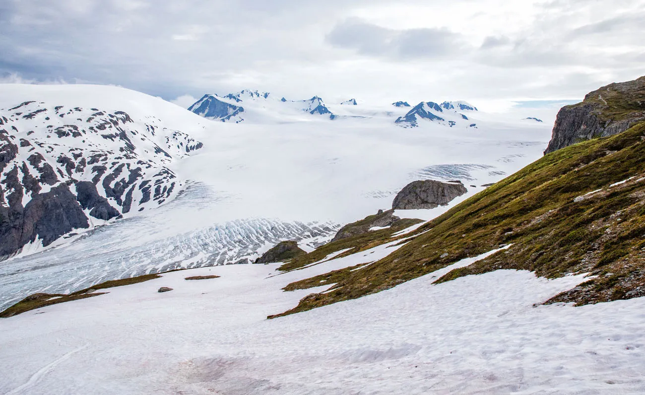
Sticking out of the icefield are mountain peaks. These are called nunataks.
A view of the Harding Icefield and the Exit Glacier from the trail.
The Exit Glacier is easily accessible because it is located at the end of Herman Leirer Road (aka Exit Glacier Road), the only road in Kenai Fjords National Park. As you drive into the park, you can see Exit Glacier from the road. In addition to the Harding Icefield Trail, which runs up a mountain alongside the Exit Glacier, there are other trails that take you closer to the terminus of the glacier.
There are also local tour companies that offer ice hiking and ice climbing experiences on the Exit Glacier.
Harding Icefield Trail Hiking Stats
Distance: 8.2 miles out-and-back
Total Ascent: 3,500 feet
Elevation at Trailhead: 420 feet
Highest Elevation: 3,525 feet
Time: 6 to 8 hours*
Difficulty: Strenuous
There is an additional 0.3 miles each way between the parking lot and the Harding Icefield Trailhead. This makes the total roundtrip distance of the hike 8.8 miles. This portion of the hike is relatively flat so you don’t have to worry about additional elevation gain.
Note: The National Park Service recommends 6 to 8 hours to do this hike, but it can be done much faster. Tyler and I did it in 4 hours.
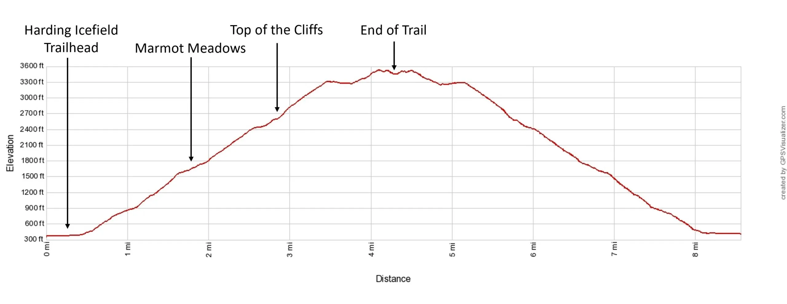
Harding Icefield Trail elevation profile
Please practice the seven principles of Leave No Trace: plan ahead, stay on the trail, pack out what you bring to the hiking trail, leave areas as you found them, minimize campfire impacts, be considerate of other hikers, and do not approach or feed wildlife.
Where to Park
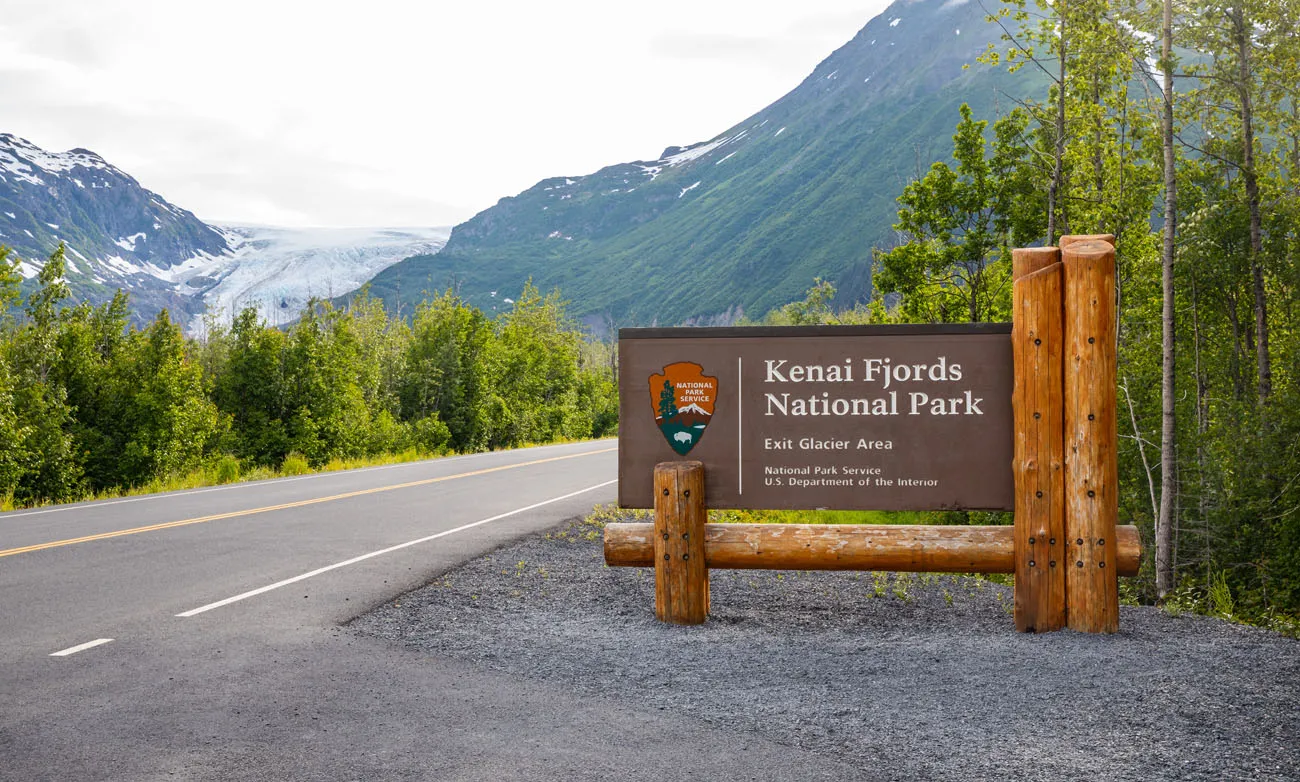
The parking lot is located at the end of Herman Leirer Road (aka Exit Glacier Road). Parking is free and entry into the park is also free.
From the Seward Harbor area drive north on the Seward Highway (Alaska Route 9) about 2.5 miles and turn left onto Herman Leirer Road. Then follow Herman Leirer Road 8.5 miles until it dead ends at the parking lot.
As you drive down Herman Leirer Road, you will see the Kenai Fjords National Park entrance sign and you will also see signs with four-digit numbers on them. These signs mark prior locations of the Exit Glacier terminus and the numbers reflect the year the terminus was at that location. It is worrisome to see how much the Exit Glacier has retreated, which is largely believed to be a result of climate change.
Herman Leirer Road and a view of the Exit Glacier
At the far end of the parking lot is the Exit Glacier Nature Center. To the right of the Exit Glacier Nature Center are restrooms. And to the left of the Exit Glacier Nature Center is the Glacier View Loop Trailhead.
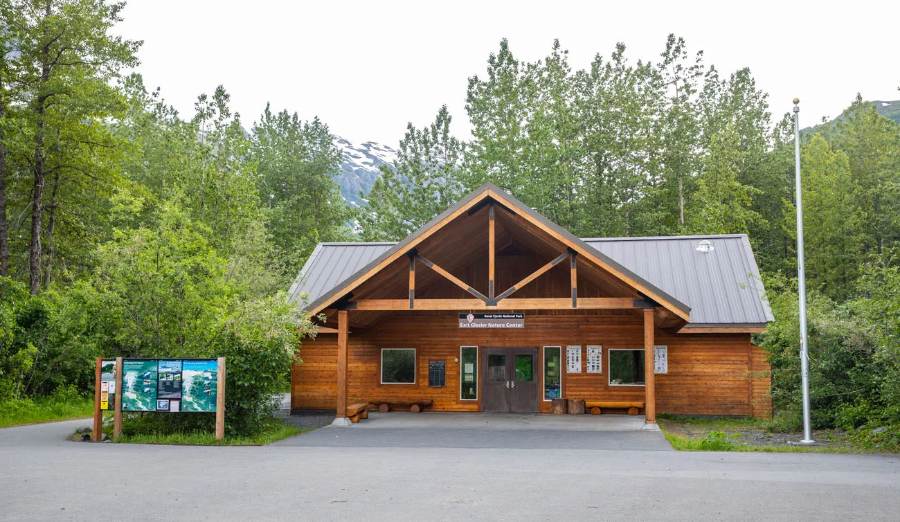
Exit Glacier Nature Center
PRO TRAVEL TIP: Before starting this hike, check with the park rangers at the Exit Glacier Nature Center for an update on trail conditions.
Shuttle Services
If you are arriving Seward via train or ship, then you might not have access to an automobile. In this case, you can use one of the local taxi services for transportation or make a reservation with a shuttle service. The Kenai Fjords National Park website lists the following shuttle service providers:
- Exit Glacier Shuttle (907-224-5569 or 907-224-9225)
- City of Seward Shuttle Service (907-224-3324)
We did not have cellular service in the parking lot area or along the trail, so if you are relying on a taxi or shuttle service then make sure you have a planned pickup time before you start the hike.
Harding Icefield Trail
Step-By-Step Trail Guide
There is no way to sugarcoat it; this is a strenuous hike. In order to reach the Harding Icefield, you will gain over 3,000 feet of elevation in just 4 miles.
There are two notable points along the trail (Marmot Meadows and Top of the Cliffs) that make great rest stops or turnaround points. You will still have a great experience if you decide to turnaround at either of these points. So, I have broken the trail description down into three sections: Hiking to Marmot Meadows, Hiking to Top of the Cliffs, and Hiking to the Harding Icefield.
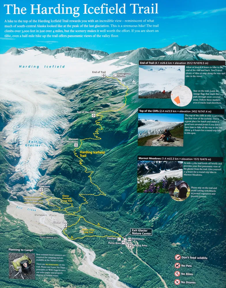
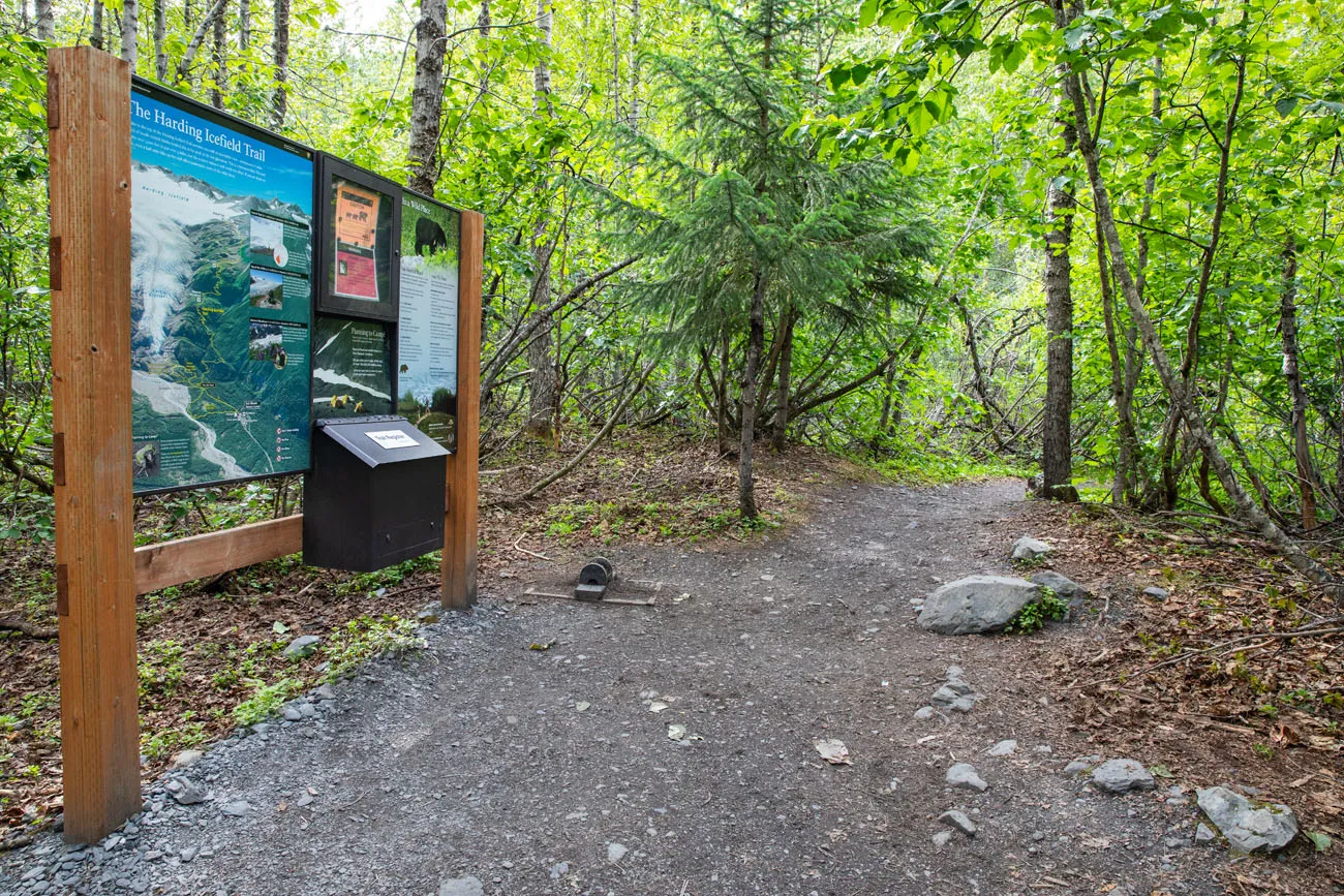
Photo of the National Park Service sign that is posted at the trailhead.
Getting to the Trailhead
From the parking lot, walk towards the Exit Glacier Nature Center. Just to the left of the Exit Glacier Nature Center you will see a wide trail called the Glacier View Loop Trail. Follow this trail straight out. The trail will actually turn into the Glacier Overlook Trail just before you reach the Harding Icefield Trailhead.
There is a posted sign for the Harding Icefield Trail so keep an eye out. You’ll reach the Harding Icefield Trail at about 0.3 miles into the hike.
Hiking to Marmot Meadows
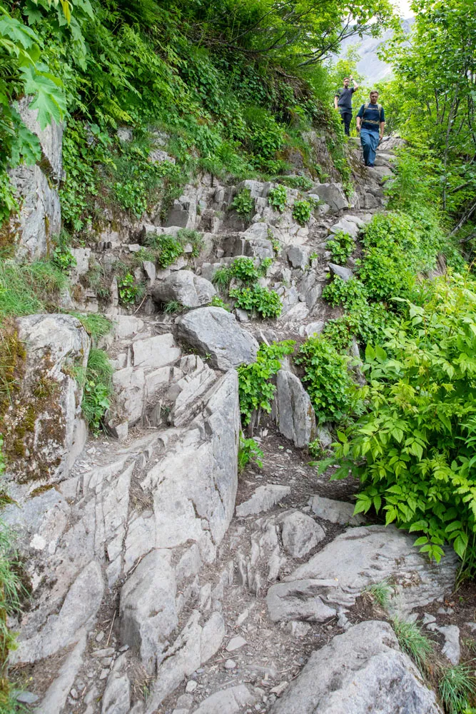
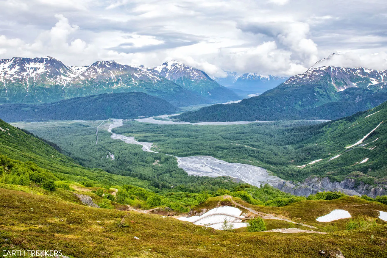
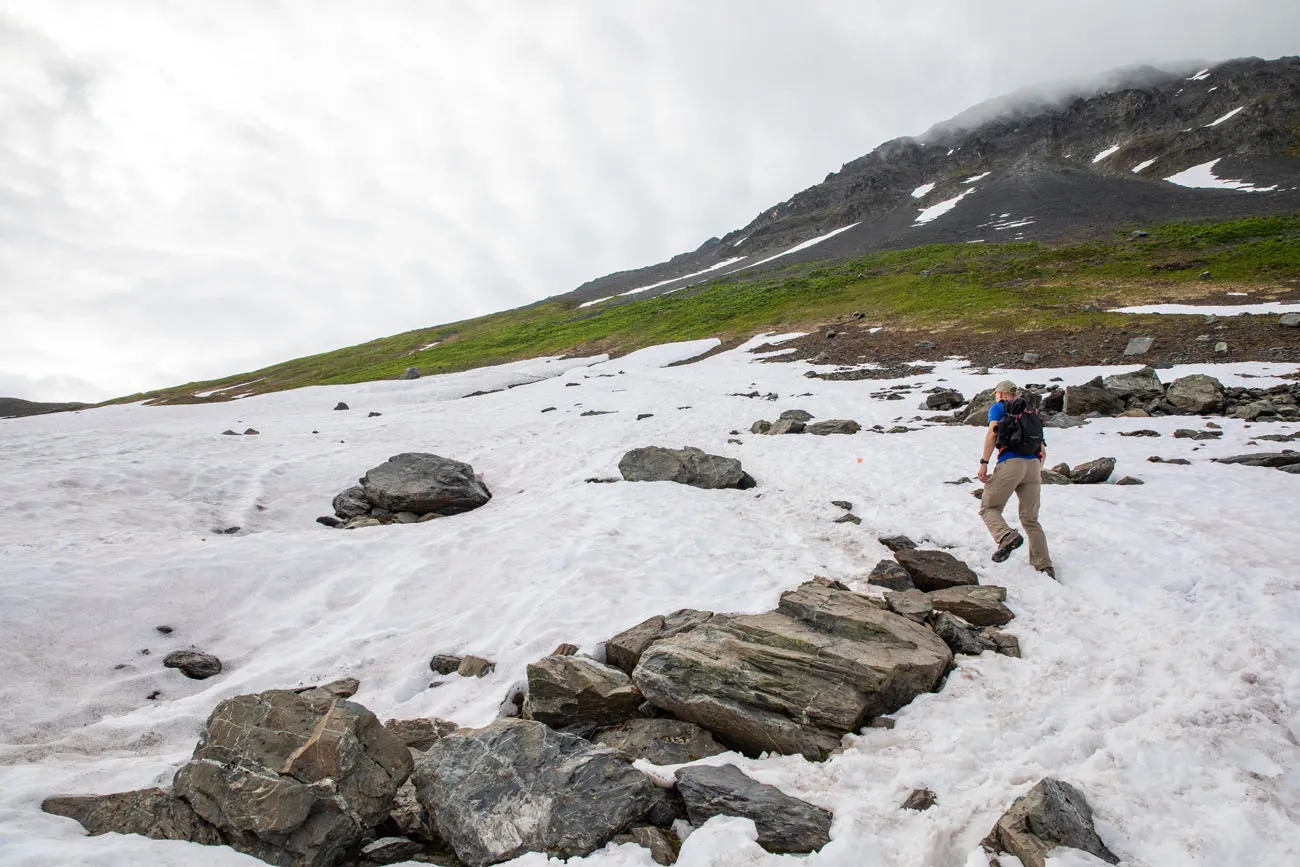
At the posted sign, turn right onto the Harding Icefield Trail. The Harding Icefield Trail starts off as a moderate ascent through brush and trees with occasional stone steps. You will hike almost a mile on the Harding Icefield Trail before you get your first break in the trees and a view looking back towards the parking lot, Exit Creek and the Outwash Plain (the proglacial creek created by the Exit Glacier).
First view from the trail.
Less than a half a mile later you will reach the Birth Canal, a fun part of the trail that narrows between two boulders.
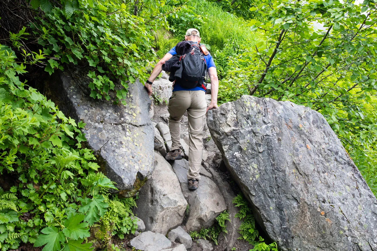
The “birth canal”
The trail now becomes rockier and a bit steeper. Shortly past the Birth Canal you will get your first view of the Exit Glacier.
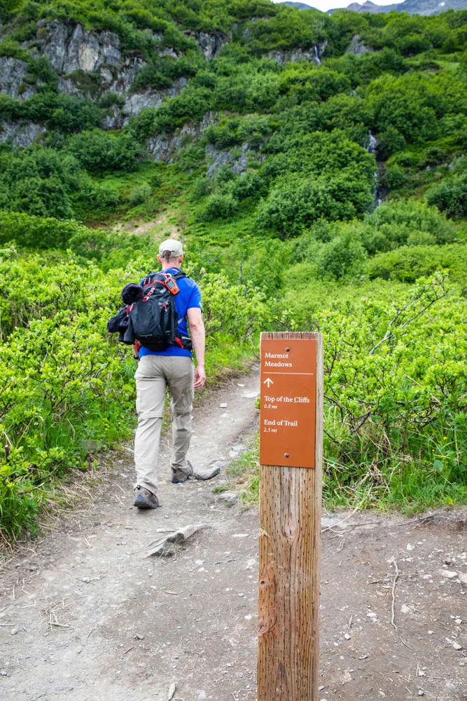
With just a few more steps, you will reach Marmot Meadows. The brush has thinned out and the trail briefly flattens as you approach the signpost for Marmot Meadows, making Marmot Meadows a great rest stop.
Marmot Meadows is 1.5 miles from the Harding Icefield Trailhead (1.8 miles from the parking lot) with 1,200 feet of total ascent. This is a great turnaround point for some people, as you have been rewarded with a view of the side of the Exit Glacier as well as a view looking out at the valley below. But for those who can continue to hike higher the views get better.
At the Marmot Meadows sign post you may notice a trail split. Heading straight is the main trail that will take you onward up to the Top of the Cliffs and the Harding Icefield. But there is also a thin, unmarked trail that turns left at the signpost. This thin trail heads towards the side of the Exit Glacier. This is the trail local tour operators use for their ice hiking and ice climbing excursions. So, if you participate in one of those excursions, then you will hike to Marmot Meadows with your tour guide and then turn here to get to the Exit Glacier.
Hiking to Top of the Cliffs
From the Marmot Meadows signpost, head straight to continue towards the Top of the Cliffs. In a half a mile you will reach the switchbacks. You will notice that the vegetation is now only ankle height with some scattered brush so you have good visibility for the rest of the hike.
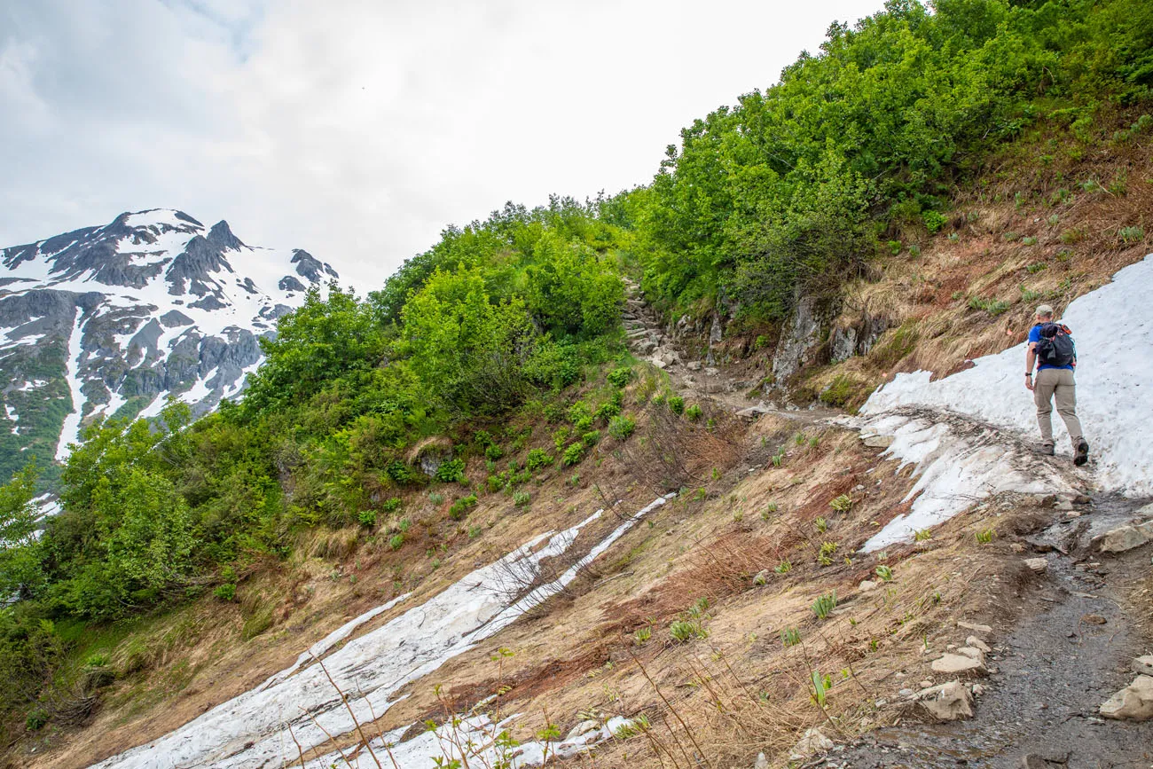
View from the switchbacks on the hike up to Top of the Cliffs
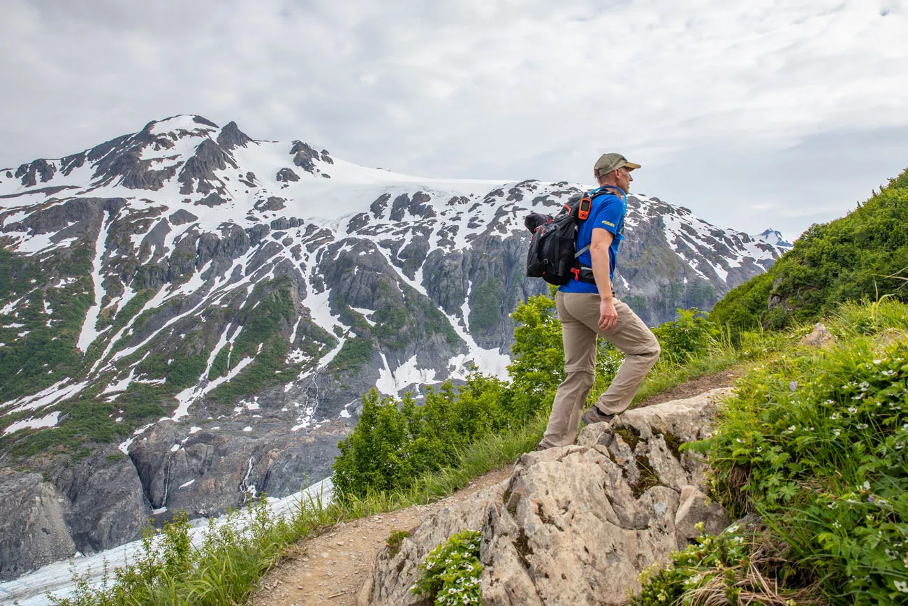
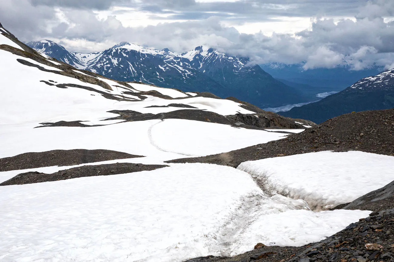
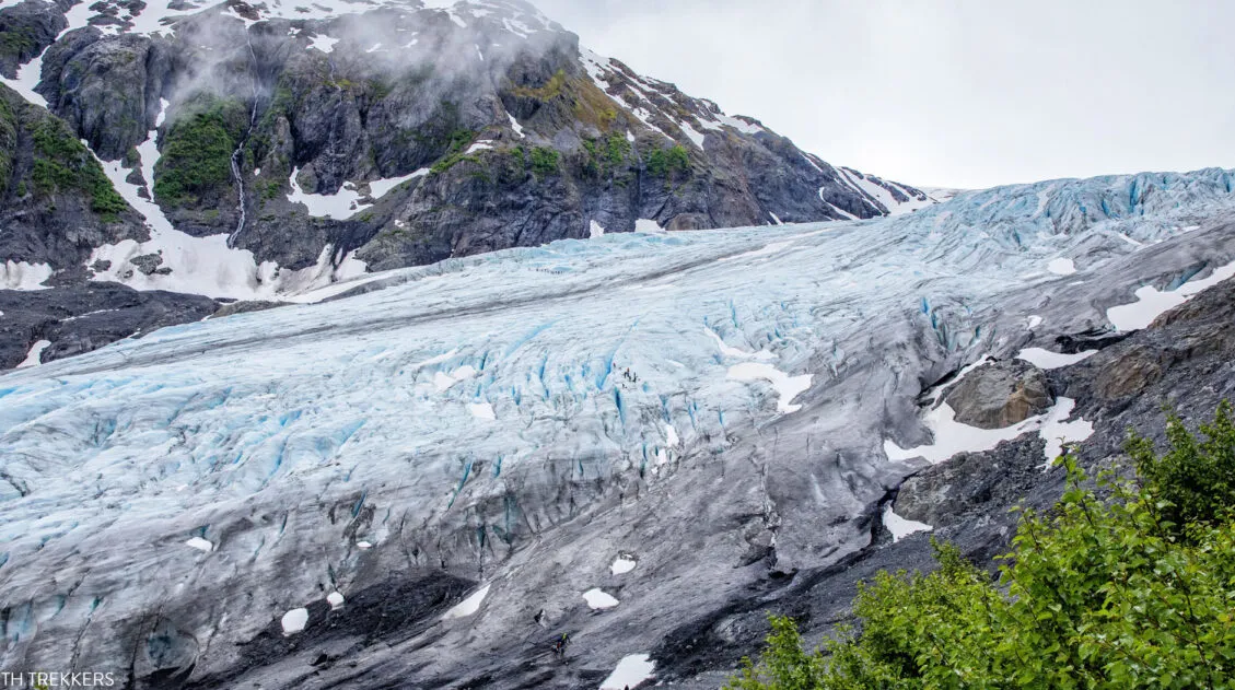
The switchbacks last a little less than half a mile. We didn’t see a signpost marking the Top of the Cliffs but it was an obvious viewpoint as you have an amazing view of where the Harding Icefield ends and the Exit Glacier begins. We were even able to see some nunataks (mountain peaks protruding from the icefield).
View of the Exit Glacier and Harding Icefield from Top of the Cliffs
The Top of the Cliffs is 2.4 miles from the Harding Icefield Trailhead (2.7 miles from the parking lot) with 2,050 feet of total ascent.
This is another great turnaround point for some people as the view here is spectacular. It can serve as a great turnaround point for those who don’t want to ascend further, if there are sections of unpassable snow further up trail, or if you are running out of time. But hiking to the end of the trail will allow you to look out across the Harding Icefield.
Hiking to the Harding Icefield (End of Trail)
Beyond the Top of the Cliffs the trail still ascends but it is less strenuous. The trail flattens out, offering relief for your legs after all of the climbing you have done so far. There will still be some easy to moderate ascents ahead of you but you will also have a few downhill stretches as well.
The more gradual ascent, the amazing views of the Exit Glacier and the Harding Icefield, crossing patches of snow, and seeing the occasional marmot made this the most enjoyable section of the trail.
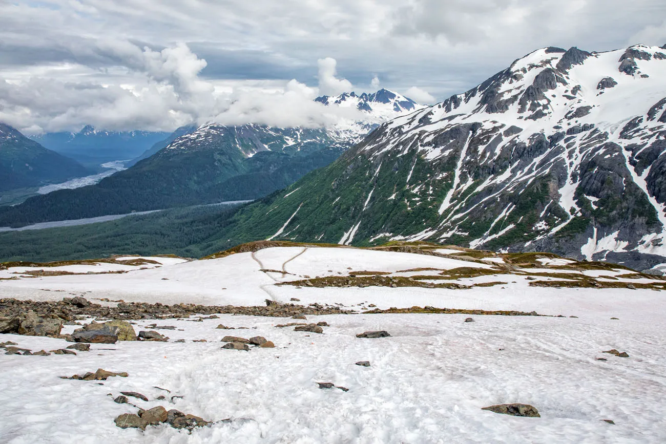
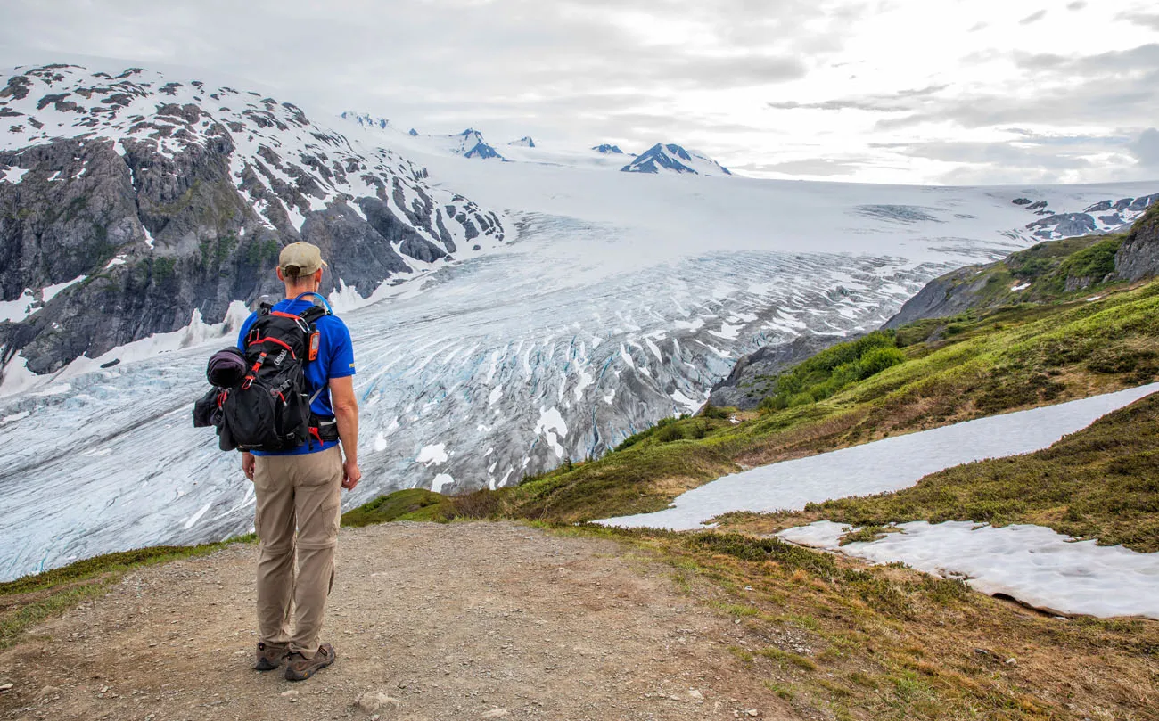
Eventually you will see an emergency shelter in the distance. This becomes a good point of reference as the End of the Trail and the view across the top of the Harding Icefield are just beyond the emergency shelter.
The End of the Trail is 4.1 miles from the Harding Icefield Trailhead (4.4 miles from the parking lot) with 3,200 feet of total ascent (3,450 feet above sea level).
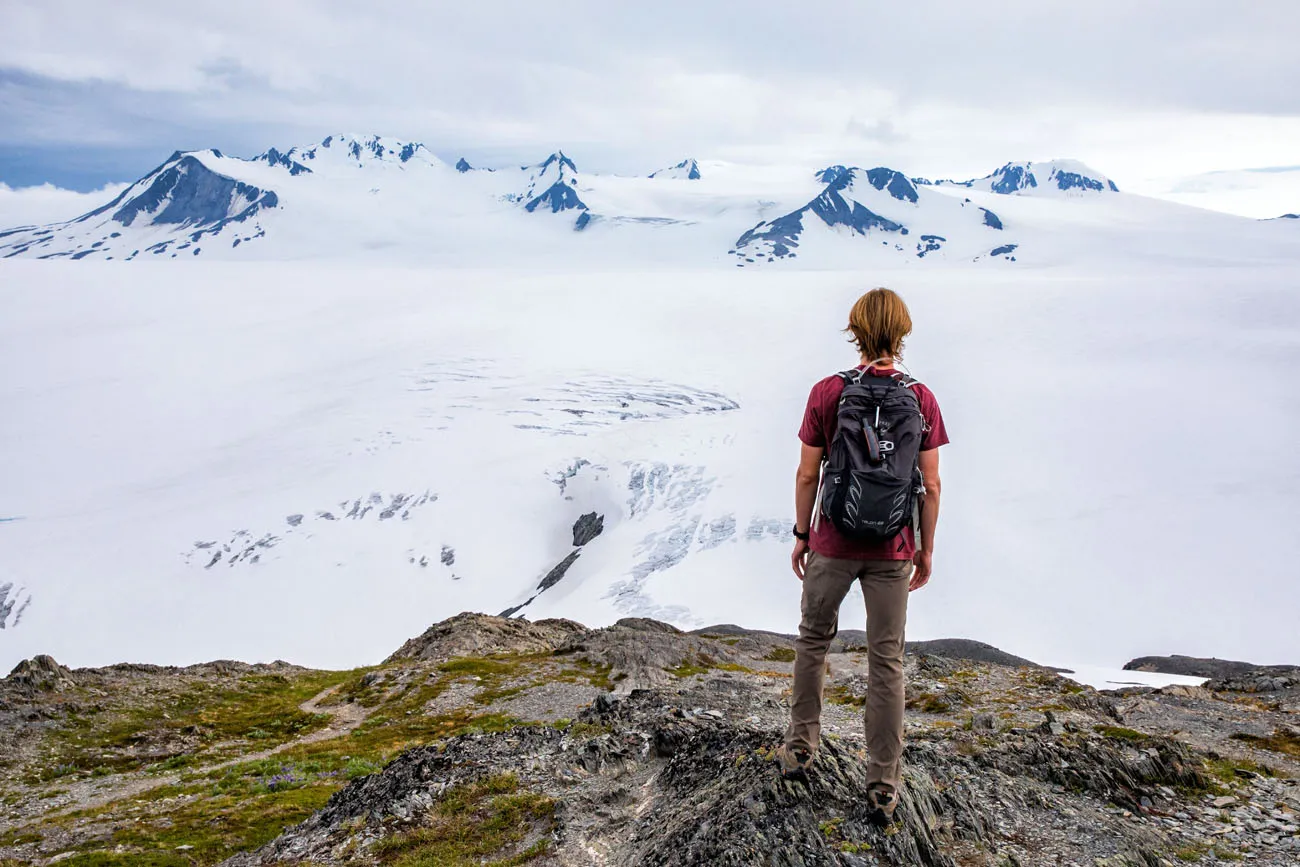
The Harding Icefield from the end of the trail.
About Our Experience and Is It Worth It?
We hiked the Harding Icefield Trail in early July. Our original plan was to finish this hike after our ice climbing excursion, but for various reasons (timing, conflicting reports about snow on the trail), we returned on a different day to do this hike.
Prior to doing this hike, I checked with a park ranger at the Exit Glacier Nature Center. The park ranger confirmed that there was snow covering parts of the trail but he said it was passable.
It turns out that the snow patches were our favorite part of the trail. The park rangers had placed small orange flags in the snow so we knew the direction of the trail. In addition, enough people had hiked across the snow to create a trough that we could follow. The ascents across the snow slowed us down as they were a bit slippery (hiking poles would have been helpful here) but it didn’t stop us. The descents in the snow were a blast. We pretended that our hiking shoes were skis and slid down the snow testing our balance. Hiking poles would have been helpful here as well (and safer) but less fun 😊.
As we hiked this portion of the trail, we had amazing views of the Exit Glacier coming off the Harding Icefield to our left, mountains peeking out of the snow to our right, and we were crossing the snow in front us. It was a beautiful landscape that we had all to ourselves to enjoy.
Overall the hike is strenuous but you are rewarded with incredible views along the way. I’ll stop short of saying that the view across the Harding Icefield is beautiful (it’s a huge sheet of ice), but the significance of what you are looking at certainly is beautiful.
PRO TRAVEL TIP: If you encounter snow on the trail, then follow the orange flags placed by the park rangers to ensure that you stay on the designated path. Don’t follow paths other people have made in the snow as you may sink into deep snow or you may crush vegetation under shallow snow.
When is the Best Time to Hike this Trail?
July, August, and the first half of September are generally the best times to hike this trail. We were there in early July and there was snow covering portions of the trail beyond the Top of the Cliffs.
May, June, October, and November are considered shoulder season. It is likely that winter conditions will exist during these months, which may involve steeper snow, the need to do your own route finding, and hazards associated with avalanches. Therefore, we recommend planning this hike in July, August, or the first half of September.
During the winter the road to the Exit Glacier is closed to automobiles.
Summer Weather at the Exit Glacier
Don’t be discouraged from doing this hike if it is raining in Seward. We had numerous people tell us that the weather over the Exit Glacier is generally clearer than the weather over Seward. And that proved to be the case the two separate times we went to the Exit Glacier. Both times it was raining in Seward but the sky was sunny over the Exit Glacier.
Be prepared for, and keep an eye out for, unpredictable changes in the weather. We had clear skies when we hiked up to the Harding Icefield. But as we started our descent, we noticed fog moving in and visibility was getting worse so we kept up a steady pace until we got below the fog layer.

Harding Icefield and the Exit Glacier
Guided Tours to the Harding Icefield
Exit Glacier Guides, a local tour operator in Seward, offers guided hikes to the Harding Icefield. This includes transportation to the trailhead and back.
We used them for our ice climbing excursion and we used their sister company (Liquid Adventures) for our Aialik Glacier kayaking excursion. We had a great experience with both companies and highly recommend them.
Camping at the Exit Glacier
Camping is permitted along the Harding Icefield Trail under the following guidelines:
- Set up camp at least 1/8 mile from the trail on bare rock or snow
- Your camp must also be out of sight of the trail
- Follow the principles of Leave No Trace
- Limit group size
- Avoid crushing fragile vegetation
- You cannot camp in the emergency shelter near the top of the trail, it is for emergency use only
There is also a 12-site campground right off of Herman Leirer Road (aka Exit Glacier Road) about half a mile before your reach the parking lot at the end of the road. The sites are free to use on a first-come first-serve basis.
What to Pack
- Sunscreen
- Insect repellant
- Food and water
- Odor Free Bag – seal your food in an odor free bag to help avoid attracting bears
- Sunglasses – sun reflection off the glacier, icefield, and snow can make your sun exposure more intense
- Hiking Poles – if you don’t normally use hiking poles then consider using them to help cross any snowy portions of the trail
- Bear spray – bear are often reported along this trail
- Dress in layers – you are likely to be warm as you ascend, but it can be colder as you approach the Harding Icefield as the glacial ice cools the surrounding air
- Rain jacket – be prepared in case bad weather moves in or in case its windy at the top
Essential Hiking Gear: What Should You Bring on a Day Hike?
If you are new to hiking or are curious about what you should bring on a hike, check out our Hiking Gear Guide. Find out what we carry in our day packs and what we wear on the trails.Be Bear Aware
Black bears are frequently spotted along the Harding Icefield Trail as they love to feed on the salmonberries in this area.
According to the Kenai Fjords National Park website you should take the following preventative measures:
- Carry bear spray
- Talk loudly
- Hike in groups
- Do not surprise a bear
And you should do the following if you see a bear:
- Back away
- Give it lots of space
- Don’t get between a sow and cubs
- Plan to wait if there is a bear near the trail – You are no longer in a hurry!
Bear are often spotted along this trail. While we were hiking up the trail, someone coming down the trail alerted us about a black bear they spotted in a tree near Marmot Meadows.
In addition, during our ice climbing excursion we saw bear feces on the Exit Glacier. Our ice climbing guide told us that bear will cross the Exit Glacier.
Get updates on road conditions and trail closures, as you plan your trip and just before your visit, on the National Park Service website.
If you have any questions about how to hike the Harding Icefield Trail, or if you would like to share your experience, let us know in the comment section below.
More information about Alaska
Read all of our articles about Alaska in our Alaska Travel Guide and the United States in our USA Travel Guide.
Ice Climbing on the Exit Glacier | Kenai Fjords National Park
Pinterest Facebook Flipboard Are you looking for an adventure to add to your Alaskan itinerary? How about ice climbing on the Exit Glacier in Kenai Fjords National Park? This experience, from start to finish, is a blast. The day starts off with a short but tough hike up a portion of the Harding Icefield Trail. […]
9 Amazing Things to Do in Kenai Fjords National Park
Hike to one of the largest icefields in North America, spot humpback whales and orcas on a wildlife cruise, kayak in front of glaciers, go ice climbing or glacier hiking, and soar over the fjords in a helicopter…these are all things to do in Kenai Fjords National Park. This is one of the few national […]
Northwestern Fjord Cruise in Kenai Fjords: Photos, Map & Is It Worth It?
The Northwestern Fjord Cruise is one of the best ways to experience Kenai Fjords National Park. You will venture further into Kenai Fjords National Park than any other cruise. By doing so you will maximize your chances of seeing a variety of marine and other wildlife, witness the allure and power of glaciers, and observe […]
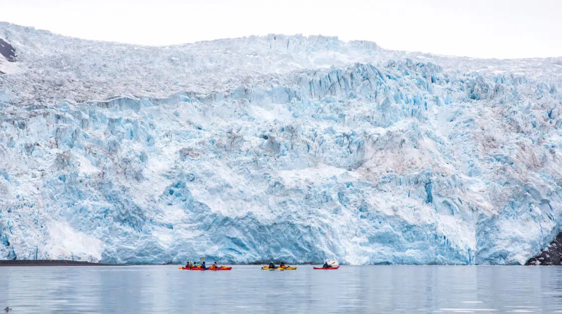
Aialik Glacier Kayaking: Beauty & Adventure in Kenai Fjords
One of the best things to do in Kenai Fjords National Park is to cruise through the fjords, to see the glaciers that carved out this beautiful landscape. And if you are looking for adventure, kayak to Aialik Glacier, one of the more remote glaciers in Kenai Fjords National Park, Alaska. This experience combines a […]
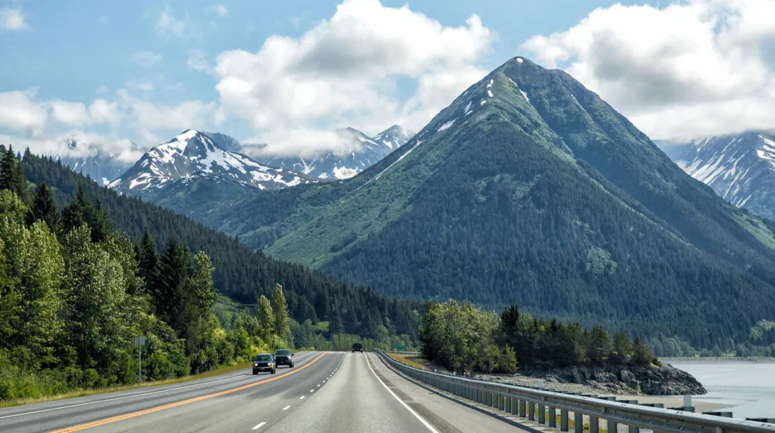
Anchorage to Seward: Best Things to Do on the Seward Highway
The drive from Anchorage to Seward on Seward Highway is beautiful, an attraction in itself. Along the way you can gaze across the Turnagain Arm, ride a cable car up into the Chugach Mountains, admire beautiful turquoise lakes with mountain reflections in them, hike to a waterfall in a picturesque setting, and so much more. […]
10 Days in Alaska: 3 Itineraries for Every Type of Traveler
We have taken two trips to Alaska. The first was a three-week road trip with our whole family, our kids were older teenagers at the time, covering Anchorage, Valdez, Wrangell-St. Elias, Denali, Kenai Fjords, Homer, Seward, and Katmai National Park. It remains one of the best trips we have ever taken as a family. Several […]
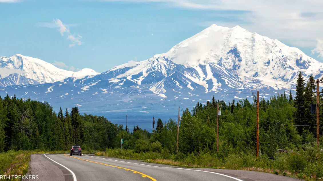
Driving from Anchorage to Valdez: Best Things to Do, Map, & Photos
The drive from Anchorage to Valdez is gorgeous and it is packed with lots of great things to do. Along the drive, you can visit historical sites, hike on a glacier, feed a reindeer, learn about Musk Ox, see Dall sheep, photograph waterfalls, and stop at numerous viewpoints. This was our introduction to Alaska. And […]
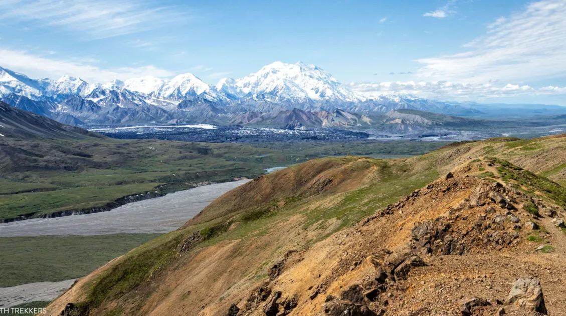
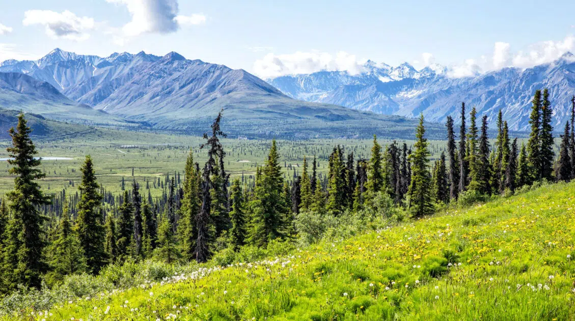
Best Hikes in Denali (From the Entrance to Eielson and Beyond)
Discover the best hikes in Denali National Park, from the easily accessible Savage Alpine Trail to trails deeper into the park, at Eielson and Kantishna. Most visitors to Denali never make it past the Savage River area, accessible at mile 15 of Denali Park Road. We’re not most visitors. We hiked trails throughout the park, […]
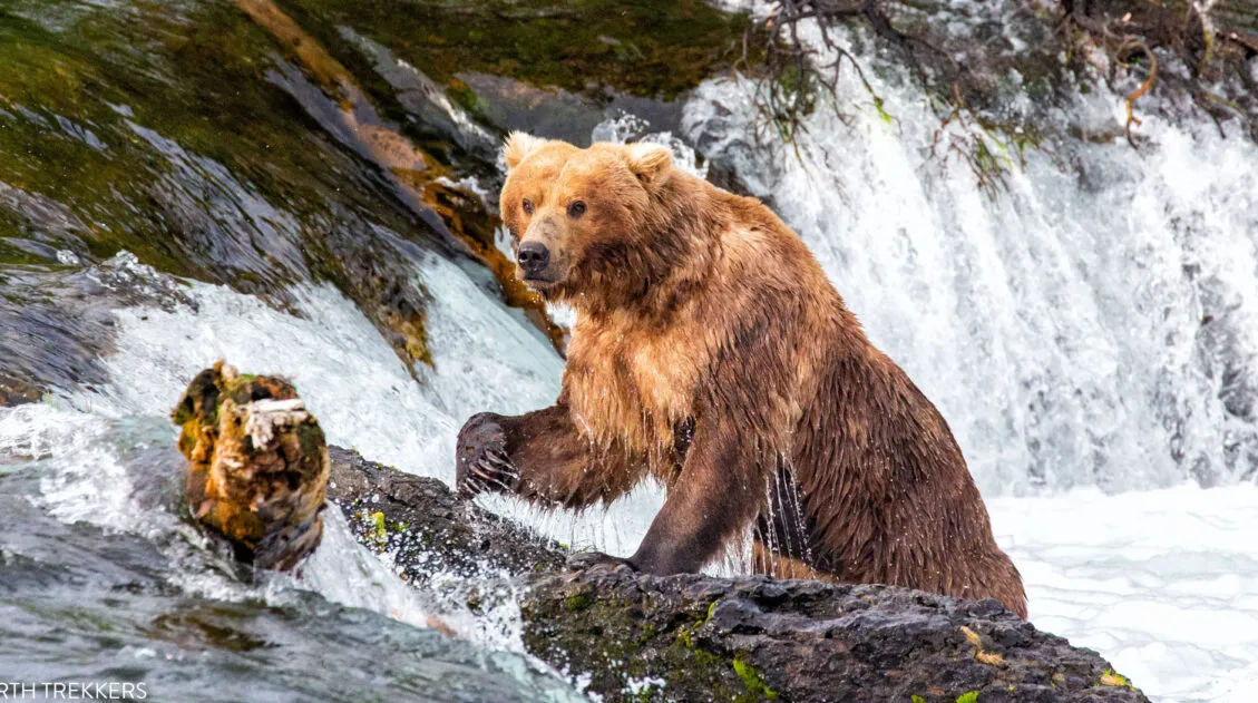
9 Amazing Things to Do in Katmai National Park & Preserve
Katmai National Park & Preserve is a land of brown bears and volcanoes. It is wild, rugged, and remote and one of our favorite national parks. This national park is one of the best in the US for wildlife viewing. Every summer, brown bears head to the rivers, to feed on salmon. Brooks Falls is […]
Journey through Lake Clark National Park in Photos
Lake Clark National Park is one of the least visited national parks in the USA. Located in Alaska, not far from Anchorage, this rugged, remote park is home to some of the most magnificent landscapes in the National Park system. Steaming volcanoes sit amidst the jagged, glacier covered Chigmit Mountains. Waterfalls spill down from the […]
10 Best Things to Do in Wrangell – St. Elias National Park & Preserve
Wrangell – St. Elias National Park & Preserve is one of our favorite US National Parks. Its remote location, countless mountains and glaciers, and sheer beauty is simply astounding. It feels like an adventure to drive in on McCarthy Road, pull your belongings across the footbridge, and get shuttled to your lodge or campground. From […]
Denali Flightseeing Tour: Is It Worth It? (+ Which Tour to Choose)
One of the best ways to experience Denali National Park is on a flightseeing tour. Denali is the tallest mountain in North America. It’s vertical relief, which is the visible difference from base to peak, is 18,000 feet (5,500 meters), which is the highest of any mountain in the world. On a Denali flightseeing tour, […]
The Valley of Ten Thousand Smokes Tour in Katmai National Park
The Valley of Ten Thousand Smokes is the site of one of the world’s largest volcanic eruptions. Located in Katmai National Park, a visit to this area makes a great day trip from Brooks Lodge. I know that it can be hard to pull yourself away from the awesome bear viewing of the Brooks Falls […]
The Ultimate Guide to the 63 US National Parks
Stretching from the South Pacific, across the United States to the Caribbean, are 63 national parks. These national treasures preserve iconic landscapes, majestic mountains, primordial forests, arid deserts, misty coastlines, immense canyons, wildlife, and historic landmarks. We have visited 56 of the 63 US national parks, from the towering granite walls of Yosemite and the […]

Comments 2