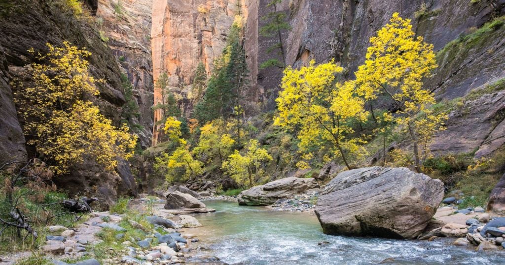
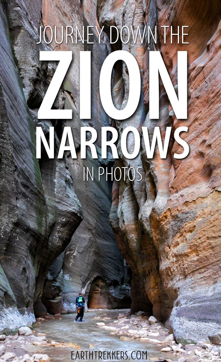
For millions of years, the Virgin River has been carving its way through layers of rock, forming the Zion Narrows. This canyon twists and turns for miles, creating one of the most unique hiking trails in the world.
There are several different ways you can hike the Narrows. Most people hike from the bottom-up, an out-and-back journey that takes you several miles upriver through some of the most scenic sections of the canyon.
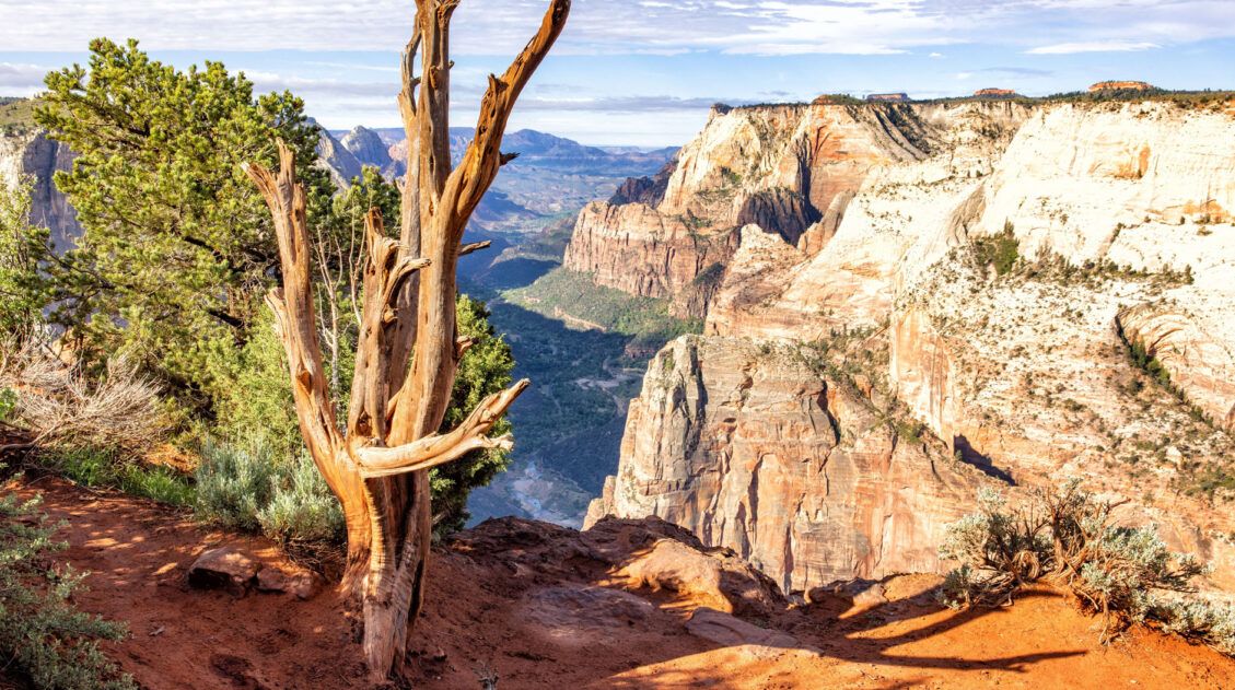
For the ultimate experience, you can hike from the top-down, a 16-mile adventure that can be done as an epic day hike or an overnight backpacking trip.
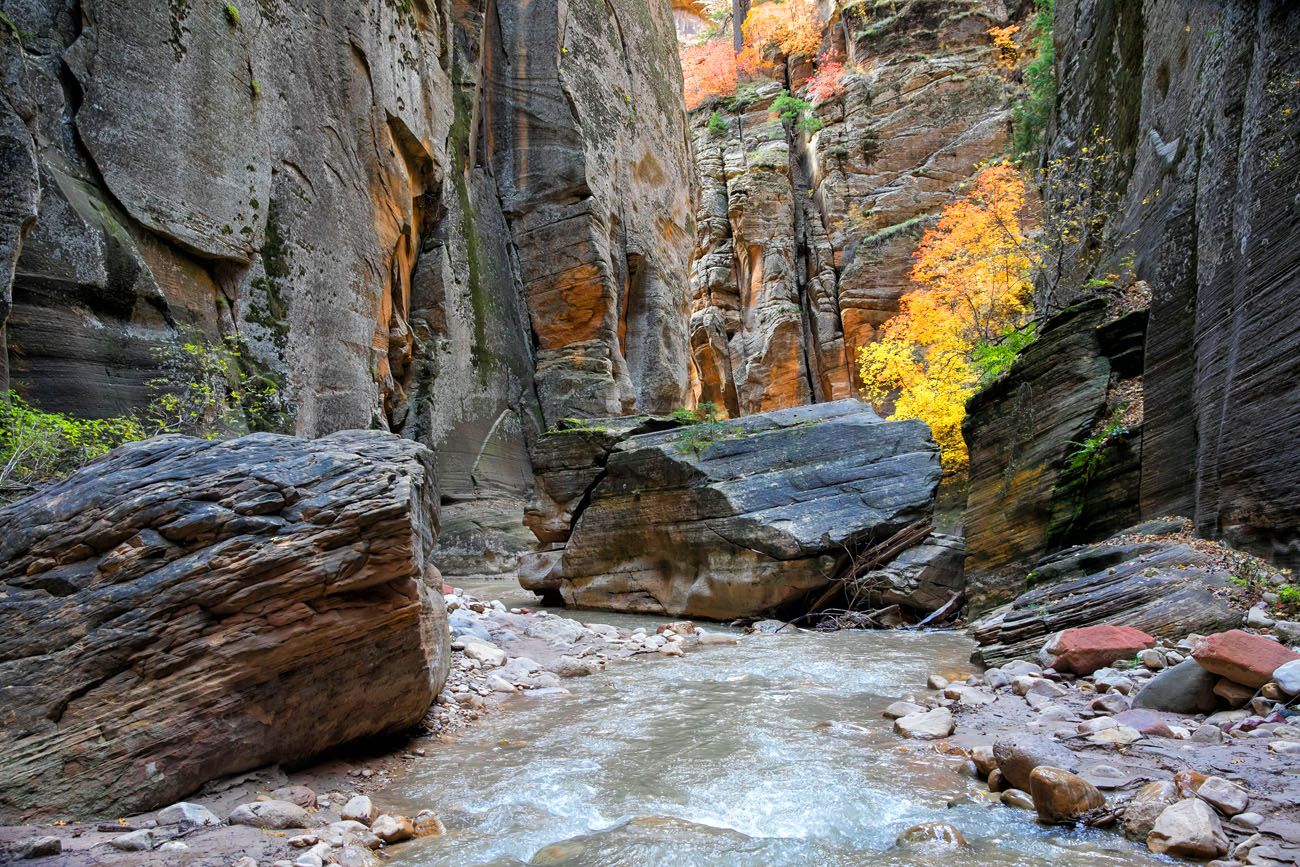
We did this as a day hike from the top-down on October 29, 2018. Fall colors were at their peak, turning this photogenic journey into something even more spectacular.
In this article, journey through the Zion Narrows in photos, starting at Chamberlain’s Ranch and ending at the Riverside Walk.
Spoiler alert! This article is filled with photos of the Zion Narrows, so if you’re the type of person who would like to keep the hike a “surprise,” stop reading here. This article takes you mile by mile through the Zion Narrows in photos.
Stats on the Zion Narrows (from the Top-Down)
Distance: 16 miles (from the top-down)
Difficulty: Strenuous
Length of Time: It takes 10 to 13 hours to do this hike. 12 hours is the average amount of time for most hikers (allowing for rest stops and photography).
When to go: The best time to go is summer and fall. In the spring, the Narrows are generally closed from mid-March through mid-May when flow rates are high from snowmelt. You can do this during the winter months with proper gear.
Before You Go: In order to hike the Narrows from the top-down, you must have a permit.
Please practice the seven principles of Leave No Trace: plan ahead, stay on the trail, pack out what you bring to the hiking trail, leave areas as you found them, minimize campfire impacts, be considerate of other hikers, and do not approach or feed wildlife.
The Zion Narrows in Photos
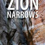
Here is a map of the top-down hike. I photographed the Zion Narrows with a Canon 5D Mark IV camera and 24-70 mm f/2.8 lens. The camera tags the photos with GPS coordinates. In Lightroom, I chose selected photos from the hike and generated the map below using their coordinates. Each orange square represents a photo in this article. I added important landmarks along the way.
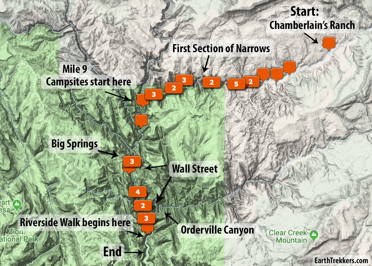
Chamberlain’s Ranch
The journey begins at Chamberlain’s Ranch. This is private property located outside of Zion National Park. Our day started at 6:15 am, with a shuttle ride from Springdale to Chamberlain’s Ranch. It took an hour and forty-five minutes to get to the ranch and our hike started at 8:15 in the morning.
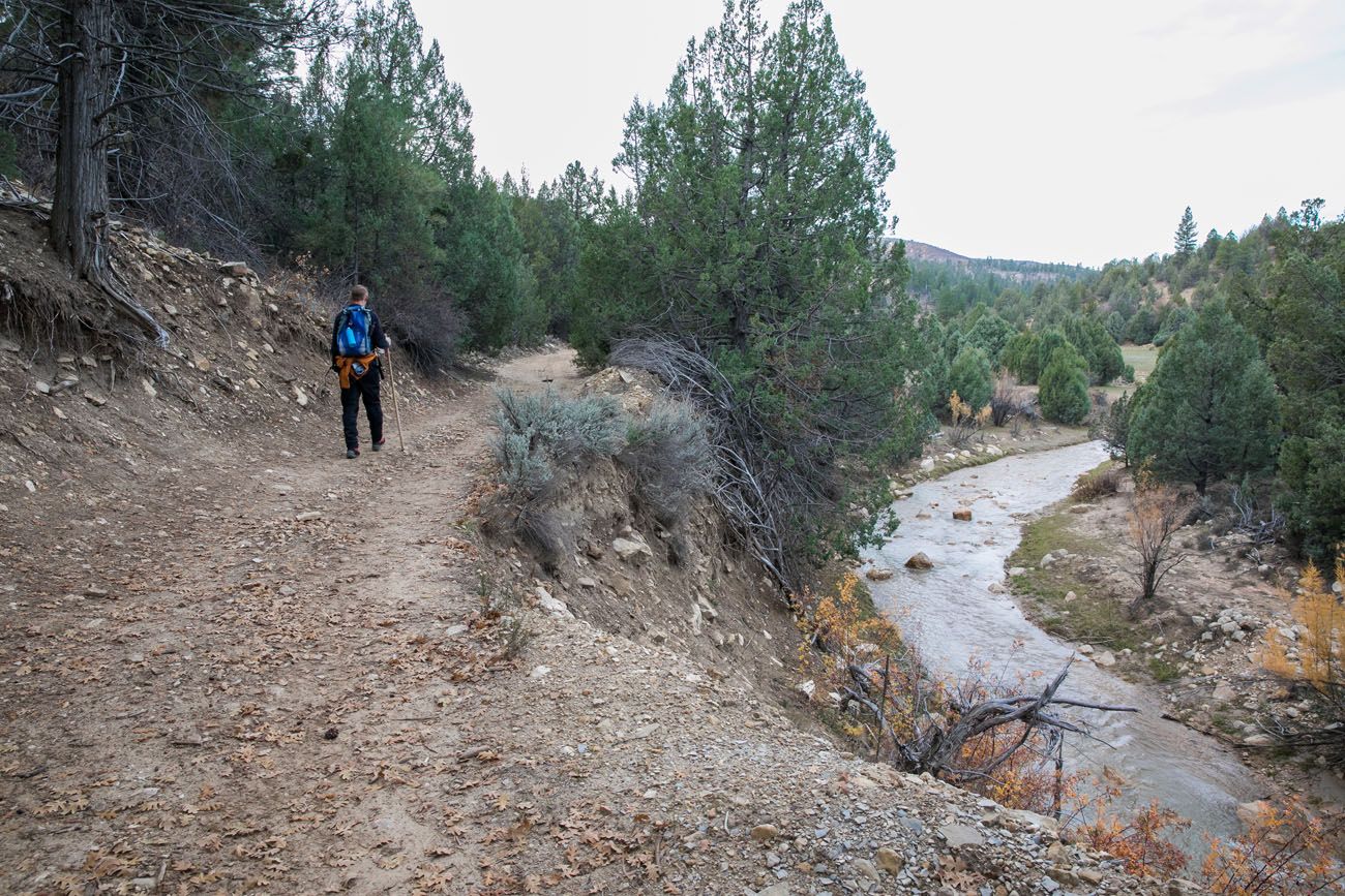
The first three miles of the hike are quick and easy. You simply walk downhill on a gravel road.
Top Half of the Hike
At mile 3, just past Bulloch’s Cabin, the real hiking begins. The road ends, you walk down a short, steep riverbank, and enter the north fork of the Virgin River for the first time.
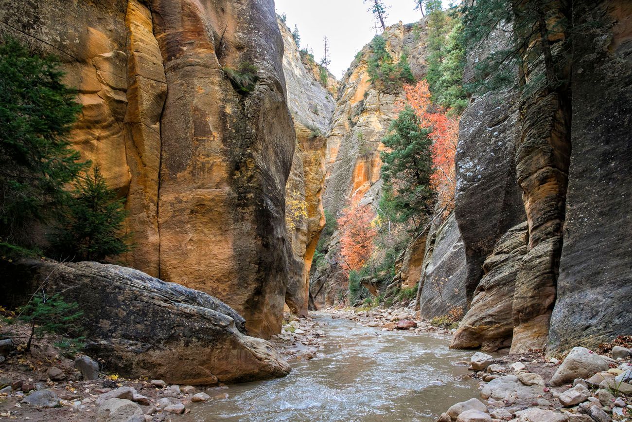
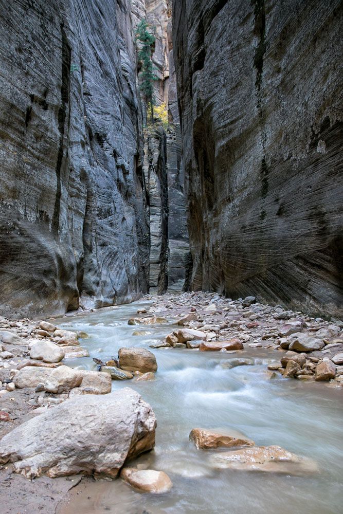
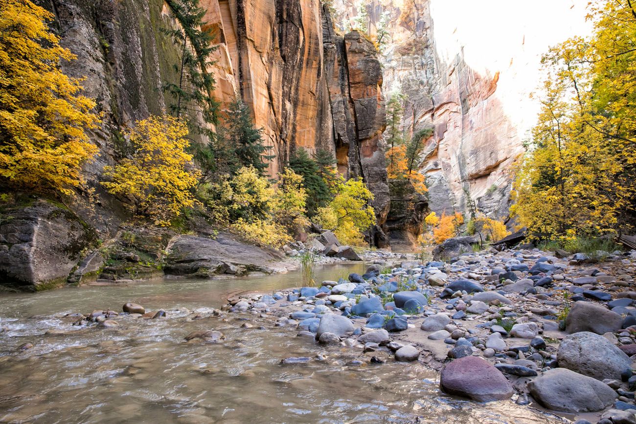
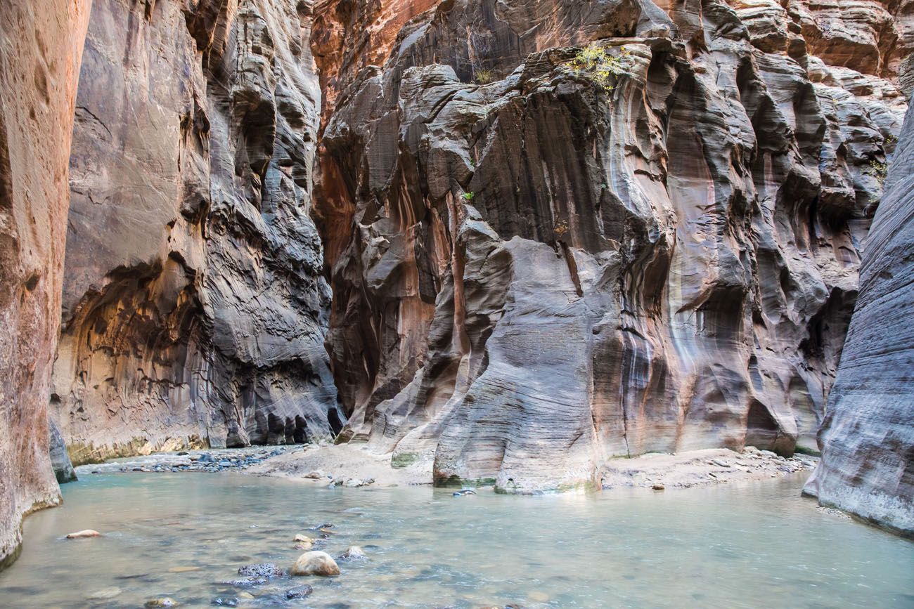
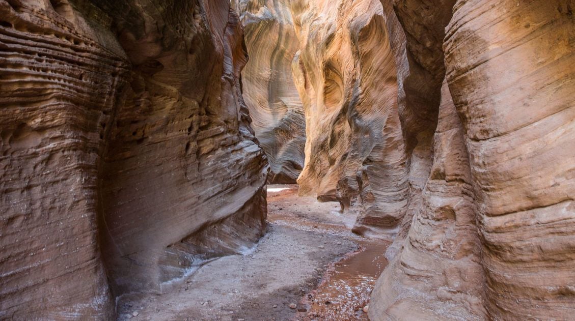
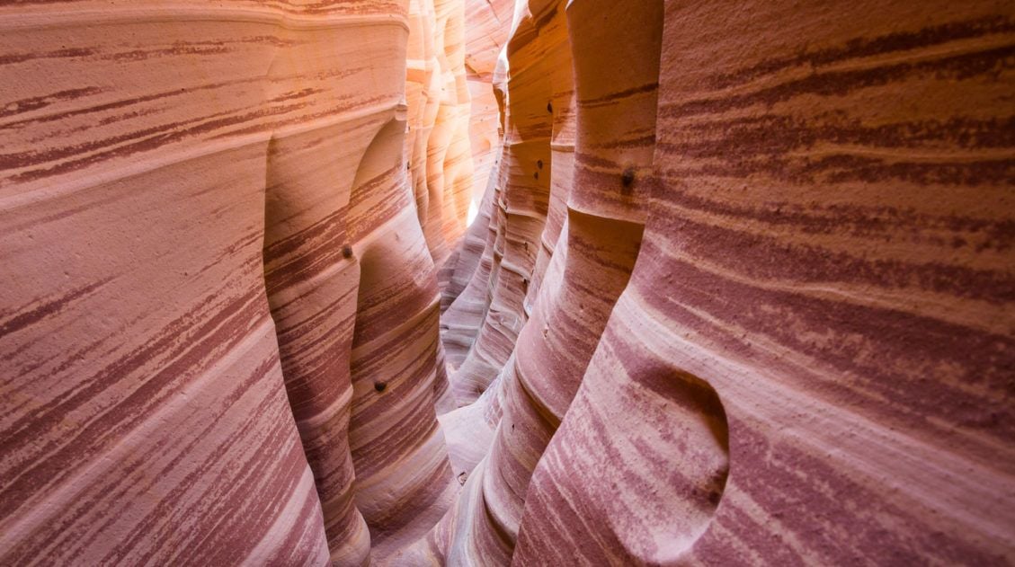
One of the coolest reasons to hike the narrows from the top-down is to watch as the canyon walls steadily grow higher and higher around you. At first, the walls are only 15 to 20 feet tall. Later in the hike, the walls tower hundreds of feet above you and even close in on you in some spots. It’s an awesome experience.
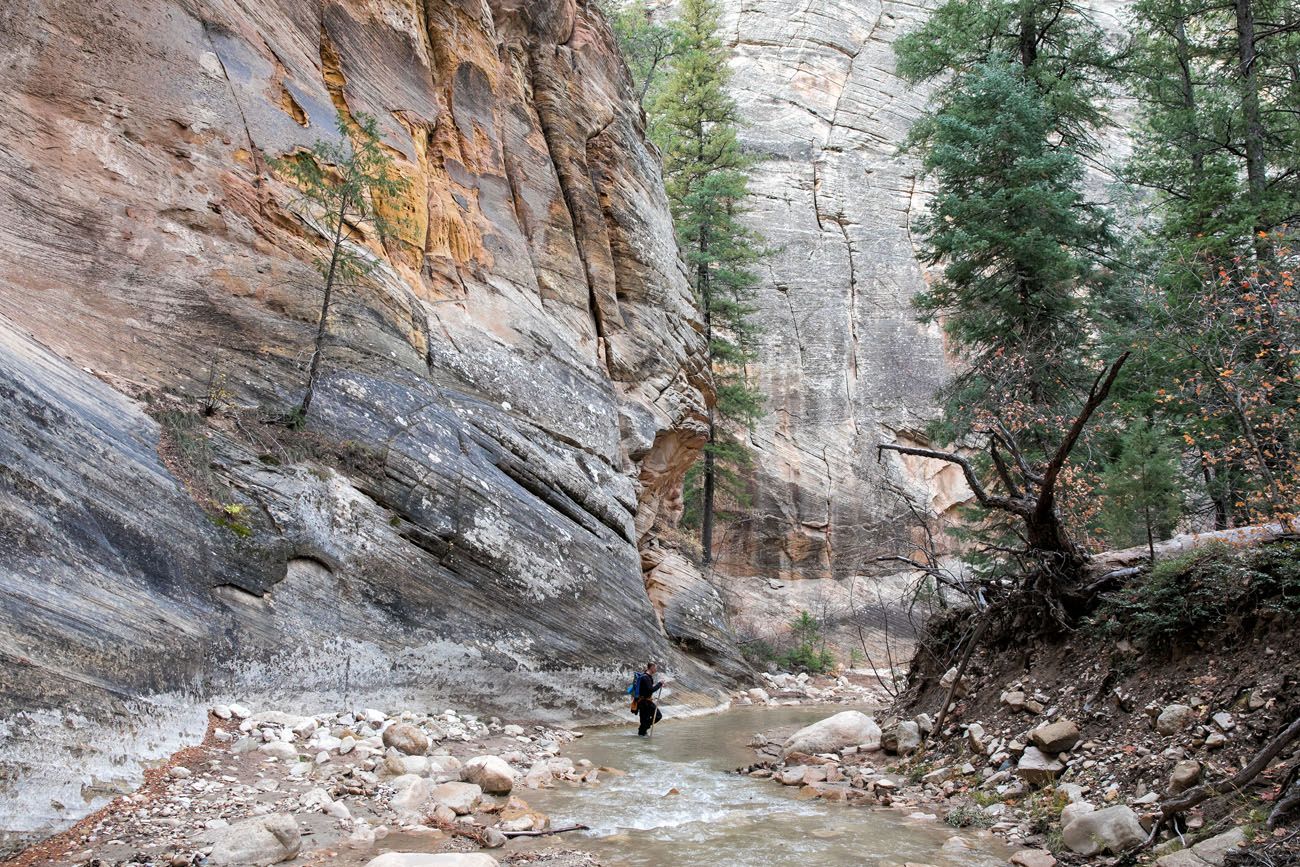
It doesn’t take long for the walls to really gain some height. At about 4.5 miles into the hike, the walls begin to close in on you in spots, and this is where it first feels like you are hiking through a slot canyon.
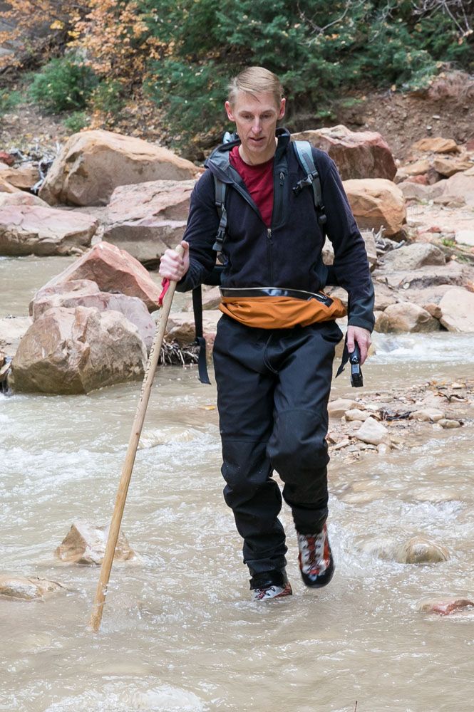
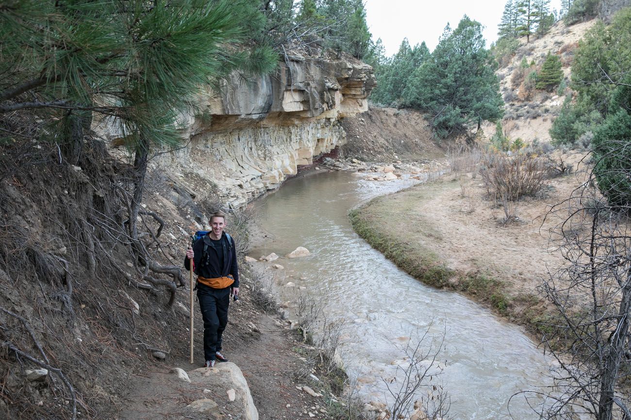
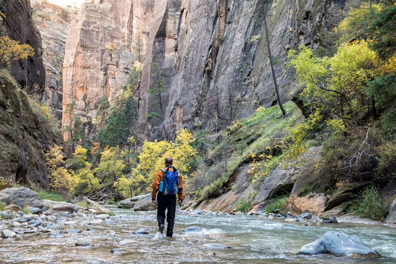
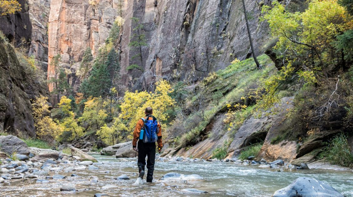
To hike in autumn, special gear is needed to stay warm and dry. We wore full body dry suits (with the arms tied around our waist for most of the hike), neoprene socks, special boots, and a hiking stick. When we did this, the water temperature was 50° Fahrenheit.
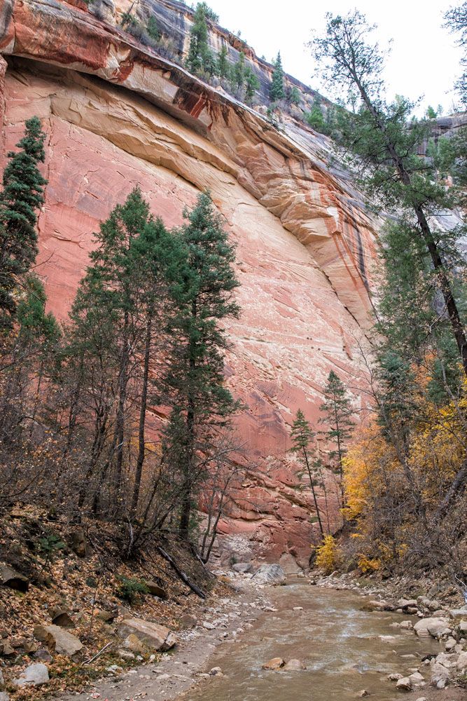
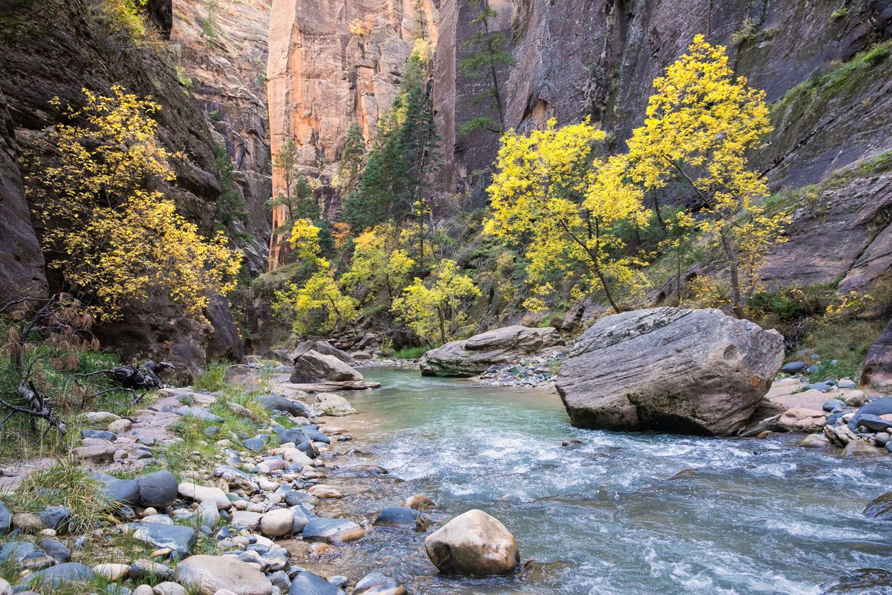
Just before mile 6, there is a short section of tall canyon walls. This is a nice little taste of what is to come later in the hike.
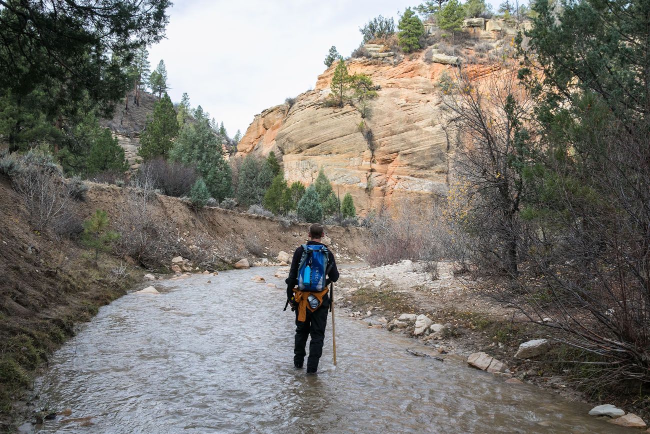
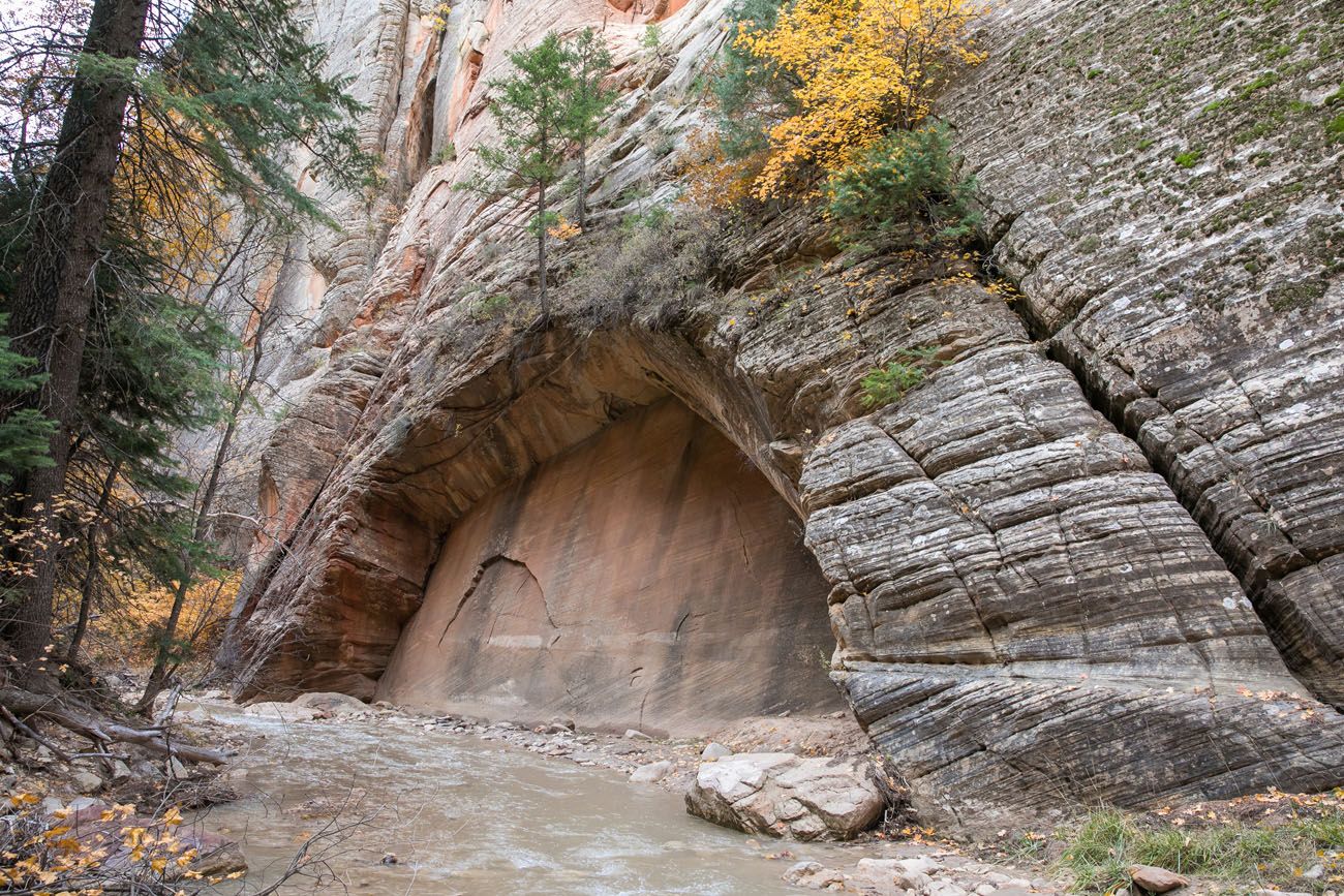
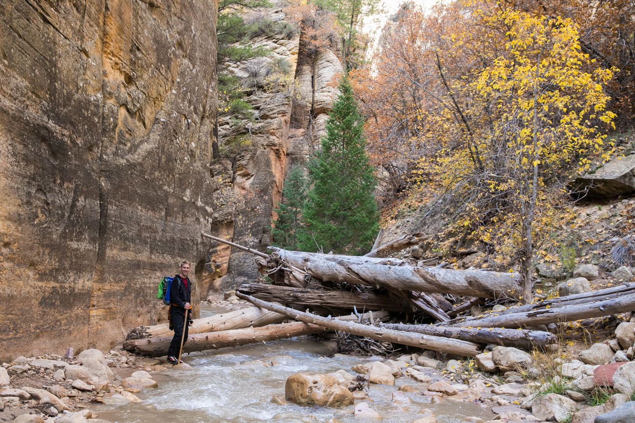
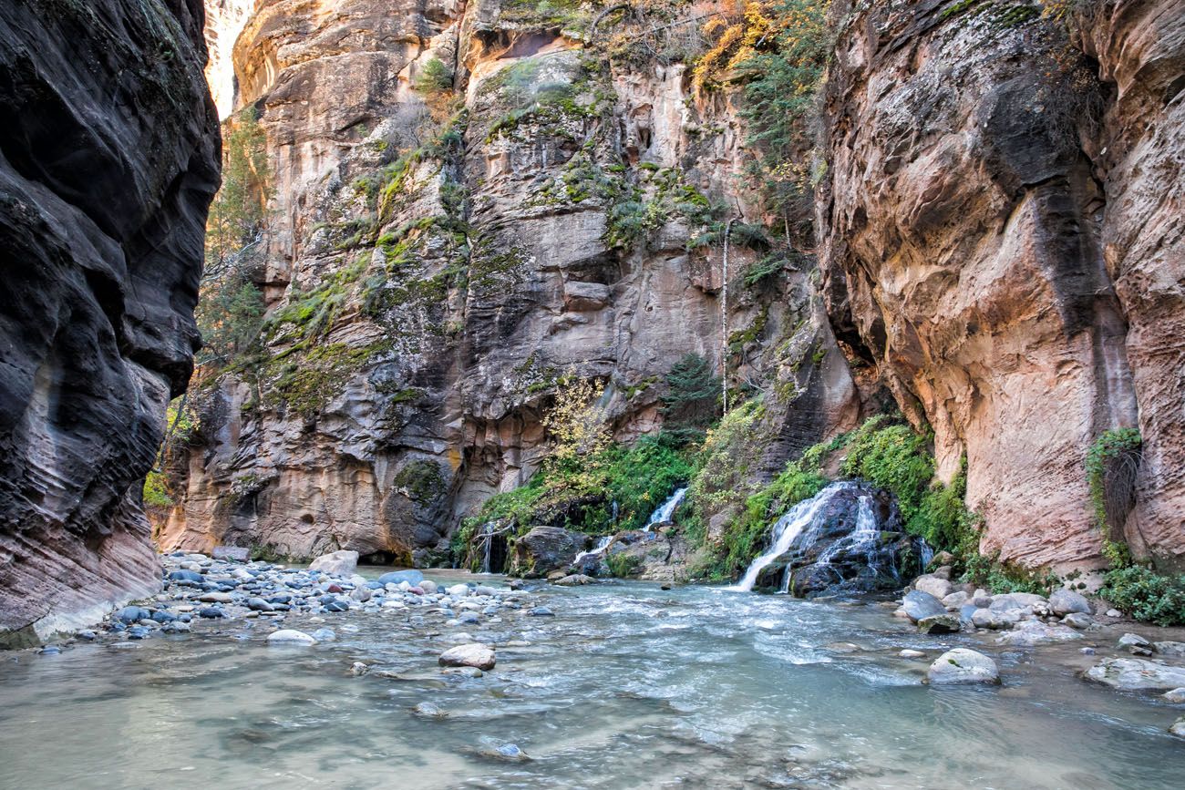
At mile 8.5, there is a small waterfall that you can bypass by hiking a trail around the south side of an enormous boulder.
Just past these falls is a spectacular section of narrows. This was our favorite part of the hike. These walls are so tall and the canyon is so narrow, we were in awe of what we were seeing. By this point, Tim and I had been hiking on our own for several hours, and to experience this alone, without any other hikers, was magical.
Zion Narrows Campsites
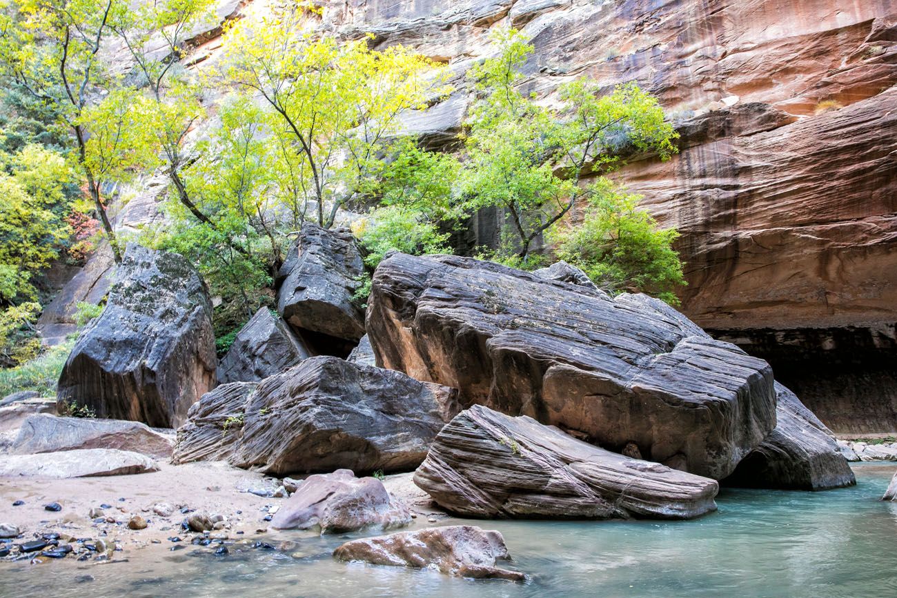
At mile 9, Deep Creek joins the north fork of the Virgin River. The Virgin River now heads south towards the heart of Zion National Park. For two miles, you hike past the campsites used by backpackers and the joining of Kolob Creek and Goose Creek.
The confluence where Deep Creek joins the North Fork of the Virgin River. On the left hand side of this photo is campsite #1. If you look closely, you can see a small, yellow sign marking the campsite.
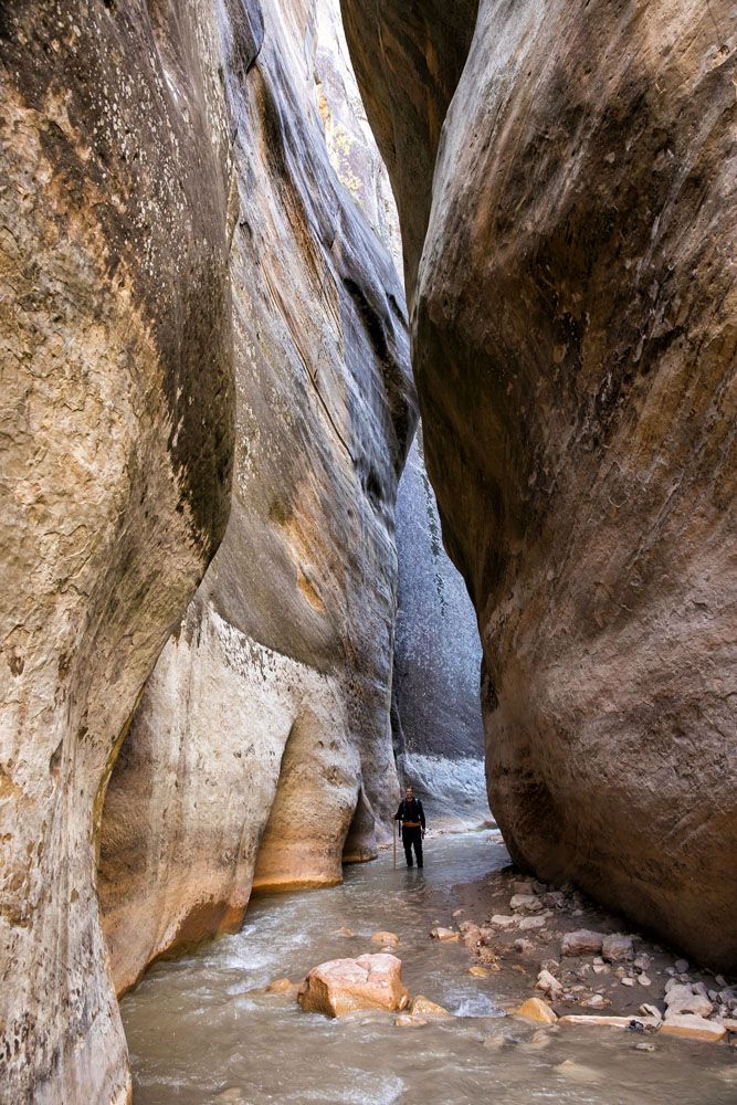
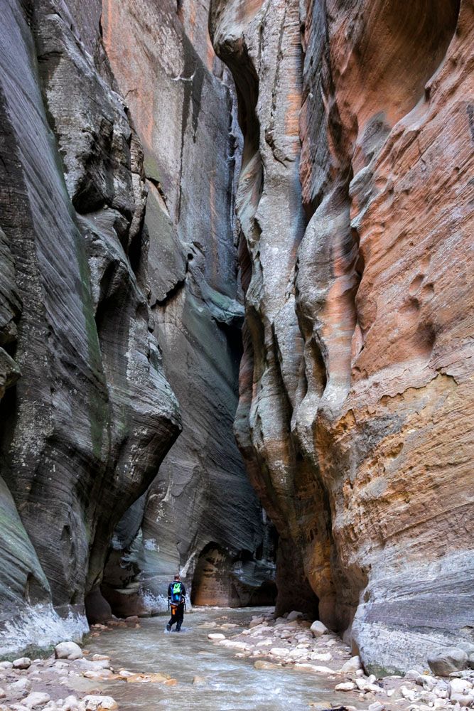
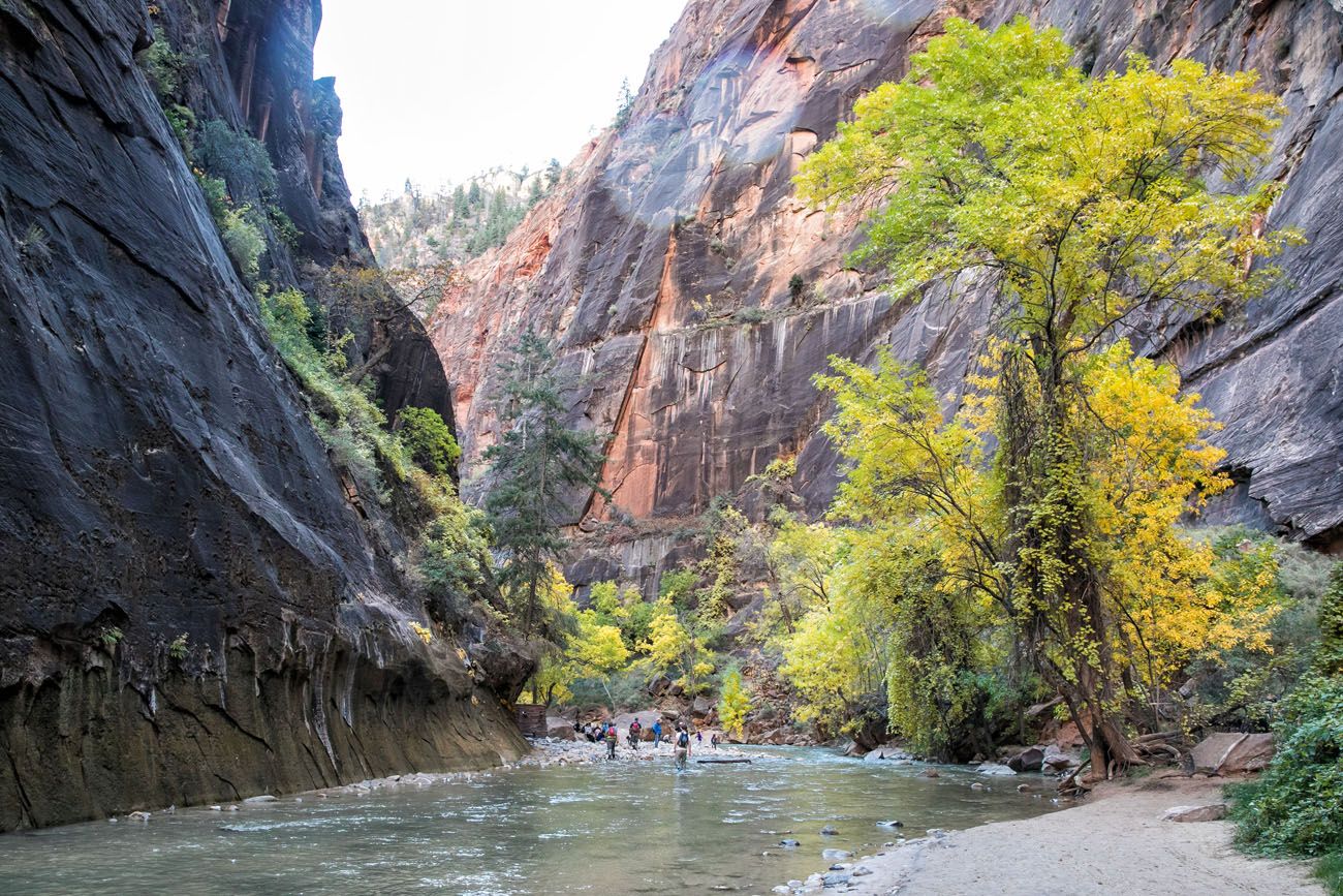
Wall Street
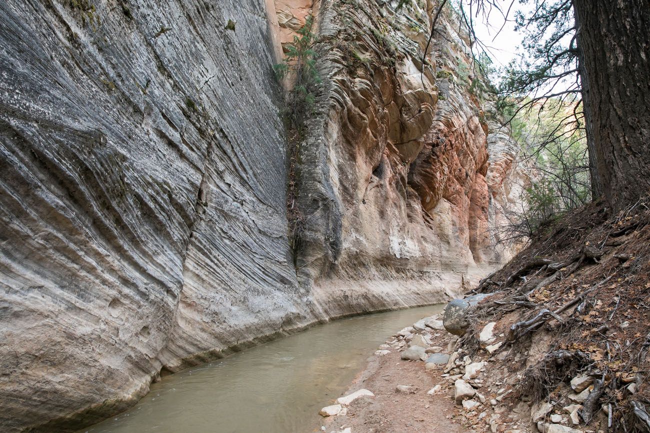
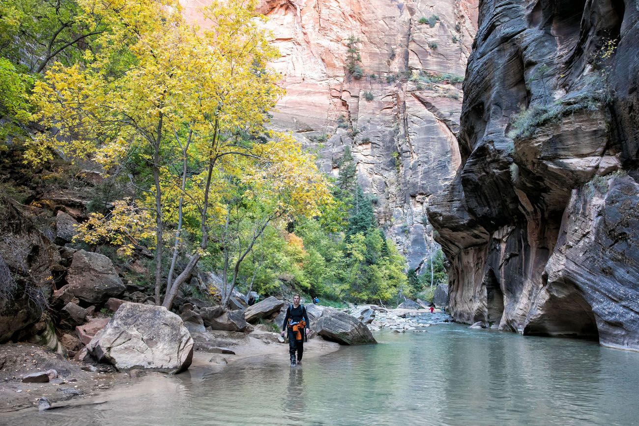
At mile 11, you will see Big Springs. This is really just a cluster of small waterfalls, but it’s an important landmark. When hiking from the top-down, this marks the point where “Wall Street” begins, one of the most spectacular sections of the hike. For those hiking from the bottom-up, this is the farthest north you can hike. Beyond this point you must have a permit.
For two miles, the canyon walls tower overhead. Even though it was a brilliantly sunny day, it was quite dark here, since the canyon walls are so tall and so narrow in spots.
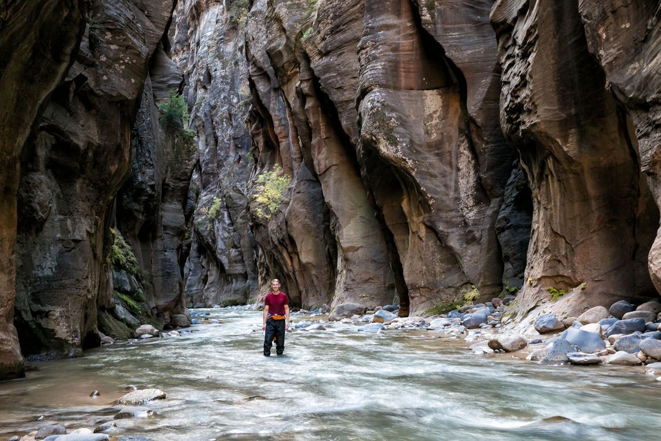
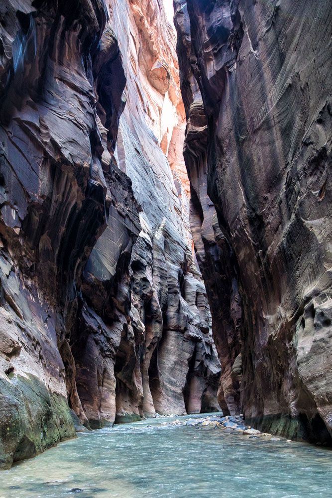
The water flow felt stronger here and it can be chest deep (or deeper!) in some spots. Tim and I wore full body dry suits, which was a good thing, because in three places we actually swam part of the river. Yes, we were in over our heads (even Tim at 6′ 3″). I wish I had photos of this, but cameras and water do not mix well and I was not willing to take the risk.
It was in Wall Street where we saw people for the first time since Chamberlain’s Ranch.
The Final Stretch of the Narrows
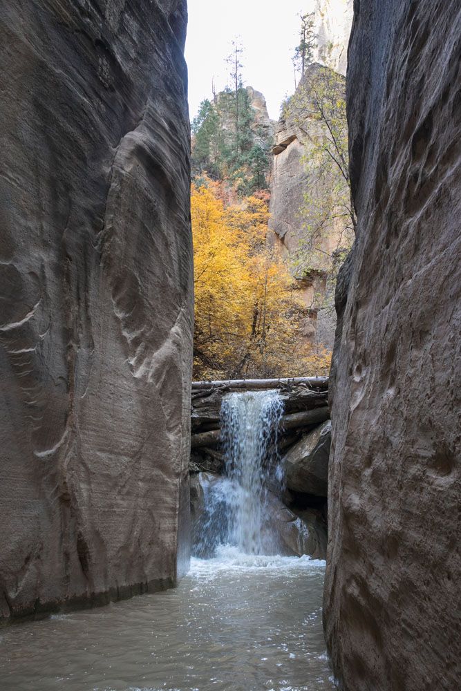
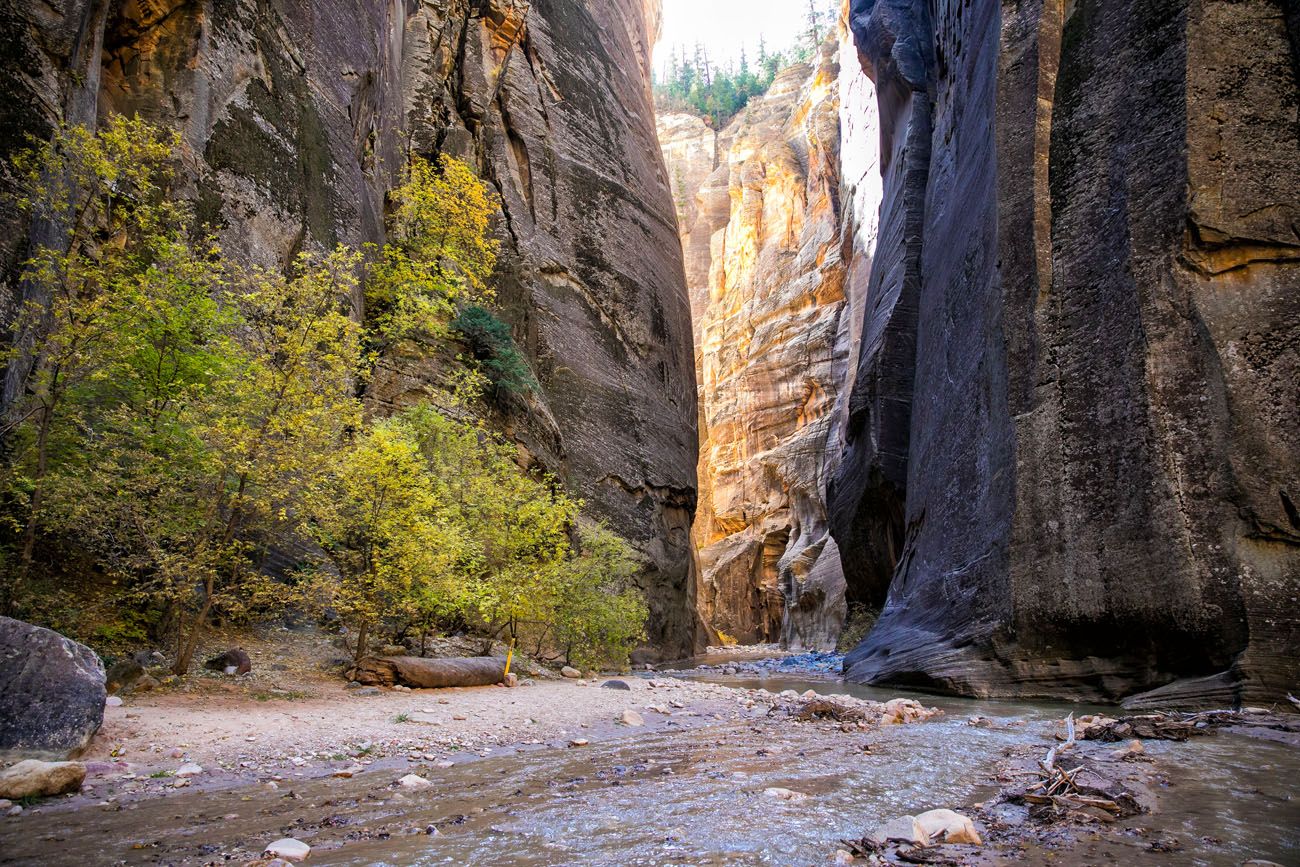
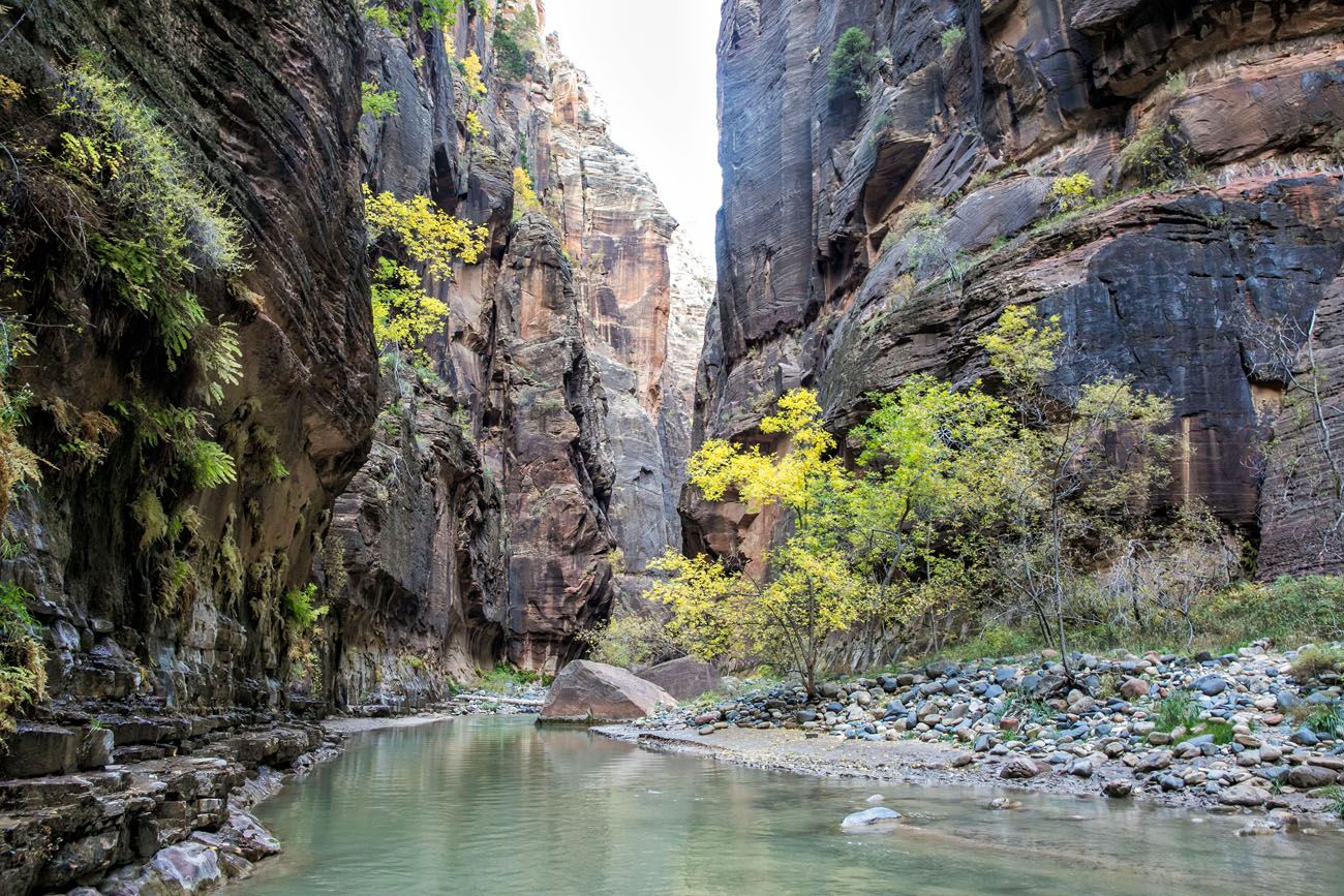
Wall Street ends at mile 13.5. This is where Orderville Canyon joins the Virgin River. You can explore this canyon for about a mile if you have the time and energy. We skipped it, since we had limited daylight with it being late in the season.
From Orderville Canyon, it is a gorgeous, relatively easy hike past boulders, forests, and more narrow canyons, until you get to the Riverside Walk at mile 15.
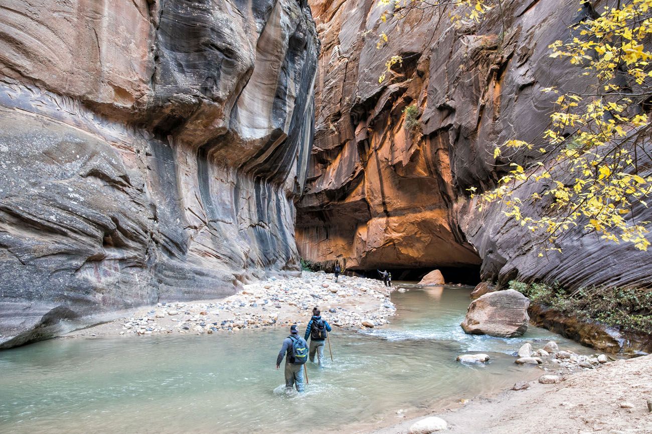
Approaching the end of the Narrows. The small crowd of people is on the riverbank near the end of the Riverside Walk trail.
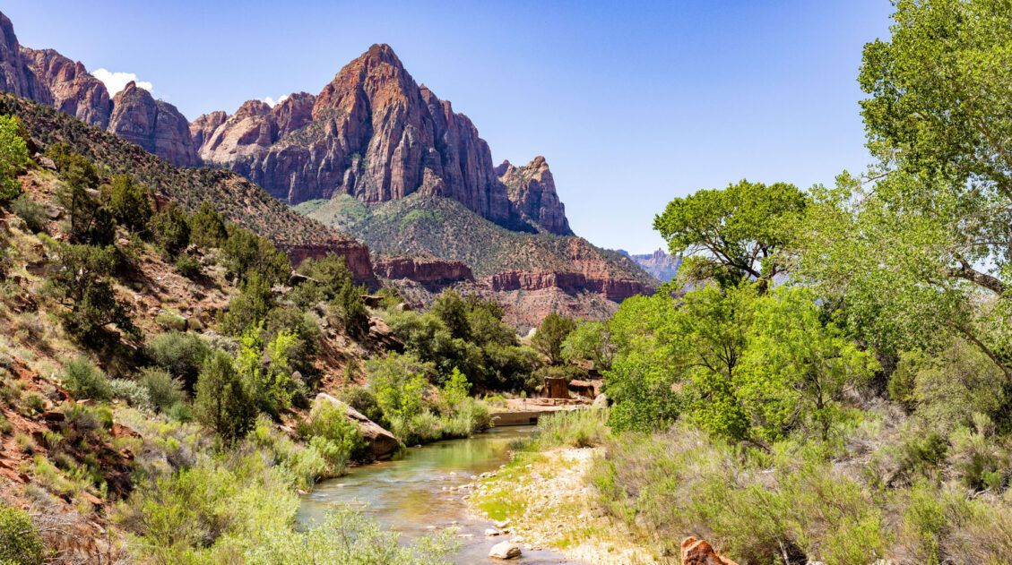
At this point, you are back on dry ground and it’s an easy one mile walk on a paved trail to reach the Temple of Sinawava.
Hiking the Narrows was one of our favorite hiking experiences, ever! For almost 10 miles, Tim and I were completely on our own without another person in sight. Hiking through the canyons, navigating obstacles along the way, and at times swimming through the river when it was up over our heads, felt like a real adventure.
Start Planning Your Adventure
Ready to start planning your adventure? Here are two more articles about the Zion Narrows.
Zion Narrows: Hiking the Top-Down Route in One Day
Zion Narrows Top-Down vs. Bottom-Up. Which One Should You Choose?
Does this look like something you would like to do? Comment below if you have any questions.
More Information about Zion & Utah
Read all of our articles about Utah in our Utah Travel Guide and the United States in our USA Travel Guide.
Best Hikes in Zion: 15 Trails from Beginner to Advanced
Pinterest Facebook Flipboard Zion National Park is one of the best places in the United States to go hiking. From the awe-inspiring hike up Angels Landing to the family-friendly Riverside Walk to multi-day backpacking adventures, there is something here for everyone. In this guide, we cover the best hikes in Zion National Park, from popular trails […]
Zion Narrows Top-Down Route & How to Do It in a Day
The Zion Narrows is one of Zion’s most popular hikes, for good reason. This is the quintessential slot canyon hike. For miles, you hike in the North Fork of the Virgin River, surrounded by sheer rock walls and amazing beauty. It’s challenging, it’s unique, and it makes for a very memorable experience. There are several […]
10 Things to Do in Zion National Park (No Hiking Required)
While Zion is world-famous for bucket list trails like Angels Landing and the Narrows, there’s a lot more to do here than hike a trail or two. Whether you’re visiting with kids, taking a rest day, or simply prefer to skip the trails, Zion offers a surprising variety of things to do that don’t involve […]
Zion National Park Travel Guide
Zion National Park Zion National Park is a hiker’s paradise. This relatively small park is packed with some of the most thrilling trails in the United States. Angels Landing and the Narrows are two hikes that attract most people to Zion National Park. But there are many more trails to choose from…hikes that range from short, […]

Travel Photography Gear Guide: What’s In Our Camera Bag
Do you want to know how we capture the images that you see on our website? Here is our photography gear guide, with links and explanations of our photography gear and accessories. At the end of this post, we offer tips and tricks on how to take better photographs while traveling. October 2025 Update: We […]
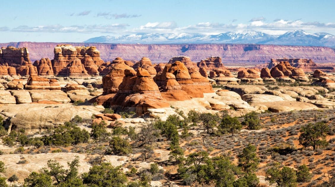
10 Days in the American Southwest: The Ultimate Road Trip
The American southwest is one of the USA’s best road trip destinations. It’s unbelievable how much there is to see and do here. There are the breathtaking vistas of the Grand Canyon, thrilling hiking trails in Zion National Park, and millions of hoodoos to photograph in Bryce Canyon. Are you getting excited yet? The list […]
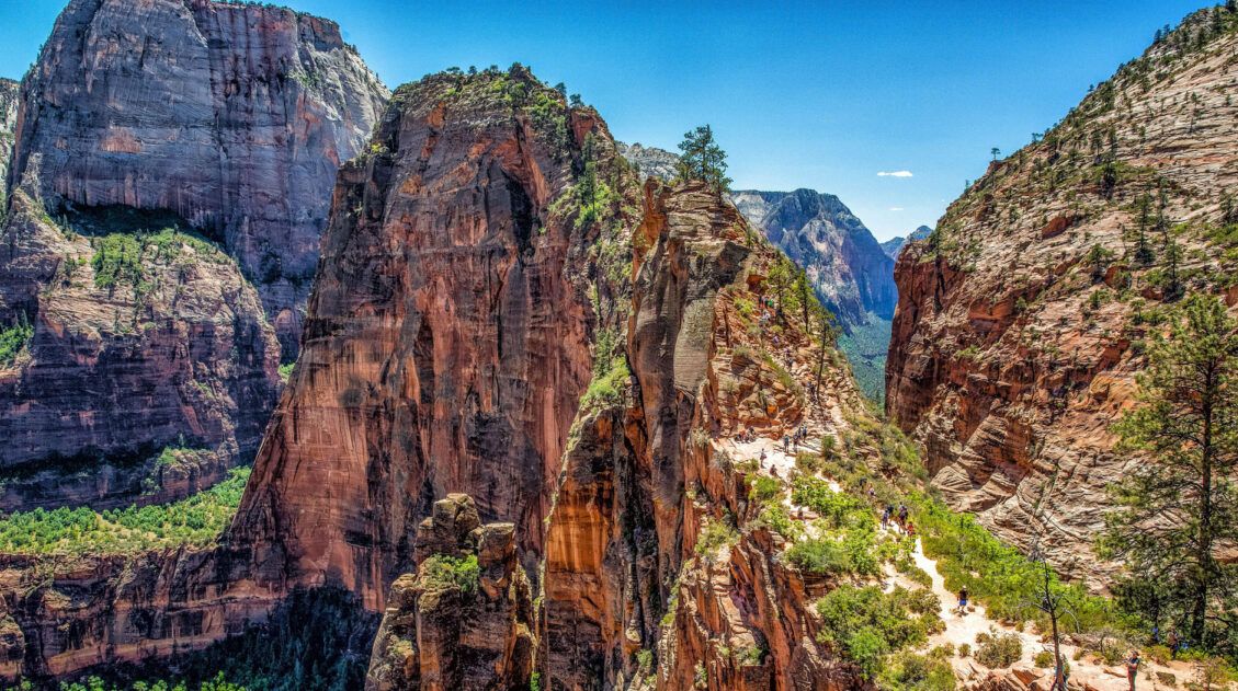
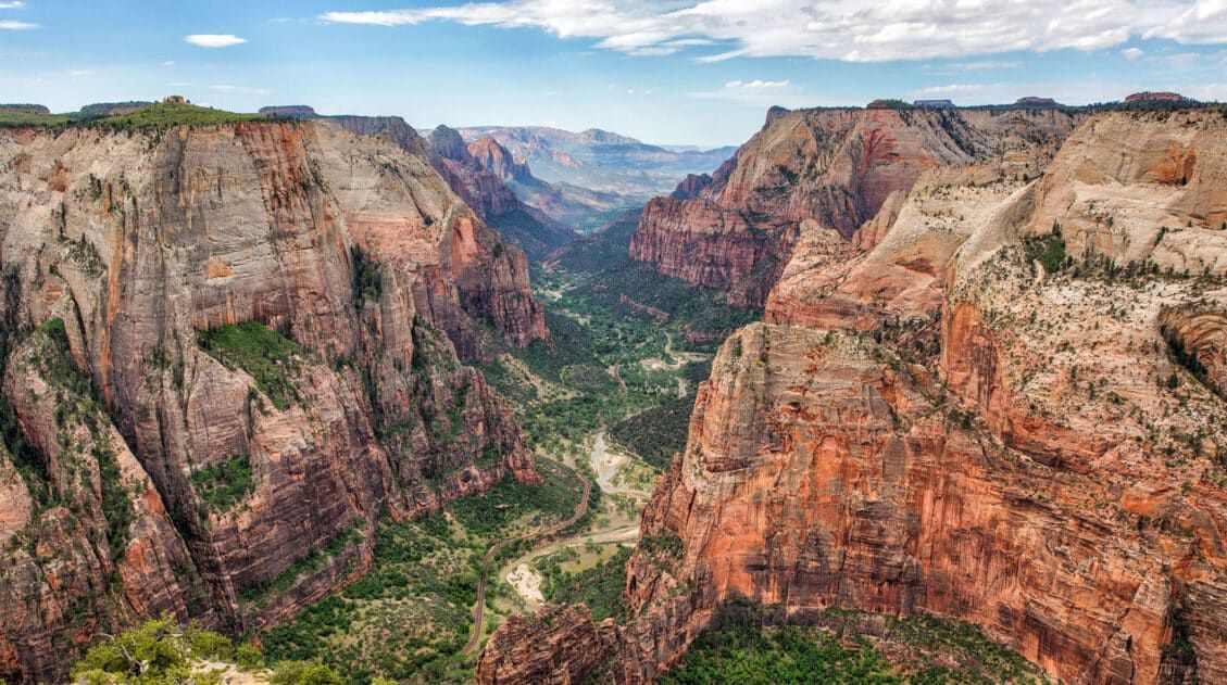
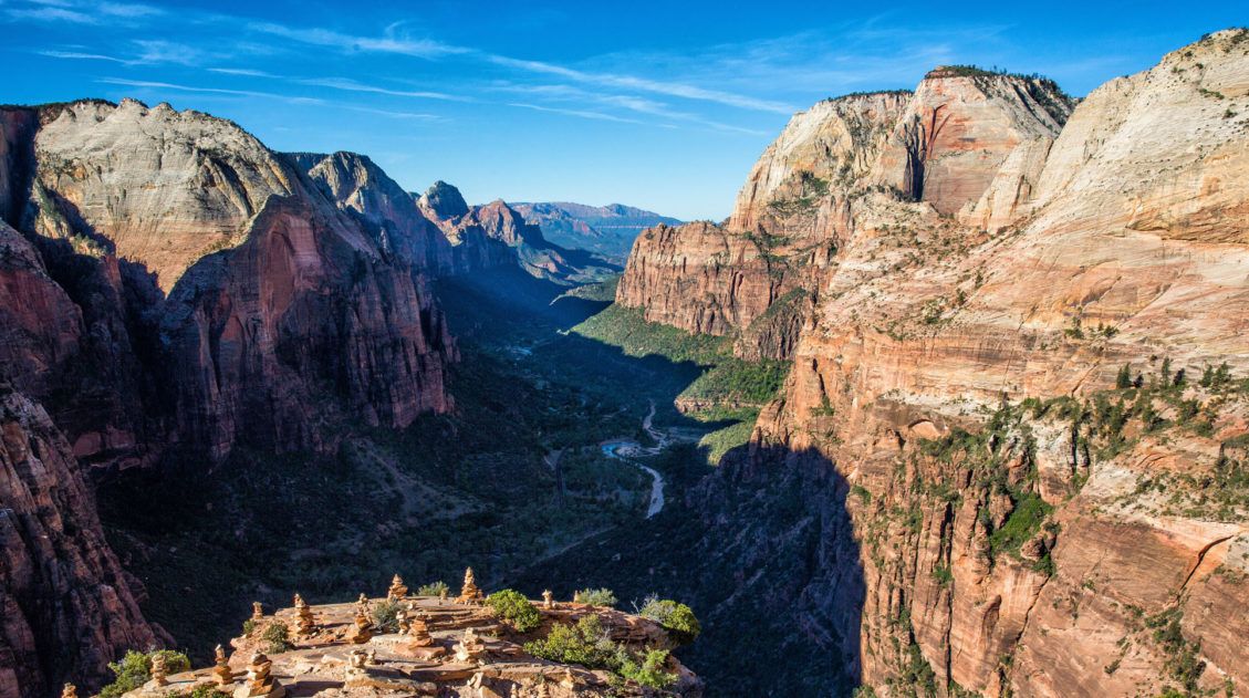
How to Hike Angels Landing: Trail Guide, Permits & Video
Angels Landing is the most popular hike in Zion National Park. This is a 5.4-mile round-trip hike with 1,500 feet of elevation gain, and requires a permit. The Angels Landing hike, along with The Narrows, draws thousands of visitors per year, most of them during the summer months. Why is Angels Landing so popular? This […]
The Ultimate Zion Itinerary: 1 to 6 Days of Hiking & Adventure
If you are planning your Zion National Park itinerary, this is a great place to start. Zion National Park is a hiker’s paradise. This relatively small park is packed with some of the most thrilling hikes in the United States. From the awe-inspiring hike up Angels Landing to the bucket list-worthy Zion Narrows to the family […]
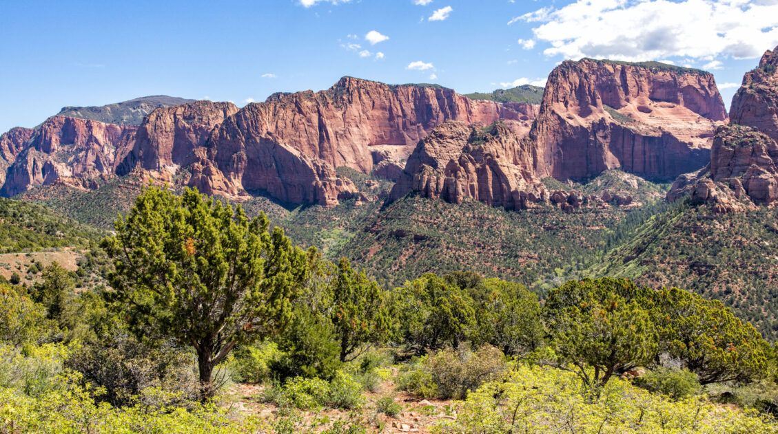
Kolob Canyons in Zion: Best Things to Do & Is It Worth It?
Kolob Canyons is a small, remote section of Zion National Park. Located in the northwestern area of the park, Kolob Canyons is known for its quieter hiking trails, sandstone cliffs, and narrow canyons. For those looking to escape the crowds of Zion, or those who want to thoroughly explore this national park, Kolob Canyons is […]
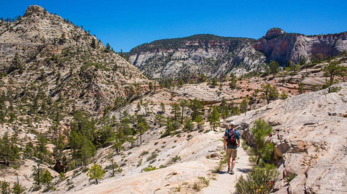
How to Day Hike the West Rim Trail in Zion National Park
The West Rim Trail is a long distance hike through Zion National Park. Starting at Lava Point, the trail slowly descends into the heart of Zion, the views getting better the farther you go. Hikers also have the option to add on Angels Landing. This is a beautiful hike, but it is long and requires […]
Utah Travel Guide: Places to Visit in Utah
Utah Travel Guide If you like rugged, desert landscapes, it is hard to beat the beauty of Utah. Visit the state’s five stunning National Parks, stand among iconic US monuments, kayak on the Great Salt Lake, and climb through photogenic slot canyons. This state is a great one for road trippers as there are many […]
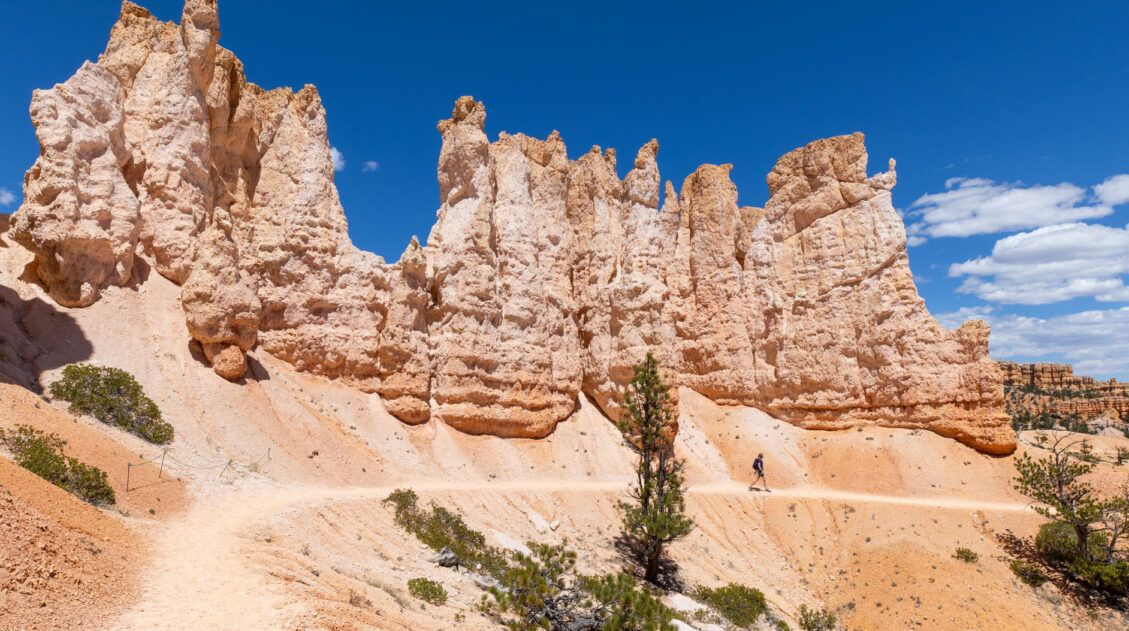
12 Epic Hikes in Bryce Canyon Rated from Easy to Hard
If you ask us, putting one foot in front of the other on a hiking trail is the best way to experience Bryce Canyon National Park. These hiking trails take visitors to jaw-dropping viewpoints and hidden canyons. Hike the short but sweet Rim Trail, descend down into the amphitheater on the Queen’s Garden Trail, or […]
Hiking the Willis Creek Slot Canyon in Utah
The hike along the Willis Creek Slot Canyon is so much fun! And to think that we almost skipped this hike. After a long day of hiking and exploring both Bryce Canyon National Park and Kodachrome Basin State Park, we wondered if we should tack on Willis Creek to the end of our day. Would it be […]
How to Hike Zebra Slot Canyon in Grand Staircase-Escalante
Zebra Slot Canyon is a very short slot canyon, named for its striped canyon walls. It’s a gorgeous spot, maybe not quite as pretty as Antelope Canyon in Arizona, but since you can explore this on your own without a guide or tour group, it’s more fun. Hiking Zebra Slot Canyon can be a little […]

Comments 20