
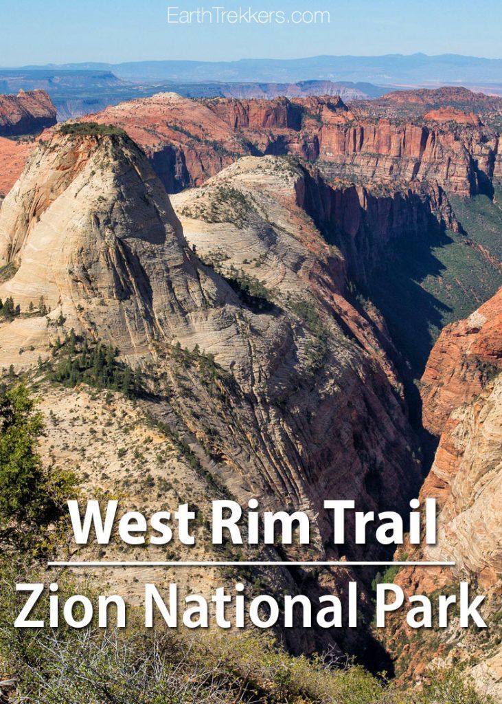
The West Rim Trail is a long distance hike through Zion National Park. Starting at Lava Point, the trail slowly descends into the heart of Zion, the views getting better the farther you go. Hikers also have the option to add on Angels Landing.
This is a beautiful hike, but it is long and requires some advance planning. With amazing views, very few hikers on the trail, and a chance to walk the length of Zion National Park, this hike rewards your efforts.
The West Rim Trail can be hiked as a long day hike or as a two day backpacking trip. We elected to do the day hike in the top-down direction, starting at Lava Point.
This guide covers the West Rim Trail as a day hike, starting at Lava Point and ending in Zion Canyon at The Grotto shuttle stop.
West Rim Trail Hiking Stats
Distance: 16.2 miles (26.1 km) point-to-point (from Lava Point to The Grotto)
Starting elevation: 7,900 feet (2,400 m) at Lava Point Campground
Ending elevation: 4,466 feet (1,361 m) at The Grotto bus stop
Overall descent: 3,156 feet (962 m)
It is an overall 3,156 foot (962 m) descent, with 1486 feet (453 m) of climbing (mostly in the mid-portion of the hike)
Difficulty: Strenuous
Length of Time: 9 – 12 hours is average, although it can take up to 16 hours, depending on your pace
When to go: May through November. Snow can block the trail during the winter and spring months.


West Rim Trail Elevation Profile
Please note: If you read other blogs and information provided by the National Park Service website, you will see the distance for this hike ranging from 14.2 to 18.5 miles. We hike with a Garmin GPS and use the stats it outputs, which turned out to be 16.2 miles (26.1 km).
How to Use This Map: Click the tab in the top left corner of the map to see a list of the points of interest and to turn layers on/off. Click the icons on the map to get more information about each point of interest.
To take this map with you, click the star next to the title of the map which adds it to your Google account. Next, within your Google Maps app, select ‘Saved’ and then select ‘Maps’. This map title will now appear in your list.
How to Get to Lava Point
The trailhead is located near Lava Point Lookout, a 45-minute to one-hour drive from Springdale. The Zion Shuttle does not provide access to this point. Getting here requires a 34-mile drive from Springdale on Kolob Terrace Road, which travels along the western boundary of Zion National Park.
There are shuttle services that you can hire to drive you from Springdale to the trailhead. We used Zion Adventure Company. It costs roughly $50 per person, and this might sound expensive, but it saves you the hassle of later trying to retrieve your car from Lava Point.
I strongly recommend booking your shuttle service at least several days in advance. There are a limited number of seats and they do sell out!
How to Hike the West Rim Trail
Step-By-Step Trail Guide
Tim and I did this hike at the very beginning of May. Temperatures were in the 90’s midday, but the morning started off cool, about 65 degrees. Almost the entire first half of this hike is at the higher elevations on Horse Pasture Plateau, which keeps temperatures pleasant, even on the hottest of days.
Getting to the Trailhead
Our day started early. At 6:30 am we were on our way to the trailhead in a van with seven more hikers. This is a much different experience than waiting in line with hundreds of other people for the Zion Shuttle!
At 7:30 am we arrived at the Lava Point Lookout.
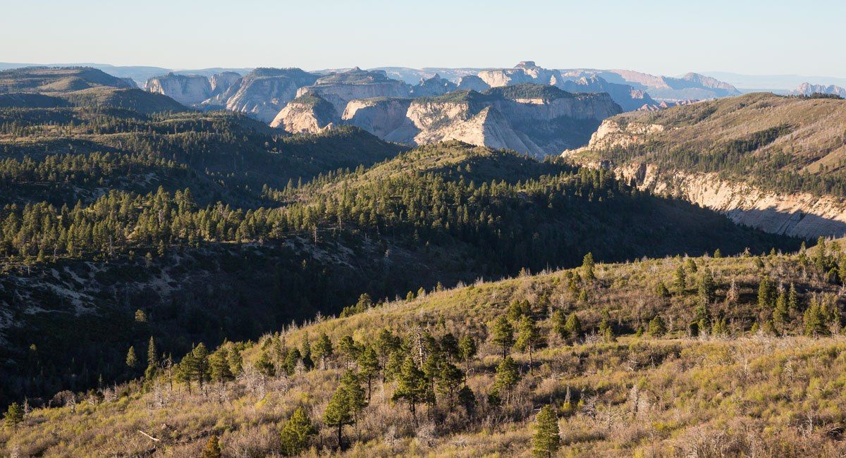
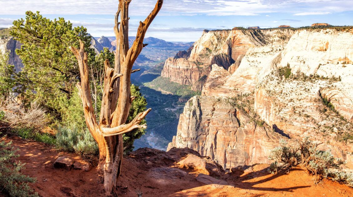
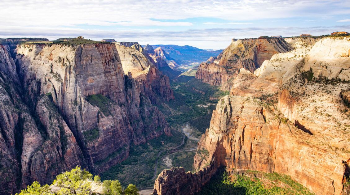
Before starting the hike, it is worth taking in the view from Lava Point Lookout. This gives you an idea of how far you will be hiking. Just in front of you is the green plateau that makes up the first part of the hike. Beyond it is the canyon of Zion National Park, your final destination.
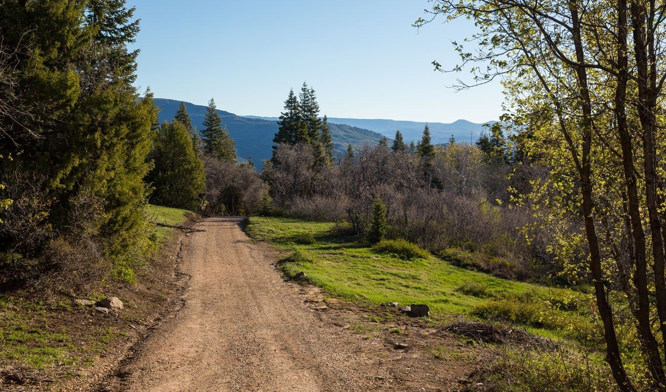
From the Lava Point Campground (and your last chance to use a bathroom for quite awhile), it is a one-mile hike on Barney’s Trail to get to the official West Rim Trail trailhead. Most of this section is on a wide, gravel road.
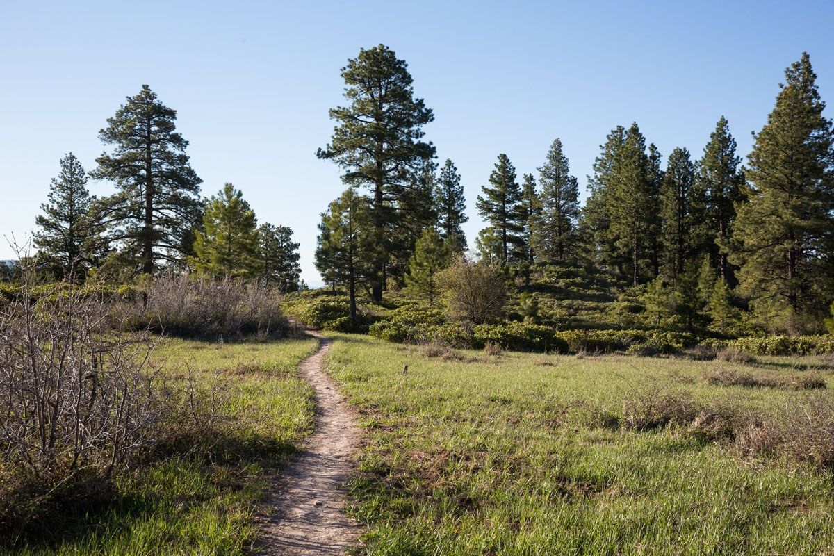
The West Rim trailhead is marked with small, black sign. Now the trail becomes a dirt, singletrack trail along the forested plateau. Almost immediately past the trailhead is the turnoff for Wildcat Canyon Trail. Make sure you stay to the left, staying on the West Rim Trail.
On the Plateau
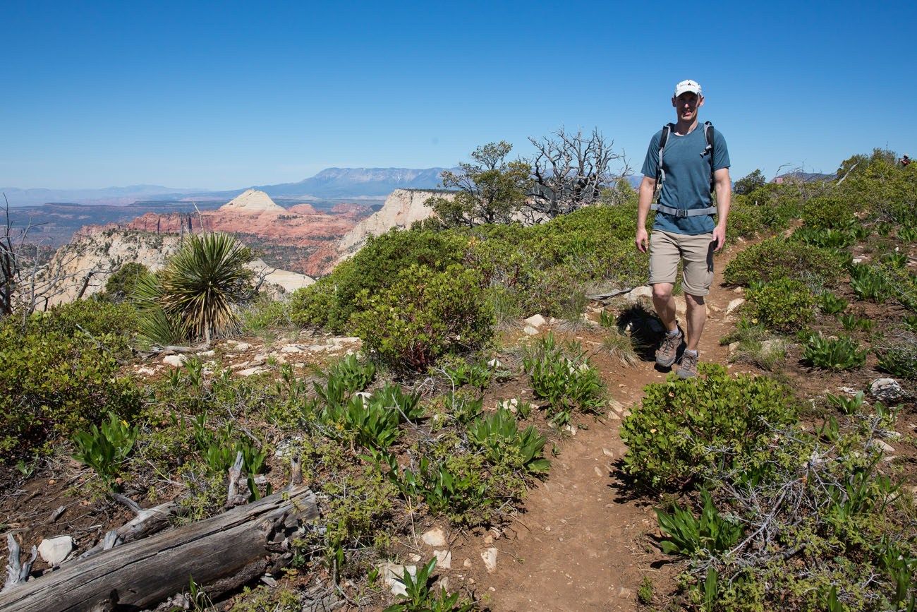
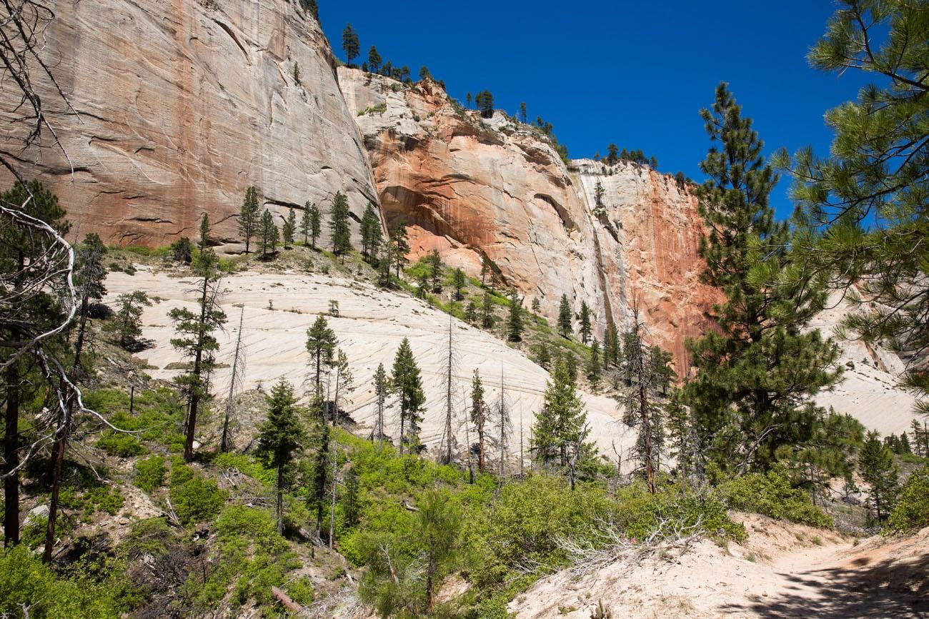
This first, forested section lasts quite awhile (about six to seven miles). It’s a cool, somewhat shady trail with a slight overall decline. This part of the trail is easy to hike and scenic views are few and far between (those come later!!), so this is a good place to hike with a fast pace.
Occasionally, there is a teaser view out to the west, spaced at just the right intervals to keep this part of the hike interesting.
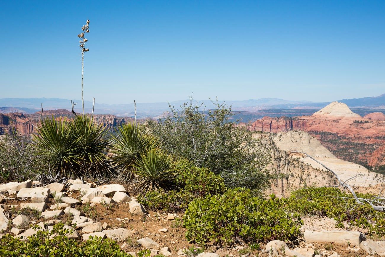
The nice, overall downhill ends at Potato Hollow. From here, it is two short climbs spaced out over the next two miles. After enjoying the downhill for so long, it seemed like a bit of a slog to get up these hills, even though they are not very difficult. But it’s worth it. From here, the views also begin to change. Now you can see more of the stunning canyons, but the best is still to come.
At the top of the second climb, the trail splits. Stay to the right to remain on the West Rim Trail, with the best views from Horse Pasture Plateau. If you go left, the Telephone Canyon Trail offers more forested trails with less spectacular views. Both of these trails meet up again.
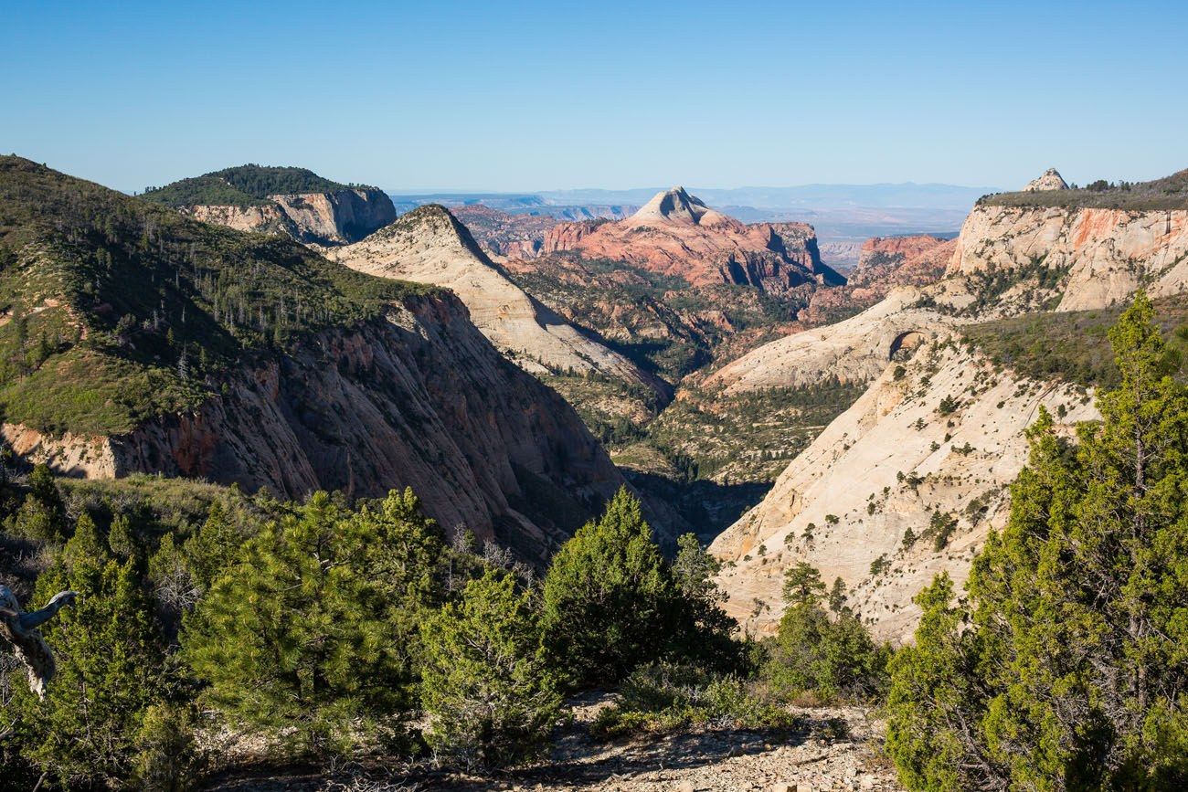
Best Part of the West Rim Trail
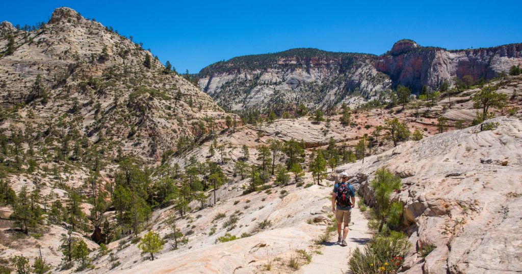
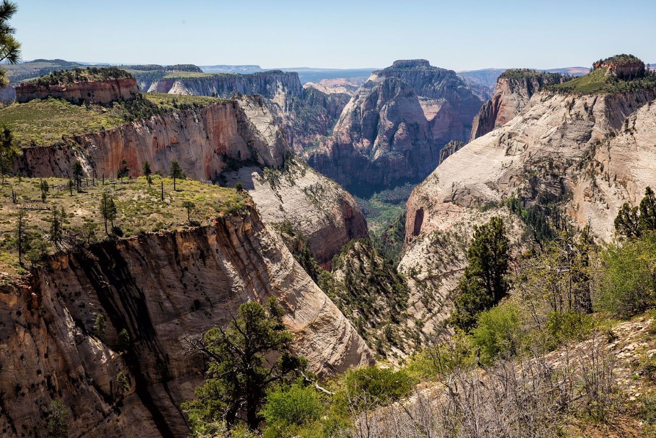
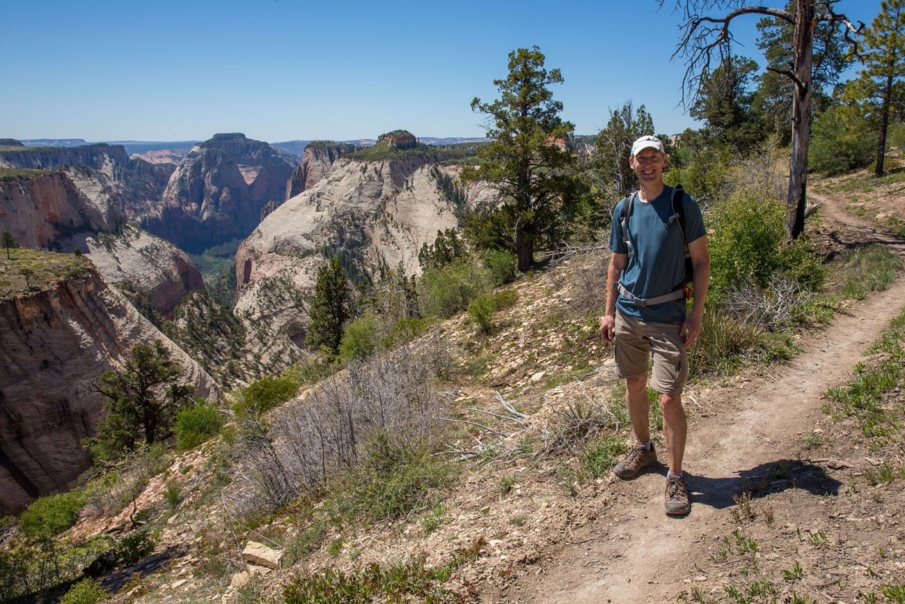
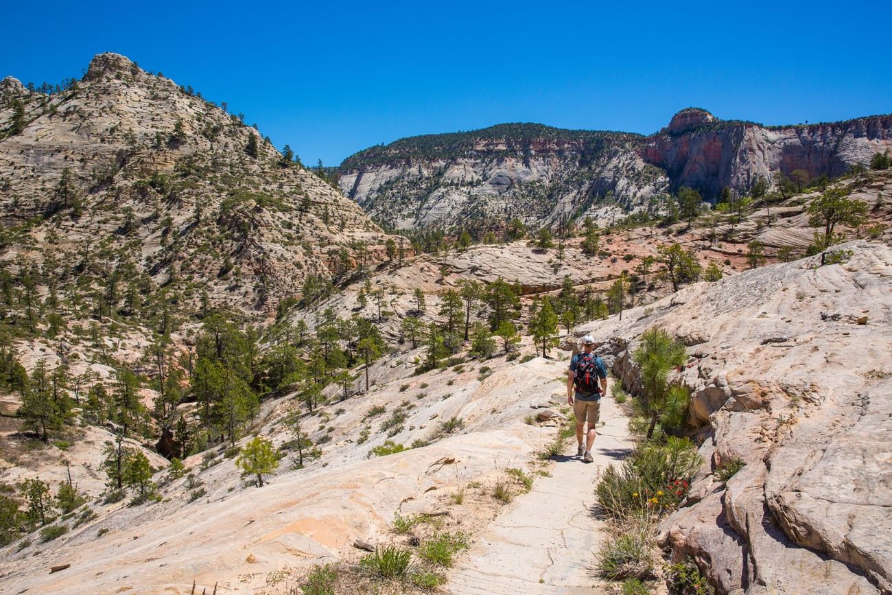
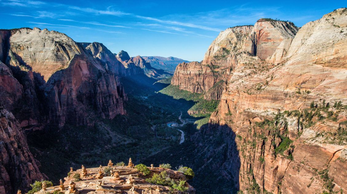
The trails meet up at Cabin Spring. And this is where the nonstop, spectacular views of the West Rim Trail start. This is why you are hiking this trail, to be able to see this.
The temperature also changes…it is much noticeably warmer and it will continue to get hotter as you descend down into the canyon.
And descend you do. From Cabin Spring, it’s a rapid descent down to almost the canyon floor.
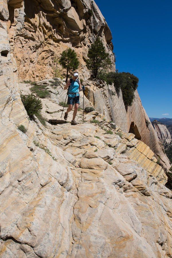
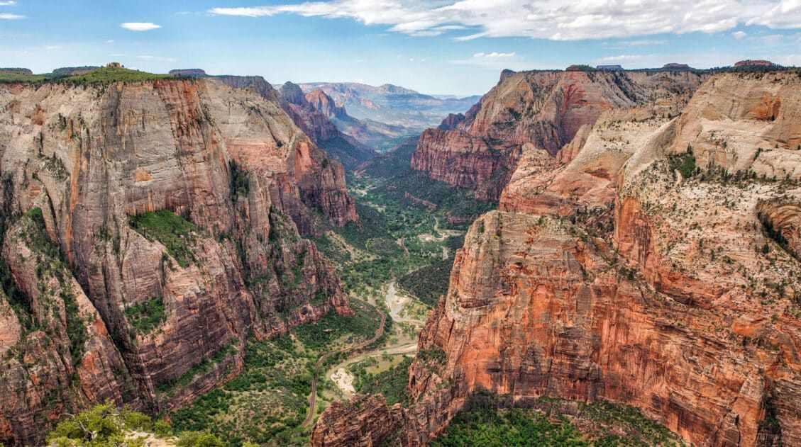
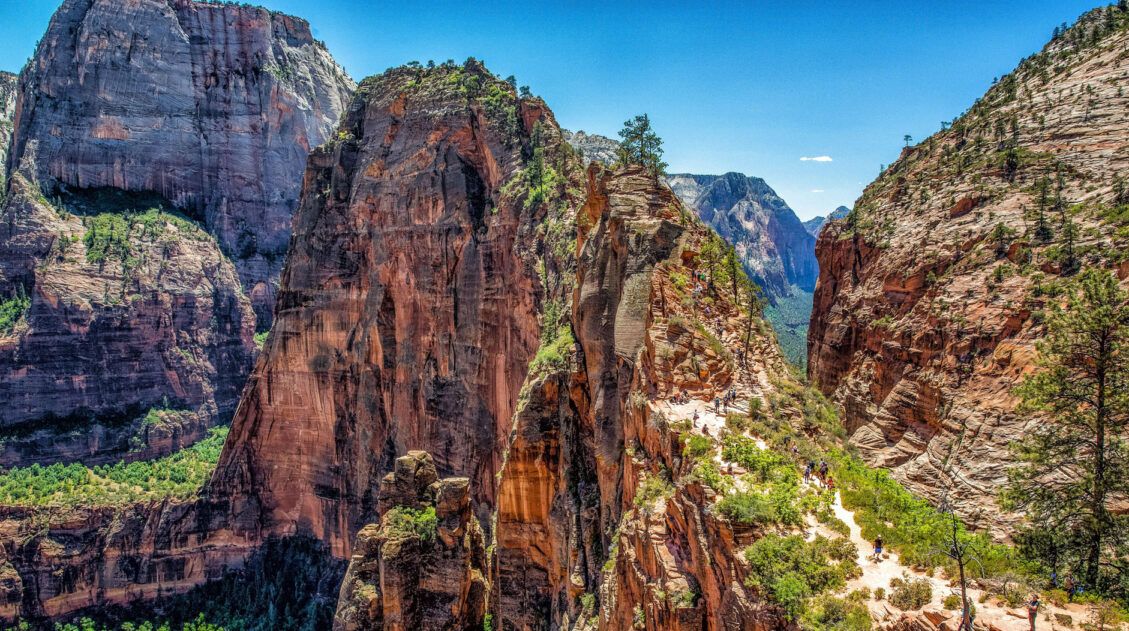
Now, the trail winds through the canyon, climbing and descending around these rocky formations. This is the most beautiful part of the hike and when we did this hike there were just a handful of people out here.
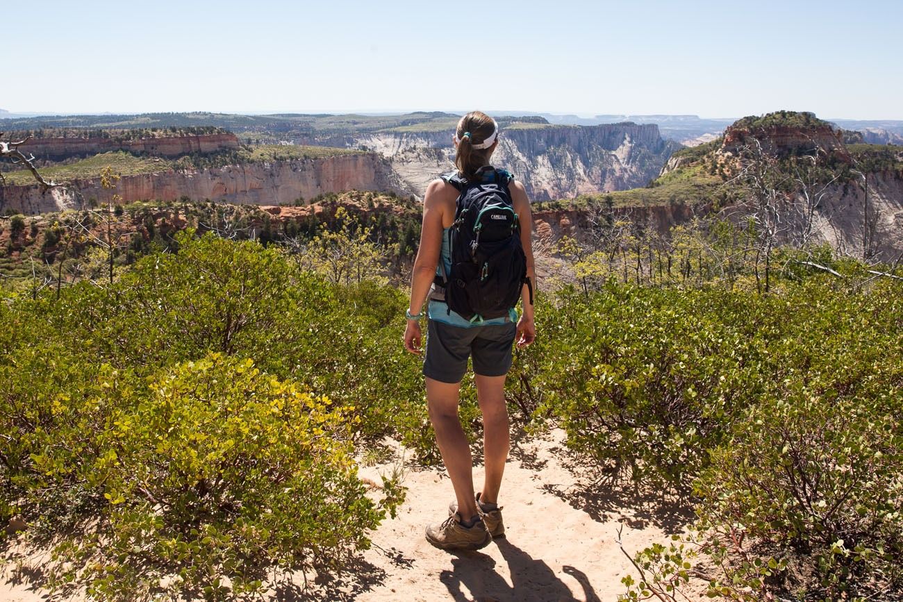
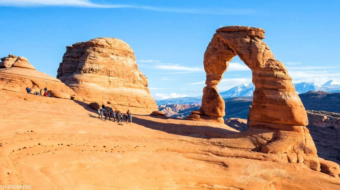
Soon, Angels Landing will come into view. If you still have energy left in your legs, you have the option of adding a climb up Angels Landing to this hike (you will need a permit). It’s icing on the cake after a spectacular hike through Zion.
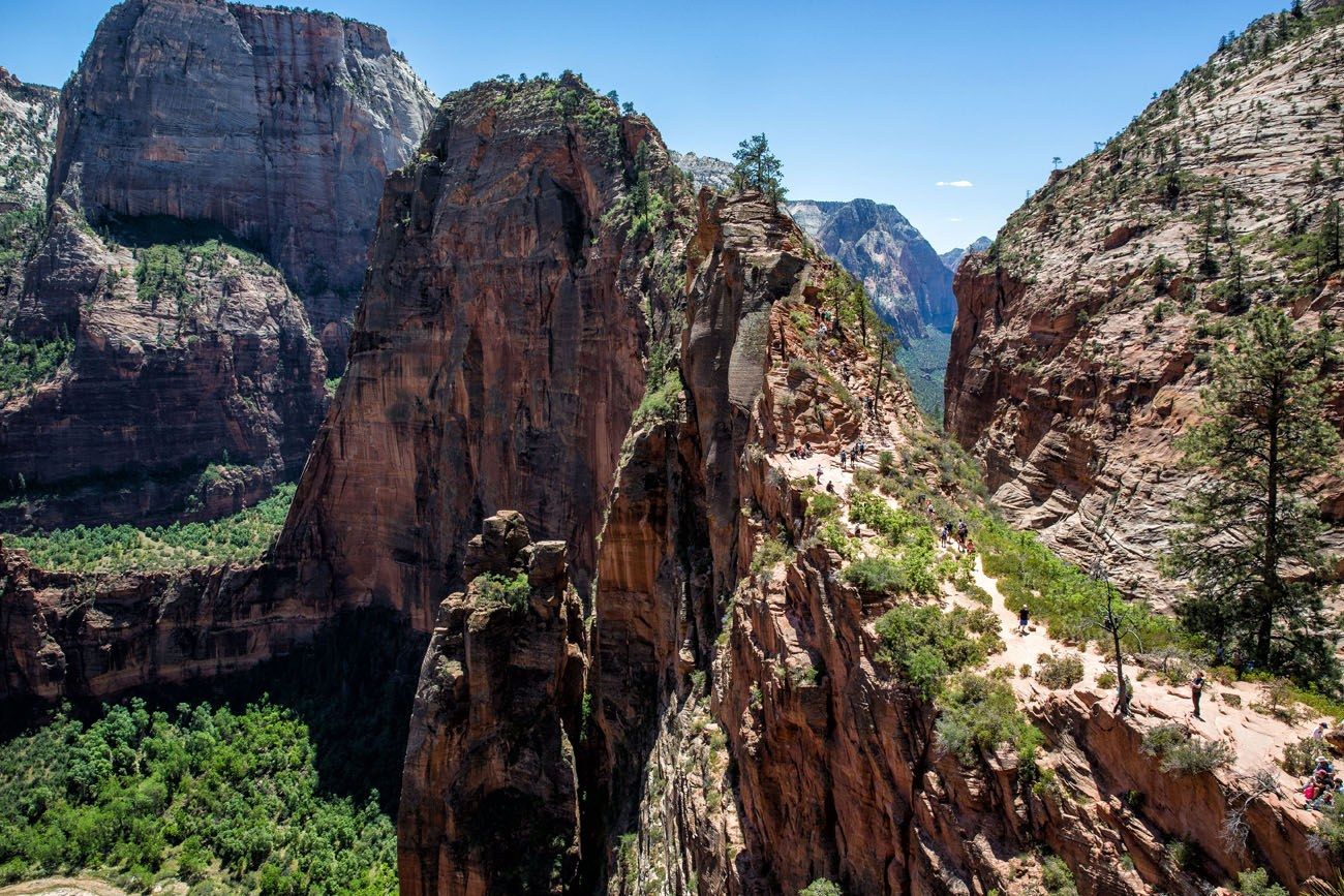
We did not add on Angels Landing to this hike, although we considered it. Tim and I hiked Angels Landing the day before, early in the morning with very few people on the trail. Even though Angels Landing is a blast and we’d love to do it again sometime, neither of us felt like joining the crowds on the trail, especially in the midday heat (we did these two hikes before permits were necessary to hike Angels Landing).
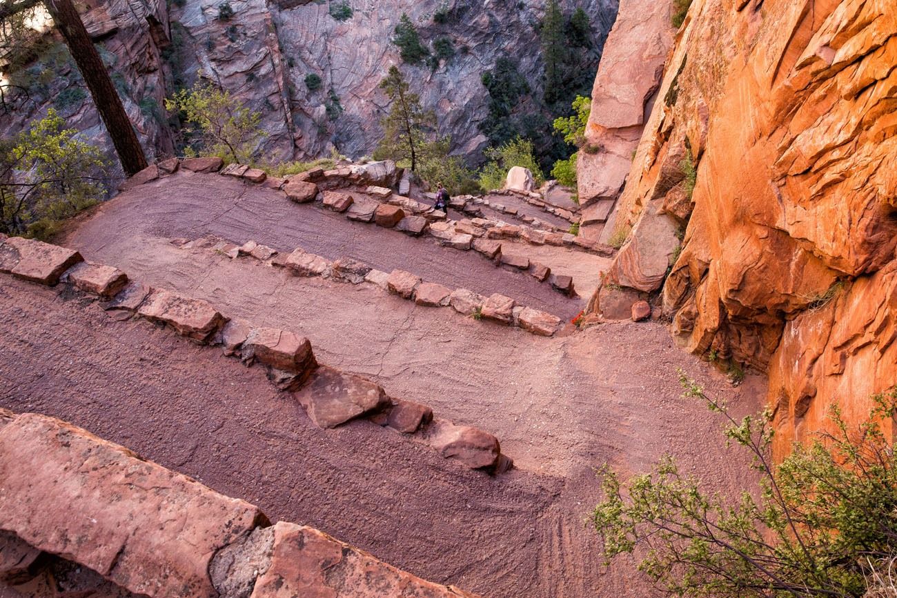
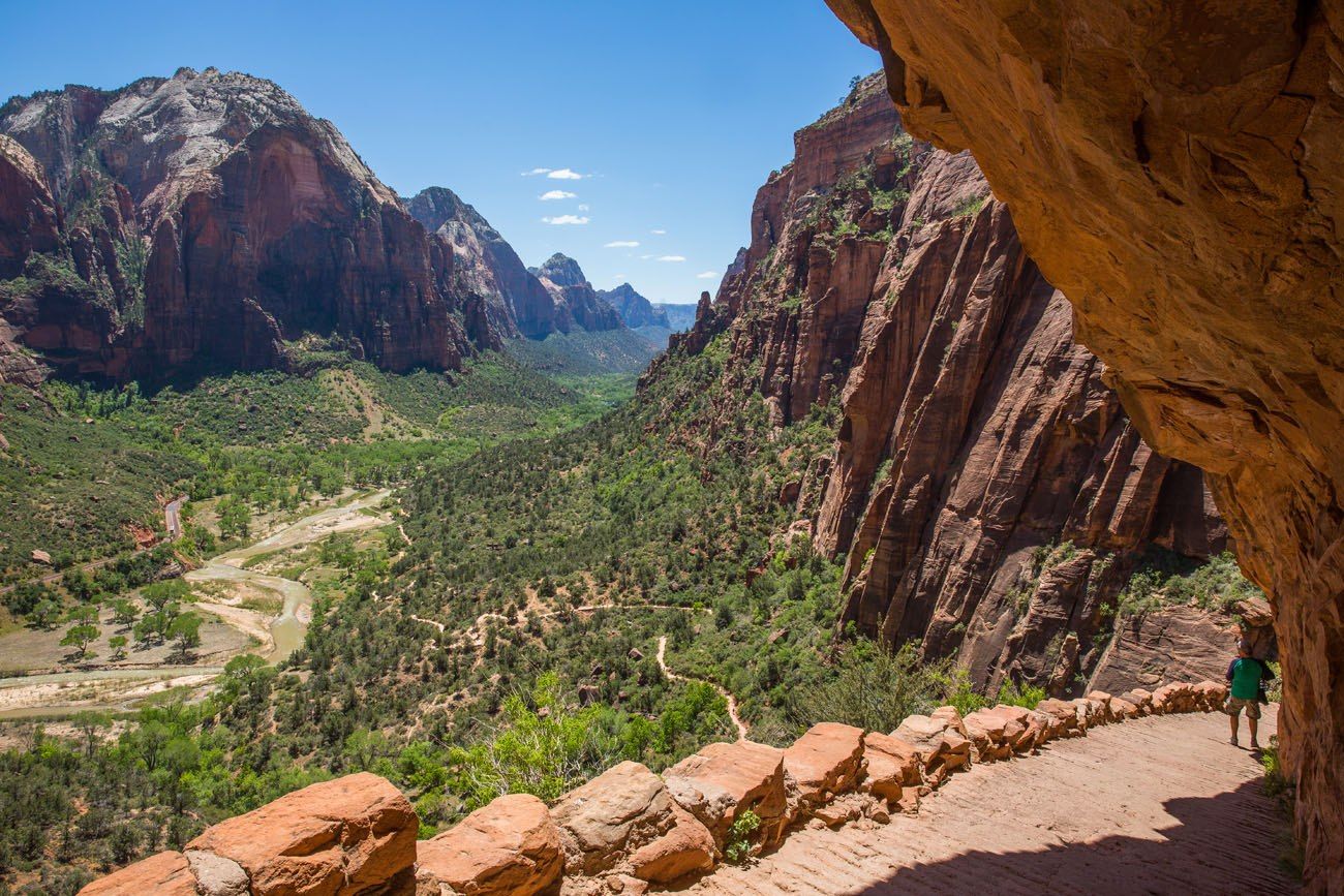
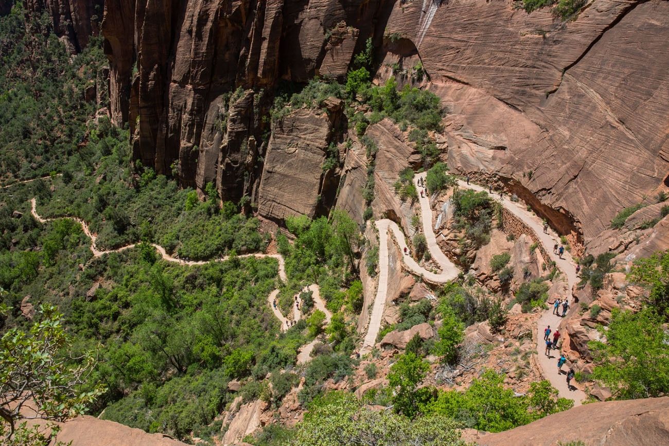
From Scout Lookout, it’s just 2.5 miles downhill to The Grotto. It’s one massive descent from here, on Walter’s Wiggles, through Refrigerator Canyon, and down to the valley floor.
About Our Experience
Tim and I hiked the West Rim Trail very fast, covering the 16 miles in just 6.5 hours, including time for stops. We enjoyed this hike and even though it was a great experience I did not like it as much as I thought I would.
It’s a long hike, but that’s why we wanted to do it. There is a certain feeling of accomplishment to doing a long day hike. But the first half of the hike, the monotonous trail on top of the plateau, was a bit on the boring side. It was worth it for the views we had later, but if we did this hike again, there are some things we may do differently.
An Alternative to the Full Point-to-Point Hike: A Portion of the West Rim Trail + Angels Landing
If you like the idea of hiking the West Rim Trail, but a 16 mile point-to-point hike from Lava Point doesn’t sound like something you would want to do, there is an alternative. You can hike just a portion of the West Rim Trail, incorporating Angels Landing into your plans.
Here’s how I would do it:
- Get a permit for Angels Landing, ideally one of the first time slots of the day.
- First thing in the morning, hike the West Rim Trail from The Grotto and then hike up Angels Landing.
- From Scout Lookout, continue on the West Rim Trail towards Cabin Spring. This section of Zion is spectacular and few people seem to walk back this way. You could go as far as you like or hike all of the way up to Cabin Spring for the best viewpoint.
This would still be a very long day hike, but what an awesome day it would be. The thrilling climb up Angels Landing followed by the spectacular but seldom visited canyons in Zion. Plus, you would not have to arrange and pay for the shuttle service to Lava Point and you could eliminate the monotonous hike on the plateau.
By doing it this way, what you are missing is the point-to-point hike through Zion and the feeling like you are out on your own, hiking through the wilderness of Zion National Park that few others get to see.
Why You Should Hike the West Rim Trail
If you like the idea of a long distance hike, this one is perfect. If you like to feel like you are out in the wilderness, away from the groups of tourists on the more popular trails, the West Rim Trail is a great pick. If you want the accomplishment of hiking down the west side of Zion National Park, there’s no hike better than the West Rim Trail.
Backpacking the West Rim Trail
If you are considering the two-day backpacking trip, you will need to obtain permits in advance. See the National Park website for details.
More Important Links
Zion National Park Service: for up-to-date information on trail closures and more information on the West Rim Trail.
Please practice the seven principles of Leave No Trace: plan ahead, stay on the trail, pack out what you bring to the hiking trail, leave areas as you found them, minimize campfire impacts, be considerate of other hikers, and do not approach or feed wildlife.
More Great Hikes in Zion
Get started with our Best Hikes in Zion, which lists the top trails in the park, from short, easy hikes to full day efforts.
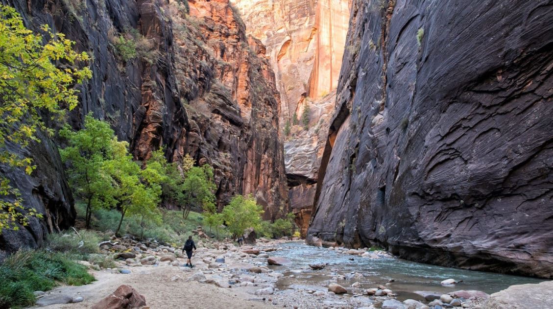
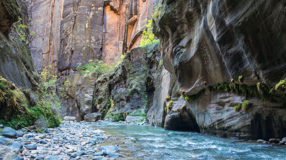
The Zion Narrows is our favorite hike in the park. It can be done from the top-down (the full distance point-to-point hike) or from the bottom-up (much shorter with no advance planning necessary).
More popular hikes include Observation Point (best view in the park), Canyon Overlook (easier hike with fantastic views), and the Watchman Trail.
We are frequent visitors to Zion and have a lot more information on this site, which you can see in the links below.
If you have any questions about hiking the West Rim Trail, let us know in the comment section below.
More Information About Zion & Utah
10 Things to Do in Zion National Park (No Hiking Required)
Pinterest Facebook Flipboard While Zion is world-famous for bucket list trails like Angels Landing and the Narrows, there’s a lot more to do here than hike a trail or two. Whether you’re visiting with kids, taking a rest day, or simply prefer to skip the trails, Zion offers a surprising variety of things to do […]
The Ultimate Zion Itinerary: 1 to 6 Days of Hiking & Adventure
If you are planning your Zion National Park itinerary, this is a great place to start. Zion National Park is a hiker’s paradise. This relatively small park is packed with some of the most thrilling hikes in the United States. From the awe-inspiring hike up Angels Landing to the bucket list-worthy Zion Narrows to the family […]
5 Things to Know Before Visiting Zion National Park
Zion National Park and its epic hiking trails have become an extremely popular place to visit in recent years. This is a spectacular destination and one of our favorite national parks in the USA. However, due to crowd levels, trail closures, and cyanobacteria in the Virgin River, Zion has become a challenging park to visit. […]
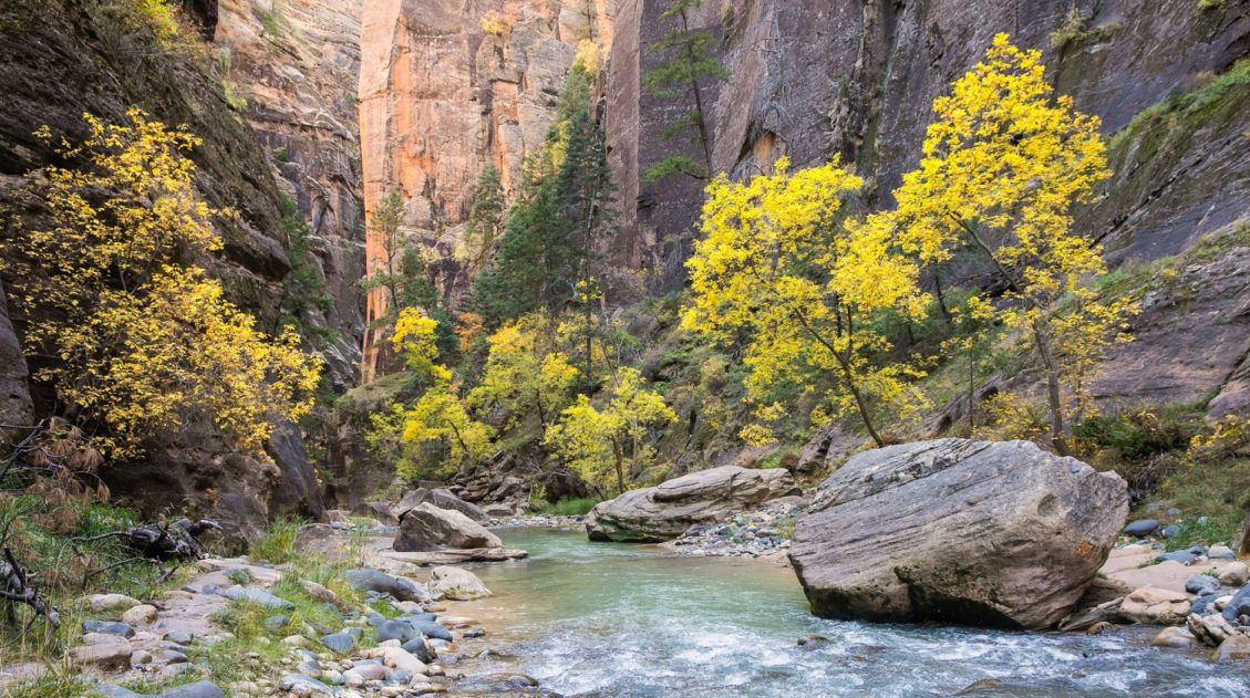
Journey through the Zion Narrows in Photos
For millions of years, the Virgin River has been carving its way through layers of rock, forming the Zion Narrows. This canyon twists and turns for miles, creating one of the most unique hiking trails in the world. There are several different ways you can hike the Narrows. Most people hike from the bottom-up, an […]
Zion Narrows Bottom-Up vs. Top-Down: Which One Should You Do?
Hiking the Zion Narrows is a very unique experience. For miles you hike through a massive slot canyon with the North Fork of the Virgin River as your hiking trail. There are two ways you can hike the Narrows. Most people hike it from the bottom-up, an out-and-back journey that takes you through some of […]
Best Hikes in Zion: 15 Trails from Beginner to Advanced
Zion National Park is one of the best places in the United States to go hiking. From the awe-inspiring hike up Angels Landing to the family-friendly Riverside Walk to multi-day backpacking adventures, there is something here for everyone. In this guide, we cover the best hikes in Zion National Park, from popular trails to hidden gems. […]
How to Hike Angels Landing: Trail Guide, Permits & Video
Angels Landing is the most popular hike in Zion National Park. This is a 5.4-mile round-trip hike with 1,500 feet of elevation gain, and requires a permit. The Angels Landing hike, along with The Narrows, draws thousands of visitors per year, most of them during the summer months. Why is Angels Landing so popular? This […]
How to Hike to Observation Point for Jaw-Dropping Views of Zion
The view from Observation Point is awe-inspiring. It’s arguably the best view you can get in Zion National Park, which is saying a lot, because there is no shortage of spectacular views from the hiking trails and scenic drives. From Observation Point, not only do you get an incredible view of Zion canyon, but you […]
9 Things to Do in Zion if You Don’t Want to Ride the Shuttle
Zion is one of the most popular national parks to visit in the USA. In the past 4 to 5 years, this park has been drawing record numbers of visitors. Because of this, you should expect big crowds waiting to board the Zion Shuttle. By 8 am, the line to board the Zion Shuttle can […]
10 Days in the American Southwest: The Ultimate Road Trip
The American southwest is one of the USA’s best road trip destinations. It’s unbelievable how much there is to see and do here. There are the breathtaking vistas of the Grand Canyon, thrilling hiking trails in Zion National Park, and millions of hoodoos to photograph in Bryce Canyon. Are you getting excited yet? The list […]
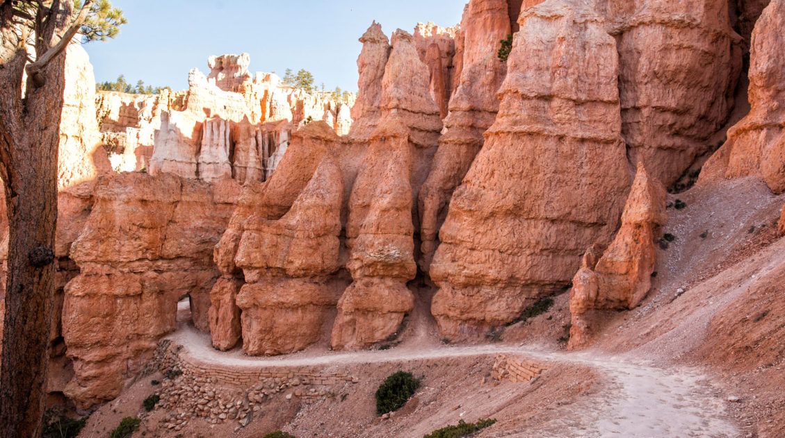
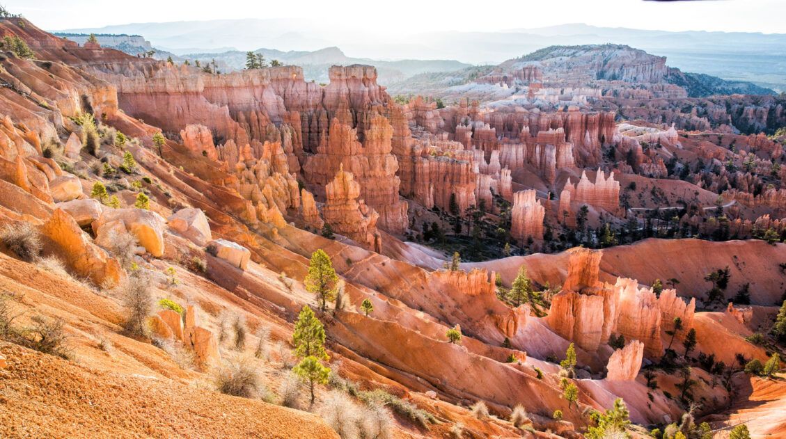
Hiking Bryce Canyon: Queen’s Garden and Navajo Loop Trails
Bryce Canyon National Park may be small in size but it has an enormous wow factor. With its orange and pink hoodoos and sandstone rock formations, Bryce Canyon is one of the most unique national parks in the United States. By hiking Bryce Canyon and visiting its numerous viewpoints, you can have the best experience […]
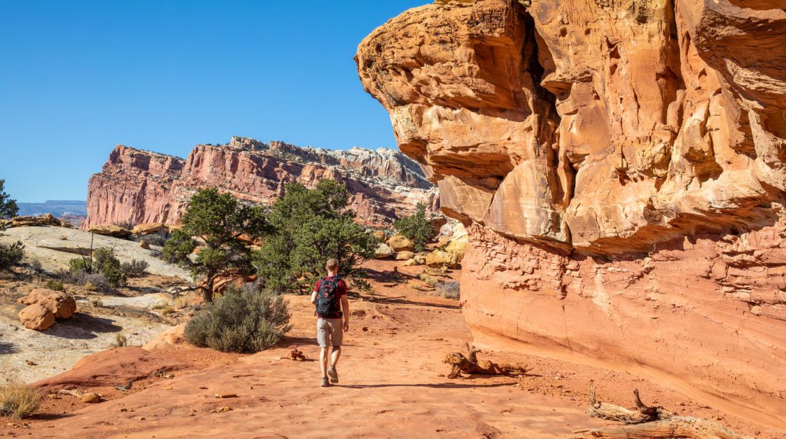
15 Best Hikes in Capitol Reef National Park
The hikes in Capitol Reef National Park are some of the most underrated in Utah. From short, easy trails along Highway 24 to scenic routes like Cassidy Arch and Grand Wash, this park is packed with adventure, without the crowds you’ll find in Zion or Arches. Drive deeper into the park and you’ll discover the […]
Utah’s Mighty 5: How to Plan the Perfect Road Trip Itinerary
Stretching across southern and central Utah are five stunning national parks. Called the Mighty 5, these parks contain some of the most thrilling hiking trails and iconic landscapes in the United States. Stand atop Angels Landing in Zion. Gaze across a wonderland of hoodoos at Bryce Canyon. Explore the Water Pocket Fold at Capitol Reef. […]
20 Epic Hikes in the US National Parks
With 63 national parks and thousands of miles of hiking trails, your options are endless for exploring the American national parks. We narrowed down the list for you to 20 of the best hikes in the US national parks, 20 amazing ways to explore this beautiful country. Hike to the tallest peaks, through massive canyons, […]
US National Parks that Require Reservations – 2026 Guide
Due to growing popularity and visitation, there are now eight National Parks and one National Monument that require a reservation in advance. This includes timed-entry reservations, vehicle reservations to drive a particular road, or hiking permit for select trails. This article was updated with new information from the National Park Service on February 23, 2026. […]

United States Travel Guide: Places to Visit in the USA
Plan your visit to the United States. Learn about the best things to do, how to plan your time, road trip ideas, and sample itineraries.
Comments 21