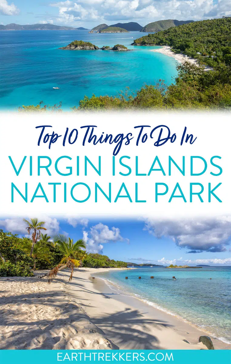
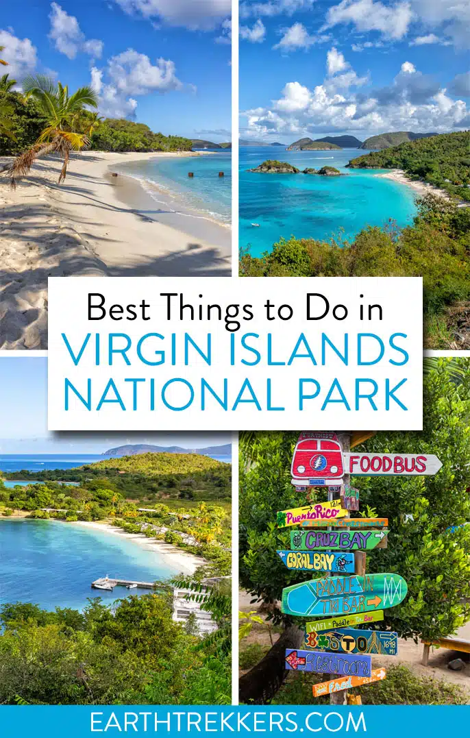
Discover the top things to do in Virgin Islands National Park, along with what you need to know to plan your trip, including how to get there, the best time to visit, where to stay, and tips for organizing your time.
Virgin Islands National Park is one of the most beautiful national parks we have visited. With pristine beaches, secluded coves, and snorkeling spots, a visit here really does feel like you are on vacation. Sip on tropical drinks in the shade of a palm tree, go stand up paddle boarding, visit the historic landmarks, or go for a hike.
When we visit a national park, we don’t just check it off in a day, and the Virgin Islands are no different. During our three busy days, we hiked the top trails, visited its best beaches, and also explored lesser-known areas of the park.
This guide offers an extensive list of things to do in Virgin Islands National Park. Tim, Tyler, and I explored every part of the park and found some fantastic viewpoints and hidden gems to share with you. Later in this guide, we also include our “top 10 list,” perfect for visitors with just a day or two or those who only want to see the highlights.
November 2025 Update: Added new hotels to the Where to Stay section, verified all links and pricing, added updated information about restaurants.
Please practice the seven principles of Leave No Trace: plan ahead, stay on the trail, pack out what you bring to the hiking trail, leave areas as you found them, minimize campfire impacts, be considerate of other hikers, and do not approach or feed wildlife.
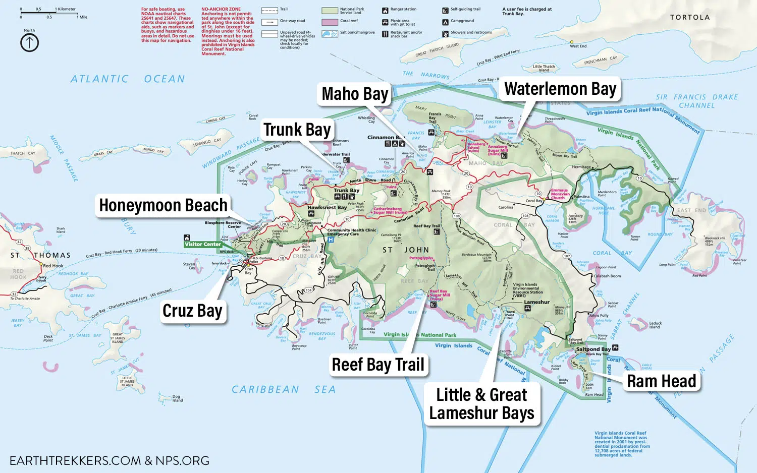
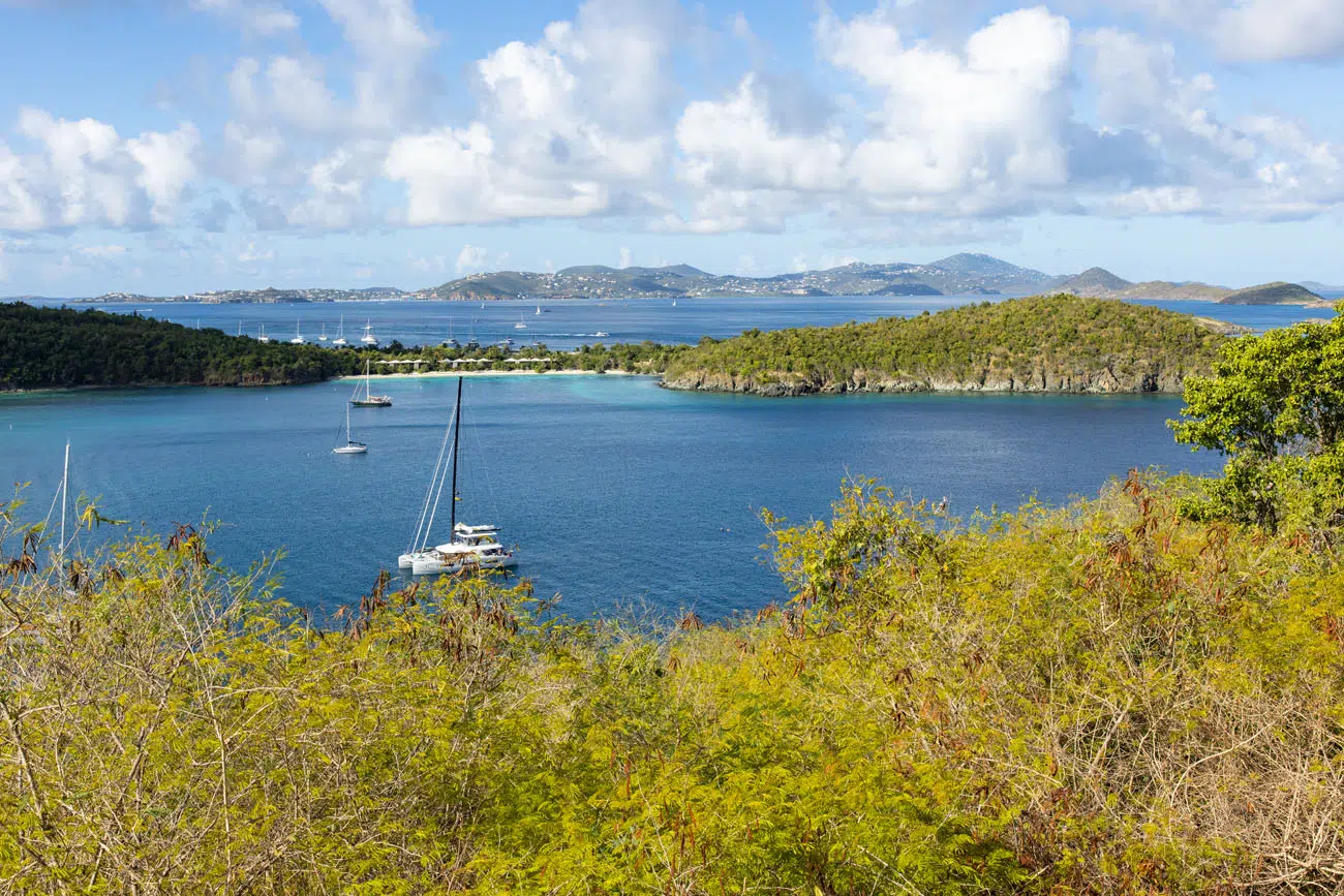
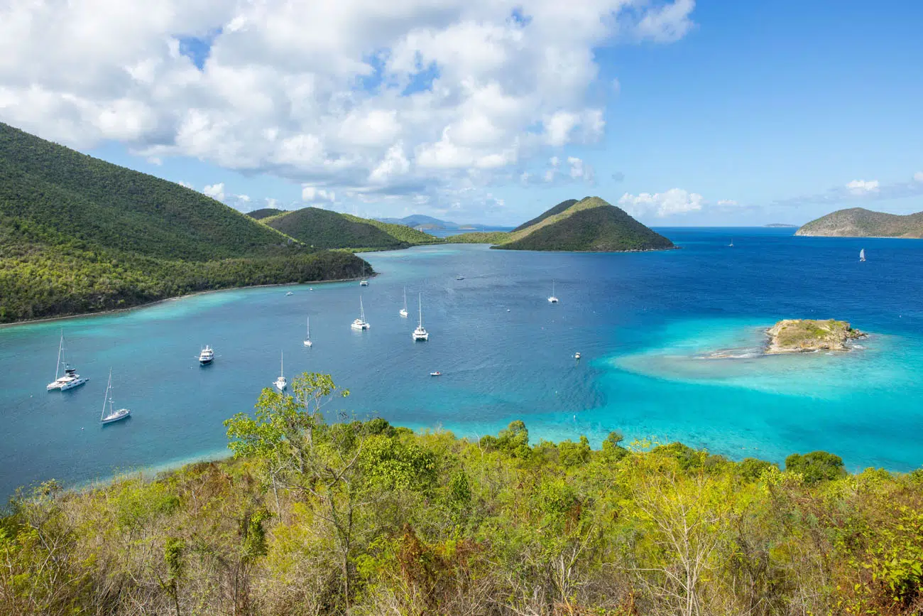
Geography and Map of the Park
Virgin Islands National Park is located on the island of Saint John in the US Virgin Islands. This national park makes up most of the island, although there are residential areas located on the west, east, and southern sides of the island.
Cruz Bay, on the western end of the island, is where you will find most of the hotels, restaurants, residences, and businesses on Saint John. This is also the location of the national park visitor center and the ferry to Saint Thomas.
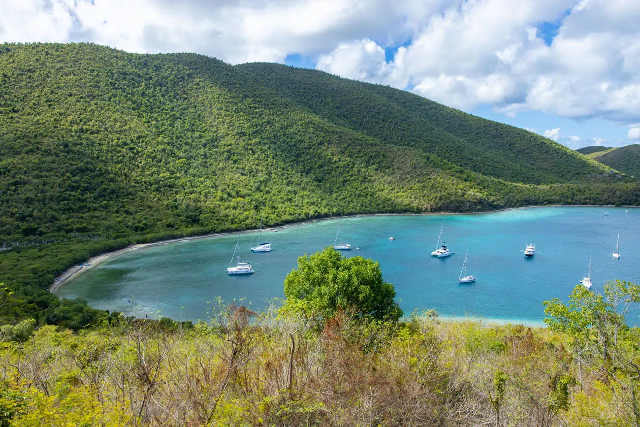
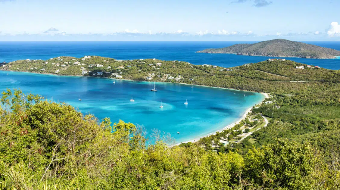
North Shore Road runs along the north side of Saint John, connecting the beaches and hiking trails on the north side of the park. Many of the best things to do in Virgin Islands National Park are located along this road.
Centerline Road runs east-west along the center of the park. This twisty road is the main thoroughfare across the island and where you will find some great hiking trails (the Reef Bay Trail) and viewpoint/bar/restaurant (The Windmill Bar).
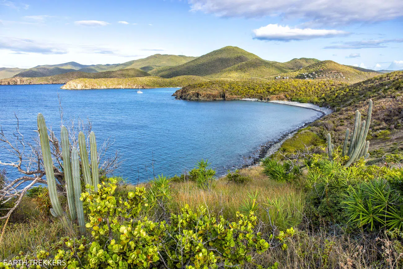
The southern side of the island, around the Lameshur Bays and Ram Head, tends to feel hotter and drier. Due to its more remote location, this part of the national park gets less visitors so it’s a nice place to escape the crowds.
On the national park map below, I labeled some of the most popular beaches and viewpoints.
Things to Do in Virgin Islands National Park
Below is a big list of things to do in Virgin Islands National Park. This is an extensive list and covers most of the sights, beaches, viewpoints, and hiking trails in the park. It is a LOT to do, and for most people, this list is too big to tackle on a typical visit here. However, I am listing all of these sights, just so you know what there is to do here.
Later in this guide, I narrow down the list of things to do in Virgin Islands National Park into the best beaches, best viewpoints, and essential experiences to have in the park.
This list of things to do in Virgin Islands National Park is ordered geographically. It starts in Cruz Bay, at the visitor center, and then heads east along North Shore Road. The list continues with sights on the east side of the island (on East End Road) and then ends with places to visit along the southern side of Saint John.
You can also see the locations of these sights on the map below.
How to Use This Map: Click the icons on the map to get more information about each point of interest. To take this map with you, click the star next to the title of the map which adds it to your Google account. Next, within your Google Maps app, select ‘Saved’ and then select ‘Maps’. This map title will now appear in your list.
Cruz Bay Visitor Center
This is optional, but at the Cruz Bay Visitor Center you can pick up a park map, learn about ranger guided tours, and get updates on park conditions. There is also a hiking trail that starts here (the Lind Point Trail).
PRO TRAVEL TIP: Pick up a park brochure from the Visitor Center. The best snorkel spots in the park are highlighted in pink on the map. You can also see them on the National Park Service map above.
Lind Point Trail
Distance: 2 miles | Difficulty: Moderate | Time: 1 to 2 hours
The Lind Point Trail connects the visitor center with Salomon Beach and Honeymoon Beach. Along the way, you get a nice view of Cruz Bay. This hiking trail can also be accessed from the small parking lot on North Shore Road next to the national park sign.
If you plan to visit Honeymoon Beach, you can hike to Salomon Beach on the Lindpoint Trail (about 10 minutes).
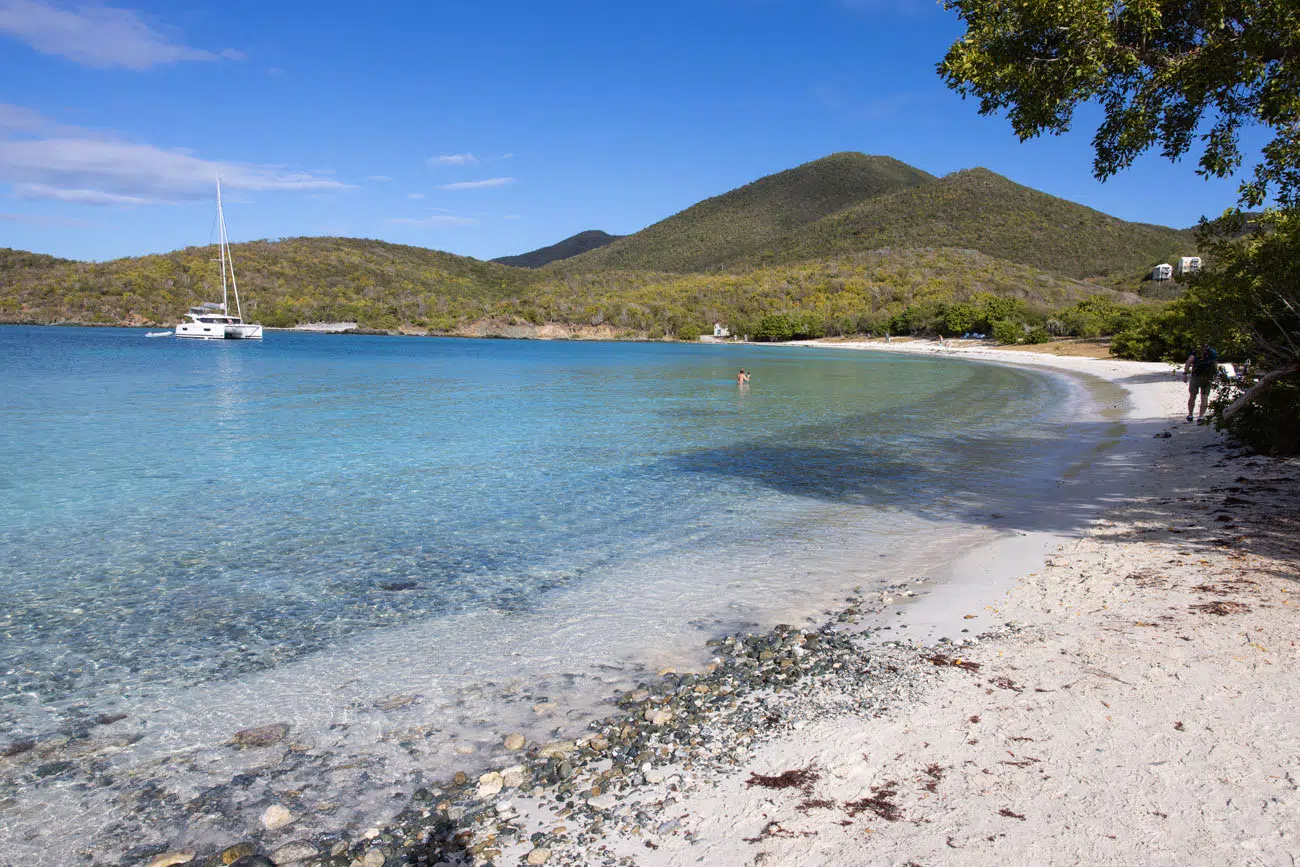
Salomon Beach
Salomon Beach is a small, secluded beach on the north shore of Saint John. When we were here midday, there were only a handful of people here, so if you are looking for a quieter, less crowded beach, this is one to consider. Be aware that there are no restrooms, lifeguard, or rentals here.
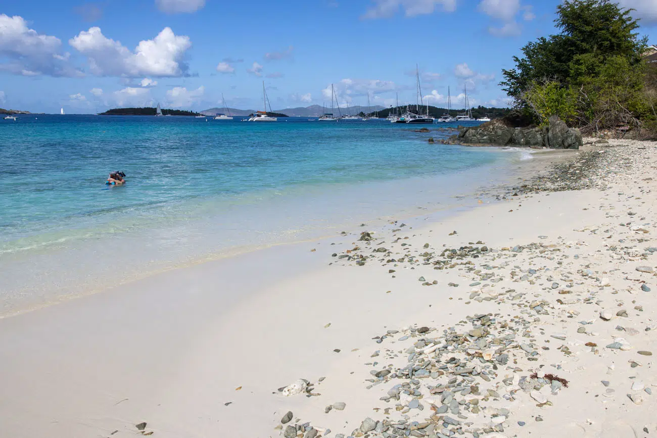
Salomon Beach
GETTING HERE: Hike here on the Lind Point Trail from the visitor center or the national park sign on North Shore Road, or it is a short walk (about 10 minutes) on the Lind Point Trail from Honeymoon Beach.
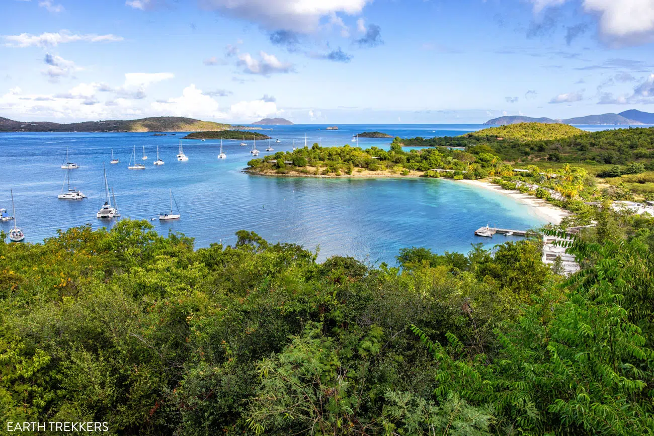
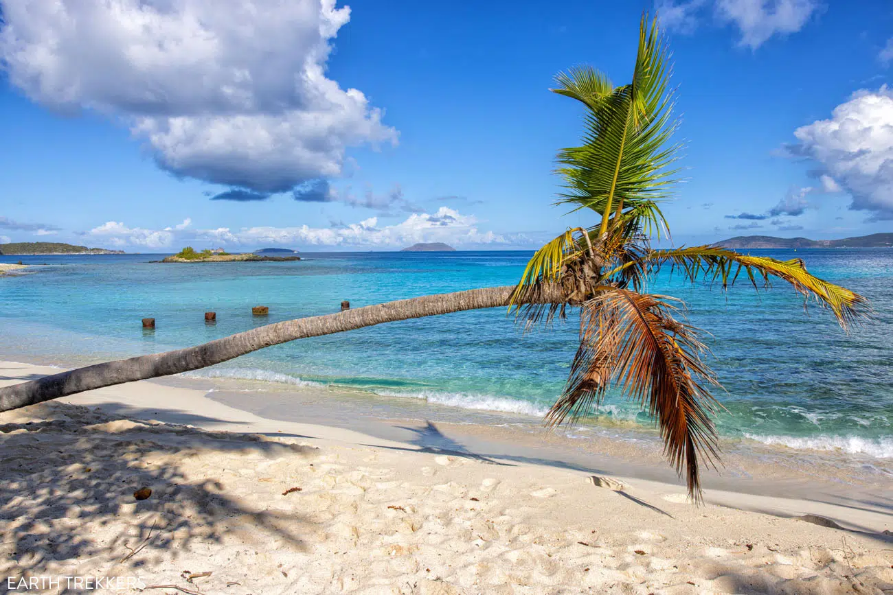
Honeymoon Beach
Honeymoon Beach is a favorite beach of several people that we talked to when planning our trip. Its relatively remote location helps keep crowds down, which is nice.
At this beach, you can rent a cabana for the day (prices range from $85 to $200 and higher) and rent lounge chairs, paddle boards and snorkel gear. There is a small souvenir shop, restrooms, restaurant (Bikinis on the Beach), and bar. Because of the amenities that you get here, this makes a great beach if you are looking for a spot to spend the entire day.
GETTING HERE: Hike here on the Lind Point Trail from the visitor center (about 1 mile one-way). It’s also possible to get to the beach by boat.
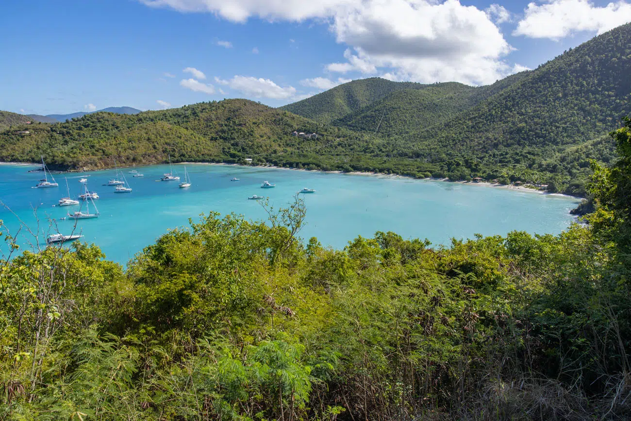
Viewpoint of Caneel Bay and Caneel Beach
For a beautiful view of Caneel Bay, pull into the turnout on North Shore Road, which is on the left hand side of the road, and enjoy the view. GPS coordinates: 18°20’26.8″N 64°47’14.1″W
IMPORTANT: Caneel Bay Resort has been closed since Hurricanes Irma and Maria struck the Virgin Islands in 2017. This property has an interesting history and an uncertain future, which you can read about here.
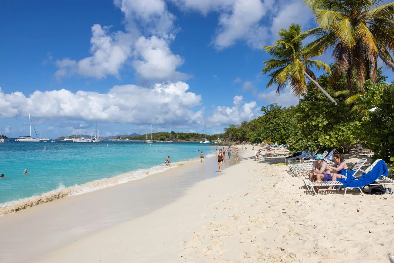
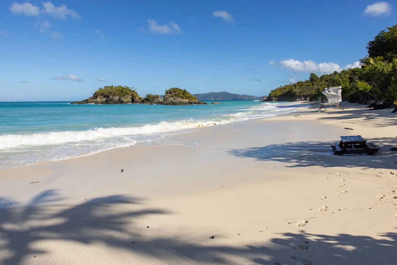
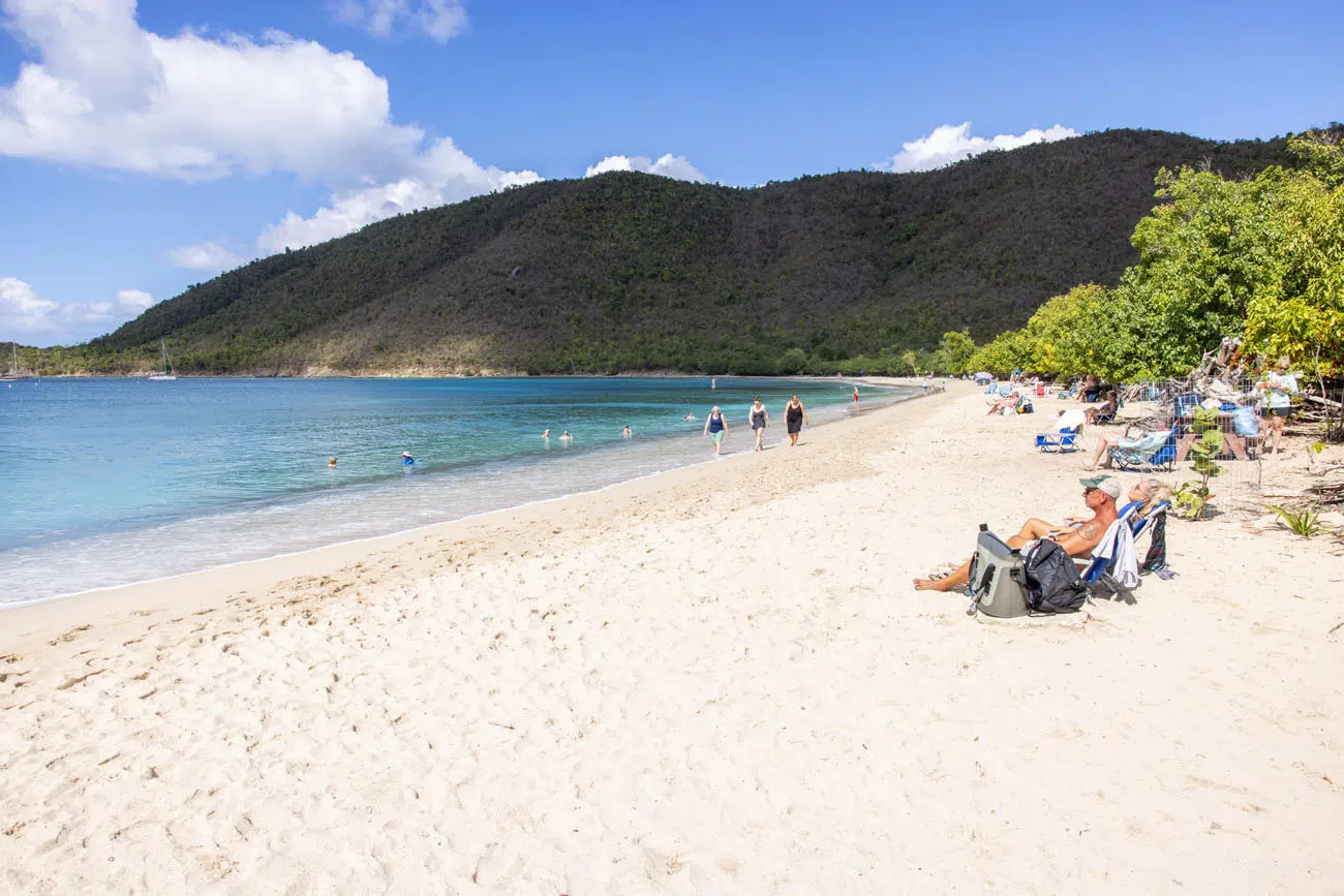
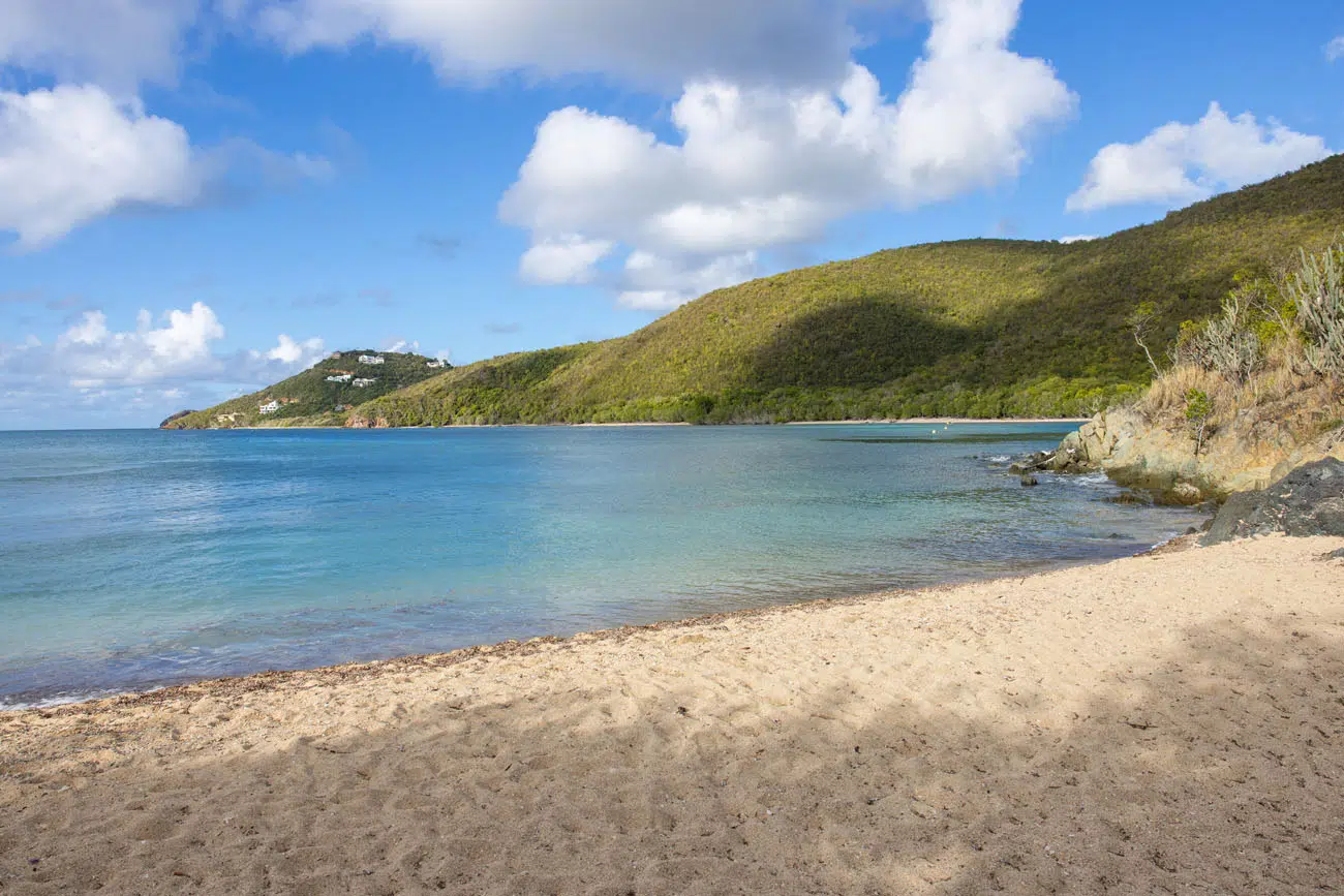
Hawksnest Beach
Hawksnest Beach is one of the prettiest and easily accessible beaches in Virgin Islands National Park. It is located just a few minutes from Cruz Bay. The parking lot is fairly large, and the beach is literally just a few feet from the road.
This is a great place to spend a few hours and it also makes a great snorkeling spot.
For those short on time or if you don’t want to do much walking, this beach is great spot to visit. Either way, as you drive along North Shore Road, it’s worth a five to ten-minute stop, to at least take a peek at this beach.
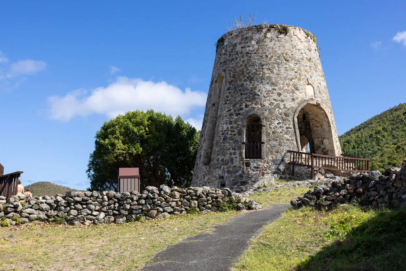
Visit the Peace Hill Windmill
The ruins of old windmills dot the highest hills in Virgin Islands National Park, and you will see that several of these make their way onto this list. The views from these spots are phenomenal.
The Peace Hill Windmill is located on a peninsula between Hawksnest Bay and Trunk Bay. From this spot, you get a great view of Hawksnest Bay, Caneel Bay Beach, Trunk Bay, and the British Virgin Islands.
Trunk Bay from Peace Hill
Hawksnest Bay and Saint John | View from Peace Hill
GETTING HERE: Park at the Peace Hill Trail. There is room in this lot for about five cars. It is a 0.1-mile uphill walk on a rugged dirt trail to get to the windmill and viewpoint. If you only do this, and don’t add on Denis Bay (mentioned next), this visit takes 15 to 30 minutes, depending on your hiking speed.
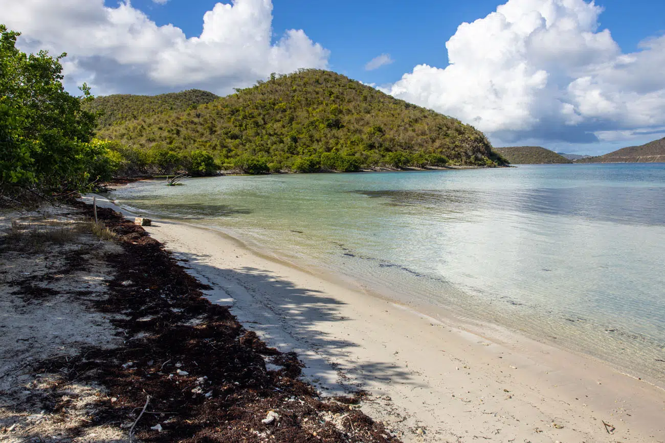
Denis Bay
This pristine beach is one of our favorites in Virgin Islands National Park. Since this small, secluded beach can only be reached by boat or on foot, and since the parking lot at the trailhead is small, this beach tends to only have a handful of people.
There are no amenities here…no bathrooms, no snorkel rental shops, and no food stands, but what you are getting is one of the quietest, most beautiful beaches in Virgin Islands National Park.
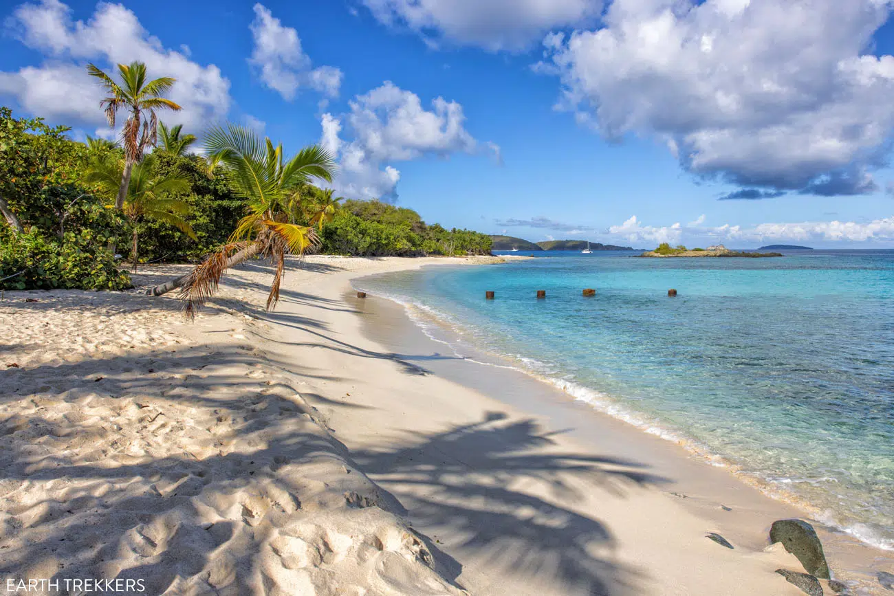
GETTING HERE: The hiking trail to Denis Bay also starts at the parking lot for the Peace Hill Trail. To get to Denis Bay, hike up the main trail, and about 50 meters from the parking lot, take the spur trail to the right. This trail heads downhill through a forest and ends at the far northern end of Denis Bay beach. In total, it is a 10-minute walk from the parking lot to the beach (0.45 miles one-way). To get back to your car, it will be an uphill walk for most of the hike (about 200 feet of elevation gain). I did this in flip flops, but the trail is rocky and uneven, so a pair of walking shoes or hiking shoes are ideal. Note: As of 2025, Google Maps has this beach labeled as Oppenheimer Beach but that is incorrect.
Jumbie Beach
This small beach is easier to get to than Denis Bay, since it is a shorter walk on a gravel trail, but it lacks the beauty and seclusion that you get at Denis Bay. However, the parking lot for this beach is also very small which limits the number of people here.
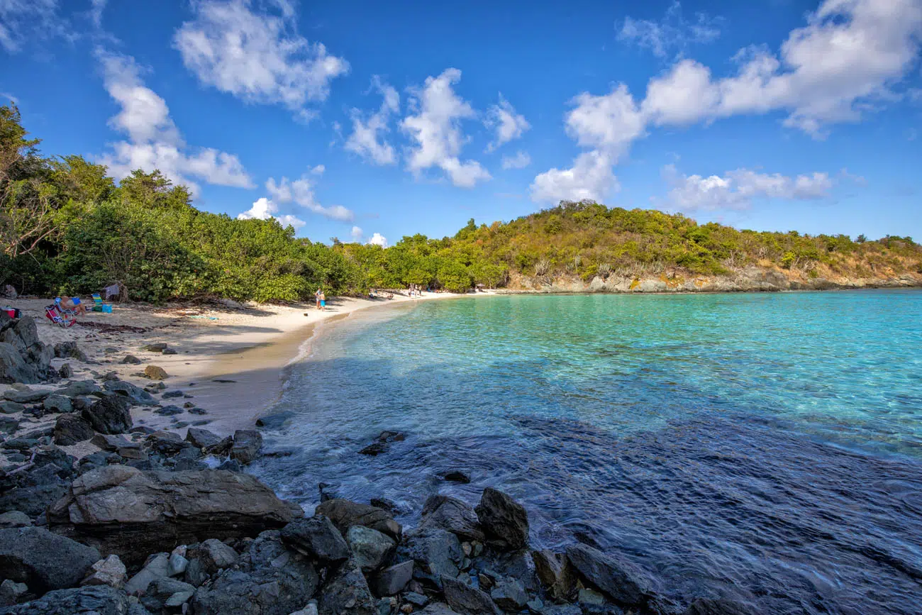
GETTING HERE: Park in the small parking lot on North Shore Road. There is a sign here indicating Jumbie Beach. There is room for roughly seven cars. Cross the street and it is a 2-minute walk on a flat trail to the beach.
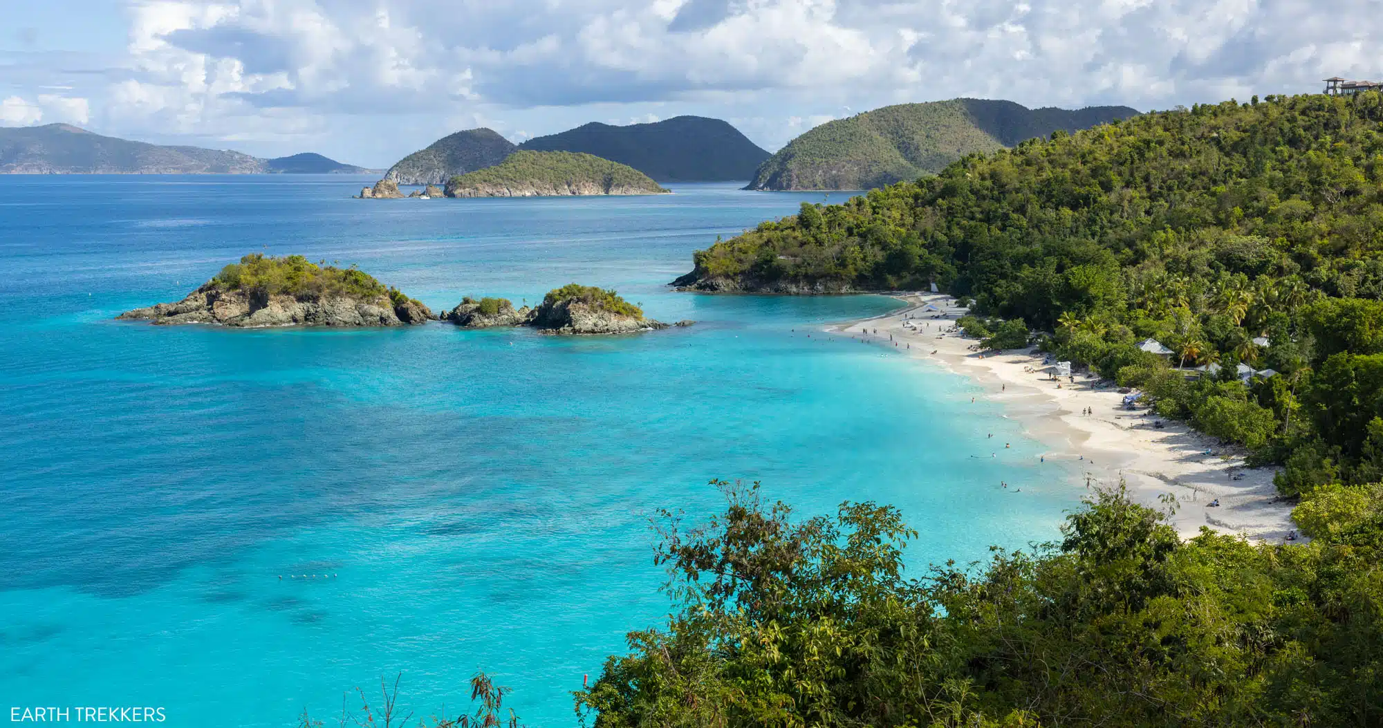
Trunk Bay Viewpoint
This is one of the best views in Virgin Islands National Park and it’s also one of the easiest to get to. As you continue the drive on North Shore Road, there will be a turn-out on the left-hand side of the road. Park here and enjoy! Here’s the view.
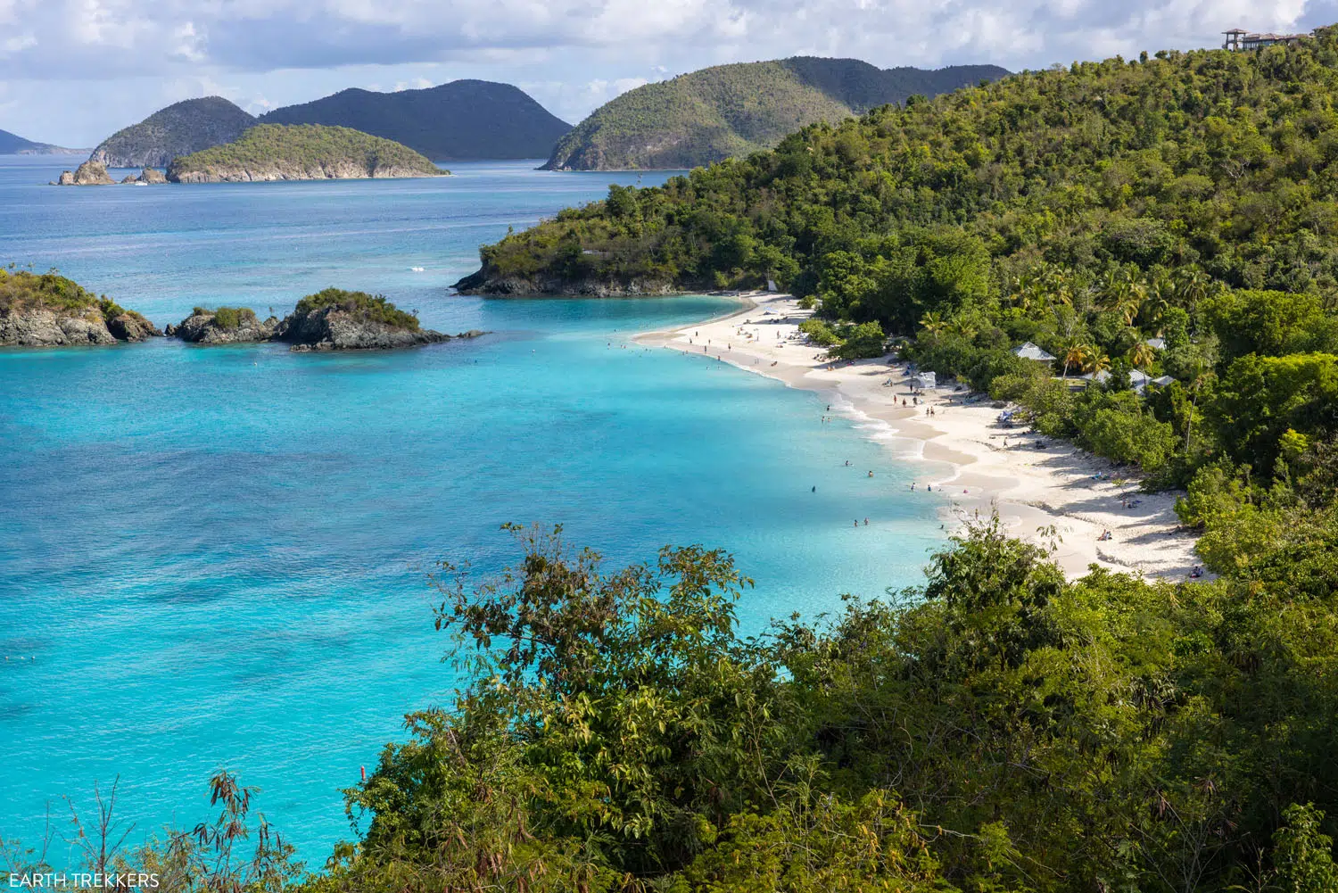
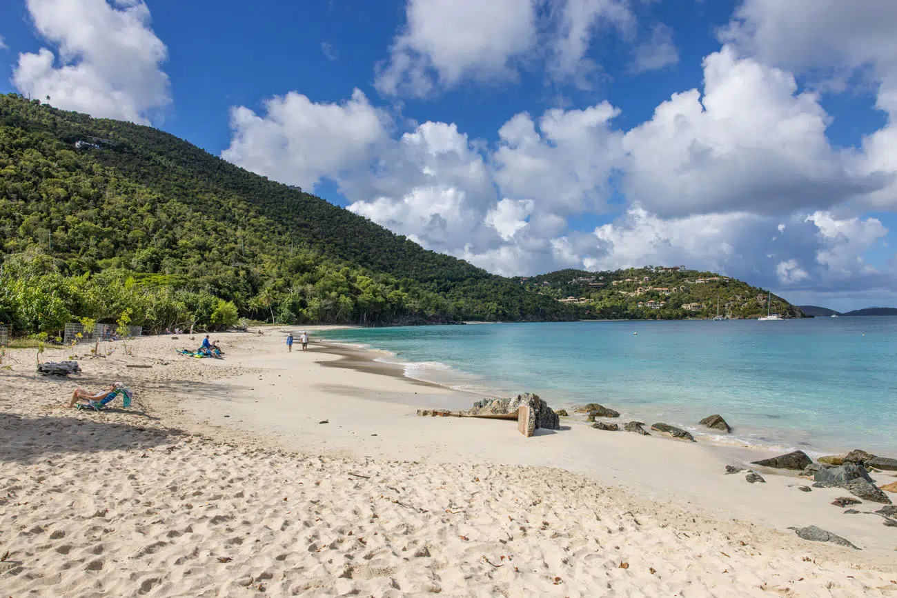
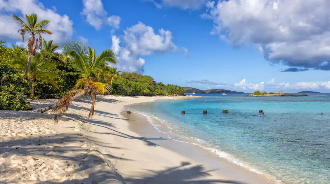
Beautiful Trunk Bay Beach
A visit to Trunk Bay is one of the best things to do in Virgin Islands National Park.
Trunk Bay is often touted as one of the most beautiful beaches in the world. Prior to our trip, another traveler told us that this beach would spoil all future beaches for us. That’s a big statement but it’s not far off. This truly is a gorgeous spot.
This long, wide, sandy beach is a great place to spend the day. There are bathrooms and pavilions, a snack bar, and even a lifeguard on duty.
One of the things that makes this beach so unique is the Coral Reef Underwater Park Trail. This snorkeling trail has underwater signs labeling the marine life. It is located just offshore from the beach, near Trunk Cay. It takes 30 to 60 minutes to swim this snorkeling trail, so you need to be able to swim that long without touching the ground (consider wearing a flotation device).
During our visit, we could not swim the snorkel trail because the beach was closed due to rough conditions. We watched as 6-foot waves crashed on the beach. Trunk Bay can close in the winter months due to rough conditions like these. If so, you might still be able to get in the water at Francis Bay, Maho Beach, or Honeymoon Beach.
PRO TRAVEL TIP: There is no park fee for Virgin Islands National Park, but there is a $5 daily charge per adult to visit Trunk Bay. If you have an interagency pass (like the America the Beautiful Pass), this fee is reduced to $2.50.
GETTING HERE: Park in the large parking lot on North Shore Road. It is labeled “Trunk Bay.” Parking tends to fill up by mid-morning so try to get here by 10 am to get a parking space. There is no overflow parking on North Shore Road.
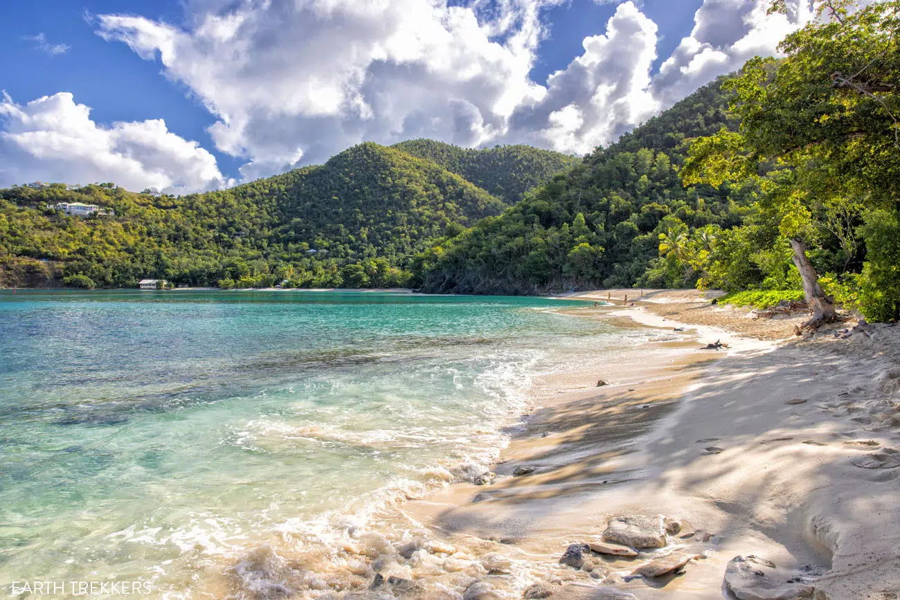
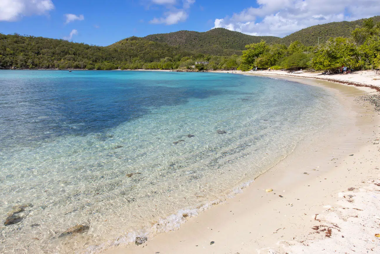
Cinnamon Bay Beach
This very long, white sandy beach is located about five minutes east of Trunk Bay. Cinnamon Bay Beach is a close second to Trunk Bay in terms of beauty, so if you can’t get parking at Trunk Bay, this is a great beach to try next, since it has a larger parking lot and is located just five minutes down the road.
There are some old ruins right on the beach and this also makes a great spot to go snorkeling.
Cinnamon Bay Beach
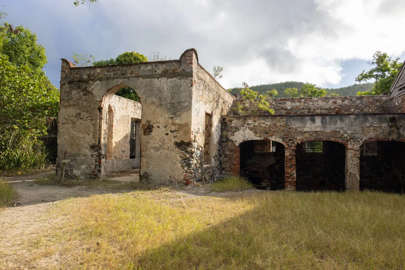
Cinnamon Bay Plantation Ruins & Nature Trail
Just across the street from Cinnamon Bay Beach are the ruins of the Cinnamon Bay Plantation. These ruins date back to the 18th century but there are also archaeological remains of the Classic Taino culture, one of the first inhabitants of the Virgin Islands.
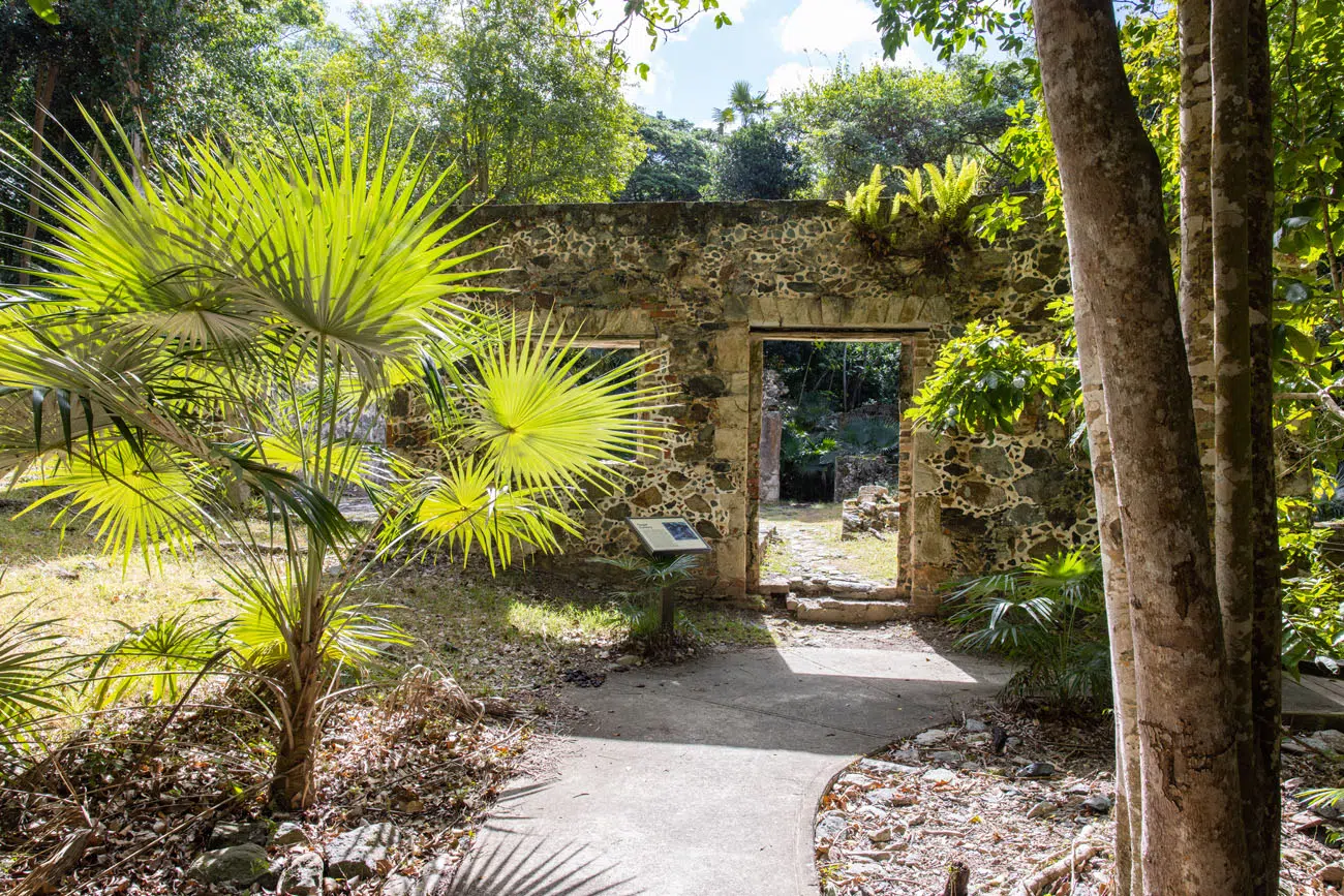
You can also hike the Cinnamon Bay Nature Trail, a 0.5 mile walk that loops around the ruins and into the forest behind the plantation. It’s a nice walk and mostly shady but only worth it if you are looking for a short hike to do.
GETTING HERE: Park in the large lot for Cinnamon Bay Beach and cross the street to get to these ruins.

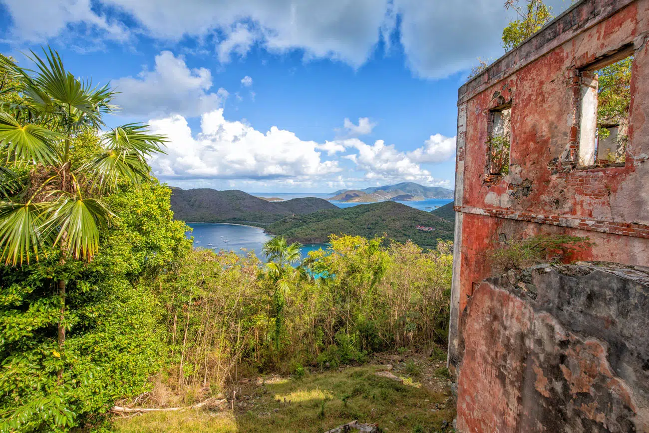
America Hill Great House Ruins and Viewpoint
Distance: 1.2 miles out-and-back | Difficulty: Moderate | Total Ascent: 400 feet | Time: 60 to 90 minutes
This hike came highly recommended to us and shows up on lot on other posts about the Virgin Islands, but this was one experience that we wish we would have skipped.
This is a tough, hot hike and the view is nice, but for us, it did not seem worth the effort.
This hard hike starts next to the Cinnamon Bay Plantation Ruins (look for the trailhead signs that says Cinnamon Bay Trail). You know you are on the right trail if it very steeply heads uphill. When you reach a trail junction (0.2 miles from the trailhead), take the trail to the left to continue up to the America Hill ruins. It’s a steep hike the entire distance with 400 feet of total ascent.
The view from the ruins is nice, but worth the effort? We didn’t think so. Here it is:
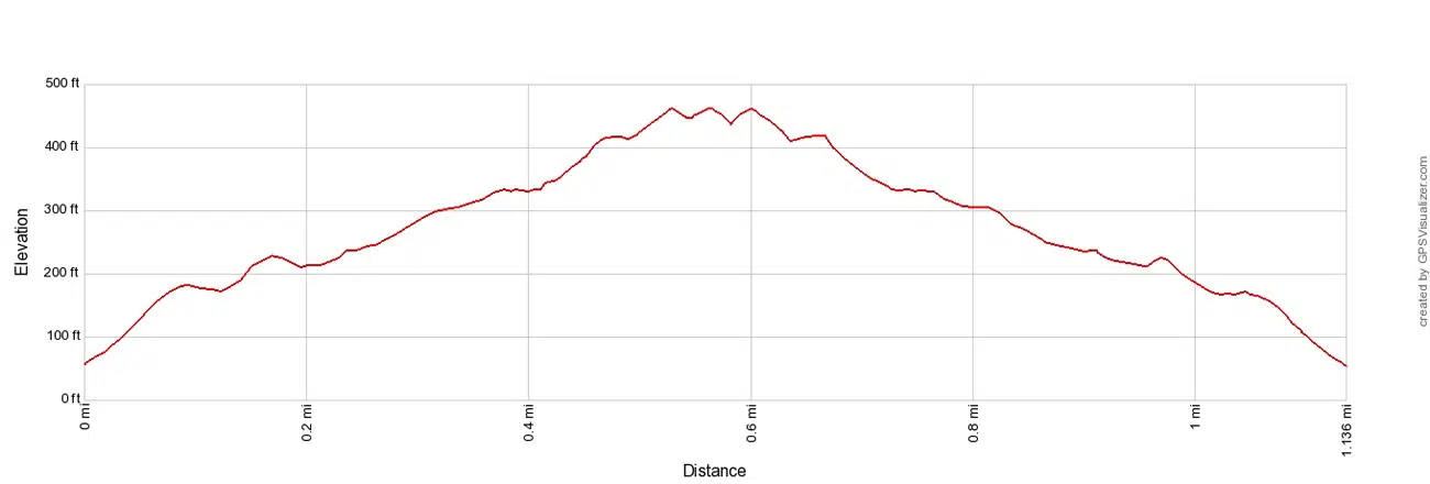
Elevation profile of the hike.
If you only have the time and energy for a hike or two, we recommend Ram Head Point, the Reef Bay Trail, and the Leinster Trail to Waterlemon Bay and the Windy Hill Greathouse ruins before tackling this hike.
GETTING HERE: Park in the large lot for Cinnamon Bay Beach and cross the street to get to the trailhead.
PRO TRAVEL TIP: Plan to do a lot of hiking? Trail Bandit has great maps of the hiking trails that you can purchase online.
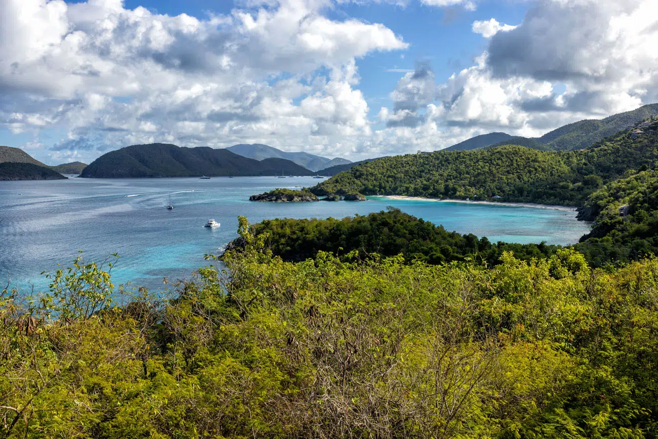
Maho Bay Viewpoint
As you drive from Cinnamon Bay to Maho Bay, stop at the pull out for this view:
Spend Some Time on Maho Bay Beach
Visiting Maho Bay is one of the best things to do in Virgin Islands National Park. This long stretch of beach is one of the best places to spend the day since there is so much to do here.
From the shops that sit across the street from the beach, you can rent paddle boards, snorkeling equipment, lounge chairs, and souvenirs. There are several food trucks selling food and a tiki bar. And in the early morning or late afternoon, you might be able to spot sea turtles. What more do you need? 😉
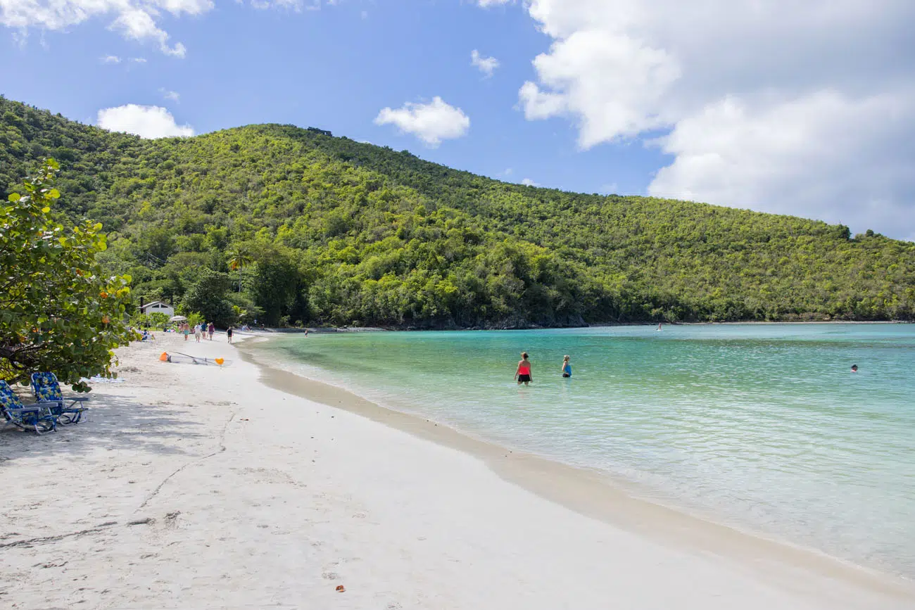
This is a popular spot and helps to get here by 10 am, in order to get a parking space and claim a spot on the beach. The beach at Maho Bay is very long, and the best spot to be is on the western end, if you plan to visit the food trucks and the tiki bar periodically.
Another great thing to do in Maho Bay is to rent kayaks and kayak out to Whistling Cay.
SEA TURTLES: Sea turtles are a protected species. It is illegal to touch a sea turtle in the Virgin Islands. If you are caught touching one, you will be subject to a fine up to $5,000 and imprisoned for not more than 6 months. So, give sea turtles their space and do not approach them. Also, don’t litter (they mistake plastic for food), do not leave holes or ruts on the beaches (sea turtles hatching can get trapped in these), and do not feed the sea turtles.
Francis Bay Beach
With calm waters, this popular beach is a great place for families and those new to snorkeling. This is a good place to see pelicans, tropical fish, and sea turtles.
The official parking lot is very small, with room for about 10 cars, so most people park along the access road to the beach. Be prepared to parallel park and for short traffic delays, since the road is narrow and two-way traffic tends to get backed up here. There is also a restroom next to the beach.
Annaberg Sugar Plantation
The Annaberg Plantation was one of 25 sugar plantations on Saint John. The windmill that was built here was one of the largest on the island.
Walking around the ruins is interesting and you also get a wonderful view over Waterlemon Bay from here. These were our favorite ruins to visit on the island.
GETTING HERE: Park in the parking lot for the Annaberg Area Trail parking lot. It is a short uphill walk to the ruins.
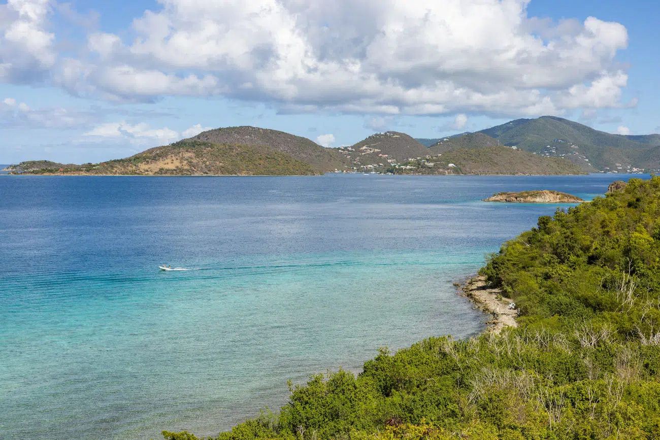
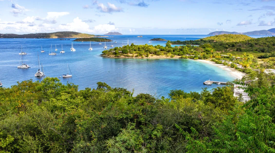
Leinster Bay Trail to Waterlemon Bay and Windy Hill
This was one of our favorite things to do in Virgin Islands National Park. This hike + snorkeling combo is an essential experience to have while in the park.
The Leinster Bay Trail is a completely flat hiking trail that starts near the Annaberg Ruins and runs to Waterlemon Bay. The views, as you look out to Leinster Bay, Waterlemon Bay, and the British Virgin Islands, are beautiful.
It is a 1.1-mile walk (one-way) to get to the beach. From here, you can go snorkeling, and we were told that this is one of the best snorkeling spots in Virgin Islands National Park. We saw a sea turtle, sea urchins, and lots of tropical fish.
Leinster Bay Trail
The beach is very narrow and rocky with lots of coral, so it’s not sand covered like many other beaches on the Virgin Islands. There are also no restrooms here.
For another spectacular view, continue on the Leinster Bay Trail to the Windy Hill Greathouse Ruins. The Leinster Bay Trail continues around the beach and then heads up the hillside. About 0.2 miles from the beach, the Leinster Bay Trail reaches a trail junction with the Johnny Horn Trail. Take the Johnny Horn Trail for 0.3 miles until you reach the Murphy Great House. From here, you have 360° views over Waterlemon Cay, the British Virgin Islands, and Leinster Bay.
View from the Murphy House ruins on Windy Hill
Waterlemon Bay and Beach
GETTING HERE: Park in the lot for the Annaberg Sugar Plantation. Walk back out to the road, turn right, and the trail starts next to Leinster Bay near the end of the road.
HOW MUCH TIME DO YOU NEED? If you plan to snorkel and hike up to the ruins, plan on spending a minimum of 2 to 3 hours here. Some people bring beach chairs and food and spend a nice chunk of the day here.
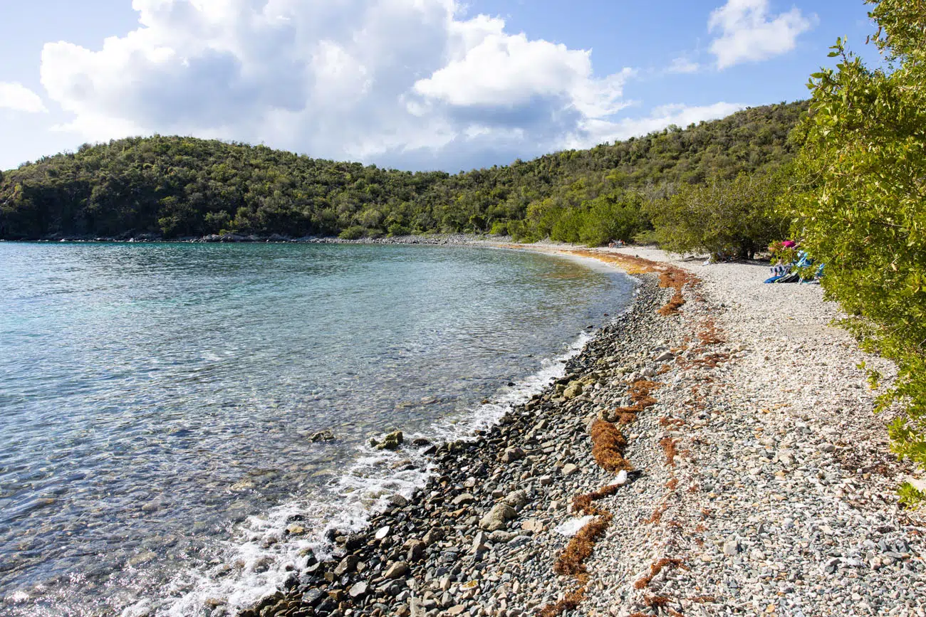
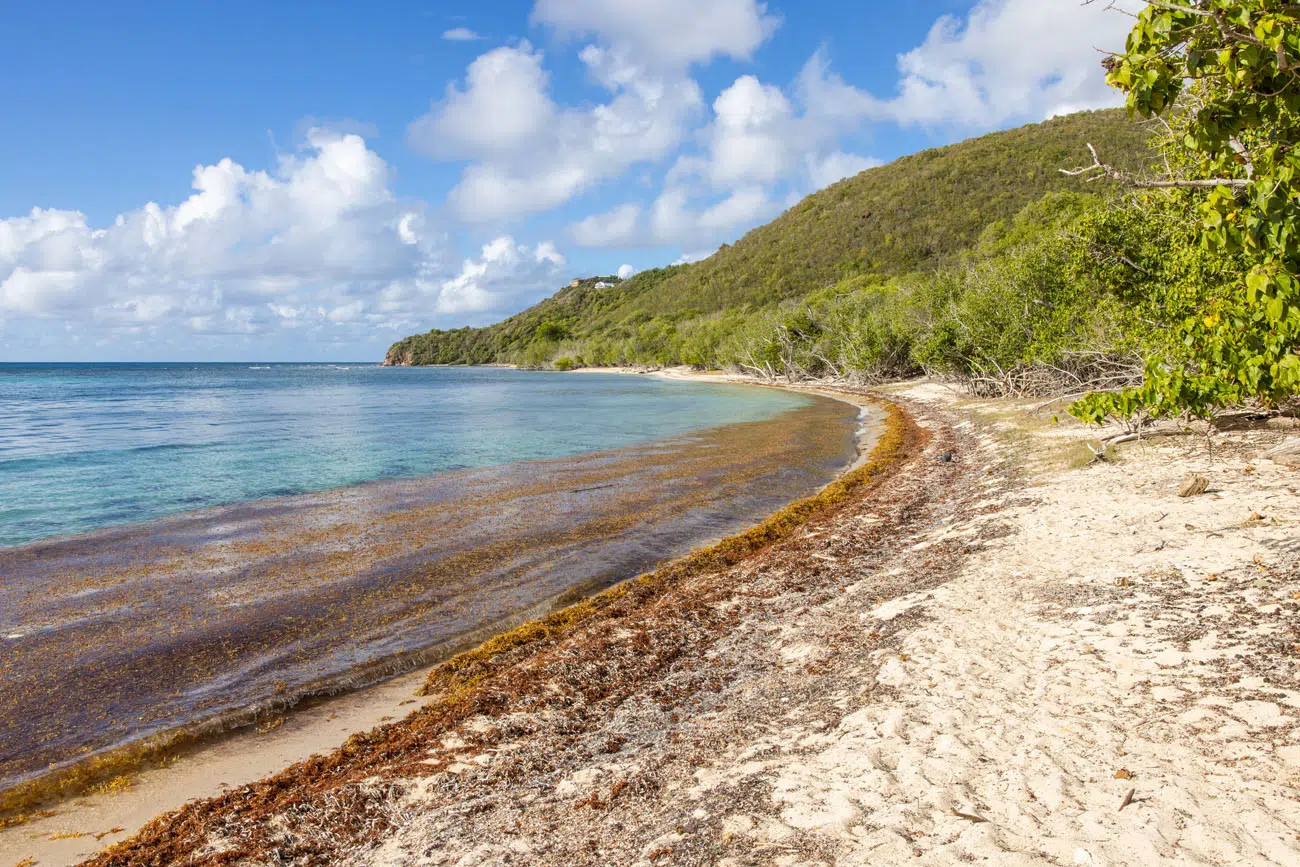
Brown Bay Trail
Distance: 1.6 miles out-and-back | Difficulty: Moderate | Elevation Gain: 400 feet | Time: 1 to 2 hours
This was one of our least favorite experiences in Virgin Islands National Park.
This moderate hike leads out to a very small, quiet beach. We did this in the mid-afternoon and the hiking trail is HOT! We were the only ones we saw, both on the trail and at the beach, so that was nice. But the beach is small and covered with seaweed. You can see a lot of hermit crabs once you get down to the beach, which was a highlight for me (I love the hermit crabs).
Brown Bay Beach
North & South Haulover Beaches
These two beaches are located at the far eastern end of Virgin Islands National Park. It is a long drive to get here and not worth the extra time, in my opinion, unless you like the idea of covering every inch of this national park.
To visit these two beaches, park in the parking area on East End Road. From the parking lot, it’s just a few steps to South Haulover Beach.
South Haulover Beach
To get to North Haulover Beach, there is a flat hiking trail that starts in the parking lot and heads north to the beach (about a 3-minute walk).
North Haulover Beach
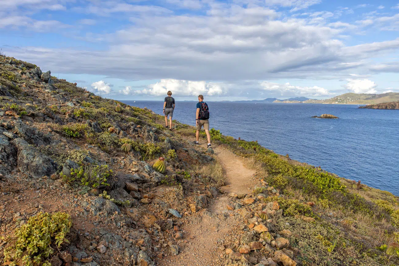
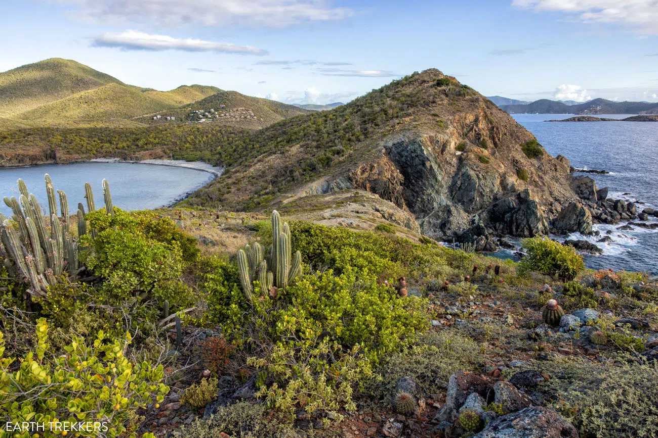
Salt Pond Trail & the Ram Head Trail
Distance: 3 miles round-trip | Difficulty: Moderate | Total Ascent: 550 feet | Time: 2 to 3 hours
This is our favorite hike in Virgin Islands National Park. This trail runs past several beaches, a salt pond, and up to a fabulous viewpoint, so the views are constantly changing and there is never a boring moment on this trail.
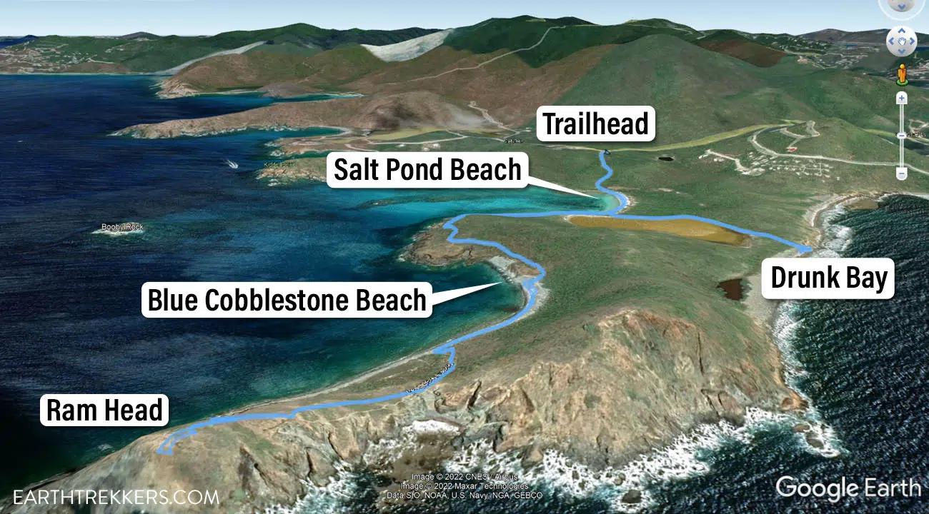
Salt Pont Trail and Ram Head trail map
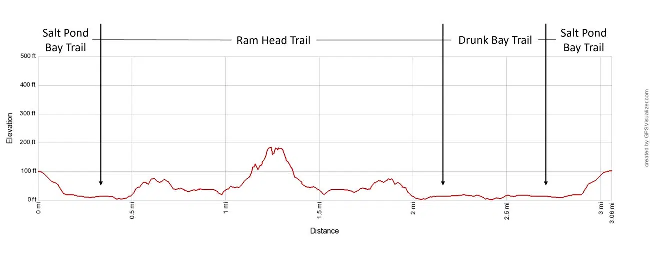
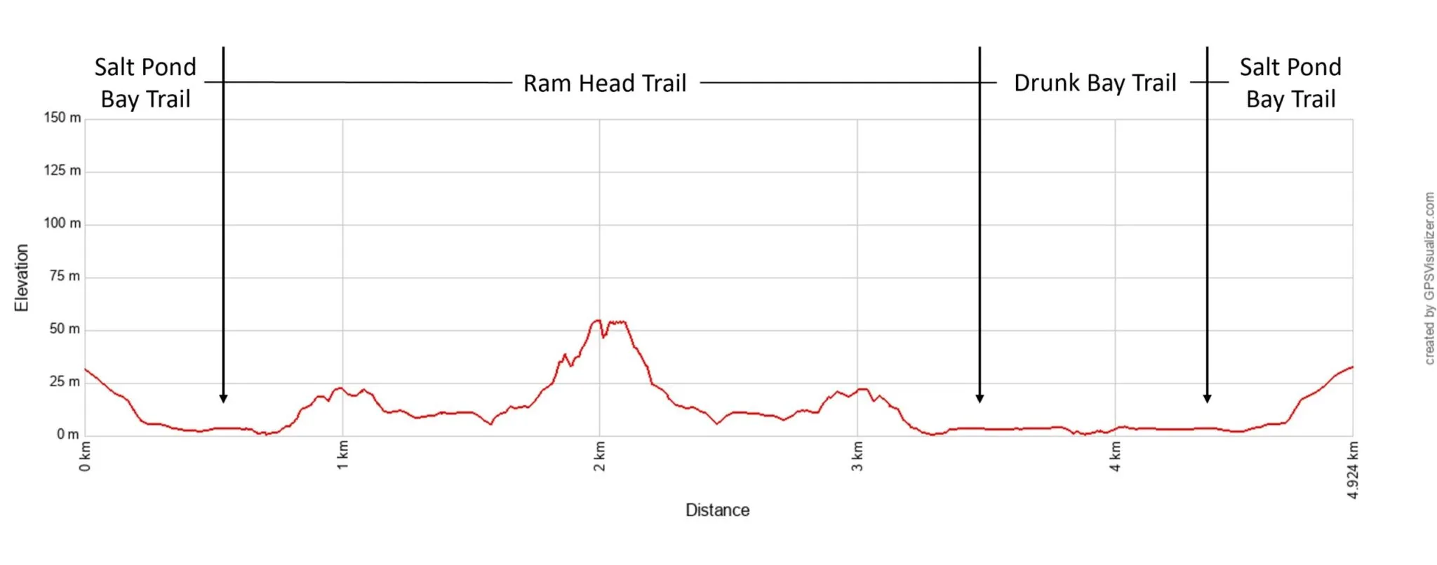
Elevation profile with the optional detour to Drunk Bay.
Park at the Salt Pond Bay Trail parking lot on Route 107. It’s a downhill walk on a wide, rocky trail that looks like an old access road. This trail ends 0.3 miles later at Salt Pond Beach. This beach is a great snorkel spot.
Salt Pond Beach
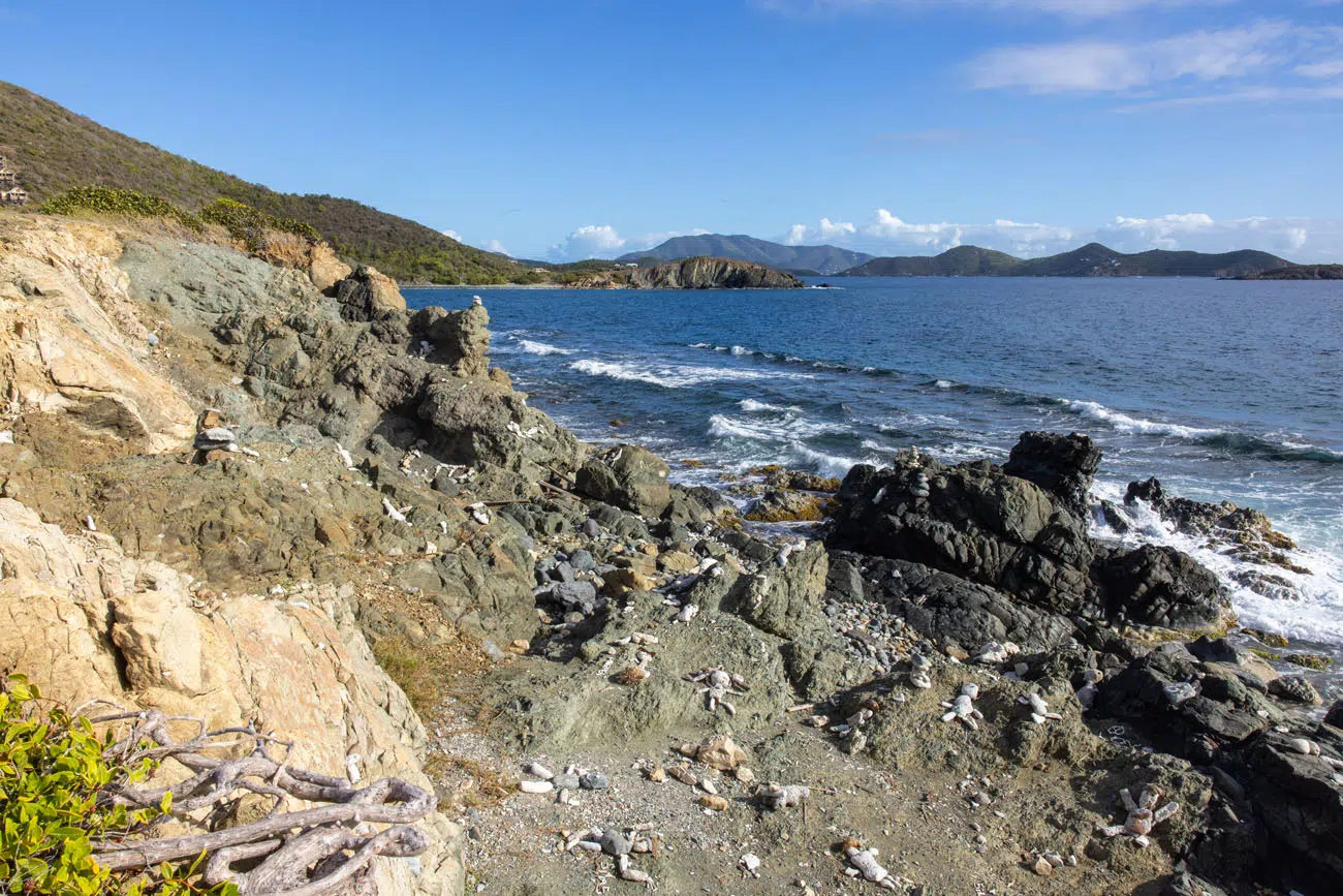
Continue around the beach and you will see a trail sign. Go right to continue out to Ram Head (save Drunk Bay for the end of the hike). You are now hiking on a hilly, rocky, dirt trail. This is one of the most strenuous parts of the hike.
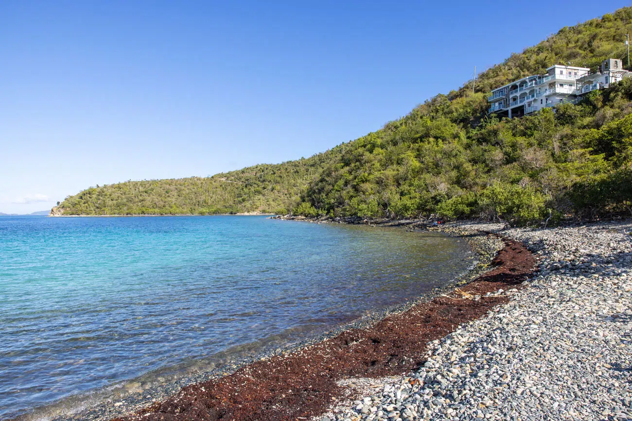
The hike levels out briefly as you hike across Blue Cobblestone Beach.
Then, it’s one final climb up to Ram Head Point. This is the toughest part of the hike, but the views back to beaches are beautiful and just keep getting better the higher you go.
Once you make it to Ram Head Point, you have 360° views. If the weather is clear, you can see St. Croix to the south. The British Virgin Islands are located to the east and you also have a very nice view of the southern coast of Saint John.
Ram Head Point
On the return hike, you have the option to take the detour out to the Salt Pond and Drunk Bay. We think it’s worth it, since it is a flat, short, easy hike with great views of the coast and the shell/coral art. To get from Salt Pond Beach to Drunk Bay it is a 0.3 mile one-way walk.
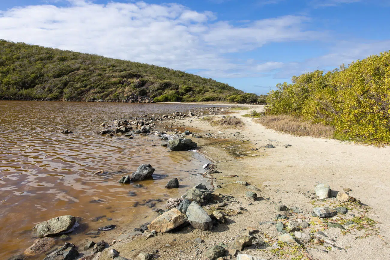
Salt Pond
Drunk Bay
PRO TRAVEL TIP: This hike is best early in the morning when temperatures are still cool. Most of this trail is exposed to the sun and it can feel very hot in the afternoon.
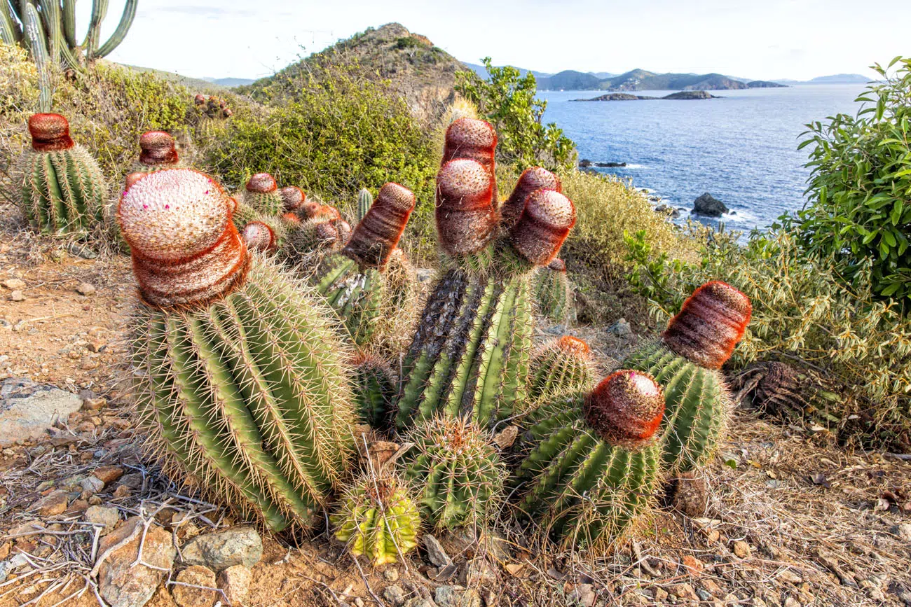
Tektite Trail
Distance: 1.3 miles out-and-back | Difficulty: Moderate | Time: 30 to 60 minutes
We did not do this hike, choosing to do Yawzi Point instead. From the end of the trail, you have a good view of the Tektite area.
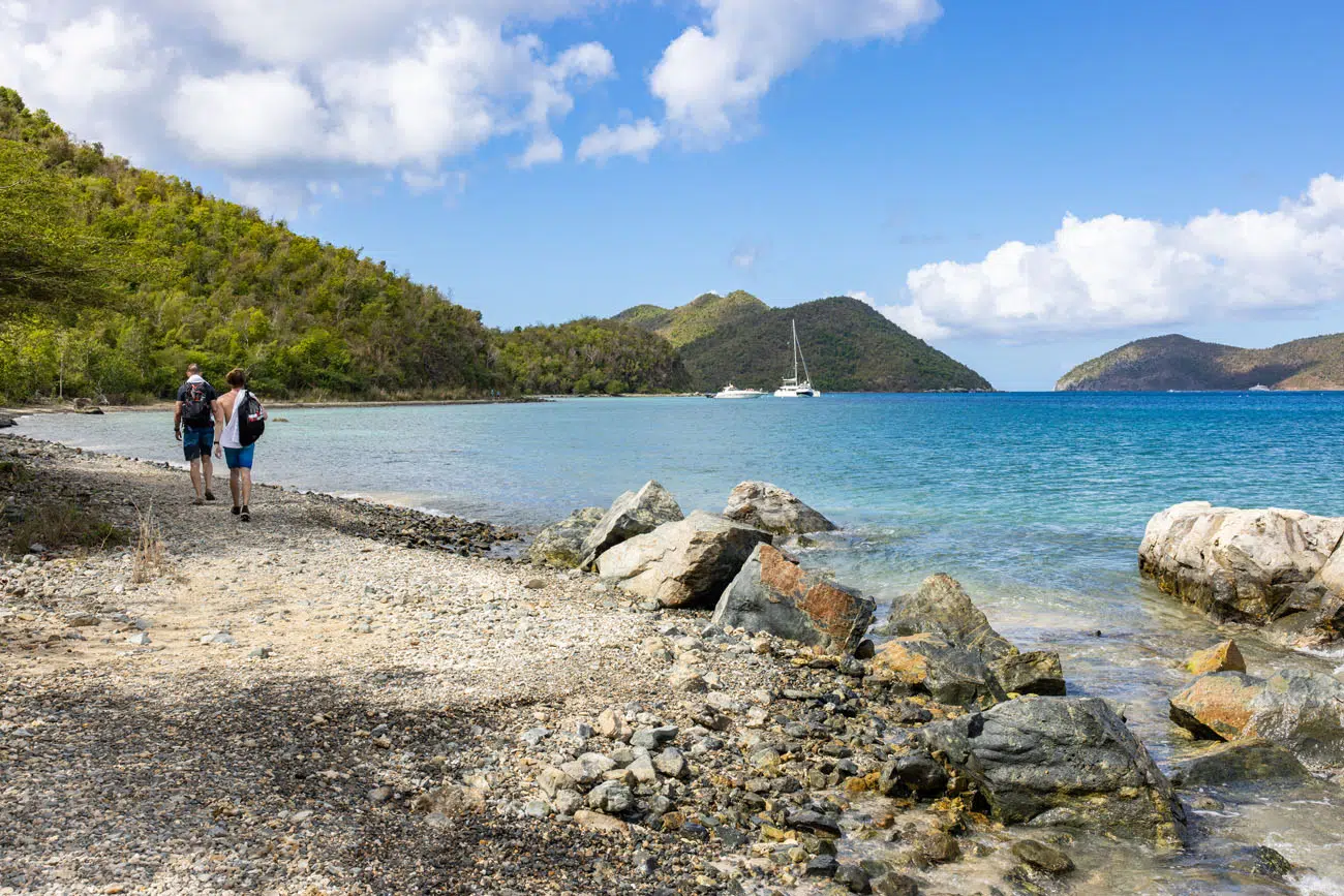
THE ROAD TO LAMESHUR BAY: Route 107, west of Mandal Estate Road, is a rough, dirt road that is about 1-mile long. It is recommended to have a high-clearance SUV, preferably one with 4WD, to get down this road. There are massive potholes, and this road can get muddy and impassable after it rains. The Tektite Trail, Yawzi Point Trail, and Lameshur Bays are located on this stretch of dirt road.
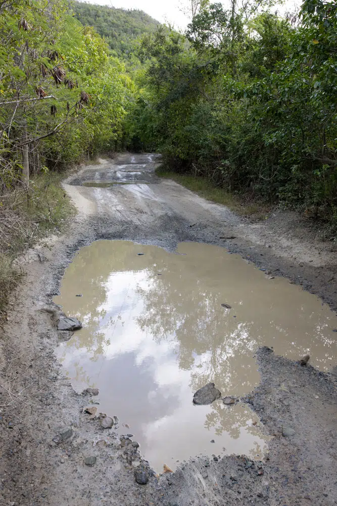
Dirt road to Little and Great Lameshur Bays
Yawzi Point Trail
Distance: 0.6 miles out-and-back | Difficulty: Easy | Total Ascent: 100 feet | Time: 30 to 60 minutes
This short hike is worth doing if plan to visit the south side of Saint John. It offers nice views of Little Lameshur Bay, Great Lameshur Bay, and the south coast of the island. When we did this hike, we met some donkeys on the trail.
Great Lameshur Bay
Little Lameshur Bay
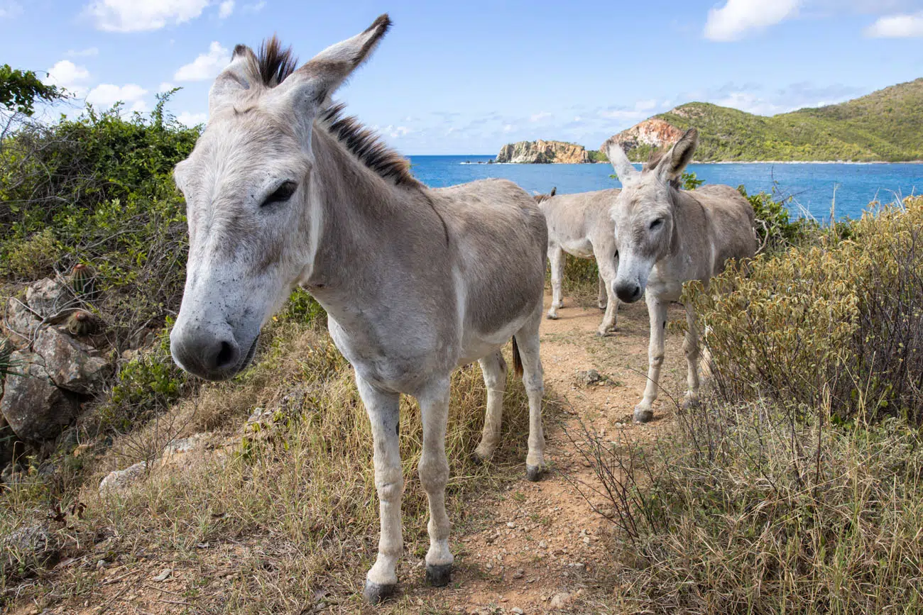
Wild donkeys on the trail.
Little Lameshur Bay and Beach
This very pretty beach is rather remotely located, so it tends to only get a handful of visitors every day. It also makes a very nice snorkeling spot.
Little Lameshur Beach
Great Lameshur Beach
This beach sits right next to Little Lameshur Beach. However, this beach is rocky so Little Lameshur makes a better spot to lay out a towel and relax on the beach.
Great Lameshur Beach
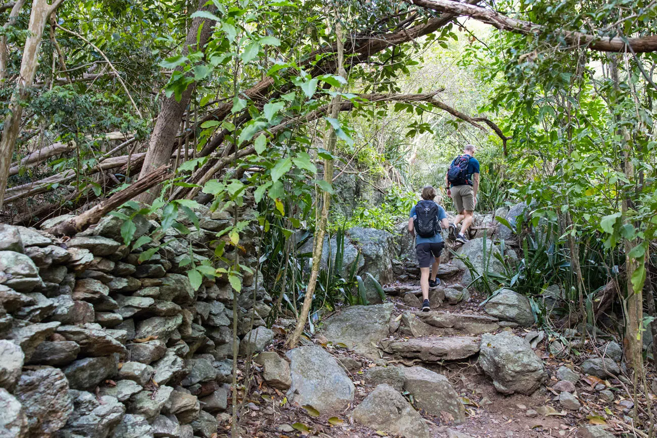
Reef Bay Trail
The Reef Bay Trail is one of the most popular hikes in the park. It’s also one of the most challenging.
Distance: 4.4 miles out-and-back; the Petroglyph Trail adds 0.6 miles (roundtrip) and minimal elevation gain; the detour to Genti Beach adds 0.2 miles (roundtrip) with minimal elevation gain
Total Distance with all detours:5.2 miles
Difficulty: Strenuous
Total Ascent: 1,000 feet
Time: 2 to 4 hours
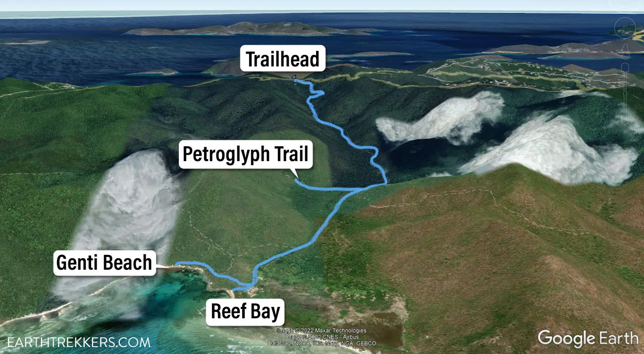
Reef Bay Trail Map
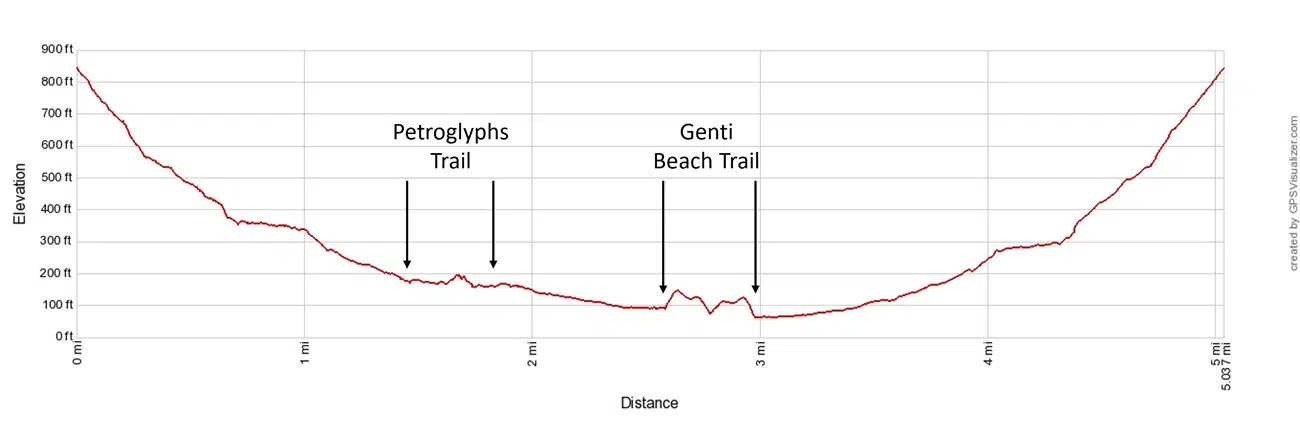
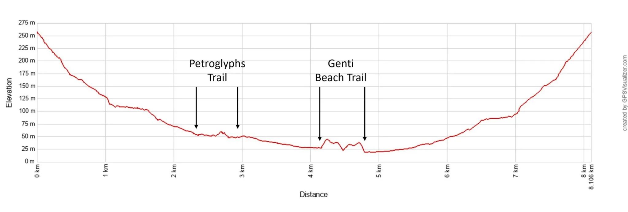
Elevation profile
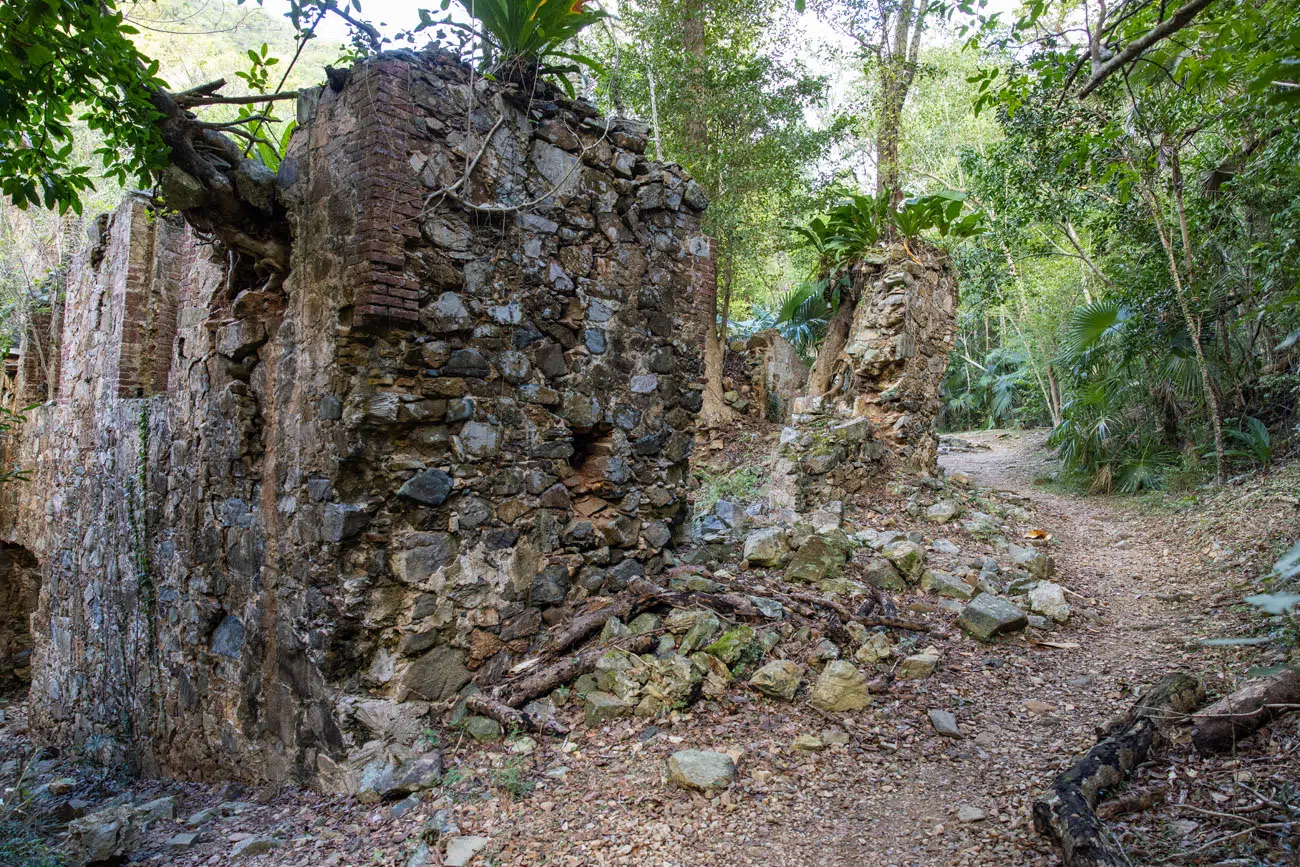
Starting on Centerline Road, the trail heads downhill for most of its distance. It travels through a tropical forest, past several ruins, before ending at the Reef Bay Sugar Mill Ruins and a view of the beach. This is a great spot to go for a swim before the uphill hike back to your car.
Reef Bay Trail
Beach at the end of the Reef Bay Trail
Reef Bay Sugar Mill Ruins
At the end of the trail, near the Reef Bay Sugar Mill Ruins, there is an optional 0.2-mile hike out to Genti Beach. This trail is exposed to the sun, hot, and moderately difficult. Here is a view of the beach:
Genti Beach
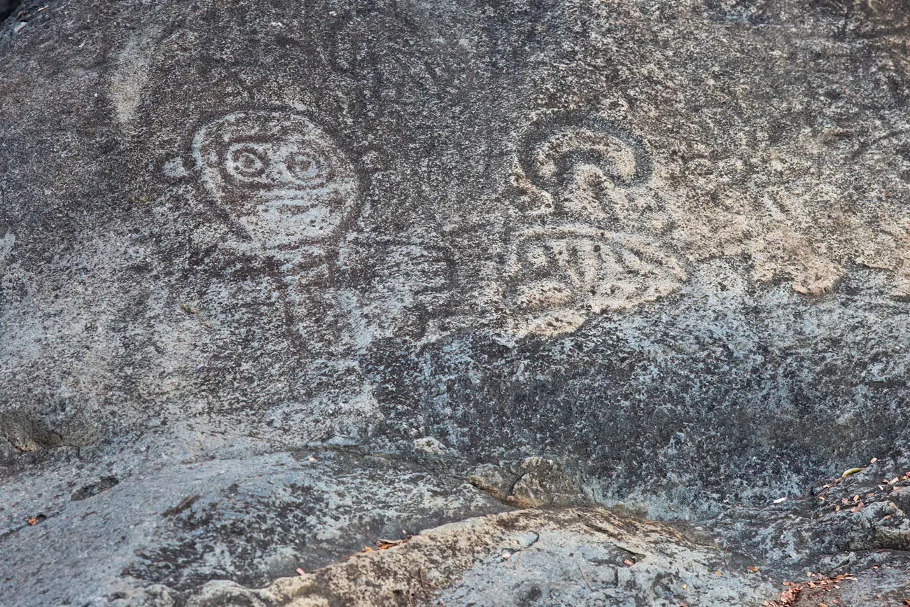
As you head back up the Reef Bay Trail, it is worth it to make the 0.3-mile one-way detour on the Petroglyph Trail to see the petroglyphs. These petroglyphs were carved between 900 and 1500 AD by the pre-Columbian Taino and their ancestors.
Petroglyph Trail
It is an uphill walk for most of the hike back on the Reef Trail to the parking area. The first mile of this part of the hike is the easiest, since it is mostly flat. The final mile is the most difficult, with steep inclines and sections of stone staircases. But since you are hiking in a forest, you at least have some shade.
Tips for the Reef Bay Trail
Bring lots of water. The NPS recommends a half gallon of water for each 4 hours of hiking as a minimum. It took us 2 hours to do this hike and we each drank about a liter of water (about ¼ of a gallon) but we were thirsty when we got back to our car.
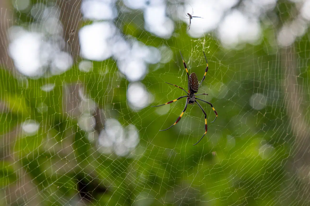
Keep an eye out for Golden Orb Spiders. We saw several of these guys along the trail, in webs about 6 to 7 feet off the ground. They were just high enough that Tim and Tyler’s heads didn’t touch the web (Tim is 6’ 3”), but it was very close.
And finally, start this hike early. It’s a long, uphill climb to finish the hike and midday or later in the afternoon, when temperatures are higher, this part of the hike can be brutal.
Catherineburg Estate Ruins
The final entry on our things to do in the Virgin Islands list is the Catherineburg Estate Ruins. This is worth it if you have an interest in visiting the ruins and historical landmarks in the park, and it is a very quick detour as you head down Centerline Road.

Top 10 Things to Do in Virgin Islands National Park
Like I said, that is a long list of things to do in Virgin Islands National Park. Below I list our favorite things to do and essential experiences to have in the park.
- Visit Trunk Bay Beach and snorkel the underwater trail
- Hike to Ram Head Point
- Spend some time at Maho Bay Beach
- Walk the Leinster Bay Trail, snorkel in Waterlemon Bay, and hike to the Windy Hill Greathouse Ruins
- Hike the Reef Bay Trail
- Visit Cinnamon Bay Beach
- Annaberg Sugar Plantation Ruins
- Visit the overlooks along North Shore Road
- Visit Denis Bay
- Honeymoon Beach
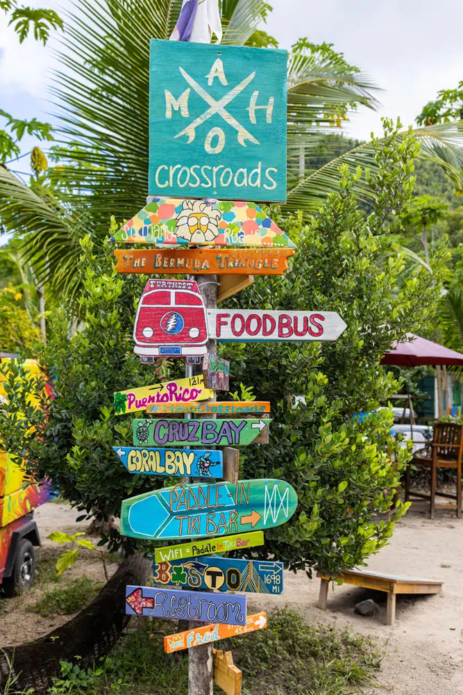
This list only includes sights located in Virgin Islands National Park. There are several other great places on Saint John that are worth adding on to your trip, such as Hurricane Hole, Coral Bay, The Windmill Bar, and Cruz Bay. These will are covered in our guide Best Things to Do in Saint John.
7 Awesome Things to Do in Saint John, USVI
Best things to do in Saint John, plus where to stay, where to eat, and helpful tips.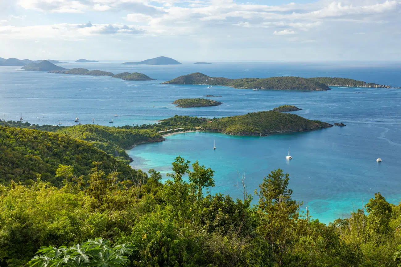
View from The Windmill Bar
Our Five Favorite Beaches
Our Five Favorite Viewpoints

How Many Days Do You Need in Virgin Islands National Park?
Ideally, plan on spending three days in Virgin Islands National Park. This gives you enough time to visit the highlights, spend some time at several different beaches, and hike a trail or two.
This park is best enjoyed slowly. One of the best things to do in Virgin Islands National Park is to spend some time on the beach, do a little snorkeling or paddle boarding, and simply relax. If you pick a beach like Maho Bay Beach or Honeymoon Beach, you can rent beach equipment, order lunch, and have a painkiller or two (or three).
If you only have one day in Virgin Islands National Park, drive North Shore Road visiting the overlooks, and spend some time at Trunk Bay, Maho Bay Beach, or hike the Leinster Bay Trail to Waterlemon Bay beach.
With two days in Virgin Islands National Park, spend day one either hiking the Reef Bay Trail or Ram Head Trail in the morning and then get your beach time in the afternoon. On day two, spend the day at Trunk Bay or Maho Bay Beach.
With three days in Virgin Islands National Park, follow our suggestions above for two days. On the third day, hike another trail, visit the quieter, more remote beaches like Denis Bay or Little Lameshur, and/or go snorkeling in Waterlemon Bay, if you have not done that yet.
View from Ram Head Point
Best Time to Visit Virgin Islands National Park
Average temperatures do not vary much over the course of the year. During the winter months, daytime highs range from 80 to 84 degrees and during the summer months, it gets up to 90 degrees. August is typically the hottest, most humid month of the year.
Peak season is the winter months: December, January and February. Daytime temps are their coolest (in the low 80’s) and this is the dry season, with rain being unlikely. Since this is peak season, hotel prices are their highest and beaches can be crowded.
One thing to be aware of is that during the winter months, storms in the North Atlantic can produce big swells on the north side of the island, creating strong surf and large waves. The winter months are the best time for surfing in the US Virgin Islands, but this strong surf can also temporarily close beaches, as it did on our visit, when Trunk Bay was closed to swimming for one day. A NPS staff member told us that when there is a strong east coast storm in the USA, five days later they get large swells on the north shore of Saint John.
During the spring months, temperatures tick up a little bit, as does the humidity and rainfall chances. This is a nice time to visit if you want lower crowds and lower prices.
The summer months, June, July and August, are the hottest, most humid months to visit the Virgin Islands. This time coincides with the arrival of the wet season and hurricane season.
Peak hurricane season runs from July through October. In 2017, two major hurricanes hit the Virgin Islands and did substantial damage. Some resorts are still closed, and parts of the island are still recovering.
The fall months, September, October, and November, tend to be warm and wet. September and October are the wettest months of the year. But by November, hurricane season and the wet season comes to a close, making this month a good time to visit before the arrival of peak season.
We spent nine days on the US Virgin Islands in mid-January. We were greeted with torrential rains that flooded the streets, but after this, our weather remained clear and mostly dry. Very short afternoon rain showers occurred about 50% of the days we were here, but these were very brief (the longest one lasted less than 10 minutes).
Denis Bay
How to Get to Virgin Islands National Park
Virgin Islands National Park is located on Saint John. To get here, fly to Saint Thomas and then take the ferry to Cruz Bay, Saint John. Passenger ferries leave from Red Hook or Charlotte Amalie. Car ferries leave from Red Hook.
There are several car ferries that travel between Red Hook and Cruz Bay: Love City Car Ferry, Global Marine’s Tug Life, Big Red Barge Company, and Boyson, Inc.
We rented a car from Avis at the Saint Thomas airport for our visit. To get to Saint John, we took the Red Barge Ferry and to get back to Saint Thomas, we took the Love City Ferry.
When we did this, we showed up at the ferry port and got in line for the next available ferry.
The first and last ferries of the day tend to be the fullest. If you plan to take the last ferry of the day, get here at least 30 minutes to make sure you get a spot. You can also reserve a spot in advance on the Love City Ferry.
If you are traveling by boat, you can also anchor in the bays in the park.
How to Get Around the Park
Rental Car
The easiest way to get around Virgin Islands National Park is by renting a car. You can rent a car in Saint Thomas (we rented our car at the airport) and take it across to Saint John on the car ferry.
Alternatively, you can also rent a car on Saint John. There are several rental car companies in and around Cruz Bay. Most of these shops rent Jeep Wranglers, and we saw hundreds of these on the roads in Saint John.
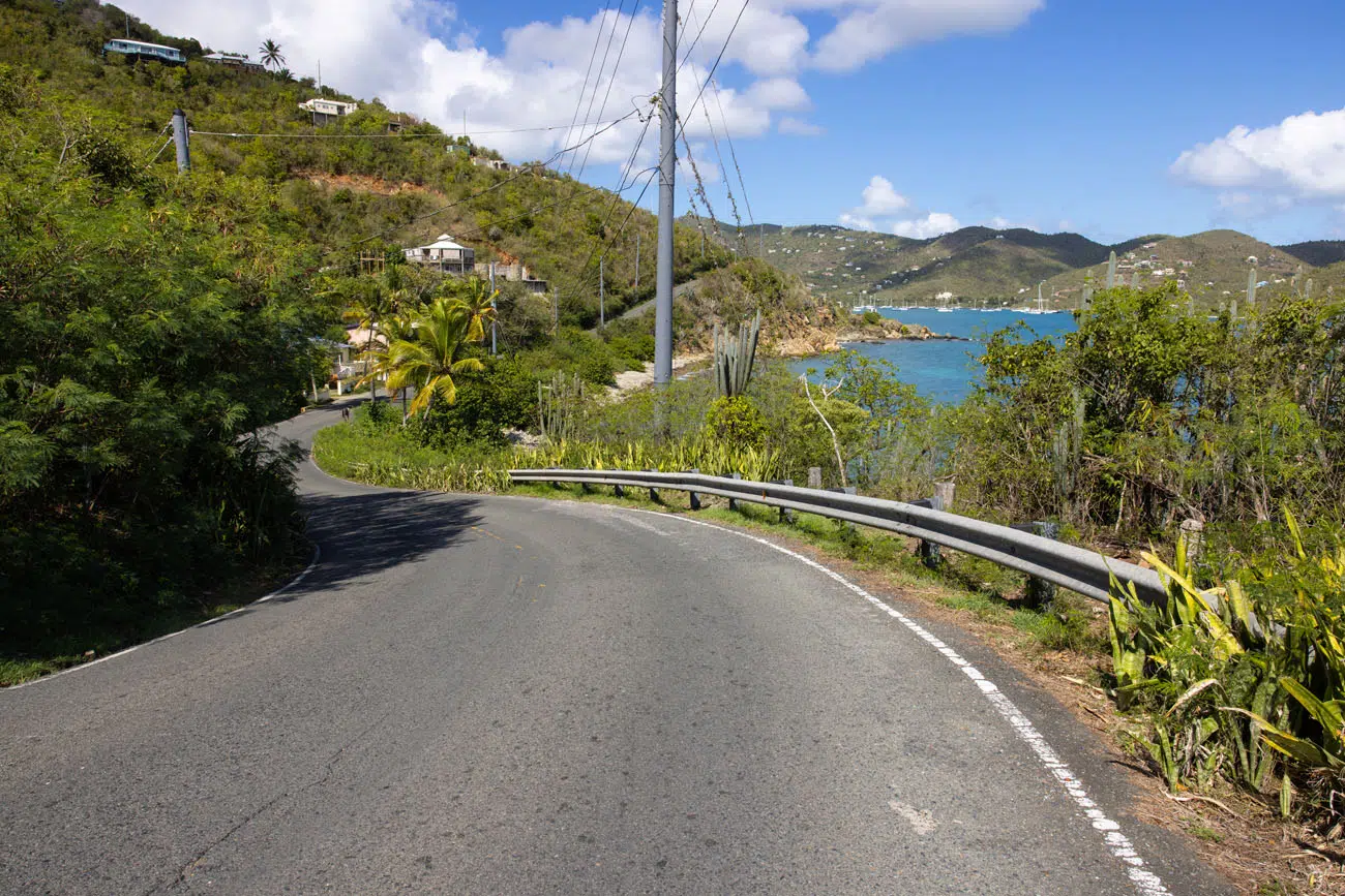
Driving on Saint John
The roads on Saint John are narrow and very windy. I don’t think there is a straight stretch of road anywhere on this island. In addition to being very windy, the roads are also incredibly steep. It’s not unusual to make very tight turns on an incline or decline that is very steep.
There are no shoulders on these roads and in most spots, no center line.
On Saint John and Saint Thomas, you will drive on the left-hand side of the road.
Keep a lookout for wild donkeys, cows, goats, chickens, deer and people.
Drive slowly, keep your eyes on the road, and stay to the left.
Road on Saint John
Parking
All beaches and trailheads have very limited parking. Parking on the North Shore Beaches usually fill by 10 am.
Taxis and Shuttles
There are also safari shuttles and taxis that leave from Cruz Bay. If you hire a taxi, arrange a time to be picked up. Cell service is spotty, and you might not be able to call for a taxi on all parts of the island.
Safari taxis also offer 2 to 3-hour guided tours of the island. They stop at beach overlooks and the plantation ruins.
The Vitran Bus System is a public bus system that runs Monday through Friday. It’s not very reliable and we saw very few buses running during our visit.
By Boat
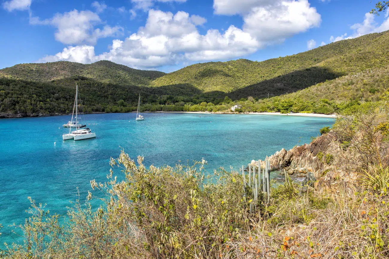
If you are traveling by boat, you can anchor at several of the bays in the park. Here is a map of the anchorage points.
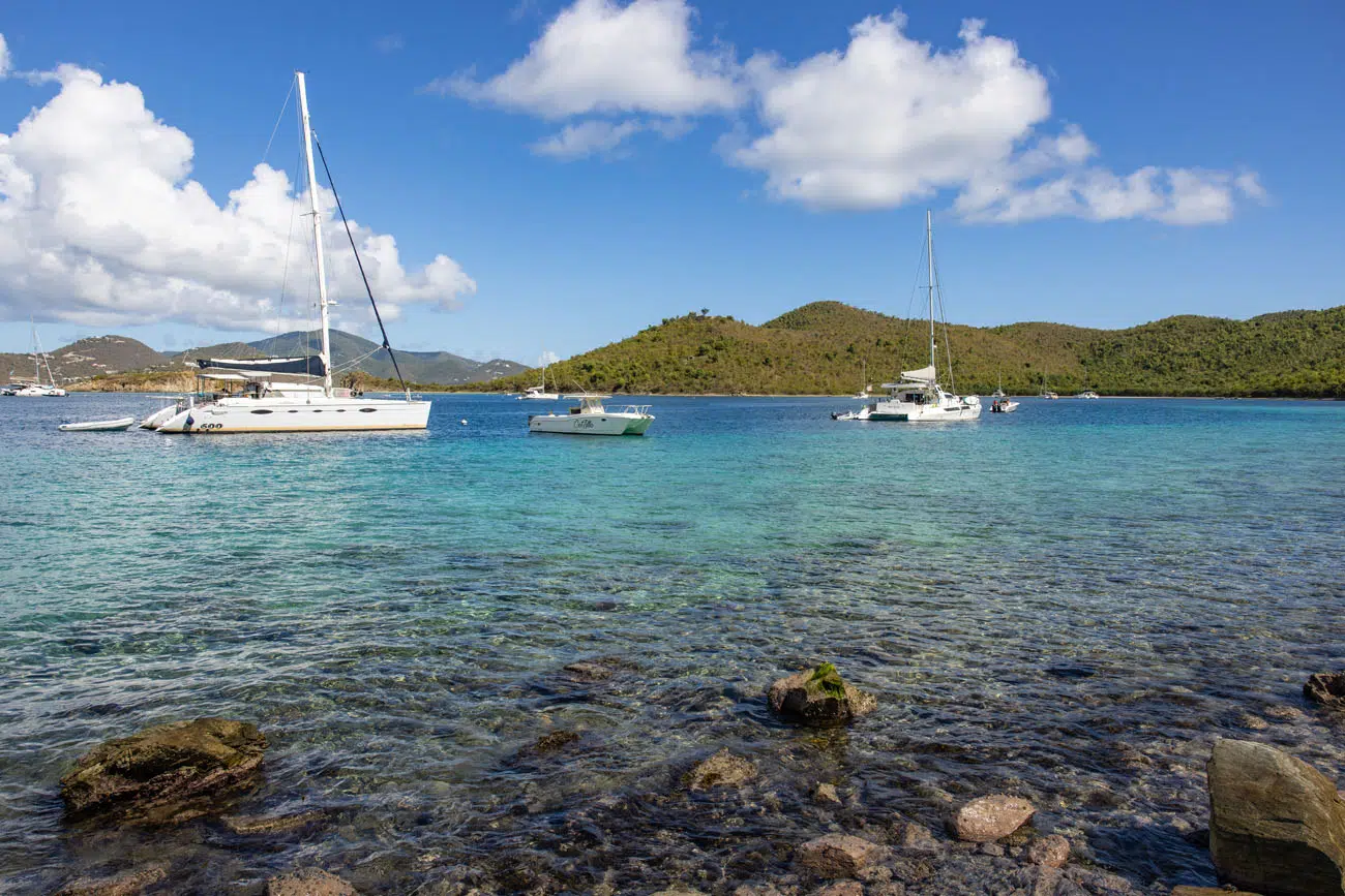
Boats in Waterlemon Bay
Where to Stay & Eat
The only place to stay in the park is at the Cinnamon Bay Resort & Campground. Camping is permitted by reservation only.
Outside of the park, the best place to stay is in Cruz Bay. This town is located on the western end of the island. There are many great hotels and restaurants to choose from, and this area also has a convenient location near the ferry port.
We stayed at the The Westin St. John Resort Villas. The property is beautiful and it is also very large…so large that there are golf carts to shuttle visitors around. We enjoyed our stay here, but if you have a villa on the far end of the property (we did) it can be as much as a 10-minute walk to your car. We didn’t have much luck calling a golf cart shuttle and having it arrive within a reasonable amount of time, so we typically walked everywhere.
Also in and around Cruz Bay, Coconut Coast Villas, Lovango Resort and Beach Club (check out the Ocean View Treehouse!), Gallows Point Resort, and the Fantastic Penthouse at Sunset Serenade Suites get good reviews.
As far as where to eat in Cruz Bay, we loved the food and the beach setting of the The Beach Bar. The Longboard, Sun Dog Café, La Tapa, Lime Inn, and Cruz Bay Landing all get great reviews.
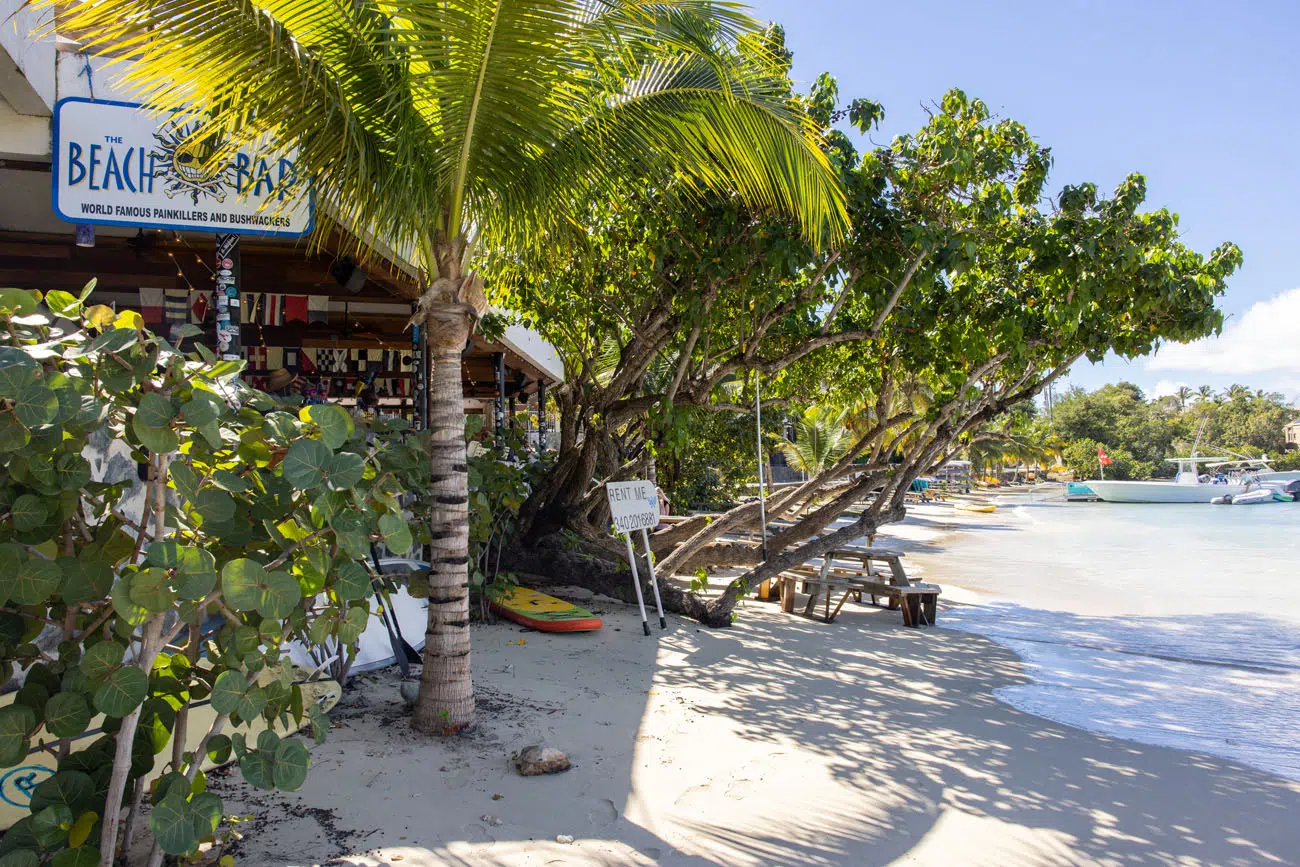
The Beach Bar
What to Pack
- Reef Safe Sunscreen. Non-reef safe sunscreen is illegal in the US Virgin Islands. This article has a list of approved and non-approved sunscreens. Our go-to is La Roche Posay Anthelios Tinted Sunscreen SPF 40+ Titanium Dioxide and Zinc Oxide sunscreen.
- Sunglasses
- Swimsuit
- Water bottle (the tap water is safe to drink and a better alternative to purchasing water in plastic bottles)
- Camera
- Underwater camera (we use a GoPro)
- Shorts and T-shirts
Our hotels provided beach towels for us (or you can bring your own). We also packed a light jacket, umbrella, and nice clothes for going out to dinner at night.
Important Planning Information
Park Entrance Fee: There is no fee to enter Virgin Islands National Park. However, there is a $5 per person fee to enter Trunk Bay. This fee is reduced to $2.50 per person if you have an interagency pass, such as the America the Beautiful pass. If you are traveling by boat, there is a $26 per night mooring fee.
Hours of Operation: The park is open 24 hours a day, 365 days per year.
Cellular Service: Cellular service is spotty across the island. We use Verizon and we had the best signal near Cruz Bay. On the eastern end of the island, we picked up the cellular service from the British Virgin Islands, so we put our phones in airplane mode to avoid incurring extra charges. We have heard that AT&T has better cellular service on Saint John than Verizon.
Pets: Dogs on a leash are permitted on hiking trails, however they are not allowed on beaches.
Get updates on road conditions and trail closures, as you plan your trip and just before your visit, on the National Park Service website.
If you have any questions about the best things to do in Virgin Islands National Park, or if you would like to share your experience, let us know in the comment section below.
More Information for Your Trip to the Caribbean
7 Day US Virgin Islands Itinerary: St. Thomas & St. John
Pinterest Facebook Flipboard St. Thomas and St. John are two of the three main US Virgin Islands. These two islands sit side by side and are connected by a short ferry ride, and together they make a fantastic Caribbean getaway. On this US Virgin Islands itinerary, learn how to plan the perfect one week trip […]
How to Plan a Trip to the US Virgin Islands
Plan your visit to the US Virgin Islands. Learn about the best things to do, how to plan your time, where to stay, and more.
14 Best Things to Do in St. Thomas, USVI
Discover the best things to do in St. Thomas, from its top beaches to its water sports and hidden gems. Get sample itineraries for 1, 2, and 3 days in St. Thomas, plus what you need to know to plan your visit, from how to get here, where to stay, and other places to visit […]
7 Awesome Things to Do in Saint John, USVI
This guide covers the best things to do in Saint John, including activities in Virgin Islands National Park and must-have experiences outside the park, such as kayaking spots and scenic dining options. We also include key travel details like where to stay, how to get there, and the best time to visit, complete with weather […]
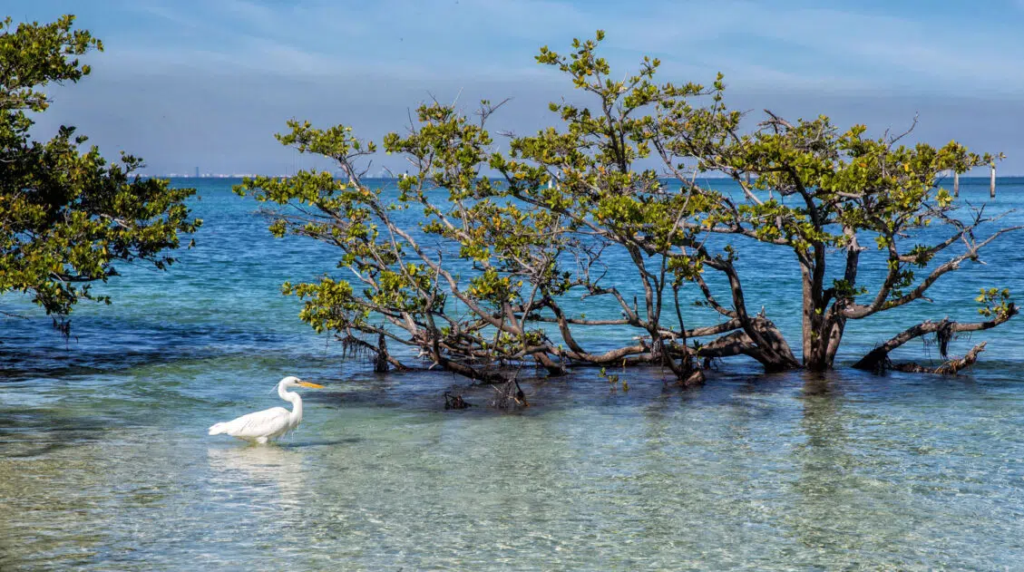
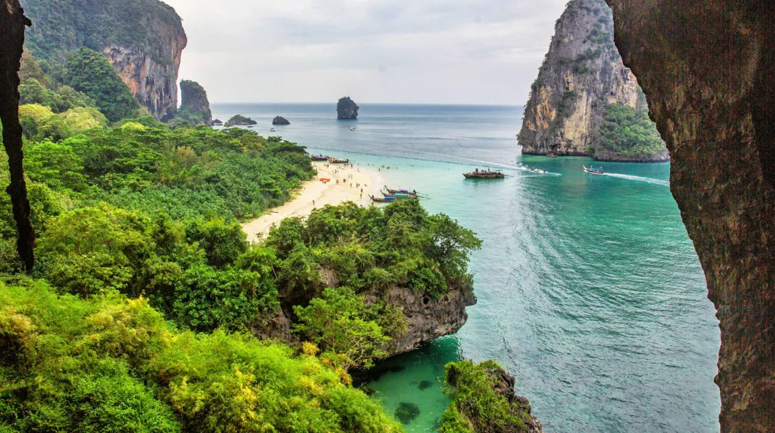
Florida Keys Bucket List: 25 Awesome Things in the Florida Keys
The Florida Keys are one of the best spots in the US to go on a road trip. In just 100 miles, hop from key to key, go snorkeling, dine at seafood restaurants, try key lime pie, go shopping, and enjoy endless views of brilliant aquamarine water. It’s a gorgeous drive with lots to do. […]
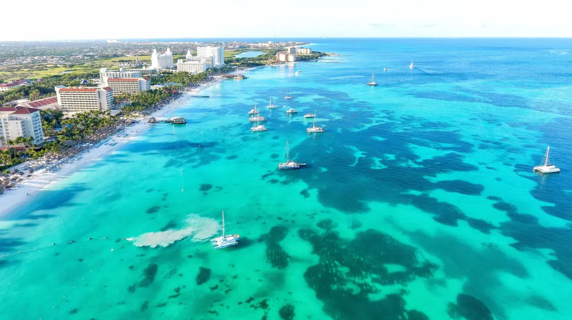
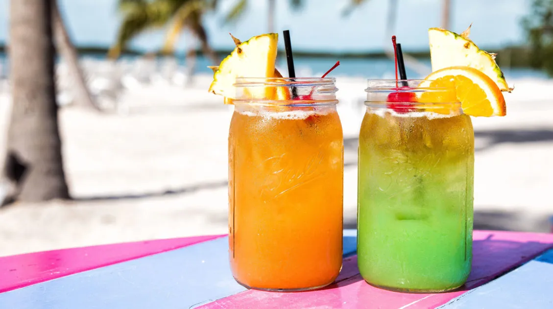
Best Things to Do in Aruba on Your First Visit
So, you are planning a trip to Aruba? Just so you know, there is more to Aruba than sipping tropical drinks in the shade of a palm tree (although that alone would make for a great vacay). Go snorkeling, learn to kitesurf, explore Aruba’s gorgeous beaches, and take an UTV tour of the island. Whether […]
10 Best Things to Do in Biscayne National Park
Biscayne National Park protects one of the largest reef systems in the world. This park is 95% water, so the best way to explore it is by boat, making it very unique from many of the US national parks. If you love snorkeling, scuba diving, swimming, or simply cruising around by boat, you will love […]
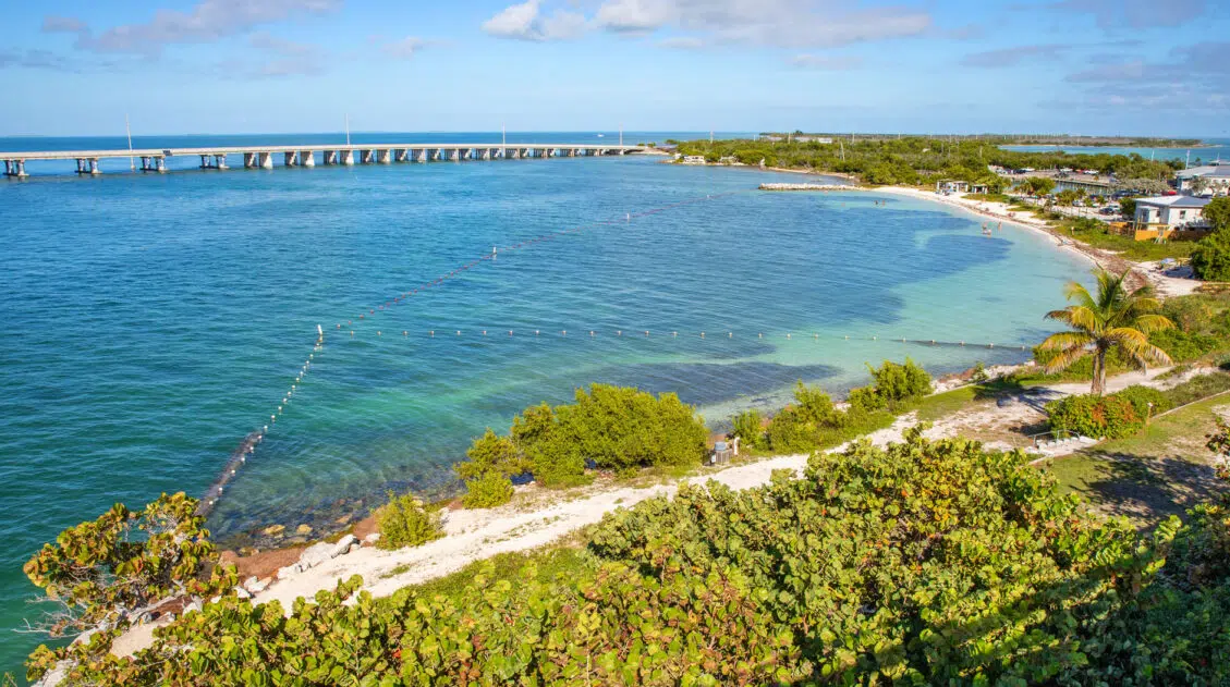
7 – 10 Day Florida Keys Itinerary: Miami, Key West & the National Parks
Driving from Miami to Key West is one of the best road trips in the USA. White sandy beaches, palm trees, beautiful aquamarine water, warm sunny skies…sounds nice, right? Add in tropical drinks, alfresco dining, a few slices of key lime pie, a national park or two (or even three), and some of the most […]

Costa Rica Travel Guide: How to Plan a Trip to Costa Rica
Costa Rica Travel Guide Few countries pack this much variety into such a small footprint: volcanoes, cloud forests, rainforest wildlife, Pacific beaches, and natural hot springs, all within a few hours of each other. We spent two weeks in Costa Rica at the end of February, experiencing sunny skies, almost no rain, and a trip […]
10 Winter Vacation Ideas Perfect for the Holiday Season
It’s nice to spend the holiday season at home, visiting with family and enjoying the low-key end to the year. But what if you want to get away? With two weekends and two days off of work for Christmas and New Year’s, it’s possible to swing a 10-day getaway without taking too many vacation days. […]
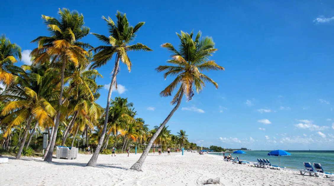
18 Great Things to Do in Key West, Florida
What is the first thing that comes to mind when you think of Key West? Gorgeous sunsets from Mallory Square? Bar hopping on Duval Street? Lounging on the beach in the shade of a palm tree? Key West may be a small place, but there’s a lot here to keep you busy. In this guide, […]

Best US National Parks to Visit Month-By-Month
Best National Parks to Visit Month-By-Month Most national park planning advice tells you the “best” month to visit a park without showing you the full picture. This guide does both. We’ve visited 56 of the 63 US national parks, many of them multiple times and in different seasons, and timing is consistently one of the […]
Our 15 Favorite US National Parks: A Few May Surprise You
Stretching from the South Pacific, across the United States and into the Caribbean, are 63 national parks. These national treasures are filled with scenic drives, hundreds of miles of hiking trails, wildlife, historic sites, and endless opportunities for adventure. In this guide, we cover 15 of the best national parks in the USA and what […]
Comments 10