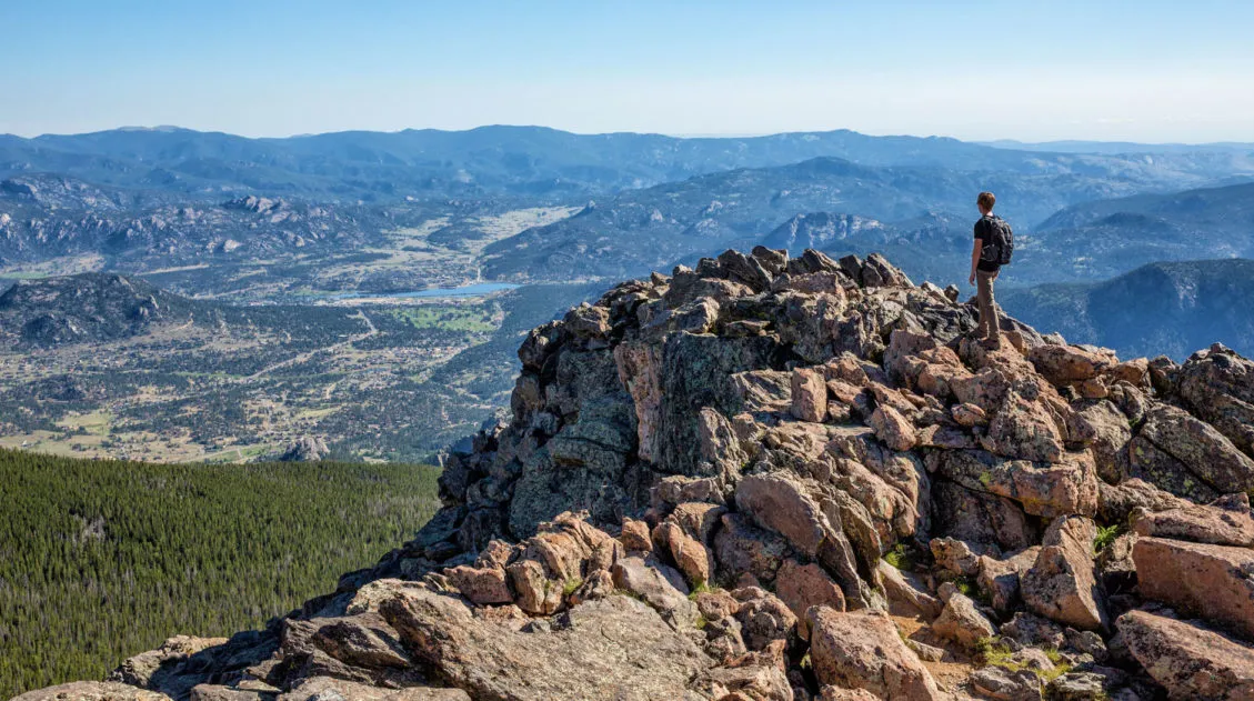
While hiking to Mt Ida, you really feel like you are walking on top of the world. For much of this hike you walk along the Continental Divide, so you have panoramic views across the park. It gets even better once you reach the summit of Mt Ida. From here, at an elevation of 12,899 feet, the entire park stretches out before you.
This hike is much different than many others in Rocky Mountain National Park. You spend very little time below the tree line, so you get sweeping views for most of the hike. And since this is a lesser known hike, you will share the trail with fewer people than many other hikes in the park.
But this is a tough hike. It starts at 10,797 feet and tops out at 12,899 on Mt Ida, so you will really feel the effects of the higher elevation. Expect lots of wind and cold temperatures, even during the summer months. Hikers need to keep a close eye on weather conditions. This is a terrible trail to be caught in a thunderstorm, since you are so exposed.
This is one of our favorite hikes in Rocky Mountain National Park and we highly recommend it if you want unforgettable high alpine views. Just come prepared, bring warm clothing, and start early to avoid those typical summer afternoon thunderstorms.
Continental Divide Trail to Mt. Ida Hiking Stats
Distance: 9.8 miles (15.7 km) round trip (out-and-back)
Difficulty: Strenuous
Total Elevation Gain: 3,060 feet (935 m)
Starting Elevation: 10,797 feet (3,291 m) at the trailhead
Highest Elevation: 12,899 feet (3,932 m) on Mt Ida
Length of Time: 4.5 to 6.5 hours
When to Go: The best time to do this hike is from July through September, when the trail is free of snow. Get updates on trail conditions on the National Park Service website.
Timed Entry Permit: You must have a Tifmed Entry permit (it does not have to include Bear Lake Road)
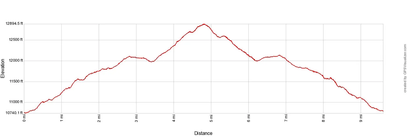

Mount Ida Elevation Profile
Please practice the seven principles of Leave No Trace: plan ahead, stay on the trail, pack out what you bring to the hiking trail, leave areas as you found them, minimize campfire impacts, be considerate of other hikers, and do not approach or feed wildlife.
How to Hike Mt Ida
Step-By-Step Trail Guide
Getting to the Trailhead
The trailhead is located on Highway 34, 4.5 miles southwest of the Alpine Visitor Center.
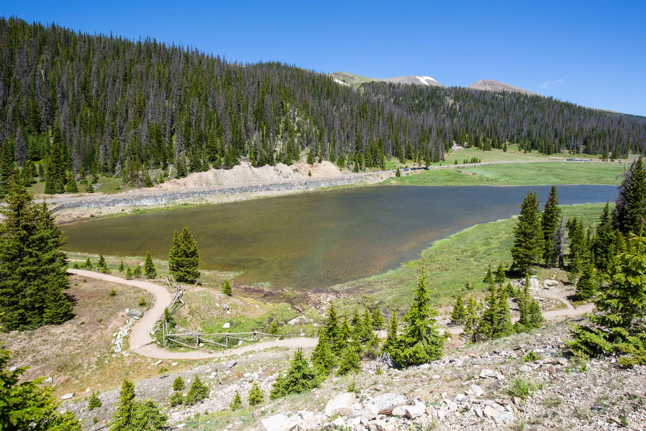
Park at the small parking lot at Milner Pass/Poudre Lake. This lot can hold approximately 22 cars. We arrived at 7 am on July 1 and got one of the last spaces.
There are two pit toilets here.
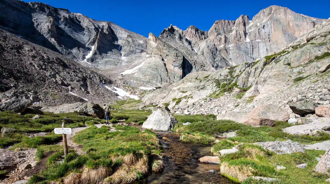
The trail starts next to Lake Poudre, on the northern end of the parking lot.
The view from the first part of the trail, looking back at Lake Poudre and the start of the hike.
Hiking to Mt Ida
The trail briefly skirts around the southern end of Lake Poudre and then heads into the trees. This first section of trail is one of the hardest and least exciting sections of the hike. You steadily gain elevation with very little to look at, other than the evergreen forest. But that is about to change.
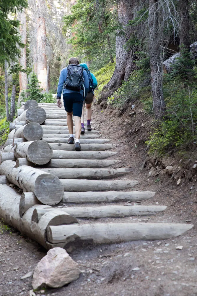
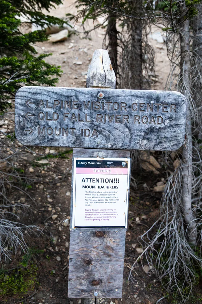
Just over 0.5 miles into the hike you will arrive at a trail junction. Stay to the right to continue to Mt Ida (follow signs for Mt Ida).
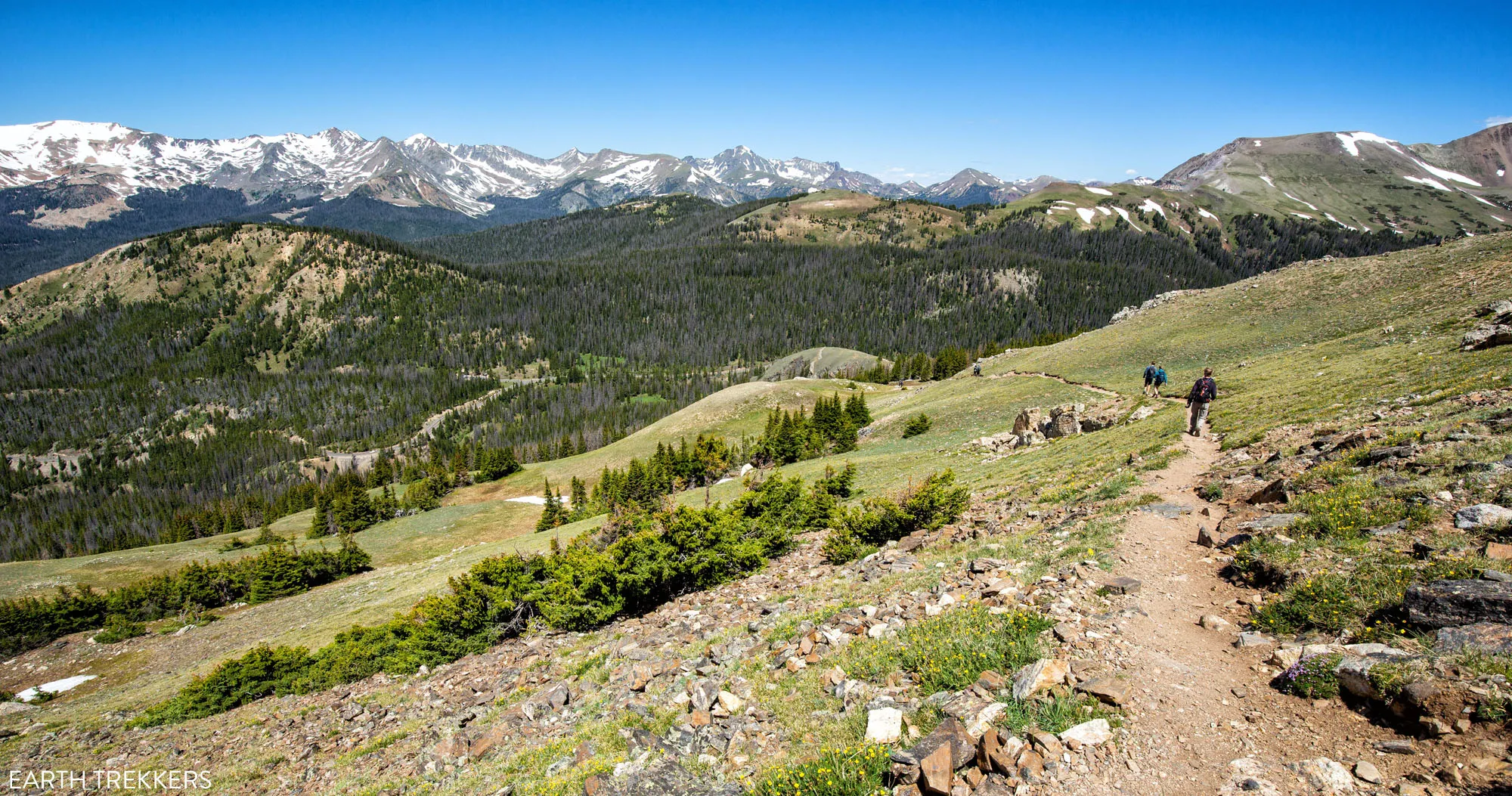
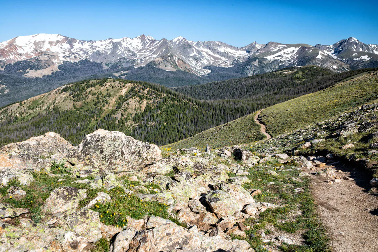
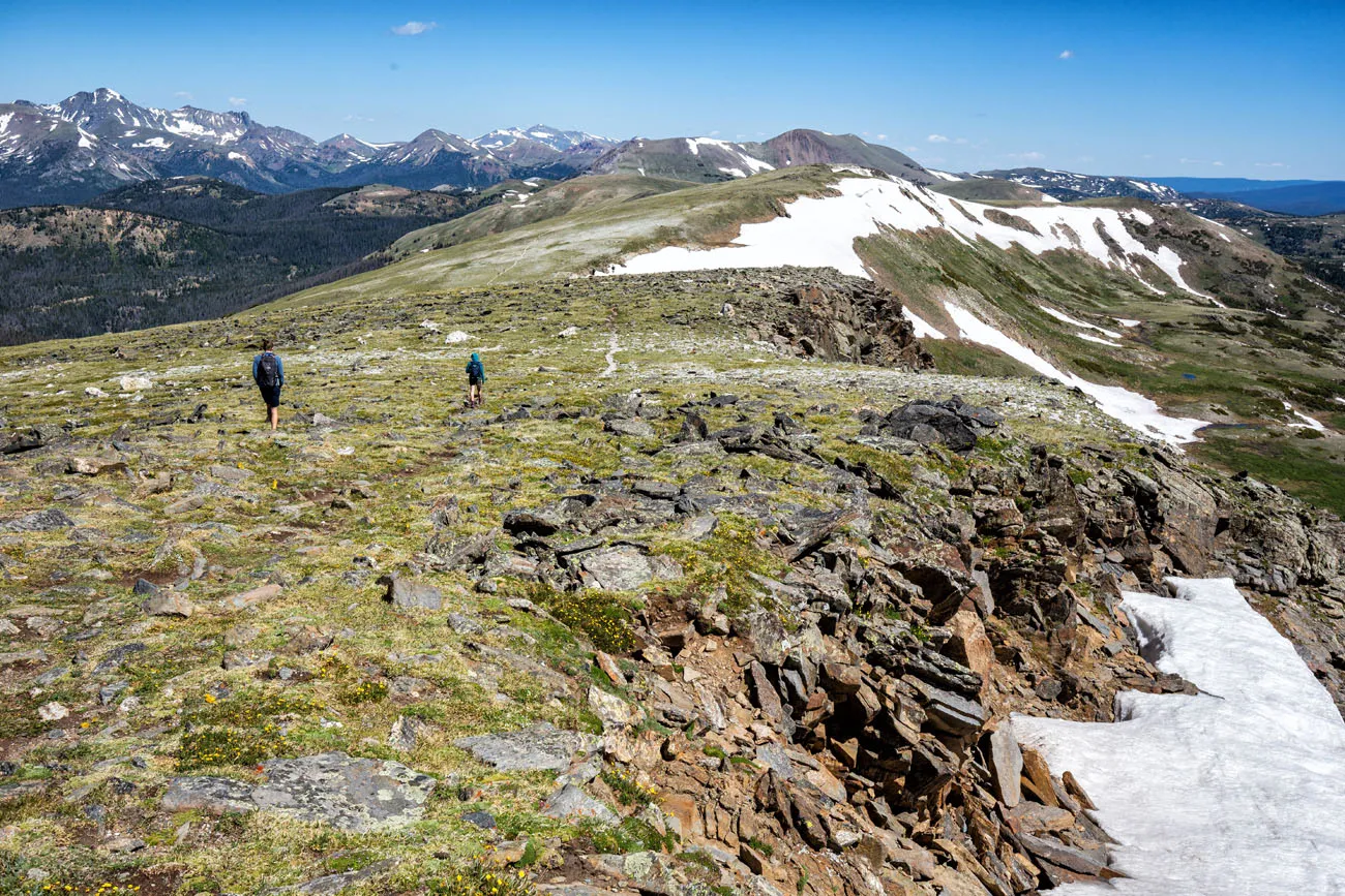
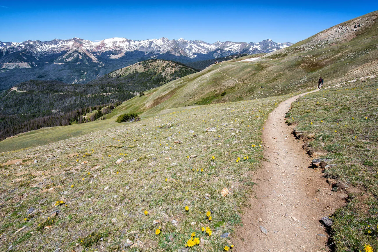
At about 1 mile into the hike, the trail emerges from the trees and the views really open up. To your right are the Never Summer Mountains. Out in front of you, you will be able to see the peak of Mt Ida.
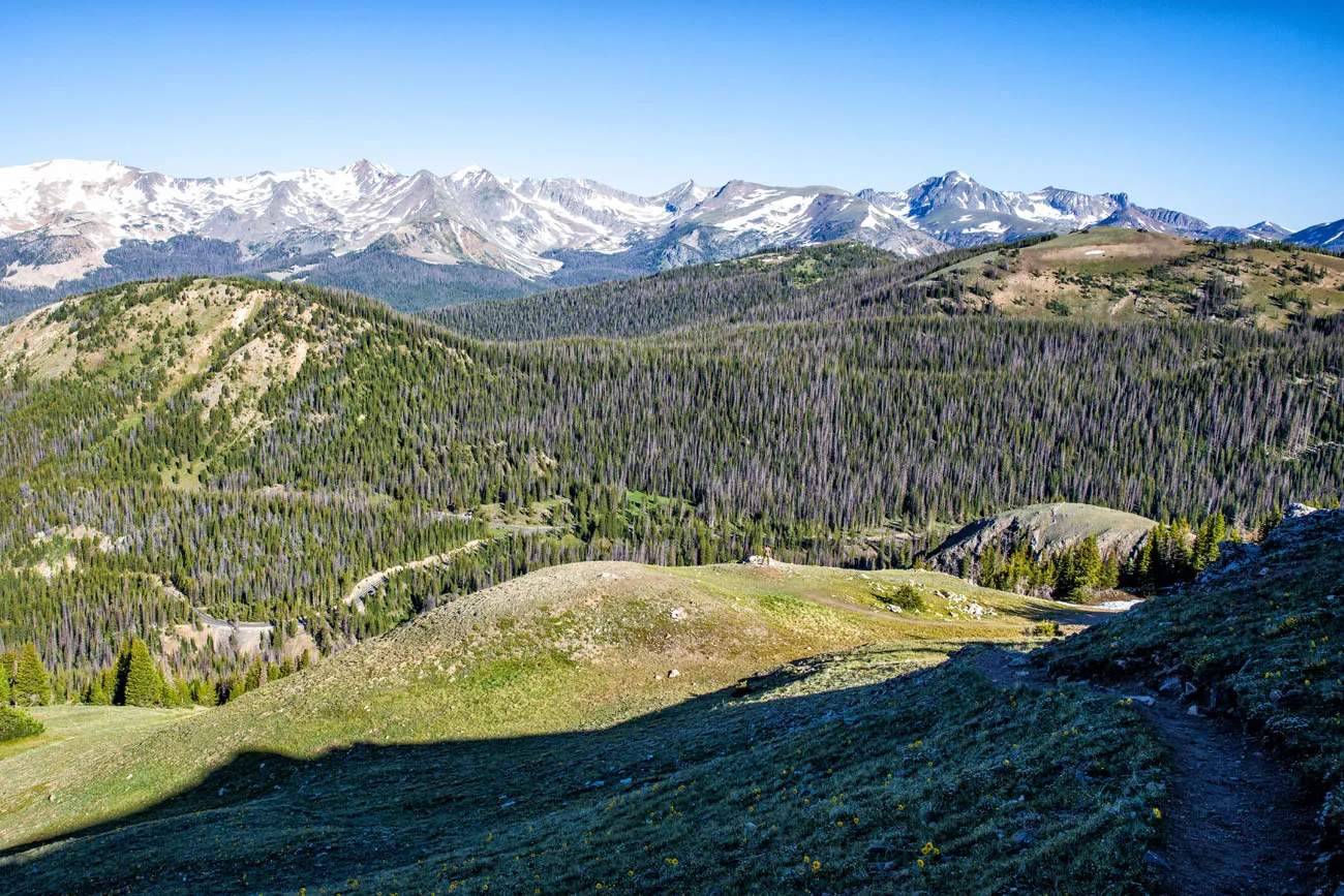
The Never Summer Mountains
Mt Ida is the tallest peak off in the distance.
This photo is taken farther into the hike. Now, you are looking back at the trail and the Never Summer Mountains.
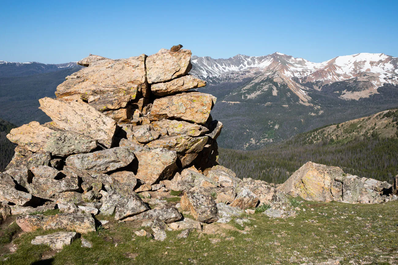
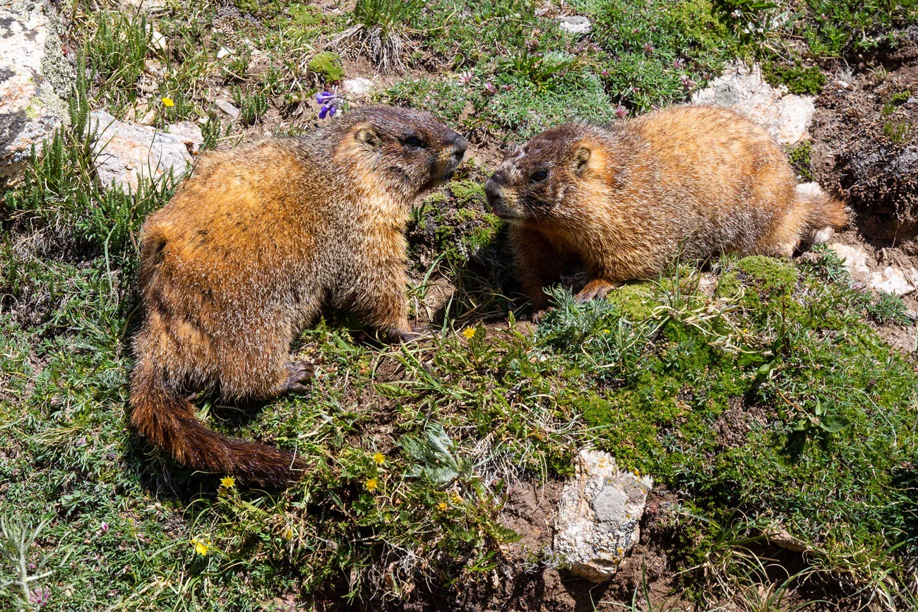
While hiking this trail, it’s possible to see bighorn sheep and elk. We didn’t get so lucky, but there are also quite a few marmots who call this area home.
At this point, you are hiking through subalpine tundra. On the day we did this, the winds were relentless and very strong. We later talked to a park ranger who stated that this is quite normal for this hike.
PRO TRAVEL TIP: Even during the summer months, I recommend packing a hat, gloves, and several layers of clothing. The temperature gauge in our car read 37°F at 7:30 am. With the high winds and the high elevation, we experienced freezing temperatures for most of our hike, on July 1.
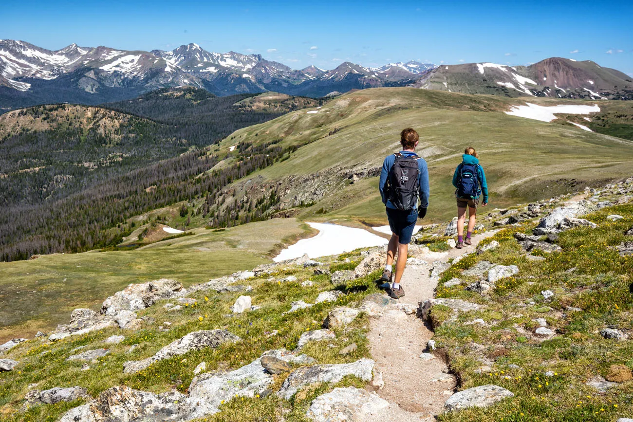
For the most part, it is a steady uphill hike to get to Mt Ida, with a few nice downhill sections.
The hardest part of the hike is the final summit of Mt Ida. This climb starts 3.5 miles into the hike. You will steadily climb up through a field of boulders. There is a faint trail to follow, but you will really have to pay attention, because it is sketchy at times.
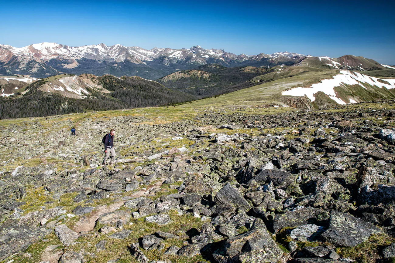
Tim hiking up through the boulder field.
This part of the hike is hard. By this point, you have already been hiking for several hours, battling the wind and the altitude, so you will feel fatigued at this point. Take your time and stop to take a break when you need it.
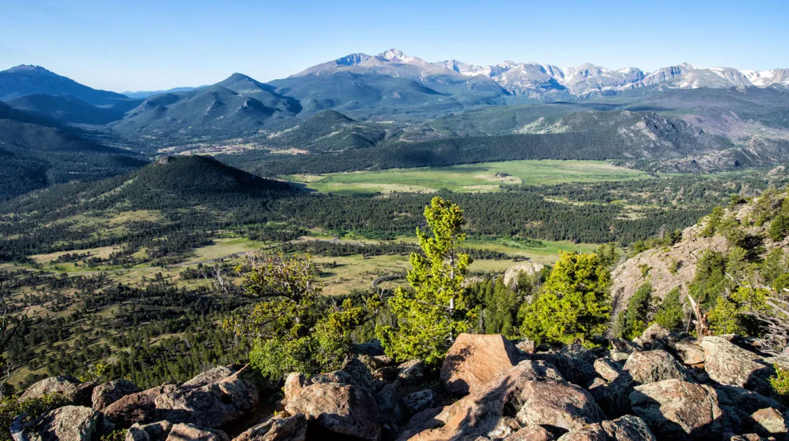
But once up on top of Mt Ida, all of your effort pays off. The views are astonishing and this was one of my favorite views after six days of hiking in Rocky Mountain National Park.
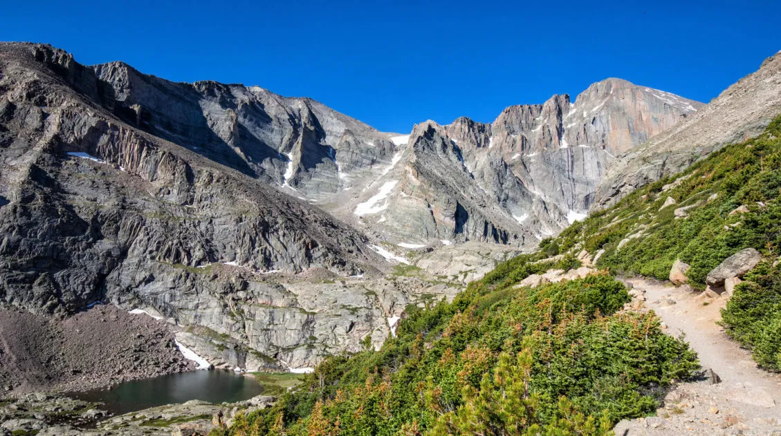
From the top of Mt Ida, you have 360° views of RMNP. To the west are the Never Summer mountains. To the north is the Mummy mountain range and Trail Ridge Road. To the southeast you can see Longs Peak. To the southwest is Grand Lake. And just below Mt Ida is Inkwell Lake and Azure Lake.
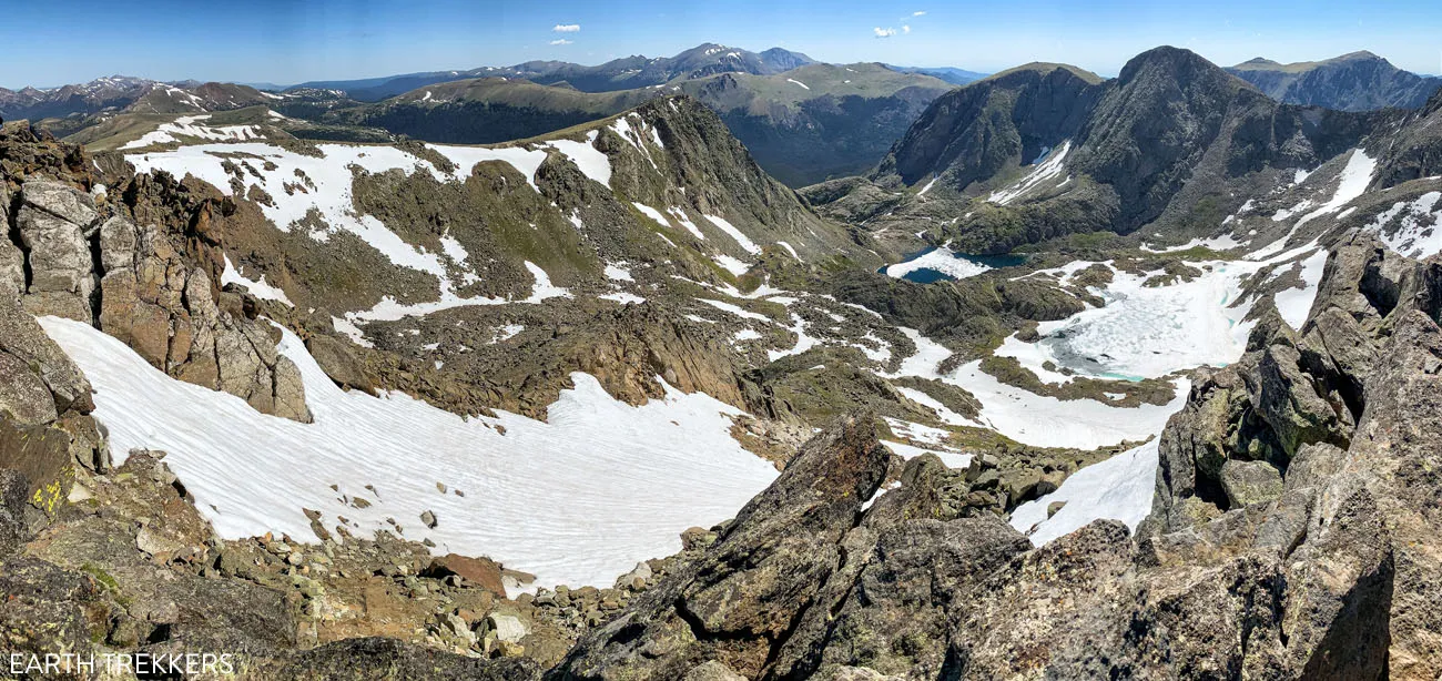
Panorama from the summit of Mt Ida.
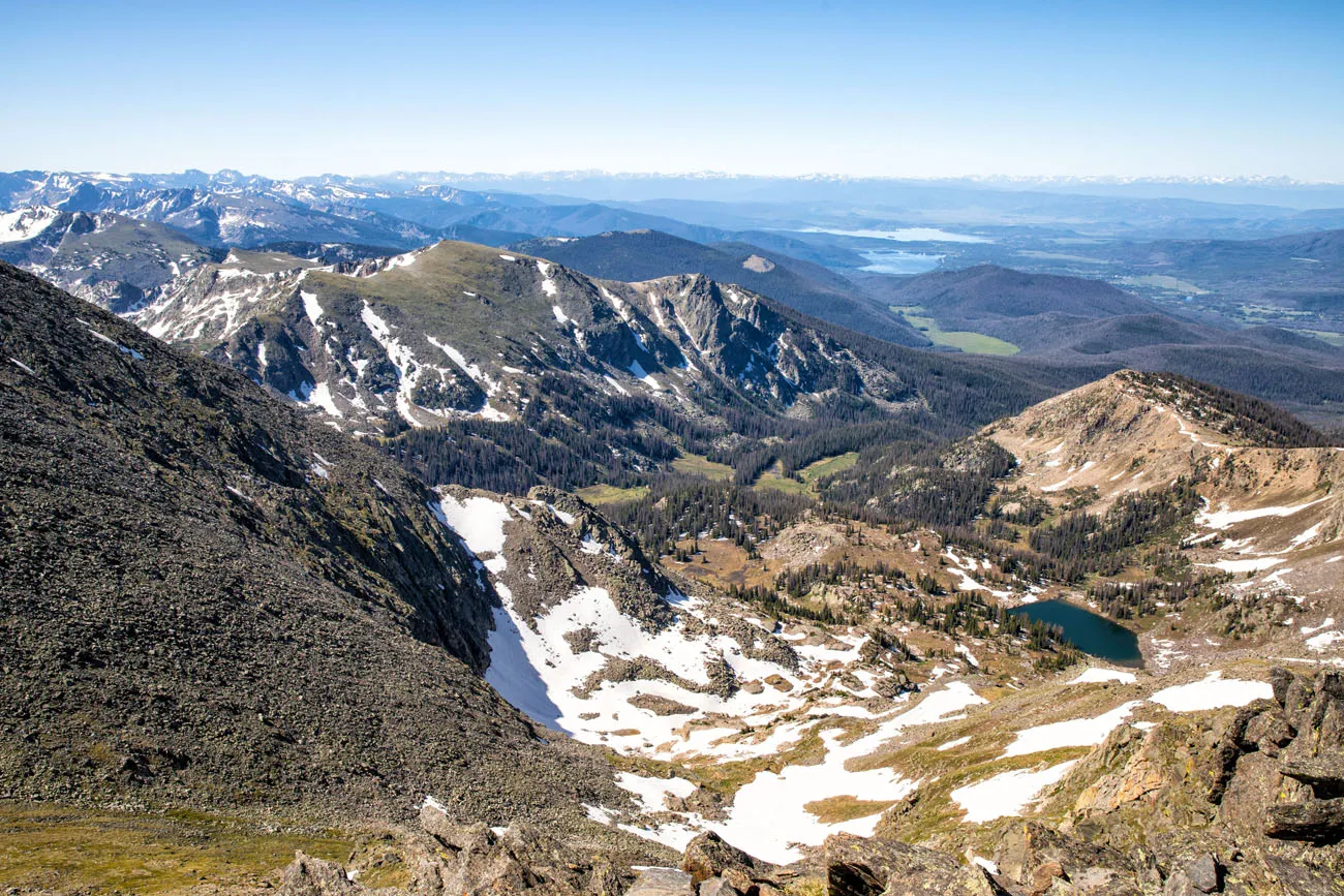
The view south from Mt Ida.
Trail Ridge Road runs along the peaks off in the distance.
On the day we did this, miraculously, there was very little wind on top of Mt Ida. We took our photos, ate an early lunch, and watched the marmots scurrying around the rocks (don’t feed the wildlife…this is part of the seven principles of Leave No Trace).
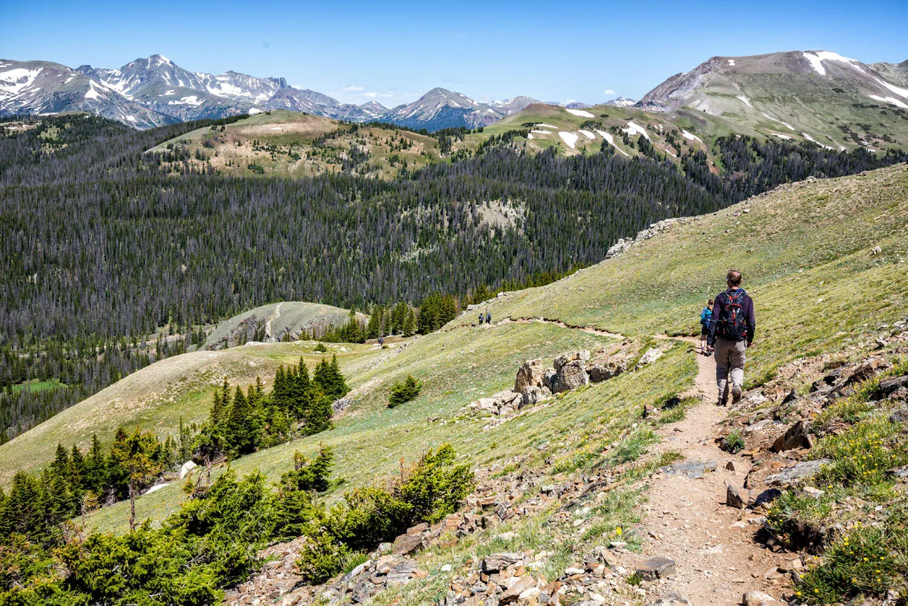
To get back to your car, retrace your steps. It’s a mostly downhill walk back to the trailhead, but the few short uphill climbs along the way add up to about 475 feet of elevation gain on the return hike.
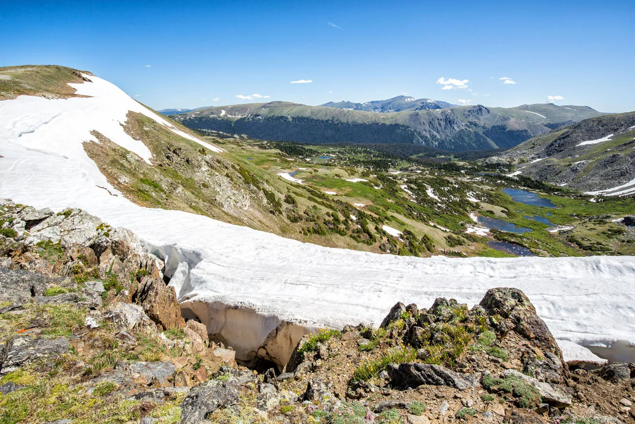
One of the great things about this hike are the incredible views. I think that the views are better on the walk back to Milner Pass than on the way to Mt Ida. Some out-and-back hikes can be boring on the way back, repeating the same views, but not this one. Plus, now that it is mostly downhill walk, it is easier to enjoy those spectacular views.
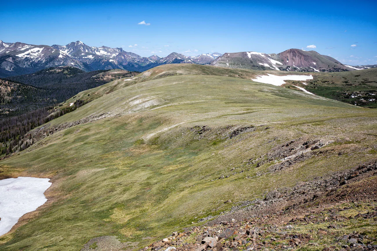
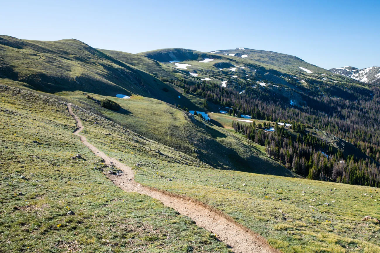
If you look closely, you can see the trail heading across the plateau.
Tips to Have the Best Experience
Start the hike early, ideally by 7 am. During the summer months, afternoon thunderstorms are common, typically occurring at 2 pm. You need to be below the tree line by 2 pm.
Do not expect your cell phone to work. During most of this hike we had no cellular service (this also goes for the drive along Highway 34). There were a few spots here and there where we got a few bars of LTE or 3G, just enough to send a text message. The best cellular service was on top of Mt Ida. Don’t depend on your phone to call for help, talk to friends, or send photos to friends and family.
Be prepared to turn around early. If weather conditions change and you see approaching thunderstorms, be prepared to end your hike before you reach Mt Ida. Your safety is more important than making it to the lake.
If you are not acclimated to the altitude, this is not a good first hike in Rocky Mountain National Park. The long distance, elevation gain, and altitude make this a tough hike. If you have not already spent time in Colorado adjusting to the altitude, I recommend that you spend at least two days acclimating to the higher elevation.
If you plan to visit Rocky Mountain National Park during the summer months, you will need to reserve a timed entry permit. Learn more here.
Trail updates. As you plan your trip to Rocky Mountain National Park, and just before doing this hike, check the National Park Service website for updates on trail and road closures.
What to Bring on the Hike
Hiking shoes. Don’t do this hike in anything other than hiking shoes or hiking boots.
Hiking poles. Hiking poles take the stress off of your legs and help to ease leg pain and fatigue.
Water and snacks. At least 3 liters of water in the summer.
Sunscreen, hat, and sunglasses. For much of the hike you will be above the trees, in direct sunlight.
Camera. Even a smartphone will do. For great photos of the Never Summer mountains and the views from the top of Mt Ida, use the panorama feature of your smartphone.
Warm clothing. Bring a hat and gloves. A rain jacket or windbreaker is great for this hike. And wear several layers of clothing, even in the summer.
Essential Hiking Gear: What Should You Bring on a Day Hike?
If you are new to hiking or are curious about what you should bring on a hike, check out our Hiking Gear Guide. Find out what we carry in our day packs and what we wear on the trails.If you have any questions about hiking to Mt Ida, let us know in the comment section below. Happy hiking!!
More Information about Colorado
Are you planning a trip through the United States? Read all of our articles about the USA in our United States Travel Guide. You can also see all of our articles about Colorado in our Colorado Travel Guide.
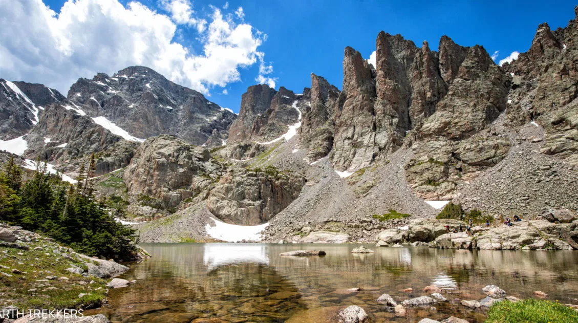
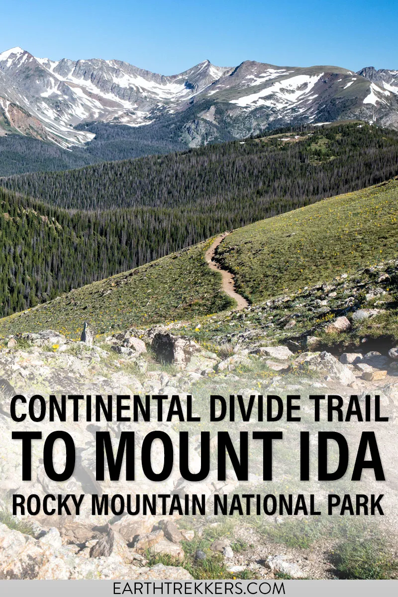
15 Epic Hikes in Rocky Mountain National Park (+ Our Top Picks)
Pinterest Facebook Flipboard Rocky Mountain National Park is best seen from a hiking trail. Fortunately, there are hikes for all ages and ability levels. From short, easy strolls around lakes, to ridgeline trails with panoramic views, to challenging but epic climbs to the tallest mountain peaks, there truly is something here for everyone. Here are […]
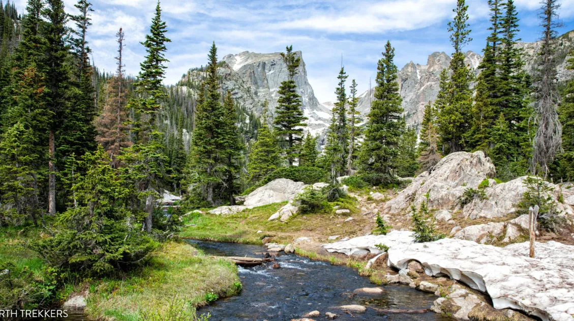
Ultimate Guide to Sky Pond: Trail Stats, Photos & Helpful Tips
Sky Pond is one of the best hikes in Rocky Mountain National Park for good reason. This hike has a little bit of everything…waterfalls, alpine lakes, high mountain views, and fun river and stream crossings. To get to Sky Pond, you will rock scramble up a waterfall, which can be refreshing when the weather is […]
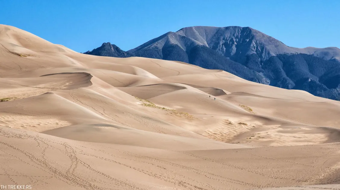
Ultimate Guide to the Colorado National Parks (+ 10 Day Itinerary)
There are four Colorado national parks: Rocky Mountain, Mesa Verde, Black Canyon of the Gunnison, and Great Sand Dunes. The landscapes that these national parks protect are dramatically different from one another. In Rocky Mountain National Park, journey high into the Rocky Mountains, cross the Continental Divide, and hike to gorgeous alpine lakes and waterfalls. […]
The Perfect Rocky Mountain National Park Itinerary (2026)
If you are planning your Rocky Mountain National Park itinerary, this is a great place to start. Rocky Mountain National Park is one of the best US national parks to go hiking. With towering mountain peaks, alpine lakes and waterfalls, and the opportunity to hike aƒlong the Continental Divide, this park offers world-class hiking experiences. […]
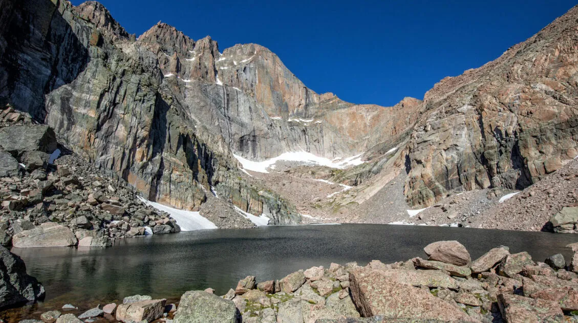
How to Hike Chasm Lake: Photos & Step-By-Step Guide
Chasm Lake is one of the most spectacular lakes in Rocky Mountain National Park. For the first part of the hike, you will walk the same trail as hikers on their way to Longs Peak, the highest point in the park. Once the trail splits, the hike gets a little easier and you are treated […]
Best of Estes Park: Things to Do, Where to Eat & Where to Stay
Estes Park is the gateway into Rocky Mountain National Park. This small town is home to numerous hotels and restaurants, making it the perfect home base for exploring the Rocky Mountains. But if you need a break from exploring the national park, there are a bunch of fun things to do in town. In this […]
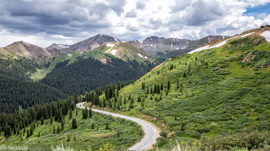
9 Spectacular Scenic Drives in Colorado
Colorado is the perfect road trip destination. The Rocky Mountains, the national parks and state parks, the historic towns, and the diverse landscapes are all linked together by some of the most beautiful drives in the United States. Drive some of the highest roads in the United States and twist and turn through verdant valleys […]
How to Hike Deer Mountain, RMNP (Photos & Trail Stats)
Deer Mountain is one of the easier hikes in Rocky Mountain National Park that offers high mountain views. To get to the peak, it’s an almost constant uphill walk through an evergreen forest. You will get occasional glimpses of Longs Peak early on during the hike, but for the most part, you will have to […]

How to Hike the Ute Trail to Tombstone Ridge, RMNP
The Ute Trail to Tombstone Ridge is a wonderful, short, easy hike to do in Rocky Mountain National Park. For the entire hike, you are walking along the alpine tundra with unobstructed views of Longs Peak and Forest Canyon. If you are looking for an easy hike with spectacular views of Rocky Mountain Park, put […]
Nymph, Dream & Emerald Lake Hike (+ How to Add on Bear Lake & Lake Haiyaha)
The Emerald Lake hike is one of the most popular hikes in Rocky Mountain National Park. On this hike, you get to see three very pretty alpine lakes (Nymph Lake, Dream Lake, and Emerald Lake), with the option to add on Bear Lake and Lake Haiyaha. This is a great hike for almost all ages […]
20 Epic Hikes in the US National Parks
With 63 national parks and thousands of miles of hiking trails, your options are endless for exploring the American national parks. We narrowed down the list for you to 20 of the best hikes in the US national parks, 20 amazing ways to explore this beautiful country. Hike to the tallest peaks, through massive canyons, […]
Best US National Parks to Visit Month-By-Month
Best National Parks to Visit Month-By-Month Most national park planning advice tells you the “best” month to visit a park without showing you the full picture. This guide does both. We’ve visited 56 of the 63 US national parks, many of them multiple times and in different seasons, and timing is consistently one of the […]
The Ultimate Guide to the 63 US National Parks
Stretching from the South Pacific, across the United States to the Caribbean, are 63 national parks. These national treasures preserve iconic landscapes, majestic mountains, primordial forests, arid deserts, misty coastlines, immense canyons, wildlife, and historic landmarks. We have visited 56 of the 63 US national parks, from the towering granite walls of Yosemite and the […]

Comments 4