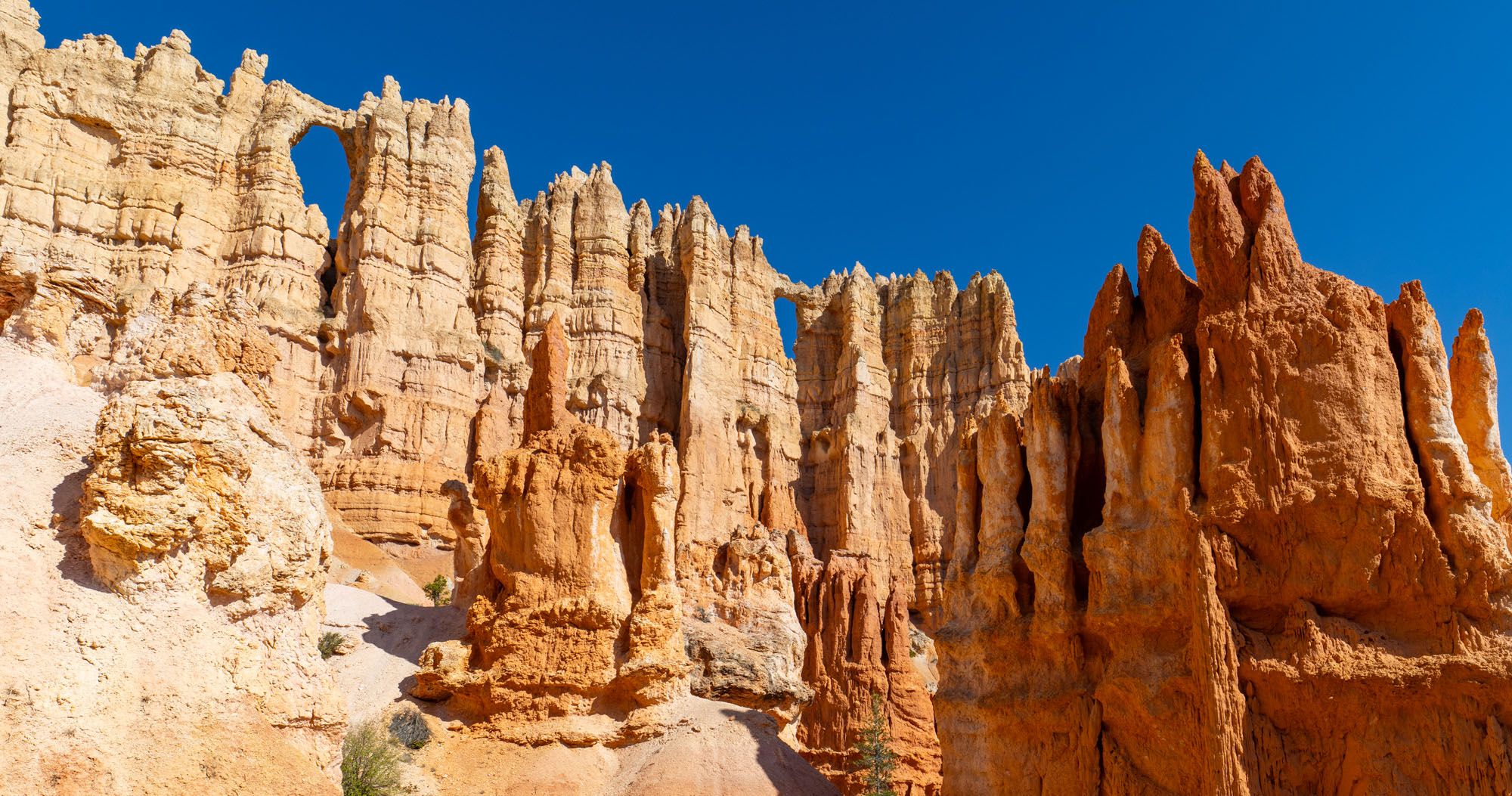

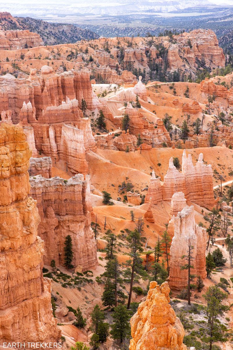
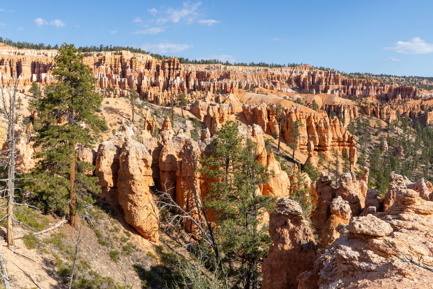
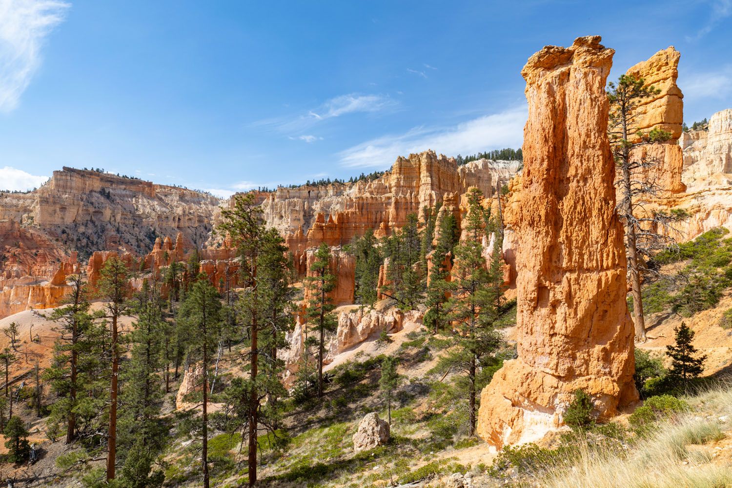
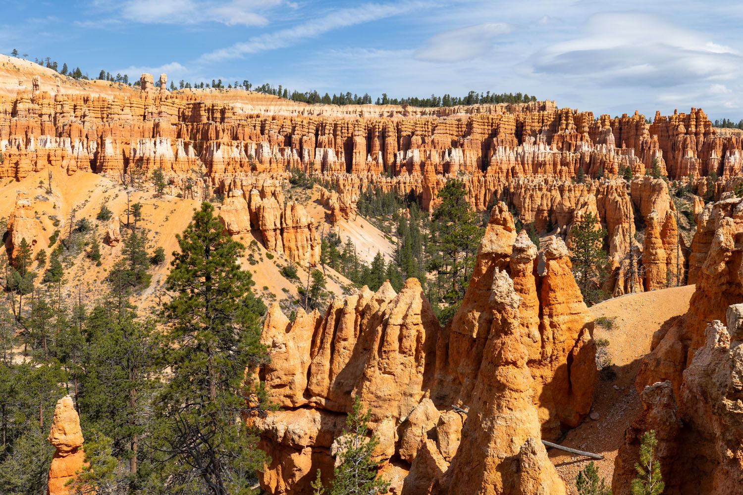
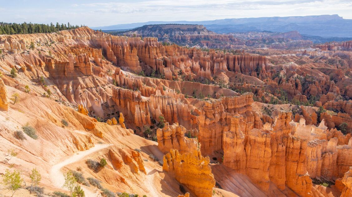
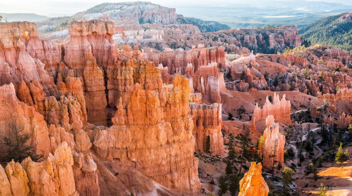
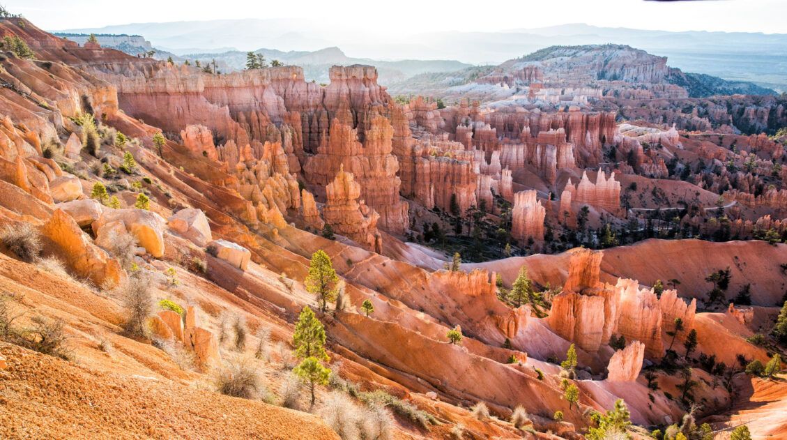
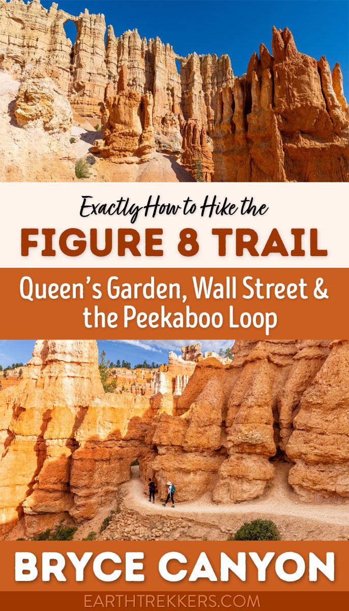
The Figure 8 Trail combines three popular trails together into a single hike. This includes the Queen’s Garden Trail, the Peekaboo Loop Trail, and the Navajo Loop Trail. All of these trails take you through the amphitheater at Bryce Canyon National Park, where you will be surrounded by hoodoos and sandstone rock formations.
This trail is ideal for visitors seeking a more challenging experience than just the Queen’s Garden and Navajo Loop Trails, or for those wanting to spend more time enjoying the breathtaking views and vibrant colors of the amphitheater.
I’ve visited Bryce Canyon National Park multiple times and still can’t believe I waited so long to hike the Figure 8 Trail. On a previous trip, I also hiked the Queen’s Garden and Navajo Loop Trails. This was a great chance to hike those again, with the added bonus of including the Peekaboo Loop.
In this guide, I will walk you through what you need to know to hike The Figure 8 Trail, so you have the best experience. But in short, if you like the idea of hiking around hoodoos, sandstone rock formations, and through short tunnels, and if you like being challenged by switchbacks and steep ascents, then this trail is for you!
Advantages of the Figure 8 Trail
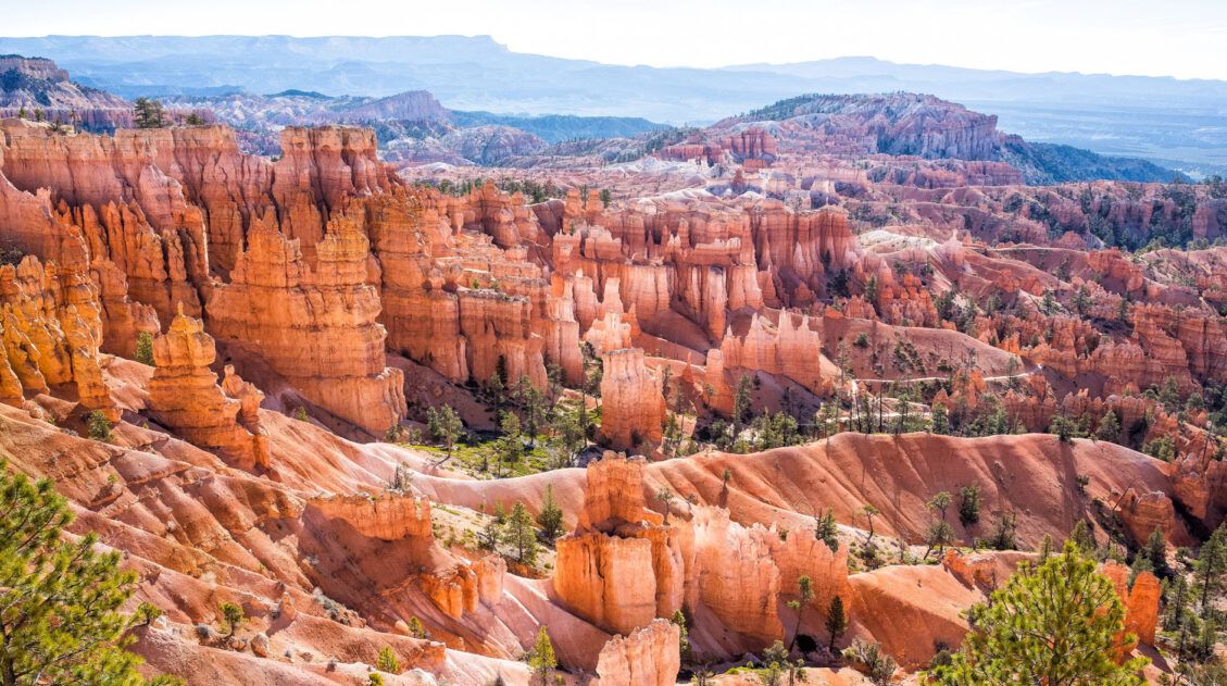
The main advantage of hiking the Figure 8 Trail instead of the shorter Queen’s Garden and Navajo Loop Trails is that you spend more time in the amphitheater, surrounded by hoodoos and rock formations.
The Figure 8 Trail provides advantages over hiking the Queen’s Garden, Navajo Loop, and Peekaboo Loop Trails separately. Combining them into one hike means you only descend into and ascend out of the amphitheater once. Additionally, you avoid the challenge of finding parking at Bryce Point Overlook, where the Peekaboo Loop trailhead is located when done separately, since the lot is small and often crowded.
Figure 8 Trail Hiking Stats
Distance: 6.1 miles (9.8 km) Loop
Difficulty: Moderate to difficult
Total Ascent: 1,550 feet (472 meters)
Lowest Elevation: 7,400 feet (2,256 meters)
Highest Elevation: 8,000 feet (2,438 meters)
Time: 3 to 4 hours
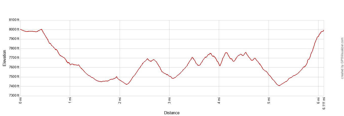
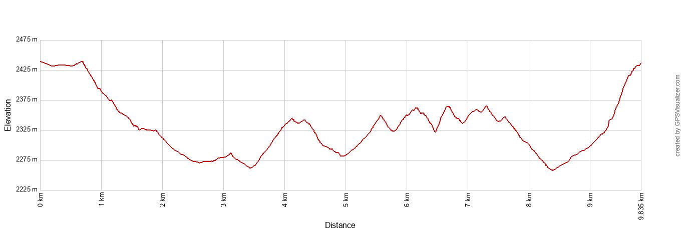
The elevation profiles show the hike in the following order: The Rim Trail from Sunset Point to Sunrise Point, the Queen’s Garden Trail, the Peekaboo Loop Trail in the clockwise direction, and the Wall Street portion of the Navajo Loop Trail to Sunset Point.
Map of the Figure 8 Trail
The map below shows the complete Figure 8 Trail.
The route starts at Sunset Point, takes the Rim Trail to Sunrise Point, then continues on the Queen’s Garden Trail, followed by the Peekaboo Loop in a clockwise direction. To return to Sunset Point, take either Wall Street or the Two Bridges Trail, which are both part of the Navajo Loop Trail.
How to Use This Map: Click the icons on the map to get more information about each point of interest. To take this map with you, click the star next to the title of the map which adds it to your Google account. Next, within your Google Maps app, select ‘Saved’ and then select ‘Maps’. This map title will now appear in your list.
Where is the Best Place to Park?
The best place to park for this hike is at Sunset Point. This parking area is located at the end of Sunset Point Road and is labeled as “Bryce Canyon National Park Sunset Point” on Google Maps.
It is best to arrive early to ensure you get a parking spot at Sunset Point.
If you cannot find parking at Sunset Point, then try along the southern portion of Sunrise Point Road (south of the North Campground General Store). There is a trail off of that road, labeled as “Rim Trail Sunrise Point Trailhead” on Google Maps, that will connect you to the Rim Trail. Turn right on the Rim Trail to reach Sunrise Point and the start of the Queen’s Garden Trail. Doing this will add about 0.5 miles (0.8 km) to the round-trip hike.
If you have to park elsewhere within the park, such as at the Visitor Center, then the national park does operate a shuttle service. This service typically runs between April and October, but check the National Park website for complete details of the schedule and route.
Please practice the seven principles of Leave No Trace: plan ahead, stay on the trail, pack out what you bring to the hiking trail, leave areas as you found them, minimize campfire impacts, be considerate of other hikers, and do not approach or feed wildlife.
Figure 8 Trail: Step-By-Step Trail Guide
Since the Figure 8 Trail is essentially combining several trails together, there are multiple ways to go about this hike.
This trail guide is written in the order we recommend hiking the Figure 8 Trail.
Start at Sunset Point and then hike the Rim Trail to Sunrise Point. From Sunrise Point, hike the Queen’s Garden Trail down into the amphitheater, followed by the Peekaboo Loop in the clockwise direction, and then ascend out of the amphitheater on the Navajo Loop Trail.
The trail is well maintained and easy to follow. The trail is also on Google Maps (see our map above) if you want a navigation aid on your mobile device. Just be sure to cache the map before you leave your accommodation, as cellular service isn’t guaranteed.
Rim Trail
Distance & Difficulty: 0.5 miles, easy
From the Sunset Point parking area walk out to the Rim Trail and turn left. Follow the Rim Trail until you reach Sunrise Point. You are only on the Rim Trail for about 0.5 miles (0.8 km). Along the way, be sure to enjoy the beautiful views looking out over the amphitheater filled with hoodoos.
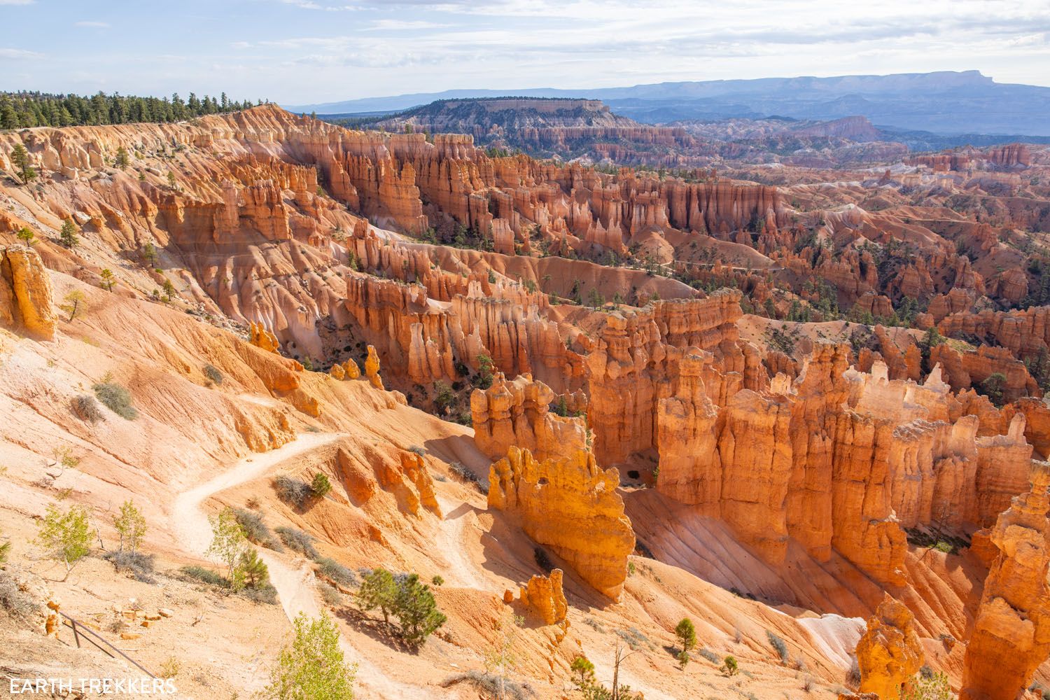
The view from Sunset Point
The view of the Queen’s Garden Trail from the Rim Trail
You will know when you reach Sunrise Point because there’s a small hill with a path to the viewpoint. Next to it is another path leading into the amphitheater, the Queen’s Garden Trail, which is marked by a signpost.
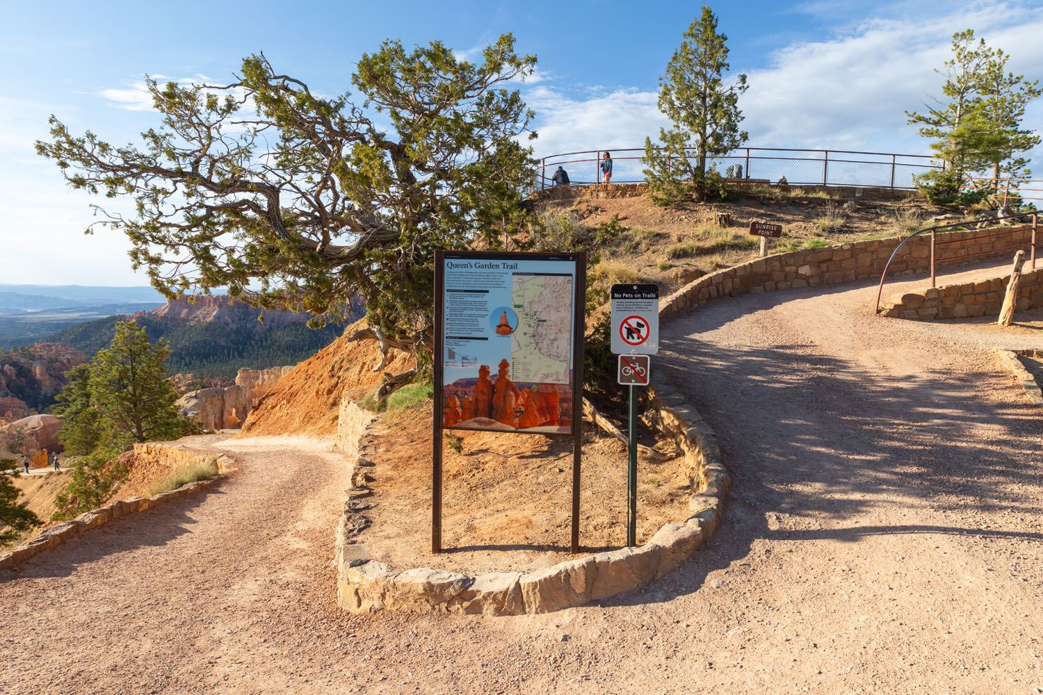
Sunrise Point and the start of the Queen’s Garden Trail
The view of the Queen’s Garden Trail from Sunrise Point
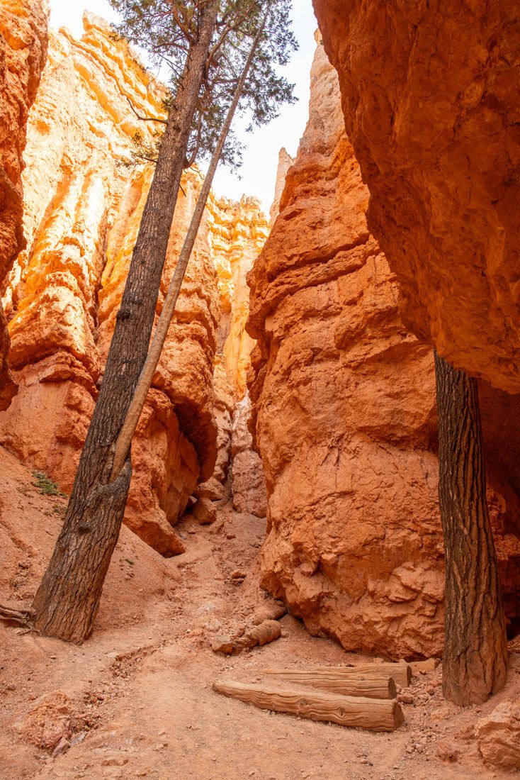
Queen’s Garden Trail
Distance & Difficulty: 1.4 miles, easy
The Queen’s Garden Trail will take you down into the amphitheater and closer to the hoodoos.
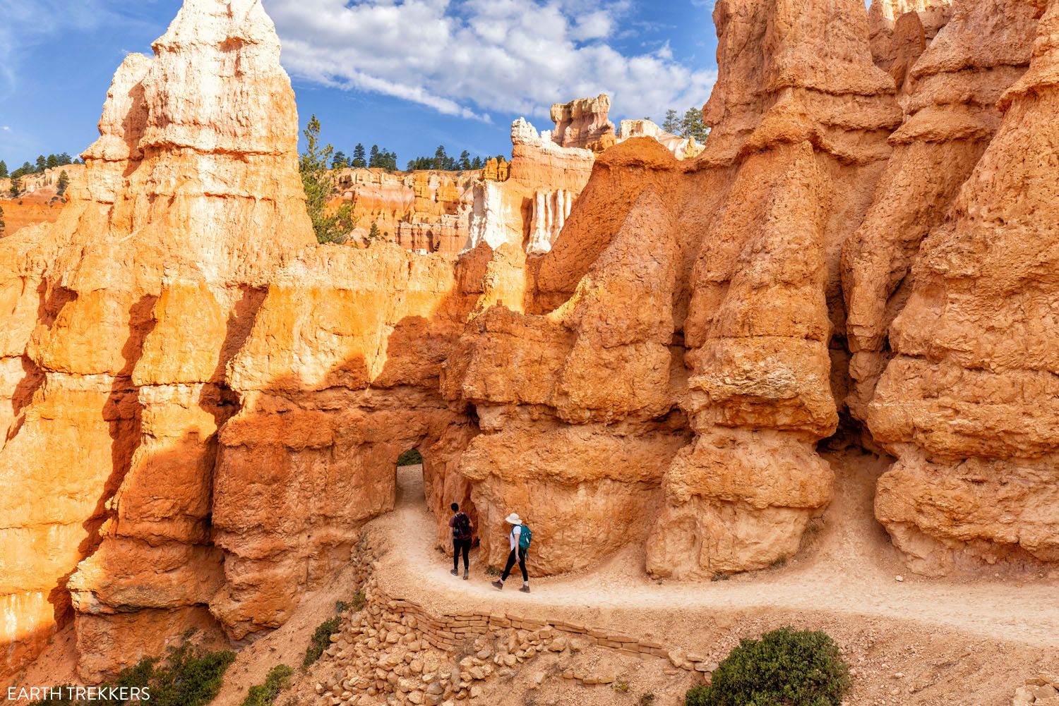
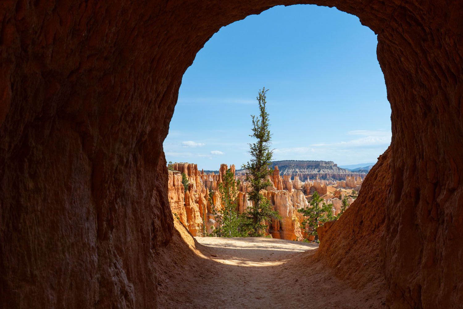
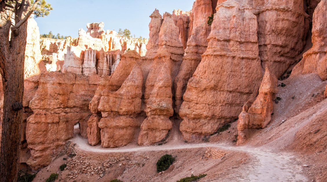
You will pass through three short tunnels carved out of the sandstone rock. These tend to be popular photo spots.
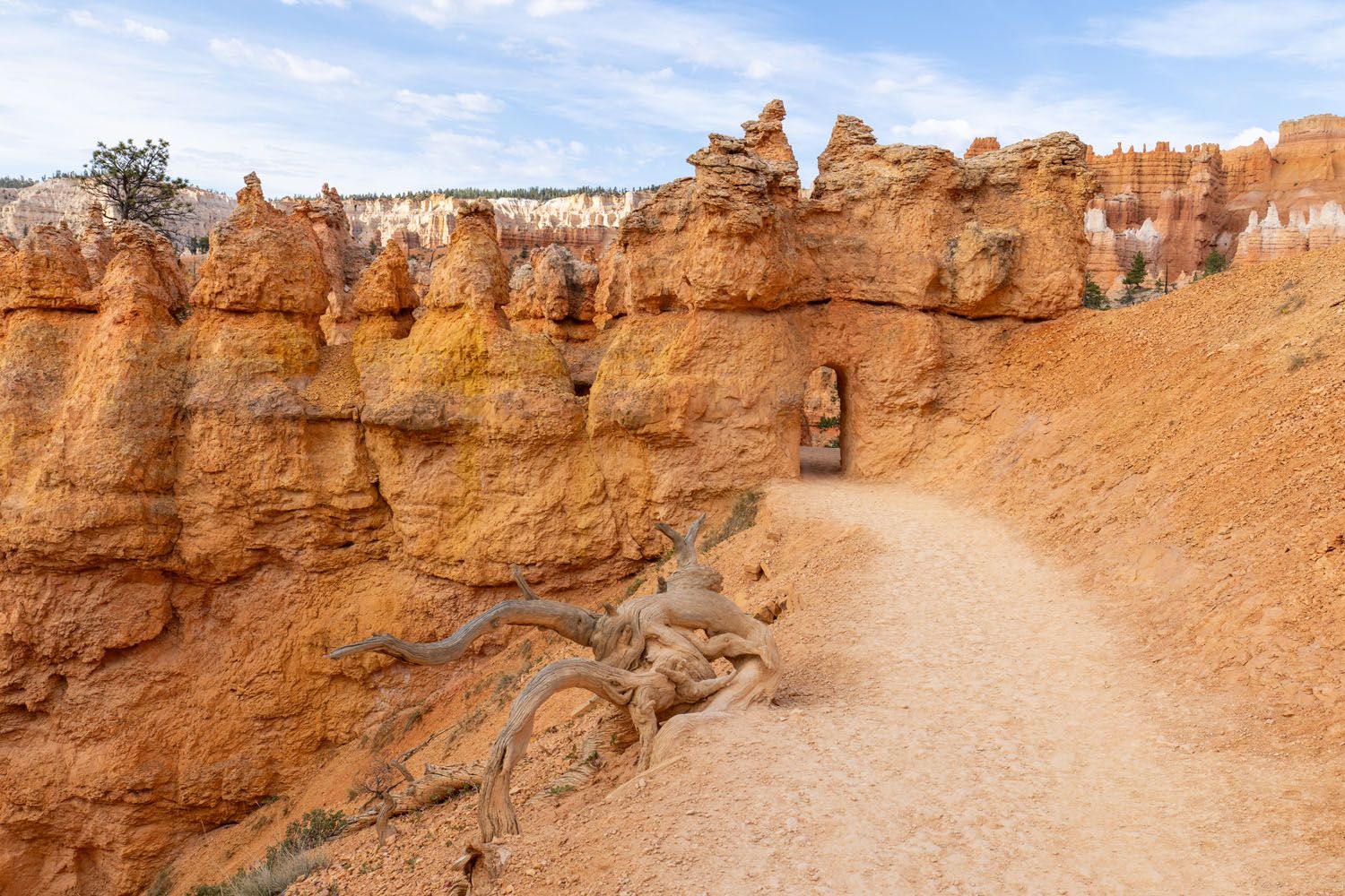
Immediately after the third tunnel there is a spur trail called the Queen Victoria Trail. This is a short out and back detour to see a rock formation described as “Queen Victoria and her court of hoodoos.”
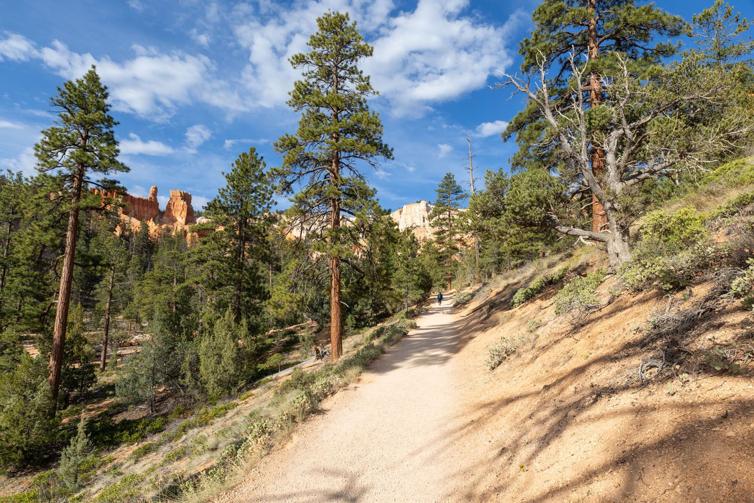
The Queen’s Garden Trail continues downhill and into a sparse pine tree forest. You can still see some of the orange rock formations through the pine trees.

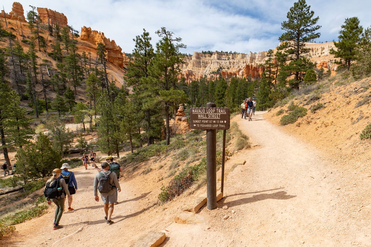
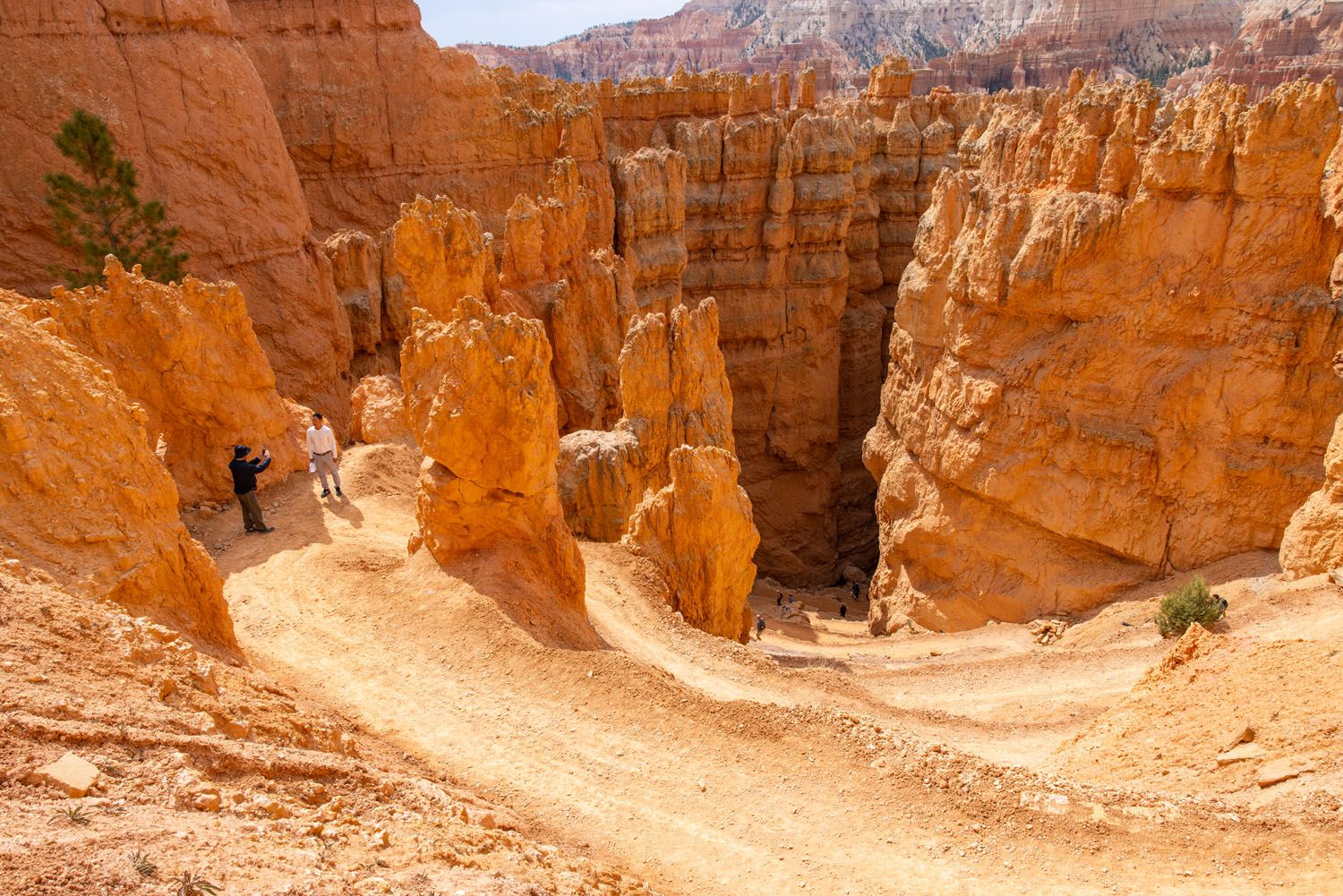
Trail Junction & Peekaboo Connector Trail
Distance & Difficulty: 0.2 miles, easy
The Queen’s Garden Trail ends at a junction. There is a tree here with a bench under it and people tend to gather here to take a break. So, this spot can get crowded, especially from late morning to early afternoon.
There are signs at this junction identifying the other three trails that meet here. One is the Two Bridges/Thor’s Hammer portion of the Navajo Loop Trail, one is the Wall Street portion of the Navajo Loop Trail, and one is the connector trail to the Peekaboo Loop Trail.
When you reach this junction, turn left and follow the connector trail to the Peekaboo Loop Trail.
Important: If for any reason you need to end your hike early, then take one of the Navajo Loop Trails instead. They both ascend to the top of the amphitheater at Sunset Point.
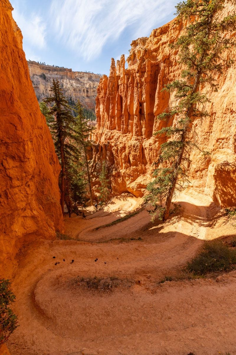
This is a short trail through the pine forest. At the end of the trail, you will reach a crossing trail. Turn right at the crossing trail. A few steps uphill and you will see a trail sign that starts the loop of the Peekaboo Loop Trail.
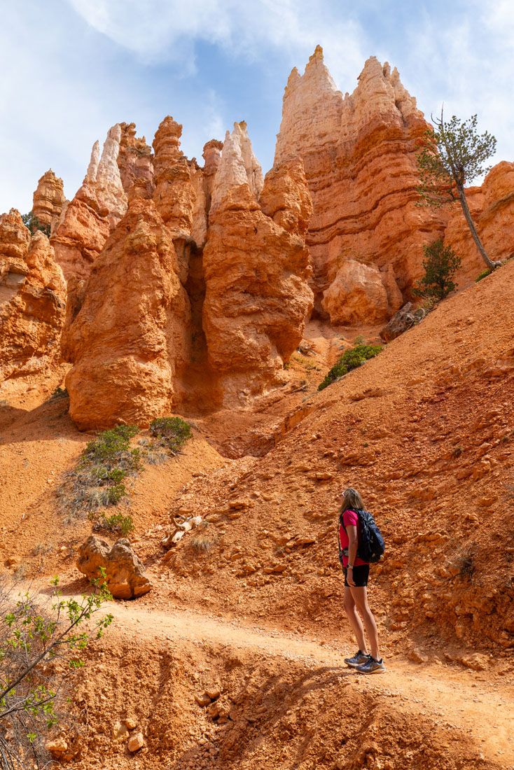
Peekaboo Loop Trail
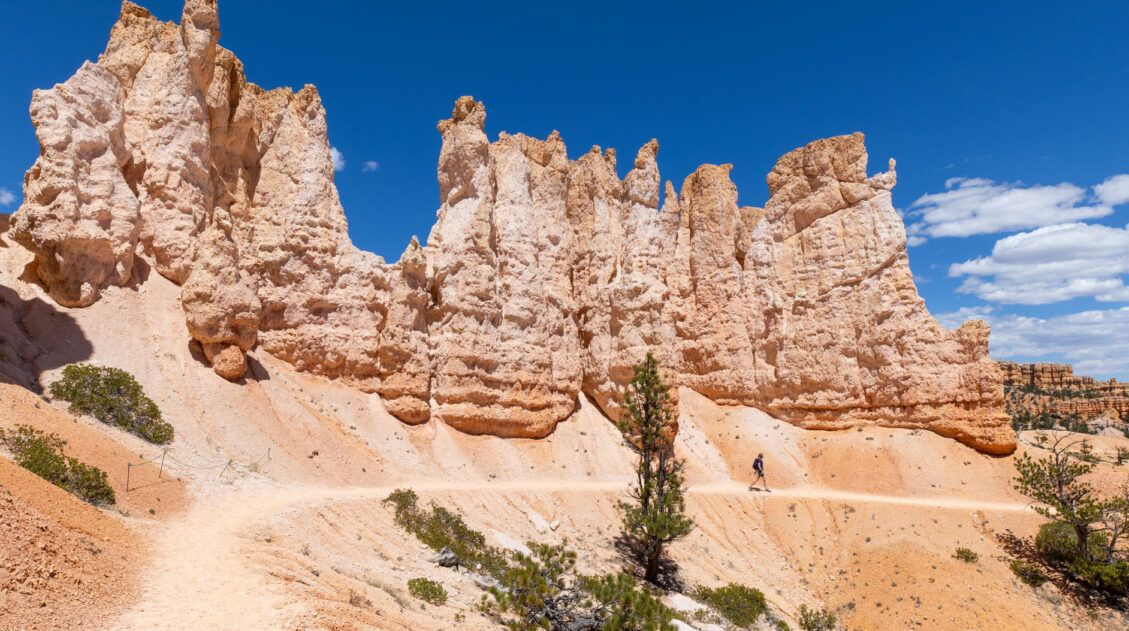
Distance & Difficulty: 3 miles, moderate to strenuous
Now that you are at the Peekaboo Loop Trail, turn left to follow the loop in the clockwise direction or turn right to follow the loop in the counterclockwise direction.
I recommend turning left and going clockwise. That is the direction I went, and this guide has been written to take you through the trail in that direction.
The Peekaboo Loop Trail is about 3 miles (4.8 km) according to the posted signage.
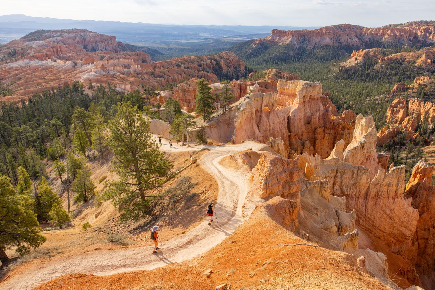
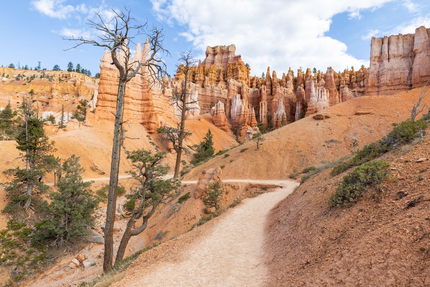
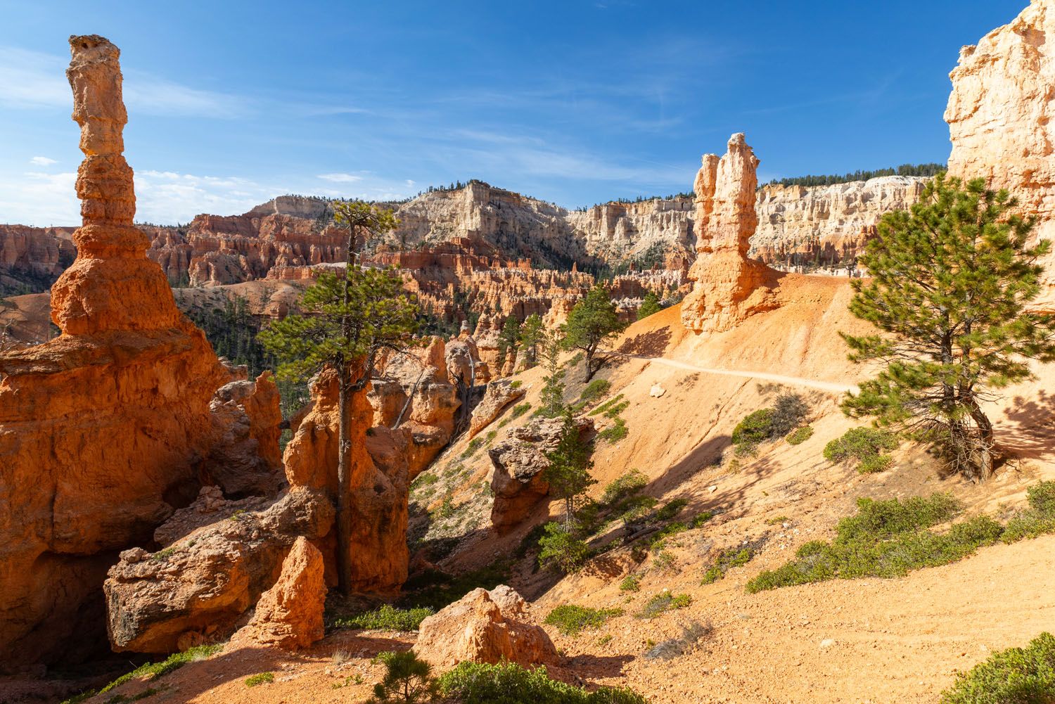
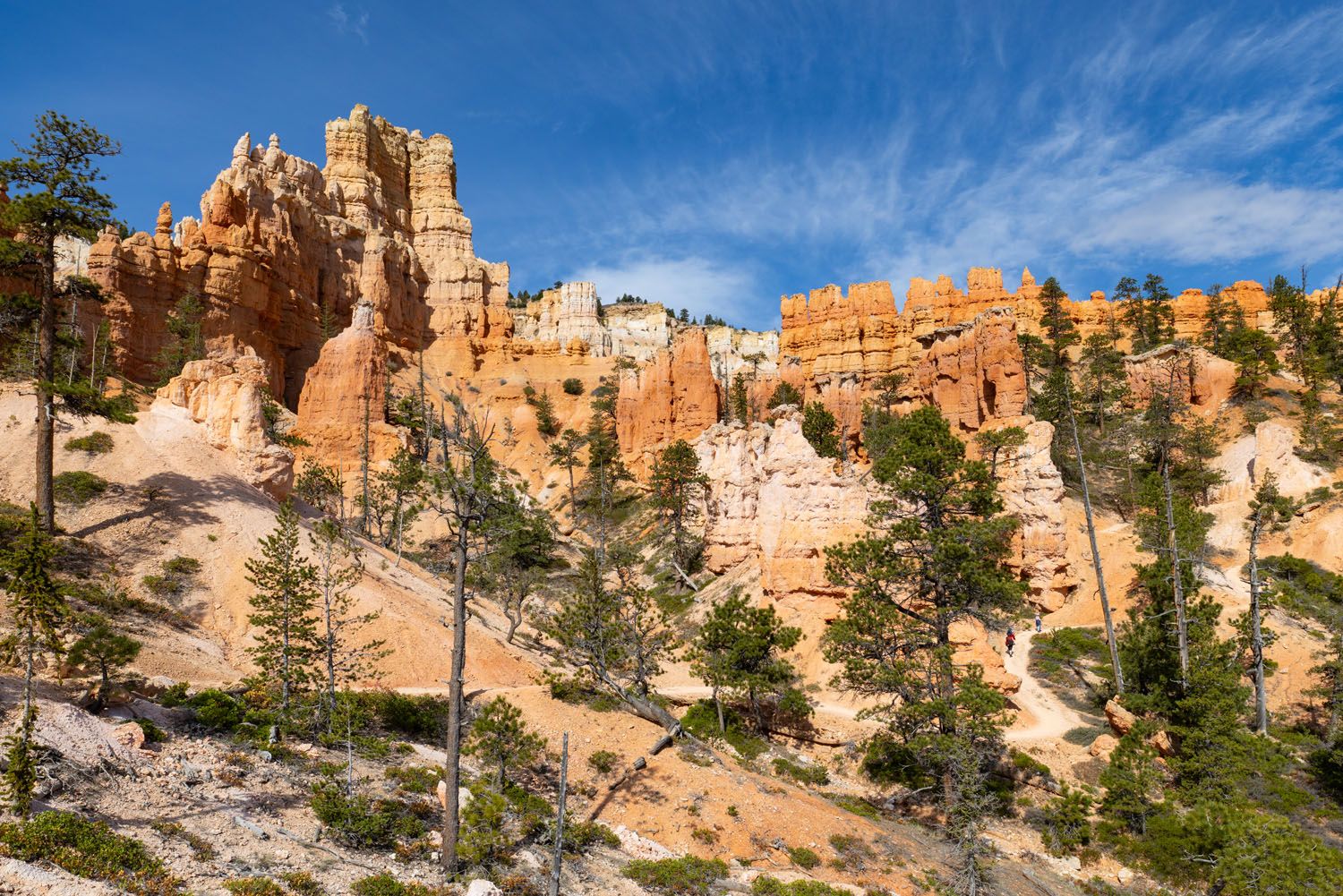
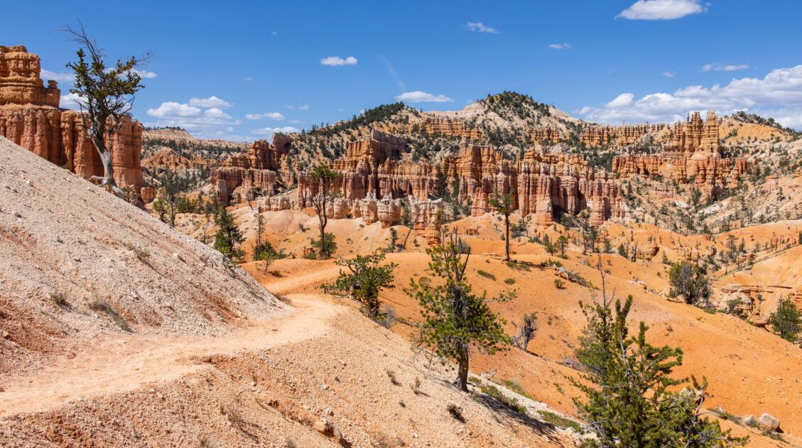
In the clockwise direction, you start off ascending along switchbacks that take you up and out of the pine tree forest. You get high enough that you will have views looking back at the Queen’s Garden area.

Then you will enter an area where you will see various rock formations. The trail is now like rolling hills. You will descend again into a pine forest with orange rock formations and then ascend again with more rock formations.

Next you will reach a trail junction. At this junction you want to stay straight to continue along the Peekaboo Loop Trail.
Important: If, for any reason, you need to end your hike early, then turn left at this junction, as that trail will take you up and out of the amphitheater to Bryce Point. That trail is about 1 mile (1.6 km) and has a lot of elevation gain. There is a shuttle bus stop at Bryce Point when the shuttle service is operating.
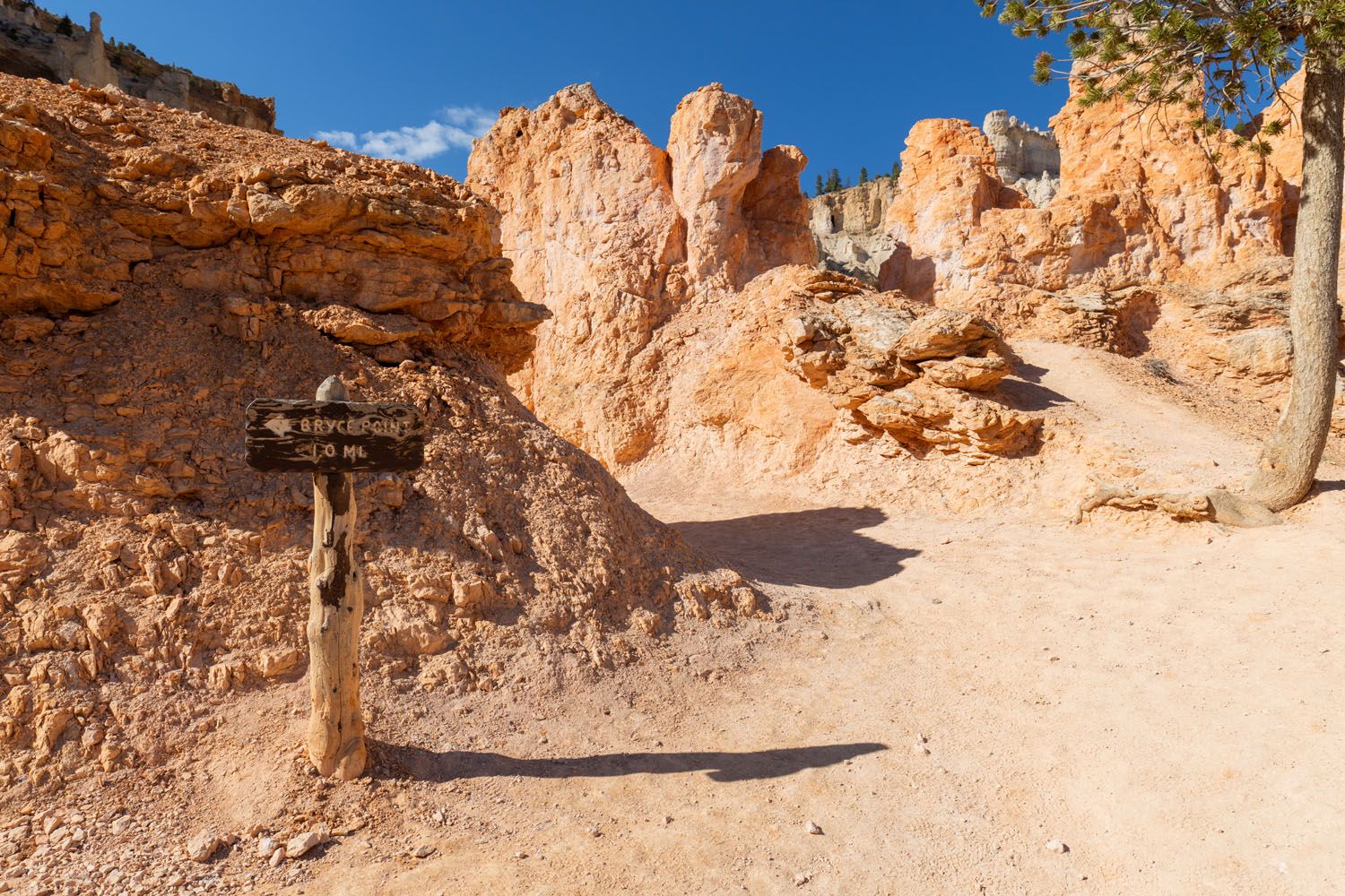
The sign marking the detour up to Bryce Point
After that trail junction, there will be a short descent and then you will see signage for a spur trail that leads to bathrooms.
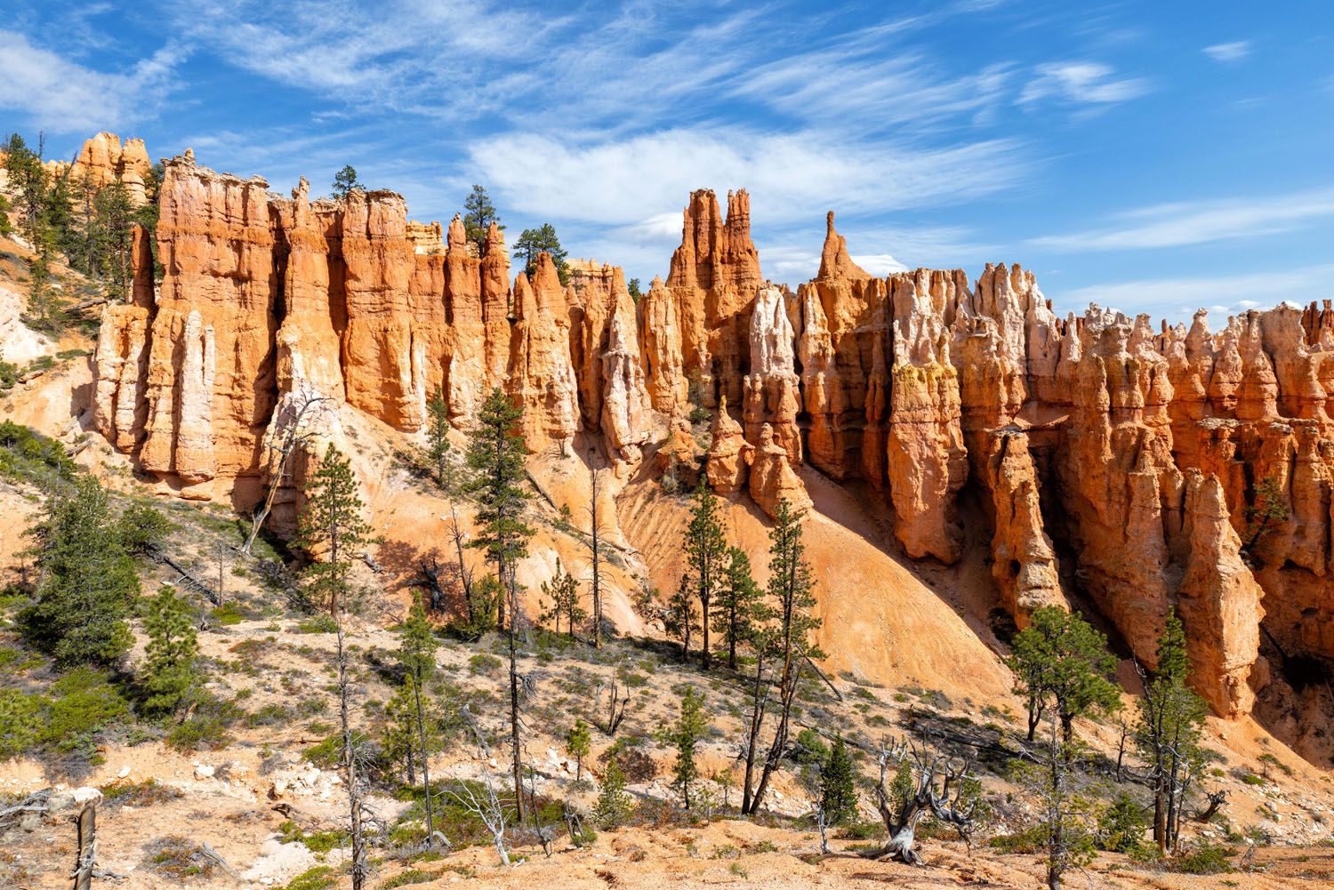
The trail continues as rolling hills. Along the way, I spotted a rock formation called Wall of Windows.
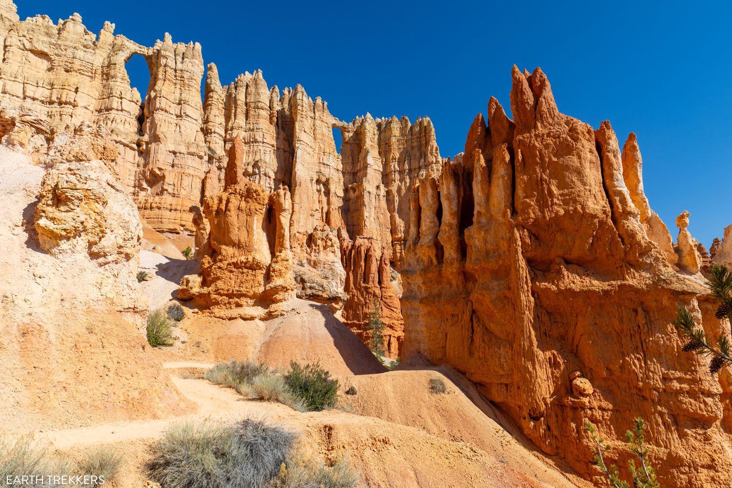
Here are a few more photos from the Peekaboo Loop.
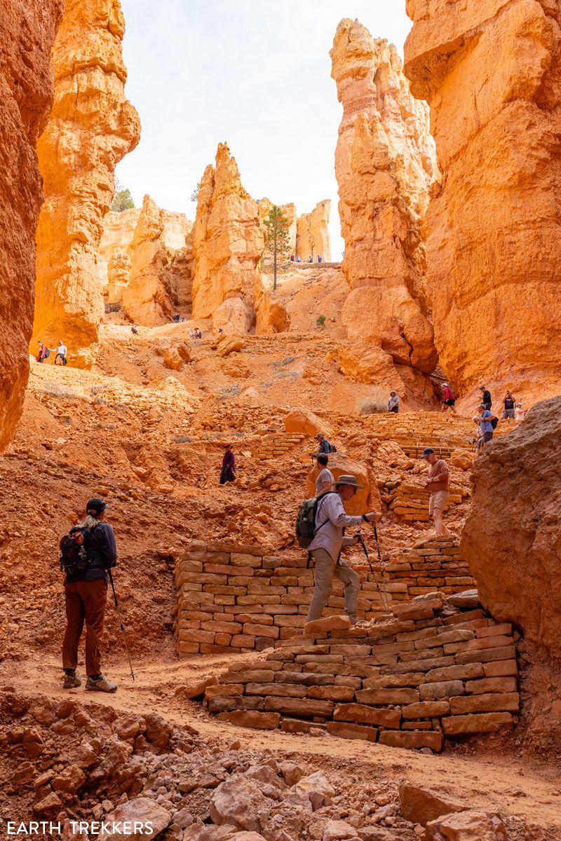
Eventually, you will reach an ascent that consists of a set of switchbacks.
Then you enter a portion of the trail that overlooks the Queen’s Garden area again. Here, there is a descent down to where you first started the Peekaboo Loop Trail.
As you make this descent, look up at Sunset Point (where you started the hike). You will likely see a lot of people standing at that viewpoint.
Peekaboo Connector Trail
Distance & Difficulty: 0.2 miles, easy
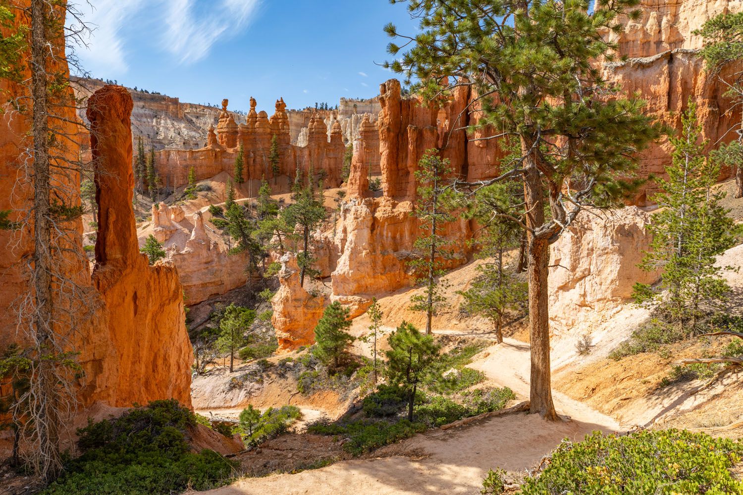
When you return to your starting point on the Peekaboo Loop Trail, walk downhill a few steps and turn left onto the Peekaboo Connector Trail. Since there are no signs here, be sure to pay close attention.
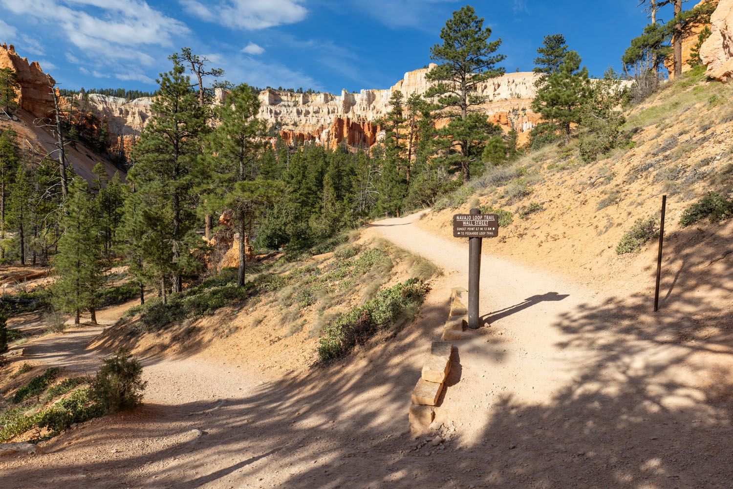
The Peekaboo Connector Trail will take you back to the junction with the Navajo Loop Trails and Queen’s Garden Trail.
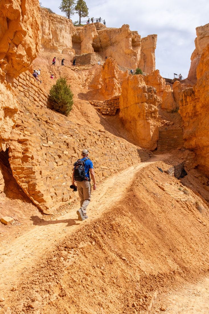
At the trail junction, you have a choice to make. You can either follow the Wall Street portion of the Navajo Loop Trail or the Two Bridges/Thor’s Hammer portion of the Navajo Loop Trail. Both trails follow a set of switchbacks that take you up and out of the amphitheater to Sunset Point. There isn’t any significant difference in their distance or total ascent.
PRO TRAVEL TIP: Wall Street isn’t open all year (it is usually open from mid-May through the middle of fall, depending on when the first snow falls). Hiking it is only possible when the trail doesn’t have ice on it. When it is closed, you have to hike the Two Bridges/Thor’s Hammer portion of Navajo Loop instead.
On the trail to Wall Street
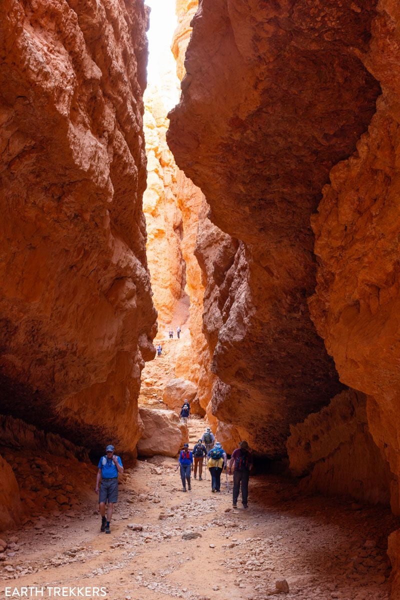
Navajo Loop – Wall Street
Distance & Difficulty: 0.8 miles, strenuous
The Wall Street portion of the Navajo Loop Trail climbs up between towering sandstone rock walls. The advantage here is that these towering walls offer shade, so the ascent out of the amphitheater can be cooler. Of course, walking between the towering walls has a cool factor just in itself.
Navajo Loop – Two Bridges/Thor’s Hammer
Distance & Difficulty: 0.8 miles, strenuous
The Two Bridges/Thor’s Hammer portion of the Navajo Loop starts off in a canyon and then opens up to views of the amphitheater. So, this option is more scenic than the Wall Street option. But with that also comes more sun exposure, so it can get hot making this ascent on a sunny summer afternoon.
Another advantage is that you can get a close-up view of Thor’s Hammer, one of the most photographed hoodoos in the park.
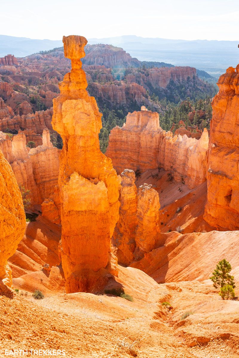
If you hiked up Wall Street then you can still see Thor’s Hammer from Sunset Point. And you can always descend down the Two Bridges/Thor’s Hammer portion of the Navajo Loop Trail a little way to get a closer look at Thor’s Hammer.
Finishing the Hike
Both Wall Street and the Two Bridges Trail end at Sunset Point, which is also the end of the hike. From here, it is a short, flat walk to the parking lot at Sunset Point. Enjoy the spectacular views of the amphitheater one more time before walking back to your car.
What to Bring on the Hike
- Water/Food/Snacks
- Sunscreen
- Hat
- Clothing Layers (Bryce Canyon sits at 8,000 feet elevation, so it can still be chilly in the mornings and late afternoons during the summer)
- Hiking Shoes (in dry conditions sneakers with a good grip are fine)

Essential Hiking Gear: What Should You Bring on a Day Hike?
If you are new to hiking or are curious about what you should bring on a hike, check out our Hiking Gear Guide. Find out what we carry in our day packs and what we wear on the trails.Which is Better: Fairyland Loop or Figure 8 Trail?
We hiked both the Figure 8 Trail and the Fairyland Loop, one day apart.
Of the two hikes, the Figure 8 Trail was my favorite. This hike combines several of Bryce Canyon’s top sights with an unforgettable walk through hoodoos and crazy rock formations. It is a beautiful hike every step of the way. Just be prepared to share this hike with a lot of people, since the Queen’s Garden and Navajo Loop Trails are extremely popular.
The Fairyland Loop has the advantage of much lower crowds. The Peekaboo Trail is a little more scenic in my opinion, but the Fairyland Loop is still amazing. It is one of our favorite hikes in the National Park system, which is saying a lot, because we have done a ton of hikes in the US National Parks.
The Amazing Fairyland Loop: An Underrated Hike in Bryce Canyon
Steo-by-step trail guide for the Fairyland Loop in Bryce Canyon.If you only have one day in Bryce Canyon and want to see its iconic sights, then do the Figure 8 Trail.
The Fairyland Loop is best for those with a second day in the park, or those who prefer a quieter, less crowded trail.
More Hikes in Bryce Canyon
If you or other members in your group are looking for a shorter hike to do, we recommend the Queen’s Garden and Navajo Loop Trail, which is 3 miles long, of moderate difficulty, and takes 2 to 3 hours.
You can see many more great hikes in our guide Best Hikes in Bryce Canyon, which are ranked from easiest to hardest.
Hiking Bryce Canyon: Queen’s Garden and Navajo Loop Trails
Bryce Canyon National Park may be small in size but it has an enormous wow factor. With its orange and pink hoodoos and sandstone rock formations, Bryce Canyon is one of the most unique national parks in the United States. By hiking Bryce Canyon and visiting its numerous viewpoints, you can have the best experience […]
12 Epic Hikes in Bryce Canyon Rated from Easy to Hard
If you ask us, putting one foot in front of the other on a hiking trail is the best way to experience Bryce Canyon National Park. These hiking trails take visitors to jaw-dropping viewpoints and hidden canyons. Hike the short but sweet Rim Trail, descend down into the amphitheater on the Queen’s Garden Trail, or […]
If you have any questions about how to hike the Figure 8 Trail, let us know in the comment section below.
Plan Your Trip to Bryce Canyon
Below are more of our guides on Bryce Canyon National Park, plus more great hikes and nearby places to visit.
Bryce Canyon National Park Travel Guide
Bryce Canyon National Park Bryce Canyon is a small national park with a huge wow factor. The moment you step up to the rim and gaze across the hundreds of hoodoos, spires, and rock formations, it will take your breath away. Bryce Canyon National Park is a fantasyland of hoodoos, sandstone pillars, and bizarre looking […]
Best of Bryce: 8 Amazing Things to Do in Bryce Canyon
Bryce Canyon is the smallest national park in Utah. Despite its small size, there is still a lot to do here. Walk the Rim Trail, gaze across the amphitheater from numerous overlooks, go on a scenic drive, and journey below the rim to venture into a sea of hoodoos…these all top the list of things […]
One Perfect Day in Bryce Canyon National Park
Bryce Canyon National Park…a fantasyland of hoodoos, bizarre rock formations, and sandstone pillars. This is a crazy beautiful place, and its unique landscape sets it apart from other national parks. Although Bryce may not have the same sweeping, expansive vistas as the Grand Canyon, it’s still a breathtaking experience the first time you see this […]
20 Fun, Short Hikes in the US National Parks
One of the best ways to experience the national parks is from a hiking trail. Hike to amazing viewpoints, deep into the forests, through scenic canyons, and to hidden lakes and waterfalls. Along the way, you have a better chance of spotting wildlife and potentially leaving the crowds behind. Here are 20 fun, short hikes […]
12 Best US National Parks to Visit in November 2026
Planning a trip to the US national parks in November and don’t know which ones to visit? The cooler weather in November makes this one of the best times of the year to visit the parks across the southern part of the USA. Road trip through Utah’s Mighty 5, go sledding on sand as white […]
Utah’s Mighty 5: How to Plan the Perfect Road Trip Itinerary
Stretching across southern and central Utah are five stunning national parks. Called the Mighty 5, these parks contain some of the most thrilling hiking trails and iconic landscapes in the United States. Stand atop Angels Landing in Zion. Gaze across a wonderland of hoodoos at Bryce Canyon. Explore the Water Pocket Fold at Capitol Reef. […]
10 Days in the American Southwest: The Ultimate Road Trip
The American southwest is one of the USA’s best road trip destinations. It’s unbelievable how much there is to see and do here. There are the breathtaking vistas of the Grand Canyon, thrilling hiking trails in Zion National Park, and millions of hoodoos to photograph in Bryce Canyon. Are you getting excited yet? The list […]
Best Hikes in Zion: 15 Trails from Beginner to Advanced
Zion National Park is one of the best places in the United States to go hiking. From the awe-inspiring hike up Angels Landing to the family-friendly Riverside Walk to multi-day backpacking adventures, there is something here for everyone. In this guide, we cover the best hikes in Zion National Park, from popular trails to hidden gems. […]
10 Amazing Slot Canyons to Explore in the American Southwest
The American Southwest is a playground for hikers, photographers, and adventurers. Fun to explore and extremely photogenic, slot canyons provide a unique hiking experience. We have assembled a short list of some of the best slot canyons in Utah, Arizona, and Nevada. This is not an all-inclusive list, because there are tons of slot canyons […]
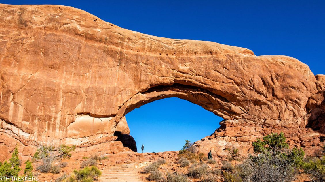
One Perfect Day in Arches National Park (+ Avoid the Crowds)
If you only have one day in Arches National Park, what should you do? Arches National Park is a relatively small national park with a handful of must-see sights. With one day in Arches, you can visit these top sights and a few off-the-beaten-path places. After multiple visits to Arches National Park, we have learned […]
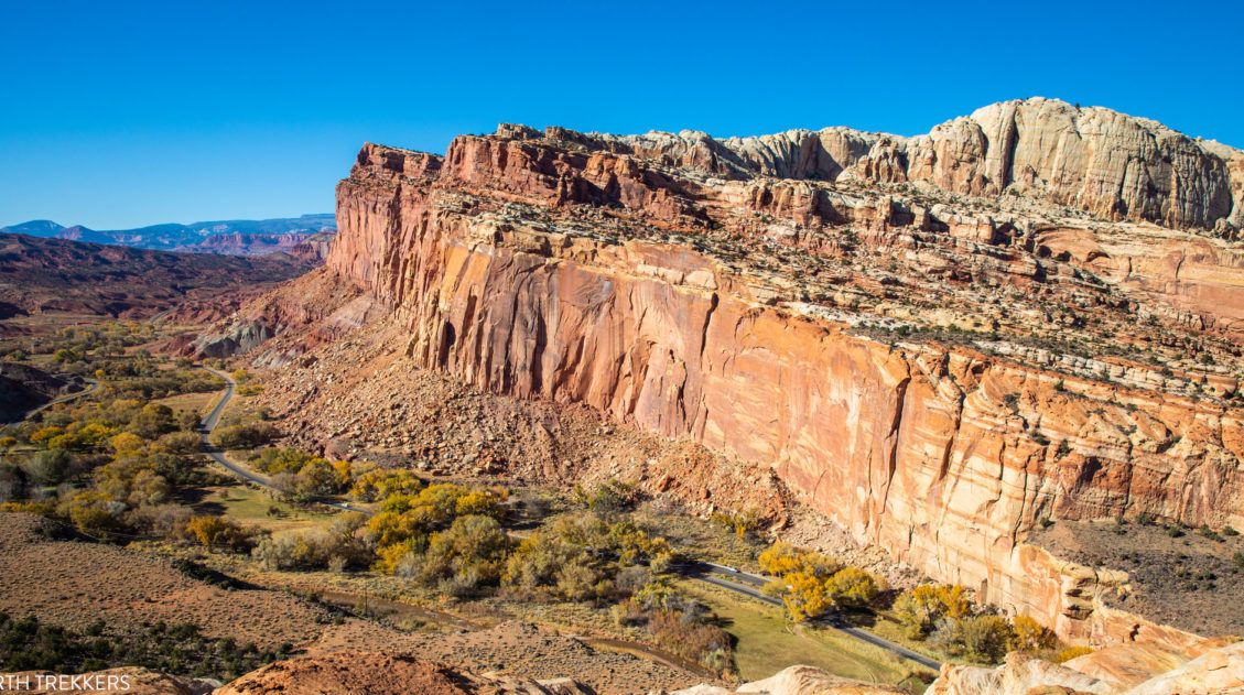
14 Amazing Things to Do in Capitol Reef National Park
Capitol Reef, often an overlooked national park, is full of many wonderful surprises. With two amazing scenic drives, hiking trails that rival those in Zion, rugged, remote areas to explore by 4×4, short, easy slot canyons, historical landmarks, and even delicious pie, this national park is absolutely amazing. In this post, learn about the best […]
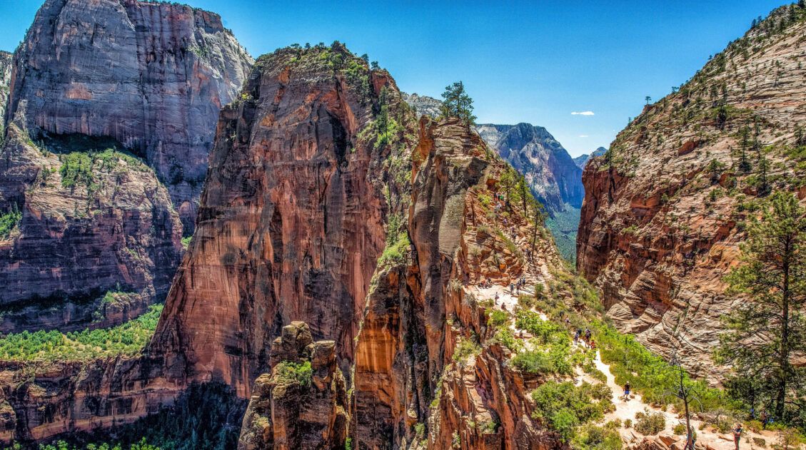
How to Hike Angels Landing: Trail Guide, Permits & Video
Angels Landing is the most popular hike in Zion National Park. This is a 5.4-mile round-trip hike with 1,500 feet of elevation gain, and requires a permit. The Angels Landing hike, along with The Narrows, draws thousands of visitors per year, most of them during the summer months. Why is Angels Landing so popular? This […]
US National Park Itineraries & Road Trip Ideas
National Park Itineraries Need help planning the perfect national park itinerary? Get ideas for your next road trip, including single and multi-day itineraries for the US national parks. Road Trip Itineraries One Day National Park Itineraries If you only have one day, what should you do? Here are detailed one day itineraries for the national […]

The Ultimate Guide to the 63 US National Parks
Stretching from the South Pacific, across the United States to the Caribbean, are 63 national parks. These national treasures preserve iconic landscapes, majestic mountains, primordial forests, arid deserts, misty coastlines, immense canyons, wildlife, and historic landmarks. The opportunities for adventure are endless. Hiking, rock climbing, rafting, mountain biking, sand boarding, horseback riding, mountaineering, canyoneering, and […]
United States Travel Guide: Places to Visit in the USA
Plan your visit to the United States. Learn about the best things to do, how to plan your time, road trip ideas, and sample itineraries.

Leave a Comment