
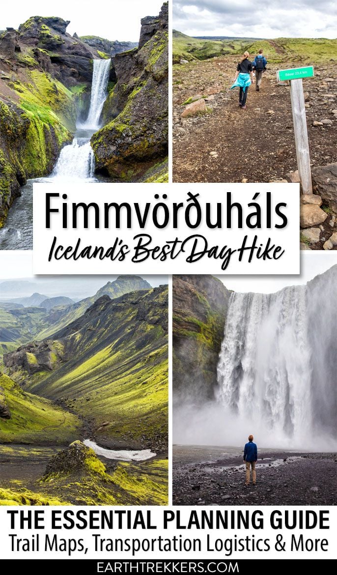
26 waterfalls, 1 volcano, 2 glaciers, and 3 very unique landscapes…this is the Fimmvörðuháls hike in Iceland.
This is one of the best day hikes we have done yet. Never have we seen so much diversity as there is on the Fimmvörðuháls hike.
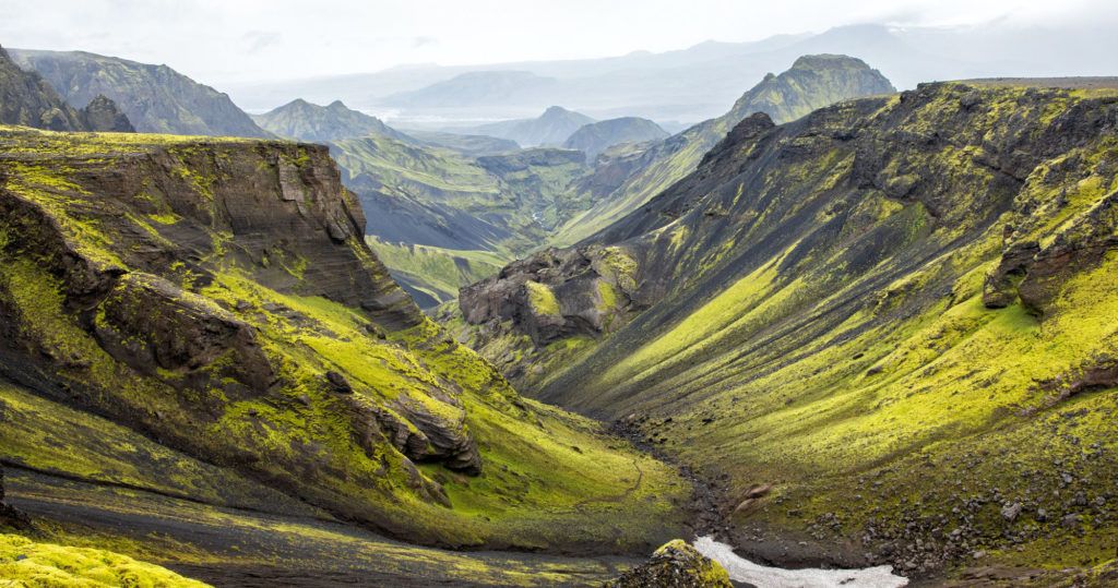
Start at the mighty Skógafoss waterfall. The land is lush and green as you hike past 25 more waterfalls along the Skógá River. As you approach the ice caps, the green grass fades away, leaving behind a rocky, barren landscape. From here, you hike between the glaciers Eyjafjallajökull and Mýrdalsjökull, on fresh, black, volcanic soil, which is one of the youngest landscapes on the planet. Once you begin the descent into Thórsmörk, the contrast is startling. Lime green moss covers the black soil and rocks, and eventually you will hike through a forest before arriving in Básar.
This is a long day with the hiking distance coming in at 25 km. Throw in 1400 meters of total elevation gain and it’s a challenging hike.
But what might be even more challenging are the logistics.
The Fimmvörðuháls hike is a point-to-point hike. This hike can be done in either direction, but most people do it Skógar to Thórsmörk. To get back to Skógar, you will need to arrange a 4×4 bus to get you back on the south coast. Depending on where you parked your car, you might also need to arrange a taxi. I will explain how to arrange your transportation later in this article.
But first, let’s get to the good stuff. Let’s check out the amazing Fimmvörðuháls trail.
Fimmvörðuháls Hiking Stats
Distance: 25 km (15.5 miles) one-way
Elevation Gain: 1400 meters (4600 feet) total ascent
Difficulty: Challenging
Length of Time: 8 to 10 hours*
When to go: Mid-June to September. You should only do this hike outside of this season with a guide and with proper equipment.
Start and Finish: Skógafoss and the Básar Hut in Thórsmörk
Note: It is possible to do this as a two-day hike, spending the night at the Baldvinsskali Hut or the Fimmvörðuháls hut. Make your reservation far in advance.
About the length of time: 8 to 10 hours is the average length of time to do this hike and I have seen estimates as long as 12 hours. If you hike fast, you can complete this hike in less than 8 hours. We finished it in 6 hours and 45 minutes, which is really moving.
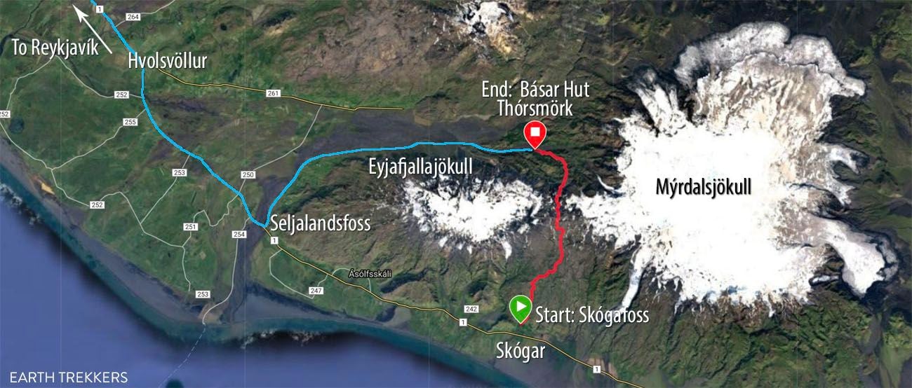
The hiking trail is in red. The blue line is the bus route out of Thórsmörk.
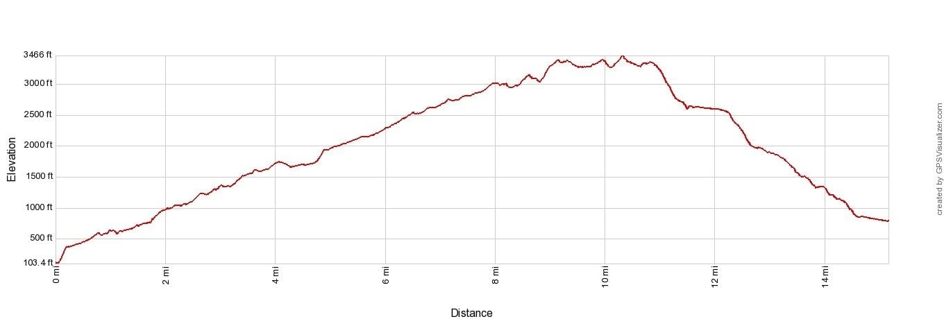
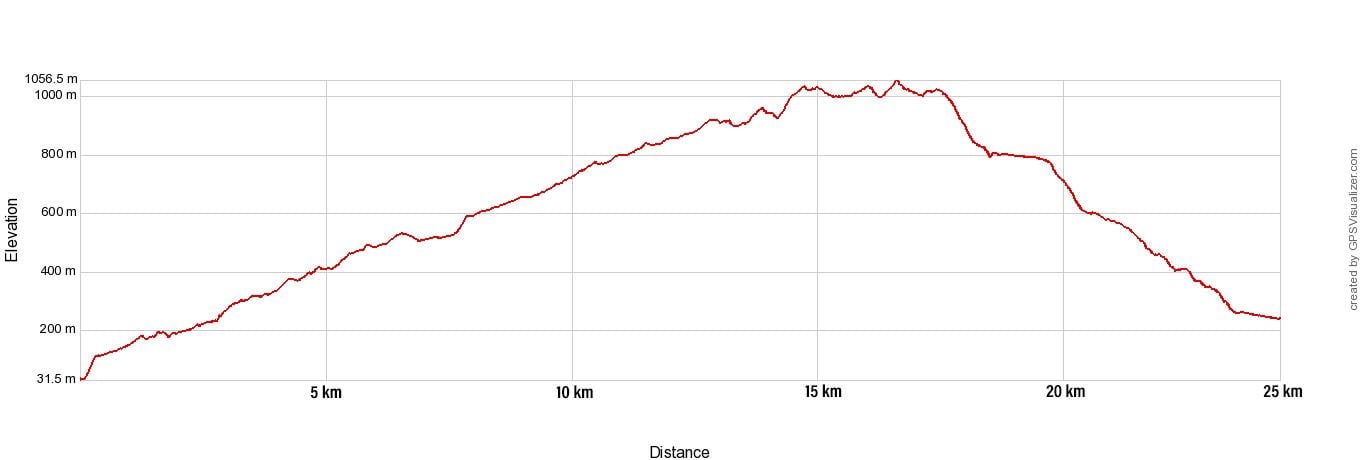
Fimmvörðuháls Elevation Profile
Fimmvörðuháls Hike
Step-By-Step Trail Guide
This hike can be done in either direction. The trail and the logistics discussed in this article are for hiking the Fimmvörðuháls trail from Skógar to Thórsmörk.
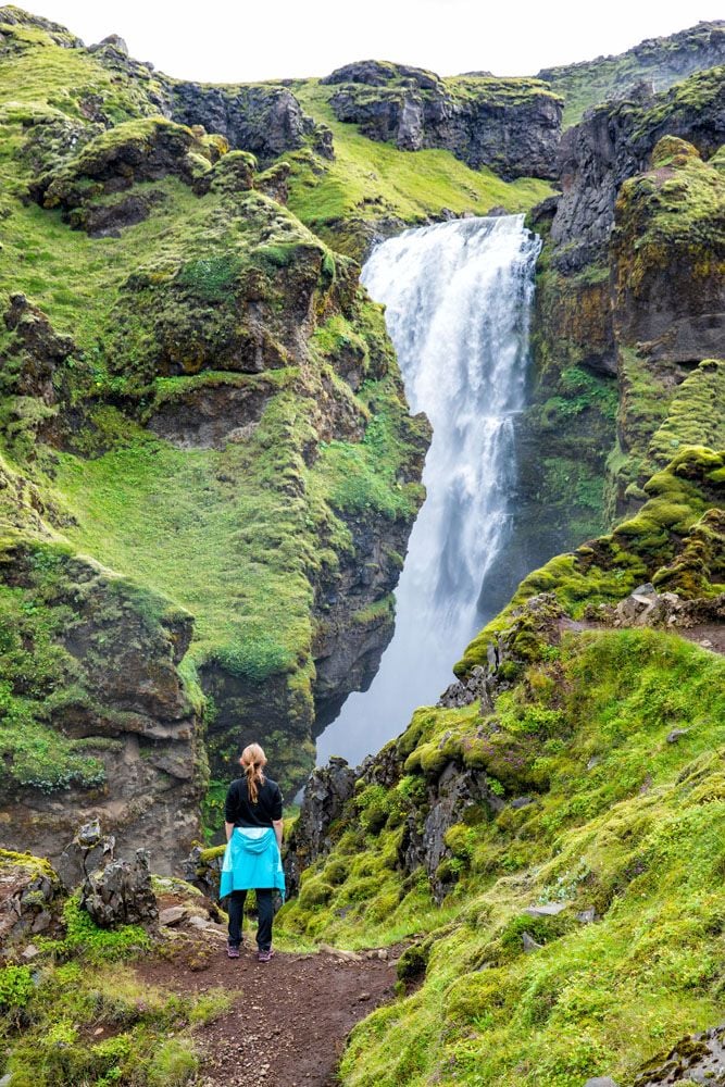
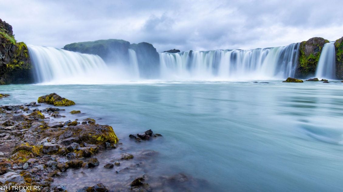
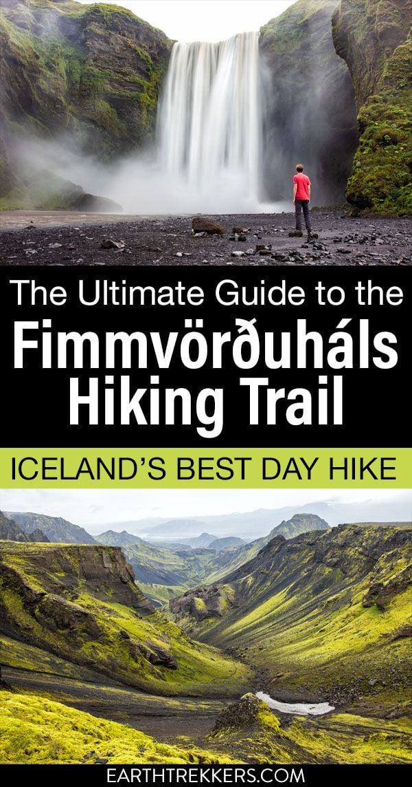
Skógafoss
What a wonderful place to start to hike, at one of Iceland’s most popular waterfalls.
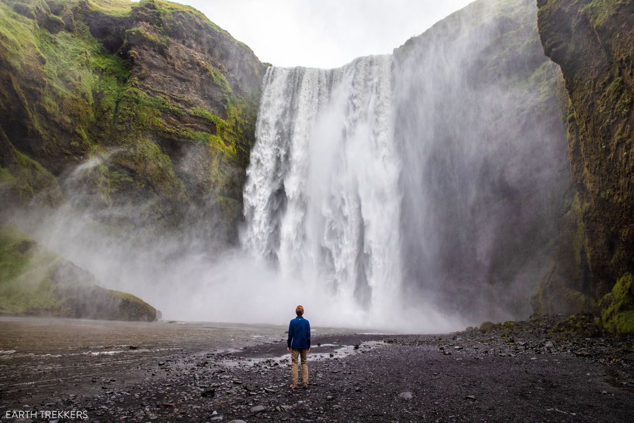
If you start early in the day, you just might get Skógafoss all to yourself, just like we did. And we really weren’t here all that early. This photo was taken at 8 am.
The trail starts right next to Skógafoss. Take the long series of steps to the top of Skógafoss, catch your breath, enjoy the view, and get ready for an amazing day.
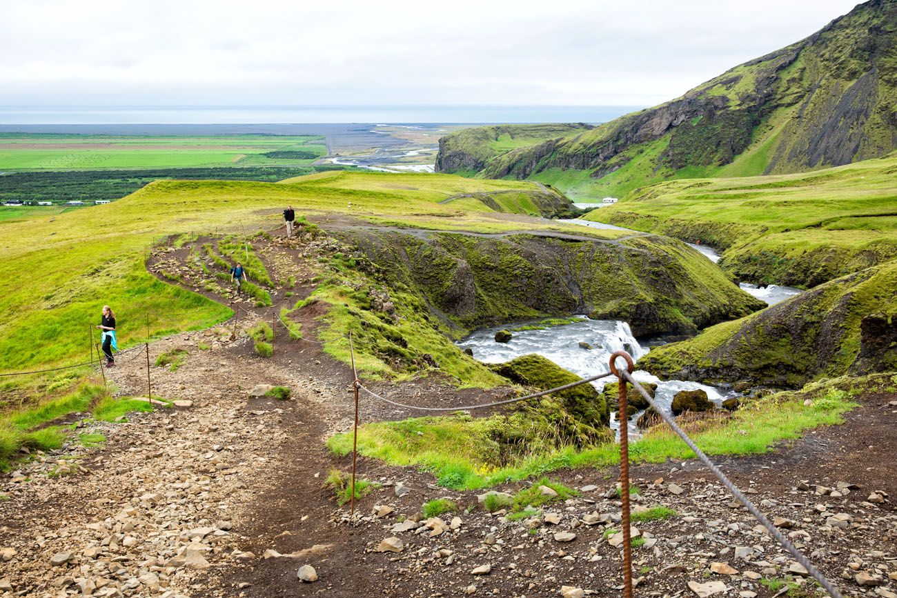
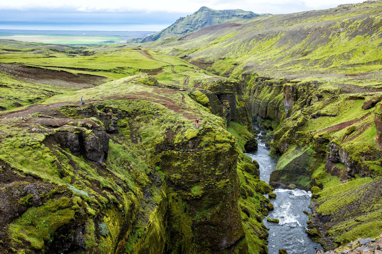
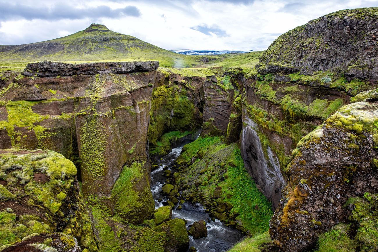
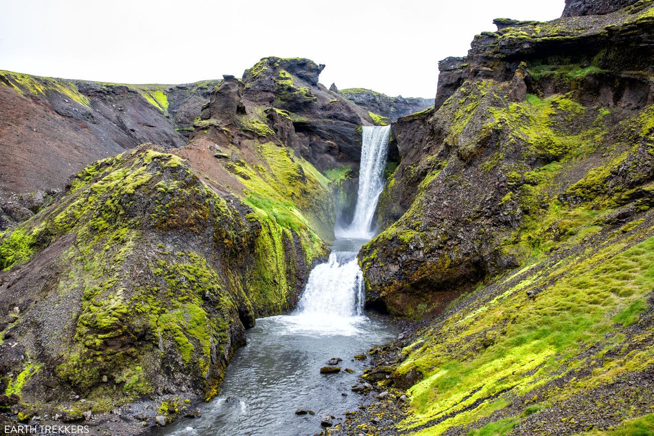
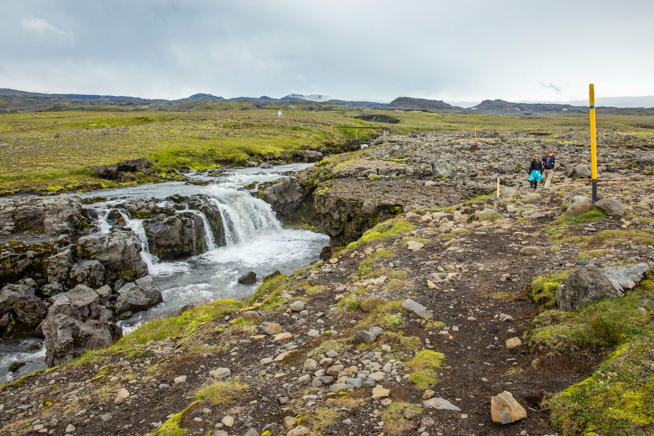
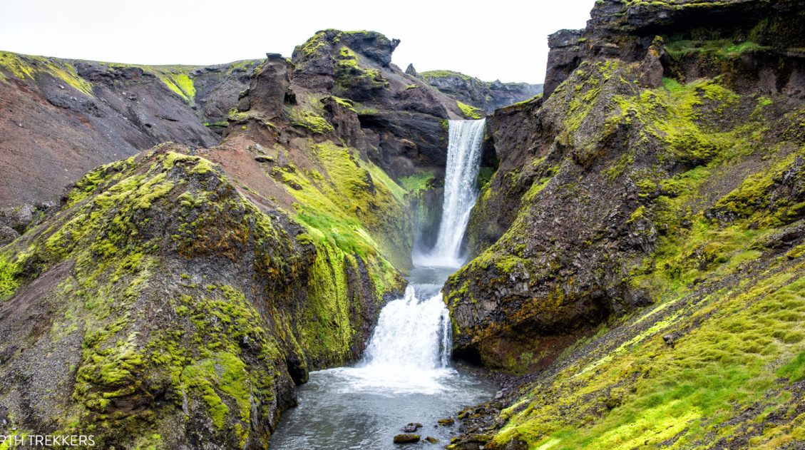
Along the Skógá River (Waterfall Way)
The first third of the hike takes you along the Skógá River and past 25 more waterfalls. This is sometimes referred to as “Waterfall Way,” since it has such a dense collection of waterfalls in a short distance.
This part of the trail blew away all of my expectations. We had already seen bunches of waterfalls in Iceland by this point, so I was kind of “waterfalled out,” if you know what I mean, but there are some beauties along this part of the hike.
It is not just the waterfalls that make this part of the hike so spectacular. Just off the hiking trail are overlooks into a green, lush canyon. Sheep and their clanging bells sometimes make an appearance. And off in the distance are the Eyjafjallajökull and Mýrdalsjökull ice caps.
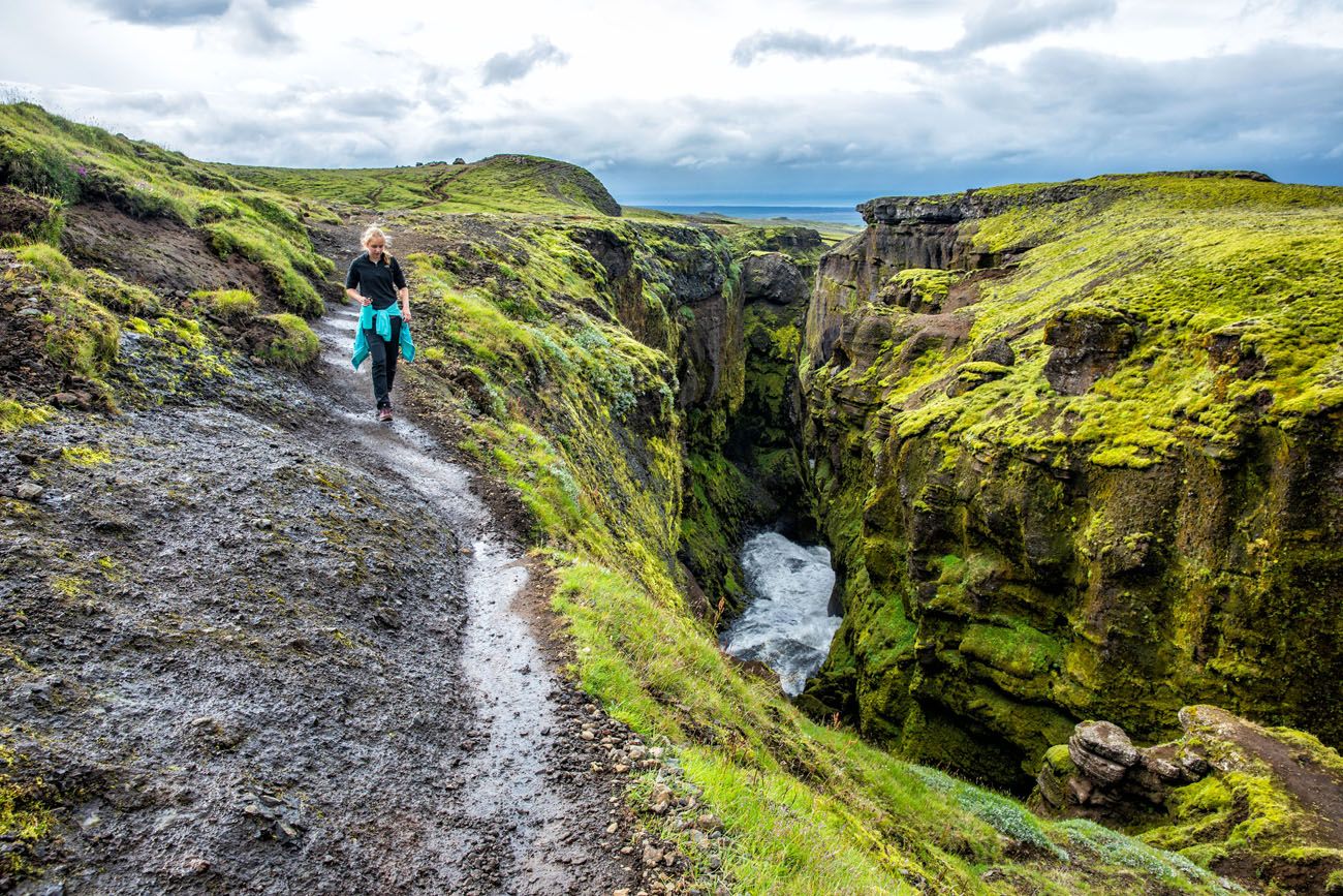
This is one of the most beautiful parts of the day and it should be savored. However, we were in a rush. We had cloudy skies but rain, and a lot of it, was in the forecast. We wanted to make it as far as possible before those raindrops started to fall.
From Skógafoss to where the trail crosses the Skógá River, it’s an 8 km (5 mile) hike. It’s a steady uphill walk, nothing too challenging, but there is enough elevation gain to make it tiring.
The Trail to Baldvinsskáli Hut
Say goodbye to the lush green vegetation.
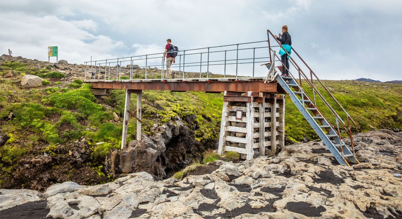
From the bridge over the Skógá River to Baldvinsskáli Hut, it’s a 5 km hike through a barren, rocky landscape. For most of this time, you will walk on a very rough gravel road.
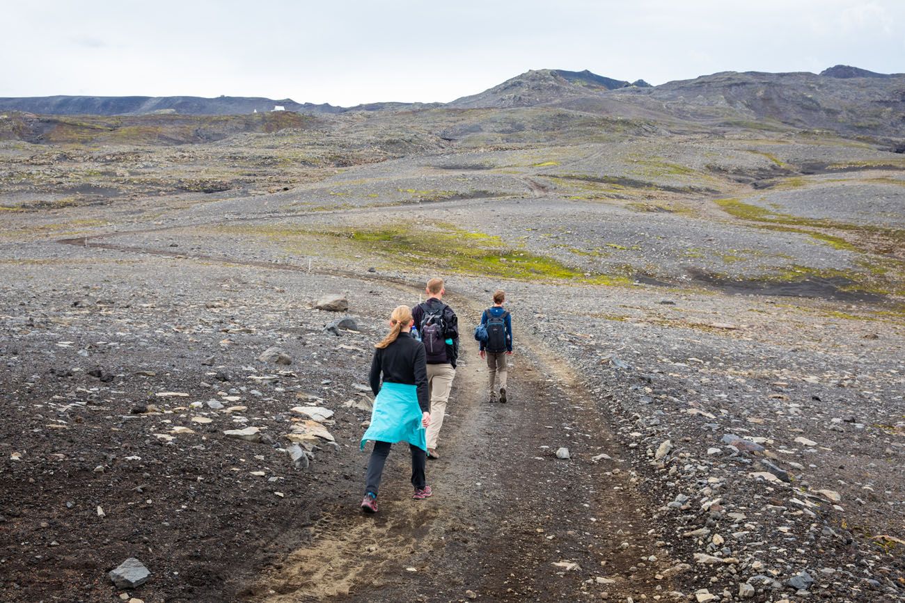
This is the most boring section of the Fimmvörðuháls hike. It takes between an hour and an hour and a half to get to the hut.
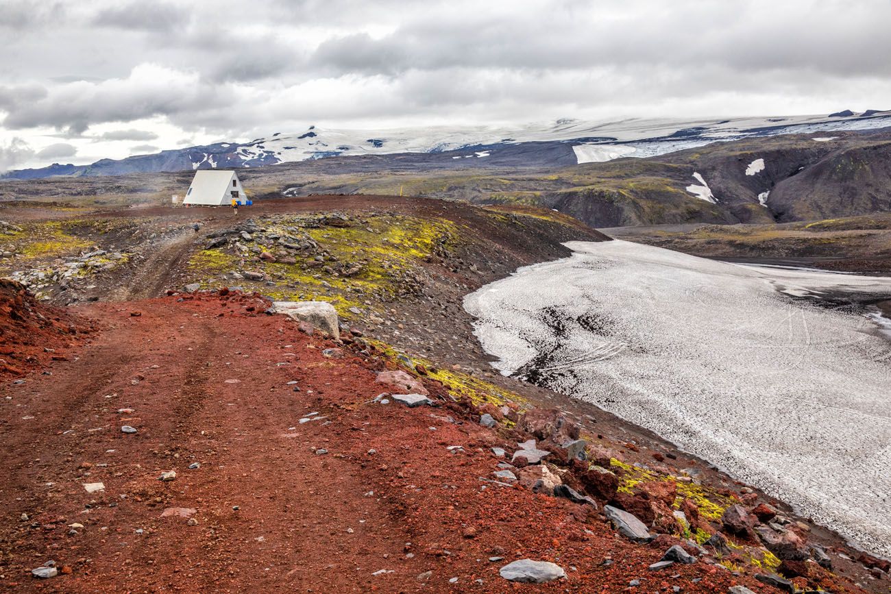
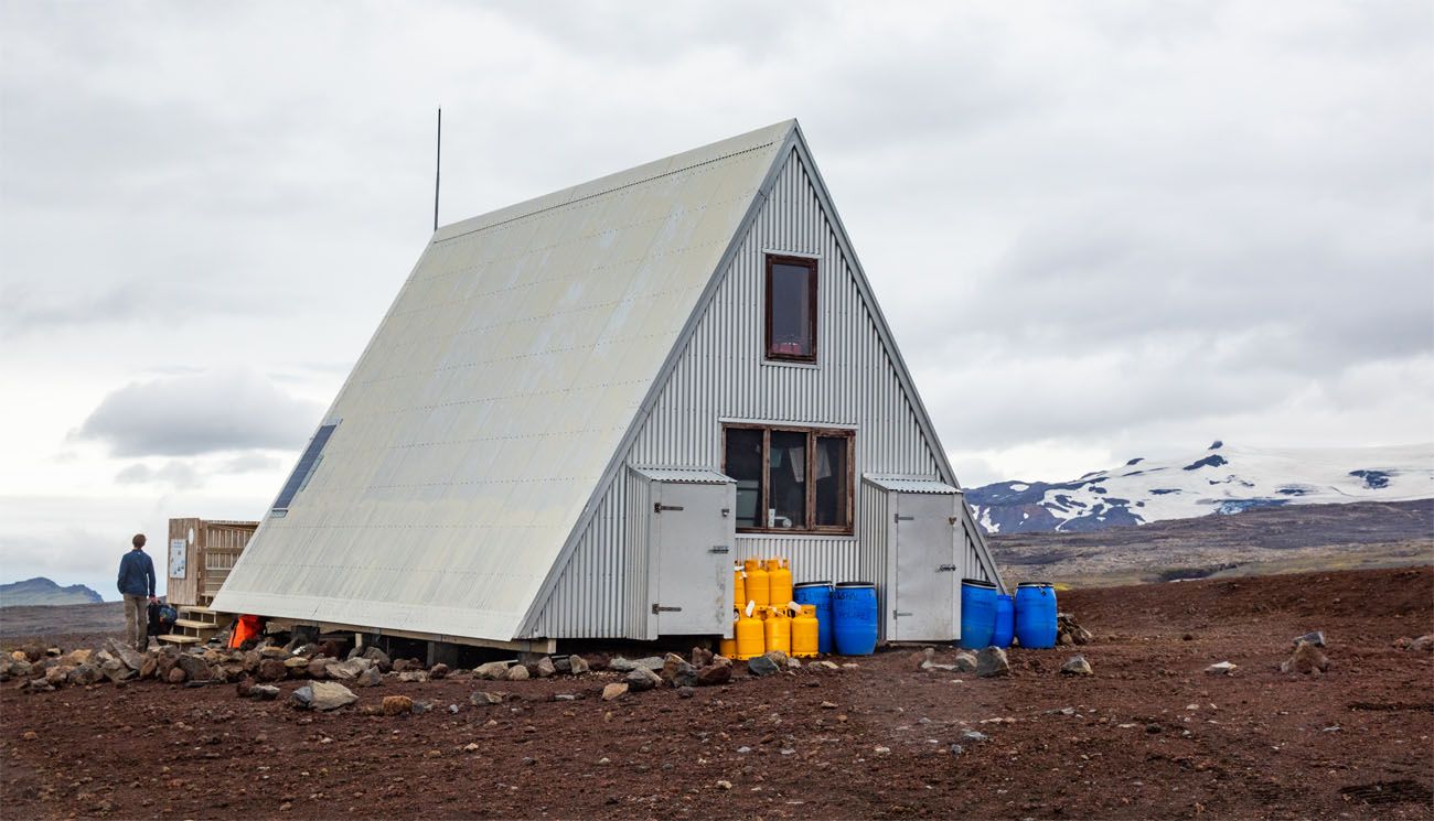
There are bathrooms at the Baldvinsskali hut but there is no running water. The hut can accommodate up to 20 people per night. Click here to learn more or to make a reservation.
From the Baldvinsskáli Hut, you get a nice view of the volcanic landscape and the hiking trail. You still have some climbing to go, but you are approaching the highest point of the trail. With that comes cooler temperatures and the chance for unstable weather.
By this point, it had started raining. This is a good place to stop for lunch or a snack, but we wanted to keep moving. We still had hours to go in the rain.
Eyjafjallajökull and Mýrdalsjökull
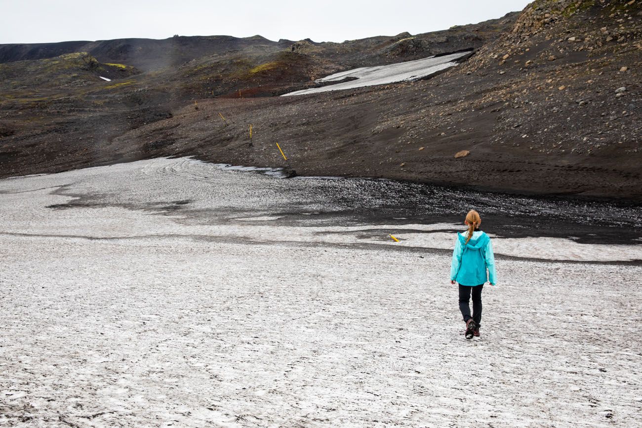
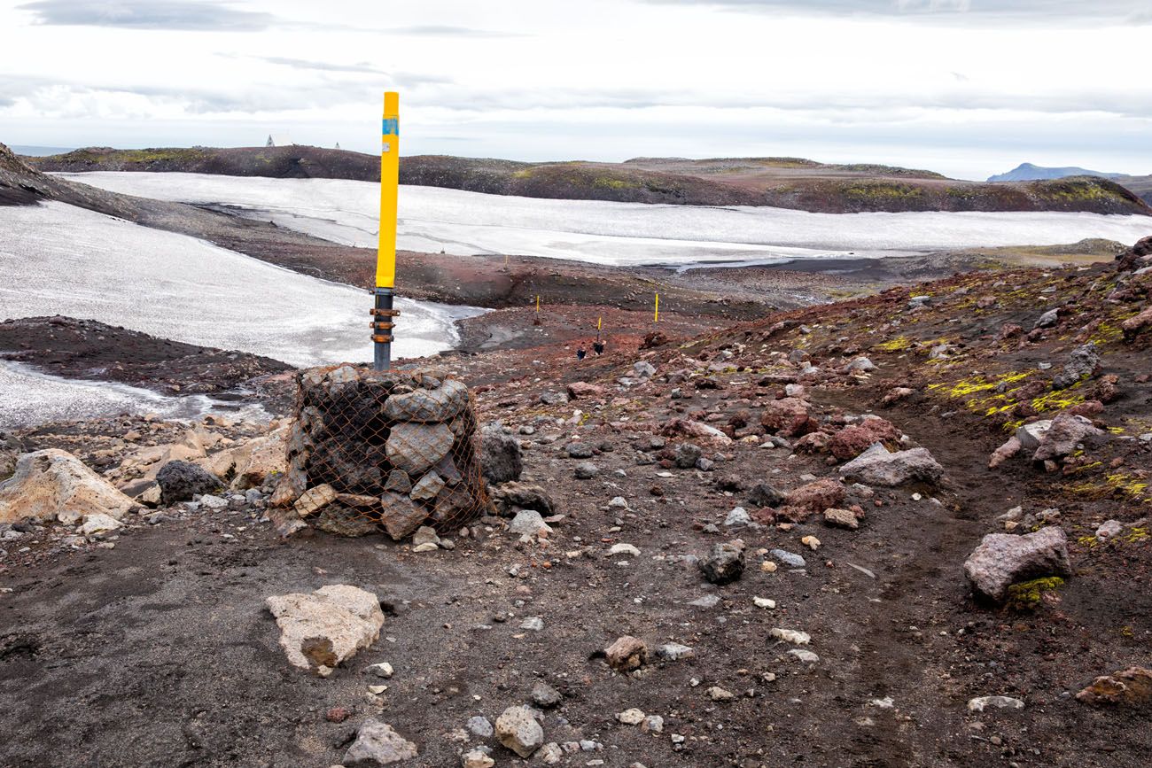
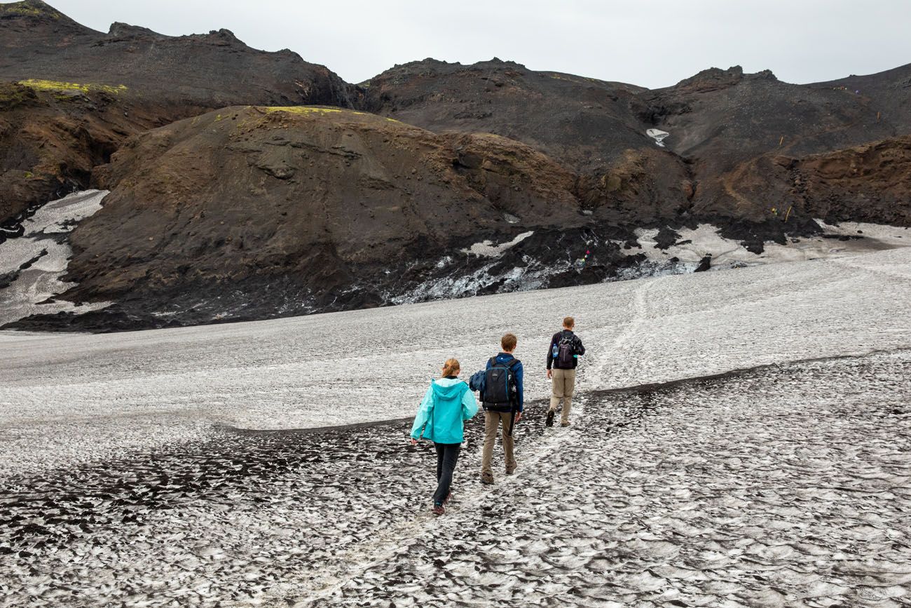
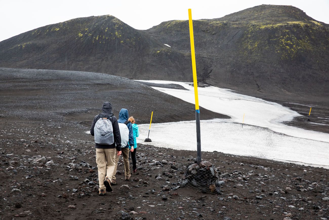
From the Baldvinsskáli Hut, hike across two snow fields separated by a small climb.
Looking back at the hiking trail to the Baldvinsskali hut.
When we did this, there was a lot of ice on the second snow field. It was very slippery, and since we were hiking on a sheet of ice down an incline, we really had to take our time.
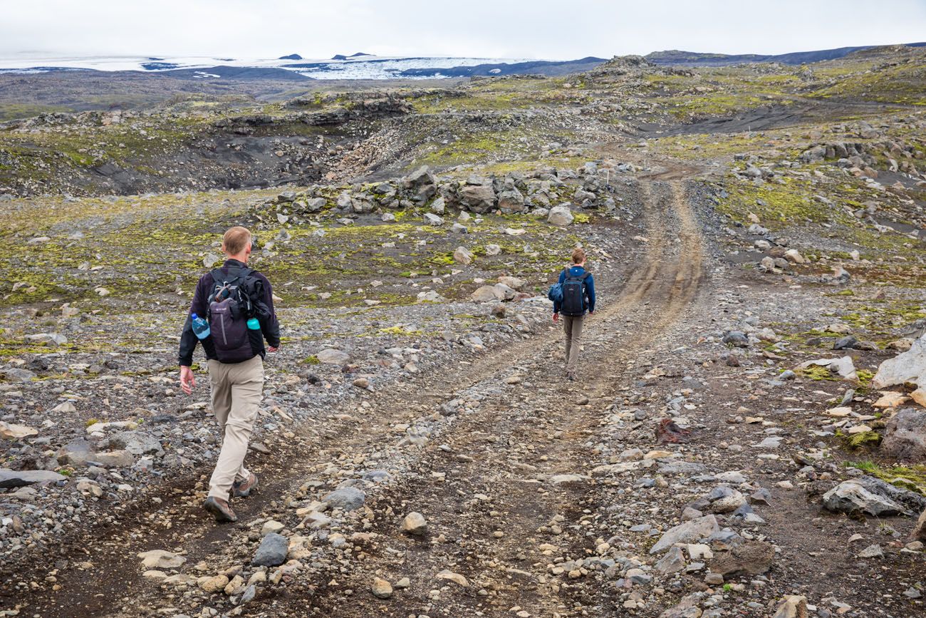
Once you make it across the snow field, it’s time to hike up to the Fimmvörðuháls Pass. It is a strenuous, uphill climb on volcanic soil and it feels almost like you are hiking through sand.
This is the most challenging section of the Fimmvörðuháls hike, but once at the top, it’s mostly downhill from here. There are still several short climbs to go, but most of the work is behind you.
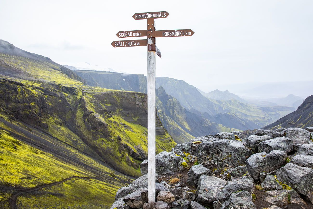
The Fimmvörðuháls Hut sits off of the trail to the west. If you plan to do this as a two-day trek, I read that this is the better place to spend the night (than at the Baldvinsskáli hut). If you do not plan to spend the night at the Fimmvörðuháls hut, there is no need to detour out to the hut.
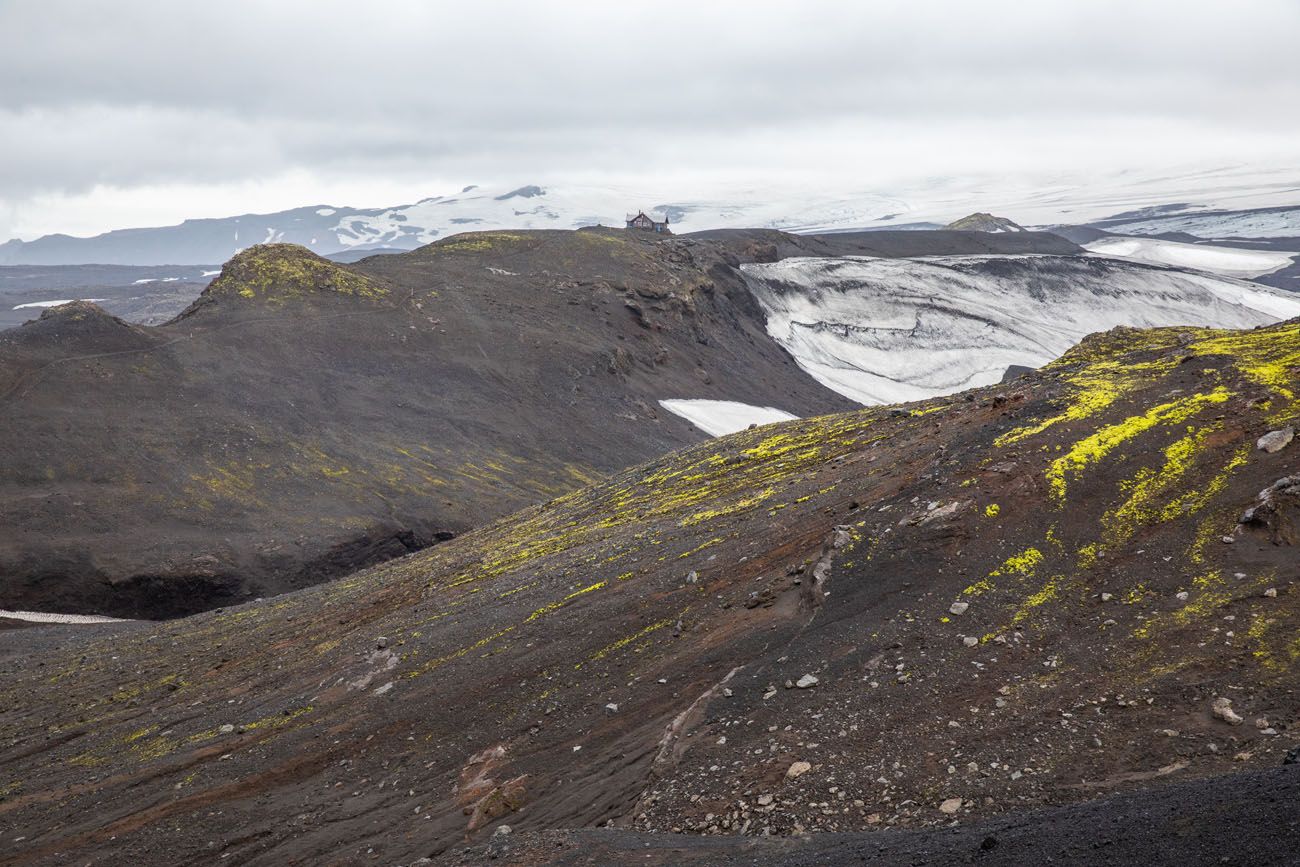
Looking west. Off in the distance is the Fimmvörðuháls hut.
Important Note: On the Fimmvörðuháls hike, you cross over the Fimmvörðuháls pass. At this high elevation, weather conditions change rapidly and you could even get stuck in a snowstorm, even in July. Even if the weather looks clear in Skógar, be prepared for rapidly changing weather conditions on this hike.
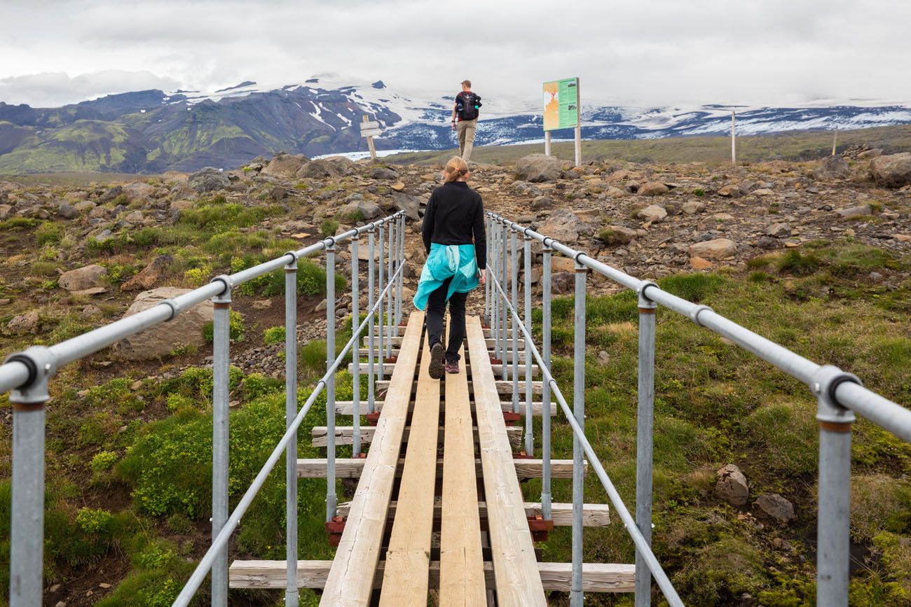
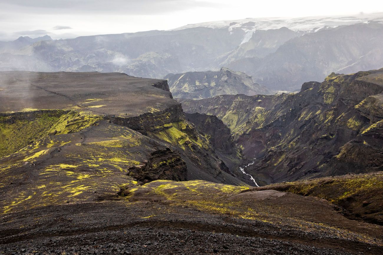
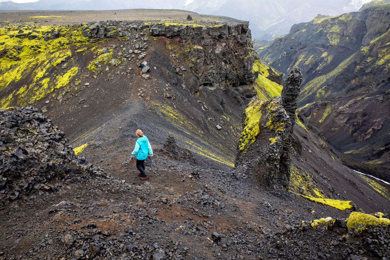
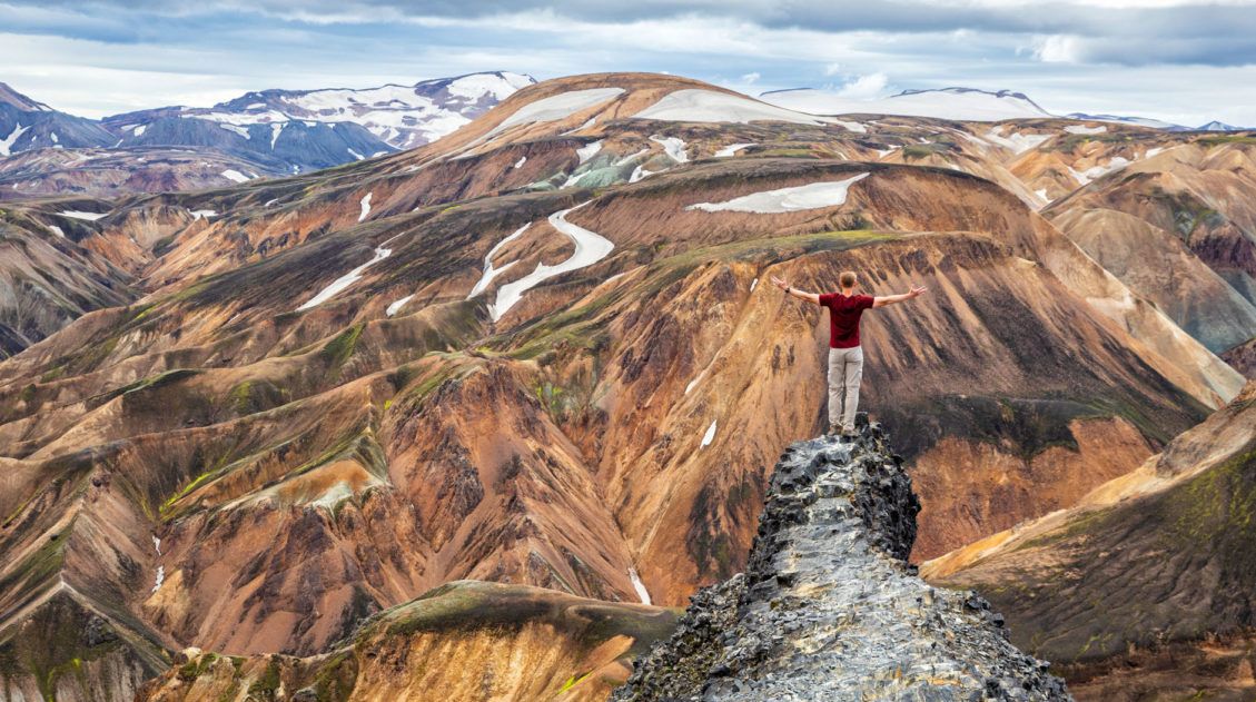
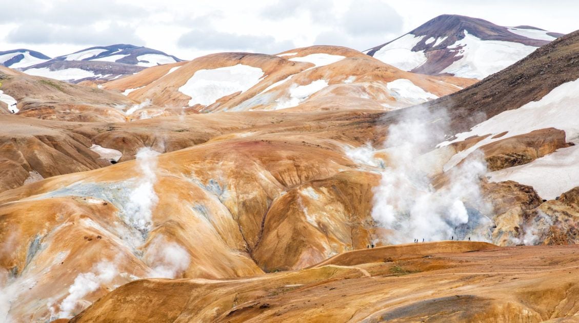
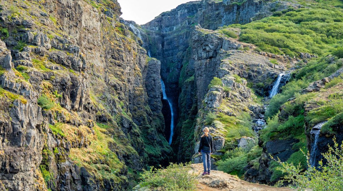
From the pass, you now get to hike between the glaciers Eyjafjallajökull and Mýrdalsjökull. In April 2010, the volcano under Eyjafjallajökull erupted, laying down this new volcanic soil. This was a relatively small eruption, but the volcanic ash in the sky disrupted European air travel for six days.
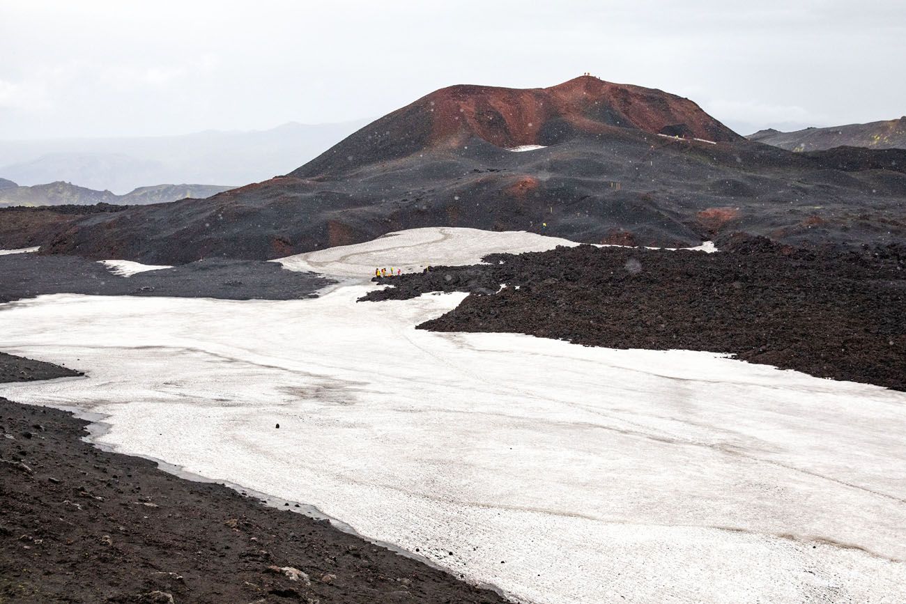
The volcanic eruption formed two new mountains, Magni and Módi. Before descending into Thórsmörk, you have the option to detour to the summit of Módi. It’s worth it. The views are amazing and you get to stand on one of the planet’s youngest geologic features.
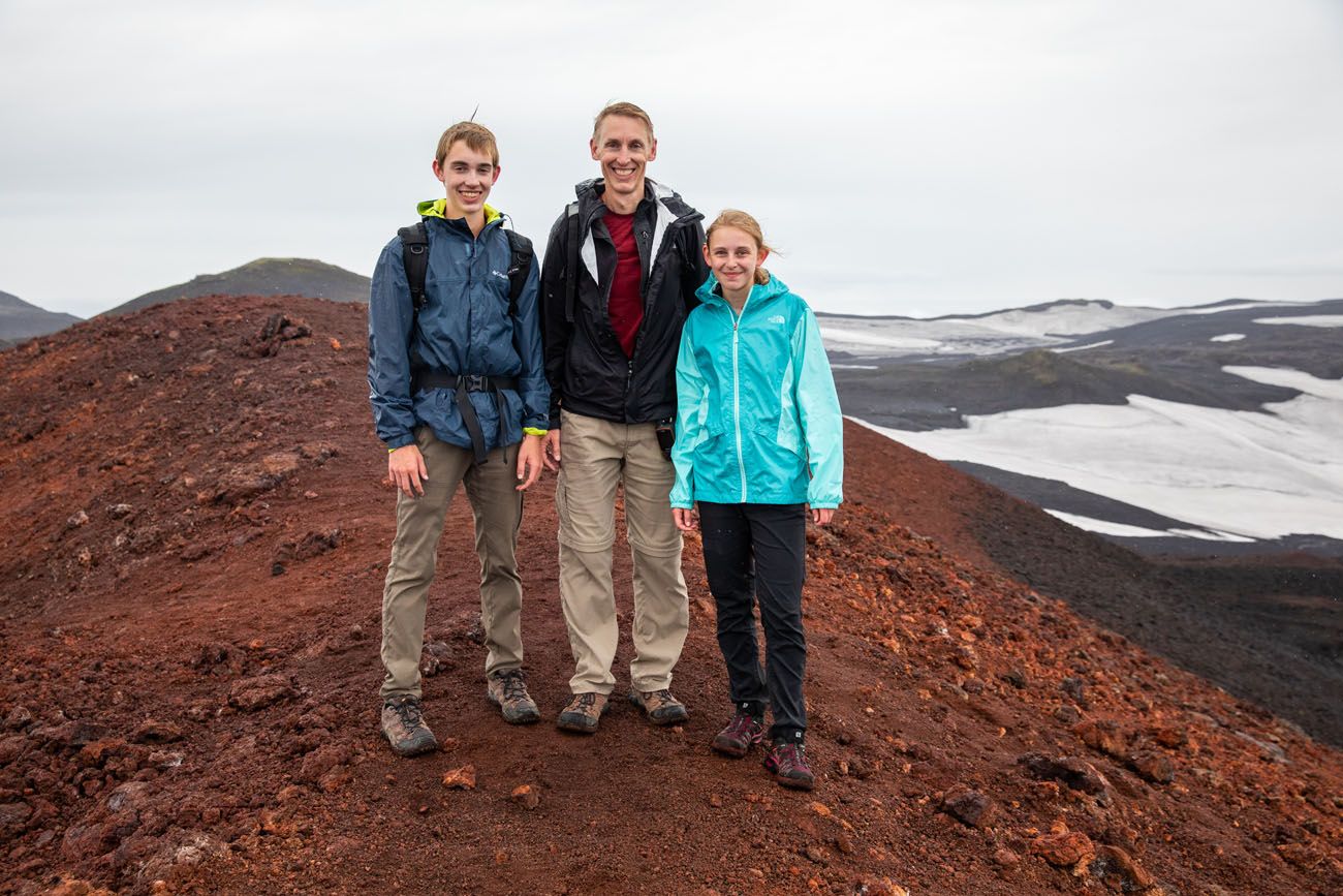
On top of Módi.
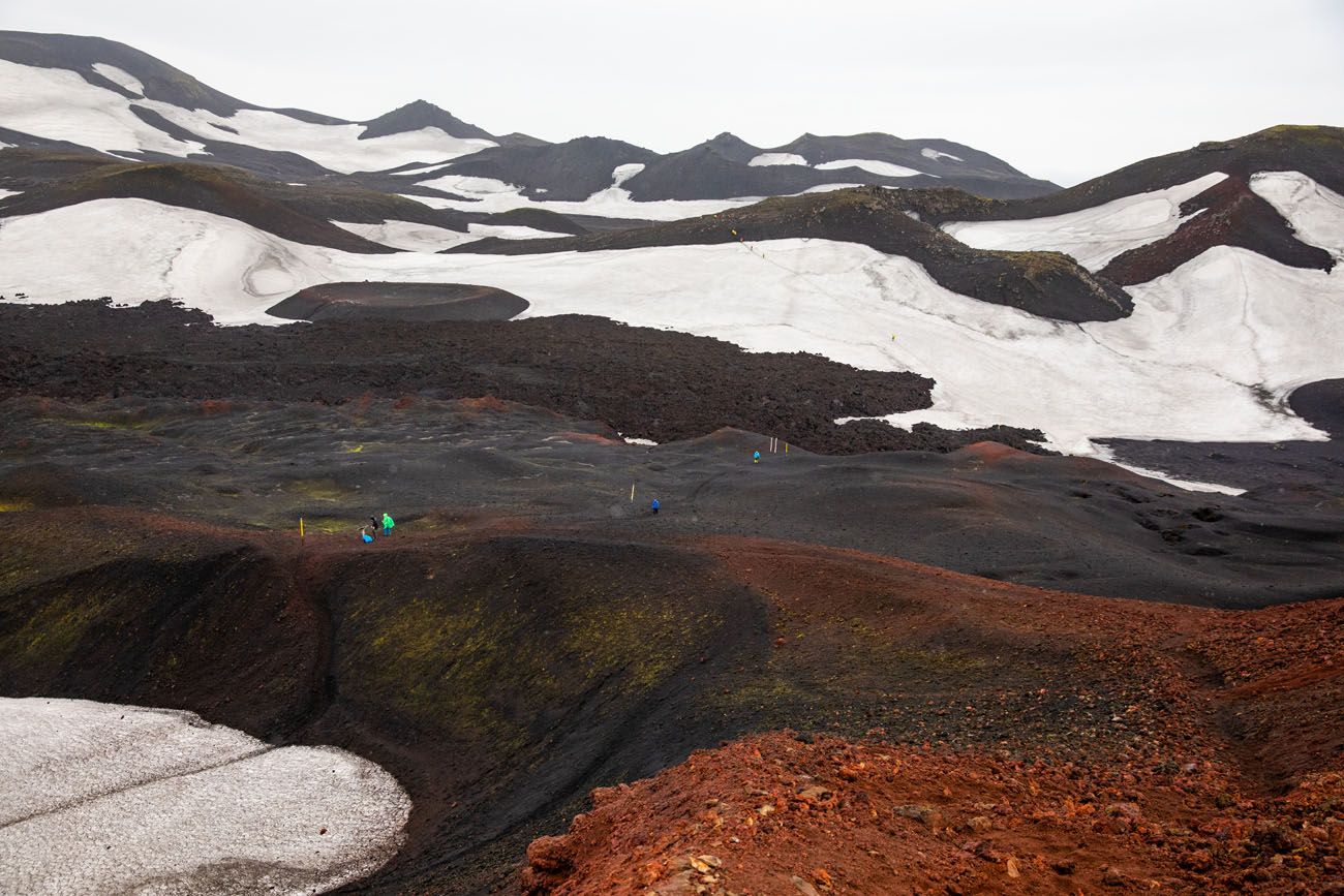
View of the hiking trail from the top of Módi.
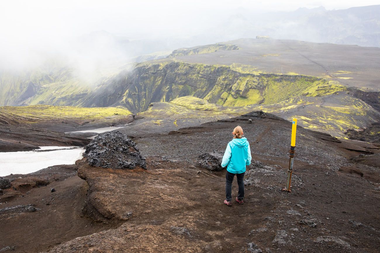
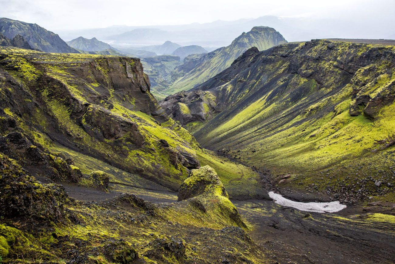
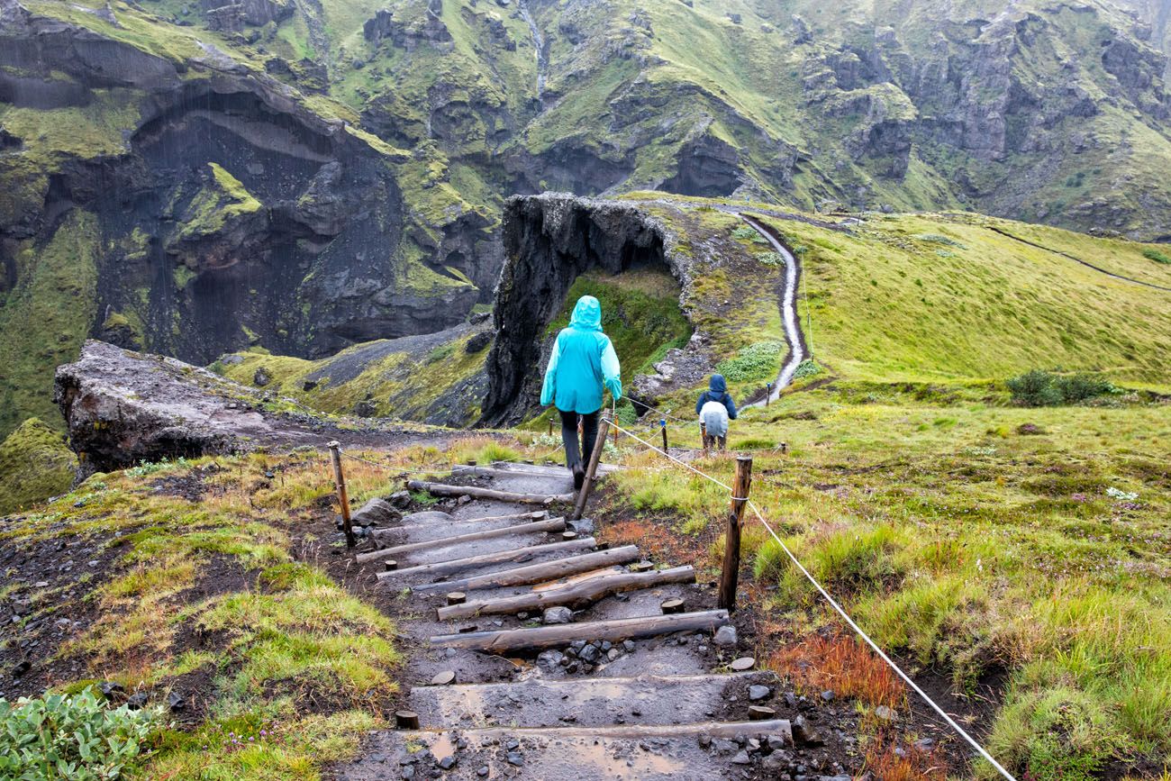
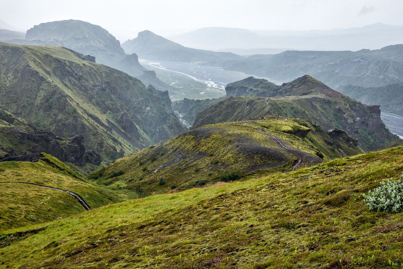
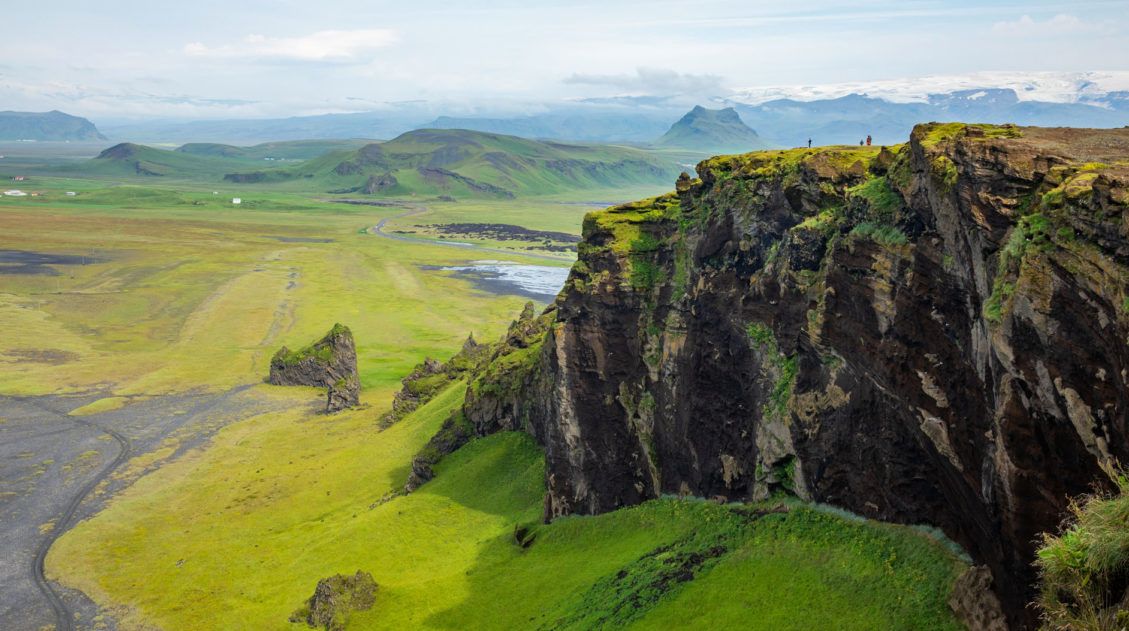
Godaland and Thórsmörk
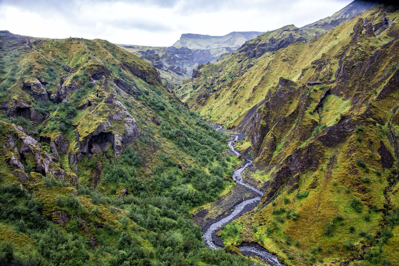
We loved this section of the hike, despite heavy rain and foggy conditions. This is a beautiful part of Iceland and a very unique landscape. Hopefully you will get clearer weather conditions than we had.
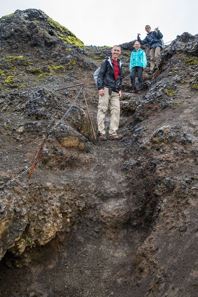
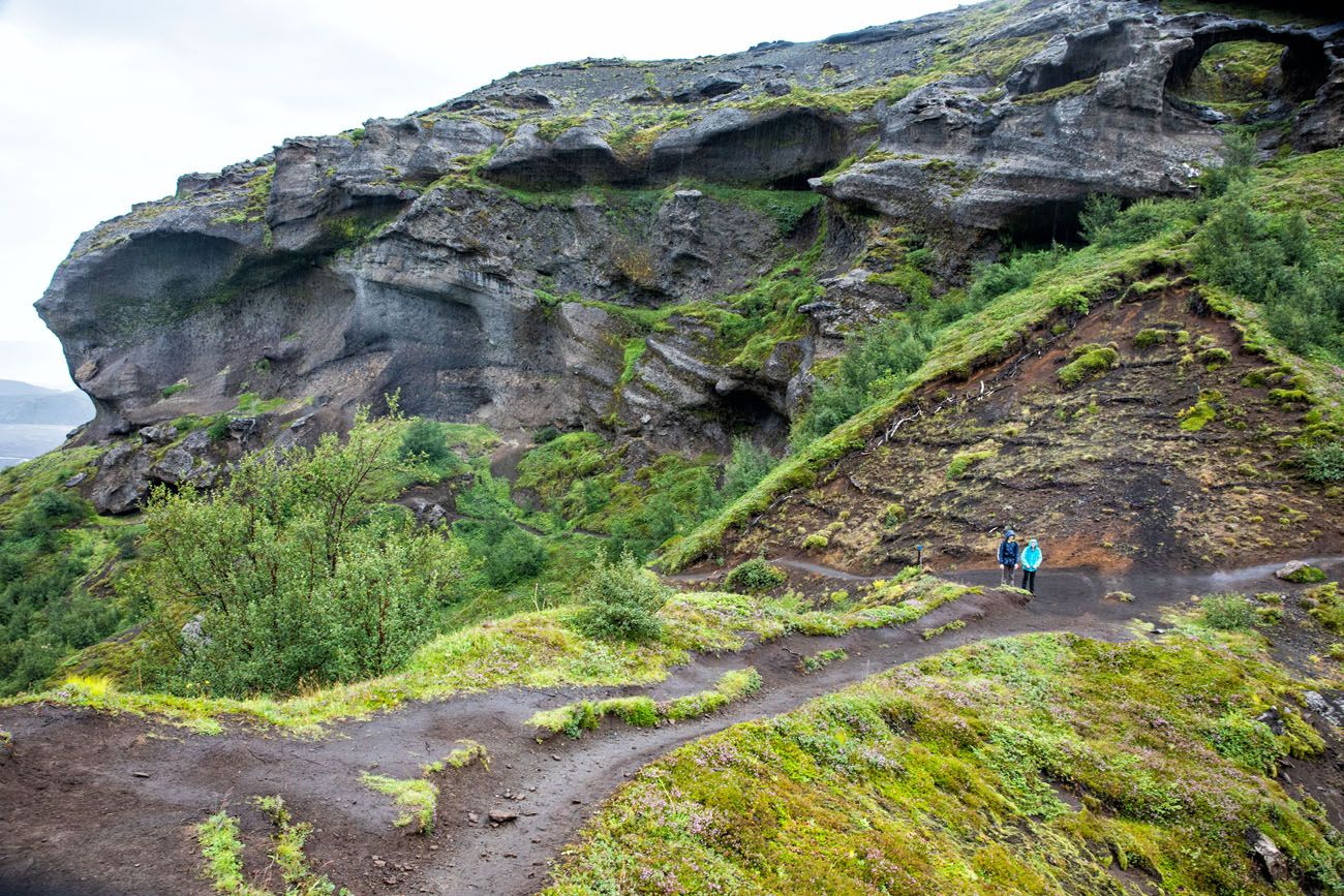
Now, it is an overall downhill walk until you get to Thórsmörk. It is steep in some spots. There is one short section where the trail clings to the cliff. On your right is a chain to assist you and to your left is a drop-off into the valley. This is the most treacherous part of the hike.
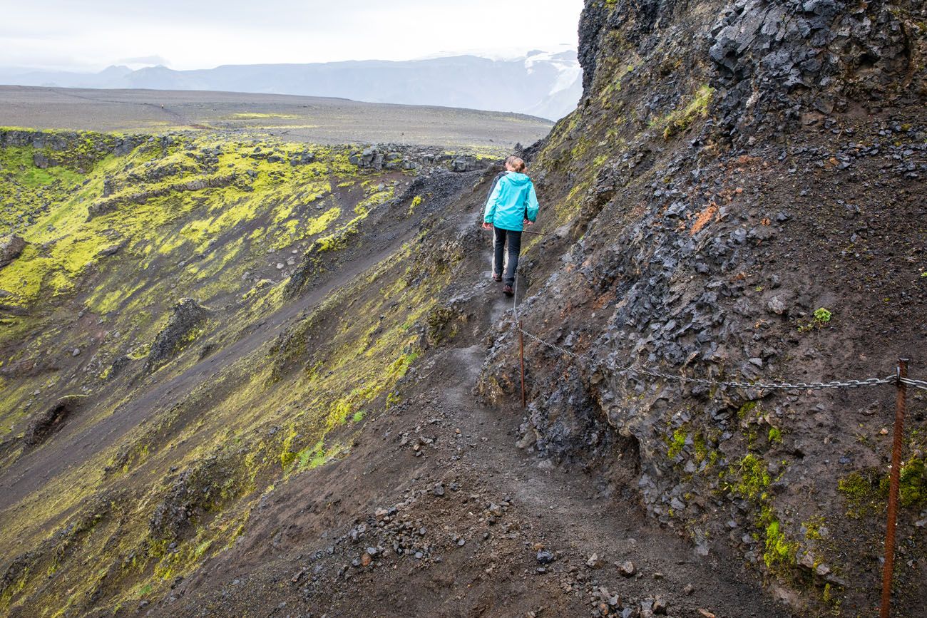
Once you get past this short section, the views really open up and are some of the best of the day. From here, continue on the main trail to Básar, or you can detour down through the Hvannárgil Canyon to Thórsmörk.
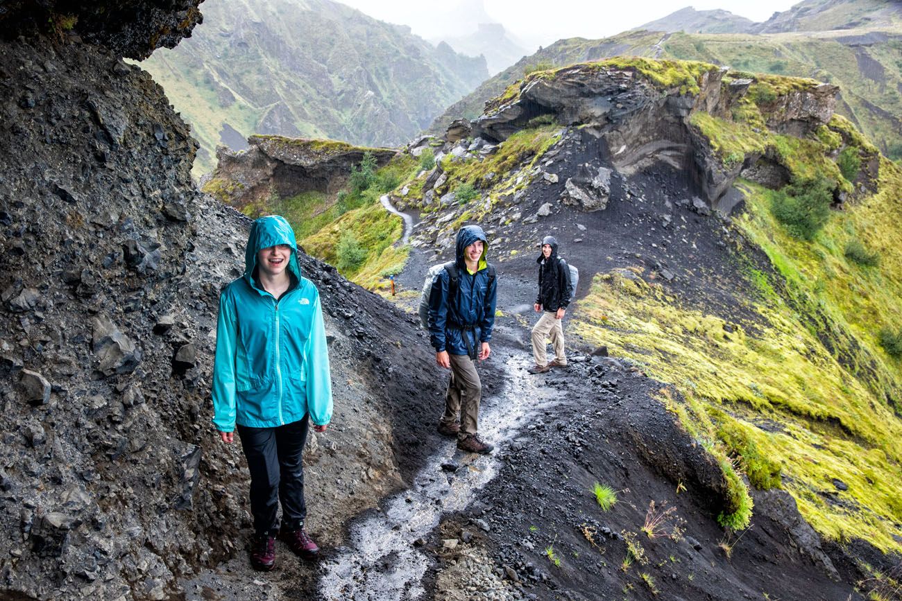
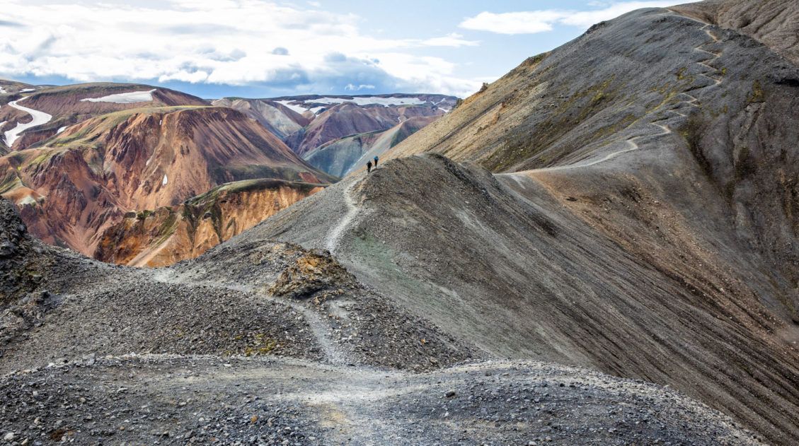
After crossing a wide plateau, you descend into Thórsmörk on the Cat’s Spine Ridge (Kattarhyggir).
How dangerous and difficult you will find this final section will depend on weather conditions as well as personal ability and experience.
These sections can be treacherous if there happens to be any snow on those parts of the trail or if it was raining, as it was in our experience. If you are not properly trained to handle the distance and total ascent of this hike, then fatigue could make these sections more dangerous.
With all of that said, we didn’t find the descent difficult at all, and most of our descent was in the rain. We thought it was fun, adventurous, and we soaked in the incredible views along the way.
The key to having the best experience is to be prepared, both physically and with having proper equipment for a variety of weather conditions. You are hiking into the backcountry and thus you need to monitor the weather even while you are hiking.
Arriving in Básar, Thórsmörk
We arrived in Básar, muddy and soaking wet from head to toe. But what an awesome day, despite the rain!
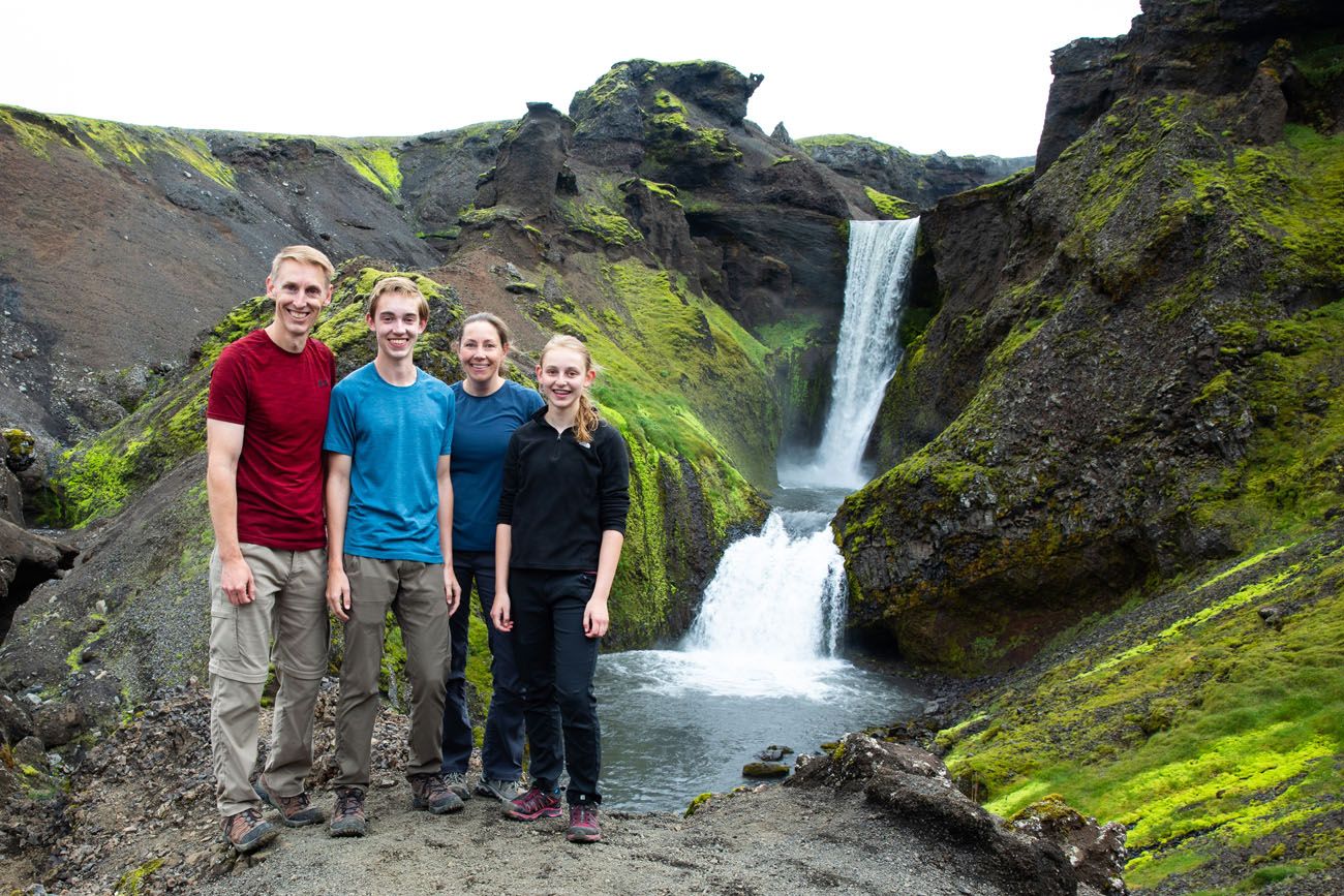
We did this hike FAST. Even with time to stop and eat, take family photos, and fly the drone numerous times, we finished the hike in 6 hours and 45 minutes. At first, we were in a race to get as far as possible before the rain moved in. And then, once it started raining, we wanted to get under cover as soon as possible.
I had originally booked the 6 pm TREX bus out of Thórsmörk. However, the 2:30 TREX bus was still in Básar when we arrived. Keeping our fingers crossed, we inquired about taking this earlier bus. Well, luck was on our side. Two passengers failed to show up, and since the bus was 15 minutes late leaving Básar, we made it on at the very last minute. We were THRILLED!
From Básar, it took an hour and 15 minutes to get to Hvolsvöllur and another 30 minutes to get back to our hotel and warm, dry clothes.
Because of our rush to the bus, I don’t have any photos of Básar. There is not much here…two huts that can accommodate 80 to 90 people, bathrooms, and a kitchen and dining hall. You can also camp here as well. For more information, click here.
Arranging Your Transportation
Arranging your transportation is one of the most challenging aspects of this hike. Before going Iceland, I spent hours trying to figure out the most efficient way to get from Thórsmörk back to our car.
There are numerous buses that travel from Thórsmörk to the south coast of Iceland, so that’s not the issue.
In 2019, there were no buses that took passengers from Thórsmörk directly to Skógar. The buses from Thórsmörk made stops at Seljalandsfoss, Hvolsvöllur, Hella, Selfoss, and Reykjavík.
So, you still have to get from one of these stops to Skógar, which means using an additional mode of transportation. There are several ways to do this.
Important Note: We have been updating this article for several years since we did this hike, and bus schedules change from year to year. I will do my best to keep this article updated. However, if you recently hiked Fimmvörðuháls as a day hike and have transportation logistics to share, comment below!
Here’s another view of the Fimmvörðuháls map. The red line is the hiking trail. The blue line is the bus route out of Thórsmörk. It first stops in Seljalandsfoss and continues onto Hvollsvöllur. It does not go to Skógar.
Take a Morning Taxi to Skógar
In the morning, park your car at one of the Thórsmörk bus stops. We chose Hvolsvöllur, since it was a short drive from where we were staying and had plenty of parking options. We did this hike on a Sunday, so we parked at the bank across from N1 gas station, because we assumed the parking lot would be empty all day.
The day before the hike, we arranged a taxi service to pick us up at the N1 gas station at 7 am. He drove us to Skógafoss, the start of the hike. At the end of the hike, we took the TREX bus to Hvolsvöllur, where our car was waiting for us.
Seljalandsfoss is another parking option. This is the first stop that the Thórsmörk bus makes. It’s a huge parking lot but you will have to pay to park here (use one of the fee stations at the parking lot, the cost is 1,000 ISK and is valid all day). If you spend the night in Thórsmörk or at the Fimmvörðuháls hut, you can pay the fee online here.
As for parking in Hvolsvöllur, we were lucky to be doing this on a Sunday. The bank parking lot was still empty when we arrived at 4 pm. On a weekday, it might be better to park at the N1 or at one of the other parking lots in town.
Take an Afternoon Taxi to Skógar
Park your car at Skógafoss and hike to Thórsmörk. Take the bus to Seljalandsfoss and from here, take a taxi back to your car in Skógar. Arrange the taxi in advance.
PRO TRAVEL TIP: We recommend using the taxi in the morning, to get from your car to Skógar. Once finished the hike, the Thórsmörk bus will drop you off right at your car. It’s one less thing to think about or worry about during the hike.
Taxi Service
We used South Iceland Transfer Services run by Magnus Haraldsson. Magnus speaks English and we communicated with him by phone and by email.
For the one-way transfer from Hvolsvöllur to Skógafoss we paid 20,000 ISK.
- info@sits.is
- www.sits.is
- +354 695 1918
Use a Bus instead of a Taxi
A cheaper option is to take a bus. However, the only bus that I found leaves Hvolsvöllur at 9 am and does not arrive at Skógar until 9:45 am. That’s too late to start this hike, unless you have plans to spend the night in Thórsmörk.
If You Have Two Cars
If you have two cars and two drivers, you can create your own shuttle. Park car #1 in Hvolsvöllur or Seljalandsfoss, use car #2 to drive to Skógafoss. Hike to Thórsmörk, take the bus back to car #1 and then pick up car #2.
Hitchhiking
Hitchhiking is not uncommon in Iceland and something we considered. However, I’m glad we didn’t do this. At the end of the hike we were muddy and drenched. We did not dry off at all on the steamy, hot bus ride out of Thórsmörk. I highly doubt that we would have found a driver willing to pick up four dirty, wet people and drive them 35 minutes down the road.
If you plan to do this in the morning, just be aware that traffic on the roads is very light until 9 am. You risk a late start to the hike, which could make you miss your bus out of Thórsmörk later in the day.
Arranging the Bus from Thórsmörk to South Iceland
To get in and out of Thórsmörk you must have a true 4×4. There are numerous river crossings and rough terrain to navigate. An AWD SUV will not make it to Thórsmörk. The river crossings are too deep for an SUV.
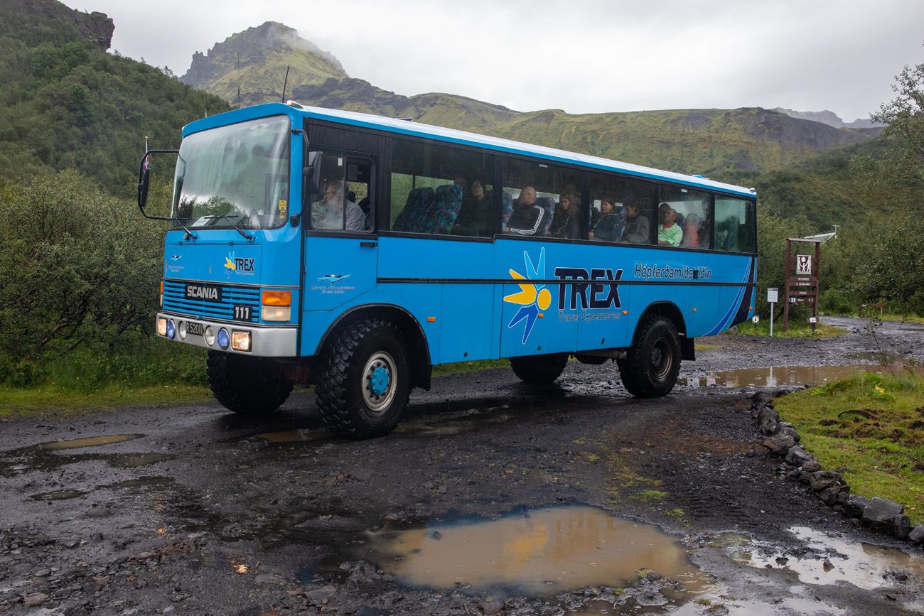
There are three main bus companies that have 4×4 buses: TREX, Southcoast Adventure, and Highland Bus. All are very similar, with similar pricing and routes. We randomly chose TREX, which worked to our advantage, since they operate two daily buses in and out of Thórsmörk.
I recommend checking out each company (use the links provided above) and choose one based on their schedule and price. Each company offers a bus out of Thórsmörk but this schedule changes from year to year.
There are several bus stops in Thórsmörk. You want to book a bus from the Básar Hut in Thórsmörk. Some companies also list Thórsmörk Langidalur or as an option, but you don’t want this. It’s a much farther walk to get to Langidalur. The Básar Hut is the end of Fimmvörðuháls trail in Thórsmörk.
How Far in Advance Should You Book Your Bus Tickets?
This is a tricky question to answer.
If you know your exact hiking date and don’t expect it to change, then book your bus tickets as soon as you know your dates of travel.
However, if you have a flexible schedule and are watching the weather, you can book your tickets several days in advance. It’s possible that there will be availability the day before your hike, but this is risky.
Make sure you reserve a seat on the bus before starting this hike. This is a very popular hike and it’s possible that buses will be completely booked. Not only do you have day hikers arriving from Skógar, but there will also be hikers just finishing the Laugavegur Trek in Thórsmörk.
Total Cost of Transportation
We booked the TREX bus and one taxi transfer.
One-way Thórsmörk to Hvolsvöllur: 12,900 ISK
Taxi: 20,000 ISK total
Total price: 32,900 ISK for one person (roughly $266 USD); each additional person will share the taxi but pay the 12,900 ISK for the Thórsmörk bus (about $104 USD per person). Every year I update this post and I am amazed at how much the price increases every year…prices have skyrocketed in the last 4 years.
If you park at Seljalandsfoss, your taxi and bus will be slightly cheaper but you will also have to pay the 1,100 ISK parking fee ($9)…just confirm that the bus makes a stop at Seljalandsfoss.
Other than taking a guided glacier hike or ice climbing tour, this the most expensive day hike we have done. Worth it? Absolutely.
But it does make hitchhiking look a little more appealing. 🙂
The Fimmvörðuháls Hike with Kids
Before taking your kids on this hike there are several risk factors to consider. The overall distance of the hike combined with the total ascent can be very fatiguing. Along with that you have to finish the hike within a certain amount of time so you don’t miss the bus. Some portions of the descent require you to be extra careful and take your time, so you don’t want to find yourself needing to rush.
Keep in mind that you are going into a backcountry area where the weather can change rapidly and even snow in the summer. You will have to cross snow/ice patches and there are narrow sections of the trail that run along the edges of cliffs and steep slopes. These can be dangerous for someone that doesn’t have the proper experience or is fatigued.
As a reference, the company that offers guided hikes has a minimum age requirement of 13 years old.
A great alternative for families with kids covering a range of ages is to hike the Waterfall Way portion (mentioned next) together as a family. You have the option to split up, with one adult taking the older more experienced kids onward, while the other adult returns to Skogafoss with the younger or less experienced kids.
Shorter Version of this Hike
If the idea of hiking 25 km does not sound like your idea of a good time, or if the logistics are too much of a hassle, you can do a shorter version of the Fimmvörðuháls hike. The Skogafoss Waterfall Way hike is the first 8 km (4 miles) of the Fimmvörðuháls trail. You do this hike out-and-back (for a total distance of 16 km) from Skogafoss, so there are no buses or taxis to work out. And since it is an out-and-back-hike, you can turn around when you have seen enough.
If someone in your group plans to do the full Fimmvörðuháls hike, you can hike a big portion of the trail with them, hike back to your car, and then pick them up at Seljalandsfoss or Hvolsvöllur once the Thórsmörk bus transports them back to the south coast.
Exactly How to Hike Skógafoss Waterfall Way: Iceland’s Most Scenic Trail
Everything you need to know to hike Waterfall Way.Tips to Have the Best Experience
The trail is well marked from start to finish. Even so, it’s a good idea to have a map of the Fimmvörðuháls trail. We used this map which is available on Amazon. It also includes Landmannalaugar.
Be prepared for all weather conditions: rain, snow, cold temperatures, and wind. Bring along waterproof clothing, a hat and gloves, and a waterproof shell to put over your backpack. We all wished that we had waterproof pants. Crampons or traction cleats would have made walking across the ice easier and safer.
Start Early. Give yourself plenty of time to complete this hike. Early in the season (late June into July) there could be a lot of snow on the trail which could slow you down.
Book your transportation in advance. Make sure you have a seat on the bus out of Thórsmörk. They can sell out.
Check the weather before you go. The most reliable website is en.verdur.is. The forecast is generally accurate within 48 hours but any forecast beyond 48 hours can change dramatically.
Fimmvörðuháls Hike with a Guide
If you like the idea of doing this hike but prefer to do it under the guidance and safety of a professional guide, there are numerous companies in Iceland who offer guided hikes.
Midgard Adventure offers a guided Fimmvörðuháls day hike. This costs 55,000 ISK ($445 USD) per person and includes pick-up and drop-off in the Hvolsvöllur area.
Note: We did not use them so we have no personal experience with their services. However, they get excellent reviews on Trip Advisor.
In Our Backpacks
We had two hiking backpacks. This is what we carried with us:
- Water (we brought one liter per person)
- Food and snacks
- First Aid Kit
- Rain jackets
- Garmin GPS
- Sunblock
- Sunglasses
- Cellular phones
- Canon 5D Mark IV camera
- 8 liter Sea to Summit Big River dry bag (for the camera)
- Tripod
- Map
- Bus tickets
Tyler also carried our DJI Phantom 4 drone in a separate backpack.
Waterproof pants and traction cleats are things that we wished we had brought along.

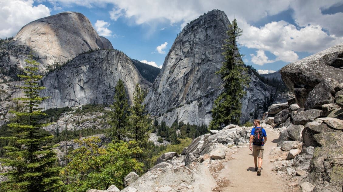
Essential Hiking Gear: What Should You Bring on a Day Hike?
If you are new to hiking or are curious about what you should bring on a hike, check out our Hiking Gear Guide. Find out what we carry in our day packs and what we wear on the trails.Where to Stay
In order to get an early start, I recommend staying in South Iceland. Somewhere between Vík and Hvolsvöllur would be a good location.
We stayed at the Lindartún Guesthouse in Lindartún. This is a bit out of the way, about 10 minutes south of Hvolsvöllur, but it was cheaper than staying near Vík. We had the family room for Tyler and Kara. Tim and I stayed in the bungalow which had a kitchen, living room, and one bedroom. Just outside of our door were horses. We really liked it here, even though it added on extra driving to our days on South Iceland.
If you have plans to hike the Fimmvörðuháls trail and have any questions, comment below. We would also love to hear about your experience if you have already done this hike.
More Information for Your Trip to Iceland
Iceland Travel Guide: How to Plan a Trip to Iceland
Pinterest Facebook Flipboard Iceland Travel Guide Iceland… the land of fire and ice. Though the country may look small on a map, Iceland is filled with some of Europe’s best outdoor adventures. In Iceland you can drive the Ring Road, walk on a glacier, explore geothermal hot springs, admire grand waterfalls, and hike some of […]
10 Epic Hikes in Iceland: Which One Will Be Your Favorite?
One of the best ways to experience Iceland is from a hiking trail. Visit stunning waterfalls, hike through the steaming, colorful landscapes of Landmannalaugar and Kerlingarfjöll, and visit beautiful, remote destinations that you can get to only your own two feet. Here are 10 of the best hikes in Iceland. Every hike on this list […]
10 Days in Iceland: The Ultimate Adventure Itinerary
Iceland…this is the land of active volcanoes, glacier-capped mountains, steaming hot springs, black sand beaches, gigantic waterfalls, the northern lights, and the midnight sun. Hiking trails and gravel roads crisscross these unique landscapes, creating the ultimate wonderland for those in search of adventure. If you have 10 days in Iceland, we have a thrilling itinerary […]
How to Hike Mt. Blahnúkúr (the Blue Peak) in Landmannalaugar, Iceland
The hike up Mt. Blahnúkúr, also called the Blue Peak, is one of the most popular day hikes in Landmannalaugar. It’s a tough, short hike but the views are incredible and well worth the effort. This is not only our favorite hike in Landmannalaugar, it is one of our favorite hikes in Iceland. The spectacular […]
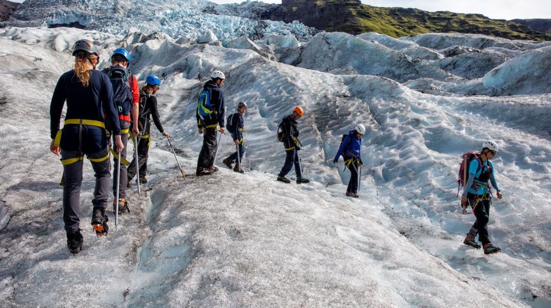
Best Iceland Glacier Hikes, Ice Caves & Ice Climbing
Strap on some crampons, grab an ice pick, and set off on a very cool Icelandic adventure. If you are thinking about doing an Iceland glacier hike, we have lots of great information to share with you. Hiking on a glacier was one of our most anticipated experiences in Iceland. Exploring crevasses, walking on the […]
The Perfect 7 to 10 Day Iceland Ring Road Itinerary
A road trip on the Ring Road is one of Iceland’s best experiences. With 7 to 10 days, you can drive around entire circumference of Iceland, visiting the highlights and several off-the-beaten-path destinations. Stand in front of mighty Skógafoss, tour the Golden Circle, relax in the Blue Lagoon, go whale watching and glacier hiking, explore […]
How to Visit Kerlingarfjöll and the Hveradalir Geothermal Area, Iceland
Kerlingarfjöll is a mountain range located in Iceland’s central highlands. Tucked away within this mountain range is Hveradalir, a geothermal wonderland of steaming vents, boiling mud pools, and rainbow-colored hot springs. The combination of hiking trails, rust-colored mountains, and clouds of steam creates one of Iceland’s most unique hiking and photography destinations. Kerlingarfjöll is located […]
Ultimate Hiking Guide: Europe, Asia, Africa, Americas & Oceania
Are you looking for the perfect hike? With hikes on six continents ranging from a few miles to multi-day adventures, explore some of the best hikes from around the world.
The Amazing South Coast of Iceland: What to Do & What to Skip
The south coast is home to some of Iceland’s most beautiful places to visit. Gorgeous waterfalls, black sand beaches, and glacier lagoons all make the list, as well as one of the most epic hiking trails in the world. Here are the best things to on the south coast of Iceland. Everything on this list […]
Iceland Travel Tips for First Time Visitors
Planning a trip to Iceland can be very exciting. Whether you plan to be here for just a few days on a long layover or spend an extended amount of time exploring the island, there are some things you should know before you go to Iceland. Here are our Iceland travel tips, tips to help […]
Glymur Waterfall: Step-By-Step Hiking Guide (+ Drone Video)
Glymur Waterfall is one of the tallest waterfalls in Iceland. You can only get to it by hiking, but what a beautiful hike it is. This hike features a short walk through a cave, two river crossings, and many amazing views of the waterfall. It’s relatively short, it’s fun, and it’s located near Reykjavík, so […]
20 Best Waterfalls in Iceland for Epic Photos (On a Map)
Iceland…the land of fire and ice…and more waterfalls than you can count. If you are planning a trip to Iceland, you’ve heard of Gulfoss, seen photos of Skógafoss, and you are probably planning to walk behind Seljalandsfoss. These are just a handful of the best waterfalls in Iceland to visit. In this post, we list […]
Best of the Snaefellsnes Peninsula (+ One Day Itinerary)
Black sand beaches, waterfalls, volcanoes, remote lighthouses, iconic mountains, lava fields, street art, and some of the most dramatic coastal cliffs in Iceland…these all make the list of the best things to do on the Snaefellsnes Peninsula. Snaefellsnes Peninsula is called Iceland in miniature, since it contains a sampling of many of Iceland’s natural wonders: […]
Best Hikes in Europe: 25 Incredible Hikes for Every Level
From the dramatic cliffs of Norway to the jagged peaks of the Dolomites and the volcanic landscapes of Iceland, Europe is packed with some of the most unforgettable hikes in the world. In this guide, we share our favorite hikes in Europe, trails that stand out for their scenery, uniqueness, and overall experience from start […]

Comments 91