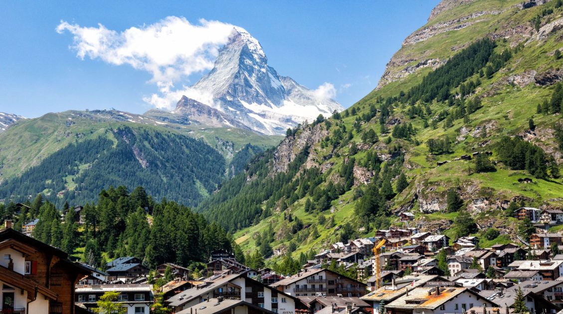
Climbing to the summit of Breithorn is one of Zermatt’s most adventurous experiences. Standing at a height of 4,164 meters (13,660 feet), Breithorn is one of the highest peaks in the area and it is one of the easiest 4,000+ meter peaks to summit in the Alps.
Thousands of hikers come to Zermatt to summit Breithorn every year. Hiking across snowfields and up icy slopes, Breithorn offers a unique mountaineering experience for those looking to add some adventure to their trip to Zermatt. And the best part is, you don’t need extensive mountaineering training to reach the top (if accompanied by a guide).
Information about Breithorn
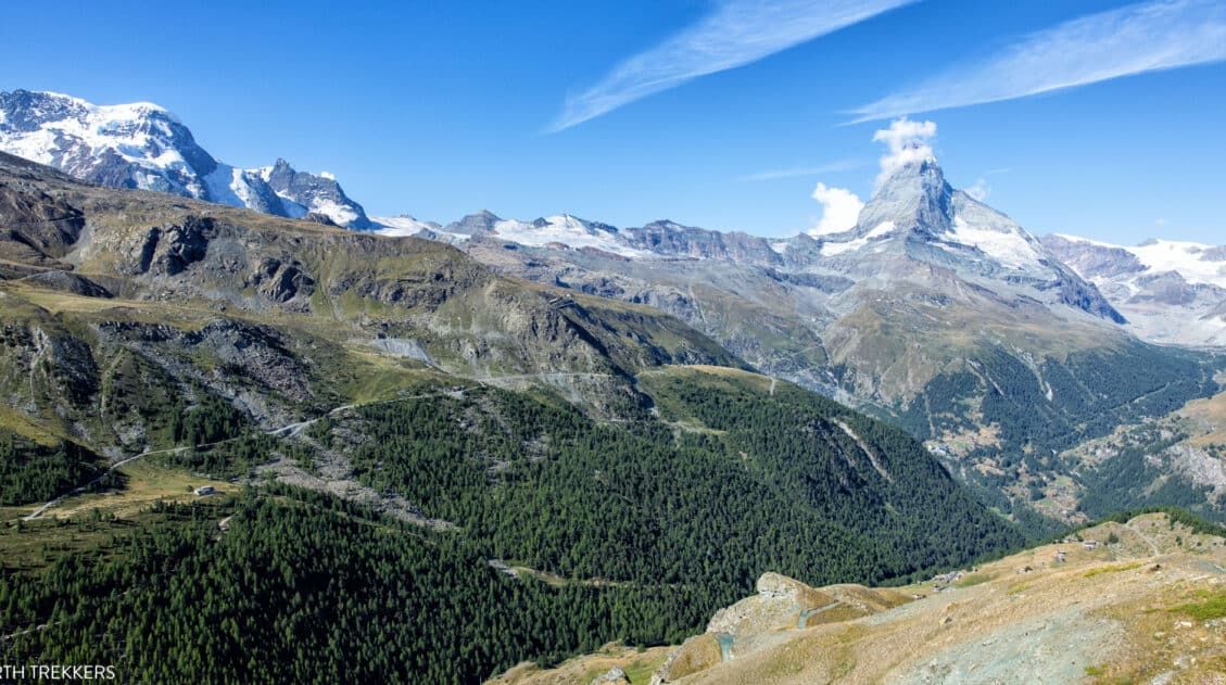
Breithorn is one of the easiest 4,000+ meter peaks in the Alps to summit. A series of cable cars transports hikers to Klein Matterhorn (Matterhorn Glacier Paradise), which sits at an elevation of 3,883 meters. From Klein Matterhorn, you only have 281 meters to climb to reach the summit of Breithorn.
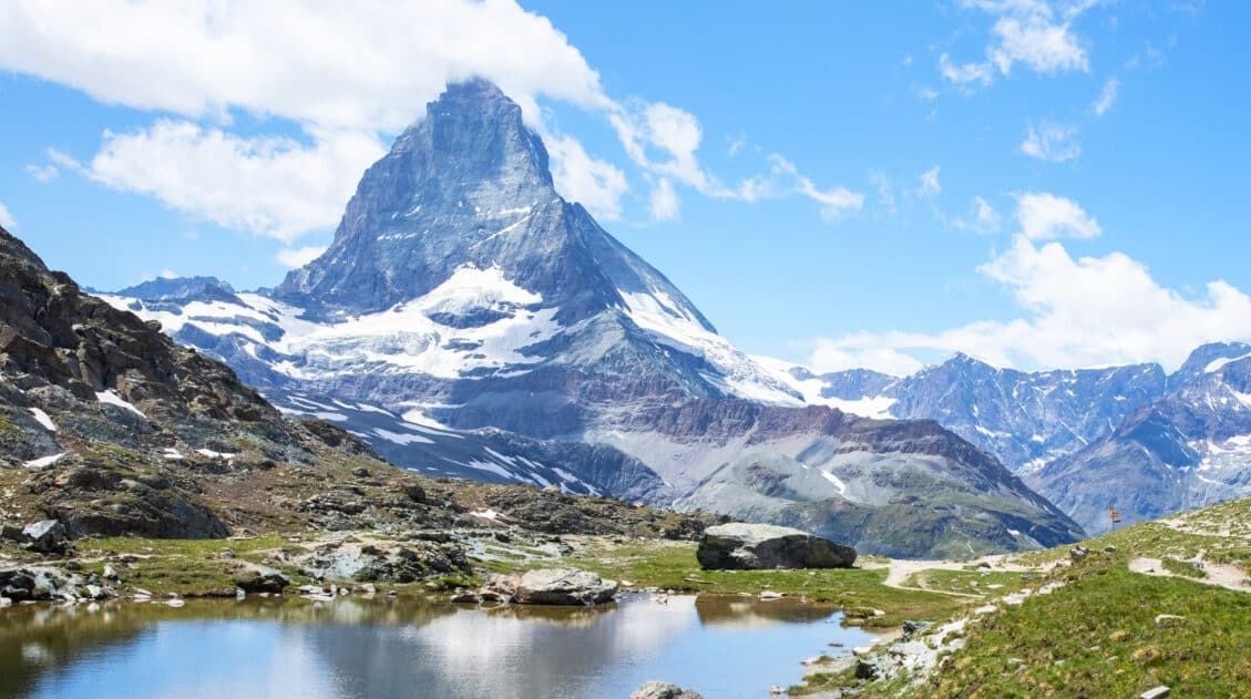
Breithorn sits on the border between Switzerland and Italy. This mountain is has several peaks and it is Breithorn Occidentale, the western summit and highest peak of Breithorn that is summited on this hike.
Breithorn can be climbed in both winter and summer.
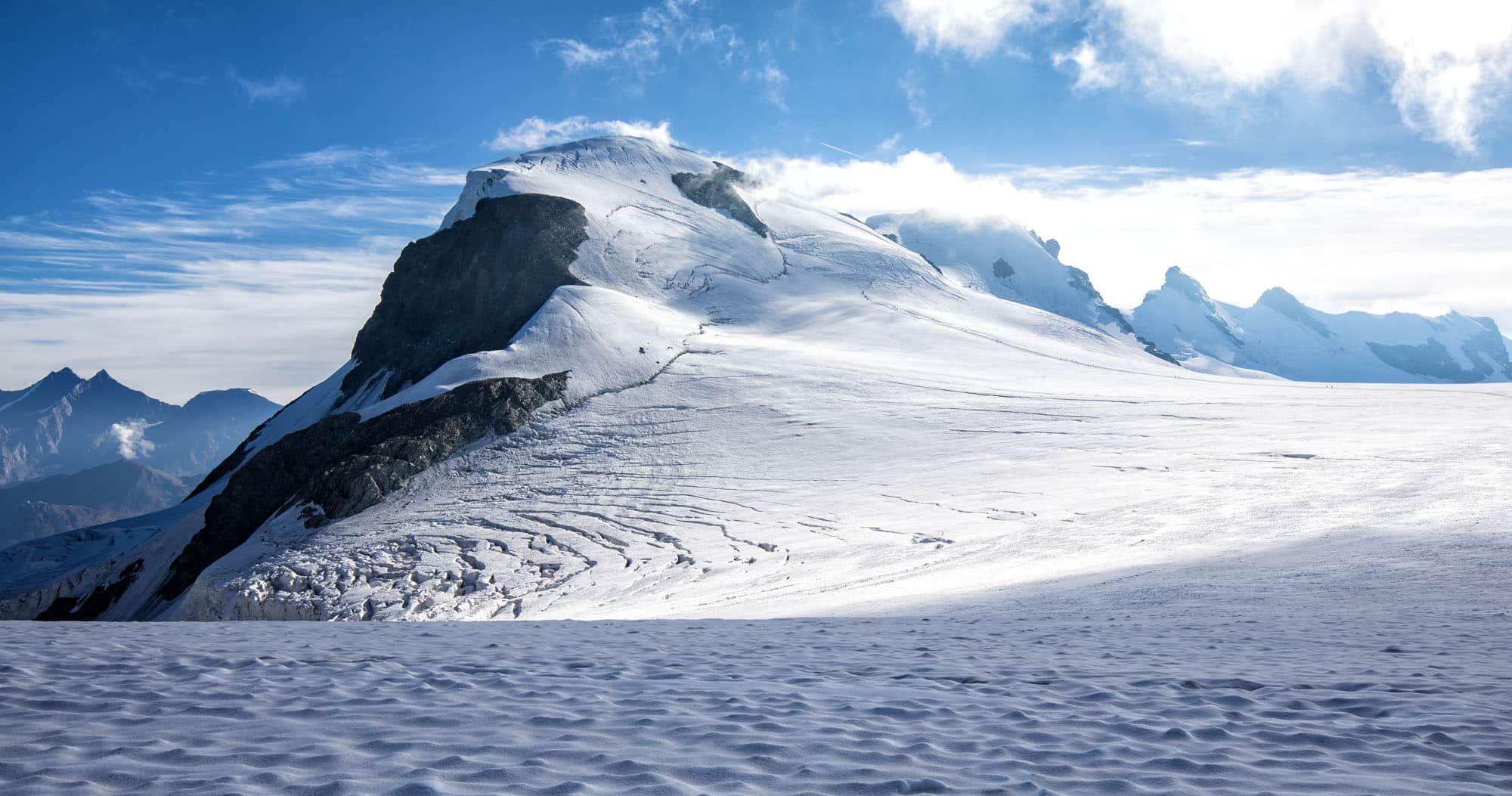
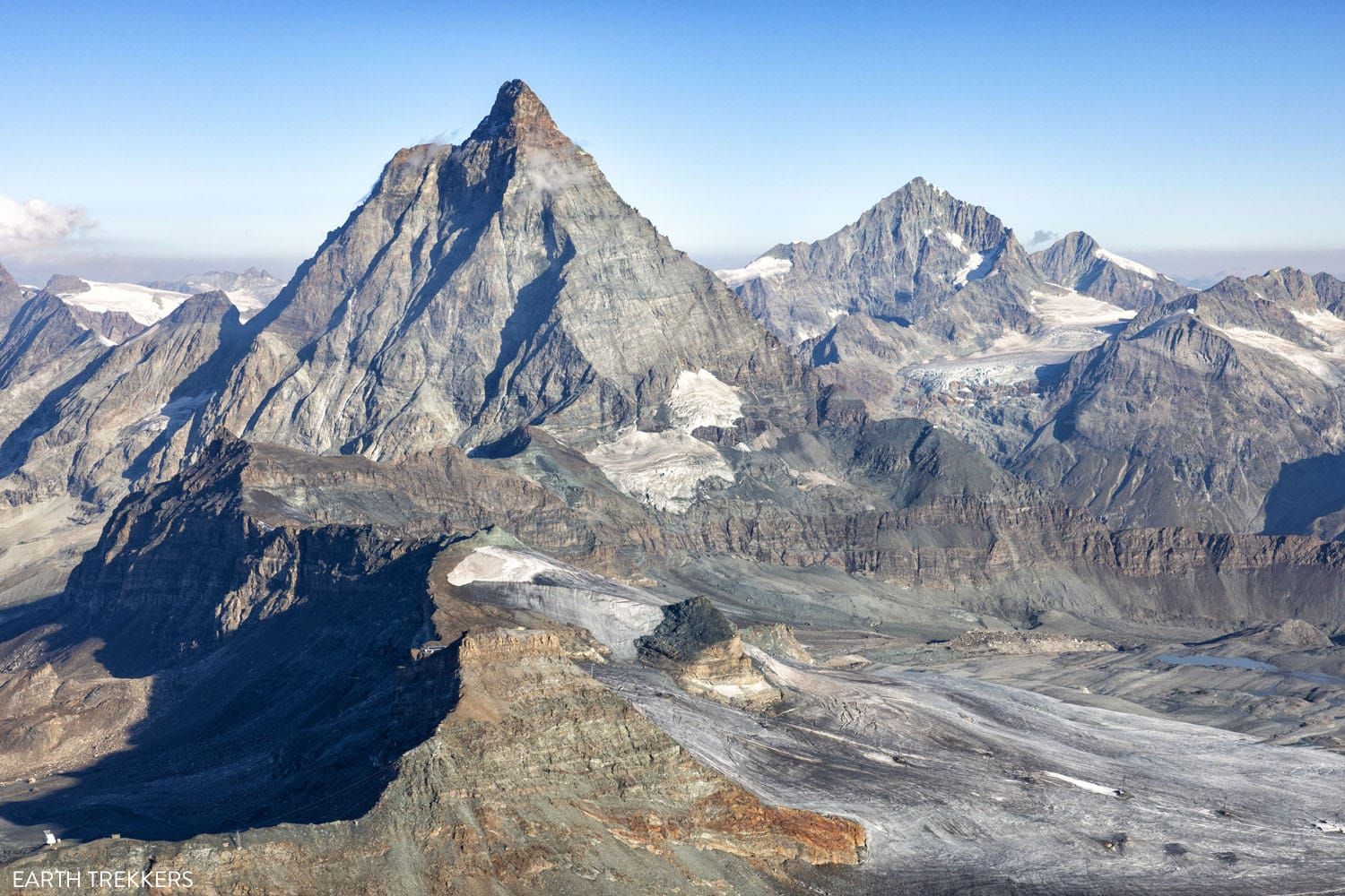
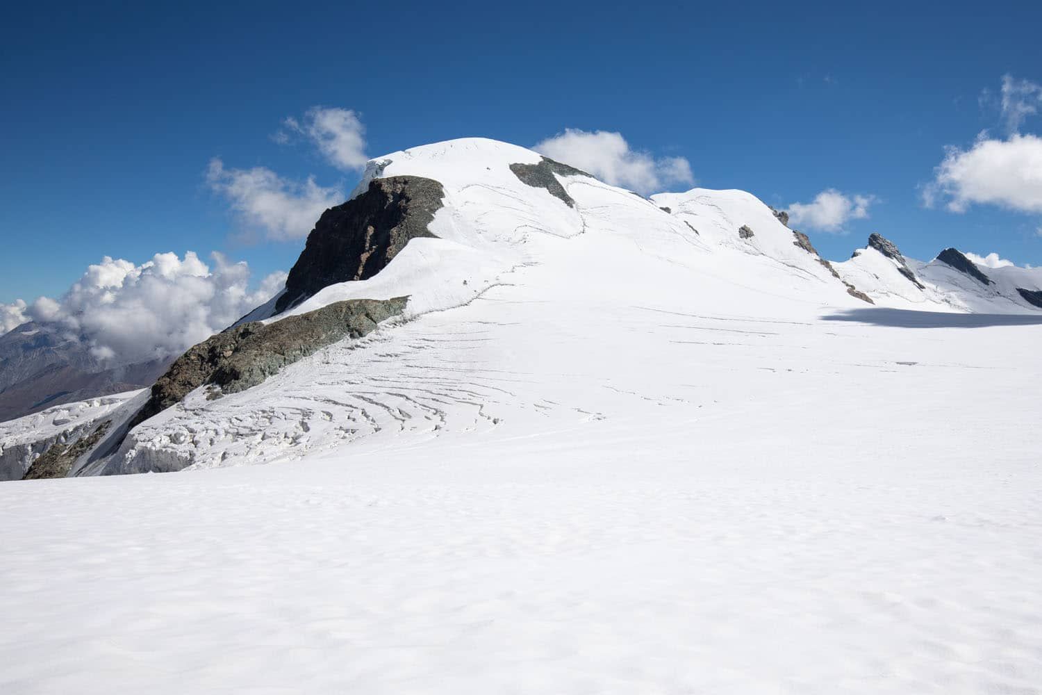
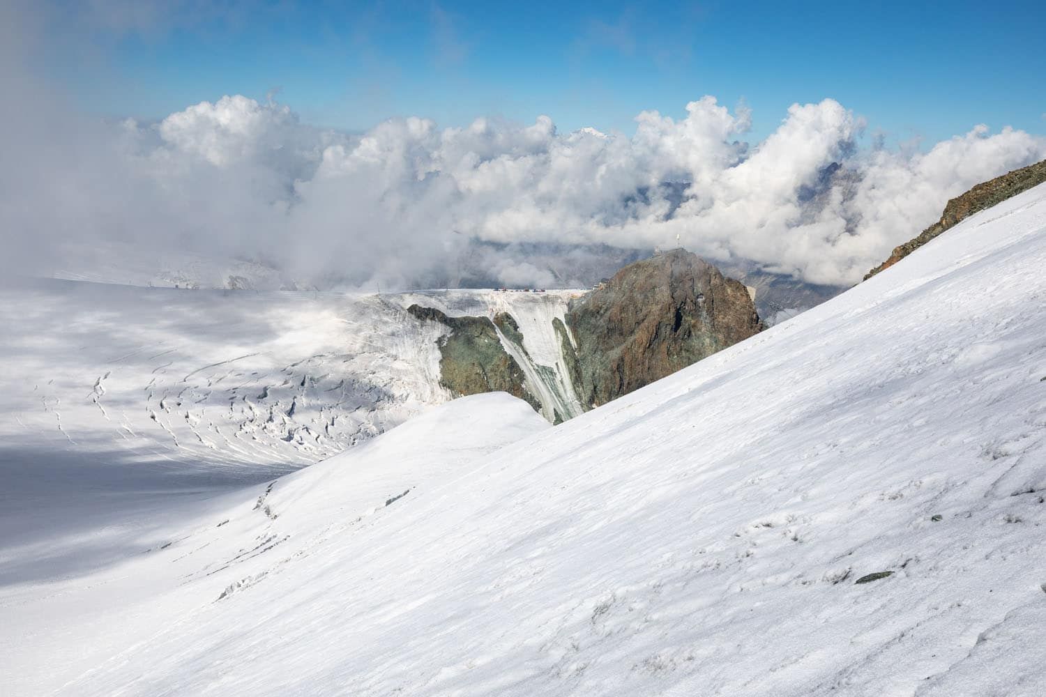
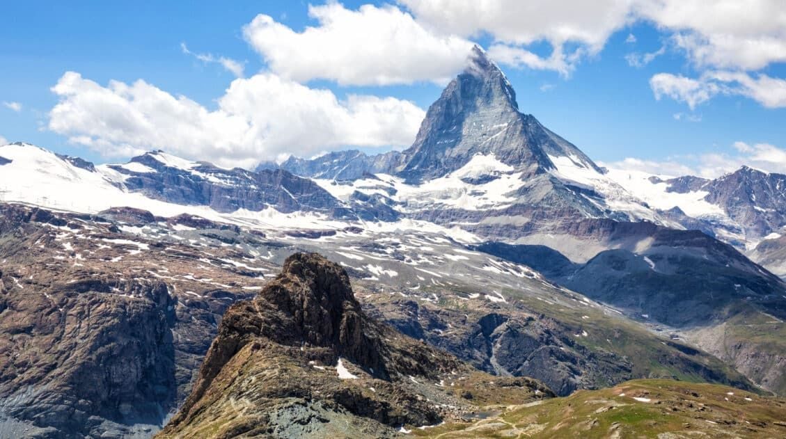
A view of Breithorn from the start of the climb, near Klein Matterhorn.
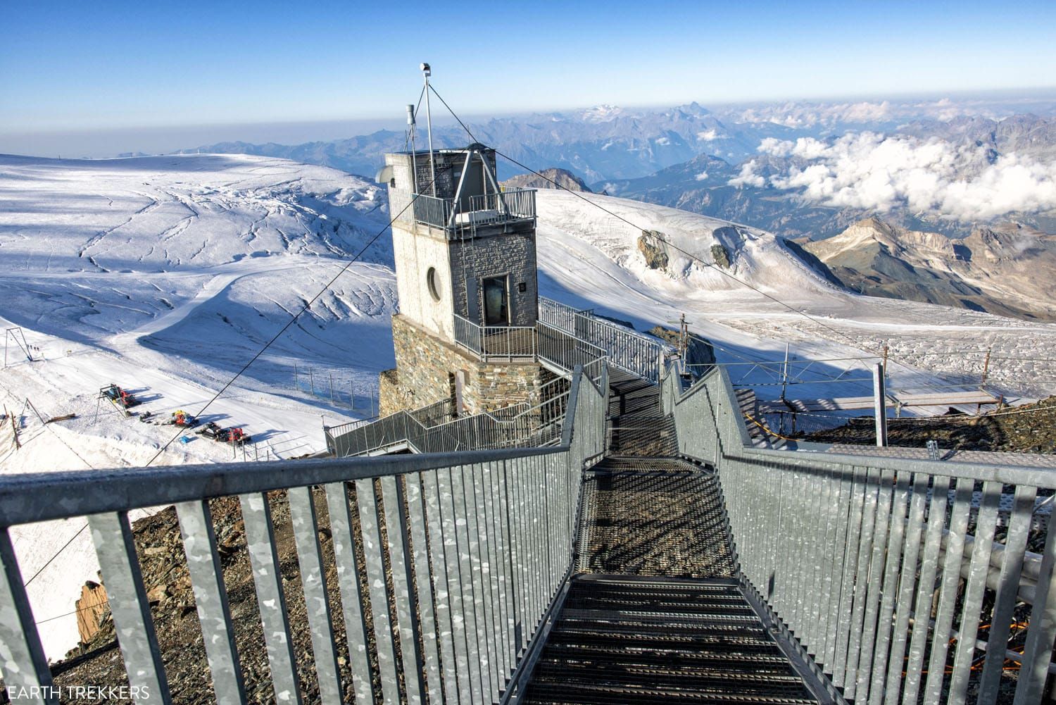
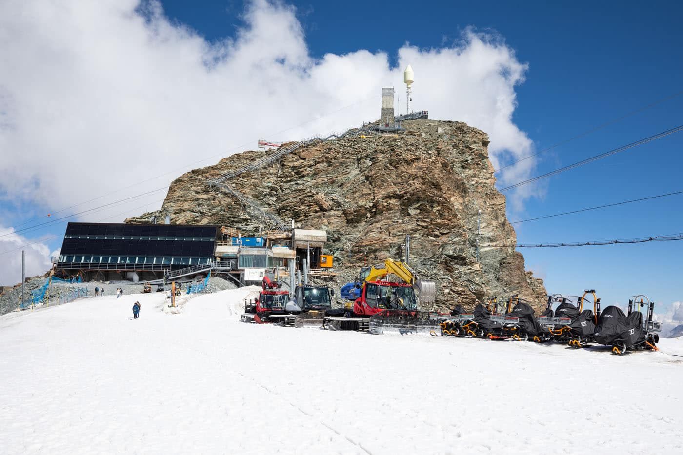
Matterhorn Glacier Paradise
The hike to Breithorn starts at Matterhorn Glacier Paradise (Klein Matterhorn).
To get here, you will ride a series of cable cars from Zermatt and this takes about 45 minutes.
For the full route and pricing, plus a list of things to do at Matterhorn Glacier Paradise, read our Guide to Matterhorn Glacier Paradise ↓
How to Visit Matterhorn Glacier Paradise …and is It Worth It?
Everything you need to know to visit Matterhorn Glacier Paradise.Once you complete the climb to Breithorn, it’s worth spending an hour or two visiting the sights at Matterhorn Glacier Paradise, since it is so pricey to get here and the views are wonderful (although not quite as epic as what you get from the peak of Breithorn).
View of the Matterhorn from Matterhorn Glacier Paradise.
Matterhorn Glacier Paradise
Hiring a Guide
The best (and only way for most people) to get to the summit of Breithorn is with an experienced guide.
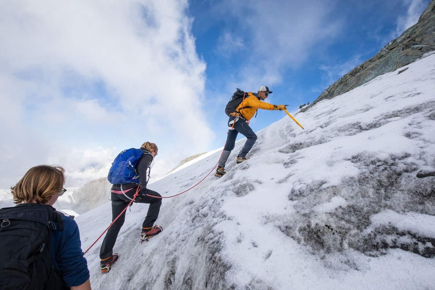
This route takes you across a snow-covered landscape that is riddled with crevasses. Every year, people fall into a crevasse and are not recovered, so this experience is not without its dangers.
To stay safe, you need special equipment (we wore crampons and a harness, and we were roped together with our guide; our guide carried an ice axe).
You also either need extensive mountaineering experience and knowledge about Breithorn, or you need to hire a guide. You should not attempt this hike without a guide and the proper equipment…don’t become a Breithorn statistic.
We hired an experienced guide from Zermatters. They offer different options and we chose to have a private tour. At a small additional fee, Zermatters provided crampons and a harness. Tickets to ride the cable cars to Matterhorn Glacier Paradise were not included.
Check in with them a day or two before your hike so they can verify if your boots are acceptable. Our hiking shoes were not sufficient so we rented mountaineering boots from the Yosemite Zermatt store. You need time to make sure your gear is in order, so don’t wait until the last minute to check in.
Get updated pricing on the Zermatters website.
Breithorn Stats
Distance: 5.7 km (3.5 miles) out-and-back
Difficulty: Moderate
Total Ascent: 407 m (1,335 feet)
Lowest Elevation: 3,792 m (12,442 feet)
Highest Elevation: 4,164 m (13,661 feet)
Time: 3 to 3.5 hours
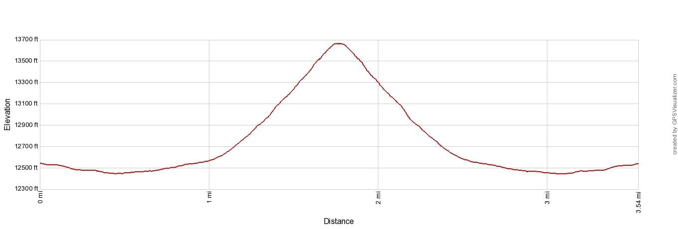
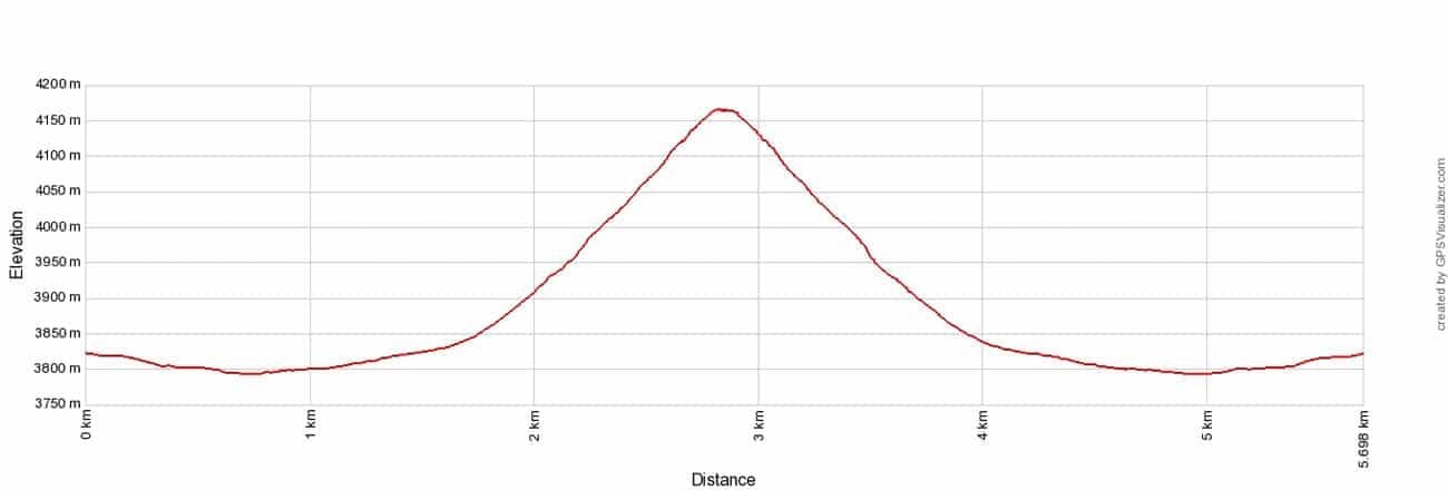
Breithorn Climb Elevation Profile
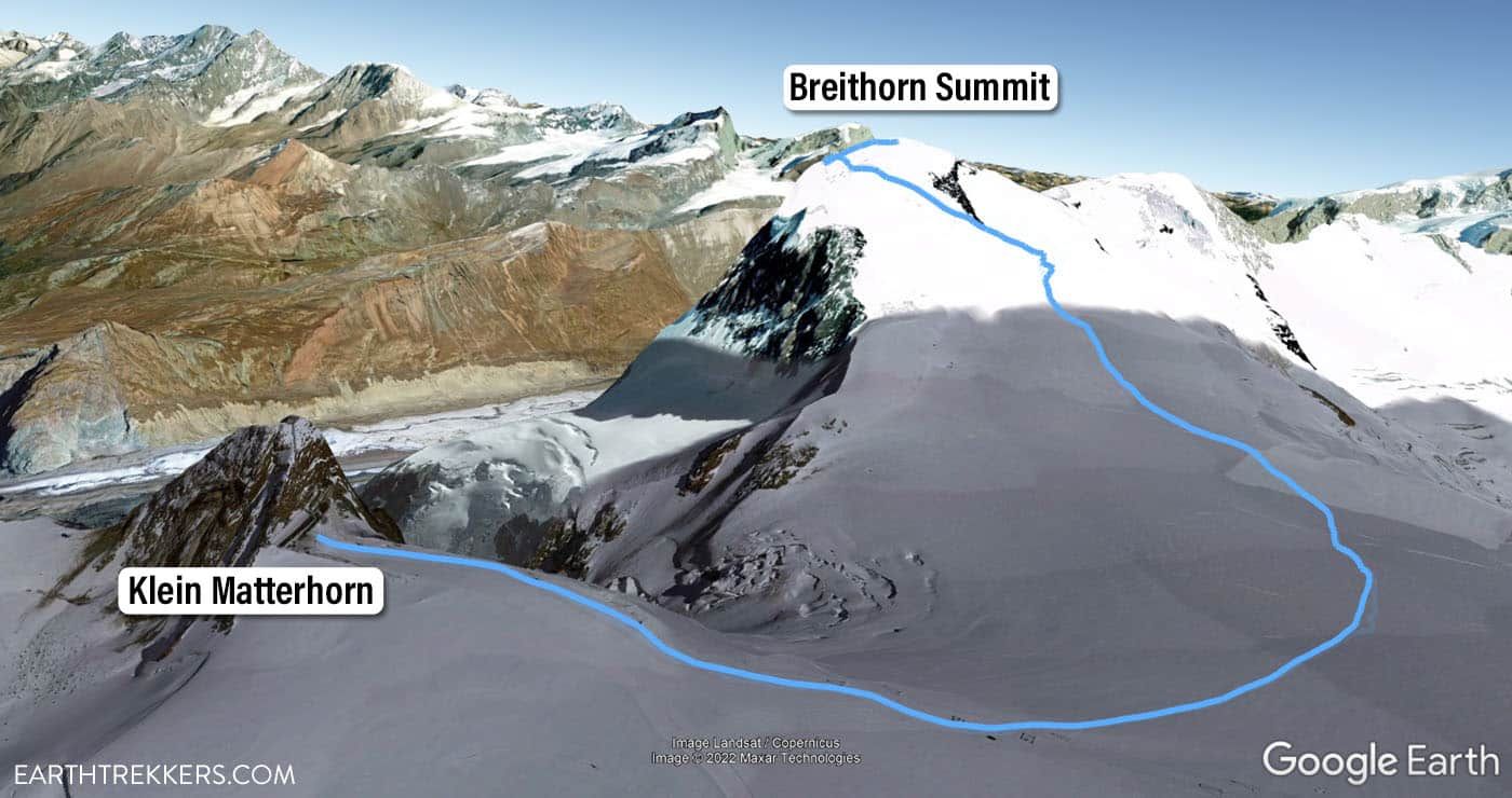
Breithorn Climb Map
How to Climb Breithorn
Step-By-Step Trail Guide
Getting Geared Up
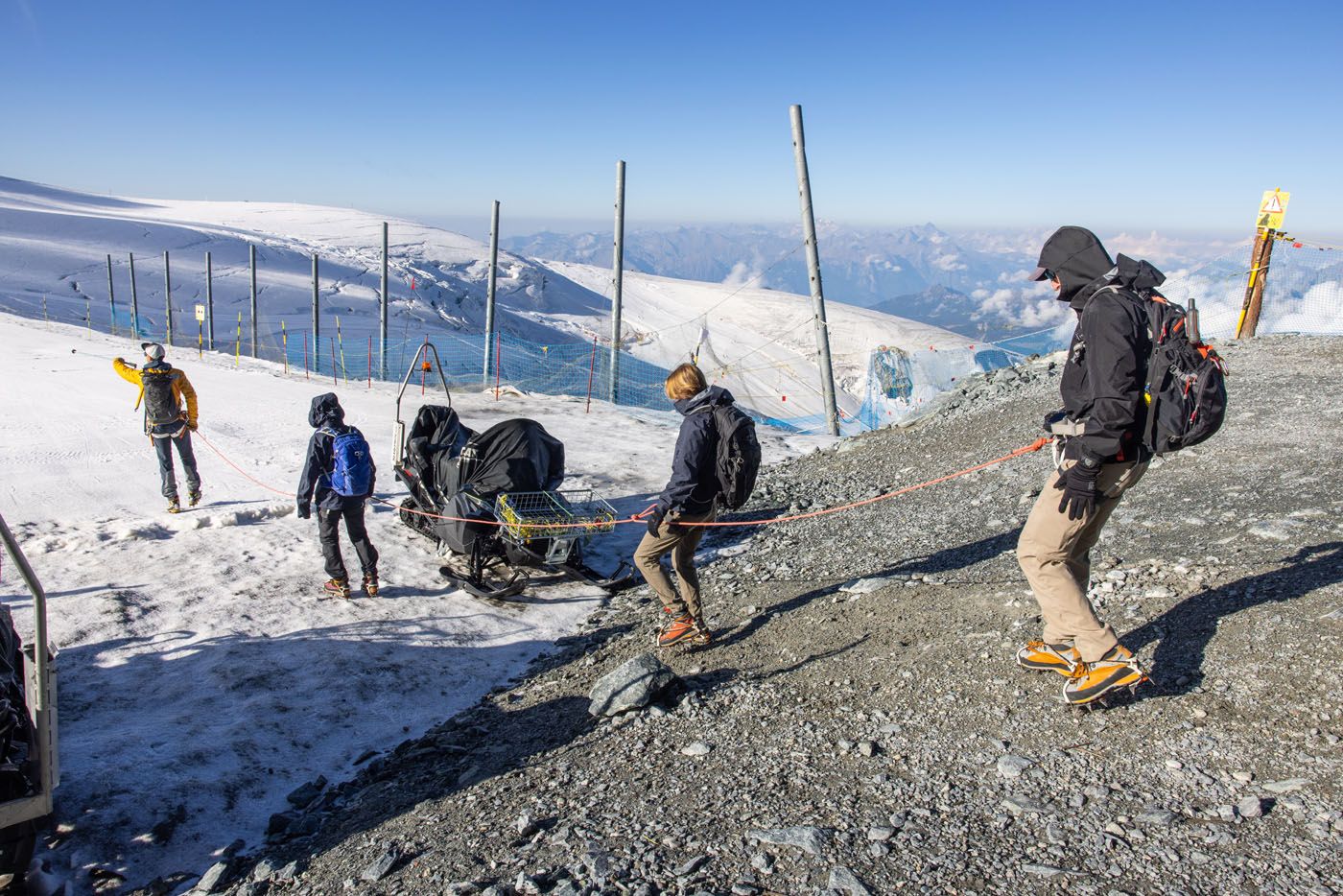
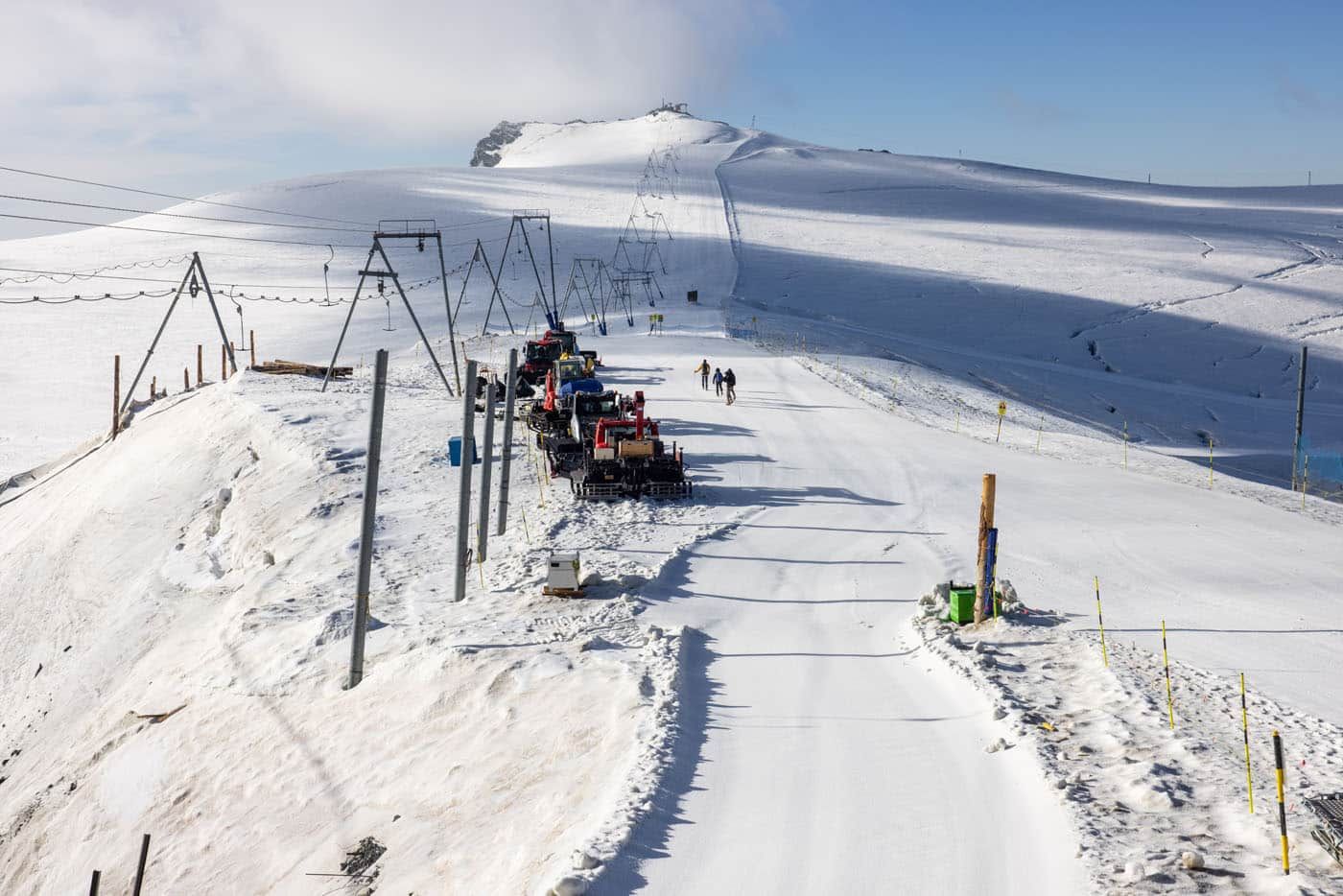
The climb begins at Matterhorn Glacier Paradise.
Stepping outside into the thin, brisk air, you’ll notice how much harder it is to breathe at this elevation. Matterhorn Glacier Paradise sits at 3,883 meters (12,700 feet) where oxygen levels are noticeably lower than down in Zermatt. If you haven’t been acclimated to higher elevations, you’ll want to be on the lookout for signs of altitude sickness (headache, fast heartbeat, dizziness).
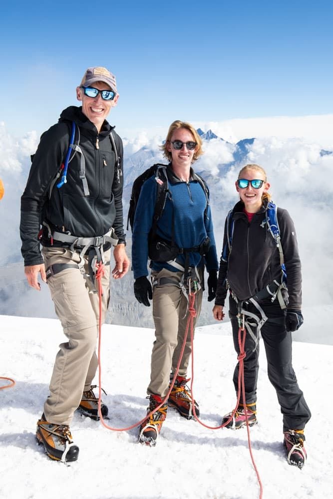
Tim, Kara, and I geared up for our climb while Julie completed another hike further down the mountain (the Matterhorn Glacier Trail). We were on a private tour, so it was just the three of us, plus our guide, making our way up Breithorn.
Our guide provided crampons and a harness for all of us, and we also rented mountaineering boots in Zermatt the day before (at Yosemite Zermatt, a sporting goods store).
We recommend applying sunscreen and putting on sunglasses before you begin the hike. Even if it’s not a sunny day the snow can reflect the sun’s rays so you’re more prone to sunburn.
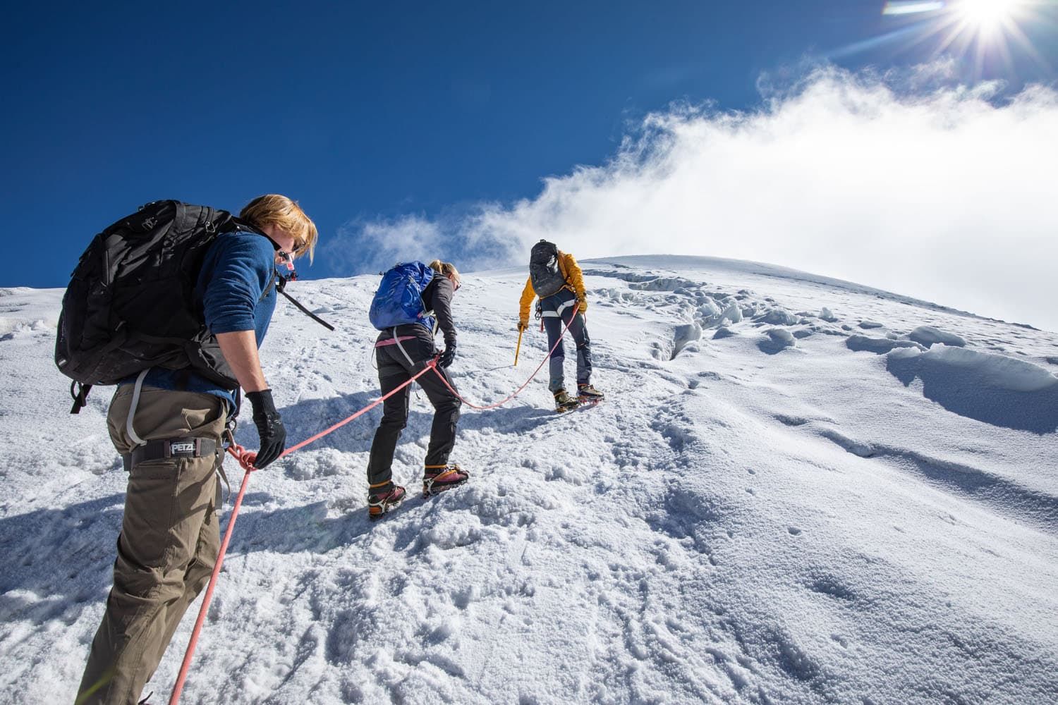
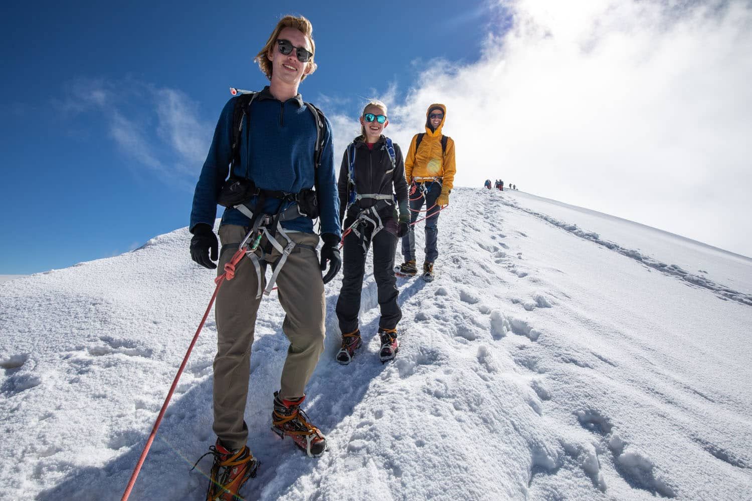
We attached our crampons and connected ourselves to the safety rope that ran between the three of us and our guide, and then began our hike.
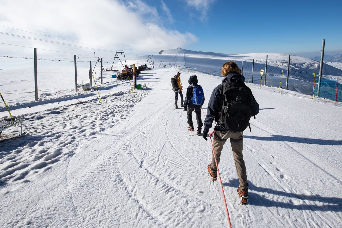
Before reaching the actual trail through the snowfield, we first hiked down an iced over ski path. This was a good warm-up to get used to the feel of the crampons and the slick trail beneath our feet. We started our ascent at 8:30 in the morning, so the path was a bit icy until the sun warmed up the snow. A few minutes later, we took our first steps onto the snowfield.
Tim, Tyler, Kara, and our guide at the start of the hike.
Climbing to the Summit of Breithorn
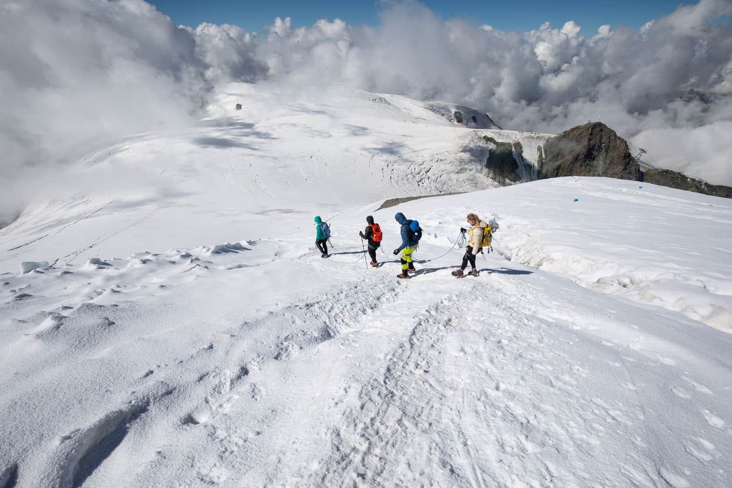
There is no defined trail up Breithorn, so we followed the path that other mountaineers carved in the snow earlier that morning. The snow was iced over which made our path very firm and easy to walk across in crampons.
As we walked, we kept about 10 feet between the person in front of and behind us, keeping the safety rope taut. Our guide instructed us to do this in order to increase safety in case one of us fell. Occasionally, if one of us tripped, we’d feel the rope go tight and pull us back. It was a strange feeling to get used to, but it made us feel safer as we neared the summit.
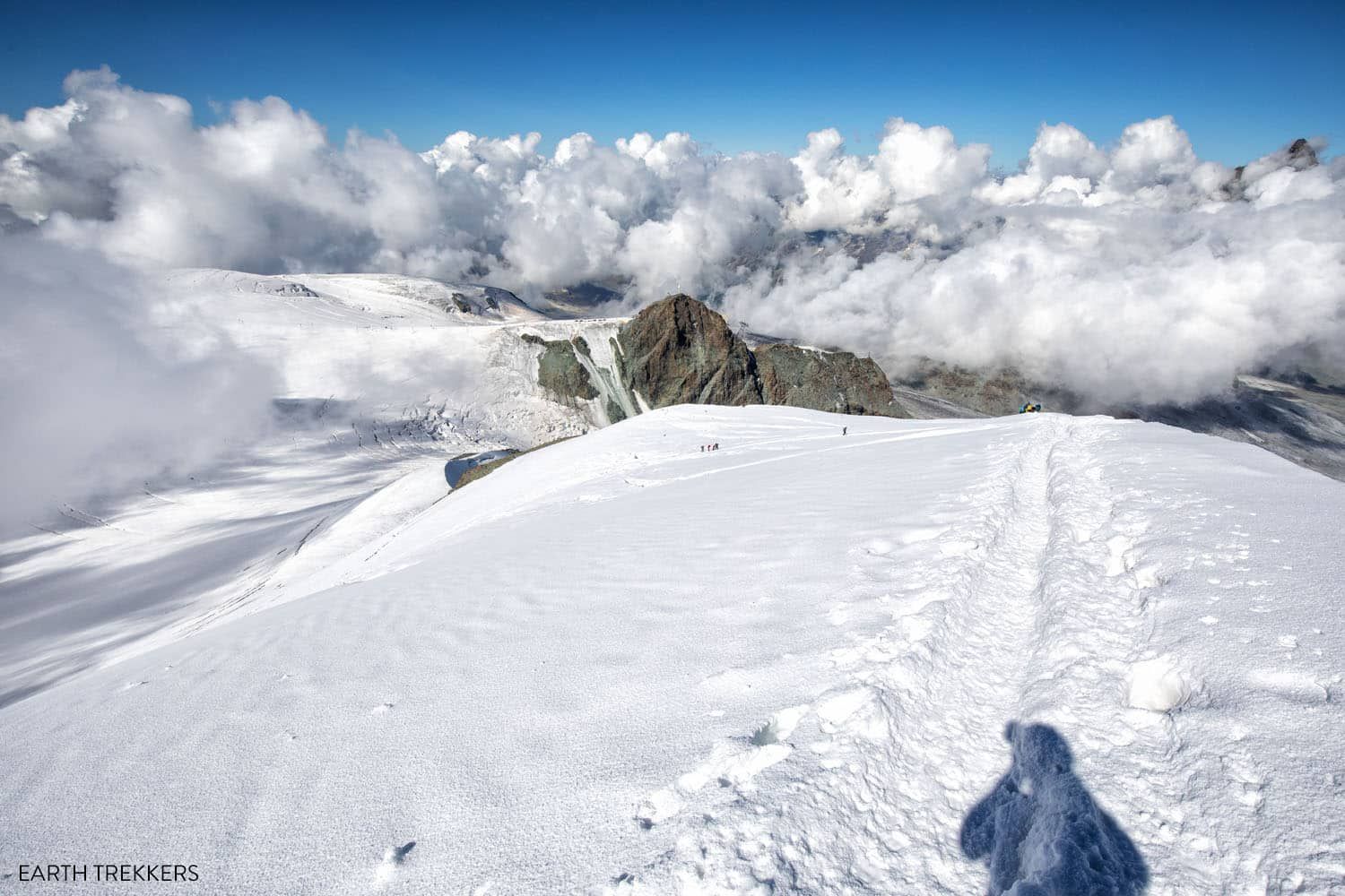
The south face of Breithorn.
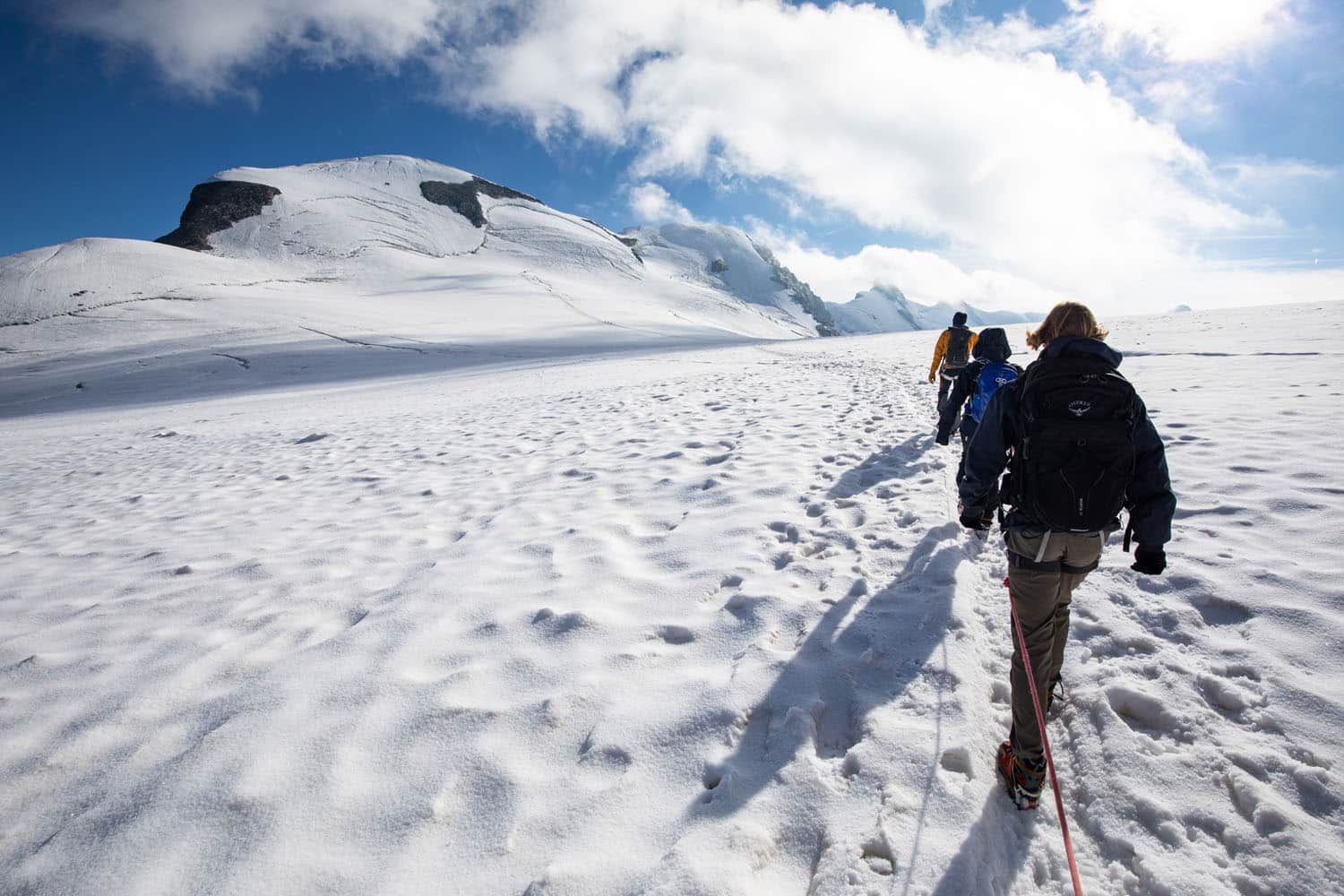
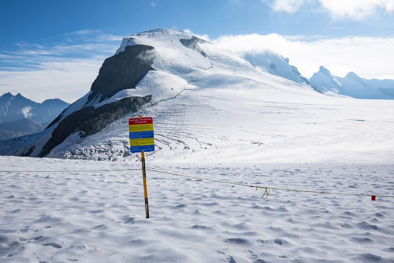
Klein Matterhorn and Breithorn
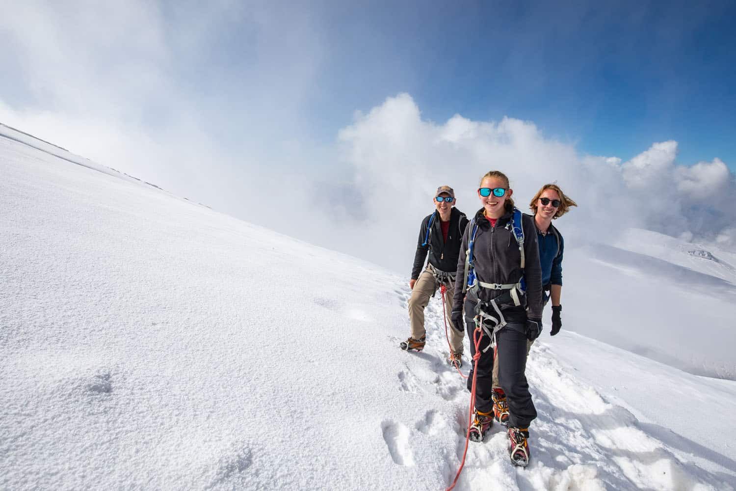
After we crossed the snowfield, we took a break to snack and take off layers since it was warming up fast. It was surprisingly warm on Breithorn in the morning sun. I continued the climb wearing a short-sleeve shirt with a light fleece overtop and was totally fine.
Our guide also shortened the length of safety rope between each of us in preparation for our climb up. Now we had a max length of 5 feet between the person in front of us.
View of the Matterhorn and, if you look closely, the Trockener Steg station.

Since we had completed the Walker’s Haute Route two days prior, the climb up to Breithorn’s summit felt surprisingly easy.
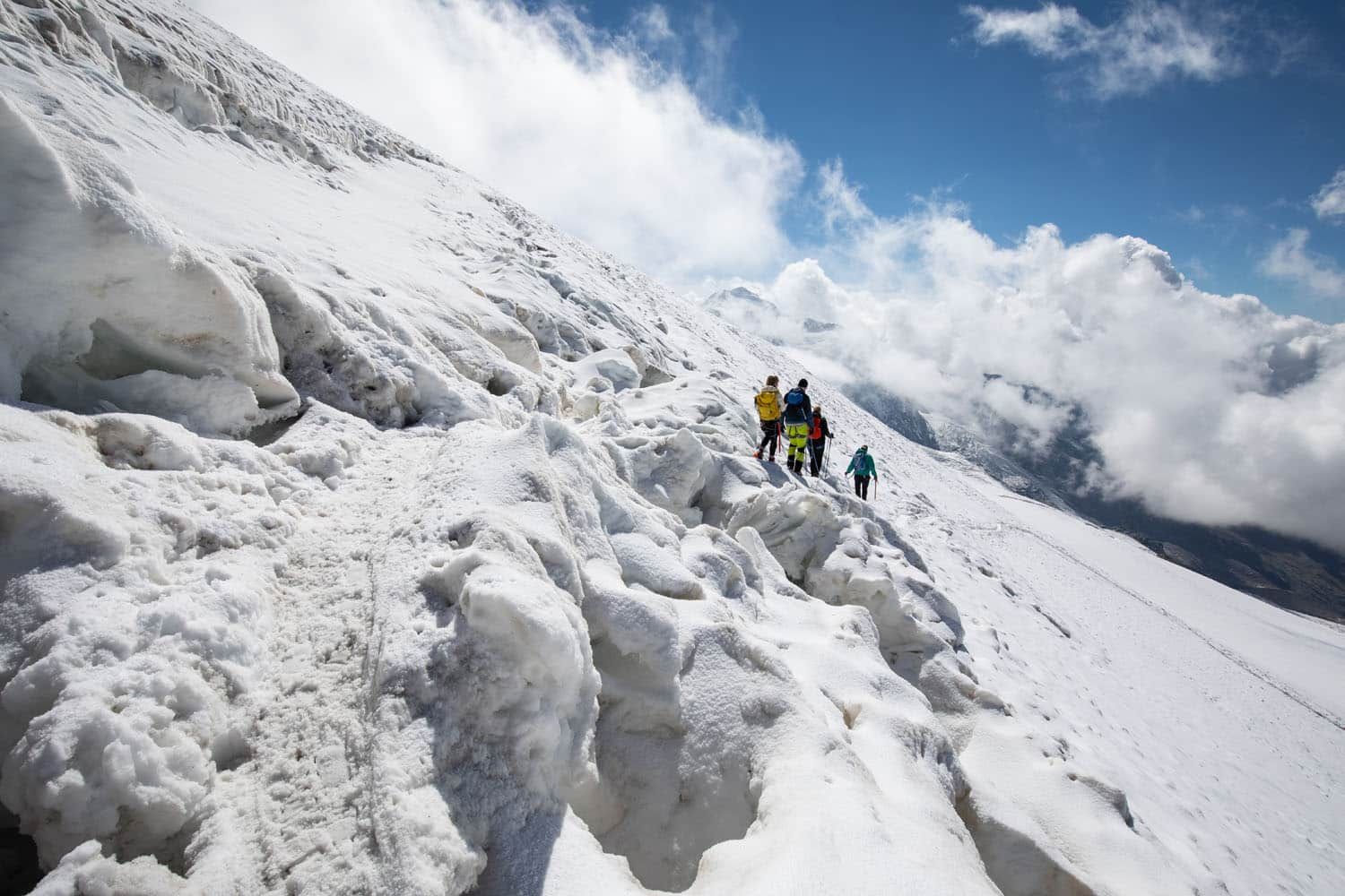
We followed a somewhat steep path that zig-zagged up the south face of Breithorn. By now I had gotten used to the feel of hiking through the snow with crampons and the ascent felt identical to previous hikes. Just replace a dirt & rock trail with ice & snow. Still, the climb up was very slow as we had to deal with the high altitude and other groups of hikers traveling both ways on one narrow path.
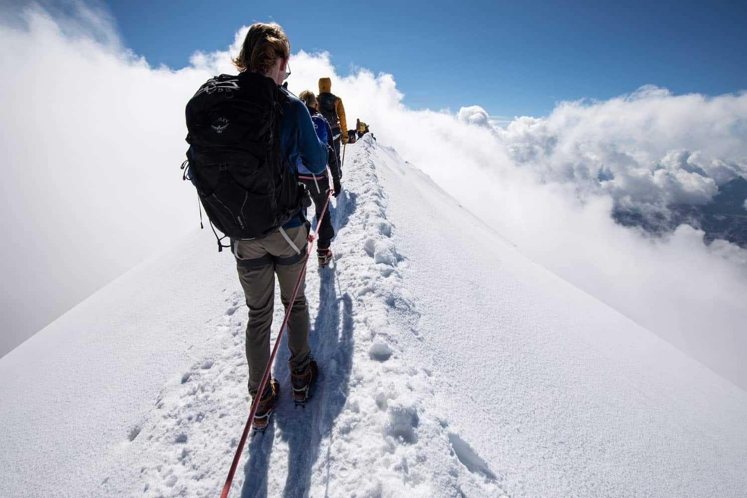
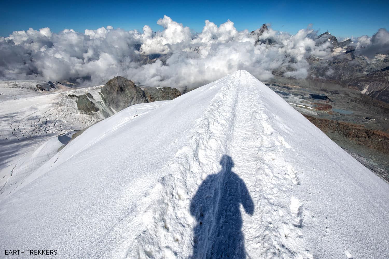
Nearing the summit, we rounded a bend onto an icy ridge that led us straight to the top.
This was without a doubt the coolest part of the entire hike.
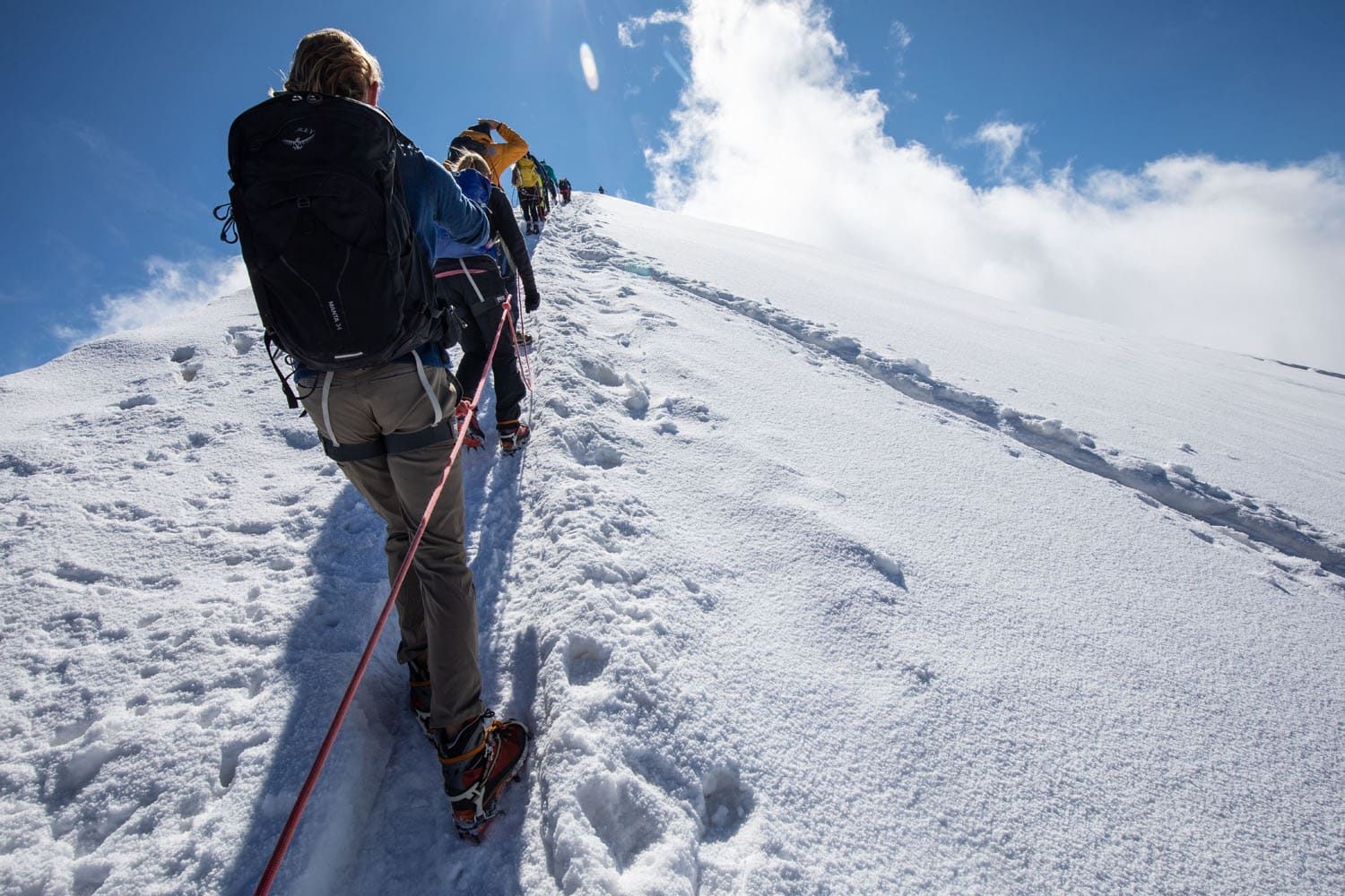
On our right was the long, steep descending slope of Breithorn’s south face and the snowfield below which we hiked across. On our left, less than 10 feet from the trail, was a several-thousand-foot drop-off into the valley below. Not to mention you get the best views of the Mattertal valley, Zermatt, and the surrounding peaks.
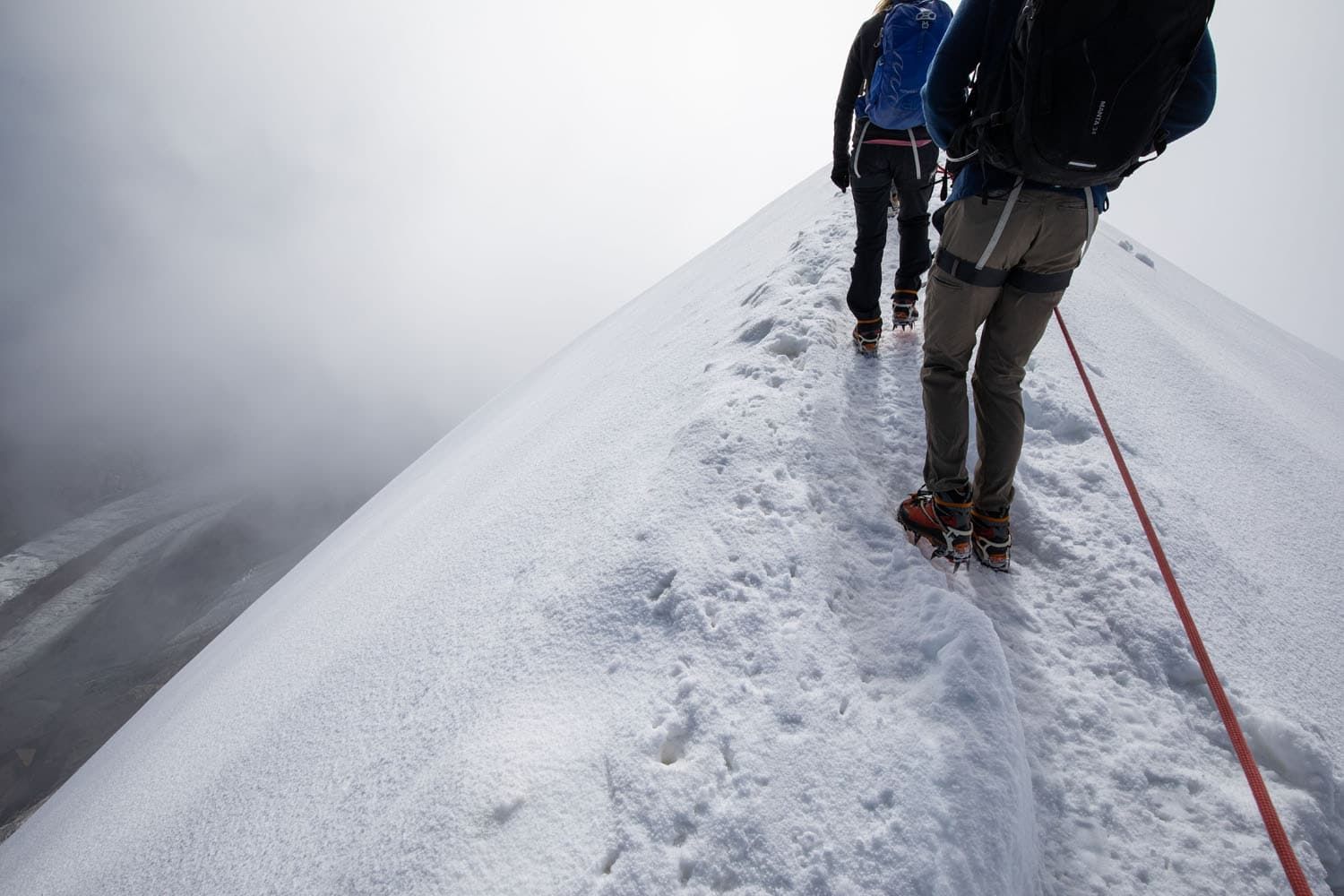
Near the summit, you walk along a ridgeline of snow…one misstep could be a disaster.
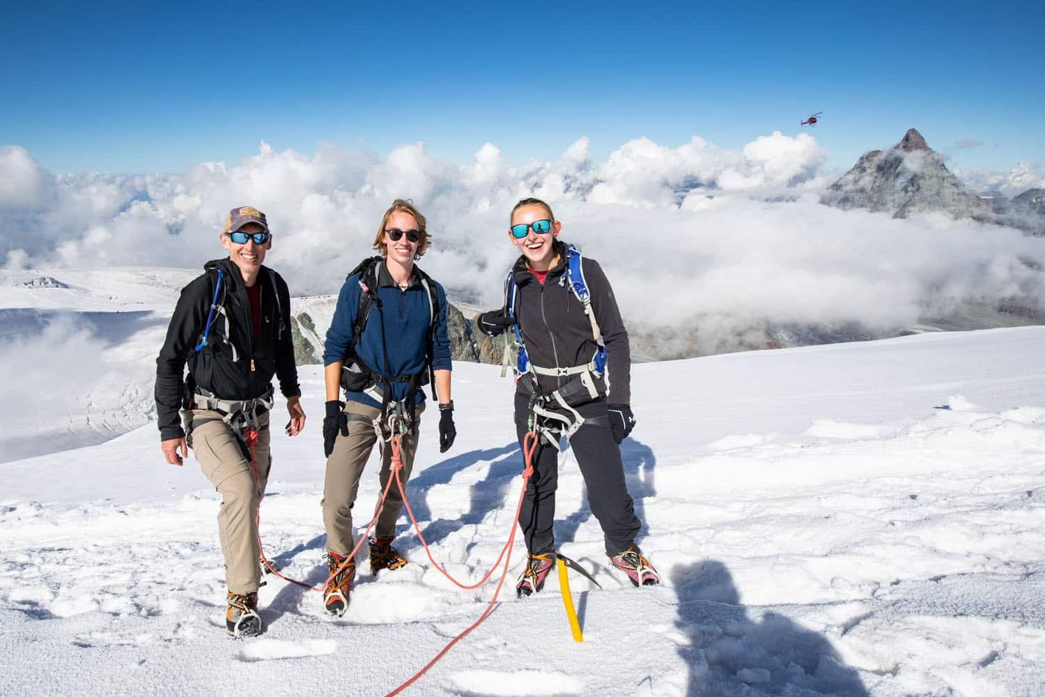
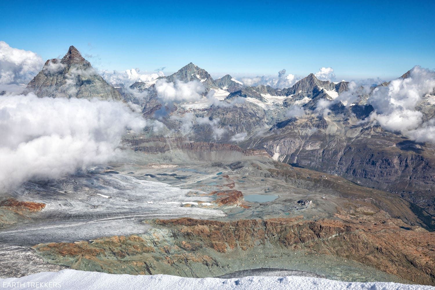
10 minutes later we had reached the summit, standing at an elevation of 4,164 meters (13,660 feet). The views here were spectacular!
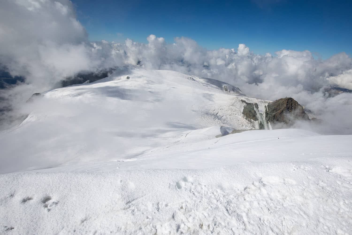
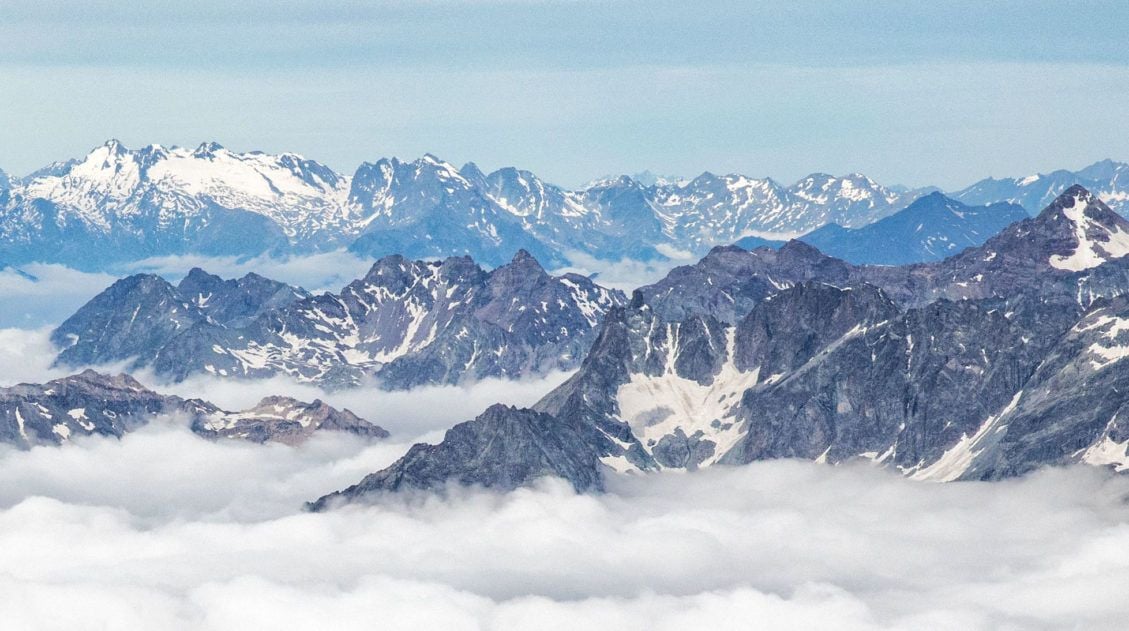
View from the top of Breithorn.
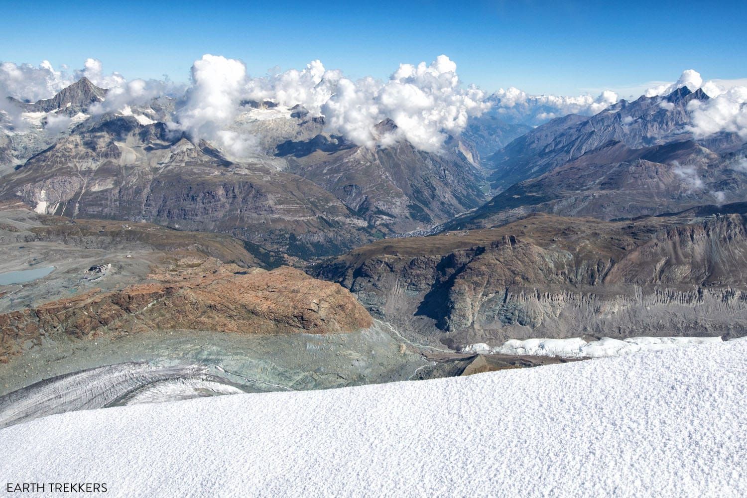
Another view from the top of Breithorn.
After a quick celebration and lots of photos, we made our way down the same trail we came up. By now it was warmer than when we started, and the thin layer of ice atop the trail had melted, leaving loose snow. We essentially flew down the mountainside as we half walked, half skied down Breithorn.
Here are a few photos of Breithorn taken during the descent.
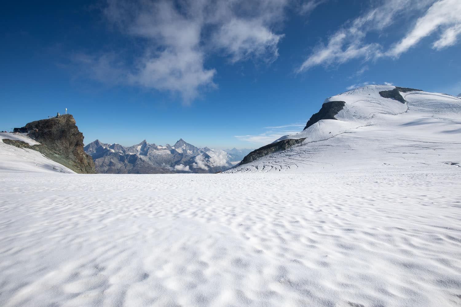
Klein Matterhorn
About an hour after leaving the summit, we made it back to Matterhorn Glacier Paradise, completing one of the coolest hikes we’ve done in Switzerland.
What to Bring on the Hike to Breithorn
Here is a list of things we packed/wore:
- Sunscreen
- Sunglasses
- Hat and gloves (even in the summer)
- Long pants
- Long-sleeved shirt
- Fleece
- Rain jacket
- Mountaineering boots or boots that are suitable to be used with crampons (we rented ours from Yosemite in Zermatt)
- Water and snacks
- Camera
- Backpack
- Hiking poles (optional)
Zermatters provided the crampons, harness, and rope.
Frequently Asked Questions
How fit do you need to be to climb to the summit of Breithorn?
You need to have a high level of physical fitness in order to do this. The ascent is relatively short and there is not a lot of elevation gain, but the altitude and the surface (snow and ice) make this much more different than your average hike in Zermatt or Switzerland.
How hard is the climb to the top of Breithorn?
If you are physically fit, sure-footed, and have experience walking with crampons, the climb to Breithorn is moderately difficult. It helps to spend some time hiking in Zermatt or another location in the Alps for at least several days before climbing Breithorn, to acclimate to the higher elevation.
We did this after completing the Walker’s Haute Route and Breithorn felt easy compared with the climbs on many of the stages during the trek.
How long does it take to climb to the top of Breithorn?
On average, it takes about 3 to 3.5 hours to hike out-and-back from Matterhorn Glacier Paradise (Klein Matterhorn) to Breithorn.
The entire excursion, which includes transportation to and from Zermatt, takes about 5 hours.
Can kids climb to the top of Breithorn?
It is generally recommended that kids under the age of 12 skip this experience.
If you have any questions about climbing to the summit of Breithorn, or if you want to share your experience, let us know in the comment section below.
More Information about Zermatt, Switzerland, & Hiking in Europe
We have TONS more information about Switzerland in our Switzerland Travel Guide.
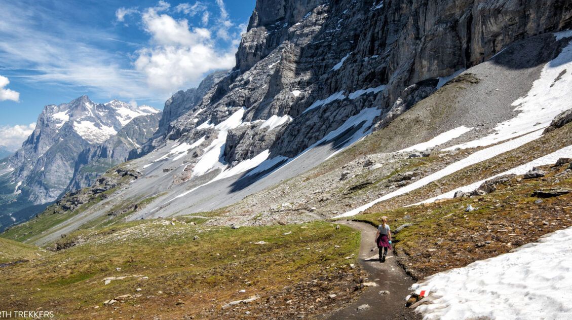
12 Epic Day Hikes in Zermatt (+ Trail Stats, Photos & Map)
Pinterest Facebook Flipboard One of the best ways to explore Zermatt is on foot. Hiking trails climb high into the mountains above Zermatt, past Swiss hamlets, through scenic valleys and rocky gorges, and to some of the best viewpoints of the Matterhorn. The network of cable cars and trains takes you up into the mountains, […]
Matterhorn Glacier Trail: Ultimate Trail Guide (+ Map, Photos & HELPFUL Tips)
The Matterhorn Glacier Trail is one of the easiest and most scenic hikes to do in Zermatt. This point-to-point trail weaves its way between alpine lakes and along the way you get up close views of the Matterhorn. Since it is done one-way and is a mostly downhill hike, this is a great trail for […]
Walker’s Haute Route Stages: An Overview of All 14 Stages
The Walker’s Haute Route is a multi-day trek from Chamonix, France to Zermatt, Switzerland. On this walk, hikers will cross 10 mountain passes, walk through small towns and through rugged, remote landscapes, and get to experience a less touristy side of the Swiss Alps. There are several routes that take hikers from Chamonix to Zermatt. […]
20 Amazing Things to Do in Zermatt, Switzerland
Zermatt is an idyllic mountain village tucked away in the Swiss Alps. The mighty Matterhorn dominates the skyline, creating one of the most unique alpine landscapes in Europe. Explore the hiking trails, journey up higher into the mountains by cable car and train, stroll the scenic streets of Zermatt, and go skiing all year long. […]
How to Visit Sunnegga, Blauherd, and Rothorn (Best One Day Itinerary)
Riding the series of lifts to Rothorn is one of the best things to do in Zermatt. Rothorn is one of the highest viewpoints in Zermatt, and from here you get a spectacular view of the Matterhorn and the surrounding mountains. On the journey to Rothorn, you will pass through two stations, Sunnegga and Blauherd, […]
The Ultimate Zermatt Itinerary for 1 to 4 Days
How many days do you need in Zermatt? How do you plan the perfect Zermatt itinerary? The answer to these questions depends on several factors. How much time do you have? Do you want to get out and hike the trails or simply ride the cable cars to viewpoints of the Matterhorn? What time of […]
Switzerland Itinerary Ideas: 7 to 21 Days of Alpine Adventures
If you are planning a trip to Switzerland, this is a great place to start. There are many different ways to plan your “perfect Switzerland itinerary,” depending on your interests and how much time you have. In this article, we list five sample itineraries for Switzerland. These range from 7 to 21 days, with suggestions […]
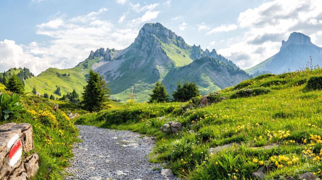
Best Hikes in Europe: 25 Incredible Hikes for Every Level
From the dramatic cliffs of Norway to the jagged peaks of the Dolomites and the volcanic landscapes of Iceland, Europe is packed with some of the most unforgettable hikes in the world. In this guide, we share our favorite hikes in Europe, trails that stand out for their scenery, uniqueness, and overall experience from start […]
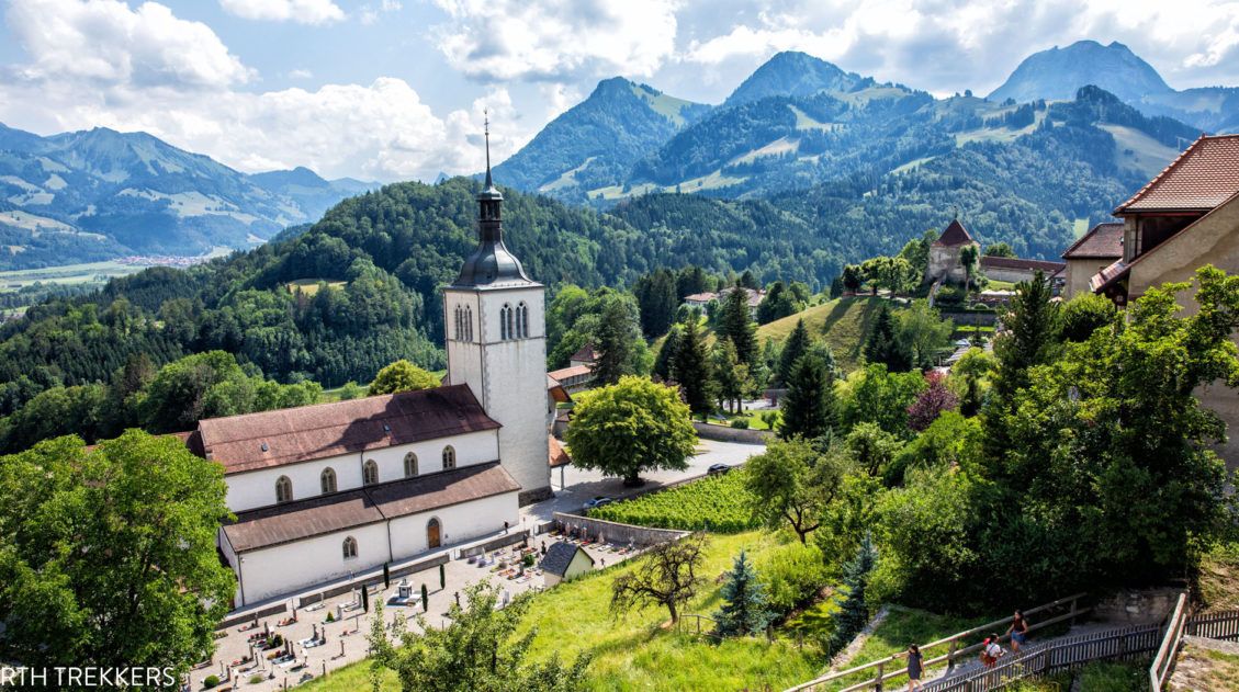
10 Wonderful Things to Do in Gruyères, Switzerland
Located in the idyllic, rolling hills of French-speaking Switzerland sits Gruyères, a picture-perfect medieval town. Cheese, chocolate, and beautiful cobblestoned streets attract visitors all year round. With one day in Gruyères, you have enough time to visit the town and add on another nearby destination, whether it is a chocolate factory, a scenic funicular ride, […]
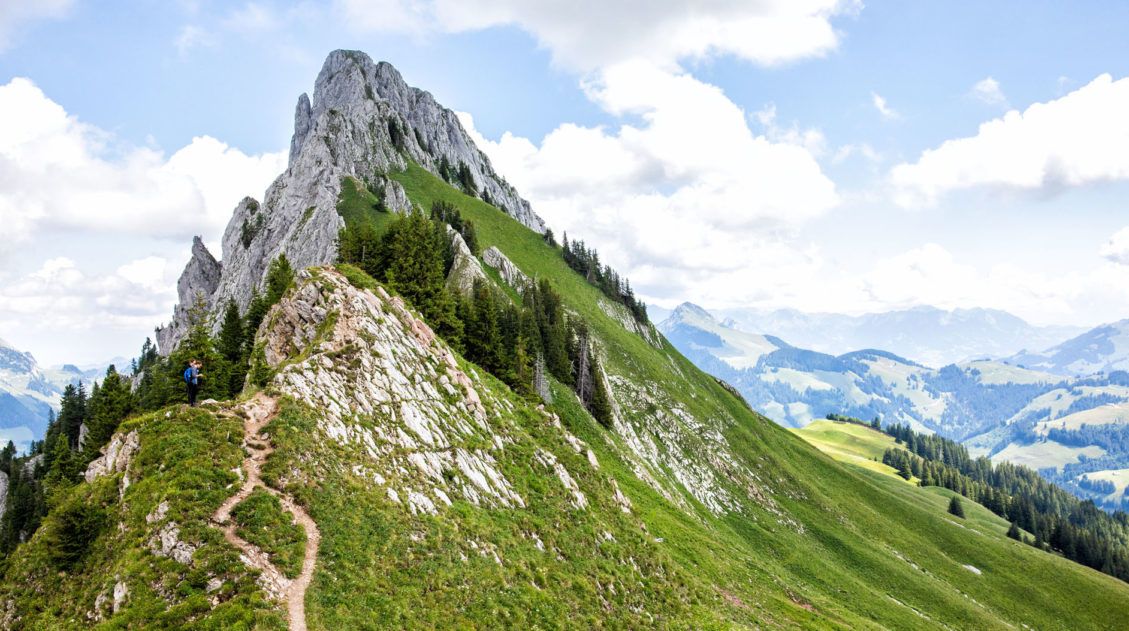
Hiking the Gastlosen Tour, Switzerland: Stats, Map, & Photos
The Gastlosen is a chain of limestone mountains that look very similar to the Dolomites of Italy. For 11 km, the trail loops around these magnificent, jagged mountains and you are treated to sweeping views of Switzerland. This is a gorgeous hike. A chair lift lops off the first big climb (and the final descent), […]
Switzerland Travel Guide: How to Plan a Trip to Switzerland
Switzerland Travel Guide Looking to hike some of the world’s most beautiful mountain landscapes, stroll through colorful old towns, and dine on some fondue? Then Switzerland is the perfect place for you! Visit the Bernese Oberland, a hikers paradise filled with towering mountains, alpine meadows, historic cogwheel trains, and quaint villages. Or, relax at Switzerland’s […]
Jungfrau Itinerary: 1 to 7 Days in Mürren, Lauterbrunnen & Interlaken
The Jungfrau region of Switzerland can seem like a confusing place to visit, particularly to first time visitors. With its unique geography, complicated network of trains and cable cars, and long list of hiking trails and small towns to visit, it may seem like an overwhelming task to plan a trip here. But it doesn’t […]
15 Great Hikes to Do in the Bernese Oberland, Switzerland
The Bernese Oberland is a hiker’s paradise. Alpine trails crisscross their way through the towns, valleys, and the mountain peaks of this gorgeous place. Take your pick from short, easy, family-friendly trails to cliff walks to thrilling trails. Here are 15 of the best hikes to do in the Bernese Oberland. All of the hikes […]

Comments 7